• " -VP
Biennial conference of the Specialist Group for Tectonics and Structural Geology Thredbo-Alpine Hotel, Thredbo, New South Wales 2nd _ gth February, 2014
SGTSG in the Snowies, 2014
Biennial conference of the SGTSG
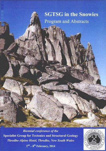
SGTSG in the Snowies
Biennial conference of the Specialist Group for Tectonics and Structural Geology
Thredbo-Alpine Hotel, Thredbo, NSW 2 - 8 February, 2014
Program and Abstracts
Conference Organising Committee Gordon Lister (Australian National University) Stephen Cox (Australian National University) Mamie Forster (Australian National University) Simon McClusky (Australian National University) Richard Blewett (Geoscience Australia) George Gibson (Geoscience Australia) Geoff Fraser (Geoscience Australia)
SGTSG in the Snowies, 2014
Biennial conference
of the SGTSG
Geological Society of Australia Inc. Specialist Group for Tectonics and Structural Geology ISSN 0729 01IX Abstract No. 109 Editors: Geoff Fraser, Mamie Forster, Simon McClusky, © Geological Society of Australia Incorporated, 2014
Preferred Citation: Fraser, G., Forster, M. & McClusky, S., 2014. SGTSG in the Snowies. Biennial Conference of the Specialist Group for Tectonics and Structural Geology, February 2014. Geological Society of Australia Abstracts No. 109, 103 pp.
Example Citation for papers in this volume: Cox, S. F. and Munroe, S. M. 2014. Particle fluidization in fault zones: implications for transitory, rupture-controlled fluid flow regimes. In: Fraser, G., Forster, M. & McClusky, S. (eds). SGTSG in the Snowies. Biennial Conference of the Specialist Group for Tectonics and Structural Geology, February 2014. Geological Society of Australia Abstracts No. 109, p 24.
Copies of this publication may be obtained from: Geological Society of Australia Suite 61 104 Bathurst Street Sydney, NSW 2000 Email: info@gsa.org.au Web: www.gsa.org.au
Acknowledgements: The organizing committee would like to thank the Research School of Earth Sciences, Australian National University, and Geoscience Australia for supporting the SGTSG in the Snowies conference
Biennial conference of the SGTSG
SGTSG in the Snowies, 2014
Conference Program Sunday
February
10:30 11:00 11:30 14:30 15:00
Bus 1 departs Jolimont Centre, Canberra Bus 1 departs Canberra Airport Bus 1 departs Geoscience Australia Bus 1 arrives Thredbo Cricket match begins, Thredbo
13:30 14:00 14:30 17:30
Bus 2 departs JoUmont Centre, Canberra Bus 2 departs Canberra Airport Bus 2 departs Geoscience AustraUa Bus 2 arrives Thredbo
18:30 19:00
Pre-dinner drinks, Poolside, Thredbo Alpine Hotel BBQ dinner, Poolside, Thredbo Alpine Hotel
111
SGTSG in the Snowies, 2014 Monday 08:30
February
Biennial conference of the SGTSG
Gordon Lister
WELCOME to SGTSG
08:45-09:45 09:45- 10:00
Mike SANDIFORD Karol Czarnota, Gareth Roberts, Nicky White
10:00-10:15
Wayne Hart
10:15-10:30
Gordon Lister, Hrvoje Tkalcic, Simon McClusky, Mamie Forster
Keynote: Small strain tectonics Uplift history of the southeastern highlands: A surface expression of convective circulation within the mantle Gutenberg-Richter Law and earthquake hazard forecasting in an active intra-plate region: The Australian Snowy Mountains Skewed orientation groups in scatter plots of earthquake fault plane solutions: implications for extensional geometry at oceanic spreading centres
10:30-11:00
Morning Tea
11:00-11:15
Clement Fay
Chair: Simon McClusky
Chair: George Gibson
Neotectonics
The Tasmanides
12:30-12:45 12:45-13:00
S-shape orocline development resolved by spatial changes in deformation partitioning Ordovician to mid-Silurian Benambran Chris Fergusson subduction zones in the Lachlan Orogen, southeastern Australia Feasibility of Permo-Triassic flat subduction Jeff Brownlow in the New England Orogen Derek Hoy, Gideon Rosenbaum, Uri Geology of the Emu Creek Block: Shaanan Implications for the Carboniferous tectonostratigraphy of eastern Australia and oroclinal bending in the New England Orogen Uri Shaanan, Gideon Rosenbaum, Structural evolution of the early Permian Pengfei Li, Paulo Vasconcelos, Nambucca Block (New England Orogen, Richard Wormald eastern Australia) and implications for oroclinal bending Jie Yan,_Paul Lennox, Bryce Kelly, Kinematic reconstruction of the Hastings Robin Offler Block, Southern New England Orogen Testing the Tasmanide oroclines Robert Musgrave The geodynamics of oroclinal bending Gideon Rosenbaum
13:00-14:00
LUNCH
17:00-17:30 17:30-18:30
Drinks Ross CAYLEY
18:30-20:30 20:30-21:30
DINNER Peter BETTS
11:15-11:30 11:30-11:45 11:45-12:00
12:00-12:15 12:15-12:30
Keynote: A paradigm change - the giant Lachlan Orocline Keynote: The Red Sea: History, bias and lessons from an incipient ocean
IV
Biennial conference of the SGTSG
SGTSG in the Snowies, 2014
Tue
February
08:30-09:15
Chair: Mike Sandiford Simon McCLUSKY
09:15 - 0 9 : 3 0
Lloyd White, George Gibson, Gordon Lister
09:30-09:45
Zheng-Xiang Li
09:45- 10:00
Eldert Advokaat, Robert Hall, Lloyd White Robert Holm, Carl Spandler, Simon Richards
10:00-10:15
10:15-10:30
Jonathon Pownall, Robert Hall, Mamie Forster, Richard Armstrong
10:30-11:00
Morning Tea Chair: Richard Blewett Russell Korsch, Michael Doublier Klaus Gessner, Tim Jones, James Goodwin, Luis Gallardo, Peter Milligan, John Brett, Ruth Murdie
11:00-11:15 11:15-11:30
11:30-11:45
11:45-12:00 12:00-12:15
12:15-12:30
Michael Doublier, Nicolas Thebaud, Klaus Gessner, Michael Wingate, David Mole, Sandra Romano, Chris Kirkland Geoff Fraser, Narelle Neumann, Russell Korsch Robin Armit, Peter Betts, Bruce Schaefer, Matthew Pankhurst, David Giles Caroline Venn, Peter Betts, Gordon Lister
12:45-13:00
David Moore, Peter Betts, Mike Hall Zheng-Xiang Li, David Evans
13:00-14:00
LUNCH
17:00-18:30 18:30-20:30 20:30-21:30
Drinks & Posters DINNER Robert HALL
12:30-12:45
Recent Tectonics of the Australian Plate Keynote: Africa-Arabia-Eurasia plate tectonic interactions, crustal deformation and geodynamics from the perspective of space geodesy Where in the world was the Australian plate? Highlighting the benefits of incorporating geological data in plate reconstructions The opening of the South China Sea: was it driven by Pacific subduction or by IndiaEurasia collision? Extension and exhumation in NW Sulawesi Melanesian arc far-field response to arrival of the Ontong Java Plateau and subduction cessation Extreme extension linked to 16 Ma UHT metamorphism on Seram, eastern Indonesia
Precambrian Tectonics of Australia Crustal building blocks of Australia Interpretation of magnetic and gravity data along seismic reflection surveys in the Southern Carnarvon Basin and Northwest Yilgarn Craton, Western Australia A crustal section through Archean gneiss dome-greenstone architecture: example from the Southern Cross Domain, Yilgarn Craton The Kalinjala Mylonite Zone: a conundrum of contrasting kinematics? Tectonic evolution of the Early Mesoproterozoic Mount Painter Province, South Australia The geodynamic evolution of the Mount Robe and Mount Franks region, northwest Broken Hill VanDieland; from both Laurentia and Antarctica A Neoproterozoic big twist within Australia: Rodinia, snowball Earth, and mineral deposits
Keynote: Subduction in eastern Indonesia
SGTSG in the Snowies, 2014
Wed
Biennial conference of the SGTSG
February
08:30-09:15 09:15 - 0 9 : 3 0
Chair: Peter Betts Ken LAWRIE
09:30-09:45
Chris Nicholson, Laurent Langhi, Yanhua Zhang, George Bernadel, Nadege Rollet, Richard Kempton Ron Hackney, Tony Watts
09:45- 10:00
Lyal Harris, Gregory Dufrechou
10:00-10:15
Giovanni Spampinato, Peter Betts, Laurent Ailleres
10:15-10:30
Alexander Cruden, Kenneth McCaffrey
10:30-11:00 11:00-11:15
Morning Tea Chair: Gideon Rosenbaum David Durney, Paul Lennox
11:15-11:30
Daria Czaplinska, Sandra Piazolo
11:30-11:45
Paul Lennox, Helga de Wall, David Dumey, Mamie Forster, Lloyd White Robyn Gardner
11:45-12:00
12:00-12:15
12:15-12:30 12:30-12:45
Timothy Chapman, Geoffrey Clarke, Nathan Daczko, Sandra Piazolo Jacob Mulder, Ron Berry, Robert Scott Adrianna Rajkumar, Geoffrey Clarke, Jonathon Aitchison
12:45-13:00
Catherine Stuart, Sandra Piazolo, Nathan Daczko
13:00-14:00
LUNCH
17:00-18:30 18:30-20:30 20:30-21:30
Drinks & Posters DINNER Fabio CAPITANIO
Geophysics Applied to Structural Geology Keynote: The importance of Neogene-toRecent Tectonics for Groundwater in Australia Trap integrity studies and new play concepts in the offshore northern Perth Basin implications for hydrocarbon trap preservation Browse Basin crustal structure from threedimensional process-oriented gravity modelling Localization of the intraplate Western Quebec - Adirondack Mountains seismic zone of N America by deep Precambrian structures, transverse to the Grenville Orogen Crustal architecture of the Central Thomson Orogen in Queensland inferred from magnetic and gravity data Scaling of tabular igneous intrusions in continental crust with implications for a range of depth- and time-dependent emplacement mechanics regimes
Deformation and Metamorphism Towards quantification of solid-state strain:an intensity scale for mesoscopic foliations in deformed granites The influence of phase distribution and grain size on the localization of strain in polyphase rocks Strain heterogeneity on all scales within the Wyangala Granite, Cowra, Eastern Lachlan Fold Belt The effect of viscosity on the formation of boudins: comparison of simulation results with field data from Fiordland, New Zealand Magma dynamics and metamorphic reaction history of lower-crustal plutons. Western Fiordland Orthogneiss, New Zealand Metamorphism of the Cox Bight-Red Point Area, Southwest Tasmania Constraints on high-P metamorphism using mineral equilibria modelling of the Qiantang metamorphic belt, central Tibet How does melt move through the lower crust? New insight from diffuse porous melt flow resulting in metasomatism and hydration of a two-pyroxene-homblende granite
Keynote: The geodynamics of extrusion tectonics: examples from the eastern Mediterranean and Asian evolutions
VI
SGTSG in the Snowies, 2014
Thursday 08:30-09:30
09:30-09:45 09:45- 10:00
Biennial conference of the SGTSG
February Chair: Mark Jessell Bruce HOBBS
Melanie Finch, Roberto Weinberg, Pavlina Hasalova Nathan Daczko, James Smith, Sandra Piazolo, Lynn Evans
10:00-10:15
Liene Spruzeniece, Sandra Piazolo, Nathan Daczko
10:15-10:30
John Wheeler
10:30-11:00 11:00-11:15
Morning Tea Chair: Ross Cayley Sarah Jones
11:15-11:30
Jose Piquer
11:30-11:45
David Selley, Mark Duffett, Robert Scott, Stuart Bull, Murray Hitzman
11:45-12:00
Stephanie Sykora, David Selley, David Cooke, Anthony Harris
12:00-12:15
Stefan Vollgger, Alexander Cruden
12:15-12:30
Stephen Cox, Stuart Munroe
12:30-12:45
Geoffrey Batt, John Miller, Campbell McCuaig
12:45-13:00
Kathryn Hayward, Stephen Cox
13:00-14:00
LUNCH
17:00-18:30 18:30-20:30 20:30-21:30
Drinks & Posters DINNER Mark JESSELL
Deformation Processes Keynote: Hydrothermal systems as open flow controlled chemical reactors: nonequilibrium, breccias, veins, multifractals and wavelets Strain localisation and evolution of a thick ultramylonite shear zone Rheological contrast controlling the development of paired shear zones, Fiordland, New Zealand Deformation in an Open System: Fluid assisted brittle-viscous deformation coupled with volume change in a greenschist facies shear zone (Wyangala, Australia) Diffusion creep, grain boundary sliding, grain shapes and mechanical anisotropy
Structural Controls on Ore Deposits Contrasting structural styles of gold deposits in the Leonora Domain, W. A. Structural architecture of the Abanica Basin, Andes of Central Chile: its relation with Mio-Pliocene magmatism and porphyry CuMo deposits Katangan Basin evolution and architecture: controls on ore location in the world's premier sedimentary copper province Structural evolution and internal kinematics of anhydrite veins at Ladolam, Lihir Island: a dissected volcanic edifice and giant epithermal Au deposit Data Mining - structural insights from spatially interpolated drillhole data Particle fluidization in fault zones: implications for transitory, rupture-controlled fluid flow regimes Pump up the Volume... and the Grade: Fault valving behaviour and the development of Au-Cu mineralisation in the Telfer resource, Paterson Orogen, WA From gouge to slickenlines: the evolution of microstructure on experimental bare interface faults at conditions simulating increasing depth in the continental crust
Plenary Speaker: Better 3D Geological Modelling
Vll
SGTSG in the Snowies, 2014
Friday
Biennial conference of the SGTSG
February
08:30-09:30
09:30-09:45
09:45- 10:00 10:00-10:15 10:15-10:30
10:30-11:00 11:00-11:15
11:15-11:30 11:30-11:45
Chair: Sandy Cruden Gianreto MANATSCHAL
George Gibson, George Bernadel, Lisa Hall, Chris Nicholson, Nadege Rollet, Jenny Totterdell, Andrew Stacey, Cameron Mitchell Morena Salerno, Fabio Capitanio Gideon Rosenbaum, Nicola Piana Agostinetti Tom Haerinck, Timothy Debacker, Rieko Adrians, Heide Freidrich, Gary Wilson, Manuel Sintubin Morning Tea Chair: Michael Doublier Glen Phillips
Joel Fitzherbert, Kyle Hughes, Liann Deyssing Mathias Egglseder^' ^ and Bemhard Fugenschuh^
11:45-12:00
Nabeel Al-Azzawi, Nazar Numan
12:00-12:15
Timothy Debacker, Jacques Verniers, Loma Strachan, Matthijs Dumon, Marcel Belmans Lachlan Grose, Laurent Ailleres, Gautier Laurent Thomas Carmichael
12:15-12:30 12:30-12:45
14:30-14:45
Gautier Laurent, Laurent Ailleres, Guillaume Caumon LUNCH Chair: Geoff Fraser Charles Verdel, Daniel Stockli
14:45-15:00
Mamie Forster, Gordon Lister
15:00-15:15
Oleg Koudashev, Mamie Forster, M. Roberts Sareh Rajabi, Mamie Forster, Trevor Ireland Juliane Hennig, Robert Hall, Margaret A. Forster, Richard A. Armstrong SGTSG General Meeting Drinks Prizes Conference DINNER
12:45-13:00 13:00-14:30
15:15-15:30 15:30-15:45
16:00-16:20 18:00 18:45 19:00-till late
Lithospheric Deformation Keynote: Deformation and magmatic processes associated with crustal and lithospheric thinning in hyper-extended rifted margins Sheared continental margins around Australia: a legacy of Gondwana breakup and pre-existing cmstal-scale heterogeneities The role of polyphasic lithospheric stretching on the long-term evolution of continental rifts Crustal and upper mantle mantle response to lithospheric tear faulting The anisotropy of magnetic susceptibility in fme-grained, siliciclastic natural and experimental rocks - a critical assessment of its relationship to tectonic strain Geological Mapping A metamorphic map of New South Wales: testing statewide geodynamic models and assisting exploration strategies Interpreting a seamless geology map of eastem New South Wales Type 2/Type 3 fold interference pattem in a Variscan basement complex in the Alpine orogen (Oetztal-Stubai-Complex, Eastem Alps, Austria) The stmctural development of fold shape in the foreland fold belt of Iraq Convergent cleavage fans in folded mudstonedominated metasediment - influence of lateral changes in relative bed thickness Variability and geodiversity in geological maps Using variography on different datasets to characterise folds Introducing faults in Rigid Element Method for geological stmcture modelling Geochronology Applied to Structural Geology Preliminary low-T thermochronology of the Thomson Orogen "^^Ar/^^Ar geochronology using Arrhenius plots to date deformation and metamorphism Dating hydrothermal alteration at the Yanderra porphyry deposit Systematic timing of the events within a Greater Himalayan fold-nappe, Phojal fold Extension-related deformation and rapid exhumation of the Palu Metamorphic Complex in Central Sulawesi, Eastem Indonesia
Vlll
SGTSG in the Snowies, 2014
Biennial conference of the SGTSG
List of Posters Authors Matthew Campbell, Charles Verdel, Uri Shaanan
Stephen Cox
Stephen Cox, Hayden Miller
Karol Czarnota, Nicky White, Mark Hoggard, Gareth Roberts, Jeff Winterbourne Liann Deyssing, Joel Fitzherbert
David Durney
Russell Korsch, Klaus Gessner, Richard Blewett, Ian Tyler, Stephen Wyche, Tim Ivanic, Ivan Zibra, Hugh Smithies, Heather Howard, Alan Aitken, Simon Johnson, Michael Doublier, Sandra Romano, Roger Hocking, Arthur Mory, Brian Kennett Achraf Koulali, Simon McClusky, Paul Tregoning and Gordon Lister Lyal Harris
Lyal Harris, Jean Bedard
Kathryn Hayward, Stephen Cox, Michelle Salmon
Daniel Howlett, Martin Hand, Tom Raimondo, Betina Bendall Songfa Liu, Ollie Raymond, Alastair Stewart, Geoff Fraser, Cathy Brown Soumyajit Mukherjee, Rakesh Biswas, Narayan Bose
Souyajit Mukherjee, Narayan Bose
Atefeh Saltanatpouri, Gordon Lister
Naomi Tucker, Martin Hand, Justin Payne
Title Fold interference patterns in the Bowen Basin: Implications for the tectonic history of eastern Australia Injection-driven swarm seismicity and permeability enhancement: Implications for the dynamics of hydrothermal ore systems in high fluid flux, overpressured faulting regimes The application of sandbox deformation experiments in teaching undergraduate structural geology Dynamic topography of Australia: surface expression of mantle convective circulation Architecture of the Goulburn Basin with an emphasis on the recent mapping of the Captains Flat 1:50 000 Special geological map sheet Interpretation of early fold and cleavage structures as mechanical responses to superposed deformation, Bermagui, New South Wales A c. 1800 km transect across Western Australia from the Pinjarra Orogen to the Musgrave Province
NW Papua New Guinea present-day plate tectonic kinematics: Results from GPS observations Interactions between regional transcurrent shearing, rifting, and mantle flow on Venus - radar and gravity interpretations and Earth analogues SCLM rifting and regional shearing in the N American Superior Craton - implications for deformation, mineralization, and tectonic reconstructions Static Coulomb stress modelling for the 2010-2012 Canterbury earthquake sequence: Insights and potential limitations of providing predictive risk information during a complex earthquake sequence Episodic mid-crustal metamorphism during the Alice Springs Orogeny: the Strangways Range, central Australia Continental-scale geological mapping in Australia Kinematics of simple shear zones with curved boundaries applied on Greater Himalayan Crystallines Genesis of out-of-sequence thrust inside the Great Himalayan Crystallines: the case of Nyalam Thrust, and 'restricted channel flow' The behaviour of bureaucrats simulated using a cellular automaton and its relevance to earthquake rupture processes Regional high-grade metamorphism during rift basin development: implications for burial mechanisms to lower crustal depths
IX
Biennial conference of the SGTSG
SGTSG in the Snowies, 2014
Saturday 08:30 09:00 12:00 12:30 13:00
February Field trip departs Thredbo Buses depart Thredbo for Canberra Buses arrive Geoscience Australia, Canberra Buses arrive Canberra airport Buses arrive Jolimont Centre, Canberra
SGTSG in the Snowies, 2014
Biennial conference of the SGTSG
Abstracts (in alphabetical order of first author surname)
XI
SGTSG in the Snowies, 2014
Biennial conference of the SGTSG
Extension and exhumation in NW Sulawesi Eldert L. Advokaat^ Robert Hall^ and Lloyd T. White^ ^ SE Asia Research Group, Department of Earth Sciences, Royal Holloway University of London, Egham, Surrey, TW20 OEX, United Kingdom
Sulawesi is located at the junction between the Eurasian, Indo-Australian, Molucca Sea and Celebes Sea plates. The island is composed of numerous fragments derived from these plates, and it has long been thought that convergence and accretion were the main mechanisms responsible for the complex geology of Sulawesi. However, new data and interpretations challenge this idea and indicate that crustal extension also played an important role. Yet, these tectonic models are based on relatively limited field and age data. Here we report new field and micro-structural observations from the Malino Metamorphic Complex (MMC) of the western part of the North Arm of Sulawesi. The MMC exposes dominantly mylonitic quartz-muscovite schists to gneisses, with subordinate occurrences of biotite schist, amphibolite and garnet schist. These metamorphic rocks are locally intruded by undeformed granitoids. Discontinuous zones of mylonitic greenschist are present around the edge of the complex. Field observations and microstructural analyses show that the MMC is a metamorphic core complex, exhumed during NESW directed extension recorded by shear zones with opposite shear senses observed on the northern and southern sides of the mountain range. The MMC is structurally overlain by a sequence of basalt, intercalated with radiolarian chert and siliciclastics of Eocene - earliest Miocene age. This sequence is intensely deformed due to the collision with the Sula Spur during the Early Miocene. These rocks provide the earliest age constraint after which crustal extension could have occurred. Limited cooling ages are also available indicating a metamorphic event between 23-11 Ma. This is supported by younger sequences being crosscut by extensional faults and intruded by undeformed granitoids of unknown age. These sequences in turn are unconformably overlain by PlioPleistocene conglomerates and coralline limestones, now uplifted to ~500m. The challenge now lies in determining when this core complex was exhumed. Work is underway to date zircons and micas separated from metamorphic, plutonic and volcanic rocks to constrain the timing of metamorphic and magmatic events in NW Sulawesi. The results obtained in this study will elucidate the tectonic history of this island.
SGTSG in the Snowies, 2014
Biennial conference
of the SGTSG
The structural development of fold shape in the foreland fold belt of Iraq Nabeel K. Al-Azzawi^* and Nazar M.S. Numan^ ^ Dept. of Geology/College of Science/Univ. of Mosul/ Iraq
Depending upon the geometrical shapes of the fold profiles, the Alpine Foreland Fold Belt of Iraq has been subdivided into four different geometrically distinctive and genetically significant sectors using Fourier ratios suggested by Hudleston classification, and into eight sectors using Singh and Gairola's Classification. The sector names of the former are; chevronic-sinusoidal, sinusoidal-parabolic, parabolic-semi elliptical and semi elliptical-box fold styles, whereas the latter are; almost chevronic, chevronic-sinusoidal, almost sinusoidal, sinusoidal-parabolic, almost parabolic, parabolic-semi elliptical, almost semi elliptical and semi elliptical-box fold styles. The investigation involved harmonic analysis (Fourier analysis) of the fold profiles by solving Fourier equations using the Gauss elimination method, determination of Fourier Coefficients and Fourier ratios for forty major anticline structures that cover fairly evenly the foreland region. The procedure of harmonic analysis was carried out by FOLDN, a GWBASIC program written for this purpose. Fourier rafios were utilized for distinguishing different types of fold shapes. In general, the maps of these sectors show that the folds become progressively more developed in shapes towards the north and the northeast. The arrangement of the obtained fold sectors in the studied area match the folds initiated first near the Alpine Suture and that they propagated across the axis of orogeny in the course of time south and southwestwards - a process that is probably still going on. Keywords: Fold developments, Fourier Analysis, Fault-related folds. * dr.nabazzawi&Momosul.edu.iq or nabazzawi@yahoo.com
SGTSG in the Snowies, 2014
Biennial conference of the SGTSG
Tectonic evolution of the Early Mesoproterozoic Mount Painter Province, South Australia R.J. Armit\ P.J. Betts\ B.F. Schaefer^ M.J. Pankhurst^ D. Giles^ ^School of Geosciences, Monash University, Clayton, VIC 3800, Australia ^ GEMOC, Department of Earth and Planetary Sciences, Macquarie University, NSW 2109, Australia ^ School of Earth and Environment, University of Leeds, Leeds, LS2 9JT, United Kingdom "^School of Earth and Environmental Sciences, University of Adelaide, SA 5005, Australia
In-situ zircon geochronology and Hf-isotope data indicate that the Radium Creek Group in the Mount Painter Province, South Austraha was deposited in a single basin-forming phase at ca. 1595 Ma. U-Pb-Hf signatures of late Archaean, Palaeoproterozoic and Early Mesoproterozoic detrital zircon populations show a similarity to the age spectra and isotopic character of the Gawler Craton rather than to the Cumamona Province, Arunta Block or the Mount Isa Inlier. Early Mesoproterozoic deformational events record rapid tectonic switches between ca. 1595 Ma and 1555 Ma. The timing of these events are similar to those recorded in the northern Gawler Craton, Etheridge Province and Mount Isa Inlier and distinct from the ca. 1620-1590 Ma Olarian-Wartaken orogenic system that affected the southern Gawler Craton and Cumamona Province (Fig. 1). This tectonic framework suggests that the Mount Painter Province represents a highly reworked zone at the nexus of two plate margins in the Early Mesoproterozoic.
Figure 1: Early Mesoproterozoic stratigraphy and tectonothermal events in the Mount Painter Province compared with terranes of eastem Proterozoic Austraha.
SGTSG in the Snowies, 2014
Biennial conference of the SGTSG
Pump up the Volume...and the Grade: Fault valving behaviour and the development of Au-Cu mineralisation in the Telfer resource, Paterson Orogen, WA Geoffrey E. Batt\ John M. Miller^ and T. Campbell McCuaig^ ^ The Centre for Exploration Targeting, UWA, M006 35 Stirling Highway, Crawley, WA 6009
The Telfer deposit in the Paterson Province of Western Australia represents a world-class Audominated polymetallic mineral system. Mining at Telfer has produced in excess of 10 Moz of gold and substantial associated copper since initial excavation in 1977, with remaining resources in-ground estimated at 20.2 Moz of gold and 1180 kt of copper as at 31 December 2012. An overwhelmingly dominant proportion of the Au-Cu endowment at Telfer is hosted in dilatant vein systems, so the propensity of host rocks to fracture under tension is key to significant mineralisation. The reef packages that dominate the near surface endowment of the system are usually hosted at boundaries between fine grained sediments (shale or siltstone horizons) and coarser lithologies (sandstones), and concentrated near the boundaries of major lithological packages where differential rheological response between units has led to the development of dilatant sites under late compression. Stockwork veining is better developed in coarser grained (sandy) lithologies that have behaved more competently during synmineralisation deformation. Horizontal tension veins widespread throughout the endowed domains at Telfer point to a general dominance of elevated fluid pressures in a regime undergoing horizontal compression during all episodes of significant mineralisation Deep-level blind feeder systems of steep axial planar fault structures and moderate to steeply dipping reverse faults provided key pathways for ore fiuids into the pre-existing domed architecture at Telfer. At higher levels, folded pelitic and carbonate horizons acted as permeability barriers, with bedding planes accommodating significant slip and locally providing additional fluid pathways. Fluid pressure elevation reduces the effective confining pressure within an affected volume, facilitating brittle failure and allowing development of extension veins and slip on other structures, even when mis-oriented for reactivation. This leads to self-organising critical behaviour - the system remains stable as long as the permeability barrier remains intact, but failure on any feature traversing the seal establishes a transient conduit across the high fluid pressure gradient. This facilitates rapid egress of fluids, relieving the overpressure, but as the conduit is sealed by precipitation of minerals the permeability barrier is re-established, allowing fluid pressure to build up once again - lending the system an inherenfly cyclic character. Such transient rapid and focused flux of fluid and energy across a high pressure gradient represents a highly efficient driver for precipitation of dissolved mineral content - particularly gold held in solution as a thiosulphate complex.
SGTSG in the Snowies, 2014
Biennial conference
of the SGTSG
The Red Sea: History, bias, and lessons from an incipient ocean P.G. Betts^ K. Almalki\ L.A. Ailleres^ ^ School of Geosciences, Monash University, Clayton, VIC 3800, Australia
The Red Sea rift, which separates the African continent from the Arabian continent, is considered a type location of a juvenile rift-related small ocean on the modem Earth. The Red Sea represents lithosphere that is in transition from rifting to drifting and therefore provides enormous opportunity to understand incipient sea floor development. Despite more than 50 years of extensive geophysical and geological research there remains significant conjecture concerning the timing of sea-floor spreading initiation, the extent of spreading along the axis of the Red Sea, and the geodynamic processes responsible for the onset of crustal extension. Early workers used magnetic and gravity data to interpret older oceanic crust beneath Miocene shelf sedimentary rocks immediately following the arrival of the Afar Plume. Oligocene ocean crust accretion was supported by modeling of seismic tomography data and modeling of gravity data that suggested a major change in crustal thickness along the Arabian escarpment. Plate reconstruction using satellite data indicates that much of the Red Sea substrate may be entirely oceanic crust, which led to interpretations that the Red Sea has unzipped in response to rotation of the Arabian Plate relative the African Plate about an Euler pole located in the Mediterranean. Rejection of the Miocene spreading is mainly derived from geological based models based on data collected along the rift flanks. These models explained away magnetic stripping as the response of mafic pluton emplacement or diffuse diking into attenuated lithosphere before the onset of sea-floor spreading at 5 Ma. Geological based tectonic models include: (1) asymmetric simple shear extension; (2) symmetrical pure shear extension; and (3) pull-apart model where spreading is interpreted to initiate in regions of large offset along transform faults. Regional geophysical data of the Farasan Bank in the southern Red Sea show a geophysical expression that suggests that Miocene Shelf sediments are underlain by oceanic crust, supporting early interpretations for an episode of Oligocene seafloor spreading. This was followed by a hiatus in seafloor spreading until ca 5 Ma when spreading re-initiated. Global and marine geophysical data along the length of the Red Sea shows a complicated picture of sea floor spreading. This data shows that sea floor spreading is restricted to the southern Red Sea, and there is no evidence to support seafloor spreading of the northern Red Sea, or in the Red Sea adjacent to the Afar region or the Gulf of Aden. The data also show no evidence for the development of transform faults initiating from the Nubian or Arabian plates. These observations suggest that un-zipping models for incipient ocean formation are not valid for the Red Sea and that an alternative model is required. We propose that the Red Sea is opening as a series of rhombic cells that are spatially restricted. A new cell is initiating in the Afar region and is separated from the Red Sea by the Danakil Block. These cells will eventually coalesce to form a continuous ocean basin and this process is likely to be responsible for the development of transform faults and micro-continental ribbons within internal oceans. Such a model may also be valid for the Woodlark Basin, another young ocean, suggesting that such processes may not be restricted to the Red Sea.
SGTSG in the Snowies, 2014
Biennial conference of the SGTSG
Feasibility of Permo-Triassic flat subduction in the New England Orogen Jeff Brownlow^ ^ School of Environmental and Rural Science, University of New England, Armidale NSW 2350, Australia
Whether and how subduction controlled the development of the southern New England Orogen and its contemporary fringing basins in the Permian-Triassic remains contentious despite: (a) extensive research; (b) a generally conducive setting (e.g., credible arc/ forearc/ accretionary complex models for the Late Devonian-Late Carboniferous); (c) widespread Permian-Triassic "calc-alkaline" igneous rocks including Cordilleran granitoids, andesites, and basalts with arc signatures; and (d) lack of an obvious alternative mechanism. Specifically, popular interpretations involving rollback are unconvincing due to: (a) lack of supporting evidence of significant crustal extension or rotation; (b) spatially and temporally discrete activity compared to an expected continuum; (c) difficulty in explaining recurrent deformation and inboard younging of granitoids. At issue is the need for viable, repeating, subduction mechanisms for multiple geological regimes - one subduction event for each of six inferred geological regimes in the PermianTriassic, including three in the later Permian-Middle Triassic [1]. Specifically, that mechanism must be able to explain a common spatial and temporal pattern wherein volcanism follows deformation then is typically overlapped or followed by outboard granitoids, and later by inboard granitoids with Sn-F mineralisafion [1]. However, for the later Permian-Middle Triassic, defining regimes by temporal association and location leads to unlikely subducfion geometries, whereas using common alignment and location leads to issues of spatial overlap and protracted regimes. Flat subduction is a potentially feasible means of resolving these issues for the later PermianMiddle Triassic development of the southern New England Orogen by enabling slab overlap through stacking and protracted activity through delayed responses. The subduction regimes envisaged comprise: (a) a WNW-dipping regime that involved the concurrent, late Middle Permian start of short-lived, steeply-dipping subduction along the South Coast (latitic Gerringong volcanics) and protracted, fiat-slab subduction beneath New England initiating intense, early deformation (Nambucca Block especially), intermittent uplift and voluminous late magmatism (till the early Middle Triassic); (b) an inclined, SW-WSW-dipping, later Permian regime that initiated the Drake Volcanics and nearby Cordilleran granitoids in the north-east, and (c) a W-WSW-dipping regime that involved the concurrent. Early Triassic inifiation of inclined subducfion southern Queensland (sourced Middle Triassic andesitic conglomerates in the Esk Basin) and fiat-slab subducfion beneath New England that folded the eastern Gunnedah Basin and initiated volcanics and granitoids (some Sn-F bearing) in eastern New England. The link between fiat subducfion and magmafism is speculafive, but plausible mechanisms for the first regime involve: (a) fiuid transfer to the upper plate in preparation for later calc-alkalic magmatism; (b) asthenosphere access due to loss of slab buoyancy (+ upper slab delamination?) to generate widespread calc-alkalic volcanism; (c) slab breakoff to generate outboard granitoids; and (d) later inboard magmatism to initiate leucogranitoids with Sn-F mineralisafion. [1] Brownlow, J., 2010, Mid Permian to mid Triassic development of the southern New England Orogen. In: Buckman S. & Blevin P.L. (eds) New England Orogen 2010: Proceedings of a conference held at the University of New England, N.S. W., November 2010, pp. 62-68. University of New England, Armidale
SGTSG in the Snowies, 2014
Biennial conference of the SGTSG
Fold interference patterns in the Bowen Basin: Implications for the tectonic history of eastern Australia Matthew J. Campbell^ Charles Verdel^ and Uri Shaanan^ ^ School of Earth Sciences, The University of Queensland, Brisbane 4072, Qld, Australia
The Permo-Triassic Bowen Basin of eastern Queensland developed in response to back-arc extension and was later subjected to several periods of E-W contractional deformation. The most prominent phase of shortening occurred during the Permian-Mesozoic development of a retroarc fold and thrust belt. This period of deformation, which is commonly referred to as the Hunter-Bowen Orogeny, was responsible for the overall N-S structural grain of the Bowen Basin. Inspection of geological maps suggests a more complicated deformation pattern, however. These maps indicate the presence of domes and basins that are tens of kilometers in scale, the orientations of which suggest an additional phase of contractile deformation with shortening direction significantly different than during the Hunter-Bowen Orogeny. The dome and basin structures have received little attention despite their implications for the tectonic history of eastern Australia and the production of hydrocarbons from the Bowen Basin. We present a compilation of geologic maps that illustrate the fold interference patterns, and we use bedding orientations to reconstruct the geometries of constituent folds that combined to produce these patterns. The maps are complemented by orthogonal cross sections of a representative interference structure. We suggest that formation of the fold-interference patterns resulted from E-W shortening during the Hunter-Bowen Orogeny, which produced folds with axes that strike roughly 350°, combined with younger (and perhaps active) N-S shortening that produced folds with axes that strike roughly 90°. The similarity between the latter shortening direction and the modem-day maximum horizontal stress direction in the Bowen Basin suggests that the formation of the fold interference patterns may be closely linked with tectonic interactions currently occurring along the northern margin of the Australian Plate.
SGTSG in the Snowies, 2014
Biennial conference of the SGTSG
The geodynamics of extrusion tectonics: Examples from the Eastern Mediterranean and Asian evolutions Fabio A. Capitanio^ ^ School of Geosciences, Monash University, Clayton, 3800 VIC, Australia
The deformation of continent interiors, far from plate margins, has remained to date unexplained. These include contrasting and seemingly unrelated tectonic styles, as the diffuse extension in the Aegean Sea and localised Anatolian faulting in the Eastern Mediterranean, or the thickening and widespread faulting in the Asian continent interiors. These classical examples of extrusion tectonics are best understood in the context of the Tethys closure, with subduction of oceanic and continental lithospheres and following slab disruptions. However, how the subduction dynamics results in such diverse deformations of continent interiors remains relatively unexplored. Geodynamic modeling shows that the oceanic trench landlocking and slab breakoff during subduction perturbs the slab-upper plate's force balance, resulting in diverse continental interiors tectonics. Buoyancy gradients and mass redistribution effectively destabilise the convergent margins, causing trench relative retreat and extension in the back-arc, or also increasing the coupling along stalled margins, causing upper plate indentation. As stresses rise above lithospheric strengths, the upper plate yields allowing the formation of a new plate margin and large lateral extrusion. Models show that slab rollback and back-arc extension are stable features, whereas extrusion is transient, and strongly follows the sinking of the detached slab at depth. These models emphasise that the diverse continent deformations are controlled by different plate tectonics mechanisms, yet related to the evolution of a single subduction system undergoing slab buoyancy perturbations.
SGTSG in the Snowies, 2014
Biennial conference of the SGTSG
Using variography on different datasets to characterise folds Thomas Carmichael^ ^ School of Geosciences, Monash University, Clayton, 3800, Australia
The use of statistical methods to analyse the spatial relationship of directional data has numerous applications across many field of geology. Variography is the technique which analyses the spatial dependence of a particular value. The conversion of orientation data (strike and dip) into vector data, allows for the analysis of these data using geostatistical techniques. By using the angle between these vectors to describe the sample variance it is possible to observe any cyclic variations in the data that can be interpreted as being caused by folds. The creation of synthetic datasets that have overprinted folds in different orientations and the subsequent analysis using directional variography shows it is possible to identify folds with different wavelengths and height. By applying variography on geophysical gradient data we can apply a similar analysis to observe if there is a relationship between the geophysical response and the geological data. This has important implications for inversion processes for the integration of geophysical and geological data.
SGTSG in the Snowies, 2014
Biennial conference of the SGTSG
A paradigm change - the giant Lachlan Orocline: consequence of microcontinent ingestion, stalled subduction and southeast-directed SiluroDevonian subduction rollback superimposed on a single accreted Ordovician arc assemblage: the Lachlan Fold Belt of eastern Australia R. A. Cayley^ and R. J. Musgrave^ ^ Geological Survey of Victoria (Ross. Cavlev&4pi. vic.gov. au) ^ Geological Survey of NSW
Reviews of the Lachlan Fold Belt (LFB) from the 1990's to the present highlight challenges understanding it within the long-prevailing paradigm of an unusually wide and squat composite orogeny, comprising an amalgamation of multiple, linear, orogen-parallel accretion or rifting events, and multiple arc complexes, some developed independently, some simultaneously. Tectonic models attribute geometry (structural vergence 'reversals' between west, central and eastern portions), sedimentary relationships, width and magmatic history to several coeval subduction zones of opposing polarity, or to large-scale juxtapositions along strike-slip faults, such as the mid- to Late-Silurian Baragwanath Transform. Multiple subduction models explain vergence reversals, but don't fit key Ordovician palaeogeographic constraints, or Proterozoic microcontinents such as western Tasmania and its northern extension the Selwyn Block. Pure strike-slip fault models fail to explain large scale vergence reversals, and new aeromagnetic data show some do not occur where interpreted. A new concept is needed. Complexity within the adjacent New England Fold Belt has been attributed to oroclinal folding and fragmentation , so it's surprising this has not been seriously considered for the LFB, given roll-back is recognised as critical to its post-Ordovician evolution. A reason for hestitation - poor LFB exposure. Fortunately, Victoria has LFB exposure across its width. Modem structural and stratigraphic mapping is complete, augmented by aeromagnetic, gravity and deep seismic data. Victoria constrains a new geodynamic model: a solution for the whole LFB. It develops the idea that only one, continent-dipping, subduction zone was active in the LFB in the Ordovician-Early Devonian. Mega-folding about vertical axes in the Silurian reoriented the orogeny into a giant Z-shaped orocline, giving the appearance of 'multiple' coeval systems of opposing dip when simple cross-sections are constructed across it. New aeromagnetic data in southwestern New South Wales extends the model north, revealing parts of the orocline buried beneath the Cainozoic Murray Basin. The Lachlan Orocline is approximately 400km in amplitude with well-defined limbs enclosing a fault-disrupted core. It developed in a trans-tensional upper-plate setting, chasing a slab that was retreating oceanward in asymmetric southeast-directed roll-back through eastern Victoria and into northeastern Tasmania. Slab-rollback began in NSW, attributed to subduction stalling after Selwyn Block microcontinent ingestion. Pinned at its southern margin by the microcontinent, slab roll-back pivoted, creating a curved asymmetry that controlled orocline geometry. The orocline effectively doubled apparent LFB width. The new model fits aeromagnetic data, resolves long-standing issues with paleomagnetic data, explains complex palaeogeography, provenance and stratigraphic relationships, and structural vergence reversals, and the transition to cmstal extension and the wave of Silurian/Early Devonian arc- and back-arc magmatism that swept the LFB.
10
SGTSG in the Snowies, 2014
Biennial conference of the SGTSG
Magma dynamics and metamorphic reaction history of lower-crustal plutons, Western Fiordland Orthogneiss, New Zealand Timothy Chapman\ Geoffrey L. Clarke^ Nathan R. Daczko^ and Sandra Piazolo^ ^ School of Geosciences, The University of Sydney, Sydney, 2006, Australia ^ GEMOC ARC National Key Centre, Department of Earth and Planetary Sciences, Macquarie University, Sydney, 2109, Australia
The Western Fiordland Orthogneiss (WFO), in Fiordland New Zealand, represents a voluminous dioritic to gabbroic pluton emplaced outboard of the palaeo-Pacific Gondwana margin between c. 125 and 116 Ma. The WFO was autometamorphosed to high-P granulite and, in places, eclogite facies assemblages (12-18 kbar and 750-850°C), during subsolidus cooling and deformation. Components exposed from distinct crustal levels, including the Malaspina Pluton (c. 45 km) and the Breaksea Orthogneiss (c. 65 km), preserve primary cumulate features and partial metamorphic overprints. Detailed petrography and trace element mineral chemistry enables the characterisation and distinction of igneous and metamorphic garnet and clinopyroxene in components of the WFO recrystallized at P ~ 14 and 18 kbar. Two types of garnet can be distinguished. Commonality in Type 1 garnet and clinopyroxene REE patterns between intermediate and mafic components of the orthogneisses is consistent with the grains having a common igneous origin; elemental zoning reflects the effects of partial metamorphic re-equilibration. Texturally distinct Type 2 garnet has depleted-HREE content and a positive Eu anomaly, reflecting a metamorphic origin. Felsic assemblages record subdivisions of the granulite facies, garnet granulite assemblages stable at P - 14 kbar and omphacite granulite stable at P ~ 18 kbar. The effect of bulk rock composition is also highlighted through mafic cumulate metamorphosed to gamet-diopside granulite at P - 14 kbar, and eclogite at P ~ 18 kbar. A change in tectonic regime to extension at c. I l l Ma, resulted in crustal thinning facilitated by movement on a series of amphibolite facies shear zones, leading to the unroofing of the lower-crustal terranes. These exposures provide a rare insight into the dynamic formation and modification of the lower-crust in thickened magmatic arcs.
11
SGTSG in the Snowies, 2014
Biennial conference of the SGTSG
Injection-driven swarm seismicity and permeability enhancement: Implications for the dynamics of hydrothermal ore systems in high fluid flux, overpressured faulting regimes Stephen F Cox^ ^ Research School of Earth Sciences, The Australian National University, Canberra, ACT 0200, Australia
Injection experiments and natural examples of swarm seismicity in hydrothermally active settings indicate that swarm seismicity is the characteristic response to injection of large volumes of overpressured fluids into intrinsically low permeability rock. Many types of hydrothermal ore deposits form in overpressured regimes during high fluid flux through active fault zones in the brittle-frictional regime. Ore formation and fault slip in these settings must involve swarm seismicity. Injection-driven swarm seismicity is illustrated by injection experiments in granite in the Cooper Basin (SA), Soultz-sous-Forets (France) and Basel (Switzerland), and by natural swarm seismicity in hydrothermally active settings (Novy Kostel, Czech Republic; Hakone caldera, Japan). Injection-driven seismicity typically involves repeated sequences of up to many thousands of ruptures with moment magnitude Mw in the range -1 < Mw < 4. High seismicity rates are sustained over periods of days to months, and relatively quiescent interswarm periods have durations of years to many decades. Individual ruptures within swarms mostly have diameters less than 100m and slip less than 1mm. Cumulative rupture areas during a swarm episode seldom exceed several km^; maximum cumulative slip is usually less than several tens of millimetres. A characteristic of injection-driven seismicity is the diffusion-like migration of a seismicity front as the injected fluid pulse, and the boundary of the associated zone of permeability enhancement, migrates away from the injection source at rates up to 100 m/day. Magnitudefrequency relations follow a Gutenberg-Richter law with b-values commonly, although not exclusively, greater than 1. Seismicity rates during injection can be as high as 1000s ruptures per day, and correlate with fluid injection rate and injection pressure. Swarm termination likely is controlled by depletion of driving pressure in the hydraulically accessible parts of the fluid reservoir. The duration of inter-swarm quiescent periods is controlled by rates of fluid pressure recovery in the reservoir. Relationships between net slip and ore deposit dimensions in faults, and recurrence intervals in natural, injection-driven swarm sequences, indicate that ore formation involves up to several thousand swarm episodes over periods as short as lO"^ - 10^ years. Relationships between injected fluid volumes and cumulative rupture areas, or moment release, indicate that individual swarms are driven by injection of 10"^ - 10^ m^ of fluid at rates of several tens of litres.s"^ over periods of days to weeks. For orogenic gold deposits, this involves deposition of up to tens of kg of gold during each swarm episode. Injection-driven swarm behaviour provides a very dynamic environment for ore deposition involving short-lived, energetic cascades of small rupture events and intervening, much longer quiescent periods. Ruptures within cascades are coupled with sudden changes in fluid pressure and accompanying transient pulses of fast fluid flow. The flow regime involves potentially severe departures from chemical equilibrium, favouring rapid ore deposition.
12
SGTSG in the Snowies, 2014
Biennial conference of the SGTSG
Particle fluidization in fault zones: implications for transitory, rupturecontrolled fluid flow regimes
Stephen F Cox^ and Stuart M Munroe^ ^ Research School of Earth Sciences, The Australian National University, Canberra , ACT 0200, Australia ^ Hill End Gold Ltd, 3 Spring Street, Sydney NSW 2000, Australia
Fault damage products within the Rusey Fault (North Cornwall, UK) and the Roamane Fault (Enga Province, Papua New Guinea) provide insights about the dynamics of fluid flow and flow velocities when fault ruptures breach overpressured fluid reservoirs. These faults contain "accretionary" breccias in which rock fragments are mantled by spheroidal overgrowths of hydrothermal minerals. Although none of the rock fragment cores of accretionary spheroids are in contact with each other, the spheroidal, mantled aggregates typically are in contact with each other. In most cases the mantled aggregates are well cemented together, although remnant porosity can be present locally between the spheroids. The overgrowth mantles typically comprise elongate crystals that radiate outwards from the surface of the core rock fragment. Concentric growth banding and oscillatory zoning is present in some hydrothermal mantles. The accretionary breccias occur as fault-parallel layers, each up to several tens of centimetres thick. Adjacent layers are characterised by different ranges of clast sizes and different proportions of clasts to hydrothermal matrix. In the Rusey fault zone, up to twenty breccia layers are present within the 3m wide fault core. Some layers truncate others and many breccia layers exhibit distinct grainsize grading or grainsize banding. Many clasts in the breccias are fragments of wall-rock, cataclasite and veins. Fragments of earlier generations of cemented accretionary breccia are also common, and indicate that individual breccia layers were cemented prior to subsequent brecciation events. Breccia formation events are therefore inferred to be episodic and separated by periods of cementation. The distinctive textures of accretionary breccias are interpreted to have formed by fluidization of fault damage products in a high fluid flux regime. Hydrothermal mineral overgrowth of rock fragments occurred while clasts were in a turbulent suspended state during rapid fluid upflow through dilatant fault segments. The banded breccias record multiple episodes of particle fluidization and indicate that the faults repeatedly provided conduits for transiently high upward flow velocities. Particle size distributions in the Rusey and Roamane Faults indicate that minimum fluid velocities required for fluidization were approximately O.lms'^; maximum flow velocities were in the range 1- 2 ms'\ The maximum flow rates correspond to fluid fluxes in the range 10 - 300 l.s"^ per metre strike length of fault through dilatant fault apertures up to several tens of centimetres wide. The volumetric fluxes are comparable to, or larger than those associated with fluid injection experiments in low permeability rocks. Flow events are likely triggered by propagation of fluid-driven ruptures from an overpressured fluid reservoir. Such high flow rates characteristically induce intense swarm seismicity rather than mainshock-aftershock seismicity in faults. Episodic fast flow can drive significant advective heat transport and promote severe chemical disequilibrium. These conditions provide a very dynamic environment for ore deposition in overpressured, fault-controlled hydrothermal flow systems.
13
SGTSG in the Snowies, 2014
.
Biennial conference of the SGTSG
The application of sandbox deformation experiments in teaching undergraduate structural geology Stephen F Cox^ and Hayden Miller^ ^ Research School of Earth Sciences, The Australian National University, Canberra, ACT 0200, Australia
Sandbox deformation experiments provide a powerful way for undergraduate students to explore large-scale cmstal deformation processes, particularly how folds and faults nucleate and grow during progressive deformation. These experiments introduce students to experimental methodology. They gain experience in collecting and analysing quantitative experimental data; they also gain an enhanced understanding of the evolution of structural geometry in the Earth's crust and the underpinning mechanics and dynamics, rates and processes of deformation. Importantly, students engage in the design and conduct of modelling experiments; this enhances their quantitative research skills, both individually, and as teams. Engagement with the experiments fosters student-centered learning and stimulates a desire to further explore the dynamics of Earth processes. We have designed and built a deformation sandbox with perspex-supported glass side panels and a digitally-controlled driving ram having a maximum displacement of 40 cm. Experiments can be conducted in shortening mode (up to 57% shortening) or extensional mode (up to 125% extension). We deform layered sequences of analogue materials such as salt (various grainsizes), sodium bicarbonate, icing sugar, plaster of Paris and cornflour. Thin layers of coloured quartz sand provide marker layers to track displacements and strains. First Year classes conduct shortening experiments that illustrate strain localization and growth of faults and related folds. They learn that faults nucleate and grow, increasing displacement as they grow. They discover that growth of folds can be related to fault growth and that deformation propagates with time across the layered sequence. Second year students conduct extension experiments to explore hangingwall deformation associated with slip on a listric normal fault. They record digital photographs or movies of the experiments and measure bulk strain, progressive changes in displacement on the master fault and subsidiary faults. They also explore migration of deformation with time. Emphasis is on quantitative analysis of experiments, and understanding geometric and mechanical controls on deformation styles. Third year classes analyse a shortening experiment that models some of the processes operating in foreland fold and thrust belts and accretionary prisms. They also explore the evolution of structures above ramp and flat fault geometries during an extension experiment. The students investigate how frictional properties and fault rotations influence fault geometries and frictional lock-up. As a quantitative tool, the deformational sandbox also has application for small research projects for senior undergraduates. The poster illustrates the main features of the design and operation of the deformational sandbox. Accompanying movies illustrate examples of contractional and extensional deformation experiments in layered materials. Details of the design of the sandbox, along with operating procedures, experimental results (images and movies) and examples of student exercises will be available on a dedicated, open access website.
14
SGTSG in the Snowies, 2014
Biennial conference of the SGTSG
Scaling of tabular igneous intrusions in continental crust with implications for a range of depth- and time-dependent emplacement mechanics regimes Alexander R Cruden^ and Kenneth JW McCaffrey^ ^ School of Geosciences, Monash University, Melbourne, Victoria, Australia 3800 ^ Department of Earth Sciences, University of Durham, Durham, UKDHl 3LE
The horizontal (L) and vertical (7) dimensions of broadly tabular, sub-horizontal intrusions of mafic to felsic composition emplaced into shallow to mid-crustal levels of continental crust reveal two well-defined and continuous curves in log L vs. log T space. The data set spans six and five orders of magnitude in L (1 m to 1000 km) and T (10 cm to 10 km), respectively. Small tabular sheets and sills (mafic and felsic) define a straight line with a slope ~ 0.5 at all horizontal length scales, similar to the known geometric scaling of mafic dikes, indicating that the L/T ratio of these intrusions increases with increasing L (horizontal lengthening dominates over vertical thickening). Laccoliths, plutons, layered mafic intrusions and batholiths define an open, continuous S-shaped curve that bifurcates from the tabular sheets and sills curve at L ~ 500 m towards higher T values. For L - 500 m to 10 km the slope of this curve is ~ 1.5, corresponding to laccoliths that are characterized by a decrease in L/T ratio with increasing L (vertical thickening dominates over horizontal lengthening). Between L ~ 10 and 100 km the slope has a mean value ~ 0.6, indicating that plutons and layered mafic intrusions have a tendency for horizontal lengthening over vertical thickening as L increases. Batholiths and very large layered mafic intrusions with L > 100 km lie on a slope ~ 0 with a threshold thickness - 1 5 km. The continuous nature of the dimensional data over such a wide range of length scales reflects a spectrum of igneous emplacement processes repeated in space and time. We discuss how thresholds and transitions in this spectrum, defined by bifurcations between the curves (e.g., between sill and laccolith emplacement) and changes in slope, largely reflect depth- and time-dependent changes in emplacement mechanisms rather than factors such as magma viscosity and composition. However, the as yet poorly understood role of magma solidification is likely to be important.
15
SGTSG in the Snowies, 2014
Biennial conference of the SGTSG
The influence of phase distribution and grain size on the localization of strain in polyphase rocks Daria Czaplinska^ and Sandra Piazolo^ ^ Australian Research Council of Excellence for Core to Crust Fluid Systems/GEMOC, Department of Earth and Planetary Sciences, Macquarie University, NSW 2109, Australia
The understanding of the rheology of the lower crust is still not sufficient. Especially the importance of the strain localization process, which may severely weaken the strength of the lower crust, is not fully understood. Most of the flow laws used to describe lower crustal rock deformation are derived from experiments using monomineralic rocks following the assumption that the rheology of plagioclase controls the rheology of the lower crust. However, during the last few years it became generally accepted that this assumption is not justified. Therefore the understanding of the deformation behaviour of polyphase aggregates is crucial. Detailed microstructural data from a pegmatite sample from Yilgam Craton (Western Australia) deformed in medium T conditions (500-600°C) is presented in order to investigate the influence of varied modal contents of minerals of different viscosity, spatial distribution and grain size of minerals (rock's structure) on the active deformation mechanisms. The hand sample forms 8 cm thick vein with four zones which differ in mineral composition and grain size. The upper part of the sample is quartz dominated with plagioclase porphyroclasts interconnected by thin recrystallized feldspar layers. Quartz occurs in coarser grained stringers, with boundaries defined by feldspar layers. The lower part of the sample consists mostly of large K-feldspars. Between the upper and lower part as well as between the lower part and the wall rock two main high strained zones consisting of very fine grained quartz, plagioclase and K-feldspar developed (called further "middle" and "lowermost part"). In addition several smaller scale high strain zones were observed between the quartz layers in the upper part and between K-fs porphroclasts in the lower part. In general the sample represents a mesoscale system with zones of different rigidity (quartz-plagioclase dominated, K-feldspar dominated and mixed) sheared together. Based on the grain size and grain shape statistics as well as the presence of CPO and other evidences of the intracrystalline plasticity the dominant deformation mechanism in each zone was determined. Plagioclase porphyroclasts experienced initial minor fracturing followed by dislocation creep accommodated by subgrain rotation recrystallization (SGR) in the strain shadows. Quartz deforms through dislocation creep followed by SGR and grain boundary migration recrystallization (GBM). K-feldspar porphyroclasts are deformed mainly through fracturing with minor plastic deformation. Fractures were healed by nucleating plagioclase grains. All the high strained zones are deformed by diffusion control grain boundary sliding mechanism. The study shows, that the development of the high strain zones is strongly dependent on the rigidity and the grain size of the neighbouring phases or zones (e.g. plagioclase bands between coarse grain quartz layers, Middle part between rigid Upper and Lower parts). Once a "soft" zone is generated through grain size reduction (SGR or nucleation and growth) it takes over the deformation/strain. This leads to a shift from the rheological power-law regime (expected in this T) to Newtonian regime and causes significant weakening of the deforming aggregate. 16
SGTSG in the Snowies, 2014
Biennial conference of the SGTSG
Dynamic topography of Australia: Surface expression of mantle convective circulation Karol Czamota^'^, Nicky White^, Mark Hoggard^, Gareth Roberts^, and Jeff Winterboume^ ^ Geoscience Australia, GPO Box 378, Canberra, ACT, 2601, Australia ^ Bullard Laboratories, Madingley Rise, Madingley Road, Cambridge, CB30EZ, UK ^ BP Exploration Operating Co. Ltd., Sunbury-on-Thames, Middlesex, TW167BP, UK
It is generally agreed that plate motion is maintained by convective circulation of the Earth's mantle. However, the detailed spatial and temporal pattern of this circulation is poorly known. Since dynamic topography is generated by the interplay between mantle convective circulation and plate motion, observational constraints should yield hitherto inaccessible insights into this convective process. Australia's isolation from active plate boundaries and its rapid northward motion within a hotspot reference frame make it a useful natural laboratory. The present-day dynamic topography is best mapped offshore by measuring the residual depth of oceanic floor with respect to the well-known age-depth relationship. Onshore present-day dynamic topography can be estimated using the relationship between gravity and topography at wavelengths >350 km. The temporal evolution of this topography can be constrained by interrogating passive margin architecture and inverting longitudinal river profiles for uplift histories. The results show the amplitude of Australian Dynamic topography is km. Southwestern Australia appears to have been emerging from the dynamic topography low associated with the Australian-Antarctic Discordance over the last -50 Myrs whereas northern Australia has been drawdown by up to 700 m from an unperturbed elevation over the last ~10 Myrs. The Eastern Highlands were uplifted in two stages. The Great Escarpment appears to be the expression of present-day dynamic support, which grew during and immediately prior to Cenozoic volcanism. A discrete earlier phase of uplift is temporally associated with rifting leading to Tasman Sea floor spreading. This history of vertical motions constrains the passage of thermal anomalies beneath the Australian plate and is consistent with palaeocoastline elevations, longterm river incision rates, basin sequence stratigraphy and thermochronological studies.
17
SGTSG in the Snowies, 2014
Biennial conference of the SGTSG
Uplift history of the southeastern highlands: A surface expression of convective circulation within the mantle Karol Czamota^'^ Gareth Roberts^ and Nicky White^ ^ Geoscience Australia, GPO Box 378, Canberra, ACT, 2601, Australia ^ Bullard Laboratories, Madingley Rise, Madingley Road, Cambridge, CB30EZ, UK
The mechanism and uphft history of Austraha's southeastern highlands has long been debated. End member models account for the topography as a down warped relict of an ancient plateau or a consequence of uplift associated with either rifting along the eastern margin or Cenozoic volcanism. All of these models assume present-day elevation is a consequence of isostatic equilibrium at the base of the crust. An analysis of the relationship between gravity and topography in the spectral domain shows the admittance at wavelengths longer than those controlled by flexure is - 5 0 mgal km"\ This value is characteristic of dynamic support arising from thermal anomalies beneath the plate predicted by multiple mantle convection simulations and observed over Africa, Antarctic and the Pacific Ocean. Division of long-wavelength filtered gravity by this admittance value suggests the southeastern highlands are supported by 400-900 m. The morphological expressions of this support are the Great Escarpment and major knick zones on rivers such as the Snowy. The temporal evolution of this support can be determined by exploiting longitudinal river profiles since their shape is controlled by uplift and modulated by erosion. By applying the wellknown detachment limited stream power law to model erosion, uplift histories can be extracted provided erosional parameters can be constrained. By calibrating the erosional parameters using incision rates along the Tumut River and Tumbarumba Creek as well as palaeoelevations of basalt flows the uplift history of the southeastern highlands can ascertained directly from the landscape. Our results show uplift of the southeastern highlands occurred in two phases associated with Cretaceous age rifting resulting in Tasman Sea floor spreading and Cenozoic volcanism. The latter event accounts for the observed amplitude of present-day dynamic topography thereby suggesting Cenozoic uplift occurred from an unperturbed isotactic elevation. Since Cretaceous rifting along the southeastern margin occurred over a cool mantle given the oldest oceanic floor is thinner than the global average it is unlikely that rift related uplift is a consequence of maflc underplating. The most likely driver for this earlier phase of uplift is emergence of eastern Australia from a dynamically drawndown position which has been inferred to explain the widespread mid-Cretaceous marine inundation of Eastern Australia. Therefore it is likely that both uplift events are controlled by changes in the thermal state of the mantle as opposed to changes in crustal thickness and density. This history of vertical motions is consistent with long-term river incision rates, basin sequence stratigraphy and thermochronological studies.
18
SGTSG in the Snowies, 2014
Biennial conference of the SGTSG
Rheological contrast controlling the development of paired shear zones, Fiordland, New Zealand, Nathan Daczko^ James Smith^ Sandra Piazolo^ and Lynn Evans^'^ ^ ARC Centre of Excellence for Core to Crust Fluid Systems and GEMOC, Department of Earth and Planetary Sciences, Macquarie University, NSW2109,
Australia
^ School of Geosciences, Monash University, Victoria, Australia
Field and detailed microstructural analysis were used together with numerical modeling to examine the effect of reaction and annealing extent on the rheology of lower cmstal rocks. We present data from a natural laboratory (Fiordland, New Zealand) where high-P granulite facies two-pyroxene-pargasite orthogneisses partially reacted to garnet granulite either side of felsic dykes. The metamorphic transition to garnet granulite not only changes the modal percentage of phases but also their shape and grain size. The reaction extent and annealing is most advanced close to the dykes while further away the reaction did not go to completion. As a consequence the modal percent of the rheologically hard phase garnet decreases away from the felsic dykes. Grain size decreases from maximum in the dykes to minimum in partially reacted host rock, while aspect ratios of garnet clusters increase and approach those of mafic clusters in the unreacted host rock. Post-reaction deformation localized in those areas that experienced minor to moderate reaction extent involving grain size reduction. This localization produces two spaced shear zones at either side of the felsic dykes, so-called paired shear zones. Our study shows that the effect of reaction and annealing extent on rheology is not only dependent on the change in modal percent of rheologically hard phases but also importantly the grain size. If grain size is sufficiently reduced, then deformation will occur by grain size sensitive deformation mechanisms such as grain boundary sliding, weakening the rock substantially and localizing deformation in partially reacted areas. However, if the mode of rheologically hard phases increases and grain size remains similar to the host rock or also increases, then the reacted rock is strengthened.
19
SGTSG in the Snowies, 2014
Biennial conference of the SGTSG
Convergent cleavage fans in folded mudstone-dominated metasediment influence of lateral changes in relative bed thickness Timothy N. Debacker^'
Jacques Verniers^, Loma Strachan^, Matthijs Dumon^ and Marcel
Belmans^ ^FROGTECH, PO Box 250, Deakin West, ACT, 260, Australia ^ Geology & Pedology, Ghent University, Gent, Belgium ^ Geology, School of Environment, The University of Auckland, Auckland, New Zealand
In a fold, convergent cleavage fanning is generally associated with relatively competent beds and divergent cleavage fanning with relatively incompetent beds. Still, folds with pronounced convergent cleavage fans frequently occur. Within Silurian pelites of the single-phase deformed Anglo-Brabant Deformation Belt (Belgium), such convergent cleavage fans have classically been attributed to two consecutive deformation phases. However, there is no evidence for a poly-phase deformation. A relationship exists between the degree of convergent cleavage fanning on the one hand and fold interlimb angle and fold wavelength on the other hand. Small-scale parasitic folds never show a convergent cleavage fanning, whereas for the larger folds the degree of fanning increases with fold wavelength and with decreasing fold interlimb angle. The degree of convergent cleavage fanning also changes across formation boundaries and in relation to lateral changes in relative thickness of the competent and less competent beds. It is essentially the homogenous, fine-grained lithology that is responsible for the convergent cleavage fan development. The specific fine-grained lithology, with very thin and isolated competent units, resulted in a large amount of pre-buckle, layer-parallel shortening, eventually resulting in the formation of convergent cleavage fans during buckling. The formation of the convergent cleavage fans is an example of tectonics controlling the nature of the sediments, and the resulting deposits in turn influencing local and regional deformation geometries. In addition, it serves as an example of the relatively poorly documented concept of mulfilayer folding of predominantly pelitic, "statistically homogenous" sequences without obvious "control units".
20
SGTSG in the Snowies, 2014
Biennial conference of the SGTSG
Architecture of the Goulburn Basin with an emphasis on the recent mapping of the Captains Flat 1:50 000 Special geological map sheet Liann Deyssing^ and Joel Fitzherbert^ ^ Geological Survey of New South Wales, 516 High Street, Maitland NSW 2320
The Captains Flat 1:50 000 Special map sheet area covers a segment of the eastern Lachlan Orogen in the Southern Tablelands of New South Wales. The area hosts extensive exposure of the lower middle to Late Silurian parts of rift basins (Goulburn Basin and Hill End Trough) containing carbonate sequences and deep water felsic to bimodal volcanic centres which are known to host VHMS deposits (e.g. Woodlawn Volcanics and Currawang Basalt of the Mount Fairy Group, Kohinoor Volcanics of the Hoskinstown Group). Late Silurian bimodal plutonic rocks (Thurralilly Suite) intrude basement beneath the basin sequences and are hypothesised to be the heat engine for the VHMS mineralising systems. The basin sequences developed in a back arc setting on a substrate of Ordovician siliciclastic turbidite and black shale that was deformed and thickened during the preceding Benambran Orogeny. The development of the back arc basin resulted in the creation of ~2km of deposition space that was filled by post rift turbidite to mass flow sequences in the latest Silurian (Carwoola Formation, Sinclair Conglomerate, Covan Creek Formation). The termination of rifting and filling of the basin was possibly the result of uplift during the latest Silurian Bowning Orogeny. A transition to subaerial conditions and renewed magmatism in the Early Devonian saw plutons of the Glenbog and Candello suites intrude close to the base of the Silurian successions along the eastern margin of the deep water basin, along with deposition of extensive ignimbrite deposits. The entire area underwent compressional deformation during the Middle Devonian and Early Carboniferous, producing regional-scale folding and complex fault systems. Major outcomes of the recent GSNSW mapping project include the establishment of a stratigraphic relationship between the Mount Fairy Group and Hoskinstown Group, rationalisation of the historical stratigraphic nomenclature of the Hoskinstown Group, and establishment of the palaeogeographic relationship between the Late Silurian sequences which host VHMS mineralisation. The Kohinoor Volcanics have been divided into four mappable members and volcanic facies have been reinterepreted as deep water lavas, domes and cryptodomes. Geochronological and geochemical links have been established between the Kohinoor Volcanics, plutonic rocks of the Thurralilly Suite and volcanics of the Mount Fairy Group. This link has helped in understanding the location and timing of VHMS mineralisation in the Goulburn Basin. Detailed petrography has shown that the Sinclair Conglomerate Member was sourced from lithologies identical to the underlying Kohinoor Volcanics and may reflect latest Silurian uplift (Bowning Orogeny). Mapping of the Thurralilly Suite has been completed and the complex is hypothesised to be the heat engine that drove major hydrothermal VHMS mineralising systems in the Late Silurian. The Hill End Trough and Goulburn Basin are interpreted to merge in the Captains Flat area and previously unmapped faults such as the Turallo Fault have been reinterpreted to represent the dividing structure between the Hill End Trough and Goulburn Basin in the north and are responsible for exhumation of the Thurralilly Suite.
21
SGTSG in the Snowies, 2014
Biennial conference of the SGTSG
A crustal section through Archean gneiss dome-greenstone architecture: example from the Southern Cross Domain, Yilgarn Craton Michael P. Doublier^-l Nicolas Thebaud^ Klaus Gessner^'^ Michael T.D. Wingate^'^'^ David R. Mole^ Sandra S. Romano^'^ and Christopher L. Kirkland^ ^ Geoscience Australia, GPO Box 378, Canberra, ACT, 2601, Australia ^ Centre for Exploration Targeting, University of Western Australia, Crawley, WA 6009, Australia ^Geological Survey of Western Australia, 100 Plain Street, East Perth, WA 6004, Australia '^Department of Applied Geology, Curtin University, GPO Box 1987, Perth, WA 6845, Australia
Archean greenstone belts of the central and southern Southern Cross Domain in the Yilgarn Craton of Western Australia have been shaped by a sequence of protracted tectonometamorphic events that spanned more than 100 Ma. These events ceased at c. 2620 Ma, synchronous with cratonization. We present relative and absolute time constraints on the formation of the Southern Cross gneiss dome structures and the greenstone architecture, which controls subsequent gold mineralization. The greenstone stratigraphy comprises two main components: a lower, mafic-ultramafic sequence, up to 5 km thick, with intercalated banded iron formations (BIF) and cherts unconformably overlain by an upper > 2 km thick sequence of clastic metasedimentary rocks. The regional metamorphic grade of the greenstone belts of the area varies between subgreenschist and upper-amphibolite facies, with corresponding temperatures between 250°C to 300°C and >650°C, and pressures between <2 kbar and >4 kbar [1,2]. Hence in their entirety the greenstone belts expose > 6 km vertical section of the crustal column, and allow tracking of tectonometamorphic events through different levels of the crust. Dl/Ml took place during N-S shortening, with formation of early recumbent folds and thrusts. The following evolution is related to an E- to ENE-oriented stress field, and is largely responsible for dome-and-keel geometries: D2/M2 caused upright folding of large parts of the greenstones, established the N- to NNW- trending structural trend, and the regional concentric metamorphic pattern in the greenstones. The lowest metamorphic grades are observed in the central parts of the greenstones. D3 showed partitioning of deformation, and led to formation of large scale, arcuate shear zones (D3a [3]), and high-strain zones within the greenstone belts (D3b/M3). North- to NE-trending D4 shear zones offset previous structures, including granite-greenstone contacts, and D5 involved the formation of minor E-W trending faults. Deformation is linked to episodes of granite magmatism, indicating a genetic relationship between magmatism and deformation. The distribution of granites is partly controlled by shear zones, but also varies with crustal depth. The latest phase of granite emplacement is synchronous with gold mineralization, and also with M3. Overall, the early history (i.e. D1 and D2) is best preserved in the higher crustal levels, and the D3b/M3 event becomes increasingly significant with depth. Our study shows, that data from different crustal levels are required to decipher the tectono-metamorphic evolution of granite-greenstone belts.
[1] A.L. Ahmat, 1986, Metamorphic pattem of the greenstone belts of the Southern Cross Province, Western Australia, Geological Survey of Western Australia Report, 19, 1-21. [2] H J . Dalstra, J.R. Ridley, EJ.M. Bloem, D.L Groves, 1999, Metamorphic evolution of the central Southern Cross Province, Yilgarn Craton, Western Australia, Australian Journal of Earth Scienes, 46, 765-784. [3] S.F.Chen, J.W. Libby, S. Wyche, A. Riganti, 2004, Kinematic nature and origin of regional-scale ductile shear zones in the central Yilgarn Craton, Western Australia, Tectonophysics, 394, 139-153.
22
SGTSG in the Snowies, 2014
Biennial conference of the SGTSG
Towards quantification of solid-state strain: an intensity scale for mesoscopic foliations in deformed granites D. W. Dumey^ and P.G. Lennox^, ^ Dept. of Earth & Planetary Sciences, Macquarie University, NSW 2109. ^ School of BEES, University of New South Wales, NSW 2052
A way of estimating degree of tectonic foliation development and strain in granites is described. Issues that needed to be addressed included: (1) how to measure strain in a heterogeneous mixture of undeformed and highly deformed grains, (2) whether it is magmatic, solid-state or both, (3) whether the quantity is a geometrical attribute that defines a component of strain, and, as part of that, (4) whether the measured objects were originally present and undeformed (for example, not formed by segregation during the deformation). The primary parameter is geometric mean aspect ratio of mesoscopic quartz compositional domains parallel to lineation and normal to foliation. These are former single grains and clusters of igneous quartz. Quartz was chosen because, in these rocks, it is relatively equant in shape and randomly oriented before deformation and deforms in a largely coherent ductile manner up to extreme degrees of strain. The degree of elongation of quartz thus provides a representative measure of the solid-state strain and intensity of 'tectonic' foliation (which is largely due to quartz). The shapes are determined visually in outcrops and hand specimens and ranked according to visual differentiability on a logarithmic scale of increasing X/Z (L/Snormal) ratio in the dominant foliation. Cases ranging from 'undetected' to 'medium' strain are based directly on domain shapes up to X/Z (ranks 0 to 6). 'High' to 'very high' strains use coarser divisions based on domain thickness, which correlates with X/Z for known initial mean domain sizes and types of strain (ranks 7 to 11, down to a practical limit of 0.125 mm). The scheme has been applied to low- and high-strain zones in the deformed Early Silurian porphyritic S-type Wyangala Granite of the Eastern Lachlan Fold Belt in New South Wales, described previously by Lennox and co-workers. In that area, foliation intensities range between rank 1 ('very low' or X/Z -1.4) and the limit of resolution at rank 11 ('extremely high'). As the mesoscopic mean initial size is 3 to 7 mm while three-dimensional deformed shapes are about neutral, rank 11 in this case is equivalent to X/Z > -1600. Preliminary results are given for relationships between these values and observed geometrical attributes of feldspar compositional domains, biotite compositional domains and C- versus S-structure. The method has low precision, consistent with the natural variability of the material, but high accuracy as a direct measure of partial strain in the rock. Results can be obtained either in the field or in the laboratory without special sample preparation or analytical facilities, making it the fastest method presently available for estimating solid-state strain in granites.
23
SGTSG in the Snowies, 2014
Biennial conference of the SGTSG
Interpretation of early fold and cleavage structures as mechanical responses to superposed deformation, Bermagui, New South Wales D. W. Dumev^ ^ Dept. of Earth & Planetary Sciences, Macquarie University, NSW 2109.
This investigation looks at the problem of partial superposition where only part of an early fold and cleavage structure is overprinted by a later one, leaving the balance of the same structure apparently unaffected. This situation occurs, for example, in previously well-studied folds in Ordovician psammites and pelites of the Bermagui area in the Eastern Lachlan Fold Belt described by [1] and [2J. The problem is discussed by [3] in terms of two prescribed heterogeneous deformations. The present analysis uses more realistic criteria where layers and fabrics respond to a specified bulk rotational flow according to their mechanical susceptibility to development of later structures (their initial anisotropy and orientation in the bulk strain-rate field). Simple planeflow progressive deformation models show at what stage, in which part of the structure and in what rock type coaxial refolding and cleavage superposition may occur. The models can be either shown as series of frames or run interactively with Microsoft Excel. Predictions obtained for two oppositely vergent rotational flows, an initial east-vergent one (DE) and a later spatially variable west-vergent one (Dw), are in qualitative agreement with structures observed by the writer in the Bermagui area. Examples include: (1) an upright close fold, interpreted as a hybrid FE-W structure that was initially E-facing, with W-dipping SE slaty cleavage and E-dipping Sw crenulation cleavage in pelite; (2) the predominant steep W-facing close asymmetric folds of the area, likewise interpreted as hybrid FE-W folds, with thicker W-facing limbs, somewhat transecting hybrid SE-W stripy cleavage in psammite and locally overprinting weak Sw crenulation cleavage in pelite; (3) cases of W-facing limbs of FE-W folds with minor open moderately to gently E-inclined Fw folds and associated overprinting Sw crenulation cleavage or stripy cleavage in some pelite horizons; (4) gently inclined to recumbent W-facing close to tight Fw folds that fold SE stripy cleavage in pelite (Powell & Rickard's 1985 'S*' cleavage in pelite). Models of single rotational and irrotational flows were also examined but either did not produce the observed sequence of structures or were unable to cause superposition at realistic amounts of accumulated bulk strain. These results tend to support the view (a) that the two sets of structures were formed by separate deformations at a high angle to one another; (b) that earliest folds are not only preserved but are common and (c) at Bermagui, the inferred original FE folds have mostly been rotated to upright and W-facing attitudes.
[1] Williams P.F. 1971. Structural analysis of the Bermagui area, N.S.W. Journal of the Geological Society of Australia, 18,215-228. [2] Powell, C.M. & Rickard, M.J. 1985. Significance of the early foliation at Bermagui, N.S.W., Australia. Journal of Structural Geology 7, 385-400. [3] Ramsay, J.G & Lisle, R.J., 2000. The techniques of modern structural geology, v.3: applications of continuum mechanics in structural geology. Academic Press, London.
24
SGTSG in the Snowies, 2014
Biennial conference of the SGTSG
Type 2/Type 3 fold interference pattern in a Variscan basement complex in the Alpine orogen (Oetztal-Stubai-Complex, Eastern Alps, Austria) Mathias Egglseder^' ^ and Bemhard Fugenschuh^ ^ School of Geosciences, Monash University, Melbourne, 3800 Australia ^ Department of Geology and Paleontology, Leopold-Franzens University, Innsbruck, 6020 Austria
The analysis of Variscan deformation is generally not straightforward in the Alps because of extensive late Alpine overprinting, and because the correlation of structures from both orogenies is often biased. To gain insights on the structural evolution of the Variscan orogeny, an essential criterion is that the study area must have an Alpine overprint that is weak enough to preserve Variscan structures and ideally post-Variscan rock units, which will allow pre-Alpine and Alpine structures to be distinguished. The northeastern portion of the Oetztal-Stubai-Complex (OSC) fulfills these requirements, with a main Variscan-age, amphibolite facies deformation event, a greenschist facies Alpine overprint and the occurrence of a post-Variscan, pre-Alpine Permo-Triassic cover (i.e., the Brenner Mesozoic (BM) unit that records only pure Alpine deformation). Local remapping and comparison with existing regional mapping data [1] reveal a previously unknown first isoclinal folding event (Di) in the OSC, with S- and NE-orientated folds associated with a penetrative schistosity that is subparallel to bedding. Large-scale open folds (D2) with ESE- and WNW-trending hinges overprint this foliation, which results in regionalscale intermediate Type 2/Type 3 fold interference patterns with "elongated mushroomshaped" geometries. These structures are not present in the overlying sedimentary cover of the BM and consequently, they can be regarded as pre-Alpine. Petrographic analyses of these structures and a comparison with petrological and geochronological studies indicate similar peak amphibolite facies conditions of ca. 600 ""C [2] at 340 Ma [3], which most likely represent a two-stage folding process of the Variscan orogeny in the study area. After PermoTriassic strata (BM) were deposited unconformably on the Variscan basement (OSC), both were overprinted by ductile and brittle deformation during the Cretaceous Eoalpine orogeny, with peak temperatures of about 450 ""C [2] (D3 & D4), as well as during the Cenozoic (D5 & D6) Alpine orogeny. Reverse modelling of the Variscan deformation provides a new and simplified pseudostratigraphy of the OSC, with meta-igneous rocks intruding into paragneisses that are overlain by mica schists. These results can be used for further detailed petrological and geochronological investigations and additionally could contribute to the geodynamic interpretation of eclogites and migmatites in the central parts of the OSC. [1] Hammer, W., 1929. Geologische Spezialkarte der Republik Osterreich, Otzthal (1:75,000). Geologische Bundesanstalt, Wien. [2] Hoemes, S. and Friedrichsen, H., 1978. Oxygen and Hydrogen Isotope Study of the Polymetamorphic Area of the Northern Otztal-Stubai Alps (Tyrol), Contributions to Mineralogy and Petrology, 67, 305-315. [3] Schuster, R., Koller, F., Hoeck, V., Hoinkes, G. and Bousquet, R., 2004. Explanatory notes to the map: metamorphic structure of the Alps - metamorphic evolution of the Eastern Alps. Mitteilungen der Osterreichischen Mineralogischen Gesellschaft, 149, 63-87.
25
SGTSG in the Snowies, 2014
Biennial conference of the SGTSG
S-shape orocline development resolved by spatial changes in deformation partitioning Clement Fay^
^ School of Earth Sciences, James Cook University, Townsville, Qld 4811, Australia
Porphyroblastic rocks from the Kanmantoo group, portion of the sigmoidal-shaped Adelaide geosyncline, reveal that the Delamerian Orogeny is a product of at least five changes in the direction of bulk shortening. These changes, which resulted from shifting directions of relative plate motion, formed multiple generations of regional folds whose overprinting relationships were resolved using the microstructures preserved in the porphyroblasts. The succession shifts in bulk shortening direction resulting from relative plate motion from NNWSSE to WSW-ENE to SSW-NNE to WNW-ESE to NNE-SSW. Previous authors had interpreted this S-shape orocline as a fold and thrust belt product of either oblique convergence or the development of asymmetric syntaxis zones but this is not the case. Rather, the orocline resulted from the overprinting of a succession of near orthogonal plan view changes in the direction of convergence. This reflects much of the geodynamic evolution of the Eastern Australian portion of the Gondwana margin during its early Paleozoic history.
26
SGTSG in the Snowies, 2014
Biennial conference of the SGTSG
Ordovician to mid Silurian Benambran subduction zones in the Lachlan Orogen, southeastern Australia Chris Fergusson^ ^ School of Earth & Environmental Sciences, University of Wollongong, Wollongong, NSW, 2522, Australia
Among the more controversial suggestions for early Paleozoic tectonics of the Lachlan Orogen was the proposal of three subduction zones across Victoria and eastern New South Wales [1]. These are represented by three subduction complexes including the Stawell and Bendigo zones in the west, the Tabberabbera Zone in the centre, and the Narooma Accretionary Complex in the east. Much of the deformation in these zones occurred during the late Ordovician to early Silurian Benambran Orogeny. These subduction complexes are mostly dominated by Ordovician quartz turbidites but all include Cambrian oceanic basement although exposed remnants in the Bendigo and Tabberabbera zones have common boninitic volcanics diagnostic of subduction initiation. The structural style ranges from widespread tightly folded and faulted Ordovician turbidites to zones with tectonic melange, blueschist blocks and rocks showing deformation of unlithified to partly lithified sediments [2]. Mud diapirism has been proposed as the origin for tectonic melange in the Narooma Accretionary Complex. The abundance of quartz turbidites has been considered anomalous but is explained by the accretion of a thick remnant basin succession deposited on the ocean floor adjacent to Gondwana. Other examples of subduction complexes with abundant quartz-rich turbidites include the Barbados accretionary complex, the Crocker turbidites of north Borneo and the Shoalwater Formation of the northern New England Orogen. These examples provide more appropriate analogues than the Japanese accretionary complexes. Low T metamorphism with P of 4 kb is suggestive of deep burial within two of these subduction complexes (Bendigo Zone, Narooma Accretionary Complex) [3]. No magmatic arc has been identified for the subduction zone inferred for the Bendigo Zone although an arc to backarc setting is indicated for Ordovician to Silurian igneous activity in northeastern Australia. A magmatic arc associated with the Tabberabbera Zone is the WaggaOmeo Zone, which is analogous to the Ryoke Belt of Japan. For the Narooma Accretionary Complex an arc is indicated by igneous activity from the Cowra Trough southwards and also parts of the Macquarie Arc. The Tabberabbera Zone can be considered as part of a larger subduction complex including the Wagga-Omeo and Girilambone zones related to eastdipping subduction along the western side of the Macquarie Arc. The Benambran Orogeny is an example of widespread shortening reflecting rapidly initiated subduction zones with a short-lived history rather than long-lived subduction typical of the modem eastern Pacific Ocean. The unusual character of the Bendigo Zone is related to the huge volume of subduction inputs resulting in a two-tiered detachment associated with the megathrust that is so well illustrated by the Mount William Fault and also similar to the "Howqua Faulf in the Tabberabbera Zone. [1] Gray, D.R., & Foster, D.A., 2004, Tectonic evolution of the Lachlan Orogen, southeastern Australia: historical review, data synthesis and modem perspectives, Australian Journal of Earth Sciences, V 51, 773-817. [2] Fergusson, C., & Frikken, P., 2003, Diapirism and structural thickening in an Early Palaeozoic subduction complex, southeastem New South Wales, Australia, Journal of Structural Geology, V 25, 43-58. [3] Prendergast, E., et al., 2012, Adaminaby Group west of Batemans Bay: Deformation and metamorphism of the Narooma accretionary complex, NSW, Australian Journal of Earth Sciences, V 59, 1049-1066.
27
SGTSG in the Snowies, 2014
Biennial conference of the SGTSG
Strain localisation and evolution of a thick ultramylonitic shear zone Melanie Finch^ Roberto Weinberg^ and Pavlina Hasalova^ ^ School of Geosciences, Monash University, Clayton, Victoria, 3800, Australia ^ Centre for Litho spheric Research, Czech Geological Survey, Klcirov 3, 118 21, Prague 1, Czech Republic
Ultramylonites are the ultimate product of mylonitisation in ductile shear zones where strain causes almost complete recrystallisation of the rock. They are the weakest rock in a shear zone and accommodate high amounts of strain, usually in a relatively narrow band. However, ultramylonitic shear zones hundreds of metres thick are occasionally reported in the literature, indicating inefficient localisation processes. This work describes the >3.5 km thick El Pichao shear zone of the Sierra de Quilmes, a metamorphic complex of the 470 Ma Famatinian orogeny in the Sierras Pampeanas of Argentina. The core to the El Pichao shear zone is a one kilometre thick band of continuous ultramylonite. Although rare, other shear zones of comparable thickness are reported in the literature and are often related to major orogenic fronts. The width of shear zones is determined by plate velocity and rock strength, with greater widths at high velocities and low rock strength. Shear zones widen when the degree of strain localisation decreases. This can be caused by hardening of the shear zone, weakening of the host rock, or an increase in temperature which decreases the yield stress of the rock. There are several mechanisms that can lead to each outcome but these are difficult to determine in studies of shear zones. El Pichao shear zone overprints granulite facies migmatites in the hanging wall, granites in the ultramylonitic shear zone core, and amphibolite facies Grt-schists in the footwall. Field relationships and mineralogy suggest that the migmatitic hanging wall was at higher temperatures during shearing than the ultramylonitic granitic core. Theoretically this makes the migmatites easier to deform than the granite. Additionally, the migmatite is very heterogenous with a mica-rich mesosome and syn-kinematic Qtz-Kfs rich leucosomes making it the ideal site for strain localisation and partitioning between strong and weak phases. Despite this, ultramylonite is localised to the granitic core and is rarely developed in the migmatites, indicating that the granite must have been the weakest lithology during shearing. This suggests a complex thermal evolution beginning with shearing in the hanging wall causing thrusting, cooling, and crystallisation of the migmatite, followed by a later period of shearing which thrust the migmatite on top of the schist footwall causing ultramylonitisation of the granite. This study investigates this theory using a combination of detailed microstructural and quantitative textural studies including the CPO of quartz, paired with thermodynamic modelling of the P/T-conditions during shearing and geochronology. This combination allows unique insight into the development of the shear zone over time, and the effect of temperature gradient and lithology on microstructure development during shearing, assisting in our understanding of thick ultramylonitic shear zones.
28
SGTSG in the Snowies, 2014
Biennial conference of the SGTSG
Interpreting a seamless geology map of eastern New South Wales Joel Fitzherbert^ Kyle Hughes^ Liann Deyssing^
^ Geological Survey of New South Wales, 516 High Street, Maitland NSW 2320
Historical geological mapping of New South Wales covers a variety of scales and was completed over many years using mapping methods that ranged from airphoto interpretation and reconnaissance field work to detailed interpretation of regional geophysics followed by field work. The resulting maps therefore vary greatly in the level of detail and the stratigraphic nomenclature used in different eras. The issues of variable scale and method over time are further compounded by georeferencing errors stemming from the original compilation of the geology linework onto inaccurate base maps which were derived from uncontrolled composite photo mosaics. The above issues have created many challenging problems in edge-matching and harmonizing the coverage. Due to the nature of historical Geological Survey products (e.g. surface geology maps) there has also been limited interpretation of basement extent beneath cover sequences (e.g. the extent of the Lachlan and New England orogens beneath the Sydney Basin. The vision of the NSW Statewide Seamless Geology Project is to provide a digital geodatabase for the Geological Survey of NSW's best-available geological mapping, presented as seamless basement and sedimentary cover layers. Work on the project has commenced in eastern NSW (Zone 56) and will involve the production of a single NSW geodatabase made up of the following themed seamless layers: Cenozoic Sedimentary Province Cenozoic Igneous Province Mesozoic Igneous Province Great Australian Basin Permo-Triassic Basins New England Orogen Lachlan Orogen The development of these seamless layers over Zone 56 will require the interpretation/ reinterpretation of a number of key tectonic and stratigraphy issues, such as: Interpretation of the New England - Lachlan Orogen boundary Rationalisation of the stratigraphy of the Great Australian Basin Characterisation of eastern NSW Cenozoic Volcanics Ultimately the Statewide Seamless Geology project will see the migration of all the Survey's existing vector datasets into the new schema, including all series maps, regional synthesis datasets and statewide datasets to create a seamless "best-available" geological dataset covering the whole of New South Wales. This seamless geological boundary data will be integral in the development of a statewide metamorphic map and a statewide 3D model for NSW.
29
SGTSG in the Snowies, 2014
Biennial conference of the SGTSG
^Vr/^^Ar geochronology using Arrhenius plots to date deformation and metamorphism. Mamie Forster^ and Gordon Lister^ ^ Research School of Earth Science, The Australian National University, Canberra, 0200 Australia
Whereas U-Pb dates from accessory minerals are with difficulty tied to the history of fabric and microstructural evolution, the same is not true for "^^Ar/^^Ar data from fabric-forming minerals. Significantly, analysis of Arrhenius data from white mica diffusion experiments (i.e. managed temperature-controlled step-heating experiments) appears to allow ages from different components of complex fabrics to be distinguished. We have analysed muscovitephengite intergrowths in fabrics from the Sesia zone (Fig. 1), and been able to distinguish exhumation ages (from the muscovite component produced during depressurization) from ages released by more retentive phengite components (providing a first estimate of the minimum age of prior early high-pressure metamorphism in this tectonic slice. The data are consistent with U-Pb geochronology. We analysed the ^^Kr/^^Ar data using a program {eArgon) and numerically simulated mixing of gas released from multiple diffusion domains. The results suggest diffusion of ^^Ar in phengitic white mica involves radically different diffusion parameters in comparison with muscovite. The merits of this approach allow structural geologists to date movement in ductile shear zones. Here we analysed phengite-muscovite intergrowths in high-pressure metamorphic rocks exhumed in and beneath extensional ductile shear zones during continental extension. Such materials yield Arrhenius plots with a steepening of slope mid-way during the stepheating sequence. This steepening appears to correspond with steps in which release of argon from phengite components dominate. Enabling the calculation of release patterns for different white mica growth between muscovite to phengite and enables the understanding of mixing patterns in complex apparent age spectra. "^^Ar/^^Ar geochronology using Arrhenius data thus appears to allow direct dating of white mica mineral growth during complex metamorphic and deformational histories.
Figure 1: Adapted from [1]. [1] Forster, M.A. and Lister G.S. 2013, "^^Ar/^^Ar geochronology and the diffusion of ^^Ar in phengitemuscovite intergrowths during step-heating experiments in vacuo. In: Advances in "^^Ar/^^Ar Dating: from Archaeology to Planetary Sciences, Eds. Jourdan, Mark, Verati,. Geol Soc, Lond, Spec Pub, SP378, doi:10.1144/SP378.
30
SGTSG in the Snowies, 2014
Biennial conference of the SGTSG
The Kalinjala Mylonite Zone: a conundrum of contrasting kinematics? Geoff Fraser\ Narelle Neumann^ and Russell Korsch^ ^ Geoscience Australia, GPO Box 378, Canberra, ACT, 2601, Australia
The Kalinjala Mylonite Zone is a major curvilinear structure of at least 250 km in strike length, near the eastern margin of the Gawler Craton, South Australia. A deep seismic reflection transect across the northern Eyre Peninsula suggests that in this region the Kalinjala Mylonite Zone is one of a series of east-dipping, crustal-scale structures [1]. Here we report complementary geological and geochronological observations along this transect that provide constraints on the timing and kinematics of shearing. The region to the west of the Kalinjala Mylonite Zone is dominated by felsic gneisses (Minbrie and Miltalie gneisses), migmatites and deformed granitoids, as well as in-folded quartzites, carbonates and pelitic metasedimentary rocks (Hutchison Group). Zircon U-Pb ages suggest these rocks were pervasively deformed, metamorphosed and intruded by granites at mid-crustal depths during the Kimban Orogeny, in the interval -1740 - 1710 Ma [2]. In contrast, the region to the east of the Kalinjala Mylonite Zone on northern Eyre Peninsula does not contain any identified Kimban-aged gneisses and appears to have been at upper crustal levels during the Kimban Orogeny. Rocks in this region include the -1790 Ma Myola Volcanics and the -1750 Ma McGregor Volcanics and associated Moonabie Formation. These rocks have been folded about upright, open to tight folds, and preserve original volcanic and sedimentary textures, indicating significantly lower metamorphic grade compared with the gneisses to the west. The juxtaposition of mid-crustal gneisses in the footwall of the east-dipping Kalinjala Mylonite Zone with upper crustal volcanic and volcaniclastic rocks in the hanging-wall suggests a bulk extensional geometry for this part of the Kalinjala Mylonite Zone. This interpretation is supported by a contrast in ^^Ar/^^Ar ages across the shear zone, with cooling ages in the mid-crustal footwall post-dating ages in the hanging wall by several tens of Ma. The evidence for extensional offset across the Kalinjala Mylonite Zone on northern Eyre Peninsula differs from previously-published interpretations of the Kalinjala Mylonite Zone as a dextral transpressional structure during the Kimban Orogeny [3,4,5,6,7]. Those studies have been based on evidence gathered from farther south, where coastal outcrops provide good exposure of the mylonite zone and immediately adjacent rocks. Contrasting geometric and kinematic interpretations from different parts of the same mylonite-zone during the same orogenic event present a tectonic conundrum; hence we will re-examine the significance of the Kalinjala Mylonite Zone in the tectonic history of the eastern Gawler Craton. [1] Fraser, et al, 2010, Geoscience Australia, 2010/10, p 81 - 95. [2] Fraser, G. L. & Neumann, N. L. 2010, Geoscience Australia, Record 2010/16. [3] Parker et al., 1993. In: The Geology of South Australia. Volume 1, The Precambrian, South Australia Geological Survey, Bulletin 54, [4] Hand et al, 1995. Geological Society of Australia, Abstracts 40, 59. [5] Vassallo & Wilson, 2002. Journal of Structural Geology, 24, 1 - 24. [6] Tong, Vassallo & Wilson, 2004. Australian Journal of Earth Sciences, 51, 571 - 589. [7] Goscombe & Gray, 2009. Gondwana Research, 15, 151 - 167.
31
SGTSG in the Snowies, 2014
Biennial conference of the SGTSG
The effect of viscosity on the formation of boudins: comparison of simulation results with field data from Fiordland, New Zealand Robyn Gardner^ ^ Department of Earth and Planetary Sciences, Macquarie University
Boudins occur from microscopic to landscape scales, making a variety of symmetric and asymmetric shapes including rhombic and sigmoidal lenses, dominoes, mullions and barrels. They occur where a more competent layer in a weaker matrix is deformed by pure and/or simple stress, often in rifting environments. The Anita Shear Zone (ASZ) in Fiordland, New Zealand has an example of asymmetric ultramafic boudins surrounded to the east by the Milford Orthogneiss and to the west by the Thurso Paragneiss. The relative viscosity of the lithologies was determined by observations of the field relationships to be ultramafic more viscous than orthogneiss which is more viscous than paragneiss. Field work uncovered a narrow (~160m) shear zone between the orthogneiss and the ultramafics and a much wider shear zone between the paragneiss and the ultramafics. Simulation using Underworld [1,2] was undertaken with initially three layers undergoing pure (extensional) shear. Strain rate and viscosity were both found to impact the formation of boudins. The optimal viscosity ratios for boudin formation of paragneiss-.ultramafic: orthogneiss was found to be 1:5:3, though the boudin shapes formed did not closely resemble the boudin shapes observed in the field. The addition of shear zones with a viscosity of 0.5 either side of the more viscous 'ultramafic' layer enabled a simulation that developed boudin shapes very similar to those of the ASZ. A wider shear zone in the models improved boudin formation. In general, the simulations showed individual boudins were more asymmetric where the shear zones were wider and the viscosity was asymmetric either side of the more viscous, boudinaging layer. Shear zone width and symmetry was also found to impact the number and symmetry of boudins formed. Similar simulations using simple shear did not cause any boudins to form. This study highlights that shear zones and the relative viscosity of the lithologies both impact asymmetric boudin formation. [1] Moresi L., Quenette S., Lemiale V., Meriaux C., Appelbe B., and Miihlhaus H. B. (2007) Computational approaches to studying non-linear dynamics of the crust and mantle. Physics of the Earth and Planetary Interiors 163: 69-82. [2] Moresi, L.N., Dufour, F. and Miihlhaus, H.B. (2003) A Lagrangian integration point finite element method for large deformation modelling of viscoelastic geomaterials. Journal of Computational Physics 184: 476497.
32
SGTSG in the Snowies, 2014
Biennial conference of the SGTSG
Interpretation of magnetic and gravity data along seismic reflection surveys in the Southern Carnarvon Basin and Northwest Yiigarn craton, Western Australia Klaus Gessner\ Tim Jones^, James A. Goodwin^, Luis A. Gallardo^ Peter R. Milligan^, John Brett\ and Ruth Murdie^ ^ Geological Survey of Western Australia, 100 Plain Street, East Perth, WA 6005, Australia ^ Minerals and Natural Hazards Division, Geoscience Australia, GPO Box 378, Canberra ACT 2601, Australia ^ Earth Science Division, Centro de Investigacion Cientifica y de Educacion Superior de Ensenada (CICESE), Ensenada, B.C., Mexico
Magnetic and gravity data provide important information on the physical properties of rocks within Earth's crust and, in turn, reveal information on the crust's geological structure. Here we report on the acquisition and interpretation of potential field data from the Palaeozoic Southern Carnarvon Basin, the Neoproterozoic Pinjarra Orogen, the Archean to Proterozoic Glenburgh Terrane, and of the Archean Narryer, Youanmi and Kalgoorlie terranes of the Yilgam Craton. For this study, new closely-spaced gravity data were collected every 400 m along the traverses of the deep seismic reflection Youanmi survey (lOGA-YUl, 10GA-YTJ2, and 10GA-YU3), and the Southern Carnarvon survey (llGA-SCl). These new data were combined with the existing regional 2.5 km spaced gravity data. The gravity data and the total magnetic intensity (TMI) data of the Magnetic Anomaly Grid of Western Australia were used to generate geophysical images in the form of multi-scale edge maps, density sections and geospectral images of jointly inverted density and magnetization. Striking features of the potential-field data are (i) the pronounced gradients in gravity across crustal domain boundaries in the northwest Yilgam Craton, and (ii) the long wavelength gravity pattern within the Murchison domain. The southern margin of the pronounced gravity low in the Murchison domain is intersected by seismic reflection line 10GA-YU2, where the overall flat reflective Moho, the derived density sections and the geospectral images suggest that the gravity low is related to the coincidence of a relatively small thickness of a dense highly reflective lower crustal domain, the Yarraquin seismic province, with extensive volumes of lower density granites in the upper crust. Whether it is this combination of physical property distribution or some other structural situation that causes the large gravity low in the Murchison domain remains speculative at this time. The potential-field data along the Southern Carnarvon survey varies with the spatial extent of the Southern Carnarvon Basin, and where the basement changes from Pinjarra to Glenburgh and Narryer affinity. Along the Youanmi survey, the variations in the potential-field data appear to be controlled by the thickness of the lower crust, and the spatial extent of granitic bodies and greenstone belts. The combined interpretation of the grids, multi-scale edge maps, density and geospectral images also integrates geological observations and deductions from the Youanmi survey magnetotelluric data, and therefore provides important constraints to understanding the deep structure of the Yilgam craton and its bounding stmctures.
33
SGTSG in the Snowies, 2014
Biennial conference of the SGTSG
Sheared continental margins around Australia: a legacy of Gondwana breakup and pre-existing crustal-scale heterogeneities Gibson G.M. ^ Bemardel G. \ Hall L.S. \ Nicholson CJ. ^ Rollet N. \ Totterdell J.M. \ Stacey, A.R. \ Mitchell C.H.H. ^ ^ Geoscience Australia, Canberra, ACT 2601
Australia is bounded on three sides by passive continental margins, a legacy of Gondwana breakup as first India and then Zealandia, followed by Antarctica, separated from Australia during the Late Jurassic-Early Cretaceous through to earliest Oligocene. As with most rifted continental margins, breakup along each of these three margins occurred episodically, controlled by a number of factors including mantle rheology, pre-existing lithospheric and basement structure, and the direction of crustal extension prevailing at any one time during successive stages of continental rifting. Resulting post-rift passive margin geometries are consequently highly segmented and characterised by abrupt changes in orientation along strike that commonly coincide with pre-existing basement structures or crustal-scale heterogeneities across which there is a commensurate change in offshore basin architecture and normal fault patterns. Mapping of these heterogeneities in geological and geophysical datasets, combined with a growing realisation that many of these basement features extend all the way to the ocean-continent boundary, has focussed attention on the extent to which these same crustal structures may also have influenced the distribution and pattern of ocean floor fracture zone development. A prominent re-entrant along Australia's 4000km-long southern rifted margin marks the site of an early Paleozoic crustal-scale basement structure whose N-S orientation was optimal for reactivation during a switch in the direction of extension from NW-SE to N-S during the final stages of continental rifting from 55-47 Ma onward. This structure evolved from a continental transform boundary into the Tasman Fracture Zone with consequent development of a sheared continental margin along the western margin of the South Tasman Rise analogous to that formed off the Ghanaian coast during the separation of Africa from South America. As with its West African counterpart, seismic reflection profiles point to a strong strike-slip influence on basin geometry with en echelon development of elongate, narrow depocentres bounded by discontinuous steep to subvertical faults. An equally spectacular pull-apart basin associated with the 1500km-long Wallaby-Zenith Fracture Zone off Western Australia is similarly developed in thinned continental crust but, unlike the basins associated with the South Tasman Rise, it has been better seismically imaged and contains a substantially greater thickness of sediment (up to 5 seconds TWT). Interpreted seismic sections across the Zeewyck Sub-basin beneath the Valanginian breakup unconformity show a complex network of deep sedimentary basins bounded by steep faults and blocks of elevated older basement (positive flower structures) across which there is only limited lateral continuity in seismic stratigraphy. Sedimentary sequences immediately above the breakup unconformity thicken into the basin axis and exhibit wedge-like geometries consistent with detritus shed from the adjacent basement highs as the sheared continental margin evolved and the associated spreading axis migrated oceanward along strike. A period of basin-wide folding and faulting accompanied by uplift and erosion brought this phase of basin formation to a close and possibly occurred in response to transpression immediately prior to the onset of full drift. Fabrics in the adjacent and underlying N-S striking Pinjarra Orogen and related Darling Fault system played an important role in localising extensional strain during formation of the Zeewyck Sub-basin and greater Perth Basin. 34
SGTSG in the Snowies, 2014
Biennial conference of the SGTSG
Variability and geodiversity in geological maps Lachlan Grose\ Laurent Ailleres^ and Gautier Laurent^ ^ School of Geosciences, Monash University, Clayton, Victoria, 3800 Australia
Geological maps are created from a combination of observation and human interpolation between outcrop observations. Both observation and the geologist's interpretation (manual interpolation) are subject to geological uncertainty. This study uses geological variability as a proxy for geological uncertainty and we present methods for identifying and analyzing geological variability surrounding geological structures. Geodiversity will be used to characterize maps differences by a number of geometrical measurements assessing geologically significant map properties. Geodiversity analysis is performed using SelfOrganising Maps (SOMs) which allow for n-dimensional datasets to be reduced to 2 dimensions for visualization and analysis. Using k-means clustering on SOMs, the varying maps can be categorised into groups with similar geological characteristics. We use 40 maps from a field course in Broken Hill. The maps cluster in 3 different groups according to their geological variability. Stratigraphic variability maps identify regions of high variability associated with the overall geological structure. Information entropy maps allow for the identification of uncertainty associated with varying geological interpretation. The local gradient of both variability maps and the geometry of highly variable regions can be used to assess the source of variability: varying location, differing interpretations and/or reliability of observations. Variability maps highlight a number of faults in the Eldee structure which are sparingly mapped in the input maps. High regions of variability are associated with the hinge of folds.
35
Biennial conference of the SGTSG
SGTSG in the Snowies, 2014
Browse Basin crustal structure from three-dimensional process-oriented gravity modelling Ron Hackney^ and Tony Watts^ ^ Geoscience Australia, GPO Box 378, Canberra ACT2601, Australia ^ Department of Earth Sciences, University of Oxford, South Parks Road, Oxford 0X1 SAN, United Kingdom
For many basins along the western Australian margin, knowledge of basement and crustal structure is limited, and yet both play an important role in controlling basin evolution and the formation of petroleum systems. To provide new insight into these fundamental features in the Browse Basin, we present the results of 3D process-oriented gravity modelling. Process-oriented gravity modelling is a method that considers the processes of rifting, sedimentation and magmatism that led to the present-day gravity field. The crustal structure associated with rifting can be inferred by backstripping the sediment load under different isostatic assumptions (i.e. various effective elastic thicknesses, Te). Combining the gravity anomalies caused by rifting and sedimentation, and comparing them to observed gravity provides insight into the presence of magmatic underplating, the location of the continentocean boundary and the thermal history of a margin. We have backstripped each of three separate post-rift sedimentary layers in the Browse Basin (above the Callovian break-up unconformity) using various combinations of Te and density (constrained by well logs). Sediment thickness is based on pre-existing regional interpretations of seismic reflection data. Our backstripping considered several scenarios for varying Tg with time during deposition of the post-rift sedimentary sequence: constant low or high Te and either a steady increase or a step increase with commencement of deposition of the most recent prograding carbonate sequences. The results show that observed and calculated gravity match best over the Caswell Sub-basin if Te is always low. Over the inboard Yampi and Leveque shelves, observed gravity is greater than calculated gravity for most combinations of Te. Similarly, the model Moho under the shelves is always shallower than the Moho inferred from refraction data. These misfits in gravity and crustal structure imply that there is insufficient mass in the models beneath the shelves. This missing mass could refiect the presence of magmatic underplating, for which some evidence exists in seismic reflection and refraction data. Further outboard over the Scott Plateau and oceanic plate, observed and calculated gravity agree best if the gravity effect of the flexural bulge arising from the tectonic loading of Timor on the Australian plate is accounted for. Scott Plateau
200
Caswell Sub-basin
Figure 1: Example model crustal structure along a cross-section through the Browse Basin that coincides with an OBS profile. Model Moho is for increasing Tg with time.
300
Distance along line (km)
36
SGTSG in the Snowies, 2014
Biennial conference of the SGTSG
The anisotropy of magnetic susceptibility in fine-grained, siliciclastic natural and experimental rocks - a critical assessment of its relationship to tectonic strain Tom Haerinck\ Timothy N. Debacker^' ^ Rieko Adriaens"^, Heide Friedrich^ Gary Wilson^ and Manuel Sintubin^ ^ Geodynamics and Geofluids Research Group, Department of Earth & Environmental Sciences, Katholieke Universiteit Leuven, Belgium ^ FROGTECH, PO Box 250, Deakin West, ACT, 260, Australia ^ Geology & Pedology, Ghent University, Gent, Belgium ^Applied Geology & Mineralogy Research Group, Department of Earth & Environmental Sciences, Katholieke Universiteit Leuven, Belgium ^Department of Civil and Environmental Engineering, The University of Auckland, Auckland, New Zealand ^ Department of Marine Science, University of Otago, Dunedin, New Zealand
The anisotropy of magnetic susceptibiHty (AMS) is a commonly used petrofabric tool. One of the standard AMS graphs is the Jelinek graph, in which the shape parameter T (-1 < T < 1; -1 = prolate and 1 = oblate) is plotted against the corrected degree of anisotropy Pj (> 1). On such a graph, data sets of deformed sedimentary rocks often show a distinctive pattern of rather constant or slightly increasing Pj values for slightly prolate to slightly oblate ellipsoids, changing into rather constant to slightly increasing T values with increasing Pj for more oblate ellipsoids. Although often interpreted in terms of strain, this hockey-stick/boomerang shaped pattern is far from understood. We examined these trends using fine-grained, very low-grade metamorphic, single-phase deformed. Palaeozoic siliciclastic samples of the Armorican Massif (France), diagenetic, regionally undeformed, Miocene siliciclastic samples of the Waitemata Basin (New Zealand) and samples of experimentally produced fine-grained turbidites. For the French samples AMS is controlled by paramagnetic carriers and for those from New Zealand by paramagnetic and ferromagnetic carriers. The experimental turbidites are composed of traces of multi-domain titanomagnetite in a diamagnetic matrix. Our results show that these trends on the Jelinek graph do not necessarily reflect hard-rock strain. In the French samples, the variation in Pj and T reflects the quartz/white mica ratio. In the New Zealand samples, slumped sequences have a lower Pj and more prolate ellipsoids than undeformed layers. Finally, experimental turbidites have lower Pj and T in distal positions than in proximal positions.
37
SGTSG in the Snowies, 2014
Biennial conference of the SGTSG
Subduction in Eastern Indonesia Robert Hall^ ^ SE Asia Research Group, Department of Earth Sciences, Royal Holloway University of London, Egham, Surrey, TW20 OEX, UK
Subduction is often reported to be difficult to start since it requires breaking a plate, yet in the West Pacific and Indonesian margins there are numerous young subduction zones. Few, if any theoretical or modelling studies consider similar settings to those of the SE Asian margins where subduction has been regularly initiated close to the boundaries between oceanic crust, and thickened crust of arc or continental origin. Some new subduction zones have developed by propagation of an existing trench into a new area by tearing, probably along an oceancontinent boundary; the Banda Arc is one example. In a sense, this 'solves' the problem since the older subducted slab provides the driving force to drag down unsubducted ocean lithosphere. However, similar explanations cannot account for many other subduction zones. In Eastern Indonesia there are subduction zones at different stages of development, from mature examples, such as the Banda system that began to roll back from about 16 Ma, to younger systems such as North Sulawesi. There are several nearby examples in which the subducted slab has not yet reached 100 km depth, and there are places where subduction appears to be beginning. There is a close relationship between subduction and extension, and observations suggest it is possible that subduction can be initiated by extension. Extension has caused both dramatic elevation of land regions and exhumation of deep crust, and similar spectacular subsidence of basins, which are imaged by oil exploration seismic and multibeam data sets. It is difficult to quantify the amounts of uplift of land surfaces, although close to areas that now include young granites and high grade metamorphic rocks at elevations of up to 3 km are shallow marine and alluvial late Neogene sediments implying vertical movements of several kilometres. Offshore there are valuable markers provided by carbonate reefs that formed close to sea level, now found at depths of up to 2 kilometres. Dating all these rocks is a challenge but it appears that subsidence and uplift takes place during very short time intervals and at very high rates, and is associated with rapid extension and rollback of subduction zones. Since several of the subducted slabs are now at depths of less than 200 kilometres, and subsidence was achieved early enough to allow later accumulation of several kilometres of sediment this raises the question of whether subduction is driving extension or is extension causing subduction? Reconstructions, modelling and theoretical studies can provide valuable insights into the geological history of unique regions such as Eastern Indonesia. However, it needs to be recognised that much of the literature concerned with this challenging and difficult-to-access region is the product of multiple recycling events and it is frustrating and common to read conclusions based on premises that are clearly wrong. There is still a need for new studies that can provide material, for example to reliably identify and date tectonic events, and field-based studies continue to provide surprises, new insights and data essential for sound interpretations.
38
SGTSG in the Snowies, 2014
Biennial conference of the SGTSG
Localization of the intraplate Western Quebec-Adirondack Mountains Seismic Zone of N America by deep Precambrian structures, transverse to the Grenville orogen Lyal Harris^ and Gregory Dufrechou^ ^ ^ Institut national de la recherche scientifique, Centre - Eau Terre Environnement, 490 de la Couronne, Quebec, QC, G1K9A9, Canada
(lyaljiarris@ete.inrs.ca)
^ Present address: Geosciences Environnement, 14 avenue Edouard Belin, 31400, Toulouse, France
The Western Quebec-Adirondack Mountains seismic zone (WQSZ) is a NW-SE oriented, ca. 160 km wide and 500 km long intraplate seismic zone including the cities Montreal, OttawaHull, and Cornwall, several mines, and sites considered for CO2 sequestration and geothermal exploration. Between 1980 and 2000, 16 earthquakes >M4.0 occurred at greater focal depths (5-26 km) than surrounding background seismicity (2-6 km). The WQSZ is transverse to structural trends in the Mesoproterozoic Grenville Province (in which most seismic activity occurs) and does not parallel any major faults with direct surface expressions, hence its origin has been previously enigmatic. NW- (dominant) and NNW-striking structures have, however, been identified beneath Grenvillian thrust nappes on upward continued and spectrally separated 'depth slices' of NRCAN ground Bouguer gravity data. The most significant, the NW-striking Mont Laurier lineament, is also apparent on seismic tomographic images of the sub-continental lithospheric mantle (SCLM) and is hence a lithospheric-scale structure. Correlation of geophysical lineaments with mapped structures and dykes in Palaeoproterozoic sequences of the Cobalt Embayment in the S Superior Craton suggests NW-and NNW-striking faults were developed during Palaeoproterozoic rifting. The Mont Laurier and parallel major lineaments are localized above NW-striking Archaean rift margins imaged in the SCLM. SEDEX or clastic dominated Zn±Pb±Ag deposits in the Grenville Province occur along the previously unmapped NW-SE lineaments. Megakinks in upper Grenville Province nappes developed during Mesoproterozoic (post-Elzevirian) transcurrent displacements in underlying basement along them. Syn-tectonic lOCG and U mineralization and younger carbonatite and lamprophyre intrusions are spatially associated with the same structures that focussed hydrothermal fluid flow during synsedimentary Zn mineralization. These long-lived, multiply reactivated basement structures delimit areas of greater spatial density of earthquake epicentres within the WQSZ. There is no correlation between the WQSZ and inferred track of the Mesozoic Great Meteor hot spot (if it indeed existed), as previously postulated. The WQSZ parallels a zone of divergent, mantle flow-induced shear tractions at the base of the SCLM. The Charlevoix seismic zone, a zone of intraplate seismic activity in Quebec about the Charlevoix impact crater, is situated on the opposite margin. The intraplate New Madrid seismic zone in SE USA lies within the commensurate zone of convergent mantle flow. Whilst plate boundary stresses control seismicity on plate margins, anomalous corridors of high SCLM shear tractions thus localize these intraplate seismic zones in areas of pre-existing lithospheric weaknesses. Inclusion of the likely role of mantle shear tractions explains why only some deep, ancient structures are seismically active in continental interiors.
39
SGTSG in the Snowies, 2014
Biennial conference of the SGTSG
Interactions between regional transcurrent shearing, rifting, and mantle flow on Venus - radar and gravity interpretations and Earth analogues Lyal Harris^ ^ Institut national de la recherche scientifique, Centre - Eau Terre Environnement, 490 de la Couronne, Quebec, QC, G1K9A9, Canada
(lyaljiarris@ete.inrs.ca)
The tectonics on Venus is dominated by upwelling and downwelling mantle plumes within a stagnant lid or transitional convection regime. NASA's Magellan radar imagery does not show any evidence for single-sided subduction zones, spreading ridge-transform fault systems, and arcuate volcanic chains that typify present-day plate tectonics on Earth, hence there is consensus that plate tectonics does not occur on Venus. Radar data over part of W Ishtar Terra in the northern polar highlands portrays brittle-ductile shear zones within orogenic belts on the margins of the 'craton-like' Lakshmi Planum. A fold-thrusttranspressional shear belt and high plateau, with structural and Bouguer gravity similarities to the Himalayan orogen and Tibetan Plateau on Earth, are developed N of Lakshmi Planum. On the western N- to NE-trending margin of Lakshmi Planum, the offset of lithological layering and early structures along shear zones and fold-shear zone relationships indicate sinistral transpressional deformation. Both dextral shearing along the NNW trending E margin of Lakshmi Planum and sinistral shearing on sub-parallel structures 500 km E of Lakshmi Planum are interpreted. The folds, shear zones, and localized rifts are similar in geometry to those associated with regional indentation-style tectonics and lateral escape during formation of the Himalayas and the Eastern Alps on Earth. The required northward displacement of Lakshmi Planum refutes the conjecture that there have been no large horizontal displacements on Venus. Regional shear zones are also interpreted from Bouguer gravity over a large part of N polar to low S latitudes of Venus. Lineament interpretation of enhanced Bouguer gravity images and horizontal gravity gradient edges ('worms') portray hitherto unrecognized crustal structures. Belts of high Bouguer gravity and thinned crust (comparable to the Mid-Continent Rift in N America) suggest underplating of denser, mantle-derived mafic material beneath extended crust. These rifts are partitioned by transfer faults and flank a zone of mantle upwelling between previously interpreted, colinear hot, upwelling mantle plumes. Gravity data thus support the model for northward drift and indentation of Lakshmi Planum. 1000 km or more transcurrent displacement is also interpreted between Ovda and Thetis regiones. Reversal of transcurrent displacement senses and fold and thrust overprinting relationships imply an orthogonal change in principal strains, attributed to a change in the orientation and loci of plume-induced rifts. The large displacements of areas of continent-like crust are interpreted to result from mantle tractions / pressure acting against their deep lithospheric mantle 'keels' commensurate with extension in adjacent rifts. Displacements of the continent-like Lakshmi Planum and Ovda and Thetis regiones on Venus cannot be attributed to plate boundary forces (ridge push, slab pull). Continent-like 'drift' on Venus resembles the westward translation of the Americas and continued northward displacement of India which are driven by mantle flow tractions on the keels of their Precambrian cratons. A new view of Venusian tectonics is thus presented where large, coherent displacements of its constituent terrains occur without true seafloor spreading nor single-sided subduction. This new perspective of Venus provides an analogue for an Archaean Earth without plate tectonics.
40
SGTSG in the Snowies, 2014
Biennial conference of the SGTSG
SCLM rifting and regional shearing in the N American Superior Craton Implications for deformation, mineralization, and tectonic reconstructions Lyal Harris^ and Jean Bedard^ ^ Institut national de la recherche scientifique, Centre - Eau Terre Environnement, 490 de la Couronne, Quebec, QC, G1K9A9, Canada ^ Geological Survey of Canada, 490 de la Couronne, Quebec, QC, GIK 9A9, Canada
3D images of S-wave seismic tomographic velocity anomalies for the Superior Province, N America, illustrate that the Abitibi Subprovince overlies a symmetrical rift in the subcontinental lithospheric mantle (SCLM) of an older 'proto-craton' (N Superior Province and Minnesota River Valley domain). Mantle plume activity led to necking, focussed thermal erosion, destruction and assimilation of ancient lithosphere, and formation of isotopically juvenile crust in a volcanic plateau-like setting. Whilst generally E-W-trending, the interpreted Archaean rift changes to a NW-SE orientation in the easternmost Abitibi and Grenville Province parautochthon. The NW-SE trending rift in the SE margin to the Superior Province parallels the Belomorian Province separating the Kola and Karelian cratons that are placed against the Superior Province in tectonic reconstructions, providing a further argument for the relative position of these cratons in the Archaean. The change in orientation by 120° suggests rifting may have occurred over a mantle plume. The NE segment of an Archaean sinistral, NE-striking shear zone (the proto-Grenville shear zone), interpreted from the offset of gravity and aeromagnetic anomalies along the SE margin of the Abitibi and Opatica subprovinces, similarly makes a 120° angle with the two rift segments and thus may follow an aulacogen in the rifted SCLM. Early rift structures localized subsequent deformation and hydrothermal fluid flow in the ca. 2696 Ma Shebandowanian orogeny. Enhanced aeromagnetic images of the central-northern Abitibi illustrate penetrative E-W dextral ductile shearing preceded formation of discrete, ductile to brittle-ductile, conjugate transcurrent and E-W reverse (± dextral) shear zones implying ca. N-S bulk shortening. The displacement history and geometry of reverse and strike-slip shear zones in the Abitibi Subprovince is similar to that of structures developed during progressive lateral escape and indentation during impingement of a rigid body. We propose that southward migration of the old cratonic nucleus (N Superior Craton) in response to mantle flow acting upon its deep lithospheric keel, and not subduction-related processes, led to progressive southward accretion of cmstal fragments and oceanic plateaux-like segments like the Abitibi, shortening and inverting the initial rift. Major epigenetic gold deposits are located above rift-bounding faults in the SCLM, suggesting that early rift structures localized subsequent deformation and hydrothermal fluid flow. The 1.1 Ga Desmaraisville and 0.55 Ga Otish kimberlite clusters also coincide with interpreted rift structures in SCLM. Our observations highlight the important role of ancient mantle structures on localizing deformation, hydrothermal fluid flow, emplacement of igneous bodies, and mineralization in the overlying crust. Research was funded by Laurentian Goldfields, NSERC, Richmond Minerals, Fort Chimo Minerals, and Diversification de I'exploration minerale au Quebec (DIVEX). The seismic tomographic database was provided by S. Godey.
41
SGTSG in the Snowies, 2014
Biennial conference of the SGTSG
Gutenberg-Richter Law and earthquake hazard forecasting in an active intra-plate region: The Australian Snowy Mountains Wayne Hart^ ^ Institute for Applied Ecology, University of Canberra, ACT 2601 Correspondence: email: wayne.hart@canberra.edu.au
For over 60 years the relationship between earthquake magnitude and frequency activity has been examined and modelled by the Gutenberg-Richter Law. This has been tested against worldwide data, however, the impetus for the research and the bias of the results is typically driven by the very active tectonic plate boundary faults that are close to major population centres, especially in south western USA, north eastern Asia and southern Europe. The Australian Snowy Mountains are sparsely populated with just 35,000 permanent residents but attract 1.5 million recreational visitors each year who, because of their unfamiliarity with the region, are more at risk to major natural hazard events than urban populations. The Snowy Mountains are some 2000 km from the nearest active plate boundary, the NZ Alpine Fault. The Geoscience Australia earthquake dataset for all of Australia shows a poor fit to the G-R Law, whereas the Snowy Mountains region dataset shows an extremely good fit with a clear "b" value of 0.84 for recorded earthquakes that have in recent decades fallen in the range of 2.0<M<5.0. This paper explores the reasons why. This paper then evaluates the applicability of peak ground acceleration (PGA) attenuation models based on recent high impact events in comparable topography to the Snowy Mountains region as a useful approach for forecasting probable earthquake impacts in popular montane visitor destinations. The prediction of earthquake impacts is as difficult as prediction the time, location, and magnitude of earthquake events, however this paper demonstrates that the application of the G-R Law and PGA attenuation models can significantly improve risk assessment processes. Keywords: Gutenberg-Richter Law, earthquake, forecasting, PGA, attenuation, risk.
42
SGTSG in the Snowies, 2014
From
gouge
to
Biennial conference of the SGTSG
slickenlines:
the
evolution
of
microstructure
on
experimental bare interface faults at conditions simulating increasing depth in the continental crust Kathryn S. Hayward^ and Stephen F. Cox^ ^ Research School of Earth Sciences, The Australian National University, Canberra, 0200 Australia
Despite evidence on natural faults that indicates the presence of a narrow slip zone or the occurrence of bare interface sliding, experimental research over the past 20 years has concentrated predominantly on the properties and mechanics of fault gouge at fault interfaces. To address some of the gaps in our knowledge of bare interface sliding, a study has been undertaken to consider how the behaviour and microstructure bare interface faults evolves with increasing temperature, pressure and the addition of chemically-reactive fluids in the transition from brittle-frictional behaviour, to one where dissolution-precipitation processes mediate frictional sliding. Triaxial experiments have been undertaken using an internally heated, high pressure gas medium deformation apparatus over a range of experimental conditions. The experimental configuration involves two Fontainebleau sandstone forcing blocks between which a slip surface has been ground on a 30° incline to the direction of axial shortening, thus simulating a fault which is approximately optimally oriented for failure. Results indicate that samples deformed under conditions simulating the upper brittle seismogenic crust, at low temperatures and at effective confining pressures up to 200MPa, show extensive brittle fracturing along the fault surfaces with the development of a distinct damage zone and the formation of fault gouge. High resolution SEM imaging of the experimentally deformed fault surface shows the development of ultrafine gouge particles with diameters of less than 50nm - far smaller than previously suggested 'grinding limits'. It is suggested that these ultra-fine particles may have significant implications in terms of fault behavior, especially if subsequently exposed to reactive fluids and dissolution-precipitation processes. In terms of mechanical behaviour, the transition from purely brittle, high friction (|i ~ 0.7) deformation mechanisms to those activated under hydrothermal conditions (temperatures of up to 927°C), results in a significant decrease in both fault strength and slip behaviour. The presence of chemically-reactive pore fluids activates a process that can be described as 'dissolution-mediated frictional sliding'. This process involves large post-yield stress drop (via slow slip processes) and subsequent low friction (|i ~ 0.3) sliding. Microstructural examination of the fault interfaces slipped under hydrothermal conditions indicates that with increasing depth, dissolution-precipitation processes can become increasingly important in the evolution of fault surfaces. Experimental results reveal a dramatically different microstructure with the slip surfaces developing an essentially gouge free, but highly striated, planar slip surface. The scarcity of wear products indicates that, in contrast to the low temperature cataclasis-dominated experiments where asperities are removed by mechanical abrasion, asperities may have instead been removed by dissolutionprecipitation creep, resulting in the observed lower effective friction coefficients. The role that reactive pore fluids play in modifying fault interface properties and stability has significant implications for fault behaviour in fluid active environments and, on a larger scale, may provide a mechanism for such phenomena as slow earthquakes, episodic tremor and slip on faults down-dip from the base of the seismogenic regime. 43
SGTSG in the Snowies, 2014
Biennial conference of the SGTSG
Static Coulomb stress modelling for the 2010-2012 Canterbury earthquake sequence: insights and potential limitations of providing predictive risk information during a complex earthquake sequence Kathryn S. Hayward^ Stephen F. Cox^ and Michelle Salmon^ ^ Research School of Earth Sciences, The Australian National University, Canberra, 0200 Australia
When earthquakes occur there is a redistribution of the stresses within the crust. The idea that the stress changes surrounding a ruptured fault trigger subsequent earthquakes provides an appealingly tangible explanation for why earthquake sequences occur and the seemingly irregular location of many of the aftershocks. To those seeking to develop hazard probability and prediction information, static Coulomb stress modeling has, for a number of decades, been used as a method of improving the understanding of the distribution of aftershock activity - although few studies have considered its effectiveness in a rupture sequence where there is significant variation in fault geometry and slip regime. The complex rupture sequence that occurred during the 2010-2011 Canterbury earthquake sequence, however, has provided an excellent opportunity to assess the effectiveness of static Coulomb stress modeling for providing useful predictive information for earthquake risk analysis. Modeling was undertaken to gauge the extent to which changes in the localised stress fields from the 2010 Darfield earthquake contributed to the rupture of the three large (Mw > 6.0) subsequent events in the Canterbury sequence and their associated aftershocks. Coulomb stress modeling was undertaken for the four largest earthquakes in the sequence using two different published fault models. The effect of the Coulomb stress change from these successive ruptures was tested on the subsequent fault ruptures and also on the fault planes derived from the moment tensor solutions of all aftershocks Mw >4.0. Results indicate a positive correlation between the location of M w > 4.0 aftershocks and areas of positive Coulomb stress change, with a significant number of aftershocks occurring in areas where models show a reduction in normal stress and unclamping of fault planes. Positive Coulomb stress change on the fault planes of the major earthquakes prior to their rupture suggests the possibility that previous seismicity within the sequence resulted in the advancement of their failure, although rupture cannot be attributed to Coulomb stress change alone. Despite achieving a number of positive correlations between subsequent ruptures and areas of positive Coulomb stress change, a number of limitations were noted that would adversely impact on the usefiilness of the information generated for hazard prediction. For example, inter-model variation of modeled stress change domains suggests a high sensitivity to changes in source model parameters, especially at distances of less than one fault length from the rupture. Visual correlation between areas of increased Coulomb stress change on idealised strike-slip and thrust faults for the regional stress field is relatively poor. This highlights the importance of accurate fault geometry in modeling Coulomb stress change for complex ruptures - something which is often not achievable on the short timescales needed for shortterm risk analysis. An additional complication is noted with the modeled geometry of major ruptures including a number of misoriented reverse faults in the sequence. This suggests the possibility that negative Coulomb stress change, combined with substantial local fluid overpressure may be necessary to activate rupture nucleation on these faults.
44
SGTSG in the Snowies, 2014
Extension-related
Biennial conference of the SGTSG
deformation
and
rapid
exhumation
of the
Palu
Metamorphic Complex in Central Sulawesi, Eastern Indonesia Juliane Hennig\ Robert Hall^ Margaret A. Forster^, Richard A. Armstrong^ ^ SE Asia Research Group, Department of Earth Sciences, Royal Holloway University of London, Egham, UK ^ Research School of Earth Sciences, The Australian National University, Canberra, 0200, Australia
New geochronological studies on metamorphic rocks and intruding granitoid bodies and dykes from the mountainous Neck of Sulawesi and Central Sulawesi show very rapid, almost instantaneous, exhumation of lower cmstal rocks in an extensional setting. The Palu Metamorphic Complex (PMC) forms a large part of the southern Neck which is a narrow area of land to the west of Gorontalo Bay connecting Central Sulawesi with the North Arm. Metamorphic rocks are strongly deformed by isoclinal and recumbent folds, SC shear fabrics, mylonitic shear zones and have suffered partial melting. 40Ar-39Ar dating and fabric analyses on biotites and muscovites from phyllites and schists indicate an early Pliocene phase of deformation in the northern part and a middle Pliocene phase of deformation in the southern part of the PMC. U-Pb data from zircon rim overgrowth, 40Ar-39Ar analyses of biotites as well as apatite (U-Th-Sm)/He analyses from a granite dyke within the complex give very similar middle Pliocene age spectra recording rapid exhumation between 3.1 ±0.2 Ma and 2.4 =b 0.2 Ma. Nearby metamorphic core complexes in the Pompangeo and Tokorondo Mountains to the south of Gorontalo Bay and to the north in the Malino Metamorphic Complex indicate an extensional setting that initiated exhumation along north and south dipping low-angle detachment faults [1,2]. As a result the deep basin of Gorontalo Bay subsided to a few kilometres depth. This is linked to subduction rollback at the North Sulawesi Trench starting in the Pliocene accompanied by clockwise rotation of the North Arm [3]. Therefore, rapid exhumation recorded in the PMC and Central Sulawesi is interpreted as an immediate response to extension from the northward migrating North Sulawesi subduction zone that initiated contemporaneous magmatism and deformation in the lower crust. Old metamorphic fabrics in the PMC are mostly overprinted by the pervasive Pliocene deformation. Remnants include pre-kinematic garnet porphyroblasts. 40Ar-39Ar analysis of an amphibolite intercalation indicates an Early Miocene age. A regional metamorphic hightemperature/low-pressure mineral assemblage that includes andalusite, cordierite, staurolite and Mn-rich garnet is likely associated with widespread Late Miocene magmatism. This is interpreted to record an Early Miocene metamorphic event related to the Sula spur collision followed by a phase of extension related to rollback into the Banda embayment.
[1] van Leeuwen, T., Allen, C. M., Kadamsman, A., Elburg, M., Palin, J. M., Suwijanto, M., 2007, Petrologic, isotropic and radiometric age constraints on the origin and history of the Malino Metamorphic Complex, NW Sulawesi, Indonesia, Journal of Asian Earth Sciences, 29, 751-777. [2] Spencer, J. E., 2011, Gently dipping normal faults identified with Space Shuttle radar topography data in central Sulawesi, Indonesia, and some implications for fault mechanics. Earth and Planetary Science Letters 308, 267-276. [3] Bellier, O., Sebrier, M., Seward, D., Beaudouin, T., Villeneuve, M., Putranto, E., 2006, Fission track and fault kinematics analyses for new insights into the Late Cenozoic tectonic regime changes in West-Central Sulawesi (Indonesia), Tectonophysics, 413, 201-220.
45
SGTSG in the Snowies, 2014
Biennial conference of the SGTSG
Hydrothermal Systems as Open Flow Controlled Chemical Reactors: Nonequilibrium, breccias, veins, multifractals and wavelets Bruce E Hobbs^ Alison Ord\ Mark Munroe^ and Sarah Firth^. ^ Centre for Exploration Targeting, The University ofWA. ^ Silver Lake Resources, Perth, WA.
Hydrothermal systems in the Earth's crust comprise fluid (of low pH) and thermal transport systems that can be tens of kilometres in height and a 100 km wide. They also transport precious metals and, under suitable conditions, concentrate these metals in relatively small ore bodies. Such systems represent an archetype example of fully couped fluid flow-thermal transport-deforming-chemically reacting processes and an extreme version of the metamorphic process. Hence knowledge gained from such systems can be applied to other deforming-chemically reacting systems. During the evolution of hydrothermal systems (over geologically short time scales) they undergo a number of transitions and the interest lies in developing criteria for picking these transitions. Other open flow systems and nonlinear chemically reacting systems have been shown to obey maximum entropy production principles with transitions between operating modes defined by minimum entropy production principles. The aim of this paper is to explore these concepts and present a relatively new way, based on wavelet transforms, to characterise these systems. The initial stage in all hydrothermal systems consists of a number of coupled exothermic chemical reactions which are sometimes autocatalytic and are pervasive (non-focussed) over the spatial extent of the system. These comprise a chaotically reacting system in which fluid flow is facilitated by the elevated temperature and the negative AV associated with the reactions. At this stage the system is self-enhancing and no precious metals are deposited. Once all the initial reactants (such as K-spar) are depleted the system switches to other modes of operation in order to continue to accommodate the imposed flow and to adjust to the increase in concentration of H^. The chemical reactions at this stage are endothermic (with the deposition of quartz, sulphides and metals) and hence the system, in the absence of other processes, is self-destroying; as indicated, this represents the mode where precious metals are deposited. The flow regime also changes from nano-pore and Darcy flow to focussed fluid flow in open channels so that the imposed fluid flow is accommodated by various combinations of fracturing, brecciation, veining and fluidisation depending on the fluid velocity. Such modes of operation are repeated as avalanches of damage and healing (as mineral deposition) many times, in some instances in large systems, hundreds of times. We draw analogies with classical phase transitions and with yield phenomena in poly-crystal materials and the associated development of intermittent avalanche behaviour. Thus the evolution of the system can be traced by examining long range spatial correlations. We show, using wavelet transforms, that these systems evolve into multifractal geometries (for breccias, veins and the distributions of alteration and mineralisation) with short or long wavelength spatial correlations at various stages during their evolution. In particular the singularity spectra enable us to track the evolution of the information dimension and hence the evolution of entropy production. The paper applies these concepts to hydrothermal gold systems in the Yilgam of Western Australia and to metamorphism in general.
46
SGTSG in the Snowies, 2014
Biennial conference of the SGTSG
Melanesia!! arc far-field respo!!se to arrival of the Ontong Java Plateau and subduction cessation Robert Holni\ Carl Spandler\ Simon Richards^ ^School of Earth and Environmental Sciences, James Cook University, Townsville, 4811 Australia
Understanding the mid-Cenozoic Melanesian arc is critical to our understanding of the regional tectonic development at the Australian-Pacific plate boundary. There are few regions on Earth where a well-documented plateau arrival at a trench and magmatic arc have not been adversely complicated by the collision itself or later overprinting. New Britain, Papua New Guinea is an exceptional natural laboratory in these terms. Collision of the Ontong Java Plateau at the Melanesian arc has been utilised by a multitude of studies to explain various tectonic phenomena with wide reaching implications for the greater Australian plate; however, evidence for the timing and nature of collision itself is lacking at the plate margin. Until recently there has been no robust absolute age constraint at the plate margin for initiation or cessation of subduction and arc magmatism. We present the first combined U-Pb geochronology and geochemical investigation into the evolution of the Melanesian arc from the Simuku Igneous Complex of New Britain. Island arc development from at least 43 Ma was punctuated by distant collision of the Ontong Java Plateau and subduction cessation from 26 Ma. The change in subduction dynamics is recorded by emplacement of the Simuku Porphyry Complex between 24 and 20 Ma. Petrological and geochemical affinities highlight genetic differences between 'normal' arc volcanics and adakitic signatures of mineralised porphyritic intrusives. The complex tectonic setting of the Melanesian arc in New Britain leads to a number of potential triggers for the contemporaneous generation and emplacement of both 'normal' arc volcanics and adakitic intrusives. Not only is this one of few studies of Melanesian arc geology, it is also among the first to address the distant tectono-magmatic effects of major arc/forearc collision events and subduction cessation.
47
SGTSG in the Snowies, 2014
Biennial conference of the SGTSG
Episodic mid-crustal metamorphism during the Alice Springs Orogeny: the Strangways Range, central Australia Daniel Hewlett^ Martin H m d \ Tom Raimondo^ and Betina Bendall^'^ ^ School of Earth and Environmental Sciences, University of Adelaide, Adelaide 5005, South Australia, Australia ^School of Natural and Built Environments, University of South Australia, GPO Box 247f Adelaide, SA 5001, Australia ^ Current address: Santos Ltd, 60 Flinders Street, Adelaide, SA 5000, Australia
Garnet Sm-Nd and monazite U-Pb isotope geochronology from the Strangways Range, central Australia, indicates that episodic metamorphism occurred within km-scale mid-crustal shear zones over a period of ca 120 Myr during the Palaeozoic Alice Springs Orogeny (ASO). The shear zones are characterised by gamet-staurolite-biotite-muscovite-quartz ± kyanite assemblages that transect ca 1700 Ma granulite facies metasediments and felsic gneisses. Preliminary P-T psuedosections suggest that the shear zones reached peak metamorphic conditions of -650 and 6.5 kbar. The ongoing aim of this study is to determine a timespace map of shear zone evolution in the Strangways Range during the ASO. Further P-T modelling along with oxygen and hydrogen isotope analyses will be undertaken and used in conjunction with the geochronology presented here. Shear zone samples have been collected along a -50 km N-S transect from the central to southern Strangways Range. The northern extent of the transect is situated in the more deeply exhumed orogenic core, where the shear foliation is sub-vertical. Moving south, the foliation dips north and progressively flattens, with kinematic indicators showing top-to-the-south displacement. In the orogenic core, mineral textures show late kyanite porphyroblasts with relict garnet inclusions that cross-cut the shear foliation defined by biotite and muscovite. Garnet porphyroblasts, - 2 mm in size, overprint or are partially wrapped by the foliation, suggesting that garnet growth was approximately coeval with deformation. U-Pb ages from monazite grains situated within the biotite-muscovite foliation indicate metamorphism at ca 445 and ca 370 Ma from one sample, and ca 355 Ma from another. Further south, kyanite porphyroblasts with biotite inclusions are aligned with the biotite-muscovite foliation, suggesting that kyanite growth was coeval with deformation. Late staurolite is oblique to the shear fabric, cross-cutting both the biotite-muscovite foliation and aligned kyanite. A U-Pb monazite age records metamorphism at ca 355 Ma. At the southern extent of the transect, 2-5 mm garnet porphyroblasts are wrapped by the biotite-muscovite foliation, with inclusions consisting of quartz only. Staurolite is occasionally wrapped by the foliation but generally overprints it, suggesting late staurolite growth. An Sm-Nd isochron age indicates metamorphism at 325 Ma. The contrasting metamorphic parageneses of the shear zones and their range of metamorphic ages, spanning almost the entire duration of the 450-300 Ma ASO, suggest a complex history of episodic shear zone activity during this orogenic event. Further P-T modelling will aim to establish metamorphic P-T paths for the shear zones in an attempt to associate metamorphic ages with shear zone evolution. However, the preliminary results suggest that there is a spatial association of older ages towards the more deeply exhumed orogenic core in the central Strangways Range. The km-scale dimensions of the shear zones, along with their juxtaposition against anhydrous granulite facies wall rocks, suggest that substantial quantities of fluid were required for metamorphism during this protracted period. It is conceivable that the temporal and spatial relationships in shear zone activity are linked to the availability of fluid for metamorphism. 48
SGTSG in the Snowies, 2014
Biennial conference of the SGTSG
Geology of the Emu Creek Block: Implications for the Carboniferous tectonostratigraphy of eastern Australia and oroclinal bending in the New England Orogen Derek Hov\ Gideon Rosenbaum\ and Uri Shaanan^ ^School of Earth Sciences, The University of Queensland, Brisbane 4072, Queensland, Australia
The southern part of the New England Orogen exhibits a series of remarkable orogenic bends (oroclines) that are defined by the curvature of pre-oroclinal tectonic elements, in particular a Devonian-Carboniferous forearc basin and associated accretionary complex. The Emu Creek Block is thought to be part of the forearc basin which is concealed for more than 1000 km of its interpreted length around the Texas and Coffs Harbour oroclines, cropping out only in the Emu Creek Block and possibly also the small Mount Barney inlier. Until now, the tectonostratigraphic origin of the Emu Creek Block has been inferred from limited geological data. In this work we present a new geological map of the block, detrital zircon U-Pb geochronology data, and a revised stratigraphic section. We examine possible correlations with forearc basin units in the opposite limb of the Texas Orocline and discuss implications for the late Paleozoic evolution of eastern Australia. The Emu Creek Block is aligned parallel to the eastern limb of the Texas Orocline, and comprises the shallow-marine Emu Creek Formation and the deltaic Paddys Flat Formation. New detrital zircon U-Pb geochronology data indicates the Emu Creek and Paddys Flat formations were deposited during the late Carboniferous and that strata were derived from a magmatic source that was active from the Devonian to Carboniferous. The sedimentary provenance and detrital zircon age distribution suggest that the sequence was deposited in a forearc basin setting. The positive identification of these forearc basin rocks provides an independent constraint for the geometry of the Texas Orocline and improves our understanding of the tectonostratigraphy and present-day structure of the New England Orogen. We propose that rocks in the Emu Creek Block are arc-distal correlatives of the Willuri and Currabubula formations, which are part the forearc basin in the western limb of the Texas Orocline.
49
SGTSG in the Snowies, 2014
Biennial conference
of the SGTSG
Better 3D Geological Modelling Mark Jessell^ ^ UWA, 35 Stirling Highway, Crawley, WA, 6009, Australia
Existing 3D geological systems are well adapted to high data-density environments, such as at the mine scale where abundant drill core exists, or in basins where 3D seismic provides stratigraphic constraints, but are poorly adapted to regional geological problems. There are three areas where improvements in the 3D workflow need to be made: in the model building algorithms themselves; in the handling of uncertainty and in the interface with geophysical inversion. The most promising systems use implicit algorithms, which include a level of geological knowledge, in the form of age relationships of faults, onlap-offlap relationships etc, but belie their origins as basin modelling systems in their lack of inclusion of normal structural criteria, such as cleavages, lineations, recognition of polydeformation etc., all of which are primary tools for the field geologist making geological maps in structurally complex areas. One area of future research will be to establish generalised structural geological rules that can be built into the modelling process. All 3D models are underconstrained, and at the regional scale this is especially critical. The idea of only producing a single model ignores the huge uncertainties which underlay the model-building processes, and results in us being unable to provide meaningful information to end users about the geological risk involved in using the interpretation. Future studies need to recognize this and focus on the characterization of this uncertainty, spatially and in terms of geological features, and produce plausible model suites, rather than single models with unknown validity. Finally, and this probably represents the biggest challenge, there is the need for geological meaning to be maintained during the model building processes. Current data flows consist of the construction of complex (and beautiful) 3D geological models that incorporate geological and geophysical data as well as the prior experience of the modeler. These inputs are used to create a geometric model, which is then transformed into a petrophysical model prior to geophysical inversion. All of the underlying geological rules are then ignored during the geophysical inversion process, so that use of the resulting 3D petrophysical distribution then reverts to a reinterpretation of the patterns in terms of geology. The loss of geological meaning between geological and geophysical modelling can be partially overcome by increased use of uncertainty characteristics in the workflow, and various examples of this will be presented.
50
Biennial conference of the SGTSG
SGTSG in the Snowies, 2014
Contrasting structural styles of gold deposits in the Leonora Domain, W.A. Sarah Jones^ ^ St Barbara Limited, 1205 Hay St, West Perth, WA 6005, Australia
The Leonora Domain contains 7 significant gold deposits that display markedly different structural styles. Deposits such as Gwalia, Tower Hill, Harbour Lights and Kailis are characterised by strongly folded and boudinaged veins. In contrast, the McGraths, Jasper Flat, and Tarmoola/King of the Hills deposits comprise gold lodes that have not experienced ductile conditions. The Leonora Domain is located 250 km north of Kalgoorlie, and is part of the Eastern Goldfields Superterrane of the Yilgam Craton, Western Australia. The complex geometry of many of the deposits here has led to multiple interpretations for the timing and nature of gold deposition. The Leonora Domain, located along the margin of the Raeside Batholith, is dominated by a strong extensional fabric that wraps around the edge of the batholith and formed during Di extension and exhumation of the granite body. In all localities the extensional fabric (Sib) is overprinted by upright folds and shears produced by subsequent east-west compression (D2 event) and sinistral transpression (D3 event). New structural observations presented here provide evidence that deposits such as Gwalia, Tower Hill and Harbour Lights formed at a very early stage of Di extension, prior to the main exhumation event (Dib). The Gwalia orebody represents a tight SE-plunging fold hinge, with gold hosted within the tightly folded lodes (gold is not remobilized into the intense Sib foliation). The dominant SE-plunge of fold axes in veins at Gwalia, compared to the NEplunge of folds in bedding, suggest that prior to folding, the mineralized Gwalia shear/vein array was a steep SE-striking structure Axial planar foliation (Sib) Schematic 3D model (formed at a high angle to the granite showing different fold orientations contact) and was at least 1.2 km in SE-plunging at Gwalia Lia-b stretching length. Variable fold vergences, with lineations abundant s-, z- and m-folds, symmetrical boudins and an absence of sub-horizontal shear lineations is consistent with deformation by pure flattening during Dib extension. A SEplunging fold hinge and elongation direction would account for the unusual aspect ratio of the deposit. Similar structural characteristics are displayed by the Tower Hill and Harbour Lights deposits.
Fib fold axes in units above and below the Gwalia deposit
Fib fold axes in quartz veins in Gwalia deposit Vein fold axes n=235
Bedding folds axes n=49 m folds = 9 z folds = 17 s folds = 1 isoclinal = 6
•r
m-folds = 66 z-folds = 54 s-folds = 45 isoclinal = 70
In contrast, gold lodes at Tarmoola/King of the Hills are related to sinistral-reverse shears that developed in the deformed carapace of a large granite body during strong east-west compression. These lodes are more typical of gold deposits elsewhere in the Eastern Goldfields. Figure 1. Schematic model of Gwalia Deposit.
51
SGTSG in the Snowies, 2014
Biennial conference of the SGTSG
Crustal building blocks of Australia R.J. Korsch^ and M.P. Doublier^ ^ Minerals and Natural Hazards Division, Geoscience Australia, GPO Box 378, Canberra, ACT, 2601, Australia
For more than 30 years, deep seismic reflection profiles have been acquired across Australia [1] to better understand the crustal architecture and geodynamic evolution of key geological provinces and basins. Major crustal-scale breaks have been interpreted in some of the profiles, and are often inferred to be relict sutures between different crustal blocks. Also, significant changes in the seismic character of the mid to lower crust have been mapped; these lower crustal units (called seismic provinces) are frequently unable to be tracked to the surface. The widespread coverage of the seismic profiles now provides the opportunity to construct a map of crustal blocks across Australia, which will allow a better understanding of how the Australian continent was constructed from the Mesoarchean through to the Phanerozoic, and how this evolution and these boundaries have controlled metallogenesis. Starting with the locations of the crustal breaks identified in the seismic profiles, geological (e.g. outcrop mapping, drill hole, geochronology, isotope) and geophysical (e.g. gravity, aeromagnetic, magnetotelluric) data are used to map the crustal boundaries, in map view, away from the seismic profiles. For some of these boundaries, a high level of confidence can be placed on the location, whereas the location of other boundaries can only be considered to have medium or low confidence. In other areas, especially in regions covered by thick sedimentary successions, the locations of some crustal boundaries are essentially unconstrained. In terms of specific examples, in north Queensland, a suture defining the eastern limit of the Mount Isa Province and a fossil subduction zone farther to the east have been well imaged seismically, but in northeast Queensland, the boundary between Paleoproterozoic to Mesoproterozoic crust and Neoproterozoic to Paleozoic crust is only poorly imaged. In southern Australia, in the Gawler-Cumamona region, three sutures separating discrete pieces of crust have been imaged, suggesting eastward growth of this region during the Proterozoic. In central Australia, at least five sutures have been recognised, implying the accretion of confinental slivers before final amalgamation between the North Australian Craton and the South Australian Craton. In Western Australia, the recognition of several probable sutures suggests the progressive accretion of continental slivers to build the West Australian Craton. In summary, interpretations of deep seismic reflection profiles across Australia identify the locations of inferred sutures, which are frequently planar and extending to the current Moho. The seismic interpretations, used in conjunction with geological data and geophysical images, have been used to construct a map of the crustal blocks. This map shows the locations of inferred ancient plate boundaries, and will provide constraints on the three dimensional architecture of Australia. During the Mesoarchean to Phanerozoic, the continent formed by the amalgamation of many smaller crustal blocks over a period of nearly 3 billion years. This will help to constrain tectonic models and plate reconstructions for the geological evolution of Australia. Finally, we acknowledge the substantial contributions of many colleagues in Geoscience Australia, State and Territory geological surveys, cooperative research centres, universities and industry, who have been involved in the interpretation of the deep seismic profiles over many years. [1] Kennett et al., 2013. Deep crustal seismic reflection profiling in Australia: 1978-2011. ANU Press and Geoscience Australia, Canberra, 180 pp.
52
SGTSG in the Snowies, 2014
Biennial conference of the SGTSG
A c. 1800 km transect across Western Australia from the Pinjarra Orogen to the Musgrave Province. Russell Korsch^ Klaus Gessner^, Richard Blewett\ Ian Tyler^, Stephen Wyche^, Tim Ivanic^, Ivan Zibra^, Hugh Smithies^, Heather Howard^, Rafael Quentin de Gromard^ Alan Aitken^, Simon Johnson^, Michael Doublier^'^, Sandra Romano^, Roger Hocking^, Tim Jones\ James Goodwin^ Peter Milligan^ Lidena Carr\ Arthur Mory^ and Brian Kennett"^ ^ Minerals and Natural Hazards Division, Geoscience Australia, GPO Box 378, Canberra, ACT 2601, Australia ^ Geological Survey of Western Australia, Mineral House, 100 Plain Street, East Perth, WA 6004, Australia ^ Centre for Exploration Targeting, School of Earth and Environment, The University of Western Australia, 35 Stirling Highway, Crawley, WA 6009, Australia "^Research School of Earth Sciences, Australian National University, Canberra, ACT 0200, Australia
Combining the interpreted seismic sections from the Youanmi deep seismic reflection survey (acquired in 2010) and the Southern Carnarvon and the Yilgam-Officer-Musgrave surveys (acquired in 2011), with seismic sections from the earlier Eastern Goldfields survey (acquired in 1991) and the Northeast Yilgam survey (acquired in 2001), produces a c. 1800 km traverse across almost the entire southern half of Western Australia, from near the west coast to within about 80 km of the border with the Northern Territory. The overall architecture of the Yilgam Craton is dominated by a central nucleus, consisting of the Youanmi Terrane and the underlying Yarraquin Seismic Province. Based on Nd isotopic data, it has been proposed that the Youanmi Terrane has behaved as a coherent crustal block since at least 3000-2900 Ma, acting as a nucleus, or protocraton, onto which the Narryer Terrane was accreted in the northwest and on which the Eastern Goldfields Superterrane developed to the east. Terranes on either side of the Youanmi Terrane are seen to be bounded by crustal-scale faults which dip away from the nucleus, towards the west and northwest on the northwestern side, and towards the east on the eastern side. Using a convergent plate tectonic model, based on analogies with modem day plate tectonic processes, geodynamic models for the Eastem Goldfields Superterrane of the Yilgam Craton involve the accretion of allochthonous continental slivers as discrete terranes, with the formafion of the Eastem Goldfields Superterrane by amalgamation of a series of terranes to form the composite Yilgam Craton by about 2655 Ma. Altematively the Eastem Goldfields Superterrane may represent the extended margin of the Youanmi Terrane. In this scenario, the older Burtville Terrane would be analogous to a horst of the basement, whereas the greenstone rocks of the younger terranes were deposited in a series of basins following <2720 Ma extension. To the northwest of the Yilgam Craton, the Glenburgh Terrane and the Pinjarra Orogen were then accreted to the Narryer Terrane in the Proterozoic, at about 1965 Ma and 1080 Ma, respectively. To the northeast of the Yilgam Craton, the 1345-1293 Ma Wankanki Supersuite of the Musgrave Province is interpreted to have formed in a continental margin magmatic arc setting, with the subduction zone located to the south. Thus, closure of the ocean basin and accretion of the Musgrave Province to the Yilgam Craton probably occurred at about 1300 Ma.
53
SGTSG in the Snowies, 2014
Biennial conference of the SGTSG
Dating Hydrothermal Alteration at the Yandera porphyry deposit. Oleg Koudashev^ Mamie Forster^ and Malcolm Roberts^ ^ Research School of Earth Sciences, Australian National University, Canberra, 0200 Australia ^ Consultant Geologist, Perth, 6014, Australia
The timing of hydrothermal alteration and associated mineralisation at the Yandera porphyry copper deposit was investigated using the ^"Ar/^'^Ar furnace temperature-controlled stepheating method. Samples displaying alteration assemblages associated with mineralization as well as unaltered samples were selected from drill core for this study. The results showed evidence of partial resetting of the argon population by movement of hydrothermal fluids, therefore maximum ages rather than definitive ages could only be obtained due to the presence of older argon populations. These maximum ages were all within error of each other for different alteration assemblages, showing that porphyry mineralisation at Yandera formed from one hydrothermal system or several hydrothermal systems operating simultaneously over a short time period. There was no record of these ages in the unaltered sample, showing the event being dated is actually the hydrothermal alteration, not a different heating event. These results are significantly younger than the U-Pb ages obtained from zircons by Dr Malcolm Roberts. This indicates that mineralisation at Yandera is not related to the intrusions observed at the surface or in drill core. This suggests that a deeper fluid source may be present with Yandera being classified as a detached porphyry deposit.
54
Biennial conference of the SGTSG
SGTSG in the Snowies, 2014
NW Papua New Guinea present-day plate tectonic kinematics: Results from GPS observations Achraf Koulali\ Simon McClusky\ Paul Tregoning^ and Gordon Lister^ ^ Research School of Earth Science, The Australian National University, Canberra, 0200 Australia
Papua New Guinea is located within the obliquely and rapidly converging Australian and Pacific plate boundary zone. It occupies arguably one of the most tectonically complicated regions of the world. In this study, we quantify the kinematics of the northwestern part of Papua New Guinea by modeling GPS velocities and earthquake slip vectors, as a combination of rigid block rotations and elastic deformation around faults. The block modeling results summarized in Figure 1, show that the Highlands fold and thrust belt is the major boundary between the rigid Australian plate and the north Highlands block, with convergence occurring at rates between ~ 6 and 13 mm/yr. The relative motion across the New Guinea Trench reaches ~ 99 mm/yr, meaning that this boundary is likely accumulating elastic strain and confirming that the new Guinea Trench is an active inter-plate boundary. Our results also indicate, that the New Guinea Highlands and the Papuan peninsula are best modeled as two blocks separated by a boundary through the Aure Fold Thrust and Belt complex. This block boundary today is accommodating an estimated 45 mm/yr dextral motion. Our kinematic model confirms previous results showing that the Ramu-Markham fault accommodates the deformation associated with the Adelbert Finisterre arc-continent collision. Our study provides important constraints for seismic and tsunami hazards modeling. •
30mm/yr 20 mm/yr • Pole position Free slip boundary — Active boundary
Figure 1: Estimated relative motions (indicated by arrows) across block boundaries based on kinematic model and their corresponding error ellipses (grey ellipses). Red dots show the location of the best-fit Euler poles of model blocks with their error ellipses (black ellipses). Block-bounding faults are shown as red/black lines with small rectangles on hanging wall side. Abbreviations: AUST: Australia block, PACI: Pacific block, HLBL: Highlands block, SBBL: South Bismarck block, SWBL: South Woodlark block, NWBL: North Woodlark block, ADBL: Adelbert block.
55
SGTSG in the Snowies, 2014
Biennial conference of the SGTSG
Introducing faults in Rigid Element Method for geological structure modelling Gautier Laurent^ and Laurent Ailleres^ and Guillaume Caumon^ ^ School of Geo sciences, PO Box 28E, Monash University, Victoria, Australia ^ Universite de Lorraine, UMR 7359 GeoRessource, CNRS, CREGU, ENSG, Campus Brabois, TSA 70605, 54518 Vandceuvre-les-Nancy Cedex, France
Rigid Element Method (Reed) is a Computer Graphics deformation algorithm that has recently been identified as a potentially useful tool for rapid and interactive 3D structural modelling [1]. It is based on rigid elements, whose position and rotation is iteratively optimised to minimise displacement variations in the model. This algorithm presents interesting robustness, in the sense that rigid elements can not degenerate during the optimisation process and would continue to allow deformation optimisation, even under extreme deformation. As the method has not been designed for geosciences in the first place [2], it lacks certain geological peculiarities such as faults. In this paper, we present a way to introduce faults in this framework by defining an appropriate cost function that penalizes the variation of distance between the elements and the faults. This formulation fits into the existing computation process and takes advantage of Reed's robustness. The cost function can also be used to introduce soft boundary conditions allowing better interactivity and possibly a way to automatically translate and rotate the elements with respect to geological data. With these improvements. Reed becomes an appropriate tool for modelling and editing geological structures in complex structural contexts. This approach could be used in a range of applications allowing modelling of uncertainties associated with geological structures, such as forward modelling, restorafion and geophysical data inversion. [1] Laurent, G., 2013, Prise en compte de Thistoire geologique des structures dans la creation de modeles numeriques 3D compatibles, PhD Thesis, Universite de Lorraine. [2] Botsch, M. and Pauly, M. and Wicke, M. and Gross, M., 2007, Adaptative space deformations based on rigid cells. Computer Graphics Forum, 26, 339-347.
56
SGTSG in the Snowies, 2014
Biennial conference of the SGTSG
The Importance of Neogene-to-Recent Tectonics for Groundwater in Australia Ken Lawrie^ Ross S. Brodie^ Larysa Halas^ John Magee^ & David Gibson^ ^ Geoscience Australia, GPO Box 378, Canberra, ACT, 2601, Australia
Groundwater provides over one third of the water consumed in AustraHa, with the broader value of groundwater to the national economy conservatively estimated at $33.8 billion per annum [1]. Despite its national importance, quantification of the hydrological cycle and sustainable yields is limited by a generally poor understanding of the continent's hydrogeological fabric. For example, groundwater investigations have previously limited the use of structural geology largely to studies of fractured rock systems in consolidated bedrock terrains. However, a number of studies over the last decade have shown that Cenozoic intraplate tectonics also plays an important role, at a range of scales, in determining the distribution and quality of groundwater resources within unconsolidated Cenozoic sediments [2], and some underlying Mesozoic sedimentary basins. Climate and palaeo-climate processes, together with the underlying geology, and tectonic and landscape evolution are the key factors that dictate groundwater distribution and sustainability. At long wavelengths (>10^ km), dynamic topographic effects (influenced by plate stresses and Cenozoic volcanism in Eastern Australia) have controlled the tilting of the continent [3, 4], while dynamic uplift has produced a relatively small topography range and low hydraulic heads to drive slow-moving groundwater flow systems. At intermediate (10^10^ km) wavelengths, tectonics, through large-scale undulations [3] and regional dynamic topography effects [3,4], has played a significant role in the development of major drainage basins, valley and river morphology, and consequently the character and distribution of aquifers and aquitards within these catchments/basins. Intermediate scale tectonics also influences the development of regional to intermediate scale groundwater flow systems. At short wavelengths (<10^ km), tectonics is locally manifested by the development of fault systems and associated tilting, and discrete faults that modify local landscapes including valley and river morphology and local aquifer and aquitard character and distribution [2]. Neogene-to-Recent tectonics at short and intermediate wavelengths has also been linked to the control and avulsion of major river systems (e.g. Edwards-Murray; Keep-Ord and Talyawalka Creek-Darling River) thereby influencing surface-groundwater interaction, interaquifer leakage and local to intermediate groundwater flow [2]. This paper will demonstrate the importance of Neogene-to-Recent tectonics for understanding hydrological systems using examples from around Australia including the Broken Hill Managed Aquifer Recharge (BHMAR) project [2]. In the latter, significant, previously unrecognized Neogene-to-Recent intraplate strike slip zones control the major drainage features, recharge processes, inter-aquifer leakage and palaeo-hydrology. These structures have been identified using high-resolution geophysical (AEM and LiDAR) datasets, with offsets validated by drilling. These major intraplate fault systems formed by reactivation of Darling Geological Basin structures, mapped independently using regional magnetics, seismic reflection and gravity data. [1] Deloitte Access Economics, 2013. Economic Value of Groundwater in Australia. Report to NCGRT. 48 p. [2] Lawrie, K.C. et aL, 2012. BHMAR Project Summary Report. Geoscience Australia Record 2012/16. 223p. Geocat 73823. [3] Sandiford, M. & Quigley, M., 2009. TOPO-OZ: Insights into the various modes of intraplate deformation in the Australian continent. Tectonophysics, Vol. 474, p. 405-416. [4] Czamota, K., Roberts, G.G., White, N.J. & Fishwick, S., In press. Spatial and Temporal Pattern of Australian Dynamic Topography from River Profile Modeling. J. Geophysical Research.
57
SGTSG in the Snowies, 2014
Biennial conference of the SGTSG
Strain hetereogeneity on all scales within the Wyangala Granite, Cowra, Eastern Lachlan Fold Belt Paul Lennox\ Helga de Wall^, David Dumey\ Mamie Foster^ & Lloyd White^ ^ School of BEES, The University of New South Wales, Sydney, 2052 Australia ^ GeoZentrum Nordbayern, D-19054, Erlangen, Germany ^ RSES, ANU, Canberra 0200, Australia Department of Earth Sciences, Royal Holloway, University of London, Egham, Surrey, United Kingdom
The Late Silurian Wyangala Granite is a north-south trending S-type pluton in the Eastern Lachlan Fold Belt. It is a heterogeneously deformed equigranular to porphyritic, often megacrystic, biotite granite and granodiorite. Mapping initially indicated development of kilometres-long, north-south linear strike-slip shear zones as defined on the basis of the grain size of K feldspar phenocrysts and the presence or absence of mylonite zones [1]. Though, densification of the station spacing across the district indicated that the pattern of high strain zones was less regular. A slightly modified scheme of low, medium and high strain shows that there are discrete regions of higher stain, not long, linear shear zones as was originally thought. [2]. Detailed mapping of K feldspar phenocryst grain size distribution in areas of almost complete exposure within a high strain shear zone south of Wyangala Dam and in the shear zones within the Wyangala Dam spillway reveals a heterogeneous grain size distribution [1, 2]. Additional AMS analyses and hand specimen/thin section studies enabled clarification of the degree of strain in these granites [3, 4]. New "^^Ar/^^Ar isotopic dating has also helped to clarify the timing of crystallisation as well as mylonisation [5]. The later of which indicate that the major phase of deformation occurred after the currently defined age of the Tabberabberan event, indicating: (1) the Tabberabberan event was longer lived than previously considered, or (2) the mylonitisation was associated with an unrecognised phase of deformation in the Lachlan orogen. [1] Czamota K., 2002, Geology and Structure in the Wyangala Dam area, Lachlan Fold Belt, NSW. BSc (Hons) thesis. The University of New South Wales, Sydney (unpublished). [2] White L. & Lennox P.G., 2010, Can the size of K-feldspar phenocrysts be used to map the occurrence of mylonitic shear zones? Results from the Wyangala Granite, Eastern Lachlan Fold Belt, NSW, Australia, Australian Journal of Earth Sciences 54, 293-314. [3] Lennox P.G., de Wall H., Czamota K. & White L. 2008, Preliminary results from AMS studies of the deformed Wyangala Granite, Cowra, New South Wales, Australia, Geotectonic Research 95/1, 97-99. [4] Dumey D. & Lennox P.G. 2014, Towards quantification of solid-state strain: an intensity scale for mesoscopic foliation in deformed granites, SGTSG Thredbo Conference abstract. [5] Lennox P.G., Forster M.A. & Williams LS. (in review). Emplacement and deformation ages of the Wyangala Granite, Cowra, NSW, Australian Journal of Earth Sciences
58
SGTSG in the Snowies, 2014
Biennial conference of the SGTSG
A Neoproterozoic big twist within Australia: Rodinia, snowball Earth, and mineral deposits Zheng-Xiang Li^ and David A.D. Evans^ ^ ARC Centre of Excellence for Core to Crust Fluid Systems (CCFS) and The Institute for Geoscience Research (TIGeR), Department of Applied Geology, Curtin University, Perth, WA, Australia ^Department of Geology and Geophysics, Yale University, New Haven, Connecticut 06520-8109, USA
Since when have the oldest parts of the AustraHan craton stayed together in their present day configuration? A reanalysis of palaeomagnetic results from Australian cratons indicates that while their directions for the past 500 million years are consistent, there is a systematic offset between the northern and southern halves of the Precambrian basement in palaeomagnetic directions older than ca. 650 Ma. This offset can be resolved by rotating a united(?) southern and western Australia relative to northern Australia by about 40 degrees counter-clockwise around a vertical axis between Alice Springs and Tennant Creek. This suggests that the Australian craton had a different shape before 650 Ma, and a major intracratonic orogeny (the ca. 650-550 Ma Paterson-Petermann orogeny) brought the amalgamated craton to its presentday shape, featuring major right-lateral movements and likely escape tectonics along the Paterson orogen. This new interpretation resolves a longstanding enigma of when the supercontinent Rodinia broke apart. It allows for a tighter-fitting Rodinia to last until at least 720 Ma (rather than >750 Ma as previously believed), which was right before the hypothesised first late Precambrian "Snowball Earth" ice age. This makes the hypothesised causal relationship between the breakup of Rodinia and the first Snowball Earth event much more feasible. The legacy of this major intracratonic event during the breakup of Rodinia, featuring an E-W trending great divide across the Australian continent, is still visible today. The large Telfer gold deposit in Western Australia was formed during this event along the southern margin of this orogen, and there would thus be potential for finding more such deposits along this largely concealed orogenic belt. The model also supports a previous geological hypothesis that the Broken Hill mineral belt was a lateral extension of the Mt Isa mineral belt, that was offset by >500 km during the Neoproterozoic event. Remnants of foreland basin deposits at the northern foothills of this once mighty mountain range form Australia's cultural and geographic icons: Uluru (Ayers Rock) and Kata Tjuta (The Olgas).
Figure 1: Palaeomagnetic results indicate a 40° intracontinental rotation between 650 Ma (A) and 550 Ma(B)[l].
[1] Li, Z.X. and D.A.D. Evans, 2011, Late Neoproterozoic 40° intraplate rotation within Australia allows for a tighter-fitting and longer-lasting Rodinia. Geology, 39, 39-42.
59
SGTSG in the Snowies, 2014
Biennial conference of the SGTSG
The opening of the South China Sea: Was it driven by Pacific subduction, or by India-Eurasia collision? Zheng-Xiang Li^ ^ ARC Centre of Excellence for Core to Crust Fluid Systems (CCFS) and The Institute for Geoscience Research (TIGeR), Department of Applied Geology, Curtin University, Perth, WA, Australia
The opening of the South China Sea (SCS) between ca. 30 Ma and ca. 16 Ma is widely believed to have been caused by the extrusion of the Indochina Block, and is therefore a consequence of India's indentation into the Eurasian continent [1,2]. The main evidence used for such a connection is the roughly consistent ages between the activation of the Red River Fault and the beginning of the SCS opening. However, such a model would predict a maximum opening of the SCS proximal to the Red River Fault, an eastward propagation of the SCS, and compressional deformation in front (south) of the extruding Indochina Block. None of these predictions has been borne out by geophysical and geological data around the SCS. The model also could not explain the continental rifting along the margins of the SCS that started from ca. 60 Ma. An alternative model is that the opening of the SCS was caused by slab-pull of a paleo-SCS [3, 4]. Here I argue that the latter model is more consistent with the kinematics around the opening of the SCS, as well as the overall evolution of the Western Pacific margin. The East Asian segment of the Pacific Margin was an Andean-type active margin between ca. 280 Ma and 90 Ma, involving flat-subduction of an oceanic plateau and slab foundering/roll-back. This Andean-type active margin appears to have terminated at around 90 Ma, and the subduction zone jumped ocean-ward, leaving a proto-SCS basin along the continental margin. The ocean-ward subduction of this old oceanic crust started sometime in the early Cenozoic [5], and the slab-pull effect caused the rifting of the continental margin from ca. 60 Ma, which eventually led to the opening of the South China Sea from ca. 30 Ma. The continental rifting leading to the opening of the SCS was part of the transition of an Andean-type plate margin to the Western Pacific-type from around 90 Ma along the entire Western Pacific, due to the overall ocean-ward retreat (roll-back) of the subduction system [6,7].
[1] Tapponnier, P., et al., 1982, Propagation extrusion tectonics in Asia: new insights from simple experiments with plasticine, Geology, 10, 611-616. [2] Briais, A., P. Patriat, and P. Tapponnier, 1993, Updated interpretation of magnetic anomalies and seafloor spreading stages in the South China Sea: implications for the Tertiary tectonics of southeastern Asia. J. Geophys. Res., 6299-6328. [3] Holloway, N.H., 1982, North Palawan block, Philippines - its relation to Asian mainland and role in evolution of South China Sea. AAPG Bull, 1355-1383. [4] Taylor, B. and D.E. Hayes, 1983, Origin and history of the South China Sea, in The Tectonic and Geologic Evolution of Southeast Asian Seas and Islands, Part 2, D.E. Hayes, Editor, AGU. p. 23-56. [5] Hall, R., Late Jurassic-Cenozoic reconstructions of the Indonesian region and the Indian Ocean. Tectonophysics, 2012. 570-571(0): p. 1-41. [6] Schellart, W.P., G.S. Lister, and V.G. Toy, 2006, A Late Cretaceous and Cenozoic reconstruction of the Southwest Pacific region: Tectonics controlled by subduction and slab rollback processes. Earth-Sci. Rev., 76, 191-233. [7] Li, Z.-X., et al., 2012, Magmatic switch-on and switch-off along the South China continental margin since the Permian: Transition from an Andean-type to a Western Pacific-type plate boundary. Tectonophysics, 532, 271-290.
60
SGTSG in the Snowies, 2014
Biennial conference of the SGTSG
Skewed orientation groups in scatter plots of earthquake fault plane solutions: implications for extensional geometry at oceanic spreading centres G.S. Lister^ H. Tkalcic^ S. McClusk^ and M.A. Forster^ ^ Research School of Earth Science, The Australian National University, Canberra, 0200 Australia
Systematic analysis of earthquake focal solutions derived from centroid moment tensors shows well-defined orientation groups in scatter plots of fault plane normals and associated slip line vectors. Consideration of the geometry implied by these orientation groups can allow resolution of the ambiguity inherent in the choice as to which of the two conjugate fault plane solutions should apply, and in many cases the same classification can be applied to the entire orientation group. Examining scatter plots of data from normal fault earthquakes on spreading ridges typically shows orthogonal relafions but there are also many cases where there is a skew with respect to the great circles defined by faults on adjacent transform faults. This can be explained by finite rock strength in the adjacent transforms, requiring resolved shear stress to allow movement, thus requiring rotation of the trajectories of the deviatoric stress axes: anticlockwise for right-lateral transforms, and clockwise for left-lateral transforms. This asymmetry also requires tilt-block geometries reminiscent of Basin and Range style continental extension.
30°$-
35"S-
40''S60°E 45°E SCE 55°E Depth range 0 km to 60 km Allowed dip deviation 30° Allowed rake deviation 30° (a)
Slip Linej ^ Vectors
65'E
Orthogonal spreading center and transform faults requires zero yield stress on the transform faults. Otherwise the trajectories of the axes of deviatoric stress must rotate until the magnitude of the resolved shear stress is sufficient to allow motion on the transform fault. This means that associated normal faults will form at an oblique angle to the transform, skewed with a sense of rotation consistent with the model advocated in Figure 1. However this rotation of the stress field is sufficient only to allow failure by ductile shear. This implies that the seismic cycle may be controlled by ductile failure in serpentinized mantle at depth, or if brittle failure is required, brittle faults must be localised by these same ductile faults in serpentinized mantle at depth.
Figure 1: Earthquakes SW of the Rodrigues triple junction (a) with fault planes and slip lines from centroid moment tensors plotted on a lower hemisphere stereoplot (b). Normal faults (light blue dots) show inferred fault plane poles rotated anticlockwise from the great circles defining left-lateral strike-slip faults on the adjacent oceanic transforms (poles marked by green dots, and slip lines marked by gold dots). The trajectory of the least compressive stress should be orthogonal to the normal fault poles.
61
SGTSG in the Snowies, 2014
Biennial conference of the SGTSG
Continental scale geological mapping in Australia Songfa L m \ Ollie Raymond^ Alastair Stewart^ Geoff Fraser^ Cathy Brown^ ^ Geoscience Australia, GPO Box 378, Canberra, ACT, 2601, Australia
Since the early 2000s Geoscience AustraHa has been compiHng new seamless national continental scale geological maps. The first edition of a seamless 1:1 000 000 scale surface geology map of Australia was released in 2008 [1] and the latest edition released in 2012 [2]. This work draws extensively from available geological mapping in Australia, primarily at the scales of 1:250 000 and 1:100 000 with the addition of some special regional scale maps. The digital GIS dataset is linked to other national geoscience databases at Geoscience Australia, including the Australian Stratigraphic Units Database. In September 2013, Geoscience Australia released the first national Geological Provinces dataset [3]. Geoscience Australia's Geological Provinces Database captures detailed information such as age, stratigraphy, lithology, mineral resources, and relations to other provinces. It also captures outlines of the full (ie, concealed) extent and outcropping extent of a province. As part of Geoscience Australia's contribution to Searching the Deep Earth [4], current continental scale digital geological mapping in Geoscience Australia includes production of a new national bedrock geological map at 1:2 500 000 scale with stratigraphic units information that can be linked with other national geoscience databases, basement geology, and a national regolith landforms coverage. The long-term aim is to produce seamless, continental scale basement or "solid" geology maps for a variety of depth/time slices. A recent step towards this goal has been the producfion of a map of Mesoproterozoic and older basement geology for a large region of central Australia, from the eastern Yilgam Craton of Western Australia across the Musgrave and southern Arunta Provinces to the Queensland border. [1] Raymond, O.L., Liu, S.F., Whitaker, A.J., Stewart, AJ., Sweet, LP., Needham, R.S., Retter, A.J., Phillips, D., Duggan, M.B., Champion, D.C., English, P.M., Connolly, D.P., Stewart, G., Hanna, A.L., Glanville, D.H., Fisher, C.L., Kilgour, P., 2008. Surface Geology of Australia 1:1,000,000 scale data package. Geoscience Australia, Commonwealth of Australia, Canberra. [2] Raymond, O.L., Liu, S.F., Gallagher, R., Highet, L.M., Zhang, W., 2012. Surface Geology of Australia, 1:1 000 000 scale, 2012 edition [Digital Dataset]. Geoscience Australia, Commonwealth of Australia, Canberra. [3] Stewart, A.J., Raymond, O.L., Totterdell, J.M., Zhang, W., and Gallagher, R., 2013. Australian Geological Provinces, 2013.01 edition [Digital Dataset]. Geoscience Australia, Commonwealth of Australia, Canberra. [4] Searching the Deep Earth: A vision for exploration geoscience in Australia. Australian Academy of Science, 2012, Canberra.
62
SGTSG in the Snowies, 2014
Biennial conference of the SGTSG
Deformation and magmatic processes associated with crustal and lithospheric thinning in hyper-extended rifted margins Gianreto Manatschal^ ^ Institut de Physique du Globe, University of Strasbourg, 1 rue Blessig, 67084 Strasbourg, France
Research into the formation of deep-water rifted margins is incontestably undergoing a paradigm shift. The discovery of hyper-extended crust, associated with either exhumed mantle or variable amounts of magmatic rocks is proving fundamental in defining the processes that form rifted margins. At present, little is known about how deformation and magmatic processes interact during lithospheric thinning and breakup and what are the magmatic systems and depositional environments, sedimentary facies, the kinematics and age of structures, and the subsidence and thermal history of hyperextended rifted margins. In my presentation I will therefore review the key observations made along the IberiaNewfoundland, Bay of Biscay-Pyrenean and Alpine Tethys rift systems and will try to show how these observations may impact our thinking and understanding of present day deep-water rifted margins. The study on the Iberia-Newfoundland rifted margins in the southern North Atlantic showed that the transition from continental to oceanic crusts does not represent a sharp boundary, but is formed by a zone, >300 km wide, of hyperextended crust, exhumed sub-continental mantle and embryonic oceanic crust. This observation questions the existence of sharp and welldefined ocean-continent boundaries at magma-poor rifted margins as well as the validity of well-accepted concepts such as the breakup unconformity or the nature and significance of first magnetic anomalies in ocean continent transitions. Mapping of rift structures and depositional systems in the ancient Alpine Tethys and Bay of Biscay-Pyrenean rift systems enables to identify lithologies and structures similar to those drilled off Iberia. The most prominent structures observed in the Alps and the Pyrenees are a set of rift-related extensional detachment faults. These structures can be traced from relatively unextended continental crust across hyperextended domains towards exhumed mantle or embryonic oceanic domains. These fault systems are far more complex than proposed by the classical Wernicke model. These extensional detachment faults interfere with ducfile layers and only when the crust is thinned to less than 10 km and is completely brittle, the detachment faults can cut from the surface into mantle and exhume the latter at the seafioor. Fluids and magmatic processes are intimately linked with this process, controlling the rheological and thermal evolution of the extending crust/lithosphere during the final stages of rift. The lesson from the Iberia-Newfoundland, the Bay of Biscay-Pyrenees and the Alpine Tethys rift systems might not explain the observations made along all deep-water hyperextended rifted margins. However, it may help to re-evaluate and rethink some of the concepts, the terminology and the processes that were (are) used to describe rifting and continental breakup along rifted margins as well as to think about the importance of hyperextended domains during subsequent subduction and collision stages in orogenic systems.
63
SGTSG in the Snowies, 2014
Biennial conference of the SGTSG
Africa-Arabia-Eurasia plate tectonic interactions, crustal deformation and geodynamics from the perspective of space geodesy Simon McCluskv\ Robert Reilinger^ and Gordon Lister^ ^ Research School of Earth Science, The Australian National University, Canberra, 0200, Australia ^ Department of EAPS, Massachusetts Institute of Technology, Cambridge, MA, 02139, USA
In this presentation the results of geodetic observations, undertaken by 18 countries and more than 25 academic and government research institutions, focused on the tectonic interactions between the African (Nubian, Somahan), Arabian, and Eurasian plates will be presented. These geodetic observations have enabled determination, with sub-mm/yr precision, of plate tectonic motions and present-day slip rates on active, sub-surface faults that have generated large historical earthquakes. These geodetic observations also provide new constraints on plate tectonic processes particularly in regard to the evolution of the continents. Here we emphasize present-day, broad-scale, secular deformation and its relation to the longer-term, post-Oligocene geologic evolution of the plate system. We show that present-day plate motions and inter-plate deformation reflect (±10-15%) the most recent phase of the geologic evolution of the plate system (i.e., since late Miocene), thus providing an opportunity to use geodetic motions to investigate the kinematics and dynamics of plate interactions. We show that substantial areas within the zone of plate interaction move coherently with internal deformation much less than the motion with respect to their surroundings (i.e., <5%), allowing quantification of fault slip rates on block-bounding faults with direct implications for estimating earthquake hazards. Both the Lesser Caucasus-Eastern Turkey Plateau region in the Arabia-Eurasia continental collision zone, and a large part of the Aegean Sea in a region of tectonic extension associated with Hellenic Trench rollback, show low strain and can be represented well by block models. While both of these areas experienced substantial internal deformation during earlier stages of plate interaction that are apparent from geologic deformation studies, present block-like behavior can be extrapolated to substantial periods - for the Aegean, a few Ma, and likely substantially longer for the Lesser Caucasus-Eastern Turkey Plateau. It is not evident whether low internal deformation is due to strong crust/lithosphere, or dynamic processes that result in low differential stress. However, quantifying changes in behaviour provides opportunities to investigate dynamic processes. Based on the relations between geodetic and geologic deformation, we suggest that Africa-Arabia convergence with Eurasia is driven by ongoing subduction and that changes in relative plate motions are due to changes in the boundary conditions along zones of plate interaction. Initial opening of the Red Sea at 24 ± 4 Ma, was presumably caused by weakening of the Arabia/Africa plate by the African Plume, and led to slowing of Africa-Eurasia convergence because of reduced "subduction pull". A second episode of slowing of Africa-Eurasia convergence corresponds with the initiation of flill-ocean rifting along the entire extent of the Gulf of Aden that further reduced the pull on Africa. This 2-stage slowing of Africa-Eurasia convergence appears to be responsible for the opening of the Mediterranean basins (Aegean, Belearic, and Alboran basins) via "slab-suction" due to lateral collapse of adjacent basins at the same time as velocities in the central part of the Anatolian Plate to the Hellenic Trench accelerate - a kinematic relation that appears to require the Arabian indentor to be pulled into position by subduction roll-back rather than pushed by the collision of Arabia with Eurasia.
64
SGTSG in the Snowies, 2014
Biennial conference of the SGTSG
VanDieland; from both Laurentia and Antarctica David H. Moored Peter G. Betts^ & Mike Hall^ ^ School of Geosciences, Monash University, Clayton Vic. 3800
VanDieland (western Tasmania, the Selwyn Block, the east and west South Tasman Rises and the East Tasman Plateau) shares few characteristics with other elements of the Tasmanides or the Australian Mesoproterozoic. Critically, the quartzite-rich ?Mesoproterozoic sedimentary rocks of VanDieland have detrital zircon populations that are unlikely to have come from Australia, since they have a ubiquitous and distinctive 1380 to 1450 Ma population and a dominant 1650 to 1900 Ma population [1]; detrital 1370 Ma monazite is also present in some rocks [2]. The potential travel paths from the few places where such zircons and monazites might have originated are either unrealistically complex or demand other improbable hypotheses. This suggests that VanDieland is exotic to Australia. Xenocrystic zircons seen in Paleozoic granites that have intruded the ?Mesoproterozoic rocks of VanDieland have an excess population of ~1620Ma zircons [3] implying an unseen basement of that age. Basement of this age occurs in the Yavapai and Mazatzal orogens and the Mawson Craton. 1400 Ma A-type granites are also known from both areas, which could be the source of both the zircon and monazite. Laurentian metaquartzites also contain zircons of the appropriate 1650 to 1900 Ma ages. We suggest that these metaquartzites were eroded in the Grenville Orogeny and deposited on the 1620 Ma basement. In the post-830 Ma Rodinia breakup, VanDieland was left on the Antarctic margin, only moving from rift to drift at -570 Ma. It then drifted north to close to its present position outboard of the Tasmanides so that by the Early Ordovician it was close to its present position. It was then progressively incorporated into the Lachlan Orogen from 460 Ma to 370 Ma. AUSTRALIA
[1] Black, L.P. et al., 1997, SHRIMP U-Pb detrital zircon ages from Proterozoic and Early Palaeozoic sandstones and their bearing on the early geological evolution of Tasmania, Australian Journal of Earth Sciences 51, 885-900. [2] Chmielowski, R.M., 2009. The Cambrian metamorphic history of Tasmania, PhD thesis. University of Tasmania, Hobart, 162 p (unpubL). [3] Black, L.P. et al.., 2010. Controls on Devonian-Carboniferous magmatism in Tasmania, based on inherited zircon age patterns, Sr, Nd and Pb isotopes, and major and trace element geochemistry, Australian Journal of Earth Sciences 57, 933-968. [4] Goodge, J.W., Vervoort, J.D., Fanning, C.M., Brecke, D.M., Farmer, G.L., Williams, I.S., Myrow, P.M., DePaolo, D.J., 2008. A positive test of East Antarctica-Laurentia juxtaposition within the Rodinia Supercontinent, Science, 321, 235-240.
^ ^
Suggested correlation
• 1 . 1 2 Sample, with oldest age, Ga +
LAURENTIA
Region of
.4 Ga A-type granites
r . [
[
I Western Tasmania (1.3-0.5 Ga)
Pan-African orogens (0.5 - 0.6 Ga) ) Grenville orogens {0.9 -1.3 Ga)
Paleozoic orogens (0.45 • 0.55 Ga) C
"2 Meso proterozoic orogens (1.3 -1.8 Ga) - | Archean & -J Paleoproterozoic orogens (>-1.8 Ga)
Figure 1: Suggested position of VanDieland at -800 Ma. Rodinia alignment after Goodge et al. [4]. The present size of VanDieland is shown but it may be too large as much of the microplate is not full crustal thickness.
65
SGTSG in the Snowies, 2014
Biennial conference of the SGTSG
Kinematics of simple shear zones with curved boundaries applied on Greater Himalayan Crystallines Soumyajit Mukherjee\ Rakesh Biswas^ and Narayan Bose^ ^ Dept. of Earth Sciences, Indian Institute of Technology Bombay, India,
soumyajitm@gmail.com
Ductile shear zones in depth and also regionally sub-horizontal are usually curved. As a first step to understand their kinematics, we assume that these zones are incompressible Newtonian viscous and bound by concentric rigid circular arcs. For the sake of simplicity, listric horizontal shear zones were considered, which is practically the same as the well known Taylor-Couette flow in fluid mechanics. The velocity profile of simple shear in such cases are functions of the radii of the two circular boundaries and their rates of slip (= rotation). Even though the profile is not a straight line, the sense of shear inside the shear zone remains uniform, and the angular shear strain at different points on the marker line increases linearly with fime. Non-linear profile indicates shear strain at any particular instant at different points on the deformed marker are unequal. The point that remains stationary on the velocity profile, either inside the shear zone, or outside when the profile is extrapolated, is called the 'pivot'. A line passing through this point and parallel to the curved boundary in this case defined a 'pivotal line' of no movement. Deformafion in circular shear zone is nonhomogeneous where the aspect ratios of different markers keeps increasing in a non-uniform manner. Had we considered circular shear zone to be inclined, the velocity profile would be expected to be dependent addifionally on density and viscosity of the shear zone material. Curvature of shear zone boundaries significantly controls the velocity profiles and the location of the pivot. See [1] for details. In this presentafion, we will extend this work to the tectonics of the Greater Himalayan Crystallines (GHC). The GHC is bound to the south by the Main Central Thrust (MCT) and to the north by the South Tibetan Detachment (STD). The MCT and the STD curve at depth. Therefore a better explanation of tectonics of the GHC requires models for curved shear zones. [1] Mukherjee, S., Biswas, R. 2013, Kinematics of horizontal simple shear zones of concentric arcs (Taylor Couette flow) with incompressible Newtonian rheology. International Journal of Earth Sciences, in press.
66
SGTSG in the Snowies, 2014
Biennial conference of the SGTSG
Genesis of out-of-sequence thrust inside the Greater Himalayan Crystallines: the case of Nyalam Thrust, and ^restricted channel flow' Soumyajit Mukherjee^ and Narayan Bose^ ^ Dept. of Earth Sciences, Indian Institute of Technology Bombay, India soumyajitm@gmail.com
Recently the 'Nyalam Thrust' (NT) of top-to-S/SW ductile shear from the Greater Himalayan Crystallines (GHC) in south central Tibet has been described as an out-of-sequence-thrust (OOST) [1]. In that work, by Wang and others commented that (i) the OOSTs are uncommon in Greater Himalayan sections; and (ii) the channel flow extrusion took place selectively through the upper part of the GHC. The first statement is inappropriate since OOST from nine river sections of the GHC has already been reviewed by Mukherjee and others [2]. However, that review missed 'Laya Thrust', a possible OOST from Bhutan Himalaya [3]. Thus, counting the NT, altogether from 11 locations the OOST in the GHC has been described till today. The NT falls within the upper GHC zone of migmatites, and not at the boundary between the lower GHC of schists and the upper GHC [1]. Therefore, the NT cannot develop favourably at zones of major rheological contrast, as stated in a publication on OOSTs [4]. Coming to the second point of Wang et al. on the restricted channel flow, the concept is not new in Himalayan geology. For example, the final pulse of channel flow during ~ 12-10 Ma got confined within the upper portion of the GHC in Bhutan Himalaya [5]. A confined pulse of channel flow from Sutlej secfion of GHC in India was postulated by a different research group [6]. Thirdly, Mukherjee, Talbot and Koyi analog modeled a Newtonian viscous channel flow starting inside a horizontal channel that extruded through the linked inclined model GHC. Extrusion through the GHC got restricted in its upper part [7]. The contact between this confined flow at north, and the slowly moving material at south deflned a ductile OOST. The genesis of this OOST and the confined nature of the channel flow were independent to any thermal and erosional effects in Mukherjee et al.'s model. Therefore Wang et al. conclusion that thermal convection restricted channel flow is questionable. In its general structural description, Wang et al. described the Main Central Thrust, the southern limit of the GHC, as a zone of compressional shear. Recent findings of extensional ductile top-to-N/NE shear (topto-N/NE) from Nepal [8], India [6, 9,10], and Bhutan [11] besides a compressional top-toS/SW shear turn Wang et al.'s statement simplisfic. See [12] for detail. [1] J.M. Wang, J.J. Zhang and X.X. Wang, J. Meta. Geol. (in press) [2] S. Mukherjee, H.A. Koyi, and C.J. Talbot, Int. J. Earth Sci. 101, 253-272 (2012) [3] C.J. Warren, D. Grujic, D.A. Kellett, J. Cottle, R.A. Jamieson and K.S. Ghalley, Tectonics. 30, TC2004
(2011)
[4] R. Carosi, C. Montomoli and D. Visona, J. Asian Earth Sci. 29, 407-423 (2007) [5] L.S. Hollister and D. Grujic, Geol. Soc. London Spec. Publ. 268, 415-423 (2006) [6] S. Mukherjee and H.A. Koyi, Int. J. Earth Sci. 99, 1267-1303 (2010) [7] S. Mukherjee, H.A. Koyi, C.J. Talbot, Int. J. Earth Sci. 191, 253-272 (2012) [8] H. Takagi, K. Arita, T Sawguchi, K. Kobayashi and D. Awaji, Tectonophysics. 366, 151-163 (2003) [9] J.-C. Vannay, B. Grasemann, M. Rahn, W. Frank, A. Carter, V. Baudraz and M. Cosca. Tectonics. 23, TC1014(2004) [10] S. Mukherjee, Int. J. Earth Sci. (in press) [11] A.K. Jain, S. Singh, Sushmita, P. Seth and M. Shreshtha, J. Nepal Geol. Soc. 45, 2 (2012). [12] S. Mukherjee, Earth Sci India. (2013) VI, III.
67
SGTSG in the Snowies, 2014
Biennial conference of the SGTSG
Metamorphism of the Cox Bight-Red Point Area, Southwest Tasmania Jacob Mulder\ Ron Berry\ Robert Scott^ ^Centre for Ore Deposit Research, University of Tasmania, Private Bag 79, Hobart, Tas 7001, Australia
The metamorphic complexes of Tasmania formed during arc-continent collision associated with the Middle Cambrian Tyennan Orogeny [1]. Previous studies of high-pressure metamorphic rocks in the Tyennan Region of western Tasmania (formed during the Tyennan Orogeny, e.g. [2],[3]), mainly focused on pelitic rocks in areas north of Port Davey and in particular the Franklin Metamorphic Complex. Although garnet-bearing rocks were identified in the Cox Bight-Red Point area in Tasmania's remote southwest during regional mapping programs of the 1950's and 1960's, until now, these rocks have not been studied in any detail or using modem petrological techniques. Medium-grade (garnet-bearing) amphibolite and pelitic schist in the Cox Bight-Red Point area is separated from a low-grade sequence of quartzite and phyllite by shear zones. These shear zones cross-cut D2 structures, which formed during peak metamorphism, and have been reoriented by D3 structures, which formed post-metamorphism. A core-rim increase in Si-in-phengite and Ti-in-biotite in medium-grade pelitic schist from the Red Point area reflect an increase in pressure and temperature during the early stages of metamorphism. Garnet cores, which formed at -550°C, 1.0 GPa, are overgrown by garnet formed under increasing pressure and temperature conditions up to peak conditions at the epidote amphibolite-eclogite facies boundary at ~580°C, 1.2 GPa. Phengitebearing, gamet-amphibolite from near Red Point also records a steep prograde pressuretemperature path to peak conditions at the epidote amphibolite-eclogite facies boundary. In contrast, the low-grade rocks in the Cox Bight-Red Point area record peak greenschist facies conditions of ~500°C, 0.6 GPa. This study demonstrates that high-pressure metamorphic rocks produced during the Tyennan Orogeny in Tasmania occur in a series of discontinuous slices that are exposed across the entire length of the state. The southernmost exposures of these rocks in the Cox Bight-Red Point area being among the highest-pressure rocks that have yet been identified in the Tyennan Region. [1] Crawford, A. J. & Berry, R. F., 1992, Tectonic implications of late Proterozoic-early Palaeozoic igneous rock associations in western Tasmania, Tectonophysics, 214, 37-56. [2] Meffre S., Berry, R. F. & Hall, M. 2000. Cambrian metamorphic complexes in Tasmania; tectonic implications. Australian Journal of Earth Sciences, 47, 971-985. [3] Chmielowski, R. M. & Berry, R. F. 2012. The Cambrian metamorphic history of Tasmania; the metapelites. Australian Journal of Earth Sciences, 59, 1007-1019.
68
SGTSG in the Snowies, 2014
Biennial conference of the SGTSG
Testing the Tasmanide oroclines Robert Musgrave^ ^Geological Survey of NSW, NSW Trade & Investment, PO Box 344, Hunter Region MC, NSW 2310, Australia
Arcuate structural elements are present throughout the assemblage of late Neoproterozoic to Paleozoic orogens that constitute the eastern Australian Tasmanides, although the status of several of these as oroclines has not been formally tested. The tightly recurved New England Orogen is generally accepted to include at least one orocline, although the number of folds, mode of construction, and even identification as an orocline have been questioned. Curvature in the Delamerian Orogen is clearly expressed as an S-shaped pair of structural arcs in the Adelaide Fold Belt, but the northern element, the Nackara Arc, has been interpreted as largely non-rotational, and so not an orocline. Hinge rotations of rigid deep cmstal elements underlie the thin-skinned Delamerian deformation. Recently, an orocline has been proposed within the Thomson Orogen of northern Queensland as the result of oblique collision involving a ribbon continent. Repetition of tectonic terranes in the southern part of the Lachlan Orogen has been recognised for many years, but only after advances in filtering of aeromagnetic data allowed I Elatina f Nuccaleena f Brachina f Bunyeroo f Wonoka structures to be traced below thick post-tectonic cover Figure 1: Paleomagnetic was this geometry reinterpreted as part of a pair of declinations around the Nackara arc. oroclines that displaced most of the Lachlan Orogen. Orocline tests comprise a plot of the coherence between the orientation of an early formed directional element and geological strike. Paleomagnetic declinations from the New England oroclines support late Carboniferous to Permian oroclinal rotation, although the test is incomplete. Large strike-slip displacements which have been inferred from the paleomagnetic data are not necessary. The circular distribution of paleomagnetic poles from the Nackara arc has been interpreted in terms of polar wander, but instead provides a positive test for the Cambrian Delamerian orocline. Orocline tests for the North Queensland and Lachlan oroclines are less direct, but appear to be positive. An isolated Silurian pole from the northern Thomson Orogen can be reconciled with the Gondwana polar wander path by removal of the proposed North Queensland orocline. Paleocurrent directions from Orodovician turbidites in the Lachlan Orogen appear to support oroclinal rotation. Ordovician to Early Devonian paleomagnetic poles from the eastern Lachlan Orogen are distributed along a small circle. Although it is not clear whether this represents rotation of an orocline limb, or rotation around smaller secondary folds, the observation is consistent with oroclinal displacement in the late Silurian.
^^^ paiaeoc rrents around'Tambo^
69
SGTSG in the Snowies, 2014
Biennial conference of the SGTSG
Trap integrity studies and new play concepts in the offshore northern Perth Basin - implications for hydrocarbon trap preservation Chris Nicholson^ Laurent Langhi^, Yanhua Zhang^, George Bemardel^ Nadege Rollet^ and Richard Kempton^ ^ Geoscience Australia, Canberra, Australia, Email:
chris.nicholson@ga.gov.au;
^ CSIRO Earth Science & Resource Engineering, Kensington, Western Australia
A general lack of exploration success in the offshore northern Perth Basin sheared margin has led to a perception that the primary source rock onshore (Hovea Member of the Triassic Kockatea Shale) is absent or has limited generative potential. However, recent offshore well studies show the unit is present and oil prone. Multiple palaeo-oil columns were identified within Permian reservoirs below the Kockatea Shale seal. This prompted a trap integrity study into fault reactivation as a critical risk for hydrocarbon preservation. Breach of accumulations could be attributed to Jurassic-Early Cretaceous extension, Valanginian breakup, margin tilt or localised Miocene inversion. This study focused on four prospects, covered by 3D seismic data, containing breached and preserved oil columns. 3D geomechanical modelling simulated the response of trap-bounding faults and fluid flow to Jurassic-Early Cretaceous NW-SE extension. Calibration of modelling results against fluid inclusion data, as well as current and palaeo-oil columns, demonstrates that along-fault fluid flow correlates with areas of high shear and volumetric strains. Localisation of deformation leads to both an increase in structural permeability promoting fluid flow, and the development of hard-linkages between reactivated Permian reservoir faults and Jurassic faults producing top seal bypass. The main structural factors controlling the distribution of permeable fault segments are: (i) failure of faults striking 350°-110°N; (ii) fault plane intersections generating high-shear deformation and dilation; and (iii) preferential reactivation of larger faults shielding neighbouring structures. These results point to a regional predictive approach for assessing trap integrity in the offshore northern Perth Basin. While this approach will help explorers reduce risk, the study highlights the need to identify other play types that avoid fault-seal breach. Play types that may satisfy these criteria include: an untested potential basin floor fan strati graphic play in the Abrolhos Sub-basin; and analogues to the Cretaceous Stratigraphic traps along the West African sheared margin that may be present in the Zeewyck Sub-basin.
70
SGTSG in the Snowies, 2014
Biennial conference of the SGTSG
A metamorphic map of New South Wales: testing statewide geodynamic models and assisting exploration strategies Glen Phillips^ ^ Geological Survey of NSW, NSW Trade & Investment.
An internally consistent metamorphic map and underlying database for New South Wales is currently unavailable; which creates a significant knowledge gap in the development of continent-scale geodynamic models. Past metamorphic studies dominantly targeted wellexposed areas of high metamorphic grade (e.g. Broken Hill Block, Wagga-Omeo Metamorphic Complex, Wongwabinda-Tia Complex and Port Macquarie Melange), leaving large tracts of the basement (both exposed and undercover) poorly characterised. Previous studies also employed a variety of techniques and schemes to categorize metamorphic zonation, creating further inconsistencies in the statewide metamorphic database. The aim of this project is to develop a series of statewide metamorphic maps that uses the lUGS facies characterisation to illustrate the distribution of: (i) heat and related fluid production (a geothermal map shown as a function of peak-T); (ii) exposed crustal depth (a geobarometric map shown as a function of peak-P). In addition, P-T-t frameworks will be developed for tectonic domains that are critical in the testing of current geodynamic models of the Tasmanides. These new datasets will critically test continent-scale geodynamic models of eastern Australia, as well as assisting companies to devise regional exploration programs. Specific applications of the proposed statewide metamorphic map include: (i) elucidating the temporal and spatial distribution of heat in the crust, and the cause(s) of heating with respect to tectonic processes and; (ii) determining the currently exposed crustal depth, which is essential for understanding mineral systems and the potential for near surface metal endowment. As a large proportion of basement geology in NSW comprises rocks that record the effects of low-grade metamorphism (sub-greenschist and below), techniques that allow rapid and cost effective determination of mineral content and P-T conditions will be investigated. Further to defining regional metamorphic trends between diagenetic and burial metamorphism, lowgrade metamorphic zonation can also be a useful indicator of thermal anomalies in the crust. Such a relationship is clearly shown around the Barrington Tops Granodiorite in the New England Orogen, where the prehnite-pumpellyite-in isograd is broadly parallel to the biotitein isograd. This relationship indicates a potential association between low-grade metamorphic zonation and subtle thermal anomalies in the crust. It is therefore critical that reliable isograds defining the distribution of rocks metamorphosed at sub-greenschist facies conditions are delineated. To achieve these goals, research and development will focus on the use of spectral analysis to characterize mineral content in low-grade metamorphic rocks (below greenschist). The chosen approach is to compare mineral content of samples characterized by XRD/thin section analysis with spectral data collected by HyLogger^^^ (lab-based) and TerraSpec™ (fieldbased). In addition to mineral identification, the applicability of the HyLogger and TerraSpec to determine mineral crystallinity (i.e. Kubler Indices and cell parameters in mica) will also be examined. The goal of this R and D is to test the applicability of cost-effective spectral analysis in the regional mapping of low-grade metamorphic rocks. 71
SGTSG in the Snowies, 2014
Biennial conference of the SGTSG
Structural architecture of the Abanico Basin, Andes of Central Chile: its relation with Mio-Pliocene magmatism and porphyry Cu-Mo deposits Jose Piquer^ ^ CODES, University of Tasmania, Hobart, Private Bag 126, 7001, Australia
This study presents new findings regarding the structural architecture of the main Andes of Central Chile, in the segment between the Rio Blanco-Los Bronces and the El Teniente porphyry copper deposits, based on new structural and geochronological data. The tectonic evolution of the area was controlled by successive reactivations of NW and NEoriented fault systems, oblique to the N-S trend of this segment of the Andean orogen. These faults probably reflect the presence of inherited basement structures, formed during the Paleozoic and Mesozoic at the western margin of Gondwana. This study shows that they were active as normal faults during the Oligocene, and controlled the compartmentalization of the Abanico intra-arc volcano-tectonic basin [1] into individual sub-basins with characteristic volcano-sedimentary facies and thicknesses (Fig. 1). They were selectively reactivated during later E-W contraction as pairs of conjugate strike-slip faults, with the NW faults showing a predominantly sinistral movement whilst the NE faults show mainly dextral movement (Fig. 1). This reactivation occurred at the time of deposition of the Farellones Formation volcanic rocks and of emplacement of Mio-Pliocene intrusive bodies and porphyry copper deposits. Syn-tectonic magmatic and hydrothermal activity was strongly localized by the pre-existing oblique structures, in particular by the intersections of pairs of regional conjugate faults, and in turn fault ruptures were promoted by high fluid pressures.
Figure 1: A. NE fault system in the northern part of the study area. About 800 metres of Abanico Fm. pyroclastic rocks were accumulated in a tectonic basin to the NW of the fault system. The same faults were later reactivated as dextral-reverse faults, and controlled the emplacement of andesitic and dacitic dikes and epidoteqz-calcite-hypogene chalcocite veins. B. Fault plane belonging to the fault system of A., with syn-inversion epidote mineral fibres forming steps showing dextral-reverse movement (arrow show the sense of movement of the missing block). [1] Charrier, R., Baeza, O., Elgueta, S., Flynn, J., Gans, P., Kay, S., Munoz, N., Wyss, A., and Zurita, E., 2002, Evidence for Cenozoic extensional basin development and tectonic inversion south of the flat-slab segment, southern Central Andes, Chile (33°-36° S.L.), Journal of South American Earth Sciences, v. 15 (1), p. 117-139.
72
SGTSG in the Snowies, 2014
Biennial conference of the SGTSG
Extreme extension linked to 16 Ma UHT metamorphism on Seram, eastern Indonesia Jonathan M. Pownall^ Robert Hall\ Mamie A. Forster^, and Richard A. Armstrong^ ^ SE Asia Research Group, Royal Holloway University of London, Egham, Surrey, TW20 OEX, UK ^ Research School of Earth Sciences, The Australian National University, Canberra, 0200 Australia
Eastern Indonesia is an actively-deforming region of great tectonic complexity controlled by ongoing collision between the Eurasian, Australian, and Philippine-Caroline Sea plates. The island of Seram, in the northern Banda Arc, includes widespread peridotites that are associated with Mio-Pliocene cordierite- and garnet-bearing granitoids and a Barrovian-type metamorphic complex predominantly comprising garnet-mica schists and amphibolites. Previously, the peridotites have been interpreted as remnants of an extensive ophiolite that was obducted from the south during arc-continent collision that generated the cordierite granites by sub-ophiolite anatexis within a metamorphic sole. However, recent extensive fieldwork conducted on Seram and Ambon has instead shown the peridotites (mainly Iherzolites) are exhumed subcontinental lithospheric mantle (SCLM) and the granites belong to an extensive granulite-facies migmatite complex [1]. The migmatite complex, granites, and peridotites together comprise the 'Kobipoto Complex'. In western Seram, the Kobipoto Complex was exhumed beneath a series of low-angle extensional detachment faults resulting in the extensive shearing, migmatisation, and localised anatexis of schists and amphibolites forming the hanging wall. "^^Ar/^^Ar furnace step-heating geochronology of white mica and biotite from these mylonites yields ages of 6.0 to 5.5 Ma, which are comparable to 5.42 Ma SHRIMP U-Pb zircon ages for the underlying cordierite granites. Thus a rapid exhumation history is inferred. Residual granulites exposed in the Kobipoto Mountains contain spinel + quartz- and sapphirine-bearing assemblages, indicative of ultrahigh-temperature (UHT > 900°C) conditions. Phase equilibria modelling using THERMOCALC suggests the granulites underwent near-isothermal decompression from peak metamorphic conditions of ~980°C and kbar. A 16 Ma SHRIMP U-Pb age for thick, low-Th/U zircon rims records granulitefacies metamorphism, thereby revealing the Seram granulites as the Earth's youngest-known exposed UHT locality. "^^Ar/^^Ar ages of micas from Kobipoto Complex migmatites and kyanite-grade schists in western Seram support this 16 Ma age for UHT metamorphism. The occurrence of voluminous Iherzolites in contact with the Kobipoto Complex granulites strongly suggests that juxtaposition of hot (~1300°C) SCLM against the mid crust drove UHT metamorphism on Seram. The requirement that Seram experienced a period of extreme extension at 16 Ma lends strong support to theories of Banda Arc evolution that involve subduction rollback. Recentlyupdated plate reconstructions of SE Asia demonstrate that rollback of a single slab into the Jurassic oceanic Banda Embayment had initiated adjacent to SE Sulawesi before 15 Ma, thereby locating Seram in its vicinity at that time [2]. As rollback propagated eastwards into the embayment, mantle was rapidly exhumed beneath Seram, inducing melting and UHT metamorphism at 16 Ma, and demonstrating a heat-flow which surpasses typical 'hot' corecomplex models. [1] Pownall, J. M., Hall, R., and Watkinson, 1. M., 2013, Extreme extension across Seram and Ambon, eastern Indonesia: evidence for Banda slab rollback. Solid Earth, 4, 277-314. [2] Spakman, W., and Hall, R., 2010, Surface deformation and slab-mantle interaction during Banda arc subduction rollback. Nature Geoscience, 3, 562-566.
73
SGTSG in the Snowies, 2014
Biennial conference of the SGTSG
Systematic timing of the events within a Greater Himalayan fold-nappe, Phojal fold Sareh Raiabi\ Mamie Forster^ Trevor Ireland^ ^ Research School of Earth Science, The Australian National University, Canberra, 0200 Australia
The Himalayan mountain belt is an ongoing collision-related orogen with a significant degree of research undertaken over many decades. But there still exist a number of questions as to the evolution and exhumation of this mountain belt and its orogen parallel stratigraphic units and shear zones. One such unit is the Greater Himalaya on the hanging-wall of Main Central Thrust (MCT) in which giant recumbent folds with a complex tectonic/thermal history preserve several stages of metamorphism and magmatism. The km-scale Phojal fold-nappe is one of the giant recumbent folds exposed in NW India. The steep topography of the area exposes much of the structure of the Phojal fold in a natural cross-section. This fold represents a sequence of greenschist and amphibolite facies metasediments and granitoids that records the history of the area. Microstructurally-focused geochronology on samples from this fold has been undertaken and detailed 'Tectonic Sequence Diagrams' (TSDs) are used as a tectonic framework for the constrained timing of tectonic/thermal events. "^^Ar/^^Ar data on white mica has revealed the timing of mylonitization in the structurally upper mylonitic granitoid, while K-feldspars have revealed younger ages correlating to MCT activation as well as preserving pre-collision events (Fig. 1). Cathodoluminescence microscopy revealed three ages in zircons (Fig. 1) from this same structural zone, with ages being determined from both rims and cores. These ^^^U/^^^Pb SHRIMP ages show pre-Himalayan detrital cores with ages ranging between 400 Ma and 2 Ga. Rims of the zircons produced varied data, where outer bright rims give Himalayan ages similar to white micas. The timing of sequences of events has been compiled for this fold so as to provide the details necessary to analyse the processes involved in the formation of these regional-scale folds.
Figure 1: Geochronology results from the structurally highest granitoid body of the Phojal fold. A) Ar/ Ar complex age spectrum from white mica defining a Himalayan shear fabric B) and C) "^^Ar/^^Ar age spectra from K-feldspars reveal younger stages of deformation and evidence of pre-Himalayan events. D) Example of 238u/206p^ SHRIMP analyses on pre-Himalayan zircon cores and Himalayan rims.
74
SGTSG in the Snowies, 2014
Biennial conference of the SGTSG
Constraints on high-P metamorphism using mineral equilibria modelling of the Qiangtang metamorphic belt, central Tibet Adrianna Rajkumar^ Geoffrey L. Clarke^ & Jonathan C. Aitchison^ ^School of Geoscience, The University of Sydney, Sydney, NSW 2006, Australia
High-P metamorphic rocks in the Qiangtang metamorphic belt (QMB) central Tibet record the closure of the paleo-Tethyan Triassic ocean that formerly separated Cathaysian and Gondwana components of Asia now forming the northern and southern Qiangtang blocks. The rocks are part of the southeast-trending Longmu Co Shuanghu suture zone (LSSZ), which stretches more than 500km through central Tibet. A series of blueschist and eclogite facies rocks occur as m to km-scale pods surrounded by lower-grade gamet-phengite-bearing schist and quartzite. Eclogite facies rocks record peak assemblages involving garnet, omphacite, barroisite, epidote, phengite and rutile. Most eclogite assemblages are extensively recrystallized by high-P amphibole-bearing and greenschist facies assemblages, formed during water ingression during terrane uplift. Modelling using P-Tpseudosections constructed in the Na20-Ca0-Fe0-Mg0-Al203-Si02-H20-Ti02-0 (NCKMASHTO) and petrography provides the ability to recover a dynamic PT history for the Gemu Co eclogite assemblages. Prograde (SI) assemblages best match a model PT field involving garnet, glaucophane, omphacite, rutile, lawsonite, chlorite and quartz, and peak (S2) conditions match a model assemblage involving garnet, barroisite, omphacite, rutile, epidote and quartz. Based on microstructural observations, chemical analyses and pseudosection modelling, a P-T path for the Gemu Co eclogite is defined from P~21.5kbars at r~505°C through to the peak assemblage at P - 14kbars at r~570°C. Further analysis of rutile and titanite ages combined with peak temperature estimates will give an approximate closure temperature for the U-Pb system. The P-T history of the high-P rocks of the QMB records the deep subduction of Paleo-Tethyan oceanic crust to depths of approximately 75km.
75
SGTSG in the Snowies, 2014
Biennial conference of the SGTSG
The geodynamics of oroclinal bending Gideon Rosenbaum^ ^ School of Earth sciences, The University of Queensland, Brisbane 4072, Australia
The significance of curved orogenic belts, normally referred to as oroclines, has been the focus of research since the work by Warren Carey in the 1950's. Carey was a pioneer in suggesting that orogenic belts can undergo large rotations and translations, but it is not surprising that in his pre-plate tectonic work the mechanisms responsible for oroclinal bending remained enigmatic. Later studies on oroclines in the 1980's and 1990's (e.g., by Stephen Marshak) mainly focused on thinned skinned deformation in fold-thrust belts, with relatively little consideration of the origin of lithospheric-scale orogenic curvatures. In the last two decades, substantial research has been done on Palaeozoic oroclines in western Europe, central Asia and eastern Australia, and the general assumption by most authors (e.g. numerous publications by Stephen Johnston, Gabriel Gutierrez-Alonso and Arlo Weil) is that the primary mechanism for oroclinal bending is controlled by buckling of the whole lithosphere. Based on evidence from modem oroclines, I argue that the buckling hypothesis is tenuous and possibly leads to major flaws in geodynamic reconstructions. Alternatively, I suggest that it is the combination of indentation, subduction rollback and slab tearing that plays the primary role in the origin of oroclines. The Alpine-Mediterranean belt is arguably one of the best places in the world for studying the geodynamics of oroclinal bending. This area comprises relatively young (<30 Ma) oroclines, which have been studied extensively, so their tectonic evolution is relatively well constrained. It appears that the formation of the firstorder oroclinal structure (-3000 km scale) was dominated by the indentation of Adria into Europe, whereas second-order (-1500 km scale) and third-order (-500 km scale) oroclines formed in response to subduction rollback and slab tearing. The latter processes were accompanied by backarc extension, and took place during a period when the -N-S convergence of Africa with respect to Europe was particularly slow. It is therefore unlikely that oroclines, such as the Calabrian Orocline, developed in response to buckling associated with -N-S shortening. Based on the information from modem oroclines, it is more likely that oroclinal structures in the Tasmanides of eastem Australia, as well as in the Central Asian Orogenic Belt and Variscan Europe, have formed predominantly in response to processes in the subduction boundary involving local indentation of accretionary terranes, subduction rollback and slab segmentation. Considering these processes in the origin of Palaeozoic oroclines may substantially alter the way we interpret geodynamic reconstmctions of Pangaea.
76
SGTSG in the Snowies, 2014
Biennial conference of the SGTSG
Crustal and upper mantle response to lithospheric tear faulting Gideon Rosenbaum^ and Nicola Piana Agostinetti^ ^ School of Earth sciences, The University of Queensland, Brisbane 4072, Australia ^ Geophysics Section, School of Cosmic Physics, Dublin Institute for Advanced Studies, Dublin, Ireland
Lithospheric tear faults are expected to develop in response to along-strike variations during trench retreat. Such orogen-perpendicular structures are observed in the central Mediterranean region, where vertical slab tearing has progressively led to the segmentation of the subduction zone and allowed the development of orogenic curvatures (e.g., the Calabrian Orocline). However, the exact 3D structure of slab tear faults, and their crustal and upper mantle expressions, are still debated. Here we present an analysis of seismic, structural and morphological features associated with the Livomo-Sillaro Lineament (LSL), which is an orogen-perpendicular structure in the northern Apennines. Based on geophysical observations, we show that the structure has a lithospheric-scale expression, which includes (1) the occurrence of a seismic gap in the proximity of the discontinuity; (2) a bend in the spatial distribution of deep crustal earthquakes; (3) a bend in the Moho topography; (4) anomalously low sub-cmstal seismic velocities; (5) an abrupt change in the spatial distribution of intermediate seismicity; and (6) a change in the pattern of upper mantle SKS splitting. The upper crustal expressions of the LSL involve a sharp bend in the orientation of the watershed and an abrupt along-strike change in the denudation rates (as reflected in lowtemperature cooling ages). The results indicate that the LSL is a major lithospheric-scale discontinuity that marks the boundary between domains of contrasting rates of trench retreat, with faster rates southeast of the discontinuity. The LSL, rather than acting as a seismic fault, is characterised by a weaker, possibly hotter, aseismic zone. We suggest that similar types of structures may play a crucial role in the evolution of convergent plate boundaries, allowing segmentation of orogenic belts and facilitating the development of orogenic curvatures. Ultimately, further tearing along these types of structures could potentially lead to the occurrence of tear-related magmatism and the formation of slab windows.
77
SGTSG in the Snowies, 2014
Biennial conference of the SGTSG
The role of polyphasic lithospheric stretching on the long-term evolution of continental rifts V. Morena Salerno^ and Fabio A. Capitanio^ ^ School of Geosciences, Monash University, Clayton, 3800 VIC, Australia
Under the effect of divergent forces, continental lithosphere deforms into continental rifts, where stretching is either diffused over large areas or localized in narrow straining zones. Existing models have probed the role of initial lithospheric rheological layering, geothermal gradients and stretching rates on continental rifting evolution. While the boundary conditions imposed by the diverging margins relate to the rifting phase, the initial conditions are inherited features. Many continental rifts underwent several extensional phases, showing varying deformation style in time. Such complexities are not easily explained by a single stretching phase; instead these might find better explanation considering poly-phasic rifting history. Here, we address the role of episodic stretching on the long-term evolution of continental rifts. Between rifting phases, as a consequence of geothermal re-equilibration, the lithosphere is prone to regain its original thickness, yet attains a different rheological layering, affecting subsequent rifting. We use numerical modelling to investigate the development of rifting patterns during polyphasic lithospheric extension. The models show that the timedependent boundary conditions have a fundamental control on the tectonic rifting style and its evolution. The formation of narrow and wide rifts might be strongly related to the cooling events during rifting history.
78
SGTSG in the Snowies, 2014
Biennial conference of the SGTSG
The behaviour of bureaucrats simulated using a cellular automaton and its relevance to earthquake rupture processes Atefeh Saltanatpouri^ and Gordon Lister^
^ Research School of Earth Science, The Australian National University, Canberra, 0200 Australia
We considered earthquake behaviour from the viewpoint of a complex system and built a cellular automaton based on Per Bak's bureaucrat model. This leads to an emergent property analogous to the Gutenberg-Richter power law relation between earthquake size and number of events, as observed by seismologists. The related algorithm for our automaton is almost too simple to be relevant. We have considered a two-dimensional square array of grids representing the segment of a fault plane. Each point p (j, k) in the grid has a number n associated with it. Papers fall randomly from the ceiling, uniformly distributed across the cells of the automaton (simulating stress build up). Paper avalanches occur when desks have more than a certain number of papers stacked on them. Additional (stress) relief as a function of an avalanche having taken place can also be considered. We plotted the number of avalanches and the size of those avalanches on the graph and we have seen that the result is a power-low graph analogous with the Gutenberg-Richter relation. We have interrogated our model to show the effect of different stress drops and seen that the number of large events decrease systematically for greater amounts of stress drop. The power law graph is flatter for larger stress drops. Gutenberg-Richter Relation
JOOOOO ^ I ISOOOO : 100000
^ • ^ •
•
Figure 1: The observed cluster events Figure 2: The Gutenberg-Richter power law [1] Bak P. Tang C. Wiesenfeld K. (1987) Self-organized criticality: An explanation of 1/f noise. Phys. Rev. Lett., 59:381—384.
79
SGTSG in the Snowies, 2014
Biennial conference of the SGTSG
Small strain tectonics Mike Sandiford^ and Kristin Morell^ ^ School of Earth Sciences University of Melbourne,
Constraining tectonics at small strain increments allows for some interesting insights that are otherwise difficult to resolve. This talk will highlight relevant case studies that have focused my attention over the last few years, each of which has motivated an analysis of small strain increments to resolve questions such as: which way does the mantle flow beneath the continents? what controls large earthquake rupture segmentation in orogenic belts? what controls intensity of intermediate-depth subduction zone seismicity? The first question is addressed with reference to the surface deformation field of the Australian continent on time-scales of 10^-10^ years. The evidence for transient undulations (order 100 meters) as reflected in the appearance and disappearance of large palaeolakes is attributed to dynamic process in the mantle beneath the Australian lithosphere. It is argued that the pattern of surface deformation provides a geomorphic tracer of mantle flow beneath the continent helping resolve the inherent ambiguity in datasets such as seismic wave speed anisotropy. The second question is addressed with reference to the geomorphic response of rivers systems to surface deformation in the central seismic gap region in Uttarakhand in the Himalaya. With a likely response time of order 10^-10^ years, stream gradient adjustment spans a crucial interval between the geodetic and the geologic. It is argued that a coincidence in the segmentation of the pattern of stream gradient adjustment at the regional scale with limits to large earthquake ruptures, reflects a lateral partitioning of incremental strain accumulation in the orogenic wedge. The third question is addressed with reference to the decadal record of seismic moment release that maps the incremental seismic deformation field onto the Banda slab in Eastern Indonesia. This is the most active of all intermediate depth earthquake sources zones attributable, it is argued, to the ongoing stretching and progressive dismemberment of the slab following opening of the Banda Sea.
80
SGTSG in the Snowies, 2014
Biennial conference of the SGTSG
Katangan Basin evolution and architecture: controls on ore location in the world's premier sedimentary copper province David Sellev\ Mark Duffett^ Robert Scott\ Stuart Bull\ and Murray Hitzman^ ^ CODES ARC Centre of Excellence in Ore Deposits, Private Bag 126, University of Tasmania, 7001, Australia ^ Mineral Resources Tasmania, PO BOX 65, Rosny Park, Tasmania, 7018, Australia ^ Department of Geology and Geological Engineering, Colorado School of Mines, Golden, Colorado 80401, USA
The Central African Copperbelt, spanning the Zambian-Congolese border, is the world's largest sedimentary copper province. Ores are hosted largely in evaporitic strata of the Neoproterozoic Katangan Basin, a product of Rodinia dispersal, and latest Neoproterozoic to Ordovician (Pan African) orogenesis. Existing structural models for the evolution of the Katangan Basin invoke high magnitude thrust transport and associated dismemberment of the middle and upper Katangan Supergroup stratigraphy, and ores hosted therein. We test these models and present new data that place important constraints on the pre-orogenic configuration of the basin, and the controls on ore location. Our results indicate that macroscale extensional basin architecture remained relatively little modified by orogenesis, with classical stratiform copper ores positioned about the condensed fringe of a central depocentre maximum. The complex structural geometries that characterize the Congolese arm of the copperbelt, in particular, were largely inherited from a systematically orientated array of extension-related halokinetic structures: diapirs, salt walls, salt allochthons, and withdrawal sub-basins. The arrangement of these intra- and supra-salt structural elements was in turn inherited from a syn-rift structural architecture developed at the initiation of basin growth. The position of classical "Mines Subgroup"-hosted ores appears strongly influenced both by the geometry of the syn-rift compartment, and the localization of overlying salt welds, the latter providing cross-stratal permeability that directed deep-seated fluids to intra-salt redox interfaces. High exploration potential is considered to exist for "non-classical" stratiform ores positioned at various stratigraphic levels beyond the original limits of salt.
81
SGTSG in the Snowies, 2014
Biennial conference of the SGTSG
Structural evolution of the early Permian Nambucca Block (New England Orogen, eastern Australia) and implications for oroclinal bending Uri Shaanan^ Gideon Rosenbaum\ Pengfei U \ Paulo Vasconcelos^ and Richard Wormald^ ^ School of Earth Sciences, The University of Queensland, Brisbane 4072, Qld, Australia. ^ School of Earth and Environmental Sciences, James Cook University, Townsville 4811, Qld, Australia.
The late Paleozoic to early Mesozoic southern New England Orogen of eastern Australia exhibits a remarkable ear-shaped curvature (orocline) in the orogenic structure, but the geodynamic processes responsible for its formation are still unclear. Oroclinal bending took place during the early Permian, simultaneously with the deposition of the rift-related, Sydney, Gunnedah and Bowen basins, which bound the oroclines to the west. The Nambucca Block is part of another early Permian rift basin that is situated in the core of the oroclinal structure. Here we present new stratigraphic, structural and geochronological data from the Nambucca Block in an attempt to better understand its provenance, tectonic history and its role in the formation of the oroclines. Preliminary detrital zircon geochronology (U/Pb ICP-MS ages) of seven samples from across the block constrains the maximum deposition ages of the sequence to approximately 285 Ma. Four phases of folding and associated structural fabrics are recognised, with the second phase dated at 275-265 Ma by ^^Ar/^^Ar geochronology. This age overlaps with the timing of oroclinal bending, suggesting that the earlier two phases of deformation in the Nambucca Block resulted from the same mechanism that formed the oroclines. We propose that oroclinal bending involved three stages. The first stage, at -293285 Ma was associated with formation of rift basins in an extensional backarc setting. This was followed by N-S contraction, which gave rise to second-order oroclinal structures. The subsequent deformation at 275-265 Ma, which involved recumbent folding and penetrative sub-horizontal structural fabrics, further tightened the pre-existing oroclinal structure. This phase of contractional deformation may have resulted from an increased plate coupling, perhaps in a flat-slab subduction setting.
82
SGTSG in the Snowies, 2014
Biennial conference of the SGTSG
Crustal architecture of the Central Thomson Orogen in Queensland inferred from magnetic and gravity data Giovanni P. T. Spampinato^ Peter G. Betts^ and Laurent Ailleres^ ^ Monash University, School of Geosciences, Clayton Campus, Clayton, 3800 VIC
The crustal architecture of the Thomson Orogen in Queensland is poorly understood since the region is concealed by a thick Phanerozoic sedimentary succession and basement geology is known from a limited number of drill holes [1]. We use regional potential field analysis to resolve the crustal architecture of the basement terranes of the Thomson Orogen. Seismic reflection data indicate that the Thomson Orogen can be divided into a non reflective upper basement extending to 20 - 24 km depth and a reflective lower basement between 20 - 24 km and 36 - 42 km overlying the Moho [2]. The Central Thomson Orogen is characterized by long - wavelength low amplitude magnetic and gravity anomalies when compared to the surrounding Proterozoic regions. It is inferred that the meta-sedimentary and meta-volcanic rocks of the Central Thomson Orogen [1] may be representative of the upper non - magnetic to weakly magnetic basement. Forward modelling indicates that upper crustal features apparent in the gravity grid show little magnetic expression. The smooth magnetic signature of the area is interpreted to reflect the topography of the lower magnetic basement while short - wavelength positive magnetic features that correlate with negative gravity anomalies may represent shallower granitic intrusions. The eastern and western portions of the Central Thomson Orogen show a different gravity pattern. Regions to the east of the Canaway Fault are characterized by orthogonal faults and fold interference patterns resulting in a series of troughs and highs. The western portion appears as a series of north - west trending structures interpreted to be reverse thrust faults. The negative gravity anomalies reflect mostly regional synclines, basinal sequences and granitic bodies inferred from drill holes and deep seismic surveys. The most prominent geophysical feature is represented by the abrupt termination of the positive NW - SE trending anomalies of the Mount Isa Province against the SW - NE trending low gravity and low magnetic Diamantina River Domain of the Central Thomson Orogen. Geophysical interpretation indicates that the boundary between the two geophysical domains is not sharp. Instead a series of high - angle listric faults in an "en echelon" style displaces the magnetic crust which gradually deepens toward south - east. We interpret that the lower basement of Central Thomson Orogen is constituted by attenuated continental crust showing similar geophysical properties to the basement crust of the Mount Isa Province further north which is consistent with previous tomographic and seismic studies of the area [2, 3]. [1] Murray, C.G., Kirkegaard, A.G., 1978. The Thomson Orogen of the Tasman Orogenic Zone. Tectonophysics 48, 299-325. [2] Finlayson, D.M., Leven, J.H., Wake-Dyster, K.D., Johnstone, D.W., 1990b. A crustal image under the basins of southern Queensland along the Eromanga-Brisbane geoscience transect. Bulletin - Australia, Bureau of Mineral Resources, Geology and Geophysics 232, 153-175. [3] Simons, F.J., Zielhuis, A., van der Hilst, R.D., 1999. The deep structure of the Australian continent from surface wave tomography. Lithos 48, 17-43.
83
SGTSG in the Snowies, 2014
Biennial conference of the SGTSG
Deformation in an Open System: Fluid Assisted Brittle-Viscous Deformation Coupled with Volume Change in a Greenschist Fades Shear Zone (Wyangala, Australia) Liene Spruzeniece\ Sandra Piazolo^ and Nathan Daczko^ ^ Department of Earth and Planetary Sciences, Macquarie University, 2109 NSW Australia
At mid crustal levels deformation is commonly accompanied by fluids which results in a complex interaction between mechanical and chemical processes. This study presents microstructural and chemical analysis across a strain gradient in a brittleviscous shear zone within the Wyangala batholith, Australia. In the shear zone, a coarse grained granitic orthogneiss is transformed into a fine-grained quartz-muscovite mylonite. The early stages of deformation are characterized by feldspar cataclasis and feldspar-tomuscovite breakdown reactions. After the disappearance of feldspars, the mylonite has acquired a layered structure and deforms by dislocation glide in muscovite domains and crystal-plasticity in quartz domains. Microstructures and mineral relationship indicate the fluctuation between fracturing, crystal plasticity and dissolution-precipitation across different structural domains in the shear zone and different stages in its evolution. The central parts of the shear zones show volume increase by 223%, mostly due to enrichment of SiOi indicating that syn-deformational fluids had a silicic composition. Deformation temperatures are estimated to be close to 400° using CPO patterns of dynamically recrystallized quartz.
84
SGTSG in the Snowies, 2014
Biennial conference of the SGTSG
How does Melt Move Through the Lower Crust? New Insight from Diffuse Porous Melt Flow Resulting in Metasomatism and Hydration of a TwoPyroxene-Hornblende Granulite Catherine A. Stuart\ Sandra Piazolo^ and Nathan R. Daczko^ ^ Department of Earth and Planetary Sciences, CCFS/GEMOC, Macquarie University, Sydney, NSW 2109 Australia
Chemical evidence of mid and upper crustal igneous rocks suggest that melt must have migrated through the lower crust. However, how this is achieved remains unclear. Until now, there has been a lack of studies investigating the possibility of porous flow of melt through the crust, even though porous melt flow in the mantle is readily advocated. In this study, we investigate granulite facies gabbroic and dioritic gneisses of the Pembroke Granulite, Milford Sound, New Zealand, which record evidence consistent with pervasive percolation of a hydrous melt. The gabbroic and dioritic gneisses display a progressive replacement of pyroxene by hornblende. Symplectitic intergrowths of hornblende and quartz ± plagioclase feldspar around orthopyroxene and clinopyroxene are variably developed between samples, which lie on a continuum of hydration. Chemistry of feldspars show decreasing Ca in feldspars from igneous compositions (An26-42) to a melt signature (Ani7.26). This is especially evident in feldspars within the symplectites, which form films around quartz grains and typically have the lowest anorthite content (Ani7.i9). Asymmetric zoning of Ca and Sr in feldspars revealed by high-sensitivity element mapping show a pattern which may represent local sub-grain scale metasomatism along melt pathways along grain boundaries. Undeformed hornblende grains in the symplectites indicate hydration occurred post-deformation. Garnet formation in and around the symplectites indicate hydration occurred before partial melting, at conditions of 8-14 kbar and > 750 °C [1]. As aqueous fluids are unstable at these FT conditions, our observations suggest that the observed hydration and chemical changes are the result of diffuse porous flow of melt rather than aqueous fluids. Heterogeneous percolative melt migration throughout the Pembroke Granulite resulted in a progressive change from gabbroic to dioritic composition where dioritic compositions are found in areas of high melt flow. This model therefore implies a metasomatic origin to the compositional variation in the study area, previously interpreted as igneous differentiation. This is further supported by the irregular to diffuse nature of the contact between gabbro and diorite bodies. [1] Clarke, G. L., Klepeis, K. A., and Daczko, N. R. (2000) Cretaceous high-P granulites at Milford Sound, New Zealand: metamorphic history and emplacement in a convergent margin setting. Journal of Metamorphic Geology, 18, 359-374.
85
SGTSG in the Snowies, 2014
Biennial conference of the SGTSG
Structural Evolution and Internal Kinematics of Anhydrite Veins at Ladolam, Lihir Island; a Dissected Volcanic Edifice and Giant Epithermal Au Deposit Stephanie Sykora\ David Selley^ David R. Cooke\ Anthony C. Harris^ ^ Australian Research Council Centre for Excellence in Ore Deposit Research, University of Tasmania, Hobart, Tasmania, Australia ^ New crest Mining Limited, Melbourne, Victoria, Australia
Ladolam on Lihir Island, Papua New Guinea, is one of the largest alkalic gold deposits in the world, however, its enigmatic four-dimensional evolution of porphyry-to-epithermal stages within the heart of a volcanic edifice has yet to be fully deciphered. The deposit is positioned at the base of a 4.5 x 3.5 km amphitheatre, formed by catastrophic sector collapse during the later stages of a protracted magmatic-hydrothermal history. Removal of over 1000 vertical metres from the original volcanic edifice is interpreted to have resulted in overprinting of an early magmatic-hydrothermal porphyry system by a shallow-level auriferous epithermal system [1]. A modem geothermal system continues to modify Ladolam. The epithermal and porphyry alterafion domains of the deposit define a 3-fold, broadly layer-cake alteration zonafion. From top to base these zones are colloquially referred to as the "clay blanket", the high grade refractory sulfide ore "boiling zone", and a deep "anhydrite seal", respectively. Previous attempts to constrain the structural architecture of the deposit, and the evolving permeability meshwork from porphyry to geothermal stages, have been hampered by the intense textural destruction associated with clay-rich alteration and primary mineral dissolution. Current mining has now exposed deeper levels of the "anhydrite seal", revealing a spectacular array of anhydrite-dominated veins and breccias. These record a complex history of polycyclic reactivation, and occasionally dissolution, under differing physiochemical conditions (spanning from porphyry to epithermal stages). Vein geometries include major sub-horizontal through to sub-vertical arrays. Compositionally and texturally similar vein generations demonstrate complex and often contradictory kinematic histories. "Anhydrite seal" vein morphology and internal kinematics indicate rapid and significant perturbations in stress conditions. The dynamic, kinematic and geometric evolution of Ladolam most likely involved a complex interplay of far-field tectonic stress, gravitational instability of the volcanic edifice, high fiuid pressure and geothermal gradient, fiuctuating magmatic pressure and strain softening by hydrothermal alteration. This study aims to determine what forces were dominant at Ladolam, and their relationship to mineralization. Preliminary results indicate the importance of local stress drivers in vein formation and growth, differing from structural studies of other epithermal systems which have attributed these processes to far-field stress regimes.
[1] Carman, G.D., 2003, Geology, Mineralization, and Hydrothermal Evolution of the Ladolam Gold Deposit, Lihir Island, Papua New Guinea, Society of Economic Geologists, Special Publication, 10, 247-284
86
SGTSG in the Snowies, 2014
Biennial conference of the SGTSG
Regional high-grade metamorphism during rift basin development: implications for burial mechanisms to lower crustal depths Naomi M. Tucker\ Martin Hand\ Justin L. Payne^
^ Centre for Tectonics, Resources and Exploration, University ofAdelaide, Adelaide, SA, 5005, Australia
Crustal-scale exhumation during the Alice Springs Orogeny (c. 450-320 Ma) in central Australia has exposed a region of medium-pressure, high-grade metasedimentary and metabasaltic rocks that define the Harts Range Group (HRG). Similarities in the detrital zircon age spectra [1] and Lu-Hf isotopic composition between the HRG and surrounding unmetamorphosed late Neoproterozoic-Cambrian Amadeus and Georgina basin sequences suggest that the HRG is a highly metamorphosed equivalent to these basin successions. Calculated phase equilibria modelling and thermobarometry constrain peak metamorphic conditions to -880°C and 10.5 kbar, and ~670°C and 7.0 kbar, in the structurally lowest and highest parts of the HRG, respectively. Metamorphic conditions also indicate burial occurred along a high geothermal regime, recorded by the prograde development of andalusite-bearing mineral assemblages. Prograde, peak and near peak retrograde metamorphism was associated with extensive mafic magmatism, the development of a coarse layer-parallel fabric and northdirected normal shear-sense kinematics. Collectively these point to an extensional regime. Monazite inclusions within garnet and also from the enclosing fabric yield a LA-ICP-MS UPb age of c. 442 Ma which is interpreted to record the timing of high-grade retrograde metamorphism of the HRG during a continuation of the early Ordovician Larapinta Event (c. 480-460 Ma). Burial and metamorphism was concurrent with a shallow epicontinental marine environment and ongoing Centralian Superbasin sedimentation in central Australia, and accordingly the deep burial, metamorphism and deformation of the HRG to mid-lower crustal depths (-20-30 km) must be justified in the context of the broader intraplate basin evolution at this time. It is difficult to reconcile these observafions with deep burial by compressional overthickening which is commonly assumed to be case for regional high-grade metamorphism. In contrast, the metamorphism of the HRG seems more consistent with burial within a deep rift basin facilitated by elevated lower crustal heat flow and mafic magmafism associated with rifting. This suggests that regional medium-pressure, high-grade metamorphic terranes could be generated in deep sedimentary basins during extension and are therefore not necessarily reflective of compressional thickening of the crust. [1] Maidment, D.W., Hand, M. and Williams, LS., 2013, High grade metamorphism of sedimentary rocks during Palaeozoic rift basin formation in central Australia, Gondwana Research, 24, 865-885.
87
SGTSG in the Snowies, 2014
Biennial conference of the SGTSG
The Geodynamic evolution of the Mount Robe and Mount Franks Region, northwest Broken Hill Caroline Venn\ Peter Betts^ and Gordon Lister^ ^ School of Geosciences, Monash University, Clayton, Vic 3800 ^ Research School of Earth Science, The Australian National University, Canberra, 0200 Australia
The present day architecture of the Mount Robe and Mount Franks structure, northwest Broken Hill exists due to the culmination of at least 1.3 billion years of deformation and thermal activity. Four major deformational events occurred in the region, two of which formed crustal-scale extensional shear zones and kilometre scale sheath folding. The pressures and temperatures of four episodes of metamorphism have been constrained, in addition to quantitatively constraining the ages of mafic and felsic magmatism, two episodes of partial melting and two relatively younger episodes of zircon recrystallisation. Deposition of sediment in the Mount Robe and Mount Franks region occurred in an extensional basin system that persisted until at least 1673±14 Ma, when mafic magmas intruded. Di deformation is only preserved as microstructures and is poorly constrained. Mi metamorphism reached conditions of 2.7-3.0 kbar and 626-654°C. After an episode of isobaric cooling, M2 metamorphism took place at 3-3.8 kbar and 582-626°C. SHRIMP U-Pb monazite ages from the Mount Robe pegmatite, in conjunction with petrographic observations, identifies four separate age populations, 1615±4 Ma, 1600±4 Ma, 1580±6 Ma and 1545±5 Ma . The 25 km^ pegmatite forms the core of the Mount Robe synform, and while massive in appearance, can be strung out and aligned with the S2 foliation in the metasediments at its contact. The oldest igneous monazite age, 1615±4 Ma, is interpreted to record the emplacement age of the pegmatite into D2, NW-SE extensional shear zones. The second population at ca. 1600±4 Ma, is believed to record the age of peak M3 metamorphism, during which conditions of 4-5 kbar and >720°C were reached. Elevated temperatures during M3 are suspected to have triggered partial melting at 1574±4 Ma. This age was determined by the weighted mean age of a third monazite population 1580±6 Ma from the Mount Robe pegmatite, along with monazite ages of 1573±10 and 1567±6 Ma from two separate partial melts. The pegmatite and partial melts are interpreted to have cooled prior to the cessation of D2 as they act as competent, often boudinaged bodies which are wrapped by the S2 foliation. D2 is therefore constrained between ca. 1615 Ma until after ca. 1575 Ma. The entire BH block and eastern Proterozoic Australia was probably affected. Post ca. 1575 Ma, a switch in the tectonic mode from NW-SE, D2 extension, to northeast directed, simple shearing, inverted the crustal-scale shear zones and produced kilometre scale sheath folds in the region. Sheath folding took place under prevailing high temperatures, and may possibly be associated with re-melting of the Mount Robe pegmatite at ca. 1545 Ma, represented by the fourth monazite population from the Mount Robe pegmatite. Slow cooling from ca. 1545 Ma to ca. 1470 Ma (muscovite cooling age) occurred during uplift and erosion, before thermal activity was renewed during M4 metamorphism at ca. 1420 Ma (garnet age). M4 metamorphic conditions are estimated to be 1-3 kbar and 480-520°C. Increased cooling rates post-M4, along with patchy recrystallisation of zircons at 1398±10 Ma and 1241 ±4 Ma, suggests that Mesoproterozoic Australia underwent multiple, episodic tectonic reworking post ca. 1420 Ma. Post-M4, NW-SE shortening of the Mount Robe and Mount Franks sheath fold (D4) produced the synformal/antiformal geometry of the region. This shortening event may be related to the 'Grenville' or possibly Delamerian (ca. 520 Ma) tectonic events. Post D4, the terrane proceeded to cool to ca. 300±50°C by ca. 800 Ma. 88
SGTSG in the Snowies, 2014
Biennial conference of the SGTSG
Preliminary low-T thermochronology of the Thomson Orogen Charles Verdel^ and Daniel Stockli^ ^ School of Earth Sciences, University of Queensland, Brisbane, Queensland, 4072, Australia ^Jackson School of Geosciences, University of Texas, Austin, Texas, 78712, USA
We measured apatite and zircon (U-Th)/He ages from basement rocks of the Thomson Orogen and overlying Paleozoic strata in the back-arc of the New England Orogen in NE Australia. Zircon (U-Th)/He ages from cover sequences and most basement samples (including those recovered from boreholes at depths of up to 1.1 km) are characterized by large inter- and intra-sample variability and range from approximately 200 to 350 Ma. Our interpretation is that this large range results from protracted residence of these rocks in the zircon (U-Th)/He partial retention zone (temperatures of roughly 130-200 during a -100 My period that encompassed late Carboniferous-early Permian extensional exhumation, Triassic burial beneath thick sedimentary basins, and Late Triassic tectonic denudation related to retroarc shortening during the Hunter-Bowen Orogeny. Relatively tightly-clustered Paleogene zircon (U-Th)/He ages from an exposure of Ordovician granitic rocks in the core of a structural dome in east-central Queensland are exceptions to this pattern. These granitoids also have Paleogene apatite (U-Th)/He ages, suggesting either rapid Eocene-Oligocene exhumation of the dome or resetting of both apatite and zircon (U-Th)/He ages by nearby Paleogene magmatism. Apatite (U-Th)/He data from late Permian sandstone in the Bowen Basin also suggest cooling to near-surface conditions during the Paleogene. Overall, these data refine the timing of major extensional and contractional events that have affected the back-arc of the northern New England Orogen over approximately the last 300 My.
89
SGTSG in the Snowies, 2014
Biennial conference of the SGTSG
Data Mining - Structural insights from spatially interpolated drillhole data Stefan Vollgger^ and Alexander R. Cruden^ ^ School of Geosciences, Monash University, Clayton, VIC 3800, Australia
In the mining industry, drillhole data is collected primarily for economic purposes such as resource estimation, quality control and mine planning. It is rarely used to gain insights on the structural framework of an ore deposit, even though abundant research has shown that many ore deposits exhibit a strong structural control. The famous and comprehensively studied orogenic gold deposits of the Victorian goldfields (Australia) are examples that emphasize the importance of structural controls on gold mineralisation. Structures such as folds, faults and shear zones allow the effective transport of hydrothermal fluids by episodically increasing permeability during seismic/aseismic events. Ascending fluids can be trapped physically within structures such as dilational jogs or extensional veins that act as low pressure sites into which fluids migrate preferentially. This process results in ore bodies with distinct geometries, sizes, orientations and spatial locations that can be outlined by assay data from drillcore. In this study, we use implicit modelling to interpolate and visualise assay data in 3D, represented as ore grade shells. Implicit modelling can also be used for analysis of non-numerical data such as lithologic information, generating consistent 3D geological models without manual linkage of hand-digitised cross-sections. This approach makes the modelling process more objective and repeatable while reducing user-based modelling bias. Additionally, implicit modelling allows the direct processing of planar structural measurements and their visualisation as structural 3D iso-surfaces (trend surfaces), a feature that is of great interest for structural geologists. In our case study at AngloGold Ashanti's Navachab orogenic gold deposit (Namibia), we used a 3D implicit model to characterise ore bodies, analyse their geometries and measure their orientations. We were able to link mineralisation trends to field observations and measurements. The implicit model and field data indicate that gold mineralisation at Navachab is associated with the development of a first order regional doubly plunging fold (dome). The study shows that 3D implicit modelling, Figure 1: Cross section through the 3d implicit when combined with traditional structural geological model (color coded by formation) of fieldwork, is a powerful tool for (re-) Navachab deposit's Main Pit with interpolated gold assessing structurally complex ore deposits. grade shells (red) This study highlights how the application of an implicit modelling workflow elucidates new information from previously assayed and logged drillholes when analysed and interpreted from a structural point of view. The resulting improved understanding of structural geology associated with mineralisation is not only valuable for ongoing mining operations. but also for future exploration.
90
SGTSG in the Snowies, 2014
Biennial conference of the SGTSG
Diffusion creep, grain boundary sliding, grain shapes and mechanical John Wheeler^ ^ Dept. Earth, Ocean and Ecological Sciences, Liverpool University, Liverpool L69 3GP, U.K.
Diffusion creep is not normally thought of as a deformation mechanism which induces localisation, although zones resulting from localisation may deform by diffusion creep. A numerical model (named "DiffForm" [1]) gives insight into how grain shapes and microstructures evolve during diffusion creep. New grain-scale simulations of both pure and simple shear quite commonly show localisation in S and or C type structures formed by the alignment of grain boundaries into rather straight features on the scale of several grains. It is implicit in diffusion creep that slip occurs along grain boundaries. This has never been tested directly in geological materials but it is necessary to maintain strain compatibility. Moreover, it is implicit in the dependence of flow strength on grain size (cubic for grain boundary diffusion creep) that the shear stress along grain boundaries is small. The assumption of Figure 1: Model microstructure after shear to top right of zero shear strength along grain 1.8, colour coded by angular velocity (cool colours boundaries is one of those incorporated clockwise) in the numerical model. This background assumption allows appreciation of why boundaries become aligned. If some alignment is present, then non-aligned grains are, in a broad sense, asperities and subject to extra stress. Over time, then, they are dissolved away. This description is a simplification and is no substitute for watching the actual evolution of the numerical models; grain rotation is also an important contributor to the alignment. Once aligned, the weak grain boundaries can take up most of the strain. The overall strength of the model rock decreases markedly during this localization and the mechanical anisotropy can be intense - enlarging the scope of preliminary predictions [2]. [1] Wheeler, J. and J.M. Ford, 2007. Diffusion Creep, in Microdynamic simulation - From microprocess to patterns in rocks, P.D. Bons, M. Jessell, and D. Koehn, Editors. Springer: Berlin / Heidelberg, p. 161169. [2] Wheeler, J., 2010. Anisotropic rheology during grain boundary diffusion creep and its relation to grain rotation, grain boundary sliding and superplasticity. Philosophical Magazine, 90: p. 2841-2864.
91
SGTSG in the Snowies, 2014
Biennial conference of the SGTSG
Where in the world was the Australian plate? Highlighting the benefits of incorporating geological data in plate reconstructions Lloyd White , George Gibson , and Gordon Lister ^ Southeast Asia Research Group, Department of Earth Sciences, Royal Holloway, University of London, Egham, UK ^ Geoscience Australia, GPO Box 378, Canberra, ACT, 2601, Australia ^ Research School of Earth Sciences, The Australian National University, Canberra, 0200 Australia
Several plate tectonic reconstructions have been presented to show the break-up of the Australian and Antarctic plates [e.g. 1, 2, 3]. Each of these reconstructions positions the Australian plate in a different location with respect to the Antarctic plate. We have shown that these variations result from the different datasets and techniques used to create each model [4]. However, a number of these reconstructions fail to align the inferred match between conjugate geological terrane boundaries. These reconstructions therefore do not produce accurate reflections of the kinematic history of basins that developed along Australia's southern margin. The incorrect positioning of these plates leads to the error being propagated to any other plate rotated relative to Australia or Antarctica. We show how this error propagation influences other geological problems such as defining the extent of Greater India, which is (rightly or wrongly) used by many as a constraint in determining the timing of IndiaAsia, or India-Island Arc collision. During our investigation we also found that many of the magnetic seafloor anomalies previously defined between Australia and Antarctica occur in the transition zone between oceanic and continental crust. These "pseudochrons" must represent linear magnetic features (e.g. ridges of peridotite) exhumed during rifting. These cannot represent magnetic anomalies generated during symmetric seafloor spreading, and means that many of the Euler poles previously proposed for Australia-Antarctica break-up between 84 Ma and 46 Ma should not be used. Considering this long list of problems, we present a revised reconstruction of the Australian, Antarctic and Indian plates that remains faithful to the available geological data. Many existing reconstructions position the continents so that conjugate terrane boundaries do not align. This has implications for our understanding of the evolution of the sedimentary basins that develop due to rifting associated with continent break-up, as well as problems like defining the northern extent of Greater India and in global reconstructions where other plates and microcontinents are rotated relative to incorrectly positioned plates. [1] Tikku, A., Cande, S. 1999, The oldest magnetic anomalies in the Australian-Antarctic Basin: are they isochrons?, Journal of Geophysical Research, 104, 661-677. [2] Whittaker, J., Miiller, R.D., Leitchenkov, G., Stagg. H., Sdrolias, M., Gaina, C., Goncharov, A. 2007, Major Australian-Antarctic plate reorganization at Hawaiian-Emperor bend time, Science, 318, 83-86. [3] Williams, S., Whittaker, J., Miiller, R.D., 2011, Full-fit, palinspastic reconstruction of the conjugate Australian-Antarctic margins. Tectonics, 30, TC6012, 1-21 [4] White, L Gibson, G., Lister, G., 2013, A reassessment of paleogeographic reconstructions of eastern Gondwana: Bringing geology back into the equation, Gondwana Research, 24, 984-998.
92
SGTSG in the Snowies, 2014
Biennial conference of the SGTSG
Kinematic reconstruction of the Hastings Block, Southern New England Orogen Jie Ym\
Paul Lennox^ Bryce Kelly^ and Robin Offler^
^School of BEES, The University of New South Wales, Sydney 2052, NSW, Australia ^Discipline of Earth Science, The University of Newcastle, Callaghan, NSW 2308, Australia
This research project used 3D geological modeling software to build a 3D structural surface model of the Permo-Carboniferous fore-arc rocks in the Northern Hastings Block (NHB) [1]. The model was built using comprehensive field measurements and a digital elevation model. The NHB is an open, ~ 40 x 30 km NW-trending dome with the dominant fold axis plunging gently northwest [1]. It has been macroscopically folded and subsequently extensively faulted and possibly rotated after fault development. Construction of the 3D model fault-block by fault-block, has highlighted the shortcomings with the existing geology map of the NHB [2]. This includes the variability in the orientation of bedding within some fault blocks, between adjacent fault blocks and around significant sections of the dome. Resolution of these challenges has resulted in a re-appraisal of the simple dome model for the NHB. There are a number of tectonic models that have been proposed to explain the structural and tectonic development of the Hasting Block, which is outboard of similar forearc basin sequences in the Tamworth Belt. They include emplacement either by faulting with or without rotation [3,4], or rotation during folding of the southern section of the Tamworth Belt [5]. The new 3D model will enable testing of the validity of these existing tectonic models. It will assist in constraining the relative timing of fault development, testing fault emplacement of the block and verifying the number and orientation of folding events in the NHB. Currently 3D geological modeling in the petroleum and mining sectors focuses on constraining horizon tops and faults using lithological logs and seismic data sets, whereas this research is designed to take this a step further by unraveling a comprehensively mapped, complexly folded, extensively faulted, layer-cake sequence without drill hole data. In this case study the model is constrained by structural evolution consistent with surface mapped features. It is believed that this new methodology will be widely applicable in the oil, gas, mining, and groundwater sectors. [1] Lennox P.G., Roberts J. & Offler R. 1999, Structural analysis of the Hastings Terrane. In Flood, P.G. ed. New England Orogen, Eastern Australia: Regional Geology, Tectonics and Metallogenesis 115-124. [2] Roberts J.R., Leitch E.G., Lennox P.G. & Offler R. 1995, Devonian - Carboniferous Stratigraphy of the Southern Hastings Block, eastern Australia, Australian Journal of Earth Sciences 42, 609-634. [3] Cawood P. A. & Leitch E. C., 1985, Accretion and dispersal tectonics of the southern New England Fold Belt, eastern Australia, Tectonostratigraphic Terranes of the Circum-Pacific Region, 1, 481-492. [4] Schmidt P.W., Aubourg C., Lennox P.G. & Roberts J., 1994, Palaeomagnetism and tectonic rotation of the Hastings Terrane, eastern Australia, Australian Journal of Earth Sciences, 41, 547-560. [5] Korsch R. J. & Harrington H. J., 1987, Oroclinal bending, fragmentation and deformation of terranes in the New England Orogen, eastern Australia, Terrane Accretion and Orogenic Belts, American Geophysical Union Geodynamic Series, 19,129-140.
93