~=-....,....,,....~
5th International Conference on Pluvial Sedimentology Modem and Ancient Rivers - Their Importance to Mankind
The University of Queensland BRISBANE, AUSTRALIA, 5-9 July 1993
Editors' addresses:
B. Yu Faculty of Environmental Sciences Griffith University Nathan Campus Queensland 4111, Australia C. R. Fielding Department of Earth Sciences The University of Queensland Queensland 4072, Australia ISBN 0 86776 521 6 Published in Australia by
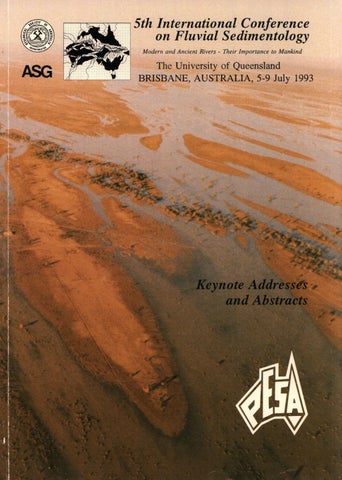
5th International Conference on Fluvial Sedimentology /Continuing Professional Education The University of Queensland, Brisbane, Queensland 4072, Australia. © Geological Society of Australia Inc. Printed by The University of Queensland Printery, Brisbane, Queensland, Australia Apart from any fair dealing for the purposes of private study, research, criticism or review as permitted under the copyright act, no part may be reproduced by any process without the written permission of the publisher. Front cover photograph: Coopers Creek in Flood, 1990. Courtesy of Delhi Petroleum Pty Ltd Responsibility for the content of these papers rests upon the authors and not The University of Queensland. Data presented and conclusions developed by the authors are for information only and are not intended for use without independent substantiating investigation on the part of the potential user.
5th Internatio nal Conferenc e on Fluvial Sedimento logy Modern and Ancient Rivers Their Importance to Mankind 5 - 9 July 1993 The University of Queensland Brisbane, Australia
CONFERENCE PROCEEDINGS Keynote Addresses and Abstracts
Sponsored by PETROLEUM EXPLORATION SOCIETY OF AUSTRALIA LTD (PESA)
Edited by B Yu and CR Fielding
Brisbane 1993
i
PREFACE
This volume contains Keynote Addresses and Abstracts of papers presented to the 5th International Conference on Fluvial Sedimentology, held at The University of Queensland in Brisbane, Australia between 5th and 9th July, 1993. The volume has been compiled by Sally Brown and Jane Ferrin at Continuing Professional Education, The University of Queensland. Checking of Abstracts was carried out by Dr. Bofu Yu of the School of Environmental Sciences, Griffith University. I would like to take this opportunity to thank all those involved in the organisation of the Conference : the Organising Committee and all Field Excursion Leaders (listed on pages vii and viii) and their employer organisations; Continuing Professional Education at The University of Queensland who acted as professional organisers, all sponsors; The University of Queensland Students Union for providing exhibition facilities and catering and the many others too numerous to mention.
C. R. Fielding, Convenor
5th International Conference on Fluvial Sedimentology Brisbane, May 1993
ii
ll)Il1fA(C Department of
INDUSTRY, TECHNO LOGY
_ &,.___ COMME RCE
IHR15
:&JM /926
THE UNIVERSITY OF QUEENSLAND
The lndtutlon
otBigk..-s,
Australia
Austral ian Academ y of Science iii
(@'
• ' AMPOLEX LIMITED
AIDAB OIL COMPANY OF AUSTRALIA
BRIDGE OIL LIMITED THE-ENERGETIC -IJ.USTRALIAN
THE
CRUSADER GROUP OF COMPANIES
Bligh Oil & Minerals N.L.
AUSTRALIAN AIRLINES ~ ~ iv
PROUDLY SPONSOR ED BY:
AUSTRALASIAN SEDIMENTOLOGISTS GROUP GEOLOGICAL SOCIETY OF AUSTRALIA INC. GEOLOGICAL SOCIETY OF AUSTRALIA (QUEENSLAND DIVISION) THE INSTITUTION OF ENGINEERS, AUSTRALIA DITAC (DEPT OF INDUSTRY, TECHNOLOGY & COMMERCE) AIDAB (AUSTRALIAN INTERNATION AL DEVELOPMENT ASSISTANCE BUREAU) AUSTRALIAN ACADEMY OF SCIENCE THE UNIVERSITY OF QUEENSLAND QUEENSLAND UNIVERSITY OF TECHNOLOGY INTERNATIONAL ASSOCIATION OF SEDIMENTOLOGISTS SEPM (SOCIETY FOR SEDIMENTARY GEOLOGY) PESA (PETROLEUM EXPLORATION SOCIETY OF AUSTRALIA QUEENSLAND BRANCH) AMPOLEX LIMITED BLIGH OIL & MINERALS N.L. BRIDGE OIL LIMITED CRUSADER GROUP OF COMPANIES LIMITED OIL COMPANY OF AUSTRALIA N.L. SANTOS PETROLEUM MANAGEMENT PTY LTD AUSTRALIAN AIRLINES LIMITED
V
ACKNOWLEDGEMENTS
The Organising Committee of the 5th International Conference on Fluvial Sedimentology thanks the following people and organisations for their assistance and support. Without their help, we could not have managed to achieve nearly so much. We especially thank •
• • • • • •
• • • • • • • • • •
The Australasian Sedimentologists Group and its parent organisation, The Geological Society of Australia Incorporated, for providing the seed loans and initial financing for the Conference. In particular, we wish to thank Drs Jim Jackson and Peter Southgate for their invaluable assistance; Ms Misha Frankel, Business Officer of the Geological Society of Australia Incorporated, Peter Pritchard (Treasurer), Dr Alison Ord (Secretary) and Gerhard Krumei (Promotions Officer) for finding answers to many of our queries and solutions to many of our problems. The Australian Federal Department of Industry, Trade and Commerce for their loan of funds under their Conference Support Scheme. The Australian International Development Assistance Bureau for financial support for fares and accommodation for two delegates. Professor Brian Wilson, Vice-Chancellor of The University of Queensland, for opening the Conference. Associate Professor David Gust, Head of School of Geology, Queensland University of Technology, for financial and logistical support; Fred Robins and Cathy Fielding for their logistical support. The Geological Survey of Queensland, Department of Minerals & Energy, for secretarial support and provision of facilities for field excursions. In particular, we thank Mr Mark Thornton for designing the conference logo and letterhead. The Staff of The University of Queensland Students Union and Ms Kerry Gilbert of Moreton Hire for organising the commissariat and for their assistance in planning the technical exhibition respectively. Ozaccom for handling accommodation arrangements. The Heritage Branch of the Brisbane City Council for providing the exhibit on the 1893 Brisbane River Floods. The Department of Civil Engineering, The University of Queensland for secretarial support. The Department of Earth Sciences, The University of Queensland for provision of facilities. The Faculty of Engineering and the Built Environment, Queensland University of Technology, for the loan of poster boards for the exhibition. Ms Lyn Robinson of the Queensland Government Travel Centre, for organising the accommodation and hire of vehicles for two of our field excursions. Michaela Abrahams for her assistance in arranging Papers in the Management of Waterways Stream Our field excursion leaders, for all the time and effort they have devoted to planning and running the field excursions which are an integral part of a Conference such as this one. Our corporate sponsors for providing much appreciated financial support. Elsevier Science Publishers B.V. for publishing a special issue of Sedimentary Geology for the 5th ICFS. All the other people who have assisted us in many and varied ways and in particular anyone whom we may have overlooked.
vi
ORGAN ISING COMMITTEE
C.R. Fielding
- The University of Queensland
Convenor
S.C. Lang
- Queensland University of Technology -
Treasurer
J.L.F. Hacker
- The University of Queensland
Secretary
].]. Draper
- Queensland Dept of Minerals & Energy
Technical Programme Co-ordinator
T.B. Connor
- Kinhill Cameron McNamara Pty Ltd
Engineering Co-ordinator
B. Yu
- Griffith University
Publications Officer
S. Buzer
- Queensland University of Technology -
Exhibition Co-ordinator
B.G. Jones
- University of Wollongong
Field Excursions Convenor
S.E. Brown J.D.M illington
Continuing Professional Education The University of Queensland
vii
Professional Conference Organisers
FIELD EXCURSION LEADERS PRE-CONFERENCE FIELD EXCURSIONS 1. 2.
3. 4.
5. 6.
Modern-day Floodplains along the Coastal Plain of New South Wales G.]. Brierley, Macquarie University The Bowen and Surat Basins of Eastern Queensland C.R. Fielding, The University of Queensland f.J. Draper, Queensland Department of Minerals and Energy f. Kassan, The University of Queensland Devonian and Permo-Triassic of the South Coast of New South Wales B. G. Jones, University of Wollongong G. Taylor, University of Canberra Alluvial Fades in an Active Orogenic Setting - Papua New Guinea K. Y. Liu, CSIRO B. Pawih, Geological Survey of PNG Devonian Fluvial Strata in the Broken Hill Area, Western New South Wales G Neef, University of New South Wales D. Larsen, Pasminco Mining, Broken Hill Coal-Bearing Successions of South-East Queensland A.J. Falkner, Consultant, Brisbane POST-CONFERENCE FIELD EXCURSIONS
7.
8.
9.
10.
11.
12.
13.
Modern and Ancient Rivers of North Queensland S.C. Lang, Queensland University of Technology B. Prove, Department of Primary Industries, Queensland J.L.F. Hacker, The University of Queensland C.R. Fielding, The University of Queensland K.J. Woolfe, James Cook University C. Hill, Department of Primary Industries, Queensland The Sydney Basin of Coastal New South Wales W.J. Bamberry, Geological Survey of New South Wales C. Herbert, Macquarie University P. Conaghan, Macquarie University A and B. Cambrian and Devonian Fluvial Fades of the Uluru (Ayers Rock) and MacDonnell Range Areas, Central Australia I.P. Sweet, Australian Geological Survey Organisation (fonnerly BMR) B.G. Jones, University of Wollongong Proterozoic and Cenozoic Fluvial and Estuarine Fades in the Kakadu National Park, Northern Australia J. Nott, Australian National University, Canberra P. Haines, Northern Territory Geological Survey Sedimentology and Sequence Stratigraphy of the Canterbury Plains, New Zealand D. Leckie, Geological Survey of Canada G. Brown, L. Brown and M. McSaveney, Institute of Geological and Nuclear Sciences, New Zealand M. Hicks, National Institute of Water and Atmospheric Research, New Zealand Modern Semi-Arid Fluvial Systems of Central Australia G. Nanson and S. Beaman, University of Wollongong R. Callen, South Australian Department of Minerals and Energy Heron Island - Southern Great Barrier Reef, Queensland f. Jell, The University of Queensland E. Frankel, University of Technology, Sydney
viii
TABLE OF CONTENTS TITLE OF PAPER AND AUTHOR/S
Page
Keynote Addresses Recent Developments in Understanding Water Flow, Sediment Transport, Erosion and Deposition in Rivers: A Personal Perspective Bridge, John S.
Kl
Fades Analysis of Fine-grained Fluvial Systems: A Constructivist Approach Brierley, Gary J.
KS
Fluvial Events and Volcanism : A Philippines Experience (River and Natural Disasters) Concepcion, Rogelio N.
K14
The Application of Sequence Stratigraphy to Ancient Fluvial Successions Flint, Stephen S.
K22
Alluvial Fans: Fluvial or Not? McPherson, John G. and Blair, Terence C.
K33
Controls on Fluvial Sequence Architecture Puigdefabregas, Cai
K42
The Geomorphology of Australia's fluvial systems : retrospect, perspect and prospect Tooth, Stephen and Nanson, Gerald C.
K49
Abstracts Sedimentology and Tectonic Setting of Polymictic Conglomerates in a Rapidly Subsiding Miocene-Pliocene Foreland Basin: Trans Indus Ranges, Northern Pakistan Abbasi, I.A. and Friend P.F.
1
Morphology and Sedimentation in Caribbean Montane Streams: Examples from Jamaica and Puerto Rico Ahmad, R., Scatena, F.N. and Gupta, A.
2
High Resolution Sequence Stratigraphy of Fluvial Deposits (Pennsylvanian Breathitt Group), East Kentucky, USA: Applications for Hydrocarbon Reservoir Modelling Aitken, ].F. and Flint, S.S.
3
Holocene Meander-Belt Evolution in an Active Extensional Basin, SW Montana, USA Alexander, ]., Bridge, ].S., Leeder, M.R., Collier, R.E.L. and Gawthorpe, R.L.
4
Sedimentary Processes and Facies Patterns at the Fluvial-Tidal Interface: Paleogeographic and Stratigraphic Implications Allen, G.P. and Castaing, P.
5
ix
Lowstand Estuarine Deposits in an Upper Albian Sequence: Characteristics and Origin (La Garbea, Vizcaya, Northern Spain) Aranburu, A., Lopez-Horgue, M ., Fernandez-Mendiola, P.A. and Garcia-Mondejar, f .
6
The Geometry and Internal Architecture of Braided Alluvium: Scaled Physical Models and Reservoir Heterogeneities Ashworth, P.j., Best, f.L., Leddy, ].O. and Geehan, G. W.
7
Bedload Sorting Mechanisms in Braided Gravel-Bed Rivers A shworth, P.j. and Mclelland, S.
8
Channel Morphology and Dynamics of a Low Gradient Multiple Channel System: Cooper Creek, Central Australia Beaman, S.]. and Nanson, G. C.
9
Sedimentology and Diagenesis of Triassic Sandstones from El Borma Oil Field, Southwestern Tunisia Ben Ismail, H.
10
Sedimentology of Tributary Mouth Bars on a Regulated Confined Gravel Bed Stream: Cudgegong River, Australia Benn, P.C.
11
The Structure of Turbulent Flow Over Dunes and the Origins of Dune-Related Macroturbulence Best, f. and Bennett, S.
12
Sedimentologic and Stratigraphic Response to Late Quaternary Climatic Change and Glacio-Eustasy, Lower Colorado River, Gulf Coastal Plain of Texas (USA) Blum, M.D.
13
Dryland Alluvial Fan Deposits: Controls on Sheetflood Development Boering, M. and North, C.
14
Sedimentology of Dryland Sheetflood Deposits: A Quantitative Approach Boering, M. and North, C.
15
Sedimentation Model for Incised Valleys Boyd, R., Dalrymple, R. and Zaitlin, B.A.
16
Recognition of Sequence Stratigraphy in the Triassic Fluvial Succession of the Bowen Basin, Australia Brake/, A. T., Wells, A. T. and Totterdell, J.M.
17
Point-Bar Deposits Documented in 3-D using Ground-Penetrating Radar and Coring and Their Genetic Interpretation Bridge, ].S., Alexander, ]., Collier, R.E.L., Gawthorpe, R.L. and Jarvis, f.
18
Element-Scale Sedimentology of Umi Fan Deposits, Markham Valley, Papua New Guinea Brierley, G.].
19
Braidplain Sedimentation in the Pennsylvanian Boss Point Formation, Maritime Canada: The Interplay of Fluvial and Lacustrine Deposition in a Tectonically Active Basin Browne, C.H.
20
X
A Sandy, Bed-Load Dominated Fluvial System Deposited by Lateral-Accretion: Permian Karoo Sequence, South Africa Cadle, A.B. and Cairncross, B.
21
Formation of Riffle-Pool Sequences: Field Evidence for an Autogenetic Process Clifford, N.].
22
Modelling Sand Delivery of Streams for Regional Planning of Resource Extraction Connor, T.B.
23
Implications of Changing Mean Annual Temperature and Sediment Supply on the Fluvial Architecture of the Aptian-Albian Wonthaggi and Eurneralla Formations, Southeast Australia Constantine, A.E., Ferguson, K.M. and Gregory, R. T.
24
The Significance of Gradational Lithofacies from the Westwater Canyon Member, Morrison Formation (Jurassic), San Juan Basin, New Mexico, USA Cowan, E.]. and Miall, A.D.
25
Eluvial Gold Placer Formation on Actively Rising Mountain Ranges, Central Otago, New Zealand Craw, D. and Youngson, ].H.
26
Compaction Related Deformation in Channel and Overbank Sediments Crawford, A.
27
Quaternary Stratigraphy and Chronology in the Lake Eyre Basin: Comparisons Between Local and Monsoon-Fed Catchments Croke, f. C., Magee, f. W. and Price, D.M.
28
Sedimentary Features of the Coal Cliff Sandstone at Coal Cliff, Southeastern Sydney Basin, NSW, Australia Dehghani, M.H. and Jones, B. G.
29
Controls of Alluvial Stratigraphy in the Central Appalachian Basin Dominic, D.F.
30
Depositional History of Quaternary Alluvial and Coastal Plain Depositional Environments, Proserpine-New Beach Lowlands, Central Queensland Doyle, ]., Little, M., Lang, S.C. and Stephens, A. W.
31
Sedimentology of a Vertically Accreted Floodplain along a Sand-Bedded Stream Edwards, D.
32
Pebble Size Variation in a Degrading Braided Stream: The Late Archaean Middelvlei Gold Placer, Witwatersrand, South Africa Eis, B.G.
33
Catastrophic Floods and Floodplain Formation and Destruction on a BedrockConfined Sand-Bed Stream Erskine, W.D. and Peacock, C. T.
34
Implications of Sedirnentological Studies for Environmental Pollution Assessment and Management: Examples from Fluvial Systems in North Queensland and Western Australia Eyre, B. and McCond1ie, D.
35
xi
Depositional Environments of the Lower Illawarra Coal Measures, Southwestern Sydney Basin, New South Wales Feldtmann, R. and Hutton, A.
36
Tectonic Controls on Fluvial Architecture in the Paparoa Coal Measures, Pike River Coalfield, South Island, New Zealand Ferguson, R.
37
Fluvial Response to Foreland Basin Overfilling: The Late Permian Rangal Coal Measures in the Bowen Basin, Queensland, Australia Fielding, C.R., Falkner, A.]. and Scott, S.G.
38
Sedimentology of the Permo-Triassic Amery Group in the Northern Prince Charles Mountains, Antarctica Fielding, C.R. and Webb, ].A.
39
Depositional Environments of the Middle Jurassic Walloon Coal Measures in the Clarence-Moreton Basin of Southeast Queensland Fielding, C.R. and Yago, f. V.R.
40
Anastomosing Channels and Arroyo Development on the Nogoa River, Central Queensland, Australia Finlayson, B.L. and Brizga, S.O.
41
Control of River Morphology by the Grain-Size of Sediment Supplied Friend, P.F.
42
Architectural Features of the Chinji Formation (Miocene), Northern Pakistan Friend, P.F., Geehan, G., Raza, S.M. and Sheikh, K.
43
Eustatic Controls on Triassic Marine and Non Marine Clastic Sequences: Examples from Western Australia, Central Australia and Queensland Gorter, ].D.
44
Anastomosing Stream Sediments in the Flood Basin of the Mississippi River Guccione, M.]., Hehr, L.H. and VanArsdale, R.B.
45
Upper Carboniferous Palaeochannels and Their Effects on Coal Mining Guion, P.D. and Jones, N.S.
46
Drainage Deflection by Actively Growing Anticlines at the Himalayan Mountain Front: Implications for Himalayan Drainage Patterns Gupta, S.
47
Fluvial Response to Thrust Tectonics in a Modem Piggyback Basin, Western Himalaya Gupta, S.
48
Early to Middle Triassic Fluvial to Marine Transition in the Sydney Basin Herbert, C.
49
Ground-Penetrating Radar Surveys of Floodplains formed in the Meandering and Braided Reaches of Squamish River, British Columbia, Canada Hickin, E.
50
A Comparison of Log-Normal and Log-Hyperbolic Grainsize Distributions to Determine the Depositional Environment of Tropical Fluvial Sediments Hill, CM.
51
xii
Tectonic Controls on Erosion and Deposition by Large Rivers Hovius, N.
52
Regular Spacing of Drainage in Compressional Orogens Hovius, N. and Tailing, P.
53
Fluvial Response to Tectonics in the Ombilin Basin, West Sumatra, Indonesia Howells, C. and Hastuti, S.
54
Bank Erosion on the Hawkesbury Nepean River, New South Wales: An Example of Rural Encroachment and Recreational Boating Causing River Bank Erosion and the Implications for River Management Hubble, T. C. T.
55
Sedimentology of the Lowland Plains of the Clarence River, Northern NSW, Australia Huq, N.E.
56
Characteristics of Avulsing River Systems, Gulf of Carpentaria, Queensland, Australia Jones, B.G.
57
Fades and Architectural Analysis of the Late Triassic Callide Coal Measures, East-Central Queensland, Australia Jorgensen, P.]. and Fielding, C.R.
58
Evolving Depositional Environments in a Retroarc Foreland Basin: The Triassic of the Bowen Basin in Eastern Queensland, Australia Kassan, J. and Fielding, C.R.
59
Rapid Climatic Changes and River Response During the Younger Dryas (11-10 ka) in the Netherlands Kasse, C.
60
Fluvial Systems Controlled by Block Movement of the Pliocene Kobiwako Group, Central Japan Kawabe, T.
61
A Terminal Fan Model Kelly, S.B. and Olsen, H.
62
Evolution of Miocene Fluvial Environments in Northern Pakistan Khan, I., Zaleha, M. and Bridge, ].S.
63
Macroturbulence Generated by Dunes: Fraser River, Canada Kostaschuk, R.A. and Owrch, M.A.
64
Reservoir Sludges - Raw Material or Waste? Minerals and Organic Components as Criteria to Evaluate Contaminations in Danube Sediments Kralik, M. and Augustin-Gyurits, K.
65
Fluvial Transport of Sand and Gravel Mixtures with Bimodal Size Distributions Kuhnle, R.A.
66
Evolution of Devonian Alluvial Systems in an Oblique-Slip Mobile Zone - An Example from the Broken River Province, Northeastern Australia Lang, S.C.
67
xiii
Braided Gravel Rivers and Incised Valleys of the Canterbury Plains, New Zealand Leckie, D.A.
68
The Canterbury Plains, South Island, New Zealand, A Photographic Montage Leckie, D.A. and Homer, L.
69
Flood Management on the Lower Yellow River: Hydrological and Geomorphological Perspectives Li, S. and Finlayson, B.
70
Control of Soil Acidification by Fluvial Sediment in an Estuarine Floodplain, Eastern Australia Lin, C. and Melville, M.D.
71
Depositional Evolution and Tectonic Controls of a Cainozoic Oil Shale Basin, The Hillsborough Basin, Central Queensland Little, M .P. and Doyle, ].
72
Separating Sedimentary Effects of Differential Compaction and Structural Control in a Foreland Basin Liu, Y., Fenn, ]. C. and Esterle, J.S.
73
Provenance Modelling of Syn-Orogenic Alluvial Fans, External Sierras, Spanish Pyrenean Foreland Basin: Insights into Extrinsic Versus Intrinsic Controls on Fan Activity Lloyd, M .].
74
The River Basin as a Mechanism for Co-Operative Regional Planning - The Logan River Case Study Low Oioy, D.
75
The Importance of Geologic Time in Understanding the Allocyclic and Autocyclic Controls on Fluvial Architecture - Towards More Predictive Models McCabe, P.]. and Shanley, K. W
76
Three-Dimensional Modelling of Alluvial Architecture Mackey, S.D. and Bridge ].S.
77
Plant Fossil Distributions in Some Australian Permian Non-Marine Sediments Mcloughlin, S.
78
Stratigraphy and Sedimentology of Quaternary Fluvial Units in the Lake Eyre Basin Magee, f. W and Croke, f. C.
79
Sediment Transport of Fine-Grained Alluvium from Cooper Creek, Central Australia Maroulis, ]. C.
80
Origin of a Massive Sandstone Fades in Ancient Braided Stream Deposits: A Comparison Between the Fell Sandstone Group (Lower Carboniferous) of North-East England and the Lee Formation (Upper Carboniferous) of Northern Tennessee, USA Martin, C.A.L.
81
Permeability Distributions and Heterogeneities of Distal Fluvial Fan Meander-Loop and Channel-Fill Deposits (Tortola Fan, Loranca Basin, Spain) Martinius, A. W and Nieuwenhuijs, R.A.
82
Adjustment of a Fluvial System to Differential Uplift, Betics, SE Spain Mather, A.E. and Harvey, A.M.
83
xiv
The Architecture of Fluvial-Deltaic Sequences in the Upper Mesaverde Group (Upper Cretaceous), Book Cliffs, Utah Miall, A.D.
84
A Stratigraphic-Tectonic Classification of Fluvial Oil and Gas Fields Miall, A.D.
85
Reconstructing Macroform Architecture from Two-Dimensional Outcrops Miall, A.D.
87
Assessment of Sedimentation Rates on Floodplains, A Case Study in the Netherlands Middlekoop, H.
89
Tertiary Sedimentation and Fossil Fuels in Kyushu, Japan Miki, T.
90
Evolution of a Glacifluvial to Fluvial System During the Final Stage of Gondwanan Deglaciation Millward, E.D. and Williams, B.P.f.
91
Development, Sedimentation and Economic Potential of Palaeoriver Systems of the Yilgarn Craton of Western Australia Morgan, K.H.
92
Preservation of Alluvial Channel-Fill Deposits Related to Basin Conditions: A Simple Model with Possible Illustration from the Neogene Leijahe Formation, Central China Muto, T.
93
Fluvial Fades Controlled by Block Movement: An Example from the Upper Cenozoic Tokai Group, Central Japan Nakayama, K.
94
Anabranching Rivers, An Explanation and Classification Nanson, G. C., Knighton, D.A. and Oiurch, M.
95
Climate and River-Regime Changes in Australia over the Past 60 Ka Nanson, G. C., Price, D.M ., Page, K.J., Callen, R.A. and Nott, ].F.
96
Sheet Flood and Braided Stream Deposition During the Early and Mid Devonian in the Western Part of the Darling Basin, NSW Neef, G., Bottrill, R.S. and Cohen, D.R.
98
Anastomosing Channel Changes Along the Upper Amazon Neller, R.f. and Riisiinen, M.
99
Fore-Arc Basin Fluvial Sediments, Alexander Island, Antarctica Nichols, G. and Macdonald, D.
100
Rehabilitation of a Dynamic Gravel-Bed River, the Common Meuse in The Netherlands Nieuwenhuijzen, M. , Gerretsen, f. and Silva, W.
101
On the Origin of Steeply Dipping Fine Grained Laminae in Riverine Still-Water Sediments Nott, f.
102
Application of Ground Penetrating Radar Methods in Alluvial Architecture Studies Olsen, H. and Andreasen, F.
103
xv
Complex Palaegeographic Changes Documented by Sand-Body Stacking Patterns, Palaeotransport Directions and Fluvial Style: The Farrer, Price River and North Hom Formations, Price Canyon, Utah Olsen, T.
104
Large Fluvial Systems: The Atane Formation, A Fluvio-Deltaic Example from the Upper Cretaceous of Central West Greenland Olsen, T.
105
Chronology and Stratigraphy of Murrumbidgee River Palaeochannels on the Riverine Plain, Southeastem Australia Page, K.]., Nanson, G. C. and Price, D.M.
106
The Distribution of Phosphate in Sediments of the Johnstone Rivers CatchmentEstuary System, North Queensland, Australia Pailles, C., Mcconchie, D.M ., Arakel, A. V. and Saenger, P.
107
Geological Controls on Fluvial Aggradation and Incision and their Significance within a Sequence Stratigraphic Framework Posamentier, H. W. and Allen, G.P.
108
Soil Erosion and Conservation in Sloping Canelands of the Wet Tropical Coast Prove, B.G. and Evans, D.S.
109
Formation and Sedirnentology of Braided-River Floodplains Reinfelds, I.V. and Nanson, G. C.
110
Meander Cutoffs as Indicators of Environmental Change: the Latrobe River, Australia Reinfelds, I. V., Rutherfurd, I. and Bishop, P.
111
Contrasting Development Patterns of Crevasse Channel Deposits in Cretaceous Alluvial Successions, Korea Rhee, C. W., Ryang, W.H. and Otough, S.K.
112
Variations in Depositional Styles of Norunarine Basins (Cretaceous), Korea Rhee, C. W., Jo, H.R., Ryang, W.H. and Chough, S.K.
113
Sedimentary Effects of Cataclysmic Late Pleistocene Glacial Outburst Flooding, Altay Mountains, Siberia Rudoy, A.N. and Baker V.R.
114
Historical Sediment Storage and Declining Sediment Yields in Victorian Catchments: Implications for River Management Rutherfurd, I., Reinfelds, I. V., Bishop, P. and Grayson, R
115
Tectono-Stratigraphic Evolution of an Alluvial Basin (Mesozoic Rifted Margin, Central Spain) Sanchez-Moya, Y., Sopefia, A., Ramos, A. and Munoz, A.
116
Dam Failure Related Sediments in the Berga Alluvial System (Oligocene). N.E. Spain Saula, E., Mat6, E. and Puigdefabregas, C.
117
Floodplain Architecture of Confined Upland Valleys Saynor, M.J. and Erskine, W.D.
118
xvi
Predictions of the Geometry of Fluvial Point-Bar Sandstones Schenk, C.].
119
Opposing Trends of Boundary and Critical Shear Stress during Channel Adjustment, North Fork Toutle River, Washington, USA Simon, A.
120
Fades Analysis of the Kosi Megafan Deposits Singh, H., Parkash, B. and Gohain, K.
121
Flash-Flood Sediments and Ichnofacies of the Late Pleistocene Homeb Silts, Kuiseb River, Namibia Smith, R.M.H., Mason, T.R. and Ward, ].D.
122
Tectonic Control on River Courses, Floodplain Widths and Development of Soils in a Part of the Gangetic Plains Srivastva, P. and Parkash, B.
123
The Okavango Fan and the Classification of Subaerial Fan Systems Stanistreet, LG. and McCarthy, T.S.
124
Low Sinuosity and Meandering Bedload Rivers of the Okavango Fan: Channel Confinement by Vegetative Levees without Fine Sediment Stanistreet, LG., Cairncross, B. and McCarthy, T.S.
125
Provenance and Sediment Dispersal in the Rajang River Delta/Coastal Plain System, Sarawak, East Malaysia Staub, ].R. and Esterle, J.S.
126
Features and Effects of Synsedimentary Tectonics in Fluvial Sequences of the Permo-Carboniferous Saar-Nahe-Basin (SW-Germany) Stollhofen, H.
127
Ayers Rock and the Olgas: Late Proterozoic or Early Cambrian Alluvial Fan Deposits at the Southern Margin of the Amadeus Basin, Central Australia Sweet, L
129
Ephemeral-Fluvial Deposits: New Light on Sedimentology and Implications for Reservoir Geology Taylor, K. and North, C.
131
Geomorphic Approach to Fluvial Maintenance Thorne, C.R., Darby, S.E. and Simon, A.
132
Longitudinal Fades Architectural Changes of a Middle Holocene Anastomosing Distributary System (Rhine-Meuse Delta, Central Netherlands) Tornquist, T.E., van Ree, M.H.M. and Faessen, E.L.].H.
133
Controls on Fluvial Deposition in Mixed Fluvial and Aeolian Fades within the Tumblagooda Sandstone (Late Silurian) of Western Australia Trewin, N.H.
134
Fluvial Channel Types in the Coal Measures of Northeast England: Implications for Hydrocarbon Exploration in the Southern North Sea Turner, B.R. and O'Mara, P. T.
135
xvii
Cold-Climate (26-12 KA BP) Overbank Sequences of the River Maas, The Netherlands Matching the Global Climatic Record van den Berg, M. W. and Schwan, f. C. G.
136
River Maas Terraces as a Long Continental Record of Climo-Tectonic Changes in North-West Europe van den Berg, M. W.
137
Hydrochemistry of Potentially Acid Groundwaters in Unconfined Flood Plain Aquifers, Eastern Australia - Implications for Land Developments Wall, L.N.
138
Geostatistical Analysis of Overbank Deposits of Anastomosing and Meandering Fluvial Systems: Rhine-Meuse Delta, The Netherlands Weerts, H.J. T. and Bierkens, M.F.P.
139
Groundwater Flow through Late-Pleistocene and Holocene Fluvial and Aeolian Deposits in the Rhine-Meuse Floodplain, The Netherlands Weerts, H.J. T. , Bakker, A. and De Hamer, A.
140
Characterisation of Fluvial Hydrocarbon Reservoirs: Examples from the Cooper Basin, South Australia Williams, B.P.].
141
A Simple Model of Space Addition for Transgressive Sequences Yu, B.
142
xviii
AUTHOR INDEX
A
ABBASI, I.A. AHMAD, R. AITKEN, J.F. ALEXANDER, J. ALLEN, G.P. ANDREASEN, F. ARAKEL, A.V. ARANBURU, A. ASHWORTH, P.J. AUGUSTIN-GYURITS , K.
1 2 3 4, 18 5, 108 103 107 6 7,8 65
B BAKER, V.R. BAKKER, A. BEAMAN, S.J. BEN ISMAIL, H. BENN, P.C. BENNETT, S. BEST, J.L. BIERKENS, M.F.P. BISHOP, P. BLAIR, T.C. BLUM, M.D. BOERING, M. BOTTRILL, R.S. BOYD, R. BRAKEL, A.T. BRIDGE, J.S. BRIERLEY, G.J. BRIZGA, S.O. BROWNE, G.H.
114 140 9 10 11 12 7, 12 139 111,115 K33 13 14, 15 98 16 17 Kl , 4, 18, 63, 77 KS, 19 41 20
C CADLE, A.B. CAIRNCROSS, B. CALLEN, R.A. CASTAING, P. CHOUGH, S.K. CHURCH, M.A. CLIFFORD, N.J. COHEN, D.R. COLLIER, R.E.L. CONCEPOON, R.N. CONNOR, T.B. CONSTANTINE, A.E. COWAN, E.J. CRAW,D. CRAWFORD, A. CROKE, J.C.
21 21, 125 % 5 112, 113 64, 95 22 98 4, 18 K14 23 24 25 26 27 28, 79
D DALRYMPLE, R. DARBY, S.E. DE HAMER, A. DEHGHANI, M.H. DOMINIC, D.F. DOYLE, J.
16 132 140 29 30 31, 72
E EDWARDS, D. ELS, B.G. ERSKINE, W.D.
32 33 34, 118
ESTERLE,J.S. EVANS, D.S. EYRE, B.
73,126 109 35
F FAESSEN, E.L.J.H. FALKNER, A.J. FELDTMANN, R. FERGUSON, K.M. FERGUSON, R. FERM, J.C. FERNANDEZ-MENDIOLA, P.A. FIELDING, C.R. FINLAYSON, B.L. FLINT, S.S. FRIEND, P.F.
133 38 36 24 37 73 6 38, 39, 40, 58, 59 41, 70 K22, 3 1,42,43
G GARCIA-MONDEJAR, J. GAWTHORPE, R.L. GEEHAN, G.W. GERRETSEN, J. GOHAIN, K. GORTER, J.D. GRAYSON, R. GREGORY, R.T. GUCOONE, M.J. GUION, P.D. GUPTA, A. GUPTA, S.
6 4, 18 7,43 101 121 44 115 24 45 46 2 47, 48
H HARVEY,A.M. HASTUTI, S. HEHR, L.H. HERBERT, C. HICKIN, E. HILL, C.M. HOMER, L. HOVIUS, N. HOWELLS, C. HUBBLE, T.C. T. HUQ, N.E. HUTTON, A. J JARVIS, J. JO, H.R. JONES, B.G. JONES, N.S. JORGENSEN, P.J.
83 54 45 49
so
51 69 52, 53 54 55 56 36
18 113 29, S'1 46 58
K KASSAN, J. KASSE, C. KAWABE, T. KELLY, S.B. KHAN, I. KNIGHTON, D.A. KOST ASCHUK, R.A. KRALIK, M. KUHNLE, R.A.
xix
59 60 61 62 63 95 64 65 66
R RAMOS, A RASANEN, M. RAZA, S.M. REINFELDS, I.V. RHEE, C.W. RUDOY, AN. RUTHERFURD, I. RYANG, W.H.
L I.ANG, S.C. LECKIE, D.A. LEDDY, J. LEEDER, M.R. LI, S. LIN, C. LITTLE, M.P. LIU, Y. LLOYD, M.J. LOPEZ-HORGUE, M. LOW CHOY, D.
31, 67 68, 69 7 4 70 71 31, 72 73 74 6 75
M McCABE, P.J. McCARTHY, T.S. McCONCHIE, D.M. MACDONALD, D. MACKEY, S.D. McLELI.AND, S. McLOUGHLIN, S. McPHERSON, J.G. MAGEE,J.W. MAROULIS, J.C. MARTIN, C.AL. MARTINIUS, AW. MASON, T.R. MATHER, AE. MATO, E. MELVILLE, M.D. MIALL, AD. MIDDELKOOP, H. MIKI, T. MILLWARD, E.D. MORGAN, K.H. MUNOZ, A MUTO, T.
76 124,125 35, 107 100 77 8 78 K33 28, 79 80 81 82 122 83 117 71 25, 84, 85, 87 89 90 91 92 116 93
N NAKAYAMA, K. NANSON, G.C. NEEF, G. NELLER, R.J. NICHOLS, G. NIEUWENHUIJS, R.A NIEUWENHUIJZEN, M. NORTH, C. NOTT, J.F.
94 K49, 9,95, 96,106,110 98 99 100 82 101 14, 15, 131 %, 102
0 OLSEN, H. OLSEN, T. O'MARA, P.T.
62, 103 104, 105 135
p PAGE, K.J. PAILLES, C. PARKASH, B. PEACOCK, C. T. POSAMENTIER, H.W. PRICE, D.M. PROVE, B.G. PUIGDEFABREGAS, C.
% , 106 107 121, 123 34 108 28, 96, 106 109 K42, 117
116 99 43 110, 111, 115 112, 113 114 111, 115 112, 113
s SAENGER, P. SANCHEZ-MOYA, Y. SAULA, E. SAYNOR, M.J. SCATENA, F.N. SCHENK, CJ. SCHWAN, J.C.G. SCOTT, S.G. SHANLEY, K. W. SHEIKH, K. SILVA, W. SIMON, A SINGH, H. SMITH, R.M.H. SOPENA, A SRIVASTVA, P. STANISTREET, LG. STAUB, J.R. STEPHENS, AW. STOLLHOFEN, H. SWEET, I.
107 116 117 118 2 119 136 38 76 43 101 120,132 121 122 116 123 124,125 126 31 127 129
T TALLING, P. TAYLOR, K. THORNE, C.R. TOOTH, S. TORNQUIST, T.E. TOTTERDELL, J.M. TREWIN, N.H. TURNER, B.R.
53 131 132 K49 133 17 134 135
V VAN ARSDALE, R.B. VAN DEN BERG, M.W. VAN REE, M.H.M.
45 136, 137 133
w WALL, L.N. WARD, J.D. WEBB, J.A. WEERTS, H.J.T. WELLS, AT. WILLIAMS, B.P.J.
138 122 39 139,140 17 91,141
y YAGO, J.V.R. YOUNGSON, J.H. YU,B.
40 26 142
z ZAITLIN, BA. ZALEHA, M.
XX
16 63
SEDIMENTOLOGY ANV TECTONIC SETTING OF POL YMICTIC CONGLOMERATES IN A RAPIDLY SUBSIDING MIOCENE-PLIOCENE FORELAND BASIN: TRANS INDUS RANGES, NORTHERN PAKISTAN I A Abbasi1 and P F Friend 2
Department of Geology University of Peshawar, Pakistan 1
Department of Earth Sciences University of Cambridge, U.K. 2
ABSTRACT
More than 6 km of Neogene molasse sediments of the Rawalpindi and Siwalik Groups accumulated in the western Himalayan (Kohat) foreland basin, northern Pakistan, in response to active basin subsidence and orogenic uplift. In the Kohat Plateau, the Siwalik Group consists of a coarsening-upward sequence of silt in the lower part (Chinji Formation), sand in the middle part (Shakardarra Formation) and conglomerate (Indus Conglomerate Formation) in the upper part. 2 The Indus Conglomerate Formation is exposed over an area of 400 km and is over 1500 metres thick. The conglomerate/sandstone ratio is 1:1 in the lower part and increases to 4:1 in the middle and upper parts. The formation is laterally variable but consists of three main lithofacies i.e., a) crudely stratified to horizontally bedded conglomerate (Gh), b) massive, clast supported conglomerate (Gm), and c) planar cross-stratified conglomerate (Gp). Lithofacies Gh is the most common. In lithofacies Gp, some of the cross-sets are up to 7 metres thick suggesting channels as deep as 10 metres or more. However, the average thicknesses of the cross-sets are 3-4 metres, suggesting channels of 6-8 metres.
The progradation of the Indus conglomerates over the finer grained formations is probably mainly a response at this depositional site on the Indian plate, to the progressive movement of the plate towards the uplifted Himalaya. But in the Kohat area, the Late Miocene progradation of the conglomerate is distinctly earlier than elsewhere in the western Himalayan foreland basin. The conglomerates pass laterally into the finer grained fades of the Nagri and Dhok Pathan Formations to the east and south of the Kohat basin, and also pass into finer grained sediments to the west. This suggests that it was in this area that he largest river system entered the western foreland, about 10 ma, approximately along the course of the present-day Indus river.
1
MORPHOLOGY AND SEDIMENTATION IN CARIBBEAN MONTANE STREAMS: EXAMPLES FROM JAMAICA AND PUERTO RICO
R Ahmad 1, F N Scatena 2 and A Gupta 3 1
Department of Geology, University of the West Indies Kingston 7, Jamaica 2
International Institute of Tropical Forestry Call Box 25000, Rio Piedras, Puerto Rico 00928-2500 3
Department of Geography, National University of Singapore Singapore 0511
ABSTRACT
This paper presents a summary description of the morphology, sedimentation, and behaviour of the montane streams of eastern Jamaica and of eastern Puerto Rico. The area is located within a 200 km wide seismically active zone of Neogene left-lateral strike-slip deformation which defines the plate boundary between the Caribbean and North American Plates. Tropical storms, occasionally strengthening up to hurricane force, affect the region periodically. This is an area of steep, mass movement scarred hillslopes which supply a large amount of coarse sediment to the rivers. Such sediment may form about 80 percent of the material transported out of the basins. From the description presented, we have constructed a model for the rivers of this region controlled by both neotectonics and periodic large floods. The drainage density is low with a near-rectangular stream network. The gradients are steep with boulder accumulations in the channels, their location at times related to the presence of large past landslides on hillslopes. Narrow, steep and confined channels occur in the mountains, but in wider sections and lower down near coastal plains, flood depositional forms appear in coarse valley alluvium. Small-scale deviations from the general pattern occur locally based on variations in lithology, neotectonism, seasonality in flow, etc. This is the model for the Caribbean montane streams which differs considerably from the standard descriptions of alluvial rivers for which a number of detailed studies are available. Overall, these streams are the product of tectonic activities, mass movement derived coarse sediment in profusion, and highmagnitude floods at intervals. We believe that the riverine forms and valley alluvium in a plate boundary strike-slip zone are diagnostic especially if high-magnitude floods are also common.
2
HIGH RESOLUTION SEQUENCE STRATIG!{APHY OF FLUVIAL DEPOSITS (PENNSYL V ANIAN BREATHITT GROUP), EAST KENTUCKY, USA: APPLICATIONS FOR HYDROCARBON RESERVOIR MODELLING
J F Aitken and S S Flint Department of Earth Sciences, University of Liverpool PO Box 147, Brownlow St., Liverpool. L69 3BX. U.K.
ABSTRACT
The Pennsylvanian, fluvio-deltaic Breathitt Group in eastern Kentucky is well exposed in large highway cuts which provide depositional dip and strike sections of up to 125 km and 100 km respectively . Fourteen sequence boundaries have been identified. Three of these, with the greatest fades tract dislocations, overlie the most extensive marine fades in eastern Kentucky and have been estimated to occur at 2.5 Ma interyals; hence they are classified as third order in terms of duration and magnitude. The remaining 11 sequence boundaries show less pronounced fades tract dislocations and have been estimated to have durations of 400,000 to 450,000 years, hence they equate with fourth order cyclicity. Systems tracts can be identified on the basis of sequential position, fades associations and systematic changes in architectural style and sediment body geometries. Lowstand systems tracts comprise multistorey, multilateral, low sinuosity fluvial complexes infilling incised valleys, and more subtle interfluve surfaces which are marked by heavily rooted horizons, gleyed palaeosols, seat earths and possibly thin coals. Transgressive and early highstand systems tract deposits comprise poorly connected, vertically isolated, single-storey high sinuosity channels, frequently with heterolithic fills. Overbank deposits are poorly drained with high crevasse splay:channel ratios. Where preserved, late highstand fluvial systems comprise high-sinuosity, single-storey, sand-filled channel fills and relatively low crevasse splay:channel ratios. Volumetric partitioning of reservoir sandbodies between systems tracts and sequences allows prediction of channel sandstone geometries and channel:crevas;:;e splay ratios. Furthermore , channel fill type is predictable from the sequence stratigraphy . Within the 4th order sequences, incised valley fills represent the main reservoirs, which are laterally continuous over l0's of kilometres. Stacking patterns indicate that the 4th order sequences occur in lowstand, transgressive and highstand sequence sets. Within fourth order sequence sets, incised valley fills are sometimes vertically stacked to produce anomalously thick, fluvial sandbodies. These are the prime potential producing zones within coastal plain reservoirs.
3
HOLOCENE MEANDER-BELT EVOLUTION IN AN ACTIVE EXTENSIONAL BASIN, SW MONTANA, USA
TAlexander1, J S Bn·dge2, M R Leeder3, R E LI Collier3 and R L Gawthorpe4 1
Geology Department, Cardiff University PO Box 914, Cardiff, CFl 3YE, Wales, UK 2
3
4
Geological Sciences, Binghamton University Binghamton, New York 13902-6000, USA
Department of Earth Sciences, Leeds University Leeds LS2 9JT, England, UK
Department of Geological Sciences, University of Manchester Manchester, M13 9PL, England, UK
ABSTRACT
The development of asymmetric meander-belts along the Madison and South Fork rivers in the West Yellowstone extensional basin resulted from a lateral bias to channel position over a prolonged period of time (>9ka). Radiocarbon ages of sediments in abandoned meander loops demonstrate a general pattern of younging towards the modern meander-belts in both rivers. Fluvial activity was periodically interrupted by transgressions of an ancestral Lake Hebgen and incision has resulted in the formation of terraces descending to the modern river floodplain. The terraces are well preserved on the tectonically uptilted sides of the meander-belts with only small remnants preserved locally on downtilted areas. The terrace remnants indicate that the positions of the downtilted margins of the floodplains have not changed significantly over the last 9ka whilst the floodplains have narrowed. The progressive younging of sediments in abandoned meander loops towards the modern rivers is explained by a preferential preservation of the uptilted parts of meander loops as the floodplain narrowed. The terraces of the South Fork meander-belt are most pronounced in the footwall of an intra-basinal fault which has displaced the alluvial surface at least twice in the last 9ka. More Holocene terraces have been recognised along the Madison river than along the South Fork and it is currently not possible to correlate between them. The size of meander loops in the South Fork meander-belt varies with age, with larger loops preserved on older terrace surfaces. The inferred reduction in discharge responsible for these changes is similar to that which has been documented from other Holocene river systems. No systematic change in meander size can be identified on the Madison meander-belt. The field data demonstrate that the morphology and deposits of asymmetric meander-belts are controlled not only by tectonic tilting but also by local base-level changes and catchment evolution.
4
SEDIMb.N 1ARY PROCESSES AND FACIES PATTERNS AT THE FLUVIAL-TIDAL INTERFACE: PALEOGEOGRAPHIC AND STRATIGRAPHIC IMPLICATIONS
GP Allen 1 and P Castaing 2 1
TOTAL Centre Scientifique et Technique, 78470 St-Remy-les-Chevreuse, France Laboratoire d'Oceanographie , Universite de Bordeaux I, 33400 Talence, France
2
ABSTRACT Sequence stratigraphic concepts stress the distinction between alluvial plain and coastal plain depositional environments and the importance of the bayline which separates the two. Few studies however, have examined the sedimentological differences between the two environments and possible fades criteria to identify the bayline in the stratigraphic record. This study analyzes the transition between the Garonne alluvial plain and the tidal coastal plain of the Gironde estuary in SW France. A major fades transition occurs where the river becomes affected by tides. This transition consists of: (1) a pronounced grain size decrease within the channel sediments, from fluvial gravel point bars to medium sand and mud estuarine point bars; (2) a change from massive-bedded channel deposits to cyclically-bedded, tide-dominated sediments; (3) the appearance of numerous clay laminations interbedded within channel sands and (4) the disappeareance of fluvial overbank levees and crevasse splays. This fades change marks the transition between the alluvial and estuarine coastal plain and occurs about 110 km upstream from the estuary mouth. Fluvial sedimentation in the Garonne is dominated by a marked seasonal flood regime with strong flood surges during winter months. These high energy events transport gravel and coarse sand in the channel and deposit sandy splays in the floodplain. When the river enters the tidal zone, flood surges are dampened out by the tidal prism. This results in the disappearance of alluvial overbank deposits seaward of the fluvial-estuarine interface. Sedimentation in the tide-dominated estuary is controlled by tidal current asymmetry and density currents which impede fluvial gravel from entering the estuary and trap fluvial suspended sediment within a turbidity maximum. The turbidity maximum generates the abundant clay laminations which characterize the estuarine channel sands. During low river flow it can extend landward as far as the tidal limit, c. 140 km from the mouth. The preserved fluvial-estuarine fades transition, however occurs about 30 km downstream from this limit, where alluvial floods are dampened out by tides. Any tidal mud laminations deposited landward of this zone during low river flow are eroded during floods. The fluvial-estuarine fades transition coincides with the bayline, where the seaward sloping alluvial plain intersects the estuarine coastal plain at sea level. This fluvial-estuarine bayline contact is clearly visible in cores of the Holocene fill of the Garonne incised valley, and it can be traced along the entire valley, i.e. over 100 km. It represents an important stratigraphic surface within the incised valley fill and coincides with the Transgressive Surface which separates fluvial lowstand systems tract deposits from the landward onlapping estuarine transgressive systems tract.
5
LOWST AND ESTUARINE DEPOSITS IN AN UPPER ALBIAN SEQUENCE: CHARACTERISTICS AND ORIGIN (LA GARBEA, VIZCAYA, NORTHERN SPAIN)
A Aranburu, M L6pez-Horgue, P A Fernandez-Mendiola and J Garcia-Mondejar Dpto Estratigrafia, Geodinamica y Paleontologia, Universidad de! Pais Vasco, Apdo 644. 48080 Bilbao, Spain
ABSTRACT The Upper Albian of the Basque-Cantabrian region in northern Spain consists of more than 3000 m of sandstones, lutites, conglomerates and limestones, corresponding to alluvial plain, terrigenous and carbonate platforms and flysch trough depositional environments. One depositional sequence from this major unit (La Sia, late inflatum Zone) was recently described in a western carbonate platform margin, and its lowstand deposits were reported to consist of different carbonate megabreccias and siliciclastic turbidites among other deposits. Tracing 30 km to the ENE (basinal direction) the basal boundary of La Sia sequence, has allowed the recognition of lowstand sandy estuarine deposits of a ramp-type setting, in La Garbea, which are the object of this communication. The studied section, oriented SE-NW, is about 50 m thick and 4 km wide, and consists of alternating shallow-water sandstones and mudstones with scarce limestones. Sandstones at the base of the section are fine and medium-grained, except the lowermost unit at the top of the sequence boundary, which is medium to very coarse-grained with quartz pebbles up to 2 cm . They present trough cross-stratification with mud drapes, reactivation surfaces, local heterolithic lateral accretion, rippled tops of many sets, local herring-bone cross-stratification, linguoid ripples, clay chips, detrital plant debris, skolithos ichnofacies, and fining to coarsening -or just coarsening- upward successions. They are attributed to estuarine channels with ebb (broadly to the north) predominant currents. Sandstones in the upper part of the section are locally channelized, but some fine-grained units showing abundant wave ripples, hummocky or swaley cross-stratification, interdigitate with offshore muds, and are considered wave-dominated deposits. A fine and medium-grained unit in the upper part of the section can be followed for about 4 km from the SE to the NW, changing laterally from channelized, thoroughly bioturbated sandstones (1,5 m) to a prograding mouth bar with bottomsets, foresets and topsets (up to 10 m). The bottomsets have laminated silststones, some slumps, and discrete sandstone beds up to 30 cm thick with erosional bas~, parallel lamination and wave-rippled tops. They pass laterally upward to foresets up to 50 cm thick, with parallel lamination, angle of repose dips, a few major reactivation surfaces and scarce skolithos burrows; their maximum relief was about 5 m and their progradation took place along 215 m. Topset beds consist of medium scale trough cross-stratified sandstones, which truncate the upper part of the foresets and pass laterally to them progressively. They show an intensely bioturbated top, similar direction of migration than the foresets (NW), and local structures of reversal current. This mouth bar is considered a tide-influenced deltaic lobe similar to some small Gilbert-type deltas. Two thin (0,5-1 m) limestone units intercalated with thick (up to 10 m) mudstone intervals can be followed at least 3 km across the section. They are sandy skeletal grainstones with orbitolinids, brachiopods, scattered corals and bivalves, and are interpreted as condensed intervals caused by terrigenous input backshiftings. Two antitethic synsedimentary faults SW-NE oriented and 4 km apart from each other controlled the estuarine fades appearance and characteristics. Their pulsating and alternating action provoked the arrivals of sandstones into an open shelf, which were transported along estuarine channels approximately parallel to the faults and in one case built away a Gilbert-type lobe. Offshore muds with occasional limestone dominated in the graben during phases of sea encroaching (relative sea level rises), and the sandstones represent phases of relative sea level falls. Therefore, at least three small cycles of relative sea level variation determined the filling of the graben, which can be attributed primarily to local tectonism. This graben, finally, can be related to a major SW-NE fault line which was intermittently active during Cretaceous and Tertiary times, sometimes with a strike-slip component. It might then be possible that the graben represent in fact a negative flower structure, corresponding to a strike-slip fault line antitethic with respect to the major NW-SE strike-slip system of the Basque-Cantabrian basin related with the Bay of Biscay opening. 6
THE GEOMETRY AND INTERNAL ARCHITECTURE OF BRAIDED ALLUVIUM: SCALED PHYSICAL MODELS AND RESERVOIR HETEROGENEITIES
P J Ashworth 1, [ L Best2, JO Leddy3 and G W Geehan 1
2
4
School of Geography, University of Leeds, W Yorkshire, LS2 9JT, UK
Department of Earth Sciences, University of Leeds, W Yorkshire, LS2 9JT, UK 3
School of Geography, University of Leeds, W Yorkshire, LSQ 9JT, UK 4
B.P. Research, Sunbury-on-Thames, Middlesex, TW16 7LN, UK
ABSTRACT Interpretation of core from coarse grained braided alluvial reservoirs is notoriously difficult and may involve many problems when constructing reservoir heterogeneity models. These difficulties arise from the coarse size and poorly sorted nature of the sediment and the fact that the continually shifting channels rework the floodplain sediment and only partially preserve their sedimentary structures. Although core information is usually supplemented by data obtained from modem and ancient analogues there remain many uncertainties regarding the 3-D geometry of the deposits and the fundamental processes that control their internal heterogeneity. In order to help overcome these problems a unique flume has been constructed that enables the scale modelling and aggradation of a multi-braided system. This has permitted quantification of the geometry of fine-grained heterogeneities and a detailed investigation of the fully 3-dimensional architecture of the fundamental depositional units of coarse grained braided rivers. Application of Froude scale modelling principles and use of channel depths and grain size information from core of the Triassic Ivishak Formation, Prudhoe Bay, Alaska permits simulation of a generic gravel-bed braided river system. White silica flour is used to scale the finest grain sizes (equivalent to silt in the prototype) and hence provide a clear indication of the most common fine-grained depositional niches in the braided model. Experiments were undertaken using a series of hydrographs and differing aggradation rates. Up to 20 channel depths of aggradation were preserved. Closely spaced sections taken both parallel and perpendicular to flow through the sedimentary fill were photographed and scanned into an image analysis package for quantification of depositional geometry. Results reveal three principal classes of fine-grained deposition: splays, abandoned channels and erosional remnants. Full statistical distributions of their geometries are derived. Overbank and bartop splays occupy the greatest percentage area of fine-grained deposition and on average stack every 3 channel depths. Conversely, abandoned channels and scours had a very low preservation potential. Inspection of the fluvial architecture shows that basal lags, foreset drapes and lateral accretion surfaces are common, the latter found in both strike and dip sections. This paper will discuss the 3-D geometry of the dominant depositional niches in braided rivers, their spatial distribution and relative preservation potential. Examples will be shown to illustrate how this information can be used to construct high resolution probability distribution functions for use in reservoir heterogeneity models.
7
BEDLOAD SORTING MECHANISMS IN BRAIDED GRAVEL-BED RIVERS P TAshworth and S Mclelland
School of Geography, University of Leeds West Yorkshire, LS2 9JT, U.K.
ABSTRACT
Almost without exception, rivers with heterogeneous bed material fine downstream. This process of sediment sorting may occur either at entrainment, during transport or upon deposition. Recent numerical models have produced realistic downstream fining .rates using bedload transport algorithms derived from single-thread channels (Parker, 1991; Ferguson and Hoey, 1993) but it is uncertain whether such models can be extrapolated to braided rivers. Such multi-channel systems are characterised by a series of connected scour-bar units with highly nonuniform converging and diverging flow. The objective of this paper is to ill ustrate the dominant sorting mechanisms operating in these scour-bar units and suggest their relative contribution to the overall reach and downstream fining process. Examples are shown from several reaches of the multi-braided Sunwapta River, (Canada) and a flume study using a 1:30 Froude scale model of the White River (U.S.) Both rivers are multi-braided proglacial streams with noncohesive banks, abundant sediment supply, regular diurnal floods and rapid rates of channel change. A single scour-bar unit was isolated for the flume and at each field site and the spatial pattern of flow strength, bedload transport rate and grain size quantified using conventional techniques. Spatially intensive measurements of the 2-D flow structure were also taken in two separate scour-bar units of the Sunwapta using seven electromagnetic current meters. Results show that the scour-bar unit is a fundamental control on the local pattern of flow strength, structure and bedload routing. Key factors affecting the rate and form of sediment sorting are: the gross bar morphology and its degree of emergence, the presence, strength and persistence of secondary flow, the magnitude of excess bed shear stress, and the spatial distribution of bed grain size. Most river long profiles include reaches with moderate braiding and convergent/ divergent flow around different bar types. Numerical models of downstream fining must therefore contain algorithms that quantify the different bedload sorting mechanisms operating in such nonuniform flow even if preliminary runs only distinguish 'fast and slow' lanes of transport or 'deep and shallow' regions of the channel.
8
CHANNEL MORPHOLOGY AND DYNAMICS OF A LOW GRADIENT MULTIPLE CHANNEL SYSTEM: COOPER CREEK, CENTRAL AUSTRALIA
S f Beaman and G C Nanson Department of Geography.University of Wollongong, Wollongong, SW2522, Australia
ABSTRACT Cooper Creek, together with the Diamantina and Georgina Rivers comprise the three major 2 ephemeral river systems of the 1.14 million km Lake Eyre drainage basin. Cooper Creek, formed from the confluence of the Barcoo and Thomson Rivers in the north-eastern section of the Lake Eyre basin, flows south and south-west through a highly complex array of channels, backswamps and aeolian dunes before terminating in Lake Eyre. The fluvial system of Cooper Creek transport.. ~: ... y-rich mud and minor amounts of sand through a broad (up to 80 km in flood) and low gradient (10-25 an/km) system of floodplains and channels. A comprehensiv e field and air-photo investigation has identified two broad channel assemblages: a complex system of channels inset into the floodplain surface and a distinct network of surficial floodplain channels. Within these two broad channels assemblages there are four distinct but interconn~te d co-existent channel patterns. The inset system is divisible into a series of relatively large waterholes and a complex assemblage of smaller anastomosing channels, both of variable sinuosity. The floodplain assemblage consists of a low-sinuosity network of braided channels that transfer abundant water and sediment overbank, and a reticulate network of small distal backswamp channels characterised by ponded flow and sedimentation . The development of these channel forms is attributed to a combination of contemporary hydraulic and sedimentological controls. Specific conditions are: 1) a low gradient fluvial system, with a variation in discharge too great to develop and maintain a single dominant channel pattern; 2) erosion-resistant banks that inhibit channel migration, confine channel size and encourage overbank displacement of flow; 3) a highly seasonal flow regime characterised by both low magnitude and extreme events that provide pulses of stream energy over a relatively short period of time; and 4) floodplain alluvium that forms pedogenic sand-sized mud aggregates, capable of being transported as abundant bedload over the floodplains. The manifestation of the four channel patterns as a complex, co-existent, multiple-channel, fluvial system is attributable to an hierarchical assemblage of channels differentiated in terms of progressively declining occupancy and stream energy. The anastomosing channels and waterholes are activated frequently by both high and low energy flow events but with low sediment concentrations. The floodplain braid channels operate infrequently during relatively high magnitude discharges, low-energy overbank flows, and are characterised by abundant bedload of pelleted muds in the braid channels with sediment deposition in the reticulate backswamp system. These overbank flows are characterised by relatively low energy conditions and an abundance of bedload. The duality of the inset channels and floodplain channels results in a unique and highly complex fluvial system.
9
SEDIMENTOLOGY AND DIAGENESIS OF TRIASSIC SANDSTONES FROM EL BORMA OIL FIELD, SOUTHWESTERN TUNISIA
H Ben Ismail Geology Department, Faculty of Sciences Petroleum Geology Laboratory, University Tunis II 1060 Tunis, Tunisia
ABSTRACT The Triassic sandstones are the principal hydrocarbon reservoir in Tunisia and constitute the El Borma giant oil field in southwestern Tunisia. The 250 squarekilometer field has recoverable reserves of 700 million barrels of oil equivalent. These deposits were accumulated in a wide range of fluvial and fluvio-marine environments and correspond to four major reservoirs named "A", "B", "C" and "D". The basal "C-D" reservoir sandstones are coarse to medium grained, massive, cross bedded and horizontally laminated with clay clasts. The overlying "B" sandstones are medium grained and massive at the base, cross bedded, silty or In the uppermost "A" reservoir, sandstones grade into an shaly upward. interbedded fine to very fine grained quartz sands, silt and shale. El Borma reservoir sandstones include 80% to 90% of quartz and range from medium to fine grained sandstones. Feldspars are present in a variable amount (5% to 15%) and mica is rare. These quartz rich sandstones have a predominant silty and shaly matrix and show several kinds of diagenetic cements. The latter are generally made of carbonate (mainly siderite), anhydrite and iron. The abundance of these cements varies within an individual reservoir as well as between reservoirs. However, the anhydritic cement is characteristic of the "C-D" reservoir. The diagenetic history of Triassic sandstones also shows several modifications including compaction, pressure-solution, cementation and dissolution. The porosity of El Borma reservoirs ranges from 5% to 25% and it is mostly intergranular. Average porosity is of about 16% for the "C-D" and 18% for "A" and "B" reservoirs. Migration and accumulation of hydrocarbon is the last stage of the paragenetic sequence of the Triassic sandstones.
10
SEDIMENTOLOGY OF TRIBUTARY MOUTH BARS ON A REGULATED CONFINED GRAVEL BED STREAM: CUDGEGONG RIVER, AUSTRALIA PC Benn
School of Geography, University of New South Wales PO Box 1, Kensington 2033, NSW, Australia
ABSTRACT
The injection of tributary sediment into the regulated gravel bed channel of the Cudgegong River has led to the formation of tributary mouth bars at six tributary junctions within a 13km reach downstream of Windamere Dam. All six bars are formed from right bank tributaries, depositing coarse gravels, which drain catchments ranging in area from 1 to 10 km2. These six deposits were mapped and three facies were identified according to particle size, sorting and structure. The three facies identified were the coarse gravel chute facies, the channel margin facies and the bar facies. The coarse gravel chute fades exhibits poorly sorted coarse gravels within the lower, often incised, channel of the tributary. The channel margin fades is of a finer nature, better sorted and characterised by gravels deposited in the form of either a symmetrical or assymmetrical ridge. The bar fades vary in size from cobble gravels to granule gravels, which are moderately sorted, in the form of splay or sheet deposits. They are better sorted than the other two facies and in most cases are on the downstream side of the coarse gravel chute facies. Two sub units were derived for two of the facies, and these sub units are identified on the basis of age and structure. The bar facies has at least three identifiable sub-units, however due to the differing ages and size of the tributary mouth bar sediment, sub-units cannot be identified in all of the bars. The reduction of flood peaks by up to 72% as a result of dam closure, and the incompetence of the regulated releases to exceed threshold of motion conditions to transport the deposited sediment, has led to these deposits becoming a permanent feature within the channel boundary, with a more complex sedimentolgy than the pre-dam deposits. All six of these bars differ from those documented by Petts (1984) and Petts and Thoms (1987) in that they do not exhibit reworking of sediment to form a bank attachment within the main channel, but they are fan-like deposits similar to the tributary fan deposits mentioned by Howard and Dolan (1981) . The alteration of localised channel hydraulics and geometry as a result of bar formation has been used to postulate a model for the continued formation and development of tributary mouth bar sedimentology under regulated flow conditions.
11
THE STRUCTURE OF TURBULENT FLOW OVER DUNES AND THE ORIGINS OF DUNE-RELATED MACROTURBULENCE
I Best and S Bennett Department of Earth Sciences, The University of Leeds, Leeds LS2 9JT, UK ABSTRACT
The relationships between the structure of turbulent flows, sediment transport and bedform morphology are central to an understanding of the origin and stability of different bedform types. Although many studies have examined bedform dynamics across a range of sediment sizes, relatively little is known about the detailed two-dimensional turbulence fields that characterise bedforms. This is especially true for the case of dunes which, despite several experimental and theoretical studies over the past 20 years, have not been satisfactorily categorised with respect to the origins of large scale or 'macro' turbulence over these forms. Yet the origins of this turbulence lie at the heart of understanding why dunes are generated and what factors control their stability. This paper reports on the most detailed experimental study yet accomplished of flow over dunes and describes the structural characteristics of turbulence over these bedforms. The aim of this research is twofold: 1) to produce detailed maps of the mean flow and turbulence fields over a 'typical' dune form and 2) to investigate the origins of 'bursting' associated with dunes and the possible links of large scale macroturbulence with the generation of dunes. Experiments were conducted using a uniform flow over fixed, two-dimensional concrete dunes that were moulded from dunes formed in 0.3mm diameter sands. Identical flow conditions were established over these fixed forms as those under which the dunes originally formed. Laser Doppler anemometry was then used to quantify the flow field over these dunes; 1800 points in 76 vertical profiles were measured over a dune. At each point both the downstream and vertical components of flow were measured for 60 seconds at a data rate of between 20 and 60 Hz. These data were processed and analysed for the following: (1) the spatial structure of flow and turbulence as a function of dune position and height above the bed; and (2) the discrimination of the local contributions to the Reynold's stress using the quadrant method. The results yield a complete picture of the turbulence field over dune bedforms and reveal: (1) the strong influence of the shear layer bounding the flow separation zone in promoting eddy shedding and generating upward-directed fluid. It is apparent that vortices may be shed into the outer flow from any position along this shear layer but that vertical movements of fluid near reattachment may be the most marked and" may therefore entrain sediment into temporary suspension. The origin of macroturbulence associated with dunes from the shear layer is confirmed through examination of the turbulence signatures in quadrant analysis which reveal a significant percentage of large, upwards directed fluid ejections from along the shear layer. (2) the flow from the inner parts of the separation zone plays little role in transmitting fluid (hence sediment) to the outer regions of the flow field, and, (3) there is a significant increase in vertical turbulence along the dune back and crest as the separation zone effects diminish and the boundary layer re-establishes itself. These results are used to highlight the role of eddy generation over dunes in causing sediment suspension and are discussed in the light of current ideas regarding the fluid dynamic origin of dunes.
12
SEDIMENTOLOGIC AND STRATIGRAPHIC RESPONSE TO LATE QUATERNARY CLIMATIC CHANGE AND GLACIO-EUSTASY, LOWER COLORADO RIVER, GULF COASTAL PLAIN OF TEXAS (USA) MD Blum Department of Geology, Southern Illinois University, Carbondal, Illinois 62901, USA
ABSTRACT The Colorado River is a large fluvial system that drains the Southern High Plains, Edwards Plateau, and Gulf Coastal Plain of Texas (USA). Recent investigations in the lower Colorado valley on the coastal plain have resulted in the development of a spatially- and temporally-controlled history of changes in channel and floodplain erosional and depositional processes. Comparison of this stratigraphic framework with independ~ntly-derived records of paleoclimates and glacio-eustasy suggests the lower Colorado alluvial sequence provides a detailed record of sedimentologic and stratigraphic response to late Quaternary climatic and sea level change. Four unconformity-bounded allostratigraphic units of late Pleistocene through modem age are differentiated in the bedrock-confined lower Colorado valley on the Inner Coastal Plain. Here up to 10 meters of late Pleistocene (ea. 20-14,000 yrs BP) sediments, referred to as the Eagle Lake Alloformation (ELA), underlie a terrace at 17-20 meters above the present-day channel. The Holocene valley fill is defined as the Columbus Bend Alloformation. Columbus Bend Members 1 and 2 (CBA-1 and CBA-2) underlie an extensive Holocene terrace at 12-14 meters above the present-day channel. CBA-1 was deposited ea. 12-5000 yrs BP, whereas CBA-2 represents the period ea. 5-1000 yrs BP. Columbus Bend Member 3 (CBA-3) consists of channel- and floodplain-related depositional environments that represent the last few hundred years of activity. Allostratigraphic units and bounding unconformities correlate with climatic and environmental changes, and represent stratigraphic response to changes in the relationship between discharge regimes and sediment supply. Alloformations record extended time periods when the concentration of sediment along valley axes exceeded transport competence and capacity, and the Colorado River responded by placing sediments into storage. Unconformities between the ELA and CBA represent time periods when sediment supply was limited relative to transport competence and capacity, which resulted in deep bedrock valley cutting and sediment bypass. By contrast, unconformities within the CBA represent decreases in flood magnitudes, which resulted in floodplain abandonment and soil formation, but continued storage of channel related fades and no additional bedrock valley cutting. Changes in sedimentary fades through time represent a response to changes in climate coupled with a protracted degradation of upland soil mantles. This degradation of soils altered the rates at which precipitation inputs were transferred to stream channels as runoff, which led to increases in the peakedness of flood hydrographs and changes in the importance of channel versus floodplain depositional environments. During the late Pleistocene through middle Holocene floods were for the most part contained within channel perimeters, and floodplains were constructed by lateral migration without significant vertical accretion. Thus the ELA and CBA-1 are dominated by channel-related gravels and sands, and contain minor vertical accretion fades. Increased flood stages during the late Holocene promoted the increasing importance of floodplain construction by vertical accretion, and late Holocene CBA-2 and CBA-3 contain thick vertical accretion fades. The same allostratigraphic units and component fades persist downvalley to the Outer Coastal Plain, but stratigraphic architecture changes as a result of the last glacio-eustatic cycle. Here, the ELA and CBA occur within a well-defined incised valley cut below the surface of last interglacial aggradational alluvial plain sediments. Within the incised valley, late Holocene CBA-2 and CBA-3 onlap and bury the late Pleistocene ELA and early to middle Holocene CBA-1 which were deposited during the last full-glacial sea level lowstand and the post-glacial transgression. 13
DRYLAND ALLUVIAL FAN DEPOSITS: CONTROLS ON SHEETFLOOD DEVELOPMENT
M Boering and C North Department of Geology and Petroleum Geology University of Aberdeen, Aberdeen, BA9 2UE, Scotland ABSTRACT
Although dryland alluvial systems have received more attention recently, there is still very little known about dominantly unconfined flow processes and their deposits. This is mainly due to the inherent difficulties of studying modern ephemeral systems characterized by infrequent and unpredictable flood events. Study and modelling of modern and ancient alluvial fan deposits provides new quantitative data on spatial and temporal development of sheetflood deposits. A field study was carried out in Colorado (U.S.A.) on excellent three dimensional cliff-sections of the Permian Upper Cutler Fm. The outcrops are laterally continuous over 10 kilometres. Modern alluvial fans around Tucson and Phoenix (Arizona) were studied for comparison with parts of the Upper Cutler Formation. The Permian Upper Cutler Formation near Gateway consists of an erg-margin alluvial fan-complex with three main facies types. Debris-flow deposits dominate the basal and most proximal sections and alternate with gravel-rich streamflow sediments. Laterally and vertically aggrading gravel-rich streamflow deposits have sheet geometries and dominate the medial and distal sections of the fan complex. These streamflows are laterally continuous over hundreds of metres. Gravel-rich streamflow deposits are interbedded with very fine sand to granule sheetflood deposits of large areal extent (>24 km2). Sedimentation on the fan appears to be cyclic and related to glacial-eustatic induced climatic changes rather than of autocyclic origin. The base of each cycle (25 to 35 m thick) consists of a thick and relatively fine grained rooted horizon which extends across the whole fan-surface. Gravel sheets overly the rooted horizons dominated by scour and fill structures which shallow upwards. A sheetflood package caps the cycle and is characterized by very shallow ephemeral flow processes and the frequent occurrence of deflation surfaces. The densely rooted horizons represent major fan stabilisation surfaces and are probably the distal equivalents of rooted super-surfaces within the bordering coastal Cedar Mesa erg. The fan cycles are interpreted as drying-up cycles with basal stabilisation surfaces during more humid conditions, major fan aggradation during semi-arid conditions and subsequent fan abandonment during the arid phase dominated by sheetflood sedimentation.
14
SEDIMENTOLOGY OF DRYLAND SHEETFLOOD DEPOSITS: A QUANTITATIVE APPROACH M Boering and C North
Department of Geology and Petroleum Geology University of Aberdeen, Aberdeen AB9 2UE, Scotland
ABSTRACT
Since the first introduction of the term 'sheetflood' by McGee in 1897, very few comprehensive studies have been carried out on their processes and deposits. This lack of data has resulted in considerable problems defining criteria for the recognition of ancient sheetfloods. A field study was carried out on well exposed three dimensional cliff-sections in Utah, U.S.A. (Lower Jurassic Dinosaur Canyon member, Moenave Fm .. ) Lateral tracing and computer-model ling of outcrops over several kilometres reveals new quantitative sedimentological data on spatial and temporal development of sheetflood deposits. The Dinosaur Canyon Member comprises of approximately 60 m of stacked fine sand grained channel and sheetflood sediments, deposited on a low gradient Four genetic units are alluvial plain bordering the aeolian Wingate Fm. deposits. Individual sheetflood by dominated is 3 unit which recognized of sheetfloods are typically very tabular, thinly bedded (5 to 50 cm) and show a Internally sheetfloods are massive to varying degree of confinement. super-critically rippled and capped by mudcracked fine silt to very fine sand. Lateral and vertical amalgation of multiple sheetfloods produce complex and laterally extensive horizons (1-2 km). Five different sheetflood-types are defined and related to relative streampower and accommodation space. Following a flood-event, sheetflood deposits are locally eroded by more perennial high-sinuosity channels thus decreasing their lateral continuity. Sheetflood stacking patterns reflect changing aggradation rates and periodic sediment by-passing.
15
SEDIMENTATION MODEL FOR INCISED VALLEYS R Boyd 1, R Dalrymple2 and BA Z',aitlin 3 1
2
Deparbnent of Geology, University of Newcastle, Newcastle, NSW 2308, Australia Deparbnent of Geological Sciences, Queens University, Kingston, Ontario, K7L 3N6, Canada 3 PanCanadian Petroleum, Calgary, Alberta, TIP 2S5, Canada
ABSTRACT Pluvial incision occurs if a river channel carries less than its equilibrium sediment load. Incision may result from many processes, including decrease in sediment supply, increase in discharge or variation of channel gradient (base level), but no widely-accepted sedimentation model for incised valley formation and fill is currently available. Here we present an incised valley model governed by a cycle of base level change. Changes in base level are most effective in controlling valley incision and filling at the seaward end of valleys, and this is also the valley position included in most sequence stratigraphic models. When base level (sea level) falls across a continental shelf steeper than j,e adjacent coastal plain, river channels incise the coastal plain and the newly-exposed shelf. The lateral translation of the deepest channel surface produces an unconformity (sequence boundary) at the base of the valley, and is associated with soil formation over the remainder of the valley and the adjacent interfluves. Any sediments deposited concurrently are likely to be relatively coarse and accumulate as bars in braided or meandering channels or as muds on associated floodplains, separated by the sequence boundary from finer-grained shelf sediments below. During the subsequent base level rise, and assuming constant sediment supply, the upper part of the valley begins to aggrade finer fluvial sediments while the lower end experiences a marine transgression. Transgression up an incised valley converts the river valley into an estuary. The pattern of estuarine sedimentation is determined by the dominant marine processes and exhibits a wave/tide spectrum. Wave-dominated estuaries typically possess a well-detmed tripartite zonation: a "bay-head" delta that experiences tidal and/ or salt-water influence, a fine-grained (generally muddy) central basin; and a marine sand body comprised of barrier, washover, tidal inlet and tidal delta deposits. The marine sand body in tide-dominated estuaries consists of elongate tidal sand bars and broad sand flats that pass headward into a low-sinuosity ("straight") single channel; net sediment transport is landward in all of these areas. The tide-dominated equivalent of the central basin consists of a zone of tight meanders where bedload transport by flood-tidal and river currents is equal in the long term, while the inner, river-dominated zone has a single lower-sinuosity ("straight") channel. The boundary between marine/bay-head delta sediments and fluvial sediments occurs at the leading edge of the transgression and represents the transgressive surface. It can be identified where tidal fades are first found, a change in channel geometry, and/or the transition from fresh to salt marsh on the bay-head delta. Further seaward are two more significant surfaces, the tidal ravinement surface formed by lateral migration of the deepest tidal channels in the estuary, and the wave ravinement surface formed at the limit of coastal fades as the base of the shoreface migrates landward. If the estuary is not filled prior to ravinement, the final stage of incised valley fill consists of a marine mudstone overlying the ravinement surface. As the rate of base level rise slows, transgression ceases and the estuary is filled, often from both marine and fluvial sources. The most landward extent of the transgressive surface coincides with the maximum flooding surface and subsequent progradation of fluvial and bay head-delta deposits downlaps onto this maximum flooding surface, eventually reaching and prograding the open roast. The length and thickness of the incised valley fill depends on the duration and magnitude of the base level change, and the coastal plain to shelf gradient. This sedimentation model describes the result of a fall and rise in base level at the seaward end of an incised valley. Although other processes could generate and fill an incised valley, only a change in base level can produce the range of fluvial, estuarine and marine fades described here. 16
RECOGNITION OF SEQUENCE STRATIGRAPHY IN THE TRIASSIC FLUVIAL SUCCESSION OF THE BOWEN BASIN, AUSTRALIA
A T Brake!, A T Wells and JM Totterdell
Australian Geological Survey Organisation GPO Box 378, Canberra ACT, Australia, 2601 ABSTRACT About 6 km of Earl y - Middle Triassic non-marine sedimentary rocks, deposited in a variety of fluvial channel, overbank, and subordinate lacustrine environments, are preserved in the Taroom Trough of the Permo-Triassic Bowen Basin. These sediments were deposited during a foreland basin phase, with the orogen and its west-directed thrusts situated on the eastern margin of the basin. In outcrop, the succession is subdivided litho-stratigraphically into the basal Rewan Group, the Clematis Group, and the Moolayember Formation. It is overlain at a major angular unconformity by Jurassic sediments of the Surat Basin. Sequence stratigraphic analysis has traditionally been applied to the sedimentary deposits of continental shelves, and some workers have expressed doubts about its application to non-marine rocks. However, on seismic sections in the Triassic of the Bowen Basin, we can recognize at least five sequences and their bounding unconformities and correlative conformities. Sequence development in fluvial basins, like that in passive margin settings, depends on sediment supply and the accommodation space available. The latter is a function of tectonic subsidence and/or sea level change. The boundaries of the three main litho-stratigraphic units coincide with sequence boundaries, and there are also at least two internal sequence boundaries. Two of the boundaries, within and at the base of the Moolayember Formation, had not been reported as erosion surfaces prior to this study. The six seismic packages show differences in seismic response and character of reflectors, probably related to changes in lithology and sedimentary architecture. They indicate episodic basin filling, and although the effects of climate, eustatic changes in sea level , and tectonics can produce sequence patterns that mimic each other, tectonics probably had the largest single influence on the development of the fluvial sequences. Tectonic subsidence during Triassic deposition was rapid, and is inferred to be due to foreland loading. Meandering stream and anastomosing channel deposition dominated the Rewan Group. The main drainage flowed from both north and south along the axis of the Taroom Trough to the basin centre, with contributory drainage from the sides, and probably left the basin at its eastern edge. Subsidence apparently slowed during Clematis Group time, forcing a decrease in accommodation; depositional styles changed to braided and bed-load meandering systems, with braided fades prevailing in the north. The drainage switched to flow south through the basin, and the sediments became more quartzose. Angular unconformity between the Rewan and Clematis Groups on the western side of the Taroorn Trough demonstrates mild uplift. An erosional sequence boundary at the start of Moolayember time marked another change. Immature detritus now entered the basin, via marginal alluvial fans, to be deposited in meandering stream and lake fades . The overall pre-existing drainage pattern was maintained. Brackish interludes suggest that at times the subsidence rate just exceeded the rate of sediment supply.
17
POINT-BAR DEPOSITS DOCUMENTED IN 3-D USING GROUND-PENETRAT ING RADA!{ ANU LU1<1NG AND THEIR GENETIC INTERPRETATION
[ S Bridge 1, J Alexander2, R E L Collier3, R L Gawthorpe4 and J Jaruis 5 1
Department of Geological Sciences, Binghamton University Binghamton, New York 13902-6000, USA 2
3
4
Departrnent of Geology, University of Wales PO Box 914, Cardiff CFl 3YE, U .K.
Departrnent of Earth Sciences, University of Leeds Leeds, LS2 9JT, U.K.
Departrnent of Geological Sciences, University of Manchester Manchester, M13 9PL, U .K.
5
Departrnent of Geology and Geography, St. Andrews University St. Andrews, Fife, U.K.
ABSTRACT
An entire sequence of sandy point-bar deposits from the River South Esk, Scotland has been detailed in 3-D using very closely spaced (meters) vibracores and ground penetrating radar (CPR) profiles. The chronology and nature of channel migration and point-bar deposition were determined using sequences of published maps, aerial photos and detailed topographic surveys, supplemented by radiocarbon Post-1685 point-bar deposits have dating of wood and peat from cores. and downstream migration, expansion channel-bend to response accumulated in resulting in sequences which fine upwards and downstream. Macroscale inclined stratasets seen in GPR profiles result from episodic point-bar accretion. Abrupt lateral changes in inclination of these stratasets, and preservation of discrete barhead and bar-tail accretionary units, record discrete episodes of exceptional erosional and depositional activity. The nature and origin of post-1974 deposits can be explained in terms of high-stage channel geometry, flow and sediment transport as studied comprehensively by Bridge and Jarvis (1975, 1977, 1982). A generalised mathematical model of the interaction between channel geometry, water flow and bedload transport, which agrees well with post-1974 data, is used to quantitatively reconstruct historic changes in the pre-1974 channel.
18
ELEMENT-SCALE SEDIMENTO LOGY OF UMI FAN DEPOSITS, MARKHAM VALLEY, PAPUA NEW GUINEA G J Brierley
School of Earth Sciences, Macquarie University, North Ryde, NSW, 2109, Australia ABSTRACT Uplift of the Finisterre and Sarawaget Ranges, which reach elevations beyond 4,000 m, has resulted in massive sediment supply and fan development as rivers enter Markham Valley, Papua New Guinea. Markham Valley is a post-collisional molasse basin which has been infilled in places by up to 1,000 m of coarse-grained alluvial sediments in the latest Pleistocene and Holocene. Umi River is the primary headwater tributary of Markham River. River incision into fan deposits has resulted in a series of five or six terraces which extend virtually across Markham Valley. Dense grassland vegetation precluded analysis of upper terrace sequences. The lowest terrace, however, has exceptional exposures up to 25 m high and kilometres long. This presented an excellent opportunity to study the sedimentology and geomorphic evolution of an alluvial fan in a tropical-savanna setting. A series of seventeen exposures were examined to characterise the fluvial sedimentology of Umi Fan at both bedform-scale fades and element scales. Four elements were identified: three sheet elements (stratified, diamict and unsorted, clast-supported), and channel elements. Crudely horizontal sheets composed of stratified subrounded gravels and sands are interpreted to reflect sheetflood events in which overbank-style deposits spread over a fan surface with poorly-defined channels. Diamict sheet gravels, which are interpreted as debris flow deposits, are observed solely in one exposure at the fan head. Unsorted, clastsupported gravels are evident in a sheet-like form that has produced a discontinuous, 4 m high inset terrace at the fan head. These subrounded, extremely poorly sorted gravels are interpreted as deposits from a recent hyperconcentrated flood flow event. Channel fill units are characteristically observed within stratified sheet elements. Moving down-fan, fades compositions in channel fills become more complex, maximum clast size diminishes from about 50 cm to about 25 cm, and channel fills become better sorted with a greater proportion of sand units. Channel fill elements make up a larger proportion of exposures in the proximal-fan than elsewhere, while 95% of distal-fan exposures are composed of sheetflood sequences. These depositional features likely result from massive sediment dispersal associated with the rapidly-uplifting upland terrain, abundant sediment availability and flashy discharge Channel fill units, along with slope-related deposits from debris and regime. hyperconcentrated flood flows, are only likely to be preserved in the trench backfilling phase following fan entrenchment. Given the constrained nature of the channel during the trenched phase, clasts transported in the channel are coarser down-fan than clasts transported during non-incised sheetflood phases. Reworking of deposits plays a dominant role in preservation of sheetflood deposits at the expense of slope-related deposits. The upper part of the Late Pleistocene Leron Formation, which forms the spectacular Sawtooth Range less than 100 km from Umi Fan, was probably deposited in a very similar tectonic setting and climatic regime to the Umi Fan, and therefore provides an excellent 'ancient' example of a tropical-savanna alluvial fan. Element-scale analyses of the upper Leron Formation show very distinct proximal-distal relationships in fan deposits. These closely resemble trends described for the modem Urni Fan. This similarity is particularly well reflected in the relative proportions of conglomerates and sandstones to mudstones, and in maximum clast sizes. The only notable difference between Umi Fan deposits and the upper part of the Leron Formation is the presence of muds with carbonate nodules and carbonate horizons in the Leron Formation. this is relatively easily explained by the lack of a lacustrine depositional environment in the distal Umi Fan. Sheetflood sequences dominate the Umi Fan and the upper part of the Leron Formation; debris flow deposits are notable by their absence. Neither of these characteristics can be seen to be peculiar to tropical fans. 19
BRAIDPLAIN SEDIMENTATION IN THE PENNSYLVANIAN BOSS POINT FORMATION, MARITIME CANADA: THE INTERPLAY OF FLUVIAL AND LACUSTRINE DEPOSITION IN A TECTONICALLY ACTIVE BASIN
G H Browne
Institute of Geological & Nuclear Sciences Ltd P O Box 30 368, Lower Hutt, New Zealand ABSTRACT
The Boss Point Formation was deposited in Westphalian A time in the Cumberland Basin, which was bounded by active strike slip faults . Over 800 m of predominantly sandy braidplain and lacustrine sediment are represented. The braidplain lithofacies comprises multi-story channel sandbodies up to 130 m thick, dominated by trough cross bedded fine- and lower medium-grained sandstone. Less abundant lithologies include pebbly sandstone, ripple and plane-laminated sandstone. Braidplain sandbodies are abruptly, but erosively overlain by mudstone-dominated lacustrine lithofacies up to 40 m thick. Within the lacustrine lithofacies subordinate lithologies include thin bedded sandstone, ostracod-bearing limestone, coal and paleosols. Near the margins of the basin conglomerates are relatively common. Braidplain and lacustrine units can be traced laterally for >20 km across the basin, and allow the recognition of up to eight sandy braidplain and lacustrine 'megasequences'. Each of these megasequences is separated from the succeeding package by an erosively scoured surface with as much 20 m relief. Paleocurrent determinations indicate an east to SE-directed flow in the central part of the Cumberland Basin, whereas in the north, paleoflow was consistently to the north. The boundary between these two paleoflow directions is inferred to be the Harvey-Hopewell Fault, which acted as a physiographic high during deposition. A particularly well exposed coastal section at Cape Enrage illustrates many of the features of the formation . Up to six depositional units are recognised over a horizontal distance of 1 km. Channelised, trough cross bedded braidplain sandstone packages, 5 to 20 m thick, erode into underlying lacustrine siltstone. Paleocurrent indicators from the majority of the braid plain sandstones are to the east, but one unit shows west-directed paleoflows and an abnormally high concentration (up to 16%) of granite clasts. The intercalated siltstone units (up to 15 m thick), consist of siltstone, claystone, blocks of siltstone, thin bedded sandstone, coal and paleosols. Roots are commonly preserved in the thin bedded sandstones, and some individual rooted horizons can be traced laterally for 300 m. Coarsening-upward sandstone cycles 0.5 to 3 m thick within the siltstone packages are common. The alternation of sandstone and siltstone packages was influenced by the penecontemporaneous tectonics of the basin, which at times resulted in basin tilting, and derivation of sediment from opposing sides of the basin.
20
A SANDY, BED-LOAD DOMINATED FLUVIAL SYSTEM DEPOSITbD BY LATERAL-ACCRETION: PERMIAN KAROO SEQUENCE, SOUTH AFRICA A B Cadle 1 and B Cairncross 2 1
Department of Geology, University of the Witwatersrand, Private Bag 3, Wits 2050, SOUTH AFRICA. 2
Department of Geology, Rand Afrikaans University, P O Box 524, Auckland Park 2006, SOUTH AFRICA
ABSTRACT A Lower Permian fluvial channel sandstone has been studied from the Karoo Sequence, South Africa. Drill-hole core data supplemented by field observations of the vertical and lateral fades associations obtained from outcrop were used to delineate the sandbody geometry and channel-fill associations. The channel sandstone has an average width of between 2 and 5km, a width to thickness ratio of about 420 and can be traced in the subsurface for 60km. Vertical profiles of channel-fill associations were defined and these include; 1) large-scale fining-upward sequences, 2)large-scale coarsening-upward sequences, and 3) a fining- then coarsening-upward sequence. The dominant sedimentary structure of these sequences is tabular cross-stratification. The analysis of photomosaics of the channel sandstone revealed the existence of channel-fill sequences comprising a second-order scour surface overlain by large-scale tabular cross-stratification and compound cross-stratification. The upper parts of the channel-fill sequences are structured by small-scale tabular cross-stratified sets. The channel-fill sequences were formed by deposition in a sandy, bed-load dominated braided fluvial system. Palaeocurrent data derived from the sedimentary structures show a transport direction to the southwest which is oblique to the south-southwest trend of the channel sandstone. A conceptual model of channel-fill sedimentation and progressive lateral migration of the fluvial system in a westerly direction is presented. The migration of dunes and sand waves over braid and compound bars in an oblique southwesterly downstream direction resulted in the formation of large-scale tabular and compound cross-stratification on the side and downstream ends of these bars. The lateral migration of first-order channels in a westerly direction controlled the net direction of migration of second-order channels. Lateral migration of second-order channels caused erosion along the advancing d1.:rnnel margin and deposition of sediment adjacent to the trailing channel margin. In this manner, new compound bars developed lateral to, and downstream of, earlier formed compound bars. Third-order channel-fill sequences, dominated by trough cross-stratified sandstones, were deposited during the waning stages of high discharge events. These channel-fill sequences constitute an insignificant proportion of the first-order channel deposit. With continued lateral migration of the first-order channel, the trailing second-order channel and initially formed compound bar was abandoned. Sand waves and dunes present within second-order channels are not considered significant depositors of sediment but rather transporters of sediment through the fluvial system. In this model, deposits formed from the oblique downstreammigration of compound bars are preferentially preserved in the rock record.
21
FORMATION OF RIFFLE-POOL SEQUENCES: FIELD EVIDENCE FOR AN AUTOGENETIC PROCESS
N J Clifford School of Geography & Earth Resources University of Hull, UK ABSTRACT
Riffle-pool sequences are the characteristic reach-scale bedforms of mixed- and gravel-bedded rivers. Riffle-pools have been the subject of geomorphological study as important features in the dynamic adjustment between form and process in alluvial channels, but information concerning their sedimentology and dynamics is also required in many areas of water resource and channel management planning. While most research has been directed to the quantitative description of the sequence and to its maintenance, comparatively little attention has been given to the processes responsible for the formation of riffle-pool sequences. In this paper, field results from quasi-continuous velocity records obtained with an array of electro-magnetic current meters are analysed with respect to a model of macro-scale structure in the turbulent velocity field of natural channels (Yalin, 1971), which has been suggested as the most plausible basis for riffle-pool formation (Richards, 1976). These demonstrate the occurrence of a variety of coherent flow structures, some of which scale on channel dimensions as predicted in Yalin's and Richards' interpretations. It is suggested that riffle-pool units are initiated with the generation of roller eddies upstream and downstream from a major flow obstacle corresponding to engineering criteria for scour around bridge piers. The obstacle persists long enough to fix the flow pattern and hence account for significant modification of channel form, but is ultimately removed as part of the process of bed modification via the extension of scour. Three distinct stages in the process are involved: local scour of a single pool creates deposition downstream, which then generates the next-downstream flow irregularity. A riffle-pool sequence is thus created autogenetically as the summation of a sequence of irregularities, each unit of which is formed and maintained only by flow dynamics operating at the local scale. The process is essentially both deterministic and statistical in character. It is further suggested that spatial differences in the near-bed turbulence field arising from incipient riffle-pool topography themselves create differences in surface sediment entrainment which enhance and maintain the sequence in a form-process feedback mechanism. Similar reasoning might possibly be extended to the entire range of bedform sizes.
22
MODELLING SAND DELIVERY OF STREAMS FOR REGIONAL PLANNING OF RESOURCE EXTRACTION
TB Connor Kinhill Cameron McNamara, 299 Coronation Drive, Milton, Qld 4064, Australia ABSTRACT This paper discusses the technical aspects of sand recharge analyses developed for a strategic study of the sand resources of the region within the City of Thuringowa and the City of Townsville in North Queensland. The region studied extends for over 100 km of coastline and covers over thirty major and minor streams. The objective of the study was to determine the regional sand resources and to develop a strategy which will achieve sensible and well-managed utilization of those resources. Sand is an essential commodity for the building and construction industries but the sand extraction industry must be well managed to limit the risk of environmental, infrastructure and amenity damage which can result from excessive or uncontrolled extraction. Experience in one of the major streams, the Black River, has shown that excessive sand extraction in the early 1980s caused degradation of the streams in subsequent years. Strategic studies of this nature therefore require analytical assessment of the extent, location and sustainable yield from sand resources within the region at the strategic planning level. For this work, the author has developed a suite of analytical packages which can provide indicative rates of sand delivery of the numerous streams in the region. This process of analysis involves: Analysis of the full period of recorded flow at the stream gauges to determine the • average duration of particular flows over that period. Estimates of sediment (sand) transport capacity of the streams based on flood • slopes, sediment size data and the appropriate relationship for total sand transport. Adjustment of the estimated sediment rating curve to take into account known • discharge rating curves. Combination of the sediment transport relationship with the recorded streamflow • data for particular events, and with the flow-duration relationship, to determine the sediment delivery in particular events and the average annual sediment delivery. The calculation procedures are complex and involve serial computer processing of given and amended data files. While the calculations are detailed and make best use of existing data, the outcomes should be regarded as estimates only. Much more recorded data in the form of sediment transport rates is needed to confirm the suitability of models used in the data assessment. Recognizing these limitations, these calculation procedures were used in the case study to determine estimates of the average annual delivery of many streams in the region. In terms of sand extraction strategies, these estimates are estimates of sand recharge rates and have been used on that basis. This process allows for best use of existing data but the approximate nature of the estimates is considered in developing the overall regional strategies for extraction limits. The paper outlines the detail of the analytical process and illustrates the process with the outcomes of the case study.
23
IMPLICATIONS OF CHANGING MEAN ANNUAL TEMPERATURE AND SEDIMENT SUPPLY ON THE FLUVIAL ARCHITECTURE OF THE APTIAN-ALBIAN WONTHAGGI AND EUMERALLA FORMATIONS, SOUTHEAST AUSTRALIA A E Constantine 1, K M Ferguson 2 and R T Gregory 2 ' Department of Earth Sciences, Monash University, Clayton, Victoria 3168, Australia 'Stable Isotope Laboratory, Department of Geological Sciences. Southern Methodist University, Dallas, Texas 75275, USA
ABSTRACT
The Gippsland and Otway basins are two WNW-trending extensional rift basins at the eastern extremity of a complex rift system which existed along the southern Australian margin during the Late Jurassic - Early Cretaceous. Although the Otway and Gippsland basins have long been interpreted as individual basins (e.g Douglas et al., 1988), recent mapping, structural analysis, palaeocurrent measurements and extensive palynological dating now indicates the Gippsland and Otway basins were connected during the Aptian-Albian, and that their present apparent separation is due to mid-Cretaceous and late Miocene basin inversion. The fluvio-lacustrine Aptian-Albian Wonthaggi and Eumcralla formations consist of up to 2800 metres of fine- to medium-grained epiclastic volcanic (andesitic) sandstone and mudstone, with local interdigitations of Palaeozoic-derived metasedimentary and granitic conglomerate eroded from the basin margins. The Aptian is characterized by lithofacies and architectural elements typically associated with both low-sinuosity multichannel mobile-belt to sheet flood, and moderate- to high-sinuosity single channel systems. Sediment transport mode ranged from mainly suspension to mainly bed load. Channel body thickness is highly variable, ranging from 10-200 metres. Floodplain-lacustrine sequences up to 100 metres thick are common. Massive sands, up to 5 metres thick, are a distinctive feature of the Aptian, occurring in both inactive and active tract settings. The early Albian is characterised by a low-sinuosity, multichannel, sheet flood, mixed bed load and suspension transport system. Stacked channel bodies up to up to 70 metres thick are separated by floodplain-lacustrine sequences up to 30 metres thick. The mid- to late-Albian is characterised by a low-sinuosity multichannel sheet flood system with bed load transport of sediment. Multistorey channel bodies up to up to 90 metres thick are separated by floodplain-lacustrine sequences 10-15 metres thick. Stacked sequences of tabular, predominantly horizontally stratified sand up to 20 metres thick are a distinctive feature of the Albian. The gradual change in channel pattern, range of lithofacies, and dominant architectural elements from the Aptian to the Albian is paralled by a gradual increase in Mean Annual Temperature (MAT). Oxygen isotope analysis of 500 calcareous concretions from 6 palynologically dated sites spanning the Aptian-Albian indicates the MAT increased by approximately.l0oC during this period. The MAT during the Aptian ranged from -s·c to -l°C (+ /-S°C}, while during the early Albian, the MAT ranged between -3°C to -1 ·c (+/-S C); reaching +s·c (+/-S C) by the late Albian. Changes in flu vial architecture are thought to be primarily due to fluctuations in discharge, and/ or periodic oversupply of epiclastic volcanic detritus. Fission track analysis of detrital volcanic apatite, sphene and zircon indicates pulses in volcanic activity at 123 Ma and 106 Ma (Gleadow & Duddy, 1980). Fission track analysis of palynologically dated samples indicates the lag time between eruption and deposition is very short, typically < 5 Myr. Variations in channel pattern during the Aptian are interpreted to be a response to periodic increases in sediment supply resulting in the fluvial system clogging up, forcing it to take on low-sinusoity characteristics. A marked change in channel pattern during the early Albian and into the late Aptian appears to correlate with the second peak in volcanic activity at 106 Ma and a warming in the MAT, resulting in both an increase in sediment supply and an increase in discharge, possibly melt-water related. 0
0
24
THE SIGNIFICANCE OF GRADATIONAL LITHOFACIES FROM THE WESTWATER CANYON MEMBER, MORRISON FORMATION UURASSIC), SAN JUAN BASIN, NEW MEXICO, USA
E f Cowan and A D Miall
Department of Geology, University of Toronto Toronto, Ontario, Canada MSS 3Bl
ABSTRACT
Separation and distinction of various lithofacies have traditionally played a great role in the analyses of fluvial deposits. In particular, the vertical cyclicity of component lithofacies has enabled discrimination between various fluvial depositional styles. This type of analysis, however, restricts the worker to recognize specific lithofacies types, forcing gradational lithofacies to be classified into specific end-members. Although gradational lithofacies have been identified from fluvial deposits (eg. Cant & Walker 1976, p. 104; Rust 1978, p. 609; Allen 1983, p. 242), description of such structures are uncommon in the fluvial literature. In contrast to most documented sandy fluvial deposits, the sedimentary structures of the Westwater Canyon Member reveal a most unusual abundance of intergradation between component lithofacies (mostly between horizontal, inclined and trough cross stratifications). It is interpreted that many aspects of the sedimentary structures of this member indicate a hybrid character between upper-flow-regime plane-bedding and lower-flow-regime three-dimensional dunes, i.e. transitional-flow-regime conditions. The abundance of inclined to low-angle stratification (some of which are interpreted as representing low-amplitude barforms) and subordinate humpback cross stratification (cf. Saunderson and Lockett 1983) suggests transitional-flow-regime conditions predominated during An estimation of channel slope can be made assuming that deposition. transitional-flow-regime condition persisted during deposition. This estimation is possible because transitional bedforms exist in a narrow field within bedform existence diagrams. Grain size and size of macroforms help to constrain the slope The abundant value to -0.0001, which is not exceptionally steep. transitional-flow-regime structures, therefore, may have been produced mainly by unusually high flow velocities rather than by constant high slopes. This tends to support an interpretation of flashy, high velocity discharge conditions for the Westwater Canyon braided fluvial channels. Gradational lithofacies in other fluviatile deposits may also reveal similar associations of transitional-flow-regime structures (e.g., humpback cross stratification) with lower- and upper-flow regime structures.
25
ELUVIAL GOLD PLACER FORMATION ON ACTIVELY RISING MOUNTAIN RANGES, CENTRAL OTAGO, NEW ZEALAND
D Craw and J H Youngson
Geology Department, University of Otago PO Box 56, Dune<l.i. H, New Zealand
ABSTRACT
Eluvial gold placer deposits form in proximal fluvial sediments and associated mass flow deposits near to an eroding gold source. This type of placer deposit is distinct from those in which gold is distributed through large volumes of distal alluvial fans and braided river sediments. Eluvial placer deposits are notoriously irregular and unpredictable, but they are locally very rich and have been of considerable economic significance. This paper describes eluvial placer deposits in an active tectonic zone in southern New Zealand. Eluvial gold deposits in Central Otago, have formed and are still forming on the flanks of actively rising antiformal mountain ranges. These gold deposits are derived mainly by erosion and concentration of fine-grained (< SOO \Ull) gold in mature Miocene fluvial quartz gravels. Chemical processes during Pleistocene-Recent uplift and eluvial sedimentation have resulted in crystalline and amorphous authigenic gold precipitation and up to 2 orders of magnitude gold grain-size increase. The eluvial gold deposits are hosted by thin lithic soil and sequences (up to 60 m thick) of poorly sorted immature schist gravels. The gravel sequences consist mainly of matrixsupported mass flow deposits and channelised proximal fan deposits, intercalated on 1-10 m scale. Gold is concentrated in coarse lag gravels (up to 40 cm clasts) at channel bases. Topographic slopes on the rising ranges show an evolutionary trend in space and time, from gentle weakly dissected surfaces, through slightly degraded but convex slopes, to deeply incised convex streams. Eluvial gold occurs sporadically on the gentle slopes, but the most efficient concentration processes occurred where steeper convex slopes yielded an apron of fan sediments. Gold concentration at these sites resulted from selective and localized removal ("winnowing") of most schist debris, leaving coarse lag gravels and gold. The combination of authigenic grain size increase and residual concentration ensures that the eluvial deposits retain coarsegrained gold, and that only fine grained gold is released to the alluvial systems downstream. With continued uplift, eluvial placers will be ultimately eroded and recycled into younger alluvial systems to form proximal placer deposits with coarse grained irregular gold.
26
COMPACTION RELATED DEFORMATION IN CHANNEL AND OVERBANK SEDIMENTS
A Crawford Postgraduate Research Institute for Sedimentology, The University of Reading, Whiteknights, Reading RG6 2AB, U.K. ABSTRACT Much has been written about channel sediment deposits, however the assumption is generally made that cross-sectional geometries seen at outcrop are depositional. Where any two sediments of different rheology (the way they respond to an applied stress) are laterally juxtaposed, the potential for differential compaction exists. Such a situation arises where a channel cuts down into overbank sediments and deposits a relatively less compactable coarser sediment body. Differential compaction has been cited as an explanation for such features as oblique stacking of fluvial sand bodies and seismic mounds. Here, post depositional geometric changes have been investigated in alluvial sediments and by modelling shallow burial in a soils consolidation cell. Two field sites in the Ebro Basin, NE Spain, with similar distributary deposits of Eocene-Oligocene age have been studied. The first, in the province of Huesca, is a predominantly sandy system. Channel deposit geometries are generally symmetrical, flat-topped with a thick 'core' and thinner overbank 'wings'. Neither the channel deposit geometries nor the overbank sediments show evidence of deformation. The second field area in Lleida shows evidence of down-bending overbank sediments towards channel deposit margins and bowing over the top of the channel deposit core. Such down-bending may previously have been reported as 'cambering'. Anticlines below plugged channels in coaly deposits are the result of an opposite rheology contrast (more compactable channel plug). Overbank sediments compact 10% more (by volume) compared to laterally equivalent channel sediment. Deformation of channel deposits themselves is less commonly seen, but some sediment bodies appear to be deformed as they exhibit 'bowed' or 'humped' tops. This is only seen where the rheology contrast is great (e.g. between conglomerate cored channel and clayey silt overbank sediments). Deformation effects are shown to be most intense where the channel deposit changes thickness rapidly, possibly enhanced by changes in the stress field below the sediment surface caused by the high angle discontinuity. This is supported by consolidation cell modelling. A simple model for deformational changes during early burial is presented based on field data and lab simulations. The overbank sediments compact more above and below the channel deposit, less in laterally adjacent areas so inducing deformation. The channel deposit body also undergoes some deformation if the rheology contrast is great enough. A compressional fabric develops subparallel to the channel deposit margins if overbank sediments are clay rich. Differential compaction must be operative immediately after deposition. Such effects must be present in any sedimentary sequence showing rapid lateral fades variation. Enhanced compaction above larger scale channel deposit bodies and deformation of surrounding overbank sediments may help form stratigraphic hydrocarbon traps as well as influencing sedimentation during burial. 27
QUATERNARY STRATIGRAPHY AND CHRONOLOGY IN THE LAKE EYRE BASIN: COMPARISONS BETWEEN LOCAL AND MONSOON-FED CATCHMENTS
TC Croke 1, J W Magee 1 and D M Price2 1
Department of Biogeography and Geomorphology Australian National University, Canberra 0200 2
Department of Geography University of Wollongong, NSW 2500 ABSTRACT
Lake Eyre, the terminal playa of a large (> 1,300,000 km2) internal drainage basin in arid central Australia, is principally fed by its north-east catchment, the monsoonfed rivers of the Cooper and Diamantina systems. In addition, the playa receives contributions from the smaller western catchments which, although occasionally strongly influenced by intense monsoon depressions, are also significantly affected by fronts and depressions from the westerly circulation. Stratigraphic and chronological evidence from lacustrine deposits and fluvial sequences of the Cooper and Diamantina systems indicates a complex cycle of successively less significant wet phases, separated by dry episodes, through the last full glacial cycle (130Ka to the present) (Nanson et al, 1992). Wet phases are marked by deposition of deep water lacustrine clays, nearshore sands, beach ridges, river aggradation and delta construction. Dry phases, marked by groundwater controlled lake floor deflation and consequent lowering of base level, are indicated by channel incision and regional aeolian deposition including salts and elastics removed from the basin. Along the western margin of the basin, four major phases of deltaic aggradation, at successively lower topographic levels and of decreasing spatial extent, are associated with subaquaeous sedimentation during periods of high/stable lake level. Episodes of deltaic and fluvial aggradation along this western margin are also separated by base level controlled phases of channel incision during periods of lake deflation. This cycle of river aggradation and incision occurs primarily in response to fluctuations in lake levels, the magnitude and timing of which are controlled by climatically driven changes in the larger monsoon-fed north east catchments. Thus, while there are notable differences in the climate, tectonic setting morphology and sedimentology of the local western catchments, the major cycle of depositional events in those rivers is predominantly controlled by monsoonal catchment driven changes in lake levels.
28
SEDIMENTARY FEATURES vr fHE COAL CLIFF SANDSTON E AT COAL CLIFF, SOUTHEAS TERN SYDNEY BASIN, NSW, AUSTRALI A
M H Dehghani and B G Jones Geology Department, Wollongong University, PO Box 1144, Wollongong, NSW 2500, Australia ABSTRACT The Sydney Basin is a typical retro-arc foreland basin, ranging in age from Carboniferou s to Triassic. It contains fluvial sediments of Late Permian age which, in the southeastem Sydney Basin, present some excellent sedimentary features. The fluviatile Narrabeen Group in the Illawarra region comprises eight formations. The lowermost formation, the Coal Cliff Sandstone, has an erosional contact with the underlying Illawarra Coal Measures. It has partly or totally eroded the siltstone at the top of Bulli Coal, which is the most economically exploited coal seam in this area. It also eroded small portions of the coal seam in some localities. The Coal Cliff Sandstone is underlain by four different types of deposit. Three of these (the Bulli Coal; highly carbonaceous dark grey mudstone; and laminated shale and finegrained sandstone) either belong to, or have close affinity with, the underlying Illawarra Coal Measures. The fourth lithology is a laminated shale and fine sandstone with ironstone bands which represents the outwash or overbank sediments of the Coal Cliff river. The fine to very coarse and pebbly sandstone, as well as other fine-grained sediments of the Coal Cliff sandstone, are excellently exposed along the coastal cliffs and on the platforms between Scarborough and the Coal Cliff. Lateral profiling, including bounding surfaces and architectural element analysis, was used to delineate the nature of the Coal Cliff Sandstone. Internal architecture of the sandstone consists of up to five multistorey channel sandstone bodies. Individual channel elements are between less than lm to about 3m thick and contain a complex hierarchy of bedforms. The primary depositional element within the channel is downstream accreting (DA) mesoforms. The mesoforms are often separated by a single intraformatio nal ironstone stringer arranged along an erosional bedding contact. At one locality, a 6.6m thick macroform composed of superimposed Other bedforms is interpreted as deposit of a bank attached macroform (LA?). bedforms sandy are: sediments fill channel the within depositional elements recognised (SB); gravel bars (GB) ; and overbank fine-grained elements (OF) . The latter element is often partly eroded by overlying sand bodies. Recorded lithofacies within the Coal Cliff Sandstone are: plannar cross-stratified sandy facies (Sp); trough-cross stratified sandy facies (St); massive and crudely bedded gravel (Gm); climbing ripple cross-laminat ed sandy facies (Sr); parallel laminated siltstone and fine sandstone (FI); and erosional scours with intraclasts (Se) . The fining upward sediments of the Coal Cliff Sandstone were deposited in low to intermediate sinuosity, mixed load fluvial channels. The general trend of paleocurrents is toward the south or southeast. However, in some places, namely south of Coal Cliff, the upper part of the formation shows an opposite direction. This sudden change in paleocurrent direction is probably due to a local meander within the river. The Coal Cliff Sandstone in this area has gradational lateral and vertical contacts with the overlying Wombarra Shale.
29
CONTROLS OF ALLUVIAL STRATIGRAPHY IN THE CENTRAL APPALACHIAN BASIN
D F Dominic
Department of Geological Sciences Wright State University, Dayton, OH 45435, USA
ABSTRACT
The Conemaugh, Monongahela, and Dunkard Groups (U. Pennsylvanian to L. Permian) exposed in northern West Virginia were deposited within a foreland basin adjacent to the Alleghenian fold and thrust belt. Sandstones were deposited in fluvial channels on an aggrading and prograding coastal plain. However, unlike those in cyclothems of the North American midcontinent, these channels were isolated from eustatic changes in a localized depositional basin. Thus, eustatic changes had no direct influence on deposition, a conclusion supported by interbasinal correlation. Also, long-term climatic trends were stable during this interval. The evolution of channel properties, therefore, most likely reflects the influence of intrabasinal controls and possibly tectonism. Detailed correlation using thin but persistent coal beds indicates that coeval channel belts were separated by about 50 km with an intervening area of slower subsidence. Quantitative reconstruction of channel hydraulics and geometry indicates that channels had a sinuosity of 1.3 to 1.8, were not braided, and were of two distinct sizes (average width 80 m and 250 m). An overall decrease in discharge in the smaller channels throughout the studied interval is attributed to a slowing of subsidence rates as the locus of sedimentation prograded onto the more stable craton. The increase in size and discharge of channels in the uppermost Waynesburg Formation is attributed to progradation of the upper fluvial-deltaic plain over the lower fluvial-deltaic plain. Many of these stratigraphic features may also derive from the response of viscoelastic lithosphere to episodic thrust loading. Components of such a tectonic/sedimentary model are: (1) rapid subsidence, elastic input, moderate stream discharge and widespread coals (Conemaugh Group); (2) slowing subsidence and even uplift with thrustward migration of a forebulge, diminished stream discharge, absence of mineable coals (Monongahela Group); (3) renewed subsidence following thrusting, increased elastic input, increased stream discharge, mineable coals (Dunkard Group).
30
DEPOSITIONAL HISTORY OF QUATERNARY ALLUVIAL AND COASTAL PLAIN DEPOSITIONAL ENVIRONMENTS, PROSERPINE-NEW BEACH LOWLANDS, CENTRAL QUEENSLAND
I Doyle1, M Little2, S C Lang 1 and A W Stephens 3 1
School of Geology, Queensland University of Technology, Brisbane 2 School of Geology, University of Newcastle, Newcastle 3 Geological Survey, Department of Minerals & Energy, Brisbane
ABSTRACT The Proserpine-New Beach Lowlands are situated on the shores of Repulse Bay on the central coast of Queensland. The lowlands represent the uppermost portion of the sedimentary fill of the Hillsborough Basin and overlie a very thick Tertiary lacustrine/alluvia l succession containing the Condor Oil Shale Deposit. The Quaternary geology of the lowlands were investigated using aerial photograph interpretation, morphostratigrap hic mapping and shallow auger and vibrocoring methods, and results show a series of marine transgressions occurred during the Late Pleistocene to Early Holocene and repeatedly inundated the Hillsborough Basin. Progradation of the coastline has resulted in the formation of an extensive alluvial plain, estuarine plain, strand plain and an intertidal to subtidal zone in and around the shores of Repulse Bay. The alluvial plain morphostratigrap hic units are found between the edges of the inland ranges and the shoreline environments and are deposited mainly by fluvial and slopewash processes. They consist of undifferentiated alluvium, colluvium, coastal grasslands and fresh water swamps. The estuarine plain morphostratigrap hic units occur as either protected embayments or estuaries along the coast and form mainly from macro tidal processes. The units comprise mangrove swamps, supratidal flats and fluvio-estuarine deltaic deposits. The strand plain morphostratigrap hic units are defined to represent palaeo-shorelines following progradation of the coastal plain and form from aeolian processes and wind generated waves and currents. These units occur as beach ridges (Holocene & Pleistocene), chenier ridges (Holocene & Pleistocene), dunes and washover fans. The intertidal to subtidal deposits are the seaward extension of the coastal sediment-wedge. These units were deposited under a combination of wave and tidal actions accompanied by northward littoral drift. The units include marine intertidal flats, fluvio-marine delta and tidal delta units. The northern end of the lowlands has advanced at a relatively more rapid rate than the southern end due to the effects of littoral drift. A basic progradational history of the coastal plain has been interpreted by aligning palaeochannels of the O'Connell River and associated beach and chenier ridges. Changes in the direction of flow of the river are mainly attributable to natural meandering and possible flooding events with some likelihood of tectonic control from the nearby Step Fault System. The palaeodelta of the O'Connell River is visible as land preferentially used for cane farming due to the more coarse grained and gravelly nature of the sediments. Present day depositional systems include ebb and flood tide processes at the mouths of the Proserpine and the O'Connell Rivers, recurve barrier spit formation and migration at the mouths of Thompson Creek and the O'Connell River. This is associated with mangrove colonisation and northward littoral drift of sediments within Repulse Bay.
31
SEDIMEN TOLOGY OF A VERTICALLY ACCRETED FLOODPL AIN ALONG A SAND-BE DDED STREAM
D Edwards School of Geograph y University of ew South Wales
ABSTRAC T
A prelimina ry study has been undertake n to investigat e the Late Quaternar y history of the Macdonal d River floodplain and to identify the relationsh ips that may exist between the chzmnel and flood plain elements based upon stratigrap hic and sedimentological evidence. The results will assist in developin g a model that explains the mode and timescales of formation of the floodplain and also help assist in determini ng the relative importanc e of external and internal adjustmen ts to the fluvial system in floodplain evolution. Of particular interest is the adjustmen ts of the fluvial system to base level changes following the Holocene Marine Transgression. The Macdonal d River is a confined, laterally stable, sand-bedd ed tributary of the Like many coastal streams in Hawkesbu ry River in central-ea stern NSW. south-east ern Australia, the Macdonal d River has thick deposits of relatively young floodplain sediments ( < 10 ka ) overlying anteceden t valley fills and estuarine deposits. The floodplain exhibits extensive features of vertical accretion deposits with some natural levees showing relief of up to 10 metres. Lateral accretion deposits are conspicuo usly absent from much of the floodplain and therefore this stream does not conform to the standard meanderin g stream/ point bar model of floodplain developm ent. A series of floods in the 1950s had a dramatic impact on the channel of the Macdonal d River but little is known about the impact of such floods on the floodplain. The rapid rates of levee developm ent have resulted in substantia l differences in floodplain relief and reductions in flood frequency. However the floodplain shows no evidence of stripping or other significant destructio n throughou t the Holocene. Stratigrap hic evidence depicts a non-synch ronous process of floodplain evolution, despite remarkabl e similarities in floodplain morpholo gy between reaches. Source material for floodplain formation is reworked channel and floodplain deposits rather than material from hillslopes. The sedimento logy of the floodplain has demonstra ted that the process of floodplain formation is a response to two different flood regimes in addition to the effects of previous floodplain morpholo gy and extreme lateral confineme nt of the channel. The storage of sediment on a short term timescale ( 1()2 years ) is related to the formation of in-channel benches. The reworking of bench material by large floods and the developm ent of large channel-levee complexes may explain the longevity of resultant floodplain morpholo gy.
32
PEBBLE SIZE VARIATION IN A DEGRADING BRAIDED STREAM: THE LATE ARCHAEAN MID DEL VLEI GOLD PLACER, WITWATERSRAND, SOUTH AFRICA
B GEis
Geology Division, Potchefstroom University for C.H.E., Private Bag X6001, Potchefstroom 2520 Republic of South Africa ABSTRACT A characteristic of fluvial conglomerates is a gradual decrease in pebble size in the direction of the palaeocurrents. However, for the ancient braided Middelvlei gold placer of South Africa, a deviation from this norm was found. The Middelvlei placer is a quartz-pebble conglomerate which is mined in a South African goldfield, known as the West Wits Line, situated west of Johannesburg. Stratigraphically, the placer occurs 130 to 180 m above the base of the arenite-dominated Central Rand Group of the 2980-2720 Ma Witwatersrand Supergroup. In previous studies, the placer and the underlying sequence have been shown to be fluvial in origin, constituting a coarsening-upward genetic increment of strata. The complete conformable succession, however, is only preserved in the distal parts of the depositional environment. In most other parts of the goldfield the placer is separated from the underlying sequence by a progressive unconformity, which disappears deeper into the basin. This unconformity is thought to have formed during a progradation. Palaeocurrents of the Middelvlei placer are unimodal. In the western parts of the study area the palaeocurrent modes are towards the south-southeast and towards the southeast in the eastern regions. Maximum pebble size of the placer, however, decreases towards the west-southwest, that is in a direction roughly perpendicular to the palaeocurrents. A reconstruction of the palaeorelief of the base of the placer in the western parts of the study area revealed a decrease in palaeoheight towards the east-northeast, that is along depositional strike, at a gradient of about 0.002. The anomalous lateral pebble size variation of the placer is explained by postulating an eastward migration of the depositing south-southeasterly flowing braided stream, simultaneous with its progradation. During the initial stages of progradation, the stream system is thought to have been located in the western parts of the study area, depositing only relatively fine-grained gravel. However, during the terminal stages of progradation, the slope had increased and the depositing system, then located in the eastern regions, was probably capable of transporting coarse-grained gravel. During the eastward migration, erosion of the underlying sequence became progressively more severe. This erosion resulted in an eastward-thinning wedge of underlying strata. The results of the study do not invalidate pebble size variation as a regional palaeoslope indicator. However, the findings suggest that caution should be exercised in the application of this indicator.
33
CATASTROPHIC FLOODS AND FLOODPLAIN FORMATION AND DESTRUCTION ON A BEDROCK-CONFINED SAND-BED STREAM W D Erskine and C T Peacock
School of Geography, University of New South Wales PO Box 1, Kensington NSW 2033
ABSTRACT Detailed studies of flood hydrology, channel hydraulics, channel changes, floodplain stratigraphy and slackwater deposits on Wollombi Brook, a bedrock-confined sand-bed stream in the Hunter Valley, New South Wales, revealed that there are four ranges of effective floods which control different aspects of channel and floodplain morphology. Small to moderate floods (up to about 2000 m 3 /s) degrade the river bed by transporting sand temporarily stored following larger events. These smaller floods also create and destroy low in-channel benches which are inset into a low floodplain deposited by larger floods. Large floods, such as the historic flood of June 1949, have peak discharges up to about 4500 m 3 /s (>20 times the magnitude of the mean annual flood) and result in channel widening of up to 100% by substantial erosion of in-channel benches and bed agradation of up to 4m. Furthermore, up to 2m of overbank deposits are laid down on a low floodplain. Catastrophic floods have peak discharges between 4500 and 6200 m 3/ s as determined by step backwater analysis fitted to slackwater deposits and at least three have occurred in the last 3400 years. These events totally destroy the low floodplain and in-channel benches but deposit thick sandy slackwater deposits on a high floodplain. Truly catastrophic floods or superfloods have a peak discharge greater than 6200 m 3 / s. Such events have been exceeded on other rivers in NSW of comparable size over the last 100 years (floods of up to 9000 m 3/ s have been recorded in NSW and up to 20000 m 3/ s in USA) and are certainly much less than the Probable Maximum Flood. They totally destroy the channel and floodplain located within the confines of the bedrock valley sides. The last truly catastrophic or dean-out flood on Wollombi Brook accurred between 4280 and 3380 yrs BP and totally eroded the valley-fill sequence to a eroded stump of an earlier floodplain composed of more compacted, cohesive sediments than the slackwater deposits. Floodplain stripping on Wollombi Brook can only occur during superfloods because these are the only events high enough to reach and hence modify the high floodplain . Floodplain management in NSW fixates on the flood hazard associated with the 1:100 year flood and totally ignores the stability of the floodplain. When floodplain stripping occurs, all structures will be destroyed along with the landform and human life placed at risk. Clearly, the flood hazard and stability of the landform associated with events greater than the 1:100 year flood must be evaluated in any flood study.
34
IMPLICATIONS OF SEDIMENTOLOGICAL STUDIES FOR ENVIRONMENTAL POLLUTION ASSESSMENT AND MANAGEMENT: EXAMPLES FROM FLUVIAL SYSTEMS IN NORTH QUEENSLAND AND WESTERN AUSTRALIA B Eyre 1 and D McConchie 2 1
School of Geology, Queensland University of Technology GPO Box 2434, Brisbane, Qld 4001, Australia
Centre for Coastal Management, University of New England Northern Rivers, PO Box 5125, East Lismore, NSW 2480, Australia 2
ABSTRACT
Sedimentology is of increasing importance in environmental research, particularly environmental pollution studies, where past trends in environmental processes need to be combined with data on present conditions to predict likely future changes - the past and present as a key to the future. Two examples are used to illustrate the role of sedimentology in assessing the influence of major processes on the transport, accumulation, deposition and modification of contaminants in flu vial/ estuarine systems and in developing environmental management plans. Example 1 shows that when assessing nutrient behaviour in flu vial/ estuarine depositional settings, it is important to examine the partitioning of phosphorus between grain size fractions to evaluate the sedimentological processes which control the dispersion and trapping of these contaminants. Example 2 shows that in studies of anthropogenic metal inputs to modern depositional settings, lateral and stratigraphic trends in sediment texture and mineralogy should be examined, in addition to trends in metal loads and evaluation of the prevailing physical, chemical and biological processes that may influence metal mobility and dispersion. Clearly, basic sedimentological data should form part of any assessment of potentially contaminated sites and part of investigations into the dispersion and trapping of contaminants in fluvial systems. These data are also required for rational environmental management to ensure that planning decisions are compatible with natural environmental constraints.
35
DEPOSITIONAL ENVIRONMENTS OF THE LOWER ILLAWARRA COAL MEASURES, SOUTHWESTERN SYDNEY BASIN, NEW SOUTH WALES
R Feldtmanni and A Hutton 2 Esso Australia, PO Box 400C, Melbourne, Victoria 3001, Australia 2 University of Wollongong, Northfields Avenue, Wollongong, NSW 2522, Australia 1
ABSTRACT The Cullen Bullen Subgroup of the Illawarra Coal Measures which comprises a sequence of siltstone, sandstone and conglomerate was deposited in a relatively high energy fluvial environment. Nine fades (Table 1), ranging from coarse-grained conglomerate to coal fades, can be recognised on the basis of lithology and sedimentary structures. Three gradational fades assemblages, alluvial fan, proximal braided distributary and distal braidplain, have been identified. Coal developed in the interfan areas and towards distal reaches of the assemblages with interfingering of the elastic units and coal seams resulting from contemporaneous deposition of terrestrial sediments and peat. The alluvial fan fades assemblage is characterised by a coarsening-upward sequence of conglomerate overlain by a fining-upward sequence of coarse-grained lithic sandstone, the proximal distributary fades is characterised by a cyclic repetition of upwardly fining sequences consisting of conglomeratic bar deposits, planar and horizontally stratified sandy bedform deposits overlain by overbank deposits and the distal braidplain fades is characterised by a single upward-fining sandstone sequence overlain by a thick coal seam. Lateral variations indicate a gradation from proximal to distal braidplain assemblages characterised by a decrease in the number of upwardly fining cycles, a rapid decrease in maximum clast size, a decrease in the abundance of conglomeratic fades, wedging of sandstone units and an improvement in coal quality. The pre-Permian topography, the result of differential erosion in response to different basement lithologies, influenced the thickness and distribution of the underlying Shoalhaven Group with thinning of the sequence over topographic highs. More • importantly, this influence continued during fluvial deposition of the lower Illawarra Coal Measures with alluvial fan fades corresponding with basement highs and coal seam development restricted to palaeotopographic lows; coal quality increases away from the basin margin. Table 1. Fades Types foe Fluvial Deposits of the Cullen Bullen Subgroup. Sedimentary Structw-es
Interpretation
Gm pebble to robble . conglomerate Gh sandy pebble conglomerate Gp pebble to robble conglomerate Gs srour and fill conglomerate
massive or audely bedded
longitudinal bar deposits
Sp medium to very coarse sandstone Sh medium to very coarse sandstone St medium to very coarse sandstone
planar cross stratifiration horizontal stratifiration
Code
Lithology
lag deposits; planar bed flow, distinct horizontal strati(upper flow regime) firation falling stage modification of a planar cross stratifilongitudinal bar ration avulsion oc bar dissection during single dlannels or multiple superimposed dlannel scours high flow
trough cross stratifiration
transverse bars (lower flow regime), lateral aocretion planar bed flow (upper flow regime) dunes (lower flow regime)
Fm siltstone or mudstone FI fine sandstone, siltstone or mudstone
drapes overlying beds
desia:ation deposits
fine laminations
overbank or waning flood deposits
C
massive or laminated
peat mires
coal, carb. shale
36
TECTONIC CONTRO LS ON FLUVIAL ARCHITECTURE IN THE PAPARO A COAL MEASURES, PIKE RIVER COALFIELD, SOUTH ISLAND, NEW ZEALAN D
R Ferguson Coal Research Group Geology Departme nt, University of Canterbur y Christchu rch, New Zealand ABSTRAC T
Rapid lateral facies changes in Late Cretaceous fluvial sediments are a prominen t feature in an escarpmen t two kilometres long and 200 - 300m high at the Pike River Coalfield. The north of the escarpmen t is characterized by a small number of thick (5 - 15m) coarse sandstone units, with minor amounts of mud and silt, which are interprete d as representi ng major fluvial channels. In contrast, the southernm ost few hundred metres of exposure is characteri zed by many, thinner (1 - 4m) coarse sandstone bodies; mud is a common constituen t and many sandstone bodies are lenticular and totally surrounde d by mudstone . The southern deposits are interprete d as overbank environm ents frequently crossed by minor fluvial channels. Rare paleocurre nt indicators suggest paleocurre nt flow from north to south. Previous attempts to explain the rapid lateral facies change seen at the Pike River Coalfield have not surprising ly concentra ted on north to south facies change, and suggested that the overbank environm ent was to the south of a trunk fluvial system which ran at an oblique angle to the present escarpmen t. It is now apparent that facies variation is west - east, supported by paleocurr ent indictors, thereby implying a trunk fluvial system running from north to south, with overbank environm ents around 250m to the east. Present knowledg e on the Paparoa Coal Measures indicates deposition in an elongate rift basin that ran approxim ately in a north-sou th direction. Thus, it seems appropria te to conclude that a fault, possibly the western margin basin-bou nding fault, was not far to the west of the now visible remnant of the trunk fluvial system. A listric geometry to such an adjacent fault would produce a rollover in the basin fill architecture,resulting in preferential deposition of channel sands in the zone of maximum subsidence. Such a mechanism would explain the tight confineme nt of the trunk fluvial system, and the associated very rapid west to east facies change. Evidence will be presented showing the rapid west-east facies changes, and the compellin g argument s for a strong tectonic control on fluvial architectu re at the Pike River Coalfield.
37
FLUVIAL RESPONSE TO FORELAND BASIN OVERFILLING: THE LATE PERMIAN RANGAL COAL MEASURES IN THE BOWEN BASIN, QUEENSLAND, AUSTRALIA
C R Fielding 1, A J Falkner2 and S G Scott 3 1
Department of Earth Sciences University of Queensland, Qld 4072, Australia 2 21 Rankin Street, Indooroopilly, Qld 4068, Australia 3 Queensland Department of Minerals and Energy G.P.O. Box 194, Brisbane, Qld 4001, Australia ABSTRACT
The Bowen Basin in east-central Queensland was initiated by limited back-arc extension and later evolved into a retroarc foreland basin. During the early part of the foreland phase, massive volumes of fresh volcanic lithic and primary volcanic sediment were shed into the basin from the eastern (orogenic) margin, causing the infilling of an earlier marine basin and the spillover of coarse sediment westward into the cratonic Galilee Basin. The latest Permian Rangal Coal Measures were formed in predominantly alluvial environments which covered the entire basin at this time. They represent the final phase of coal formation in the history of the Bowen Basin, after which time sediment accumulation occurred in predominantly well-drained fluvial environments. Large opencut mine exposures, mainly in the Blackwater area, have allowed the establishment of a fades scheme for the Rangal Coal Measures. Seven lithofacies have been recognised from a combination of lithological, geometrical, palaeocurrent and contextual criteria: 1. 2. 3. 4. 5. 6. 7.
Sheet-like Sandstone Channel Bodies, which show evidence of pronounced basal incision, Laterally-accreted, Heterolithic Channel Bodies, which show only modest levels of incision into surrounding fades, Levee (Proximal Overbank) Deposits, showing alluvial ridge-margin topography, Minor Crevasse Channel Fills, incised into Fades 3 or 5, Floodbasin Deposits, sheet-like masses of fine-grained sediments, Stagnant Lake Floor Deposits, comprising laminated carbonaceous silts tones, Mire Deposits of peat, now preserved as coal and carbonaceous shale.
The depositional style of the Rangal Coal Measures is unusual, and considered to be related to the periodic oversupply of coarse sediment to the system. Heterolithic channel fills (Fades 2), which comprise alternations of thinly interbedded sandstone/siltstone and sharp-bounded sandstone, formed under conditions of dramatically variable sediment supply. Such channel deposits, while formed dominantly by lateral accretion, were the product of only slightly sinuous streams (less than 1.5). Fades 1 sheet sandstones, however, are interpreted to have formed during times of sand oversupply to the basin, and were the product of low-sinuosity, probably braided streams. The overall character of the Rangals is considered a response to the early stages of overfilling of the Bowen Basin by first-cycle volcanic detritus released during the uplift of thrust sheets in the adjacent orogen.
38
SEDIMENTOLOGY OF THE PERMO-TRIASSIC AMERY GROUP IN THE NORTHERN PRINCE CHARLES MOUNTAINS, ANTARCTICA C R Fielding 1 and JA Webb 2 Department of Earth Sciences, The University of Queensland, Queensland 4072, Australia 2 Department of Geology, LaTrobe University, Bundoora, Victoria 3083, Australia
1
ABSTRACT One of few significant outcrops of Phanerozoic sedimentary rocks within the East Antarctic Orogen occurs in the northern Prince Charles Mountains in MacRobertson Land. The rocks (collectively referred to as the Amery Group) were examined in detail by the This paper provides a authors during the summer field season of 1989 /90. sedimentological analysis of the Amery Group; stratigraphic revisions arising from the project are reported by Webb & Fielding (in press). The Permo-Triassic Amery Group comprises three formations, the basal Radok Conglomerate and overlying Bainmedart Coal Measures of Late Permian age, and the uppermost Flagstone Bench Formation (Late Permian to Triassic). All three units represent sediment accumulation in continental environments within a western extension of the north-south elongate Lambert Graben. The Radok Conglomerate comprises over 400 m of interbedded coarse elastic sedimentary rocks, with significant mudrocks and thin coals in the uppermost part of the unit. The base of the formation is not exposed. Conglomerates are in many cases matrix-supported and show a mud-rich matrix; coarse clasts range up to 1.5 m in diameter, are poorly soded and rounded, and dominantly composed o"- felsic granulite. Sandstones are typically lacking in internal structure, and beds are often disrupted by soft-sediment deformation. Mudrocks range from thin siltstone partings between coarse-grained beds to thick intervals of claystone and siltstone at the top of the unit (Panorama Point Beds). The fades assemblage, lateral fades variations and palaeocurrent distributions suggest that the Radok Conglomerate accumulated on alluvial fans and subaqueous fans issuing eastward and westward from active fault scarps into semi-permanent lakes and wetlands. The overlying Bainmedart Coal Measures comprise about 1100 m of interbedded sandstones, siltstones, claystones and coals. Sandstones are the dominant lithology, forming sheet-like bodies up to about 30 m thick. Interbedded and fine-grained fades may also form thick and persistent units, and laterally extensive coal seams range up to 8 m in thickness. This unit was deposited in well-established alluvial systems in which low sinuosity, probably braided rivers flowed axially (northward) down the dominant structural grain. In between active channels were floodbasin lakes and wetlands where peat was able to accumulate. The Flagstone Bench Formation is sandstone-dominated, with quartzo-feldspathic sandstones similar in many respects to the underlying coal measures. In contrast to the latter, however, mudrock intervals show evidence of deposition in oxidising (ie. well-drained) environments. Fades and palaeocurrent relationships suggest continuation of the axially-flowing fluvial systems established earlier, but with exposed floodplains flanking channels. A succession of more mudrock-dominated fades within the formation (Jetty Member; Webb & Fielding, in press) shows evidence of derivation from the west, indicating interruption of the axial drainage net perhaps due to further movements alorig the western boundary fault. The Amery Group represents a superbly-exposed example of continental rift-valley fill, illustrating the interplay between axial and transverse sediment dispersal systems in such basins. 39
DEPOSITIONA L ENVIRONMEN TS OF THE MIDDLE JURASSIC WALLOON COAL MEASURES IN THE CLARENCE-MORETON BASIN OF SOUTHEAST QUEENSLAND C R Fielding and J V R Yago
Department of Earth Sciences University of Queensland, Qld 4072, Australia ABSTRACT
In the Rosewood-Walloon coalfield of southeast Queensland, Australia, the Middle Jurassic Walloon Coal Measures are represented by an erosionally truncated sequence of interbedded dastic sedimentary rocks and coals totalling up to 250m in thickness. Coal has been mined by mostly underground methods since 1881, although more recent mining has utilised opencut/ open pit methods. Natural exposures are rare, but excellent exposure has been created by opencut mining, and a substantial amount of borehole core is also available from the area. Using data from openpit mines and boreholes, a facies analysis of the Walloons has been undertaken. Three facies associations are recognised; A, comprising major channel sandstone bodies, B, comprising four facies of interpreted floodbasin origin, and C, comprising organic-rich and bentonite facies representing mire environments. Bentonites are interpreted as diagenetically altered ash falls which accumulated in peat swamp environments. Coal seams, which are of high-volatile bituminous rank, are mostly up to 2m thick and display a complex regional geometry in three dimensions. The sequence is interpreted as the deposits of an extensive alluvial plain which was crossed by mainly meandering streams of variable dimensions. Between major channels were shallow floodbasin environments, and on inactive parts of Periodic volcanic eruptions the plain were peat-forming wetlands (mires) . preserved in mire preferentially was which area showered ash across the environments. The Walloon Coal Measures in southeast Queensland form part of a vast alluvial drainage system which occupied the Great Artesian Basin during Middle Jurassic times. Sediment provenance was overwhelmingly volcanic, with additionally direct input of volcanic ash into the basin as airfall deposits. The source of this volcanic material, and the detailed sediment dispersal patterns across the basin, await further work.
40
ANASTOMOSING CHANNELS AND ARROYO DEVELOPMENT ON THE NOGOA RIVER, CENTRAL QUEENSLAND, AUSTRALIA B L Finlayson 1 and S O Brizga 2
1
2
Department of Geography, The University of Melbourne, Parkville, Victoria 3052, Australia
School of Environmental Planning, The University of Melbourne, Parkville, Victoria 3052, Australia
ABSTRACT
It is widely accepted that European settlement in Australia has had a major impact on river channels. For many parts of Australia records are available which permit the history of channel changes to be reconstructed over most of the postsettlement period. In this paper the history of changes on part of the Nogoa River in Central Queensland is described from the first European contact until the present. The river channel at this site has changed from an anastomosing pattern to a single large channel (arroyo). There is evidence to suggest that such changes have occurred also in the past but an unusual feature of the present incision phase is that incision is synchronous throughout the region. This may have been triggered by the introduction of cattle which naturally congregate in the moister valley bottoms in this otherwise dry environment. The changes observed here reflect those reported for the semiarid regions of the USA. A linking factor appears to be hydrological behaviour characterised by high levels of variability in the annual flood series, which appears to render such streams more sensitive to disturbance than those with less variable flood behaviour.
41
CONTROL OF RIVER MORPHOLOGY BY THE GRAIN-SIZE OF SEDIMENT SUPPLIED
P F Friend Department of Earth Sciences, University of Cambridge, Downing Street, Cambridge CB2 3EQ, UK
ABSTRACT
The assumption that the morphology and grain-size distribution of river sediments are largely controlled by water flow variables is questioned. Water flow variables (such as mean velocity, shear velocity or stream power) tend only to predict correctly the amount of sediment transported if the flow is sediment-saturated or if the sediment load is transport-limited. In natural river systems, flows tend to be sediment-undersaturated, and the sediment load is supply-limited. Under natural conditions, the sediment supply will depend on episodes or "sediment moves" that may involve hillslopes, banks, tributaries, or the sediment bed, in addition to transfer from the immediately upstream channel reach. Both spatial and temporal changes of one of these types of sediment supply produce changes of river morphology, at least locally, and over historical orders of time. But the same processes are likely to be critical in larger, basin-scale, river systems, and over geological time periods.
42
ARCHITECTURAL FEATURES OF THE CHINJI FORMATION (MIOCENE), NORTHERN PAKISTAN
P F Friend 1, G Geehan 2, SM Raza 3 and K Sheikh 3 1
Dept. of Earth Sciences, University of Cambridge Cambridge CB2 3EQ. UK British Petroleum Chertsey Rd., Sunbury-on-Thames, UK 2
Geological Survey of Pakistan Plot No 84, H-8/1, Islamabad, Pakistan 3
ABSTRACT
The fluvial Chinji Formation is the classic red-bed unit of the Siwlaik Group Himalayan molasse sequence, and it is excellently exposed in the Potwar Plateau area of northern Pakistan. In the Salt Range Monocline Zone, near Chinji Village, the Formation is about 650 m thick, and palaeomagnetic work has shown that its deposition extended between 14.3 and 10.8 Ma ago (Middle Miocene). We have constructed a fence diagram based on 13 logs measured through the lower 240 to 295 m of the Formation, over a strike distance of some 12 km of the monocline. Major lithologies distinguished in these logs (with their overall %) are: sandstone (32%), heterolith (14%), mudstone (42%) and paleosols (12%). In a formation with such a low net-to-gross ration (32%), the sandstone bodies are distinctive and tend to be isolated from eachother. Paleocurrents are generally oblique to the strike direction of the fence, and correcting the apparent widths to widths perpendicular to paleocurrent, makes little difference to the overall form of a plot on which the great majority of sandstone bodies have width/height ratios of between 15 and 400. "Thick megasheets", more than 12m and up to 23m in maximum thickness, have apparent widths of many km, and some extend for more than 15 km. We interpret these megasheets as the deposits of mountain-fed megafans, similar to the Kosi megafan of eastern India. They appear to have been deposited at approximately half million year intervals during lower Chinji times, and were separated by episodes of interfan sedimentation with only minor river channel deposits. The reasons for this apparent long period cycle, and whether smaller period cycles are present, are matters for continuing research and speculation.
43
EUSTATIC CONTROLS ON TRIASSIC MARINE AND NON MARINE CLASTIC SEQUENCES: EXAMPLES FROM WESTERN AUSTRALIA, CENTRAL AUSTRALIA AND QUEENSLAND
J D Gorter Hardy Petroleum Limited Perth, Western Australia ABSTRACT
Fossil fuels, including coal and petroleum, occur in marine and non marine Triassic rocks in several sedimentary basins of Australia: Early Triassic sandstones in the north Perth Basin are oil and gas productive; oil and gas are produced from Middle Triassic sandstones in the Bowen and Eromanga Basins of Queensland; Late Triassic sandstones of the Rankin Platform in the offshore Camarvon Basin of Western Australia host vast reserves of natural gas. This paper explores the eustatic control of the deposition of hydrocarbon reservoirs and source fades in these basins. Conclusions include: 1. Global sea level changes have influenced the depositional style and fades architecture throughout the Triassic. 2. Eustatic events have localised the development of sandstone reservoirs in the early Triassic and played a role in the deposition and preservation of basal Triassic source beds on the North West Shelf. Cuticle-rich (resinous) sources beds are likely to be more prevalent in the more southerly latitudes of the triassic, ie in the northern Perth Basin, rather than in the more open-ocean facing, shelfal, lower latitude areas of the Timor Sea. Oil is more likely from such source beds than from the more gasprone source beds in the Timor Sea region, although some minor oil potential is seen in the basal Triassic shales. 3. Middle Triassic eustatic events localised the development of sandstone reservoirs and possible lacustrine source beds in the Bowen and perhaps in the Eromanga Basins. 4. Later Triassic eustatic events may have determined the localisation of source beds in the Carnarvon Basin. Further work that needs to be done to clarify certain conclusions drawn from this study include: 1. Establish better definition, using conodont biostratigraphy, of the depositional sequences on the North West Shelf and the north Perth Basin (ie improve the model, define reservoir, source rock and seal distribution) . 2. Investigate the interrelationships between palaeolatitudes, climate and the "oilproneness" of the original organic matter (ie localisation of oil-prone source beds). 3. Better define areas of restricted water circulation during the Early Triassic on the North West Shelf (ie area of preservation of source beds) and transgressive episodes into the generally non-marine basins. 4. Investigate the relationships between sea level high~, high lake levels and source rock development in the interior basins.
44
ANASTAMOSING STREAM SEDIMENTS IN THE FLOOD BASIN OF THE MISSISSIPPI RIVER
M ( Guccione, L H Hehr and R B VanArsdale
Geology Department, Ozark-118, University of Arkansas •Fayetteville, AR USA 72701 ABSTRACT
Flood-basin deposition of the Mississippi River in the upper part of its alluvial valley includes two major environments: first, crevasse splay, crevasse channel, and overbank deposits associated with the main channel of the Mississippi and second, channel deposits of a stream, the Little River. This abstract concentrates on the latter. The Little River heads in the Mississippi River flood plain at the northern end of the alluvial valley. It flows south 400 km to its confluence with the St. Francis River. Approximately 250 km downstream the Little River intersects the Manila high, interpreted to be a tectonically upwarped area associated with the New Madrid Seismic Zone. At and upstream of this topographic feature 18 km of the Little River has multiple channels with no evidence of adjacent point bars, indicative of an anastamosing river. In this anastamosing section both channel and sheet sands are present. Channel deposits are more than 4 m thick and include multiple cycles of aggradation. Some cycles are comprised of up to 1.5 m of thin-bedded sand with clay balls and gastropod shells. They are interbedded with 1.6 m of thin-bedded sand and muddy sand. Sedimentation during infilling of abandoned channels may be up to 5.6 m thick, accumulating at a rate of (0.21 cm yr· 1) during the last 1950 +70 years (Beta-45848). Sand is interbedded and laminated with muddy sand, mud, silty clay, and clayey silt. Clay balls and wood are present. The beds of sand become progressively thinner, finer, and less abundant with abandonment. The upper 0.9 to 1.0 meter is backswamp silty clay with a soil developed in it. Beyond the channels are cohesive silty clay overbank deposits of both the Mississippi and the Little rivers. This backswamp sediment can be up to 7 meters thick with accumulation occurring during the last 9050 + 150 years (Beta-17028). At a location distal to a channel, silty clay or clayey silt is present. In contrast, at a location more proximal to a channel, muddy sand is deposited. Beds of sand, gastropod shells, and wood are absent. Anastamosing streams can exist within the flood basin of a major river such as the Mississippi River because regional sedimentation is rapid (mean of 7.2 x 10⁻² cm yr· 1), the gradientis low (8.4 x 10-6 mm· 1) and there is a rising base level, probably due to tectonic uplift of the Manila high. Channels do not remain active indefinitely but are gradually abandoned and revert to overbank sedimentation characteristic of the Mississippi River flood basin.
45
UPPER CARBONIFEROUS PALAEOCHANNELS AND THEIR EFFECTS ON COAL MINING
PD Guion 1 and N S Jones 2 1
Geology and Cartography Division Oxford Brookes University, Headington, Oxford, OX3 0BP, UK 2
British Geological Survey, Kingsley Dunham Centre Keyworth, Nottingham, NG12 SGG, UK
ABSTRACT Coal extraction in UK deep mines is mainly carried out by longwall faces. Although these are capable of high productivity, they are relatively inflexible and can be hindered or stopped by unforeseen geological conditions such as 'washouts', caused by the presence of palaeochannels. Palaeochannels may be difficult to predict in advance of mining, and can have a variety of adverse effects in deep mines including coal loss, pick wear, sparking, aquifers, roof falls and seam thickness and gradient changes. Coal is also mined by opencast methods, which although much more flexible, are also adversely affected by the presence of palaeochannels in workings. In opencast workings, palaeochannels may be responsible for slope stability and groundwater problems, interseam interval variations, seam thickness and gradient changes, and require blasting, with the associated environmental problems of noise and dust. The detection and delineation of palaeochannels thus forms an important aspect of coal mining. Channels occur at a variety of scales from major to minor and have variable sinuosities. Many of the channels had complex histories, and thus exhibit a wide variety of fills and internal organisation. The products of high-, falling and low-stage processes and abandoned channels have been identified. Channel fill mechanisms include lateral and downstream accretion, concentric fill, mud fill, bank collapse and infill of abandoned channels by vegetation. The cohesion of the underlying substrate and bank material appears to have a significant effect on channels, and may influence the erosion of underlying peat (coal), thus channels with sandy bank material may be less susceptible to downcutting into underlying peat than channels eroded into muds. Post-depositional compaction results in subsequent modification of original geometries of channels and their marginal deposits, including coal seams, and can create discontinuities. Methods of detecting palaeochannels in the subsurface include the analysis of isopachyte patterns and palaeocurrents, and the mapping of channel margin fades such as crevasse splays and overbank deposits. However, the likelihood of detecting a palaeochannel in the subsurface depends not only on its type and dimensions, but also the timing of its development relative to peat formation. Case studies will illustrate the organisation and genesis of various channel deposits and associated fades, and their effects on coal working.
46
DRAINAGE DEFLECTION BY ACTIVELY GROWING ANTICLINES AT THE HIMALAYAN MOUNTAIN FRONT: IMPLICATIONS FOR HIMALAYAN DRAINAGE PATTERNS S Gupta
Department of Earth Sciences University of Oxford Parks Road, Oxford OXl 3PR, UK ABSTRACT Drainage patters observed on the southern slope of the Himalaya typically show a subparallel, rectangular, formed style. From the High Himalayas, most rivers follow a broadly linear, south-directed transverse course until they encounter the main Hirnalayan frontal range at the Main Boundary Thrust (MBT). To the north of this south-facing topographic barrier, many rivers show an abrupt change in course, often at right-angle bends to the east or west. These axial segments may gather several transverse rivers, before breaking through the topographic front of the MBT along a single transverse segment. Most actively uplifting mountain belts tend to show a simple pattern of sub-parallel transverse rivers; the 'forked' Himalayan drainage networks are exceptional. Deflection of rivers by laterally growing anticlines at the presently active Hirnalayan deformation front offers a possible mechanism for generating this anomalous drainage pattern. The Himalayan deformation front in north west India and Nepal comprises a series of anticlines and synclines developed ahead of the Main Boundary Thrust. The anticlines are considered to be active fault-propagation fold structures. They are the surface expressions of blind thrust faults (Yeats and Lillie 1991) and are expressed morphologically as the Siwalik Ranges. Examination of drainage patterns in this frontal zone of the Hirnalaya shows that the topography created by the growing Siwalik Ranges anticlines has clearly influenced the courses of rivers draining the main Himalaya. Vertical growth of the anticlines in response to the propagation of blind thrust tips has diverted the antecedent transverse drainage into an axial flow pattern sub-parallel to the fold axes. Lateral migration of fold tips has eventually resulted in the creation of right angle deflections of transverse drainage. For example, the courses of the Beas and Sutlej rivers in NW India have been bowed out at the northwest and southeast tips of the Janauri anticline, presumably by lateral migration of these fold tips. Similar drainage deflection occurs in western Nepal. The deflection of transverse Himalayan rivers behind the MBT range front can be explained by deviation of rivers by lateral propagation of anticlines during the incipient development of the MBT. This would have allowed progressive incorporation of laterally adjacent south flowing rivers. Points at which rivers do break through the MBT may identify gaps between two adjacent developing structures which pinned river outlets from the mountain belt. Thus, uplift rates at frontal structures may be crucial in determining patterns of drainage in thrust sheet-top basins fronting mountain belts. Growth of topography at the frontal Himalayan anticlines may have been rapid enough initially to prevent rivers incising across rising structures.
47
FLUVIAL RESPONSE TO THRUST TECTONICS IN A MODERN PIGGYBACK BASIN, WESTERN HIMALAYA S Gupta
Department of Earth Sciences, University of Oxford Parks Road, Oxford OXl 3PR, UK
ABSTRACT
Modern piggy back basins located in the frontal part of the Himalayan mountain belt have been active since the mid-Pleistocene. They provide excellent localities for examining the influence of active folding and thrusting on fluvial systems. Preliminary work will be presented exploring how mountain front drainages have responded to tectonic uplift related to the growth of a fault propagation fold structure. The Dehra Dun piggyback basin in north-west India is a longitudinal synclinal valley delineated morphologically at its front by the Siwalik Range and at its rear by the Lesser Himalayan mountain front. The Lesser Himalayan mountain front is formed by an active segment of the Main Boundary Thrust (MBT), which became active in the Pliocene and now forms a major topographic front. The Siwalik Range is formed by the actively growing Mohand Anticline which is related to slip on the blind Himalayan Frontal Thrust -the southernmost prolongation of the Himalayan deformation front in this area. A prominent alluvial fan occurs in the Dehra Dun piggyback basin adjacent to the distinctive topographic front of the Main Boundary Thrust. An extensive fan surface is preserved and shows a prominent tilt to the south. Present day drainage arising from the mountain front is deeply incised into the fan surface and down into bedrock. Flights of stream terraces are preserved on the valley sides. These terraces represent former elevations of the active channel, indicating that the mountain front drainage has downcut episodically through the fan deposits and into the underlying bedrock. Degradation has been punctuated by episodes of fluvial aggradation. Both fan and terrace profiles converge downstream with present day river profiles. Long term stream incision and subsequent rotation of the fan and terrace surfaces are thought to be related to concurrent growth of a fault propagation fold structure. Divergence of river-terrace profiles from within the basin toward the mountain front indicates higher uplift rates northwards. It is not clear what controls the distinct episodes of aggradation; they may reflect climatically forced increases in sediment output from the mountain front catchments.
48
EARLY TO MIDDLE TRIASSIC FLUVIAL TO MARINE TRANSITION IN THE SYDNEY BASIN
C Herbert School of Earth Sciences, Macquarie University Sydney, NSW 2109, Australia ABSTRACT Early to Middle Triassic strata of the Narrabeen Group in the Sydney Basin has, until recently, been regarded as fluvial to lacustrine only. However, there is increasing evidence for marine influence. Along the western margin of the Sydney Basin, the Narrabeen Group comprises a thick interval of stacked sandstone units, with rare intercalated shale, which produce the spectacular, dissected, cliffline scenery of the Blue Mountains. Northeastwards across the central part of the basin, shales become thicker, dividing the sandstones into separate, correlatable, sheet-like bodies. Shales become dominant in the northeastem corner of the basin where subsidence was greatest. Off-white to green-grey sandstones vary from quartzose to lithic, medium to coarse-grained and conglomeratic. In western and central parts of the basin they have sharp, erosive bases with sheet-like geometries and were considered to have been deposited on a broad, braided, alluvialplain. Bioturbation within the sandstones, while more common basinwards, can be observed as far west as the Blue Mountains, and indicates a considerable estuarine influence suggesting deposition on a coastal plain dose to, or at, sea-level rather than on a more distal alluvial plain. Northeastwards an increasing variety of trace fossils, sedimentary structures and basal intercalations with bioturbated shale indicate that the sandstones were deposited in a marine shoreline complex of barrier islands, tidal deltas and inlets. Both red and grey shales were deposited offshore from the barrier islands. Landwards, shales change colour to dominantly green and grey with subordinate red. Bioturbation, desiccation cracks, roots, soil profiles, and sand/ shale coarsening-up and fining-up sequences indicate deposition in a variety of paralic environments such as crevasse splays and delta infills of shallow lakes, lagoons and marine bays, all situated landward of barrier islands. Each of the many sandstone/ shale couplets in the Narrabeen Group is considered to be a highfrequency, 4th order, depositional sequence controlled by changes in relative sea-level. The erosional base of each coarse-grained, conglomeratic sandstone represents a sequence boundary, resulting from relative sea-level fall, with extensive subaerial exposure, soil formation, and minor erosion of previously deposited paralic shale. With rising relative sea-level, fluvial/estuarine, coarse-grained elastic sediments aggraded on the coastal plain. During the maximum rate of relative sea-level rise the coastal plain was inundated by transgressive lakes, lagoons, and marine bays which expanded behind barrier islands. Slowing rates of relative sea-level rise then allowed fine to medium-grained, regressive, fluvial sediments to infill the shallow paralic environment with crevasse splays and microdeltas. These paralic sediments were subsequently exposed to erosion and soil formation by the next relative sea-level fall which concluded the cycle, and produced another minor sequence boundary.
49
GROUND-PENETRAT ING RADAR SURVEYS OF FLOODPLAINS FORMED IN THE MEANDERING AND BRAIDED REACHES OF SQUAMISH RIVER, BRITISH COLUMBIA, CANADA
E Hickin
Department of Geography & The Institute for Quaternary Research Simon Fraser University, Burnaby B.C. VSA 1S6, Canada ABSTRACT
Squamish River, a gravel-bed river draining the Coast Mountains near Vancouver in southwestern British Columbia in Canada, exhibits a downstream sequence of river planforms from braided through wandering gravel-bed to meandering. Previous surveys of sediments in the floodplain of Squamish River indicate that it is not possible to distinguish between floodplain sediments of the meandering and braided reaches on the basis of conventional facies composition and assemblages. A recent resurvey of the same floodplain sections using a Pulse Echo IV ground-penetrating radar (GPR) profiler suggests, however, that at larger sedimentological scales the floodplain sediments may be differentiated on the basis of river planform although the results are far from unequivocal. Four 100-300m long radar profiles show that, at some sites the meandering-river floodplain is characterized by lateral continuity of vertically stacked horizontal structures and planar cross-bedded units while at others the braided river floodplain is characterized by lateral discontinuity of sedimentary structures and a high density of scours and abandoned channel infills. At other sites, however, the radar profiles confirm the findings of the earlier field studies that reworking of material in meandering floodplains in places produces sections with such a high density of chute infills that they are difficult to distinguish from sections in the braided river environment. These sedimentological features are only fully apparent at space scales much larger than those traditionally examined by fluvial sedimentologists and are only readily accessible using extensive surveys such as those yielded by seismic or GPR methods. Groundpenetrating radar is a relatively new geophysical technology that rapidly yields extensive surveys of the floodplain subsurface at the same space scales as those typically addressed by fluvial geomorphologists. It is a technology that deserves greater attention from sedimentologists and geomorphologists alike.
50
A COMPARISON OF LOG-NORMAL AND LOG-HYPERBOLIC GRAINSIZE DISTRIBUTIONS TO DETERMINE THE DEPOSITIONAL ENVIRONMENT OF TROPICAL FLUVIAL SEDIMENTS CM Hill
Dept of Primary Industries, Bundaberg, Queensland, Australia ABSTRACT The use of normal frequency distributions is the most common representation of sediment size distributions, with most data being represented on log-cumulative probability axes. Textural and provenance interpretations are based on relationships between various statistical parameters such as population mean and skewness of grainsize populations. To represent more fully the environmental sensitivity of the long population tails commonly associated with normal distributions sediment populations have also been plotted as hyperbolic distributions. In order to distinguish depositional environments within a tropical caneland catchment in Northern Queensland, two statistical-graphical methods were used. The multivariate methods of Friedman (1961) and the hyperbolic shape-triangle method of Hartmann and Christiansen (1993) were applied to fluvial samples from a caneland creek. Samples from the channel bed, mid channel spits, small alluvial fans and parent soil material were used to attempt to determine environmental sensitivity of the two distributions. The composition of deposited sediments in the Bamboo Creek catchment is strongly influenced by rapid erosion and transport of deeply weathered basaltic and metamorphic soils, reworking of alluvium and soil aggregates. It is estimated that in excess of 80% of the sand and gravel fraction of eroded sediment is redeposited within the catchment (Hill, C.M., 1993). In nearly all cases grainsize statistics based on normal population distributions were able to be generated, and the association of skewness and standard deviation of the normal distribution has allowed a strong differentiation between well sorted channel bed sediments and sediment which had been deposited either at toe slopes or in spits and mid channel bars in the caneland creeks. However, nearly half of all sediment samples were unable to be fitted to a log-hyperbolic distribution. From this study the log-hyperbolic distribution failed to adequately treat the range of samples found in a fluvial setting and was unable to discriminate between erosional and depositional sediments from channel cross sections nor has it differentiated between successive flood deposits. References
Friedman, G.M. (1%1). Distinction between Dune, Beach and River Sands from their Textural Characteristics. J. Sed. Petrol. 31, pp 514-529 Hartmann, D. and Christiansen, C. (1992). The Hyperbolic Shape Triangle as a tool for Discriminating Populations of Sediment Samples of Closely Connected Origin. Sedimentology, 39, 697-708 Hill, C.M. (1993). The Magnitude of Sediment Delivery within a River Drainage Basin on the Tropical Coast of North East Queensland. Unpublished MAppSc Thesis, Qld. Univ. Tech., Brisbane, Australia.
51
TECTONIC CONTROLS ON EROSION AND DEPOSITION BY LARGE RIVERS
N Hovius
Department of Earth Sciences University of Oxford Parks Road , Oxford OXl 3PR, UK
ABSTRACT
Over the past two decades a limited number of datasets have been assembled, containing information on sediment transport by major rivers. These datasets focus on sediment output of rivers and contain little detail on the source areas of the material or the catchment areas of the rivers. Sediment liberation, and transport processes within drainage basins, determine the sediment output of rivers. With this in mind, a database containing information on large scale sediment fluxes from source to basin was constructed. In this database over 100 parameters, characterising or influencing sediment liberation, transport, and deposition are described for 125 of the largest rivers throughout the world. Information is included on topography, geomorphology, geology, tectonics, climatology, hydrology, and land use. Statistical analysis of the database points out the great importance of tectonic setting to the routing of sediment by large rivers. Both the amount of material eroded from a sediment source area, and the way in which this material is distributed over the depositional part of a river system seem to be determined to a large extent by tectonic processes that occur in different parts of the drainage basin. Two examples of tectonic controls on erosion and deposition of material by large rivers will be presented. Specific sediment yields of river-systems have been explained in terms of precipitation and relief. However, neither of these factors is able to explain a large part of the variance in sediment yield that is shown by the present database. On the large scale, erosion rates do not seem to be transport limited. Instead, input of material into the erosion system by uplift of rocks may play a crucial role. Uplift rates of rocks are determined to a large extent by tectonic setting. In the database, a marked zonation of specific sediment yields is seen according to the tectonic setting of the erosional part of the drainage basin. Only part of the eroded material reaches the mouth of a river. The rest is stored temporarily or permanently in the depositional part of the drainage basin. The geometry of depositional areas of catchments shows a strong correlation with their tectonic setting. Thus, tectonic setting may determine the capacity of drainage basins to accommodate sediment. Present day sediment budgets for a limited number of rivers can be used to demonstrate the differences in the functioning of downstream parts of large catchment areas in different tectonic settings.
52
REGULAR SPACING OF DRAINAGE IN COMPRESSION AL OROGENS N Hovius 1 and P Talling 2 1
2
Department of Earth Sciences, University of Oxford Parks Road, Oxford OXl 3PR, UK
Department of Earth Sciences, University of Leeds, Leeds LS2 9JT, UK
ABSTRACT
Analysing large scale topographic maps, straight sections of many compressional orogens seem to have more or less regular drainage patterns. There is an apparent regularity in the spacing of catchments that extend all the way back to the main drainage divide. As fluvial processes are responsible for the transport of most erosion material out of mountain belts, the spacing of drainage basins is crucial to our understanding of the erosion of mountain belts, but also of the infill of adjacent sedimentary basins. The spacing of drainage basins in compressional orogens can be expressed using an aspect ratio, defined as the ratio of the width of the orogen, from the top of the main ridge to the base of the foothills, to the distance between the outlets of adjacent catchments draining the mountain belt over its entire width, as measured at the base of the foothills: aspect ratio
=
width of mountain belt distance between outlets
Average aspect ratios have been calculated for straight segments of a number of actively uplifting mountain belts around the world. The average aspect ratios of most studied segments fall within a narrow range of values. Thus, aspect ratios of mountainous drainage seem to be independent of size of the mountain belt, and • climatological setting. The Nepalese Himalaya form a notable exception to this general pattern. Using the aforementioned definition, the aspect ratio of the drainage of the southern slope of this mountain belt is significantly lower than in all other cases. This may be due to the fact that drainage is blocked and diverted by anticlinal structures developing in relation to the Main Boundary Thrust. After correction for the diversion, the aspect ratio for the drainage of the Nepalese Himalaya also falls within the narrow range of values that seem to be characteristic for actively uplifting orogens. The observations on aspect ratios can be extended to the sedimentary record. Two European examples illustrate that the spacing of alluvial fans can be used, in combination with geophysical constraints on the width of a mountain belt, to calculate the aspect ratio of the drainage of an orogen in earlier stages of its development. The calculated aspect ratios are in agreement with ratios found in present day mountain belts.
53
FLUVIAL RESPONSE TO TECTONICS IN THE OMBILIN BASIN, WEST SUMATRA, INDONESIA
C Howells 1 and S Hastuti 2 1
Group for Geological Research in Southeast Asia, Royal Holloway, University of London, Egham, Surrey, UK 2
LEMIGAS, Jln. Ciledug Raya, PO Box 1089/Jkt Jakarta 10010, Indonesia
ABSTRACT
The Ombilin Basin is a Tertiary intramontane basin located within the Barisan Mountains, West Sumatra, Indonesia, containing an asymmetric fill of up to 4600m of terrestrial and marine sediments ranging from Lower Eocene to Early Miocene age. The fluvial sediments of the basin are of Oligocene to earliest Miocene age and consist in the lower part of sandstones and siltstones with claystones which are interpreted as meandering river deposits. There are three economic coal seams associated with these deposits. Above is a thick succession of coarser sandstones and conglomerates with very little fine (silt/ clay size) material preserved; these are considered to be braided river sediments. The meandering river deposits below and above the coals seams appear very different to those associated directly with the coals. The non-coal sandstones occur as both single channel bodies isolated within pedogenically altered silt grade overbank deposits and as stacked channel bodies. The sandstones associated with the coals are stacked multistorey bodies, sheet sands are also more abundant and the overbank deposits lack the characteristic purple/ green colouring of those found above and below the coal bearing sequence. There is major change in depositional style recorded at the basin-wide change from meandering to braided river deposits. Silt/ clay sized material is preserved as cm thick, laterally discontinuous drapes and rip-ups, not m thick pedogenically altered beds as noted with the meandering river deposits. There is an increase in the size of the material transported and quartz pebbles become abundant. Tectonics have played a major part in the depositional history of the Ombilin Basin as shown by the strongly slumped and deformed sediments of the underlying lacustrine sequence. Slump phenomena are also recorded within the fluvial deposits. A complex interplay of climatic and tectonic factors have influenced the depositional style of this succession of fluvial deposits.
54
BANK EROSION ON THE HAWKESBURY NEPEAN RIVER, NEW SOUTH WALES: AN EXAMPLE OF RURAL ENCROACHMENT AND RECREATIONAL BOATING CAUSING RIVER BANK EROSION AND THE IMPLICATIONS FOR RIVER MANAGEMENT
TC T Hubble Ocean Sciences Institute, The University of Sydney, Sydney, NSW 2006, Australia
ABSTRACT The present day Hawkesbury-Nepean River occupies an ancient and little modified course incised into a series of broad open shale valleys or narrow sandstone gorges which are thought to be in excess of 20 million years old. The river is generally entrenched in relatively narrow valley flats comprised of Late Quaternary to Modern sands and muds set in the sandstone gorges or relatively broad, relict Tertiary and Quaternary river terraces comprised of gravels, sands and muds set in the shale valleys. The modern thalweg probably stabilized during the Mid-Holocene after the river's last major depositional pulse during the post-glacial Holocene transgression. Mild to severe river bank erosion occurs along most of those reaches of the Hawkesbury-Nepean River and Estuary which are flanked by rural and semi-rural landholdings. The banks and levees of the floodplain and estuary are subjected to a variety of environmental stresses which have resulted in circular slip failures and plain failures of the upper banks and toe erosion in the lower banks. The combination of several factors, rather than a single cause, are thought •to be responsible for both types of erosion. Similar but separate combinations of environmental stresses affect the fluvial Nepean River and tide influenced to estuarine Hawkesbury River respectively. In the fluvial Nepean River irrigation weirs constructed for riparian farming have turned the river into a series of lakes during periods of low flow. Bank erosion is ubiquitous in those areas of the broad open alluvial terraces occupying the shale valleys which have been cleared for agriculture. Toe erosion at the edge of weir lakes is common and is thought to be caused by the combination of constant saturation of these previously mid-bank regions and very mild scour exerted by the river's low flow current - erosion of these areas is probably exacerbated by small waves generated by wind and small recreational craft (water craft less than about Sm). Circular slip or plain failures which propagate from the lower and mid-bank regions to the upper bank are also common along the weir lakes. These failures generally occur after floods prior to draw-down of the water table and are probably caused by the combination of high porewater pressure induced by flooding and devegetation which reduces the cohesion of the soil mass. It seems likely that the weir lakes have raised the permanent level of the water table near the river and this effect probably exacerbates post-flood bank collapse by slowing the draw-down of the water table after floods thereby It is maintaining high bank pore pressures for longer periods than used to be the case. likely that toe erosion can also act as a trigger for the upper bank failures but is not always implicated. Bank erosion is not generally observed in the banks of the sandstone gorge valley flats as these areas have not been cleared for agriculture - such flats are quite narrow and subject to occasional, locally catastrophic flooding. The banks of the tide affected and estuarine Hawkesbury River are also subjected to upper bank failures and toe erosion. Toe erosion scarps are generally higher and more common in this section of the river than in the upstream fluvial section but due to the absence of weirs they occur at the river's natural low flow level and in the estuary's tidal range. Some of this toe erosion is probably due to the action of tides but if this is the case this toe erosion is obviously exacerbated by the combination of devegetation, a heavy traffic of and high-speed recreational speedboats which exploit the rivers width and depth in for water skiing and the wakes of the large fleet of prawn trawlers which work the estuarine section of the river. Upper bank circular slip failures along this section probably result from similar causes as in the fluvial section ie. devegetation and high water tables after flooding but many appear to be triggered by the larger scale and more widespread toe erosion evident here. In the uncleared and revegetated tidal river sections bank erosion is less prevalent while in estuarine sections of the Lower Hawkesbury mangrove swamps have not been cleared and bank erosion is quite rare. 55
SEDIMENTOLOGY OF THE LOWLAND PLAINS OF THE CLARENCE RIVER, NORTHERN NSW, AUSTRALIA
NEHuq Deparbnent of Geology, Australian National University, Canberra, ACT, Australia 0200
ABSTRACT The Clarence river drains the largest coastal valley in NSW with a catchment area of about 22,000 km 2 • Floodplains are poorly developed along most of its course. However, in the lowland areas beyond Grafton, the valley widens to 18 km and an extensive floodplain has developed. The character of this floodplain is unusual in that the proximal-distal relations are very poorly defined and different segments of the floodplain are made up of bizarre assemblage of geomorphic units. The primary aims of this study were to characterize the geomorphic units which make up the different lowland segments, to assess their sedimentologic properties, and to evaluate the Late Quaternary evolution of this lowland plain. In particular, emphasis has been placed on development of suitable classification scheme with which to analyse the sedimentology and the evolutionary history of the various floodplain depositional units. In different segments of the floodplain, there are generally hierarchies of geomorphic units, nested within broader floodplain zones. The floodplain consists of various channel styles, levees and ridges, bars, platforms, swamps, ponds and plains. These features are generally scaled relative to the adjacent channel. Accordingly, up to four or five hierarchial steps can be described, depending on the scale of the channel feature (e.g. the primary channel, chute channel, secondary channels, primary flood channels, secondary flood channels). The presence/absence and spatial configuration of these units varies from floodplain segment to segment. The size and shape of these depositional units are extremely variable, and their distribution is quite complex. This contrasts sharply with floodplain systems in which the distinction between within-channel and overbank mechanism of sediment accumulation is clearly defined. In general, the Clarence River floodplain consists of finer grained deposits, primarily sand and clays. While grain size commonly decreases from the proximal to distal floodplain zones, this pattern is by no means common for all floodplain segments. Indeed, grain size distribution on the floodplain appears to be controlled primarily by the local configuration of flood channels which are generally coarser-grained than their marginal deposits. The sediments of the same type of units at different locations varies widely. The main channel zone of the Clarence River in the study area is well defined, and there is no meander-belt which indicates that the channel has been virtually stationary over the past hundreds to a few thousands of years. This relates to the relative lateral stability of the channel in response to the sea level adjustments, as the present configuration of the channel and the floodplain were established during the early to mid Holocene. Subsequent flood events on the Clarence River have modified the surface expression of the floodplain but the broad framework of the floodplain reflects controls of the antecedent conditions. As segments of the floodplain have been differently reworked by flood events, the Clarence floodplain appears to represent a series of floodplains within the broader alluvial plain. Understanding mechanisms of floodplain development is contingent on establishment of suitable classification procedure for analysing depositional units that is based on geomorphic terms. This is especially important in evaluating the preservation potential of various depositional units. In the broad spectrum of floodplain styles, systems such as that of the Clarence River appear to fit in the "more complex, mixed floodplain" type. It is unclear how common such systems may be, but unravelling the sequence of floodplains within floodplains for systems such as Clarence would certainly present a large number of problems in interpretive modelling procedure. 56
CHARACTERISTICS OF AVULSING RIVER SYSTEMS, GULF OF CARPENTARIA, QUEENSLAND, AUSTRALIA BG Jones
Department of Geology, University of Wollongong Northfields A venue, Wollongong, NSW 2522, Australia. ABSTRACT Fluvial sedimentation in the upper sand-dominated part of the ephemeral monsoonal Gilbert River fandelta depositional system is dominated by avulsion processes. Aerial photographic surveys indicate the presence of a large number of earlier sand-filled anastomosing channels forming a sand-dominated depositional system. Individual channels are generally 4-7 m deep and up to 1 km wide. The channels are filled with coarse sand bedload material, finer sandy midchannel bar, side bar and channel fill deposits, and capped by overbank deposits including extensive splay sands. Avulsing river deposits are characterised by (1) broad braided stream channels; (2) scoured erosional channel bases overlain by poorly defined upward fining in the channel sand deposits; (3) marked changes in palaeocurrent direction between succeeding channels - at the point of avulsion the channel divergence is typically 50-90·; (4) the presence of large cross-beds, some slumped, where secondary channels rejoin main stream; and (5) a sand dominated multiple channel zone showing moderate downfan dispersion. Active avulsion of the modem Gilbert River has been studied over a six year period at three main avulsion sites. The avulsion process appears to be cyclic and is dependant on the depositional slope, a marked seasonal variation in rainfall, and an abundant supply of bedload sediment. The cyclic pattern of channel development can be defined by a number of main processes:(1) After an avulsion event the initial channel is narrow and confined. The dominant process in the new channel is one of channel excavation and lateral widening during peak flood flow . This promotes braiding within the channel especially during falling and low flow periods. (2) Once a critical width and braiding index is reached (related to maximum flood discharge) the channels become clogged with sand during waning flow conditions due to frictional resistance to flow and a loss of bedload transport efficiency. (3) Channel depth reduces from an initial 4-6 m to 1-2 mas the channel floor aggrades and overbank sheet flood accompanies main flood events. (4) The sheet flood concentrates into a new channel which has a gradient advantage over the sand plugged prior channel. As flow increases in the new channel it gradually widens and cuts down through earlier channel deposits. (5) Avulsion into a new channel causes a downward grade adjustment in the old channel above the point of avulsion, which further reduces the flow along the cut-off portion of the old channel. (6) The reduced flow in the old channel allows an increase in the amount of vegetation over the bars and old channel surface. This promotes further siltation and avulsion is complete. (7) The estimated time for the complete avulsion process to occur is 20-50 years; the period between avulsion events is probably about 500 years for the Gilbert River system. A vulsing river systems produce a downstream widening sheet deposit composed of an anastomosing network of sand-dominated channel fill units. The angular divergence in palaeocurrent orientation between successive channel deposits may be up to 135· which is much larger than the palaeocurrent dispersion recognised in most braided river systems.
57
FACIES AND ARCHITECTURAL ANALYSIS OF THE LATE TRIASSIC CALLIDE COAL MEASURES, EAST-CENTRAL QUEENSLAND, AUSTRALIA
P TTorgensen and C R Fielding Department of Earth Sciences. University of Queensland, Qld 4072, Australia ABSTRACT The Late Triassic (Camian - Rhaetian) Callide Coal Measures are preserved in a partly fault-bounded basin remnant near the town of Biloela in east-central Queensland, Australia. The sequence arises from the formation and infilling of a late orogenic, intermontane basin during the final stages of the Hunter-Bowen Orogeny. The preserved sequence comprises up to 150m of elastic sedimentary rocks interbedded with at least four major coal seams, and including one of the thickest black coal seams in Australia (the Callide seam, up to 23m thick) . This seam is currently mined in a series of opencut excavations. The Callide Coal Measures (CCM) form a grossly fining-upward megasequence with thick conglomerate bodies at the base, passing upward somewhat abruptly into coal-bearing, finer-grained elastic rocks. The unit is bounded above and below by unconformities. No marine indicators are present in the sequence which, together with the location of the basin, implies a continental (alluvial) origin. The conglomeratic lower part of the CCM is suggestive of deposition in high-energy, stream-dominated alluvial fan environments. Supply of coarse detritus then rapidly waned, allowing finer-grained fluvial systems to become established and, under appropriate circumstances, peat mires. The coal-bearing part of the CCM was probably deposited on a restricted alluvial plain. Fades analysis has established an assemblage of eight lithofacies, two of which (A, B) are largely restricted to the lower conglomeratic association: A) clast- and matrix-supported, mainly massive, sand matrix conglomerates, in sharply-based units up to 20m thick (hyperconcentrated flood flow deposits in high-gradient alluvial systems), B) finer-grained sediments in most cases mantling the tops of Fades A units (waning flow deposits of high-gradient alluvial systems), C) elongate sheet-like bodies of sharply-based, cross-bedded sandstone in fining-upward units up to 10m thick (active fills of low sinuosity alluvial channels), D) sharply-based, lobate sandstone bodies in fining-upward units up to 2m thick (proximal crevasse splays), E) gradationally-based, lobate siltstone/sandstone bodies up to 4m thick (distal crevasse splays),
F) thinly interbedded sandstone and siltstone in units up to 4m thick (overbank - levee deposits), G) siltstone and tuffaceous siltstone in units up to 4.Sm thick (suspension fallout in floodbasinal setting), H) coal and carbonaceous shale in units up to 23m thick (peat mire). Fades relationships and geometries indicate peat accumulation contemporaneous with channel activity in the Callide Basin, such that the main Callide seam has a highly complex three-dimensional geometry. Palaeocurrent data indicate southward palaeoflow, parallel to the structural grain of the time, throughout the history of the CCM. While this may indicate a structural control on sediment accumulation, fades relationships indicate that the present outcrop margins of the CCM bear little resemblance to those of the original basin.
58
EVOLVING DEPOSITIONAL ENVIRONMENTS IN A RETROARC FORELAND BASIN: THE TRIASSIC OF THE BOWEN BASIN IN EASTERN QUEENSLAND, AUSTRALIA
I Kassan and C R Fielding Department of Earth Sciences, University of Queensland, Qld 4072, Australia ABSTRACT The north-south elongate Bowen Basin forms part of an extensive retroarc foreland complex of Permo-Triassic age in eastern Queensland, Australia. The basin underwent a complex history, opening during a phase of limited backarc crustal extension, which was followed by a period of mainly passive thermal subsidence. From late Late Permian times onward, however, the basin is interpreted to have acted as a true retroarc foreland basin. From this time until at least Middle Triassic, continental depositional environments prevailed within the basin; the evolution of these systems is the theme of the current paper. The latest Permian to Early Triassic Rewan Group comprises predominantly fine-grained, reddened sediments of volcanic lithic composition. Sediment accumulation occurred in small, medium to high-sinuosity alluvial channels and extensive floodplains within an internally-drained basin. Sediment was supplied predominantly from a tectonically active volcanic terrain to the east of the basin. On the eastern basin margin, extensive successions of coarse-grained lithic conglomerates are interpreted to represent westward alluvial fan progradation. The Early to Middle Triassic Clematis Group marks a dramatic change in sediment The predominantly quartzose and more provenance and depositional style. sandstone-dominated succession accumulated in basin-wide braidplains draining both transversely and axially. Sediment was derived dominantly from the cratonic hinterland that lay to the west of the basin. Minor sediment input from the orogen is evident in coarse-grained and more lithic fades close to the eastern margin. No thick conglomerates successions are known from the Clematis Group in the Bowen Basin. The uppermost part of the Clematis Group on the western margin comprises well-sorted, bioturbated fades of interpreted lake margin origin. The Middle Triassic Moolayember Formation records a return to a more lithic, fine member-rich lithology. Sediment accumulation occurred initially in an internally drained basin (similar to the Rewan Group), the central part of which was occupied by a large, perennial, hydrologically open lake. This led to accumulation of the Snake Creek Mudstone, a regional marker bed at the base of the Moolayember Formation. The greater part of the Moolayember Formation accumlated in fluvio-lacustrine environments, involving high-sinuosity channels of moderate dimensions. The upper part of the unit contains thick successions of alluvial fan conglomerates on the eastern basin margin, derived from elevated basement areas to the east. While it is evident that tectonic forces associated with retroarc basin formation controlled sediment dispersal in broad terms, it has proved difficult to establish detailed causes and effects. The presence of internal drainage systems and large lakes in both Rewan and Moolayember indicate tectonic control at a regional scale, further supported by the occurrence of basin-margin conglomerates in both these units. Such influences are most evident on the eastern margin, rendering lithological correlation somewhat problematic compared to the greater part of the basin. The critical question as to the cause of major petrographic and depositional changes at base and top of the Clematis Group must await further research.
59
RAPID CLIMATIC CHANGES AND RIVER RESPONSE DURING THE YOUNGER DRYAS (11-10 ka) IN THE NETHERLANDS C Kasse
Institute for Earth Sciences Vrije Universiteit, De Boelelaan 1085, 1081 HV Amsterdam, The Netherlands ABSTRACT The climatic changes during the Weichselian Late Glacial (c. 13-10 ka) and their effects on river dynamics have been studied in the Maas valley in the southern Netherlands. During the glacial maximum (20-18 ka) the Maas is a braided river in a permafrost environment. At the start of the Late Glacial the river pattern changed from braided into meandering, because the higher temperature and higher humidity resulted in the establishment of a new vegetation cover leading to soil stability and a decrease in sediment supply to the river. Channel meandering remained the dominant process during the Late Glacial and the following Holocene interglacial. However, during the Younger Dryas (c. 11-10 ka) the river pattern became braided again. The Younger Dryas in northwestern Europe is characterized by a sudden cooling of the climate. The mean annual temperature dropped from c. -1 to -5 °C and the presence of at least local permafrost could be established by the presence of initial ice-wedge casts. The lower evapotranspiration, the larger amount of snow melt water and the reduced water storing capacity of the soil by the local permafrost resulted in higher and more frequent peak discharges of the Maas. The effects of the increased peak discharges are registered in the geomorphological and sedimentological record: 1.
2. 3. 4.
5.
The channel geometry changed from single-channel meandering into multi-channel braided. The higher discharges, in combination with a restricted sediment supply because of the protective, although less dense, vegetation cover, resulted in a strong erosion of the floodplain. An incised, straight and wide valley developed. Older Late Glacial terraces were flooded by the higher peak discharges and a silt layer was deposited. The infilling of an abandoned, Alleri!Sd neck cut-off meander changed from organic deposition (gyttja) into elastic deposition (sandy clay), because the sand plugs at the entrance and exit of the neck cut-off were overflooded by the peak discharges. The meanders that existed during the Alleri!Sd-Younger Dryas transition were abandoned by the process of chute cut-off. Because of the higher peak discharges the river overflooded its pointbars and formed a new, straight channel through the previous meander floodplain. Because of the change in channel pattern, wind activity became very important, especially in the dryer second part of the Younger Dryas. Sand was blown out of the braided floodplain during low discharges by westsouthwesterly winds and it accumulated in an up to 4km wide sand sheet and parabole dune field on the east bank of the Maas.
The rapid temperature rise at the start of the Holocene resulted in a decrease of the peak discharges and the braided pattern was transformed into a low-sinuosity meandering pattern. As a consequence the aeolian processes stopped.
60
FLUVIAL SYSTEMS CONTROLLED BY BLOCK MOVEMENT OF THE PLIOCENE KOBIWAKO GROUP, CENTRAL JAPAN
T Kawabe Lab. of Earthscience, Faculty of Education Yamagata University, Yamagata 990, Japan
ABSTRACT
The Pliocene Kobiwako Group is distributed in the Ueno and Omi basins, central Kinki district, Japan. The group, of more than 1,500 m in thickness, consists of fluvial to lacustrine elastic sediments with more than 150 thin volcanic ash layers Stratigraphy and geologic structures of the group has been intercalated. established based on tephrostratigraphy. Sedimentary basin of the Kobiwako Group, as intra-arc basin, consists of rectangular and parallelogrammatic fault-blocks which are 2 to 30 km in each side and tilt generally north-northwestward. The facies and thickness of each horizon of the group is extremely variable between each fault-block. The focused area is the western part of the sedimentary basin, 6 x 8 km in area, where the lower part of the Kobiwako Group overlies the granitic basement rocks across two tilting fault blocks; the northern and the southern blocks. Each block had been moving from the embryo time of the sedimentary basin. The lower part of the Kobiwako Group consists of Cobble to pebble gravels carried from the northwest to the basin in the western part of this area. It grades into alternation of pebbly sands and fine sediments in the southeastern part, beyond the northern block. Two main and one minor distributary systems are recognized in this area. One main distributary system run directly through the northern block (system A), and another main distributary system run transversely the northern block against the tilting direction to the southern block and then run through the southern block (system B). The minor distributary system run diagonally the northern block against the tilting direction (system C). Particular fluvial facies appears in each system as follows; system A: structureless or weakly stratified laterally continuous gravel beds with irregularly erosional base, system B: same facies as system A in the northern block, channel fill fining-upward gravels around the boundary of the blocks, and epsilon-type cross stratified channel-fill pebbly sand bed beds within vegetationally bioturbated fine deposits trough the south block, system B: lenticular thick gravel beds covered by fine sediments. Depositional environment is suggested that system A was a braided river system, system B varied from braided, fan-like to meandering river system to the down stream, and system C was the mouth-closed channel system where the still water usually filled and flood-flow occurred episodically. System B and C are thought to be controlled by the tilting block movement.
61
A TERMINAL FAN MODEL
SB Kelly ' and H Olsen 2 1
Nederlandse Aardolie Maatschappij B.V. Postbus 28000, NL-9400 HH Assen, The Netherlands 2
Department of Geology and Geotechnical Engineering Danmarks Tekniske H0jskole, Building 204, DK-2800 Lyngby, Denmark
ABSTRACT Terminal fans are fluvial distributary systems in which the drainage is wholly dissipated internally via a distributary network from which no water escapes by surface flow to a lake or the sea during normal conditions. Terminal fans occur in regions of moisture deficit where downcurrent reductions in discharge occur due to infiltration and evaporation. In combination with discharge fluctuations this is probably the main reason for the characteristic distributary channel network observed in terminal fan systems. Terminal fans are widespread in the geological record. It may thus appear surprising that no general fades model for terminal fans exists. The reason is probably the fact that terminal fans are rare at the present day where modem land vegetation seemingly hampers the development of this kind of fluvial systems. This presentation aims at reviewing the present knowledge of terminal fans, both in terms of geomorphology and processes described from modem systems and fades architecture observed in ancient systems. The presentation is illustrated by examples of Devonian systems from Ireland and Greenland. A general model for terminal fans is presented, in which a zonal subdivision of the fans is suggested. The model includes a tripartite zonation of terminal fans into feeder, distn·butary and basinal zones. The feeder zone is characterized by one or a few large channels associated with interchannel areas. The deposits are dominated by single and multistorey conglomerate/ sandstone bodies with distinctly finer-grained floodplain sediments or aeolian sandstones. The transition to the distributary zone is defined by a downcurrent multification of feeder channels into smaller distributaries. The · distributary zone is dominated proximally by channels which are gradually replaced downstream by sheetfloods. The deposits are dominated by multistorey sandstone bodies, proximally. Downcurrent sheetflood sandstones, floodplain siltstones and aeolian sandstones dominate. The basinal zone is defined by the absence of channelized flow. It may be a flood basin, a mud playa or an aeolian environment. Accordingly the deposits are dominated by mudstones, with or without chemical sediments, or they may be dominated by aeolian sandstones. The model is an initial attempt to describe terminal fan systems in general. It is hoped that the model may act as a framework for future descriptions of terminal fans, of which there surely exists as great a variability as known from other alluvial systems.
62
EVOLUTION OF MIOCENE FLUVIAL ENVIRONMENTS IN NORTHERN PAKISTAN I Khan, M Zaleha and TS Bridge
Department of Geological Sciences, Binghamton University Binghamton, New York 13902-6000 ABSTRACT The Miocene Siwalik Group (Chinji, Nagri, Dhok Pathan and Soan Formations), Potwar plateau, northern Pakistan, record changing fluvial environments in the Himalayan foreland basin. Major sandstone bodies are generally meters to tens of meters thick and km wide normal to paleoflow, and are composed of largescale stratasets (storeys) stacked vertically and laterally adjacent to each other. They represent deposition in mainly braided channels, with channel-belt widths of km, bankfull discharges on the order of la3la4 cumecs, and braiding parameter 2 to 3. Individual channel segments had widths, maximum depths, and slopes on the order of 102m, 101m, 10-5, respectively, and sinuosities less than 1.3. The thicker sandstone bodies represent superimposed channel belts. Mudstones and minor sandstone bodies occur in lenticular units that are meters thick and up to km in width. They record overbank deposition on low-relief floodplains including relatively minor channels, levees, crevasse-splays and lakes. Meters-thick paleosols extend for many km normal to paleovalley direction; the degree of development of their horizons depends on factors such as topography, parent materials and deposition rate, which vary locally and throughout the sequence. Throughout the Potwar plateau, the Chinji-Nagri-Dhok Pathan Formations record coarsening upward followed by fining upward over 1-2 km of strata (3rd order cycle). Coarsening is associated with increases in thickness, lateral extent and grainsize of channel belt sandstone bodies in their proportion relative to overbank deposits, and in overall compacted deposition rate (and vice versa for fining). These basin-wide trends are approximately coeval with a major eustatic sea-level fall (Chinji-Nagri boundary) and subsequent rise (Nagri-Dhok Pothan), marked changes in heavy mineral composition, and a major change in mammalian fauna. The increase in deposition rate, coarsening and changes in provenance associated with the Nagri Formation resulted from tectonic uplift of the Himalayan hinterland, increase in subsidence rate (plus sea-level rise), and diversion of relatively large rivers into the Potwar plateau region, possibly involving basin-scale progradation of fans. The relative timing of these tectono-eustatic events is difficult to establish. l00m-scale (4th order) cycles in channel-belt sandstone-body proportion extend laterally for tens of km but cannot be correlated confidently across the whole basin. They may be due to progradation and retreat of discrete alluvial fans, whereby high proportion and connectedness of channel belts are associated with low deposition rate relative to channel avulsion rate and/or increasing channel sizes and/or localised tectonic movements. Meter to lOm-scale Either autocyclic or allocyclic (tectonic) origins are possible. alternations of channel-belt and overbank deposits, or sequences within overbank deposits (Sth-order cycles), extend for km normal to paleovalley direction, and are related to local movements of channel-belts over alluvial fans or plains (autocyclic). There is no sedimentological evidence for either periodic or progressive climate change through the Chinji to Dhok Pathan Formations. However, Carbon isotopes in calcareous nodules of paleosols in younger deposits of the Soan Formation indicate a major change in climate, vegetation and fauna between 7 and 6 Ma BP, but no obvious change in sedimentary fades other than paleosols.
63
MACROTURBULENCE GENERATED BY DUNES: FRASER RIVER, CANADA
R A Kostaschuk 1 and M A Church 2 1
2
Department of Geography, University of Guelph Guelph, Ontario, Canada NI G 2Wl
Department of Geography, University of British Columbia Vancouver, British Columbia, Canada V6T 122
ABSTRACT
Turbulence is a fundamental feature of fluid flows of vastly different scales. Laboratory studies have led to the description of small-scale microturbulent structures originating at flume walls. In geophysical flows, macroturbulence is evident at the surface as strong upwellings called 'boils'. Boils have been characterized as the surface manifestation of slowly-rotating, upward-tilting vortices termed 'kolks'. Macroturbulent phenomena remain poorly understood, primarily because of a lack of flow visualization studies in the field. A selectable frequency acoustic profiler and electromagnetic current meter were deployed in the lower Fraser River, Canada, to examine large turbulent structures. Features were generated on the lower stoss sides of dunes, possibly at the point of impingement of the lee side main flow. They appeared at the surface tens of metres downstream as boils and were identified with acoustic 'clouds' in the acoustic profile. The acoustic clouds are interpreted as kolks. Recurrence periods measured from acoustic visualizations and from ejection events identified in a current meter record revealed qualitatively similar frequency distributions, each resolvable· into two subpopulations. The upper subpopulations appear to be identical, but the lower subpopulation of the acoustic sequence is displaced toward longer return periods: this observation is consistent with truncation of the weakest features from the acoustic record. Comparison of the mean period in each subpopulation with predictions based on the Strouhal number indicate that the lower subpopulation of events, as revealed in the current meter record, is associated with persistent wave instability on the lee side of the dunes. The upper subpopulation, as revealed in both the acoustic and current meter records, is associated with intermittent ejections in the internal boundary layer of the dune field . Inasmuch as kolks are unquestionably important agencies for sediment suspension from the bed - prospectively the dominant mechanism - they deserve more study. Our conclusions form useful hypotheses for critical examination of these features.
64
RESERVOIR SLUDGES - RAW MATERIAL OR WASTE? MINERALS AND ORGANIC COMPONE NTS AS CRITERIA TO EVALUATE CONTAMIN ATIONS IN DANUBE SEDIMENTS M Kralik and K Augustin-Gy urits
Environmental Geology, Geotechnical Institute Federal Research Institute-Arsenal, PO Box 8, A-1030 Vienna, Austria ABSTRACT
Daily quantitative measuremen ts of the particular suspended matter by the Austrian water way administrati on and literature data indicate the deposition of the bulk of the fine grained reservoir sediments during short floods. These floods are caused by the snow melts in the high Alpine regions during the months of May till August. Geochemical indications support the central alpine areas of Salzburg and Tyrol as main source areas of the fine grained reservoir sediments. 3 During the more than twenty years of reservoir operation about 20 million m fine grained sediment has been accumulated in the lower most part of the reservoir. In areas closest to the reservoir dam about 50% of the original river bed were filled by sediments and maximum sedimentatio n rates of up to 80 cm/y were observed. In the area of fine grained sediment accumulatio n and in one deep drill core (17m) 36 one meter cores were sampled and investigated . The mean composition of the sediments consist of about 70% silt and equal parts of 15% fine sand and clay. The very consistent mineralogy is composed of 30% quartz and feldspar, 22% carbonate, 44% clay and mica minerals, and 3.4% organic matter. The mean chemical composition varies in a very narrow range and is equivalent to (carbonatic) shales. The trace elements are in the range of mean shale composition. Just N, Cr, Ni, Zn, Pb, As, Cd, Ag and Hg are relatively enriched by anthropogen ic activities. However, in general the sediments are only "moderately polluted". Just the Cr and Ni content slightly exceed the threshold values for agricultural soils. Sequential leaching and factor analysis support the dominant fixation of anthropogen ic added Ni and Pb to Mn-(hydr)oxides, whereas Cr, Cu and Zn seem to be attached to particular organic matter. The content of organic matter, calcite, Cu, As and Hg seem to decrease continuously since 1964, whereas the Zn content stays more or less constant, and the Cr content, however, seems to have increased slightly since then. Technological investigations of the reservoir fine sediments suggest the limited use as raw material for brick fabrication or for soil improvemen t in agriculture, although it seems more appropriate to use the fine sediments for concrete production or as barrier material in waste disposal sites and dams.
65
FLUVIAL TRANSPORT OF SAND AND GRAVEL MIXTURES WITH BIMODAL SIZE DISTRIBUTIONS RA Kuhnle
National Sedimentation Laboratory, USDA - Agriculture Research Service McElroy Drive, P. 0. Box 1157, Oxford, Mississippi 38655, USA ABSTRACT Initiation of motion and fractional transport rates of sediments with bimodal size distributions were measured in a laboratory channel and in a natural channel. The laboratory experiments were conducted in an adjustable-slope flume with a channel 15.2 m long, 0.356 m wide, and 0.457 m deep using five different mixtures of sand (D50 =0.444 mm) and gravel (D50 = 5.579 mm): 100% gravel, 10% gravel-90% sand, 25% gravel-75% sand, 45% gravel-SS% sand and 100% sand. Water and sediment were recirculated using an adjustable speed impeller pump on a 0.15 m pipeline and a compressed air driven diaphragm pump on a 0.051 m pipeline. Sediment concentration was measured in the 0.15 m and 0.051 m pipelines using a density cell and a U-tube weigh cell sampler, respectively. Bed surface and water surface profiles were measured at the center of the channel over a length of 9.1 m using two ultra-sonic distance measurement devices. In each of the 36 experimental runs flow depth and flow discharge were selected at the beginning of the experiment and continued until steady mean conditions of sediment transport and water surface slope were attained. The field site, Goodwin Creek, is located in the north central region of the state of Mississippi, USA, in the bluff-hills area, just east of the Mississippi River floodplain. The channel at the study site is about 25 m wide and 3.0 m deep. The bed material has a bimodal size distribution with modes at 0.42 mm and 22.63 mm and a median sediment diameter of 8.3 mm. Bed load samples were collected with a modified Helley-Smith sampler from four locations each 1.5 m apart across 1/2 of the channel width on a concrete supercritical flow structure. From late 1984 to 1988, 488 bed load samples were collected from Goodwin Creek. Bed shear stress was calculated at the time of collection for each sample using the hydraulic radius and water surface slope of the flow measured in a 106 m straight reach 63 m upstream from the sample collection location. For the two unimodal beds (100% gravel and 100% sand) of this study all grain sizes had about the same critical shear stress for initiation of motion. In the bimodal sediment beds the critical shear stress showed very little change with grain size for the sand sizes (0.2 -2 mm), but increased with grain size for the gravel sizes. Possibly the formation of the coarse bed surface pavement was affected by the bimodal sediment mixtures. For low flow strengths only the sand sizes were in transport, while for the highest flow strengths the bed load sediment size distribution approached that of the bed material. The differences in critical shear stress of the sands and gravels on Goodwin Creek suggests that sand and gravel may be segregated over long times and/ or distances. To test this hypothesis the weighted mean grain size distribution of the bed load was calculated over a nine-year period of record. The size distribution of the bed load was found to be very near that of the of the bed subsurface. This indicates that for Goodwin Creek, the sediment transported at the higher flows dominates that transported at lower flows and downstream fining of the bed sediment would occur much slower than a casual estimate might suggest.
66
EVOLUTIO N OF DEVONIAN ALLUVIAL SYSTEMS IN AN OBLIQUE-SLIP MOBILE ZONE - AN EXAMPLE FROM THE BROKEN RIVER PROVINCE, NORTHEAS TERN AUSTRALI A SC Lang
School of Geology, Queensland University of Technology P.O. Box 2434, Brisbane, 4001. Queensland, Australia
ABSTRACT The lower 1500 m of the Late Devonian Bulgeri Formation was deposited in a tectonically active foreland basin in response to a major Late Devonian orogeny in the Broken River Province, northeastern Australia. The basin was bounded to the east by an uplifted belt of Palaeozoic sedimentary and volcanic rocks that was deformed east of an active thrust zone (Gray Creek Fault). To the south, the basin was bounded by igneous and metamorphic basement rocks, uplifted along a major oblique-slip fault zone (Clarke River Fault). Fades analysis and mapping of alluvial stratigraphy has resulted in the recognition of compositiona lly distinct, coalescing, axial and transverse alluvial drainage systems. The axial drainage system flowed to the northeast, approximatel y parallel to the Gray Creek Fault and away from the Clarke River Fault. The system drained the cratonic basement to the south and west, and accumulated mainly feldspathic and quartzose sedimentary rocks. A lower, fine-grained succession, and an upper coarse-grained succession are recognised . . The lower succession ('Rockfields' alluvial system), was deposited in broad, sandy, low-sinuosity channels and semi-perman ent floodplain lakes. These rivers drained ultimately northward into a retreating coastal plain and shallow sea that lay over the Georgetown Province. The upper succession ('Bulgeri' alluvial system) was deposited in gravelly and sandy braided rivers emanating from south of the Clarke River Fault. The transverse distributary system ('Stopem Blockem' alluvial system), accumulated mainly lithic, coarse-grained sedimentary rocks deposited in gravelly braided rivers sourced from the uplifted orogenic belt to the east. These rivers flowed towards the northwest before coalescing with the axial drainage system where they changed to a northerly orientation. Uplifted fault blocks of Devonian limestone within the basin locally contributed limestone gravel to these rivers. Between the coalescing axial and transverse river systems lay extensive floodplains, which received a slow, but compositiona lly mixed supply of mainly fine-grained sediments. Long periods of weathering resulted in the development of reddened palaeosols, with well developed calcrete horizons. The palaeogeogra phy and fluvial style of the lower Bulgeri Formation is compared to the Gulf of Carpentaria in northeastern Australia. Analysis of the architecture of these alluvial systems has led to recognition of at least three, subsidence-dr iven, tectonic cyclothems and this is supported by simple quantitative modelling. The lower part of each cycle begins with a thin conglomeratic succession above an unconformity, and is overlain by thick, relatively fine-grained, syn-tectonic alluvial fades deposited during maximum subsidence. The upper part of each cycle is marked by increasingly coarse-grained, post-tectonic alluvial facies. These were deposited by gravel progradation following cessation of uplift or thrusting in the source areas and concomitant slowing of subsidence rates.
67
BRAIDED GRAVEL RIVERS AND INCISED VALLEYS OF THE CANTERBURY PLAINS, NEW ZEALAND
D A Leckie Geological Survey of Canada 3303-33 St., NW, Calgary Alberta, Canada T2L 2A7
ABSTRACT
The Canterbury Plains, New Zealand, bounded by the Southern Alps and Pacific Ocean, are 60 km wide and 185 km long, and traversed by four large and several small gravel-bed, dominantly braided rivers. The coastline is wave-dominated and microtidal with high rates of north-directed longshore drift. There is considerable variability between the rivers. Some river valleys widen seawards; others widen land wards. Some are aggrading; others are incising. The southern coast is transgressive with 22 m cliffs in Pleistocene gravel. The river mouth and adjacent beaches are mixed gravel and sand. Coastal erosion is 1 m/year causing the rivers to down cut 1.5-4.2 mm/yr. Kilometre-wide river mouths have incised up to 22 m into the regional floodplain at the coast. There are no estuarine conditions at the mouths of the downcutting valleys. The Southern Alps and adjacent plains are also uplifting causing incision. Thus, fluvial incision occurs in the west due to isostatic uplift of the mountains and in the east due to the transgressing shorelines. Terrace heights decrease asymptotically seawards from the mountains and landwards from the coast. A zone of null valley incision occurs 20 km from the coast. This valley incision occurs during sea level highstand. Sequence stratigraphic models suggest that downcutting should occur during sea level lowstands. Banks Peninsula, a resistant volcanic complex acts as a large natural barrier to southerly waves affecting the northern coast which progrades 1 m/yr. Gravel does not reach the sandy coastline and erosional terraces are not present in lower river reaches. Thus, this coastline within the same basin during sea-level highstand is at one locale progradational and elsewhere transgressive. Gravel is only reaching the transgressive coast where a steep gradient is maintained by downcutting caused by coastal retreat or where the rivers are short and steep. Dominant controls on the fluvial sedimentation are the high-wave energy coastline, highly variable but extreme rainfall, rising mountains and the subsiding basin. Although sea level plays a role, more important controls on progradation and transgression are the extreme wave energy and longshore drift which influence the sediment budget.
68
THE CANTERBURY PLAINS, SOUTH ISLAND, NEW ZEALAND A PHOTOGRAPHIC MONTAGE
D A Leckie 1 and L Homer 2
Geological Survey of Canada 3303 33 St., N.W. Calgary, Alberta, Canada 1
2
Institute of Geological and Nuclear Sciences Ltd. Box 30368, Lower Hutt, New Zealand
ABSTRACT
The Canterbury Plains, South Island, New Zealand are the deposits of braided rivers flowing eastwards from the Southern Alps onto a passive continental margin. The Canterbury Plains comprise a sheet of gravel up to 60 km wide, 180 km long and up to 700 m deep. The Plains are characterized by several contrasts. The southern part of the coast is transgressive, characterized by mixed sand and gravel beaches, and dominated by powerful southerly swell. All rivers are downcutting into the southern floodplain. The northern Canterbury Plains is situated in the wave shadow of a large, natural and resistant embankment (Banks Peninsula). The seaward reaches of the northern Plains is dominantly sandy in the south but gravelly in the north. The northern coastline is progradational, however all the rivers are incised in their western reaches. Although there are many similarities between the rivers, there are also numerous differences between the rivers. Some rivers deliver gravel to the coast; other rivers transport sand; part of the coast line is transgressive; other parts are progradational; some rivers are incising and cutting wide valleys, others are aggrading; some river valleys widen seawards, others widen landwards. This poster illustrates the variability and complexity of fluvial environments of the canterbury Plains by way of a series of low-level oblique aerial photographs.
69
FLOOD MANAGEMENT ON THE LOWER YELLOW RIVER: HYDROLOGICAL AND GEOMORPHOLOGICA L PERSPECTIVES
S Li and B Finlayson
Department of Geography Parkville, Victoria 3052, Australia Melbourne, of University
ABSTRACT
Chinese history is full of accounts of disastrous flood events from levee breaches and channel changes of the lower Yellow River. Past channel positions can be identified from historical documentary records and geomorphological and sedimentological evidence. Since 1947, government policy has been aimed at containing the floods within artificial levees and preventing the river from changing its course. Flood control is based on flood retarding dams and off-stream detention basins as well as artificial levees lining the channel. The design flood for the system has a recurrence interval of only around 60 years and floods of this and larger magnitudes can be generated downstream of the main flood control dams at Sanmenxia and Xiaolangdi . Due to the heavy sediment load with a mean annual sediment concentration of 36 kg/m3, and consequently the rapid channel aggradation, the Yellow River takes a race with the main levees raised artificially and the river-bed perched naturally. The present river bed is already some 10m above the surrounding floodplain, which prompts the river to change its course during any large flood. From the hydrological and geomorphological point of view, the Yellow River appears to have reached the limit of the engineering containment strategy. It cannot be confined in the present channel for very long, and is only a question for how long the present flood control measures will continue to be effective, which, in turn, depends solely on when an extremely large storm occurs in the middle reaches of the river. Storms of the required magnitude have recurrence intervals of no more than 60 years. Moreover, the long period of protection also engenders a false sense of security within a large population at risk, resulting in a poor level of preparation for a big disaster. Therefore, Chinese attitudes toward the security of the Yellow River should be changed, the reality of the Yellow River's behaviour should be recognised and appropriate measures should be planned ahead to deal with the probable flood . A new management approach, based on controlled failures of the levees with flood warning and evacuation systems in place in the area to be affected may provide the only viable alternative.
70
CONTROL OF SOIL ACIDIFICATION BY FLUVIAL SEDIMENT IN AN ESTUARINE FLOODPLAIN, EASTERN AUSTRALIA
C Lin and M D Melville
School of Geography, University of New South Wales PO Box 1, Kensington NSW 2033
ABSTRACT
A shallow stratigraphic sequence associated with pyrite-induced soil acidification was investigated along a transect from the levee to the backswamp in the estuarine floodplain of Shark Creek, a right bank tributary of the Clarence River, eastern Australia. Three sedimentary layers were identified and interpreted to correspond with three depositional stages. The first stage was characterised by a saline, mangrove-inhabited intertidal environment corresponding to a relatively open estuary entrance and this stage allowed great accumulation of pyrite in the sediment. A brackish lagoonal environment followed the blocking of the estuary mouth by a sandy onshore-transported, mouth barrier. The narrowing of the estuary entrance weakened the tidal exchange thus causing a decrease in the salinity and tidal range within the estuary. These changes led to a decline in pyrite accumulation due to the decline of mangrove communities and insufficient supply of soluble SO2-4 ion, both factors being important controls for the accumulation of pyrite. The third stage represents non-pyritic freshwater sedimentation resulting from flood overbank deposition of Shark Creek. These last sediments have been deposited within narrow belts along the Shark Creek channel to form a paired-levee, and only a small quantity of sediments has been transported into the backswamp. The influence of marine sedimentation on the siltation of the Clarence embayment behind the mouth sand barrier remains uncertain. However, within the investigated shallow stratigraphic sequence, it is apparent that the fluvial sedimentation has been increasingly important in the stratigraphic development, which controls the pyrite content, thickness and occurrence depth of the pyritic layer. In comparison with other coastal plains where there is a large river inflow, the accumulation of pyrite in the Shark Creek floodplain is markedly greater. However, the change from a saline intertidal environment to a brackish lagoonal environment in the Shark Creek side-bay limited the further upward growth of pyritic sediments. The uneven distribution of the freshwater alluvium has created contrasting soil profiles between the levee and the backswamp. The present drainage conditions have allowed oxidation of pyrite in the soils of the backswamp and the resulting acidification has caused elevated concentrations of toxic aluminium that threaten the local environment. However, in the levee, the pyritic layer is covered by thick non-pyritic freshwater sediments and low-pyritic lagoonal sediments, and the soil profiles are unlikely to contribute to any acidification hazard.
71
DEPOSITIONAL EVOLUTION AND TECTONIC CONTROLS OF A CAINOZOIC OIL SHALE BASIN, THE HILLSBOROUGH BASIN, CENTRAL QUEENSLAND
M P Little' and J Doyle2 1
Department of Geology, The University of Newcastle, University Drive, Newcastle, NSW 2308, Australia 2 School of Geology, Queensland University of Technology, Brisbane, Queensland 4001
ABSTRACT The Hillsborough Basin is an elongate southeast trending half-graben that extends 120 km from Edgecumbe Bay to Cape Hillsborough on the central Queensland coast. The basin contains the Condor Oil Shale Deposit, a nine billion barrel shale oil resource. Recent investigations of selected drill cores from the Condor Oil Shale Deposit and the overlying Quaternary sediments, provide evidence that basin evolution and sedimentation patterns were mainly controlled by tectonics. The Hillsborough Basin contains the Hillsborough Group which comprises three formations. In ascending order these formations are the Lethebrook Formation, Condor Oil Shale and the Gunyarra Formation. After initial basin formation during the Late Cretaceous to Early Tertiary, basin infilling began with the deposition of the Lethebrook Formation. An axial drainage system is postulated, with a fluvial tract gradually developing into a swamp dominated alluvial system that ultimately produced significant amounts of coal in the upper part of the formation. The overlying Condor Oil Shale contains the bulk of the shale oil resource which accumulated in a non-marine open lacustrine system. The dominance of fine grained oil shale fades suggests that the formation represents a period of rapid subsidence in the basin. The algal blooms provided the majority of the kerogenous material that produces shale oil. The lake was probably stratified, with an oxic (oxygenated) upper layer and an anoxic (oxygen deficient) basal layer. As the oxic dwelling algae perished, the organic remains accumulated in the basal anoxic layer, in which conditions preserved the organic remains. The Gunyarra Formation represents a period of slowing basin subsidence and increased sedimentation rate as a fan-delta system prograded across the lake and gradually restricted thedistribution of the oil shale fades. The vertical and lateral decrease in oil shale and increase of coarser-grained siliciclastic fades such as siltstone and sandstone fades marks the progradation of the subaqueous section of the fan-delta. The fan-delta has been sourced from the Airlie Block that is located to the northeast of the basin. Following the deposition of the Gunyarra Formation, weathering developed laterites during the Oligocene to Miocene. Following this weathering event a Pliocene to early Pleistocene marine regression resulted in the erosion of most of the laterites and the upper part of the Gunyarra Formation. The basin was then flooded by marine transgressions during the Quaternary. The present onshore section of the basin is completely covered by Quaternary sediments.
72
SEPARATING SEDIMENTARY EFFECTS OF DIFFERENTIAL COMPACTION AND STRUCTURAL CONTROL IN A FORELAND BASIN
Y Liu 1, JC Fenn 1 and T S Esterle 2 1
Department of Geological Sciences, University of Kentucky Lexington, KY, USA 40506 2
CSIRO-Division of Exploration and Mining Kenmore, QLD 4069, Australia
ABSTRACT
Previous studies in Carboniferous coal-bearing rocks of the Appalachian basins have suggested that activation of deep seated faulting produces small scale topographic features on the depositional surface and controls the patterns of fluvial sedimentation. Coarse-grained channel or splay deposits were generally attracted to the topographic "lows" on the downthrown sides of faults while fine-grained mud or peat was accumulated on the adjacent, relatively elevated areas on the upthrown sides. Differential compaction of these sediment types, however,reverses the pattern of sediment distribution in subsequent deposits with peat and mud accumulated on less compactable sand, and coarse-grained sediments deposited on more compactable peat and mud. Because the effects of structural control and differential compaction appear to operate at similar horizontal and vertical scales, the differential compaction effects tend to obscure those of structural control. The present study of subsurface coal-bearing rocks in the southeastern Kentucky coal field provides method for separating sedimentary effects of structurally controlled sediment distribution from those produced by differential compaction. Correlation, variogram and trend surface analysis of 1100 records of cored holes in an area of 10 x 30 km indicated that, within a stratigraphical interval of 600 m, the thickness of 12 stratigraphic units showed two scales of variation. The small scale variation on the order of 6-10 km, which was a function of thickness of sandstone within them, showed linear patterns of thickness distribution in E-W and NE-SW directions. In successive pairs of units, areas of greater thickness overlie those of less thickness indicating effects of differential compaction, but when thicker sandstone areas are cumulatively superposed, the influence of greater subsidence on the downthrown sides of faults becomes apparent. The large scale variation (>32 km) was defined by cumulative thickness of rock units and its regional trends, which are believed to reflect regional subsidence, were parallel with those of small scale. Concurrence of the large and small scale trends suggests that much of the small scale variation within the area is in response to regional subsidence.
73
PROVENANCE MODELLING OF SYN-OROGENIC ALLUVIAL FANS, EXTERNAL SIERRAS, SPANISH PYRENEAN FORELAND BASIN; INSIGHTS INTO EXTRINSIC VERSUS INTRINSIC CONTROLS ON FAN ACTIVITY M] Lloyd
Dept. of Earth Sciences, University of Cambridge, England. ABSTRACT The External Sierras of the Spanish Pyrenees form the topographic expression of the leading edge of the Guarga/Gavamie thrust-sheet. In the Oligo-Miocene, this frontal thrust formed a barrier to fluvial sediment transport, and segmented the South Pyrenean Foreland Basin into the thrust-top Jaca, Ainsa and Tremp-Graus basins to the north, and the Ebro basin to the south. Marginal alluvial fans were shed from the External Sierras as they were uplifted. These sedimentary systems are ideal for a refinement in our understanding of the link between thrust-generated uplift, erosion, and the deposition of syn-orogenic alluvial fan deposits because: 1)
Source areas and depo-areas are distinct, with small alluvial fans shed from local source regions uplifted by distinct, identifiable thrusts or thrust systems.
2)
Source thrust sheets have distinctive stratigraphies, whose lithologies can be recognized as clasts in the fan conglomerates, thus allowing detailed provenance modelling.
3)
The inland drainage of the Oligo-Miocene foreland basin, and the terminal nature of the fans, means that no sediment was lost from the systems as they were deposited.
4)
A moderate amount of further shortening and uplift has exposed many of the thrusts and syn-orogenic deposits so that they can be observed in outcrop. This allows detailed field mapping, leading to an accurate interpretation of the source area structural geology, and determination of amounts of shortening and uplift.
5)
Detailed magnetostratigraphic dating of pre-, syn- and post-orogenic sediments in the area has been completed by Hogan (1992).
Provenance modelling (Graham, 1986 and de Celles, 1988) is a deductive technique for identifying matches between actual compositions of conglomerates and modelled conglomerate compositions eroded from hypothetical source sections, and leads to a semi-quantitative progressive unroofing history of the source rocks exposed to supply sediment to the depositional system. The technique has so far only been applied to extensive and thick bodies of conglomerate, deposited over large periods of time, and eroded from stratigraphically very thick source sections. This study applies the technique to relatively small alluvial fans (<3km2, <600m thick) eroded from thin source thrust sheets, and explores the relationship between extrinsic (tectonics, climate) and intrinsic (geomorphological thresholds) controls on alluvial fan activity. The overriding control appears to be tectonism in the source region, which determined the amount and rate of uplift. Climate and geomorphological controls are minor. Rates of uplift and erosion of the thrust front, and rates of deposition on syn-orogenic alluvial fans, can be determined on a geological timescale.
74
THE RIVER BASIN AS A MECHANISM FOR CO-OPERATIVE REGIONAL PLANNING - THE LOGAN RIVER CASE STUDY
D Low Choy
School of Planning, Landscape Architecture and Surveying Queensland University of Technology
ABSTRACT
The paper examines the complex web of overlapping, duplicating, interlocking and sometimes conflicting management arrangements for the river and coastal systems in Queensland. In many areas of public administration, certainly in the current Queensland context, there is a marked swing away from the large bureaucracy and also from the creation of new public administration organisations. Consequently, the major contemporary challenge is how to derive a suitable institutional arrangement which can improve co-ordination, planning and management whilst achieving sound decision making within the above-mentioned prevailing bureaucratic and political climate. The paper explores a number of co-operative management options and presents a case for a model that is based on five years of action research with a management co-ordination committee for the Logan River catchment of southeast Queensland. Such an approach promotes the drainage basin as a natural system which facilitates the holistic and comprehensive environmental, ecological, hydrological, social, cultural, administrative and political considerations at the regional planning scale of management. In effect this organisation represents a defacto regional planning body that is based on the drainage basin. In promoting the river catchment as the appropriate mechanism for co-operative regional planning, a model •is advanced which can draw together the numerous and diverse management and administrative strands of two different levels of government into a joint action body operating in a spirit of co-operation. This joint co-operative action is demonstrated in the second half of the paper which outlines a number of initiatives which have been taken by the Logan River Management Co-Ordination Committee to date. These initiatives include a Delphi study which was designed to identify the key issues of planning and management concern and the priorities for attention and action by the various management agencies within the catchment. The paper concludes by examining the current initiative of deriving a common vision statement, management principles and policies for ongoing catchment management with a high level of commitment to community participation.
75
THE IMPORTANCE OF GEOLOGIC TIME IN UNDERSTANDING THE ALLOCYCLIC AND AUTOCYCLIC CONTROLS ON FLUVIAL ARCHITECTURE -TOWARDS MORE PREDICTIVE MODELS P TMcCabe 1 and K W Shanley2 1
U.S. Geological Survey, Mail Stop 972, Federal Centre Box 25046, Denver, Colorado 80225, U.S.A. 2 Shell Development Company, Box 481, Houston, Texas 77001-0481, U.S.A.
ABSTRACT The development of sequence stratigraphic models has led to the interpretation of some alluvial successions in terms of changes in accommodation space by applying the concept of graded river equilibrium profiles. Detailed studies of Cretaceous alluvial strata in Utah, for example, suggest that regionally extensive erosional surfaces (sequence boundaries) can be recognized and characterized by abrupt changes in alluvial architecture. Isolated channel-belt sandstones with a low net/gross ratio deposited by fine-grained , suspended and mixed-load dominated systems are erosionally overlain by more amalgamated sandstones with a high net/ gross ratio deposited by more coarsegrained and bedload dominated systems. In many of these settings, sequence boundaries that demarcate this transition can be traced into coeval marine strata where incision into marine facies supports an allocyclic change in stratigraphic base level. Significantly, temporal resolution in these Cretaceous deposits is rarely less than 200,000 yrs and is often >500,000 years, especially in the alluvial fades. Detailed studies of Quaternary alluvial deposits from a wide range of depositional settings, however, offer a different perspective. These studies often emphasize autocyclic processes or relatively high-frequency allocyclic processes, such as climatic changes, to explain changes in alluvial architecture. In the Brazos and Colorado Rivers of Texas, for example, detailed studies (e.g. Blum 1992) suggest that widespread erosional surfaces can be traced within incised valleys. In these Quaternary examples, the internal erosional surfaces developed during an overall rise in stratigraphic base level and are attributed to variations in sediment supply reflecting short term changes in climatic conditions. Similarly, in the Sahe] region of western Africa, short term changes in climate resulted in substantial changes in drainage-basin size resulting in pronounced changes in alluvial architecture that are not related to base-level changes (Talbot, 1980). In recent studies of Quaternary alluvial deposits, there is apparent agreement that the concept of graded equilibrium profiles is not valid. Importantly, these studies of Quaternary deposits have a temporal resolution usually measured in hundreds to thousands of years. Interpretation of alluvial deposits, and understanding of the importance of allocyclic versus autocyclic processes is, in large part, dependent on the temporal scales at which investigations are conducted. Over longer periods of geologic time, perhaps reflecting tens to hundreds of thousands o: years, the processes related to the preservation and destruction of accommodation space are critical. At shorter time spans, however, processes responsible for short-term fluctuations in sediment supply assume increasing Understanding the fundamental controls on alluvial architecture and importance. resolving the apparent discrepancy that exists between studies of Quaternary strata and studies of more ancient successions is a prerequisite for better assessment of the risk associated with prediction of alluvial facies.
76
THREE-DIMENSIONAL MODELLING OF ALLUVIAL ARCHITECTURE
S D Mackey and f S Bridge Department of Geological Sciences Binghamton University, Binghamton, New York 13902-6000 ABSTRACT
A three-dimensional model of alluvial stratigraphy has been developed to simulate the spatial distribution, proportion, connectedness and dimensions of channel-belt deposits in alluvium as a function of channel-belt width, floodplain width, bankfull channel depth, channel-belt and overbank sedimentation rates, avulsion location and period, compaction, and tectonism (tilting and faulting). The location and timing of avulsions are determined by local changes in floodplain slope relative to channel-belt slope (controlled by deposition, compaction and tectonism) and by relative flood magnitude and frequency. Avulsion probability increases when channel-belt deposition rate increases relative to that on the floodplain, and as downvalley slope decreases. The diverted channel follows the locus of maximum floodplain slope. Experiments in which deposition rate increases (and slope decreases) downstream simulate the effects of rising base level. In this case, avulsion frequency increases in the down-valley part of the floodplain and channel deposit proportion and connectedness increase relative to up-valley. Down-valley decreases in deposition rate occur in some foreland basins, alluvial fans, and where base-level is falling. In this case, avulsions occur more frequently in up-valley locations, increasing/? channel-deposit proportion and connectedness here. These trends may be moderated by along-valley or temporal changes in factors such as floodplain width, channel-belt width, or tectonism. An alluvial fan simulation indicates that channel belts can move progressively in a preferred direction over the fan surface purely by autocyclic mechanisms. Also avulsion sequences occur where points of avulsion migrate up-valley with a progressive decrease in avulsion period. A coarsening-upward sequence results from increasing channel-deposit proportion and connectedness as avulsion period decreases. Channel belts become concentrated near tectonically down-thrown areas of the floodplain and may offlap away from these areas in response to changes in floodplain elevation due to local deposition and shift in avulsion locations. Apparent dimensions, proportion, and connectedness of channel-belt deposits can vary dramatically as a function of cross-section orientation and location relative to points of avulsion and areas of preferred tectonic subsidence.
77
PLANT FOSSIL DISTRIBUTIONS IN SOME AUSTRALIAN PERMIAN NON-MARINE SEDIMENTS
S Mcloughlin Department of Geology University of Western Australia Nedlands, W.A. 6009. Australia ABSTRACT Terrestrial plant remains occur in all post-Devonian, lowland, non-marine depositional systems, with distinctive assemblages characterizing discrete environments. Though dearly some constituents were transported, Australian Permian coals are nevertheless rich in indigenous and autochthonous plant remains. The low diversity of plants incorporated in these Permian coal measures is partly related to Australia's cool temperate climatic setting at that time and partly a function of floral impoverishment in mire communities generally. The proportional abundances, preservational style, fossil associations, sediment associations, and morphological adaptations of plants in these assemblages enable categorization of depositional environments within alluvial plain, delta plain, and nearshore settings. Glossopterid gymnosperms dominate most Australian Permian coal-bearing sediments. Glossopterids were mostly large woody deciduous plants with aerenchymatous root systems adapted to growth on waterlogged substrates in levee, back-levee mire, and abandoned channel habitats mostly within upper delta plain and alluvial plain settings. Non-glossopterid gymnosperms, including conifers, pteridosperms, cordaitanthaleans, and cycadophytes, mostly colonized drier floodplain and upland environments and are only sparsely represented in Australian Permian sequences. Herbaceous pteridophyte, sphenophyte, and lycophyte foliage and subaerial axes are best represented in lower deltaic lacustrine, paludal, and marginal interdistributary bay deposits. Horizons showing matted sphenophyte and fern rhizomes in such environments confirm an indigenous source for much of the subaerial plant components. Larger (arborescent) lycopods have been recovered, in the form of fallen indigenous and upright autochthonous trunks, from drier floodplain environments within upper delta plain and alluvial plain successions. Fresh- and brackish-water algae and algal cysts are abundantly preserved in paludal and lacustrine fades in both alluvial and delta plain environments. Spinose acritarchs characterize more open marine environments but frequently occur mixed with non-marine algal remains in paralic settings. Nearshore deposits rich in marine invertebrates also often contain an abundance of transported pycnoxylic gymnosperm wood probably of glossopterid affinities. Seasonal productivity and taphonomic factors undoubtedly influenced the composition of interseam compression/impression floras but integration of information from these assemblages with that from permineralized peats, autochthonous coalified plants, and coal maceral and palynological analyses can assist in the interpretation of Australian Permian coal-forming environments and the structure of ancient plant communities. Modern raised peats show especi;:i lly low floristic diversity and some Australian coals, particularly in small fault-bound basins (e.g. Blair Athol, Wolfang, and Collie Basins), show other features reminiscent of such deposits. However, these very thick coal seams with low ash and vitrinite but high inertinite content require further sedimentological, coal petrological, and palaeobotanical studies to more clearly resolve their depositional setting. Studies of anatomically preserved plant remains in Australian and Antarctic silicified peat offer the best potential for understanding of Gondwanan Permian coal-forming vegetation and community variations within coal mire environments.
78
STRATIGRAPHY AND SEDIMENTOLOGY OF QUATERNARY FLUVIAL UNITS IN THE LAKE EYRE BASIN
J W Magee and f C Croke Department of Biogeography and Geomorphology Australian National University, Canberra 0200
ABSTRACT
The Lake Eyre Basin is a large (1,300,000 Km 2 ) internal drainage basin, with major streams, the Cooper and the Diamantina, fed by monsoon catchments which drain to the arid core of the continent. Ephemeral under the present regime, these rivers have been large perennial streams during wetter phases of the Quaternary (Nanson et al, 1992) which deposited extensive fluvial units containing terrestrial and aquatic megafauna remains. Tedford et al (1986) and Tedford and Wells (1991) recognised three widely distributed Quaternary fluvial units in the basin; the Tirari, Kutjitara and Katipiri Formations. They ascribed both the Tirari and Kutjitara to distributary streams draining northwest, towards depo-centres north of modern Lake Eyre. In contrast, the Katipiri Formation which is characterised by fine, white sands with festoon cross-stratification, is associated with a widespread tributary pattern, similar to the modern drainage. These deposits are incised by younger channels filled with laminated mud and fine sand typical of suspended load streams suggesting waning discharge. Tedford et al (1986) report preliminary palaeomagnetic analyses of the Tirari Formation which indicates that deposition began in the late Pliocene and extended into the Quaternary but had ceased before 780,000 years BP. Nanson et al (1991) report a TL date of >350K from a section at Lake Hydra, which is attributed to the Kutjitara Formation and a suite of TL Dates from exposures of the Katipiri Formation on the Lower Cooper and Warburton Creeks which suggests that two major periods of alluviation are represented; an early phase which dates to 220260Ka and a later phase around 90-130Ka, with the final, waning stream channels at about 60-70Ka. In this paper, we refine and expand the existing litho- and chronostratigraphy by presenting a detailed stratigraphic and sedimentological analysis of a newly dated, major exposure on the lower Cooper Creek which unlike previous examples, shows clear superposition of a number of Katipiri Formation sub-units overlying a truncated Kutjitara Formation section. The textural, mineralogical and chemical characteristics of these units are compared, as are selected samples from the Kutjitara and Tirari formations from elsewhere in the basin and the different modes of sedimentation and depositional styles are assessed in light of these results.
79
SEDIMENT TRANSPORT OF FINE-GRAINED ALLUVIUM FROM COOPER CREEK, CENTRAL AUSTRALIA
JC Maroulis Department of Geography, University of Wollongong Wollongong, NSW Australia
ABSTRACT
The ability of mud aggregates to form depositional bedforms is of considerable sedimentological importance for explaining both the geomorphology of the Channel Country of Central Australia and the depositional environment of certain argillaceous fluvial sequences in the rock record. The sediment transport and bedform development of an aggregated sediment obtained from the floodplain of Cooper Creek, Central Australia, was examined in a laboratory flume over a range of flow conditions. The aggregates were found to be day-rich (>60% clay), fine sand-sized (dS0=0.10 mm), low density (2.30 g/cm3), water-stable and contained very low salt levels (<0.02%). The presence of smectite in the clay mineralogy of the sediment is an important factor in the development of the aggregates. Disaggregated sediment could be reaggregated in a laboratory after 2-3 wetting/ drying cycles under simulated field conditions. With increasing discharge, ripples, plane beds and antidunes were observed in the flume. Aggregates were observed moving predominantly as bedload with measured peak bedload concentrations being high compared to other flume studies. The highly mobile nature of the sediment is due to the ready entrainment of low-density aggregates. The occurrence of braid bars formed of mud in an extensive low-gradient arid environment as evident in the Channel Country of Central Australia, is attributed to steeper braid-channel gradients across the floodplains during the passage of a flood; the highly mobile nature of the low-density sediment aggregates; the ability of the aggregates to be transported as bedload and their durable nature within the flow.
80
ORIGIN OF A MASSIVE SANDSTONE FACIES IN ANCIENT BRAIDED STREAM DEPOSITS: A COMPARISON BETWEEN THE FELL SANDSTONE GROUP (LOWER CARBONIFEROUS) OF NORTH-EAST ENGLAND AND THE LEE FORMATION (UPPER CARBONIFEROUS) OF NORTHERN TENNESSEE, USA CAL Martin
Department of Geological Sciences University of Durham, Durham, DHl 3LE, England
ABSTRACT A feature of some sandy braided stream deposits is the presence of an extensively developed massive sandstone facies. The Fell Sandstone (Chadian-Holkerian) of north-east England and the Naese Sandstone Member of the Lee Formation (Morrowan) are composed of moderate to well sorted quartzose sandstones which were deposited by perennial braided river systems. Locally developed within the sandbodies is a sheet-like massive sandstone facies of over 300 m in length and between 3 and 6 m thick. Internally the massive sandstone facies is predominantly structureless, but contains locally developed diffuse undulatory laminae, well defined cross-stratification and water escape structures. The lower surface of the massive sandstone facies is undulatory, the upper surface is more planar in character and coincides with a laterally extensive major bounding surface. Three possible mechanisms responsible for the development of the massive sandstone facies are currently under investigation : 1) hyperconcentrated flow which dampens turbulence and causes rapid deposition accompanied by homogenisation and liquefaction of sediment (hydrod ynamic control) ; 2) post-depositional seismically induced liquefaction (tectonic control) ; and 3) seepage (baseflow) into the sandy bed of the stream during periods of high groundwater levels promoting liquefaction and homogenisation of sediments (groundwater control). Modern analogues suggest that this latter mechanism occurs specifically along certain reaches of a stream, referred to as gaining reaches. Preliminary results of this study indicate that massive sandstones of this type are characteristic of humid climates and perennial braided streams, with facies development closely related to bounding surfaces of high order. Both the massive sandstone facies and the structured sediments are cut by a series of steep-sided, symmetrical channels which vary in width from 1 to 5 m and reach a maximum height of 3 m . The channels were emplaced oblique to the main channel flow, and filled with a massive sandstone identical in composition to the sheet-like massive sandstone facies. The channel fill displays diffuse laminae parallel to the channel margins and water escape structures. The most realistic mechanism capable of producing sand flows moving across rather than along braided channels is collapse of channel banks through slumping induced by discharge variations or seismic shocks. Mass balance considerations indicate that collapse of the margins or slip-face of in-channel sandy bedforms is untenable as a mechanism for most channel fills. The precise processes involved in the development and filling of such channels is an integral part of this study.
81
PERMEABILITY DISTRIBUTIONS AND HETEROGENEITIES OF DISTAL FLUVIAL FAN MEANDER-LOOP AND CHANNEL-FILL DEPOSITS (TORTOLA FAN, LORANCA BASIN, SPAIN)
A W Martinius 1 and R A Nieuwenhuijs 2 1
Faculty of Mining and Petroleum Engineering, Delft University of Technology P.O. Box 5048, 2600 GA Delft, The Netherlands 2TNO Institute of Groundwater and Geo-Energy, P.O. Box 285, 2600 AG Delft, The Netherlands
ABSTRACT Fluid displacement through reservoir sands strongly depends on permeability. To simulate fluid flow behaviour, relevant rock parameters have to be assigned to simulator grid cells. Flow units are defined to reduce and translate genetic type parameters to a set of fluid-flow relevant parameters suitable as grid cell input. It groups entire, or parts of, sand bodies with significantly different heterogeneity and permeability characteristics. Flow units are characterized by size, lithofacies association, type of heterogeneities, and permeability range and distribution. The T6rtola Fan (Loranca Basin, central Spain) served as reservoir equivalent outcrop for the acquisition of data. A succession of loosely-stacked fluvial sand bodies and floodplain fines was deposited at the distal part of the fan during the late Oligocene. The 3-D fan architecture is characteristic of a labyrinth-type reservoir with poor lateral and vertical interconnectedness of sand bodies. Genetic type definition was based on sand body lithofacies associations, morphology, and size. Subsequent description and quantification of sand-body heterogeneities, and permeability range and distribution revealed significant differences with respect to fluid flow behaviour, resulting in a flow unit classification. Permeability was studied by means of 1-D profile lines and large 2-D sampling grids; measurements were carried out with a portable steady-state probe-permeameter. Attention is focused on three flow units, formed as fluvial channel deposits. Flow unit I comprises complete channel-fill deposits. It is characterized by large scale trough cross-bedding, small-scale heterogeneities with respect to flow unit size, an almost normal permeability distribution, and a median permeability value of 3.5 Darcy. Semivariogram analysis revealed a small-scale range of 30 cm and a large-scale range of 225 cm. Flow unit II comprises the lower part of meander-loop deposits without lateral accretion. Trough cross-sets are of smaller size and heterogeneities less pronounced than of flow unit I. Permeability distribution is lognormal; median permeability value is 3.6 Darcy; semivariogram analysis revealed a small-scale range of 16 cm. Flow unit III comprises the heterolithic upper part of meander-loop deposits built-up by ripple cross-lamination and lateral accretion, the latter forming pronounced bounding surfaces. Heterogeneities considerably inflt.cnce permeability distribution, which is lognormally distributed with a median value of 1.3 Darcy. Semivariogram analysis showed a small-scale range of 6 cm and a large-scale range of 3 m. Heterogeneities, classified in a bounding surface hierarchy, are expressed by semivariogram cyclicity and range. Small-scale ranges are related to set size and bed thicknesses, large-scale ranges to coset or (laterally accreted) bed truncating surfaces. The combination of lithofacies and heterogeneity characteristics, sand body size distribution, permeability distribution, and attributes of the model fitted to the semivariogram characterizes flow units and enable their use as input in numerical fluid flow simulations.
82
ADJUSTMENT OF A FLUVIAL SYSTEM TO DIFFERENTIAL UPLIFT, BETICS, SE SPAIN A E Mather 1 and A M Harvey 2 1
Department of Geographical Sciences, University of Plymouth, Drake Circus, Plymouth, Devon PL4 8AA, U.K. Department of Geography, University of Liverpool Roxby Building, PO Box 147, Liverpool L69 3BX, U.K. 2
ABSTRACT
The Sorbas Basin lies in the internal zone of the Betics and is one of a series of sedimentary basins defined within the left-lateral shear zone which characterises the regional structural framework . The basins originated in the mid-Miocene and have been subjected to north-south compression for most of that time, up to and including the present day. Current uplift has been enhanced by Oligocene nappe emplacement and associated isostatic recovery. Until the Messinian, the basin fill was dominantly marine. In the Pliocene, a number of marginal, prograding alluvial fans developed into a basinally convergent drainage network. This fed a main river system which exited the basin via a gap in the Sierras on the southern margin. As a result of the inversion of the basin in the late Pliocene, the former drainage network became superimposed. The progressive incision is recorded by a series of river terrace gravels which lie uncomformably on the older basin fill deposits, post-dating the main deformation of the basin. Continued tectonic activity during the Quaternary resulted in further uplift, faulting and halokinesis. This has stimulated major shifts in fluvial system behaviour with uplift stimulating variable rates of incision, headcutting favouring river capture and changes in channel pattern (particularly sinuosity) and localised halokinesis defeating and ponding the river system. This paper will focus on the southern margin of the basin where deformation and uplift have been most intense. This area was affected by early Quaternary river capture which beheaded the southern Sorbas Basin tributary systems, and later Quaternary capture of the principal basin drainage, stimulating changes in local base level and incision. The weak nature of the lithology in this area makes the drainage network particularly sensitive to change, and recent small scale piracy related to aspect controlled differential erosion has stimulated capture in partial badland areas.
83
THE ARCHITECTURE OF FLUVIAL-DELTAIC SEQUENCES IN THE UPPER MESAVERDE GROUP (UPPER CRETACEOUS), BOOK CLIFFS, UTAH
AD Miall Department of Geology, University of Toronto Toronto, Ontario MSS 3Bl, Canada
ABSTRACT
The Mesaverde Group is a elastic wedge that prograded eastward into the Western Interior Basin from the Sevier Orogen of central Utah during the Late Cretaceous. The Blackhawk Formation and the overlying Castlegate Sandstone represent tongues of fluvial-deltaic and shoreface strata that prograded far into the basin in response to pulses of tectonism. They represent a third-order stratigraphic sequences This study examined the units along a 140-km transect obliquely down paleoslope. The Blackhawk Formation (Desert Member) includes two fourth-order stratigraphic sequences and the Castlegate Sandstone represents the lower part of a third sequence. The sequence model was developed by Van Wagoner et al. (1990) and represents a radical reappraisal of earlier lithostratigraphic subdivisions of the elastic wedge (e.g., Young, 1955). The sequences begin with regional erosion surfaces, above which widespread fluvial blankets represent backfill deposits formed during periods of relative base-level rise. Mapping by Van Wagoner et al. (1991) indicated that the geometry of the erosion surfaces includes a network of shallow incised channels. Transgressive and highstand deposits are poorly represented in the Blackhawk Formation, having probably been removed by erosion prior to Castlegate sedimentation. However, the Castlegate sequence is completed by a widespread marine transgression which deposited the Buck Tongue of the Mancos Shale. The overriding tectonic control of the third-order Blackhawk-Castlegate fluvial-deltaic wedge is demonstrated by regional changes in paleoslope and detrital sources. However, the sequence architecture indicates that downstream, regional tectonism was modulated on a fourth-order time scale by short-term base-level changes, of tectonic or eustatic origin. Architectural-element analysis of the fluvial units (Miall, 1988) indicates deposition predominantly by large bars (macroforms) in braided river systems (the details of which are described in an accompanying paper) . The bars developed by lateral, oblique and downstream accretion. They combine laterally and vertically to form widespread sandstone sheets typically capped by thin mudstones and bounded by flat erosion surfaces. The sheets thicken from an average of 4-6 m in the Price area to 6-9 m east of Green River, 140 km down paleoslope, probably as a result of tributary amalgamation and consequent deepening of the rive. system. In the subsurface such sheets would define flow units for production purposes. However, they are not internally homogeneous, consisting of bar sandstones >400 m in lateral dimensions, and bar increments and small channels <120 m long and wide. All of these heterogeneities may be bounded by mudstone units, and contain dipping accretion surfaces which could act as baffles to lateral fluid movement.
84
A STRATIGRAPHIC-TECTONIC CLASSIFICATION OF FLUVIAL OIL AND GAS FIELDS
AD Miall Geology Department, University of Toronto, Toronto MSS 3B1, Canada
ABSTRACT Pluvial oil and gas fields can be classified on the basis of three criteria: 1. tectonic setting, 2. geometry and origin of the depositional system, and 3. geometry of the reservoir bodies. Tectonic setting: The thickest and most widespread fluvial deposits are found in rift basins, and basins associated with plate collision, including foreland basins, forearc basins and strike-slip basins. Most of the major fluvial plays occur in rift basins and foreland basins, with a few major plays in craton-margin basins and forearc basins. Geometry and origin of depositional system: Major elastic wedges and thick sheets are typically associated with rift basins and foreland basins, which are commonly bounded by up-faulted mountainous source areas. Tongues or sheets of fluvial deposits also form on coastal plains during times of rising sea-level. Geometry of reservoir bodies: Fluvial sandstones occur primarily in two modes, the laterally extensive sheet, and the more laterally restricted ribbon or lens. Sheet deposits are formed by steep, bed-load systems such as braided rivers, and can also be formed where lower-slope and lower-energy systems, such as some meandering systems, develop in areas of low subsidence rate. Sheet sandstones typically form laterally extensive reservoir bodies that require a structural component to generate a petroleum trap. Sandstone ribbons and lenses form by the accumulation of sandstone bodies isolated within overbank fines. Point bars are the best known of such deposits. Ribbons may represent the fill of high- or low-sinuosity channels, or the amalgamation of point bars or other bar deposits along a channel trend.
Classification of petroleum plays: The criteria discussed here can be grouped to define three major types of petroleum play. 1. Paleovalley bodies (PV-type): Ribbon or shoestring reservoirs associated with regional unconformities. The reservoirs are typically 10s of km in length, up to a few kilometres in width, and 10s of m in thickness. They define the former course of straight or sinous incised meander belts (Mannville Sandstone fields, Alberta; J-Sand, Denver Basin). The fill may be entirely fluvial, or may contain an estuarine component. Internally, the reservoir may be homogeneous, or may contain important fades variations, such as channel and bar geometries. PY-type fields can only occur where the paleovalley fill is incised into impermeable strata, and they also require a structural component to generate a trap. 2. Sheet bodies (SH-type): Sheet sandstones reflect high source-area relief and steep paleoslopes, with the development, in most cases, of a broad braidplain (e.g., Brent, Statfjord fields, North Viking Graben; Prudhoe Bay, Alaska; Messla field, Libya). Craton-margin and rift tectonic settings are typical. These fields require a structural trapping mechanism because the reservoir consists of a sheet-like porous unit providing no constraints on fluid movement. Most cases consist of large faulted anticlines in which the reservoir sandstone is overlain by an impermeable shale.
85
3. Oiannel a11d bar bodies (CB-type}: These fields are characterized by the small size of the individual reservoir body, although there may be hundreds to thousands of individual reservoir units which can add up to significant, even supergiant accumulations (e.g., Citronelle field, Texas; Daqing field, China). Traps that are entirely stratigraphic in character are typical. Prospect definition and the development of production models may require a detailed knowledge of depositional style, such as the scale and orientation of the channel and its associated bars (e.g., Miller and Coyote Creek fields, Wyoming; Mallalieu and Little Creek fields, Mississippi; Eastburn field, Missouri) . In Citronelle and Daqing fields, where multiple reservoir horizons are present, several types of reservoir geometry are present, indicating subtle local variations in fluvial style. An important aspect of production modelling may be to ascertain the degree of interconnectedness of the reservoir units, and the definition of separate flow units within the field.
86
RECONSTRUCTING MACROFORM ARCHITECTURE FROM TWO-DIMENSIONAL OUTCROPS AD Miall Geology Department, University of Toronto, Toronto MSS 3B1, Canada
ABSTRACT Field and laboratory methods are illustrated with reference to examples in the Castlegate Sandstone (Cretaceous), Utah. Outcrop analysis begins with the construction of photomosaics of the outcrop and tracing all field information onto an overlay. Particular attention is paid to the drawing in of all internal bounding surfaces and precise location of paleocurrent measurements. Bounding surfaces are interpreted on the basis of geometric information and, if available, paleocurrent data. They are assigned rank designations from the hierarchy of depositional units and bounding surfaces of Miall (1988). Lithofacies are classified using the scheme of Miall (1977, 1978). Architectural-element designations are made on the basis of their external and internal geometry, with the aid of paleocurrent data It has long been recognised that paleocurrent data are susceptible to analysis on a hierarchical basis, with the scale of the rock sample from which readings are taken corresponding to a particular level of variance within the depositional system (Allen, 1966; Miall, 1974). Such paleocurrent analysis carried out within a framework of architectural-element analysis, as used here, provides a particularly powerful tool of geometrical and architectural analysis, providing, for example, the third geometrical dimension for two-dimensional outcrop profiles (the dip and orientation of accretion surfaces), and data on internal bar orientations and channel sinuosities. Sophisticated use can be made of limited data, if the data are properly located within the outcrop. Local paleocurrent means are determined from the entire thickness of the sandstone at each location, and can therefore be considered representative of the long-term average, with the effects of local channel sinuosities smoothed out. Large divergences between local means and element means indicate that the macroforms evolved within a flow system oriented at a high angle to channel trend. This is a feasible interpretation given the sinuosity of all fluvial systems, even those of braided type. Interpretations of individual elements are made with the use of these data, plus measurements of the orientation of dipping second-, third-, and fourth-order accretion surfaces. These data should be shown individually on the profiles. It is commonly not possible to collect enough of these measurements to treat them statistically. The method of interpretation is as follows. Where the orientation of the accretion surface and that of the crossbedding within the same element are within about 60° of each other it indicates that the element grew by accretion in a direction parallel or oblique to local flow, and the element is designated a DA (downstream-accretion) unit, even if local flow is oriented at a high angle to the regional trend. Where the orientations of the accretionary surfaces and the crossbedding are more nearly perpendicular (>60° difference) the element is designated a LA (lateral-accretion) unit. DA and LA geometries may be present in different parts of the same macroform and may consist of similar lithofacies. These
87
orientations may or may not be close to that of the regional mean, reflecting local sinuosities. For example, accretionary dips and crossbed directions in DA units may beoriented at a high angle to the local outcrop mean if the channel in which it formed has a locally high sinuosity. The orientation of individual lateral-accretion surfaces may show no relationship to regional mean, although if enough are studied to permit statistical treatment their average orientation would be expected to approximate the regional mean. In some outcrops elements defined as macroforms (LA or DA) are interbedded with sheets labelled SB. In such cases all bounding surfaces are horizontal in outcrop, suggesting accumulation of the element as a tabular sheet. However, it is possible that the outcrop is parallel to the strike of dipping accretion surfaces, in which case the designation SB is incorrect. The Castlegate Sandstone consists predominantl y of amalgamated DA and LA units. These stack to form sheets that thicken over 140 km down paleocurrent, indicating amalgamation of tributaries into larger rivers. A braided style was predominant.
88
ASSESSMENT OF SEDIMENTATION RATES ON FLOODPLAINS, A CASE STUDY IN THE NETHERLANDS
H M iddelkoop Dept. of Physical Geography, University of Utrecht P.O. Box 80.115 35608 TC Utrecht, The Netherlands
ABSTRACT
The Netherlands are situated along the lower parts of the rivers Rhine and Meuse. In this area, deposition of the suspended load of the rivers occurs, either on the river bed near the river mouth, or, during floods, on the floodplains along these rivers. Changes in sedimentation rates may affect the sediment budget in the lower parts of the rivers. To be able to predict the effect of possible future changes in sedimentation rates (e.g. due to a slight climate change) on evolution of floodplains, actual and past sedimentation rates should be known. To assess the order of magnitude of the yearly sedimentation rates during the past century, several methods can be applied. In a test area along one of the branches of the river Rhine, several methods were evaluated to assess the sedimentation rates at this site since 1870. The reconstruction of the sedimentation rate was based on analysis of historic maps, water level records, sediment lithology, Pb-210 dating and a record of the sediment contamination with heavy metals during the last century. The history of the sediment quality is reconstructed using lake-sediments from dike-burst ponds, which are almost yearly flooded. The results obtained from these data were compared with yearly sedimentation rates calculated by a simple sedimentation model. These results will be compared to measurements of actual sedimentation during individual floods and the results of 2-dimensional sedimentation models used by the Dutch Ministry of Hydrology and Water Management.
89
TERTIARY SEDIMENT A TIO
AND FOSSIL FUELS IN KYUSHU, JAPAN
T Miki
Department of Earth and Planetary Sciences, Kyushu University, Fukuoka 812, Japan
ABSTRACT
In the marginal areas of the Asian Continent Uapan, Korea, Taiwan, southern China and Indochina), the Paleogene and Miocene coal-bearing formations are sporadically distributed. Among them, the formations in northern Kyushu, Japan, which contain coal in complex geological structures, are present in many fluvial to marine basins originally formed as tectonic depressions. The sequences in each basin consist of conglomerate, sandstone, shale, red shale and coal. Tuffaceous sandstone and tuffaceous shale are intercalated in some horizons. The characteristics of the formations are: local isolated and small-scale distribution in a complex geological structural setting accompanied by marked lateral discontinuity of thickness, lithology and sediment properties. The thickness of the formations in each basin changes from about 350 meters to 4200 meters. The formations begin with red beds in most basins, which are interpreted as the products of fluvial sedimentation as in river flood plains. The basins change through near-shore swamps to open marine over time. In some offshore regions, the possibility of oil generation from the Tertiary formations may be expected . The nature of coal and coal-bearing formations, and coalification and oil maturation patterns reflect the geologic situations of the basins: rate of subsidence and uplift of basins, overburden thickness, paleo-geothermal conditions, etc. Consequently, fossil fuels and associated rocks formed in the continental margin environments show characteristics which differ from those originated on continental platforms. The results of maturation studies suggest that the future oil exploration activities should be focussed on the East China Sea region rather than the land areas in Kyushu.
90
EVOLUTION OF A GLACIFLUVIAL TO FLUVIAL SYSTEM DURING THE FINAL STAGE OF GONDWANAN DEGLACIATION ED Millward and BP J Williams
Department of Geology and Petroleum Geology, University of Aberdeen, Kings College, Aberdeen, Scotland AB2 2UE, UK
ABSTRACT
The uppermost Permo-Carboniferous of the Canning Basin in north western Australia consists of an approximately 100m thick coarsening upward sequence of glaci-fluvial sediments. Defined as the Grant Group these units were deposited during the final retreat of the Gondwanan ice sheet from the area, approximately 280 Ma ago. A suite of 28 stratigraphic boreholes acquired by WMC Petroleum has allowed a detailed study of these otherwise poorly exposed sediments. The predominantly fluvial Clianthus Formation and the fluvially influenced Calytrix Formation overlie terrestrial diamictites and a glaci-marine interval. These fluvial sandstones consist of well sorted fine to medium grained stacked and amalgamated beds. Plane bed and low angle plane stratification dominate along with subordinate planar and trough cross bedding. The sandstones are interpreted as being deposited by a high energy, low sinuosity braided system, with a high width:depth ratio. Coarser grained cross bedded sandstones near the base of the fluvial section fine very slightly upward into a series of extremely homogeneous 10 to 15m thick fining-upward sequences. These are capped by rippled very fine sand, minor silt and carbonaceous debris. The well developed fluvial sandstone sequence is punctuated by two thin intervals of shallow marine facies. Some of the wells reveal up to 15m of structureless sandstone, capped in one case by convolute bedding. A jokulhaup or glacial lake outburst flood is the proposed mechanism for generating these mass flow deposits. Evidence for this has also been observed in outcrop (O'Brien pers.comm.) . Larger scale jokulhaup is also the probable mechanism for producing the excellent sorting of the sands with near complete absence of fines, unusual in a glacifluvial sequence. Potential reservoir quality is enhanced in this facies and could be significant in regional hydrocarbon exploration of the Grant Group.
91
DEVELOPMENT, SEDIMENTATION AND ECONOMIC POTENTIAL OF PALAEORIVER SYSTEMS OF THE YI LG ARN CRATON OF WESTERN AUSTRALIA
K H Morgan 34 Geddes Street, Victoria Park W.A. 6100, Australia ABSTRACT
The Yilgarn Craton, covering an area of 720,000 square kilometres is composed of Archaean rocks, dominantly granitoids, with narrow northerly trending fold belts of older rocks. The surface of the northern part of the craton has been eroded to that approaching the nearly level Lower Proterozoic depositional surface. A well preserved palaeodrainage is present on the craton and forms part of the extensive palaeodrainage system of the Australian continent. Several interacting factors have shaped the palaeodrainage system and these include, initially, the land form prior to the break up of Gondwana shaping the initial river systems, the break up of Gondwana from Cretaceous to Early Cainozoic, the migration of the craton northward and a number of distinct climate cycles caused by global events independent of plate movement. The existing palaeochannels were incised during an Early Eocene erosion event. Sedimentary sequences contained in the palaeochannels relate to a series of depositional and erosional cycles from Late Eocene to present day. Conditions of peneplanation have persisted throughout the Cainozoic, and also probably from much earlier times, with the resultant preservation of a regolith of great antiquity. Climatic change since deposition has affected the chemical reactions between palaeochannel sediments and groundwater systems. The palaeoclimates include more extreme conditions, both arid and pluvial, than those at present and have resulted in considerable chemical modification of the sedimentary sequence. The palaeochannels of the northern Yilgarn Craton have developed isolated but similar hydrochemical cells as a response to local rainfall recharge in a semiarid climate. The palaeochannels in the southern parts of the craton, in more temperate conditions, form single hydrogeological systems along their linear flow paths. This hydrogeological style separation between northern and southern parts of the craton seems to have also existed in palaeoclimates.
92
PRESERVATIO N OF ALLUVIAL CHANNEL-FILL DEPOSITS RELATED TO BASIN CONDITIONS: A SIMPLE MODEL WITH POSSIBLE ILLUSTRATIO N FROM THE NEOGENE LEIJAHE FORMATION, CENTRAL CHINA
T Muto
Department of Geology Nagasaki University, Japan
ABSTRACT
Preservation of channel-fill deposits in alluvial basins depend on the lateral\ vertical movements of the channels, which, in turn, are at least partly related to basin conditions such as tectonic subsidence and lateral dimensions of the basin. Suppose that (i) an alluvial basin bearing a single, relatively narrow, active channel is aggrading at a constant rate of V, (ii) depth of the channel, D, is kept constant through time, and (iii) the channel returns to s specified site within the basin after the elapse of time T ("recurrence period"). Just before the recurrence of the channel, the sediment thickness measured from the base of the one-cycle old channel at the site is given as D + VT, which is reduced to VT when the channel has returned. Therefore, thickness P of the sediments which deposited during one recurrence period and have remained uneroded is equal to VT [i.e. P = V1l P can be directly detected from the outcrop observed; thus, T will be determined with the equation when V is reasonably inferred, and vice versa. V and T also exert a great influence on the stratigraphic architecture in alluvial basins. It is suggested from the equation that variations in vertical sequences of alluvial facies do not necessarily reflect different river types, but can merely be due to different values of V and/ or T. In a meandering system, only the lowest part of a fining-upward point-bar sequence would be preserved if the basins's aggradation is very slow relative to the channel's migration and recurrence. The meandering morphology of the channel will be hardly imagined if only the coarse lag deposits and erosional surfaces are preserved. As for braided rivers, for example, the preserved deposits of a "Donjek-type" river, which is usually expected to produce fining-upward cydothems ("Donjek-type" profile), may present a "Scott-type" profile consisting mostly of facies "Gm" in case VT was significantly small. The actual applicability of the equation is illustrated with the Neogene Leijahe Formation in central China, which includes multiple coarse-grained bodies of For the meandering-cha nnel fills and poorly-sorted floodplain sediments. depositional system, a long T, possibly due to large lateral dimensions of the basin, is inferred from measured P and V.
93
FLUVIAL FACIES CONTROLLED BY BLOCK MOVEMENT: AN EXAMPLE FROM THE UPPER CENOZOIC TOKAI GROUP, CENTRAL JAPAN
K Nakayama
Department of Geology, Shimane University Shimane 690, Japan
ABSTRACT
On changing the tilting direction of basement block, depositional environments are transformed from braided stream system to meandering stream system. The Upper Miocene to Lower Pleistocene Tokai Group is distributed around Ise Bay of Central Japan. The group with maximum thickness of 2,000 m is fluvial, which is composed mainly of sand, mud and gravel beds with intercalations of lignite and volcanic ash. Detailed stratigraphy has been established on the basis of tephrochronology and paleomagnetic measurements. The sedimentary basin of the group as intra-arc basin consists of small blocks which are 5 to 20 km in each side. The blocks are clarified from geologic structures and the level map of volcanic ash layers. Target block is 5 x 15 km 2 in area, the middle of the Tokai Group (c.a. 4.3-1.9Ma) overlies the block. The block had been tilting SSE direction before 3.2 Ma, and then tilting NNW direction. Tilting rate before 3.2 Ma is 0.027x10·8 /y, one after 3.2 Ma is 0.023x10·8 /y. Representative sequence except one at the tilt changing horizon comprises channel deposits of sand and gravelly sand with superimposed floodplain deposits of mud. Particular fluvial facies around the horizon of tilt change are as follows: 1. Poorly lateral continuity of sand beds, 2. Increasing suspended load, 3. Abundant in narrow and deep channels, some of which are filled with suspended load, 4. Increasing lateral accretion architecture, 5. Abundant in crevasse splay and overbank fine deposits. These suggest that the allocyclic change of depositional environments from braided stream system to meandering stream system. Recent fluvi al sys tem of active arc Japan is predominant by braided stream system. In adjacent alluvial plane, for example, braided river system has been developed. This alluvial plain has 1-10x10·8 /y in tilting rate and dipping westward. Unusual meandering stream system in Japan is observed in comparative tectonic quiescence area. This fact coincides with this case study.
94
ANABRANCHING RIVERS, AN EXPLANATION AND CLASSIFICATION
G C Nanson1, D A Knighton 2 and M Church 3 'Dept of Geography, University of Wollongong, Northfields Ave, Wollongong, N.S.W., 2522, Australia 2 Dept of Geography, University Sheffield, Sheffield, SlO 2TN, UK 3 Department of Geography, University of British Columbia, Vancouver, BC, V6T lWS
ABSTRACT Alluvial channels respond to changes in hydrology and sediment load by adjusting their hydraulic geometry and planform. Anabranching rivers are those which exist as a system of multiple channels separated by islands normally excised from the continuous floodplain during channel avulsion, or by islands that develop from within-channel alluvium accreting vertically to the floodplain level. They occur in a wide range of environments but their existence has not been adequately explained. Low energy fine-grained examples can be considered as part of a continuum of channel pattern that also includes meandering, straight and braided rivers, however, these low energy types represent only a subset of a broader category of anabranching rivers that range from high energy coarse-grained alpine environments to lowland plains and deltas. Anabranching is best considered as a river planform rather than as a distinctive channel pattern, for any individual anabranch can meander, braid or run straight. This paper firstly describes the range of conditions that result in anabranching, secondly it classifies various types of anabranching systems and thirdly it attempts to explain why certain rivers, in a wide range of environmental settings, have channels that repeatedly divide and rejoin. The bedload in anabranching rivers can vary from 1% to over 50% of the total load, overbank sedimentation rates can be either rapid or negligible, and bank sediments can vary from cohesive muds to noncohesive sand and gravel. However, specific conditions are required for anabranching to occur, the most important of which are: 1) a flood-prone flow regime; 2) a mechanism such as within-channel sediment deposition, ice jamming or debris damming that displaces flow from existing channels on to the floodplain, ultimately leading to channel avulsion, and; 3) banks that are resistant to erosion relative to available shear stress. Such conditions occur in a wide range of environments but in combination are sufficiently uncommon as to make anabranching systems relatively rare. Four types of anabranching rivers are identified. Type 1 are Cohesive-Sediment Low Energy Anabranching Rivers that form at low gradients and have stable cohesive banks and low w / d ratio channels that exhibit little or no lateral migration. They have been previously referred to and widely described in the Americas and Australia as anastomosing rivers. In this classification they are divided into three subtypes on the basis of environmental conditions: a) those in hyperhumid situations with highly organic sedimentation, such as occurs in permanently saturated swamps and deltas, b) those in mesohumid situations where sedimentation is mixed elastic and organic, and c) those in subhumid situations where sedimentation is entirely elastic. Type 2 are Sand-Dominated Low Energy Anabranching Rivers that have been recognised as forming in noncohesive sandy tropical environments stabilised by riparian monsoonal rainforest. Type 3 are Gravel-Dominated High Energy Anabranching Small Rivers that occur as nonmigrating channels in very small and relatively steep basins. Type 4 are Gravel-Dominated High Energy Anabranching Large Rivers that that occur in mountainous regions where individual channels are close to the braiding-meandering threshold and commonly exhibit lateral migration. Elsewhere this last type has been termed wandering gravel-bed rivers. Anabranching rivers represent a small but widespread and distinctive group of rivers that, because of particular energy, flood-regime, sediment-load and bank-resistance (including vegetation) conditions, operate most efficiently as a semi-permanent system of multiple channels divided around stable long-lived islands. They occur within a wide range of energy environments and their anabranches exhibit a diversity of channel patterns. 95
CLIMATE AND RIVER-REGIME CHANGES IN AUSTRALIA OVER THE PAST 60 Ka G C Nanson 1, D M Price1, K J Page2, RA Callen 3 and J F Nott4 'Dept of Geography, University of Wollongong, Northfields Ave, Wollongong, NSW 2522 2 Charles Shut University, PO Box 588, Wagga Wagga, NSW, 2650 3 South Australian Department of Mines & Energy, PO Box 1511, Eastwoood, SA, 5063 4 Department of Geography, Australian National University, PO Box 4, Canberra, ACT, 2601
ABSTRACT Thermoluminescence (TL) dating of river, lake and dune deposits are combined to illustrate climate and runoff changes in Australia over the past 60 ka, a record which is correlated with north Pacific and Antarctic cores and other evidence of global climate change. Three locations are given special attention: humid and subhumid New South Wales (NSW); the arid Lake Eyre Basin of central Australia; and the monsoon tropics of northern Australia. The veracity of sedimentary TL dating in this study is demonstrated by comparing alluvial TL dates with U /Th dates from pedogenic secondary minerals within the same units (Nanson et al., 1992), and with radiocarbon dates for the younger record. The coastal and inland rivers of NSW show pronounced fluvial activity associated with oxygen isotope Stage 3 (, 60-35ka) as well as a time of high lake levels on the Riverine Plain. This was followed by a period of aeolian dune building. Some of the NSW lakes were again high during and immediately following the Last Glacial Maximum (LGM) which was believed to have been relatively arid. This lacustrine evidence of a 'humid' environment during the LGM departs sharply from the alluvial record that shows that most of the rivers of southern Australia were not especially active at this time. Water balances calculated for lakes on the Riverine Plain revealed that depressed evaporation rates during the LGM maintained high lake levels despite reduced precipitation and runoff. Exceptions were the rivers flowing from the the Snowy Mountains which carried seasonal snowmelt during the glacial at discharges much greater than today. With the exception of these snow-fed rivers, the last period of widespread fluvial activity in southeastern Australia was during Isotope Stage 3 as the Holocene contained no major pluvial episodes in the south of the continent. Lake Eyre was full (>20 m deep and more than twice its present area) at 60-40 ka, a period correlating well with the Stage 3 Subpluvial (Nanson et al., 1992) and with low dust activity in China and Antarctica. However, unlike the more humid areas of NSW, there was no substantial alluvial deposition during this subpluvial, indicating that the rivers of central Australia were not especially active during Stage 3. During the LGM, Lake Eyre was full due to supressed evaporation. As in NSW, the rivers were relatively inactive probably because precipitation at that time would have been less than today. Dune building episodes in central Australia were also largely inactive during the arid LGM (26-20 ka); low evaporation and more effective precipitation probably kept the dunes vegetated and relatively stable. Aridity produced a peak of aeolian activity immediately after the LGM when temperatures rose and the dunes dried out. This aridity declined from then until the early Holocene when it again peaked. The early Holocene in central and southern Australia was dry but became wetter in the middle Holocene when dunes were stabilised and lakes partially refilled, before drying (but not so intensely) towards the present.
96
As in central Australia, the Stage 3 Pluvial was not a major fluvial event in the tropics. In contrast to central and southeastern Australia, the north shows marked fluvial activity It would appear that the northern from the very late Pleistocene to mid Holocene. with the rise in sea level strength monsoon returned to a condition of considerable following the LGM and that it waned in the late Holocene. In summary, during the past 60 ka fluvial activity the winter rainfall zone of Australia was most active during the Stage 3 Subpluvial (60-35ka), and this wetness declined northwards. In contrast, precipitation in the summer rainfall zone was most intense from the LGM to the mid Holocene, but this effect declined southwards. During the LGM, it appears that only those rivers draining the southern snowfields were exceptionally active. Future modelling of Australia's late Quaternary climate change must recognise these marked temporal, latitudinal and altitudinal contrasts in precipitation and runoff.
97
SHEET FLOOD AND BRAIDED STREAM DEPOSITION DURING THE EARLY AND MID DEVONIAN IN THE WESTERN PART OF THE DARLING BASIN, NSW
G Neef, R S Bottrill2 and D R Cohen 1 1
Department of Applied Geology School of Mines, UNSW, NSW 2033, Australia. 2
Tasmanian Geological Survey, Mines Department PO Box 56, Rosny Park, Tasmania, 7018, Australia
ABSTRACT
During the Early to Mid Devonian the Darling Basin lay at approximate latitude 25oS. Deposition within the basin probably proceeded under a semi arid climate. The western part of the Darling Basin contains several sub-basins, some of which contain significant thicknesses (up to 7.5 km) of the Mulga Downs Group. The age of these strata is early to mid Devonian, based on very rare fragments of fossil fish. Two formations -- Coco Range Sandstone (oldest) and Nundooka Sandstone -- are recognised in the study area and their combined thickness is around 2.6 km. 93% of strata in the area are fine grained arenites and largely represent extensive sheet flood deposits on very low gradient alluvial fans. Some braided stream deposits are also recognised. The sheet flood deposit sandstones display the following sequence: (base) massive sandstones [Sm] laminated sandstone [Sh] high flow regime trough cross-bedded sandstone [St] (top) low flow regime planar cross-bedded sandstone [Sp]. In many locations the basal part of the sequence overlies an erosion surface and is commonly slumped due to surging during sheet flood flow (this feature is typical of present day sheet floods in Mexico). The sequence is interpreted to have been deposited as a result of decelerating flow in sheet floods crossing the depositional area. Unlike similar styles of deposits, such as the Pre Cambrian Van Hom Sandstone of Texas, the absence of coarse elastics in the fans of the Darling Basin suggests the hinterland to the west was covered by lightly indurated, fine-grained sandstone. The remaining 7% of the strata present within the Coco Range Sandstone is coarse grained pebbly sandstones, deposited by braided streams flowing northwards from the Broken Hill Block. The sheet flood sequences recognised in the western part of the Darling Basin may be generally widespread in basin and range environments undergoing rapid down warping, and appear to be almost as common in such regions as Bouma Sequences are in turbidite dominated basins.
98
ANASTOMOSING CHANNEL CHANGES ALONG THE UPPER AMAZON
R T Neller 1 and M Riisiinen 2 LDepartment of Geography The Chinese University of Hong Kong 2
Department of Quaternary Geology University of Turku, Finland
ABSTRACT
Using two cloud-free Landsat images (July 30, 1979 and September 19, 1983) a comparison of channel changes along anastomosing sections of the Rios Marafton and Solimoes (upper Amazon River) in Peru was undertaken. Thirteen categories of landscape change were defined, four erosional, three depositional, two vegetational and four of no change. The multiple river channels varied widely in stability and distinct reaches of rapid channel change were observed (up to 400 m.y-1), with change maximized at meander apices and along the adjacent concave banks. Change was minimal when the river impinged on the bordering tierra firma (non-flooded terrace features). Nevertheless, the multi-channel character of the river and its irregular bend characteristics promotes mossaic change. These results are at odds with existing literature on anastomosing rivers, where laterally stable channel banks are considered important diagnostic features. As the river channels are the lifeline of the region, any changes in either the position or the nature of the river can have immense repercussions on local populations. Most major settlements are established on tierra firma adjacent to the major rivers and are relatively well protected from flooding and channel erosion. Nevertheless, the possibility of channel migration/ deposition and the consequent relocation of port facilities is of concern.
99
FORE-ARC BASIN FLUVIAL SEDIMENTS, ALEXANDER ISLAND, ANTARCTICA G Nicho!s 1 and D Macdonald 2 1
Royal Holloway, University of London, Egham, Surrey TW20 OEX, England 2
British Antarctic Survey, Natural Environment Research Council Madingley Road, Cambridge, CB3 OET, England (now at Cambridge Arctic Shelf Programme West Building, Gravel Hill, Huntingdon Road, Cambridge, CB3 ODJ, England)
ABSTRACT The Mesozoic rocks of the Fossil Bluff Group form one of the largest and most completely exposed suites of fore-arc basin sediments in the world, inducting fluvial deposits of late Albian age near the top of the succession. Over 600 metres of stratigraphic section of fluvial sediments of the Triton Point Formation are exposed in a series of nunataks at the southern end of Alexander Island, off the west coast of the Antarctic Peninsula. 1. 2.
3.
4.
5. 6.
7.
At the base of the succession, there is a sharp transition from tidally-deposited sands to coarse braided river deposits, attributed to a rapid fall in base level in a tectonically active basin. Sheets of trough-cross-bedded coarse sandstone are predominant in the lower part of the formation, the deposits of braided rivers 4 - 10 m deep; outcrop width perpendicular to palaeoflow indicates that the channels migrated laterally, forming sheets from 400 m to more than 4 km wide. Overbank deposits are relatively coarse, occurring either as 1 - 3 m units of coarse sand (crevasse splays), or as laterally extensive sheets of medium sands up to a metre thick, sometimes stacked into units 6 - 10 m thick. In the upper 100 m of the Triton Point Formation, the channel deposits are more laterally restricted and display lateral accretion surfaces; the proportion of overbank deposits increases and there is more abundant evidence of plant colonisation. These indicate a change to meandering river deposits on a more gentle floodplain slope. Near the top of the exposed succession, a minor marine transgression is indicated by a shallow marine bar deposit interbedded with the meandering river deposits. Palaeoccurrents are remarkably consistent throughout the formation, indicating flow towards the southwest, away from a basin margin (the volcanic arc to the east) which was approximately north - south. This palaeoslope would have been controlled by depocentre thorides the southern end of the elongate fore-arc basin. Fossiliferous marine deposits above and below the Triton Point Formation constrain the duration of fluvial sed imentation to no more than 6 my. The rate of fluvial sedimentation was therefore at least 100 mm/ka.
In this fore-arc region , a wedge of coarse elastic sediments prograded into the basin following uplift, possibly related to arc activity. This wedge prograded obliquely, its position controlled by the morphology of the basin. Reduction in the depositional slope and degradation of the volcanic source area resulted in a change from braided to meandering river deposition and finally a return to shallow marine sedimentation.
100
\.
REHABILITATION OF A DYNAMIC GRAVEL-BED RIVER THE COMMON MEUSE IN THE NETHERLANDS M Nieuwenhui;zen 1, J Gerretsen 1 and W Silva 2 1 Rijkswaterstaat, directorate Limburg, PO Box 25, 6200 MA Maastricht, The Netherlands 2 Rijkswaterstaat, Institute for Inland Water Management and Waste Water Treatment, P.O. Box 9072, 6800 ED Arnhem, the Netherlands ABSTRACT The river Meuse is one of the middle-sized rivers in Europe, with a length of874 km, and a drainage area of ea. 33,000 km2. It flows through France, Belgium and the Netherlands. In the southern part of the Netherlands the Meuse forms the border with Belgium for about 45 km. This part is called the Border Meuse, or the Common Meuse. The latter will be used here. The Common Meuse is a gravel-bed river. Its discharge depends on rainfall, and yearly generally varies between 10 m3/s and 1200 m3/s (bankfull). In its natural state it was an actively meandering river, with frequent cut-offs, and many islands. Since about 1850 however the river has been trained by groynes and the banks have been fixed, after which meandering virtually ceased. The width of the rivier diminished from about 150 m to about 100 m, and at the moment the river is deeply incised, mainly because of gravel-exploration within the riverbed in the 1960's. This means that natural processes occur only within a very confined minor bed. Present water policy making in the Netherlands attaches high priority to (ecological) recovery of rivers. For the Common Meuse a joint project is set up by the Ministry of Transport and Public Works (Rijkswaterstaat), the Ministry of Agriculture, Nature Conservation and Fishery, and the Province of Limburg. Plans are being developed to combine gravel mining at the banks of the river with river rehabilitation. Main strategies are to widen the channel, and to lower the floodplains under such a slope that the influence of the river occurs over a broader plain, and that ecological diversity has a chance to occcur. At the moment studies are taking place on the possibilities and environmental impacts of the rehabilitation plans. Morphological, sedimentological and hydraulic studies focus on the following subjects: 1. what is the current sediment transport, and how will this change by the plans? 2. how can the morphological activity of the river be predicted? 3. what are natural conditions for a gravel bed river like the Common Meuse? These studies are complicated by the fact that at the moment the Common Meuse is armoured, probably to an unnatural extent because the minor bed is so small and deep. At lower and moderate flows there is thus little transport. The armour breaks up at floods that occur every 5-10 years. No transport rates under those circumstances are known. The weirs upstream of the Common Meuse (in Belgium) also complicate the sediment transport. The weirs act to store sediment at lower flows. At floods occurring every 10 or more years the weirs in Belgium are hoisted up, and sedimenttransport can take place over a longer reach. To determine the natural conditions of the present Common Meuse a comparison will be made with a natural gravel bed river, probably the river Allier in France.
101
ON THE ORIGIN OF STEEPLY DIPPING FINE GRAINED LAMINAE IN RIVERINE STILL-WATER SEDIMENTS
J Nott Department of Geography, Faculty of Science, The Australian National University, Canberra, ACT 2601 ABSTRACT Excellent exposures of sedimentary sequences resulting from damming of rivers by Eocene and Oligocene basalt flows in the southeastem highlands of Australia show fine grained laminae consistently mimicking the palaeovalley morphology over distances up to 100km. These laminae were laid down as distal deposits which now dip at angles up to 560, but usually between 300 - 400, from both right and left valley walls toward the centre of the palaeo-valley. Irregular undulations within the valley floor have also been blanketed by these fine grained sediments producing steeply dipping laminae. The origin of dipping fine grained lacustrine laminae is normally ascribed to either penecontemporaneous modification due to folding by compaction or secondary modification due to tectonism. Evidence of post-deposition modification of the sediments in this region is rare and there is negligible change in the thickness of individual laminae as their dip angles flatten towards the palaeo-valley axis suggesting that these features developed as primary sedimentary structures. In order to test this hypothesis a simple experiment was devised to determine the angle of initial yield in fine grained sediments deposited from suspension in low energy environments. Two 20 cm wide strips of metal were placed into each of four rectangular glass tanks filled with water. The four tanks were divided into two groups of two tanks each. In group 1 tanks the metal strip was bent at consecutive angles of 00, 100, 200, 300, 400, 500 and 600. In each of the group 2 tanks the metal strips were bent consecutively at intermediate angles of 50,150, 250, 350, 450, 550 and 650. One metal strip in each of the four tanks was covered with sandpaper so that there was a smooth and rough textured series of slopes in each tank. Group 1 tanks experienced sedimentation rates of 100 gms of suspended sediment per 12 hours and Group 2 tanks the rate was 100 gms of suspended sediment every 3 hours. The experiment was undertaken over a 2 month period. In every case an initial very thin layer (0.25mm) of sediment covered and paralleled each of the slopes in each tank. After continued sedimentation slopes up to and including 400 maintained similar initial bedding angles. In the slow sedimentation tanks on slopes between 40-500 bedding maintained an angle of around 400. In the fast sedimentation tanks on slopes of 450 the resultant angle of bedding was 310 on the smooth surface slope and 350 degrees on the rough surfaced slope. Above 450 in the Group 2 tanks slumping occurred. Thus the steepest angle beds were produced during slow sedimentation onto a rough surfaced slope. In each a.se and especially with the steeper slopes (40-500) the angle of bedding gradually decreased with increasing thickness of sediment. The angle of initial yield for fine grained sediments deposited from suspension in a sub-aqueous setting therefore is approximately 400. This experimental data confirms field observations of similarly angled laminae in the basalt dammed river valleys suggesting that post-depositional modification need not be invoked to account for such features in the geologic record .
102
APPLICATION OF GROUND PENETRATING RADAR METHODS IN ALLUVIAL ARCHITECTURE STUDIES H Olsen and F Andreasen
Department of Geology and Geotechnical Engineering Danmarks Tekniske H0jskole, Building 204, DK-2800 Lyngby, Denmark
ABSTRACT Ground penetrating radar (GPR) is one of the most promising surface-geophysical methods for use in sedimentary architecture studies. The GPR method produces continuous profiles of the subsurface similar to those produced by seismic-reflection profiling. The GPR method is rapid (several kilometres a day) and the resolution is considerably higher than obtainably from reflection seismics (down to a few centimetres). Profiling with GPR is based on the use of electromagnetic energy reflection. Contrasts in dielectric constants of different sediments usually cause strong reflections. The contrasts may occur either due to changes in sediment type, porosity or pore fluid composition. The Department of Geology and Geotechnical Engineering has applied the method to numerous purposes, including mapping of the groundwater table, fracture identification, mapping of coal layers and mapping of sedimentary architecture. This presentation will focus on studies of alluvial architecture from Pleistocene deposits in Denmark. A GSSI SIR-10 system has been used in the studies presented. The equipment includes antennae ranging from 40 MHz to 900 MHz. This allows us to map to a depth of more than 30 m with a vertical resolution of c. 1 m (low-frequency antennae). An increasing resolution (decimetres to centimetres) upwards in the sediment succession is obtained by application of higher-frequency antennae. A 3-D mapping of small braid bar complexes is presented from proximal outwash deposits (Pleistocene, NV Denmark) . A radar survey of 11 profiles covering an area of 200m * 55m and penetrating c. 5 m was carried out. The radar studies were supplemented with vertical sectioning and photogeological investigations of gravel pit exposures, providing a detailed basis for comparison with the radar profiles. A package of closely spaced reflections could be mapped in the entire survey area, representing a sequence of thinly bedded gravels, sands and muds. This sequence forms a draping unit above the cores of the bar complexes, which are composed of cross-bedded and flat-bedded gravels and sands. Accordingly the external geometry of the bar complexes could be mapped in three dimensions. A study of an incised valley of Pleistocene age is also presented from western Denmark. The valley is 15 m deep and exhibits a stepped profile. The valley fill is composed of a basal gravel lag deposit succeeded by downlapping and onlapping units, dominated by sands. The valley was probably incised during a late glacial sealevel lowstand or, alternatively, as a subglacial meltwater tunnel. When these lines are written only two profiles across the incised valley have been made. It is, however, planned to carry out additional surveys which will be presented at the conference.
103
COMPLEX PALAEOGEOGRAPHIC CHANGES DOCUMENTED BY SAND-BODY STACKING PATTERNS, PALAEOTRANSPORT DIRECTIONS AND FLUVIAL STYLE: THE FARRER, PRICE RIVER AND NORTH HORN FORMATIONS, PRICE CANYON, UTAH
T Olsen
Geologisk Institutt, Universitet i Bergen Allegaten 41, N-5007 Bergen, Norway ABSTRACT
Fluvial drainage systems respond to tectonism in numerous ways. These changes are generally always viewed in 2-dimensional hinterland-basin models and with emphasis on the amount of elastics being shed from the hinterland area. In many areas, however, tectonism also affects the basin itself causing some areas to subside faster than others, and thus create broad areas with thick deposits separated by swells and domes where equivalent strata are thin or absent. The Carnpanian Farrer and Price River formations and the Maastricthian to Palaeocene North Horn Formation have been investigated in a 10 x 6 km large area centered around Price Canyon, east-central Utah. The formations compose a c. 500 m thick succession of fluvial and lacustrine deposits laid down during a period of great palaeogeographic change in which a relatively simple foreland basin was being increasingly influenced by numerous basement-cored uplifts. In the study area, periodic uplift of the San Rafael Swell to the south-east caused drainage to be deflected towards the north and north-east. However, in periods with no or minor uplift the drainage systems ran eastwards across the axis of the swell. The deposits in the Price Canyon area were laid down in a number of different ainage systems. 1): The simple foreland basin situation where sediments were transported towards the east from the Sevier thrust-fold belt in the west. This configuration was especially important during deposition of the underlying Blackhawk and Castlegate Formations but is repeated in the top of the Price River Formation and again in parts of the North Horn Formation. 2). A south-west north-east oriented alluvial valley with transport directed towards the north-east. This situation existed during deposition of the Farrer, lowermost Price River and part of the North Horn formations. 3) . An alluvial valley with drainage towards the north. This situation characterises the middle of the Price River Formation. 4). A ponded lacustrine environment, present in the basal and upper parts of the North Horn Formation. The deposits in Price Canyon show a rapid alternation of different drainage systems with variable transport directions. This suggest that 2-dimensional models of continental depositional enviroments may be of limited use, and that 3dimensional subsidence patterns must be considered in order to understand the observed changes.
104
LARGE FLUVIAL SYSTEMS: THE ATANE FORMATION, A FLUVIO-DEL TAIC EXAMPLE FROM THE UPPER CRETACEOUS OF CENTRAL WEST GREENLAND
T Olsen
Geologisk Institutt, Universitet i Bergen Allegaten 41, N-5007 Bergen, Norway ABSTRACT
Recognition of major river deposits is crucial to the understanding of palaeogeography and basin evolution. This paper describes the geometry of 2 - 30 m thick fluvial sand-bodies which occur in Upper Cretaceous strata deposited in a major river delta in central West Greenland. The deposits are cyclic and each cycle can be divided into 4 genetic fades associations which reflect deposition: 1. at the delta-front, 2. on the delta-plain, 3. in fluvial channels and 4. during transgression of a delta lobe. The cyclicity is attributed mainly to autocyclic shifting of delta lobes. The study area is very well exposed and an advanced, new photogrammetric system was used both for making accurate vertical profiles and for mapping the horizontal extent of individual sand-bodies. The c. 100 investigated sand-bodies from the fluvial channel association can be divided into two important types based on horizontal extent, internal architecture and relationship to other fades associations. Distributary channel sand-bodies are the dominant type (80 %). They vary in thickness from 3 m up to as much as 30 m and reflect the migration and infilling of rather narrow distributary channels that existed on a flat, vegetated delta-plain. The relationship with the surrounding sediments as well as faint epsilon cross-beds indicate that the thicknesses of the sand-bodies approximate the bankfull depth of the palaeochannels. Many small and medium-sized sand-bodies have very narrow cross-sections and show no signs of lateral migration. The preserved geometry of these sand-bodies consequently represents the original channel morphology. The sand-bodies show an increasing degree of migration with increasing thickness and the width/thickness ratio increases from c. 6 for the smaller sand-bodies up to c. 2D for the largest. The distributary channels were only moderately sinuous (average sinuosity; 1.2).
Channel mouth complexes are the other type of fluvial sand-body (20 %), and are 3 - 8 m thick with a large lateral extent (width/thickness ratio of 50 or more). They have an erosive base and occur at the top of the coarsening-upward sequences made by the delta-front association. Internal bounding surfaces suggest that these sand-bodies were generated by lateral amalgamation of many small channel-fills in fan-shaped sub-deltas at the sea-ward end of distributary channels. The discharge through the distributary channels has been calculated using the Manning equation. These calculations indicate that the river system which supplied the Atane Delta was very large, and may well have drained most of the presently ice-covered interior of Greenland.
105
CHRONOLOGY AND STRATIGRAPHY OF MURRUMBIDGEE RIVER PALAEOCHANNELS ON THE RIVERINE PLAIN, SOUTHEASTERN AUSTRALIA
K T Page 1, G C Nanson 2 and D M Price2 1
Charles Sturt University, PO Box 588, Wagga Wagga, NSW 2650 2 Department of Geography, University of Wollongong, Northfields Avenue, Wollongong, NSW 2522
ABSTRACT The Riverine Plain of south-eastern Australia is essentially a relict Quaternary landscape dominated by fluvial deposits. Until recently two fundamentally different periods of palaeochannel activity were recognised: an early phase of bed-load prior streams and a later phase of sinuous suspended-load ancestral streams. The modern drainage was thought to be a shrunken remnant of the ancestral phase. Although some of the ancestral channels had been radiocarbon dated all of the prior streams and the earliest ancestral streams were beyond the radiocarbon range(> 35 ka). Bowler (1978) questioned the validity of the prior/ ancestral model but it was not until thermoluminescence (TL) dating was carried out on palaeochannel sediments that an unequivocal case for revision of the model could be sustained. The TL dates showed that the early ancestral streams on the Cadell Tilt Block dated from before 60 ka and were therefore significantly older than the Murrumbidgee Northern Prior Stream dated at 40 to 50 ka. (Page et al, 1991) Recent TL dating of Murrumbidgee sector palaeochannels has permitted the identification of at least three phases of activity since the last inter-glacial at about 125 ka. Detailed augering of the palaeochannel sediments by NSW Water Resources Department shows that each phase was characterised by early laterally migrating mixed-load (ancestral) channels and later aggrading bed-load (prior) channels. TL dates on coarse sandy channel infills therefore mark the terminal period of channel activity. Palaeochannel Phases 1 SOUTHERN-CENTRAL STREAMS Bores near Coleambally show that lateral channel migration preceded a phase of bed-load aggradation at 80 to 100 ka. 2 NORTHERN STREAMS This system cuts the Central Stream at Booroorban and is dearly younger. The main channel can be traced across the Plain to Moulamein, is associated with well developed marginal dunes and has several distributaries. 3 MURRUMBIDGEE-YANCO STREAMS These channels are preserved as large meander scars along the Murrumbidgee near Darlington Point and extensive cor tinuous channel reaches along Yanco Creek. Although large meander scars are absent from the Murrumbidgee floodplain below Carrathool well preserved reaches of sinuous channel occur both north and south of the river. TL dates on sandy infills of these channels range from 25 to 30 ka. Perhaps because of its shorter duration the bed-load phase of these channels did not obliterate the inherited sinuous channel pattern, but simply choked the channels with coarse grained sediments. The modem rivers post-date this phase.
106
THE DISTRIBUTION OF PHOSPHATE IN SEDIMENTS OF THE JOHNSTONE RIVERS CATCHMENT-ESTUARY SYSTEM, NORTH QUEENSLAND, AUSTRALIA
C Pailles1, D M McConchie2, AV Arakel3 and P Saenger 1
School of Geology, Queensland University of Technology GPO Box 2434, Brisbane, Qld 4001, Australia
2
Centre for Coastal Management, University of New England Northern Rivers, PO Box 5125, East Lismore, NSW 2480, Australia 3
River Studies Section, Scientific Services Sydney Water Board, 51 Hermitage Road, West Ridge, NSW 2114, Australia
ABSTRACT
This paper presents results from a preliminary assessment of phosphate-loaded sediment occurrence and distribution of the Johnstone Rivers system, in the Cairns section of the Great Barrier Reef Marine Park. Total PO4 concentrations in channel sediments show a substantial increase from rainforest to agricultural settings and inorganic PO4 concentrations are much higher in the tributaries draining agricultural land than in either main river. It was also found that total PO4 concentrations are much higher in the dry season than in the wet season. The results of this study indicate that agricultural practices have a noticeable influence on the PO4 content of riverine and estuarine sediment of the Johnstone Rivers. Despite this, the estuarine, offshore and reef sediment data suggest that the phosphate loss from agricultural land in the Johnstone Rivers catchment is unlikely to affect the nutrient status of the Great Barrier Reef. Reworked, firregrained phosphate-bearing sediment may, however, have an impact on nearshore marine ecosystems.
107
GEOLOGICAL CONTROLS ON FLUVIAL AGGRADATION AND INCISION AND THEIR SIGNIFICANCE WITHIN A SEQUENCE STRATIGRAPHIC FRAMEWORK
H W Posamentier 1 and G P Allen 2 1
2
ARCO Oil and Gas Company, Piano Parkway, Piano Tx 75075, USA TOTAL Centre Scientifique et Technique, 78470 St Remy les Chevreuse, France
ABSTRACT Large scale vertical fluviaJ patterns as observed in the geologic record result from changes in subaerial accommodation, defined as the space between the actual longitudinal fluvial profile and the theoretical equilibrium profile (TEP) . If the profile of the river and the TEP coincide, steady-state conditions prevail with no net sediment accumulation or erosion. If the TEP lies above the fluvial profiles, accommodation exists and fluvial aggradation occurs. If the TEP lies below the profile, accommodation is negative and fluvial incision occurs. Three geologic factors affect fluvial accommodation: relative sea level (ie, base level), tectonism, and modification or river flow parameters. Relative sea-level changes can cause both vertical and horizontal shifts of the TEP. If relative sea-level rise is rapid, the fluviaJ profile is transgressed without any displacement of the TEP and no fluvial aggradation occurs. However, if relative sea-level rise is sufficiently slow and coastal regression is maintained, the TEP is displaced upward and seaward and fluvial aggradation can take place. Coastal regression under conditions of relative sea-level stillstand can apparently also result in seaward displacement of the TEP and fluvial aggradation. Fluvial aggradation produced under these conditions however, is slower than coastal regression so that the seaward migrating TEP and bayline will commonly lag far behind coastal progradation. Relative sea-level fall results in a downward displacement of the TEP and fluvial incision if the slope of the exposed sea floor is greater than that of the TEP. Tectonism can cause either fluvial aggradation or incision by raising or lowering the local fluvial profile with respect to the TEP. Tectonic uplift causes negative accommodation which can result in significant fluvial erosion. Tectonic subsidence lowers the fluvial profile below the TEP causing fluvial aggradation. Modification of flow parameters such as discharge and sediment flux can change the shape of the TEP and result in fluvial accommodation as well as modifying channel geometry. Increased fluvial discharge or decreased sediment supply can result in a lowering of the TEP and fluvial incision. In contrast, if fluvial discharge decreases or sediment supply increases, fluvial aggradation can occur. Of these three processes, modification of flow parameters alone eg by climate change or stream piracy, is suggested to be the least significant geologically and will not cause type 1 sequence boundaries to form. Tectonism and in particular tectonic tilting may be the most effective way of causing fh 1vial aggradation and erosion and can cause type 1 sequence boundaries to form . On passive margins subjected to eustatic sea level cycles, fluvial deposits will occur mainly in the lowstand systems tract. Basin physiography and the amplitude of eustatic cycles usually limit fluvial lowstand incision to a few tens of metres. During transgression, fluvial aggradation will probably not occur, while in the highstand systems tract it will take place only in the most proximaJ reaches of the basin. In basins affected by rapid tectonic tilting, major fluvial wedges can occur in all systems tracts.
108
SOIL EROSION AND CONSERVATION IN SLOPING CANELANDS OF THE WET TROPICAL COAST
B G Prove 1 and D S Evans 2 1
2
Senior Soil Conservationist, Land Use & Fisheries PO Box 838, Innisfail, Qld 4860, Australia
District Soil Conservation Adviser, Land Use & Fisheries PO Box 20, Sth Johnstone, Qld 4859
ABSTRACT Soil erosion from sloping land on the wet tropical coast has been measured for caneland, undisturbed rainforest, logged forests, banana land and pasture land. By far the greatest soil erosion losses measured were from intensively cultivated lands for cane, bananas or pasture. Capelin and Prove (1983) calculated erosion rates on a per hectare basis from ppm suspended loads reported by Gilmour (1977) for natural rainforest, logged rainforest and cleared rainforest. They found that annual erosion rates rose from <5 to 10.9 t/ha/an when the rainforest was logged to 60 t/ha/ an when cleared. Soil erosion is caused primarily by high intensity rainfall from two distinct rainfall types. The first is the monsoon wet season (Dec-April) which provides >70% of the annual rainfall of 3600 mm. Rainfall from this mechanism is of high intensity and long duration. The second dominant rainfall type occurs in the pre-monsoon thunderstorm period (SeptNov) and is typified by high intensity, short duration rainfall. When cultivation operations occur prior to or during either of these rainfall periods, high erosion losses occur. In all land uses, large erosion losses may occur during the establishment or planting phase. With sugar cane, bananas and pastures cultivation for planting occurs once· in every four, five and ten years, respectively. Historically sugar cane culture has included the use of intensive cultivation after harvest operations. Large machinery has been used and mechanical cultivation operations were used to remove compaction and for weed control. Losses as high as 380 t/ha/an (Matthews and Makepeace, 1981) and 505 t/ha /tan (Prove, 1991) were recorded for intensively cultivated ratoon cane lands. An average annual soil erosion rate of 150 t/ha/ an for sloping ratoon canelands was estimated by Prove (1991), irrespective of soil type. With the adoption of green cane harvesting, soil erosion losses have been dramatically reduced to <10 t/ha/an. There has been considerable scientific debate over the fate of sediment eroded from cane paddocks and a general consensus appears to be the following. Of the sediment eroded on the upper slopes, approx 70% is deposited at areas of change in slope, in vegetated riparian areas and in drainage lines (Hill, 1993). This material may subsequently be pulsed through the system. The remaining 30% of eroded sediment is comprised of mainly silts and clays and is readily transported through the river system. The fate of this material has been studied using carbon isotopes by Gagen et al. (1987) . This work demonstrates that most of the eroded sediment is deposited within 2km of the river mouth of the study catchment (ie Johnstone River catchment). The remainder of the sediment is deposited within 15 km of the river mouth, well short of the main barrier reef at 30 km.
109
FORMATION AND SEDIMENTOLOGY OF BRAIDED-RIVER FLOODPLAINS IV Reinfelds 1 and G C Nanson 2 1
Department of Geography and Environmental Science Monash University, Clayton, Vic 3168, Australia
2
Department of Geography, University of Wollongong P.O. Box 1144, NSW 2500, AUSTRALIA
ABSTRACT
Braided-river floodplains have been only briefly or indirectly referred to in studies of floodplain formation and braided river processes, for even their existence has been questioned. This paper describes their distribution, formation and stratigraphic characteristics along the braided, gravel-bed Waimakariri River, New Zealand. In order of importance, three mechanisms lead to floodplain formation. Riverbed abandonment by lateral migration of the braid-train leads to the formation of the largest and most common floodplains which usually occur downstream of tributary fans and valley bedrock spurs. In the headwater reaches, localised riverbed aggradation during high magnitude events leads to floodplain formation by producing a surface resistant to erosion by lesser events due to either the coarse nature of the deposit, or by it's elevation over the riverbed, or both. The least important mechanism initiating floodplain development is river or channel incision. After the formation of a stable tract of riverbed by either abandonment, aggradation or incision, floodplain development proceeds through a series of six stages, from active riverbed to terrace. Floodplain stages are distinguishable by the depth of fine sediment and the occurrence of particular vegetation associations. Stratigraphic characteristics and elemental architecture of braided-river floodplains vary according to their mode of formation, stage of development and distance downstream. Along the Waimakariri River, floodplains are generally composed of horizontally-bedded basal gravel bars capped with vertically accreted fines exhibiting few depositional structures. Infilled primary and secondary braid-channels are generally of minor importance, occurring only in floodplains formed by riverbed abandonment in the middle to lower reaches. Clearly, braided rivers can form substantial areas of well developed floodplain.
110
MEANDER CUTOFFS AS INDICATORS OF ENVIRONMENTAL CHANGE; THE LATROBE RIVER, AUSTRALIA.
I V Reinfelds, I Rutherfurd and P Bishop
Department of Geography and Environmental Science Monash University, Clayton, VIC 3168, AUSTRALIA
ABSTRACT
River management should be based on a sound knowledge of former channel conditions in order to assess the magnitude and nature of the changes to which the management is the response. Detailed archival records of past channel conditions are unavailable for many rivers. This paper assesses the usefulness of meander cutoffs as recorders of historical changes in river channel dimensions and sediment loads by comparison of cutoffs with high quality archival data. The meandering, sand-bed lower Latrobe River, Victoria, has been subject t'0 considerable disturbance since European settlement including multiple episodes of channel bed and bank de-snagging and clearing, direct channel widening and installation of 67 artificial cutoffs. Resulting bank erosion and channel incision are suggested to have been severe, but few details on former channel dimensions are available in archival data sources. Reconstruction of channel dimensions in pre-European and artificial cutoffs and comparison between artificial cutoffs of different age are used to determine the timing, magnitude and probable cause of these changes. Moreover, cutoff infill stratigraphy generally reflects the nature, volume and availability of flood load sediments. Changes in sediment texture and infilling rates between pre-European and post-settlement cutoffs suggest that the Latrobe River now carries a higher and coarser sediment load than in pre-settlement conditions. In the absence of detailed archival data such as channel cross-sections and measurements of suspended sediment, meander cutoffs offer a useful insight into former river conditions.
111
CONTRASTING DEVELOPMENT PATTERNS OF CREVASSE CHANNEL DEPOSITS IN CRETACEOUS ALLUVIAL SUCCESSIONS, KOREA
C W Rhee, W H Ryang and S K Chough Department of Oceanography, College of Natural Sciences Seoul National University, Seoul 151-742, KOREA ABSTRACT
The Eumsung and Pyonghae basins represent part of a series of Cretaceous nonmarine sequence in the Korean peninsula. The Eumsung Basin in the SW comprises volcanic breccia, conglomerate, gravelly sandstone, purplish, and dark gray mudstone formed in stream-flow-dominated alluvial fan to lacustrine environments. The Pyonghae Basin, a northeastern extension of the Kyongsang Basin, was filled with a succession of conglomerate, gravelly sandstone, and thick purplish siltstone, representing a terminal alluvial fan. Laterally impersistent, gravelly sandstone beds of both basins can be classified into 2 types based on bed geometry, internal structure, and occurrence: 1) vertically stacked, sheet-like bodies (fades 1) and 2) migratory, ribbon-shaped bodies (fades 2) . Fades 1 is characterized by symmetrical channel geometry with a large ratio of width to thickness of sandstone beds which are mostly stratified and bounded by relatively distinct lower- and upper boundaries. The channels are commonly symmetric and are filled with clast-supported, disorganized gravelstone and stratified gravelly sandstone beds which are amalgamated and/ or separated by thin siltstone layers. They are frequently found in aggradational style. Fades 2 shows asymmetric geometry with a relatively small ratio of width to thickness of sandstone beds. It comprises massive and/ or cross-stratified units bounded by sharp basal contacts and gradational upper boundaries. These features are reminiscent of laterally shifting mode of channels. Both types are interpreted as crevasse/ distributary channel deposits formed in alluvial fan environments. We compare and infer depositional processes and controls on ephemeral channel development in floodplain environment. Fades 1 is suggestive of gradual and successive migration of crevasse/ distributary channels under the conditions of prominent aggradation of the floodplain, whereas fades 2 represents discrete, abrupt diversion of crevasse channels which are formed by more episodic, torrential flows during relatively low aggradation. Whilst the features in each fades reflect mainly autocyclic processes controlled by intrinsic thresholds and local flow conditions, overall transitions from fades 1 to fades 2 or vice versa may result from the differences in slope gradient of the floodplain, paleohydrology and trunk channel behaviour owing to the external factors such as tectonic subsidence and climatic changes. The distinction between the two fades types will help interpret depositional settings of floodplains and associated channel fades.
112
VARIATIONS IN DEPOSITIONAL STYLES OF NONMARINE BASINS (CRETACEOUS), KOREA
C W Rhee, H R Jo, W H Ryang and S K Chough Department of Oceanography, College of Natural Sciences, Seoul National University, Seoul 151-742, Korea
ABSTRACT Cretaceous nonmarine successions occur extensively in the SE part of the Korean Peninsula (Kyongsang Basin, ea. 100 x 200 km2 in area and 10 km thick). They also occur in the SW part as elongated patches, representing a series of small-scale strike-slip basins trending NE-SW. The Eumsung Basin (ea. 8 x 34 km 2 in area and 3 km thick) is one of these strike-slip basins. In the NW part of the Kyongsang Basin, the succession can be classified into 6 lithologic units (total ea. 1.5 km thick): conglomerate (Ia-e), conglomerate/gravelly sandstone (II), gravelly sandstone (III), sandstone (N & VI), sandstone/purplish mudstone (V). The conglomerate units occur locally along the northern and western margins and are transitional basinward to either conglomerate/ gravelly sandstone (II) or gravelly sandstone (III), interpreted as alluvial fan to braid plain deposits. Toward the basin center (SE), the latter unit (III) is transitional to sandstone (N) and succeeding sandstone/purplish mudstone (V) units, which represent an axial fluvial system of sinuous channels (N) and floodplain (V). The conglomerate/gravelly sandstone (II) partly overlies units IV & V in the northern part and is capped by dark mudstone (lO's m thick), which is in turn overlain by sandstone (VI) of braided channel deposits. In the uppermost sandstone (VI), purplish mudstone beds rarely occur, whereas they are abundant in other units (I-V) below the dark mudstone. The Eumsung Basin succession consists of volcanic breccia, conglomerate, gravelly sandstone, purplish and dark gray mudstone formed in stream-flow-dominated alluvial fan to lacustrine environments. In the southern part of the basin, it represents asymmetric fades distribution: coarse-grained deposits (alluvial fan) along the SE margin and fine-grained deposits (floodplain and lacustrine) in the SW part. The coarse-grained deposits become younger toward the NE and can be subdivided into two sequence units, demarcated by intervening greenish fine sandstone (max. 100 m thick). The lower sequence (ea. 1 km thick) is characterized by basinward fades change from channel-fills to sheet-like beds over 3.5 km from the basin margin and common intercalation of purplish siltstone beds, whereas the upper one (ea. 1.5 km thick) by multi-storey channel-fills within limited extent (1.5 km) from the basin boundary and infrequent intercalation of purplish siltstone wedges. These features indicate that the lower sequence was formed by episodic channel shifting on the floodplain of alluvial fan, and the upper one by repetitive aggradation of channel-fills with intense reworking of the underlying purplish siltstone beds. In both basins, the variations in depositional styles from the lower to upper basin-fill sequences probably resulted from a change in tectonic regime such as subsidence rate during the basin evolution. The emplacement of the intervening greenish fine sandstone/ dark mudstone can be interpreted as a consequence of abrupt basin-floor subsidence owing to the onset of new tectonic phase. Marked decrease in number of the purplish siltstone/mudstone beds in the upper basinfill sequences may reflect extensive reworking by channels with slow aggradation due to the reduced subsidence rate. In the Eumsung Basin, the northward overlapping of the alluvial fan systems having limited basinward extent together with the abundant volcanidastics suggests strike-slip movements accompanied with volcanic activity. The data on the NW part of the Kyongsang Basin appears to imply that fault movements gave rise to the asymmetric distribution of depositional systems in the early stage of the basin evolution. These features suggest that, in nonmarine basins, the formation of fine-grained beds and accompanying changes in depositional styles are indicative of changes in subsidence rate. This may be a test for recent controversies on the deposition of coarse- or fine-grained sediments according to the tectonic phases, quiescent or active.
113
SEDIMENTARY EFFECTS OF CATACLYSI\tlIC LATE PLEISTOCENE GLACIAL OUTBURST FLOODING, AL TAY MOUNTAINS, SIBERIA
A N Rudoy 1 and V R Baker
1
Geography Department, Tomsk State Pedological Institute, Tomsk, Russia 2
Department of Geosciences, University of Arizona, Tucson, AZ 85721, USA
ABSTRACT
Pleistocene glacial outburst floods were released from ice-dammed lakes of the Altay Mountains, south-central Siberia. The Kuray-Chuja lake system yielded peak floods in excess of lxla6 m 3 s·1 and as great as 18xla6 m 3 s·1. The phenomenally high bed shear stresses and stream powers generated in these flows produced a main-channel, coarse-grained facies of coarse gravel in (1) foresetbedded bars as much as 200 m high and several kilometers long, and (2) degradational, boulder-capped river terraces. Giant current ripples, SO to 150 m in spacing, composed of pebble and cobble gravel, are locally abundant. The whole sedimentary assemblage is very similar to that of the Channeled Scabland, produced by the Pleistocene Missoula Floods of western North America.
114
HISTORICAL SEDIMENT STORAGE AND DECLINING SEDIMENT YIELDS IN VICTORIAN CATCHMENTS: IMPLICATIONS FOR RIVER MANAGEMENT I Rutherfurd 1, IV Reinfelds 2, P Bishop 2 and R Grayson 3 1
Cooperative Research Centre for Catchment Hydrology Department of Civil Engineering Monash University, Clayton, Vic 3168, Australia 2
Department of Geography & Environmental Science Monash University, Clayton, Vic 3168, Australia
Department of Ci vii and Agric Engineering University of Melbourne, Parkville, Victoria, Australia 3
ABSTRACT
Problems associated with high sediment yields and sand deposition are often used as justification for river management activities. This paper assesses historical sediment fluxes through a selection of Victorian catchments from 6 km2, to over 12,000 km2. Volumes of sediment (both suspended and bed-load) eroded from stream channels, are compared with volumes deposited in a variety of sediment sinks. Results are compared with rates of sediment deposition in large dams over the last century. Although the data presented do not represent full sediment budgets (ie. they ignore extra channel sources) we can draw three conclusions. (1)
Little of the sediment coarser than the sand fraction reaches the local base-level (trunk-stream, lake, etc.). This is true of even large streams without dams. A similar conclusion has been reached in many North American studies.
(2)
Unlike conclusions from other studies a surprising proportion of fines Ue. muds) have also been trapped in stream beds and flood-plains.
(3)
The sediment yields from the catchments tested have declined since the 1920s, and particularly since the 1950s.
Two implications of these conclusions follow. (1)
In many catchments, sediment does not reach the sediment sink in which it is assumed to be a management problem.
(2)
Renewed erosion of sediment stores can be expected as less sediment is delivered from the catchment.
115
TECTONO-STRATIGRAPHIC EVOLUTION OF AN ALLUVIAL BASIN (MESOZOIC RIFTED MARGIN, CENTRAL SPAIN). Y Sanchez-Moya, A Sopefza, A Ramos and A Munoz Departamento de Estratigrafia-Instituto de Geologia Econ6mica UCM-CSIC. 28040. Madrid. SPAIN ABSTRACT Quantitative subsidence analysis performed for the western Cordillera lberica (Central Spain), which represents a Mesozoic rifted margin have proved that the area underwent two subsiding phases (Triassic-Jurassic and Cretaceous). During the first of these phases a non marine siliciclastic basin was configurated resulting in the accumulation of several hundreds of continental redbeds (Buntsandstein). From the subsidence curves we have estimated the approximate duration of the first of those rifting events in this area to be between 250-229 Ma (Triassic-Jurassic). Apart from the long-term subsidence pattern, there are significant short-term stages. First of all a relatively fast and localized stage of active subsidence took place between 2~-240 Ma (lower Buntsandstein). Then, a decrease in subsidence rate together with an extension of the active area controlled the evolution between 240-232 Ma (upper Buntsandstein). Eventually, a new reactivation generated between 232-229 Ma parallel to the Tethys marine transgression (Muschelkalk). Estimated sediment accumulation rates during the Triassic-Jurassic rifting evolution in the studied area, making compaction corrections, range between 0.007--0.051 m/1000 years, with a tectonic subsidence between 226-707 m. Detailed analysis of the alluvial basin-fill have proved the existence of a close relationship between fluvial style and subsidence curves. Tectonics controlled basin slopes and relief of hinterland in the drainage basin, resulting in a distinctive river system evolution punctuated by a serie of unconformities. The figure below integrates the main results of this study in a two-dimensional tectono-sedimentary-facies model to explain the basin-fill successions and shows the distribution of the nine different alluvial systems that have been distinguished during the basin-fill evolution: gravel bed load braided (GB), mixed load braided (MLB), three different sandy braided (SB I, SB II & SB III), intermediate sinuosity (IS), high sinuosity (HS), ephemeral (EPH) and alluvial fan. W-SW
E-NE
- - - 3km - - -
·-- ... ·- · . . -.· :............ :::: O
SBIII
0
II
HS-EPH
0 ,5
IS --"G"'-B- - I IS SB II SBI
1 km
MARINE
tE O l -=s===i:::::.~=;=::..=,r=o...._~=<c~o=c~ ~
USCHELKALK BUNTSANOSTEIN
[
2
BASEMENT
3 km
CARBONATES
FlUVIAL
D
~
SANDSTONES ANO MUOSTONES
BRECCIAS /
CONGLOMERATES
LO CAL UNCONFORMITIES
DETACHMENT OEPTli HAS BEEN ESTIMATED FROM A M OOIAEO CHEVRO N TECHNIQUE
116
I
DAM FAILURE RELATED SEDIMENTS IN THE BERGA ALLUVIAL SYSTEM (OLIGOCENE). N.E. SPAIN E Saula, E Mat6 and C Puigdefabregas
Servei Geologic de Catalunya Paral.let, 71, Barcelona, Spain ABSTRACT
The Berga Formation (Upper Eocene-Oligocene) is a coarse grained alluvial fan system which developed in the South Pyrenean Foreland Basin. Although the system was dominated by braided processes, several mass-flow conglomerate beds have been identified. A particular mass-flow conglomerate unit has been mapped throughout the entire alluvial fan system. This unit shows a number of very particular characteristics, such as great lateral extent (136 km2), its lithology (more than 80% of limestone clasts, which represents a unique composition in the extremely polymictic Berga alluvial system) and the brecciated character of clasts. The vertical sequence of the unit consists of a succession of beds which include graded intervals, disorganized intervals, and massive intervals with faint horizontal stratification or lamination. The succession deposited in the proximal and mid fan reaches includes graded and disorganized conglomerate breccia beds. The thickness of the unit ranges from 3 to 8 metres. Graded breccia beds are of hectometric to kilometric extent, with inverse, normal and inverse to normally graded intervals. Normally graded intervals may include lenses of gravelly sand, through difuse or transitional contacts. Horizontally stratified breccia beds are found to be the lateral equivalent of some graded intervals. In distal fan reaches the succession includes graded microconglomeratic breccia beds alternating with silt and very fine to coarse sized sandstone beds. Grading, flat lamination and ripple cross-lamination are common. Thickness is about 3 metres. Proximal reaches show a great variability with rapid facies changes, whereas distal reaches are characterized by the extent and homogeneity of the facies types. The bulk of the breccia unit was deposited by mass-flow processes, although some evidences are found of tractive transport. Breccia character of clasts, monomictic composition, great lateral extent and massflow deposition, among others, suggest to us that the flow that deposited the estimated 300 3xl04 m 3 of sediment of the breccia unit was originated by failure of a landslide dam within the drainage basin. Observations from other alluvial fan systems suggest that such processes are fairly common and of relevance in the stratigraphic record.
117
FLOODPLAIN ARCHITECTURE OF CONFINED UPLAND VALLEYS
M T Saynor and W D Erskine School of Geography, University of New South Wales PO Box 1, Kensington NSW 2033 ABSTRACT
Bedrock-confined upland valleys draining Triassic sandstone in central eastern New South Wales have experienced a number of cycles of massive but discontinuous incision during the late Holocene. These erosional phases have produced four channel reaches which, in downstream sequence, are: i) ii) iii) iv)
an upstream stable reach, an incised reach, a depositional reach, and a downstream stable reach.
Detailed floodplain stratigraphy shows that these channel reaches display distinctive floodplain architectures. Incised channels are preserved as two fades, channel fills and inset fills. Channel fills are characterised by highly variable textures and infill cutoffs and incised channels. Inset fills are sandy bench sediments which partially infill trenches produced by lateral migration of incised channels. The sediment generated by incision is largely deposited immediately downstream as floodplain sand sheets which are often characteristed by high natural levees. These sand sheets bury laterally extensive, finer-grained sediment called mud sheets. Historical evidence demonstrates that these mud sheets were deposited in swamps, lagoons, chains of ponds, channels and floodplains. The stable channel reaches exhibit two fades, the fining upwards and the coarsening upwards fades. Fining upwards fades consists of sand, clayey sand, sandy loam and loam fine sandy sediments up to 2m thick and was deposited by small capacity, laterally migrating channels. On the other hand, the coarsening upwards fades consists of heavy clay, light-medium clay, light clay, silty clay loam, clay loam, silt loam and loam sediments at least 2.Sm thick and was deposited by sinuous, non-migrating, backwater-affected channels. Floodplain architecture demonstrates that the present phase of channel incision has impacted on a shorter length of valley than many late Holocene phases. Therefore, in the absence of river management works, further substantial incision is predicted. The floodplain architecture of confined upland valleys in central eastern New South Wales is extremely complex with at least six sedimentary fades being present. No single model of floodplain formation is appropriate for this area. Channel incision and its effects on sediment transport must be incorporated into any model of floodplain formation to explain the distribution of the observed floodplain fades. Floodplain architecture is variable both laterally and longitudinally and is rarely formed by laterally migrating, meandering streams.
118
PREDICTIONS OF THE GEOMETRY OF FLUVIAL POINT-BAR SANDSTONES CJ Schenk
U.S. Geological Survey, MS 971, Denver, CO 80225, U.S.A.
ABSTRACT
The prediction of widths of sandstone bodies from a measurable parameter such as sandstone thickness would be of value in the exploitation of hydrocarbons from sandstone reservoirs. The widths of point bars are important to characterize when attempting to recover hydrocarbons from composite fluvial sandstones originating in sinuous channels. Using the equation:
the longitudinal width of a point bar (Wpb, meters), each of which is part of a composite fluvial sandstone, is predicted from bankfull channel depth (De, meters). Bank.full channel depth is derived from the corrected thickness of a single pointbar sandstone. This technique is applied to six published examples of ancient composite fluvfal sandstones containing point bars. Good agreement between measured and predicted longitudinal point-bar widths occurs in two cases, whereas predicted longitudinal widths are too large in three cases, and too small in the remaining case. Reasons for the overestimation or underestimation of longitudinal point-bar width include such factors as the influence of bank stability on channel meandering and point-bar preservation, subsidence rate, tidal influence, and the inability to differentiate the thickness of a single point bar from the thickness of a composite fluvial sandstone in the subsurface.
119
OPPOSING TRENDS OF BOUNDARY AND CRITICAL SHEAR STRESS DURING CHANNEL ADJUSTMENT, NORTH FORK TOUTLE RIVER, WASHINGTON, USA
A Simon Visiting Fellow, University of Nottingham, Nottingham, UK on leave from U.S. Geological Survey, Raleigh, NC, 27622 USA ABSTRACT Channel adjustments in the North Fork Toutle River, Washington were initiated by deposition of a 2.5 km3 debris avalanche and associated debris flow that accompanied the May 18, 1980 eruption of nearby Mount St. Helens. The channel in some reaches of the river was transformed from a low-sinuosity gravel-cobble stream channel to a braided, sand-bed channel by the debris flow . Channel adjustments during the period 1980-92 involved changes in longitudinal profile, channel geometry, flow hydraulics, and bed-material particle size. These channel changes caused average boundary shear stress to decrease non-linearly with time and critical shear stress to increase non-linearly with time. The difference between these opposing stresses was greatest in 1980 but tended to approach a balance in later years as the channel begain to aprroach stability. In this study, shear stresses were estimated using a a flow model, and channel geometry and bed-material particle size data at two oir more cross sections in each of four channel reaches. A steady 1-D flow model was used to estimate average boundary shear stress for the discharge that was equalled or exceeded 5% of the time (Q5) for repetitive surveys of four reaches (each defined by at least two cross sections) . The size distribution of the bed material was also measured repeatedly at each of the cross-sections. A modified Shields criterion, which accounts for the ratio of particle diameter to bed roughness scale was used to estimate critical shear stress values. A dimensionless "excess shear stress" (difference between calculated boundary shear and critical shear, divided by critical shear) was used to track the relative imbalance between the force applied by the flow, and the resistance provided by the bed-material. Over the period of study, boundary shear at the Q 5 discharge decreased by an order of magnitude (from - 4,700 dynes/cm2 to - 400 dynes/cm 2 ); critical shear increased by 2 orders of magnitude (from - 3 dynes/cm2 to - 400 dynes/cm 2 ) . Trends of dimensionless excess shear stress approach 0.0 and reflect the opposing non-linear convergence of available and critical shear stresses. Increases in critical shear were the result of erosion of sand and fine gravel, leaving a coarser-grained pavement (1992 mean d50 = 35.6 mm) that was more resistant to entrainment. Channel banks were eroded preferentially by flu vial undercutting and subsequent failure because they consisted of finer-grained material than the coarsened channel bed. Reductions in boundary shear in both aggrading and degrading reaches were, therefore, due largely to channel widening (hundreds of m) and the consequent reduction in hydraulic depth. Bed degradation (as much as 30 m) also reduced channel gradient and energy slope but was of secondary importance. If coarse-gr..ined sediments (gravel and cobbles) had not been available, it is probable that increases in critical shear stress would have been negligible and, therefore, geometric changes would have occurred at even greater rates to reduce values of boundary shear to levels commensurate with the resistance of the finer boundary sediments.
120
FACIES ANALYSIS OF THE KOSI MEGAFAN DEPOSITS H Singh 1, B Parkash 2 and K Gohain 3
1
Geology Section Oil and Natural Gas Commission, ERBC Nazira (Assam) - 785 685, India 2
Department of Earth Sciences University of Roorkee, Roorkee, India 3
Geological Department Oil India Ltd, Duliajan (Assam) - 786 002, India
ABSTRACT
The Kosi River shows distinct changes in its channel pattern from Chatra, where the river enters the lndogangetic Plains, to Kursela, where it joins the Ganga River, i.e. gravelly-sandy braided (zone 1), sandy braided (zone 2), and straight (zone 3) to meandering (zone 4). Fades analysis of the Kosi channel deposits suggests that in zone 1, the depositional sequence consists of the basal gravel fades Gm (symbols after Miall, 1977) overlain by fades Sh and St and covered by fades Ss, with minor fades Fl at the top in places. The sandy fades may pass laterally into fades Sp. At the confluence of channel anabranches, the alternating deposition of gravel and sand from the differing branches may give rise to the interbedded gravelly and sandy fades. This process is expected to be common in braided rivers. In both zones 1 and 2, major bed features observed or inferred are mid-channel and side bars, islands, 3-D dunes are also significant features. The deeper parts.of the channel are probably characterized by longitudinal bars in zone 1 and sandwaves in zone 2. A longitudinal bar often appears to have evolved into a large humpback dune or a linguoid dune with smaller 3-D dunes superimposed on its stoss side. Lateral accretion of sandy bars is a significant process in these zones. Zone 3 is characterized by side bars, with deposition by lateral accretion as on point bars. Linguoid dunes may migrate up a side bar or move across it, subparallel to the main channel thalweg. The uppermost sedimentary sequence (8-10 m thick) of the Kosi megafan consists of mainly sands and minor gravels in the proximal northern half, and sand and mud (45 vol. %) in the distal southern half of the megafan. This downfan trend reflects the change from braided to straight channel pattern. Numerous spring-fed meandering streams rework the surficial sediments of the megafan and produce fining-upward sequence, up to 4.7 m thick, on top of braided/ straight-channel deposits of the megafan. Such streams are very common in humid areas.
121
1
FLASH-FLOOD SEDIMENTS AND ICHNOFACIES OF THE LATE PLEISTOCENE HOMEB SILTS, KUISEB RIVER, NAMIBIA RM H Smith1, T R Mason 2 and J D Ward 3 1
Department of Karoo Palaeontology, South African Museum, PO Box 61, Cape Town 8000, South Africa. 2
3
Department of Geology and Applied Geology, University of Natal, Durban 4001, South Africa.
Consolidated Diamond Mines Pty Ltd., Ore Reserves Dept., PO Box 253, Oranjemund 9000, Namibia
ABSTRACT
The Homeb Silt Formation consists of eroded remnants of fine-grained alluvium that were deposited within the Kuiseb River valley in southern Namibia during the Late Pleistocene. In Holocene times the river deeply incised its valley fill leaving steep walled "castles" of relict alluvium - the Homeb Silts. This study investigates the sedimentary sequences, structures and trace fossils of these essentially flash-flood deposits and introduces the Termitichnus and Taenidium ichnofacies. The 25m thick type exposure consists of stacked flood unit each comprising a massive tabular siltstone bed overlain by a narrower interval of rapidly alternating sandstone and siltstone with claystone veneer. The sequence is interpreted as having accumulated under semi-arid climatic conditions by episodic back-flooding of the Kuiseb River into embayments and tributary mouths. Each flood unit has been colonised by successive generations of opportunistic arthropods. Soon after deposition as the floodwaters subsided, the sediment was colonised by burrowing, sediment ingesting organisms, mostly arthropods, that produced a Taenidium ichnofacies. After the floodwaters had drained, the exposed sediment was colonised by grasses and burrowed by terrestrial arthropods, probably ants and termites, resulting in an overprint of Termitichnus ichnofacies with associated pelletal chambers. Thirteen "horizons" of rhizocretions and root tubules occur toward the top of the succession and indicate a gradual reduction in the frequency of flooding. These immature calcic palaeosols suggest that the climate in the Central Namib Desert 20 000 years ago was semi-arid, being wetter and more seasonal than the hyperarid conditions that prevail today.
122
TECTONIC CONTROL ON RIVER COURSES, FLOODPLAIN WIDTHS AND DEVELOPMENT OF SOILS IN A PART OF THE GANGETIC PLAINS P Srivastva and B Parkash
Department of Earth Sciences University of Roorkee, Roorkee - 247 667, India
ABSTRACT
Studies of soil-geomorphic interrelationship s in a part of the Indogangetic Plains help to identify a number of faults and tectonic blocks. The major blocks are Rarnganga-Deoha Interfluve, Sarda, Rapti and Deoha/Ganga - Rapit (D/GRI) blocks (Fig. 1). The D/GRI block is further divided into Bahraich, Gonda and Faizabad sub-blocks by two northeast trending faults. Tectonics seem to have controlled river morphology and pedogenesis in the area significantly. Northeastward movement of the Indian Peninsula has resulted in southeastward tilting of the Bahraich sub-block causing widening of the Ghaghra and Rapti floodplains and sagging of the Gonda sub-block causing higher sinuosity of the Gomti, Sai and Rapti and Sarju rivers. Rivers like Ghaghra antl Rapti take easterly courses form initially southeasterly directions due to changes in regional tectonic slopes of the sub-blocks. The D / GRI block has remained an upland block since about 6500 BP and is thus generally covered by soils (Alfisols, Spodosols, and calcareous soils) older than 6500 BP. The Rapti, Sarda-Ghaghra and Rarnganga-Geoha Blocks are overlain by piedmont zones and are covered by entisol to alfisols (Late Holocene) and degree of soil development is controlled by relative subsidence of the plains and rise of The Rarnganga-Deoha block exhibits a the adjoining Himalayan ranges. pedofacies association as it shows an increase in degree of soil development from north to south with decrease in sediment accumulation rate.
123
THE OKAVANGO FAN AND THE CLASSIFICATION OF SUBAERIAL FAN SYSTEMS I G Stanistreet and T S McCarthy
Department of Geology, University of the Witwatersrand Private Bag 3, WITS 2050, Johannesburg, South Africa ABSTRACT
Controversy exists over the classification of fluvially formed subaerial fans. Authors either restrict alluvial fans to debris flow dominated types or extend the spectrum to fans dominated by braided rivers. The Okavango Fan provides an end member which extends this spectrum to fans dominated by meandering and low sinuosity rivers. The fan is a large (150 km radial axis) shallowly sloping (0.00036), heavily vegetated subaerial fan, which can be subdivided into four subenvironments. These are: (1) the entry corridor or panhandle characterized by single and anastomising meander belts; (2) the upper fan characterized by meander belts diverging from the fan apex, comprising peat-confined meandering channels, with interchannel swamps forming thick peats; (3) the middle fan with highly confined single and anastomosing low sinuosity rivers and less common prograding meander belts whose channels are confined by thick peats with, however, little chance of geological preservation; and (4) the lower fan in which annual floods from relatively unconfined channels spread over the fan surface and interact with pre-existing fluvial, aeolian and lacustrine deposits. With the recognition of this new fan type, the spectrum of subaerial fan types can be expressed in terms of : (1) debris flow dominated fans of which the Death Valley fans are a member; (2) braided river dominated fans of which the Kosi Fan is a member and (3) low sinuosity /meandering (losimean) river dominated fans of which the Okavango Fan is a member. This spectrum is expressed in terms of variation in slope and maximum size, but crucial to the evolution of the various fan types is variation in the flashy to continuous nature of the discharge and the degree of channel confinement evident on the fan surface, in which vegetation can play an important, if not crucial role. Comparable ancient examples of the three fan types are recognizable, many of which provide intermediates between ideal end members. The spectrum of subaerial fan types can be expressed on a triangular field of variation with the vertices defined by the relative importance of the processes which shaped a particular fan system be they debris flows, processes associated with braided rivers or processes associated with meandering and low sinuosity rivers. Debris flow dominated and braid dominated fan types are known from throughout earth history. However, the losimean fan type, because of its reliance on confining vegetation, may only have developed after the Devonian Period.
124
LOW SINUOSITY AND MEANDERING BEDLOAD RIVERS OF THE OKAVANGO FAN: CHANNEL CONFINEMENT BY VEGETATIVE LEVEES WITHOUT FINE SEDIMENT
I G Stanistreet 1, B Caimcross 2 and T S McCarthy 1 1
Department of Geology, University of the Witwatersrand Private Bag 3, WITS 2050, Johannesburg 2000 2 Department of Geology, Rand Afrikaans University PO Box 524, Johannesburg 2000
ABSTRACT The river systems of the Okavango Fan negate present fluviological perceptions that fluvial geometry is primarily dependent upon the type of sediment load being carried by the river. In north-west Botswana meandering and low sinuosity rivers, both of which may show anastomosis, are distinctly bedload in character. This is mainly because of the restricted source of elastic sediment, consisting of aeolian sand of the Cretaceous to Recent Kalahari Basin. All that seems to be required therefore to control low sinuosity and meandering geometries is adequate confinement of channels. In the study examples, this is provided by heavily vegetated levees comprising peat, formed from and colonised by a Cyperus papyrus dominated flora: fine sediment plays almost no role in the confinement process. Active and abandoned examples of low sinuosity river channels were studied and an inversion of topography develops in the latter. This is caused by the metres thick peat levees which have a low probability of survival geologically. Desiccation and burning of this peat ultimately forms a degraded ash layer only tens of centimetres thick. The channel sand then stands as a ridge rising metres above the surrounding fan surface, which would be preserved geologically as a ribbon sand. In both examples, no crevasse splays occur, but hippopotamus trails breach the levees to form minor distributary channels which become filled with sand which grades backwards to plug the breach. Meander belts are also developed, particularly in the upper fan and entry corridor. Cut banks incise into the sand substrate and scroll bar topographies can be discerned beneath their peat cover. Fine sediment also plays no role in the confinement of these channels, which are maintained by peat levees similar to those encountered in the low sinuosity river channels. The recognition of these bedload low sinuosity and meandering river channels now completes the matrix, whereby any geometry of river channel can be developed in bedload, mixed load and suspended load rivers. Ancient river systems which are analogues or part analogues of those described are Carboniferous channels of the Clifton Formation of New Brunswick; Permian channels of the Ecca Group, South Africa; and Tertiary channels of the Ebro Basin, N.E. Spain. Important aspects of the modem channels for the study of ancient river systems are: (1) the confining effect of peat levees many metres thick, which have a low preservation potential geologically, and would register as only a thin seam of carbonaceous siltstone a few centimeters thick in the rock record; and (2) in helping to explain river systems which show contradictory evidence of semi-arid and more humid climatic conditions. The latter may be explained as perennial rivers entering an otherwise semi-arid climatic regime from a distant source which provide a shifting "more humid" overprint to the inherent sedimentological characteristics.
125
PROVENANCE AND SEDIMENT DISPERSAL IN THE RAJANG RIVER DELTA/COASTAL PLAIN SYSTEM, SARAWAK, EAST MALAYSIA T R Staub 1 and J S Esterle 2 1
Department of Geology, Southern Illinois University at Carbondale Carbondale, Illinois 62901 U.S.A. 2
CSIRO Australia P.O. Box 883, Kenmore, Queensland 4069 AUSTRALIA ABSTRACT
Preliminary sedimentologic investigations were conducted in the Rajang River delta/ coastal plain system in Sarawak, East Malaysia, to determine the processes and timing of silicidastic transport and sedimentation in tropical, peat dominated systems. Methods involved depth profiling and collection and analysis of bottom and suspended load samples from channels and offshore areas, and coring and trenching of subaerial channel, shoreline, and backswamp features. The Rajang River delta occurs in an embayment formed by the folded Mesozoic and Cenozoic sediments of the Central Borneo Massif. It covers an area of 11,000 km2 and is physiographically separated into an alluvial valley floodplain, an abandoned tidally flushed delta plain, and an actively accreting rectilinear delta/coastal plain. From 50 to 80% of the surface area is covered by peat 1 to 20 m thick. During the dry season of July/ August, 1992, river channels varying from 2 to 45 m deep with discharge rates from <100 to approximately 3,600 m 3 / s were carrying suspended sediment loads ranging from O to 2,281 mg/1. At present, approximately 8.2 x 101°kg/yr of fine-grained sediment is supplied to the system and areal accretion rates are over 1.0 km2 /yr. Tidally influenced parts of coastal plain rivers and distributary channels within the system consist of fluvially-dominated mesotidal salt-wedge estuaries to the northeast, partially-mixed macrotidal estuaries with variable degrees of fluvial influence in the central areas, and fully-mixed tidally-dominated macrotidal estuaries to the southwest. Tidal influence is ubiquitous within the delta plain and extends into the alluvial valley of the Rajang River. This zone of tidal influence extends inland for distances of up to 120 km. The structural configuration of the uplands/receiving basin and subsequent drainage patterns and tidal influence results in a contradictory distribution of mature, fine-grained sediments in the channels of the active delta/ coastal plain, and immature, coarse-grained angular sands and gravels in the channels of the abandoned lobe. The contemporaneity of the peat and dastic accumulation is evidenced by the margins of the thick, domed, low-ash peat deposits interfingering with and being overlain by root penetrated siliciclastic sediments. Much of the fine-grained sediment, however, bypasses the delta plain due to in-channel density gradients generated by substantial volumes of acidic, sediment-free peat swamp/ delta plain freshwater discharge. Delta/ coastal plain growth occurs by distributary mouth bar buildup, sand bar welding, and ridge and runnel accretion. All subaerially exposed surfaces are quickly vegetated. The aberrant depth and bifurcation patterns of some channels suggests that drainage is, in part, controlled by contemporaneous faulting.
126
FEATURES AND EFFECTS OF SYNSEDIMENTARY TECTONICS IN FLUVIAL SEQUENCES OF THE PERMOCARBONIFEROUS SAAR-NAHE-BASIN (SW-GERMANY)
H. Stollhofen
Institut fur Geologie der Universit:at Wurzburg, Wurzburg, FRG ABSTRACT Sedimentary and volcanic strata in the Saar-Nahe-Basin preserve a dateable record of sedimentary response to motion on contemporaneously active faults, and studies of such deposits can constrain geometric and kinematic models of intrabasinal extension as well as concepts for paleostress stratigraphic analysis. The intrabasinal structural framework is characterized by longitudinal normal faults paralleling the basin trend and orthogonal transfer faults. The latter subdivide the basin into segments exhibiting differing structural styles, volume capacities, extents of drained area, bed thicknesses, fades distributions as well as compositions of sediments. Fades changes occur particularly across transfer faults whose surface expressions acted as topographic barriers. Vertical fault displacements were small in absolute terms but large enough to distinctly restrict the spreading of mass flows as well as the distribution and mixing of sedimentary detritus, derived from extrabasinal and intrabasinal (volcanic) sources. Synsedimentary faults controlled the depositional surface and volume capacity of the whole basin as well as of individual basin segments. Vertical displacements influenced the water level within the basin by controlling vertical difference between the basin's hydrological outlet and the sediment surface. Local lacustrine conditions were established close to several transfer and transfer duplex structures. Biogenic, partly bituminuous limestones, allochthonous und autochthonous coals, increasing amounts of reworked, floated pumice, early diagenetic alteration and a local increased preservation potential for primary pyroclastic deposits are related to this particular type of small fault-bounded depocenter. The limestones were deposited in very small structurally starved subbasins and slide lakes or within sag ponds on the floodplain. Within the hanging wall blocks accumulations of notable amounts of lithoclasts and/or soft clasts resulted from the gravitational collapse or erosion of uplifted footwall blocks. Higher clast/matrix-ratios, higher amounts of epiclastic components in tuffs and tuffites and local reductions in structural and compositional maturity record the tectonic effects on sedimentation. In contrast, erosional unconformities, local abundant reworking or erosion, as well as restricted formation of caliche and/or soil horizons are localized above particular footwall blocks. Internal breccias, characterized by low matrix percentages and a high mutual fitting of their fragmental component, developed, probably during flexural deformation of mixed coherently consolidated and lithified sediment layers above active faults. Autoclastic limestone-breccias with low fitting of intra- and extraclasts and comparably higher matrix percentages represent a second type, which may grade upwards within small seismically induced mass flows. Extraordinarily abundant elastic dykes, slump folds, convolute lamination and water-escape structures have been observed in the vicinity of several of the synsedimentary faults. Soft sediment deformation structures may have been triggered by seismic tremors during tectonic activity even if the immediate driving force was porewater overpressure. Pyroclastic marker beds, occurring as intercalations within sediments and lavas of the basin fill, allow the relative timing of tectonic and seismically active sedimentary intervals. Just prior to the fluvial sequences described above, a large permanent lake occupied much of the depositional basin. In this setting fault development and tectonic activity in general are not as well recorded in the
127
sedimentary sequence because the sedimentation from suspension is not as sensitive to the relatively small fault displacements. The emplacement of several high level intrusions, igneous dykes, diatremes and the development of ore mineralization coincide with the surface expressions of transfer faults, many of them at their point of intersection with longitudinal normal-faults. Within rhyolitic/ dacitic laccoliths and basaltic/ andesitic sills the alignement of flow laminae and igneous sub-bodies along certain transfer faults is apparent from field measurements and from geophysical surveys. In a similar way synsedimentary faults were important as restricted zones of hydraulic activity during the depositional history which also had considerable influence on diagenesis and ore mineralization by hydraulic pumping. The elongation of synsedimentary graben structures, fissures, elastic and magmatic dykes as well as striated fault surfaces and microfaults indicate least principal stresses oriented ENE/WSW to E/W during Upper Rotliegend deposition.
128
AYERS ROCK AND THE OLGAS: LATE PROTEROZOIC OR EARLY CAMBRIAN ALLUVIAL FAN DEPOSITS AT THE SOUTHERN MARGIN OF THE AMADEUS BASIN, CENTRAL AUSTRALIA
I Sweet Australian Geological Survey Organisation GPO Box 378, Canberra, ACT, 2601, Australia ABSTRACT
Australia's most famous natural feature, Ayers Rock (Uluru), comprises coarse arkosic sandstone and granule conglomerate known informally as the "arkose at Ayers Rock". The nearby inselbergs of Mount Currie Conglomerate at The Olgas (Kata Tjuta), comprise cobble to boulder conglomerate. Both rock units are components of the Neoproterozoic to Devonian Amadeus Basin, and resulted from faulting and uplift associated with the Petermann Ranges Orogeny, which affected the southern margin of the Amadeus Basin and areas to the south at the end of the Neoproterozoic or Early Cambrian. The arkose at Ayers Rock is at least 2.4 km thick. Four sedimentary fades have been recognised: Fades 1 is dark grey or greenish grey, well sorted, ripple laminated to cross-bedded, very fine to medium grained sandstone. Fades 2, the dominant fades, is poorly sorted, medium to very coarse sandstone to granule conglomerate. It is characterised by small and medium scale trough cross-bedding, and deep scouring or channelling is absent. Fades 3, plane-bedded granule to pebble conglomerate, is similar to, but coarser grained than, Fades 2. There was slightly greater relief on the depositional surface, probably due to the development of gravel bars. Fades 4: Beds up to 1 m thick of massive pebble conglomerate, consisting of sub-rounded pebbles up to 20 mm across set in a granule-rich matrix. The conglomerate ranges from rare dast-supported to matrix supported. The massive nature of Fades 4, the sharp, flat bases to the beds, matrix support of many clasts, and possible inverse grading, suggest that it is a debris flow fades. Fades 1 to 4 represent a spectrum of increasing energy flows. The lack of deep scours and channelling, the relative uniformity of arkose composition, and the complete lack of features suggesting wave action or deposition in standing water all point to deposition in a high energy fluvial environment, in very broad, shallow channels or as sheet floods. An alluvial fan environment is considered most likely. Palaeocurrent measurements indicate transport mainly from the south. The Mount Currie Conglomerate is about 6 km thick, of which the upper 1.8 km is exposed at Kata Tjuta. The dominant fades is thick to very thick bedded cobble conglomerate; it is dast supported or matrix supported but with a very high proportion of clasts. Most clasts are of granite or basalt. The matrix is a poorly sorted assemblage of pebbles, granules and sand in a finer epidote matrix. The epidote is presumed to result from low grade metamporphism of the mud fraction in the sediments, derived largely from the weathering products of basalt. Cross-bedding is very rare in the conglomerates, and faint plane bedding or massive units predominate. Rare clast imbrication indicates transport from the west and southwest. The fades is interpreted as a very high energy fades deposited from hyperconcentrated flows. A second fades, green to brown medium to very coarse, epidote-rich massive or cross-bedded sandstone, forms lenses up to 2 m thick which extend laterally for tens of metres, and represents reworked deposits from waning currents. The Mount Currie conglomerate at Kata Tjuta is also interpreted as an alluvial fan fades, but its composition and palaeocurrents indicate a separate alluvial fan whose apex lay to the west or southwest.
129
An outstanding feature of both the arkose at Ayers Rock and the Mount Currie Conglomerate is the uniformity of lithology of the rocks, and the lack of any clearly or easily definable sedimentary cycles. This indicates continuous, perhaps rapid, uplift of the source regions, and is consistent with movement on major thrusts mapped to the south.
130
EPHEMERAL-FLUVIAL DEPOSITS: NEW LIGHT ON SEDIMENTOLOGY AND IMPLICATIONS FOR RESERVOIR GEOLOGY K Taylor and C North
Department of Geology and Petroleum Geology, University of Aberdeen Aberdeen AB9 2UE, Scotland ABSTRACT Ephemeral-fluvial deposits and the processes behind them are relatively poorly understood compared to their perennial counterparts. Renewed interest has been brought about with the discovery of oil within a number of North Sea arid-region fluvial reservoirs. Problems of sandbody correlation and production anomalies have highlighted this lack of understanding and has been the drive behind current research. The Lower Jurassic Kayenta Formation of south eastern Utah, U.S.A. was deposited in a semi-arid environment. It comprises a complex series of sand-dominated, sheet like palaeochannels of a low sinuosity system. Stacking patterns indicate that these channels were relatively unstable, rapidly shifting over and reworking an aggrading floodplain. High-energy multiple-event deposits consist of scours filled with intraformational conglomerates overlain by repeated beds of parallel laminated sandstone. Combined with infrequent fining-upward sequences, interference of stratification types and lack of over:all hierarchical ordering, these are representative of fluctuating hydrodynamic conditions which are inherent in ephemeral systems. Periods of relative stability within the flow regime are indicated by bedform development both on local and regional scales. Downstream trends in fluvial architecture include a reduction in the size and complexity of bedforms, fewer but thicker conglomerates and greater variability in the channel geometries. These are interpreted to be the result of variations in the frequency and magnitude of flow. Proximal sections have a more continuous flow characterised by low magnitude, high frequency events, whereas downstream sections have been periodically incised by large, high magnitude, low frequency events. Sedimentary analysis has helped establish diagnostic criteria for the recognition of these systems in core and develop guides for their interwell correlation. Probe-permeametry measurements on this formation range over 3 orders of magnitude and have short vertical correlation lengths (<6m). Low permeability zones and potential baffles to flow in a reservoir are found in conglomerates, fining-up sequences and along bounding surfaces. Of particular importance are the conglomerates, many of which have been a focus for pervasive dolomite cementation. High permeability zones are associated with high-energy deposits near the base of the channel and with low-angle sigmoidal crossbedding. Quantification of the effect of these high and low permeability zones on oil recovery is being carried out in 2D using a reservoir simulator.
131
GEOMORPHIC APPROACH TO FLUVIAL MAINTENANCE
CR 1horne 1, SE Darby 2 and A Simon 3 1
Professor, Department of Geography, University of Nottingham 2
Graduate Student, Department of Geography University of Nottingham 3
Visiting Fellow, Department of Geography University of Nottingham, UK on leave from US Geological Survey, Raleigh, NC 27622, USA ABSTRACT This paper reviews fluvial maintenance practices, and examines opportunities for reduction of their environmental impacts and economic costs through greater application of geomorphological insights into channel form and processes. Fluvial maintenance is frequently undertaken to preserve the flood capacity, visual amenity, conservation value and geomorphic stability of river channels. Typical maintenance tasks include the management of both riparian and in-channel vegetation, maintenance dredging and the maintenance of structures and streambank protection. Conventional maintenance practices and regimes associated with each of these tasks are reviewed. The procedures, geomorphic effects and environmental impacts associated with each task are outlined. Approaches to reorganizing maintenance practices to reduce their environmental impacts and economic costs are considered. The potential for improving maintenance practices varies according to the particular maintenance task considered and the constraints imposed by the need to reach and maintain the target standard of service for the river reach in terms of flood defence and land drainage. In terms of the economic and environmental impacts associated with fluvial maintenance policy and practice can be reviewed at three scales. First, at the smallest scale, it is shown that there is often potential for improving the local operational deficiency of individual fluvial maintenance tasks. For example, recent developments aimed at properly accounting for the contribution of riparian vegetation to overall channel flow resistance indicate that selective clearance and management of bank vegetation can be undertaken in place of bank clearance without compromising flood capacity. Similarly, new insights into the flow dynamics of channels with pools and riffles has clarified the role of riffle bars as roughness elements and suggested new and innovative approaches to operational maintenance dredging that retains the natural geomorphic periodicity of the pool-riffle sequence. Second, it may be possible to reduce the intensity of maintenance in channel reaches which are presently over-serviced. This follows from increasing demand by the public that environmental impacts be equally considered with the need to protect property. Third, at the largest scale, it is shown that efficient maintenance is best achieved within the framework of integrated basin management (IBM), and by giving appropriate consideration to future maintenance requirements at the design stage of new projects, in order to reduce the overall need for fluvial maintenance.
132
LONGITUDINAL FACIES ARCHITECTURAL CHANGES OF A MIDDLE HOLOCENE ANASTOMOSING DISTRIBUTARY SYSTEM (RHINE-MEUSE DEL TA, CENTRAL NETHERLANDS) T E Tornquist, M H M van Ree and E L J H Faessen
Department of Physical Geography University of Utrecht Heidelberglaan 2, NL-3584 CS Utrecht The Netherlands
ABSTRACT
Longitudinal changes of channel planform and fades architecture occur in a 22-km long reach of an anastomosing Middle Holocene distributary system in the RhineMeuse delta (central Netherlands). A geological map and a sequence of cross sections show that the channel belt is characterized by sand body width/thickness ratios which decrease within the study area from approximately 25 upstream to well below 10 downstream, accompanied by a change in channel planforrn as indicated by a downstream increase of the number of crevasse splays. The lithological composition of the sand body is relatively homogeneous, but there is always a well-developed fining upward sequence from sandy channel deposits to clayey natural levee deposits. Within-channel vertical aggradation appears to have been restricted during most of the period of activity of the distributary system, and since lateral accretion was also small (especially in the downstream part) rapid accumulation of channel deposits seems to have occurred predominantly during the avulsion stage, leaving a narrow and shallow residual channel as the last remnant. The longitudinal change in channel pattern is mainly attributed to a downstream increase in the rate of (ground)water-level rise that resulted from Holocene sealevel rise. In the Rhine-Meuse delta a rate of (ground)water-level rise of > 1.5 mm yr- 1 is required for the creation of fully developed anastomosing fluvial systems (ribbons with a width/thickness ratio of < 15 accompanied by numerous crevasse splays). Values of 1.0-1.5 mm yr- 1 enable the formation of fluvial systems with fewer crevasse splays and width/thickness ratios of about 25, which are interpreted as transitional to meandering.
133
CONTROLS ON FLUVIAL DEPOSITION IN MIXED FLUVIAL AND AEOLIAN FACIES WITHIN THE TUMBLAGOODA SANDSTONE (LATE SILURIAN) OF WESTERN AUSTRALIA
N H Trewin
Department of Geology and Petroleum Geology University of Aberdeen, ABERDEEN, AB9 2UE, Scotland
ABSTRACT
The Tumblagooda Sandstone (? late Silurian) of Western Australia was deposited dominantly by fluvial processes on a palaeoslope to the NW. Interbedded fluvial and aeolian sandsheet deposits occur within the formation, in which winds blowing obliquely up the palaeoslope to the SE reworked the sandy, unvegetated, and unconsolidated surface into aeolian sandsheets and small parallel crested aeolian dunes with NE-SW crest lines. The water table was generally high but flashy river discharge resulted in deposition of thin (up to 3m) laterally extensive (100-l000's m) sheets of medium-coarse sandstone with dominant trough cross-bedding and subordinate planar cross-bedding and parallel laminated beds. In the absence of vegetation and levees, floods were virtually unconfined and current directions are locally unimodal with narrow variation. Flood waters were sometimes diverted by aeolian surface morphology. Similar mixed fluvial and aeolian environments are considered to have been frequent in a wide range of climatic regimes prior to the advent of abundant land plants.
134
FLUVIAL CHANNEL TYPES IN THE COAL MEASURES OF NORTHEAST ENGLAND: IMPLICATIONS FOR HYDROCARBON EXPLORATION IN THE SOUTHERN NORTH SEA
BR Turner and PT O'Mara
Department of Geological Sciences, University of Durham South Road, Durham DHl 3LE, England, UK
ABSTRACT
Westphalian B Coal Measures in northeast England form a 290m thick regressive sequence deposited on a low relief coastal alluvial plain. Sandbodies in the most productive coal-bearing part of the succession were deposited by two types of low sinuosity perennial channel system: low gradient mixed load channels and high gradient bedload channels, both of which were laterally restricted but with extensive axial continuity. The dominant mixed load channel sandbodies differ from the much rarer bedload type in that: (1) they commonly contain significant amounts of shale; (2) they are much finer grained and of different composition; (3) they have a more variable internal architecture and; (4) they have much lower porosities and permeabilities. The sandstones are interpreted to have been deposited by channel systems draining different source areas and trending in different directions. The coarse bedload channel sandbodies occur at the same stratigraphic level in the succession and were deposited by channels derived from the east. The texture and composition of the sandbodies is consistent with rapid fault controlled uplift and erosion of granitic provenance rocks located in the present day southern North Sea close to the depositional site. The sandbodies provide good evidence of mid Westphalian B tectonism when a number of contemporaneously active, but different source areas of similar composition initiated bedload dominated sandy braided river systems which flowed westwards across the southerly regional palaeoslope, passing distally into more mixed load channels of variable sinuosity. A similar period of tectonism is indicated by the regionally widespread concentration of sandbodies of similar composition and petrophysical properties to the bedload channel sandbodies at the Westphalian A-B boundary, which were also derived from the east. Bedload channel sandbodies, which have reservoir analogues in the southern North Sea, contain locally developed coarse, pebbly high permeability streaks. Although sandbody connectivity is generally very low the local amalgamation and slightly offset stacking of sandbodies suggests that the two fluvial systems merged and transected the axis of underlying channel sandstones producing a complex stratigraphy. Subsurface drilling of such amalgamated sandbodies may encounter different sandstones at a similar stratigraphic level showing very different reservoir properties.
135
COLD-CLIMATE (26-12 KA BP) OVERBANK SEQUENCES OF THE RIVER MAAS, THE NETHERLANDS, MATCHING THE GLOBAL CLIMATIC RECORD M W van den Berg 1 and J C G Schwan 2 1
Geological Survey of The Netherlands, c/ o DLO Winand Staring Centre PO Box 124, 6700 AA Wageningen, The Netherlands 2
Free University, Institute of Earth Sciences PO Box 7161, 1007 MC Amst~rdam, The Netherlands ABSTRACT
Late Pleniglacial (26,000 - 12,000 BP, stage 2) overbank deposits in the Lower Maas basin in the SE Netherlands show a stacked series of 9 sequences of about 1 m thick each. Generally, they consist of fine-sandy fluvial overbank deposits at the bottom, with increasing amounts of (wet) aeolian sandy intercalations towards the top, one consists of a sandy loam. The sequence boundaries are formed by sharp breaks in the grainsize and cryogenetic macrostructured marker-horizons and, in the top half of the section, by "interstadial" soils. In our interpretation, each sequence records a cycle of diminishing river activity, increasing eolian action and a gradual shift to a period of maximum coldness (ice-wedge The maximum rate of environmental change occurs around the sequence casts). boundaries where the structural deformation indicates thawing of permafrost. This sudden return to milder conditions is followed by flooding. The interstadial soils represent relative climatic optima. The changing sedimentary environments within the sequences and the punctuated and discreteness of the sequence boundaries favour an allocyclical, climatically driven origin. Tectonic subsidence is slower than floodplain aggradation, precluding an autocyclical origin. Each sequence may represent the record of a minor climatic cycle, expressed in terms of discharge (Q +/-) and temperature (T +/-) (Fig.I). The available time-controls suggest an average cycle duration of 1,600 yrs. Similar frequencies have been noted in the position of the front of the Laurentide ice-sheet, in the temperature fluctuations and in the global dust record (Fig.2). LAURENTIDE GREENLAND
INTERPRETATION
SEDIMENTARY LOG
MARGIN
EMPERATURE
ilnCN+R<tt,a -
[Ml
+ -
0
0
N
MAAS .-,Q,
ANTARCTIC
n--. + +
DUST 0
0
o·
3
o• OPTIMUM ♦
12ka
5
♦
10
15
-
20
-
<26 ka
25
Ill
''
30 Mayewski et al. 1981
0 0
136
Reeh et al. 1991
This study
Lorius et al. 1990
RIVER MAAS TERRACES AS A LONG CONTINENTAL RECORD OF CLIMO-TECTONIC CHANGES IN NORTH-WEST EUROPE M W van den Berg Geological Survey of The Netherlands, c/ o DLO Winand Staring Centre for Integrated Land, Soil and Water Research, PO Box 125, 6700 AA Wageningen, The Netherlands ABSTRACT Since the lower Maas appeared on the rising south flank of the Roer Valley Graben (NW Europe), around the Middle Miocene, a record of at least 30 terrace levels with steps of about 10 m has developed. On the basis of sedimentary characteristics, pollen, palaeomagnetism, thermoluminescence dating together with pattern matching and simulation techniques, about 23 levels of the record have shown to be formed over the last 3 Ma. Sediment accumulation took place during the cold periods and the river incised during the warm periods. This part of the record matches the eccentricity-controlled Milankovitch rhythm.
Ii
c::::::J Maas terraces fan
:_-( Paleo) Watershed W.-E. Maas • •• M1d1-Aken Thrust
-
Section composite
~ Temporal control
~ :::m~netk~nd-,y
s
soi!
•
C
'r \
n thffmoluminnc:ence
200m
'"'-'""'_, o\\_ PMP•\~
Pollen
2som
East. Maas
•
stages
lSOm
P.M .
.t p
100m
200(m)
·-
TL
~
som
P14(:
Terrace sequence.-dataset used in simulation NW~---;:;-:No:-:t,.,....osc,c,-a-;-1•----SE
• Top Maas Terraces Simulated
= Time
30
sequence
Temperature
Fluvial sequences 25
20
15
0
10
(100 KA)
•
Each terrace is built up by a stacked series of gravel to sand fining upwards sequences. This pattern has been studied in the subsiding part of the Roer Valley Graben because here the sequences are capped by "floodplain wide" clay deposits, providing more data on the geological age. The fluvial record, formed here since the Saale glaciation (stage 6), is preserved along the entire length(lOO km) of the valley and well controlled in time by pollen and 14 C as well as morphology. The Weichselian accumulation record appears to be built up episodically by four, lateral continuous, fining upwards sequences. They seem to be controlled by the interference of the precession (23 ka) and obliquity (41 ka) Milankovitch rhythms. Following the cold-climate aggradation phase, the river incised rapidly and the floodplain shrunk synchronously during the Late Weichselain through Holocene climatic improvement. This may be due to a shortage of sediment supply relative to the previous period of sediment overloading of the system. It appears that Quaternary fluvial sequences can closely match the climatic records. As such they are complementary to the "warm" pollen records.
137
Erosion Pollen
r,
Po en
Ill
"
LJ II
•! ]
:i
I
Erosion
Pollen
[
Stage
HYDROCHE MISTRY OF POTENTIALLY ACID GROUNDW ATERS IN UNCONFIN ED FLOOD PLAIN AQUIFERS, EASTERN AUSTRALIA IMPLICATI ONS FOR LAND DEVELOPMENTS
L N Wall AGC Woodward-Cly de Pty Ltd, 6 Qualtrough, Buranda, Qld 4102, Australia and Queensland University of Technology, GPO Box 2434, Qld 4001, Australia
ABSTRACT Unconfined aquifers formed in coastal flood plain sediments and dunes underlie many of the more densely populated and rapidly developing areas of southeastern Queensland and northeastern New South Wales, Australia. Excavations into such aquifers have intersected shallow ground waters which were either acid pH range 4 to 5, or which became markedly acid, yielding pH values below 3.5, following aeration. Oxidation of pyrite in Pleistocene to Holocene sediments, which have been disturbed by agricultural activities etc. has long been recognised as a source of acid along the eastern Australian seaboard. The acid-sulphate soil conditions experienced in the cane growing areas of northeastern New South Wales is an example. While oxidation of recent pyritic sediments has been well documented as the source of acid-sulphate soils and associated groundwaters world wide, it is not the only possible source of acid. Under favourable hydrochemical conditions other acid forming processes may be locally more significant. An example of this may occur in the vicinity of Kingscliff, situated close to the coast on
the Tweed River Estuary. Here a shallow, unconfined aquifer has developed in Holocene sand deposits. These consist of medium to fine grained sands with shelly horizons. Very thin organic rich lenses occur near the top of the sequence which is believed to be approximatel y twenty metres thick. The average concentration of sulphide sulphur appears to be low compared to concentrations recorded in acid sulphate generating sediments in the region. Samples of groundwater recovered from shallow depths below the water table became acid on exposure to air. Field tests for ferrous iron indicated concentrations in excess of 500 mg/Lin some water samples. Brown deposits, believed to be iron hydroxides, formed on the insides of the sample containers, deeper ground waters from the same site contained much lower iron concentrations and remained neutral following aeration. It is suggested that acidification of the shallow groundwater samples was due to reactions involving oxidation and subsequent hydrolysis of dissolved iron. This process has been previously described in groundwaters elsewhere and has been termed as 'ferrolysis' in the literature. The iron in this case is believed to be concentrated in the phreatic zone by biogeochemical processes. These may include the dynamic cycling of pyrite, particularly close to the water table. Upward migration of such iron rich water through the unsaturated zone could be expected to produce extremely acid conditions. Alunite and jarosite mineral crusts may form at the surface. Natural seepages of such waters may also be responsible for brown deposits associated with seepages of groundwater frequently observed in the banks of drains etc in the coastal zone. Discharges of acid waters can adversely impact on aquatic environments, corrode civil Consequently, engineering materials and remobilise certain classes of pollutants. management of such waters is a concern to the relevant regulatory authorities. Recognition of the site specific sources of potentially acid groundwaters (and associated aquifer sediments) will provide valuable information for the environmenta l management of projects which involve excavation below the water table. This has been the experience in developing an environmenta l management plan for construction of an artificial lake at Kingscliff. Potentially acid groundwaters may underlie many parts of the coast likely to be developed in the foreseeable future. The hydrochemist ry and distribution of such waters, have as yet only received cursory investigation. It is, however, anticipated that current research will go c;ome way tn roni pdy t~is need. 138
GEOSTATISTICAL ANALYSIS OF OVERBANK DEPOSITS OF ANASTOMOSING AND MEANDERING FLUVIAL SYSTEMS; RHINE-MEUSE DELTA, THE NETHERLANDS
H { T Weerts and MF P Bierkens Department of Physical Geography, University of Utrecht P.O. Box 80.115, 3508 TC Utrecht The Netherlands
ABSTRACT
The architecture of overbank deposits of anastomosing and meandering rivers in the central Rhine-Meuse delta (The Netherlands) is analysed by geostatistical investigation of three detailed cross sections in two study areas. The thickness of the overbank deposits in the cross sections were examined by semivariogram analysis. The cross sections show that two different types of overbank deposits are found at different depths at the same location. At greater depths, lithologically complex overbank deposits with many crevasse splays and a varying thickness are found. At shallow depths lithologically uniform overbank deposits with a more or less constant thickness are found. The semivariogram analysis serves as a tool to distinguish between these two types of overbank deposits. Semivariograms of the lithologically complex overbank thicknesses strongly differ from the semivariograms of the more uniform overbank deposits. The former show large nugget values combined with large sill values and a small range. The latter show small nugget values and a clear trend and no sill is reached. The complex overbank deposits are thought to be deposited by anastomosing rivers, the uniform overbank deposits by meandering rivers. Maximum boring intervals for mapping of the overbank deposits can be derived from the semivariograms. If a complete understanding of the fluvial architecture in the study areas is needed, e.g. for reservoir characterization, a sampling grid of 25 m perpendicular and 100 m parallel to main flow direction is necessary.
139
GROUNDWATE R FLOW THROUGH LATE-PLEISTOCENE AND HOLOCENE FLUVIAL AND AEOLIAN DEPOSITS IN THE RHINE-MEUSE FLOODPLAIN, THE NETHERLANDS
H T T Weerts, A Bakker and A De Hamer Department of Physical Geography, University of Utrecht Heidelberglaan 2, 3584 CS Utrecht, The Netherlands ABSTRACT
In the Rhine-Meuse floodplain in The Netherlands, a thick aquifer consisting of unconsolidated sandy and gravelly braided river deposits is present underneath a lithologically complex confining layer (5-15 m) of Late-Pleistocene and Holocene deposits. This aquifer is used for groundwater abstraction in many places. The covering LatePleistocene and Holocene layer is thought to protect the aquifer from groundwater pollution. Detailed knowledge of the groundwater flow through this layer is becoming increasingly important because of environmental problems related to drinking water wells. To understand the groundwater flow in the complex confining layer, its architecture must be known. The Holocene deposits of this layer comprise sandy channel bodies, silty crevasse splays, and clayey and peaty flood basins, mainly deposited by meandering rivers. In the west-central part of the Rhine-Meuse floodplain, also deposits of anastomosing rivers are present. The Late-Pleistocene aeolian deposits consist of sandy river dunes. As a result of years of detailed mapping, the architecture of the Holocene and Late-Pleistocene deposits in the Rhine-Meuse floodplain is known very well. The sediments in the complex confining layer have a wide range in permeability. Alternating zones of high permeability (channel bodies, river dunes) intermediate permeability (crevasse splays) and low permeability (flood basins) are found. Hydraulic conductivity, porosity and grain size distribution were measured on undisturbed sediment cores taken from the various sediments of this layer. In this way, average permeabilities of the different fades of the complex confining layer were obtained. From sediment cores taken from channel bodies, the sedimentary structure is described. This information is used to derive geohydrological maps from the detailed maps of the complex confining layer. In a part of the Rhine-Meuse floodplain, a detailed geohydrological map (1 : 25000) is used in a semi 3-D groundwater model which uses the US Geological Survey MODFLOW 3 modelcode. An important groundwater abstraction well is present here (4000000 [m /yr]). The well is situated in a flood basin area, where a 3-5 m thick layer of heavy clay and peat covers the aquifer. Close to the well, some crevasse splays and river dunes are present. Two channel bodies of former rivers are present at a distance of about 1 km to the northwest and southeast of the well. Around the well , the Dutch government 2 established a protection area of a few krn large, where potentially polluting activities are under heavy restrictions. No attention was paid to the complex architecture of the confining layer. Most of the channel bodies, river dunes and crevasse splays show an infiltration to the aquifer. Hardly any seepage areas are present in the model area. In the flood basin areas, there is virtually no contribution to groundwater flow in the confining layer. The volume of infiltration is small compared to the abstraction volume of the well. A comparison of the infiltration areas with the protection area shows the latter has not been planned optimally. Most of the infiltration areas are situated outside of the protection area.
140
CHARACTERISATION OF FLUVIAL HYDROCARBON RESERVOIRS: EXAMPLES FROM THE COOPER BASIN SOUTH AUSTRALIA B P J Williams
Department of Geology and Petroleum Geology University of Aberdeen, Aberdeen, Scotland, UK ABSTRACT
The geometry, dimensions and internal characteristics of fluvial hydrocarbon reservoirs are largely a function of the original channel morphology, and the interconnection of the reservoir units can be markedly different depending upon the sinuosity of the channel system. In low sinuosity channels the reservoirs are commonly characterised by a high net to gross and relatively high permeability trends. The sand bodies can present a homogeneous to layered reservoir style in which fluid flow units can be equally in vertical and lateral communication with high recovery factors. In moderate to high sinuosity systems there will be variable net to gross commonly with loss of sand body connectivity. Permeability trends are variable and may be directional due to the presence of flow baffles. Fluid flow pathways are more complex with a reduction in the recovery factor. Examples of both systems, as major gas reservoirs, are present within the 2km thick Gidgealpa Group (Permo-Carboniferous} of the southern Cooper Basin, S. Australia. The Tirrawarra Sandstone is a low sinuosity reservoir system in which the properm characteristics, reservoir quality and gas production are controlled by primary bedform fabrics in a sand-dominant, high net to gross system. • Conversely the mixed-load, higher sinuosity fluvial Toolachee Formation shows clear evidence of complete and partially isolated reservoirs, and directional permeability. Predictive techniques to reservoir location and geometry may still be better applied to the higher sinuosity systems in the analysis of the overall basin-fill architecture.
141
A SIMPLE MODEL OF SPACE ADDITION FOR TRANSGRESSIVE SEQUENCES
B Yu
Faculty of Environmental Sciences, Griffith University Nathan 4111, Queensland, Australia
ABSTRACT
The concept of sequence stratigraphy is principally based on the interaction between eustatic sea-level change, local subsidence or uplift, and basin sediment supply. The notion of accommodation and subsequent basin in-filling is important to the identification of various systems tracts and sequences. Although the conceptual framework for sequence stratigraphy has been well established, any quantitative assessment of sequence models is decidedly lacking. Attempt is made here to evaluate the amount of new space added due to relative sea-level rise using the backwater equation. A critical condition under which transgrgession occurs is then derived invloving a balance of sediment supply and deposition. It is shown that for a given rate of relative sea-level rise, the rate at which new space is added is proportional to the slope of valley floor and inversely proportional the bankfull water depth. Further, it was found that the product of valley slope and mean sediment concentration is critical in determining whether transgression occurs. Critical valley slope and sediment concentration can be used to evaluate the impact of future sea-level rise on low-land river basins. Data compiled for several largest rivers in the world suggest that at the current rate of sea-level rise of 1. 7 +/ - 0.3 mm/ yr (Douglas, 1991 ), most of the large river systems have sufficient amount of sediment input to deter eustatically driven transgression. On the other hand, the model also suggests that if sea-level rise continues, valley slope will decrease and estuary, delta and shoreline retreat will eventually take place.
142
KEYNOTE ADDRESS Recent Developments in Understanding Water Flow, Sediment Transport, Erosion and Deposition in Rivers: A Personal Perspective
JS Bridge Department of Geological Sciences, Binghamton University Binghamton, New York, 13902-6000, USA This address concerns selected topics concerning the movement of water and sediment in modem rivers which are considered to be important. It is not a comprehensive state-of-the-art review of the subject.
Laboratory studies of turbulence, sediment transport and bedform dynamics Phase doppler anemometry is a new technique capable of providing simultaneous at-a-point measurements of turbulent fluctuations of fluid velocity and sediment velocity, concentration and grain size. It has the advantage of being non-intrusive, having small measurement volume and extremely fast sampling rates (up to kHz); it can also be used in combination with flow visualisation and high-speed video. The system set up at the Department of Earth Sciences, Leeds University, is currently being used to study turbulent fluctuations in flow and sediment transport (2-D vertical plane) and their relationship to bedform dynamics. Experiments using fixed planar beds of varying roughness provide baseline turbulence data. Planar beds with sediment transport are used to examine the interaction between turbulence and sediment motion of individual grainsize fractions, and to isolate the effects of sediment concentration on turbulence. These experiments will allow testing of recent theories of mixed-size sediment transport which explicitly consider the influence of turbulence, the relationship between turbulent bursting and transport of specific grain-size fractions, the role of vertical turbulence anisotropy in suspending sediment and drag reduction. Fixed beds with bedforms are being used to isolate the effects of topography on turbulence structure. Experiments using mobile beds with bedforms are being undertaken to examine the role of suspended sediment in controlling the transition from ripples or dunes to upper-stage plane beds (drag reduction, spatial lag of transport rate behind changes in flow velocity), and the role of macroturbulence in controlling the existence and geometry of ripples and dunes. In these and previous experimental studies, measurements of the geometry and kinematics of bedforms have been made with a highly accurate ultrasonic depth profiler (resolution of 0.1mm). This equipment has been used to measure the geometry and migration rate of very low height (mm) bedwaves on upper-stage plane beds under aggradational conditions, such that individual laminae can be matched to specific bedwaves. There is much potential for use of this equipment in laboratory studies.
Kl
Experimental and theoretical studies of the threshold of entrainment of sediment of mixed size, shape and density There have been many laboratory and field studies of the threshold of entrainment of mixed-size sediment recently, but few have been concerned with mixed shapes and densities. Also, there has been little attempt to compare experimental data with available theoretical models. In fact, such theoretical models perform remarkably well as long as measurements of critical bed shear stress are reliable, and the friction (pivoting) angle of grains can be specified appropriately as a function of their size and shape relative to the geometry of the rest of the bed (controlled by size, shape and arrangement of other grains). Both theoretical and experimental results demonstrate that the 'equal mobility' concept is generally incorrect. The effects of turbulent variations in bed shear stress on entrainment and transport of different grain fractions continues to be ignored by many researchers.
Sediment routing models Models for the entrainment and transport of heterogeneous sediment (mixed size, shape, density) have been integrated with simple flow models (straight, singlethread channels; channel-width averaged hydraulic parameters) to predict the routing of sediment supplied to rivers (eg. !ALLUVIAL, HEC-6, MIDAS). MIDAS has been used recently to predict temporally and spatially varying rates of sediment transport, erosion and deposition of individual grain fractions; the development of armored beds; and the grainsize-density distributions of deposited sediments. Predictions using MIDAS compare well with experimental data from the field and the laboratory, based on limited comparisons to date. Predicted sediment transport depends critically on sediment availability, which evolves through time, e.g. associated with flood waves. At present, sediment routing models such as MIDAS cannot predict the temporal and spatial variation in sediment supply, transport rate and sediment sorting associated with bedforms (ripples, dunes, bars), bank slumps, and changes in channel geometry. These An mechanisms produce 'sediment-transport pulses' on varying scales. understanding of these mechanisms is critical to understanding local size-sorting and heavy-mineral concentration; however, much more theoretical and experimental work is needed. Sediment routing models can predict downstream decrease in mean grain size in an aggrading river system, where slope decreases downstream. This is produced by size-selective transport and deposition (no equal mobility). Although abrasion may contribute to downstream fining it is not necessary. Based on sedimentrouting models, an equilibrium (graded), straight, single channel will have constant slope, sediment transport rate equal to supply rate, and no downstream fining due to selective transport and deposition. Potentially, sediment-routing models can be used to interpret ancient river deposits quantitatively in terms of available sediment types, river slope, distance to source, etc. It is possible now, for the first time, to interpret grain-size
K2
distributions based on sound physical principles, and to predict the formation of placers.
Geometry and dynamics of dunes The hydraulic stability limits of dunes in equilibrium with the flow are quite well known experimentally and theoretically, but less so in deep natural flows. However, the broad zone of overlap between the dune and plane bed existence fields makes it difficult to predict bed configuration from hydraulic parameters such as bed shear stress. It now appears that low-height bedwaves in sands and gravels (eg. bedload sheets) are dunes formed under conditions close to their hydraulic stability limits. The geometry and dynamics of equilibrium dunes are also quite well known; however, there are still uncertainties concerning the role of macroturbulence in controlling dune geometry, changes in geometry and migration rate of individual dunes, and the possibility of equilibrium superposition of different-sized dunes. Thus, it is difficult to predict the 3-D characteristics of cross-strata formed by dunes, depending as they do on changes in heights and migration rates of individual dunes in a train as well as overall aggradation rate. Dune geometry and dynamics under temporally and spatially changing flows remain poorly documented despite some important recent field studies. These studies suggest that there are major deficiencies in theoretical models of dune lag. This lack of knowledge of dunes under changing flows makes it very difficult to understand superposition of dunes of different size.
Experimental studies of the origin and evolution of braiding in rivers Laboratory and field studies have clearly demonstrated how most alluvial riverchannel patterns can develop from alternate (unit) bars in initially straight channels, and how subsequent channel migration may be related to periodic formation and migration of unit bars. A particular channel pattern (braided, single-channel) is determined by the imposed discharge and sediment supply, braided channels being characteristic of relatively large water and sediment discharges. Seasonal variability in water discharge is not a prerequisite for the existence of any channel pattern, al though channel geometry in detail is influenced by seasonal discharge fluctuations. Bank resistance (eg. vegetation) and size of sediment load also influence channel geometry in detail but are not primary controls on channel pattern. Changes in water discharge and/ or sediment supply, for example due to extreme floods or bank slumps, may cause dramatic changes in channel geometry and pattern, requiring a finite time to adjust to 'normal' flood conditions (ie. reach equilibrium) if these conditions can be considered to exist. Thus channel geometry observed at any point in time reflects the history of changes in water and sediment supply.
K3
Theoretical models of flow, bed topography, sediment transport and deposition in braided rivers Quantitative models for the equilibrium interaction between water flow, transport rate and grain-size of bedload and bed topography in single river bends are now well developed, at least for sandy rivers. Such models have been applied recently to simple braided-river geometries, since river braids can be considered to be approximated by side-by-side river bends. When these models are combined with models for bank erosion and channel bar migration, it is possible to predict semiquantitatively the variation in sedimentary facies of river-channel deposits as seen in 2-D vertical cuts in any orientation through a channel belt. Such models have been used successfully to interpret channel geometry, hydraulics and migration patterns of ancient meandering and braided rivers. In order to develop these models, it is necessary to more fully understand the interaction between water flow, sediment transport, bank erosion and cutting of bank slumps and migration of unit bars. This requires detailed field studies over time scales of decades, spatial scales of several bars, and measurements made over large discharge ranges using stable measuring platforms and innovative measuring equipment and techniques. Experimental studies of larger scale, longer term processes such as avulsion and changes in channel pattern are also needed. Finally, it is necessary to document modern river deposits in 3-D using a combination of coring and geophysical profiling (eg ground-penetrating radar).
K4
KEYNOTE ADDRESS
Fades analysis of fine-grained fluvial systems: A constructivist approach Gary J. Brierley School of Earth Sciences, Macquarie University, North Ryde, NSW 2109, AUSTRALIA
Introduction
Considerable research has been focussed on development of methodologic frameworks with which to analyse and interpret river styles from ancient depositional sequences. It is now generally recognised that vertical and lateral profiling techniques must be integrated, whenever possible, to develop a three-dimensional appreciation of the geometry of depositional units and their relationship to river style. The challenge to fluvial sedimentologists is to generate a suite of fades models which adequately reflects the morphological complexity demonstrated by rivers, such that ancient depositional systems can be related to likely modern analogues. It is in this arena that principles from fluvial geomorphology must be integrated with fluvial sedimentology, as geomorphic controls determine the geometry, preservation and stacking arrangement of depositional units. Over the past twenty-five years, two modern fluvial fades models have dominated as analogues in reconstructions of river style from the ancient record : models based on the meandering Mississippi River and the braided Brahmaputra River. These two models, however, constitute end-member situations in the spectrum of morphological complexity demonstrated by rivers and their validity as analogues may have been somewhat overextended. Shortcomings of the limited number of sediment inventories from modern alluvial settings that can be used as analogues are illustrated by the recent profusion of reinterpretations of ancient sedimentary sequences following detailed sedimentological descriptions of anastamosing river deposits. Many of these re-analyses mark significant shifts in assessment of alluvial style, once familiarisation with the anastamosing model became more prevalent. Forcing of data into such end-member fades models may severely constrain past-environmen tal interpretation of river styles, thereby providing misleading insights into distribution and stacking arrangement of depositional units within a basin fill.
KS
In this talk an elemental framework to facies modelling is described, based on the three-dimensional geomorphic units, or elements, that are the building blocks of river depositional environments. Individual field situations are viewed as assemblages of these elements rather than as similar or dissimilar to any particular planform-scale facies model. This is termed a constructivist approach to facies modelling. Acceptance of element-based procedures for sedimentological classification has been the source of considerable debate over the past decade. The primary source of criticism seems to reflect practical difficulties in applying an element-based approach given the lack of suitable exposures or data bases with which to analyse and interpret depositional units at this scale. This argument is somewhat tenuous, however, as three-dimension al analysis must be the ultimate goal of all sedimentological analysis, so it only seems sensible to use this as a starting point in developing a framework for field analysis. Three-dimension al reconstructions of elemental configurations in modern depositional systems provide the ideal testing ground for assessing the application of an element-based approach. After all, if the complexities of river depositional environments cannot be unravelled in modern river systems, where data can be attained with relative ease at predetermined sites, the possibilities of reliably interpreting ancient depositional environments must be conjectural to say the least. Approaches and limitations of channel planform f acies modelling To be effective, a modelling procedure must summarise available data into physically meaningful groups which can be differentiated on the basis of discrete phenomena. The critical issue in facies modelling is the predictability of the stacking arrangement of river deposits for any particular fluvial depositional environment; i.e., do individual river styles produce discrete assemblages of preserved depositional units? Depositional units can be evaluated at a range of spatial scales (Table 1, Figure 1) . One set of conditions at a particular instant determines the style of bedform formation, while subsequent events dictate the deformation and/ or preservation of these deposits and the stacking of additional bedforms. The position of these deposits and subsequent flow history determine whether the broader scale depositional units will become part of a basin-fill sequence. The primary scale at which river styles have been reconstructed is the channel planform scale. Individual channel planform types are not found under unique sets of circumstances; rather, they reflect fluvial adjustment to combinations of inter-related variables, in which limiting factors may impose a particular morphologic response. Despite reservations about the lack of geomorphic distinctiveness of these planform types and the arbitrary, non-genetic terms used in their differentiation, differing planform styles have been adopted as the primary basis for facies modelling of river deposits. Five major channel planforin types are recognised: braided, wandering, meandering, anastamosed and low sinuosity or straight.
K6
Table 1 : Hierarchical arrangement of sedimentary scales
CONCEPTUAL UNIT
CONTEMPORARY FIELD UNIT Individual grain Bedforms (e,g. ripples, dunes)
Sedimentary structure Bedform-scale facies
Bedsets/ cosets/ composite beds
Facies assemblage/ model
Field geomorphic unit (e.g. levee, ox-bow)
Macroform Morphostratigraphic unit Architectural-element Element Allomember
River reach {e.g. planform type)
Element assemblage Alloformation
Catchment
Basin Stratigraphic Group
Figure 1 : Schematic representation of various scales of river depositional unit e«dlorm assemblage
84dfonn
I
20cml_ 2 ..
''
,/
I
,/ ,/
I I I
,/
,,
,/ ,/
/
lml_
''
......
''
/ /
/ / /
'
Valley 1111 uqu.nce
/
10ml_
SO m
K7
Initially, planform facies models were developed as sequences of stacked bedform-scale facies. However, since flow/ sediment interactions merely record the passage of particular volumes of water over certain materials on a given slope, there is not necessarily direct association between assemblages of bedforms and any particular river style. Rather, the stacking arrangement of bedforms is determined primarily by the specific geomorphic unit within which flow/ sediment interactions take place. It is the spatial configuration of these geomorphic units that is the primary determinant of planform style. The distribution of geomorphic units, however, is not directly tied to planform style (Table 2). Indeed, there is pronouced overlap in the presence of geomorphic units in all five primary planform styles. Convergence of depositional units by planform style has profound implications for the predictability of the sediment signature for differing planform reaches. There are no unique units for particular planform styles other than the seldom-observed oblique accretion benches and concave bank benches associated with a meandering planform style. Furthermore, there are no indications of sedimentary structures peculiar to individual planform types. The character and distribution of river deposits, as such, are primarily determined by processes operating at the scale of geomorphic units rather than at the planform scale.
Table 2 : Element presence/absence for primary channel planform styles
Frequency ofoccurrence i11 truly alluvial reaches Always ++ Commonly + 0
~ionally
Beaded Within-channel element Primary channel + Secondary channel(s) ++ Avulsed channel + Chute cut-off + Ox-bow 0 Swale Downstream accretion macrofonn + + Lateral accretion macrofonn + 0 Scroll bar Oblique aoccetion Concave bank bench Channel-marginal element Levee Crevasse splay Flood basin elements Floodplain Backswamp
Wandering ++ ++ + +
Meandering
Anastamosing
Straight
++
+ ++ +
0
0 0
0
+ + ++ +
0
0
0
+ + + ++ +
0 0 0 0
0 0
0 0
0
0
+
0
0
0
+ +
+
++ +
++ +
+
++
0
KS
0 0
+
Appreciation of the critical nature of form/process associations in analysis of river sediments has been recognised by sedimentologists and geomorphologists alike, but unfortunately these different groups have not always worked in unison and the literature has become riddled with jargon and idiosyncratic terminology. Nowhere is this better reflected than in the readoption of sediment classification procedures based on three-dimensional depositional units demarcated by distinct unconformities or bounding These have been variously termed macroforms, alloformations, surfaces. architectural-elements, or morphostratigraphic units. For simplicity, these geomorphic units are simply referred to here as elements . The challenge to fluvial sedimentologists is to relate the spatial assemblages of differing elements to differing river styles.
A constructivist approach to facies modelling Recognition of the non-representative nature of fades models derived for end-member planform situations has resulted in comprehensive re-evaluation of the association between channel morphology and sedimentological attributes. There is no magic number of models that defines the spectrum of morphological complexity demonstrated by rivers. Rather, individual models fit in particular positions along the continuum of stream power and grain size trends. Viewed in this way, fades models may impose a rigid framework on what is actually observed. It is in this light that alternative, element-based procedures to sediment classification have been proposed. Elements are interpreted directly in the field on the basis of their geometry, bounding surface, position within a sediment sequence and sediment character. Analysis of element assemblages provides insights into both hydrodynamic conditions at the time of deposition, and processes conditioning the broader-scale geometry, stacking arrangement and preservation of depositional units. The geometry and spatial association of elements fundamentally control alluvial architecture. Viewing river styles as element assemblages in this constructivist approach to fades modelling provides a suitable methodology to analyse the character, preservation potential and evolution of river depositional systems at each field situation. The complexity of alluvial assemblages documented from modern river systems prompts the development of modelling procedures that are not dependent on comparisons with end-member situations. Rather than viewing any data set as 'closely akin to model a, b or whatever', or 'intermediary in character between models x and y', a constructivist approach simply views the data as an assemblage of elements, and uses knowledge of the geomorphic form/processes associations of these elements and their stacking arrangement to make inferences on alluvial behaviour.
Facies analysis of fine-grained fluvial systems Textural relationships to river processes, and their associated consequences for river and floodplain deposition have long been a focal point for classification of river style. For example, the classic framework developed by Schumm that differentiated among
K9
bedload, mixed load -and suspended load rivers, used in connectio n with planform variability, has dominated classification procedure s for rivers for the past three decades. Emphasis in research, however, has shifted markedly within these differing texturally-driven groups. Prior to the 1978 Fluvial Sediment ology Conference in Calgary emphasis was placed largely on mixed-loa d systems. During the 1980's concerted effort was made to unravel controls on the behaviour of gravel-bed rivers. In recent years, however, there have been a number of symposia, reports and research publications that have focussed on fine-grained fluvial systems. This research has been boosted, in part, by concerns raised regarding potential sea-level change scenarios for lowland plains and downstrea m effects of human impacts within catchment s (e.g. build-up of pollutants at the river-estu arine interface) . Depositional zones in a river system can be viewed as three componen ts, namely within-channel deposits, floodplain elements, and those features deposited at the margin of the channel and floodplain (Table 3) . The most obvious starting point in assessmen t of alluvial style is to evaluate channel type, particular ly in terms of its scale, cross-sectional geometry, lateral stability, nature of within-channel sedimenta tion and relationsh ip with floodplain facies. The geometry and orientatio n of smaller-scale macroforms can be used to interpret bar type and hence provide insights into channel fill mechanisms. Channel-fill data can then be used to interpret channel style, whether fixed and abandone d channel fills, mobile sheet sands (combed or laterally unstable), or intermedi ary in character. Perhaps the key criterion in assessmen t of alluvial style is the relationsh ip between channel and floodplain fades. The relationsh ip between these facies is an artifact of their preservati on history which is largely dependen t on the channel type and magnitude , and associated rates of lateral channel migration , avulsion and vertical floodplain accretion. Rate of aggradatio n and/or subsidenc e determine the proportion of channel fill facies versus finer-grained overbank facies that is preserved . Rapidly aggra<l'ing systems tend to preserve complete channel/ overbank sequences, while in slowly aggrading systems, migration of channel networks reworks overbank deposits and preservati on is strongly biased towards the coarsest channel-fill deposits. Fine-grained systems are dominated by deposition from suspensio n. Vertical accumulat ion is dominant, as the channel has little propensity to move given its stable, cohesive banks. The channel zone tends to occupy only a small proportio n of the overall floodplain . Bank stability produces a well-defin ed channel zone (i.e. meander belt or channel stringer/ri bbon) with an even finer-grained floodplain zone. Hence floodplains tend to be relatively featureless and are· relatively poorly drained. Local scale textural differences and position relative to the channel zone will result in a range of local deposition al environm ents such as ponds, organic accumulat ions, swamps, etc. Channel-m arginal elements may act as the primary control on proximal-distal sediment distributio n over floodplain surfaces as their presence dictates the character of processes
determining flow partitioning and textural segregation on floodplains. If levees are well developed along extensive, fine-grained floodplains, it infers that the channel is relatively stable and that segregation between the channel zone and the backswamp is well-defined. Under backswamp conditions with infrequent incursions of elastic sediments, organic accumulations may promote peat development.
Table 3 : An elemental framework for sedimentological analysis of river deposits
This table is schematic, and is not intended tobe all-inclusive Within-channel elements Channel fill sequences hierarchy of scales of channel fill may be evident fixed vs sheet channel bodies range of smaller-scale channel fill elements produced by channel abandonment e.g. meander cut-offs, swale-fills flood channels that soour floodplains Components of channel fill : Basal lag: coarse materials that are sorted out and left as a residual accumulation in channels. Bars: areas of net sedimentation of sire comparable in magnitude to the channels in which they occur. Unit vs compound features Used to infer lateral and/or downstream component of channel movement. Anomalous features ... Concave bank benches, Oblique accretion benches
Cl,annel-marginal elements Levees Wedge-shaped ridges which border stream channels Generally scaled proportional to dimensions of their adjacent channel. Alluvial ridge Meander belt elevated above the floodplain surface, within levees. Crevasse-splay deposits Narrow to broad, locali7.Cd tongues of sediment which are sinuous to lobate in plan. Sand wedge Wedge-shaped sheets of sand launched onto floodplains in non-levee situations
Floodplain elements Aoodplain poorly drained, relatively featureless areas located adjacent to or between abandoned or active channels. typically tabular, prismatic bodies of rectangular a-oss-section. proximal-distal gradation in grainsire is common Backswamp or flood pond conditions may develop in the distal floodplain may be organic-rich
Kll
Implications of an element-based constructivist approach Once the configuration of elements on a floodplain have been evaluated, the controls on their longer-term preservation and stacking arrangement need to be discerned. Geomorphic insights into channel behaviour are essential to understand controls on the lateral shifting, switching or avulsive patterning of channels and the relative energy of scour in subsequent flows, as it is the history of events and the recurrence interval of floods of differing magnitudes that controls the nature of preservation of elements within an alluvial assemblage. Studies of modern river systems have demonstrated remarkable local-scale complexity in alluvial depositional environments. This suggests that great reservation must be maintained in interpretation of alluvial style using less than ideal data. This has profound implications for computer modelling of alluvial morphology and reservoir heterogeneity, especially for those interpretations based on limited data (such as one-dimensional core logs). Several applications of element-scale sedimentology can be proposed as future research directions:
a] Modern analogues for comparison in the ancient record We know very little about modern floodplain architecture. There is great need for detailed field sediment inventories of three-dimensional units applied at a range of scales, across the spectrum of morphological complexity demonstrated by rivers. Perhaps the critical question to be addressed is: What controls the presence or absence of geomorphic units in differing depositional settings? The range of modern depositional environments also needs to be extended. For example, there is need for further research on elemental assemblages in arid environmental ~ettings. Many modern river styles need to be evaluated in terms of three-dimensional geomorphic units, with vertical profiles related to element types rather than broader river styles. One option may be to re-evaluate field sites used in derivation of existing vertical profile models in element terms.
b] Factors controlling element preservation Factors that control preservation of depositional units need to be evaluated in a range of depositional settings, especially the role of channel shifting and reworking potential of rivers, compared to avulsion-related mechanisms. The relationship between channel and floodplain fades constitutes a fundamental component in the reconstruction of river style. Given their position in river systems, levees may act as the primary determinant of flow routing and sediment dispersion on floodplains. Despite their apparent significance, however, there has been surprisingly little research on factors controlling the presence or absence of such ,c hannel marginal elements. The role of levees in controlling mechanisms of floodplain sedimentation warrants further attention, as levees may well control the nature of deposits likely to be preserved in the rock record.
Kl2
Controls on element preservation in modern systems need to be extended to evaluate mechanisms by which alluvial assemblages become incorporated into basin fills. While tectonic, climatic, and eustatic changes are generally invoked, the relationship between these broader-scale controls and element-scale mechanisms that operate within aggradationa l regimes are very poorly understood. Further detailed field investigations, along with modelling procedures, need to be applied to unravel controls on the deposition, reworking (conversely preservation) potential and stacking arrangemen t (i.e. architecture) of elements and how these processes operate as basin fill mechanisms in a range of tectonic settings.
c) Implications for hydrocarbon recovery In this era of enhanced hydrocarbon recovery from reservoirs in alluvial basins, analysis of the geometry of depositional units and their associations with river styles is playing an increasing role in resource exploitation and extraction strategies. The greater the reliability of the reconstruction of three-dimensional geometry of river depositional units in any basin fill, the greater the potential to assess reservoir compartmen talisation and/ or interconnectedness and hence successfully model reservoir heterogeneity. Reconstruction of alluvial suites at the channel-scale is of primary significance in The element scale permits elucidation of the macroscopic economic geology. heterogeneity of complex reservoir bodies. This heterogeneity needs to be quantified for engineering prediction of reservoir scale, geometry, and interconnect edness. Such predictive modelling is destined to become increasingly significant in enhanced resource recovery.
Kl3
KEYNOTE ADDRESS Fluvial Events and Volcanism : A Philippines Experience (River and Natural Disasters)
Rogelio N. Concepcion, Ph.D. Project Manager, Soils Research and Development Center Elliptical Road, corner Visayas Avenue, Diliman, Quezon City, Philippines Mr. Chairperson, Distinguished Members of the Organizing Committee of the 5th International Conference on Fluvial Sedimentology, Colleagues and Fellow Scientists, Distinguished Guests, Ladies and Gentlemen. Good Morning. Before I proceed, may I be allowed to express my sincerest gratitude and appreciation for being given this golden and rare opportunity, to speak before a congregation of highly respected individuals, who are bound by the common dedication to promote and develop scientific measures and understanding, for the protection and management of the fluvial systems. Indeed, I am very honored to be a part of this august gathering, because this is one subject matter that is rarely discussed. However, because water is the basic resource that increases the intensity of use to mitigate the undesirable effects of high population growth, the agenda of the conference has now evolved as the centerpiece of sustainable development especially in countries where Mother E:arth is struggling to sustain its ecological prestige and basic integrity, in the process of securing water needs for their ever-growing population, as well as for their ever-growing pollution-inducing urban centers. I understand from the organizers of this conference that this meeting aimed to "gather scientists, engineers, and administrators with common interests in the understanding of natural river systems, provide a forum to present the latest developments in the field of Fluvial Sedimentology." However, I will leave the substantive analyses of these highly diverse subject matters to you as individual experts and seasoned administrators. I will confine myself to the elaboration of our own experiences in the natural disasters related to the drastic changes of the river morphology caused by the major volcanic eruptions in the Philippines. I would like to inform this august body that I came here not as an expert, but as a layman eager to learn more, not as a scientist, but as a pragmatic observer of natural phenomena that have created the confluence of historical events of the fluvial systems in the Philippines a country of more than 7,0CX) islands, who has been struggling to survive the onslaught of economic and ecological stress caused by the series of natural and man-made calamities during the last decade. However, using the experiences we have accumulated during the last decade in developing mitigative measures against the damages from the series of natural and man-made calamities - killer typhoons and
Kl4
earthquakes and debilitating droughts and forest destructions - I will attempt to elaborate on the evolving importance and linkages of the river systems management and development with the overall strategies for Sustainable Development. How important are Rivers and Fluvial Episodes to our Efforts on Sustainable Development?
The fluvial episodes have created the dichotomy of emotions in the Philippines. First, the social excitement that leads to apprehensions, economic uncertainties, and even deeper poverty to our rural communities; and second, the academic/ scientific excitement of our rural planners, physical/natura l scientists, sociologists, our medical practitioners, and most outstandingly, our environmentalis t, who are actively arguing for the inclusion of local and indigenous technologies and resources in the pursuit of framing our development visions. Scientists in the Philippines are caught literally with their pants down, without any background information, with no one having sufficient experience and data base on how to handle the lahar, whose unique hydraulic properties provided a totally new dimension in fluvial analyses and is not fully understood by any of our scientists. Several questions and cross-sectoral issues were asked and have remained unanswered. These issues are: a. What mitigation measures are available to totally prevent further damages by Zahar during rainy periods? The Sabo dams and all traditional flood control structures are all wiped out by the series of lahar episodes. During its active downslope movements within the river channel, the townspeople reported that lahar is very hot and travel at the rate of 15-25 km/hour, w ith rumbling, thunder-like sounds whose noise is equivalent to thousands of rampaging cattle and carabaos. . b. What are the levels of heavy metals and radio-active chemical contents of the volcanic ash and the Zahar? So far, we have noted high concentration of copper and nickel. The results of soil and water analyses indicated that the lahar-filled rivers have variable properties, with pH ranging from very acid to neutral (pH 3-pH 7.9) . The sulfate contents are extremely high. c. How long will the situation normalize? To what extent does it damages the environment? These are difficult questions and honestly, we don't have any ready answer. The only response is that the danger remains for as long as there are potential sources of lahar in the mountain. We are learning from each and every episodes and each one of these is expensive in terms of uncontrolled damages to life and properties. We, likewise, learned that indeed biodiversities are affected. After the severe ashfall, all forms of wildlife, including the insect pollinators and predators, have evacuated to safer grounds and returned few weeks later. d. What social and economic costs does it take to rehabilitate agricultural soils and our settled areas? Again we depend on the best guesses since we have no way of predicting the
K15
e.
volume of run-off and lahar flows in any given typhoon or normal rainfall events. How about the issues of settlement and resettlements? The lowland communities will never understand why a once progressive village must be used as a lahar drainage basin, and have to be resettled, be sacrificed to ensure the safety of other nearby villages and towns? In the same perspective, the upland natives, whose entire culture depends on the biodiversity (wild flora and fauna) and in the wilderness of the uplands, are equally bewildered as to why they shall be resettled in a place totally different from their original abode. All of these are sensitive social, cross-sectoral issues and would therefore require an integrated, multi-disciplinary team to provide intelligent responses.
Because of the historical associations between our terrestrial landscapes and the river developments with the various volcanic episodes, we in the Philippines, have accepted that the twin events of volcanism and river anomalies are parts of our economic and development efforts. As you and I must have noted, all major cities of the world are in many ways associated with the once majestic pristine rivers, which are pitifully transformed into mere wastewater canals and are now practically destitute, where the biological habitats are limited to disease-bearing organisms. The first and final victims of economic progress are our rivers. In the Philippines, for one, rivers are the final depositories of human and industrial wastes and the ultimate effect of such pitiful events is recurrent flooding of major thoroughfares in the cities causing untold inconveniences and diseases. These unwise use of river resources have caused very high, recurrent social costs to the government which could have been otherwise spent for other important services. But, we are not alone in these predicaments. In fact, the historic rivers of the world such as the Nile river, the Rhine river, the great Ganges river, have been showing common signs of social and political neglect and the ominous, and perhaps, irreversible signs of ecological decay caused by the rapid urbanization/industriali zation and the unsustainable levels of population density, and accentuated by the negative effects caused by the myopic visions in the choice of development pathways. We are very much concerned on the damages of volcanic activities on our major river systems. In the Philippines, we have recognized that rivers are the and shared natural resources that provide common focus for the effective pursuit of sustainable and habitable environment. Rivers are the ecological arteries that link and sustain various life-support and economic systems. The river system is a single resource that initiate rural commerce and rural settlements. These provide the primary indicators of a healthy ecology and a progressive economy habituated by disciplined people who shared a common vision for progress. The industrial countries of the world during the Earth Summit sessions at Rio de Janeiro, Brazil have now been asking the third world to take active roles in the protection and conservation of the global ecology. But under such an evolving global stress on the natural resources and the declining capacity to sustain high population growth, how can the third world pursue affordable development without suffering technical defaults in
Kl6
the equal care for the environment? Does it mean that the economic pathways followed and used by the more developed countries, which have largely contributed to the present global ecological aberrations, are no longer valid and therefore cannot be used as the rational development tools for the third world? The global dilemma of the current and the future generations is, which of the economic development and technological pathways are available to less developed countries in their race-against-time pursuit for socially cost-effective and sustainable development? All blunders in the handling of terrestrial resources now provide the bottomline in the action plans one may consider in maintaining the overall integrity of the remaining pristine rivers in the world. Volcanism, River Systems and the General Ecology - Some Lessons Learned
The Mt. Pinatubo eruptions (from 12 June, 1991 with still minor eruptions up to the present) have immediate effects on the geomorphology and the physico-chemical properties of the major rivers in the Central Luzon, a prime agricultural region located some 100 km north of Manila. The eruptions have practically filled- up and raised the elevation of some 10 major river systems by 1 to 3 meters above the floodplain elevation. The eruptions have caused serious damages to our prime agricultural lands and extensive fishing grounds, major infrastructures, and have displaced peoples of all economic status and ethnic origins. These phenomena have accelerated the dessertification of at least 22 towns in four provinces, all in Central Luzon. Not known to many scientists, is the existence of one area in Mindanao, the southern island of the country, that had similar volcanic events similar to what has been recently recorded for the Mt. Pinatubo eruptions. This one in Mindanao was apparently unrecorded. The volcanic ash and lahar flows have a combined area of 300,000 hectares and are now one of the most important growth corridors in the country which is now most important producers of yellow corn, rice, pineapple, rootcrops. Because of the similarities of climate and topography, we noted that the Mindanao episodes and the present successes in development of these areas can in fact be used as our models for identification of the research needs and development potentials for the Mt. Pinatuboaffected areas. Without going into details, these eruptions have also contributed to the global climate changes. The Philippines has no less than 21 active volcanoes and all of them are associated with the most of our densely populated regions and more urbanized cities. For every eruption of these volcanoes, we can safely say that there shall be major morphological changes in our river systems and new ones are created to replace the channels lost from lahar and volcanic ash sedimentation. This process of creation of new river channels dictates the amount of sediments that are loaded in the river overflow or flooding. Unfortunately, the same process, in fact, is an act of nature to provide life and nourishment to the otherwise inert ash materials that have blanketed the general landscapes in the region. The Mt. Pinatubo eruptions have motivated the world communities to take unified actions to mitigate the global effects of these eruptions and other similar phenomena
Kl7
across the world. Literally, these recent episodes of Mt. Pinatubo sent our scientists back to their libraries to understand the many unknowns of the primary and second generation problems related to physical damages caused by lahar and health problems brought by ash laden and polluted atmosphere. Local scientists have to communicate with the scientists all over the world for any facts and information from any similar and comparable experiences from eruptions that can be used to guide our actions on area rehabilitation and land use researches. But, unfortunately, we found that the volcanic outputs of contemporary volcanic events in other parts of the world (Mt. Galungong in Indonesia, the Mt. St. Helens, Mt. Unzen in Japan, and lately, the famous Mayon Volcano in the Philippines) are not comparable to our situation. However, at the end of the very difficult and strenuous days, the Mt. Pinatubo episodes have taught us a three-point planning strategies, viz, (a) to adopt new planning dimensions that focus on the appropriate and legitimate location-relevant socio-technical arguments for development; (b) to pursue a more pragmatic approach to human settlement where culturally appropriate schemes are used as its centerpiece; and (c) to encourage the NGO-lead people empowerment which insisted on a well-calculated infusion of political and social will to human and economic rehabilitation for calamity-affected areas. In the words of the Secretary of the Department of Agriculture in the Philippines, we must, at this time of economic and resource stress, adopt a strategy of handling our traditional development needs in a more non-traditional or pragmatic manner.
Cross-sectoral Issues on River Flooding - Must We Consider them as Natural Disasters? or Must They be Considered as the Natures Act of Resuscitating an Already Depleted/Degraded Lands? Shall We Treat these Events as Calamity? and How Do We Take Them as Opportunities to Attain Sustainable Development? Natural disasters require a systems analyses since these need teamwork to the understand cross-sectoral issues. To the environmentalists, this drastic modification of the fluvial events could mean a serious ecological disaster, and under the present socioeconomic stress scenario, this is the negative, defeatist point of view. The other end of the dichotomy of analyses, would take the positive, more proactive meaning, where such recurrent flooding foretold of a better land productivity. It must be appreciated that after the stabilization of and filling up of the river by lahar, a more significant ecological event, flooding, will follow. The prolonged rainy months will initiate the severe, widespread river flooding which is the natures' way of nourishing the inert volcanic materials with precious nutrients to become once more fertile and productive lands. For every flood events, volcanic ash soils improved its textures, structures, and the contents of major soil and plant nutrients. Each flood event, would in fact, cleans the ash soil materials of any excess heavy metals through leaching processes. The causal factor of the perception of the phenomenon as a calamity is because of its effects on people, where the life and properties of settled communities are at stake. Because of lack of alternative livelihood in the adjoining areas, these communities will only move out when the situation have irreversibly deteriorated but would immediately return to their homes every after conditions have started to normalize.
Kl8
If the affected areas are used according to its defined potentials and historical hazards, the repetitive settlements and economic disruptions could have been avoided. In a similar manner, the present volcanic episodes in the country would have been treated as an ideal laboratory for geomorphologists and fluvial scientists. The river sedimentologists are now offered a rare chance to develop technical indices for various lahar episodes and therefore a predictive flood model can be developed for use as early warning systems every rainy season in the region and elsewhere in the world.
But without people, the calamitous fluvial event remains a mere historical account and natural occurrence. And precisely, because of people, the otherwise historical occurrence, has become socially, economically, and politically significant. It has, to a great degree, sharpened the global perspective not only as scientific community but as family of nation with shared feelings and common aspirations. It has strengthened our resolve for global cooperation, interdependence and mutuality of concerns. There are signs that the combined effects of fluvial development and volcanism have created some socio-institutional impact upon the residents in the affected areas. For instance, it may interest the forum that our local dialects can be used to understand the historical calamitous episodes in the region. Such as the famous Mt. Pinatubo it has equivalent in the vernacular where the word "Pinatubo" means growth and development. Perhaps, the message obtained from this whole event is to seek sustainable growth and development immediately after calamities and adversities. The severely affected province, Pampanga, is dissected by relatively young rivers and is derived from the word "Pampang" or rivers/creeks which denote the primary importance of the rivers to the province, thus, destroy them, then goes the source of economic strength of the province. It is equally noteworthy that, perhaps because of the repeated eruptions of Mt. Pinatubo, the last one was somewhere between 450 and 600 years ago, the accompanying conditions and landscape changes have been internalized by the villagers in the area. There is a village in the affected area which is called Barangay "Tabon". "Tabon" is a Pilipino word for "to bury". Our study of the village indicated that it was an old drainage way that was filled up and buried by rampaging lahars and volcanic ash falls from the previous eruptions. Now the same village was "revisited by lahar in the 1991 through 1993 eruptions of the Mt. Pinatubo and once again, "Tabon" village, their communities, their homes, their agricultural lands, were again buried and now a desert and desolate. Meanwhile, the geomophological event called Landscape Inversions were observed; in many places, the deeply incised ravines and rivers (5-20 meters deep) were filled-up and are now 1-3 meters higher than the nearby flooplains and ultimately become the greater part of the new desert plains. In time, after series of enrichments from the yearly flooding, these new deserts become fertile and shall become the site of new hope and new efforts for economic regeneration and new agricultural concepts and new directions for land use developments. Consequently, new river pathways are formed and are now cutting across the village which forced the local residents to evacuate, and seek new and safer places and start off new villages.
Kl9
A closer look of the situation will dearly show that most economically active rural settlements are located right at the floodplain and at the core of the lahar catchment basins. Maybe during the earlier periods in the region where populations are relatively scarce, people residing in the lahar catchment basins can manage to move to safer high grounds during active lahar movements. However, where every piece of arable lands is now privately owned, the movement of the people in the traditional lahar catchment basins is restricted and has no choice but to return to their respective homes after every major eruptions and thus live with the situation. We have also noted that the lahar-stricken areas are traditionally the same sites that were agriculturally active and the prime lands for root crops, vegetables, and sugarcane. These areas are also the old center of commerce which eventually developed into dusters of heavily populated villages which unfortunately, this time, become the same sites that are revisited by lahar flows and heavy flooding. Therefore iteratively over time, are again the subject of rehabilitation and resettlement. It appears that the growth of the population, both by birth and by rapid immigration and its impact on cultural diversity, in the volcanic region is not matched by the improvement of understanding of the volcanic event itself.
The Issues and Challenges Today, Fluvial Scientists and River Sedimentologist play the key role in the formulation of proactive development planning. The day has come to call upon all the physical and natural scientists to divorce themselves from the four corners of their libraries and study rooms and relate more effectively with the social scientists, politicians, administrators, and most urgently to organized People Organizations and Non-Government Organizations. Now is the time to bring our books and scientific findings closer to operational realities and must not allow professional judgements for sustainable development be substituted or taken over by the subtle greed-driven formula which become very tempting under the urgent state of needs and stress periods. As a final step, in addition to some of major points I have cited earlier, I would like to offer the 11 point agenda for the conference to consider in relation to the quest for solutions on river-related disasters. And these are premised on two opposing facts: calamities, and not opportunities, have to be addressed to, because people will accept to live with the current dangers since, now and more than ever, the existing settlement patterns will persist despite the known river-related problems because the improvement of soil fertility would encourage more intensive agricultural activities. 1.
There is a need to design the formulation of the Comprehensive Framework for Surface Water Resources Use. The need for the social and economic rehabilitation strategies within the river disaster areas is vital; that extreme urgency is the bottomline and time is non-negotiable; and that the required interventions are broad and varied. The necessity of the cooperation between and among national government agencies, local governments, the private sector/NGO's is a major imperative. This is equally demanded of our physical scientists who must work
K20
2.
3. 4. 5.
6. 7. 8.
9. 10. 11.
in close collaboration with the social and political scientists, and, more urgently, with the affected communities themselves. How do we argue that cost-effective engineering solutions can replace the geomorphological fact that river flooding (and its attendant "disasters-because-ofpeople") are the very explicit way of Nature in ensuring better soil/land productivity for the future generation? Shall we really prevent flood occurrences? or Must we offer settlement planning as the better alternative? or Can we formulate an Emigration Inducement Strategy (EIS) as a way to resettle people out of the flood zones? Are we capable of settling among experts the crosssectoral issues in these types of planning exercises? There is a need for a culturally-appropriate mitigative measures for river disaster areas. All assistance must consider ethnic and other social differences and similarities. What Decision Pathways are Acceptable? How do We take society's plea against engineering rreasures which would sacrifice a selected few in order to spare the majority against the uncontrolled rampages of the lahar-laden river systems? The need for community consultations to ensure that the plans follow a rigid legitimization process and are socially and politically acceptable. The roles of the various NGO's and Peoples Organizations must be properly defined and their terms of participation are integrated into the process rather than be a mere part of the show. How do we institutionalize the participatory approach to rehabilitation? Take note of the issue of the bureaucratic traps, social will, and political will!! What are the fundamental elements and indicators of success in monitoring programs and projects in the calamity areas? Is the multi-disciplinary and integrated planning approach for River-Related Disaster Management Planning feasible? Will it be effective in handling the various cross-sectoral issues related to the rivers and natural disasters? What institutional linkages can be evolved to effectively set the tone for the ethics of multi-disciplinary works? In more specific mitigative measures, will the delineation of danger zones work? What other tasks are required to make this effort more meaningful? How do we optimize the roles of the lahar catchment basins in the prevention of widespread flooding and damages to properties and infrastructures? Can River Modelling be constructed to include forecasting of natural disasters? Can the included parameters be universally applied and have the same levels of accuracy? Is there any pragmatic way of estimating hydrologic behaviors of lahar for easy use in estimating its erosive capacity?
Finally, Mr. Chairperson, Ladies and Gentlemen, I hope that I was able to provide some useful insights and I also hope that the forum shall set the tone for the better appreciation of the importance of river systems in the formulation of framework for sustainable development. Again, my sincerest appreciation for this opportunity, and may I wish you all the best of luck, success, and pleasant days ahead. Thank you and good day.
K21
KEYNOTE ADDRESS The Application of Sequence Stratigraphy to Ancient Fluvial Successions
Stephen S. Flint Department of Earth Sciences, University of Liverpool Liverpool L69 3BX, U.K. ABSTRACT
Sequence stratigraphy is a well established practical series of techniques for well log correlation, well-outcrop tying and outcrop characterisation. It stresses the identification of a series of roughly isochronous surfaces that form a geologically sound framework for correlation and identification of key changes in basin dynamics. In the fluvial environment sequence stratigraphy can be used to define high frequency sequences and usually their component systems tracts in coal-bearing strata. Larger scale organisation of these sequences into sequence sets is sometimes clearly o bserved. Lowstand systems tracts comprise relatively high gradient, stacked fluvial deposits and more cryptic interfluve palaeosols. Transgressive systems tract deposits comprise vertically isolated, single storey, high sinuosity channel sand bodies, commonly with a bioturbated, heterolithic fill. Overbank deposits are poorly drained with a high crevasse splay/ channel ratio and thick, laterally extensive coals. The early highstand systems tract is similar in terms of sand/shale ratio and connectivity but floodplain deposits tend to be better drained than in the TST. Late highstand fluvial systems, where preserved, comprise high sinuosity, sand-filled, single storey channel fills and relatively low crevasse splay/ channel ratios. Sequence stratigraphic analysis allows prediction of fluvial style within stratigraphic intervals and may sometimes imply a fundamental temporal decoupling of stacked channel complexes from spatially related crevasse systems or mouth bar deposits. A sequence stratigraphic framework is critical in predicting hydrocarbon reservoir architecture and quality from limited well data at the early field appraisal stage. This framework must be used as (a) a test of "fit" of outcrop analogues to subsurface successions and (b) a basis for collection of data on sediment body geometries and permeability distributions. Introduction
Sequence stratigraphy attempts to interpret the sedimentary rock record in terms of conformable rock sequences bounded by unconformities of mappable regional extent. The approach traces its direct origin back to the work of Sloss et al. (1949), which itself draws from earlier work (see Sloss, 1988). The methodology was developed through the 1960s by Exxon Production Research Company (EPR), primarily with application to seismic data (Vail et al., 1977). Sequence stratigraphy was later scaled down to parasequence (and thus outcrop) scale (Van Wagoner, 1985), applied to outcrops and conceptually refined by EPR
K22
staff and other workers during the 1970s and 80s. This was marked by the release of SEPM Special Publication 42 (Wilgus et al., 1988), followed importantly by the Book Cliffs volume (Van Wagoner et al., 1990). This short paper reviews briefly the main components of sequence stratigraphy and explores the potential the oretical and practical application of the approach to fluvial systems. Outcrop examples showing sequence stratigraphic concepts in coal-bearing fluvial systems are taken from the Cretaceous of SE and S-Central Utah and the Carboniferous of Kentucky, drawing from the work of Shanley, 1991; Shanley and McCabe, 1991a, b; O'Byme and Flint, 1993; Aitken and Flint, 1993; Van Wagoner et al., 1990; 1991. Sequence Boundaries in Pluvial Strata
Theoretical Considerations The sequence boundary represents a surface along which sediment is bypassed during a lowering of base level, which increases fluvial gradients and drives headward erosion as for as the first nick point (Schumm et al., 1987; Butcher, 1990; Miller, 1991). F luvial responses to base level changes were summarised by Posamentier et al. (1988) and Posamentier and Vail (1988), who argued that basinward shifts in the equilibrium point would change the fluvial equilibrium profile, resulting in a change in fluvial response (Fig. 1). Base level fall results in increased sediment supply as drainage basins are progressively enlarged and stream capture processes are operative. It is generally held that during base level fall sediment is not likely to be deposited in the fluvial environment due to the virtual absence of accommodation space and poor preservation potential (but see below). However, local deposition may take place on river terraces (Leopold, et al., 1964). Implicit in most published models is that the incision and valley cutting take place along existing highstand fluvial drainage systems. Depending on the rate and magnitude of base level fall this may not always be the case; lowstand shorelines are commonly oblique to earlier highstand systems (Van Wagoner et al., 1991) and basement faults may be important in determining areas of incision. Recent flume studies have advanced our understanding of the effects of base level change. Koss et al. (1990) showed that the rate of base level fall is important in determining the characteristics of the incised valley and its fill. An important point here is that downcutting appears to be periodic during the base level fall. Thus an episode of incision may result in stream capture, which gives a sudden increase in sediment supply. Oversupply will result in storage of sediment within the valley, either on a temporary or permanent basis. Alluvial responses to a base level transit cycle have been summarised schematically by Shanley and McCabe in Figure 2. Indsed Valleys
Sequence boundary recognition is made difficult in the fluvial setting because of potential confusion with local channel scour. Not every scoured channel base represents a sequence boundary but it is difficult to envision an autocyclic process responsible for significant incision (i.e. scours deeper than 3-5 m over 10s of km) purely through seasonal flooding. In fluvial rocks a sequence boundary may be
K23
indicated where there is an abrupt increase in the degree of sandstone amalgamation and an increase in mean grain size and/ or change in petrographic composition. In the Creta ceous of the Kaiparowits Plateau and Book Cliffs, Utah and the Carboniferous of east Kentucky, fine grained floodbasin siltstones, coals, single-storey, high sinuosity fluvial channel sands with complete preserved fining-upward motifs and crevasse splay sheet sands are found beneath sequence boundaries (Fig. 3, 4). Above the sequence boundaries are coarser-grained, stacked, incised, low sinuosity fluvial systems with no preserved complete fining-upward units. Outcrop studies show these surfaces to have regional extent. The change in architecture across the surfaces suggests a change in the hydraulic character of the fluvial system and in amount of accommodation space; these features are good evidence of a basinward shift in fades belts.
Lessons from Pleistocene-Recent systems Geomorphologis ts argue that rivers will initially respond to changes in base level by widening/narro wing and changes in sinuosity, before changing their equilibrium profile. However, it is pertinent to remember that their whole Pleistocene dataset is contained within the last 18,000 years. Thus we do not know what the preserved stratigraphic record of these deposits will be following a future lowstand. Work on the Mississippi valley has shown that relative sea level changes are only "felt" in the lower portion of the river system (Blum, 1990); thus the upper parts of fluvial systems are unaffected directly by relative sea level (Koss et al., 1990). Thus in the case of the Mississippi, this is as far upstream as Natchez, MI. However this is a straight line distance of over 300 km and it is likely that it is only the lower portions of fluvial systems which are preserved into the stratigraphic record anyway (Shanley & McCabe, 1991a).
Recognition of Interfluues A more subtle form of sequence boundary is the interfluve sequence boundary. Starting in the coastal/ shelf area, a type 1 sequence boundary involves the cutting of incised valleys and emergence of the shelf. The incised valleys are relatively easy to identify, as indicated above (Fig. 3), but valleys are not cut everywhere. Outside of the incised valleys the sequence boundary exists as a surface of subaerial exposure and, depending on the time locked up in the lowstand, small drainage systems may develop in the shelf (O'Byrne and Flint, 1993). With a prograding lowstand wedge, fine grained alluvial strata may directly overlie the sequence boundary. The up-dip expression of interfluve sequence boundaries in a wholly fluvial environment is complex. In outcrop, the sequence boundary at the base of an incised valley can be traced up and out into the interfluve environment. Here, the boundary represents a time period equal to the incision and back-filling of the valley and is thus represented by slowly-deposited sediments (Fig. 4), the nature of which depends on climate. In humid fluvial systems, thin coals or mature, very-well drained palaeosols may form on the interfluves to incised valleys (Aitken and Flint, 1993). These are hard to distinguish from such sediments formed in other systems tracts. However, due to the minimal accommodation
K24
space in the fluvial environmen t during lowstand, these sediments will be thin and laterally restricted. Transgressive Systems Tract (TST) Transgressiv e systems tracts are defined by Posarnentier et al.(1988) as represented by deposits which lie above the initial transgressive surface and below the maximum flooding surface. In the fluvial environment , neither of these surfaces may be represented directly by marine shales, as at the coastline and the up-dip expression of maximum marine encroachme nt will not be a marine deposit but more subtle phenomena. Detailed studies in the Kaiparowits Plateau of Utah (Shanley & McCabe, 1991; Shanley, 1991) indicate that rivers are tidally influenced for some 40 kilometres up-dip of the coeval coastline at maximum flooding. Their criteria for tidal influence include full-length mud drapes on point bar lateral accretion surfaces and the presence of marine trace fossils such as Teridolites (Fig. 2) . Recent work in the Carbonifero us of Kentucky (Aitken & Flint, 1993) shows that channel-fills in the TST tend to be single-storey and dominantly filled by heterolithic rocks which contain marine bioturbation . It is difficult to define a surface of maximum marine influence but may be better to identify a maximum flooding zone (a few metres to 10 m thick). Highstand Systems Tract (HST) Accommoda tion space gradually reduces during highstand and so parasequenc es respond by shifting from aggradationa l to progradation al stacking patterns. In fluvial environmen ts the highstand deposits are predicted to be initially aggradationa l with poorly connected, vertically isolated channel sands. Late highstand deposits are predicted to be laterally well connected and dominated by laterally amalgamate d meanderbelt systems (Posamentier & Vail, 1988). Relatively little floodbasin material would be expected to be preserved in the late highstand owing to the progressivel y reducing accommoda tion space. In fluvial successions the highstand, if complete, should comprise a vertical sequence of low net/ gross, poorly connected ribbon sands with thick floodbasin deposits, grading upwards into high net/ gross meanderbelt systems. The problem is that highstand systems tracts are commonly incompletely preserved. In the Kaiparowits Plateau, Utah, the HST of the John Henry Member consists of a thick succession of isolated channels, thick crevasse splay sandstones and laterally extensive coals. Down dip this sequence correlates to an aggradationa l shoreface parasequenc e set (Fig. 2) . No progradation al sequences are seen; the aggradationa l deposits are truncated by the Drip Tank sequence boundary. Highstand deposits in Breathitt Group sequences of east Kentucky comprise low net/ gross (30%) associations of single storey point bar channel sandstones, and distributary mouth bar deposits (Fig. 4). A typical sequence, found above the Magoffin marine shale, is truncated by a sequence boundary and valley-fill (Aitken and Flint, 1993). In many cases superjacent sequence boundaries have removed all the HST and even, in cases, the TST of the underlying sequence.
K25
High Frequency Sequence Sets Implicit in sequence stratigraphy is the concept of high frequency sequences, being systematically influenced by their successive positions on a background, low frequency-high magnitude base level curve (Mitchum & Van Wagoner, 1991). Stacking patterns indicate that the high frequency sequences occur in lowstand, transgressive and highstand sequence sets related to the development of a lower frequency base level transit cycle. In the lowstand sequence set, incision associated with successive 4th order sequence boundaries has commonly removed all the HST and TST of the underlying sequences, such that succeeding 4th order incised valley fills are amalgamated. During the transgressive sequence set, incision is at a minimum and incised valley fills tend to stack discretely with the maximum amount of fine-grained TST and HST between them. The highstand sequence set is transitional between the lowstand and transgressive sequence sets in terms of the amount of transgressive and highstand deposits preserved (Fig. 4) . Incised valley fills tend to stack discretely in an aggradational to progradational manner. Sequence stratigraphy and fluvial hydrocarbon reservoir modelling Several studies have attempted to obtain empirical relationships between the width and thickness of alluvial sand bodies (Fielding & Crane, 1987; Lowry & Raheim, 1991). Quantitative summaries of these width vs. thickness data reveal a wide scatter of data . A promising line of research involves reduction of this scatter by grouping data into specific systems tracts within a proper sequence stratigraphic analysis of the outcrop analogue. This approach, moreover, helps to assess the appropriateness of the outcrop analogue to the subsurface data. Conclusions 1.
Sequence stratigraphy is applicable to the fluvial coal-bearing systems to the level systems tracts within high frequency (approx. 4th order or 0.25-0.5 My duration), unconformity-bounded sequences.
2.
Incised valley fills are readily identifiable in outcrop, and probably from core and wireline logs.
3.
The transgressive systems tract is characterised by predominantly poorly-drained, fine-grained overbank deposits with single storey, sinuous, heterolith-filled channels and well-developed, laterally-extensive coals. The highstand systems tract differs from the TST by containing channel fills which, although still single storey, tend to be sandstone-filled. The HST also contains less well-developed coals and better drained floodplain deposits than the TST.
4.
5.
Stacked aggradational, progradational and retrogradational high frequency sequences may, in certain cases, define lowstand, transgressive and highstand sequence sets, which exhibit large scale changes in architecture consistent with theoretical positions on a background low frequency relative sea level (base level) curve.
K26
6.
Sequence stratigraphic analysis allows prediction of fluvial style within stratigraphic intervals and can indicate that stacked channel-fill complexes may be non-contiguous with spatially juxtaposed crevasse systems or mouth bar deposits.
References
Aitken, J.F. and Flint, S., 1993. Fill characteristics of incised valley-fills in the Carboniferous of East Kentucky. In: R. Boyd, R.W. Dalrymple & B. Zaitlen (Editors), Incised Valleys. S.E.P.M. Spee. Publ. (in press). Blum, M.D., 1990. Climatic and eustatic controls on Gulf Coastal Plairr fluvial sedimentation: an example from the late Quaternary of the Colorado river, Texas. In: Sequence Stratigraphy as an Exploration Tool: Concepts and Practices in the Gulf Coast. Pro c. 11th Gulf Coast Section, S.E.P.M.: 71-83. Butcher, S.W., 1990. The nickpoint concept and its implications regarding onlap to the stratigraphic record. In: T. Cross (Editor), Quantitative dynamic stratigraphy Prentice Hall, New York: 375-385. Fielding, C.R. and Crane, R.C., 1987. An application of statistical modelling to the prediction of hydrocarbon recovery factors in fluvial reservoir sequences. In: F.C. Ethridge, R.M. Flores & M.D. Harvey (Editors), Recent developments in fluvial sedimentology S. E. P. M. Spee. Publ. 39, 321-327. Koss, J.E., Ethridge, F.G. and Schumm, S.A., 1990. Effects of base level change on coastal plain and shelf systems - an experimental approach. Bull. Am. Assoc. Petrol. Geol, 74, 697 (abs.). Leopold, L.B., Wolman, M.G. and Miller, J.P., 1964. Fluvial processes in geomorphology. Freeman & Co., London. 522pp. Lowry, P. and Raheim, A.,1991. Characterisation of delta front sandstones from a fluvial-dominated delta system. In: L.W. Lake, H.B. Carroll Jr. and T.C. Wesson, Reservoir Characterization II. Academic Press, London, 665-676. Miall, A.D., 1991. Stratigraphic sequences and their chronostratigrap hic correlation. Jl. Sediment. Petrol., 61, 497-505. Miller, J.R., 1991. The influence of bedrock geology on nickpoint development and channel-bed degradation along downcutting streams in south-central Indiana. Jl. Geology, 99, 591-606. Mitchum, R.M. and Van Wagoner, J.C., 1991. High frequency sequences and their stacking patterns: sequence stratigraphic evidence of high frequency eustatic cycles. Sediment. Geol., 70, 131-160.
K27
O'Byrne, C.J. and Flint, S., 1993. Sequence, parasequence and intraparasequence architecture of the Grassy Member (Campanian), Book Cliffs, Utah. Am. Assoc. Petrol. Geol., Methods in Expl (in press) . Posamentier, H.W. and Vail, P.R., 1988. Eustatic controls on elastic deposition II-sequence and systems tract models. In: C.H. Wilgus, B.S. Hastings, C.G. St. C. Kendall, H.W. Posamentier, C.A. Ross & J.C. Van Wagoner (Editors), Sea Level Changes-an Integrated Approach. S.E.P.M. Spee. Publ. 42, 125-154. Posamentier, H.W., Jervey, M.T. and Vail, P.R.., 1988. Eustatic controls on elastic deposition I-conceptual framework. In: C.H. Wilgus, B.S. Hastings, C.G. St. C. Kendall, H.W. Posamentier, C.A. Ross & J.C. Van Wagoner (Editors), Sea Level Changes-an Integrated Approach. S.E.P.M. Spee. Publ. 42, 109-124. Schumm, S.A., Mosley, M.P. and Weaver, W.E., 1987. Experimental fluvial geomorphology. Wiley, New York, 413p. Shanley, K.W., 1991, Sequence stratigraphic relationships and fades architecture of Turonian-Campa nian strata, Kaiparowits Plateau, south-central Utah. Unpubl. Ph.D. Thesis, Colorado School of Mines, 390p. Shanley, K.W. and McCabe, P.J., 1991a. Perspectives on the sequence stratigraphy of continental strata. Proc. 1991 Nuna Conference on High Resolution Sequence Stratigraphy, Banff, August 1991. Shanley, K.W. and McCabe, P.J., 1991b. Predicting fades architecture through sequence stratigraphy - an example from the Kaiparowits Plateau, Utah. Geology, 19, 742-745. Sloss, L.L., 1988. Forty years of sequence stratigraphy. Geol. Soc. Am. Bull., 100: 1661-1665. Sloss, L.L., Krumbein, W.C. and Dapples, E.C., 1949. Integrated fades analysis In: C.R. Longwell et al. (Editors), Sedimentary fades in geologic history. Geol. Soc. Am. Mem., 39, 91-124. Vail, P.R., Mitchum, R.M. Jr., Todd, R.G., Widmeir, J.M., Thompson, S. III., Sangree, J.B., Bubb, J.N. and Hatlelid, W.G., 1977, Seismic stratigraphy and global changes of sea-level. In: C.E. Clayton (Editor), Seismic stratigraphy and applications to hydro carbon exploration. Mem. Am. Assoc. Pet. Geol., 26, 49-212. Van Wagoner, J.C., 1985. Reservoir fades distribution controlled as controlled by sea-level change. Proc. SEPM Midyear Mtg., Golden, CO, 91-92 (Abs.) Van Wagoner, J.C., Mitchum, R.M., Campion, K.M., and Rahmanian, V.D., 1990. Siliciclastic sequence stratigraphy in well logs, cores and outcrops. Am. Assoc. Petrol. Geol. Methods in Expl., 7, 55p.
K28
Van Wagoner, J.C., Nummedal, D., Jones, C.R., Taylor, D.R., Jennette, D.C. and Riley, G.W., 1991. Sequence stratigraphy applications to shelf sandstone reservoirs, outcrop to subsurface examples. AAPG Sequence Stratigraphy Field Conference Guide. Wilgus, C.H., Hastings, B.S., St. C. Kendall, C.G., Posamentier, H.W., Ross, C.A. and Van Wagoner, J.C., 1988. Sea Level Changes-an Integrated Approach. S.E.P.M. Spee. Publ. 407p.
K29
Equilibrium point 2
---========----*
--
~I-P-1
Equilibrium prolilo 1 Equilibrium prolilo 2
Equilibrium point 1
o1 .,..-....,.
Figure 1: F(uvial eq~ilibrium profile translation basinward as a.result of a base level fall (Posament1er & Vail, 1988). Not~ that the model assumes a simple but arbitrary movement fro!11 pr~file 1 to profile 2. In reality there are many possible resultant profiles dependent on the vertical movement of the equilibrium point (Miall, 1991 ). '
SlwcrCncr Acrbilrriucr lli1tl=d ..
-----:.:-:-:-.,.,;;;:
Tid;illy-inOucuccd iluvial dcpo:;iu
© Lowsuuw Wcd&c
.
--.
:::::::::::-::...-
® VAllc:y incwon 11111I !omullion of 1Crroc:c dcposiis
~
©~
Low-sinuo:;ily. ~ hi&h·&r.ulicm civc.rs
1-IO'skm
Ncnrshorc stralll
Fluviul Strut.u
Sl1orcl°" dcpo,iu
Fwc•tcnincd alluvi.'ll pi.a.in SU'lll.'l
O!f:J1ol'c muinc ucposiu
Tcrrucc ucpo:;iu
~
TiiJ;illy-influcocctl rivc.r ucpo;;ilS
w.,\ ~\!:~~,
Oiaiu1cl fill uq10.it:.
Figure 2: Summary diagram (from Shanley & McCabe, 1991 a) highlighting the relationships between shoreface architecture and time-equivalent up-dip fluvial architecture as a function of base level change. A= slow rate of base level rise followed by base level fall; B=reduction in rate of fall and beginning of rise; C=increased rate of base level rise; D=reduction in rate of base level rise and balancing with sediment supply.
K30
Correlation panel from Horse Canyon to Trail Canyon WC2
WCL7 HOIM
Beck2 Beo.1
Bock3
Sunnyalde Member :(lncludlng Sunnyaldt Coal):
.i ...
... '
- - - - - - - < e a. 9 km .- - - - - - - •
GSB1
- -- - --<ca.1 .3 km.- - - - - • 10 metres.
• • •
Transgressive lag deposit.
---------------ea. B km.- - - - - - - - -- - - - - +
Figure 3: Correlalfon panel of measured seclfons from the updlp extension of the Grassy Member, Book Cliffs, Utah. The section Is hung from the Buck tongue, a maximum ffoodlng surface defining the top of Castlegate sandstone. The sequence here begins with an Incised valley complex associated with sequence boundary GSB1 truncating the underlying Sunnyslde hlghstand systems tract. A maximum ffoodlng surface (MFS) caps both the valley fill deposits and associated lnterfiwes (IF) defining the top of the transgressive systems tract of Grassy Sequence 1. US/FS: upper shoreface and foreshore; MS: middle shoreface; LS: lower shoreface; GPS1 : Grassy parasequence 1; GSB1 : Grassy Sequence Boundary 1: TI: Tidal Inlet; FTD/LD: Flood tidal delata/lagoonal delta. Horizontal distance not to scale (distance marked). From O'Byme & Flint (1993).
- - - - - - - - - - - - - - - c . 27 k m - - - - - - - - - - - - - - - -
s
N
.., "'C
Q.)
C
VI
('II
Q.)
.., u VI C ..c Q.)
Cl ::I
·- C' :::c: Q.) VI
..... ::::::::::;·:::· . . . .
4
:: : .:.::::::.: .. ;:·::::.·
:Eikihs F6rk ShalJ :
20 m
Fl LJ
Marine shelf ( facies association 1) Mouthbar (facies association 2)
Incised valley fill (facies association 5) Sequence boundary
A
lnterfluvial sequence boundary
PS
Parasequence
Figure 4: Highly simplified, oblique strike section through part of the Late Carboniferous Breathitt Group of east Kentucky (from.Aitken & Flint, 1993). Note the restriction of major fluvial channel units to specific stratigra.phic horizons, with coeval incised bodies being correlatable with interfluve surfaces.
KEYNOTE ADDRESS
Alluvial Fans: Fluvial or Not? John G. McPherson Mobil Exploration & Production Australia Pty Ltd, P.O. Box 4507,Melbourne, Australia 3001 Terence C. Blair Blair & Associates, 1949 Hardscrabble Place, Boulder, Colorado, USA 80303 Alluvial fans figure prominently in the geomorphologic and sedimentologic However, a survey of this literature reveals a major problem literature. concerning the fundamental definition and distinctive characteristics of fans. Alluvial fans were clearly and unambiguously defined and exampled in the early literature (Smith, 1754; de Saussure, 1796; Surrell, 1841 1870; Drew, 1873); but through time the fundamental definition of this distinctive geomorphic entity became obscure. The current popular definition of an alluvial fan is extremely broad, highly ambiguous and very confusing. It is a term used to embrace a broad spectrum of geomorphic features from talus slopes to the floodplains of meandering rivers, and even the deltas of these rivers. In our view, the term alluvial fan, in its present usage, has become scientifically unsubstantiated and meaningless, and is in serious need of review.
' Origins of the Problem From our extensive literature review and case studies of many types of modern alluvial fans and rivers, we conclude that there is a fundamental and natural distinction between alluvial-fan and fluvial environments, as recognized centuries ago by the pioneering works of Smith (1754), de Saussure (1796), Surrell (1841, 1870), and Drew (1873). This distinction is reflected by marked differences in morphology, hydraulic and sedimentary processes, and resultant depositional fades of fan and fluvial systems. The demise of the alluvial-fan environment that we are faced with today appears to have its origin in the writings of W. M. Davis who, in his textbook "Physical Geography," arbitrarily redefined the term alluvial fan to be any alluvial or deltaic form that was fan shaped, with the Yellow River delta of China provided as a prominent example (Davis, 1901). His revised definition was given without credit or reference to previous work, and without any supporting scientific reasoning or data. His misconception that fans are a product of fluvial processes was widely seized upon and quickly became the dictum. The view was reinforced by later geomorphologic observations of some western United States fans reported to have been deposited from braided distributary channels (Blissenbach, 1954; Hooke, 1967; Bull, 1972, 1977). This concept derived from a failure to recognize and distinguish superficial reworking processes and deposits on alluvial fans. Using this same misguided logic, later
K33
workers proposed that the glacial outwash plains of rivers and deltas also were fans (Boothroyd, 1972; Gustavson, 1974; Boothroyd and Ashley, 1975; Galloway, 1976; Nummedal and Boothroyd, 1976; Boothroyd and Nummedal, 1978). To this greatly broadened view of alluvial fans was later added low-sloping meandering plains such as the Kosi River in northern India (McGowen and Groat, 1971; Wells and Dorr, 1987a, 1987b; Gohain and Parkash, 1990), and inland swamps or deltas such as the Okavango delta of Botswana (McCarthy et al, 1988, 1991, 1992; Stanistreet and McCarthy, 1993), the Assinboine delta of Canada (Rannie, 1990), and the Markanda delta of India (Mukerji, 1976; Parkash et al., 1983). Believing that alluvial fans and rivers are inseparable, Miall (1990) recently proposed a definition stating, "the term alluvial fan may be used for any entirely non-marine and non lacustrine fluvial system whose channel network is distributary rather than contributary." He warned of the problems facing those who tried to differentiate the fades of alluvial fans from rivers in the rock record, and established the Trollheim and Scott "fan" models as representative of the fan-to-river continuum (Miall, 1978, 1981b, 1984). The problems created by these models have recently been addressed (Blair and McPherson, 1992, 1993a, 1993b). Alluvial-Fan Characteristics
Alluvial fans, are distinctive geomorphologic and sedimentologic entities that can be clearly and unambiguously distinguished from fluvial systems by many characteristics, including their: 1) semi-conical form and piano-convex cross profile; 2) limited radial length (less than or equal to 12 km); 3) restricted association with high relief settings; 4) high depositional slopes; 5) typically rare and catastrophic water and sediment discharge; 6) non-channelized, unconfined and expansive water flows; 7) interbedded association with water-flow (fluid-gravity-flow) and sediment-gravity-flow facies; 8) predominance of upper flow-regime, planar-bedded, water-flow facies and absence of lower flow-regime, cross-bedded, water-flow facies; and 9) ubiquitous coarse-grained, poorly sorted and angular deposits (McPherson et al., 1987, 1988; Blair, 1987; Blair and McPherson, 1993a, 1993b). Enlarging on some of the key characteristics of alluvial fans, we find that their composite form is a most distinctive feature, and is both the product and the cause of many of the unique characteristics of fan processes and deposits. The semi-conical form results from the autocyclic switching of the active depositional lobe across the fan through time. Sedimentation is away from a point source where the feeder channel of an upland drainage basin emerges at the mountain front. Flow expansion, the principal cause of sedimentation on the fan, results in radii that rarely exceed 12 km in length (Drew, 1873; Anstey, 1965, 1966). The radii of a fan extend outward from the apex and the mountain front in an arc of 180 degrees, maintaining a relatively constant slope throughout. By comparison, a river system has only one main slope axis. The cross-profiles of fans and rivers differ significantly and thereby have a differing influence on facies and their distribution (Blair and McPherson, 1993b). River systems have overall trough-shaped cross profiles, where flows usually
K34
\
remain confined in the active channel. However, during peak flood, channel breaching and overtopping will produce the important lateral flows and deposits of the overbank and floodbasin. In many rivers, substantial floodbasin deposits will accumulate through overbank flooding facilitated by channel stability. Alluvial fans, by contrast, have piano-convex-upwards cross profiles that promote unconfined flow. This hydraulic condition, coupled with the steep semi-conical form, precludes the development of overbank and floodbasin fades. The characteristic of a high depositional slope is a major factor in determining the distinctive processes and deposits of alluvial fans. Slopes commonly average 2-10 degrees, but range from 1.5-25 degrees (Anstey, 1965, 1966; McPherson et al., 1987; Blair and McPherson, 1993a). By contrast, even coarse-grained, proximal rivers in sedimentary basins have slopes of only 0.1-0.3 degrees. There is a natural depositional slope gap in the range of 0.4-1.5 degrees in alluvial sedimentary basins (Blair and McPherson, 1993b). This rules out the concept of a continuum between river and alluvial-fan systems that has long been advocated (Miall, 1978, 1981a, 1981b, 1984; Boothroyd and Nummedal, 1978). The high slope of alluvial fans has a major effect on the flow regime and shear stress of its water flows. The determination of critical slope for a given depth and resistance condition (for gravels and sandy gravels), clearly defines separate fields of naturally occurring alluvial-fan and river systems (Blair and McPherson, 1993b). Fans plot in a high slope and shallow depth field, whereas rivers typically fall into a low slope and low-to-high depth field. In addition, essentially all water flows (fluid-gravity flows) occurring on alluvial fans will be supercritical, whereas those in rivers located in sedimentary basins will most commonly be subcritical. The unconfined, non-channelized nature of the water flows on a fan is responsible for several distinctive characteristics. Firstly, these flows are typically expansive and rapidly slowing and shallowing. This situation leads to a rapid decrease in shear stress and velocity, and consequent decrease in sediment competence and capacity. Hence the water-flow (fluid-gravity) deposits of fans are characterized by overall very poor sorting with a wide range of grain sizes, and a general lack of lateral continuity. In addition, the multitude of tractional structures that characterize river deposits, and are a product of sustained relatively deep-water channelized flows (typically of the lower flow regime), are rare in alluvial-fan deposits because of the rarity of such flows on fans. One of the most diagnostic features of alluvial-fan deposits, and a feature that clearly distinguishes them from fluvial deposits, is their content of Although the volume and character of the sediment-gravity deposits. sediment-gravity deposits varies greatly (debris flows, mudflows, rockfalls, rock avalanches, etc.), fans typically contain a component of this fades. Sediment-gravity deposits are the result of many factors including: 1) the close proximity of fans to high relief and commonly unstable terrains; 2) the ephemeral, flashy and catastrophic nature of the water and sediment discharge from the fan catchment basins; and 3) the steep slopes in both the catchment basin and on the fan itself.
K35
Alluvial-fan processes are of two types: primary and secondary. Primary processes are those responsible for transporting sediment from the drainage basin to the fan, and include rockfalls, rock avalanches, gravity slides, debris flows, sheetfloods, and incised-channel floods. Primary processes generally result in fan construction or aggradation and are of short-duration. Secondary processes, by contrast, are those events that cause the remobilization or modification of sediment that previously had been deposited on the fan by any of the primary processes. They include overland flow, wind erosion, sediment weathering, bioturbation, soil development, faulting, and case hardening. Secondary processes most commonly result in fan erosion or degradation, and have minimal influence on fan construction. Controls on Fan Development and Sedimentary Processes Our study of modem alluvial fans supports the view of Surrell (1841, 1870) who suggested that there are three main prerequisite conditions for fan development: (1) a topographic setting where a channel becomes unconfined by emerging from an upland drainage basin onto a relatively flat lowland; (2) sufficient sediment production in the drainage basin for fan construction; and (3) infrequent intense precipitation to create the high water discharge needed to transport sediment from the drainage basin to the fan site (Blair and McPherson, 1993a). There are at least five key factors that control or strongly influence the major sedimentary processes and deposits of alluvial fans: (1) lithology and splitting properties of the bedrock underlying the drainage basin; (2) shape and evolution of the drainage basin; (3) neighbouring environments; (4) climate; and (5) tectonism (Blair and McPherson, 1993a). These variables form a system of interacting feedback relationships that are exceedingly difficult to analyze or quantify due to their complexity and to their general lack of detailed study. Lithology in the catchment basin directly affects the type, volume and content of ; the sediments in a fan. For example, metamorphic strata, weathering under an arid climate, will likely yield an abundance of clay-rich sediment-gravity deposits. By contrast, a granitic terrain weathering under the same arid climatic regime, will likely yield a preponderance of sandy and gravelly sheetflood deposits in the absence of clays. Hence, the fundamental character of a fan, whether it is dominated by water flows or sediment-gravity flows, may simply be a function of bedrock lithology (Blair and McPherson, 1993a). Catchment-basin shape significantly affects fan sedimentation through changes in slope values, feeder-channel profile characteristics, relief, propensity for flashflood promotion, and storage capacity. Aeolian, fluvial, volcanic, lacustrine, or marine environments that border alluvial fans may also impact the operative fan processes by modifying the conditions of deposition at the fan site. Climate is an important, but commonly overrated, controlling variable of the types of sedimentary processes found on alluvial fans. The control is by means of net water availability, which affects bedrock weathering and sediment generation, potential sediment transport mechanisms, and vegetation cover. The most common and favourable condition for the development and long-term
K36
preservation of alluvial fans (especially with regard to the rock record) exists in tectonically active zones that juxtapose mountainous uplands and lowland valleys. The more detailed characteristics of tectonism, including rates and occurrence of uplift, downthrow, and lateral displacement, will greatly influence the overall form and development of the fan and to a lesser degree the nature of the fan processes and deposits. Types of Alluvial Fans Despite the inherent complexities, alluvial fans can be grouped into two types (Blair and McPherson, 1993a). Type I fans are constructed principally of cohesive clast-rich and clast-poor debris flows, which may or may not have an active incised channel in their upper segment. Colluvial slides, bedrock slides, rock avalanches, and rockfalls are also common primary processes. Sandy interbeds are uncommon in the proximal fan, and distal sandskirts are not present. The average slope of these fans varies from 5 to 15 degrees, with radial profiles most commonly maintaining a constant slope. Because of the low recurrence interval of the debris-flow activity on Type I fans, surfaces at a distance from the active depositional lobe, and even the active depositional lobe itself, widely display the effects of secondary processes. Type II fans are dominated by water-flow (fluid-gravity-flow) processes and deposits. Hyperconcentra ted flows, sheetfloods, and incised channel flows are common, whereas rockfall, rock avalanche, and non-cohesive debris-flow processes are less common and localized. Incised channels typically contain cobbles and boulders, whereas sheetflood deposits vary in grain size from boulders to sand in a down-fan direction. Sandy interbeds are common in the gravelly sheetflood A prominent sandskirt rims the lower part of the fan where deposits. neighbouring environments, detrimental to its preservation, are not present. The average slope of the Type II fan is between 1.5 and 8 degrees, with a progressive down-fan lessening of slope corresponding to a down-fan reduction in grain size. The fan surface in general is relatively smooth, especially in contrast to Type 1 fans. Secondary processes are dominant on Type II fans because of the relative ease of erosion of the surficial sediment and the infrequency of catastrophic primary events. The carving of rills and gullies with a braided distributary pattern by noncatastrophic overland flows is the most prevalent result of secondary erosion. Alluvial fans evolve through time in response to the progressive enlargement of the fan and the concomitant evolution of its drainage basin. An idealized four-stage evolutionary scenario for fan development through time can be envisioned: 1) the precursor stage (talus cone formation), 2) the incipient stage, 3) the composite stage, and 4) the progradation stage. In summary, alluvial fans have a distinctive geomorphologic setting, morphology, and hydraulic regime to create sediment transport, depositional, and erosional characteristics (with resultant assemblages of sedimentary fades) that are unique to the fan environment and readily distinguishable from other depositional
K37
environments. This unique fades assemblage permits the ready identification of alluvial-fan deposits in the rock record, even when the geomorphologic and stratigraphic relationships are lost or obscured. The value in recognizing the uniqueness of fan settings and fades is considerable. Fans are a major basin-fill component in extensional terrains and they provide valuable data regarding the tectonic and stratigraphic history, and fades distributions in the basins. Furthermore, the correct identification of fans and their deposits is essential to the classification and understanding of fan-delta systems and coarse-grained deltas in general (McPherson et al., 1986, 1987, 1988). Much of the vociferous misrepresentatio n and miscommunication on the subject of fan-deltas (Dunne, 1988; Nemec and Steel, 1988; Postma, 1990; Nemec, 1990, 1993) is due entirely to ambiguities in the definition of an alluvial fan created or perpetuated by persons unfamiliar with the processes and resulting deposits of modern alluvial-fan systems.
References
Anstey, R. L., 1965, Physical characteristics of alluvial fans. Army Natick Laboratory, Technical Report ES-20 Anstey, R. L., 1966, A comparison of alluvial fans in west Pakistan and the United States. Pakistan Geographical Review, v. 21, p. 14-20. Blair, T. C., 1987, Sedimentary processes, vertical stratification sequences, and geomorphology of the Roaring River alluvial fan, Rocky Mountain National Park, Colorado: Journal of Sedimentary Petrology, v. 57, p. 1-18. Blair, T. C., and McPherson, J. G., 1992, The Trollheim alluvial fan and fades model revisited:_Geological Society of America Bulletin, v. 104, p. 762-769. Blair, T. C., and McPherson, J. G., 1993a, Alluvial fan processes and forms, in Abrahams, A. D., and Parson, A. J., eds., Desert geomorphology: London, Harper Collins, (in press) Blair, T. C., and McPherson, J. G., 1993b, The natural distinction of alluvial fans from rivers based on morphology, hydraulic and sedimentary processes, and fades: Journal of Sedimentary Petrology, (in review) Blissenbach, E., 1954, Geology of alluvial fans in semi-arid regions: Geological Society of America Bulletin, v. 65, p. 175-190. Boothroyd, J. C., 1972, Coarse-grained sedimentation on a braided outwash fan, northwest Gulf of Alaska: Coastal Research Division, Department of Geology, University of South Carolina, Columbia, South Carolina, Technical Report No. 6-CRD, 127 p. Boothroyd, J. C., and Ashley, G. M., 1975, Process, bar morphology, and sedimentary structures on braided outwash fans, northeastern Gulf of Alaska, in
K38
Jopling, A. V., and McDonald, B. C., eds., Glaciofluvial and glaciolacustrine sedimentation: Tulsa, Society of Economic Paleontologists and Mineralogists Special Publication 23, p. 193-222. Boothroyd, J. C., and Nummedal, D., 1978, Proglacial braided outwash: A model for humid alluvial-fan deposits, in Miall, A. D., ed., Fluvial sedimentology, Calgary, Canadian Society of Petroleum Geologists, Memoir 5, p. 641-668. Bull, W. B., 1972, Recognition of alluvial fan deposits in the stratigraphic record, in Rigby, J. K., and Hamblin, W. K., eds., Recognition of ancient sedimentary environments: Tulsa, Society of Economic PaleontologistW. B.s and Mineralogists Special Publication 16, p. 63-83. Bull, W.B. 1977. The alluvial fan environment. Progress in Physical Geography, v. 1, p. 222-270. Davis, W. M., 1901, Physical geography: Boston, Ginn and Company Publishers, 432 p. Drew, F., 1873, Alluvial and lacustrine deposits and glacial records of the Upper Indus Basin: Geological Society of London Quarterly Journal, v. 29, p. 441-471. Dunne, L. A., 1988, Fan-deltas and braid deltas: Varieties of coarse-grained deltas: Discussion and reply: Geological Society of America Bulletin, v. 100, p. 1308-1310. Galloway, W. E., 1976, Sediments and stratigraphic framework of the Copper River fan-delta, Alaska: Journal of Sedimentary Petrology, v. 46, p. 726-737. Gohain, K., and Parkash, B., 1990, Morphology of the Kosi megafan, in Rachocki, A. H., and Church, M., eds., Alluvial fans-A field approach: Chichester, John Wiley and Sons, p. 151-178. Gustavson, T. C., 1974, Sedimentation on gravel outwash fans, Malaspina Glacier Foreland, Alaska: Journal of Sedimentary Petrology, v. 44, p. 374-389. Hooke, R. LeB., 1967, Processes on arid region alluvial fans: Journal of Geology, v. 75, p. 438-460. McCarthy, T. S., Stanistreet, I. G., Cairncross, B., Ellery, W. N., Ellery, K., Oelofse, R., Grobicki, T. S. A., 1988, Incremental aggradation on the Okavango Delta-fan, Botswana: Geomorphology, v. 1, p. 267-278. McCarthy, T. S., Stanistreet, I. G., and Cairncross, B., 1991, The sedimentary dynamics of active fluvial channels on the . Okavango fan, . Botswana: Sedimentology, v. 38, p. 471-487. McCarthy, T. S., Ellery, W. N., and Stanistreet, I. G., 1992, Avulsion mechanisms on the Okavango fan, Botswana: The control of a fluvial system by vegetation: Sedimentology, v. 39, p. 779-795.
K39
McGowen, J. H., and Groat, C. G., 1971, Van Horn Sandstone, West Texas, an alluvial fan model for mineral exploration: Austin, Bureau of Economic Geology, University of Texas, Report of Investigations No. 72, 57 p. McPherson, J. G., Shanmugam, G., and Moiola, R. J., 1986, Fan deltas and braid deltas: Conceptual problems [abs.]: American Association of Petroleum Geologists Bulletin, v. 70, p. 619. McPherson, J. G., Shanmugam, G., and Moiola, R. J., 1987, Fan deltas and braid deltas: Varieties of coarse-grained deltas. Geological Society of America Bulletin, V. 99, p. 331-340. McPherson, J. G., Shanmugam, G., and Moiola, R. J., 1988, Fan deltas and braid deltas: Conceptual problems, in Nemec, W., and Steel, R. J., eds., Fan deltas, Sedimentology and Tectonic settings: Glasgow, Blackie, p. 14-22. Miall, A. D., 1978, Fluvial sedimentology: An historical review, in Miall, A. D., ed., Fluvial sedimentology: Calgary, Canadian Society of Petroleum Geologists Memoir 5, p. 1-47. Miall, A. D., 1981a, Alluvial sedimentary basins: Tectonic setting and basin architecture, in Miall, A. D., ed ., Sedimentation and tectonics in alluvial basins: Geological Association of Canada Special Paper 23, p. 1-33. Miall, A. D., 1981b, Analysis of fluvial depositional systems: American Association of Petroleum Geologists Educational Course Note Series No. 20, 75 p. Miall, A. D., 1984, Principles of sedimentary basin analysis, First Edition, New York, Springer-Verlag, 490 p. Miall, A. D., 1990, Principles of sedimentary basin analysis: Second Edition, New York, Springer-Verlag, 668 p. Mukerji, A. B., 1976, Terminal fans of inland streams in Sutlej-Yamuna plain, India: Zeitschrift fur Geomorphologie, v. 20, p. 190-204. Nemec, W., 1990, Deltas - remarks on terminology and classification, in Colella, A., and Prior, D. B., eds., Coarse-grained deltas: Oxford, Blackwell, Special Publication of the International Association of Sedimentologists No. 10, p. 3-12. Nemec, W., 1993, The concept and definition of a fan delta: Review and discussion: 3rd International Workshop on Fan Deltas, Pohang, Korea, Abstracts with Program, p. 17-25. Nemec, W., and Steel, R. J., 1988, What is a fan delta and how do we recognize it?, in Nemec, W., and Steel, R. J., eds., Fan deltas: Sedimentology and tectonic settings: Glasgow, Blackie, p. 3-13.
K40
Nummedal, D., and Boothroyd, J. C., 1976, Morphology and hydrodynamic characteristics of terrestrial fan environments: Columbia, Coastal Research Division, Department of Geology, University of South Carolina, Technical Report No. 10-CRD, 61 p. Parkash, B ., Awasthi, A. K., and Gohain, K., 1983, Lithofacies of the Markanda terminal fan, Kurukshetra district, Haryana, India, in Collinson, J. D., and Lewin, J., eds., Modern and ancient fluvial systems: International Association of Sedimentologists Special Publication 6, p. 337-344. Postma, G., 1990, Depositional architecture and fades of river and fan deltas: A synthesis, in Colella, A., and Prior, D. B., eds., Coarse-grained deltas: Oxford, Blackwell, International Association of Sedimentologists Special Publication 10, p. 13-27. Rannie, W. F., 1990, The Portage la Prairie "Floodplain Fan," in Rachocki, A. H., and Church, M., eds., Alluvial fans-A field approach: Chichester, John Wiley and Sons, p. 179-193. de Saussure, H. B., 1796, Voyages dans les Alpes; Precedes d'un essai sur l'historie naturelle des environs de Geneve: Paris Chez Lous Fauche-Borel, v. 4, 594 p. Smith, G., 1754, Dreadful storm in Cumberland: Gentleman's Magazine, v. 24, p. 464-467.
Surrell, A., 1841, Etude sur les torrents de Houtes-Alpes: Paris, Dunod, edition.
first
Surrell, A., 1870, Etude sur les torrents de Houtes-Alpes: Paris, Dunod, second edition. Stanistreet, I. G., and McCarthy, T. S., 1993, The Okavango fan and the classification of subaerial fan systems: 5th International Conference on Fluvial Sedimentology, University of Queensland, Brisbane, Abstracts with Program, p .. Wells, N. A., and Dorr, J. A., 1987a, A reconnaissance of sedimentation on the Kosi alluvial fan of India, in Ethridge, F. G., Flores, R. M., and Harvey, M. D., eds., Recent developments in fluvial sedimentology: Tulsa, Society of Economic Paleontologists and Mineralogists Special Publication 39, p. 51-61. Wells, N . A., and Dorr, J. A., 1987b, Shifting of the Kosi River, northern India: Geology, v. 15, p. 204-207.
K41
KEYNOTE ADDRESS
Controls on Fluvial Sequence Architecture
Cai Puigdefabregas Servei Geologic de Catalunya Paral.lel, 71, Barcelona, Spain. 1.
Introduction
When approaching the topic of this presentation, one realises that one's own limited experience closely matches the general little, and sometimes biased, available information. The ideas expressed in this paper come mostly from others. The Report of Working Group III of the 1991 NUNA Conference on High Resolution Sequence Stratigraphy, carefully summarised in detail by Keith Shanley and Peter McCabe (1992), deserves a special and general reference. Those reviewed ideas, together with my own observations on some Pyrenean field examples, constitute the basis for this presentation which deals with the problem of controls on fluvial sequence architecture at a basinwide scale. 2.
A short review
The architecture of a basin fill where fluvial processes predominate is the result of the combined effect of various factors. As our knowledge of their interactions and the way they combine is only partial, when we list them, we usually end up with In fact, fluvial architecture results from the a rather heterogeneous lot. preservation, often incomplete, of the sediments brought by rivers into a particular sedimentary basin. According to this, the essential controlling factors are only three: accommodation space, sediment supply, and hydraulics of the fluvial system. As recently stressed by Schlager (1993), sequences are controlled by the interplay between the rate of change in accommodation and the rate of sediment supply. It is therefore this interplay that determines the spatial arrangement of the architectural elements, whose nature and geometry are mostly determined by the hydraulics of the fluvial system. As defined by Jervey (1988), the accommodation space can be visualized as an entity whose shape and volume is determined and continuously modified by the interplay between tectonic subsidence and base level, of which sea level is a particular case. The concept of the graded stream (Mackin 1948) as a system in equilibrium is the key to understanding how the concept of accommodation space applies to the subaerial environment and also explains how eustatic changes can exert control on aggradation and degradation of the fluvial system.
K42
Coastal related alluvial plains seem frequently to develop aggradation-degradation cycles according to an increasing number of field descriptions which in most cases recognize variations of relative sea level as one of the important controlling factors (Puigdefabregas et al. 1989, and Shanley and McCabe, 1992). The extent of this control is nevertheless limited to the lower coastal plain. Field observations (Blum, 1992) and experimental studies (Koss et al. 1990, Wood et al. 1992) suggest that as the effect of the eustatic (base level) control decreases upvalley, sediment supply becomes the main control on the aggradation-degradation process, as the surface of equilibrium which defines accommodation continuously adjusts to the changes of hydraulic regime as the river tends to grade. Nevertheless, however limited the extent of the eustatic effect would be, the result in terms of stratigraphic preservation is important, since many of the alluvial plains are located in coastal-related environments, and therefore affected by relative sea level changes. The Castissent Formation, from the Eocene basin in the Southern Pyrenees (Nijman and Puigdefabregas 1978, Marzo et al. 1988, Puigdefabregas et & 1989) is a good example of how a significant base level fall, relative sea level in this case, rejuvenates the drainage system and triggers a chain of complex geomorphic processes which end up with the capture of an adjacent basin (Ager basin) by the main drainage system of the Montanyana basin. This capture dramatically increased sediment supply and, subsequently, the fluvial system had to adjust to grade. This resulted in prominent forced regression (Posamentier et al. 1992) in the related shelf area, aggradation in the delta plain, and in a succession of short term aggradation-degradation events in the valley fill, probably governed by autocydic geomorphic processes, until the increased supply ceased. In interior basins, the controls on sequence architecture are essentially the same, with the exception of the sea level. This gives the impression that tectonics takes a prominent role, although tectonics exerts the same control in the basin regardless of the presence or absence of sea level fluctuations. In interior basins, tectonics and climate are the external factors behind the two essential controls: accommodation space and sediment supply. Climate obviously controls sediment supply, but also plays a role in the definition of the graded profile through changes in hydraulic regime, and therefore in changes of accommodation space to a certain extent. Tectonic controls affect sediment supply by modification of the geomorphic factors and accommodation through changes in rate of subsidence. It must be stressed that the generally accepted assumption that tectonic deformation is a slow process is not necessarily true. Tectonics is present at all scales and its effects should be perceptible even in sequences of higher order. It is important to note that both climate and tectonics exert their control through a complex series of geomorphic processes whose nature and characteristics are either poorly known, or simply not incorporated into the current sedimentological considerations. An illustrative example is the naive attribution of the sudden activity of an alluvial fan, or a qualitative change in the lithology of the components, to the emplacement of a particular thrust unit. What thrusts normally do is to increase slope gradients and set in motion the geomorphic processes that result in increased sediment supply. There may be local exceptions
K43
to this, but a sudden lithological change is more likely to be related to a geomorphic capture, or even shorter term events such as frequent landslideinduced dam failure. Climate may be more immediate in the exertion of its control on sediment supply, but also here extreme caution should be used to discriminate direct climatic control from a number of autocyclic geomorphic processes (goeomorphic thresholds; Shumm 1977) which play an important role in changes of sediment supply.
3.
The Pyrenean example
The south Pyrenean foreland basin is a good example of the interplay between different factors at various scales. Tectonic control is firstly exerted at the crustal Several stages in the structural evolution of the Pyrenees can be scale. distinguished (Puigdefabregas et al. 1992) which correspond to stages in the basin evolution, each of them with an associated basin architecture. The driving force which controls basin subsidence as well as thrust propagation is the continental subduction of the Iberian plate under the European plate. This continental subduction is responsible for orogenesis, basin subsidence, creation of space to accommodate the basin fill as well as the tectonic fill, the general elongated shape of the basin and diachroneity of events along the orogen. The first of those stages (Upper Cretaceous-Paleocene) is characterised by the inversion of the previous extensional faults developed during the rifting phase and by emplacement of the first thrust sheets. Supply is mainly from the foreland where deep weathering made large amounts of mature material available. Fluvial deposits corresponding to this stage (Tremp Group, Garumnian fades) include widely distributed red beds with large rivers (extensive, thick sandstone bodies) from the foreland, and localized alluvial fans from the thrust sheets. Finer mud flat fades, lacustrine beds and westward (axial) transition to marine environments extend over large areas where channel sandstones are almost absent. The wide distribution of fades is accompanied by gentle local thickness variations which reflect the initial effects of local thrust tectonics. A second stage (Lower and Middle Eocene) is characterised by the piggy-back propagation of the thrust system which resulted in a piggy-back succession of thrust sheets, each of them bearing a corresponding minor sub-basin. Differentiation of the main foreland basin into minor outward displaced subbasins is typical of this stage. In general, the inner (oldest) basin is the largest and deepest, and the degree of basin connectedness varies very much along strike following the rising reliefs created by thrust propagation. In contrast to the previous stage, the main supply comes from the relief of the hinterland, although supply from the foreland occurs latterly. Supply from the hinterland is brought into the basin by means of paleovalleys and associated alluvi4al fans, the material being then axially distributed to the coastal and deeper water environments.
K44
From the point of view of fluvial architecture, we have, in this case, the most complex situation of interplay between all involved factors. Accommodation is controlled by differential subsidence, which results from regional tectonics (subduction) and local tectonics (thrust propagation), slope gradients (taper of the orogenic wedge) and relative sea level changes. Supply is controlled by climate, slope gradients, and relative sea level to a certain extent. Descriptions of successive aggradation-degradation sequences come from sections corresponding to this stage. A typical sequence described by Nijman (in Puigdefabregas et al. 1989) would include a first fluvial incision followed by valley-fill aggradation, at the end of which marine influence is shown by tidal structures within the last channel fills, oyster-bearing thin gray shale intercalations, or indications of risen watertable. This is finally followed by a thick section of finer fluvial deposits which include isolated point-bar, and ribbon bodies, the whole section being laterally connected to coarser alluvial fan progradation. Comparable sequences have been described by Legarreta and Gulisano (1989), Shanley and McCabe (1992) and Ryseth and Fjellbirkeland (1993). In the case of the Tremp basin, the depocenters of the successive sequences are outwardly displaced in relation to thrust propagation. The point which is unclear in the described pattern is the eventual link between relative sea level changes and sediment supply in a geologic context where supply is certainly controlled by tectonics and climate, and accommodation is also strongly controlled by tectonically driven differential subsidence. The fact that marine environments are absent in some of the described examples seems to open the possibility that tectonics can overprint eustasy, or even be the cause of the relative sea level change in such a structurally active setting. Ongoing studies in related slope environments show that there is no such thing as one single erosive nonconformity going from the alluvial plain to the shallow marine and slope environment. Degradation of the drainage system and submarine slope erosion may be coeval, although they do not need to be, but the resulting nonconformities are separate features as they result from different processes acting at different rates. A third stage (Upper Eocene and Oligocene) is characterised by vertical stacking of basement thrust sheets which resulted in the growth of a huge antiformal stack in the inner chain at the same time that frequent reactivation and out-of-sequence thrusts affected the formerly emplaced cover thrust sheets. The taper of the orogenic wedge was thus dramatically increased leaving large sectional areas ready for erosion. Large amounts of coarse alluvial fans were deposited subsequently all around the margins of the Ebro basin. In this context, fluvial sequence architecture was entirely controlled by subsidence and sediment supply, the predominant role was hence played by tectonics and subsidence. The related alluvial fan architecture shows evidence of climatic, tectonic and autocyclic controls but field observations are still insufficient to draw reliable conclusions. It is worth noticing that climate cycles defined in the lacustrine central areas of the Ebro basin do not correlate with tectonic nonconformities in the basin margins
K45
(Cabrera, personal communication). The relation between fluvial activity and lake level have been discussed by Allen et al. (1983) and Anad6n et al. (1989) but further observations are needed to understand the sequence architectures clearly. The final steps in the evolution of the basin are even less understood. When compressional tectonics ceased, there is a period (Late Miocene to present) of limited information. Weathering must have been important in the hinterland before the Pleistocene climate change which favoured the removal of the material made available and extensive thin sheets of braided stream conglomerates ("raftas" in the Duero basin) were laid over large surfaces constituting an excellent example of exclusive climatic control. Fluvial incision started also at this time in the higher areas of the Pyrenees as it is demonstrate d by the paleokarst developed on the previously deposited conglomerates. The final capture of the Ebro closed drainage system by the Mediterrane an drainage system is considered to be related to the Messinian crisis as suggested by deep sinuous paleovalleys presently filled by marine Pliocene deposits at 50 km from the present Ebro mouth. Nevertheless, it was only after the Pleistocene climatic change that general degradation of the Ebro basin took place. We may draw some conclusions from all those observations. taken with caution as the knowledge is only very partial.
They should be
Tectonics and climate are the ultimate factors controlling fluvial sequence architecture. Eustatic control is only relevant in coastal related alluvial plains, and then only when it is not overprinted by other controls. It is not true that tectonics is a slow process and therefore not significant in the control of fluvial architecture at a detailed scale. There is a complete world of geomorphic processes involved in the transfer of the signal from the ultimate controls to the final result in the fluvial sequence architecture. Better knowledge of these processes, or definite incorporatio n of this knowledge in the sedimentological reasoning is desperately needed. How little we know about ancient climates! Fluvial sequences are often taken out of their context to be analysed according to geometric parameters. This should never be done. The meaning is to understand how the system works and we need information on all the processes involved. Acknowledgments I must express my gratitude to the Organizing Committee of the Sfh ICFS for offering the opportunity to give this presentation, and to M. Marzo for his criticism. Many of the observations and ideas expressed here have been obtained within the project DGICYT PB 91-0805.
K46
REFERENCES
Allen, Ph., LI.Cabrera, P. Anad6n and S. Arbiol, 1988: A Late Oligocene-Early Miocene rodent biozonation from the SE Ebro Basin (NE Spain): A potential mammal stage stratotype, Newsl. Stratig. 18(2): 81-97. Berlin. Anad6n, P., L. Cabrera, B. Colldeforns, F. Colombo, J.L. Cuevas and M. Marzo, 1989: Alluvial fan evolution in the SE Ebro Basin: response to tectonics and lacustrine base level changes. Excursion Guidebook n. 9 of the 4th International Conference on Fluvial Sedimentology, Servei Geologic de Catalunya, 91 p. Blum, M.D., 1992: Modern depositional environments and recent alluvial history of the lower Colorado River, Gulf coastal plain, Texas: Unpublished Ph.D disseration, University of texas, Austin, Department of Geography. Jervey, M.T., 1988: Quantitative geological modelling of siliciclastic rock sequences and their seismic expressions: in, C.K. Wilgus, B.S. Hastings, C.G.St.C. Kendall, H.W. Posamentier, C.A. Ross and J.C. Van Wagoner (editors), Sea level changes: an integrated approach: Society of Economic Paleontologists and Mineralogists, Special Publication 42, p. 47-69. Koss, J.E., F.G.Ethridge and S.A. Schumm, 1990: Effects of base-level change on coastal plain and shelf systems - an experimental approach: abstract in, American Association of Petroleum Geologists Bulletin, v. 74, p.697. Legarreta, L. and C.A. Gulisano, 1989: Analisis estratigrafico secuencial de la cuenca Neuquina (Triasico superior-Terciario inferior): Cuencas Sedimentarias Argentinas, 1989 v. 6, p.221-243. Marzo, M., W. Nijman and C. Puigdefabregas, 1988: Architecture of the Castissent fluvial sheet sandstones, Eocene, South Pyrenees. Sedimentology 35: p. 719738. Mackin, J.H., 1948: Concept of the graded river: Geological Society of America Bulletin, v.59, p. 463-512. Nijman, W. and C. Puigdefabregas, 1978: Coarse-grained point bar structure in a molasse type fluvial system, Eocene Castissent Sandstone Formation, South Pyrenean Basin. Canad. S')C. Petr. Geol. memoir 5, p. 487-510. Posamentier, H.W. G.P. Allen, D.P. James and M. Tesson, 1992: Forced regression in a sequence stratigraphic framework: concepts, examples, and exploration significance; American Association of Petroleum Geologists Bulletin, v. 76, p. 1687-1709.
K47
Puigdefabregas, C. W. Nijman and J.A. Munoz, 1989: Alluvial deposits of the successive foreland basin stages and their relation to the Pyrenean thrust sequences. Guidebook Series of the 4th International Conference on Fluvial Sedimentology. Servei Geologic de Catalunya, 176 p. Puigdefabregas, C. J. A. Munoz and J. Verges (1992): Thrusting and foreland basin evolution in the Southern Pyrenees, in: K.R. McClay (ed.) Thrust Tectonics, Chapman & Hall, 247-254 p., London. Ryseth, A. and H.Fjellbirkeland, 1993: Sequence stratigraphy in continental deposits: Examples from the Statfjord- and ness Formations (TriassicJurassic), Viking Graben, North Sea. Meeting on Sequence Stratigraphy, Norvegian Petroleum society. Abstract book. Stavanger. Schlager, W., 1993, in press: Accommodation and supply - a dual control on stratigraphic sequences. Sedimentary Geology. Schumm, S.A., 1977: The fluvial system: John Wiley and Sons, New York, 338 p. Shanley, K.W. and P.J. McCabe, 1992: Alluvial architecture in a sequence stratigraphic framework - a case history from the Upper cretaceous of southern Utah, USA: in, S. Flint and I. Bryant (editors), Quantitative modelling of elastic hydrocarbon reservoirs and outcrop analogues: International Association of Sedimentologists special publication 15, Blackwell Scientific Publications, Oxford. Wood, L.J., F.G. Ethridge and S.A. Schumm, 1992: The effects of rate of base level fluctuation on coastal plain shelf and slope depositional systems: an experimental approach: in, H.W. Posamentier (editor) Sequence Stratigraphy and fades associations, International Association of Sedimentologists special publication.
K48
KEYNOTE ADDRESS The geomorphology of Australia's fluvial systems: retrospect, perspect and prospect Stephen Tooth and Gerald C. Nanson Department of Geography University of Wollongong, Northfields Avenue, Wollongong, NSW 2522 Introduction The environment and landscape have always been central themes in the cultural imagery and experience of Aboriginal and white Australians, yet scientific studies of Australian landforms are a relatively recent development. Riverine environments featured strongly in shaping the nature of European exploration and settlement of the vast Australian continent but it is only in the last few decades that studies of Australia's fluvial systems, of anything more than descriptive value, have started to emerge. A considerable body of knowledge now exists on the geomorphology of Australia's varied fluvial systems yet the picture is far from complete and considerable gaps in understanding still remain. Thus, as the end of the twentieth century approaches, it is perhaps opportune to, assess the state of knowledge, firstly by outlining some trends in fluvial geomorphofogical thinking in Australia, secondly by offering some comment on the findings so far and finally by suggesting the topics that might be most profitably pursued in the future. Reviews of Australian geomorphology as a whole are available (e.g., Scott, 1977; Young and Twidale, 1993) as are accounts of Australian fluvial geomorphology (e.g. Pickup, 1986; Warner, 1988a); these provide material additional to this review. Due to constaints of space, constraints, hydrology, fluvial studies of hillslope processes and alluvial fans are not covered here. Early experiences with fluvial environments and landscape The recurring theme in the exploration and scientific investigation of Australia's natural environment is the extent to which theories of Australian geomorphology and hydrology have been influenced by ideas developed in Europe and North America's far younger, far wetter terrain. Early travelogues (e.g. Eyre, 1845; Sturt, 1849; Warburton, 1875;,Giles, 1889) stressed the unfamiliarity of the Australian landscape, yet European perceptions of hydrology and riverine behaviour continued to dog exploration and travel well into the nineteenth century. Much early exploration of the continent was stimulated by belief in ideas such as a westwards-flowing river of continental extent and the existence of an inland sea, the folly of which can be seen in many failed expeditions (Scott, 1977). In 1840, the explorer Charles Sturt was the first person to formulate a theory of landform evolution in Australia, attributing the peculiar landforms of the interior to marine planation followed by uplift, a theory generally supported by the explorer Edward John Eyre (Scott, 1977). Similarly Charles Darwin, in his visit to Australia on The Beagle in 1836 (Nicholas and Nicholas, 1989) attributed the shaping of the canyons of the Blue Mountains, New South Wales, to marine erosion. In this regard, the thinking of all three was in line with contemporary geological thought in Britain, where Charles Lyell's (1830-1833) highly influential 'Principles of Geology' emphasised the role of marine erosion in shaping landforms (Scott, 1977).
K49
The visit of the American geologist James Dana in 1839 however, and subsequent account of the formation of the canyons of Kangaroo Valley, New South Wales (Dana, 1850), provided a direct argument against the Darwinian scheme of valley development. In interpreting the canyons as the result of sub-aerial erosional forces, particularly rivers in flood, Dana represented Huttonian reasoning, a contrast to Lyell's emphasis on marine denudation. As the social climate at the time was generally not conducive to the stimulation of interest in Australian landforms (Scott, 1977), the ideas of these visiting scientists had relatively little impact until later in the century. Indeed almost fifty years passed before David (1896,1902) conclusively established the fluvial origin of the valleys in the Blue Mountains (Young and Twidale, 1993). With the stimulus of the mid-nineteenth century gold rush however, and the gradual establishment of universities, scientific societies and state geological surveys, interest in Australian landforms increased and was given greater attention in the second half of the nineteenth century (Scott, 1977). At this early stage of landform investigation, the role of geologists was prominent. Studies often took the form of broad-scale geological mapping and descriptive surveys of various parts of the continent (e.g. Clarke, 1860; Wilkinson, 1882; Stirling, 1887), but many important geomorphological observations were also made which were to set the foundation for later research. The development of theory In these early years, theories of Australian landform development were slow to develop and even then were heavily dependent on theory imported from overseas. W.M. Davis's (1899) cycle of erosion concept, developed in the Appalachian Mountains of the United States, had enormous impact both elsewhere in the States and in Europe and similarly was applied to parts of Australia. Andrews (1903) study of the geology of the Blue Mountains and Sydney district was the first to interpret this area within the framework of cyclical landform evolution. Like Davis, Andrews saw peneplains as the result of subaerial denudation rather than as uplifted marine erosional surfaces. Similar interpretation were proposed by Gregory (1903) for the Henty Peneplain in Tasmania and by Hart (1908) for the plateau of the Great Dividing Range in Victoria, but Andrews remained the chief advocate of Davis's ideas in eastern Australia by producing a series of studies prior to 1914 that essentially gave a Davisian interpretation of this part of the continent. However, Andrews recognised many of the limitations of the Davisian approach and, inspired by the work of G.K. Gilbert in the United States, attempted to introduce the results of erosional process studies to the scheme (e.g. Andrews, 1911) but with only limited success (Young and Twidale, 1993). Despite fundamental criticisms of the cyclical model by some workers (e.g. Carne, 1908), in other studies debate largely centred on the number and age of the postulated peneplains and uplifts in various parts of Australia. Young (1978a) provides a review of these debates in the context of the Sydney region. The influence of Davis can be seen particularly in the work of Woolnough and Taylor (1906) and Taylor (1911) on drainage evolution in eastern Australia, involving explanations of stream capture and changing positions of the main drainage divide, ideas which still retain support in some quarters (e.g. Browne, 1969; Ollier, 1978, 1981, 1982) but which have been rejected elsewhere (Young, 1977; Bishop, 1982; Nott, 1992).
K50
Similarly Woolnough's (1918a, b, 1927) extensive studies of duricrust in Western Australia saw deep weathering of the land surface as consistent with the Davisian scheme, for in the latter stages of peneplanation stream erosion was thought to become subordinate to chemical weathering. By establishing the unity of the surface on which it is found, duricrust was seen as a useful stratigraphic marker, an interpretation which was to provide the basis for landform investigations in Western Australia for several decades (Scott, 1977). The inter-war period saw a general decline in the level of interest in Australian landforms, although with the decreasing importance of geologists in landform studies and emergence of geomorphology as a topic in its own right, much reinterpretation of earlier theories of landscape evolution took place. Particularly prominent in this period were the geological studies of Craft in New South Wales and Hills in Victoria, whose more detailed approaches to landform evolution, use of basalt evidence, and the linking of erosional history with sedimentary records, showed the limitations of the traditional chronology adopted for eastern Australia and pointed to the antiquity of many parts of the highlands (e.g. Craft, 1932, 1933a; Hills, 1934, 1939). The findings of both Craft and Hills have generally been substantiated by later work (e.g. Voisey, 1942; Gill and Sharp, 1957; Wellman and McDougall, 1974; Young, 1977) with a review of Craft's numerous contributions being provided by Browne (1975) and those of Hills by Joyce (1987). In particular, Craft's detailed papers on the landform history of the Shoalhaven river valley and his (1933b) study of the coastal tableland streams contained much that is relevant to the tracing of the development of Australian fluvial studies and foreshadowed much modern thinking on the landscape evolution of the region (e.g. Young, 1977, 1978a).
The emergence of fluvial geomorphological studies As this brief review indicates, although fluvial systems often featured as an important or even dominant factor in many early theories of broad-scale landscape evolution, from Darwin and Dana through to Taylor and Craft, there were few studies of the geomorphology of Australia's fluvial systems per se. Furthermore as Warner (1988a) notes, while Josephson's (1885) and Hall's (1927) study of floods on the Hawkesbury river contained much of interest, and many notable engineering studies were made (e.g. Maiden, 1902), such information has only just started to be utilised by fluvial geomorphologists (Erskine and Warner, 1988; Warner and Bird, 1988; Erskine et al, 1992). It was not until the mid-1950's that there was a change of emphasis in landform studies and fluvial geomorphology assumed importance as a topic in its own right. The 1950's was a period of rapid growth of the university system and with the establishment of new departments of geography, the small size of the geomorphological community in Australia meant active recruitment of staff from overseas. These imported geomorphologists, many of them from Britain, brought with them specialisms, concepts and interests developed in their home countries, thus influencing the direction of subsequent research in Australia. The influence that many of these figures, such as J.N. Jennings, J.L. Davies, E. Derbyshire, C.R. Twidale, J.A Mabbutt and E.C.F. Bird, have had on the post-war development of Australian geomorphology lies outside fluvial studies and thus is beyond the scope of this review (see Scott, 1977; Young and Twidale, 1993) but for fluvial geomorphology the appointment of G.H. Dury as Professor of Geography at the University of Sydney can be seen as a particularly important development.
K51
Dury's prior interests in quantitative fluvial geomorphology, developed in Britain, were furthered in 1959 through his twelve-month stay at the Water Resources Division of the United States Geological Survey (U.S.G.S.), where he worked with Leopold and Wolman. After his arrival in Australia in 1960 to take up the Chair at Sydney (a position he held until 1968) Dury pursued the theme of quantitative fluvial geomorphology, particularly through his work on underfit bedrock streams and their implications for former climates. Three key papers on this theme were published (Dury, 1964a, b; Dury, 1965) relating to his work at the U.S.G.S. and these were extended by his study of the Colo River, New South Wales (Dury, 1966). In addition to this work, Dury also carried out studies on the characteristics of bankfull discharge (Dury et al; 1963; Dury, 1968) and on the channel features of the Hawkesbury river, New South Wales (Dury, 1967, 1970). Although his interest in fluvial geomorphology diversified into other areas of geomorphology such as duricrusts, much of this early and subsequent research on underfit streams (Dury, 1977, 1983) has had a lasting impact on fluvial geomorphology worldwide. His contribution to the development of Australian fluvial geomorphology has also been enormous, not only in terms of his personal research but also through extension work in schools and the research of many of his post-graduate students (such as Abrahams, Blong, Hickin, Page, Riley and Young) and the similarity of the title of this paper to Dury's (1977) review of research on underfit streams is not simply coincidence. A second important development for Australian fluvial geomorphology can be related to the work of S.A. Schumm on the Riverine Plain in the mid 1960's. Previous studies of the alluvial deposits of the area by soil scientists and geomorphologists had aroused controversy concerning their chronology, the nature of the rivers responsible for the deposits and the implications for former climates (e.g. Butler, 1950, 1958; Langford-Smith, 1960a, b, 1962; Stannard, 1961; Pels, 1964, a, b, 1966). By applying concepts developed in the western United States on the morphological, hydrological and sedimentological characteristics of alluvial channels to the past and present channels on the Riverine Plain, Schumm (1968) was able to establish a fluvial chronology for the area, in the process reconciling some of the previously conflicting views. These findings from the Riverine Plain were to form an important influence of Schumm's later theoretical ideas concerning palaeohydrological relations and river metamorphosis. In this sense the influential work of both Dury and Schumm in Australia, set in the context of concepts and ideas developed in Britain and the States, have helped return the flow of ideas to these heartlands of fluvial geomorphology by providing support for theoretical concepts and models developed in their home countries. Thus the origins of Australian fluvial geomorphology as study discipline, even if not as yet the idea of a distinct geomorphology of Australian fluvial systems, can be traced to this period of rapid growth and change in the 1950's and 1960's. Although assuming importance as a topic for study in their own right however, it should not be forgotten that fluvial systems continued to feature strongly in theories of landform development (e.g. King, 1959, 1962; Browne, 1969), interests that have continued through to the present. Furthermore the work of several government instrumentalities, in particular the Commonwealth Scientific Industrial Research Organisation (C.S.I.R.O.) Land and Regional Surveys Division, helped to establish the regionally-based geological and terrain mapping surveys within which later, more detailed fluvial geomorphological studies have taken place (Scott, 1977; Young and Twidale, 1993).
K52
Early indications of a distinctly Australian fluvial geomorphology. From these early fluvial studies, many essentially palaeohydrological in nature but also with elements of morphometry and process, the late 1960' s and 1970' s saw a dramatic increase in the number of studies relating to these aspects of Australian fluvial geomorphology. In a few paragraphs it is hard to do justice to the range of work published in this period but nevertheless certain trends are apparent. The river terraces of coastal New South Wales and Victoria for example, had received much attention from soil scientists and geologists (e.g. Walker and Hawkins, 1957; Walker, 1962) with geomorphic perspectives being provided by studies such as Warner (1967), Bowler (1970), Hickin (1970) and Hickin and Page (1971). A useful review of these early terrace studies is given by Warner (1972), much of the geomorphic work being characterised by an emphasis on morphology in relation to suspected former sea level stands. Other aspects of river morphology were also considered, along with greater emphasis on the processes responsible for their formation and maintenance. At the scale of the channel reach or cross-section the controls on channel morphology were investigated through work on the characteristics of bankfull discharge and concepts of dominant discharge (Dury et al., 1963: W oodyer, 1968; McGilchrist et al., 1968, 1970; McGilchrist and Woodyer, 1968; Page, 1972; Pickup, 1976a; Pickup and Warner, 1976) and grain-size relations (Riley, 1975), with studies of the definition of cross-sectional form and bankfull level a closely related issue (Woodyer, 1968; Riley, 1972; Gregory, 1976 a, b, c). Studies were also conducted on point bars (Hickin, 1969), concave-bank benches (Woodyer, 1975; Page and Nanson, 1982; Nanson and Page, 1983) and alluvial cutoffs and ox-bow lakes (Erskine and Melville, 1982; Page and Mowbray, 1982). Studies at the planform or network scale were provided by Shoobert's (1968) investigation of underfitness on the Port Hacking River, Abraham's (1972) study of drainage densities and sediment yields in eastern Australia and Young's (1970, 1978b) work on meandering channels in bedrock. Previously little-studied classes of channel pattern received attention with work on the hydraulic and sedimentary characteristics of a distributary system in New South Wales (Taylor and Woodyer, 1978; Riley 1975, 1977) and Rust's (1978) study of anabranching river systems in the Channel Country of central Australia. Aspects of change in channel networks were considered by Eyles (1977) and Gregory (1977). The increased number of fluvial geomorphological studies in this period paralleled an increase in geomorphological studies as a whole and was reflected in the publication of several review books (e.g. Jennings and Mabbutt, 1967; Twidale, 1976; Jeans, 1977; Douglas, 1977; Davies and Williams, 1978) some containing summaries of hydrological/fluvial work to date. Furthermore the increasing output of fluvial geomorphologists was also accompanied by a gradual awareness of how Australian fluvial process-form systems often differed from the North American and European 'norms'. For instance, following the classic investigations of the frequency of bankfull discharge in the United States and Britain (Wolman and Leopold, 1957; Nixon, 1959; Kilpatrick and Barnes, 1964) studies on eastern Australian rivers initially gave general support for the
K53
concept of a constant frequency of bankfull discharge despite problems of definition and actual frequencies sometimes lower than the 1-2 years considered typical (Dury et al, 1963; Dury, 1968; Woodyer, 1968). Later work by Pickup (1976a) and Pickup and Warner (1976) failed to support either these results or the concept of a dominant channel-forming discharge. From their study of 47 small streams in the Cumberland Basin, Pickup and Warner (1976) concluded that two groups of flows seem to determine channel characteristics and calculated that the return period of natural bankfull discharge was not particularly regular but lay between 4-7 years on the annual series, considerably less than the 1-2 years commonly reported for many Northern Hemisphere mid-latitude rivers. Although it is now widely recognised, from research conducted in a wide range of environments, that the frequency of bankfull discharge is neither literally nor statistically constant (Williams, 1978; Richards, 1982; Nanson, 1986; Page, 1988), these studies nevertheless gave early indications of the limited applicability of some overseas findings to Australian fluvial systems. Contrasting Anglo-American and Australian observations and concepts
These early indications of the difficulties of transferring results from the Anglo-American setting to Australian fluvial environments have been furthered by research in the 1980's. For instance, a body of research now suggests that the Australian continent as a whole is characterised by more highly variable flow regimes and annual floods than for many other parts of the world (Warner, 1986; Finlayson and McMahon, 1988) a feature possibly related to a greater transfer of rainfall variability to variability of effective rainfall due to the higher rates of evaporation in Australia (Finlayson and McMahon, 1988). The results of research on the streams of south-east Australia and, in particular, those in New South Wales, serve as a good indication of how unusual catchment characteristics and somewhat unique hydrological process variables can interact to create fluvial systems that are at odds with established fluvial geomorphological theory, as the following examples will illustrate. i)
Long-term landscape evolution in south-eastern Australia
Most statements about the long-term development of fluvial landscapes emphasise that, over time scales of millions of years, given relative tectonic stability and adequate runoff, river profiles will decline in gradient and become increasingly independent of lithological constraints. However, studies by Young (1983), Bishop et al. (1985), Taylor and Walker (1986) and Young and McDougall (1993), on the long-term landscape evolution and river valley changes in the uplands of New South Wales, all point to extremely slow rates of denudation, to persisting rather than waning lithological influences and to striking continuity of drainage systems and constancy of river gradients over extremely long timeframes. Although such findings are not beyond contention (e.g. Ollier, 1978, 1986) similar general trends have been observed in the uplands of north-east Queensland (Coventry et al, 1985). There are also suggestions that the landscape of south-east Australia, despite being at odds with results derived from North America and Europe, may not be an exceptional case but in fact typical of large parts of the earth's surface which are of moderate relief and have experienced tectonic stability (Bishop et al, 1985). Either way these findings would seem to have considerable implications for models of long-term landscape evolution and fluvial behaviour.
K54
The indications of very low long-term denudation rates of the eastern highlands (Young, 1983) and the coastal plain (Young and McDougall, 1982) may also have important implications for fluvial theory. Several comparative studies of continental sediment yields (suspended sediment and bedload) broadly confirm that contemporary Australian sediment yields are among the lowest in the world (Walling and Webb, 1983; Reiger and Olive, 1988; Olive and Rieger, 1986). Standard bedload formulae have been developed for use in mid-to high-latitude Northern Hemisphere rivers where glacial and periglacial conditions in the recent past have left a legacy of abundant coarse sediment, but in many of the coastal rivers of south-east Australia, despite abundant transport energy, the amount of bedload available for transport is in limited supply and, in addition, available only erratically (Hean and Nanson, 1987). On this basis there is presently little justification in applying standard bedload formula to gravel streams in New South Wales, findings which have a range of implications for channel geometry and channel behaviour. For example, studies of the streams in the Illawarra region of New South Wales (Nanson and Young, 1981a) suggests that the dominance of fine suspended load over bedload deposition in downstream channel reaches is caused by frequent overbank flows and an abrupt decrease in stream gradients on the coastal plain. In such conditions, where overbank deposition should be so dominant over bedload deposition, there are ramifications for floodplain formation processes terrace stratigraphies, channel geometries and flood regimes, which subsequent work has explored, (Nanson and Young, 1981 a,b; Nanson, 1986). As a case in point, Nanson and Young (1981a) showed that the cohesive nature of downstream alluvium, the extensive areas of floodplain and the sharp decreases in slope and associated stream power in the foothills of the Illawarra escarpment all combine to create a marked reduction of channel size downstream, with a concomitant downstream increase in the frequency of bankfull discharge. That channel size increases downstream to accommodate increases in bankfull flows, is a tenet of fluvial theory (Leopold and Maddock, 1953). Thus, although a wider variety of streams need to be studied to isolate precisely which variable is most important, the Illawarra streams contrast with expected hydrogeomorphological behaviour based on the Anglo-American fluvial research. ii)
Hydrological regimes and channel change in south-eastern Australia.
Channel variations due to climatic change and other environmental factors, also received much attention in the late 1970's and 1980's, and in many cases have also contributed to a greater awareness of the unusual nature of many of Australia's flu vial geomorphological systems in the coastal south east. Examples of channel changes due to individual meteorological flood events '(Nanson and Hean, 1985; Erskine and Melville, 1983), series of flood events (Henry, 1977) and longer-term secular climatic change (see Erskine and Warner, 1988, for a review) can all be found in the literature. Perhaps most significant for Australian fluvial geomorphology, however, are the findings from this body of work on secular climatic change. Following observations of statistically significant increases in mean annual rainfall in south-east· Australia since the mid-1940's (Kraus, 1955; Pittock, 1975; Cornish, 1977), Pickup (1976b) showed that this resulted in an increase in the number and magnitude of floods in the Cumberland Basin. Furthermore this increased flooding could be related to increases in channel erosion and bedload transport, an observation extended by Erskine and Bell's (1982) study of the upper Hunter Valley, and Erskine and Melville
KSS
(1983) and Erskine (1986) on the Macdonald River. In a study of the Nepean River, Warner (1987 a,b) described periods of higher than average and lower than average rainfall and flooding as flood-dominated regimes (FDR) and drought-dominated regimes (DDR), respectively. FDR and DDR characterise the flood record of New South Wales coastal rivers, with mean annual flood discharges 2-4 times higher in FDR, and have been conclusively related to secular rainfall change rather than to land-use changes (Erskine and Warner, 1988). Although the exact timing of the onset and termination of the alternating high and low flood activity varies slightly from basin to basin, each of the regimes lasts for three to five decades and is causally linked to fluvial geomorphic response of various kinds. The impact of the regime shifts are widespread and affect long lengths of channel. However, fluvial response is not registered simultaneously downriver due to differing sensitivity of the channels to change and to the lag times inherent in the complexities of the drainage basin (Riley, 1988). In certain erodible reaches, Warner (1987a,b) has demonstrated that there may be two morphologically distinct channels - an inner, smaller one related to the DDR and a larger one related to the FDR. These findings are so far unique to Australian streams and, while they may be duplicated elsewhere, their widespread importance in eastern Australia highlights the significance of understanding the fluvial geomorphology of this region in terms other than those defined by earlier Anglo-American studies. In addition to these spatially widespread channel changes induced by climatic (extrinsic) factors there are also more localised, catastrophic channel and floodplain changes responding to intrisically controlled thresholds (N anson, 1986; N anson and Erskine, 1988), ideas derived from work undertaken in the sub-humid and semi-arid regions of North America by Schumm. Channel changes resulting from this type of control only affect reaches where channels and floodplains evolve to a point at which they become erosionally vulnerable or where they are laterally confined by erosion-resistant materials (Nanson and Erskine, 1988). In conjunction, these findings on the behaviour of the coastal rivers of New South Wales have many implications for the science of fluvial geomorphology. Concepts of steady-state or dynamic equilibrium of form and process, and the controlling role of small to intermediate discharge, pervades many commentaries on river behaviour. Yet the coastal rivers indicate that although low denudation rates and stability of form in the long-term (see above) suggest that they are close to a state of long-term 'adjustment' within the landscape, this does not mean that they are under conditions of steady-state or dynamic equilibrium. Many fluvial systems may in fact be in a condition where they oscillate between two (or possibly more) different morphological states in response to the transgression of external and internal thresholds, and thus may be in disequilibrium for much of the time (Nanson and Erskine, 1988). In such instances, where stream regimes alternate between FDR and DDR and a highly episodic and spatially disjunct pattern of floodplain formation is superimposed, the investigation of long-term sediment yields, the magnitudes and frequencies of bankfull discharge, and paleohydrological reconstructions from terrace and alluvial stratigraphy are all fraught with difficulties. To take the latter example, the contrast between a lag deposit of coarse gravels left by a catastrophic stripping episode (Nanson, 1986) and subsequent vertical accretion of fine-grained deposits may seem indicative of a major shift in hydrological regime. It is now clear, however, that such stratigraphic changes or the existence of alluvial terraces cannot be assumed to be evidence for climatic change
K56
(e.g. Walker and Coventry, 1976; Walker, 1984), for they can result from the crossing of internal thresholds rather than climatic forcing (Young and Nanson, 1982). Indeed whereas much of the early work on terraces focused on terrace and climate correlation on the basis of morphology (Warner, 1972) and is probably correct for older Quaternary terraces, later work in the 1980's has called into question the whole concept of climatic control of recent alluvial depositional cycles or terrace sequences for streams in coastal New South Wales (Young et al, 1986; Nanson, 1986). A distinct geomorphology of south-east Australian fluvial systems?
From this selective summary of work on south-east Australian coastal streams it is clear that many exhibit characteristics that are at odds with models of fluvial process and response prevalent in the Anglo-American literature. This is not to doubt the existence of underlying physical principles governing stream behaviour but more to illustrate that the magnitude and frequency of many fluvial processes may vary considerably in these Australian coastal streams. Furthermore, the stability of the continent and the almost complete absence of glaciation has resulted in reduced coarse sediment supply and a dominance of fine suspended load. The results are fluvial systems that provide important limitations and extensions to many long-cherished ideas and concepts in fluvial geomorphology. At the same time, the argument for a somehow distinct geomorphology of Australia's fluvial geomorphology should not be overstressed, for as Nanson and Young (1981a) state, their purpose in describing a downstream decrease in channel capacity in the Illawarra streams is not to discredit the assumption that many streams do show a progressive and roughly log linear downstream increase in size parameters but simply to emphasise the limitations to this assumption. Similarly while Nanson's (1986) model of floodplain development by catastrophic stripping and vertical accretion is an important alternative there is no doubt that many floodplains in Australia do conform to the classical lateral accretion models of Wolman and Leopold (1957) and Allen (1965). As Page (1988) notes, the coastal streams of New South Wales bear little relation to those of the westwards flowing Murray system of south-east Australia where there are well-defined meanders and floodplains dominated by scroll bar and concave bench arrays. It remains to be seen if research in this and other fluvial environments in Australia can discover other 'anomalies' in stream behaviour. Quaternary evolution of river channels
One area of research that has received an increasing amount of attention since the mid 1980s and that may provide examples from other environments to emphasise caution in adopting concepts of channel behaviour from the Northern Hemisphere, is that of Quaternary channel change. The increasing use of dating techniques in Australia, alternative to radiocarbon dating, such as thermoluminescence and uranium-thorium (e.g. Nanson et al, 1988; Nanson et al, 1991), have allowed Quaternary chronostratigraphies and riverine histories to be described from a variety of alluvial deposits in a number of locations. In many cases these have led to a reinterpretation of the findings of earlier workers. In the Channel Country, for example, the early assumptions of Quaternary change by Whitehouse (1948), Rundle (1976), Veevers and Rundle (1979) and Rust (1981) have been reinterpreted by Nanson et al (1988), and chronological interpretations of the Riverine Plain have also undergone revision (Pels, 1964a,b, 1966; Bowler, 1978; Page et al., 1991).
K57
The Late Quaternary history of the Darling River near Tilpa in N.S.W. has received attention from Bowler et al (1978) as has the Nepean River near Sydney (Nanson and Young, 1987, 1988) and Magela Creek, Alligator Rivers region, Northern Territory (Nanson et al, 1993), while Wyrwoll (1988a) has drawn attention to the problem of interpreting Quaternary alluvial sequences for several streams in Western Australia. Although relatively little is known about climate and flow-regime changes in low latitudes, there are suggestions that, given the absence of extensive glaciation and the predominance of low gradient, low-energy fluvial settings, Quaternary environmental and riverine changes in Australia have followed a very different path to those of the Northern Hemisphere (Nanson and Erskine, 1988). Tentative models of riverine response to wetting and drying cycles in central and eastern Australia over the last 300,000 years (the last 2-3 glacial/interglac ial cycles) have recently been proposed (Nanson et al., 1992) with indications of marked variations in the nature of fluvial response to the gross environmental changes both in space (across Australia) and in time (between pluvial episodes). Work on Quaternary fluvial changes is progressing with studies of associated lacustrine and aeolian depositional environments and will provide a clearer picture of past climates and environmental changes in Australia. Arid environment streams
Arid and semi-arid regions constitute anywhere from two thirds (Warner, 1988a) to three quarters (Thomas, 1989) of the total area of the continent and many of these areas have landform assemblages dominated by fluvial action (Warner, 1988a). As a consequence, a small but significant body of knowledge has accumulated on Australia's desert streams. Important initial work on flood regimes, flow characteristics and sedimentary structures of arid sandy-streams was conducted by Williams (1969, 1970, 1971). Work by Nanson et al (1986, 1988) and Rust and Nanson (1986, 1989, 1991) on the bedload transport of mud aggregates and the co-existence of braided and anastomosing channel patterns, highlights this little-known area of arid-environmen t fluvial sedimentology. Maroulis (1992) has undertaken experimental flume studies of mud aggregates transported as bedload in the arid-evironment streams of the Channel Country. Pickup (1991) has identified the important role of extremely large sheet-floods in forming and modifying extensive areas of low-lying country in central Australia, a process that may extend well beyond the previously recognised channel systems of that region. Most recently, Dunkerley (1992) has inferred flow conditions from the analysis of bedforms and grain size characteristics for sandy channels. As outlined in the previous section, the arid-environmen t streams of Australia offer considerable potential for providing past flow regime and climatic records for the mid-latitude deserts of the Southern Hemisphere. This work has already started with the recent publication of results on the Quaternary alluvial deposits of the Channel Country (Nanson et al, 1988), the Finke (Pickup et al, 1988; Nanson et al, in press) and selected streams in Western Australia (Wyroll, 1984, 1988a,b). Extreme events and bedrock channels
Bedrock channels and extreme events have usually been studied in tandum in Australia, for bedrock gorges offer the best locations for finding palaeo-records of very large floods. Dury (e.g. 1966) attempted to reconstruct ancient flow regimes from the morphology of river valleys and argued that the larger valley meander and pool and riffle forms were
K58
the product of a more fluvially active climate. Young (1970) supported this concept but modified his ideas later (Young, 1978b). For the very late Holocene, palaeoflood histories have been reconstructed from slackwater deposits for the Katherine Gorge (Baker and Pickup, 1987), the Finke Gorge (Baker et al, 1983; Pickup et al, 1988), rivers in the Kimberley (Gillieson et al, 1991) and the Herbert River in Queensland (Wohl, 1992). These studies may provide evidence of flow conditions that control the morphology of bedrock channels. Many conventional models derived from small, mid-latitude alluvial streams, suggest that channels adjust their morphology to flow events of intermediate magnitude and frequency. However the indications are that in the deep, narrow bedrock canyons, the action of rare, large floods may dictate aspects of channel geometry. That is, the bedrock channels may be deformable on the time scale of extreme flow events (Baker and Pickup, 1987; Wohl, 1992). Given the general neglect of bedrock channels by fluvial geomorphologists (Young, 1985), such research can make an important contribution to theory. Furthermore floods originating in gorge headwaters may affect many floodplain areas and play a previously unrecognized role in creating the landforms of Australia's fluvially-derived desert surfaces (Pickup, 1991).
Applied fluvial geomorphology From knowledge gained in short-term fluvial process-form studies together with that from studies of longer-term river behaviour, a logical application is to the environmentally-sensitive management and artificial control of channels. In an ideal situation, process studies may provide better inputs to channel modification and design while studies of historical and Quaternary river dynamics provide evidence as to the magnitude and nature of expected hydro-geomorphological changes on longer timescales or under altered environmental conditions. As environmental impact assessments of all major development projects that affect rivers are now required by law in Australia, this is potentially a very important area of input by fluvial geomorphologists. Many early attempts at river training/ engineering in Australia were again hampered by European, particularly British, ideas of the operation of fluvial systems and the unfamiliarity with the Australian environment. The consequences of this can be seen in the underdesign of many dam spillways in New South Wales from data collected in the below average rainfall and flow period of 1900-1945 (Riley, 1988) and with associated problems of the stability of structures within rivers. Furthermore, early attempts at erosion control in Victoria by replacing indigenous species of vegetation with imported European willows (Salix ) allowed trees to establish mid-stream, choking channels and leading to the formation of in-stream islands, a haven for vermin and other noxious weeds (Warner and Bird, 1988). In applying knowledge of river channel process and change to the management of Australian fluvial systems, development of a local understanding is critical (Warner and Bird, 1988). Account needs to be taken of the hydrological peculiarities of many fluvial systems in Australia such as secular climatic change, high variability of runoff and evaporative losses and extreme flood behaviour. Furthermore floral and fauna! relations with hydrology and fluvial geomorphology need to be established (Finlayson and McMahon, 1988; Warner and Bird, 1988).
K59
In addition to the impacts on river channels caused by failure to develop a local perspective in river management, there are those disturbances to river channels caused inadvertently by catchment land-use changes including urbanisation and mining activities. Although debate still surrounds the relative roles of natural factors and 200 years of white settlement in causing change to Australian fluvial systems (see Gregory, 1977; Erskine and Warner, 1988; Finlayson and Brizga, 1993 for brief discussions), the recent literature is replete with examples of human impacts on river channels that result from mismanagement. A review of human impacts on river channels in New South Wales and Victoria is provided by Warner (1984) and Warner and Bird (1988). Examples of the impact of various channelisation schemes have been assessed by Bird (1980) and Erskine (1990), and assessments of channel bank erosion and flood damage have received attention from Warner and Paterson (1987). The hydrogeomorphological effects of dams (Riley, 1981; Erskine, 1985) and mining activities (Knighton, 1987; East et al, 1988) have been considered, as have channel responses to urbanisation on both a reach and network scale (e.g. Douglas, 1974; Gregory, 1977, Nanson and Young, 1981a; Neller, 1988a, b). The impacts of land-use changes due to agricultural practices and deforestation/ afforestation have been the subject of much detailed work by Loughran, Bonell, Olive and Rieger and various co-workers on fluvial sediment dynamics and sediment budgets (for a selection, see Loughran, 1984a; Loughran et al, 1992; Bonell, 1988; Olive and Rieger, 1988) and the effects of rangeland management on erosion in the arid zone have been considered through Pickup' s (1988, 1991) work on erosion cell mosaics. Although in many cases projects assessing the impacts of different forestry practices on hydrology, water quality, erosion and sediment transport have represented the longest and most intensive studies on Australian fluvial systems (Olive and Rieger, 1988), the implications for channel changes largely remain to be explored. By documenting anthropogenic channel change much of this work on human impact can best be characterised as 'applicable' rather than applied in any strict sense, and furthermore, although many studies provide general prescriptions for improved river management, few give any specific suggestions as to how these might be implemented in the context of a particular river system. In addition, there is a problem in applying ideas developed in small basins, where much work has been conducted following the lead of Douglas, to the management of large-scale river systems. These problems are not unique to Australian fluvial geomorphology but if a more rapid uptake of fluvial geomorphic principles in river management is to be achieved then ways must be found to reconcile the often contradictory perspectives of the engineer and the fluvial geomorphologist. Many instances can be provided in which Australian fluvial geomorphologists have had an input to engineering projects (see Warner and Bird, 1988), such as involvement in the hydroelectric and mining developments in Papua New Guinea (Pickup, 1980, 1984; Pickup and Warner, 1984) and where they have assessed the impact of storing uranium mining waste in river catchments (Pickup et al, 1987; East et al, 1988, 1993) . Deficiencies and prospects in Australian fluvial geomorphological research
From this brief review of the study and geomorphology of Australia's fluvial systems it can be seen that the discipline is characterised both by a diversity of approaches to study
K60
and also with a wide range of hydrogeomorphological environments in which to carry out research. Australia's location between the heat sink of the tropics and the world's largest ice sheet in Antarctica gives rise to large climatic gradients across the country, and indeed it can be argued that when the globe as a whole is considered, Australia contains a more representative range of hydrological environments than do the Northern Hemisphere heartlands of scientific hydrology (Finlayson and McMahon, 1988). Considerable research on Australian fluvial geomorphology is summarised in Warner's (1988b) edited volume, and although not comprehensive, this nevertheless still stands as an excellent benchmark for the subject and also serves to draw attention to many of the unique characteristics of Australian rivers. This is not to suggest, however, that deficiencies do not exist in the Australian fluvial geomorphological research theme, and in addition to the retrospectives and perspectives offered so far, it is intended to outline some of these areas and the prospects for further research. Firstly, it is clear that much more emphasis needs to be given to basic collection of process data even in the relatively familiar areas of the continent. Information of this nature is contained in governmental, private consultancy and engineering reports, and although much may be inaccessible, fluvial geomorphologists are only just beginning to make use of what is available (e.g. Erskine and Warner, 1988; Warner and Bird, 1988). However, studies of natural sediment transport rates and yields (dissolved, suspended, bedload) still remain a most serious deficiency in the monitoring programs (of water authorities) throughout Australia (Hean and Nanson, 1987). Although studies of sediment dynamics and sediment loads (e.g. Woodyer, 1978; Loughran, 1984b; Olive and Rieger, 1985; Rieger and Olive, 1988; Hart et al., 1993) are steps in the right direction, more needs to be done to provide data for feedback into models of channel dynamics and fluvial landscape evolution. Particularly important is the need for an increased understanding of processes of formation of bedrock channels, for these have been largely ignored (Young, 1985). Secondly, and a far more pressing problem, is just how little of the fluvial geomorphology of the Australian continent has been studied. Given the immense size of the land mass and the relative paucity of researchers there is a predictable and understandable result - a concentration of research effort on the easily accessible and well-watered coastal streams, especially in New South Wales and Victoria. The coastal fringes of eastern Queensland have received nothing like the same attention, although Queensland has been the location of some recent hydrological and geomorphological work (Herwitz, 1986, 1987; Bonell, 1988; Wohl, 1992; Finlayson and Brizga, 1993). Furthermore, in stark contrast to the long tradition of studies of glaciation in Tasmania and landscape evolution in South Australia, very little exists on the fluvial geomorphology of these two states (although see Olive, 1973; Knighton, 1987), as is the case in Western Australia. Recently, increasing attention has been given to the coastal rivers of Northern Queensland and the Northern Territory, primarily in the Alligator Rivers region by Woodroffe et al (1986; 1989), Chappell and Woodroffe (1985) and Knighton et al. (1992, 1992). Along with the earlier studies of Wright et al. (1973, 1975) and Coleman and Wright (1978) in the Cambridge Gulf - Ord River region, these studies represent a considerable body of knowledge with regards to tropical monsoonal tidal river channel, network and floodplain dynamics. The most critical need however, is to extend research away from the relatively well-watered fringes of the tropical and temperate zones into the arid and semi-arid
K61
interior of the continent, for a number of reasons. As Pickup et al. (1988) note, and as this review has indicated, the concentration on New South Wales coastal streams means that there is now a danger of developing models of Australian fluvial geomorphology that are irrelevant in inland areas. By analogy to Graf's (1984) review of the geography of American field science, greater research effort must now be concentrated on those areas that are fluvial geomorphologic 'blind spots'. Despite important research in the arid zone, especially the Lake Eyre Basin, such studies in Australia are few and far between considering the size of the areas involved, and there is limited knowledge of the fluvial histories and Quaternary chronologies of particular areas. Indeed apart from some work on rivers in the Kimberleys region (Wright et al., 1973, 1975; Coleman and Wright, 1973; Gillieson et al., 1991), Wyrwoll's work stands alone for Western Australia. In addition, there is an even greater dearth of information on basic processes operating in the arid zone than for the other fluvial environments of Australia. As is clear from research on dryland streams in other continents (Graf, 1988), direct observation of the hydrogeomorphological processes is difficult . Thirdly, in all the fluvial environments of Australia there remains a need to link fluvial process with alluvial stratigraphy and chronology - in other words, to attach process events to chronostratigraphic breaks and changes identified in sediment sequences. For example, the exact nature of the climatic and flow regime transition between the sand and mud-dominated bedload phases recorded in the stratigraphy of the Channel Country rivers remains unclear (Nanson et al., 1988). Important developments for interpreting ancient fluvial successions from these more recent ones may result from sedimentological approaches such as architectural element-based analysis of fluvial deposits (Miall, 1985, 1987; Brierley, 1991). Conclusion Whilst in no way pretending to be comprehensive in scope or to do full justice to many researchers interests, this review has hopefully indicated that Australian fluvial geomorphology is in a very strong position as the end of the twentieth century approaches. With a wide range of fluvial environments across the continent and research still strong in the areas of longterm fluvial landform-evolution, Quaternary channel-change, fluvial form and process and applied work, this four-pronged approach should result in highly productive geomorphic research well into the next century. While Anglo-American research interests are starting to return to ideas of long-term evolution of rivers, Australian fluvial geomorphologists, can in some senses, be said never to have lost sight of this. With greater emphasis on consolidating and linking these four areas of study, and in expanding research into hitherto little explored areas of the continent, this diversity should strengthen the idea of a geomorphology of Australia's fluvial systems that on the one hand is distinct from, yet on the other, is an important variation on fluvial systems in other parts of the world. Acknowledgements This manuscript has benefitted considerably from discussion and correspondance with numerous people, which has improved its content. Particular thanks must go to Paul
K62
Bishop, Gary Brierley, David Dunkerley, Brian Finlayson, Bob Loughran, Jon Nott, Laurie Olive, Geoff Pickup and Bob Young for their suggestions. The views expressed in the manuscript however, remain those of the authors and we readily accept their various shortcomings. This review will possibly form the basis of a revised publication and any additions, comments, criticisms or corrections will be welcomed. References: Abrahams, A.D. (1972), Drainage densities and sediment yields in eastern Australia, Aust. Geog. Studies, 10, pp. 19-41. Allen, J.R.L. (1965), A review of the origin and character of recent alluvial sediments, Sedimentology, 5, pp. 89-191 . Andrews, E.C.F. (1903), Notes on the geography of the Blue Mountains and Sydney District, Proc. Linn. Soc. N.S.W, 28, pp. 786-825. Andrews, E.C. (1911). Erosion and its significance, J. Roy. Soc. N.S.W., 55, pp., 116-136. Bal<er, V.R., Pickup, G. and Polach, H.A. (1983), Desert palaeofloods in Central Australia, Nature, 301, pp. 502-504. Bal<er, V.R. and Pickup, G. (1987), Flood geomorphology of the Katherine Gorge, Northern Territory, Australia, Geol. Soc. Am. Bull., 98, pp. 635-646. Bird, J.F'. (1980), Some geomorphological implications of flood control measures on the Lang Lang River, Victoria, Aust. Geog. Studies, 18, pp. 169-183. Bishop, P. (1982), Stability or change : a review of ideas on ancient drainage in eastern New South Wales, Aust. Geog., 15, pp. 219-230 Bishop, P., Young R.W. and McDougall, I. (1985), Stream profile change and longterm landscape evolution : Early Miocene and modern rivers of the east Australian highland coast, central New South Wales, Australia, J. Geol., 93 pp. 455-474. Bonell, M. (1988), Hydrological processes and implications for land management in forests and agricultural areas of the wet tropical coast of north-east Queensland, In Warner, R.F. (Ed.), Fluvial Geomorphology of Australia, Academic Press, Sydney, pp. 41-68. Bowler, J.M. (1967), Quaternary chronology of Goulbourn Valley sediments and their correlation in south-eastern Australia, J. Geol. Soc. Aust., 14, pp. 287-92. Bowler, J.M. (1970), Alluvial terraces in the Maribyrnong Valley near Keilor, Victoria, Mem. Nat Mus. Viet., 30, pp. 15-58. Bowler, J.M. (1978), Quaternary climate and tectonics in the evolution of the Riverine Plain, Southeastern Australia, In Davies, J.L. and Williams, M.A.J. (Eds), Landform Evolution in Australasia, A.N.U. Press, Canberra, pp. 70-112. Bowler, J.M., Stockton, E. and Walker, M. (1978), Quaternary stratigraphy of the Darling River near Tilpa, New South Wales, Proc. R. Soc. Vic., 90, pp. 78-88. Brierley, G.J. (1991), Floodplain sedimentology of the Squamish River, British Columbia : relevance of element-analysis, Sedimentology, 38, pp., 735-750. Browne, W.R. (1969), Geomorphology, J. Geol. Soc. Aust., 16, pp. 559-80 Browne, W.R. (1975), Frank Alfred Craft: 1906-1973, Aust. Geog., 13, pp. 1-3. Butler, B.E. (1950), A theory of prior streams as a causal factor of soil occurrence in the Riverine Plain of south-eastern Australia, Aust. Journal of Agricultural Res., 1, pp. 231-52. Butler, B.E. (1958), Depositional systems of the Riverine Plain of south-eastern Australia in relation to soils, Soil Publication 10, Commonwealth Scientific and Industrial Research Organisation, Australia. Carne, J.E. (1908), Geology and mineral resources of the western Coalfield, Mem. Geol. Surv. N.S.W., 6.
K63
Chappell, J. and Woodroffe, C.D. (1985), Morphodynamics of Northern Territory tidal rivers and floodplains, In Bardsley, K.N., Davie, J.D.S., Woodroffe, C.D. (Eds.). Coasts and Tidal Wetlands of the Australian Monsoon Region, North Australia Research Unit Monograph, A.N.U. Press, Canberra, pp. 85-% Clarke, W.B. (1860), Research in the Southern Gold Fields of New South Wales. Reading and Wellbank, Sydney Coleman, J.M. and Wright, L.D. (1978), Sedimentation in an arid macrotidal alluvial river system; Ord River, Western Australia, J. Geol., 86, pp. 621-642. Cornish, P.M. (1977), Changes in seasonal and annual rainfall in New South Wales, Search, 8, pp. 38-40. Coventry, R.J., Stephenson, P.J. and Webb, A.W. (1985), Chronology of landscape evolution and soil development in the upper Flinders River area, Queensland, based on isotopic dating of Cainozoic basalts, Aust. J. Earth Sci., 32, pp. 433-447. Craft, F.A. (1932), The physiography of the Shoalhaven River Valley, vi. conclusion, Proc. Linn. Soc. N.S.W .. 57, pp. 245-60. Craft, F.A. (1933a), The surface history of Monaro, N.S.W., Proc. Linn. Soc. N.S.W., 58, pp. 229-44. Craft, F.A. (1933b), The coastal tablelands and streams of New South Wales, Proc. Linn. Soc. N.S.W., 58, pp. 437-460. Dana, J.D. (1850), On the degradation of the rocks of New South Wales and formation of valleys, Am. J. Sci., 59, pp. 289-294 (2nd series). David, T.W.E. (1896), Anniversary address, J. Roy. Soc. N.S.W., 30, pp. 33-69. David, T.W.E. (1902), An important geological fault at Kurrajong Heights, New South Wales, Proc. Roy. Soc. N.S.W., 36, pp. 359-370. Davies, J.L. and Williams, M.A.J. (Eds.) (1978), Landform Evolution in Australasia, A.N. U. Press, Canberra. Davis, W.M. (1899), The geographical cycle, Geog. J., 14, pp. 481-504. Douglas, I. (1974), The impact of urbanisation of river systems, Proc. IGU. Reg. Conf. and 8th N.Z. Geogr. Conf., Palmerston North, pp. 307-317. Douglas, I. (1977), Humid Landforms, A.N.U. Press, Canberra. Dunkerley, D.L. (1992). Channel geometry, bed material, and inferred flow conditions in ephemeral stream systems, Barrier Range, western N.S.W., Australia, Hydro!. Proc., 6, pp. 417-433. Dury, G.H. (1964a), Principles of underfit streams, U.S. Geol. Surv. Prof. Pap., 452 - A. Dury, G.H. (1964b), Subsurface exploration and chronology of underfit streams, U.S. Geol. Surv. Prof. Paper, 452 - B Dury, G.H. (1965), Theoretical implications of underfit streams, U.S. Geol. Surv. Prof. Paper. 452-C. Dury, G.H. (1966), Incised valley meanders on the lower Colo River, New South Wales, Aust. Geog., 10 (1), pp. 17-25. Dury, G.H. (1967), Some channel characteristics of the Hawkesbury River, New South Wales, Aust Geog. Studies, 5, pp. 135-149. Dury, G.H. (1968), Bankfull discharge and the magnitude-frequency series, Aust. J. Sci., 30 (9), pp. 371. Dury, G.H. (1970), A re-survey of the Hawkesbury River, New South Wales, after one hundred years, Aust. Geog. Studies. 8 (2), pp. 121-32. Dury G.H. (1977), Underfit streams : retrospect, perspect and prospect, In Gregory, K.J. (Ed.), River Channel Changes, John Wiley and Sons, Chichester, pp. 281-293. Dury, G.H. (1983), Osage - type underfitness on the River Severn near Shrewsbury, Shropshire, England, In Gregory, K.J. (Ed.), Background to Palaeohydrology : A
K64
Perspective, John Wiley and Sons, Chichester, pp. 399-412. Dury, G.H., Hails, J.R. and Robbie, M.B. (1963), Bankfull discharge and the magnitude - frequency series, Aust. J. Sci., 26 (4), pp. 123-4. East, T.J., Cull, R.F., Murray, A.S. and Duggan, K. (1988), Fluvial dispersion of radioactive mill tailings in the seasonally-wet tropics, Northern Australia, In Warner, R.F. (Ed.), Fluvial Geomorphology of Australia, Academic Press, Sydney, pp. 303-322. East, T.J., Nanson, G.C. and Roberts, R.G. (1993), Geomorphological stability of sites for the long-term containment of uranium mine wastes in the seasonally wet tropics, northern Australia, Zeit. F. Geomorph., (in press) . Erskine, W.D. (1985), Downstream geomorphic impacts of large dams : the case of Glenbawn Dam, N.S.W., Applied Geog., 5, pp. 195-210. Erskine, W.D. (1986), River metamorphosis and environmental change in the Macdonald Valley, New South Wales since 1949, Aust. Geog. Studies, 24, pp. 88-107. Erskine, W.D. (1990), Hydrogeomorphic effects of river training works: the case of the Allyn River, N.S.W., Aust. Geog. Studies, 28(1), pp. 62-76. Erskine, W.D. and Bell, F.C. (1982), Rainfall, floods and river channel changes in the Upper Hunter, Aust. Geog. Studies, 20, pp. 183-196. Erskine, W.D., McFadden, C. and Bishop, P. (1992), Alluvial cutoffs as indicators of former channel conditions, Earth Surf. Proc. and Landf ., 17, pp. 23-37. Erskine, W.D. and Melville, M.D. (1982), Australian landform example, No. 41; Cutoff and oxbow lake a) On a straight-simulating river, Aust. Geog., 15, pp. 174-177. Erskine, W.D. and Melville, M.D. (1983), Impact of the 1978 floods on the channel and floodplain of the lower Macdonald River, NSW, Aust. Geog., 15, pp. 284-292. Erskine, W.D. and Warner, R.F. (1988), Geomorphic effects of alternating flood and drought-dominated regimes on NSW coastal rivers, In Warner, R.F. (Ed.), Fluvial Geomorphology of Australia, Academic Press, Sydney, pp. 223-244. Eyles, R.J. (1977), Changes in drainage networks since 1820, Southern Tablelands, NSW, Aust. Geog., 13, pp. 377-386. Eyre, E.J. (1945), Journals of Expeditions of Discovery into Central Australia, and overland from Adelaide to King George's Sound, in the years 1840-1, T. and W. Boone, London, 2 vols. Finlayson, B.L. and Brizga, S.0. (1993), Anastomosing channels and arroyo development on the Nogoa River, Central Queensland, Australia, Sed. Geol., 85, in press. Finlayson, B.L. and McMahon, T.A. (1988), Australia v. the world : A comparative analysis of streamflow characteristics, In Warner, R.F. (Ed.) Fluvial Geomorphology of Australia, Academic Press, Sydney, pp. 17-40. Giles, E.J. (1889) Australia Twice Traversed, Sampson, Lowe, Marsden Searle, and Rivington, London. Gill, E.D. and Sharp K.R. (1957), The Tertiary rocks of the Snowy Mountains, eastern Australia, J. Geol. Soc. Aust., 4, pp. 21-40. Gillieson, G., Ingle, D., Greenaway, M. and Ellaway, M. (1991), Flood history of the limestone ranges, Kimberleys, Western Australia, Applied Geog., 11, pp. 105-123. Graf, W.L. (1984), The geography of American field geomorphology, Prof. Geog., 36, pp. 78-82. Graf, W.L. (1988), Fluvial Processes in Dryland Rivers, Springer Velbag, New York. Gregory, J.W. (1903), Some features in the geography of north-western Tasmania, Proc. Roy. Soc. Vic., 16 (1), pp. 177-183. Gregory, K.J. (1976a), Bankfull determination and lichenometry, Search, 7, pp. 99-100. Gregory, K.J. (1976b), The determination of river channel capacity, New England
K65
Research Series in Applied Geography, No. 42. Gregory, K.J. (1976c), Lichens and the determination of river channel capacity, Earth Surf. Proc.. 1, pp. 273-285. Gregory. K.J. (1977), Channel and network metamorphosis in northern New South Wales, In Gregory, K.J. (Ed.) River Channel Changes, John Wiley and Sons, Chichester, pp. 389-410. Hall, L.D. (1927), The physiographic and climatic factors controlling the flooding of the Hawkesbury River at Windsor, Proc. Lin. Soc. NSW, 52, pp. 133-152. Hart, B.T., Douglas, G.B., Beckett, R., Van Put, A. and Van Grieken, R.E. (1993), Characterisation of colloidal and particulate matter transported by the Magela Creek system, Northern Australia, Hydrol. Proc., 7, pp. 105-118. Hart, T.S. (1908) The highlands and main divide of western Victoria, Proc. Roy. Soc. Vic., 20 (2), pp. 250-273. Hean, D.S. and Nanson, G.C. (1987), Serious problems in using equations to estimate bedload yields for coastal rivers in NSW, Aust. Geog., 18, pp. 114-124. Henry, H.M. (1977), Catastrophic channel changes in the Macdonald Valley, New South Wales, 1949-1955, J. Roy. Soc. N.S.W., 110, pp. 1-16. Herwitz, S.R. (1986), Infiltration-access caused by stemflow in a cyclone-prone tropical rainforest, Earth Surf. Proc. and Landf.. 11, pp. 401-12. Herwitz, S.R. (1987), Raindrop impact and water flow on the vegetative surfaces of trees and the effect on stemflow and throughfall generation, Earth Surf. Proc. and Landf ., 12, pp. 425-432. Hickin, E.J. (1%9), A newly identified process of point bar formation in natural streams, Am. J. Sci., 267, pp. 999-1010. Hickin, E.J. (1970), The terraces of the Lower Colo and Hawkesbury drainage basins, NSW, Aust. Geog., 11, pp. 278-287. Hickin, E.J. and Page, K.J. (1971), The age of valley fills in the Sydney Basin, Search. 2, pp. 383-384. Hills, E.S. (1934), Some fundamental concepts in Victorian physiography, Proc. Roy. Soc. Vic., 57, pp. 158-174. Hills, E.S. (1939), The physiography of north-western Victoria, Proc. Roy. Soc. Vic., 51, 297-320. Jeans, D.N. (Ed.) (1977), Australia - a geography, Sydney Univ. Press. Jennings, J.N. and Mabbutt, J.A. (Eds.) (1967) Landform Studies from Australia and New Guinea. ANU Press, Canberra. Josephson, J.P. (1885), History of floods in the Hawkesbury River, J. Roy. Soc. N.S.W., 19, pp. 97-107. Joyce. E.B. (1987), The publications of E.S. Hills, Aust. Geog. Studies, 25, pp. 102-109. Kilpatrick, F.A. and Barnes, H.H. (1964), Channel geometry of piedmont streams as related to frequency of floods, U.S. Geol. Survey Prof. Paper, 422-F. King, L.C. (1959), Denudational and tectonic relief in Southeastern Australia, Trans. Geol. Soc. S. Africa, 62, pp. 113-138._ King, L.C. (1962), Morphology of the Earth. Oliver and Boyd, Edinburgh. Knighton, A.D. (1987), Tin mining and sediment supply to the Ringarooma River, Tasmania, 1875-1979, Aust. Geog. Studies. 25, pp. 83-97. Knighton, A.D. (1991), Channel bed adjustment along mine-affected rivers of northeast Tasmania, Geomorph .. 4, pp. 205-219. Knighton, A.D., Mills, K. and Woodroffe, D.D. (1991), Tidal creek extension and saltwater intrusion in northern Australia, Geology. 19, pp. 831-834. Knighton, A.D, Woodroffe, C.D. and Mills, K. (1992), The evolution of tidal creek
K66
networks, Mary River, northern Australia, Earth Surf. Proc. and Landf., 17, pp. 167-190. Kraus, E.B. (1955), Secular changes of east-coast rainfall regimes, Ouat. J. Roy. Met. Soc., 81, pp. 430-439. Langford-Smith, T. (1960a), The dead river systems of the Murrumbidg ee, Geog. Rev., 50, pp. 368-89. Langford-Smith, T. (1960b), Reply to Mr. Butler, Aust. J. Sci., 22, pp. 452-3. Langford-Smith, T. (1962), Riverine Plains geochronolo gy, Aust. J. Sci., 25, pp. 96-7. Leopold, L.B. and Maddock, T. (1953), The hydraulic geometry of stream channels and some physiograph ic implications, U.S. Geol. Surv. Prof. Paper, 252. Loughran, R.J. (Ed.) (1984a), Drainage Basin Erosion and Sedimentation, University of Newcastle. Loughran, R.J. (1984b), Studies of suspended sediment transport in Australian drainage basins - a review, In Loughran, R.J. (Ed.), Drainage Basin Erosion and Sedimentation, University of Newcastle, pp. 139-146. Loughran, R.J., Campbell, B.L., Shelly, D.J., and Elliot, G.L. (1992), Developing a sediment budget for a small drainage basin in Australia, Hydrol. Proc., 6, pp. 145-158. Lyell, C.( 1830-1833), Principles of Geology. Murray, London, 3 vols. Maiden. J.H. (1902), The mitigation of floods in the Hunter River, J. Roy. Soc. N.S.W .. 36, pp. 107-131. Maroulis, J.C. (1992), Sediment Transport of Fine-grained Alluvium from Cooper Creek, Central Australia. MSc. Thesis (unpubl.), University of Wollongong. McGilchrist . C.A., Woodyer. K.D. and Chapman, T.G. (1968), Recurrence intervals between exceedances of selected river levels I. Introduction and a Markov model, Water Res. Res., 4. McGilchrist. C.A. and Woodyer, K.D. (1968), Statistical tests for common bankfull frequency in rivers, Water Res. Res., 4, pp. 331-334. McGilchrist, C.A., Chapman, T.G. and Woodyer, K.D. (1970), Recurrence intervals between exceedances of selected river levels. 3. Estimation and use of a prior distribution, Water Res. Res .. 6, pp. 499-504. Miall, A.D. (1985), Architectural-element analysis : A new method of fades analysis applied to fluvial depostis, Earth Sci. Rev .. 22, pp. 261-308. Nanson, G.C. (1986), Episodes of vertical accretion and catastrophic stripping : a model of disequilibriu m floodplain developmen t, Bull. Geol. Soc. Am., 97, pp. 1467-1475. Nanson, G.C., Chen, X.Y. and Price, D.M. (in press), Aeolian and fluvial evidence of changing climate and wind patterns during the past lOOKa in the western Simpson Desert, Australia, Palaeogeog., Palaeosecol. Palaeoclim. Nanson, G.C., East, T.J., and Roberts, R.G. (1993), Quaternary stratigraphy , geochronolo gy and evolution of the Magela Creek catchment in the monsoon tropics of northern Australia, Sed. Geol.. 83, pp. 277-302. Nanson, G. C. and Erskine, W.D. (1988), Episodic changes of channels and floodplains on coastal rivers in New South Wales, In Warner, R.F. (Ed.), Fluvial Geomorphol ogy of Australia, Academic Press, Sydney, pp. 201-221. Nanson, G.C. and Hean, D.S. (1985). The west Dapto flood of February 1984 : rainfall characteristics and channel changes. Aust. Geog .. 16, pp. 249-258. Nanson, G.C. and Page, K. (1983), Lateral accretion of fine-grained concave beaches on meandering rivers, In Collinson. J.D. and Lewin. J. (Eds.). Modern and Ancient Fluvial Systems, Spee. Publ. Int. Ass. Sedimentologists, 6, pp. 133-143. Nanson, G.C., Price, D.M. and Short, S.A. (1992), Wetting and drying of Australia over the past 300Ka, Geology, 20, pp. 791-794.
K67
Nanson, G.C., Price, D.M. and Short, S.A., Young, R.W., and Jones, B.G. (1991), Comparative uranium-thorium and thermoluminescence dating of weathered Quaternary alluvium in the tropics of northern Australia, Quat. Res., 35, pp. 347-366. Nanson, G.C. and Young, R.W. (1981a), Overbank depostion and floodplain formation on small coastal streams of New South Wales, Zeit. f. Geomorph., 25, pp. 332-347. Nanson, G.C. and Young, R.W. (1981b), Downstream reduction in rural channel size with contrasting urban effects in small coastal streams of southeastern Australia, 1 Hydrol., 52, pp. 239-255. Nanson, G.C. and Young, R.W. (1987), Comparison of thermoluminescence and radiocarbon age-determinations from late-Pleistocene alluvial deposits near Sydney, Australia, Quat. Res., 27, pp. 263-269. Nanson, G.C. and Young, R.W. (1988), Fluviatile evidence for a period of late Quaternary pluvial climate in coastal southeastem Australia, Paleogeog. Palaeoclim. Palaeoecol., 66, pp. 263-269. Nanson, G.C., Young, R.W., Price, D.M. and Rust, B.R. (1988), Stratigraphy, sedimentology and late-Quaternary chronology of the Channel Country of western Queensland, In Warner, R.F. (Ed.), Fluvial Geomorphology of Australia, Academic Press, Sydney, pp. 151-175. Neller, R.J. (1980), Channel change in the Macquarie Rivulet, New South Wales, Zeit. f. Geomorph., 24 (2), pp. 168-179. Neller, R.J. (1988a), A comparison of channel erosion in small urban and rural catchments, Armidale, New South Wales, Earth Surf. Proc. and Landf., 13, pp. 1-7. Nicholas, F.W. and Nicholas J.M. (1989), Charles Darwin in Australia, Cambridge University Press, Sydney. Nixon, M. (1959), A study of the bankfull discharges of rivers in England and Wales, Proc. Inst. Civil Engrs., 12, pp. 157-175. Nott, J.F. (1992), Long-term drainage evolution in the Shoalhaven catchment, southeast highlands, Australia, Earth Surf. Proc. and Landf., 17, pp. 361-374. Olive, L.J. (1973), Sediment yields and stream catchment variations in southeast Tasmania, MSc. Thesis (unpubl.), University of Tasmania. Olive, L.G. and Rieger, W.A. (1985), Variation in suspended sediment concentration during storms in five small catchments in southeast New South Wales, Aust. Geog. Studies, 23, pp. 38-51. Olive, L.G. and Rieger, W.A. (1986), Low Australian sediment yields - a question of inefficient sediment delivery?, IAHS Publ., 159, pp. 355-366. Olive, L.G. and Rieger, W.A. (1988), Problems in Assessing the impact of different forestry practices on coastal catchments in New South Wales, In Warner, R.F. (Ed.), Fluvial Geomorphology of Australia, Academic Press, Sydney, pp. 283-302. Ollier, C.D. (1978), Tectonics and geomorphology of the eastern highlands, In Davies, J.L. and Williams, M.A.J. (Eds.), Landform Evolution in Australasia, ANU Press, Canberra, pp. 5-47. Ollier, C.D. (1981), Tectonics and Landforms, Longman, Harlow. Ollier, C.D. (1982), The great escarpment of eastern Australia: tectonic and geomorphic significance, J. Geol. Soc. of Aust., 29, pp. 13-23. Ollier, C.D. (1986), Early landform evolution, In Jeans, D.N. (Ed.), Australia - A Geography. Volume One : The Natural Environment, Sydney Univ. Press, pp. 97-116. Page, K.J. (1972), A field study of the Bankfull Discharge Concept in the Wollombi Brook Drainage Basin, New South Wales, BA (Hons) Thesis (unpubl.), University of Sydney.
K68
Page, K.J. (1988), Bankfull discharge frequency for the Murrumbidgee River, New South Wales, In Warner, R.F. (Ed.}, Fluvial Geomorphology of Australia, Academic Press, Sydney, pp. 267-281. Page, K.J. and Mowbray, P.D. (1982), Australian landform example, No. 41 : Cutoff and oxbow lake b) On a meandering river, Aust. Geog., 15, pp. 177-180. Page, K.J. and Nanson, G.C. (1982), Concave-bank benches and associated floodplain formation, Earth. Surf. Proc. and Landf., 7, pp. 529-543. Page, K.J., Nanson, G.C. and Price, D.M. (1991), Thermoluminescence chronology of Late Quaternary deposition on the Riverina plain of south-eastern Australia, Aust. Geog., 22, pp. 14-23. Pels, S. (1964a), The present and ancestral Murray River system, Aust. Geog. Studies, 2, pp. 111-119. Pels, S. (1964b), Quaternary sedimentation by prior streams on the Riverine Plain, south-west of Griffith, N.S.W., J. Proc., Roy. Soc. of N.S.W., 97, pp. 107-115. Pels, S. (1966), Late Quaternary chronology of the Riverine Plain of south-eastern Australia, J. Geol. Soc. of Aust. 13, pp. 27-40. Pickup, G. (1976a}, Adjustment of stream channel shape to hydrologic regime, J. Hydrol, 30, pp. 365-373. Pickup, G. (1976b), Geomorphic effects of changes in river runoff, Cumberland Basin, N.S.W., Aust. Geog., 13, pp. 188-193. Pickup, G. (1980), Hydrologic and sediment modelling studies in the environmental impact assessment of a major tropical dam project, Earth Surf. Proc., 5, pp. 61-75. Pickup, G. (1984), Geomorphology of tropical rivers. I. Landforms, Hydrology and Sedimentation in the Fly and lower Purari, Papua New Guinea, Catena Supp., 5, pp. 1-18. Pickup, G. (1986), Fluvial landforms, In Jeans, D.N. (Ed.}, Australia - A Geography. Volume One : The Natural Environment, Sydney Univ. Press, pp. 148-179. Pickup, G. (1988), Modelling arid zone soil erosion at the regional scale, In Warner; R.F. (Ed.), Fluvial Geomorphology of Australia, Academic Press, Sydney, pp. 177-200. Pickup, G. (1991), Event frequency and landscape stability on the floodplain systems of arid central Australia, Quaternary Science Reviews, 10, pp. 463-473. Pickup, G., Allan, G. and Baker, V.R. (1988), History, palaeochannels and palaeofloods of the Finke River, central Australia, In Warner, R.F. (Ed.), Fluvial Geomorphology of Australia, Academic Press, Sydney, pp. 105-127. Pickup, G. and Warner, R.F. (1976), Effects of hydrologic regime on magnitude and frequency of dominant discharge, J. Hydro!., 29, pp. 51-75. Pickup, G. and Warner, R.F. (1984), Geomorphology of tropical rivers. II. Channel adjustment to discharge and sediment load in the Fly and lower Pwari, Papua New Guinea, Catena Supp., 5, pp. 19-42. Pickup, G., Wasson, R.J., Warner, R.G., Tongway, D. and Clark, R.L. (1987), A feasibility study of geomorphic research for the long term management of uranium mill tailings, C.S.I.R.O. Div. Water Res. Res., Rept. 87 /2. Pittock, A.B. (1975), Climatic change and the patterns of variation in Australian rainfall, Search, 6, pp. 498-504. Richards, K.S. (1982), Rivers: Form and Process in Alluvial Channels, Methuen, London and New York. Rieger, W.A. and Olive, L.J. (1988), Channel sediment loads : comparisons and estimation, In Warner, R.F. (Ed.), Fluvial Geomorphology of Australia, Academic Press, Sydney, pp. 69-85. Riley, S.J. (1972), A comparison of morphometric measures of bankfull, J. Hydrol., 17,
1{69
pp.23-31. Riley, S.J. (1975), The channel shape-grain size relation in eastern Australia and some palaeohydrologic implications, Sed. Geol.. 14, pp. 253-258. Riley, S.J. (1977), Some downstream trends in the hydraulic, geometric and sedimentary characteristics of an inland distributary system, In Gregory, K.J. (Ed.), River Channel Changes, John Wiley and Sons, Chichester, pp. 337-352. Riley, S.J. (1981), The relative influence of dams and secular climatic change on downstream flooding, Australia, Water Res. Bull., 17, pp. 361-66. Riley, S.J. (1988), Secular change in the annual flows of streams in the N.S.W. section of the Murray-Darling basin, In Warner, R.F. (Ed.), Fluvial Geomorphology of Australia, Academic Press. Sydney, pp. 245-266. Rundle, A.S. (1976), Channel patterns of multiple streams, PhD Thesis (unpubl.), Macquarie University. Rust, B.R. (1978), A classification of alluvial channel systems, In Miall, A.D. (Ed.), Fluvial Sedimentology, Canadian Society of Petroleum Geologists Memoir, 5, pp. 60~25. Rust, B.R. (1981), Sedimentation in an arid-zone anastomising fluvial system : Cooper Creek, Central Australia, J. Sed. Petrol., 51, pp. 745-755. Rust, B.R. and Nanson, G.C. (1986), Contemporary and palaeochannel patterns and the late Quaternary stratigraphy of Cooper Creek, southwest Queensland, Australia, Earth. Surf. Proc. and Landf., 11, pp. 581-590. Rust, B.R. and Nanson, G.C. (1989), Bedload transport of mud as pedogenic aggregates in modern and ancient rivers, Sedimentology, 36, pp. 291-306. Rust, B.R. and Nanson, G.C. (1991), Reply, Sedimentology, 38, pp. 157-160. Schumm, S.A. (1968), River adjustment to altered hydrologic regimen - Murrumbidgee River and palaeochannels, Australia, U.S. Geol. Survey Prof. Paper., 598. Scott, H.J. (1977), The Development of Landform Studies in Australia, Bellbird Publishing Service, Sydney. Shoobert, J. (1968), Underfit stream of the Osage type : Head of the Port Hacking River, Aust. Geog., 10 (6), pp. 523-4. Stannard, M. (1961), Prior stream deposition, Aust. J. Sci., 25, pp. 96-7. Stirling, J. (1887), Physiography of the Tambo Valley, Trans. Geol. Soc. Aust., 1 (2), pp. 37-67. Sturt, C. (1849), Narrative of an Expedition into Central Australia .... during the years 1844, 1845, 1846., T. and W. Boone, London, 2 vols. Taylor, G. and Walker, P.H. (1986), Tertiary Lake-Bunyan, Northern Monaro, N.S.W., Part 1 : geological setting and landscape history, Aust. J. Earth Sci .. 33, pp. 219-229. Taylor, G. an Woodyer. K.D. (1978), Bank deposition in suspended-load streams, In Miall, A.D. (Ed.), Fluvial Sedimentology. Canadian Society of Petroleum Geologists Memoir, 5, pp. 257-276. Taylor, T.G. (1911), A discussion of the salient features in the physiography of eastern Australia. Commonwealth Bur. Met. Bull .. 8, pp. 1-18. Thomas, D.S.G. (1989). Introduction, In Thomas, D.S.G. (Ed.), Arid Zone Geomorphology. Belhaven Press, London. Twidale, C.R. (1976), Analysis of Landforms. Wiley. Sydney. Veevers, J.J. and Rundle, A.S. (1979), Channel Country fluvial sands and associated facies of Central-eastern Australia: modern analogues of Mesozoic desert sands of South America, Palaeogeog., Palaeoecol., Palaeoclim., 26, pp. 1-16. Voisey, A.H. (1942), The Tertiary land surface in southern New England, Proc. Roy. Soc. N.S.W., 76, pp. 82-85. Walker, P.H. (1962), Terrace chronology and soil formation on the South Coast of N.S.W.,
K70
J. Soil Sci., 13, pp. 178-86. Walker, P.H. (1984), Terrace formation in the Illawarra region of New South Wales, Aust. Geog., 16, pp. 141-143. Walker, P.H. and Coventry, R.J. (1976), Soil profile development in some coastal alluvia of eastern New South Wales, Aust. J. Soil Res., 14, pp. 305-317. Walker, P.H. and Hawkins, C.A. (1957), A study of river terraces and soil development on the Nepean River, N.S.W., J. Roy. Soc. N.S.W., 91, pp. 67-84. Walling, D.E. and Webb, B.W. (1983), Patterns of sediment yield, In Gregory, K.J. (Ed.). Background to Palaeohydrology : A Perspective, John Wiley and Sons, New York, pp. 69-100. Warner, R.F. (1967), Some Aspects of the Geomorphological Evolution of the Bellinger Valley, N.S.W., PhD. Thesis (unpubl.), University of New England. Warner, R.F. (1972), River terrace types in the coastal valleys of New South Wales, Aust. Geog., 12 (1), pp. 1-22. Warner, R.F. (1984), Man's impact on Australian drainage systems, Aust. Geog., 16, pp. 133-141. Warner, R.F. (1986), Hydrology, In Jeans, D.N. (Ed.), Australian -A Geography. Volume One: The Natural Environment, Sydney Univ. Press, pp. Warner, R.F. (1987a), Spatial adjustments to temporal variations in flood regime in some Australian rivers, In Richards, K.S. (Ed.), River Channels: Environment and Process, Blackwell, Oxford, pp. 14-40. Warner, R.F. (1987b), The impacts of alternating flood - and drought-dominated regimes on channel morphology at Penrith, New South Wales, Australia, IAHS Publ., 168, pp. 327-338. Warner, R.F. (1988a), Fluvial geomorphology in Australia: Some perspectives, In Warner, R.F. (Ed.), Fluvial Geomorphology of Australia, Academic Press, Sydney, pp. 1-16. Warner, R.F. (Ed.) (1988b), Fluvial Geomorphology of Australia, Academic Press, Sydney. Warner, R.F. and Bird, J.F. (1988), Human impacts on river channels in New South Wales and Victoria, In Warner, R.F. (Ed.), Fluvial Geomorphology of Australia, Academic Press, Sydney, pp. 343-363. Warner, R.F. and Paterson, K.W. (1987), Bank erosion in the Bellinger Valley, N.S.W. : Definition and management, Aust. Geog. Studies, 25, pp. 3-14. Warburton, P.E. (1875), Journey Across the Western Interior of Australia, Lowe and Searle, London. Wellman, P. and McDougall, I. (1974)," Potassium-argon ages on the Cainozoic volcanic rocks of New South Wales, J. Geol. Soc. Aust., 21, pp. 247-272. Whithouse, F.W. (1948), The geology of the Channel country of southwestern Queensland, Old. Bur. Invest. Tech. Bull., 1, pp. 10-28. Williams, G.E. (1969), Flow conditions and estimated velocities of some Central Australian stream floods, Aust. J. Sci., 31, pp. 367-369. Williams, G.E. (1970), The central Australian stream floods of February-March 1967, l Hydrol., 11, pp. 185-200. Williams, G.E. (1971), Flood deposits of the sand-bed ephemeral streams of Central Australia, Sedimentology, 17, pp. 1-40. Williams, G.P. (1978), Bank-full discharge of rivers, Water Res. Res., 14, pp. 1141-1154. Wilkinson, C.S. (1882), Notes on the Geology of New South Wales, Dept. of Mines, Sydney. Wohl, E.H. (1992), Gradient irregularity in the Herbert Gorge of northeastern Australia, Earth Surf. Proc. and Landf ., 17, pp. 69-84. Wolman, M.G. and Leopold, L.B. (1957), River flood plains: some observations on their
K71
formation, U.S. Geol. Survey Prof. Paper, 282-C. Woodroffe, D.D., Chappell, J., Thom, B.G. and Wallensky, E. (1986), Geomorphological Dynamics and Evolution of the South Alligator Tidal River and Plains, Northern Territory. North Australia Research Unit. A.N.U. Press. Canberra. Woodroffe, C.D .. Chappell. J. Thom. B.G. and Wallensky. E. (1989), Depositional model of a macrotidal estuary and floodplain. south Alligator River. Northern Australia, Sedimentology. 36. pp. 737-756. Woodyer, K.D. (1968), Bankfull freq~ency in rivers, J. Hydrol., 6, pp. 114-142. Woodyer, K.D. (1975), Concave-bank benches on the Barwon River, Aust. Geog .. 13, pp. 36-40. Woodyer. K.D. (1978). Sediment regime of the Darling River, Proc. Roy. Soc. Viet.. 90, pp. 139-148. Woodyer, K.D. , Taylor, G. and Crook, K.A.W. (1979), Depositional processes along a very low-gradient. suspended-load stream : The Barwon River. New South Wales, Sed. Geol.. 22, pp. 97-120. Woolnough, W.G. (1918a), The physiographic significance of laterite in Western Australia, Geol. Mag .. 5, pp. 385-393. Woolnough, W.G. (1918b), The Darling Peneplain of Western Australia, Proc. Roy. Soc. N.S.W .. 52, pp. 385-395. Woolnough. W.G. (1927), The chemical criteria of peneplanation : also the duricrust of • Australia, Proc. Roy. Soc. N.S.W .. 61, pp. 17-53. Woolnough, W.G. and Taylor. T.G. (1906), A striking example of river capture in the coastal district of New South Wales. Proc. Lin. Soc. N.S.W. 31, pp. 546-554. Wright. L.D .. Coleman. J.M. and Thom, B.G. (1973), Processes channel development in a high-tide-range environment : Cambridge Gulf - Ord River delta, J. Geol., 81, pp. 15-41. Wright, L.D., Coleman, J.M. and Thom, B.G. (1975). Sediment transport and deposition in a microtidal river channel. Ord River, Western Australia, In Cronin, L.E. (Ed.). Estuarine Research, Vol II .. Academic Press, London, pp. 309-321. Wyrwoll, K.H. (1984), The sedimentology, stratigraphy and palaeoenvironmental significance of the Late Pleistocene alluvial fill : the central coastal areas of Western Australia, Catena. 11, pp. 201-218. Wyrwoll, K.H. (1988a). Stratigraphic complexities and the interpretation of alluvial sequences in Western Australia, In Warner, R.F. (Ed.). Fluvial Geomorphology of Australia, Academic Press, Sydney, pp. 129-150. Wyrwoll, K.H. (1988b). Determining the cause of Pleistocene stream-aggradation in the Central coastal areas of Western Australia, Catena, 15, pp. 39-51. Young, R.W. (1970), The patterns of some meandering valleys in N.S.W., Aust. Geog .. 1, pp. 269-277. Young, R.W. (1977), Landscape development in the Shoalhaven river catchment of southeastern New South Wales, Zeit. f. Geomorph., 21 (3). pp. 262-283. Young, R.W. (1978a), The study of landform evolution in the Sydney region: a review, . Aust. Geog .. 14, pp. 71-93. Young, R.W. (1978b), Geologic and hydrologic influences on the development of meandering valleys in the Shoalhaven catchment, N .S.W., Erdkunde, 32, pp. 171-182. Young, R.W. (1983), The tempo of geomorphological change : evidence from southeastern Australia, J. Geol., 91, pp. 221-230. Young, R.W. (1985), Waterfalls : form and process, Zeit. f. Geomorph .. Suppl. Bd., 55, pp. 81-95. Young, R.W. and McDougall, I. (1982), Basalts and silcretes on the coast near Ulladulla,
K72
southern New South Wales, J. Geol. Soc. Aust., 29, pp. 425-30. Young, R.W. and McDougall, I. (1993), Long-term landscape evolution : Early Miocene and Modern rivers in southern New South Wales, Australia, J. Geog., 101, pp. 35-49. Young, R.W. and Nanson, G.C. (1982), Terrace formation in the Illawarra region of New South Wales, Aust. Geog., 15, pp. 212-219. Young, R.W ., Nanson, G.C. and Bryant, E.A. (1986), Alluvial chronology for coastal New South Wales : climatic control or random erosional events? Search, 17, pp. 270-272. Young, R.W. and Twidale, C.R. (1993), Geomorphol ogy in Australia, In Walker, H .J. and Grabau, W.E. (Eds.), The Evolution of Geomorphol ogy, John Wiley and Sons, pp. 29-43.
K73