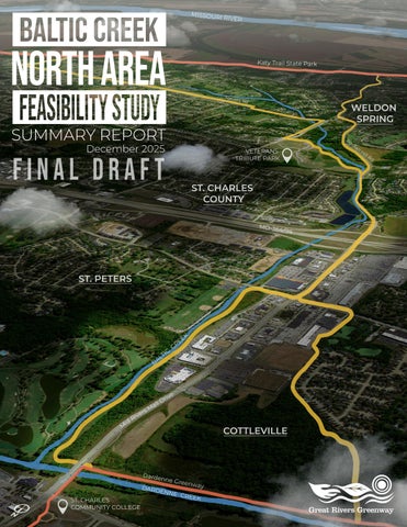
Baltic Creek North Area Feasibility Study Summary Report
NORTH AREA
INTRODUCTION
Great Rivers Greenway (GRG) initiated the Baltic Creek North Area Feasibility Study to build upon the recommendations of the 2024 Baltic Creek Master Plan and to evaluate opportunities for various alignments within the “North Area” of the greenway corridor. This corridor extends from the Dardenne Greenway at Mid Rivers Mall Drive on the north to the Highway 364 exit ramp on the south, parallel to Mid Rivers Mall Drive and Baltic Creek. The study’s goal is to determine the feasibility of greenway alignments within this area, assess potential challenges, and identify connections to nearby neighborhoods and destinations.
The study was a collaborative process of data collection, analysis, and stakeholder engagement. Tasks included evaluating existing environmental and infrastructure conditions, identifying key stakeholders, coordinating with utility providers and ongoing transportation studies, and developing diagrams and maps to communicate findings. Building on this foundation, the study explored alternative alignment options, roadway crossings, maintenance considerations, and potential social, economic, and environmental benefits. This summary report documents the process, findings, and preferred alignment recommendations for advancing the Baltic Creek Greenway. The report is divided into sections including Discovery, Analysis and Recommendations. The goals for the project (below) were established during the 2024 Baltic Creek Greenway planning process based upon input and contributions from the stakeholders and public.
COMMUNITY GOALS FOR THE GREENWAY
DISCOVERY
REGIONAL LOCATION
The map below shows existing greenways and trails in St. Charles County, highlighting how the Baltic Creek North Area Feasibility Study area relates to the broader network. Existing greenways in the county include Boschert, Busch, Centennial, and Dardenne. The Baltic Creek North Area Feasibility Study area—shown in red—represents the first phase of a detailed alignment study exploring opportunities to connect the Dardenne Greenway with the Mid Rivers Mall/Pitman Hill Trail, which links to Veterans Tribute Park.
STUDY AREA
DISCOVERY
STUDY AREA MAP
This map illustrates the limits of the study area for the Baltic Creek North Area Feasibility Study project. The focus of the study area was centered on Mid Rivers Mall Drive between Hwy 364 and Dardenne Creek. The western limits of the study area extended to the residential neighborhoods adjacent to Francis Howell Central High School and the City of Cottleville Kountz Fort Trail area. The eastern limits extended to Baltic Creek and the Lions Club of Harvester south to N. St. Peters Parkway.
DISCOVERY PUBLIC ENGAGEMENT
PUBLIC MEETING INPUT
Great Rivers Greenway hosted an Open House meeting on July 15, 2025, at the Harvester Lions Club to share proposed alignments for the Baltic Creek North Area Greenway. Thirty-three people attended in person, with additional participants reviewing the materials online. Two potential alignments (A and C) were presented, both of which were well received. Three comment cards were submitted at the meeting and ten comments were received online. Most attendees learned about the meeting through GRG e-blasts, but other outreach methods included newsletters, yard signs, social media, city communications, and word of mouth.
Feedback was largely positive, with participants expressing excitement and support for the greenway’s potential to improve connectivity, recreation, and community benefits. Alignment A was favored for its proposed path under Mid Rivers Mall Drive to avoid surface crossings, while Alignment C received praise for its durability, boardwalk solution, and easier biking connections. Many respondents expressed interest in both options.
Participants emphasized the importance of safety at Mid Rivers Mall Drive, suggesting traffic signals, enhanced crossings, or alternate routes to address concerns. Other ideas included linking to the Scott Lewis Park Trail, providing access from Lion’s Park to reduce traffic conflicts, and creating crossings at Highway N (Schnucks to Dierbergs). Several attendees requested updates on the project’s timeline and phasing. Overall, the input reflected strong community enthusiasm, recognition of the greenway’s role in connecting neighborhoods, parks, and nature, and a willingness to explore creative, safe, and durable solutions.
ELECTRICAL EASEMENT
Ameren Missouri and Central Electric Power Cooperative (CEPC) were both contacted regarding the Baltic Greenway project during the Discovery phase. It was confirmed that both companies will allow construction and installation of the greenway provided certain guidelines and clearances are followed.
Ameren’s lines in the area are considered distribution lines and the company is currently unable to share maps but can discuss specifics by phone. Ameren is also investigating the easement and right-of-way documents with their Real Estate Department, noting that if the trail needs to be dug up for maintenance, GRG would be responsible for repairs. CEPC’s lines are classified as a transmission line, specifically the 161,000-volt overhead CottlevilleKisker transmission line.
CEPC prefers the trail to be as close to the edge of the right-of-way as possible and has noted that the line will eventually need to be rebuilt, which will require large equipment to traverse the area. General conditions from CEPC also state that no trees are allowed on their right-of-way, and grade fills require review to ensure adequate clearance from the conductor. The maps below illustrate some of the known utility easement information.
TRANSMISSION LINES
CEPC System Maps
OLD HICKORY GOLF COURSE
LIONS PARK
ANALYSIS MAPPING
The Land Use and Land Cover maps highlight several factors that shape opportunities for a new greenway alignment. The prevalence of residential and commercial use within the study area suggest that alignments should emphasize access and connectivity to neighborhoods, retail areas, and parks to maximize community benefit. Woodland and habitat areas within the study area offer natural corridors that can provide scenic routes and ecological value, but they are also sensitive environments where alignments must be designed to minimize disturbance. Barren or sparsely vegetated land may offer lowercost opportunities for construction, while zones dominated by impervious surfaces and highway infrastructure present challenges that require careful routing or use of existing rights-of-way.
LAND COVER MAP
LAND USE MAP (2030)
ANALYSIS MAPPING
The flood-prone zones and ecologically valuable areas within the study area present both opportunities and constraints for greenway alignment. Land along Dardenne Creek is vulnerable to flooding and contain wetlands, which can limit construction feasibility or require costly mitigation, but these same areas also offer natural corridors that provide scenic value and habitat connectivity.
Portions of the corridor traverse FEMA-designated 100-year floodplains and regulatory floodways, triggering local floodplain development permit requirements supported by hydrologic and hydraulic analyses to demonstrate no increase in upstream flood elevations. Wetlands and streams mapped by the U.S. Fish and Wildlife Service National Wetland Inventory are likely jurisdictional under Section 404 of the Clean Water Act and Section 401 of the Missouri Clean Water Law; unavoidable losses exceeding 0.10 acre will require compensatory mitigation, typically through purchase of mitigation bank credits, and losses exceeding 0.50 acre may require an individual permit rather than a Nationwide Permit 14. Potential impacts below the Ordinary High Water Mark may also require stream mitigation. Alignments routed away from these zones may be more practical to build but could reduce the greenway’s environmental and recreational value.
FLOOD MAP
ANALYSIS
SLOPE STUDY MAP SLOPE
As part of the Baltic Creek North Area project, the study team conducted a slope analysis to support the evaluation of potential greenway alignments. This analysis helps identify whether steep slopes may present design challenges that would need to be addressed during future phases. Topographic information was collected using drone-based LiDAR surveys. The resulting elevation data was used to generate one-foot contour intervals across the study area. The analysis indicates that the southern end of the study area, near Highway 364, represents the high point at approximately elevation 494 feet. From this point, the land generally slopes northward toward Dardenne Creek, reaching an elevation of roughly 466 feet. This change in elevation equates to an overall slope of less than one percent. Based on these findings, no significant slope-related constraints are anticipated for any of the proposed greenway alignments.
ANALYSIS
TRAFFIC
Traffic analysis for the Baltic Creek North Area shows that 2024 Average Daily Traffic (ADT) volumes throughout the study area fall within expected ranges for their roadway classifications, with the highest counts on Mid Rivers Mall Drive at 36,700 vehicles per day. Crash data collected from 2019–2023 reveal approximately 617 reported crashes, including one fatality and four serious injury crashes, primarily along Mid Rivers Mall Drive, and one minor-injury pedestrian crash on Central School Road. These findings highlight both the high-volume nature of key corridors and locations with safety concerns. The City of St. Peters has planned improvements within the study area, including a federally funded 10-foot-wide multi-use path on the east side of Mid Rivers Mall Drive between Dierbergs Crossing and Highway N, upgraded pedestrian crossings, and intersection enhancements to improve safety and connectivity for all users.
Crash Data Aerial
ANALYSIS ENVIRONMENTAL & CULTURAL RESOURCES
The environmental feasibility analysis for the Baltic Creek North Area documents several regulatory considerations applicable to all potential alignments. Ecological data further shows that the most valuable resources are concentrated in the northern section near the creek, making it an attractive destination for users while also requiring careful alignment to avoid degrading sensitive habitats. Cultural resource screening found no National Register–listed properties, cemeteries, or architecturally significant resources within or adjacent to the corridor, and previous surveys indicate low sensitivity for undiscovered sites. A Missouri Department of Natural Resources database review found no Superfund sites, brownfields, or reported hazardous releases within the corridor. Alignment-specific issues—such as relative wetland impact acreage, deed-restricted mitigation sites, and opportunities for historic interpretation—will be addressed in the subsequent alignment sections of this report.
ECOLOGICAL SIGNIFICANCE
ALIGNMENT EXPLORATION ANALYSIS
As part of the Baltic Creek Greenway North Area Feasibility Study, the project team developed and evaluated a range of potential alignment options within the study corridor, shown in the graphic to the right.
Initial concepts explored multiple routes that varied in their proximity to Mid Rivers Mall Drive, environmental conditions, and potential connections to surrounding destinations. Each option was analyzed for feasibility, safety, user experience, environmental impacts, and property requirements.
Through this evaluation, the project team narrowed the alternatives to three primary alignments that best balance community preferences, technical constraints, and opportunities for connectivity. These remaining options form the basis for the ongoing analysis and public engagement efforts.
INITIAL ALIGNMENTS
ANALYSIS
ALIGNMENT EXPLORATION
The initial six alignment concepts (A–F) developed for the Baltic Creek North Area became the three primary alignments for further study.
Alignment A generally remains as shown in the previous graphic, Alignment B combines portions of the former Alignments E and F, and Alignment C is a newly developed alignment west of Mid Rivers Mall Drive connecting from Hwy N behind Schnucks to the Kountz Fort Trail was added during the analysis process.
REFINED ALIGNMENTS
ALIGNMENT A ANALYSIS
Alignment A generally follows Baltic Creek within the existing overhead utility easement east of Mid Rivers Mall Drive. At its southern end, the alignment connects to the proposed St. Peters Multi-Use Trail and includes an at-grade crossing of Central School Road. In the central portion, the corridor is constrained near the new Timber Club Apartments due to the placement of power poles and the extent of adjacent parking areas. This limited width, combined with the proximity to Baltic Creek, will require careful design solutions to address space limitations and potential flooding concerns. Continuing north, an at-grade crossing of Dye Club Drive is needed. At its northern end, Alignment A passes under the Mid Rivers Mall Drive bridge at Dardenne Creek to link directly with the existing Dardenne Greenway path. Photos representing typical conditions along Alignment A are included on the next page.
PROS
Corridor away from noisy Mid Rivers Mall Dr. Shaded creekside route with native plants and wildlife.
• Safer and more comfortable than Alignment B.
• Preferred option by public.
• Ample space for greenway under Mid Rivers Mall Drive bridge at Dardenne Creek.
CONS
• Constrained space near new apartments.
• Existing utility infrastructure conflicts (electrical poles, sewer manholes) Portions of alignment in floodway/floodplain. At Grade roadway crossing (Central School Rd. and Dye Club Dr.).
• Potential wetland impacts.
• Temporary and/or permanent easements would be required.
Requires significant intersection safety improvements for users crossing Mid Rivers Mall Drive and Central School Road.
ALIGNMENT A PHOTO GALLERY ANALYSIS
A5- View of space under MRMD Bridge at Dardenne Creek.
A4- View of overhead utility corridor adjacent to Baltic Creek.
A3- View of Dye Club Drive at utility corridor.
A1- View of intersection of Mid Rivers Mall Drive & Central School Road.
A2- View of space under MRMD Bridge at Dardenne Creek.
ALIGNMENT B ANALYSIS
Alignment B is located within the west-side public right-of-way of Mid Rivers Mall Drive. The southern terminus ties into the proposed St. Peters Multi-Use Trail, with at-grade crossings required at Central School Road and Mid Rivers Mall Drive. Along its length, the corridor traverses multiple commercial access points and signalized intersections, necessitating the design of enhanced pedestrian/bicycle treatments (e.g., refuge islands, high-visibility crosswalks, signal modifications) to address conflict points and improve user safety. The northern terminus connects directly to the existing Dardenne Greenway facility immediately south of the Mid Rivers Mall Drive bridge over Dardenne Creek. Photos representing typical conditions along Alignment B are included on the next page.
PROS
• Direct access to adjacent commercial businesses
• No impacts to wetlands, streams, or protected resources
• Minimal floodplain concerns Ample ROW space on west side of Mid Rivers Mall Drive
• Connects seamlessly to the existing Dardenne Greenway path at the Dardenne Creek bridge. Consistent with recent efforts by St. Peters to install a shared use path along Mid Rivers Mall Drive
CONS
High traffic volumes (6 lanes, 45+ mph) make Mid Rivers Mall Drive unsafe and uncomfortable for pedestrians/cyclists
• Numerous driveways and swale crossings with significant drainage/stormwater challenges
• Needed widening, barriers, and storm sewer upgrades add substantial cost and impacts Strong prior public opposition with little support for this option.
• Requires significant intersection safety improvements for users crossing Mid Rivers Mall Drive and Central School Road.
ALIGNMENT B PHOTO GALLERY ANALYSIS
B5- Junction of the Dardenne Greenway trail at Mid Rivers Mall Drive.
B3- View of multiple curb cuts along MRMD.
B1- View of exiting crosswalk at Mid Rivers Mall Drive.
B2- View of existing storm drainage infrastructure along MRMD.
B4- View of existing sidewalk and crosswalk on west side of MRMD.
ALIGNMENT C ANALYSIS
Alignment C follows a corridor west of Mid Rivers Mall Drive, beginning near Highway N behind the Schnucks shopping center and extending north to connect with the Kountz Fort Trail. Unlike Alignment B, which remains adjacent to the busy Mid Rivers Mall Drive, this option shifts the greenway away from heavy traffic and provides a more natural setting. A portion of the alignment borders the Brittany Place neighborhood, making it the only option that directly links the northern portion of the Baltic Creek Greenway with an adjacent residential community. In addition, Alignment C offers a distinctive user experience by traversing a bottomland forest and wetland area that ties into the existing Dardenne Greenway trail infrastructure. Photos representing typical conditions along Alignment C are included on the next page.
PROS
• Quiet, shaded, natural corridor away from Mid Rivers Mall Drive with ecological benefits
Uses and upgrades existing Kountz Fort gravel trail and links directly to Brittany Place neighborhood Safe, comfortable route requiring minimal new infrastructure
• Strong public support from earlier outreach
CONS
• Portions run adjacent to commercial service areas
• Potential wetland and floodplain impacts requiring mitigation
• Limited space behind Cottleville Farm & Home Supply Requires significant intersection safety improvements for users crossing Mid Rivers Mall Drive and Central School Road.
ALIGNMENT C PHOTO GALLERY ANALYSIS
C6- Existing Dardenne Greenway path at the junction of the Kountz Fort Trail.
C5- Existing Kountz Fort Trail.
C4- Existing Kountz Fort Trail connection to the Brittany Place Neighborhood.
C3- Existing retaining wall behind Cottleville Farm & Home Supply.
C2- View behind Schnucks store.
C1- Existing 10' wide path along Hwy N.
ALIGNMENT COMPARISONS EVALUATION
Alignment A Summary:
Alignment A extends through FEMA-designated regulatory floodway and 100-year floodplain areas along Baltic Creek, requiring a City of St. Peters floodplain development permit supported by hydrologic and hydraulic analyses. Wetlands mapped by the USFWS National Wetland Inventory are likely jurisdictional under Sections 404 and 401, with unavoidable losses exceeding 0.10 acre requiring compensatory mitigation (estimated at $70,000–$120,000 in 2025 dollars). Because the route would establish an entirely new path, it does not benefit from existing trail infrastructure and would necessitate new boardwalk or bridge construction near the Timber Club Apartments where high-velocity stream flow and near-surface sanitary sewer infrastructure present constructibility challenges. Cultural resource review identified no National Register-listed properties or cemeteries and a low likelihood of undiscovered sites. No hazardous substance releases, brownfields, or other contamination concerns are present. Alignment A presents potentially higher wetland impacts and engineering complexity than Alignment C. Although the proposed alignment does not cross MRMD, improvements to that intersection will be required for any users traveling along the Hwy N shared use path to or from the Cottleville (west) side of the street.
Alignment C Summary:
Alignment C crosses FEMA-designated regulatory floodway and 100-year floodplain areas along Dardenne Creek, requiring a City of Cottleville floodplain development permit with supporting hydrologic and hydraulic analyses. Wetlands mapped by the USFWS National Wetland Inventory include forested and emergent types likely subject to Sections 404 and 401, with unavoidable losses exceeding 0.10 acre requiring compensatory mitigation (estimated at $30,000–$60,000 in 2025 dollars). By enhancing and reusing the existing Kountz Fort Trail for a portion of the greenway, Alignment C reduces overall wetland impacts compared to constructing an entirely new path. However, a separate wetland behind the Schnucks retail strip may be deed-restricted as a mitigation site, potentially limiting development and requiring additional property records research and coordination with the U.S. Army Corps of Engineers. Cultural resource review indicates one mapped but previously disturbed prehistoric (Native American) site of low sensitivity and the historically significant Kountz Fort Trail/Boone’s Lick Road corridor, which offers interpretive opportunities. No hazardous substance releases, brownfields, or other contamination concerns are present. Alignment C connects to the existing path along HWY N and continues to MRMD were intersection modifications are necessary to improve pedestrian safety.
ALIGNMENT COMPARISONS EVALUATION
Alignment A and C Comparison:
Both Alignment A and Alignment C traverse regulated floodplains and wetlands, requiring similar federal, state, and local permitting and compensatory mitigation. Alignment A would require entirely new path construction through wetland areas and potentially complex boardwalk or bridge structures near Baltic Creek, likely resulting in higher wetland impacts and greater engineering effort. Alignment C benefits from reuse of the existing Kountz Fort Trail, reducing new disturbance and offering opportunities for historic interpretation along Boone’s Lick Road; however, it may be constrained by a deed-restricted wetland mitigation site behind the Schnucks retail area. Safety improvements to MRM Drive/Central School Rd. intersection will be necessary for either option. These differences in constructibility, environmental impact, and cultural resource context will be important factors in evaluating the feasibility and overall benefit of each alignment in subsequent sections of this report.
To guide selection of a preferred alignment for the Baltic Creek North Area, the project team developed an evaluation matrix to compare each alternative across a consistent set of factors. The matrix considers five key categories—user experience, traffic and safety, environmental impacts, public support, and cost to implement. Each category highlights both the advantages and challenges of an alignment, with color-coded checkmarks indicating where benefits are strong, potential issues that may require mitigation, or conditions are less favorable. This approach allows decision makers and stakeholders to clearly see how each alignment performs relative to the others and to weigh trade-offs between benefits, impacts, and costs when identifying the most suitable and publicly supported alignment for implementation.
ALIGNMENT COMPARISONS EVALUATION
Alignment A
Alignment A offers a generally positive user experience with strong scores in most evaluation factors. It provides a comfortable and engaging trail environment and performs well in traffic and safety considerations. Environmental impacts appear manageable, and public
support is solid. However, some aspects may require mitigation to fully meet design goals—particularly in balancing environmental considerations and traffic crossings. The most significant drawback of Alignment A is cost; implementing the necessary improvements at key crossings and along the route is expected to be expensive compared with other options. Overall, Alignment A represents a high-quality but higher-cost alternative that would need targeted mitigation and investment to deliver its benefits.
Alignment C
Alignment C scores strongly across most evaluation factors. It offers a highquality user experience in a quieter, more natural setting and provides a safer, more comfortable route than options adjacent to Mid Rivers Mall Drive. Public support for this alignment is also high. However,
portions of the route border commercial service areas and traverse sensitive wetland or floodplain environments, which would require mitigation. While implementation costs are relatively favorable compared with other alternatives, the environmental considerations and space constraints behind certain properties present challenges that must be addressed during design.
ALIGNMENT COMPARISONS EVALUATION
The following diagram illustrates the Alignment A route, identifying its key access points, proposed trail improvements, and destinations located within the corridor. Alignment A generally follows the existing utility corridor and Baltic Creek, offering opportunities to connect destinations. The diagram also shows the Dardenne Greenway and other existing trail systems to provide context and illustrate how the Alignment A corridor connects.
MID RIVERS MALL DRIVE CENTRAL
ALIGNMENT COMPARISONS EVALUATION
The following diagram highlights key features of the Alignment C corridor, including access points, proposed improvements including upgrading existing trails to GRG greenway standards, and nearby destinations. The illustration also depicts the Dardenne Greenway and other existing trails to provide context and show how Alignment C enhances overall connectivity within study area.
Upgraded Existing Trails
Existing Trails
Existing Greenway
Proposed Alignment Major Access Point Minor Access Point
/ Impacted Area
RETAINING WALL CONCRETE BOARDWALK
COTTLEVILLE FARM & HOME SUPPLY
RETAINING WALL REPLACEMENT
CONNECTION TO BRITTANY PLACE NEIGHBORHOOD
RETAINING WALL
CONNECTION TO BRITTANY PLACE NEIGHBORHOOD
BRITTANY PLACE NEIGHBORHOOD
UPGRADES TO EXISTING KOUNTZ FORT TRAIL
CENTRAL SCHOOL ROAD
MID RIVERS MALL DRIVE
SCHNUCKS STORE
HIGHWAY N
PROPOSED MRMD MULTI-USE PATH
GRG BRANDED PLAZA
UPGRADES TO EXISTING TRAIL
POTENTIAL DEED RESTRICTIONS
CONDITION
The overall length was calculated at approximately 5,100 linear feet. Conditions along that length were calculated based upon percentage of the overall. The trail condition for Alignment A was considered 22% road adjacent, mostly due to the commercial area in the southern part of the alignment. The majority of the alignment (76%) is adjacent to the Baltic Creek and the Ameren utility easement. This alignment is not adjacent to any residential areas.
RECOMMENDATIONS
ALIGNMENT C
While both alignments are technically feasible, the available data indicates that Alignment C is the stronger option to pursue for the Baltic Creek Greenway North Area. Alignment C presents fewer constraints than Alignment A, which faces significant challenges related to limited space and no-rise challenges near the Timber Club Apartments. These factors reduce the feasibility of Alignment A, making Alignment C the recommended alignment moving forward.
TRAFFIC RECOMMENDATIONS
The traffic analysis for the Baltic Creek North Area identified a series of improvements to enhance safety and comfort for trail users at key crossings. Intersection improvements are necessary regardless of which alignment is implemented in the future.
At the Mid Rivers Mall Drive/Central School Road intersection, recommended measures include adding median islands, shifting and enhancing crosswalks, installing leading pedestrian intervals, and incorporating pedestrian-scaled lighting and a small plaza to create a visible gateway to the trail. Additional calming islands are suggested on approaches to slow traffic further.
For the Dye Club Drive crossing, lower-volume local traffic allows simpler interventions such as signage, yield striping, stop controls, or a raised crosswalk paired with a pedestrianactuated beacon if needed. A “Z-crossing” configuration is also proposed to improve sightlines and driver yielding behavior. Collectively, these treatments are intended to make each crossing more conspicuous, slow vehicles, and improve pedestrian and cyclist safety as the greenway is implemented.
Conceptual sketch of crosswalk and center median on Central School Road.
Pedestrian-actuated RRFB crosswalk.
PHASING AND COST SUMMARY: ALIGNMENT C
Implementation of Alignment C is proposed in two phases, each approximately onehalf mile in length. Phase 1 focuses on the northern segment, extending from Danielle Drive in the Brittany Place neighborhood north to connect with the Kountz Fort Trail and the existing Dardenne Greenway. This portion lies within property owned by the City of Cottleville, which has expressed strong support for the project, making it an ideal starting point. Completing this phase will create an immediate link between the existing trail network and a residential neighborhood while providing a visible early success for the greenway.
Phase 2 encompasses the southern portion of Alignment C, extending the greenway connection south from Danielle Drive to the existing trail along Highway N. This segment involves more extensive infrastructure improvements, including replacement of the limestone retaining wall behind Cottleville Farm & Home Supply and coordination to address overhead power lines in the same area. The property owner within the Phase 2 area has also expressed support for the project; however, potential deed restrictions behind the Schnucks store will require further investigation and coordination before proceeding. Focusing this area as the second phase allows time to address these considerations while maintaining momentum toward implementation of the greenway.
PHASE 2- SOUTH AREA
ALIGNMENT C
ALIGNMENT A - COST SUMMARY
Cost information for Alignment A is provided for reference only. While Alignment A is not the recommended alignment, it remains a potential option should future circumstances limit the feasibility of Alignment C.
The cost summary offers a basis for comparison and helps illustrate the relative investment associated with this alternative, ensuring that Great Rivers Greenway has the information needed to make informed decisions as the project advances.
Old Town Cottleville
NEXT STEPS
The next steps for the Baltic Creek Greenway North Area Alignment C will focus on building the partnerships and gathering the information needed to move the project forward. This includes looking into possible deed restrictions on the property behind Schnucks, identifying wetlands along the alignment and planning for their protection, and working with the appropriate agencies on needed intersection improvements. In addition, agreements will need to be developed with the City of Cottleville and nearby property owners to ensure that everyone is aligned and ready to support the project. Another big step is to identify additional funding sources, such as federal grants, to leverage GRG's resources.
Together, these steps will lay the groundwork for moving into the design and construction phases of the greenway.