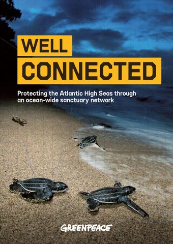
WELL
CONNECTED Protecting the Atlantic High Seas through an ocean-wide sanctuary network
Report author: Dr Guillermo Ortuño Crespo, with input from Greenpeace International.
Aerial view of Greenpeace’s ship, Arctic Sunrise © Tavish Campbell / Greenpeace
ACRONYMS
EBSA Ecologically or Biologically Significant Marine Areas
IUCN International Union for Conservation of Nature
BBNJ Biodiversity Beyond National Jurisdiction
EEZ Exclusive Economic Zone
MPA Marine Protected Areas
CCAMLR Commission for the Conservation of Antarctic Marine Living Resources
GBF The KunmingMontreal Global Biodiversity Framework
NGO Non-Governmental Organisation
CBD Convention on Biological Diversity
IMMA Important Marine Mammal Area
NEAFC North-East Atlantic Fisheries Commission WCPA World Commission on Protected Areas
3
CONTENTS 2
Acronyms
4
00: Executive Summary
10
01: Introduction
18
02: The dynamic ocean
19
2.1 Essential features of effective sanctuary networks
25
2.2. Migration: hidden driver of biodiversity
26
03: Potential sites
27
3.1: Opportunity to upgrade: existing Atlantic High Seas protection
29
3.2 Emerging candidates for network inclusion
30
04: Optimising marine protection
35
4.1 Longline fishing: the risk to leatherback turtles
40
4.2 Collisions with shipping: the threat to humpback whales
44
05: Building blocks
52
06: A roadmap
56
07: Protecting the Atlantic
60
References
64
Endnotes
68
Annex
ACKNOWLEDGEMENTS: We would like to thank all of the sources who made their data freely available, including Dr. Gabriel Reygondeau & AquaX Lab at the University of Miami, Wilkes Atlantic Leatherback Turtle Alliance and Global Fishing Watch.
00: EXECUTIVE SUMMARY
A humpback whale in Cabo Pulmo National Park, Mexico © Octavio Aburto / International League of Conservation Photographers / Greenpeace
5
The Global Ocean Treaty offers countries an unprecedented opportunity to protect biodiversity in areas of the ocean that lie beyond national jurisdiction – referred to in this report as the ‘high seas’. These areas cover two thirds of the ocean, and include the seawater at all depths, as well as the seabed. This means it’s vital that governments protect them effectively, to safeguard precious marine ecosystems and biodiversity. The Treaty’s legal provisions support countries in fulfilling the commitments they made in 2022 under the Kunming-Montreal Global Biodiversity Framework (GBF). This framework calls for the protection of 30% of global marine and coastal ecosystems by 2030, to reverse biodiversity loss. Achieving these targets in a meaningful way that protects marine ecosystems depends on how the framework is implemented. Protected areas that are isolated can’t safeguard interconnected ocean systems and migratory species. Effective protection requires connected networks of high seas sanctuaries, that represent all marine ecosystems and cover key migration corridors.
Countries need to act quickly. Just 3.5% of the world’s ocean is fully or highly protected, but at the current rate of increase, achieving the remaining 26.5% needed to fully protect 30% of the ocean would take the international community an estimated 265 years. It’s clear that progress has not been fast enough – the world can’t wait until 2291 to fully protect just a third of the ocean. It’s also vital that protection levels meet the standards for marine protected areas (MPAs) described by the International Union for Conservation of Nature (IUCN) as fully or highly protected. This means that all extractive activities, like industrial fishing, aren’t allowed. In 2025 alone, fishing vessels spent 1.6 million hours fishing in Atlantic High Seas – equivalent to over 180 years, or more than one million football matches.
At current rates of protection, fully protecting 30% of the ocean would take the international community an estimated 265 years
6
MIGRATION PATHWAYS UNPROTECTED
RISKS FROM FISHING AND SHIPPING
Having a connected network of ocean sanctuaries is key to countries’ ability to protect biodiversity and allow the ocean to recover. Ocean ecosystems are linked by currents, larval dispersal and long-distance migrations by a wide range of creatures. Over 800 marine species migrate through national waters and the high seas. Their survival depends on their safety across entire migration pathways, rather than just in single locations, like feeding or breeding grounds. This means fragmented protection is unlikely to be sufficient, even when large areas are designated as MPAs.
Risk profiles for migrating leatherback turtles and humpback whales reveal stark gaps in protection. These well-known species are flagship indicators for marine ecosystem status, connecting different ecosystems and generating strong tracking data through their long migrations. Their extensive journeys include both the high seas and the Exclusive Economic Zones (EEZs) under national jurisdiction – and they involve high levels of risk from industrial activity.
Using the Atlantic Ocean as a case study, this report shows that existing and emerging protected areas provide an important foundation, but they’re not enough – both in scale and the level of protection they offer. They include MPAs established under the 1992 OSPAR Convention, and areas currently being explored by governments for protection under the Global Ocean Treaty. But critical gaps persist, particularly along migration routes and in areas where industrial pressures – including from shipping – are highest.
According to the IUCN Red List of Threatened Species, leatherback turtles are classified as vulnerable and are at particular risk from being captured as bycatch in longline commercial fishing, while the whales’ greatest risk is of collision with shipping. Analysis of tracking data with commercial fishing and shipping data shows the areas of highest risk for leatherbacks and humpbacks. This provides vital information for policymaking and identifying locations where sanctuaries can have the strongest impact in protecting marine ecosystems. At present, none of the high-risk areas on the Atlantic High Seas for either leatherback turtles or humpback whales is adequately protected. This report finds that for the turtles, 80.7% of habitat areas with moderate-to-high risk of bycatch fall outside current proposals for protected areas. Although for humpback whales, some areas with a higher risk of collision with shipping overlap with sites being explored for protection, major migration corridors remain unprotected, especially in the South West Atlantic. These findings show that governments’ current approach to protection doesn’t take into account the risk faced by highly migratory species.
The 2026 Global Ocean Treaty is the first legal framework that can close the conservation gap for the high seas
7
A Tristan rock lobster sits atop a summit at Vema Seamount in the South Atlantic Ocean © Richard Barnden / Greenpeace
NEW SANCTUARY SITES FOR STRATEGIC PROTECTION
STRONG GOVERNANCE TO DELIVER ON COUNTRIES’ COMMITMENTS
Currently, there are no fully or highly protected areas in the Atlantic High Seas. This means there’s nowhere completely free from industrial extraction. Existing MPAs and sites being explored by governments and scientists for possible protection cover just over 15% of the Atlantic High Seas. In this report, Greenpeace identifies 11 new sites that would both increase the overall area under protection and cover locations where migrating species face the greatest threats. These sites could be joined with existing MPAs and the sites currently being explored to form a network of protected sanctuaries covering over 31% of the Atlantic.
But however well they’re positioned and connected, sanctuaries will only be effective if they include strong management measures that reduce real-world pressures and are well enforced. Governments have a powerful opportunity to deliver meaningful protection for the high seas by making sure that sanctuaries exclude extractive activities such as industrial fishing. They must also minimise impacts from all other activities, like shipping – for example, through measures like rerouting shipping lanes and imposing speed limits.
This proposed network would capture over 36% of areas with moderate-to-high risk of bycatch for leatherback turtles in the Atlantic High Seas, and almost 44% of areas with above-average risk of collision between humpback whales and shipping. It would also notably improve protection of key migration corridors, showing that a strategically designed sanctuary network can both meet the 30% protection target for the Atlantic High Seas and deliver meaningful reductions in risk for highly migratory species.
The report shows clearly that countries must implement the Global Ocean Treaty through ambitious sanctuary networks. These must be strongly governed if countries are to achieve their marine protection targets. Governments and institutions must cooperate to strengthen the protection offered by existing MPAs and create new ones to fill critical gaps. This means coordinating action across national waters and the high seas to address the cumulative and cross-border impacts of industrial activity.
Pod of short-finned pilot whales swimming © Paul Hilton / Greenpeace
The ocean contains over 800 migratory marine species, including mammals, seabirds, reptiles and fish, many spending significant portions of their lifecycle in the high seas
9
RECOMMENDATIONS FOR MEANINGFUL TREATY IMPLEMENTATION The Global Ocean Treaty offers governments a unique opportunity to conserve marine life on an unprecedented scale – and this report shows that it’s truly achievable. To contribute to the target of protecting at least 30% of the ocean by 2030, governments of countries bordering the Atlantic Ocean must urgently cooperate to establish a science-based, ecologically connected network of fully or highly protected MPAs. Measures should include:
■ Continue to develop current proposals under the Global Ocean Treaty for fully or highly protected Atlantic MPAs. ■ Explore new sites that can help deliver the 30% protection target in the Atlantic, and connect them with other proposals currently under consideration or development. ■ Prioritise existing Ecologically or Biologically Significant Marine Areas (EBSAs) when identifying new sites for potential MPAs. ■ Upgrade protection in existing Atlantic High Seas sites, such as OSPAR sites, to become sanctuaries. ■ Make sure that proposals are scientifically robust and contribute to an ecologically representative network of protection. ■ Carry out consultations with scientific experts, Indigenous and local communities, regional bodies and NGOs, to capture their specialist knowledge for decision making. ■ Develop proposals for MPAs within national EEZs and strengthen existing national MPAs by upgrading them into fully or highly protected areas.
Greenpeace also calls on governments bordering the Atlantic Ocean to prioritise ocean protection over short-term economic interests, to deliver lasting benefits for both people and the planet. This includes: Prioritise ratification and early implementation of the Global Ocean Treaty: All countries that border the Atlantic and are Parties to the United Nations Convention on the Law of the Sea should ratify the Treaty, to ensure worldwide implementation. Hold an open, transparent Ocean COP that can deliver the 30% protection target by 2030 target, including through cooperation with other international frameworks and bodies, participation by Indigenous Peoples and local communities, and establishment of the subsidiary bodies to the Global Ocean Treaty. Actively promote a moratorium or precautionary pause on deep sea mining at the International Seabed Authority, to support responsible, protective deep-sea governance. By implementing these recommendations, governments can deliver truly meaningful protection for our awe-inspiring ocean ecosystems, within a timeframe that counts. If countries network the ocean with strategically placed sanctuaries, they can support turtles, whales and the countless creatures they share their waters with – across the whole of their remarkable life journeys.
01: INTRODUCTION
Shoals of fish swim around coral in the Galápagos islands © Markus Mauthe / Greenpeace
11
Will enough nations implement the Global Ocean Treaty with enough ambition to create strong, ecologically aligned sanctuary networks?
Establishing marine protected areas (MPAs) in the high seas1 is one of the defining conservation opportunities of this century. The high seas make up the majority of the ocean’s surface and almost all of its volume, but until 2026, the existing legal framework didn’t support the establishment of effective MPAs in these areas. This was despite mounting evidence about ecological decline and industrial damage throughout our ocean, including the high seas.2 However, in an incredible campaigning victory, the Global Ocean Treaty became international law on 17 January 2026.3 This Treaty is the first legal framework that can close the conservation gap for the high seas.4 Governments now have a legal and policy basis to create high seas sanctuaries – vast, fully protected areas outside any country’s national waters, where fragile ecosystems can recover and thrive.
Under the Convention on Biological Diversity, governments adopted a key conservation target to protect 30% of the global ocean by 2030, as set out in the Kunming-Montreal Agreement in 2022. Given just how much of the ocean lies beyond national waters, achieving this target would be almost impossible without establishing protected areas in the high seas. If the target of 30% was implemented only within national jurisdictions, up to 83% of national waters would need to be protected. This would be an extremely difficult political feat, given the alarmingly slow rate of national MPA designation, and the difficulty of balancing protected areas with securing sustainable coastal livelihoods and fair, equitable access to the sea for Indigenous Peoples and local communities. And even if that level of protection was achieved in national waters, it wouldn’t protect the full variety of biodiversity, habitats and ecosystems in our ocean.5
12 A female leatherback sea turtle in French Guiana crawls on the beach © Greenpeace / Jacques Fretey
OCEAN SANCTUARIES One of the biggest opportunities in the Treaty lies in its objective to create networks of protected areas. It calls for ‘ecologically representative and well-connected networks of marine protected areas’, and confirms decades of conservation science showing that networks of MPAs bring more benefits than single MPAs.6 This is because in a dynamic, three-dimensional ocean, connectivity is not a ‘nice-to-have’ – it’s the main factor that determines whether protection will be effective across vast areas. This report uses the term ‘sanctuary’ to align with the standards of ‘fully’ or ‘highly’ protected MPAs as defined by the International Union for Conservation of Nature (IUCN).7 Its recommendations are also aligned with a growing global consensus that strong biodiversity outcomes depend on banning industrial activity in protected areas and substantially reducing direct risks of mortality for marine life,8 such as bycatch from fishing and collisions with shipping.
In practice, protected areas are defined not only by their boundaries, but also by how strictly they’re managed. Sanctuaries eliminate industrial fishing, prevent extraction from the seabed, and reduce chronic disturbance and other problems caused by human activity – meaning they offer more effective protection than other types of protected marine areas. This is another reason why creating true sanctuary networks is so important. If governments fill the high seas with weakly regulated ‘protected areas’ while allowing industrial activity to continue, they might be able to meet official targets while failing to protect the ocean, its habitats and wildlife.
13
FLAGSHIP SPECIES Sanctuary networks are particularly important for migratory marine species9 and for ‘straddling’ populations – fish found in both coastal waters and the high seas.10 These highly mobile organisms have lifecycles and population dynamics structured around cross-border movement – meaning they travel between different ocean areas, crossing international frontiers. This can include movement between breeding grounds, feeding areas, developmental habitats and migration corridors.11 These species demonstrate the problems with national jurisdiction-based governance, because their survival depends on robust protection across the high seas and multiple Exclusive Economic Zones (EEZs).12 Over the past seven decades, scientific understanding of migratory marine biodiversity has grown substantially, revealing that earlier policy frameworks weren’t strong enough. The mismatch between ecological reality and governance frameworks is one reason why many marine populations continue to decline within and beyond national jurisdictions. This report profiles the experiences of leatherback sea turtles and humpback whales, as flagship species that demonstrate the need for international marine protected areas (MPAs).
Both species:
■ undertake extensive migrations across the ocean, including the Atlantic ■ are affected by increasing ecological issues across EEZs and the high seas ■ generate tracking and risk data that can help identify key areas needing protection and support policy action.13 These species’ movement patterns illustrate why the Global Ocean Treaty calls for connected protection not only of places, but of pathways and areas for activities like breeding and foraging, including in areas where marine species face high risks from industrial activity. Only with connected protection can we support ecological function across entire ocean basins.
THE ISSUES FACING THE ATLANTIC The Atlantic Ocean is a hotspot for a vast array of incredible marine life, and covers key migratory routes for many species. But it faces major threats from human activity like shipping and fishing, as well as low levels of governance. Despite this, there are no sanctuaries in the Atlantic High Seas.
Migratory species maintain ecological connectivity across distinct ocean regions – this is vital information for designing effective marine sanctuary networks
Tuna and bycatch caught on a purse seiner ship © Alex Hofford / Greenpeace
ATLANTIC EMERGENCY As the world’s second-largest ocean, the Atlantic is a vital haven for marine wildlife. It is home to rare and vulnerable species found nowhere else on Earth, including the critically endangered North Atlantic Right Whale and Kemp’s Ridley Sea Turtle.14 But human activities are placing increasing pressure on its fragile ecosystems, and despite the existence of several large high seas MPAs, no part of the Atlantic High Seas is fully or highly protected from destructive industrial fishing. ESCALATING FISHERIES THREATS Decades of industrial overfishing have severely depleted key fish stocks across the Atlantic, including herring in the Baltic Sea,15 mackerel in the North East Atlantic,16 small sardine-like pelagic fish in the Gulf of Guinea17 and squid in the South West Atlantic.18 Heavy, bottomtowed fishing gear is a major threat to fragile Atlantic seabed ecosystems, including the many cold-water coral species that are in decline.19 Entanglement in fishing gear threatens critically endangered Atlantic megafauna,20 and the North East Atlantic region is estimated to have the highest annual seabird bycatch in European waters.21
NEW ANALYSIS OF FISHING PRESSURE Greenpeace International’s new analysis of Atlantic high-seas fishing shows vast industrial fishing pressure. In 2025, fishing vessels spent 1.6 million hours fishing in the Atlantic High Seas – equivalent to over 180 years, or more than one million football matches. Drifting longlines are the most prevalent type of fishing gear, making up almost half of all fishing effort. These fishing lines can stretch up to 100km long, holding thousands of hooks, and they’re associated with high levels of bycatch of turtles, sharks and seabirds.22
In 2025, fishing vessels spent 1.6 million hours fishing in the Atlantic High Seas – equivalent to over 180 years, or more than one million football matches If fully protected from industrial fishing, the Atlantic-wide sanctuary network proposed by this report would prevent almost a third (32%) of all Atlantic high-seas longline fishing from taking place in areas where turtles are currently at high risk of bycatch. This would create true safe havens for these iconic species.23
OTHER ESCALATING THREATS Along with fishing pressure, warming seas in the North East Atlantic are leading to shifts in predation in food webs – interlocking food chains – and significant decline in fish stocks.24,25 Heat stress has triggered marine heatwave hotspots in the northern Atlantic and shifts in species distribution.26 For example, Atlantic bluefin tuna are using feeding grounds hundreds of miles further north in cooler, prey-dense Arctic and sub-Arctic waters,27 while Atlantic sharks are delaying southward migrations from northern waters by up to 29 days.28 Half of Atlantic reef-building corals are at increased risk of extinction due to threats including bleaching due to climate change.29 Maritime traffic is growing globally, with shipping densities in the North East Atlantic increasing by over a third during a five-year period.30 Intense underwater noise from shipping travels vast distances, causing disturbance to marine mammals that rely on sound to navigate, feed and communicate.31 Heavy traffic in key
feeding and migratory routes also leads to frequent collisions between marine mammals and shipping. Lethal injuries from impacts and propeller cuts severely hinder the recovery of critically endangered species like the North Atlantic Right Whale.32 Global shipping also spreads non-native species across the Atlantic through ballast water and hull fouling.33,34 Invasions like the sun coral spreading in the South West Atlantic highlight this growing threat.35 The top 200m of Atlantic waters have been estimated to hold 12-21 million tonnes of microplastics.36 Millions of tonnes of nanoplastics in the North Atlantic have also been identified as an emerging threat to marine ecosystems.37 In the North East Atlantic, marine mammals face a high risk of both consuming plastic and becoming entangled in it, while the South West Atlantic has also been identified as a high-risk area for entanglement.38 The International Seabed Authority has granted three exploration contracts for deep-sea mining along the Mid-Atlantic Ridge,39 targeting polymetallic sulphides – rich ocean-bed sources of metals such as copper, zinc, gold and silver – near hydrothermal vents. Deep-sea mining poses severe environmental risks, including physical destruction of unique vent communities,40 biodiversity loss, and noise and light pollution that threaten fragile ecosystems that live in perpetual darkness.41,42
16
ATLANTIC OCEAN GOVERNANCE The Atlantic Ocean is an ideal case study, not because the threats it faces are unique, but because it reflects global marine governance challenges. Key factors affecting Atlantic governance include:
■ advanced regional initiatives such as the OSPAR Convention,43 which coordinate policies, research and legal frameworks to protect the ocean ■ sites where proposals for MPAs under the Global Ocean Treaty are emerging ■ major pressures from industrial human activities ■ Regional Fisheries Management Organisations, which have overseen decades of destruction on the high seas and failed to protect marine species effectively44 ■ strong ecological connectivity between the high seas and adjacent coastal ecosystems, requiring international cooperation to deliver meaningful protection.
The Afrika Super Trawler fishing off the coast of Mauritania © Pierre Gleizes / Greenpeace
While the Global Ocean Treaty allows protection based on ecological, cultural and social values, existing research has already identified areas of high importance for biodiversity. The Convention on Biological Diversity established the process for identifying Ecologically or Biologically Significant Marine Areas (EBSAs). Although not legally protected, EBSAs provide a widely recognised scientific foundation for identifying priority areas for ocean sanctuaries under frameworks such as the Global Ocean Treaty. An effective sanctuary network in the Atlantic could provide a vital blueprint for other ocean basins, offering the foundation for a global matrix of interconnected sanctuaries. The first robust sanctuary network would move us ever closer to the worldwide ‘ecologically representative and well-connected networks’ of MPAs that the Treaty calls for.
PROGRESS TOWARDS 30% PROTECTION ONLY
3
HAVE FULLY OR HIGHLY PROTECTED
30 % 1
THEIR % OF NATIONAL
UN MEMBER STATES
THE MAJORITY OF STATES (136) HAVE FULLY OR HIGHLY PROTECTED
WATERS.
LESS THAN
OF THEIR NATIONAL WATERS JUST
3.5
%
of the world’s ocean is fully or highly protected –
MEANING THERE’S A ‘MARINE PROTECTION GAP’ OF
26.5
%
THAT NEEDS CLOSING TO REACH 30% PROTECTION
In the 34 years since the Rio Earth Summit in 1992, when countries initially agreed to establish networks of MPAs,45 fully and highly protected MPA coverage of the global ocean has increased by
JUST
0.1
%
PER YEAR.
AT THIS RATE, FULLY PROTECTING THE OCEAN WOULD TAKE AN ESTIMATED
265
YEARS
It’s clear that progress within national waters has not been fast enough – we can’t wait until 2291 to fully protect just a third of the ocean. A huge network of sanctuaries in the high seas is the only way we can properly protect 30% of the ocean by 2030.
02: THE DYNAMIC OCEAN AND HOW TO SUPPORT IT
A baby leatherback sea turtle on its way to the ocean © Jody Amiet / Greenpeace
19
2.1 ESSENTIAL FEATURES OF EFFECTIVE SANCTUARY NETWORKS To be truly effective, sanctuary networks must protect two core ecological features: 46
■ Connectivity, which is the exchange of individual creatures, genes, energy and materials among ecosystems. This links different ocean regions into a functioning whole,47 and involves two elements which work together: the movement of currents and water masses,48 and the movement of organisms through migration.49
■ Representativity, which refers to the full range of biodiversity and types of ecosystem. It’s vital that sanctuary networks capture this full range, instead of focusing protection on a limited set of well-known or politically workable sites.50 Guidance from the IUCN World Commission on Protected Areas (WCPA) recommends that protected areas are designed systematically to deliver representativity across ecological areas, depth zones and ecosystems.51
The proposed sanctuary network would cover over 31% of the Atlantic High Seas, including over 36% of areas with moderate-to-high risk of bycatch for leatherback turtles and almost 44% of areas with above-average risk of collision between whales and shipping
20
THE GLOBAL OCEAN TREATY AND CONSERVATION IN THE HIGH SEAS The Global Ocean Treaty addresses a longstanding gap in ocean governance: the lack of a comprehensive, legally binding mechanism for establishing and managing MPAs in the high seas with consistent conservation standards.52 The Treaty represents a major shift because it creates a global process through which countries can establish fully or highly protected sanctuaries beyond areas of national jurisdiction.53
The Treaty embeds ecological science within its criteria for sanctuary design. In Annex I, it lists ecological connectivity, cumulative impacts and cross-border considerations as criteria for identifying areas in need of protection.54 This reflects an understanding that major pressures on marine biodiversity – including industrial fishing, shipping, pollution, noise and climate change – operate across large areas and rarely align with national boundaries. Sanctuary networks are intended not simply as ‘lines on a map’, but as strategic tools to reduce systemic threats to the ocean and to sustain ecological processes.55 Regional initiatives demonstrate both the potential and limitations of existing approaches. The OSPAR Convention pioneered high seas MPAs in the North East Atlantic, while the Commission for the Conservation of Antarctic Marine Living Resources (CCAMLR) has shown that large-scale ecosystem-based protection is feasible. But progress in both initiatives has often been uneven. Despite substantial expansion of OSPAR’s network of MPAs, protection levels are weak,56 and its most recent assessment concludes that the network isn’t yet ecologically coherent, with persistent gaps in geographic and species representation.57
And under CCAMLR, progress on expanding the MPA network has largely stalled since the designation of the Ross Sea MPA in 2016. Governance of the high seas has also been fragmented when it comes to mandates for different sectors, including fisheries, shipping, seabed mining and conservation.58 The Global Ocean Treaty provides a framework to help align these sectors, making protection possible at the scale of ocean basins.
The key challenge now is implementation. Will enough nations use this framework with enough ambition to create strong, ecologically aligned sanctuary networks?
21
Greenpeace activists project onto the Brooklyn Bridge during UN oceans negotiations © POW / Greenpeace
The Global Ocean Treaty represents a major shift because it creates a global process through which countries can establish fully or highly protected sanctuaries beyond areas of national jurisdiction
22
GOING BELOW THE SURFACE Together, connectivity and representativity allow protected areas to function not as isolated sites, but as integrated systems that sustain biodiversity across ocean basins. In the Atlantic, this means protection must extend beyond surface features to include:
■ open-water ‘pelagic’ systems, like circular currents and zones where surface currents, winds or distinct water masses meet ■ midwater ecosystems, central to nutrient transfer between organisms and to the biological carbon pump59 ■ deep-sea habitats, such as seamounts, ridge systems, deepwater ‘abyssal’ plains and hydrothermal vents. Because deep-sea ecosystems recover slowly and store carbon over long timescales, it’s essential to include them in biodiversity conservation and climate mitigation.60
The WCPA emphasises that connectivity should inform how governments and scientists select and design MPAs in the high seas from the outset. This means MPAs’ size isn’t the only factor that matters. They should also protect ecological corridors, habitats that act as stepping-stones for migrating species, and areas of concentrated movement.61 And they’ll only be effective if they allow species to breed, feed and migrate safely, free from exposure to destructive human activities like industrial fishing. This opportunity to provide ecologically representative, well-connected networks of sanctuaries also highlights the need to integrate protection across EEZs and the high seas. Migratory connectivity doesn’t follow national boundaries, and gaps between national and high-seas protections can leave marine life vulnerable at critical life-stages. Unless they’re carefully coordinated, networks can appear extensive on maps, while remaining ecologically fragmented in reality. That’s why it’s so important that the Global Ocean Treaty recognises crossborder and cumulative impacts on marine life, and provides a legal and policy basis for coordinated, basin-scale protection.
If it covers high-risk areas where turtle habitat overlaps with industrial longline fishing, the emerging sanctuary network could reduce leatherback deaths from bycatch
Blenny larva in the deep sea flashing its colorful dorsal fins © Blue Planet Archive / Steven Kovacs
Gannets flying near a fishing vessel © Lorraine Turci / Greenpeace
25
2.2. MIGRATION: HIDDEN DRIVER OF BIODIVERSITY The ocean contains over 800 migratory marine species, including mammals, seabirds, reptiles and fish.62 Many of these migrants spend significant portions of their lifecycle in the high seas.63 This means we can’t afford to ignore the need for protection of marine life across entire ocean basins. Migratory species play critical ecological roles, including:
■ structuring links between different food chains and spreading marine life across ocean basins ■ enabling the movement of nutrients throughout the ocean, via food chains ■ helping to shape prey populations ■ influencing dynamics among bottomdwelling organisms, such as worms, clams, corals and algae.
Together, migratory species maintain ecological connectivity across otherwise distinct ocean regions. Understanding this is important for designing effective marine sanctuary networks. Protective networks must safeguard not only habitats, but also the ecological pathways that allow species to complete full lifecycles. Because many migratory species move between multiple EEZs and the high seas, national measures aren’t enough on their own to make sure they’re protected. In addition, pressures from fishing, marine traffic and habitat degradation accumulate across different jurisdictions.64 The Global Ocean Treaty recognises this reality. Connectivity is not simply a design choice in creating effective sanctuaries. It’s an essential scientific and legal foundation for effective conservation in the high seas.
Data on whale habitat and shipping movements shows sanctuaries must cover areas where whale migration and maritime activity intersect
03: POTENTIAL SITES FOR AN ATLANTIC SANCTUARY NETWORK
Arctic Sunrise amid the Sargassum seaweed of the Sargasso Sea © Tavish Campbell / Greenpeace
27
Networks of sanctuaries contain individual sites which are connected through the movements of currents and bodies of water, and through migrating species. To create a network of sanctuaries in the Atlantic High Seas, governments need to look both at existing protected areas and potential new ones. In some existing Atlantic MPAs, protection measures are weak and must be reviewed and upgraded.
3.1: OPPORTUNITY TO UPGRADE: EXISTING ATLANTIC HIGH SEAS PROTECTION Before the Global Ocean Treaty provided a legal framework for High Seas MPAs, regional frameworks and bodies provided a limited degree of marine protection, although they faced significant challenges. Among the most advanced regional efforts to protect high-seas biodiversity is the MPA network established under the OSPAR Convention in the North East Atlantic. This covers eight sites, largely focused on seamounts, hydrothermal vents and major oceanographic features. They were primarily designed to safeguard vulnerable, highly biodiverse seabed ecosystems. Larger areas, such as the North Atlantic Current and the Evlanov Sea Basin,65 were designed initially for pelagic conservation, then expanded to include the seafloor.
OSPAR lacks the authority to regulate high-seas fisheries and other activities, and it can’t ban industrial fishing. This means that the effectiveness of these MPAs depends on cooperation with bodies such as the North-East Atlantic Fisheries Commission (NEAFC), which holds some of the fisheries mandate in the same waters. Through their ’Collective Arrangement’, OSPAR provides the conservation framework and NEAFC can adopt complementary measures, such as halting bottom fishing in certain areas. In practice, this means that the measures adopted by NEAFC don’t protect the sea at all depths, so conservation benefits are limited. Although OSPAR’s MPAs were a governance breakthrough, the network is still not ecologically balanced, with some depth zones and biodiversity distributions poorly represented.66
28
LEARNING FROM PREVIOUS INITIATIVES But there has been some progress in establishing protected areas in the Atlantic sector of the Southern Ocean. Here, in the Scotia Sea in 2009, CCAMLR established its first High Seas MPA, the South Orkney Islands Southern Shelf MPA. Unlike OSPAR sites, which depend on coordination with NEAFC, the MPAs established under CCAMLR are adopted within a single ecosystem-based fisheries body, which can regulate fishing activities at all depths. But although CCAMLR’s progress shows that high-seas protection is feasible, its decision-making process relies on consensus. This means that additional proposals in the Antarctic Atlantic sector have repeatedly stalled, including for the Weddell Sea and East Antarctica – highlighting the limits of consensus-based governance.
Adélie penguins near Paulet Island, Antarctic Peninsula © Abbie Trayler-Smith / Greenpeace
Encouragingly, the Global Ocean Treaty was negotiated with these lessons in mind. Article 23 states that while consensus is preferred, decisions do not ultimately depend on unanimity. If two thirds of the Parties present have agreed by vote that consensus can’t be reached, they can adopt measures through a vote with a three-quarters majority.67 This approach maintains incentives for cooperation, while preventing a small number of Parties from indefinitely blocking high seas conservation.
29
3.2 EMERGING CANDIDATES FOR NETWORK INCLUSION Real hope for effective marine conservation lies in the potential for parties to the Global Ocean Treaty to create a credible Atlantic sanctuary network by connecting existing protected areas, upgrading protection within them, and developing new sites. Governments and NGOs are already investigating several regions for their potential as future sanctuaries that would form a diverse network. These include:
■ The Sargasso Sea, a globally distinctive open-water ecosystem shaped by circular currents and a floating sargassum seaweed habitat. The sea provides a developmental and migratory environment for numerous species, and offers a high-profile opportunity to demonstrate that pelagic ecosystems can be meaningfully protected as sanctuaries. Through the Hamilton II Declaration, the British and Bermudan governments have stated their intention to work towards protecting the Sargasso Sea under the Global Ocean Treaty, though they haven’t specified whether they envisage a fully protected sanctuary.68 ■ The Canary-Guinea Current Convergence Zone, an oceanographic hotspot shaped by deep, cold, nutrient-rich water rising to the surface, and the interaction between different bodies of water. This makes the water highly productive of marine life, including migratory megafauna such as whales and turtles. Nigeria is leading a group from the Economic Community of West African States in exploring this zone as a site of interest under the Global Ocean Treaty.69 Countries are also considering full protection for the area.70
■ The Walvis Ridge, a seamount chain in the South Atlantic that features both representativity – by nurturing deep-sea biodiversity associated with seamounts – and connectivity, by functioning as a stepping-stone for migrating humpback whales.71 The Namibia Nature Alliance and the Blue Marine Foundation are collaborating on plans to protect the ridge under the Treaty.72 ■ The Banana Hole, a high-seas pocket in the Norwegian Sea enclosed by EEZs belonging to Norway, Iceland and Greenland, and stretching over the Arctic Mid-Ocean Ridge. Its deep-sea ecosystems include hydrothermal vents and seamounts, and are biodiversity hotspots and stepping stones for many deep-sea species.73,74 It also supports migratory and straddling species, and features mixing of Atlantic and Arctic waters, highly productive of marine life. Greenpeace and other NGOs are exploring the Banana Hole for future conservation under the Global Ocean Treaty. ■ The Atlantic Equatorial Fracture Zone and High Productivity System EBSA, which lies along the Mid-Atlantic Ridge near the equator, where fracture zones create complex deep-sea habitats. Ocean currents mix to generate rich food environments that support diverse pelagic species. This is one of several sites which governments and NGOs are exploring through the Living high seas project.75
04: OPTIMISING MARINE PROTECTION INSIGHTS FROM TURTLES AND WHALES
Humpback whale calf breaches the surface © Jasmine Carey
31
Flagship marine species like whales and sea turtles aren’t just symbols of the urgent need to conserve the ocean. They can also show us the best ways to deliver protection. By studying their habitats and epic migrations, we can learn where to position MPAs for maximum protective impact.
There’s rich evidence documenting the migrations of leatherback turtles and humpback whales, which powerfully illustrates active migratory connectivity in practice. This shows why we must design sanctuary networks to protect species throughout their migration cycles, rather than around isolated areas. And these two species aren’t exceptional cases – they’re just examples from a much larger migratory system involving over 800 marine species.76 Their survival depends on connected sequences of breeding, feeding and transit habitats across multiple EEZs and the high seas.
POLICY INSIGHTS FROM MIGRATION PATHWAYS Examining the movements of leatherback turtles and humpback whales offers us key policy insights. These movements are sufficiently predictable, and the overlaps between both species’ preferred habitats and human pressures sufficiently mappable, to test whether an emerging Atlantic network of sanctuaries could reduce the cumulative risks these species face throughout their migrations.77 By analysing these patterns, we can identify where sanctuary design can deliver the greatest reductions in the risks leatherback turtles and humpback whales face.78
An Atlantic basin-scale sanctuary network designed to protect ocean migrants is achievable and can reach the goal of protecting 30% of the Atlantic High Seas
32 With the future of both species currently uncertain, it’s vital that sanctuaries offer maximum protection. Both currently sit between the potential for recovery and persistent threats from human activity. Leatherback turtles remain among the most threatened migratory marine vertebrates. Populations are heavily impacted by becoming bycatch in fisheries across entire ocean basins, as well as by coastal development, habitat change and pollution.79 Their wideranging migrations overlap repeatedly with longline pelagic fisheries, exposing them to widespread risk of bycatch.80 In contrast, several populations of humpback whales have made encouraging recoveries since the end of commercial whaling. But as ocean spaces become more industrialised, the whales are increasingly exposed to threats such as climate change, pollution, collisions with shipping, entanglement in fishing gear, noise disturbance and biodiversity depletion undermining their food sources.81
A CONNECTED NETWORK APPROACH Although this picture sounds bleak, it also offers countries an exciting blueprint for dramatically enhancing conservation measures. It encourages states to elevate their ambition – from protecting individual marine sites to protecting a connected network of sanctuaries. This wouldn’t provide a comprehensive framework for addressing every threat these areas face, but it’s a vital step to meet the Global Ocean Treaty objectives – in particular, to strengthen resilience to stressors. Ecological
connectivity is one of the main criteria the Treaty identifies for effective MPA design. Together, leatherback turtles and humpback whales provide a concrete example of how policymakers and conservationists can use current knowledge on ecological connectivity to design networks of sanctuaries. These networks can’t simply contain charismatic biodiversity somewhere within their boundaries, but must meaningfully include the pathways and areas where marine life faces the greatest risks of death and disturbance.82 By taking a connected network approach, we can see how a proposed network of sanctuaries could contribute meaningfully to protecting at least 30% of the ocean, while also targeting areas where conservation interventions would most reduce ecological risk. In the Atlantic basin, existing MPAs and sites currently being explored for protection by governments and NGOs cover approximately 15% of the high seas.83 If, together, we can double this to reach the 30% target, we have a real chance to achieve meaningful ocean protection. A network’s success would rest on its extent and whether it captures the areas where migratory species face the greatest cumulative pressures. But it would also depend on the strength of its protection. Crucially, the conservation standards of the existing Atlantic High Seas MPAs also need to be strengthened to become fully or highly protected if they’re to qualify as sanctuaries.
33
A network’s success would rest on its extent and whether it captures the areas where migratory species face the greatest cumulative pressures. But it would also depend on the strength of its protection
Humpback whale mother and calf swim along a migration route © Brooke Pyke / Greenpeace
34
Dead turtle caught as bycatch on a Dutch pelagic freezer trawler © Anonymous
Protecting nesting beaches and nearshore waters alone can’t safeguard the turtles if they die along migratory routes and in offshore feeding areas
35
4.1 LONGLINE FISHING: THE RISK TO LEATHERBACK TURTLES Migrating leatherback turtles offer powerful lessons for where best to create sanctuary networks. Leatherbacks migrate further than almost any other reptile, travelling across entire ocean basins between nesting beaches and distant feeding areas. Individuals move through both coastal and open-ocean habitats, using tropical, temperate and even subpolar waters during their lifecycle. Turtles from the same nesting population can disperse to very different feeding regions, creating wide-ranging migration patterns.84 In the Atlantic, computer modelling of leatherback habitats shows that turtles have key foraging and transit zones in the high seas.85 Together, these findings have clear policy implications, showing that sanctuary networks can’t be designed around a single migration route or site of importance. Instead, they must cover multiple types of habitat, sites and migration pathways if they’re to support the survival of leatherback populations.86
Globally, leatherback turtles are classified as ‘Vulnerable’ on the IUCN Red List,87 reflecting long-term declines and continuing pressures across parts of their range. The Atlantic basin has two main subpopulations of turtles: the North West Atlantic population – which nests mainly in the Caribbean, Florida and northern South America – and the South East Atlantic population, which nests primarily along the coasts of West and Central Africa. While the North West Atlantic population shows strong recovery trends in some nesting areas, there’s little data on the South East group, leading to uncertainty about population size and trends. There’s also a South West Indian Ocean subpopulation, listed as ‘Critically Endangered’, which nests along the east coast of southern Africa and may venture into the South Atlantic during migrations. This means that waters in the southern Atlantic can be used by turtles originating from different regions. For migrating leatherback turtles, the key danger is being captured as bycatch in commercial fisheries.88 Leatherbacks are frequently caught in pelagic longline fishing across the North, Tropical and South Atlantic, with many of the highest-risk areas occurring far from national coastlines.89 This highlights a key challenge in conserving them: protecting nesting beaches and nearshore waters can’t alone safeguard the turtles if they die along migratory routes and in offshore feeding areas. Remote sensing of leatherback movements shows that conservation measures centred only on national waters aren’t enough to protect the turtles.90 Bycatch risk is spread across multiple fishing fleets and jurisdictions. This makes coordinated action across the high seas essential if countries are to protect turtle populations.91
36
FISHING AND TURTLES: THE OVERLAP Combining information on leatherback turtle habitats with data on pelagic longline fisheries reveals striking images of areas with higher bycatch risk for the turtles. Figure 1 draws on a pan-Atlantic assessment of interactions between leatherbacks and fisheries.92 It combines information on turtle movements and habitat use with data on longline fishing activity, to identify areas where bycatch risk is likely to be highest.
Figure 1: Areas of longline bycatch risk for leatherback sea turtles, overlapped with the ranges of each of the three subpopulations of leatherback (derived from IUCN data).
Atlantic leatherback distribution, RMUs and candidate MPAs 80°N
60°N
40°N
Latitude
20°N
0°
20°S
40°S
60°S
100°W
80°W
60°W
40°W
20°W
0º
20°E
Longitude
RMU
DC_22_ATL_NW
DC_24_ATL_SE
DC_25_IND_SW
Grid Value
1
2
3
N/A
37 Taking a different approach, Figure 2 overlays maps of suitable turtle habitat derived from species distribution models,93,94 and maps of pelagic longline fishing derived from vessel activity data from Global Fishing Watch.95
Figure 2:
■ Left: Estimated average pelagic longline fishing activity in the Atlantic Ocean (2021–2024) ■ Middle: Habitat suitability model for leatherback sea turtles ■ Right: Bycatch risk for leatherback sea turtles in pelagic longline fishing, based on the overlap between habitat suitability and fishing intensity.
Fishing effort (sum) @ 1°
Turtle SDM (mean) @ 1°
Bivariate: SDM × Fishing (3×3)
80°N 60°N
Latitude
40°N 20°N 0° 20°S 40°S 60°S 100°W 80°W 60°W 40°W 20°W
0º
20°E
100°W 80°W 60°W 40°W 20°W
0º
20°E
100°W 80°W 60°W 40°W 20°W
0º
20°E
Longitude Effort (sum)
SDM (mean) 0
2000
4000 6000 8000
Bivariate class 0
Both approaches show areas where leatherback habitat consistently overlaps with pelagic longline fishing. This highlights where sanctuary networks could most effectively reduce bycatch risk in the high seas. Seasonal or dynamic measures based on turtles’ migration patterns could complement carefully placed sanctuaries to reduce the turtles’ risk.96 The new analysis also shows the areas where turtles face the highest risk of bycatch – essential information for identifying areas for sanctuaries that would protect the ocean most effectively. By overlaying maps showing how suitable an area of habitat is for leatherbacks, and maps showing the intensity of longline fishing,97 Figure 3 clearly shows several areas where turtle migration coincides with high
250
500
750
H_H
H_M H_L
L_L
M_H
M_M
L_H
L_M
M_L
levels of pelagic longline fishing. The analysis found that leatherbacks face moderate-to-high risk of bycatch in pelagic longline fishing in over 35% of the Atlantic High Seas. But only 19.3% of these moderate-to-high risk areas fall within current protection zones or sites being explored for protection under the Global Ocean Treaty. This leaves 80.7% of identified risk areas outside these zones and sites – giving governments a real opportunity to make the high seas safer for turtles. By incorporating significantly more of these moderate-to-high risk areas into existing sanctuaries and sites being explored for protection, decision makers can make sure that the areas they protect will have the greatest impact in keeping leatherback turtles safe.
38 Figure 3:
■ The overlap between longline fishing and suitable habitat for leatherback turtles. ■ Dark and light red areas show high habitat suitability for leatherback sea turtles overlapping with areas of high and medium-intensity fishing. ■ Dark and light orange show areas of medium habitat suitability for leatherback sea turtles overlapping with high and medium levels of fishing.
Bivariate overlap (SDM × Fishing) with Atlantic HS MPA candidates + NACES (WDPA) Only H_H, H_M, M_H, M_M shown; solid dark blue = MPAs 80°N
60°N
40°N
Latitude
20°N
0°
20°S
40°S
60°S
100°W
80°W
60°W
40°W
20°W
Longitude
Bivariate class
H_H
H_M
M_H
M_M
0º
20°E
39
THE NEED FOR STRONG RULES Encouragingly, some areas being explored for sanctuaries in the Atlantic under the Global Ocean Treaty fall within predicted high-risk areas, where turtle habitat overlaps with industrial longline fishing.98 These include the Walvis Ridge, the Sargasso Sea and the Canary-Guinea Current Convergence Zone. This means that parts of the emerging sanctuary network could help reduce leatherback deaths from bycatch, if they’re well designed and implemented. There’s also a very high risk of bycatch in around 7% of the Atlantic High Seas. With 36.5% of these high-risk areas falling within existing protected sites or sites being explored for protection, there are moves toward risk reduction. But most areas of bycatch risk – including high-risk areas – remain outside existing protected sites or areas being
A shark is hauled onboard a Spanish longliner in the south east Atlantic © Tommy Trenchard / Greenpeace
explored. Parts of the South West Atlantic, next to Brazil’s EEZ, the wider Gulf of Guinea and the west coast of Africa, combine highly suitable turtle habitat with concentrated longline fishing, but there are no publicly proposed sanctuaries for these regions. This means that additional protected areas are essential so that the sanctuary network can fully cover leatherback exposure to industrial fisheries. But however well they’re situated, MPAs won’t reduce leatherback deaths from bycatch unless they’re governed by strong protection standards that are well enforced. To conserve turtle populations, countries must establish a network of sanctuaries with the same protection levels as fully or highly protected MPAs, where industrial fishing is excluded. Without strong measures like this, even sanctuaries in the best locations can only offer turtles limited protection.
40
4.2 COLLISIONS WITH SHIPPING: THE THREAT TO HUMPBACK WHALES Stretching between warm tropical breeding areas and colder high-latitude feeding grounds, humpback whale migrations are among the longest of any mammal.99 There are four main Atlantic humpback populations: the Caribbean/ West Indies and the smaller Cabo Verde populations in the north, and the Western and Eastern South Atlantic populations, which breed along the coasts of Brazil and West and Central Africa, respectively. All migrate to feeding areas in the North Atlantic and the Southern Ocean, journeying across large parts of the Atlantic basin that often include the high seas. Migration routes and timing differ between populations and are influenced by ocean conditions and the availability of prey. This means that conservation measures can’t just focus on one migration route.100
Commercial shipping is among the main threats to humpback whales in the high seas, particularly via collisions with vessels and disturbance from underwater noise.101 While many collisions occur near busy coasts and ports, shipping activity is expanding across the open ocean as global trade grows. This means major shipping lanes increasingly overlap with humpback whales’ migratory routes. Recent global analyses show that whales’ risk of collision with shipping is concentrated in certain parts of the ocean. Figure 4 shows these higher-risk areas across the Atlantic High Seas, by overlaying maps of whale habitat use based on telemetry – remote sensing – with maps of shipping intensity based on vessel tracking data. The maps reflect where humpback whale migration systems across ocean basins overlap with expansion of global maritime traffic.102
Globally, humpback whales are currently listed as of ‘Least Concern’ on the IUCN Red List of Threatened Species, reflecting the strong recovery of many populations since the end of commercial whaling. But while some groups – such as the Western South Atlantic – have recovered well and now number in the tens of thousands, others remain smaller and potentially more vulnerable, particularly the Cabo Verde population.
Shipping activity is expanding across the open ocean as global trade grows. This means major shipping lanes increasingly overlap with humpback whales’ migratory routes
41 Figure 4: Top: Predicted areas of shipping collision risk for humpback whales (left) and various species of whale (right) in the Atlantic. Bottom: Areas of above-average collisions with vessels risk for humpbacks (left) and multiple species (right). Source: Nisi et al. (2024)
80°N
Humpback whale ship-strike risk in ABNJ
80°N
60°N
60°N
40°N
40°N
20°N
20°N
0°
0°
20°S
20°S
40°S
40°S
60°S
60°S 100°W
80°W
60°W
40°W
Humpback whale ship-strike risk
80°N
20°W
0º
0.1
0.3
0.2
20°E 0.4
100°W
80°N
60°N
60°N
40°N
40°N
20°N
20°N
0°
0°
20°S
20°S
40°S
40°S
60°S
60°S 80°W
60°W
40°W
Humpback whale ship-strike risk
20°W
0º
20°E
0.25 0.30 0.35 0.40 0.54 0.50
80°W
60°W
40°W
All whales ship-strike risk
0.5
Above average humpback whale shipstrike risk in ABNJ (mean = 0.248243)
100°W
All whales ship-strike risk in ABNJ
20°W 0.2
0º 0.3
20°E 0.4
0.5
Above average all whales ship-strike risk in ABNJ (mean = 0.289650)
100°W
80°W
60°W
40°W
All whales ship-strike risk
20°W
0º
20°E
0.30 0.35 0.40 0.54 0.50
42
If they’re designed and managed with migration and shipping routes in mind, parts of the emerging sanctuary network could help reduce whales’ exposure to risk of collision with vessels VITAL MIGRATION CORRIDORS Together, these datasets highlight the need for conservation measures to extend across large portions of the Atlantic basin, including EEZs, so they cover areas where whale migration corridors intersect with intensifying maritime activity. Parts of this risk landscape coincide with sites currently being explored by governments and NGOs as potential sites for protection under the Global Ocean Treaty. This means that parts of the emerging sanctuary network could help reduce whales’ exposure to risk of collision with vessels, if they’re designed and managed with migration and shipping routes in mind. Measures like adjusting shipping lanes or reducing vessel speeds in key areas could make a real difference in reducing the risk of whale collisions.103 Migration corridors show us the potential to reduce the current uneven protection of migratory species. In the North West Atlantic, around 41.3% of the migration corridor occurring in the high seas could fall within protected areas if countries adopt a Sargasso Sea sanctuary proposal, and existing OSPAR High Seas MPAs are upgraded to fully protected
sanctuaries. But further south, none of the existing MPAs or sites under exploration intersect with the South West Atlantic migration corridor. This exposes a substantial gap in the emerging network of protected areas. It reveals how sanctuary networks can provide meaningful protection in some regions, while leaving others unprotected. But by expanding the marine sanctuary network to include migration routes, countries have the opportunity to significantly strengthen their protection of Atlantic humpback whales. There are also several high-risk areas in the high seas that aren’t currently candidate sites for protection, as Figure 5 shows. This means that existing candidate sites only cover part of the areas where humpback whales risk collisions during their migrations. We need additional, fully protected MPAs if sanctuary networks are to reduce the whales’ cumulative risk of shipping collisions and other dangers, such as entanglement in fishing gear, across their full range of movement in the Atlantic.
43
Figure 5: Areas of above-average risk of humpback whale collision with shipping, overlaid with existing Atlantic MPAs in the high seas (blue) and exploratory areas for protection under the Global Ocean Treaty (black).
Above average humpback whale ship-strike risk in ABNJ
80°N
(mean = 0.248243)
60°N
40°N
20°N
0°
20°S
40°S
60°S 100°W
Humpback whale ship-strike risk
0.25
0.30
0.35
80°W
0.40
0.45
60°W
40°W
20°W
0°
20°E
0.50
Critically, protected areas must be governed by strong management measures if they’re to reduce whale deaths. For sanctuaries to offer effective humpback whale protection, their management plans must include concrete regulations for shipping, as well as excluding fishing. Without measures like these, even the best-placed sanctuaries will provide limited protection against the key manmade risk facing humpback whales across the Atlantic.
05: BUILDING BLOCKS FOR AN ATLANTIC SANCTUARY NETWORK
A mauve stinger jellyfish in the Azores © Greenpeace / Gavin Newman
45
Exciting opportunities to protect marine environments are already emerging under the Global Ocean Treaty. The growing number of sanctuary initiatives being explored shows that it’s possible to build an Atlanticwide network to protect a proportion of the basin. This includes areas of key risk and importance for leatherback turtles and humpback whales. The effectiveness of such a network will depend on how much ocean is covered, whether it includes key migration routes and high-risk areas, and whether sanctuary management is strong and regulations are enforced.
By linking high-seas protections with national actions, governments can build a truly connected network of ocean sanctuaries
46 To create an effective, ocean-wide sanctuary network, countries must address three key issues: 1. Quality of management: Candidate sites must be supported by strong and effective management achieved through collaboration across different bodies. This must deliver sanctuaries that are fully or highly protected, through measures like excluding fishing and minimising the impact of shipping traffic. Where needed, countries must also strengthen the protection offered by existing MPAs, including those under OSPAR. 2. Scale of protected areas: The current set of sites being explored is not enough on its own. Important whale and turtle migration routes and high-risk areas remain outside existing or proposed protected areas. This means countries must explore and propose additional candidate areas that cover migration pathways and risk hotspots. 3. Cross-border cooperation: Many of the main threats faced by marine life, such as shipping collisions and fishing bycatch, cross national boundaries, affecting both high-seas areas and coastal waters. Conservation must be coordinated across borders, linking high-seas sanctuaries with action by coastal and island states.
Deep sea species known as the spiral tube worm in the Azores © Greenpeace / Gavin Newman
47 It’s clear that new candidate areas are needed as potential building blocks for effective Atlantic Ocean protection. Based on the risk analyses for leatherback turtles and humpback whales, Greenpeace has identified 11 new sites with strong potential to reduce the threats faced by migratory species. Eight of these sites are already Ecologically or Biologically Significant Marine Areas (EBSAs). These eight are important for ocean connectivity and their overlap with high-risk areas for migrating leatherback turtles and humpback whales, making all of them strong candidates for a sanctuary network in the Atlantic High Seas:
■ Mid-North Atlantic Frontal System – A highseas area where ocean currents and fronts concentrate food, making it an important feeding ground for whales, sea turtles and other marine wildlife. ■ Hatton and Rockall Banks and Basin – A diverse offshore area with deep and shallow habitats supporting a wide range of species, including whales and occasionally sea turtles. ■ Flemish Cap and Grand Banks Slopes – A deep-sea area rich in fragile habitats such as sponges and cold-water corals, which support seafloor and pelagic biodiversity. ■ Subtropical Convergence Zone – A highseas zone where different water masses meet, creating productive conditions that support species like leatherback turtles and other pelagic wildlife. ■ Equatorial Atlantic Tuna Production Zone – A region driven by currents and seasonal changes, supporting large populations of migratory fish and other marine species. ■ Amazonian-Orinoco Influence Zone – A vast area affected by major river systems, where nutrient-rich waters support abundant marine life, including turtles and marine mammals.
■ Southern Brazilian Sea – A highly productive area where ocean currents meet, providing key feeding and breeding habitats for humpback whales and important feeding areas for leatherback turtles. ■ Abrolhos Bank and Vitória-Trindade Chain – A highly biodiverse western South Atlantic system that includes coral reefs, seamounts and oceanic islands. This is a key breeding ground for humpback whales, and supports sea turtles and seabirds. Critically, these areas have the potential to fill important gaps when added to the sites currently being explored – particularly in regions where risks to marine species are highest. The remaining three sites out of the 11 identified by Greenpeace are all within the South Atlantic High Seas, and have above-average predicted risk of bycatch for leatherbacks and shipping collisions for humpbacks. Together, the existing OSPAR MPAs, sites currently being explored for protection by governments and NGOs, and the eight EBSAs and three additional sites identified by Greenpeace, designated and managed as sanctuaries, would reach over 31% of the Atlantic High Seas, as shown in Figure 6. This would enable Parties to the Global Ocean Treaty to surpass the 30% target set out by the Kunming-Montreal Global Biodiversity Framework (GBF). It would also demonstrate that a basin-scale sanctuary network designed to protect ocean migrants is achievable. Greenpeace estimates show that the Atlantic Ocean accounts for approximately 20% of the global high seas. This means that a new sanctuary network covering 31% of the Atlantic basin would protect over 6% of the global high seas and approximately 4% of the world’s ocean – which more than doubles the current coverage of fully or highly protected ocean areas, from 3.5% to 7.5%.
48
Proposed network of high seas sanctuaries covering over 30% of the Atlantic Ocean Sanctuary sites 1
Sites currently designated by OSPAR*
2
Hatton and Rockall Banks and Basin EBSA**
3
Mid-North-Atlantic Frontal System EBSA
4
Slopes of the Flemish Cap and Grand Bank EBSA
5
Sargasso Sea EBSA
6
Amazonian-Orinoco Influenced Zone EBSA
7
Canary-Guinea Current Convergence Zone EBSA
8
Atlantic Equatorial Fracture Zone EBSA
9
Equatorial Tuna Production Zone EBSA
10 Abrolhos Bank and Vitória-Trindade Chain EBSA 11 Southern Brazilian Sea EBSA 12 Walvis Ridge EBSA 13 Subtropical Convergence Zone EBSA 14 Banana Hole 15 New sanctuary site 1 16 New sanctuary site 2 17 New sanctuary site 3
High risk areas for marine life Leatherback turtles
Humpback whales
Both species
* OSPAR – OSPAR Commission for the Protection of the Marine Environment of the North East Atlantic ** EBSA – Ecologically or Biologically Significant Marine Area Sources: AquaX Lab, PLOS ONE, 2026; Nisi et al, Science, 2024
Figure 6: Proposed network of high seas sanctuaries covering over 30% of the Atlantic Ocean
49
50
Real hope lies in the potential to create a credible Atlantic sanctuary network by connecting existing protected areas, upgrading protection within them, and developing new sites
HOPE FOR TURTLES AND WHALES For leatherback turtles, this new connected network designed by Greenpeace covers important migratory and foraging habitats. Critically, it would also capture 36.6% of all areas in the Atlantic High Seas identified as having moderate-to-high bycatch risk. The conservation value of these areas lies not only in the protection of individual sites, but also in maintaining ecological connectivity across the Atlantic Ocean. For humpback whales, these sites form part of a connected pathway linking breeding areas, feeding grounds and migration routes across the Atlantic. Although this new connected network would cover more than 31% of the Atlantic High Seas, it would capture almost 44% of the areas identified within those high seas as having above-average risk of collision between whales and shipping. This means that protection would be concentrated where conservation benefits are expected to be greatest. Two of the four Atlantic humpback
whale migration corridors have been spatially delineated as Important Marine Mammal Areas (IMMAs) by the IUCN Marine Mammal Protected Area Task Force. The proposed sanctuary network would encompass 52.6% of the North West Atlantic IMMA and 20.6% of the South West Atlantic IMMA.104 These results demonstrate the potential for a strategically designed high seas sanctuary network that would protect substantial portions of key migration pathways, while contributing to a broader ecologically connected Atlantic conservation network. All these candidate areas are not only rich in biodiversity, but they also help maintain connections between key habitats and reduce risks to migratory species. By combining EBSAs with existing Atlantic MPAs and candidate areas for protection to form a cohesive, well-connected network of sanctuaries, governments have a valuable opportunity to make sure that critical areas along migratory routes are effectively linked.
51
BEYOND PROTECTION AS A LABEL Existing high seas MPAs show that protection must be meaningful to be effective. While some sites overlap with whale migration routes, significant gaps in protection remain. Current maritime shipping and fisheries frameworks often don’t translate into effective on-thewater measures to reduce shipping and fishing threats on the high seas. Without actions such as re-routing shipping lanes, reducing vessel speeds and excluding fishing, these areas offer very limited protection. To make sure that these sites aren’t protected in name only, countries must fully protect them from industrial fishing vessels – unlike some current MPAs, which still allow industrial fishing within their borders. The role of coastal and island states is critical. Many countries are closely connected to highseas ecosystems through the movements of leatherback turtles and humpback whales. They include Brazil, with oceanic territories associated with the Abrolhos Bank and the Trindade and Martim Vaz archipelago; Portugal, with the Azores’ 30% fully or highly protected
A leatherback sea turtle hatchling swims away after its release © Chaideer Mahyuddin / AFP via Getty Images
marine network; Cabo Verde, French Guiana, Namibia, the Netherlands – through its overseas territories – and the United Kingdom, to name a few. Even countries that seem far from the high seas, like those in Scandinavia, are linked to them through long-distance whale migrations that connect different parts of the Atlantic. Protected areas that cover both the high seas and national waters are essential for ecologically representative, well-connected networks of protected areas across the ocean. A future Atlantic sanctuary network must recognise this shared cross-border responsibility. The Global Ocean Treaty emphasises the importance of addressing marine migrations and human impacts across jurisdictions, including under Annex I, which gives criteria for assessing these impacts. By linking high-seas protections with national actions, and by including the additional sites identified in this report, governments can build a truly connected network of ocean sanctuaries – one capable of providing strong protection for whales, turtles and wider marine life.
06: A ROAD MAP FOR MEANINGFUL PROTECTION
A leatherback sea turtle with a GPS tracking device on its back © Jody Amiet / Greenpeace
53
The Global Ocean Treaty offers a truly exciting opportunity for ocean conservation. It establishes the first worldwide legal and institutional framework to protect biodiversity across the high seas, which cover nearly two thirds of the ocean. Achieving the ‘30X30’ target – protecting at least 30% of the ocean by 2030 – will depend on whether countries translate this opportunity into coordinated, ambitious action. This means moving beyond isolated conservation sites or a patchwork of protected areas, and instead implementing the Treaty through strategic networks of sanctuaries covering entire ocean basins. Only by building ecologically connected, representative and resilient systems across basins can countries create a truly effective global network of protection.
By incorporating these 11 new sites into a network of sanctuaries, countries could increase protection to over 31% of the Atlantic High Seas
54 Evidence shows that fully or highly protected areas deliver the strongest ecological outcomes, especially when they’re embedded within connected networks. This means that implementing 30×30 requires science-based planning that identifies priority areas of biodiversity, connectivity hubs and migration corridors. Crucially, protection must cover areas of genuine ecological importance, including sites currently used for industrial purposes.
SAFETY THAT SPANS OCEAN BASINS The need for connectivity highlights the need for basin-scale planning. Ocean circulation, larval dispersal and migratory pathways link ecosystems across vast distances, meaning ecological processes rarely align with national marine boundaries. Tracking studies of highly mobile species such as leatherback turtles and humpback whales show this clearly. Critical habitats and mortality risks often occur across
Artisanal fishermen at work in Senegal © Clément Tardif / Greenpeace
both EEZs and the high seas, particularly along migration corridors that span entire ocean basins. Protecting coastal habitats while leaving high-seas pathways exposed can safeguard only fragments of these ecological systems. Designing effective sanctuary networks also requires attention to population-level connectivity and risk. Different turtle and whale populations follow distinct migratory routes and use widely separated feeding and breeding habitats. Sanctuary proposals should clarify which populations they benefit, which life-stages they protect and which pressures they meaningfully reduce. Flagship species such as turtles and whales can help illuminate these connectivity patterns, but basin-scale representativity must also safeguard deep-sea ecosystems, midwater systems and the less visible species that underpin ocean functioning
55
Humpback whales glide through ocean waters © Paul Hilton / Greenpeace
A new sanctuary network covering 31% of the Atlantic basin would protect over 6% of the global high seas and approximately 4% of the world’s ocean – more than doubling the current coverage of fully or highly protected ocean areas, from 3.5% to 7.5%
07: PROTECTING THE ATLANTIC KEY RECOMMENDATIONS
Rainbow Warrior at sea © Lorenzo Moscia / Greenpeace
57
To achieve the target of protecting at least 30% of the Atlantic High Seas by 2030, governments of countries bordering the ocean must urgently cooperate to establish a science-based, ecologically connected network of fully or highly protected MPAs. Measures should include: 1. Continue to develop current proposals under the Global Ocean Treaty for fully or highly protected Atlantic MPAs, including for the Sargasso Sea, the Canary Guinea Convergence Zone, Walvis Ridge and Banana Hole. 2. Explore new sites that can help deliver the 30x30 target in the Atlantic Ocean, and connect them with other proposals currently under consideration or development. 3. Prioritise areas already designated as Ecologically or Biologically Significant Marine Areas (EBSAs) when identifying new sites for potential designation as fully or highly protected MPAs. This should be supported by strong cooperation between the conferences of parties (COP) to the Agreement on Marine Biological Diversity of Areas beyond National Jurisdiction (BBNJ Agreement) and to the Convention on Biological Diversity. 4. Upgrade protection in existing Atlantic High Seas sites, such as OSPAR sites, to become sanctuaries. 5. Make sure that proposals are scientifically robust and contribute to an ecologically representative network that will cover at least 30% of the Atlantic Ocean by 2030. 6. Carry out inclusive consultations with scientific experts, Indigenous and local communities, regional bodies and NGOs, to capture their specialist knowledge for decision making.
7. Develop proposals for fully or highly protected MPAs within national EEZs and strengthen existing national MPAs by upgrading them into fully or highly protected areas. These can then feed into a wider connected network of MPAs across both national and international waters, in support of achieving the 30x30 target.
58
Greenpeace also calls on governments bordering the Atlantic Ocean to prioritise ocean protection over short-term economic interests, to ensure that future global ocean governance delivers lasting benefits for both people and the planet. This includes: ■ Prioritise ratification and early implementation of the Global
Ocean Treaty: Ratification by an increasing number of countries is key to strengthening global participation and influencing early implementation outcomes. All countries that border the Atlantic and are Parties to the United Nations Convention on the Law of the Sea105 should ratify the Global Ocean Treaty as soon as possible, to ensure its implementation worldwide.
■ Hold an open, transparent Ocean COP that can deliver the
30x30 target. Governments must make sure that:
– Cooperation with other international frameworks and bodies, such as Regional Fisheries Management Organisations, is practical, efficient, time-bound and supportive of implementation, to avoid delays in establishing fully and highly protected MPAs
– Indigenous peoples and local communities can fully and effectively
participate in the implementation of the BBNJ Agreement, and that their traditional knowledge is properly integrated into all decisions
– The subsidiary bodies to the Global Ocean Treaty are established and become operational at COP1, or as soon as possible afterwards.
■ Actively promote a moratorium or precautionary pause on
deep sea mining at the International Seabed Authority, to support responsible, protective deep-sea governance.
59
By implementing these recommendations, countries can deliver truly meaningful protection for our awe-inspiring ocean ecosystems, within a timeframe that counts. The Global Ocean Treaty offers us a unique opportunity to conserve marine life on an unprecedented scale.
If we network the ocean with strategically placed sanctuaries, we can support turtles, whales and the countless sealife they share their waters with – across the whole of their remarkable life journeys. Participants of the ocean sanctuary workshop on the Arctic Sunrise in Bermuda © Tavish Campbell / Greenpeace
60 Atwood, T.B., Witt, A., Mayorga, J. et al. (2020). Global patterns in marine sediment carbon stocks. Frontiers in Marine Science, 7, 165. Available at: www.frontiersin.org/ journals/marine-science/articles/10.3389/ fmars.2020.00165/full Ball, I.R., Possingham, H.P. and Watts, M. (2009). Marxan and relatives: software for spatial conservation prioritisation, in Moilanen, A., Wilson, K.A. and Possingham, H.P. (eds.). Spatial Conservation Prioritisation: Quantitative Methods and Computational Tools. Oxford: Oxford University Press, pages 185-195. Available at: www.researchgate.net/ publication/43516514_Spatial_Conservation_ Prioritization_Quantitative_Methods_and_ Computational_Tools Bedriñana-Romano, L., Hucke-Gaete, R., Viddi, F.A., et al. (2022). Individual and joint estimation of humpback whale migratory patterns and their environmental drivers in the South West Atlantic Ocean. Scientific Reports, 12, 11536. Available at: www.nature.com/articles/s41598-022-11536-7
REFERENCES
Best, P.B. and Allison, C. (2010). Catch history, seasonal and temporal trends in the migrations of humpback whales along the west coast of southern Africa. International Whaling Commission Scientific Committee, SC/62/ SH5. Available at: www.researchgate.net/ publication/239591500_Catch_history_seasonal_ and_temporal_trends_in_the_migrations_of_ humpback_whales_along_the_west_coast_of_ southern_Africa Combes, M., Vaz, S., Grehan, A., et al. (2021). Systematic conservation planning at an ocean basin scale: identifying a viable network of deep-sea protected areas in the North Atlantic and the Mediterranean. Frontiers in Marine Science, 8, 611358. Available at: www.frontiersin. org/journals/marine-science/articles/10.3389/ fmars.2021.611358/full Convention on Biological Diversity (2022). Decision 15/4: Kunming-Montreal Global Biodiversity Framework. Montreal: Secretariat of the Convention on Biological Diversity. Available at: www.cbd.int/doc/decisions/cop-15/ cop-15-dec-04-en.pdf
61 Cooke, J.G. (2018). Megaptera novaeangliae. The IUCN Red List of Threatened Species 2018: e.T13006A50362794. Available at: www.iucnredlist.org/species/13006/50362794 Cowen, R.K. and Sponaugle, S. (2009). Larval dispersal and marine population connectivity. Annual Review of Marine Science, 1, pages 443-466. Available at: www.researchgate.net/ publication/49667252_Larval_Dispersal_and_ Marine_Population_Connectivity Davies, T.E., Carneiro, A.P., Campos B. et al. (2021) Tracking data and the conservation of the high seas: opportunities and challenges. Journal of Applied Ecology, 58(11), pages 2372-2382. Available at: https://besjournals. onlinelibrary.wiley.com/doi/epdf/10.1111/13652664.14032 Day, J., Dudley, N., Hockings, M. et al. (2019). Guidelines for applying the IUCN protected area management categories to marine protected areas (2nd edition). Gland: International Union for Conservation of Nature. Available at: www.researchgate.net/publication/337707449_ Guidelines_for_applying_the_IUCN_protected_ area_management_categories_to_marine_ protected_areas_-_2nd_Edition Dudley, N. (ed.) (2008). Guidelines for Applying Protected Area Management Categories. Gland: International Union for Conservation of Nature. Available at: https://portals.iucn.org/library/ sites/library/files/documents/PAG-021.pdf Edgar, G.J., Stuart-Smith, R.D., Willis, T.J. et al. (2014). Global conservation outcomes depend on marine protected areas with five key features. Nature, 506, pages 216-220. Available at: www.nature.com/articles/nature13022 Fossette, S., Witt, M.J., Miller, P. et al. (2010). Atlantic leatherback migratory paths and temporary residence areas. PLoS ONE, 5(11), e13908. Available at: https://journals.plos.org/ plosone/article?id=10.1371/journal.pone.0013908 Gaines, S.D., Lester, S.E., Grorud-Colvert, K. et al. (2010). Designing marine reserve networks for both conservation and fisheries management. Proceedings of the National Academy of Sciences USA, 107(43), pages 18,286-18,293. Available at: www.pnas.org/doi/10.1073/ pnas.0906473107
Garzón, C., Barrientos, C., Anvene, R.E. et al. (2023). Spatial ecology and conservation of leatherback turtles (Dermochelys coriacea) nesting in Bioko, Equatorial Guinea. PLoS ONE, 18(6), e0286545. Available at: https://journals. plos.org/plosone/article?id=10.1371/journal. pone.0286545 Greenpeace International (2024). From commitment to action: Achieving the 30×30 target through the Global Ocean Treaty. Amsterdam: Greenpeace International. Available at: www.greenpeace.org/static/ planet4-international-stateless/2024/10/ b53a2f62-from-commitment-to-action-achievingthe-30x30-target-through-the-global-oceantreaty.pdf Grorud-Colvert, K., Sullivan-Stack, J., Roberts, C. et al. (2021). The MPA Guide: A framework to achieve global goals for the ocean. Gland, Switzerland: International Union for Conservation of Nature. Available at: www.science.org/doi/10.1126/science.abf0861 Halpern, B.S., Frazier, M., Potapenko, J. et al. (2015). Spatial and temporal changes in cumulative human impacts on the world’s ocean. Nature Communications, 6, 7615. Available at: www.nature.com/articles/ ncomms8615 Harrison, A.L., Costa, D.P., Winship, A.J., et al. (2018). The political biogeography of migratory marine predators. Nature Ecology & Evolution, 2(10), pp.1571-1578. Available at: www.nature.com/articles/s41559-018-0646-8 Hazen, E.L., Scales, K.L., Maxwell, S.M. et al. (2018). A dynamic ocean management tool to reduce bycatch and support sustainable fisheries. Science Advances, 4(5), eaar3001. Available at: www.science.org/doi/10.1126/ sciadv.aar3001 Hodapp, D., et al. (2023). Global marine species distribution modelling using AquaMaps: recent advances and applications. Frontiers in Marine Science, 10, 123456. Huang, H.W. (2015). Conservation hotspots for turtles on the high seas of the Atlantic Ocean. PLoS ONE, 10(7), e0133614. Available at: https://journals.plos.org/plosone/ article?id=10.1371/journal.pone.0133614
62 IUCN WCPA (2025a). Connectivity in the context of the BBNJ Agreement. IUCN WCPA Technical Note No. 22. Gland, Switzerland: International Union for Conservation of Nature. Available at: https://iucn.org/sites/default/files/2025-06/ wcpa-technical-note-connectivity-in-the-contextof-the-bbnj-agreement_compressed.pdf IUCN WCPA (2025b). Representativity in protected and conserved area systems (Draft technical guidance). Gland, Switzerland: IUCN World Commission on Protected Areas. Johnson, D.E., Ardron, J., Billett, D.S.M., et al. (2014). When is a marine protected area network ecologically coherent? A case study from the North-east Atlantic. Aquatic Conservation: Marine and Freshwater Ecosystems, 24(S2), pages 44-58. Available at: https://onlinelibrary.wiley.com/doi/full/10.1002/ aqc.2510
Magris, R.A., Pressey, R.L., Weeks, R. and Ban, N.C. (2014). Integrating connectivity and climate change into marine conservation planning. Biological Conservation, 170, pages 207-221. Available at: www.sciencedirect.com/science/ article/abs/pii/S0006320713004539 Maxwell, S., Hazen, E., Lewison, R. et al. (2015). Dynamic ocean management: defining and conceptualizing real-time management of the ocean. Marine Policy, 58, pages 42-50. Available at: www.sciencedirect.com/science/article/pii/ S0308597X15000639 Merrie, A., Dunn, D.C., Metian, M., et al. (2014). An ocean of surprises – trends in human use, unexpected dynamics and governance challenges in areas beyond national jurisdiction. Global Environmental Change, 27, pages 19-31. Available at: www.sciencedirect. com/science/article/abs/pii/S0959378014000788
Kroodsma, D.A., Mayorga, J., Hochberg, T. et al. (2018). Tracking the global footprint of fisheries. Science, 359(6378), pages 904-908. Available at: www.science.org/doi/10.1126/science.aao5646
Nisi, N., Welch, H., Brodie, S. et al. (2024). Ship collision risk threatens whales across the world’s oceans. Science, 383. Available at: www.science.org/doi/10.1126/science.adp1950
Lascelles, B.G., Notarbartolo di Sciara, G., Agardy, T., et al. (2014). Migratory marine species: their status, threats and conservation management needs. Aquatic Conservation: Marine and Freshwater Ecosystems, 24(S2), pages 111-127. Available at: https://onlinelibrary. wiley.com/doi/full/10.1002/aqc.2512
Popova, E., Vousden, D., Sauer, W.H. et al. (2019). Ecological connectivity between the areas beyond national jurisdiction and coastal waters: Safeguarding interests of coastal communities in developing countries. Marine Policy, 104, pages 90-102. Available at: www.sciencedirect. com/science/article/pii/S0308597X19300764
Levin, L.A., Wei, C.-L., Dunn, D.C., et al. (2020). Climate change considerations are fundamental to management of deep-sea resource extraction. Global Change Biology, 26(9), pages 4664-4678. Available at: https://repository. library.noaa.gov/view/noaa/28580
Reygondeau, G., Egorova, Y., Boerder, K. et al. (2026). AquaX: An enhanced and revised AquaMaps framework to model marine species distributions and biodiversity. PLoS ONE, 21(2), e0335823. Available at: https://journals.plos.org/ plosone/article?id=10.1371/journal.pone.0335823
Lewison, R., Crowder L., Wallace, B. et al. (2014). Global patterns of marine mammal, seabird, and sea turtle bycatch reveal taxa-specific and cumulative megafauna hotspots. Proceedings of the National Academy of Sciences USA, 111(14), pages 5271-5276. Available at: www.pnas.org/doi/10.1073/pnas.1318960111
Robinson, N.J. (2014). Migratory ecology of sea turtles. [Monograph]. Available at: https://docs. lib.purdue.edu/open_access_dissertations/352/ Sala, E. and Giakoumi, S. (2018). No-take marine reserves are the most effective protected areas in the ocean. ICES Journal of Marine Science, 75(3), pp.1166-1168. Available at: https://academic.oup.com/icesjms/ article/75/3/1166/4098821?login=false
63 Schill, S.R., Raber G., Roberts J. et al. (2015). No reef is an island: integrating coral reef connectivity data into the design of regionalscale marine protected area networks. Available at: https://journals.plos.org/plosone/ article?id=10.1371/journal.pone.0144199 United Nations (2023). Agreement under the United Nations Convention on the Law of the Sea on the Conservation and Sustainable Use of Marine Biological Diversity of Areas Beyond National Jurisdiction. New York: United Nations. Available at: www.un.org/bbnjagreement/en Wallace, B.P., DiMatteo, A.D., Bolten, A.B. et al. (2011). Global conservation priorities for marine turtles. PloS one, 6(9), p.e24510. Available at: https://journals.plos.org/plosone/ article?id=10.1371/journal.pone.0024510 Wright, G., Rochette, J., Gjerde, K.M., Seeger, I. and Molenaar, E. (2019). The Long and Winding Road: Negotiating a Treaty for the Conservation and Sustainable Use of Marine Biodiversity in Areas Beyond National Jurisdiction. Paris: IDDRI. Available at: www.iddri.org/ en/publications-and-events/study/long-andwinding-road-negotiating-high-seas-treaty Wallace, B.P., Posnik, Z.A., Hurley, B.J. et al., (2023). Marine turtle regional management units 2.0: an updated framework for conservation and research of wide-ranging megafauna species. Endangered Species Research, 52, pages 209-223. Available at: https://repository.library.noaa.gov/view/ noaa/66610 Wallace, B.P., Tiwari, M. and Girondot, M. (2013). Dermochelys coriacea. The IUCN Red List of Threatened Species 2013: Available at: www.iucnredlist.org/species/6494/43526147 UNEP-WCMC and IUCN (2026). Protected Planet: The World Database on Protected Areas and World Database on Other Effective Areabased Conservation Measures [Online]. March 2026, Cambridge, UK: UNEP-WCMC and IUCN. Available at: www.protectedplanet.net WWF (2022). Protecting Blue Corridors: Challenges and solutions for migratory whales navigating national and international seas. World Wide Fund for Nature. Available at: https://wwfwhales.org/resources/protectingblue-corridors-report
64 1 This report uses ‘high seas’ to refer to ‘Areas Beyond National Jurisdiction’, which encompass both the water column (the high seas) and the seabed (the Area). 2 Halpern et al., 2015; Merrie et al., 2014 3 The ‘Global Ocean Treaty’ is officially named The Biodiversity Beyond National Jurisdiction (BBNJ) agreement under the United Nations Convention on the Law of the Sea (UNCLOS). 4 United Nations, 2023; Wright et al., 2019 5 Greenpeace International, 2024 6 Gaines et al., 2010; Johnson et al., 2014; Magris et al., 2014 7 Grorud-Colvert et al., 2021 8 Dudley, 2008; Day et al., 2019; Edgar et al., 2014; Sala and Giakoumi, 2018
ENDNOTES
9 Migratory species are marine animals that travel long distances across open ocean areas, often crossing multiple international jurisdictions, including EEZs and the high seas, e.g. various types of tuna, whale and shark. 10 Straddling species are fish populations that move across or are found on both sides of Exclusive Economic Zones (see footnote 12) and the high seas. They inhabit areas that fall under the jurisdiction of more than one country, as well as international waters. 11 Lascelles et al., 2014; Robinson, 2014 12 Exclusive Economic Zones are areas of the ocean beyond a nation’s territorial sea, within which a coastal nation has jurisdiction over both living and non-living resources. 13 Fossette et al., 2010; Davies et al., 2021; Garzón et al., 2023 14 www.fisheries.noaa.gov/species/northatlantic-right-whale; www.fisheries.noaa. gov/species/kemps-ridley-turtle 15 www.ccb.se/baltic-herring 16 https://anglingtrust.net/2025/09/30/
65 mackerel-meltdown-industrial-greedpushes-stock-to-20-year-low/
28 https://conbio.onlinelibrary.wiley.com/ doi/10.1111/cobi.70080
17 https://salatainstitute.harvard.edu/fisherson-the-gulf-of-guinea-climate-and-theincome-diversification-imperative/
29 https://pmc.ncbi.nlm.nih.gov/articles/ PMC11567617/
18 https://ejfoundation.org/news-media/ new-investigation-exposes-human-rightsabuses-and-ecological-crisis-in-the-South West-atlantic-squid-fishery 19 https://link.springer.com/article/10.1007/ s12526-025-01533-0 20 https://conbio.onlinelibrary.wiley.com/ doi/10.1111/csp2.12736 21 www.togetherforthemed.org/an-articleco-led-by-birdlife-europe-highlights-theurgent-need-to-address-seabird-bycatchin-european-waters/ 22 www.msc.org/what-we-are-doing/ourapproach/fishing-methods-and-geartypes/longlines 23 To uncover these vital insights, Greenpeace International used ‘apparent fishing data’ from Global Fishing Watch (GFW) for each year from 2015 to 2025, and applied geographic information system (GIS) shape files to isolate data for both the whole area of Atlantic High Seas and the area covered by the proposed sanctuary network. See Annex 1. 24 https://thefishingdaily.com/latest-news/ warming-seas-fishing-pressure-drivingmajor-shifts-in-predation/; 25 https://thefishingdaily.com/science-andresearch/norwegian-imr/norwegianresearchers-warn-fish-stock-biomass-hashalved/ 26 https://marine.copernicus.eu/press/pressreleases/persistent-ocean-warmth-andexpanding-marine-heatwaves-mark-firsthalf-2026 27 https://thefishingdaily.com/latest-news/ atlantic-bluefin-tuna-shift-north-as-oceanwarming-accelerates/
30 www.sciencedirect.com/science/article/pii/ S0025326X22003630 31 The Third World Ocean Assessment (WOA III) (2026) 32 Blondin, H., Garrison, L.P., Adams, J.D. et al. (2025). Vessel strike encounter risk model informs mortality risk for endangered North Atlantic right whales along the United States east coast. Sci Rep 15, 736 (2025). https://doi.org/10.1038/s41598-02484886-z 33 www.imo.org/en/mediacentre/hottopics/ pages/bwm-default.aspx 34 Hull fouling is the undesirable accumulation of organisms – including microorganisms, plants and small animals – on the submerged surfaces of a vessel. See: www.tandfonline.com/doi/ abs/10.1080/08927010290011361 35 www.sciencedirect.com/science/article/ abs/pii/S0025326X20305129 36 www.nature.com/articles/s41467-02017932-9 37 https://news.mongabay.com/shortarticle/2025/07/scientists-find-millions-oftons-of-nanoplastics-in-the-north-atlanticocean/ 38 https://environment.ec.europa.eu/news/ threats-marine-ecosystems-plastic-wastevary-across-worlds-oceans-2026-06-25_en 39 https://isa.org.jm/exploration-contracts/ 40 www.sciencedirect.com/science/article/pii/ S0308597X17306061?via%3Dihub 41 www.frontiersin.org/journals/ marine-science/articles/10.3389/ fmars.2023.1095930/full 42 www.mdpi.com/2077-1312/9/5/521
66 43 OSPAR is the mechanism by which 15 European governments and the European Union cooperate to protect the marine environment of the North-East Atlantic. OSPAR began in 1972 with the Oslo Convention against dumping, and was broadened to cover land-based sources of marine pollution and the offshore industry by the Paris Convention of 1974. These two conventions were unified, updated and extended by the 1992 OSPAR Convention (named after the original Oslo and Paris Conventions). 44 www.greenpeace.org/static/planet4international-stateless/2024/06/43f396d8untangled-rfmo-report.pdf 45 https://news.mongabay.com/2018/01/ the-ups-and-downs-of-marine-protectedareas-examining-the-evidence/
55 Magris et al., 2014 56 www.sciencedirect.com/science/article/pii/ S0308597X22001567 57 OSPAR Commission (2024), Report and assessment of the status of the OSPAR network of Marine Protected Areas in 2023, Publication No. 1052. 58 Merrie et al., 2014 59 The marine biological carbon pump is the ocean’s biologically driven sequestration of carbon from the atmosphere and land runoff to the ocean interior and seafloor sediments. 60 Atwood et al., 2020; Levin et al., 2020 61 IUCN WCPA, 2025a 62 Lascelles et al., 2014
46 IUCN WCPA, 2025a
63 Harrison et al., 2018
47 Cowen and Sponaugle, 2009
64 Huang, 2015; Davies et al., 2021
48 Passive connectivity arises through processes such as currents, fronts, eddies and vertical mixing that transport larvae, nutrients and organic matter across large distances (Cowen and Sponaugle, 2009; Schill et al., 2015).
65 NACES; UNEP-WCMC and IUCN, 2026
49 Active migratory connectivity reflects the movement of animals across multiple habitats during their life cycles. Many marine species move between breeding grounds, feeding areas, developmental habitats and migration corridors across ocean basins (Robinson, 2014). For these species, the ecological unit of concern is not a single site but a network of habitats used at different life stages. Disruption at any point – through bycatch, disturbance or habitat degradation – can reduce population viability even where other stages remain protected (Robinson, 2014; Huang, 2015). 50 Johnson et al., 2014 51 IUCN WCPA, 2025b 52 Wright et al., 2019 53 United Nations, 2023 54 United Nations, 2023
66 OSPAR Commission, 2024 67 United Nations, 2023 68 www.gov.bm/articles/hamilton-iideclaration-civil-society-consultation 69 https://news.mongabay.com/2026/03/ with-high-seas-treaty-in-place-westafrican-countries-plan-for-protected-area/ 70 www.reuters.com/sustainability/boardspolicy-regulation/africa-is-leading-wayprotecting-ocean-now-world-must-follow-ecmii-2025-09-30/ 71 Best and Allison, 2010 72 www.bluemarinefoundation.com/projects/ high-seas-new-hope-beyond-nationalboundaries/
67 73 Greenpeace International, 2024: Deep Sea Mining in the Arctic. Living Treasures at Risk. Amsterdam: Greenpeace International. 74 Ramirez-Llodra, E., Meyer, H.K., Bluhm, B.A., et al. (2024) ‘The emerging picture of a diverse deep Arctic Ocean seafloor: From habitats to ecosystems’, Elementa: Science of the Anthropocene, 12, 00140. 75 https://livinghighseas.org/ 76 Lascelles et al., 2014 77 Fossette et al., 2010; Huang, 2015; Davies et al., 2021; IUCN WCPA, 2025a 78 Ball et al., 2009; Combes et al., 2021; Davies et al., 2021 79 Wallace et al., 2011, Wallace et al., 2025 80 Fossette et al., 2010; Wallace et al., 2011; Lewison et al., 2014; Huang, 2015, Wallace et al., 2025 81 Cooke et al., 2018; Bedriñana-Romano et al., 2022; Nisi et al., 2024 82 Edgar et al., 2014; Sala and Giakoumi, 2018; IUCN WCPA, 2025b 83 Calculations that include sites being explored by governments and NGOs use spatial data from the EBSAs that these sites are based on. 84 Fossette et al., 2010 85 Fossette et al., 2010; Hodapp et al., 2023 86 Fossette et al., 2010; Wallace et al., 2011; IUCN WCPA, 2025b 87 Wallace et al., 2013 88 Wallace et al., 2011 89 Huang, 2015 90 Wallace et al., 2011; Garzón et al., 2023 91 Lewison et al., 2014; Davies et al., 2021; IUCN WCPA, 2025a 92 Fossette et al., 2010 93 Dervied from AquaX, a next-generation marine species habitat suitability modelling platform. See: AquaX https://journals.plos.org/plosone/
article?id=10.1371/journal.pone.0335823 94 Reygondeau et al., 2026 95 Kroodsma et al., 2018 96 IUCN WCPA, 2025b; Maxwell et al., 2015; Hazen et al., 2018 97 Fishing data drawn from Global Fishing Watch datasets. See: https://globalfishingwatch.org/ 98 Huang, 2015; Kroodsma et al., 2018 99 WWF, 2022 100 Bedriñana-Romano et al., 2022 101 Entanglement in fishing gear is also a major threat to humpbacks, in addition to vessel collisions and underwater noise, but data is not available to map this risk across the Atlantic basin. Other threats include climate change and habitat degradation, which can impact food sources, and ocean noise, which can impact navigation. A network of sanctuaries would address these cumulative threats. See https://iwc.int/ about-whales/whale-species/humpbackwhale; www.fisheries.noaa.gov/species/ humpback-whale 102 Davies et al., 2021; Bedriñana-Romano et al., 2022; Nisi et al., 2024 103 Nisi et al., 2024 104 Equivalent estimates can’t currently be calculated for the remaining two migration corridors, because they haven’t yet been delineated as IMMAs. 105 www.un.org/Depts/los/convention_ agreements/convention_overview_ convention.htm
68
ANNEX
GLOBAL FISHING WATCH DATA USED IN THE ANALYSIS FOR THIS REPORT Global Fishing Watch uses data about a vessel’s identity, type, location, speed, direction and more that is broadcast using the Automatic Identification System (AIS) and collected via satellites and terrestrial receivers. AIS was developed for safety/collision-avoidance. Global Fishing Watch analyses AIS data collected from vessels that our research has identified as known or possible commercial fishing vessels and applies a fishing presence algorithm to determine “apparent fishing activity” based on changes in vessel speed and direction. The algorithm classifies each AIS broadcast data point for these vessels as either apparently fishing or not fishing and shows the former on the Global Fishing Watch fishing activity heat map. AIS data as broadcast may vary in completeness, accuracy and quality. Also, data collection by satellite or terrestrial receivers may introduce errors through missing or inaccurate data. Global Fishing Watch’s fishing presence algorithm is a best effort mathematically to identify “apparent fishing
69
activity.” As a result, it is possible that some fishing activity is not identified as such by Global Fishing Watch. Conversely, Global Fishing Watch may show apparent fishing activity where fishing is not actually taking place. For these reasons, Global Fishing Watch qualifies designations of vessel fishing activity, including synonyms of the term “fishing activity,” such as “fishing” or “fishing effort,” as “apparent,” rather than certain. Analytical Global Fishing Watch information about “apparent fishing activity” should be considered an estimate. Global Fishing Watch is taking steps to make sure fishing activity designations are as accurate as possible. Global Fishing Watch fishing presence algorithms are developed and tested using actual fishing event data collected by observers, combined with expert analysis of vessel movement data resulting in the manual classification of thousands of known fishing events. Global Fishing Watch also collaborates extensively with academic researchers through our research program to share fishing activity classification data and automated classification techniques.
LICENCE Unless otherwise stated, Global Fishing Watch data is licensed under a Creative Commons Attribution-ShareAlike 4.0 International licence and code under an Apache 2.0 licence. Suggested citation for data: Global Fishing Watch. 2026, updated daily. Vessel presence and apparent fishing effort. Global Fishing Watch, a provider of open data for use in this report, is an international nonprofit organisation dedicated to advancing ocean governance through increased transparency of human activity at sea. The views and opinions expressed in this report are those of the authors, which are not connected with or sponsored, endorsed or granted official status by Global Fishing Watch. By creating and publicly sharing map visualisations, data and analysis tools, Global Fishing Watch aims to enable scientific research and transform the way our ocean is managed. Global Fishing Watch’s public data was used in the production of this publication.
Aerial view of Arctic Sunrise in the Sargasso Sea © Tavish Campbell / Greenpeace
PUBLISHED BY GREENPEACE INTERNATIONAL OCTOBER 2026 GREENPEACE.ORG/INTERNATIONAL
Front cover: Leatherback sea turtles on the beach at Grande Riviere, Trinidad © Martino Motti / Education Images / Universal Images Group via Getty Images This page: A humpback whale swims in the ocean © Paul Hilton / Greenpeace