AUSTRALIA’S GLOBAL OCEAN CONSERVATION OPPORTUNITY
:
Potential locations for regional Marine
Protected Areas under the Global Ocean Treaty
Acknowledgements
Greenpeace Australia Pacific Limited acknowledges the Traditional Owners of Country throughout Australia and the Indigenous peoples of the Pacific Islands, and recognises their continuing connection to land, waters, and culture. We pay our respects to their Elders past and present.
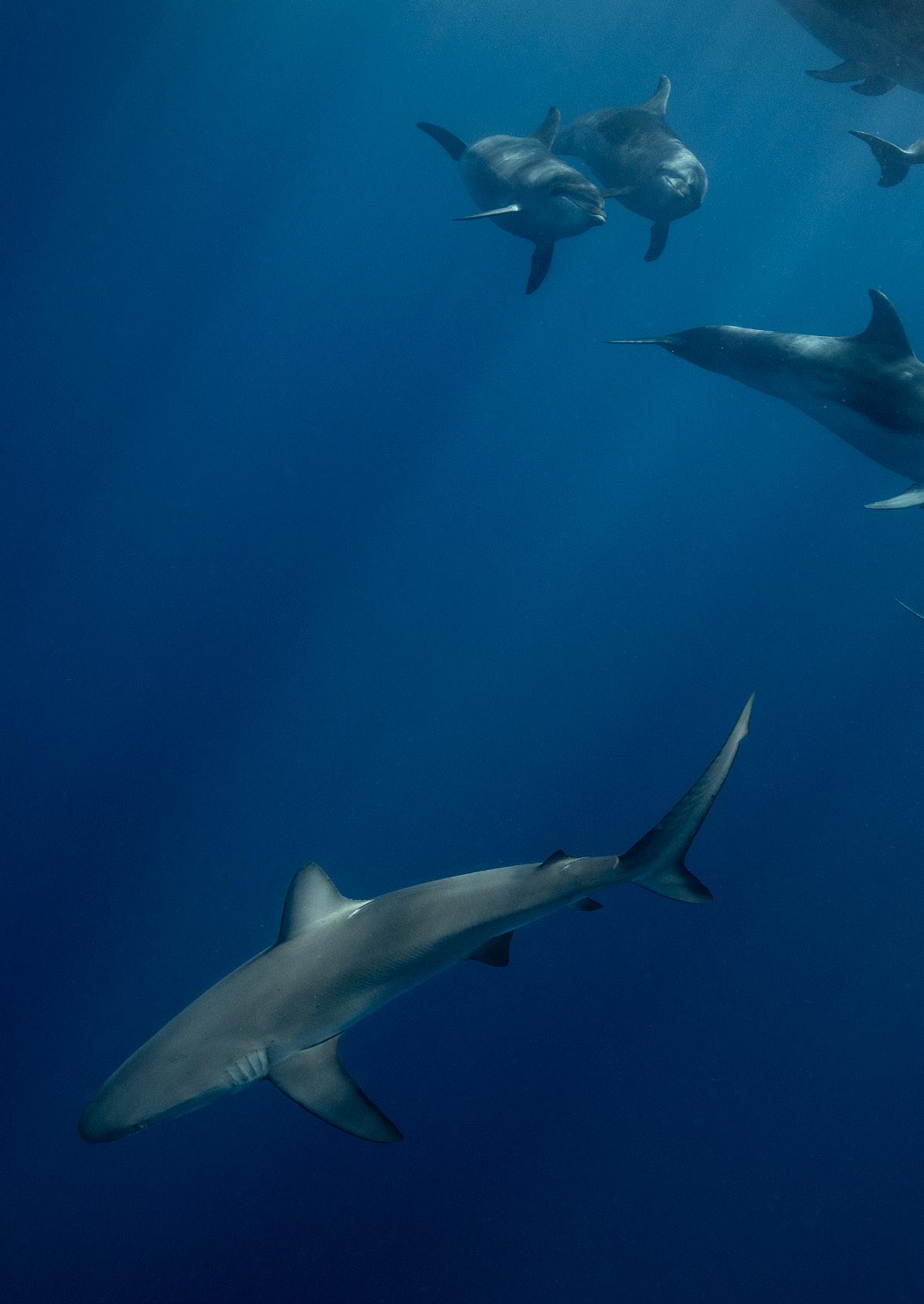
Bottlenose Dolphins and a Galapagos Shark off Lord Howe Island (Cover Image)
© Bridget Ferguson / Greenpeace
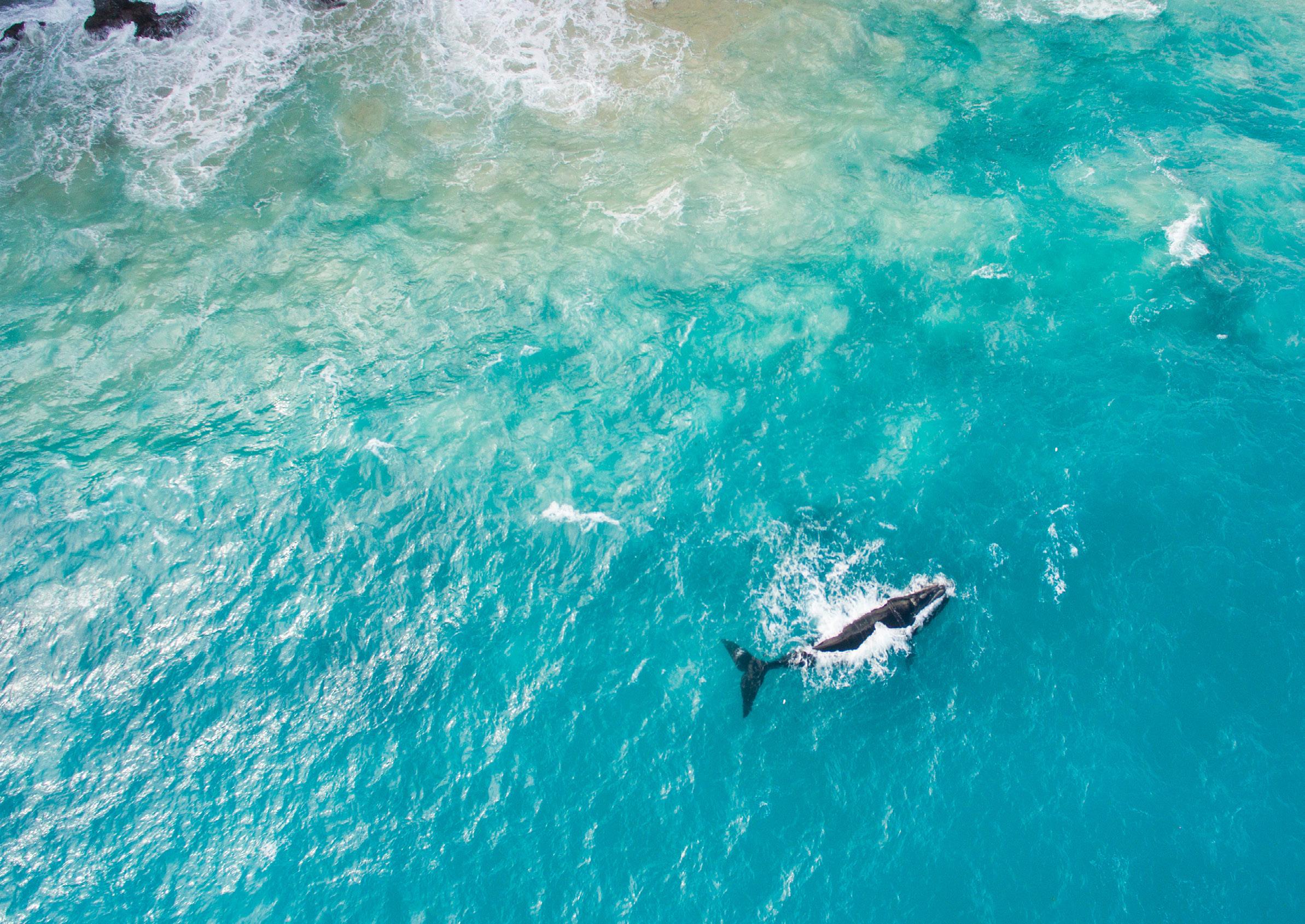
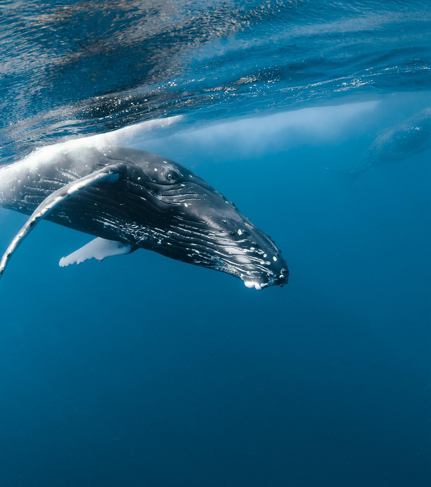
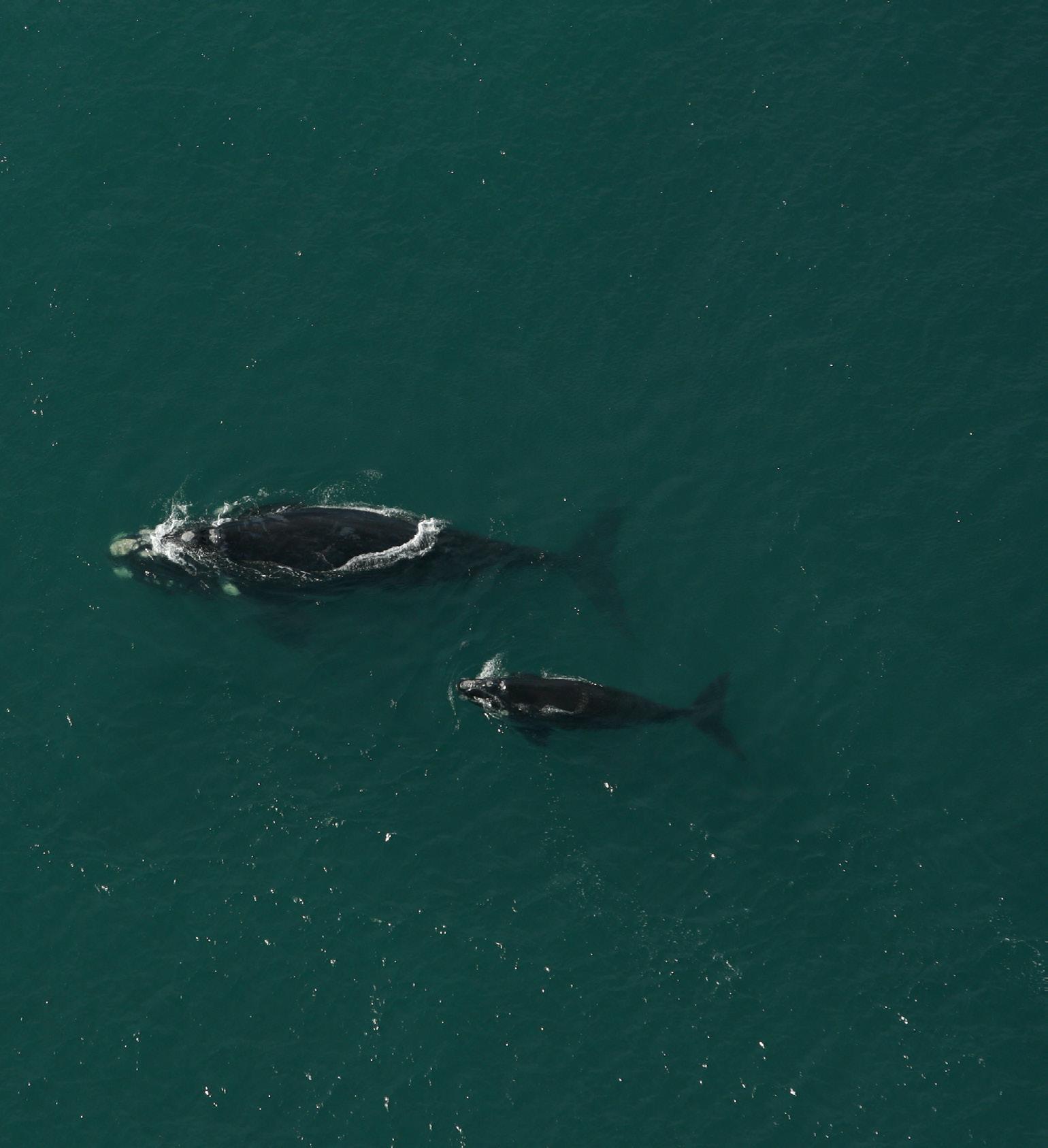
Whales in the Great Australian Bight
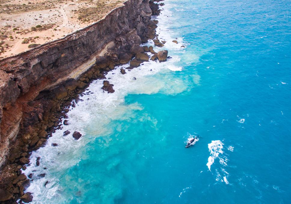
© Jaimen Hudson / Greenpeace

INTRODUCTION
The Biodiversity Beyond National Jurisdiction agreement (BBNJ)1, also known as the High Seas Biodiversity Treaty and Global Ocean Treaty, is one of the most significant international conservation agreements in history and the first focused on protecting marine life and areas of ecological significance in the high seas. These waters cover 64% of the ocean, are home to extraordinary biodiversity, and until now, less than 1% have been fully or highly protected2
The Global Ocean Treaty entered into force on 17 January 2026 paving the way for governments to propose fully protected ocean sanctuaries in the high seas. This is a crucial step toward the global goal of protecting 30% of the world’s ocean by 20303.
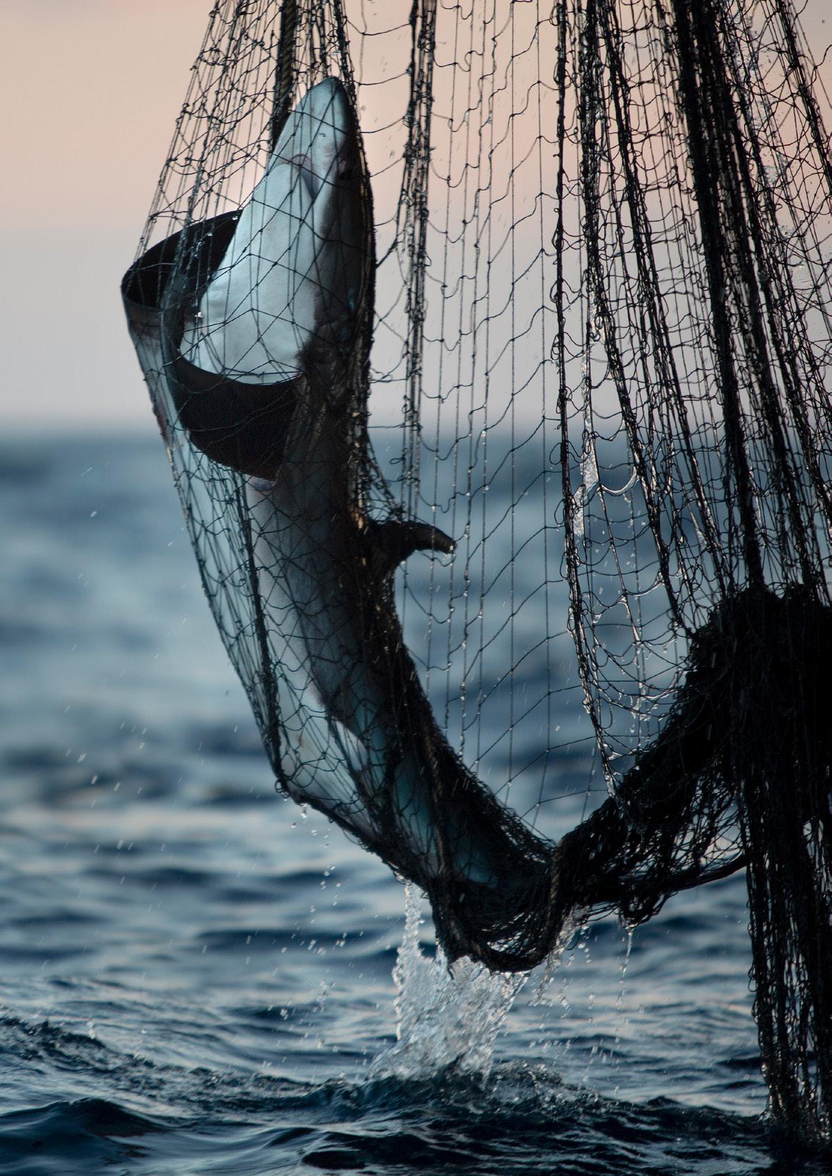
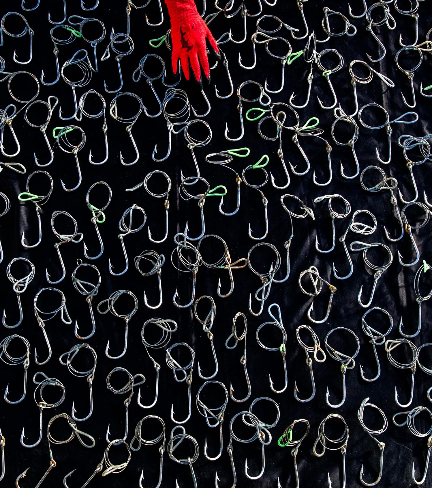
Australia’s ratification comes at a critical time. The ocean is facing increasing pressure from global heating, pollution, marine heatwaves, ocean acidification, habitat loss, mining, and destructive industrial fishing.4 Longline and Bottom Trawl fishing methods kill vast numbers of non-target species and destroy fragile ecosystems. Between 2018 and 2022, global high seas fishing hours increased by over 8%, with longliners responsible for more than three-quarters of all activity.5
Greenpeace Australia Pacific (GPAP) has identified priority areas within our broad oceanic region for potential protection under the Treaty. These sites are all underpinned by strong science in the case for protection. This brief aims to:
• Build credibility for proposed sanctuaries.
• Provide evidence-based proposals for decision makers.
• Contribute to a network of protected areas that safeguard biodiversity and ecosystems.
The following document presents the case for protection for five high seas Marine Protected Areas (or network of Marine Protected Areas) for Australia to champion, aligned with the global 30x30 commitment and to be implemented under the Treaty.
PROPOSED SITES: LORD HOWE RISE AND SOUTH TASMAN SEA
Brief Overview
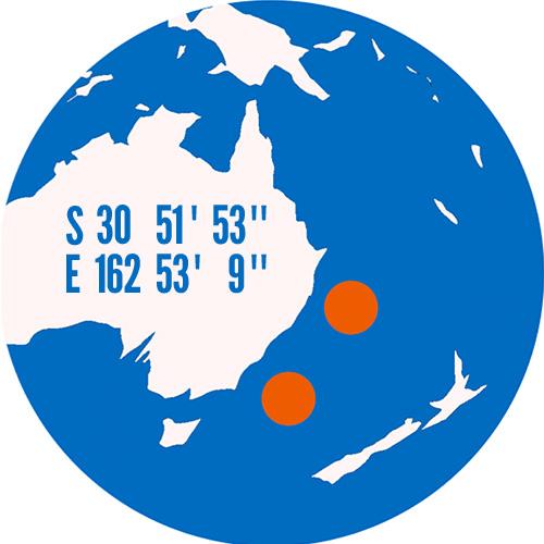
The Lord Howe Rise and South Tasman Sea (LoHST) are two geographically linked sites within the same seascape between Australia and New Zealand. It is one of the world’s most ecologically significant marine areas, spanning approximately 3.7 million square kilometers.6 Greenpeace recommends the establishment of a network of MPAs with the highest possible levels of protection across at least 1 million sq km of the LoHST region. The South Tasman Sea and the submerged volcanic plateau known as Lord Howe Rise contain an extraordinarily diverse and dynamic marine environment, including seamounts which act as magnets of life supporting fragile ecosystems, providing critical feeding grounds and are highly vulnerable to destructive fishing. This area supports migratory marine mammals, pelagic and demersal fish populations, and seabirds, acting as a highway for species moving between Antarctic feeding grounds and tropical breeding sites.7
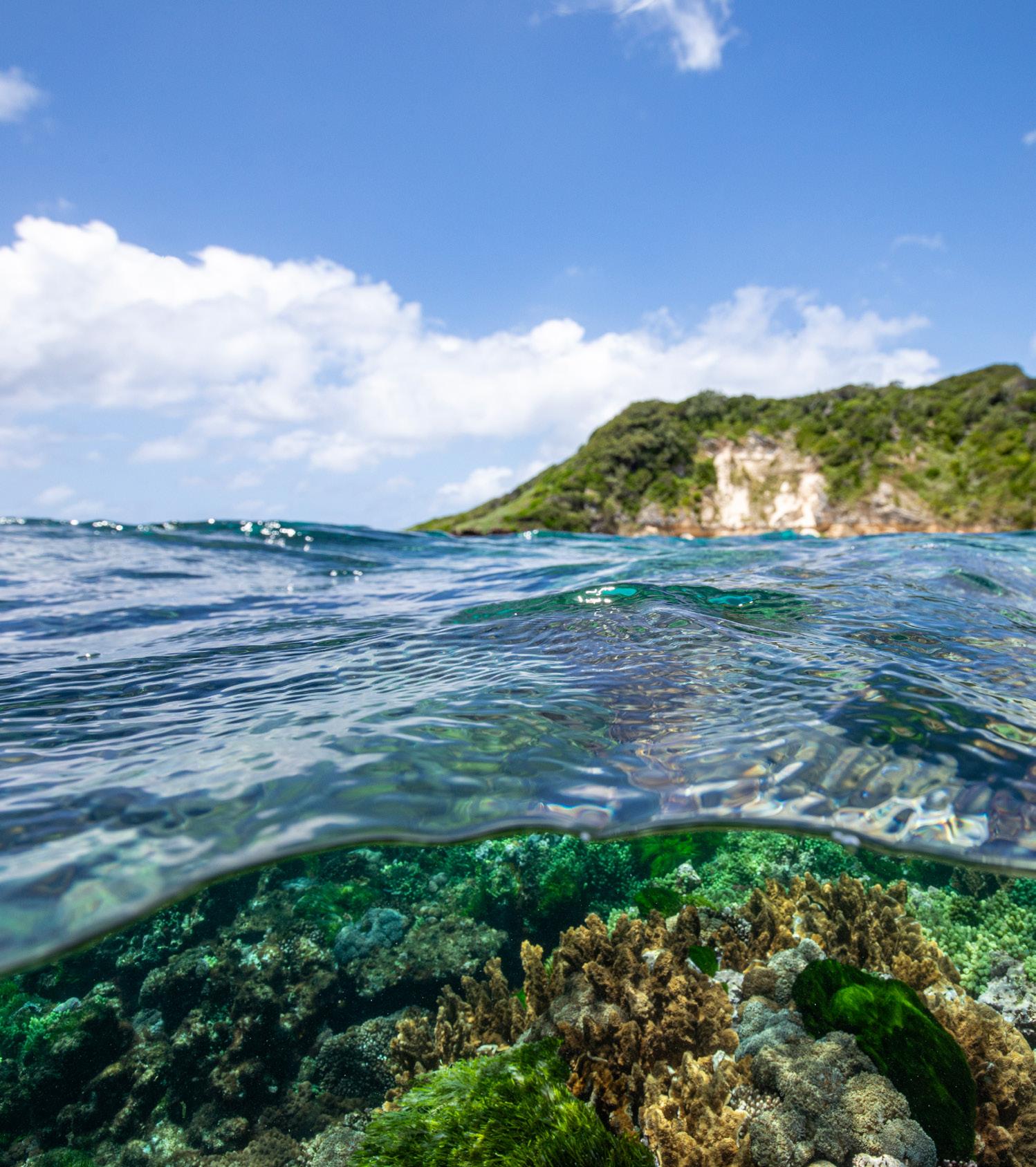
Sea Surface at Ned’s Beach, Lord Howe Island, Australia
© Bridget Ferguson/ Greenpeace

Biodiversity
Lord Howe Rise was identified by the International Union for Conservation of Nature (IUCN) as one of the world’s “High Seas Gems.”8 The Northern Lord Howe Ridge Petrel Foraging Area and the South Tasman Sea have both been recognised under the United Nations Convention on Biological Diversity as an Ecologically or Biologically Significant Area (EBSA).9/10 The combined topography and oceanography make this region a key breeding, resting and feeding ground for a wide range of migratory species. The region hosts rich biodiverse ecosystems supporting whales, dolphins, seabirds, and diverse fish populations.11
Threats
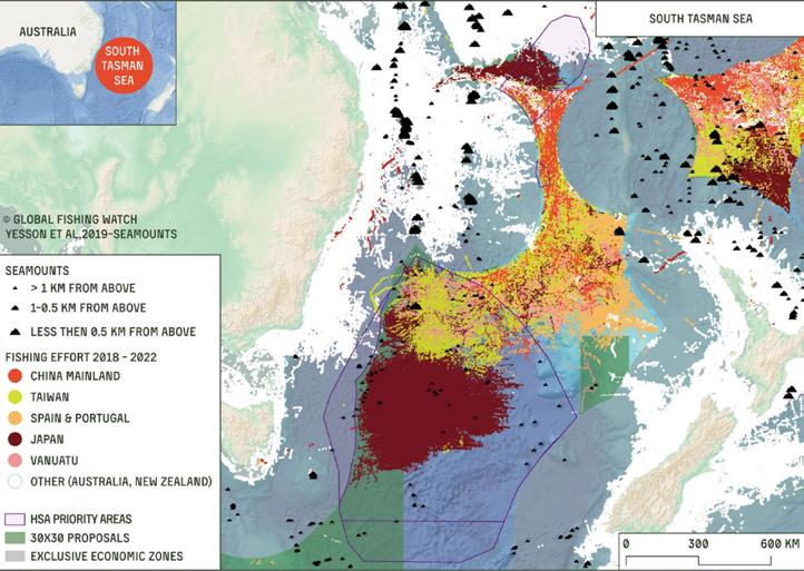
• Industrial fishing, including longlining and bottom trawling. Harming and killing non-target species including seabirds, sharks, turtles and slow-growing deep-sea coral ecosystems.12/13 Mainly Japanese, Spanish, Taiwanese, Portuguese and Chinese-flagged vessels.
• Marine heatwaves and ocean acidification.14
• Plastic pollution.15
The Case for Protection
This section addresses initial criteria under the Treaty demonstrating the area is worth further investigation and consideration as a marine protected area.
Greenpeace and allied conservation organisations continue to work with governments and stakeholders to champion protection for this region, emphasising that without urgent international action, unique marine life and ecosystems here remain at risk. Establishing a network of high seas MPAs within the South Tasman Sea and Lord Howe Rise would secure vital habitats for migratory whales, endangered seabirds and high-diversity fish populations, helping to buffer ecological systems against industrial fishing and climate change. In addition, the Tasman Sea and Lord Howe Rise sit adjacent to Australia’s temperate east marine zone, which includes Lord Howe Marine Park and Norfolk Island Marine Park within Australia’s Exclusive Economic Zone (EEZ). Linking these national protections with new high seas Marine Protected Areas (MPAs) would strengthen ecological connectivity across national and international waters, creating a broad, connected network of protection.
The ocean is deeply interconnected: Species like the Antipodean wandering albatross breed in New Zealand and travel through the Tasman Sea to feed in Australian waters, while seabirds like the Providence and Gould’s petrels breed on Lord Howe Island and forage across the same region – highlighting how these ecosystems are shared across borders. This region is a vital link in species life stages and survival, underscoring Australia’s responsibility to protect these shared ocean ecosystems.
Mount Gower and Mount Lidgbird, Lord Howe Island
© Greenpeace / Bridget Ferguson
Lord Howe Rise and South Tasman Sea represented symbolically in orange.
Source: High Seas Alliance.
Fishing gear types South Tasman Sea.16
Special importance for the life history stages of species
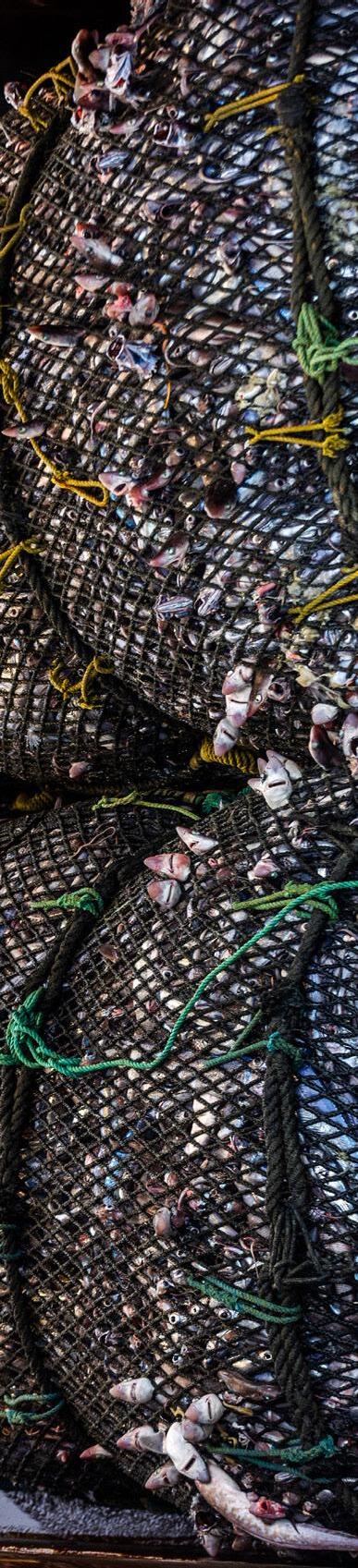
Longlines deployed across migratory pathways entangle and kill albatrosses and petrels during key breeding seasons.17 The region is an important migratory corridor for marine megafauna, including humpback and southern right whales, which use these waters for feeding, resting and moving between breeding and feeding grounds.
The importance for threatened, endangered or declining species or habitats
The region is an important breeding and feeding grounds for multiple endangered species including Antipodean wandering albatrosses, cold-water corals and Providence and Gould’s petrels. Humpback and southern right whales gather to rest in the waters as they migrate between their feeding and breeding grounds.
The Tasman Sea and Lord Howe Rise boast some of the highest seabird densities in the world. The area is used year round by breeding Antipodean albatross, providence petrel and white-winged petrel, as well as by juvenile wandering albatross, which are known to travel thousands of kilometres to feed here.18 More than half (50-65%) of the world population of Gould’s petrels visit in the breeding season.19 In total, 14 of the albatross and six of the petrel species listed under the Agreement on the Conservation of Albatrosses and Petrels (ACAP) use the waters of the Tasman as an important foraging ground during the breeding cycle.20 The value of the South Tasman Sea and Lord Howe Rise to globally-important seabirds, many endangered or vulnerable, has resulted in Birdlife International identifying five important Bird and Biodiversity Areas (IBAs) in the area.
Fragility and Sensitivity
Destructive bottom trawling has damaged deep-sea coral and sponge habitats, which are centuries old and critical for ecosystem function.21 Deep-sea coral and sponge habitats grow incredibly slowly, taking decades to centuries to form, and once destroyed, may never repopulate.22
Uniqueness or Rarity
The Lord Howe Rise and South Tasman Sea region is the main feeding area for the New Caledonian population of Gould’s petrel, one of only two populations in the world (the second is in the connected waters off New South Wales). This subspecies is unique to the region and is declining rapidly.23
The raised bathymetric features of Lord Howe Rise support rich and abundant communities of cold-water corals and sponges (amongst other epifaunal suspension feeders). The subdued bathymetric features (expansive soft sediment basins and plateaus) provide habitat to acorn worms, sea pens and shrimps, and other animals, including various detritivores, living in the sediment.24
Seamounts themselves act as biological hotspots, including deep-water coral communities and aggregating plankton, fish and larger predators such as tuna, sharks and billfish. It is likely species inhabit these seamounts undiscovered and unknown to science.25
Vulnerability, including to climate change and ocean acidification
The South Tasman Sea recorded its longest and most intense heatwave in 2015-16, and projections show such events will almost certainly increase as the planet continues to heat.26 The impacts of climate change, particularly warming and ocean acidification, pose a huge threat to the cold-water corals and associated species living on the seamounts. Climate change could also disrupt the East Australian Current and the Tasman Front, affecting water quality and nutrient distribution, and as a result, the species that depend on them.
Biological diversity and productivity
Within this broad seascape, the South Tasman Sea and the submerged volcanic plateau known as Lord Howe Rise support an extraordinarily diverse and dynamic marine environment. The region’s underwater landscape of seamounts, plateaus, knolls and pinnacles interacts with ocean currents, particularly the East Australian Current and the Tasman Front, to create nutrient-rich patches of high productivity that attract abundant marine life across the food chain.27
PROPOSED SITES:
DUE SOUTH OF THE GREAT AUSTRALIAN BIGHT
Location
Due South of the Great Australian Bight (GAB)28 is a recognised Important Bird and Biodiversity Area (IBA) and listed as an Ecologically or Biologically Significant Marine Areas (EBSA) located off the central coast of South Australia in the Southern Indian Ocean.29
Brief Overview
Due south of the GAB is a key feeding and migratory area of high ecological significance. The region supports species migrating from nearby subantarctic islands and is globally important as a feeding and breeding ground.
Aerial image of Southern Right Whale and calf
CarlFourie
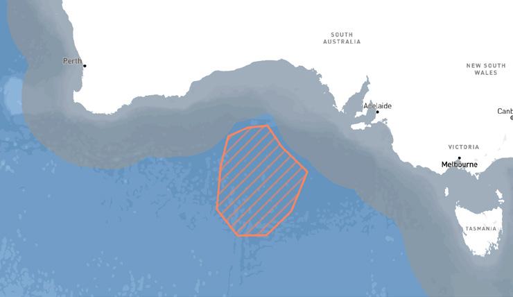
Due South of the Great Australian Bight EBSA is identified in orange.
EEZ represented in grey.
High seas represented in blue.30
Biodiversity
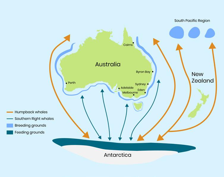
Due South of the GAB is a critical feeding and migratory area for a range of threatened marine and seabird species. It is a key feeding ground for the IUCN-listed endangered Sooty Albatross and IUCN-listed vulnerable Wandering Albatross.31 It also forms part of a major migratory route for the endangered Southern Bluefin Tuna as it moves through Australian waters. Southern Bluefin Tuna take eight to 15 years to reach reproductive maturity, underscoring the importance of protection to support population recovery and long-term sustainability.32 The area serves as the migratory route for the federally listed endangered Southern Right Whale from sub-Antarctic feeding grounds to breeding grounds off the Australian coast. The Great Australian Bight is a globally significant nursery for Southern Right Whales, as the majority of the Australian population use the Bight to give birth and care for their young.33
Threats
• Anthropogenic underwater noise.
• Marine heatwaves.34
• Slow reproduction rates – all seabird species are longlived and slow at reproducing, leaving them prone to slow recovery after population declines, which often occur as a result of fisheries by-catch.35
• Oil and gas industry interest in drilling in the Great Australian Bight within the Australian EEZ.
The Case for Protection
This section addresses initial criteria under the Treaty demonstrating the area is worth further investigation and consideration as a marine protected area.
Protecting the Due South of the GAB is critical to safeguard key feeding and migratory habitat for multiple threatened species. It also provides an opportunity for seascape connectivity to the South West domestic marine parks network. In addition, the area has strong ecological connections to French subantarctic territories, the Amsterdam and Crozet Islands, which provide habitat to Albatross species during life-history stages, presenting opportunities for international collaboration.
Special importance for life-history stages of species
This area is a key feeding ground for Sooty Albatross from Amsterdam Island during their non-breeding season and for Wandering Albatross from Crozet Island during their juvenile early life stage. Both species gather here in globally significant numbers.
Migratory routes of the endangered Southern Right Whale from sub-antarctic feeding grounds to breeding grounds along the Australian coast.
Source: NSW National Parks and Wildlife Service
Importance for threatened, endangered or declining species and/or habitats
This region supports large gatherings of threatened seabirds and fish, which regularly travel long distances across the globe. The Sooty Albatross and Wandering Albatross are both protected under international conservation agreements, including the Agreement for Conservation of Albatross and Petrels and Convention on Migratory Species. Additionally, the area incorporates the migration path of the Southern Right Whale from feeding to breeding grounds.
Vulnerability, fragility, sensitivity, or slow recovery
Seabirds like albatrosses live long lives but reproduce slowly, making them vulnerable to population declines. Fisheries bycatch is a major threat, and recovery from population losses can take decades.
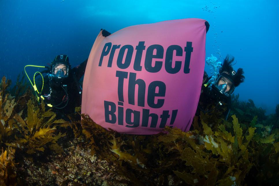
Divers Protest in the Great Australian Bight © Richard Robinson / Greenpeace
Whales in the Great Australian Bight © Jaimen Hudson / Greenpeace
SOUTH OF JAVA ISLAND –SOUTHERN BLUEFIN TUNA SPAWNING GR0UND PROPOSED SITES:
Location
Southern Indian Ocean, between 12°S – 17°S and 107°E – 117°E.
Overview
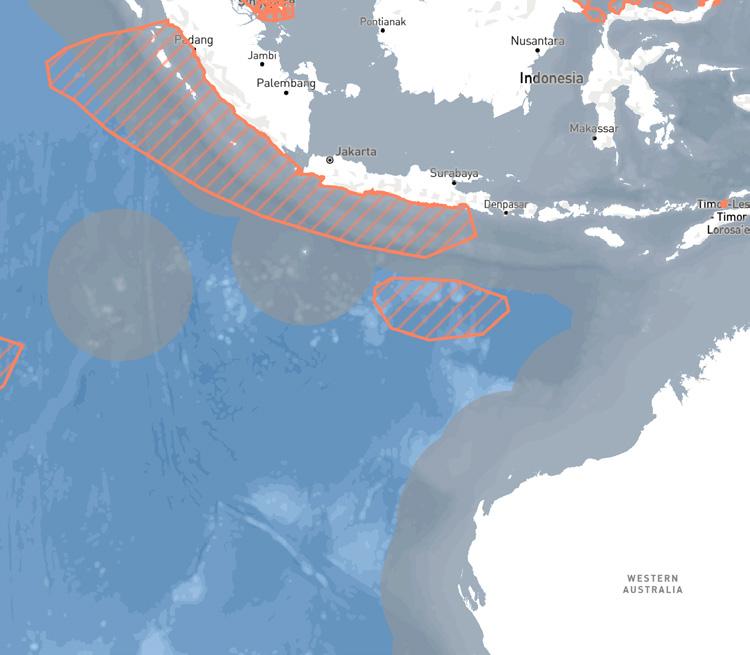
South of Java is a recognised Ecologically or Biologically Significant Marine Area (EBSA), containing the only known spawning ground for Southern Bluefin Tuna, a species that migrates across the Southern Hemisphere.36
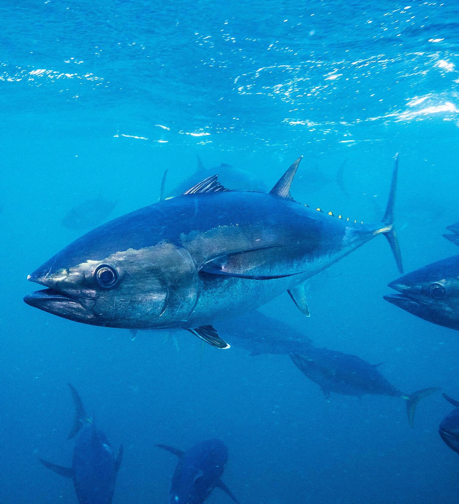
Southern Bluefin Tuna
Stefan Andrews / Great Southern Reef Foundation
Biodiversity
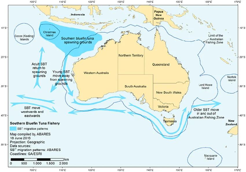
The South of Java is the only known spawning site for the Southern Bluefin Tuna, a species listed as endangered by the International Union of Conservation of Nature (IUNC). These long-lived fish can reach 42 years of age, however, they take eight to 15 years to mature. Each year, adult Southern Bluefin Tuna return to this warm-water region to spawn between September and April. Once hatched, young tuna migrate down the west coast of Australia before spreading across the Indian, Pacific, and Atlantic Oceans.37 As the only known spawning site for this species, this area plays a crucial role in the survival of Southern Bluefin Tuna populations worldwide. The area also provides habitat for swordfish, bigeye tuna, yellowfin tuna, and albacore tuna, and has high seasonal biological productivity due to strong ocean currents and upwelling.38
Threats
• Heavy industrial fishing, particularly by Indonesian, Japanese and Chinese flagged vessels.39
• Southern Bluefin Tuna breeding adult populations have declined dramatically, it is estimated there could be as few as 3% of their original population remaining, meaning there are fewer eggs produced each year and dangerously low levels of breeding population remaining to produce the next generation.40
• Rising ocean temperatures leading to a loss of marine biodiversity.
Connection to Commonwealth marine parks and biodiversity within national jurisdiction
There is an opportunity for a high sea MPA South of Java to join both the Christmas and Cocos (Keeling) Islands marine parks, enabling seascape habitat connectivity across jurisdictions.43
There is an opportunity to link the North West Shelf reef system within Commonwealth waters to a high sea MPA South of Java. The Southern Bluefin Tuna spawning grounds neighbour the North West Shelf reef system, including Scott Reef. Scott Reef is Australia’s largest oceanic reef system, rising 800m from the sea floor on the edge of the continental shelf. It comprised two atolls which support 1,500 species of invertebrates, nearly 1,000
EEZ represented by grey. High Seas represented by blue. EBSAs represented in orange. South of Java Island EBSA highlighted by the green circle, is the orange oval with hatching inside.41
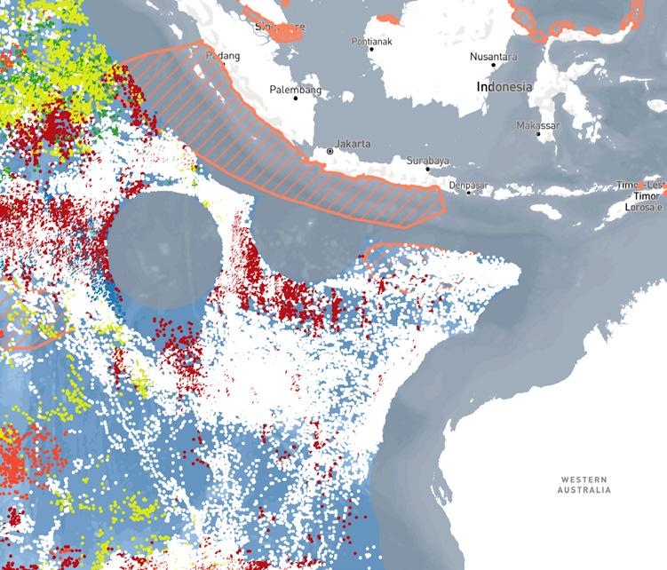
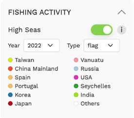
Fishing activity across the South of Java Island EBSA, data from 2022. EEZ represented by grey. EBSA’s represented by orange.42
Cocos (Keeling) Islands EEZ
Christmas Island EEZ
fish species, and 33 federally listed threatened species, including the endangered pygmy blue whale and the vulnerable green turtle.44 As a critical habitat to rich biodiversity, there is an opportunity to link the North West Shelf reef system and a future Scott Reef Marine Park as part of domestic protections for the Southern Bluefin Tuna Spawning Ground, and to strengthen protections for national biodiversity.
The Case for Protection
This section addresses initial criteria under the Treaty demonstrating the area is worth further investigation and consideration as a marine protected area.
Safeguarding this area is essential to rebuilding and safeguarding Southern Bluefin Tuna populations and maintaining global fishery sustainability. It is essential that connectivity of the Indian Ocean is considered with a whole-of-basin approach coordinated with other nations to allow for seascape connectivity between MPAs.
Uniqueness or rarity
This area is rare on both a regional and global scale and may be unique. It is the only known spawning ground for Southern Bluefin Tuna.
Special importance for life-history stages of species
This area lies along the migratory route of cetaceans and other pelagic species. It may also serve as a potential spawning site for freshwater eels, as its benthic zone contains a vast chain of seamounts covering approximately 1,000,000 km².
Importance for threatened, endangered or declining species and/or habitats:
The Southern Bluefin Tuna is listed as Endangered by the IUCN. Its population has been in decline for the past 40 years, though there have been signs of recent recovery. Given the area’s critical role in Southern Bluefin Tuna spawning, it is considered highly important for the species’ survival.
Biological productivity
Satellite data shows that high concentrations of chlorophyll-a (Chl a), a measure of microscopic plant life, occur in this region from July to August, forming long offshore plumes near Java. These blooms mark a spike in ocean productivity, when food becomes abundant meaning this area is a critical feeding ground supporting entire food webs and species survival. Moderate Chl-a levels persist through September and October, before declining to low levels by November and December.45
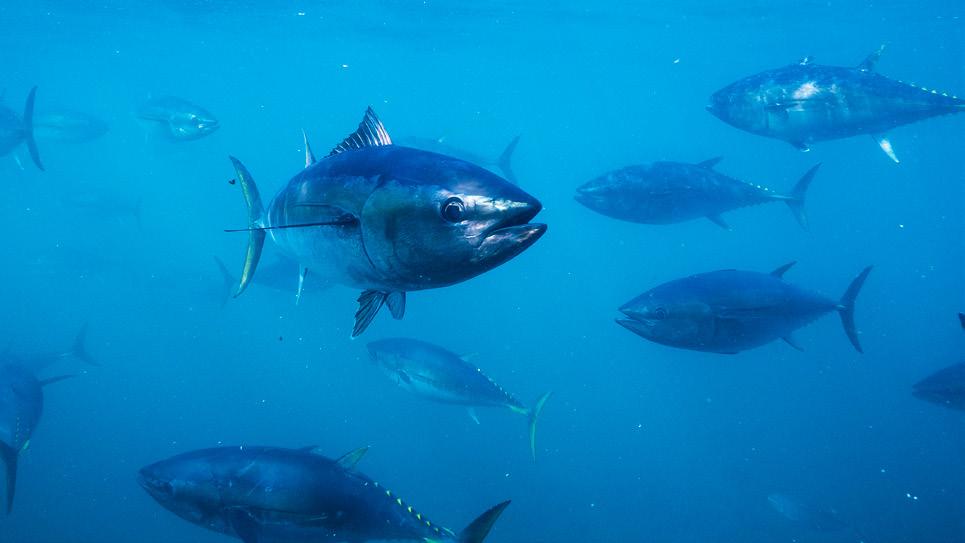
Southern Bluefin Tuna Spawning Grounds. Source: Australian Fisheries Management Authority.
Southern Bluefin Tuna © Stefan Andrews / Great Southern Reef Foundation
SOUTHERN OCEAN AND SOUTH INDIAN OCEAN PROPOSED SITES:
Location
Greenpeace recommends Australia investigate further the creation reation of a Marine Protected Area (MPA) and/or network of MPAs in the in the high seas between the Australian continent and Commission for the Conservation for Antarctic Marine Living Resources (CCAMLR) jurisdiction.
The BBNJ Agreement commits not to ‘undermine relevant legal instruments and frameworks and relevant global, regional, subregional and sectoral bodies’ to that effect, it is recommended Australia investigate areas bordering or beyond the CCAMLR jurisdiction in the Southern Ocean and Southern Indian Ocean. By doing so, Australia is ensuring it has played a strong role in protecting part of this unique and invaluable region, while CCAMLR negotiations continue to be stalled. These vast waters host diverse biodiversity and ecosystems including seamounts, nutrient-rich waters, migratory pathways, feeding and breeding grounds and habitat for unique and threatened species – being therefore of high merit for an MPA.
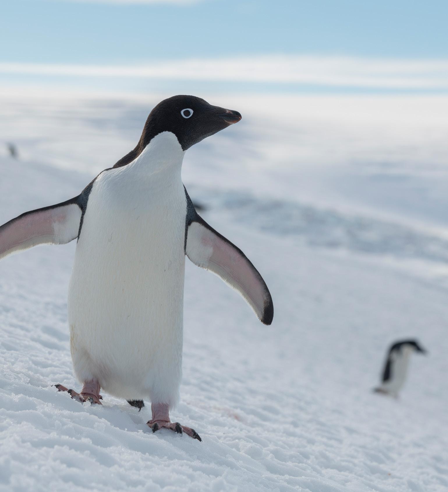
Adélie Penguin Colony in Antarctica
© Christian Åslund / Greenpeace
Heard Island and McDonald Islands Marine Park within Australian EEZ. Greenpeace proposes creating a network of high seas MPAs connecting to the north of the domestic Marine Park. Noting the draft management plan is currently open for review (as of June 2026) protections for the existing marine park within the Australian EEZ must be strengthened by expanding the fully protected sanctuary zone. Source: Australian Marine Parks.
Sites worth consideration and investigation:
• The Southeast Indian Ridge.
• On the CCAMLR border north of the Heard Island and McDonald Islands Australian EEZ, incorporating the Kerguelen Plateau.
• MPA creation in the Southern Ocean and South Indian Ocean should not be limited to the above.
A concept for a High Seas MPA connecting South African, French, and Australian sub-Antarctic territories is being advanced by the WildTrust CIRCLE project; it is recommended Australia collaborate on such initiatives.
Heard Island and McDonald Islands
Heard Island and McDonald Islands (HIMI) are a remote Australian Territory subantarctic island group located about 4,000 km south-west of Western Australia and approximately 1,700 km from the Antarctic continent. A network of MPAs connecting to the north of the HIMI Marine Park within the Australian EEZ is worth investigating.
The existing domestic marine parks network within the Australian EEZ around HIMI could provide a foundation for expansion into connected high seas areas to the north, outside of the CCAMLR jurisdiction in the Kerguelen Plateau. The HIMI EEZ abuts the French EEZ around the Kerguelen Islands, presenting an opportunity to collaborate with France.
Biodiversity
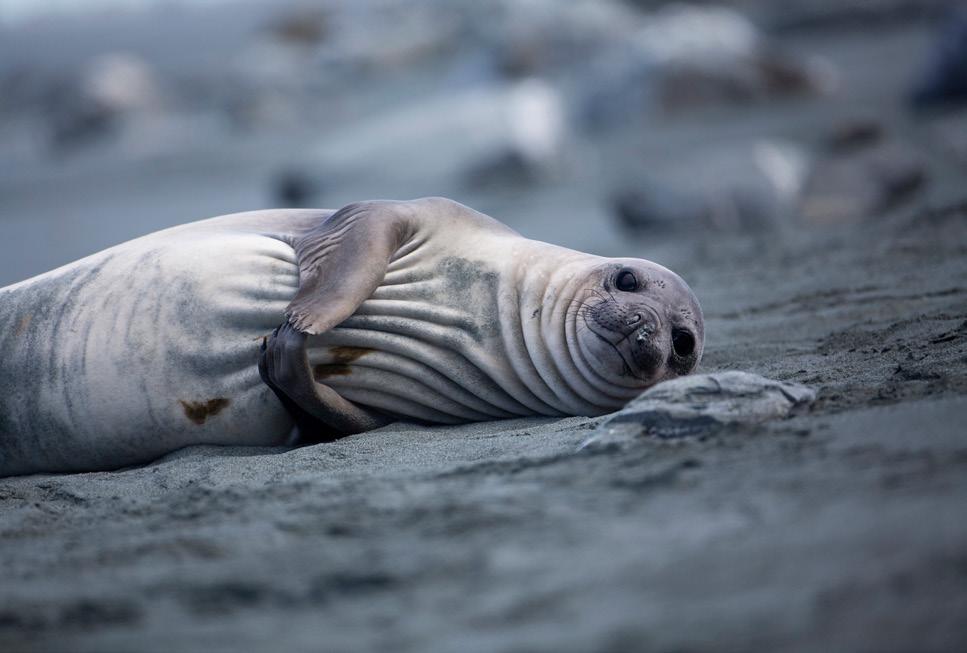
The waters surrounding HIMI support a unique, highly biodiverse ecosystem. Krill and benthic fauna form a rich food web supporting cold-water reef ecosystems and vast populations of unique species like penguins (Macaroni, King, Gentoo, Rockhopper, Adélie ), numerous albatross and petrel species (Wandering Albatross, Snow Petrel amongst many), whale species (Orca, Humpback Whale, Southern Right Whale, Blue Whale) and seal species (Elephant Seal, Antarctic Fur Seal), along with fish (Icefish, Toothfish).46/47 The UNESCO World Heritage listed Heard and McDonald Islands support globally significant wildlife populations and unique ecosystems. Both the marine and terrestrial environments of HIMI are globally recognised for their ecological significance.48

Southern Ocean and Southern Indian Ocean Threats
Industrial fishing and climate change-driven habitat changes:
• Commercial fishing of Patagonian toothfish, Antarctica toothfish and Mackerel icefish is undertaken in this region using longline and trawl methods,49 resulting in bycatch death and injury to marine mammals, seabirds and other non target species.50/51 The main species of seabirds killed in longline fisheries are albatrosses and other species of petrel.52
• Illegal, unreported and unregulated (IUU) fishing resulting in bycatch and primary threat to Toothfish sustainability.53/54
• Vessel strike and anthropogenic underwater noise from commercial fishing.
• Unprecedented shutdown of the Antarctic krill fishery in August 2025, after industrial trawlers reached the catch limit of 620,000 tonnes months earlier than normal.55 While krill fishing is not undertaken in CCAMLR Domain 6 or 7, this indicates fishing within Antarctic waters is reaching unsustainable levels.
• H5 bird flu in Elephant seals at Heard Island confirmed November 2025.56
The Case for Protection
This section addresses initial criteria under the Treaty demonstrating the area is worth further investigation and consideration as a marine protected area.
The creation of a network of high seas MPAs in the Southern Ocean or Southern Indian Ocean outside the CCAMLR jurisdiction including high seas waters north of HIMI and the Southeast Indian Ridge would create a large network of protection for habitat, feeding and breeding grounds for a diversity of marine species.
The
importance for threatened, endangered or declining species or habitats
Southern Ocean waters contain distinctive deep water flora and fauna, and support important ecosystem roles, such as feeding areas for marine mammals, fish, penguins and other seabirds.57 This region supports the federally listed endangered Southern Right Whale, IUCN listed endangered Blue Whale, and is of high habitat importance
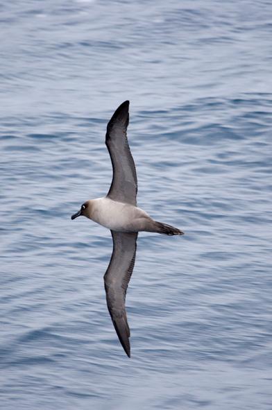
to King penguins, Macaroni penguins, Lightmantled albatross, Wandering albatross.58 The Southeast Indian Ridge hosts hydrothermal vents and seamounts, which are biodiversity hotspots for species like deep-sea corals and sponges.
59
Sensitivity and Fragility
Southern Ocean marine ecosystems are likely to be highly vulnerable to warming waters. Warming of deeper waters can disrupt the life cycles of keystone species like Antarctic krill, which breed by sinking their eggs to deep ocean depths. As a keystone species, declines in krill populations have cascading impacts on the food chain.60/61
Special importance for life-history stages of species
Feeding areas for marine mammals and seabirds that rely on Antarctic krill. Krill are a keystone species and the foundation of the Antarctic food web, with many Antarctic animals eating krill directly, or eating other animals that eat krill. Protection of krill provides food web stability.62
Biological Diversity and Productivity
The waters around HIMI include the Kerguelen Production Zone, an open-water, highly productive region with rugged deep-water habitat that nourishes whales and seabirds migrating through the area as well as immense populations of land-based predators, including breeding king penguins,63 Antarctic fur seals, and elephant seals.64
Vulnerability, including to climate change and ocean acidification
High marine heatwave activity in the Southern Ocean waters disrupts food chains, alters ecosystem functions and can be mortal events.65 For example, impacts on phytoplankton have been linked to fewer krill and reduced survival of Adélie penguins (Pygoscelis adeliae) in Antarctica.66
Sooty Albatross, Southern Ocean © Daniel Beltrá / Greenpeace
PACIFIC POCKETS PROPOSED SITES:
Australia must be a strong supporter of Pacific-led marine protected area (MPA) proposals. The Pacific Pockets proposed MPA is included in this report to underscore the importance of Australia supporting Pacific Nation-led MPA proposals through sustained regional collaboration. Australia must ensure Pacific-led outcomes in MPA creation that incorporate Indigenous knowledge and cultural perspectives.
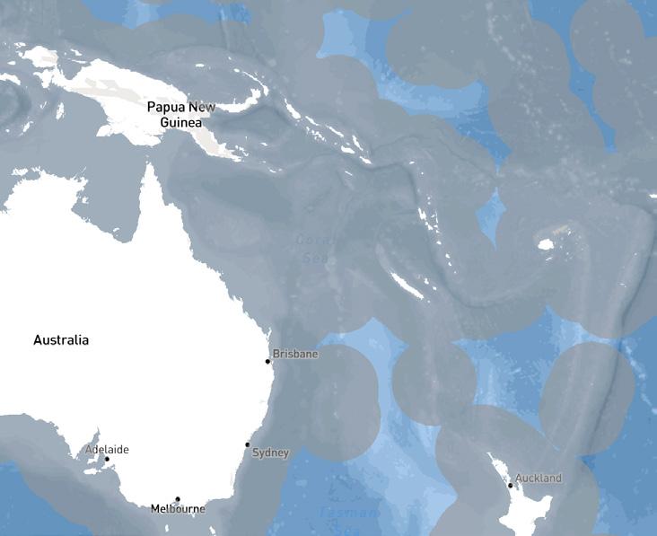
Pacific Pockets refer to large areas of the high seas enclosed by the Exclusive Economic Zones (EEZs) of Pacific Island nations. These waters are culturally significant, and function as biodiversity hotspots, thus presenting significant cultural preservation and biodiversity conservation opportunities. Work is already underway to establish an MPA proposal, with Indigenous leaders, Pacific governments, Pacific NGOs, community organisations and philanthropies currently exploring the establishment of a network of high seas MPAs within these Pacific Pockets.

Threats
• Intense fishing pressure, primarily from Chinese, Spanish, Portuguese, Taiwanese and Japanese-flagged vessels.67 Overexploited fish stocks.68
• Illegal, unregulated and unreported fishing activity.69
• Bycatch, vessel strike and underwater marine noise.
• Climate change, including marine heatwaves and ocean acidification.70
Biodiversity
The high seas waters of the Pacific Ocean holds immense marine biodiversity, hosting turtles and rays, vast coral reefs, diverse fish, mangroves, and unique endemic species, supported by rich ecosystems from atolls to deep seas.71 The Pacific Pockets lies within a broader transboundary ecological zone that forms part of a ‘blue corridor’ used by migratory whales, sharks, tuna and seabirds, reinforcing the importance of coordinated protection. A network of MPAs in the Pacific Pockets would connect to the Lord Howe Rise South Tasman Sea MPA, linking migration corridors and seascape habitat.
The waters around the Pacific Island Nations provide food security, support livelihoods and sustain communities for millions of people in the Pacific dependent on a healthy ocean. The waters also contain numerous Ecologically or Biologically Significant Marine Areas (EBSA), with three located in the high seas.
Remetau group: home to some of the most biologically diverse coral reefs in the world. The area supports high seamount diversity, a Marine Important Bird Area defined by a key foraging concentration of the Streaked shearwater.72
Monowai Seamount: comprises an active volcanic cone, with a caldera that has extensive hydrothermal venting at depths of about 1200 m. Vent communities comprise tubeworms, dense beds of bathymodiolid mussels, lithodid crabs, and zoarcid fishes. The seamount is at the northern end of a series of vent communities along the Kermadec back arc.73
EEZ represented by grey. high seas represented by blue. The Pacific Pockets are the high sea areas between the Pacific Island Nations. The Pacific Pockets also extend further to the East. (Note the high seas area from near Brisbane continuing south is the proposed Lord Howe Rise South Tasman Sea MPA.)78
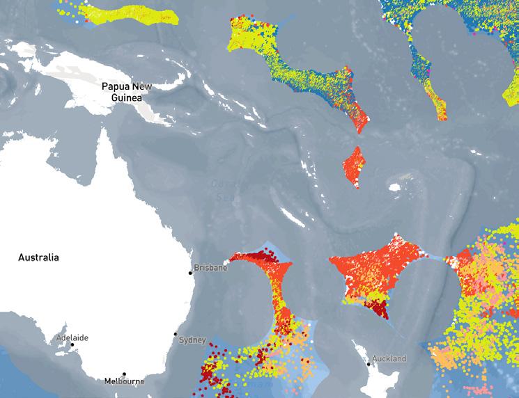
EEZ represented by grey. The map now has fishing data from 2022 overlaid within the high seas. The high fishing activity is directly within the high seas Pacific Pockets.77
Northern New Zealand/South Fiji Basin: identified as the core foraging area for the Parkinson’s petrel during the breeding season (Oct–June), a species listed as Vulnerable on the IUCN Red List. A number of other seabird species can also be found in the area.74
The Case for Protection
Progressing protection in the Pacific Pockets must be Pacific led and will require close collaboration between Pacific Island governments, NGOs, community organisations and community leaders, with a strong emphasis on community-based approaches and the meaningful incorporation of traditional knowledge.75/76
These efforts align with the mandates of key regional agencies, known as CROP agencies, including SPREP (Secretariat of the Pacific Regional Environment Programme) on environmental protection, the Forum Fisheries Agency (FFA) on fisheries governance, and the Pacific Community (SPC) on ocean science, providing a strong foundation for coordinated regional ocean stewardship. Continued collaboration among Pacific leaders, CROP agencies and civil society will be critical to securing effective, Pacific driven outcomes.
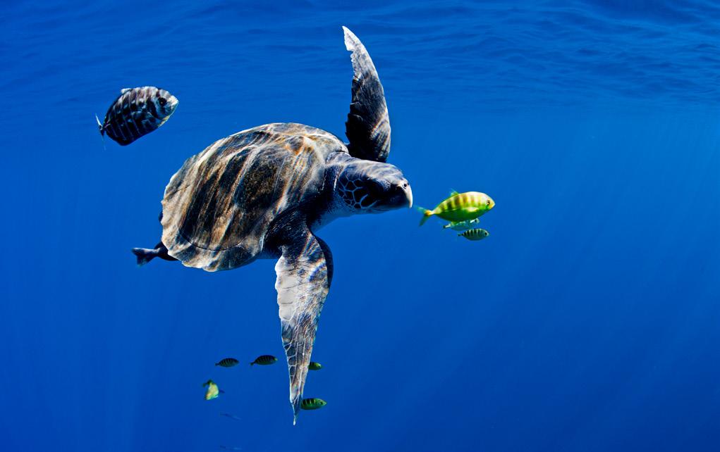
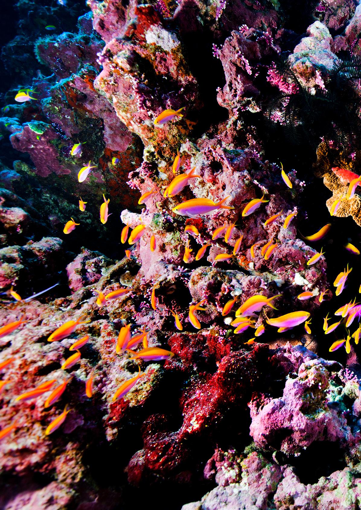
Turtle in the Pacific Ocean © Paul Hilton / Greenpeace
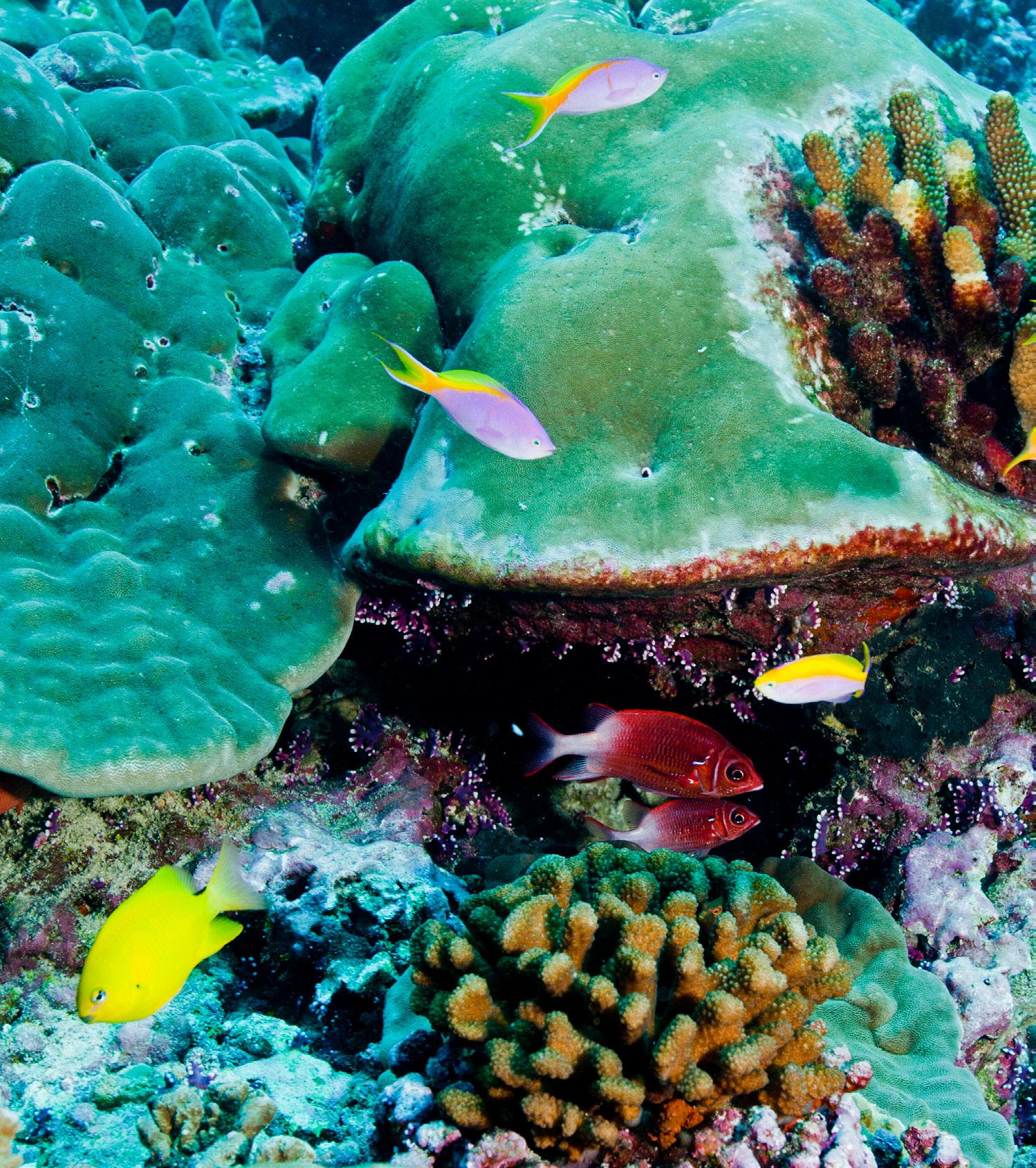
Coral Reef Nauru in the Pacific Ocean
© Paul Hilton / Greenpeace
United Nations, Agreement Under the United Nations Convention on the Law of the Sea on the Conservation and Sustainable use of Marine Biological Diversity of Areas Beyond National Jurisdiction 2023. https://www.un.org/bbnjagreement/ sites/default/files/2024-08/Text%20of%20the%20Agreement%20in%20English.pdf
2 Greenpeace International, From Commitment to Action: achieving the 30X30 target through the Global Ocean Treaty 2024. https://www.greenpeace.org. au/static/planet4-australiapacific-stateless/2024/11/2f3a6293-achieving-the30x30-target-through-the-global-ocean-treaty.pdf
3 Target 3 of the Kunming Montreal Global Biodiversity Framework: 30% of marine areas are effectively conserved and managed through an ecologically representative, well-connected and equitably governed protected areas by 2030 https://www.cbd.int/gbf/targets/3
4 United Nations, The Sustainable Development Goals Report, Goal 14, Life Below Water, 2025. https://unstats.un.org/sdgs/report/2025/The-SustainableDevelopment-Goals-Report-2025.pdf
5 Greenpeace International, 30X30: from Global Ocean Treaty to Protection at Sea, 2023. https://www.greenpeace.org/static/planet4-internationalstateless/2023/09/ab626c5e-eng_full-report_digital-version.pdf
6 The initial definition of ‘the area’ refers to the full area of EBSA 15 (1.6 km2) ( https://hub.arcgis.com/datasets/panda::ecologically-or-biologically-significantmarine-areas-ebsas/explore) and the Lord Howe Rise region (1.95 km2) as defined by Przeslawski et al (Przeslawski, Rachel et al, ‘Biogeography of the Lord Howe Rise region, Tasman Sea’ (2011) 58(7-8) Deep Sea Research Part II: Topical Studies in Oceanography 959), which includes the Lord Howe Rise and adjacent features.
7 Karan, L., Clark, N., Pew Charitable Trust, A Path to Creating the First Generation of High Seas Protected Areas. Science-based method highlights 10 sites that would help safeguard biodiversity beyond national waters, 2020.
8 IUCN, High Seas Gems: Hidden Treasures of Our Blue Earth, 2008.
9 United Nations Convention on Biological Diversity, Marine EBSA, Northern Lord Howe Ridge Petrel Foraging Area, 2015.
10 United Nations Convention on Biological Diversity, Marine EBSA, South Tasman Sea, 2013.
11 Zintzen V., Roberts C.D., Clark M. and Williams A, Composition, distribution and regional affinities of the deepwater ichthyofauna of the Lord Howe Rise and Norfolk Ridge, southwest Pacific Ocean, Deep Sea Research Part II Topical Studies in Oceanography 58(7-8):933-947. 2011.
12 Unseenlabs, Searching the Tasman Sea for dark vessels illegally fishing for southern bluefin tuna, 2020. https://unseenlabs.space/2022/04/29/searchingthe-tasman-sea-for-dark-vesselsillegally-fishing-for-southern-bluefin-tuna/
13 Greenpeace 30X30 Map compiled by a team of scientists led by experts at the University of York, UK.
14 Wernberg, T., Thomsen, M.S., Burrows, M.T. et al. Marine heatwaves as hot spots of climate change and impacts on biodiversity and ecosystem services. Nat. Rev. Biodivers, 2025.
15 Wilcox, C., Van Sebille, E. and Hardesty, B.D. Threat of plastic pollution to seabirds is global, pervasive, and increasing, Proceedings of the National Academy of Sciences Vo l. 112 | No. 38, 2015.
16 Greenpeace International, 30X30: from Global Ocean Treaty to Protection at Sea, 2023, pp.62.
17 WCPFC, Distribution of seabird bycatch at WCPFC and the neighboring area of the southern hemisphere. By Yukiko Inoue, Kotaro Yokawa, Hiroshi Minami, Daisuke Ochi, Noriyoshi Sato and Nobuhiro Katsumata. 2011.
18 The Convention on Biological Diversity Information Submission Service, Ecologically or Biologically Significant Areas (EBSAs), Northern Lord Howe Ridge Petrel Foraging Area, 2015.
19 High Seas Alliance. South Tasman Sea / Lord Howe Rise, 2023. https://mpa. highseasalliance.org/south-tasman-sea-lord-howe-rise
20 BirdLife International, The Tasman Sea as a candidate High Seas Marine Protected Area, Thirteenth Meeting of the Advisory Committee Edinburgh, United Kingdom, 22 – 26 May 2023. AC13 Inf 04 Agenda Item 7.2 https://www. acap.aq/advisorycommittee/ac13/ac13-information-papers/4305-ac13-inf-04thetasman-sea-as-a-candidate-high-seas-mpa/file
21 Hooper, E., Greenpeace Aotearoa, Bottom Trawling, 2025. https://www. greenpeace.org/aotearoa/story/what-is-bottom-trawling-and-why-is-it-bad-forthe-environment/
22 National Oceanic and Atmospheric Administration, State of Deep-Sea Coral and Sponge Ecosystems of the United States, 2017. https://spo.nmfs.noaa.gov/sites/ default/files/OHC4_v2.pdf
23 Bretagnolle, V., Renaudet, L., Villard, P., Shirihai, H., Carlile, N., & Priddel, D, Status of Gould’s Petrel Pterodroma leucoptera caledonica in New Caledonia: distribution, breeding biology, threats and conservation. Emu - Austral Ornithology, 2021.
24 Przeslawski R., Williams A., Nichol S.L., Hughes M.G., Anderson T.J. and Althaus F, Biogeography of the Lord Howe Rise region, Tasman Sea, Deep Sea Research Part II: Topical Studies in Oceanography, Volume 58, Issues 7–8, 2011, pp 959-969.
25 United Nations Convention on Biological Diversity, Marine EBSA, South Tasman Sea, 2013.
26 Oliver, ECJ; Benthuysen, JA; Bindoff, Nathaniel; Hobday, AJ; Holbrook, Neil; Mundy, Craig; et al, The unprecedented 2015/16 Tasman Sea marine heatwave, University of Tasmania, 2017.
27 Department of Environment and Water Resources, Ecosystems of the east marine region, 2007. https://www.agriculture.gov.au/sites/default/files/ documents/ecosystems.pdf
28 BirdLife International, Designing networks of marine protected areas: exploring the linkages between Important Bird Areas and ecologically or biologically significant marine areas, Cambridge, UK: BirdLife International, 2009.
29 United Nations Convention on Biological Diversity, Marine EBSA, Due South of the Great Australian Bight, 2015.
30 Greenpeace 30X30 Map compiled by a team of scientists led by experts at the University of York, UK.
31 Department of Climate Change, Energy, Environment and Water, National recovery plan for albatrosses and petrels, 2022.
32 Caton, AE. et al, 1991. Review of southern bluefin tuna: biology, population and fisheries. Berau Rural Resources, Dept of Primary Industry and Energy. Barton, Canberra.
33 Department of Climate Change, Energy, the Environment and Water, National Recovery Plan for the Southern Right Whale, 2024.
34 Wernberg, T., Thomsen, M.S., Burrows, M.T. et al. Marine heatwaves as hot spots of climate change and impacts on biodiversity and ecosystem services. Nat. Rev. Biodivers, 2025.
35 Anderson, O., C. Small, J. Croxall, E. Dunn, B. Sullivan, O. Yates, A. Black. Global seabird bycatch in longline fisheries. Endangered Species Research. Vol. 14: 91–106, 2011.
36 United Nations Convention on Biological Diversity, Marine EBSA, South of Java Island, 2015.
37 Caton, AE. et al, 1991. Review of southern bluefin tuna: biology, population and fisheries. Berau Rural Resources, Dept of Primary Industry and Energy. Barton, Canberra.
38 BRS, 2007. Fishery Status Review : Southern blue-fin tuna fishery.
39 Data from the Greenpeace 30X30 Map compiled by a team of scientists led by experts at the University of York, UK
40 Commission for the Conservation of Southern Bluefin Tuna, 2011, Report of the Sixteenth Meeting of the Scientific Committee, 118pp.
41 Greenpeace 30X30 Map compiled by a team of scientists led by experts at the University of York, UK
42 Source: Greenpeace 30X30 Map compiled by a team of scientists led by experts at the University of York, UK.
43 Brewer, T. et al. 2009. Conservation values at Commonwealth waters of the Chrismast and Cocos (Keeling) Island remote Australian territories. Report to Department of Environment and Water Resources, Cleveland, CSI[]’RO., 206 pp.
44 Australian Institute of Marine Science, Understanding the isolated coral atolls of the north west shelf, 2017
45 Tengfei Xu, Dingqi Wang, Qinsheng Wei, Shujiang Li, R.D. Susanto, Guanlin Wang, Fei Teng, T. Agustiadi, M. Trenggono, Priyadi Dwi Santoso, Zexun Wei, Satellitedetected sea surface chlorophyll-a penetrating fronts off the south coast of Java Island, Deep Sea Research Part I: Oceanographic Research Papers, Volume 225, 2025.
46 DCCEEW, Conservation values in the marine environment surrounding Heard Island and the McDonald Islands, 2024. https://www.antarctica.gov.au/site/assets/ files/67866/dcceew_himi_conservation_report.pdf
47 Colin Southwell, et al., Large-Scale Population Assessment Informs Conservation Management for Seabirds in Antarctica and the Southern Ocean: A Case Study of Adélie Penguins, Global Ecology and Conservation 9: 104–115. 2017.
48 Andrew J. Constable, Ian Cresswell, Nicholas J. Bax, Keith Reid, Understanding the marine ecosystems surrounding Heard Island and McDonald Islands (HIMI) and their conservation status, University Western Australia, 2024.
49 Commission for the Conservation of Antarctic Marine Living Resources, Fishery Monitoring, 2024. https://fisheryreports.ccamlr.org/ and https://www.ccamlr.org/en/ fisheries/fisheries
50 Krafft, B. A., Lowther, A. & Krag, L. A. Bycatch in the Antarctic krill (Euphausia superba) trawl fishery. Fisheries Management and Ecology, 30, 154–160. 2023.
51 Australian Fisheries Management Authority, Australian Sub-Antarctic Fisheries. Bycatch and discarding workplan, pp. 10, 2013. Note there is not an updated workplan since 2013.
52 Australian Antarctic Program, Seabird Bycatch, 2016.
53 Australian Antarctic Division, Illegal, unreported and unregulated (IUU) fishing, 2011.
54 Kock KH, Reid K, Croxall J, Nicol S. Fisheries in the Southern Ocean: an ecosystem approach. Philosophical transactions of the Royal Society of London. Series B, Biological sciences. 2007.
55 Australian Broadcasting Corporation, Australia criticises ‘lost opportunity’ for strengthened Antarctic conservation, 2025. https://www.abc.net.au/news/2025-1101/antarctic-conservation-krill-fishing-ccamlr/105958414
56 DCCEEW, Joint media release: Confirmation of H5 bird flu on sub-Antarctic Heard Island, 25 November 2025. https://minister.dcceew.gov.au/watt/media-releases/ joint-media-release-confirmation-h5-bird-flu-sub-antarctic-heard-island
57 Australian Antarctic Program, East Antarctic Marine Protected Area (EAMPA) proposal, 2021.
58 DCCEEW, Conservation values in the marine environment surrounding Heard Island and the McDonald Islands, 2024. https://www.antarctica.gov.au/site/assets/ files/67866/dcceew_himi_conservation_report.pdf pp.14.
59 Christopher Small, James R Cochran, Jean-Christophe Sempéré, David Christie, The structure and segmentation of the Southeast Indian Ridge, Marine Geology, Volume 161, Issue 1, 1999.
60 Herraiz-Borreguero, L., Naveira Garabato, A.C. Poleward shift of Circumpolar Deep Water threatens the East Antarctic Ice Sheet. Nature Climate Change, 12, 728–734. 2022.
61 Bransome, N. The PEW Charitable Trusts, Solutions to Protect Antarctica’s Keystone Species, 2021. https://www.pew.org/en/research-and-analysis/ articles/2021/10/04/solutions-to-protect-antarcticas-keystone-species
62 Meng Cui, Yong Yu, Kewei Shen, Jing Kong, Lizong Wu, Xin Qi, Antarctic krill habitat suitability changes: Historical trends and future projections under climate scenarios, Marine Pollution Bulletin, Volume 217, 2025.
63 Charles-André Bost et al., Feeding of Diving Predators and Diel Vertical Migration of Prey: King Penguins’ Diet Versus Trawl Sampling at Kerguelen Islands, Marine Ecology Progress Series 227 (2002): 51–61
64 Mary-Anne Lea et al., Colony-Based Foraging Segregation by Antarctic Fur Seals at the Kerguelen
65 Wernberg, T., Thomsen, M.S., Burrows, M.T. et al. Marine heatwaves as hot spots of climate change and impacts on biodiversity and ecosystem services. Nat. Rev. Biodivers, 2025.
66 Montes-Hugo, M. et al. Recent changes in phytoplankton communities associated with rapid regional climate change along the western Antarctic peninsula. Science 323, 1470–1473. 2009. 67 Greenpeace 30X30 Map compiled by a team of scientists led by experts at the University of York, UK. Fishing Data 2022.
68 Juliano Palacios-Abrantes et al, Climate change drives shifts in straddling fish stocks in the world’s ocean, Science Advances. 2025.
69 Australian Fisheries Management Authority, Regional cooperation in the Pacific, 2023.
70 Rebecca G. Asch, William W.L. Cheung, Gabriel Reygondeau, Future marine ecosystem drivers, biodiversity, and fisheries maximum catch potential in Pacific Island countries and territories under climate change, Marine Policy, Volume 88, 2018.
71 Secretariat of the Pacific Regional Environment Program, Our Ocean Biodiversity: Pacific Conversations with SPREP, 2017.
72 Convention on Biological Diversity, Remetau group: South-West Caroline Islands and Northern New Guinea, 2017.
73 Convention on Biological Diversity, Monowai Seamount, 2013.
74 Convention on Biological Diversity, Northern New Zealand/South Fiji Basin, 2017.
75 Maintaining community rights and guardianship through local fishing, seasonal closures, distributed governance.
76 UNESCO, The Ocean Decade and Indigenous Knowledge, 2021. https://www.unesco. org/en/links/oceandecade
77 Greenpeace 30X30 Map compiled by a team of scientists led by experts at the University of York, UK.
78 Greenpeace 30X30 Map compiled by a team of scientists led by experts at the University of York, UK.