The Official Newspaper of the Smokies • Winter 2024-25
Words with a Ranger
After ten years at Great Smoky Mountains National Park, and 33 years in public service, the time has come for me to hang up my flat hat.
As an idealistic young man starting my career in the US Forest Service in 1991, I could have had no idea what adventures lay ahead or that I would have the honor to lead the most visited national park in America. This is a complex park; with 400 employees, 2,000 volunteers, and more than 13 million visitors per year, there is never a dull moment. I have cherished these opportunities and the challenges that have come along with them.
In fact, this ten-year stretch may have been the most consequential decade of the park’s history. We have experienced a prolonged government shutdown, hurricanes, wildland fires, and a global pandemic. Yes, there
The rolling hills of Cades Cove are a feast for the eyes with a light dusting of frost. Cades Cove, like most areas on the western side of the park, saw little damage from the hurricane. Photo by
Park’s East Still Recovering in Wake of Helene
Several storm-related road and trail closures will persist this winter
It’s been months since Hurricane Helene tore through the Southern Appalachians, but the storm’s impacts still linger in Great Smoky Mountains National Park. Though most of the park saw only minor flooding, significant damage in its far eastern region has led the National Park Service to close the Cataloochee Valley, Big Creek, and Balsam Mountain areas until further notice.
In Cataloochee, the worst-hit area of the park, all trails were affected by flooding and erosion. Only two footlog bridges survived, and fields were left full of debris. In many places, the entrance road along Rough Fork Creek transformed into a gully where the raging waters ripped away the roadbed and ate at the foundation of Caldwell Barn.
The entire length of Big Creek Trail was damaged, and Heintooga Road and Straight Fork Road both saw numerous washouts. A footlog bridge on Swallow
Fork Trail, one mile up from the junction with Big Creek Trail, washed away, and a significant landslide took out about 100 feet of Gunter Fork Trail.
Flooding outside the park boundary could also impact visitors. The heavily used section of Interstate 40 connecting North Carolina and Tennessee, closed since Helene, will reopen as a two-lane road by 2025. A permanent fix is still nearly two years away.
Despite the damage, plenty of magic awaits park visitors this winter, and most park trails remain open and accessible. Just be sure to check current conditions before you venture out, as winter weather can change rapidly. Ask at a visitor center or see current closures at go.nps.gov/SmokiesConditions. For information about road closures outside the park, visit smartway.tn.gov/traffic for Tennessee roads or drivenc.gov for North Carolina.
PARKING TAG REQUIRED!
Parking in the Smokies for more than 15 minutes requires a valid parking tag (annual tag pictured).
Bill Lea.
CassiusM . Cash, Superintendent
SMOKIES TRIP PLANNER
Visitor centers
Sugarlands, Oconaluftee, and Cades Cove: open 9 a.m.–4:30 p.m. December through February, 9 a.m–5 p.m. in March.
Kuwohi (formerly Clingmans Dome): closed for the season GSM Institute at Tremont: open 10 a.m–4 p.m. Tuesday through Friday only.
All visitor centers are closed on December 25.
Road closures
• Many secondary and higher- elevation roads close in late fall and remain closed in winter. Refer to the map on pages 6-7 for opening dates.
• All park roads are subject to temporary closure during dangerous driving conditions. Visit go.nps.gov/ smokiesconditions for current info.
Shuttle services
Local shuttle services offer convenient transportation to and from the park’s most iconic destinations. Routes, schedules, pricing, and pick-up/drop-off locations vary. Visit go.nps.gov/grsmshuttles for a list of authorized concessioners.
Weather
As winter arrives, days can be sunny and 65°F or snowy with highs in the 20s. Conditions vary considerably between low and high elevations. Nearly 70 inches of snow fall on Mount Le Conte every year. Lows of -20°F are possible at the higher elevations. At lower elevations, snows of an inch or more can be expected about three to five times a year. Milder temperatures typically arrive by mid-to-late April.
Campgrounds in the national park
The National Park Service maintains developed campgrounds at ten locations in the park. There are no showers, and hookups are only available at Look Rock Campground (ten campsites include electric and water hookups). There are circuits for special medical uses at Cades Cove, Elkmont, and Smokemont.
Campsite reservations are required at all park campgrounds. Sites may be reserved up to six months in advance. Camping is only permitted in designated sites.
Make your reservation online at recreation.gov or call 877.444.6777.
Site occupancy is limited to six people and two vehicles (a trailer is considered one vehicle). The maximum stay is 14 days.
Campsites for larger groups are available at Big Creek, Cades Cove, Cataloochee, Cosby, Deep Creek, Elkmont, and Smokemont. Reservations are required and may be secured up to a year in advance. For more information, visit nps.gov/grsm.
Firewood
To prevent the spread of destructive pests, only USDA- or state-certified heat-treated firewood may be brought into the park. Campers may gather dead and down wood in the park for campfires.
Picnic areas
Picnic areas at Cades Cove, Deep Creek, Greenbrier, and Metcalf Bottoms are open year-round. Big Creek, Chimneys, Collins Creek, and Cosby open late March; Look Rock opens late April; and Heintooga opens mid-May. Picnic pavilions may be reserved for a fee at recreation. gov. Some restroom facilities at picnic areas may be closed for the season.
Accommodations
LeConte Lodge (accessible by trail only, reopens late March) provides the only lodging in the park. Reservations required. 865.429.5704, lecontelodge.com
Services
There are no gas stations, charging stations, showers, or restaurants in the national park. Limited food options are available in visitor centers and camp stores.
Event reservations
Reserve the Appalachian Clubhouse or Spence Cabin at Elkmont for daytime events at recreation.gov. Cabin and clubhouse reopen in April.
Pets
Pets are allowed in campgrounds and along roads as long as they are restrained at all times. Pets are not allowed on park trails, except for Gatlinburg and Oconaluftee River trails. Pets must be kept on a leash no longer than six feet.
Bicycling
Most park roads are too narrow and heavily traveled for safe or enjoyable bicycling. Bicycles are permitted on park roads but prohibited on trails except Gatlinburg, Oconaluftee River, lower Deep Creek, and Indian Creek trails. Helmets are required by law for persons age 16 and under and strongly recommended for all.
Horseback riding
Some 550 miles of park trails are open to horses. See park trail map for trails and rules. Horse camps are available at Anthony Creek, Big Creek, Cataloochee, Round Bottom, and Tow String. Cataloochee and Round Bottom camps are currently closed due to damage from Hurricane Helene. Make reservations at recreation.gov.
Three concession horseback riding stables offer rides from March through November. Call for exact opening dates.
Fishing is permitted year-round in the park, but a Tennessee or North Carolina fishing license is required. Either state license is valid throughout
the park, and no trout stamp is required. Fishing with bait is prohibited. Special permits are required for the Qualla Boundary and Gatlinburg, and licenses are available in nearby towns. A free fishing map with a complete list of all park fishing regulations is available at visitor centers.
Backcountry camping
The park service maintains more than 100 campsites and shelters dispersed throughout the Smokies’ backcountry trail network. Although all overnight stays require a permit and reservation at a designated campsite, the greatest challenge might be deciding where to go. See below for help as you prepare for your next adventure:
1. Get the map. Go online to view the park’s official trail map (go.nps.gov/grsmmaps), which shows all park trails, campsites, and shelters. Park rules and regulations are also listed here. You can purchase the printed version of the trail map for $1 at any park visitor center or online at SmokiesLife.org.
2. Plan your trip. Call the park’s Backcountry Office from 8 a.m. to 5 p.m. or drop into the office located within Sugarlands Visitor Center for trip-planning help. The office is open to visitors during visitor center hours. 865.436.1297.
3. Get a permit. Make your reservation and get your permit through the Backcountry Office at Sugarlands Visitor Center (by phone or in person) or online at smokiespermits.nps.gov.
Reservations and permits are required for all overnight stays in the backcountry. The cost is $8 per person per night. Reservations may be made up to 30 days in advance. Backcountry camping permit holders are not exempt from parking tag requirements.
Winter hikers should be especially aware of abrupt weather changes and the danger of hypothermia—the dangerous lowering of body temperature. Always carry an ample supply of food, water, and reliable rain gear. Layer clothing that provides warmth when wet (not cotton). Be prepared for rain, snow, cold, wind, and sudden weather changes, especially at the higher elevations. Stay dry and know your limits.
See page 4 for more hiking tips and trip essentials.
Special events and ranger activities
See page 5 for more things to do and visit go.nps.gov/GRSMcalendar for a full calendar of events.
• December 14: Festival of Christmas Past, Present, and Future at Sugarlands Visitor Center, 10 a.m.–2 p.m.
• December 14: Holiday Homecoming at Oconaluftee Visitor Center, 11 a.m.–3 p.m.
The only two pet-friendly trails in the Smokies are the Gatlinburg Trail in Tennessee and the Oconaluftee River Trail in North Carolina.
Keep it SMOKIES SMART:
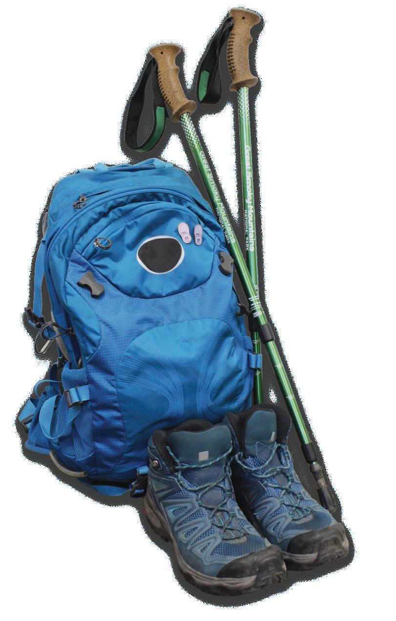
• Traction support like microspikes and hiking poles
• Navigation —map, compass, and knowledge of how to use them
• Water and food
• Extra layers
• First aid kit
• Headlamp or flashlight
• Rain gear and pack cover or waterproof bags
• Emergency whistle
• Sun protection with sunscreen, sunglasses, and hat
• Repair kit with multi-tool or knife
• Fire starter • Shelter —emergency tent or tarp
Tell someone where you’re going, stay on established trails, pack the essentials, and know what to do in case of an emergency. Let the NPS Backcountry Office help you plan and prepare for your hike. Call 865.436.1297, 8 a.m.–5 p.m.
IN AN EMERGENCY
• Call 911 if you can acquire a signal.
• Remain with any injured parties until help arrives. Use what basic first-aid techniques you know, but do not attempt invasive intervention unless you are medically trained.
• Use an emergency whistle to issue a series of three spaced blasts every few minutes to alert rescue crews. If you are in an open area, display brightly colored clothing or gear.
YOUR CELL PHONE IS NOT
• always going to have service
• a light
• a map
• a survival kit
THINGS TO DO IN THE WINTERTIME
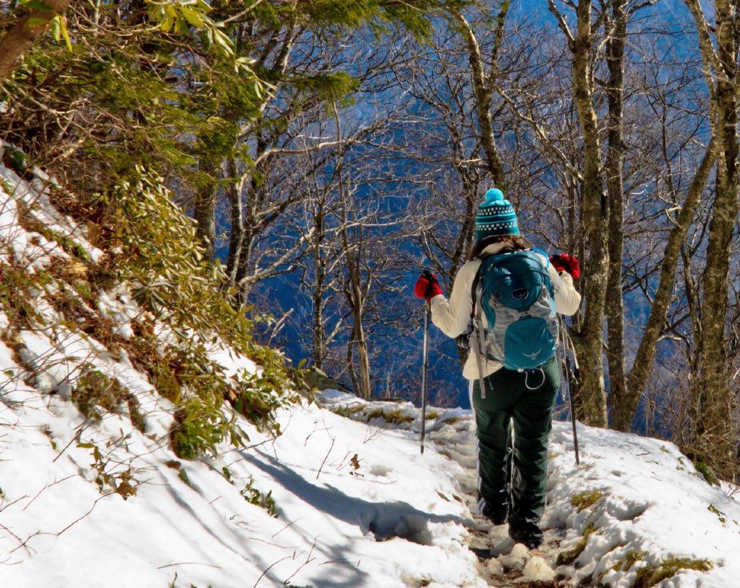
Hit the trail
There are more than 800 miles of trails in the Smokies ranging from leisurely quiet walkways to challenging mountain ascents. Just be sure to come prepared with rain gear, layers, traction support, and plenty of water and snacks. Download a free copy of the park’s trail map at nps.gov or purchase one for $1 at a visitor center or kiosk. Visitor center bookstores offer hiking references including Day Hikes of the Smokies and Hiking Trails of the Smokies. See page 4 for pack essentials.
Photo by Michael Hicks.
Spot winter wildlife
Winter may be a quieter season in the Smokies, but it brings golden opportunities to see wildlife including white-tailed deer, elk, and winterresident songbirds. As temperatures drop, several species of birds migrate to the park’s lower elevations where golden-crowned kinglets, chickadees, and nuthatches forage together in small mixed flocks. Take photos of birds and other wildlife you see and use the iNaturalist app to identify and share your observations. Remember not to feed or approach wildlife. If you see wildlife from your vehicle, continue to the nearest pull-out before attempting to view. Screech-owl photo by Fred Dunn.
Explore Smokies history
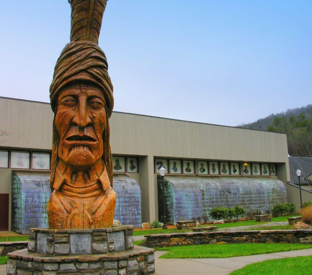
Visit Cherokee, North Carolina, and immerse yourself in culture and history at the Museum of the Cherokee People, one of the longestoperating tribal museums in the country. Visit motcp.org for hours and details.
Great Smoky Mountains National Park is a UNESCO World Heritage Site and home to many historic structures including churches, mills, and log cabins. In Cades Cove, Elkmont, and Oconaluftee, the bareness of winter reveals hidden structures, cemeteries, and other reminders of past Smokies residents. Museum of the Cherokee People photo by Judy Baxter.
Saturday, December 14
Festival of Christmas Past, Present, and Future Sugarlands Visitor Center, 10 a.m.–2 p.m.
Holiday Homecoming Oconaluftee Visitor Center, 11 a.m.–3 p.m.
Some ranger-led programs may be held during winter on a day-to-day basis. For a full list, inquire at a visitor center or visit:
go.nps.gov/GRSMcalendar
Parking tag purchase locations within the park
Parking tags may be purchased at locations designated by these symbols on the map:
Automated Fee Machine (AFM)
• Available 24 hours per day
• Accepts credit/debit only
• Daily and weekly tags only
Located at Sugarlands Visitor Center, Cades Cove Loop Entrance, Metcalf Bottoms Picnic Area, Newfound Gap, Oconaluftee Visitor Center, Deep Creek Picnic Area, Kuwohi (formerly Clingmans Dome), Greenbrier, Cosby, Big Creek, Townsend Wye, Look Rock, and Cataloochee.
Visitor Center
• Open business hours (see page 2)
• Accepts cash or credit/debit
• Daily, weekly, and annual tags available
Located at Sugarlands, Great Smoky Mountains Institute at Tremont, Cades Cove, Oconaluftee, and Kuwohi (formerly Clingmans Dome).
Parking tags are available outside the park at Great Smokies Welcome Center in Townsend, Gatlinburg Welcome Center, Swain County Visitor Center, and select area businesses.
For all purchase locations, see go.nps.gov/grsmfees.
Greenbrier
Words with a Ranger
Continued from page 1
have been hard times—but we have persevered.
Yet, the triumphs have always outweighed the heartaches. I won’t rattle off a list of accomplishments, although there have been many— because these successes are our successes. Without the support of our cooperating partners and neighboring communities, nothing can be achieved.
Together, we’ve implemented the Park It Forward program, with 100 percent of revenue staying in the park to fund new positions and needed projects. We’ve created the Forever Places endowment, which funds the restoration of historic buildings. We’ve constructed 33 new miles of the Foothills Parkway, reopened the Look Rock Campground, and completed more than $60 million of projects funded by the Great American Outdoors Act. And in 2020, we launched Hikes for Healing, providing a space for people to have open conversations about racism, diversity, and inclusion in a place long recognized for its incredible biodiversity. (Okay, maybe just a little bit of bragging!)
It’s difficult to put into words all the great admiration and affection I feel for Great Smoky Mountains National Park and its communities and partners. It has been my honor to serve alongside an incredible staff, partners, and dedicated volunteers. I have also had the privilege of getting to know our neighbors; I am proud to call you all my friends. Because in the end, it is people that truly matter. The mountains may be majestic, and the wildlife may be captivating—but only people can give a place its heart.
From the bottom of my soul, I thank you.
LEAVE ONLY FOOTPRINTS
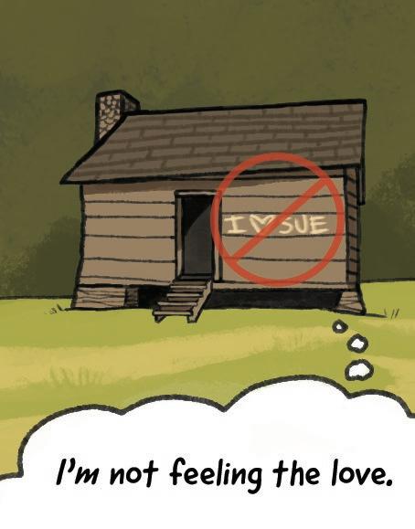
Writing on or carving into trees, stones, or structures can cause permanent damage—it’s also a crime! Taking a photo is always a better way to remember your time in the Smokies and helps preserve the park for others too.
BIN IT FOR THE BEARS
Help protect bears by packing out all trash and food waste and using bear-proof dumpsters in the park.
KEEP PETS ON DESIGNATED TRAILS
Remember that the Gatlinburg Trail and Oconaluftee River Trail are the only pet-friendly trails in the park. All pets must be kept on a leash no longer than six feet at all times.
Raccoon and firewood pest illustrations by Lisa Horstman. All others by Emma Oxford.
Sources:
“Hikers: Eat Bananas – but Take Your Skins Home.” theguardian.com “How Long Does Your Litter Live?” slocounty.ca.gov “‘Organic’ Litter is Not Copacetic.” hcn.org “Recycling Mysteries: Candy Wrappers.” earth911.com
Even a mushy apple core can linger on the landscape for as long as two months. That’s more than enough time to draw wildlife to places they shouldn’t be. Citrus contains a natural insecticide, meaning ants won’t touch discarded orange peels. They can take six months or longer to break down.
Banana peels can take around two years to completely rot—the thick skin protects the inner fruit from cold and resists decomposing quickly.
Cigarette filters contain cellulose acetate, a form of plastic. These frequently littered items remain intact for five to ten years on average.
Most candy wrappers (and granola bar wrappers) are made of a plastic and aluminum combo that won’t break down for ten to 20 years.
ALWAYS USE THE RULE OF THUMB
PLEASE LEAVE YOUR FIREWOOD AT HOME
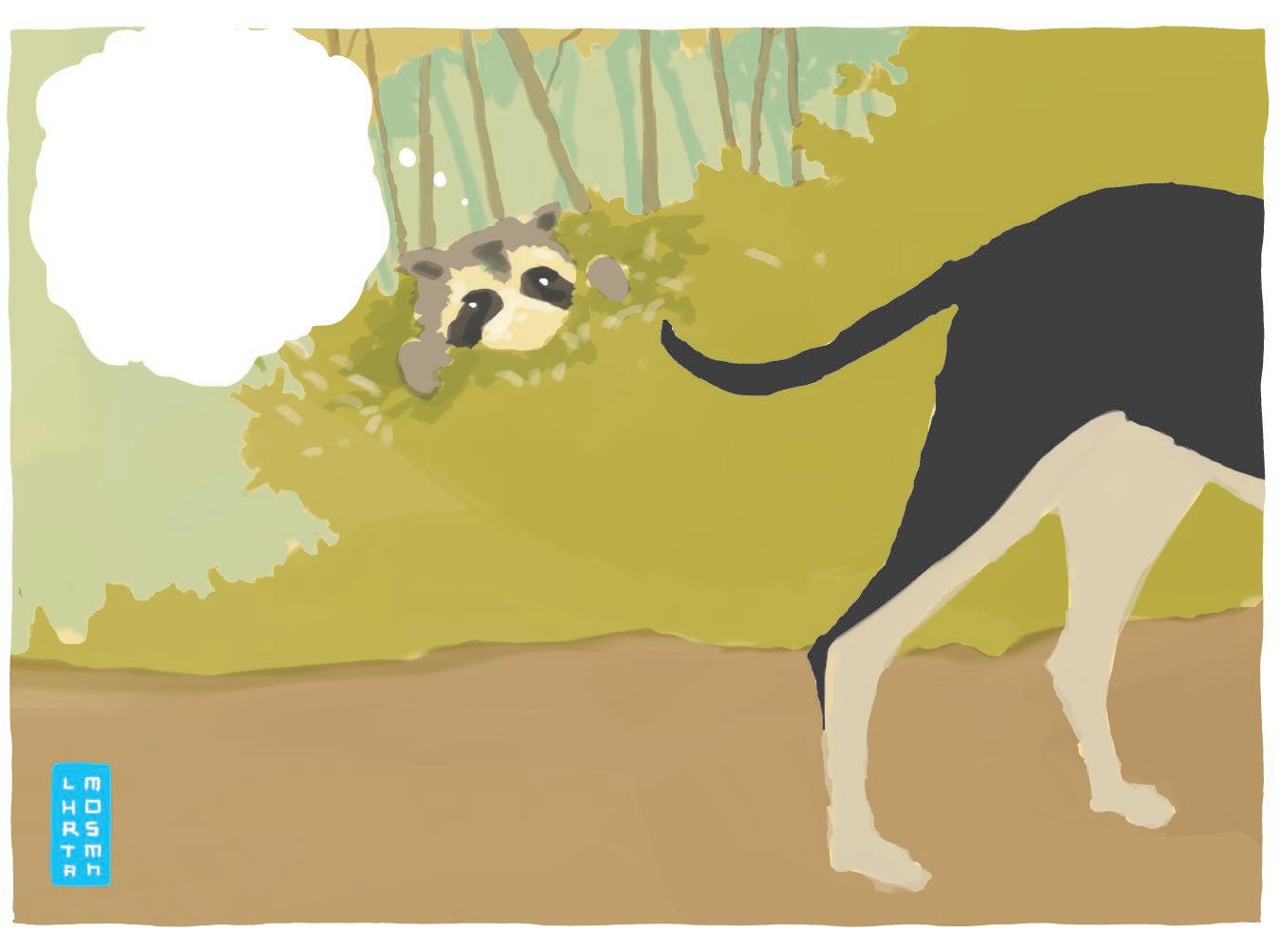
When viewing wildlife, hold your arm out straight. If you can’t cover the animal in your line of sight with your thumb, you’re too close!
Use only heat-treated or dead and down wood within the park. Harmful pests can hitchhike into the park on your firewood, which could kill millions of trees.
IF YOU LOVE THE SMOKIES
Smokies Life
Smokies Life (formerly Great Smoky Mountains Association) brings people of all backgrounds together as advocates and stewards to honor, sustain, and protect Great Smoky Mountains National Park.
Since 1953, Smokies Life has provided more than $50 million to the park. Today, the organization operates the park’s official bookstores, publishes books and other media about the Smokies, and supports the park’s educational, scientific, and historical preservation efforts.
Become a Smokies Life Park Keeper today by visiting SmokiesLife.org or calling 888.898.9102, ext. 257.
Interested in working in the park? Smokies Life is currently hiring for retail and information desk positions with rates beginning at $15.75/hr. Apply online at SmokiesLife.org/employment.
Friends of the Smokies
Discover Life in America
Tremont
Discover Life in America (DLiA) is devoted to cataloging every living species in the Smokies through the All Taxa Biodiversity Inventory. This ongoing project helps the National Park Service better understand and protect the 21,000 kinds of organisms documented in the Smokies, with more discovered every year.
Since 1993, Friends of the Smokies has raised over $85 million to assist GSMNP in providing visitors a safe, memorable experience while protecting the park’s historic and natural resources.
Every year, the park requests funding for projects and programs that would be unfulfilled without support from Friends.
Examples include:
• Trail rehabilitation
• Preservation of historic structures
• Facility repairs, upgrades, and renovations
• Accessibility improvements
• First responder equipment and training
• Educational programs for 10,000+ students
• Conservation and wildlife management
Learn more and become a ‘Friend’ at FriendsOfTheSmokies.org
DLiA also offers internship, volunteer, community science, and education opportunities that provide firsthand experiences in the Smokies, promote the importance of biodiversity, and foster stewardship of the natural world. Learn how you can support DLiA at dlia.org or call 865.430.4757.
Join the discovery!
Record life in the park with the iNaturalist app! dlia.org Park Keepers enjoy... • Bi-annual Smokies Life Journal • Smokies Live e-newsletter • Discounts at park bookstores and local businesses • Exclusive group hikes and expert-led events
GSMNP BY THE NUMBERS
Great Smoky Mountains Institute at Tremont offers kids and adults an opportunity to connect with nature through immersive, multi-day experiences in the national park. Through residential workshops, summer camps, and school programs, Tremont promotes curiosity and inspires learning for thousands of individuals each year.
Adult workshops include the Southern Appalachian Naturalist Certification program, photography courses, backpacking adventures, community science, and professional development for teachers.
Visit gsmit.org for program information or to learn how you can support life-changing learning experiences in the Smokies. Header photo by Rich Bryant.
13 5
25 0
miles of streams 90
species of bir ds + 2, 90 0 + species of tr ees
3, 50 0 species of f ungi +
500,000 acres of land
84 8 miles of tr ails +
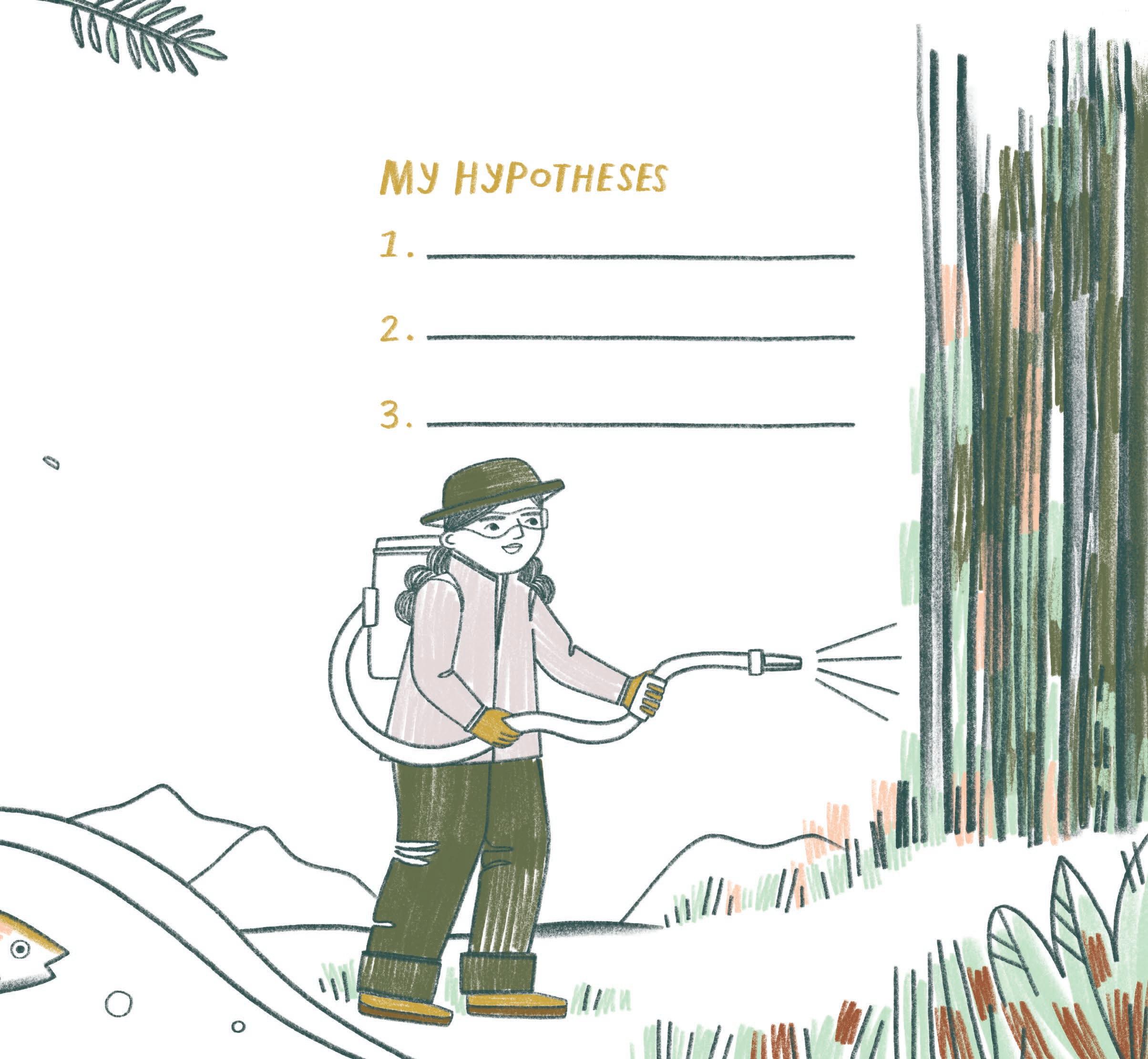
Scientists make predictions called hypotheses. These are more than guesses-- they are based on observations and on what we already know. You may not know for sure what’s for dinner, but if you smell pizza when you walk in the door, you can probably make a good hypothesis.
Hemlock trees are a keystone species; they are so important that losing them would totally change the balance of the natural world around them. Hemlocks grow very tall, have thick needles, shallow roots, and make dense shade. Can you make three hypotheses about why hemlocks might be important to forests, streams, and wildlife?
This activity is adapted from great smoky mountains national park’s jUNIOR ranger activity guide! work as a team to fill out the guide and earn a jr. ranger badge. available at any park visitor center!
regularly treats 300,000 trees to protect them from hemlock woolly adelgid (HWA), an insect that does not belong here. If you see a hemlock, look for a paint spot showing it was treated.
Illustration by Jesse White
SMOKIES INFORMATION
CAUTION: Some regional roads are temporarily closed due to damage from Hurricane Helene. Check smartway.tn.gov/traffic and drivenc.gov for the most up-to-date information.
(closedinwinter)
Information
General park info:
865.436.1200
nps.gov/grsm
Backcountry info:
865.436.1297
smokiespermits.nps.gov
Emergencies 911 Cherokee Police
828.497.4131
Gatlinburg Police
865.436.5181
Avoid the fine
A valid parking tag must be displayed when parked for more than 15 minutes anywhere in the park. Pets are permitted only on the Gatlinburg and Oconaluftee River trails, which allow dogs on a leash. Persons feeding wildlife are subject to a $5,000 fine. Picking or digging plants is prohibited in the park.
Accessibility
Restrooms at Cades Cove, Oconaluftee, and Sugarlands visitor centers are fully accessible. For more information about accessibility, go to nps.gov/grsm/planyourvisit/accessibility.htm.