Journal on natural and built environment Published by GO2Albania No. 41, January 2026 Distributet for free
TROPOJË
MALËSI E MADHE
109m
HAS
FUSHË-ARRËZ
156m 158m
58m PUKË
25m
ALBANIA MAP OF DEVELOPMENT PRIORITY ZONES
345m
KUKËS
79m LEZHË
MIRDITË DIBËR
355m
KURBIN
137m
KRUJË
State border Municipal boundary Municipalities with approved DCM on development priority zone Development priority zone approved with DCM 83m Average elevation of development priority zone under 600m
BULQIZË
DURRËS VORË
KAMËZ
83m TIRANË
50m
100m
LIBRAZHD
KAVAJË RROGOZHINË PEQIN 245m
255m 175m
DIVJAKË
LUSHNJË FIER
PËRRENJAS
200m CËRRIK 150m 150m
MALLAKASTËR
SELENICË
PUSTEC MALIQ
POLIÇAN
KORÇË
DEVOLL
MEMALIAJ KËLCYRË
VLORË
POGRADEC
GRAMSH
KUÇOVË DIMAL ROSKOVEC BERAT PATOS
GJIROKASTËR LIBOHOVË
HIMARË
GJIROKASTËR
DELVINË SARANDË
DROPULL
FINIQ
KOLONJË
Priority development zones approved by special DCMs were digitized in QGIS based on official coordinate descriptions and georeferenced at national scale across all Albanian municipalities. The average elevation for each zone was calculated through spatial analysis using national elevation data and presented in this map, highlighting zones below 600 m above sea level, which are not considered mountainous.
KONISPOL
Map of development priority zones on the Mountain Package approved until December 31th, 2025. Prepared by: GO2, 2026
In this issue:
PAGE IV
PAGE II, VI
PAGE II, V
PAGE III, VIII
PAGE V
PAGE VII
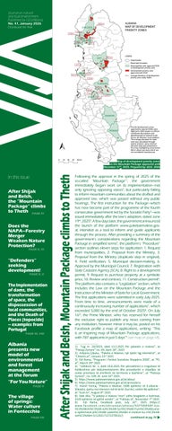
Following the approval in the spring of 2025 of the so-called “Mountain Package”1, the government immediately began work on its implementation—not only ignoring opposing voices2, but particularly failing to inform mountain communities about the drafted and approved law, which was passed without any public hearings. The first instruction for the Package—which has now become part of the programme of the fourth consecutive government led by the Socialist Party3—was issued immediately after the law’s adoption, dated June 19th, 20254. A few days later, the government announced the launch of the platform www.paketaemaleve.gov. al, intended as a tool to inform and guide applicants through the process. After providing a summary of the government’s considerations regarding the Mountain Package in simplified terms5, the platform’s “Procedure” section outlines eleven steps for application: 1. Request from municipalities, 2. Proposal from the Ministry, 3. Proposal from the Ministry (duplicate step in original), 4. Field verification, 5. Municipal decision-making, 6. Approval by the Municipal Council, 7. Registration with State Cadastre Agency (SCA), 8. Right to a development permit, 9. Request to purchase property at a symbolic price, 10. Review and contract, 11. Construction permit6. The platform also contains a “Legislation” section, which includes the Law on the Mountain Package and the Instruction of the Minister of State for Local Government. The first applications were submitted in early July 2025. From time to time, announcements were made of a continuously increasing number of applications7, which exceeded 5,000 by the end of October 20258. On July 16th, the Prime Minister, who has reserved for himself the exclusive right to publish any news coming from any institution, however minor it may be, posted on his Facebook profile a map of applications, writing: “This is an inspiring map of Mountain Package applications, with 787 applicants in just 5 days”9 (see map on page VII). 1) “Ligj nr. 20/2025, datë 13.3.2025 Për paketën e maleve”, at “Fletoja Zyrtare” no. 69, April 18th, 2025 2) Arbjona Çibuku, “Paketa e Maleve, një tjetër ligj klientelist”, at “Citizens.al”, January 23rd, 2025 3) Edi Rama, “Programi i Partisë Socialiste Shqipëria 2030”, at “PS. al”, March 29th, 2025 4) “Udhëzim Nr. 1, datë 19.6.2025 Për përcaktimin e rregullave të hollësishme për dokumentacionin dhe procedurën e shpalljes së zonës prioritare të zhvillimit në territoret e bashkive”, at “Fletorja Zyrtare”, no. 109, dt. June 24th, 2025 5) https://www.paketaemaleve.gov.al/al/about 6) https://www.paketaemaleve.gov.al/al/procedura 7) Hamit Yzeiraj, “Paketa e Maleve, 3308 aplikime në E-albania Shkodra, qarku me interesin më të lartë. Durrësi, vetëm 96 aplikime”, at “Scan.tv”, August 8th, 2025 8) Sebi Alla, “Si paketa e maleve ‘mori’ edhe bregdetin e kodrinat, 5520 aplikime në gjithë vendin”, at “Faktoje.al”, November 7th, 2025 9) Edi Rama, Facebook post, July 16th, 2025 (https:// www.facebook.com/ediramaal/photos/%EF%B8%8F-kjo%C3%ABsht%C3%AB-nj%C3%AB-hart%C3%AB-frym%C3%ABzuesee-aplikimeve-p%C3%ABr-paket%C3%ABn-e-maleve-ku-n%C3%ABvet%C3%ABm-5/1292171272278531/) continued at pg. IV
Artan Rama
Autumn landscape. Lëpushë, Kelmend, “Albanian Alps” National Park, October 2025. Photo: GO2
It is being presented as a reform – as a necessary modernisation of the model for managing nature, forests and protected areas in Albania. The Prime Minister declared that the merger of the National Agency of Protected Areas (NAPA) with the National Forestry Agency would bring “360-degree management”, “institutional synergy” and “increased efficiency”. At first glance, these sound like the slogans of an administration seeking to keep pace with the times. However, if this move is analysed within a broader political, ecological and institutional context, its aims appear far more complex and potentially problematic. Albania today finds itself at a decisive moment for nature: the contested Law on Protected Areas (Law No. 21/2024) has weakened construction restrictions within the territories of Protected Areas; pressure from tourism, energy and infrastructure projects is higher than ever, whereas the trust in environmental institutions is fragile. Precisely at this tense point, the government has decided to dissolve the main institution that, until now, has held the mandate to protect nature. Nevertheless, let us first examine the advantages of this move (based on the current context in Albania), which, in my view, exist only in theory. It is true that the merger of the two agencies could bring some technical benefits. In many European countries, the management of forests and protected areas is coordinated in order to ensure ecological connectivity, reduce institutional fragmentation and create integrated landscape policies. In theory, a unified agency could respond more quickly to fires, reduce bureaucracy, save funds and better manage habitats that extend both inside and outside protected areas. But these benefits are conditional. They occur only where there are strong institutions, transparency, professional culture and unwavering respect for the primary objective of Protected Areas, which is the conservation of biodiversity. Now, let us look at the real risks, when the conservation mission disappears under economic pressure. The greatest risk arising from this merger is not organisational, but structural and conceptual. Protected Areas have a clear and non-negotiable mission: to protect nature. Forests in Albania, by contrast, have historically been treated as a source of timber, grazing land and economic activity and, not infrequently, as a field of political and clientelist influence. When these two logics are brought together within a single institution, a fundamental question arises: which mandate will prevail— nature conservation or the exploitation of territory? continued at pg. VI II
41 2026
Yesterday, in one of the inner chambers of the revived Pyramid of Tirana, a small community of friends and donors, among them bureaucrats and professors, invited by the Ministry of Environment, gathered to celebrate (without much enthusiasm) the 10th anniversary of the National Agency for Protected Areas (NAPA). The ceremonial level of the jubilee, under the elegiac title “For you, nature”, was raised by the presence of the Prime Minister, although he himself did not stay until the end. Daniel Pirushi, executive director of this agency, gave the first speech; then, Minister Sofjani and finally, Prime Minister Rama. The activity was followed by live, on Facebook, on the prime minister’s channel, with over one and a half million followers. Little of what was said is worth addressing, briefly, here. In an effort to promote Rama’s vision of urban revitalization projects, Pirushi acknowledged that such projects could serve as replicable models in the network of protected areas, concluding, and this is about the managers of the national network of these areas, that these are not guardians, but lovers of nature. The question rightly arises. If it is not the administration of protected areas that protects them, who protects our parks? In the 3 and a half years since his appointment as head of the NAPA, Pirushi has learned to avoid responsibilities. The same pattern of avoidance has spread down into the subordinate structures. Perhaps this serves individual interests better to protect their jobs, since protecting the parks often endangers their careers. continued at pg. V
Cemetery in the old Aldeia da Luz, September 2001. Photo: João Luís J. Fernandes
This text summarizes, from the geographers’ point of view, several aspects to be considered when building and implementing dams. It is important to begin by recalling two of Geography’s fundamental concepts: landscape and territory. The first concerns perceived space, approached through a multisensory perspective (what is seen, observed, heard, or smelled). The second, more political, refers to appropriated and controlled space. In reality, the construction of a dam interferes with both of these geographical dimensions — with the landscape, which is altered irreversibly, and with the territories and territorialities of local populations affected by such infrastructures, which bring with them new power relations and new actors, whether public or private. In this context, we invoke the concept of “deterritorialization,” as understood by the Brazilian geographer Rogério Haesbaert. With a long trajectory in the human and social sciences, this concept has often been interpreted — for example by anthropologist Arjun Appadurai — as synonymous with “loss of space” and a certain downgrading of factors such as location. From this perspective, deterritorialization is seen as a condition of hypermobility, stemming from the compression of space–time and the acceleration of the social ecosystem. The notion of “deterritorialization” applied here, however, is the one used by geographers: it refers to processes of “loss of territory” and “reconfiguration of territorialities.” Whether or not it implies physical displacement, this deterritorialization expresses shrinking, degradation and territorial vulnerability. This theoretical framing aligns closely with the transformative dynamics induced by many dams, such as the Three Gorges Dam in China, which displaced nearly one million people. Similar examples can be found across the world, from Brazil to India. In the latter case, the construction of the system of dams in the Narmada Valley — a highly contentious process denounced by the writer Arundhati Roy — resulted in the displacement of an estimated 200,000 to 400,000 inhabitants, mostly vulnerable rural communities. Although exact figures remain difficult to establish, estimates suggest that since the independence of the Indian state, dams have displaced between 40 and 80 million people. This scale reflects the fact that India, alongside China, is among the countries with the highest number of large dams globally. 41 2026
III
Dams must be understood as one factor — among several — that has contributed to the global urbanization of populations. Despite being an uneven phenomenon, cities worldwide have grown through the arrival of people living in increasingly precarious conditions. Although assessing the balance of impacts is difficult and must be carried out at the local scale, dams provide vital resources such as irrigation water, electricity, or leisure areas. At the same time, they may erase houses, footpaths, agricultural land, pastures, and forests. From this viewpoint, two additional concepts are important: domicide (the “death” of the home) and topocide (the “destruction” of place), which capture the negative geohuman consequences downstream of the construction of large dams. In mainland Portugal, there exists a geography of small, medium and large dams across every river basin — from the Douro to the Tagus, from the Mondego to the Guadiana, from the north to the south of the country. This distribution results from political decisions, but also from the Mediterranean climate, in which the driest months coincide with the hottest, during summer. For this reason, beyond energy needs, dams have been central to water management throughout the year. At present, Portugal has 260 large dams used for electricity generation, agricultural irrigation and public water supply. Around seventy of these were built in the 21st century; however, the major transformative push in rural space occurred throughout the 20th century. The 1950s and 1960s, particularly the 1950s, were marked by the Estado Novo regime’s surge in public works, including many dams for electricity production. Examples include the Castelo de Bode Dam, built in 1951 on the Zêzere River and supplying water to Lisbon, and the Picote Dam, completed in 1958 on the Douro River in the north. During the 1960s and 1970s, the construction of Portugal’s dam network expanded. In 1971, in the north of the country, the Vilarinho da Furna Dam was completed on the Homem River, submerging the iconic communal village of Vilarinho da Furna, extensively studied by the ethnographer Jorge Dias. This period also saw the launch of the Alqueva Dam project on the Guadiana River, in the south, near the border with Spain. The “Alqueva Multipurpose Project” was only completed in 2002, with the closing of the floodgates and the filling of the continued at pg. VIII reservoir.
Map of development priority zones on the Mountain Package in Theth. Prepared by: GO2, 2026 continues from pg. I In parallel with appli cations on e-albania.al, the government began requesting from municipalities across the country maps of priority zones for development10. Within a record time, the “base proposals” (from municipalities) for priority areas were converted into Decisions of the Council of Ministers (DCM). Till now 9 municipalities11 have had such DCMs approved (see map on page I). At this stage, concerns over the consequences of the law add to the early worries that arose during the repeal of the Law on Protected Areas12. Clearly preceded by that Law13, the effects of the Mountain Package are beginning to be felt not only within protected areas— including IUCN Category II National Parks, from the coast up to mountains around 1,000 metres above sea level—but also in any other territory considered subject to the broad scope of the Mountain Package. Although there is no strict definition of “mountain”14, both national15 and international literatu re suggests that, depending on the geo graphical region16, mountains are con sidered large natural landforms rising at least 600 metres above sea level17 with a terrain slope of at least 15%18. However, reviewing the latest government decisions on declaring priority zones for development, it is clear that alongside Vau i Dejës, Elbasan, Përmet, Mat, Skrapar, Shkodër, etc., the priority zones also include the territories of lowland municipalities such as Belsh and Shijak, whose highest elevations do not exceed 300 m (see map on page I). These zones have been declared by special DCMs’ No. 624, 625, 626, 627, 714, 715, 716, 780 and 781 until December 2025. It is therefore clear that the law is called the “Mountain Package” only in name. In practice, the objective is not just mountains, but any land with development potential that has not yet been sanctioned under existing preferential laws, similar to the infamous provisions For Strategic Investments19. Even in the case
of Theth—the site of Albania’s first national park, where a priority development zone was declared in November 202520—the designation overlaps the village’s historical centre and the culturally protected zone established 8 years earlier21. According to Article 10 of the accompanying 2 DCM bylaw22, the competence and responsibility for interventions in these zones is delegated to the Institute of Cultural Monuments (ICM). Projects are reviewed by the Scientific Council of the Institute of Cultural Monuments and approved by the National Restoration Council.” However, the Mountain Package and the two ministerial instructions associated with it make no mention of the ICM. The same disregard applies to the National Agency of Protected Areas, which under the law should have authority over the administration of Central Zone B of the zoning plan of the “Albanian Alps” National Park. This zone also overlaps cadastral zones number 3579 and 2771, covering a total of 2,712.2 hectares—from the water sources of the Okol river in Theth to beyond the Ndërlysa riverbed and across Kaprre (see map on page IV). This disregard for the Agency of Protected Areas—which is being merged with the Forestry Agency23— comes almost two years after catastrophic amendments to the Law on Protected Areas, which changed not only naming conventions but also expanded the range of activities permitted in these zones. Ironically, Article 49 of that law forbids the placement of posters or signage in the Sustainable Use subzone! The deliberate chaos created by the 2024 amendments generates confusion. Article 49, for instance, states: “Activities permitted in the Sustainable Use subzone, aside from those defined in Article 33 of this law, shall be determined in the DCM declaring the protected area.” Yet the DCM of January 202224 allows no activities within Protected Areas beyond those reco gnised by the Law. continued at pg. VII
10) Redaksia, “Paketa e Maleve/Rama kritika kryebashkiakëve: Pse nuk keni dorëzuar hartat me zonat prioritare?”, at “Shqiptarja.com”, October 23rd, 2025 11) Agjencia Kombëtare e Planifikimit të Territorit/Legjislacioni/Turizmi/VKM (https://planifikimi.gov.al/ index.php?id=l67t) 12) Elira Kadriu, “Qeveria mbështet hapur projektligjin për të lejuar ndërtimet në zonat e mbrojtura”, at “Citizens.al”, December 7th, 2023 13) “Ligj Nr.21/2024 Për disa shtesa dhe ndryshime në ligjin nr.81/2017 Për Zonat e Mbrojtura”, at “Fletorja Zyrtare’ no. 50, March 20th, 2024 14) Christian Körner, Davnah Urbach, Jens Paulsen, “Mountain definitions and their consequences” at “Alpine Botany”, Volume 131, Issue 2, October 2021 15) “Fjalori i Gjuhës së Sotme Shqipe”, 1980 16) “The Oxford English Dictionary” 1989 17) Dictionary.com 18) Council Directive 75/268/EEC, “On mountain and hill farming and farming in certain less- favoured areas”, April 28th, 1975 19) “Ligj Nr. 55/2015 Për Investimet Strategjike në Republikën e Shqipërisë”, at “Fletorja Zyrtare’, no. 113, July 1st, 2015 20) “Vendim Nr. 714, datë 26.11.2025 Për shpalljen e disa zonave me përparësi zhvillimin e ekonomisë malore në Bashkinë Shkodër”, at “Fletorja Zyrtare” no. 223, December 2nd, 2025 21) “Vendim nr. 733, datë 8.12.2017 Për shpalljen e qendrës historike të fshatit Theth, Shkodër e të zonës së mbrojtur përreth saj dhe miratimin e rregullores për administrimin e saj” at “Fletorja Zyrtare” No. 223, December 20th, 2017 22) “Udhëzim Nr. 1, datë 19.6.2025 Për përcaktimin e rregullave të hollësishme për dokumentacionin dhe procedurën e shpalljes së zonës prioritare të zhvillimit në territoret e bashkive”, at “Fletorja Zyrtare”, no. 109, dt. June 24th, 2025; and “Udhëzim nr. 2, datë 15.10.2025 Për përcaktimin e rregullave të hollësishme për dokumentacionin dhe procedurën e shpalljes së zonës prioritare të zhvillimit në territoret e bashkive”, at “Fletorja Zyrtare” no. 190, October 16th, 202 23) Ministry of Environment, “Shqipëria prezanton modelin e ri të administrimit të mjedisit dhe pyjeve në forumin kombëtar Për Ty Natyrë”, December 5th, 2025
24) “Vendim nr. 59, datë 26.1.2022 Për miratimin e ndryshimit të statusit dhe të sipërfaqes së ekosistemeve natyrore Park Kombëtar (kategoria II) të Zonave të Mbrojtura mjedisore” at “Fletorja Zyrtare” no. 16, February 1st, 2022 IV
41 2026
continues from pg. II In any case, communications through language tricks cannot be superimposed on the legal responsibilities that belong to the administration of protected areas. The declarative denial of the figure of the ranger supports the evildoers and bandits who rob and destroy national parks. Meanwhile, in aid of avoidance, support for the socalled “environmental education” is also exaggerated, overestimating its role. The fact is that the rangers are not educators; nor are they biology teachers. This is another method to cover up responsibilities, to brainwash the public about the usefulness and efficiency of the administration of protected areas. Bureaucrats turned into educators are hypocrites. The administration is not a school, nor a church, but a law enforcement body. Rama himself went even further. At the end of his speech, when he addressed representatives of environmental organizations, he mocked their efforts towards the environment, implying that they protect it to ensure their livelihood. This is not the first aggression he has undertaken against them. In 2022, he called them “annoying protectors”, while during the time when he liberalized the construction of tourist hotels within national parks (with the changes to the law on protected areas), in an attempt to paralyze their reaction, he tried to intimidate them with these words: “respect us if you want us to respect you…”. No matter how much he tried to be somewhat more moderate this time, the mask of kindness failed to cover the aggression and chronic cynicism towards civil society. Despite the fact that such attitudes are not only opinionated and political, despite the fact that even the so-called civil society suffers serious symptoms, the hypocrisy of a society does not burden the conscience of the prime minister, but the prime minister’s “dedication” to the natural environment constitutes a separate hypocrisy that harms society. It is the same action, as Pirushi tried to do before, which aims to transfer responsibility to another; the same attack tactic that aims to discredit the political opponent, to strip the effort to protect nature of its morality in the eyes of the public. Thanks to this mindset, although they have increased in hectares, in ten years protected areas have become impoverished in biodiversity. Two of the areas with the highest protection (Strict Zone), the Gashi Forest (Tropojë) and the Kardhiqi Fir (Gjirokastër) have lost their previous status. Renewable energy production plants have been allowed to be built within the Pishë-PoroNartë Protected Landscape, where the much-contested Vlorë International Airport is also being built. Tourist hotels, in addition to other infrastructure works, have secured legal support to be built within national parks. Hundreds of hectares of Mediterranean pine habitats, along the coastline, have been scorched by fires. The Vjosa, which is promoted as the last wild river in Europe, but which is actually the only national park on paper in Europe, carries every day, through its wide bed, all the feces of Southern Albania towards the Adriatic. There is no future in this decade for protected areas. Last year the law was changed to allow development. Today the guards are being asked to leave. One thing is certain: protected areas are protected, not revitalized; they need guardians, not prime minister’s court architects and urban planning bureaucrats. Often, heritage “revitalizations” cost us more than the revenue they could generate. But not everyone understands this...
Tirana became the center of a new environmental vision today, as the national forum “For You Nature”, led by the Minister of Environment Sofjan Jaupaj, brought together in a single space policymakers, academia, implementing agencies and key international partners, including IUCN and UNESCO. The forum marked the beginning of a new stage in the management of the environment, forests and biodiversity in Albania, in line with the country’s journey towards membership in the European Union. Together with Prime Minister and the Director of AKZM, Minister presented the priorities and strategic directions of the new reform for building a modern, integrated system in line with European standards. At the center of this transformation is the merger of the National Agency for Protected Areas (NAPA) with the National Forest Agency (NFA), creating a unique management structure to increase efficiency, transparency, and control over the territory. “The time has come to build a new, transformative and modern model for the environment. We will unite the NAPA and the NFA into a single structure, for unified management, data-based decision-making and stronger control of the territory. Nature knows no administrative borders. Neither does our approach.” – minister says. Prime Minister praised the reform as a key instrument, underlining that the modernization of nature management is fundamental for Albania’s progress in the European integration process. During the forum, the main steps of the reform were presented, including: strengthening biodiversity protection through scientific monitoring and advanced technology; modernizing forest management and digitizing territorial data; increasing transparency and involving local communities; promoting ecotourism and the green economy as engines of development; full harmonization of the legal framework with European Union standards. International partners, including IUCN, UNESCO, as well as development agencies, appreciated the commitment of the Albanian government and Minister Jaupaj’s vision for creating an administration model that combines science, innovation and practical territory management.
Daniel Pirushi, director of National Agency of Protected Areas (NAPA) speaking at “For You Nature”, December 5th, 2025 Source: NAPA Facebook.
Ministry of Environment 41 2026
V
Kërtoku Peak (1700m), southwest of Jame, Nikç, Kelmend, “Albanian Alps” National Park, July 2025. Photo: GO2 continues from pg. II In most countries where a similar governance model has been attempted without strong legal safeguards, the outcome has been clear: nature institutions lose influence, while those concerned with the economic use of land gain ground. In practice, it is far easier to justify a tourism project or a logging operation than to defend an endangered habitat, especially in a political climate where economic development is presented as the ultimate justification. Examples of this can be found repeatedly in our own country. The media have frequently reported on project developments carried out in clear violation of the law, causing extraordinary environmental damage. The construction of hydropower plants or photovoltaic parks has, not infrequently, sacrificed habitats that support significant proportions (up to 3–4%) of the total European populations of certain species. It should not be forgotten that Albania, although small in area, possesses geographical characteristics that make it a biodiversity hotspot on the European continent; unfortunately, this fact is not emphasised nearly enough. To demonstrate that this is not a hypothetical risk, several cases may be cited, including Romania, Poland and Turkey, where similar models of institutional merger led to a weakening of nature conservation. In Romania, for example, national parks were placed under the administration of the State Forestry Agency, with catastrophic results: logging within protected areas, infringement procedures initiated by the EU, and the loss of independence of conservation structures. In Poland, the forestry administration began largescale logging in the Białowieża Reserve as soon as it acquired the relevant competences. In all these cases, forest economics prevailed over biodiversity. The merger of the agencies creates a paradox: the institution that will tomorrow issue permits for forestry use, tourism development or other economic activities in forests will be the same institution responsible for assessing the environmental risks arising from those activities. The same hand authorises, the same hand monitors, the same hand reports. This conflict of interest is fundamental and cannot be resolved without strong, independent structures. For this reason, the merger should be seen not merely as a technical reform, but as a change that affects the balance of power between nature and the economy—a balance that in Albania has always been fragile. Why does the political context make this move questionable? It cannot be ignored that this merger was announced shortly after amendments to the Law on Protected Areas, which: (i) softened construction bans in many categories of Protected Areas; (ii) created vague openings for tourism projects; and (iii) shifted the balance
of the law from protection towards “sustainable development”—a term that in practice is increasingly used to justify construction within protected areas. In this context, the merger gives the impression of a move driven more by the centralisation of political control than by the strengthening of nature protection institutions. Furthermore, the risk of weakening the professional culture of nature conservation must not be overlooked. NAPA, despite its shortcomings, represented a specialised institutional culture: biologists, biodiversity experts, rangers, international projects, and more. Absorbing this structure into a large, predominantly “forestry” agency risks: (i) eroding specialisation; (ii) reducing technical independence; and (iii) weakening the voice of science in decision-making. This is particularly dangerous at a time when Albania must prepare for the Natura 2000 network and comply with the obligations arising from EU directives. The central question, then, is what model we want for Albania’s nature. There are two possible paths: (i) a model of genuine ecological and scientific integration, in which forests and protected areas are managed together, but with strong safeguards, independent departments and a clear conservation mandate; or (ii) a model of political centralisation, in which nature loses its status as a priority and becomes an appendage to development projects. In the absence of transparency, public consultation, impact assessment and legal guarantees, everything unfortunately suggests that we are moving towards the second option. I do not wish it to be understood or implied that, as an environmental specialist, I am conservative or opposed to reforms—quite the contrary. I am, however, opposed to the weakening of nature protection. I emphasise this because environmental experts are often portrayed as being against reform and “modernisation”. Albania does need reforms in nature management. It needs unified data systems, technology, and better coordination between institutions. But it has an even greater need for clear guarantees that conservation objectives will not be sacrificed in the name of opportunistic investments. Until such guarantees exist, in my view, any merger that affects the principal institution responsible for protected areas is not a reform, but a regression disguised as modernisation. Ultimately, the question we must ask is this: will this merger serve the nature of Albania, or other interests that are waiting for new spaces to open up? At this stage, the answer is far from clear. Mirjan Topi *) The title is the editors’ own. The original version by the author: Albania on the Road to the EU, but the environment is a hard pill to swallow. Are we biting off more than we can chew? VI
41 2026
Fontecchio is a village in the province of L'Aquila, of pre-Roman origins, located in the Aterno River Valley. Rich in water and springs, it is known for its remarkable 14th-century fountain, part of a complex water system consisting of additional basins and channels once used by the craftsmen of the workshops located close to the city walls, or for watering animals. The fountain has a polygonal basin, at the centre of which stands a column with plant figures and four masks, from whose mouths the spouts emerge, culminating in an octagonal lantern with Gothic windows supporting a conical spire. A primary place of socialising, the fountain literally gave life to the population, providing nourishment and opportunities for encounters. A survey conducted in the winter of 2025 as part of a research project aimed at producing multimedia content for I Cammini degli Altipiani (The Paths of the Highlands), funded by the USRC - Special Office for the Reconstruction of the Crater Municipalities, Fossa (AQ), and in collaboration with the European project Tramontana Network, highlighted the importance of the fountain's water for the inhabitants of Fontecchio, its value as an emotional and auditory memory, and its cultural and social significance. The three interviewed persons, Concetta Pellegrini, Alessio Di Giulio, and Marzia Ippoliti, generate a linked narrative on the role of water in the history of their community. Concetta Pellegrini: I was born up in San Nicola, beyond the tower, but my grandparents lived right behind the fountain, and so there were always lots of people there, mostly girls and elderly people. We would go there, make friends, get to know people, talk, tell stories, do all sorts of things like that. Often the girls, mostly the girls, would go to the fountain to chat or meet up with friends and stuff like that. We would meet at the fountain, take the water home, throw it away on the way back, and then go back to the fountain to get more water so we could stay with the other girls, you know? Alessio Di Giulio: This theme of water is fundamental to Fontecchio. As the name suggests, Fontecchio means “small fountain”, fonticulum. There is also a beautiful 18th-century motto praising the water that brought relief and gave its name to the village of Fontecchio: 'Here is the living source of healthy sweetness from which the people of Fontecchio derive their name, coat of arms, relief and honour'. Marzia Ippoliti: Fontecchio is water, in the sense that it has always had water, it lives around water, the water of the fountains, the water of the springs, the springs of the friars, the water of the friars. We also had other fountains rich in water, the water of the Rio, for example, the 14th-century fountain outside the walls, outside this walled enclosure, let's call it that. So I like to imagine the people who once walked out these doors to fetch water from nearby. Alessio Di Giulio: The fountain, being so central, also became a meeting place. Until the 1960s, not so many years ago, women would come with their basins on their heads to fetch water to take home, and it was a place for women to socialise, but from above the wall there were boys watching the girls below, pretending to spill their water so they could come back for more, there was a whole world connected to this. Concetta Pellegrini: Everything was there, water is life, isn't it? Back then, water was necessary, whatever you needed, you had to go to the fountain... how many loves were born at the fountain. Alessio Di Giulio: By the way, for those who want to try carrying a full basin on their head, it's hard work, you can't even lift it up, I don't know how these ladies did it. Concetta Pellegrini: Then in winter we slipped, we put rags on our feet so we wouldn't slip on the snow, you know? Then we would have a competition to see who could carry it without using their hands, right? We would twist it into a coil and put it on our heads, and carry it home. Marzia Ippoliti: Water is life, isn't it? It is a source, it is identified with Christ, the source of life. This is a medieval village, many elements can also be traced back to spirituality: water is a source that must be respected. Sister water, used sparingly... it is a gift. Bibliography:
AA.VV., I volti dell'acqua. La fontana di. Fontecchio, Arti Grafiche Aquilane, L’Aquila 2017
The fountain before intervention, 2015. Photo: Giorgia Gentilini
41 2026
VII
The fountain after restoration, 2016. Photo: Giorgia Gentilini
Map of first 787 aplicants, July 16th 2025. Source: Facebook.com/ediramaal continues from pg. IV
The 2024 Law, in Article 33(2), allows: “Activities carried out in accommodation structures of excellence, five stars or higher, in tourism and any other supporting or associated infrastructure, regardless of whether this is specified in the DCM declaring the protected area”25. Paragraph 3 allows similar activities for agritourism accommodations and related infrastructure. It is therefore clear that, at least in the case of Theth, the Mountain Package has been preceded by: a.) The internal rezoning of the “Albanian Alps” National Park in 2022 b.) Amendments to the Law on Protected Areas in 2024 Without wishing to repeat the historical approach to the property of local mountain communities, who have survived centuries of hardship (covered in issue 37 of VIJA26), it is hoped that this article contributes, even modestly, to informing and raising awareness among mountain communities and activists about the risks posed by the implementation of the Mountain Package to both cultural and natural heritage. 25) “Ligj Nr.21/2024 Për disa shtesa dhe ndryshime në ligjin nr.81/2017 Për Zonat e Mbrojtura”, at “Fletorja Zyrtare’ no. 50, March 29th, 2024 26) “The ‘Final Hit’ to the mountain communities”, at “VIJA”, no. 37, June 2025
Old Aldeia da Luz. Street. September 2001. Photo: João Luís J. Fernandes
New Aldeia da Luz. Street September 2001. Photo: João Luís J. Fernandes
continues from pg. III The imple mentation of this infrastructure produced the most studied case of population “deterritorialization” in Portugal — that is, the loss of territory followed by processes of reterritorialization, in which both personal and collective territories are reorganized in response to the construction of a dam. At the time, the Aldreia of Luz, with around 300 inhabitants, was submerged. Because this process occurred under democracy (unlike Vilarinho da Furna), the displacement of families involved lengthy negotiations. That dialogue was undoubtedly asymmetrical and framed by a certainty: the dam would proceed, and the project was non-negotiable. Even so, a new settlement — also named “Aldeia da Luz” — was built five kilometres away, outside the flood zone. Among the most emotionally difficult aspects of the relocation was the transfer of the cemetery, along with geosymbolic elements such as the church and a communal fountain. The new “place,” designed in architectural and engineering studios, is more open, orderly and hygienic, equipped with improved infrastructure, sewage treatment and modern housing. Neighbourhood relations were also preserved. However, surveys, interviews and research reveal that the true construction of “place,” as an affective and memoryladen space, is a slow process — evident in the reduced vibrancy of public life in the new settlement. The built space is real, but the past lies submerged; childhood places and lifelong spaces have vanished, and the trauma of loss remains, particularly among an ageing population. Recognizing the importance of this connection to the past, the new village includes a museum housing materials, objects, photographs and videos that recall the lost place. Symbolically, a small window was opened — functioning both as a lookout and as a temporal threshold — facing the reservoir whose waters lie directly above the submerged village. Elsewhere in Portugal, the process took different forms. In Vilarinho da Furna, also with around three hundred
inhabitants, displacement occurred before the democratic transition. The population was dispersed across several neighbouring villages and towns, and the community dissolved. Nonetheless, former residents formed an association, created a museum in “Campo de Gerês,” and maintained gatherings, religious rituals, and visits to the remnants of the village. During the driest months of the year, when the water levels recede, parts of the old settlement become visible. The same occurs with the memories of places such as Foz Dão, Breda and others, which disappeared following the construction of the Aguieira Dam in 1986 on the Mondego River near Coimbra. In this case, around 1,330 inhabitants were displaced. They received compensation and settled mainly in nearby areas. Still, rituals of memory persist — photographic exhibitions, gatherings, and visits to the reservoir's margins whenever dry weather reveals traces of former life. In these collective behaviours, we recognize the concept of topophilia — the “love” and affective attachment to place — developed in Cultural Geography by authors such as Yi-Fu Tuan. The reterritorializations that follow such projects — the construction of new life territories and the reorganization of everyday routines — also rely on memory, on the connection to the past, and on the imaginary of lost places that persist in the lives of those displaced. To conclude, it should be emphasized that in the Portuguese case, the construction of dams was not the driving force behind the country's urbanization or the concentration of population in the two metropolitan areas (Lisbon and Porto) and in some diffuse urban corridors. Dams — which symbolize the rural depopulation already underway — may have accelerated this trend. At the same time, this network of dams reveals a rural environment with fewer inhabitants and new, often urban-oriented functions, such as energy production and resource extraction. Above all, even as displaced communities seek to maintain ties with their past, dams have become symbols of a wider process of detraditionalization in many of these geographical spaces. João Luís J. Fernandes
Co-funded by the European Union and Prespa Ohrid Nature Trust (PONT). Views and opinions expressed are however those of the author(s) only and do not necessarily reflect those of the European Union or PONT. Neither the European Union nor PONT can be held responsible for them.
Nr. 41, January 2026 Journal on natural and built environment Published by GO2Albania
Organizatë për Planifikim Urban të Qëndrueshëm Sustainable Urban Planning Organization Bulevardi “Skënderbeu”, Nd34, H2, A1 4001 Shkodër, Albania vija@go2albania.org
read online
VIJA © 2025 GO2Albania and authors. All rights reserved.