A STRATEGIC TRAILS PLAN FOR FLINT AND GENESEE COUNTY
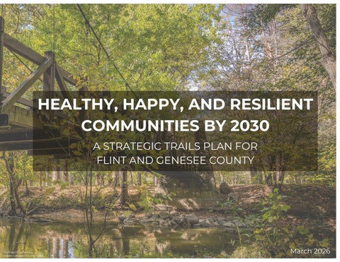
A STRATEGIC TRAILS PLAN FOR FLINT AND GENESEE COUNTY
The Flint and Genesee County Strategic Trails Plan was developed by the Genesee County Metropolitan Planning Commission (GCMPC) with input and guidance from community partners, local governments, and regional stakeholders. This plan represents a shared vision to connect communities, promote active and healthy living, and expand equitable access to trails and non-motorized facilities throughout Genesee County.
GCMPC extends sincere appreciation to the residents, organizations, and municipal leaders who contributed ideas and information through meetings, workshops, and surveys, as well as to the Charles Stewart Mott Foundation for supporting the 2025 Flint and Genesee County Trails Symposium. Additional thanks are given to the Genesee County Parks and Recreation Commission, Genesee County Road Commission and all other regional partners for their ongoing collaboration and commitment to advancing trail development.


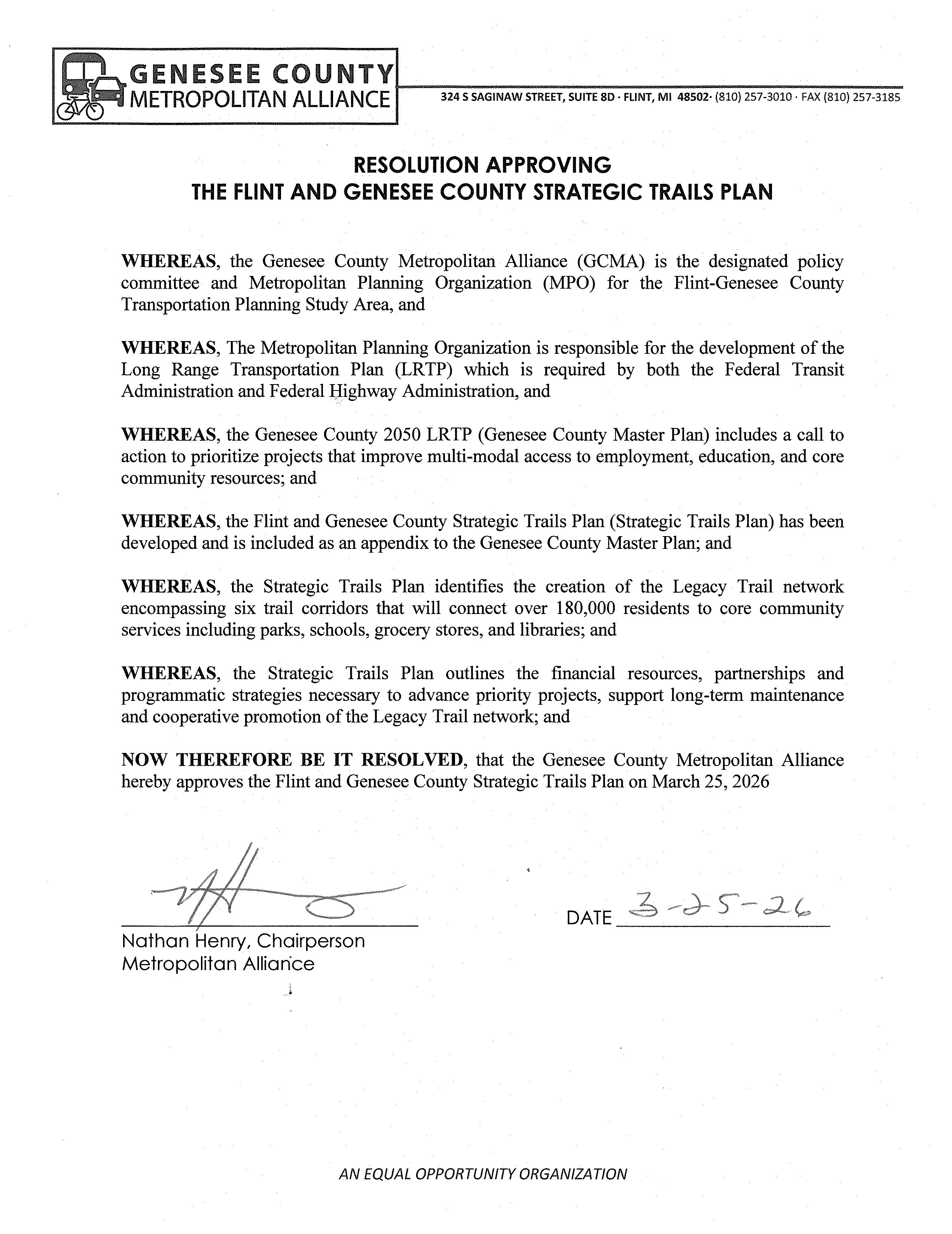
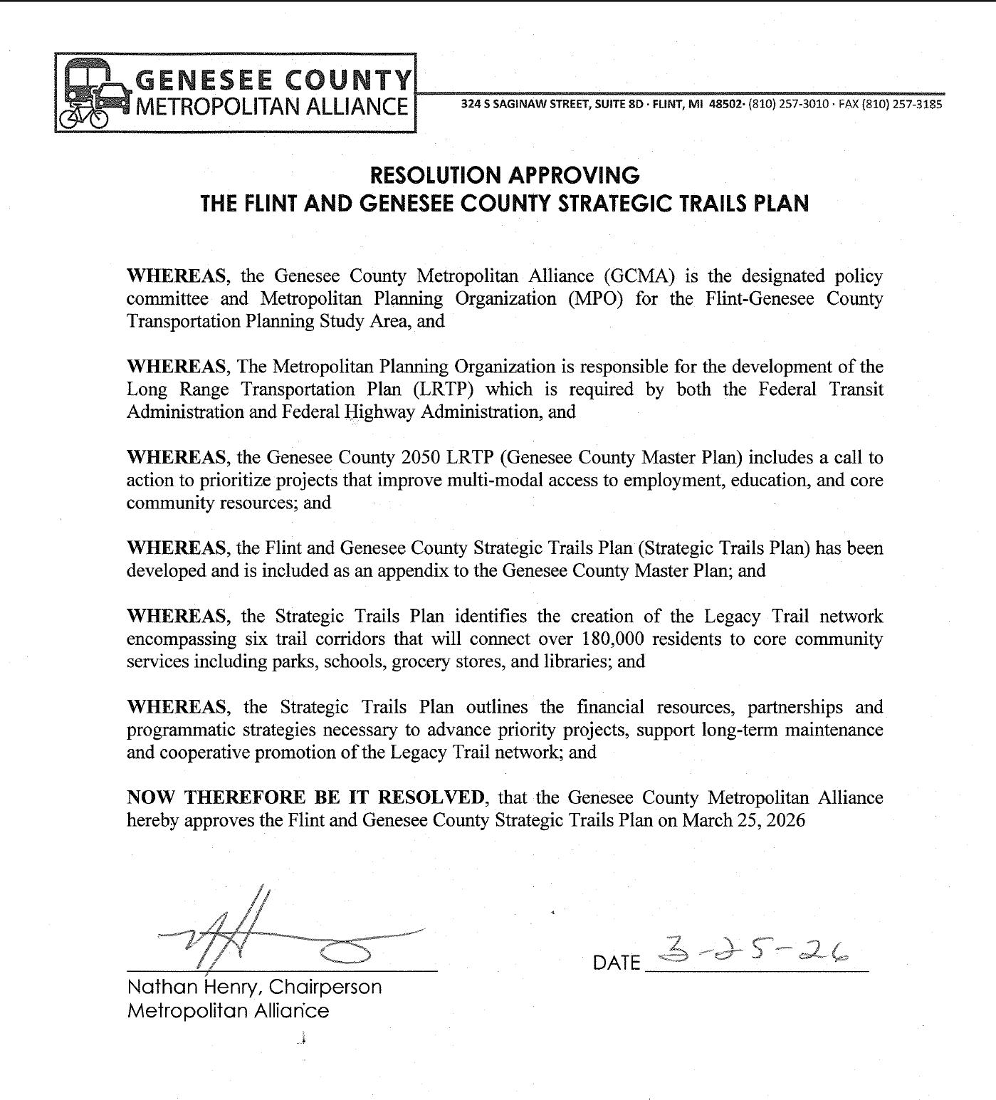
The Flint and Genesee County Strategic Trails Plan (“The Strategic Trails Plan”) was adopted by resolution on March 25 , 2026 by the Genesee County Metropolitan Alliance, the MPO for the Flint and Genesee County Region. th
Adoption Resolutions can be found in Appendix A. *PLACEHOLDER*
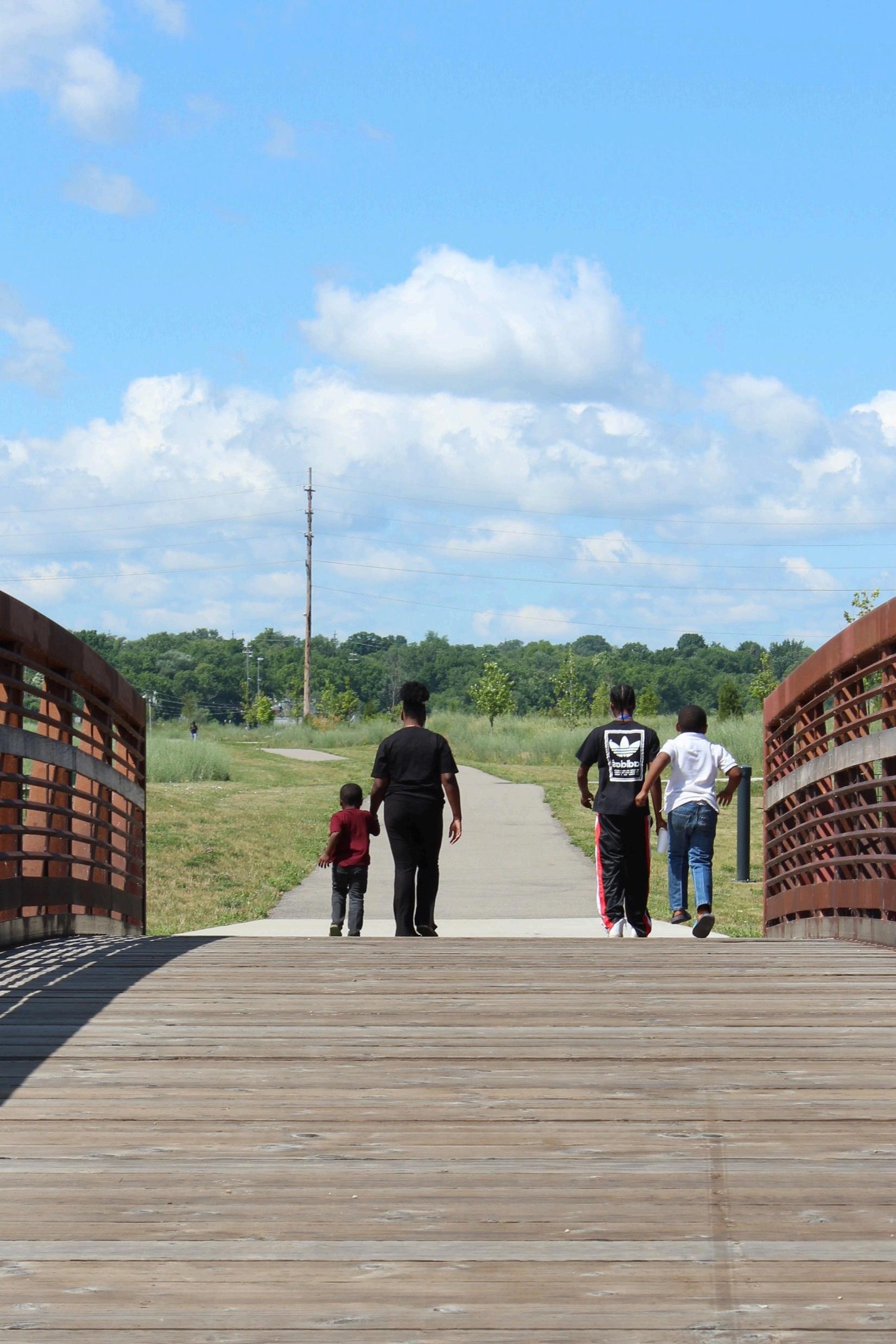
The Flint Genesee County Strategic Trails Plan establishes a unified vision for a safe, connected, and accessible non-motorized network linking communities across the County. Building on decades of planning and investments, the plan provides a clear framework to expand trail connectivity, strengthen partnerships, advance equitable access, and accelerate the delivery of trail projects countywide.
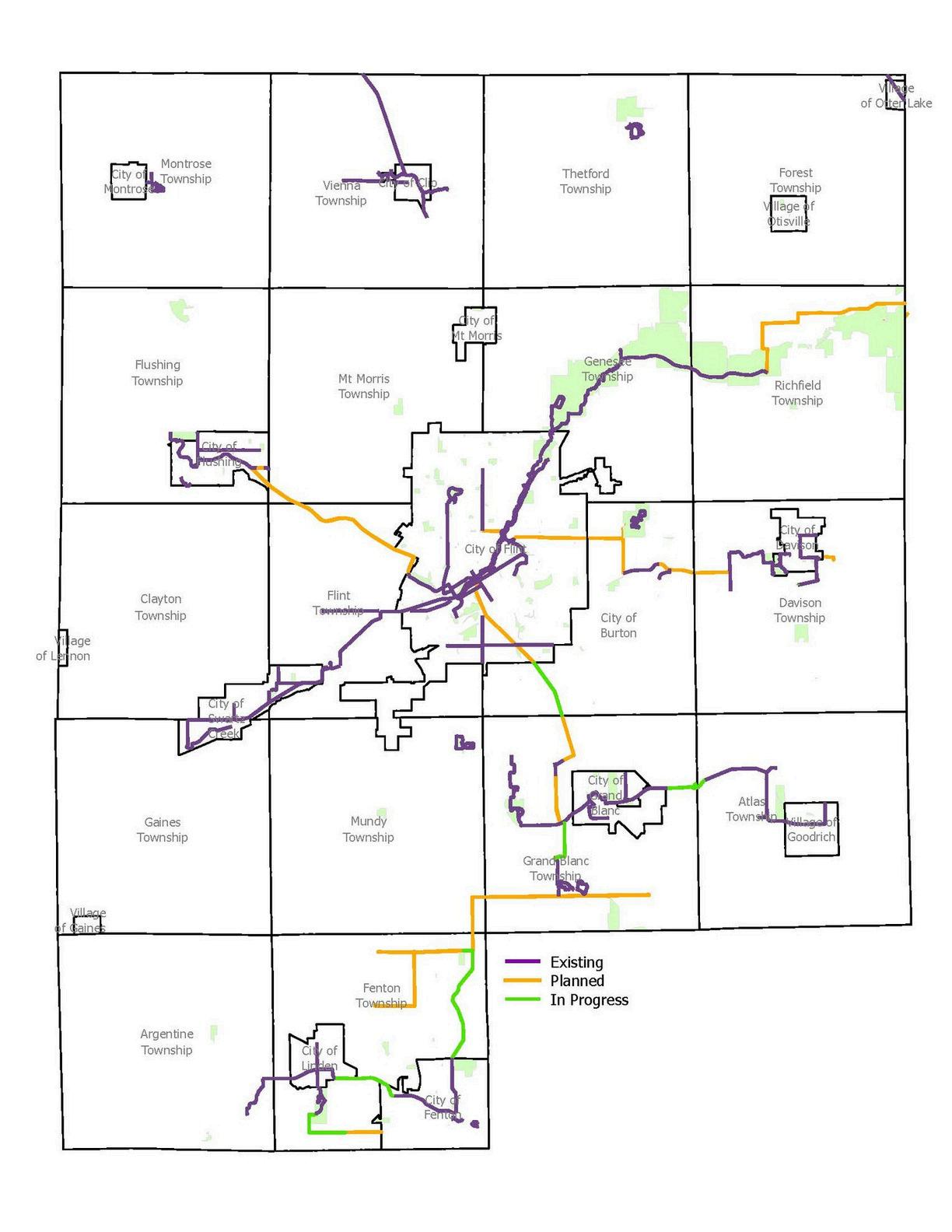
An assessment of the existing network highlights both progress and remaining needs for trail development within the county. As of 2025, Genesee County has made meaningful progress in expanding the trail system, yet approximately 70 miles of critical gaps continue to separate key corridors affecting safe and continuous travel between communities. At the current pace of development, building the missing infrastructure would take several decades to resolve, demonstrating the need for a new coordinated and proactive implementation approach.
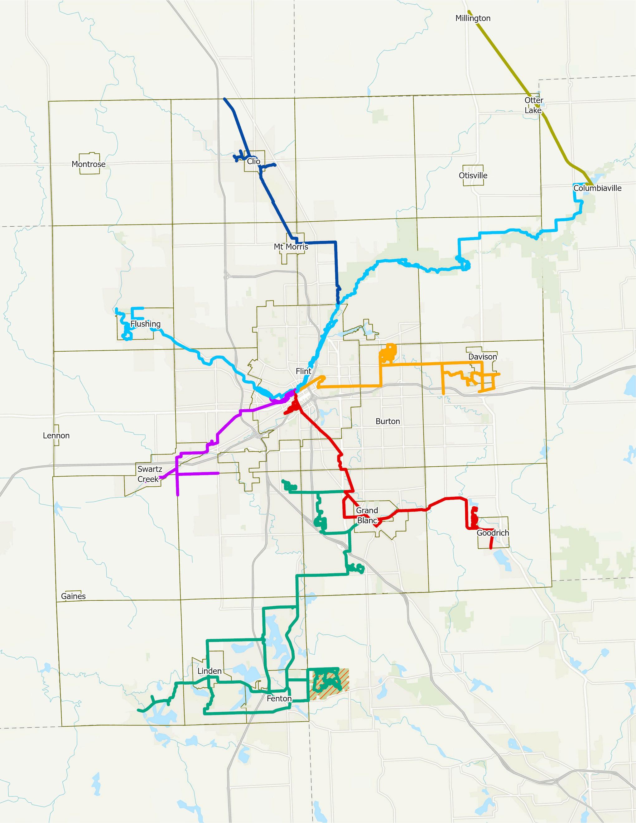
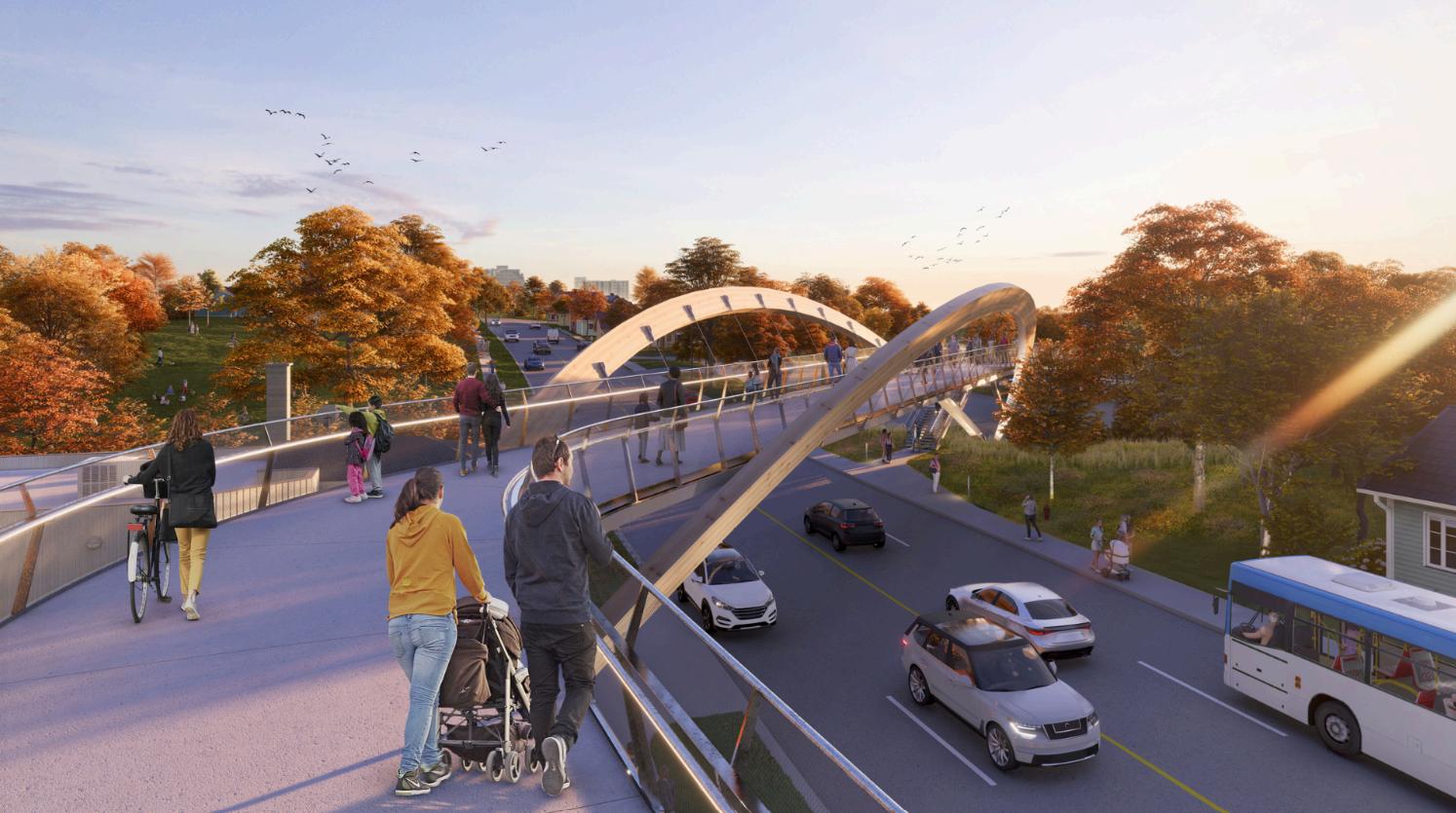
The creation of The Legacy Trail represents an over $80 million investment that will connect over 180,000 residents to core community services including parks, schools, grocery stores, and libraries. The plan focuses on the completion of six non-motorized trail corridors that form the backbone of a regional hub-and-spoke trail network centered on the City of Flint.
Through collaboration among local governments, agencies, and community partners, this document provides a practical roadmap for delivering a connected, healthy, and resilient trail network that enhances quality of life and supports Genesee County’s four established goals for non-motorized decision making and project creation.
The Flint and Genesee County Strategic Trails Plan is a culmination of community voices, local expertise, and data collection that was used to establish the framework for a stronger and cohesive trail system. Through feedback and analysis, the Genesee County regional trail network has been imagined by our stakeholders as providing key connections to core services while also highlighting Genesee County as a recreational destination.
This plan details existing trail and sidewalk connections throughout the county, as well as where gaps in the network need to be addressed to provide the greatest benefits for residents and visitors. Through the establishment of this trails plan, Genesee County has developed a clear set of goals and supporting actions, offering practical steps for communities and partners to implement within their municipalities and bring this shared vision to life.
“To accelerate trail and sidewalk development in Genesee County to schools, parks, and communities through a strategic improvement plan, prioritized projects, and a clear funding strategy.”
Goal: Create a seamless, safe, non-motorized network connecting people to places.
Gather local knowledge through surveys and stakeholder meetings to understand community priorities.
Identify opportunities to establish safe pedestrian and bicycle access to parks, schools, and transit stops
Develop a framework to identify and prioritize key connectivity gaps to focus investments.
Formalize partnerships to align project timelines and share funding opportunities.
Inclusion of strategic trails plan priorities into municipal fiveyear recreation plans.
Utilize existing transportation study recommendations such as Genesee County’s Safe Streets for All Action Plan.
Goal: Establish a recognizable, branded trail network.
Actions:
Design the trail network to be instantly recognizable to users through a cohesive brand package (name, logo, colors, fonts, signage) for the entire trail system.
Create a seamless user experience across jurisdictions through branded signs, maps, mile markers, and trailhead kiosks with the network logo and color scheme.
Balance local identity with regional cohesion by partnering with existing trail groups or municipalities to keep their local names/logos while incorporating the regional brand.
Raise visibility of the trail network and build excitement through a public marketing and outreach campaign.
Develop a digital presence through the creation of a dedicated website, mobile application and interactive map.
Goal: Move beyond incremental progress towards rapid, coordinated implementation of the trail network.
Actions:
Create a dedicated cross-sector team (planners, public works, recreation, and community) to oversee and coordinate rapid implementation.
Identify centralized staffing to support the administration, coordination, implementation and promotion of nonmotorized initiatives.
Cultivate elected officials and partner agencies as champions to build capacity to accelerate project delivery.
Identify essential list of projects, set timelines, assign responsibilities, and prioritize high-impact gaps in the network.
Establish multi-year, flexible funding sources through public funds, state and federal grants, and public-private partnerships.
Establish cooperative agreements between Genesee County and municipalities to streamline the procurement of design, engineering, and construction phases.
Work with local and state agencies to fast-track permitting for trail projects.
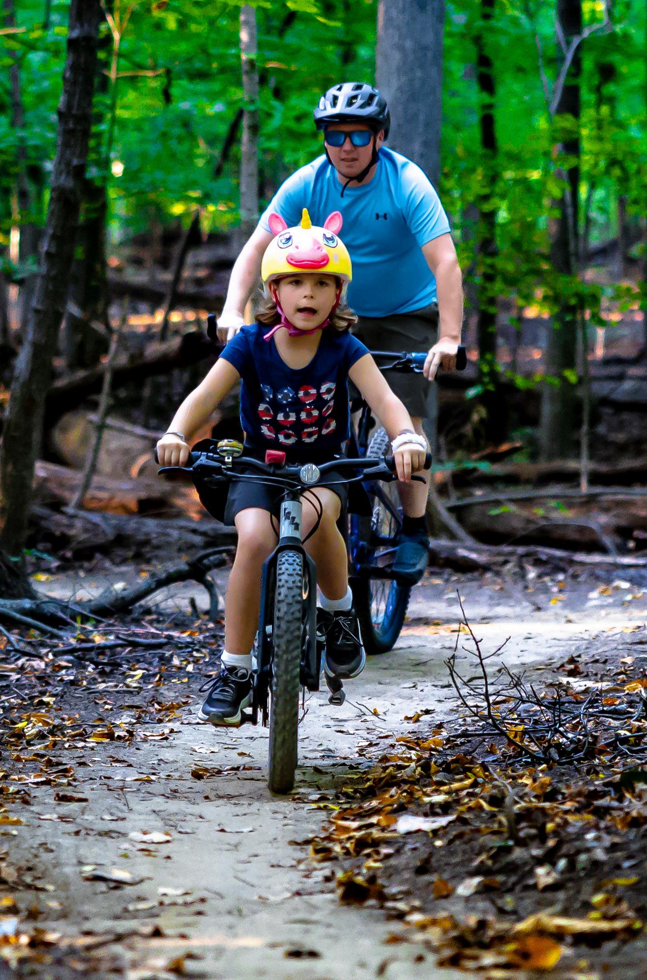
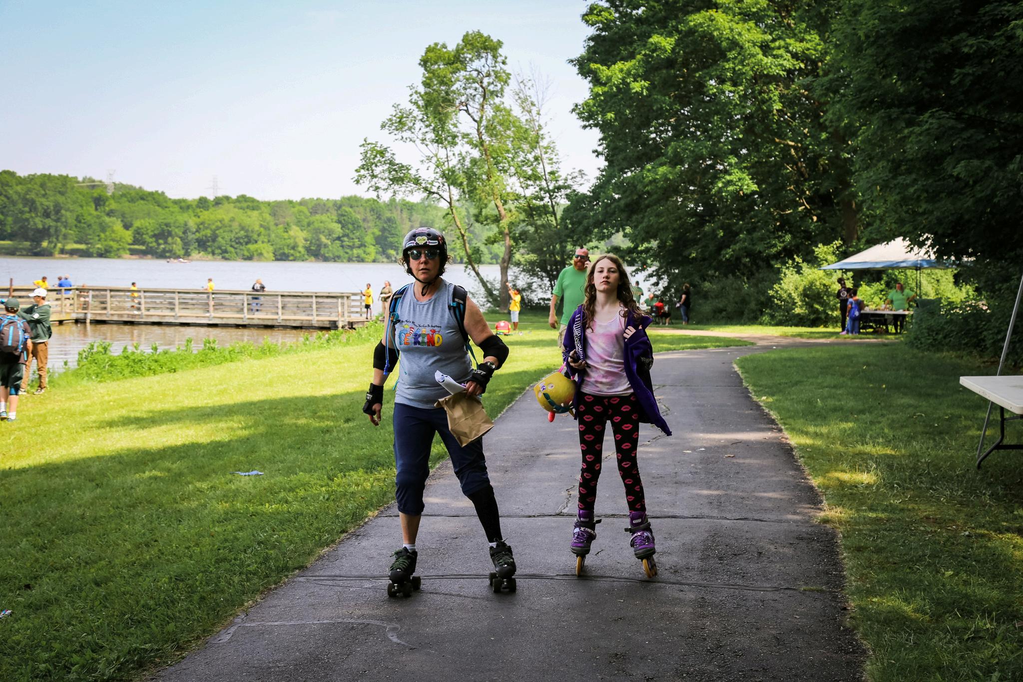
Goal: Ensure all residents benefit from convenient and affordable access to trails for physical activity and healthier lifestyles.
Actions:
Prioritize projects that increase proximity of trails to all residents, particularly those in low-income or high-density areas.
Partner with local health organizations to provide free walking groups, fitness classes, or "prescription trails" programs.
Improve trails and sidewalks to be ADA-compliant with clear signage, lighting, rest areas, and safe crossings.
Involve residents in planning trail routes through surveys, public meetings, or pop-up events to ensure the nonmotorized network reflect the needs of the community.
Address maintenance issues such as vegetation control, surface repair, and winter access.
29% of Genesee County residents do not engage with leisure time physical activity Outdoor Recreation added $13.9B to Michigan’s GDP in 2023
The top 5 recreation activities by economic value in Michigan are all related to trail and sidewalk utilization.
< 25% of Michigan children get an hour of physical activity each day
Visitors spent $615.8 million in Genesee County in 2023 generating $73 million in tax revenue
24% of Genesee County
Households have 1 or fewer available vehicles
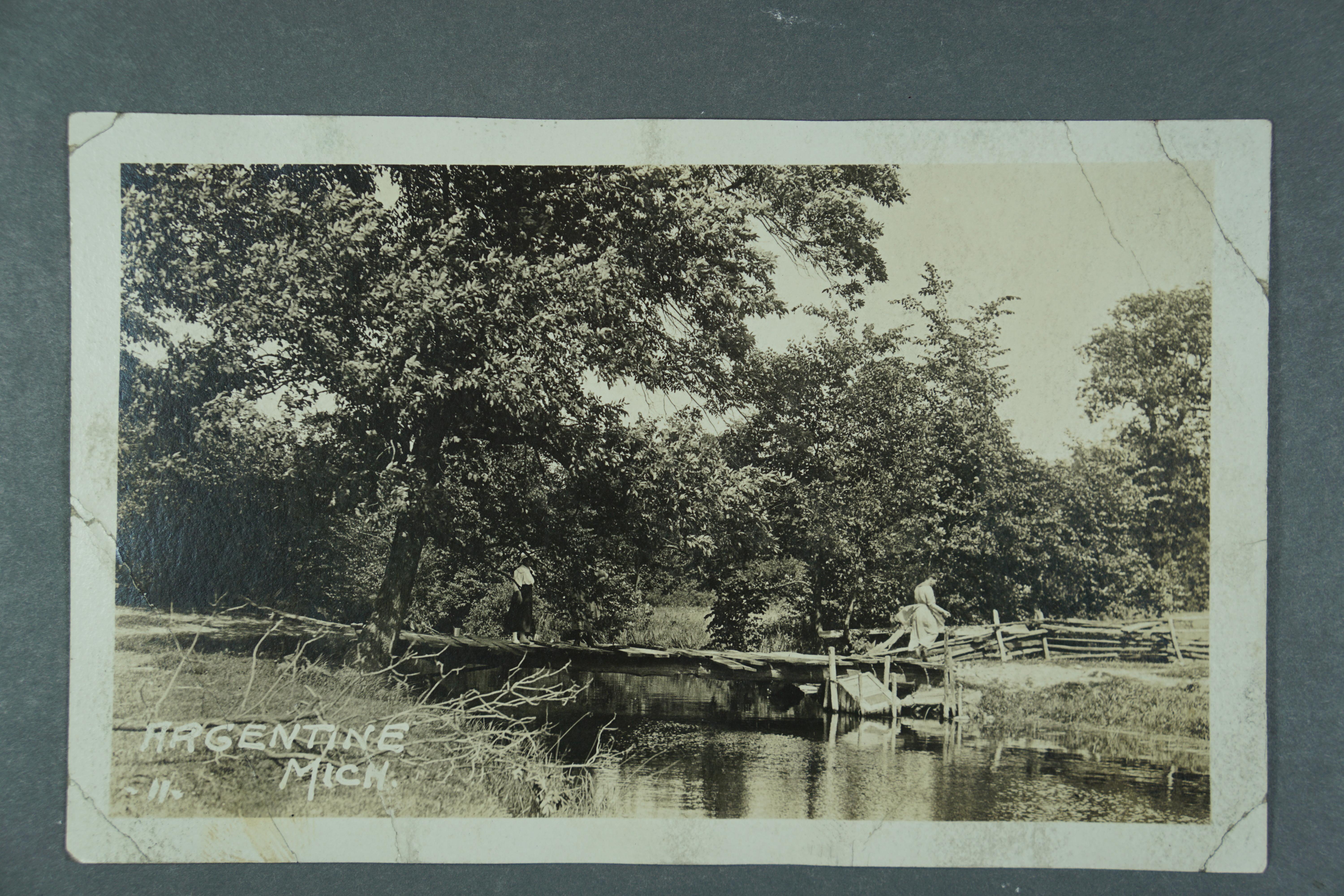
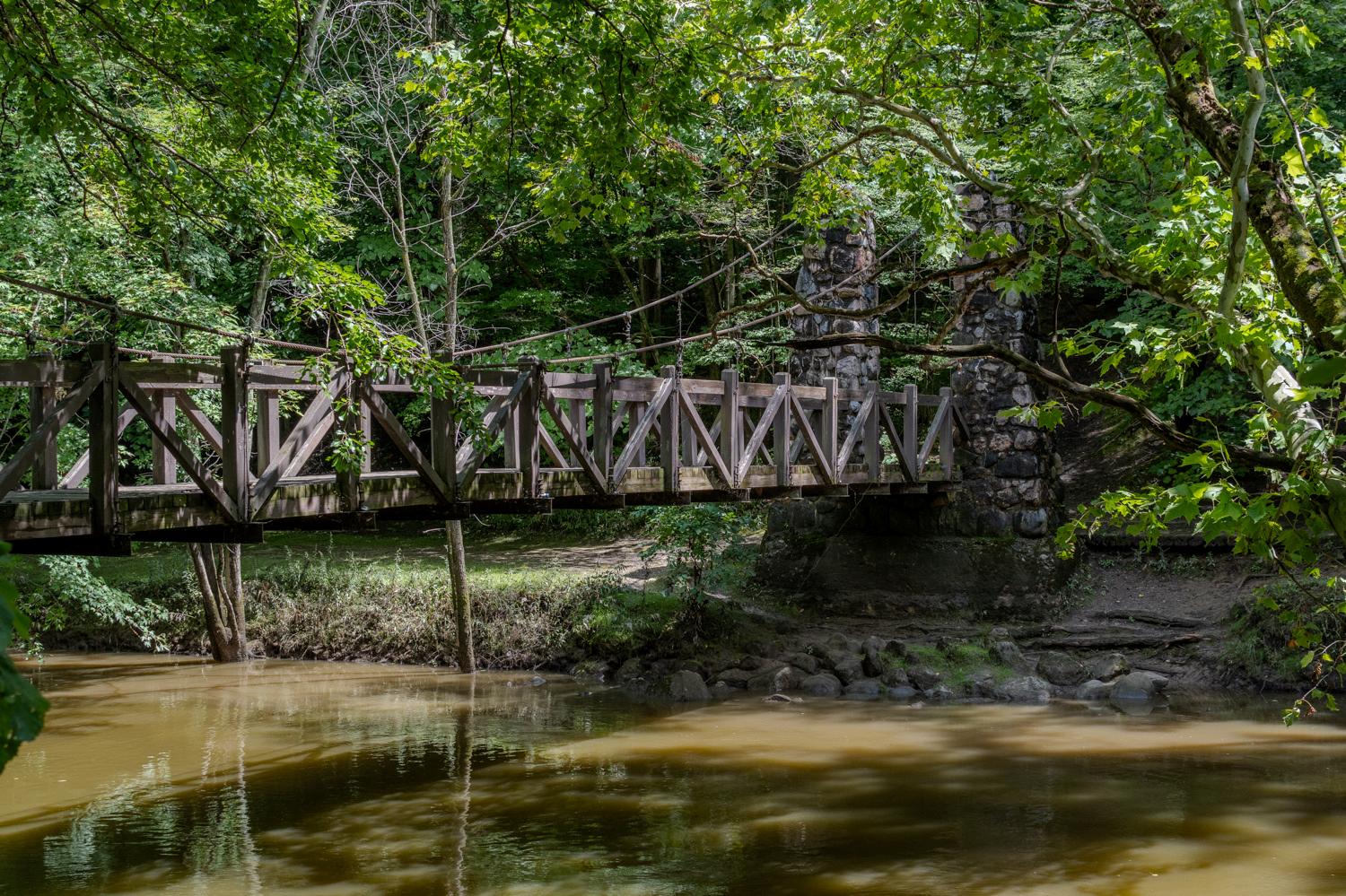
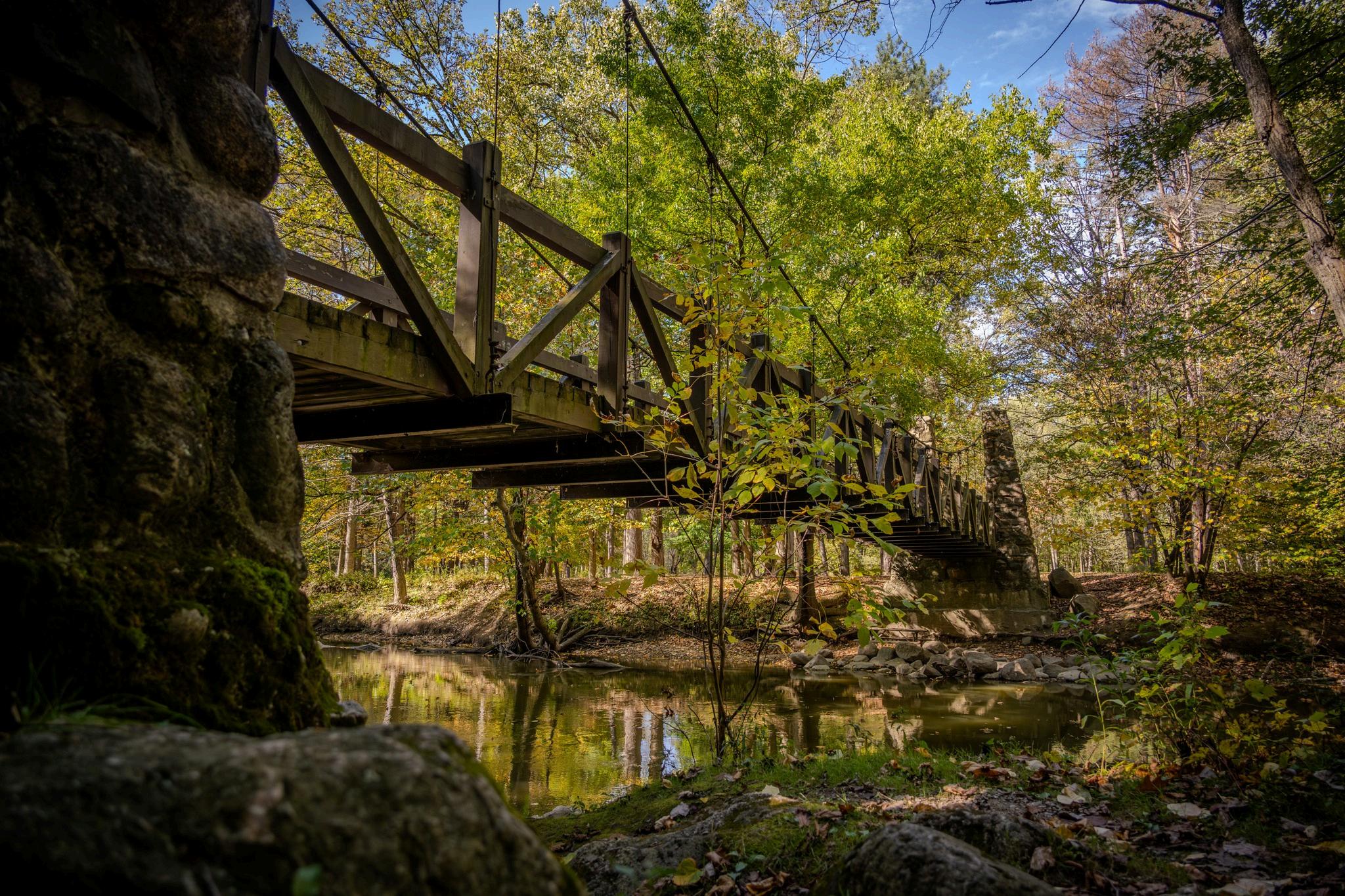
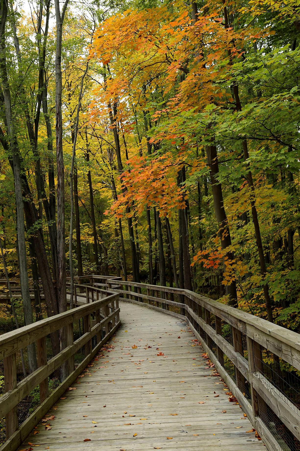
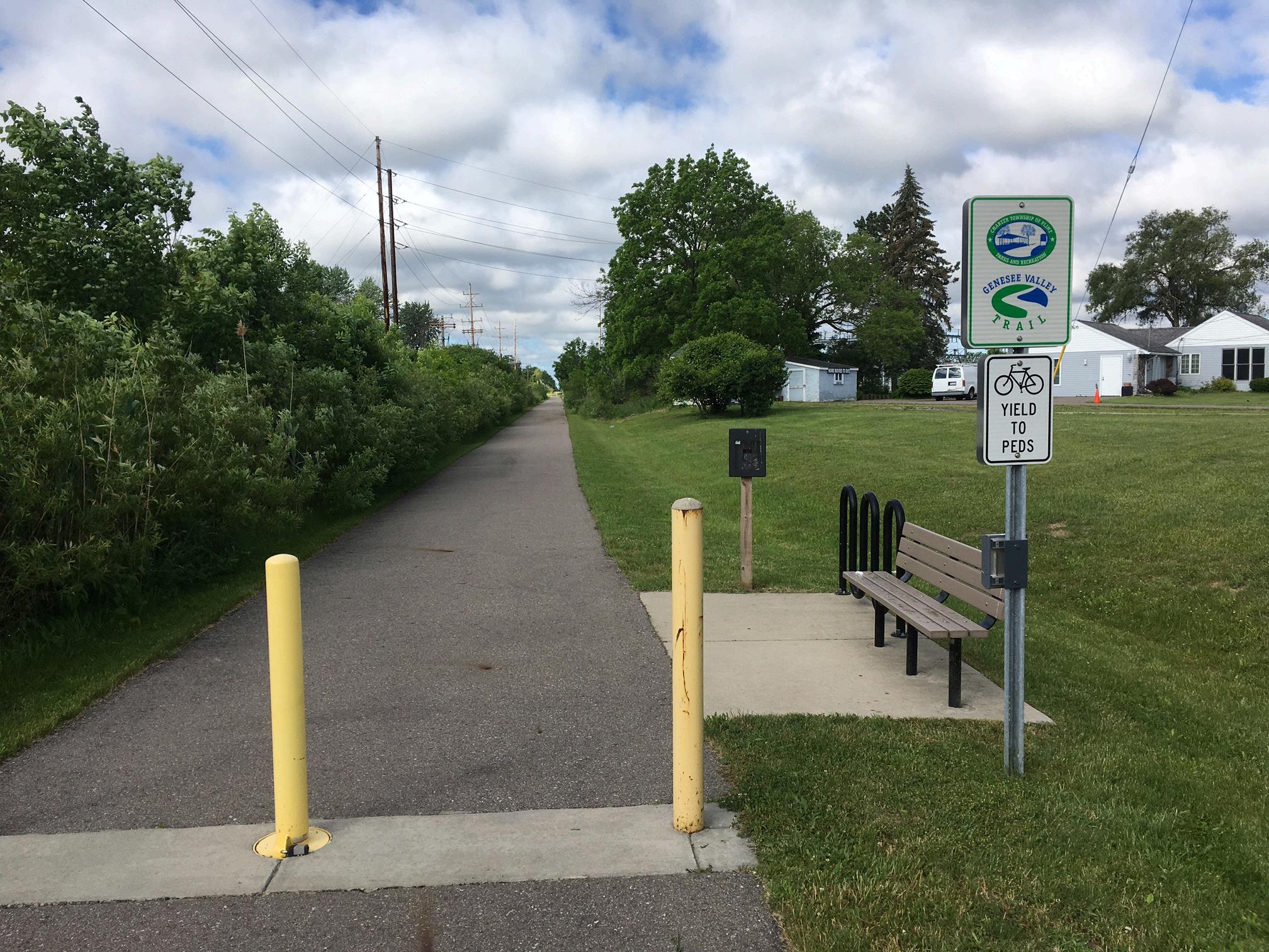
The groundwork for the county’s trail system was established during a period of prosperity and expansion within the City of Flint and Genesee County During this time, philanthropist Charles Stewart Mott co-founded the Genesee Recreation Area, establishing a pivotal early investment towards public open space and outdoor recreation. Building on this legacy, the Flint River Trail emerged in the 1970s as a riverside pathway and has since evolved into one of mid-Michigan’s most recognizable corridors, connecting downtown Flint, universities, and neighborhood parks to the Genesee Recreation Area.
As interest in trails continued to grow, non-motorized projects have emerged across the county, forming a patchwork of community connectors that demonstrate both sustained public demand and the ongoing challenge of linking these assets into a fully cohesive network.
Genesee County’s geographic position places it at the crossroads of Michigan’s growing non-motorized system, making it a regional travel destination for neighboring counties and local residents. The Iron Belle Trail, Michigan’s signature long-distance route from Belle Isle to Ironwood, passes directly through the new State Park, positioning Flint and its surrounding communities as a hub within a statewide recreation and mobility network. This role provides a unique opportunity to develop local connections and sidepaths that meet neighborhood needs while linking residents to destinations across the region and state.
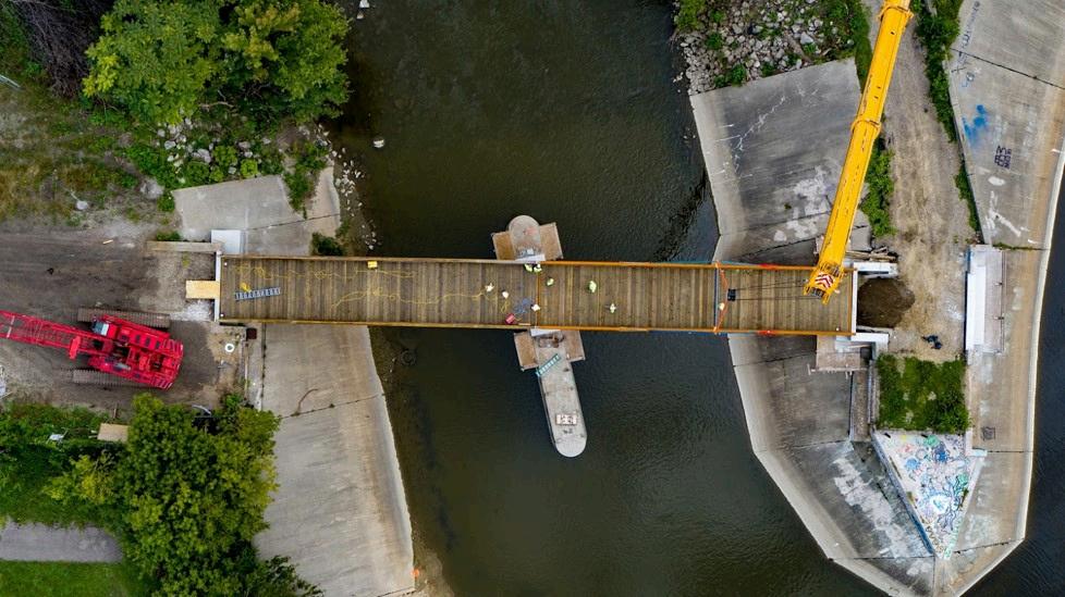
Since the publication of the 2014 Regional Trail Plan, Genesee County has made steady progress in expanding its nonmotorized network. More than $24 million in construction funds were secured, resulting in nearly 19 miles of new trail segments completed or under construction by the end of 2025. These investments have strengthened community connections and advanced the countywide vision of a safe, accessible, and integrated trail system.
Despite current efforts, significant gaps remain in the current network. Approximately 70 miles of critical missing links continue to separate key destinations, including corridors from Flushing to Flint, Swartz Creek to Davison, Goodrich to Flint, Clio to Genesee, and Grand Blanc to Argentine. The absence of these connections creates concerns of limited safe and continuous travel between neighborhoods, schools, parks, and downtowns.
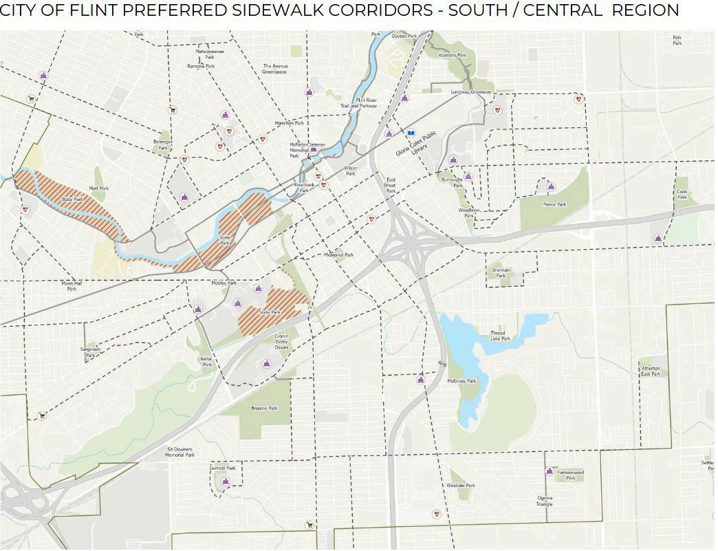
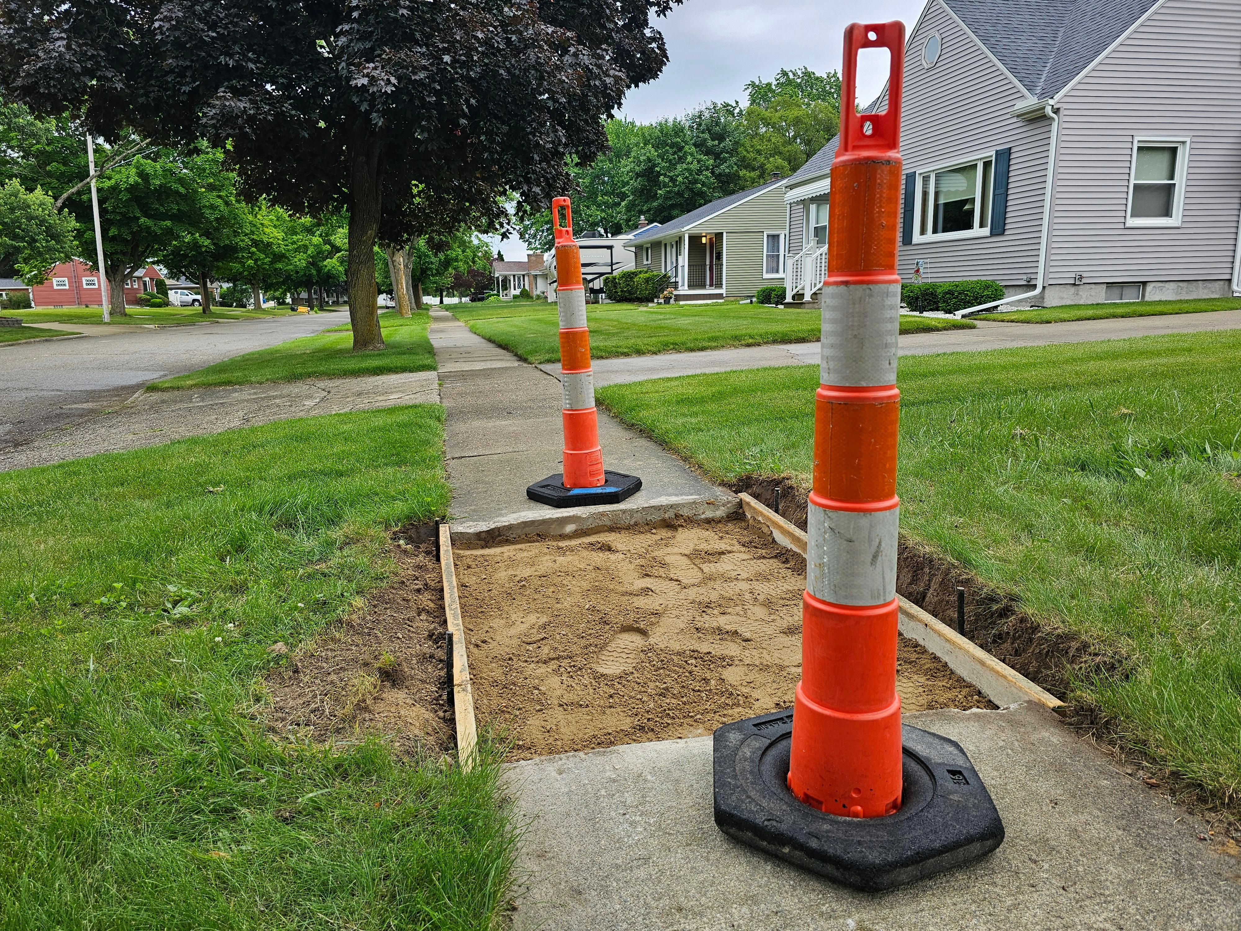
Sidewalk infrastructure plays a and economic vitality of overlooked compared to roads shape how cities function an access schools, workplaces, m businesses without relying on
Through conversations with C groups this past year, it beca not only on pavement con environment. Proactive main structures along sidewalk rout pedestrian safety, perceived Destinations that were mo neighborhoods, the City Parks identified on maps included in
A 2023 assessment completed City of Flint documents the loc sidewalk infrastructure acros partnership with the Charles to working alongside the C replacements along key non-m
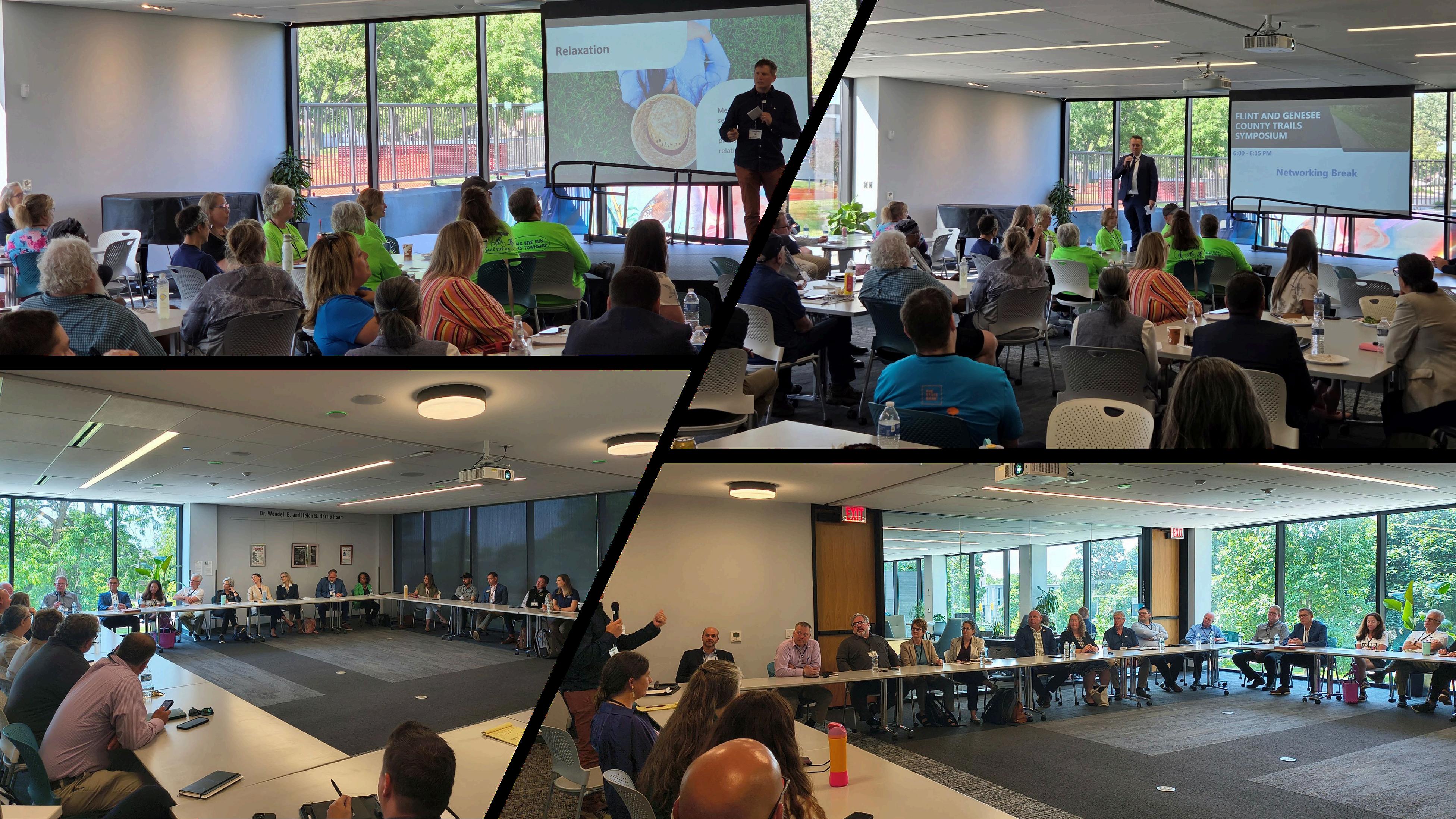
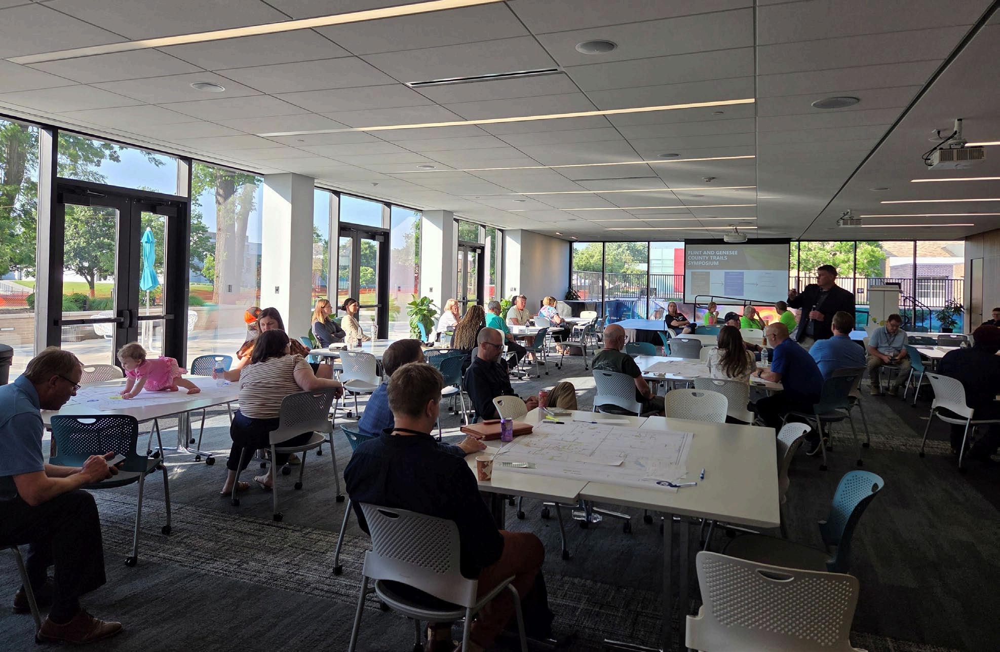
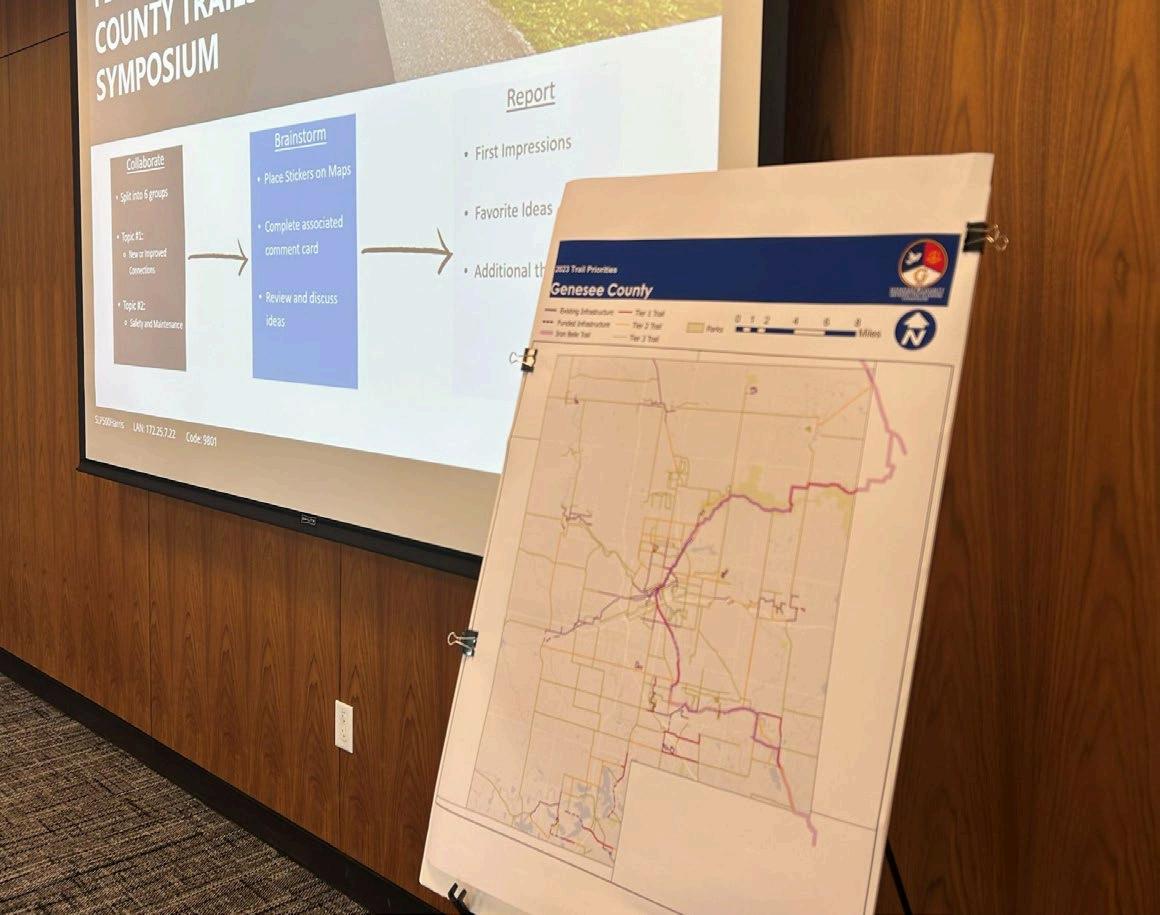
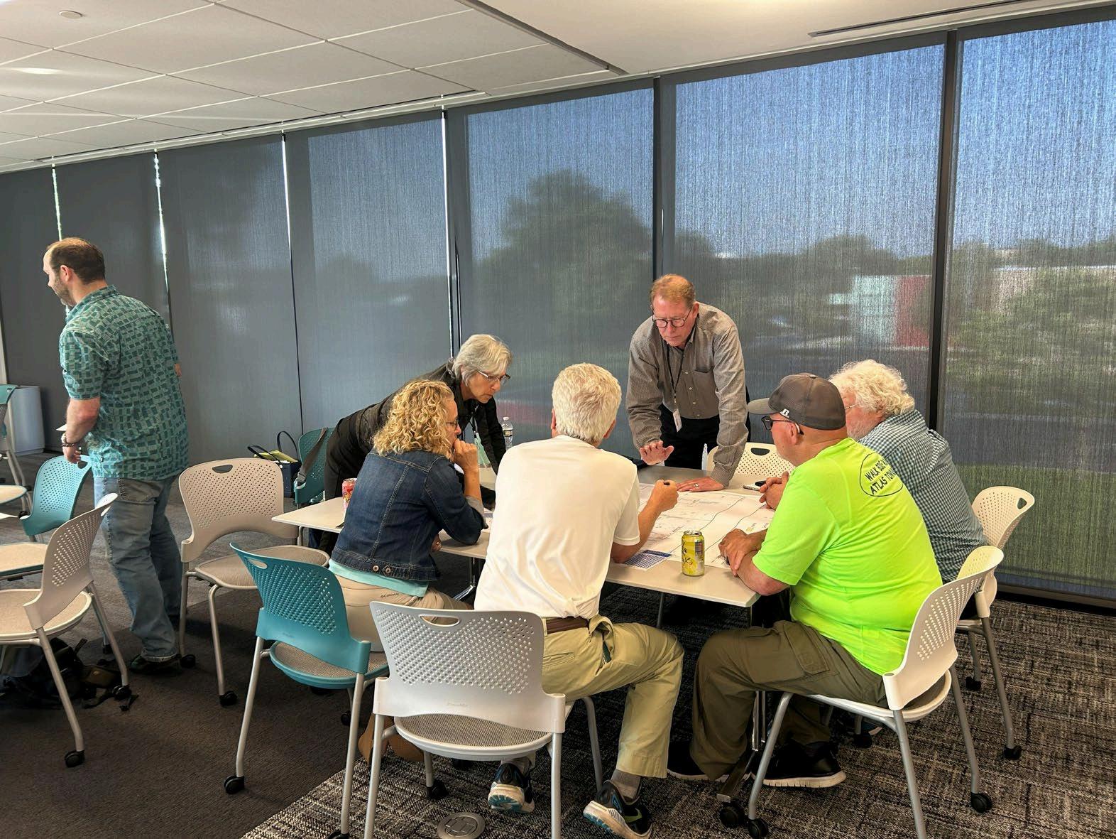
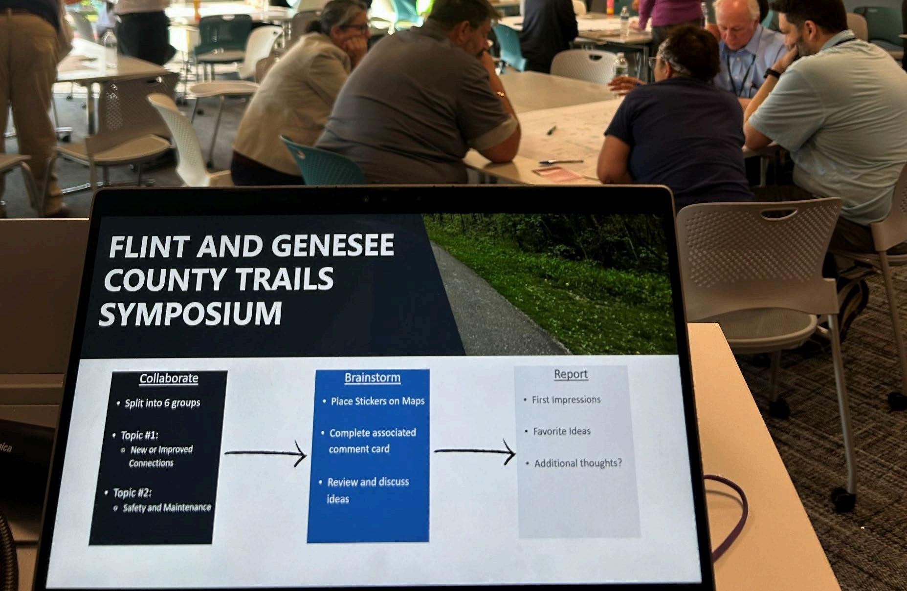
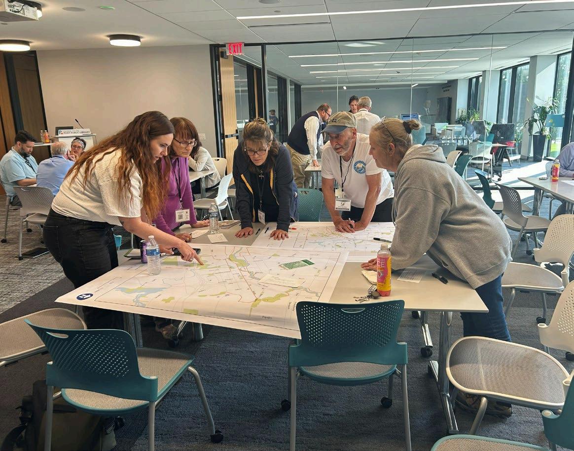
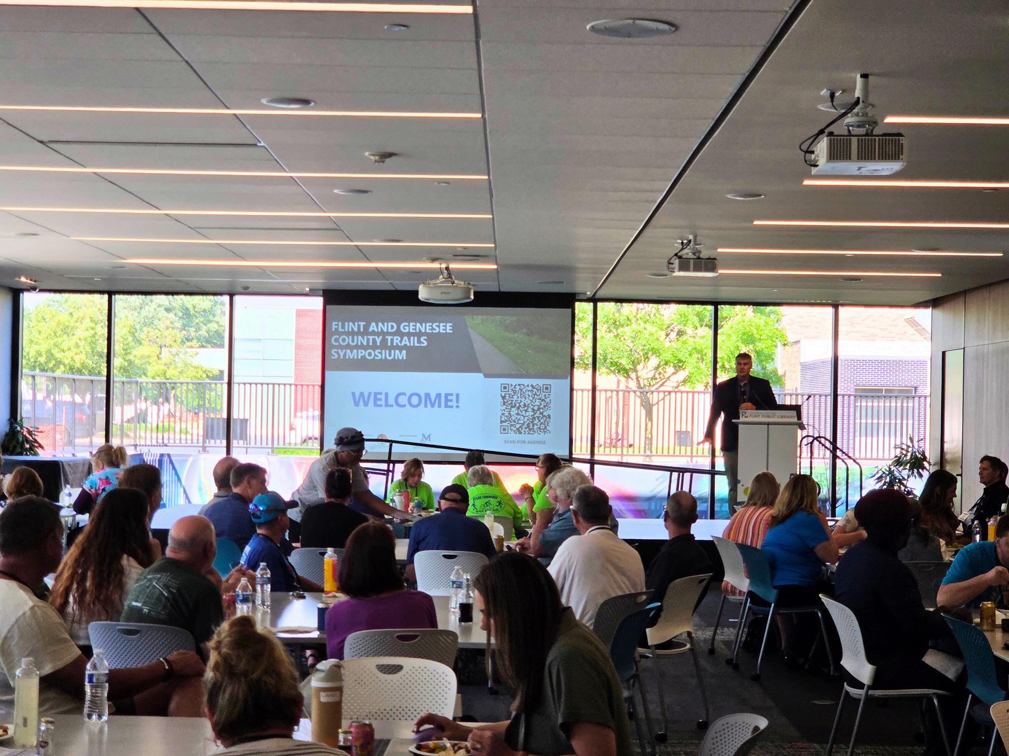
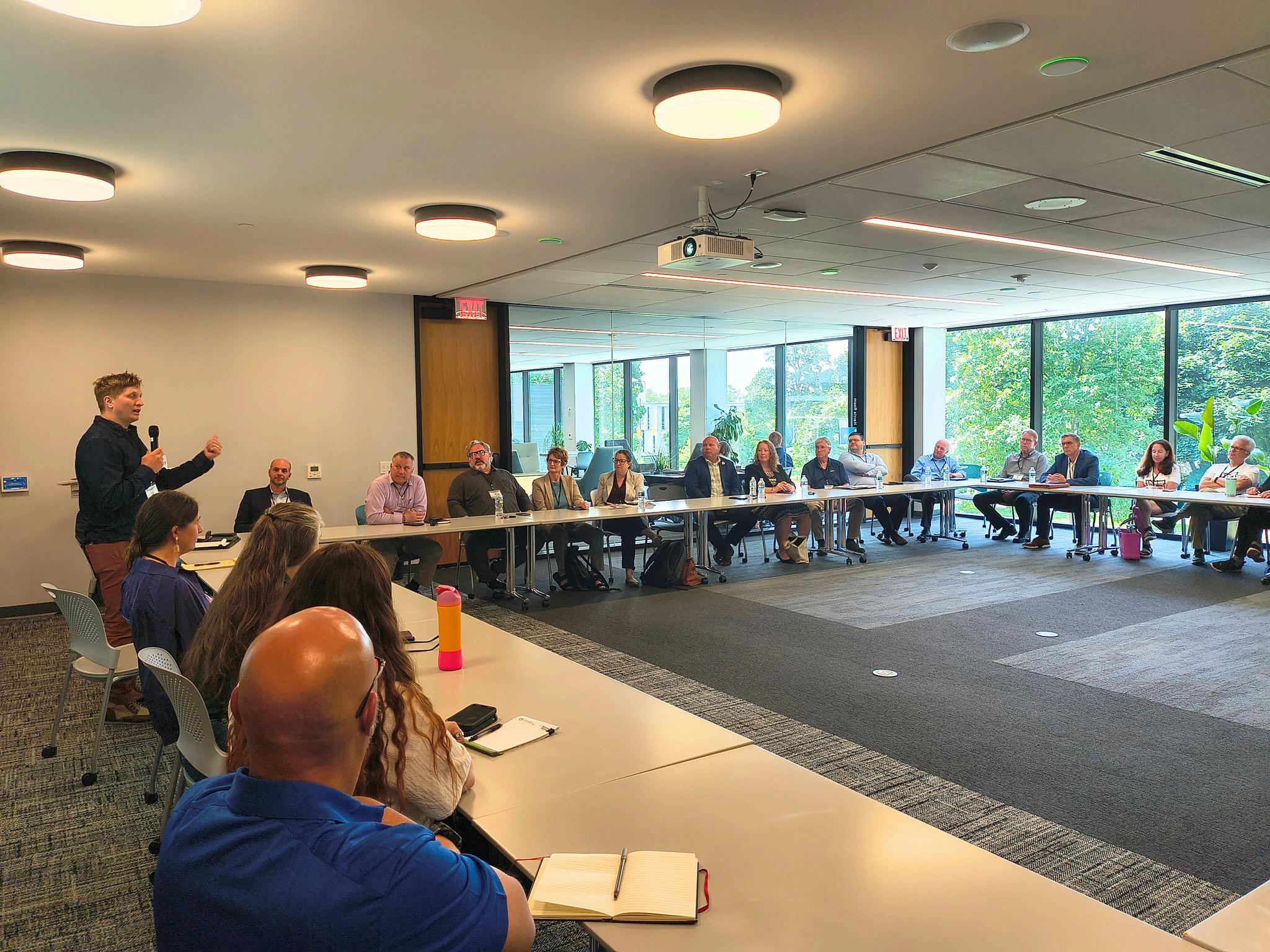
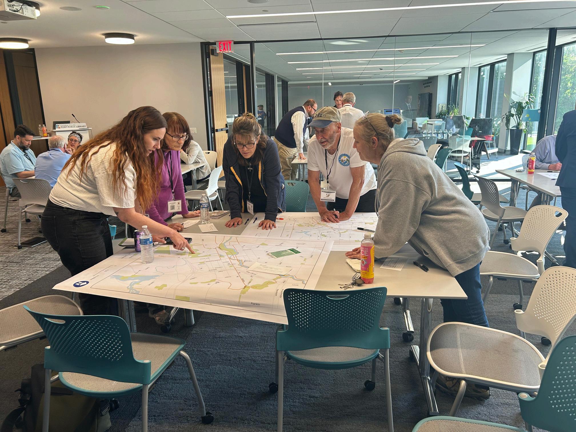
Public input collected through trail prioritization workshops and the development of the County Master Plan established a foundation for coordinated trail investment. In 2025, Genesee County, in collaboration with the Charles Stewart Mott Foundation, explored different outlets and opportunities to gather feedback from a wider audience. One method was through the development of an interactive online dashboard that allowed residents and stakeholders to provide input on where they would like to see development in their communities. Additionally, Genesee County, with support from the Charles Stewart Mott Foundation, hosted the Trails Symposium on June 11th, 2025. Event materials, including agendas, maps, and comment summaries, are provided in Appendix A.
The Symposium consisted of two parts: Roundtable Discussion and the General Session.
Roundtable Discussion: This working session included planners, municipal leaders, health organizations, advocacy groups, and partners from the State of Michigan (DNR & MDOT) Discussion was focused on trail connectivity, maintenance responsibilities, funding coordination, and equitable access. Participants emphasized the need for shared design standards, improved interjurisdictional coordination, and a countywide brand.
General Session: This session acted as an open public forum that invited residents to share their ideas, priorities, and concerns regarding trail access, safety, and connectivity. Participants expressed strong support for expanding neighborhood linkages, improving maintenance of existing trails, and ensuring safe access for walkers and cyclists of all ages and abilities. Connections to schools and parks were a particular focus.
Following the Symposium, County staff conducted one-on-one meetings with elected officials, neighborhood associations, and trail user groups to ensure that feedback was inclusive of organizations and individuals who were not represented at the event. These ongoing conversations provided deeper insight into local priorities, emerging projects, and the challenges faced by municipalities and community groups working to expand nonmotorized connectivity.
Community engagement through online, in-person, and group style outreach revealed not only what residents value in the trail network, but also how the process for planning and delivering projects must evolve. For years, trail development in Genesee County has advanced one mile at a time, often through independent municipal projects that operate in isolation While this approach has yielded important connections, it has also led to repeated challenges, including redundant permitting, misaligned funding cycles, and recurring easement delays. Stakeholders noted that lack of funding, time, internal capacity, and technical knowledge limit how quickly projects can move from concept to construction.
Throughout the Genesee County community outreach sessions, participants identified a clear path forward for improvements to how we approach trail development. The new approach calls for building a coordinated project delivery framework grounded in collaboration, speed, and accountability.
Under this new process, each trail project would begin with a defined project team, which would include clear roles and responsibilities for municipal staff, County representatives, engineers, and community partners. Projects will be advanced on a fast-paced timeline designed to identify funding within the first two years of the work program to maintain momentum and minimize delays. This shift reflects a move from reactive, siloed project delivery to a proactive, strategic, and regionally coordinated model.
Public input reinforced that residents view trails as essential infrastructure, not simply as recreational amenities. Key takeaways from this outreach include:
Connectivity is the top priority. Residents want direct, continuous routes linking neighborhoods, schools, parks, and downtown areas.
Safety and maintenance follow closely behind. Consistent lighting, signage, and routine upkeep are critical to ensure comfortable and reliable trail use.
Equitable access matters. Building or reparing the trails / sidewalks in areas with limited park space, lower incomes, or higher transportation barriers was identified as a core value.
Collaboration drives success. Coordinated partnerships among municipalities, county departments, and advocacy organizations can streamline permitting, leverage funding, and promote consistent standards.
Specific project ideas that emerged from these conversations include completing key connections between Flushing and Flint; Goodrich and Flint; Swartz Creek and Flint; Clio and the Genesee Recreation Area; Davison and Flint; and Argentine and Grand Blanc. Residents also emphasized the importance of adding sidepaths and riverfront greenways to improve access to schools, parks, and employment centers. Another priority is repairing and replacing sidewalks within the City of Flint to strengthen connections to parks and downtown.
This collective feedback represents a paradigm shift from incremental, project-by-project progress toward a strategic, unified trail network that is planned, implemented, and maintained collaboratively for the benefit of all Genesee County residents.
INTERACTIVE ONLINE MAP FEEDBACK LOCATIONS
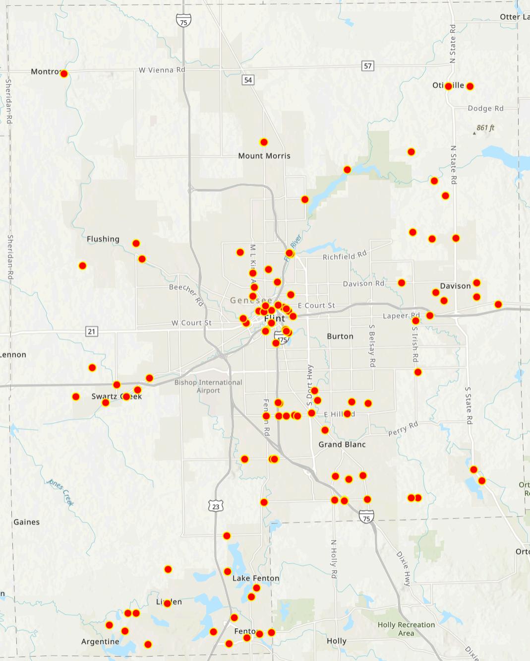
85 Symposium Attendees
82% Responsesprioritizing connectivityinnewnonmotorizedfacilities
111 Responsesrecorded throughoutthe onlinemapping exercise
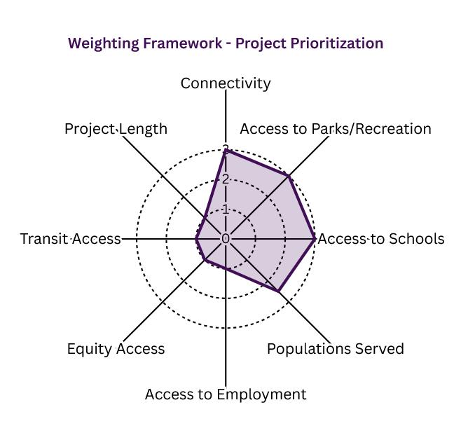
In 2025, Genesee County Metropolitan Planning Commission (GCMPC) staff updated their project prioritization methodology to evaluate and rank trail segments identified through the public outreach events and workshops. This framework builds on prior prioritization events and planning initiatives conducted since the adoption of the County’s first Regional Trail Plan, incorporating lessons learned from a decade of implementation.
Earlier prioritization efforts relied primarily on municipal input and qualitative criteria to identify project readiness. While this process successfully supported funding applications and project coordination, the 2025 update introduces a quantitative, datadriven approach that emphasizes connectivity, access, and equity as guiding principles that aligns with countywide goals for mobility, public health, and economic vitality.
A review of prioritization models from trail coalitions and other national metropolitan planning organizations were reviewed to identify best practices for evaluating trail development. The intent is to ensure that project selection is data-driven, transparent, and aligned with countywide planning goals. Through this review, a scoring rubric was created to support decision-making and identify candidate trail segments with the highest potential impact.
Candidate trail segments were evaluated according to eight measurable factors, each reflecting a specific aspect of connectivity, accessibility, or community impact. Each factor was assigned a score ranging from 0 to 3, with 0 indicating limited benefit or connection and 3 representing the highest level of benefit or alignment with plan objectives. Scores were then multiplied by their assigned weight and summed to produce an overall prioritization score.
This weighting framework emphasizes projects that close major network gaps, serve large populations, and improve access to key community destinations while also accounting for equity and multimodal integration. Quantitative data was compiled using spatial and demographic datasets maintained by the Genesee County Metropolitan Planning Commission (GCMPC) and the Genesee County GIS Department. Key data inputs include:
Travel Demand Model outputs for employment density, population distribution, and proximity to transit.
County GIS layers identifying parks, schools, and employment centers.
Climate and Economic Justice Screening Tool (CEJST), which identifies census tracts with elevated social, economic, or environmental burdens, ensuring equity-driven prioritization.
Trail network datasets reflecting existing, planned, and proposed non-motorized facilities to assess connectivity and access.
The resulting scores provide a transparent and replicable basis for comparing projects across jurisdictions. Higherscoring trail segments represent those with the greatest potential to:
Advance regional connectivity and mobility,
Expand access to parks, schools, and employment centers,
Serve dense or historically under-resourced populations, and
Strengthen equitable, multimodal transportation options.
The methodology ensures that each project is evaluated consistently and objectively, allowing decision-makers the option to allocate funding and implementation efforts strategically based on data-supported priorities. Each project was identified through a combination of technical analysis and local input, serving as a “gut check” for those most suitable to form the foundation of a truly connected regional network. By focusing on these projects first, Genesee County and its municipal partners can build momentum, demonstrate success, and continue leveraging resources.
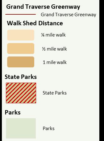
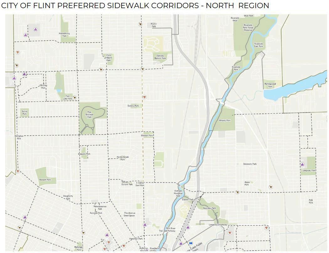
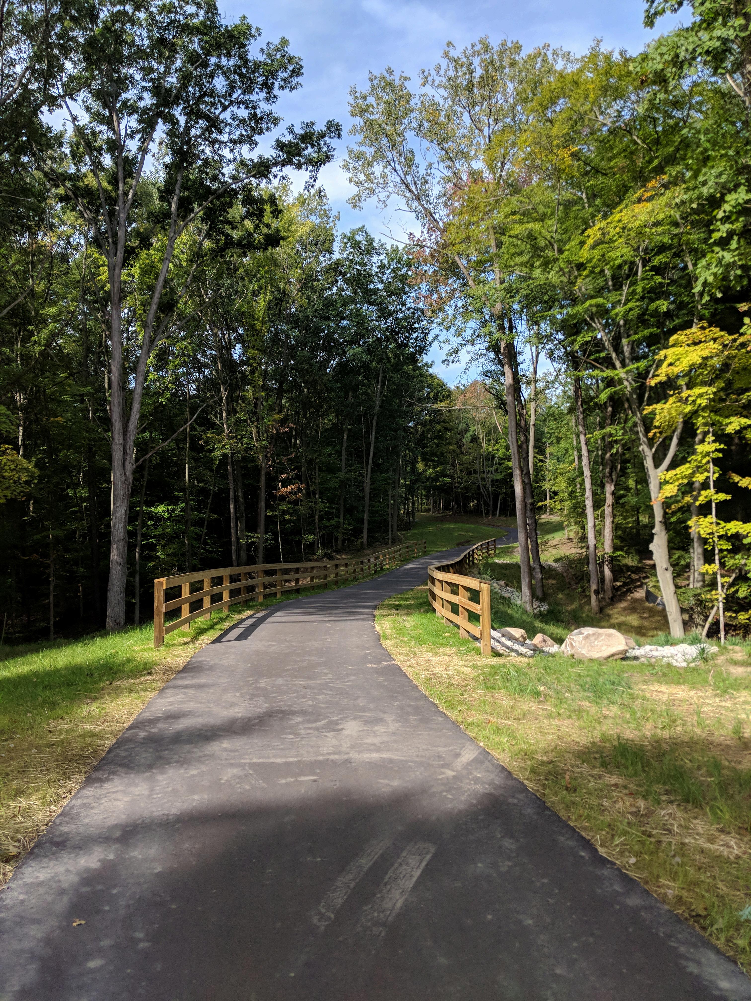
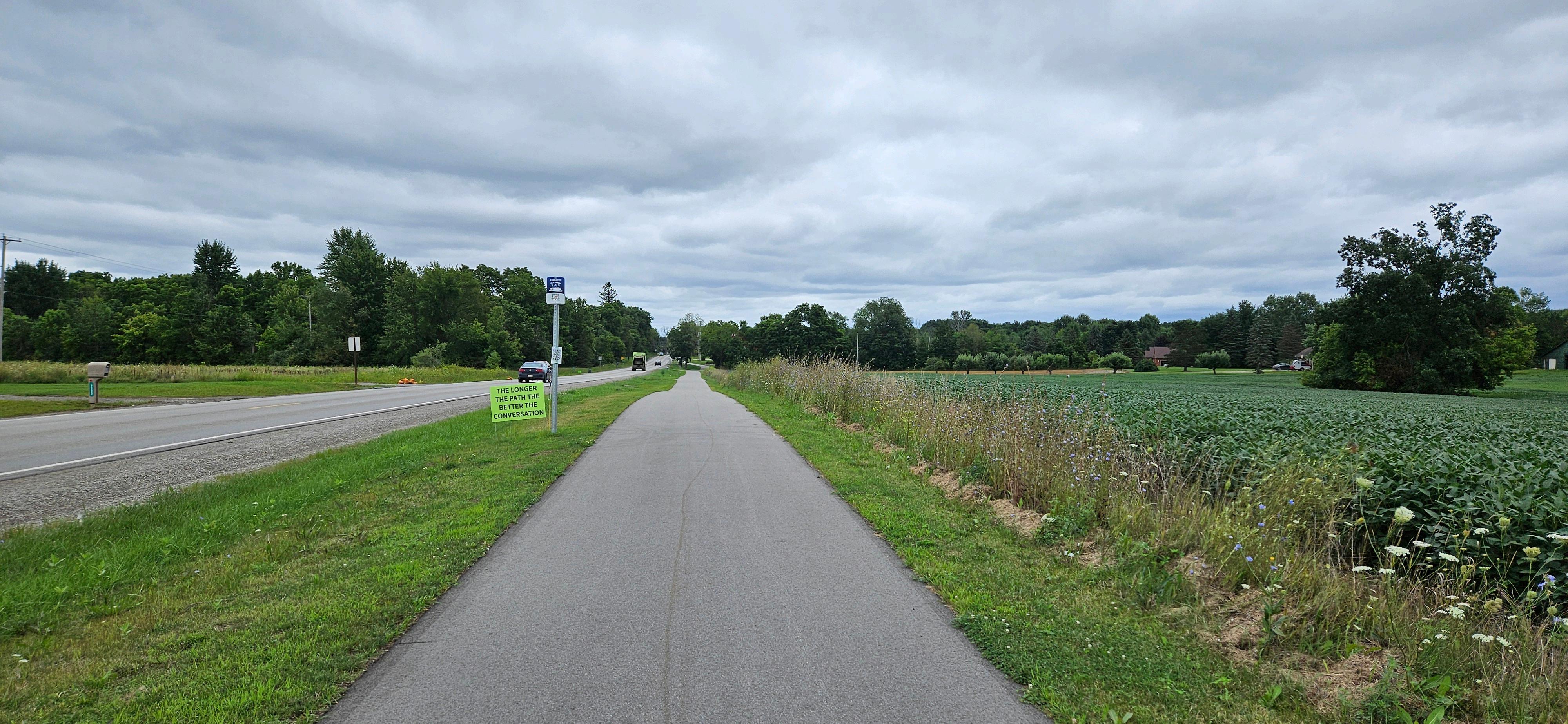
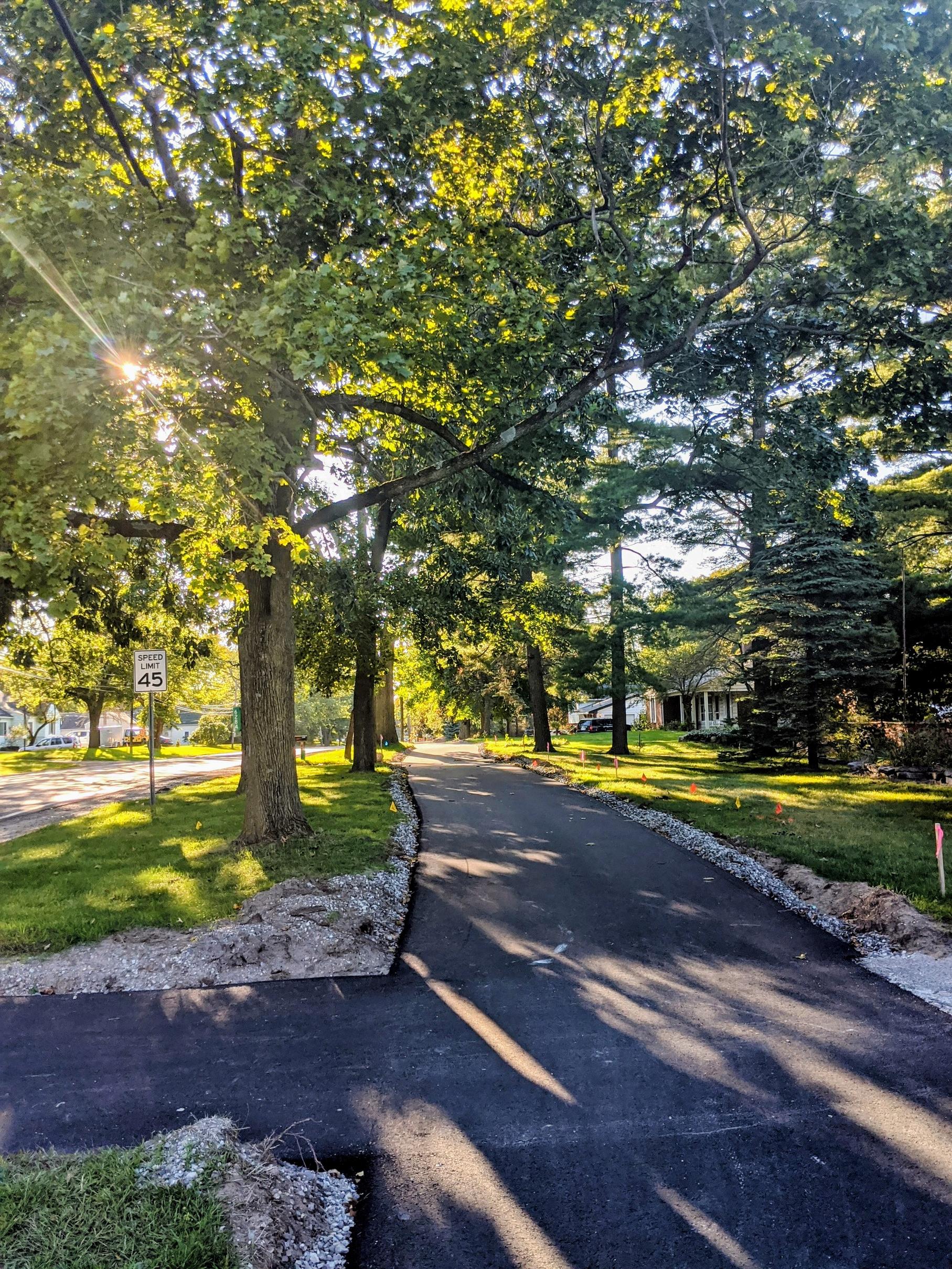
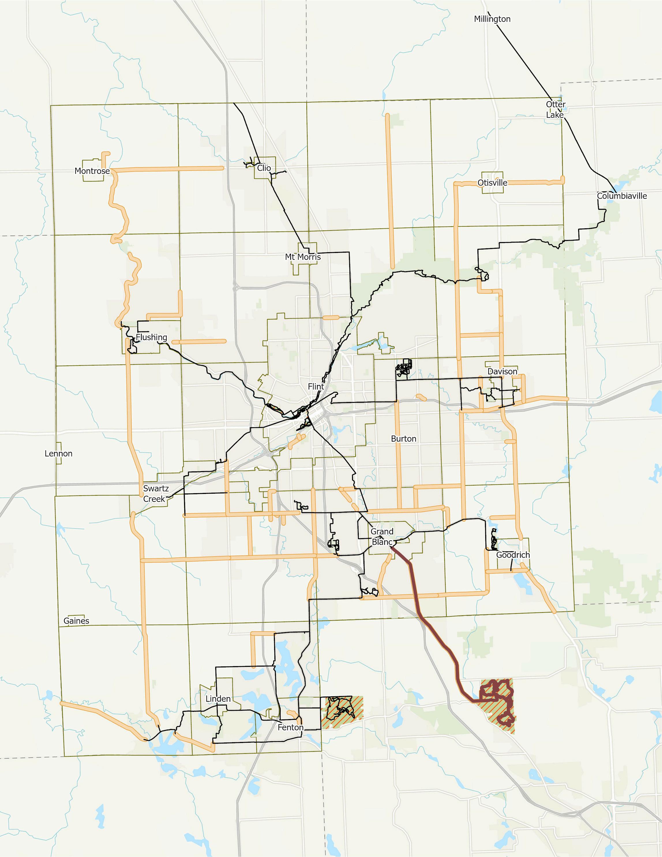
Genesee County’s existing trail network consists of various types of non-motorized facilities, built through decades of collaboration among municipalities, agencies, and community partners. It includes paved shared-use paths, bike lanes, sidepaths, sidewalks, riverfront greenways, equestrian paths and hiking trails, forming a mosaic of regional corridors and local loops that serve both recreation and transportation purposes
For the purposes of this report and illustrations, not all sidewalk infrastructure was included. Several hundred miles of sidewalks exist throughout the County primarily in the urban centers and corridors. As of 2025, Genesee County’s trail network consists of approximately 135 miles of non-motorized facilities.
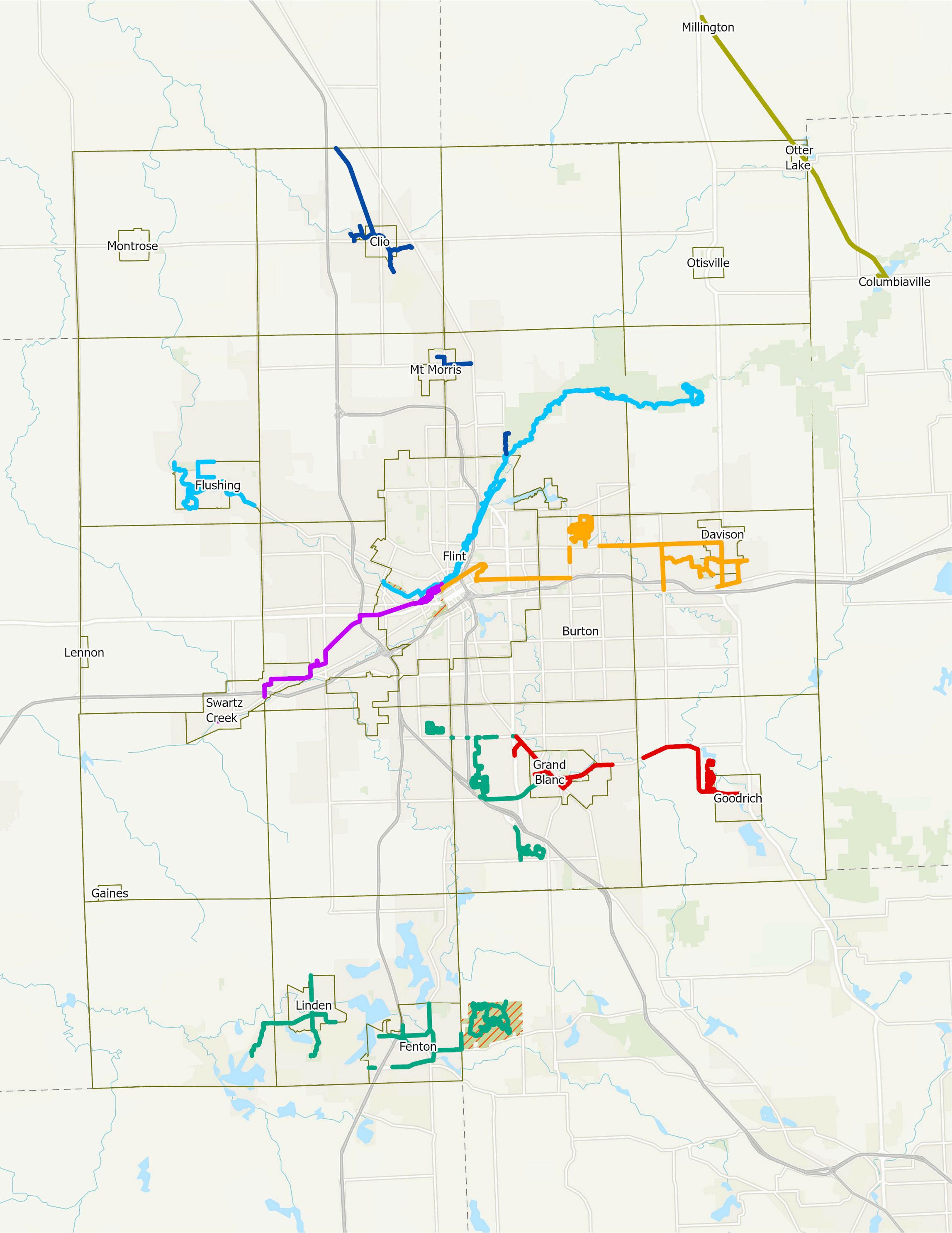
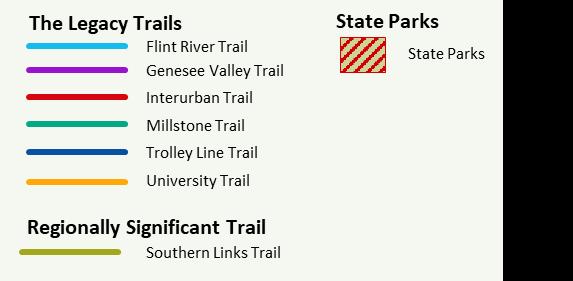
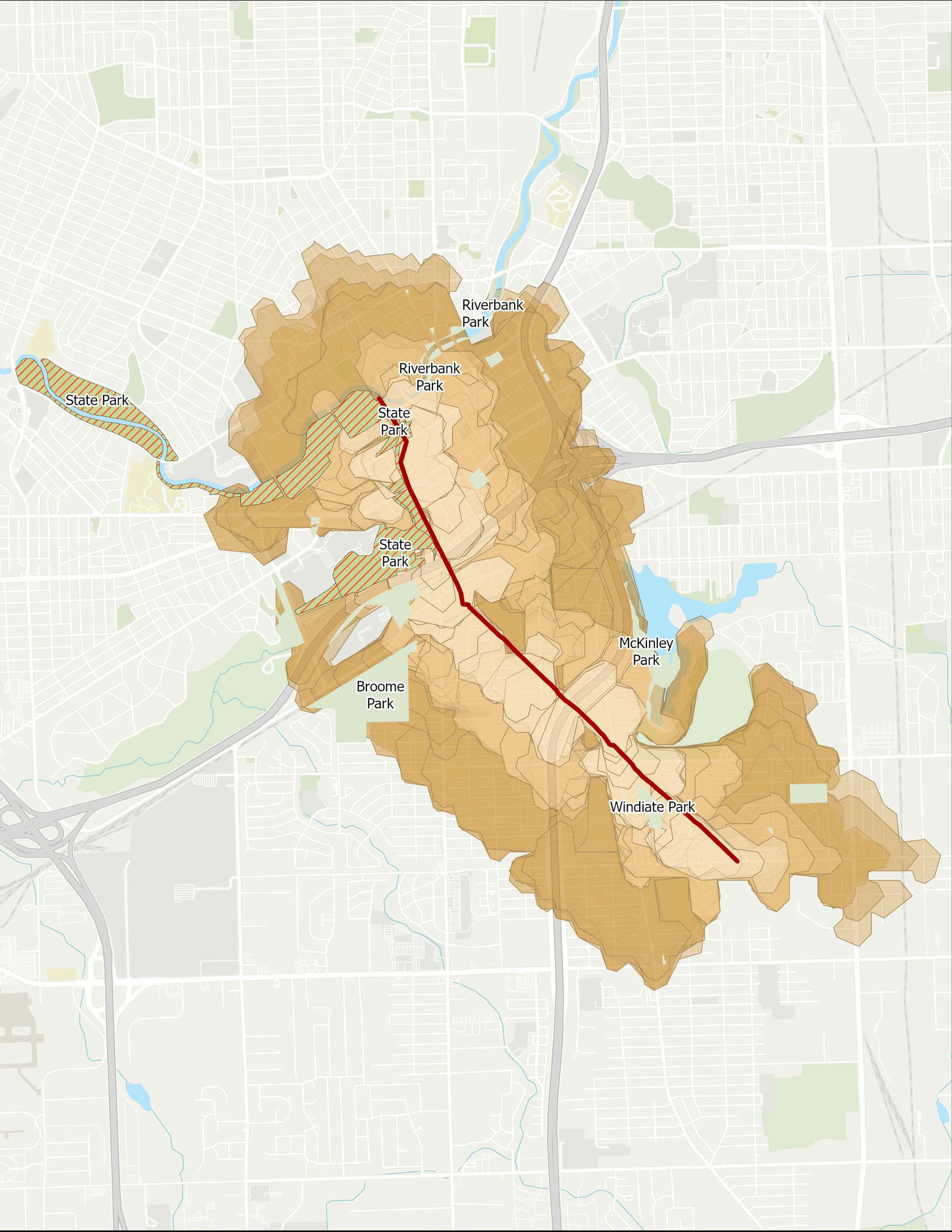
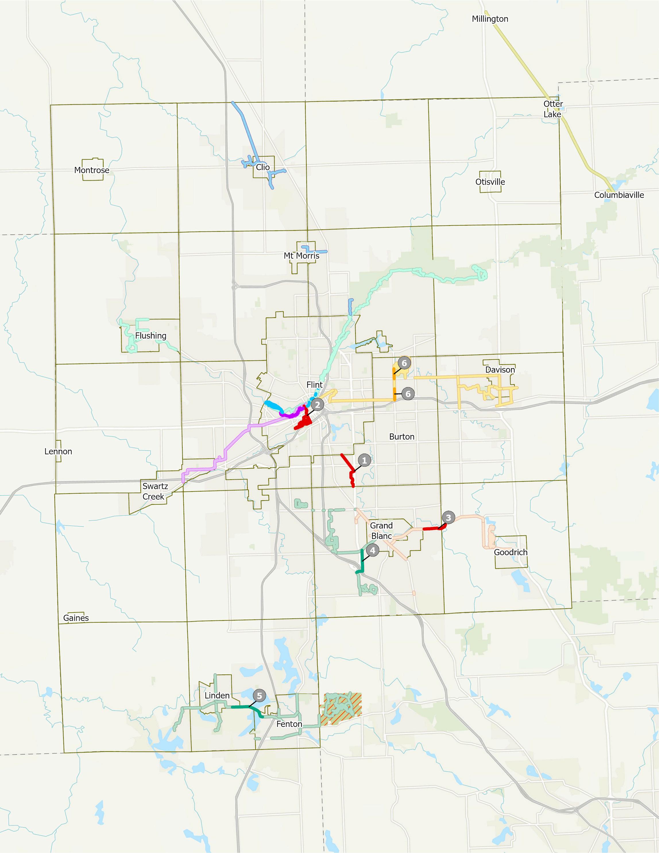
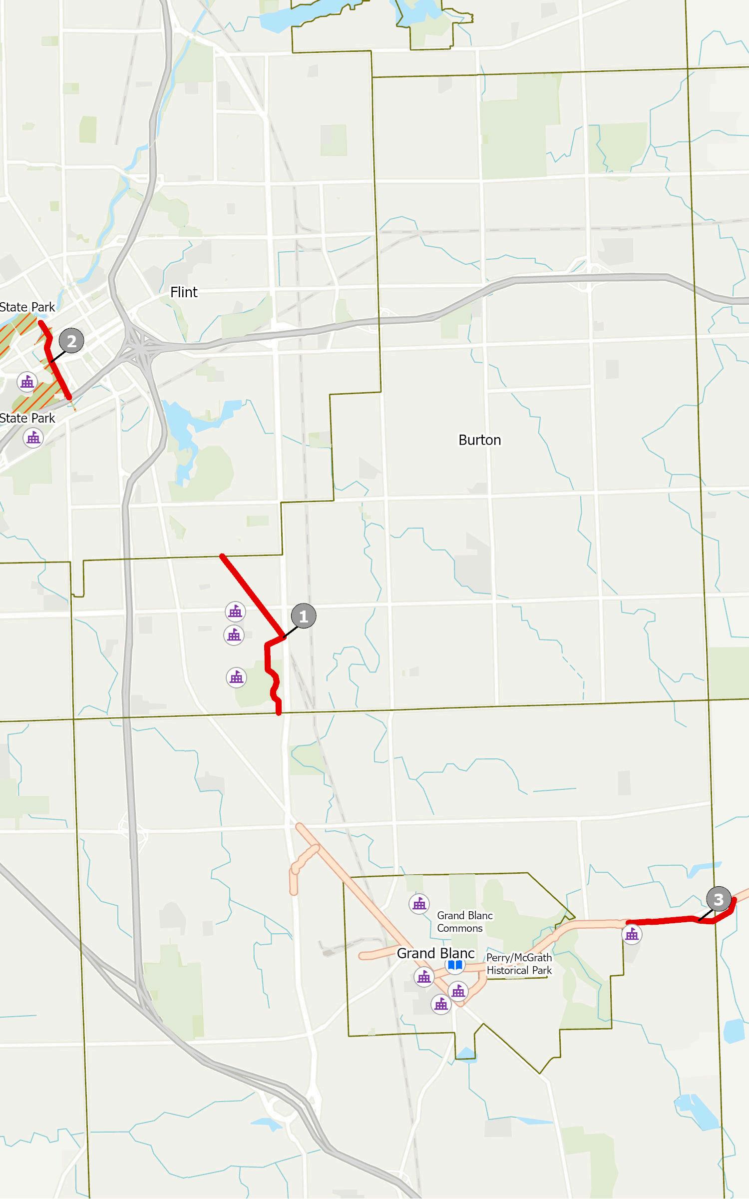
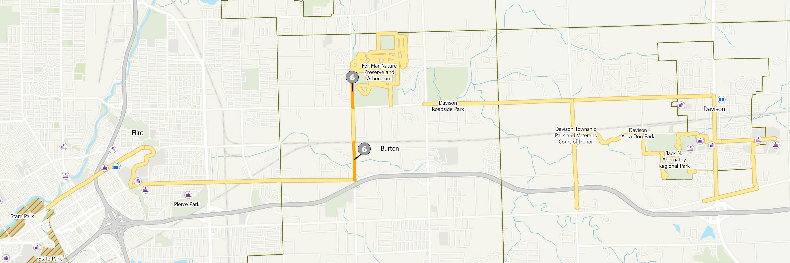
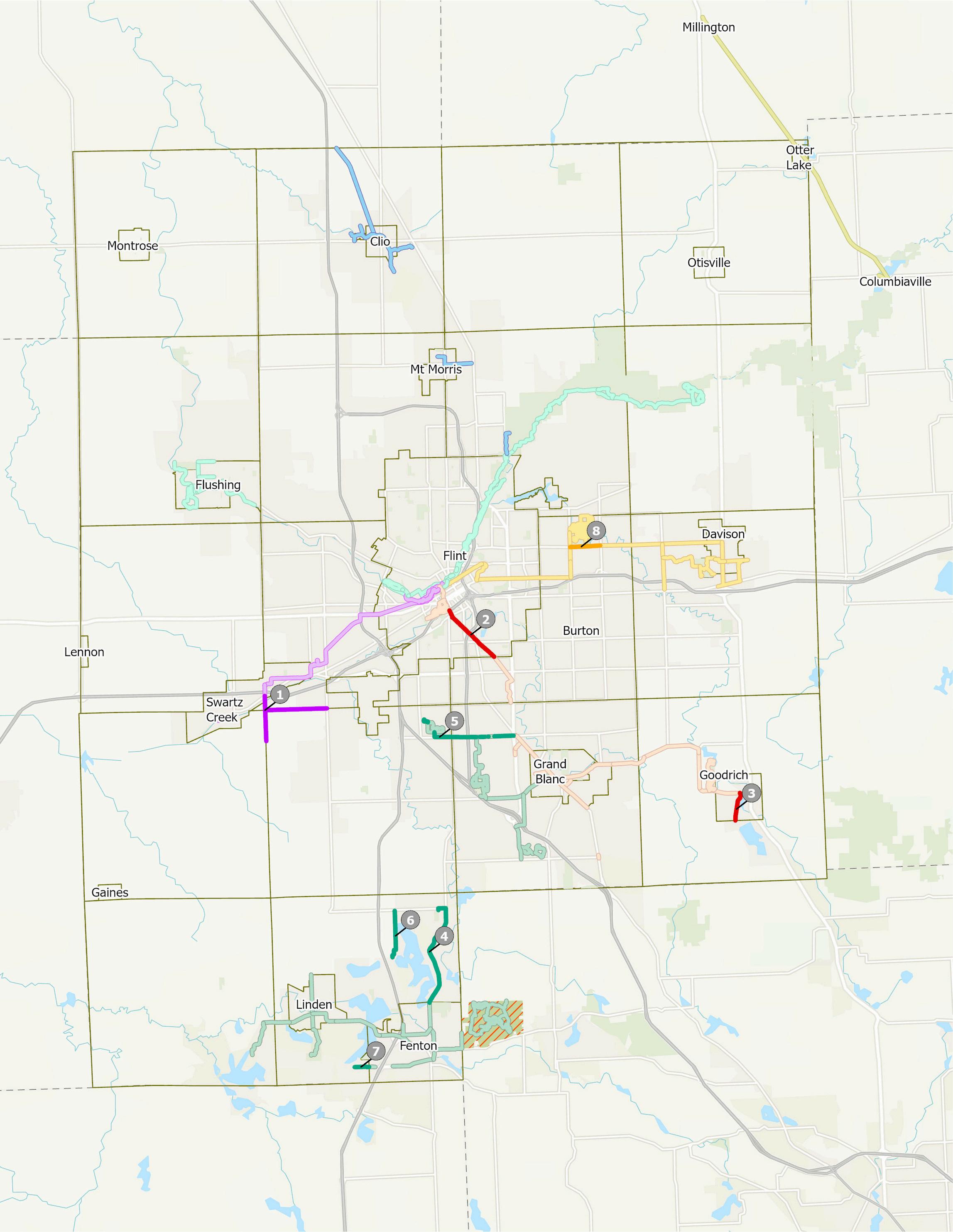
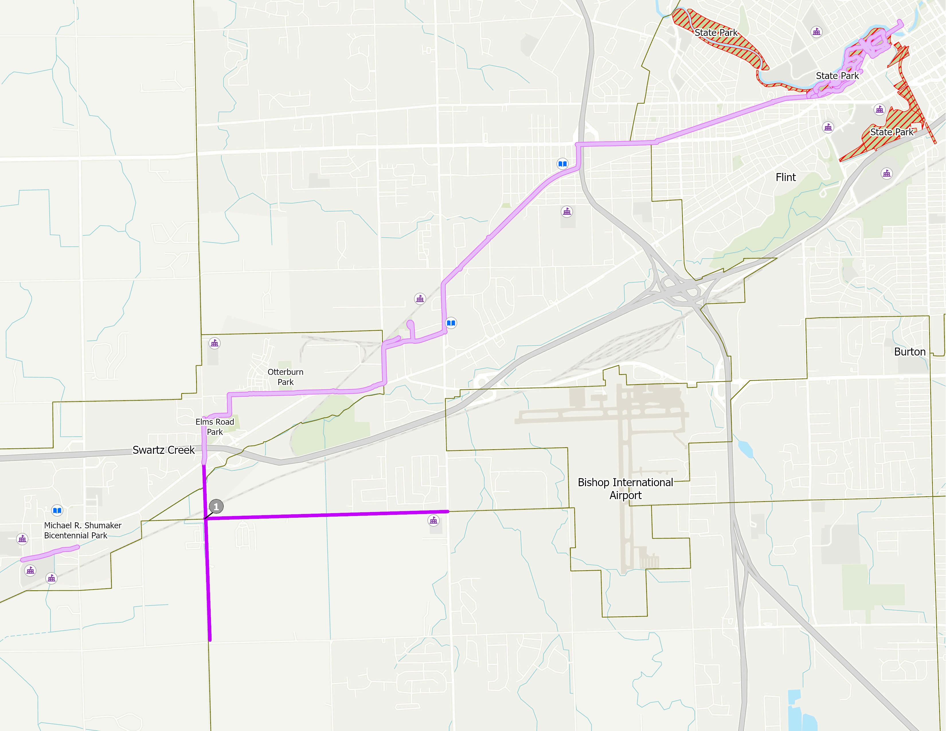
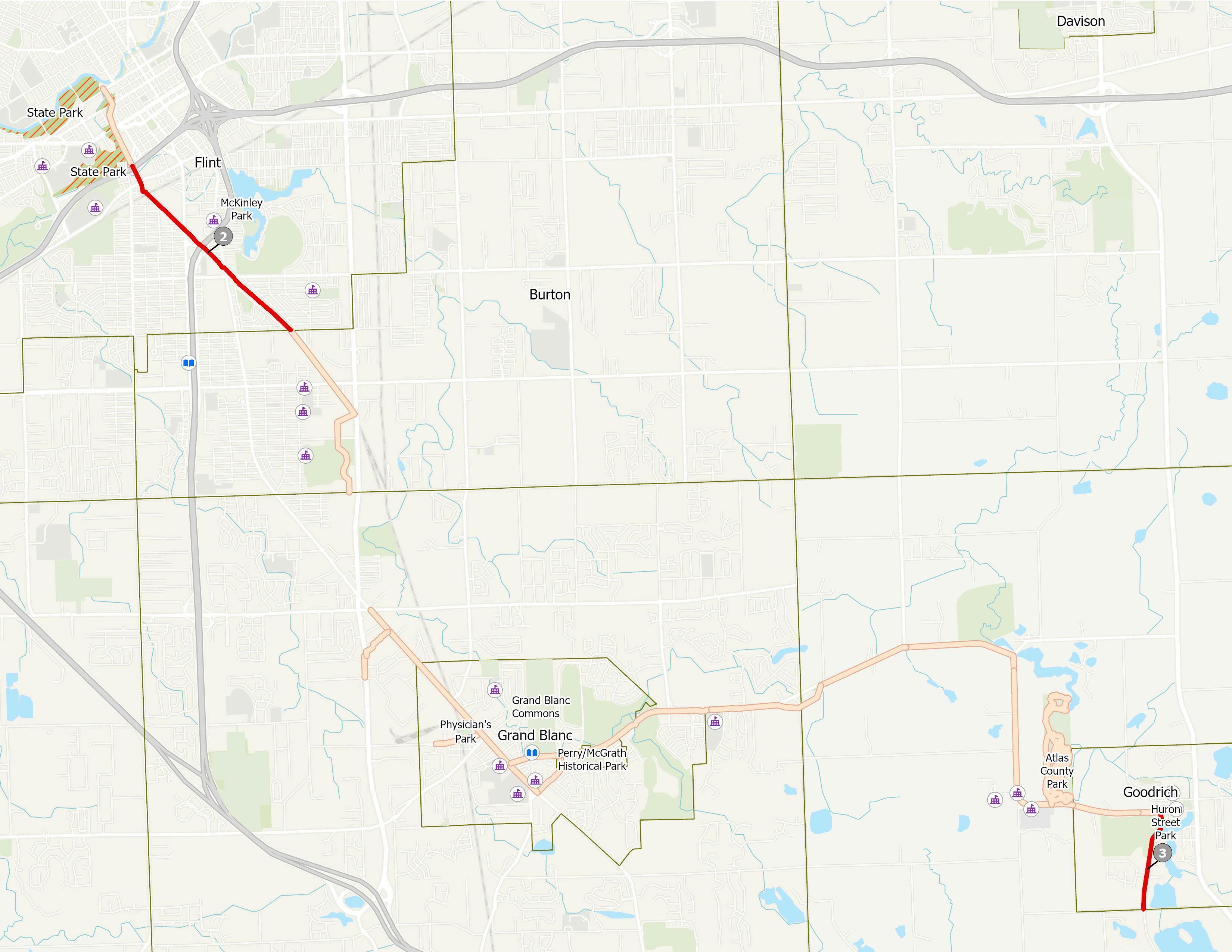
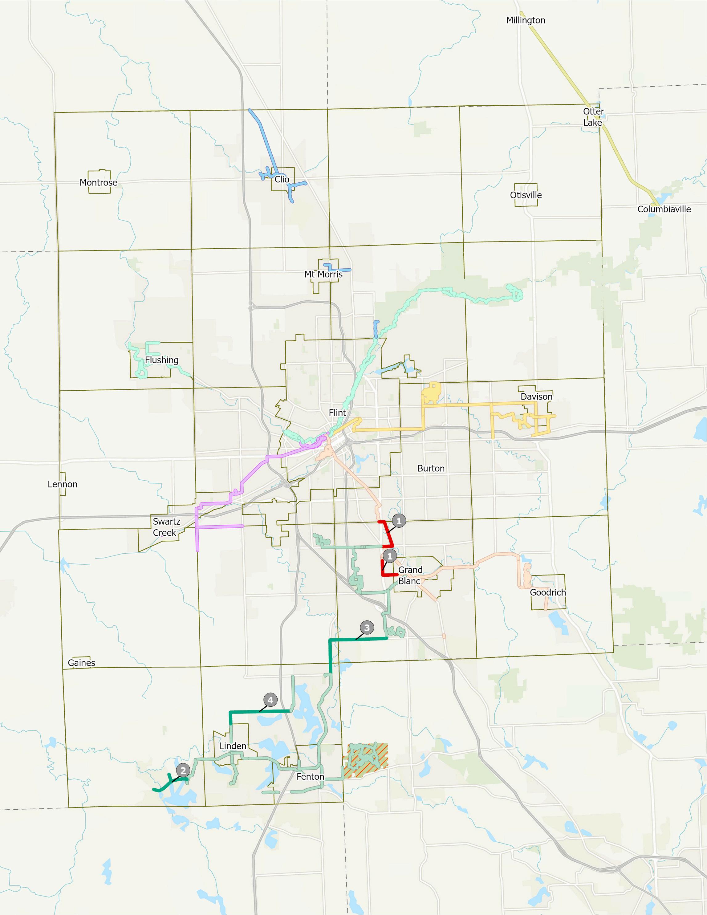
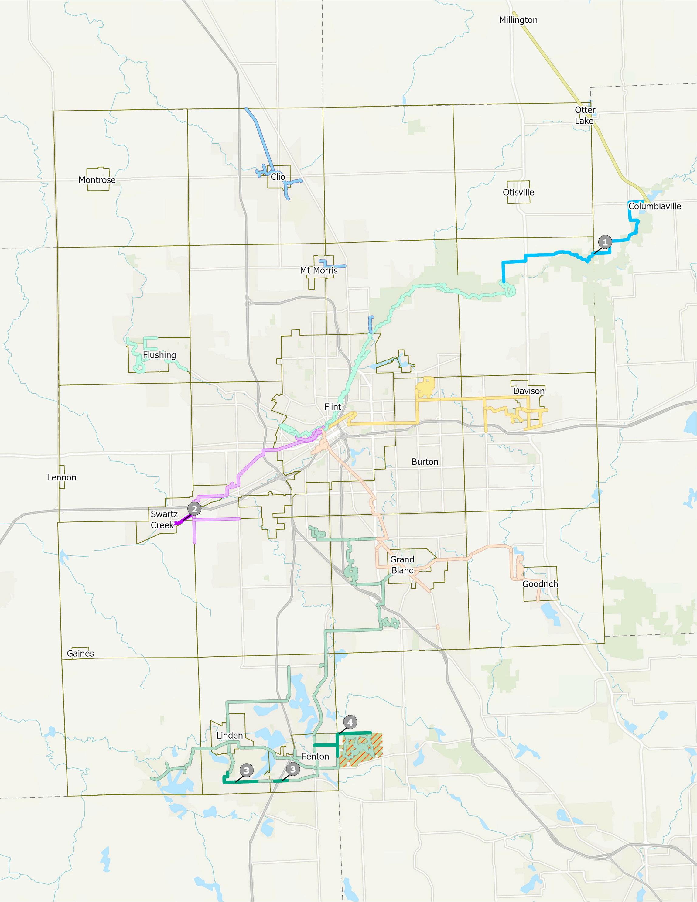
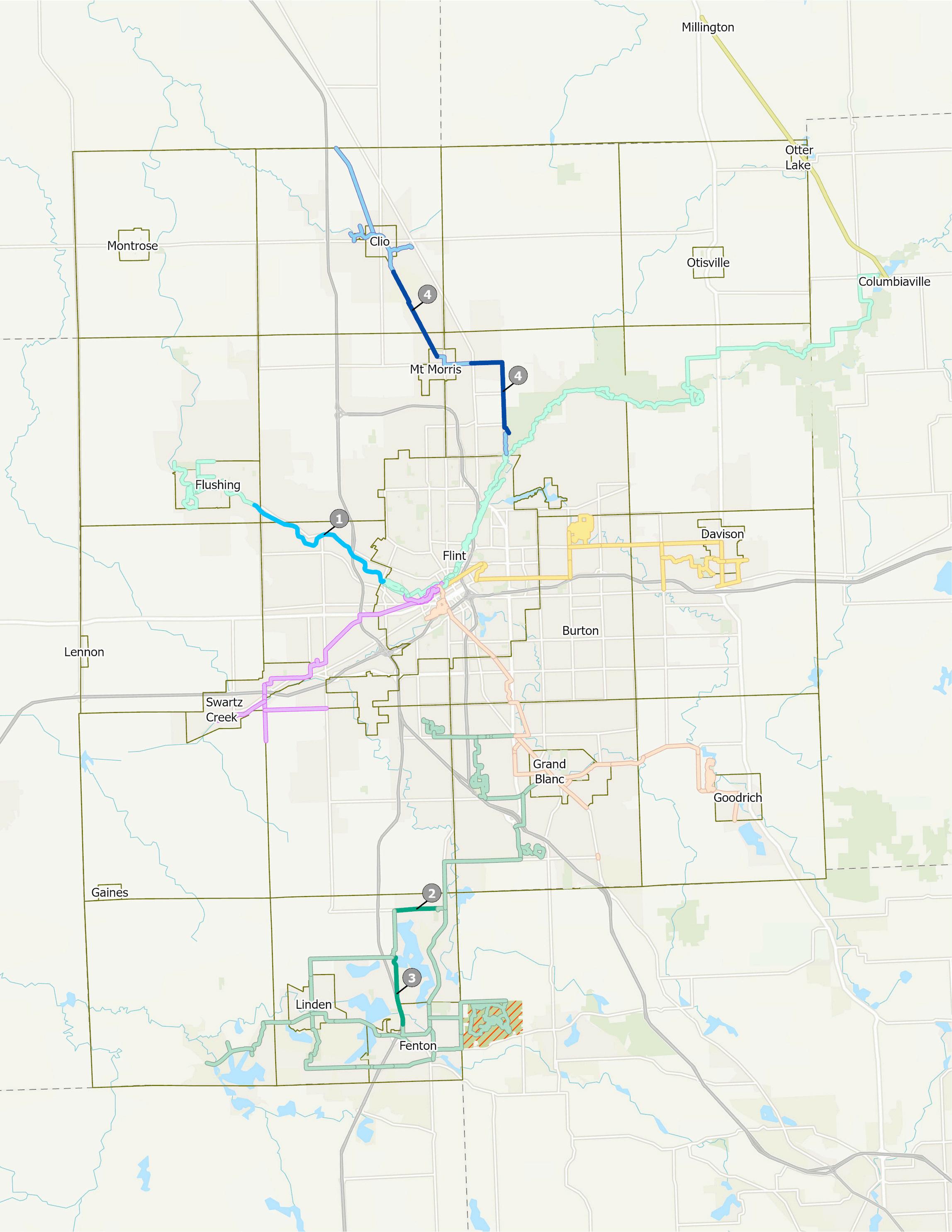
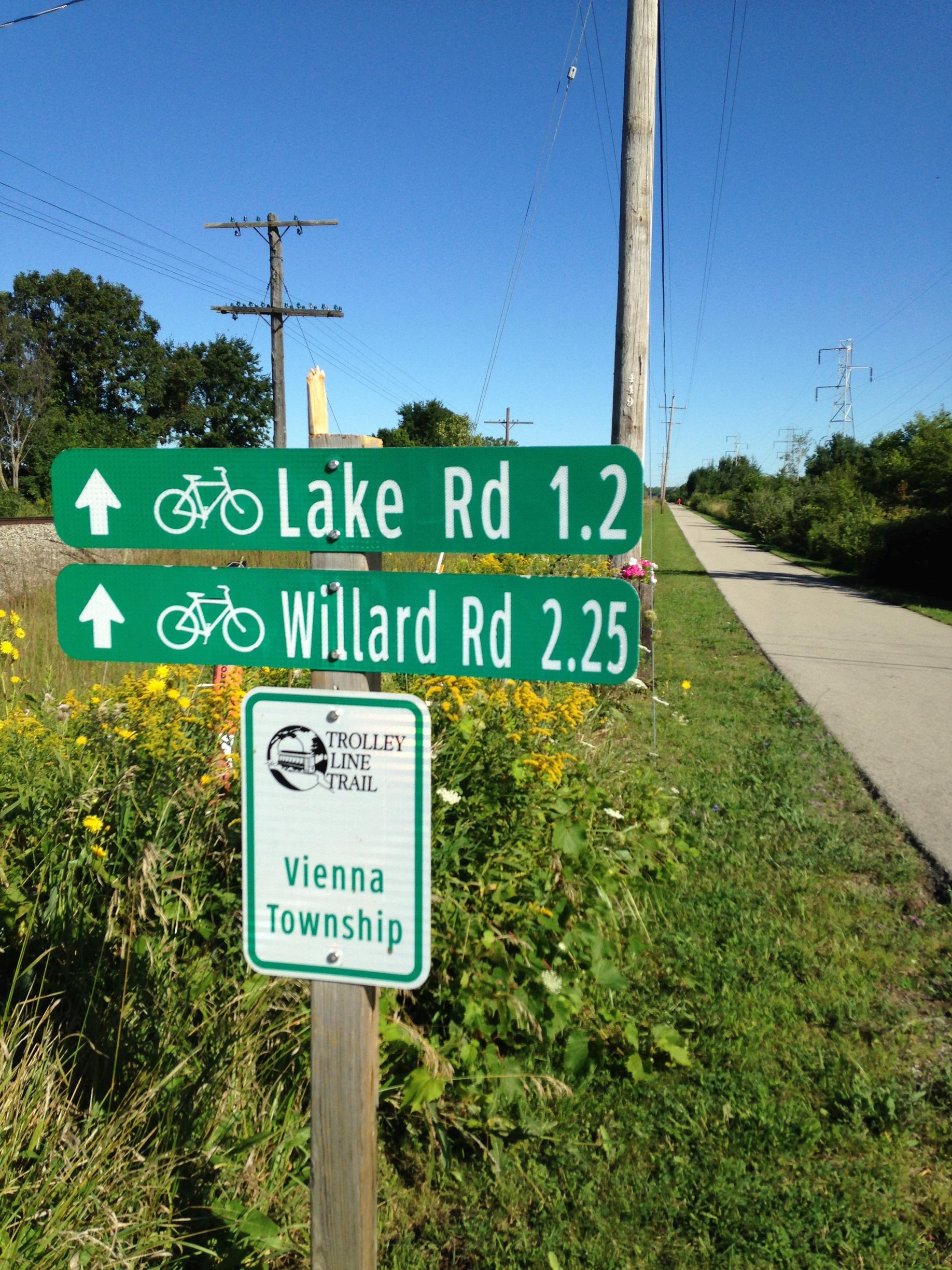
This plan announces the creation of The Legacy Trail, a network comprised of six regional trail corridors that span across Genesee County. The network includes the completion of segments along the long-established Flint River Trail, Genesee Valley Trail, and Trolley Line Trail corridors. We also see new connections through the creation of the Millstone Trail (Argentine to Grand Blanc), the University Trail (Davison to Flint), and the Interurban Trail (Goodrich to Flint).
These projects are the framework for a cohesive huband-spoke network that is centered at the State Park in the City of Flint. Spokes, or trails extending past the city, will enhance regional connectivity, serve high-density population areas, address local mobility and recreational needs, and demonstrate visible progress towards developing a countywide trail system. Once fully built, residents utilizing this network will have non-motorized access to over 11,000 acres of Genesee County parkland, the Seven Lakes State Park in Oakland County, and Lapeer & Tuscola Counties to the north via the Southern Links Trailway.
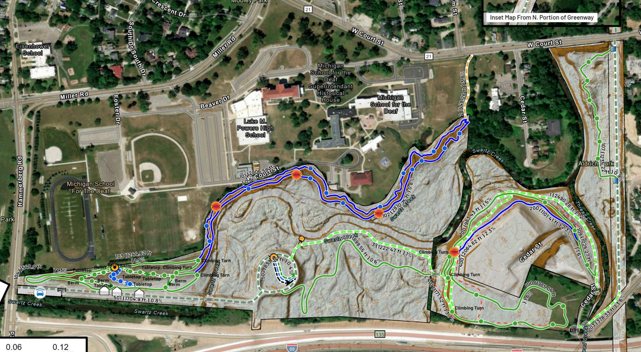
Initiatives are in motion at the new State Park in downtown Flint thanks to the partnership between Genesee County, the Michigan Department of Natural Resources, and the Charles Stewart Mott Foundation Established in 2022, the State Park in downtown Flint is Genesee County’s first and Michigan’s 104 consisting of five park units - Chevy Commons, Mott Park Recreation Area, Riverbank Park, Vietnam Veterans Park and Happy Hollow Nature Area. Over 16 miles of new trail are currently under design including new trailhead construction at Mott Park Recreation Area, Happy Hollow th
re Area, and Chevy Commons. One significant project to highlight is the truction of a state of the art pump track course at Happy Hollows that
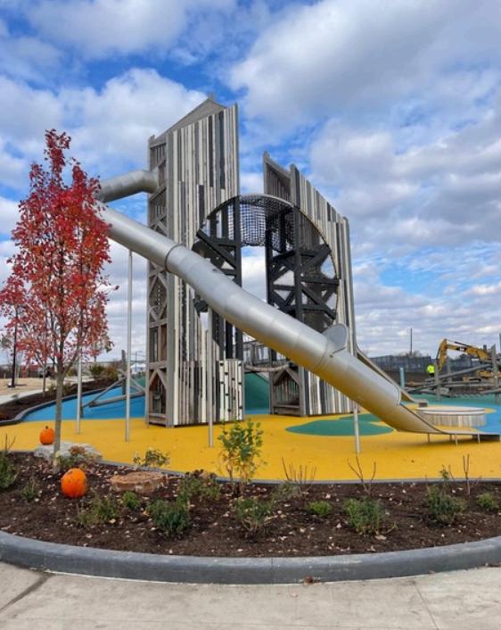
Within this plan, we also recognize the importance of creating public spaces and facilities that will attract visitors to the County and become an ecomomic driver for the region. Well designed trailheads are critical infrastructure for a successful non-motorized trail system. They serve not only as safe and organized access points, but also as economic catalysts, public health assets, and gateways to the broader community.
A thoughtfully designed trailhead serves as the “front door” to the community. A gateway trailhead can make a bold, memorable statement by intentionally combining design, identity, and experience into a single, welcoming first impression. Some elements to consider include the following:
Design and Architecture - adding iconic signage or striking features to create an immediate visual impact. This becomes recognizable and photograph worthy.
Community Branding & Wayfinding - incorporating local and regional logos, color schemes, maps and consistant messaging.
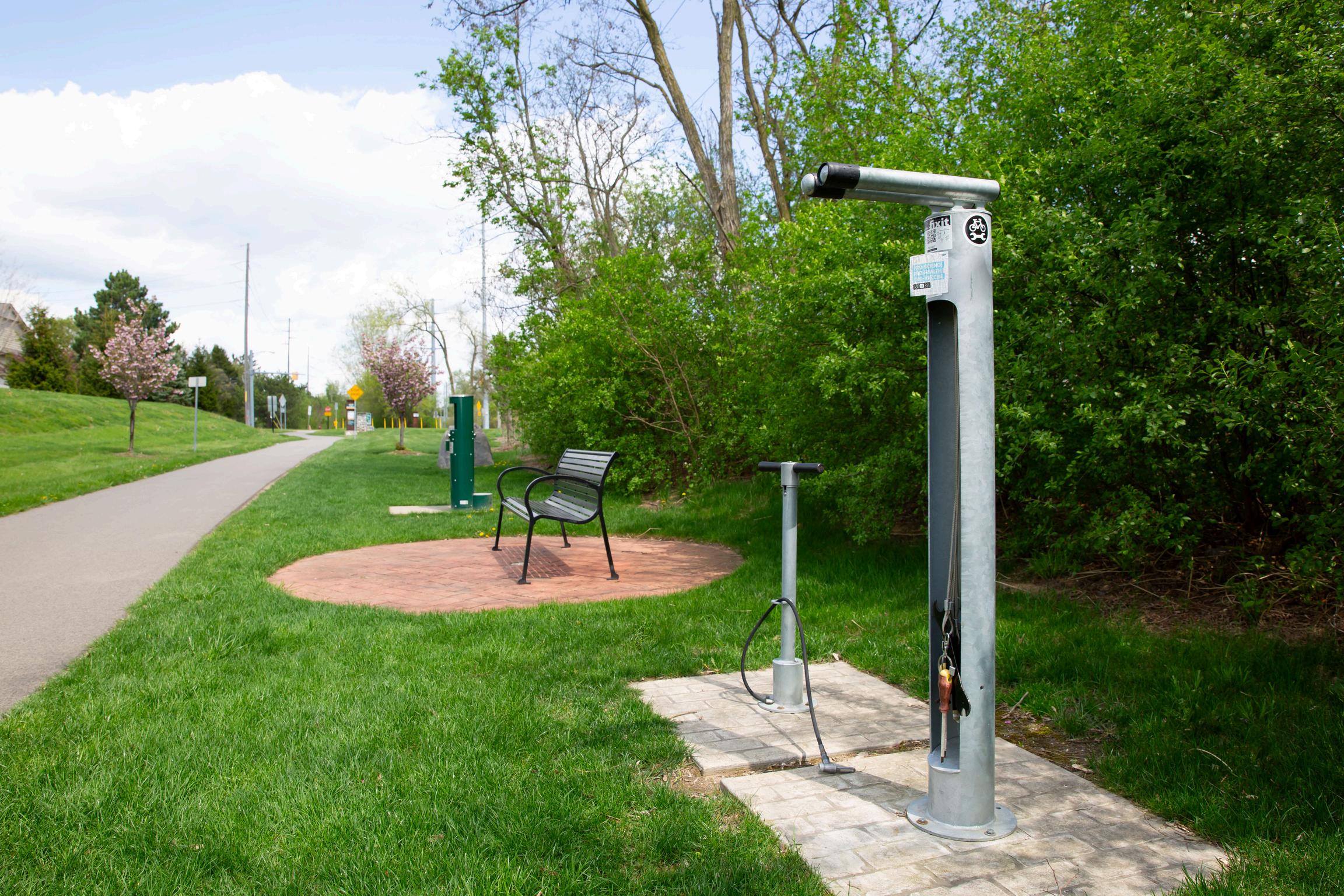
User Amenities - encouraging repeat visits and longer stays, include accessible features such as shaded seating areas, restroom facilities, bike repair stations, play structures, information kiosk, parking, and lighting.
In short, a gateway trailhead becomes memorable when it feels intentional, authentic, and welcoming. When visitors associate a positive experience with a distinctive place, they are far more likely to return and to recommend it to others.
A five year project schedule was created based on project readiness, grant competitiveness, right-of-way availability as well as other considerations known to date. Projects are illustrated and numbered on the following pages. To learn more about each project and stay informed, please visit https://geneseetrails.com/.
Miles of New Connections: 6.9 miles
Trail Segments to be Constructed:
Interurban Trail
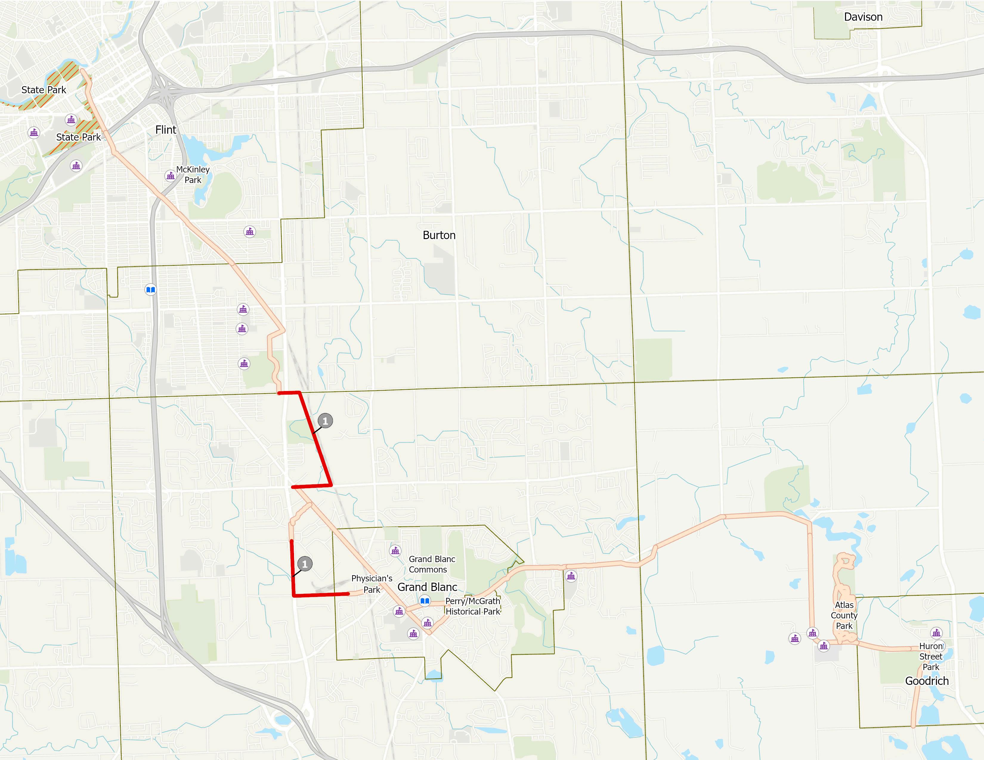
1.Burton Iron Belle Trail
2.Grand Traverse Greenway Phase A
3.Perry Road Trail Phase B
Millstone Trail
4.Embury-Cook Road Trail
5.Silver Lake Road Trail
University Trail
6. Genesee Road Trail
Description: Six non-motorized projects across
The Legacy Trail network are identified for design and construction during the 2026 calendar year. Together, these investments represent a major step forward in regional connectivity. Notably, the Silver Lake Road Trail will complete a critical link between the City of Linden and the City of Fenton and provide access to schools, parks, and other essential community services Additionally, construction of the region’s first pump track / mountain bike course will begin at the new State Park in Downtown Flint. A detailed overview of the six non-motorized projects is provided on the following pages.
Estimated Total Cost: $ 12.8 million
ProjectLocation:CityofBurton
ProjectLength:1.7miles
Description: Beginning on Maple Ave, this project runs throughtheformerSouthmoorCountryClubproperty,joining with the utility corridor and continuing north to Hemphill Road ThisprojectispartoftheIronBelleTrailandcompletes acriticalconnectionbetweentheCityofFlint,CityofBurton, andGrandBlanc Thisprojectisscheduledtostartinlate2026
EstimatedCost:$1.5million
ProjectLocation:CityofFlint
ProjectLength:0.8miles
Description: In the planning stages for several decades, this project starts in downtown Flint at the new State Park and continues south along the utility corridor, concluding at FentonRd.Therearetwophasesofthisproject.PhaseAofthe projectwillbeginconstructionin2026
EstimatedCost:$1.4million
ProjectLocation:GrandBlancTownship&AtlasTownship
ProjectLength:1.1miles
Description: The project, part of Michigan's Iron Belle Trail route, will begin at a new trailhead located at Grand Blanc EastMiddleSchool,traveleastandconnectwiththerecently constructed trail in Atlas Township. This will serve both the Grand Blanc Community Schools and the Goodrich Area Schoolswithacontinuousandsafetransportationfacility.This projectisscheduledtobeginconstructionlate2026.
EstimatedCost:$2.1million
ProjectLocation:GrandBlancTownship
ProjectLength:1.3miles
Description: Beginning on Cook Road at S. Dort Hwy., this project continues east to Embury Road before heading north on Cook Road, concluding at Grand BlancRoad.Thisprojectprovidesaconnectionbetween currently existing trail systems This connection will provide residents additional access to the Bicentennial Recreation Complex, Henry Ford Genesys Regional MedicalCenter,andtheGrandBlancschoolsystem.This projectisscheduledtobecompleteinmid-2026
EstimatedCost:$1.8million
ProjectLocation:CityofLinden,FentonTownship,City ofFenton
ProjectLength:2.1miles
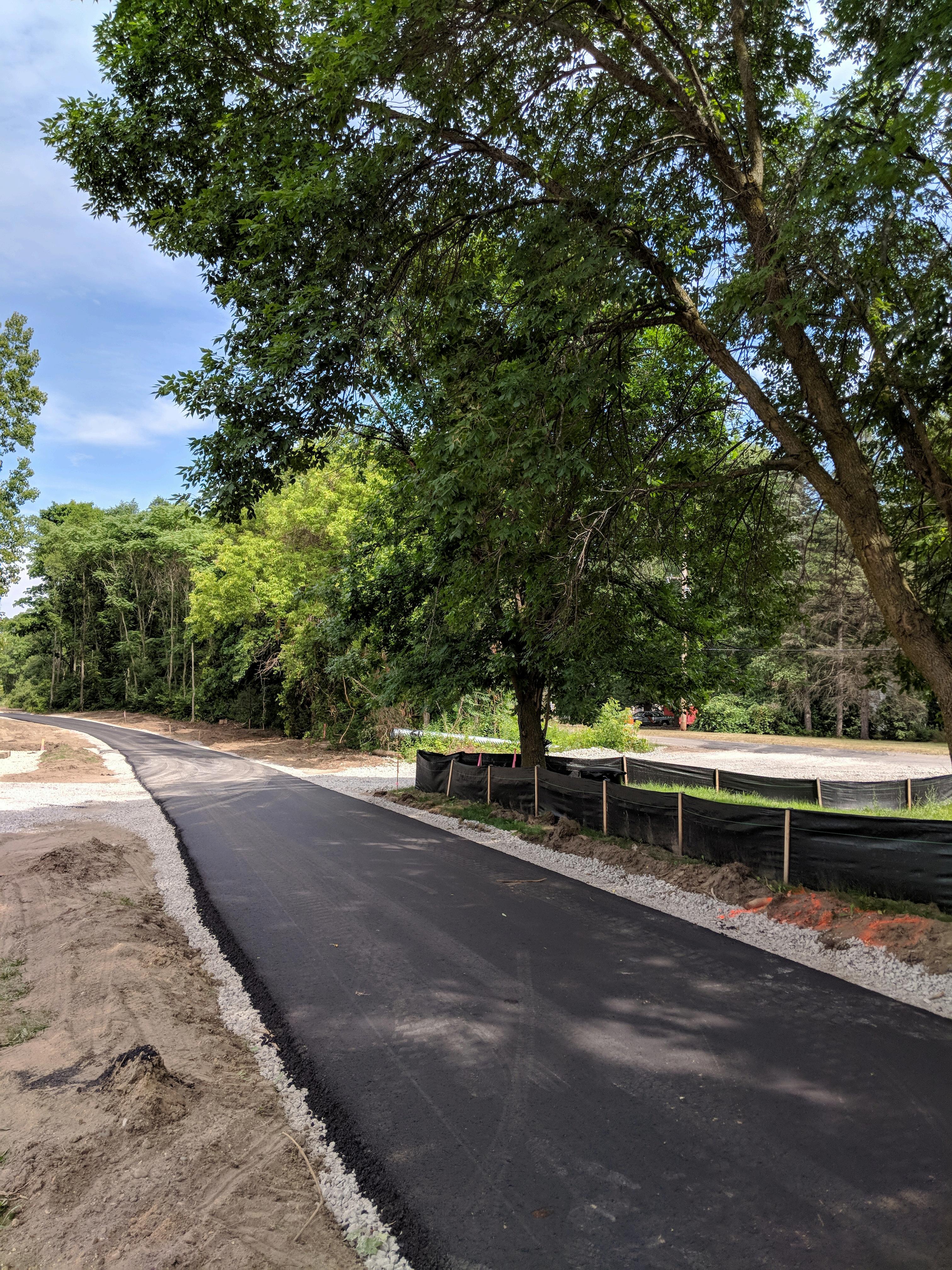
Description:Thispathwaywillbeconstructedalongthe south side of Silver Lake Road and connects existing sidewalks at Triangle Park in the City of Linden with sidewalks in the City of Fenton. The project will border the north shoreline of Silver Lake where modifications willbemadetothelakeedgetoprovideerosioncontrol, bank stabilization, and accommodate subgrade fill for pathway construction. Construction is underway with theribboncuttingscheduledformid-2026.
EstimatedCost:$54million
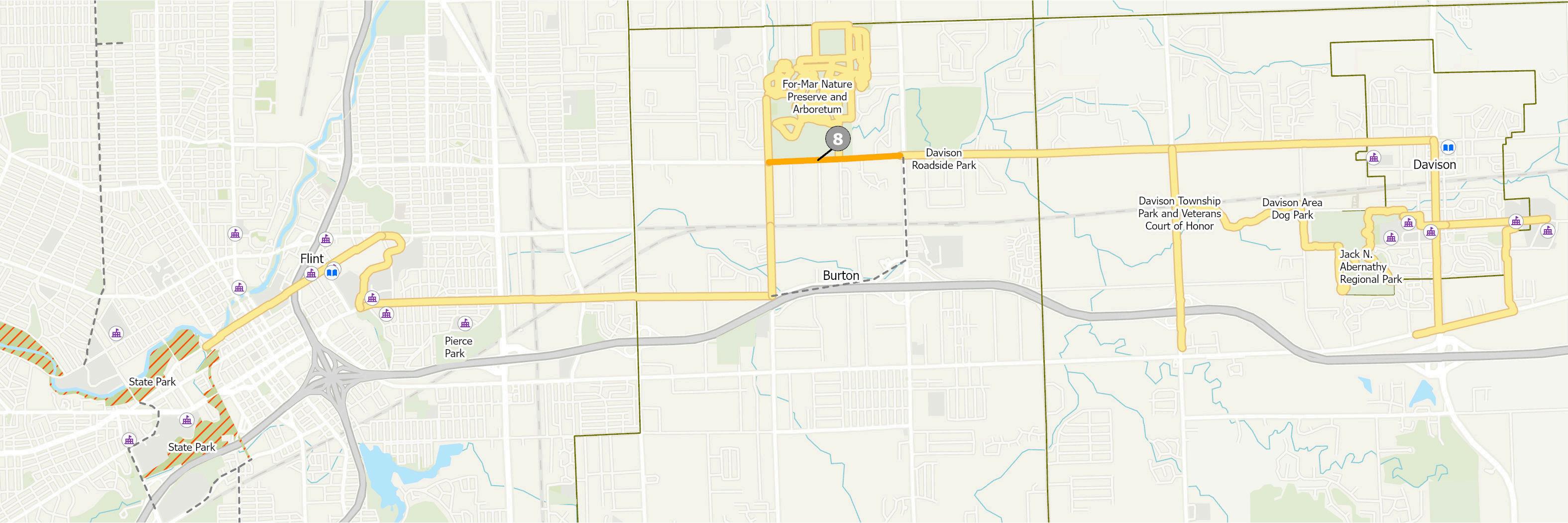
Project Location: City of Burton
Project Length: 1.0 miles
Description: Beginning on Genesee Road at Court Street, this project connects existing sidewalks connecting to the ForMar Nature Preserve. This project will fill the missing connection between the City of Flint (Flint River Trail) and ForMar.
Estimated Cost: $ 06 million
Miles of New Connections: 15.6 miles
Trail Segments to be Constructed:
Genesee Valley Trail
1.Maple-Elms Road Trail
Interurban Trail
2.Grand Traverse Greenway Phase B
3.Ridge Road Trail
Millstone Trail
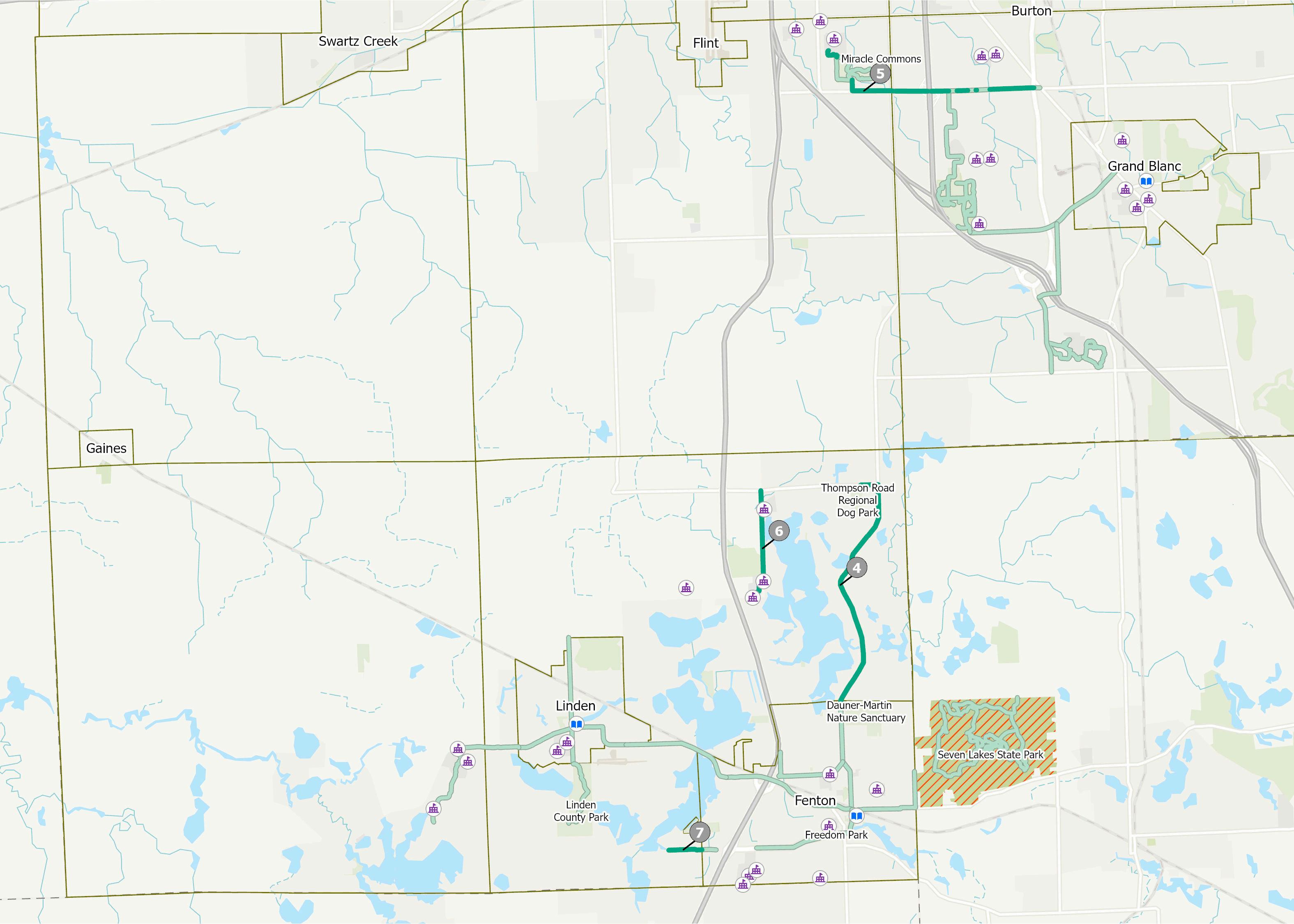
4.Fenton Road Regional Trail
5.Hill Road Trail
6.Lake Fenton Schools Trail Phase A
7.Owen Road Connector Phase A
University Trail
8.Davison - Irish Road Trail
Description: Eight projects across The Legacy Trail network are identified for design and construction during the 2027 calendar year. These investments build off of the network created by previous year projects and the existing infrastructure. A detailed overview of these eight projects is provided on the following pages.
Estimated Cost: $ 17.5 million
ProjectLocation:MundyTownship
ProjectLength:3.5miles
Description: Beginning at the existing sidewalks on Elms Road, this project will provide pedestrian access to neighborhoods along Elms Rd ending at the Hill Rd Intersection This connection will extend onto Maple Rd and connect to the future Advanced Manufacturing Site. Furthermore,thisfacilitywillbethefirstphasetoconnecting theGeneseeValleyTrailinSwartzCreektoMundyTownship.
EstimatedCost:$4.5million
ProjectLocation:CityofFlint
ProjectLength:2.1miles
Description:PhaseBoftheGrandTraverseGreenwaystartsat Fenton Road, continuing southward down the utility corridor and concluding at Hemphill Road connecting to the City of Burton’s2026trailproject.
EstimatedCost:$2.8million
ProjectLocation:VillageofGoodrich
ProjectLength:0.9mile
Description: Starting in Downtown Goodrich, this pathway travels south along Ridge Road to Green Road The proposed sidewalkwillprovideseveralneighborhoodsaccesstoexisting non-motorized facilities along Hegel Road that lead to Goodrich Community Schools and the larger Iron Belle Trail route.
EstimatedCost:$0.5million

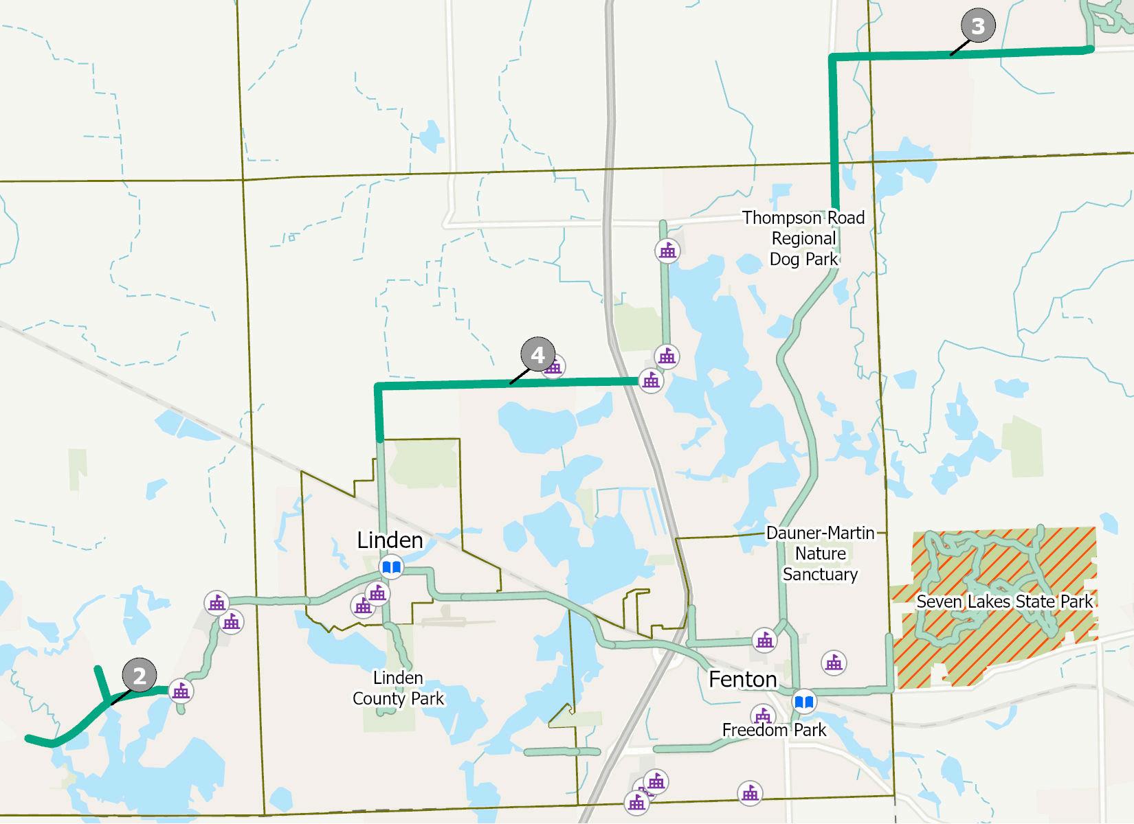
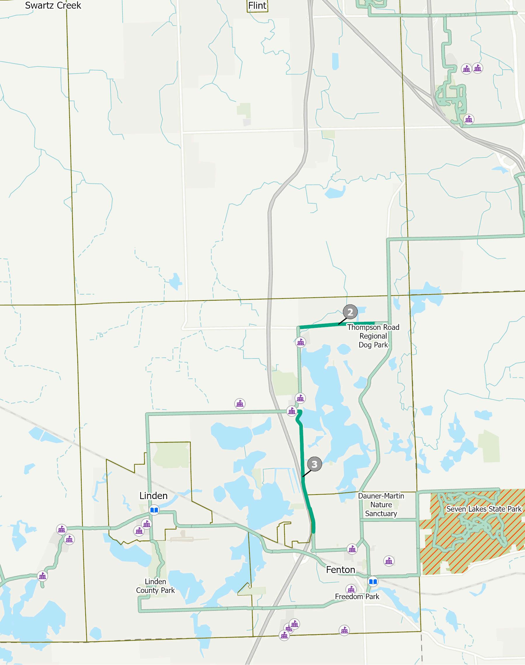
ProjectLocation:FentonTownship
ProjectLength:3.7miles
Description: Beginning on Fenton Road at the city limits, this project continues north to Thompson Road, heading west and concluding at the Regional Dog Park. This project provides park access to the substantial residential population along Fenton Road and establishes the first section of a critical connection to the larger County trail network
EstimatedCost:$5.8million
ProjectLocation:MundyTownship,GrandBlancTownship
ProjectLength:23miles
Description: ThisprojectbeginsattheMundyMiracleCommonsin Mundy Township continuing east down Hill Road into Grand Blanc Township, concluding at M-54. The sidewalk will provide increased park access, substantial pedestrian access to a dense urban environmentthatservesasaneconomicenginetothearea,aswell as connections to Grand Blanc and their trail system, ultimately connecting to the Fenton community. An additional sidewalk is planned to be added connecting Mundy Miracle Commons with Carman Ainsworth Middle School, furthering access to this connection.
EstimatedCost:$14million
ProjectLocation:FentonTownship
ProjectLength:1.5miles
Description: This project begins at Thompson Road in Fenton TownshipheadingsouthonTorreyRoad,connectingtotheTorreyHill Intermediate School and West Shore Elementary School property withasidewalklooparoundtheschools
EstimatedCost:$2.1million
ProjectLocation:FentonTownship
ProjectLength:05mile
Description: Thisprojectwillextendtheexistingsidewalkson the north side of Owen road, from Jennings Road west to Silvercrest Drive. The new sidwalks are to be constructed duringtheexpansionofOwenRoadfrom2-to-3lanesin2027. The project will provide non-motorized access to several neighborhoodstoseveralcommunityresourceslocatedinCity ofFenton.
Project Location: City of Burton
Project Length: 1.0 miles
Description: Beginning at Genesee Road, this project connects existing sidewalks before continuing east on Davison Road, connecting to the ForMar Nature Preserve. This project will fill the missing connection between the City of Flint (Flint River Trail) and the greater Davison community (Black Creek Trail)
Estimated Cost: $ 0.6 million
Miles of New Connections: 12.8 miles
Trail Segments to be Constructed: Interurban Trail
1.Grand Blanc Iron Belle Trail
Millstone Trail
2.Argentine Connector
3.Baldwin-Fenton Road Connector
4.Lake Fenton Schools Phase B
Description: Four projects across The Legacy Trail network are identified for design and construction during the 2028 calendar year. These investments build off of the network created by previous year projects and the existing infrastructure. A detailed overview of these four projects is provided on the following pages.
Estimated Cost: $ 13.9 million
ProjectLocation:GrandBlancTownship
ProjectLength:3miles
Description: Beginning on Reid Road at the currently existing sidewalk, this project continues westbeforeheadingNorthonM-54,connectingto theexistingpathway.Theprojectcontinueseaston Hill Road beginning at the existing sidewalk, turning north and following the utility corridor, continuingWestonMapleAve,concludingatthe beginningoftheCityofBurtonIronBelleTrail This project completes a critical gap in the Iron Belle TrailandconnectstheGrandBlancareatotheCity ofBurtonandCityofFlint.
EstimatedCost: $3million
ProjectLocation:ArgentineTownship
ProjectLength:2miles
Description: Beginning on Silver Lake Road at River Ridge Trail, this project continues east before turning south on Lobdell Road to connect to the existing Argentine Trail and the Linden Community Schools Campus. This project connects residential neighborhoods to downtown Argentine and the greatertrailsystemservingtheFenton-Lindenarea.
EstimatedCost:$1.3million
ProjectLocation:FentonTownship
ProjectLength:3.2miles
Description:ThefinalphaseoftheLakeFentonCommunity SchoolsprojectstartsattheendofPhaseAonTorreyRd from the West Shore Elementary School continuing west along LahringRoad(includingapedestrianbridgeacrossUS-23),to LakeFentonHighSchool,extendingtotheCityofLinden.This will provide connections to all Lake Fenton School District buildings. This trail directly connects with existing infrastructureintheCityofLindenaswellasLindenCounty Park
EstimatedCost:$7million
Project Location: Mundy Township, Grand Blanc Township,FentonTownship
ProjectLength:4miles
Description:BeginningonFentonRoadatThompson Road,thisprojectcontinuesnorthuntilBaldwinRoad, continuingeastandterminatingattheexistingS.Dort HighwayExtensionTrail.Thisprojectcompletesacore connection between the Argentine-Linden-Fenton areaandthegreaterGrandBlanccommunity.
EstimatedCost:$2.6million
Miles of New Connections: 17.7 miles
Trail Segments to be Constructed:
Flint River Trail
1.Wolverine Trail
Genesee Valley Trail
2.Swartz Creek Riverwalk
Millstone Trail
3.Owen Road Connector Phase B
4.Seven Lakes State Park Connector
Description: Four projects across The Legacy Trail network are identified for design and construction during the 2029 calendar year. These investments build off of the network created by previous year projects and the existing infrastructure.
Estimated Cost: $ 16.1 million
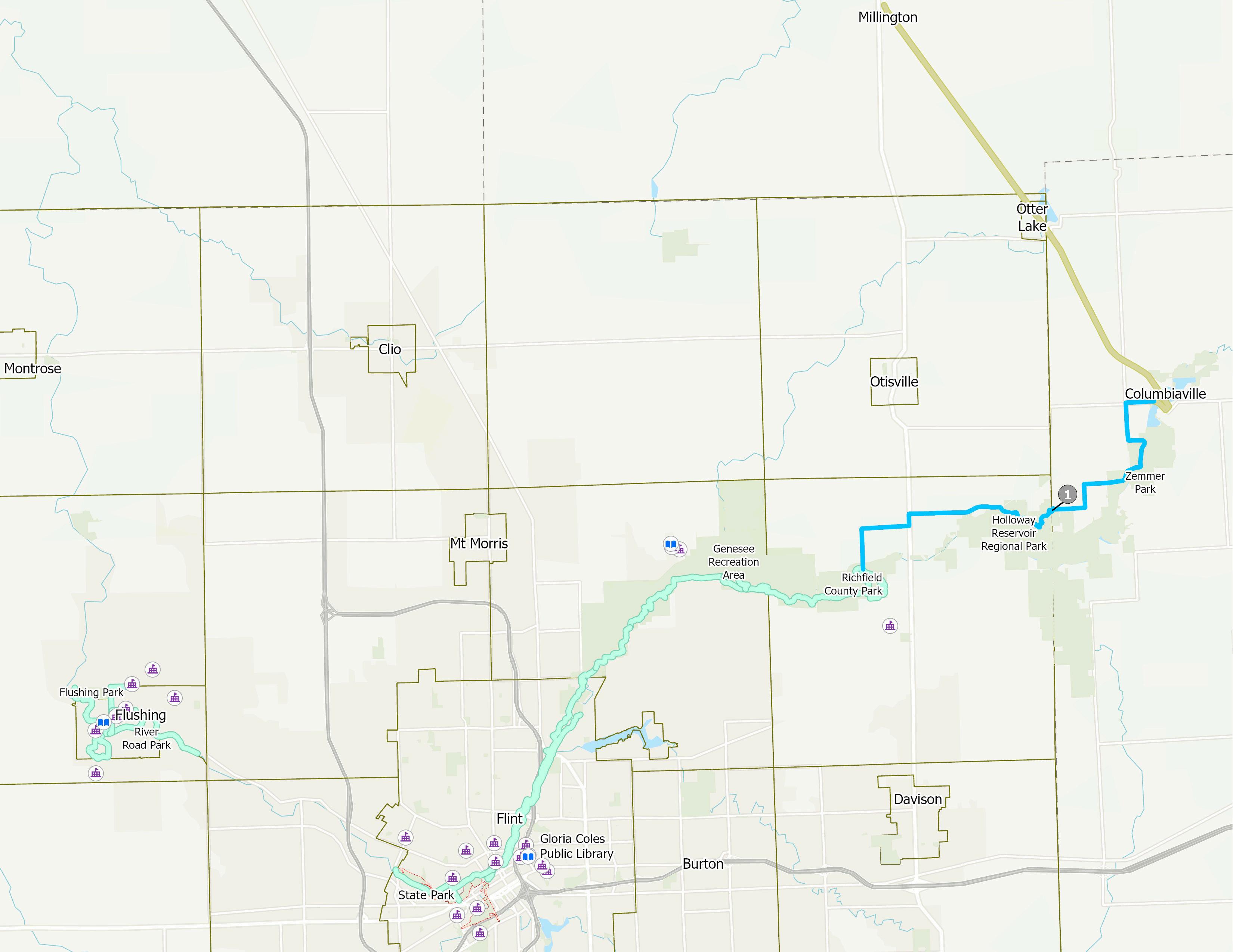
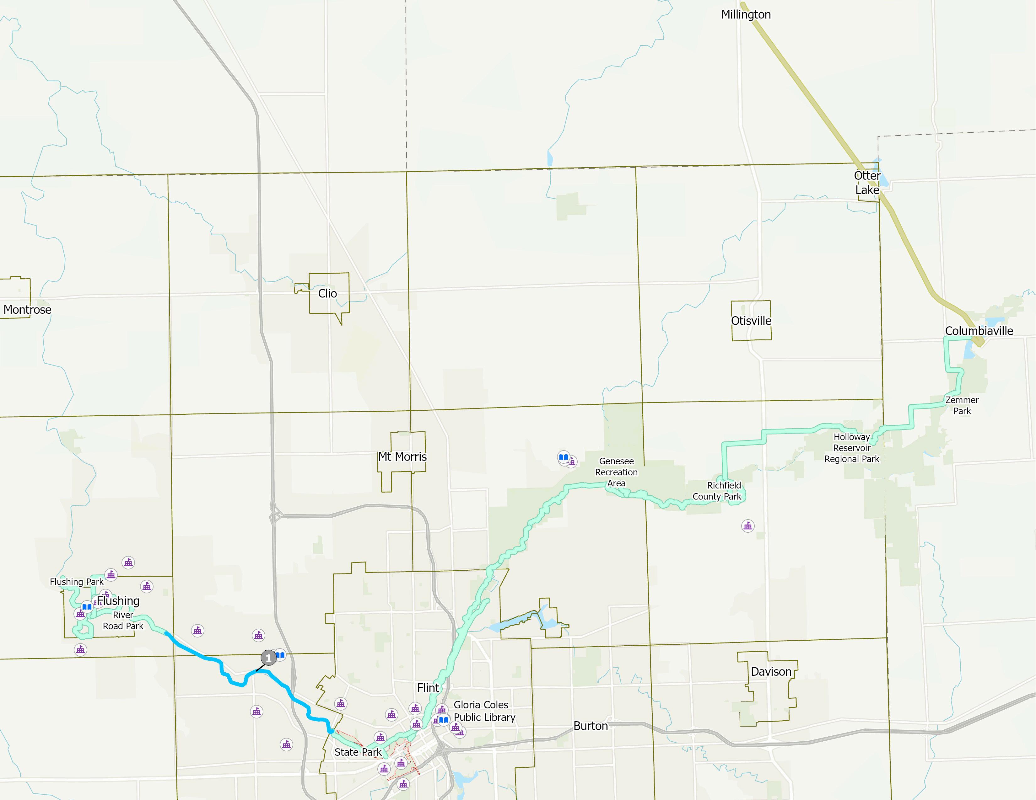
ProjectLocation:RichfieldTownship
ProjectLength: 106miles
Description: Beginning at Richfield County Park, this trail heads north alongGaleRoad,eastonMt.MorrisRoad,NorthonM-15beforecontinuing east on Mt. Morris Road, reaching Wolverine Campgrounds near Baxter Road. From there, the signed route will follow the northern shore of the Holloway Reservoir primarily along County Park property, connecting to theexistingSouthernLinksTrailinColumbiaville.
EstimatedCost:$71million
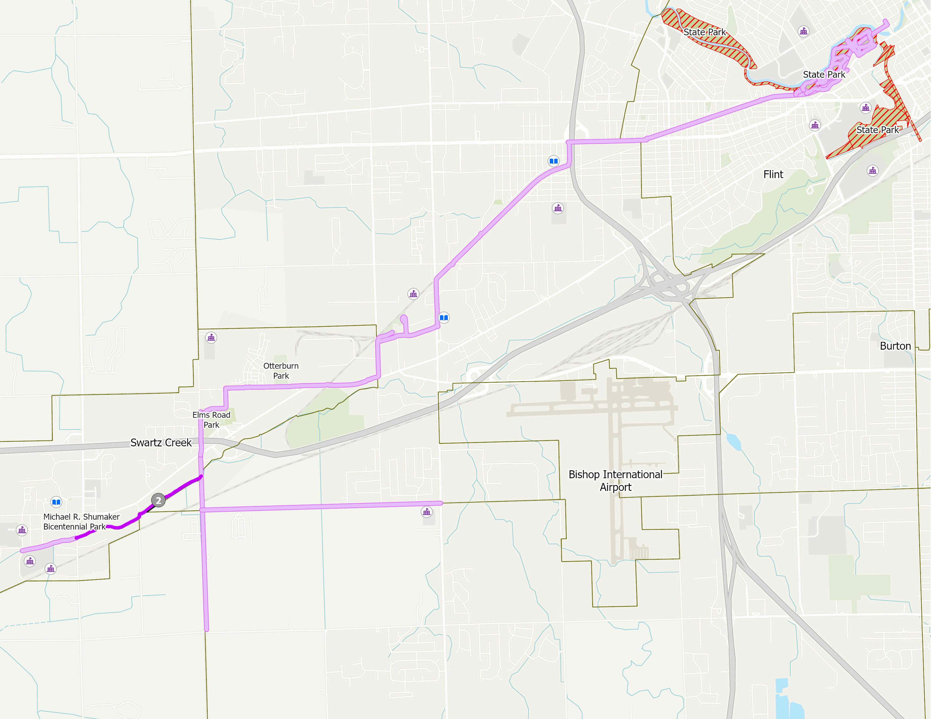
Project Location: City of Swartz Creek
Project Length: 1.2 miles
Description: Beginning at Morrish Road in the City of Swartz Creek, this project continues along the West Branch of the Swartz Creek, continuing north on Elms road, concluding at Miller Road. This project connects to existing pathway and sidewalk facilities in the City of Swartz Creek and provides additional access to the schools and business of the city.
Estimated Cost: $ 0.8 million
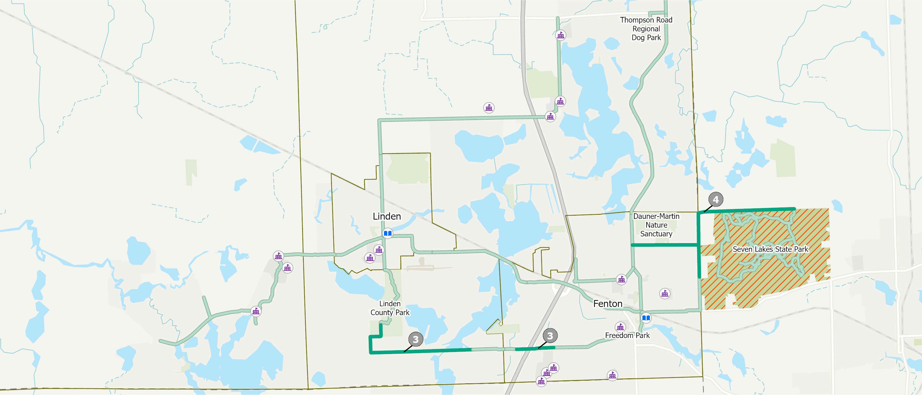
ProjectLocation:FentonTownship
ProjectLength:3.1miles
Description:BeginningatLindenCountyParkinFentonTownship this pathway travels south on Linden road then east along Owen Road terminating at the new sidewalks at Silvercrest Drive. This projectconnectstheCityofFenton,theCityofLinden,andadense residential population together, including a connection to the County Park Additionally, pedestrian access over US-23 will be evaluated for safety elements including pavement markings, barriers,andsignage
EstimatedCost:$6.1million
ProjectLocation:CityofFenton/HollyTownship(OaklandCounty)
ProjectLength:3.9miles
Description: Beginning at the existing City sidewalks, this project willtraveleastonDaunerRoad,northonEddyLakeRoad,andeast alongTinsmanRoadtoanewpedestrian/cyclistonlyentranceinto theStatePark SidewalkwillalsobeplacedsouthofDaunerRoad along Eddy Lake Road, connecting to existing sidewalk infrastructurealongMainStreetinDowntownFenton
EstimatedCost:$2.1million
Miles of New Connections: 13.1 miles
Trail Segments to be Constructed:
Flint River Trail
1.Flushing Road Connector
Millstone Trail
2.Thompson Road Trail
3. Lake Fenton School Trail - Phase C
Trolley Line Trail
4.TLT Southern Extension
Description: Three projects across The Legacy Trail network are identified for design and construction during the 2030 calendar year. These investments build off of the network created by previous year projects and the existing infrastructure
Estimated Cost: $ 12.7 million
ProjectLocation:FlintTownship,FlushingTownship,CityofFlushing
ProjectLength:5.8miles
Description: Beginning at the intersection of the Flint River and Ballenger Highway,thisprojectcontinuesalongtheriverbeforecontinuingalongFlushing Road, terminating at the existing sidewalk infrastructure at Diane Drive. This projectprovidesacriticalconnectionbetweentheCityofFlushingandresidents in Flint Township to the City of Flint and the greater Genesee County Trail System.
EstimatedCost:$3.8million
ProjectLocation:FentonTownship
ProjectLength: 1.7miles
Description: Beginning at the non-motorized facilities at theThompsonRoadRegionalDogPark,thispathwaywill extendwesttofacilitiestobelocatedatTorreyRoad.This new trail is identifed as core infrastructure to the rapid commercialdevelopmentofthiscorridor.
EstimatedCost:$2.1million
ProjectLocation:FentonTownship
ProjectLength: 2.4miles
Description: Beginning at the non-motorized facilities at Georgetown Parkway, this pathway will extend North along Torrey Road and connect to Phase B of the Lake Fenton Schools Trail This new trail will provide essential connections from Lake Fenton Schools to Downtown Fenton
EstimatedCost:$3.1million
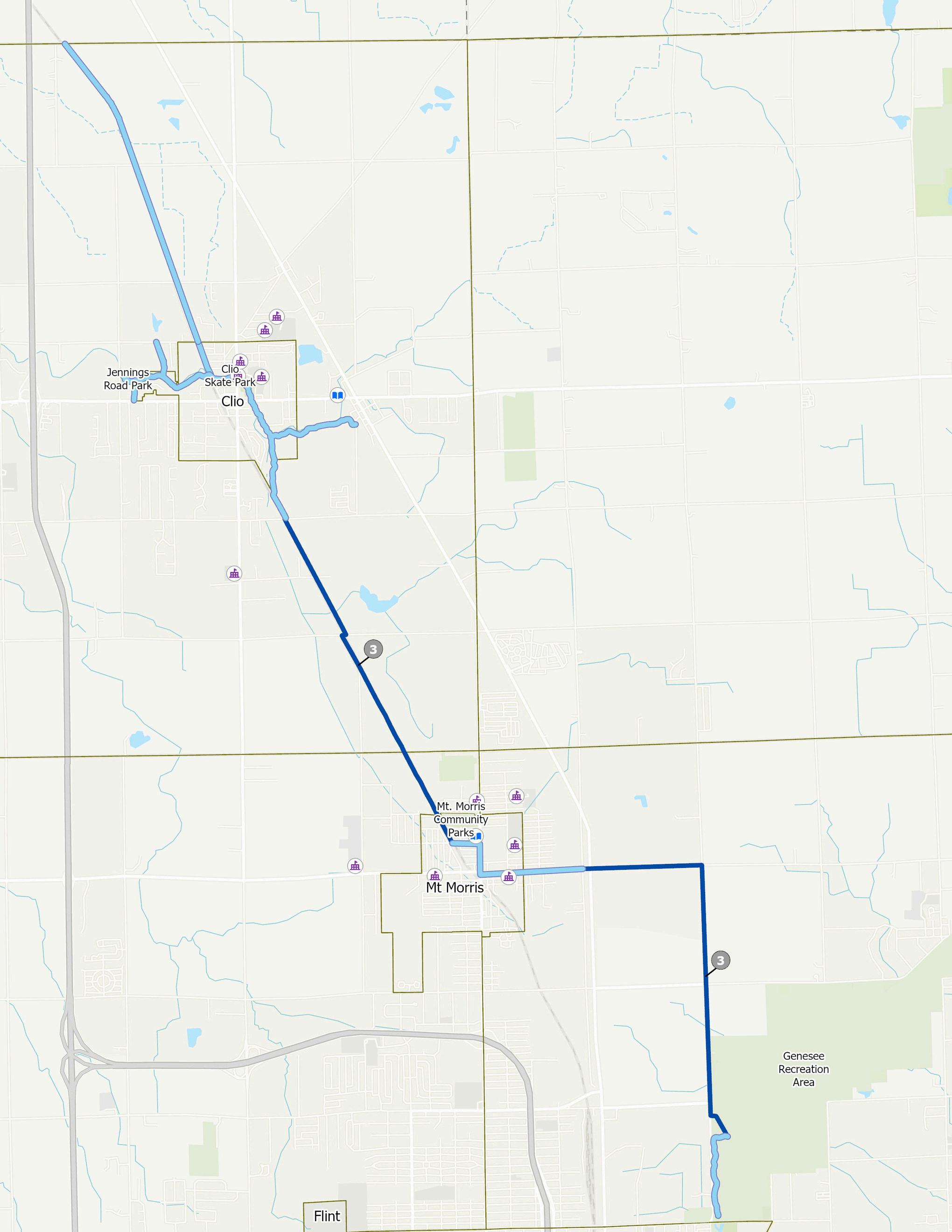

Project Location: Vienna Township, Mt. Morris Township, City of Mt. Morris,GeneseeTownship
ProjectLength:5.7miles
Description: Beginning at the Genesee Recreation Area, this project continues north on Bray Road and West on Mount Morris Road, connecting to the existing sidewalk infrastructure of Mt. Morris. The projectcontinuesalongtheutilitycorridorfromdowntownMt.Morris connecting to the existing Trolley Line Trail pathway in Vienna Township. This project provides a completed trail connection to northern Genesee County, connecting the City of Clio, Vienna Township,andtheMt.MorrisareatothegreaterGeneseeCountyTrail systemandrecreationfacilities.
EstimatedCost:$3.7million
In addition to the essential connections at the heart of the hub-and-spoke network, a robust set of secondary connections were identified during the public participation process.
One key cooridor connection identified as a regionally significant trail, listed as “The Renaissance Trail” on the map, is a future priority for the county as a way to expand our connections to regional attractions such as the State Park. Genesee County will work with the State of Michigan, SEMCOG, Oakland County, Holly Township, and Groveland Township to explore opportunities that would see a non-motorized trail between the City of Grand Blanc and ends at the Holly Recreational State Park.
It is important to identify all future secondary routes so that they may be included in future developments and funding opportunities currently unknown to-date.

This chapter outlines the timeline for implementing the Strategic Plan, establishes the organizational structure for overseeing its execution, aligns potential funding sources with relevant projects and initiatives, and presents a prioritized short-term action plan. To that end, this chapter addresses the following:
Presents a recommended framework for managing the Strategic Plan, including the roles and responsibilities of local stakeholders and strategies for tracking progress and accountability throughout implementation.
Highlights the interagency collaboration needed to develop and maintain a cohesive countywide trail network. Successful implementation relies on strong coordination among County
departments and municipalities to ensure consistent standards, efficient delivery, and long-term stewardship across jurisdictions.
Summarizes key initiatives introduced in Chapter 1 and organizes them into a focused list of early-action priorities with anticipated costs to build out the Legacy Trail and guide implementation efforts in the initial years following adoption or endorsement.
Details a range of eligible funding sources that may be accessed by one or more implementation partners to support active transportation infrastructure projects or active promotion efforts.
TECHNICALADVISORY COMMITTEE
CITIES,VILLAGES,AND TOWNSHIPS
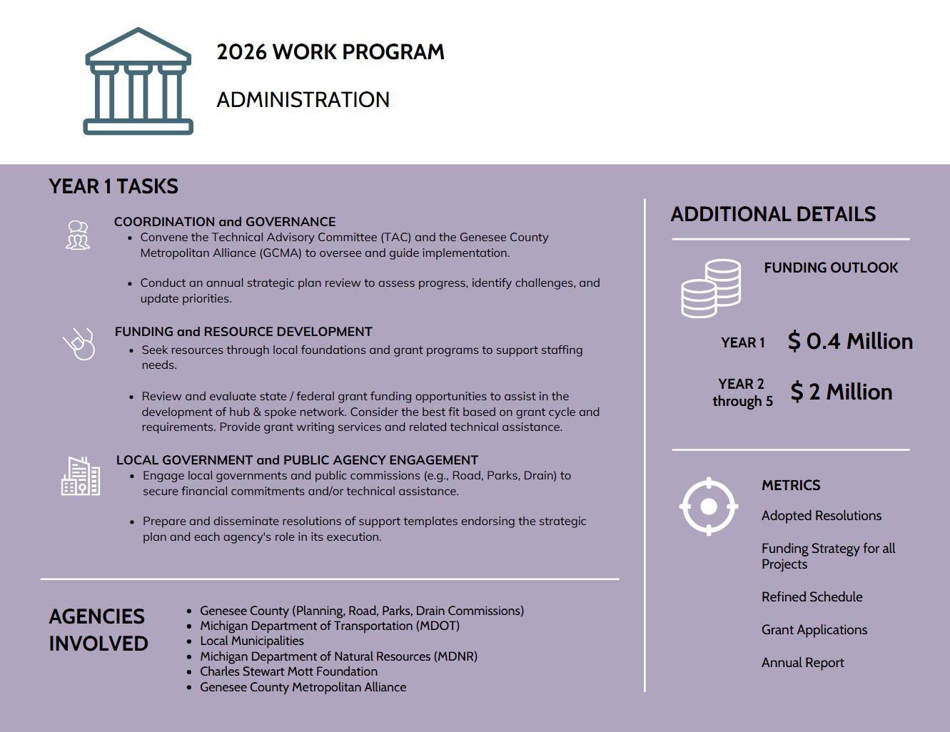
To ensure coordinated, transparent, and sustained implementation of the Strategic Trails Plan, administration will occur through two interconnected frameworks: planning guided by the Genesee County Metropolitan Planning Organization (MPO) committees , and funding administration overseen by the Genesee County Board of Commissioners and its Community and Economic Development Committee.
The planning framework will operate through the existing MPO structure. The Genesee County Metropolitan Alliance (METRO), serving as the transportation policy committee for Genesee County, provides final approval for transportation programs, policies, and projects. The Technical Advisory Committee (TAC), with voting members composed of each City, Village, and Township (represented by the Genesee County Road Commission) and partner agencies MDOT, FHWA, MTA, and Bishop Airport, reviews and recommends actions to METRO. GCMPC staff supports both committees by coordinating project planning, prioritization, and alignment with regional and federal transportation goals to ensure consistent implementation of the Strategic Trails Plan.
The funding framework provides oversight and authorization of financial resources through the Genesee County Board of Commissioners and its Community and Economic Development Committee. This structure integrates the Strategic Trails Plan into the County’s broader community development initiatives, ensuring that project funding, grant applications, and implementation agreements align with county priorities and fiscal policies.
As seen in many regional planning efforts nationwide, the likelihood of long-term success for the Strategic Plan significantly improves with the support of dedicated, paid staff. While the staffing requirement is minimal, ideally one to two individuals from the County Planning Commission, having personnel solely focused on advancing the Plan’s goals is critical to maintaining momentum and accountability.
To manage costs, the professional staff could be housed within an existing organization, such as the Genesee County Metropolitan Planning Commission, allowing for shared use of office space, equipment, and software. Financial support for operations could be drawn from a mix of sources, including contributions from local governments, grant funding, and potential endowment resources.
The success of the Genesee County trail network depends on close coordination among multiple agencies, jurisdictions, and departments responsible for transportation, parks, land management, and utilities. Most existing and proposed trail corridors are located within public rights-of-way or publicly owned lands managed by federal, state, county, and municipal authorities. While limited segments may traverse private lands through easements or agreements, the majority of implementation will rely on strong intergovernmental collaboration and sustained institutional support.
The Strategic Trails Plan establishes a framework for aligning the goals and responsibilities of these various entities to create a cohesive, efficient, and well-maintained regional network. Formalized cooperation among agencies, through Memorandums of Understanding (MOUs), will help ensure consistency in design, construction standards, long-term maintenance, and a consistent, regional branding and signage across jurisdictional boundaries.
Implementation of the trail network will require coordination among multiple Genesee County departments and external partners, including:
Genesee County Metropolitan Planning Commission (GCMPC): Lead agency responsible for trail network administration, planning, procurement, promotion, and coordination of funding and technical assistance.
Genesee County Parks and Recreation Commission: Primary partner for non-federally funded trail construction and maintenance within county parklands, as well as trail programming and user amenities.
Genesee County Road Commission (GCRC): Collaborates on right-of-way access, permitting on-street facilities, safety improvements, and maintenance of road network. The Act-51 agency representative for federal grants.
Genesee County Drain Commission (GCDC): Collaborates on trail planning efforts involving county drains, retention basins, or other stormwater infrastructure.
Municipal Governments: Partners in design, implementation, and upkeep of local trail segments, as well as coordination with residents and neighborhood organizations.
Flint River Watershed Coalition, Mott Foundation, and Other Nonprofits: Support network development, programming, and public engagement through advocacy and grant partnerships.
These partners will collectively advance the development of an interconnected trail system by integrating trail planning into local and regional transportation, recreation, and land-use initiatives.
To streamline project delivery and ensure long-term consistency, the County will facilitate the creation of intergovernmental agreements that clearly define each party’s role in trail development. These agreements may include, but not limited to:
Adoption of shared design standards and specifications to ensure compatibility across jurisdictions.
Construction and Procurement:
Coordination of bidding, permitting, and contracting processes to leverage economies of scale and improve efficiency.
Establishment of joint procurement mechanisms to simplify material sourcing and professional service contracting.
Maintenance Responsibilities:
Clear delineation of routine and capital maintenance roles among county, municipal, and park agencies.
Inclusion of maintenance standards within MOUs to ensure consistent upkeep and safety across the network.
A coordinated marketing and media strategy will ensure that Genesee County’s trail network is promoted with a clear, consistent, and compelling identity. This approach strengthens public awareness, encourages trail use, and supports long-term community investment.
Hire a professional media and branding consultant.
Create a unified countywide trail brand
Ensure consistent adoption of branding across all jurisdictions.
Develop a comprehensive marketing and media strategy
Utilize digital and social media campaigns, public service announcements, and collaborative outreach Outcomes
Establish a polished and professional brand identity.
Enhance regional visibility and awareness of the trail network.
Encourage trail use and community engagement.
Build long-term pride and support for the countywide trail system
The development and adoption of MOUs between GCMPC, municipalities, and relevant county departments will formalize cooperation for trail implementation. Each MOU will outline:
Roles and responsibilities for design, funding, construction, and maintenance.
Cost-sharing arrangements and funding sources.
Communication and reporting procedures for project milestones.
Long-term maintenance expectations and inspection schedules.
Consistent, cohesive regional branding and signage.
Regular coordination meetings between participating agencies will ensure progress tracking and early identification of potential challenges. GCMPC will maintain a Trail Coordination Committee composed of representatives from each partnering department and municipality to oversee:
Annual updates to trail priorities and implementation timelines.
Review of trail design standards and funding opportunities. Monitoring of trail condition data and maintenance needs.
Coordination of marketing and media efforts for consistent regional messaging.
This structure promotes transparency, efficiency, and shared ownership of Genesee County’s growing trail system, ensuring that all agencies are working collectively toward a common vision of connectivity, safety, and equitable access.
Engaging a professional advisor in a limited, strategic role will strengthen the trail planning process by providing specialized expertise and an objective, experience-based perspective. An outside firm can help the project team avoid preventable missteps and accelerate decision-making. This added support ensures that Genesee County and its partners move efficiently through critical planning stages while maintaining high-quality, defensible, and well-coordinated outcomes.
The successful realization of the Genesee County trail network depends on a coordinated approach to funding and implementation. This section outlines the financial resources, partnerships, and programmatic strategies necessary to advance priority projects and support long-term maintenance and promotion of the system. Aligning local, regional, state, and federal funding opportunities with an organized work program will ensure steady progress toward a connected, accessible, and sustainable trail network that benefits all communities.


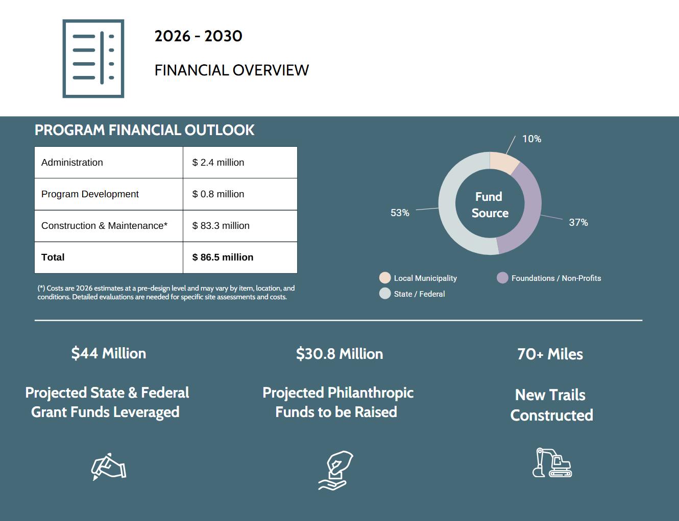
Funding a countywide trail system requires a multi-pronged strategy that blends capital grants, local commitments, philanthropic leverage, and long-term maintenance funding. The scale of Genesee County’s proposed trail network means no single source can deliver the system alone; instead, implementation will depend on stacking resources, leveraging partnerships, and matching projects to the programs that best fit their purpose and scale.
Funding a comprehensive trail system requires a mix of federal, state, local, and private investment. Each level of funding plays a unique role, and successful projects often layer multiple sources to create a complete financing package. Understanding the scope and intent of each category helps communities position their projects for success and maximize competitiveness.
Federal programs, such as those administered by the Michigan Department of Transportation (MDOT), provide the largest and most transformative grants for trail development, particularly for projects that advance regional connectivity, multimodal transportation, and climate or equity goals. These programs are administered either directly by federal agencies or through state departments of transportation, typically requiring local match commitments and strong evidence of project readiness.
Federal dollars remain best suited for large-scale, high-priority trail connections, grade-separated crossings, and trailheads that provide regional or multi-community benefits projects that form the backbone of Genesee County’s non-motorized transportation system.
State programs, such as those administered by the Michigan Department of Natural Resources (DNR), provide critical support for land acquisition, park-based trail development, and recreation facilities These grants typically require a strong local match and are highly competitive, with scoring criteria emphasizing recreation demand, community need, and alignment with state priorities. State funding is especially effective when paired with federal awards, allowing communities to leverage multiple funding sources to deliver high-quality, well-connected trail infrastructure.
Local funding whether through municipal general funds, parks budgets, or dedicated millages forms the backbone of the match commitments required by state and federal programs. Communities that demonstrate local buy-in and recurring financial support are far more competitive in grant processes.
At the same time, some trail projects are better suited to be delivered entirely with local or private funds due to factors such as accelerated timelines, cost savings, reduced administrative burden, or unable to meet all federal or state regulatory requirements. For smaller connectors, quick-build improvements, relying solely on local or philanthropic dollars can enable faster deployment and greater flexibility in design and implementation.
Private and philanthropic contributions also provide adaptable funding that can support planning, branding, public art, trailheads or amenities not always eligible under public programs. Partnerships with foundations, local businesses, and advocacy organizations can fill critical funding gaps while strengthening community ownership and long-term stewardship of the trail network.


HOSTED BY WITH SUPPORT FROM Wednesday,June11,2025 5:00–7:00p.m.|GloriaColesFlintPublicLibrary


JedOlson Owner VeloCityProjects


11June2025
3:00PM-4:15PM
GloriaColesFlint PublicLibrary
3:15PM HarrisRoom 4:15PM 3:30PM 3:00PM
RegistrationandNetworking
WelcomeandIntroductions
InteractiveDiscussion
Adjournment
BuildingaMaptotheFutureyouWant
Hearfromyourfriends,neighbors,andteammatesonwhatmakesthis areaspecialandhowtoaccelerateandmagnifyimpact.


RidgwayWhite
PresidentandCEO


DelricoJ.Loyd
CharlesStewartMott Foundation Chairman GeneseeCountyBoard ofCommissioners
JedOlson Owner VeloCityProjects
11June2025 4:30PM-7:00PM
GloriaColesFlint PublicLibrary
RegistrationandNetworking
C.SMottFoundationCommunityRoom
WelcomeandOpeningRemarks
Keynote-TrailsConnectCommunities:the SocialCapitalofOutdoorRecreation Dinner
NetworkingBreak
HarrisRoomandC.SMottFoundationCommunityRoom
6:15PM 7:00PM 4:30PM 6:00PM 5:00PM
TrailVisioningActivity
Adjournment
TrailsConnectCommunities:theSocialCapitalofOutdoorRecreationWhatdowereallyneed tobehealthyandhappy?Trailsconnectustoeachother,ourselves,andtonature,building positive community impact along the way. Together, we'll explore and share how trails can buildasenseofplacewhileprovidinglifestyleimprovements,economicimpact,andsenseof placeasahighreturnoninvestment.
ToacceleratetrailandsidewalkdevelopmentinGeneseeCountytoschools, parks,andcommunitiesthroughastrategicimprovementplan,prioritized projects,andaclearfundingstrategy.

Over19milesofsidewalks andtrailsince2014
Representing$17.6 millioninvestment
What’snext?