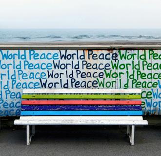
is not about designing spaces, but about designing time.”
— Toyo Ito
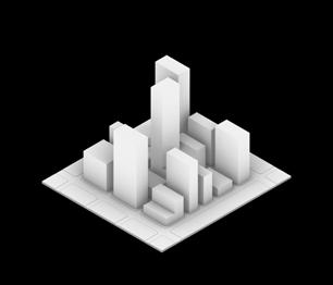
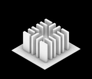
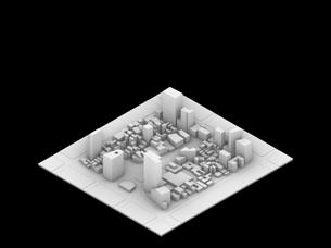
The book starts with pieces of places, people, models, and memories. What comes next is not a single argument but a development. It is a collection of actions in cities influenced by care, speculation, disruption, and rhythm.
The Master of Science in Urban Design (MSUD) is a one-year, post-professional degree comprising 33 credits. The program fosters advanced, research-driven design methodologies focused on the urban conditions of two major global cities: New York and Mexico City.
Through the application of innovative design strategies and advanced digital tools, students investigate and propose new urban morphologies that address the critical challenges of contemporary urbanism, climate adaptation, social equity, and urban densification. The program emphasizes critical, context-specific design thinking and prepares graduates to lead in shaping sustainable and equitable urban futures.
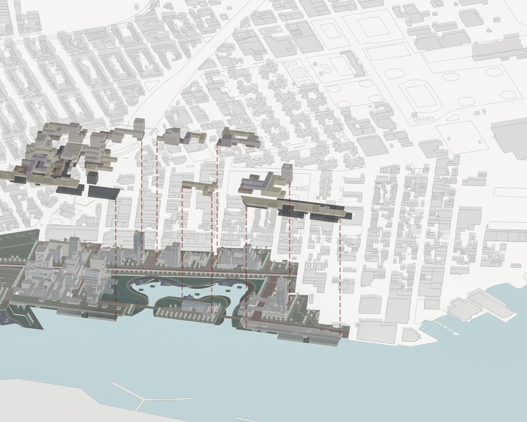
Over the course of three semesters, students develop three distinct projects, each situated in a different site and urban context. This project sequence is designed to integrate urban strategies across varying programmatic and scalar frameworks, progressively building a comprehensive understanding of urban design practice within complex global contexts.
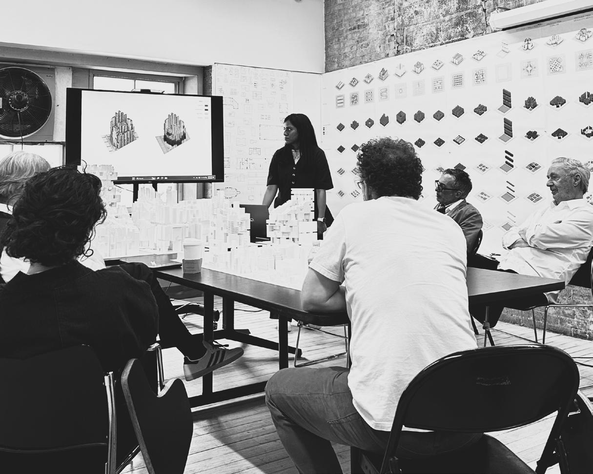
Erich Schoenenberger MS Urban Design, Program Coordinator
assembly premise
“Design is not just what it looks like and feels like. Design is how it works.”
— Steve Jobs
This book collects urban inquiries. It involves actions like assembling, listening, and intervening. These activities are rooted in the complex issues we face today. It brings together infrastructures, memory, and imagination into systems that respond and last.
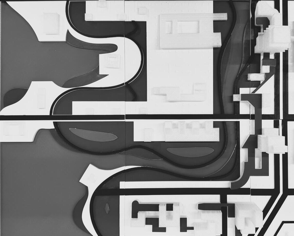
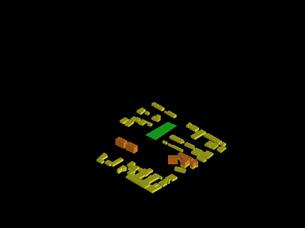
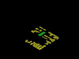
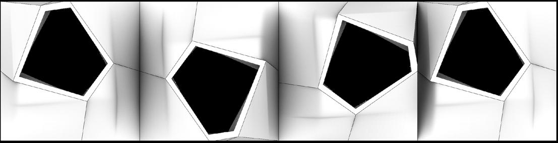
Figure 2.1: Preach The Paradoxical Edge: Step In-Step Out, AOA, 2021: Natural Edge; Water Territories; Festivals and Cultural Association; Occupations; Infestation of Concrete; Urban Fabric; Figure-Ground; Inhabit; Affect-Infect; Reaction; Water as a Resource.
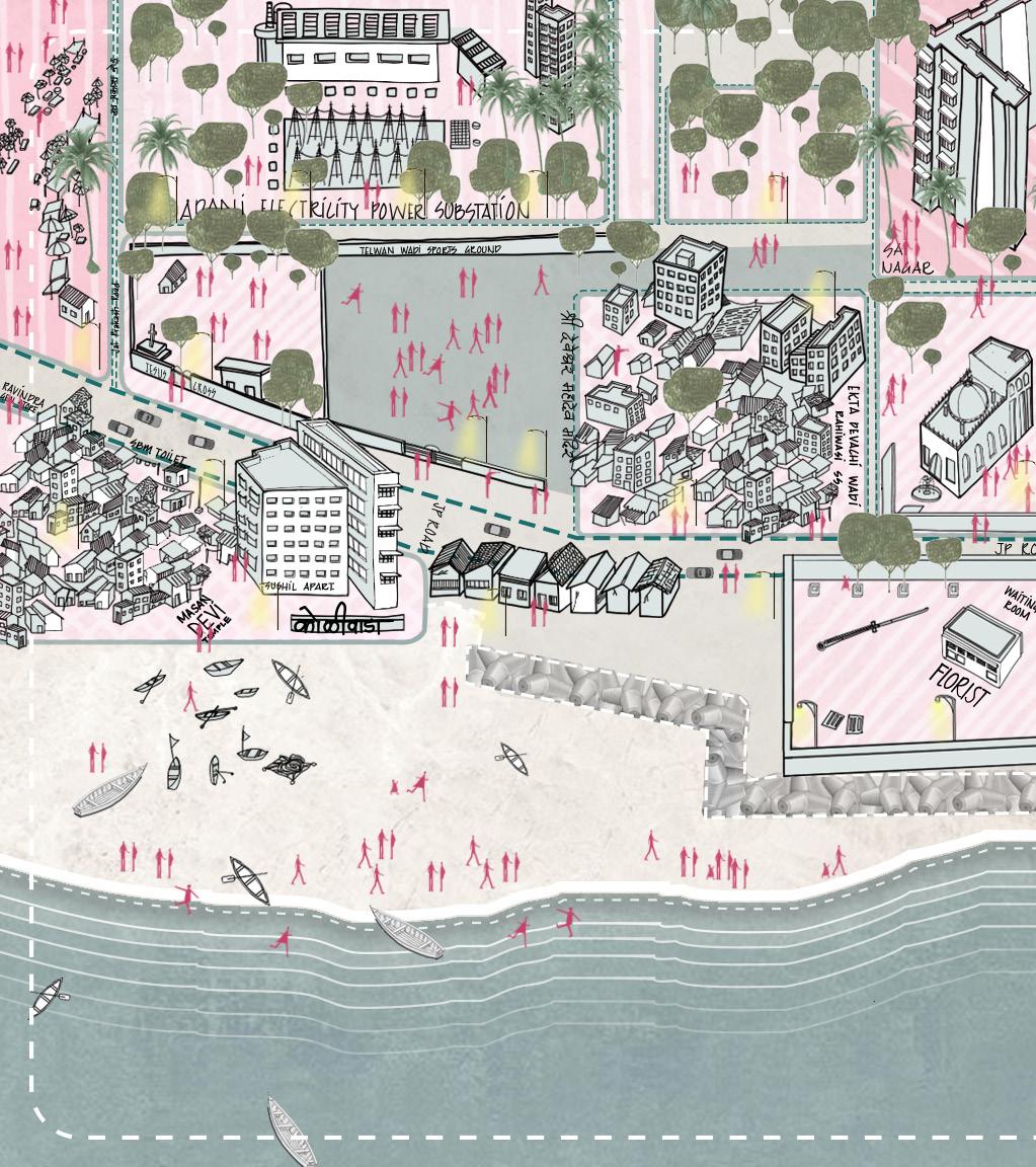
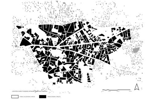
Figure 2.2: Impressions, understandings, initial intuitions of the site, and the context at large The Paradox: Step In-Step Out, AOA, 2021: Different typologies like residential, commercial, crematorium, temples, churches, playgrounds, slums, and markets exist within the same place. Within the community dwellings, the movement is organic compared to the hierarchical development in the high-end residential areas. These are connected through roads, forming
an interdependent network at a macro level. This is the identified chaos. This resembles the patchwork of different fabrics of the quilt. Each fabric has an individual character; as a totalisation, it is seen as one quilt stitched seamlessly. When zoomed into the site at a micro level, the functions are highly fragmented, and the movement is freerhizomatic.
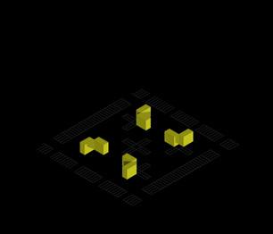
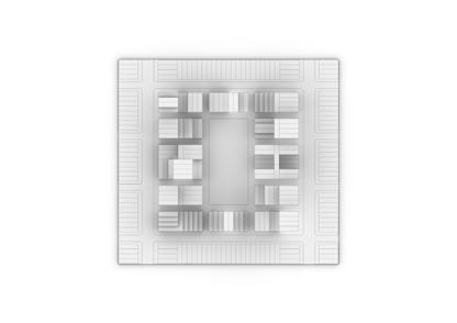
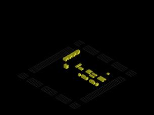
Ilustration of the Village; Digital Drawing, AOA, 2021
Figure 2.3: #AOAWHODUNNIT?
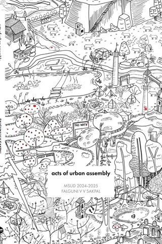
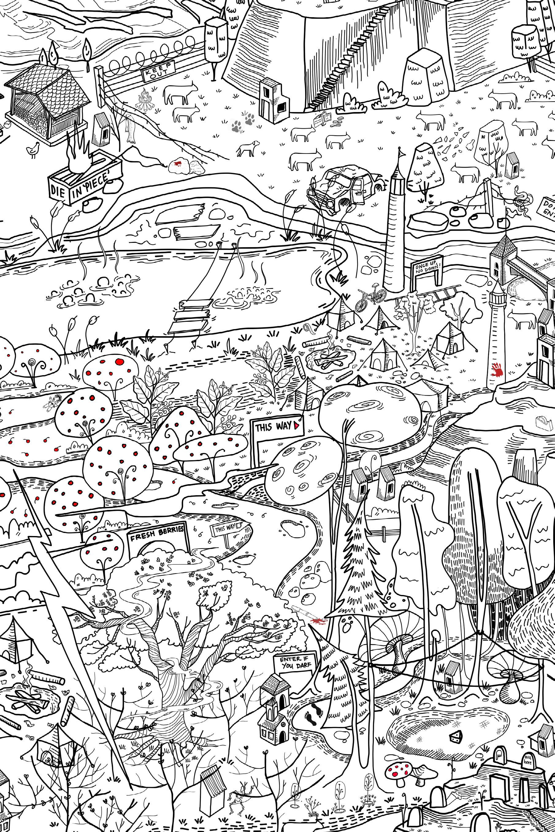
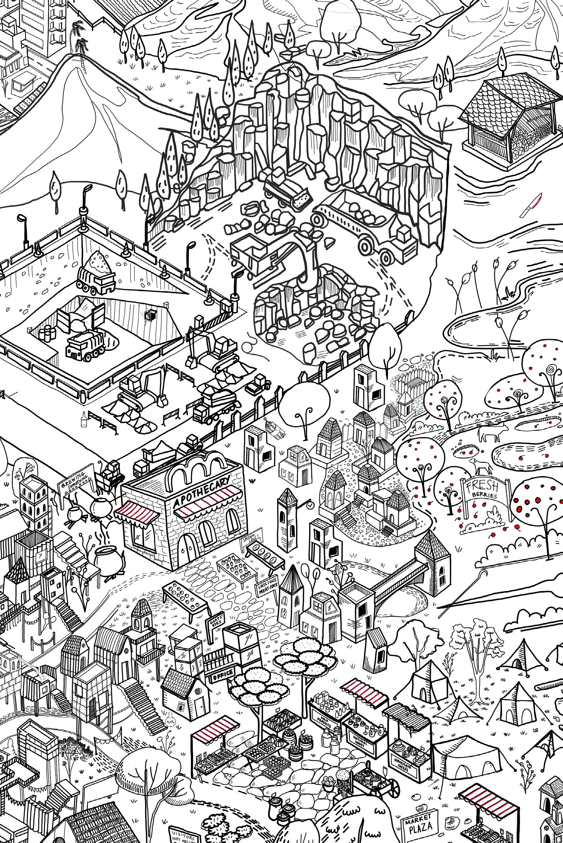
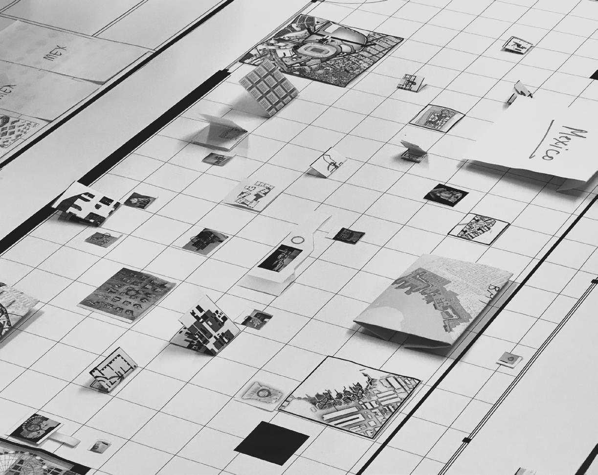
The illustration on the cover of this book is not just decorative; it is a memoryscape. It was created during a 10-day orientation workshop at the Academy of Architecture (AOA) in Mumbai, where I worked as a teaching assistant. In collaboration with Tanaya Nadkarni and Priyal Vasaiwala, we expanded the nursery rhyme of Jack and Jill into a fictional village. This village served as a narrative world for sixty first-year students. It became a setting for their stories, performances, and spatial play.
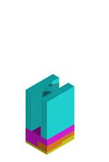
This drawing now serves as an anchor for this book. Originally a teaching tool and gameboard, it now represents the book’s larger idea: urban design as a practice of assembly, of bringing people, programs, and possibilities together. The zones in the map reflect the same principles I have followed throughout this work: participatory systems, responsive infrastructures, and performative landscapes shaped by care, resilience, and imagination. It reflects my work at Pratt, where I continued to build zones of participation, responsive infrastructures, and imaginative spaces of memory. This book includes nine key explorations, acts of urban assembly, each layered with care, urgency, and imagination. Together, they lay the groundwork for the culminating thesis that follows: an urban intervention located in Mexico City, rooted in risk, ritual, and memory.
Framework Statement
Before arriving at Pratt, I spent five years studying architecture and over a year and a half in professional practice. These important years focused on projects that emphasized assembly in its most immediate and practical sense. I designed systems that could be built quickly, met urgent public needs, and could be disassembled or transformed over time.
From toilets under flyovers to small community units, these projects went beyond just creating structures. They aimed to weave moments of dignity, access, and possibility into the urban environment. I learned that architecture is not fixed; it changes, listens, and responds. My early works explored modular construction, spatial reuse, and collective infrastructures as ways to provide care, especially in times of scarcity or urgency.
The framework presented here includes a selection of interventions from that time. Each one offers a different perspective: sanitation, accessibility, informality, and memory. They represent a practice of small-scale urban acupuncture, where leftover, overlooked, or underused spaces served as testing grounds for larger questions about equity, participation, and temporality.
This approach influenced my later work at Pratt. Here, I expanded the idea of assembly, viewing it not just as physical construction but as a design principle. In my graduate projects, assembly became a way to layer systems, embed memory, and prepare spaces for change and resilience. It allowed me to connect infrastructure, care, and spectacle on a larger urban scale.
Thus, this framework is not a conclusion; it is a threshold. It represents a shift from practice to reflection, from physical form to spatial strategy. What follows are acts of urban assembly that build on these foundations, each suggesting ways to draw, imagine, and activate future possibilities.
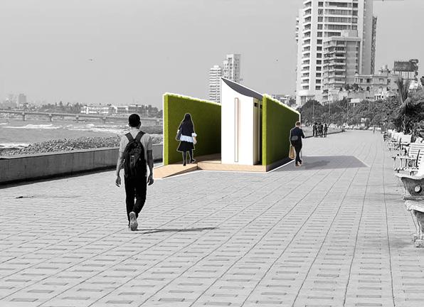
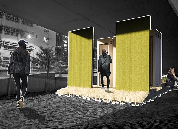
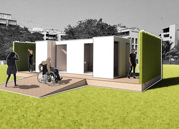
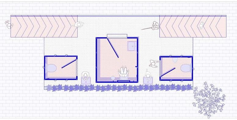
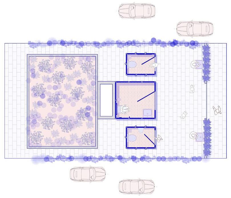
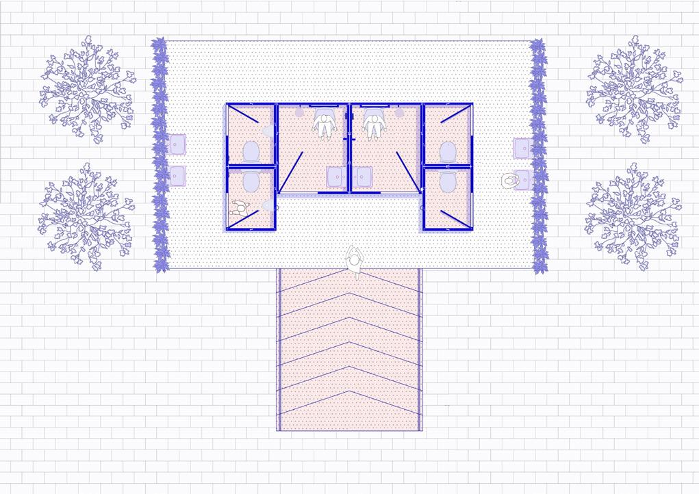
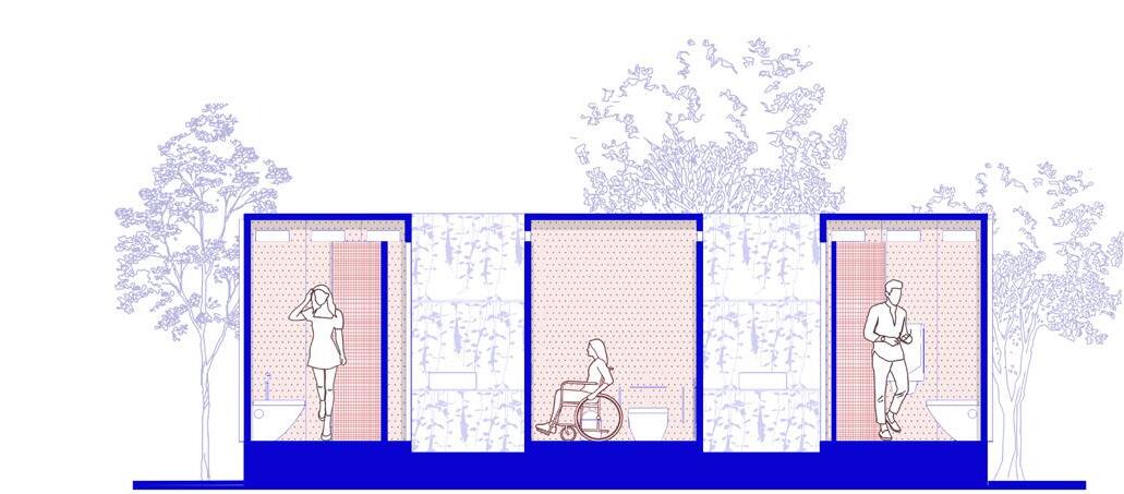
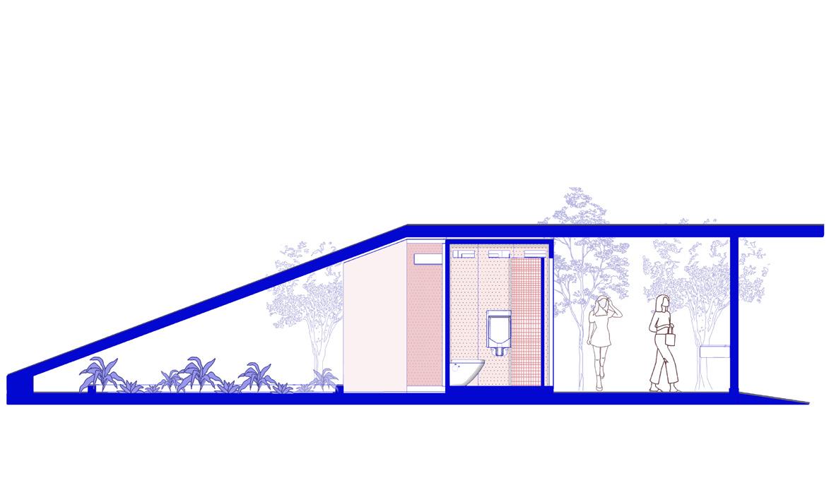
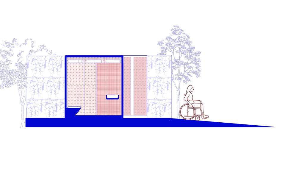
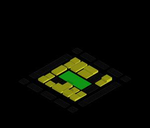
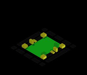
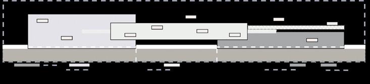
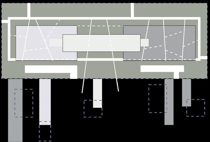
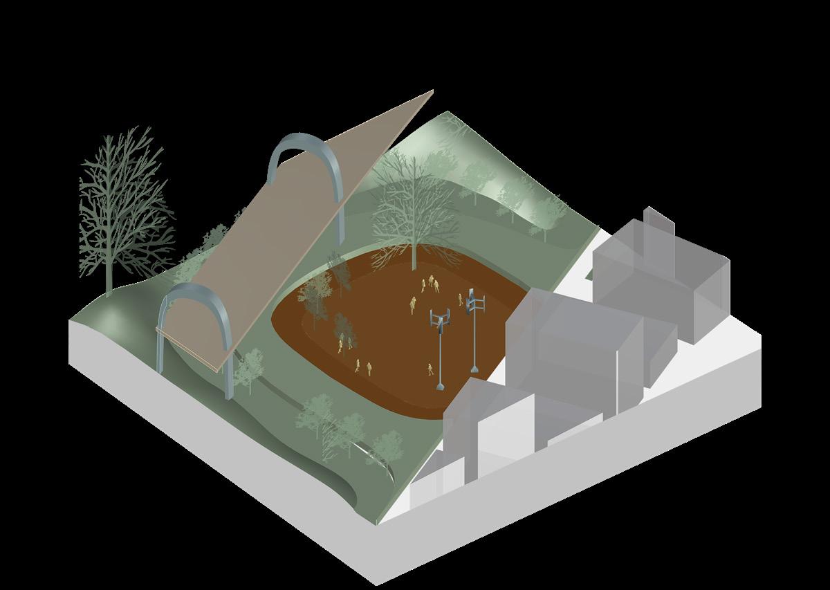
Figure 2.1.1: Where is the Sulabh? Public Toilets, AOA, 2021: Before and After the Interventions The designed system can be multiplied to form a larger public utility space and disassembled in case of space crunch.
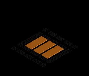
Figure 2.1.2: Where is the Sulabh? Public Toilets, AOA, 2021
Type A: Promenades and Bus Stops; Type B: Under the flyovers; Type C: Parks and Open Grounds
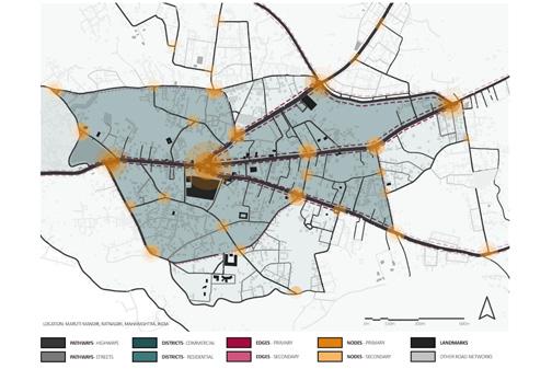
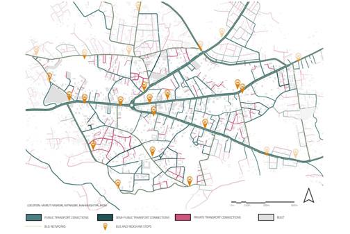
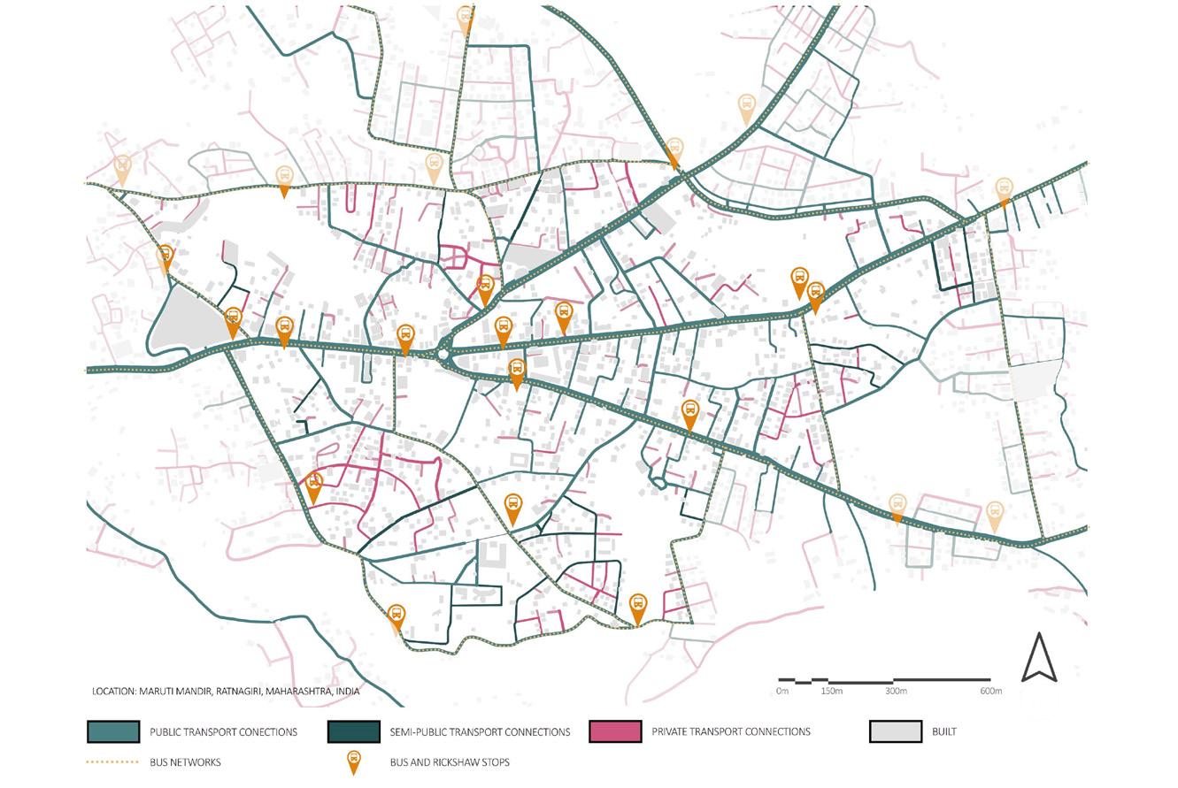
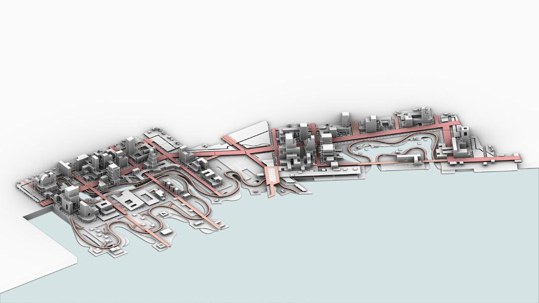
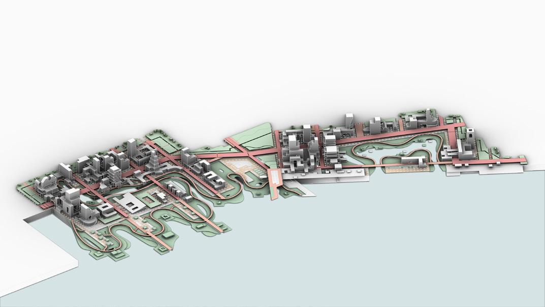
TRANSPORTATION_CONNECTIVITY
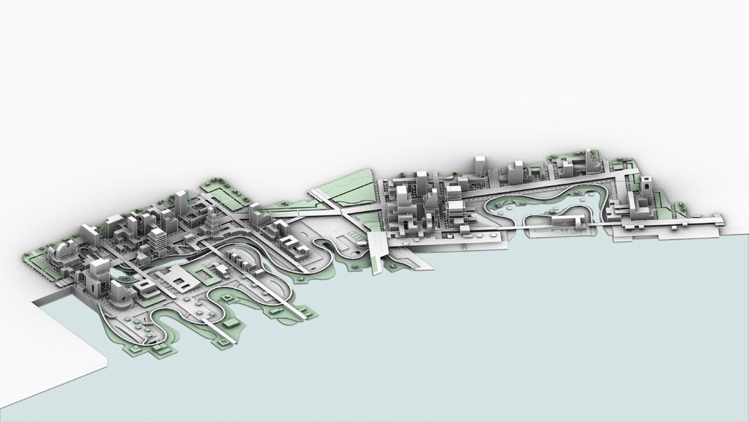
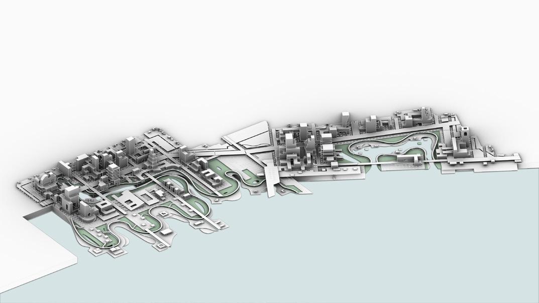
2.2 FIGURE AND GROUND MAP
Mind Map
Investigations
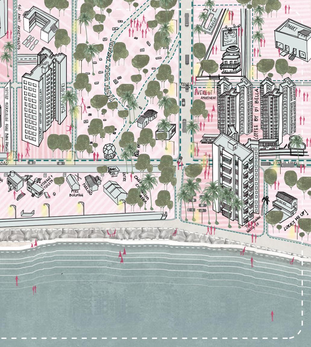
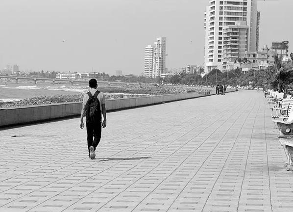
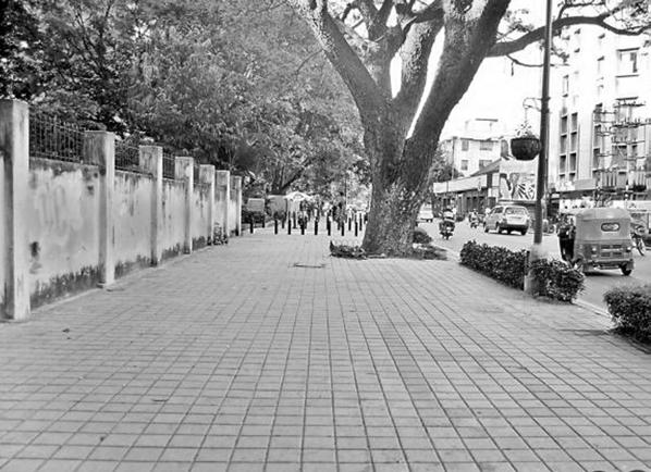
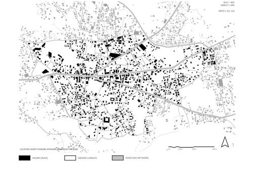
The investigation phase in the assembly premises creates a space and framework for the design goals. During my undergraduate urban design studio, I conducted a series of analytical exercises focused on mapping the realities of Indian cities. I looked mainly at inclusivity, porosity, and responsive streetscapes. Each drawing represents the complex interactions between people, activities, and the built environment, based on observations, interviews, behavior mapping on-site, and material studies.
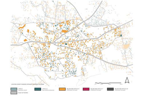
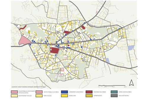
The first set of mappings captures the city at various scales using layered urban analysis. Mind maps identify landmarks based on memory. Diagrams illustrate spatial enclosures and thresholds. Nolli maps distinguish between accessible and inaccessible urban areas. Overlays examine public and private mobility. I backed these up with studies on transportation, connectivity, land use, and density through diagrams and direct observation.
I didn’t treat these as fixed data. Instead, I viewed them as performative mappings, documents that show how streets function, are navigated, and change over time. The Nolli Map highlighted spots where fences and barriers disappeared, where people took back space regardless of legal claims. The Density Map showed certain nodes acting as socio-economic hubs, where commerce, transit, and religion came together to create the city’s fabric. This mapping revealed an important contradiction: even in their chaos, these urban areas had their systems that were adaptable, temporary, and highly negotiated.
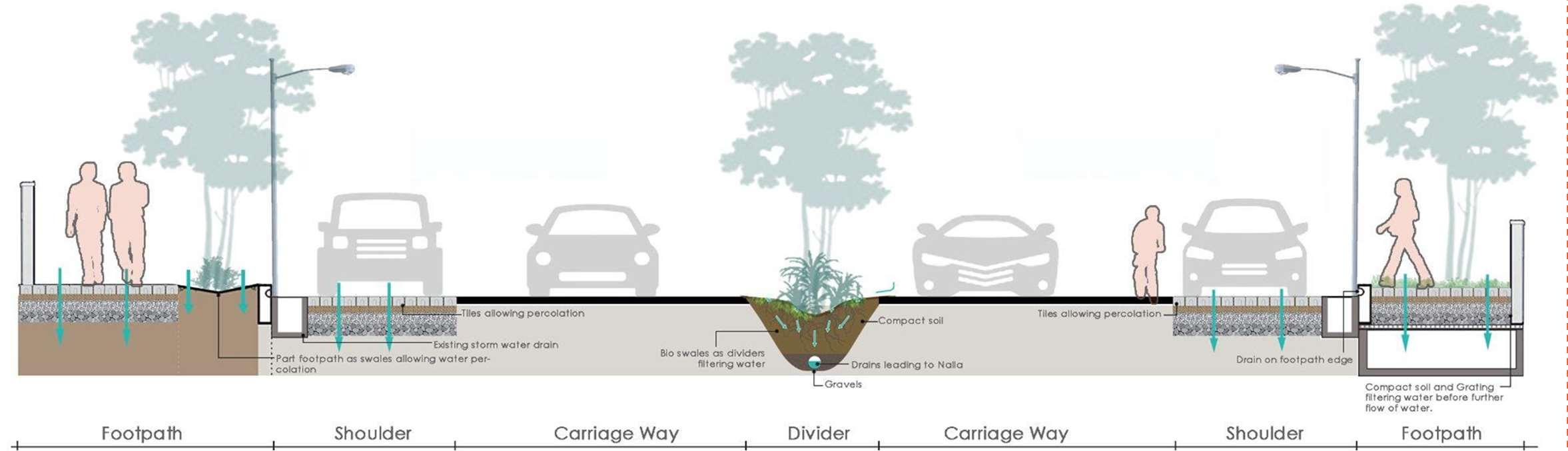
This observation led to the next part of my investigation, which involved analyzing street sections as speculative infrastructures for resilience. I focused on the street as a living system, rethinking roadways as not just transit paths but also as active ecologies. I imagined drainage systems, material choices, bioswales, and permeable pavement strategies that would respond to everyday life and monsoonal weather. In a city like Mumbai, where heavy rains and rapid urban growth coexist, such planning is vital.
The section shows a detailed arrangement: water-permeable paths on both sides, planted areas and bioswales along the roads, and elevated barriers meant to slow vehicle traffic while capturing and directing runoff. Each part serves multiple purposes, performing functional roles and influencing public behavior and movement. For example, the width of the shoulder and the type of surface can affect informal vending and street activity. Similarly, the placement of lights and trees is designed to encourage use at night while promoting cooling during the day.
Part footpath as swales allowing water percolation
Existing storm water drain
Tiles allowing percolation
Bioswales as dividers filtering water
Carriage Way
Divider
Together, these mappings and sections shape my early understanding of urban care. I see infrastructure as responsive rather than static. Streets are not just paths but layers of active life. These foundational investigations, both quantitative and qualitative, would shape my later work in graduate studies at Pratt. There, I built on these ideas through performative ground logic, layering infrastructure, and speculative urban memory in contexts beyond Indian streets. However, one principle remained: drawing is also about assembling data, people, and stories to create a more empathetic and vibrant city.
Footpath
Drain on footpath edge
Tiles allowing percolation
Compact soil
Drain leading to Nalla Gravels
Compact soil and grating filtering water before further flow of water
Shoulder Carriage Way Divider
acts of urban assembly
“Cities are an assembly of differences.”
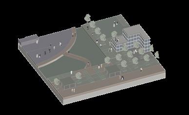
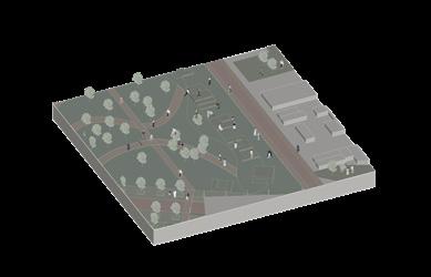
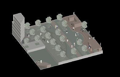
This chapter looks at how blocks turn into stories that are layered, ongoing, and not finished. Each act of building in the city is a chance to create, take apart, and put together the city as a living and changing entity filled with care and complexity.
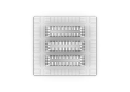
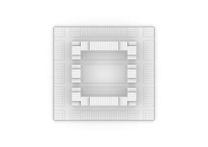
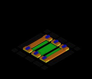
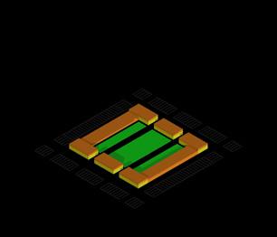
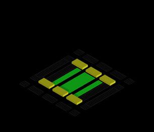
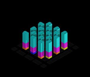
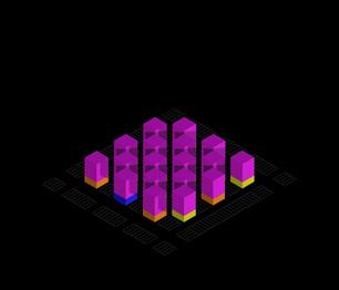
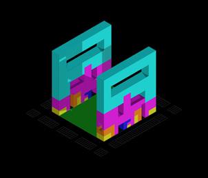
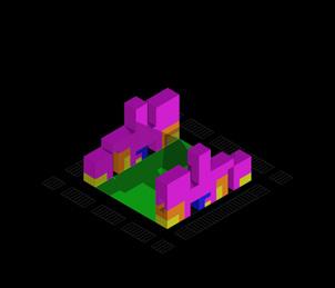
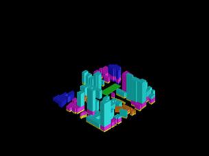
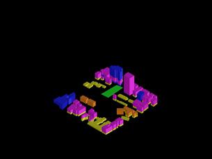
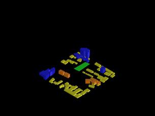
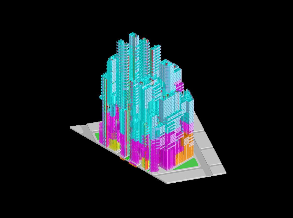
Figure 3.1: The Block Commons: A Regenerative Urban Engine; The Rise of New Urban Block
Massing
MASSING TRESPESSING BLOCK
Trespassing Block Typical Block
BLOCK
Top View
TOP VIEW
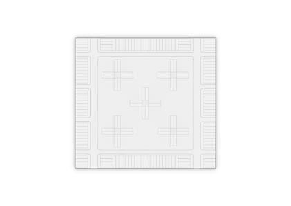
Programmatic Diagram
PROGRAM DIAGRAM
HOUSING
Retail Offices
RETAIL
Institutional Industrial Housing
PROGRAM DIAGRAM
PROGRAM DIAGRAM
PROGRAM DIAGRAM
3.2.1: Theories of Urban Blocks
PROGRAM DIAGRAM
Superblock
Block as a Village Superquadra Urban Fabric SUPERBLOCK VILLAGE
SUPERQUADRA
URBAN FABRIC
PRECEDENT FROM AHMEDABAD, GUJARAT, INDIA
Miniature City
PRECEDENT FROM MUMBAI, MAHARASHTRA, INDIA
Stacked Buildings
PRECEDENT FROM PUNE, MAHARASHTRA, INDIA
Block as a Void
VOID STACKED BUILDINGS
Figure 3.2.2:
Theories of Urban Blocks
City Under a Single Roof
CITY UNDER A SINGLE ROOF
Precedent from Ahmedabad, India
PRECEDENT FROM AHMEDABAD, GUJARAT, INDIA
Precedent from Mumbai, India
PRECEDENT FROM MUMBAI, MAHARASHTRA, INDIA
Precedent from Pune, India
PRECEDENT FROM PUNE, MAHARASHTRA, INDIA
Aperformance - based layering
“Form follows performance?”
This principle shifts the focus of design to an ongoing response. Layering transforms from a strategy into a concern for space, society, and climate. These projects pose questions: how can architecture go beyond looks and instead support memory, risk, and tradition?
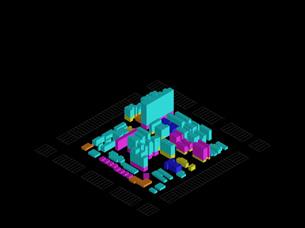
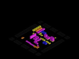
Figure 3A.1: The Mosaic: Connecting Legacy + Innovation + Community
Figure 3A.1.1: Hybridization of the Theory Blocks
A.1 Hybrid Typology
The Block Commons: A Regenerative Urban Engine
Instructors : Prof. Peter Trummer and Pinar Araci
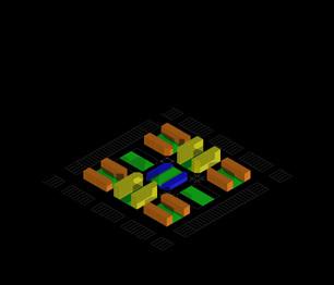
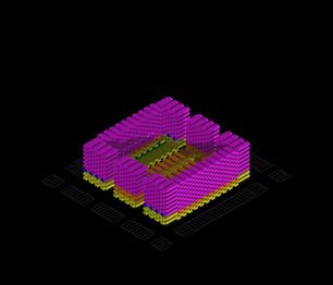
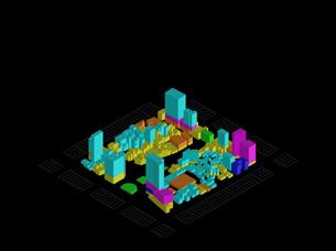
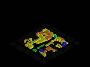
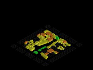
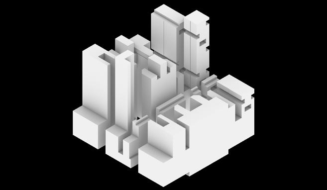
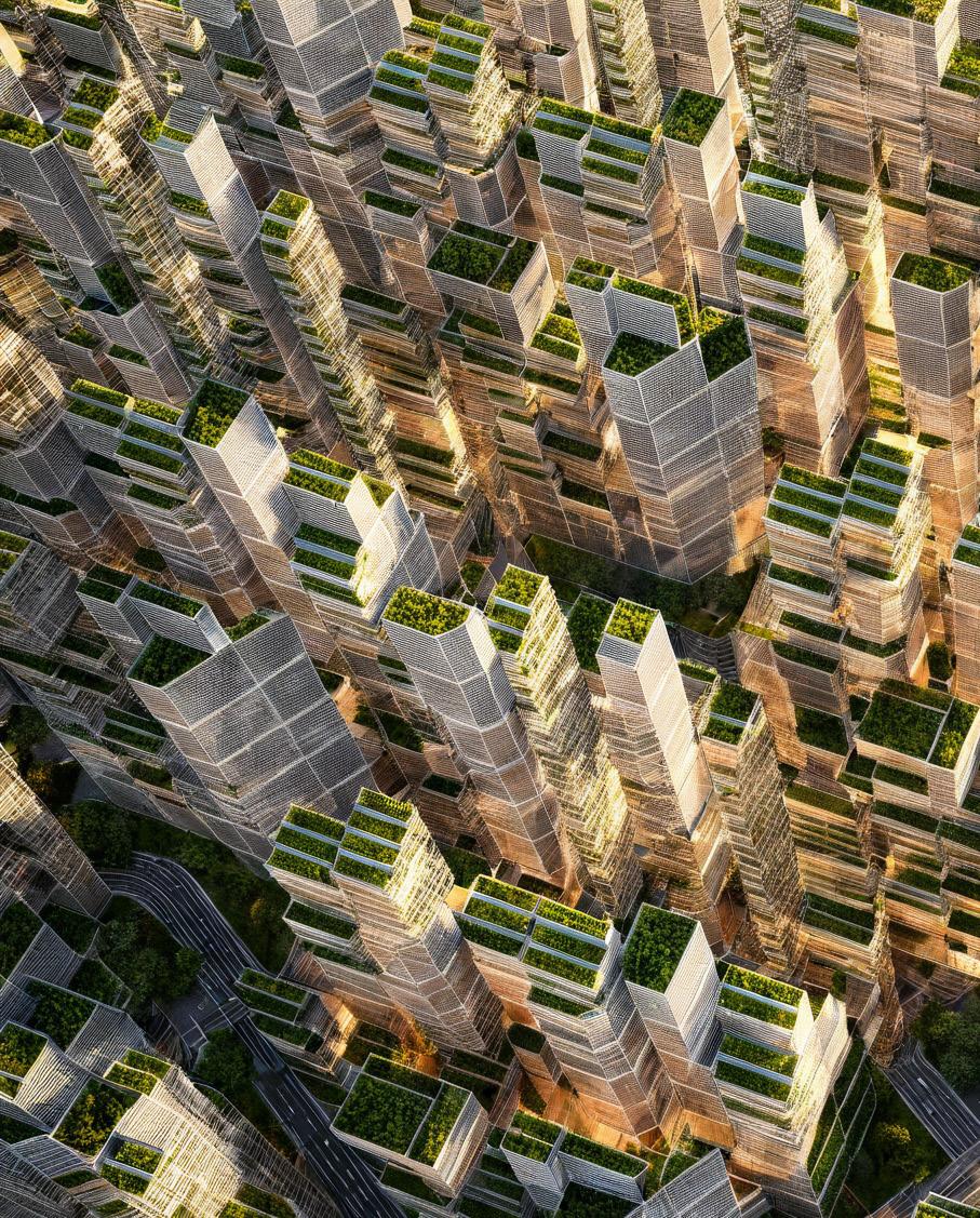
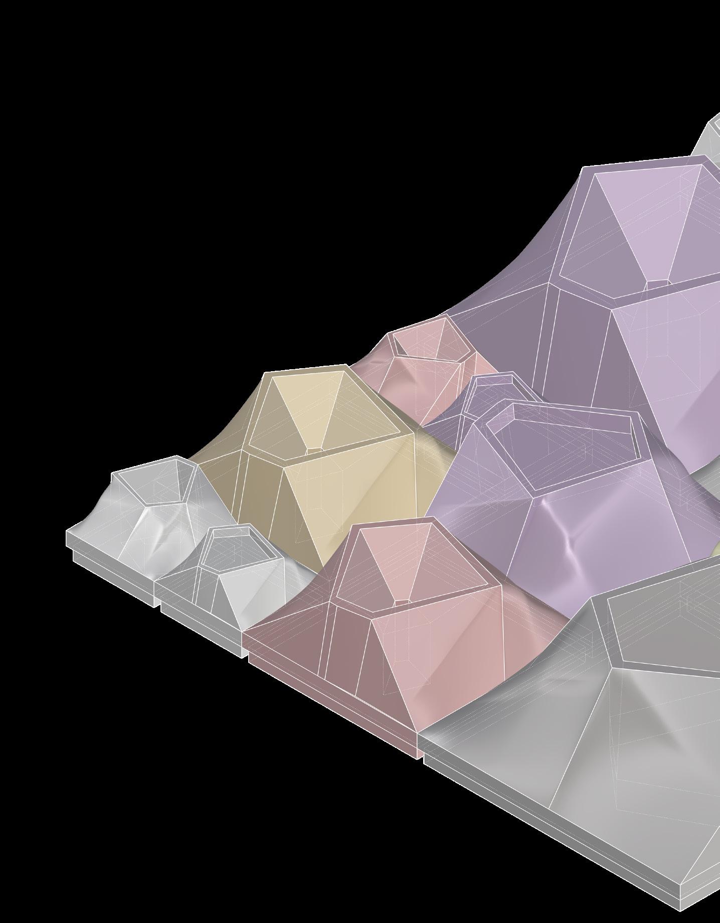
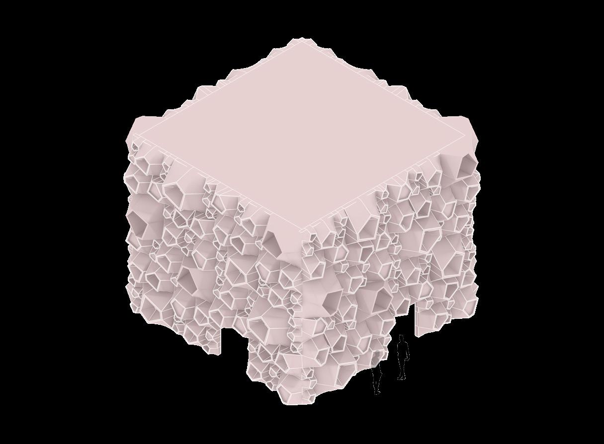
“The Block Commons” proposes a new way of thinking about urban blocks. Instead of viewing them as fixed and unchanging, it sees them as layered, flexible, and active systems. By examining ten key urban block theories, ranging from the Superblock to the City Under One Roof, the project explores new types that address urban challenges, environmental needs, and socioeconomic diversity.
This hybrid model does not aim to replace existing ideas but to blend them through layering. It recognizes the complexity of today’s city, where a single concept of “the block” doesn’t suffice. Instead, The Block Commons investigates how various block strategies can coexist, overlap, and develop within a unified framework.
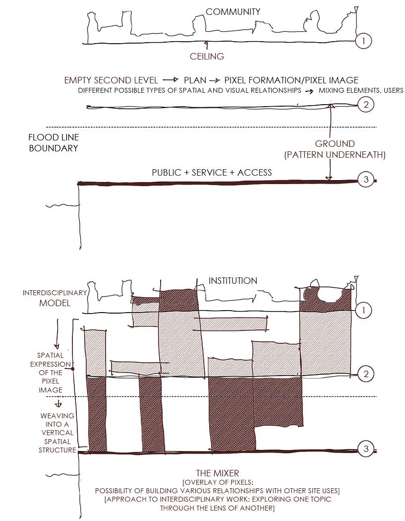
From Pixel to Massing: A Bottom-Up Grid
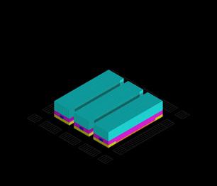
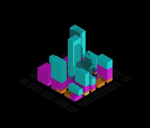
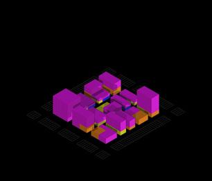
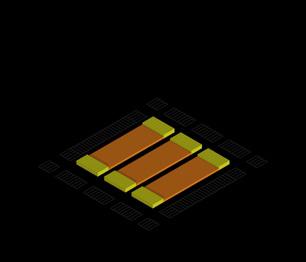
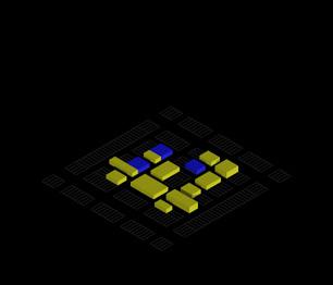
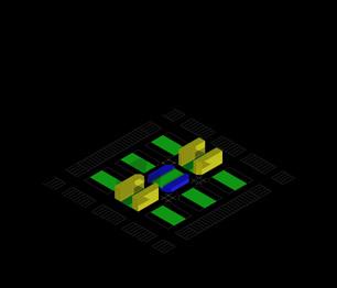
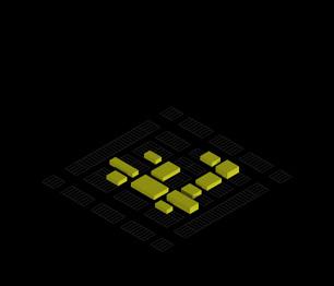
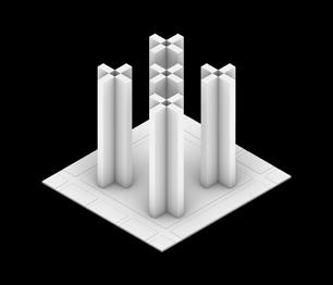
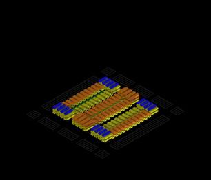
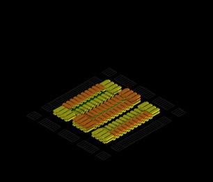
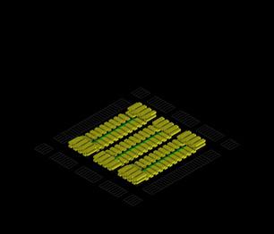
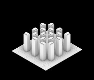
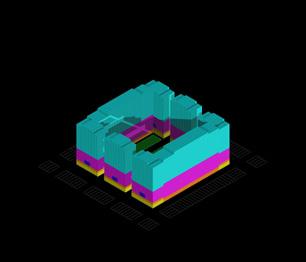
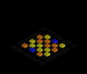
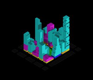
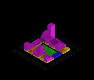
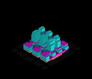
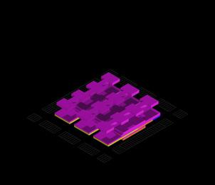
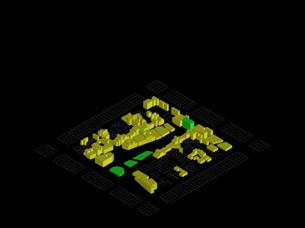
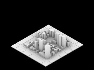
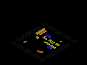
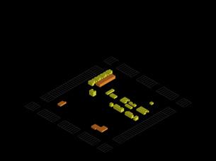
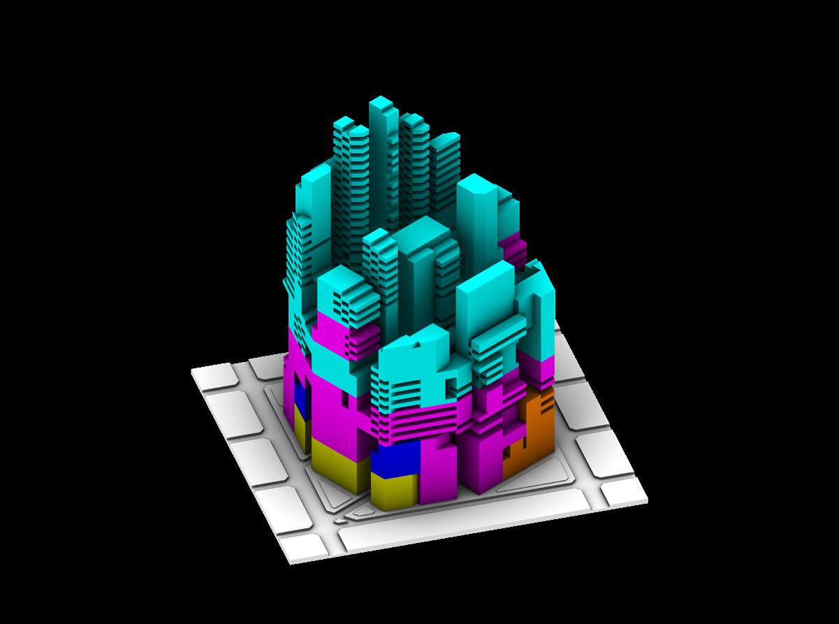
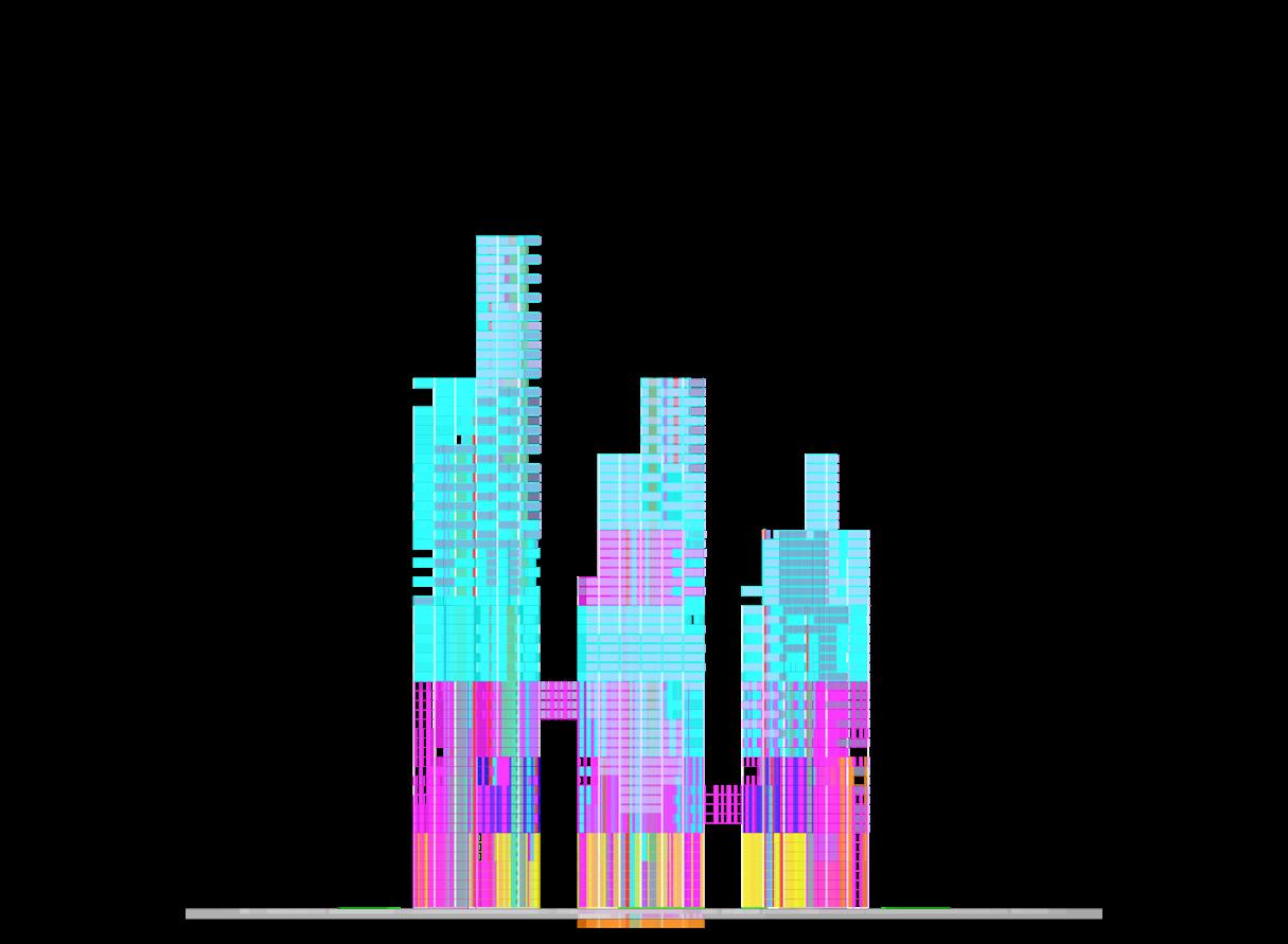
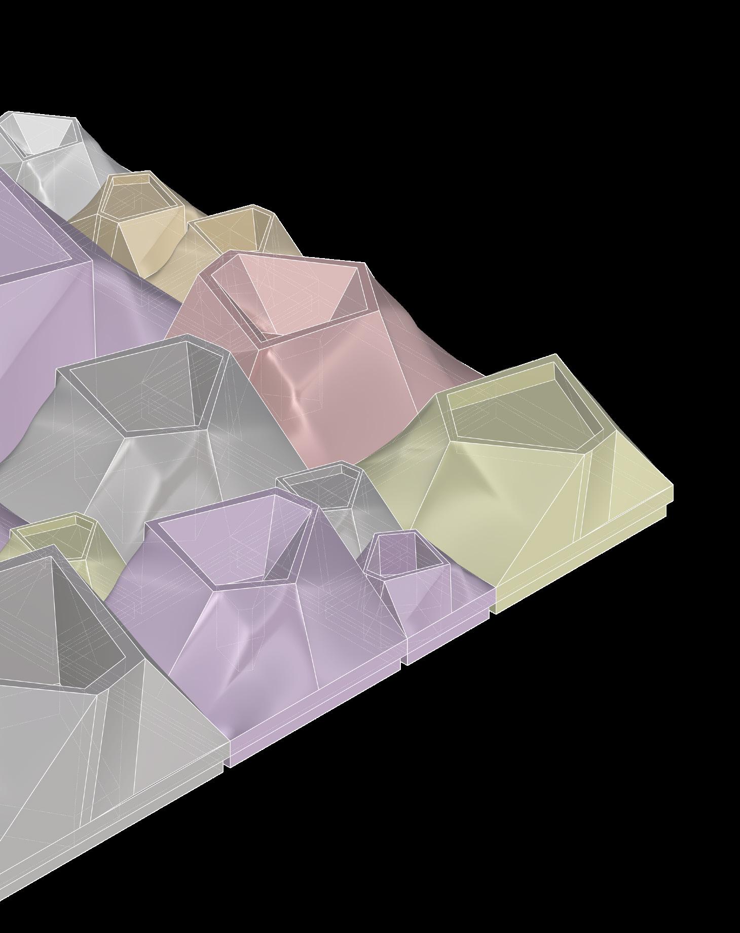
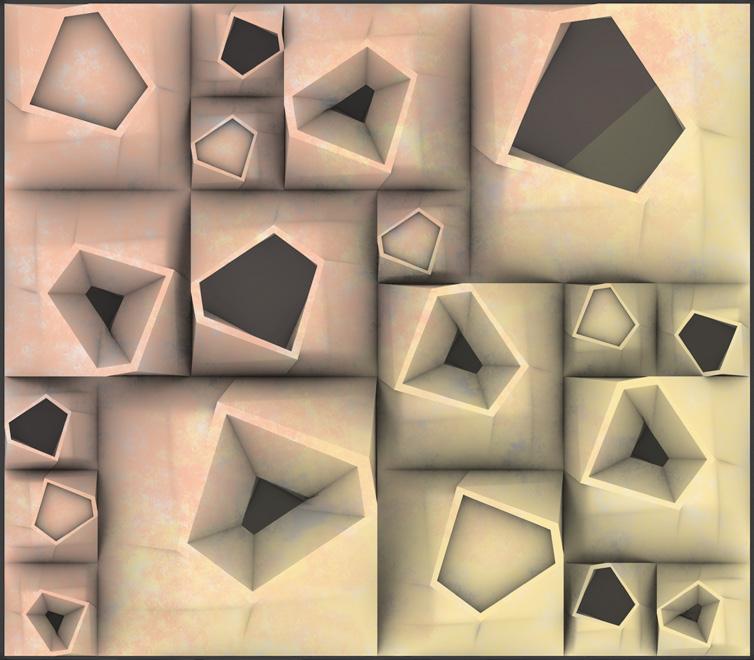
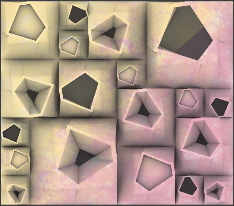
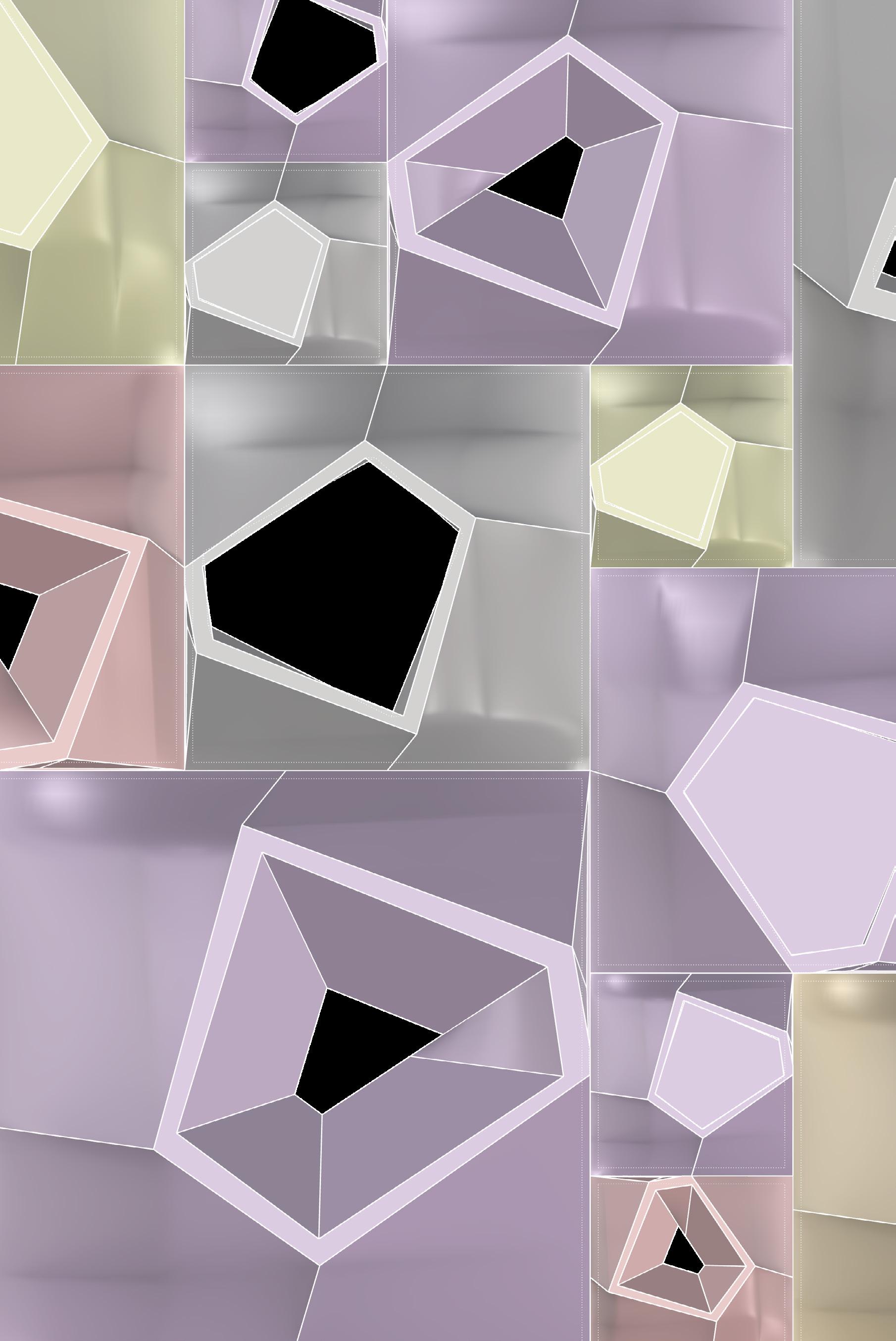
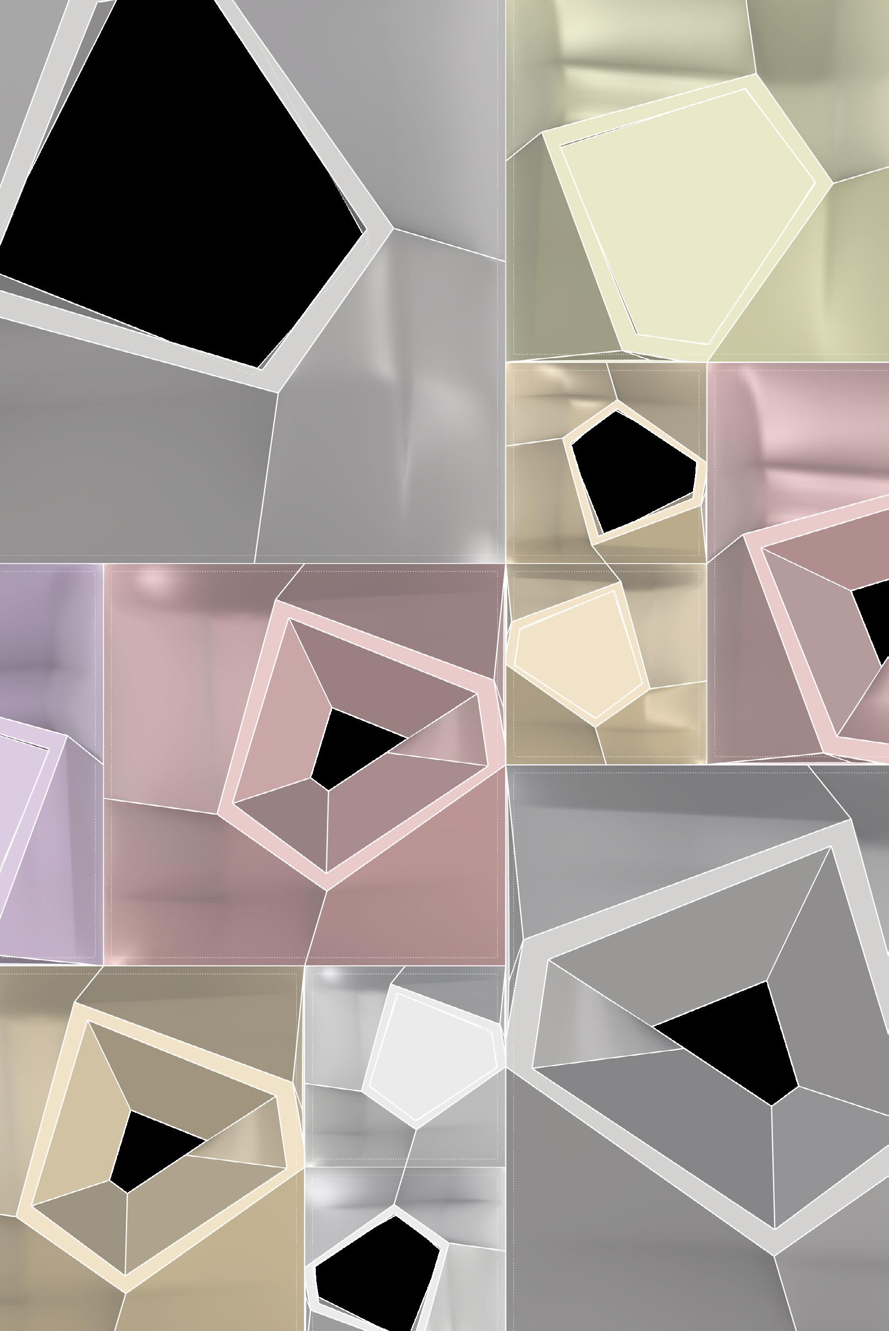
The project starts with a 2D pixel grid, a democratic and uniform base that removes hierarchy and encourages modularity. Each pixel unit serves as a foundation for stacking and assembling. As the design progresses, these pixels transform into a volumetric array of programs, varied by height, color, and texture. Housing, retail, office, institutional, and industrial programs are assigned unique color-coded volumes and grouped according to solar orientation, density needs, and urban interactions.
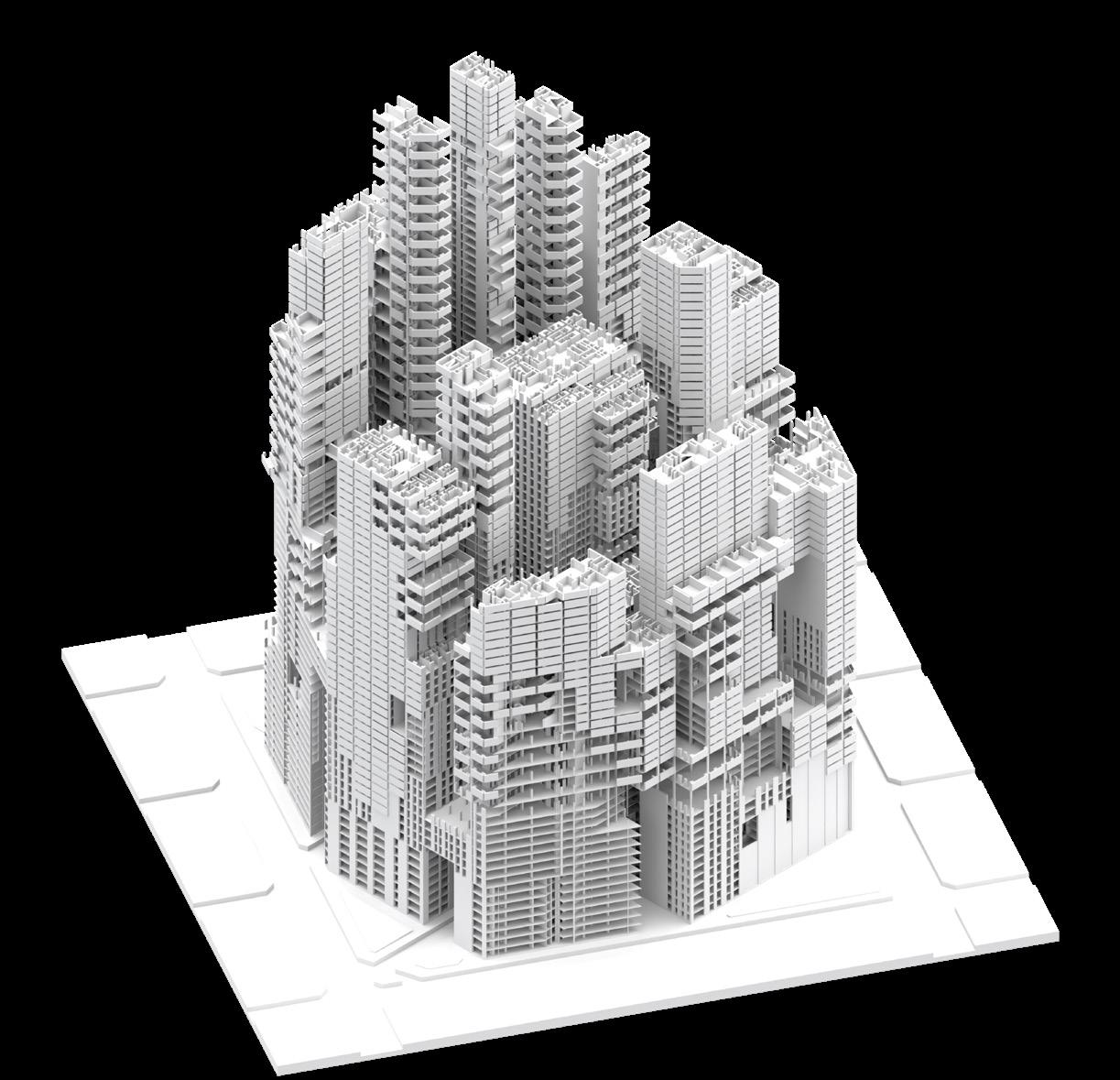
The lower levels emphasize accessibility and public engagement, featuring markets, retail clusters, and open institutional areas, while the upper layers provide housing and workplaces. This vertical zoning is not straightforward but layered, shifting from public to private, light to heavy, dense to open. The resulting block behaves like a living organism that responds to its environment, seasonal solar data, and urban dynamics.
Urban Block as Generator
Rather than acting as a simple container, the hybrid block serves as an urban generator. It creates both internal spaces and external urban features like courtyards, walkways, gardens on roofs, and gaps for communal areas. By combining voids and solids, terraces and setbacks, the block avoids a monolithic appearance and encourages diversity at every level.
This approach arises from a thorough understanding of urban theories and a fresh take on traditional block models. Each massing action, whether a cantilever, cutout, or core shift, is not just structural but also performs a function. Solar studies informed the design of facades; larger openings and translucent surfaces face south and southeast to maximize daylight and solar collection, while compact volumes protect interior spaces from excessive heat. The block functions like a membrane, breathing and adapting.
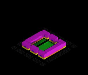
Performance Logic: Systems, Layers, and Energy
The project uses performance as a guiding principle across ecological, spatial, and social dimensions. At its foundation, a shared infrastructure slab contains utilities, public facilities, and structural cores. Modular translucent solar panels wrap key facades, adjusting to sunlight angles and program needs. Public rooftops become sources of energy, community gardens, and viewing areas, merging infrastructure with architecture.
Inside, circulation and service cores are integrated with program logic. Units are designed specifically, responding to neighboring functions, orientation, and performance goals. For example, retail spaces have shorter spans for better visibility, while housing blocks feature cross-ventilated, split-core layouts. This thoughtful approach ensures that every part of the block is utilized; no surface or void remains inactive.
Commons as Catalyst
At the core of this hybrid block is the notion of the commons, viewed not just as shared space but as a shared value. The block functions to promote not only efficiency but also fairness. It supports various scales of living and working, emerging economies, micro-industries, family units, and flexible co-working spaces. The commons appears in vertical gardens, skywalks, water-harvesting terraces, and community pods positioned at entry points.It encourages change, allows for disorder, and prioritizes adaptability over stability.
3A.1.2: The Block Commons
Figure
Housing
Retail Offices
Institutional
Industrial
Figure 3A.1.3: Axon Section
Figure 3A.1.4: Programmatic Zoning
Figure 3A.1.6: North to South Elevation with Programmatic Zoning
Figure 3A.1.5: Axon Section with Programmatic Zoning
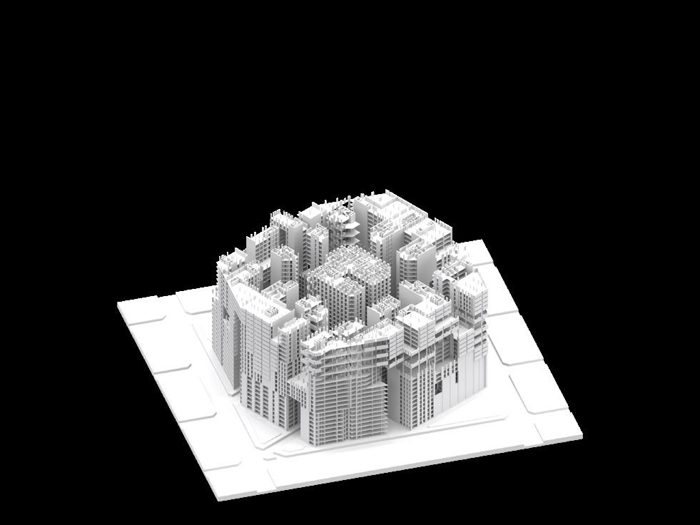
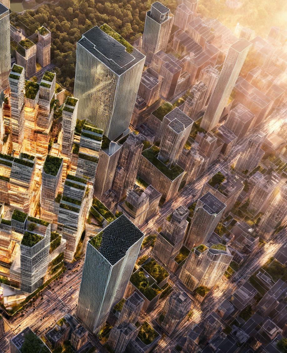
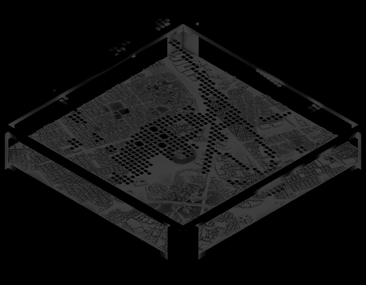
Figure 3A.1.7: Sun Radiation Analysis. Left: block embedded as a speculative urban context and
Right: block integrated within existing Manhattan fabric
50 Figure 3A.1.8: AI-Generated Visuals. Left: block embedded as a speculative urban context and
Right: block integrated within existing Manhattan fabric
Figure 3A.2.2: Driver B: View Access and Energy Efficiency
Figure 3A.2.1: Driver A: Adaptive Daylighting
A.2 Kinetic Performance
Skin in Motion: Re-skinning with a responsive, adaptive facade
Instructors : Alan Cation, Anthony Samaha, and Charlie Portelli
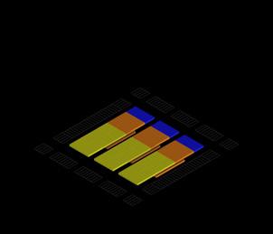
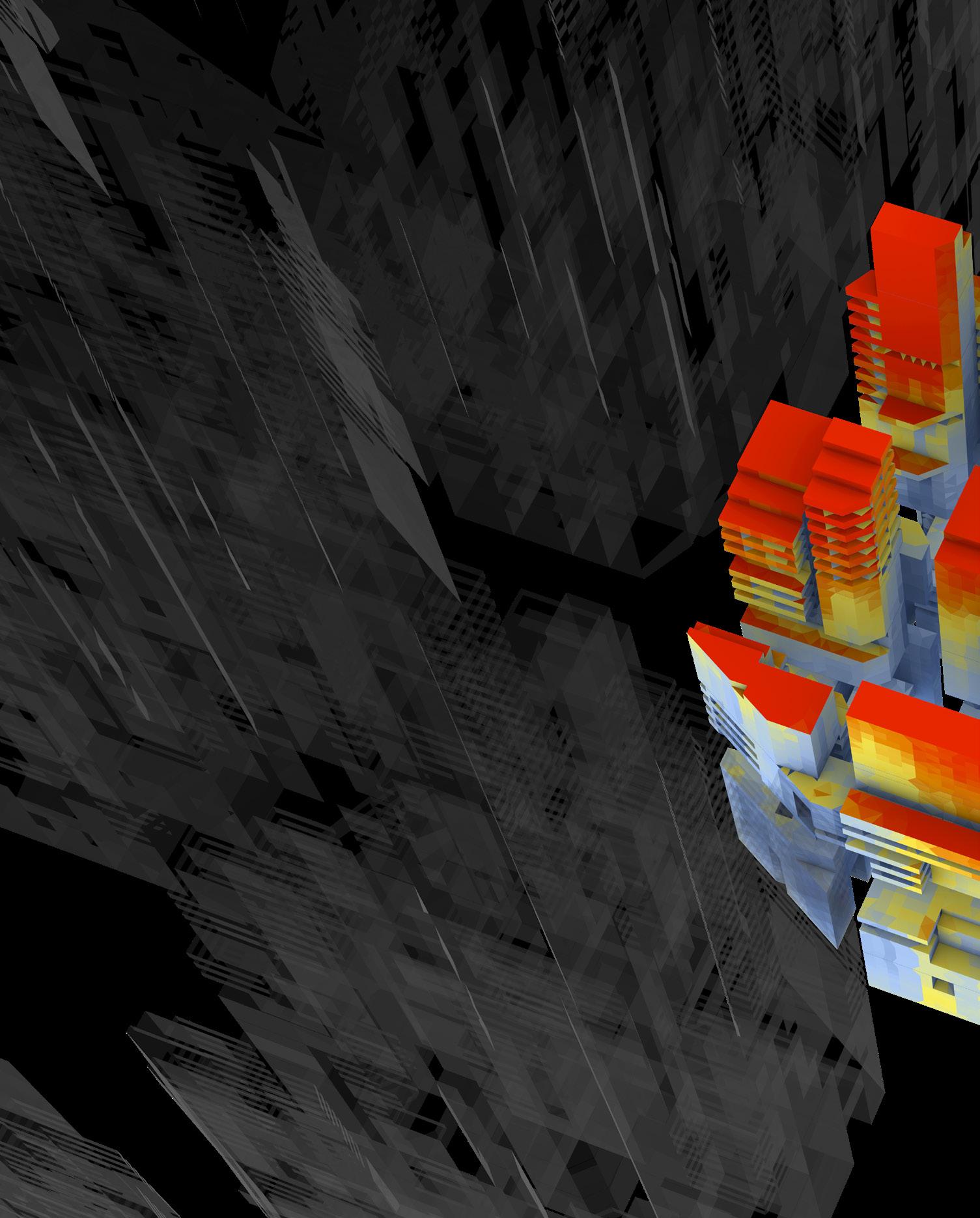
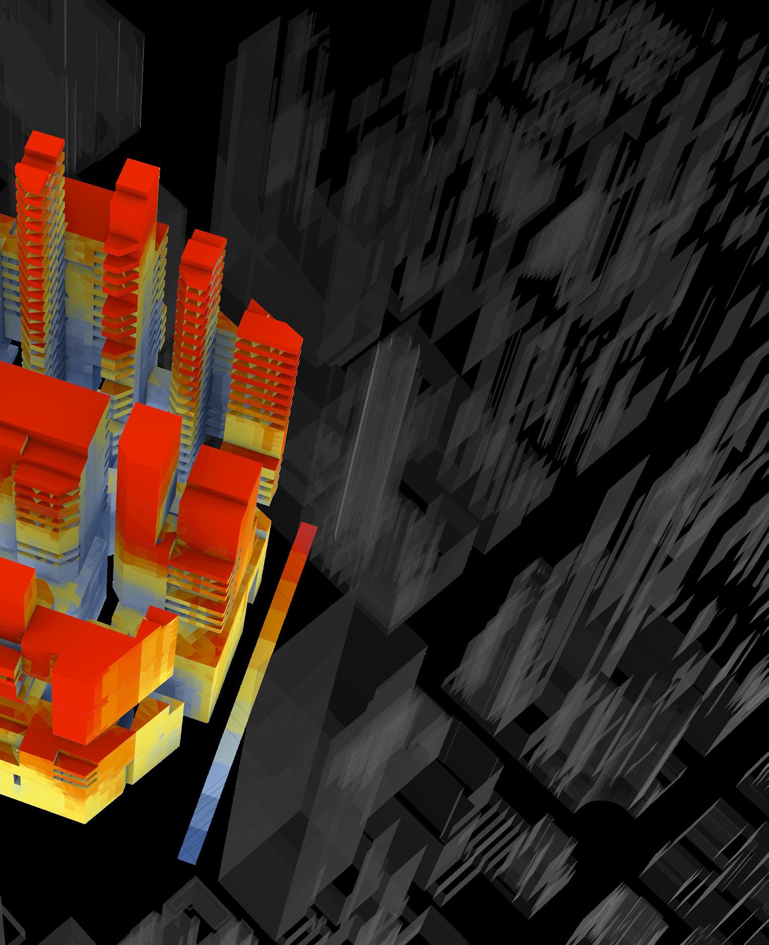
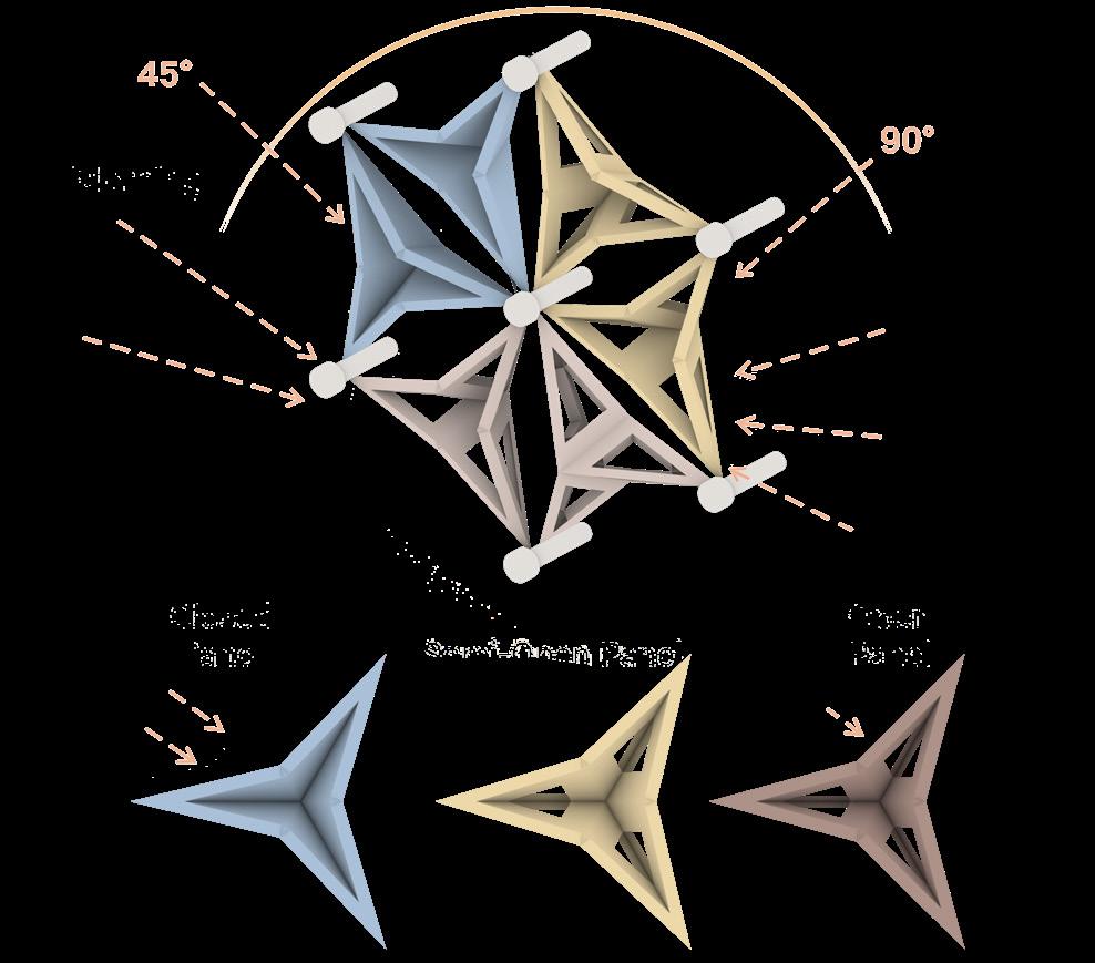
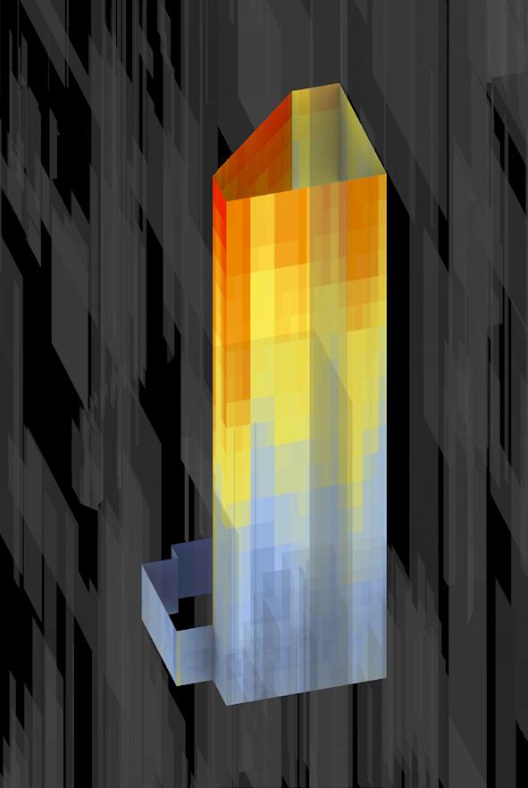
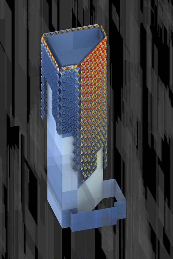
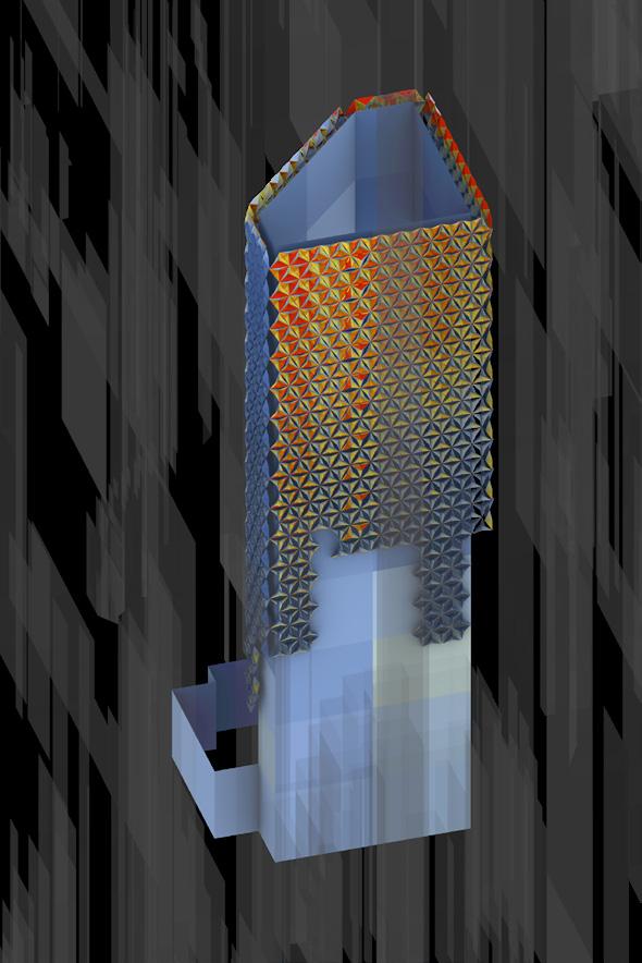
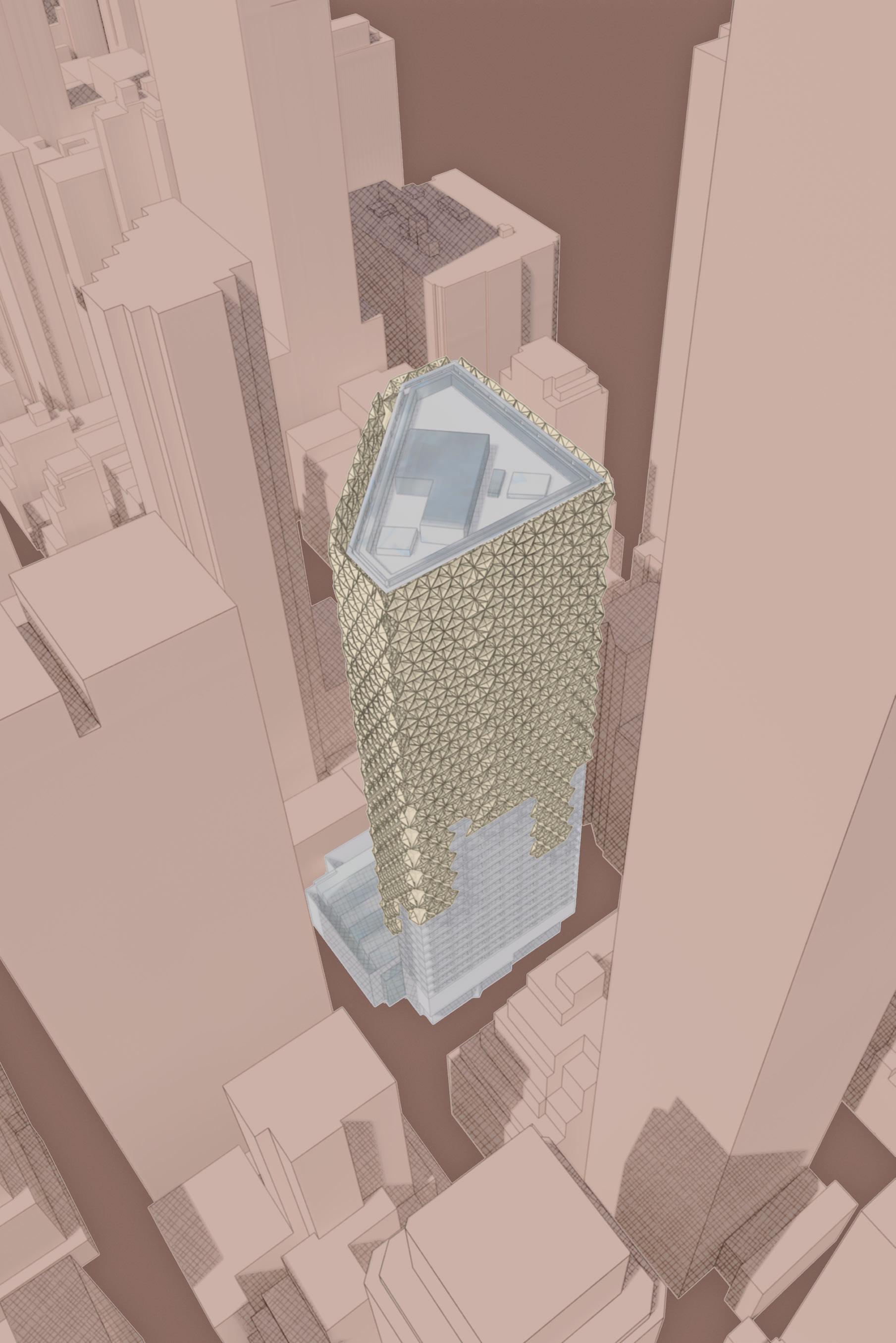
“Skin in Motion” reimagines the facade of 590 Madison Avenue as a dynamic envelope that responds to climate, program, and light. Inspired by the Mashrabiya design of the Al Bahar Towers, the project proposes a kinetic skin that interacts with the city, changing its porosity, scale, and openness as it rises. This re-skinning does not just decorate; it redefines how the building performs with its environment.
Daylight and Visual Comfort
Rather than blocking out light, the system modulates it. The triangular units are designed to rotate between 45° and 90°, adjusting aperture size and light diffusion. This creates soft, patterned lighting conditions inside, reducing glare while maintaining a connection to the outside. The light becomes intentional, crafted through material thickness, opening angles, and directionality. This focus on visual and spatial comfort underscores the idea of architecture as a flexible, moving entity, capable of adapting like a living membrane.
View Access, Privacy, and Program
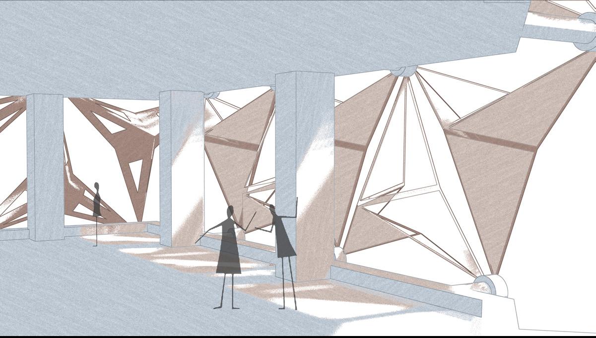
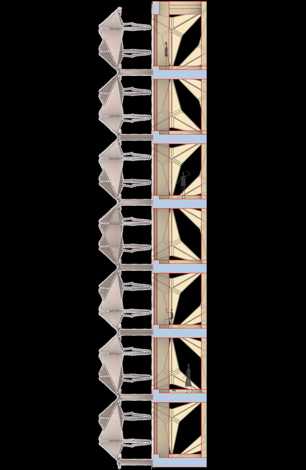
Transparency changes along with the program. Where public engagement is needed, the panels open to frame views, highlight interiors, and invite light. As the program shifts toward workspaces and enclosed areas, the geometry tightens, providing privacy and energy efficiency without complete opacity. This layered approach to enclosure offers a range of interior experiences, whether open, semifiltered, or fully protected, all achieved through adjustments rather than separations. Rendered perspectives and vertical sections show how these shapes translate to a human scale. At eye level, the panels create shaded pauses, thresholds, and seating edges. In sections, they form transitional areas between inside and outside, filtering, buffering, and softening.
Facade as Environmental Mediator
The design introduces a responsive system of triangular petal panels that rotate and scale across the facade. Their movement is not random; it is guided by solar orientation, interior use, and desired transparency. On the southeast and northwest sides, the panels shield the interior from excessive radiation while allowing soft daylight to filter in. Radiation analysis shows significant performance improvements, with post-mediation areas exhibiting notably less solar heat gain. This approach lets the skin shift from open and welcoming to dense and protective, depending on the needs of the interior and the climate. As the building rises, panel density increases, changing from the porous transparency needed for retail and public functions on lower levels to more shaded, private conditions on upper levels. The facade becomes an adaptable filter, protecting the building while keeping visual and environmental continuity.
Material Intelligence and Urban Character
Formally, the system adds to the architectural language of the skyline. The tower no longer appears as a sealed glass box but as a textured, living surface. The skin wraps, folds, and peels in response to the city, establishing a new type of performative verticality. Structurally, the panels are modular and scalable. Their repetition supports mass production, while their variability in angle and size allows for visual interest and performance-specific responses.
The panels suggest a progressive architectural language where data, program, and climate come together to shape the envelope.
Beyond Aesthetic: Toward a Generative Envelope
In this project, facade design is no longer an afterthought; it actively drives performance, identity, and empathy. Rooted in passive solar strategies and smart geometry, this re-skinning presents a new model for architectural renewal in dense urban areas. It does not erase the original building; instead, it overlays it with a layer of care, responsive, dynamic, and beautifully executed. In doing so, “Skin in Motion” transforms 590 Madison into a vertical artifact, balancing efficiency and spectacle, data and desire, light and shadow.
Figure 3A.2.4: Before and After Mediation. Left: Northwest and Right: Southeast
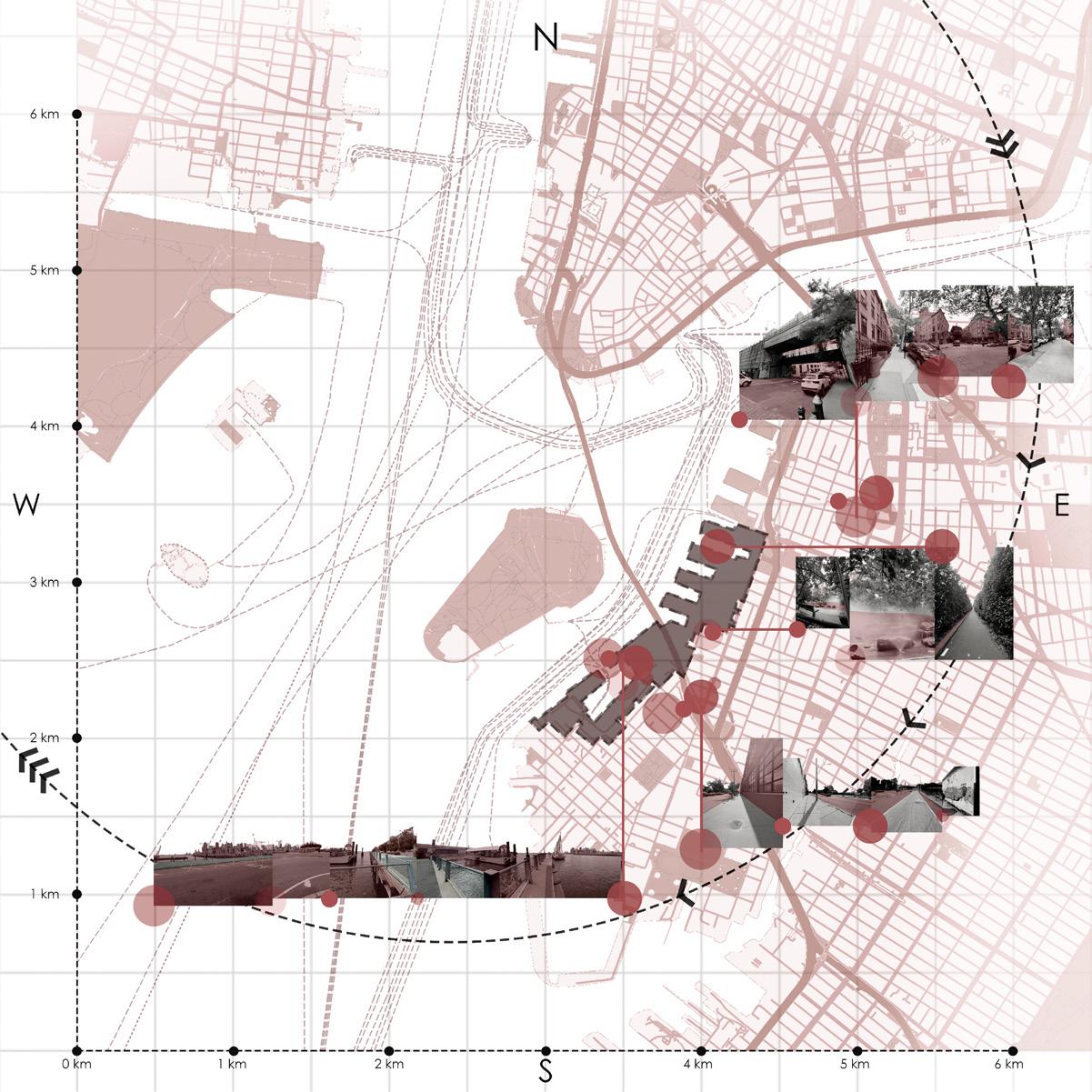
Figure 3A.3.1: Site Impressions
A.3 Economic Viability and Inclusivity
The Mosaic: Connecting Legacy + Innovation + Community
Instructors : Prof. Oliver Schaper and Ms. Valeria Cedillos
Collaborators : Dowon Kwon and Falguni Sakpal
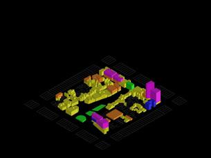
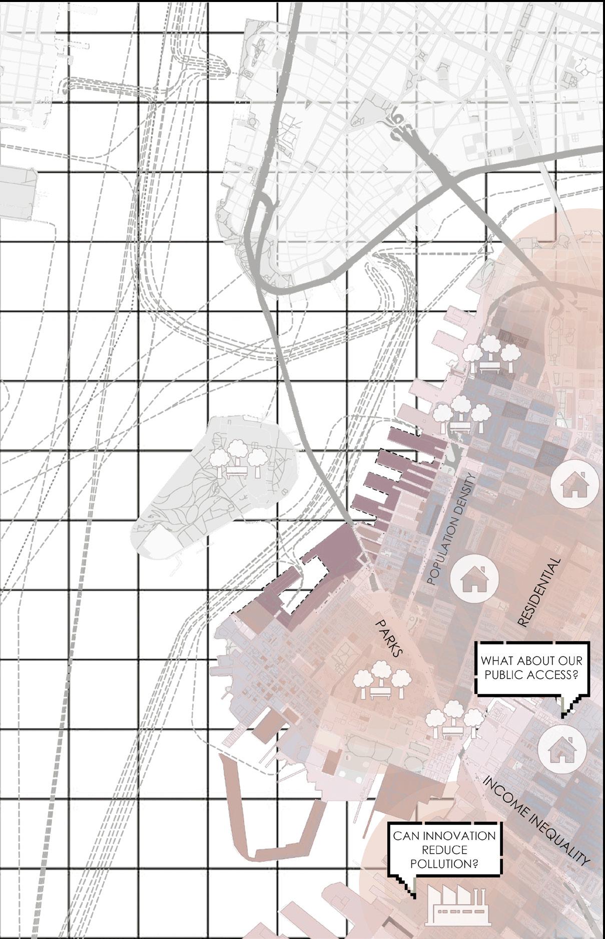
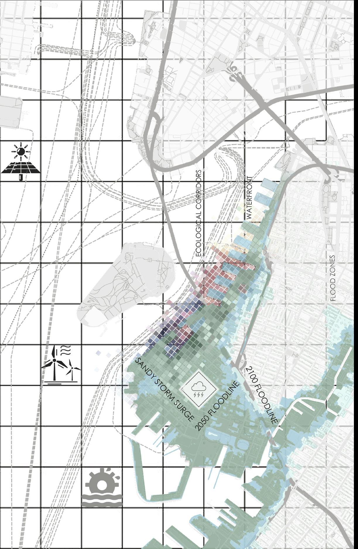
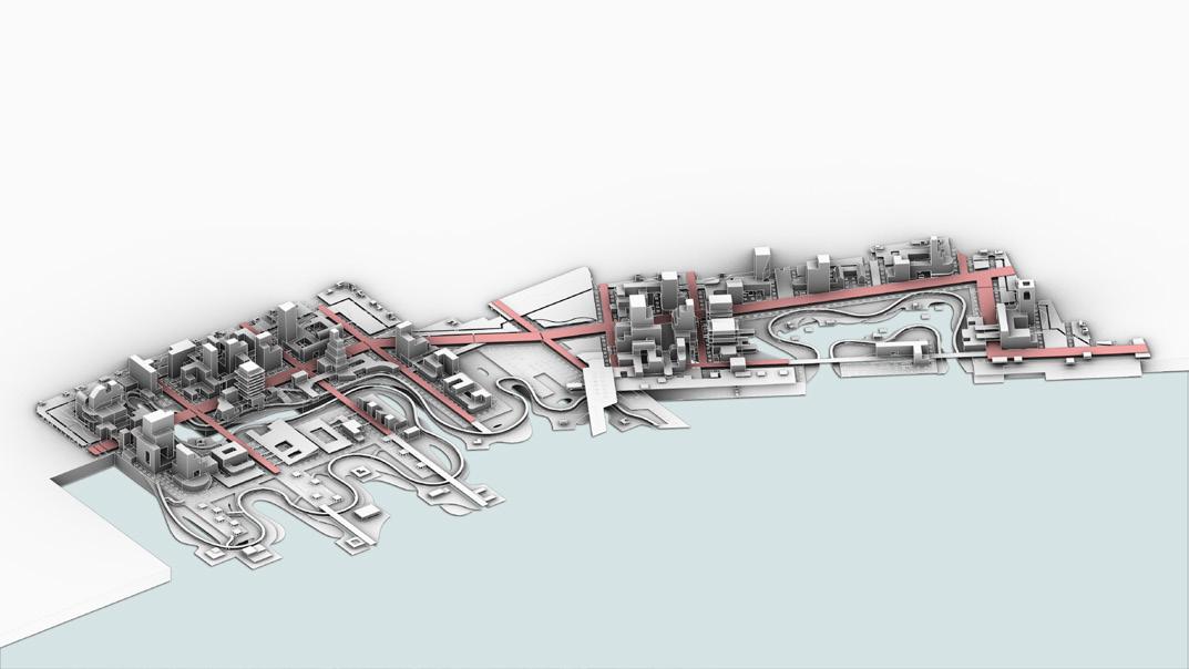
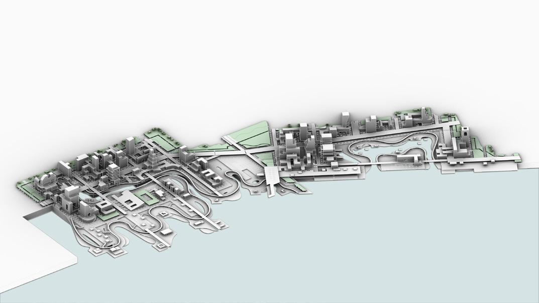
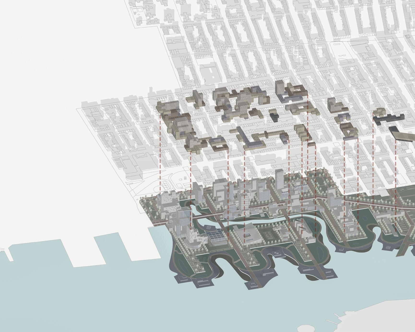
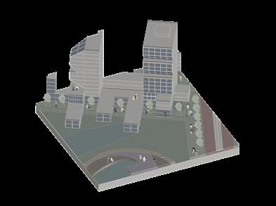
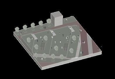
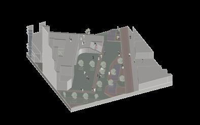
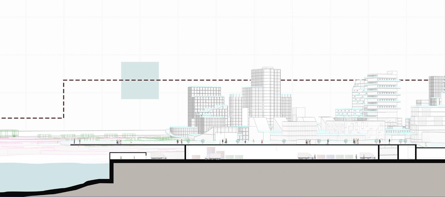
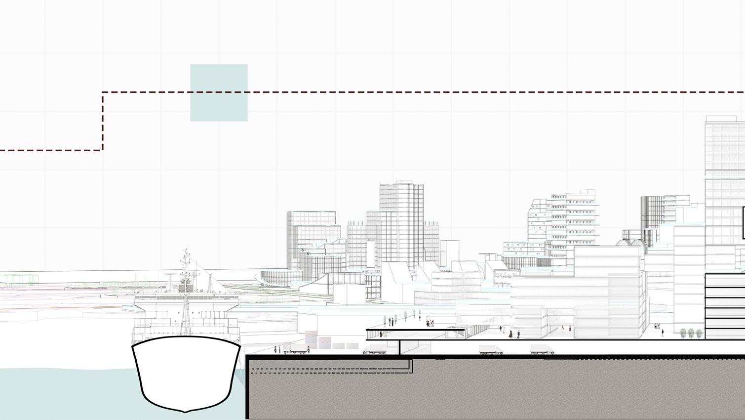
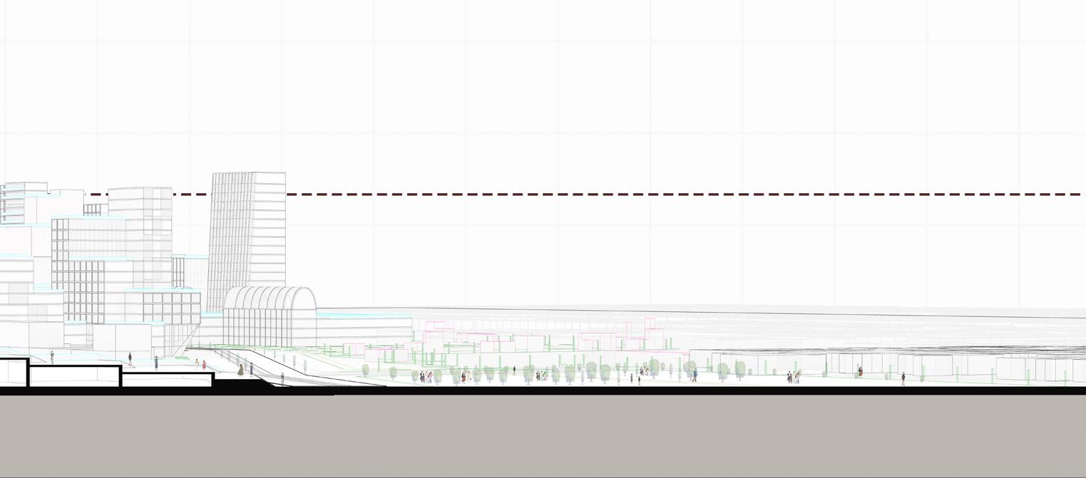
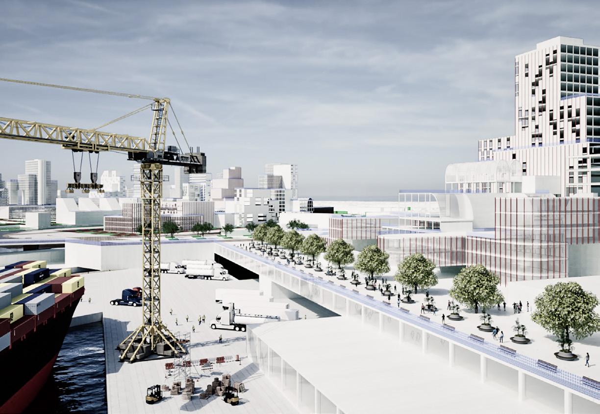
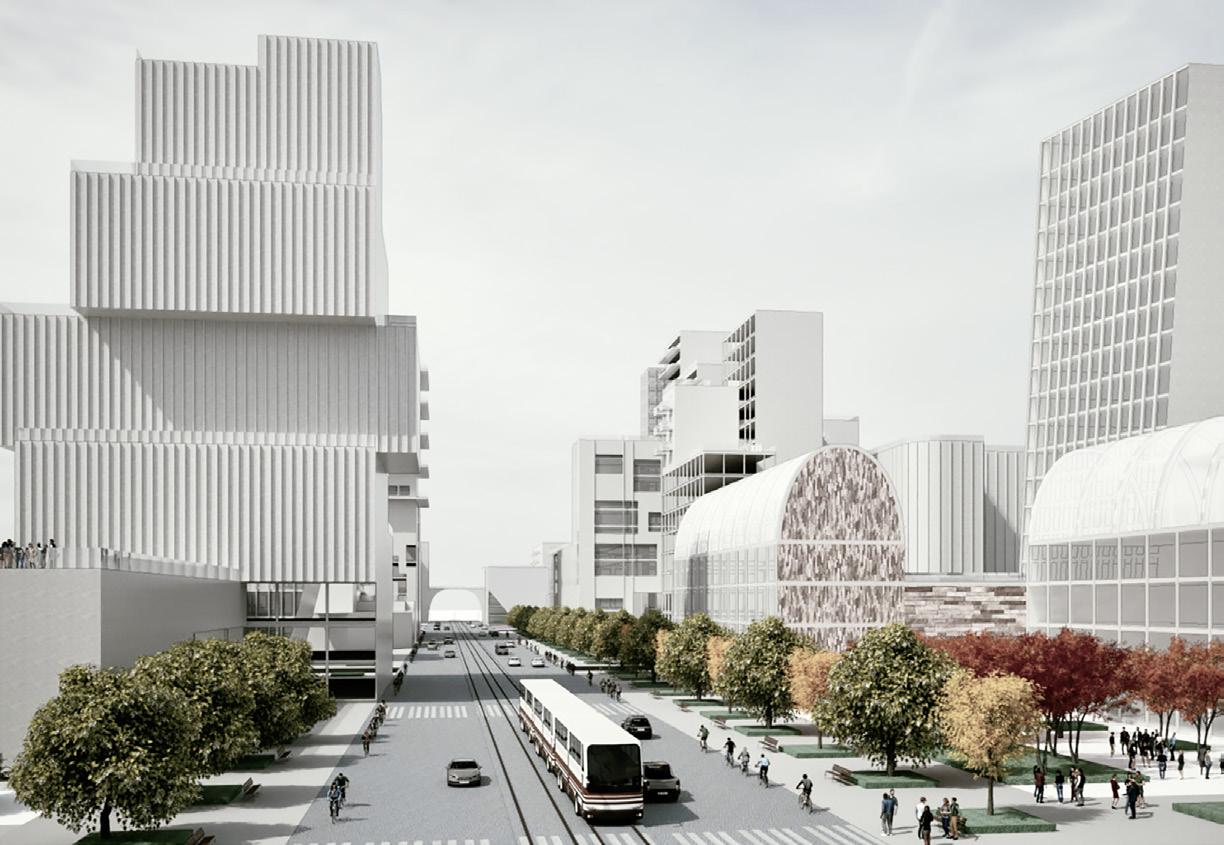
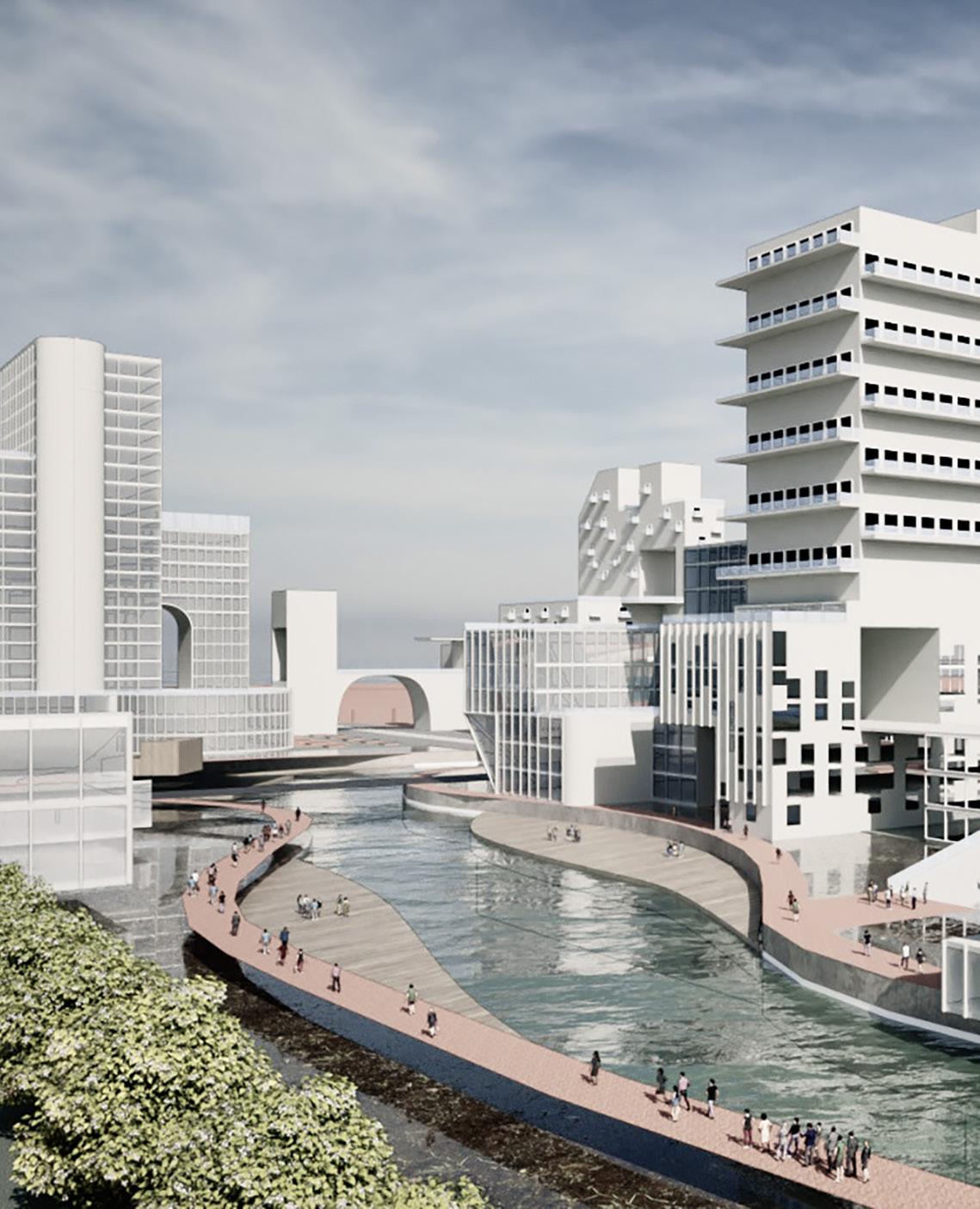
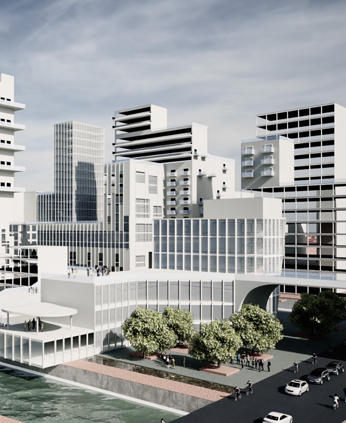
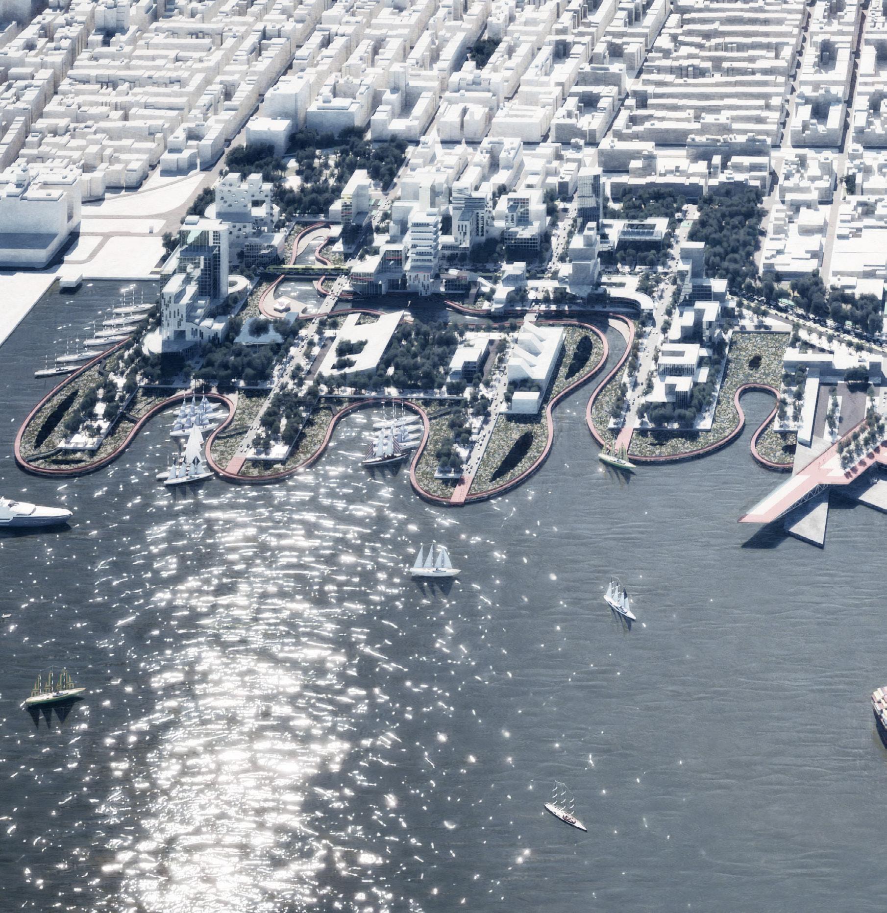
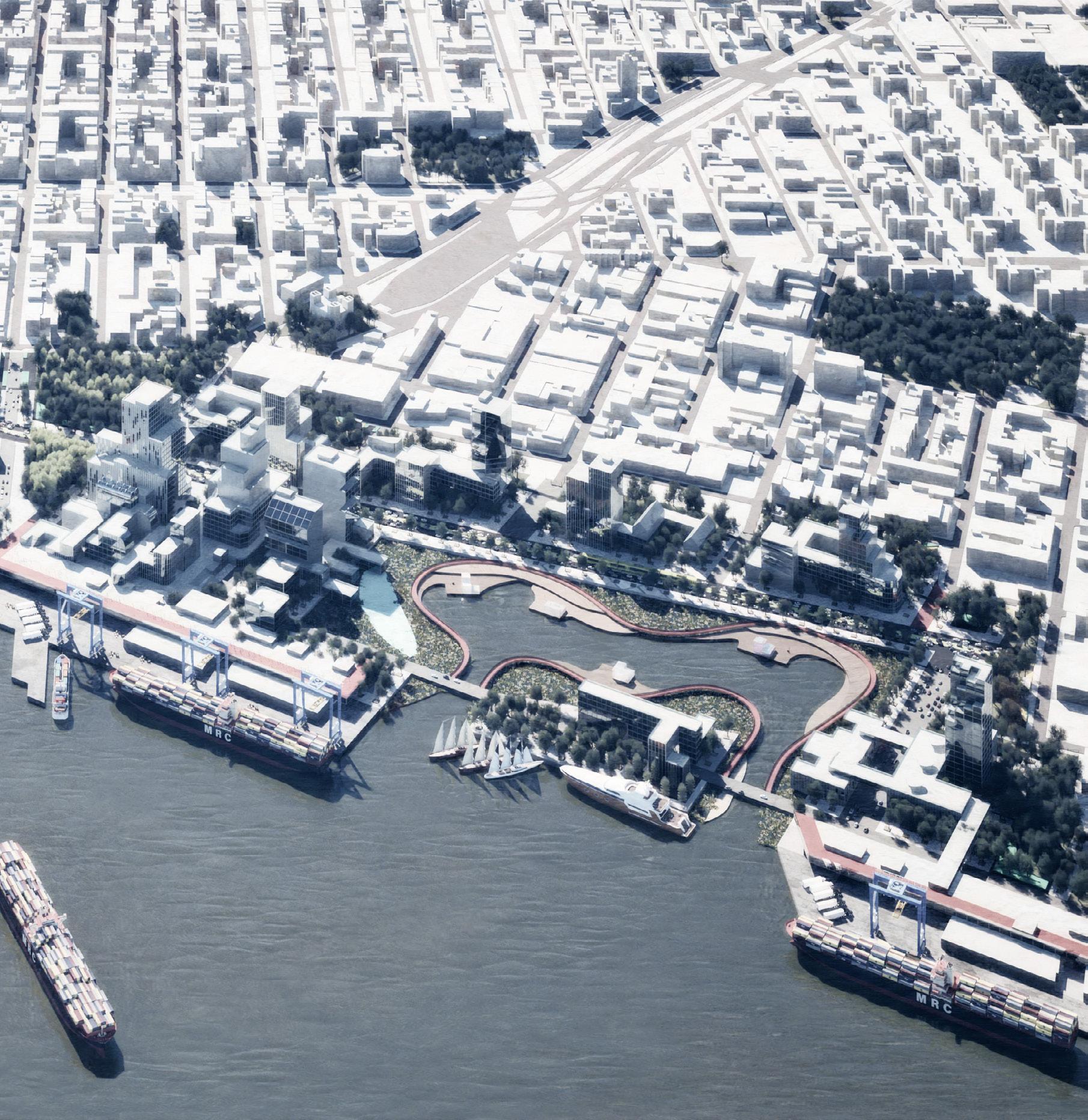
In The Mosaic, the Brooklyn Marine Terminal transforms into a resilient and inclusive urban model that combines legacy, innovation, and community through a layered system focused on performance. This system shapes not only space but also lives, economies, and identities. The project raises an essential question: how can design fulfill economic and social roles not as an afterthought, but as a fundamental aspect of architectural and urban development?
At its heart, The Mosaic connects modular public spaces, civic anchors, and infrastructure improvements to reimagine the terminal’s waterfront as a vibrant system. This goes beyond redeveloping a post-industrial site; it recalibrates value, access, and belonging. In this approach, economic viability is measured not just in speculative investments or commercial gains, but also through shared prosperity, equal opportunity, and thoughtful space management. The project reclaims architecture’s political role, where buildings, connections, and transitions are both economic and spatial tools.
Layering Economies: From Pixels to Systems
Taking inspiration from pixel logic, the design uses a modular grid where each “unit,” whether it’s a plaza, market stall, co-op housing block, or marine facility, contributes to a larger urban picture. This “pixel image” fosters economic inclusivity, accommodating diverse user groups with various needs and contributions. This way, the design supports micro-economies: fishermen, vendors, young artists, logistics workers, and residents all find a space within the system.
The performance-based layering in The Mosaic operates in terms of section, elevation, and economy. Markets are located alongside housing, while public workstations are integrated with educational institutions. Waterfront promenades feature dynamic art and vending modules that respond to seasonal tourism, trade, and community events. Each design decision enhances economic accessibility and long-term adaptability.
As Jane Jacobs noted, “Cities have the capability of providing something for everybody, only because, and only when, they are created by everybody.” The Mosaic embodies this idea; its layered logic encompasses both infrastructure and personal relationships.
Redefining Economic Instruments through Design
Traditional urban development often relies on single economic strategies, such as zoning for business, subsidized housing, or designated industrial areas. The Mosaic suggests interweaving uses and users, where vertical connections and mixed programming act as economic enhancers.
For example, the public amphitheater is integrated into the landscape while being next to a food co-op managed by residents. A logistics point at the water supports marine operations during the day and hosts public screenings at night. This dual function increases use-value and creates new revenue streams grounded in community involvement.
By viewing infrastructure as a public network, The Mosaic channels investment into shared spaces instead of private profits. It proposes energy generation units, community-run hydroponic farms, and temporary retail spaces as both revenuegenerating and resilience-enhancing features. This expands the site’s economic presence beyond industrial logistics, turning it into a catalyst for self-sustaining local systems.
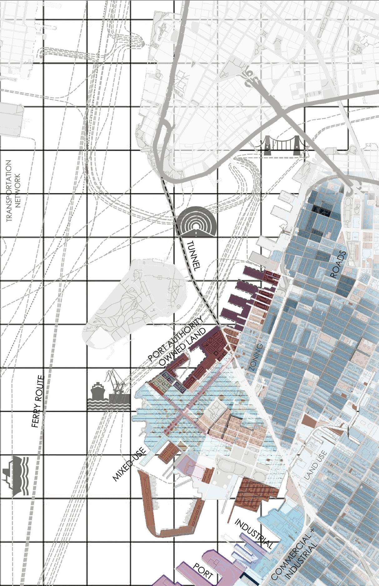
3A.3.2: Driver A: Urban Infrastructure
Figure
Figure 3A.3.3: Driver B: Socio-Economic Trends
3A.3.4: Driver C: Environmental Policies
Figure
Existing Entryway as Primary Access Vehicular and Pedestrian
Greenbelt: Park + Retail Stitch A Connecting Site to Neighbourhood
Green Corridor + Market
Stitch C for Public Realm and Workstations
Figure 3A.3.5: Contextual Inflections
Multiple Pedestrian Entryways Increasing Accessibility to the Site
Wetlands Stitch B Connecting Site to Waterfront
Open Workstations and Public Realm Stitch to the Waterfront
Greenbelt at Ground Plane Sub-Stitches
Greenbelt and Market A Stitch to the Neighborhood
Wave Currents Shaping the Mounts/Shoreline Changing Physical Boundaries of the Site Overtime
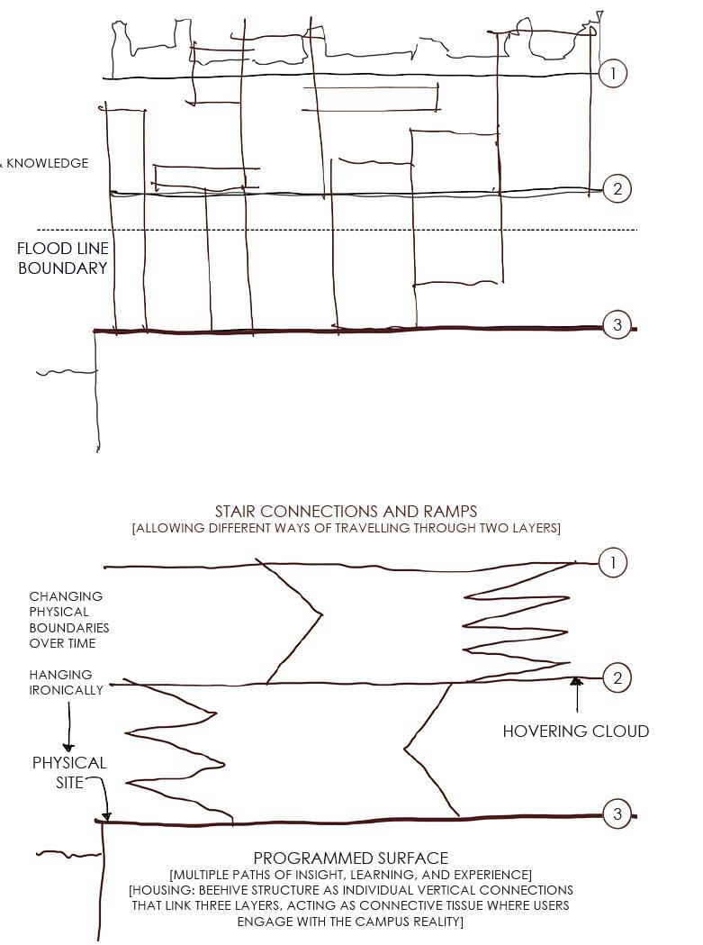
Housing: A Bee Hive and a Connecting Tissue
Individual Vertical that Connect Three Screens
Interdisciplinary Model Spatial Expression of the Pixel Image
Figure 3A.3.6: Vertical Connectivity
Interactive Exhibits and Waterfront Promenade With Integrated Public Spaces and Public Art Installations
Cooperation and Work
Stitch to the Waterfront
Greenbelt
Amphitheater
Sub-Stitches
Greenbelt and Market B
Stitch to the Neighborhood
Wetlands
New Logistics Facility To Support Industries and Provide Jobs for Local
Existing Maritime Operations With Update to the Infrastructure
Screen 3 Community Engagement
Looking at One Topic Through the Lens of Other Topic
Site Bounding Box
Community Canvas
Floating Stitch
Public Realm
Maritime Canvas
The Stitch
Innovation and Technology Canvas
Sub-Stitches
Coastal Canvas
Wetlands
Innovation and Technology
Figure 3A.3.7: Stitching the Mosaic
Figure 3A.3.8: Section A through Community and Information Technology Canvas
Proposed BQX Line
Innovation and Technology
Sponges
Housing
Small Businesses
Market
Waterfront Observatory
Logistic and Last Mile Delivery
Public Park
3A.3.9: Section B through Central Green-Belt at Community and Maritime Canvas
Logistics Port
Waterfront Observatory
Logistics Hub
Retail Area
3A.3.10: Section C through IT and Maritime Canvas
Figure
Figure
Public Programs
Science
BQX Tram
Public Park Public Park
BQX Tram
Accessibility as Spatial Currency
Economic inclusivity is fostered through open space and access. The “Stitch” elements, such as open corridors, bridges, and transitional nodes, connect elevated programs with ground-level engagement. This vertical openness invites everyone, regardless of ability or background, to participate. Elevation is not exclusive; it is made accessible to all.
In a city where waterfronts are often closed off or gentrified, The Mosaic opens up the area, both literally and figuratively. The site features cooperative housing for low-income families, art and tech labs for youth, and workshops focused on the circular economy, all built on reclaimed waterfront infrastructure.
Rather than reinforcing economic differences, the design redistributes access. The public space becomes a shared canvas: interactive, creative, and useful.
Time as a Layer: Economic Phasing and Evolution
The project recognizes that economic viability is always changing; it must adapt to fluctuating cycles of migration, trade, risk, and innovation. The Mosaic incorporates flexibility into its design, allowing for different life spans for various elements. Temporary installations, movable units, and retrofittable edges support gradual growth and decline.
Through phasing diagrams and development plans, the site evolves from a logistics hub to a civic gathering place while maintaining its economic foundation. This approach avoids the shock of complete displacement and encourages temporal inclusivity.
Here, performance-based layering also addresses time: buildings become adaptable instead of permanent. Community ownership models foster shared management and stewardship, moving away from top-down real estate principles.
Climate and Crisis as Economic Factors
Resilience underpins the economy; it is its foundation. The Mosaic prepares for flood risks, social challenges, and environmental changes. Elevated structures are built above flood lines, and wetlands are restored for both biodiversity and flood insurance benefits. Energy nodes are decentralized, community-managed, and serve multiple purposes.
The design transforms climate risk into spatial opportunity, establishing economic buffers through robust infrastructure and public awareness. Economic inclusivity in The Mosaic is about more than just jobs and markets; it influences who survives and thrives during tough times.
The Third Urban Surface: Memory, Legacy, and Work
One of The Mosaic’s key contributions is its concept of the Third Urban Surface, where memory, performance, and future use interact. This layered idea springs from the balance between the ground level (legacy), a middle zone (innovation), and an upper tier (speculation and cultural vision).
As Arundhati Roy says, “Another world is not only possible, she is on her way. On a quiet day, I can hear her breathing.” The Mosaic listens to that breath, bringing together legacy and aspiration into a city built on economic care.
A Mosaic That Performs
In The Mosaic, performance-based layering is more than a design tactic; it represents economic fairness. Through careful overlaps of programs, access, memory, and use, the project shows how architecture can generate local, resilient, and inclusive economies.
Instead of relying on top-down economic models, it fosters bottom-up systems of exchange. The terminal is not just revived; it is redefined as a city-wide model for shared prosperity. By embedding care into its design, integrating economy with infrastructure, and ensuring equity in access, The Mosaic presents a replicable blueprint for urban futures that thrive on inclusivity.
A.3 Economic Viability and Inclusivity | performance-based layering
3A.3.13: Part C: Sub-Stitches
Figure
Figure 3A.3.12: Part B: Maritime Canvas
Figure 3A.3.14: Part A: Community and IT Canvas
Burban care
“To care is not a gentle gesture. It is a force that builds, resists, and transforms.”
— María Puig de la Bellacasa
This chapter frames empathy in design. It focuses on memory, justice, and coexistence through actions of spatial, ecological, and social kindness.
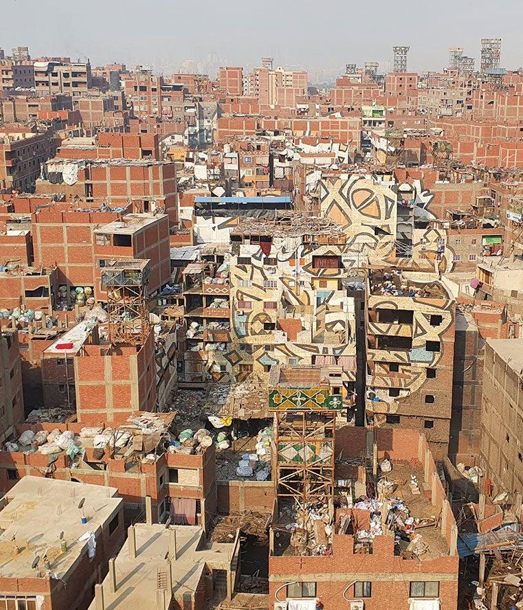
Figure 3B: Zabbaleen Garbage City, Cairo
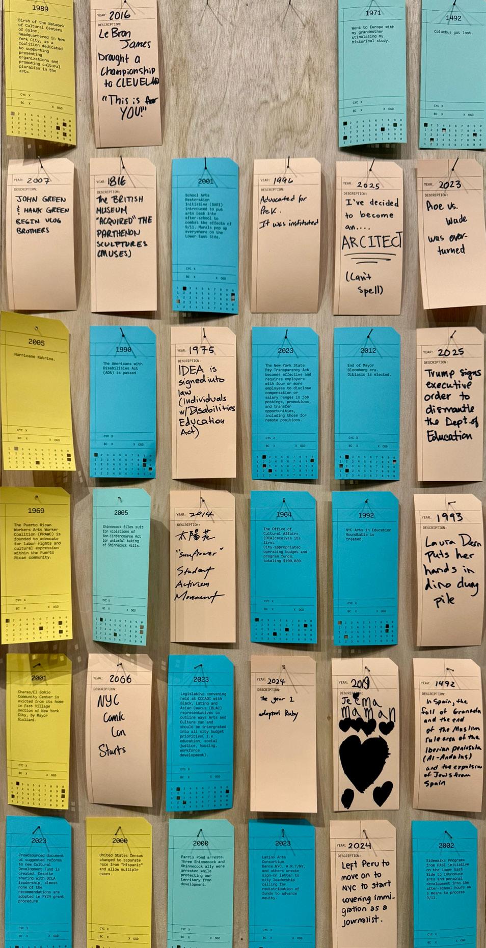
Figure 3B.1: The Timeline Project by Mauricio Delfin, Data Through Design a.k.a. DXD at BRIC
B.1 Empathetic Resilience
Designing for Economic Empathy: Rethinking Urban Spaces
Instructor : Prof. Xenia Adjoubei Kwan
In shaping our cities, what kind of city are we creating – one that is efficient and economic or incorporates community? Our urban spaces have often been planned with the objective of economic development, driven by the desires of the developers and the governments seeking economic profits. Yet, these urban spaces are not mere sources of revenue - they are socio-ecologies where individuals live, work, and interact. When thinking about the future of urban design, we should not solely focus on economic development but engage with the social and ecological fabric of our urban environments. The role of design must balance the needs of communities and the demand of markets, allowing both to succeed harmoniously.
For instance, Brooklyn Marine Terminal (BMT) is a typical example of economic interests overshadowing community-based initiatives. High-end projects such as the Brooklyn Cruise Terminal mainly benefit the tourists, making their revenues in the cruise industry while their contributions to the local community are minimal. On the other hand, low-end projects such as the Brooklyn Greenway address the needs of the community by making waterfront spaces more accessible but they lack sufficient funding and support. At the same time, exemplary initiatives, such as the Navy Yard’s industrial revitalization assure the potential of enhancing economic growth, revitalizing industry, and generating new employment.
As the political and urban landscape grows more polarized, economic empathy offers a chance to find common ground between low and high-economic-status developments. It challenges us to ask: can urban design bring social belonging, where both developments contribute to cohesive, pluralistic societies? What if instead of states competing against each other, states agreed in advance on a schedule of overlapping capitals? Suppose the fundamental criterion of the design was not the economic profit, but the beneficial implication for the community. What if we flipped the script entirely? What if our design goal was not monetary but the benefits to the communities? B.1 Empathetic Resilience
The Disparity of Design: High-End vs. Low-End Projects
There is a stark difference between high-end and low-end urban projects in cities like New York. As a high-end and profit-driven project, the Brooklyn Cruise Terminal is an example developed primarily for profit by catering to international tourists (NYCEDC, 2024). While it generates revenue for the city, the local community experiences limited benefits from the development of the Brooklyn Marine Terminal. Job opportunities are limited to service jobs, and more effort needs to be made to bring this facility into the community. This disconnection also brings to light general imbalances in the growth and development of urban areas where socio-centric values and needs are overshadowed by economics.
In contrast, the Brooklyn Greenway represents a low-end community-driven initiative. The Greenway provides a public space for the community to access the waterfront and improve their health, quality of life, and environmental awareness. However, such projects very often struggle to attract the necessary funding since they do not bring guaranteed monetary returns to investors (Brooklyn Greenway Initiative, 2024).
On the other hand, new developments such as the Bjarke Ingels Group (BIG)’s multi-storey Wildflower Studios are another approach to a high-end urban project with economic viability. Set to be a “vertical village” that houses production and creation spaces for the film and television industry, Wildflower Studios aims to include green spaces and pedestrian areas (ArchPaper, 2021; Dezeen, 2022). However, issues concerning how such projects integrate with the larger community may be seen as a crucial question amidst their adoption for innovation and employment generation. The proposed concept of the Studios demonstrates how employment centers should be incorporated with public domains to revitalize urban life and eliminate social disparities. However, concerns still arise regarding how these designs can improve their contributions to the surrounding community. Urban designers need to find strategies for integrating affordable housing, easy public transportation, and social facilities within high-end projects like Wildflower Studios for long-term sustainability. These discrepancies in design and funding are an example of the broader polarization in urban planning, in which privileged neighborhoods receive well-
funded and exclusive amenities, while disadvantaged populations are stuck with inadequately resourced public spaces. In this case, economic empathy provides a form of how these divides can be conquered, creating common grounds for the various communities across socio-economic lines.
A Balanced Approach: The Navy Yard Redevelopment
Exemplary projects like the Brooklyn Navy Yard offer a balanced model for growth and public welfare, illustrating that such results are possible. The Navy Yard was a decaying industrial site, but now it has become a hub for innovation and manufacturing, which has provided thousands of jobs to the city’s residents. It is a balanced model between industrialization, employment opportunities, and community engagement. These types of projects showcase that economic development and community welfare are mutually beneficial and exclusive. By emphasizing job development and recycling existing structures, the Navy Yard also defines the concept of co-benefit initiatives that bring about improvements in the economy, society, and environment (NYCEDC, 2024). For example, it supports clean energy startups as well as workforce training aligning with the economy with sustainable environment solutions. Its establishment of small businesses, arts non-profit spaces, and local start-ups showcases how mixed-use industrial adaptive development makes a difference in creating economic and cultural value propositions. The collaborations with nearby schools and workforce development initiatives produce diverse avenues for minorities to access employment; therefore increasing integration.
Economic empathy builds from this model, envisioning the urban setting that promotes the integration of community requirements with market-driven development.
Economic Empathy in Urban Design
How can we rethink the urban environment with an economic empathic framework? Economic empathy translates as embracing the social and environmental impacts of urban development as valuable as economic gains. Urban design should not be about developers winning and communities losing. By prioritizing co-benefits,
urban design can potentially promote social cohesion, economic opportunity, and environmental resilience.
For instance, promoting walkability streets and transportation systems enhances equity in city centers by providing access to infrastructural amenities. Copenhagen and Amsterdam are examples of locations where public-oriented mobility systems such as biking lanes, public transport, and green pathways are designed to provide connectivity for various communities. Such examples depict that connectivity in urban spaces results in better social interaction among individuals within such places.
This approach could involve several approaches. Multi-purpose spaces, such as Recreational, educational, and economic purposes are combined through such programs to guarantee that these areas are utilized by various communities. Such as Battery Park City integrates climate-resilient open spaces with access to nature. Public-private partnerships are also an option, partnership between developers and communities will float innovation hubs that support new job creations and local venture development as seen in projects like the NEW LAB innovation hub in Brooklyn. Design for climate resilience, such as Innovative green infrastructure for climate mitigation and adaptation – for instance, in stormwater management and solar-powered systems - provides climate resilience for infrastructure and enhances public amenities.
Rethinking the Triple Bottom Line
Incorporating economic empathy into the designing of the cities requires rethinking and redefining the triple bottom line - a framework for people, the planet, and profits. In current practice, economic gains precede people and the planet Earth. The Bennett Institute’s report to the UK government indicates that socially sustainable solutions, including the funding of renewable power and communal facilities, offer additional economic and environmental returns (Bennett Institute, 2023). For example, community-led renewable energy initiatives not only decrease electricity tariffs but also decrease a community’s carbon footprint whereby environmental and societal concerns fit perfectly with the monetary objectives. City designers must take from such undertakings the essence of
applying sustainability indexes to upgrades of human settlements for long-term viability.
Besides sustainability, such approaches bring positive community-oriented programs, including public libraries, cultural institutions, and parks to improve the quality of urban living and reduce inequality. Such amenities serve as literal and metaphoric ‘connective tissue’ between unlike entities and help to recast urban settings as communal, rather than economic extractive platforms. By flipping this script and turning community engagement and environmental sustainability into the protagonists, we can design scenarios that will contribute to a new urban economy that will benefit everyone.
Conclusion: Designing a Resilient, Empathetic Urban Future
To create a resilient and empathetic urban future for environments, people, and places we must move beyond the concept of cities to do more than make profits. However, this should be done by conceiving cities as ecosystems of interdependent elements of human, environmental, and economic nature. Economic empathy provides the approach for breaking down the divisions between affluent and economically less privileged areas while establishing social cohesion. For instance, the success of projects such as the Brooklyn Navy Yard and Wildflower Studios shows that the interest in profit-making does not have to come at the cost of inclusion in urban design. On the contrary, these projects demonstrate how design thinking can lead to synergy between public and private entities in the interest of achieving innovative positive changes to benefit diverse communities.
Urban planners and designers can help close these gaps in our polarized cities by foregrounding community-centered design. Economic empathy has the power to transform cities and turn them into vibrant centers that are innovative, environmentally conscious, and equitable. This transformative vision compels the community to rethink the urban design process not as a tool for economic gain but as a means of creating shared prosperity.
B.2 Modular Justice
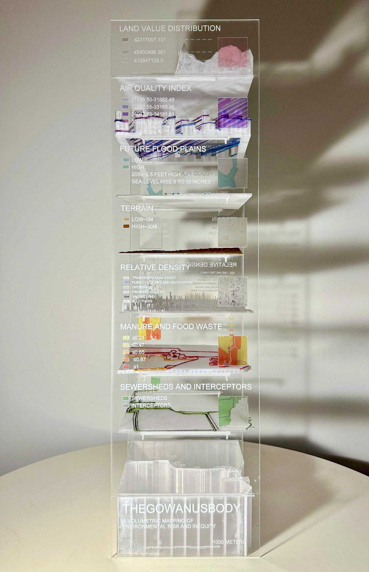
The Gowanus Body: A Volumetric Mapping of Toxicity, Infrastructure, and Inequality
Instructor : Prof. Mark D. Heller
Collaborators : Bhavya Prajapati and Falguni Sakpal
The Gowanus Body is a physical model that explores modularity to highlight layered injustices. Located in Brooklyn’s Gowanus Canal, an area affected by industrial pollution and urban changes, the project uses modular construction not just for form but as a framework focused on justice. Through this method, we examine how spatial inequalities appear in the built environment and how design can reveal and address them.
Volumetric Translation of Data
We started by gathering spatial data from GIS and environmental databases, focusing on indicators found in vulnerable urban areas. These included land value, air quality, future flood projections, topography, population density, food waste distribution, and sewer systems. Each data layer was turned into a plexiglass module that was laser-cut, etched, and stacked to create a seven-layer vertical archive. Inspired by geological core samples, the model acted as both a sculptural piece and a mapping tool, with its height representing a timeline of environmental stress.
Threading Environmental Stress
To show intensity and overlap, we used color-coded threads stretched across and between the plexiglass layers. Red marked areas of extreme vulnerability, green indicated moderate environmental comfort, blue represented hydrological systems, and orange illustrated infrastructural intersections. The threads crisscrossed the modular frame like an exposed nervous system, revealing connections that are usually hidden in datasets. Threading served both as a way to represent data and as an act of care, slowing down the process and fostering a tactile connection with the information.
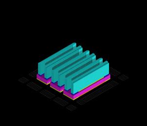
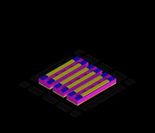
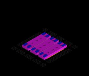
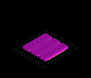
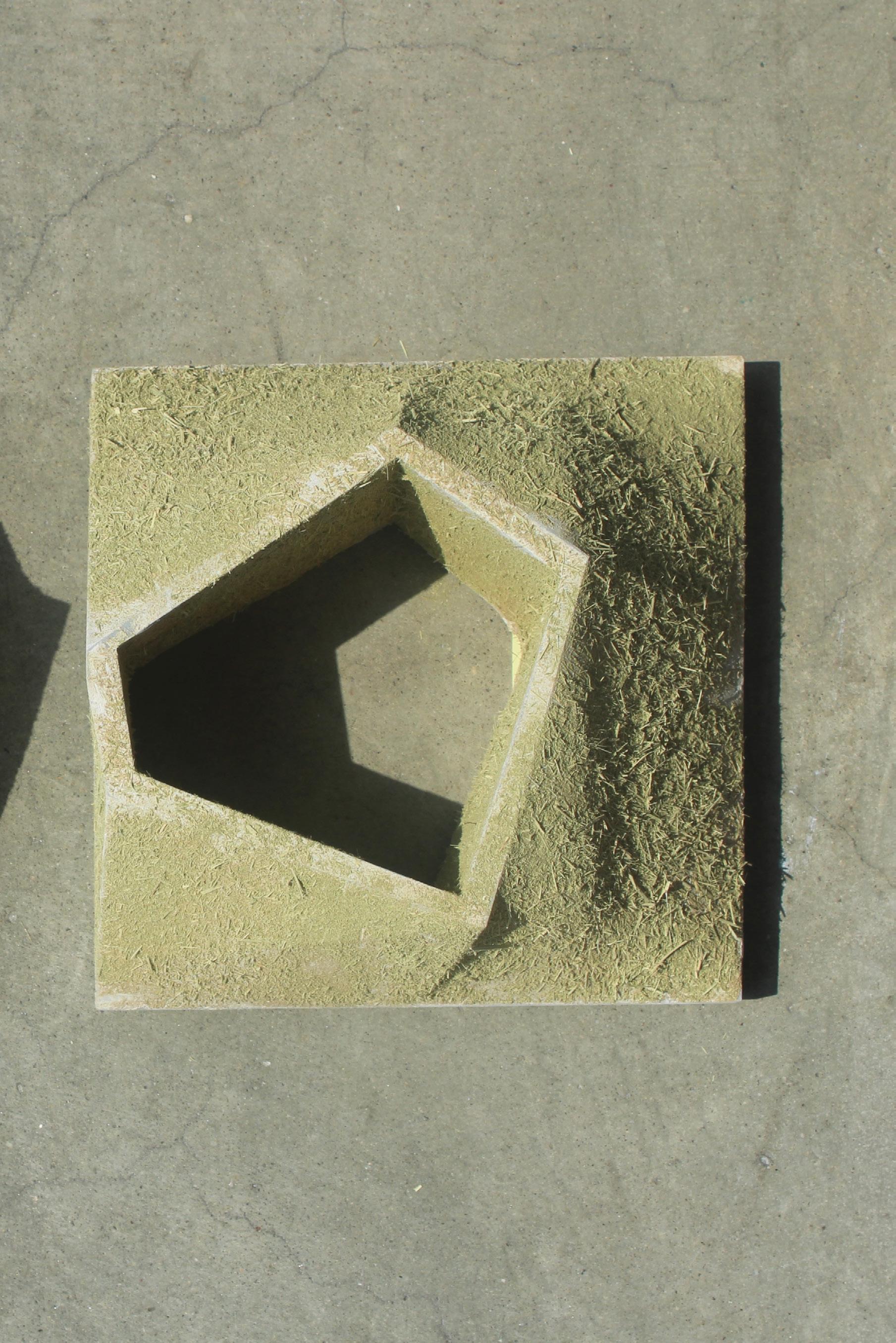
Figure 3B.2: 250 X 250 X 900 MM Physical Model for The Gowanus Body
B.3 Sensory Urbanism Data as Dialogue
Paw and Pavement: A Material Reading of Urban Canine Culture
Instructor : Prof. Mark D.
Heller
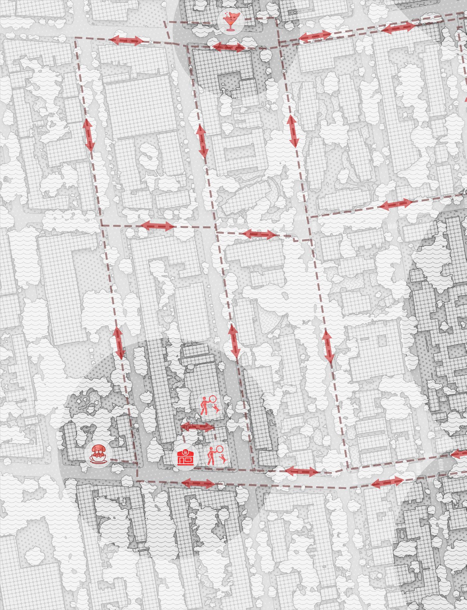
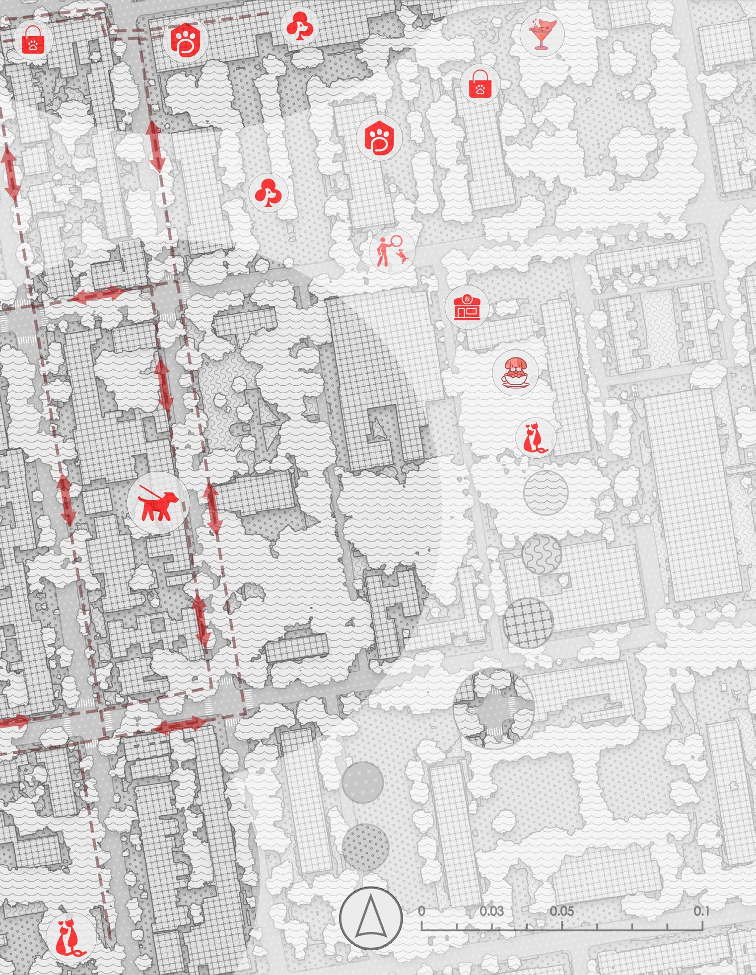
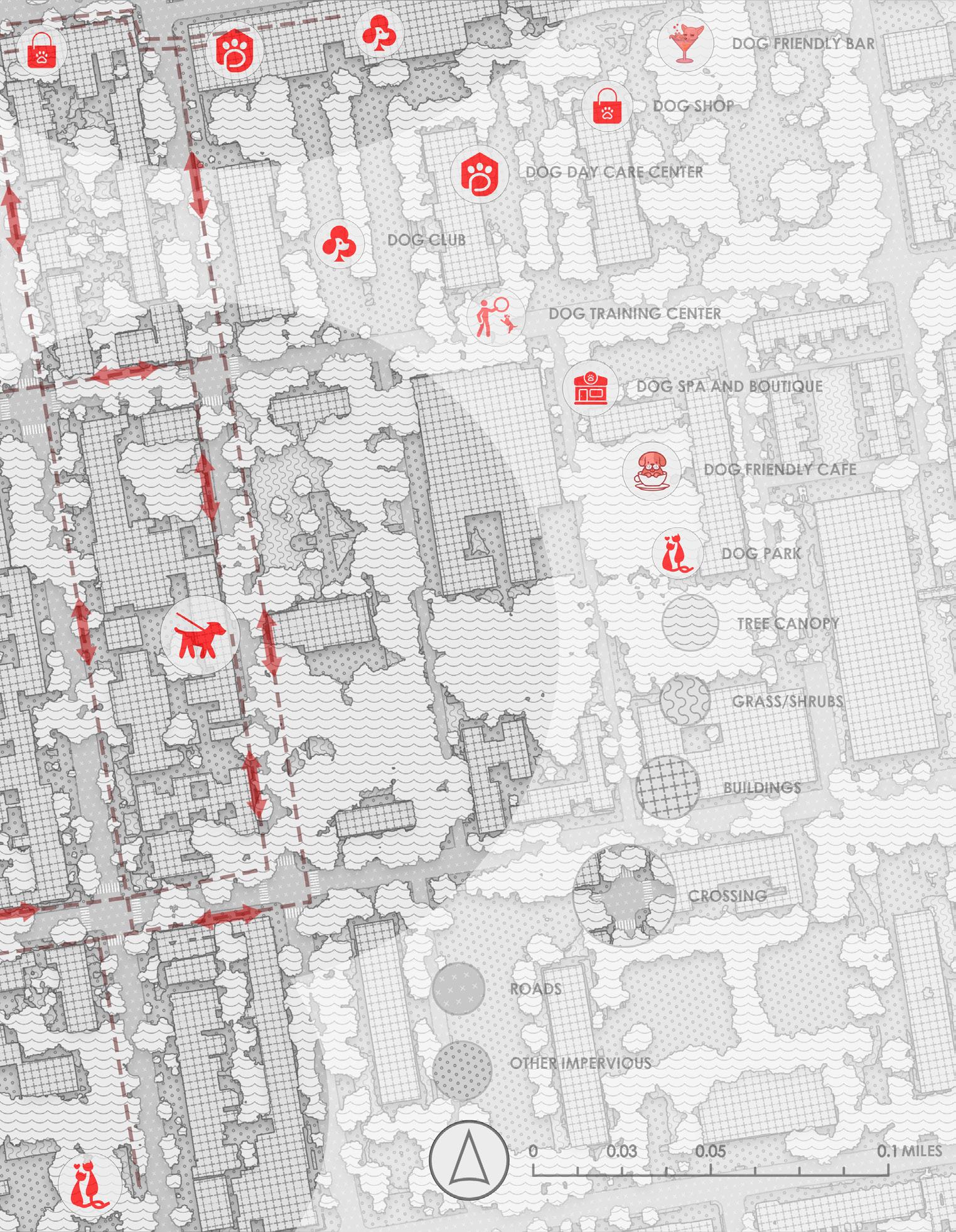
“Paw and Pavement” looks into how cities come together through both humans and their non-human companions, especially dogs. Set in the neighborhoods around Fort Greene Park, Brooklyn, this project examines the patterns, preferences, and gentle structures that influence urban life for dogs and their owners. By using geospatial data, sensory clues, and observational overlays, the work reveals an emotional and behavioral landscape that traditional urban maps often miss.
By considering canine activity a way of shaping space, this project changes how we view GIS mapping. It becomes an act of empathy and connection. What if we mapped presence not by zoning rules, but by wagging tails, sniffed paths, and shared resting spots? This creates a map for many species, where care, behavior, and companionship define urban experiences.
A Sensory Dialogue with Data
The project explores “sensory urbanism,” where data is not cleaned up or simplified but serves as an active dialogue between perception, routine, and emotions. Dog-friendly cafes, parks, training centers, and grooming spots mix with tree canopies, soft surfaces, hard pavements, and desire paths. The outcome is a drawing that not only depicts urban form but captures how the city feels and works for its quieter inhabitants.
The map uses a mixed visual style: vector lines and architectural hatching are broken up by icons, arrows, shadows, and symbols of dog culture. These elements turn static infrastructure into living networks of interaction, showing how bodies contribute to the city not through major changes, but through everyday actions like moving, waiting, watching, and returning.
Urban Care as Spatial Practice
At its heart, this project looks at how daily urban rituals, such as walking a dog, subtly shape public spaces. These rituals strengthen community bonds, reinforce memories through repetition, and create a softer social infrastructure. Dog walkers often stop under the same trees, chat with familiar strangers, and naturally occupy the same spots, creating a pattern of care, trust, and presence.
This way of caring is not solidified through rules, but rather comes from informal social agreements. It is relational and embodied. “Paw and Pavement” argues that these fleeting, interspecies acts of care should be included in how we document and design the city. They reflect a broader ethic of maintaining, being sensitive, and coexisting.
Reframing GIS through Empathy
This project challenges the limitations of traditional GIS representation, which often focuses on utility, infrastructure, and measurable efficiency. Instead, “Paw and Pavement” suggests that GIS can serve as a storytelling tool, highlighting overlooked places and agents. It’s not just about showing where people walk, but also how they walk and who walks with them.
The project maps memory, behavior, and feelings alongside raw data, providing a framework for illustrating the city not only by its contents but by its inhabitants. This way, the map becomes both a tool and a story: revealing how intimacy, routine, and the presence of dogs create an alternate understanding of urban life.
Toward a City That Feels
“Paw and Pavement” begins this chapter on Urban Care, establishing a design approach based on connection rather than imposition. Care, in this context, is not only a moral or social act; it is also a spatial one. The project poses these questions: What if we designed cities around companionship? What if pavements could speak, and maps could express feelings?
Cbio - techno - spatial interfaces
“Technology is the answer, but what was the question?”
– Cedric Price
This chapter looks at spatial systems that combine biology and technology. Here, design interfaces change, react, and function through logic, material intelligence, and speculative modular ecologies.
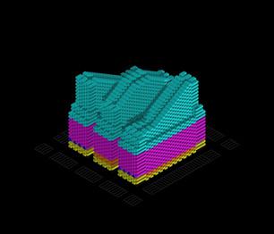
Figure 3C: Form Finding. BioHue: Climatic Response through Bio-Technology and Hybrid Habitats
2 NUTRIENT SYSTEMS
Nutritional Equity through Bio-Farming
8 INCLUSIVE ECONOMIES
Bio-Circular Systems: Care & Regenerative Technologies
5 GENDER EQUILIBRIUM Planetary and Gender Equity as Ecological Harmony
11 ADAPTIVE BIOREGIONS Cities as Regenerative Ecologies
3 GENOMIC REPAIR Living Systems & Synthetic Immunity Wellness
9 BIO-BUILDS Self-Healing, Living Infrastructures
14 AQUA AI FUTURES Blue Futures: Reviving Oceans with AI-Bio Synergy 15 EARTH STEWARDSHIP Regenerative Seed Vaults Restore Terrestrial Health
6 CLEAN-TECH H2O Circular Water Futures: Regenerative & Equitable
12 E-CIRCULAR NORMS Regenerative Consumption in Everyday Life
Form Finding and BioHue: Climatic Response through Bio-Technology
Instructor : Dr. Sandra I. Piesik
Collaborators : Mithila Sunil Patil, Bhavya Prajapati, and Falguni Sakpal
As climate change worsens and planetary limits are crossed, designers need to explore new material systems that are both environmentally strong and biologically harmonious. BioHue is a speculative design framework suggesting a bio-circular architectural surface that responds to environmental conditions. It serves as a link between climate, community, and microbial intelligence. Starting with the 17 United Nations Sustainable Development Goals (SDGs), we proposed an 18th SDG: Beyond Earth: Designing for Life in Extreme and Shared Ecosystems. This goal addresses the growing need for sustainable design in harsh environments on Earth and beyond. It recognizes future human habitation in deserts, high-altitude areas, flood zones, or even space habitats. The emblem represents multi-species symbiosis, microbial life, and architectural structures suited to extreme environments.
A main reason for our research was the hidden toxicity of architectural surface treatments. The building paint industry contributes around 58% of all microplastics that enter the oceans each year, making it one of the most damaging yet widely accepted pollutants. This fact reinforced our investigation into bio-receptive surfaces as a substitute for synthetic, non-biodegradable paints.
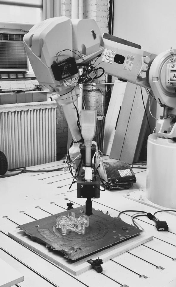
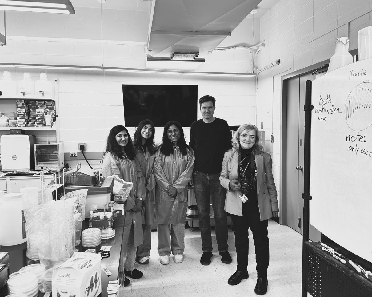
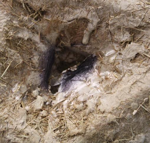
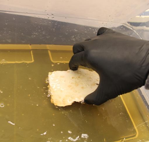
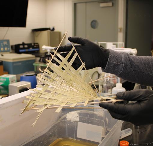
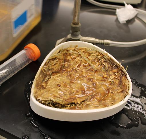
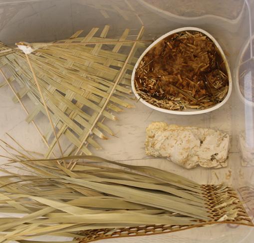
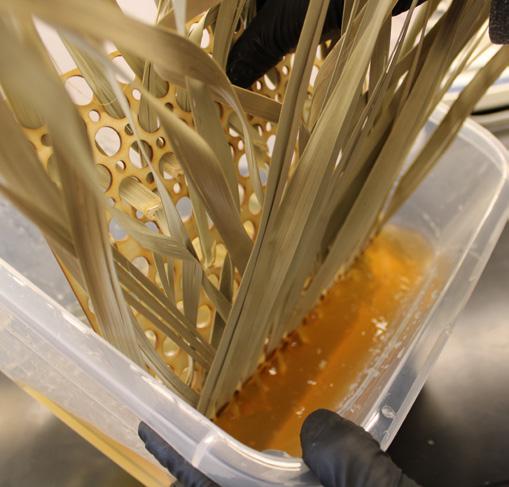
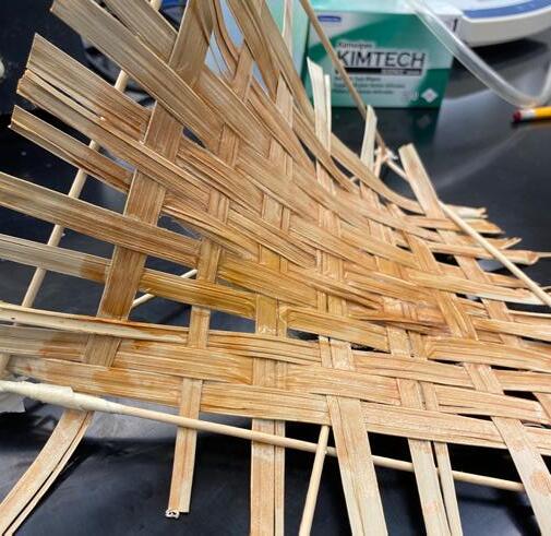
We began prototyping with dry palm leaves, a plentiful and underused organic waste material in India, and progressed through experiments with color-changing and bioluminescent bacteria. Working with the Dietrich Lab at Columbia University, we conducted bacterial growth trials on biodegradable bioplastic sheets. We tested how bacterial colonies react to temperature, moisture, and seasonal changes, which formed the core palette for BioHue. These early versions became the Next Patterns, the base for modular environmental infrastructure.
System Logic: Module Composition and Bio-Circular Responses
Our system starts with a single module. The module serves as both a spatial and material unit, acting as the basic building block of BioHue. These modules are designed to react to climate events, especially desertification, heat waves, and wind erosion. The external shell of the module consists of biodegradable bioplastics, treated with lime and mud plaster, and packed with palm leaves that serve as thermal mass.
From a materials standpoint, BioHue engages in a bio-circular economy.
Agricultural waste, like palm leaves, turns into a resource. Natural materials get processed into biomaterials, and the life cycle of the module concludes with biodegradation and reuse. Local systems of labor and knowledge are involved at every stage of the construction process.
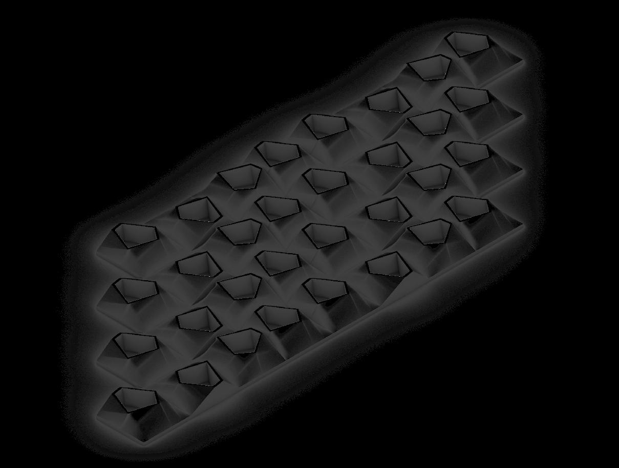
The design process includes twisting the module to create surface creases and folds. These features increase surface area, create micro-environments for airflow, and establish optimal zones for bacterial growth. A five-sided form was created to enhance undulation and surface exposure. Hollow cavities enable air to flow within and between modules, improving thermal comfort.
The bacterial coating plays multiple roles:
Color-Changing Surfaces respond to light and temperature variations.
Bio-Receptive Skins act as living facades, purifying air.
Microbial Fuel Cells can generate energy in future iterations.
These components are not just for show; they serve a purpose. The bacteria act as designers, not just as materials.
Modules can be arranged in rotated series to create layering patterns and airflow corridors. The lifted edges, punctured cores, and twisted frames promote dynamic spatial qualities that support various living styles, from shaded outdoor thresholds to cooling towers and porous facades.
Maximized Undulating Surfaces to Foster Bacterial Colonization
Optimized Bacterial Growth Zones Strategic Creases and Folds Provide Micro-Environments for Bacterial Interaction
Increased Surface Area
Five-Faceted Design Enhances Bacterial Adhesion
20% More Surface Exposure for Bacterial Growth
C. bio-techno-spatial interfaces
Three-Dimensional Color
Gradient
Seasonal Bacterial Activity Influences
Modular Coloration
Hollow for Air Circulation
Integrated Voids Promote Aeration and Microbial Exchange
Figure 3C.3.1: Spring - Represents growth, renewal, and awakening of bacterial cultures. Warm yellow hues emerge as microbes actively spread and adapt to the environment.
Figure 3C.3.2: Summer - Peak metabolic activity as bacteria thrive under warm conditions. Peach tones enhance heat absorption and indicate optimal growth.
Figure 3C.3.3: Autumn - Transition into dormancy as bacterial colonies adjust to cooling temperatures. Pink hues signify nutrient recycling and microbial adaptation before hibernation.
Figure 3C.3.4: Winter - Dormant phase where bacterial metabolism slows. Lavender-gray hues reflect resilience and biological conservation during minimal activity.
112 Figure 3C.4: Bacteria growth on the module at Dietrich Lab, Columbia University, NYC
Color Ecology: Seasonality and Biological Change
Each season was imagined as having a distinct bacterial coloration.
After incubating bacterial samples at the Dietrich Lab for over two weeks, our winter hypothesis proved to be correct. The bacterial surface developed a haunting lavender-gray color under cooler temperatures. This demonstrated the possibility of using bacterial colonies as living indicators of seasonality and environmental change. The real-world implications are significant. If facades could change color with the seasons, it would create a poetic form of architecture. It could also function as a passive environmental sensor. For example, a community could know when the monsoon season begins by observing the greening of public infrastructure. Additionally, these living color palettes can provide information to both users and maintenance systems about microbial health and environmental changes. To put this into practice, architectural surfaces could be coated in bacterial biofilms tailored for each local climate. Using seasonal color charts, the structure would change colors over time. Areas with higher airflow could boost bacterial metabolism, making colors more intense and improving purification.
Architectural Application and Community Empowerment
The BioHue module goes beyond being just a facade element. Its flexibility and modular design allow for four main applications:
As a roofing element, twisted forms create overhangs and wind channels.
As a facade element A, it sheaths external walls and provides a responsive skin.
As a community of modules, it combines into entire buildings with porous boundaries.
As a facade element B, it is adapted specifically for desert climates like Gujarat, India.
In the Rann of Kutch, daytime temperatures can reach up to 45°C, while nights cool down. This daily temperature change makes the module’s thermal mass and breathable surfaces very useful. The desert’s dry, salty soil conditions support our choice of strong local materials like palm dust and lime.
To ensure connection with the community and environment, we suggested working with SEWA (Self-Employed Women’s Association). Through SEWA, local women artisans would learn to build and assemble the modules. This keeps the technology community-led, making the modules tools for both survival and self-expression.
The project aims to:
Empower women by teaching skills in material fabrication.
Create jobs through a sustainable construction supply chain.
Provide low-cost, adaptable shelter options for dry areas.
In shaping the future, BioHue is not just a design project; it invites us to view architecture as living skin, an adaptive system, and a form of cultural expression. Women become builders of new futures. Buildings turn into organisms that respond to change. Color transforms into a way of showing care.
The community gains not just infrastructure but also the power to co-create a resilient environment. This environment is rooted in local knowledge and supported by global biotech. Through BioHue, we pose the question: What if our cities were alive? What if care, not control, shaped the material intelligence of tomorrow?
Figure 3C.5.1: The Rann of Kutch, Gujarat’s desert region, experiences scorching daytime heat (up to 45°C) and much cooler nights. The desert has low humidity, minimal rainfall, and saline soil.
Figure 3C.5.2: The community will gain access to a climate-responsive, low-cost building module suited to their environment createing local jobs hands-on participation and skill building.
118 Figure 3C.6.2: Module as a Facade Element A
Figure 3C.6.1: Module as a Roofing Element
Figure 3C.6.4: Module as a Facade Element B
Figure 3C.6.3: Community of Modules as Building Itself
the living memory
“The image of the city is the product of both immediate sensation and of the memory of past experience.”
– Kevin Lynch
In this chapter, memory takes shape as infrastructure. Through rituals, shocks, and systems of care, the city becomes a dynamic and performative space that both remembers and transforms.
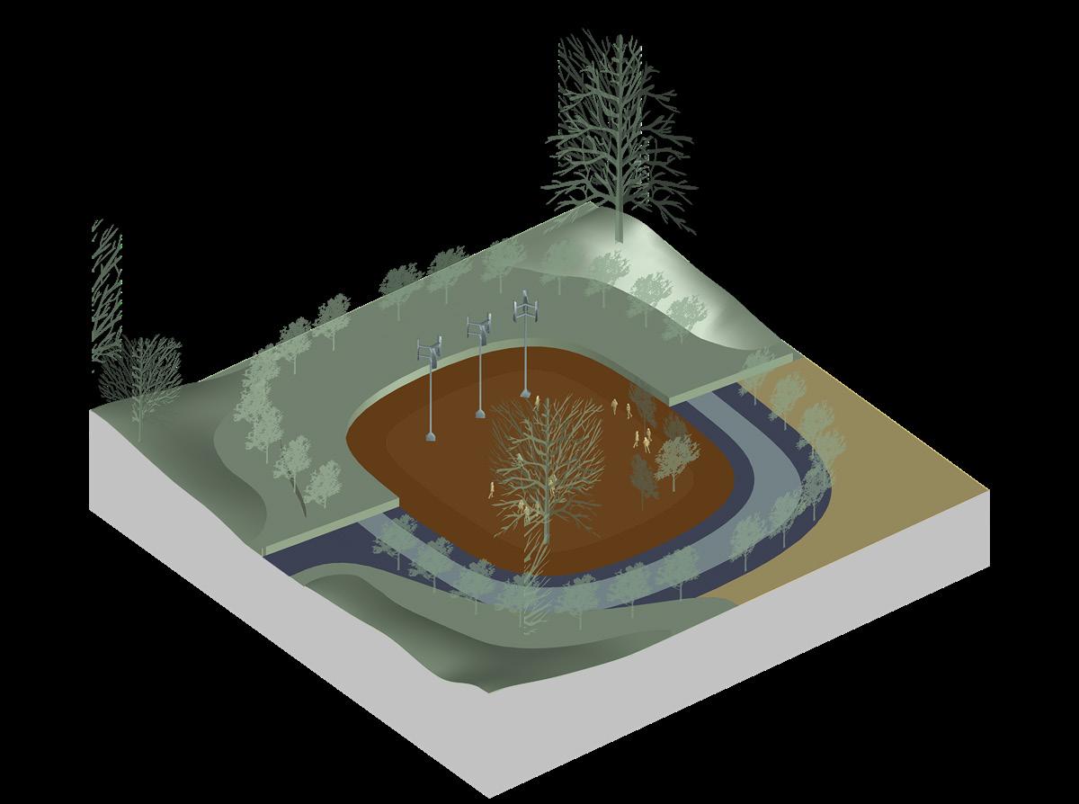
Figure 4.1: Spatial Deployment of the Urban Altar within the Memory Grid
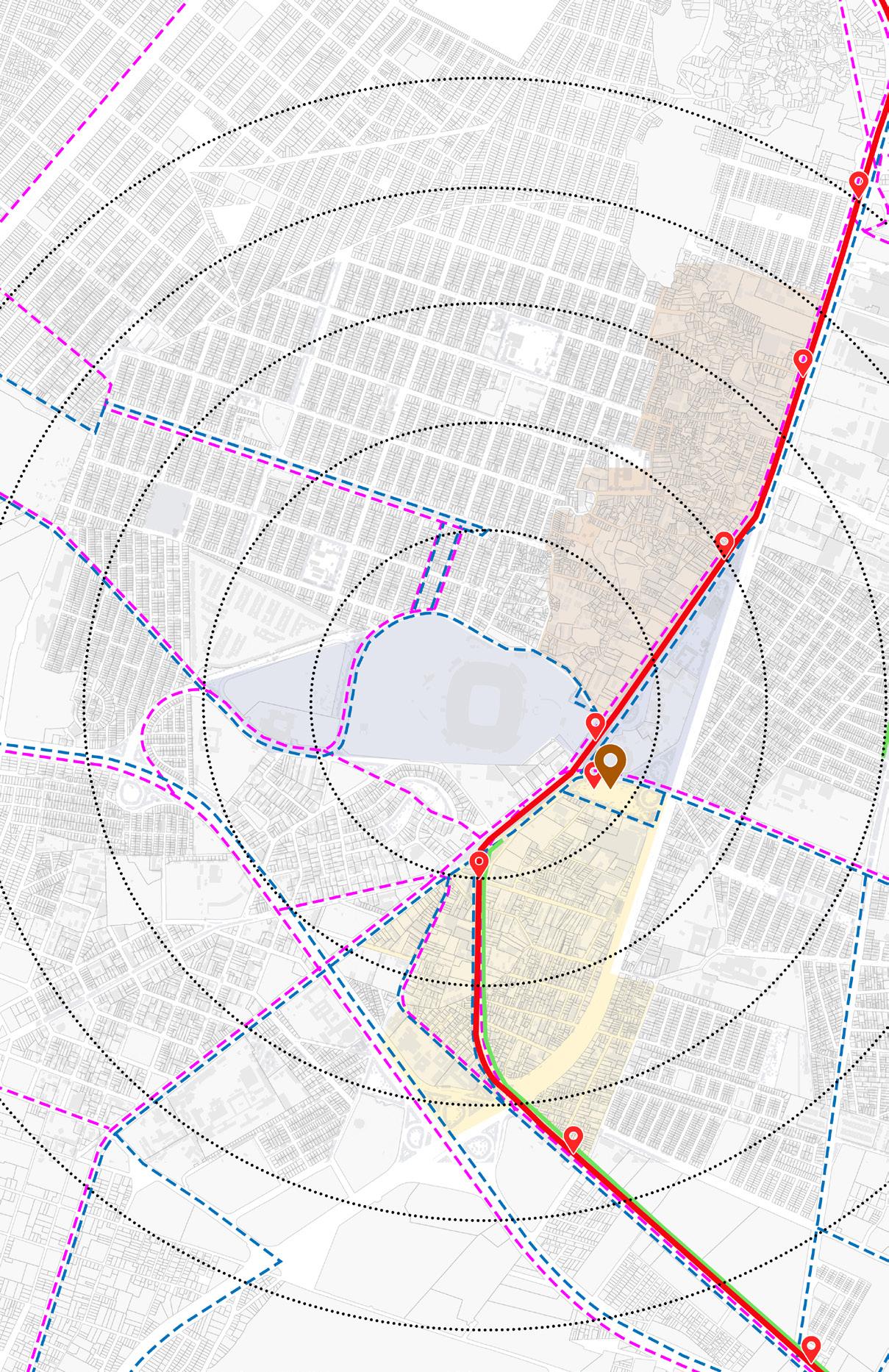
Figure 4.2: Accessibility and Connectivity to the site - Concentric radius lines (0.5 km, 1 km, etc.) effectively show how many parts of the site fall outside easy walking distance to major nodes.
the living memory
The Living Memory
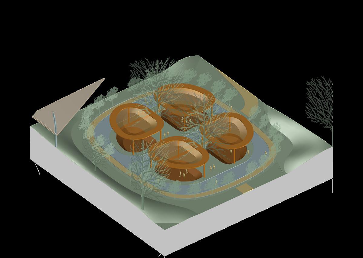
Urban Altar: A Journey Through Memory, Crisis, And Care
Instructors : Alex Tahinos and Erich Schoenenberger
Architectural and Urban Hypothesis
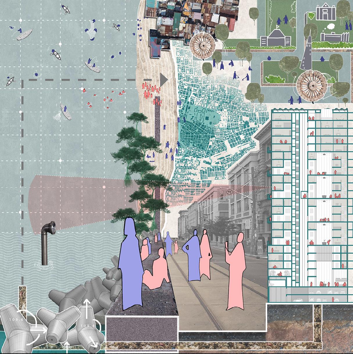
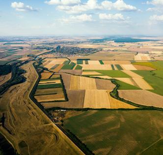
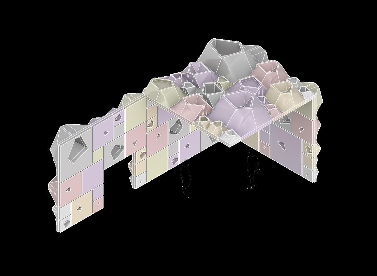
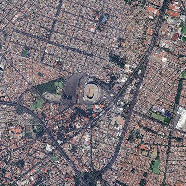
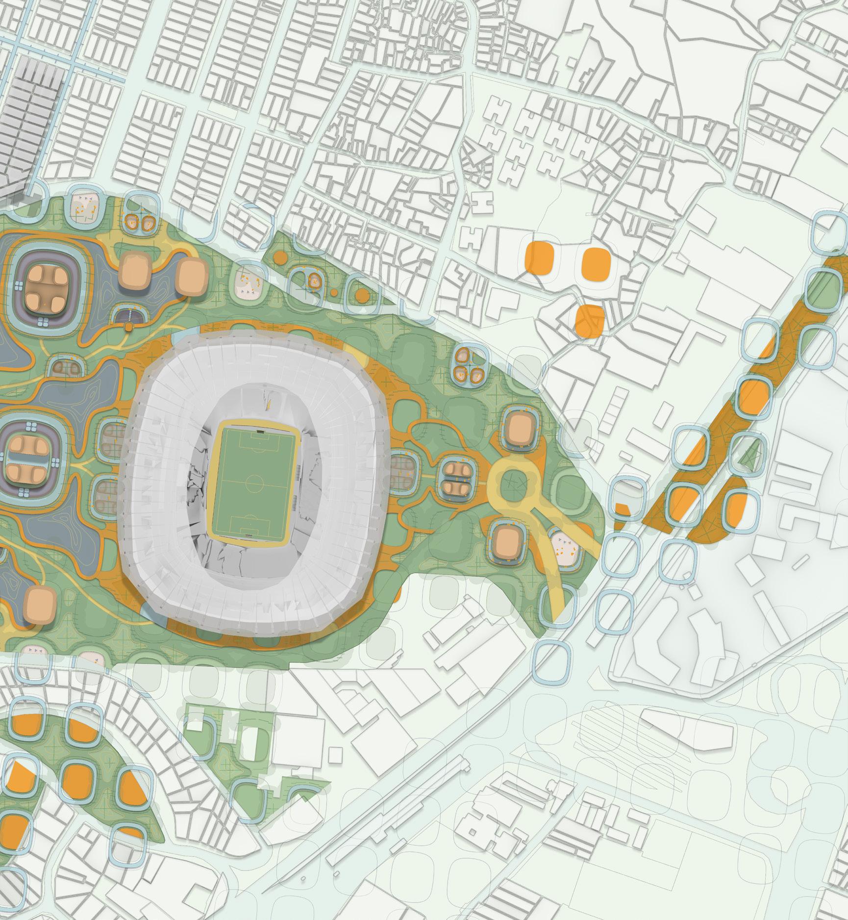
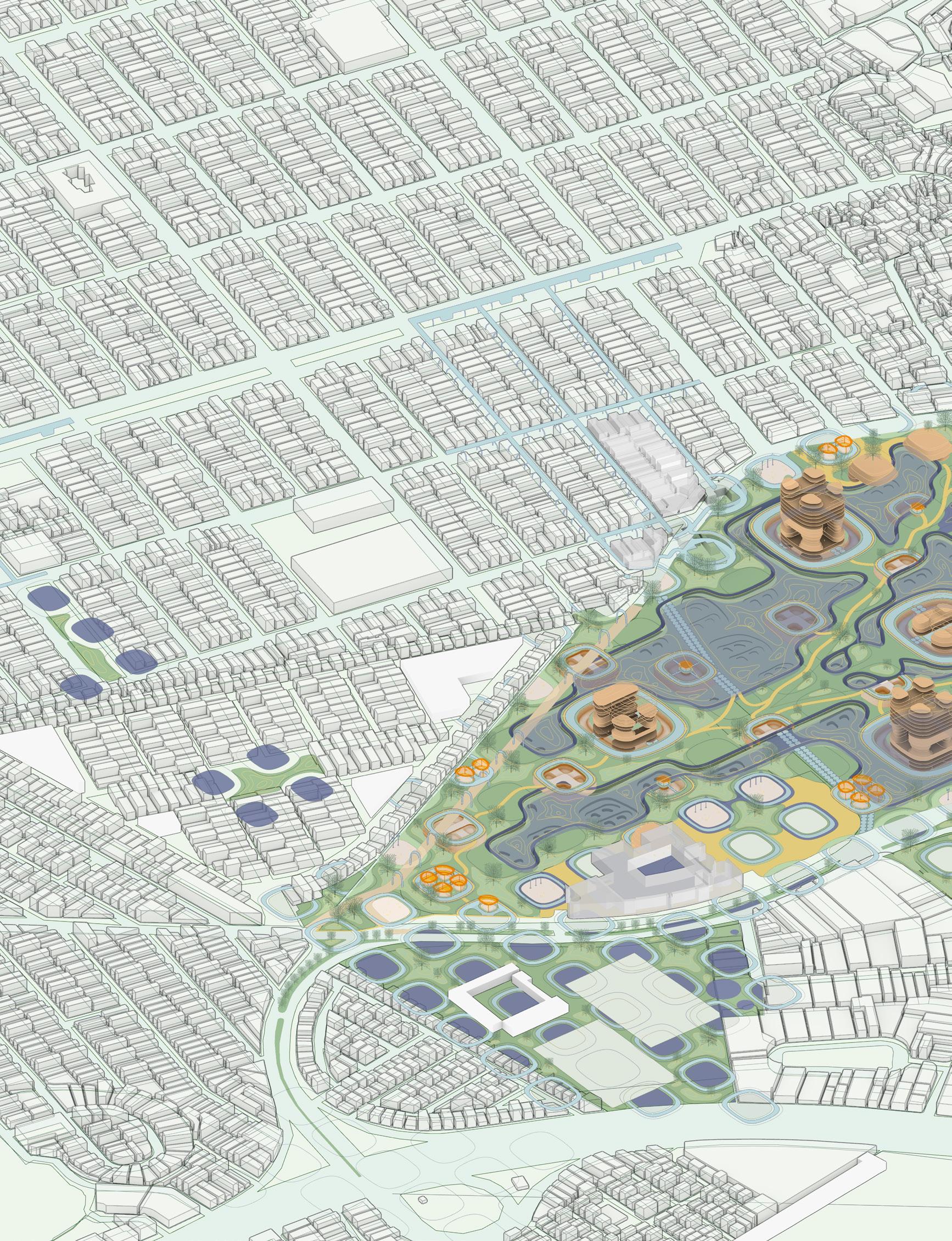
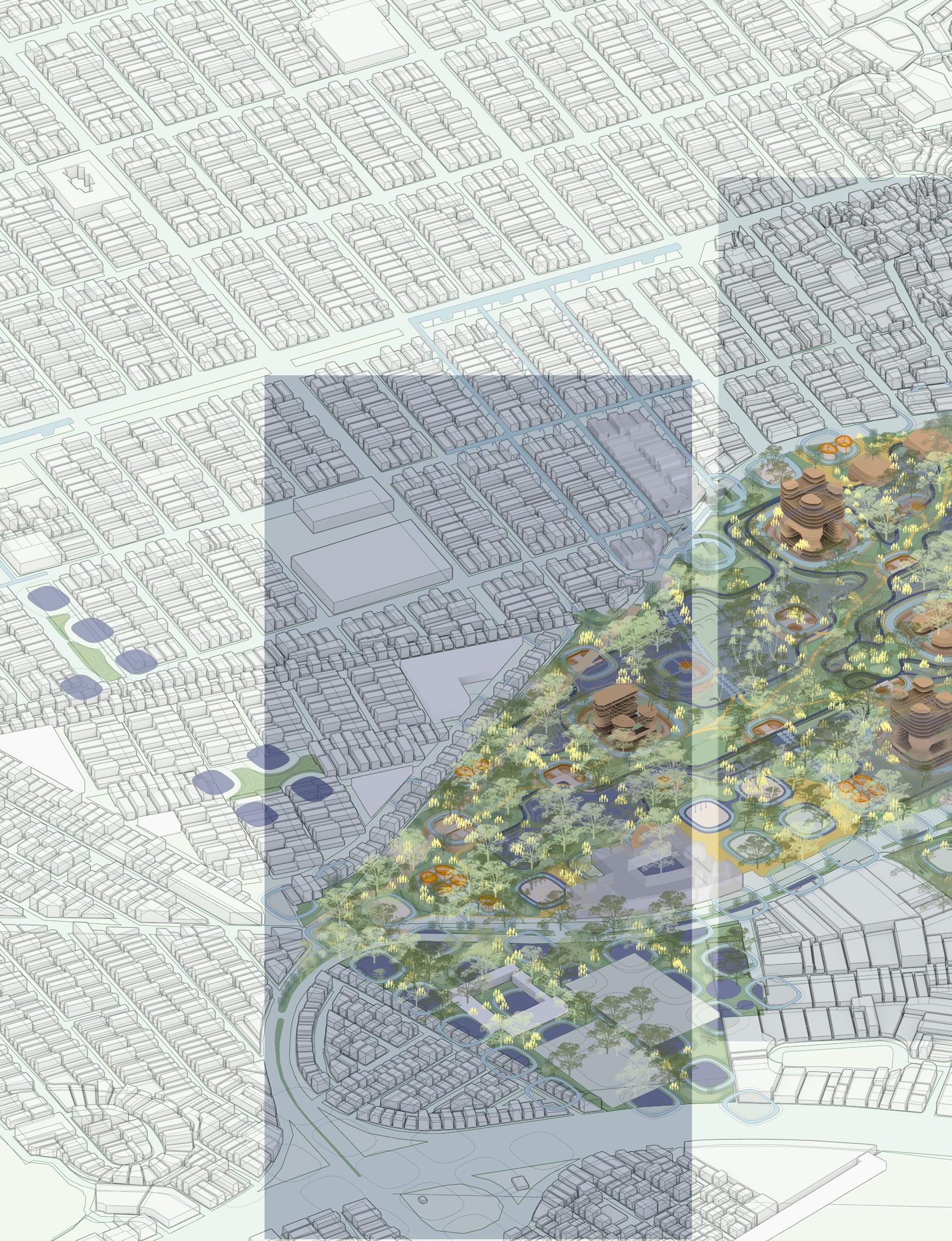
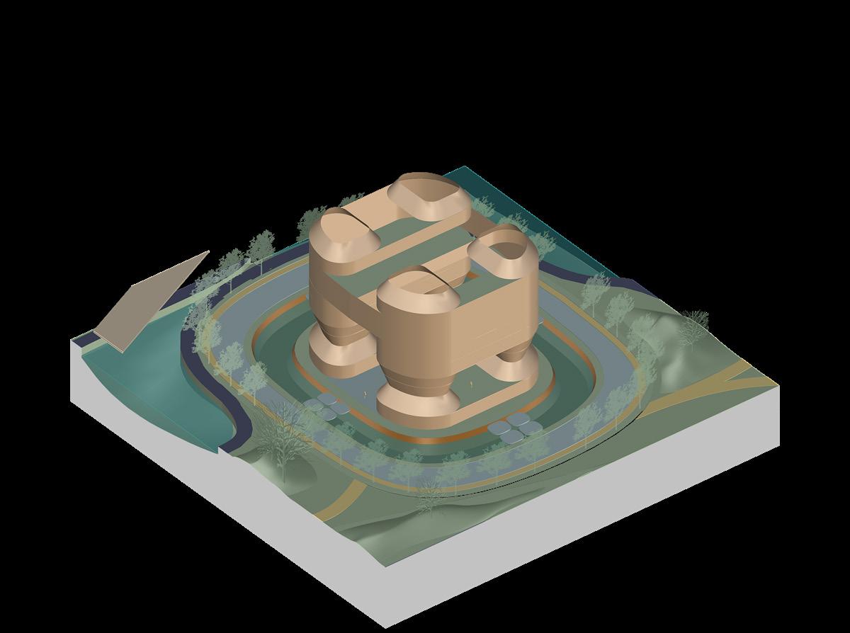
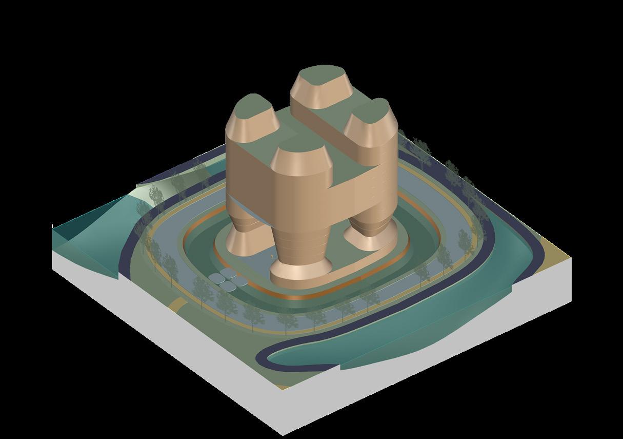
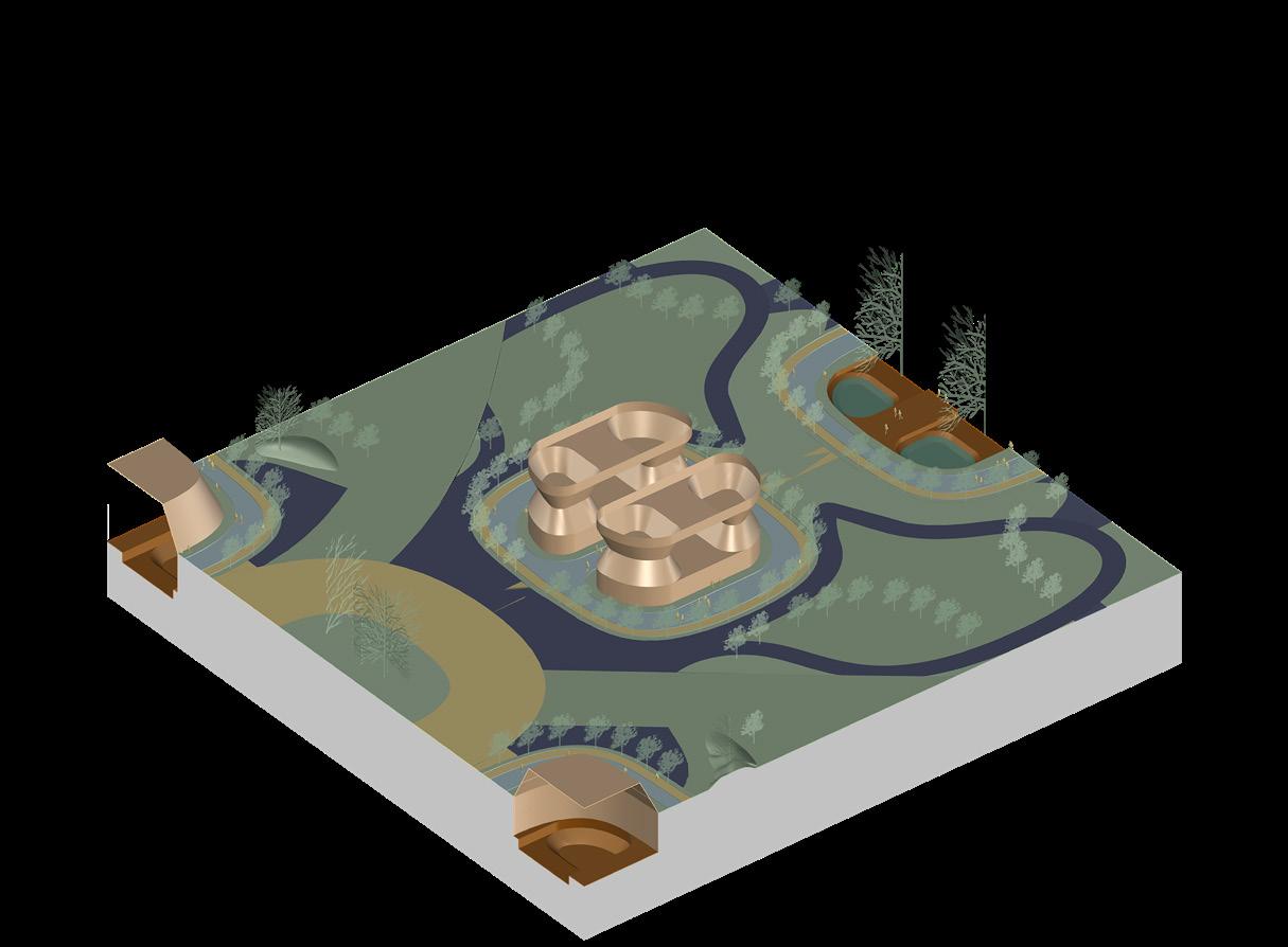
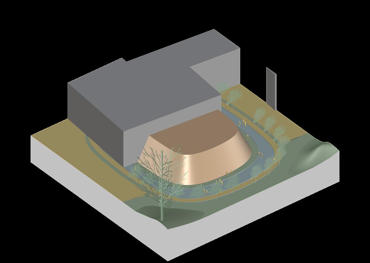
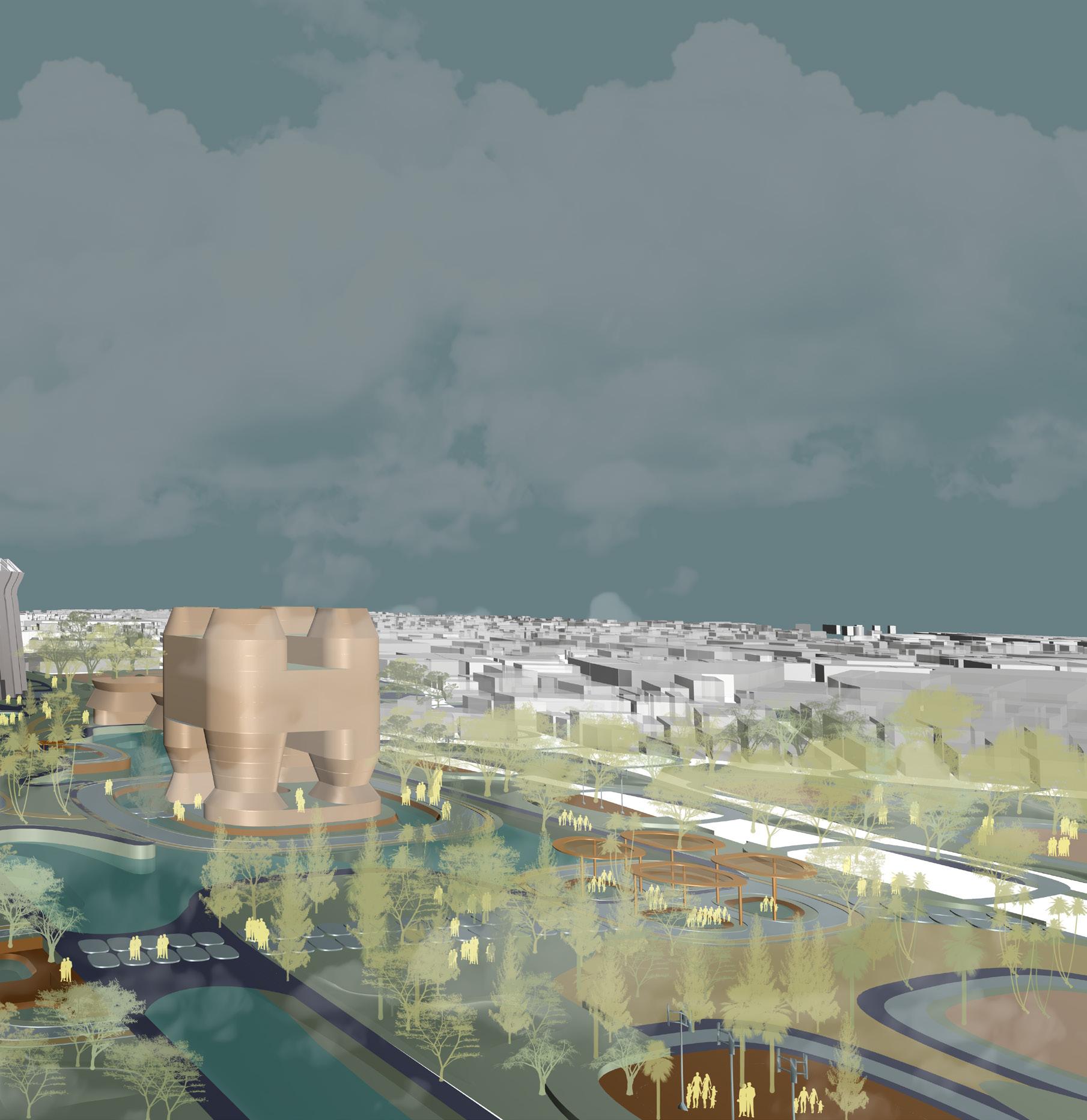
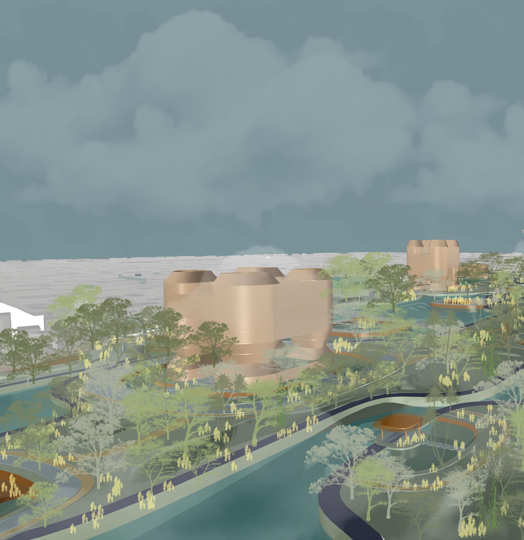
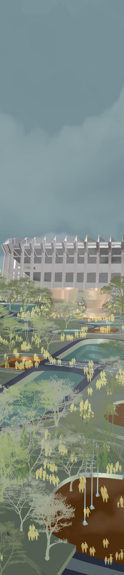
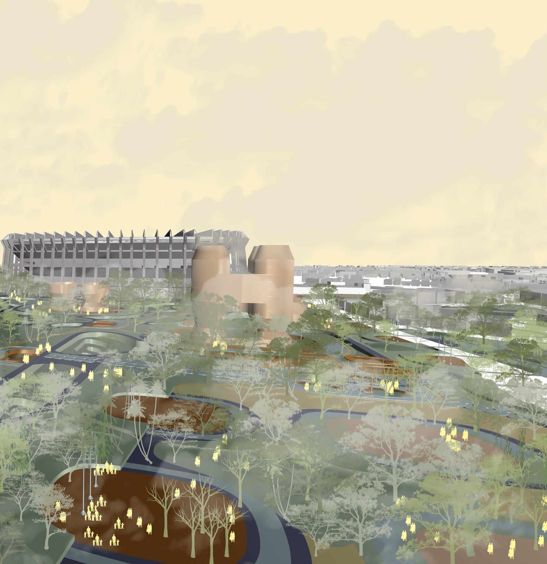
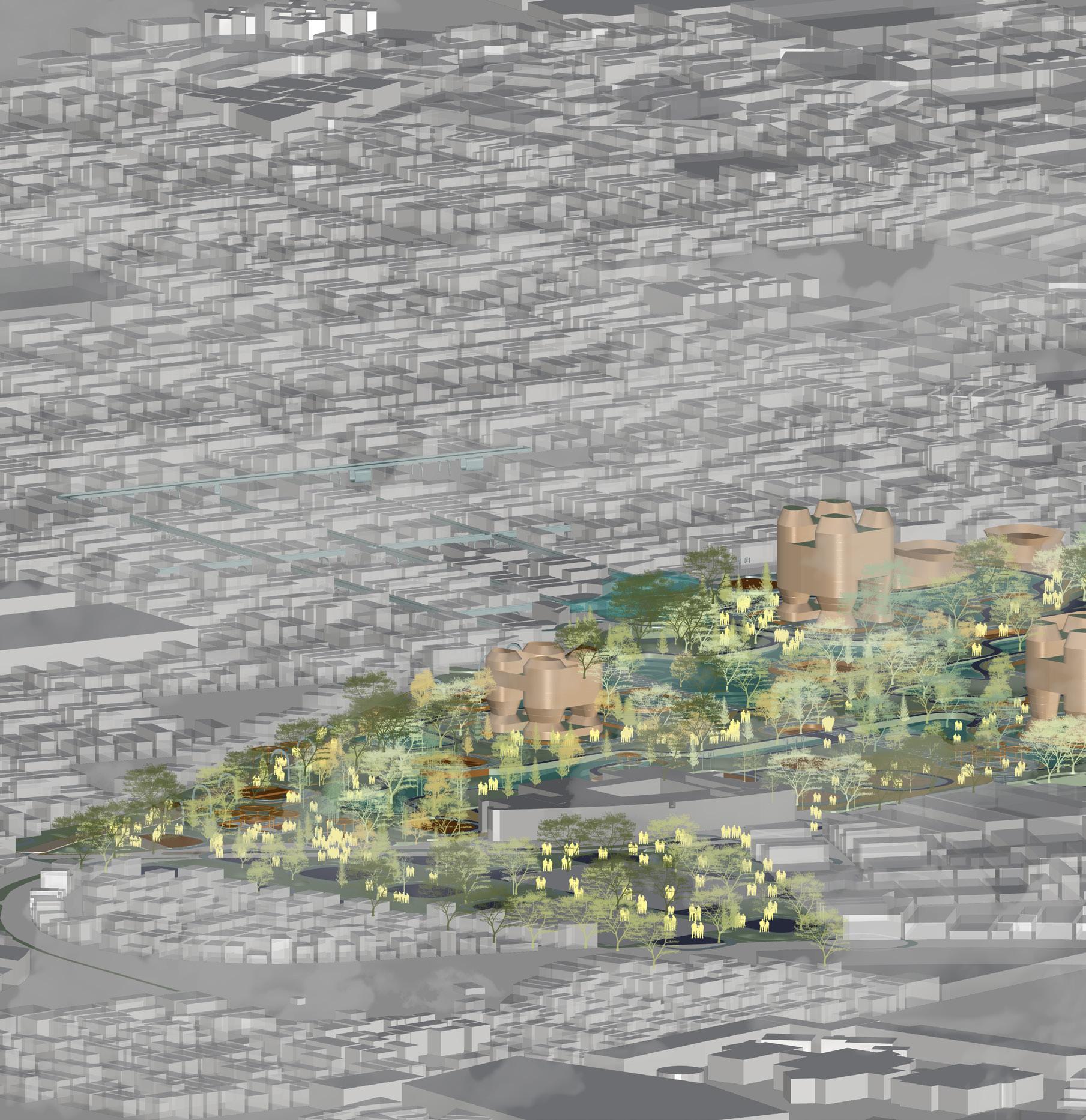
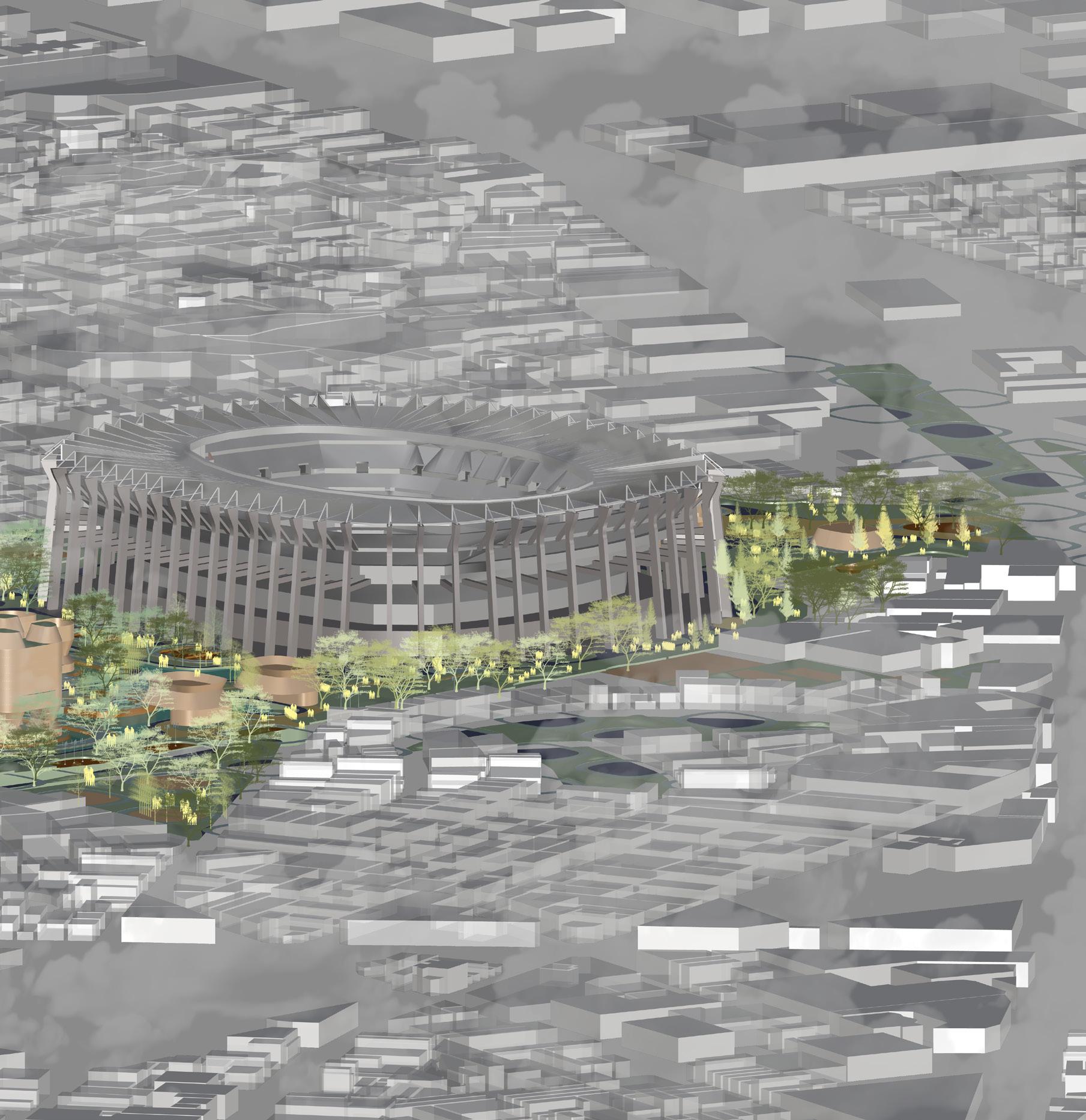
This final chapter presents the thesis project, The Living Memory, as an urban intervention in Mexico City that combines memory, risk, and adaptability into one cohesive system. Situated between past trauma and future possibilities, the design functions as a responsive urban framework. It is built not only to endure ecological challenges like earthquakes and floods but also to preserve collective memory and cultural activity at its center.
Grounded in the methodology of Acts of Urban Assembly, the project draws on the knowledge gained from three research chapters:
A. Performance-Based Layering: Designing with modular systems, solar analysis, adaptable programs, and form-to-function assemblies.
B. Urban Care: Focusing on empathy, memory, public engagement, and spatial justice.
C. Bio-Techno-Spatial Interfaces: Utilizing climate-responsive material systems and speculative infrastructures of care and communication.
Together, these components serve as analytical and generative tools for The Living Memory, an urban sponge system for a city prone to tremors.
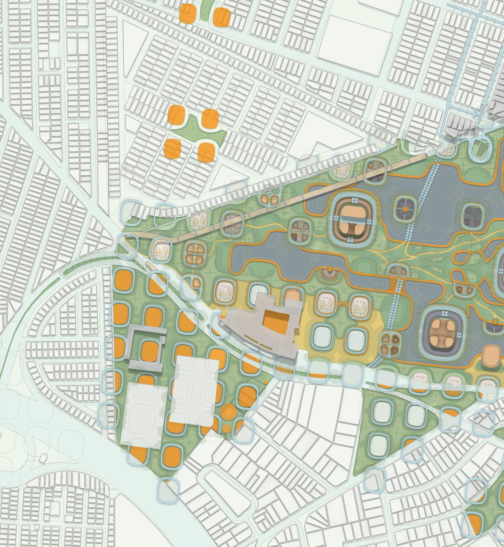
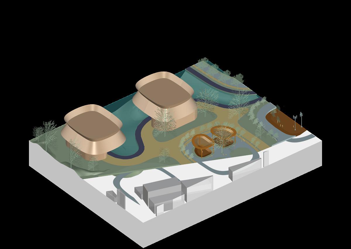
Site Synthesis Through Vulnerability and Memory
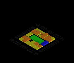
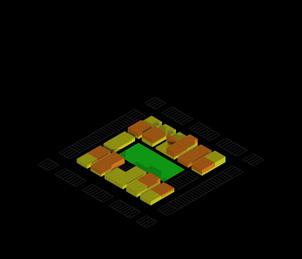
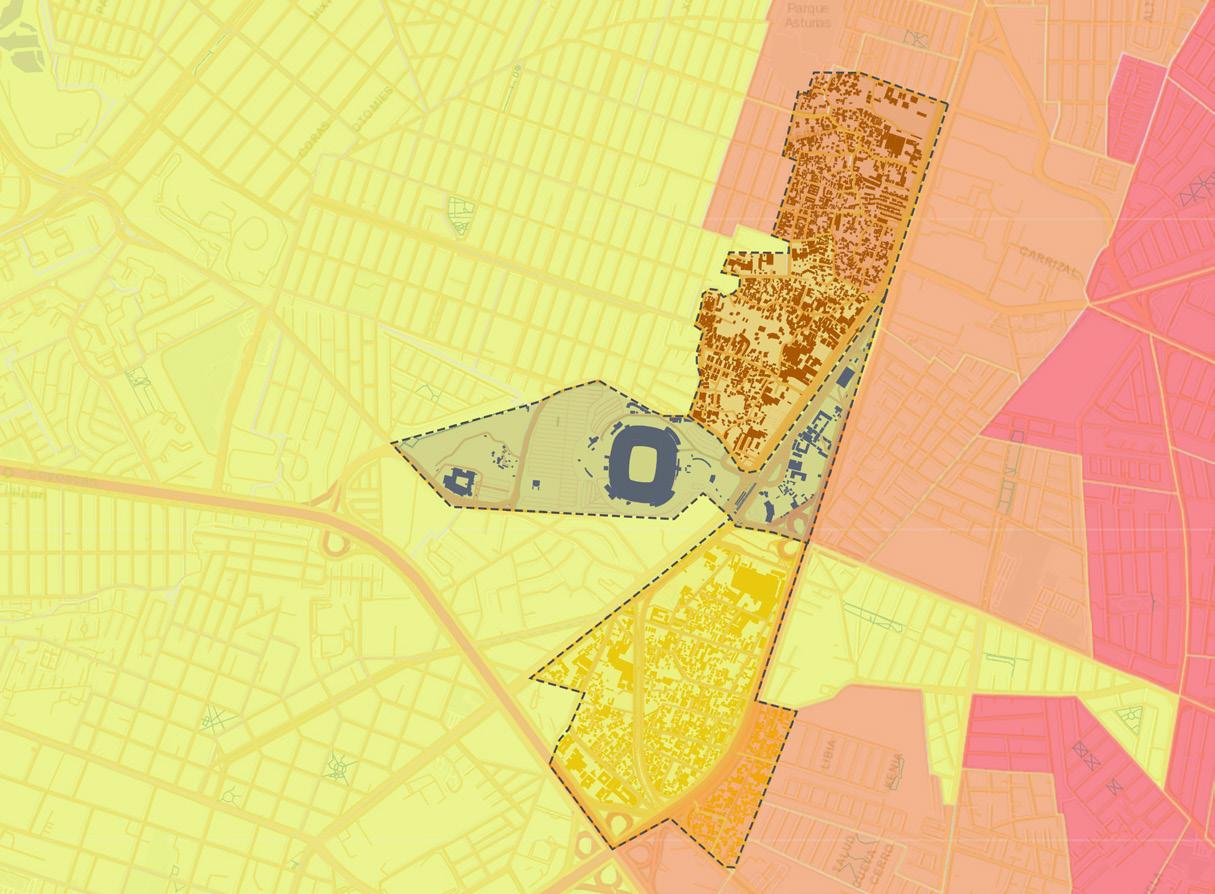
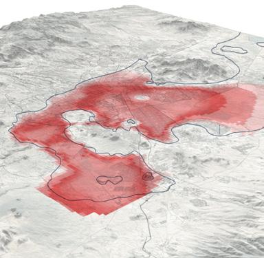
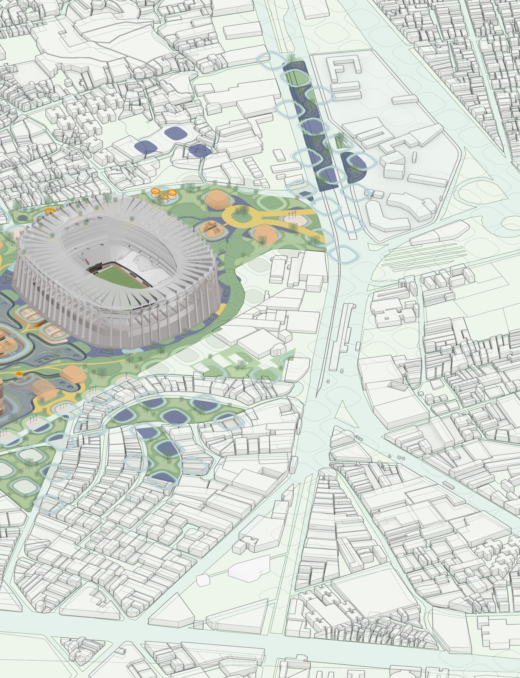
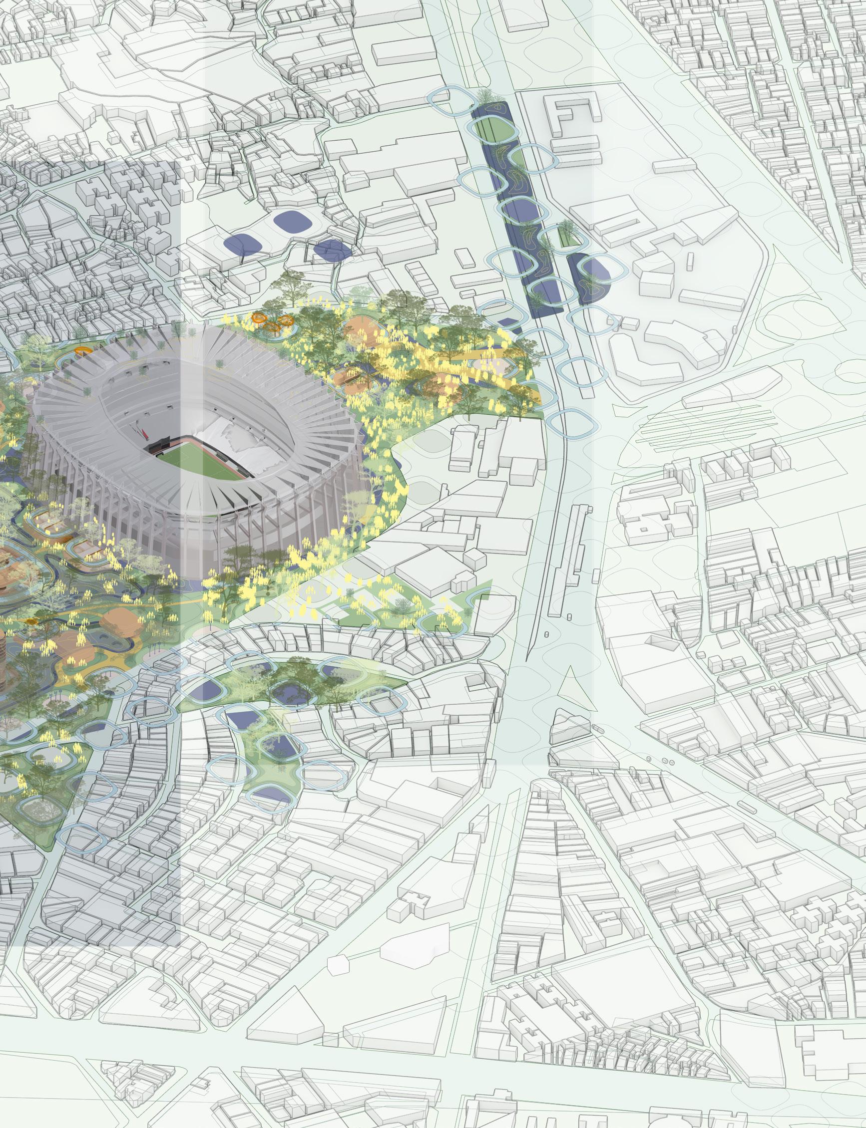
A system of concentric circles (0.5 km, 1 km, 1.5 km) was layered over the site to highlight areas where pedestrians cannot easily access. Key locations, such as the Estadio Banorte, show a significant lack of connection to housing and cultural areas. This radial grid now represents a new logic of accessibility, a guideline for future interventions. Performance-Based Layering: The concentric system acts as a base module for segmentation, overlap, and shifting gradients in the proposed design.
Figure 4.4: Land Value - Inequality Overlay
Figure 4.3: Land Use - Vulnerability Overlay
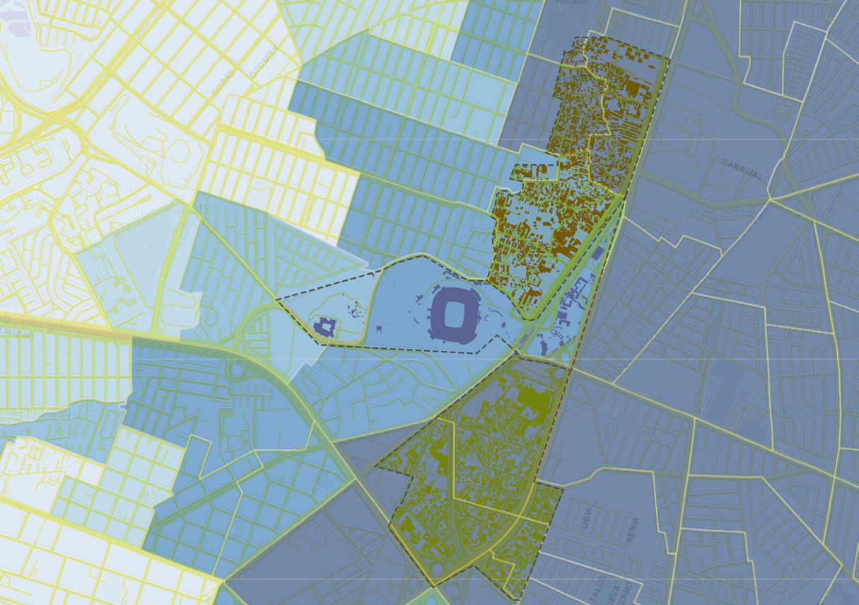
Figure 4.6: Earthquake Risk - Composite Overlay
Figure 4.5: Flood Risk - Composite Overlay
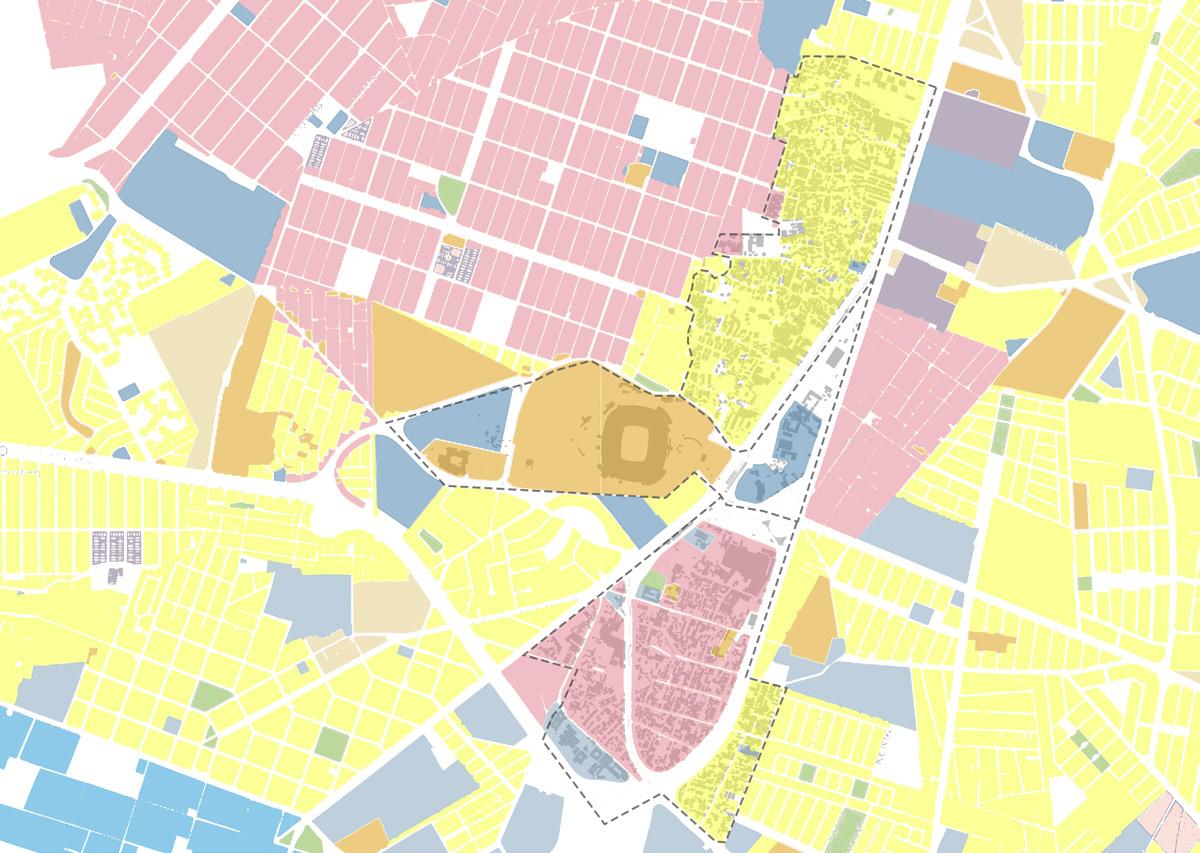
The Land Value figure shows a contradiction: high vulnerability areas often align with low land value zones, especially around Huipulco and Santa Ursula Coapa. These undervalued lands face risks of displacement and are frequently ignored in planning. Empathetic Urbanism: The thesis introduces strategic design elements into these “neglected” spaces, treating them as essential areas for creating memoryholding infrastructures.
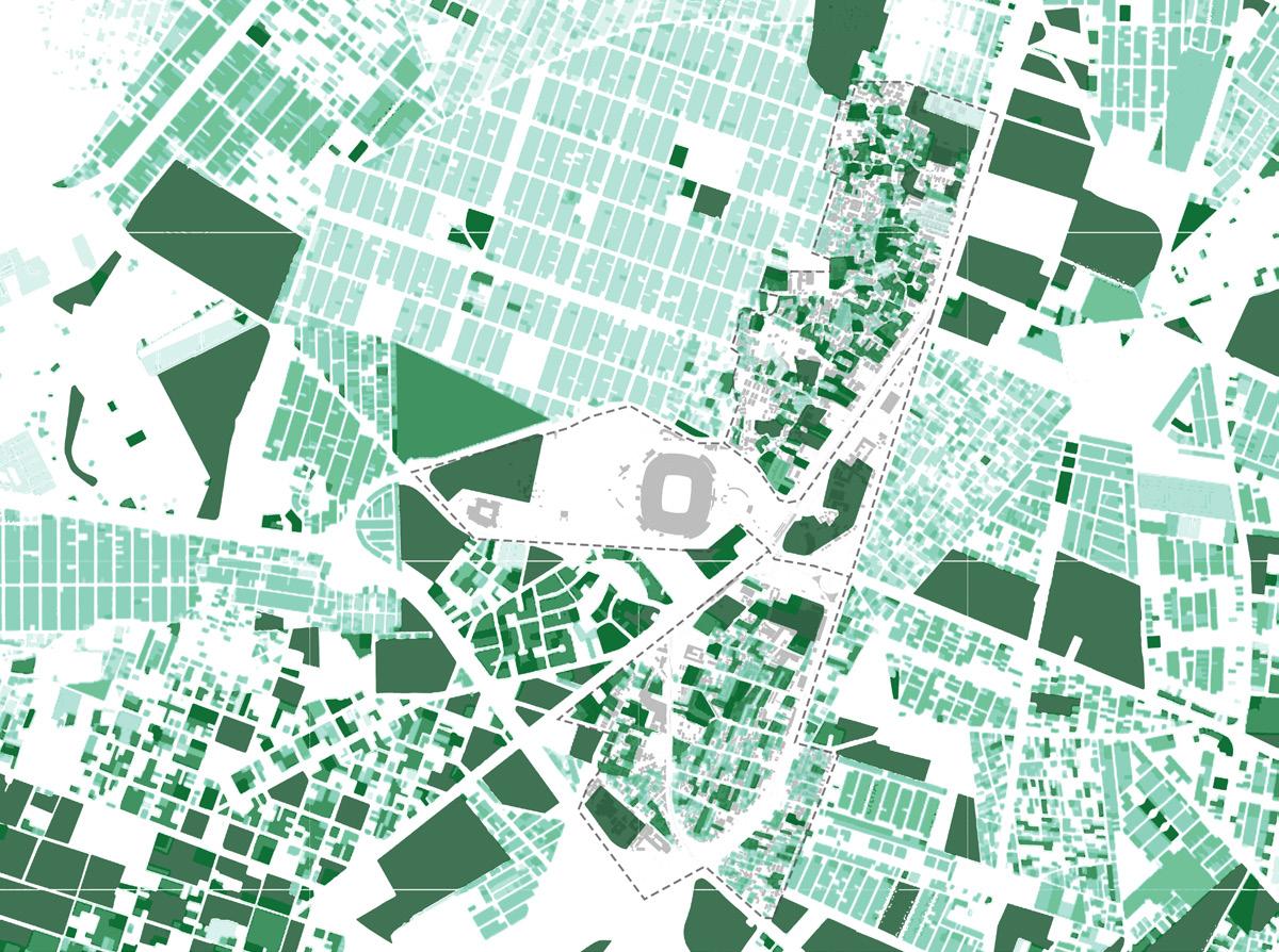
Mapping seasonal flood risks highlights how water collects from the edges of the site and gathers around built structures. Key programs, such as vendor markets and informal bus stops, are especially vulnerable. Bio-Techno Interfaces: A sponge logic is introduced with modular designs and gabion-based water-retention pods that manage water flow over time.
Earthquake Risk Overlays as a composite map shows where soft soils overlap with areas at high risk for seismic activity. Many important roads (particularly those updated in the 1980s) require upgrades to withstand shocks. Performance-Based Layering: Street infrastructures are reimagined with coffered foundations, sectional absorbers, and tensile connectors that allow for phased collapse and repair.
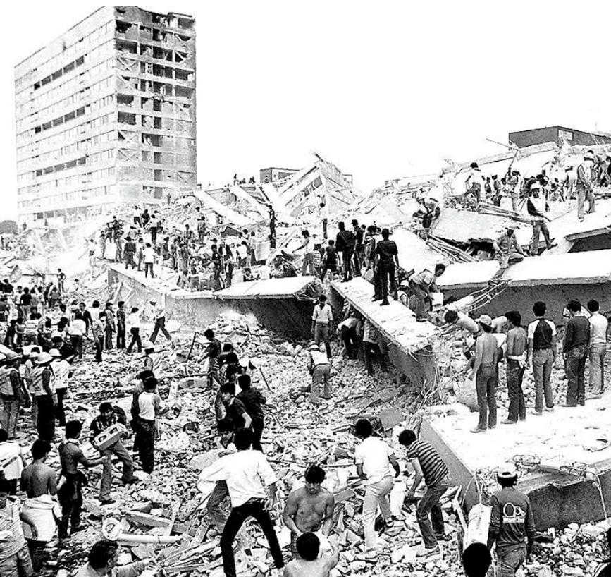
Overlaying the 1985 damage zones onto current cultural landmarks reveals overlooked trauma, memories often excluded from spatial documentation. This final map centers the design’s narrative: an urban altar that engages, remembers, and adapts. Urban Care + Memory: This forms the foundational concept of the proposal, a street that not only facilitates movement - but also retains memories.
128 The combination of land use types with vulnerability indicators (low-income housing, informal settlements, and green spaces) creates a picture of inequality. Residential areas near the stadium are particularly vulnerable and have minimal infrastructural support. Urban Care: These overlays indicate where to place new urban altars, pods, and public access paths, addressing areas of exclusion.
Figure 4.7: 1985 Earthquake Impact in Mexico City - A moment of collapse + collective memory.
This collage layers four urban moments, each marking a shift in how cities are designed, experienced, and imagined.
Figure 4.8: Cities in Transition: From Control to Culture
Cities in Transition: From Control to Culture
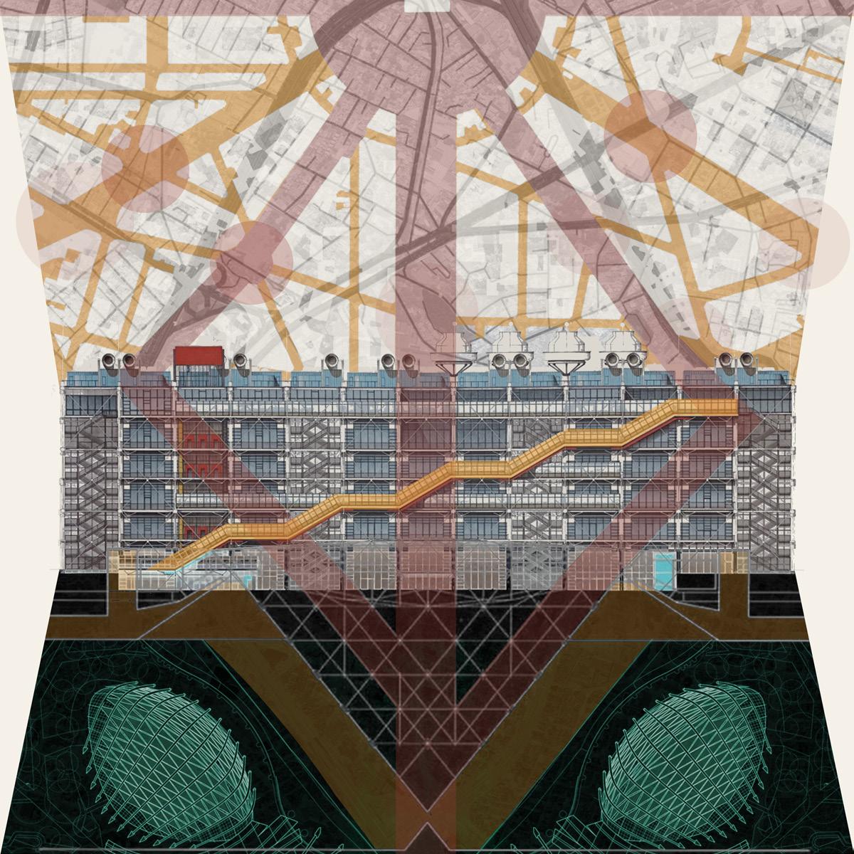
This montage represents a significant change in how we view cities. They are not just static machines for control; instead, they are complex landscapes of cultural interaction and community engagement. This piece reflects the changing ideas in urbanism. We see a shift from rigid infrastructure to flexible performance, from isolated programs to shared spaces, and from sterile governance to urban care actions.
Rooted in Performance-Based Layering, the composition mixes regulatory, infrastructural, and ecological elements into a dense network. The top layer shows circulation paths that flow from a stadium at the center of the Mexico City site. It draws from traffic, sound, water, and people in motion as expressions of urban rhythm. Below this, the building façade is cut open to show modular public spaces, galleries, kiosks, ramps, and bleachers. This creates a civic block that functions like a sponge instead of a singular monument.
Using the idea of Urban Care, the piece acknowledges various groups: informal workers, memory keepers, children, stray animals, and pilgrims are represented within the city’s logic. Architectural expression is not fixed; it unfolds through the daily life, celebrations, and crises that occur. Translucent graphic overlays reflect cycles of trauma and recovery, visible in earthquake areas and protest spaces.
Finally, in the essence of Bio-Techno-Spatial Interfaces, the drawing includes material textures, mesh, skin, and organic fills. It hints at structures that adapt to environmental changes and cultural uses. It invites viewers to understand the city not through data, but through experiences of pressure, pause, and participation.
This urban collage suggests that cities evolve beyond rigid control systems. They become places that support transition. In this setting, care is an integral part of the design. Memory is layered; it isn’t lost but created through moments and actions.
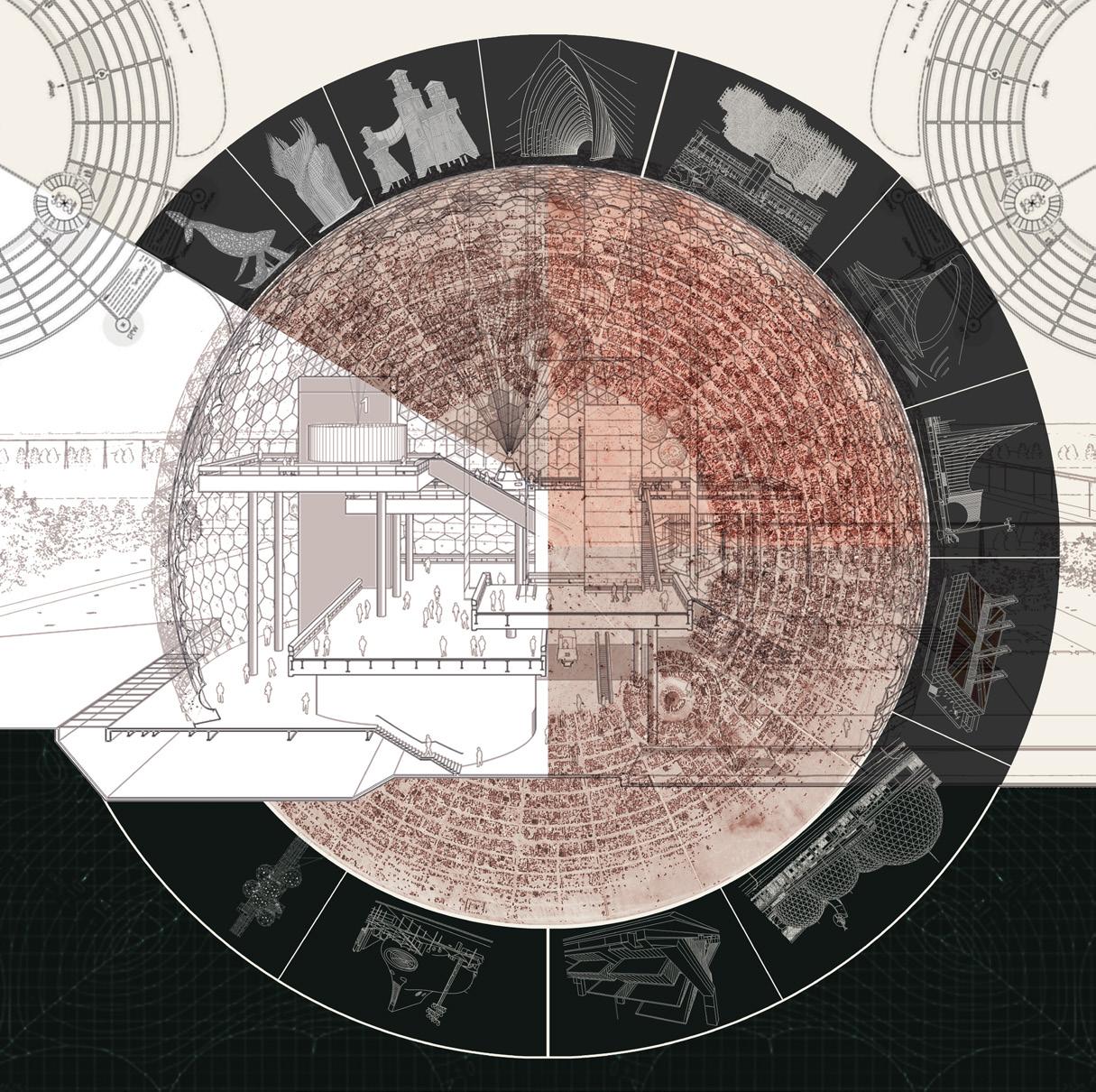
Circular Acts: A Dome of Memory, Spectacle, and Typological Time
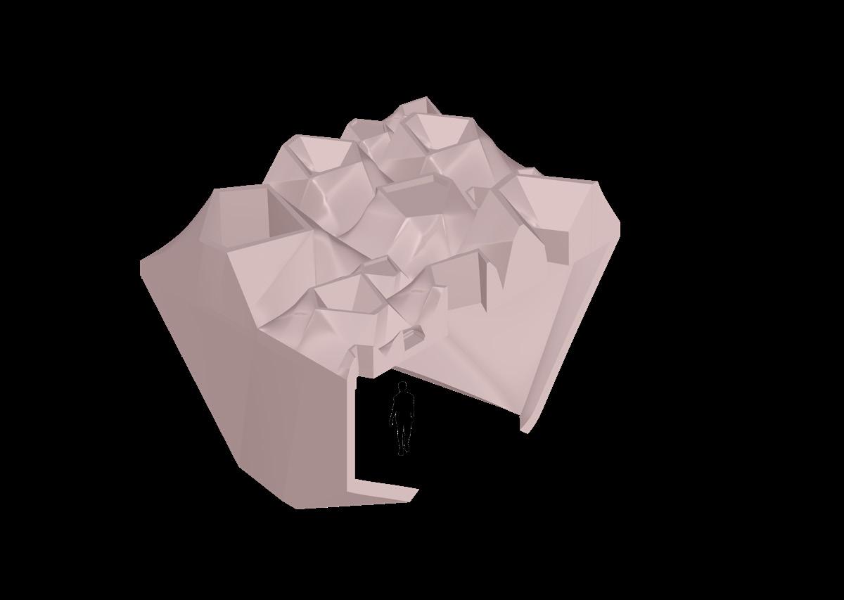
This illustration presents a speculative dome that serves as both an architectural section and a performance archive. It reflects the main ideas of the thesis: Performance-Based Layering, Urban Care, and Bio-Techno-Spatial Interfaces. This is shown through a radial design that combines time, typology, and events into one spatial system.
The left side of the dome acts as an inhabitable architectural section. It is structural, layered, and porous. It suggests a new form of civic architecture that merges tectonic flexibility with care for infrastructure. Here, the dome is not just a roof; it is an urban feature that supports both daily activities and emergency situations. Its sectional qualities provide spatial depth, encourage multi-level interaction, and create adaptable areas that can change over time.
The right side, on the other hand, transforms the dome into a circular archive. Examples, typological references, and spatial fragments spread out in concentric rings, embedding memory into its form. This setup does not follow a straight or chronological order. Instead, it suggests a cyclical, layered view of time, a design approach shaped by a collection of spatial knowledge.
Together, these halves express a dual idea: architecture as a place to live and as a space for remembering. The dome’s performative nature allows it to change through various timeframes, including flood events, community festivals, and mourning rituals, without losing its spatial integrity.
As an object, it avoids a fixed typology. As a drawing, it resists a single interpretation. This is by design: the dome represents a shared space, an infrastructure that remembers, adapts, and performs. It has the ability to respond not only to the physical conditions of Mexico City but also to the social and temporal layers that shape urban memory.
Figure 4.9: Circular Acts: A Dome of Memory, Spectacle, and Typological Time
A radial montage compresses time, type, and tectonics into a speculative dome. One half displays an inhabitable architectural section, structural, occupied, layered. The other acts as a performative archive, embedding layers of spatial memory and typological references into concentric rings Together, they form a dome not just of structure, but of stories.
Figure 4.10: Narrative Mattrix - Spectacle, Memory, and Resilience
Estadio Banorte Stadium
Coco as a narrative
Mexico City
Sunrise Spectacular Stadium
Altar of Remembrance
City of the Dead Towers inspired by Aztec City
1985 and 2017 Earthquakes
Flood Resilient Futures
City on a Lake
Narrative and Cultural Logic
This matrix of images captures the narrative and cultural ideas behind the Living Memory project. It is arranged as a 3x3 grid, serving as a speculative storyboard that connects the past and present, reality and imagination, trauma and healing.
The first row sets the scene in an urban, spectacular, and seismic context. The Estadio Banorte stadium is both a place for gathering and a symbol of change, coming to life during major events like the World Cup. Its dual nature expands in the adjacent speculative image, “Sunrise Spectacular Stadium,” which features festive lighting, crowds, and ritual movements. The last image, a seismic map of the 1985 and 2017 earthquakes, grounds the spectacle within Mexico City’s real vulnerabilities. It offers a warning lens through which to approach these events in design.
The second row explores memory, family, and cultural resilience using narrative frameworks. The Coco frame serves not as direct inspiration but as a concept to explore how memory, family, and death are celebrated and honored. It highlights continuity across generations and strength in spirit. The Altar of Remembrance continues this theme, creating a space that accommodates both mourning and celebration. The final image in this row, “Flood Resilient Futures,” connects this cultural memory with visions for the future, showing how memorial structures can also support environmental efforts.
The third row focuses on memory linked to place and design. From a bird’s-eye view of Mexico City’s fractured grid to the mythical “City on a Lake,” this row reflects on historical water systems, lost landscapes, and the city’s transformation from a floating civilization to a sprawling metropolis. The “City of the Dead Towers,” inspired by Coco’s final scene, is not a literal proposal but a design philosophy, vertical memory structures that integrate story, function, and ritual across different heights.
These images together create a design approach that is empathetic, environmentally responsive, and culturally rooted.
Programmatic Framework: Urban Assembly
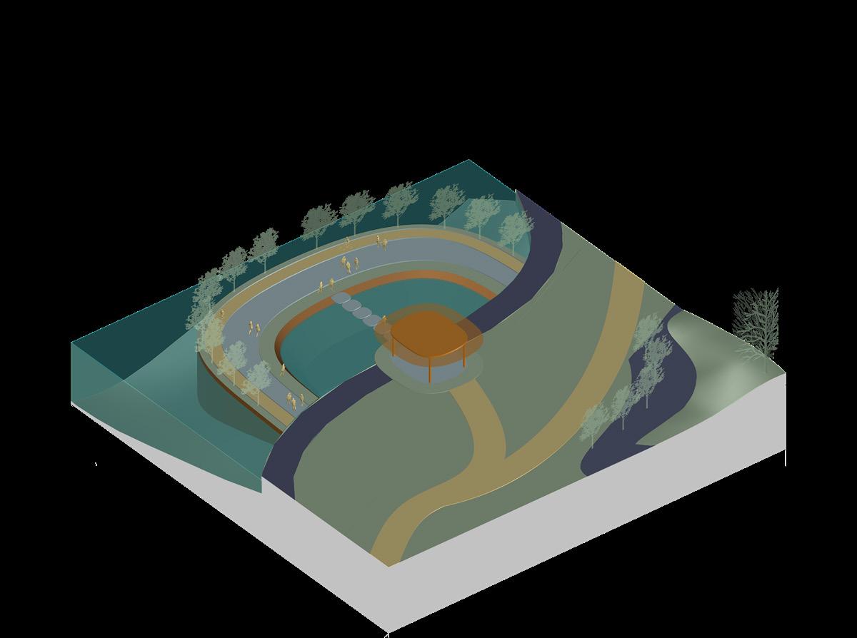
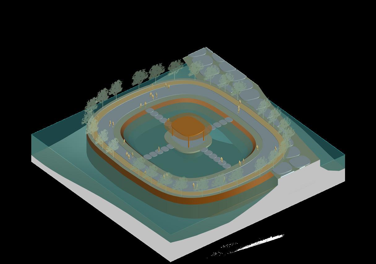
This programmatic diagram simplifies the spatial and experiential logic of the thesis into three overlapping systems: A. Sports Gateway, B. Hybrid Urban Altar, and C. Porous Flood Sponge Park. Together, they create a layered area of urban assembly where spectacle, ritual, ecology, and care connect.
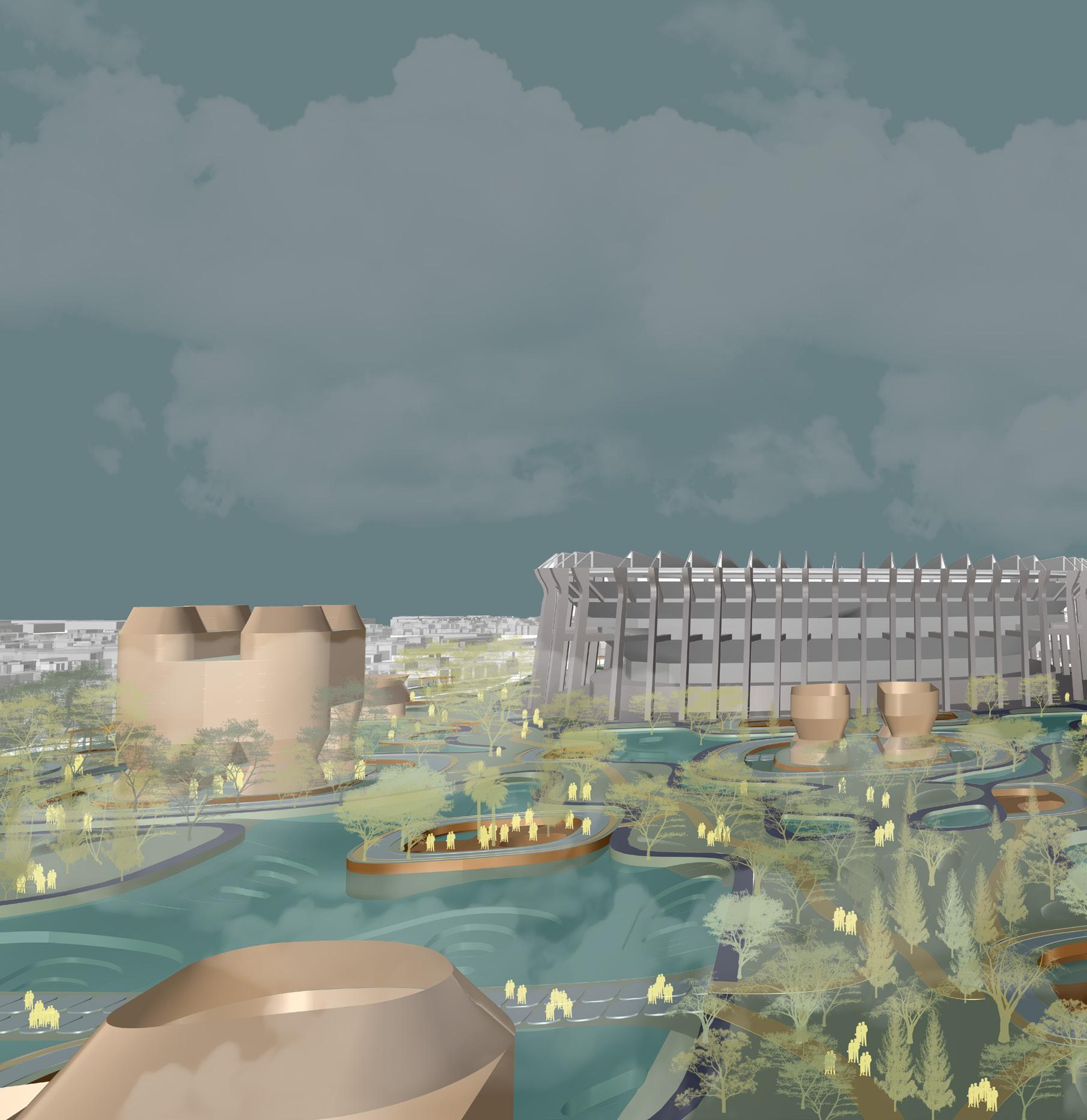
Zone A, the Sports Gateway, positions the stadium as a civic threshold and a site for performances, youth activities, and local celebrations. It hosts large events like concerts and World Cup matches, while also featuring smaller cultural programs such as the Youth Jam Pod and local performance spaces. Its purpose is rooted in spectacle and public infrastructure. The stadium becomes an active anchor; it serving as a participatory gateway to the city.
Zone B, the Hybrid Urban Altar, taps into the emotional and spiritual aspects of urban life. This space combines architectural types with memory and ritual, including ofrenda pods, community festivals, and places for quiet reflection. Open year-round, it offers continuous use beyond specific events. It makes memory a spatial act, shaping built forms and public behavior through emotional and cultural rituals. This zone becomes a performative archive of care, ritual, and memory.
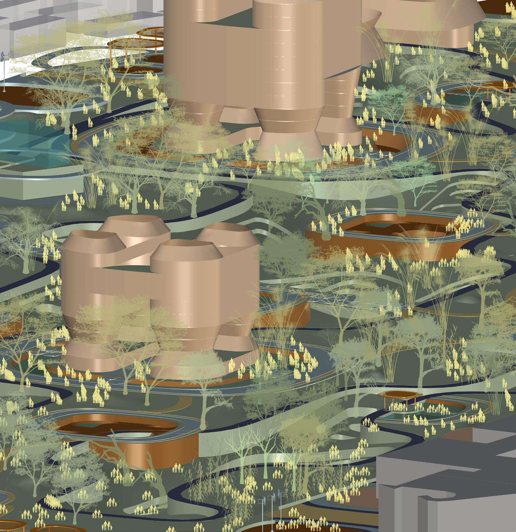
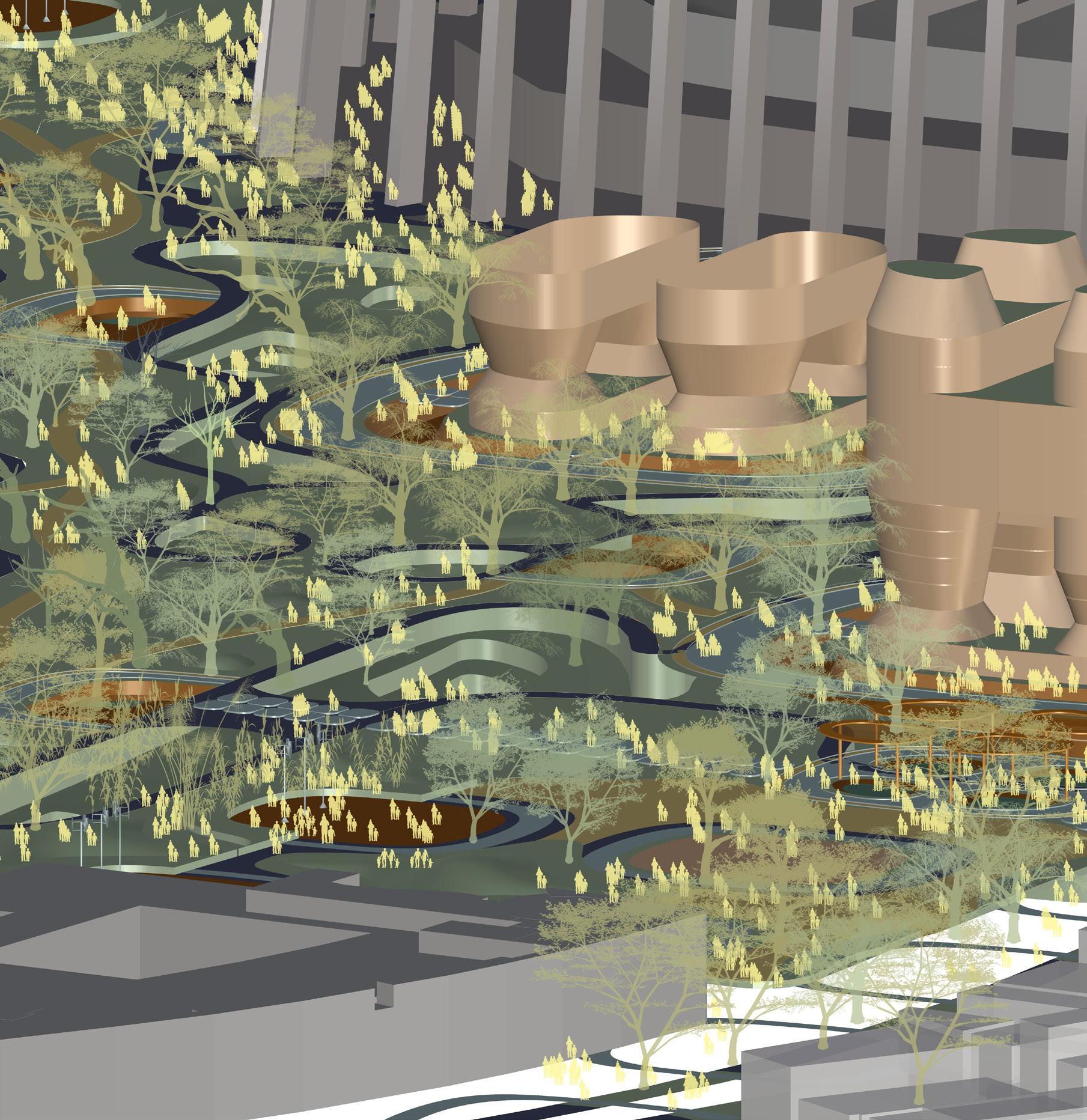
Zone C, the Porous Flood Sponge Park, acts as the link between the other two zones. Located at the crossroads of spectacle and memory, it highlights ecological resilience. Sponge decks, edible landscapes, and water-responsive surfaces create a constantly changing space that balances civic use with environmental needs.
Across the three zones, key features such as markets, eateries, transitional decks, play areas, and spaces for exchange are mixed in to create a lively and inclusive urban area. The diagram is not a fixed master plan. It is a space where memory, ecology, and participation overlap and co-evolve as layered systems.
Youth Jam Pods
Positions Stadium as Civic Threshold
Local Cuisine: Taste of Mexican Food
Eatery: Occupation for the Local
A Sports Gateway
Spectacle + Public Infrastructure
Ecological Resilience
CEvents and Performances
Economic Exchange: Tourism
Play on the Land: On the Intervention Engagement + Exchange: Local + Foreign
Transition Shock Open All Year
Porous Flood Sponge Park
Memory + Ecologiocal Care
Play on the Edge: Public Gathering Pockets
Sponge Decks
Hybrid Typology Overlaying Ritual
Memory
B Hybrid Urban Altar
Point of Relaxation + Meditation
Community Market
Emotional Boundary
Ofrenda Pods
Festivals and Rituals Space for Emotions Ritual Bridge
Figure 4.11: Programmatic Framework
ASports Gateway
Event Driven + High-peak Revenue
Match-Day Concessions
Job and Economic Opportunity
Cafe Kitchen and Cafeteria
Revenue to Sustain Sponge + Pod Systems
Maintenance
Porous Flood Sponge Park
B
Hybrid Urban Altar C
Daily Revenue + Cultural Memory
Market Pods
Ticketed Small Revenue
Sponge-Garden Tours
During the Night
Open Movie Complex
138 Figure 4.12: Operational Ecology - Revenue, Ritual, and Resilience
Non-revenue + Symbolic + Cultural
Ritual Pods
Local Artist Platform
Art Exhibition Space
In-kind Value
Urban Farming Units
During the Day
Farming Workshops
Operational Flow: Revenue, Ritual, Resilience
This diagram outlines the operational logic and economic ecology of the proposal through a mix of revenue-generating and non-revenue-generating urban systems. It highlights the financial strategies that support daily functioning and enhance cultural, ecological, and symbolic urban gestures.
Zone A: Sports Gateway is a high-peak, event-driven revenue generator. Matchday concessions and temporary food and beverage stalls respond to large crowds, generating seasonal employment and activating public infrastructure. These spectacle moments create income that indirectly helps with infrastructure maintenance and public space programming.
Zone C: Porous Flood Sponge Park connects the commercial and cultural. Market pods serve daily visitors and support local vendors, food artisans, and seasonal events. Ticketed sponge-garden tours generate modest but steady revenue while inviting educational and ecological stories for tourists and residents. Evening programs like the open movie complex activate the park during off-peak hours, attracting consistent foot traffic and funding maintenance systems, pod upkeep, and landscaping services.
The cafe kitchen and cafeteria, located across the zones, provide food access and jobs while linking economic and symbolic layers of the intervention. It acts as a social hub for the local community.
Zone B: Hybrid Urban Altar is intentionally non-commercial. It offers altars, ritual pods, and art exhibition spaces that hold symbolic and cultural value. These areas do not generate revenue but provide benefits in identity, memory, and public care. Programs like urban farming units and workshops introduce exchanges in kind, education, food security, and cultural continuity. This creates a slower urban economy, one grounded in sustenance, stewardship, and shared cultural value.
Together, these zones show how a city can thrive through multiple timing patterns, peak and off-peak, commercial and communal, without commodifying every space.
Figure 4.13: Zone Logic Plan for Urban Intervention
4.14: Spatial Layering and Deployment
Figure
Memory Path
Water-Retention Garden
Figure 4.15: Phasing + Event Activation
Floods
Hybrid Green Civic Reservoir
Sponge Park Trail
Urban Farming Pods
Flooded Game Day
Game Day
Street Theater
146 Figure 4.16.2: Edge 2 - Inhalling Urban Life
Figure 4.16.1: Edge 1 - Breathing Out Greens
Figure 4.16.4: Edge 4 - Absorbing via Median Sponges
Figure 4.16.3: Edge 3 - Opening Into a Pedestrian Refuge
148 Figure 4.17.2: Green Pod 2 - Pause and Play
Figure 4.17.1: Green Pod 1 - Everyday Market Pavilion
Figure 4.18.2: Water Pod 2 - Sunken Gabion Nest
Figure 4.18.1: Water Pod 1 - Sponge Island
Figure 4.19.1: Built 1 - Edge Parking Infrastructure with Integrated Flood Buffering
150 Figure 4.19.2: Built 2 - Hybrid Urban Cluster for Daily and Shock-Time Use
4.19.3: Built 3 - Hybrid Green Civic Reservoir for Gathering and Storage
4.19.4: Built 4 - Entry Pavilion for Event Transitions
Figure
Figure
Figure 4.20.2: Porous Sponge Landscape Carved into the Hospital Edge
Figure 4.20.1: Semi-Open Greenhouse Extension to Existing Hospital Infrastructure
Built and Landscape Typologies: Systems and Material Memory
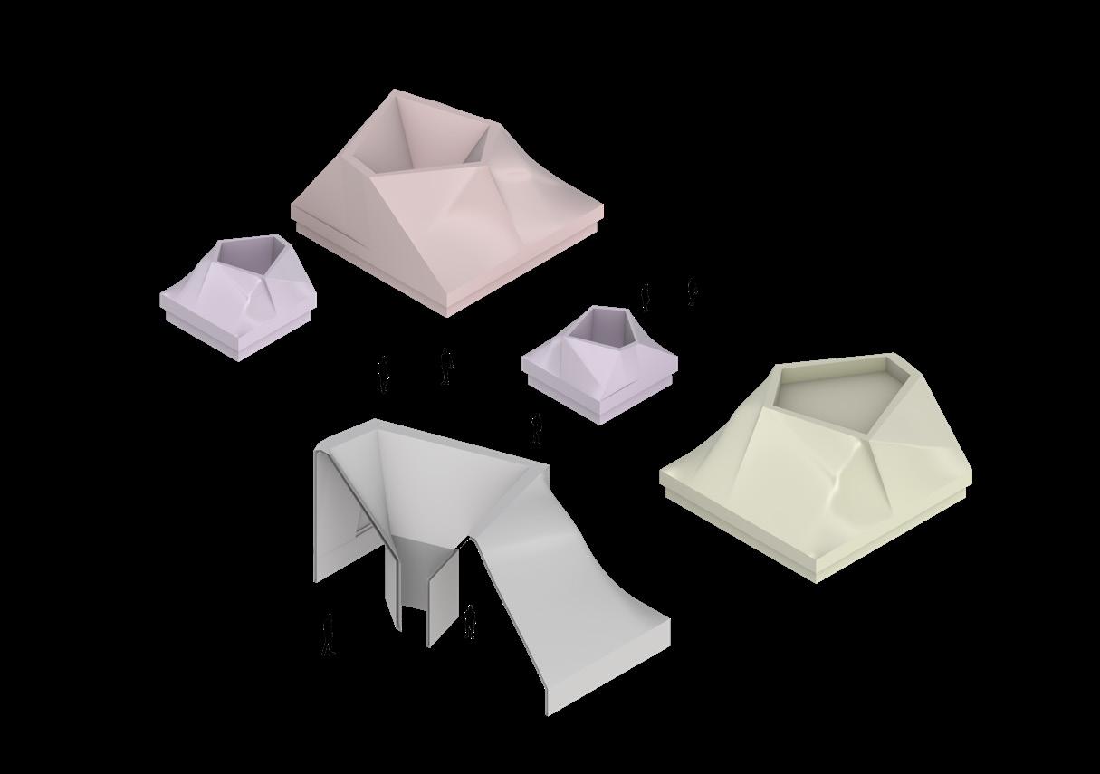
These spreads explores a collection of evolving types based on the fundamental ideas of material memory and spatial layering. The built types (Figure 4.19) test hybrid modular units set within layered, sponge-like shapes. These forms react to event programming, water storage potential, and spatial changes, creating nested envelopes that reflect density, porosity, and embedded rituals.
The landscape types (Figure 4.17 and 4.18) express various ground conditions, such as wetland rings, sunken plazas, and performance areas. Each landscape shape relates to a specific memory function, from collective gatherings to quiet reflection. These topographic layers also show ecological strategies, capturing, absorbing, and redistributing water while shaping human presence.
Together, these two sets of types create a spatial toolkit that is flexible, strong, and grounded in both climate awareness and cultural storytelling. They act as building blocks for the larger urban system proposed in The Living Memory.
Figure 4.21: Game Day - Activated Public Grounds
Refuge Pod Level 1 Check-in
Figure 4.22: Extreme Rain and Flood Event
Do not enter submerged paths!
Emergency Access Route!
This garden stores storms!
Figure 4.23: Dual Scenario - Flooded Terrain Meets Game Day
Market Pods Activate at 10AM!
Walk. Pause. Absorb.
160 Figure 4.24: The Urban Altar Landscape in Context
Spreading the Sponge: A Living Urban Logic
This grid is more than a pattern of pods and paths. It is an urban breathing system that is alive, adaptable, and responsive to both the everyday and the exceptional. From the center of the site to the edges of the city, the sponge carries memory, ritual, and livelihood. It is a system that listens rather than dominates, that responds rather than fixes.
Each cell offers a possibility: a marketplace, a ritual gathering, a flood-absorbing garden, a shared table. Together, they suggest a city shaped not only by zoning but by shared moments, seasonal rhythms, and collective memory. The grid here is not just spatial; it’s emotional. It holds lightness and weight, urgency and pause.
This is a condition that can shift scale, from a single neighborhood edge to a citywide strategy. It carries a rhythm that can be interpreted differently by architects, farmers, children, and elders. Its strength lies in this very flexibility, in its ability to invite participation and evolve.
For me, this project marks the end of one chapter and the start of a new approach. It offers a way of thinking, designing, and organizing space through softness rather than rigidity. It prioritizes care over control and memory over mere metrics.
In a world that feels increasingly fractured, this grid provides a way for me to gather, layer, listen, and start anew, wherever the next site may be.
This is how I now envision urbanism: not as a monument to permanence, but as a living collection of stories that is porous, temporary, and quietly radical.
Latour, Bruno. Down to Earth: Politics in the New Climatic Regime. Cambridge: Polity Press, 2018.
de Urbanisten. Urban Water Buffer Project Reports and Diagrams. Rotterdam: Urbanisten Studio, 2019.
de Urbanisten. Water Squares. Urbanisten.nl. Accessed June 2025. https://www.urbanisten.nl/wp/projects/water-plein/
Price, Cedric. Re: CP. Edited by Hans Ulrich Obrist. Basel: Birkhauser, 2003.
Price, Cedric. Re: CP. The Cedric Price Retrospective. Edited by Samantha Hardingham. London: Architectural Association Publications, 2016.
Libeskind, Daniel. Chamber Works: Architectural Meditations on Themes from Heraclitus. London: Architectural Association, 1983.
Libeskind, Daniel. The Space of Encounter. London: Thames & Hudson, 2001.
UNStudio. Responsive Environments. UNStudio.com. Accessed June 2025. https://www.unstudio.com/
Tschumi, Bernard. Event-Cities. Cambridge: MIT Press, 1994.
Al Baha Towers. Aedas Architects. Al Bahar Towers – Responsive Facade System. Aedas.com. Accessed June 2025. https://www.aedas.com/
Lebbeus Woods. Radical Reconstruction. New York: Princeton Architectural Press, 1997.
Kallipoliti, Lydia. The Architecture of Closed Worlds. New York: Lars Muller Publishers, 2018.
Kurgan, Laura. Close Up at a Distance: Mapping, Technology, and Politics. New York: Zone Books, 2013.
Dogma. Aureli, Pier Vittorio. The Project of Autonomy: Politics and Architecture Within and Against Capitalism. New York: Princeton Architectural Press, 2008.
Dogma (Pier Vittorio Aureli and Martino Tattara). The Room of One’s Own: Domestic Architecture and the Public Sphere. Berlin: Sternberg Press, 2021.
de Urbanisten. “The Water Squares Project, Rotterdam.” www.urbanisten.nl, Accessed July 28, 2025.
Elemental. Incremental Housing and Participatory Design Manual. Hatje Cantz, 2016.
OMA. “OMA Projects: Parc de la Villette, CCTV Headquarters, MoMA PS1.” oma.eu, Accessed July 27, 2025.
Dogma. “Research on Domestic Space.” dogma.name, Accessed July 25, 2025.
Aravena, Alejandro. My Position Will Be Disputed. Lars Muller Publishers, 2023.
Kallipoliti, Lydia. The Architecture of Closed Worlds: Or, What Is the Power of Shit? Lars Muller Publishers, 2018.
Zhang, James. “Computational Thinking in Architecture: Human-Machine Interfaces.” Columbia GSAPP Thesis, 2023.
McMorrough, John. Notes on the Block. In Log 50: Model Behavior, edited by Cynthia Davidson. New York: Anyone Corporation, 2020.
Anderson, Jeffrey. Architectural Mediums: Form to Function, Fall 2024. Studio materials. Pratt Institute.
Tahinos, Alex, and Schoenenberger, Erich Urban Design Studio: Spectacle and Shock Fields, Summer 2025. Pratt Institute.
Adjoubel, Xenia. Culminating Research Project, Summer 2025. Research guidance. Pratt Institute.
Po-Yao Wang. Digital Fabrication in Architecture, Summer 2025. Pratt Institute.
Sakpal, Falguni, Prajapati, Bhavya, and Patil, Mithila Sunil. BioHue: Climatic Response through Bio-Technology and Hybrid Habitats. Columbia Dietrich Lab Collaboration. Hybrid Habitats Studio, Spring 2025. Digital.
Columbia University Dietrich Lab. “Bacterial Coloration Research.” Accessed June 2025. https://www.dietrichlab.columbia.edu
Figure 3.1: The Block Commons: A Regenerative Urban Engine; The Rise of New Urban Block
Figure 3.2.1: Theories of Urban Blocks
Figure 3.2.2: Theories of Urban Blocks
Figure 3A.1: The Mosaic: Connecting Legacy + Innovation + Community
Figure 3A.1.1: Hybridization of the Theory Blocks
Figure 3A.1.2: The Block Commons
Figure 3A.1.3: Axon Section
Figure 3A.1.4: Programmatic Zoning
Figure 3A.1.5: Axon Section with Programmatic Zoning
Figure 3A.1.6: North to South Elevation with Programmatic Zoning
Figure 3A.1.7: Sun Radiation Analysis. Left: block embedded as a speculative urban context and Right: block integrated within existing Manhattan fabric
Figure 3A.1.8: AI-Generated Visuals. Left: block embedded as a speculative urban context and Right: block integrated within existing Manhattan fabric
Figure 3A.2.1: Driver A: Adaptive Daylighting
Figure 3A.2.2: Driver B: View Access and Energy Efficiency
Figure 3A.2.3: Section
Figure 3A.2.4: Before and After Mediation. Left: Northwest and Right: Southeast
Figure 3A.3.1: Site Impressions
Figure 3A.3.2: Driver A: Urban Infrastructure
Figure 3A.3.3: Driver B: Socio-Economic Trends
Figure 3A.3.4: Driver C: Environmental Policies
Figure 3A.3.5: Contextual Inflections
Figure 3A.3.6: Vertical Connectivity
Figure 3A.3.7: Stitching the Mosaic
Figure 3A.3.8: Section A through Community and IT Canvas
Figure 3A.3.9: Section C through Central Green-Belt at Community and Maritime Canvas
Figure 3A.3.10: Section B through IT and Maritime Canvas
Figure 3A.3.11: Site Plan
Figure 3A.3.12: Part B: Maritime Canvas
Figure 3A.3.13: Part C: Sub-Stitches
Figure 3A.3.14: Part A: Community and IT Canvas
Figure 3B: Zabbaleen Garbage City, Cairo
Figure 3B.1: The Timeline Project by Mauricio Delfin, Data Through Design a.k.a. DXD at BRIC
Figure 3B.2: 250 X 250 X 900 MM Physical Model for The Gowanus Body
Figure 3C: Form Finding. BioHue: Climatic Response through Bio-Technology and Hybrid Habitats
Figure 3C.1: Initial Nest Patterns
Figure 3C.2: Module Composition
Figure 3C.3.1: Spring - Represents growth, renewal, and awakening of bacterial cultures. Warm yellow hues emerge as microbes actively spread and adapt to the environment.
Figure 3C.3.2: Summer - Peak metabolic activity as bacteria thrive under warm conditions. Peach tones enhance heat absorption and indicate optimal growth.
Figure 3C.3.3: Autumn - Transition into dormancy as bacterial colonies adjust to cooling temperatures. Pink hues signify nutrient recycling and microbial adaptation before hibernation.
Figure 3C.3.4: Winter - Dormant phase where bacterial metabolism slows. Lavendergray hues reflect resilience and biological conservation during minimal activity.
Figure 3C.4: Bacteria growth on the module at Dietrich Lab, Columbia University, NYC
Figure 3C.5.1: The Rann of Kutch, Gujarat’s desert region, experiences scorching daytime heat (up to 45°C) and much cooler nights. The desert has low humidity, minimal rainfall, and saline soil.
Figure 3C.5.2: The community will gain access to a climate-responsive, lowcost building module suited to their environment createing local jobs hands-on participation and skill building.
Figure 3C.6.1: Module as a Roofing Element
Figure 3C.6.2: Module as a Facade Element A
Figure 3C.6.3: Community of Modules as Building Itself
Figure 3C.6.4: Module as a Facade Element B
Figure 4.1: Spatial Deployment of the Urban Altar within the Memory Grid
Figure 4.2: Accessibility and Connectivity to the site - Concentric radius lines (0.5 km, 1 km, etc.) effectively show how many parts of the site fall outside easy walking distance to major nodes.
Figure 4.3: Land Use - Vulnerability Overlay
Figure 4.4: Land Value - Inequality Overlay
Figure 4.5: Flood Risk - Composite Overlay
Figure 4.6: Earthquake Risk - Composite Overlay
Figure 4.7: 1985 Earthquake Impact in Mexico City - A moment of collapse + collective memory
Figure 4.8: Cities in Transition: From Control to Culture
This collage layers four urban moments, each marking a shift in how cities are designed, experienced, and imagined.
Figure 4.9: Circular Acts: A Dome of Memory, Spectacle, and Typological Time
A radial montage compresses time, type, and tectonics into a speculative dome. One half displays an inhabitable architectural section, structural, occupied, layered. The other acts as a performative archive, embedding layers of spatial memory and typological references into concentric rings. Together, they form a dome not just of structure, but of stories.
Figure 4.10: Narrative Mattrix - Spectacle, Memory, and Resilience
Figure 4.11: Programmatic Framework
Figure 4.12: Operational Ecology - Revenue, Ritual, and Resilience
Figure 4.13: Zone Logic Plan for Urban Intervention
Figure 4.14: Spatial Layering and Deployment
Figure 4.15: Phasing + Event Activation
Figure 4.16.1: Edge 1 - Breathing Out Greens
Figure 4.16.2: Edge 2 - Inhalling Urban Life
Figure 4.16.3: Edge 3 - Opening Into a Pedestrian Refuge
Figure 4.16.4: Edge 4 - Absorbing via Median Sponges
Figure 4.17.1: Green Pod 1 - Everyday Market Pavilion
Figure 4.17.2: Green Pod 2 - Pause and Play
Figure 4.18.1: Water Pod 1 - Sponge Island
Figure 4.18.2: Water Pod 2 - Sunken Gabion Nest
Figure 4.19.1: Built 1 - Edge Parking Infrastructure with Integrated Flood Buffering
Figure 4.19.2: Built 2 - Hybrid Urban Cluster for Daily and Shock-Time Use
Figure 4.19.3: Built 3 - Hybrid Green Civic Reservoir for Gathering and Storage
Figure 4.19.4: Built 4 - Entry Pavilion for Event Transitions
Figure 4.20.1: Semi-Open Greenhouse Extension to Existing Hospital Infrastructure
Figure 4.20.2: Porous Sponge Landscape Carved into the Hospital Edge
Figure 4.21: Game Day - Activated Public Grounds
Figure 4.22: Extreme Rain and Flood Event
Figure 4.23: Dual Scenario - Flooded Terrain Meets Game Day