FOTOBANK
PHOTOGRAPHY / ART & VISUAL COMPOSITION
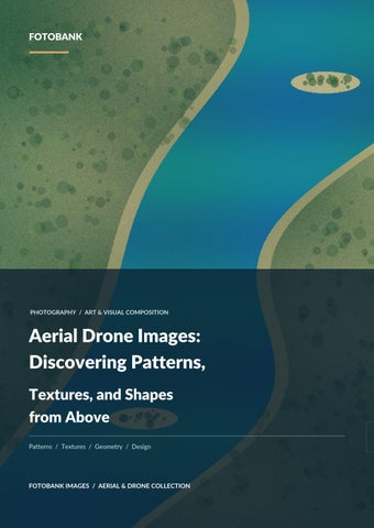
Aerial Drone Images: Discovering Patterns, Textures, and Shapes from Above Patterns / Textures / Geometry / Design
FOTOBANK IMAGES / AERIAL & DRONE COLLECTION
FOTOBANK / AERIAL PHOTOGRAPHY
EDITORIAL GUIDE 04
AERIAL DRONE IMAGES: DISCOVERING PATTERNS Textures, and Shapes from Above A coastline becomes a sweeping curve. A winding river resembles a painted brushstroke. Agricultural fields transform into geometric blocks, while rows of buildings create patterns that are almost impossible to recognize from the street. These are some of the remarkable visual discoveries made possible by aerial photography. Aerial drone images reveal patterns, textures, and shapes that often remain hidden at ground level. By changing the viewer's perspective, photographers can transform familiar landscapes into compelling compositions that combine artistic expression with geographic detail. The result is an approach to photography in which ordinary objects and environments can become extraordinary visual subjects. From the natural geometry of sand dunes to the carefully arranged structures of historic architecture, elevated photography offers endless opportunities to discover design in the world around us.
Why the World Looks Different from Above Human vision is naturally accustomed to viewing environments from approximately eye level. From this perspective, objects have recognizable proportions, and nearby structures often conceal elements farther away. A building appears as a facade. A road extends toward the horizon. A lake looks like an open surface of water. When viewed from above, these familiar relationships change. A building becomes part of a larger architectural arrangement. A road develops into a line connecting different spaces. A lake reveals the shape of its shoreline and the patterns formed by surrounding vegetation. The higher viewpoint reduces the dominance of conventional perspective and encourages viewers to focus on relationships between elements. This creates opportunities for photographs that resemble abstract paintings, geometric illustrations, or carefully arranged graphic designs. The most interesting aerial compositions often emerge when the photographer recognizes these visual relationships before pressing the shutter.
Discovering Geometry in Natural Landscapes
FOTOBANK IMAGES · AERIAL & DRONE COLLECTION
02
FOTOBANK / AERIAL PHOTOGRAPHY
RIVER CURVES
EDITORIAL GUIDE 04
DUNE TEXTURES
FIELD GEOMETRY
Geometry is not limited to architecture or human-made structures. Natural processes continuously create lines, curves, repetition, and irregular shapes. Aerial photography makes many of these formations easier to appreciate.
The Curves of Rivers and Lakes Water shapes landscapes through movement, erosion, and deposition. Rivers may bend across wide valleys, divide into branching channels, or flow around islands and sandbars. Seen from above, these features create natural compositions based on curves and contrasting surfaces. A river flowing through vegetation may appear as a continuous blue or brown line across a green landscape. A lake surrounded by sandy terrain may form a vivid shape within the surrounding earth. The artistic opportunity comes from recognizing how water defines the composition. A strong aerial photograph might emphasize a single winding shoreline, while another uses multiple river channels to create a complex pattern.
The Repeating Forms of Desert Dunes Desert landscapes are particularly rich in natural geometry. Wind shapes sand into ridges, slopes, and recurring patterns. Depending on the terrain and wind conditions, dunes can form broad curves or repeating linear structures. Low-angle sunlight adds depth by casting shadows along these formations. From above, the interplay between illuminated sand and shadow can produce striking visual rhythm. Photographers may emphasize the contrast between adjacent ridges or use an isolated subject to interrupt an otherwise repetitive landscape. A camel caravan, for example, can provide a recognizable focal point against an expansive background of sand.
Mountain Ridges and Geological Patterns Mountain landscapes reveal another form of natural repetition. Parallel ridgelines, exposed rock layers, erosion channels, and changes in vegetation can create complex visual patterns. A photograph featuring several overlapping mountain ridges may convey depth through variations in color and atmospheric haze. An image captured from a more vertical viewpoint may instead emphasize the shapes of rock formations and the boundaries between different surfaces.
FOTOBANK IMAGES · AERIAL & DRONE COLLECTION
03
FOTOBANK / AERIAL PHOTOGRAPHY
EDITORIAL GUIDE 04
These details make geological landscapes valuable subjects for both creative photography and environmental publications.
How Aerial Photography Reveals Texture
REPEATED FORMS
ROOF PATTERNS
ORGANIC SHAPES
Texture describes the visible surface characteristics of a subject. Photographers often associate texture with close-up photographs of wood, stone, fabric, or architectural materials. However, aerial imagery reveals textures on a much larger scale. Forests, farmland, rooftops, deserts, and rocky terrain all produce distinctive surface patterns when photographed from above.
Forest Canopies as Natural Textures A forest canopy may resemble a continuous green surface when viewed from a distance. Closer observation reveals differences in tree height, leaf density, shape, and color. These variations create texture through repetition and irregularity. During autumn, forests containing different tree species may display contrasting patches of yellow, orange, red, and green. Such patterns can produce striking aerial landscape photographs, especially when combined with winding roads, rivers, or open clearings.
Agricultural Fields and Cultivated Land Agricultural landscapes frequently combine natural vegetation with deliberate human organization. Crop rows create parallel lines, field boundaries introduce geometric divisions, and changes in cultivation produce contrasting colors and textures. Seen from above, these landscapes may resemble patchwork designs. An aerial image of farmland can therefore serve two purposes. It can document agricultural land use while also functioning as an attractive visual composition based on repetition and structure. Photographers should avoid identifying particular crops or farming methods unless the visual evidence and supporting information justify those descriptions.
FOTOBANK IMAGES · AERIAL & DRONE COLLECTION
04
FOTOBANK / AERIAL PHOTOGRAPHY
EDITORIAL GUIDE 04
Urban Rooftops and Architectural Surfaces Cities contain textures formed by repeated architectural elements. Roofs, balconies, windows, roads, courtyards, and building arrangements can produce visual patterns across entire neighborhoods. Historic districts may feature irregular building layouts, while newer developments often display more consistent geometric organization. Aerial photography can highlight these differences without requiring individual buildings to dominate the frame. This approach is particularly useful for editorial design, urban photography, and architectural storytelling.
The Importance of Shapes in Aerial Drone Images Shape is one of the fundamental elements of visual composition. When recognizable objects are viewed from unfamiliar angles, their shapes often become more noticeable than their conventional identities. A circular water tank becomes a bold geometric form. A winding road becomes a continuous line. An island becomes an irregular shape surrounded by contrasting water. This shift encourages viewers to interpret the photograph differently.
Organic Shapes Organic shapes occur naturally and often contain irregular curves. Examples include shorelines, forest boundaries, rock formations, river bends, and drifting cloud formations. These shapes introduce movement and variation into a composition.
Geometric Shapes Geometric shapes are frequently associated with buildings, roads, fields, and other constructed environments. Squares, rectangles, circles, and straight lines can create a strong sense of order. Formal palace gardens, historic courtyards, and modern urban developments are particularly interesting examples.
Combining Organic and Geometric Elements Some of the most engaging aerial compositions contain both natural and human-made structures. A straight road crossing an irregular desert landscape creates contrast. A rectangular agricultural field beside a winding river establishes two different visual rhythms. A historic building surrounded by landscaped gardens combines architectural symmetry with organic vegetation. These relationships create photographs that offer visual complexity without becoming confusing.
Finding Inspiration in Real Aerial Photography
FOTOBANK IMAGES · AERIAL & DRONE COLLECTION
05
FOTOBANK / AERIAL PHOTOGRAPHY
EDITORIAL GUIDE 04
VISUAL REFERENCE / FOTOBANK IMAGES fotobankimages.com/category/aerial-drone
Understanding photographic composition becomes easier when studying actual landscapes and architectural subjects. Rather than looking only at technical camera settings, photographers can examine how successful images use lines, textures, perspective, and contrasting colors. A thoughtfully organized collection of aerial drone images and elevated landscape photography can provide examples of these visual relationships across different environments. When reviewing an image, consider where your eye moves first. Does a winding shoreline lead attention toward an island? Do repeated buildings create rhythm? Does one brightly colored element interrupt a larger pattern? These questions help identify the visual decisions that make aerial photography effective. The same analytical approach can be applied to natural landscapes, historic landmarks, rural environments, and modern cities.
Color Contrast and the Aerial Perspective
WARM CONTRAST
COOL TONES
SOFT LIGHT
Color becomes especially influential when photographs are composed around large visual surfaces. From above, entire sections of a landscape may appear as distinct areas of color. Blue water contrasts with pale sand. Green forests stand against rocky mountains. Warm rooftops interrupt the cooler tones of an urban environment. Strong color relationships can make a photograph immediately engaging.
Complementary Colors Colors on opposite sides of the color wheel often create strong contrast. Blue water surrounded by orange or golden terrain is one familiar example. When photographed under favorable lighting conditions, this contrast can establish a clear distinction between the main subject and its surroundings.
Tonal Variation Not every compelling aerial image requires vivid colors.
FOTOBANK IMAGES · AERIAL & DRONE COLLECTION
06
FOTOBANK / AERIAL PHOTOGRAPHY
EDITORIAL GUIDE 04
Subtle variations in brightness can communicate texture and shape. A monochromatic desert landscape, for example, may rely on shadows to distinguish individual dunes. Black-and-white aerial photography can emphasize this effect by reducing the influence of color.
Seasonal Color Seasonal changes can alter the overall appearance of landscapes. Autumn forests may develop warmer tones, agricultural fields may change as crops grow or are harvested, and mountain valleys may appear different under snow. These variations create opportunities to document the same location at different times without producing visually identical photographs.
Negative Space: The Power of Simplicity Aerial landscapes often contain large areas of relatively uniform visual information. Open water, sand, snow, and agricultural fields can create natural negative space. Negative space refers to areas surrounding the main subject that help establish emphasis, balance, and visual breathing room. A single boat surrounded by water may appear small, yet become the unmistakable focus of the photograph. A solitary tree in a field can create a similarly powerful effect. This type of composition works particularly well when the subject contrasts clearly with its surroundings.
Why Simplicity Matters Photographs containing too many competing subjects can become visually difficult to interpret. An effective minimalist aerial photograph gives the viewer a clear focal point. The surrounding empty space becomes an important part of the design rather than an area that must be filled. This makes minimalist aerial imagery useful in editorial layouts, presentation backgrounds, posters, and other designs requiring space for text. However, negative space should be intentional. An underdeveloped composition with excessive empty surroundings is not automatically minimalist. The subject and the space around it must work together.
Architectural Patterns from Above Buildings are among the most rewarding subjects for exploring geometry through aerial photography. Historic architecture often contains carefully planned relationships between entrances, courtyards, gardens, towers, and surrounding walls. An elevated viewpoint may reveal architectural features that are difficult to understand from ground level.
FOTOBANK IMAGES · AERIAL & DRONE COLLECTION
07
FOTOBANK / AERIAL PHOTOGRAPHY
EDITORIAL GUIDE 04
Palaces and Formal Gardens Historic palaces frequently combine architectural structures with landscaped grounds. Curved pathways, symmetrical lawns, fountains, and building arrangements can produce visually balanced compositions. From above, the palace and its grounds become parts of a larger design.
Fortresses and Defensive Architecture Fortresses may contain repeated bastions, fortified walls, gates, and internal courtyards. A ground-level photograph communicates the height and surface detail of the walls. An elevated photograph may reveal their arrangement and relationship with the surrounding terrain.
Religious Architecture Mosques, temples, churches, and other religious structures can feature distinctive geometric layouts. Courtyards, domes, minarets, towers, and neighboring buildings may form recognizable patterns when photographed from elevated viewpoints. For architectural publications, accurate identification and historical context are as important as visual composition.
Turning Aerial Photographs into Useful Visual Assets Aerial imagery has applications well beyond photographic exhibitions and personal portfolios. Its combination of graphic clarity and geographic detail makes it useful for multiple publishing and design purposes. Editorial publications may use aerial photographs to introduce geographic subjects or provide context for feature articles. Travel publishers can show the relationship between landmarks, landscapes, and surrounding settlements. Architectural publications may use elevated photographs to illustrate the layout of historic structures or modern developments. Educational materials can present river systems, landforms, agricultural fields, and settlement patterns through recognizable visual examples. Creative designers may select aerial images for their strong lines, abstract textures, and areas of negative space. For stock photography, this versatility increases the value of collections containing distinct viewpoints and compositions. However, the suitability of an image for commercial use depends on its licensing terms and any necessary permissions.
Selecting the Right Aerial Image for a Design Project Choosing an aerial image involves more than finding an attractive photograph. A designer or publisher should consider the purpose of the image and how it will interact with surrounding content.
FOTOBANK IMAGES · AERIAL & DRONE COLLECTION
08
FOTOBANK / AERIAL PHOTOGRAPHY
EDITORIAL GUIDE 04
Composition and Layout A photograph with a strong central subject may work well as a standalone editorial image. An image containing negative space may be more suitable for a presentation cover or magazine layout that includes text.
Orientation and Cropping Landscape-oriented photographs often work well in websites, banners, and wide editorial layouts. Portrait-oriented images may suit posters, mobile designs, or magazine covers. Cropping should preserve the photograph's essential subject and avoid creating a misleading impression of the original scene.
Resolution and Detail Aerial photographs containing fine textures require adequate resolution for the intended output. Forest canopies, building patterns, and agricultural fields may lose visual clarity when enlarged beyond their useful dimensions. Print projects should therefore consider image dimensions and final reproduction size.
Accurate Captions Editorial photographs should carry reliable information about the photographed location and subject. A visually impressive image becomes substantially more useful when the associated details are accurate.
Common Mistakes in Abstract Aerial Photography Although aerial photography offers unusual perspectives, several problems can weaken otherwise promising compositions. One common mistake is capturing a subject from above without establishing a clear visual purpose. Height alone does not create an engaging image. Another problem is excessive reliance on symmetrical framing. While symmetry can be effective, a more dynamic composition may sometimes communicate the subject better. Overediting can also reduce quality. Artificially intense colors, exaggerated contrast, and excessive sharpening may distract from the natural patterns that originally made the photograph interesting. Finally, photographers should distinguish visually similar frames when building an image collection. Several photographs showing the same landscape from nearly identical angles may offer less value than a smaller set of images featuring genuinely different compositions. A carefully selected portfolio should emphasize meaningful visual variety.
FOTOBANK IMAGES · AERIAL & DRONE COLLECTION
09
FOTOBANK / AERIAL PHOTOGRAPHY
EDITORIAL GUIDE 04
Responsible Photography and Accurate Representation Aerial photography also requires an understanding of operational and editorial responsibilities. Drone operators must follow applicable aviation regulations, including restrictions concerning airspace, people, sensitive locations, and protected environments. Wildlife and natural habitats should not be disturbed simply to obtain unusual photographs. Photographers should also accurately describe how images were captured. An elevated photograph taken from a hillside or observation platform should not automatically be called drone photography. Similarly, geographic and architectural details should be verified when images are intended for documentary or educational use. The artistic qualities of a photograph and the accuracy of its description should support one another.
Conclusion: Finding Extraordinary Design in Ordinary Landscapes Aerial photography invites viewers to recognize the artistic qualities of environments they might otherwise overlook. Rivers become flowing shapes. Deserts reveal repeating textures. Forests form natural patterns, and cities display complex geometric arrangements. These visual discoveries demonstrate that compelling design exists throughout the natural and built world. The strength of aerial drone images lies in their ability to reveal these relationships through a fresh perspective. For photographers, the challenge is to move beyond simply capturing impressive views and begin recognizing how composition, texture, color, and shape work together. For designers, publishers, and viewers, aerial imagery provides an opportunity to appreciate familiar environments through entirely different visual arrangements. Sometimes the most extraordinary photograph is not found in an unfamiliar place, but in a familiar landscape seen from a different angle.
FOTOBANK IMAGES · AERIAL & DRONE COLLECTION
10