THE HIGH WATER MARK

May 2026 - Volume 36, Issue 2
May 2026 - Volume 36, Issue 2
The Newsletter of the Floodplain Management Association May 2026 - Volume 36, Issue 2
Mission: To promote the common interest in reducing flood losses and to encourage the protection and enhancement of natural floodplain values.
Chair Vince Geronimo Geronimo Engineering (916) 993-4606 Vince@geronimoengineering.com
Vice Chair
Millicent Cowley-Crawford Carollo Engineers MCowleyCrawford@carollo.com
Secretary Clark Barlow AtkinsRealis Clark.Barlow@atkinsrealis.com
Treasurer Connie Perkins-Gutowsky California Department of Water Resources Constance.PerkinsGutowsky@ water.ca.gov
Past Chair
Brent Siemer City of Simi Valley BSiemer@simivalley.org
Director Brittney Duncan Clark County Regional Flood Control District BDuncan@regionalflood.org
Director Debbie Neddenriep Carson Water Subconservancy District debbie@cwsd.org
Director Darren Suen San Joaquin Area Flood Control Agency Darren.Suen@sjafca.org
Director Mary Keller Placer County MKeller@placer.ca.gov
Director Rohini Mustafa Riverside County RoMustaf@rivco.org
Director
Remi Candaele Q3 Consulting RCandaele@q3consulting.net
Director Satish Kumar Wood Rodgers skumar@WoodRodgers.com
Director Ernest Conant Downey Brand econant@DowneyBrand.com
Director Flannery Banks City of Santa Rosa, CA FBanks@srcity.org
Director Katie Howes Woodard & Curran KHowes@woodardcurran.com
Director David Smith West Consultants dsmith@westconsultants.com
Executive Director George Booth (916)847-3778 fmaed@floodplain.org
Vince Geronimo
Floodplain management has always required adaptation. But lately, the pace of change feels different.
Across California, Nevada, and Hawaii, floodplain managers are being asked to make decisions in an environment where the science is evolving quickly, implementation tools are improving rapidly, and funding priorities seem to shift almost yearly. At times, it can feel like we are trying to hit a moving target while standing in rising water.
At the same time, this may be one of the most important periods our profession has faced in a long time.
For decades, floodplain management focused heavily on historic conditions. We relied on established recurrence intervals, FEMA maps, local drainage criteria, and longstanding assumptions about risk. Those tools still matter, but increasingly we are being asked to plan for conditions that do not neatly resemble the past.
In California, communities are grappling with increasingly volatile swings between drought and extreme rainfall. Atmospheric river events over the past several winters have demonstrated how quickly flood risks can emerge in places that may not have experienced major flooding in generations. State agencies are now placing greater emphasis on climate adaptation, flood resilience, and multi-benefit projects that combine flood protection with habitat restoration, groundwater recharge, and water quality improvements.
Nevada faces its own challenges, particularly in rapidly developing communities where growth pressures continue pushing infrastructure into arid watersheds that can produce intense flash flooding with little warning. In both California and Nevada, floodplain managers are increasingly balancing not only technical responsibilities, but also difficult policy questions about land use, resilience, and long-term community investment.
And in Hawaii, recent extreme rainfall events have reinforced the vulnerability of island communities where steep terrain, short-duration rainfall, and coastal exposure create uniquely complex flood risks. While our collaboration with Hawaii may be less frequent simply due to geography, their experiences continue to remind us that floodplain management is never one-size-fits-all.
At the same time, the tools available to our profession are advancing rapidly.
High-resolution terrain data, real-time forecasting, cloudbased hydraulic modeling, GIS integration, and Artificial Intelligence are beginning to reshape how we evaluate flood hazards and communicate risk. Many of us entered
this profession carrying rolled-up paper maps and running models that took hours or days to process. Today, younger professionals are analyzing terrain on tablets in the field and using machine-learning-assisted workflows to process information faster than many of us imagined possible just a few years ago.
The tools are improving quickly, but good judgment still matters.
One challenge for all of us is figuring out how to use these new tools effectively without losing the practical judgment and field experience that floodplain management still depends on. Models still need interpretation. Data still requires context. And communities still depend on experienced professionals who understand that flood risk is ultimately about people, not just numbers.
Funding and implementation priorities are also evolving quickly.
Federal and state programs increasingly prioritize projects that demonstrate broader community benefits beyond flood reduction alone. Grant applications now routinely emphasize climate adaptation, environmental justice, nature-based solutions, ecosystem restoration, and community resilience. These are important priorities, but they also create challenges for smaller agencies and communities that may not have the staffing or technical resources to compete for increasingly complicated funding opportunities.
Many floodplain managers now wear a lot of hats: engineer, planner, communicator, grant writer, outreach coordinator, and sometimes even translator between technical information and public understanding.
And honestly, that may be the biggest shift of all.
Floodplain management today is about much more than maps and regulations. A big part of the job now is helping communities navigate uncertainty.
That responsibility can feel overwhelming at times, especially as regulations evolve, development pressures continue, and public expectations grow. But I also believe this moment presents a real opportunity for our profession to lead.
One thing FMA does particularly well is bring together people from very different parts of the profession. Engineers, planners, biologists, emergency managers, regulators, consultants, public works staff, and academics all sit at the same table within this Association. That collaboration has always been one of FMA’s greatest strengths, and it may become even more important in the years ahead.
different today than when we first entered it. Still, I’m optimistic because I see a lot of smart, motivated people stepping up across the profession.
And honestly, floodplain managers have always done some of their best work when conditions get complicated.
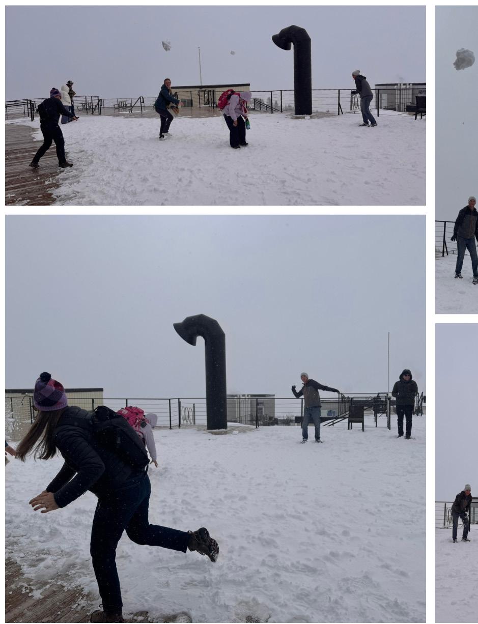
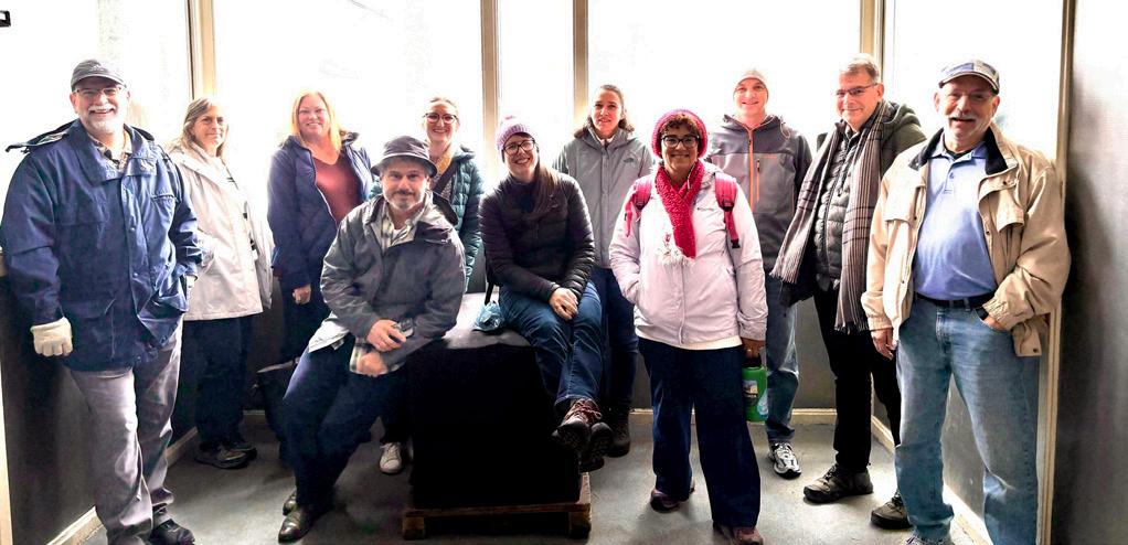
Long Beach, CA Visit – www.floodplain.org
California Extreme Precipitation Symposium
July 16, 2026
UC Davis
For an Update of the latest disaster declarations visit: www.fema.gov/disasters
Information on Flood Insurance Reform – Rates and Refunds: www.fema.gov/flood-insurance-reform-rates-and-refunds
Due to changes in federal priorities in 2025, FEMA will indefinitely be unable to provide tailored updates to the FMA Board or newsletter. If you have a unique FEMA issue, feel free to reach out to FMA and we will advise to the best our abilities.

Record Hot, Dry March Wipes Out California Snowpack, Leaving No Measurable Snow for April Survey
On April 1, the Department of Water Resources (DWR) conducted the critical April snow survey at Phillips Station and found no measurable snow, a stark indicator of how record-hot March temperatures and high-elevation rain have erased the Sierra Nevada snowpack months ahead of schedule. The combination of warm storms and unusually hot temperatures rapidly melted what remained of this year’s already sparse snowpack. Statewide, the snowpack is now just 18 percent of average for this date, according to the automated snow sensor network.
The survey’s results are the second lowest April measurement on record for Phillips Station, largely because there was still some visible snow on the ground. By contrast, the lowest April reading occurred in 2015 when no snow was present at the site.
Given the unprecedented heatwave across the West in March, DWR and its partners expanded monitoring efforts to better track this year’s rapid snowmelt, including 100 additional mid-month snow surveys across 18 critical watersheds. The California Cooperative Snow Surveys Program has also been working closely with partner agencies to monitor the snowmelt and ensure water managers have the information they need to make informed water management decisions.
• More information: https://water.ca.gov/News/ News-Releases/2026/Apr-2026/Record-Hot-DryMarch-Wipes-Out-California-Snowpack-Leaving-NoMeasurable-Snow-for-April-Survey
Governor Newsom launches most ambitious water plan in California history
Governor Gavin Newsom announced the formal launch of the California Water Plan 2028, marking the start of a multi-year effort to modernize statewide water planning in response to climate-driven extremes and long-term water reliability challenges.
The launch initiates the first phase of work under Senate Bill 72 (SB 72), which mandates modernization of the California Water Plan by improving data and setting measurable water supply targets. It also creates a more coordinated, transparent planning framework that aligns state, regional, and local actions, which includes close collaboration with the California Water Commission.
To fulfill the SB 72 mandate, the Department of Water Resources (DWR) is convening an Advisory Committee that will immediately get to work in shaping the workplan for both the 2028 and 2033 Water Plan updates and providing input about approaches to effectively engage regional communities.
The committee will hold its inaugural meeting in May, and the public is encouraged to attend.
• More information: https://water.ca.gov/News/ News-Releases/2026/Feb-2026/GovernorNewsom-launches-most-ambitious-water-plan-inCalifornia-history
The San Francisco Estuary Wetlands Regional Monitoring Program (WRMP), DWR, and the Delta Stewardship Council collaborated to collect lidar data across the entire San Francisco Bay-Delta Estuary at sub-ten-centimeter vertical accuracy.
This lidar project provides high-resolution, region-wide elevation data offering an unprecedented view of the landscape, landforms, and habitat conditions. Fine-scale features captured across the estuary make this a shared foundation for researchers, engineers, and land managers working to mitigate flood risk, improve habitat restoration, monitor subsidence, and more.
Once available, links to the data and information about a forthcoming webinar will be posted on this web page. In the meantime, sign up to be notified when the data is made available by the WRMP.
• Project webpage: https://www.wrmp.org/ estuarywide-2025-lidar-collaboration/
Continued on next page
DWR hosts quarterly State CRS Users Group meetings that provide support and educational resources for communities that participate in the CRS, are interested in joining, or want to learn more about the program. During the meetings, attendees can share ideas, best practices, and hear from guest speakers about CRS-related topics. If you or your community are interested in attending a future meeting, please e-mail the State CRS Coordinator at Robert.Lampa@water.ca.gov. Program information is available on the Community Rating System webpage
Upcoming meetings:
• Wednesday, July 22: 10:00 am-12:00 pm. Register for the meeting to receive meeting information and updates.
• Wednesday, October 14: 10:00 am-12:00 pm. Register for the meeting to receive meeting information and updates.
Note: The 2026 meeting dates are subject to change. National Flood Insurance Program Workshops
DWR staff will be hosting NFIP workshops in May and June, both virtual and in person. Upcoming workshop:
• Successful Floodplain Management in California-Oceanside: May 7. This full-day event will provide insights about floodplain management and the NFIP. The meeting is a great opportunity to connect with peers in floodplain management and learn about NFIP updates. Earn up to 6 CECs for attending.
о Oceanside: May 7. Register for the workshop
о Fresno: May 14. Register for the workshop
о Northern California: June 16. Register for the workshop
Information about upcoming events is available on California NFIP Events and Tickets | Eventbrite. Other questions? Email DWR_NFIP@water.ca.gov
Staff Participated in ASFPM’s Certification Board of Regents Meeting
On March 9-12, DWR staff participated in the Association of State Floodplain Managers (ASFPM), Certification Board of Regents (CBOR) meeting in Milwaukee, WI. The CBOR meets for the governance and key certification policies and procedures of the Certified Floodplain Manager (CFM) program, including establishing eligibility standards and all aspects of
exams, such as developing, administering, scoring, and overseeing the program’s operation. The meeting agenda consisted of the nomination for the John Ivery CFM Award, going over the 2025 CFM exam statistics, NFIP development courses in Substantial Damage Assessments, and fundamentals of the Community Rating System.
Silver Jackets Webinar: USGS’s New Postfire Debris-Flow Runout Hazard Maps
Starting in the summer of 2026, the USGS Geologic Hazards Science Center has the capability to generate post-fire debris flow runout hazard maps upon request for certain fires. A new method to generate runout hazard maps is now able to indicate how far debris flows may travel. Katy Barnhart, Research Civil Engineer, will describe the USGS’s new method for generating postfire debris-flow runout hazard maps and share case studies that show events that were triggered by a range of rainfall intensities and how the observed debris flow runouts compared to model predictions.
Please join us for the webinar on April 28 at 1:00-2:00pm ET:
Web URL: https://counciloak.webex.com/meet/ SilverJackets (copy/paste the link text into your web browser to join the meeting)
Recordings of previous Silver Jackets webinars can be found here: https://www.iwr.usace.army.mil/SilverJackets/Resources/Webinars/
Interested in news about DWR’s programs, grants, and partnerships? DWR has fifteen mailing lists that provide updates on the work we do. Subscription page: public. govdelivery.com/accounts/CNRA/signup/31790
Nikki Blomquist, Northern California Advisor
California Department of Water Resources
Nikki.Blomquist@water.ca.gov | (916) 820-7749
Salomon Miranda, Southern California Advisor
California Department of Water Resources
Salomon.Miranda@water.ca.gov | (818) 549-2347
See the latest news stories relating to Hawai’i’s floodplain management issues. For the transformed flood information platform from Hawai’i visit their exciting weekly blog at www.waihalana.hawaii.gov/
Some of the latest articles relate to the release of the MAT report for the Maui fires and the appeal period for Honolulu Preliminary Flood Maps, and much more, provided by the DLNR Engineering Division.
For archived Wai Halana Newsletters (prior to 2018) –https://dlnreng.hawaii.gov/nfip/wai-halana/
The FMA Newsletter welcomes the input of its members and now our extended family of readership to contribute to the conversation! Keep the great articles coming! We need to hear from all of you. There’s always room for more to join the ranks of published authors. Showcase your programs, projects, tools, policies, regulations or ideas to hundreds of floodplain management professionals throughout the U.S.! Articles must be submitted in Word format to fmaed@floodplain.org and may contain 2-3 small pictures. Preferred length is less than 850 words. For more details, call (916) 847-3778.
The flood program kicked off 2026 with a focus on floodplain management trainings. Nevada collaborated with CA Department of Water Resources on virtual trainings: Elevation Certificates, Substantial Improvement & Substantial Damage, and Flood Mapping.
Additionally, the Nevada Silver Jackets Team hosted the 3rd annual Nevada Watershed University which featured presentations on innovative technology in flood mapping and forecasting, and applications of AI in floodplain management. We plan on organizing more trainings, so stay tuned for updates.
The flood program is excited for another year of classroom and public outreach events. Planning and collaborative efforts will be the focus of the Flood Awareness Communications Team (FACT) meetings. The FACT 2026 Kickoff meeting is scheduled for April 29 when we will recap Flood Awareness Week 2025, share flood risk outreach tips and discuss upcoming outreach events.
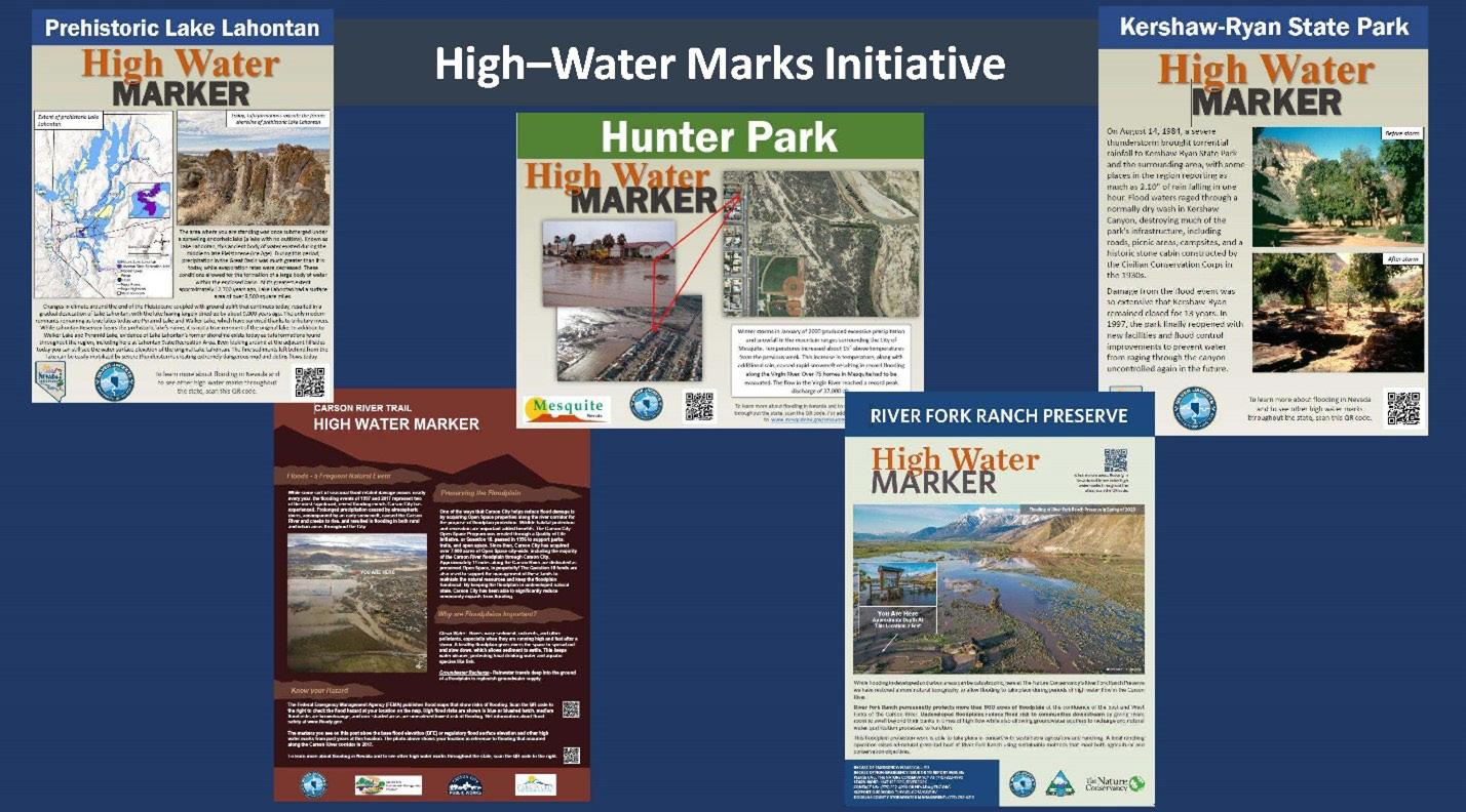
Additionally, the Nevada Silver Jackets Team is collaborating with the Carson Water Subconservancy District to plan the next high water mark unveiling event: the Carson City High Water Mark Bike Tour. Carson City, NV is home to many high water mark installations and extensive bike paths. The goal is to unveil the new Riverview sign and connect the public with Carson City’s outdoor recreation activities with the area’s many high water mark installations.
Schedule of events 2026
5/29 – WaterPalooza 2026
8/15 – Carson City High Water Mark Bike Tour 11/8- 11/14 – Nevada Flood Awareness Week 2026
Grey Hayes, Ph.D.
For those overseeing floodplains, it is crucial to recognize that the California Department of Fish and Wildlife has mandated the use of non-lethal management techniques when viable to address beaverrelated damage. Beaver-caused tree destruction, culvert blocking, water conveyance infrastructure plugging, and flooding are frequent concerns in and near floodplains. In each of these situations, there are low-cost non-lethal beaver coexistence strategies that, while relatively new to California, are widely proven and adopted elsewhere. To answer the need for more information and provide contact to Certified Beaver Coexistence Professionals, CDFW in partnership with the Occidental Arts & Ecology Center’s WATER Institute have launched the California Beaver Help Desk.
In recognition of the benefits beaver provide to aquatic ecosystems, CDFW began a new approach to managing beaver-human conflict throughout the state in 2023. Beavers improve floodplain function while recovering listed riparian species and fostering water retention, groundwater recharge, and wildfire resilience. To protect these benefits, the Department requires implementation of feasible nonlethal corrective actions to prevent future beaver damage, and agency staff must document those measures prior to issuing a depredation permit. It is important to stay informed about where nonlethal beaver control is feasible, where lethal control remains the only solution, and where Californians are still exploring options.
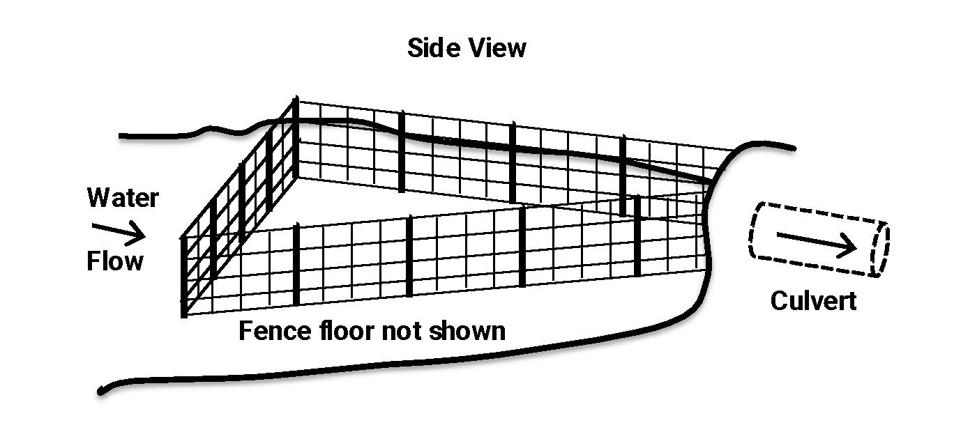
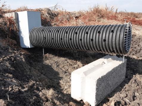
With beaver-blocked culverts and water control structures, beaver coexistence techniques are available. Correctly designed fencing that keeps beavers at a certain distance from water flowing through culverts/ water control structures helps deter these rodents’ desire to stop the sound of running water. Floodplain managers may use twin track weirs to manage water level heights, and these are where Beaver Back Savers (BBS) come in handy. A BBS consists of a long, perforated pipe (‘snorkel’) attached to a manifold that slips into the outer track of the weir, allowing for continued management of water height using removable boards in the inner track. Again, a long enough submerged pipe confounds beavers by stopping their triggering impulse caused by the feel and sound of the water flow.
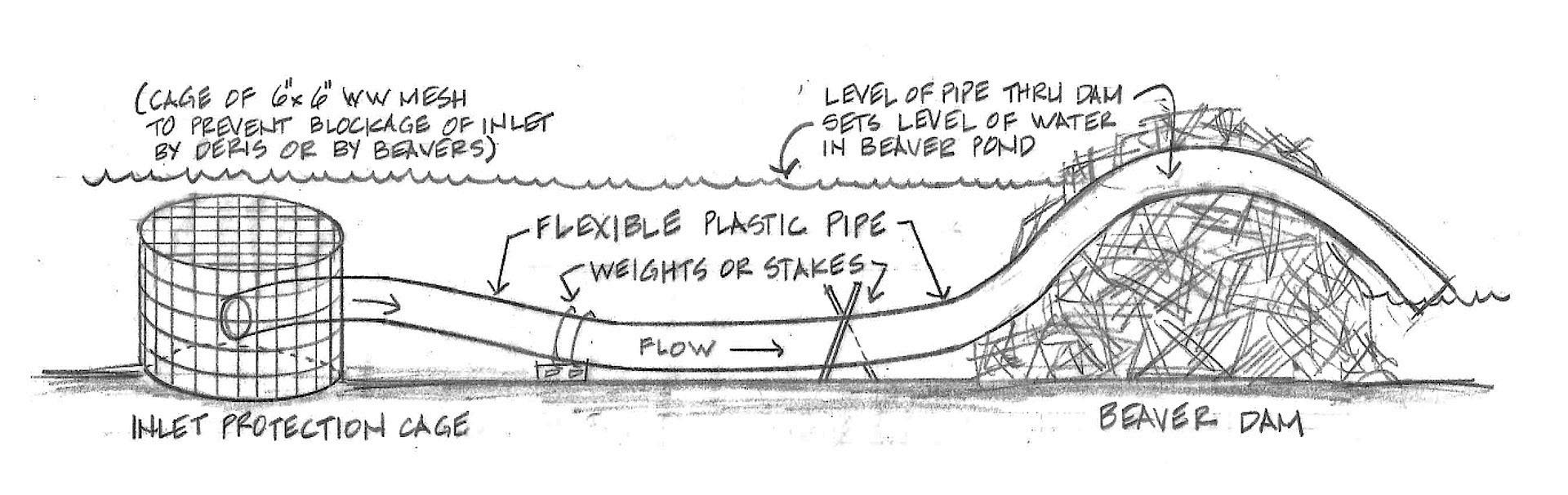
The flooding caused by beaver dams can also be mitigated through non-lethal means. To manage water height, a Flexible Pond Leveler again helps to prevent beavers’ dam-building behavioral cue—the sound and feel of running water. Because beavers have an instinct to build when they hear running water, it is ineffective to simply remove or modify their dam. Instead, putting a Pond Leveler pipe through the dam prevents water from noisily spilling over the top, discouraging the beaver from building the dam any higher. A welded wire cage around the submerged upstream inlet keeps beaver from blocking the pipe. The pipe releases water below the dam crest on the downstream side, reducing dambuilding cues. The height of the Pond Leveler can be strategically adjusted, lowering the pond to a level that reduces flooding.
Finally, tree and vegetation damage by beavers is a widespread concern. Beavers are herbivores, can eat around two pounds of food a day, and, if given access, can chop down more than a hundred trees each year. But beavers don’t need trees to survive: they can subsist on herbaceous vegetation such as cattail rhizomes, grass, etc. In California, farmers report beaver impacts on crops, especially almond orchards adjacent to waterways. Park managers and ranchers are also concerned about beaver destruction of trees. In these cases, hard-wire or electric fencing beavers out of areas has proven effective. Caging individual trees also works
as does painting tree trunks with beaver-deterring latex paint and sand mixture. The particulars of these strategies matter—the right kind of fence, installed the right way, and the right recipe for the sand-paint mixture are also critical.
Coexistence professionals have yet to discover a feasible solution for another beaver-caused issue plaguing floodplain managers: burrowing under roadways and into levees. This is common especially in high flow/ volume waterways where they avoid building dams. Given the extraordinary length of these systems, installing and securing fencing to exclude beavers is still not feasible. In addition, fencing could get caught in mowers or other maintenance equipment, complicating long-term efficacy.
To help alleviate these human-beaver conflicts, there is financial and technical assistance available through the recently-launched California Beaver Help Desk, This website is administered by the Occidental Arts & Ecology Center’s WATER Institute with funding by the California Department of Fish and Wildlife’s Nature Based Solutions: Wetlands and Mountain Meadows Grant Program. Funding is available for the full cost of site assessments performed by trained Beaver Coexistence Professionals. Should a property owner decide to go with non-lethal strategies, funding is also available for the installation of solutions.
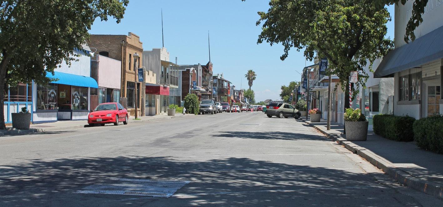
Kathleen Schaefer, Ph.D, P.E., CFM
This was originally published in IMPACT magazine by the American Water Resources Association
Located on Brannan-Andrus Island, along the south and left bank of the Sacramento River, Isleton is a California community with a rich agricultural history. Founded in 1874, the once booming city in the Sacramento-San Joaquin Delta has been called many things—Paris of the Delta, asparagus capital of the world, and even the Mayberry of the West. Situated from six feet below to six feet above sea level, the town is a community at risk.
Isleton has flooded numerous times. In its first four years, the town flooded four times. Fortunately for the residents, by the early 1900s the California legislature had begun creating reclamation districts to build and manage levees and other flood protection structures. Eventually, 26 miles of levees encircled the town and kept it more or less dry until June 21, 1972. On that day, a levee breach four miles away poured water into the town.
By the third day of the flood, the water level in the island chain where Isleton is located had risen to match the river, flooding the basin. In the lower portions of the islands, the floodwaters exceeded 20 feet deep. Levee repairs were finally completed in July of that year, but residents could not return until November when the town dewatered. Notably, the levee break took place at a time of low river flows and moderate tides. Since then, more has been done to shore up the levees, which also support the major water conveyance system supplying water to the state’s water projects. Although California has invested over $4 billion in flood-related infrastructure in just the past 15 years, flood risk continues to grow and includes events on the landside of the levees. Forces such as erosion, subsidence, and sea-level rise are making the system’s protective levees increasingly fragile, leaving communities at significant risk.
Threats are only growing. The Delta’s small towns are especially vulnerable as atmospheric rivers become stronger and more intense. Although the levees did not fail during winter storms of early 2023, intense rainfall from atmospheric rivers overwhelmed the town’s aging wastewater system, causing the wastewater treatment ponds to fail and spilling wastewater into the Mokelumne River. With no financial reserves, the delays in federal disaster aid have put the town on the brink of bankruptcy.
As fears of levee failure grow, the financial resources of rural regions to recover from natural disasters have diminished. Isleton offers one example. A fifth of the city’s roughly 800 residents live in poverty. Although many mortgage lenders require their homeowners in high-risk areas to buy flood insurance, only a quarter of the town’s 500 households are believed to have the insurance. With premiums estimated at $1,100 per year, insurance is simply unaffordable given that the median household income in Isleton is about $60,000.
In cities like Isleton, a significant gap exists between the funds needed for recovery and the expected disaster costs. This gap is known as the financial protection gap. Over the years, various experts have suggested closing the protection gap with a community-based insurance program. Insurance provided at a neighborhood, community, watershed, or statewide scale provides a framework that supports public-private partnerships, helping to make insurance more affordable.
Public-private partnerships can help communities transition from a single flood control focus to an
integrated flood risk management focus. They can foster the implementation of a wide variety of risk reduction measures. For example, insurers might fund enhancements to green infrastructure, such as rain gardens and horizontal levees, to reduce the smallest and most frequent flood losses.
Public-private partnerships can help raise awareness and disseminate risk information. In addition, they can ensure that risk is accurately and adequately priced, creating incentives for decision making that reduces risk. They can create opportunities to provide alternative sources of financing for risk reduction, allowing insurers to invest directly in risk.
In cities like Isleton, a significant gap exists between the funds needed for recovery and the expected disaster costs.
Researchers at the University of California, Davis (UC Davis), in collaboration with the California Department of Water Resources (DWR), the state Department of Insurance, and industry experts, have developed an implementable community-based insurance framework called Resilient Insurance for Equitable Recovery (RISER), which aims to close the financial protection gap. The goal is to help individuals and communities become financially resilient after a flood disaster.
RISER supports public-private partnerships with insurance providers to offer a community-based alternative to the National Flood Insurance Program. It uses data analytics and insurance to help communities plan for, reduce, and recover from flood risk.
RISER aims to promote resilience and stability in the face of natural disasters, allowing communities to rebuild better. What sets it apart from other flood insurance affordability initiatives is its integration of behavioral economics, finance, and social science research into a community or neighborhood-scale flood insurance framework.
Floods are low-probability, high-consequence events, making them susceptible to behavioral biases that are difficult to overcome. RISER effectively addresses these biases, which are crucial in encouraging people to purchase flood insurance.
Nobel Prize winner Daniel Kahneman, in his best-selling book Thinking, Fast and Slow, argues that decisions involving probabilities and insurance require deliberate, analytical thinking, which he describes as “slow brain” activities. However, when purchasing flood insurance, households often rely on heuristics, instincts, and biases, what Kahneman refers to as “fast thinking.”
These biases include myopia (short-sightedness), amnesia (forgetting past experiences), optimism (overestimating the likelihood of positive outcomes), inertia (resisting change), simplification (oversimplifying complex decisions), and herding (following others without critical thought). Additionally, households often engage in mental accounting, where they mentally allocate planned expenses into specific accounts. They may avoid committing to premium payments because they lack a designated risk protection account or have exhausted it with other obligations. These mental models and biases make it challenging to consistently decide to purchase flood insurance year after year.
With the support of UC Davis and its partners, in October 2024, Isleton launched a pilot, communitybased flood insurance initiative. Implemented by the Delta Region Geologic Hazard Abatement District (Delta Region GHAD), it’s been a first-of-its-kind for the state and operates with initial funding from a twoyear $200,000 state grant. Community-based flood insurance utilizes an intermediary—in this case the Delta Reion GHAD—between the insurer and the beneficiaries.
The Delta Region GHAD purchased a parametric flood insurance policy on behalf of residents. Parametric insurance provides payment when a specific predefined triggering event occurs rather than compensating for the actual financial loss of the insured asset or property.
In California, a parametric policy must have two independent index triggers and a verifiable loss. For example, the triggering event could be a levee failure, the elevation of the water surface of the Sacramento River exceeding a predetermined height, or an atmospheric river of a certain magnitude. A photo of the water line could verify losses. An index must have the following properties:
• Observable and easily measured
• Objective
• Independently verifiable
• Transparent
• Reported promptly
• Consistent over time
• Experienced over a wide area
Continued on next page
For Isleton, the payout varies with the depth recorded by a water level sensor installed at the wastewater pumping station. The maximum payout will be $2.5 million. How the money will be dispersed is decided by the GHAD board.
The most significant and impactful benefit of parametric insurance is the speed of payment. With a parametric insurance program, payments can be made almost immediately, providing financial security. This program’s speed contrasts with Federal Emergency Management Agency (FEMA) Individual Assistance (IA) programs. To receive FEMA IA payouts a federal disaster declaration must be made. This process can take months to obtain, and the state does not always receive IA as part of a federally declared disaster.
Additionally, with FEMA’s IA program, the amount of financial assistance is determined on a case-by-case basis after the disaster event. The FEMA IA program typically provides a modest payment. From 2016 to 2018, on average, FEMA awarded approximately $4,200 to homeowners and $1,700 to renters. Finally, the FEMA IA program does not provide funding to undocumented households.
As flood insurance programs like this are implemented in other areas, a GHAD is expected to be the most common way this type of program will be managed. This is because the most reliable long-term funding source is a property-related assessment.
Although the program might be managed by a joint powers authority (JPA), Climate Resilience District (CRD), or the local governing entity that administers similar property-based fees, a GHAD also requires that a registered geologist actively manage the flood risk. Active flood risk management, in partnership with the insurance providers, reduces the cost of insurance.
Isleton hoped to fund the program independently after the pilot ends in 2027 by establishing a parcel tax, but many residents seem unsupportive of paying it. Still recovering from the 2023 disaster, they have few resources to cover any new expenses. Despite the uncertain future, Isleton’s leadership and community advocates hope to identify grants and other funding sources to continue the program.
One option to explore involves adding additional entities such as the Brannan-Andrus Island Levee Maintenance District, private property owners, the Sacramento County, the Department of Water Resources, and the Metropolitan Water Authority to strengthen the program’s financial stability and risk management approach.
The path forward requires innovative solutions to overcome financial constraints, leverage economies of scale, and foster broader regional collaboration in flood risk management. By expanding the stakeholder base and policy coverage, the program could achieve greater financial resilience and adopt a more comprehensive approach to protecting the entire Brannan-Andrus Island area.
As DWR Director Karla Nemeth explains, “Growing weather extremes in California require re-examining how we protect communities from flooding and the role of insurance in getting people back on their feet if destructive flooding does occur. … Ultimately, we hope this effort can lead to models of affordability for people across California, particularly those with limited income.”
In the meantime, the Isleton pilot will be evaluated by UC Davis and its partners and others interested in the feasibility of extending this type of program to other communities at risk.
Floods are lowprobability, highconsequence events, making them susceptible to behavioral biases that are diffcult to overcome.
Kathleen Schaefer (kkschaeferca@gmail.com) is a “flood whisperer.” Dr. Schaefer leverages four decades of civil engineering experience to bridge the gap between flood risk and financial protection. Her innovative approach helps community officials and organizations develop practical solutions that reduce flood risk and close the financial protection gap.







Note from the Editor: This article was submitted to FMA as a piece with promise. It is obviously not directly targeting floodplain issues. However, the methods discussed for measuring water body volume and elevation using satellite imagery and topography may someday be expanded to include measuring flooding as it is happening. Too often floodplain managers are left struggling to find data on historic flooding that tells the story of what actually happened and when it happened. To all the hydrology and hydraulic modeling people out there in FMA, think about the possibilities for calibration as you read the following article:
Tejas Bharadwaj
This was originally published in IMPACT magazine by the American Water Resources Association
Access to clean and safe water is essential for life, but planning for water consumption is difficult when the amount of access is unknown. Reservoirs control access to water in domestic, agrarian, and industrial contexts, and so reservoir operators must have reliable information on reservoir water storage to make the right decisions. Most places lack such information, or, if available, it is significantly delayed or unactionable. Despite a clear incentive, decision makers have not had real-time access to reservoir water information that is deployable across multiple facilities.
This gap could be filled by satellite remote sensing, which has evolved over the decades to become a promising solution. We can identify water surfaces using the innovation of multispectral imaging, a tool that captures image data including infrared, ultraviolet, and visible light, all beyond what can be seen with the human eye. And we can measure the height of a satellite from a surface using laser altimetry, a technology similar to lidar. Marrying these two pieces of technology should allow satellites to map all water bodies, their height and their beds, to monitor volume. However, despite these innovations, three major challenges have impeded laser altimetry’s use for this purpose:
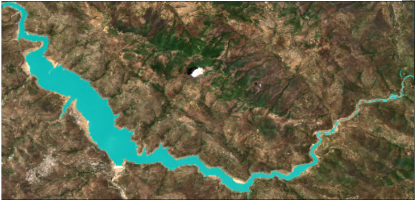
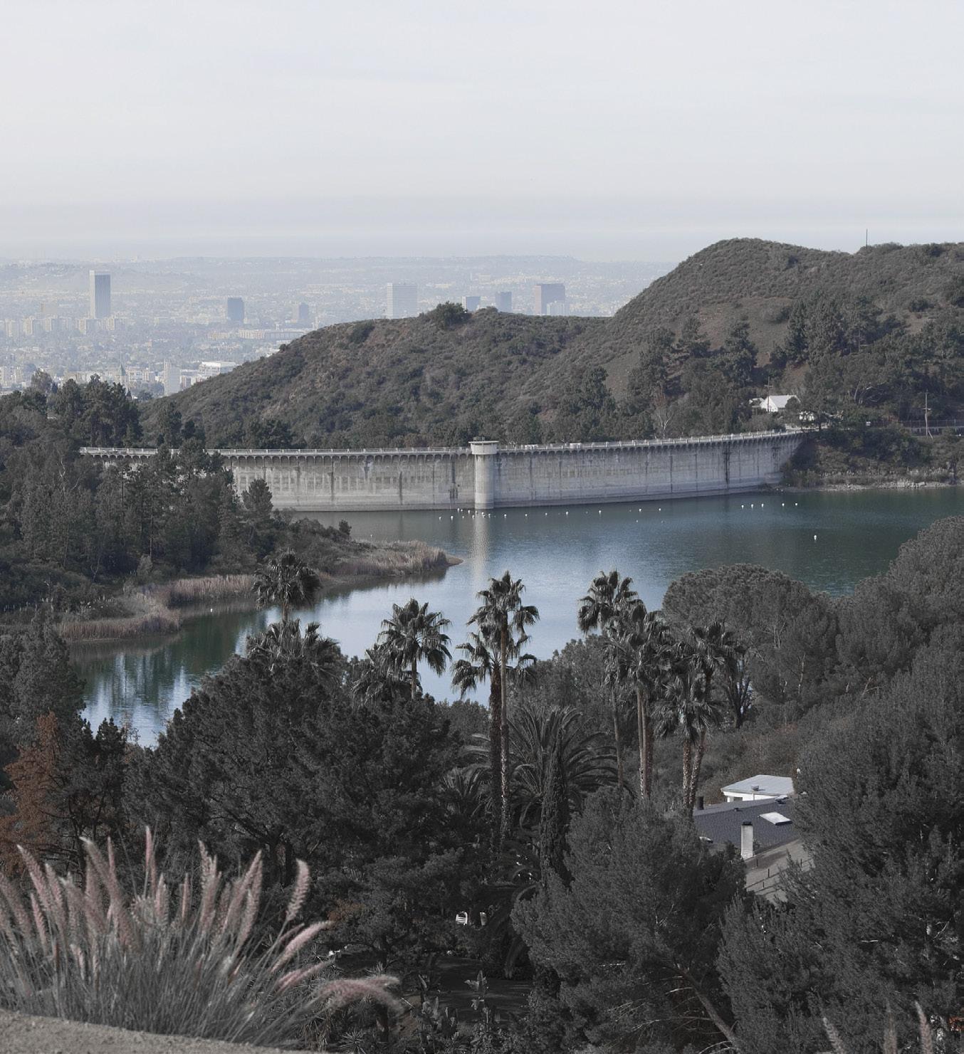
Satellite imaging using Sentinel 2. This is what the pipeline sees after correcting and filtering for clouds, turbidity, pollutants, and vegetation. Source: Author







1. Most existing altimetry applications need customized calibrations for site specific conditions. Without this calibration, accuracy could be diminished by upwards of ±25%.
2. Current altimetry measurements have long intervals (days, weeks, or months) between consecutive images of the same location. This makes it difficult to draw meaningful, actionable insights.
3. Alternative approaches to altimetry are not satellite solutions, and so cannot simply be aimed at a new reservoir to model volume.
Our team, composed of Tejas Bharadwaj, Professor Sachit Rao, and Jason Chinitz-Mital, believed these barriers could be addressed and began exploring modeling options. This led to us identifying an opensource, end-to-end solution that uses freely available satellite imagery, tools, and methodologies.
Despite a clear incentive, decision makers have not had real-time access to reservoir water information that is deployable across multiple facilities.
We conceived our end product as a pipeline: We wanted it to automate a sequence of tasks performed in a specific order to deliver real-time data for reservoir operations. We also wanted the pipeline to be available in a single containerized package. This package would allow our application, with all its dependencies (such as libraries and configuration files), to be deployed as a single executable unit that allows applications to run consistently across different environments, whether on local machines, servers, or cloud platforms.
To evaluate the pipeline, we selected the Tehri Reservoir in India as a test site. The reservoir operates primarily for power and irrigation, and it assists in reducing downstream flood risks during the monsoon season. At times, the reservoir faces high inflows from intense rainfall. This requires careful management to balance
power generation needs with flood control in the downstream regions. With such a hostile climate, Tehri is one of the hardest reservoirs on which to test the solution we proposed. Our choice of this site prompted us to expand our thinking and create a more robust model.
We began our process by obtaining composite images from Landsat and Sentinel 2 (the highest quality open access satellites) and correcting for cloud corruption. The first layer of cloud correction employs an opensource tool called Acolyte, which we tuned for inland water bodies.
We also had to correct for all other sources of corruption that could interfere with our ability to map the surface of the water body. These corruptors included shoreline fuzziness, turbidity, and vegetation. We created masks for each corrupting variable (modified normalized difference water index, normalized difference water index, normalized difference turbidity index, and normalized difference vegetation index). The purpose of the masks was to identify which pixels from the images are water, and which are not.
Even in the harsh monsoon conditions, our false positive flag rate (water pixels as non-water + non-water pixels as water) was less than 1%. We used the pixels detected as water to directly calculate the surface area of the water, deploying algorithms to create a comprehensive estimate of the surface area.
Once we had calculated the surface area from the satellite data, we then needed tools to translate the surface area to the water volume under the surface. To address this, we extracted publicly accessible
Our pipeline is a single containerized package that can be pointed at any inland water body to measure its capacity by simply modifying a single list of parameters.










www.consoreng.com
bathymetric data and graphed the points to create a map of dots representing the bed of the reservoir. We connected those dots using Delaunay triangulation, which ensures no overlap, and thereby created a 3D mesh of continuous triangles that approximated the lake bed. The closer the sampled datapoints, the smaller these triangles, and therefore the more accurate the mesh. Using these meshes, we modeled prism columns over the triangles to visualize all levels of water elevation. We added those volumes up to create a function that represents the volume of water under the surface at a given water level. Similarly, we used mathematical formulas to create a function that represents the surface area of water at a certain water level (summing the cross product of the normal and each of the triangles in the mesh under the water level at a given height). However, since we used sampling data, we needed to account for the possibility that the height of the water exceeded the maximum height from the samples. To account for this, we extended the gradient of the triangles closest to the edge of the reservoir.
We believe the major novel techniques employed by this pipeline are:
1. Integration of satellite images with bathymetric data
2. Use of triangulation to fill in data gaps and provide a continous approximation of area and volume
3. Creation of cloud, vegetation, and turbidity masks for image correction
As a product of these features, our pipeline is a single containerized package that can be pointed at any inland water body to measure its capacity by simply modifying a single list of parameters.
At our initial test site, the pipeline achieved surface area accuracies above 98%. As for volume, we validated our pipeline with official Indian water board gauge measurements, showing mean absolute percentage error under ±14% for volume with a root mean square error (RMSE) of 18 million cubic meters (representative of about 5% of live capacity).
This is noteworthy, since a majority of the error in our pipeline stems from the satellite imaging and bed modeling parts, both of which are more prone to error at higher areas and volumes. Thus, the lower the overall volume/area of water in the lake, the more accurate our models. This means that as volumes near critical levels, our models become more accurate and reliable.
To advise decision makers on how much water they can safely extract from reservoirs, the key parameters to calculate are natural inflow and outflow rates. With that
information, operators can determine how much artificial outflow to allow. For these parameters, our error rate was below ±2%.
This approach enables reservoir managers to make more educated scheduled releases, industries to be aware and plan around access and shortages, and domestic consumption and agricultural use to be more transparent. The modularity of this pipeline design allows for community extensions for specific deployment scenarios (i.e., snow or rain gauges). Water scarcity poses a massive threat to agrarian and industrial economies as well as domestic consumption, and this work presents a transparent framework that is deployable on any inland water body to anticipate and mitigate this risk.
Tejas Bharadwaj (tejasjb@gmail.com) is a student at Carnegie Mellon University, seeking to obtain a degree in computer science.


Michael C. Nowlan, P.E., CFM
I’d like to talk to the folks out there that have a desire to write for the newsletter, but have been unable to make it happen so far (or perhaps I’ve scared them off?). For those of you who enjoy reading the writings of others and have no desire to become a published author, feel free to move on to the next article (oh wait, there isn’t one, yet). This piece is intended to share my observations and make a few recommendations, so it may still be entertaining, but it is really for the benefit of those budding writers out there, the “silent” majority.
It may seem a bit self-serving as the editor of the newsletter, but it is always a win-win when people write and contribute to “the conversation”. It would be great if it could be the floodplain management conversation, but I recognize that there are other subjects that are just as fulfilling to contribute to.
Writing can be, in some ways, a much safer mode of communication than public speaking. After all, the writer is able to write and refine their thoughts through editing before delivering it to the “audience”. One can take their time in the writing process to perfect their phrase-turning with very little pressure. There really is no audience other than the writer themselves during the writing process, so it is “safe”. In public speaking you need to be able to be articulate and perform within a given time frame. If you take too much time between phrases people will begin getting uncomfortable. It’s funny, but silence is …………. Painful, in that situation. Just like on the radio, dead air, is, well, dead. Silence can be much less stressful, even peaceful, when you’re writing, sort of like a form of meditation. It’s all in our perception/expectation.
So, according to my own rules on writing an article for the newsletter, I need to tie this to floodplain management. Here goes. Writing is a basic form of planning and management. It is communication about a subject that articulates the details of a subject prior to execution of an action. It records/memorializes those details. It explains its concepts. It is much like a set of improvement plans before beginning construction. (Public speaking is more like the construction in this analogy.) Of course, not all writing is action-oriented. Sometimes it is purely hypothetical/abstract, reviewing and analyzing something that has already happened. Before dedicating and spending money to building anything, writing can provide a conceptual study that finds the advantages and disadvantages of previous efforts to build ideas in our brains to test their feasibility.
Even with fictional writing, what is being constructed is the story in our imaginations, but there is always something intended to be constructed/championed when one writes. Even with writing that calls for the destruction of something, the intention is almost always to build
something new, something better, to replace what is destroyed, at least in the opinion of the writer. Sometimes, often times, such types of writing hurt more than they help, particularly when they are written to benefit only a chosen few, and not everyone. Writing can include the expression of deceptional and delusional thinking, but how are you to discern if there is only silence? I recognize in today’s communication environments that the loudest voices can seem hard to drown out. When those loud voices are deceptive/selfish voices, it is not always clear. It is our job as human beings to dig and test all of those voices and come to our own conclusions. Don’t be intimidated into silence! Equally, do not be blindly bloviating an emotional argument simply because others are empassioned about it. (You may think I am bloviating with this article ). In order to determine whether speech is empty, or boastful, or pompous, it has to be communicated. Leave it up to the readers to assign their own valuation of the importance of the content. Seek substance first, not adulation.

As floodplain management professionals you are already writers. Most/all of you already write for your job, i.e. reports, memos, etc. So, asking you to write for the newsletter may seem like asking you to work more than you already are, and for free, to boot. You may not write often enough to feel like you’re good at it. I think writing is like any exercise, which includes building up muscle strength and control. If you do it often enough, you will become better/ stronger at it. If you only do it every once in a while, it may make you feel sore, and frustrated. I promise, if you write more, you will become a better floodplain manager. You will become more organized, more decisive, more insightful, and perhaps more inspirational. You will even become better at discerning defects and deceptions, to help your fellow floodplain managers.
How do you get good at it? It is the dilemma of life for any endeavor. For example, I love playing golf, but I suck at it. Maybe I would play it more if I was better at it, but I’ll never be better at it if I don’t play it more often. Here’s the kicker. I still love it even when I suck at it. There are other sports adages that could apply more broadly to motivating you to write, like “You miss 100% of the shots you don’t take”.
If you’re afraid of messing up, here’s my recommendation. Write in private, to practice. Get your thoughts down in black and white, even if you are the only one reading them. I know you have thoughts. I’m willing to bet that a good many of them would be great to share with others. Start precipitating your ideas, build some channels and detention basins, clear some debris, and let the brainstorming begin. If we get a flood of ideas from all of you after this, who better to entrust them to than FLOODPLAIN MANAGERS!
The Newsletter of the Floodplain Management Association