

Portfolio
Urban Planner and Designer
Farnaz Omouri

ABOUT ME:
CONTACTS:
Farnaz.omouri@mail.polimi.it
+39 3515852405
Farnaz Omouri
I am an Urban Planner and Designer with a profound interest in the development of urban public spaces and the integration of sustainable socio-environmental principles in urban planning. My expertise includes master planning, urban revitalization, and community development, with a focus on integrating innovative design principles and community needs. I really enjoy working as part of a team and I'm always excited to connect with colleagues across diverse interdisciplinary fields, seeking opportunities to acquire new knowledge and expand my skill set, especially within the realm of sustainable urban development.
EDUCATION:
M.Sc in Urban Planning and Policy Design
Politecnico di Milano, Italy 2019- 2023
B.Sc in Urban Engineering Islamic Azad University, Tehran, Iran, 2011-2015
EXPERIENCES:
Project Management Intern, IPMA Italy Politecnico di Milano, May 2022 - July 2022
Graphic Designer, Exiss Company, Tehran, Iran, Jan 2018-Nov 2020
Urban Designer, Sharmand Architecture Office, Tehran, Iran, Jan 2017- Dec 2017
Urban Designer Intern, Engineering Office 214 Tehran, Iran, April 2016 - July 2016
Urban Planner Intern, Municipality of Zone 5 Tehran Iran, Nov 2014 - April 2015
CERTIFICATES:
Introductory in Project Management, IPMA Italy, May 2022 - July 2022
WORKSHOPS:
Anatomy of Public Space
Park Associati, Transform Transport, Land Milan, Italy, May- 2024
SOFTWARE SKILLS:
AutoCAD
Illustration InDesign SketchUp
Photoshop
Revit
SPSS
01. Integrating the Fragments Acamedic ( Umbria-Molise, Milan )
02. Spatial Planning and Infrastructure Design Acamedic ( South-east of Milan )
Microsoft office
03. Gratosoglio, Wake Up! Academic ( A Self-Sufficient Neighborhood )
PERSONAL SKILLS:
Teamwork Organization
Problem-solving Communications
LANGUAGES: Arc GIS
English - Fluent Persian - Native
Italian - Intermediate
Turkish - Basic
04. Master's Thesis Acamedic ( A Strategy for Revitalizing Neglected Public Open Spaces with the Aid of Nature-based Tools in the Gratosoglio Neighborhood, Milan )
Urban Policies Design Studio
School of Architecture,Urban Planning and Constructiion Engineering
Msc in Urban Planning and Policy Design
Professors:
Prof. A. Bruzzese & Prof. A. Balducci
Team Work
Site Analysis:
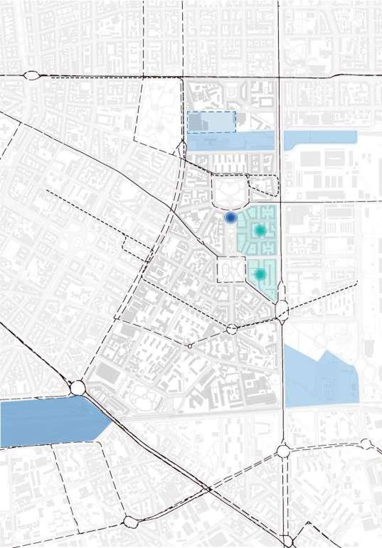
Umbria-Molise is located in south-east of Milan and it is part of Municipality 4, one of the nine local administration unit of the city, which includes also Corvetto, Rogoredo and Forlanini nieghborhoods.
The denomination Umbria-Molise stems from the two main thoroughfares that delimit the east (Viale Molise) and on the west (Viale Umbria, a segment of the second ring road of Milan); the northern border is defined by Corso XXII Marzo, the southern one by the railway, with Porta Romana Station.
Location of the Neighborhood :


Legend:

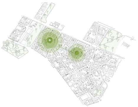
The Neighborhood has an presence of green spaces, such as Piazzale Insubria and Piazzale Martini, which, together with Via Laura Ciceri Visconti, form the central pivot of the sequence including Parco Vittorio Formentano, Parco Emilio Alessandrini and Giardino Marcello Candia. In the middle of Via Laura Ciceri Visconti, a large boulevard with trees on both sides, there is Calvairate library, the main cultural facility of the neighborhood; Fondazione Prada, Museo del Fumetto and Cascina Cuccagna are in proximity. Another element of Umbria-Molise is the presence of schools, from kindergardens to high schools.
Walkability Assessment
Public Housing
Attractions (library, supermarkets, etc.)
Railway Stations
Bus Stops
Tram Stops
Beaten paths
Green Areas
Commercial streets

Problem Definition:
Multiple and Interlinked Problems :

Iligal Parking Green Space and Playground
Good level of accessibility Legend:

Green space
Stations (railway and metro)
Strong local actors presence
Bus stops Tram stops
Opening of a
Future and ongoing Projects
Monofunctional street - high presence of carslow walkability
Non-transparent ground floors
Legend: Monofunctional streets
Illigal parking
Poor neighborhood (highunemployment, poor education level, largefamilies, etc.)
Opportunities

Empty apartments, Decayed groundfloors
Lack of investment in the area by public sector (both ALER and Comune di Milano)
Concentration of poverty, unemployment, low education Social and cultural fragmentation
Threats
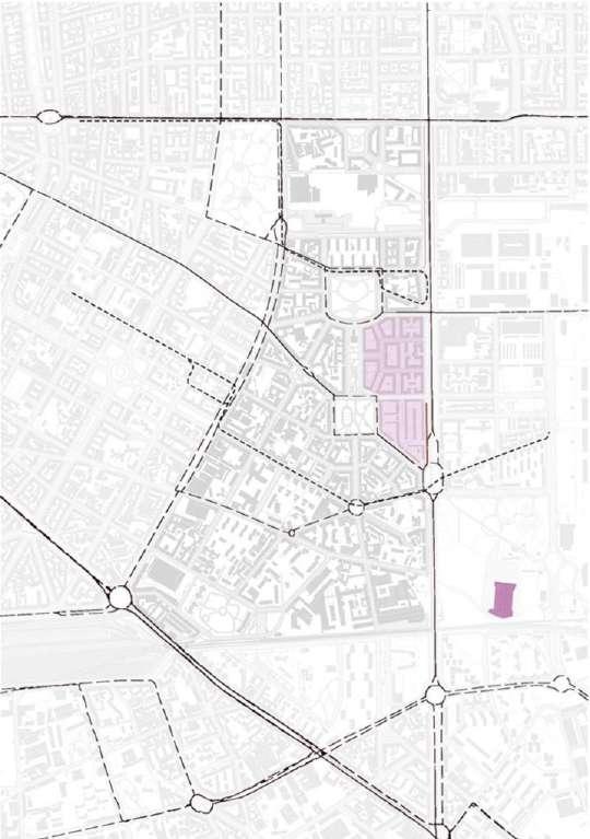
Public Space: limited or improper use

Spatial and Social Fragmentation: isolated community and lack of network Housing: concentration of fragilities and insuficient answer to people needs


Degrading Neighborhood: no investments and increase of

Concept and Strategies:
FRAGMENTATION
econimic disparities- immigration-public space
SOCIAL-ETHNIC-SPATIAL
reconciliation of fragments
reduce disparities - recreat local identity
INTEGRATING THE FRAGMENTS COHESION
The concept of this work therefore is “INTEGRATING THE FRAGMENTS”, which means to reactivate the processes that lead to the restoration of a cohesive community, to which all populations feel the sense of belonging. When the local identity and the sense of community are lost and scrambled, the way to reverse the direction is to invest in the social capital (Cognetti, 2017, Metabolismo…) and provide the conditions (spatial, economical, procedural) to make people the main drivers of change working as a community and not a sum of single individuals.
The Objective of ''Cohesion''

Strategy comprehensive of the two dimensions:
In order to integrate the fragments, recognized as a number of populations living and using the same place but not belonging to a community with its own local identity, the strategy puts COHESION as the main objective
Spatial and Social Dimensions of Strategy:

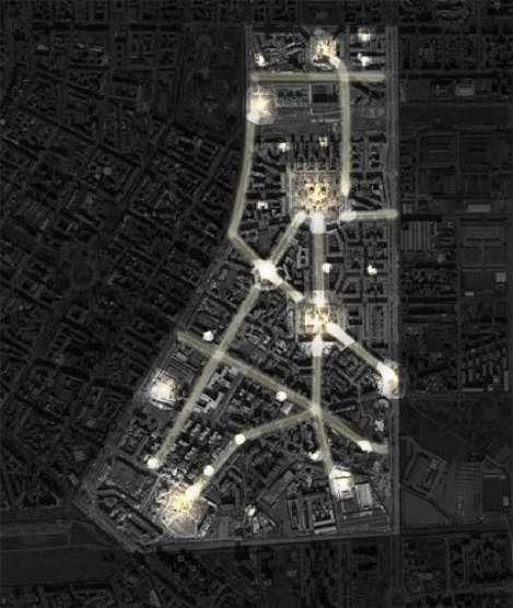
Restoration of centralities
- Restoration of the centralities and creation of new ones through a renovated use of public space;
- Reconnection of actors, creation of a network and implementation of a point of reference for both people and actors able to manage the overall strategy.

''Centralities as drivers for a chesive community''
Mutual exchange in terms of activites and proposals between actors, the network and the third actor

Diffusion of the centralities throughout the neighborhood

Implementation of a third actor as point of reference

A new and better use of public space as a whole

Mapping of actors and implementation of forums

Three Dimensions of Intervention :
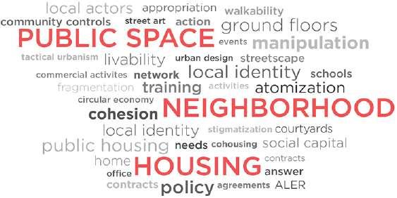
Implementation of Street Design Elements Regenation of Squares


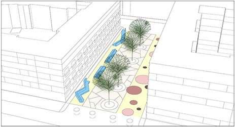
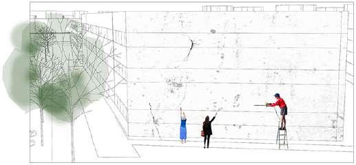
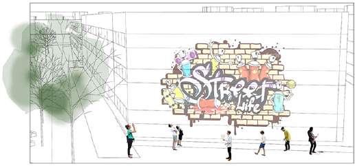
Program of Events and Activities
Reuse of Vacant Grunnd floors:


Using Courtyards of Public Housing for Collective Activities


Open Schools ( Building and Courtyards) in non Scholatstic Hours
Via Laura Ciceri Visconti Via Faa di Bruno
and "POLIMI Off Campus" :
This actor is identified in the Politecnico through the tool of Polimi Off Campus already used in San Siro and the location of this physical place could be inside the library, taking advantage of the fact that it is going to be renewed and enlarged in the next future; the Campus would be in the exact centre of the neighborhood and it will offer the library to open, physically and socially, to the public space, with a freely accessible space open to the parks of Via Laura Ciceri Visconti and Piazzale Martini.

Opening
Site Analysis:
Spatial Planning and Infrastructure Design Studio
School of Architecture,Urban Planning and Constructiion Engineering
Msc in Urban Planning and Policy Design
Professors:
Andrea Arcidiacono & Paola Pucci
Team Work
Infrastructural & Environmental System:
Milan is the second most-populated city of Italy. While the growth of residential neighborhood is mostly in the northern areas of Milan, some fragmented residential areas are situated between agricultural lands in the south. The selected area is situated in south-eastern of Milan. most of the area is covered by agricultural lands. Also, the Linate airport and ldroscalo lake are situated in the center of the area. Furthermore, the Lambro river is situated in the west of the area which can imagine as a border or a good potential for this area. The public transportation in this area limited to bus and should be improved.
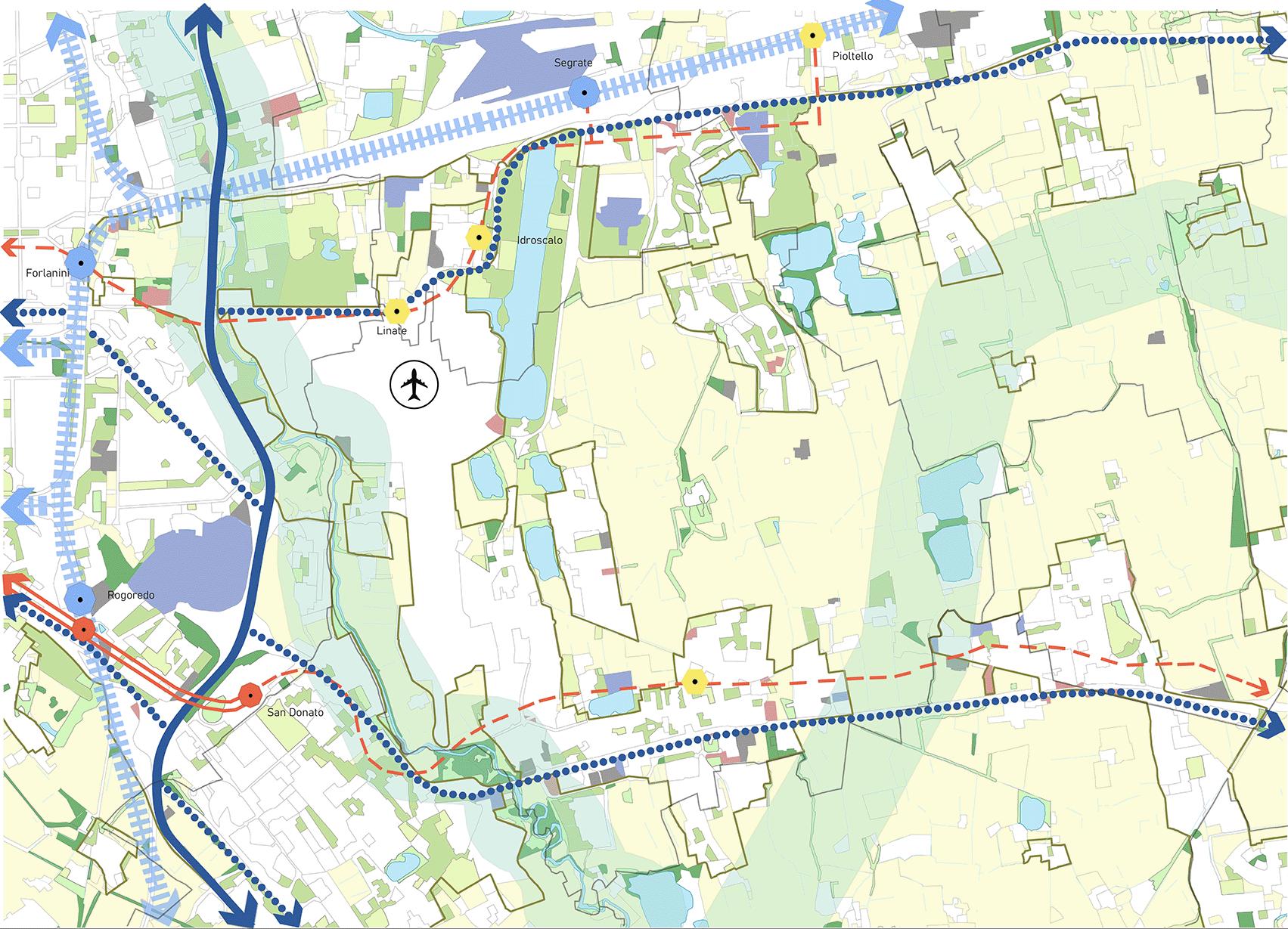

Environmental system relationship with regional level

Fast mobility system:


system is scatered and there is lack of integrated cycle path and also pedestrian areas are not very well organized in some parts.
Barrier analysis and crossing points:
INFRASTRUCTURE BARRIERS:
/ Industrial areas
airport
Trip
generators and attractors:

Infrastructure system relationship with region level


ENVIRONMENTAL SYSTEM:
-Preservation of the main green areas along the river
-Re-estanblishing ecological corridor
-Main green corridor -New sustainable


-Garden strips along the highway
-New path
-Secondary green corridors
-Preservation of agricultural lands
-New gardens

-New park
Master Plan :


MOBILITY SYSTEM:
-Highway redesign
-Elevated crossing points
-Adding and integrating bike routes
-Redesign of traffic nodes
-New metro line -New metro stations
-New bus line
-Horizontal and vertical connection
-Adding bike routes
-New multi-functional metro stations
Improving the quality of open space in excisting elements ( Residential and Indeustrial )
-Residential areas -Industrial areas
-Regenerating vacant spaces Connecting north and south BUIT-UP SYSTEM:
-Connecting the new residential blocks to the

-New centralities
-Connecting new centralities


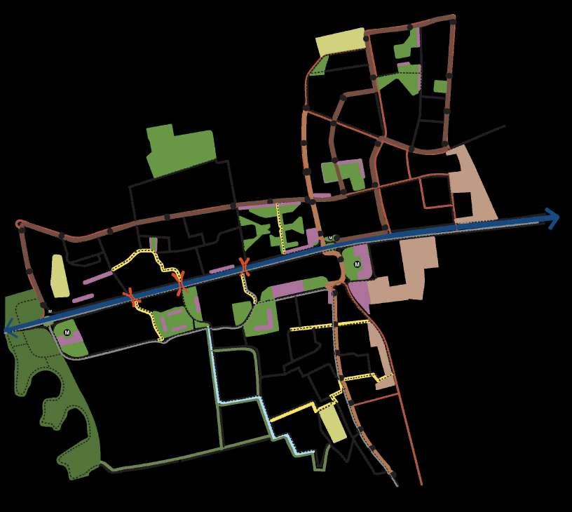


ENVIRONMENTAL SYSTEM:


Regenerating vacant spaces considering their type and taxonomy Preservation of green areas and forests along the river
Creation of neighborhood gardens
MOBILITY SYSTEM:
Redesign of the existing bus routes
Improving the existing bridges and create a main crossing point to connect northern neighborhoods to the facilities provided in the south
BUIT-UP SYSTEM:
-New metro line



Re-design of elevated crossing points to give priority to bicycle and pedestrian
Creating paths in between agricultural areas
Redesign of the highway to improve green spaces both of the edge and in between and also enhance pedestrian and bicycle accessibility.
Using the spaces between houses to provide cycle pathe and pedestrian area.
Redesign of the streets to provide an integrated cycle path.
New Multifunctional public facilities adjacent to green areas and with good cycle and walking accessibility.

Construction of mixes-use metro station with a green and open space in front
New educational complex for the southern neighborhood with large open and green spaces on both sides.
Designing new residential areas based on mixed-use patther, commertial and retail store in the ground floor to meet people’s daily needs.
Design Scenario :
Intervention in vacant spaces:
This proposal is based on a net of projects connected and designed dependently one on the other. All the small interventions nourish the activity of the others, so they all interact with each other reciprocally.

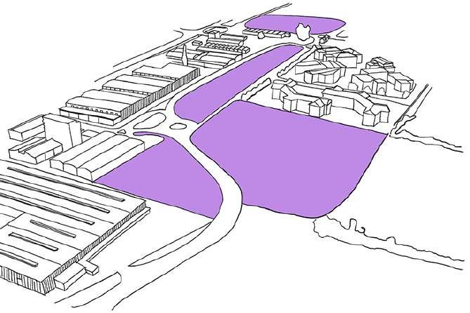


New green & social area
Pedestrian & cycle accessibility improvement New social interactive square
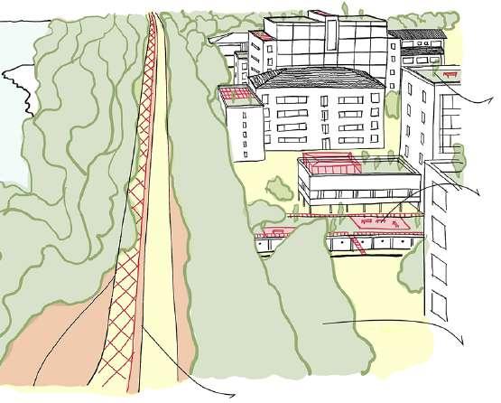
Building rooftops redesign
Parking rooftops social & green for purposes
Green areas improvement Mixed-use avenue


Riverbed
Courtyard
Gratosolio , Wake Up!
Housing and Neighborhoods
Studio
School of Architecture,Urban Planning and Constructiion Engineering
Msc in Urban Planning and Policy Design
Professors:
Massimo Bricocoli & Stefania Sabatinelli
Team Work
The Vision and Strategy:

- DORMITORY NEIGHBORHOOD
- LACK OF STIMULATION
- NO SENSE OF BELONGING
VIBRANT NEIGHBORHOOD - ATTRACTIVE COMMON SPACES
- FLOWS OF RELATIONS
Keeping it Young!
Policies and Spaces for youth in Gratosiglio
For this project we retraced the historical development of Gratosoglio, understanding why the neighborhood is today so stigmatized and trying to overcome the paralysis acquired over the years.
The goal is to awaken the neighborhood and its inhabitants, through a project based on three actions that touch indoor and open spaces.
To develop new housing units and a new housing system that aims to involve young students

Interventions :
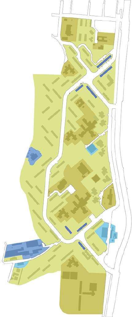
Areas of Intervention:




To give new uses to open spaces which have no use, which are nameless and without identity
To organize new systems and destinations by intervening on the relationship between


Plan for Youth Foyer :


Plan for Services


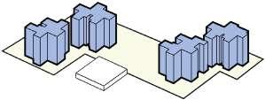
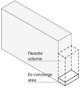
Parasite House : New affordable units


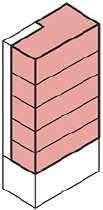


Plates Pop-up System:


5 RESIDENTIAL UNITS ELEVATOR AND A STAIRWELL AT ITS DISPOSAL OPENING OF THE GROUND FLOOR TO ALL RESIDENTS TO MAKE ROOM FOR EDUCATIONAL IF THERE IS A PORCH, IT WOULD NOT BE ALTERED

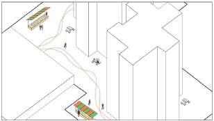


Community library
Open green space
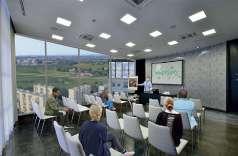
Lecture room
New Uses for Unused Plazas:

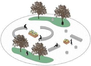


SHORT TERM
Pop-up System
rehabilitate the concierage
MEDIUM TERM
Parasite House new uses aqueares
LONG TERM
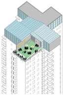
Foyer Rooftop
Service Rooftop

Master’s Thesis
Network of Public Open Spaces
(A Strategy for Revitalizing Neglected Public Open Spaces with the Aid of Nature-based Tools in Gratosoglio, Milan)
School of Architecture,Urban Planning and Constructiion Engineering
Msc in Urban Planning and Policy Design
Professors: Maria Antonella Bruzzese
Author: Farnaz Omouri
Strategy Plan:
Sterategy 1. Revitalizing of neglected open spaces for creating new centralities.
Strategies for Underutalized Neglected Spaces: 2 5 3 1 4 6
The project emphasizes using a placemaking approach to revitalize Public OPEN Spaces, particularly “Neglected Open Spaces” (NOS).
The revitalization of neglected public open spaces is a key aspect in the development of sustainable urban areas, as it enhances land-use efficiencies and fosters social interactions while simultaneously reducing negative environmental impacts. The main goal of the thesis is to have a significant impact on the entire chosen site and contribute to a “Revitalized Neighborhood” in order to strengthen the neighborhood’s network and its public open spaces.
Design Scenario :
1. The ParkPlatz


Fragmentation of Gratosoglio
Sterategy 2. Creating new linkages and accessibilities to Improve and connectivity of the attraction points and making the target spaces more walkable
Networking of the Linkages
New Ecological Corridor
Connecting Green areas to the Riverside
New Pedestrian Path
Reducing Mobility for new Gthering Spcae
Addition of Bike Routes
Creation of Stop Points


High density of residential buildings Accessibility


Main Green Corridor
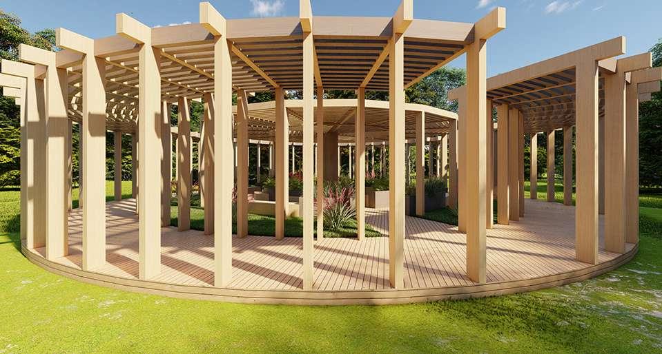
The Following is a Possible Proposed Design for the “Tree Tower” :
The Outside Look of the Tree Tower:


Infrastructure Open Gathering Space Seating area


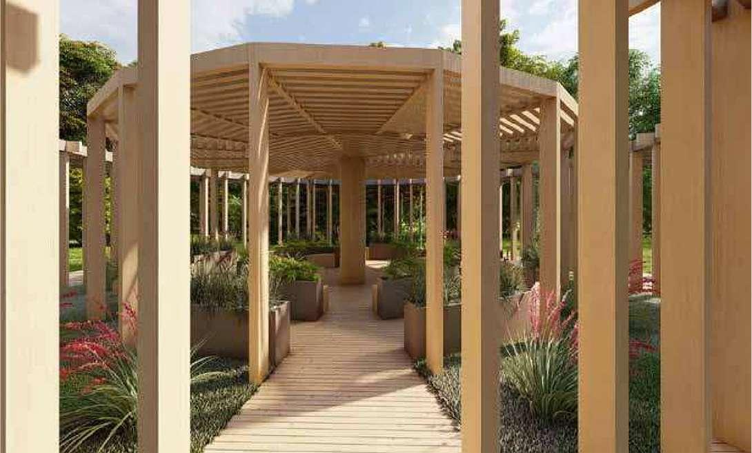

The Inside Look of the Tree Tower:


Before:

Accessibility of the Park


The Existing Bridge Provides Access to the area from across the River

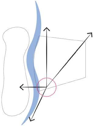
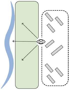
Section of the current situation illustrates how the green barrier beside the river makes it invisible


After:


Getting Closer to the River Visually and Physically


Gthering Space beside the River
Connecting Both Sides of the River


1. Creating a Greenhouse Garden 2. Community Garden
3. Creating two buildings dedicated to weekly markets to sell the products of the gardens and space for maintaining the gardening equipment as well.
4. Creating new Green Open Spaces beside the River
5. Creating Wooden Pedestrian Path along the River
6. Adding a wooden pedestrian bridge connects the neighborhood to the river’s other side.
7. Cycle path
View of Residential Buildings to the Riverside
The Current Condition of the Pathways to the Riverside
Accessibility of the Piazzato the Riverside
Accessibility of the Piazza
5. Flexible Socio-cultural Area Between the Towers
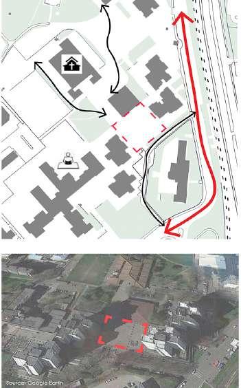
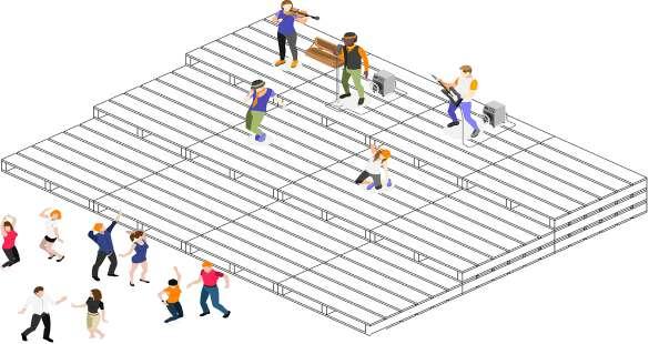
It adds lacking natural elements to space. It works as a shading area to cover the open spaces, covering sunny and hot days and cold seasons and also its revised design of the umbrella will capture rainwater on rainy days with perceptions and creates a multifunctional gathering space.


6. Southern Open Green Area


Educational Community Butterfly Garden:
This open green area has the potential to be a vital point in the South. Transforming a green area from a purely decorative space into one with a distinct identity can provide greater benefits.


During Cold Seasons:

During Hot Seasons:

Accessibilty
The Green Umbrella:
New Flexible Gathering area:
Secondary Intervention Locations
Revitalization of Main Street “Via Baroni” and “Via Achille Feraboli” :


Current Situation of the streets: The Proposal Plan:
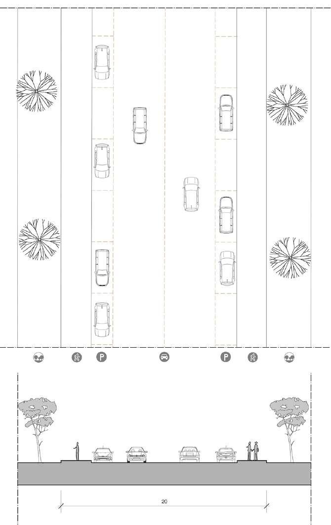

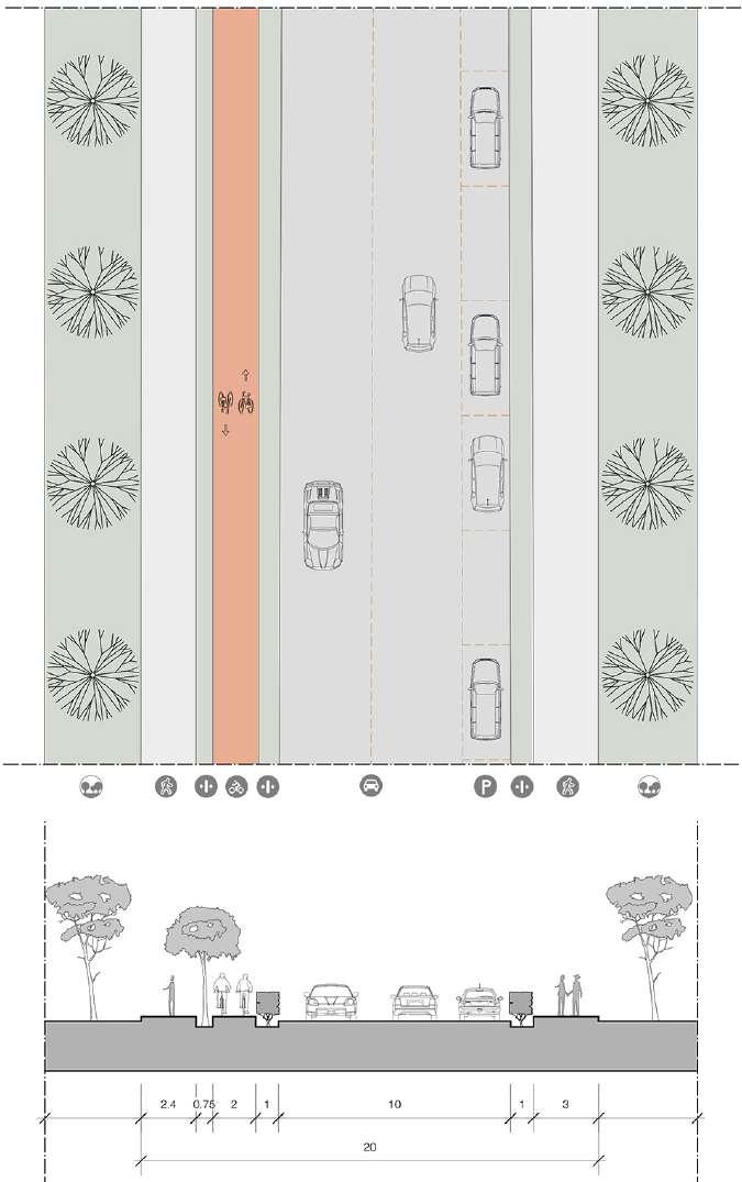
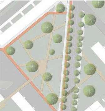
The Proposal Plan:

Via Achille Feraboli
Via Baroni
