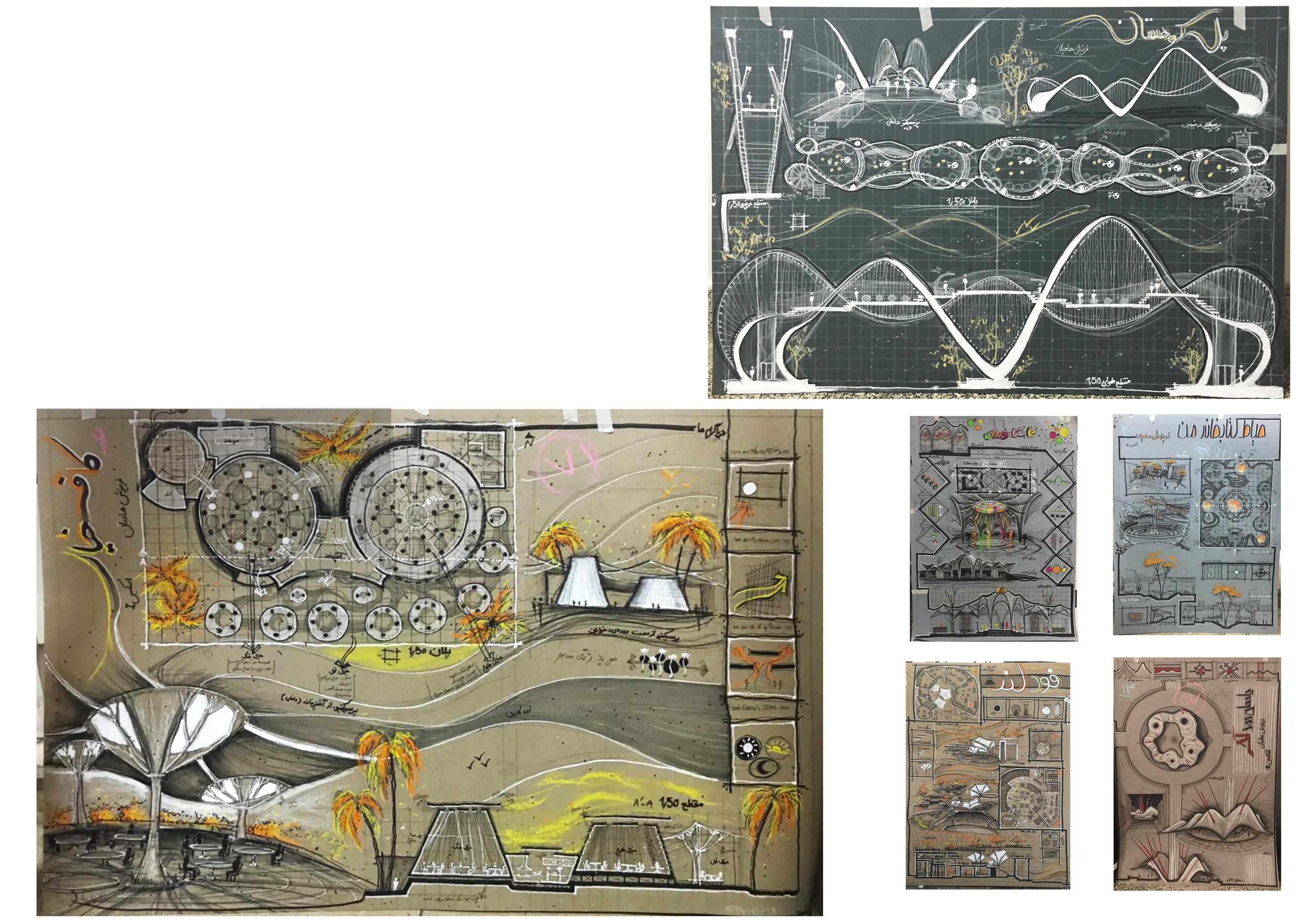
Landscape Architecture Portfolio Farinoosh Hadian jazy 2022 Portfolio
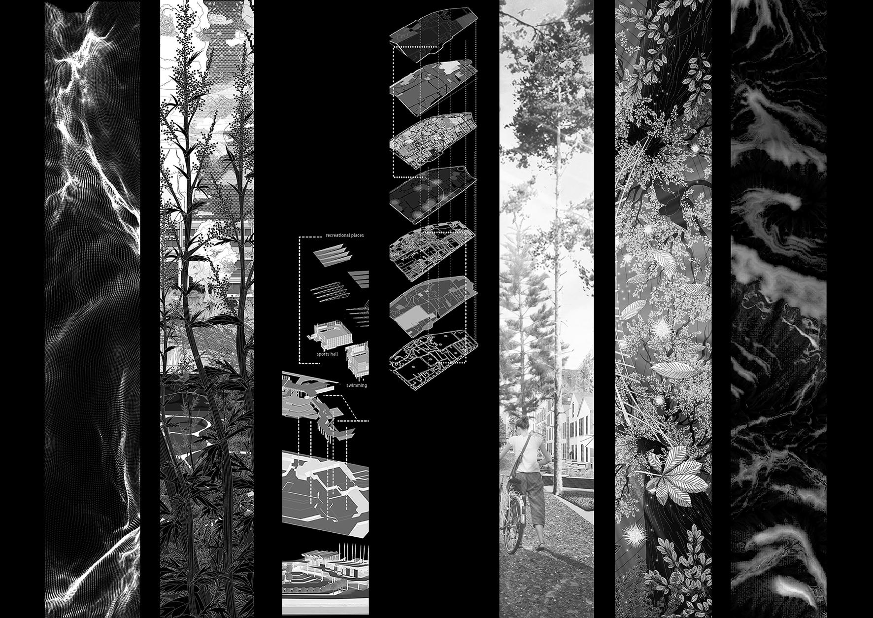
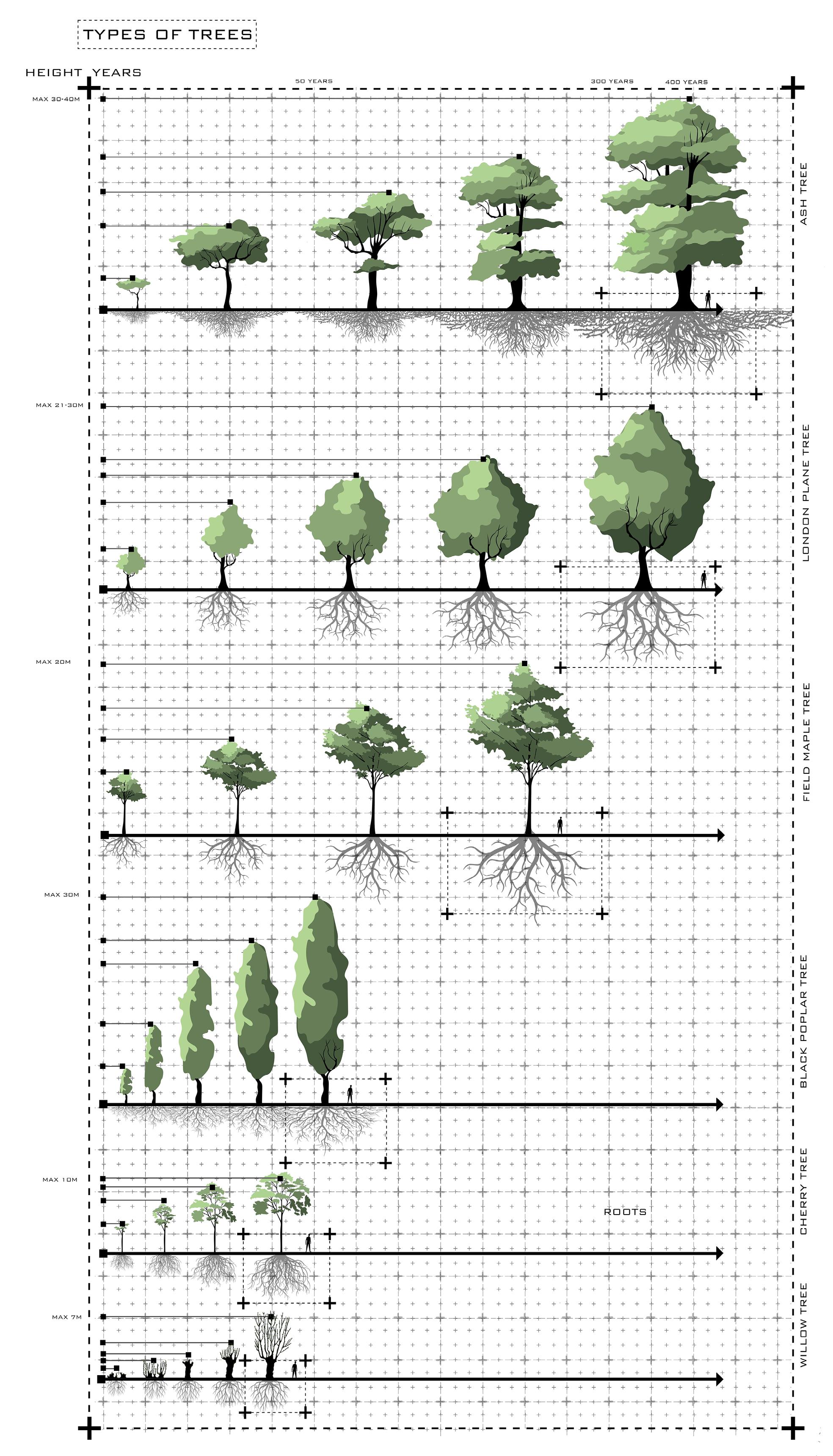
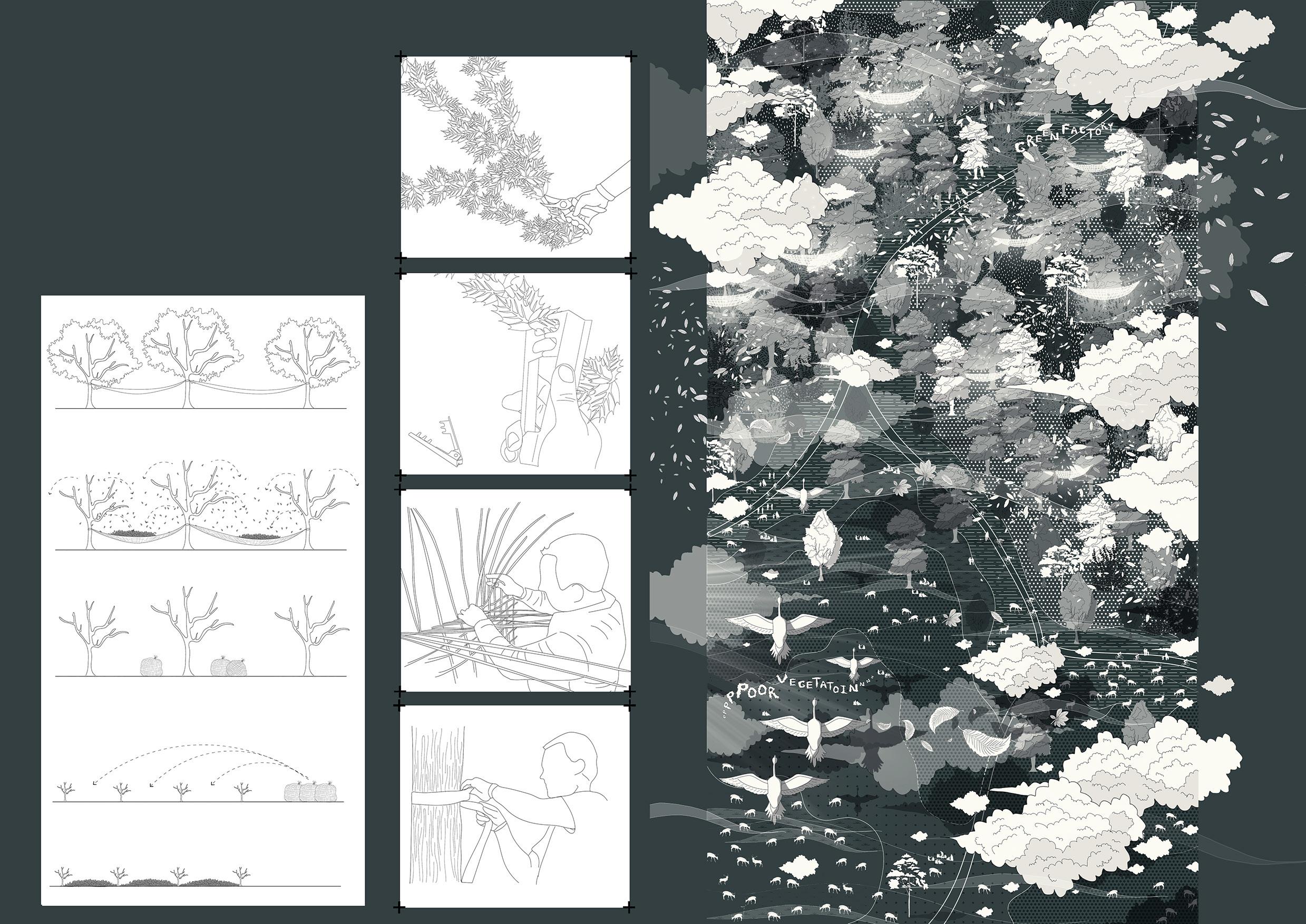
extracurricular Activities In this part there are some of samples of my work in university college London and my internship 1. Here-east wetland rehabilitation 2. Hidden forest!!! Forest factory??? 3. Jolma architects This part is a collection of my projects during my Master’s degree and my internship. I bring three projects that are more relavent to Landscape and Urban design. All of them are done between 2020-2022. They are modeled with many softwares such as Revit, Rhino, Houdini, Agisoft, and etc software. These projects changed my view towards Landscape design.
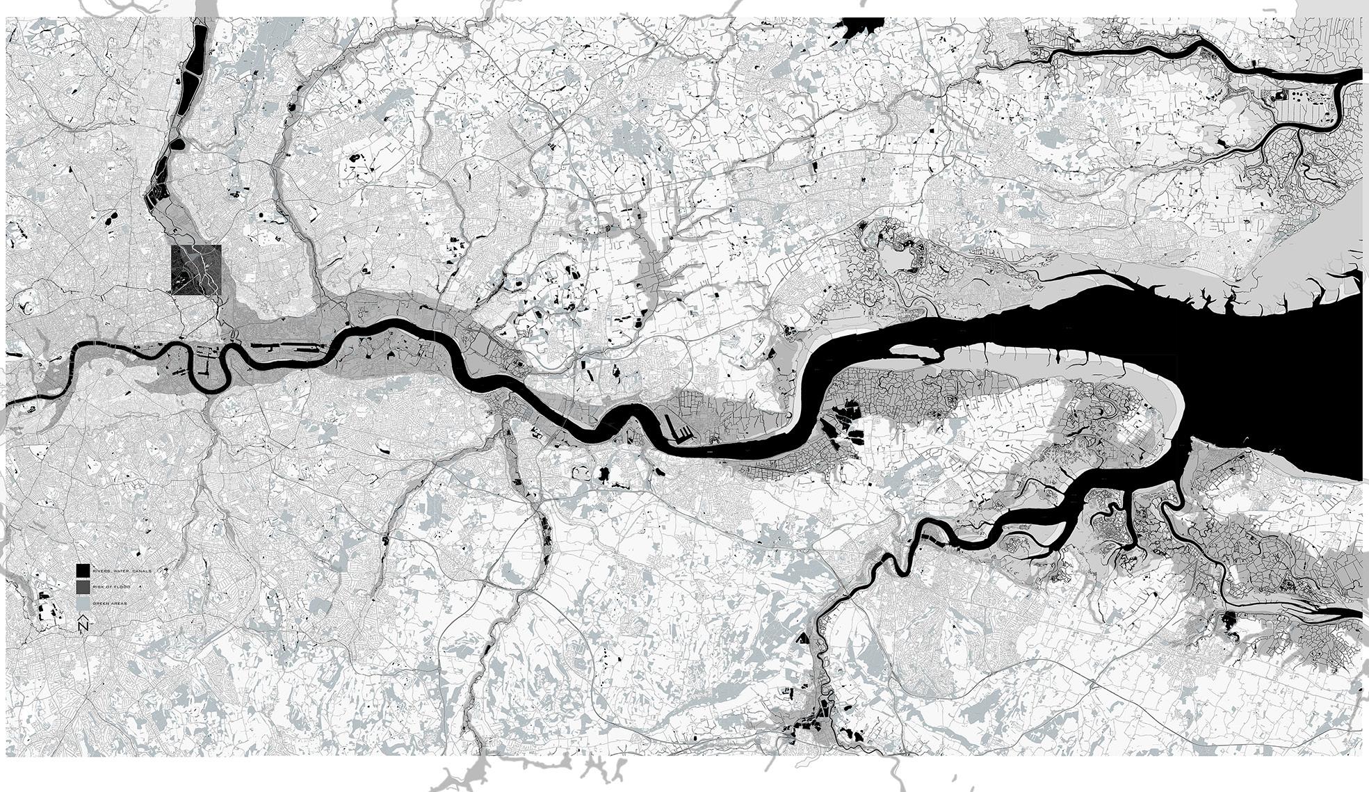
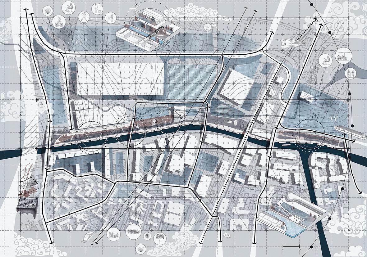
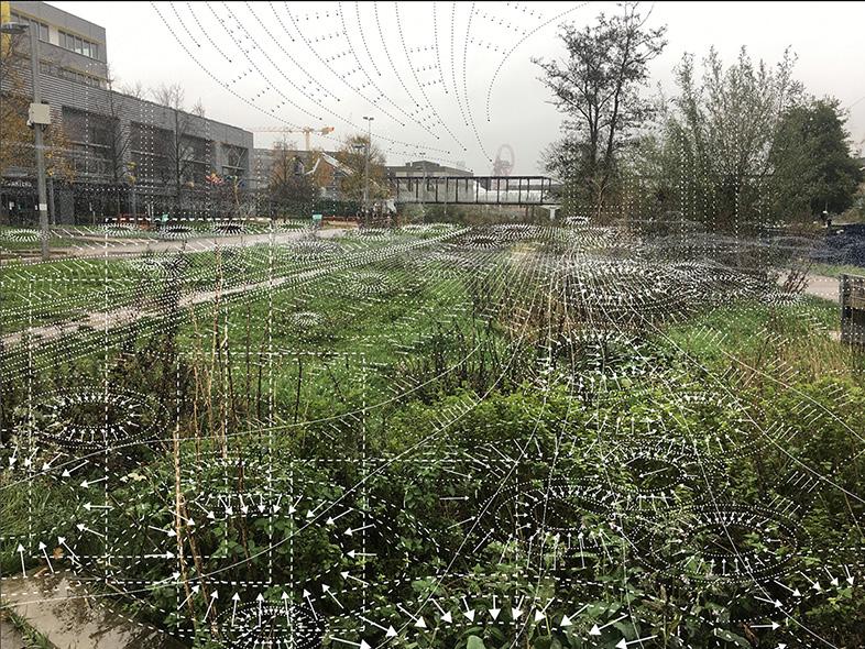
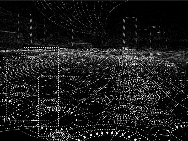
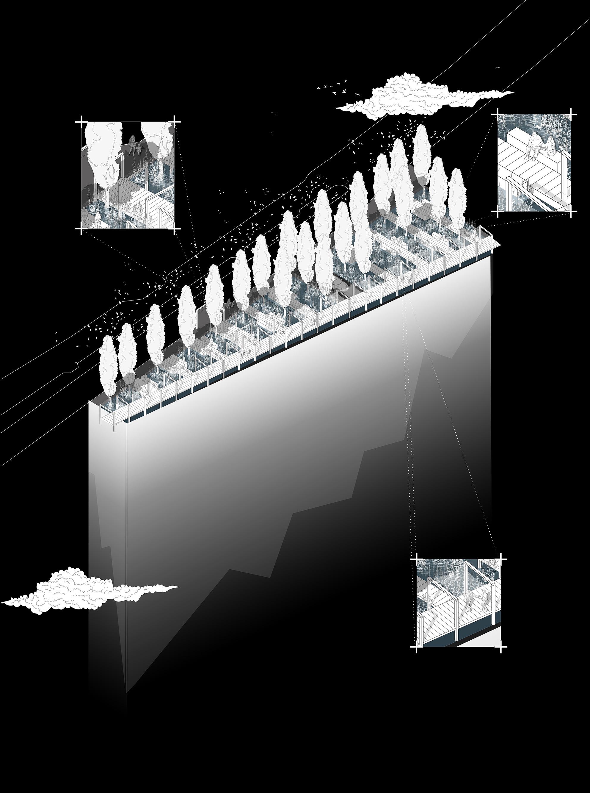
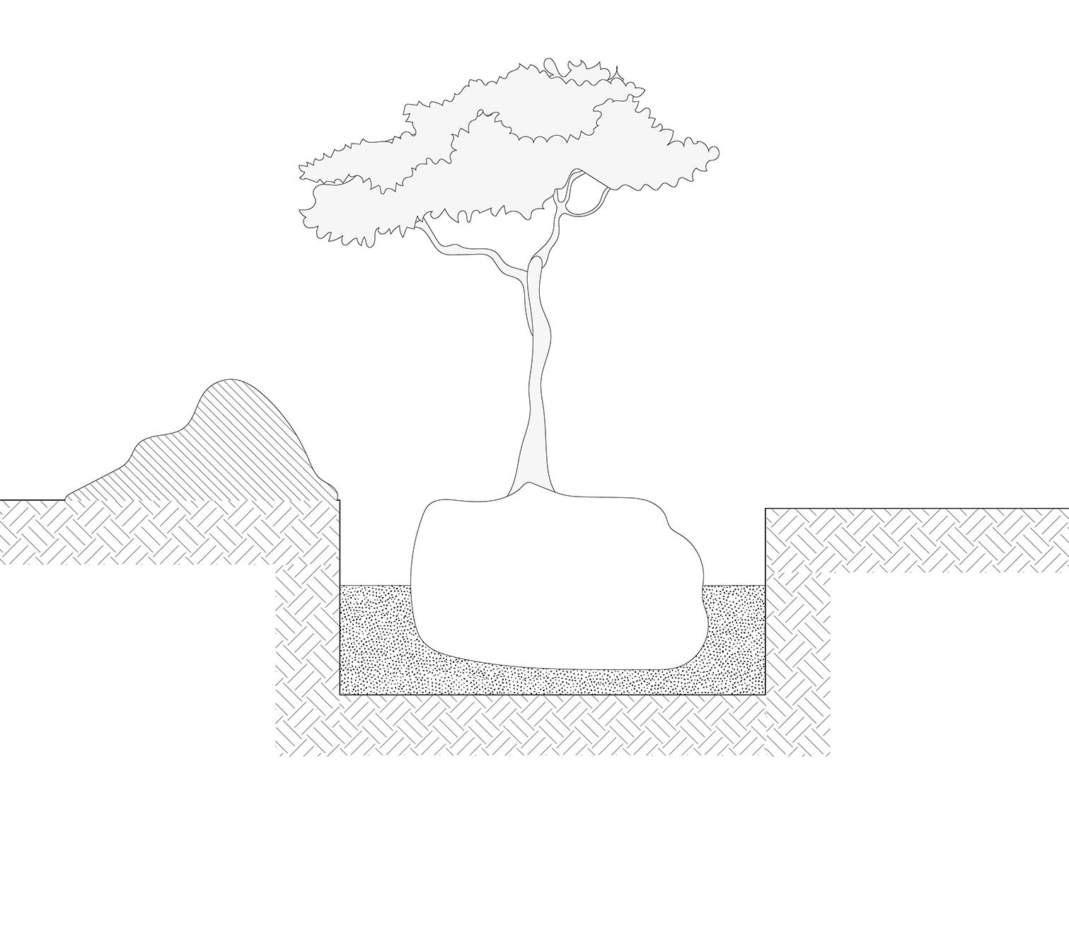
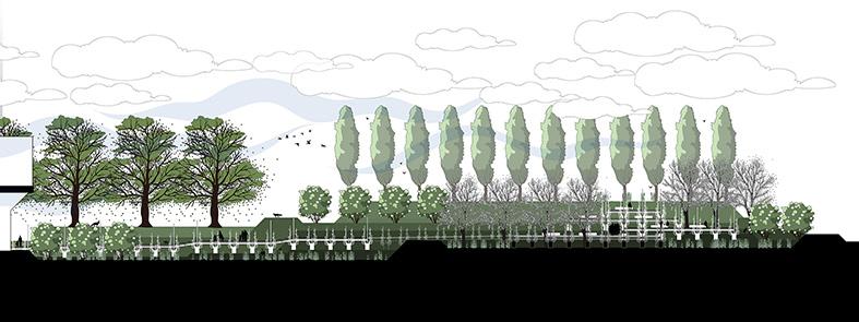
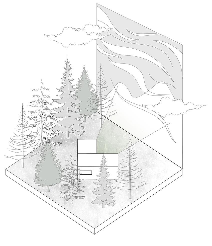
Roads, highways, and buildings are main features of modern cities. Along those hard layers of landscape there is leftover terrain with scarce vegetation. Many of these for gotten lands constitute terrain vague. These hard layers of our cities have many im pacts on our environment. One of the most significant is the rapid increase in the level of runoff as the ground is not able to absorb water. This problem causes a high risk of flood in various parts of the world.
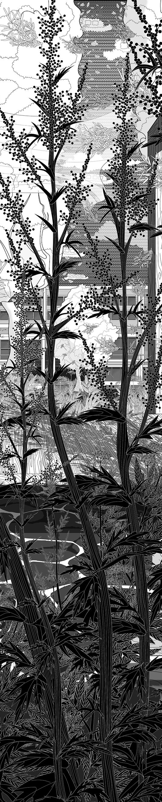
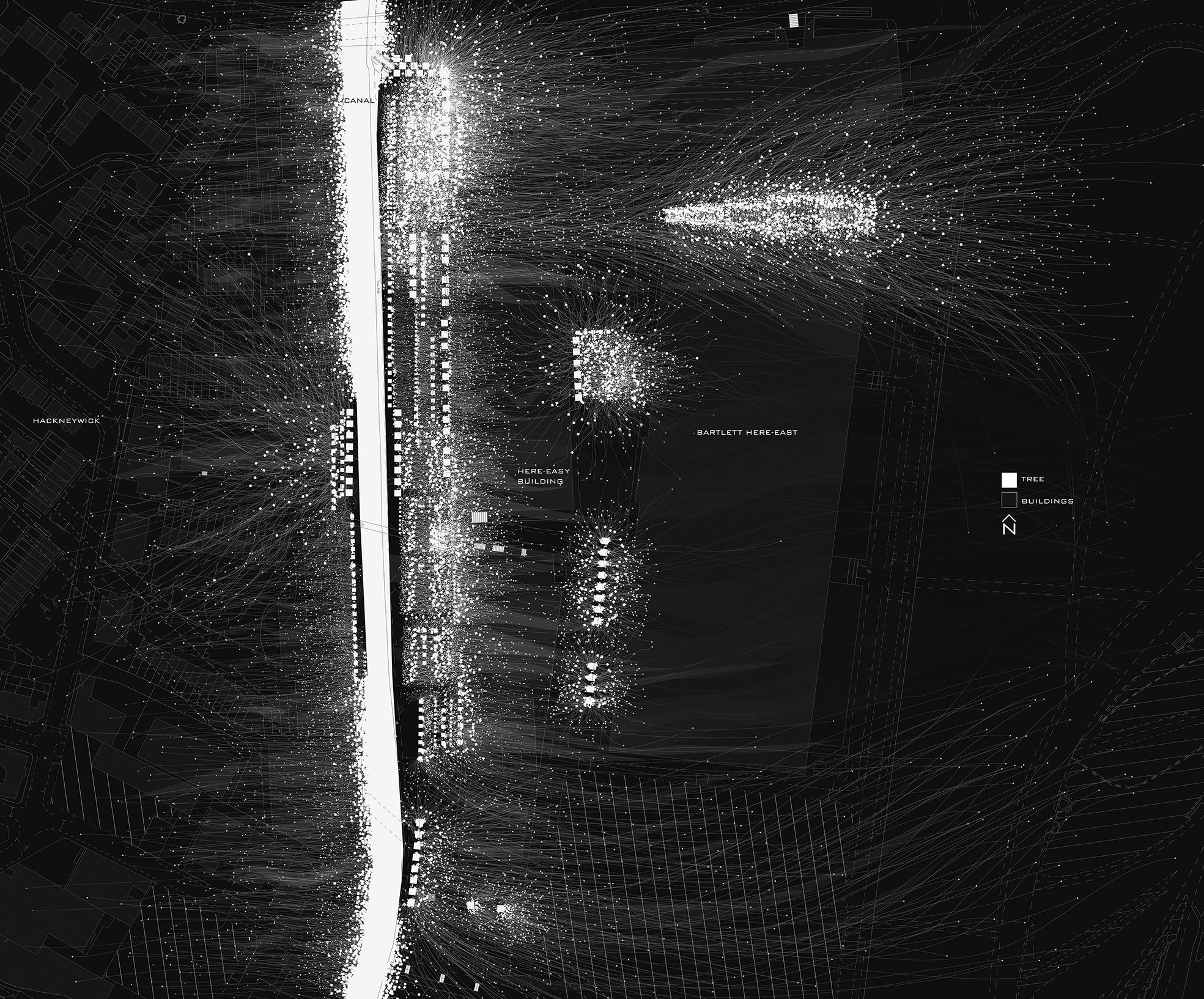
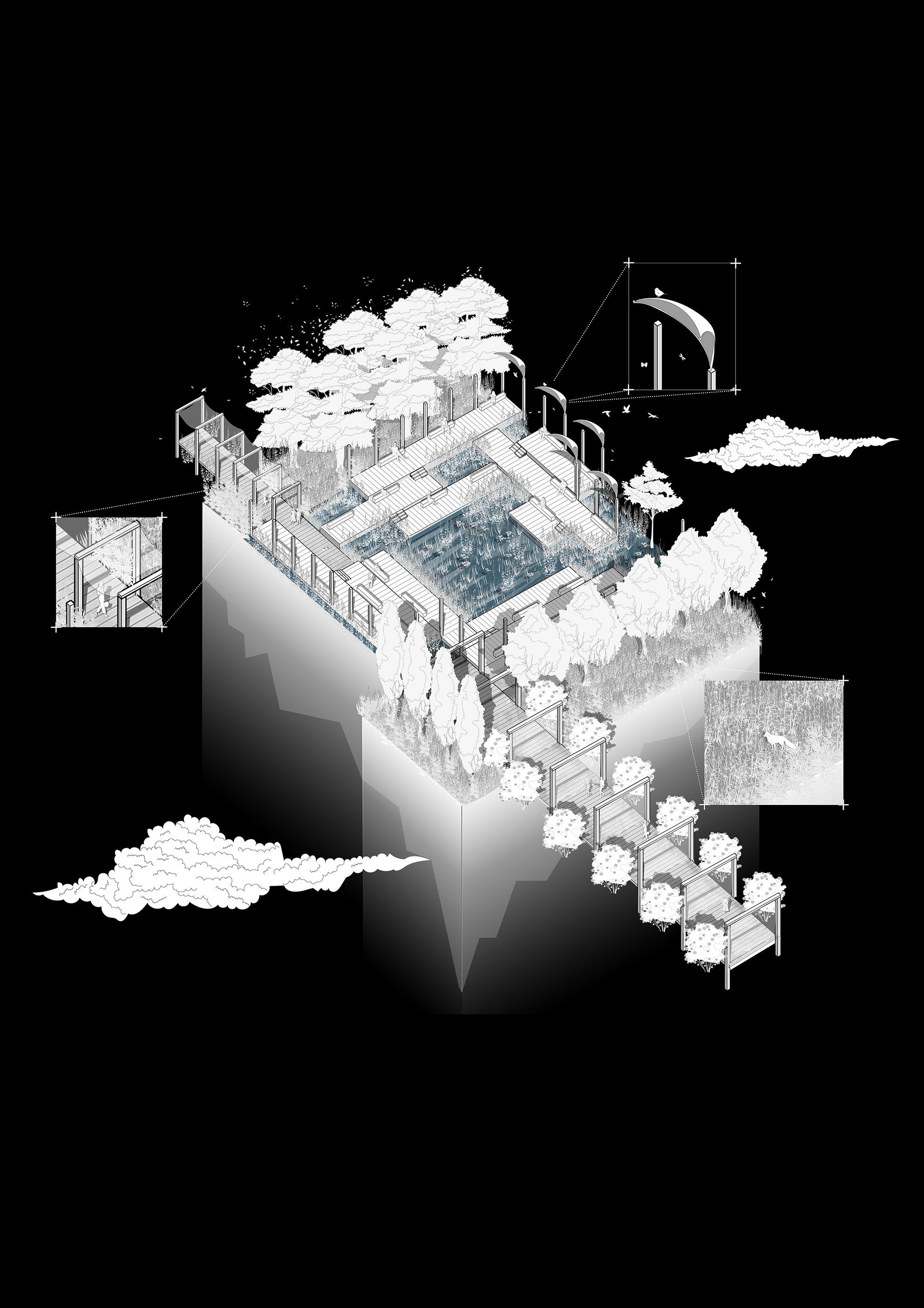
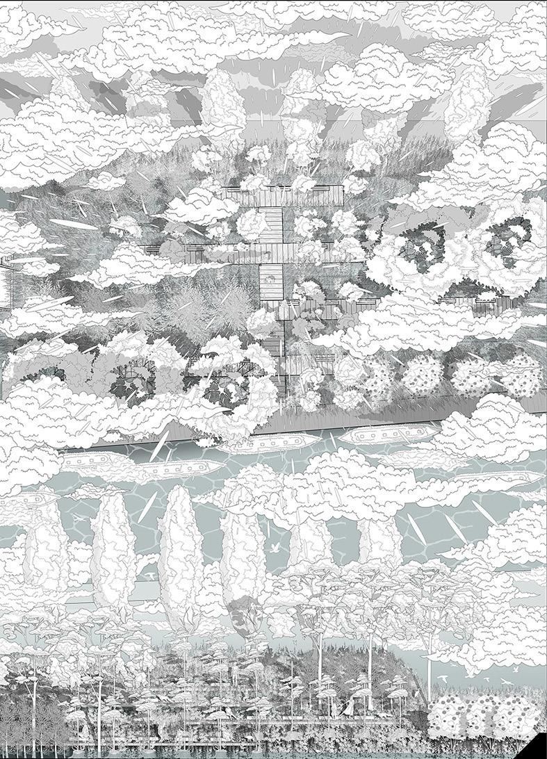
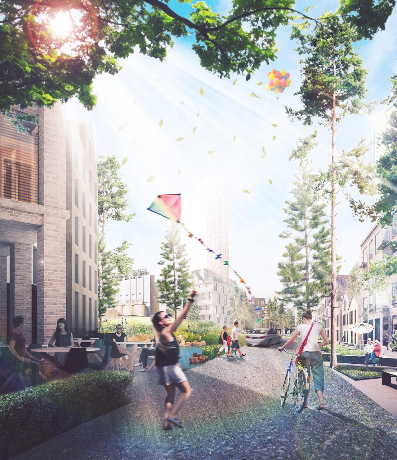
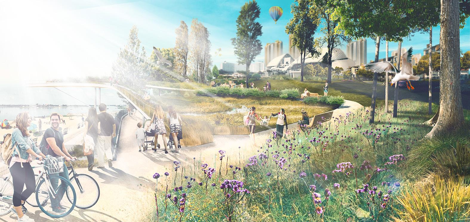
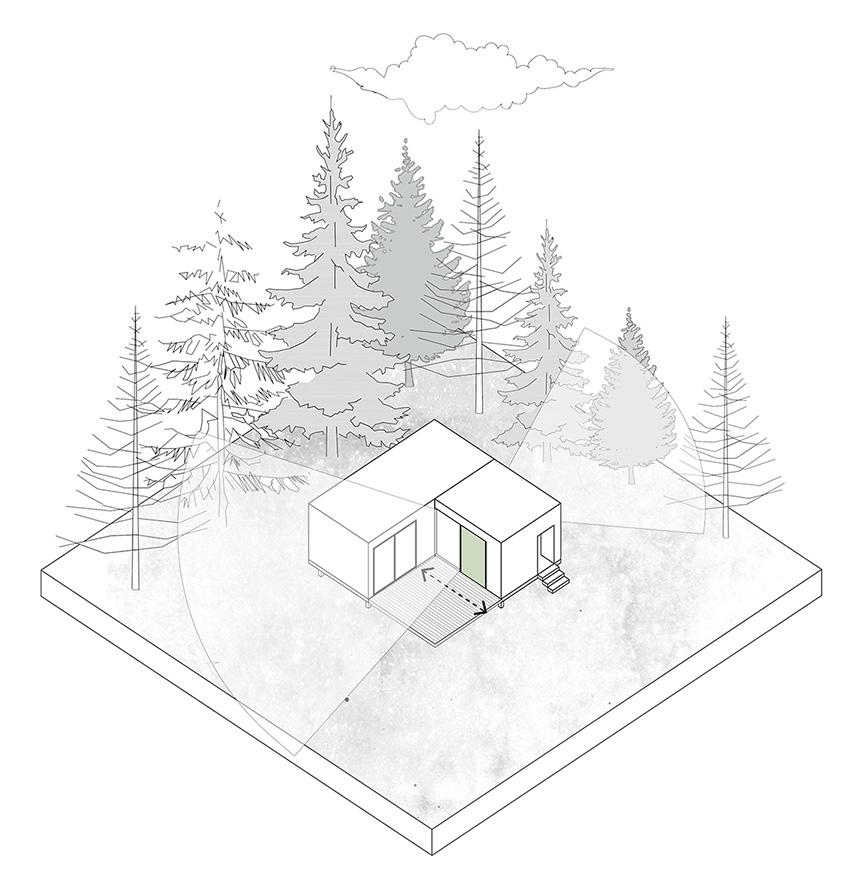
This project suggests a possible way to absorb runoff by designing a wetland out of a terrain vague and improve the ecosystem of the site. At Here East, Hackney Wick, Lon don, there is a linear site with poor vegetation near the River Lee Navigation Channel.
The proposal suggests the creation of a linear wetland with defined pathways and flexible wooden scaffoldings. These provide endless moments and opportunities for visitors to engage with the site and define its use.
In the proposal I considered three elements for the site to introduce new identity to the terrain:
Pathways
Plants
1.Water 2.
3.
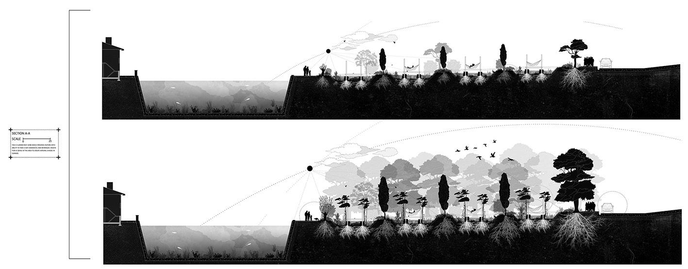
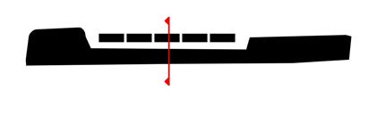
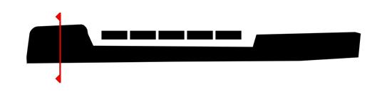
Here-east wetland rehabilitation MLA LANDSCAPE ARCHITECTURE Studio 2 BARC0118: Landscape Design 3 Studio Tutors: Cannon Ivers and Alex Malaescu Student: Farinoosh Hadian Jazy 2020/2021 Term 2 Individual
The
Therefore,
try to
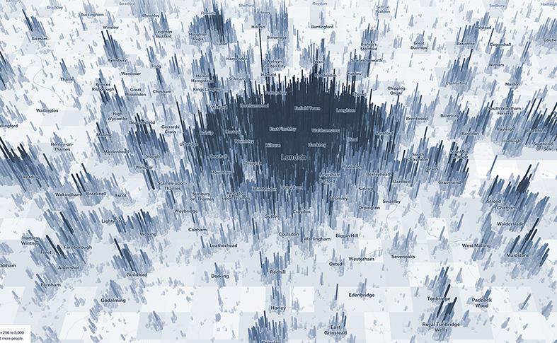
run-offs is one of the factors which increases the risk of flooding in other areas in London. This figure shows areas in london with high risk of flood. According to the map, the site is in flood risk area (the small black square).
I
find a way to decrease the run-offs in the site. Risk !!!!!!!
Urban Context:

The site is located alongside the River Lee Navigation Canal. This provide access for people with ca nal boats to visit the site. It can be seen that there are various functions near the ca nal.
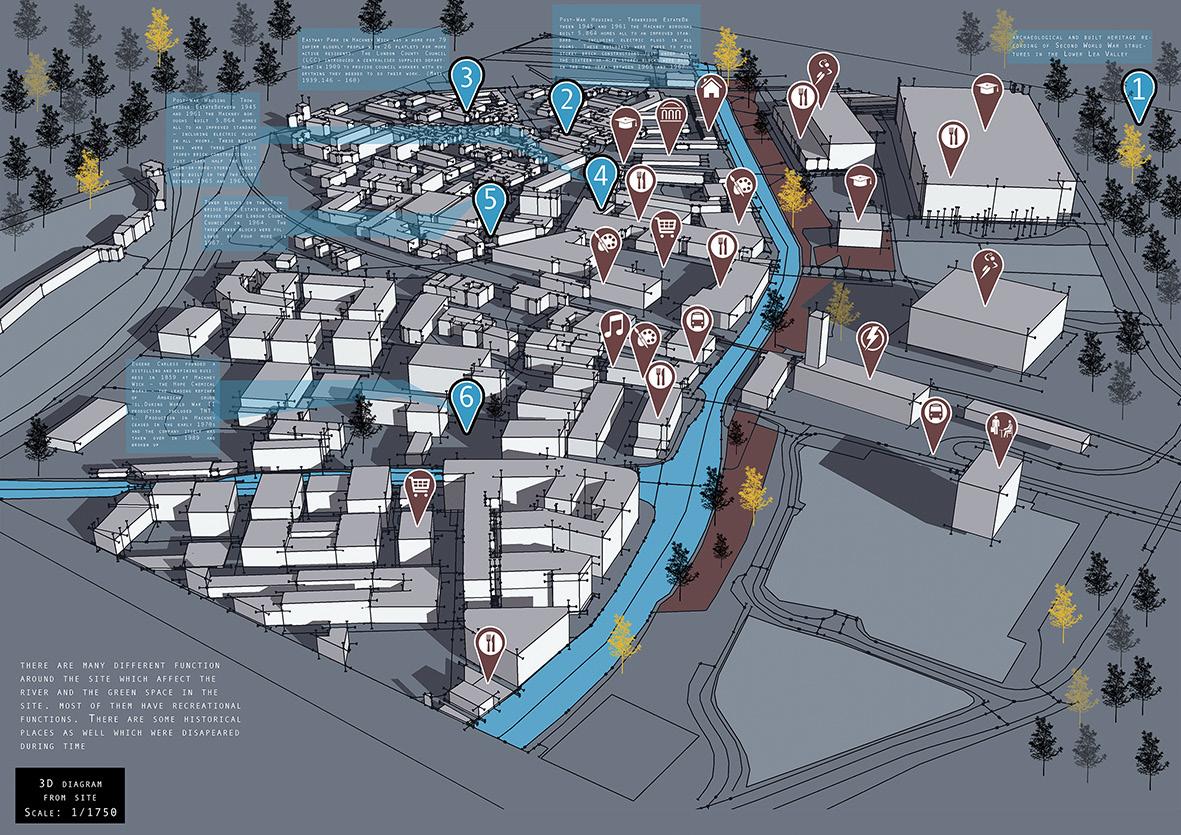
Figures below give us information about population of Hack neywick area.
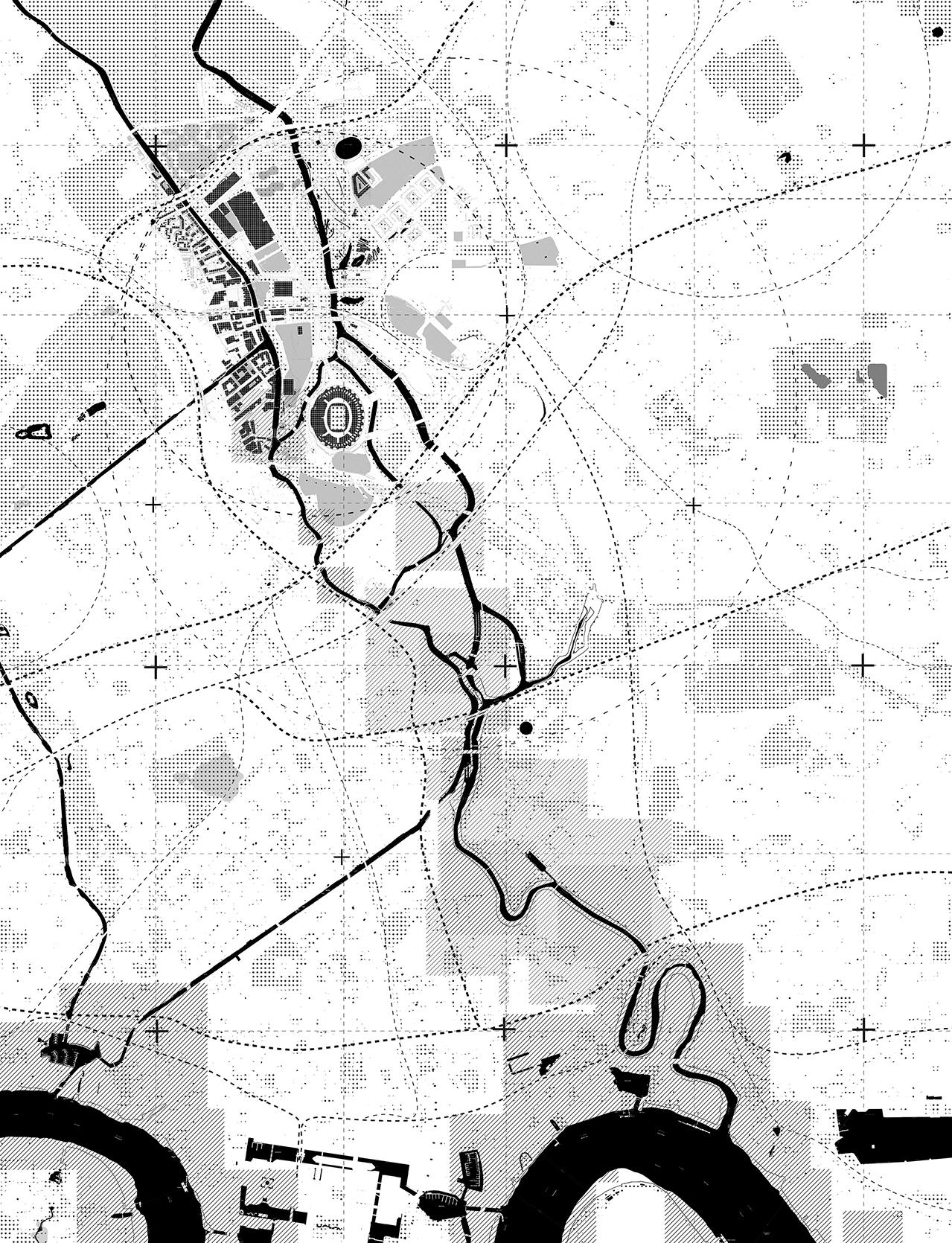
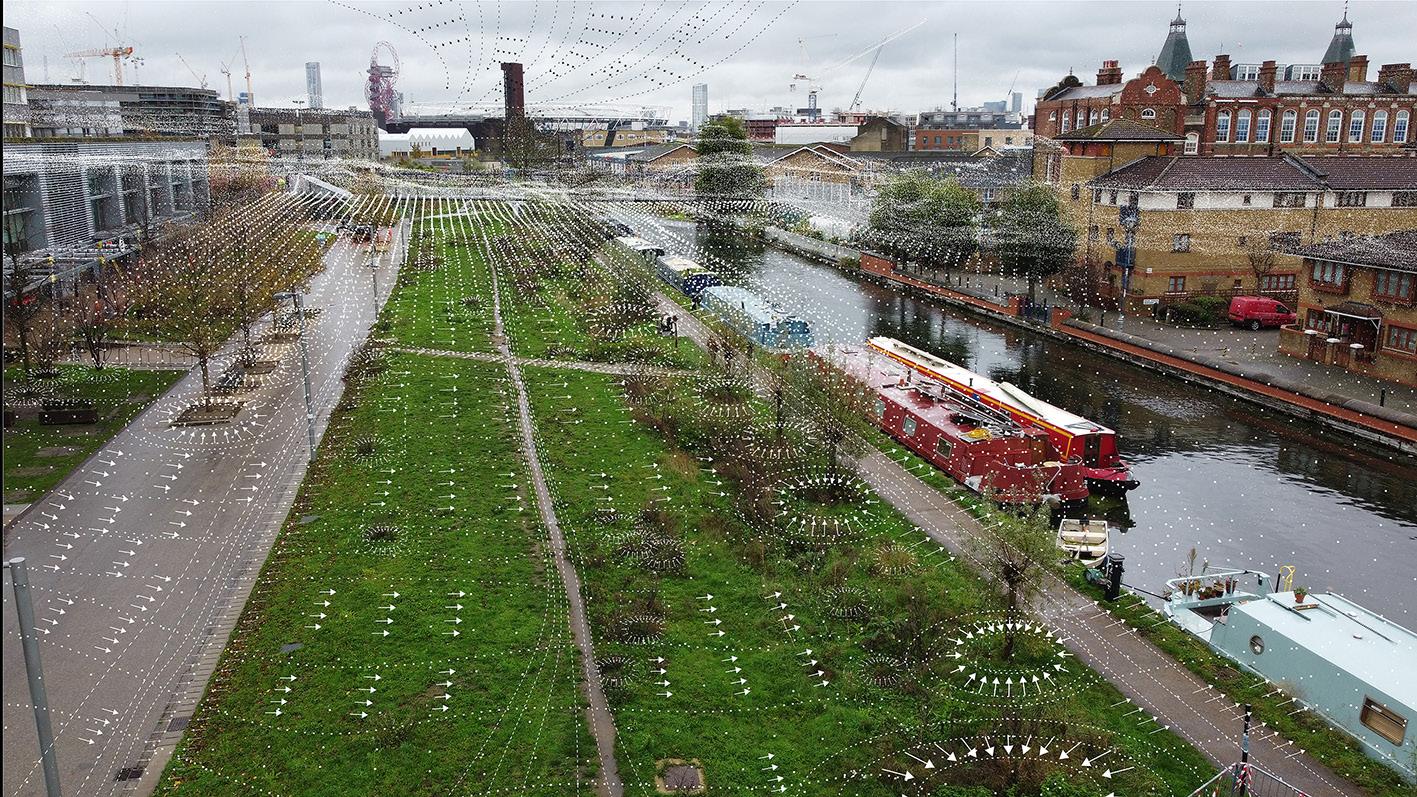
It is possible to say that there are many residents in Hack ney-wick area which provide the site with the potential to at tract many visitors. In my visits to the site, I have noticed that there are few people visiting the site and it is a left-over vegeta tion in hackney-wick. The palimpsest below shows features of the site during time.
Vegetation analysis:
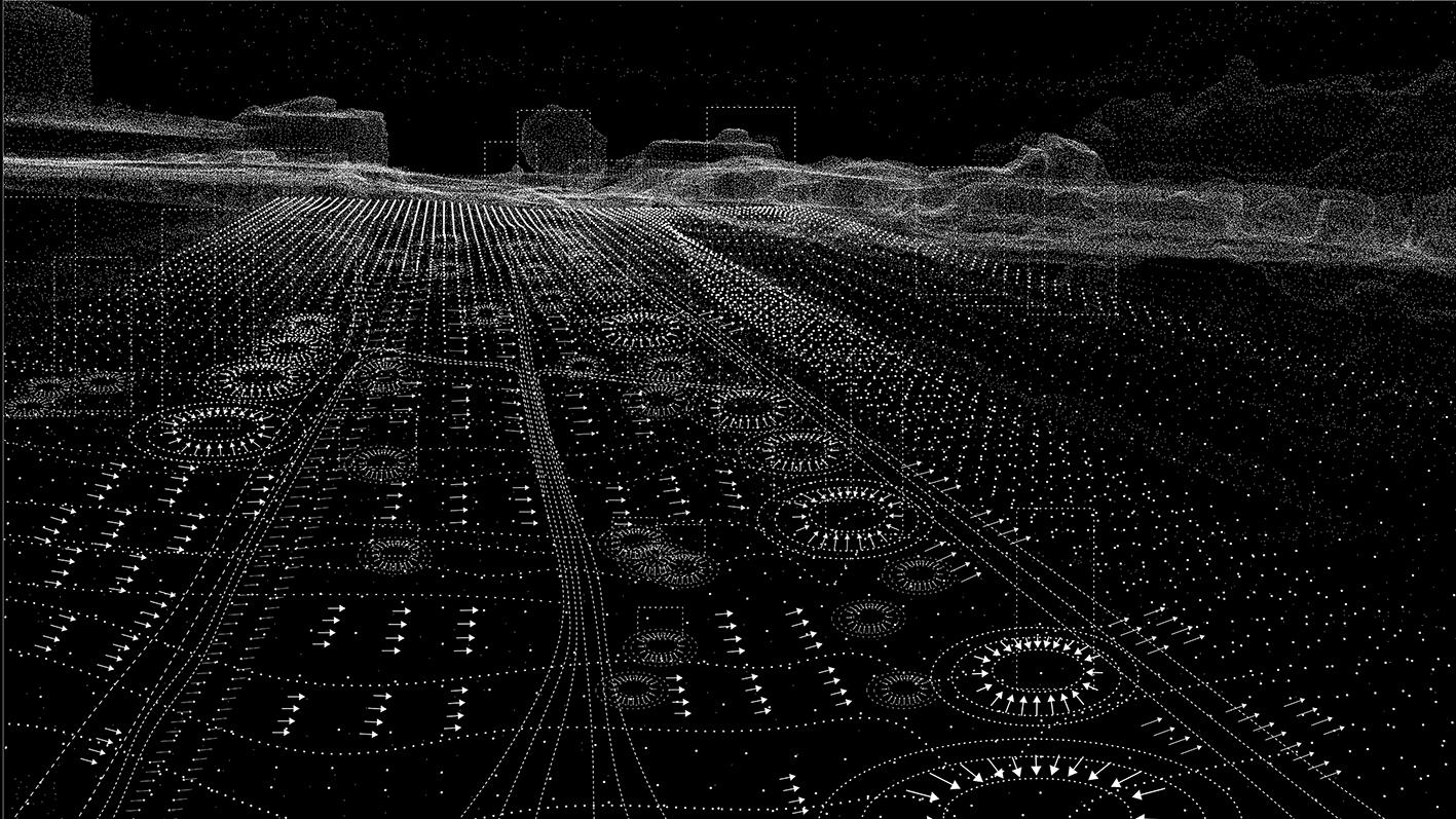
This page is representing my researches and analysis of the site in its existing conditions.
I scanned the site and its vegetation with drone photography to understand the condition of the site.
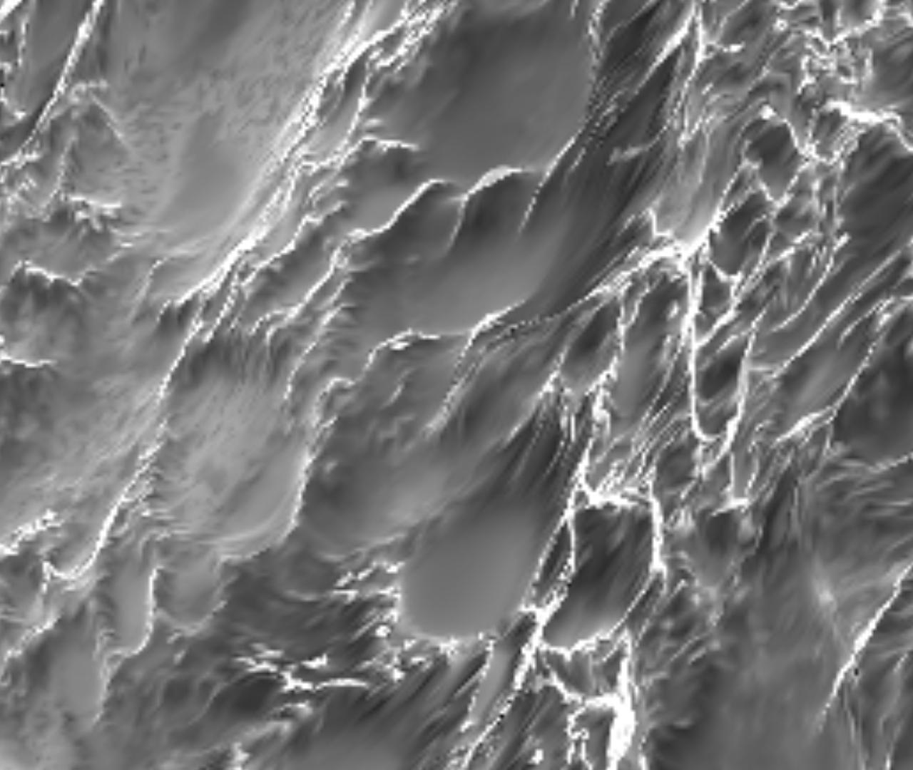
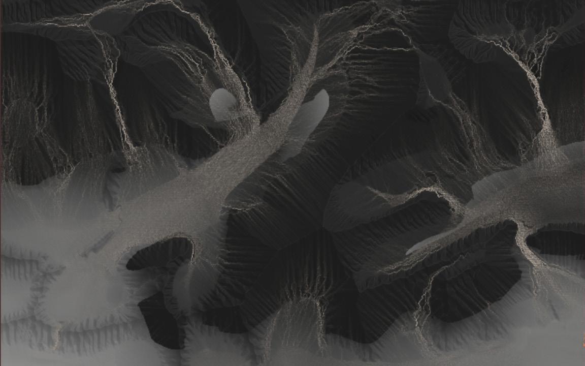
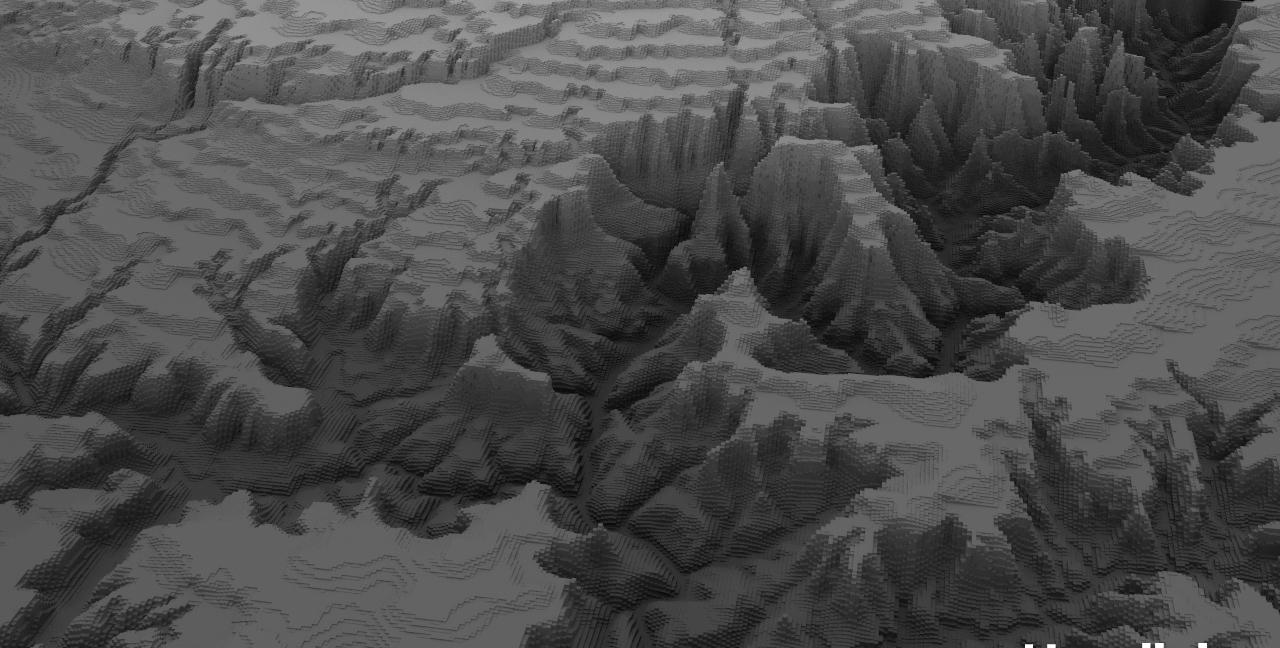
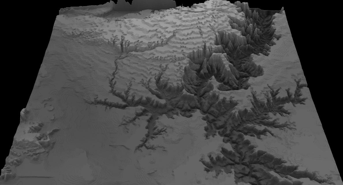
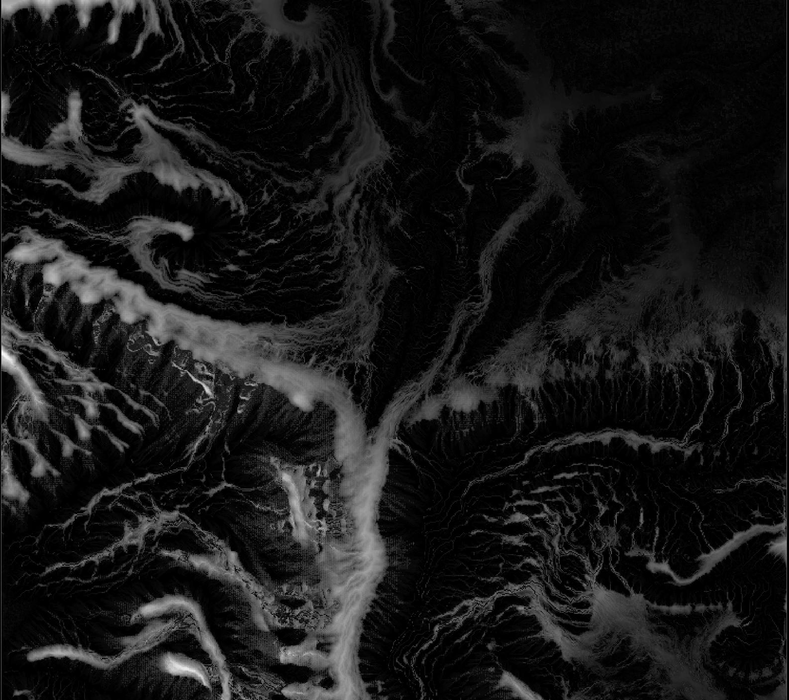
Then I modeled the site and test the site condition with different software such as Houdini to estimate the future condition of the site. It became clear in stimulations that the site will be eroded severly because of poor vegetation and topography.
I searched for references and I investigate to find out local vege ation.
These analysis and data helped me to understand the condition of the site.
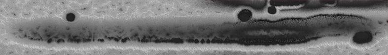
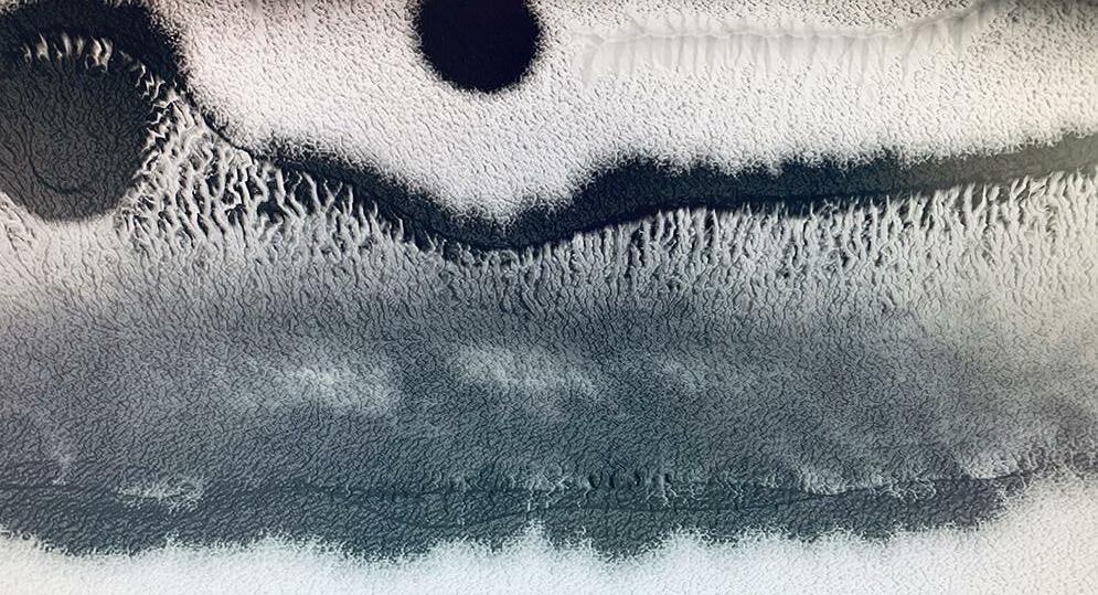
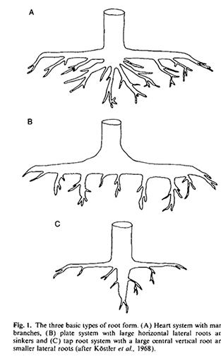
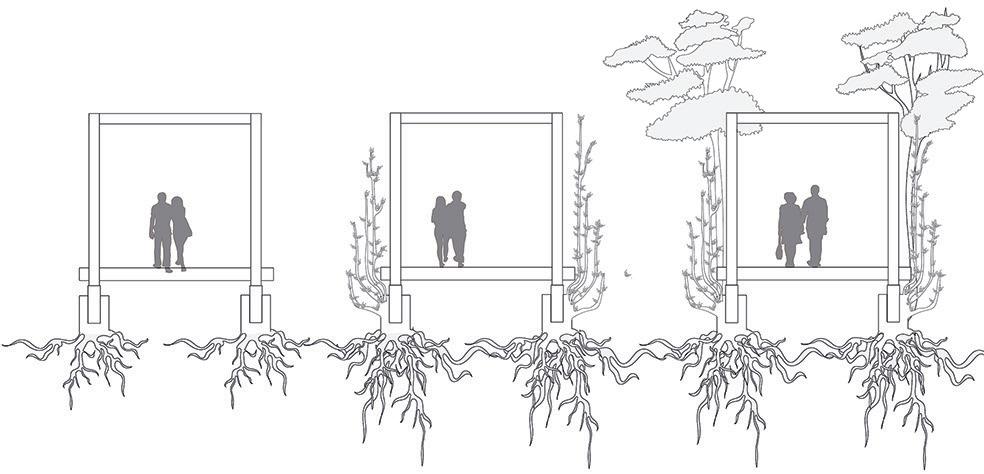
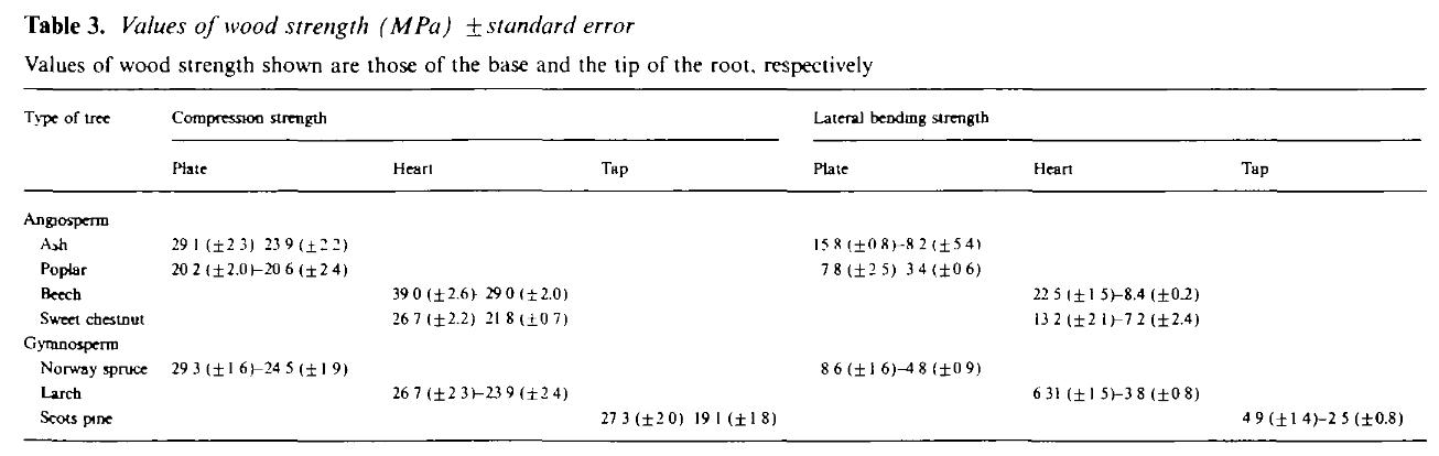
Understanding different types of roots was essential for further design proposals and tackle the soil erosion. Different types of roots have different shapes and they will pro tect their surrounding soil differently. This picture of various types of roots is from one of the refernces I found during project.
This is a map of existing vegetation in the site which is showing the swale that created the linear vegetation pattern in the site.
The linear patterns inspired me to my design proposal which is highly influenced by existing patterns.
This drawing is made with Autocad and Adobe Illustrator and Photoshop
Assigning different moments
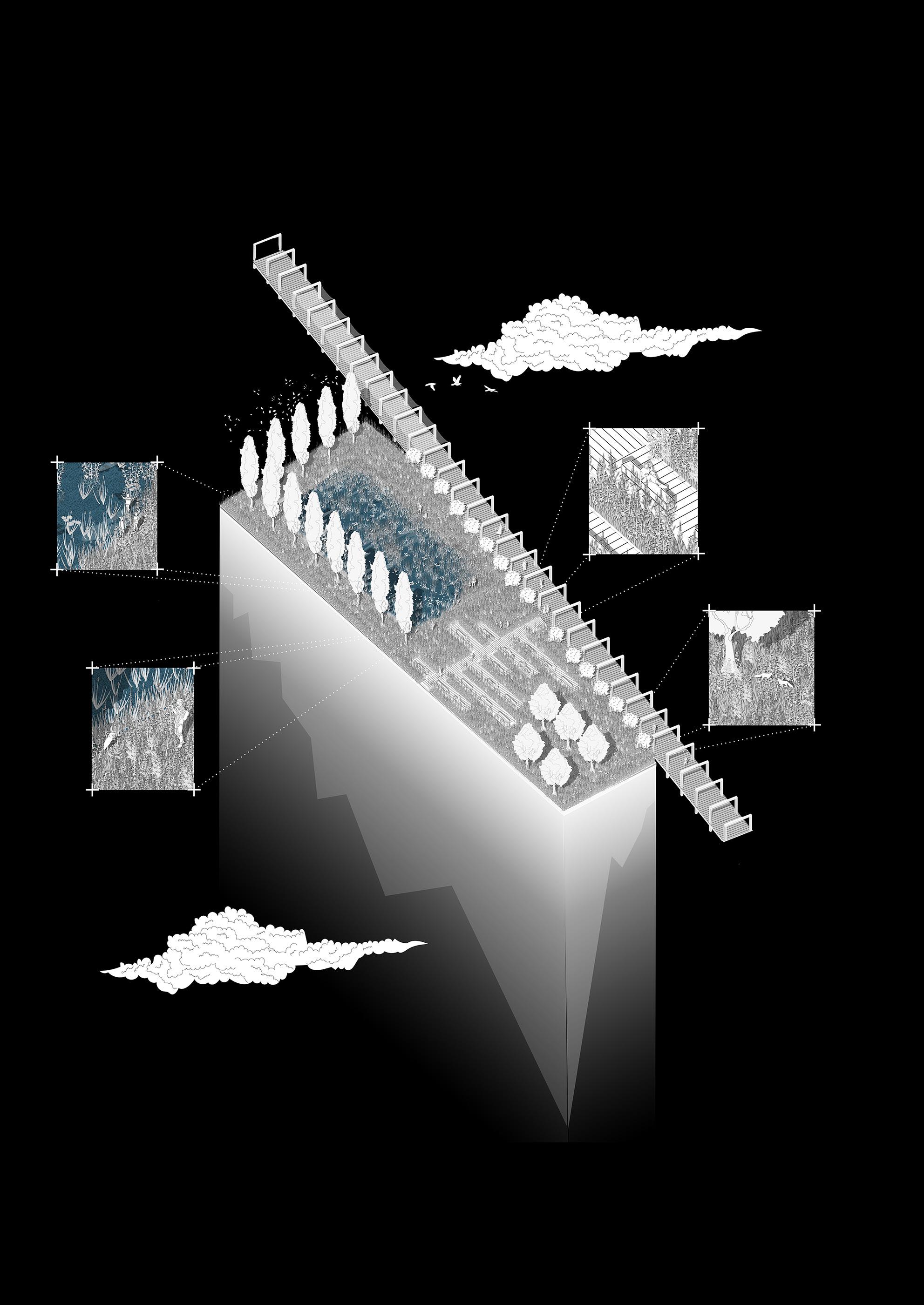
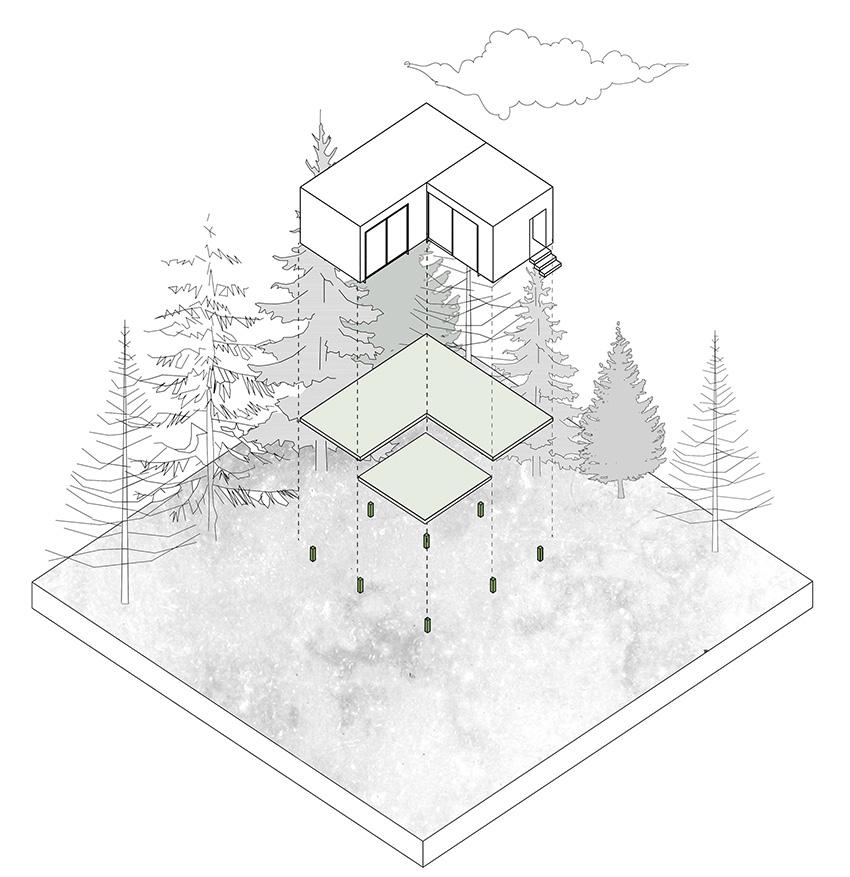
PROPOSAL
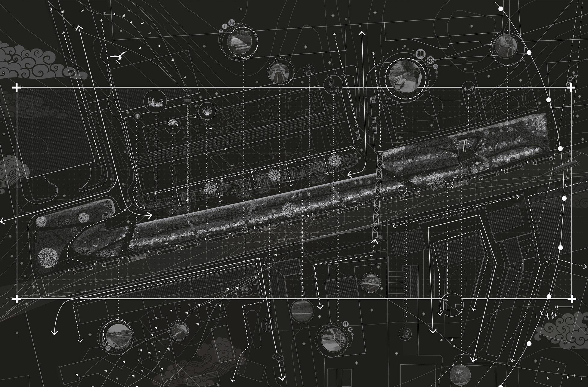
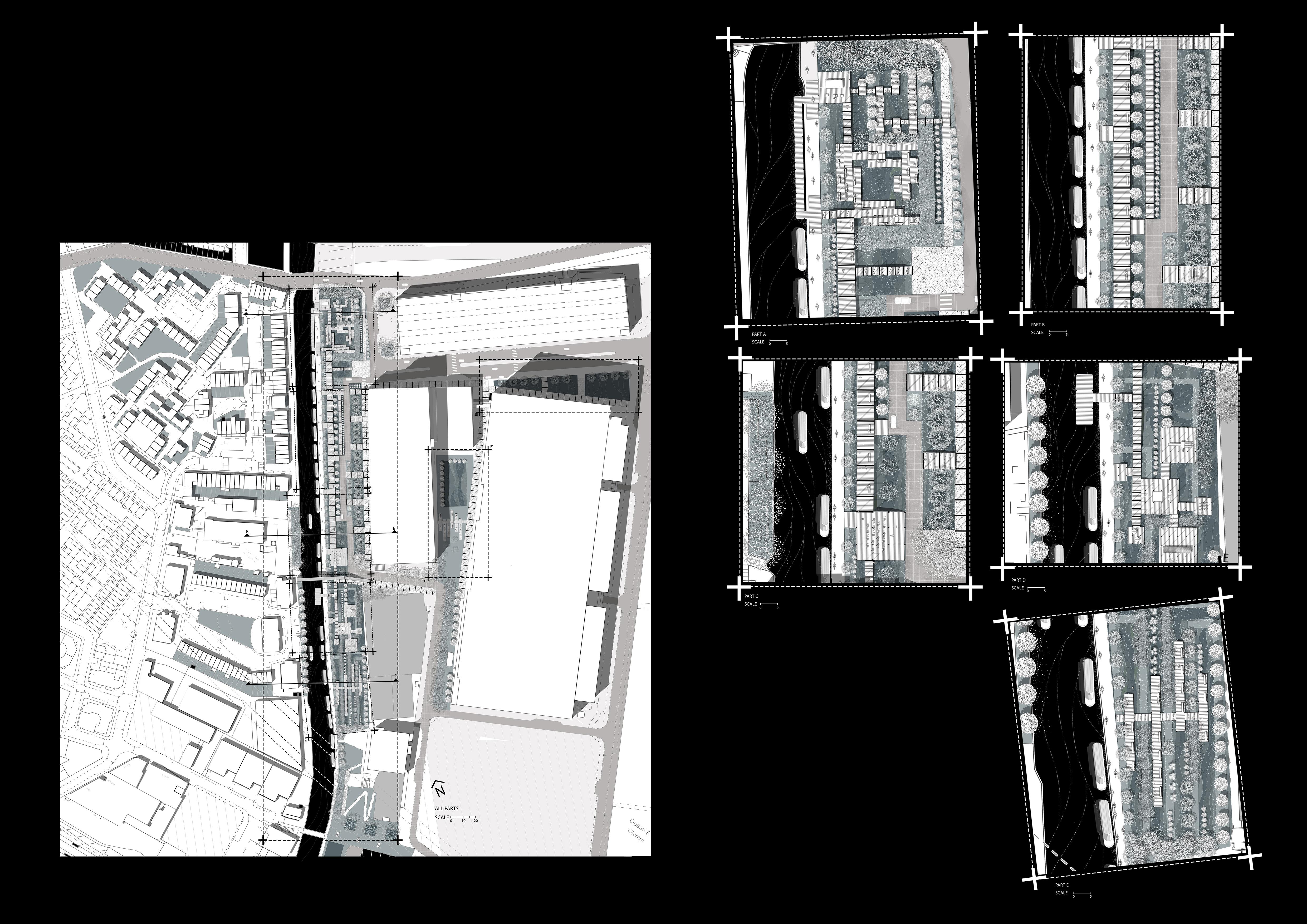
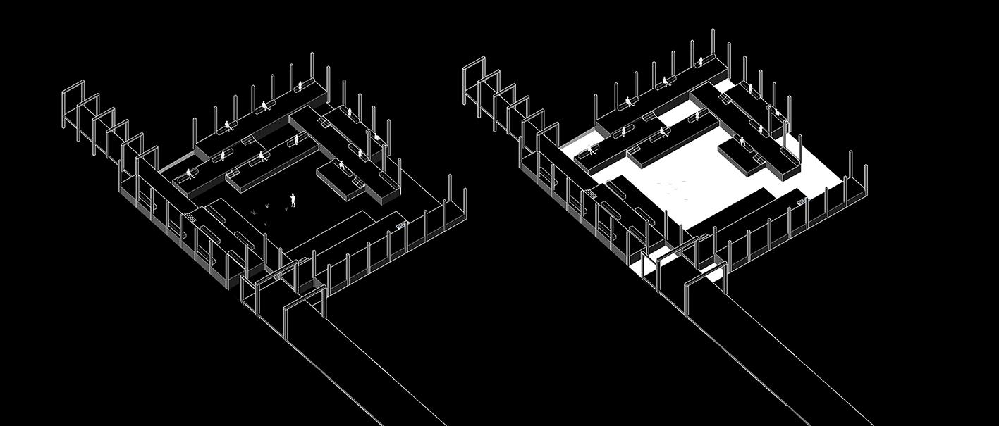
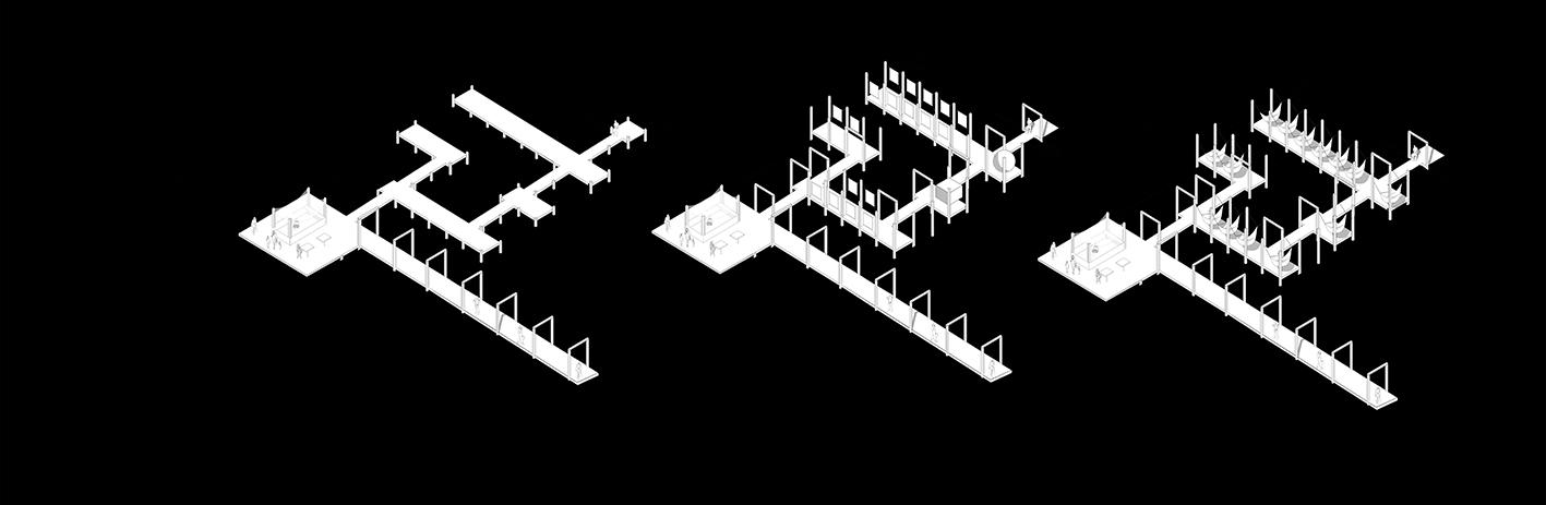
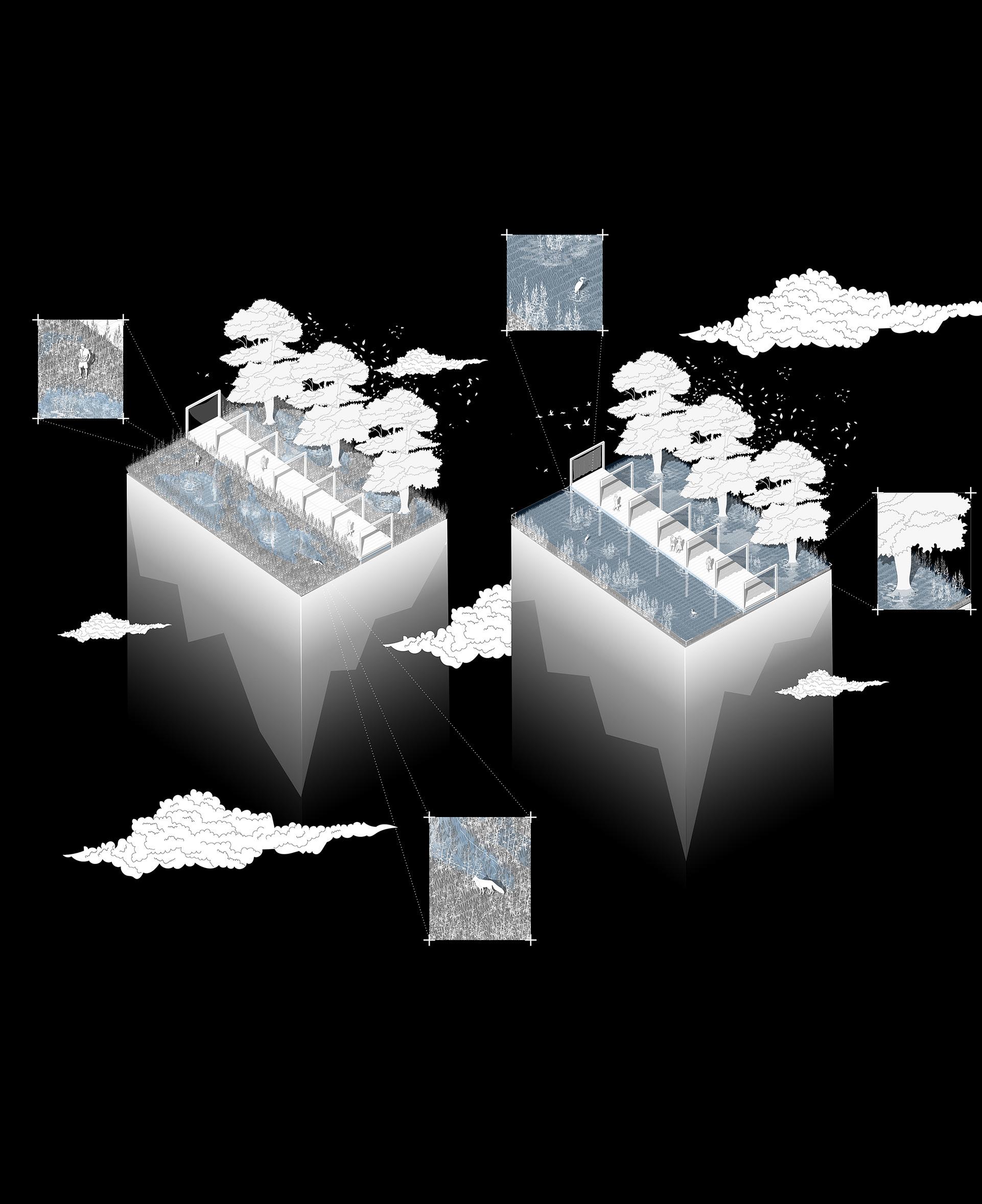
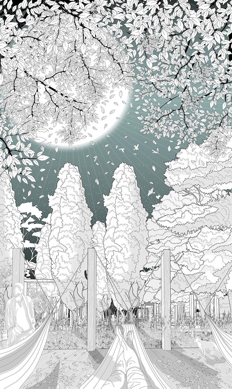
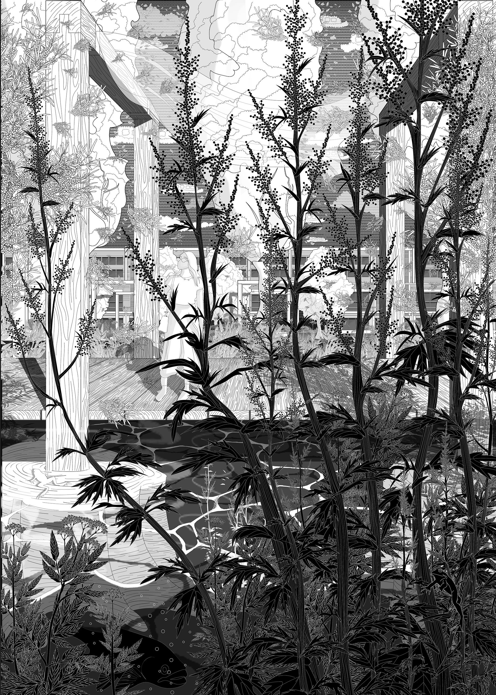
In my proposal, I assigned different moments to the site by the proposed flexible structure. The pathways are different in width and they become larger or smaller to create different senarios for the visitors. These plans are modeled in Revit. Various parts are classified as: A. summer rest area and gathering area B. run pathway and access to Here-east building C. pathways and yoga area D. playground E. spring rest zone F. Middle area G. Small linear wet-land
for refresh ments
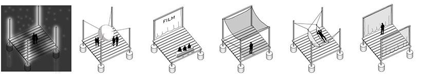
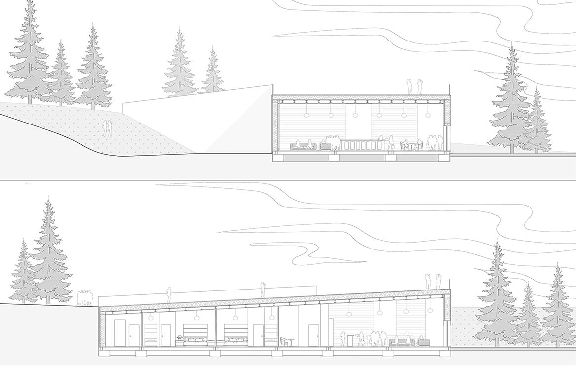
This part is designed to create a rest zone for people. There are some hammocks which are attached to the columns (flexible structure). This part can be used as a temporary exhibition area for Bartlett Here-East and the columns provide structure to attach students’ work.
Whole area is detached from the ground to let the wet-land work efficiently.
Water, fruits and flowers of the vegetation will attract many animals and insects to the site.
Trees are dense in this area to provide sound barrier and shadings for the visitors.
Structure will be reviewd in the next parts of the portfolio
Axonometric view to part A:
fabric shadings for pathways
removeable shadings for sittings eco-system
wet water
This part is designed togather people. Whenever the wetland is dry, the center can act as a scene for theater or etc.
Whenever the wetland is wet, people can come and see the pond.
Structure will be reviewd in the next parts of the portfolio
Axonometric view to part A: sound barrier and natural shading hammock eco-system eco-system and ponds
kiosks
dry
Axonometric view to part F:
creating of ponds and podles
sittings with natu ral light attraction of new eco-sys tem attracting visitors by introducing new eco-system
Axonometric view to part G:
This part is between Bartlett Here-east and Here-east building. This area can act as a natural ventilation for the two buildings and can be a rest zone for people who work there.
Structure will be reviewd in the next parts of the portfolio
sitting area entrance decks with shad ings
This part is also another left over area in front of Bartlett Here-east building.
This area can act as an entrance to building and can be a rest zone for people who work there
Structure will be reviewd in the next parts of the portfolio
Design components:
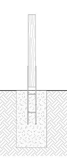
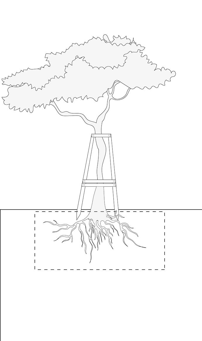
1. foundation
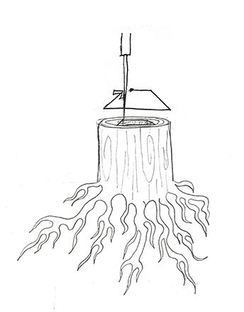
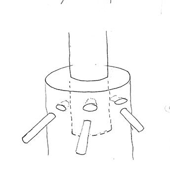
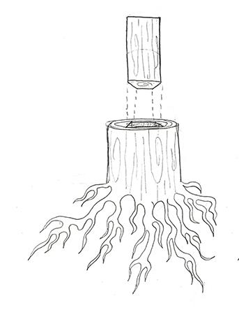
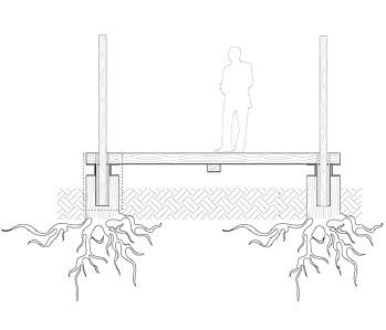
By designing new pathways to the site, many visitors will be introduced to the site. For many years trees were cut for their wood and their roots and stumps were left behind or killed as they rot(Alan J. 2005). This gave me the idea of natural foundation instead of using hard foundations like concrete.
Not only the stumps can be the foundation for the path ways, but they can also grow and create shades for the paths. These foundations will grow their roots and provide stronger foundations each year
by water
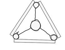
Figures below depicts various usages of columns. They are introduced to the site as flexible structure which give the visitors the opportunity to create different moments in the site. Moreover they provide the visitors with the ability to adapt with different condition of site; for instance as a shade.
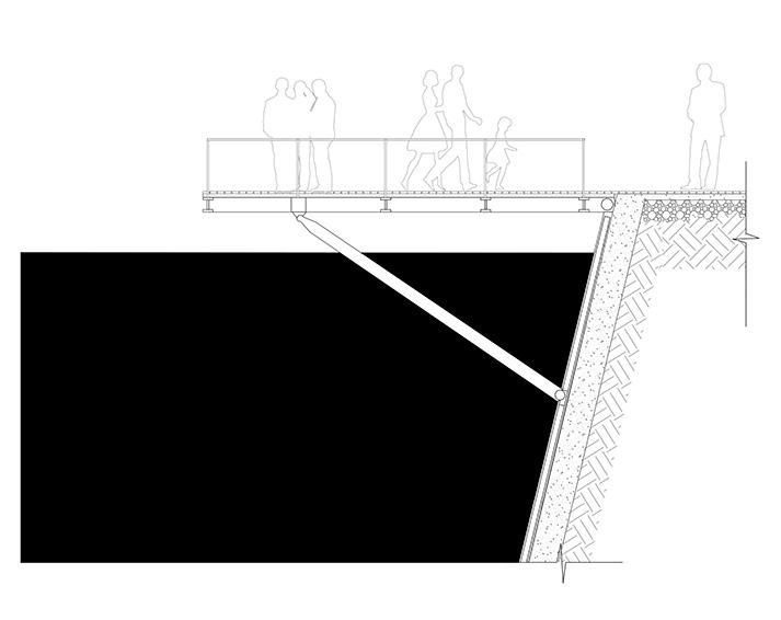
Columns and paths reduce the destruction of the site by lifting the pedestrians’ pathways from the ground. This means that the proposed wetland can easily work without any disruptions.The pathways give the visitors the opportunity to visit the site either the ground is wet or dry
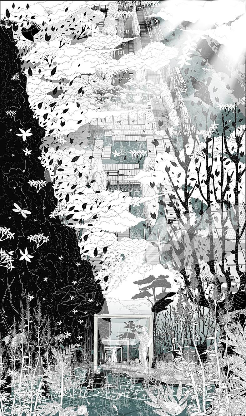
These axonometric views are showing the main concept of the site. In order to preserve the vegetation and the wet-land, pedestrians’ pathways are detached from the ground and they are decks which also provide visitors with the access to the site even when the wet-land is wet. Structure will be reviewd in the next parts of the portfolio
 Axonometric view to part B and C:
access when it is dry
attracting wetland eco-system
introduction of new eco-system
sun shadings
2. Flexible wooden columns
Axonometric view to part B and C:
access when it is dry
attracting wetland eco-system
introduction of new eco-system
sun shadings
2. Flexible wooden columns
expansion
stump
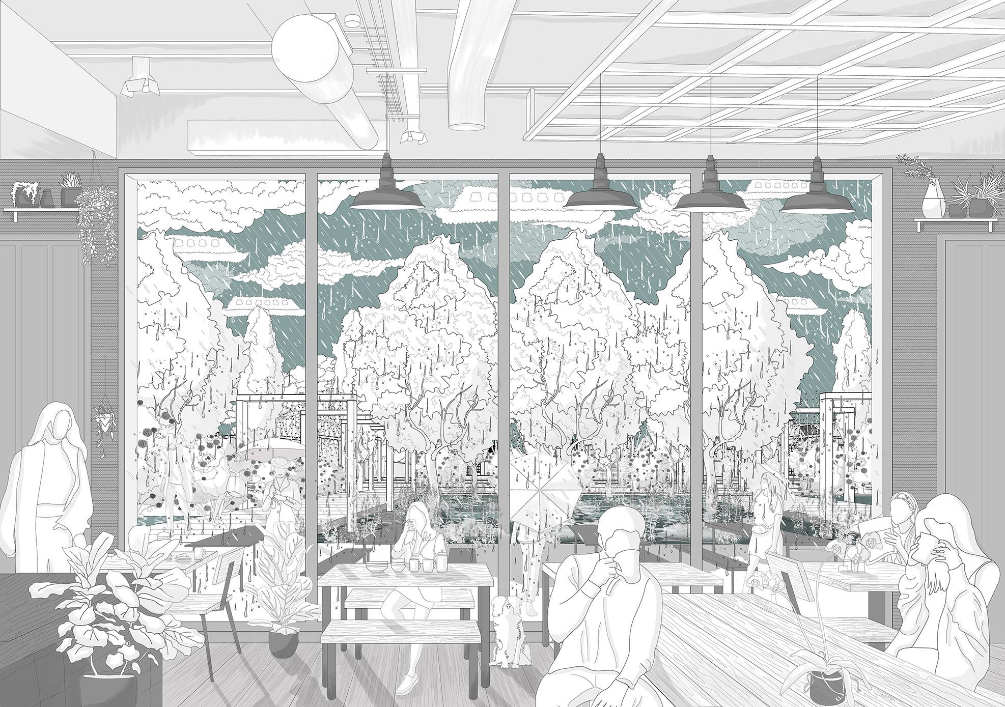
A view from local cafe to the site
Ash tree wood features:
This tree is among “toughest hardwoods” which is common for production of “tools and handles such as hockey sticks and furniture”. This type of wood was used for construction of car riages and is still used for construction of cars by some companies in the UK ( “like Morgan Motor”) ( A. Stokes, 1996)
Phases:
1. Construction:
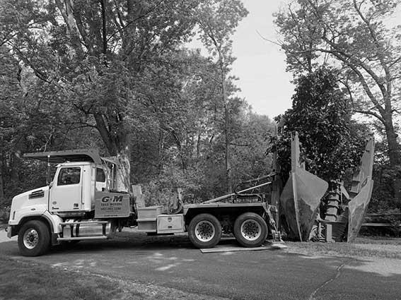
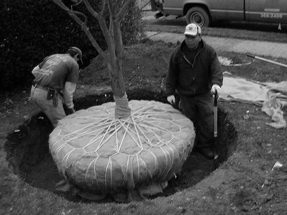
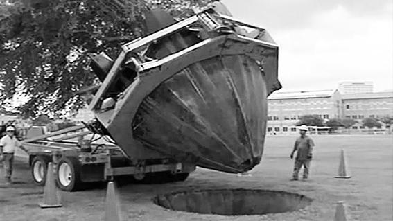
In this part the main structures will be built in the site. Trees will be transplant to the site and the foundation of the path ways will be installed. Suggested bushes and shrubs will be planted in their supposed positions. There will be some inter ventions in the shape of soil and ground to reshape the topography. tree transportations processes. (Vehicle Channel, 2015)
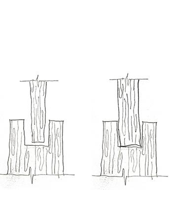
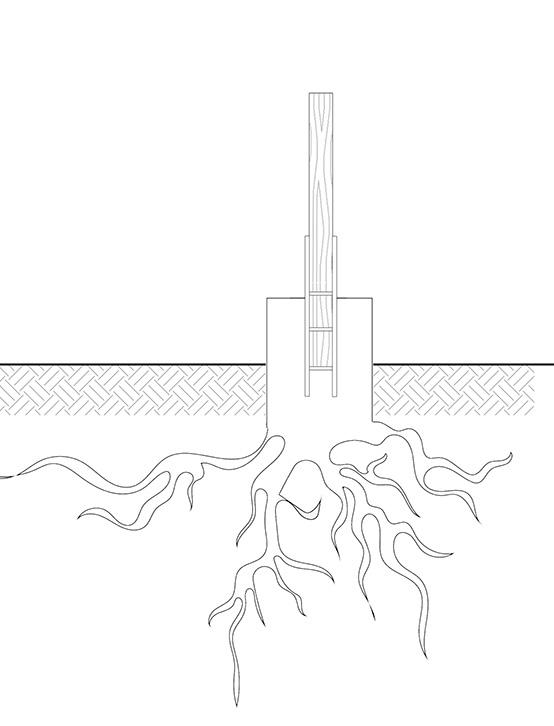
Connections: The wooden columns in proposal will be cut like the figure in order to provide future beam structure above (Stub Tenon Mortise). In stead of using fixed connections such as nails and pins, the beams will be attached to the structure and other beams by crossing joints. These structures are flexible and can be removed easily.
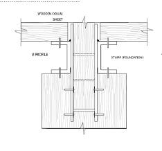
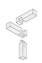
Material: Wooden columns can be made up of Ash trees (which is local to the area). Wood from Ash tree are among resistant materials to humidity. The columns can be connected and fixed to the foundation by metal sheets.
Foundation structure:
In wood industry the trees are cut from jungles and forest and their stumps left over or be removed as they rot. (Alan J. 2005). One part of my proposal is reusing of these stumps as natural foundations.
Stumps of deciduous trees can easily regrow (McIndoe, A. 2018). Comparing the ordinary foundations to the pro posed foundations shows differenc es between the structures. The natu ral foundation can grow and become stronger during time (with regular monitoring), but ordinary foundations such as concrete foundations are same during time.
phases overview
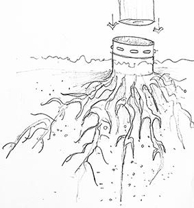
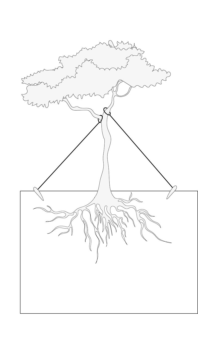
Flexible Structure:
The most important problem in the design is that the stumps can rot easily. This issue can be solved by adding chemical coats such as Polyurethane wood sealant to the surface of the stumps.
Therefore it is possible to design foundation for structures with left over Ash trees’ stumps.
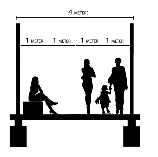
The stumps will be placed in a modular pattern. Each column has 4 meters distance to other near columns in the rows. The 4 meters distance is assigned to create suitable pathways for pedestrians.

In some areas the distance can become near half of 5 meters which is 2.5 or 2 meters (such as in playground for swings.
2. Care and Rehabilitation :
This phase is the most important phase in the project. Trees must be checked regularly in order to analysis their adaption to the new conditions. Tree and shrubs features will be measured during this time; such as “color, defoliation, insects and disease damage, mush room growth, soil deficiencies, mulch condition, dead or broken Branches and so on”.
This period can exceed to twelve weeks (this period varies according to the type of the trees and shrubs) for the vegetation to adapt to the new condition.
Moreover, humus soil will add to the area of the tree to provide the tree with enough nutrition. Designers should check moister level of the soil around tree and there will be some simple structures to help the tree to grow in the right position.
ordinary founda tions
Natural founda tions
deck railings
wooden track
I profile
canal
A simple structure of the deck above the canal which creates view for the visitors to the ca nal. As the existing major path way along the canal is narrow and is approximately two me ters, The deck will add more space for people to stop and enjoy the landscape of the ca nal.
3. Growth and attraction :
A simple suggestion for sittings. The main idea was designing a sitting which is light and it can easily move by visitors. Therefore, I considered an empty metal cuboid which is created by metal sheets with additional sheets inside to avoid any distortion in future. The sitting area is covered by rows of wood profiles which create a soft layer for sitting. There will be handles in the both ends of each sittings for move them easily. For protecting the metal sheets from weathering we can add chemical coats on them.
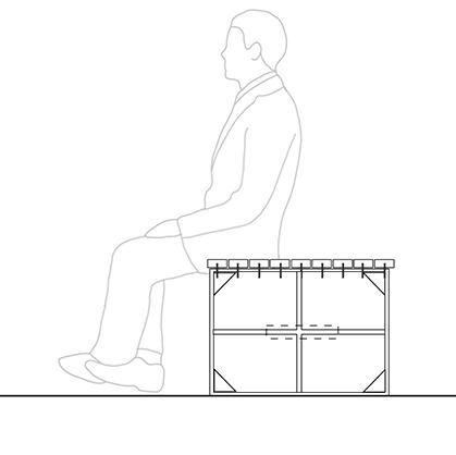
handles rows of wood profiles metal sheet
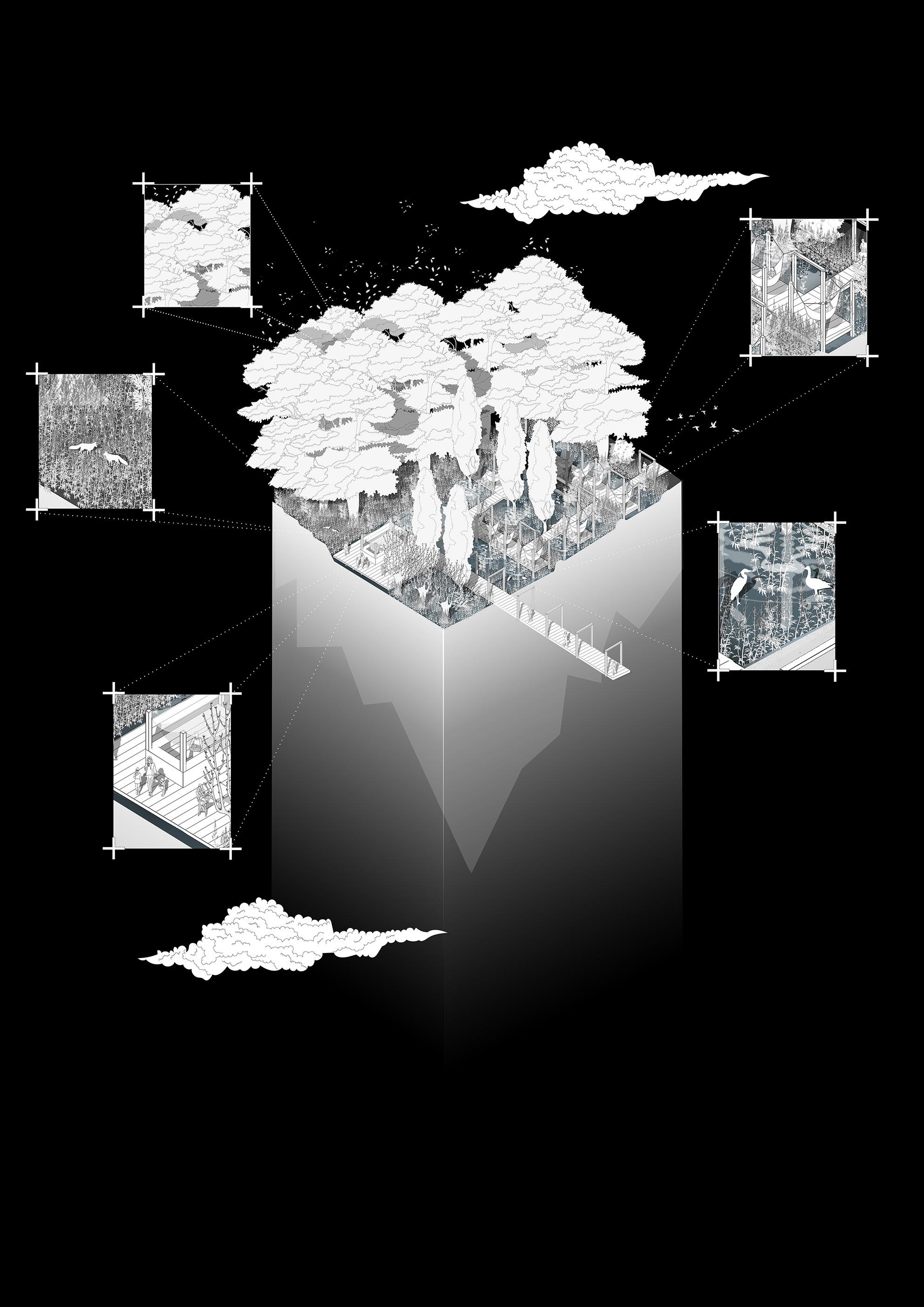
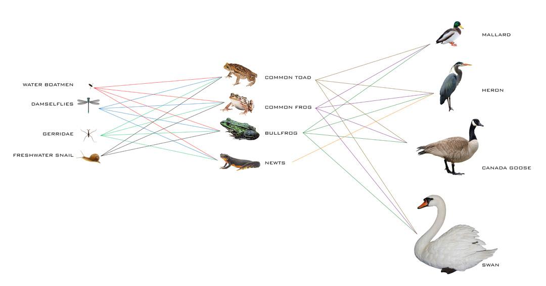
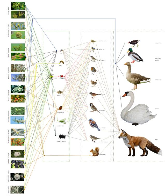
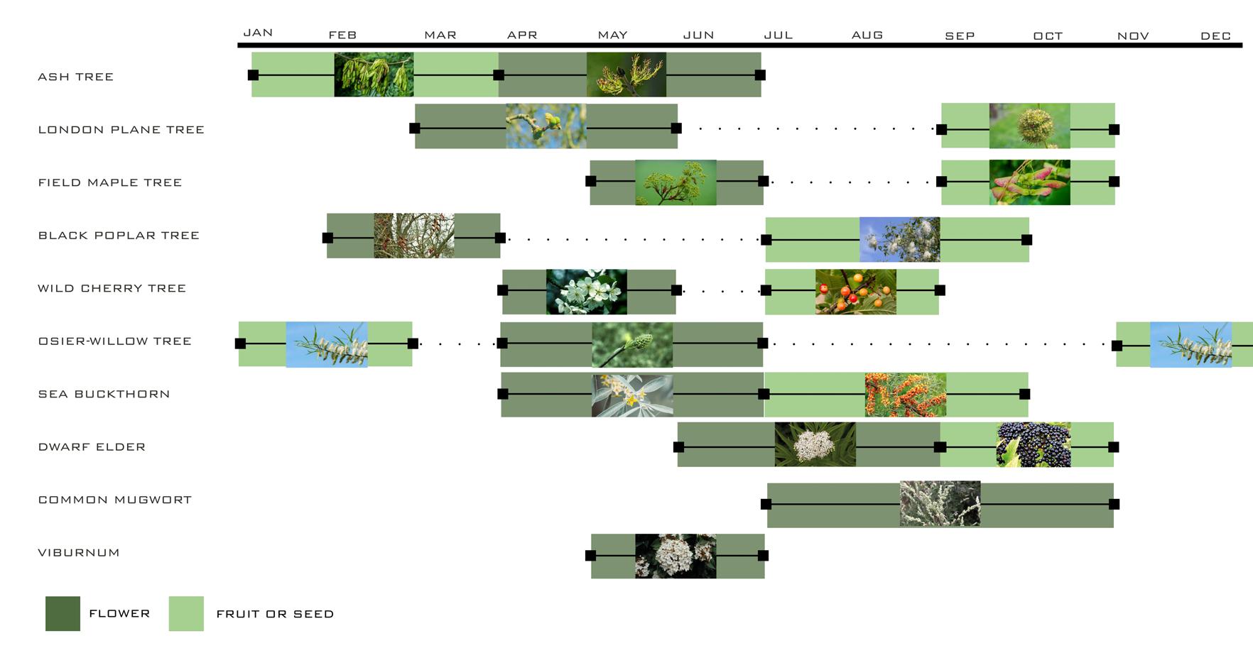
After adaption to the new condition, when the suggested vegetation start to grow, the site will be ready and can attract many visitors. The bushes and trees attract the planned eco-sys tem to the site by their fruits, flowers and etc.
Comparing the figures we can expect and fore cast that which species will appear in which month during the year as their preferred food or flower will appear in that month. Therefore, features of the site will change according to seasons and there will be different scenarios during a year.
zoomed x4
zoomed x2
As it was mentioned in the previous sections, the site will be act as a swamp and there will be many ponds af ter rainfalls. Therefore, new species will be added to the site such as “Damselflies”.
emptyempty empty empty
humus plan
This is another crucial part of the design. Condition of the site should be checked regularly. Data should be gathered from various parts of the site in order to illustrate future image of the project.
It can be seen that many parts of the site should be considered in the checking. For example the width and height of the trees should be check in order to monitor the growing rate of the trees. Getting samples from soil and stumps will be another way to monitor the changes in the site. Pollarding and coppicing of some of the bushes and trees such as willow tree will help the vegetation to grow efficiently.
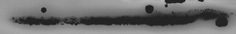
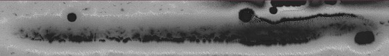
Figures below shows how the ground will be eroded in the future. Comparing this stim ulation to the previous stimulations conveys that the amount erosion by run-offs in the proposed plan will be reduced and all parts of the site will erode similarly. The erosion will happen more slowly in the proposal and it takes more steps to erode and the proposed shape will remain same in the future which shows the durability of the proposed plan.
AFTER 5 YEARS
How the site will change in future?!
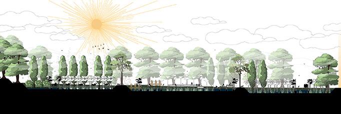
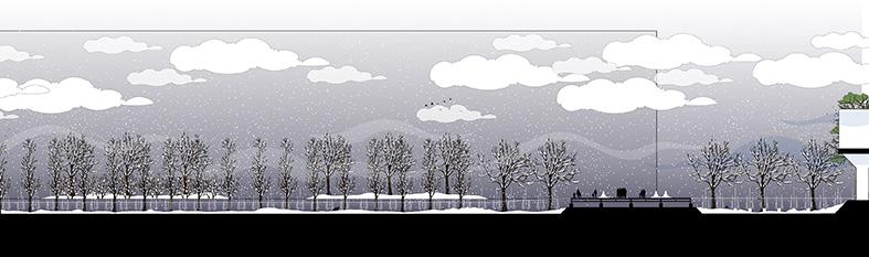
These are some sections from dif ferent parts of the site in different times in future.
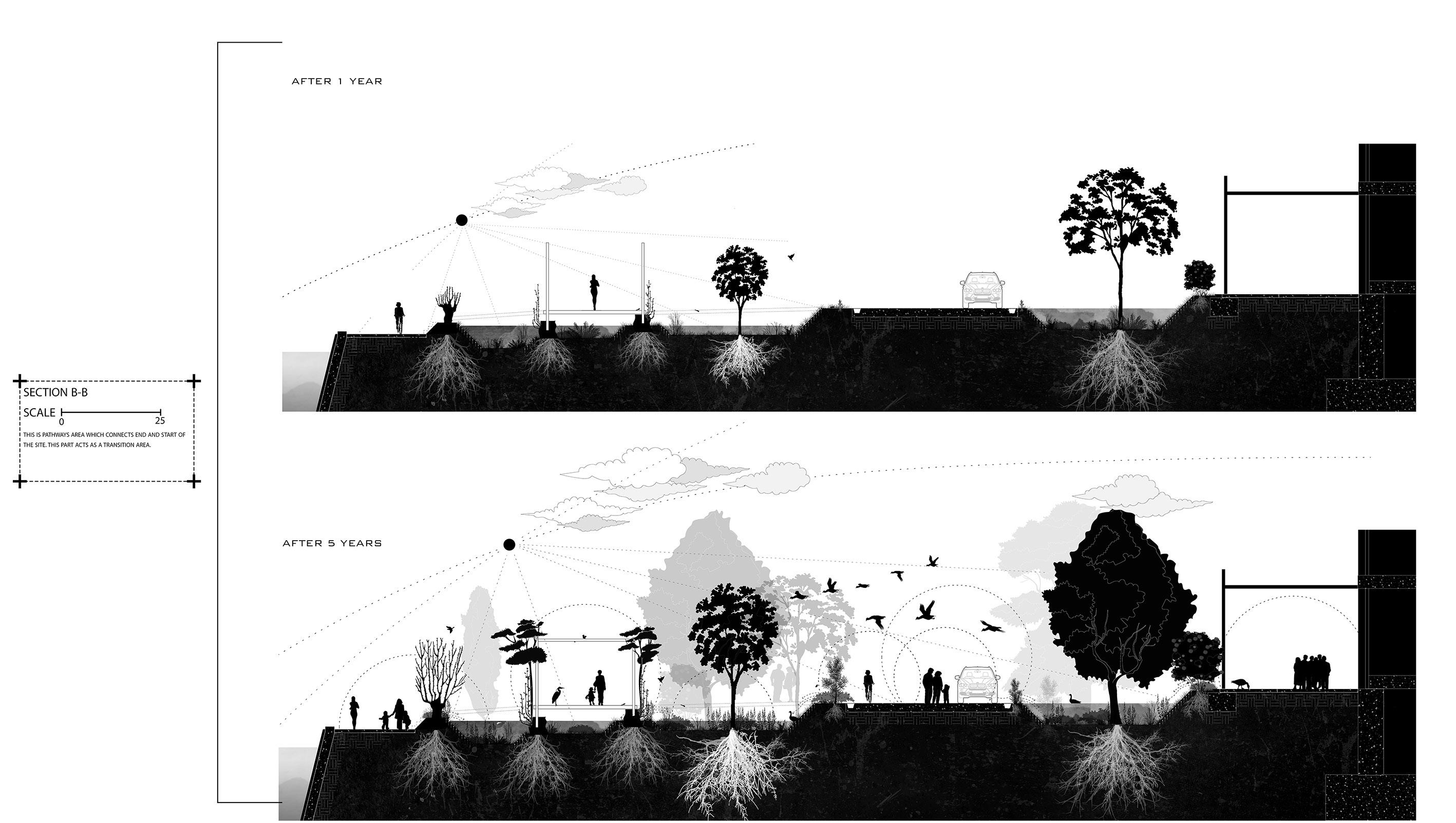
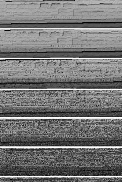
The figures are giving information about how the trees and vege tation will grow and change the landscape in future.
AFTER 1 YEAR
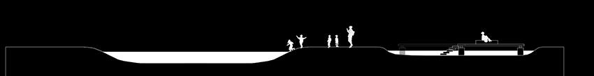
Different seasons?
How does the site look like?
The section is giv ing us an illusion of the site in dif ferent seasons.
B
AFTER 5 YEARS
4. Checking and re-arrangements
A A AFTER 1 YEAR
B
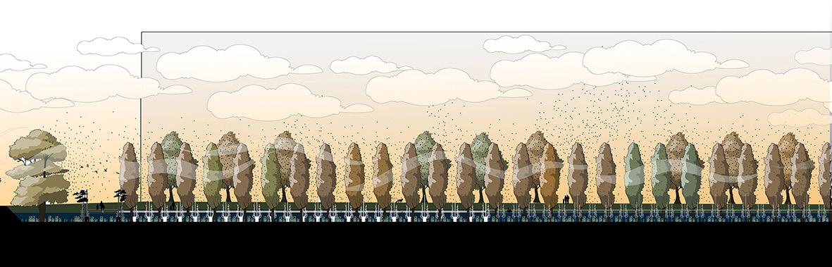
These perspectives are giving us ideas that how the proposal will be look like in future.
 Perspective from north of site looking southward
Perspective
Perspective from north of site looking southward
Perspective
from
hammock area
Perspective from spring rest zone area
Perspective from pathways
Kirsty Badenoch,
Purkiss
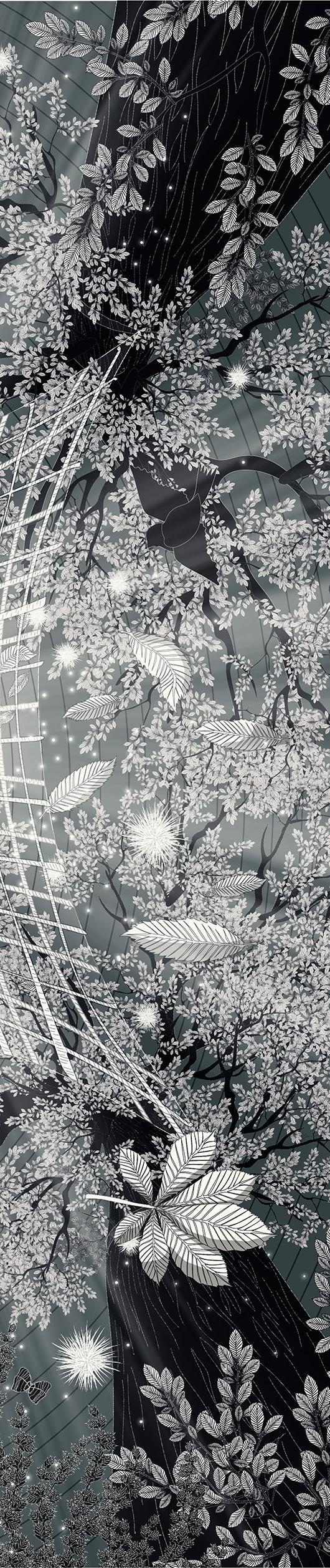
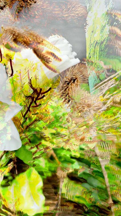
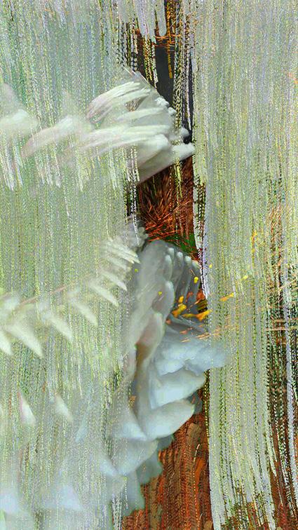
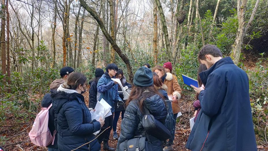
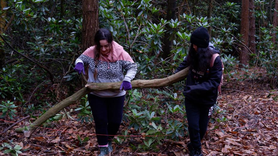
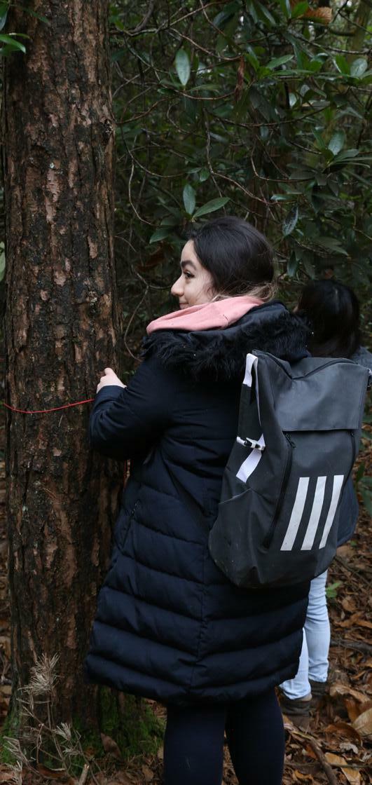
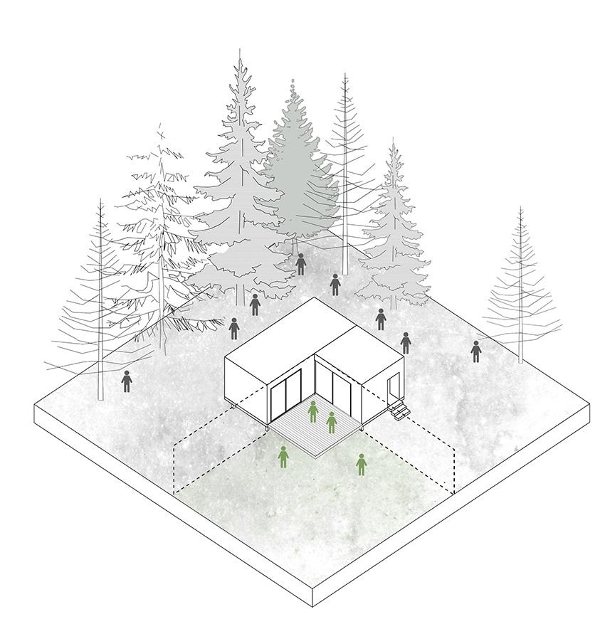
Forests are usually considered as a best example of Natural world. For me, they are always mysterious. Our understandings towards forests and their cycles are limited. I used to believe that people should not change anything in forests (as their actions always lead to disasters). During this project I tried to identify the natu ral character of forests.
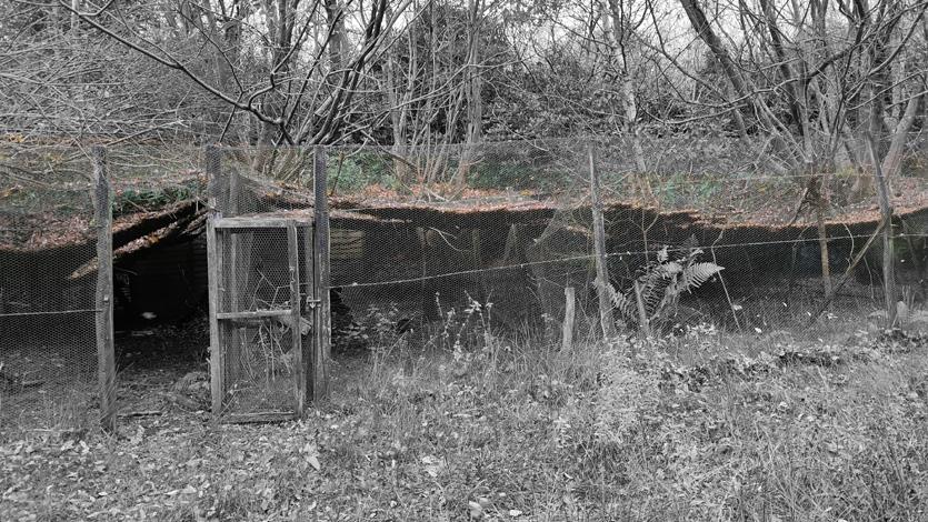
I tried to see forests in a different way. Therefore, I used some new methods to change my perspective towards them. Inversion of pictures, Motion photography and reviewing samples in my mini lab helped me to understand Natural cycles in nature in both small and large scale. Our studio visited Flimwell forest in the middle of the term.I learnt a lot from forests. I understood that we are in the natural cycle and we can help forests to im prove their conditions.
At the end, I reviewed my findings and realised that there are many factors controlling natural cycles in forests. One of the intrinsic factors is “Temperature”. My Mini Lab tests show that not only temperature changes speed of the cycles, but it also eliminates previous cycles or introduces new cycles to the forest landscape. Therefore, we can use temperature to control forests’ landscapes. In our Flimwell trip, I understood that forests con trol the temperature of soil and underground systems by layers of dead leaves. Flimwell forest inspired me to introduce a tool to collect leaves in autumn from rich forests and transfer them to newly young forests to moderate temperature in cold winters (result of climate change). This method can be introduced as a new greenhouse system. These greenhouses will be temporary and decompose to create a rich humus for the forests after a while.

MLA LANDSCAPE ARCHITECTURE Studio 8 BARC0112: Advanced Landscape Design 1 Studio Tutors: Tom Budd,
and Danielle
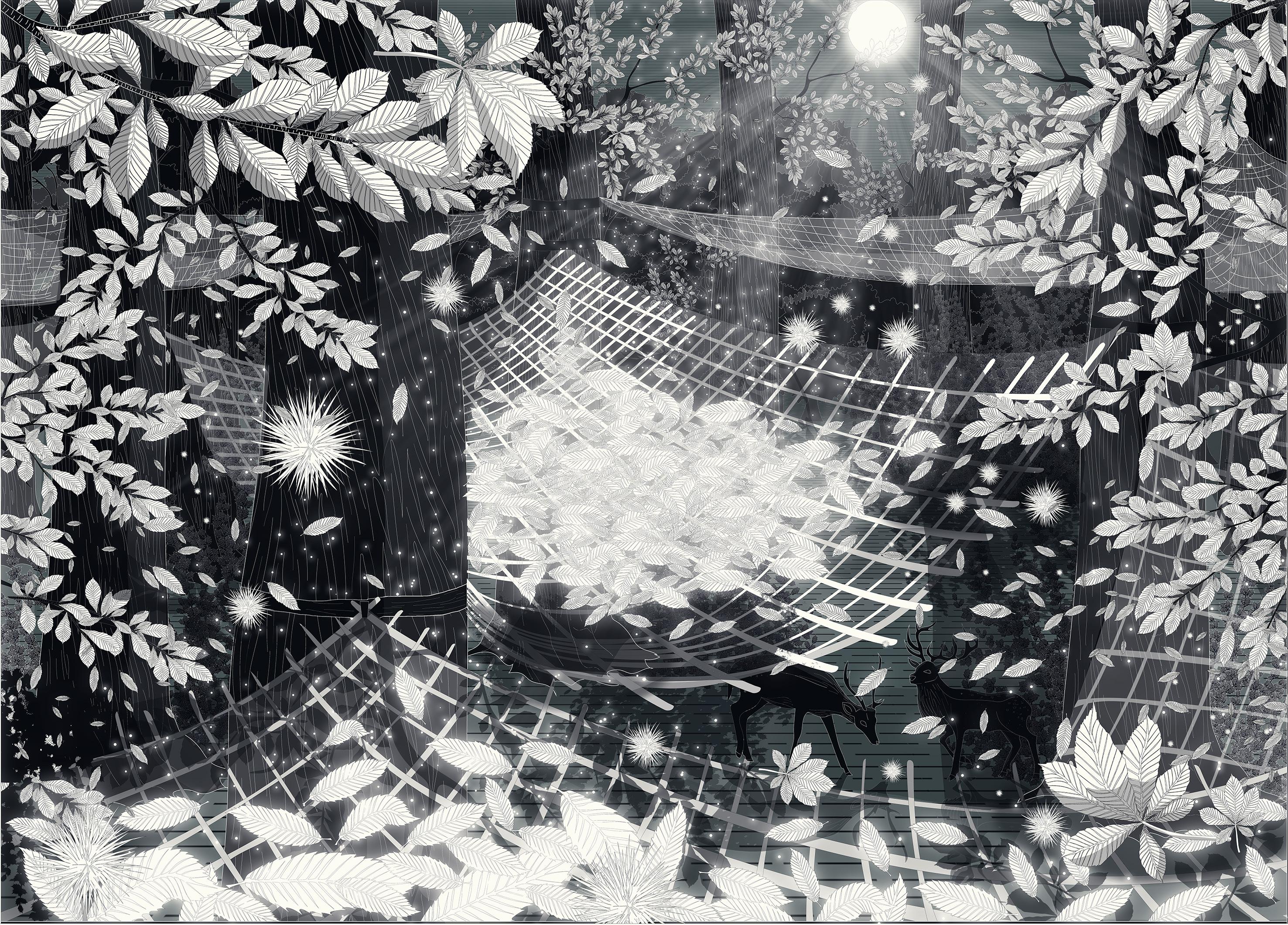
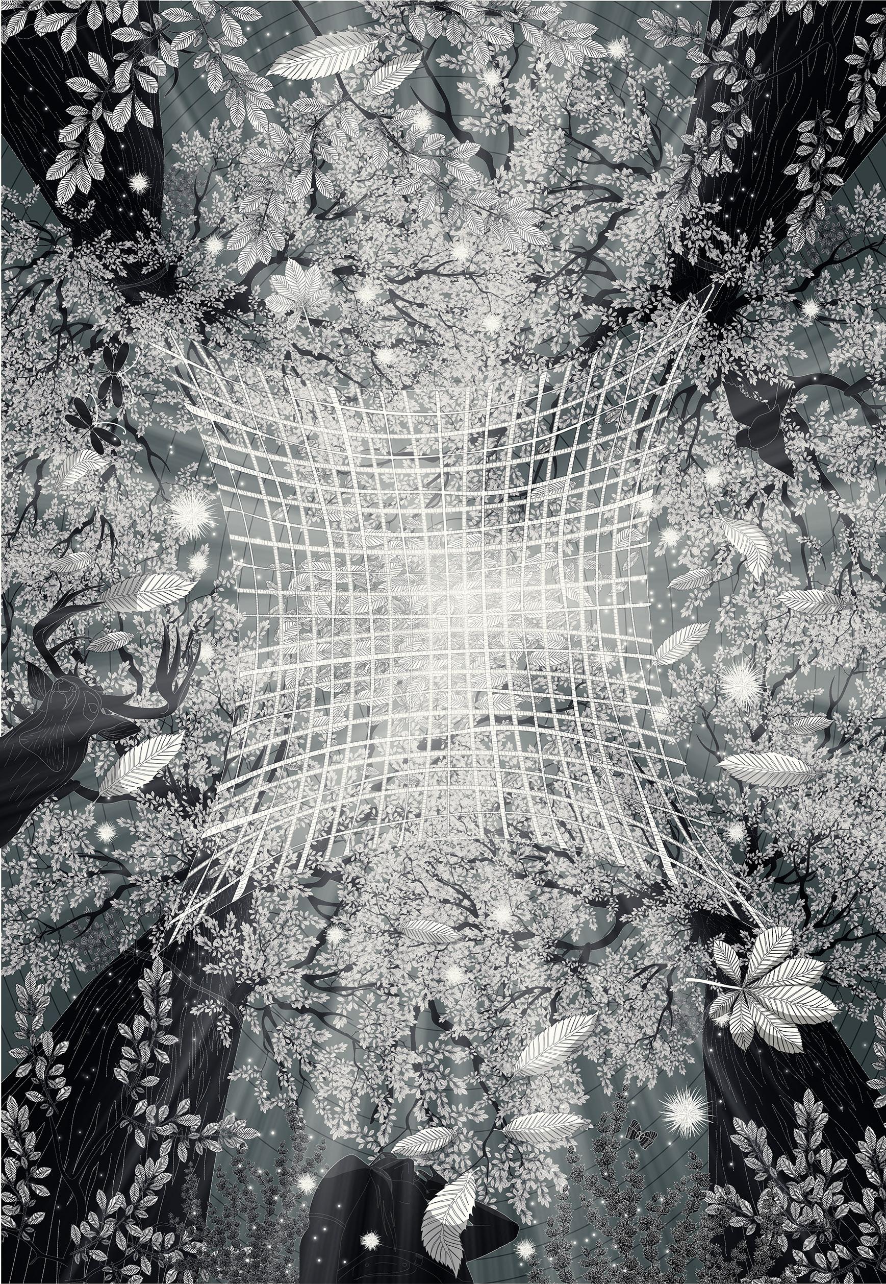
Student: Farinoosh Hadian Jazy 2021/2022 Term 1 Individual Hidden forest!!! forest factory???
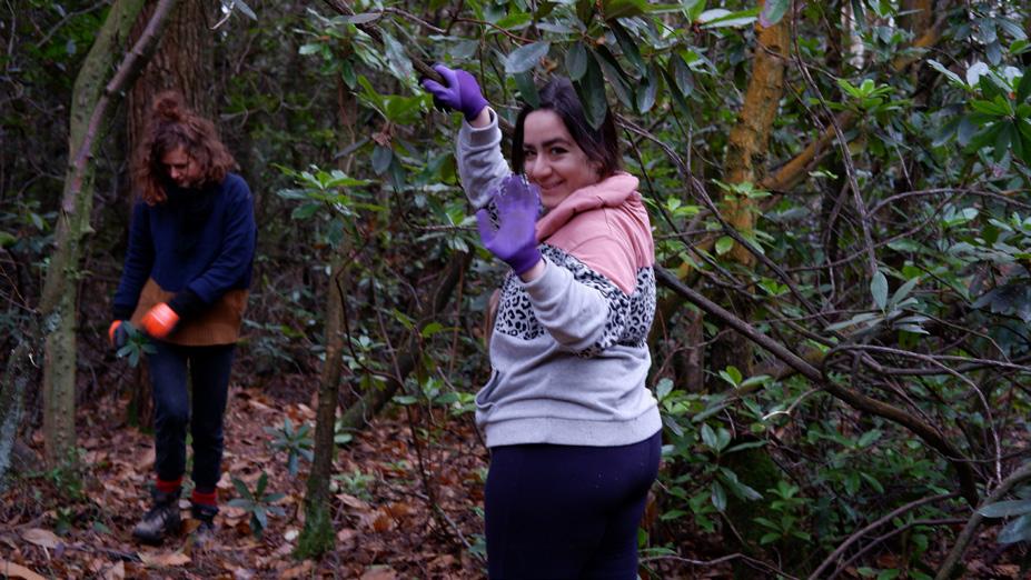
I visited Richmond park before, but for this project, I tried to see everything in a different way and see what I am missing in a forest landscape. Therefore, I managed to visit the place again regularly seeking for discovering hidden things.At first, Small scale landscapes attracted my attention. A fungi growth pattern or the shape of a spider net were amazing for me. I de cided to use motion photography and invention method for my self. I inverted the pictures I have taken from the forest. By this way I forced myself to see the landscapes in a different way. Please visit my website to see the full result.
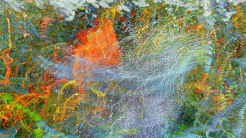
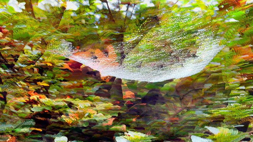
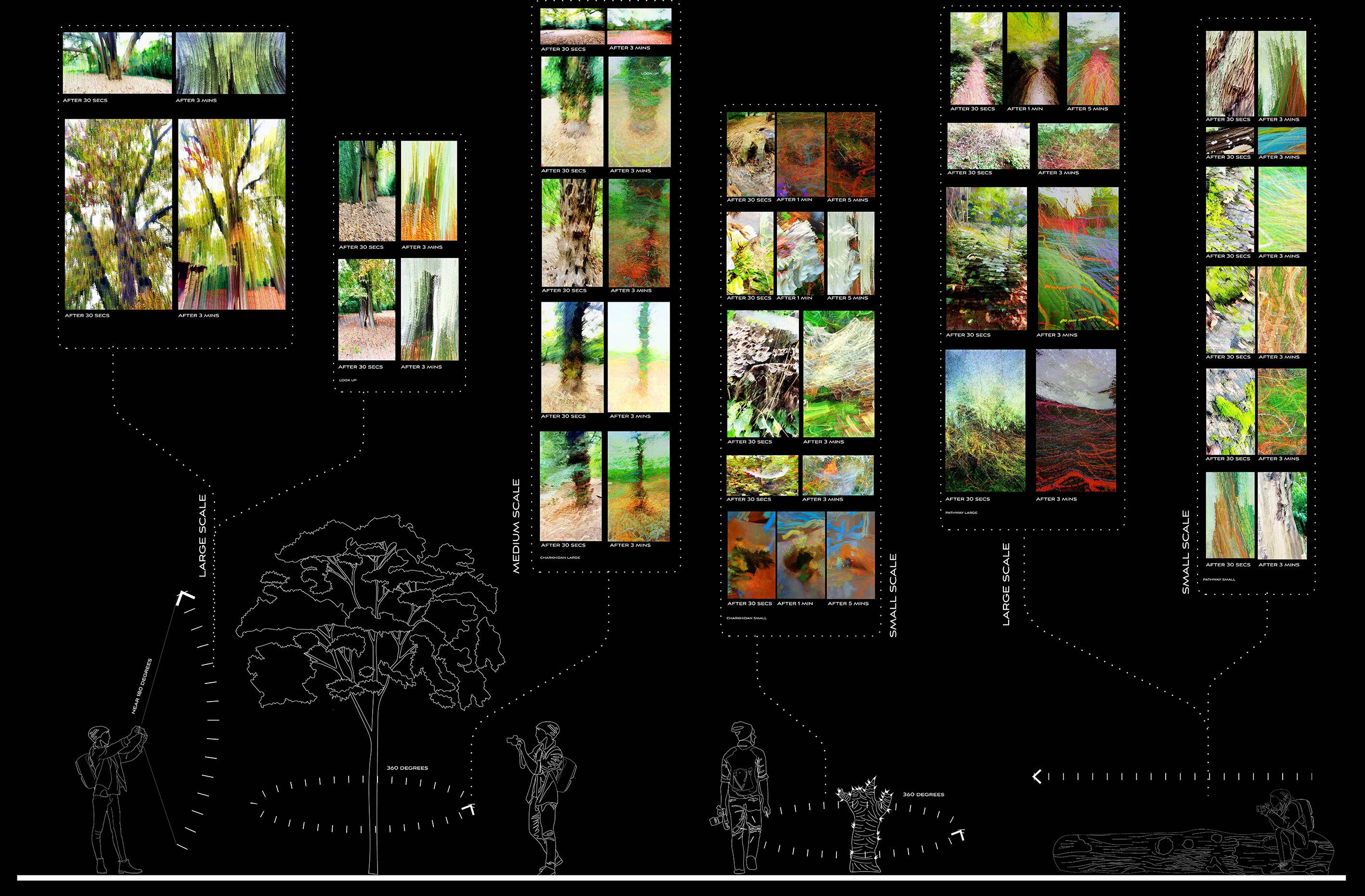
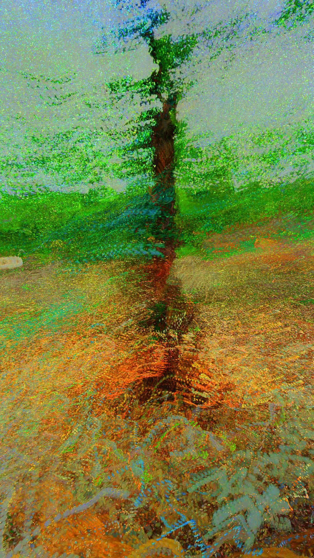
After 30 Seconds After 5 MinutesAfter 1 Minute Flower in windA tree Spider net in wind After 30 Seconds After 3 Minutes
Computational
I stimulated some natural cycles and the pattern of how roots and natural elements react towards eachother.
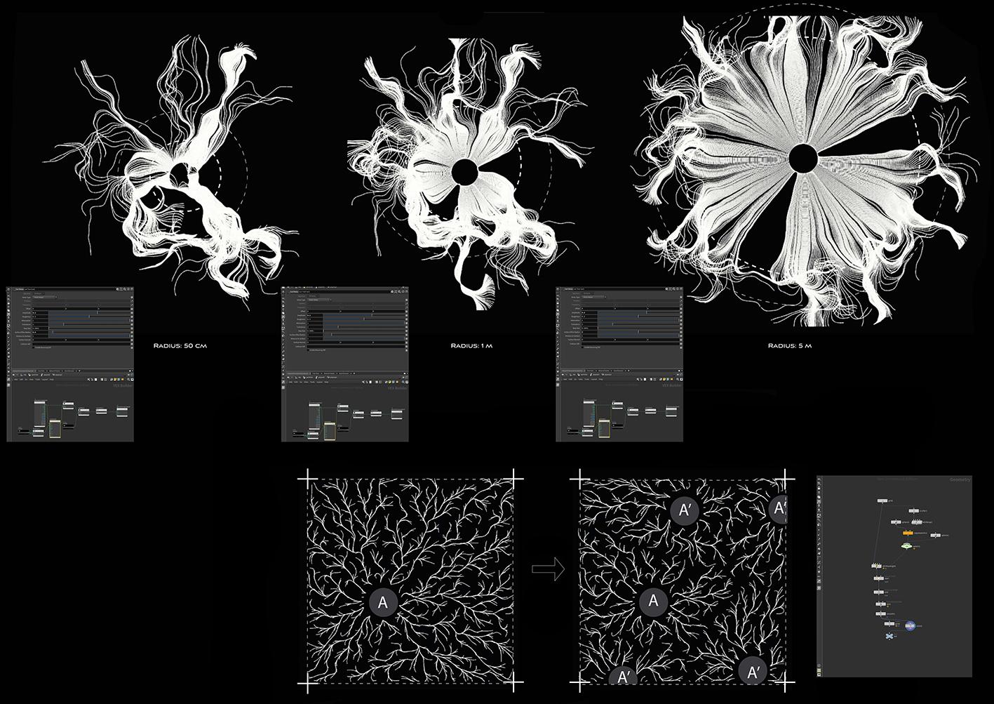
These stimulation helped me to understand the rules of natural game.
There is a video of my findings in : https://youtu.be/WcC-TW2whTY
stimulations:
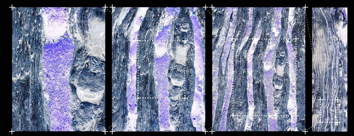
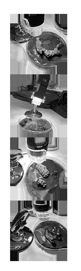
I decided to gather some objects from the forest and look at them in zoomed scale.
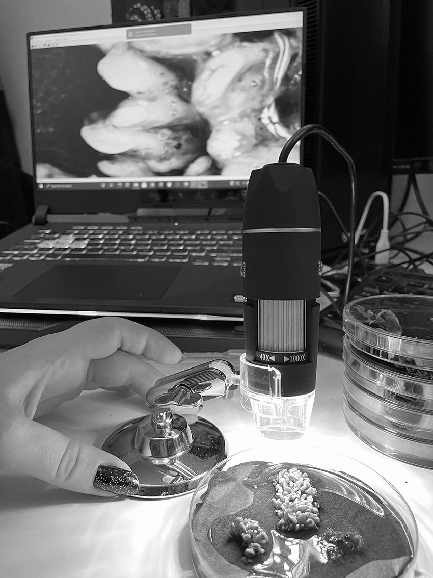
I put the objects (fungi, moss, ...) in separate glasses with same amount of water and same tem perature.All of them were in same situation. I did not remove any in sects from them as I did not want to change their existing features. The leads of the glasses were locked in order to keep the mois ture and insects inside.
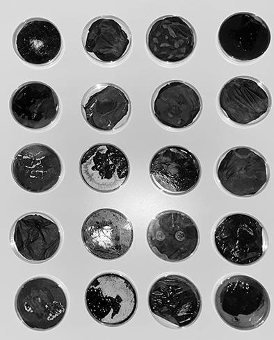
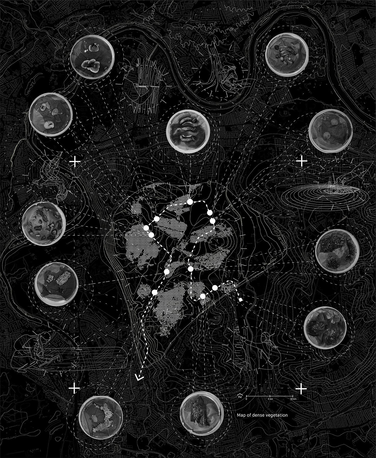
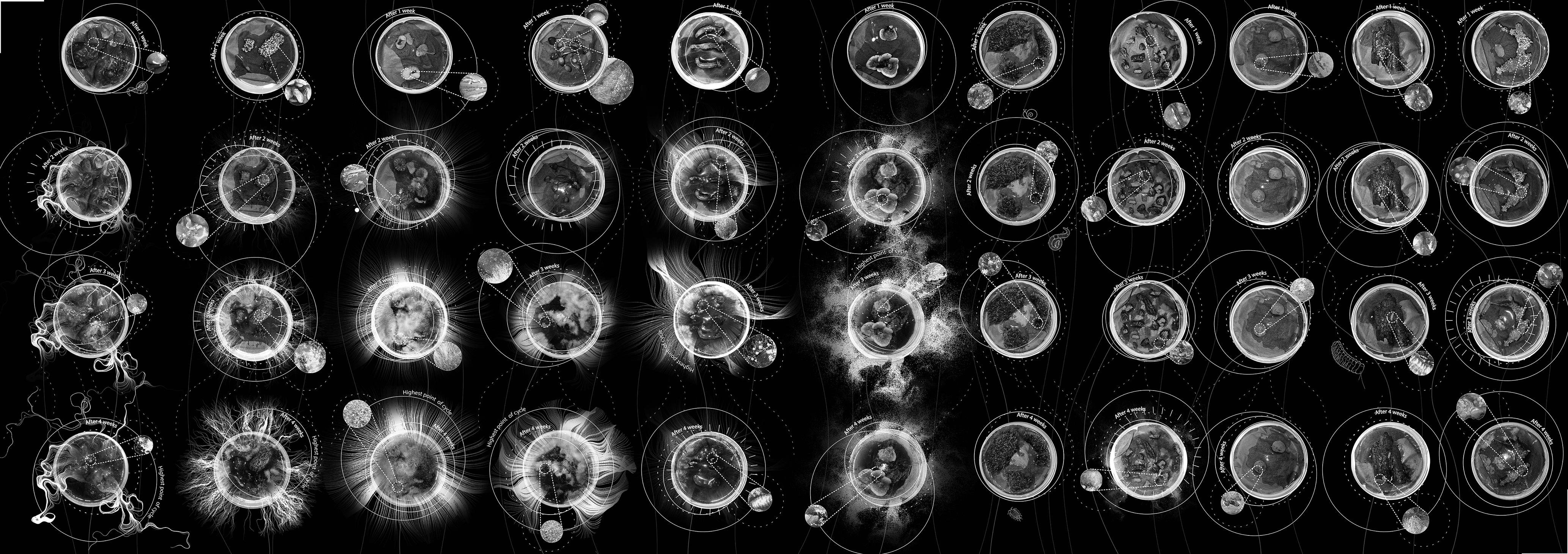
I managed to vist them carefully each week to see any changes. I captured any changes in each vis its.
The results of this experiment al tered my idea about forests.
The advantage of this experiment is that I have the control to my ob jects and non of them lost with ex ternal factoes.
However the disadvantage of this method is that the condition of the experiment is not original as they were kept outside the forest.
This is a map showing my collect ing process from Richmond park.
I managed to collect from differ ent parts of the forest to experi ence different conditions of the forest.
This experiment helped me to un derstand micro elements of the forest. I was focused merely on vegetation, but this practice shows me that there are other species which effects natural cycles.
Please visit the video : https://youtu.be/-dEBetxuHxU
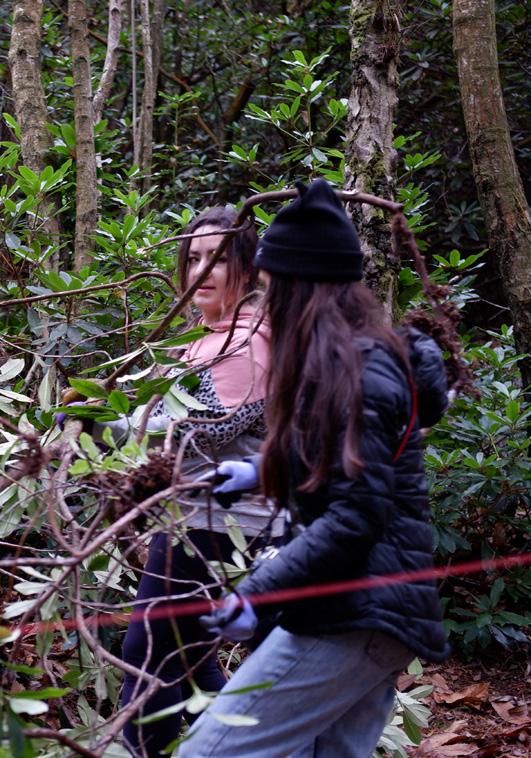
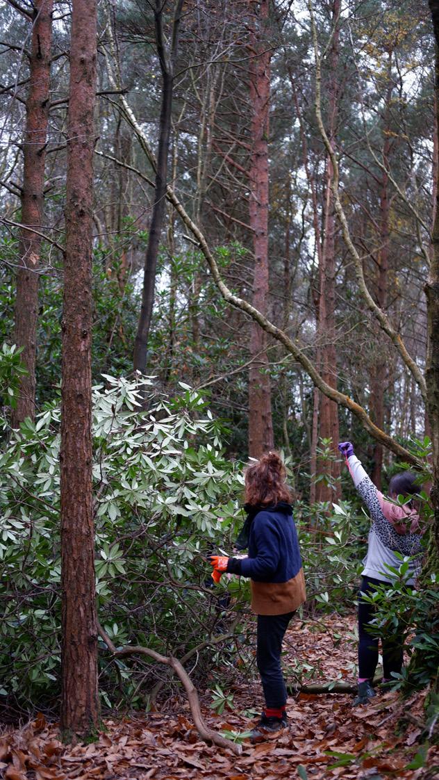
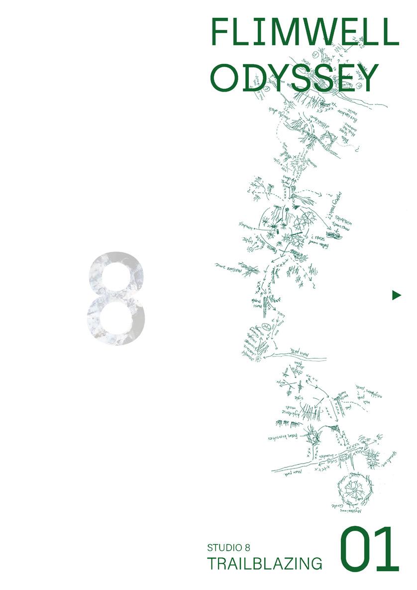
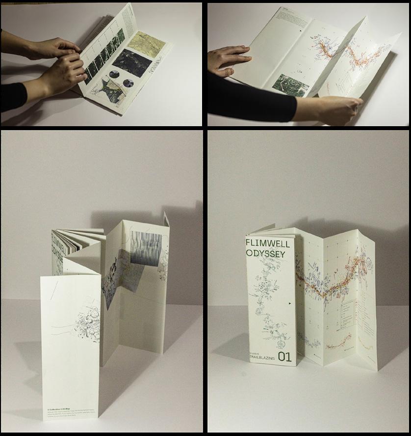
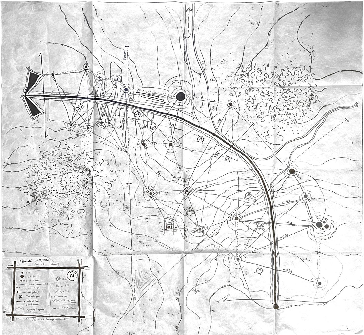
In Novemebre 2021, we as studio 8 went to Flimwell park to experience a natural forest and create a pathway in forest. The results of this tripe is in the Flimwell Od yssey which will be published in summer.
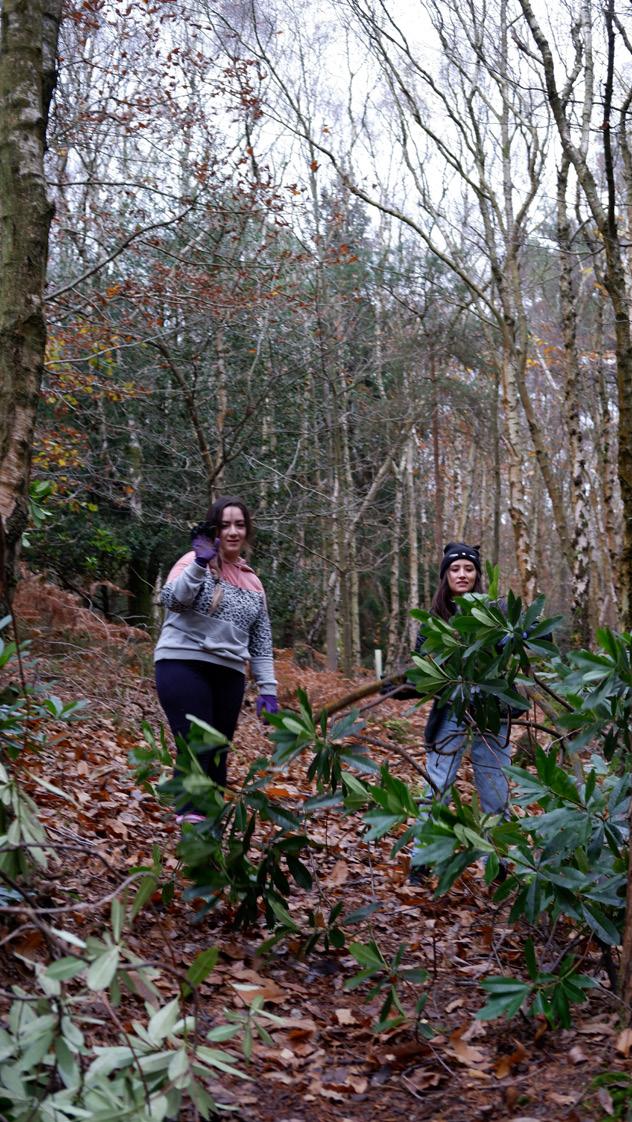
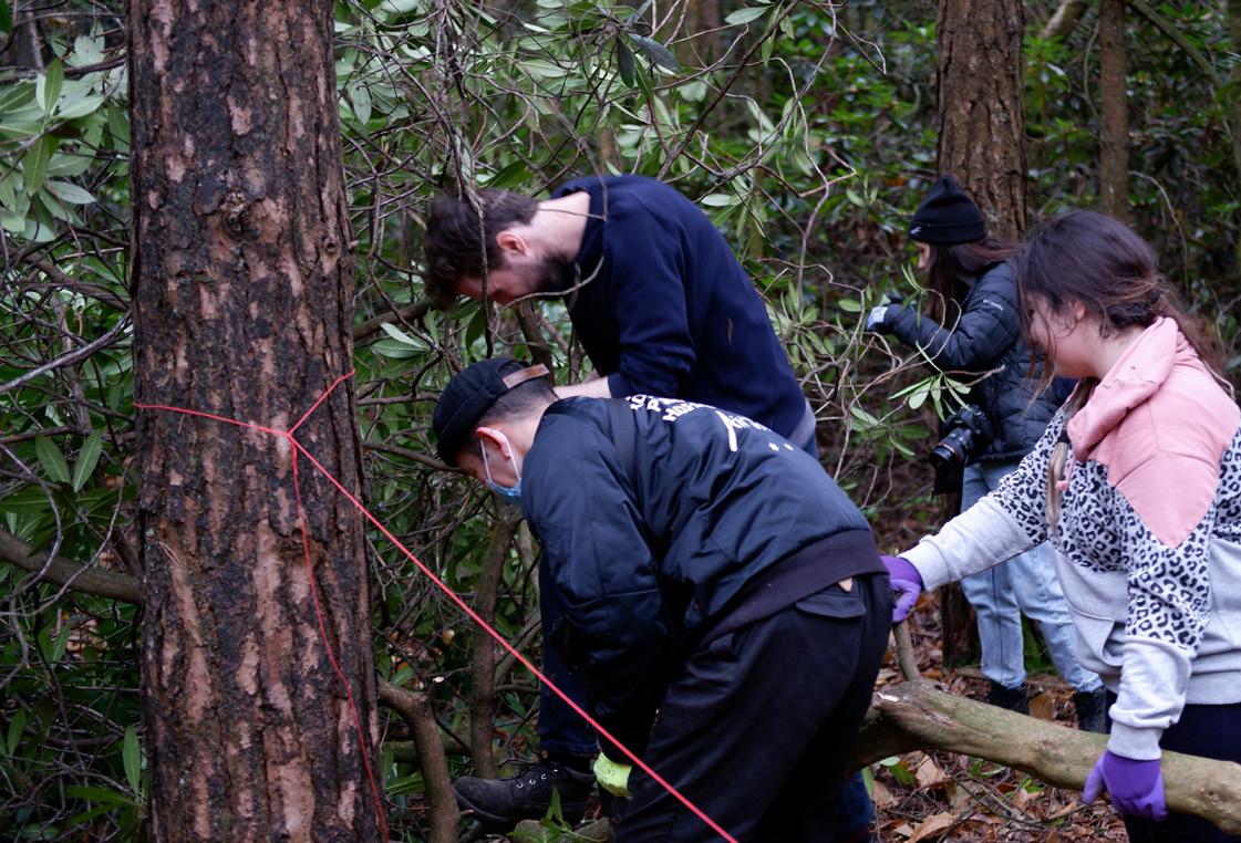
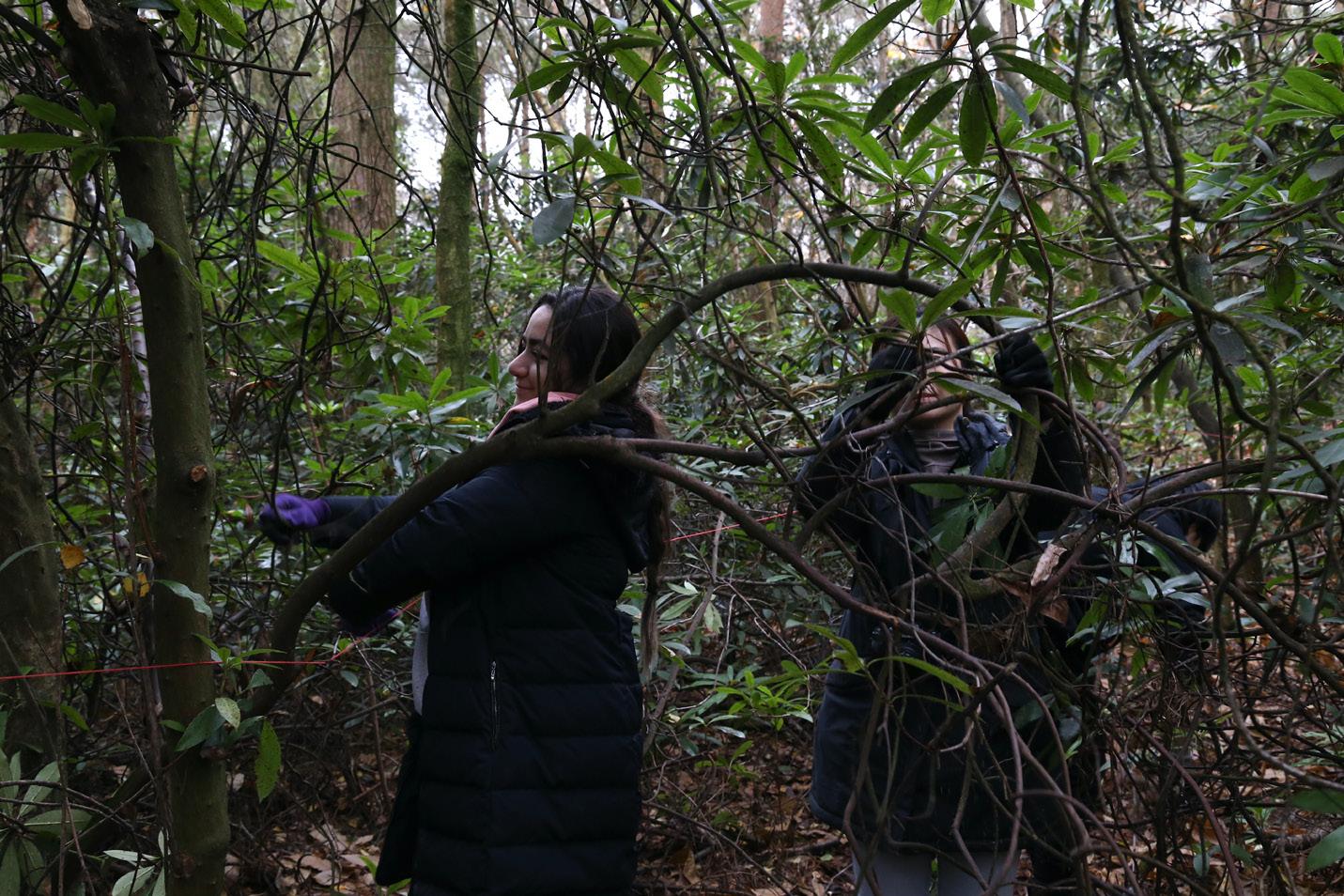
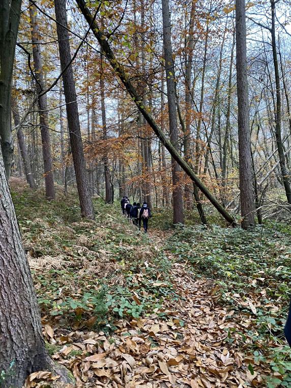
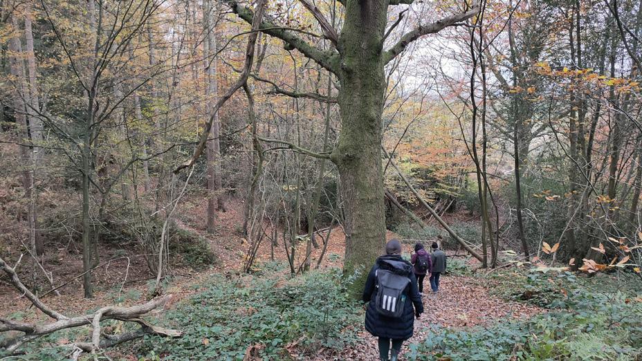
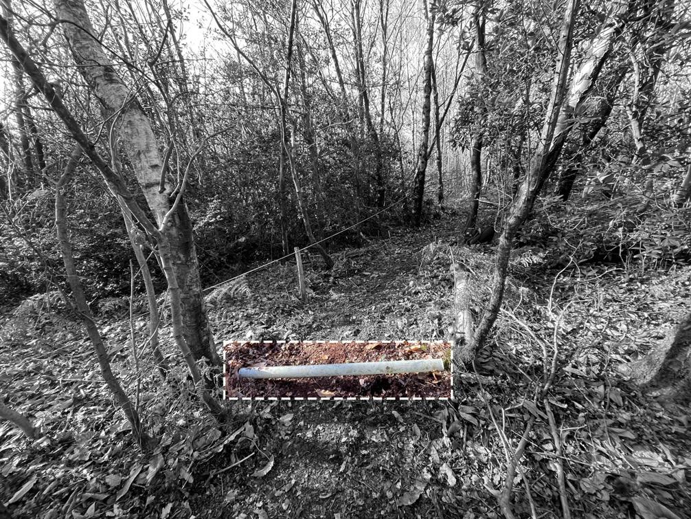
This tripe was a practical experience in for est and after that all of us created a map of one part of the pathway in 1:20 in 1.2 x 1.2 m paper.
Process
First, we can cut long branches of hollies in the site. Removing the spiny leaves im prove the ability to work safely with them.
Then the bare stems of the branches can be woven together to create networks for collecting leaves.
The networks are ready to be installed in the site by attaching them to the trees.
The networks should be installed before the trees start to drop their leaves. After that, we can gather the networks with dead leaves and carry them to the near sites with young and vulnerable plants and trees. The dead leaves and hollies net works provide covering layers for the young vegetation. In this proposal we can pro tect the temperature of the soil and improve the eco-systems. This proposal is proposed instead of building a green house which consums lots of energy and materials. The system will be decompose during time and no materials will be wasted in this proposal.
Process of the proposed system:
Installation of the net work in the begining of autumn.
Trees drop off their leaves.
Gathering the networks.
Collect them to the new site.
Protection and decompose
Process of creating the network:
Installation of the networks
Woving the networks
Removing spiny leaves
Cutting the branches
These perspectives are giving us ideas that how the proposal will be look like in future.
The nets collect the fallen leaves in autumn. Then they will be collected to new forests to protect them in winters. They will decompose after a while and create humus for the soil.
The nets will work as natural temporary green house without any need for construction of heavy fundations.
This project is still going on.
Perspective from the net
Perspective from below the net
I joined this firm as an architecture intern in summer 2021 for three months when I had a summer break. This internship taught me a lot about industry and architecture in real world as all the staff particpate in all meetings in office to learn new things from senior architects.
In this internship we generally worked in teams for competitions and we assist the senior architects in other projects.
This page is showing the competitions that my team participated in ( we are not allowed to share other projects).
3. Sirius
This was an architectural competition that our group participated. The challenge was to regenerate Sirius coast line in Russia. The proposal was to create wetlands instead of the hard concrete sea barriers in the beach qlong with multifunctional structure.
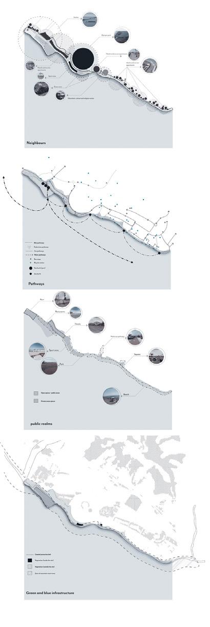
I made this perspective of our proposal (along with other per spectives) and diagrams of the existing condition of the site.
1. europan
This was an architectural competition that our group participat ed. The challenge was to rehabilitate the industrial area around a factory in Sweden.
Our group proposed shared spaces and green structure to the site to improve the existing condition of the site. In our propos al we tried to proposal eco-friendly and low carbon emission proposal.
I made this perspective of our proposal (along with other per spectives).
2. Arctic hotel :
This was an architectural competition that our group participated.
The challenge was to design a hotel in Lapland in Finland.
The proposal was to create views to north lights and propose a low energy proposal.
In this project, I was assigned to draw the iso diagrams of the hotel components and technical sections of the design.
Jolma architects Architecture Internship
1.
bachelor’s of architecture
In this part there are some of samples of my work in university of Tehran
4.
This part is a collection of my projects during my Bache lor’s degree. I bring two projects that are more relavent to Landscape and Urban design.
All of them are done between 2015-2020.
They are mostly created by Revit software.
You can see that this part is completely different from the previous parts as I grow more during time. But I bring these projects as they are intrinsic mildstone of my knowledge towards architecture. I learnt a lot during my Bachelors degree.
Please check out my website to see the architectural pro jects that I made during this time.
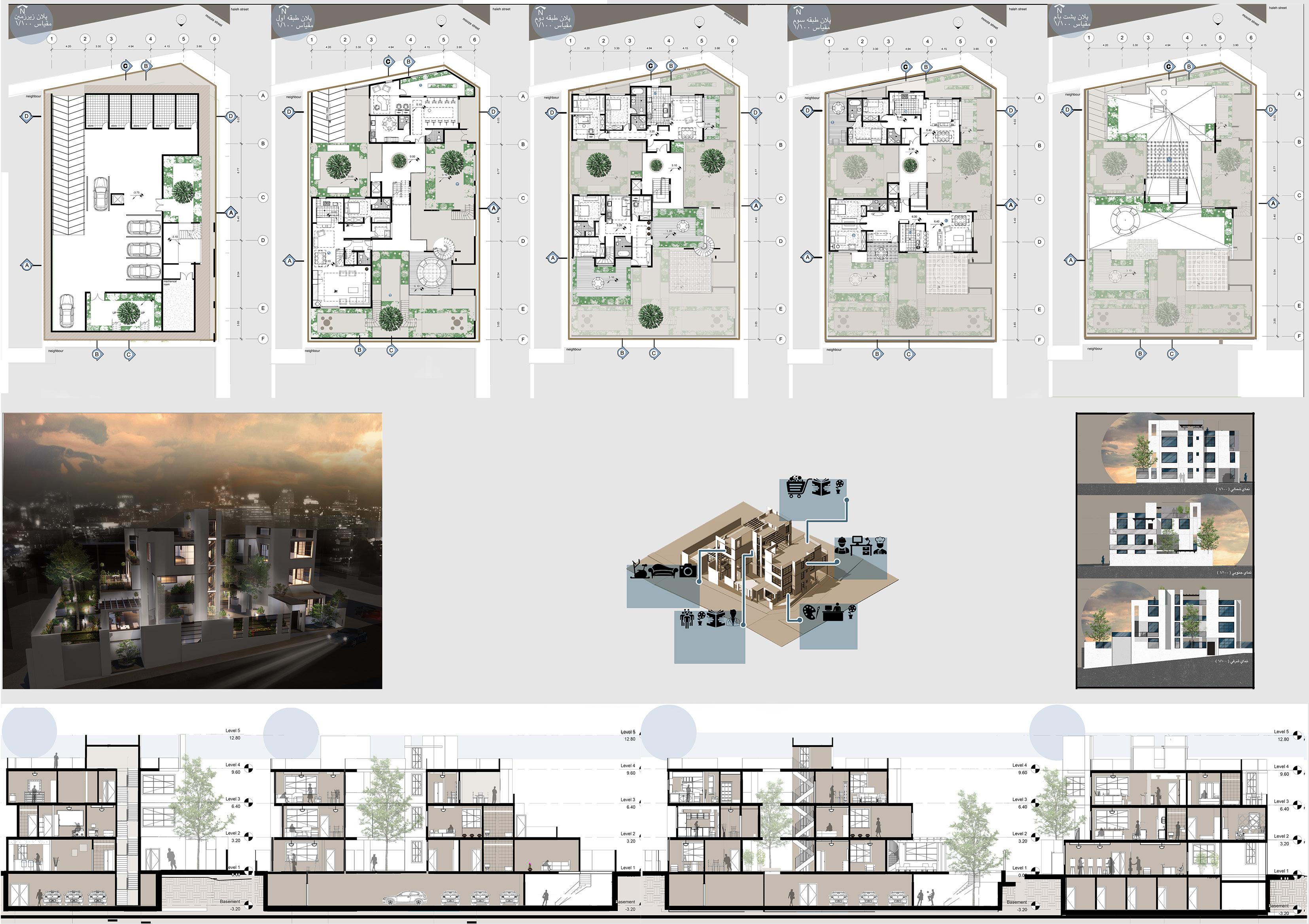
Structure studio 2. Urabn design 3. Residential complex
mini scale
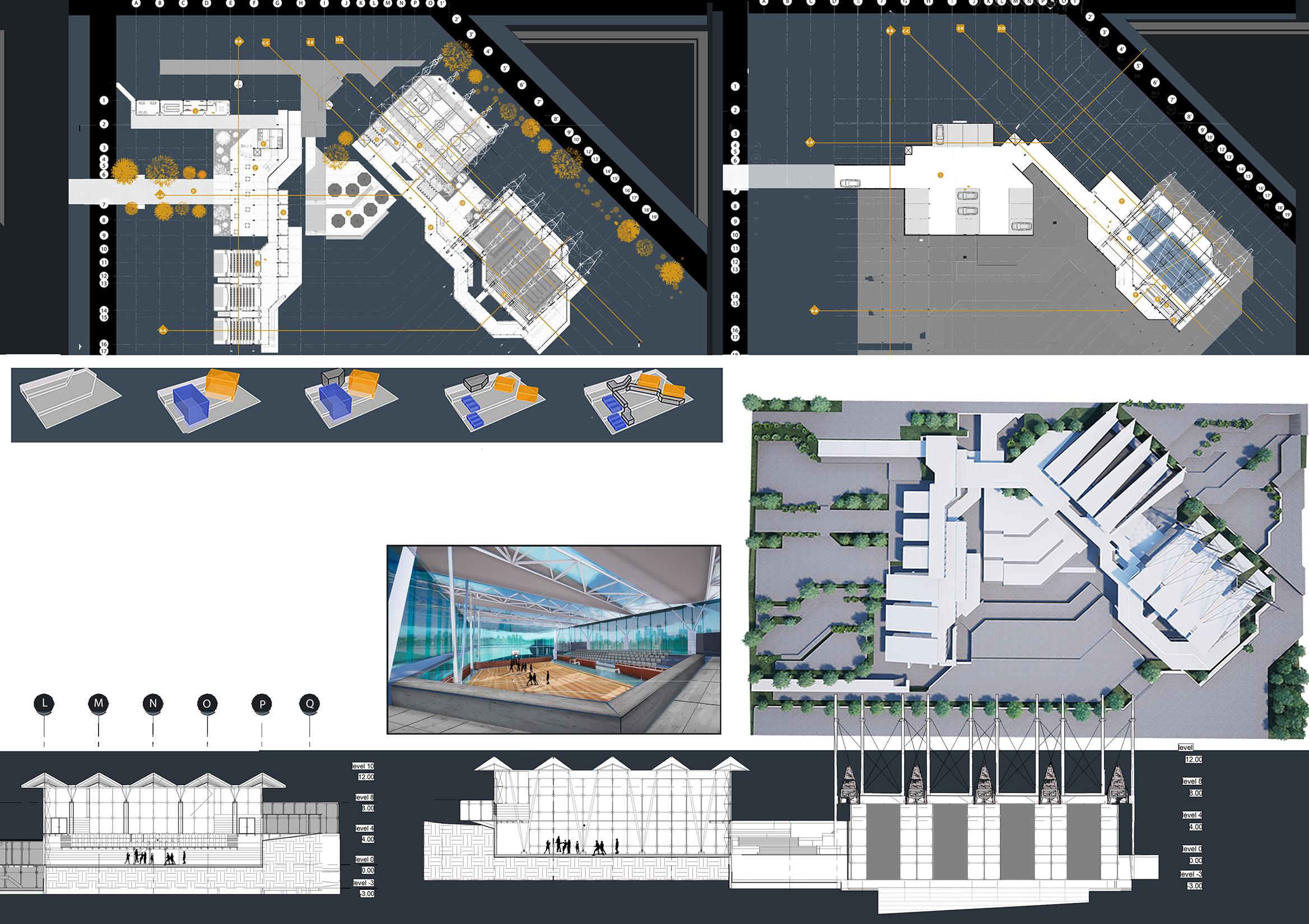
In this design studio , we have learned many contemporary and modern structures which deal with glass , concrete and cables. This pro ject is dedicated to recreation and cultural activities of university of Tehran stutdents .
All caponies and trusses are parallel to the base girids and they control amount of light which comes in and out
They are perpendicular to gradens to make spec tators watch the competitions or matches
In this complex there are two different functions which shape whole the pro ject. Cultural places include three cinemas, three classes and main gallery. recrea tional parts include sports halls and swimming pools with separate lobby and corridors in order to control noise and etc.
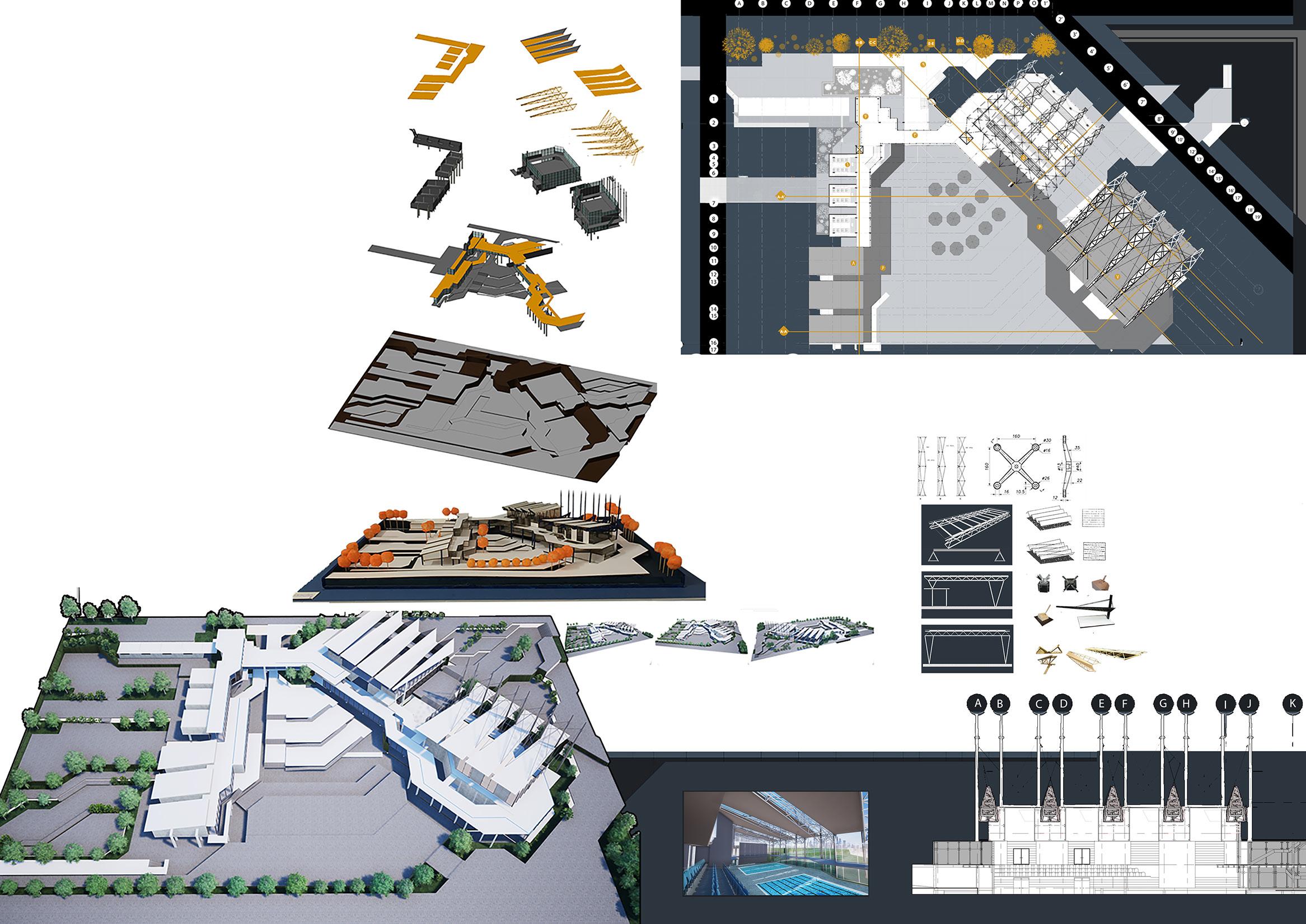
Most of the facades in the pro ject are glass and windows . One of the main goals of the project is that simplifying all facades and interaction with outdoor spaces Thus, frames of teh windows were removed and spider system was utilised . This system is suitable for large and glass facades In this project, steel connections are pin joint considering frequent earthquakes.
Arms, cables and concrete colums are the structures which hold roofs and trusses in large spaces such as swimming pool
Physical model
corridors
site
swimming pool
sports hall
cultural places
recreational places
twinmotion render
perspective from swimming pool Section E-E
SECOND LEVEL 1. Classes 2. Elevators 3.Main lobby 4.Gallery 5.Gradens 6.Lobby roof 7.Swimming pool roof 8.Cinema roof 9. Main entrance
Structure studio BACHELOR OF ARCHITECTURE Recreational and Cultural Center Design Studio 2 Studio Tutors: Dr. Heshmatolah Motedayen and Dr Farzin Negarestan Student: Farinoosh Hadian Jazy Individual 2017 Term 2
and green spaces
ject. Their features
grids of the site
other intrinsic part
most
lines
project
perspective from sports hall Site is steep and there were 3 main different levels of topography. This levels provide the buildings with basic grids There is a need for connection parts such as lobby and corridors, to connect different places in the complex Places should be more functional in order to address visitors needs. Corridors and lobbies should spread thorugh out the project and they should obey the to pography of the site Landscape
were the
of the pro
depend on the topography and features of the site. Main
are
imporatant factors to shape landscape in the project. All
in this
are alignedwith 90, 45, 0 and 180 degrees ,which cause geometric landscape in all parts of the project FIRST LEVEL BASEMENT 1. Offices 2. WC 3.Cafe 4.Entrance 5.Cinema and Theater 6.Shops 7.Open space 8.Sports hall 9. Cloakroom 10.Sports lobby 1. Parking 2. HVAC 3. Pool entrance 4.Cloakroom 5.Bathrooms 6.WC 7.Matching pools 8.Training pools There should be 2separate parts for the project; Recre ational section (orange) and cultural section (blue) main grids
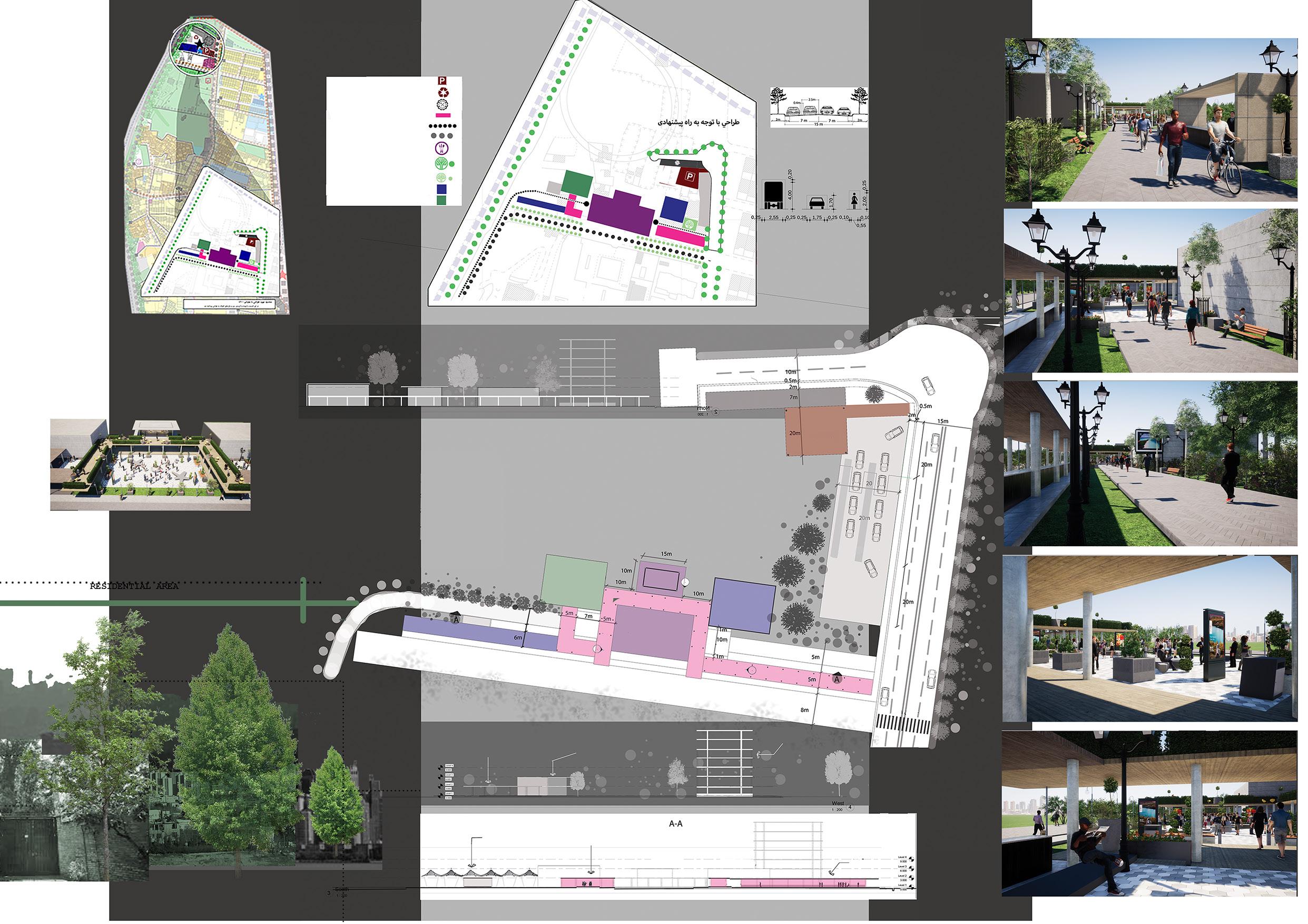
Our team chose this loca- tion for building a city cen- tre for it was accessible to all parts of the region and it was far from residential zones.
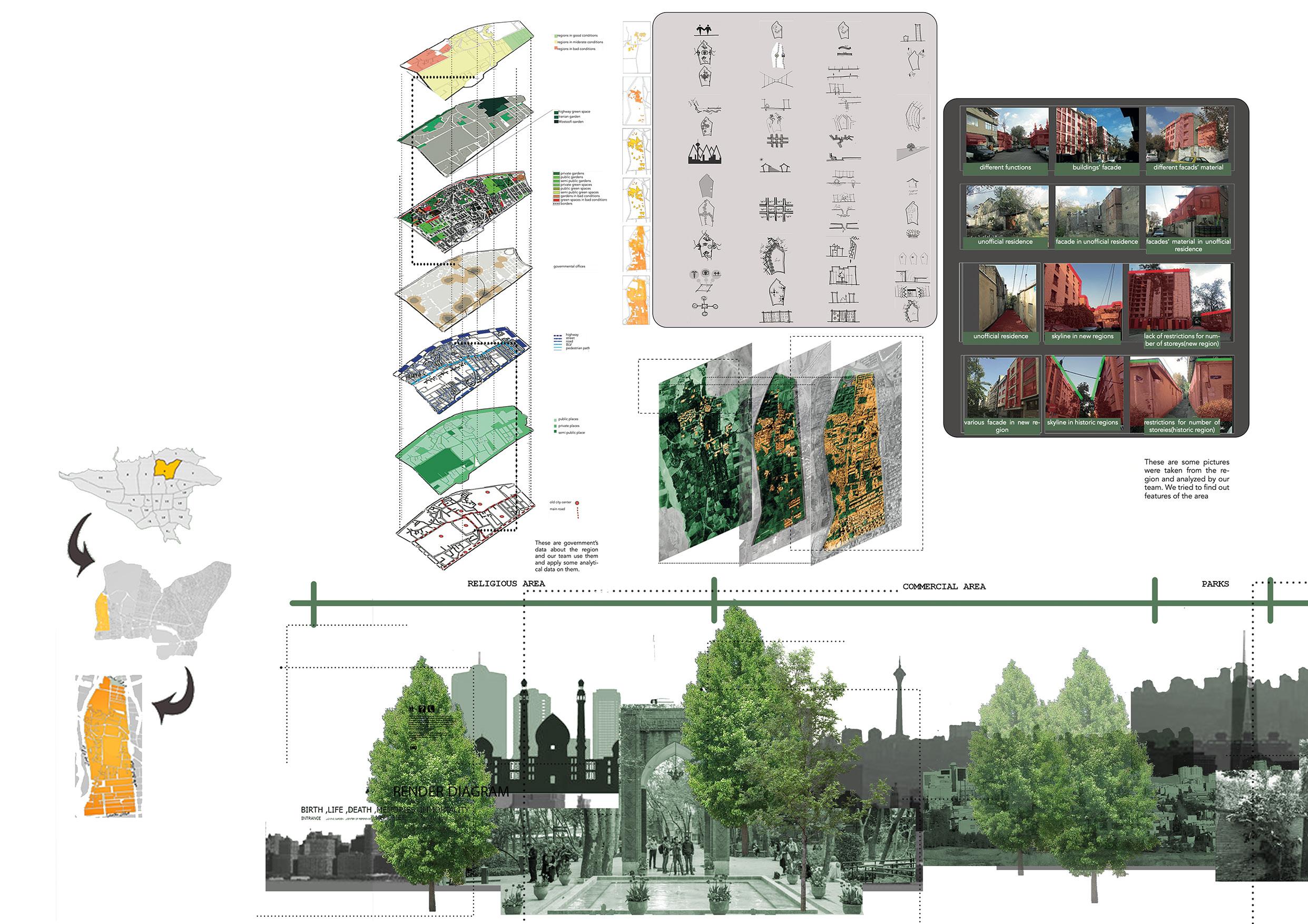
Urban
Final proposal: after analysis all four possible proposals, our team reached to a comprehensive conclusion which covered all good points of each pro posal and intoduced best solutions for the region. In this proposal we tried to consider all problems and deal with all of them in proper way.
conflict between new and old regions unsuitable public transport suitable access to important buildings good combination of neighbours in new areas tourist attractions religious landmarks and places aqueduct utilisation enough green spaces good city view in new areas commercial places important functions in specific urban structure trans-regional functions vacant lands service north to south connections alleys with deadend large suitable roads in new reigons north access to highways suitable urban pattern in new reigons enough light for each building good infrastructure in new reigons natural sound bar riers in the east connection between main squares lack of immigrants attractions unsuitable transport structure unsuitable streets infrastructure fault danger no access to highways from east or west small roads lack of pedestri an paths lack of disci pline for tree planting unsuitable organic pattern in old region unsuitable public furniture lack of discipline for functions lack of disci pline for facade in old reigons discipline for facade in new reigons air and water pollution high population density unsuitable sewage infra structure lack of some functions lack of good landscape conflict between functions destruction of green spaces lack of landmarks houses in bad conditions opportunities weaknesses
design BACHELOR OF ARCHITECTURE Recreational and Cultural Center Design Studio 2 Studio Tutors: Dr. Heshmatolah Motedayen and Dr Farzin Negarestan Student: Farinoosh Hadian Jazy 2017 Term 2 Group of five
parking waste land mechanical zone commercial zone pedestrian path bicycle path recreational zone natural sound barrier green corridor cultural zone sports and educational zone
In our design, we offered many useful parts such as recreational centre, commercial zone, sports hall and pedestrian -bicycle path ways. Those paths starts from the city centre and covers all parts of the region. They also covers west part of the region which is pro tected by natural sound barriers.
All parts of the city centre (except parking lot) have no more than two storeys. fruitand vegetables stores are covered by tents and temporary structures in order to create an at tractive skyline and be closed in bad weather.
These pictures are some renders from the 3D model of the city centre. All of them were renderd in twinmotion. Open spaces and green ones are the most important places in the region
Some references Some references south section east section section A-A plan parking lot parking lot mechanics sports hall vegetable stores community centrerestaurantsports hall
Our
team chose this location for building a city centre for it was accessible to all parts of the region and it was far from residential zones.
designing city centre for the region space for U turn space for U turn parking lot mechanics taxi station main road benches pedestrian pathway pedestrian pathway mainpedestrian pathway vegetable stores round about sports hall community center restaurant pedestrian pathway gallery and multi space gallery and multi space gallery and multi space sports hall vegetable store vegetable store round about parking lot bike station bike station border
complex
Studio 5
Tutors:
There is a river apprximately in the middle of the site. As you can see, topographic lines are affected by this river. Moreover there is a steep slope from north to south in the region
Masoud
site plan (render)
All four sides of the site is accessi ble for car and pedestrians. There are two main roads in east and west of the site which are suitable for main access to the site.
Main features of the site are the most important factors for a successful design
This residential complex has many parts. Some of these parts are in public zone; such as public hall, vertical (eleva tors and staris) and horizontal corridors , the others are in residential zone such as houses and flats. The most impor tant goal for this complex is separation between public and private zones which control safety and noise for residents
pedestrain pathway
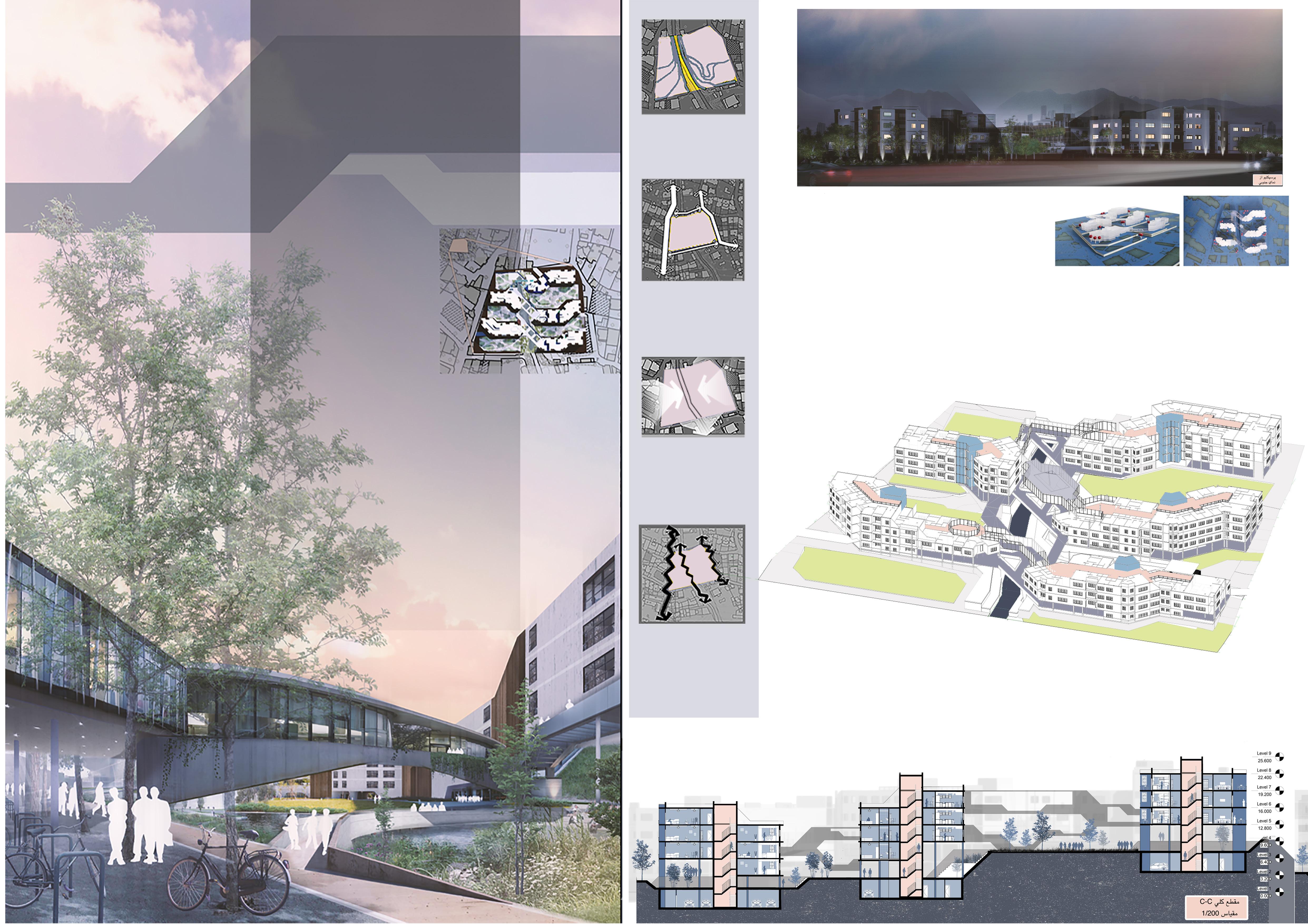
In this design studio, we tried to design a res idential complex with 100 flats (families).Land scape, privacy and safe ty were crucial factors in this design.
Tehran is in the skirt of moun tains ,therefore our site has a good view to the city. Further more, the river in the middle of the site creates an attractive view for the site.
River and main roads are the culprits of noise in the site ,thus reidential places should situate away from them. In contrast, pub lic places can be built near these sources of noise.
residential zone
elevators and stairs garden
In these sections, as it can be seen, all bathrooms and kitchens are in vertical lines (in the same place in each flats) to use sewage pipes efficiently. Noise was the other problem which I should deal with ,therefore I put bedrooms away from corridors and elevators and provide them with a good view from gardens. They are in vertical lines (repeating in residential floors). There are pilots below each block to connect gardens and create entrance zone for each block. Public places connect blocks together by bridges.
river pilot
corridors
public hall
perspective from south street
SECTION C-C
RESIDENTIAL COMPLEX BACHELOR OF ARCHITECTURE Residential
Design
Studio
Dr. Alireza aeinifar and Dr Ehsan
Student: Farinoosh Hadian Jazy 2018 INDIVIDUAL
In this project, facades were intrinsic part of designing. Tehran is a mountainous city ,therefore I tried to design skylines which imply moun tain range. I designed balconies in vertical lines as well as windows. In this complex, I used three materials (glass, concrete and wood). Using shear walls instead of wind beams is the other challenge for me (because in Iran it is more economical to use concrete, so I tried to re duce construction’s cost). Bridges and public places abow the river, follow complex skyline and materials which are mentioned before. There are only 90,45,0 and 180 degree lines in both architectural plans and facades.
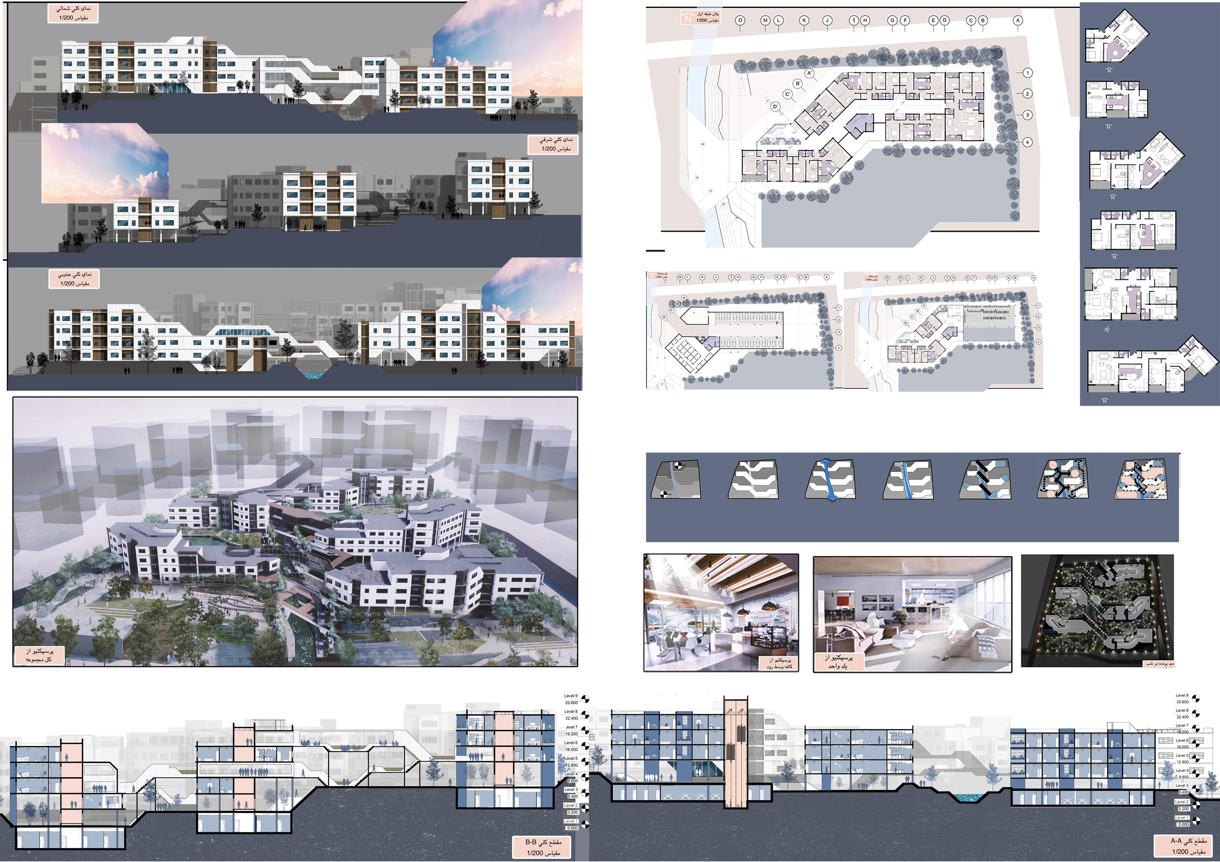
There are three floor plans of one block in the complex. Some of the flats have north light and the others get light from south. There are three different types of plans with different area 200, 120, 80 m2. These
three types have two various shapes which is affected by the shape of each block. Moreover all blocks just have 90,45,0 and 180 degree lines in their design.Thus all flats obey the blocks’ geometry. In the design of each flats, I tried to separate public (kitchen and livingroom) and private (bedrooms) places. All of bedrooms, kitchens and livingrooms have windows and have different views to the gardens. Each two blocks share a garden. There are enough distance between each two blocks to protect privacy of each blocks
NORTH FACADE SOUTH FACADE EAST FACADE SECTION B-B bird-eyed perspec tive from complex SECTION A-Abv There is a steep slope from north to south which create different levels in the site. Following these topographic lines was the concept of my design (environ mental friendly). River separate the site to two parts. These parts are ap proximately same in their size In both sides of the river, there are pe destrian and bikes’ pathways which are from north to south. Connecting two parts of the site was made by three main bridg es above the river Connection be tween gardens was made by green paths and pilots. balconies and bridg es’ voids were added to reduce rigidness of blocks and bridges. concept site plan in night perspective from one livingroomperspective from complex’s cafe 80 m2 flats TYPES OF FLOOR PLANS 100 m2 flats 200 m2 flats SECOND LEVEL BASEMENT FIRST LEVEL
There is one main road
the
the
Pesedtrian
The road and the alley cause a lot of noise for the site.
there is traf fic jam in the main road and there is a steady traffic in the alley (beacuse it is narrow)
This is a section-perspective diagram from the building. As you can see, this building has differ ent parts which are connect by the stairs and el evator.
These are pictures of physical model. They are similar (in shape) with the real house that I designed (the proposal).
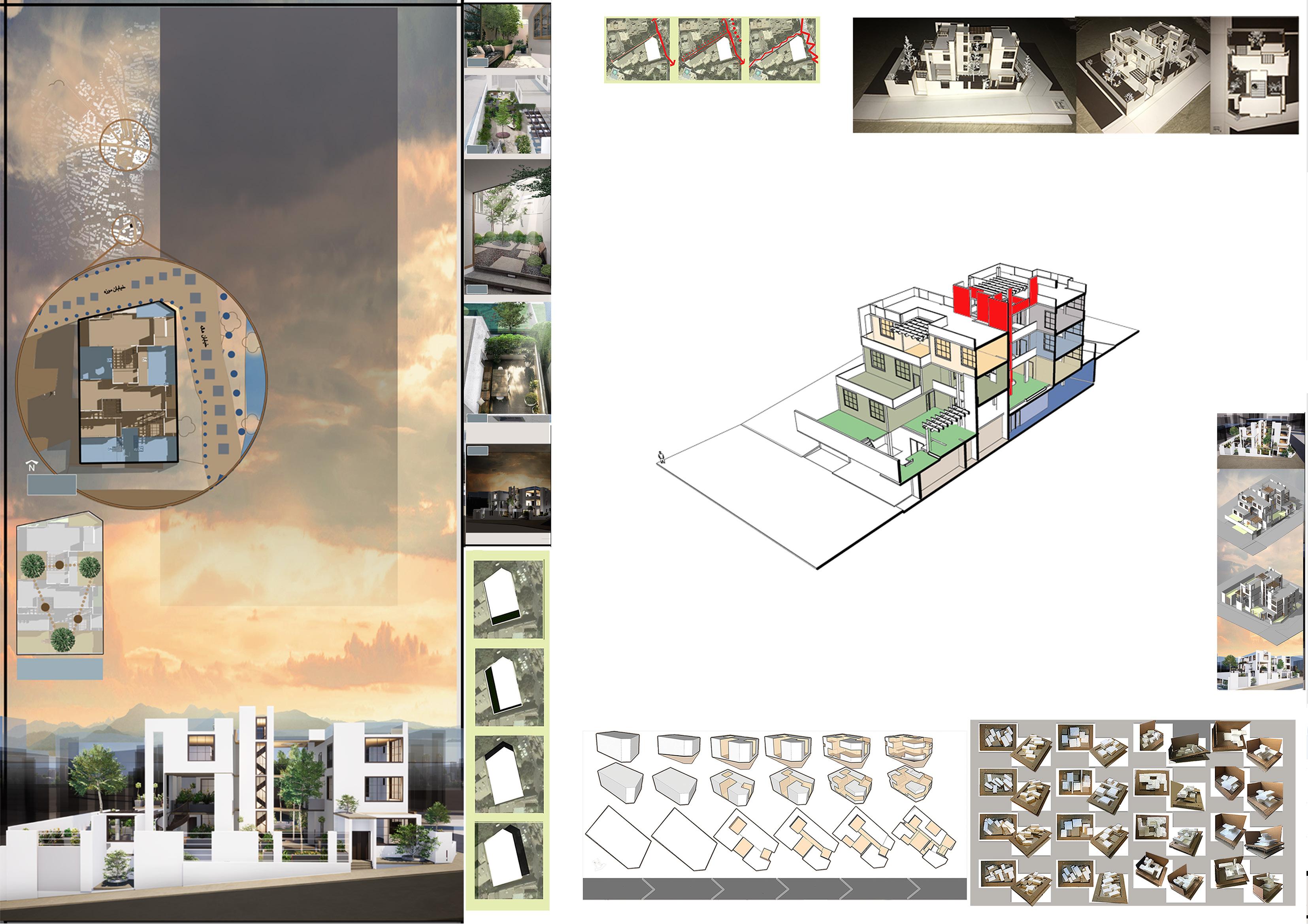
this design studio, we tried to design an apart ment for five different fam ilies which have different traditions.Privacy, light and comfortibility were main goals for this project
Shadows are the important fac tors in designing a house. There for I tried to analysis all shadows in the site in a normal day
This diagram shows how my concept developed during the course. First I consider a cube. Then by placing three gardens for the three trees in the site, the cube was reduced inside. Finally, I managed spaces by in troducing special function for each part.
In design of each space such as livingrooms ,bederooms and kitchens) light was the most important factor. I tried to use south, east and north light which are desirable for people.
These are the steps that were done in order to creating a successful house out of the concept.
mini scale BACHELOR OF ARCHITECTURE Residential complex Design Studio 4 Studio Tutors: Dr. Alireza aeinifar and Dr Ehsan Masoud Student: Farinoosh Hadian Jazy 2018 INDIVIDUAL In
three historical trees site plan north garden south garden west garden east balcony night perspective light from west light from south light from east light from north Step 1 Step 2 Step 3 Step 4 Step 5 Step 6
2 bedroom flat stairs and elevator 4 bedroom flat garden HVC storage 3bedroom flat
parking
2 bedroom flat
near
site (east) and one alley in
north of the site. The road and the alley provide the site with access to city center
path ways are the other option which pro vide access to the city centre. They are near the road and the alley.
Usually
physical model
In the process of designing a plan, I tried to create rectangular and square plans (90 degrees) which are the efficient shapes for designing a house (interior design). All flats have their own garden or balcony. One of the flats is duplex which is for the family with five family members. There is one parking space for each flat (in the basement). I designed a roof garden which can be used by all of the families.
In this diagram, There are five different families which has different occupa tions and cultures . Thus they need spe cial space and equipments.
In the middle of the building is an el evator and a staircase. There are some voids in the project (gardens) in order to provide each flats with enough sun light
As you can see in the facade, I designed the building with just three materials ( white concrete, glass and wood). I tried to design a simple modern house which can interact with its neighbours
level2 plan level3 plan roof planlevel1 plan basement plan east facade south facade north facade In this family, family memebers like to study, shop, plants. So they need place to read garden or green balcony. In this family, family memebers are doctors and they need storage for their medecines. They like planting and reading. The number of family memebers is more than other families. In this family, family memebers are athletes and space for doing exercise. They also are photographers and like to have their own gallery for their photos. In this family, family meme bersare engineers and one of them is a chef. Therefore they need space for PC. This is art gallery which people can visit and learn art. It has one atelier and office (+wc and kitchen and garden).
section
D-D section c-c section b-b section a-a
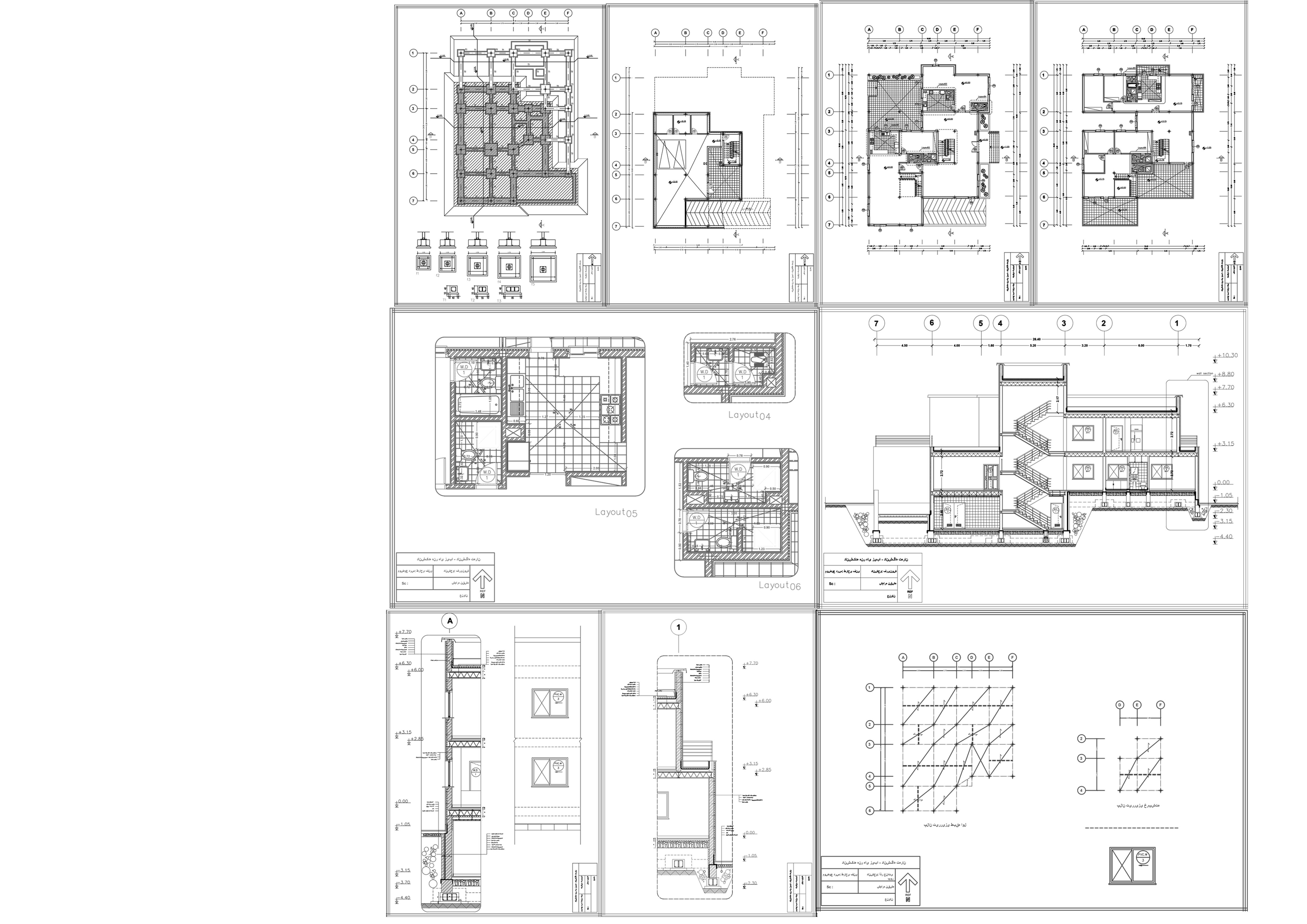
This is Phase 2 of my Mini scale project. It is drawn by Autocad.
In
This
some
that I did
can see
of
extracurricular Activities
this part there are some of samples of my work outside university
part is a collection of
mini projects
in my free times. You
all
them in my website.
parametric design
These pictures are showing my recent projects with Grasshop per in Rhino. These mini projects helped me to learn grasshopper and Rhi no for designing parametric projects. The projects varies from fashion design to landscape design (such as pavillions). Please visit my website for more samples.
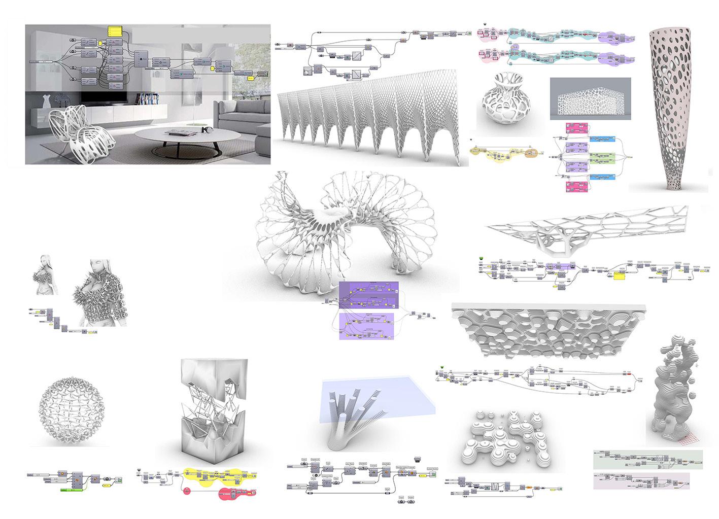
These are my sketches and plans for some projects. Each of them were done in 4 hours. They were drawn in 100x70 cm sheets.
In iran, spring is the season which we celebrate new year’s eve. In this project, I tried to provide visitors with a chance to celebrate this oc casion in a better way. Temporary structures such as tent s are the best choices for construction of this project. Selection of colors was an other challenge because there are special colors for this event.
Bam land is one of the popular public places in Iran. In this pro ject i tried to design a foodcourt for Bam land visitors which is a mixture of open and close spaces (by tent). It consists of different levels (like an amphitheater) to create different views to Bam land lake. kitchen zones are below the levels and on the levels there are tables and chairs (main place to seat). Customers buy their meal from ground floor and go up to up per levels to eat with view of lake.
In south of Iran, weather is humid and hot. As a result, climate is the most important challenge in design any building in these regions. My design was inspirade by local architecture of south regions (with highrise roofs and usage of bright colors) ,thus i design main buildings like funels to remove hot weather. Furthermore, there are two different areas for night and day to deal with harsh weather
Libraries’ open spaces are the most important parts of every libraries. In this project, I tried to design a land scape (garden) of a library which had four old trees in different part of itself. I designed a circle plan for the garden to create various spaces (cafe,main roundabout,gallery and etc) for visitors and book readers. It provide a pleasent place to read a book in a open space
Enghelab round about is one the most intrinsic part of Tehran. In fall, people commemorate their leadership ”Hossein”. This project amied to remind this person and his dedications (he was a military man). It is a combination of tents and fluke to resemble harsh sit uation in the past in his era. It is a manumanet which can interact with pedestrians
Tehran is mountainous city in north of Iran. This is a proposal for con struction of a bridge between two parkways. North mountains of the city inspired me to design the bridge like a mountain range. In order to make the bridge stable and remove any redundant moves, I use cables with huge arms to address these problems. There are two elevators which are designed to provide hand icaped people with suitable access to the bridge. Moreover there are ramps (instead of stairs) to ease walking paths in the bridge. Plan of the bridge is consist of seven elipses and the main elipse is bigger than others and a good spot which provides visitors with view of the city. This bridge is a multipurpose bridge:1.a pathway for pedestrains 2. spot of view 3. recreational-com municational place for local people to spend their free time.
In some parts of my country, because of tropical weather in those regions, peo ple do not have any idea about snow and winter. In this gallery, tried to introduce them this season in an other way. use glass, white and black boxes and glass chandeliers to imply cold feeling of winter. In the center of the gallery there is a pommegrant tree (winter tree)
Sketches 2016-2018
Spring
exhibition
Spring exhibition
A library’s yard
A library’s yard
A cafe
Enghelab square
Enghelab square
Foodland Mountain Bridge
Foodland
Winter gallery
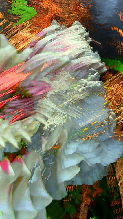
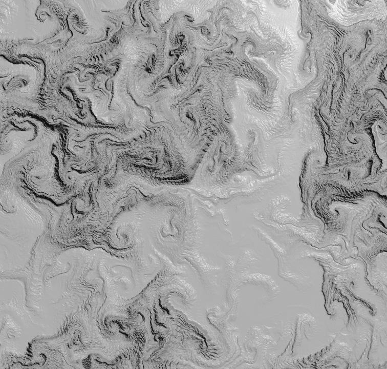
These are some samples of terrain vague and kinetic landscapes. Main goal for creation of these terrain is trying to see landscape architec ture in a new way.
please visit my website for videos and pictures.
These models were designed in Ado be After Effects.
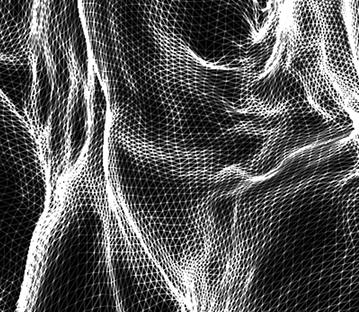
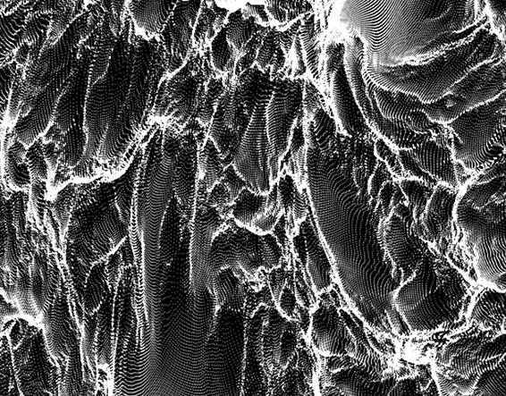
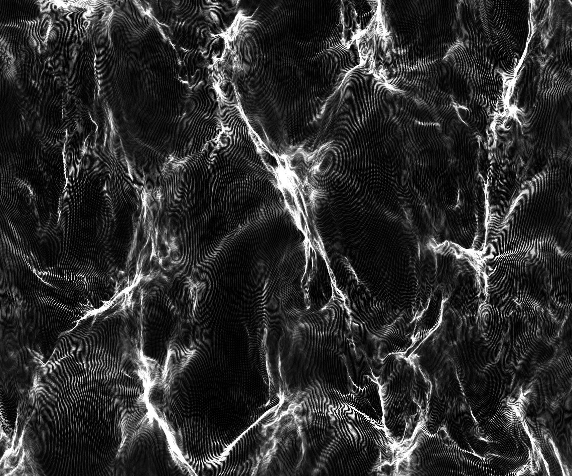
These are first samples of my designs in Houdini to analysis effects of rivers, water and erosion on terrains.
I am still exploring new software.
Main goal for creation of these terrain is trying to see land scape architecture in a new way.
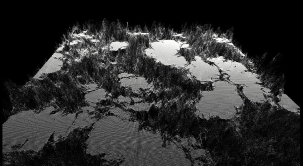
These are the outcomes of Houdini workshop with Zaha Had id’s Architects.
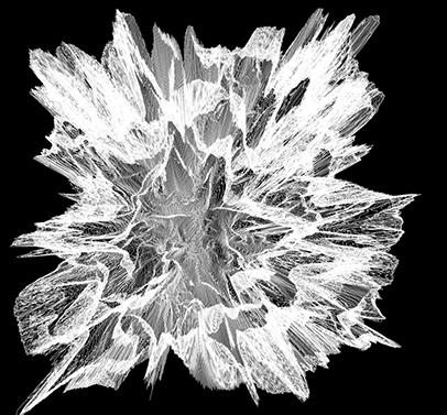
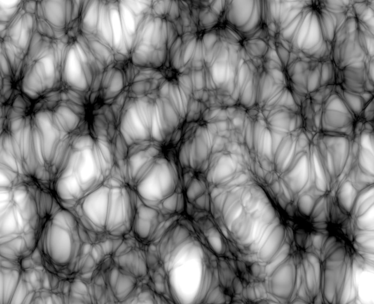
ATTRACTOR
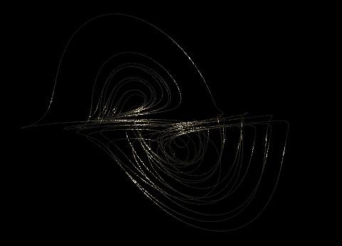
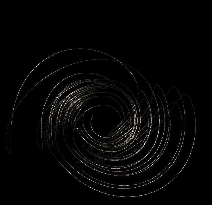
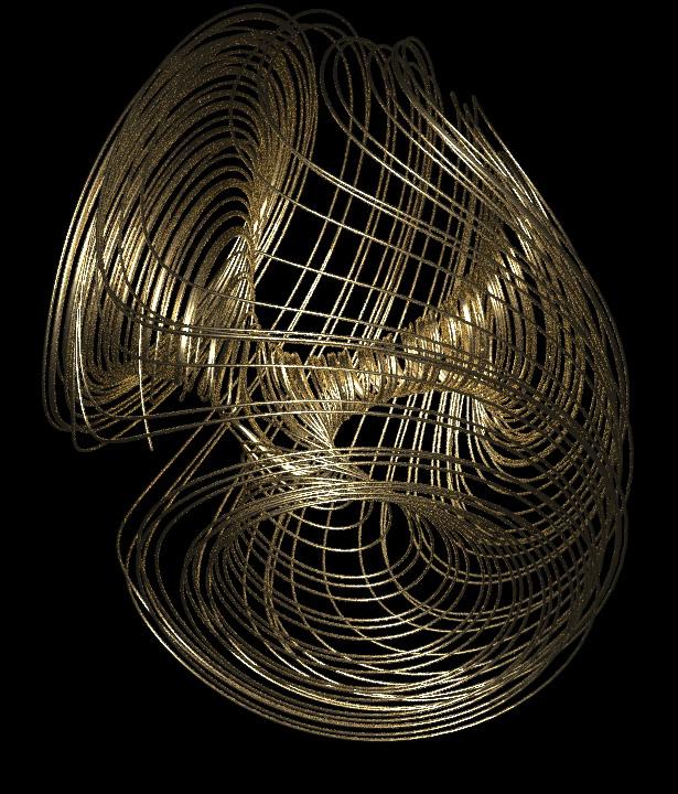
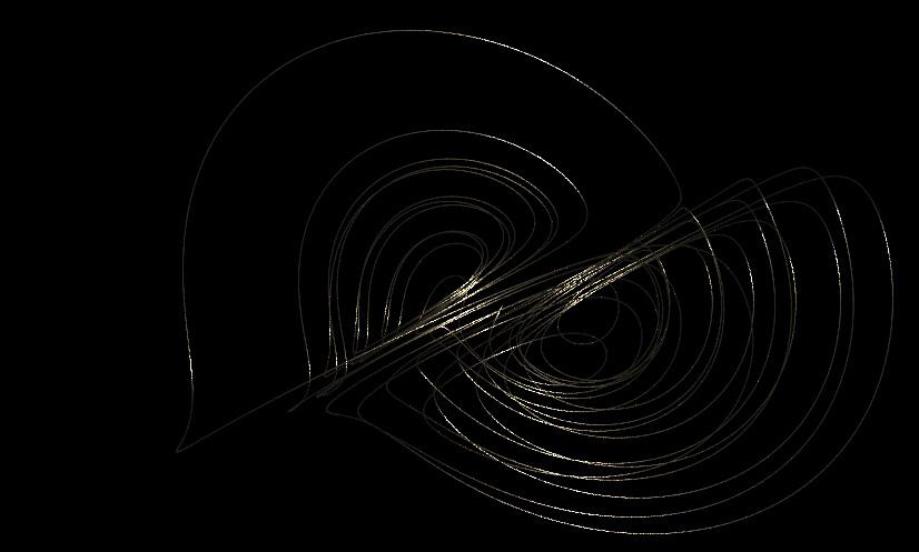
LORENZO
These are the results of a workshop with Zaha Hadid architects. By houdini and lorenz attrac tor formula, I created these shapes. Please visit my website to see the stimulation film: https://farinoosh-hadian-jazy-1.jimdosite. com/masters-degree/ dt = 0.001; a = 40; c = 1.833; d = 0.16; e = 0.65; k = 55; f = 20; pos = @P; x = pos[0]; y = pos[1]; z = pos[2]; x = x + (a * (y-x) + d*x*z) * dt; y = y + (k*x + f*y - x*z) * dt; z = z + (c*z + x*y - e*x*x) *dt; dt = 0.001; a = 0.9; b = 5; c = 9.9; d = 1; pos = @P; x = pos[0]; y = pos[1]; z = pos[2]; x = x + (-a*x + y*y z*z + a*c) * dt; y = y + (x*(y - b*z) + d) * dt; z = z + (-z + x*(b*y + z)) *dt; dt = 0.001; a = 0.9; b = 5; c = 9.9; d = 1; pos = @P; x = pos[0]; y = pos[1]; z = pos[2]; x = x + (-a*x + y*y z*z + a*c) * dt; y = y + (x*(y - b*z) + d) * dt; z = z + (-z + x*(b*y + z)) *dt;
surrealism
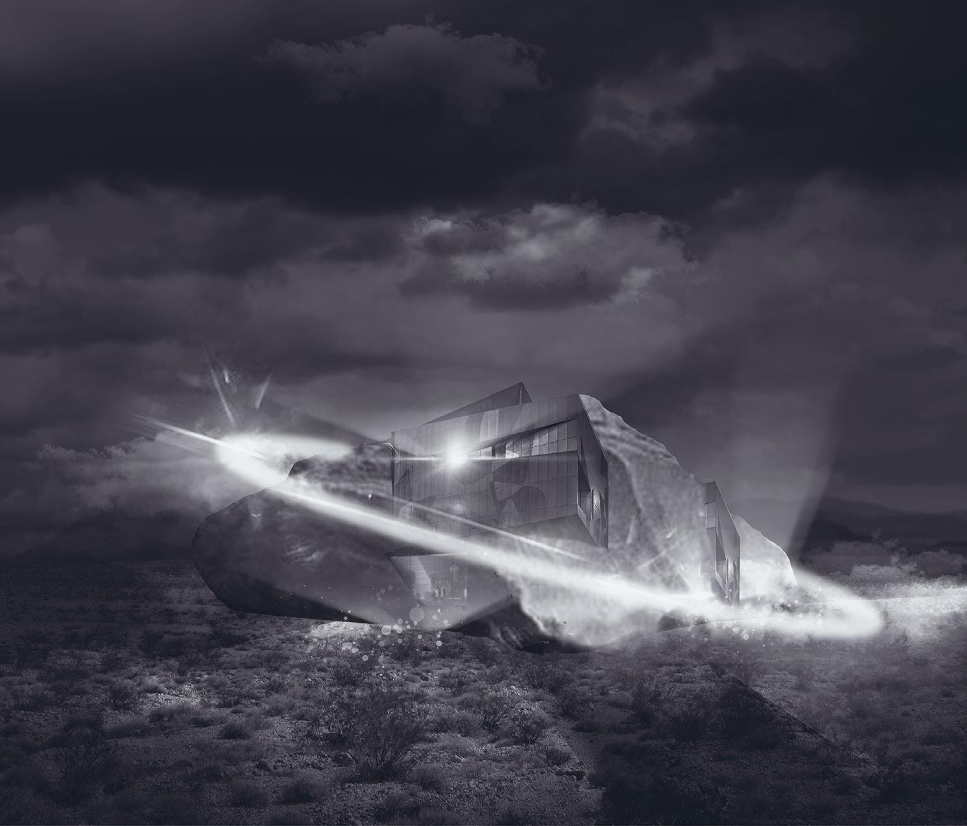
In this part, I saw architecture as a surreal co cept and I tried to imagine beyond two point perspectives.
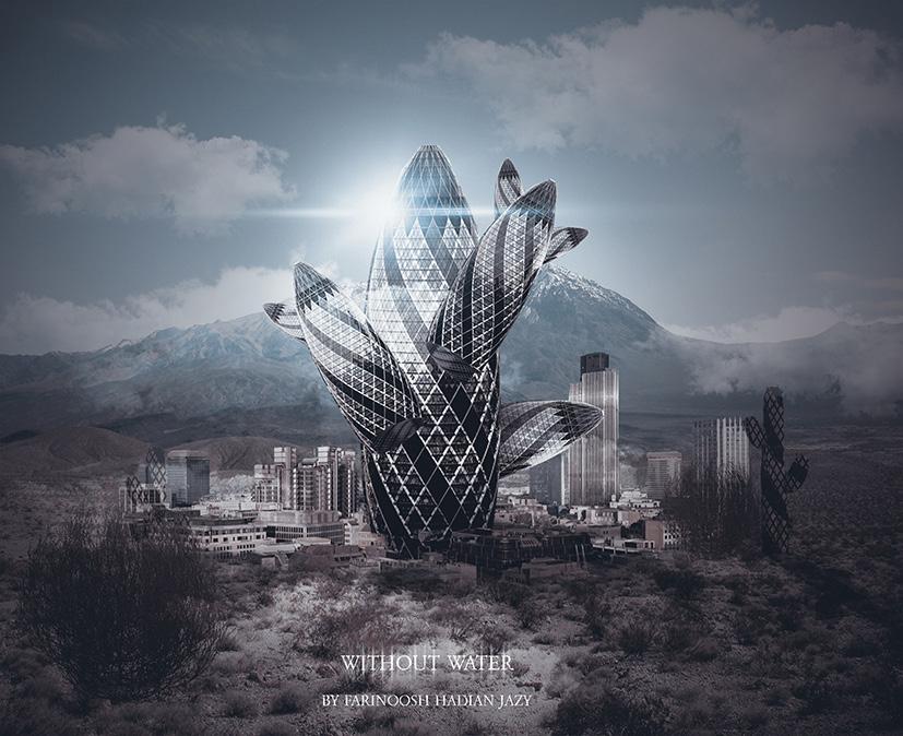
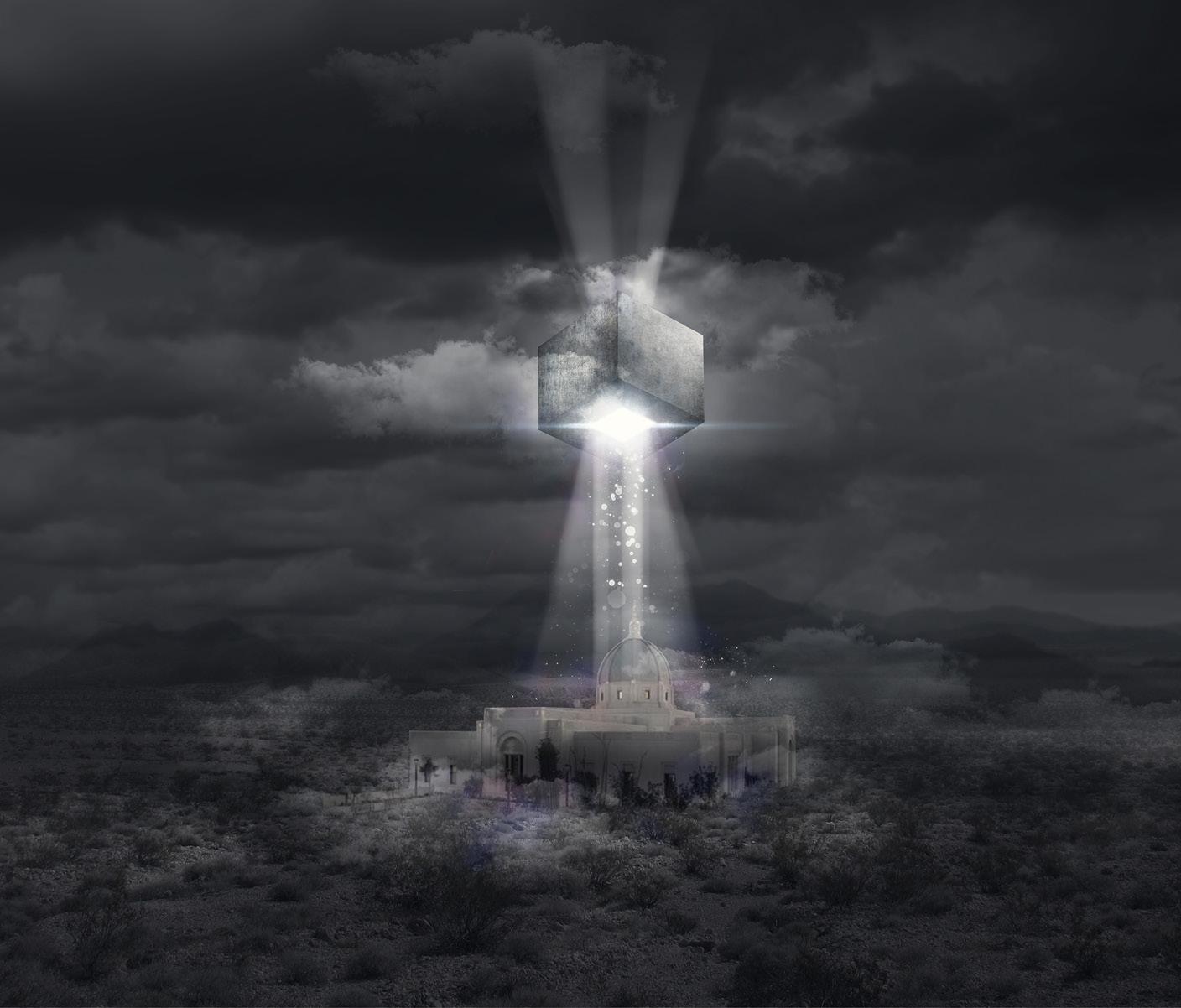
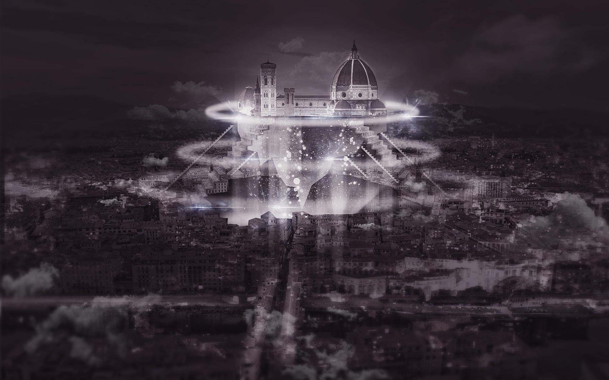
There are some samples of my work in surreal concept.
They are made as fun and some old paintings were used in order to create the perspectives.
thanks for your attention Website: https://farinoosh-hadian-jazy-1.jimdosite.com/
