OUR PARKS LANCASTER

CITY OF LANCASTER
COMPREHENSIVE PARKS, RECREATION & OPEN SPACE PLAN 2024


CITY OF LANCASTER
COMPREHENSIVE PARKS, RECREATION & OPEN SPACE PLAN 2024
LANCASTER DEPARTMENT OF PUBLIC WORKS
Steve Campbell, Director
Cindy McCormick, Deputy Director, Engineering
Karl Graybill, Environmental Planner
Emma Hamme, Transportation Planner
Ryan Hunter, Facilities Manager
LANCASTER DEPARTMENT OF COMMUNITY PLANNING & ECONOMIC DEVELOPMENT
Chris Delfs, Director
Molly Kirchoff, Program Manager, Public Art and Urban Design
LANCASTER RECREATION COMMISSION
Heather Dighe, Executive Director
LANCASTER COUNTY
Michael Domin
Alice Yoder
RESIDENTS & STAKEHOLDERS
Adriana Atencio
Chris Aviles
Kareema Burgess
Erin Conahan
Tene Darby
Tim Freund
Zeshan Ismat
Rob Reed
Melissa Ressler
Karen Schloer
John Hursh
Jeremy Young
Christine Mondor, FAIA
Claudia Saladin, ASLA
Ashley Cox, AICP
Varun Shah
WSP
Robert Armstrong, PhD., CPRP
Connect the Dots
Sylvia Garcia-Garcia
Sophia Peterson
Stephanie Fuentes
Julia Whyte
Merritt Chase
Danica Liongson
This report has been made possible with funding from: The City of Lancaster and
This project was financed in part by a grant from the Community Conservation Partnerships Program, Keystone Recreation, Park and Conservation Fund, under the administration of the Pennsylvania Department of Conservation and Natural Resources, Bureau of Recreation and Conservation.


A Comprehensive Parks Recreation and Open Space Plan or CPROS is a plan for the future. It guides investment in park development, maintenance, and connectivity to better serve the recreational needs of residents. In addition to focusing on the physical amenities of parks, this plan re-envisions the city’s parks and open spaces as an interconnected system and prioritizes how to equitably expand and build connections within the system. The objective of Lancaster’s 2024 CPROS plan is to increase accessibility to recreational amenities and natural areas in a way that is fair, equitable, and safe. Through research, analysis, and public engagement, the City of Lancaster has developed this plan to make the Lancaster Parks System the best it can be. It identifies policies, resources, and capital investments needed to accomplish long-term and short-term recreation and green space conservation goals. This document is a summary of the plan’s recommendations.
The Lancaster park system is approximately 212 total acres The system is maintained by the Bureau of Parks and Public Property within Department of Public Works. The main responsibility for programming the parks lies within the quasi-governmental nonprofit Lancaster Recreation Commission. Lancaster Recreation Commission provides programming for the City of Lancaster, Lancaster Township, and the School District of Lancaster. Numerous nonprofits also activate the parks with programming. In addition to parks owned by the city, Lancaster residents also have access to public parks in the county and neighboring jurisdictions. Many school district properties have recreational facilities that are open and available for public use. Additionally there are privately owned open spaces; while there is not a standard definition of open space the US Forest Service states: “Open Space refers to any open, undeveloped piece of land. Open space includes natural areas such as forests and grasslands...parks, stream and river corridors, and other natural areas within urban and suburban areas. Open space lands may be protected or unprotected, public or private.” For the purposes of this document, Cemeteries have been categorized as private open spaces.
Compared to national benchmarks, Lancaster’s park system has approximately one third the area, and is understaffed, particularly in terms of programming staff; spends less per capita than regional peer cities, and is below the national median for spending when compared to cities of similar size. Lancaster’s park system was developed opportunistically over time as parcels became available and has lacked a cohesive plan for the park system. Many of the parks are small, and some neighborhoods, particularly in the southeast of the city, are poorly served. Because Lancaster is a dense city with relatively little vacant land, the opportunities to increase the park system area, and natural open space are limited. This plan provides an overview of the system and recommendations for targeted improvements.
NORTHWEST & NORTHWEST EXTENSION
• Buchanan Park
• Mayor Janice Stork Linear Park
• Rotary Park
• North Market Street Kids Park
• Blanche Nevin Park
• CANBA Park
• Long’s Park NORTHEAST & NORTHEAST EXTENSION
• Musser Park
• Triangle Park
• Sixth Ward Park
• Reservoir Park
• Conestoga Pines Park
DOWNTOWN
• Binns Plaza
• Penn Plaza
• Ewell Plaza
SOUTHWEST
• Culliton Park
• Brandon Park
• Rodney Park
• Crystal Park
• South End Park
• Cabbage Hill Veterans Memorial SOUTHEAST & SOUTHEAST EXTENSION
• Milburn Park
• Case Commons
• South Duke Street Mall
• Joe Jackson Tot Lot
• Ewell Gantz Playground
• Holly Point Park
• Lemon Street Parklet
• Conestoga Creek Park
• Lancaster Central Park
• Lancaster Community Park
• Buchmiller County Park
• Stauffer Park
• Conestoga Greenway Trail
• Farmingdale Trails
• Noel Dorwart Park
• Hazel Jackson Woods
• Holly Pointe Greenway
• SoWe Pocket Park

• School District Campus (McCaskey)
• Reynolds Middle
• Jackson Middle
• ML King, Jr. Elementary
• Washington Elementary
• Price Elementary
• Lafayette Elementary
• Hamilton Elementary
• Wharton Elementary
• Ross Elementary
• St Mary’s
• Lancaster Cemetery
• St James Cemetery
• Shreiner’s Cemetery
• St. Josephs’ Church Cemetery
• Woodward Hill Cemetery
• Cedar Lawn Cemetery
• Greenwood Cemetery
• Riverview Burial Park
The following recommendations are based on the needs identified through the public engagement process and the consultant team’s analysis of the existing park system.
All parks need to be updated from time to time. Lancaster recently completed a process called “Facilities Condition Assessments” (FCAs) for all of its parks. The FCAs identifying needed repairs in all parks, including repairing or replacing equipment, replacing worn safety surfaces in playgrounds, and making parks more ADA accessible. In addition to these needed repairs, the following projects are recommended:
Reservoir Park is one of the largest and oldest parks in Lancaster. While it is a great park, it needs an update and master plan that will incorporate the many uses in the park. Planning for Reservoir Park should be done in conjunction with the East End Small Area Plan, that will occur around the redevelopment of the County Prison property. Reservoir Park and the prison site are potential locations for some of the new facilities discussed below. The plan should carefully balance the competing uses on the Reservoir Park site, including its use for community fairgrounds, and other recreational activities.
Conestoga Pines Park has been the subject of a separate master planning process. Implementation of the recommendations of that plan, including providing greater access to the Conestoga River, improvements to the barn, and addressing the aging pool currently located in the floodplain, should continue along the schedule laid out in that plan
Converting wading pools to spray parks in existing parks provides many benefits. They are less costly to maintain, are more accessible for users of all abilities, and because they have no standing water, require less staffing. Spray parks can operate longer hours and across a longer season.
Some parks in the southern part of the city are in dire need of upgrades. These include Joe Jackson Tot Lot, Ewell Gantz Playground, South End Park, and the South Duke Street Mall. Planning and fundraising for upgrades in these parks has already begun. Investments in these parks should be a priority as they will help bring modern amenities to areas of the city that are currently underserved.
Across the system, improved infrastructure could catalyze increase use of the parks. Improving shade by planting new trees and succession planting for older trees; amenities such as water fountains and bottle filling stations, lighting, access to electricity for events, and restrooms, are items that allow people to use parks more frequently and for longer periods of time.
Through the planning process, needs for additional facilities were identified.
A new Municipal Pool. The pool at Conestoga Pines is reaching the end of its useful life, is located in a flood plain, and is not easily accessible without a car. The High School pool, which in the past was used for lifeguard training, is now closed. Lancaster needs a new municipal pool that can accommodate many activities, such as swim lessons, lifeguard training, water aerobics, be ADA accessible, and more centrally located. Possible locations include Reservoir Park or the County Jail Site.
Sunnyside Peninsula was envisioned in the Our Future Lancaster Plan as a nature reserve and park, providing environmental education programming, an opportunity to connect with nature, and greater access to the Conestoga River. A park on Sunnyside Peninsula would create more access to parks for city residents. Planning on this park has already begun. The need for skate parks was identified through the engagement process. Possible locations include Reservoir Park or on city-owned property adjacent to Culliton Park. Design and implementation of a Skate Park should involve a partnership with the skating community to avoid the design challenges of the existing skate park in County Park, which is not preferred by skaters.
An off-street bicycle track or pump track was also identified as a need to allow for safe places to learn and practice bicycle skills and tricks. A future pump track should be located close to cycling infrastructure, for example, adjacent to the Water Street Bicycle Boulevard. In conjunction with converting wading pools to spray parks, additional spray parks could be added to existing parks that do not have wading pools.
This would help provide water play and cooling for users across the city, especially important in a densely populated city, such as Lancaster, where many older buildings do not have air conditioning.
Pickleball is gaining popularity as a sport, particularly among seniors, which is a growing demographic in Lancaster. Tennis courts can often be converted into pickleball courts with minimal investment. Pickleball courts can also be built as temporary installations to test locations.
Natural play areas, which incorporate natural elements into outdoor spaces, could be incorporated into the Sunnyside Peninsula Park with its focus on environmental education, or added to existing parks where there is space and community interest.
The City of Lancaster is deeply committed to public engagement. The city has identified several ways to better engage the community around parks, improve the park experience for all, and encourage park use and volunteerism.
Park ambassadors or rangers would welcome visitors to the parks, educate the public on park rules, and be the eyes and ears on the ground to identify ongoing issues. They could assist staff with opening and closing gates and restrooms and ideally extend the hours of restroom operation.
Stewardship and recreation coordinators would help to coordinate volunteer engagement in the parks and communicate and coordinate the activities of nonprofit organizations operating in the parks to ensure that all areas of the city are served.
A landscape workforce and greenhouse would support the city’s parks and green infrastructure, and could also help support community gardens.
A comprehensive, multilingual signage program, including system-wide mapping, consistent park signage in multiple languages, and education handouts for users, would help to promote the park system and make it welcoming to all. Such a resource would also inform people about the entire park system and connections between the parks.
Lancaster’s Vision Zero Program has focused on creating safe streets for all, focusing on the most dangerous streets and intersections. The Vision Zero Program complements the parks plan by providing safer routes to parks. Particularly important improvements for park connectivity include the South Duke Street corridor, improved connection to Lancaster County Central Park at Strawberry Street, and connections to a future Sunnyside Peninsula Park and Conestoga Greenway Trail at Circle Avenue.
The project goals guide how this plan is rethinking the city parks and open spaces as one integrated system. The consultant team worked with the City of Lancaster and the steering committee to develop a set of goals for the Comprehensive Parks, Recreation, and Open Space Plan.
Incorporate environmental sustainability, green infrastructure, and climate resilience into parks and open spaces.
Ensure that all residents are within a safe 10-minute walk of a “high quality” park.
Increase connectivity of parks and open spaces to enhance accessibility and safety for active transportation mobility.
Prioritize park and open space projects that improve accessibility for people of all ages and abilities and emphasize inclusivity and equity.
Increase adaptability of parks and open spaces to accommodate current and future needs.
Establish a plan for long-term sustainability of the city’s public spaces to address resiliency, maintenance, programming, funding, and upgrades.
The Lancaster Parks Recreation and Open Space Plan is the result of a robust analysis of the existing park system and community engagement.
The Introduction & Context chapter provides a community profile, a short history of Lancaster’s park system, a review of past and ongoing plans in the City of Lancaster, a discussion of the various benchmarking standards used to evaluate the system, and an introduction to the many types of parks in Lancaster’s system. This section also describes the public engagement methodology used in the project and presents the City of Lancaster’s mission statement developed during the planning process.
The System Analysis chapter analyzes the park system of the City of Lancaster. This analysis includes an understanding of the city administration, recreation services, benchmarking of staffing and budget to national and regional benchmarks, as well as the physical system of parks and open space. The recreational facilities available to Lancaster residents were benchmarked, the quality of individual parks assessed, and the distribution of parks and amenities across the system evaluated. The connectivity of the system was then reviewed, building on the important work Lancaster is doing on Vision Zero and active transportation. This chapter provides details on each of the parks in the system.
The Recommendations chapter presents the recommendations developed based on the findings of the system analysis and input from the public. The development of the recommendations was guided by the National Recreation and Parks Association’s pillars of equity, health and wellness, and conservation and sustainability, as well as Lancaster’s goals of stewardship and maintenance, engagement and participation, and leadership. The recommendations include improvements to individual parks, new types of facilities, and improvements across the system in infrastructure, workforce, signage, and policy.
The Implementation Plan chapter prioritizes the recommendations based on community priority, equity, technical need, and cost. It organizes the recommendations into three tiers. Within each tier, it identifies project considerations, funding sources, and project phasing for each of the recommendations.

City Parks
Other Parks
School District Properties (open to the public)
Cemeteries (private)
Other Open Spaces (private)
Publicly-owned Opportunity Sites
Existing trails
Existing bike facilities
Regional trail connections
Proposed trails
Proposed bike facilities
Proposed Riverfront trail


A Comprehensive Parks Recreation and Open Space Plan or CPROS is a plan for the future. It guides investment in park development, maintenance, and connectivity to better serve the recreational needs of residents. In addition to focusing on the physical amenities of parks, this plan re-envisions the city’s parks and open spaces as an interconnected system and prioritizes how to equitably expand and build connections within the system. The objective of Lancaster’s 2024 CPROS plan is to increase accessibility to recreational amenities and natural areas in a way that is fair, equitable, and safe. Given the focus on equity, equity-related challenges and considerations have been address and recommendations integrated throughout every section of the CPROSP
Through research, analysis, and public engagement, the City of Lancaster has developed this plan to make the Lancaster Parks System the best it can be. It identifies policies, resources, and capital investments needed to accomplish long-term and short-term recreation and green space conservation goals. This document is a summary of the plan’s recommendations.
The project goals guide how the plan is rethinking the city parks and open spaces as one integrated system. The consultant team worked with the City of Lancaster and the steering committee to develop a set of goals for the Comprehensive Parks, Recreation, and Open Space Plan.
Incorporate environmental sustainability, green infrastructure, and climate resilience into parks and open spaces.
Ensure that all residents are within a safe 10-minute walk of a “high quality” park.
Increase connectivity of parks and open spaces to enhance accessibility and safety for active transportation mobility.
Prioritize park and open space projects that improve accessibility for people of all ages and abilities and emphasize inclusivity and equity.
Increase adaptability of parks and open spaces to accommodate current and future needs.
Establish a plan for long-term sustainability of the city’s public spaces to address resiliency, maintenance, programming, funding, and upgrades.
The City of Lancaster, located in South Central Pennsylvania and founded in 1730, is important both historically and culturally to the region, the Commonwealth of Pennsylvania, and the Nation. In 2001, the City of Lancaster Historic District was added to the National Register of Historic Places with over 13,000 contributing properties, encompassing almost the entire historic city boundary. With a period of significance of 1760-1950, the City of Lancaster is one of the oldest and most historically important places in all of Pennsylvania.1 Three main parks referenced in the City of Lancaster Open Space Plan Request for Proposals are listed as contributing properties to the National Register: Musser Park in the northeast of the Central Business Area, Buchanan Park in the northwest, and Reservoir Park in the east. In addition, 12 of the small playgrounds and pocket parks are located within the boundaries of the historic district.2
The City of Lancaster has a long history as the center of commercial, industrial, and governmental affairs in Lancaster County. Lancaster was the capital of Pennsylvania from 1799 to 1812 before it moved to Harrisburg. Its proximity to Philadelphia and its importance as an inland market center allowed the city to grow as a cosmopolitan center from the 18th century well into the 20th century. Linked first by the 62-mile Philadelphia and Lancaster Turnpike, completed in 1795, and later by railroads, the transportation network connected the agricultural marketplace of Lancaster with Philadelphia, one of the nation’s most important commercial and intellectual centers since colonial times.
After World War II and especially after 1960 and lasting into the end of the 20th century, Lancaster began to lose population to its burgeoning suburbs, especially Manheim Township to the north of the city (location of Stauffer Park) and Lancaster Township to the west of the city (location of Lancaster Community Park). The construction of suburban developments on farmland located just outside
1 For the City of Lancaster Historic District National Register Nomination see: https://www. cityoflancasterpa.gov/the-national-register/
2 Ibid, page 9 (Section 7, page 2)
the city limits and suburban shopping centers and malls with ample parking in the mid-20th century drained the vibrant nature of the downtown business district. Urban renewal changed the character of much of downtown Lancaster in the 1960s and 1970s in an attempt to solve the problems of parking, congested streets, and housing for its economically disadvantaged residents.3 The remnants of urban renewal can be seen in the design and location of the South Duke Street Mall, for example, with the adjacent public housing fronting along Rockland Street and along North Queen Street where the former Lancaster Square urban renewal project has been transformed into Binns Park and Ewell Plaza.
The 21st century has seen a resurgence in Lancaster as art galleries, restaurants, and shops have opened and the downtown is once again a destination, even during the pandemic era. Population loss seems to have plateaued and the city is attracting new residents. Adaptive reuse saved many historic buildings from demolition, particularly in the older industrial area located in the northwest section of the city. Unlike other cities, Lancaster has retained much of its historic fabric, although preservation of the historic environment remains a challenge. Lancaster has one of the most diverse populations of any smaller city in Pennsylvania, boasting a large population of Puerto Rican descent as well as an established African-American community. The city is poised to continue to thrive, especially by connecting its residents to the many parks, open spaces, and cultural and historic sites scattered throughout this important, historic place.
3 For a discussion of Urban Renewal in Lancaster see David Schuyler’s “Prologue to Urban Renewal: The Problem of Downtown Lancaster, 1945-1960.” file:https://journals.psu. edu/phj/article/view/25117/24886
Public space in Lancaster originated in Penn Square, as laid out by James Hamilton in the mid-1730s. Originally named Centre Square, the square was the site of the County Courthouse and sat at the center of the grid pattern Hamilton used for the city Plan, which is similar to Philadelphia’s. This would remain Lancaster’s only public space until almost 180 years later. While there was much public interest in parks in Lancaster during the mid-to-late nineteenth century, the city did not have any substantial public spaces for its residents. In 1892, the Lancaster Intelligencer stated that “When William Penn laid out Philadelphia he made provision for certain parks” while “James Hamilton laid out Lancaster (and) wasted no sentiment on parks for that would have been to throw away real estate with cash value. The spirit of the founder, each his own, seems ever since to have dominated these two cities.”1
It was not until later in the nineteenth century that larger public parks began to become a reality in Lancaster as the East Reservoir, site of
1 “Our Lancaster Parks” 16 April 1892, Lancaster Intelligencer
Reservoir Park, and the West Reservoir, site of Buchanan Park, were both identified as locations for larger parks and were championed by local newspapers. In 1889, land adjacent to the East Reservoir was identified for a public park, however, it would take several years to become a reality.2 In 1900, land that would become Long’s Park was donated, however, at that time it was outside the city limits. In 1905, Buchanan Park was dedicated on the site of the West End Reservoir and remains the largest park inside the original city limits at over 20 acres.
1909 saw the creation of the Lancaster Recreation Commission (originally called the Lancaster Playground Association) and several smaller playground areas were identified throughout the city for recreational purposes. However, many times these areas remained in private ownership and areas once used for recreation were sold off for development as the city’s population swelled in the early twentieth century.
2 “The Park Has Come” 1 June 1889 Lancaster New Era
By the early 1920s, the city began either purchasing or receiving through donation parcels and dedicating them for public use. These included Farnum (now Culliton) Park, Rodney Park, Sixth Ward Park, and South End Park, all acquired during the 1920s and all of which remain parkland to the present day. After many decades without any new land acquisitions during the Great Depression and World War II eras, the city acquired Musser Park through donation in 1949. Crystal Park was dedicated eight years later in 1957.
The mid-to-late 1960s saw the next great expansion of Lancaster’s park system as federal funds became available to acquire land for park purposes during the Urban Renewal period. Conestoga Pines (1966), South Duke Street Mall (1967), Joe Jackson Tot Lot (1968), Conestoga Creek Park (1968), Lancaster Square (1970), and Brandon Park (1971) all were acquired within five years as the city utilized funding to acquire park land and increase recreational activities for its citizens.
Since the late 1960s and early 1970s, the city has acquired key parcels to expand its park and recreational assets through acquisition or donation. These include Triangle Park (1979), Mayor Janice Stork Linear Park (1994), Ewell Gantz Playground (1996), Case Commons (1997) and Holly Pointe Park (1999). The western portion of Lancaster Square was redeveloped as Binns Park in 2005 and the eastern portion was redeveloped as Ewell Plaza in 2022.
Historically, the sporadic and opportunistic process of adding parks and public spaces led to a system that lacks true connectivity and equitable access for city residents. Due to a lack of prioritization and planning over time and rapid development in the early twentieth century as Lancaster became a densely populated city, access to open space became difficult. This made it challenging for open space advocates such as the Lancaster Recreation Commission to gain traction with the city to acquire meaningful land for new parks and recreation purposes.
ALL_Updated
Lancaster City, PA
Lancaster City, PA (4241216)
Geography: Place
According to the US Census Bureau, the City of Lancaster’s population in 2022 was 57,453 with a population density of approximately 8,000 residents per square mile. Lancaster’s population density is greater than much larger cities such as Pittsburgh (approximately 5,400 residents per square mile) and Baltimore (approximately 7,200 per square mile). Lancaster is also more densely populated than other smaller, peer Pennsylvania cities between 50,000 and 100,000 residents such as Harrisburg (approximately 6,000 residents per square mile) and Bethlehem (approximately 4,000 residents per square mile). Lancaster is a multi-racial city with roughly 40% of the population identifying as Latino or Hispanic and 16.5% identifying as Black or African American. The population of foreignborn residents is approximately 12%. Around 19% of the population lives in poverty, roughly 18% are under the age of 18, and about 9% are over age 65.1
Looking forward, it is projected that the City of Lancaster population will grow to 58,392 residents by 2030. The population is then expected to decline to 58,024 residents by 2035 and to 57,656 residents by 2040. Given the relatively small population change expected through 2040, the recommendations made in this report regarding the number of parks appropriate for the City of Lancaster will remain relevant through 2040.”
1
$5,788

2021 Population by Race
2021 Population by Race
2021 Population by Hispanic-Race


Hispanic Population (darker blue color correlates to higher number)


Black Population (darker blue color correlates to a higher number)
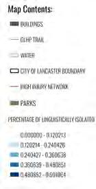

Linguistically isolated population (households with out a person 14 yrs. or older who speaks English well) (darker blue color correlates to a higher number)
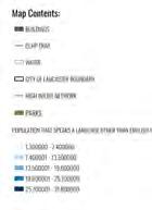
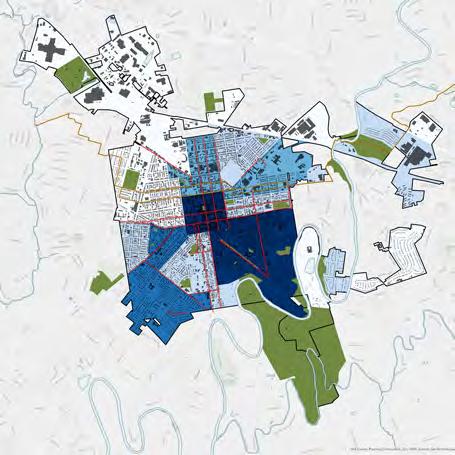
Population that speaks a language other than English very well (May speak a language other than English at home) (darker blue color correlates to a higher number)
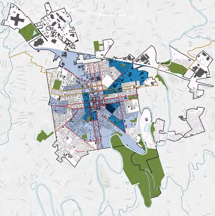
The historic grid of the City of Lancaster is organized into four quadrants: northwest, northeast, southwest, and southeast. The core section of the city is characterized by a dense, narrow street grid and a high level of density. The city has annexed additional areas over time beyond the historic grid. These annexes or extensions have lower density and are more suburban. The annexed areas include two of the largest parks in the system, Long’s Park in the Northwest annex and Conestoga Pines in the Northeast annex.
The different quadrants of the city also have different socioeconomic characteristics. The southern quadrants of the city have higher levels of poverty and are home to a larger portion of the city’s African-American and Latino communities. The northern quadrants and the extensions have a larger White population. The southeast quadrant in particular is characterized by a large immigrant population and populations of households that are isolated by language barriers. The different socioeconomic characteristics of each quadrant prompted the consultant team to benchmark the parks from both a city-wide perspective and on a quadrant level.

Other Parks
School District Properties (open to the public)
Cemeteries
Other
NORTH WEST
NORTH WEST EXT.

SOUTH WEST
NORTH EAST
NORTH EAST EXT.
SOUTH EAST
SOUTH EAST EXT.
The government of the City of Lancaster is based on Pennsylvania’s Constitution, which authorizes the General Assembly, Pennsylvania’s state legislature, to create different types of local government and to give each specific responsibility and authority to carry out those responsibilities. All forms of local government were created by the state legislature and operate under the laws of the Commonwealth. Each local government operates under a state law, called the Municipal Planning Code (MPC) which establishes who and how the local government is managed.
The City of Lancaster currently functions as a city of the Third Class under the Laws of the Commonwealth of Pennsylvania. As a city of the Third Class, Lancaster operates under a MayorCouncil form of government, which includes a full-time mayor and a seven-member city council, the members of which are part-time and are elected to a four-year term. Under the State Code for Cities of the Third Class, Lancaster is not required to have the council represent geographic districts, and therefore all members of the city council are elected at-large and do not necessarily represent all of the city’s quadrants and annexed areas. Due to this, certain areas of the city can be underrepresented by the council. Historically, the least represented areas of the city are the southwest and southeast quadrants.1
The PA code gives the council certain responsibilities, the legal authority to carry out these responsibilities, and the means to pay for them generally through taxes or fees.
The mayor is the chief executive of the city and enforces the ordinances of the council. The mayor may veto ordinances, but that can be overridden by at least two-thirds of the council. The mayor supervises the work of all city departments and submits the annual city budget to the council. Property taxes remain the primary source of Lancaster City’s Budget.
1 https://lancasteronline.com/news/local/ lancaster-residents-want-more-representationforsoutheast-in-city-government-democratic-party/ article_bd52f784-b86c-11ed-8b6df7369aaf04a2.html
In the 2023 City of Lancaster Budget Address, Mayor Sorace quoted from an October 2022 Pennsylvania Economy League study, “It’s Not 1965 Anymore: State Tax Laws Fail to Meet Municipal Needs,” because Lancaster’s tax structure is antiquated and the city cannot rely on other taxes to cover the city’s operating expenses.
The Mayor proposed and the voters have supported a study commission to review and adviste on potential updates to the tax structure in the city. The revised tax structure could allow for more funding to be allocated for parks, recreation, and open space; following the recommendations of this plan could thereby provide for a more equitable distribution of parks & recreation services within Lancaster.
The City of Lancaster and Lancaster County have engaged in extensive planning over the years. The goals and findings of these plans have guided the development of this Comprehensive Parks, Recreation, and Open Space Plan. The last city-wide parks plan completed by the City of Lancaster was the Urban Park, Recreation and Open Space Plan prepared in 2009. This plan focused on developing and improving open space connections, enhancing existing park facilities, and promoting environmental stewardship and education.
Our Future Lancaster: The City of Lancaster’s Comprehensive Plan is a document that guides city decision-making regarding future development. It identifies what is important to the community and creates a vision for development over the next 20 years. The plan focused on five major planning systems:
Strengthening Neighborhoods and Housing (SNH) focuses on stable, supportive, and equitable neighborhoods where all residents have the same access to social capital, safe housing, green spaces, economic opportunity, and public services;
Expanding Economic Opportunity (EEO) by growing the local economy and prioritizing the triple bottom line (economy, equity, environment);
Connecting People and Places (CPP) by providing access to jobs, services, and educational needs and creating a sense of community and shared spaces;
Growing Green (GG) focuses on natural resources, parks and open space, sustainable buildings, and infrastructure systems to limit greenhouse gas emissions, reduce waste, and improve urban sustainability;
Building Community and Capacity (BCC) includes community health, safety, and welfare to enable residents to take greater control of their lives.
Revitalizing and connecting to the Conestoga Riverfront was also a major focus of the Comprehensive Plan, including further development of the Conestoga Greenway Trail. The Sunnyside Peninsula is identified as a major opportunity to develop natural parkland, extend the Conestoga Greenway Trail, and provide connections to the Conestoga River.
Places 2040: A Plan for Lancaster County is the county’s comprehensive plan. It priorities, include: Managing Growth by creating compact, walkable communities; improve Transportation by building a network with more alternatives and connections; enhance Parks, Trails and Natural Areas by providing more places to hike, bike, and enjoy nature.
Both the City and County of Lancaster have been very proactive in planning for active transportation and Vision Zero. Active transportation describes transportation networks that reduce congestion and promote physical activity. Vision Zero is an transportation planning approach that sets the goal of eliminating severe injuries and fatalities for all road users, including cyclists and pedestrians.
The Lancaster Active Transportation Plan (2019) was a joint effort between Lancaster County, the City of Lancaster, and the Lancaster Intermunicipal Committee. The goals include connecting the transportation system, implementing complete streets, improving safety through education awareness and enforcement, encouraging walking and biking, and working collaboratively to implement active transportation priorities. The report includes a recommended bikeway network for the City of Lancaster, integrating with bike network improvements in the county.
The City of Lancaster’s Vision Zero Action Plan (2020) identifies the city’s high-injury network and most dangerous intersections. Lancaster has followed up the Vision Zero Action Plan with several Vision Zero projects aimed at creating safer intersections and bicycle facilities, including the South Duke Street Mobility Project, the Church Street Complete Streets Project, and the Water Street Bicycle and Pedestrian Boulevard. These specific projects also implement the bikeway network recommended in the Active Transportation Plan.

Green It! Lancaster (2019) is the city’s green infrastructure plan to create livable, safe, and sustainable communities and clean rivers and streams. The plan looks city-wide at the potential of green infrastructure to manage stormwater runoff and mitigate combined sewer overflows to meet the city’s requirements under its 2018 consent decree with the Environmental Protection Agency and Pennsylvania Department of Environmental Protection. It identifies green parks as one of eight green infrastructure strategies. The plan identifies green parks and green streets as the most effective green infrastructure strategies in terms of both the volume of stormwater they can manage and the lowest overall unit cost. Currently, Lancaster is in the process of preparing Clean It! Lancaster’s Combined Sewer Overflow Control Plan.
Trees for People: An Action Plan for Lancaster City’s Urban Forest (2020) seeks to increase and maintain Lancaster’s urban forest sustainably, and to enlighten residents and property owners about the importance of the urban forest so that it will remain healthy and verdant, and continue to benefit all residents and visitors long into the future.
Lancaster Public Art Ten-Year Plan (20172027). The plan focuses on equity, livability, and excellence to promote neighborhood connectivity, create meaningful collaborations, and magnify Lancaster’s distinct sense of place to position Lancaster as a city distinguished by public artworks and engaged communities. It seeks to ensure that
• every community in Lancaster will have opportunities to collaborate with artists on projects in the public realm (equity)
• public art contributes to Lancaster’s sense of community, livability, creativity, and character (livability)
• public art initiatives in Lancaster are guided by artistic excellence and sincere community participation (excellence)
Southwest Lancaster Neighborhood Revitalization Strategy (SoWe) 2016 is a 10 year vision to chart a course of action to enable Southwest lancaster to identify and prioritize revitalization strategies.
The Historic Southeast Neighborhood Plan is a neighborhood strategic planning process that began in 2018 and was led by the Spanish American Civic Association (SACA) for residents, business owners, civic leaders, and other stakeholders to share their goals and aspirations for the neighborhood. Strategies identified by the plan include introducing neighborhood connectors, creating new and improving existing civic spaces, and involving the community in plan implementation to build social cohesion.
The Conestoga Pines & Walnut Street Fishing Master Plan (2023) is currently in process. It studies the 61-acre park located in the Northeast Extension of Lancaster along the banks of the Conestoga River. It looks at making improvements to the park to promote public enjoyment of the park and improve the long-term health of the Conestoga River. It seeks to increase access to the river for fishing, small craft, and boardwalks; to protect and manage the existing forest; to protect the historic Civilian Conservation Corp Will Rogers Camp; and update the existing barn into a recreation center. It also proposes removing the existing pool, which is at the end of its life and located in the flood plain.
In addition to understanding the city-wide context, part of the scope was to compare the Lancaster Parks, Recreation, and Open Space System to other similar jurisdictions in the state and nationally. To do this, the consultant team referenced several national standards, such as the National Parks and Recreation Association (NRPA), other similarly sized third-class cities in Pennsylvania, such as Harrisburg and Bethlehem, as well as national studies, such as the Trust for Public Land’s Park Serve System, and Lancaster’s own goals and objectives for its park system as a welcoming and inclusive community.
These benchmarking standards were used to evaluate the system overall, including the level of investment, staffing, and operating expenditures, and equity (the size, distribution and accessibility of park and recreation resources across the city. They were used to develop a park scorecard for evaluating the individual parks.
The NRPA is a national non-profit organization dedicated to building strong, vibrant, and resilient communities by supporting the work of park and recreation professionals. Their mission is to “advance parks, recreation, and environmental conservation efforts that enhance the quality of life for all people.”1
The NRPA has three pillars2 that guide their work:
• Health & Wellness: Advancing community health and well-being through parks and recreation.
• Equity at the Center: Striving for a future where everyone has fair and just access to quality parks and recreation.
• Conservation: Creating a nation of resilient and climate-ready communities through parks and recreation.
The NRPA publishes an annual NRPA Agency Performance Review. This review collects data from across the country and is a benchmarking resource that assists park and recreation professionals in the effective management and planning of their operating resources and capital
1 https://www.nrpa.org/aboutnational-recreation-and-park-association/ 2 https://www.nrpa.org/ourwork/Three-Pillars/
facilities. It provides data on park facilities, programming, staffing, budget, funding, and policies. The data presented by the Performance Review is broken down by jurisdiction size. These metrics were used to benchmark Lancaster’s Park and Recreation System as one facet of the system-wide evaluation in the next chapter.
In addition to the NRPA, other organizations have been working to create park evaluation standards and metrics.
The Trust for Public Land has a national 10-minute walk to parks goal. As part of that campaign, they have developed a park score rating system, which looks at a city’s park system through five categories: acreage, investment, amenities, access, and equity.3
Acreage is a combination of median park size and the percentage of city area that is dedicated to parkland. Investment is measured as public spending by all agencies that own or manage parkland with the city as well as state, federal, and county agencies, non-profit spending, based on information from 1090s and volunteer hours. The amenities measure focuses on six key park amenities on a per capita basis: Basketball hoops, off-leash dog parks, playgrounds, recreation, and senior centers, restrooms, and splash pads and spraygrounds. Access focuses on the percentage of the population living within a 10-walkable service area for each park.
The Pennsylvania Statewide Comprehensive Outdoor Recreation Plan: Recreation for All, 2020-2024 lays out DCNR’s blueprint for meeting the outdoor recreation needs of all Pennsylvanians. The plan focuses on five priority areas: Health and Wellness; Recreation for All, including equitable access and meeting the needs and expectations of the underserved; Sustainable Systems; Funding and Economic Development; and Technology.
The Urban Land Institute also undertook a study to examine the importance and characteristics of high-quality parks. It finds that communities of color and low-income communities receive less park investment than more affluent white communities. They note that evaluating park quality can engage communities and help address disparities in funding and investment to create equitable 3 https://www.tpl.org/parkscore/about
access to high-quality parks. The report outlines five characteristics of high-quality parks and identifies key evaluation questions within each of the criteria:
• High-quality parks are in excellent physical condition
• High-quality parks are accessible to all potential users
• High-quality parks provide positive experiences for park users
• High-quality parks are relevant to the communities they serve
• High-quality parks are flexible and adaptable to changing circumstances
Change Lab Solutions’ Complete Parks Playbook (2015) develops the idea of a “complete parks system.” This concept is a way to assess parks, green spaces, and open spaces in a community, and to identify areas in need of improvement and the policies necessary to support those improvements. The complete park system has eight elements:
• Engage: Engaging everyone in the process
• Connect: Creating safe routes to parks
• Locate: Ensuring equitable access to parks
• Activate: Programming activities and amenities for parks, ensuring that all members of the community can participate
• Grow: Planting and maintaining sustainable parks to protect and support biodiversity and ecological integrity
• Protect: Making parks safe using crime prevention through environmental design (CPTED)
• Fund: Committing to finance the complete parks system, including capital projects, ongoing maintenance, and programming.
Finally, an important component of developing the criteria for evaluating the system was understanding the specific goals and objectives of the City of Lancaster. Lancaster is a city committed to public engagement and inclusion as well as to being a welcoming community for immigrants and refugees. Lancaster is one of the largest refugee destination cities in Pennsylvania.1
1 https://www.democratandchronicle.com/ in-depth/news/2022/01/10/refugees-palancaster-pennsylvania-dutchimage/8765556002/
The City of Lancaster’s Strategic Plan, Block-byBlock focuses on four key areas: Strong neighborhoods; safe places; sustainable economy; and sound government. Lancaster is also a certified Welcoming City. The Welcoming City framework focuses on ensuring equitable access to community services and opportunities for all residents, newcomers, and immigrant communities providing opportunities for civic engagement, and providing safe communities.
During the CPROS planning process, the consultant team worked with the project steering committee to define a high-quality park system. The steering committee, which includes representatives from the city, county, and recreational non-profits, identified the following components of a high-quality park system:
• Focus on nature and ecology
• Have community buy-in, support, and engagement with the parks
• Provide diverse and high-quality amenities and programming
• Provide opportunities for both active and passive recreation
• Are easy to access and accessible: residents should be able to walk on safe streets to parks that are ADA accessible and have connections to transit
• Welcome all users: there should be activities and amenities for people of all ages and from all backgrounds, providing language and cultural access
• Are knowable and transparent: it should be easy for residents to understand the entire system, what amenities and activities are available, how to get there, and how to access them
• Are well cared for and maintained, both by the city and by the residents
• Are adaptable for multiple uses
• Have quality design and comfortable spaces
Finally, the phased, year-long public engagement process, which consisted of in-person workshops, surveys, interviews, focus groups, and community events, aimed to intentionally include public input into the CPROS Plan. Community stakeholders and community members were asked what they wanted to see in the parks, what they liked about the parks, and what would lead them to use the parks more often.
The consultant team used studies, benchmarks, standards, and public input to evaluate the Lancaster Park System. The information collected was used to create a scorecard for the parks and to develop recommendations in this report that address the established criteria, goals, and aspirations.
Building on the benchmarking references above, the consultant team developed a set of metrics for evaluating individual parks, which was organized into a quantitative scorecard. The team also developed a set of evaluation metrics that were both quantitative and qualitative that looked at the park system as a whole. The evaluation was conducted through a series of on-site evaluations and GIS analysis. To evaluate the Lancaster parks and park system, the team visited all City of Lancaster Parks and conducted an on-site survey. This data was paired with GIS analysis to assign a set of scores to each of Lancaster’s Parks. The consultant team also conducted interviews, focus groups, and community surveys to gather additional information and reviewed the 2023 budgets for the City of Lancaster and the Lancaster Recreation Commission. Finally, the team benchmarked the Lancaster data against the National Recreation and Parks Association (NRPA) metrics for cities in the 50,000 to 99,999 population range.
For individual parks, the criteria evaluated were:
• Stewardship - is the park clean and wellmaintained?
• Sustainability - does the park contribute to stormwater management, growing the urban forest, and reducing the urban heat island effect?
• Programming and Activities - How many types of uses and programming are available in the parks, and do they provide flexibility in programming?
• Amenities - Are there a variety of amenities available and what is their condition? In parallel, the City of Lancaster conducted Facilities Conditions Assessments of the parks, reviewing in detail the safety and condition of existing structures and equipment in the parks. The consultant team also used the NRPA benchmarks to understand how the level of amenities that Lancaster provides compares to similarly sized jurisdictions nationally.
• Welcoming and Relevant - Does the park appear inviting and welcoming, is it comfortable to spend time in, are entrances clear and well-signed?
• Connectivity, Access & Accessibility- is it safe to walk or bike to the park? Can it be accessed by public transit, can it be accessed by people of all ages with differing abilities.
• Safety - is the park visible from and wellintegrated into the neighborhood, does it feel safe, and are adjacent land uses compatible with a park?
For the evaluation of the system, the consultant team looked broadly at the following categories:
• Knowable & Transparent - is there system-wide legibility, do people know what amenities and programming are available, where it is, and how to get there? Is signage clear and consistent and is it available in multiple languages?
• Size & Distribution - System-wide what kinds of parks are there, are they high quality, and how are they distributed? How does this distribution compare to the demographics of the city?
• Investment - Is system-wide spending, investment, and staffing adequate to support the parks system? The team used the NRPA benchmarks, as well as the Harrisburg and Bethlehem budgets to understand how Lancaster compares to benchmarks and similar cities.
Not all parks are the same. A park might be a large park, such as Lancaster County Central Park with forested areas, trails, and multiple amenities, or a pocket park with just a bench and some trees, such as Triangle Park. Not everyone can live within a 10-minute walk of a park the size of Lancaster County Central Park, but a project goal is for everyone to be within a safe 10-minute walk of a high-quality park. To better evaluate the system and the type of parks that people have access to, the project team developed a set of park typologies to look at the question of access at a more granular level. The
Plazas are typically paved spaces surrounded by buildings and public right of way. They function as meeting and event spaces. Design and landscape are highly important due to compact size, level of use and visibility, weather conditions, and the types of events and programming that need to be accommodated. Plazas are located in central areas and serve either regional or local users (based on programming). Visits can be brief or longer for events and programming. Examples of plazas in Lancaster include Binns Park, Ewell Plaza, and Penn Square.
typologies were developed using several criteria, including size, the number of facilities, the catchment area (the distance people typically travel to get there), visit length (how long people typically spend in the park), and naturalness.1
An example of each park type is provided and identified again for each park evaluation.
1 Byrne, Jason and Sipe, Neil. “Green and Open Space Planning for Urban Consolidation: A Review of the Literature and Best Practice,” Griffith University, January 2010.

Pocket Parks are small, often the size of a single city lot or smaller. They serve localized areas, such as a block, or a street, and typically have few facilities, for example, a bench, some grass or shrubs, a few trees, or a play structure. Visits can be as brief as 10 minutes up to one hour. To be most successful, pocket parks should have good visibility from the public street. Pocket parks can serve as “stepping stones” along the routes to larger parks. Examples of Pocket Parks in Lancaster include Triangle Park, North Market Street Kids Park, and Ewell Gantz Playground.

NEIGHBORHOOD PARK

Neighborhood Parks are 1-2 acres and can accommodate up to 50-75 users. They provide a mix of uses both passive and active. They typically serve a city neighborhood. The average visit is 1-3 hours. Facilities can include green space, plantings, and potentially a mix of play equipment, basketball courts, 1-2 playing fields (soccer, baseball), wading pools or spraygrounds, and picnic tables in zones with passive open spaces for non-active uses. Examples of Neighborhood parks include South End Park, Sixth Ward Park, and Holly Pointe Park.
COMMUNITY PARK

Community Parks are typically 3-10 acres and can accommodate up to 75-200 users. The average visit is 30 minutes to 3 hours but can be longer for events. Community parks serve a larger area than a city neighborhood, drawing from multiple neighborhoods due to their size and amenities. They can accommodate active play areas, such as picnic pavilions, pools, play equipment, and passive spaces. They have a variety of landscaped areas and tree plantings with a variety of uses and can include water features, sculptures, structures, dog parks, trails/greenways, and concessions. These major amenities require significant ongoing maintenance. Examples of community parks in Lancaster include Reservoir Park, Culliton Park, and Musser Park.

REGIONAL PARK
Regional Parks are typically 1 to 500 acres or more and can accommodate hundreds of users. Visit times range from 1 hour to an entire day. They typically have a large mix of amenities including walking trails, a pool, structures, an amphitheater, water features (ponds, lakes, rivers), and can have multiple concessions, including kayak rentals, forested areas, large areas of permeable surface, natural areas, restrooms, and multiple playing fields. People visit from further away, drawing visitors from the entire city as well as suburban users. Examples of Regional Parks in Lancaster Include Long’s Park, Lancaster County Central Park, and Buchanan Park.
Trails and Greenways are linear corridors used for biking, hiking, rollerblading, jogging, and walking. Trails can connect parks and urban, on-street bicycle facilities to assist in park and open space access. Urban trails are typically paved or feature stone fines (sometimes referred to as crushed fines) but can be soft surfaces as well. Trails connect users to natural areas, including rivers and creeks, and forested areas. Trails can attract residents from adjacent neighborhoods and also community and regional users, especially if there is a gateway with parking (and sometimes a portable toilet in warmer seasons or restroom facility). Examples of Greenways in Lancaster are the Conestoga Creek Park, Conestoga Greenway Trail, and Mayor Janice Stork Linear Park.

Streetscapes/Medians are areas of public right of way (ROW) with a higher level of amenity values, including plantings, public art, street furnishings, and amenity paving, such as pavers or exposed aggregate. Streetscape elements can also be incorporated into sidepath and greenway designs for higher-level public realm ROW spaces. Although streetscapes and medians are not typical parks, they can provide important amenity space, safer pedestrian and cyclist areas, and improved connectivity to parks. Streetscapes can also incorporate pocket parks. In Lancaster, Duke Street Mall and Blanche Nevin Park are examples of streetscapes and medians.
Remainders. Some properties are intersticial spaces that may enter into public ownership but are not classified as a park as they provide no amenity value. CANBA park is an example of a remainder in Lancaster.
TRAIL / GREENWAY

In addition to the park types, school properties that are open to the public can provide important recreational opportunities for the community, particularly for sports and active recreation.
STREETSCAPE / MEDIAN
The consultant team worked with the City of Lancaster and the steering committee to develop the benchmark statements, consisting of the mission, vision, and values concerning parks and recreation. The group engaged in an iterative process during several steering committee meetings to brainstorm who the city serves, what services they provide, and how those support the city’s other goals. The answers to these questions guided the development of the recommendation and implementation plan and contributed to creating the mission, vision, and values.
The City of Lancaster’s Strategic Plan, Block by Block, identifies Strong neighborhoods, including quality public spaces and facilities as a city-wide goal. Providing quality parks in all Lancaster neighborhoods supports this broader city goal. Safe Places is another city-wide goal in the Block by Block plan, including safe, walkable, and accessible places for all. Providing safe parks and safe routes to parks supports this broader city goal.
Because Lancaster does not provide recreation services directly, Lancaster’s role in directing the Lancaster Recreation Commission and coordinating the efforts of the many non-profit organizations that provide recreational services and programming is critical to ensuring that recreation opportunities are equitably provided.
Lancaster’s 2023 Comprehensive Plan, Our Future Lancaster, emphasized equity and sustainability as guiding principles for the city’s comprehensive plan. This CPROS plan and these benchmark statements build on the base established by Our Future Lancaster.
We envision a healthy, happy, and engaged community brought together by recreation, parks, and open space.
MISSION
We provide parks and recreation services to enhance the quality of life for Lancaster residents and visitors by connecting people to nature, providing recreational opportunities, and promoting civic engagement with and ownership of the parks and open space.
We believe parks enhance quality of life, physical and mental health, and social and emotional wellbeing.
We provide direction, planning, and coordination of recreation services in the city’s parks and open spaces.
We maintain parks and trails in excellent condition so that they are safe, clean, and ready to use.
We provide safe routes to parks through traffic calming, and improved pedestrian and bike infrastructure.
We believe in equity and will guide investment and spending on parks and recreation that benefit the entire city, especially historically underserved communities and neighborhoods.
We believe parks play a critical role in protecting and improving environmental quality, enhancing climate resilience, and connecting people to and educating them about the environment.
The purpose of engagement for this project was to inform the CPROS plan by allowing the community to give input on their experiences in the parks and thoughts on recommendations that the project team drafted.
Phase 0 was focused on gathering information to draft a public engagement plan. This included creating a community profile to understand vulnerable communities, possible barriers to engagement, and establishing metrics for success for outreach and engagement. This phase occurred between March and May of 2023. The project team worked with the project Steering Committee to:
• Understand target and priority audience groups to engage;
• Understand desired insights from the engagement process;
• Develop a clear understanding of roles and responsibilities for engagement tasks;
• Agree on public engagement schedule and approach
Phase 1 was focused on collecting insights from Lancaster residents about their experiences accessing spaces like parks, playgrounds, and nature areas. This input helped the project team draft initial recommendations. This phase engaged near 280 people and took place between May and October of 2023.
The tactics undertaken during this phase include:
• Pop-ups at 6 local events across Lancaster City
• 16 stakeholder interviews
• 3 focus groups with 16 stakeholders on May 22, July 27, and August 9, 2023
• A survey (open from May 2024 to September 2023)
• 248 participants took the survey
PHASE
Phase 2 was focused on gathering deep, detailed insights and feedback from community leaders and stakeholders on the preliminary recommendations. This phase engaged 86 people and took place between March and April of 2024.


The tactics undertaken during this phase include:
• 2 workshops at Lancaster Science Factory and Lancaster Rec Center on March 14, 2024
• 72 people attended
• A survey (open from March 2024 to April 2024)
• 14 participants took the survey PHASE 3: SHAREBACK
Phase 3 focused sharing back the finalized recommendations which were organized and prioritized based on input from the public.


All laws and ordinances on the City of Lancaster’s parks and Lancaster Recreation Commission are included in the City of Lancaster’s Code. The code includes articles and chapters on Parks, Facilities, the Department of Public Works, Boards and Commissions, pools, skateboards, trees, public streets, riparian corridors, vending, zoning, public art, graffiti, and stormwater management.
The primary responsibility for maintenance of Lancaster’s parks resides with the Bureau of Parks and Public Property (BPPP) within the Department of Public Works (DPW). DPW is one of five departments that report directly to the Mayor within the Organizational Chart of the City of Lancaster. Other key departments that interface with Parks and Recreation include:
• The Department of Neighborhood Engagement (DoNE) and Lancaster Office of Promotions (LOOP)
• The Department of Public Safety
• The Department of Community Planning and Economic Development
The Director of Public Works is responsible for four divisions within DPW and approximately 210 full-time employees. The DPW Divisions are:
• Public Right of Way
• Construction and Operations
• Sustainability and Environment
• Utilities
The Director of DPW represents the City of Lancaster on a variety of Boards, including Long’s Park Commission, Lancaster County MPO, Lancaster Recreation Commission, Public Arts Advisory Committee, and Green Infrastructure Advisory Committee.
Although not shown on the Organization Chart on page 39, the Department of Administrative Services supports DPW and all departments with grant writing and other financial and accounting services.
The Department of Neighborhood Engagement (DoNE) was created in 2022 by the Lancaster City Council by merging the Lancaster Office of Promotion (LOOP) and Neighborhood Engagement into one department, although LOOP continues to operate under that name. DoNE’s purview includes:
• Language Access,
• Tourism and Promotion, and
• Civic Engagement.
DoNE intersects with Lancaster’s Park and Recreation system in the following areas:
• planning special events,
• permitting the use of public space,
• river connections through the Love Your Block Community Building Grants, and
• building civic engagement and language access to park and recreation resources.
Through LOOP, DoNE is directly responsible for planning special events, marketing Lancaster as a destination, managing the Lancaster City Welcome Center, and permitting the use of public space.
In 2023 DoNE rolled out the Fix It! Lancaster program, which is the city’s new non-emergency request platform which residents utilize to submit their service requests. Many requests are routed through DPW’s Bureau of Parks and Public Property and handled by staff, adding additional tasks to their workdays. In addition, DoNE oversees the Public Art Community Engagement (PACE) program which is grantbased and supports local artists in making temporary public art.
Because Lancaster’s Parks and Recreation spaces do not have a Park Ranger program, the responsibility of enforcing any park rules and regulations falls to either “individuals designated by the Director of Public Works,” Animal Law Enforcement Officers, or all city police officers per City of Lancaster Code (Chapter 210 Parks).
BUREAU OF ENGINEERING
TRANSPORTATION
CONSTRUCTION & OPERATIONS
SUSTAINABILITY & ENVIRONMENT
PUBLIC RIGHT OF WAY UTILITIES
BUREAU OF PARKS & PUBLIC PROPERTY
BUREAU OF STREETS, TRAFFIC & FLEET
BUREAU OF STORMWATER
BUREAU OF WATER
CLIMATE ACTION PLAN
BUREAU OF WASTE WATER
CONSTRUCTION
BUREAU OF SOLID WASTE
Lancaster City Departments with responsibility for the parks and recreation system
Bureau of Parks and Public Property
Organizational Chart
BUREAU OF PARKS & PUBLIC PROPERTY
CONSTRUCTION SUPERVISOR
The Department of Community Planning and Economic Development (CPED) includes the Bureau of Planning within the Land Development and City Division. This department may collaborate with DPW to apply for design and planning grants for parks, trails, and open space. The Bureau of Property Maintenance and Housing Inspections unit ensures safe and quality housing stock through the administration of the city’s ordinances. The Historical Commission oversees the Heritage Conservation District and reviews projects that have an impact on the surrounding streetscape. There are several parks within the Heritage Conservation District, including Buchanan, Musser, and Reservoir. The Historical Commission is involved in any changes to parks
falling under the Heritage Conservation District and adheres to the Design Standards in the Heritage Conservation District.
It should be noted that the CPED also provides administrative support to the Redevelopment Authority of the City of Lancaster (RACL) and the Land Bank Authority through service agreements. RACL is a state agency and not officially part of the CPED.
The Bureau of Parks and Public Property (BPPP) lies within the Department of Public Works and has primary responsibility for the management of the parks. It was created in 2020 when the Bureaus of Facilities Management merged with Parks (including Long’s Park), Trees, and Green Infrastructure to create the Bureau of Parks & Public Property. The manager of BPPP reports to the Deputy Director of Construction and Operations who in turn reports to the Director
of Public Works.
Under the BPPP Manager, six separate structural units report to their own internal chain of command with one construction supervisor assigned to all units who reports directly to the BPPP Manager. There is also an Administrative Assistant who coordinates between management and staff. The total full-time staff of the Bureau of Parks and Public Property is 43 employees, including the BPPP Manager.
Building Maintenance is responsible for sixteen city owned municipal buildings, including City Hall, Police Administration Building, fire stations, and park buildings.
Parks Maintenance is responsible for maintaining all city parks, including wading pools (with assistance from Lancaster Rec), restrooms, mowing, trash removal, is heavily involved in special events (set up/tear down).
Long’s Park has staff dedicated specially to the 80-acre Long’s Park in NW Annex. The Long’s Park Commission oversees Long’s Park while BPPP staff work on maintenance.
Green Infrastructure is responsible for all rain gardens and stormwater BMP’s located within the public realm city-wide.
Landscape is responsible for landscaping around all parks and public property.
The City Arborist heads the Tree Crew and is responsible for complying with the City’s Tree Ordinance and street tree planting program. The Tree Crew is funded by the stormwater fund.
Though not public facing, the Mission of the BPPP is:
The Bureau of Parks and Public Property strives to provide an exceptional work and public environment which is functional, clean, accessible, and sustainable via facilities and maintenance services that are fully aligned with the City’s strategic and financial objectives.
In 2023, the City of Lancaster adopted Cityworks, an asset-based, internal-facing work order management system utilizing ArcGIS to create a more manageable workflow while also allowing for the development of priorities. Before this, maintenance work was performed in more of an ad hoc manner. Implemented in 2024, Cityworks should provide a more manageable way for BPPP management and staff to track work orders and allow for better record-keeping and asset management over time.
The total level of funding for the BPPP in the
Lancaster budget in FY 2023 was $5,870,563. This includes funding for staff, park and building maintenance, and tree and green infrastructure maintenance. The majority is contributed from the general fund but includes contributions from the stormwater fund as well. Applications for construction grants falls under the auspice of the Construction Capital Unit of DPW with support from Administrative Services.
There are a total of 43 full-time employees (FTEs), including the Manager of Parks and Public Property.
Lancaster has 7.7 FTEs, or parks related employees, per 10,000 residents. This is lower than the median for cities of a similar size in the NRPA benchmark. Moreover, it is low given the population density of Lancaster. According to the NRPA 2023 Agency Performance Review, agencies with greater population density should have higher FTEs per number of residents. Jurisdictions with more than 2,500 people per square mile have an average of 10.2 FTEs per 10,000 residents. Lancaster, with a population density of 8,000 people per square mile has only 7.7 FTEs per 10,000 residents, well below the national benchmark for similar-sized and densely populated jurisdictions.
Even though staffing levels are below the NRPA benchmark and are lower than other similarly sized third-class cities in Pennsylvania, staff is routinely not being used specifically on parks, so in reality park-specific staffing levels are very low. Due to this, management and staff have very little ability to proactively maintain and operate parks. Low levels of staffing for landscaping leave little time for the beautification of park facilities through plantings and maintaining plantings while parks maintenance staff spend the majority of their time mowing during 8-9 months of the year.
In addition, BPPP Buildings Maintenance staff also spend a considerable amount of time on the numerous special events that the City of Lancaster hosts throughout the year. While these events contribute to the quality of life of the citizens of Lancaster, the Special Events set up/tear down process is time-consuming and removes staff from any daily operations.
In the Annual Budget of the City of Bethlehem, PA, a peer Pennsylvania City with approximately 75,000 residents, there is a clear breakdown of the goals and objectives of the Recreation Department, something the Lancaster Budget lacks for BPPP (only the day-to-day duties). Potentially laying out core duties of BPPP staff and the goals and objectives of this Bureau within DPW for the Annual Budget would create goals that the City Council would support and
align with and would provide a more aspirational emphasis on work within the public realm as well as potentially commit more fiscal resources to the BPPP from the Annual Budget.
According to the BPPP manager, much of the Parks Maintenance staff time is spent mowing the approximately 80 sites that fall under the BPPP management, including all park and public property land within the city as well as water facilities owned by the City of Lancaster that are outside the city limits in other areas of Lancaster County, including Columbia Borough which is approximately 15 miles to the west of Lancaster. To mow these areas, travel time is included in the calculation contributing to a considerable amount of time devoted to mowing in-season. Due to this, routine maintenance within parks is consistently deferred and staff cannot be proactive on issues which would lead to improved parks from a maintenance perspective. (See Page 260 of the City of Lancaster Budget–Bureau of Water Grounds Maintenance: 5.9 FTE/yr dedicated to mowing water facilities).
In addition to mowing, BPPP Buildings Maintenance staff are also tasked with graffiti removal on public and private property, which removes staff from performing core duties. Graffiti is specifically discussed in the City of Lancaster’s Code and is a priority for the city to have graffiti removed from private property (see code–https://ecode360.com/8118199). In discussions with management and staff, it appears that staff spends a lot of time on graffiti removal.
In January 2023 the City of Lancaster rolled out its “Fix It! Lancaster” program through the Department of Neighborhood Engagement. While the program intends to provide more efficient city services for non-emergencies, BPPP staff are engaged in responding to these requests, again removing them from core duties within the BPPP. There is also the possibility that this system could add more time to graffiti removal as that is a prime complaint in the system.
Public restrooms are routinely available in Culliton Park, Brandon Park, Buchanan Park, Ewell Plaza, Long’s Park, Reservoir Park, Rodney Park, and Sixth Ward Park. With the exception of Ewell Plaza, these restrooms are only open and available during the periods that staff is on duty to custodially manage and maintain them, i.e. Monday through Friday, ~7:30a to ~3p; they also lack insulation and are winterized and completely unavailable between ~November 1 and ~April 1 annually. Ewell Plaza’s restrooms are available year-round and are generally open in accordance with park hours between approx. 9a to dusk. South End Park and Musser Park do have restrooms, but these are not publicly available and are generally only open during special events or rentals. A common complaint/issue in interviews with stakeholders is the lack of public restrooms during times the public most needs them–after school hours and after work when people are using parks and or participating in recreational activities.
Volunteering is challenging (“Adopt-It” Program) as it requires the supervision of the Parks Maintenance Supervisor. Volunteer groups are sporadic and require effort to manage. Citizens who are involved know which staff to contact when there is a need, however, there is no staff assigned to any specific stewardship or volunteer activities. This is an equity issue as citizens who know the system and are connected to city staff benefit while those who don’t know who to contact tend to come from more historically disadvantaged areas such as the Southeast/Southwest neighborhoods.
The City of Lancaster does not historically or presently provide any recreational programming on any parks or open space that it owns. Instead, per the City Code, it relies on the Lancaster Recreation Commission (LRC), a non-profit partner of the city, to program the various parks, open spaces, and recreational areas throughout the City of Lancaster. Several other private, non-profit organizations provide communitybased services that interface with park and recreation space. The City of Lancaster and the School District of Lancaster own the majority of land and facilities, including most play equipment, playgrounds, ball fields, courts, wading pools and pool (Conestoga Pines), and other recreational amenities on which all recreational programming takes place in the city. In addition, the recently created Lancaster Rec Foundation Fund, a separate 501(c)(3) nonprofit organization was created to provide recreation services to all for the long-term.
Non-profit organizations partner with the City to provide either recreational programming, utilize park space in an organized manner, interface with city-owned land, maintain aspects of city-owned land, or lease buildings or land from the City. Certain groups are geographically focused while others are city-wide and even extend into suburban areas, in the case of the LRC, and the programming it provides in Lancaster Township, which is a partial funder of the LRC.
In addition, there are smaller, geographically based groups focused on specific parks, providing stewardship, engagement, programming, and stakeholder-led improvements. These groups are connected to the leadership at BPPP but are not connected to one another in their efforts which serve only the individual parks.
LANCASTER RECREATION COMMISSION (LRC)
• City Wide and Lancaster Township
BOYS AND GIRLS CLUB OF LANCASTER
• City Wide and lease Roberto Clemente Field
COMMON WHEEL
• City Wide and lease building at Reservoir Park
• Southeast Lancaster City focused
CRISPUS ATTUCKS COMMUNITY CENTER
• City Wide
• Originally founded in 1927 under LRC to serve “inter-racial” communities (see Simpson-p 67)
• Traditionally serving the City of Lancaster’s African-American population
LANCASTER SCIENCE FACTORY
• STEM programming in parks
SOWE
• Southwest Lancaster City-Culliton Park and small-neighborhood park advocacy
SPANISH AMERICAN CIVIC ASSOCIATION (SACA)
• Southeast Lancaster City Focused
DISABILITY EMPOWERMENT CENTER
• City Wide
LANCASTER DOWNTOWNERS
• Senior and Retirement-Age Focused
• City Wide
CHURCH WORLD SERVICE
• Refugee Community Focused
• City Wide
The origins of the Lancaster Recreation Commission (LRC) date to 1909 when civic and business leadership within the City of Lancaster wanted to promote recreation with an original focus solely on the City’s children and youth population.
The Lancaster Recreation Commission is established by the Lancaster Code. It is a board that is comprised of:
• two members appointed by the Lancaster School District,
• the Chief Financial Officer (CFO) of the Lancaster School District,
• two members of Lancaster City Council,
• the Director of DPW,
• three residents of the City of Lancaster,
• two members are appointed by Lancaster Township supervisors, one of whom must be a township employee and one of whom is a resident.
The Code tasks the Lancaster Recreation Commission with providing public recreation on public playgrounds, athletic fields, and recreation facilities owned or controlled by the City of Lancaster, Lancaster Township, and the School District of Lancaster. 1
Although its authority is vested within the City of Lancaster Code and it occupies and uses city-owned facilities, it is not a part of city government and the majority of its funding comes from the State and Federal funds and private sector contributions. The fiscal year 2024 contributions from the City of Lancaster ($305,656), the School District of Lancaster ($90,100), and Lancaster Township ($73,650) are roughly 11% of the LRC’s budget. These funding contributions have remained relatively flat for over a decade while the School District of Lancaster’s contribution has decreased in the last decade and is approximately $3,000 less than it was in 2011.2 Recreation programming at LRC (sports, special programs, and the senior center) amounts to just over 16% of the budget. The Lancaster Recreation Commission (LRC) has 3 full-time staff devoted to providing recreation services and hires numerous seasonal and part-time staff, including providing lifeguards at
1 City of Lancaster Code, Article IX, sections 22-28 to22-35.
2 See LRC Annual Reports, 2011-2022
CITIZENS OF LANCASTER AND LANCASTER TOWNSHIP
SCHOOL BOARD SUPERINTENDENT
SCHOOL BOARD APPOINTED MEMBERS (2)
SCHOOL DISTRICT CFO
CITY OF LANCASTER MAYOR
DIRECTOR OF DPW
LANCASTER TOWNSHIP MANAGER/SUPERVISORS
LANCASTER CITY COUNCIL MEMBERS (2)
TOWNSHIP APPOINTED MEMBERS (2)
RESIDENTS OF LANCASTER (3)
LANCASTER RECREATION COMMISSION BOARD OF DIRECTORS
LANCASTER RECREATION COMMISSION EXECUTIVE DIRECTOR
ADMINISTRATION
RECREATION
Conestoga Pines Pool and staffing the wading pools in the summer. They also have one full-time maintenance staff member to meet their maintenance and custodial obligations for facilities. The majority of LRC’s staff and budget goes to providing state-licensed childcare services. These services run at a profit, which subsidizes the recreation programming, which operates at a loss.
The LRC has a written agreement with the city, School District, and township, which governs the financial contribution of each entity. This agreement was last updated in 1997. Under this agreement, there is a provision detailing the relative responsibilities of the city, school district, and LRC for maintenance of the spaces and facilities used by the LRC to provide recreation services. Generally, these include maintaining fields, routine maintenance of Conestoga Pines Pool, basketball rims, goals, and custodial care of the facilities they occupy.
As mentioned, the LRC is also responsible through an agreement for the maintenance of several sites throughout Lancaster’s Park system. The LRC has a huge impact on the community through these programs and the maintenance performed but almost all programs operate at a loss, meaning a heavy reliance on fundraising and childcare services to generate revenue, which removes executive staff from day-to-day recreation responsibilities.
Originally, the by-laws of the LRC focused specifically on children and it received only donations from the private sector, especially the city’s leaders in business and industry.
Throughout most of the 20th century, leaders of the LRC repeatedly tried unsuccessfully to solicit Lancaster City Council to fully fund recreation within the city budget and create a public Recreation Department. According to William Simpson’s A Healthier and Happier Lancaster: The Story of the First 100 Years of the Lancaster Recreation Commission: 1909-2009, demand for facilities and services far exceeded supply as Lancaster’s Council refused to fund recreation. Instead, recreation leadership within the city relied on an annual fundraising campaign, which included hosting carnivals and relying on donations from civic-minded groups such as the Kiwanis Club. Leaders such as Grant Brandon (for whom Brandon Park is named) testified before the Council that Lancaster was falling
behind other Pennsylvania cities such as Reading and Scranton when it came to funding recreation.1 As early as the 1920s, other agencies, such as Crispus Attucks Community Center were formed, to fill in the gaps left as the city would not fund recreation.
The tradition of constant fundraising for recreation by the LRC leadership allowed for numerous private, non-profit agencies to form which filled the gaps left by the city, some of which were originally off-shoots of the LRC (including Crispus Attucks and Boys and Girls Club). This is reflected in the numerous non-profit agencies that continue to provide decentralized recreational programming in the city.
In addition, throughout much of the 20th century, organized recreation occurred on private land due to a lack of city involvement. As the city grew in density during the first half of the twentieth century, land used for recreation was constantly under threat of development which created a situation pitting LRC leadership against property owners and developers. In 1936, the LRC successfully petitioned the city to issue a bond to purchase lots for playgrounds, including the site of the future Roberto Clemente Park and three other sites. This set the pattern of the city purchasing land for recreational purposes without providing the funding needed for recreational amenities and programming. Therefore, since the beginnings of the modern-day recreation movement in the early 20th century into the 21st century, the City of Lancaster has relied heavily on its private partnership with the LRC for recreational programming benefiting its citizens for which the LRC is primarily responsible for funding through revenue generation. The LRC began its Day Nursery Program in 1927 at 449 S. Duke St.2 Almost 100 years later, school-age care and early childhood education remain the primary focus of the LRC budget.
1 A Healthier and Happier Lancaster Simpson, p 96
2 Ibid, 67.
The mission of the LRC is to “provide quality and affordable recreation and learning opportunities to Lancaster residents.”3 The LRC provides a variety of recreation and community-based programming that heavily benefits the citizens of Lancaster. Current programs include events-based programming such as Open Streets and community Beer Gardens, as well as more traditional recreational programming such as youth football, adult softball leagues, senior games, dance program, junior basketball league, youth soccer, youth baseball, and clinics and lessons. LRC is also a subcontractor for the School District’s Summer Enrichment Program.
The City Code authorizes the Lancaster Recreation Commission “to work jointly with other municipal departments and/or political subdivisions to provide and establish, operate, conduct and maintain a supervised recreation system and to acquire personal property and operate, improve and maintain property, both real and personal, for parks, playgrounds, recreation centers, and other recreation facilities and activities.”
As the Lancaster Recreation Commission will continue to operate and program much of the city’s public spaces, the challenge is to serve all of Lancaster’s citizens, including those who aren’t reached by LRC’s services since it is not a full public agency. As the city relies on its non-profit partner for all recreational opportunities for its residents, there is a chance that marginalized populations or underserved areas who cannot access recreational programming in their neighborhoods will be excluded. It is also difficult to benchmark recreation in Lancaster against NRPA standards as well as peer cities as it is not a public agency and the focus of LRC is not always purely on recreation but also includes childcare and early childhood education.
While the LRC has remained successful in providing programming for over 100 years, the City of Lancaster cannot fulfill the mission of a truly modern, urban park and recreation department, with an emphasis on equitable services, while it relies solely on non-profit partners to determine when, how, and what type of programming to offer. The LRC’s understanding of revenue generation and 3 LRC 2022 Annual Report,
concessions is considerable and is a real asset to the citizens of Lancaster. LRC expertise could be leveraged more as a public fundraising organization such as a Parks Conservancy.
A high-quality park system is characterized by adequate staff, investment, and funding to maintain and operate the parks and recreation system. Because recreation programming is almost entirely performed by non-profit partners and not by the city it is challenging to assess Lancaster’s system and compare it to national standards. The consultant team looked at the BPPP budget and the city’s contribution to LRC as the basis for comparing the budget to both the NRPA benchmarks for cities in the 50,000 to 99,999 population range. For full-time employees (FTEs), the 43 BPPP staff and the 3 recreation programming staff at LRC were used.
To evaluate the FTEs, the 43 FTEs at BPPP and the 3 FTEs at LRC were included in the analysis. Lancaster has 7.7 FTEs per 10,000 residents. This is lower than the median for cities of a similar size in the NRPA benchmark. Moreover, it is low given the population density of Lancaster. As mentioned earlier, according to the NRPA 2023 Agency Performance Review, agencies with greater population density have higher FTEs per number of residents. Jurisdictions with more than 2,500 people per square mile have an average of 10.2 FTEs per 10,000 residents. Lancaster, with a population density of 8,000 people per square mile has 7.7 FTEs per 10,000 residents.
In addition to looking at total FTEs and FTEs per 10,000 residents, the NRPA also assesses the distribution of responsibilities of park and recreation staff. In the 2023 Agency Performance Review, this breakdown was as follows:
• Operations & Maintenance - 46%
• Programming - 30%
• Administration 17%
• Other - 4%
• Capital Development 3%
In the case of Lancaster, the 3 LRC programming staff are just over 6% of the Parks and Recreation FTEs in the Lancaster System. Based on national benchmarks, the number of FTEs is low given the size and density of the City of Lancaster and the level of recreation programming staff is very low compared to the national benchmark.
To compare Lancaster to the NRPA benchmark, the combined budget of the BPPP and Lancaster’s contribution to the LRC was compared both to the NRPA benchmark for cities between 50,000 and 99,999 residents and to Harrisburg and Bethlehem as similar third-class cities in Pennsylvania.
Lancaster’s annual operating expenditures for the Bureau of Parks and Public Property, as discussed above, are $5,870,564. Adding in the $305,656 annual contribution of Lancaster to the LRC each year brings the total to $6,176,219. This puts the total operating budget for Lancaster below the median NRPA benchmark for similarly sized cities as well as below the expenditures for Harrisburg and Bethlehem on both a total budget and per capita basis.
The Lancaster Recreation Commission can fundraise in ways that municipal agencies cannot as they can receive direct donations from corporations, the local business community, and private individuals as well as from federal and state government sources. This presents a unique situation among Recreation agencies, most of which rely on public tax dollars for recreational programming. The LRC has a track record of successful fundraising and recently created a Lancaster Rec Endowment Fund, to ensure future generations are served by Recreation. The LRC, in many ways, fulfills a role that a Parks Conservancy might serve in other cities as it is a non-profit champion of the recreation system, filling gaps that the city cannot fill as it does not have a department dedicated to Recreation.
Lancaster
$15,000,000
$10,000,000
$5,000,000
Lancaster residents are served by many parks including parks owned and operated by the city, the county, and adjacent municipalities. Below is the list of the parks and other open spaces that serve the city. They are located on the map to the right. The following pages explain the scope of the parks evaluation of these categories of parks
NORTHWEST & NORTHWEST EXTENSION
• Buchanan Park
• Mayor Janice Stork Linear Park
• Rotary Park
• North Market Street Kids Park
• Blanche Nevin Park
• CANBA Park
• Long’s Park.
NORTHEAST & NORTHEAST EXTENSION
• Musser Park
• Triangle Park
• Sixth Ward Park
• Reservoir Park
• Conestoga Pines Park
DOWNTOWN
• Binns Plaza
• Penn Plaza
• Ewell Plaza
SOUTHWEST
• Culliton Park
• Brandon Park
• Rodney Park
• Crystal Park
• South End Park
• Cabbage Hill Veterans Memorial
SOUTHEAST & SOUTHEAST EXTENSION
• Milburn Park
• Case Commons
• South Duke Street Mall
• Joe Jackson Tot Lot.
• Ewell Gantz Playground
• Holly Point Park
• Lemon Street Parklet
and their facilities. The parks in each quadrant are also discussed. More detailed maps are included in the quadrant section introductions. Those sections include evaluations of each of the city-owned parks.
• Conestoga Creek Park Lancaster Central Park
• Lancaster Community Park
• Buchmiller County Park
• StaufferPark
• Conestoga Greenway Trail
• Farmindale Trails
• Noel Dorwart Park
• School District Campus (McCaskey)
• Reynolds Middle
• Jackson Middle
• ML King, Jr. Elementary
• Washington Elementary
• Price Elementary
• Lafayette Elementary
• Hamilton Elementary
• Wharton Elementary
• Ross Elementary
• St Mary’s
• Lancaster Cemetery
• St James Cemetery
• Shreiner’s Cemetery
• St. Josephs’ Church Cemetery
• Woodward Hill Cemetery
• Cedar Lawn Cemetery
• Greenwood Cemetery
• Riverview Burial Park
• Hazel Jackson Woods
• Holly Pointe Greenway
• SoWe Pocket Park
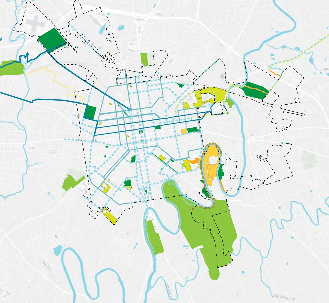
The Lancaster parks and open space system is complex. Below are the broad categories of open spaces and how they were included in the evaluation and benchmarking of the park systems.
Parks owned and maintained by the City of Lancaster (for example, Reservoir Park). These are the parks that were evaluated using the scorecard described in the introduction. Some spaces that Lancaster owns are more aptly described as either streetscapes or remainders Remainders are land owned by the city which may not provide any specific amenities or recreation opportunities, such as Blanche Nevin Park.
Other publicly owned parks, mostly outside Lancaster, but used by Lancaster residents (such as Lancaster Central Park). These parks provide benefits to the community regardless of who owns them and are important elements of park access, particularly in Southeast Lancaster. We included these parks in the walkshed analysis to determine what percentage of the population lives within a 10-minute walk of a park. Since they are not owned by the city and the city is not responsible for improvements, we did complete scorecard evaluations of them. We also did not include them when benchmarking the parks system to NRPA standards.
School district properties (for example McCaskey Field) are important for the active recreation facilities they provide (for example basketball courts and playgrounds). In benchmarking Lancaster facilities we included school district properties if they were in the city and open to the public outside of school hours. This included all school district properties except MacCrae ES. This assumption may need to be revised if policies regarding access to school property amenities (playgrounds, basketball courts) are modified.
Cemeteries were included in looking at the overall system. As open spaces, they provide shade and greenspace, but cannot be used for active recreation, or certain passive recreation activities, such as dog walking. While they are part of the system, they are not a substitute for parks, which provide greater recreation opportunities.
Other open space available to the public were included in the analysis. This included conservation areas, such as Hazel Jackson Woods, and pocket parks not maintained by the city, such as the Lemon Street Parklet.
All Lancaster city parks were scored using the scorecard for individual parks described in the introduction. All of the parks were evaluated through a combination of on-site assessment by the consultant team and GIS analysis. Scores within each category were normalized to the percent of available points achieved. Parks scoring 75% or higher of total points were scored “Good”. Parks scoring between 50% and 75% were scored “Fair”, and parks scoring less than 50% were scored “Poor”. The Parks Overview section includes the score and a description of each park.
In evaluating progress towards Lancaster’s goal of ensuring that all residents are within a safe, 10-minute walk of a high-quality park, the consultant team felt that it was important to look at the scores of each of the individual parks to identify those most in need of being improved to make them high-quality, but also at the overall geographic distribution to identify areas of the city that may be particularly lacking in quality parks. The larger parks, such as Buchanan, Musser, and Long’s, and the newly constructed Ewell Plaza scored highest. Through the Engage Lancaster survey, the public also identified these high-quality parks as some of their favorite parks.
The Northwest, Southwest, and Southeast quadrants all have parks scoring ”Poor.” The Southeast quadrant stands out as having all parks that scored “Poor”. The consultant team found that the parks in the north half of the city scored higher than those in the south of the city, with the southeast quadrant scoring lowest overall. The highest-ranked parks also corresponded to people’s favorite parks in the community survey. As a result, improving the lower-scoring parks and particularly addressing areas of the city that are entirely served by lower-scoring parks should be a priority. Only parks and the Greenway owned and operated by the City of Lancaster were evaluated. Parks, trails and open spaces not owned by the city or privately owned were noted but not included in the analysis, recommendations or implementation strategies.
75-100 GOOD
50-75 FAIR
LESS THAN 50 POOR
EWELL PLAZA (78)
PENN SQUARE (60)
BINNS (57)
BUCHANAN (78)
STORK LINEAR (56)
ROTARY (53)
NORTH MARKET STREET KIDS (42)
BLANCHE NEVIN (41)
CANBA (33)
MUSSER (81)
TRIANGLE (70)
SIXTH WARD (68)
RESERVOIR (59)
CULLITON (65)
BRANDON (61)
RODNEY (55)
CRYSTAL (53)
SOUTH END (51)
CABBAGE HILL VETERANS MEMORIAL (47)
CONESTOGA CREEK (48)
MILBURN (47)
CASE COMMONS (46)
SOUTH DUKE STREET MALL (41)
JOE JACKSON TOT LOT (38)
EWELL GANTZ PLAYGROUND (36)
LONG’S (74)
HOLLY POINTE (61)
CONESTOGA PINES (46)
NORTHEAST
SOUTHWEST
The consultant team also reviewed the number and type of amenities that Lancaster provides in its parks. For the facilities benchmarking, outdoor facilities on school district properties were included. The number of outdoor facilities (for example playgrounds) that Lancaster provides is in line with or exceeds the median for similarly sized cities nationally, per the NRPA benchmarks. These include playgrounds, basketball courts, tennis courts, dog parks, and diamond and rectangular fields. In terms of these amenities, Lancaster is well-served.
For full-size pools, the city underperforms compared to the benchmark, with one pool for the entire city population (roughly 60,000 people) compared to the NRPA benchmark of just over 40,000 residents per pool. Lancaster’s only pool is located at Conestoga Pines Park in the Northwest Extension. It is remote from the majority of the city’s population, accessible only by car, located in the flood plain, and at the end of its useful life. We heard from many residents that they do not use the Conestoga Pines pool because of its remoteness. The pool should be replaced and located in a more centralized site for Lancaster residents. Given the median residents per pool of 43,100 and Lancaster’s population of nearly 60,000, a pool larger than the Conestoga Pines pool would better serve Lancaster’s population. In addition, a new pool will need to meet the requirements for ADA accessibility, which will require a larger pool area, but also serve a more diverse population.
Lancaster has six wading pools. NRPA does not benchmark wading pools, so there is no comparison. Nationally the trend is to move away from wading pools and toward spraygrounds/ splash pads. While both wading pools and splash pads provide cooling in the summer, splash pads provide several advantages compared to wading pools. They cost less to install and require less maintenance than a pool. In addition to lower costs, they can also present reduced liability for municipalities and consume less water than a pool. They have no standing water, so less supervision is required compared to a wading pool. Splash pads can be enjoyed by a far wider range of ages and abilities. They are more ADA-accessible because they offer barrier-free
1 All facilities benchmarking references the 2023 NRPA Agency Performance Review.
entry. A more centrally located and accessible full-size pool combined with splash pads may help to lessen the demand for wading pools.
Other jurisdictions of Lancaster’s size provide outdoor facilities that Lancaster does not provide. For example,
• 52 percent of all agencies provide community gardens, with an average of one community garden per 52,906 people for jurisdictions of Lancaster’s size. Lancaster recently acquired the Bay Street community garden site, which would bring Lancaster into conformance with this metric.
• 41 percent of all agencies provide skate parks, with an average of one skate park per 62,927 residents for a jurisdiction of Lancaster’s size.
• 31 percent of all agencies provide pickleball courts with an average of 11,150 residents per pickleball court.
In the community survey skate parks, pickleball courts, and community gardens were mentioned as desired amenities.
Median Population per Facility for facilities Lancaster does not currently provide compared to the NRPA Benchmark for cities with populations between 50,000 and 99,999
of Lancaster
RESIDENTS PER PLAYGROUND
These charts look at the number of residents per each type of outdoor facility compared to the NRPA median benchmark. In these graphs, being below the medium means that each facility is shared by fewer people. Or in other words, where Lancaster falls below the median it is outperforming the benchmark.
RESIDENTS PER DOG PARK NRPA MEDIAN
+ EXT
+ EXT
+ EXT
To evaluate the city parks and open spaces as one integrated system, the consultant team looked at the size and distribution of parks within the system, the parks and the available facilities, and the 10-minute walk sheds to the parks.
It is typical for park systems to have a variety of park typologies from small pocket parks to larger regional parks. While the number of residents per park in Lancaster aligns with the NRPA median benchmark for similarly sized cities, this number does not account for the many small parks in Lancaster. NRPA also provides a benchmark for acres of park per 1,000 residents. Compared to the NRPA benchmark for similarly sized jurisdictions, Lancaster has fewer acres of parkland per resident than the median. When we look at this broken down by quadrant, we see that the quadrants have fewer acres of park per 1,000 residents than the city overall.
The quadrants within the city contain just under a third of Lancaster’s parks by area with the majority of parkland - primarily Conestoga Pines and Long’s Park - in the annexes. While the northwest, northeast, and southwest include a mix of park types, including neighborhood parks and community parks, the southeast is dominated by pocket parks, which do not provide the same level of recreational opportunities as the larger park typologies.
Acres of park per 1,000 residents Residents per park.
The City of Lancaster, working with Lancaster County Planning and the Lancaster County MPO, promotes active transportation and connectivity through enhanced bikeways, improved pedestrian access, and trail and greenway connectivity planning. As part of building the active transportation network, Lancaster is actively working on Vision Zero plan - seeking to make Lancaster’s streets safe for all users, including pedestrians and cyclists. Current City initiatives related to connectivity include new streetscape design guidelines and restoring two-way streets along certain corridors.
Lancaster built and continues to add improved bicycle facilities within the city; these facilities include bike boulevards, protected bike lanes, bike lanes, and shared streets. These facilities will connect to the active transportation network within the city and beyond to the Lancaster County network. Connects have been created to the Conestoga Greenway Trail along the Conestoga River and the planned Lancaster Heritage Pathway. Lancaster’s Conestoga Creek Park is part of the Conestoga Greenway Trail, which currently ends at Duke Street but should be extended to safely cross this busy street into Lancaster County Central Park and its network of trails.
NRPA includes a benchmark for miles of trail. To compare Lancaster to the benchmark, the consultant team looked at existing and proposed miles of both trails and bike facilities within the city. The combined existing trails and bike facilities place Lancaster just below the NRPA median for similarly sized cities. When the proposed trails and bike facilities are completed, Lancaster will exceed the NRPA benchmark.
Trail and greenway planning in Lancaster has been ongoing for over 25 years and includes the following studies:
• Sunnyside Greenway Task Force Study (1999): Prepared for the Lancaster County Commissioners for the Sunnyside Greenway, this study proposed a bicycle and walking trail on the edge of the floodplain around the entire 22 acres of City-owned land on the Sunnyside Peninsula for passive, greenway usage,
• Lancaster Greenway Trail System (2014): Prepared by the Lancaster County Planning Commission, this plan proposed a “riverview” trail along the northern (City) edge between Duke Street and Strawberry Street, near Riverview Cemetery, as well as completing the Sunnyside Peninsula Trail and a
“Lakeview” trail around the old Brenner’s Quarry site off River Road directly across the Conestoga River from Holly Pointe Park. During on-site evaluations, the riparian buffer along the Conestoga River appeared healthy. While the riparian buffer seemed healthy, it would still be beneficial for the City to conduct further analysis to assess the bank slopes and whether invasive species are present in the corridor
The City should prioritize trails and greenways that safely connect citizens to passive spaces. Creating trail connections for Lancaster residents to access larger, open space tracts at Hazel Jackson Woods and Sunnyside, creating safer connections for residents to access Lancaster County Central Park, and improved connectivity between city neighborhoods and parkland should be a priority for the City.
Several other Lancaster parks, including Mayor Joyce Stork Linear Park and the Duke Street Mall offer the possibility to be part of the trail network. Trails not only provide recreational opportunities, but they also provide active transportation opportunities, connecting Lancaster residents safely to larger parks on the periphery and adjacent to the city, such as Lancaster County Central Park, Conestoga Pines Park, and Longs’ Park, as well as larger parks within the city, such as Buchanan, Reservoir, Culliton, and Musser. As can be seen on the map at the left, the existing and proposed trail network has the potential to provide a more connected network to many of the city’s parks.
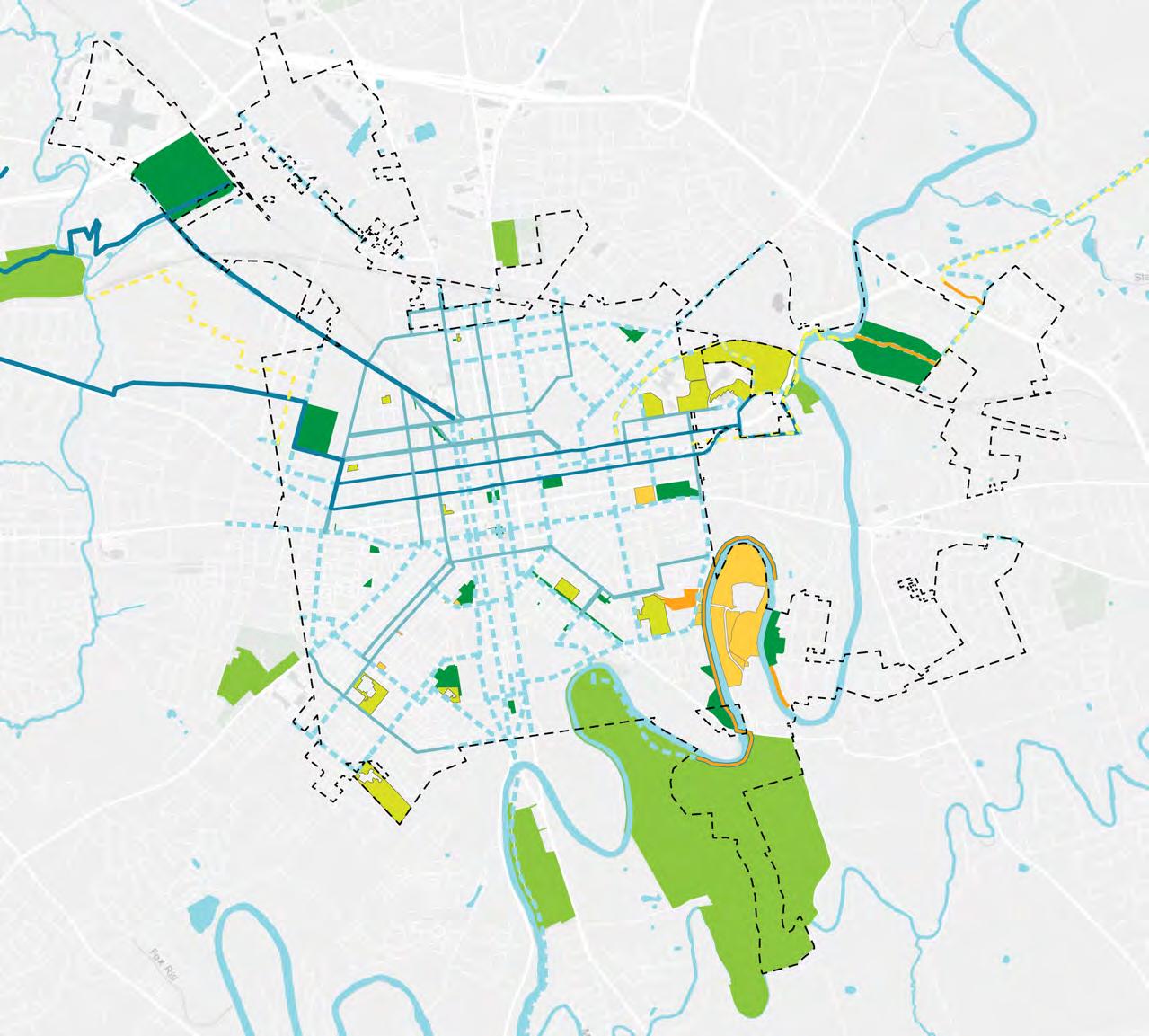
City of Lancaster Parks
Other public Parks
Schools open to the public
Hazel Jackson Woods
Sunnyside Pennisula
Existing trails
Regional trail connections
Existing bike facilities
Proposed trails
Proposed bike facilities
Riverfront trail
The consultant team performed a walk access analysis and found that 93.5% of Lancaster residents are within a 10-minute walk of a park, including city parks and other parks. If we look at only city-owned parks, the number falls to 88.3%. The team also looked separately at the walkshed for school district properties open to the public.

Overlapping walksheds for all city parks

for all city parks

Overlapping walksheds for school district properties
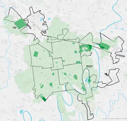
Walksheds for all parks, including those outside the city
COMBINED WALKSHEDS

The Northwest and Northwest Extension feature the largest and earliest acquired parkland in the entire Lancaster system. Although smaller parks dot the area, this is one of the most served areas in the entire City for parkland as large parks are destinations from both the surrounding neighborhood and region.
CITY PARKS
PARK
STORK LINEAR PARK
PARK
NORTH MARKET STREET KIDS PARK
BLANCHE NEVIN PARK
CANBA PARK
LONG’S PARK
SCHOOL DISTRICT PROPERTIES
WHARTON
REYNOLDS
ROSS
FULTON
CEMETERIES
SHREINER-CONCORD CEMETERY
NORTHWEST
4 PARKS
1

At approximately 21 acres, Buchanan Park is the largest park within the original street grid of Lancaster. In the early 1890s, the City considered the grounds of nearby Wheatland, home to President James Buchanan, as a potential spot for “Buchanan Park.” However, the present location was chosen over a decade later on the grounds of the defunct West End Reservoir, which was taken out of service around 1900, and was dedicated in 1906 as one of the City’s earliest park spaces. It features the John A. Fritz Memorial Rose Garden and the highly popular Beau’s Dream Dog Park. It also features the President James Buchanan statue, erected in 1928, the Monument to the Soldiers

TYPOLOGY: regional park
SIZE: 21.27 acres
AMENITIES: wading pool, dog park, playground, basketball courts, tennis courts, baseball field
NEEDS: none
CREATED: 1905
LAST UPDATED: ?
of the USS Maine, erected in 1931, and the Liberty Bond House, a miniature replica of Lancaster’s 1886 Court House. The replica was used in Penn Square during World War I and World War II to sell war bonds. It features benches, a picnic pavilion, a wading pool, basketball courts, large rock outcroppings, and a variety of tree plantings. It is also one of the most highly scoring parks in Lancaster. It is located adjacent to the campus of Franklin and Marshall College and situated in a mostly residential neighborhood with good connections to City streets. The park has a good mix of active and passive uses, which it can accommodate due to its size and topography.

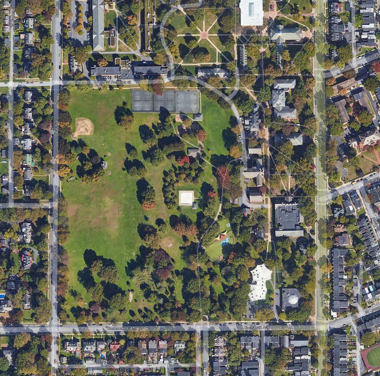
Opened in 1994, Mayor Janice C. Stork Corridor Park is a trail that follows an abandoned below-grade railroad line, which was part of the 80-mile Philadelphia and Columbia Railroad, completed in 1834 and closed in 1929. The approximately 2.5-acre rail-to-trail park was originally known as Northwest Corridor Park until it was renamed in 2015 by an act of City Council for Lancaster’s first female mayor, Janice Stork, who was mayor when the park opened. The park extends from W. Lemon Street to Harrisburg Avenue, cutting across the grid of the Northwest section of the City with an additional gateway at W. James and N. Mulberry Streets. The park features a trail, playground equipment,

TYPOLOGY: community park
SIZE: 2.53 acres
AMENITIES: playground, trail, basketball court, garden
NEEDS: lighting study, new benches
CREATED: 1994
LAST UPDATED: ?
a basketball court, composting bins for area residents, and a small garden which appears to be maintained by neighbors. The Lancaster Boys and Girls Club-Jack Walker Club House is located adjacent to the park at 229 W. Lemon St. The park can feel isolated at times as it is below street grade and also traverses a road underpass. The presence of a potential Park Ranger in this park, possibly on a bicycle doing rounds, would assist in park safety. In addition, potential additional plantings could be added which could be maintained by a potential stewardship coordinator working with nearby neighbors. Lighting might also be an option for increased usage and safety.

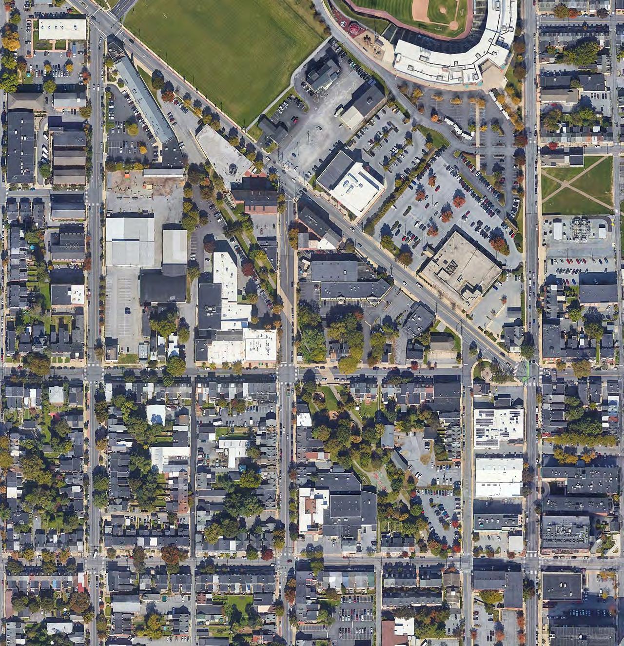
Rotary Park, first established in 1999 and dedicated as Rotary Park in 2005, is a .16 acre plaza located at 200 Harrisburg Avenue featuring a sculpture entitled “Let’s Play Ball” of children getting ready for a game of baseball, a nod to nearby Clipper Magazine Stadium,
TYPOLOGY: plaza
SIZE: .16 acres
AMENITIES: benches, public art, bike racks, bike rental station
NEEDS: additional plantings and shade
CREATED: 1999
LAST UPDATED: 2005
which also opened in 2005 and is home to the Lancaster Barnstormers professional baseball team. The park is along a busy street with some shade and seating but could use additional plantings of trees to invite more visitation with shade.

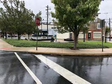
This pocket park was created in 1997 on a former vacant city lot. It is behind Ross Elementary School and was created with funding from the Pennsylvania Department of Environmental Protection. This park was created around a large oak tree which is no longer standing and is in need of additional shade plantings and play equipment upgrading. The entrance is not
TYPOLOGY: pocket park
SIZE: 0.09 acres
AMENITIES: playground, benches
NEEDS: lighting study, new benches
CREATED: 1997
LAST UPDATED: upgrades to play surface and equipment.
accessible due to the lack of a sidewalk at the entrance. The mid-block park also lacks sufficient visibility from the neighborhood. The park is in need of some basic upgrading and should be coordinated with students from the neighboring school (who were involved with the opening of the park in the late 1990s) and the surrounding community.
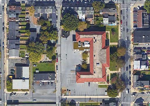

Named for the Columbia Avenue Neighborhood Betterment Association (CANBA), this park was created by the Association in the early 1980s and was cared for by the Association until 1999, when it was transferred to the City as the organization could no longer maintain it due to dwindling membership. The City accepted a
TYPOLOGY: remainder
SIZE: 0.10 acres
AMENITIES: bench
NEEDS: bench needs replacing CREATED: 1983
LAST UPDATED: ?
HUD Community Development Block Grant in 1986 on behalf of CANBA and performed site improvements. At .1 acres, CANBA Park is one of the smallest park spaces in Lancaster and should be considered to be removed from park space after the City reviews any HUD grant restrictions.
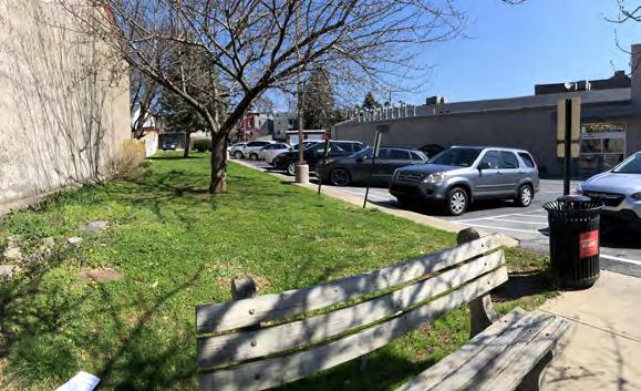

This small (.02 acre) median at the junction of W. Orange St and Columbia Ave was dedicated in 1898 and features a marble fountain and sculpture donated to the City by sculptor Blanche Nevin to honor her mother, Martha
TYPOLOGY: streetscape/median
SIZE: 0.02 acres
AMENITIES: statue
NEEDS: none
CREATED: 1898
LAST UPDATED: ?
Jenkins Nevin. Although the median is well maintained (mowed, healthy tree) the City should consider removing it from its list of parks.

Long’s Park was created as a bequest from the will of Judge Henry Grimly Long. After the death of his daughter, Catherine Long, the funds and land for the park became available in 1900 with an endowment for the park. The park was originally outside the boundary of the city but was annexed to the city in 1952. Originally, the park was almost 75 acres but in 1961, the Pennsylvania Department of Highways (now PennDOT) announced the Route 30 bypass would be constructed through the northern edge of the park, removing several acres. Presently, at almost 70 acres, Long’s Park is the largest park in the system and one of the most highly scored. It is also a favorite park with respondents to the community survey. The BPPP has a dedicated maintenance team in Long’s.
The park boasts many amenities, including an amphitheater (constructed in 1962), petting zoo, tennis courts, restrooms, recently constructed stormwater wetlands as well as a number of picnic pavilions, playground areas, a

TYPOLOGY: regional park
SIZE: 73.46 acres
AMENITIES: amphitheater, playgrounds, trails, tennis courts, basketball courts, petting zoo, lake, picnic pavilions, constructed stormwater wetlands, restrooms.
NEEDS: better cycling and trail connections to allow city residents to reach the park without a car, amphitheater is in need of some upgrades.
CREATED: 1900
LAST UPDATED: 2023 (wetlands)
lake with fountain feature and gazebo overlooking the lake, walking paths, large and active recreation amenities. The Long’s Park Wetlands include amenities such as boardwalks and education signage and manages a significant amount of stormwater that flows to the Conestoga River. It recently received an award from the Lancaster Clean Water Fund. The non-profit Long’s Park Amphitheater Foundation programs and maintains the amphitheater, which features a popular Summer concert series. There are numerous trees in the park and the park is well maintained. There are extensive signs throughout the park. This signage should be coordinated with other park signage so there is consistency throughout the system. Bounded on the east by Amtrak’s Keystone line, US 30 bypass to the north, heavily traveled Harrisburg Pike to the west and a small creek and wetlands to the south, the park does not present options for non-vehicular connectivity unless some major capital improvements were made along Harrisburg Pike, such as widening for a sidepath to connect to the city proper.


The Northeast and Northeast extensions feature a regional park, two larger community parks, a neighborhood park, and a pocket park. Geographically, this is the best-served area of the City as resources are well-spread over the Northeast neighborhoods and extensions.
CITY PARKS
MUSSER PARK
SIXTH WARD PARK
RESERVOIR PARK
CONESTOGA PINES
TRIANGLE PARK
SCHOOL DISTRICT PROPERTIES
SCHOOL DISTRICT CAMPUS (MCCASKEY, LINCOLN & WICKERSHAM
CEMETERIES
ST MARY’S CEMETERY
LANCASTER CEMETERY
OTHER
LEMON STREET PARKLET
NORTHEAST
4 PARKS
15.09
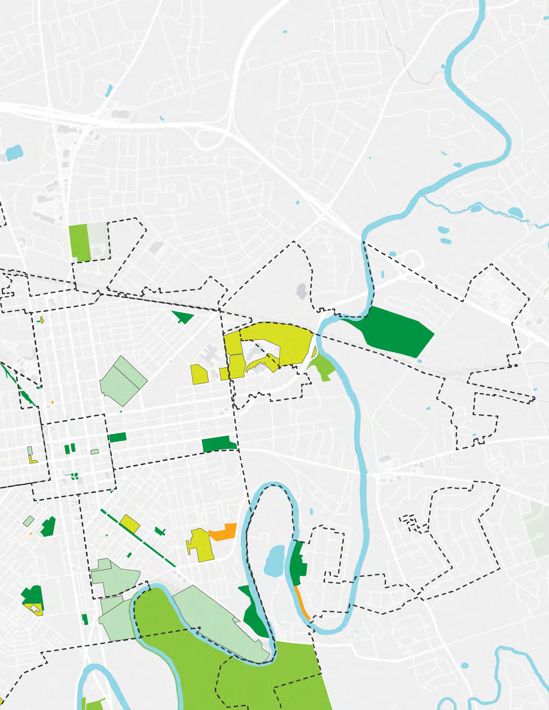
Dedicated in 1949 and named for Harry Musser, a wealthy manufacturer who left funds for the park in his will, this approximately 3-acre park is one of the more centrally located community parks in Lancaster City with an active nonprofit, the Musser Park Civic Association, assisting with maintenance and programming. The park is well integrated into the neighborhood and is very accessible and visible from surrounding streets and adjacent neighboring houses. There are high traffic volumes and speeds on N. Lime St. (to the west) and E. Chestnut St. (to the north). Not all entrances are ADA accessible, although there is
TYPOLOGY: community park
SIZE: 3.01 acres
AMENITIES: playground
NEEDS: additional shade on the playground
CREATED: 1949
LAST UPDATED: ?
accessibility from the main entrance at the Chestnut and Lime intersection. The park features benches, play equipment, a neighborhood composting station, open space, plantings, and trees all of which are in good condition. The park would benefit from standardized signage. Musser Park occupies land adjacent to the Lancaster Museum of Art, housed in the 1846 Greek Revival Grubb Mansion, which fronts on N. Lime St.


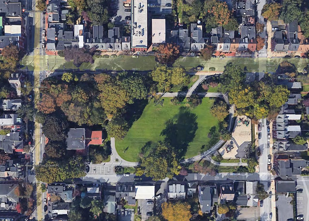
Created in the mid-1920s by a group of neighborhood citizens on the last remaining tract of open space in Lancaster’s Sixth Ward, the Sixth Ward Park is an actively used approximately 3-acre neighborhood park located along busy E. Ross St across from industrial and commercial activities on the edge of a neighborhood with neighboring houses backyards facing onto the park. Despite having bicycle racks, it could be difficult to access the park via bike due to busy city streets and therefore many people arrive at the park by car. Traffic calming and protected bike lanes, if
TYPOLOGY: neighborhood park
SIZE: 3.11 acres
AMENITIES: playground basketball courts, wading pool, pavilion, baseball field
NEEDS: upgrades to playground safety surface, baseball field could be re configured as multipurpose rectangular field.
CREATED: 1926
LAST UPDATED: 2011
possible, could provide additional access to the park. The park features basketball courts, play equipment, a pavilion, and wading pool as well as a large, open space along Hamilton St. It is well-planted with trees and is maintained. Traffic calming along E. Ross St. would provide additional safety measures, especially since the park is very child-friendly.
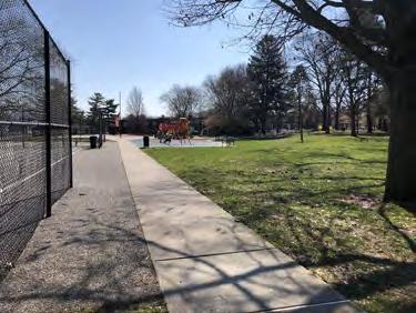
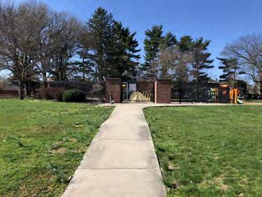

Reservoir Park occupies land that was once the site of the city’s Water Works and is one of Lancaster’s oldest parks, the land being owned by the city for public purposes since 1836.1 The land for Reservoir Park was purchased for park purposes adjacent to the City’s East End Reservoir in 1889, although it took several years to come to fruition after then-Mayor Edward Edgerly prioritized having a park within the City’s boundary. 2
It is the largest centrally located park in Lancaster, near downtown Lancaster, McCaskey High School, Thaddeus Stevens School of Technology, and dense residential neighborhoods. The approximately 9-acre park features a pavilion, the surface of a former street hockey rink, basketball courts, wading pool, benches, walkways, tree plantings, lawn areas, an historic swing set from the early twentieth century, and a parking area. The Common Wheel non-profit bicycle shop, which also does bike programming in the City, is housed in a small building in the park. A large water tower
1 City of Lancaster: “A Brief History of Reservoir Park and Its Lion”
2 “The Park Purchased” Lancaster New Era. May 29, 1889.

TYPOLOGY: community park
SIZE: 8.92 acres
AMENITIES: playground, basketball curt, handball court, restrooms, roller rink, arboretum, Common Wheel
NEEDS: master plan, upgrades to play equipment, play surfaces, and site furnishings, more water fountains and bottle filling stations, upgrades to paving and surfacing of sports courts, improved ADA accessibility.
CREATED: 1889
LAST UPDATED: ?
on the southeastern edge of the park occupies a considerable segment of parkland. The “Lion in the Park” fountain sculpture, fronting on E. King St, was created by Blanche Nevin (1841-1925), considered one of America’s first noteworthy women sculptors. Nevin, who lived in Lancaster for much of her life, was present at the dedication of the sculpture in 1905 and small Blanche Nevin Park in the Northwest is named for her. For Reservoir Park to function as a true community park, it should undergo a master planning process to ensure the full usage of both passive and active elements of public space.
Needs: According to a September 2023 FCA report, Reservoir Park needs upgraded sidewalks as areas of concrete are failing, which presents tripping hazards; repaving and restriping the parking lot with new parking space pavement markings; several cookout grills are rusted; wood chips in the playground area need replacement; athletic surfaces and courts need re-striping; swing sets are in poor condition; trash receptacles and benches need replacement and miscellaneous ADA/accessibility issues need to be addressed site-wide.

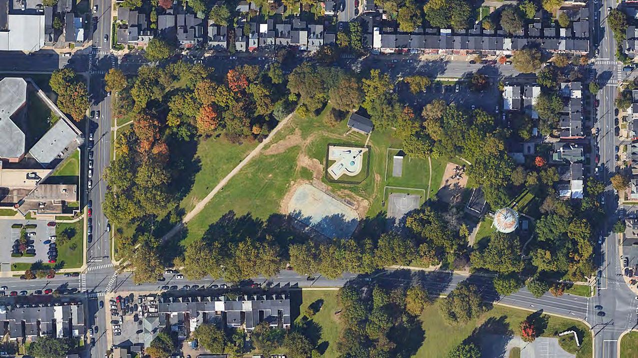
Conestoga Pines Pool opened in 1966 and the adjacent bathhouse and concession opened one year later in 1967. The remaining 50+ acres opened to the public in the later 1960s and early 1970s as improvements were made. The City’s Conestoga Pines Pool is considered fairly inaccessible to the majority of City residents due to its location at the edge of the Northeast annex. Like Reservoir Park, Conestoga Pines is situated on land that fell under the jurisdiction of the Lancaster City (Water) Authority when it was being developed as a City park. A circa1850s renovated barn is located near the entrance on Pitney Road. The barn is operated by
TYPOLOGY: regional park
SIZE: 55.82 acres
AMENITIES: full size pool, trails, barn, forest
NEEDS: lighting study, new benches
CREATED: 1966
LAST UPDATED: 2024 (master plan)
the Lancaster Recreation Commission and is only opened on a seasonal basis due to a lack of heating and air conditioning. The park is undergoing the Conestoga Pines Park and Walnut Street Fishing Area Master Plan process, which began in 2021 and was adopted in 2024. Trail connections as part of the larger Lancaster Area Heritage Pathway, expanded river access for canoes and kayaks, and a potential closure of the pool, which is within the floodplain are being considered.


Dedicated in 1979 when area neighbors petitioned the City to demolish a vacant garage and gas station and install a small pocket park. Neighbors formed the Triangle Park Association which assists with the maintenance and upkeep of the small .05 acre pocket park. The park is very visible from the street and adjacent houses although E. Walnut Street on the southern edge of the park can have high traffic volumes and
TYPOLOGY: pocket park
SIZE: 0.05 acres
AMENITIES: bench, plantings, art
NEEDS: lighting study, new benches
CREATED: 1979
LAST UPDATED: ?
speeds. The park is steps away from Lancaster Cemetery, located to the east and one of the largest open spaces in Northeast Lancaster, and a short walk to Musser Park, located one block south. The park also features sculpture, plantings, and benches and is a good example of a pocket park in an urban setting.
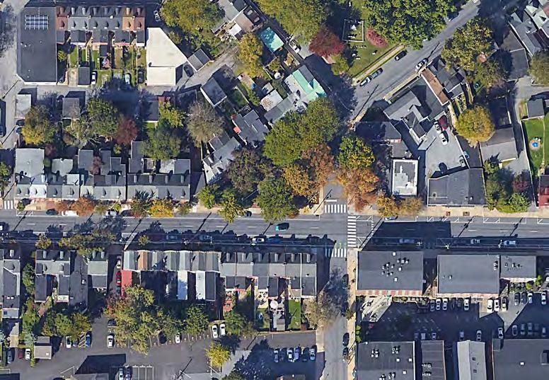
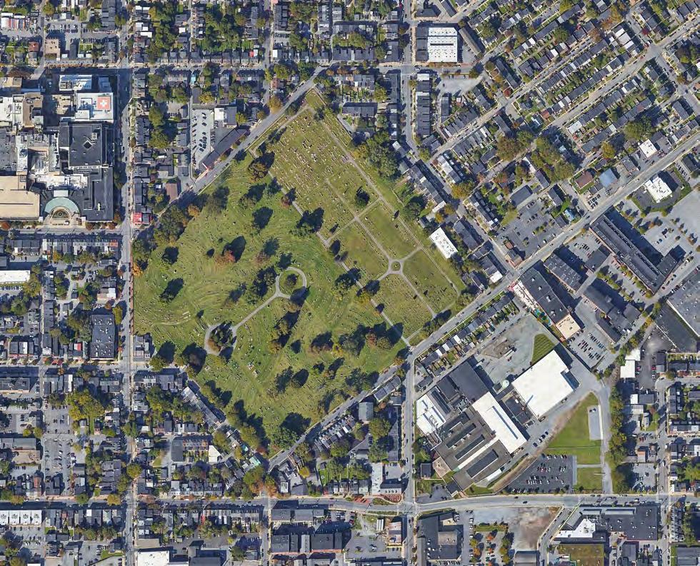
Lancaster Cemetery is a 20-acre cemetery in the rural cemetery style of the 19th century. Created in the late 1840s, and dedicated in 1850, it is adjacent to St. Mary’s Cemetery. The entrance is on E. Lemon Street near the intersection of N. Lime Street. Together, both cemeteries add considerable acreage to open space in the Northwest, however, both are in private ownership.
Southwest Lancaster does not feature as much park acreage as the Northwest and Northeast sections of the City. Instead, it features smaller community and neighborhood parks, primarily serving local neighborhood residents. While Culliton Park draws regionally due to its renowned softball leagues at Conlin Field, the other parks do not serve a regional population due to their size and location. The Southwest is the headquarters of the Lancaster Recreation Commission in Brandon Park. Southwest features very early neighborhood parks as it was a focus of the early leadership of the Lancaster Recreation Commission due to the density of neighborhoods within this quadrant.
CITY PARKS CULLITON PARK BRANDON PARK
RODNEY PARK
CRYSTAL PARK
SOUTH END PARK
CABBAGE HILL VETERANS
MEMORIAL
SCHOOL DISTRICT PROPERTIES
LAFAYETTE
PRICE
HAMILTON CEMETERIES
ST
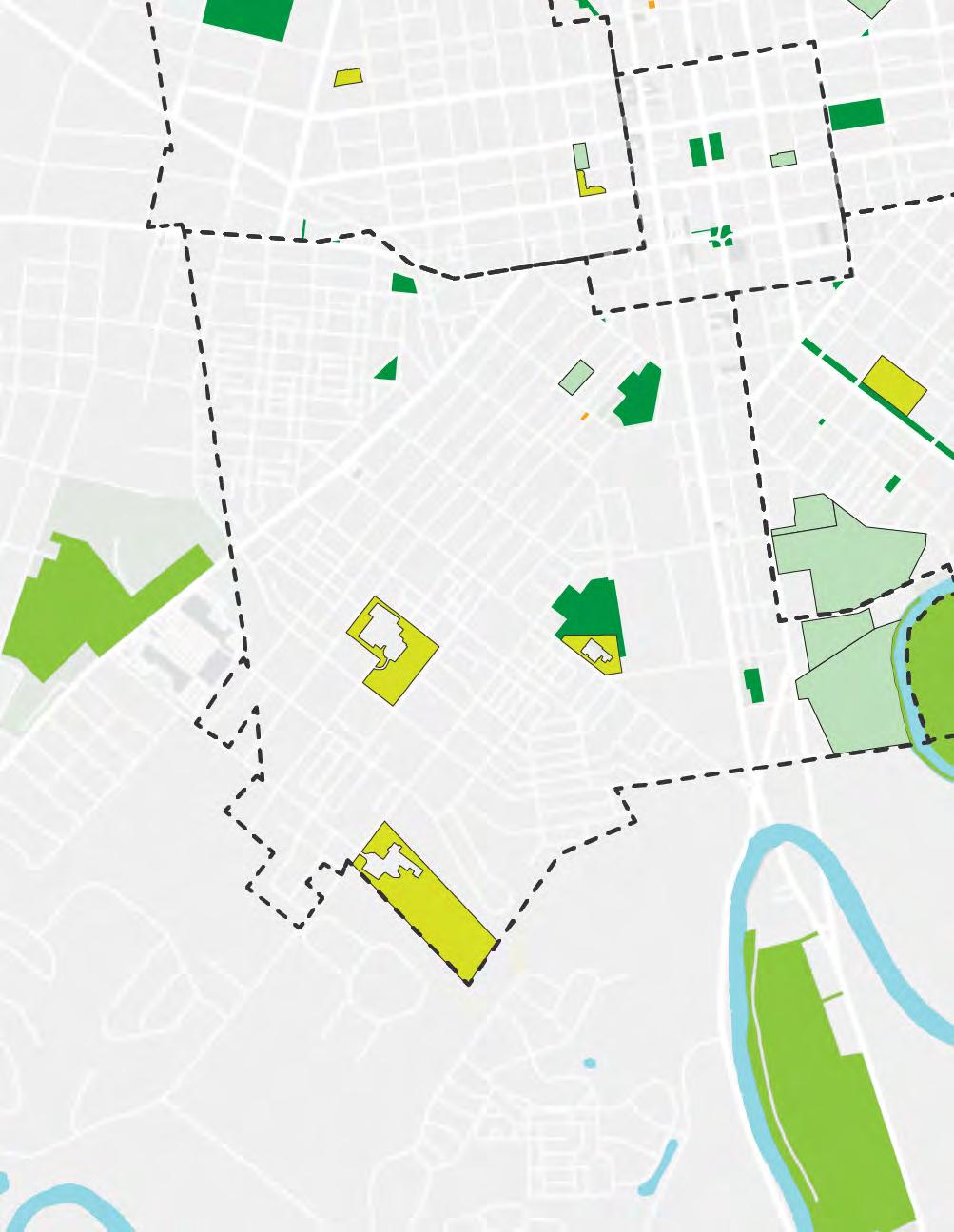
Originally known as John Farnum (and then Farnum) Park, Culliton Park is one of the larger community parks in the Southwest at almost 4.5 acres. Culliton Park was one of the earliest playground areas of the City, dating from the Lancaster Recreation movement in the early 1920s. Baseball and softball have a long history in the park as games were played here starting in the 1920s and continuing into the present day on Conlin Field, which is permitted by the Lancaster Recreation Commission. In 2017,
TYPOLOGY: community park
SIZE: 4.37 acres
AMENITIES: playground, wading pool, ball field, basketball courts, pavilion, restrooms, green infrastructure, public sculpture.
NEEDS: lighting study, new benches
CREATED: c. 1923
LAST UPDATED: 2020
after a donation from local philanthropist Carol Culliton, the park was renamed in her honor, and renovations to the park were completed in 2020. The park features a wading pool, GSI, grassy areas, a pavilion, public art, tree plantings, benches, and basketball courts. The proposed “bicycle boulevard” along Water Street would connect the park to downtown Lancaster for bicycles.
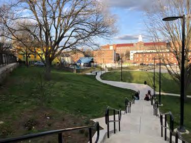


Originally called Fairview Avenue Park when it was undergoing development in the late 1960s, Brandon Park is named for the long-time Lancaster Recreation Commission Director Grant Brandon, who led the organization from 1922 to 1954. Brandon Park was dedicated in 1971 after several parcels were acquired by condemnation and using Federal Project 70 funding for acquisition costs. The Lancaster Recreation Commission moved into the facility they presently occupy at the Lancaster Recreation Center in 1979 (former headquarters were at Grubb Mansion adjacent to Musser Park). The park includes a large basketball court area, trails, play equipment, a large parking lot area, GSI, and public art. Renovations were completed in 2012 which included many of the upgrades to the park. The Rec Center includes programming for children and seniors.

TYPOLOGY: neighborhood park
SIZE: 7.22 acres
AMENITIES: LRC, playground, basketball courts, rain garden, restrooms
NEEDS: more eyes on the park.
CREATED: 1971
LAST UPDATED: 2012
Note: Plans are underway to potentially move the LRC to the adjacent Price Elementary School, which would provide additional space for the LRC’s daycare program which is presently at capacity. Price Elementary would move into the current Rec Center and the Brandon Park parcel conveyed to the school board. The intent is to keep the parcel publicly accessible.
Needs: Due to steep topography, the majority of Brandon Park (excluding the Recreation Center on Fairview Avenue) is sited well below street grade prohibiting neighbors from viewing park activity. For this reason, issues of public safety and vandalism remain ongoing concerns. This park would benefit from regular monitoring by a Park Ranger so that the public using it for legitimate purposes would feel safe.
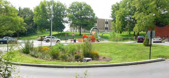

Dedicated in 1923, Rodney Park is one of the oldest parks in Lancaster. At .6 acres the small neighborhood park underwent renovations in 2013. The park features play equipment, a “Dancing Arches” sculpture installed in 2013, and a “mini water park” feature also installed in 2013. The park includes a building occupying the northeast corner, which is programmed by the Lancaster Recreation Commission, with some
TYPOLOGY: neighborhood park
SIZE: 0.60 acres
AMENITIES: playground, wading pool, rec building
NEEDS: upgraded safety surface CREATED: 1923
LAST UPDATED: 2013
open grass area that is mowed. GSI is featured around the perimeter along with tree plantings and benches. The park is in the middle of a dense rowhouse neighborhood. The playground safety surface needs to be upgraded.


TYPOLOGY: neighborhood park
SIZE: 0.84 acres
AMENITIES: playground, basketball courts, rain gardens, public art.
NEEDS: lighting study, new benches
CREATED: 1957
LAST UPDATED: 2013
Created from a donation of land by the Paul Eshelman family in 1956 and dedicated in 1957, Crystal Park is a small neighborhood park at .84 acres, located near Rodney Park. Like Rodney Park, Crystal Park underwent renovations in 2013, which included new basketball courts, a new playground, a new plaza-like entrance with brick pavers, GSI, and an art installation, “Changing Gears.” The park has lawn areas, however, this area is sloped. Mature trees front the park’s entrance on 1st Street.
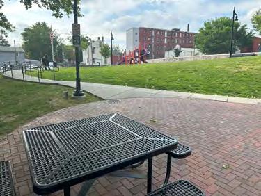
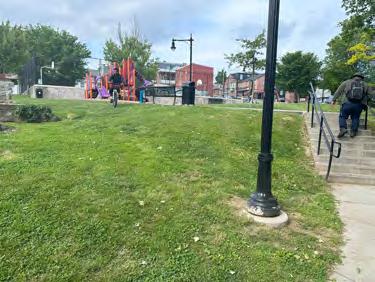
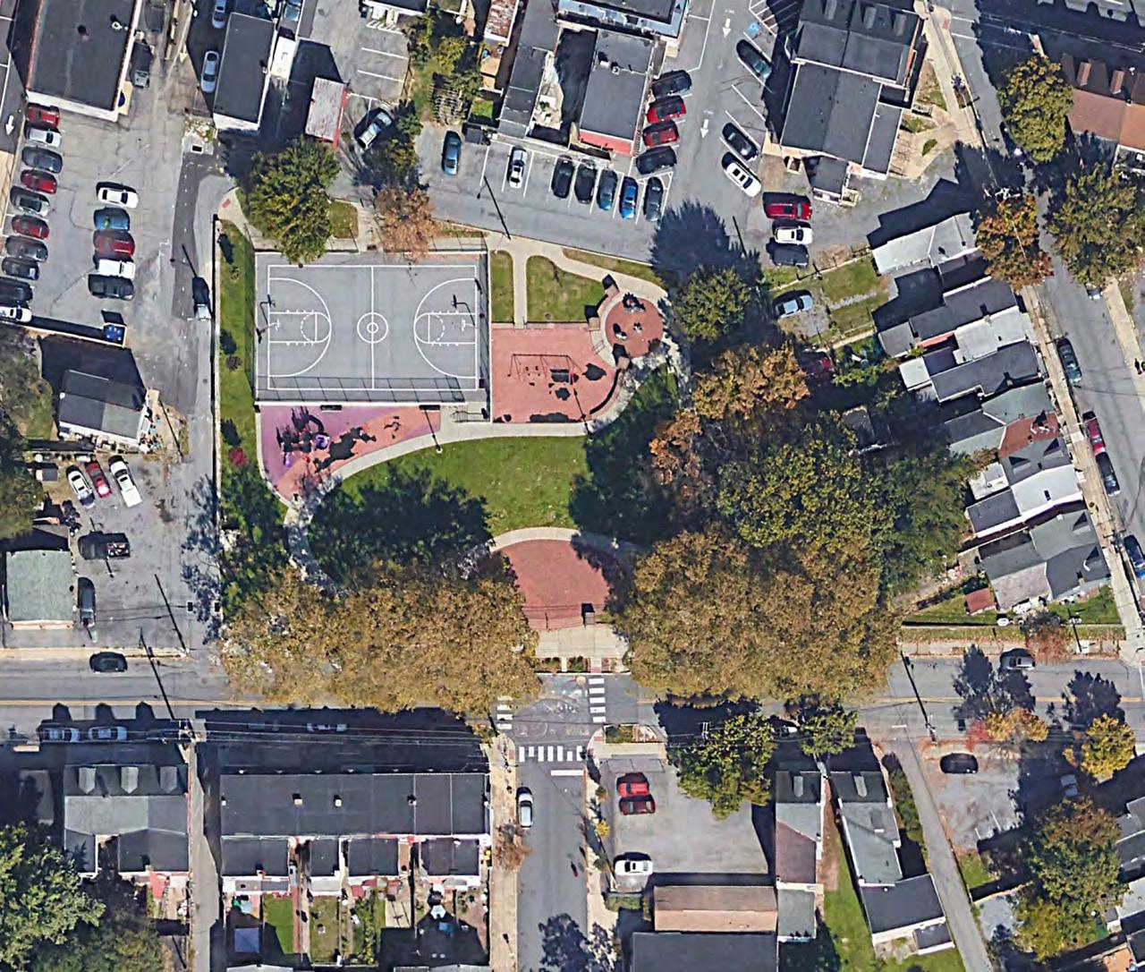
Dedicated in 1924, South End Park is one of Lancaster’s oldest neighborhood parks. At just over an acre, the park has basketball courts, playing fields, a playground, larger lawn areas, tree plantings, and benches. A maintenance facility is located in the park. South End is an important amenity for the neighborhood as it is hemmed in on both sides by heavily trafficked north and southbound US 222 on the City’s southern end (northbound is Highland Ave and southbound is Prince Street). South End Park could use some planning with neighborhood
TYPOLOGY: neighborhood park
SIZE: 1.03 acres
AMENITIES: playground, basketball court, ballfield
NEEDS: upgraded play equipment and safety surfaces, improved ADA access, park planning process, lighting for basketball court.
CREATED: 1924
LAST UPDATED: ?
involvement as it has not been fully updated for many years. Neighbors have worked in recent years to add benches and tress to the park.
Needs: According to a September 2023 FCA, all playfield surfaces are in poor condition and are in need of upgrading, swing sets are in poor condition, play structures should be upgraded, basketball courts need resurfacing and restriping, and ADA/accessibility measures need to be addressed site-wide.
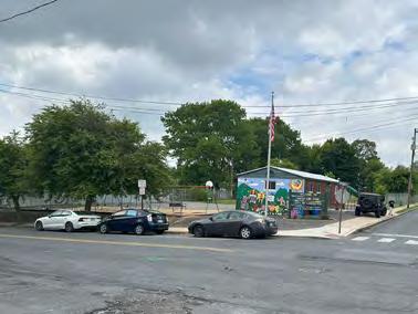


TYPOLOGY: pocket park
SIZE: 0.02 acres
AMENITIES: bench, war memorial, mature trees
NEEDS: new or repaired bench
LAST UPDATED: ?
Small, triangle pocket park bounded by Vine St, Strawberry St, and St. Joseph’s St in the Cabbage Hill neighborhood, the memorial features a bench, flagpole, small memorial, and a large sycamore tree on a traffic island created from a three-way intersection in a quiet, residential neighborhood.

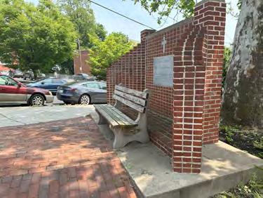

The Southeast has the lowest park acreage across the city. Lancaster County Central Park (LCCP) is adjacent to the neighborhood and partially inside the Southeast extension. In 1971, the City’s Williamson Park (dedicated in 1903) was subsumed into LCCP with a transfer of trusteeship from the City to the County. This removed city-controlled parkland from Southeast, the argument at the time being that the County was more secure financially to perform maintenance due to having a larger tax base and that County parkland flanked Williamson Park on both sides. Southeast has several large cemetery and school district properties, three playgrounds, and the Conestoga greenway trail. The Sunnyside peninsula is also under City ownership but is not a public space.
CITY PARKS
MILBURN PARK
SOUTH DUKE STREET MALL
JOE JACKSON TOT LOT
EWELL GANTZ
HOLLY POINTE
CONESTOGA
CASE COMMONS KING

CEMETERY CEMETERIES
Milburn Park is the largest park in the Southeast quadrant and has new playground equipment. The park suffers from being internal to a block. The park largely faces backyards. There are few eyes on the park and the hidden nature of the park means that many people are not aware of it.
TYPOLOGY: pocket park
SIZE: 1.05 acres (including parking area)
AMENITIES: play ground, bioswale
NEEDS: greater visibility from the street, eyes on the park
CREATED 1996
LAST UPDATED: 2023
It also means that the park is more subject to vandalism and requires frequent maintenance. A significant portion of the park’s area is surface parking, which is largely used by nearby residents rather than park visitors.


TYPOLOGY: pocket park
SIZE: 0.1 acres
AMENITIES: none
NEEDS: benches, invasive species management
CREATED: 1997
LAST UPDATED: ?
Case Commons is a .10 acre triangle pocket park in an area known as “Fivepoints” at the intersection of E. Vine and Church Streets, constructed in 1996 on land donated to the City of Lancaster in 1995 by High Associates. The Park is dedicated to the memory of Lancaster civic leaders Charlotte and Robert Case who died in 1991 and 1993, respectively. Robert Case was the executive director of the Lancaster County Library for 18 years from 1974 to his retirement in 1992 and both were active in the local community near the Park. The Park features plantings, trash receptacles, a staircase (non ADA–provides access between the Park and Church St as the elevation changes between Church St and Vine St), railroad ties provide retaining walls for plantings, and brick pavers.
Needs: There are no benches and there are several invasive species within the plant palette as well as invasives which are growing interspersed with other species, including the Ailanthus tree (“tree of heaven”), which should be removed as it secretes a chemical into the soil that is toxic to surrounding plants. The Ailanthus tree also is one of the primary attractors of the invasive spotted lantern fly. All invasives should be removed and viewsheds of Church St should be established for visibility into the Park. Benches and seating areas should be considered to make the passive park more usable for passive activities, rather than as a “cut through” between two busy streets.

The South Duke Street Mall extends from Church Street to Chesapeake Street in Southeast Lancaster along the northern edge of S. Duke St. It connects the edges of Lancaster’s downtown to the Southeast neighborhoods and the open spaces made up of the many cemeteries in Southeast Lancaster. It also connects to MLK Elementary School and Roberto Clemente Field (Boys & Girls Club). Originally planned in the late 1950s and constructed in the 1960s as a “recreation” space for Lancaster’s massive Southeast urban renewal project, it was
TYPOLOGY: streetscape/median
SIZE: 3.82 acres
AMENITIES: benches
NEEDS: places for people, updated planting, paving and seating, separated bike and pedestrian infrastructure
CREATED: c. 1967
LAST UPDATED: ?
originally intended to address the absence of recreation space in Southeast Lancaster, which has been largely unsuccessful. The streetscape is undergoing a planning process presently.
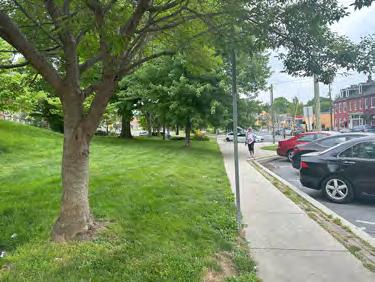


TYPOLOGY: pocket park
SIZE: 0.30 acres
AMENITIES: playground, picnic tables, mature trees
NEEDS: major renovation update play equipment and safety surface, regrade site to improve access
CREATED: 1968
LAST UPDATED: 1994
The Joe Jackson Tot Lot, created in the late 1960s and named for a much beloved local Southeast Lancaster resident who died while serving as a Marine Corps Sergeant in the Vietnam War in 1966.This 0.3 acre pocket park, located at 502 Dauphin St. The Joe Jackson Tot Lot was originally dedicated in 1968. In 1994 the current playground equipment was installed, much of which is now past its useful life and should be replaced. The park needs master planning and renovations. The park is programmed by the Mix, a faith-based organization located in Southeast Lancaster.
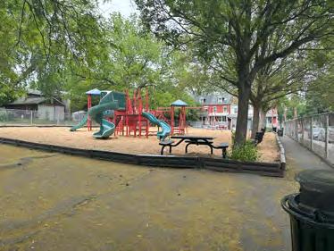


Located at the intersection of South Christian and North Streets, the Ewell Gantz Playground was named for two Southeast Lancaster residents: Olympian Barney Ewell (1918-1996), who grew up at the site of the playground, and Ida Mae Stewart Gantz, who lived across the street from Ewell and was instrumental in starting Head Start and other childcare initiatives in Lancaster. The Ewell Gantz Mural which overlooks the playground was dedicated in 2014 and the park was dedicated upon Ewell’s death in 1996.
TYPOLOGY: pocket park
SIZE: 0.05 acres
AMENITIES: playground, public art.
NEEDS: upgrade play equipment and benches, improve ADA accessibility
CREATED: 1996
Needs: According to a recent Facility Condition Assessment the playground’s play equipment has worn over time and the benches are at the end of their useful life. Accessibility issues were identified as in need of upgrades.


The approximately 10-acre Holly Pointe Park and Conservation Area was donated to the City by real estate developers John and Ben Groff in 1999. The Holly Pointe residential development, which was nearing completion in 1999, featured suburban-style houses within the city limits. In 2002 Lancaster Council approved a grant proposal to the Lancaster County Parks Initiative grant program for the development and installation of park facilities at Holly Pointe
TYPOLOGY: neighborhood park
SIZE: 10.79 acres
AMENITIES: playground, trail, garden
NEEDS: connectivity to Conestoga river
CREATED : 1999
LAST UPDATED: 2016
Park. The park features a nature trail that connects directly to the Conestoga River, play equipment and benches, natural areas and tree plantings, and an expansive lawn area along the edge of the residential neighborhood. Better connections to the Conestoga River should be a priority for enhanced river access.


TYPOLOGY: trail/greenway
SIZE: 11.99 acres
AMENITIES: trail, trailhead
NEEDS:
CREATED: 1968
LAST UPDATED: ?
This approximately 12-acre linear park and greenway was created after Lancaster received federal funding in 1968 to purchase several parcels in the Southeast to create a park along the Conestoga. The park is essentially a riparian buffer park along the Conestoga with a trail. A portion of this park is adjacent to the Franklin Terrace public housing complex, which is located at 630 Almanac Avenue. When it opened it was adjacent to the City’s Williamson Park, which
has now been subsumed into the larger Lancaster County Central Park. The park features the Conestoga Greenway Trail and parking at trailheads on S. Broad St. and S. Duke St. The existing park and trail’s proximity to the potential park on the Sunnyside Peninsula would provide great neighborhood connectivity to the Sunnyside Park and would greatly increase park land in an underserved area of Lancaster.
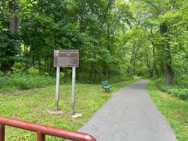

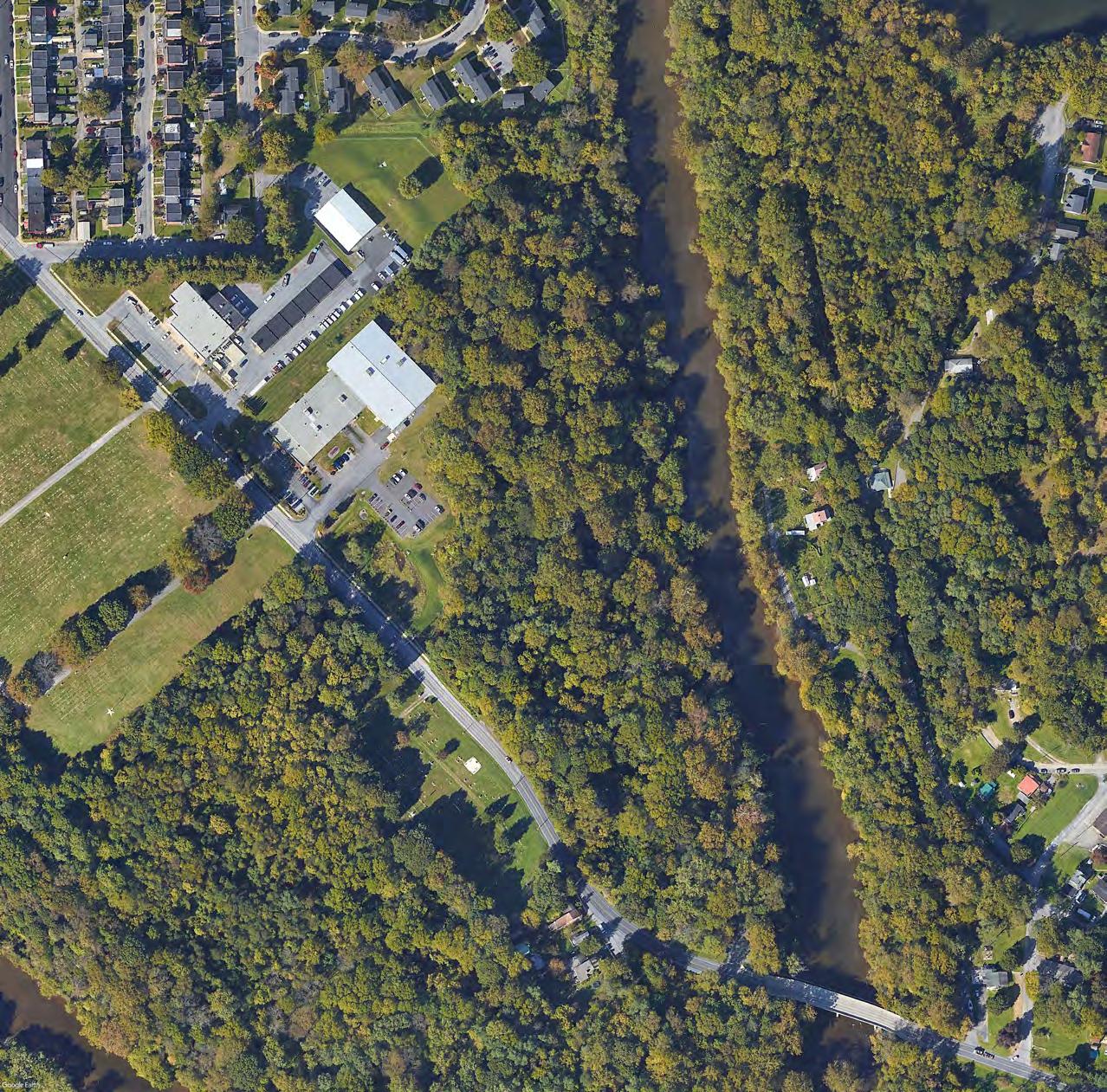
The downtown area features three plazas, including Penn Square, Lancaster’s first park. The public plazas provide opportunities for public events and are well-connected to the urban grid. The parks in the downtown do not provide many active recreation opportunities.
CITY PARKS
EWELL PLAZA
BINNS PARK
PENN PLAZA
CEMETERIES
SAINT JAMES
3 PARKS
2.17 TOTAL PARK ACRES
1.0% OF LANCASTER’S TOTAL PARK AREA (213 ac)

Originally part of the Lancaster Square urban renewal project on the 100 block of N. Queen St, Ewell Plaza opened in 2022 and features Adirondack chairs, benches, small lawn areas, plantings and a sculpture of its namesake, Olympian Barney Ewell, a Lancaster native. The relocation of Lancaster’s Public Library adjacent to the plaza The relocation of Lancaster’s Public Library adjacent to the plaza will increase the visibility of Ewell Plaza and likely increase the
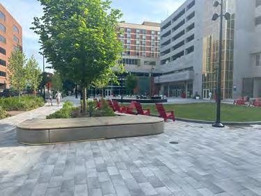
TYPOLOGY: plaza
SIZE: 0.69 acres
AMENITIES: swings, seating areas
NEEDS: none
CREATED: 2022
LAST UPDATED: 2022
use of the Ewell Plaza by the public. For decades after the urban renewal projects of the 1960s, the block suffered from a lack of attention as it was surrounded by Brutalist architecture with little usable public space. The dedication of Ewell Plaza, as a true public space, is at the heart of reclaiming this area for Lancaster’s residents and visitors in the heart of the downtown district.


Originally part of the Lancaster Square urban renewal project on the 100 block of N. Queen St, Binns Park was dedicated in 2005 and was renovated in 2023. Named for benefactors James Binns, President and Chairman of Armstrong World Industries, a major Lancaster company, and his wife Ruamie Binns, the small plaza features a fountain, tree plantings, seating areas, and portions of Corinthian columns, salvaged from demolished Lancaster County Farmers National Bank, placed in the planting areas. Renovations completed in 2023 included upgrades to the aging infrastructure, enhanced lighting, and tree plantings providing better visibility, shade and accessibility leading to greater public safety and an improved experience, allowing for greater usage of this important downtown Lancaster public space
TYPOLOGY: plaza
SIZE: 0.85 acres
AMENITIES: fountain, seating, planting areas
NEEDS: lighting study, new benches
CREATED: 2005
LAST UPDATED: 2023
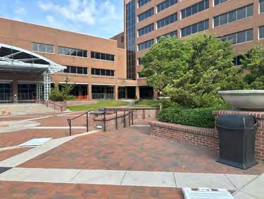
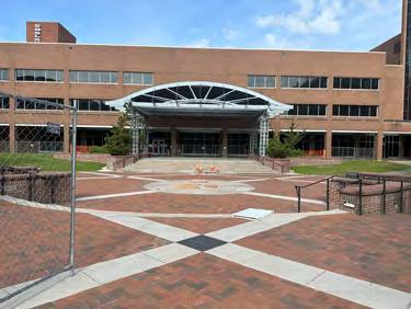
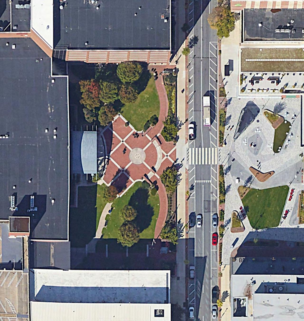
Lancaster was laid out in the 1730s by James Hamilton in a grid pattern, similar to Philadelphia with a central square in the town center. Originally named Centre Square (which is also the name William Penn gave to the central square in Philadelphia), Penn Square was the seat of the Pennsylvania State government from 1799 to 1812 when Lancaster was the capital of Pennsylvania before moving to Harrisburg in 1812. The state government was located at the Court House, which was demolished in 1852 and is now the site of the Soldiers and Sailors
TYPOLOGY: plaza
SIZE: 0.63 acres
AMENITIES: playground, trail, basketball court, garden, public art.
NEEDS: lighting study, new benches
CREATED: c. 1734
LAST UPDATED: 2013
Monument, erected in 1874. Penn Square is at the intersection of King and Queen Streets and has north and east-bound vehicular traffic on three sides of the square. A brick-paved plaza is located on the northeast side of the square with benches and tree plantings. An art piece, part of the Poetry Path Initiative, is a winding path which echoes the flow of the Conestoga River. The square is home to large public events, including the Christmas Tree lighting ceremony.

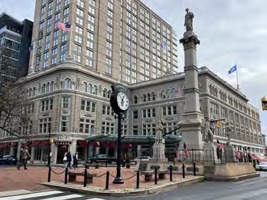

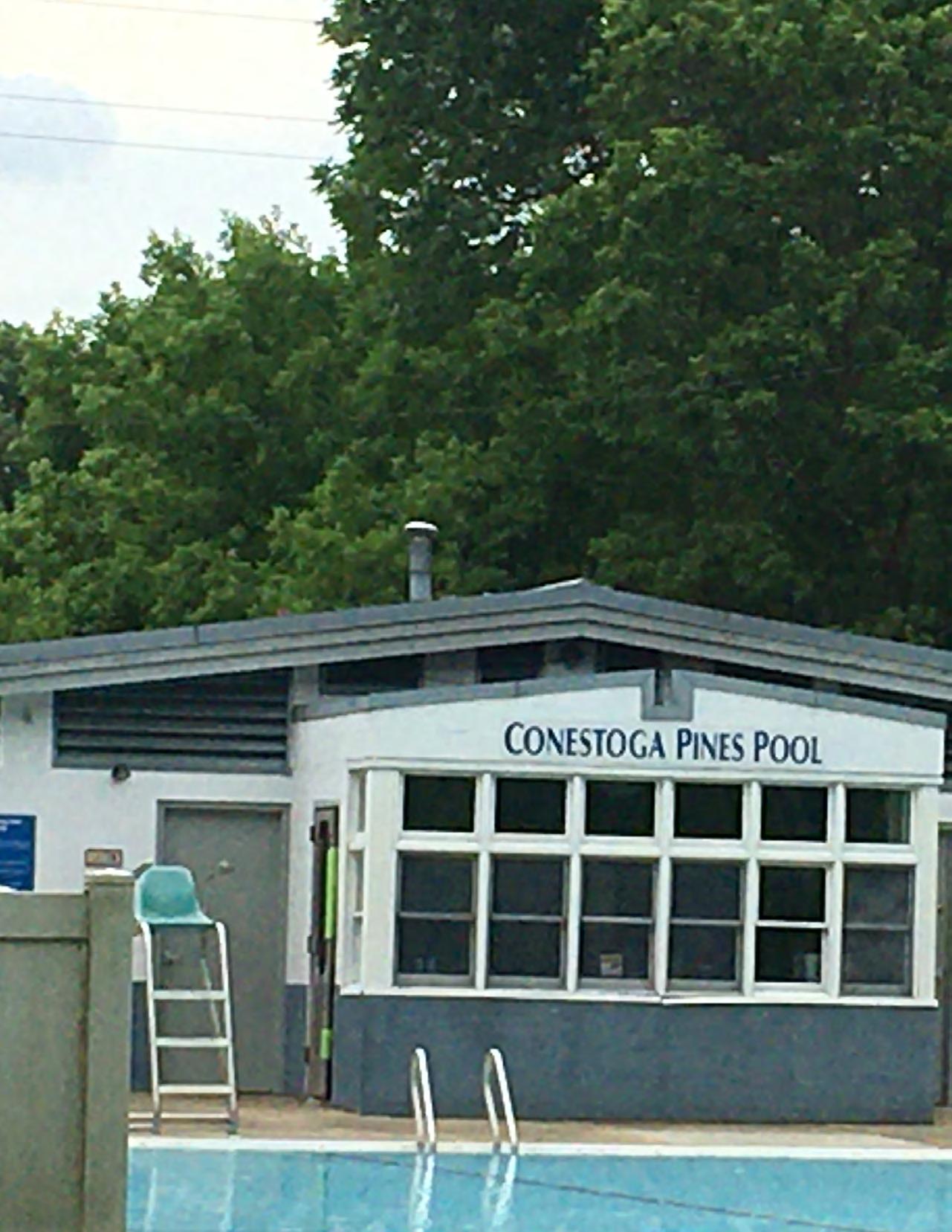

As discussed in the introduction, both the NRPA pillars and Lancaster’s goals and objectives as a city are important benchmarks for evaluating the park system. They are also critical in formulating the recommendations under this comprehensive parks, recreation, and open space plan. These recommendations will improve the Lancaster Parks, Recreation, and Open Space system for all citizens, regardless of immigration/refugee status, language barriers, age, ability, or living in underserved neighborhoods.
During the public engagement and stakeholder interviews, the consultant team found that citizens would use the Lancaster park system more if there were additional programming and events, cleaner and safer parks, more facilities and infrastructure as well as more shade trees and seating. Citizens want to experience nature in park spaces, walk or bike on trails, connect as a community, and have safe places for children to play.
The City of Lancaster sits within a larger county and has many neighboring municipalities. Implementing some of these recommendations will require intermunicipal and inter-agency cooperation. Many of Lancaster’s active recreation sites, for example, the Martin Luther King Jr. wading pool are owned by the School District of Lancaster. Duke Street between the Duke Street Mall and Lancaster County Central Park moves from the City of Lancaster to Lancaster Township and back again. Duke Street is also a state road managed by PennDOT. Lancaster County owns the (closed) prison site adjacent to Reservoir Park. The Board of the Lancaster Recreation Commission includes representatives of the City of Lancaster, Lancaster Township, and the School District of Lancaster. Inter-municipal cooperation will better serve the needs of all of the residents of the City and County of Lancaster.
The recommendations are prioritized to enable equitable opportunities for all citizens in Lancaster’s dense, urban environment to enjoy their city’s parks, open spaces, and recreation opportunities. The four priority recommendations are discussed in more detail in the following sections. In addition to these
priority recommendations, this chapter addresses additional recommendations, such as new amenities, system-wide improvements, and supporting policies.
ADDRESS THE ONCE-IN-AGENERATION OPPORTUNITY PRESENTED BY THE REDEVELOPMENT OF THE PRISON SITE.
Given the proximity of the prison site to Reservoir Park, master planning of Reservoir Park should be coordinated with the East End Small Area Plan addressing the redevelopment of the prison site. The RACL/Land Bank could be useful tools for the redevelopment of the prison site. Lancaster lacks large redevelopment sites. The prison and Reservoir Park, while technically in the northeast quadrant, are adjacent to the southeast quadrant, which is underserved in terms of parks and recreation. The large size and central location of these two sites creates a tremendous opportunity to address some of the inequities in the park and recreation system. Interventions that should be considered for this combined master planning effort could include a full-size or Olympic-size swimming pool, recreation center, and possible pump track or skate park location. In addition, the feasibility of an indoor pool should also be evaluated as part of the master planning process, to provide year-round recreational opportunities to citizens.
ADDRESS INEQUITY IN THE PARK SYSTEM, IN THE SOUTH OF THE CITY, PARTICULARLY THE SOUTHEAST QUADRANT.
The south of the city and the southeast quadrant in particular are under-served and disconnected. Investment in the south and southeast should address Joe Jackson Tot Lot, Ewell Gantz Playground, South End Park, and South Duke Street Mall by adding amenities and landscaping. The creation of a new natural area and recreation park on Sunnyside Peninsula as proposed in the comprehensive plan should be advanced. Crucially, these investments should be accompanied by connectors and gateways from the city grid to the Conestoga Greenway Trail and Lancaster County Central Park. The strategy should include connecting Culliton, Brandon, and South End Parks in the Southwest, the core of the southeast neighborhood to these larger natural and passive recreation assets. Better
connecting these experiences to the southern grid will by extension connect the entire city to these larger regional parks. By improving existing parks and public spaces and investing in well-planned, strategic acquisitions that target citizens in underserved neighborhoods, Lancaster will provide its citizens with park spaces that bring its richly diverse communities together.
As discussed in the systems analysis section, Lancaster is understaffed in terms of park maintenance, and park maintenance staff are often pulled into non-park-related tasks. Investing in workforce development through the creation of a ranger program would help to facilitate and manage events, freeing maintenance staff to do maintenance work. A range program would also facilitate park use by allowing restrooms to be open for more hours, as well as by increasing human presence in the parks, improving visitors’ sense of security.
Lancaster’s parks and recreation system is highly decentralized. One of Lancaster’s strengths is a robust non-profit and faith-based agency ecosystem which is a major asset to the city’s residents but which could thrive even more with some investment by the city. The city has relied for over a century on either non-profit agencies or commissions to perform virtually all programming on public land. Though decentralized parks programming and stewardship efforts provided by the Lancaster Recreation Commission (LRC) have served Lancaster well for many years, providing services through this current arrangement may inhibit the City’s ability to advance implementation strategies for a more inclusive and equitable parks system.
By investing in a stewardship coordinator and recreation coordinator, Lancaster will build the capacity of its non-profit community organizations, and individual citizens to play a leadership role in the parks.
These priority recommendations will implement the guiding principles. By implementing the priority recommendations, Lancaster is poised to have a great park system that can bring both physical and mental health improvement opportunities on an equitable basis for ALL of its citizens while also protecting and enhancing the natural environment of the city.
Equitable concepts are woven into the individual park and overall recommendations. Workforce development programs support equity goals by creating jobs, and bringing people from the neighborhood into neighborhood parks. These jobs then contribute to economic stability and opportunities for skill training for younger citizens, providing them a path to meaningful employment, thus aligning with a stated goal of the City of Lancaster: “to build a city workforce that reflects our city and prioritizes hiring city residents.”1 A Ranger program will be a visible park presence and create safe parks. Specific improvements using Crime Prevention through Environmental Design principals also creates safe spaces. Access to a safe environment improves equity in the community. Applying principals of universal design to accommodate persons with disabilities goes beyond meeting ADA requirements to create equitable access. Prioritizing future park locations and amenities to serve all residents equitably city wide is a primary goal of the plan.
Improving access to parks and the quality of parks increases health and wellness as more residents will use them. Improving connectivity to county parks, trails and opportunities to connect to nature promotes both physical and mental health. Creating pathways for people to volunteer in the parks also provides mental health benefits by reducing stress and combating social isolation.2 If more citizens could access park and recreation opportunities, the health of the city’s residents would be positively impacted. Increased
1 https://www.cityoflancasterpa.gov/blog/creating-aninclusive-culture-the-city-of-lancasters-diversity-equityinclusion-efforts/
2 See National Alliance on Mental Illness: “How Volunteering Improves Mental Health” https://www. nami.org/Blogs/NAMI-Blog/February-2022/ How-Volunteering-Improves-Mental-Health
recreation opportunities directly target physical health and issues, such as obesity, and mental health issues, such as depression and social isolation, which the pandemic has exacerbated.
Workforce development, stewardship, and volunteer opportunities can enhance conservation efforts in the parks. A large natural, passive park at Sunnyside Peninsula would provide Lancaster residents more opportunities to access nature and the Conestoga River, a desire of residents expressed during the community engagement process. Greater stewardship of the natural environment will also provide for better care in tree canopy and wildlife habitat, which is necessary in a dense, urban environment.
The greater emphasis on conservation, sustainability, and stewardship will also enhance the City’s resilience to climate change. Improving the health of the City’s natural spaces will increase these areas’ capacity to function as green storm-water infrastructure and absorb rain and flood waters. Additionally, if residents plant new trees or other plantings during conservation programs, the new trees will help the City to adapt to climate change by reducing the urban heat index.
Increasing workforce development and investing in staff to prepare them to work across all City of Lancaster parks will increase opportunities for programming, volunteering, and stewardship. Workforce training and ranger programs will increase capacity for maintenance by freeing up existing maintenance staff to perform their daily duties and proactively manage the parks. By creating greater coordination of stewardship and connections to the parks, the City of Lancaster will empower communities, individuals, and organizations to become greater stewards of the park system. Having a stewardship coordinator who facilitates and directs volunteer opportunities in the park will complement the maintenance work of BPPP and provide residents with more opportunities to engage with public spaces. The ranger program will give the parks much-needed ambassadors, leading to better coordination of services for the large homeless population who use Lancaster’s parks. Rangers can also assist with maintenance challenges by communicating with operations
RESERVOIR PARK & PRISON SITE SOUTH & SOUTHEAST
WORKFORCE & MAINTENANCE CAPACITY BUILDING
EQUITY HEALTH & WELLNESS
CONSERVATION & SUSTAINABILITY
STEWARDSHIP& MAINTENANCE
ENGAGEMENT & PARTICIPATION
LEADERSHIP
and maintenance staff, providing greater presence and surveillance in parks to reduce vandalism, and providing an on-the-ground resource for citizens who use the park system.
ENGAGEMENT AND PARTICIPATION
Most of Lancaster’s population are disengaged from the city’s park system and the engaged residents are either connected through the LRC’s programming or non-profit programs. A small number of citizens are engaged in a small number of parks (Musser, Long’s, South End) but the majority of citizens are not as the City does not have staff dedicated solely to citizen engagement. By investing in a recreation coordinator and stewardship coordinator, the city will improve the engagement of its citizens with the parks and provide greater recreation opportunities. By acting as community ambassadors, park rangers will enable more
citizens to engage in the parks by making them safe and welcoming.
LEADERSHIP
By investing in stewardship, a ranger program, and workforce development, the City of Lancaster will position itself to engage its citizens directly with its park system and will also assist in creating a pipeline of knowledgeable staff and from which will come the future leadership for the Lancaster City government, and its support networks of volunteers and non-profit organizations.
Although Reservoir Park and the prison site are in the northeast, they are adjacent to the southeast, which is underserved by parks and amenities. The city is embarking on a planning process for the redevelopment of the prison site. Consideration of Reservoir Park and some of the park and recreation needs should be incorporated into that planning process. The prison site is owned by the County and the process and timeline for property disposition is not yet known. There are many competing concepts for the redevelopment of the prison site, including increasing housing. Given Lancaster’s existing density and the likely increase in density that will come with additional housing on the prison site, ensuring access to quality park and recreation space is critical. This can be accommodated through master planning for Reservoir Park as well as considering the incorporation of recreational facilities into some of the prison site redevelopment.
Due to its location, Reservoir Park could become one of Lancaster’s signature park spaces, however, it is an underutilized resource that lacks cohesion and requires investment and planning. The master plan process should include as many citizens as possible on a city-wide basis and should also be part of the larger plan for redeveloping the adjacent Lancaster County Prison site, across Franklin Street. Reservoir Park is large enough that it could function for a variety of users and could draw from all areas of the city, providing opportunities for active sports and programming and passive uses.
Improving Reservoir Park was identified as a priority by the community. Amenities prioritized by the community include skate obstacles, updated play equipment, updated plantings, and overall beautification. Given its size, Reservoir Park is a potential location for additional amenities, such as a skate park, pickleball, natural play area, and programmable spaces. The possibility of using either Reservoir Park or the prison site for a teen center should be considered given the proximity to McCaskey High School. The park is also used for an African American Cultural Festival. A robust master planning process can balance and accommodate these different interests.
The redevelopment of the prison site could include space for a large, municipal pool which would serve many more Lancaster citizens than
the present-day municipal pool site located on the edge of the city at Conestoga Pines which is inaccessible to the majority of Lancaster citizens. The NRPA does not have a metric for the size of pools, instead, the metric is on how many pools are needed per number of residents. The NRPA benchmark for cities with populations between 50,000 and 99,999 is one outdoor pool per 43,100. Lancaster, with a population of nearly 60,000, should have a pool on the larger side, more centrally located, and connected to the city street grid to ensure that it can equitably serve all residents.
Municipal pool1 sizes vary greatly, the pool should accommodate the following programs:
• Children’s swim lessons
• Aqua aerobics
• Lifeguard training
• Public swim time
• ADA Access2
The majority of public pools are rectangular and are up to 50 meters (approximately 164’ long). The deepest end of an is 2 meters or 6.6’ deep. The dimensions of the concrete deck structure that surrounds the perimeter would also need to be taken into account.
Taking into account the approximate size of the pool area, support facilities and landscaping, the approximate area needed would be 1-1.5 acres minimum. Consideration should be given to the creation of an indoor pool as part of a recreation center so that it can be used year-round. An indoor pool would have additional maintenance costs over an outdoor facility. All the same program accommodations would be required.
1 Municipal Pools (Public Swimming and Bathing Places) are covered in the Pennsylvania Code (https://www. pacodeandbulletin.gov/Display/pacode?file=/secure/ pacode/data/028/chapter18/chap18toc.html&d=).
2 For large pools (over 300 linear feet of pool wall) there must be two accessible means of entry—either a pool lift or a sloped entry. (https://www.ada.gov/resources/ accessible-pools-requirements/).
As documented in the system analysis section, the south and particularly southeast of the city is under-invested in parks. Because of its dense population and low levels of vacant land, there are limited opportunities to create large parks within the urban core. Improving the access to parks for residents will involve a combination of investing in renovating existing parks, providing greater connectivity to larger parks, and strategic acquisition of new parks in connection with the connectivity strategy.
In addition to their being few parks, many of the existing parks are in poor condition. Improving these existing parks should be a priority. In particular, Joe Jackson Tot Lot in the Southeast and South End Park in the Southwest are in need of major renovations, over and above replacing equipment.

City parks
Other parks
School District properties open to the public
Cemeteries (private)
Other open spaces (private)
Publicly owned opportunity sites
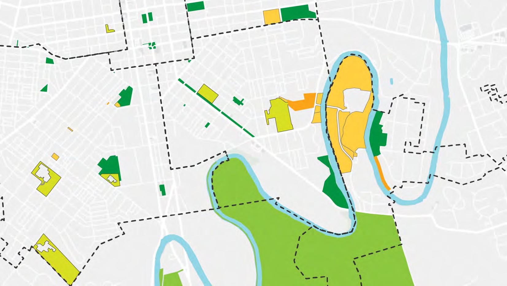
The Joe Jackson Tot Lot needs an overhaul. A recently completed facility condition assessment (FCA) rates Joe Jackson Tot Lot in overall poor condition, noting that the play equipment, site furnishings and paving are all in poor condition and require replacement. Given the extent of the needed replacements and the need for park space in the neighborhood, a larger refresh of the park is needed, not just replacement of equipment in kind. Investment in this park space is critical from an equity lens as the area is underserved by park amenities. While this is primarily a playground area, the site is large enough for additional tree and woody plant plantings that would attract a more passive park user from the neighborhood. Joe Jackson is large enough to incorporate other uses in addition to the play ground. Areas outside of the playground should offer space for adults to use the public space as well.
Even if the space allows for a small area to gather, it can still be transformational to the neighborhood and become an amenity that brings the community together and promotes physical and mental health. Joe Jackson could also be a location to pilot the first splash pad/sprayground in Lancaster. During community workshops, community members identified that this park needed considerable improvement. The most popular recommendation, based on the recommendations provided by the project team, from the community workshops was planting shade trees to complement existing trees, highlighting the community need for increased shade and passive use of this space. Community members explicitly stated in community workshops that the park needed “many changes” and “more fixes.”


RECOMMENDATIONS
• Fence the playground with access gates and remove perimeter chain link fence
• Re-grade the edges of the site for accessibility
• Create a perennial planting buffer
• Plant shade trees to complement existing trees
• Remove existing asphalt
• Playground surface: mulch or rubber surfacing
• Walkway surface: concrete
• Gathering areas surface: concrete with a different finish, or specialty paving (pavers or crushed stone)
• Add seating, including a variety of benches, seat walls, and tables with chairs
• Option 1 - large playground, equal in size to the existing play area
• Option 2 - combined playground and water play. Water play should use material and features that allow for seating, gathering and other uses in the off-season.
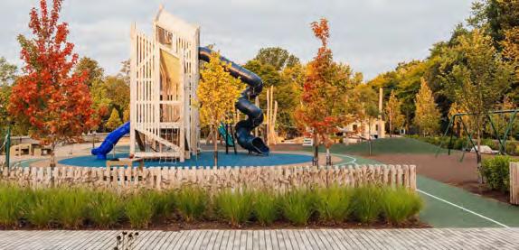


South End Park is one of the oldest parks in Lancaster’s system, dating from the 1920s during the early decades of the city’s recreation movement. A recently completed FCA identifies the play structures, safety surfaces, and paving as all being in poor condition and in need of replacement. Areas of the park are underutilized and investment should be made to encourage both passive and active use. Key stakeholders can be identified such as neighborhood park advocates to receive feedback on amenities that could be included in the update to the park. While this area of the city is close to larger parks such as Brandon Park and Lancaster County Central Park and large cemeteries such as Woodward Hill, Cedar Lawn, and Greenwood, it is separated from the larger open spaces by heavily used highways, with large volumes of truck traffic, along US 222 northbound (Highland Ave) and southbound (S. Prince St).
Some renovations have recently been made to South End Park, including tree plantings, benches, and a mural, as a result of community engagement with the park. A reworking of the park could build on this, adding plantings and seating, and replacing and upgrading equipment. The existing baseball diamond and cage could be removed and the area converted to a multipurpose field. The park is large enough to accommodate a new playground and a water play area. The existing basketball court should be resurfaced and painted asphalt considered as a surface treatment in the court area. The court area should be lighted to allow for evening use. Lights could be on a timer. Currently, Lancaster’s Parks Ordinance states that parks close at Sunset, so modification to the ordinance would be required.
Adding elements such as bench seating and lighting will increase comfort and safety. Perimeter grading is inaccessible along Furnace Street and play equipment is in need of replacement.
During community workshops, the most popular recommendations for the site, based on the recommendations provided by the project team, were to add elements to increase comfort and safety such as bench seating and lighting and create a water play area with materials and features that allow for seating, gathering, and other uses in the off-season.
• Replace perimeter fence along the field with plant buffers and entries
• Replace chain link fence around playground with smaller scale fencing set in planting
• Remove asphalt along southern sloped edge, replacing it with planting and stairs to navigate slope
• Replace perimeter fence along the field with plant buffers and entries
• Remove baseball diamond and cage and create multipurpose field
• Replace materials and equipment in fair to poor condition.
• Explore painted asphalt as a treatment for the court area.
• Provide lighting at basketball court
• Add elements to increase comfort and safety such as bench seating and lighting
• Create a water play area with materials and features that allow for seating, gathering, and other uses in the offseason
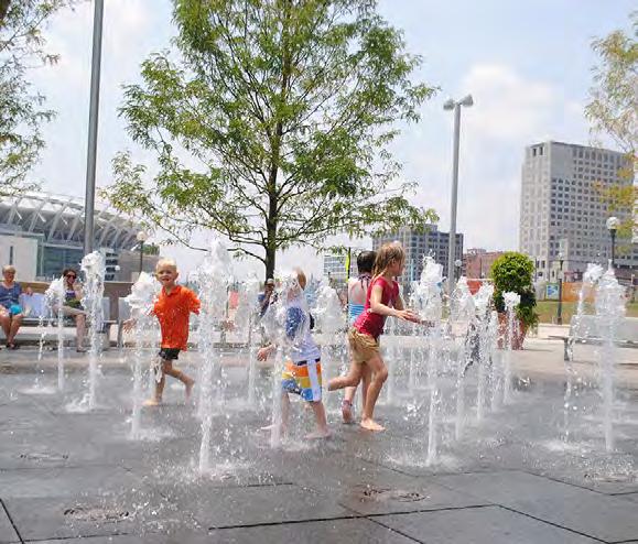


Seating area under shade
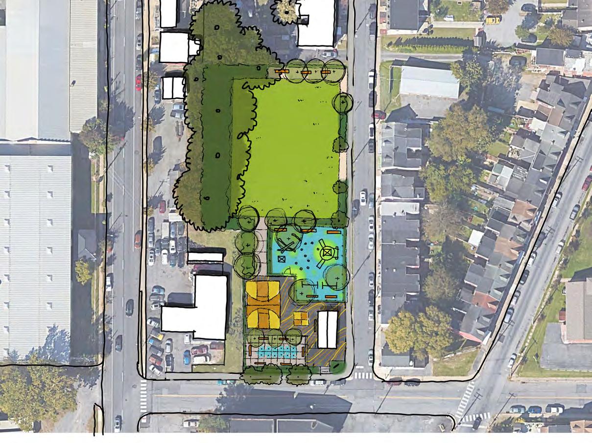
Plant buffer to define edge
Replace perimeter fence with plant buffers
Accessible entry
Replace chain link fence with smaller scale fencing set in planting
Replace playground equipment
Paint asphalt as a surface treatment
Opportunity for seasonal water play
Accessible entry
The Duke Street Mall extends from Church Street to Chesapeake Street in Southeast Lancaster. Originally planned in the late 1950s and constructed in the 1960s as a “recreation” space for Lancaster’s massive Southeast urban renewal project. It was intended to address the absence of recreation space in Southeast Lancaster, which has been largely unsuccessful. This site should be addressed as an early action item, especially as it continues to represent some of the failures of the urban renewal period and is in one of the city’s most underserved areas. Although the Duke Street Mall is large at 3.82 acres, it is long, narrow, sloped, and crossed by four streets and two driveways, presenting challenges to having a large recreation site. Duke Street Mall should be planned as a true, linear park space with passive spaces, tree plantings, and improved landscaping. A bike facility is planned along Duke Street as part of Lancaster Vision Zero work. Areas for nearby neighbors to sit and gather were mentioned during the stakeholder interview process as a need. Creative placemaking, with input from local residents, could transform this into a healthy space for the community, allowing Lancaster to invest in the Southeast equitably and to provide safe spaces for bicycle riding in the city.
The Spanish American Civic Association has developed several plans for new public spaces along the Duke Street Mall. These plans include a cafe and terrace space between Church Streets and Howard Avenue and an amphitheater at the corner of North Street and Duke Street in front of King elementary. These ideas, or similar ones, could be expanded into a series of thoughtful pocket parks along Duke Street that relate to adjacent uses is possible.
Playground and wading pool at King Elementary. Provide seating areas with picnic tables and shade for families to picnic in conjunction with visiting those amenities.
Roberto Clemente Field. Provide pedestrian areas offset from the new multi-use path- arrival points for people using the field, with seating and bike parking
Boys and Girls Club. Provide seating and public art that could be interactive.
Duke Manor Apartments Replace existing concrete patios and walls with new neighborhood outdoor spaces that provide differing seating and table options clustered and arranged in close proximity for residents to sit and socialize. Explore opportunities to provide ADA access from apartments to the planned Duke Street shared use path.
Susquehanna Court. Replace existing concrete patios and walls with new neighborhood living room spaces that provide outdoor living rooms for residents to sit and visit. These could incorporate the natural rock outcroppings and possible a small nature play area could be incorporated. Explore opportunities to provide ADA access from apartments to the planned Duke Street shared use path.

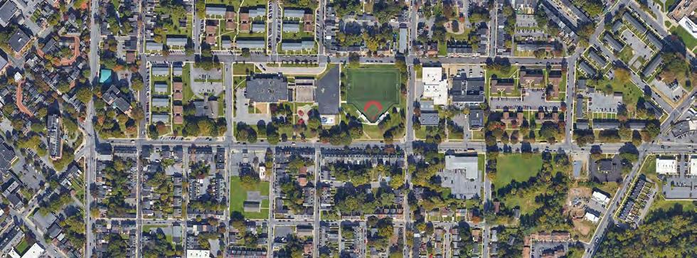
High visibility; could be a gateway
High point offers views
Proximity of side street could provide space for food trucks to park
Existing seating area


IDEAS POTENTIAL CONCEPTS
Planting buffer from traffic
Gathering area on high point; potential site for art installation
Terraced seating built into existing slope
Plaza at-grade with sidewalk to promote foot traffic into the pocket park
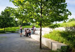


Scale and comfort of seat walls
Condition of existing pocket park materials
Create connectivity between blocks
High visibility; parking could provide space for food trucks or other programming
Existing seating area
Mature tree with shade canopy
Community garden beds


Planting buffer from traffic and parking lot
Enhance seating area and update connection to sidewalk
Update community garden beds
Potential food truck location to tie into “food” context of the community garden
Keep and enhance existing historic markers and signage
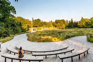


Lack of hierarchy with paths and spaces
Underutilized open space
Create connectivity between blocks
bumpout and crosswalk promote connections

POTENTIAL CONCEPTS

Planting buffer from traffic
Expand play area with play “rooms”
Right-size paths and provide spatial hierarchy
Green infrastructure could be installed with stormwater gardens
Keep and enhance existing historic markers and signage about historic neighborhood
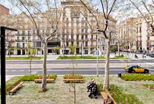
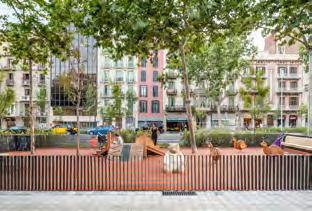
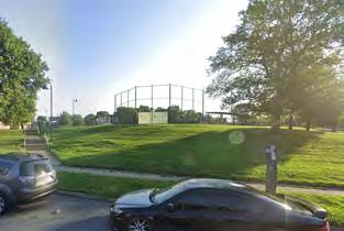
Underutilized space
Less tree cover and shade
Steepness of sloped terrain
Views from sloped terrain and range of experiences moving across it
Proximity to baseball field could inform a recreational or fitness use
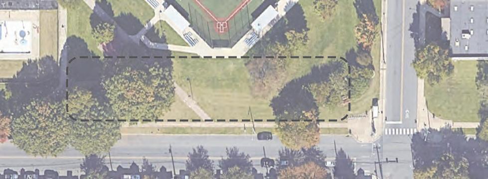

Sloped walkway or switchback trail for workout stations or adventure play
Seating along path looking out
Additional trees for shade
Skateable elements, where pedestrian safety would not be impacted.
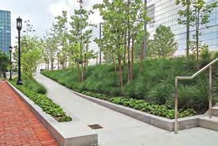


Underutilized, “back of house” environment
Highly visible location with proximity to bike rideshare station
Sloped terrain
Residential context across the street lends itself to more of a daily use park for passive enjoyment

POTENTIAL CONCEPTS

Garden planting
Small scale plaza at the interior
Seat walls
Green infrastructure could be installed with stormwater gardens


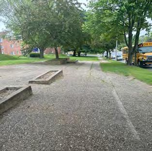
POTENTIAL CONCEPTS
Underutilized space
Homogeneous ground plane; monoculture lawn lacks biodiversity and visual interest
Empty concrete planters
Health, condition, and aesthetics of trees in concrete planters

Adjacent residential context lends itself to more of a daily use park for passive enjoyment
Existing seating areas under mature tree canopy with shade Rock outcrops

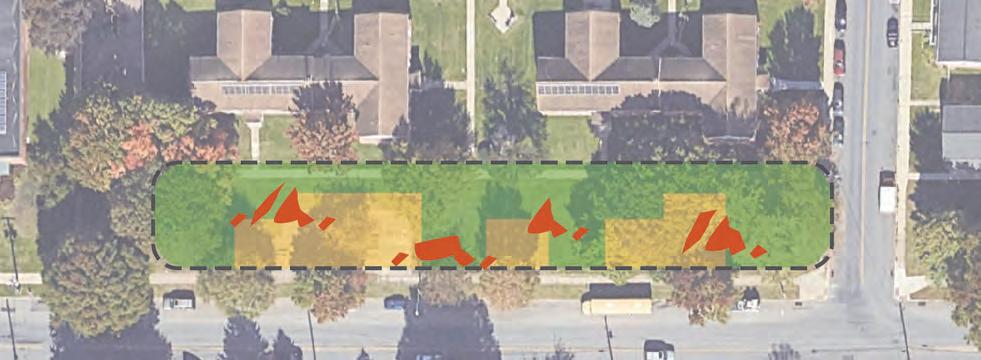
Series of small plazas with either hardscape or gravel to break up the ground plane
Introduce more ecological planting and seasonal interest with native perennials
Supplement existing rock outcrops with boulders to highlight local geology character and provide opportunities for seating or play

Pedestrian “rooms” with site furnishings that draw on local geology (Source: Bloor-Annex BIA Parkettes by DTAH)

Perennial plantings along a walkway (Source: Buffalo Niagara Medical Campus Streetscape by SCAPE Landscape Architecture)
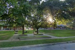

POTENTIAL CONCEPTS
Underutilized space
Homogeneous ground plane; monoculture lawn lacks biodiversity and visual interest
Steep terrain
Health, condition, and aesthetics of trees in concrete planters

Context of commercial transitioning to residential could make this site a gateway
Existing seating areas under mature tree canopy with shade
Rock outcrops

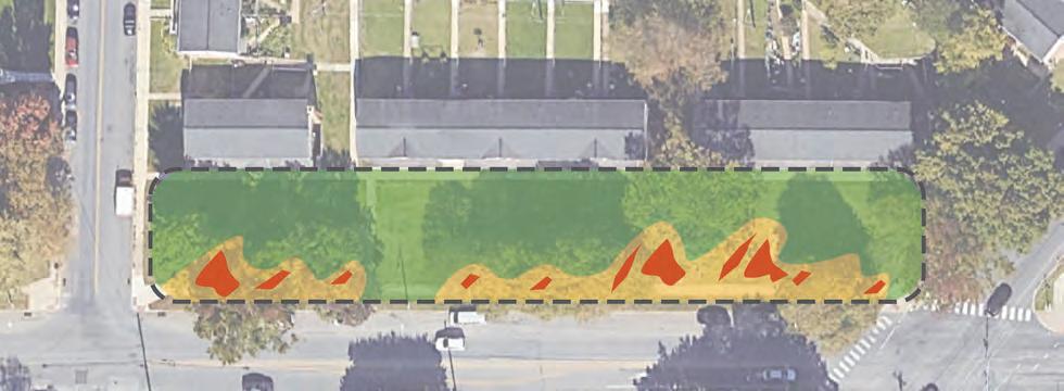
Series of small plazas with either hardscape or gravel to break up the ground plane
Introduce more ecological planting and seasonal interest with native perennials
Supplement existing rock outcrops with boulders to highlight local geology character and provide opportunities for seating or play

Site furnishings along sidewalk with planting (Source: Bloor-Annex BIA Parkettes by DTAH)
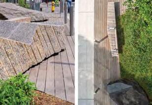
Geologic site furnishings (Source: Bloor-Annex BIA Parkettes by DTAH)
In Our Future Lancaster, the City of Lancaster’s Comprehensive Plan, the Sunnyside Peninsula is identified as a potential “nature and recreation preserve on the north and an ecologically sensitive residential area on the south.”1 The Sunnyside Peninsula has an access point to the Conestoga River and could provide non-motorized access to the river. Much of the peninsula is in the floodplain. Passive uses like trails are an ideal use of the floodplain. If the publicly owned northern portion of Sunnyside peninsula were to become a park, an extension of the Conestoga River Greenway through Sunnyside would provide an alternative connection between the Conestoga Greenway Trail and Lancaster County Central Park.
Our Future Lancaster proposed an environmental education center on the Sunnyside Peninsula. The city has already begun planning for the park and nature center, Sunnyside SAP. The environmental education center could be an ideal location for a natural play area with an education component (see discussion of nature play areas). National Guidelines for Nature Play and Learning Places have been established and could be incorporated into this space, allowing urban children to engage with nature.2
Publicly-owned parcels between Broad Street and the river could be included in the park design concept and could be a location for more active recreation elements, such as a play area. A connection through Hazel Jackson Woods would provide additional connectivity. If the Sunnyside area could be added to a conservation overlay district, as proposed in the plan, this would meet NRPA pillar goals of both equity and conservation. This new zoning protection would promote equity by increasing access to parks and open space in an underserved area of the city. Preservation of this area as a nature preserve would protect wildlife, preserve and enhance the existing forest, enhance air quality, and protect the riparian buffer through tree plantings.
Community members taking the community survey repeatedly emphasized that a “good park” allowed community members to be close with nature. Utilizing Sunnyside Peninsula in this way will meet this community need.
1 https://compplan.cityoflancasterpa.gov/
2 https://outdoorplaybook.ca/wp-content/ uploads/2015/09/Nature-Play-LearningPlaces_v1.5_Jan16.pdf

OWNED
PUBLICLY OWNED LOTS
• Create a riverfront trail around Sunnyside.
• Connect the Sunnyside trail to Lancaster County Central Park.
• Work with the boating community, conduct a survey, identify the best access for non motorized craft to the Conestoga River.
• Create a nature play area in conjunction with a future environmental education center.
• Connect Sunnyside trail to the Conestoga Greenway Trail via the Center Street Bridge improve pedestrian /cyclist infrastructure.
• Connect Sunnyside and the Conestoga Greenway Trail to the Southeast via a pedestrian connection through Hazel Jackson Woods.


City parks
Other parks
School District properties
Other open spaces (private)
Publicly owned opportunity sites
Approximate area not in the floodplain
City parcels could be used for more active recreation uses like a playground
Future trail connection through Hazel Jackson Woods

Existing Conestoga Greenway Trail Trailhead
Connect through the neighborhood, using existing public rights of way
Existing Conestoga Greenway Trail Trailhead
Existing Conestoga Greenway Trail
Existing Youth Intervention Center
Lancaster County Central Park and Sunnyside Peninsula are major natural park assets for both active and passive recreation. Creating safe connections to these parks for pedestrians and cyclists will provide Lancaster residents with access to nature and recreational opportunities. Connecting these parks into the grid will benefit all of Lancaster’s residents. Critical to creating this connectivity is the creation of gateways into these parks and improved connections from the city grid to those gateways.
There are only three points where the Conestoga River can be crossed from Lancaster into County Park and Sunnyside Peninsula: Circle Avenue, South Duke Street, and Strawberry Street. Each of these should be celebrated as a gateway and should include improved cycling and pedestrian infrastructure and traffic calming to ensure safe access to these natural assets for all Lancaster residents.
CIRCLE AVENUE GATEWAY
Circle Avenue Bridge provides a point of connection to Sunnyside Peninsula, the existing Conestoga Greenway Trail trailhead, the planned Broad Street bike improvements, and a future riverfront trail on Sunnyside Peninsula.
SOUTH DUKE STREET GATEWAY
South Duke Street is a critical connection point on the Conestoga Greenway Trail, which connects over the South Duke Street Bridge from Conestoga Creek Park to County Park. The entrance to County Park from South Duke Street is via Rockford Road. Although the bridge has sidewalks, the street on either side of the bridge has no sidewalks or bike lanes. The Streets ‒Reedy Lane, Rockford Road, and the Parkway ‒ all intersect with South Duke Street within less than 250 feet. Visibility is poor for anyone entering or attempting to cross South Duke Street at these locations.
Creating a better gateway experience and calming traffic in this location is critical to creating a safe connection for the Conestoga Greenway Trail and a future riverfront trail on Sunnyside Peninsula. Access from and across Duke Street is not safe. Lancaster should explore with PennDOT options for traffic calming at this important trail connection gateway, including at a minimum a traffic study and warrant analysis for a rapid flashing beacon, up to possible modifications/widening of the bridge to provide safe pedestrian and cyclist access along this trail. Duke Street is an example of the need for
interagency cooperation, with PennDOT, City of Lancaster, and Lancaster Township all needing to be involved in the process.
The Strawberry Street Bridge provides a connection point from Lancaster to County Park and the planned Chesapeake Street bike and pedestrian improvements. It provides a connection to Rockford Road, which connects to the Conestoga Greenway Trail to the east.
The existing vision zero work includes planned bike facilities on Broad Street, Chesapeake Street, Strawberry Street and Ann Street, as well as along the Duke Street Mall Portion of South Duke Street (from Chesapeake to Church Streets). In addition to those improvements, improving South Duke Street below the mall (from Chesapeake Street to Lancaster County Central Park) is critical to improving connectivity.
Duke Street is one of the main connection points from the city to Lancaster County Central Park. It is a state route, meaning it is controlled by PennDOT. Duke Street lacks a continuous sidewalk from the end of the Duke Street Mall to Lancaster County Central Park or to the Conestoga Greenway trailhead just off Duke Street at Conestoga Creek Park. Park of Duke Street in this area is outside the city and thus not directly in Lancaster’s control, but the City should explore working with Lancaster Township and PennDot to complete the sidewalk network along Duke Street at least as far as Lancaster County Central Park, and possibly extending the planned shared use path along Duke Street Mall for this entire length.
Community members who took the community survey identified park accessibility as an element that would make them use parks more. Connectivity helps improve the accessibility of parks, encouraging park use.
Greenway and Connectivity Plan: The CPROSP provides a high-level overview of connectivity and greenways throughout the City. It is recommended that the City develop a Greenway and Connectivity Plan to better assess the health and functionality of the City’s greenways and riparian buffers. This project would also provide the City with the opportunity to develop more detailed recommendations for how to enhance connectivity for pedestrians and bicyclists in every neighborhood.

City parks
Other parks
School District properties open to the public
Cemeteries (private)
Other open spaces (private)
Publicly owned opportunity sites
Existing trails
Existing bike facilities
Proposed trails
Proposed bike facilities
Proposed Riverfront trail

As identified in the system analysis section, Lancaster needs additional maintenance staff. Additional staff will also improve the perception of safety at the parks by increasing human presence on-site. Providing for these staffing and operational needs could be addressed through a workforce training program. Workforce training programs provide multiple benefits, including improving the parks and users’ experience, improving safety and equity, and providing young people with paths to employment. In evaluating the needs for Lancaster’s park system, two immediate needs could be fulfilled by a workforce development program: establishing a ranger program and developing landscaping staff.
It is important to note that recommendations and projects related to maintenance are incorporated throughout the Recommendations chapter. For instance, the City maintenance needs are addressed by recommendations related to staffing, infrastructure, and climate adaptation
Landscape management is an opportunity for skill training and workforce development if the city invests in a greenhouse as a capital investment and propagates plant material for park spaces. The city could construct a greenhouse on city-owned land at the Riverside Avenue Public Works/Parks Maintenance facility. The city could save money by propagating plant material at this facility. A greenhouse facility would also create the opportunity for workforce development by hiring young adults and aging populations to create cross generational engagement and gaining marketable skills at the greenhouse and landscaping and greening the parks and public areas of the city. This could be funded as a workforce development position and local philanthropic and faith-based organizations could assist with salary. Hiring should be done in the city and especially targeted to underserved neighborhoods. Plant material grown on-site could then be planted throughout the park system by individuals in the workforce development program who would also be responsible for caring for the plants during the appropriate seasons. This would greatly enhance the parks’ beauty, attracting additional usage, while allowing citizens to be directly engaged with skill-building, citizen engagement, and stewardship.
By investing in a ranger program, Lancaster will also promote its park system as safe and welcoming to all citizens and improve management and accessibility. The ranger program should hire local young adults from the City of Lancaster, who may be at-risk, from an underserved community, and/or a person of color. Hiring rangers from Lancaster neighborhoods will meet both workforce development goals; provide local knowledge and resident engagement to the program. According to the NRPA’s Workforce Development: A Resource Guide for Parks & Recreation: “more and more, innovative workforce development programs in parks and recreation successfully pair both essential and hard skills to prepare participants for a successful career, while also helping address systemic issues of economic inequities, racial discrimination and other barriers to community health and well-being.” Lancaster could become a model for workforce development within its park system by using this program to uplift young adults while creating an improved park system to reach more citizens.
The greatest role of the park ranger would be as an on-the-ground ambassador to the neighborhoods of the city and the park system. The rangers could develop relationships and observe usage patterns which would enable park staff to understand needs within the system. The ranger program would greatly enhance the safety of certain park areas by providing accountable staff observing park usage and listening to resident concerns. They will be trained to explain rules and regulations and can act as a conduit to inform city services when necessary to address issues of homelessness in the parks. Rangers can deter vandalism, short-dumping, graffiti, and illegitimate uses which act as a impediment to legitimate park visitors. The ranger program could be used to educate citizens about the parks in Lancaster and could also have a presence within the Lancaster School District. Park rangers could be responsible for routine tasks, such as opening and closing gates and restrooms, which could extend the hours that restrooms are available in the parks.
The ranger program could partner with area schools and universities, such as the HACC Community College (Lancaster Campus) or Millersville University to continue the ranger’s
education through a potential scholarship program, allowing the individual ranger to continue education beyond high school. Private philanthropic or faith-based organizations could assist in funding the ranger program, especially those who have goals for workforce development for underserved communities. The program could seek private philanthropic funding a pilot program before investing in civil service positions.
Peer cities in South Central Pennsylvania, such as Harrisburg, have a ranger program. The City of Philadelphia’s park ranger program was originally funded by a $1M grant from the William Penn Foundation in 1987 and continues to provide park user with safety and accessibility.
In the community survey, respondents identified that, in addition to safety and cleanliness, a feeling of community engagement, that “people care about and are in the parks,” is a major element of a good park. As an on-the-ground ambassador to the park system, park rangers could help not only improve feelings of safety and cleanliness in the parks, but also serve as a symbol of community engagement and care for the parks.
Facility Condition Assessments (FCAs) were prepared in late 2023 for twenty parks, playgrounds, and plazas. Those FCAs include a detailed inspection of equipment and facilities, including play equipment, safety surfaces, and site furnishings. The FCAs rate parks and equipment as “good” “fair” or “poor”. The FCAs, however, are not looking at the parks overall, nor are they gauging community needs.
The City of Lancaster should prioritize the recommendations of all FCAs in the capital budget as well as seek any applicable grant funding for larger projects to bring all facilities up to code and provide safe, functional, and ready-touse facilities for its citizens. Any work resulting from the FCAs that can be handled by internal staff such as maintenance and skilled trades, should be prioritized by DPW leadership. In some cases, the facilities in a park are rated as fair, the park may be a priority for other reasons, such as overall park condition and community needs. The Implementation Plan prioritizes and addresses the overall phasing of all park improvements.
OVERALL GOOD
Binns Park
Culliton Park
Ewell Plaza
Holly Pointe Park
Market Street Kids Park
Milburn Park
Musser Park
OVERALL FAIR
Brandon Park CANBA
Conestoga Pines Park
Ewell Gantz Playground
Janice Stork Linear Park
Long’s Park
MLK Wading Pool
Reservoir Park
Rodney Park
Rotary Park
Sixth Ward Park
South End Park
OVERALL POOR
Joe Jackson Tot Lot
Lancaster prides itself on its engagement with residents and ensuring the public feels a sense of ownership of the park system is part of that engagement. Lancaster should take steps to strengthen and support the capacity of the community to steward and provide leadership in the parks, including taking a more proactive role in coordinating programming and recreation services city-wide and facilitating volunteer engagement.
As discussed in the system analysis section, Lancaster relies heavily on non-profit partners and the LRC to provide programming in Lancaster’s Parks. While Lancaster’s non-profit ecosystem is robust and is a great asset to the city, it would be beneficial to all citizens of Lancaster if the city could provide improved coordination between the LRC and all non-profit agencies so that citizens who might not be able to access the non-profits can still benefit from the city’s parks, recreation and open space resources.
The underfunding of the LRC contributes to a lack of programming reaching all parts of the city. A lack of programming was identified as relevant during the stakeholder interviews, hearing some expressed concern around it. The LRC spends a considerable amount of time on non-recreation-based programming such as child care/daycare and fundraising to remain financially solvent. Municipal funding to the LRC has remained stagnant for over a decade while the cost of running programs and performing maintenance and custodial tasks outlined in its agreement with the city continues to escalate. The City of Lancaster also relies heavily on non-profit agencies such as Boys & Girls Club, Downtowners, Crispus Attucks Community Center, and The Mix Lancaster to provide services to residents. While it is not unusual for nonprofits to play an active role in parks, for example in the form of “friends of” groups and parks conservancies, certain lessons have been learned from park conservancies across the country. In the case of parks conservancies, a formal agreement with the city is critical and should define roles, responsibilities, and shared goals. Although LRC is a quasi-governmental agency and not a park conservancy, both the city and the LRC would benefit from updating their agreement, formally
codifying all responsibilities of the LRC, directing the LRC to reach underserved areas, and providing appropriate resources. The creation of a recreation coordinator would also allow for improved coordination between the LRC, the City of Lancaster, and the many non-profit agencies active in the parks.
The City of Lancaster should work with the LRC to formally codify its relationship, roles, and responsibilities with a formal agreement or memorandum of understanding (MOU). Lancaster Township and the School District of Lancaster could both be signatories, however, the MOU would detail locations of the City of Lancaster that are presently underserved and parties could agree upon resources that could be programmed for underserved areas, particularly in the Southeast quadrant. The MOU would expand upon the current agreement, which has not been updated in over 25 years and mainly addresses maintenance responsibilities. The MOU would have recreational equity at its core by identifying the recreational needs of all city residents and by establishing priorities and benchmarks for the LRC to expand its services which would be based on and tied to additional funding from the City of Lancaster.
The recreation coordinator position could be included within the MOU and could be either a full-time, staff-level City of Lancaster position or housed within the LRC. The coordinator would work as a direct liaison between the LRC and the city to develop a city-wide purpose, goals, and objectives for programming paying special attention to underserved areas and populations of the city for an equitable distribution of resources. Following NRPA benchmarks, the coordinator would create and maintain an inventory of current programs offered in Lancaster by LRC and non-profit agencies. The coordinator would also work with local community members to determine community needs for programming. The recreation coordinator would ensure there is equitable programming throughout the park system. Once this position is established, it could be expanded to hire additional staff, potentially through grant-funded positions, to oversee the implementation of city programming. It could be a year-round supervisor position assisted by
seasonal staff. The job description for the coordinator position would be drafted with assistance from the LRC Executive Director and the position would be defined by the MOU.
The purpose of this position would be to expand health and wellness comprehensive programming to all areas and populations of the city. Adding an administrative position to the city staff would benefit citizens not presently being engaged by the non-profit sector. This position would require a college degree in a related field, such as recreation and park administration, and some experience.
The Recreation Coordinator could also be the point person for all permitting in parks and open spaces, which is presently a source of confusion for citizens.
By investing in a recreation coordinator position, the City of Lancaster would have a direct liaison between the LRC, the non-profit community, and ALL citizens, including those not presently served by any programming. The recreation coordinator position would be a wise investment to ensure Lancaster is reaching and providing recreation to ALL citizens.
During interviews and public engagement, we heard that people want to find opportunities to volunteer in the parks and the “friends of” groups have been important in maintaining and improving the parks, for example, the Musser Park Civic Association. To tap into this community spirit and avoid overburdening existing staff, the consultant team recommends the city create a stewardship coordinator who would work to increase volunteer opportunities and improve communications between the city and residents, and work closely with non-profit agencies to create a more equitable system.
The stewardship coordinator would be a full-time, staff-level City of Lancaster position. Investment in a stewardship coordinator position will increase the community’s involvement and engagement with the parks. The coordinator would act as a liaison between the city and various non-profit groups to better coordinate resources and improve communication between the city and the
citizens it serves. The coordinator would organize, engage with, and grow volunteerism within the city’s parks and open spaces by working on tree plantings, clean-ups, gardening opportunities, and other stewardship opportunities in Lancaster. This would also include working with area non-profits on volunteer opportunities.
Over time, the coordinator position would work to develop advocacy and friends groups for specific parks or specific areas of the city. Cultivating and overseeing friend group activities would become a large part of the position but would greatly benefit the city as more citizens could be actively engaged in caring for their public spaces.
The stewardship coordinator would also work directly with the Dept of Neighborhood Engagement (DONE) and city communications staff to better reach underserved populations and engage them in parks and open spaces. The coordinator could also work with the green stormwater infrastructure (GSI) Supervisor and educate the public on the benefits of rain gardens and other GSI elements as well as lead volunteer groups on managing elements of the GSI. This position would benefit Lancaster residents by promoting all three NRPA pillars:
• health and wellness and the improved community building that would result;
• equity as all residents will be engaged not just those who know how to navigate the nonprofit system;
• conservation measures such as tree plantings, invasive species removal, and engagement with nature would all benefit the city and its citizens.
This position would require a college degree in a related field and some experience.
The consultant team recommends a series of additional amenities, system-wide improvements, and policies to support the priority recommendations.
SKATE PARK
PUMP TRACK
NATURE PLAY AREAS
SPLASH PADS / SPRAYGROUNDS
PICKLEBALL
SKATE PARK AND PUMP TRACK
Pump tracks and skate parks are often constructed in one area for an “Action Sports” recreation complex. However, due to Lancaster’s density and lack of vacant land, this may not be feasible in the city.
There are several areas where a skate park and pump track can be considered. A skate park area should be explored in the Reservoir Park master plan process and at the former recycling site next to Culliton Park which is owned by the city. The ideal location for a pump track would be where it is safe to ride for all users from the neighborhoods. If the Water Street Bicycle Boulevard moves forward. Placing a pump track and skate park on properties close to one another would benefit the users and the city from a maintenance perspective. This would bring active sports opportunities to the southern quadrants of the city. An additional consideration is noise concerns which can either be addressed by siting, noise attenuation strategies, or operating hour restrictions.
In both the survey and the public workshops, the skate park emerged as the most requested amenity. Members of the skating community were very clear and consistent about their desire for a skate park and skating obstacles to be included in parks in Lancaster County.
The skate park could advance by following the model established in Philadelphia, specifically Paine’s Park near the Benjamin Franklin Parkway and the Philadelphia Museum of Art. This park, which is on municipally owned parkland, was developed under the guidance of a non-profit (501c3) agency, now known as Skatephilly,
dedicated to bringing a skate park to this location. The non-profit agency raised state, local, and private funds and managed the design and construction with oversight from the City. A Memorandum of Understanding (MOU) arrangement would allow the non-profit and the City of Lancaster to agree on design, permitting, construction, liability, and maintenance responsibilities. Several skate parks operate within Lancaster County. The county operates a skate park in Lancaster County Central Park, located at 826 Eshelman Mill Road. There are at least seven other municipalities in Lancaster County with skate parks, including Quarryville (a very rural section of Southern Lancaster County); Overlook Park in Manheim Township; Borough of Lititz Skate Park; Ephrata Borough Skate Park; Maytown Skate Park; Millersville (Freedom Memorial Skate Park); and Denver Community Skate Park. In addition, skate parks can be found in nearby York (Reid Menzer Skate Park) and Steelton (Steelton Skate Park near Harrisburg), while Allentown (Jordan Skate Park) is also a destination for skateboarders in Lancaster County.
One pump track operates in Lancaster County: the Ephrata Bike Park @ Heatherwood, which is a collaboration between the Susquehanna Area Mountain Bike Association (SAMBA), Ephrata Borough, Mainspring of Ephrata, and Green Mountain Cyclery. This pump track is adjacent to a 1.5-mile trail.1
Key design and process considerations in developing a skate park include:
• ensuring that all skill levels are considered by utilizing diverse features for diverse users during design is best practice.
• working with qualified skate park designers and the local skateboarding community to ensure a better outcome for the skate park. An experienced skate park designer will understand the nuances of skate park functionality, layout, and design. Take requests from locals and implement them in a cohesive design that addresses potential traffic patterns and the needs of the community. Skate parks that have negative feedback seem to be designed by contractors without input from the local skateboarding community.
The NRPA benchmark for skate parks in a city
1 https://sambabiker.com/heatherwood-bike-park-atephrata/
Lancaster’s size is one per 62,000. The Skate Park Adoption Model (SAM) guidance suggests one 10,000-square-foot skate park for every 25,000 residents. Under the SAM guidance, an appropriate facility for Lancaster City could be approximately 20,000 square feet or approximately one half-acre parcel. This facility could fit into the existing Reservoir Park (10.5 acres), on the city-owned parcel adjacent to Culliton (0.4 acres), or the All-Met site near Culliton (0.6 acres) if this site were acquired;2 or specific elements could be incorporated into existing parks.
Pump tracks, like skate parks, should be designed by an experienced designer with crucial input from the local community, especially young adults, teens, and children. Care should be taken to determine the users of the pump track. The challenge is to design the ‘optimum track’ – varying the shape, height, and combination of berms and rollers – to create a free-flowing loop or straightaway that all riders of all ages can enjoy. In interviews with local stakeholders, including The Mix, there is real interest in bicycling and trick riding by young people in the city. A pump track could fulfill a need and remove some of them from the congested and unsafe use of the right of way, placing their activities on dedicated parkland. In addition, bicycling skills can be taught safely at pump tracks, providing younger residents with much-needed skills training Pump tracks should be located adjacent to trail access to encourage future generations to use active transportation, a goal of the City of Lancaster.
Pump track sizes can vary but according to best practices, they can be a half acre or one-third an acre in size. Lancaster should also consider whether the pump track should be staffed and programmed, either by the city or in partnership with LRC or a nonprofit. This could allow for skills training as well as bike rentals. The Philadelphia pump track is staffed at certain times, allowing for bike rentals. Bike rentals would provide for some concession fees. Sponsorships from local bicycle shops could also provide funding for ongoing maintenance. The choice of materials is
2 Resources from The Skatepark Project include: Public Skatepark Development Guide, https://skatepark.org/ uploads/PSDG-PDF.pdf; Skatepark Design Consideration and Constraints, https://skatepark.org/uploads/ Best-Practices-Skatepark-Design.pdf; The Skatepark Project Grants, https://skatepark.org/the-skateparkproject-grants/; The Skatepark Adoption Model (SAM) https://publicskateparkguide.org/vision/skateparkadoption-model/
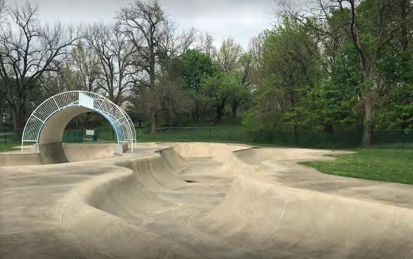
https://goskate.com/sp/listing/lancaster-county-skatepark/#gallery-1
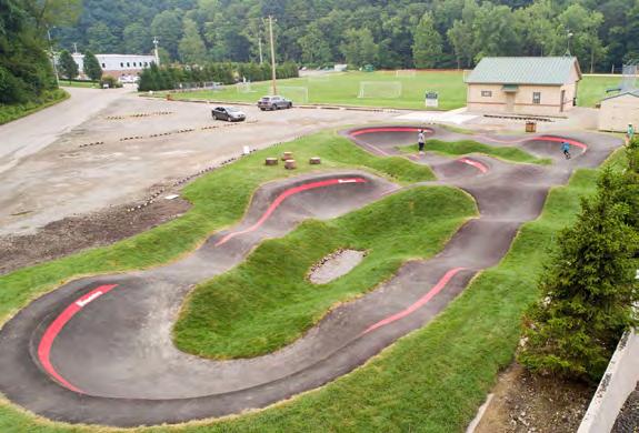
PA https://americanrampcompany.com/projects/oakmont-pa/

Dirt pump track in Ephrata, Lancaster County https://mainspringofephrata.org/post/a-summer-day-in-ephrata-pa/
also critical. A direct track is closed for the winter, but paved tracks are open year-round. The Philadelphia Pump Track is a dirt track.
Nature play spaces incorporate natural elements into outdoor play spaces. This can include rocks to climb, logs to balance on, and plants. The idea is to give children the opportunity to play in and connect to nature. Nature play areas should be located in a larger Community Park, such as Buchanan and Reservoir, to reach the most users. Given the naturalness of Conestoga Pines, a natural play area there makes some sense, but it might not be heavily used, given the remoteness of that park. If the Environmental Center at Sunnyside Peninsula moves forward, one could also be placed there, particularly as most of the land use is passive with a nature focus. This playground could function as part of the environmental education curricula. With Lancaster making the Conestoga River a priority of the Comprehensive Plan, one recommendation would be to use the Conestoga River watershed as a natural playground to educate younger Lancaster residents about the watershed.
A recent example of a nature play area is the Chesapeake Sensory Plaza in Rockfield Park in Bel Air, Maryland (approximately 45 miles south of Lancaster).3 It features a 5,000-square-foot playground with a water and nature-themed play area. The nature play area represents the Chesapeake Bay watershed and highlights the importance of natural resources and the environment. It includes manual hand pumps and water switches that will start the flow of water into a 70-foot-long channel traversing the length
3 https://www.landmark-se.com/project/chesapeakesensory-plaza/
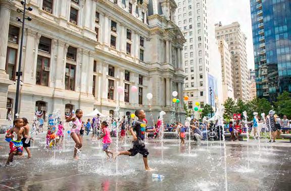
Source: https://phillyfamily.com/beat-the-heat-at-phillys-spraygrounds/

Source: https://harfordcountyliving.com/2020/06/chesapeake-sensory-plaza-harford-countysfirst-nature-based-playground-opens-in-rockfield-park/

Source: https://www.landmark-se.com/project/chesapeake-sensory-plaza/
of the plaza. The channel features a variety of mill wheels, lock gates, flaps, forks, and collection areas to form a highly interactive play experience. Educational signs and illustrations showcase the watershed’s delicate ecosystem and the importance of water conservation and environmental stewardship practices.
As mentioned in the facilities benchmarking discussion, the trend nationally is to move away from wading pools and towards splash pads because of the lower installation and maintenance costs and reduced liability. While both wading pools and splash pads provide cooling in the summer, splash pads cost less to install and require less maintenance than a pool. They can also reduce liability for municipalities and consume less water than a pool. Splash pads require less supervision than a wading pool as there is no standing water. A wider range of ages and abilities can enjoy splash pads. They are more ADA-accessible because they offer barrier-free entry.4 LRC, who provides the staff to supervise the wading pools supports this conversion. The consultant team recommends that Lancaster consider replacing its existing wading pools with splash pads as the wading pools reach the end of their useful lives.
Splash pads and spraygrounds can come in a variety of configurations. A water play area with flush water
4 https://www.nrpa.org/parks-recreationmagazine/2023/january/top-trends-in-parks-andrecreation-for-2023/

Splash pad with vertical elements for interacting with water. Source: https://www.waterplay.com/en/ solutions/
jets, allows for a multi-season use. When the water is turned off, the space can still function as a plaza space for seating and gatherings. Water play areas can also come with vertical elements that allow for interaction with the water.
The community survey indicated an interest in pickleball. Pickleball is especially popular with seniors and is seen as the greatest growth sport for that demographic. With Lancaster increasingly becoming a destination for retirees, the interest in pickleball will likely continue. According to the USA Pickleball Association, the number of pickleball courts in the US has doubled since 2010 and the popularity of the game has created challenges for local Parks and Recreation departments who struggle to find or repurpose active spaces for the sport. Pickleball is typically played as doubles on a badminton size court (which is one-third the size of a traditional tennis court).5
Courts should be located in areas that seniors can access easily, especially by walking, to promote healthy lifestyles. The location of the courts is a key element as the noise from pickleball is an ongoing issue in dense, urban areas, which would include almost all of Lancaster City. Building a soundproofing wall or prohibiting play early in the morning and late in the evening can address the noise concerns of neighbors.6 Pickleball courts can be built as temporary installations to test locations, Pickleball could potentially be introduced as a pilot as Reservoir Park undergoes a master planning process. This park’s location would not create as much of a noise disturbance due to being removed from the residential neighborhood by large, busy streets. It is also centrally located and could attract the most users. Wherever the pickleball courts are placed, a careful process of selection should be undertaken to ensure that noise is not an issue and that the site is accessible to all, but especially seniors. Existing tennis courts can be temporarily converted to pickleball as a way of testing the interest in pickleball.
5 https://www.nrpa.org/parks-recreationmagazine/2013/may/having-a-ball/
6 https://www.nrpa.org/parks-recreationmagazine/2023/january/top-trends-in-parks-andrecreation-for-2023/
CREATE A COMPREHENSIVE, SYSTEM-WIDE, STANDARDIZED, MULTILINGUAL SIGNAGE PROGRAM.
UPGRADE INFRASTRUCTURE & MANAGEMENT TO SUPPORT GREATER USE OF THE PARKS.
COMPREHENSIVE SIGNAGE PROGRAM
Lancaster’s existing public maps need a refresh. A comprehensive, system-wide standardized multilingual signage program is needed to serve all of Lancaster’s diverse population. Building on the City’s commitment to the Language access Program, a system-wide park signage program with wayfinding maps pointing people to safe routes to existing parks could be incorporated into this larger mapping effort. Signage is a relatively low investment with a significant impact, welcoming Lancaster’s residents to their public spaces. New park signage could be part of a larger city-wide system of signage upgrades and improvements, focusing on access to public space.
In addition, signage should be placed strategically within park spaces to orient and
educate the user about the park’s amenities. Rules and Regulations signs should be consistent and posted at each park. Larger parks, such as Long’s Park and Buchanan Park, should have multiple signs while smaller parks should have minimal signage.
According to the NRPA, a good park signage system performs multiple functions:
• it provides information and directions for people to find their way around the park,
• encourages learning experiences,
• helps maintain the image of the park, and communicates park rules.
Signs can meet specific needs, target certain areas, and should be kept to a minimum in the park as a whole. They can also provide a sense of place and local pride by incorporating the history of a specific site in the overall design.1
Significant planning should be undertaken on a comprehensive park signage system by developing goals, purposes, and audiences for the signage system. All parks at a minimum should have English and Spanish signage and clear graphics to accommodate non English or Spanish speaking persons. Sign should be designed to be address disability challenges and minimally be ADA compliant, high contrast, with large fonts, and tactile lettering. Additional considerations should be reviewed during the design process.
1 https://www.nrpa.org/parks-recreationmagazine/2015/october/helpful-hints-for-creatinggreat-park-signage/
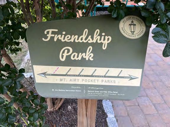

Investment should be made in all parks to ensure system-wide cohesion and equity. Signage installed in a piecemeal fashion will exclude certain park users, neighborhoods, and parks. All signage should be accessible via the city’s website. Web-based materials could include additional languages and information on the parks. Park users should be able to access signs on mobile devices and with a QR code.
Citizens could be involved in decision-making about sign topics such as historical figures, persons, or events to be included with each park, for example, President James Buchanan, Olympian Barney Ewell, or Joe Jackson, a soldier killed in the Vietnam War. Signage could also educate residents about green stormwater infrastructure, birds, the ecosystem of the Conestoga River, or elements of nature.
Lancaster is an important historical city and signage could also orient the park user to adjacent important historical areas. A coherent, clear signage system will promote park usage and equity with minimal investment and should be an early action item.
A palm card program should be implemented as part of the signage improvements. Palm cards could be distributed by park rangers, the stewardship coordinator, LRC staff, or nonprofits. The City of Philadelphia has successfully implemented this program within the past three years. The palm cards encourage respecting Philly’s parks and list Do’s and Don’ts which encourage that park spaces are for all users and rules are to keep spaces clean and safe for all park users and neighbors. The palm cards clearly state (with graphics for non-English speakers) what is NOT allowed: smoking and vaping, public urination and defecation, drug and alcohol use, camping, off-leash dogs, parking and driving on grass, unauthorized amplified sound, and motorized vehicles. These palm cards effectively communicate rules and regulations to park users and act as another layer of enforcement to encourage positive park usage. Palm cards also have contact information for emergency mental health crisis lines, street outreach, Prevention Point (needle exchange drop-in center), mental health and addiction services, intellectual disability services, and behavioral health services. Lancaster’s robust non-profit and city services could also be promoted by using these palm cards.
During the public engagement survey, multiple people discussed the need for basic infrastructure such as lighting, water fountains, bottle-filling stations, restrooms, and access to electricity. While multiple parks have these amenities they are not always open, in the case of restrooms, or functional, in the case of water fountains. In addition, lighting is not consistent across the system. A system-wide assessment of needs for restrooms, water fountains, and lighting should be performed with investment in these amenities as an early action item. The distribution of these resources should be determined on an equitable basis with attention particularly to underserved areas of the city. By investing in these amenities, more people will be drawn into the park system; providing the necessary infrastructure for people to spend more time in parks will promote physical and mental health for all Lancaster residents. These infrastructure upgrades should be assessed in conjunction with implementing a ranger program.
A lighting analysis and assessment should examine the need for an appropriate type and level of lighting in the park. Lighting increases park usage, particularly for adults and sports leagues who use parks after the work day, particularly in the shoulder seasons. It also increases safety and is a crime deterrent. Lighting can also be a nuisance to neighbors, especially in densely populated areas, so any lighting project should involve members of the community before making key decisions. If a park ranger program is implemented, the ranger staff member can also assist in decision-making as rangers will be on duty into the evening hours.
Currently, restrooms are available Monday through Friday from approximately 7:30 am to 3:00 pm. These are the times that BPPP staff is on duty and available to provide custodial services. None of the restrooms are insulated and must be winterized, meaning they are only available from approximately April 1 to October 31 each year. Ewell Plaza is an exception with restrooms open year-round during park opening hours, approximately 9:00 am to dusk. Ewell Plaza’s restrooms are maintained by the Lancaster Alliance as part of the Downtown Business Improvement District. South End Park and Musser Park have restroom facilities, but these are not publicly available and are generally only open during special events or rentals.
Restrooms can be opened and closed by the rangers, which would also allow for additional park use by adults at night, something mentioned as a priority during the public survey. In addition, if BPPP staff can focus on proactive, preventative maintenance more water fountains will be functional and ready to use.
The city recently installed a Portland Loo in downtown. Experience with this installation can also inform the restroom strategy for the parks. If the Portland Loo experiment is successful that project could potentially be replicated elsewhere.
Culliton Park
Conestoga Pines
Brandon Park
Buchanan Park
Long’s Park
Reservoir Park
Rodney Park
Sixth Ward Park
Ewell Plaza (longer availability)
South End Park (special events only)
Musser Park (special events only)
Bathrooms publicly available M-F; approximately 7:30 am to 3:00 pm, April to October
Bathrooms only available for special events or rentals
Bathrooms available year round 9:00 am to dusk

ADOPT AN ACQUISITION POLICY TO ENSURE NEW PARKS ARE SAFE, MAINTAINABLE, AND EQUITABLE
IMPLEMENT CRIME PREVENTION THROUGH ENVIRONMENTAL DESIGN PRINCIPLES IN THE ACQUISITION, DESIGN, AND RENOVATION OF PARKS
EXPLORE CONTRACTING SERVICES THAT ARE NOT PARK RELATED
EXPLORE SPONSORSHIPS AND CONCESSION
To avoid bringing parks into the system that are difficult to maintain and keep safe, the City of Lancaster should create and follow an acquisition policy to ensure parcels it acquires will be good, safe parks, are maintainable, and will equitably serve its residents. This policy could also have language for the potential removal of certain “parks” from the park system that do not function well as parks, but could be used for other purposes. Options could include transfers another department or agency.
CANBA is an example of a “park” that does not function as a park. CANBA is a grass strip next to a privately owned parking lot. It provides neither active nor passive recreation opportunities but must be maintained by the city. Removing the park from the system and repurposing it should be explored under a new acquisition policy. Investigation into any deed restrictions will be required before any divestment decision is made.
The policy will provide guidance and clarity to the City of Lancaster elected officials, Department of Public Works, and LRC officials when considering acquiring or accepting property for park, recreation, and open space purposes. Acquisition objectives include identifying appropriate properties in high-need areas, community support, evaluation for potential public use, and pursuing available funding sources for acquisition. Funding sources include PA DCNR. PA DCNR funds acquisitions (50/50 match) so as part of the acquisition process, reviewing the DCNR process is very beneficial before making any commitments to the public or property owners.1
In addition, if any potential sites are to be acquired on former industrial, commercial, or railroad land, a Phase 1 Environmental Site Assessment (ESA), as well as a survey of the potential parcel to be acquired, should be completed as part of due diligence from the city’s perspective. Any site remediation from an environmental standpoint should be considered before hiring design professionals or engineers. Location within the floodplain should also be considered and should dictate use (trails and passive park areas are best uses along riparian corridors).
1 https://www.dcnr.pa.gov/Communities/Grants/ LandAcquisitionGrants/Pages/default.aspx
Acquisitions should also be reviewed with a neighborhood connectivity focus. If the parcel is only accessible by automobile (annex area) and is inaccessible to the city’s neighborhoods, it should be considered a lower priority. The acquisition policy should be drafted by the city solicitor, passed by the council, and adopted into the city code.
Crime Prevention through Environmental Design (CPTED) uses design to reduce crime. It is a useful tool for evaluating park acquisition and designing and renovating parks. The National Crime Prevention Council and the NRPA identify four main principles of CPTED: Access Control — Using the design layout to limit the access and egress points. This practice can also guide users, both positive and negative, to a specific direction within the park. Controlling access makes negative users feel uncomfortable and less apt to commit a crime.
Surveillance — Eliminating physical barriers that inhibit the casual observer from scrutinizing behaviors inside a space. Surveillance is enhanced by lighting, proper placement of shrubbery, well-placed windows, elimination of physical barriers, architecture, and social commitment.
Territorial Control — Ensuring that public spaces are inviting to legitimate users and discouraging nuisance uses and behaviors by activating the space. Programming for all parks should be prioritized, particularly in underserved areas where the need is greatest and illegitimate usage, vandalism and short dumping detract from residents engaging with public parks. Investing in a stewardship coordinator, recreation coordinator, and ranger program and programming spaces helps eliminate or reduce nuisance behaviors because bad actors using the space receive increased monitoring.
Maintenance and Management — Creating a clean, well-kept area for patrons and preventing graffiti, garbage, and/or damaged property from being seen by positive users. 2
Milburn Park is a cautionary tale of how failure to implement CPTED can undermine the effectiveness of well-intentioned investments in park amenities. Recent investments made to Milburn Park include the Kaboom Playground and bioswale. The existing park is removed from 2 https://www.cpted.net/Primer-in-CPTED
the public right of way and is bounded by the backyards, fences, and the backs of houses. There is one narrow entrance from S. Lime Street but it is largely hidden from public view and for this reason, short dumping, vandalism, and other crimes are occurring.
This area of the city is traditionally underserved and by not providing a safe environment for park users, the recent investments will not get the maximum amount of usage by Lancaster’s residents. In addition, the park is across the street from the Phoenix Academy (K-12) on Rockland St but it has limited visibility. The park is also a short distance from Roberto Clemente Field and ML King Elementary School. By not providing safe and clear access to the park, the park cannot capitalize on this proximity to Lancaster’s younger residents. Unfortunately, unless access to the park is redesigned with the safety of users in mind, it will continue to suffer from crime, dumping, and vandalism.
The CPTED principle of surveillance is largely absent in Milburn Park. There are physical barriers on all sides of the park preventing direct site lines into the park. Allowing for a parking lot within Milburn’s entrance point on S. Lime Street invites short dumpers by providing easy access to the park. Allowing an unsafe space to exist behind and within a residential neighborhood does a great disservice to the residents who live next to this space. The city should take a proactive approach, engage the near neighbors to discuss this situation and hire a professional to identify improvements that will implement the CPTED principals and improve safety. Engaging staff at SACA or The Mix to facilitate a discussion around the issues would be beneficial.
If people feel unsafe, they will not use a park. Lessons should be learned from Milburn Park’s isolation. The principals of CPTED should be reviewed when considering future acquisitions and applied to park land redevelopment and design.
BPPP staff spend a large amount of time on tasks such as mowing/turf management, including on non-park land, graffiti removal on private property, and set up/take down tasks associated with private events on public land. While BPPP staff are responsible for all public property in the city, the time spent on these specific tasks could be contracted out to a private firm which would allow staff to proactively manage the parks and open spaces owned by the city, thereby making them more safe, clean and ready to use.
While Lancaster’s current staffing levels are below the benchmarks set by NRPA, the true amount of staff time spent on maintenance of parkland is even less resulting in very low usage of staff time to proactively maintain parks. This also results in deferred maintenance of playground equipment, water fountains, benches, pavilions, restrooms, and other amenities all of which lead to both more costs in the long term and less use of these spaces by the public. By allowing park staff to focus primarily on park work with some time allotted for other public property, the residents of Lancaster will greatly benefit, staff morale will increase, and Lancaster can truly have park spaces ready to use by its dense and diverse population.
Best practices from peer cities will guide these efforts to ensure all union compliance, competitive bidding, procurement, and legal terms are met before contracting the services to a third party. Once this is established, the next step would be to review the existing staff levels and fund additional staff positions so that Lancaster exceeds the minimum benchmark for staffing to maintain the park system and all assets and amenities associated with it proactively. Not proactively maintaining park space also has consequences for liability, safety, and equity. To serve all residents, BPPP staff should be proactively maintaining parks and public spaces. This can only be accomplished if the level of maintenance standards are established and followed. If BPPP staff are utilized for mainly non-park-related tasks, they cannot even begin to establish these standards.
Sponsorships and concessions can provide additional service to park users and additional revenue to the parks. Presently, any permitting fees for park space go into the general fund while the parks remain underfunded. The city should pursue additional, outside funding to hire additional staff, perform preventative maintenance, purchase equipment, improve facilities, and offset some land acquisition costs. Lancaster’s park system is small. Lancaster’s approach to concession should take a “parks first” approach. Concessions should not compete with local retailers near the park providing similar products. Concession should be a complement to the parks and recreation system. For example, if the Sunnyside Nature and Recreation Park moves forward, it may make sense to have a concession that rents canoes and kayaks.
Sponsorships and concessions are different from donations. Many donors will not want to give funding directly to the city, especially as many are already giving to the nonprofit sector, which this program should not compete with. For example, the LRC receives donations for parks and recreation through the Lancaster Rec Foundation Fund, a separate 501(c)(3) organization. Establishing a mechanism to capture revenue from concessions and sponsorships would provide revenue to the city that would complement the donations that LRC and non-profits are able to leverage for the parks.
All permitted concessionaires or private events on parkland owned by Lancaster should be required to have a portion of the proceeds set aside for a Lancaster Parks Fund to be used at the discretion of the Director of the Department of Public Works or their assignee. This fund could be used for a variety of park purposes but should be established with clear goals so that its use directly and equitably benefits the residents of Lancaster and the park system, for example, dedicating revenue from this fund to the smaller neighborhood parks which sometimes lack investment, especially in the Southwest and Southeast quadrants of the city.
Sponsorships could also be pursued within an equitable framework. Sponsorships could be solicited from businesses from the sports and recreation market sector, including sports leagues, outdoor recreation companies; outdoor facilities and landscape maintenance materials, equipment and service providers. Local businesses could be incentivized to work in underserved areas by sponsoring certain elements of the playground, park space, playing field or providing volunteer labor for work/maintenance days. The sponsor would not only receive advertising but could also work within the community to promote nature and open space. One example is the City of Philadelphia’s participation in TD Bank’s “TD Tree Days” which promotes tree planting in urban areas and allows the business to gain advertising while also promoting goodwill in the community by working directly with the municipal agency. While there is not presently a TD Bank presence in Lancaster, this could be a great model. This program could be overseen by the stewardship coordinator and could begin to generate much-needed revenue for Lancaster’s Park System.
The opportunity for capturing even a portion of permitting fees for the park’s operating budget, as opposed to the present system of going into the general fund, should be evaluated as a revenue stream. In addition, opportunities for sponsorships from area businesses and fees for concessionaires operating on public land should also be evaluated as a potential revenue stream for parks.
Park Maintenance staff are consistently utilized for private and community events which are held on public parkland. This private usage should be analyzed and, if possible, funds and fees from rentals should be captured for park maintenance, which could be housed in a separate fund for maintenance.
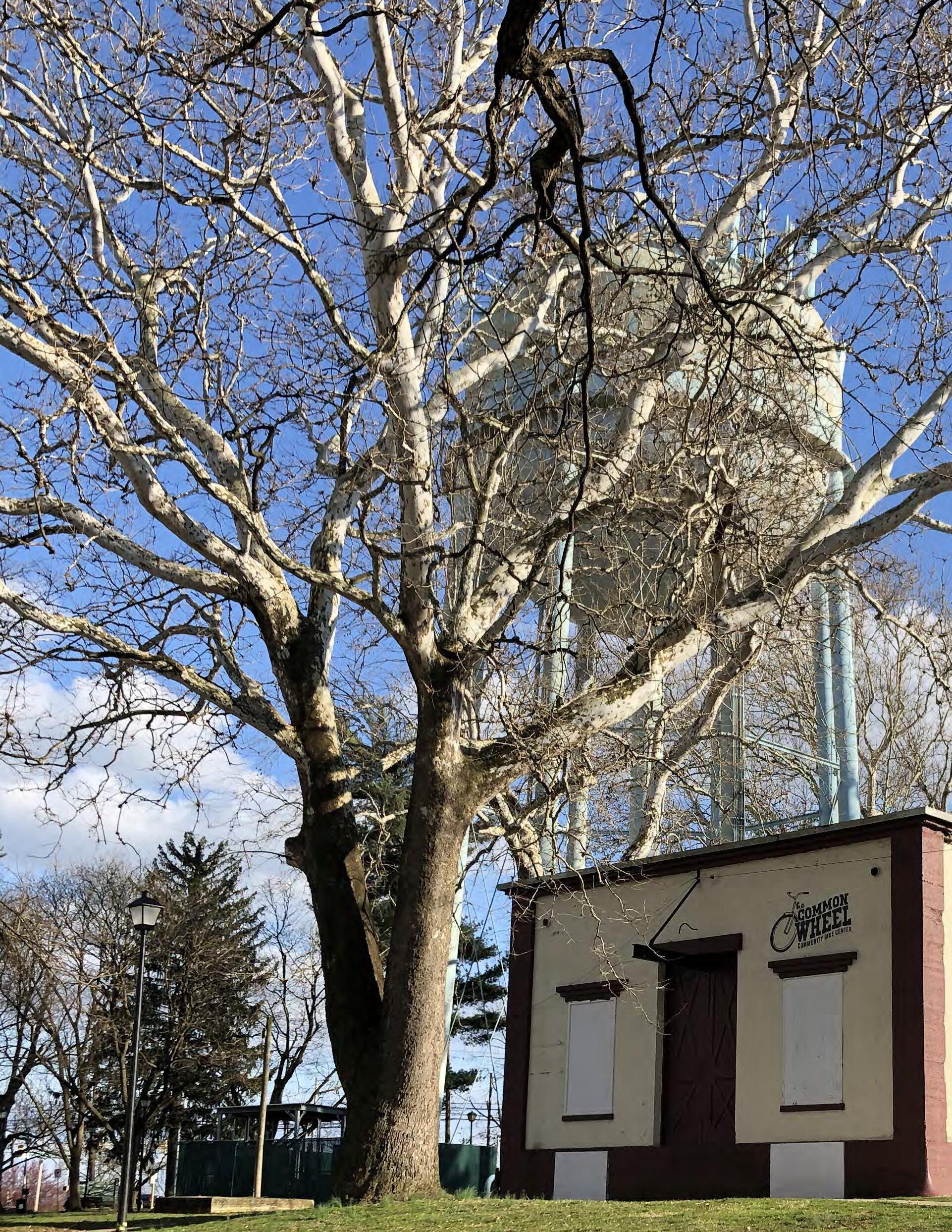

The CPROS is a ten-year plan for improving parks, recreation, and open space in the City of Lancaster. This chapter looks at the relative priorities of the different recommendations, provides an estimated timeline for implementation, and identifies funding opportunities for implementing the recommendations.
To establish priorities and an estimated sequence of projects, the consultant team worked with the City of Lancaster and the steering committee to establish a set of prioritization criteria to better understand how each recommendation meets the community’s goals and priorities. Each recommendation was evaluated based on four criteria. Projects were given a score of 1, 2, or 3 within each criterion, as described below. Recommendations were then scored based on these criteria as discussed below and a scoring matrix was developed. Projects were organized into three priority tiers based on the scoring.

Projects were scored based on the needs and priorities expressed through the community engagement process and as reflected in the recently completed Comprehensive Plan: Our Future Lancaster. Projects that addressed significant community needs were given the highest scores in this category.
1. Low Community Priority
2. Moderate Community Priority
3. High Community Priority

Projects were scored based on their ability to address inequities or imbalances in the system, for example, by improving or creating parks in underserved areas and addressing existing needs and gaps. Projects providing the greatest equity benefit scored highest in this category.
1. Little benefit in addressing historic inequities or underserved areas
2. Moderate benefit in addressing historic inequities or underserved areas
3. Significant benefit in addressing historic inequities or underserved areas

In certain parks equipment or other materials need to be replaced or upgraded due to being in an unsafe condition or at the end of their lives, or projects that address an identified safety need. Lancaster recently completed a series of facility condition assessments identifying needs, which were used to identify the safety needs of the parks in addition to site assessments by the consultant team. Projects with the greatest technical or safety needs scored highest.
1. The project has a low technical or safety need. [FCA assessment = good.]
2. The project has a moderate technical or safety need.[ FCA assessment = fair.]
3. The project has a high technical or safety need, for example, facilities at the end of their lives or in a potentially unsafe condition. [FCA assessment = poor.]

The cost estimates shown are general because the full scope of the recommended projects is still unknown. Detailed cost estimates would be prepared during the design phase for each project Projects were scored based on their estimated cost to implement. Projects with lower estimated costs are easier to fund and implement and scored higher. Projects with higher costs require more planning and funding sources and scored lower.
1. Significant cost $3 million and higher
2. Moderate cost $1 million to $3 million
3. Low cost less than $1 million
Based on these scores, projects were organized into Tier 1, Tier 2, and Tier 3 priorities. In addition, similar projects were grouped, where applicable for grant funding. This allows for larger impact and greater economies of scale for construction. Grouping projects can also make them more appealing to funders.
Project packaging and phasing are necessary to complete the numerous projects identified in the Comprehensive Plan. By packaging and phasing the projects, Lancaster will be able to accomplish more as grant funding requires matching funds and phasing allows for major improvements to be completed over many years. Higher priority projects are sequenced with clear schedules to provide the greatest level of detail for potential grant funding as grantor agencies at federal, state, and local levels will require detailed schedules for return on grant investment.
The majority of larger capital projects will require the following sequence:
• Master Planning (as needed-ex. Reservoir Park)
• Contracting (at multiple phases for professional services and construction contractors)
• Planning and Feasibility
• Preliminary Design and Permitting
• Final Design and Permitting
• Bidding and Award for construction
• Construction
• Punch List and Grant Closeout
The following section includes a discussion of funding opportunities and requirements, the prioritization matrices for each tier, and project pages describing the project considerations, funding opportunities, and phasing for each project.
Reservoir Park Master Plan
Splash Pad Conversions & MLK Wading Pool Replacement
System Wide Infrastructure Upgrades
South Park Improvements
Joe Jackson Tot Lot
South End Park
Ewell Gantz Playground
South Duke Street Mall Park Amenities
Workforce Programs
Park Ranger Program
Recreation Coordinator
Stewardship Coordinator
Policy & Operations Changes
Memorandum of Understanding with LRC
Implementation of CPTED Principles in design and renovation
Comprehensive Signage Program
New Community Pool
Gateways - Sunnyside & County Park
Landscape Horticultural Support
Workforce Development and Training
Greenhouse
Sunnyside Nature and Recreation Park
Natural Play Areas
Needed park Upgrades
New Amenities - Public-Private Partnerships
Skate Park
Pump Track
Pickleball
Policy Operations Changes
Needed park Upgrades
Greenway connectivity Plan
Policy Operations Changes
FEDERAL EPA EJ Community Change Grant USDA Urban Ag and Innovative Production ORLP
PA DCNR C2P2 CDBG PA DCED GTRP RACP CFA MTF PA DEP Growing Greener
Urban Ag Infra Grant In-House
Public private partnership & philanthropy Planning Devt
The consultant team reviewed eligible grant opportunities for the identified projects. The funding matrix summarizes the grant opportunities available for each of the projects. Below is a short description of each of those opportunities. Many of these grants require matches. State funding grants cannot be matched with other state grants. The fundraising strategy should consider a mix of funding sources for projects, including the City of Lancaster capital budget.
US ENVIRONMENTAL PROTECTION AGENCY ENVIRONMENTAL AND CLIMATE JUSTICE COMMUNITY CHANGE GRANTS
The EPA’s Environmental and Climate Justice grants are part of the larger Inflation Reduction Act. Eligibility is based on census tracts that are disadvantaged using the Climate and Economic Justice Screening Tool (CEJST).1 Based on the data, the majority of Lancaster City qualifies as disadvantaged, including much of the Northeast, Southeast, and Southwest quadrants. Eligible applicants include a partnership between a community-based non-profit organization (CBO) and a local government.
Eligible grant activities include workforce development programs that enable participants to gain critical skills to enter careers, especially in occupations that reduce GHG emissions and air pollutants to benefit disadvantaged communities. Partnerships between unions, career and technical schools, community colleges, and workforce development nonprofits are encouraged.
The workforce development component can serve youth or adult populations. To qualify, projects must assist disadvantaged communities. Lancaster’s southeast quadrant is in the 95th percentile for linguistic isolation and the 94th percentile for poverty with 35% of the population not having a high school diploma. This grant program would allow Lancaster City
1 https://www.epa.gov/environmentaljustice/ environmental-justice-grants-funding-andtechnical-assistance
to partner with any number of nonprofits to work on projects related to community greening initiatives around open space and parkland and following the Good Jobs Principles as laid out by the US Department of Commerce and US Department of Labor.2
This grant opportunity could be used to support the development of the park rangers, landscape/ horticultural workforce, recreation coordinator, and stewardship coordinator.
Local governments are eligible for funding under this program to provide mentoring, job training, and resources for underserved populations and operating community gardens under the Implementation category.3 This is a potential for workforce training if a greenhouse can be constructed that would benefit the community. This funding source could support funding of a greenhouse, provided it was partially supporting community gardens, as well as workforce training for the landscape/horticulture workforce.
The program is funded through the Land and Water Conservation Fund and was created to aid disadvantaged urban communities that lack access to outdoor recreation. Funds can be used for the acquisition and/or development or renovation of public parks and other outdoor recreation spaces, including swimming pools.4 The State Lead agency, which in Pennsylvania is DCNR, must be the applicant but can apply on behalf of local governments with a city population of at least 30,000. Project sites must be located in a disadvantaged community as identified in the CEJST and a dollar-for-dollar match is required.
2 https://www.dol.gov/sites/dolgov/files/ goodjobs/Good-Jobs-Summit-PrinciplesFactsheet.pdf
3 https://www.usda.gov/topics/urban/grants
4 https://www.nps.gov/subjects/lwcf/outdoorrecreation-legacy-partnership-grants-program.htm

Lancaster from the EPA’s Climate and Economic Justice Screening Tool (https://screeningtool.geoplatform.gov/en/#13.04/40.03909/76.30251)
PA DEPARTMENT OF CONSERVATION AND NATURAL RESOURCES (PA DCNR) COMMUNITY CONSERVATION PARTNERSHIPS PROGRAM (C2P2)
This is the primary funding entity for all Lancaster park and recreation projects. Lancaster should be strategic about timing on all applications. Grants are for acquisition, planning, and development (Capital) Projects.
All projects require a 50/50 match. Applications open in January and are due in April every year.
Eligible Planning projects include:
• swimming pool complex feasibility study;
• master site development plan;
• rivers conservation plan;
• land conservation and stewardship plan
These grants could be used by Lancaster City as it develops a centralized pool to benefit more of the community, develops Reservoir Park into vibrant, green active space; works towards improving access to the Conestoga River; and transforms Sunnyside Peninsula into a sustainable, forested passive park with trails and river access.
Acquisition grants can fund parks and recreation areas and critical habitat areas.
Trail funding can fund acquisition, planning, development, rehabilitation, and maintenance, as well as assist with purchasing trail maintenance equipment.
PA DCNR’s maximum awards are typically $500,000 for capital/development projects with the sponsor responsible for matching DCNR’s grant. If a project is over $1 million it should be phased, multiple grant funding sources should be used, or an over match can be made.
PA DCED’s GTRP funding program should be considered for any number of parks, recreation, open space, and trails and greenways needs in Lancaster. Planning, acquisition, development, rehabilitation, and repair are all eligible project costs. Grant awards cannot exceed $250,000 and require a 15% match from the local municipality. Engineering, design, and inspection cannot exceed 10% of the development grant award. Planning grants are also awarded and can be used for a variety of planning projects, including developing a parks management plan.1
RACP is administered by Pennsylvania’s Office of the Budget. RACP grants can be used for design, acquisition, and construction of a regional economic, cultural, civic, recreational, and historical improvement project. RACP projects typically cannot receive other state funding but have a much higher threshold for funding. RACP is best utilized for large-scale capital projects such as a swimming pool complex that has a large cost associated with design and construction as well as a larger impact on a large segment of the population, particularly an economic impact which a centrally located, community swimming pool would have on the local economy.2 Minimum RACP awards are for $1M.
To be successful, RACP requires a significant checklist both in the application process and also once the grant funds are awarded. The municipality must do significant compliance work for a successful grant. RACP requires a 50% match. RACP also requires working with State Legislators to be introduced as a specific line item in the Capital Project Itemization Bill in the State Budget and the Pre-Award Application process requires working with the Governor’s office
1 https://dced.pa.gov/download/greenwaystrails-recreation-program-gtrpguidelines/?wpdmdl=81379
2 https://www.budget.pa.gov/Programs/RACP/ Pages/Main%20Page.aspx
Since RACP can be a daunting process to smaller (and even larger) municipalities, the Office of Budget released a document: “Demystifying RACP: A Deeper Dive” in 2023.3 All larger-scale projects should be considered for RACP due to higher thresholds for funding to complete projects without the need for lengthy phasing. For this comprehensive park plan, a new, centrally located pool and the creation of a new Sunnyside Nature and Recreation Park are projects that would be appropriate for RACP funding.
CDBG grants are a federally funded program that has two components for eligible funding:
• an annual funding amount to municipalities through a formula based on state entitlement programs, and
• competitive project funding available to eligible local governments set aside for critical infrastructure or revitalization projects.
The CDBG programmatic goal is to “improve critical community health and welfare infrastructure” in “low and moderate-income neighborhoods.” CDBG programmatic funds can also pay for staff, which most state grant programs cannot pay for, although staff might be required to spend a certain percentage of work time in underserved areas.4 For this plan, CDBG could be used to fund parks projects, as well as some of the workforce development programs.
Administered through DCED, the CFA MTF grant period is open between March 1 and July 31 annually. Grants are awarded between $100,000 and $3M and require a 70/30 match. Projects can include sidewalk/crosswalk safety improvements, bicycle lanes/route designation, greenways as well as projects related to streetscape, lighting, sidewalk enhancement, and pedestrian safety, including but not limited to sidewalk connections, crosswalks, pedestrian and traffic signals, pedestrian signs, and lighting. Streetscape amenities, such as permanently affixed benches, planters or trash cans and trees, shrubs, or mulch, may not exceed 10% of the total project cost.5
3 https://www.budget.pa.gov/Programs/RACP/ Pages/Main%20Page.aspx
4 https://dced.pa.gov/programs/communitydevelopment-block-grant-cdbg/
5 https://dced.pa.gov/download/multimodaltransportation-fund-mtfguidelines/?wpdmdl=82892
PENNSYLVANIA DEPARTMENT OF ENVIRONMENTAL PROTECTION (PA DEP) GROWING GREENER
Growing Greener Grants fund watershed planning, restoration, and protection efforts. Priorities are given to Pennsylvania’s Environmental Justice (EJ) communities, which includes several neighborhoods in Lancaster and much of Southeast Lancaster around the Duke Street corridor, utilizing the Penn Enviro Screen tool.1 Funds are prioritized around the Chesapeake Bay Watershed, which includes the Conestoga River and include watershed restoration projects that implement stormwater BMPs, stream restoration, and bank stabilization to reduce runoff volumes, increase infiltration, improve water quality, and assist in future flood prevention and climate resiliency in support of the Pennsylvania 2021 Climate Action Plan. This includes riparian forest buffers, green infrastructure, and other agricultural and stormwater BMPs which could be utilized within Lancaster’s Park system, but especially within Sunnyside Peninsula and the Conestoga Greenway as well as the Duke Street corridor for tree plantings.2
PENNSYLVANIA DEPARTMENT OF AGRICULTURE (PDA) URBAN AGRICULTURE INFRASTRUCTURE GRANT
The Urban Agriculture Infrastructure Grant Program eligibility requirements include: improving the agricultural infrastructure in an urban area; entailing the sharing of resources among urban agricultural operations, agricultural producers, or community organizations. Eligible costs include: gardening/growing equipment, greenhouses, contracted labor for installations, and contracted site design and planning. The grant could support a greenhouse for the City of Lancaster that would propagate plants for greening the City and potential partnerships with community gardens. The maximum award is $100,000. The project would be competitive with a community partner.3
1 https://gis.dep.pa.gov/PennEnviroScreen/
2 https://www.dep.pa.gov/Citizens/ GrantsLoansRebates/Growing-Greener/Pages/ default.aspx
3 https://www.agriculture.pa.gov/Funding/ Farmbill/Pages/Urban-Ag-Grant.aspx
Public-Private partnerships, particularly with non-profit organizations can be an important means of implementing certain types of projects. Private philanthropy may provide some additional funding options. Some of these may be available to the city, but LRC and other non-profit partners may be able to access additional resources for specific projects. Specific opportunities are discussed on the project pages.

Map of Lancaster and surrounding area using the PA DEP’s PennEnviroScreen tool. All areas in dark blue are high-scoring EJ areas with slightly lighter blue also qualifying as EJ areas with slightly lower EJ scores. Much of the city, excluding the NW quadrant is within an EJ area and would qualify for funding.
Source: https://gis.dep.pa.gov/PennEnviroScreen/
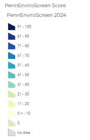


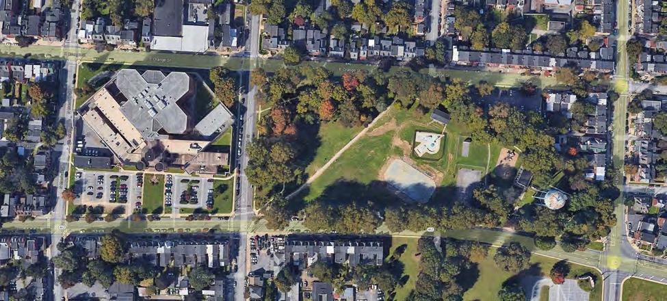
Project Considerations: A master plan and implementation of the master plan will require a multi-phased approach to fully realize its potential as a vibrant public space.
This project overlaps with other priorities as follows:
• The wading pool could be part of the splash pad conversion
• Potential location for a skateboard area or pump track
• Potential location for a pool.
• Potential location for Natural play area, LRC could provide programming
POTENTIAL FUNDING
• DCNR Community Conservation Partnership Grant
• DCED Greenways Trails and Recreation Program Grant
As planning for the county-owned jail site across the street moves forward, consideration of the impact of that site on the park should be considered. Recognizing that the city does not control the timing of the disposition of the prison site, close communication with the county on the planning and phasing of that project should be coordinated. The start date of the planning phases described below may be impacted by the jail project. The project will involve grant writing for both the planning and implementation process. Implementation of master planning will require multiple grants, fundraising, public engagements, design, and construction.
Grant writing
Contracting with professional services
Master planning process
Implementation of the master plan

The MLK wading pool conversion can be used as a pilot for the system-wide conversions of the wading pools. Fundraising for the system-wide conversion can take place in parallel with the MLK wading pool conversion. Lessons learned from the MLK conversion can be incorporated into future conversions.
• DCNR Community Conservation Partnership Grant
• DCED Greenways Trails and Recreation Program Grant
Since the MLK wading pool was identified as in need of immediate replacement through the FCA process, the conversion of this wading pool to a splash pad should be the first conversion and should be done soon. Grouping the subsequent wading pool conversions in either a single contract or in groups would provide for economies of scale and cost savings. The conversion from wading pool to splash pads, per discussions with Philadelphia’s Parks and Recreation Department’s Operations and Maintenance Director, requires a contractor working with skilled trades (plumbers) to fill in the pool and tie in the existing water source infrastructure to the new jets for the splash pads. This can be achieved for minimal capital investment while adding significant maintenance cost savings over the life of the asset.
MLK Pilot Conversion
Fundraising system-wide wading pool conversion
Contracting for system-wide conversion
Construction system-wide
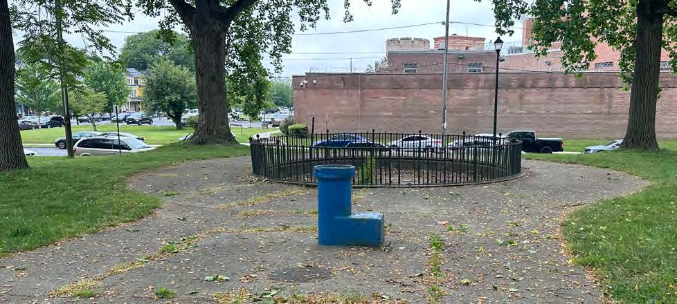
System-wide infrastructure upgrades include:
• Lighting Study and Strategy and access to electricity for events- system-wide
• Restrooms
• Water fountains, bottle filling stations
These infrastructure projects will all have detailed site investigation requirements to understand the extents and location of underground utilities. Therefore, combining the site investigation for all three will provide some economies of scale. In the implementation phase, although these projects might be phased geographically, it makes sense to do all the utility work in a given area at the same time, so that you are only doing excavation work once. The planning and assessment phase of these projects should occur system-wide, however, implementation should occur on an individual park-by-park basis based on the assessment and study outcomes.
For the lighting study, an investigation of lighting trespass and how it will impact neighboring communities will be critical. All park lighting should be energy efficient and dark skies compliant. Different lighting strategies should be incorporated in different areas - for example, pathway lighting to ensure safe passage, timed lighting to allow for uses of that park into the evenings in the shoulder seasons, for example, basketball, tennis, and pickleball
courts; and event lighting that would only be turned on during planned events, such as baseball and soccer games, and the beer gardens. Studying light trespass will require significant study to ensure that impacts on residential neighborhoods are minimal. In addition, a detailed site investigation to understand existing utilities and conduit location should take place. This information is highly relevant to all future capital improvements, including the lighting study, and should be conducted as thoroughly as possible.
To accommodate the highest number of users in all areas of Lancaster’s park system, a restroom study should be conducted, which would include a plan for maintenance and extending hours for existing restrooms. In addition, the study would identify park areas in need of restrooms.
According to recent NRPA guidance, it would be prudent to potentially have all-gender facilities for any new restroom construction and additions to the system. Sometimes known as single-user restrooms, these restrooms foster inclusion and also provide improved privacy, security, and overall space maintenance due to having a smaller footprint than multiple-user facilities.1
1 https://www.nrpa.org/parks-recreationmagazine/2024/may/all-gender-restroomsfoster-inclusion/

• DCNR Community Conservation Partnership Grant
• DCED Greenways Trails and Recreation Program Grant
PROJECT PHASING
Implementation of extended bathroom hours and expansion of the number or restroom facilities depends on having the staff in place to monitor those restrooms and provide custodial care. For this reason the construction of additional restroom facilities is tied to the implementation of a ranger program and other staffing levels.
Fundraising
Site investigation for all
Planning & design (water, lighting, sewer)
Installation (water, lighting & sewer)
Planning and design (restrooms)
Installation restrooms


Joe Jackson Tot Lot, South End Park, and Ewell Gantz playground were included in the recently completed Facility Condition Assessments, conducted by the Department of Public Works. These are a priority for implementation as certain recreational amenities need upgrading as much of the infrastructure is past its useful life. These parks are prioritized and grant applications for funding were submitted in 2024, with award announcements pending.
POTENTIAL FUNDING
• DCNR Community Conservation Partnership Grant
• DCED Community Development Block Grant
• DCED Greenways, Trails and Recreation Program (GTRP)
GTRP funding is probably only available for Joe Jackson and South End Park.
These projects are priority projects for the City of Lancaster and are presently in the grant application process to advance these Tier 1 projects.
Fundraising
Planning & design
Permitting and Construction
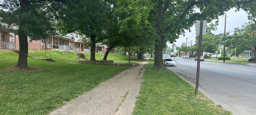
The South Duke Street Mall park amenities project can be packaged with planned ROW improvements to provide one capital project along the entire corridor. This is especially important as significant tree removal will be required for both ROW and park improvement projects and replacement tree plantings should be included in the project. This project is located in an Environmental Justice (EJ) area and the community would greatly benefit from improving conditions along the corridor.
This project is an excellent candidate for a Community Development Block Grant (CDBG) due to its location in an Environmental Justice community. The CDBG programmatic goal is to “improve critical community health and welfare infrastructure” in “low and moderate-income neighborhoods.” CDBG funds can be used on streets, sidewalks, and community facilities.
Planning and design for the project, including community engagement, should occur in year one and contracting and construction should occur in years 2-3. The project should complement any ROW work that is presently being designed.
Current construction
Fundraising
Planning & design
Contracting and construction
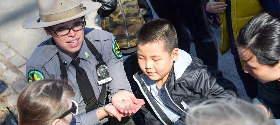
https://www.nycgovparks.org/events/kids_week
The workforce programs include:
• Ranger program
• Recreation Coordinator
• Stewardship Coordinator
The workforce programs can greatly benefit the City of Lancaster by providing equitable park and recreation services across the city, for all neighborhoods. One scenario would be to package the workforce programs together as one program, hiring staff from within the city limits and providing workforce development and training opportunities for new graduates from area high schools and colleges.
The Rangers would work as ambassadors for the parks, positively encouraging legitimate use. It would be beneficial to hire bilingual Rangers due to the city’s large Spanish-speaking population. The Rangers would also allow for greater use of the parks and could open and close restrooms in
the parks, allowing citizens to use the parks into the evening. The Rangers could also work with the city’s large non-profit network, encouraging greater park use in a coordinated manner.
The Recreation and Stewardship Coordinator positions would complement the Ranger program as additional coordination is needed throughout Lancaster’s park system. These workforce development opportunities would both train younger Lancaster residents for career path positions while providing the additional staffing to strengthen the city’s ability to serve all its citizens through park and recreational opportunities, especially as much of the city is in an Environmental Justice area. The skills needed to elevate Lancaster’s park system would be developed in-house and with foundation support. Over time, these positions could eventually become full-time city positions but in the short term, utilizing private funding and CDBG funding would begin the process.

These positions could be funded through a mix of local foundation support and Community Development Block Grants (CDBG) funding. There is precedent in Philadelphia for utilizing foundation support for a Ranger program. The William Penn Foundation supported the creation of Philadelphia’s Park Rangers. Presently, Philadelphia’s 17 park rangers are civil servants as the program transitioned from foundation support in the early years of the program into city employees.
The EPA’s Environmental Justice Community Change Grant has a workforce development component but would require the city to partner with a Community-Based Organization (CBO), which could be any number of non-profit entities working with underserved populations in the city, including possibly LRC, in the several Environmental Justice communities within the city limits. CDBG funds could also be utilized for the workforce in these areas.
Fundraising and planning for these positions should occur in year one. Implementation can occur in years 2 and 3. If the city does not package the workforce program as one program, the ranger program should be prioritized with the recreation and stewardship positions to follow within the next 1-2 years.

Source: Lancaster Recreation Commission
The Memorandum of Understanding (MOU) between the City of Lancaster and the Lancaster Recreation Commission (LRC) should be a top priority to enable more efficient, equitable, and effective management of Lancaster’s recreational resources and programming opportunities. As the city relies on the LRC to carry out its recreational programming throughout the city, the MOU should address aspects of equitable distribution of all recreational resources, identifying areas of need, and providing the appropriate funding and support for the LRC to serve all of Lancaster’s citizens with quality programming while utilizing the city’s recreational assets. The MOU can also provide a clear, agreed upon maintenance plan for the division of responsibilities between the city and the LRC based on financial and human resource capabilities.
The principles of Crime Prevention through Environmental Design (CPTED) should be utilized during any park and open space acquisition and design process to ensure that
Policy & Planning
MOU with LRC
Integrating CPTED into park designs
public park areas in the city are safe for all residents to use and so residents can “build a sense of community to gain territorial control of areas, reduce crime and minimize fear of crime.”1
The MOU with LRC and CPTED principles can be completed within the City of Lancaster’s existing staff capabilities. The MOU will be completed with LRC executive staff working with the City of Lancaster.
The MOU with LRC should be prioritized in year one.
CPTED principles should be used in all decisions on feasibility, planning, and design for all existing park properties requiring upgrades, any future acquisitions, and incorporated into the acquisition policy, discussed in tier 2.
1 https://www.cpted.net/


Lancaster lacks a comprehensive signage system for its park system, both internal to each park and incorporating wayfinding for parks into larger signage and mapping systems throughout Lancaster. Due to its large Spanish-speaking population, signage should be in English and Spanish and should be standardized across the system to welcome all residents and visitors into Lancaster’s parks. Signage should include rules and regulations, both system-wide and any rules specific to individual parks.
POTENTIAL
PA DCNR C2P2 grants fund signage programs for parks but would potentially not fund a city-wide upgrade that would include parks. A decision should be made on whether to create a separate program for park signage or incorporate it into a larger city signage upgrade. A larger city-side signage upgrade could be potentially funded by PA DCED.
This is an early implementation item with fundraising occurring in year one, planning, and design in year two, and installation in year three. Installing comprehensive signage is a relatively simple way to communicate to citizens directly in park space and establish Lancaster’s parks as a welcome space for all citizens. The city could also consider updating its existing mapping/signage system to include parks and recreation facilities as well as wayfinding signage around the city in key areas to assist citizens in accessing public open space and recreation opportunities.
Fundraising
Planning & design
Installation


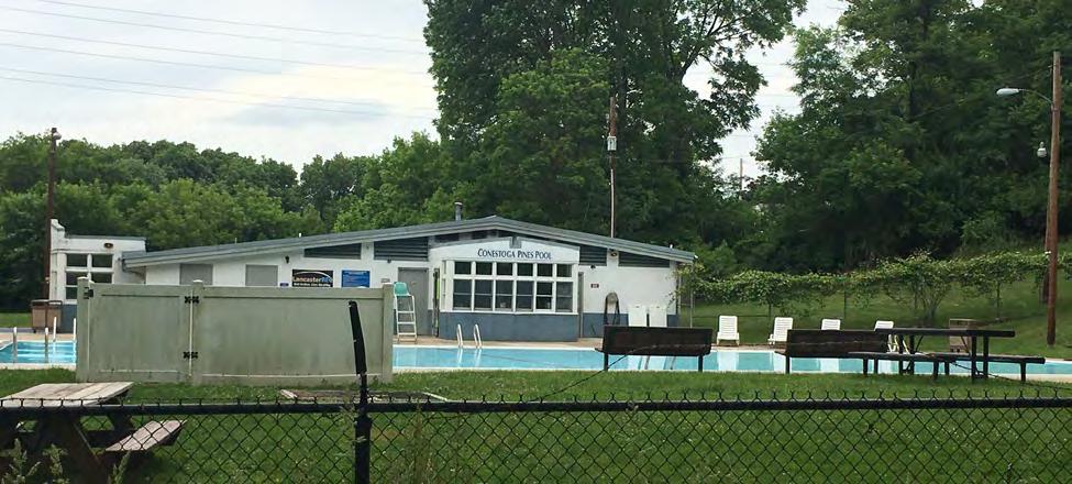
A modern, accessible, and centrally located pool will require significant location planning and analysis with extensive community and stakeholder engagement. A centrally located pool will serve far more residents, increasing the equitable distribution of recreational resources, than the existing pool at Conestoga Pines, located at the city’s NE edge.
POTENTIAL
• DCNR Community Conservation Partnership Grant
• DCED Greenways Trails and Recreation Program Grant
• Outdoor Legacy Recreation Partnership Grant (National Park Service)
• Redevelopment Assistance Capital Program Grant (RACP)
Years 1-2 should be set aside for extensive site planning and community and stakeholder engagement, ensuring a full public process for this major capital investment. Once a site is selected, fundraising will need to be extensive due to the costs of site survey and preparation, planning, design, and construction of the full facility including on-site buildings and grounds. Fundraising can occur in year three. Years four and five would include all final design and permitting with construction occurring in year six.
Community engagement
Fundraising
Planning & design
Permitting & construction

To safely connect the city’s residents to parks, open spaces, recreational areas, and trails, gateways in areas of higher traffic volumes and population density are necessary to allow for improved access for residents of the city. Improved connectivity in three key areas: Circle Avenue Gateway connecting to Sunnyside Nature and Recreation, Duke Street Gateway connecting to Lancaster County Park, and Strawberry Street Bridge Gateway connecting to Lancaster County Park will allow safer access for area residents. These three gateways should be designed and constructed as one project to improve economies of scale and equitable access from various sections of SE and SW Lancaster to these amenities. These projects require traffic calming measures and are multimodal and can be implemented through the city’s Vision Zero plan.
• Commonwealth Financing Authority (CFA) Multimodal Transportation Fund
PROJECT PHASING
Fundraising for this project can occur in year one, with contracting with a design and engineering professional in year two. Design and permitting can take place in years three and four with construction in year five.
Fundraising
Planning & design
Permitting & construction

Sunnyside Nature and Recreation Park will likely include improvements to the peninsula’s public spaces, including river access, invasive tree removal, tree plantings, riparian buffer stabilization, trail construction, neighborhood gateways, potential natural play areas, and potential construction of an environmental center. A natural play area could focus on the Conestoga River and its connections to the larger Susquehanna River and Chesapeake Bay Watershed and could be part of the Environmental Center’s programming and education focus.
Sunnyside Peninsula is located in an Environmental Justice area as fined by PA DEP. If a natural play area were established with programming, the LRC would be able to focus on underserved areas for programmatic content, drawing on children and youth from the surrounding areas of SE Lancaster, which is presently underserved by programming.
Feasibility
Grant writing and fundraising
Planning & design
Permitting & construction
Planning for river access through a kayak launch will necessitate serious study due to safety and environmental permitting considerations. Neighborhood connectivity and trail implementation will also require extensive planning. Robust neighborhood and community outreach will be essential for this project. A multi-year, multi-phase endeavor will be need to secure the extensive funding required from a variety of local, state and federal grant programs.

• DCNR Community Conservation Partnership Grant
• DCED Greenways Trails and Recreation Program Grant
• Outdoor Legacy Recreation Partnership Grant (National Park Service)
• Redevelopment Assistance Capital Program Grant (RACP)
• PA DEP Growing Greener (watershed protection with a natural playground)
• Public-private partnerships and private philanthropy, including the local High Foundation, may be available for certain components of the park, including the environmental center and natural play areas.
• National Park Service Outdoor Legacy Recreation Program (ORLP)
The timeline can be adjusted based on the scope of the overall project after the planning and feasibility are completed. The final scope of the project, as well as the phasing of each project on the peninsula, will also dictate the sequencing of grants from PA DCNR, PA DEP, and other grant agencies. Extensive funding and community engagement will be required throughout the process.

Nature play areas, a play environment that consists of elements and textures from the earth such as tree logs, tree stumps, boulders, plants, and drainage paths, among others instead of a traditional steel playground structure that includes slides and climbers, can be incorporated into multiple park spaces, including Conestoga Pines, Buchanan, Long’s and Musser if community and neighborhood interest warranted their installation. One could also be considered in Reservoir Park during the Master Planning process. Nature play area are also being considered in the 3 Southeast Parks projects. Philadelphia Parks & Recreation has successfully installed these very popular ways to engage urban children with the natural world as well as provide educational programming around nature. This would provide another way for the LRC to engage with the children and youth communities within the city, especially once an MOU is established. The Stewardship Coordinator and Recreation Coordinator could also work in these spaces, growing an interest in nature and the natural world within a dense, urban environment for the future stewards of the city’s environment.
Feasibility & concepts
Fundraising
Planning & design
Permitting & construction
Planning funds could be obtained from PA DCNR if multiple parks were chosen. Design and Construction funding could also be potentially funded by PA DCNR, however, due to the large number of projects in the Comprehensive Plan potentially being funded by PA DCNR, an alternative funding stream could be PA DEP’s Growing Greener initiative or local private foundation support.
This project will require significant planning and stakeholder engagement over two years due to location planning, stakeholder and community engagement, as well as the type and size of the natural play areas. Fundraising can take place in year three for either a pilot project or installation within multiple parks. Design and permitting could take place in year four with construction following in year five. Natural play areas could be incorporated as part of overall park upgrades for economies of scale and to minimize disturbance to the parks.

Source: https://www.greenmountainenergy.com/en/sun-club/recipients/food-advocacy/grow-pittsburgh
PROJECT CONSIDERATIONS
Landscape and horticultural workforce training could occur with an investment in a landscape greenhouse to propagate plant material for the parks, public, and open spaces of the city, including green infrastructures. In addition, the greenhouse could also support community gardens and gardeners which would allow for workforce training elements and open up additional funding opportunities. The Stewardship Coordinator could work with grounds maintenance workers to maintain existing and recently planted materials throughout the city, fostering community.
POTENTIAL FUNDING
• Pennsylvania Department of Agriculture (PDA) Urban Agriculture Infrastructure Grant
• The Pennsylvania Department of Agriculture’s Urban Agriculture and Infrastructure Grant
• The USDA Urban Agriculture and Innovative Production Grant
• The EPA’s Environmental Justice Community Change Grant
PA DCNR and PA DCED are potential funding
Greenhouse Fundraising
Planning & design
Permitting & construction
Workforce program fundraising
Workforce program implementation
partners, however, as these funding streams will be utilized for several other plan initiatives, it would be prudent to rely on additional funding sources, including local private philanthropy.
The Pennsylvania Horticultural Society (PHS), an established non-profit which uses horticulture to advance health and well-being, administers programming and workforce development projects in the Philadelphia region only. While it is not likely that PHS will expand to Lancaster, models could be developed which could be funded by Lancaster philanthropic organizations such as Lancaster County Community Foundation or the High Foundation that could provide similar services.
PROJECT PHASING
The greenhouse should be the first investment made with planning taking into consideration a community garden element. Considerations would center on the size of the greenhouse and if the facility would house room for community gardening plantings. The workforce and horticultural staff support would need to follow the construction of the greenhouse.
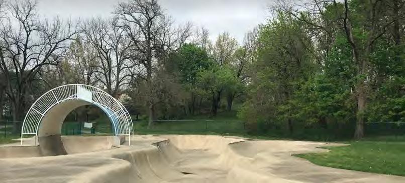
Lancaster County Skate Park; Source: https://goskate.com/sp/listing/lancaster-county-skatepark/#gallery-1
Facilities such as a skate park, pump track, and pickleball courts that have dedicated users are opportunities for public private amenity partnerships to realize these projects and ensure that the amenities meet the needs of the user groups.
SKATEPARK
The creation of a public-private partnership to bring a skatepark to fruition might be necessary as there are limited funding options for the many needs facing the larger Lancaster Park system. A private fundraising arm could be created by the skateboarding advocates as a 501(c)(3) organization, or utilizing an existing non-profit partner. This organization could raise the bulk of the funding separately from the city’s budget and grants while the city could acquire the land for the skatepark or donate existing land. This would also allow for the skateboard community to be in
Feasibility & Policy
Identify non-profit partners (establish MOU
Fundraising
Planning & Design
Permitting & Construction (under MOU)
charge of the design standards, creating a skatepark for skateboards by skateboarders. This would require the creation of an MOU between the city and the skateboard community to discuss matters of liability, maintenance, and other ongoing concerns.
In Philadelphia, the Paine’s Park Skatepark, a 30,000 square foot facility with significant landscaping and walking paths, was constructed as a result of an agreement between a non-profit and the city of Philadelphia. The city now maintains the space but the planning, feasibility, and design were carried out by the non-profit, now known as SkatePhilly. The skateboarding community also assists in routine maintenance but is not under formal partnership with the city.
There are also local organizations, such as FDR Skateparks Company, a non-profit located in Philadelphia, provided local technical assistance.
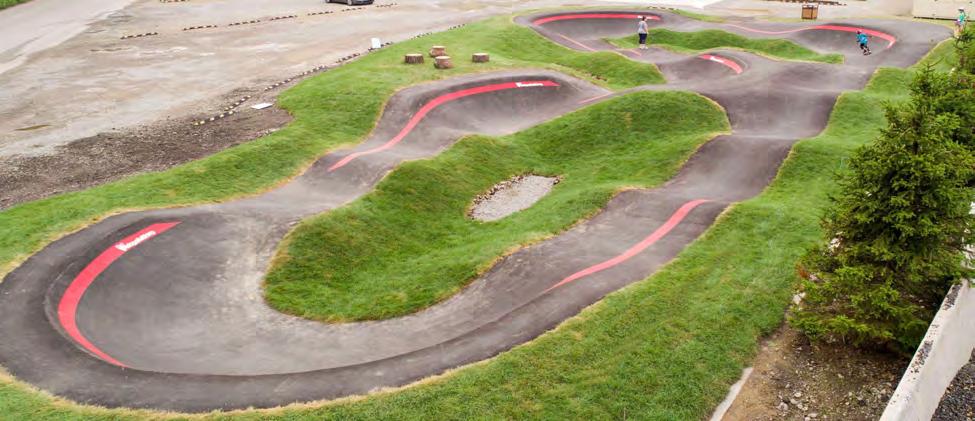
PA; source: https://americanrampcompany.com/projects/oakmont-pa/
A pump track could be developed along with a skatepark as an active sports area within the city or it could be developed separately. If there was interest from the local bicycling community, a partnership could be formed between the city and an entity such as the Susquehanna Area Mountain Biking Association (SAMBA) to raise necessary funds for design, permitting, and construction, forming a partnership for programming and potential maintenance once the pump track was constructed. An MOU would also be recommended in this case.
Pickleball is a growing recreational activity and is especially popular with all ages of adults, including a robust senior population. The city could reach seniors and provide active recreation for this growing segment of the population. The need for pickleball would need to be gauged on needs assessment from the public.
Pickleball could be introduced in the Reservoir Park Master Planning process or Buchanan Park if there is interest from the community. Recent interest in converting tennis courts at Long’s Park into pickleball courts could be revived if there was continuing interest from the community.
Potential funders include PA DCNR for the pump track and pickleball courts, with the potential for private funding for both initiatives from local
sources. The AARP has also funded pickleball and Lancaster should investigate this potential source of funding.
Public-private partnerships with area philanthropic organizations for all three initiatives should be prioritized, especially if existing and future nonprofits are involved in fundraising, creating partnerships between the private sector and area nonprofits.
If the skatepark was developed on previously contaminated ground, PA DEP funds could be utilized, especially if it was located in an Environmental Justice area of the city. In addition, if the skatepark was developed either separately or with the pump track, it could qualify for a RACP grant, if there was elected official involvement.
Year one should focus solely on identifying a potential non-profit partner and establish an MOU between the city and the partner to raise funds and begin the planning for locations of the potential facilities. Once this is established, fundraising can occur by the non-profit, working with the city on pass-through grants. Design and construction can follow in year three under the MOU with the city. The city and the non-profits can also decide the appropriate long-term partner for the maintenance during the negotiation process.
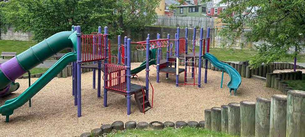
The following parks all underwent recent Facilities Condition Assessments (FCA) and were identified as second-tier projects based on the individual needs of the parks:
• Conestoga Pines–paving, recreation building, and pool area
• Stork Linear Park–play structures and safety surfaces
• Long’s–site paving
• Musser–upgrades to play structures and safety surfaces
• Rodney–safety surface
• Rotary
• Sixth Ward–safety surface
• Culliton–concessions and restroom building, repairs to lights
The Conestoga Pines Park should follow the Master Plan implementation and should explore nature play areas as well, especially due to the presence of the LRC. Larger parks such as Musser and Long’s could also potentially benefit from a nature play area.
Although Culliton was renovated relatively recently, there are needs to address lighting, and vandalism issues, in addition to the concession and restroom building upgrades noted in the FCA.
• DCNR Community Conservation Partnership Grant
• DCED Greenways, Trails and Recreation Program
Some of the maintenance recommendations in the FCAs could be implemented through the regular maintenance budget, for example replacement of safety surfaces.
Based on FCAs the following parks should be upgraded in year three: Milburn; with Musser and Rodney taking place in years three and four; year five construction would include construction upgrades to Janice Stork Linear Park, Long’s Park, Rotary and Sixth Ward. Culliton lighting and vandalism repairs should be addressed in year one.
Planning & design standards
Milburn, Musser and Rodney
Janice Stork Linear Park, Long’s Park, Rotary, Sixth Ward
Culliton
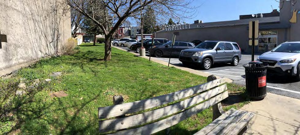
The city should address policy and operation changes by formally adopting an acquisition policy and investigating the contracting out of some services to outside vendors.
The city should establish an acquisition policy for any potential park, open space, and recreation area in year one to ensure the highest quality parcels are being acquired for public use. This policy can also address the current remainer parks, such as CANBA, which should be divested from the system. This will ultimately save the city significant resources over time as it will remove the future potential for parcels that either do not serve the public well, require maintenance that strains resources, or are not adequately situated for safety concerns (see CPTED). In addition, equity should be a major consideration of this policy to ensure that any future park acquisition serves all members of the public, including previously underserved areas.
The city should decide if it is fiscally responsible to begin contracting some of its services to third-party vendors, which would free up DPW parks staff to focus primarily on park needs. Mowing, graffiti removal, responding to requests from the public on non-park-related matters, and all special events work should be considered to be contracted out for both cost-savings and to ensure park staff works on park-related matters.
These are policy and operation changes that can be made in-house.
Contracting of services should be decided in years one and two of the plan as the city investigates opportunities for contracting services and the potential cost savings benefits as well as long-term benefits to the maintenance of the city’s park system. The acquisition policy can be developed in year 1.
Acquisition Policy (planning)
Adoption & implementation
Contracting services policy (planning)
Adoption & implementation


The following parks were identified as lower priorities based on the recently completed Facilities Condition Assessments, due to either having undergone recent upgrades in the case of Binns Parks, recently being opened in the case of Ewell Plaza, or having lower maintenance and safety needs. In the case of these newer or newly renewed parks, any significant investment is likely 10 or more years out.
• Binns–pavement
• Brandon
• Ewell Plaza
• Holly Pointe–play equipment
• Market Street Kids–play surface, play equipment
• Milburn–paving, play equipment
• DCNR Community Partnership Program Grant
• DCED Greenways, Trails, Recreation Program Grant
Some of the maintenance recommendations in the FCAs could be implemented through the regular maintenance budget, for example replacement of safety surfaces.
These projects as identified in the FCAs for construction needs in years nine for Culliton, Market Street Kids, and Holly Pointe and years ten for Brandon, Binns, and Ewell Plaza.
Planning & design standards
(see Tier 2)
Market Street Kids & Holly Pointe Brandon, Binns, Milburn & Ewell Plaza

Source:https://ruralstudio.org/project/lions-park-concessions/
Sponsorships and concessions would occur on a park-by-park basis and should be prioritized by the city to generate revenue as well as provide amenities for the park using public such as potential kayak outfitters for Conestoga Pines and Sunnyside Nature and Recreation Park. Food and beverage vendors would allow the public to enjoy the parks for a longer period and serve as additional eyes on the park spaces. Revenue agreements between vendors and the city should ensure the facilities receive a portion of the revenue and that funds do not automatically go back to the general fund. This could offset some of the city’s budget concerns around park maintenance as well. Philadelphia has successful, long-term vendor agreements for its parks and could provide a model moving forward.
These are policy and operation changes that can be made in-house without the need for additional resources.
Once a vendor agreement was established by the City Solicitor, vendor opportunities could be pursued on a case-by-case basis.
Planning & policy
Identify sponsorhip, concessions & vendors
Establish vendor agreements
Case-by-case implementation
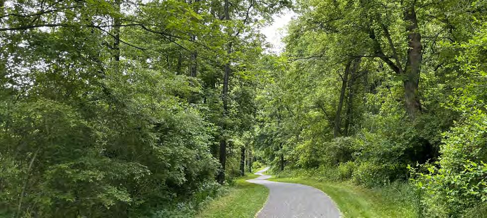
It is recommended that the City build on the ongoing mobility projects to develop a Greenway and Connectivity Plan to assess the connectivity and functionality of the City’s trails, greenways and sidewalks which connect users to active transportation facilities. This project would develop more detailed recommendations for how to enhance connectivity for residents from every neighborhood, to their parks, schools, and to other popular and necessary destinations. This would also be an opportunity to assess the health of the tree canopy, landscapes, erosion controls, stormwater management, and riparian buffers; Additionally the trail surfaces, trail amenities (site furnishings), accessibility including ADA requirements should be assesed along the routes. The project will encompasses all routes which are used for active transportation and recreational purposes.
• DCNR Community Partnership Program Grant
• DCED Greenways, Trails, Recreation Program Grant
Planning for this project should begin with detailed mapping and then assessment of the existing greenways, trails, sidewalks which includes both existing and proposed routes. The public should be engaged to map desirable routes between popular and frequent origin and destination points; route planning, parcel aquisition, system wide infrastructure standards and signage should be developed. Potential non-profit partners should be identified for input and future management and maintenance where connections traverse property not owned by the City. Fundraising should be coordinated with non-profit partners, working with the city on grants and parcel aquisition. Design and construction will follow. The City and the non-profits will decide long-term partnerships for maintenance.
Public engagement / partnerships
Planning & design standards
Fundraising, grants & parcel aquisition
Permitting & construction

City of Lancaster Parks
Other public Parks
Schools open to the public
Hazel Jackson Woods
Sunnyside Pennisula
Existing trails
Regional trail connections
Existing bike facilities
Proposed trails
Proposed bike facilities
Riverfront trail
Reservoir Park Master Plan
Splash Pad Conversions
MLK Wading Pool Replacement
System wide wading pools conversion
System Wide Infrastructure Upgrades
3 Southeast Park Improvements
South Duke Street Mall
Workforce Programs
Policy and Operation Changes
MOU with LRC
Integration of CPTED Principles
Comprehensive Signage Program
New Community Pool
Gateways
Sunnyside Nature and Recreation Park
Natural Play Areas
Landscape Horticultural Support
New Amenities
Skate Park
Pump Track
Pickleball
Needed Park Upgrades
Policy and Operations Changes
Acquisition Policy
Contracting Services Policy
Needed Park Upgrades
Policy and Operations Changes
Sponsorship and Concessions
Greenway Connectivity Plan