Photograph by Tuomas Haapalehto
Priodiversity LIFE project The Priodiversity LIFE project is the largest initiative ever established in Finland to tackle biodiversity loss, with partners engaged in a variety of different activities, including spatial analysis and biodiversity monitoring. We spoke to Anssi Ahtikoski, Matti Koivula and Ninni Mikkonen about their work in the project and how it contributes to the common goal of identifying biodiversity hotspots and restoring natural habitats. Matti Koivula is a Research Professor at the Natural Resources Institute Finland (LUKE)
Photograph by Mikko Törmänen
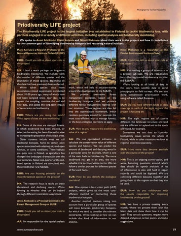
Ninni Mikkonen is a researcher at the Finnish Environment Institute (Syke)
EUR: Could you tell us about your role in the project?
EUR: Could you tell us about your role in the project?
MK: I lead a work package on long-term biodiversity monitoring. We monitor both the number of different species and the abundance of those species, depending on the data that have previously been collected. We’ve taken species data from restoration-related experiments conducted about 10-20 years ago, many of which have not been sampled since. Our idea is to repeat the sampling, combine the old and new data, and assess the long-term impact of restoration on biodiversity.
NM: I’m leading a group of scientists in a project sub-task. We are responsible for collecting spatial biodiversity data for the ReBAPs. We’re looking at all kinds of data in this work, from satellite data to aerial photographs to field surveys. We are also doing conservation prioritisation work, using software called Zonation.
EUR: Where are you doing this work? What types of sites are you monitoring? MK: Some of the sites are managed forests, in which deadwood has been created, or selective harvesting has been done with a view to increasing the proportion of deciduous trees. Other contexts include what we call traditional biotopes, home to certain plant species associated with relatively dry and open habitats, or sunny conditions. These habitats are quite rare in Finland, as agriculture has changed the landscapes dramatically over the past centuries. About one-quarter of the redlisted species in Finland are associated with these traditional rural habitats. EUR: Are you focusing primarily on the most threatened species in the project? MK: The research focus is really on these threatened and declining species. We’re looking at whether they can be helped through different restoration operations. Anssi Ahtikoski is a Principal Scientist in the Forest Management Group at LUKE EUR: Could you tell us about your role in the project? AA: I’m responsible for the spatial analysis
www.euresearcher.com
work, which will help in decision-making around the development of the ReBAPs. We provide alternative forest management scenarios, based on the biodiversity hotspots, and we produce different forest management regimes with our simulator. Those regimes are then fed into the optimisation framework, which resolves questions around for example the most cost-efficient way to manage forests, or the best ecological corridors to apply. EUR: How do you measure the biodiversity value of a region? AA: We use specialised software to calculate the conservation value of different species and habitats. We can predict the amount of deadwood and decaying wood in a particular area for example, which is one of the main fuels for biodiversity. The more deadwood you get in an area, the more valuable it is in conservation terms. We can follow a similar process for different species of flora and fauna. EUR: How do you identify the ecological corridors? AA: One option is least coast path (LCP) analysis, which gives us the most costefficient method of connecting these biodiversity hotspots. Another method involves taking into account how a particular group of species will move between biodiversity hotspots, for which we need to consider the relevant constraints. We’re looking at how we can include that kind of information in our analysis.
EUR: Do you have different types of data coverage in each of the eight regions the project is focusing on? NM: The eight regions are of course different, the landscape structure and land use are different in Lapland and in the south of Finland, for example. Sometimes we use data to consider biodiversity issues across the whole of Finland, while in other situations we look at regional priorities separately. EUR: Have more data become available over the course of the project? NM: This is an ongoing conversation, and we’re balancing questions around which data should be openly available. A lot of information is also still held in paper records and could be digitised. We are collecting different datasets together and giving them to the regions so that they can be used. EUR: How do you collaborate with the people responsible for improving biodiversity on the ground? NM: We have a private meeting every month, where we present them with the latest data and show them how it can be used. They can ask questions, request more detailed analysis on certain points, and make suggestions.
19