Enhancing wildfire resilience in the Karst

The Karst region is vulnerable to wildfires, and with the effects of climate change set to heighten the risk still further, it is important to prepare effectively and enhance resilience. The team behind the Karst Firewall 5.0 project are producing knowledge and co-developing plans to prevent and manage wildfires in the region, as Dr Massimiliano Granceri Bradaschia explains.
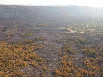
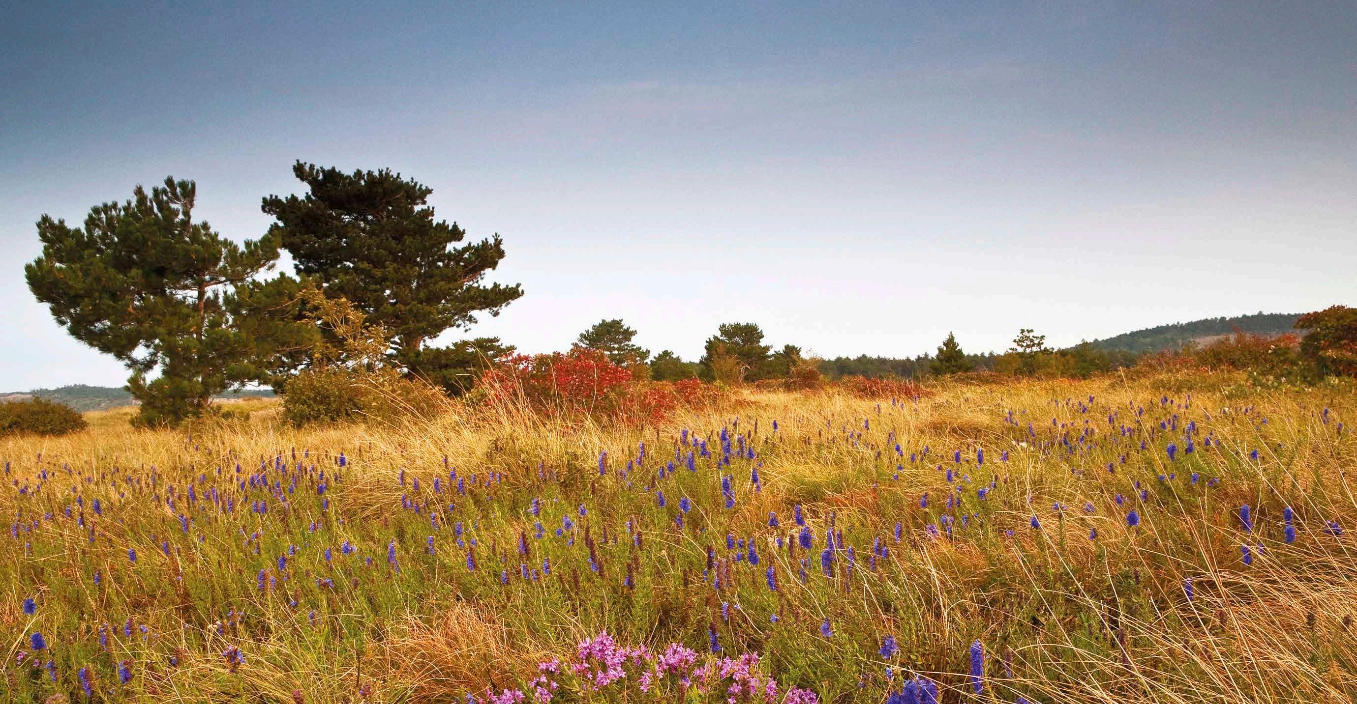
The Karst region, a limestone plateau extending across the Italian-Slovenian border, is vulnerable to wildfires. The geology is bare rock and where there is soil, it is typically fairly shallow. “The soil typically reaches down to a depth of just 50 centimetres or so, this means there is a higher probability of vegetation remaining dry, and so being more susceptible to wildfires,” explains Massimiliano Granceri Bradaschia, a postdoctoral researcher at the University of Venice in Italy. Other factors also heighten the susceptibility of the region to wildfires, says Dr Granceri Bradaschia. “Some highly flammable species have been planted in the Karst, such as black pine (Pinus Nigra), which is not indigenous to the region. It was first planted around 200 years ago during the period when the Austrian empire dominated the region,” he continues. “There are also some marked differences between the two sides of the border. The Italian side is on the coast, while the Slovenian side is towards the interior, so they have different characteristics in terms of wetness and temperature.”
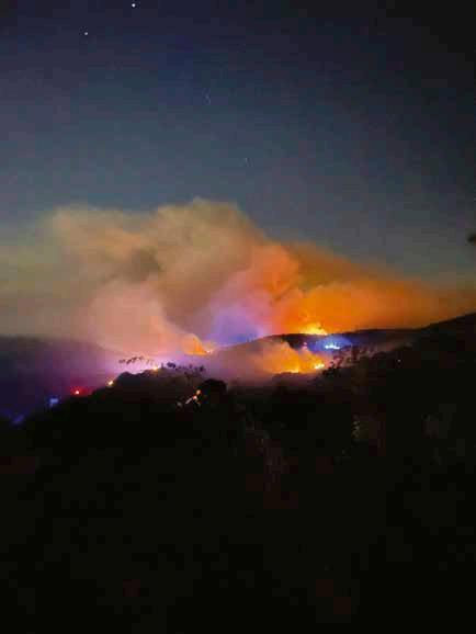
This picture is changing as the local climate evolves, with warmer summers and sustained periods of hot weather increasing the amount of dry wood biomass available, which heightens both the ignition of wildfires and the flammability of forests. In terms of the climate, the Italian side is more vulnerable to wildfires, as it’s hotter and drier than the Slovenian side, yet wildfires of course do not respect borders and can spread rapidly. “A wildfire which starts in the Slovenian Karst can easily cross over into Italy, and viceversa,” points out Dr Granceri Bradaschia. This means close and sustained cross-
border cooperation is essential if wildfires are to be managed effectively, an issue at the heart of Dr Granceri Bradaschia’s work in the Interreg-backed Karst Firewall 5.0 project, in which six partners are working together to develop innovative, eco-system based plans to enhance the resilience of the region. “There are several layers to this work, including issues around the nature of the land, as well as administrative and governance considerations,” he outlines.
Wildfires
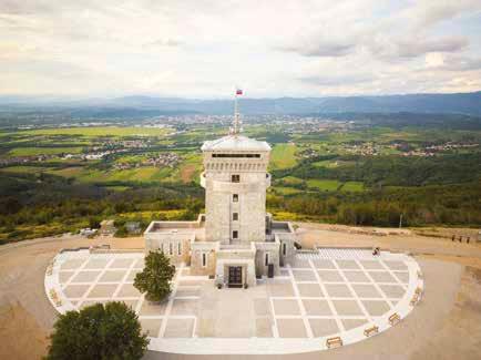
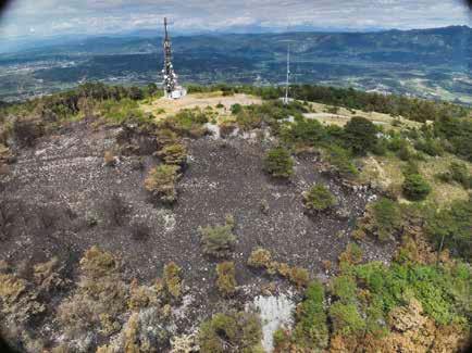
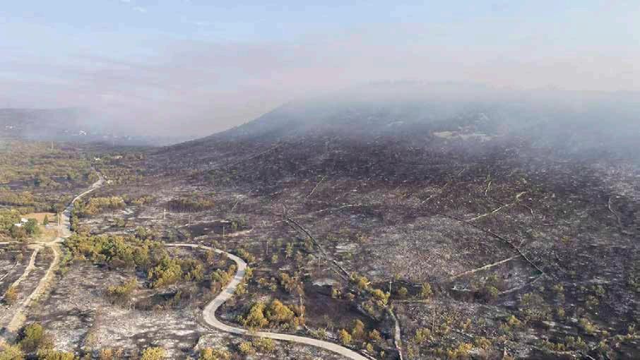
The vulnerability of the Karst was highlighted by the severe wildfires which swept across the region in 2022, burning around 4,100 hectares of forested land. While both sides of the border were affected, the fires had a more severe impact in Slovenia than in Italy for several reasons, including both natural factors like wind strength and direction, as well as mismanagement by local emergency agencies. As part of his role in the project, Dr Granceri Bradaschia is now working to reduce the risk of wildfires in future, which
would limit the need to call out civil protection agencies. “The belief is that if we work more effectively in the ordinary spatial planning stage, if we can reduce the vulnerability of forest land and grasslands, then there will be less need to activate civil protection agencies and firefighters,” he says.
Researchers from University of Venice (IUAV) and the Research Centre of the Slovenian Academy of Sciences and Arts (ZRC-SAZU) are working to co-produce vulnerability maps, together with both Italian and Slovenian forest rangers, which will prove highly valuable in these terms. The project team is following the risk concept framework, which can be sub-divided into three main elements; vulnerability, hazard, and exposure. “Vulnerability concerns the innate characteristics of the land, primarily forests and grassland, including the presence of vulnerable – flammable – species. We have also added data on other variables, such as the climate, and produced both hazard probability and vulnerability maps. We look to identify highly susceptible, flammable areas, considering things like the density of woodland, the presence of certain flammable species (e.g. Pinus nigra and Cotinus coggygria), and the steepness of the slope,” says Dr Granceri Bradaschia. The idea is to plan ahead and put measures in place, so that local agencies can then respond effectively to wildfires. “We are working with forest rangers, and aim to avoid activating civil protection agencies, as they can be very
expensive in financial and water resources terms, without mentioning the potential for fatalities among the workforce,” continues Dr Granceri Bradaschia.
A greater focus on prevention and effective spatial planning will also help protect assets in the region, such as critical infrastructure and houses, which can be very exposed when wildfires spread. It may not always be possible to prevent wildfires though, so alongside mapping vulnerability, Dr Granceri Bradaschia and his colleagues are also working to ensure they are detected rapidly where they do occur, and to assess how they are likely to develop over time.
“Together with ZRC-SAZU and Infordata
we work with predictive algorithms and information and communication technologies (ICT). We are implementing thermal cameras and electric nodes in order to detect, in real time, potential smoke and wildfires,” he outlines. The project team have produced maps on both hazard probability and vulnerability, considering both the characteristics of the land and the potential for a wildfire to spread, which have been shared with Italian and Slovenian forest rangers. “This is a participatory project, and there are different priorities either side of the border,” stresses Dr Granceri Bradaschia. The team at IUAV has been supported by the Slovenian NGO PiNA for public and civic engagement activities. This is part of efforts to establish more lines of dialogue between the two sides and overcome decades of mutual suspicion, as well as linguistic and cultural differences. Italy and Slovenia may be relatively close neighbours, yet they were on opposite sides of the iron curtain during the Cold War and there is a long history of tense relations, while Dr Granceri Bradaschia says the physical characteristics of the Karst region also differ either side of the border. “The Italian Karst is a relatively small strip of land near the Adriatic coast, much of which has been abandoned. The woods are used a bit for log production, while the rest is in the hands of private owners, some of whom have mismanaged it. In Slovenia they have a more economically-focused approach,

where silviculture is an important industry” he explains. The black pine is perceived as holding a lot of value in this respect, so in some cases there is a degree of reluctance to cut it down. “In Slovenia some people argue for the retention of black pine, they still don’t tend to view it as a problematic species,” says Dr Granceri Bradaschia.
Physical interventions
The project is playing a critical role in this respect, with information-sharing and cross-border cooperation providing the foundations of a more common approach that will boost the resilience of the region as a whole to wildfires. The project team are exploring two types of physical intervention; one is cutting down the more flammable trees, while a second is improving the grassland. “The idea is to do as much preventative work as possible before the wildfires spread,” explains Dr Granceri Bradaschia. This work also holds wider relevance; wildfire risk is a critical consideration in the development of infrastructure and housing plans for example, another topic that is being addressed in the project. “We are proposing specific
measures for spatial planning approaches. We would argue that it’s important to avoid a scattered approach to developing the urban fabric, where single houses are built within a wood, or in close proximity to it,” says Dr Granceri Bradaschia.
This is an inherently risky approach, believes Dr Granceri Bradaschia, as single
houses in this type of situation are essentially surrounded by fuel (i.e. wood) for fires, so would be highly exposed in the event of a wildfire. Compact villages, an idea dating back centuries, are a significantly safer and more resilient option, says Dr Granceri Bradaschia. “Grassland and agricultural land surrounding compact villages can act as a kind of buffer between the urban tissue and a forested area. We are working with a masterplan with a zoning scheme, each of which has its own characteristics. The idea is to essentially create a buffer zone, either agricultural or grassland, between urban areas and the forest,” he outlines. This is one illustration of how the project’s work is heightening awareness of fire risk and associated problems, encouraging regional and national authorities to think about the issue in more holistic rather than sectoral terms. “We want to encourage a more multi-sector, multi-level approach to fire risk prevention and management, instead of approaching it with a silo mentality,” says Dr Granceri Bradaschia. The hazard and vulnerability maps will be highly valuable in this respect, enabling the authorities to look further ahead,
consider specific scenarios, and develop plans. This represents a significant step forward, as there has historically been very little research on the risk of wildfires in the Karst, a knowledge gap that Dr Granceri Bradaschia and his colleagues are working to fill. “We produce knowledge and we also provide practical solutions, acknowledged by key local stakeholders,” he says. These different measures will also be tested and assessed in four pilots, in the municipalities of Duino-Aurisina (ITA) and MirenKostenjevica (SLO) which can then guide the ongoing development of fire prevention
and forest rangers. The wider potential of the predictive algorithm model will also be highlighted, with Dr Granceri Bradaschia keen to turn the project’s applied research into practical applications in the Karst region. “We want these tools to be acknowledged, legitimised, and used at the regional level,” he says. Many bureaucratic hurdles need to be negotiated first, however.
“We are really at quite an early stage in the goal of creating a trans-boundary scheme and establishing protocols,” acknowledges Dr Granceri Bradaschia. “We have faced certain bureaucratic challenges, so we will
“The belief is that if we work more effectively in the ordinary spatial planning stage, if we can reduce the vulnerability of forest land and grasslands to wildfires, then there will be less need to activate civil protection agencies and firefighters.”
and management plans for the Karst region. “We will be able to show the pros and cons of our approach to the local authorities, and provide them with further, more detailed information about our work,” continues Dr Granceri Bradaschia. “It’s very important that our online platform (https://karst.way. to.it/) is used and understood here in the Karst, and over the next few months we will engage with some of the key stakeholders.”
This includes national, regional, and local authorities on the Slovenian side, to demonstrate the importance of the physical interventions, while participatory activities are also planned on the Italian side, where the online data repository will be presented to civil protection agencies, firefighters
extend the project slightly and finish later than originally planned. We aim to have finished all of the project activities by the end of August 2026.”
A final conference is planned for May 2026, at which most of the project’s work and tools will be presented, which could then open up wider possibilities beyond the Karst region. While the project has focused specifically on the Karst, many other regions across Europe are vulnerable to wildfires and climate change is likely to heighten the risk further, so Dr Granceri Bradaschia is keen to explore whether the tools and platform could be applied more widely. “The idea is to capitalise on the project’s research and scale-up this approach,” he says.
Karst Firewall 5.0
Innovative ecosystem-based plan to adapt to climate change in the Karst. Promoting Fire-resilient forestry supported by Industry 5.0
Project Objectives
The Karst Firewall 5.0 project addresses the issue of forest wildfires in the Karst area, exacerbated by the phenomenon of climate change, with a focus on the area burned in the summer of 2022 in the Municipalities of DuinoAurisina (IT) and Miren Kostanjevica (SL). On the basis of the research work done to improve the wildfire-related knowledge, the project draws up a series of climate change adaptation measures and implements a selection of these measures through pilot actions.
Project Funding
The project Karst Firewall 5.0 is co-funded by the European Union as part of the Interreg VI-A Italy-Slovenia Programme (ref. ITA-SI0600146)
Project Partners
• Università IUAV di Venezia
• ZRC SAZU - Znanstvenoraziskovalni center Slovenske akademije znanosti in umetnosti
• Infordata Sistemi Srl
• Comune di Duino Aurisina – Občina Devin Nabrežina
• Občina Miren-Kostanjevica
• Kulturno izobraževalno društvoAssociazione Culturale ed Educativa - PiNA
Contact Details
Project Coordinator, Francesco Musco
Università IUAV di Venezia Santa Croce 191 - 30135 Venezia
E: karstfirewall@iuav.it
W: www.ita-slo.eu/en/karst-firewall-50 W: www.iuav.it


is a post-doctoral researcher at the University Iuav of Venice with more than 10 years of work experience in Urban and Environmental Planning, Climate Change Adaptation, Monitoring and Evaluation, and Public policy analysis.
Prof. Francesco Musco, Ph.D is Full Professor in Urban and Environmental Planning at the University Iuav of Venice’s Department of Architecture and Arts. He served as Director of Research at Iuav from 2021-2024 and is Director of the MS in Urban Planning for Transition.