FLOOD
WHAT YOU SHOULD KNOW
FLOOD HAZARD INFORMATION
The City of Tamarac participates in the Community Rating System of the National Flood Insurance Program. As of October 1, 2011, the City holds a Class 6 rating for Special Flood Hazard Areas (SFHA), which results in a 20% discount on flood insurance premiums for Tamarac properties within a flood zone.
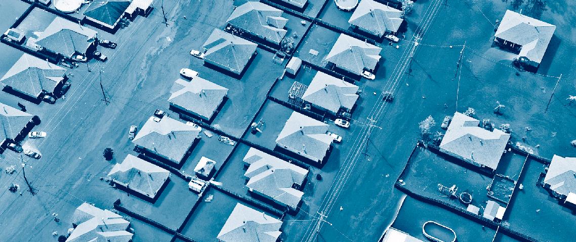
During extended periods of heavy rainfall, low-lying neighborhoods within the City are subject to flooding. This information is offered to help you protect your property and reduce potential losses due to flooding. Please refer to it in the event of an impending hurricane, tropical storm or projected heavy rainfall.
FLOOD HAZARD
Tamarac maintains a waterway system consisting of over 527 acres of open canals and lakes that meander through the City. All the City’s drainage systems are required by City code to discharge into one of our canals or lakes that flow into the C-13 and C-14 canals owned and operated by the South Florida Water Management District.
The soil in Tamarac is typically not very permeable. Therefore, during saturated conditions or when the water table is high, very little water seeps into the ground. In order to increase stormwater storage within the City during tropical weather systems, the City passed an ordinance in 1979 requiring all new developments to provide additional areas to store and retain stormwater on site before discharging it into the public system.
The City is divided into two defined drainage basins. Generally, all drainage west of NW 64th Avenue flows north into the C-14 canal (also known as the Cypress Creek Canal), and the drainage east of NW 64th Avenue flows south into the C-13 canal. The C-13 and C-14 canals flow east to the intracoastal waterway where they discharge.
HISTORICAL FLOODING: PROTECT YOUR PROPERTY, BUY FLOOD INSURANCE
While Tamarac’s most devastating storm, Hurricane Wilma (2005), was not a wet hurricane, others are. In 1999, Hurricane Irene deposited a significant amount of rain in a 24-hour period, causing severe flooding in residential areas and more than $640,000 in flood damages in Tamarac. Your property may be at a high enough elevation that it has never flooded, but if it’s in the flood zone, it could be damaged by flooding, no matter the history.


We hope this brochure helps you learn how to protect yourself. A map showing flood problems and historical flooding is available online at www.tamarac.org/flood.


NATURAL AND BENEFICIAL FUNCTIONS:
State regulations protect natural areas that help reduce the risk of flooding. When portions of floodplains are preserved in (or restored to) their natural state, they provide many benefits to both human and natural systems. These benefits range from providing aesthetic pleasure to reducing the number and severity of floods, helping handle stormwater runoff and minimizing non-point water pollution. In fact, Tamarac’s 164 acres of parks play a vital role in helping drain water through to the aquifer that replenishes South Florida’s water supply. These areas may be viewed on maps available online at www.tamarac.org/flood.
FLOOD INSURANCE:
PROTECT YOUR PROPERTY, BUY FLOOD INSURANCE
If you don’t already have flood insurance, talk to your insurance agent. Most homeowners insurance policies don’t cover flood damage. However, because Tamarac participates in the National Flood Insurance Program, you can purchase a separate flood insurance policy. This insurance is backed by the federal government and is available to everyone, even for properties that have been flooded.
• Statistics show that all homes have a 26% chance of experiencing a flood during the life of a 30-year mortgage.
• It is also important to note that there is a 30-day waiting period before coverage goes into effect.
BUILDING COVERAGE CONTENTS COVERAGE
Single Family Dwelling $250,000 Residential $1 00,000 Other Residential $250,000 Non-Residential $500,000 Non-Residential $500,000 Small Business $500,000 Small Business $500,000
FLOOD WARNING SYSTEM:
The City of Tamarac and Broward County depend on the National Weather Service (NWS) for flood recognition. The NWS issues flood advisories for Broward County at least six hours before expected rainfall that could overflow drainage systems and cause the isolation of structures by the inland ponding of floodwaters. Residents should tune in to TV and radio weather broadcasts and be alert to special local advisories. The following stations carry advisories for our area:
DRAINAGE SYSTEM MAINTENANCE:
Proper drainage helps reduce flood risk. It’s illegal to directly or indirectly discharge any solids, liquids (such as paints, gasoline, oils, etc.) or gaseous matter into the drainage system. The City inspects the drainage system and removes blockages that are found or reported. If you live near areas where waters flow, you can help in this process by keeping the stormwater pipes and catch basins clear of brush and debris. Report any violations to the Tamarac Public Services department at (954) 597-3700 or the Broward County Environmental Protection Department notification hotline at (954) 519-1499.
As part of the City’s road cleaning and debris removal programs, the streets are swept once monthly for curbed sections and twice monthly for uncurbed sections. City crews make frequent site visits to ensure catch basins and pipes are free of obstructing materials that would impede stormwater flow. Specifically, working in conjunction with different regulatory agencies, City crews inspect the drainage system and remove blockages prior to a reported major storm event. Here are some things you can do: Don’t throw or dump anything into storm sewers or canals. Even grass clippings and branches can accumulate and plug channels and drains. A plugged channel or storm drain can’t carry water when it rains. Clogged storm drains will cause water to back up into the street and may cause flooding. Every piece of trash contributes to flooding.
If your property is next to a catch basin or stormwater pipe that discharges into a canal and is visible, help keep the banks clear of brush and debris. The City has a canal maintenance program, which can help remove major blockages such as downed trees.
FLOOD SAFETY, PROPERTY PROTECTION & ASSISTANCE:
June 1st is the official start of the hurricane season, and it’s recommended that you look at the hazards that could affect your home a few months beforehand. Know your home’s vulnerability to flooding and wind damages and prepare to keep your families, homes and businesses safe during the hurricane season by using the appropriate materials such as storm shutters and reinforced garage doors.
If you’re advised to evacuate, turn off utilities at the main switches or valves. Disconnect electrical appliances, but don’t touch any electrical equipment if you are wet or standing in water. Avoid fast flowing water or unstable banks. Property protection measures should be taken at the onset of a flood. If flooding is likely, and time permits, move essential items and furniture to the upper areas of your home. Keep materials like sandbags, plywood, plastic sheeting and lumber handy for emergency waterproofing. This action will help minimize property damage from floodwaters.
MAP DETERMINATIONS and ELEVATION CERTIFICATES:
The City can provide copies of available elevation certificates for newer and substantially improved buildings and make flood zone determinations; simply call (954) 597-3420. Elevation certificates include the elevation of your structure and the 100-year historic flood level. In addition, they help determine if a structure is above flood level and whether flood insurance is necessary. Please refer to the map on the last page to determine if your property lies in the Special Flood Hazard Area (AE or AH zones). Maps for flood determination and elevation certificates are available online at www.tamarac.org/flood.
EVACUATION:
Tamarac is not in the mandatory evacuation zone. Broward County advises people not in the evacuation areas to take shelter in their own home.
Being prepared is a vital part of getting through a storm. Contac t Tamarac Fire Rescue at (954) 597-3800 for information regarding hurricane preparedness. Fire Rescue also has programs to better prepare the community as to what to do and when to do it when a storm approaches.
Broward County provides special needs shelters. If you have special needs that may meet the County criteria, call the Broward County Special Needs Registration line at (954) 831-3902. PLEASE NOTE: YOU MUST BE PREREGISTERED BEFORE ARRIVING AT THE SHELTER.
FLOODPLAIN DEVELOPMENT PERMIT REQUIREMENTS:
OBTAIN BUILDING PERMITS
All buildings under construction require permits. Contact the Building department at (954) 597-3420 or 6011 Nob Hill Road, first floor, before starting construction, to report any illegal work done in the flood plain or if you have any concerns.
SUBSTANTIAL IMPROVEMENT REQUIREMENTS:
The City of Tamarac and the National Flood Insurance Program require that if the cost of reconstructing, rehabilitating, adding on or otherwise improving a building equals or exceeds 50% of its market value, the building must meet the same construction requirements as a new building, including lowest floor elevations. Substantially damaged buildings must also be brought up to the same standards.
PET SAFETY TIPS:
During a hurricane, service animals are permitted in Broward County’s General Population Shelters if they meet the ADA requirements under federal law. In addition, the County operates a pet-friendly shelter for those who live in evacuation zones or mobile homes. For additional information, contact Broward County at (954) 831-4000.
SECURING BOATS:
If you own a boat, it’s your responsibility to secure it. Plan in advance to move your boat or arrange for its storage. Check with a local marina for suitable alternatives.
If possible, store your boat inside a garage or warehouse. If you must leave it outside, attach the trailer tongue to something firm in the ground, let the air out of the tires and make sure the boat is secured to the trailer. If possible, fill the bilge with water, which adds extra weight.
If you plan to keep your boat in the canal, be sure to double the dock lines, leaving sufficient space for the tidal range and put out extra anchors. Remember to remove all unsecured equipment, including marine electronics. Self-furling sails and Bimini tops should be removed from sailboats. Boats on davits should be secured with extra tie lines and in such a manner to keep them from swinging during high winds.
Be sure to have the vessel registration and boat hull numbers available if you need to report it lost, stolen or damaged.
DID YOU
KNOW...floods are the most common natural disaster? Here are a few safety tips to consider if you are ever faced with flooding:
Do not walk through flowing water, nor drive through a flooded area. Drowning is the number one cause of floodrelated deaths. Currents can be deceptive; six inches of moving water can knock you off your feet. If you walk in standing water, use a pole or stick to ensure the ground is still there. Also, do not disregard road barriers, the road or bridge may be washed out. Remember to treat nonoperational traffic signals as 4-way stop signs. Avoid driving unless absolutely necessary. Turn Around – Don’t Drown. Have your electricity turned off by FPL. Some appliances such as television sets hold electrical charges even after unplugging. Avoid using appliances or motors which have gotten wet unless they have been taken apart, cleaned and dried.
Stay away from power lines and electrical wires. Electrocution is the number two flood-related killer. Beware that downed power lines in the water may pose a threat of electrocution. Electrical currents can travel through water. Report downed power lines by calling 911 or FPL at 1 - 800 - 4 - OU TAGE ( 1-800-468-8243).
Look before you step. After a flood, the ground and floors may be covered with debris, including broken bottles and nails. Floors and stairs covered with mud can be very slippery.
RF 1580
WPLG Channel 10
SITE VISITS:
Upon request, a representative of the Public Services Engineering division will meet with property owner(s) on site to discuss his/her concerns regarding flooding, drainage and stormwater. To request a site visit, please call Public Services at (954) 597-3700.
If your home is susceptible to flooding, consider retrofitting the surrounding terrain to reduce risk through modifications such as the installation of an earthen berm or small flood-wall. Home modifications include raising the home, waterproofing the walls, and elevating electrical panel boxes, furnaces, water heaters, and washers and dryers to locations less likely to flood. FEMA has federal grant funds available for property protection measures through their Flood Mitigation Assistance program. For information on grant eligibility and applications, contact FEMA Regional Office IV, Atlanta, GA at (770) 220-5400 or www.FEMA.GOV/flood-mitigation-assistance-grant-program.

Plan ahead. Talk to a friend or family member who lives in an area not expected to be affected by the hurricane. Ask if their home would be open to you and your pet should a storm threaten. Be responsible Don’t leave pets home alone during a hurricane. A secure room and a few days of food and water don’t mean they will be safe. Many people returned home after Hurricane
Be ready for the unexpected. Place important documents inside plastic bags or other waterproof containers. Review your insurance policy to ensure it provides adequate coverage. Know what type of coverage you have. Most policies cover windstorm damage, but not flooding. Any policy change usually takes 30 days before going into effect.
Be alert for gas leaks. If you use natural gas, use a flashlight