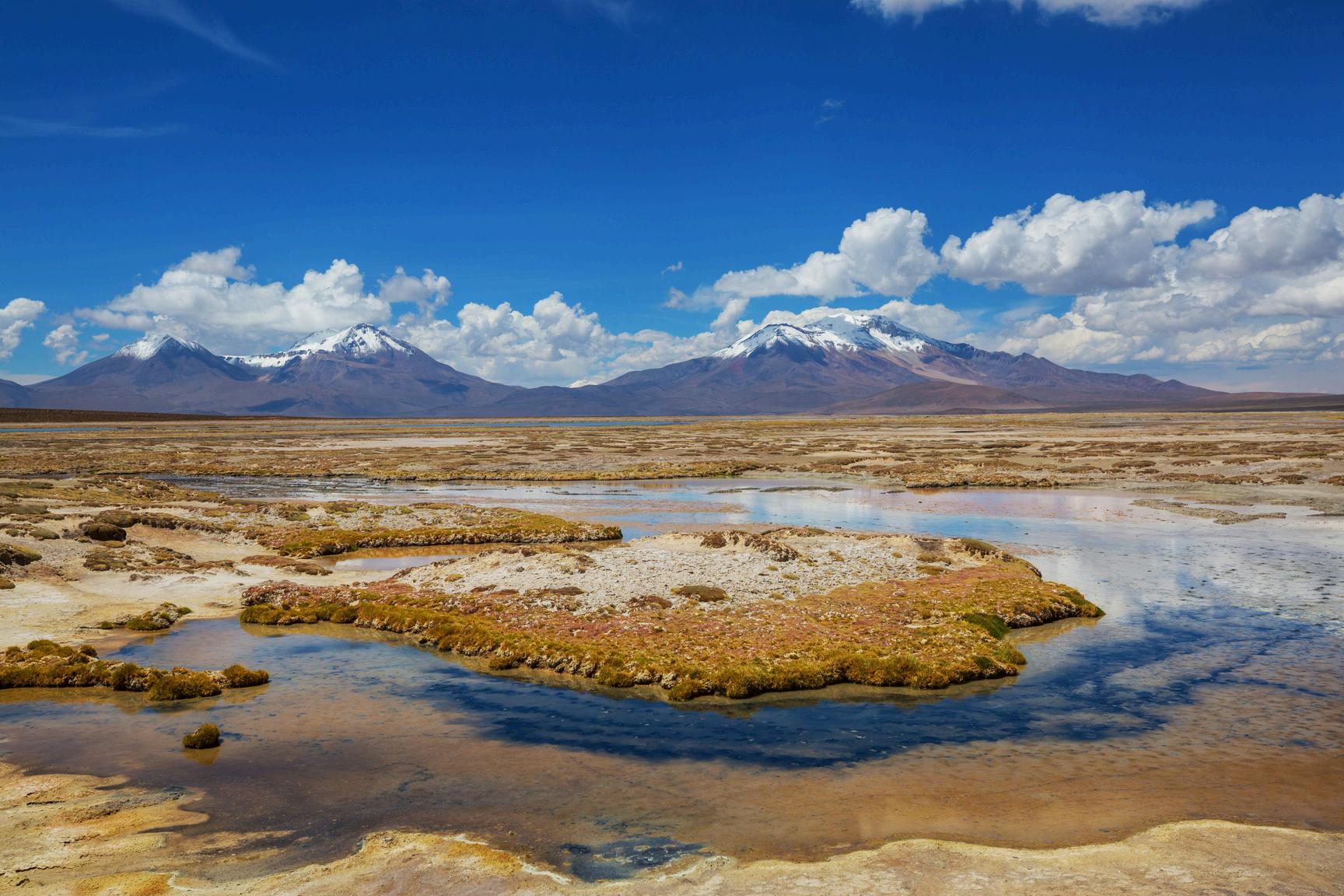
Chile,alandshapedbyearthquakes,wheretheEarthisconstantlyshiftingandeven one of its most traditional cocktails is known as the “Earthquake”, will become the epicenterofanunprecedentedscientificgatheringinSouthAmerica.
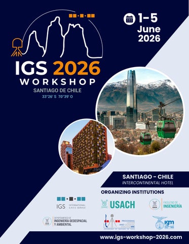
From June 1 to 5, 2026, Santiago, Chile, will host the global GNSS and geodesy community for the IGS Workshop 2026, organized by the University of Santiago de Chile(USACH)incollaborationwiththeMilitaryGeographicInstitute(IGM).
This edition of the Workshop will bring together researchers, scientists, institutions, and industry leaders from around the world to share the latest advances, innovations, and challenges related to the International GNSS Service (IGS) and the futureofglobalgeodesy.
We are also pleased to inform participants that simultaneous English–Spanish translationwillbeprovidedthroughouttheWorkshop,fosteringamoreinclusiveand connectedinternationalexperience.
Beyond its scientific program, IGS 2026 offers a unique opportunity to experience Chile, a country internationally recognized for its seismic and geodetic significance, modern infrastructure, academic excellence, and extraordinary geography stretchingfromtheAtacamaDeserttoPatagonia.
We warmly invite you to join us at the IGS Workshop 2026 in Santiago, Chile, where science,innovation,andglobalcollaborationconverge.
Dr.JoséAntonioTarrío LOCChair
Electricity: 220 V, 50 Hz.
Plug types C and L. Bring a travel adapter if needed.
If you are a foreigner and during your stay in Chile you are affected by an emergency, you should contact your country's Consulate in Chile, who can advise you on how to obtain assistance from local care networks, such as the following:
Firefighters
Foreignconsulatesin Chile
We strongly recommend that all participants traveling to Chile obtain comprehensive travel insurance prior to departure Insurance coverage should ideally include medical assistance, hospitalization, accidents, trip cancellation, personalliability,andlossordelayofluggage.
n citizenship, length of stay, and purpose fficial website of the Chilean Ministry of Chilean Embassy or Consulate well in or the duration of your stay and that all eforedeparture.
RolfDach GoverningBoard
IGSChair
ElisabettaD’Anastasio GoverningBoard Vice-Chair
Gustavo Caubarrère Chair
UnivGustaveEiffel,Géodata Paris UniversitéParisCité,Institut dephysiqueduglobede Paris,France
The Symposium is structured around five scientific sessions covering GNSS infrastructure, reference frames, real-time services, atmosphere and space weather, andsocietalapplications.
The keynote lectures connect the workshop’s scientific scopewithChile’sstrategiccontext: ALMA:InSearchofOurCosmicOrigins ResilientHigh-PrecisionPositioning ARoadmapforAutonomousTechnologicalDevelopment IGS and SIRGAS: 30+ Years of GNSS Geodesy in the Americas Chile´sNationalTsunamiWarningSystem
GNSS for society, including geohazards, climate change,andsustainability.
KeynoteSpeakers
PresentationTitle
ALMA:InSearchofOurCosmicOrigins
Biography:
SeanDougherty–CanadianAstrophysicist
SeanDoughertyhasservedasDirectoroftheALMAradiotelescopeinChile since 2017. With more than 30 years of experience in radio astronomy leadership,hehasoverseenmajorinternationalscientificandtechnological projects,includingcontributionstotheJVLAintheUnitedStatesandtheSKA Observatory in South Africa. He previously directed Canada’s Dominion Radio Astrophysical Observatory (DRAO) and has held key leadership roles within the ALMA organization Mr Dougherty holds degrees in Mathematics, rophysics.
KeynoteSpeakers
PresentationTitle
ResilientHigh-PrecisionPositioning
Biography:
Gustavo Mansur, Ph.D – Universidade Federal do Paraná, Master's degree, GeodesyScience
With experience in GIS, GNSS, Python, geospatial processing, and spatial analysis, he is a dedicated professional in GNSS engineering and data science. His ti i l d th i l t ti f statistical methods in Python, SS orbit and clock combination cipated in topography projects, s, and supported environmental cision with strong analytical and
PresentationTitle
ARoadmapforAutonomousTechnologicalDevelopment
Biography: ChristianStuardo–GeneraldeBrigadaAérea
Brigadier General (Air Force) entered the Chilean Air Force Academy “Capitán Manuel ÁvalosPrado”in1993andgraduatedasanEnsignin1996.HelaterearnedadegreeinAir DefenseEngineeringfromtheAeronauticalPolytechnicAcademy.
Throughout his career in the Chilean Air Force, he has held several leadership positions, including Commander of the Space Operations Group, Commander of the Academic Instruction Squadron at the Air War Academy, and Head of the Information Technology and Computing Center. In 2023, he was appointed Chilean Defense and Air Attaché in Israel,andin2026hewaspromotedtotherankofAirBrigadeGeneral.
His academic background includes studies in Industrial Civil Engineering, Military ter of Strategic Studies from the Air hasservedasaprofessorattheAir es.
PresentationTitle
IGSandSIRGAS:30+YearsofGNSSGeodesyintheAmericas
Biography:
CatalinaCáceres-OfficialProcessingCenterSIRGASUSC
She holds a degree in Surveying Engineering and specializes in geodetic applications related to transformations between classical reference systems (PSAD56/SAD69/HITOXVIII)andmodernreferencesystems(SIRGAS/REDGEOMIN)inChile.
She currently serves as Coordinator of the SIRGAS-CON Network Analysis and has extensive experience in geodetic data analysis and reference frame processing. In addition,shehasworkedasalaboratoryinstructorinGeodeticAdjustmentandNetwork Adjustment, contributing to the academic training of students and professionals in geodesy.
She is also part of the Official SIRGAS Associated Processing Center “USC,” supporting GNSSdataprocessingandregionalgeodeticinitiatives.
KeynoteSpeakers
PresentationTitle
Chile´sNationalTsunamiWarningSystem
Biography:
Capitán de Navío Carlos Zúñiga - Director del Servicio Hidrográfico y Oceanográfico delaArmadadeChile(SHOA)
CaptainCarlosZúñigaisaHydrographicEngineer,Category'A'Hydrographer,andholds anMScinPhysicalOceanography.HehasservedintheChileanNavyfornearly30years, spending the majority of his career at the Hydrographic and Oceanographic Service (SHOA),wherehecurrentlyservesasDirector.Overthepast13years,CaptainZúñigahas dedicated his expertise to enhancing and developing the Chilean National Tsunami Warning System, working in close collaboration with SENAPRED, CSN, and both local and internationalacademia.HeservedastheAssociateDirectoroftheInternationalTsunami Information Center (ITIC) from 2013 to 2023 and is currently a Vice-Chair of the )ofUNESCO
GeoDE:theGeodesy DatabaseEngineforGNSS DataProcessing, Management,and NASAJet Propulsion Laboratory, California Instituteof Technology UNITED STATES SData ble g,and GFZ GERMANY
PORTUGAL
1 P1 01 Miyahara
Mr. Basara Miyahara
1 P1 02 Jolivet Dr. Laurent Jolivet
1 P1 03 Ramatschi
1 P1 04 Imada
1 P1 05 Romero
1 P1 06 Mu
Mr. Markus Ramatschi
Ms. Emi Imada
Dr. Ignacio Romero
Dr. Lei Mu
IGS Analysis Center “JGX” –Evaluation of Products Performance
Geospatial Information Authority of Japan JAPAN
Monitoring Emerging Galileo Services through the REGINA GNSS Global Network CNES FRANCE
Recent Developments in GFZ’s GNSS Contributions: Network, Realtime, and the GIPP Instrument Pool GFZ GERMANY
Overview of MADOCA: Architecture and Recent Developments JAXA
EGON: The ESA/ESOC GNSS Observation station Network CSC Ltd UNITED KINGDOM
Autonomous Time Synchronization and Reference Maintenance in LEO Satellite Constellations Shanghai Astronomical Observatory CHINA
1 P1 07 Lkhamsuren
Mrs. Zolzaya Lkhamsuren
Geodetic Reference Frame & ITRF Alignment
1 P1 08
Mr. JeanChristophe
General Authority for Land Administration Geodesy and Cartography
GSSC: GNSS Science Support Centre re ESA GERMANY
MONGOLIA
1 P1 09 de Seixas
1 P1 10 de Seixas
Prof. Dr. Andrea de Seixas
Prof. Dr. Andrea de Seixas
GNSS Data Robustness and Resilience: The Recife Multi-GNSS Experimental Nucleus for Autonomous Assessment of PNT Service Performance, Integrity and Continuity
Technological Evolution of a GLONASS Ground Segment Station Located in Recife, PE, Brazil
Session1-P1
Associação
Instituto de Tecnologia de PernambucoITEP
Associação
Instituto de Tecnologia de PernambucoITEP
1 P1 11 Voltare Zaupa
1 P1 12 Galera Monico
1 P1 13
Spesivtsev
Mr. João Pedro Voltare Zaupa
Prof. João Francisco Galera Monico
Mr. Aleksandr Spesivtsev
Stability and Convergence Gains from Multi-Constellation GNSS in Precise Point Positioning Using 2 Hz Data FCT UNESP BRAZIL
Study of the Quality of IGS Analysis Center Final and Rapid Products Using PPP-AR derived solutions
Universidade
Estadual Paulista BRAZIL
Cloud-based GNSS data processing at GeoNet: Navigating the migration Earth Sciences New Zealand NEW ZEALAND
2 S2 01 Kalarus
Dr. Maciej Kalarus
Experimental CODE products based on GPS L1/L5 signals
Session2-S2
University of Bern, Astronomical Institute SWITZERLAND
2 S2 02 Sosnica
Prof. Krzysztof Sosnica
2 S2 03 Gravelle
Mr. Mederic Gravelle
Improving GNSS positioning by clock constraints
2 S2 04 Geng
Prof. Jianghui Geng
2 S2 05 Schönemann
Dr. Erik Schönemann
2 S2 06 Guo (Jing)
Prof. Jing Guo
2 S2 07 Katsigianni
Dr. Georgia Katsigianni
2 S2 08 Gazzino
Dr. Clément Gazzino
Institute of Geodesy and Geoinformatics, Wrocław University of Environmental and Life Sciences POLAND
Comparison of GPS-only and Galileo-only ambiguity-fixed PPP solutions: insights from the SPOTGINS analysis center LIENSs FRANCE
Consistent in-orbit calibration of all-frequency BDS-3 satellite antenna phase centers and their implications for the terrestrial reference frame scale
ESA Code Bias Reference Frame
BDS-3 high-accuracy products based on modernized B1C and B2a signals: the threat of pilot–mixed channel and signal distortion biases
IDEFIX: An algorithm for the comparison and validation of fixed ambiguities
GNSS satellite hardware biases stability over time: long term analysis of the products from several analysis centers and impact from flex power.
State Key Laboratory of Precision Geodesy, APM, CAS, Wuhan CHINA
European Space Agency GERMANY
Wuhan University CHINA
Collecte Localisation Satellites (CLS) FRANCE
CNES FRANCE
2 S2 09 Guo (Jiang)
2 S2 10 Duan
2 S2 11 Dilssner
2 S2 12 Akiyama
2 S2 13 Sermanoukian
Dr. Jiang Guo
Mr. Bingbing Duan
Dr. Florian Dilssner
Continuous and multi-GNSS IPPP link for UTC BIPM FRANCE
Toward a standardized GNSS satellite attitude modeling framework
High-Precision Radiation Force Box-Wing Modeling of Galileo FOC Spacecraft
Mr. Kyohei Akiyama
Mr. Ivan Sermanoukian Molina
2 S2 14 Peidou
Dr. Athina Peidou
2 S2 15 Gini
Dr. Francesco Gini
Precise Orbit Determination of QZSS Satellites Integrated with LEO Onboard GNSS Observations
Technical University of Munich GERMANY
European Space Operations Centre (ESOC) GERMANY
Japan Aerospace Exploration Agency JAPAN
Making It COOL: Enhancing ESA’s COmbination at the Observation Level VisionSpace Technologies GERMANY
Integrating Four Space Geodetic Techniques for Terrestrial Reference Frame Recovery
Genesis: Status and performance analysis of the GNSS instrument
NASA Jet Propulsion Laboratory, California Institute of Technology UNITED STATES
European Space Agency GERMANY GNSS
Astronomical Institute, University of Bern SWITZERLAND
2 S2 17 Zajdel
2 S2 18 Kang
2 S2 19 Tarrío Mosquera
Dr. Radosław Zajdel
Dr. Zhigui Kang
Dr. José Antonio Tarrío Mosquera
Three Decades of GNSS-Derived Geocenter Motion
Earth’s Gravitational Coefficient
GM and Geocenter Motion
Determination using LEO GPS Data
Time-Dependent GNSS
Reference Frames in Tectonically Active Regions: The ADELA Approach within SIRGAS
Geodetic Observatory Pecný (GOP)
Center of Space Research, The University of Texas at Austin UNITED STATES
2 P2 01 Dach
Mr. Rolf Dach
2 P2 02 Kobel
Dr. Cyril Kobel
Activities at the CODE Analysis Center
Advancing Zero-Difference
GNSS Processing for Operational Use at Center for Orbit Determination in Europe (CODE)
2 P2 03 Brockmann
Dr. Elmar Brockmann
2 P2 04 Banville
Mr. Simon Banville
2 P2 05 Gini
Dr. Francesco Gini
2 P2 06 Männel
Dr. Benjamin Männel
2 P2 07 Loyer
2 P2 08 Ries
Mr. Sylvain Loyer
Dr. Paul Ries
Astronomical Institute, University of Bern
Quality Monitoring of MultiGNSS Product Series at the CODE Analysis Center University of Bern SWITZERLAND
Next-Generation GNSS Precise Orbit Determination (POD) Software for the EMR Analysis Center
Natural Resources Canada (NRCan) CANADA
ESA IGS Analysis Centre –Status Update SSC Space GmbH
Recent developments of EPOS software at GFZ: GNSS and LEO integrated data processing
CNES/CLS IGS Analysis Center 2024/2026 Activities
Testing new Empirical SRP Models at the JPL IGS Analysis Center
GFZ Helmholtz Centre for Geosciences, Potsdam, Germany
NASA Jet Propulsion Laboratory, California Institute of Technology UNITED STATES
2 P2 09 McFarland
Mr. Phillip McFarland
2 P2 10 Tan
Dr. Weijie Tan
2 P2 11 Zajdel
Dr. Radosław Zajdel
2 P2 12 Barnéoud
Mr. Julien Barnéoud
2 P2 14 Wang
Prof. Xiaoya Wang
2 P2 15 Yezhi Prof. Song Yezhi
Session2-P2
Genetic Algorithm Optimization of GNSS Ground Tracking Networks for Orbit Determination NOAA / NGS
GNSS Determination of EOP at 12-Hour Resolution
Beyond Constellations: Revealing Natural Satellite Groups in Multi-GNSS Landscape
Midnight discontinuities in repro3 orbits: what can we learn about solar radiation pressure mismodeling?
GRACE-FO Real-Time Precise Orbit Determination with Onboard GPS and Inter-Satellite Ranging Measurements Based on DIA Quality Control Algorithm
Precise Orbit Determination and Spacetime Transformation for Autonomous Navigation in the Earth-Moon Space
Shanghai Astronomical Observatory, Chinese Academy of Sciences, Shanghai, China
Geodetic Observatory Pecný (GOP)
IGN-IPGP
Shanghai Astronomical Observatory, Chinese Academy of Sciences
Shanghai Astronomical Observatory, Chinese Academy of Sciences CHINA
CHINA
2 P2 17 Schönemann
2 P2 18 Abe
2 P2 19 Byram
2 P2 20 Rebischung
Dr. Erik Schönemann
An Update on Genesis Mission Status
Mr. Satoshi Abe Initiative for Estimating the QZSS Reference Frame
Dr. Sharyl Byram
Dr. Paul Rebischung
2 P2 21 Rebischung
2 P2 22 Männel
2 P2 23 Fang
2 P2 24 Tarrío Mosquera
Dr. Paul Rebischung
Dr. Benjamin Männel
Dr. Peng Fang
Status of the IERS Conventions Updates
pytrf: a Python toolbox for the analysis of time series and terrestrial reference frames
Session2-P2
ESA Directorate of Navigation, ESA/ESTEC, Noordwijk, The Netherlands
Geospatial Information Authority of Japan JAPAN
USNO
2 P2 25 Cisneros Revelo
Dr. José Antonio Tarrío Mosquera
Mr. David Alexander Cisneros Revelo
Generating realistic synthetic GNSS station position time series to evaluate automatic discontinuity detectors IGN-IPGP
Impact of surface loading deformation on GNSS products
Intra-frame deformation model (IFDM) for the Western U.S.
Application of IGS Products to the Development of Kinematic Reference Frames in Seismically Active Regions: The SIRGAS-CON Network
Probabilistic Neural Networks for Tropospheric and Ionospheric Delays with Calibrated Uncertainties in GNSS Positioning
GUARDIAN Scout : First Global AI-Driven System for Automated Detection of Ionospheric Disturbances from Natural Hazards
Deep learning-based GNSS tomography for high-resolution tropospheric monitoring
Jet Propulsion Laboratory, California Institute of Technology
RT-FAIRS: Real-time Factor-Adjusted Ionospheric Residual Statistics approach for generating accuracy information in Global Ionospheric Maps Aerospace Information Research Institute, Chinese Academy of Sciences
Recent Advances in Ground-based GNSS Atmospheric Monitoring: New Datasets, Innovative Methodologies, and Emerging Applications
Ionospheric Products From
Remote Sensing:
Assimilation of Climate-Scale TEC Maps, Low-Latency GNSS Products, and Auroral Oval in the IGS–IRI Cooperation University of Warmia and Mazury in Olsztyn
On the spatial variability of the ionospheric response to two space weather events over selected African stations as obtained from GNSS observations
of Climate Variability and Extreme Events Using
Snow accumulation and ablation patterns estimated using GNSS-IR in the Mocho-Choshuenco volcanic complex, Southern Andes
local
5 S5 01 Rodriguez
5 S5 02 Bravo
5 S5 03 Paziewski
5 S5 04 Jaimes
Prof. Gerhard Rodriguez
Dr. Manuel Bravo
Dr. Jacek Paziewski
Miss Francia Sepúlveda Jaimes
5 S5 05 Camelo Priscila Camelo
5 S5 06 Riquelme
5 S5 07 Loyola
Mr. Sebastián Riquelme
M.D. Mauricio Loyola
Multi Constellation GNSS Processing for Monitoring Crustal Deformation and Environmental Forcing in Southern Peru: Implications for Geohazards and Sustainability
GNSS-Based Detection of Ionospheric Disturbances Associated with Earthquakes, Tsunamis, and Volcanic Eruptions
Exploring the potential of smartphone GNSS and accelerometer observations for displacement monitoring
Modeling and simulation of P-wave propagation using fractional derivatives to characterize the weathered layer as a viscoelastic medium
Universidad Católica San Pablo PERU
Centro de Instrumentación Científica, Universidad Adventista de Chile CHILE
University of Warmia and Mazury in Olsztyn POLAND
Universidad Industrial de Santander COLOMBIA
Altimetric and geometric performance assessment of GNSS RTK on an EDM calibration baseline UFPE BRAZIL
Real Time Finite Fault Models From Seismo-Geodetic Data
National Seismological Center CHILE
GNSS and GIS Integration for Climate Risk Projection in Central Chilean Basins Esri Chile CHILE atial nt CHILE
5 P5 01 Arnold
5 P5 02 Montecino
5 P5 03 Wyszkowska
5 P5 04 Herrera Malig
5 P5 05 Barbosa
Dr. Daniel Arnold LEO activities at AIUB
Dr. Henry Montecino
Dr. Patrycja Wyszkowska
Mrs. Gabriela Herrera Malig
Mrs. Beatriz Barbosa
Evaluating the performance of Precipitable Water Vapor obtained from GPS for drought detection in Central Chile
Msplit estimation as an alternative approach for GNSS baseline adjustment in networks affected by outliers
Characterizing earthquakes from their GNSS-TEC response multiplets
Implementation and Analysis of a GNSS Geodetic Network for Land Regularization in Agrarian Reform Areas: Case Study of the Jacaré Settlement Project, Pará, Brazil
Astronomical Institute, University of Bern
Universidad de Concepción CHILE
University of Warmia and Mazury in Olsztyn POLAND
University of Chile CHILE
Universidade Federal de Pernambuco (UFPE) BRAZIL
5 P5 06 de Seixas
5 P5 07 Cherestre
Prof. Dr. Andrea de Seixas
Mrs. Guerda Cherestre
Geodetic heights determination of inaccessible points to GNSS signals using eccentric stations at the Historic Site of Olinda, Brazil
GNSS in the Service of Society: Geohazards, Climate Change, and Sustainability
Federal University of Pampa BRAZIL
Université publique du Nord-Ouest à Port-de-Paix HAITI Session5-P5
5 P5 08 Sulistioadi
Dr. Yohanes Budi Sulistioadi
5 P5 09 Roy Mr. Angikar Roy
5 P5 10 Dousa
Dr. Jan Dousa
5 P5 11 Alberto Soto Reyes
Mr. Jaime Alberto Soto Reyes
Tracking the landslide risk of Selili Hill in Samarinda, Indonesia through GNSS Observation Mulawarman University
The Search for Time-Dependent Coupling Changes on the Plate Interface following the Great Earthquakes of Chile University of Kansas
Monitoring effects of flooding of closed mines using GNSS and absolute gravimetry
Application of High-Precision GNSS for Archaeological Documentation and Spatial Analysis in GIS Environments
Research Institute of Geodesy, Topography and Cartography, p.r.i. CZECH REPUBLIC
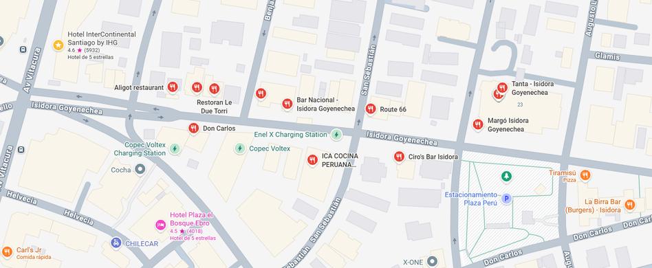
Near the InterContinental Santiago Hotel, participants will find a wide variety of restaurants,cafés,barsandinternationaldiningoptionswithinwalkingdistanceofthe venue.
**Reservationsarerecommendedforgroups
AligotRestaurant Frenchcuisine USD18–35
LeDueTorri Italiancuisine USD22–45
DonCarlos Argentinesteakhouse USD30–50
BarNacional Chileancuisine USD15–25
TantaPeruvianandLatinfusioncuisine
USD20–40
Margointernationalcuisine/winebar USD22–45
Tiramisu ItalianandMediterraneancuisine
USD15–30
LaBirraBarGourmetburgers/Americanfood
USD15–28
Carl’sJr. Americanfastfood/burgersUSD10–18
MAINSPONSOR
SPONSORS
CONSTELLATION
ORBIT
MAINSPONSOR
Trimbleisaglobaltechnologycompanyconnectingthephysicalanddigitalworlds to transform how work gets done. Through innovation in high-accuracy GNSS correction, precise positioning, modeling, and data analytics, Trimble empowers the construction, geospatial, and transportation industries. From building infrastructure to optimizing global supply chains, Trimble drives productivity and progressforamoresustainablefuture.
Formoreinformation,visit:www.trimble.com.
GeocomisaChileancompanythatintegratescutting-edgegeospatialtechnology and expert knowledge to help clients capture, represent, and analyze reality with precision.BasedinChile,itprovidesgeospatialsolutionsthatdriveprojectsuccess acrosstheregion.IthasbeenaTrimbledistributorsince2000.
Formoreinformation,visit:www.geocom.cl.
SPONSORS
CONSTELLATION
Chilean company specializing in providing opography, and metrology. With more than 100 years of history and family-owned prestige, the company focuses on the commercialization and calibration of precision instruments, representing leading brandssuchasSokkia,Topcon,Bosch,Sanding,andSingularXYZ.
The company stands out for its world-class advanced electro-optical laboratory infrastructure,operatingunderinternationalstandardsthatensuretraceabilityand accuracy.
It also led the development of KollNET, the first and largest RTK network in Chile, featuring GNSS stations and servers that provide real-time corrections for a wide rangeofgeospatialapplicationsacrossthecountry.
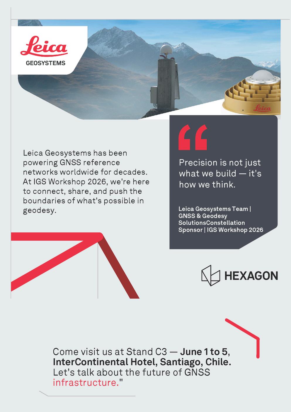
PartofHexagon,agloballeaderingeospatialandmeasurementtechnology,Leica Geosystems has been present in Chile since 2012, with operations in Santiago and the northern region of the country. The company specializes in high-precision solutions for mining, construction, and infrastructure, offering a portfolio that includes total stations, GNSS systems, 3D laser scanners, mobile mapping, ground-penetratingradar,andmonitoringequipment.
Its solutions enable the real-time capture and analysis of geospatial data, supporting key national and international projects. With a highly skilled technical team and specialized software solutions, Leica Geosystems Chile enhances the operationalefficiencyandproductivityofitsclients.
SPONSORS
The company provides comprehensive surveying and geomatics engineering solutions with technical precision and a strong commitment to regulatory compliance. Its mission is to optimize processes in order to ensure reliable results, while its vision for 2030 is to become a national market leader through technologicalinnovationandcutting-edgesolutions.
Although currently undergoing certification processes under ISO standards (9001 and14001),thecompanyalreadyintegratescorevaluessuchasethicsandsafety intothedevelopmentofhigh-complexityprojects.
The consultancy stands out for its versatility: it supports private clients in property regularization processes before local municipal authorities (DOM) and ensures dimensionalandgeometricaccuracyforrealestatetransactions,whilealsoacting as a strategic partner in mining operations and major government infrastructure projects.
Among its most notable projects are its participation in the New El Arenal Penitentiary Complex in Copiapó, as well as the new hospitals of Buin, Sótero del Río,andNuevaToltén.
SPONSORS
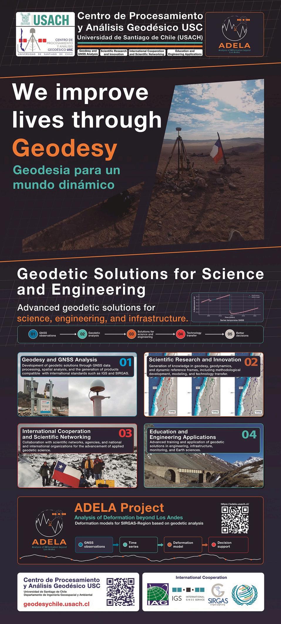
The mission of this center is to calculate new reference frames for Chile, systematically process the SIRGAS-CON Network according to SIRGAS requirements, and to submit the solutions to the DGFI for their analysis and combination with results from other international processingprograms.
ThegeneralobjectiveoftheUSCCenteristomonitorthekinematiceffectsoftheEarth’scrust and infrastructure, as well as generating and promoting teaching, research and external consultancy in geodesy, together with the creation of graduate programs at Universidad de Santiago.
Visit:https://geodesychileusachcl/
SANA is published by Springer Nature with an Impact Factor of 10.1, ranking Q1 in three categories. The journal publishes original PNT research using global and regional satellite navigationsystems Featuringaninternationaleditorialboardfrom16countriesandaglobal authorship,itservesasaworldwideplatformforacademicexchange.APCiscurrentlywaived.
We sincerely thank all participants, speakers, session chairs, sponsors, partners and collaboratinginstitutionsforcontributingtotheIGSWorkshop2026.
Your participation will help make this Workshop a meaningful space for scientific dialogue, technical exchange and international collaboration within the GNSS and geodesycommunity.
From Santiago, Chile, we look forward to welcoming you to a meeting shaped by science,cooperationandthesharedcommitmenttoadvancingglobalgeodesy.
IGSWorkshop2026
June1–5,2026
InterContinentalSantiago·Chile
For updated information about the programme, registration, visa letters,venuedetailsandparticipantservices,pleasevisittheofficial Workshopwebsite: