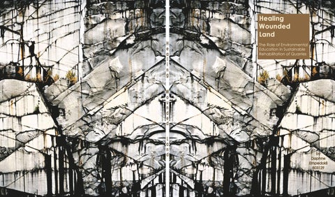
Healing
Healing Wounded Land The Role of Environmental Education in Sustainable Rehabilitation of Quarries
Wounded Land
by Daphne Empedokli 803129
i
Healing Wounded Land The Role of Environmental Education in Sustainable Rehabilitation of Quarries
Daphne Empedokli Architecture + Landscape 802931 March 2 Architecture University of Portsmouth Janruary 2016
ii
iii
Table of Contents Author’s Declaration Abstract List of Illustrations Preface Introduction Chapter 1 – Wounded Land 1.1. Introducing the elements of a Wounded Land 1.2. Levels of intervention to the landscape 1.3. The observation of a wounded land 1.4. Visual Landscape Absorbency Chapter 2 – Quarries 2.1. Attica Context 2.2. Unused Quarries of Attica 2.3. Uses of Rehabilitated Quarries of Attica 2.4. Detailed Analysis of Unused Quarries of Attica 2.4.1. “Karampini” Quarry, Pikilo Mountain 2.4.2 Quarry of Sxistos, Koridalos 2.4.3. Quarry of Chaidari 2.4.4. Quarry of Penteli, Penteli Mountain 2.4.5. Quarry of Vyronas, Hymettus Mountain 2.4.6. Quarry of Ano Glyfada, Chapter 3 – Environmental Education through Rehabilitation of Wounded Land 3.1. Brief Historical Retrospective 3.2. Aim of Environmental Education 3.3. The Context of Attica 3.4. Environmental Education through a wounded land
iv v vi ix x 1 2 2 4 6 9 10 11 12 14 14 15 16 17 18 19 20 21 22 24 27 iv
3.4.1 Landart Case Study: "Spiral Jetty" by Robert Smithson 3.4.2 Groundscape Case Study: Redesign of the Roman Quarry disposed Opera Festivals by AllesWirdGut Architektur 3.4.3. Building Case Study: “Eden Garden� by Grimshaw 3.5 Characteristics that promote the idea of environmental education on wounded land Conclusion References Bibliography Image citations
v
27 28
29 30
31 32 32 34
vi
vi
Authors Declarations Written thesis submitted as part of the award for Masters in Architecture and Urbanism Title: Healing Wounded Land The Role of Environmental Education in Sustainable Rehabilitation of Quarries Date of submission: January 23, 2017 I declare that this assignment is offered for assessment as my original and unassisted work, except insofar as any advice and/or assistance from any other named person in preparing it, and any quotation used from written sources are duly and appropriately acknowledged. I affirm that this is a true copy of my thesis along with any final revisions, as approved by the University of Portsmouth School of Architecture and that it has not been submitted to any University of Institution for a higher degree.
vii
iiiv
Abstract In Attica, after the expansion of the urban environment that was causes by the industrial revolution many areas that were used as mines in order to extract natural resources, ended up much closer or even inside the city limits. These areas which are wounded by artificial interference are mostly quarries on the mountains and hills that are around the valley of Athens. In this dissertation, I am studying Wounded Areas as a matter of their typology, the level in which they interfere with the environment, ways that they can be restored by visual absorbing to the landscape and finally the aesthetic factors that would help to do so. Moreover the cases in the area of study are analyzed according to these aspects and the effect they have on the sustainability of the landscape of Attica. On the whole, I will pursue to create a connection between these wounded areas with environmental education combined with sustainable design, as a solution to the restoration of landscapes as such. To support this opinion some characteristic of relative cases will be gathered in order to point out the factors that would lead to a successful outcome of such a design plan.
ix
x
List of illustrations Figure 1 Grade A intervention that maintain the visual characteristics, mine in Banská Štiavnica, Slovacia Figure 2 Grade B intervention, partly altered landscape in a small quarry in Craig Y Llyn forest, UK Figure 3 Grade C intervention, quarry as a dominant characteristic of the landscape, Markopoulo quarry, Figure 4 Grade D intervention, complete transformation of the landscape at a German coal exit quarry Figure 5 typical brownfield near London, UK, Panoramic typology of a wounded area with unobstructed view. Edited photo. Figure 6 typology with characteristic forms of Widan el-Faras peaks from an Old Kingdom basalt quarry, Egypt. Edited photo Figure 7 "surrounded" area typology at an abandoned construction aggregate quarry near Adelaide, South Australia. Edited photo Figure 8 Typology of a focal or axonal area at Francon quarry, Montréal, Québec, Canada. Edited photo Figure 9 Typology of a sheltered quarry in Harran, Turkey. Edited photo Figure 10 Typology of a detailed quarry in Aliki, Thassos GR. Edited photo. Figure 11 Typology of a momentary landscape at Old Slate Mill, Snowdonia, Wales. Edited photo Figure 12 non-rehabilitated quarry stands out of the landscape as it has no visual absorbency, Cape Girardeau, USA. xi
Figure 13 visually absorbed rehabilitated quarry by reintegrating the vegetation and its variety, uniformity of the color palette and adding human activity, Falling Rock Park, LaGrange, USA. Figure 14 the form of the quarry's volums as a main element of the landscape in Glendyne quarry, Quebec, Canada. Edited photo Figure 15 the edges of the quarry's volums as a main element of the landscape in Glendyne quarry, Quebec, Canada. Edited photo Figure 16 color as a main element of the landscape, Markopoulo, GR Figure 17 texture as a main element of the landscape, Markopoulo, GR Figure 18 on the right the is the natural shape of Tourkovounia before the mining and southern Tourkovounia before the Attiko park was created in 1950, Galatsi, GR Figure 19 Current view of central Tourkovounia with the quarry in the left and the Attiko park on the right, Galatsi, Figure 20 map of unused quarries of Attica Figure 21 small Illegal quarry right next to the University of Athens, at the foot of mountain Hymettus. Level B of intervention to the landscape and approachable only on foot. Figure 22 uses of rehabilitated quarries of Attica Figure 23 Location of "Karampini" quarry. Edited photo. Figure 24 Analysis of the levels of the quarry. edited photo
xii
Figure 25 View of the quarry from the city. Edited photo
Figure 26 Location of the quarry of Sxistos. Edited photo. Figure 27 Analysis of the characteristics of the quarry. Edited photo Figure 28 View of the quarry from the city. Edited photo Figure 29 Location of the quarry of Chaidari. Edited photo Figure 30 Analysis of the characteristics of the quarry. edited photo. Figure 31 View of the quarry in the context of the city Figure 32 Location of the quarry of Penteli. Edited photo Figure 33 Analysis of the typology of the quarry panoramic. edited photo. Figure 34 Analysis of the typology of the quarry – detailed. Edited photo. Figure 35 View of the quarry in the context of the city. Figure 36 Location of Vyronas quarry next to Vyronas city. Edited photo. Figure 37 analysis of the typology of the quarry. edited photo. Figure 38 Close-up view of the quarry. Edited photo Figure 39 Location of Glyfada quarry next to Vyronas city. Edited photo. Figure 40 analysis of the typology of the quarry. edited photo. Figure 41 analysis of the typology of the quarry. edited photo. xiii
Figure 42 Close-up view of the quarry. Edited photo Figure 43 Map of Environmental Education Centers of Greece. edited photo Figure 44 "Spiral Jetty" Landart by Robert Smithson raises awareness on how an artificial interference may alter the natural environment Figure 45 Aerial photo of the "Spiral Jetty" by Robert Smithson and its connection with the Great Salt Lake. Figure 46 Visitor's view of the redesigned Roman Quarry ramp which is used as experiential learning and accessway of the design. Figure 47 Plan view of the redesigned Roman Quarry ramp and the connection with the surrounding levels. Figure 48 View of the "Eden Garden" by Grimshaw Architects showing the building's relation with the surounding environment Figure 49 Construction of "Eden Garden" using the different levels of the quarry on which it is build. Figure 50 Inner view of the "Eden Garden" where the vegetation of the wounded area has been restored
xiv
xv
xvi
Preface From a very young age, hiking has been one of my main hobbies and as I grew up it became a getaway from everyday life. Also it is in my advantage that my hometown is located at the foot of mountain Hymettus and therefore this activity is much more easily accessed. Many times during hiking it is likely to discover places that are not accessible by means of transportation and thus not approached by many individuals. The discovery of an abandoned quarry became the reason to start a research on this theme and realize the amount of quarries that exist in the area of Attica and the way that many of these “Wounded Areas� have been rehabilitated without regarding a sustainable result. Through studying cases of wounded areas in Attica and their relationship with the urban environment in order to see the way most of them are rehabilitated, it came to my knowledge that these areas have not been treated in a way to restore the natural environment. This being the case, a study of sustainable rehabilitated cases helped to lead to the outcome to combine the healing of an area as such with a use that is also about educating and raising awareness on this aspect.
xvii
xviii
Introduction Cities were first formed in areas that had mild climate in low altitude and with good soil for cultivating and farming. They were also near water, for drinking, irrigation, transportation and commerce. The soil provided solid support for their structures and protected the habitants from earthquakes and other natural disasters. It also sometimes contained metals precious or not and other minerals. These characteristics benefited not only the habitants but also other living organisms. However today's cities have different characteristics that are a consequence of the ongoing urbanization that creates some main problems of our time. The production and consumption of energy by humans, is sometimes up to four times more than the solar energy captured by plants. The amount of waste from non-degradable materials as a result of excessive manufacturing or importing of goods is immense. There is air, soil and water pollution and also signs of eutrophication and the greenhouse effect. The aquifer is getting lower and is therefore constantly transforming the morphology of the Earth’s surface and leads to a big reduction in the number of plants and animals. A different type of climate, distinctive of urban environments, has been developed. The urban environment expanded with the industrial revolution, contaminating and altering the surrounding environment and led to intolerable conditions. The development was so rapid that consequences of the unhealthy conditions on humans and the over mining for natural resources, were not realized until much later. There were dramatic changes in people’s everyday-life and way of living, nevertheless the psychological impact was not perceived until the 1960s when the consequences were realized to be profound. Very important aspects of life were impacted, such as public health and therefore life longevity, sanitation, energy usage and the declaration of natural resources. As a result, the industrial revolution had a major effect in ecology by altering the natural landscape and also affecting human's relationship
xix
with the environment. The main demand of all of the urban designers is to restore this connection between humans and nature. These professionals are called to create and maintain natural and open spaces that will promote their use for leisure and education, in every neighborhood. Areas that need to be developed in order to protect nature within the city are: large parks and squares, gardens and courtyards, abandoned buildings, sidewalks, school courtyards and public buildings and other open areas in the urban environment. Moreover, this can be combined with the areas that were wounded by urbanization in order to rehabilitate and restore the natural environment through environmental education.
xx
xxi
1.
Wounded Land
Our current lifestyle choices demand the use of natural resources which then lead to alter a part of a landscape in order to provide them to us. Therefore, there are parts all over the world that have become symbols of our thirst for these natural resources and as population grows the alternation of the landscape grow proportionally. These areas are called “Wounded� lands. There are many typologies, levels of interference and other aspects to categorize these areas, though their common characteristic is that they all are altered natural environments, as a result of artificial interference.
1
1.1 Introducing the elements of a Wounded Land According to the book Return to landscape (Valentien, 2010, p.51), once a town has established its self-sufficiency architects and artists of the 21st century should consider the open spaces of the periphery as valuable ground sources for the formation of the expansion of the city. This can be achieved through the development of new urban qualities that will be completed following a well-planned and thorough study of the facts and information gathered about the wounded area. However this expansion should take under great consideration the protection of the natural environment that exists right next to the urban fringes. That is because of the fact that if there is no plan on protecting the area, the expansion would also mean the limitation of the natural environment and could also lead to its extinction. A wounded area can be perceived by its specific and generalized surroundings and conditions, in order to find a way to coexist harmoniously with its neighboring environment. It is important to make some directives and classifications that will determine the full definition and character of the wounded area. Once the area and its characteristic have been perceived the aesthetics of the wounded area and its elements can be examined. According to Waterman (2009, p.50,112) the various materials, the techniques and the means of representation of an area can reveal its important elements, creating multiple feelings, textures, emotions and moods to a passing observer.
2
1.2 Levels of intervention to the landscape Every intervention to the landscape has its respective impact to the environment. Especially in quarries where part of the earth has been removed, which can change drastically the form of an area. From 1973 the “Scenery management system” of the department of Agriculture of the United States, defines four main levels of intervention to the landscape. (Scenery Management System, 2016) 1
2
Grade A intervention, is defined by ensuring the maintenance of the visual characteristics of a landscape. For example the underground quarries do not lead to an above ground of deposit of materials (Ksenidis, Kaliampakos, 2010, p.18). In these cases the alternation of the landscape happened underground and the only visual evidence was the entrance of the mining area. A quarry as such exists in Banska Stiavnica, in Slovacia, where it has been achieved to maintain the landscape completely natural by preserving the surface untouched, where the underground mine is approximately 1.5 km long, as shown in Figure 1. Grade B intervention is the case of sallow ground level deposits and the landscape is only partly altered (Ksenidis, Kaliampakos, 2010, p.18). Such as in the case of the small quarry in Craig Y Llyn forest in the UK (Figure 2) where the scale of intervention is not radical so that it can be naturally rehabilitated, with the passage of time.
3
Figure 1 Grade A interven�on that maintain the visual characteris�cs, mine in Banská Š�avnica, Slovacia Figure 2 Grade B interven�on, partly altered landscape in a small quarry in Craig Y Llyn forest, UK Figure 3 Grade C interven�on, quarry as a dominant characteris�c of the landscape, 3 Markopoulo quarry, GR
When large excavations and deposits take place during mining, they become dominant characteristics of the drastically altered landscape, which is resulting in intervention of grade C (Ksenidis, Kaliampakos, 2010, p.18). The case of Markopoulo, Greece is one of these where, as shown to Figure 3, the interference of the quarry to the landscape is visible from a very long distance and has altered the landscape to a scale where it would take a very long time for it to rehabilitate naturally. Finally, grade D intervention, refers to the complete
transformation of the natural landscape. Such is the case of the leveling of a series of natural geomorphological elevations, as in the case of large surface mining for lignite (Ksenidis, Kaliampakos, 2010, p.18). A case of mining for lignite exists in Germany where the complete transformation of the landscape would be very difficult to be rehabilitated even with artificial interference and nearly impossible to do so naturally (Figure 4). These levels of intervention to the landscape into four grades are based on the scale and type of a wounded area. Nevertheless there are seven typologies that all wounded areas can be approached from and are based on the characteristics of each case and can depend on the observer’s point of view, such as location or distance or even the time and season the observation takes place.
4
Figure 4 Grade D interven�on, complete transforma�on of the landscape at a German coal exit quarry 4
1.3 The observation of a wounded land Each landscape has its own character, in other words a holistic impression that derives from the combination of its visual elements. Even if the classification is not strict, however there are various types that can be observed, such as: panoramic, form, surrounded, focal or axonal, sheltered, detailed and momentary. The panoramic type of a wounded area is represented by its unobstructed view of 360 degrees, or if the observation is from a side of a mountain, the view of 180 degrees (Chatzistathis, Istikoudis, 1995, p.146). This type is mainly observed in brownfields. (Figure 5)
6
7
A land of characteristic forms is dominated by an object or a group of object of a special form, as are quarries. The significance of the object depends on the scale of a specific landscape under observation. Once the observer stands in close proximity to the quarry, he can distinguish its front as a characteristic form while when standing aback he preserves the whole of the quarry as one characteristic form (Chatzistathis, Istikoudis, 1995, p.147). For example, as shown in Figure 6 at the case of the Old Kingdom basalt quarry in Egypt, the Widan el-Faras peaks forms are the dominate object of the landscape. The characteristic of a “surrounded” area is that a rather flat surface or a total of many surfaces are surrounded by other vertical surfaces forming a wall. (Chatzistathis, Istikoudis, 1995, p.147) (Figure 7)
A wounded landscape can also be characterized focal or axonal when the form of the landscape, the vegetation or the roads is guiding the observer’s view Figure 6 typology with characteris�c forms of towards one point. If a characteristic form coexists in Widan el-Faras peaks from an Old Kingdom that point, then they self-display and they enhance basalt quarry, Egypt. Edited photo the focal landscape. (Chatzistathis, Istikoudis, 1995, p.147) (Figure 8)
Figure 5 typical brownfield near London, UK, Panoramic typology of a wounded area with unobstructed view. Edited photo.
5
Figure 7 "surrounded" area typology at an abandoned construc�on aggregate quarry near Adelaide, South Australia. Edited photo
A wounded area can be characterized as sheltered when it is under a surface as a celling of an
underground quarry that is supported by its columns (Chatzistathis, Istikoudis, 1995, p.149-150). As in the case of the quarry in Harran (Figure 9) the wounded area appears to be underground in contrast to the other typologies that are about aboveground quarries. The detailed landscape is the one that can be perceived mainly from the visitor and it consists of small objects that take part in the synthesis of the whole landscape or a part of it. (Chatzistathis, Istikoudis, 1995, p.151) (Figure 10) Finally a momentary landscape is the most controversial regarding in changes that are difficult to be observed. There are alternating situations even a day’s observation. Such landscape is affected by weather conditions, the images that are projected or reflected on it, objects that might be moving, traces and the appearance of animals. (Chatzistathis, Istikoudis, 1995, p.153-155) (Figure 11)
8
9
However all types of quarries are able to be smoothly blended in the natural landscape, by studying their characteristics and taking under consideration which are those who make them stand out from their topography. In that way these wounded areas can be easier rehabilitated.
10
Figure 8 Typology of a focal or axonal area at Francon quarry, Montréal, Québec, Canada. Edited photo Figure 9 Typology of a sheltered quarry in Harran, Turkey. Edited photo Figure 10 Typology of a detailed quarry in Aliki, Thassos GR. Edited photo. Figure 11 Typology of a momentary landscape at Old Slate Mill, Snowdonia, Wales. Edited photo
11
6
1.4 Visual Landscape Absorbency Nevertheless the way of observation of a wounded area may alter the typology that we think it has, it is important to take these characteristic into consideration, as a tool to the study of this specific area. There are some unexpected factors that tend to affect someone’s perception of the landscape, such as atmospheric conditions, the season of the year, the movement of some natural elements, the lighting conditions and orientation. Other factors that contribute to the alternation of the landscape are time, distance, position of the observer and also the scale of the projected place in regard of the whole landscape. (Chatzistathis, Ispikoudi, 2010, p.174-183)
12
13
Although the view of the landscape alters slightly according to these factors, a wounded area and mainly a quarry, has the capacity to maintain its visual character and the value of its view. For that reason each case should be studied based on how much the mining might have altered the character of the landscape. In most cases the quality of the landscape is noticeably degraded. In the case of quarries, mining in multiple levels and inclinations lead to the corruption of the ground and therefore color contrast compared to the natural environment surrounding the site, causing significant decrease of the visual absorbency of the quarry. Especially through the observation from up close, the absence of variety, the land uses and human activity, emphasizes even more the alternation of the landscape. (Chatzistathis, Ispikoudi, 2010, p.194-197)
Thus it is clear that in order to increase the ability of visual absorbency of a mined area it is easier to have as less inclinations as possible between the mining Figure 12 non-rehabilitated quarry stands out of the landscape as it has no visual absorbency, levels. This will make the reintegration of the original state of the vegetation more generous. By having a Cape Girardeau, USA. larger number of vegetation the variety of them can Figure 13 visually absorbed rehabilitated quarry by also be increased which will apparently lead to the reintegra�ng the vegeta�on and its variety, uniformity of the color palette of the landscape. 7
uniformity of the color pale�e and adding human ac�vity, Falling Rock Park, LaGrange, USA.
As it is clear by comparing the cases of the non-rehabilitated quarry of Cape Girardeau and rehabilitated quarry of LaGrange in USA, the existence of a large amount and variety of vegetation and human activity can lead to a completely visually absorbed outcome.
8
1.5 Aesthetic Approach In order to achieve a visually absorbed outcome there are more factors that need to be studied on the subject of designing a landscape. The unity of a landscape is formed by the repetition or the prevalence of the four main elements of landscape, which are the form, the edge, the color and the texture. (Chatzistathis, Ispikoudi, 2010, p.158) 14
15
16
Figure 14 the form of the quarry's volums as a main element of the landscape in Glendyne quarry, Quebec, Canada. Edited photo Figure 15 the edges of the quarry's volums as a main element of the landscape in Glendyne quarry, Quebec, Canada. Edited photo Figure 16 color as a main element of the 9 landscape, Markopoulo, GR
The form is the total of the elements of an object or combined objects in the landscape. As presented in figure 14 they are characterized as rounded, angular and conical and they create a rhythm when they are evenly spaced. Through the contrast of the landscape, the outline and the volume of the form, is differentiated. Important differentiations derive through vegetation. Edge is defined by the succession of points towards one direction, or whatever is aligned or directed towards a point as show in figure 15. Edge is as well the section between two different levels. Its direction can be horizontal, perpendicular or inclined. Each edge guides the view. When it is straight it seems rigid, harsh and bold, compared to the smooth edge that seems relaxed, flexible and passive. Thus each one has its own character and it expresses various emotions. Color depends on the conditions of the surface of the landscape and it depends on the vegetation, the exposed soil, the rocks and the possible appearance of water. Usually it varies depending on the time of the day and the weather conditions. The color contrasts are expressed through the tone, the intensity and the hue. The tone is referred at the level of the luminosity of color, the intensity refers to its clarity where the hue is about its shades such as the case of figure 16. The texture of the landscape, refers to the way the surfaces of the elements, such as vegetation, are combined. A smooth surface reflects ample light where the rough, matte and uneven surface, absorbs
it unevenly. When these different types of surfaces are next to each other, then the contrast is noticeable. Finally the perception of the texture varies and it depends on the distance between the observer and the landscape as illustrated in figure 17. (Chatzistathis, Ispikoudi, 2010, p.161-162) When the unity of the landscape of the four elements is combined by contrast and variety, then the landscape is considered harmonious. Therefore the aesthetics of the landscape is directly connected with its basic elements and with the way these interact as they can be not only in contrast between them but in succession, combination, axial layout, framing or even balance. (Chatzistathis, Ispikoudi, 2010, p.241-248)
17
Figure 17 texture as a main element of the landscape, Markopoulo, GR 10
11
2.
Quarries
A great part of the hills and mountains surrounding the city of Athens, has been used for mining and, therefore is considered “Wounded Land�. All of those quarries have a connection with the city in which they belong and some of them are even in the urban environment. That is the reason why it is very important to study them using the tools from the previews chapter, and even criticize their rehabilitation use.
12
2.1 Attica Context
18
19
After the Second World War it became apparent that Athens needed to recover economically and industrially. A large scale construction took place, as demanded, for basic infrastructures such as roads, ports, airports and buildings. At the same time the expansion of the Greek capital was taking place without planning or continuity. More than sixty quarries in the greater Athens area produced limestone aggregates. Such quarries existed in the hills of Hymettus, Aegaleo, Pikilo and Tourkovounia, which is the most representational case. In Tourkovounia, as shown in figures 18 and 19, the hill is places in the urban environment and has been surrounded by it for many years, even before the mining activity had started. Therefore it is clear to observe the evolution of the landscape throughout the years. Nevertheless in all of these cases, the quarries were placed close to the center of Athens to ensure the low cost of transportation of the materials and as the city expanded they became part of the populated area. As a result many environmental issues occurred by the mining, mainly to the neighboring inhabitants. In 1976 a law was passed for the discontinuation of the mining process in the inhabited areas, only allowing some of them to sell the already mined materials, without proceeding to further mining. The abandoned quarries where left in the care of the municipalities without any plan for their rehabilitation. More than ten quarries had drastically altered the topography of the hills, such as the case of Tourkovounia. (Kalampakos, 1996, p.464)
Figure 18 on the right the is the natural shape of Tourkovounia before the mining and southern Tourkovounia before the A�ko park was created in 1950, Galatsi, GR
There are two mining areas at the hill of Tourkovounia which started their activity in 1937 and 1949. Until 1976 when the mining activity stopped, the quarry was a dominant form of the landscape (level B of Figure 19 Current view of central Tourkovounia intervention). What has remained nowadays is a total with the quarry in the le� and the A�ko park on of elevations and depressions with rough inclinations. the right, Galatsi, GR The vegetation of the area is minor and the only 13
human activity in the area is the little church of Agios Savvas, where at the rest of the area there are only some abandoned industrial buildings. Therefore it is difficult for the quarry to be visually absorbed. To this destruction of the hills, Dimitris Pikionis had also commented on his well-known text “the disgrace of Earth� in 1954, where he spoke of the violation of Attica as the town was slowly turning into a big quarry. Concrete had replaced the green areas and the quarries had disfigured the hills, slowly making them disappear. The unsystematic mining of Penteli was at its limits and Lycabetus had begun to have its shape altered (Pikionis, 2010).
14
2.2 Unused Quarries of Attica In Greece there are functioning aggregates quarries within the limits of statutory quarry areas (where it has become possible to do) or in individual locations. Mining areas are the areas in which there are one or more quarry sites. The number of licensed public, municipal / communal and private quarries operating within or exceptionally outside quarry area is 195. Of course there's a number of quarries that do operate without the required license and whose calculation is unattainable.
Figure 20 map of unused quarries of A�ca
15
The above map includes the Athenian area surrounded by mount Hymettus, Pendeliko, Aegaleo and Pikilo. The quarries illustrated in blue are the unused quarries at the interior of the hills, where the gray are at the exterior. There is a great difference between these two states as a matter of the way the quarries interfere to the landscape and therefore their visual absorbency. The dark blue ones show the rehabilitated quarries that can be seen in the current aerial view of Athens. Some of them are surrounded by rocks, where others interrupt the urban environment with a green area or an area for other activities. The light blue ones indicate the non-rehabilitated quarries. (Kaliampakos, 1996) Nevertheless there are plenty more quarries in Attica with no anticipation for rehabilitation because they were created and mined illegally. As a result these quarries remain abandoned areas of wounded land in the urban environment that are unable to be calculated and are difficult to be approached by any means of transportation or even reached only by hiking
21
Figure 21 small Illegal quarry right next to the University of Athens, at the foot of mountain Hyme�us. Level B of interven�on to the landscape and approachable only on foot. 16
2.3 Uses of Rehabilitated Quarries of Attica Many municipalities that own a part of a mountain or a hill that contains a quarry, decides to rehabilitate it in order to make achieve infrastructure development. Nevertheless their approach is mainly to create a space that their residents would find it useful, without considering other approaches such as ecology and sustainability. The rehabilitated areas are mainly uses for sport activities, cultural events and parks. Sports activities and parks prevail, for example the parks of Dexameni, Attiko, Veikou and Agiou Dimitriou. Also the quarries Agios Dimitris, Filothey, and the park of Andreas Papandreou have become green areas. The quarries of Vyrona, Kesariani, Petroupoli, Kamatero, Cholargos, Chalikaki, and Ilioupoli, have all become either open air stadiums or closed sport centers. In some cases sport and cultural uses coexist in the same quarry, such as in Politia, Vyrona and Nikaia. There are also two quarries that have become open-air theaters in Petroupoli and Lycabettus. There are also some other uses such as the Industrial Park in Sxistos and the cemetery of Voula.
17
Sport Sport
Figure 22 uses of rehabilitated quarries of A�ca
Generally the state ‘chooses to reclaim, rather than restore’ (Berger 2008 p.xxi) leaving behind the ambition that an altered landscape can be returned to its original state, or even that it could be used as a space that will help the landscape to evolve. However, landscape architects ought to recognize that the landscape is not bound to a previous state and should search for a deeper meaning in the need to reclaim, even better to restore.
18
2.4 Detailed Analysis of Unused Quarries of Attica 2.4.1 “Karampini” Quarry, Pikilo Mountain
23
24
25
Figure 23 Loca�on of "Karampini" quarry. Edited photo. Figure 24 Analysis of the levels of the quarry. edited photo Figure 25 View of the quarry from the city. Edited photo 19
Pikilo Mountain is placed at the Western side of the valley of Athens and is right above many cities, from Kamatero to Chaidari and Koridalos, but it is not yet fully included to the urban area(figure 23). The quarry is placed between the municipalities of Nikaia and Neapoli and has three different levels, as shown in figure 24. One of the levels has been rehabilitated into an enclosed sport center, where the upper two are turned into unofficial courts. The three levels of the quarry have a descending order of size and a large increase of height and the first level where there is also the enclosed sport center also consists of many smaller levels. The high level of its surroundings and the existence of steep hills next to it, prove that it has the characteristics of a “surrounded” area. The mining is a dominant characteristic of the landscape, which makes it a level of interference C. Visually the quarry is quite absorbed as it is close to an urban area with plenty of human activity (figure 25). As for the aesthetic condition, its forms are the main element of the topography.
2.4.2 Quarry of Sxistos, Koridalos The quarry is placed at the Southern-west side of Koridalos and it is gradually becoming part of the urban environment as it is easily accessed from main roads of the city and more and more buildings have been built around it(figure 26). There has been a proposal for rehabilitating the quarry by creating a sport center. The type of the quarry is considered axonal as many roadways are visually guiding towards its location (figure 27). It is also estimated to be a level C of interference to the landscape as the topography has not been altered completely although large pieces of the mountain have been removed. It is difficult for this case to be visually absorbed because of its scale, the limited vegetation and also the contrast color of the material compared to the urban color palette. The fact that its facades rise to a great height with pointy endings, prove its forms to be the main element of the topography (figure 28).
26
27
28
Figure 26 Loca�on of the quarry of Sxistos. Edited photo. Figure 27 Analysis of the characteris�cs of the quarry. Edited photo Figure 28 View of the quarry from the city. Edited photo 20
2.4.3 Quarry of Chaidari The quarry is placed in the Southwestern side of Chaidari city and its location is on the municipality’s border (figure 29). Its facade is towards the city and it has been rehabilitated into a park with a horse stable.
29
30
31
Figure 29 Loca�on of the quarry of Chaidari. Edited photo Figure 30 Analysis of the characteris�cs of the quarry. edited photo.
21
Figure 31 View of the quarry in the context of the city.
It has a clear focal typology, which is easily perceivable from high points of the city and from some main streets which end as stairs to the entrance of the quarry (figure 30). Its large facades lead it to be categorized into a level C of interference to the landscape and its colors, as a main element of the landscape, create a vast contrast to the urban and natural environment around it, making it unable to be absorbed visually (figure 31).
2.4.4 Quarry of Penteli, Penteli Mountain Penteli Mountain is located Southeastern of Athens and is geologically considered to be one of the oldest mountains in Europe(figure 32). The current state of the quarry is a large non-rehabilitated area that has been abandoned for many years. Nevertheless there has always been a very strong relation with the cities on the foot of the mountain as well as with Athens in whole. It has also been profaned and illegally invaded and as a result, a large amount of material has been stolen. 32
There are many different areas of the mountain, both over ground and underground that have been mined and are all connected, composing the wider area of the quarry, but can also be perceived as autonomous quarries of a smaller scale. This is the main reason why it is characterized as a detailed typology (figure 33). Moreover the quarry has unobstructed view towards Athens and is clear from many areas of Athens, such as Varimpopi, Kifisia, Ekali and other cities of Northern suburbs. Furthermore it is also referred as a panoramic type with forms as a main element of its landscape (figure 34), with large slopes and sharp color contrast and therefore a quarry with low visual absorbency. The large excavations on the side of the mountain alter a lot the topography from the natural shape it used to have before the mining took place (figure 35). Thus the intervention to the landscape is considered to be of level C.
33
34
35
Figure 32 Loca�on of the quarry of Penteli. Edited photo Figure 33 Analysis of the typology of the quarry – detailed. Edited photo. Figure 34 Analysis of the typology of the quarry panoramic. edited photo. Figure 35 View of the quarry in the context of the city. 22
2.4.5 Quarry of Vyronas, Hymettus Mountain Hymettus Mountain is located on the Southeastern side of Athens and it’s the closest mountain to the center of the city. It is also considered to be one of the oldest mountains of Europe. The quarry is currently fully protected and is consisted in the suburban leisure park zone from the “Protection and Development Association of Hymettus” and reforestation actions are frequently organized. Even though it is the closest mountain to the center of Athens it is in quite a distance from the urban environment (figure 36). The facade’s bright color is the main element of the landscape and its typology is considered focal, as it is visible from many main roads of Athens (figure 37). The center of the quarry is characterized as surrounded and it is a level C intervention to the landscape. The edges of the top of the facades are the main element of the topography, which makes it not absorbed visually (figure 38).
36
37
38
Figure 36 Loca�on of Vyronas quarry next to Vyronas city. Edited photo. Figure 37 analysis of the typology of the quarry. edited photo.
23
Figure 38 Close-up view of the quarry. Edited photo
2.4.6 Quarry of Ano Glyfada, Hymettus Mountain he quarry has a large facade towards the city of Glyfada and is only separated from the urban environment by a vegetated area with olive trees and other vegetation of smaller scale (figure 39). Therefore it is clearly visible from the roads that enhance its focal typology (figure 40). Its bright colored and rounded shape creates its character of forms. There is also the possibility to be characterized as panoramic (figure 41) because of its view and therefore it is difficult to be visually absorbed (figure 42).
39
40
41
This outcome agrees with mineralogist’s opinion, that the current uses are not based in a thorough study of all the aspects of rehabilitation. No alternative plans of reclamation can be found and they insist that the rehabilitation of the quarries near the center of Athens, offers a good chance of upgrading the environment and the living conditions. (Damigos, Koumandakis, Kaliabakos, Panagopoulos, 1998) It is observed that the quarry is usually reclaimed as an open area however, still the natural environment that was harmed is not restored. The uses given to these areas, such as sport centers or open theaters, might have a positive effect on the neighborhood’s leisure quality but on the contrary the recovery of the landscape is not taken under consideration and there is not even a study on the sustainability of this rehabilitation.
42
Figure 39 Loca�on of Glyfada quarry next to Vyronas city. Edited photo Figure 40 analysis of the typology of the quarry. edited photo. Figure 41 analysis of the typology of the quarry. edited photo. Figure 42 Close-up view of the quarry. Edited photo
24
25
3. Environmental Education through Rehabilitation of Wounded Land From a brief refer to the history, to point out the reasons environmental education exists and having in mind the aim of such program, it is crucial to criticize the Greek context. Therefore it is consequent to say that “Wounded� Areas are the most ideal location of such use.
26
27
3.1 Brief Historical Retrospective The main reason for the existence of environmental education is the environmental degradation that has been already going on for many years. It all started in the 18th century with the industrial revolution which was responsible for the increase of the population more than ever and leaded to the overconsumption of natural resources. As a result of the abundance of natural resources in relation with demand, these were taken for granted and used without any consideration of the impact of their increasing use on the environment and public health. (McLamb, 2011) It was only during the 1960’s that people started to get concerned with the impact of human activity on their environment and depletion of natural resources. Mining activity was so intense because of the dependence on these resources that has begun to alter the landscape and transforming it into a “Wounded Land”. Therefore the idea of sustainable production and development started to appear. This was essentially voiced publicly by Rachel Carson in her book of “Silent Spring” that adopted this powerful idea and made it globally acclaimed. “Those who contemplate the beauty of the earth find reserves of strength that will endure as long as life lasts. There is something infinitely healing in the repeated refrains of nature -- the assurance that dawn comes after night, and spring after winter.” ― Rachel Carson, Silent Spring
28
3.2 Aim of Environmental Education Reflecting on the past, it is not easy to realize why the enormous environmental impact of the industrial revolution was not realized sooner and also why something that occurred such a long time ago has still consequences nowadays. Nevertheless, social, economic and natural environments are mutually influenced. Thus changing one system will affect the whole. Undoubtedly, the same mechanism of effectiveness must be used, but this time to improve the current situation of the natural environment. This revolution is aimed on sustainability and further protection of the ecology. The most effective way to solve a problem of such a scale is by dramatically increasing public awareness. Creating awareness on nature, a subject that concerns all human kind should not be considered difficult but simply educating. Learning about a subject and becoming aware of it are the first steps on finding a suitable solution. Especially when nature is being the subject of interest, awareness can be achieved by creating a connection that has been lost over time. All these can be accomplished through Environmental Education. “Environmental education is a process that allows individuals to explore environmental issues, engage in problem solving, and take action to improve the environment. As a result, individuals develop a deeper understanding of environmental issues and have the skills to make informed and responsible decisions.� - US Environmental Protection Agency
29
Environmental education programs must promote not only the development of values that are connected with feeling but also with knowledge. Education must promote the creation of values that bring respect to the environment and its effect on humans. To invigorate and create awareness it has to be possible for all to come into close contact with nature and the theoretical conversation to be associated with practical experience. In many
countries this has been achieved with ecological parks which contain a large amount of natural elements. The purpose of all the EECs is to raise awareness and educate through practical experience and skills, which lead to sustainability and a state of mind closer to nature.The aims of these centers are to inform and sensitize students, educators and other social groups on environmental issues, to promote the problems that emerge from the relationship between humans and the natural or structured environment, to find solutions regarding sustainability. Develop a responsible standpoint and attitude and understanding of one’s personal and collective responsibility. More particularly, the most important objective of environmental learning is to make the students capable of understanding the value of the ecosystem and its particularities. It is also crucial for the students to adopt a positive attitude towards the environmental issues. "Environmental education is learning to see the whole picture surrounding a separate problem like air-pollution - the history, the values perception, emotions, techniques, traditional processes that cause, the problem and suggest actions to cure it" (Meadows, 1990)
30
3.3 The Context of Attica There are many Environmental Educational Centers in Greece. The most successful ones are the ones that achieve the goal of raising awareness, educating and helping people to get closer to the natural environment. These achieving examples belong in places closer to natural environment or ever in a fully natural environment, which makes easier the promotion of environmental awareness by experiencing and coming in close contact with it.
Figure 13 Map of Environmental Educa�on Centers of Greece. edited photo
31
List of Environmental Education Centers in Greece
REGION OF ATTICA
THESSALY REGION
Argiroupoli Athens Drapetsona Piraeus Lavrion Attica Trizina Methana Piraeus
Makrinitsa Magnisias Mouzaki Karditsas Agia Larissa Pertouli Elassona Larisas Trikala Trikala
Naoussa Imathia Poroia Serres Kilkis Kilkis Giannitsa Pellas
REGION OF EASTERN MACEDONIA AND THRACE
Paranesti Drama Soufli Evros REGION OF Vistonida Xanthi WESTERN Komotini Amfissa Fokidas MACEDONIA Maronia Rodopi Stylida Fthiotidas FilipponKavalas Kastoria Kastoria Kavala High Fthiotida Grevena Evrytania Grevena Karpenisi Velvento Kozani REGION Siatista Kozani
CENTRAL GREECE
WESTERN GREECE
Neapolis Lasithi Rouvas Heraklion Gouves Heraklion Anogia Rethymnoy
REGION OF NORTH AEGEAN Vathi Samos Evergetoulas Lesvos Homeroupolis Chios
REGION SOUTH AEGEAN
PELOPONNISOU Korthiou
Cyclades (Andros) Butterflies Dodecanese (Rhodes)
Kalamata, Messinia Akrata Achaias Kastri Arkadias Thermo Sikyonion Corinth Aitoloakarnanias Molai, Laconia Kleitoria Arnaia Chalkidiki Nea Kios Skillountos Ilia East Olympus in Argolidas IONIAN Messolonghi Pieria ISLANDS Etoloakarnania Vertiskos DISTRICT Thessaloniki REGION OF Edessa Pellas Lithakia CRETE EPIRUS REGION Eleftherio Zakynthos Thessaloniki Ithaca Ithaca Archanes Arachthos Arta Corfu Corfu Heraklion Konitsa Ioannina Sfakiotes Lefkada Vamos Chania Pramanta Lasithi Ierapetra Ioannina Filiates Thesprotias Filippiada Prevezas
REGION OF CENTRAL MACEDONIA
32
Nevertheless Environmental Education Centers in Attica have more of an organization’s character which on the one hand consists of activities and other actions on this field but on the other hand they only promote this idea from this theoretical approach. They do not take into consideration the aspect of housing a use as such in a building that promotes this idea through a sustainable and environmental friendly design. Also a use as such placed in a location could help to the restoration of a landscape. Landscapes where the natural environment has been effected by human interference, could be restored by locating a use which would raise environmental awareness, as an Environmental Education Center for instance, combined nevertheless with a sustainable design, in order to rehabilitate such areas through a use which would also be supported by the appropriate building design.
33
3.4 Environmental Education through a wounded land Even though there are many ways to reuse a wounded area depending on the size, the location and many other characteristics, it is very important to take the design’s environmental aspect under consideration in order to have a sustainable outcome and help to restore the ecology of the landscape. Therefore the concept of rehabilitation of a wounded land should be related to this subject.
3.4.1 Landart Case Study: "Spiral Jetty" by Robert Smithson Art in general has the intension to raise awareness and sentimentalize the observer. Moreover awareness is even stronger in the case of landart because of its location. The "Spiral Jetty" by Robert Smithson is a very strong example of this kind of art that raises awareness because it is located at Rozel Point, Great Salt Lake, Utah and was created in 1970 with mud, precipitated salt crystals and rocks. This piece of art is placed at this site because when a nearby causeway was constructed by the Southern Pacific Railroad in 1959, the northern section of the Great Salt Lake was cut off from fresh water supplies. This encouraged it to produce a concentration of salt-tolerant bacteria and algae the water's unique red-violet coloration (figure 44). Therefore this lard was wounded because of human interference. This became the source of inspiration for the artist to create a piece of art to sentimentalize the audience on this subject. The location of the artifact supports the promotion of the idea of environmental awareness. Also the choices of materials which are native and entirely extracted from this specific location play a crucial part to emphasize the situation. The artificial interference on wounded land, to point out environmental issues as such is a great way to raise awareness and educate the observers about the way an infrastructure can interfere to the natural
44
45
Figure 44 "Spiral Je�y" Landart by Robert Smithson raises awareness on how an ar�ficial interference may alter the natural environment Figure 45 Aerial photo of the "Spiral Je�y" by Robert Smithson and its connec�on with the Great Salt Lake 34
environment. Therefore the location and choice of materials are crucial in order to support the promotion of the environmental friendly character of a design.
35
3.4.2 Groundscape Case Study: Redesign of the Roman Quarry disposed Opera Festivals by AllesWirdGut Architektur This case study is located at the quarry of St. Margarethen in Australia and has been part of a UNESCO World Cultural Heritage Site since 2001. Until 1977 it was the site and source of inspiration for international artists to create works in stone, that is the reason of existence of numerous sculptures that give the area around the quarry its unique character. The orientation of the stage has enhanced the atmosphere of the location, but also the path used by visitors to get from the parking lot to their seats in the auditorium and back is used to highlight the quarry and the characteristics of this highly sensitive natural space through this accessway from Staging Steel and Rock. The choice of materials also helps to highlight the characteristics of the location because of the color of the metal that stands out of the topography and creates a visual connection in between the inclinations and also guides to different views along the quarry (figure 46) .
46
47
“The basic idea of the design is to extend the ambience of the magnificent rock-face scenery to all parts of the theatrical arena so as to make it a more palpable and visual enveloping experience.” (Archdaily, 2016) Through this experience, the idea of environmental education is also promoted, connecting the site directly with the situation of the wounded area (figure 47). Thus creating viewpoints through the design would also emphasize the promotion of a certain idea. Figure 46 Visitor's view of the redesigned Roman Quarry ramp which is used as experien�al learning and accessway of the design. Figure 47 Plan view of the redesigned Roman Quarry ramp and the connec�on with the surrounding levels. 36
3.4.3 Building Case Study: “Eden Garden” by Grimshaw Architects
48
49
50
Figure 48 View of the "Eden Garden" by Grimshaw Architects showing the building's rela�on with the surounding environment Figure 49 Construc�on of "Eden Garden" using the different levels of the quarry on which it is build.
37
Figure 50 Inner view of the "Eden Garden" where the vegeta�on of the wounded area has been restored
This case is about a botanical garden placed at an old quarry which was closed when contractors moved in to the redevelopment of the site. Before that, it is estimated that 1.8 million tons of earth was removed from the natural site, therefore the alternation of the site was quite large because of the artificial interference (figure 48). The two large dome greenhouses are placed at the uneven site using the landscape to create different levels of the building and they are completely focused on sustainability and zero waste design (figure 49). The use of a botanical garden at a wounded area, combined with a fully sustainable design using respectively environmental friendly materials, helps the injured landscape to restore its natural vegetation along with its variety, ecologically bringing it back to its original state (figure 50). Therefore it represents a successful way of rehabilitation in such landscape. Moreover the educational nature of the building creates a direct connection to the area and the awareness that ought to be raised.
3.5 Characteristics that promote the idea of environmental education on wounded land Taking these case studies under consideration, there are some common characteristics that could lead to a successful, sustainable design that would rehabilitate a wounded land and restore its natural environment. First of all the location of such case is very important to be studied as a matter of typology and other characteristics such as the levels of interference and the aesthetic factor, keeping in mind the parameters for a visually absorbed landscape that were stated in chapter 1, can also be useful on the designing process. Nevertheless it is crucial to be strict on the choice of materials. Using native materials for the design, that exist on the location of the site, can help to point out the promotion of the wounded land and also benefit on the sustainable aspect of the design by keeping its locality and low cost. In addition creating views through the design makes it possible to support the promotion of an idea. Therefore through a well-studied viewpoint can emphasize a certain part of the landscape in order to point out the design’s concept. Finally the most important factor to have in mind is to restore the landscape through the design. In topographies which have been wounded restoration to the original state becomes much more important that rehabilitation. As seen in paragraph 1.4, vegetation plays a crucial part on the matter of restoring the landscape’s visual absorbency. Therefore the amount and variety of vegetation in a landscape is also a very important factor. These factors will help for the designing process and also for the program of uses which is the most important part of the process. The choice of the use is critical in order to indicate the necessary attention that should be paid in such areas alongside with the
38
awareness that should be raised and the environmental education which connects the site with the use.
39
Conclusion There are very important aspects in which “Wounded� Landscapes can be categorized. Analyzing the levels of intervention to the landscape into four grades are based on the scale and type of a wounded area, the typologies that all wounded areas can be approached from and are based on the characteristics of each case, their ability of visual absorbency and other aesthetic factors which are directly connected with its basic elements and with the way these interact, makes easier the achieving of a sustainable and eco-friendly design outcome and also help the wounded land to be smoothly blended in the natural landscape. Nevertheless the current uses of such rehabilitated cases in the context of Greece are not based on a well-studied review of the aspects of each case. The given uses are nothing more than a basic study of the reclamation and integration of the quarries into the urban landscape. However by studying cases which have successfully connected a site on a wounded landscape with the aspect of environmental education and awareness, can become helpful in order to propose such a design program. An ideal design of such nature will be able to promote the eco-education aspect of the program with the renaturalization of the wounded land, creating a strong connection of the location and the use of the design. Moreover, an environmental education center has to combine experiential learning and informing but not by an artificial imitation of the natural environment. Ideally, its location should be placed in a way that it would make the approach to nature easily accessed. In these conditions it will be influenced by both environments, invigorating their differences and needs. The ideal location for an eco-educational center in the area of Attica would be at one of the many quarries that exist in this region, which connects also to the natural environment. As cities expand towards
40
nature these areas become nodes that are semi-natural, because of their environmental nature combined with the artificial interference. These nodes can also be where a protected area or a national park begins. That’s the reason why the way that these nodes of wounded land are treated is very important.
41
42
References Bibliography Hardcover books Chatzistathi, A., Istikoudi, I. 1995. Προστασία της Φύσης και Αρχιτεκτονική του Τοπίου/ Protection of Nature and Landscape Architecture, 2nd edition, Giachoudi - Giapouli Publications, Thessaloniki Korres, M. 1993. Από την Πεντέλη στον Παρθενώνα – From Penteli to Parthenon, 2nd edition, Melissa Publications, Athens Menegaki, M., Kaliampakos, D. Landscape impacts in open pit mine design: introducing a new method, 12th International Symposium on Environmental Issues and Waste Management in Energy and Mineral Production (SWEMP 2010), Conference Proceedings, 24-26 May 2010 Prague, Czech Republic. Pikionis, D. 2010. Κείμενα Δ. Πικιώνης – Texts D. Pikionis, 4th edition, National Bank Cultural Foundation, Athens Carson, R. 1962. Silent Spring, Houghton Mifflin Harcourt, Boston Valentien, D. 2010. Wiederkehr Der Landschafti/ Return of Landscape, Jovis Verlag GmbH & Akademie der Künste, Berlin Waterman, T. 2009. The Fundamentals of Landscape Architecture, AVA Publishing SA, Lausanne Websites
43
Arch daily. 2016. Redesign of the Roman Quarry disposed Opera Festivals / AllesWirdGut Architektur, [online] Available from: < http://www.archdaily.com/45692/redesign-of-the-ro man-quarry-disposed-opera-festivals-alleswirdgut-ar chitektur > [accessed Decemer 2016]
Ecology Global Network. 2016. The Ecological Impact of the Industrial Revolution, [online] Available from: <http://www.ecology.com/2011/09/18/ecological-i mpact-industrial-revolution/> [accessed Decemer 2016] Eden Garden Project. 2016. Eden Garden Architecture, [online] Available from: <http://www.edenproject.com/> [accessed Decemer 2016] InOut. 2016. Chaidari: the palace of the west shore. [online] Available from: <http://www.inout.gr/showthread.php/t=96826> [accessed Decemer 2016] Iranon. 2016. Acquaintance with mountain. [online] Available http://iranon.gr/PENTELI/PENTELI.htm> December 2016]
space: the from: < [accessed
Ksenidis, A., Kalimpakos, D., 2010. Οπτική Ρύπανση – Visual Pollution. Περιβάλλον ΙΙ – Environment II. Conference Proceeding, January 2-5 2010. [online] available from: http://www.metal.ntua.gr/uploads/3740/visual_impa cts.pdf [accessed December 2016] Spay. 2016. Hymettus Mountain. [online] Available from: <http://www.spay.gr/el/to-vouno.html> [accessed December 2016] The art story. 2016. Robert Smithson - American Sculptor and Writer. [online] Available from: < http://www.theartstory.org/artist-smithson-robert.htm > [accessed December 2016] United States Environmental Protection Agency. 2016. What is Environmental Education. [online] Available from: < https://www.epa.gov/education/what-environment al-education > [accessed December 2016] United States Department of Agriculture. 2016. Scenery Management System. [online] Available
45
from: <https://www.fs.usda.gov/projects/tonto/landmana gement > [Accessed December 2016] Yale-New Haven Teachers Institute. 2016. The Industrial Revolution. Available from: <http://teachersinstitute.yale.edu/curriculum/units/1 981/2/81.02.06.x.html> [Accessed December 2016]
46
Image citations Figure 1 Grade A intervention that maintain the visual characteristics, mine in Banská Štiavnica, Slovacia [primary source] Figure 2 Grade B intervention, partly altered landscape in a small quarry in Craig Y Llyn forest, UK. Retrieved from https://commons.wikimedia.org/wiki/File:Small_quarry_in_Craig_Y_Llyn_forest_-_geograph.org.uk_-_66044 .jpg Figure 3 Grade C intervention, quarry as a dominant characteristic of the landscape, Markopoulo quarry, GR. Retrieved from http://www.bloko.gr/2016/11/blog-post_6113.html Figure 4 Grade D intervention, complete transformation of the landscape at a German coal exit quarry. Retrieved from https://cleantechnica.com/2016/02/13/germany-the-coal-exit/ Figure 5 typical brownfield near London, UK, Panoramic typology of a wounded area with unobstructed view. Edited photo. Retrieved from http://uk.businessinsider.com Figure 6 typology with characteristic forms of Widan el-Faras peaks from an Old Kingdom basalt quarry, Egypt. Edited photo. Retrieved from www.quarryscapes.no Figure 7 "surrounded" area typology at an abandoned construction aggregate quarry near Adelaide, South Australia. Edited photo. Retrieved from https://en.wikipedia.org/wiki/Quarry Figure 8 Typology of a focal or axonal area at Francon quarry, Montréal, Québec, Canada. Edited photo. Retrieved from http://www.mindat.org Figure 9 Typology of a sheltered quarry in Harran, Turkey. Edited photo. Retrieved from http://gei.aerobaticsweb.org/
47
Figure 10 Typology of a detailed quarry in Aliki, Thassos GR. Edited photo. Retrieved from http://www.quarryscapes.no/ Figure 11 Typology of a momentary landscape at Old Slate Mill, Snowdonia, Wales. Edited photo. Retrieved from http://www.alamy.com/ Figure 12 non-rehabilitated quarry stands out of the landscape as it has no visual absorbency, Cape Girardeau, USA. Retrieved from http://www.haywardbaker.com/WhatWeDo/Structures/MinesQuarries/default.aspx Figure 13 visually absorbed rehabilitated quarry by reintegrating the vegetation and its variety, uniformity of the color palette and adding human activity, Falling Rock Park, LaGrange, USA. Retrieved from http://www.fallingrockpark.org/ Figure 14 the form of the quarry's volums as a main element of the landscape in Glendyne quarry, Quebec, Canada. Edited photo. Retrieved from https://www.stortz.com/quarry-touring-where-is-slate-coming-from Figure 15 the edges of the quarry's volums as a main element of the landscape in Glendyne quarry, Quebec, Canada. Edited photo. Retrieved from https://www.stortz.com/quarry-touring-where-is-slate-coming-from Figure 16 color as a main element of the landscape, Markopoulo, GR. Edited photo. Retrieved from http://www.slap.gr/epikairotita/koinonia Figure 17 texture as a main element of the landscape, Markopoulo, GR. Edited photo. Retrieved from http://www.slap.gr/epikairotita/koinonia
48
Figure 18 on the right the is the natural shape of Tourkovounia before the mining and southern Tourkovounia before the Attiko park was created in 1950, Galatsi, GR. Retrieved from http://oreios.blogspot.gr/2014/03/tourkovounia-hills-of-athens.html
Figure 19 Current view of central Tourkovounia with the quarry in the left and the Attiko park on the right, Galatsi, GR. Retrieved from http://oreios.blogspot.gr/2014/03/tourkovounia-hills-of-athens.html Figure 20 map of unused quarries of Attica. [primary source] Figure 21 small Illegal quarry right next to the University of Athens, at the foot of mountain Hymettus. Level B of intervention to the landscape and approachable only on foot. [Google earth] Figure 22 uses of rehabilitated quarries of Attica. [primary source] Figure 23 Location of "Karampini" quarry. Edited photo. [Google earth] Figure 24 Analysis of the levels of the quarry. edited photo.[primary source] Figure 25 View of the quarry from the city. Edited photo. [primary source] Figure 26 Location of the quarry of Sxistos. Edited photo. [Google earth] Figure 27 Analysis of the characteristics of the quarry. Edited photo. [primary source] Figure 28 View of the quarry from the city. Edited photo. [primary source] Figure 29 Location of the quarry of Chaidari. Edited photo. [Google earth] Figure 30 Analysis of the characteristics of the quarry. edited photo. [primary source] Figure 31 View of the quarry in the context of the city. [primary source] 49
Figure 32 Location of the quarry of Penteli. Edited photo. [Google earth] Figure 33 Analysis of the typology of the quarry panoramic. edited photo. [primary source] Figure 34 Analysis of the typology of the quarry – detailed. Edited photo. [primary source] Figure 35 View of the quarry in the context of the city. [primary source] Figure 36 Location of Vyronas quarry next to Vyronas city. Edited photo. [Google earth] Figure 37 analysis of the typology of the quarry. edited photo. [primary source] Figure 38 Close-up view of the quarry. Edited photo. [primary source] Figure 39 Location of Glyfada quarry next to Vyronas city. Edited photo. [Google earth] Figure 40 analysis of the typology of the quarry. edited photo. [primary source] Figure 41 analysis of the typology of the quarry. edited photo. [primary source] Figure 42 Close-up view of the quarry. Edited photo. [primary source] Figure 43 Map of Environmental Education Centers of Greece. [primary source] Figure 44 "Spiral Jetty" Landart by Robert Smithson raises awareness on how an artificial interference may alter the natural environment. Retrieved from https://www.robertsmithson.com/earthworks/spiral_jetty.htm
50
Figure 45 Aerial photo of the "Spiral Jetty" by Robert Smithson and its connection with the Great Salt Lake. Retrieved from https://www.robertsmith
son.com/earthworks/spiral_jetty.htm Figure 46 Visitor's view of the redesigned Roman Quarry ramp which is used as experiential learning and accessway of the design. Retrieved from http://www.archdaily.com/45692/redesign-of-the-roman-quarry-disposed-opera-festivals-alleswirdgut-architektur Figure 47 Plan view of the redesigned Roman Quarry ramp and the connection with the surrounding levels. Retrieved from http://www.archdaily.com/45692/redesign-of-the-roman-quarry-disposed-opera-festivals-alleswirdgut-architektur Figure 48 View of the "Eden Garden" by Grimshaw Architects showing the building's relation with the surounding environment. Retrieved from http://www.edenproject.com/ Figure 49 Construction of "Eden Garden" using the different levels of the quarry on which it is build. Retrieved from http://www.edenproject.com/ Figure 50 Inner view of the "Eden Garden" where the vegetation of the wounded area has been restored. Retrieved from http://www.edenproject.com/
51