Landscape Architecture Portfolio


Landscape Architecture Portfolio
emmapodietz@gmail.com
I am a landscape designer with a strong focus on ecological restoration and nature-based design. I have worked for nearly two years in the field of ecological restoration and am trained in landscape architecture, interdisciplinary research, GIS mapping and analysis, and community engagement. I strive to approach design work in a way that creatively integrates science, centers stewardship, and builds ecological resilience.
Restoration Production Associate; September 2021 – present
Environmental Quality Resources LLC, MD
Directed ecological restoration field crews in large-scale planting and invasive species management projects, wrote and researched management plans, conducted site assessments and surveys. Built and maintained a GIS-based system for project guidance, field data collection, and post-implementation assessment. Used GIS analysis to locate and prioritize new restoration projects.
Program Consultant; Summer 2021
Wright-Ingraham Institute, Brooklyn, NY (remote)
Developing Field Stations, an interdisciplinary workshop focused on deepening understanding of social-ecological systems. Creating curriculum on graphic landscape interpretation techniques for non-designers.
Curriculum Developer; Summer 2020
University of Maryland, College Park, MD
Developed syllabus and lectures for a graduate-level course entitled “Ecological Design & Restoration.” Integrated concepts in restoration ecology, landscape ecology, and community ecology with contemporary ecological design ideas.
Graduate Teaching Assistant, August 2018 – May 2021
University of Maryland, College Park, MD
Taught discussion sections, created and delivered technical lectures, provided design assistance, assisted in lesson planning. Assisted 6 instructors over 3 years.
GIS & Watershed Management Intern; Summer 2019
CityScape Engineering LLC, Baltimore, MD
Performed large-scale suitability analysis and detailed mapping of Baltimore properties as part of a National Fish and Wildlife Foundation (NFWF) grant-funded watershed restoration project.
2021 - Master of Landscape Architecture, University of Maryland 2018 - GIS Certificate, Temple University, PA
2012 - B.A. Individualized Study, New York University, NY
Maryland Forest Conservation Professional Certified pesticide applicator - MD, VA, PA
Languages: English, Spanish Software: ArcGIS (ArcMap), Adobe Creative Suite, SketchUp, AutoCAD, Microsoft Office, TR-55 Hydrological Modeling
Creative: Hand drawing, illustration, sewing, woodworking
2021 MD ASLA Student Honor Award
2019-2020 MD ASLA Graduate Fellowship 2019 Wright-Ingraham Institute Fellowship 2018-2019 UMD Dean’s Scholarship
RESEARCH
Master’s Thesis; 2020-2021
Integrating Vegetation Dynamics Theory into the Long-Term Ecological Design & Management of Urban Public Parks: Long Branch Stream Valley, Maryland. Presented & published Spring 2021.
Baltimore Biodiversity Toolkit; 2019-2020
Conceptual Modeling at the Interface of Science and Design: The Baltimore Biodiversity Toolkit Poster Series.
Research collaboration with ecologists, UMD faculty, and plant science students. Refereed posters presented at 3 conferences in 2019 and 2020.



PROJECT TYPE:
LOCATION:
TOOLS:
Long Branch Stream Valley, Montgomery County, MD
ArcGIS, AutoCAD, Illustrator, Photoshop, InDesign, SketchUp
DESCRIPTION:
This project applies ecological succession theory to the redesign and future management of Upper Long Branch Stream Valley Parks. Through a systematic vegetation inventory and extensive mapping efforts, the project envisions how Long Branch can rebuild its ecological integrity while accommodating projected future uses and meeting community needs.
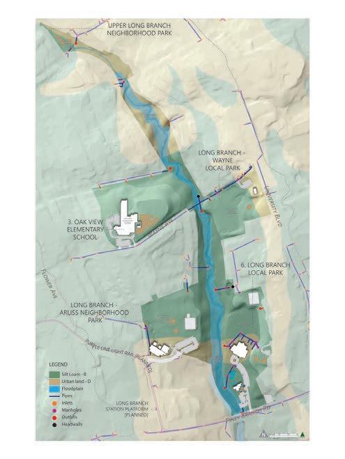


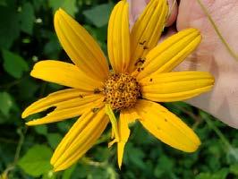
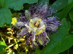

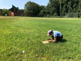


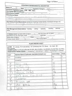
I completed a systematic vegetation inventory using a rapid assessment (relevé) method. After walking the site extensively, I selected 15 sample plots that reflected the structural and compositional diversity of the vegetation.


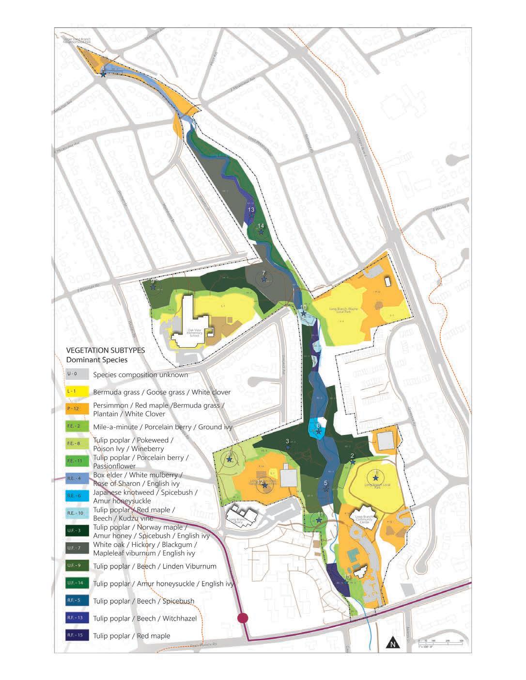
This map shows where each of the 15 vegetation associations appeared at the time of inventory, according to my observations. This detailed snapshot of the site’s plant community was intended to help inform its ecological status and future potential.




DATA ANALYSIS & IDEATION
To assess the site’s vegetation conditions and set goals for ecological restoration, I analyzed some aspects of the structural and compositional quality of the existing forest and parkland.
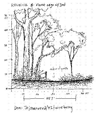


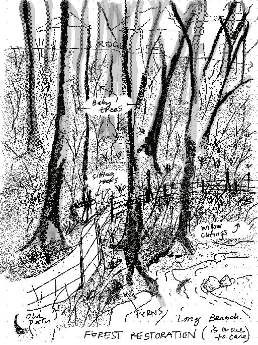


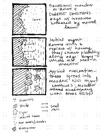

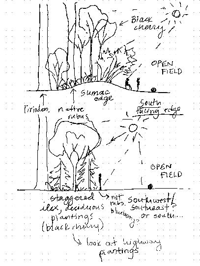


The data I collected informed my reflection on the vegetation dynamics present on the site, and how they could potentially be changed to improve the ecological and aesthetic quality of Long Branch.
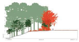


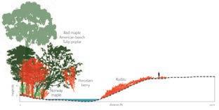
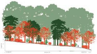
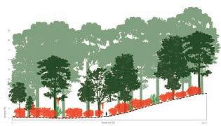

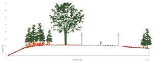
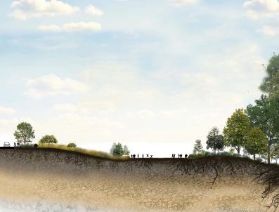
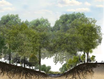
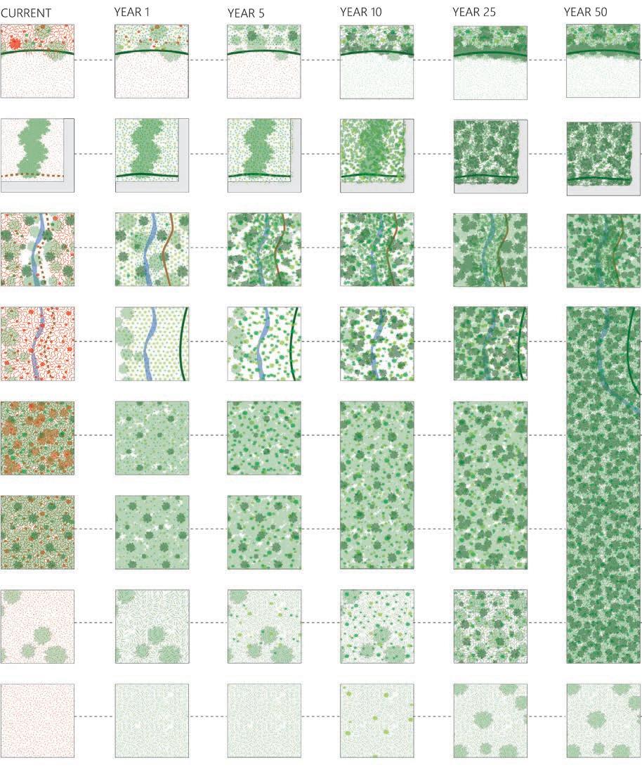
This diagram visualizes how common vegetation typologies on the site could be managed over time, eventually transitioning to more ecologically functional and aesthetically pleasing conditions.
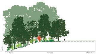
MAGNOLIA EDGE FUTURE TYPOLOGIES
Evergreen magnolias shade the forest interior while providing visual interest and native tree benefits.
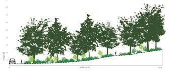

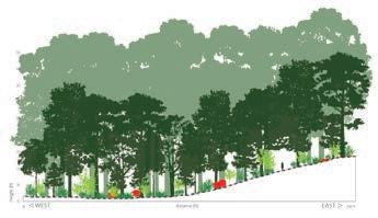
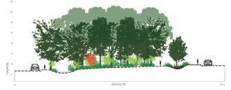

Densely planted interstitial spaces provide bursts of color and wildlife habitat.

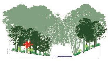
Willows and other fastgrowing riparian species shade and anchor the stream bank.
Intensive multi-layered planting in riparian zones provides richness and habitat in the forest.
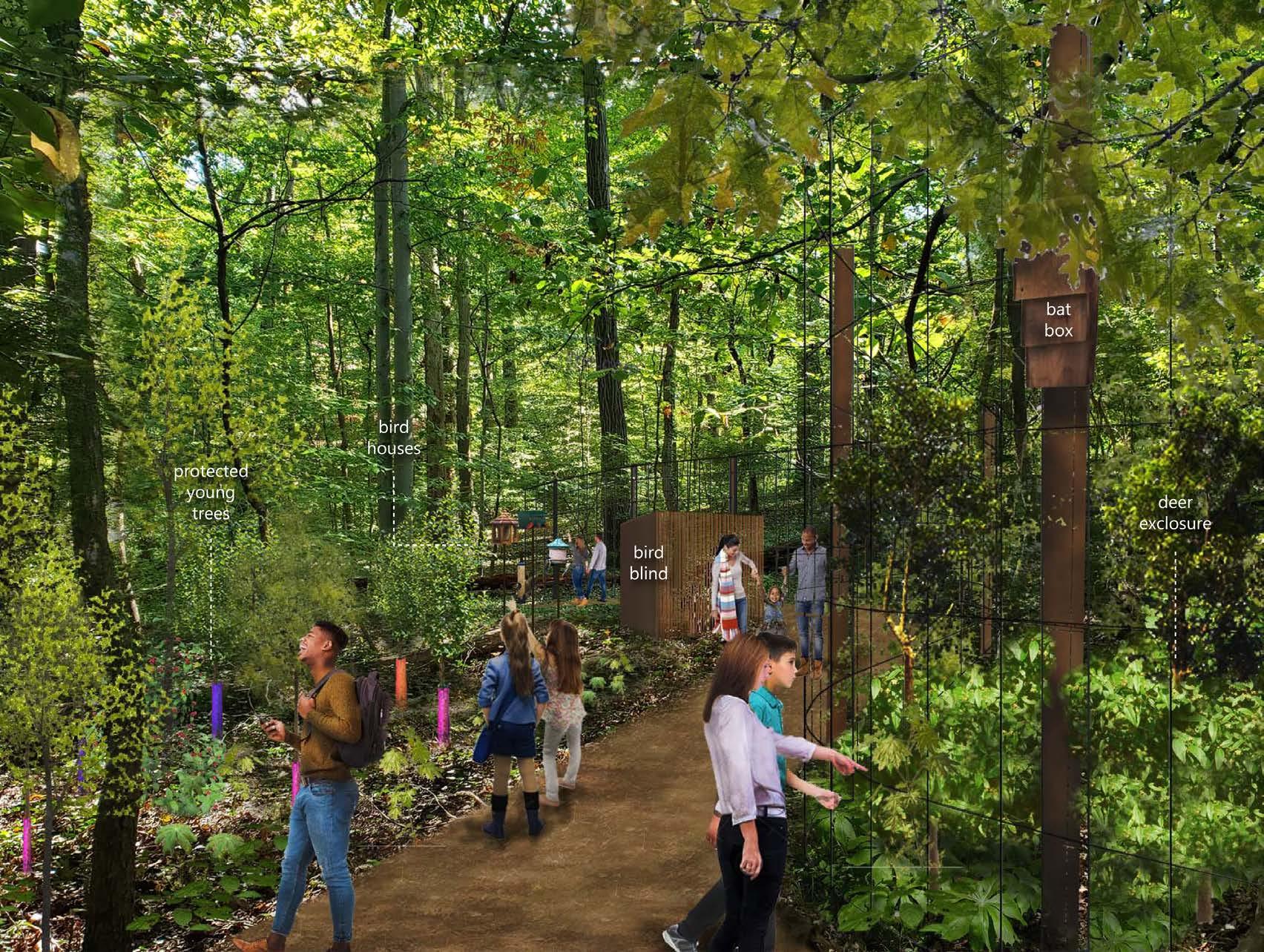
The target species for the forest restoration is based on a forest association native to Maryland. Some areas are first planted as meadows and transitioned to forests by managed succession. Areas where visibility is necessary are maintained as meadows interspersed with large shade trees.


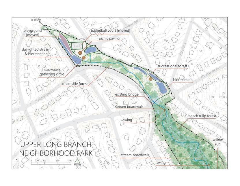
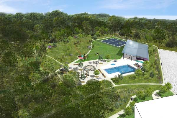
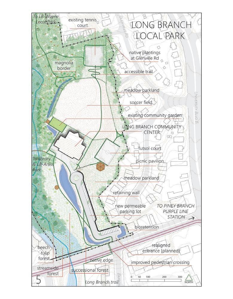
The site plan was divided into five sections. In four sections there is an existing park, and in one there is an elementary showing the proposed plan for each park, which is intended to meet community needs, expand the capacity more visitors, and connect ecological quality of the ArcGIS, Adobe Illustrator

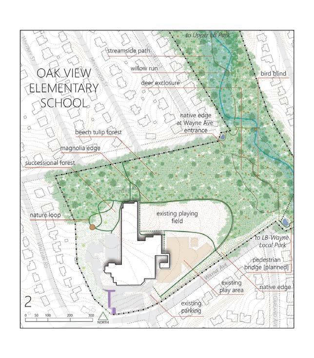

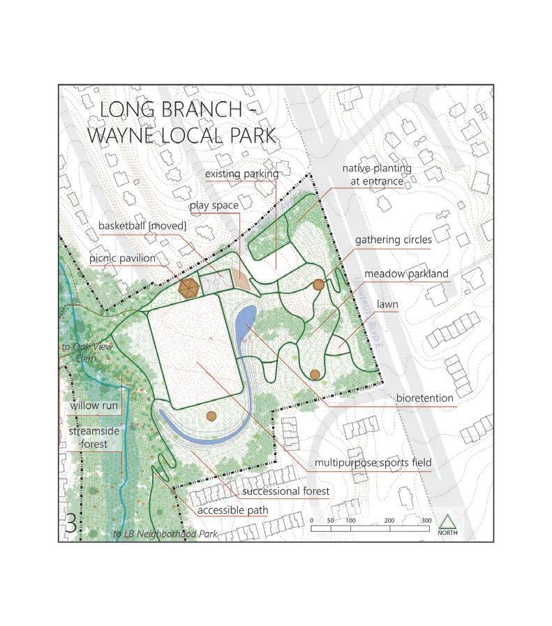
elementary school. This is a conceptual site plan capacity of the Long Branch forest patch to support connect the parks together while building the the forest patch.




SketchUp, Adobe Photoshop



SketchUp, Adobe Photoshop


PROJECT TYPE:
LOCATION:
TOOLS:




Rio Claro Forest Reserve, Antioquia,
Extensive site observation, hand drawing,
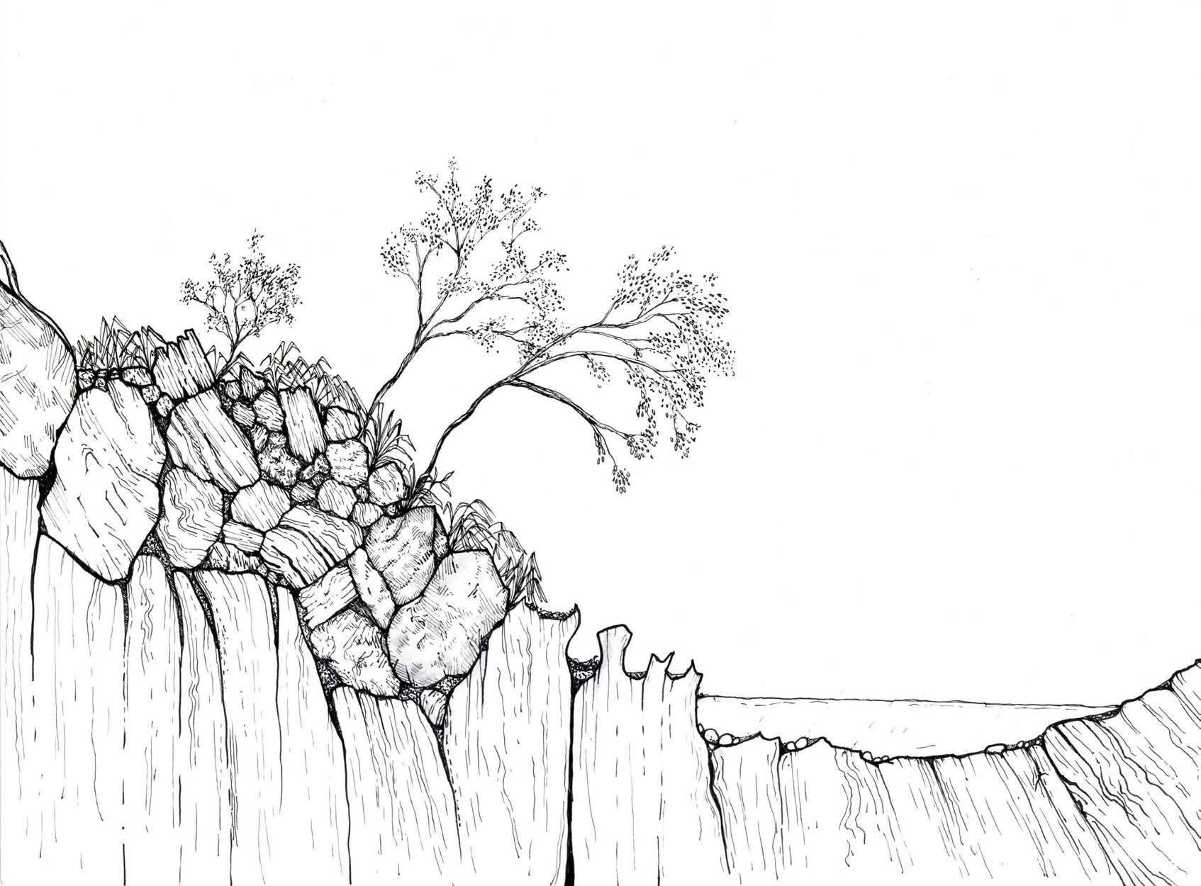
DESCRIPTION: DEEP SECTION: RIO CLARO
This project was done Antioquia, Colombia. Through conceptual illustration visible landscape components to the biological on science to communicate embedded cues in
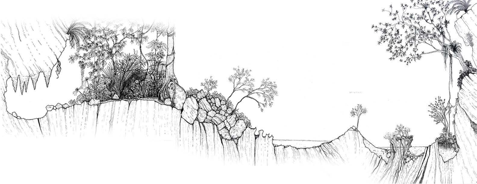
Some of the biological and geological phenomena the river carved through its marble karst bedrock biogeographical conditions in this region contribute
Antioquia, Colombia
drawing, Adobe Photoshop, Illustrator, InDesign
during an interdisciplinary summer fellowship with the Wright-Ingraham Institute in illustration and diagramming of landscape phenomena at varying scales, I aimed to connect biological and geological processes that shaped them. Though this is not a scientific study, it draws in the landscape that are indexical of how this moment in history was shaped.
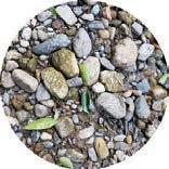


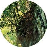


pen illustration
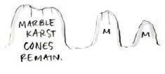
phenomena I observed over two weeks of fieldwork are illustrated here. In the Rio Claro forest reserve, bedrock over millions of years while karstic soils developed on the marble cones above. The unique contribute to some of the highest levels of biodiversity in the world.


ArcGIS, Adobe Illustrator
This watershed map shows the characteristic belt of marble through which the Rio Claro runs.
LEGEND
MINING CONCESSIONS
MARBLE KARST CLIFFS
PROTECTED AREAS
STUDY AREA
WATERSHED BOUNDARY
BOGOTA-MEDELLIN
HIGHWAY
CITIES & TOWNS
PLACES OF INTEREST
Map credit: Kirk Gordon, Centro Geografico Augustin Codazzi

The forests in this area are directly threatened by the marble mining industry.

The region is a large shallow ocean.
Central Andean Cordillera begins to form metamorphically
Shale forms from clay & silt compaction
Intrusive gneiss forms metamorphically
Massive limestone deposits continue to form

Intrusive igneous rock formationdiorite and quartz diorite

Nazca plate moves under South American plate

Heat and pressure from batholiths create marble and schists
Andean cordilleras form; Marble & other rocks exposed to surface through uplift


This timeline, split into three different time Linking the visible elements of the landscape the main processes that shaped this phenomena
Flowering plant evolution First land plants
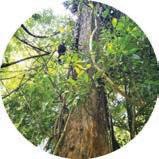
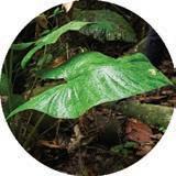

time scales, outlines biological and geological shifts that contribute to current-day conditions in the Canyon of Rio Claro. landscape with these historical processes adds a dimension of observable time. Leaders indicate the period of history when phenomena began.
Globalfluctuationstemperature
Quaternary speciation
Intrusive diorite
Intrusive gneiss



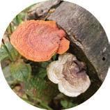
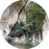


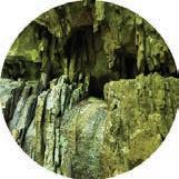
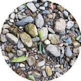
Marble karst cones are exposed; cliffs, caves, and reservoirs develop Earth vacillates dramatically between glacial and interglacial periods, driving massive shifts in global biome distribution. These changes drive speciation patterns in Neotropics.
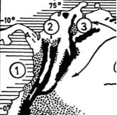
Claro may have been part of the
From Haffer (1969)
Speciation driven by large-scale climactic shifts and complex geomorphology contributes to extreme endemism in neotropics & Rio Claro.
1950s: Forest cleared for cattle grazing
1966: Construction of Bogota-Medellin highway begins
1970s: Mining companies route highways through karstic areas
1980: Mining concessions granted
1984: Highway completed; mining begins; nearby conservation land also acquired
1986: First major botanical inventory
1998-2005: Mass emigration from region due to armed conflict
Elements are arranged according to whether they are biological phenomena, geological phenomena, or an interaction between the two.
2005-2008: Number of scientific & botanical studies increase
2008-present: 2016 peace deal increases access; marble mining activity intensifies

PROJECT TYPE:
LOCATION:
West Baltimore, Maryland
TOOLS:
ArcGIS, AutoCAD, Illustrator, Photoshop, InDesign, SketchUp, hand drawing
DESCRIPTION:
In West Baltimore, the so-called Highway to Nowhere tore a neighborhood apart when it was constructed in the mid-1970s. This project reimagines this underutilized space as a way to reconnect the neighborhood, build Baltimore’s green network, and integrate multimodal transportation.
ArcGIS,

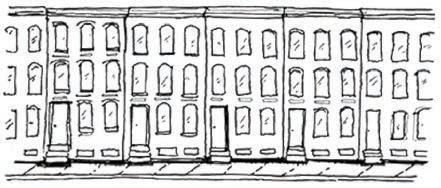

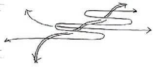


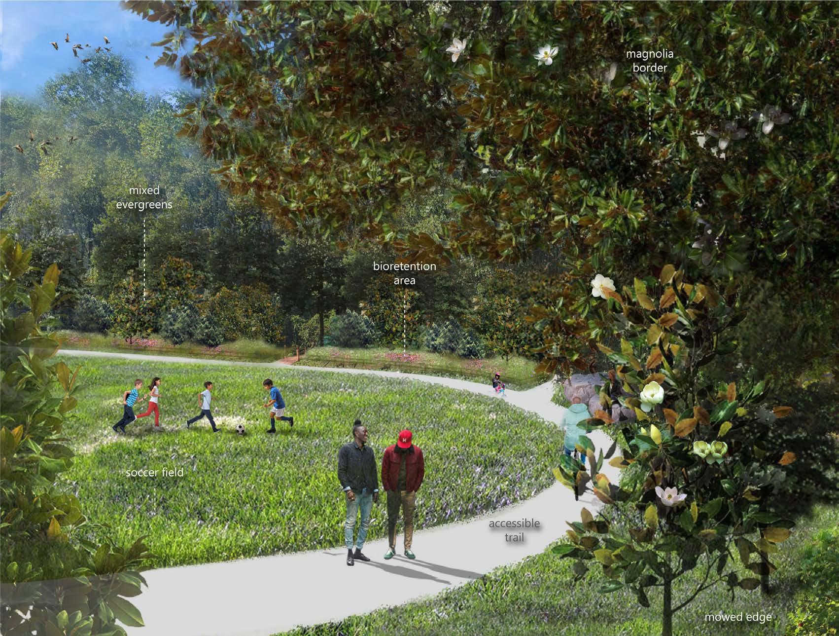
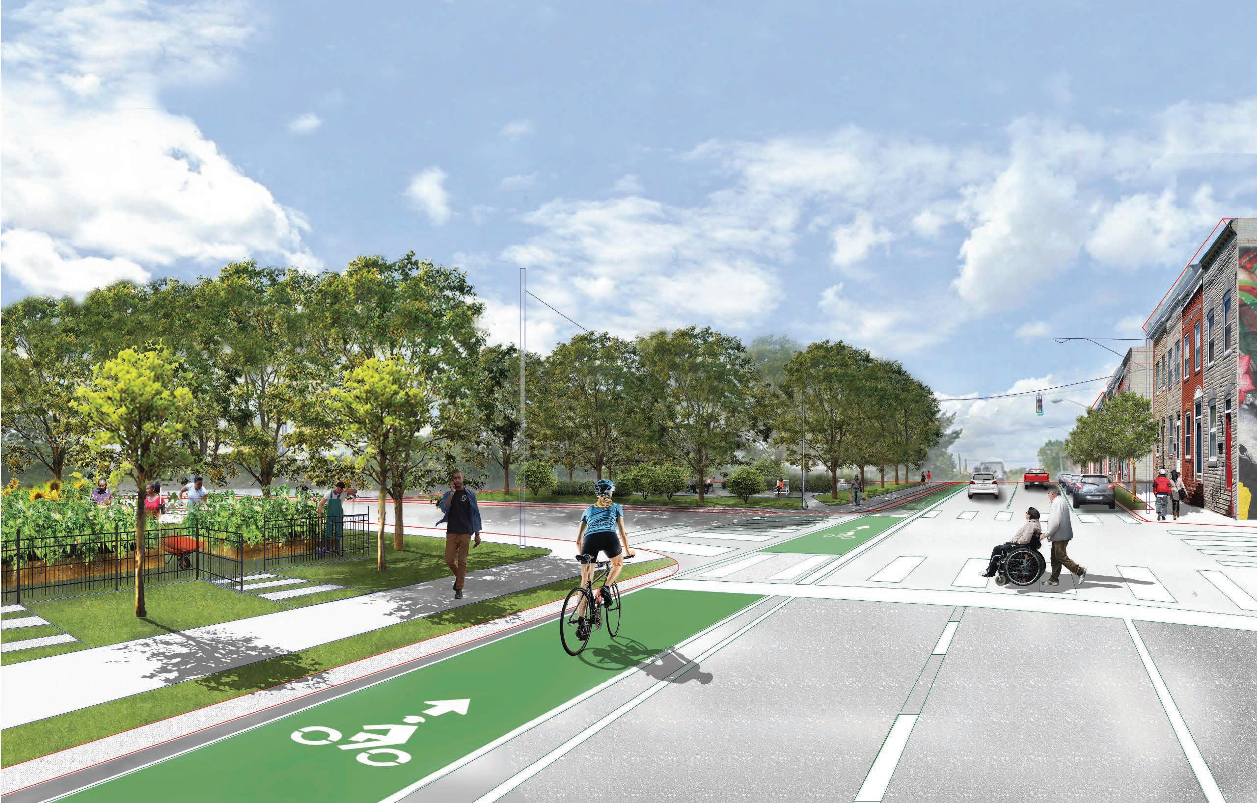
PERSPECTIVE: WOODLAND PATH


SITE PLAN: ROUTE 40 ECOLOGICAL PARK
LEGEND
VEGETATION
TRANSPORTATION
COMMUNITY RESOURCES


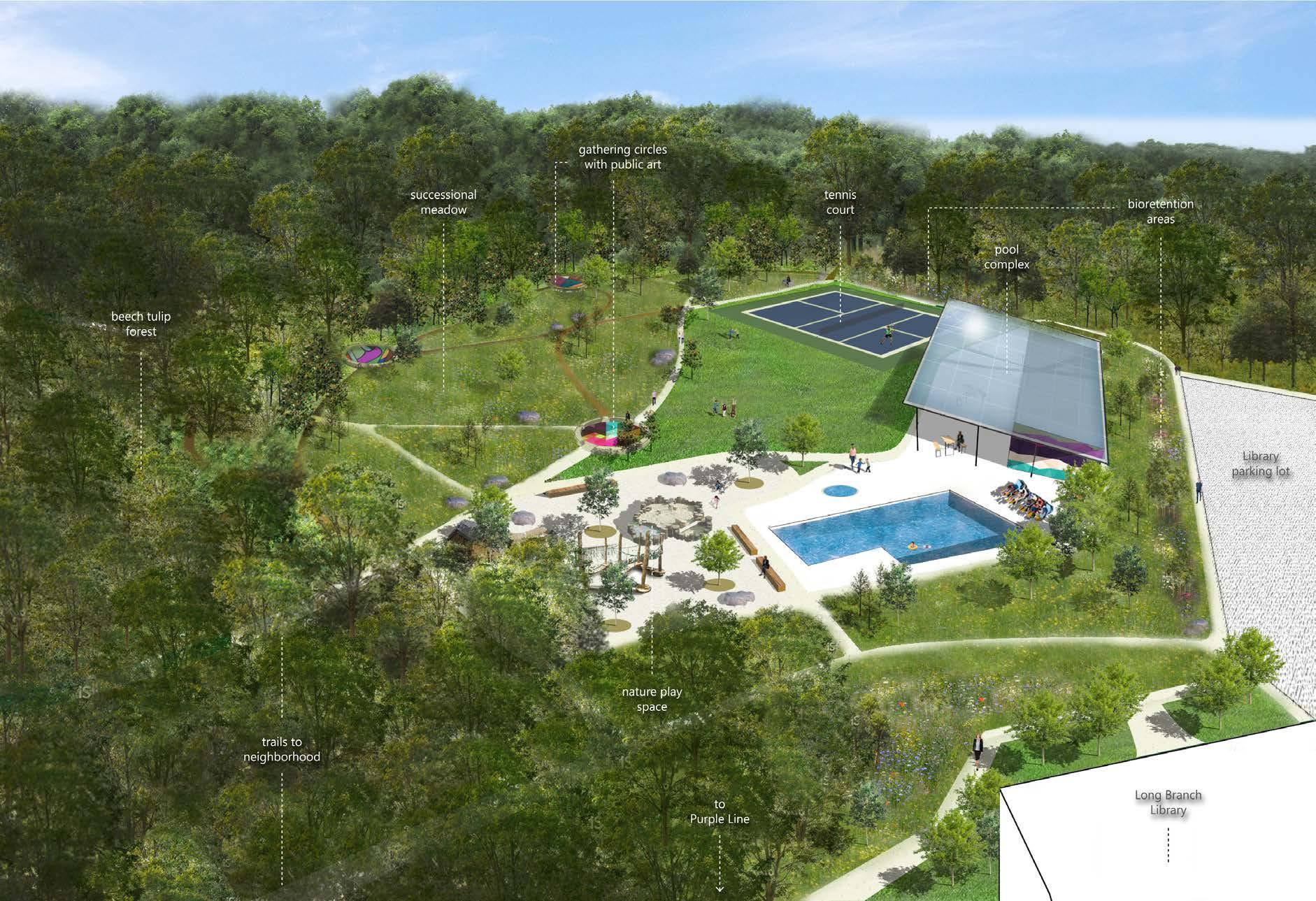
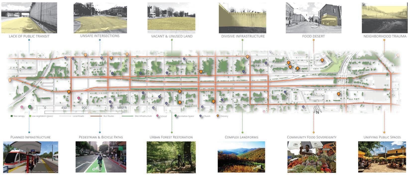
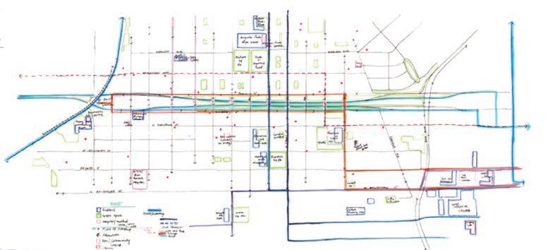
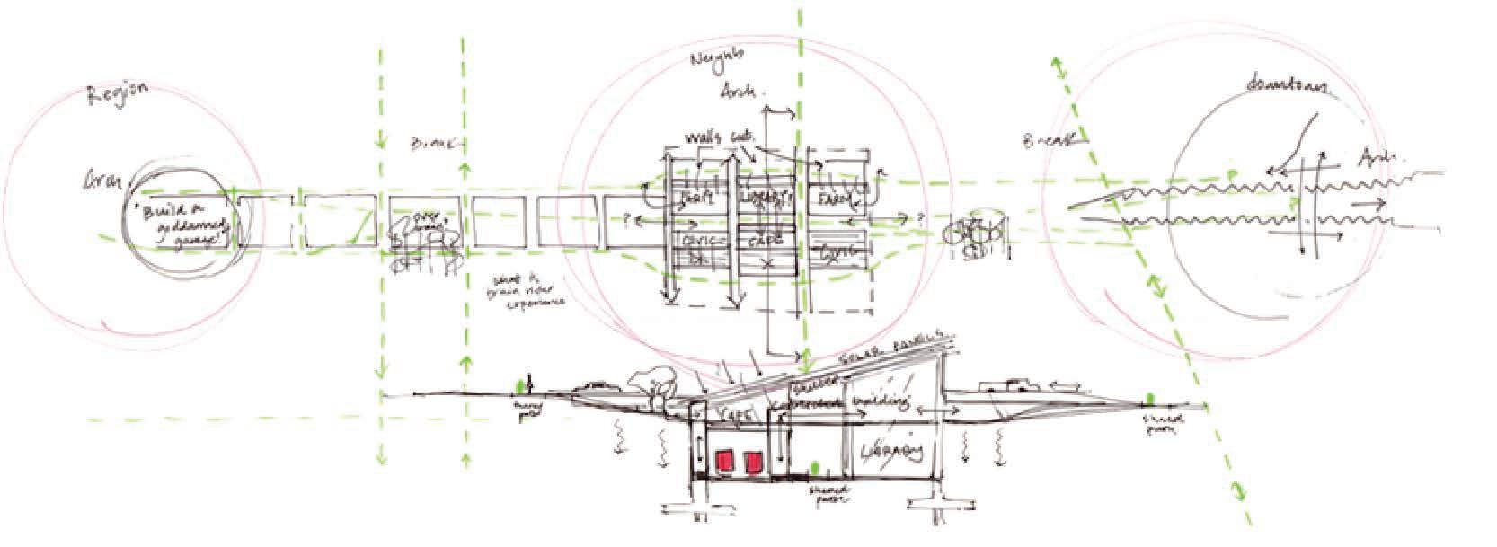
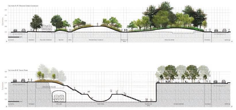
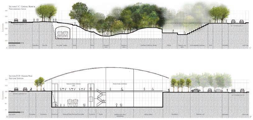
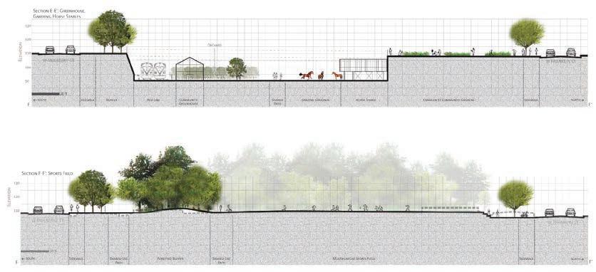
This conceptual plan weaves together planting design, multimodal transporation, and community resources.
The planned (unbuilt) Baltimore Red Line light rail runs through the site. The design includes meadows, forested berms, and shrublands, space designated for local businesses, a community library, horse stables to uphold a fading part of West Baltimore’s history, community greenhouse and gardens, and a wide variety of recreational resources.

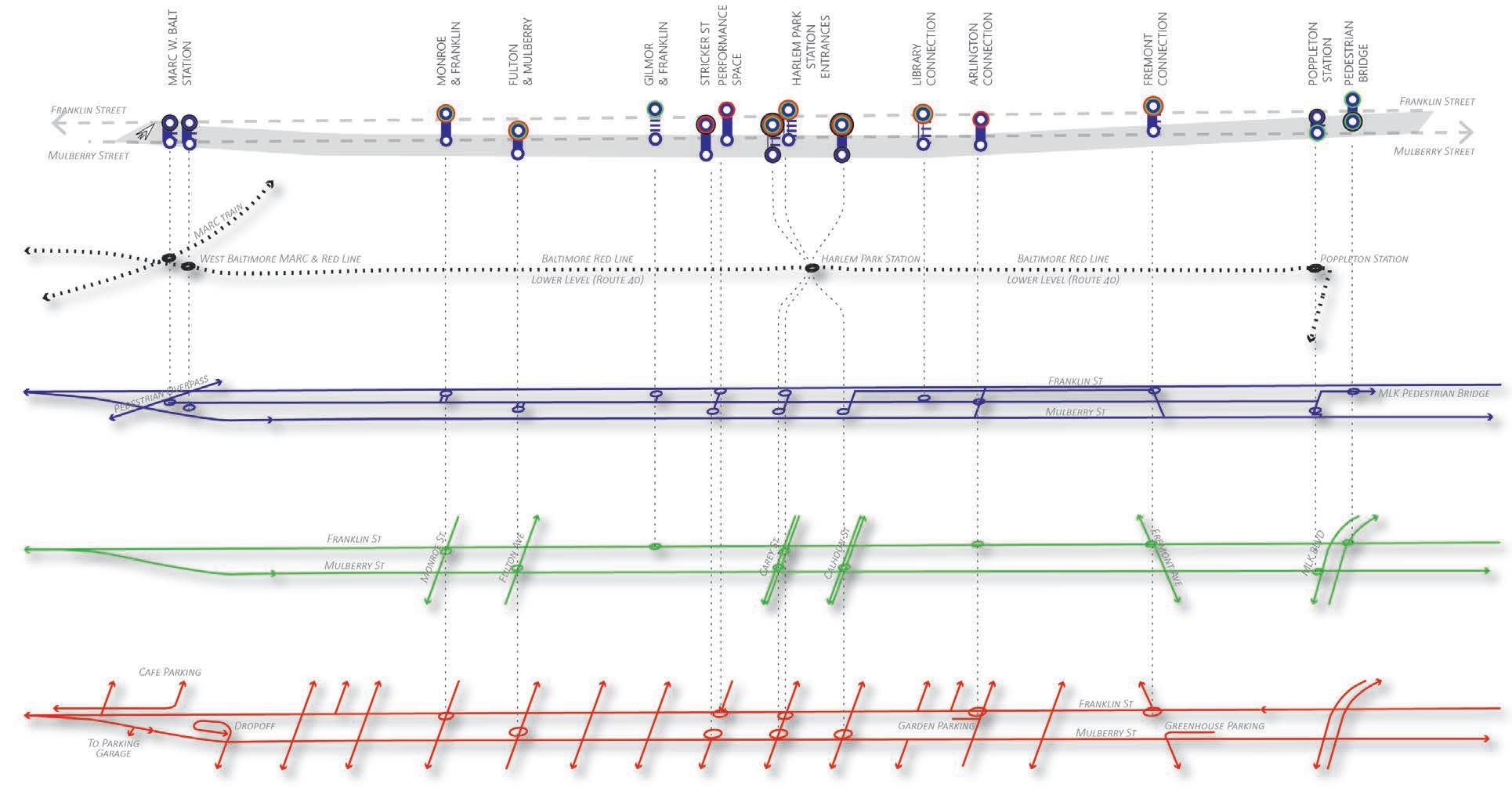
Showing proposed connections between train lines, pedestrian paths, bicycle paths, and vehicle routes.

The dramatic elevation changes on the current site, vestiges of the dramatic construction of the highway in the mid-1970s, provide a rich design opportunity.


Adobe Photoshop, SketchUp, Google Earth


Adobe Photoshop, SketchUp, Google Earth


Creating habitats on small plots - a resident’s guide to ecological planting

PROJECT TYPE:
DESCRIPTION:
Interdisciplinary collaboration, Maryland ASLA Fellowship Project
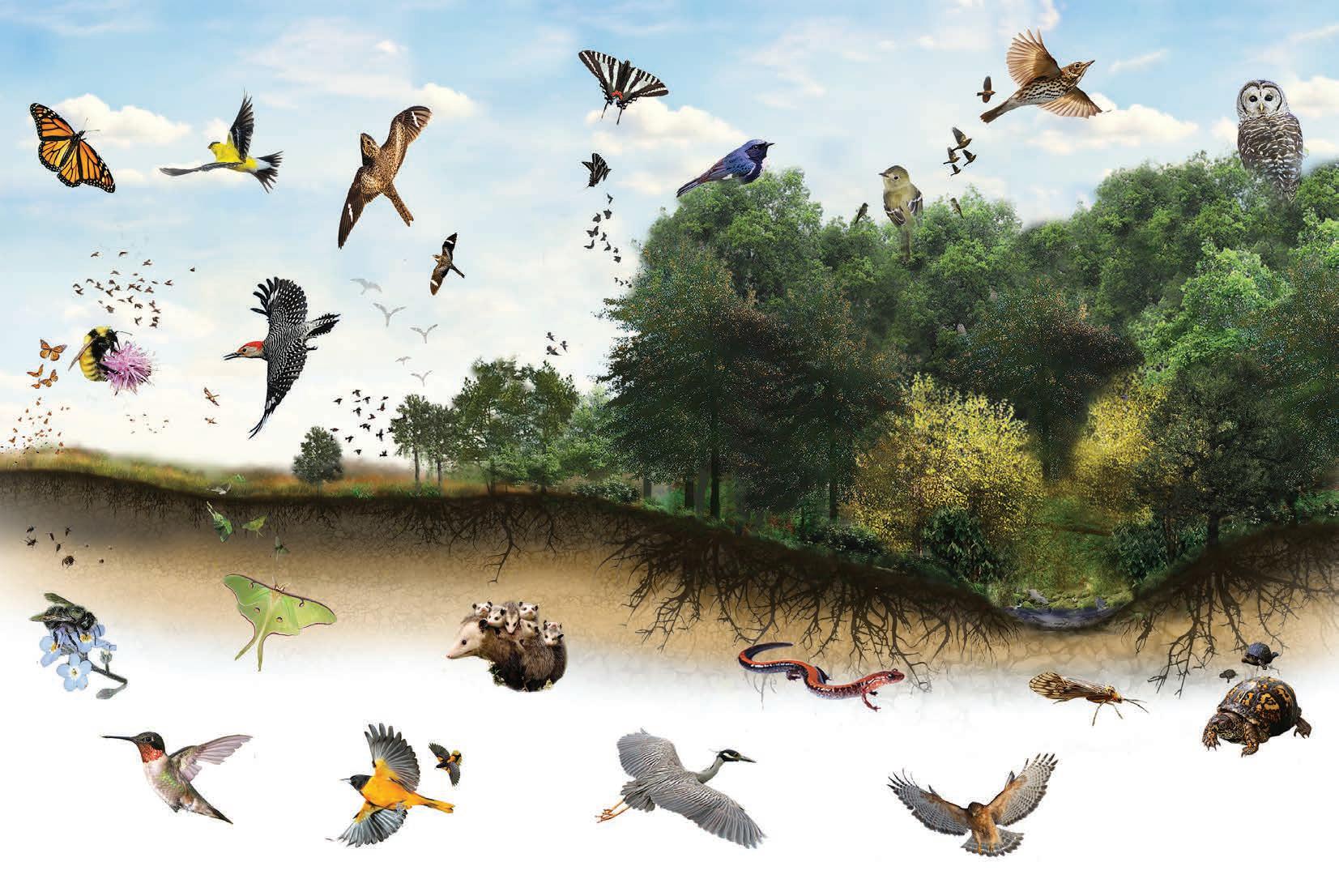
This poster series is my contribution to a regional effort to build biodiversity in Baltimore, Maryland through residential-scale planting design. The posters integratbasic ecological concepts with design ideas and focus on attracting charismatic animal species.

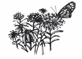
Milkweed-filled meadows are crucial in monarch’s famous migratory journey. They need milkweed to survive, and are increasingly threatened by habitat loss.
Find the beautiful goldfinch in low branches of shrubs, and foraging for nuts and seeds in open grassy areas. Unafraid of city life, these resident birds light up the urban landscape.
Native bees are essential pollinators in local ecosystems. These non-aggressive ground nesters are threatened by habitat loss from mowing and raking.
On clear summer nights, you can look for nighthawks swooping around streetlights to catch flying insects. They are fueling up for their long winter migration to Central and South America. Their name is deceiving; they have been constantly declining in population in recent years.
Red-bellied Woodpeckers are fairly common, but they are a conservation priority because the holes they peck into trees provide necessary habitat for countless other small animals.
These non-aggressive native bees form individual families, as opposed to building colonies. Their fascinating life cycle depends on undisturbed hollow grasses, making them vulnerable to mowing and clearing.
The beautiful luna moth is unmistakable. Its long tails and eye-like wing patterns deceive predators such as owls and bats. It relies on specific host trees, such as walnuts and sweet gums; specialists like this are especially threatened by deforestation.
This charming tiny bird can be seen drawing the nectar from red
It needs tons of sugar to power its long migration to the Gulf of Mexico, which it fascinatingly does often without stopping.
You usually see butterflies our in the sun, but these distinctive swallowtails can be found wherever Pawpaws are found. Pawpaws are a fruit tree that thrives in the wetter, shady forest understory.
The Acadian Flycatcher is a perfect example of a forest interior dwelling bird. They need large tracts of mature forests to thrive.
These beautiful birds can be found lower in the foliage than the typical warbler. Look for them foraging deep in the woods on the forest floor.
Perhaps the most misunderstood of local mammals, the unique Virginia opossum is North America’s only marsupial. Commonly mistaken for rodents, they actually eat rodents, along with ticks, roaches, and garden snails. Got a possum in your yard? You can’t do better.
These iconic birds forage for insect and ripe fruits at the very tops of trees. They like the darkest, ripest fruits. Find them on stream banks and forest edges in conservation areas, and maybe even in your own backyard.
you know that salamanders breathe through their skin and so it has to stay wet all the time, but it produces a chemical that protects it from fungus! Look for them under logs and
and
These small herons are nocturnal, hunting in streams and tidal waters at dawn and dusk for crustaceans. Their breeding habitats are vulnerable to sea level rise, so we need to protect inland habitat for them to relocate to.
Barred Owls’ distinctive call sounds like
“Who-cooks-for-you?” These noble birds need large, dead trees for nesting sites. Usually they are found in undisturbed wooded areas, but have been seen in small patches of urban forest as well.
bird
The caddisfly is well known as an indicator of stream health. They can not tolerate a contaminated stream. So if you see a caddisfly nearby, you know you are next to a healthy habitat. Eastern box turtles used to be a common wildlife encounter in Maryland. Due to habitat loss and increased car-related deaths, their numbers have declined dramatically. To see more box turtles, we must rebuild and protect their habitats.
These beautiful hawks have seen a population rise in recent years. They are the easiest hawk to identify because of their distinctive appearance and call.
For more information about the Biodiversity Toolkit ambassador species, scan this QR code.


These two posters draw heavily on the idea of the ecological niche, illustrating how that translates to the urban environment. The information here is intended to build and for people to begin to see themselves in those interactions. The concept of “focus habitats” draws a parallel between types of naturally occuring habitats and urban

QUALITY HABITAT FOR LOCAL ANIMALS REQUIRES THE RIGHT CONDITIONS YEAR-ROUND. YOU CAN PROVIDE THIS WITH SOME SMALL--OR LARGE--CHANGES TO YOUR SPACE.
The conditions of your space -- such as light and soil moisture -- will determine which plants can grow, and which type of habitat you can create.
After the last frost, queen bees emerge from hibernation under loose grasses and leaf litter, seeking a place to build a nest.
Atlantic.
These bees emerge from hibernation in early spring, seeking pollen and nectar. They are often found in orchards because fruit trees blossom earlier than other plants.
The beautiful luna moth emerges in mid-Spring. They mate, and the adults do not eat; they immediately lay eggs on walnut, sweetgum, or hickory trees, and then die.
These charming, charismatic birds arrive in North America in Mid-May. They immediately mate and find a spot to lay and guard their eggs. They lay eggs in open, rocky areas, often in gravelly fields or on rooftops.
To get enough energy for the rest of their journey north, monarchs need nectar sources in early and midsummer from blooming flowers.


On the way back from Canada, monarchs also need abundant nectar sources in early fall.


In the fall, new queens fatten up on fall-blooming flowers for winter hibernation.


While the rest of the colony dies, the new queens hibernate underneath leaf litter for the entire winter.
Instead of forming a nest, orchard bees form individual families. Within 5 weeks of emerging from hibernation, mothers lay their eggs individually in compartments inside hollow stems or other long, narrow holes.
Egg compartments inside of a hollow stem
Larvae Nutritious mix of pollen and wax
As long as their nesting sites remain undisturbed, orchard bees spend most of their life cycle in their compartments their mothers created for them. They reemerge the following spring. Mud wall


Once these eggs hatch, the second generation is born. This one will overwinter, and emerge in spring to start the cycle again.


Lunas can only surive on certain types of trees. If you have a walut, sweetgum, or hickory tree, avoid raking under it to avoid damaging pupae.


Nighthawks hunt insects everywhere, powering up for their winter migration to South America. The more insects, the more nighthawks.
In early spring, these tiny birds build cup-like nests out of fluffy grasses and spiderwebs.
North America’s only marsupial will mate any time except for winter, and their babies are so small you can fit 20 of them in a teaspoon.
For protein they eat small insects such as gnats and mosquitoes, and for sugars, they are attracted to flowers such as the Canada Lily.
Babies ride in their mother’s pouch until they are big enough to ride on her back while she forages for food. In the summer, they eat common pests like ticks, mice, garden snails, and mosquitoes.
Choose plants that are appropriate to your space and choose how they will be arranged. You can make your space a multi-seasonal resource for biodiversity.
Opossums often move between several different shelters to evade predators.


In the fall, they forage for fallen fruits such as pawpaws and acorns. Very vulnerable in the winter, they often hide in old squirrel holes or hollow logs. Don’t mistake these fascinating animals for rats!
Once you have done the hard work, you can start seeing the results of your efforts and enjoy birds, butterflies and other animal species visiting your space.


awareness and curiosity about local ecological interactions, urban conditions that provide analogous conditions.
ONCE YOU KNOW YOUR SITE CONDITIONS, YOU CAN CHOOSE WHICH ECOSYSTEM TYPE TO FOCUS
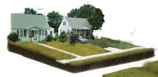
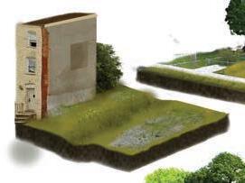
If your site has few to no trees and low vegetation such as grass, you have conditions that are most akin to a meadow. This is quite common in urban environments. Meadows are usually dry, but they can be wet in low spots where water concentrates.
Forest edges are a mixture of open, sunny areas with shaded patches of trees, shrubs, and vines. Forest edges are common in urban environments where humans have cut through forests to construct roads and buildings.
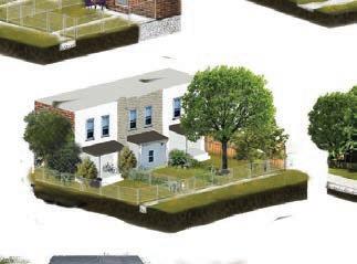


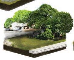
MANY FAMILIAR URBAN SETTINGS, SUCH AS VACANT LOTS, YARDS, AND PARKS, HAVE SIMILAR CONDITIONS TO ECOSYSTEM TYPES FOUND
There are many different types of water-adjacent ecosystems in Maryland, also called riparian ecosystems. In urban areas, these are uncommon outside of conserved areas.
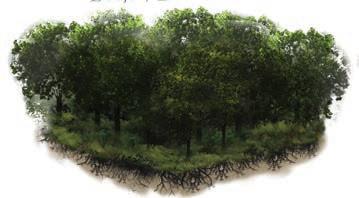
Dense tree canopy, shade-tolerant understory plants, low light, and high humidity characterize forest interiors.. It is now quite rare to find these conditions in urban environments.
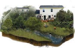

Even if you don’t have a stream running through your backyard, anywhere where water pools or flows has habitat potential. Usually
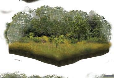



These two posters explore the practical aspects of assessing and observing land with the intention of making plant selections. The emphasis here is on matching plants of providing resources to local wildlife. The “Meadow” poster provides an example of a habitat type that can be created in many places in the urban environment: for example,
OBSERVING YOUR SPACE WILL HELP YOU DECIDE WHAT YOU WANT TO CHANGE, AND WHAT YOU WANT TO KEEP.
Whatever the size of the space you’re working with, you can make changes that will benefit local wildlife.

Some wildlife sightings are extremely common in urban areas, such as deer, crows, starlings, and squirrels. These species have adapted well to environmental conditions in areas that have been modified by humans. Some other species may need a bit of extra help finding a comfortable home in urban settings, and that’s where you come in.


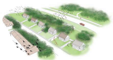


To understand lighting on your site, you first need to know which way is North, South, East, and West in relation to your house. In the Northern Hemisphere, south-facing surfaces get the most sunlight, because of the sun’s angle in relation to the Earth. This will greatly affect your planting choices.
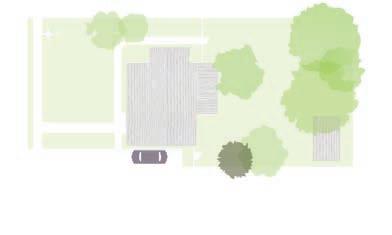
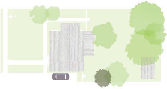
Measure the approximate boundaries of your space, and draw a birds-eye view map. Note the location of grassy areas, trees, pavement, and buildings. It does not have to be perfect. Try finding your house on a mapping app and drawing what you see.
OBSERVE WATER, LIGHT, PLANTS, AND ANIMALS.
Try taking a photo of your space at various times on a sunny day to get an idea of how much light each area gets. Identify areas that are full sun (6+ hours
(between
Notice which plants you’d like to keep, and which you’d like to replace. You don’t have to start over completely-- you may already have more animal and plant diversity in your space than you suspect.
It is important to distinguish between native plants and non-native plants. Native plants provide more resources to native animals than non-native plants do, because they share an evolutionary relationship.


The next time it rains, observe where water is flowing and pooling around your land. Does it drain to the street? Are there any wet spots where water tends to collect? Does water come in from neighboring properties or flow off of your roof? Water availability will determine which types of plants you can plant.
Combine your observations of water, light, plants, and animals and write them as notes on your basemap. This will help you make decisions later.

to their optimal growing conditions, and also with the aim example, in
yards and
lots.
FOCUS HABITAT:
Benefits: Pollen & nectar in summer; deer-deterrent; monarch breeding habitat. Plant near edges and in large swaths.
Species: Butterfly milkweed (Asclepias tuberosa), Common milkweed (A. syriaca)
Species: Mountain mint (Pycnanthemum muticum), Golden ragwort (Packea aurea) Benefits: Meadow seed mixes typically contain a mix of native grasses, perennials, and annual species,


1. BASIC MEADOW COMPOSITION
Meadows are usually planted with about 50% native grasses and 50% native perennials and annuals.
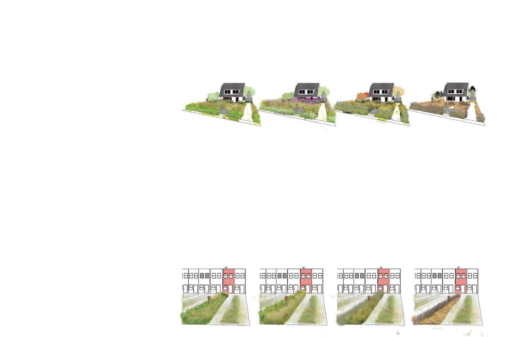
Meadows are a temporary ecosystem in Maryland, caused by forests being cleared by human or natural disturbance. They take a bit of management and take some time to establish, but can be incredibly rewarding in their beauty and biodiversity value.
To maximize animal biodiversity, it is important to have a variety of plants that will produce nectar, pollen, seeds, or fruits throughout the year.
Leaving fallen leaves, dead stems, and brush piles provides habitat for overwintering and ground nesting animals.
Milkweed not only attracts monarchs, but also provides nectar, pollen, and shelter for a wide variety of other animals.


