Downtown Austin Plan
Adopted by the Austin City Council December 8, 2011


Adopted by the Austin City Council December 8, 2011

Adopted by the Austin City Council by Ordinance No. 20111208-093 December 8, 2011

I do not know what the future of downtown is, but here is what I am certain of:
• If we are to have an effec ve environmental policy, downtowns are important.
• If we are to have an effec ve transporta on policy, downtowns are important.
• If we are to have meaningful historic preserva on, downtowns are important.
• If we want Smart Growth, downtowns are not only important but also irreplaceable.

• If a local official wants to claim the treasured mantle of fiscal responsibility, downtown revitaliza on is impera ve.
• If we want to avoid Generica, downtown is essen al to establish differen a on.
• If the community is trying to compete in economic globaliza on without being swallowed by cultural globaliza on, downtown revitaliza on has to be central to the strategy.
• If new businesses, innova ve businesses, and crea ve businesses are going to be fostered and encouraged, a community will need a downtown where that can take place.
• If we are able to have buildings with meanings, buildings with value, buildings with values, they will be downtown.
• If we are to have public places of public expression, we need a downtown.
• If a community is going to embrace diversity instead of hide from it, celebrate diversity instead of deny it, then that has to take place downtown, it ain’t gonna happen anywhere else.
(Donovan Rypkema, Journal of the American Planning Associa on, Winter 2003.)

Aus n City Council Resolu on (2005)
Record of DAP Mee ngs
Imagine Aus n Comprehensive Plan Vision Statement (2010)
DAP Historic Preserva on Policy Recommenda ons for Downtown Aus n (2010)
DAP Proposed List of Uses under Revised DMU Districts (2010)
Exis ng Zoning and Special Districts Maps (current)
DAP Affordable Housing Strategy (2009)
DAP Downtown Density Bonus Program
DAP Proposed Building Design Standards (2010)
DAP Strategies and Policies to Sustain and Enhance Aus n’s Crea ve Culture (2009)
DAP Downtown Infrastructure Strategy (2010)
DAP Ten-Year Implementa on Program (2010)
(These documents are located at h p://www.aus ntexas.gov/downtownplan) A: B: C: D: E:
DAP Transporta on Framework Plan
DAP Parks and Open Space Plan
Waller Creek District Master Plan
Northwest District Plan
Core/Waterfront District Plan

Second Street District, Austin
Over the past ten years, Downtown Aus n has undergone an amazing transformaon. 6,000 new residents have moved to Downtown, inhabi ng the many new buildings that have drama cally transformed the skyline and energized its streets and public spaces. Downtown is no longer just a place for conduc ng business or enjoying live music or dining out. It has become a neighborhood in its own right - a place where people are living, working and playing - a place that offers new lifestyle choices - a place that is contribu ng to a longstanding vision of a mixed-use urban district at the heart of a sustainable region.
In addi on to the influx of new residents, considerable progress has been made in other regards. Second Street has emerged as an urban promenade and an exci ng day and night- me des na on. The cultural life of Aus n has been enriched with new ins tu ons, like the Long Center, the Blanton, the Bob Bullock Museum, the MACC, Arthouse and others. The expansion of the Conven on Center and the addi on of over 1,500 new hotel rooms have strengthened the Downtown’s viability as a na onal and regional des na on. And the introduc on of commuter rail service represents a significant step toward a more sustainable transporta on system.
In spite of - or in some cases because of - this progress, Downtown faces some cri cal challenges. There is concern over the loss of local businesses and historic buildings, that live music and the arts are being “priced-out” by higher paying ac vi es, that housing is affordable only to the affluent, that parks con nue to decline and that Downtown’s auto-dominated streets do not support the kind of urban public life that its ci zens envision.
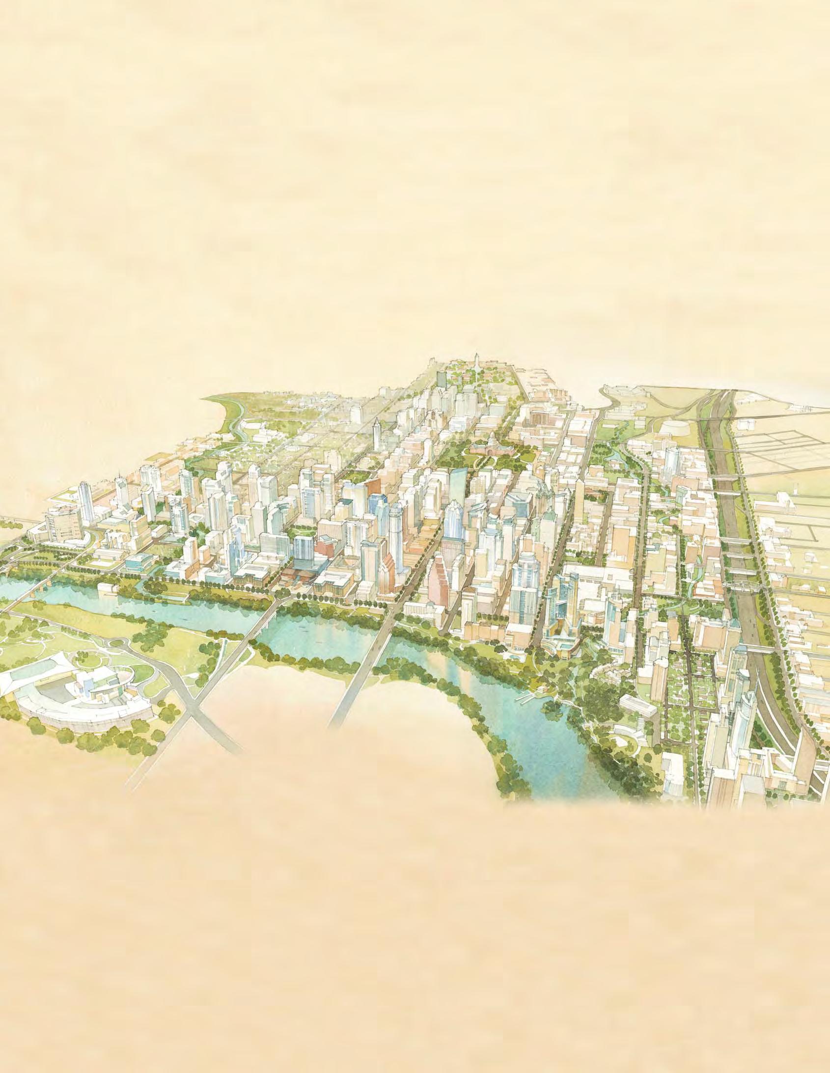
The Downtown Austin Plan (DAP) encompasses an approximately 1,000-acre area bounded by Martin Luther King Blvd., IH 35, Lady Bird Lake and Lamar Blvd.
Over the past ten years Downtown has gone through a remarkable transformation.
The Downtown Aus n Plan (DAP) provided the opportunity for the community to refine its vision for Downtown and to formulate an ac on plan that addresses these challenges, while building on the momentum of the past ten years. The DAP is the result of a three-year dialogue with the general public and the Downtown community and stakeholders. It involved six Town Hall mee ngs and scores of smaller mee ngs and workshops, solici ng input on a wide range of issues and geographic subareas.
The planning process began with a nine-month “diagnos c” phase to assess existing condi ons, analyze opportuni es and constraints, iden fy priori es and cra the work program for subsequent phases of the project. The resul ng “Downtown Aus n Plan Issues and Opportuni es”1 report was presented to the community and City Council in February 2008.
In 2008 - 2009, the City Council acted to advance specific elements of the DAP, including a Downtown Transporta on Framework Plan and an Urban Rail Study, a Downtown Affordable Housing Strategy, a Downtown Density Bonus Program and a Downtown Parks and Open Space Master Plan. Addi onal studies include reports on historic preserva on, the character and form of the various “districts” or subareas of Downtown, crea ve community strategies, design and development standards, and a program for upgrading u li es and infrastructure. In addi on, District plans for three of the nine districts established by the Plan have been developed, including the Waller Creek District Master Plan, the Core/Waterfront District Plan and the Northwest District Plan.

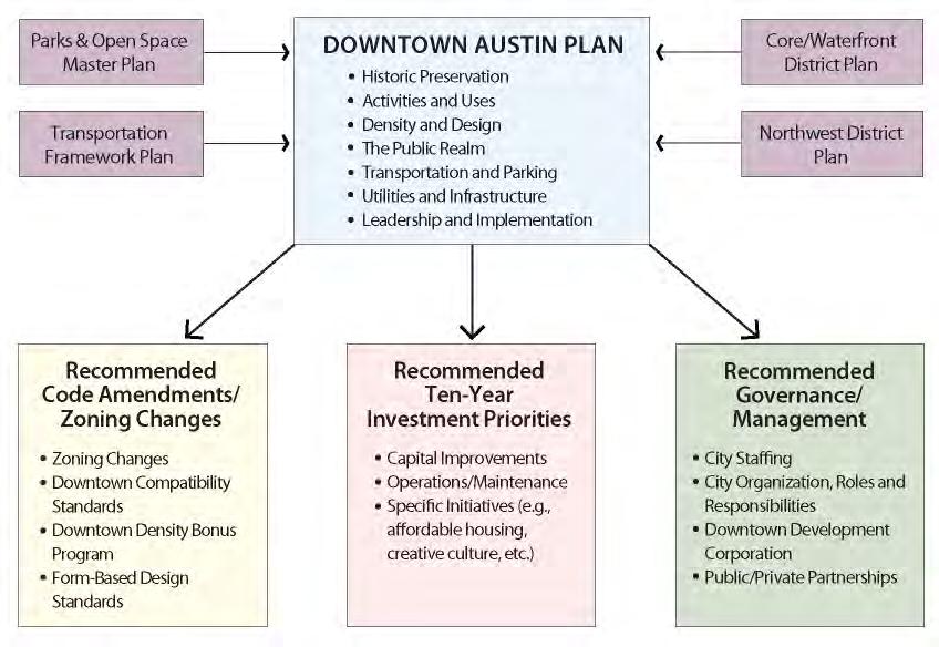
The community input involved in assembling these reports and plans have informed and contributed to this, the final dra of the Downtown Aus n Plan. The Plan was adopted as an amendment to the City’s Comprehensive Plan. A er City Council adop on, City staff will ini ate the various recommenda ons of the Plan. As shown in this chart, implemen ng the DAP will involve three categories of ac ons: code amendments and zoning changes, governance and management changes and a commitment to an ini al ten-year investment plan.
The DAP is intended as a “living” plan – one that will be amended and updated through me. The document is organized into three parts:
Part I: Execu ve Summary, highligh ng the community’s vision for Downtown, the findings of the diagnos c phase and a summary of Plan goals and recommenda ons.
Part II: Downtown Districts, describing the diverse issues and opportuni es of Downtown’s sub-areas and stakeholder priori es for the improvement of these areas; and
Part III: The Plan Elements, providing goals and recommenda ons for the seven elements of the Plan and the implemen ng ac ons necessary to achieve them.

Downtown Aus n is everyone’s neighborhood. It is the place where people gather for special events and celebra ons, the place where we exercise our most basic American freedom of public speech, and the place we come to meet one anotherboth by plan and by chance. It is a place where we make that vital connec on with one another as part of the larger community. Downtown conveys our values and aspira ons, both to ourselves and to the outside world. As a place, Downtown is perhaps the most vivid and authen c expression of our history and culture: it is the “soul” of our region, a place like no other.
In recogni on of this unique role, the Aus n City Council passed a resolu on in 2005 calling for the development of a plan to guide the City and the community in achieving a shared vision for Downtown. The resolu on recognized the importance of Downtown in reinforcing the City’s fundamental goals of economic and environmental sustainability, affordability, livability and diversity. (See Appendix A)
More specifically, the resolu on reiterated the goal of 25,000 residents living Downtown in 10 years and therefore, the need to plan for passenger rail; to increase funding for Great Streets, drainage and flood control improvements; to revise and update regula ons consistent with more dense urban development and infill; to develop a strategy for affordable workforce housing; and to explore redevelopment of government-owned land.
Downtown is the place where we make that vital connection with one another as part of the larger community.

Over a three-year planning process of the Downtown Aus n Plan (DAP), a vision has emerged for Downtown Aus n. At its Bicentennial in 2039, Downtown will be at the heart of one of the most sustainable ci es in the na on with:
• A dense and livable pa ern of development that supports a vibrant day and nigh me environment;
• An interconnected pa ern of streets, parks and public spaces that ins ll a unique sense of place and community;
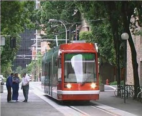
• A mul -modal transporta on system that is convenient, sustainable, affordable and a viable alterna ve to the automobile;
• A beloved fabric of historic places, buildings and landscapes that celebrate the unique journey Aus n has taken over the past 200 years;



• A variety of districts and des na ons that support the crea ve expression of its ci zenry through art, music, theater, dance and performance;
• A green “necklace” of trails extending from Lady Bird Lake, and along Waller and Shoal Creeks into surrounding neighborhoods;
• A wide range of housing choices for individuals and families with diverse social and economic backgrounds; and
• An array of innova ve businesses – small and large - that are a racted to the Downtown by its rich human capital and unique sense of place.



The DAP proposes seven transformative actions that can help realize the community’s vision. These and other recommendations are elaborated in the Leadership and Implementation chapter.
1. Initiate a new generation of downtown signature parks. Complete Waller Creek as a linear park between Lady Bird Lake and UT, along with Palm and Waterloo parks to provide a green “necklace” that can support the revitalization of Downtown’s east side.

2. Complete the first phase of urban rail. Connect Downtown, the Capitol Complex, UT and the East Riverside Corridor. Enhance Congress Avenue -“the Main Street of Texas” - and other urban rail streets to promote transit as a high quality mode of choice.
3. Re-imagine East Sixth Street as a destination for everyone. Improve the pedestrian environment, diversify activities, protect the unique historic character and provide for coordinated management, so that “Old Pecan Street” can live up to its full potential as one of the most unique streets in Texas.


4. Provide permanent supportive housing. Construct and manage safe, secure and affordable longterm housing and services for those who face the complex challenges of homelessness, substances abuse, mental illness or physical disability.
5. Invest in Downtown infrastructure. Make utility and drainage improvements that address existing deficiencies and that support positive development in a sustainable way. Establish flexible funds and the leadership that can respond to development opportunities dynamically.


6. Amend the Land Development Code. Revise regulations for the downtown area to promote a mix of uses, incentivize well-designed dense development, preserve unique districts and destinations and result in buildings that contribute to a vibrant public realm.
7. Establish a “Central City Economic Development Corporation”. City government cannot do all this alone. A special entity should be created to leverage actions by both public and private sectors to develop projects that benefit the community, such as affordable housing, parks, cultural facilities and public infrastructure.
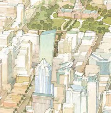





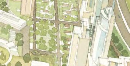


The success of Downtown is ed to the community’s larger vision of a city and region that is economically and environmentally sustainable, a vision that is currently being reaffirmed and focused in the Imagine Aus n update of Aus n’s Comprehensive Plan.
An Economically-Healthy Downtown Benefits all of Aus n’s Ci zens. We should care about Downtown, because its economic success is central to the prosperity of the city and the region. Taxes generated in Downtown pay for City services well beyond its boundaries: as much as 80% of property taxes generated in Downtown are “exported” to other parts of the City to cover the costs of community services, parks and infrastructure:2
• Downtown’s land area is 0.6% of the total land area of the City, yet it cons tutes approximately 5% of the City’s property tax base, about 3.4 billion dollars. An area eight mes the size of Downtown is needed to generate the same average taxable value.3
Taxes generated Downtown pay for City services well beyond its boundaries.

• The per capita cost of building infrastructure in Downtown is considerably less than that of a typical area outside Downtown. To serve an equivalent popula on of employees and residents in the outlying parts of Aus n, we need more land, more miles of streets, water lines and sewers, more parks, more schools, more police sta ons, more fire sta ons, etc.
• The cost of providing public services to each new Downtown resident and worker is much less than the cost of serving new residents and employees in less central loca ons, since the ini al infrastructure investment has already been made.
• Downtown is also the focus of live music and culture which city-wide, contributes more than $2.2 billion annually to the economy, forging Aus n’s iden ty and reputa on as one of the na on’s most vibrant crea ve-class ci es. 4
• An economically-healthy Downtown is one of the main criteria for how future employers and employees decide whether to invest in our community. Even if they plan to locate in another part of Aus n, the vitality and a rac veness of Downtown is a cri cal factor in choosing Aus n as a place for their business and home.
Downtown is Key to the Region’s Environmental Sustainability Goals. A compact and dense downtown is a model of sustainability. In addi on to being less costly and more efficient to provide services, Downtown has a much smaller carbon footprint than outlying neighborhoods of Aus n. Its con nued growth and success is key to the community’s goals for climate protec on and environmental sustainability:
• Development in Downtown is much less land-consump ve than that in the outlying parts of the City, and a compact downtown helps to reduce suburban sprawl that is overtaking the countryside and our environmentally-sensi ve lands of the “Drinking Water Protec on Zone”;
• With a more compact land area than suburban neighborhoods, Downtown needs many fewer roads and sidewalks to support the same number of people, and is therefore helping to reduce: the amount of impervious surface area that brings contaminated stormwater into our creeks and rivers; the number of “vehicle miles traveled” (VMT) that leads directly to the deteriora on of air quality; and the acres of pavement and asphalt that create “heat islands”.
• By comparing a “green” urban development of 200 residen al units to a typical suburban single-family project with the same number of units, the benefits of the urban development become readily apparent:5
• The typical urban project uses less than 3/4 of an acre of land, while the suburban project consumes as much as 70 acres.
• Impervious cover of the suburban project is thirty mes as great (26 to 32 acres compared with 3/4 acres).
• Landscape water usage for the suburban project can be as much as 15.6 million gallons per year, compared with li le or no consump on for the urban project.
• Monthly electricity usage for the suburban project is five to ten mes greater than the urban development (i.e., $100 to $300/unit versus $10 to $60/unit).
• The taxable value of the “green” urban project is considerably greater than its suburban counterpart ($80 to $150 million/acre depending on the unit value, compared with $700,000 to $1.2 million/acre, assuming an average home value of $200,000).
Development in Downtown is much less energy, water and land-consumptive than that in outlying areas.


Downtown Aus n is the original city of Aus n. The shape and form of Downtown dates from 1839, when Edwin Waller laid out the simple grid plan of the original city with its four public squares and Capitol square. The Capitol Building would be constructed at the head of Congress Avenue to serve as a focal point for the city from the Colorado River. The buildings in Downtown represent all of the periods of Aus n history and development, including the fine Greek Revival homes designed by architect-builder Abner Cook in the 1850s, the masonry commercial buildings of the Victorian era, the Chicago Style skyscrapers of the early 20th century, and the striking architectural landmarks of today, such as Aus n’s City Hall.
In order to fully appreciate the context within which we find ourselves, it is important to understand the forces that have shaped the city. Seven transforma ve events, not all of them posi ve, have given Downtown the form and character that we experience today. These include:
• The 1839 Waller Plan (le ), which has established a las ng imprint and the basic “DNA” of the city: its block sizes, street grid and public open spaces;
• The introduc on of passenger rail in 1871, including an urban streetcar system that led to Aus n’s first neighborhoods beyond Downtown: Travis Heights and Hyde Park. The streetcar system, with its 23 miles of lines converging on Congress Avenue, was abandoned in the 1940s for buses and automobiles, but provides a model for a new genera on of transit service that is being contemplated today.
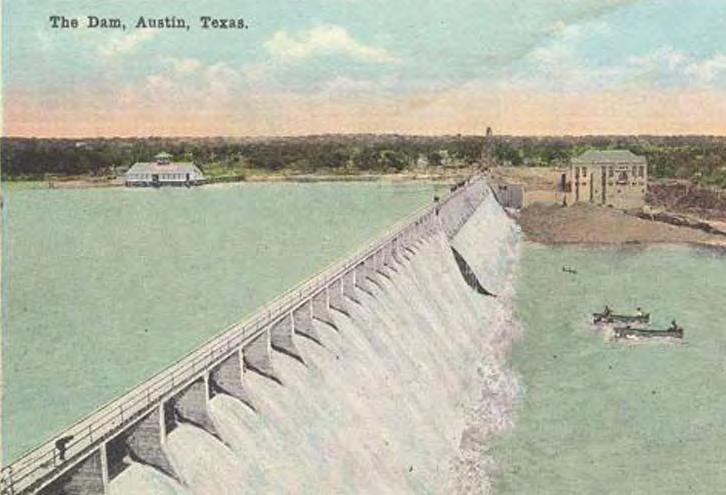
• The damming of the Colorado River in 1893, which removed the recurring threat of flooding and ul mately led to the crea on of a necklace of recrea onal “lakes” and to the beau fica on of Lady Bird Lake - the “jewel” of Aus n’s park system. Lady Bird Lake has served as Downtown’s principal amenity and one of the most powerful catalysts for new residen al and commercial investment.

The introduction of urban rail in 1871 (left) and the damming of the Colorado River in 1893 (right) were formative events in the City’s history.


1925 Austin Streetcar Map
• The City Plan of 1928 was the City’s first formalized a empt to guide growth and public investment, establishing zoning and a parks and recrea on department. However, on the nega ve side, the Plan promoted race segrega on of neighborhoods and districts, crea ng divisions and inequi es that s ll exist today.
• The construc on of the Interstate Highway system of IH 35, cu ng through the urban core in the 1960s contributed to the economic development of the city and the na on, but tore the fabric of the eastern edge of Downtown, crea ng economic barriers and racial divisions with East Aus n. The visual and physical effect of the elevated freeway is s ll strongly felt.

IH 35, completed in the 1970s, created a significant barrier between Downtown and East Austin.
• Shortly a er the highway was constructed, urban renewal swept the northern and eastern quadrants of Downtown, where the State and UT considerably expanded their holdings, removing single-family neighborhoods. Single ins tu onal uses, such as the Federal Building and State office buildings and their parking garages followed along with university facili es. While many of these uses are posi ve, the lack of residen al and commercial uses nearby or within, has le this large part of Downtown with li le vitality.
• The 1984 Capitol View Corridor Legisla on has been highly effec ve in preserving key public views to the Capitol building and dome, and in doing so, the image and iden ty of Aus n as the capital city of Texas. Responding to community concerns that new high-rise development was beginning to overshadow and obstruct views to the Capitol, the City and State adopted several ordinances and legisla on: a Congress Avenue Overlay District, requiring stepbacks for buildings along the central avenue, a Capitol Dominance Zone limi ng building height within a certain radius of the Capitol, and the Capitol View Corridors (CVCs), protec ng 35 different viewpoints to the Capitol through specific height limits. These ordinances are playing a significant role in shaping the form of the Downtown skyline.

The 1984 Capitol View Corridor legislation has been effective in preserving views to this historic resource.
Downtown is re-emerging as a place to live, shop and play, as well as work.
The Good News: Downtown is evolving as a great place to live, work and play. Over the past 10 years, considerable progress has been made toward the realiza on of some of the community’s aspira ons for Downtown:
• People want to live Downtown More than 6,000 new residents have moved into new condominiums, apartments and townhouses - a remarkable growth rate of 40% since 2000.6
• There is a greater diversity of land uses. Over 400,000 square feet of new retail shops, nightclubs and restaurants have opened to serve residents, visitors and employees, bringing more life to the streets. Concentra ons of restaurants and shops in the 2nd Street District and around the Whole Foods World Headquarters in the Market District have strengthened Downtown as a regional des na on.
• Job growth has been robust. Over 6,000 new jobs have been created in Downtown, with an addi on of 1.7 million square feet of new office space.7
• Visitors con nue to view Downtown Aus n as an a rac ve des na on. Over the past 10 years, more than 1,500 hotel rooms have been constructed Downtown8 ; occupancy and rental rates are the highest in the region, and more than seven million people visit annually, contribu ng over $2.8 billion to the economy.9

• There is a clustering of cultural venues (museums, theaters, galleries, live music clubs, etc.) that provide des na ons for residents and visitors.
• The pedestrian environment is improving. With the ini a on and implementa on of the Great Streets Program, 70 blockfaces of tree-lined sidewalks have been created in the past 10 years.
• Bicyclists are safer and more welcome, with the construc on of the Lance Armstrong Bikeway and over 15 miles of new bike facili es within, and leading to, Downtown.
• Rail transit has arrived, with Capital Metro’s 32-mile commuter rail service (“MetroRail”) between Leander and Downtown. Lone Star Rail between San Antonio and Aus n is in the planning stage, and the City is evalua ng plans for a 16.5-mile urban rail system that will extend the reach of the commuter rail to many central Aus n des na ons.
• Flood control improvements for Waller Creek are now underway, which will remove 28 acres of Downtown real estate from the floodplain, create a new open space resource for the community and set the stage for posi ve redevelopment.
• There is s ll significant poten al for growth. There are approximately 100 acres of assembled vacant or underu lized property of a quarter-block area or greater in Downtown poised for redevelopment. Given exis ng en tlements, this could more than double the size of Downtown, from approximately 26 million square feet to more than 60 million square feet of floor area.10 This es mate of the poten al for Downtown growth is purely a ‘capacity’ analysis (i.e., how many addi onal square feet of development could be accommodated) and is not an es mate of whether, when, or how much square footage the market will produce.

Commuter rail service has been initiated and the pedestrian environment is improving.

The automobile is still the dominant mode of transportation in Downtown. Many streets are uncomfortable places to walk or linger.
In spite of this progress, Downtown faces significant challenges and risks:
• The automobile s ll dominates. Lack of mobility op ons con nue to threaten both the economic and environmental well-being of Downtown, as well as its visual a rac veness and quality of life. Since there are few reasonable and sustainable ways to increase the capacity of the vehicular network leading to and within Downtown, con nued growth is dependent upon a significant investment in transit and other alterna ves to the automobile. That investment has yet to be made.
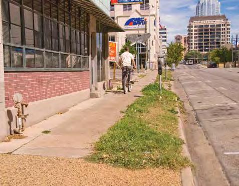
• The quality of streets and parks is lacking. The “public realm”, the system of publicly-used streets and open spaces which make up 50% of Downtown’s land area, is in deteriora ng condi on. Most streets are s ll uncomfortable places for people to walk or linger. Due to limited funding, Downtown parks are poorly maintained and are o en occupied by the homeless, making them uncomfortable for others to enjoy. Significant public and private investment is cri cal to enhance the quality of life in Downtown, and its appeal as a place to live, work, play and visit.
• There is a lack of support services for the homeless and very low-income popula ons. There are an es mated 3,500 homeless individuals in Aus n at any one me, and about 900 of these are chronically-homeless. Despite the needs for transi onal and permanent suppor ve housing, there are no permenant suppor ve housing units in Downtown.11
• Some local and “iconic” businesses are being priced out. Some long me businesses, that have given Aus n and its downtown an authen c charm and a level of affordability, have been forced out by new development and rising rent levels. There is concern that Downtown could become a place dominated by na onal chains.

• Downtown’s role as the region’s center of live music is in danger of being displaced by redevelopment. Venerated music des na ons along Red River Street are at risk of being displaced by new development along Waller Creek. East 6th Street no longer lives up to its iden ty as a live music district, and the increasing number of Downtown residents has created new issues of compa bility.
• Downtown’s historic fabric is at risk of being demolished. More than 150 poten ally significant historic proper es, iden fied in Aus n’s 1984 Cultural Resources Survey, have been demolished in Downtown over the past 35 years. Some dis nc ve areas of Downtown – like the Warehouse District – have no protec ons and are in danger of being lost to redevelopment.
• Development sites are becoming more constrained. With fewer half and fullblock building sites remaining, new development projects will need to be more efficient with parking and more cognizant of their rela onship with adjacent buildings. More specific form-based regula ons, with increased levels of transit, bicycle, and pedestrian access and shared parking, will be needed to achieve the full poten al of a high-density downtown that is livable.
• The development of Downtown is only beginning to mature. Compared to other ci es in the south and west, Aus n’s downtown is in its infancy. Although it has grown substan ally in the last decade, Downtown Aus n remains in the lowest third of southern and western ci es in terms of popula on density per square mile and land prices remain substan ally lower than other ci es.
• Downtown’s share of the regional office and employment market has declined to less than 20% of the region’s supply. Downtown is no longer the principal employment center of the region, and it has not been the loca on of choice for the primary tenant drivers of the office market, such as technology companies.12
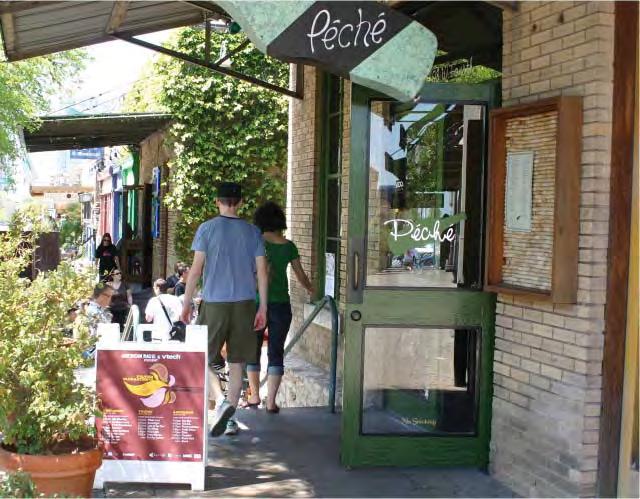
Unique areas of Downtown including the Warehouse District (left) and the Red River Music District (right) are at risk of being displaced.

The DAP process has included six Town Hall Meetings and over 80 smaller focus group meetings on a variety of topics.
The Downtown Aus n Plan (DAP) encompasses an approximately 1,000-acre area bounded by MLK Boulevard on the north, IH 35 on the east, Lady Bird Lake on the south and Lamar Boulevard on the west. The DAP is a policy document aimed at addressing the above opportuni es and challenges. Like the many neighborhood plans, it was adopted as an amendment to the City’s Comprehensive Plan. Subsequent to City Council’s adop on of the DAP, implementa on of the various recommenda ons of the plan will be ini ated, such as adop on of new policies, budget and staffing alloca ons, re-zonings, code amendments, process improvements, etc. The DAP will be a “living” plan – to be amended through me with the approval of the Planning Commission and City Council.
While the planning horizon for the DAP is over the next 25 years, the Plan includes a shorter-term implementa on program that focuses on ac ons to be taken in the next 10 years: 2012 to 2021. The Plan provides a founda on for more specific ini a ves (e.g., Downtown density bonuses, affordable housing policies, crea ve community policies, historic preserva on programs, form-based development standards, etc.), as well as more detailed district plans for the defined sub-areas of Downtown. The district plans provide specific policy guidance for the nine defined character districts of Downtown (see Part Two: Downtown Districts).


The DAP is the product of a three-year dialogue with the general public and Downtown community and stakeholders. It involved six Town Hall mee ngs and scores of smaller mee ngs and workshops, solici ng input on a wide range of issues. (See Appendix B which describes the mee ngs held and the people involved.)
The DAP was guided by senior City staff, by Downtown stakeholders and by the City’s Downtown Commission, whose members represent other key boards and commissions.13 The planning process began with a ninemonth “diagnos c” phase to assess exis ng condi ons, analyze opportuni es and constraints, iden fy priori es and cra the most relevant work program or scope for the second phase. It concluded with the “Issues and Opportuni es” report to the City Council in February 2008.
The planning process involved many separate planning studies, all of which have informed the policies of this, overall Downtown Aus n Plan. In March 2008, the City Council acted to advance specific elements of the DAP, including: a Downtown Transporta on Framework Plan and an Urban Rail Study, which has provided the basis for current transporta on and rail transit planning by the City; a Downtown Affordable Housing Strategy to provide policy direc on and to op mize public investment toward a more affordable and diverse Downtown; and a Downtown Density Bonus Program to provide an equitable and transparent system of awarding addi onal density. These reports were finalized in 2009, and with addi onal public input, have been incorporated into the policies of this Plan.14
All things considered, I feel ____ about Downtown Austin.
If I had to spend $100 on public improvements Downtown...
A survey completed by over 3,500 respondents asked community members to express their feelings about Downtown.
Chart
Over the past year, the planning process has produced addi onal separate studies and reports on historic preserva on, the crea ve community, form-based development standards, and u li es and infrastructure. The Downtown Parks and Open Space Master Plan was completed in January 2010 and endorsed by the Parks and Recrea on Board in May 2010. In addi on, individual district “spreads” were created that capture the essen al character-defining elements of each district, along with their key goals and priori es.15
Three “district plans” have been completed, beneath the umbrella of the Downtown Aus n Plan, including the Waller Creek District Plan, the Core/Waterfront District Plan and the Northwest District Plan. Each involved extensive stakeholder and community input to establish policy direc on and development standards for these par cular areas of Downtown. The Waller Creek District Master Plan was adopted by City Council in June 2010, and the other two dra district plans have been incorporated within the DAP.16
Over the past 15 to 20 years, the community has engaged in a dialogue to understand where Downtown Aus n has been, and to be er shape where it is going. Some of the key guiding plans and documents include several R/UDAT (Regional and Urban Design Assistance Team) analyses and recommenda ons developed for Downtown, which led to the crea on of the Downtown Aus n Alliance.
Further, the Design Commission’s 2000 Downtown Aus n Design Guidelines and its sequel, the 2009 Urban Design Guidelines, provide important perspec ve and guidance on how both public and private sector development should promote Downtown as a dense, compact and sustainable place.17
The City’s former Smart Growth Program and ongoing Great Streets Development Program also have contributed to the place-making of Downtown, crea ng incen ves for the private sector to build toward a shared vision of a great downtown.
The Envision Central Texas (ECT) plan, completed in May 2004, sets forth a farsighted vision for our five-county area, emphasizing the importance of the Downtown as a dense, walkable, mixed-use district at the heart of a mul -centered region served by transit.18
An intensive community-based planning process is now underway to update the City’s Comprehensive Plan. Known as “Imagine Aus n”19, the process is building on the work of the ECT Plan to set a policy framework for future conserva on, growth and investment. (See Appendix C for Imagine Aus n Vision Statement.)
Parallel and in concert with this effort and with the Downtown Aus n Plan are several transporta on ini a ves, including the City’s Strategic Mobility Plan and Urban Rail Program20 which define a long term plan and near-term strategies for implementa on. The policies and recommenda ons of the Downtown Aus n Plan build on and reinforce this planning context, toward the vision of an economically and environmentally sustainable region.
The Envision Central Texas Plan emphasizes the importance of Downtown as the heart of a multi-centered region.

The Downtown Aus n Plan is wri en as an ac on-oriented document to assist City government, its staff and leadership, and its poten al partners in implemen ng the DAP. For this reason, the recommenda ons are organized into seven subject areas that relate closely to those City departments, divisions and programs that will undertake their implementa on. These elements are:
• Historic Preserva on (HP)
• Ac vi es and Uses (AU)
• Density and Design (DD)
• The Public Realm (PR)
• Transporta on and Parking (TP)
• U li es and Infrastructure (UI)
• Leadership and Implementa on (LI)

The handbook-style format and the succinct language of the Plan are meant to facilitate ac on. Each of the seven elements has an over-arching goal or broad intent, followed by a series of specific recommenda ons formulated as objec ves, with sufficient explana on to convey key considera ons for final implementa on. The spectrum of recommenda ons include ac ons regarding the City’s and its partners’ policies, staffing, programs, process improvements and physical improvement projects.
Approximately 100 recommenda ons have been developed throughout the DAP planning process described above, and are the result of balancing stakeholder concerns and preferences with best professional planning prac ces. Some recommenda ons are ac onable immediately, others will require further study and stakeholder input as they are refined and readied for final ac on. For example, Council adop on of the DAP could ini ate the staff ac on necessary to finalize code amendments and zoning changes and ready them for a series of individual public hearings and adopons.
The following provides a summary of the Plan’s goals and recommenda ons and serves as a snapshot of the overall Downtown Aus n Plan. The full descrip on of these recommenda ons can be found in Part Three: The Plan Elements.
HP-1. PRESERVATION PLAN
Preserve and enhance the unique historical and cultural heritage of Downtown.
HP-1.1: Update and disseminate the Comprehensive Cultural Resources Survey and Preserva on Plan, beginning with Downtown, and plan for periodic updates.
HP-2. DESIGN STANDARDS
HP-2.1: Adopt form-based development standards to protect and complement the unique character of historic downtown buildings, streets, and districts.
HP-2.2: Adopt standards and incen ves to protect the Warehouse District.
HP-2.3: Introduce stepback provisions and other design standards for building addi ons within the East 6th Street Na onal Register District.
HP-2.4: Introduce stepback provisions for new buildings and building addi ons within the Congress Avenue Na onal Register District.
HP-3. ADMINISTRATION
HP-3.1: Improve the capacity of the City’s Historic Preserva on Office (CHPO) and that of the Historic Landmark Commission.
HP-3.2: Create a historic preserva on funding source and incen ves to encourage preserva on projects available to both public and private property owners, as well as tenants.

AU-1.
Ensure that Downtown’s future growth supports a vibrant, diverse and pedestrian-friendly urban district.
AU-1.1: Replace single-use zoning districts with downtown mixed-use zoning designa ons.
AU-1.2: Priori ze or incen vize certain uses in certain districts of Downtown.
AU-1.3: Priori ze and incen vize certain ground-level uses along certain streets.
AU-1.4: Explore ways to mi gate the poten al nega ve effects of an over-concentra on of cocktail lounges, which can discourage establishing a more balanced set of uses, par cularly day me uses that add to the vitality of Downtown.
AU-2. HOUSING
AU-2.1: Support the produc on of affordable housing.
AU-2.2: Leverage redevelopment of public lands to contribute to affordable housing produc on.
AU-2.3: Provide for permanent suppor ve housing.
AU-2.4: Promote affordable housing for ar sts and musicians.
AU-2.5: Make downtown housing more family-friendly.
AU-3. RETAIL AND ENTERTAINMENT
AU-3.1: Reinforce exis ng retail and entertainment districts.
AU-3.2: Promote ground-level retail and restaurant uses along par cular Downtown streets.
AU-3.3: Establish retail, entertainment and cultural uses in City-sponsored redevelopment projects.
AU-4. LIVE MUSIC, CULTURAL, AND CREATIVE USES
AU-4.1: Encourage Downtown museums and other cultural ins tu ons that serve the en re city.
AU-4.2: Provide for the crea on of new cultural facili es and live music venues.
AU-4.3: Support cultural district planning and marke ng of Downtown arts and cultural organiza ons.
AU-4.4: Provide incen ves and programs for the protec on of the Red River Street music district.
AU-4.5: Build on the East 6th Street brand and improve it as a high-quality des na on.
AU-4.6: Allow restaurants in certain downtown districts to have outdoor music venues with the same sound levels as cocktail lounges.
AU-4.7: Increase the capacity of the City staff to act as an advocate for the crea ve community.
AU-5. OFFICE AND EMPLOYMENT USES
AU-5.1: Provide incen ves for Downtown office and employment uses.
AU-6. HOTEL AND VISITOR USES
AU-6.1: Provide incen ves for Downtown hotel uses.
AU-6.2: Support the development of an addi onal “headquarter” hotel in close proximity to the Conven on Center.
AU-7. PUBLIC SERVICES
AU-7.1: Enhance and expand the range of downtown social services in a manner that is compa ble with other land uses and the public realm.
AU-7.2: Promote educa onal and child care facili es that make the Downtown more family-friendly.
AU-7.3: Improve fire and police facili es.

Ensure that Downtown can evolve into a compact and dense urban district, with new buildings contributing positively to sustainability, quality of life and the Downtown experience.
DD-1.1: Maintain exis ng height and density limits as a baseline with some adjustments based on the surrounding context.
DD-1.2: Finalize and adopt a Downtown Density Bonus Program that allows developers and the community to equitably share the benefits of addi onal height and density above the exis ng regula ons.
DD-1.3: Employ addi onal density incen ves to achieve specific community objec ves.
DD-1.4: Establish specific scale-compa bility standards that are tailored to the downtown context.
DD-2.1: Require setbacks and build-to lines that are appropriate to the form and character of the street.
DD-2.2: Allow addi onal setbacks if these provide publicly-accessible open space.
DD-2.3: Limit curb cuts, drop-offs and porte-cocheres that interrupt the con nuity of the pedestrian path and experience.
DD-2.4: Establish standards for the treatment of commercial building fronts.
DD-2.5: Establish standards for the treatment of new residen al building fronts.
DD-3.1: Promote a compa ble rela onship between new and historic buildings.
DD-3.2: Create buildings that provide spa al defini on of streets.
DD-3.3: Step towers back from the streets.
DD-3.4: Provide space between towers.
DD-3.5: Encourage tall and slender towers.
DD-3.6: Prohibit highly-reflec ve glass cladding on buildings.
DD-3.7: Integrate parking garages into the architecture of a building.
DD-3.8: Establish an acceptable level of green building consistent with overall city goals to be established in the updated Comprehensive Plan, and consistent with City of Aus n’s evolving goals, standards and ini a ves.

Interconnect and enhance Downtown’s network of public parks, open spaces and streets.
PR-1.1: Provide adequate funding for the maintenance and opera on of all City-controlled Downtown parks.
PR-1.2: Program and design parks to serve the diverse needs of Downtown residents, families, workers and visitors.
PR-1.3: Improve Downtown’s urban greenways and adjoining public parks as natural refuges and pathways.
PR-1.4: Improve the historic squares of the original City Plan.
PR-1.5: Improve the PARD-owned Old Bakery and Emporium and surrounding parkland on Congress Avenue.
PR-1.6: Pursue public/private funding sources and management structures for improving and maintaining Downtown parks.
PR-1.7: Special en es, such as non-profit conservancies, should be encouraged to assist with park improvements, opera ons, management and maintenance.
PR-1.8: Allocate addi onal sources of public funding to Downtown parks.
PR-2.1: Provide incen ves and design criteria that promote high quality open space within private developments.
PR-3.1: Maintain, extend and restore Downtown’s grid system of streets and alleys.
PR-3.2: Require all new development to build Great Streets sidewalks or contribute to the Great Streets Development Program fund.
PR-3.3: Streamline the license agreement process for Great Streets improvements.
PR-3.4: Ensure that planned transit facili es, including urban rail, incorporate Great Streets improvements.
PR-3.5: Improve East 6th Street as a mixed-use, pedestrian-priority, entertainment street that appeals to a greater diversity of people.
PR-3.6: Improve Congress Avenue in keeping with its role as the Main Street of Texas.
PR-3.7: Improve Sabine Street, from 3rd to 7th Street as a bicycle-friendly, pedestrian promenade, paralleling Waller Creek.
PR-3.8: Explore the crea on of a 5th Street Mexican American Heritage Corridor linking Republic Square to Sal llo Plaza.
PR-3.9: Establish a public restroom program in Downtown.
TP-1.
Develop a multi-modal transportation system that improves access to and mobility within the Downtown.
TP-1.1: Improve pedestrian facili es in all streets and implement the Great Streets Master Plan.
TP-1.2: Convert certain Downtown streets to two-way opera on.
TP-1.3: Maintain alleys as the principal means of loading, servicing and parking access.
TP-1.4: Reduce or remove the barrier of the IH 35 edge.
TP-1.5: Establish a comprehensive way-finding system for all modes of transporta on.
TP-2.
TP-2.1: Establish an urban rail system to connect Downtown with other Central Aus n des na ons and the exis ng and passenger rail system.
TP-2.2: Concentrate major bus routes along designated Downtown corridors.
TP-2.3: Create high-quality, state-of-the-art transit stops and transfer areas.
TP-3.
TP-3.1: Establish bicycle priority streets that provide facili es for all levels of bicyclists along key northsouth and east-west corridors.
TP-3.2: Introduce shared lane markings (“sharrows”) on streets where cyclists can safely share the lane with automobiles.
TP-3.3: Create a more con nuous system of off-street bikeways and mul -use trails.
TP-3.4: Increase bicycle parking in Downtown.
TP-3.5: Require shower and locker facili es in office developments.
TP-3.6: Introduce bike-sharing.
TP-3.7: Ensure that urban rail facili es promote bike safety.
TP-4.
TP-4.1: Manage and coordinate Downtown parking.
TP-4.2: Promote public/private partnerships to provide shared parking facili es within new development.
TP-4.3: Establish an in-lieu fee system that allows developers to contribute to centralized off-site parking as an alterna ve to providing parking on site.
TP-4.4: Provide incen ves for on-site, car-share spaces and recharging facili es.
TP-4.5: Manage on-street parking and loading areas in a more efficient manner.
TP-4.6: Create a way-finding system and real- me parking displays that guide visitors to key public parking facili es.
TP-5.
TP-5.1: Assist in establishing a Central City Transporta on Management Associa on.

Provide for phased utility and infrastructure upgrades that address existing deficiencies and that support future redevelopment.
UI-1.1: Consolidate u lity coordina on efforts under execu ve-level leadership to coordinate and facilitate the planning and construc on of proposed u lity and roadway-related infrastructure projects.
UI-1.2: Expand and refine the City’s use of the Envista system.
UI-2.1: Dedicate adequate funding annually to Aus n Water U lity’s (AWU) “CIP-dedicated funds”.
UI-2.2: Require developers to submit their Service Extension Requests (SERs) for proposed projects in advance of their site development permit applica ons to allow me for AWU to assess needs and, if applicable, develop cost-par cipa on agreements.
UI-3.1: Develop a Downtown Drainage Master Plan and extend that plan to adjacent urban redevelopment areas as feasible.
UI-3.2: Con nue to allocate funding annually to departmental “CIP-dedicated funds” for use in upgrading City storm sewer mains through developer par cipa on programs or for CIP projects, on an as-needed basis.
UI-3.3: Increase watershed maintenance of Shoal and Waller creeks.
UI-3.4: Construct the Li le Shoal Creek flood control project.
UI-3.5: Implement the Lower Shoal Creek Restora on Project.
UI-3.6: Develop a flood control plan for Shoal Creek in conjunc on with a Shoal Creek Greenway improvement plan.
UI-3.7: Create a Water Quality Program for Downtown.
UI-4.1: Acquire a site for a future electric substa on.
UI-4.2: Aus n Energy should develop design and loca on op ons for electric vaults, including underground and alleyway op ons, to be er achieve goals of pedestrian-oriented, ground-floor uses and facades.
UI-5.1: Require that “dry” u lity franchises go through a City review process to receive approval for alignments and/or reloca ons.
UI-6.1: Con nue to priori ze maintenance improvements to Downtown streets and alleys, and coordinate and fund “complete” street reconstruc on.
Implement the Downtown Austin Plan, within the resources and priorities of the community.
LI-1.1: Establish a Central City Economic Development Corpora on.
LI-1.2: Encourage and support public/private partnerships and conservancies aimed at building and opera ng parks and open space improvements.
LI-1.3: Organize City government to provide for the effec ve implementa on of the Downtown Aus n Plan.
LI-2.1: Adopt the Downtown Aus n Plan as an amendment to the City’s Comprehensive Plan.
LI-2.2: Finalize and adopt a Downtown Density Bonus Program by ordinance. (See Appendix H.)
LI-2.3: Refine the recommended form-based development standards as part of the ordinance prepara on and amendment process. (See Appendix I.)
LI-2.4: Amend the zoning ordinance within the Land Development Code in a phased way that allows for further stakeholder involvement and refinement, as appropriate.
LI-2.5: Make amendments to other plans, as appropriate.
LI-3.1: Adopt a ten-year ac on plan for implementa on.
LI-3.2: Upon adop on of a finalized Implementa on Program, EGRSO should lead City departments in the development of a financing plan for these priority ac ons.

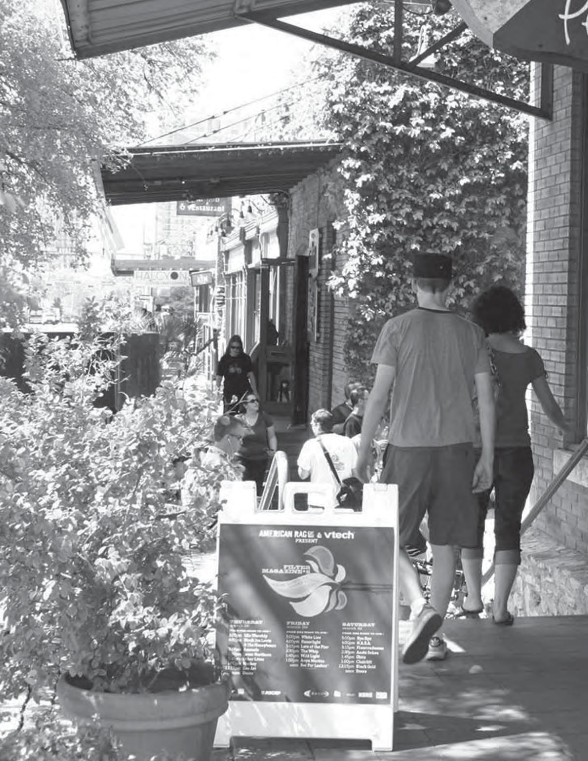
Warehouse District, Austin
Downtown is not a monolithic or homogenous place: it is a series of sub-areas or districts that have evolved differently since Aus n’s beginnings in 1839 - with different uses and ac vi es, building types and heights and property ownership pa erns. The character of Downtown ranges from the skyscrapers of Congress Avenue to the single-family neighborhood of Judges Hill. This diversity gives Downtown an authen c sense of place - a unique character that fosters district pride, enjoyment and investment, as well as visitor appeal.
As part of the Downtown Aus n Plan, nine such districts have been iden fied as areas that share common characteris cs in terms of their built form and scale, ac vi es and uses and the issues and opportuni es that they face. Delinea ng these areas as districts has allowed their stakeholders to convene and discuss those characteris cs, to understand what is important to preserve, where and what kinds of new development should be encouraged, and the kinds of public improvements that should be given the highest priority.
This sec on of the DAP provides a summary of the issues, opportuni es and priori es of the districts, except for the single-family neighborhood of Judges Hill and The University of Texas-owned Northeast/UT District, both of which will be the subject of future planning processes. Three of the Downtown districts – the Northwest, the Core/Waterfront and the Waller Creek districts have been developed as District Plans, with more detailed recommenda ons that have informed the recommenda ons of the DAP. (The Waller Creek District Plan21, adopted by the City Council in June 2010, was part of a separate planning effort guided by an advisory commi ee and resul ng in a master plan for the design of the creek corridor and surrounding area.). As addi onal district plans are completed, it is an cipated that the overall DAP will be refined and amended accordingly.
In the mean me, the following district summaries may be used to help guide preserva on, development and investment in each district, or simply to convey an overall picture of each of these unique areas.
CORE/WATERFRONT DISTRICT
r r r r r k R r r r r r r
NORTHWEST DISTRICT
’
2 1 3 4 6 7 5
UPTOWN/CAPITOL DISTRICT r r r
LOWER SHOAL CREEK DISTRICT
CREEK DISTRICT
RAINEY STREET DISTRICT
MARKET/LAMAR DISTRICT
Preserve existing tree canopy along Rainey Street to the maximum extent possible.
8 9 JUDGES HILL DISTRICT - No proposed changes
UT/NORTHEAST DISTRICT - No proposed changes
Congress Avenue the, “Main Street of Texas”, is the principal axis of the Core/ Waterfront District.
(See also detailed district plan at h p://www.aus ntexas.gov/downtownplan)
District Specific Goals:
1. Enhance the Core/Waterfront as the premier employment, cultural and visitor center of the region.
2. Improve the quality of the pedestrian experience.
3. Make it easier to move around without a car.
4. Restore and ac vate the historic squares.
5. Ensure that the District is a welcoming and affordable place for all.
6. Preserve the historic building fabric.
Top Three Public Improvement Priori es (per 256 responses from 2009 survey):
1. Great Streets (72%), par cularly Congress Avenue and East 6th Street
2. Exis ng open space improvements (46%), including the historic squares
3. Public parking facility (33%)
Exis ng Form and Character:
• The Core/Waterfront is the most intensely developed and urbanized district of the city. Focused along Congress Avenue between Lady Bird Lake and the Capitol, it has a strong and memorable iden ty that is recognizable throughout the region.
• The area consists of numerous sub-districts, each with its own unique iden ty, including: Congress Avenue, East 6th Street, the Warehouse District, the three historic squares, 2nd Street, the Waterfront and the Conven on Center area.
• The District faces and embraces Lady Bird Lake, the region’s pre-eminent open space and one of the community’s most beloved gathering places.
• The Core is the principal address for corporate office users and for major “flagship” hotels.

• Downtown’s waterfront has emerged as a high-density residen al and mixed-use area.
• The eastern por on of the Core is least developed, characterized by underu lized parcels, parking lots and a concentra on of social services.


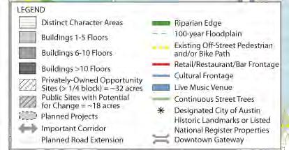

The sites shown in brown represent approximately 14.4 million square feet of future potential development.
Historic Resources Iden fica on:
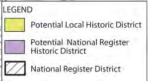
• On the basis of windshield surveys and the City’s 1984 Cultural Resources Survey, several sub-areas of the Core/Waterfront District have been iden fied as poten al historic districts, subject to further study and property owner interest. These are:
1. A possible Local Historic District (LHD) in a por on of the railroad-oriented warehousing district which began to develop in the 1870s. The focus of this district is Colorado Street, between West 3rd and West 5th, between Lavaca Street and the north-south alley immediately west of Congress Avenue.
2. A possible Local Historic District could be created within the exis ng East 6th Street Na onal Register Historic District (NRHD); and
3. A possible Local Historic District is iden fied along the segment of West 6th Street, between San Antonio Street and West Avenue.
Development Opportunity Sites:
• There are 63 proper es, totaling about 50 acres that have been assembled to a quarter-block or greater. (See Form and Character Analysis map on p. 35.)
• These “opportunity sites” are rela vely unconstrained and could likely develop over the next five to 15 years, represen ng approximately 14.4 million square feet of development.

Urban Design Priori es:
• Incen vize office and hotel uses to bolster the Core/ Waterfront as the premier office employment district and visitor des na on of the region.
• Improve the pedestrian environment and streetscape throughout the District and especially along Congress Avenue and East 6th Street.
• Establish a be er mix of ground-level retail uses throughout, par cularly along Congress Avenue, 2nd Street and East 6th Street.
• Ensure a concentra on of live music venues, but control the number of cocktail lounge uses.
• Promote redevelopment and revitaliza on of the east side of the Core/Waterfront, with catalyst public projects and improvements (e.g., Waller Creek, East 6th Street and Congress Avenue streetscapes, Brush Square, affordable/ suppor ve housing).
• Promote publicly-accessible plazas and pocket parks on private land.
• Create form-based design standards that promote compa bility between new buildings which are adjacent to historic structures or along designated historic street frontages (e.g., Warehouse District).
• Establish development standards that allow for mul ple towers to be constructed on one block (e.g., tower spacing and setback requirements).
• Require or incen vize some percentage of below-grade parking.
• Preserve Red River Street Entertainment District as a live music district that fosters innova on.
• Explore the crea on of a 5th Street Mexican American Heritage Corridor linking Republic Square to Sal llo Plaza.
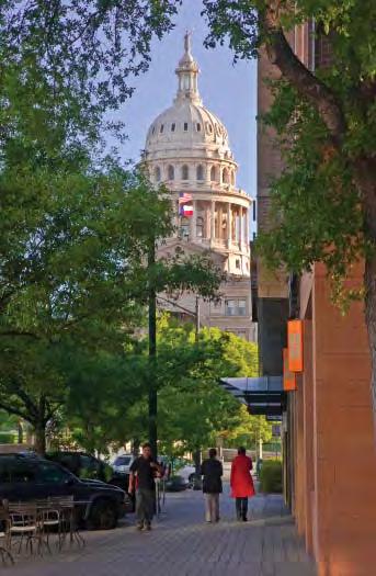
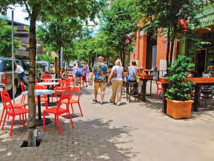
Congress Avenue should be enhanced as a green boulevard with active pedestrian-oriented uses.
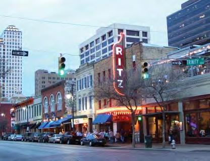
East Sixth Street (left) and Second Street (right) are also major pedestrian activity spines within Downtown.
(See also detailed district plan at h p://www.aus ntexas.gov/downtownplan)
District-Specific Goals:
1. Preserve the neighborhood’s historic residen al character.
2. Bring residents back to the neighborhood.
3. Preserve the exis ng tree canopy along the streets.
4. Preserve and enhance exis ng open space.
5. Improve the pedestrian environment.
6. Improve condi ons for bicycling.
7. Improve Shoal Creek and the quality and accessibility of its creekside trail.
Top Three Public Improvement Priori es (per 36 responses from 2009 survey):
1. Great Streets (64%)
2. Off-street mul -use trails (47%)
3. Creek stabiliza on and flood improvements (42%)
Exis ng Form and Character:
• Most of this area was developed as Aus n’s first residen al neighborhood, with houses of prominent ci zens da ng back to the mid-19th century.
• The historic residences are typically one and two floors and include front porches set back from the sidewalk by 10 to 15 feet. The Bremond Block Historic District is an excep onal collec on of some of the largest historic houses.
• The mature streetyard tree canopy throughout the District contributes greatly to the character of the area, as well as to the city’s urban forest.
• Many of the homes have been restored, but few are currently in residen al use. Most have been rehabilitated for office use, including many law offices, which benefit from their proximity to the County Courthouse and Capitol.
• There is li le night- me ac vity in this area and few commercial (retail, restaurant) offerings. (Zoning within the District is predominantly LO, Limited Office, and GO, General Office, which precludes mul -family residen al use.)

• The principal public open spaces of the neighborhood, Duncan Park/BMX Park and House Park, are located along Shoal Creek.
• The historic school structures at the heart of the neighborhood, now occupied by Aus n Community College (ACC) and Pease Elementary School, create a campus environment and a center of ac vity. There are some small, neighborhood-serving retail uses nearby along 12th Street.


Northwest District Form and Character Analysis

• The MLK edge of the neighborhood is immediately opposite the University Neighborhood Overlay (UNO), occupied by a mix of uses, including “stripcommercial”, mul -family housing, bed-and-breakfast and office.
Historic Resources Iden fica on:
• On the basis of windshield surveys and the City’s 1984 Cultural Resources Survey, the following three subareas of the Northwest District have been iden fied as poten al historic districts, subject to further study and property owner interest.
1. A possible Local Historic District (LHD) is iden fied in the block between West Avenue and Shoal Creek, West 10th and 11th streets, and the east half of the block between West Avenue and Shoal Creek, 11th and 12th streets. The old West Aus n Public School, now Pease Elementary, could also be included in this LHD.

and Potential Historic Districts
Infill development should respect the scale of the historic houses and preserve the tree canopy, like this example in Vancouver’s West End neighborhood.

2. A possible Na onal Register Historic District (NHRD) is iden fied along West Avenue, Rio Grande, Nueces and San Antonio streets. Por ons of this area may also be incorporated into a LHD, associated with the district currently being contemplated by the Judges Hill Neighborhood.
3. A possible Local Historic District (LHD) is iden fied along the West 12th Street. This street is presently and historically a significant “gateway” corridor into the original city, as it is one of the axial approaches to the Capitol Building.
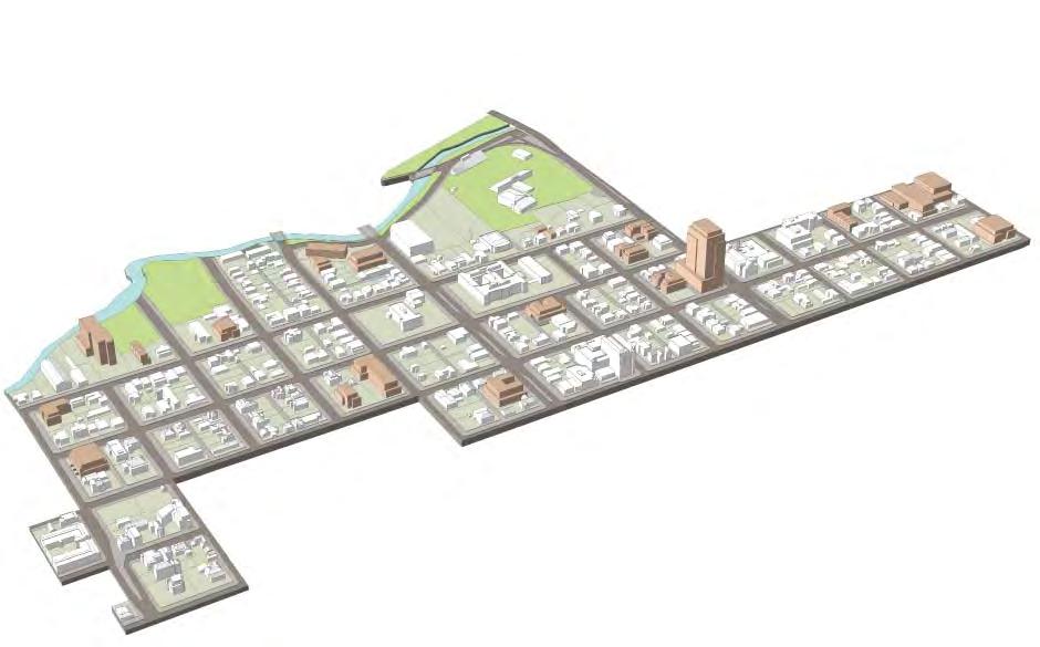
• There are 21 assembled proper es, totaling about 13 acres. (See Form and Character Analysis map on p. 39.)
• These “opportunity sites” are dispersed throughout the District, are rela vely unconstrained and could likely develop over the next five to 15 years, represen ng approximately 1.0 million square feet of development, under exis ng en tlements
Urban Design Priori es:
1. Amend zoning to allow a broader range of uses including mul -family residen al.
2. Encourage neighborhood-serving retail and commercial uses along 12th Street and around the ACC campus.
3. Concentrate medium-density, mixed-use development along MLK Boulevard, West 15th Street, Lamar Boulevard and in the southern por ons of the area south of West 8th Street.
4. Establish form-based design standards to promote compa bility with the historic neighborhood fabric.
5. Develop design standards for proper es adjacent to Shoal Creek that will promote views and access to the creek.
6. Discourage or minimize above-grade parking.
7. Develop Nueces and Rio Grande streets as a “bicycle boulevard”, linking Lady Bird Lake, Downtown and UT.
The sites shown in brown represent approximately 1.0 million square feet of potential future development.
The Capitol is Downtown’s most prominent building (left).
Neighborhood-oriented retail and restaurant uses between 17th and 18th streets (right).
District-Specific Goals:
1. Promote a broader diversity of uses beyond office to contribute to a more vibrant mixed-use district.
2. Encourage the redevelopment of underu lized proper es and parking garages along the Lavaca/Guadalupe and San Jacinto/Trinity Street transit corridors.
3. Enhance the State Capitol campus north of the Capitol along Congress Avenue, consistent with the 1989 Texas Capitol Master Plan.
4. Enhance streets to be more pedestrian and bicycle-friendly and to create stronger linkages with other parts of the downtown and UT.
5. Provide a framework for direct coordina on between the City and the State of Texas Facili es Commission to achieve mutually beneficial objec ves.
Top Three Public Improvement Priori es (per 39 responses from 2009 survey):
1. Great Streets (69%)
2. New parks, pocket parks or plazas (51%)
3. Public parking facility (33%)
Exis ng Form and Character:
• The Uptown/Capitol District is anchored by the historic Capitol Building and Square and provides a transi on between The University of Texas and the Central Business District.
• The area has a concentra on of parking garages, par cularly along San Jacinto and Trinity streets, crea ng an eight-block “dead” zone. Most of the State office buildings and their streetscapes need revitalizing.
• The Lavaca/Guadalupe Street corridor lacks a cohesive iden ty and contains a mix of building types, including high-rise office and residen al buildings, historic single-family houses, single-story restaurants, fast food and art galleries.
• The western edge of the district along San Antonio Street is characterized by some historic buildings and by a mature tree canopy.


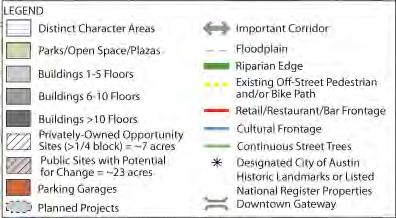


Historic Resources Iden fica on:
• On the basis of windshield surveys and the City’s 1984 Cultural Resources Survey, several sub-areas of the Uptown/Capitol District have been iden fied as poten al historic districts, subject to further study and property owner interest. These are:
1. A possible Local Historic District (LHD) along Guadalupe and Lavaca streets, between West 16th Street and midblock between West 17th and West 18th streets.
2. A possible Local Historic District along West 12th Street, between West Avenue and Colorado.
3. A possible Na onal Register Historic District (NHRD) along West 13th and West 14th, west of the midblock between San Antonio and Guadalupe streets.
Development Opportunity Sites:
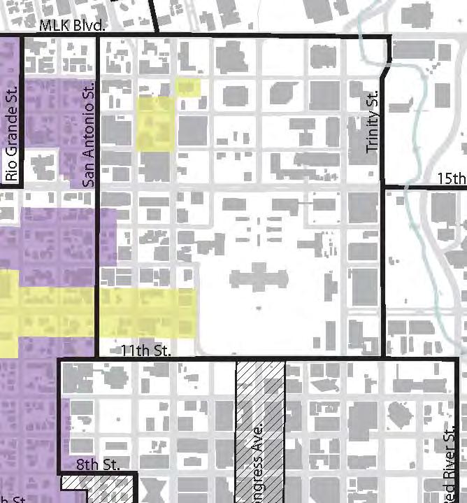
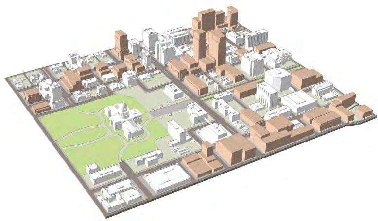
• There are 28 proper es, totaling 30 acres, which have been assembled to one-quarter-block or greater; many of these could redevelop over the next five to 15 years. (See Form and Character Analysis map on p. 43.)
• The opportunity sites include approximately 23 acres of publicly-owned (State) land, much of which is occupied by stand-alone parking garages constrained by Capitol View Corridors. These sites represent approximately 6.2 million square feet of development, given exis ng en tlements.
The sites shown in brown represent approximately 6.2 million square feet of future potential development.
Urban Design Priori es:
• Improve North Congress Avenue as a landscaped civic axis, linking the Capitol and University of Texas campus.
• Consistent with both the 1956 and 1989 Capitol Area Plans, concentrate new State of Texas buildings along North Congress Avenue to create a civic mall, with minimum setbacks from North Congress Avenue of 40 feet.
• Explore poten al for a major cultural use (museum) at the corner of MLK and Congress to expand an emerging museum district.
• Implement Great Streets improvements along Lavaca and Guadalupe streets.
• Promote a mix of higher density commercial and residen al uses along the Lavaca/Guadalupe and Trinity/San Jacinto Street corridors.
• Establish form-based design standards for new development adjacent to or within poten al historic districts.
• Encourage ac ve, pedestrian-oriented uses, par cularly adjacent to exis ng and planned transit routes along Guadalupe/Lavaca streets and San Jacinto/Trinity streets.
• Encourage addi onal retail and restaurant uses in the vicinity of 17th and 18th streets along Guadalupe and Lavaca streets to create a district ac vity center. Focus these uses around/adjacent to a new public open space.
• Encourage shared parking in private and public garages for special events along Waller Creek and UT.
• Promote workforce-affordable housing on publicly-owned parcels.
The 1989 Master Plan for the Capitol calls for the enhancement of North Congress Avenue as a civic spine extending to MLK Boulevard.

Lamar Boulevard is characterized by new development in close proximity to small- scale commercial and residential uses.
District-Specific Goals:
1. Strengthen the area as a compact, pedestrian-oriented mixed-use district, with ground level retail and restaurant uses.
2. Improve the quality and safety of the pedestrian environment, par cularly along the major arterials of Lamar Boulevard, 5th and 6th streets.
3. Enhance streets to be more bicycle-friendly.
4. Enhance Shoal Creek, addressing flood control and improving the con nuity and accessibility of its creekside trail.
5. Promote new development that creates an appropriate scale transi on to the neighborhoods west of Lamar Boulevard.
Top Three Public Improvement Priori es (per 35 responses from 2009 survey):
1. Great Streets (71%)
2. Off-street trails (51%)
3. Creek stabiliza on/flood control (40%)
Exis ng Form and Character:
• The district is bordered by the Old West Aus n Neighborhood Associa on (OWANA) on the west, Shoal Creek on the east and north, and Lower Shoal Creek District to the south.
• The OWANA neighborhood shares a rear property line with commercial uses along Lamar Boulevard.
• Along Lamar Boulevard, retail is the predominant land use.
• Lamar Boulevard has high vehicular traffic volumes and a poor pedestrian and bicycle environment, with its many curb-cuts and surface parking lots.
• The 100-year floodplain of Shoal Creek impacts a large por on of the district east of Henderson Street and north of 9th Street.
Historic Resources Iden fica on:
• On the basis of windshield surveys and the City’s 1984 Cultural Resources Survey, no sub-areas of the Lamar/Market District have been iden fied as poten al historic districts warran ng further study.


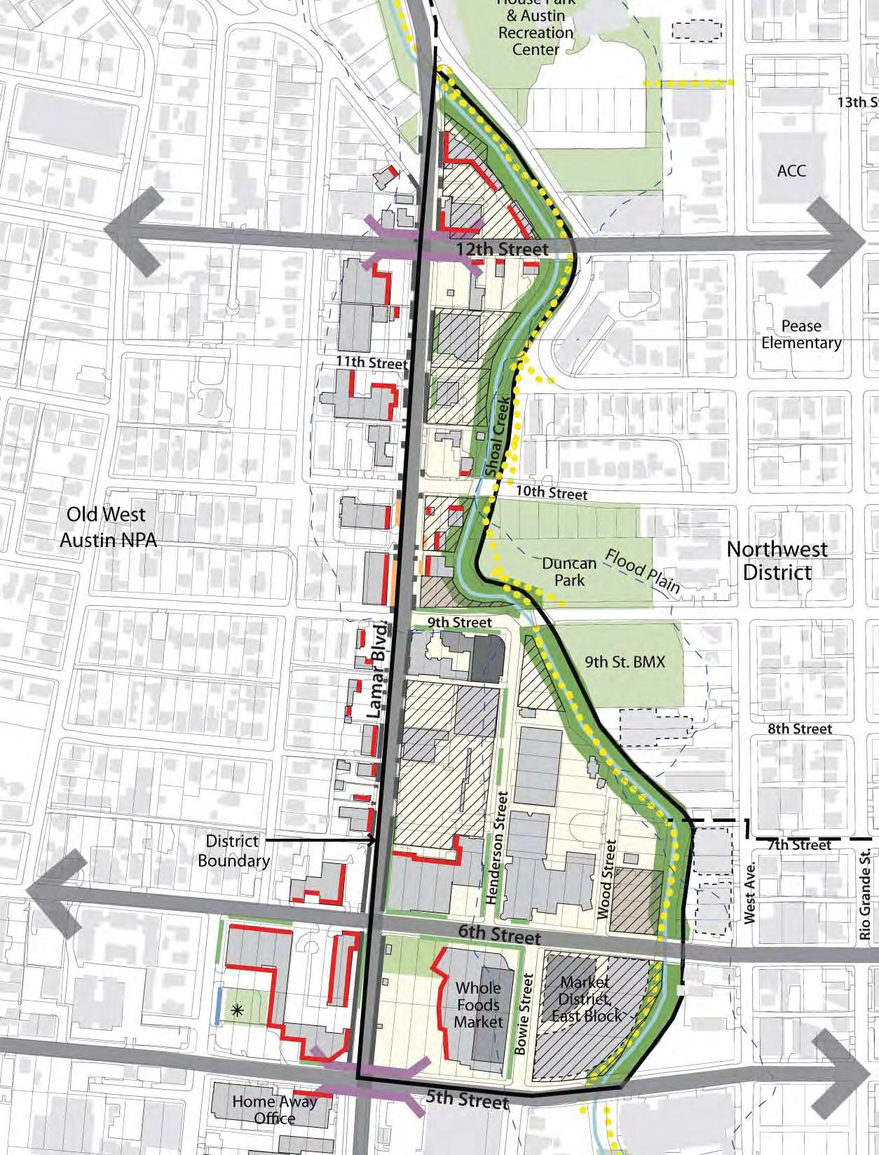
Market / Lamar District Form and Character Analysis
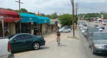

Curb cuts, parking lots , power poles and driveways along Lamar Boulevard interrupt pedestrian and bike circulation (above). Like Shoal Creek Saloon, new development should create a positive relationship with the creek (below).
The sites shown in brown represent approximately 1.4 million square feet of future potential development.
• There are nine assembled proper es, of a quarterblock or greater in area, totaling about 11 acres. (See Form and Character Analysis map on p. 47.)
• These “opportunity sites” are rela vely unconstrained and could develop over the next five to 15 years, represen ng approximately 1.4 million square feet of development under exis ng en tlements, however, flood levels limit the ability to do creek-level development and below-grade parking. They are located primarily along Lamar Boulevard and Shoal Creek.
• Promote ac ve, pedestrian-oriented uses, par cularly along Lamar Boulevard, West 6th and West 5th streets. Encourage ground-level residen al units with street entries along other streets. Improve pedestrian environments along these streets.
• Develop urban design regula ons to be er address compa bility with adjacent single-family buildings.
• Improve Duncan Park as a neighborhood-serving open space.
• Assure Shoal Creek trail con nuity and maintenance, and define a flood control project for Shoal Creek.
• Encourage pedestrian-oriented uses that open onto Shoal Creek.
• Establish public access easements and specific creekside design regula ons for proper es abu ng Shoal Creek.
• Limit exposure of above-grade parking garages along Shoal Creek.
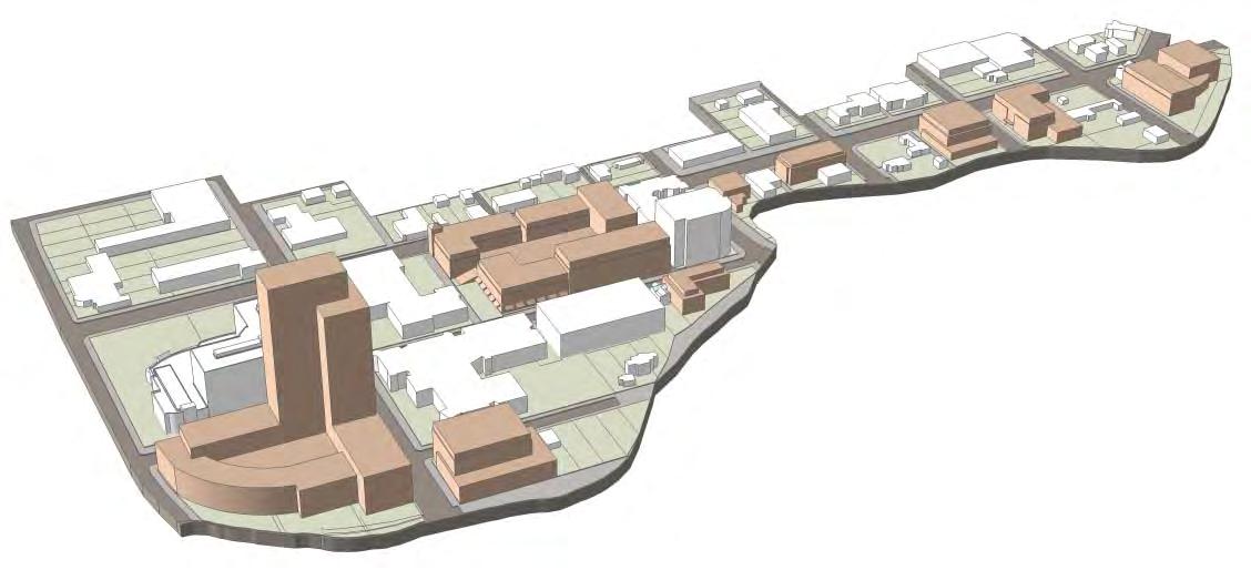

Lamar Boulevard Between 5th and 12th Streets: Existing Conditions
The Lower Shoal Creek District is emerging as a dense mixed-use neighborhood.
District-Specific Goals:
1. Improve Shoal Creek as the central open space amenity of the District, and improve the con nuity and accessibility of its creekside trail. Improve the flood capacity and the riparian character of the corridor.
2. Extend the street grid to create stronger bicycle, pedestrian and vehicular linkages to the Core and Waterfront.
3. Promote a mixture of residen al, commercial, cultural and visitor-oriented uses that contribute to the day and night- me life of the District.
Top Three Public Improvement Priori es (per 52 responses from 2009 survey):
1. Great Streets (60%)
2. Off-street hike and bike trails (54%)
3. Creek stabiliza on and flood control improvements (40%)
Exis ng Form and Character:
• Shoal Creek, with its steep banks and mature vegeta on, bisects the District, giving it a highly dis nc ve image and iden ty.
• The area is currently undergoing significant transi on from an industrial and warehouse district to a high-density, mixed-use neighborhood. Several major residen al developments have recently been completed (360 Condos, Monarch Apartments, Gables Park Plaza, Spring Condos).
• The planned Green and Seaholm redevelopments, and the new Central Library, will create a significant ac vity center and linkage to the CBD.
• Connec ons between Downtown and the southern por on of the District are interrupted by Shoal Creek.
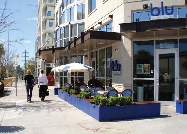
• The area includes a concentra on of bars and nightclubs along West 6th Street and drive-through banks along West 5th Street. These streets have narrow sidewalks interrupted by many curbcuts and driveways.


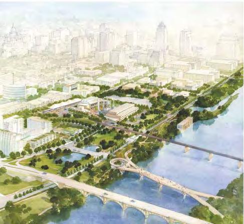
Historic Resources Iden fica on:
• On the basis of windshield surveys and the City’s 1984 Cultural Resources Survey, one possible Local Historic District has been iden fied, subject to more detailed study and property owner interest. It is located along the segment of West 6th Street between San Antonio Street and West Avenue.
• Shoal Creek includes some historic ar facts including the wooden rail trestle bridge at West 3rd Street. Mirabeau B. Lamar’s first cabin was located at the mouth of Shoal Creek, which warrants an interpre ve treatment, since Lamar was one of Aus n’s founding fathers and a leading proponent for Aus n as the seat of Texas government.
Development Opportunity Sites:
• The area is largely built out or planned.
• There are 12 assembled “opportunity sites”, totaling about 13 acres.
• These “opportunity sites” are rela vely unconstrained and could develop over the next five to 15 years, represen ng approximately 3.0 million square feet of development.
The sites shown in brown represent approximately 3.0 million square feet of future potential development.

Urban Design Priori es:
• Implement the Seaholm and Green Water Treatment Plant redevelopment projects to link the District with the Core and Waterfront.
• Complete the Pfluger Bridge and associated Sand Beach Park to link this area with the Lady Bird Lake trail system and to the South Shore.
• Promote streetscape, creekscape, trails, promenade and open space improvements that establish stronger rela onships to Downtown, Lady Bird Lake and Shoal Creek.
• Buildings abu ng Shoal Creek should be subject to specific setback and other design requirements.
• Promote high levels of density, consistent with exis ng base zoning, while ensuring appropriate transi ons to the Core/Waterfront and neighborhoods to the west.
• Promote building forms that preserve views to the Lake and reinforce their waterfront se ng.
• Require ground-level treatments that reinforce the pedestrian realm, including ac ve, pedestrian-oriented uses along key linking streets (i.e., West 5th, 6th, 3rd, Bowie streets).
• Discourage or prohibit any new automo ve uses, drive-through services and exposed parking structures that compromise the pedestrian life and orienta on of the area.
• Explore the poten al for addi onal pedestrian bridges across and connec ng both sides of Shoal Creek.
• Extend the Cesar Chavez Promenade westward to the Pfluger Bridge.
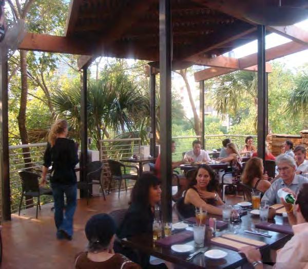
a positive relationship to
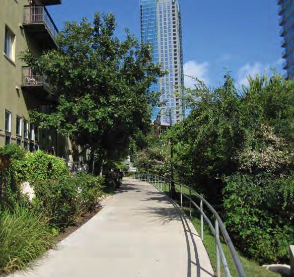
There is a lack of public access along Waller Creek.
(See also detailed district plan at h p://aus ntexas.gov/department/wallercreek-0)
District-Specific Goals:
1. Transform Waller Creek into an urban greenway and linear open space that connects the surrounding community.
2. Create con nuous pedestrian and bicycle access between Lady Bird Lake and UT in/near the Creek corridor.
3. Improve pedestrian and bicycle connec ons between East Aus n, UT, Waller Creek and the Core and Waterfront.
4. Maintain and enhance the environmental and habitat value of the creek as a riparian corridor.
5. Encourage new development that promotes the area as a diverse, livable, and affordable mixed-use district with a dis nctly local feel.
6. Establish ac vi es along the Creek that contribute to its safety and vitality and to the area’s economic revitaliza on.
7. Promote the District as a place for crea ve and cultural ac vi es including live music venues, galleries, studios, etc.
8. Improve Palm and Waterloo parks to be er serve their adjacent neighborhoods and to provide opportuni es for community-wide events and recrea on.
Top Three Public Improvement Priori es (per 57 responses from 2009 survey):
1. Great Streets (65%)
2. Off-street hike and bike trails (54%).
3. Creek stabiliza on and flood control improvements (47%)
Exis ng Form and Character:
• Development within the Waller Creek District is restricted by 13 Capitol View Corridors (CVCs), five of which originate from IH 35. Height limits beneath the CVCs range from 25 to 150 feet.

• The district is centered on Waller Creek, which links UT with Lady Bird Lake.
• Most development backs on to Waller Creek, rather than addressing it. The paths along the creek are discon nuous and in poor condi on; some of the creek banks are eroding, homeless encampments exist throughout the corridor, par cularly under bridges.
• The District includes two special areas: the East 6th Street Na onal Historic Register District and the proposed Red River Live Music District.

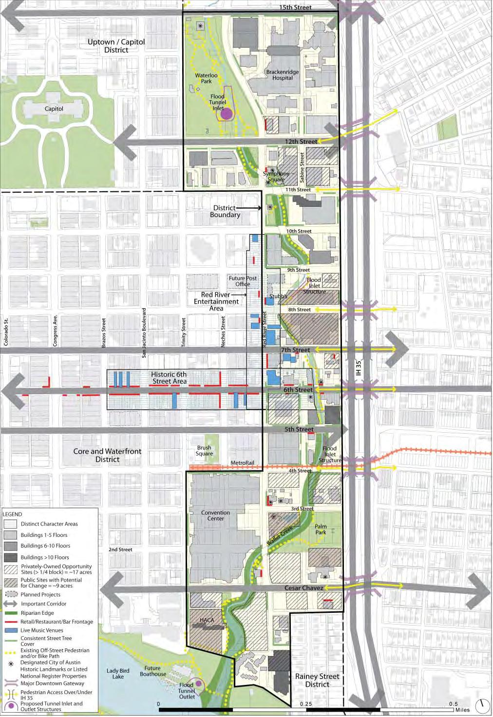
Waller Creek District Form and Character Analysis

• The District is characterized by low-intensity development, underu lized lots, a concentra on of social services and entertainment and bar uses.
• Many of the bridges and proper es are historic and contribute greatly to Waller Creek’s unique character.
Historic Resources Iden fica on:
• On the basis of windshield surveys and the City’s 1984 Cultural Resources Survey, two sub-areas of the Waller Creek District have been iden fied as poten al Local Historic Districts, subject to further study and property owner interest. This includes the north and south blockfaces of East 6th Street between IH 35 and Trinity Street and the northern blockface on East 3rd Street between Red River and the Sabine Street rightof-way.
Development Opportunity Sites:
• There are 21 assembled proper es of a quarter-block or greater, totaling about 26 acres, represen ng approximately 7.6 million square feet of development, under exis ng en tlements.
• These “opportunity sites” are rela vely unconstrained (with the excep on of Capitol View Corridors) and could develop over the next five to 15 years.
• The opportunity sites include approximately nine acres of publicly-owned land, including the Aus n Police Department (APD) facility, the Municipal Courts and Travis County’s facility in the historic Palm School.

Urban Design Priori es:
• Implement creekscape, trail and open space improvements as an integral part of the Waller Creek Tunnel project.
• Provide incen ves to retain and expand live music venues.
• Promote a pa ern of development that re-engages Waller Creek with the surrounding downtown, and creates a posi ve and sustainable greenway between UT and Lady Bird Lake.
• Enhance connec ons to the Conven on Center, 6th Street, and Red River Street to create a premier visitor/tourist des na on.
• Revitalize Palm Park as a family-friendly, water-oriented place that reflects its importance to the Hispanic community.
• Promote development opportuni es at a variety of scales, including mid-rise development on small parcels.
• Promote the development of facili es for the crea ve community (e.g., workspace, rehearsal space, galleries, etc.).
• Control the number and intensity of bars and cocktail lounge uses, par cularly along East 6th and Red River streets.
• Require ground-level space suitable for ac ve, pedestrianoriented uses, including retail, par cularly along Red River, East 6th and Sabine streets.
• Establish a program for off-site parking (e.g., in-lieu fees and centralized public/private parking facili es) that can reduce the need for on-site parking, create opportuni es for affordable housing, and allow smaller parcels to redevelop more effec vely.
• Explore the crea on of a 5th Street Mexican American Heritage Corridor linking Republic Square to Sal llo Plaza.


The Rainey Street District is characterized by new development in close proximity to older singlefamily homes.
District-Specific Goals:
1. Allow for the orderly transi on of the District from a single-family enclave to a high density, mixed-use neighborhood.
2. Establish an infrastructure master plan to promote an adequate roadway, pathway and u lity network.
3. Create stronger pedestrian and bicycle linkages to the CBD, Lady Bird Lake, Waller Creek and East Aus n.
4. Create improved roadway connec vity to the IH 35 Frontage Road and Cesar Chavez Boulevard.
5. Preserve the exis ng tree canopy along Rainey Street to the maximum extent possible.
Top Three Public Improvement Priori es (per 25 responses from 2009 survey):
1. Great Streets (84%)
2. New parks, pocket parks or plazas (40%)
3. Public parking facility (40%)
Exis ng Form and Character:
• This area contains a concentra on of single-family houses and bungalows along Rainey Street on small parcels 120-feet deep and less than 50-feet wide. The proper es within the area have recently been rezoned to CBD. Several have recently converted to nightclubs and bars.
• High-rise buildings have been constructed and/or planned along the Lady Bird Lake edge of the District.
• The mature street yard tree canopy throughout the District contributes greatly to the character of the area, as well as to the City’s urban forest.
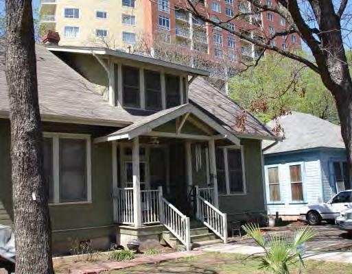


businesses have
The sites shown in brown represent approximately 2.9 million square feet of future potential development.
• Streets in the District are not well connected to the surrounding downtown, limi ng pedestrian, bicycle and vehicular access and making the area feel isolated.
Historic Resources Iden fica on:
• A Na onal Register Historic District currently exists along Rainey Street, but the recent rezoning of this area from SF-3 to CBD could promote demoli on of exis ng single-family houses.
• There are nine assembled proper es of at least one-quarter block each, totaling about six acres and represen ng approximately 2.9 million square feet of development.
• These “opportunity sites” are rela vely unconstrained and could develop over the next five to 15 years. Other smaller sites exist, par cularly along Rainey Street, but will need to be assembled if they are to be redeveloped.

Urban Design Priori es:
• Promote streetscape, creekscape, bridges, trails, promenade and other open space improvements that establish a more direct rela onship with Lady Bird Lake and Waller Creek.
• Encourage new residen al and other uses that can complement the exis ng, quiet neighborhood character. Limit the number of cocktail uses allowed.
• Encourage neighborhood-serving retail and commercial uses along Cesar Chavez and the IH 35 frontage road.
• Promote the highest levels of density in the Rainey Street District, consistent with exis ng base zoning and the to-be-determined density bonus provisions of the Waterfront Overlay District.
• In order to ensure compa bility with the exis ng low-rise pa ern of houses, require mid- and high-rise new development buildings to have a streetwall and stepback that is compa ble with the exis ng low-rise pa ern.
• Promote creekside development that addresses the creek, maintains appropriate setbacks and enhances its ecological integrity.
• Promote building forms that preserve upland views to the lake.
• Require any above-grade parking garages along Rainey Street to be lined with upper-level residen al, hotel or offices uses.
• Require ground-level space suitable for ac ve, pedestrian-oriented uses, including retail, or ground level residen al units with street entries.
• Be er connect the Emma S. Barrientos Mexican American Cultural Center (MACC) to Downtown and East Aus n.
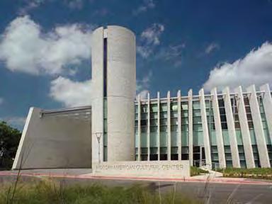
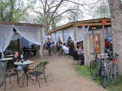

Texas Capitol, Downtown Austin



Preserve and enhance the unique historical and cultural heritage of Downtown.
Ensure that Downtown’s future growth supports a vibrant, diverse and pedestrianfriendly urban district.
Ensure that Downtown can evolve into a compact and dense urban district, with new buildings contributing positively to sustainability, quality of life and the Downtown experience.
Interconnect and enhance Downtown’s network of public parks, open spaces and streets.
Develop a multi-modal transportation system that improves access to and mobility within the Downtown.
Provide for phased utility and infrastructure upgrades that address existing deficiencies and that support Downtown redevelopment.
Implement the Downtown Austin Plan, within the resources and priorities of the community.
The Downtown Aus n Plan is wri en as an ac on-oriented document to assist City government, its staff and leadership and its poten al partners in implemen ng its recommenda ons. As such, this part of the Plan is organized into seven subject areas, or elements, that relate closely to those City departments, divisions and programs that will undertake their implementa on. These elements are:
• Historic Preserva on, focusing on the preserva on and enhancement of Downtown’s unique cultural and historic resources;
• Ac vi es and Uses, presen ng policies and ac ons aimed at promo ng a vibrant, diverse and pedestrian-friendly district;
• Density and Design, se ng forth policies that guide development toward the community’s vision of a sustainable, compact and engaging environment;
• The Public Realm, describing improvements and ini a ves that will enhance the quality and upkeep of Downtown’s parks, open spaces and streetscapes;
• Transporta on and Parking, providing a program to improve access and mobility for all modes within Downtown;
• U li es and Infrastructure, describing policies and ini a ves for phased upgrades and improvements in support of Downtown redevelopment; and
• Leadership and Implementa on, describing the ac ons required to realize the recommenda ons of the Plan, such as changes in governance and organiza on, amendments to exis ng regula ons, and a ten-year priority ac on plan.
Each of the seven elements has an over-arching goal or broad intent, followed by a series of specific recommenda ons formulated as objec ves, with sufficient explana on to convey key considera ons for their final implementa on. The spectrum of recommenda ons include ac ons regarding the City’s and its partners’ policies, staffing, programs, process improvements and physical improvement projects. Approximately 100 recommenda ons have been developed, based upon stakeholder input and preferences and best professional planning prac ces formulated through the lens of the do-able. Some recommenda ons are ac onable immediately, while others will require further study and stakeholder input as they are refined and readied for final ac on.
Overall Goal: Preserve and enhance the unique historical and cultural heritage of Downtown.
Historic preserva on is important if Downtown is to con nue to develop in a way that is authen cally and uniquely Aus n - where the history of place is evident and celebrated. Downtown Aus n’s sense of place is built to a great extent on its unique collec on of historic buildings and landscapes. The Warehouse District, Congress Avenue, East 6th Street, the Bremond Block and the Northwest District neighborhood are not just ar facts of interest, they are physical manifesta ons of the community’s collec ve iden ty and values - living stories of the path that the community has taken since its founding 170 years ago.
Preserva on is also consistent with Aus n’s value of sustainability. The conserva on and improvement of exis ng built resources, including re-use of historic and exis ng buildings, greening of the exis ng building stock, and reinvestment in older and historic districts, are key elements of a sustainable downtown.
Aus n has taken bold steps over the past 30 years to preserve its cultural resources, from protec ng views to the Capitol to establishing historic districts along Congress Avenue, East 6th Street and the Bremond Block. These ac ons have helped to shape the urban experience of Downtown and have directly contributed to its economic vitality and success.
It is important to build on these ac ons and to address some of the cri cal risks and challenges that are facing Aus n’s historic core. The DAP recognizes the importance of the historic fabric of the original city and has iden fied nine individual “districts” that are generally cohesive in character, in terms of building form and scale, which is o en a result of their historical development. (See Form and Character Districts.)
Downtown’s fabric of historic residential and commercial structures creates a unique identity. (Excerpt of 1897 Augustus Koch map)


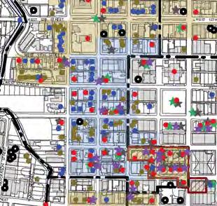


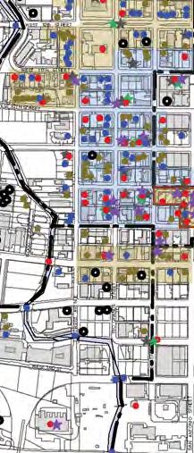


City of Austin Downtown Master Plan Historic Resources Location Map

NATIONAL REGISTER DISTRICT
NATIONAL REGISTER PROPERTY
CITY OF AUSTIN LANDMARK
RECORDED TX. HIST. LANDMARK
PROPOSED DOWNTOWN DISTRICT
POTENTIAL LOCAL HISTORIC DISTRICT


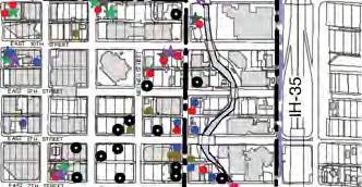





Base map information source: City of Austin GIS website North LEGEND
PRIORITY 1 - 1984 CRS
PRIORITY 2 - 1984 CRS
UNPRIORITIZED - 1984 CRS
DEMOLISHED SINCE 1984 CRS
POTENTIAL NATIONAL REGISTER HISTORIC DISTRICT
Downtown Historic Resources Map



& Godfrey Architects, 11/04/2010
HP-1. PRESERVATION PLAN: Preserva on of Downtown’s historic buildings and districts should be guided by an updated, city-wide Preserva on Plan that is based upon a current inventory of cultural resources.
The City’s Preserva on Plan and its Comprehensive Cultural Resource Survey (CCRS) - two key planning tools that guide a city to make appropriate policies and decisions about historic preserva on are both over 30 years old, and so are of limited relevance today. The Preserva on Plan is a resource manual, with recommenda ons intended to guide the work of the City, the Historic Landmark Commission and the preserva on community in Aus n. It is the best prac ces “roadmap” of what resources are important to preserve. It is based on a comprehensive understanding of the historical and cultural resources, their physical condi on, their “story” or historical associa ons and their rela ve value or priority to the community. Aus n’s Comprehensive Cultural Resource Survey, published in 1984 and never updated since, provides an inventory with priori es established for further research.
The Downtown Historic Resources Map (le ) compiles in graphic form what the 1984 CCRS listed as those proper es warran ng further research in order to ascertain their priority for preserva on. Evident on this map are the structures that have been demolished since that me. The City should update both the CCRS and the Preserva on Plan, in conjunc on with, or following the City’s “Imagine Aus n” Comprehensive Plan update, which is now underway.22
HP-1.1: Update and disseminate the Comprehensive Cultural Resources Survey and Preserva on Plan, beginning with Downtown, and plan for periodic updates.
• The Preserva on Plan should set clear goals, policies and priori es and guide historic preserva on efforts into the future. Per City Code, the Historic Landmark Commission is charged with proposing amendments to the Preserva on Plan, so the prepara on of an updated plan is consistent with that requirement. As was done in 1981, a professional preserva on consultant should be commissioned to prepare the updated plan, as well as to update the 1984 Comprehensive Cultural Resources Survey.
• The CCRS and the Preserva on Plan should be made available on the City’s website in a user-friendly form that allows the public to understand proper es and resources with historic significance, as well as the preserva on goals associated with these.
• Periodic updates to the CCRS and the Preserva on Plan should be budgeted and scheduled every five years, synchronized with the City’s Comprehensive Plan updates, since historic preserva on is a required element of the Comprehensive Plan.

HP-2. DESIGN STANDARDS: Standards and policies should be strengthened to ensure that new development respects the scale and character of historic buildings, districts and landscapes.
Today, Aus n’s Land Development Code contains very few standards or regula ons that require new buildings to be compa ble with adjacent historic places, nor are there actual code regula ons for new addi ons or modifica ons to exis ng historic buildings or for signage in historic districts. With the excep on of a 45 foot height limit along East 6th Street, there are only guidelines, such as those for East 6th Street and the State Capitol Complex, as well as the more general Secretary of the Interior’s Standards for the Treatment of Historic Proper es. 23 While Aus n’s guidelines are well-conceived, they have not been consistently followed or enforced, as evidenced by addi ons and altera ons to various East 6th Street buildings and by new development within the Capitol Complex.
HP-2.1: Adopt form-based development standards to protect and complement the unique character of historic downtown buildings, streets and districts.
• The City should adopt form-based development standards to provide more specific guidance on the rela onship of new development to historic buildings and districts. These standards, including height, stepback and massing regula ons, should be developed as part of the individual district plans to address specific issues and condi ons. Signage regula ons specific to each historic district should be included. (See Appendix I: DAP Proposed Building Design Standards.)
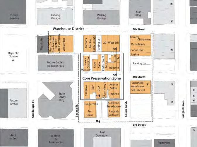
HP-2.2: Adopt standards and incen ves to protect the Warehouse District. The Warehouse District has become one of Aus n’s most popular districts and des na ons, known for its unique bars, cafes and entertainment venues, all housed in 19th and early 20th century buildings with loading docks now serving as public sidewalks. The area has not been designated as an historic district, and as such, has no official protec on and is at risk of being lost to new high-rise development. The City should develop specific standards to protect the District, including:
• City staff should explore addi onal tools for preserving the historic character of the Warehouse District without imposing a strict height limit. Such tools could include: an overlay; design standards; review of permits by the Historic Landmark Commission; or context sensi ve development standards.
• Form-based standards that require new buildings within the Core Preserva on Zone and adjacent blocks to step back from the street to maintain the scale of the warehouse buildings of the area, and to preserve and introduce special elements that give the area its unique character, including elevated sidewalks and projec ng canopies.
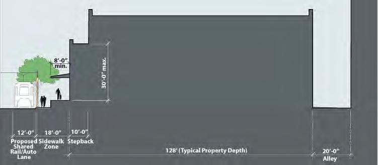

Excerpt from East 6 th Street
NRHD Design Guidelines
• To provide an incen ve for preserva on, the Plan recommends that the City adopt a Transfer of Development Rights (TDR) program that would allow Warehouse District property owners to sell unused development rights (available under exis ng zoning en tlements and those within the proposed Downtown Density Bonus Program) to other proper es within Downtown that may be seeking greater density. The TDR program and the recommended development standards are described in detail in the Downtown Density Bonus Program report.24
• The City should support efforts by the Heritage Society of Aus n and property owners to establish the Warehouse District as a Na onal Register Historic District and as a Local Historic District. The City’s Historic Preserva on Office (CHPO) has already compiled documenta on of the development of a more extensive warehouse area, much of which has already been demolished. The CHPO could complete the applica on for the Warehouse District to be cer fied as a Na onal Register District, which would be an important first step in assis ng in its preserva on. To become a Local Historic District, however, 51% of District property owners must agree to being part of such a district, so the CHPO’s efforts and those of the Heritage Society should be focused on working with property owners to understand the benefits of the LHD designa on.
HP-2.3: Introduce stepback provisions and other design standards for building addi ons within the East 6th Street Na onal Register Historic District. East 6th Street is one of the largest concentra ons of 19th and 20th century mercan le buildings in the State of Texas and is Aus n’s (and perhaps Texas’) most celebrated entertainment district. Many buildings along this historic street between IH 35 and Lavaca Street, are designated city historic landmarks. The area is part of the East 6th Street Na onal Register Historic District (NRHD), most of which is subject to a 45-foot height limit established by code as the Pecan Street Overlay District. In 1994, a set of architectural design guidelines was adopted for use by the CHPO and the Historic Landmark Commission in their project reviews to determine the appropriateness of new construc on or modifica ons within the District.

• The City should maintain these as design standards, but also require roo op addi ons on historic buildings to be stepped back from the front façade of the original, historic structure by approximately 15 feet. This would help maintain the original building’s dis nct form, silhoue e and prominence, while allowing for compa ble roof terraces and/or addi onal stories.
• The 6ixth Street Aus n Public Improvement District (PID) should be tasked with developing appropriate roo op trerrace and signage standards and with enforcing these.

HP-2.4: Introduce stepback provisions for new buildings and building addi ons within the Congress Avenue Na onal Register Historic District.
Proper es along Congress Avenue are currently under the protec on of a NRHD, a Capitol View Corridor and the Congress Avenue Overlay District. The Overlay requires new buildings (or addi ons) to step back by 60 feet star ng at a height of at least 30 feet, but no greater than 90 feet. This required stepback of 60 feet is greater than necessary to protect the historic character and symbolic significance of Congress Avenue since exis ng tall buildings (e.g., along the east side of Congress Avenue) have already shaped the street. In addi on, there are no regula ons to guide the construc on of addi ons to exis ng buildings on the Avenue, which is especially important when these are historically significant.
Existing 45’ Height Limit
15’-0”
Restoration of Downtown’s historic public infrastructure, such as bridges and parks, is needed.
• The City should require building addi ons to historic structures to be stepped back from the Congress Avenue-facing façade by approximately 15 feet. In addi on, the City should consider relaxing the 60-foot stepback requirement of the Congress Avenue Overlay District.
HP-3. ADMINISTRATION: The City should intensify its role in managing and funding Downtown preserva on.
Currently the City’s Historic Preserva on Office has three full- me staff, which is not adequate to accomplish much beyond the monthly administra on of Historic Landmark Commission mee ngs. The CHPO is not funded to engage in more proac ve planning efforts, required updates, public outreach and educa on, website development, etc., nor does it have the ability to support high-priority preserva on projects. There are also no sources of capital funding for needed renova ons of key Downtown historic resources, including publicly-owned parks and park structures, bridges, etc. The few grant programs available for historic preserva on are generally small and reserved for local government organiza ons.
The City’s seven commissioners on the Historic Landmark Commission are called upon to interpret federal, state and local standards for designa on of landmarks and districts, and to do so objec vely, fairly and consistently. They must review building permit and Cer ficate of Appropriateness applica ons and determine whether the work proposed is consistent with best preserva on prac ces and federal, state and local standards for preserva on, rehabilita on and restora on. It is important that there be sufficient staff capacity to advise the Commission, and that the Commission be reinforced with members who have technical exper se, including preserva on architects and architectural historians, who could con nue to provide informed and effec ve review of project applica ons.

HP-3.1: Improve the capacity of the City’s Historic Preserva on Office (CHPO) and that of the Historic Landmark Commission.
• The City should augment CHPO staff with professional-level staff (architects and architectural historians) to perform func ons vital to Downtown and city-wide preserva on, including management of the Comprehensive Cultural Resources Survey, the Preserva on Plan, historic district applica ons, website, etc.
• The City Council should require that some members of the Historic Landmark Commission be architects trained in and/or prac cing in the field of historic preserva on.
HP-3.2: Create a historic preserva on funding source and incen ves to encourage preserva on projects available to both public and private property owners, as well as tenants.
• The City should establish a funding source(s) that can provide capital to a number of key Downtown projects and ini a ves, e.g., historic bridge restora on, heritage tourism ini a ves, façade restora ons.
• The City should explore the development of a City-owned and operated “TDR bank”, focused first on purchasing the development rights from willing property owners within the Warehouse District’s Core Preserva on Zone.
• The City should develop a façade rehabilita on grant or revolving, low-interest loan program for commercial historic proper es, building on the success of the current Heritage Grants Program for non-profits.
• The City should dedicate bond funds for preserving historic resources Downtown, priori zing the rehabilita on of City-owned resources, such as the historic squares and Palm Park.
• The City should par cipate in the Cer fied Local Government (CLG) grants program to provide funding for CHPO local preserva on projects.
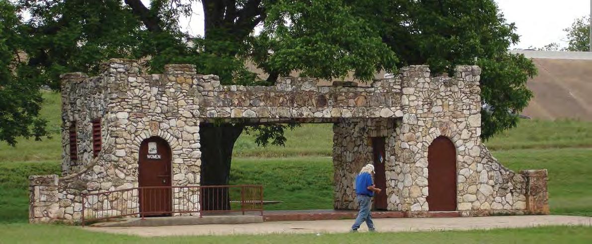

Mixed Use Street, Amsterdam
Overall Goal: Ensure that Downtown’s future growth supports a vibrant, diverse and pedestrian-friendly urban district.
Over the past decade, Downtown has con nued to evolve beyond that of a “central business district” to an urban neighborhood: a place to live, shop, visit and play - as well as work. This evolu on is taking place in spite of the City’s zoning ordinance, which includes a complex array of special districts and overlays. Major parts of Downtown are subject to zoning districts that disallow residen al as a primary use, others that do not allow offices, and others include zoning designa ons that permit uses that undermine the health and vitality of a pedestrian-oriented district. This is not consistent with the community’s vision for a diverse and mixed-use Downtown. While mixed-use is desirable throughout Downtown, certain uses should be priori zed or incen vized in par cular districts, and along certain streets to achieve the par cular goals of that district and to reinforce Downtown as a viable and a rac ve des na on. The following policies are aimed at fulfilling the vision of an inclusive, mixed-use Downtown with a thriving pedestrian environment.
Street, now lined
parking garages, is envisioned as a mixed-use, pedestrian and transitoriented street.

AU-1. MIXED USE: Downtown should have a full mix of urban uses that reinforce an ac ve and engaging pedestrian environment.
An appropriate mix of residen al and non-residen al uses should be allowed in all parts of Downtown, except for Judges Hill, which should generally be preserved as a single-family residen al neighborhood.
AU-1.1: Replace single-use zoning districts with downtown mixed-use zoning designa ons.
Some of the zoning districts within Downtown restrict the full range of residen al and non-residen al uses that are desirable for a healthy urban district. For example, proper es with Commercial Service (CS) and General Office (GO) designa ons are prohibited from construc ng residen al units, and those with Mul -Family (MF) zoning do not allow office uses.
• The City should establish two new downtown mixed-use zoning districts, “DMU40” and “DMU-60”, to replace these single-purpose zoning districts and provide for a broader mix of residen al and commercial uses.
• DMU-40 should replace exis ng zoning districts that have a 40-foot height limit (e.g., LO and MF-4), and DMU-60 should replace those with a 60-foot height limit (CS, GO, MF-5, MF-6). The intent of these new zoning districts is to promote a mixture of uses at a scale that is appropriate to their context, providing a transi on from “DMU-120” (currently “DMU”) to surrounding singlefamily neighborhoods and lower intensity districts.
• The specific provisions of these new zoning districts, including the list of permi ed and condi onal uses, should be established as part of detailed District Plans within Downtown.25
AU-1.2: Priori ze or incen vize certain uses in certain districts of Downtown.
• The support documenta on developed in the District Plans should be used to encourage par cular uses that are deemed to be important in achieving the community’s vision and to correct any imbalances that may have occurred over the past decades. For example, the Northwest District Plan provides incen ves for residen al development in a part of Downtown that was once Aus n’s first residen al neighborhood, but that is now substan ally in office use. The District Plan recommends that residen al infill development that complies with the Plan’s form-based standards be allowed to be built to an increased density.26 See DD-1.3.
• Provide incen ves for neighborhood-serving commercial uses in certain ac vity areas of the Northwest District. A concentra on of neighborhood serving retail businesses should be encouraged along MLK Boulevard, 12th Street west of West Avenue, and 15th Street east of Rio Grande Street. To encourage retail shops and restaurants along these designated frontages, the floor area of these par cular uses should be exempted from the FAR density calcula on.

An over-concentration of bars can threaten the viability of certain Downtown areas.
• As other future District Plans are prepared, priority uses should be iden fied.
AU-1.3: Priori ze and incen vize certain ground-level uses along certain streets. In order to realize the community’s goal of a vibrant and pedestrian-oriented downtown, and to avoid inappropriate use and treatment of ground-level stree ronts, the City should adopt more specific regula ons regarding stree ront uses along certain streets. Two types of streets are recommended:
• “Downtown Mixed Use Streets”, allowing for a wide range of pedestrianoriented uses including office, retail and residen al uses; and
• “Pedestrian Ac vity Streets” for certain streets that are regional des na ons, and where a more defined set of pedestrian-oriented ac vi es like retail, restaurant and cultural uses are desired.
District Plans should be used to establish specific loca ons, regula ons and requirements for these street frontages.27
AU-1.4: Explore ways to mi gate the poten al nega ve effects of an overconcentra on of cocktail lounges, which can discourage establishing a more balanced set of uses, par cularly day me uses that add to the vitality of Downtown.
An over-concentra on of bars in a single loca on can cause ill effects. It can cause that loca on to have a “closed up” feel during non-evening hours; and it can prevent or discourage that loca on from having a dynamic and pedestrian friendly feel. Public order problems have some mes arisen due to poor management of some cocktail lounge uses. The City should explore ways of addressing these issues.
Because the Land Development Code treats ‘cocktail lounge’ as a permi ed use in the CBD zoning district, there is no current regulatory tool to prevent overconcentra ons of bars. Through addi onal analysis and community input, the City should seek to iden fy and implement tools that address this issue. One of the tools that should be explored is making Cocktail Lounge a condi onal use. If those
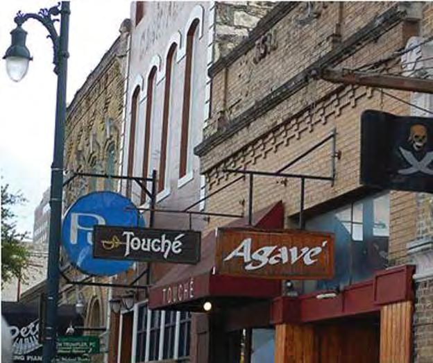


75% of parcel frontage in active commercial or civic use including:
“Commercial Uses”: Art Gallery, Art Workshop, Cocktail Lounge, Consumer Convenience Services, Food Sales, General Retail Sales, Hotel-Motel, Liquor Sales, Personal Services, Restaurant, Theater
“Civic Uses”: Cultural Services
MIXED USE STREET
60% of parcel frontage in the above active commercial or civic use and the following: Pedestrian Activity and Mixed-Use Streets for
All zoning “Residential Uses”
“Commercial Uses” includes: Financial Services, Food Preparation, Indoor Entertainment, Indoor Sports and Recreation, Laundry Services, Personal Improvement Services, Pet Services
“Civic Uses” includes: Clubs or Lodge, College or University Facilities, Day Care services, Public and Private Education Facilities, Religious Assembly
Affordable housing at a variety of densities should be accommodated in and within reach of Downtown (below low and mid-rise projects in San Francisco by David Baker Partners).
tools were to include criteria associated with evalua ng cocktail lounge uses, those criteria might include: hours of opera on criteria – ensuring both a day me and nigh me presence; compliance with all codes and regula ons; and security and other staffing criteria.
With regard to public order issues, the City and the community should explore whether current enforcement efforts and mechanisms are adequate, and if not, iden fy and implement improvements.
The City should also explore incen ves that would promote the development of other (non-cocktail lounge) uses, such as: use of the Business Reten on and Enhancement loan program; City par cipa on in u lity infrastructure improvements; and expedited review of permits.
AU-2. HOUSING: Downtown and the areas immediately around it should have a greater socio-economic diversity of residents.
Ensuring that the supply, type and cost of housing provides opportuni es for a wide range of Aus nites to live Downtown is crucial to achieving the community’s vision of an inclusive and diverse district. Housing in Downtown should be available to a wide range of income groups and lifestyles, including special needs residents, singles and families, Downtown workers and those who contribute to the arts and music community. Housing should be available within or in proximity to Downtown, in order to support public transit, provide housing near jobs and to create an adequate market base for retail, arts, culture and entertainment uses.
AU-2.1: Support the produc on of affordable housing. Most Downtown workers cannot afford to live Downtown, as units are typically far less affordable and therefore less diverse. The cost of producing high-rise housing is high, and therefore the subsidies needed to reduce market-rate housing to affordable levels are significant.
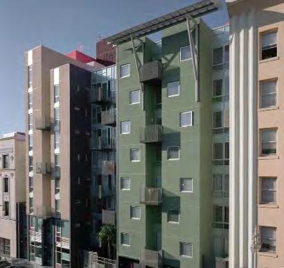
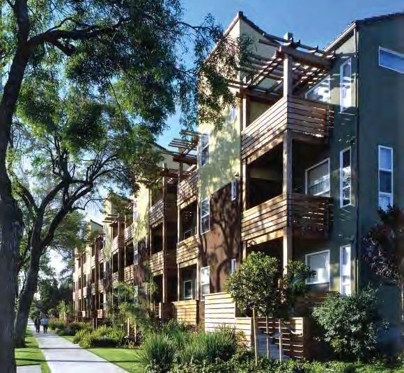
• City staff should explore poten al funding mechanisms to support affordable housing and suppor ve services in and around Downtown. Such tools could include: the 40% alloca on currently in place on proper es previously owned by the City; other tools drawing on the tax base associated with par cular projects; fees associated with events; and other poten al tools based on best prac ces in other ci es.
• The City should support the produc on of very low, low, and moderate-income units in and within reach of Downtown, including rental units affordable to families earning below 60% of MFI (median family income) and ownership units affordable to families earning below 80% of MFI. The lower cost of crea ng affordable housing in the areas surrounding Downtown, coupled with its transit accessibility, makes it a fiscally-prudent alterna ve to mee ng some of Downtown’s affordable housing needs. Specifically, crea ng affordable housing op ons in neighborhood planning areas within a two-mile radius of 6th Street and Congress Avenue can provide cost efficient, transit-accessible units in close proximity to Downtown.
• Opportuni es for achieving very low, low and moderate income housing within Downtown should also be maximized in areas where height limits result in lower costs of construc on, and where affordable unit construc on can be required as part of the redevelopment of government-owned land. (See AU-2.2 below.)
• These goals could be accomplished through a number of short-term strategies that can be achieved in the current market environment - primarily with public subsidy - as well as long-term strategies that leverage a framework of funding sources and changing market condi ons, such as: proceeds from a Downtown Density Bonus Program, crea on of a Workforce Housing Corpora on to provide centralized funding, abatement of taxes for projects achieving threshold requirements for on-site affordable housing and the expansion of SMART Housing fee waivers and economic development grants.28 In the long term, a non-profit Workforce Housing Corpora on could leverage a range of public and private sources to create centralized financing programs for the crea on of affordable housing.
• The City should help to reduce the substan al cost of structured parking by both “decoupling” the sale or rental of parking from that of an affordable unit and by developing a supply of centralized, off-site parking that can be leased as needed. (See Transporta on and Parking.)
AU-2.2: Leverage redevelopment of public lands to contribute to affordable housing produc on.
Of the approximately 180 acres of publicly-owned land
Public land like the Green Water Treatment Plant (above) can be leveraged to contribute to downtown affordable housing.

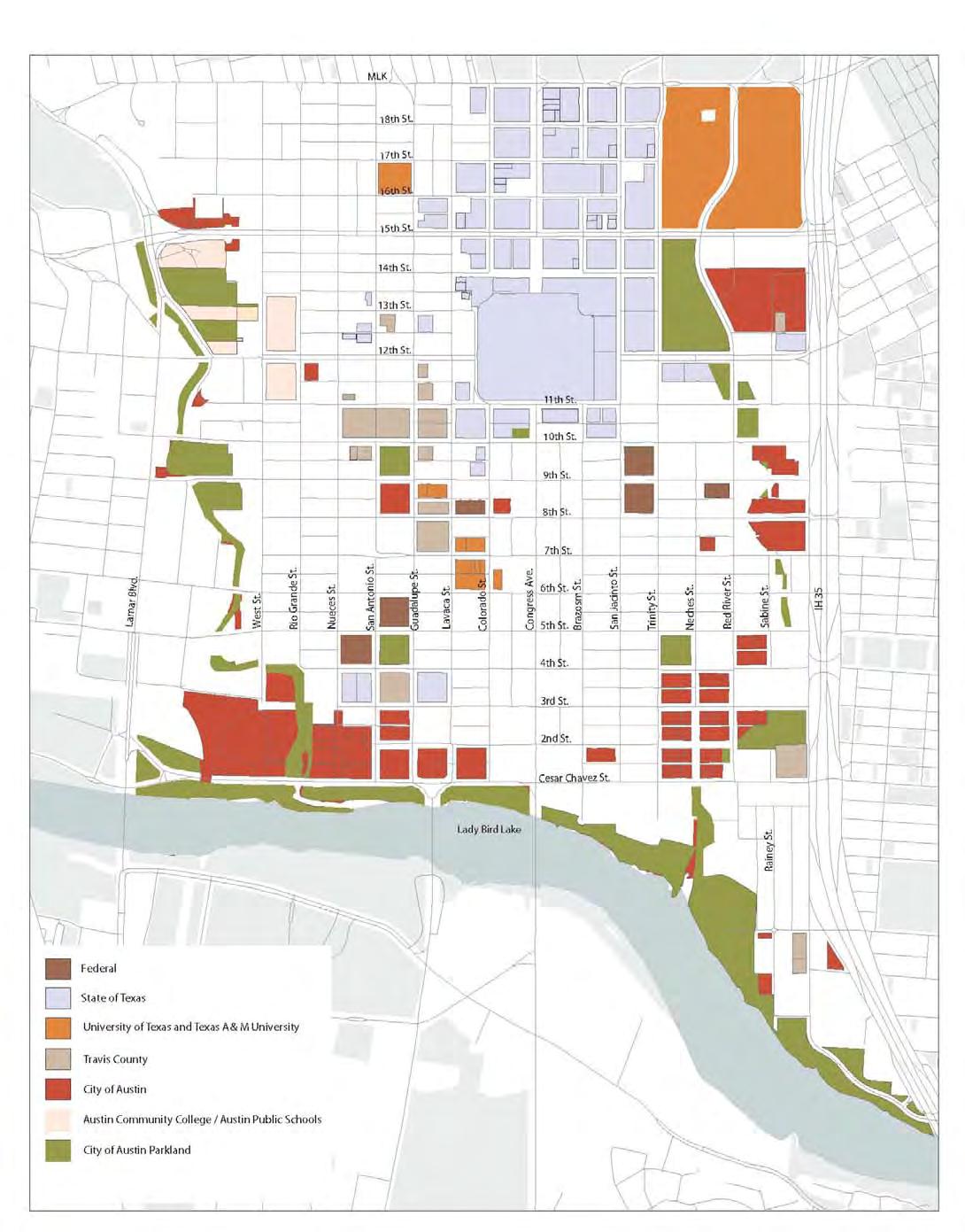
Approximately 180 acres of land are publicly-owned.


Downtown, 32 acres have short or mid-term redevelopment poten al. This includes proper es owned by the City of Aus n, Travis County, the State of Texas and the federal government. Some of these proper es may be redeveloped in the future for a mix of non-governmental uses, including housing.
• The City should work in partnership with other governmental en es, such as the Texas Facili es Commission, that could be engaged in redevelopment of Downtown land to promote affordable housing goals. The City already has an established policy that directs 40% of the property tax from redeveloped City-owned property to the Housing Trust Fund. The City should consider addi onal leverage in the redevelopment of City lands, including provision of free or discounted land in exchange for on-site affordable housing and requirements for on-site affordable housing units, as in the Mueller Redevelopment and Project Green.
• The Housing Authority of the City of Aus n (HACA) controlled sites present addi onal opportuni es for partnership. There is poten al to increase density and create more than 3,500 addi onal units on the eight HACA sites in Downtown and in the areas surrounding it. The City should partner with HACA to priori ze the intensifica on of its sites, in order to increase availability and improve quality of housing in and around Downtown.
AU-2.3: Provide for permanent suppor ve housing.
The City of Aus n and other providers have strived to address the immediate needs of sheltering the homeless; however, progress is needed to provide permanent suppor ve housing that can help people transi on to more stable and independent lives. To this end, the City Council in March 2010 passed a resolu on priori zing local and federal resources administered by the City’s Health and Human Services and Neighborhood Housing and Community Development departments in order to create 350 units of permanent suppor ve housing in the next four years.
Permanent supportive housing is aimed at helping the chronically homeless transition to more stable lives.
(Delancy Street Foundation Housing, San Francisco)

Permanent suppor ve housing is a cost-effec ve way of addressing the needs of those who face the most complex challenges: individuals and families confronted with homelessness who also have very low incomes and significant barriers to obtaining housing, including criminal histories, substance abuse addic ons, mental illness, or other mental and physical challenges. Such housing combines a place to live with social services, such as job and life skills training, alcohol and drug abuse programs and counseling. Permanent suppor ve housing is intended to help people recover and succeed while reducing the public’s overall cost of care. Goals of the City of Aus n’s Permanent Suppor ve Housing Strategy include geographically dispersing a diverse housing stock; crea ng units with high quality design; establishing effec ve property management; developing partnerships with non-profit and private developers and agencies; and suppor ng tenant’s choice and fair housing principles.
The City should commit to the crea on of approximately 225 units of housing in Downtown to address the needs of very low-income persons, some of which may be single-room occupancy (SRO) or other appropriate permanent suppor ve housing, in conjunc on with non-profit partners that can provide needed services. The loca on of these units should be carefully considered; sites near the alreadyburdened area surrounding the Aus n Resource Center for the Homeless should be avoided.
AU-2.4: Promote affordable housing for ar sts and musicians. The City should assist in the crea on of affordable housing and live-work spaces for ar sts and musicians, through partnerships with non-profit developers, contribu on of affordable housing bond monies and/or the discoun ng of public lands, as appropriate.
Downtown housing should provide protected play areas for children.
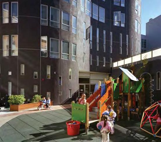
AU-2.5: Make Downtown housing more family-friendly. Families with children contribute significantly to the growth, diversity, vibrancy, and economic vitality of a city. Joel Kotkin writes in the Wall Street Journal, “If you talk with recruiters and developers in the na on’s fastest growing regions, you find that the cri cal ability to lure skilled workers, long term, lies not with bright lights and nightclubs, but with ample economic opportuni es, affordable housing and familyfriendly communi es not too distant from work.”31
The City of Aus n’s Families and Children Task Force report provides a comprehensive series of policy recommenda ons to make Aus n a more familyfriendly city. These recommenda ons, which deal with housing, child care, park and public space design and transporta on, are consistent with the community’s vision of a diverse and inclusive Downtown.32
While many families will choose to live elsewhere, Downtown should provide opportuni es for affordable and suitable housing for families. In this regard, the City should:
• Introduce incen ves through the Downtown Density Bonus Program to encourage the produc on of affordable, family-sized dwelling units with three bedrooms or more.
• Ensure that required on-site open space within mul -family residen al developments of a par cular size (e.g., greater than 40 units) include space suitable for families with children, such as protected courtyards and play areas, child care facili es, recrea on rooms, etc.
AU-3. RETAIL AND ENTERTAINMENT: Downtown should be the most desirable retail and entertainment des na on in the region, for both residents and visitors.
Retail, restaurant and entertainment uses are cri cal to achieving the community’s vision of a vibrant and pedestrian-friendly, mixed-use district. A thriving and diverse retail core, including shopping, dining and entertainment, as well as a diverse range of cultural ac vi es (see AU-4), is important for the con nued growth and vibrancy of Downtown. Retail promotes street ac vity, encouraging residents and visitors alike to spend me and money Downtown. Local-serving retail a racts and supports the growing number of households seeking a unique urban and pedestrian-oriented lifestyle.
Like most American ci es, Downtown’s role as the region’s central shopping district was eclipsed in the 1960-70s by suburban shopping centers which represented a new paradigm in merchandising. Downtown is no longer a des na on for “comparison retail”, but instead, is emerging in a role as a specialty and lifestyle shopping des na on, with the influx of new residents and the crea on of the 2nd Street District, the Market District and ini a ves by the Downtown Aus n Alliance in partnership with the City to introduce new retail businesses along Congress Avenue and East 6th Street.
Downtown’s role as an entertainment district has also grown over the past 10 years, enhancing the compe veness and a rac veness of Downtown as an office and employment center, as well as a residen al district. During 2005 to 2007,

thousands
During 2005 - 2007 retail space increased 400% to over 250,000 square feet.

Source: Downtown Austin Alliance, 2009
new construc on increased the total amount of occupied retail space Downtown fourfold, from 61,883 square feet to 254,567 square feet.33 Recent studies have projected an unmet demand of 500,000 square feet of new retail.34 However, Downtown s ll represents only about 1% of the total occupied retail space in Aus n.
The City should adopt land use policies that encourage a cri cal mass of retail and entertainment uses in Downtown that are focused along key, pedestrian-oriented streets.
AU-3.1: Reinforce exis ng retail and entertainment districts.
Exis ng concentra ons of retail and entertainment uses have emerged in certain areas of Downtown, including: the Market District at Lamar and West 6th Street; the 2nd Street District, the Warehouse District, East 6th Street, Congress Avenue and Red River Street. These key districts should be reinforced.
• A retail recruitment program is currently being implemented by the DAA for Congress Avenue and East 6th Street. These efforts should be bolstered by the City and private sector partners to a ract businesses that create synergy and cri cal mass within specific sub-areas of Downtown. The City’s exis ng Business Reten on and Enhancement (BRE) Program should con nue to assist displaced, new and expanding businesses on East 6th Street and Congress Avenue.
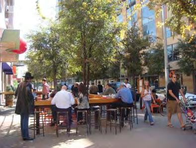
Jo’s is a successful example of one of the locally-owned businesses in the Citysponsored 2nd Street District.
• Development incen ves should be provided for a desired balance of retail and entertainment uses in certain parts of Downtown, including density bonuses and “free” or exempted FAR (floor area ra o).
AU-3.2: Promote ground-level retail and restaurant uses along par cular Downtown streets.
• Pedestrian-oriented space suitable for retail, restaurant or entertainment uses should be required along key street frontages designated as “Pedestrian Ac vity Streets” within Downtown (see AU-1.3 above).
AU-3.3: Establish a concentra on of retail, entertainment and cultural uses in City-sponsored redevelopment projects.
• Downtown redevelopment projects on City-owned land, such as Project Green and Seaholm, should con nue to include significant retail, restaurant, entertainment and cultural uses to create a strong regional des na on and a complementary “anchor” for both the 2nd Street District and the Market District.
New retail uses are strengthening Congress Avenue as a shopping destination.

● A significant por on of these businesses should be locally-owned to contribute to an authen c, diverse and affordable Downtown.
The Create Austin Plan recognizes the diversity of players who contribute to Austin’s creative community.
USES: Aus n’s crea ve community and Downtown’s concentra on of live music and other cultural des na ons should be nurtured and expanded.
Richard Florida’s The Rise of the Crea ve Class ranks Aus n as second only to San Francisco in US crea ve class ci es. The crea ve community contributes significantly to the vitality, livability and dis nct character of Aus n and Downtown. If Aus n is to con nue “being Aus n”, the city must sustain and enhance the vibrancy of culture, arts and music. Crea vity is perhaps the most character-defining element of Aus n’s culture - one that has both a na onal and interna onal reputa on.
A recent economic benefit study es mates that Aus n’s crea ve industry generates $2.2 billion of economic ac vity annually, almost half of which can be a ributed to live music.35 There is a wide variety of players who contribute to Aus n’s crea ve economy, including dancers, performers, sculptors, photographers, filmmakers, musicians, painters, writers, poets, printmakers, fashion designers, industrial designers, web designers, sound engineers, mul -media and interac ve ar sts, videographers and graphic designers. The list is enormous, as is their contribu on to Aus n’s iden ty.
But many in Aus n’s crea ve class do not feel adequately supported by City government: there is a lack of “crea ve culture” leadership at the City and, as a result, a lack of support. Some even feel that City bureaucracy creates barriers and added expense, par cularly in the realms of events and building permi ng. Resources to help ar sts, musicians and other crea ve individuals develop their talents and grow their careers in Aus n are lacking. Many ar sts find their careers stalling once they achieve a certain threshold of success and feel compelled to move to Nashville, Los Angeles or New York to receive adequate compensa on and to con nue their career trajectories. This should be recognized as an economic development opportunity to expand Aus n’s crea ve economy and help the struggling crea ve class stay in Aus n.
It is cri cal that Downtown be the area where art in all its forms lives, on the streets and in public spaces, as well as in new and exis ng developments. The following policies build on the recommenda ons of the Live Music Task Force,36 the Create Aus n Plan37 and the DAP report en tled “Strategies and Policies to Sustain and Enhance Aus n’s Crea ve Culture”.38
AU-4.1: Encourage museums and other cultural ins tu ons that serve the en re city to be located in or very near Downtown
Recognizing that cultural ins tu ons are key economic anchors for Downtown, the City should con nue to take a proac ve role in ensuring that one-of-a-kind cultural ins tu ons, such as museums, galleries, planetariums, major performing arts venues, etc., are located Downtown. These types of ins tu ons flourish in the dense, mixed-use se ng of a downtown environment. When located within walking distance of one another, visitors are able to access mul ple des na ons easily, increasing the length of visitor stays and the amount of visitor dollars into the downtown economy.
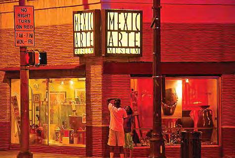
AU-4.2: Provide for the crea on of new cultural facili es and live music venues.
• Create an inventory of publicly-owned lands and buildings in and near Downtown that could accommodate incubator spaces, rehearsal and performing spaces, ar st studios, ar st live/work spaces, live music venues or other crea ve culture uses and businesses. Maintain the inventory for possible public/private partnership opportuni es. Examples of such publicly-owned assets include the Palm School, the Castleman-Bull House, the Old Bakery and the Seaholm Power Plant Turbine Hall and Water Intake Structure.
• The City should take a proac ve role in incen vizing both reten on and crea on of cultural facili es and live music venues by:
• Con nuing to provide capital funding for the construc on, renova on and expansion of major cultural facili es, like the support given to the Emma S. Barrientos Mexican-American Cultural Center (MACC), Zachary Sco Theater, Mexicarte, Asian-American Cultural Center and the Long Center;
• Presen ng the City’s exis ng incen ves clearly and comprehensively, so developers, tenants and property managers are made aware of these opportuni es and may leverage them with other incen ves available through federal and local historic preserva on grants and tax credits, affordable housing tax credits, the Density Bonus Program, the Business Reten on and Enhancement Program, etc. The City’s incen ves that benefit the crea ve community should be rebranded as such, and widely disseminated;
• Crea ng incen ves for property owners to develop affordable crea ve spaces in underu lized or unoccupied areas of a building,
The City should help to ensure that one-of-a-kind cultural institutions are located in or very near Downtown. (Mexicarte, above and The Blanton below)
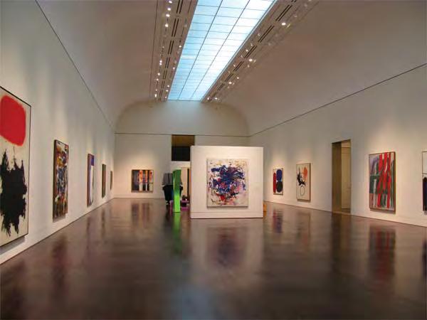
Red River Street can accommodate both dedicated bicycle lanes and drop-off/parking lanes on both sides.
such as upper stories, par cularly along Congress Avenue and East 6th Street;
• Using the exis ng City incen ves and regula ons to create and/or reimagine these under a crea ve community “brand”;
• Providing a density bonus to developers construc ng or retaining live music venues or cultural uses; and
• Allowing developers to exempt floor area of approved cultural uses, including live music venues, from the FAR calcula on in par cular districts or sub-districts of Downtown.
• The City should explore the feasibility of a “Cultural Mi ga on Fund” within the Waller Creek Tax Increment Financing (TIF) district, which would assess new development to create a fund to support cultural ac vi es and facili es in Downtown, as well as mi gate any nega ve effects of redevelopment on exis ng live music venues. Such an assessment may be jus fied given the significant public investment being made in the Tunnel Project, the poten al “windfall” that property owners will receive from this improvement and the economic and cultural benefits that accrue to the City from cultural uses and live music venues. The fee should be calibrated so that it is not a deterrent to redevelopment and investment in the area.
• Uses for this fund should priori ze the preserva on and crea on of “cer fied” live music venues within the Red River Live Music District (see AU-4.4 below), and other crea ve community uses and needs, including the crea on of rehearsal space, galleries, non-profit arts-related office space, ar st promo ons, etc. (Cer fied live music venues should be those that meet a set of minimum building and opera onal standards, e.g., sound-proofing, number of shows per
week, presence of sound engineer, etc. The City should work with acous cal and sound engineers to develop cost-effec ve building standards or code associated with live music and performance venues.)
AU-4.3: Support cultural district planning and marke ng of Downtown arts and cultural organiza ons, businesses and live music venues.
A “cultural district” is a well-recognized, branded, mixed-use area in which there is a high concentra on of cultural assets serving to anchor the district. In Texas, there is a State-designated cultural district program which promotes consistent branding and marke ng and sustained commitment to cultural district vitality.
• The City and its cultural partners should establish such districts in Downtown, where appropriate, and commit resources to their enhancement. Poten al exis ng cultural districts include Congress Avenue, Red River Street, East 6th Street and the Uptown Arts District.
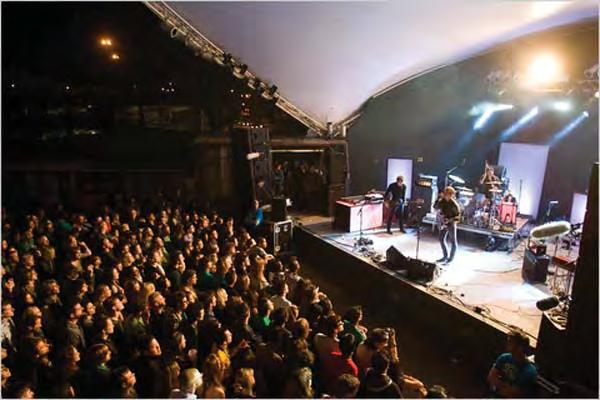
AU-4.4: Provide incen ves and programs for the protec on of Red River Street as an authen c live music district.
This na onally-acclaimed live music district is at risk of being displaced by the redevelopment resul ng from the Waller Creek Tunnel Project which will be completed in 2014.
• The City should designate the 600 to 900 blocks of Red River as Aus n’s premiere “live music district” and provide incen ves for the reten on, renova on and addi on of live music venues. Incen ves could include those currently being explored through the Waller Creek implementa on, such as the use of “Cultural Mi ga on Funds” and other grant funding. (See AU-4.2.)
• Ensure that drop-off and parking lanes are retained on both sides of Red River Street within the District, to provide for musician loading and parking.
• Consider expanding the Business Reten on and Enhancement Program (BRE) to support the reten on and crea on of live music venues along Red River Street.
AU-4.5: Build on the East 6th Street brand and improve it as a high-quality day me and night- me entertainment and visitor des na on.
While historic East 6th Street is touted to be Aus n’s premiere entertainment district, on weekends it can devolve into a disorderely and una rac ve street, with its over-concentra on of student-oriented bars and dance clubs spilling out onto the sidewalk. The lack of public order is off-pu ng to many, including the large visitor popula on generated by the nearby Conven on Center and hotels.
6ixth Street Aus n, the manager of the street’s public improvement district, has taken great strides to develop a vision for the street that would cater to a much
“6ixth Street Austin” is promoting a vision for the street that includes wider sidewalks, a mix of day and nighttime uses, cultural activities and public art.
broader demographic (including residents, workers, tourists and conven oneers) and that would include a mix of day and night- me uses, including cultural ac vi es, restaurants, retail, etc. To help bring about this vision, the City should:
• Implement the recommenda ons of the Responsible Hospitality Ins tute’s 2009 report on 6th Street: “Ac on Plan: Managing the Nigh me Economy”.39
• Enhance the retail recruitment efforts of the DAA as recommended in the “6th Street - Urban Entertainment and Retail Strategy” and “Congress Avenue - Retail Strategy” reports by ERA/Downtown Works (2007).
• Give the highest priority to streetscape improvements that can change the character of the street, handle pedestrian volumes with wider sidewalks, provide space for outdoor cafes and reduce the need for weekend street closures that impact businesses and encourage nega ve social behavior.
• Control the prolifera on of poorly-managed cocktail lounge uses by ins tu ng specific condi ons to their approval and con nued opera on (see AU-1.4).
• Work with Aus n Police Department (APD) and 6ixth Street Aus n to establish the design and management criteria necessary to allow the street to remain open to car traffic on typical weekend nights.
• Build on the live music brand of East 6th Street and reposi on it through a coordinated promo onal program through the Aus n Conven on and Visitors Bureau (ACVB) and 6ixth Street Aus n.
• The City should explore the feasibility of construc ng an “experience-based”

visitor center that could showcase the best of Aus n live music, arts and cuisine, as well as fulfill the exis ng func ons of ACVB’s “Grove Drugs” Visitor Center site. Such an exci ng new facility located near Waller Creek at IH 35 could provide a needed anchor and a rac on where the street loses energy due to lack of ac ve uses. This facility could also help to link the street to its segment immediately east of IH 35, where a new restaurant and entertainment district has recently emerged, as well as to the Red River Live Music District
AU-4.6: Allow restaurants in certain Downtown districts to have outdoor music venues with the same sound levels as cocktail lounges.
• The City’s noise ordinance allows outdoor amplified music up to 85 decibels for cocktail lounge uses within CBD-zoned areas, yet Downtown restaurants in the same zoning district are limited to 70 decibels, if they have an outdoor music venue. The City should allow CBD-zoned restaurants to fall under the same 85 decibel sound limit. Simultaneously, the City should ins tute requirements and/ or incen ves for soundproofing hotel and residen al units.
AU-4.7: Increase the capacity of City staff to act as an advocate for and ambassador to the crea ve community.
• Many crea ve community members have expressed the desire for the City to provide a single point of entry to facilitate and streamline the processes and permits required for the full range of cultural pursuits, from holding a public concert or event, to selling food and drink in a park, to performing in the parks or on the street (i.e., busking), to obtaining building permits and inspec ons. O en mes, the requirements of numerous City departments create unintended barriers for the crea ve community. A City staff member or members should be dedicated not only to assist the crea ve community in these processes, but act as liaisons to the crea ve community. This may require some staff focused on issues related to live music and other(s) on performing and visual and other arts, as some of the needs and interests of these groups vary considerably.
AU-5. OFFICE AND EMPLOYMENT USES: Downtown should maintain its role as the region’s premiere employment center.
It is important for Downtown to maintain its role as the premiere employment district of the region, since it is best served by public transit and exis ng infrastructure, and since a thriving downtown business environment is key to a city’s economic success. Today, Downtown accounts for only 20% of the overall regional office
Downtown should maintain its historic role as the region’s premiere office district (Scarborough Building at 6th and Congress).

Source: Global Insight, D.K. Shifflet & Associates
Downtown accounts for only 20% of Austin’s office share.
Source: Capitol Market Research, 2007
inventory. During the past decade, and par cularly in the last four years, millions of square feet of addi onal supply have been developed outside Downtown, with a much smaller propor on constructed in Downtown.40 Although Downtown has been out-performing other parts of the region in terms of rental return due to its growing vibrancy as a mixed-use urban district, it con nues to lose ground to other loca ons in the region.
AU-5.1: Provide incen ves for Downtown office and employment uses.
• As part of the Downtown Density Bonus Program, the City should incen vize office and employment uses in certain districts, by offering a 50% density bonus above exis ng zoning (baseline) maximums. In addi on to responding to economic development goals, this policy is based on the economic analysis undertaken as part of the Density Bonus Program that found that payment of a fee for addi onal office density cannot be consistently supported by increased economic return.41

AU-6. HOTEL AND VISITOR USES: Downtown’s posi on as the principal visitor des na on of the region should be maintained.
Tourism is a key economic anchor for Aus n, and Downtown is the epicenter of this industry. As a result the robust annual visita on and the thriving fes val and conven on market, Aus n’s hotel sector is the strongest in Texas, with the highest nightly rates and occupancy levels in the State. Conven on-goers and visitors to Aus n each year support more than 75,000 jobs, and they bring more than $200 million in revenues to local governments.
A er experiencing a large increase in supply mid-decade, Downtown has absorbed the addi onal rooms successfully and has been outperforming the rest of the region Travel and Tourism Spending: Austin 2006
during the current recession. Despite healthy occupancies and strong rates, no new hotels have opened in Downtown since 2006.42
AU-6.1: Provide incen ves for Downtown hotel uses. As part of the Downtown Density Bonus Program, the City should incen vize hotel uses by offering a 50% density bonus above exis ng baseline maximums. In addi on to responding to economic development goals, this policy is based on the economic analysis undertaken as part of the Density Bonus Program development that found that payment of a fee for addi onal hotel density does not consistently result in greater developer return.43
AU-6.2: Support the development of an addi onal “headquarter” hotel in close proximity to the Conven on Center.
The Aus n Conven on and Visitors Bureau reports that growth in the Conven on Center’s business is constrained by the maximum available block of 1,500 rooms, allocated across numerous proper es and brands. It projects that 38% of business lost to other locales is due to the lack of hotel rooms or facili es, and recommends another large headquarter hotel of 1,000 rooms to address this shortcoming. The City should provide economic development incen ves and other support to a ract a suitable flagship hotel.
A second flagship hotel is under construction to support increasing Convention Center demand.
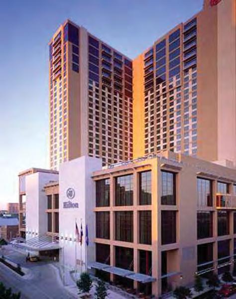
AU-7. PUBLIC SERVICES: Downtown should provide high-quality public and social services in a manner that complements other uses and the public realm.
Public services – parks and open spaces, cultural and educa onal facili es, and public safety and social services – are an essen al part of making Downtown a livable place that can con nue to support economic growth. (DAP policies for parks and open spaces are described in The Public Realm chapter below, and recommenda ons for the reten on and enhancement of Aus n’s crea ve culture are outlined above.) The following policies focus on educa onal facili es, police and fire facili es and social services that provide aid to popula ons in need.
AU-7.1: Enhance and expand the range of Downtown social services in a manner that is compa ble with other land uses and the public realm. Downtowns, with their typically higher level of transit accessibility and easy access to public services, have tradi onally been the natural loca on for social service providers and homeless shelters. However, the concentra on of such services immediately adjacent to the East 6th Street and Red River entertainment districts has created problems of crime and disinvestment. Some of the adverse impacts of
Housing for the chronically homeless should include support services and be designed to complement the surrounding area.
(Christ Church Cathedral Outreach Center)
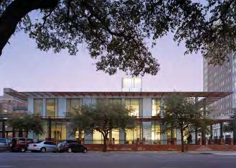
this over-concentra on are due to the lack of comprehensive facili es and services, par cularly, permanent suppor ve housing, where access to counseling and many programs are available in the same building as the housing units. This has resulted in camping, loitering, public disorder, outdoor toile ng, panhandling and some criminal behavior - the la er primarily from those who prey on the area’s homeless. Therefore, it is important that permanent housing for the chronically homeless include support services and that these facili es be located, designed and equipped to maximize effec veness and to complement other ac vi es in Downtown.
• The City should develop a comprehensive plan for social service delivery and housing to guide decisionmaking and investment in addressing homelessness.
• The City should make improvements within and around the Aus n Resource Center for the Homeless (ARCH) to be er provide for the comfort and needs of its clients. Provision of a sheltered and supervised courtyard area within the boundaries of the property should be considered to accommodate more dignified queuing and wai ng away from the public sidewalk area that is protected from the elements. Restrooms and adequate places for people to sit and rest should be provided within this area.
• The City should give the highest priority to the crea on of a state-of-theart, single-room occupancy (SRO), permanent suppor ve housing project Downtown. This facility should provide housing for the chronically-homeless, coupled with support and special needs assistance, including job and life skills training, alcohol and drug abuse treatment and other health services. (See AU2.3.)
Child care facilities will make Downtown a more familyfriendly place.
AU-7.2: Promote educa onal and child care facili es that make the Downtown more family-friendly.
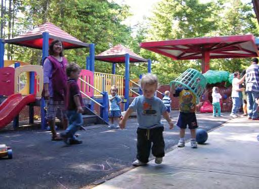
• The City should work proac vely with the Aus n Independent School District (AISD) and other ins tu ons to ensure that the short and long-term educa onal needs of Downtown residents are being met. Schools with special curricula in the areas of art, music, science and the performing arts should be encouraged and the poten al for Downtown partners and sponsors explored. Loca ng such facili es in close proximity to public open spaces should be given a high priority, both to serve the needs of schools and to provide ac vity and sponsorship of the parks.
• As proposed in the DAP Downtown Density Bonus Program, incen ves should be given to projects that incorporate child-care facili es within private residen al or commercial development.
AU-7.3: Improve fire and police facili es.
Appropriately-located and state-of-the-art fire and police emergency facili es are important to serve the growing resident, visitor and employee popula ons of Downtown. The exis ng Downtown police and fire facili es are well over 30 years old and should be upgraded and expanded over the next decade. As facility improvements are evaluated for both the Fire and Police, the City should give high priority to the reloca on and/or redevelopment of both facili es to create a more engaging public environment in their place.
• Fire Sta on #1, which occupies most of the western half of Brush Square, should be relocated to another downtown site that meets the response me needs of AFD and can also accommodate AFD Headquarters and other City departments. The Art Deco building constructed in 1939 should be repurposed as a visitor-oriented facility, such as a museum and provide an outdoor dining terrace overlooking the open space. A public process should be ini ated to determine how best to reuse the building, and a public-private partnership should be established to implement the re-use vision.
The Art Deco Fire Station in Brush Square should be re-purposed as a cafe or other public-oriented facility.

• In the short term, the City should work with AFD to reduce the footprint of the fenced parking lot in order to provide for a larger lawn area within the park.
• Opportuni es should be pursued for consolida ng the APD headquarters facility and its parking garage on a more compact footprint, either on its exis ng site along Waller Creek, or in another loca on within or near Downtown. The redevelopment of the APD site should consider opportuni es for enhanced open space along the eastern banks of Waller Creek, consistent with the Waller Creek District Master Plan.
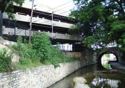
The Austin Police Department building and parking garages should be relocated from this prime creekside location.


Overall Goal: Ensure that Downtown can evolve into a compact and dense urban district, with new buildings contribu ng posi vely to sustainability, quality of life and the Downtown experience.
Downtown is an area of the City that benefits greatly from density. The close proximity of buildings and ac vi es to one another provides a unique vibrancy, crea ve energy and a dis nc ve sense of place. The concentra on of economic ac vity contributes to the fiscal viability and health of the City, and a compact and dense Downtown is a keystone of regional sustainability.
There is significant opportunity for addi onal infill development within Downtown on assembled sites greater than one-quarter block that are vacant or underu lized. Under exis ng en tlements, it is es mated that 37 million square feet of addi onal floor area could be created Downtown, if these sites were to redevelop. This represents an increase of over 240% from the exis ng 26 million square feet of floor area. This es mate of the poten al for Downtown growth is purely a “capacity” analysis (i.e., how many addi onal square feet of development could be accommodated) and is not an es mate of whether, when, or how much square footage the market will produce. Addi onal density could be achieved with the use of density bonuses.
As Downtown becomes more intense, however it is increasingly important for individual buildings to create a posi ve rela onship with one another, the fabric of historic buildings and with the public realm of streets and open spaces. This is cri cal not only to maintaining Downtown’s unique iden ty and its livability, but also to enhancing the value of individual proper es and in achieving the full growth poten al of Downtown. It is important that individual buildings contribute to a coherent, pleasing urban form, and that they be designed in a way that does not preclude adjacent proper es from developing to their full poten al.


DD-1. HEIGHT AND DENSITY: Dense development that respects the context of Downtown’s diverse districts should be encouraged.
Downtown is a part of the city that can support well-designed buildings of significant height and density. The City should con nue to encourage high-density development that contributes to the economic vibrancy of the region and that helps to achieve other Downtown objec ves related to diversity, affordability, quality of life, historic preserva on and sustainability.
DD-1.1: Maintain exis ng height and density limits as a baseline with some adjustments based on the surrounding context. Proper es in Downtown have Floor Area Ra o (FAR) limits ranging from 8:1 in the Central Business District (CBD) to less than 1:1 in the single-family neighborhood of Judges Hill. (“FAR” is amount of building square footage divided by amount of site square footage. It is the typical measure to describe building density). Height limits transi on upward from 35 feet in Judges Hill and the por ons of Northwest District to unlimited height on proper es designated with CBD zoning. These limits have helped to shape Downtown and have provided a level of certainty in terms of real estate value. The Downtown Aus n Plan calls for these limits to be substan ally maintained with the following proposed adjustments:
• The City should increase the baseline height and density on certain proper es where exis ng zoning is not consistent with surrounding development. For example, proper es with a Commercial Services (CS) zoning designa on aimed at promo ng auto-oriented, non-residen al uses with low height limits and densi es are no longer appropriate for a downtown environment and should be re-designated to DMU or CBD zoning that allows for higher density, mid and high-rise development. (The Proposed Downtown Zoning Changes map on p. 79 outlines proper es recommended for an increase in height and density.)
• Consistent with its goals for historic preserva on and the policies above, the City should decrease the allowable building height within the single, “core” block of the Warehouse District (i.e., proper es along West 4th Street between Lavaca and Guadalupe streets) to 45 feet, as a means of preserving this last ves ge of one and two-story warehouse buildings. In conjunc on with this reduced height limit, the City should establish a Transfer of Development Rights (TDR) system to allow Warehouse District property owners to sell unused floor area up to a maximum of 25:1 FAR to property owners in other parts of Downtown wishing to obtain addi onal density above the baseline. (See Policy HP-2.2.)
The Downtown Density Bonus Program44 report provides a more detailed descrip on of this policy recommenda on.


(Feet) * Capitol View Corridors (CVC) or special districts. * Consistent with 1989 Capitol Master Plan Public Parks/Open Space
Areas Exempted from Density Bonus Program (Height and density may not exceed underlying zoning.)
(FAR)
Boundary of the Waterfron Overlay District (WO) Density Bonus recommendations within the WO will be developed by the Waterfront Planning Advisory Board (WPAB)
DD-1.2: Finalize and adopt a Downtown Density Bonus Program that allows developers and the community to equitably share the benefits of addi onal height and density above the exis ng regula ons.
In 2008, the City Council directed the Downtown Aus n Plan to develop a transparent and understandable density bonus program to support growth in Downtown and promote clear community benefits. A dra Downtown Density Bonus program, based on extensive stakeholder input and economic analysis, was completed in July 2009.45 The program provides a menu of specific community benefits to which developers seeking addi onal density can contribute, including requirements for on-site affordable housing or payment of an in-lieu fee. The report provides a detailed descrip on of the proposed program. Since then, the recommenda ons have undergone addi onal review by a sub-commi ee of the Planning Commission and interested stakeholders, and refined by Council direc on provided in conjunc on with adop on of the DAP.
• The City should finalize and adopt the Downtown Density Bonus Program as an integral part of the DAP and proceed with the prepara on of the necessary code amendments that will update the interim ordinance that has been in place since January 2008. The following findings of the DAP study should be considered:
• The density bonus system should ensure that developers are incen vized to use it. “Charging” for addi onal density, whether through on-site benefits or as a fee-in-lieu, can be jus fied only where sufficient incremental value is created for a private developer to take on the addi onal risk of building a larger project. The public may feasibly exact a por on, but not all, of the incremental value created from bonus density. In order to incen vize use of a density bonus, private developers must be le with some measure of incremental value for choosing to build the addi onal density. The economic analysis that accompanied the DAP Density Bonus Report concluded that addi onal office and hotel density does not create sufficient incremental value to warrant a fee, and recommended that an affordable housing in-lieu fee apply only to residen al development, which consistently accrues addi onal economic value from addi onal height and density. In light of the economic events of the past several years, the economic analysis that formed the basis for the Density Bonus provisions regarding fee in lieu, community benefits, etc. should be re-calibrated prior to the adop on of a Density Bonus code amendment, so as to ensure that those provisions reflect current economic condi ons.
• The exis ng CURE re-zoning process has proven to be a convenient alterna ve to the exis ng interim Density Bonus Program; so convenient in fact that it has rendered the interim Program ineffec ve. No developer has u lized the “interim” Downtown density bonus program since its incep on in 2008. Rather than adhering to the prescribed program of density bonuses, developers seeking addi onal density have all gone through the discre onary CURE process with City Council. The Central Urban Redevelopment (CURE) ordinance allows rezonings of Downtown proper es
to increase en tlements as well as get relief from certain regula ons on a case-by-case basis. The proposed Downtown Density Bonus Program should be revised so that CURE is no longer available as a means of achieving addi onal height and/or density (FAR) Downtown. The Density Bonus Program should allow limited flexibility with regard to the types and amount (in excess of the ‘floor’) of community benefits provided by the applicant. A “floor” should be set with respect to the Downtown Density Bonus based on the value of 100% of the affordable housing fee-in-lieu as prescribed by the Program. If the applicant chooses not to proceed with the administra ve process by simply paying 100% of the fee-in-lieu as prescribed by the Density Bonus Program, or providing on-site affordable housing based on the Program’s parameters, or by providing some combina on of the other community benefits op ons in accordance with the Program, then the applicant is responsible for demonstra ng that the mone zed value of the offered community benefits is equal to or exceeds the value of the “floor.” Staff will administra vely evaluate the proposal to make sure that the offered community benefits meet or exceed the value of the “floor.” At least one half of the fee-in-lieu amount must be for affordable housing. The balance may be for other preferred community benefits. If the “floor” is met or exceeded per staff evalua on, the City Council will consider the density bonus proposal.
• The “Sustainability” component of Downtown Density Bonus Program should be modi fied to move 2-Star Aus n Energy Green Building (AEGB) ra ng from the list of Sustainability op ons to a “Gatekeeper” requirement. In other words, a 2-Star ra ng would be required for all projects that seek to par cipate in the Density Bonus Program. The Gatekeeper Requirements for the Density Bonus Program are:
• Complete design plans and perspec ves
• Great Streets
• Substan al compliance with Urban Design Guidelines
• 2-Star AEGB Ra ng
The bonus provisions for “Sustainability” should be:
• 20% bonus for a 3-star ra ng
• 25% bonus for a 4-star ra ng
• 30% bonuses for 5-star ra ng
As the Density Bonus code amendments are developed, these recommended ra ngs and percentages will con nue to be evaluated in light of work flowing from the updated Comprehensive Plan, and the City of Aus n’s evolving sustainability goals, standards and ini a ves.
• The “Family-Friendly Housing” component of the proposed Downtown Density Bonus Program should be modified so that the 150 square feet of bonus space awarded for each bedroom over two bedrooms in a unit shall be granted only when that unit conforms with the affordability requirements as set forth on page 24 of the ‘Downtown Density Bonus Program’ report (Appendix H to the DAP).
• The ‘Publicly Accessible Open Space’ component of the Downtown Density Bonus Program should be modified so that a par cipant in the Program can achieve bonus square footage either by providing on-site open space that is publicly accessible and that meets well-defined criteria or by paying a fee-in-lieu that could be used to improve Downtown parkland. The fees-in-lieu
should go into a trust fund similar to the Housing Trust Fund. This trust fund should supplement, not supplant, the Parks and Recrea on Department budget. Improvements made using money from this trust fund should be limited to the Downtown area and should be spent within two to three years of receipt. Money from this trust fund should be available both for capital improvements and opera ons and maintenance purposes. The amount of the open space fee-in-lieu should be determined during the process of calibra ng the overall community benefits of the Density Bonus Program.
• In developing the code amendments that put in place the proposed Downtown Density Bonus Program, City staff should modify the structure of the Program so that residen al and non-residen al projects must follow the same ‘pathway’ to achieve addi onal square footage. Ini ally, nonresiden al projects that comply with the Gatekeeper Requirements shall be en tled to a 50% increase in their “base” density (e.g., an increase from an FAR of 8:1 of 12:1) by paying an affordable housing fee-in-lieu that shall be set at $0/square foot of bonused area. Non-residen al projects seeking square footage beyond 50% of the base density (e.g., from base FAR of 8:1 to an FAR of 16:1), shall be required to par cipate in the Density Bonus Program on an equal foo ng as residen al projects for the por on of the requested addi onal square footage beyond 50% of base FAR. The re-calibra on to be conducted by staff (concurrent with developing the code amendments) shall include an evalua on of whether non-residen al projects that seek addi onal density can support an increased level of fee for any addi onal square footage.
• Where density bonuses are permi ed on proper es zoned H-Historic, development using a density bonus shall maintain the architectural integrity of the historic landmark, as determined by the Historic Landmark Commission. Density bonuses shall not be permi ed for projects that would substan ally modify the exterior of the historic structure visible to public view, excluding historic reconstruc on rehabilita on façade restora on.
• The ‘Historic Preserva on” component of the proposed Downtown Density Bonus Program shall allow for contribu ons towards on-site or off-site historic preserva on exceeding applicable legal requirements.
• The Density Bonus Program should be recalibrated at five-year intervals. A mechanism for calibra on and recalibra on of the bonuses needs to be established to ensure that the fees and community benefits associated with the Program maintain an appropriate balance over me. In each case, the City should use a combina on of pro forma financial analysis and outreach to stakeholders to determine whether a bonus produces incremental value for a developer/property owner, such that the bonused area is likely to be constructed, and whether a bonus produces sufficient incremental value to jus fy charging a proposed fee.
• The Waterfront Planning Advisory Board has been charged with developing recommended density bonus provisions for the por ons of the Waterfront Overlay District within Downtown. Those provisions should be incorporated into the proposed Downtown Density Bonus Program upon adop on.
DD-1.3: Employ addi onal density incen ves to achieve specific community objec ves.
The City should allow for addi onal density, outside of the Density Bonus Program, to encourage specific uses or treatments. For example:
• The Northwest District Plan proposes to incen vize infill housing development by permi ng an increase in density for residen al uses within the DMU-40 and DMU-60 zoning districts, subject to form-based design standards that promote a compa ble rela onship with the surrounding context.
• The Core/Waterfront District Plan proposes that ground-level retail and restaurant floor area along Pedestrian Ac vity streets (i.e., Congress Avenue, East 6th Street and 2nd Street) be exempted from the Floor Area Ra o calcula on.
• The Waller Creek District Master Plan recommends that on-site low-income housing units at or below 50% of Median Family Income (MFI) on the Housing Authority-owned Lakeside Apartments site should not be counted toward the floor area of any future redevelopment on that property.
DD-1.4: Establish specific scale-compa bility standards that are tailored to the downtown context.
Current compa bility standards of the Land Development Code are applied city-wide to proper es adjacent to or near single-family zoned and/or used proper es. A graduated height limit radiates out horizontally from such proper es up to 540 feet, regula ng height, building and parking setbacks and screening. This generic, citywide approach to ensuring compa bility is not appropriate in a downtown se ng, and it also produces results counter to many aspects of the vision of a dense, mixeduse downtown.
• The Land Development Code’s generic Compa bility Standards should not apply in Downtown; instead, the City should adopt more specific standards to protect adjacent neighborhoods and to promote compa bility of building scale and massing. Five compa bility zones are proposed, each with specific height standards aimed at providing an appropriate scale transi on to the Judges Hill and Old West Aus n Neighborhoods. These are illustrated on the on Page 109 (Proposed Downtown Compa bility Zones and Standards).


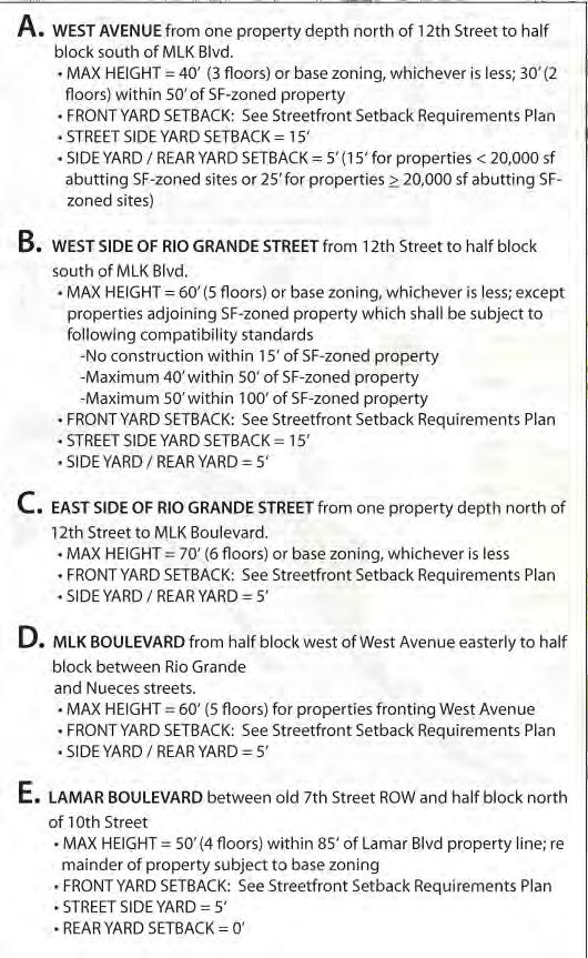
Downtown buildings have a variety of street front conditions ranging from the shaded yards of the Northwest District to the storefronts and cafes of the Core/Waterfront.
DD-2. STREET FRONT RELATIONSHIPS: Downtown buildings should create engaging and pedestrian-oriented stree ronts.
A building’s rela onship to the street is the most significant factor in shaping the pedestrian experience of the city. Buildings should help to ac vate and define the character of the street edge. In some parts of Downtown, this could be storefronts and cafes built right up to the property line; in others, it may be more appropriate for buildings to be set back from the sidewalk with frontyard landscaping that provides addi onal greenery and shade.
The exis ng Land Development Code does not provide specific standards for the treatment of street frontages. The city-wide “Commercial Design Standards” (Subchapter E of the Land Development Code) provide some general guidance, but are not specifically targeted to Downtown condi ons. The following policies are intended to remedy this situa on, describing how buildings should relate to streets within Downtown.
DD-2.1: Require setbacks and build-to lines that are appropriate to the form and character of the street.
The Land Development Code currently legislates building setbacks according to a property’s zoning designa on. For example, a property with a zoning designa on of CBD or DMU requires no building setback from its stree ront property line, whereas a General Office (GO) designa on requires a 15-foot setback. This produces incongrui es in the street character when one street has mul ple zoning designa ons. The DAP proposes that setbacks be established by street, so that the character of that street can be consistent, regardless of the zoning designa on or building type along it. (See map on opposite page.)
• At least 75% of a building should be built to the setback line so that the spa al defini on and character of the street can be enhanced.
DD-2.2: Allow addi onal setbacks if these provide publicly-accessible open space. Buildings that provide plazas, gardens, courtyards, paseos or other types of publiclyaccessible open space should be allowed addi onal setbacks, provided that they meet the design criteria described in Policy PR-2.1.
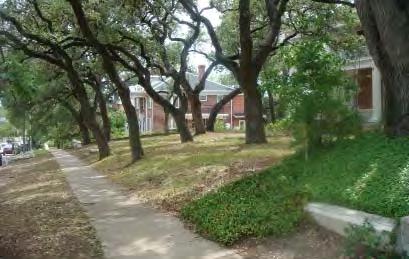


Streetfront Setback Requirements Map

Publicly-accessible open spaces (e.g., plazas and gardens) that extend the experience of the street and should be encouraged.

DD-2.3: Limit curb cuts, drop-offs and porte-cocheres that interrupt the con nuity of the pedestrian path and experience. The following criteria should be established for the loca on and treatment of driveways or curb cuts that interrupt the con nuity of sidewalks and that can undermine a successful pedestrian experience:
• Driveways, porte-cocheres and curb cuts should generally be prohibited on Pedestrian Ac vity Streets where pedestrian con nuity and ac ve street frontage is cri cal. (See Pedestrian Ac vity and Mixed Use Streets map on p. 81.)
• In the Core/Waterfront District, off-street drop-offs and porte-cocheres should be allowed only for hotel developments on Downtown Mixed Use Streets (see map page 81) and only where curbside drop-off areas are not prac cal or feasible. In no event should a drop-off or porte-cochere interfere with the provision of a generous and con nuous pedestrian path.
• The number of driveway curb cuts along a block should be limited to a maximum of two, with driveways spaced apart from one another and from street intersec ons.
• The width of a driveway should be no greater than 25 feet.
DD-2.4: Establish standards for the treatment of commercial building fronts. Consistent with the approach of Subchapter E of the Land Development Code, the DAP proposes the following, more specific direc on for commercial street frontages:
• Storefront glazing should be provided on at least 40% of the wall area of the ground level between two and 10 feet above grade on all “Mixed Use Streets”, and 60% of the wall area along “Pedestrian Ac vity Streets”.
• All glazing on ground-floor, street or public open space-facing facades should have a Visible Transmi ance Ra ng of 0.6 or higher. (This is a measure of transparency of glass.)


• Shelter and shading devices (e.g., awnings, canopies) should be provided on at least 75% of the frontage along a Pedestrian Ac vity Street and 50% of the frontage on a Mixed Use Street, projec ng no more than eight feet into the public right-of-way, so as not to conflict with tree canopies.
• Arcades or colonnades that set the ground-level wall back from the property line should be allowed, subject to approval by the responsible City director, under the following condi ons:
• The arcade or colonnade is part of an exis ng or planned, block-long system of covered walkways;
• The structure provides clear ver cal openings to the street, no less than 14 feet in height; and
• Between the ground and 14 feet above the ground, the solid por ons of the structure may represent no more than 10% of the building facade facing the street.
• Public building entries should be oriented to the street, and (with the excep on of the Warehouse District blocks) should be generally flush with the eleva on of the sidewalk and with the ground-level finished floor. No ramps or stairs are permi ed to project within the public right-of-way or front setback area.
DD-2.5: Establish standards for the treatment of new residen al building fronts.
• Where ground-level residen al uses are permi ed as a pedestrian-oriented use (e.g., on streets designated as Downtown Mixed Use Streets), all living spaces (not including ground-level common areas or lobbies) should be separated from public sidewalks or trails by a building setback of at least five feet, or the required street front setback, whichever is greater.
• Ground-level living space should also be at least 18 inches above the grade of the sidewalk, but no more than 60 inches, to promote residen al privacy and livability.
Projecting canopies along commercial frontages in Austin (left) and porches/ stoops on residential frontages in Portland.
DD-3. BUILDING DESIGN: Form-based development standards should guide the scale and treatment of most building types in Downtown.
Individual buildings help to define the spa al experience of Downtown, so it is important that they be designed to contribute to a harmonious urban form – one that is enjoyable for people to move through and gather within.
As Downtown con nues to mature and as larger half and full-block sites become more and more scarce, it is cri cal that buildings be designed in a way that does not undermine the value of adjacent sites or preclude them from developing to their full poten al. It is also important that development regula ons allow for smaller sites to be developed efficiently.
Building design standards should provide property owners and developers with a clear and predictable path for approval. At the same me, they should be designed to allow for flexibility and crea vity, with a method of alterna ve compliance established for those who may wish to propose other architectural means to achieve the intent of the form-based regula ons. Appendix I provides a dra of the form-based development standards that could be considered for a range of Downtown building types. As part of the ordinance amendment process that will follow adop on of the DAP, further outreach should be conducted with stakeholders and addi onal tes ng undertaken to apply the standards to a greater variety of Downtown sites and condi ons. The following policies provide some general direc on on the types of regula ons that should be considered in the finaliza on of the form-based standards:
Step building down in height when adjacent to a designated historic landmark property.
Provide building stepback above 40’.
Side/rear setback as per zoning
Provide building stepback above 40’.

Front yard setback as per Downtown street frontage requirements (10’ - 25’)
Proposed Form-Based Standards for Neighborhood Infill Buildings
Side/Rear setback as per zoning
- Primary entries oriented to street
- Porches and stoops may encroach into front yard setback.
- Ground level habitable space should be no greater than 60” above adjacent sidewalk level.
Provide plane breaks at intervals of approximately 50’.
DD-3.1: Promote a compa ble rela onship between new and historic buildings. Specific provisions should be made to ensure a compa ble rela onship between new development and historic buildings with a landmark designa on.
• New buildings built adjacent to a landmarked building should provide a transi on in scale through the use of stepbacks.
• New development that is constructed on a landmarked property should be required to preserve the historic building façade and to set back any new addi ons from the exis ng parapet to clearly dis nguish new construc on from the original building. (See Policies HP-2.3 and HP-2.4.)
• Guidelines like those for the East 6th Street Na onal Register Historic District should be developed for proper es within the Congress Avenue and the Warehouse District areas.
A portion of the tower should be permitted along a street front property line.
Set tower back from alley to provide appropriate separation. *
Set tower back above streetwall for a portion of the parcel frontage. *

Streetwall = 90’ maximum/25’ minimum should be built within 5’ of the property line for at least 75% of parcel frontage
Limit the maximum tower floor plat above 120’ height to a percentage o site area and/or to a percentage of the block face. *
Set towers back from interior property lines to create appropriate separatio n
Create a streetwall transit in scale between new construction and buildin g deemed significant by th e City of Austin Cultural Resource Survey.
Ground level pedestrian-oriented uses as per District Plans
* Proper es substan ally impacted by Capitol View Corridors (CVCs) should be given special considera on and relief from stepback regula ons.

A significant portion of a street wall should be built to the setback line to create spatial definition along a street.
Towers should be spaced apart to protect the development potential of adjacent sites.
DD-3.2: Create buildings that provide spa al defini on of streets.
A building’s front facade along the street is known as the “street wall”, which defines the space of the public realm (up to a height of 90 feet), crea ng a sense of interest and enclosure. It is important that the street wall of adjacent buildings be coordinated with one another, so that a consistent street, block or neighborhood form may be created. A significant por on of a street wall should be built to the setback line to create spa al defini on along a street, and some level of ar cula on through plane and material changes should be provided to create interest, varia on and human scale.
• Provision for bay windows and other minor encroachments that provide interest and varia on on a street wall should be encouraged. However, significant areas of habitable space or parking should not be permi ed to encroach into the setback area or into the public right-of-way.
• Sky-bridges that cross public rights-of way and interrupt the visual and spa al integrity of the street should not be premi ed. Sky-bridges are appropriate only across public alleys or within private proper es.
DD-3.3: Step towers back from streets.
Towers (i.e., any por on of a building greater than 90 feet in height) should “interlock” with the street wall to allow for both a horizontal and ver cal building expression. To this end, a por on of the tower perimeter should be stepped back to allow for expression of the street wall; the remaining por on could be built to the property line to allow for the ver cal expression of the tower. Special relief from these standards should be given to proper es that have Capitol View Corridor (CVC) height limits of less than 200 feet or are within the Capitol Dominance Zone, through the proposed alterna ve compliance process.
DD-3.4: Provide space between towers.

• Towers should be stepped back from alleys and interior property lines, so that the livability and development poten al of adjacent sites is not compromised.
DD-3.5: Encourage tall and slender towers.
• Tall slender towers should be encouraged in Downtown to allow light to the street, and to create an appealing skyline. Standards that limit the bulk of a building to a percentage of the site area and/or to a maximum floorplate size should be considered, such as:
• The length of a tower along a blockface should be limited to allow for some light penetra on to the street and to avoid a “canyon-like” effect.
• Proper es substan ally impacted by CVCs, where the height limit is less than 200 feet, should be given special considera on and relief from the provisions of DD-3.5.
DD-3.6: Prohibit highly-reflec ve glass cladding on buildings.
• Expanses of highly reflec ve glass on Downtown buildings can create a glaring and unfriendly environment. During the code amendmentwri ng process, the City should establish a standard maximum level of reflec vity that is acceptable.
DD-3.7: Integrate parking garages into the architecture of a building.
• Parking garages should be architecturally-integrated or encapsulated within and beneath buildings, so that they are not a dominant part of the building expression. Views of cars and garage ligh ng should be screened with architectural treatments that are an integral part of the overall building vocabulary.

DD-3.8: Establish an acceptable level of green building consistent with overall city goals to be established in the updated Comprehensive Plan, and consistent with City of Aus n’s evolving goals, standards and ini a ves.
Currently buildings with CBD and DMU zoning designa ons are required by code to achieve a 1-star Aus n Energy Green Building (AEGB) ra ng. Many feel that this standard does not achieve an appropriate level of green building reflec ve of the community’s commitment to sustainability and climate protec on.
• The City should develop Downtown standards for green building, based on the goals and policies established city-wide by the Comprehensive Plan, to ensure that Downtown plays an appropriate and equitable role in mee ng local and regional sustainability targets
• The City should evaluate other accepted green building ra ng tools in addi on to AEGB. One such ra ng tool is the Leadership in Energy and Environmental Design (LEED) ra ng system, which has become a na onally recognized benchmark. Some developers, especially those with a presence outside of Aus n, may desire the op on to use such tools. Further analysis is needed to develop specific recommenda ons, including determining an appropriate process and level of cer fica on that would provide equivalency to AEGB ra ngs. If LEED, or another ra ng tool, is included as an op on, processes should be put in place that will ensure an equivalent level of verifica on and repor ng.
• The City should also allow developers to employ the Leadership in Energy and Environmental Design (LEED) ra ng system as an alterna ve to the AEGB, since this ra ng system has become a na onally-recognized standard.
and
Green roofs can provide usable open space, reduce heat gain and filter urban run-off.
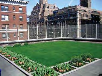
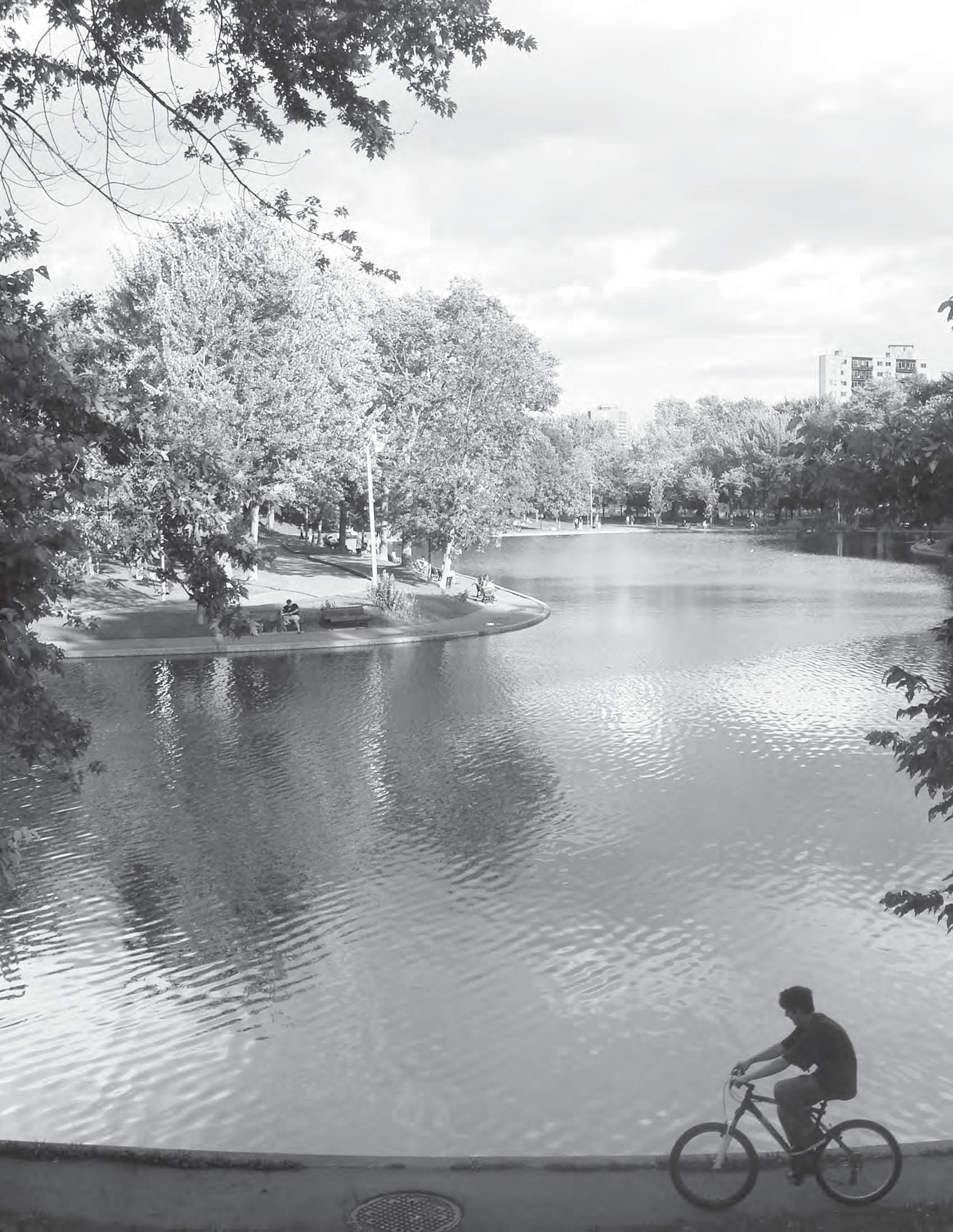
Overall Goal: Interconnect and enhance Downtown’s network of public parks, open spaces and streets.
Typical of many urban districts, approximately 50% of the land area of Downtown Aus n (494 acres) is made up of parks, open spaces and streets. The quality and interconnec vity of these public spaces defines to a great extent our day-to-day urban experience and the overall livability and iden ty of Downtown.
Parks and open space comprise a significant por on (118 acres) of this public realm. With few excep ons, Downtown parks are in poor condi on and, due to limited funding, poorly-maintained - with aging furnishings and few programmed ac vi es that make them invi ng places to gather. The few privately-owned open spaces (e.g., plazas, pocket parks, etc.) do not consistently contribute to Downtown place-making, and instead have become areas that lack ac vity and a sense of stewardship. And streets, which make up the most significant propor on of the public realm, are s ll dominated by automobiles, o en with narrow sidewalks which can be discon nuous and/or inaccessible.
If Downtown is to con nue to a ract new residents, businesses and visitors, excellent parks, open spaces and streetscapes will be essen al to its success. Over the past 10 years, growth and investment in Downtown has been directly ed to the City’s investment and commitment to the public realm, evidenced by the intensity of new development along Lady Bird Lake and Second Street, both of which have been developed and maintained as signature public spaces.
The City’s Great Streets Program, established in 2000, has set standards aimed at redefining the role of streets from single-purpose conduits of vehicular traffic to treelined corridors that support pedestrian life, connect ac vity centers and enhance bicycle and transit circula on. However, the implementa on of the program has been incremental, leaving many Downtown streets unchanged.
The DAP Downtown Parks and Open Space Master Plan47 ar culates a community vision for Downtown parks and open spaces and provides a guide for public and private investment and management. This vision is dependent on increased capital investment and an adequate funding source for ongoing maintenance.48
Public art - both permanent and temporary - plays an important role in the public realm. It may be expressed in the form of gateways to special districts and streets, as way-finding elements and signage, as streetscape ameni es such as fountains, bike racks, transit shelters, and even as more u litarian objects, such as manhole covers and tree grates. Public art can have a major role in place-making, helping to strengthen a community’s iden ty, offering a moment of beauty and refuge or one of excitement and provoca on.49
The following policies are aimed at achieving the community’s vision of an interconnected and engaging public realm that is suppor ve of economic development and that contributes to an inclusive, sustainable and beau ful Downtown.
PR-1. PUBLIC PARKS: Downtown parks should be improved and maintained as signature spaces that serve residents, employees and visitors.
A high-quality downtown parks system – combining large signature des na ons, smaller spaces serving workers and residents and neighborhood parks – can promote economic growth for Downtown and reinforce Aus n as a vibrant, mixeduse community. Recent transforma ve park projects across the country have relied on major capital investments, design excellence, and a commitment to high standards of opera ons, maintenance and park programming. Successful downtown projects have ranged from newly-formed transforma ve parks including Millennium Park in Chicago and Discovery Green in Houston, to the renova on and revitaliza on of exis ng parks like Bryant Park in New York City and Patriots Square Park in Phoenix. Today these parks serve a range of users, whose presence bring ac vity, investment and spending to the surrounding Downtown. Downtown parks should serve a range of users, creating a sense of community and offering a connection to nature.

As organizers and catalysts of revitaliza on, signature parks can contribute directly to the community’s vision and goals for Downtown: they can enhance livability in ways that are respec ul of a city’s history and culture, and secure Downtown’s economic and compe ve posi on at the center of the region. By priori zing parks and open spaces within the Downtown Plan, the community has acknowledged that the public realm is and will be both an important amenity for businesses and residents, and a highly visible aspect of the city’s iden ty.
The City’s Parks and Recrea on Department (PARD) maintains and operates 11 Downtown parks totaling about 82 acres. These include linear parks or greenways (Lady Bird Lake, Shoal Creek and Waller Creek), adjoining parkland (Waterloo, Palm and Duncan parks), and the three urban squares remaining from Edwin Waller’s original Town Plan (Republic, Wooldridge and Brush Squares). Aus n spends about $7,000 per acre on opera ons and maintenance of Downtown parks, which is average for ci es of comparable size, but less than ci es that are known for outstanding parks. A be er target for the public cost of opera ng and maintaining excellent downtown parks would be $10,000-$25,000 per acre per year, based on best prac ces from other parks systems such as Chicago, San Francisco, Sea le, Minneapolis and Tucson.
The Downtown Parks and Open Space Master Plan50 builds on PARD’s Long Range Plan, describing a vision for each City-controlled park appropriate to its specific loca on and func on within the open space system. The Master Plan also establishes an implementa on strategy with priori es and budgets and recommends a governance, funding and management program. The following policies provide a summary of these recommenda ons:

Discovery Green in Houston is a place for both grand events and children’s play.

1. Meaning and Significance: Build on the posi ve exis ng pa erns of use within and around the open space, and celebrate the dis nct history, culture, and iden ty of the place.
2. A rac ons and Des na ons: Create mul ple ac vi es and features that can a ract a diversity of people, and establish a cons tuency of stewards.
3. Flexibility and Adaptability: Allow the space to respond to daily, weekly, and seasonal fluctua ons over me.
4. Posi ve Edges/”Frame”: Promote a form and pa ern of development at the edges of the public space that provide posi ve ac vity and spa al defini on.
5. Connec ons: Design streets and pathways as an extension of the public space itself.
6. Design Excellence: Procure the highest levels of design professionalism capable of crea ng successful, world-class public spaces.
7. Public Art and Ar ul Design: Introduce public art that raises community consciousness and reinforces an authen c sense of place.
8. Green Design: Promote the highest levels of sustainable design and green construc on.
9. Strong Management: Establish appropriate governance that can facilitate successful programming, maintenance, and security.
10. Sustainable Financing: Secure adequate levels of funding to assure ongoing high quality maintenance and opera ons.

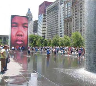
PR-1.1: Provide adequate funding for the maintenance and opera on of all Citycontrolled Downtown parks.
If the nega ve image of Downtown parks is to be reversed, and if Aus n is to make a palpable change in the way open spaces look, are perceived and used, addi onal funding must be allocated to their upkeep. In addi on to the physical benefits it will provide, this is cri cal for a rac ng a cons tuency of stewards that will jus fy and a ract further investment.
• The City should provide an annual PARD Downtown parks opera ons and maintenance (O&M) budget in the order of $950,000 (~$23,000/acre), which would be sufficient to make long-needed repairs and operate the parks at the desired PARD “Level 1” maintenance.
PR-1.2: Program and design parks to serve the diverse needs of Downtown residents, families, workers and visitors.
Although Aus n’s downtown parks support a range of recrea onal and passive ac vi es, they do not promote the kind of ac vi es consistent with Downtown’s evolving role as a dense mixed-use district, with a concentrated popula on of residents, office workers and visitors. Lady Bird Lake provides excellent opportuni es for jogging, walking and recrea onal biking, but there are few good places in Downtown to sit and watch people or to enjoy a brown-bag lunch. (UT’s Regents Plaza at 6th and Colorado Streets is a notable excep on in this regard.)
In spite of a growing resident popula on, there is virtually no family-oriented park space or playground within walking distance of the numerous condominiums and apartments that have been developed in Downtown. Although there are several parks which accommodate large programmed events (e.g., Waterloo Park), there are few great spaces that are suited to spontaneous gatherings or celebra ons. The recent retrofit of Republic Square has provided an ideal space for performances, markets and civic fes vi es, but the other historic squares are not well-suited for such events: Brush Square is largely covered with buildings and a fenced surface parking lot, and Wooldridge Square has steep topography and inaccessible pathways.
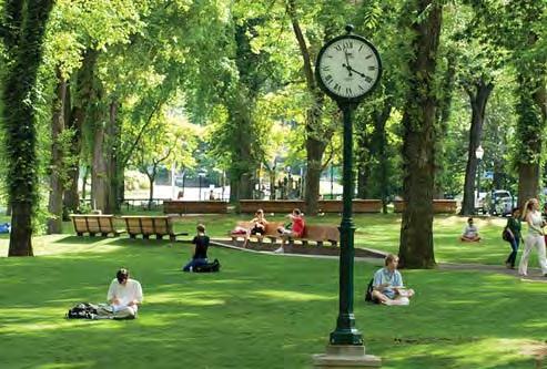
Downtown parks should be part of an interconnected and engaging public realm, serving residents, families, workers and visitors.

The Waller Creek District Master Plan calls for environmental restoration, trail improvements and adjacent redevelopment.
Many Downtown parks have been treated as “excess real estate”, expedient places for displaced historic buildings or areas to dispense meals to those in need. As a result, many parks have no regular users that can be their “stewards” or advocates, and there is no pa ern of daily ac vity that has emerged. Many parks have been taken over by the homeless popula on, who tend to occupy spaces that are unused or uncared for.
• The DAP Downtown Parks and Open Space Master Plan makes recommenda ons regarding the range of recurring ac vi es that should be supported within each Downtown park, and the kinds of spaces, features and facili es that would be desirable. The vision for each park and its key goals are summarized on p. 127. The City and their parks partners should build on this work to develop specific master plans and programs for Downtown parks that meet the diverse needs of residents, workers, families and visitors.
• The City should also develop a Furnishings Master Plan for Downtown parks to establish a consistent standard and iden ty and to guide short-term improvements.51
PR-1.3: Improve Downtown’s urban greenways and adjoining public parks, as natural refuges and pathways.

Lady Bird Lake, Waller and Shoal Creeks and the adjoining open spaces of Palm, Waterloo and Duncan Parks provide an approximate four-mile long system of greenways, trails and parks that lace through the Downtown, connec ng surrounding neighborhoods, UT and other key ac vity centers with the core. These open spaces offer a unique retreat from urban life and a natural resource in the heart of the city. While Lady Bird Lake has benefited from City investment, volunteerism, and stewardship by The Trail Founda on (TTF) and the Aus n Parks Founda on (APF), the full poten al of both Waller Creek and Shoal Creek greenways remains unfulfilled.
• The City should finalize and implement the creek and trail improvements proposed in the Waller Creek District Master Plan52, including the environmental restora on of the stream channel, the public trail system and the parkland improvements. Improvements for Palm Park and Waterloo Park should be developed in concert with the detailed design of the Waller Creek Greenway, as these two parks are both open space extensions of the creek corridor and should be seamlessly integrated with it.
• The City should establish and implement a long-term vision for the Shoal Creek Greenway, in conjunc on with a program of flood-control improvements and a high-quality trail system. A Master Plan should be developed that builds on previous plans and incorporates improvements for Duncan Park and House Park as integral extensions of the creek corridor.
PR-1.4: Improve the historic squares of the original City Plan.
Edwin Waller’s inten on for the four squares of the original City Plan was to provide a balanced system of open space for community gathering and enjoyment, and to create focal points for civic life - a func on which is again strongly desired and needed. Recent improvements to Republic Square, the site of the weekly farmers market and frequent civic events, have made significant strides in fulfilling this original intent.
• Brush Square should be improved as a cultural, visitor-oriented park, consistent with its loca on adjacent to the Conven on Center and with the three already established museums on the site.) It should also provide a landscaped refuge from city life for the daily use of nearby residents and employees. The City should work with the Aus n Fire Department (AFD) to find a new loca on for its downtown facility, so that the full poten al of the open space can be realized.


2
BIRD LAKE GREENWAY
CREEK GREENWAY
CREEK GREENWAY
HOUSE PARK/AUSTIN RECREATION CENTER (ARC)
OLD BAKERY BUILDING & PARK DUNCAN PARK
The renovation of Republic Square has provided a venue for performances, markets, and small civic festivities.
• Wooldridge Square should be carefully designed to preserve its historic character as a civic space, while improving drainage, accessibility and the ability to support programmed events as well as informal gatherings. The exis ng topography, tree canopy and bandstand structure should be maintained as key features of the park. In the near-term, efforts should be made to establish a stronger pa ern of daily use with ac vi es that serve the significant employee popula on in the area. Mobile food carts, semi-permanent kiosks, curbside food vans, and moveable chairs and tables are recommended in the northwest corner of the square where there is rela vely flat terrain.
• The fourth square in Edwin Waller’s 1839 City Plan was located in the northeast quadrant (between 9th and 10th, and Trinity and Neches streets) but was never developed as an open space. It was the site of the original Aus n High School and was sold in the 1960s to the First Bap st Church, whose main sanctuary occupies the site. The Parks and Open Space Master Plan iden fies the need for addi onal open space in this northeast quadrant of the Downtown to provide for a more even distribu on of public open space. In the long-term, it would be ideal to reclaim this historic block to realize the 1839 Waller Plan, but the church has expressed no interest in selling their property or in reloca ng.
As redevelopment of State and Federal proper es in this area proceeds, the City should pursue opportuni es for land swaps with the Church in an effort to reclaim the fourth Downtown square. Failing this, or in advance of it, other open space opportuni es should be pursued in the Northeast quadrant of the Downtown, for example on land that may be surplussed by the federal government. In the interim, the City should partner with the General Services Administra on to improve the exis ng plaza within the Federal Building Complex so it can be er accommodate both daily use as well as special events.

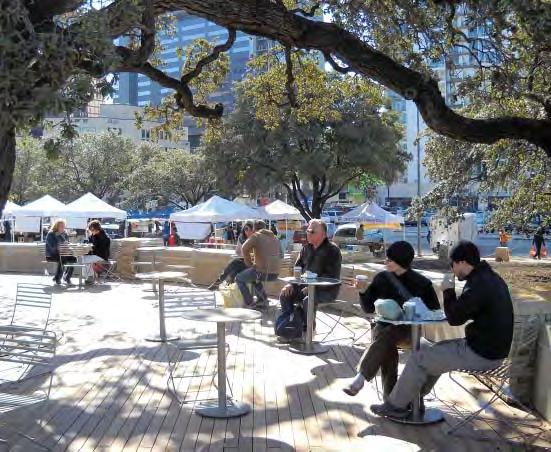
PR-1.5: Improve the PARD-owned Old Bakery and Emporium and surrounding parkland on Congress Avenue.
• The City should enhance this small open space, located on the 1000 block of Congress Avenue, to provide a link between the Capitol Complex and Downtown. Considera on should be given to the introduc on of a commercial café concession in the Old Bakery building, with extended and weekend hours to ac vate this key blockface and to complement the current senior arts and cra retail venue.
• The City should coordinate with the State, which owns adjacent underu lized parkland, to create a vibrant visitor des na on that links the Capitol Complex to Downtown along “the main street of Texas”.
PR-1.6: Pursue public/private funding sources and management structures for improving and maintaining Downtown parks.
To create and maintain high quality parks, substan al one- me capital funding and ongoing opera ons and maintenance funding is required. Public sources o en account for the majority of a park system’s capital funding. The City, through PARD, should con nue to provide governance and overall policy direc on for downtown parks.

The PARD-owned Old Bakery should become a vital part of the Congress Avenue experience.
• On-site earned income, such as concession and event revenues and corporate and private sponsorships, can become more substan al funding streams a er parks become known as great places, with high-quality design and ameni es. To facilitate the growth and capture of new funding, PARD should be enabled and encouraged to pursue longer and more robust concession agreements, as well as philanthropic and corporate and private sponsorships, including naming rights of park assets. The City should also enable PARD to keep all concession and sponsorship revenue for use in maintaining and improving the downtown parks system.
PR-1.7: Special en es, such as non-profit conservancies, should be encouraged to assist with park improvements, opera ons, management and maintenance. Because downtown parks require an even higher level of investment and management oversight than the rest of the park system, they rarely depend on public funding alone. Many municipal parks agencies – including Aus n’s PARD today – work with special purpose en es to produce supplemental funding and management capacity. En es such as development corpora ons, Business Improvement Districts (BIDs) and conservancies each have access to financial
There is a wide spectrum of public and private sector funding sources for parks and open spaces.
resources that are not as readily available to municipal parks departments, and these en es can execute capital projects and manage and program open spaces in ways that complement the resources of government agencies.
• PARD should partner with one or more special purpose en es to execute park revitaliza ons, and poten ally also to manage and/or program downtown parks. The nature of this en ty (e.g., public-private development corpora on, private BID organiza on, or non-profit conservancy or friends group) and its role and rela onship to PARD should be further determined in reference to priority projects and the range of available funding sources.
PR-1.8: Allocate addi onal sources of public funding to Downtown parks.
• The City should evaluate a range of exis ng funding sources for Downtown parks, including a General Fund increase, a set-aside for Downtown parks, adjustments to event and concession policies that allow revenues to be retained for use in Downtown parks and increased solicita on of corporate and private sponsorships and dona ons. In addi on, the City should evaluate new public funding sources, including:
• Extension of the parkland dedica on fee to commercial proper es within the Downtown, which will benefit from enhanced parks.
• Establishment of a citywide park user fee integrated with City of Aus n u lity bills, similar to those already in place for drainage and transporta on to be used for parks opera on, maintenance and capital improvements city-wide, with an appropriate percentage dedicated to the Downtown parks system.

PR-2. OPEN SPACE: New development should be encouraged to create engaging open spaces (e.g., plazas, gardens, courtyards, etc.) that expand and enrich the public network of streets and parks.
In addi on to its 11 public parks, Downtown also includes 17 publicly-accessible open spaces (about eight acres), both on public and privately-owned land. These include plazas and courtyards on public land like the City Hall Plaza, Regents Plaza, Symphony Square and the Pickle Building Plaza, and others on privately-owned land, such as the sunken courtyard at One Congress Plaza. These spaces typically provide a more in mately-scaled experience and a welcome break in the dense fabric of urban development. This type of publicly-accessible open space should be encouraged, but carefully regulated, in terms of design and opera ons, by the City to ensure that they contribute to a posi ve urban experience and to Downtown’s public realm. If not well designed and maintained, these open spaces can become a liability, with areas of inac vity that promote nega ve social behavior.
PR-2.1: Provide incen ves and design criteria that promote high-quality open space within private developments.
Special incen ves including density bonuses and/or Floor Area Ra o exemp ons should be offered to developments which provide publicly-accessible open space in compliance with established design criteria. The proposed Downtown Density Bonus Program includes publicly-accessible open space as one means of achieving addi onal density.53 Downtown District plans are also a vehicle for achieving specific open space goals in par cular areas. For instance, the Waller Creek District Master Plan provides specific FAR exemp ons for the crea on of publicly-accessible open spaces between the creek and Red River Street, south of Cesar Chavez Street.
• The City should allow the Code requirement for open space within private mul -family developments to be fulfilled with publicly-accessible open space.
• Specific design criteria for publicly-accessible open space should be finalized as part of the City’s ordinance amendment process that will follow adop on of the DAP. The following characteris cs and elements should be included:
• Accessible and visible from a public sidewalk;
• Usable throughout daylight hours;
• Public sea ng and furnishings;
• Adjacent ground-level ac vi es;
• A minimum size with minimum dimension(s);
• Planted areas;
• Shade; and
Regents Plaza provides an attractive setting for brown-bag lunches and performances.

After 170 years, the original grid of city streets remains largely intact.
• A significant por on of the area open to the sky.
PR-3. STREETSCAPES: All Downtown streets should be great public places, suppor ng pedestrian circula on and ac vi es, and bringing nature and greenery into the urban core.
Waller’s street pa ern laid out in the 1839 City Plan contributes significantly to the form and character of Downtown Aus n. The orthogonal grid of streets allow for walkable blocks (measuring 276 feet in each direc on), with alleys that contribute to the fine-grained urban fabric. Most rights-of-way, with the excep on of the wide ceremonial axes of Congress Avenue and 12th Street (originally College Avenue), were laid out to be 80 feet in width. This grid of streets is an essen al element of the public open space system, making up over 35% (374 acres) of the land area of Downtown, providing easy connec ons between districts, parks, ac vity centers and cultural and entertainment des na ons.
The grid remains largely intact a er 170 years. Some interrup ons have been made to accommodate public facili es, including the six-block Aus n Conven on Center, several of the State’s office developments within the Capitol Complex and the Federal Complex in the northeast quadrant of Downtown. As Downtown con nues to evolve into a vibrant mixed-use district with an emphasis on pedestrian circula on, there is a need to ensure that new developments do not create further interrup ons in the grid.
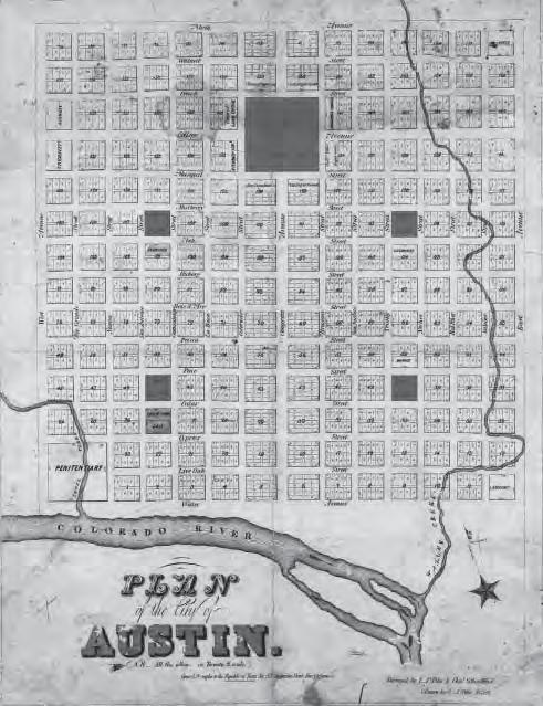
The Downtown Great Streets Master Plan54 was finalized in 2000 to guide public and private streetscape investment and to create a more comfortable and engaging pedestrian environment. The Master Plan, among other things, establishes streetscape design standards and dimensional criteria, furnishings and tree species for each street. The Plan is being implemented consistently today by both the public and private sectors.
The DAP Downtown Transporta on Framework Plan55 builds on the Great Streets Master Plan, further developing the system of “priority streets by mode”, and developing more detailed streetscape cross sec ons of all of the different street types and varia ons.56 In adop ng the DAP, the Great Streets Master Plan design standards and furnishings should be incorporated into the Framework Plan.
PR-3.1: Maintain, extend and restore Downtown’s grid system of streets and alleys.
• The City should not allow full or par al street closures for new Downtown developments. Where a street closure to vehicular traffic is considered essen al, generous access for pedestrians and bicycles should be maintained within the right-of-way. Redevelopment of blocks where streets have been interrupted should re-establish the grid. Poten al sites where the street grid could be re-extended in the future include:
• The Federal Building Complex, which could provide for the extension of East 9th Street between San Jacinto and Trinity streets;
• The redevelopment of State parking garages along San Jacinto and Trinity streets, which would allow for the extension of East 16th Street; and
• The redevelopment of both the Seaholm Power and the Green Water Treatment plant sites, which will allow West Avenue, Nueces, West 2nd and West 3rd streets to be extended.
• Within the Waller Creek District, various restora ons and/or extensions of public right-of-ways are recommended:
• East 2nd Street from Red River to IH 35; and
• Sabine Street, between 3rd and 4th and between 2nd and Cesar Chavez Street.
• In the case of the Rainey Street District, the City and developers should plan for certain streets to penetrate through exis ng, long blocks to create be er connec vity for all modes of transporta on. The following are such recommended extensions:
• Rainey Street, between Driskill and Cesar Chavez streets;
• Davis Street between Rainey Street and the IH 35 frontage road; and
• Lambie Street between East Avenue and Rainey Street.
• The City should not permit the closure of alleys, as they provide an important service func on. Vaca on of alleys should only be allowed if equivalent offstreet service facili es are provided, and where such a vaca on does not result in a need for on-street servicing/loading. (See TP-1.3.)
• The City should not permit sky-bridges or other encroachments such as parking garages or habitable space to project into the public right-of-way.
PR-3.2: Require all new development to build Great Streets sidewalks or contribute to the Great Streets Development Program fund. The City’s Great Streets Development Program encourages private developers to construct public sidewalk improvements by the City reimbursing a por on of their cost from the Downtown parking meter revenue fund. The resul ng construc on has been inconsistent, as par cipa ng developments are not necessarily located adjacent to one another or located in areas of high-pedestrian priority. Some developers have opted not to construct Great Streets sidewalks at all. Public sector implementa on of Great Streets has had a more significant impact, as in the case of the 2nd Street District, where six blocks of street frontages, or 24 blockfaces, have been improved and where sidewalks occupy up to 50% of the right-of-way, allowing for café zones and con nuous tree canopies.
• The City should require new development to construct Great Streets sidewalks, since the value of these improvements provides a direct economic benefit to the property and to the surrounding area. For proper es where it is not prac cal to construct Great Streets, (e.g., because of phasing issues or size of parcel), the City should collect an in-lieu fee, the proceeds of which should be directed to the Great Streets Development Program fund. Downtown developments should contribute to the implementation of Great Streets improvements.


PR-3.3: Streamline the license agreement process for Great Streets improvements. The City should take measures to improve and streamline the license agreement process, as the complexity of the applica on process acts as a disincen ve for private developers to construct Great Streets.
• To this end, the City should require developers to submit fully-developed streetscape plans demonstra ng their compliance with the Great Streets Program and the DAP Transporta on Framework Plan at the me of the site development permit applica on. A complete set of coordinated development plans (site plan, streetscape/right-of-way plan and building plans, eleva ons, etc.) is needed at this stage, so that City staff can understand and evaluate the submi al as a coordinated whole. (This process improvement will help in reducing the me needed for license agreement approvals necessary for construc on in the public right-of-way, as well as reduce the need for mul ple site plan correc ons.)
PR-3.4: The design and construc on of Great Streets improvements should accompany and be closely coordinated with transit improvements, including urban rail.
Streetscape and pedestrian design and facili es are cri cal to the success of public transit because: they provide the first or last element of any transit trip; they ensure that transit trips occur in a pleasant, accommoda ng, and human-scaled environment; and they ensure that transit facili es are carefully integrated into the fabric of Downtown. Therefore, it is cri cally important that streetscape improvements – consistent with the Great Streets Program and the DAP Transporta on Framework Plan – be budgeted, designed, and constructed in

The City should streamline the license agreement process to promote sidewalk cafes and concessions.
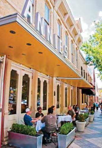

Transit facilities should be designed as high quality streetscapes. (Portland Transit Mall)
coordina on with transit improvements and investments. This will be especially true for the corridors where urban rail and Capital Metro’s rapid bus service are provided
PR-3.5: Improve East 6th Street as a mixed-use, pedestrian-priority, entertainment street that appeals to a greater diversity of people.
East 6th Street is Aus n’s signature entertainment district, and is also Texas’ most extensive and intact district of Victorian mercan le buildings. While it is known throughout the country and the world, the experience of being on 6th Street does not live up to this reputa on. The sidewalks are in deteriora ng condi on, and their narrow width makes it impossible to accommodate the high volume of pedestrians that descend on the area each weekend and during SXSW. As a result, the street must be closed to traffic, nega vely impac ng local businesses, encouraging unruly behavior and inhibi ng the goal of crea ng a more diverse day and nigh me experience.
• The City should give the highest priority to the improvement of the street. Public investment in the pedestrian environment and a more focused effort on business recruitment, management of street and the maintenance and improvement of façades are essen al to promo ng 6th Street as a viable visitor des na on.
• As part of the DAP process, 6ixth Street Aus n (managers of the East 6th Street public improvement district) developed a design concept for the street, calling for:
• the widening of sidewalks to allow for permanent cafe zones and a generous promenade and landscape zone;
• the maintenance of three vehicular lanes which could be managed in offpeak periods to provide for drop-off, loading and valet parking; and
• pull-out areas for loading, drop-off and district valet service at mid-block.

East 6th Street Conceptual Street Plan
PR-3.6: Improve Congress Avenue in keeping with its role as the Main Street of Texas. Congress Avenue is Aus n’s and Texas’ main ceremonial street, providing a grand boulevard between the Capitol and Lady Bird Lake. However, like East 6th Street, it is in a condi on that no longer meets expecta ons or poten als. Uneven sidewalks with mul ple paving materials, diagonally-parked cars which constrict the sidewalks and block views, and congested bus stops with few ameni es contribute to a deteriora ng environment. However, the community has indicated strong support for urban rail on Congress Avenue, restoring its historic role as the confluence of a larger passenger rail system. Such a project would create the opportunity to revitalize the street.
• The City, using the Congress Avenue Charre e report57 as the visionary star ng point, should develop a master plan to define:

• the long-term physical improvements to the right-of-way that support the loca on of urban rail and the accommoda on – to the greatest extent prac cal -- of all other means of mobility on the Avenue;
• storefront/facade and signage design guidelines for private proper es fron ng the Avenue;

East 6th Street Cross-Section
In April 2010, the Downtown Aus n Alliance conducted a day-long, community-wide charre e to explore ways of enhancing Congress Avenue, block by block, to fulfill the Avenue’s poten al as the “Main Street of Texas”. Charre e par cipants consistently iden fied the following six elements as being the most important to achieving greatness:


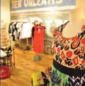


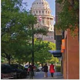
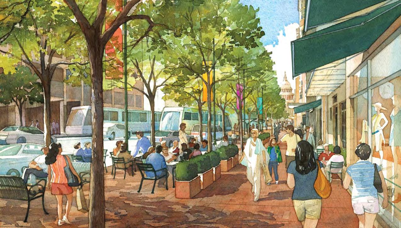
• a maintenance plan for the physical improvements in the ROW;
• a master license agreement that would allow individual property owners to make “pre-approved” improvements along their frontages within the public ROW; and
• a master management structure that has a variety of responsibili es that can augment the City’s efforts in improving and monitoring the street.
• The City should leverage future investments in rail along Congress Avenue to provide for other enhancements, consistent with the community vision expressed in “Envisioning the Avenue - A Strategic Report”.
PR-3.7: Improve Sabine Street, from 3rd to 7th Street as a bicycle-friendly, pedestrian promenade, paralleling Waller Creek.
• The City should give high priority to the improvement of Sabine Street as an urban promenade, as called for in the Waller Creek District Master Plan.58 This segment of the street provides a key link along the Waller Creek corridor, where the creek environment is too narrow to accommodate a creekside path.
• The Sabine Street promenade will connect the creekside hike-and-bike pathways south of 3rd Street with those north of 7th Street. The street, with one lane in each direc on, will also help to provide calm, local access to several proper es and businesses, and provide more direct access to Palm Park from the north. Sabine Street is envisioned as a vibrant promenade along Waller Creek, connecting 3rd and 7th streets.
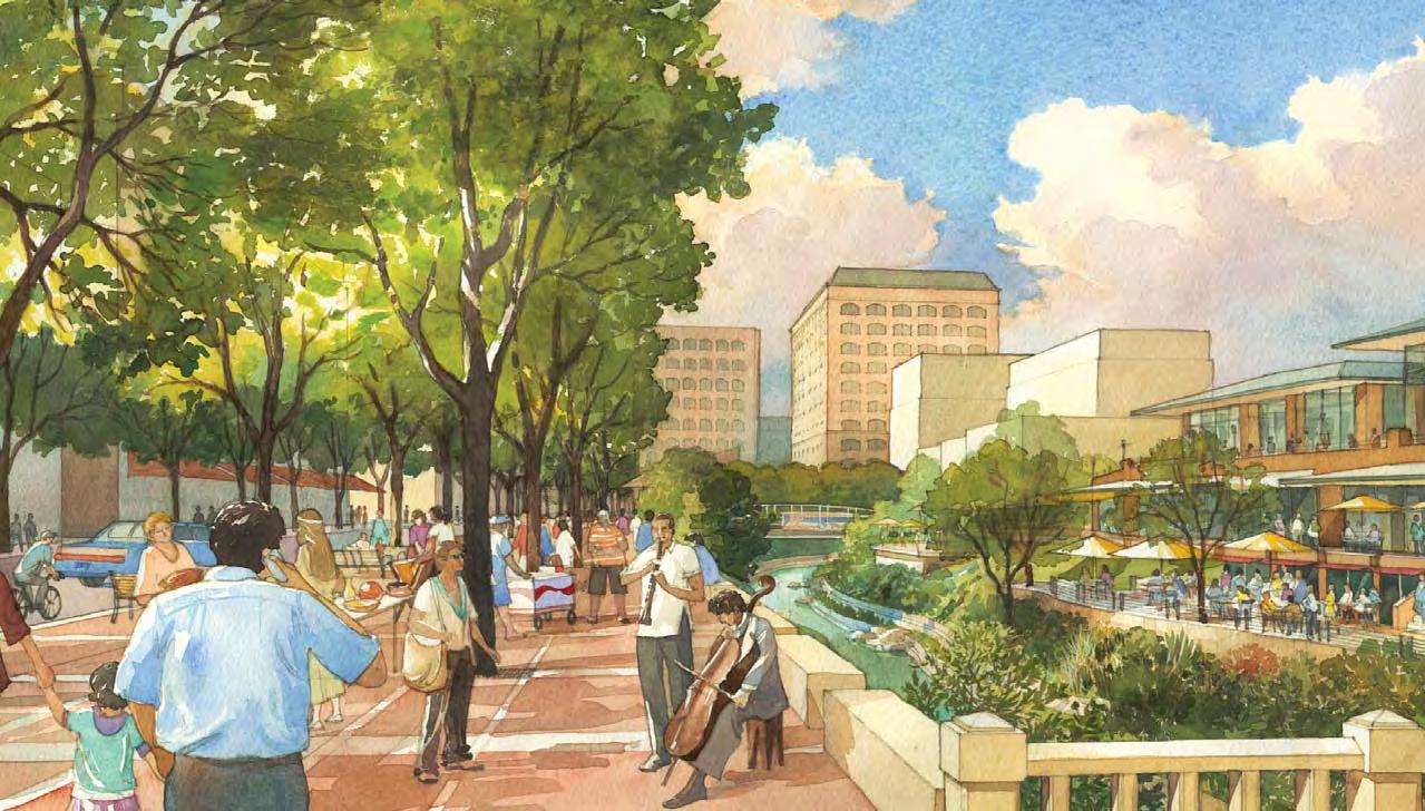
• Broad sidewalks should be included to provide generous space for cafes and kiosks that can ac vate the street. Special provision should be given to bicycle circula on either within the carriageway of the street, or in a dedicated path. Pedestrian connec ons to creekside overlooks, bridges and cafes should be provided along the mid-block alleys.
PR-3.8: Explore the crea on of a 5th Street Mexican American Heritage Corridor linking Republic Square to Sal llo Plaza.
• The area around what is now called Republic Square was, in the early 20th century, a hub of the Mexican American community in Aus n. Located within this area were the Walker Chili Company, Nuestra Senora de Guadalupe Catholic Church, and numerous other Mexican American businesses and residences. Nicknames for what is now called Republic Square included “Chili Park” and “Mexican Park.” The 1920s witnessed the migra on (ins gated by the 1928 City Plan) of most of those businesses, residences, and ins tu ons to East Aus n, where Sal llo Plaza is located. The idea of crea ng a cultural/historical corridor along 5th Street – linking these two public squares -- has been suggested as far back as the 1999 “Republic Square Task Force Final Recommenda ons.”
Sabine Street is envisioned as a vibrant promenade along Waller Creek, connecting 3rd and 7th streets.
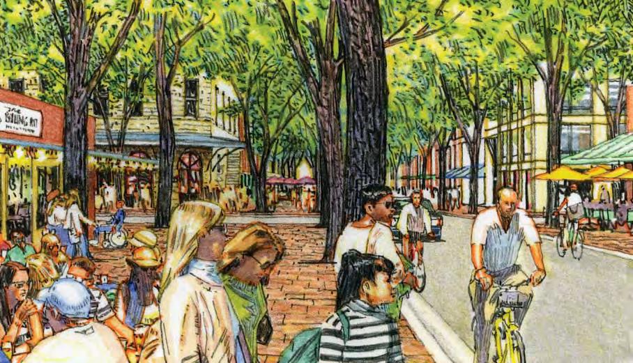
PR-3.9: Establish a public restroom program in Downtown. • The City should undertake a master planning process to establish loca ons and types for Downtown public restrooms. Currently there are no public restrooms in Downtown Aus n, apart from those that are situated in public buildings, like City Hall and the Central Library. This is a need that stakeholders throughout Downtown have iden fied as a high priority. The Master Plan should explore and evaluate a variety of op ons including: lease purchase of automa c pay toilets, construc on of stand-alone facili es, integra on of restrooms within parking garages, agreements with private property owners, etc.

The City should undertake a master planning process to provide for Downtown public restrooms.
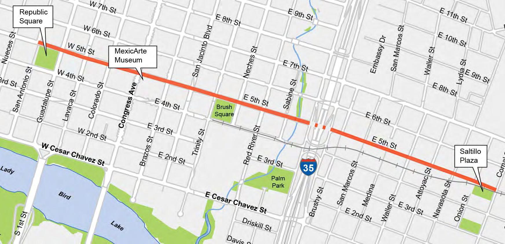

Overall Goal: Develop a mul -modal transporta on system that improves access to and mobility within Downtown.
Downtown can no longer depend on automobile access to sustain growth and provide mobility. There are few reasonable and sustainable ways of increasing vehicular capacity on freeways and arterials leading to and within the core. As Downtown real estate becomes more scarce, providing excessive amounts of parking for each individual project increases costs, reduces development poten al and creates una rac ve urban streetscapes. A key goal of the Downtown Aus n Plan is to improve access to, and mobility within, the Downtown core, crea ng a more balanced mul -modal transporta on system that supports growth and intensifica on, while fostering a high-quality, pedestrian environment.
TP-1. STREETS: Downtown streets should be re-balanced to provide more equitable accommoda on of all modes, including pedestrian, bicycle, transit and vehicular mobility.
The grid of Downtown streets provides an excellent framework for a mulmodal transporta on system, with par cular streets priori zed for designated mobility func ons. As part of the DAP, a Transporta on Framework Plan has been established to guide transporta on planning in Downtown.59 The Plan calls for all streets to be improved as mul -modal corridors with enhanced pedestrian facili es, but also establishes a classifica on system defining priority roles for each street (e.g., pedestrian, bicycle, transit and vehicular), with corresponding cross-sec ons defined for most streets. The Transporta on Framework Plan should be u lized as the basis for design and opera on of Downtown streets, and should con nue to be updated as specific projects are funded for design and engineering, and as further community input is considered.
TP-1.1: Improve pedestrian facili es in all streets and implement the Great Streets Master Plan. All Downtown streets should provide safe and accessible pedestrian circula on. All streets should have con nuous and accessible sidewalks on both sides of the street. The Council-adopted 2008 Sidewalk Master Plan provides a guide for iden fying, priori zing, and improving the Downtown sidewalk system. 60
• The City should complete the Downtown sidewalk system to provide full con nuity and accessibility along all streets. The map on the right illustrates areas with either no or inadequate sidewalks. Highest priority should be given to the Rainey Street District, which has both narrow streets and few sidewalks and which has recently emerged as a popular entertainment des na on.
TP-1.2: Convert certain Downtown streets to two-way opera on.
Virtually every planning study over the past 20 years has called for the conversion of many of Downtown’s one-way streets to two-way opera on, in order to provide more understandable and convenient circula on pa erns, calmer traffic flows and enhanced retail frontages.
The exis ng system of one-way streets creates confusion. East 7th Street, a principal gateway into Downtown from the airport, requires a disorien ng one-block shi to the one-way system, and many trips within Downtown require circuitous routes to reach desired des na ons. Wide one-way streets encourage faster-moving traffic that undermines the pedestrian environment and the poten al for ac ve, pedestrian uses along the frontage.
• The City should pursue the phased conversion of several Downtown streets (map to right) from oneway to two-way opera on. These include: 3rd, 7th, 8th, 9th, 10th, 16th, 17th, and 18th in the east-west direc on; and Colorado, Brazos, San Jacinto, Trinity (north of 7th Street), and Sabine Street (between 3rd and 7th Streets) in the north-south direc on.
• The north-south Lavaca/Guadalupe corridor and the east-west 5th/6th corridor should be retained as one-way couplets to handle the high volumes of traffic. (However, all streets in Downtown should be
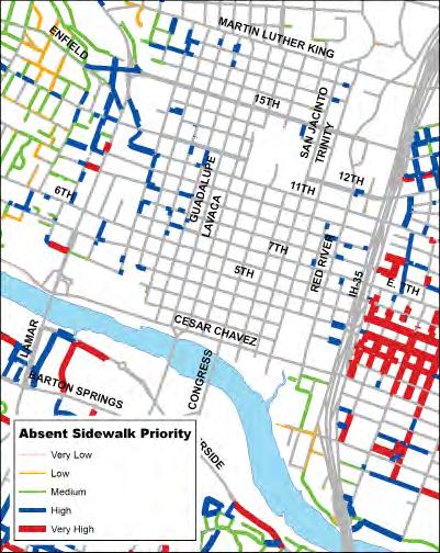
(City of Austin Sidewalk Plan 2008)
Native vegetation and swales that intercept and treat urban run-off could replace the concrete banks along IH 35.
designed to allow for two-way conversion in the future, such as providing traffic signal pole infrastructure with all new street upgrades.) Certain other street segments may also need to be retained in one-way opera on in considera on of the adjacent land use or the condi on of the street. These include: the segment of Trinity Street between Cesar Chavez and East 7th streets to provide bus access and drop-off to the Conven on Center; the constrained segments of 7th Street between San Antonio and Guadalupe streets, and San Antonio between 7th and 8th streets; and 10th Street between Nueces and Guadalupe streets to provide con nued access to the sally port of the County Jail.
TP-1.3: Maintain alleys as the principal means of loading, servicing and parking access.
Downtown is fortunate to have a comprehensive system of mid-block alleys that provide rear service access to most proper es. These alleys relieve pressure on the streets, allowing them to func on for pedestrian, bicycle and vehicular circula on. However, alleys are o en congested with dumpsters, power poles and even abovegrade grease traps that prevent them from func oning properly. The following policies are aimed at preserving and enhancing alleys, and improving their efficiency as both service corridors and for access and egress to parking within a development:
• Vaca on or abandonment of alleys should be avoided, and occur only in special circumstances where equivalent off-street service facili es are provided (e.g., within a full-block development), and where such vaca on does not result in a need for on-street servicing/loading.
• All development abu ng an alley should be required to use alleys for loading, servicing and trash collec on.
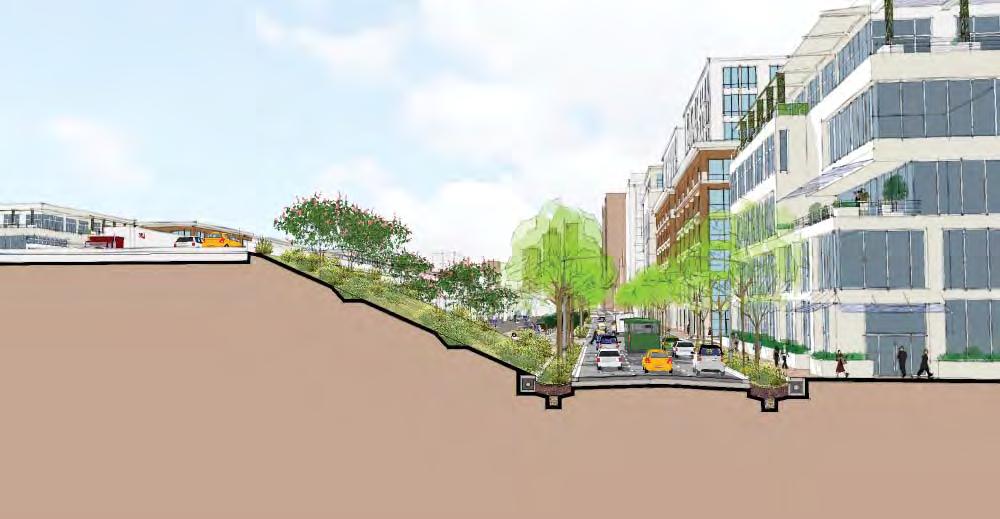
• The City should work with Downtown property owners to eliminate dumpsters and above-grade grease traps from alleys. In older areas, such as 6th Street and Congress Avenue, more efficient systems for trash collec on, recycling and compos ng, should be established.
• When at all possible, primary or secondary access and egress to and from onsite parking should be taken from the alley. This will be more possible once alleys become less clu ered with dumpsters and other obstacles.
• The City should con nue opera ng the Downtown Refuse Collec on District, which effec vely manages refuse in the bar and restaurant intensive central core of Downtown.
TP-1.4: Reduce or remove the barrier of the IH 35 edge. The comple on of IH 35 in the 1960s created a significant social and physical divide through the en re city, isola ng East Aus n from Downtown and the more affluent neighborhoods to the west. The freeway is now over 50 years old and is one of the most congested and dangerous sec ons of the Interstate Highway system.
• As part of any future upgrade, the City should work with TxDOT to develop a long-term improvement plan that puts the through-traffic of the freeway below street level, so that the street network of Downtown can pass over it in an unobstructed manner, and so that the nega ve visual and environmental effects of the facility are reduced (see image below). Ultimately, the freeway could be depressed below grade with new bridges reconnecting Downtown with East Austin.

“Real-time” electronic signage should be developed for public parking and way-finding.
• In the mean me, the City should make efforts to enhance pedestrian and bicycle access and safety beneath the exis ng freeway viaduct, to beau fy the environment with landscaping and public art (as demonstrated by the recent “Makeover” project between 6th and 8th streets), and to make the frontage roads more a rac ve and pedestrian-friendly. (See image on p. 144.)
• The Downtown segment of the IH 35 corridor could be greatly enhanced, both visually and environmentally, with the removal of its concrete slopes and reconfigura on of frontage road edges to allow for the capture and filtra on of stormwater runoff from both the freeway and the frontage roads. This runoff is des ned for Waller Creek, and is the source of pollutants that undermine a empts to restore the creek. Na ve vegeta on and swales that intercept and treat urban run-off should be introduced along the corridor. Bio-swales, vegetated filter strips, rain gardens, etc., will generate “ecosystem services”, reduce the urban heat island effect and create a more humane environment. (See image on p. 144.)
TP-1.5: Establish a comprehensive way-finding system for all modes of transporta on.
Downtown lacks a way-finding system that guides visitors and residents to important des na ons, a rac ons and landmarks, or to public services and public parking facili es.
• The City should develop a unified way-finding and signage system, indica ng clear paths of travel to key des na ons and major public facili es and cultural ins tu ons. The way-finding system should be part of a larger, ar ully-conceived branding program for Downtown and should include specific approaches that promote overall Downtown and district iden ty with maps, graphics and interpre ve elements, as appropriate. The system should be designed to serve all modes of transporta on and incorporate new communica on techniques such as GPS, smart phone “apps”, toll tags, etc.
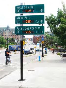
• As an integral part of the way-finding system, “real- me” electronic signage should be developed to indicate public parking availability along major entries into Downtown, as well as the status of bus or rail arrivals at key transit stops.
TP-2. TRANSIT: Public transit should be enhanced as a high-quality mode of choice.
Transit in Downtown has not been a mode of choice. The lack of high quality service and the inadequacy of bus stops and ameni es have contributed to a nega ve image and iden ty. Introduc on of commuter and urban rail and planned rapid bus routes have the poten al of improving the quality of service and the iden ty and a rac veness of transit as a viable alterna ve to the automobile.
TP-2.1: Establish an urban rail system to connect Downtown with other Central Aus n des na ons and the exis ng and passenger rail system.
The expansion of urban rail within Central Aus n should be given the highest priority, providing connec vity between Downtown and surrounding neighborhoods and des na ons, including the Capitol Complex, UT, Mueller, the Riverside Corridor and Aus n-Bergstrom Interna onal Airport. The Aus n Transporta on Department (ATD) is taking the lead on defining a first-phase urban rail project and is developing a financing and implementa on strategy that could be taken to voters in 2012.
• Urban rail technology deployed within Downtown should be at a human-scale, compa ble with the urban fabric, able to mix easily with mixed modes of traffic, and capable of high frequency service.
• The urban rail system should link to commuter and regional rail assets, including: MetroRail on East 4th Street, which is planned to be double-tracked and extended to Brazos Street; and the future Lone Star Rail (“LSTAR”) intercity regional rail line, which is expected to stop near Seaholm on West 3rd Street.
TP-2.2: Concentrate major bus routes along designated Downtown corridors. Consistent with Capital Metro’s ServicePlan 2020 and the Transporta on Framework Plan of the DAP, the City should priori ze certain streets within Downtown as major bus corridors, including: 7th, 15th and MLK Boulevard in the east-west direc on; and Lamar, Lavaca/Guadalupe and Red River streets in the north-south direc on. These corridors should provide both local and express service, while other streets should be limited to local routes.
• Major through-routes should be relocated from Congress Avenue to the Lavaca/Guadalupe corridor. Studies should be undertaken to ensure that bus volumes can be accommodated along with future urban rail service which is also envisioned for the corridor.
• The City should support Capital Metro’s MetroRapid line by construc ng Great Streets improvements along Lavaca and Guadalupe Streets.
Public transit should be a high quality mode of choice, rather than one of last resort.

TP-2.3: Create high-quality, state-of-the-art transit stops and transfer areas.
• Transit stops should generally be located on the “far-side” of an intersec on, to avoid conges on and obstruc on of right-turning vehicles. Stops should be consolidated to the extent pracitable and spaced to provide convenient pedestrian access, but to avoid bunching of buses at every intersec on.
• More deliberate provision should be made for comfortable and convenient bus transfers and transit stops within Downtown. Since the majority of bus routes in Downtown are “through” routes, most transit boardings and transfers will s ll occur on the street at curbside bus stops, where they can be accomplished most effec vely, both in terms of passenger convenience and bus opera onal efficiency.
• The City should establish specific design criteria for on-street transit facili es to ensure convenient and comfortable transfers that are part of a well-conceived streetscape design. The criteria should include:


• State-of-the-art shelters constructed with appropriate ameni es - (benches, ligh ng, shade, trash and recycling receptacles, way-finding, and a “real- me” bus arrival informa on system) that maximize public safety, mi gate crime, vandalism and public order problems, while providing comfort and an enhanced experience for transit patrons.
• Each bus stop should post the routes assigned to it, so that passengers understand where to wait.

• Where mul ple routes converge, a sufficient length of curbside space should be provided to prevent overcrowding of passengers and buses and blocked sidewalks.
• Bus stops and transfer areas should be separated from the main, “through-zone” of the public sidewalk, so that transit users are not overly concentrated at one stop, do not impede the flow of other pedestrians along a street, and do not interfere with ac vi es taking place on the proper es they front.
• Capital Metro should ensure the highest levels of maintenance and security in and around stops and transfer areas.
TP-3. BICYCLES: Downtown should con nue to provide safer and more convenient bike facili es for all types of cyclists.
As the City improves its bicycle infrastructure, and as traffic conges on persists, cycling has become an increasingly viable alterna ve mode of travel, offering easy and efficient ways of moving through Downtown, and contribu ng to the iden ty of Aus n as an engaging and sustainable urban district.
Over the past five years, the City has significantly increased the number of bike lanes and paths in Downtown. Much of the Lance Armstrong Bikeway, an eastwest system of dedicated trails and lanes connec ng East and West Aus n through the core, has been completed. The extension of the Pfluger Pedestrian and Bicycle Bridge will provide safe passage over busy Cesar Chavez Street and a direct commuter and recrea onal link between Downtown and South Aus n. Plans have been approved for a north-south bike boulevard along Rio Grande and Nueces streets, connec ng UT and the West Campus neighborhood with Downtown and Lady Bird Lake. These improvements and others are helping to realize the goal of the City’s Bicycle Plan Update of 2009, to make Aus n one of the most bikefriendly ci es in the na on. The following policies are intended to build on these accomplishments, by guiding public and private investment in Downtown’s bicycle network and infrastructure.
Bic ycle Priority Streets
Off-Street Multi-Use Trails
Secondary Bic ycle Streets/Routes
See also: http://www.ci.austin.tx.us/public works/bic ycle-plan.htm
TP-3.1: Establish bicycle priority streets that provide facili es for all levels of bicyclists along key north-south and east-west corridors.
• The City should augment the exis ng bicycle network by implemen ng the recommended facili es for the bicycle priority streets, as iden fied in the Aus n Bicycle Plan Update61 and the DAP Transporta on Framework Plan, thereby providing a clear and safe network for bicyclists of all experience levels. Facility improvements include bike lanes along:
• Bowie and Henderson Streets to connect Pfluger Bridge with the Shoal Creek Greenway. including design and construc on of the railroadundercrossing at Bowie and 3rd Streets;

• Red River Street to connect the trail systems of Lady Bird Lake and Waller Creek with UT;
• Colorado Street, once it is converted to two-way. In the mean me, “sharrows” (designated shared vehicular/bicycle lanes), are recommended on both Brazos and Colorado in their current one-way configura on;
• 11th Street to connect East Aus n with the Capitol and Downtown.
TP-3.2: Introduce shared lane markings (“sharrows”) on streets where cyclists can safely share the lane with automobiles.
• “Sharrow” designa ons should be introduced on certain Downtown streets where dedicated lanes are not prac cal, to alert motorists to take cau on and to allow cyclists to safely share the lane.
TP-3.3: Create a more con nuous system of off-street and mul -use trails.
• The City should improve the con nuity of off-street, mul -use trails along Waller, Shoal and Lady Bird Lake greenways and address deficiencies and pedestrian conflicts so that a con nuous and safe system is created in and around the downtown core.
• An off-street bike and pedestrian path should be introduced between the northern end of the Pfluger Bridge extension and Bowie Street, including an undercrossing of the Union Pacific rail tracks.
TP-3.4: Increase bicycle parking in Downtown.
• Bicycle parking should be planned comprehensively in tandem with automobile parking needs. The City should increase on-site bicycle parking requirements in Downtown, so that bike parking represents at
is part of Austin’s expanding system of off-street trails.
Artfully-designed bike racks and facilities can reinforce Austin’s identity as a premiere biking city.


“Bicycle cages”, located in portions of parking garages that cannot accommodate cars, are a cost-effective method of creating bikeparking spaces.
Velib, the successful bikesharing program in Paris, is provided and maintained by JC Decaux, who receives advertising rights in return.
least 10% of the required motor vehicle parking, before any parking reduc ons are made. At least half of these spaces should be either Class I racks or parking spaces defined in the City’s Transporta on Criteria Manual, or in locked bicycle storage rooms. Bicycle parking should also be provided at major transit stops. Provision of bike sta ons62 near major transit stops, in parks and within new evelopments should also be explored further for Downtown. Providing locked “bike cages” in por ons of parking garages that cannot accommodate cars is also a cost-effec ve way of crea ng bike-parking spaces, both in new development or as a retrofit.
TP-3.5: Require shower and locker facili es in office developments.
• The City should adopt specific requirements for shower and locker facili es that promote commuter cycling in Downtown. It is recommended that the recently adopted requirements for an Urban Core PUD be adopted for Downtown, which require office buildings over 25,000 square feet to provide shower and locker facili es, propor onate to the area of the building and the number of employees.
TP-3.6: Introduce bike-sharing.
• The City should explore the feasibility of a community bike-sharing program that offers affordable access to bicycles for short trips. Bike sharing programs, like Paris’s highly successful Velib system, have proven to be an a rac ve alterna ve to the automobile, and an effec ve component of a mul -modal transporta on system.
• Implementa on alterna ves should be evaluated including: public/private partnerships with adver sing agencies who supply, rent and maintain bikes in return for adver sing rights; and partnerships with community non-profit en es, bike retailers, car-share companies or with private companies that capitalize the enterprise through subscrip ons, rentals, and adver sing.
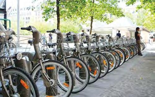
TP-3.7: Ensure that urban rail facili es promote bike safety.
Design of urban rail facili es within Downtown need to be carefully coordinated with the provision of safe bicycle and pedestrian facili es that avoid or mi gate poten al conflicts.
TP-4. PARKING: Adequate and convenient supplies of parking should be provided, consistent with goals for increased transit ridership and an enhanced pedestrian environment.
Parking is one of the principal elements that is shaping the form and character of Downtown Aus n. As much as 30% of the mass of a building can be dedicated to parking - affec ng development economics, traffic circula on and the a rac veness of the urban environment. Although a central goal for Downtown is to create a sustainable, pedestrian-oriented district, the lack of a fully robust transit system requires that adequate levels of automobile parking con nue to be provided un l there are more viable alterna ves. The provision of bicycle parking should also be considered as an integral part of a Downtown parking program.
As Downtown real estate becomes more expensive and sites smaller and less efficient for on-site parking, there is a need to manage the parking supply more effec vely. Rather than single-purpose parking facili es for every use in Downtown, shared and centralized automobile and bicycle parking facili es, de-coupled from their primary use, could reduce the costs and burdens of on-site parking, provide for a more intensive and sustainable use of urban land and promote a more interes ng and engaging public realm.
TP-4.1: Manage and coordinate Downtown parking.
The 2009 Downtown Parking Study by Walker Parking Consultants concluded that there is an adequate supply of automobile parking in the CBD to meet demand on most occasions. However, since many parking garages are not made available to the public, some nigh me and weekend parking is not conveniently located near the main ac vity centers, like East 6th Street and the Warehouse District.
• The City, through its newly-created Parking Enterprise, is taking and should con nue to take a more proac ve role than it has in the past in coordina ng the supply of Downtown parking, through shared management and opera on responsibili es, coordinated pricing, and consolida on of valet services within par cular areas such as the various entertainment districts. The Parking Enterprise should also be charged with managing the supply of Downtown bicycle parking.
TP-4.2: Promote public/private partnerships to provide shared parking facili es within new development.
• The City and its Parking Enterprise should partner with private sector developers and/or with other governmental en es to construct joint public/ private parking garages in areas of the City that have high demands for visitor parking, such as the Red River, East 6th Street and 2nd Street districts.
As Downtown real estate sites become smaller and more expensive, shared centralized parking will be increasingly important.

Car-share and recharging facilities should be provided throughout Downtown.
TP-4.3: Establish an in-lieu fee system that allows developers to contribute to centralized off-site parking as an alterna ve to providing parking on site.
• The City should establish an “in-lieu” fee to allow developers to pay into a parking fund as an alterna ve to providing on-site parking. In this way, the burden of providing on-site automobile parking on small sites would be relieved, allowing for more efficient and cost-effec ve infill development to occur throughout the area. (Bicycle parking should s ll be provided on site.) This in-lieu fund should be used by the Parking Enterprise to construct, operate and maintain joint-use parking garages.
TP-4.4: Provide incen ves for on-site, car-share spaces and recharging facili es.
• Car-sharing in Aus n is becoming a viable alterna ve to car ownership. Consistent with incen ves offered in the UNO district, the City should reduce parking requirements in developments that provide car-sharing facili es.
• The City should also offer incen ves for the provision of electric car recharging facili es within parking garages and on streets, including parking reduc ons, reduced electrical rates and assistance in providing higher-voltage charging equipment.
TP-4.5: Manage on-street parking and loading areas in a more efficient manner.
• As the Great Streets Program is implemented, it is es mated that up to 1,000 on-street Downtown parking spaces will be displaced to allow for transit lanes, wider sidewalks and bike lanes. Considera on should be given to “ me management” of valuable curb space and travel lanes, including specified hours for short-term parking, commercial loading and servicing and/or for peak hour travel lanes as appropriate.
TP-4.6: Create a way-finding system and real- me parking displays that guide visitors to key public parking facili es.
• In coordina on with a comprehensive way-finding system (see Policy TP-1.5), signage and real- me parking displays should be established along key corridors leading into Downtown to inform motorists of the availability and loca on of public parking facili es.


TP-5: TRANSPORTATION DEMAND MANAGEMENT: A TDM Program should be put in place to promote more effec ve commu ng behavior.
Transporta on demand management (TDM) is a means of reducing the number of single-occupancy vehicles on a street network at any given me. Managing demand is a cost-effec ve alterna ve to increasing capacity, and an approach that can promote be er environmental outcomes, improved public health, and more prosperous and livable ci es. TDM programs are par cularly effec ve in dense Downtown districts, where there are large public or private sector employers who can provide leadership in promo ng alterna ves to the single occupant vehicle.
TP-5.1: Assist in establishing a Central City Transporta on Management Associa on.
• The City should partner with the DAA and major Central City employers (Travis County, State of Texas, University of Texas at Aus n) to fund a Transporta on Management Associa on (TMA) to promote TDM programs that decrease the number of Downtown workers using single-occupant vehicles. Such programs could include: subsidized transit passes, car-share incen ves, preferen al carpool parking and pricing, ride home program, real- me commuter informa on, day care coordina on, etc.

Time management of valuable curb space and travel lanes should be considered.
TDM programs promote alternatives to the single occupancy vehicle. (e.g. car pools, employee shuttles)


Urban
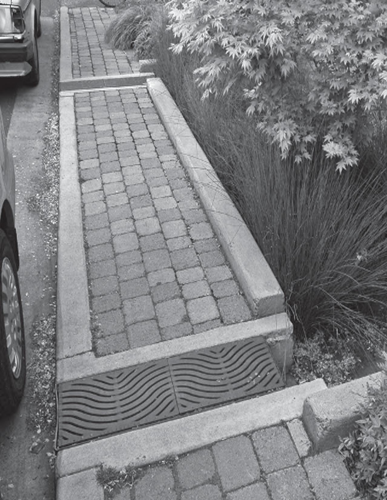
Portland Oregon
Overall Goal: Provide for phased u lity and infrastructure upgrades that address exis ng deficiencies and that support posi ve development.
Strong infrastructure capacity a racts economic growth, new businesses and residences - wherever it is invested. Adequate and mely investment in Downtown public infrastructure - u li es and streets - needs to be made if Aus n is to achieve its vision of a dense and vibrant downtown, and if Downtown is to con nue to support the vitality of all parts of the city. Investment in Downtown infrastructure promotes development that increases the City’s General Fund revenues at a much higher rate than any other loca on in the city, due to its high-density nature, which can be 10 to 100 mes as dense as a suburban development. Due to the compact nature of the urban core, the cost to install water and wastewater improvements

Source: Lower Colorado River Authority and Terry Mitchell, 2010.
per “fee unit” can be less in rela on to the number of units served, and in general, the revenue per linear foot of u lity line will be higher for the high-rise residen al, restaurants and other intense downtown uses. Furthermore, the Downtown’s lower eleva on, reduces electricity demand needed to pump water uphill, compared to the higher eleva ons of the suburbs. With the exis ng investment in treatment and transmission mains, the upgrade of aging distribu on and collector systems should be purchased to support redevelopment within the central city.
The DAP Downtown Infrastructure Strategy report (Appendix K) includes recommenda ons and targeted investments that will lay a sustainable framework to provide safe and reliable water, wastewater, storm drainage and electric systems, all of which are central to the overall health, quality of life and prosperity of the community.
Improve coordina on among City of Aus n departments and other agencies that plan and construct Downtown infrastructure, and set priori es consistent with the DAP.
UI-1.1: Consolidate u lity coordina on efforts under execu ve-level leadership to coordinate and facilitate the planning and construc on of proposed u lity and roadway-related infrastructure projects.
• The City should adopt a policy to priori ze coordinated Downtown infrastructure planning and investment within each City department’s capital improvement program and maintenance budget. Part of the new policy should include establishing more focused roles and responsibili es for the two exis ng interdepartmental, u lity planning and coordina on groups to implement both the DAP Infrastructure Strategy recommenda ons and the Ten-Year Implementa on Program summarized in the Leadership and Implementa on sec on. The two exis ng groups are the CIP Coordina ng Commi ee, led by the Capital Planning Office (CPO) and the Aus n U lity Loca on Coordina ng Commi ee (AULCC), led by the Aus n Transporta on Department (ATD).
UI-1.2: Expand and refine the City’s use of the Envista system.
• Envista is a GIS-based so ware enabling the various City department users to document and illustrate planned infrastructure projects within a shared mapping framework. This allows all City departments to have a comprehensive view of all planned projects, thus facilita ng the iden fica on of poten al conflicts between them, as well as opportuni es to combine projects or por ons of projects to reduce cost, me and disrup on to the public. Further refinement of the use of this tool will allow greater op miza on of project planning and budgets.
UI-2. WATER/WASTEWATER: The Downtown networks of water distribu on and wastewater collec on lines should con nue to be upgraded by Aus n Water U lity-ini ated replacements and coordina on with private development through the Service Extension Request (SER) Process.
Generally, the water transmission and wastewater collec on capacity serving Downtown is more than adequate, thanks to the recent construc on of the 72-inch Ulrich water transmission main and the new Downtown wastewater tunnel currently under construc on. However many of the water distribu on lines within Downtown are old and inadequate; water mains are o en too small to provide code-required fire flows for proposed higher-density development and many wastewater lines are substandard and in deteriora ng condi on. The SER process, updated in 2009, provides an opportunity for private developmers to work with Aus n Water U lity (AWU) to determine upgrade requirements and possible cost par cipa on scenarios.
UI-2.1: Dedicate adequate funding annually to Aus n Water U lity’s (AWU) “CIP-dedicated funds”.
Rather than a empt to predict where new development may occur next in Downtown and begin upgrades where they may not be needed, it is more effec ve to allocate “flexible” funds that can be used on a more dynamic, as-needed basis for necessary extension of City mains and/or for cost par cipa on with a developer to “oversize” such City-needed mains.
• These funds should be used for upgrading City distribu on and collec on mains for water and wastewater through developer par cipa on programs and/or for CIP projects, on an as-needed basis to meet the demands of emerging projects.
UI-2.2: Require developers to submit their Service Extension Requests (SERs) for proposed projects in advance of their site development permit applica ons to allow me for AWU to assess needs and, if applicable, develop cost-par cipa on agreements.
• With adop on of the DAP policy and procedure changes, there is an opportunity for developers to meet early in the site development process with AWU in order to establish the capacity and constraints within the area of the proposed development. While it is probable that much of the distribu on system could provide domes c water needs, the current code-required fire flows could dictate that developers upgrade City water lines. There is an opportunity - if this process is started early - to explore modifying the proposed building design and to use more sophis cated u lity modeling techniques, both of which can help reduce the size and expense of fire-flow water line upgrades, while providing appropriate levels of fire protec on.
Downtown is framed by Waller and Shoal Creeks and the Lady Bird Lake reach of the Colorado River (“Austin Creeks” 1976).
UI-3. WATERSHED PROTECTION: Downtown stormwater drainage, water quality and flood control infrastructure should be upgraded.
The Watershed Protec on Department’s (WP) mission includes protec ng Aus n’s watersheds and waterways and safeguarding the community from flooding through the storm drainage system and more specific flood control projects. Downtown has two major urban creeks, Waller and Shoal, as well as the Lady Bird Lake por on of the Colorado River. These waterways provide important open space ameni es, as evidenced by the amount of development oriented toward Lady Bird Lake. A major flood control project is planned and funded for Waller Creek which will open new opportuni es for redevelopment as early as 2014, but Shoal Creek has no such project planned. Both creeks have been subject to severe flooding, which has hampered development opportuni es of creekside proper es.
Most of Downtown’s storm drainage/sewer system dates from the 1930s, meaning it is both too fragile and undersized to meet the drainage demands of certain storm events. However, rela vely few complaints are received about flooded Downtown proper es, so investment in Downtown storm drain upgrades has been less of a priority than other parts of the city.

Well-protected and managed waterways are an asset to a community and bring ecological and recrea onal benefits to its ci zens. Downtown’s waterways are enjoyed by the en re community, as well as its many visitors. The vegetated creek corridors also help to intercept and filter stormwater run-off, support natural wildlife habitats, mi gate heat island effect, and contribute to the reduc on of air pollu on.
Over the past 10 years, the Watershed Protec on Department (WPD) has taken a proac ve role in promo ng these values through specific projects and ini a ves.
The following recommenda ons are intended to augment these efforts:
UI-3.1: Develop a Downtown Drainage Master Plan and extend that plan to adjacent urban redevelopment areas as feasible.
• An effec ve drainage master plan will map and document the exis ng system (loca on, size and condi on of pipes and facili es), project future needs and establish a phased implementa on program to construct upgrades according to priori es. Today, the system mapping has recently begun in the needed GIS (Geographic Informa on System) format. The Department has priori zed the downtown area’s documenta on, which should be complete in early 2011.
UI-3.2: Con nue to allocate funding annually to departmental “CIP-dedicated funds” for use in upgrading City storm sewer mains through developer par cipa on programs or for CIP projects, on an as-needed basis.
• Watershed Protec on should con nue to direct funds received from the citywide drainage u lity fee to support Downtown public and public-private projects.
UI-3.3: Increase watershed maintenance of Shoal and Waller creeks.
• With the redevelopment of Seaholm and the Green Water Treatment Plant, much a en on has been focused on improving the creekside environment of lower Shoal Creek. Likewise, Waller Creek has been the subject of substan al efforts to improve the creek, from removing excess vegeta on and invasive species to debris removal and focused policing. As these two creeks become more and more integrated into the life of Downtown, a higher level of rou ne maintenance, coupled with higher levels of security, should be established.
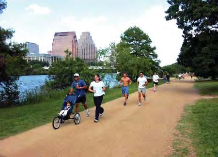
The trail system along Lady Bird Lake (left) and Shoal Creek Trail (right) - provide an important recreational amenity Downtown.
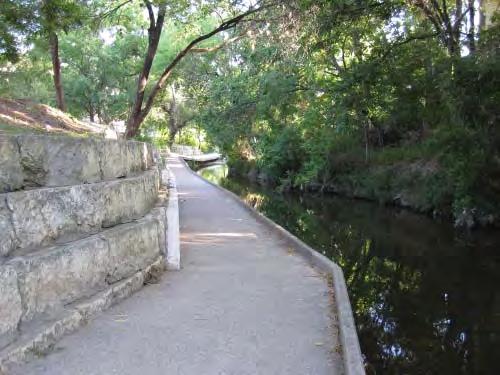
Stormwater run-off infiltration and evaporation rates in more and less urbanized sites
UI-3.4: Construct the Li le Shoal Creek flood control project.
Li le Shoal Creek, located near Nueces Street in the lower part of Downtown is a small creek that has been diverted into an underground tunnel that is undersized.
• The Watershed Protec on Department has developed the preliminary design for a larger flood tunnel project to take its place, and the City should move forward to construct it, as this is in a key redevelopment area that suffers from flooding.
UI-3.5: Implement the Lower Shoal Creek Restora on Project. The Watershed Protec on Department has developed streambank stabiliza on plans for the lower reach of the Downtown segment of Shoal Creek. This area is the focus for much public and private investment such as the recent Shoal Creek trail improvements, the future Central Library, the future Project Green, 360 Condominiums, etc.
• WPD should implement this project as soon as possible, as this por on of the creek corridor is a major open space amenity for the area.
UI-3.6: Develop a flood control plan for Shoal Creek in conjunc on with a Shoal Creek Greenway improvement plan.
• As has just occurred for the Waller Creek Greenway, the City should work with partners, such as the Corps of Engineers (USACE) and Travis County, to address

the severe flooding problems of Shoal Creek. This flood control project should be defined as part of a corridor-wide master plan that integrates recommenda ons for public open space and trail improvements, environmental restora on and streambank restora on, as well as redevelopment standards for creek-fron ng proper es. A USACEsponsored Shoal Creek study will be ini ated in 2011 to re-evaluate flood control op ons from MLK Boulevard to Lady Bird Lake, enabling the City and partners to advance the planning for this unique greenway corridor.

UI-3.7: Create a Water Quality Program for Downtown.
• Downtown development and its desired orienta on toward waterways makes the need for a water quality program crucial. The focus for water quality improvement and control in Downtown should be on infrastructure and maintenance solu ons which address odor control, trash and floatable materials and the color and condi on of the creek and lake water, as well as maintaining and increasing the adjacent na ve vegeta on, wherever possible. In addi on the program should:
• Encourage and expand the development of public/private programs for maintenance of Downtown creeks and Lady Bird Lake, such as the Keep Aus n Beau ful (KAB) programs.
• Increase the number of dedicated City of Aus n staff for maintenance, par cularly trash control, along the creeks and river.
• Create/expand educa on programs to inform the public, property owners and tenants about “source control” water quality methods.
• Expand street-sweeping frequency and areas as more areas of Downtown redevelop.
The
Creek trail will be enhanced as part of the planned flood control project.

• Expand use of trash and sediment control storm water inlets, as appropriate. (City staff is currently developing a Downtown inlet replacement program.)
• Encourage innova ve water quality controls and landscaping and adop on of an “Integrated Pest Management Plan”, which requires an environmentally-sensi ve approach to pest control, fer liza on and plant selec on.
• When the Green Roof Stakeholder Group completes their work, consider incorpora ng these recommenda ons into the DAP.
UI-4. ELECTRIC UTILITY: Long-term electric u lity needs should be an cipated and met with facili es that do not detract from the pedestrian environment.
Downtown’s electric service area is called “the network” because it is largely an underground system supplied by transmission mains feeding it from outside the system. Current projec ons by Aus n Energy (AE) do not indicate the need for new transmission feeds, but do project a need for two new electric substa ons in addi on to the exis ng two substa ons in Downtown: Seaholm in the southwest quadrant and Brackenridge in the northeast. There is a new substa on planned in the Rainey Street District, where a site has already been acquired. One addi onal substa on will likely be needed at some point in the future to both support new development and provide for system redundancy.
In addi on to substa on infrastructure, the design and loca on of individual building electric vaults should be be er addressed, so that these do not conflict with the desire to create a pedestrian-friendly, retail-oriented Downtown.
UI-4.1: Acquire a site for a future electric substa on.
• AE staff believe that an addi onal new substa on may be needed in or near the northwest quadrant of Downtown to meet long-term development needs. A 1.5-acre site will be needed and, as this process will take me and due public process, the site search should be ini ated as soon as possible.

UI-4.2: Aus n Energy should develop design and loca on op ons for electric vaults, including underground and alleyway op ons, to be er achieve goals of pedestrian-oriented, ground-floor uses and facades.
• The loca on of Aus n Energy’s required electrical vaults poses a challenge for Downtown projects. Currently, the vault must be at ground level, located within the customer’s property and be accessible by AE service equipment. Also, electric transformers inside the vaults are becoming larger due to the more energy-efficient design of buildings. Ground-
floor rooms occupy street frontages where more appealing pedestrianoriented uses and facades are desired. To the extent possible, vaults should be located underground, within parking garages, or adjacent to alleyways, rather than within building facades fron ng public streets.
UI-5. DRY UTILITIES: U lity franchises should be be er coordinated within the framework of Downtown planning and capital improvements.
Telecommunica ons consume a significant amount of space beneath Downtown streets, yet are not regulated by the City. This creates difficulty in planning for and construc ng public improvements, such as “Great Streets” sidewalks and street trees.
UI-5.1: Require that “dry” u lity franchises go through a City review process to receive approval for alignments and/or reloca ons.
• The City should con nue to improve the process to reduce conflicts between the various “wet” and “dry” u li es. The City should also clarify the legal implica ons of their agreements with the franchises, so that City projects are not responsible for bearing all the costs of reloca ons of the franchise u li es in street improvement projects.
UI-6. ROADWAYS: Roadway upgrades should include needed u lity improvements to support Downtown redevelopment. Out of 165 lane miles in Downtown, 81% are rated as “less than desirable and unsa sfactory”. The Street and Bridge Division of Public Works indicates that the best course of ac on is to rehabilitate or reconstruct most of them over the next 25 years. However, the prac ce of providing “overlays” and spot maintenance will need to con nue as necessary stop-gap measures to defer extensive capital expenses.
UI-6.1. Con nue to priori ze maintenance improvements to Downtown streets and alleys, and coordinate and fund “complete” street reconstruc on.
• The Street and Bridge Department currently uses the Pavement Management Informa on System (PMIS) and data from the Downtown Aus n Alliance to priori ze street and alley maintenance. This data should be coordinated with the new CIP coordina ng commi ee, so that street reconstruc ons that integrate u lity needs for the foreseeable future are priori zed within the overall infrastructure framework of Downtown.

Congress Avenue, Austin
Overall Goal: Implement the Downtown Aus n Plan, within the resources and priori es of the community.
The Downtown Aus n Plan (DAP) is a policy document reflec ng the community’s vision and priori es for Downtown over the next 20 to 30 years. It is a living document that will be updated and amended on a periodic basis, as the remaining Downtown district plans are completed, and as changing condi ons present new challenges, opportuni es and priori es. The Plan’s full range of policies and recommenda ons will be implemented over an extended me period. Some will require further analysis and outreach before they can be fully realized, and others will need to await sufficient funding and/or staffing.
This chapter of the Plan describes the ac ons that should be pursued to advance the community’s vision for Downtown, including improved governance and organiza on; amendments to the regulatory framework; and investments and ac ons to guide the phasing and funding of capital, opera ng and maintenance programs over the next ten years.
LI-1. GOVERNANCE AND ORGANIZATION: Exis ng City structures of governance and organiza on should be refined to facilitate implementa on of the Downtown Plan.
At least seven City organiza ons and two non-profits are currently suppor ng the development process and/or s mula ng demand from new businesses and residents in Downtown Aus n and the Central City, including:
• Economic Growth and Redevelopment Services Office (EGRSO)
• Planning and Development Review Department (PDR)
• Public Works Department (PWD)
• Watershed Protec on Department (WPD)
• Neighborhood Housing and Community Development (NHCD)
• Aus n Housing Finance Corpora on (AHFC)
• Housing Authority of the City of Aus n (HACA)
• Downtown Aus n Alliance (DAA)
• Greater Aus n Chamber of Commerce (GACC)
The Aus n Housing Finance Corpora on (AHFC) and the Housing Authority of the City of Aus n (HACA) finance, manage and construct affordable housing throughout Aus n. The Downtown Aus n Alliance (DAA) plays an important role as a manager of the Downtown Aus n Public Improvement District to promote and maintain Downtown as a vibrant business, cultural and residen al environment, and the Greater Aus n Chamber of Commerce acts as an advocate for economic development.
These en es possess a number of important economic development tools, from acquiring and disposing of public land for development to funding Downtown open space and public realm improvements to channeling federal en tlements to affordable housing projects. This system has generated economic development, mainly on public land. EGRSO indicates that 19 such projects are currently underway or planned to begin construc on by the end of 2010 in and near Downtown.
In order to effec vely implement the DAP to fully meet the opportuni es that it presents, new and enhanced organiza onal structures and procedures are needed.
Agency Type Agency Func on Public Agencies Economic Growth and Redevelopment Services Office (EGRSO)
Developer Assistance Center/Aus n One Stop Shop
Neighborhood Housing and Community Development (NHCD)
Aus n Housing Finance Corpora on (AHFC)
Housing Authority of the City of Aus n (HACA)
Administers Aus n’s economic development programs, including small business assistance and cultural sector promo on, and oversees Downtown development projects – par cularly projects on City-owned land.
Provides ini al consul ng to developers regarding permi ng and approvals and streamlines the flow of informa on throughout reviews and inspec ons.
Administers the SM.A.R.T. Housing and affordable housing development assistance programs, as well as some commercial revitaliza on programs. Issues tax-exempt bonds for development of new affordable housing in Aus n.
Controls and managespublic housing in Aus n, administers the City’s Housing Choice Voucher program, and provides other services to low-income families in Aus n. Has power of eminent domain and bonding authority.
Non-Profit
En es
Downtown Aus n Alliance (DAA)
Maintains “clean and safe” programs, assists businesses, and makes recommenda ons for further infrastructure improvements and development Downtown.
Greater Aus n Chamber of Commerce Undertakes ac vi es to increase employment and economic growth in the region through business a rac on and reten on.
LI-1.1: Establish a Central City Economic Development Corpora on.
As Aus n con nues to develop through future real estate cycles, the City’s ac vi es will, by necessity, transi on from encouraging the development of public land through disposi on, to taking a more ac ve role in closing feasibility gaps for projects on private land that generate significant public benefits. An effec ve economic development corpora on could allow the City to be proac ve about developing such projects by providing a suite of predevelopment and development services, as well as access to financing.
• Aus n should establish a Central City Economic Development Corpora on to serve these func ons, coordinate the City’s many economic development en es and assist in implemen ng DAP objec ves. At its core, the func on of the economic development corpora on is to focus on execu ng projects rather than providing specific governmental func ons Downtown, and to do so with some flexibility to promote public-private collabora on in genera ng economic development and other public benefits. To achieve these objec ves, the Corpora on should be equipped by the City to serve three principal func ons:
• Developing public infrastructure projects that contribute to city-building;
• Suppor ng public and private real estate development projects that produce desired public benefits; and
• S mula ng development of workforce and affordable housing Downtown.
The corpora on should perform these func ons by advoca ng for public approvals; guiding projects through the permi ng process; assembling and conveying land; “packaging” incen ves, subsidies and financing; providing planning and design assistance; and supplying project management and marke ng services. It should also act as a liaison between the public and private sectors, facilita ng coopera on and process efficiency, while ensuring that projects are implemented in line with the intent of the DAP.
The Development Corpora on should be tasked with developing -- and suppor ng the development of -- key public infrastructure improvements that s mulate desirable private sector investment in strategic loca ons or that provide strategic public benefits. This will entail priori zing infrastructure investment, establishing effec ve financing structures, and managing project design and construc on. Public infrastructure projects could include improvements in and around Waller Creek, revitaliza on of Downtown’s key open spaces and parks, transporta on and parking facili es and downtown streetscape enhancements. Working in
The Midtown Houston Development Authority manages public infrastructure projects, such as Baldwin Park.

this fashion the Development Corpora on would not supplant the role of the City’s Public Works Department, but would have the ability to act in an opportunis c and strategic manner, especially in situa ons where the City would not be able to do so.
The Midtown Houston Development Authority manages public infrastructure projects funded through the 617 acre Midtown Tax Increment Reinvestment Zone (TIRZ). Since its incep on in 1994, the Authority has made significant improvements to the district’s streetscapes, pedestrian experience, transit connec ons and public spaces, helping transform a blighted neighborhood into a growing district. The popular Midtown and Baldwin parks were conceptualized, funded and constructed by the Authority and are now managed through its partner organiza on, the Midtown Management District.
To support both public and private development, the Corpora on should assist in the execu on of cataly c development projects for Downtown. This will require the capacity to intervene in each component of the real estate development process, iden fying priority projects that provide significant public benefits consistent with the DAP, and then becoming the implemen ng agent for that project. The Corpora on should seek to support and facilitate a range of development projects, including:
• Public projects, such as infrastructure projects, that serve to support the DAP and s mulate private investment in addi onal developments;
• Public-private partnership projects that may u lize public funds or land and which partner with the private sector to meet a market need, and which also generate ongoing revenue for the Corpora on; and
• Private projects that are viewed as important to Downtown’s development. These would receive facilita on and other methods of support by the Corpora on to ensure they are completed and produce public benefits.
To execute the City’s vision of affordable housing development, the Corpora on could channel public and third-party financing sources for affordable housing to privately-capitalized projects seeking gap financing for affordable rental and ownership housing Downtown. Poten al public and private funding sources include Density Bonus Program proceeds, banks mee ng Community Reinvestment Act obliga ons and financing offered by affordable housing intermediaries, such as the Local Ini a ves Support Corpora on (LISC) and the Enterprise Founda on.
Many ci es across the country have created development corpora ons performing similar func ons to those recommended in this plan. The successful examples of these en es share a set of a ributes that enable them to carry out these func ons, including:
1. A clear statutory base;
2. Effec ve leadership;
3. A capable staff experienced in a range of program areas;
4. Stable funding sources; and
5. Strong partnerships with public and private en es.
Establishing the Corpora on with these a ributes in mind will lead to the successful implementa on of the DAP.
The Corpora on should be a citywide Local Government Corpora on (LGC) established under the Texas Transporta on Code, Chapter 431, providing the en ty with clear legal authority to carry out the func ons described above while enabling the Corpora on to support development agendas citywide as they evolve over me. LGCs possess authority to aid and act on the behalf of city government to accomplish any governmental purpose, including entering into contracts, hiring consultants and issuing bonds upon approval by City Council. However, the City Council retains ul mate control of the Corpora on by retaining the right to approve both the ar cles of incorpora on and bylaws. Several Texas ci es have chosen to establish LGCs: LGCs o en serve as the management and financing vehicle for projects funded by TIRZs. Throughout Texas, municipali es have established LGCs
Classi ca on LGC
Statute
c. 431
c. 431
c. 431
Board Appointment Council Mayor Mayor
and TIRZs simultaneously, with one set of professionals ac ng as the board for both en es. An Aus n LGC should be established with the capability of managing several different TIRZs, both currently in place and created for future investments. Crea on of new TIRZs may be either project-driven or area-wide. Other Texas ci es have u lized TIRZs with a variety of geographic scopes to meet their downtown redevelopment objec ves:

Leadership and staff excellence at 3CDC have made it one of the most successful in the nation.
The Corpora on should be guided by an appointed oversight and agenda-se ng Board of Directors, including leaders with specific professional exper se from the public and private sectors. The Board should have two principal func ons:
• Mobilize public and private resources in support of the DAP priori es; and
• Ensure accountability to the business plan created for the en ty.
The board should have a broad-ranging skill set, and represent various points of view in the development process. Across the country, many models for board appointment are evident, including appointment by City Council, by the Mayor or a combina on of the two, with nomina ons from various en es. The selec on of an appointment process is less important than a commitment to a high-quality, professional board that is familiar with the development process. In Aus n’s case it will be important that major players, such as the State, UT, the County and the federal government be included.
The Cincinna Center City Development Corpora on, 3CDC, exemplifies the effec ve leadership and capable staff needed for a successful corpora on. The professionals at 3CDC have broad exper se which has allowed the en ty to not only provide the services of a tradi onal development corpora on, but also to manage the Cincinna New Markets Fund and the Cincinna Equity Fund, which provide reliable sources of financing for downtown redevelopment projects.
3. Staff Excellence
The Corpora on should be staffed with professionals experienced with private sector development and intergovernmental rela ons, and led by an Execu ve Director with substan al experience in managing an organiza on and coordina ng real estate planning, financing and development. The Director must also have the ability to interact with senior City officials to advance project funding and approvals, and the Corpora on’s policies should give the Director the flexibility to employ staff as opera ons and projects require. The staff should possess a diversity of skills, including exper se in planning, nego a on of public-private real estate transac ons, finance, marke ng and project management.
4. Funding Structure
In the short-term, and within the confines of State legisla on, the City should support the Corpora on’s opera ng budget with an appropria on from the
General Fund or other supplementary sources. The City should consider iden fying a dedicated revenue stream from public improvement district (PID) fees, facili es charges, parking fees, property taxes or other sources that can ensure con nuity of opera ng support for the Corpora on for its first five years of opera ons.
The City should iden fy a medium- to long-term, self-sustaining funding structure for the Corpora on that may include dedicated taxes and/or fees, development service fees, revenue from assets granted to the Corpora on and interest income.

The Jersey City Redevelopment Agency is a financially self-sustaining entity.
An excellent example of an en ty with such self-sustaining funding is the Jersey City Redevelopment Agency. It was established in 1949 with the goal of elimina ng blight in Jersey City’s urban core and a rac ng residen al, commercial and industrial development to the area. Since its incep on, the Agency has been responsible for crea ng billions of dollars in development and thousands of jobs. The fees that the Agency charges to the private sector for facilita ng development projects currently provide the majority of its opera ng budget.
The Corpora on should create strong partnerships with other development en es as appropriate to meet the DAP’s intended func ons. Key partnerships will be with the Downtown Aus n Alliance, a separate PID en ty whose efforts should be coordinated to work in tandem with the Corpora on’s mission, and with the Aus n Housing Finance Corpora on, who assists the City’s Neighborhood Housing and Community Development Department in developing affordable housing.
An immediate opportunity for partnership lies in the redevelopment of the Waller Creek District. The Corpora on should work closely with the PID and the newly-formed conservancy to fund and manage necessary public improvements and iden fy key cataly c private development projects to leverage the value of the Waller Creek public infrastructure investment. Although the Corpora on may not be responsible for opera ons and maintenance of the Waller Creek District, it should assist in the design and development of public spaces and the management of the many “opportunity sites” abu ng the creek. Uptown Houston is an example of an en ty that has forged successful partnerships. It is a collec on of four en es (a TIRZ, a PID, the Uptown Housing Authority, and the Uptown Houston Associa on) that work coopera vely to promote development in the Uptown District. The Authority’s role is to finance and manage projects - using TIRZ revenues and other public, private and earned funding sources - while the Associa on coordinates area-wide planning and
Uptown Houston is an example of an entity that has forged successful partnerships.
services. Since its incep on, the Authority’s opera ons have been enabled by staff assistance from the Associa on and fees from the PID.
LI-1.2: Encourage and support public/private partnerships and conservancies aimed at building and opera ng parks and open space improvements.
• The City should encourage the growth of a network of public-private and non-profit, park-suppor ng en es that complement the efforts of PARD and the Economic Development Corpora on described in LI-1.1 above.
These could include:
• Public Improvement Districts (PIDs), which are effec ve in obtaining sponsorships, engaging local business and residents and programming events and ac vi es; and
• Non-profit or philanthropic organiza ons corpora ons or en es with the ability to gain support from communi es or cons tuencies surrounding key Downtown park networks in the form of in-kind services (park volunteers) and fundraising.
• The City should work with the Aus n Parks Founda on, the Downtown Aus n Neighborhood Associa on and other non-profits, to expand their fund-raising capacity and develop a capital campaign for the first major Downtown park ini a ve (e.g., Waller Creek Greenway, including Palm and Waterloo parks). Successful capital campaigns depend upon a few strong champions from different sectors who provide leadership and visibility from the beginning, as well as significant staff to manage outreach and plan fundraising events. All capital campaigns should be structured such that a por on of each philanthropic contribu on is earmarked for an opera ng endowment.
LI-1.3: Organize City government to provide for the effec ve implementa on of the Downtown Aus n Plan.
• The business plan of each City department should be updated to incorporate the relevant policies and recommended ac ons of the DAP, so each department is clear on its roles and responsibili es. Each City department should establish individuals responsible for implemen ng their department’s Downtown ini a ves as set forth in the business plan, and these responsibili es and performance measures should be reflected within individual staff reviews so that there is clear tracking and accoun ng for progress made in implemen ng DAP recommenda ons.
•
• The City should assign a specific work group to play the central oversight role for plan implementa on. This group should coordinate efforts of all affected City departments and act as the liaison to the Economic Development Corpora on. An execu ve-level staff person should be appointed as the City’s Downtown Coordinator to oversee the work of the various departments, to act as a central
advocate for Downtown ini a ves and to serve as a liaison to other en es including the DAA, UT, the State of Texas, Travis County, etc.
LI-2. REGULATORY AMENDMENTS: The recommended policies of the DAP should be incorporated within the City’s regulatory framework.
A key aspect of implementa on will be to ensure that DAP recommenda ons are integrated with other guiding and governing plans, such as: the City’s Comprehensive Plan, which describes the overall vision and priori es for Aus n; the City’s Land Development Code, which regulates land uses and development; the Aus n Area Metropolitan Transporta on Plan (AMATP) and the CAMPO Plan, our three-county region’s long-range transporta on plan that establishes transporta on needs and priori es.
LI-2.1: Adopt the Downtown Aus n Plan as an amendment to the City’s Comprehensive Plan.
• The DAP is the Downtown’s Neighborhood Plan, and like the other adopted Neighborhood Plans, will amend the much more general Comprehensive Plan, providing specificity about the par cular geographic area of Downtown.
LI-2.2: Finalize and adopt a Downtown Density Bonus Program by ordinance. (See Appendix H)
• The City should finalize the policies of the Downtown Density Bonus Program and formulate it as an ordinance to be incorporated into the Land Development Code.
LI-2.3: Refine the recommended form-based development standards as part of the ordinance prepara on and amendment process. (See Appendix I.)
• A public review process with stakeholder involvement should be undertaken, as part of the typical code amendment process, to further review and refine the DAP’s recommended form-based standards. On the basis of this input, the City should prepare an ordinance that incorporates the standards into the Land Development Code.
LI-2.4: Amend the zoning ordinance within the Land Development Code in a phased way that allows for further stakeholder involvement and refinement, as appropriate, in order to:
• Incorporate new mixed-use zoning classifica ons;
• Incorporate standards for ground-level uses and treatments;
• Implement recommended rezoning of designated proper es; and
• Incorporate revised Downtown-specific, scale-compa bility standards.
LI-2.5: Make amendments to other plans, as appropriate. Various regional and citywide plans should be amended, such as the Aus n Metropolitan Area Transporta on Plan (AMATP) and the Capital Area Metropolitan Planning Organiza on (CAMPO) Plan to bring them into alignment with the DAP.
LI-3. DOWNTOWN INVESTMENT AND ACTION PLAN: The Downtown Aus n Plan’s Implementa on Program should guide the phasing and funding of capital, opera ng and maintenance programs, as well as specific ini a ves for the next 10 years.
LI-3.1: Adopt a ten-year ac on plan for implementa on.
• The City Council should adopt a ten-year ac on plan aimed at addressing the community’s major priori es for Downtown. The DAP Ten-Year Implementa on Program (below) outlines those ac ons that have emerged as the highest priority for the next 10 years. (See Appendix L for a more detailed descrip on of the Implementa on Program.)
LI-3.2: Upon adop on of a finalized Implementa on Program, EGRSO should lead City departments in the development of a financing plan for these priority ac ons.
The Ten-Year Implementation Program calls for a $250 - 350 million budget for both capital and operating expenses.
DOWNTOWN AUSTIN PLAN: TEN-YEAR IMPLEMENTATION PLAN ESTIMATED BUDGET* 2012 TO 2021
PROPOSED INITIATIVES TEN-YEAR COST RANGE (2010 DOLLARS)
HISTORIC PRESERVATION
& OPEN SPACE
$4,270,000 $5,530,000
$55,690,000 $75,347,000
$20,830,000 $34,950,000
$34,680,000 $46,920,000
CULTURE
& PARKING
$8,575,000 $11,600,000
$17,858,000 $24,753,000
& INFRASTRUCTURE
$100,638,000 $144,012,000 LEADERSHIP & IMPLEMENTATION
$6,000,000
1 Downtown Aus n Plan Issues and Opportuni es: p:// p.ci.aus n.tx.us/DowntownAus nPlan/dap_ph_1_report_2-14-08.pdf
2 Source Downtown Aus n Alliance (DAA) source: h p://www.downtownaus n.com
3 Source City of Aus n Staff, 2008.
4 The Role of the Cultural Sector in the Local Economy 2005 Update: h p://www.ci.aus n.tx.us/council/downloads/cultural_sector2005.pdf
5 Lower Colorado River Authority and Terry Mitchell, 2010.
6 2000 Census Tract Data from Downtown Aus n Alliance: h p://downtownaus n.com/downloads/DTAus n_Resid_Profile.pdf
7 Source City of Aus n, Economic Growth and Redevelopment Services Office.
8 Waller Creek TIF Update, Spille e, 2010.
9 Source Aus n Conven on and Visitors Bureau.
10 Based on MAS’ study (2008-2010) of development capacity of asembled proper es of at least one-quarter block area.
11 Neighborhood Housing and Community Development Corpora on, “Fiscal Years 2009-2014 Consolidated Plan,”: h p://aus ntexas.gov/page/reports-publica ons#consolplans
12 Waller Creek TIF Update, Spille e, 2010.
13 Boards and Commissions Index: h p://www.aus ntexas.gov/department/boards-and-commissions
14 Downtown Aus n Plan: h p://www.aus ntexas.gov/department/downtown-plan
15 Downtown District Spreads: p:// p.ci.aus n.tx.us/DowntownAus nPlan/dap_district_spreads.pdf
16 Waller Creek District Master Plan: p:// p.ci.aus n.tx.us/DowntownAus nPlan/adopted_mp_hires10_0712.pdf p:// p.ci.aus n.tx.us/DowntownAus nPlan/adopted_ds_hires10_0712.pdf
17 Urban Design Guidelines for Aus n: h p://www.ci.aus n.tx.us/downtown/downloads/urban_design_guidelines_for_aus n.pdf
18 Envision Central Texas: h p://www.envisioncentraltexas.org/
19 Imagine Aus n Comprehensive Plan: h p://www.imagineaus n.net/
20 Aus n Strategic Mobility Plan: h p://www.aus n-mobility.com/
21 Waller Creek District Master Plan: p:// p.ci.aus n.tx.us/DowntownAus nPlan/adopted_mp_hires10_0712.pdf p:// p.ci.aus n.tx.us/DowntownAus nPlan/adopted_ds_hires10_0712.pdf
22 Imagine Aus n Comprehensive Plan: h p://www.imagineaus n.net/.
23 Secretary of the Interior’s Standards for the Treatment of Historic Proper es: h p://www.nps.gov/history/hps/tps/standguide/
24 Downtown Density Bonus Program: h p://www.aus ntexas.gov/department/downtown-plan
25 For more informa on on these proposed zoning districts, see the Waller Creek, Core/Waterfront and Northwest district plans: p:// p.ci.aus n.tx.us/npzd/dap_support_docs.pdf p:// p.ci.aus n.tx.us/DowntownAus nPlan/adopted_mp_hires10_0712.pdf p:// p.ci.aus n.tx.us/DowntownAus nPlan/adopted_ds_hires10_0712.pdf
26 Northwest District Plan: p:// p.ci.aus n.tx.us/npzd/dap_support_docs.pdf
27 Waller Creek, Core/Waterfront and Northwest district plans: p:// p.ci.aus n.tx.us/npzd/dap_support_docs.pdf p:// p.ci.aus n.tx.us/DowntownAus nPlan/adopted_mp_hires10_0712.pdf p:// p.ci.aus n.tx.us/DowntownAus nPlan/adopted_ds_hires10_0712.pdf
28 Downtown Affordable Housing Strategy: h p://www.aus ntexas.gov/department/downtown-plan
29 City of Aus n Permanent Suppor ve Housing Strategy, 2010: h p://www.aus ntexas.gov/department/housing
30 Journal of Housing and Community Development, April 2008.
31 “The Rise of Family-Friendly Ci es,” Wall Street Journal, 27 November 2007, ci ng, Brookings Ins tute demographer Bill Free.
32 Families and Children Task Force: h p://www.cac on.org/CAN-Research/Reports/2009/fac _report.pdf
33 Capitol Market Research, 2007.
34 Economics Research Associates, 2007.
35 The Role of the Cultural Sector in the Economy: 2005 Update.
36 Live Music Task Force: h p://www.ci.aus n.tx.us/council/downloads/lm report.pdf
37 The Create Aus n Plan: h p://www.aus ntexas.gov/department/createaus n-cultural-master-plan
38 Appendix J and Downtown Aus n Plan: h p://www.aus ntexas.gov/department/downtown-plan
39 Ac on Plan: Managing the Nigh me Economy. h p://www.downtownmorgantown.com/newsle er/wintermainstreet09-1308699790.pdf
40 Waller Creek TIF Update, Spille e, 2010.
41 Downtown Density Bonus Program: h p://www.aus ntexas.gov/department/downtown-plan
42 Waller Creek TIF Update, Spille e, 2010.
43 Downtown Density Bonus Program: h p://www.aus ntexas.gov/department/downtown-plan
44 Downtown Density Bonus Program: h p://www.aus ntexas.gov/department/downtown-plan
45 A dra Downtown Density Bonus program, based on extensive stakeholder input and economic analysis, was completed in July 2009.
46 Detailed District Plans: www.cityofaus n.org/downtown.
47 Downtown Parks and Open Space Master Plan: www.cityofaus n.org/downtown
48 Downtown Parks and Open Space Master Plan: www.cityofaus n.org/downtown
49 The Downtown Arts Development Study – Aus n Alive: Mapping Place through Art and Culture at www.cityofaus n.tx.us/downtown for recommenda ons on how public art may be integrated in the public realm
50 Downtown Parks and Open Space Master Plan: h p://www.aus ntexas.gov/department/downtown-plan
51 See the DAP Downtown Parks and Open Space Master Plan for recommenda ons for furnishings which could be used as an interim guide, un l such a master plan is completed.
52 Waller Creek District Master Plan: h p://www.aus ntexas.gov/department/waller-creek-0
53 Downtown Density Bonus Program: h p://www.aus ntexas.gov/department/downtown-plan
54 Downtown Great Streets Master Plan: h p://www.aus ntexas.gov/page/great-streets
55 DAP Downtown Transporta on Framework Plan: h p://www.aus ntexas.gov/department/downtown-plan
56 Downtown Great Streets Master Plan: h p://www.aus ntexas.gov/page/great-streets
57 Envisioning the Avenue - A Strategic Report: h p://downtownaus n.com/downloads/FinalReport2010ViewOnline.pdf
58 Waller Creek, Core/Waterfront and Northwest district plans: p:// p.ci.aus n.tx.us/DowntownAus nPlan/adopted_mp_hires10_0712.pdf p:// p.ci.aus n.tx.us/DowntownAus nPlan/adopted_ds_hires10_0712.pdf
59 DAP Downtown Transporta on Framework Plan: p:// p.ci.aus n.tx.us/npzd/dap_support_docs.pdf
60 Sidewalk Master Plan: h p://www.ci.aus n.tx.us/publicworks/downloads/sidewalk_mp_resolu on.pdf
61 Aus n Bicycle Plan Update: h p://www.aus ntexas.gov/sites/default/files/files/Public_Works/2009_bicyclemasterplan.pdf
62 Bikesta on: www.bikesta on.org


City Council
Lee Leffingwell, Mayor
Sheryl Cole, Mayor Pro-Tem
Mike Mar nez
Laura Morrison
Chris Riley
Bill Spelman
Kathie Tovo
City of Aus n
Marc O , City Manager
City Staff
Consultant Team
McCann Adams Studio (urban design and planning, plan development)
HR&A Advisors (real estate economics, parks and plan implementa on)
Studio 8 Architects (development regula ons, computer modeling)
Urban Design Group (infrastructure)
Limbacher & Godfrey Architects (historic preserva on)
Taniguchi Architects (plan documenta on)
Economic & Planning Systems (crea ve community strategies)
Capitol Market Research (real estate market analysis)
Diana McIver & Associates (affordable housing)
LTK (urban rail)
HDR Engineering (transporta on)
Kimley-Horn (transporta on)
Tate Aus n Hahn (website, ci zen survey)
Renderings by Elizabeth Day:
Cover
Pages 4-5
Page 19
Page 52 (top le )
Page 57 (lower le )
Page 94
Page 120
Page 124-125
Page 138-140 (bo om)
Photos Courtesy of Michael Knox / Knox Photography:
Page iv
Page vi
Page 3 (lower right)
Page 6
Page 7
Page 12
Page 13 (lower le )
Page 13 (lower right)
Page 14 (lower right)
Page 20
Page 28
Page 37 (upper and lower right)
Page 62
Page 66
Page 89 (lower right)
Page 95
Page 129
Page 134 (lower le
Page 135 (lower right)
Page 139 (photos 1, 2, 4, and 6)
Page 168
A:
B:
C:
D:
Austin City Council Resolution (2005)
Record of DAP Meetings
Imagine Austin Comprehensive Plan Vision Statement (2010)
DAP Historic Preservation Policy Recommendations for Downtown Austin (2010)
E:
F:
G:
H:
I:
J:
K:
L:
DAP Proposed List of Uses under Revised DMU Districts (2010)
Existing Zoning and Special Districts Maps (current)
DAP Affordable Housing Strategy (2009)
DAP Downtown Density Bonus Program
DAP Proposed Building Design Standards (2010)
DAP Strategies and Policies to Sustain and Enhance Austin’s Creative Culture (2009)
DAP Downtown Infrastructure Strategy (2010)
DAP Ten-Year Implementation Program (2010)