STAGE 1 Krems – Dürnstein
Charming historic towns and magnificent views of the Danube
From the Jauerling plateau to the banks of the Danube
7.2 km
2 h 80 m ascent / 462 m descent
near Oberranna Castle 446 m
Jauerling 960 m
Maria Laach 594 m
Wachau Turm, Fam. Rosenberger, Auf der Burg 140, Weißenkirchen
Donabaum winery and wine tavern, Haidgasse 10, Spitz
Naturparkgasthaus inn, Jauerling
Schleinkhof farmstead, Fam. Buchegger
7
8
9
10
11
12,5 km
STAGE 7 Aggsbach-Markt – Emmersdorf
0,0
1
2
3
4
5
6
7
8
9
10
11
12
STAGE 8 Emmersdorf – Melk
2
3
4
5
6
7
8
9
10.5 km
2
3
4
5
6
7
8
STAGE 10 Aggsbach-Dorf – Hofarnsdorf
The Baroque abbey and tranquil woodland
0,0
1
2
3
4
7
8
9
10
12 13,1 km
11
STAGE 11 Hofarnsdorf – Rossatz
300 200
Schleinkhof
400
Litzendorf
500 m
1
0,0
2
3
4
5
6
7,2 km
STAGE 12 Rossatz – Unterbergern
Steep footpaths and Roman remains
A proud medieval fortress and rolling hillside vineyards
700 600
Kreuzstöckl
6
Zeißing
5
Weinberg
400 300 200
Gießhübler Kreuz
10 11 km
500 m
Mühldorf
9
Mühldorf
Ried Setzberg 1
0,0
Ried Bruck
100
Zornberg
200
STAGE 9 Melk – Aggsbach-Dorf
An imperial castle and an historic town
Gentle rolling hills and picturesque churches
1
0.0
300
Radlbach
14 15 16,7 km
Rotes Tor
13
100
400
Spitz
100
200
Michaelerberg
200
300
Ried Höll
300
400
Ried Kollmitz
400
Auf der Burg Ried Ritzling
500 m
900 800 700 600
Aggsbach Markt
1000 m
Maria Laach
500 m
Maria Laach
500 m
700 600
(bei Ruine)
In spring and summer the Jauerling dry grasslands between Mühldorf and Emmersdorf are an enchanting sight, dotted with brightly coloured wildflowers and abuzz and aflutter with bees and butterflies. Directly above Aggsbach Markt there is a breathtaking view of the Danube and Aggstein Castle ruin, which has a thrilling yet bloody history.
Thurn
The spectacular vista shows the Wachau as a narrow gorge-like valley between steep wooded hillsides, with rugged walls of rock that jut out into the Danube and are popular with climbers. On the inner sides of the meanders the sediments deposited by the river form alluvial flats that are good places for bathing, e.g. at Dürnstein and Rossatz.
Trenning
Many centuries ago, stone terraces were constructed across the slopes of the Wachau valley to allow wine to be grown on the steep hillsides. Another relic of the arduous work in the vineyards are the so-called "Hiata-Hütten", stone huts where the winegrowers could have a rest and the watchmen ("Hiata") guarded the grapes against thieves. There is an especially pretty one at the summit of the Tausendeimerberg. Tausendeimerberg
This stage boasts an array of well-preserved historic buildings, including the Teisenhoferhof as well als old salt stores (Salzstadl) in Weißenkirchen, the former shipmaster's house in Spitz and the fortified churches in Weißenkirchen and St Michael. It also passes through numerous areas of dry grassland with a rich flora and fauna, including the typical European feather grass and the rare predatory bush cricket.
Spitz
The Kanzel rock formation provides magnificent views over to Rossatz and the riverine wetlands of Pritzenau, a habitat for rare fish species. The "Malerwinkel" on the Dürnstein riverside, popular with artists since time immemorial, and the Renaissance Teisenhoferhof in Weißenkirchen are further classic spots from which to appreciate the stunning beauty of the Wachau.
Weißenkirchen
Dürnstein
Kuhberg
Weinblick
Höhereck
Loibenberg
6
This stage of the trail leads downhill from the Jauerling plateau, past plantations of Christmas trees and through broad expanses of grassland to the riverbank. The path starts at the Gothic parish church of Maria Laach and continues via the Litzendorf wayside shrine to the hamlet of Litzendorf. A series of wide zigzags then leads up to the solitary Schleinkhof farmstead. From there, a forestry road takes us downhill all the way down to the Danube at Aggsbach Markt.
Aussichtswarte Jauerling
5
This stage of the trail stands out for the splendid countryside of the Jauerling Natural Park and boasts a trio of superlatives. Not only does it cross the Jauerling, the highest point on the World Heritage Trail; it also passes by Lower Austria's highest vineyard on Trenning hill. What is more, on the Wachau Terrace of the Naturparkhaus inn you can enjoy both delicious home cooking and the most elevated view of the Danube along the entire course of the river.
Naturparkgasthaus
4
This rather strenuous stage of the trail features the steepest wine terraces in the Wachau, sun-dappled oak and beech woodland and more superb views of the river. From Spitz, the route continues over the famous Tausendeimerberg (said to produce 1,000 pails of wine per season) and Setzberg into the side valley known as Spitzer Graben. The hilly path wends its way up and down, passing baroque Prandhof Castle to reach Mühldorf.
Burg Oberranna
3
This scenic stage high above the Danube passes through the heart of the Wachau wine terraces with their typical dry stone walls and famous vineyards. From the marketplace in Weißenkirchen the trail passes the Michaelerberg natural monument and continues through the vineyards to the "Red Gate" (Rotes Tor) above Spitz. Both of these winegrowing villages are famous for their wine taverns and inns, it's still a good idea idea to carry plenty of provisions in your rucksack for refreshments en route.
Niederranna
2
The start of this stage is all about Dürnstein, with its striking church tower, stunning views of the river and famous terraced vineyards. After climbing up to the famous ruined castle, the path continues through rocky woodland to the aptly-named Kanzel ("pulpit"), a rock formation with spectacular views of the Danube below. The trail then follows a forestry track to reach the famous vineyards "Klaus" and "Achleiten", which line the route until it descends to the fortified church in Weißenkirchen.
Weißenkirchen
1
0,0
Ried Pfaffenberg
Ried Kögl
100
beim Roten Tor © Robert Herbst
5 h 30 min 849 m ascent / 611 m descent
Geißberg 457 m
200 0m
13,1 km
Fesslhütte inn, or Pomassl winery in the hamlet of Weißenkirchner Schildhütten
Steiner Rebentor
300
4 h 463 m ascent / 334 m descent
11,0 km
Starhemberg lookout tower 564 m
Krems
400
3 h 30 min 364 m ascent / 350 m descent
10.5 km
WA C H A U . AT
Jauerling © Donau Niederösterreich Robert Herbst
© Andreas Hofer
Fam. Mayer-Resch, Rebentor winery, Steiner Kellergasse 40
This stage of the trail brings together all the signature features of the Wachau World Heritage Cultural Landscape: well-preserved historic buildings and settlement structures, protected dry grassland habitats, stunning views of the free-flowing Danube, picturesque terraced vineyards and apricot orchards, and last but not least Dürnstein with its ruined castle and monastery.
Signposts and waymarks
STAGE 6 Maria Laach – Aggsbach Markt
Ried Kögl 306 m Ensembles of Gothic, Renaissance and Baroque buildings, a constant view of the river and some big-name Wachau vineyards are just some of the highlights on this stage of the trail. After passing through the medieval Old Town of Krems and lanes lined with wine cellars in Stein, the trail climbs up into the picturesque Wachau vineyards with their typical stonewalled terraces. From the rocky wooded landscape of Kuhberg with its breathtaking views, the path finally descends to the medieval Kremser Tor gate in Dürnstein, nestling below its famous ruined castle.
500 m
Spitz © Robert Herbst
Rotes Tor © Robert Herbst
6 h 509 m ascent / 512 m descent
16,7 km
Ried Achleiten
For detailed descriptions of all the stages, together with GPS tracks and bookable luggage transport options, please visit www.welterbesteig.at
4 h 30 min 365 m ascent / 370 m descent
12.5 km
Schildhütten
Kanzel © Niederösterreich Werbung Robert Herbst
Heudürr
own, when quiet falls over the Danube and the hillsides are occasionally shrouded in snow.
STAGE 5 Mühldorf – Maria Laach (Jauerling Natural Park) The highest peak and a place of pilgrimage
© Donau Niederösterreich Olga Brecht
Dürnstein © Niederösterreich Werbung Franziska Consolati
Pfaffental
in summer. Autumn brings a spectacle of riotous colour, and winter has an allure all of its
STAGE 4 Spitz – Mühldorf (Spitzer Graben)
Imposing terraced vineyards and the famous Tausendeimerberg
World Heritage Trail | Jauerling-Runde | Dunkelsteinerwaldrunde Way of St. James and circular hiking trails in the region
The best time of year for a hiking tour? Every season has its own unique character. In springtime the orchards are in full blossom, while the woods are pleasantly cool and shady
STAGE 3 Weißenkirchen – Spitz
Famous vineyards and species-rich grassland
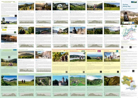
Wachau Hiking Map
Fesslhütte Kanzel
The 14 stages of the Wachau World Heritage Trail are an impressive reminder of just how enjoyable hiking can be. Wending its way gently up and down, the long-distance trail encircles one of the most idyllic parts of the Danube valley: the stunning 36-kilometre stretch known as the Wachau. Each stage of the trail has its own scenic highlights. The steep hillsides on the northern bank of the Danube are covered in stone-terraced vineyards, with the picturesque winegrowing towns of Krems, Dürnstein, Weißenkirchen and Spitz nestling below. Behind them rises the Jauerling, at 960m the highest peak along the entire course of the Danube. The tranquil southern side between Melk and Mautern is dominated by the wooded foothills of the Dunkelstein Forest. The flatter land beside the river is covered in vineyards and orchards, while the higher ground in between affords enchanting views of fascinating hilltop ruins. The local winegrowers and restaurateurs make the Wachau a paradise for gourmets. Wachau wines are among the best Austria has to offer, and the local hostelries – from top-class restaurants to the many wine taverns – offer delicious regional specialities for every taste and pocket.
Dürnstein
It's all about the journey
STAGE 2 Dürnstein – Weißenkirchen
Legendary ruins and dappled woods
Ruine Dürnstein
Wachau World Heritage Trail
Picturesque orchards and wooded hilltops
Painted waymarks for Wachau World Heritage Trail and Jauerling-Runde
Mühldorf
Spitz
Signpost with walking times and pictograms Jauerling 960 m
Fensterfelsen © Donau Niederösterreich Robert Herbst
5 h 547 m ascent / 544 m descent
14.9 km
Melk © Donau Niederösterreich Robert Herbst
Bärenreut plateau, 521 m
5 h 40 min 690 m ascent / 684 m descent
Tachberg lookout tower 383 m (currently closed, rebuild planned)
Hohenwarthberg 542 m
Hoher Stein 679 m
Seekopf 671 m
525 m in the woods above Pemexel hill
Rantenberg 4, 3644 Emmersdorf
Hotel Residenz Wachau, Aggsbach Dorf no. 19
Aggstein Castle
Pammer winery and wine tavern, Bacharnsdorf 18
Unterbergern Busstop Town Centre
Melk
4
5
6
7
8
10
11
12
13
14,9 km
Flower-filled meadows and an abbey with an impressive art collection
4
5
6
7
8
9
10,1 km
2
3
4
5
6
7
8
9
10
11
12
13
14
15,7 km
0,0 1
2
3
4
5
6
7
8
9
10
11
12
13
14
15
16 17,6 km
0,0 1
2
3
4
5
6
7
8
9
12
13
14
15
16 17,7 km
100
0,0
1
2
3
4
6
7
5
8
9
Unterbergern
200
Biritor
300
Ferdinandwarte
Rossatz
Rossatz
11
Abzwg. nach St. Lorenz
10
400
Bergerner Höhe
100
500 m
Radfähre Rossatzbach
200
Zeilingmaißhöhe
300
Kreuzberg
400
Bacharnsdorf
Hofarnsdorf
Hofarnsdorf
Rollfähre
Hoher Stein
Kastlkreuz
Maria Langegg
200
Burgruine Aggstein
300
Hartl
400
Aggsbach-Dorf
Aggsbach-Dorf
Hotel Residenz Wachau
Bildbuche
Hohenwarter Höhe
Berging
Schönbühel
Pielachberg
(Brücke)
1
0,0
Jonaskreuz
100
Pielach
3
Melk
2
1
0,0
Stift Melk
100
Leopoldsbrücke
Käfermühle
9
200
500 m
500 m
600
Rotes Kreuz
3
400 300
600
700 600
Pemexel
2
200
500 m
700
Hirschwand
1
300
600
Seekopf
0,0
400
Kraftwerk Melk
100
Mödelsdorf
200
Felbring
300
Zintring
400
500 m
Melk
Beech, Scots pine and sessile oak grow side by side in the natural woodlands of the Wachau, which are home to the spotted salamander and the Aesculapian snake as well as rare beetle species. Over the millennia, the Danube cut its way through the Bohemian Massif, separating Dunkelstein Forest from the high plateau of the Waldviertel on the other side of the river.
Schloss Luberegg
The dry stone walls that once served to reinforce the terraced vineyards are also home to beneficial insects and other creatures. Passing hikers might spot slow-worms, praying mantis or the European green lizard, which gives its name to one of the three locally produced wines. The aptly-named plant basket-of-gold flowers after the springtime apricot blossom, covering the slopes in a sea of brilliant yellow.
Aussichtswarte Tachberg
One of the characteristics that led to the Wachau being designated a World Heritage Cultural Landscape are its very compact settlement structures. The local villages combine architectural styles from multiple eras and the built-up areas have clear boundaries with virtually no overspill into the surrounding landscape. These lovely compact villagescapes are a signature feature of the Wachau and especially worthy of preservation.
Rantenberg
The narrow yet important strip of riverine wetland beside the Danube at Schallemmersdorf is the nesting place of a rarely-seen bird: the kingfisher. A renaturalization project has allowed this beautiful bird with its iridescent blue and orange plumage to colonise the protected wetland habitat, which can be viewed from across the river at Schönbühel.
Emmersdorf
Back in the day, ships travelling upstream on the Danube required the muscle power of up to 30 horses and men to drag them along with ropes from the towpath; nowadays, they glide through the locks at Melk hydroelectric plant. The 100,000 or more ships that pass through the locks every year testify to the Danube's importance as a major line of communication between East and West.
Emmersdorf
The Wachau Railway viaduct with its eight arches is an Emmersdorf landmark and forms part of the UNESCO World Heritage Cultural Landscape. Started in 1897, the Wachau Railway was opened in 1909 as part of a planned rail link from Vienna to Linz and helped fuel the local tourist boom from the 1950s onwards. Today, it operates as an excursion service between Krems and Emmersdorf. (Felbringbach)
Orchards, vineyards and Dunkelstein Forest are the key features of this stage, which also rewards walkers with the best views of Dürnstein. From the wine-growing village of Rossatz the trail passes through natural riverine wetlands and orchards to a sandy beach on the banks of the Danube. It then climbs up through the Rossatz vineyards and Dunkelstein Forest to the summit of Pemexel hill (508 m). After crossing the Bergerner Höhe plateau, it finally leads downhill.
10
11
12
13,8 km
O t h e r l o n g - d i s ta n c e h i k i n g t ra i l s i n t h e re g i o n
STAGE 14 Mautern – Krems
Roman ruins and medieval alleyways
The "roof of the Danube" between Wachau and Weinviertel
Kremstal-Danube Hiking Trail
Nibelungengau Hiking Trail
Varied Tours with Views
Mythical Hiking Along the River Of Time
Way of St. James
Dunkelsteinerwald-Runde (DUR)
1h
5
6
7
9
10
11
12
13
14
15
16,7 km
0.0
1
2
3
4
5
6
6.8 km
Further information is available at www.donau.com/jakobsweg
STAGE 4 Emmersdorf Marktstraße – Weiten Prangerplatz
STAGE 5 Weiten village square – Raxendorf marketplace
STAGE 6 Raxendorf marketplace – Mühldorf marketplace
STAGE 7 Mühldorf marketplace – Jauerling – Spitz Kirchenplatz
For detailed descriptions of all the stages, GPS tracks and lots more useful information about the World Heritage Trail, please visit www.welterbesteig.at Scan the QR code or visit www.wachau.at/schlafen for a full list of accommodation providers
Scan the QR code for bookable hiking packages incl. luggage transport..
2
3
4
5
6
7
8
9
10
11
Spielerkreuz wayside cross, 540 m
above Eibetsberg 617 m
Am Großen Berg, 739 m above sea level
Jauerling 935 m (summit above the Naturparkgasthaus inn)
Langthaler farmstead and inn, Pömling 14
Gasthaus zur Post, Fam. Kremser, Hauptstraße 47/1, Weiten (at the Prangerplatz)
Weißes Rössl inn, Fam. Siebenhandl, Markt 17, Mühldorf
Wachau Terrace, Naturparkgasthaus inn
400 300 200 100
700
0,0 1
2
3
4
5
6
7
8
9
10
11
12
13
14
600
15
500 m
16 17,7 km
400 300 200
0,0
From Raxendorf, the trail follows forestry roads and farm tracks to the hamlet of Frühwirt, then continues through splendid woodland to the village of Trandorf with its fortified church. Enjoying the lovely views, we cross meadows and fields to the hamlets of Amstall, Wegscheid and Ötz, where a Celtic boundary stone stands beside the footpath. Our walk finishes at the old mill wheel in Mühldorf marketplace.
800
1
700
2
3
4
5
6
7
8,1 km
600
500 m 400 300
0.0
1
2
3
4
5
6
7
8
9
10
11 12.2 km
From Mühldorf we make our way to the summit of the 628 m Trenning hill (viewpoint), passing Lower Austria's highest vineyard en route to the Jauerling, the "roof of the Danube". At the summit awaits the Naturparkgasthaus inn, with glorious views from its Wachau Terrace. The trail continues via Benking, descending through splendid woodland past the summits of Hirschenkogel, Zwölferkogel and Elferkogel to the ruins of Hinterhaus Castle. From there it's not far to the finish point of the trail in front of the parish church in the wine-growing town of Spitz an der Donau. 1000 m 900 800 700 600
500 m 400 300 200
0,0
1
2
3
4
5
6
7
Spitz
13 14,3 km
500 m
. From the village square (Prangerplatz) in Weiten the trail leads up to Eibetsberg, then over Schießgrub and Kulm hills down to idyllic Zehentegg. We then follow the path through species-rich meadows to Heiligenblut with its charming pilgrimage church. Continuing along the main street we finally reach the village of Raxendorf, where our walk finishes in the marketplace.
8
9
10
11
12
Radlbach
. Leaving Emmersdorf, we pass by Rothenhof Castle and the picturesque hamlet of Hain to reach St. Georgen. The path then climbs through meadows full of wildflowers to Pömling and back down to Eitental. Crossing the open meadows of Lohsdorfer Höhe and Kogelfeld we reach the hamlet of Mörenz and shortly afterwards the Spielerkreuz wayside cross, the highest point on this stage of the trail. The trail continues via Nasting to Weiten with its fortified church, the finish point of our walk.
Danube between Melk and Krems; service 720 operates every 1 to 2 hours along the southern bank of the Danube. On Friday and Saturday evenings service 715 gets you home safely after an enjoyable evening out at the wine tavern.
Service 718 runs between Spitz and Mühldorf, and on weekdays onward via Raxendorf to Pöggstall in the Waldviertel region. Service 719 brings passengers from the Waldviertel region to St. Pölten via Spitz and Melk and return.
5 h 768 m ascent / 899 m descent
14,3 km
Teufelsmauer
12
4 h 30 min 300 m ascent / 480 m descent
Thurn
1
12,2 km
Trenning
0,0
Benking
200
8,1 km 3 h 423 m ascent / 230 m descent
5 h 45 min 524 m ascent / 398 m descent
Naturparkgasthaus
300
Grimsing
400
Zintring
500 m
17,7 km
re points throughout the Wachau region. Registration and detailed information at www.nextbike.at.
Trenning © Donau Niederösterreich Robert Herbst
Ruine Hinterhaus
Nextbike: nextbikes can be hired and returned around the clock at numerous bike hi-
Further details are available at www.vor.at Information to help you plan your route is available at anachb.vor.at
Nature Park Jauerling © BrandingBrothers
© www.extremfotos.com
Rothenhof © Donau Niederösterreich Würflinger
600
Felbring
600
Loitzendorf
Maria Laach
Litzendorf
Schlaubing
Abzwg. Seeb
Marterl Schildgraben
200
Bireben
300
Aggsbach Markt
Aggsbach Markt
Schleinkhof
Köfering 8
Rosenmühle
Fundort Venus Willendorf
Schwallenbach 4
400
700
Friedersbach
3
500 m
Further information is available at www.dunkelsteinerwaldrunde.at
Mühldorf
4 h 216 m ascent / 594 m descent
This stage begins with easy walking on farm tracks from Maria Laach via Friedersdorf to Loitzendorf. From there we continue through splendid woodland and flower-filled meadows to Felbring and the idyllic hamlet of Zintring. Finally, we follow the Grimsing Gorge down to Grimsing, where a lovely panoramic path leads us to our finish point in Emmersdorf.
Maria Laach
2
Teufelsmauer
Ruine Hinterhaus
Spitz 1
From Aggsbach Markt, the path takes us up to Bireben and onward up the side valley known as Schildgraben to Seeb. From there, we continue to the hamlets of Schlaubing and Litzendorf, where the wayside shrine is a good place for a rest. After visiting the Gothic pilgrimage church in Maria Laach we finish our walk in the marketplace. Maria Laach marketplace is also the starting point of the Energy Trail, a short themed walk and a perfect opportunity to refresh and recharge.
Further information is available at www.nibelungengau.at
Mühldorf
14,3 km
A particularly beautiful stage of the Way of St. James, this trail links the abbeys of Göttweig und Melk and is rich in historic and cultural treasures. The spiritual journey is punctuated by orchards and vineyards, forests and stunning viewpoints high above the Danube. Beside the two magnificent Baroque abbeys, other impressive sights dotted along the 49-kilometre trail include the monastery of Maria Langegg, the former Carthusian monastery of Aggsbach and the ruined Aggstein Castle.
Further information is available at www.kremstal.at
Wegscheid
2 h 30 min 428 m ascent / 47 m descent
Maria Laach marketplace 586 m
600
3,5 4,0 km
Emmersdorf © Donau Nö Tourismus
Dorfwirtshaus Lagler, Loitzendorf 14 (inn in the village centre)
700
Krems
Steiner Tor 3,0
STAGE 3 Maria Laach marketplace – Emmersdorf Marktstraße
Meadow on the Jauerling © Donau Niederösterreich Tourismus Robert Herbst
6,8 km
Kremser Tor Kunsthalle 2,5
2,0
Amstall
1,5
Trandorf
1,0
Frühwirt
0,5
0,0
Raxendorf
100
Wayside shrine in Litzendorf 594 m
0,0
At your service for further information Donau Niederösterreich Regional Tourist Board Wachau-Nibelungengau-Kremstal Tourist Office Schlossgasse 3 I A-3620 Spitz/Donau Tel.: + 43 (0) 2713/300 60-60 urlaub@donau.com I www.wachau.at I www.donau.com
Wachau bus services: Service 715 operates hourly along the northern bank of the
The Dunkelstein Forest Loop (DUR) is a 160-kilometre hiking trail that passes through all the communities in the Dunkelstein Forest, taking in the region's loveliest beauty spots. Designed as a circular trail, it comprises nine main stages and four interstages with other trails to allow variation and provide enjoyable walks for families and more ambitious hikers alike. The paths offer stunning views and wend their way through idyllic woodland to monasteries, castles, fortresses and ruins, while local inns, wine taverns and hotels provide rest, refreshment and sustenance en route.
Raxendorf
13,0 km
Weiße Rose inn, Fam. Busch, Maria Laach 5 (in the marketplace)
200
River Danube Wachau World Heritage Trail Jauerling-Runde Dunkelsteinerwald-Runde (DUR) Way of St. James
holidays in the off-peak season and daily in the summer months, with several trains a day between Krems und Emmersdorf. Further information is available at www.wachaubahn.at
51.7 km 2 – 3 days
Nibelungengau - The name of the wide valley between Ybbs and Pöchlarn has its origins in the Song of the Nibelungs, the medieval heroic epic. Times have passed, but numerous treasures remain hidden in the region north and south of the Danube, waiting to be discovered. A treasure map shows the way to historical excursion destinations, varied nature with the best views and culinary delights. The Nibelungengau long-distance hiking trail is a great way to discover several treasures - ideal for explorers, those seeking peace and quiet, and families. Along the way, the secrets of each treasure are revealed and take you on a journey through time, or let you get to know the people, their histories, tradition and zeitgeist.
Heiligenblut
11
In the woods above Schleinkhof farmstead 535 m
300
Haunoldstein
Wachau Railway: The Wachau Railway operates on Saturdays, Sundays and public
With its many different stages around the wine and cultural town of Krems, the longdistance hiking trail is also particularly suitable for day trips through gentle meadows, shady forests and fertile vineyards between Wachau and Kamptal. Each individual stage makes for a wonderful walk or hike with spectacular viewpoints. Some of the tours lead through undiscovered areas and take between 50 minutes and 4.5 hours to complete. With their easy to moderate level of difficulty, they are also suitable for families with children. Culinary delights can be found in the high-quality inns, rustic wine taverns and award-winning restaurants. The varied Krems Valley can also be experienced by bike on 5 recommended tours.
Weißes Kreuz
10
Stage Furth – Göttweig Abbey – Melk Abbey
/ total ascent and descent: 3296 m
Zehentegg
9
Linzer Tor
Römerkastell
Zellerkreuz
Furth 8
© Daniela Matejschek
1665 m ascent / 680 m descent
approx. 160 km
/ total ascent and descent: 2890 m
Abzwg. Eibetsberg
7
approx. 110 km
Weiten
6
approx. 100 km / total ascent and descent 1200 m
Mörenz
5
The trail is divided into 9 stages, with 4 different route options: Karlstetten – Ober bergern – Schenkenbrunn – Maria Langegg – Aggsbach Dorf – Gerolding – Melk – Inning – Hafnerbach – Karlstetten
Eitental
4
The trail is divided into 8 stages: Sarmingstein - Persenbeug - Marbach - Maria Taferl - Leiben - Emmersdorf - Pöchlarn - Krummnußbaum - Persenbeug
Pömling
3
The route is divided into 15 stages: Krems - Mautern - Furth - Paudorf - Hollenburg - Gedersdorf (shortcut to Krems) - Langenlois - Lengenfeld - Stratzing - Droß (shortcut to Senftenberg) - Gföhl - Senftenberg - Krems
Hain St. Georgen
2
200
© Weinfranz
Rotes Kreuz
1
300
Nibelungengau © Donau Niederösterreich Robert Herbst
Emmersdorf
0,0
400
Emmersdorf
100
Stift Göttweig
200
Linde zu Baumgarten
300
Am Giritzer
400
Frauenbergkirche Stein
500 m
Donaubrücke (Flussmitte)
500 m
Mautern
Until 1463, there was no bridge over the Danube anywhere between Passau and Vienna. That year saw the building of the first ever bridge between Stein and Mautern, supported on 26 timber piles. Placenames such as "Furt" or "Förthof" recall earlier fording of the Danube at this point. The present bridge, a steel truss construction dating from 1895, is a listed historic monument.
Mautern
In the early 1970s, local activists embarked on a ten-year struggle to prevent the construction of a power plant at Rührsdorf. The Wachau was subsequently awarded the European Diploma for Protected Areas in 1984, before being inscribed on the UNESCO World Heritage List in 2000. This free-flowing stretch of the Danube also provides a valuable habitat for a large number of animal and plant species. Steinaweg
This stage of the trail is more of a history tour, featuring the Roman remains of Mautern, magnificent Renaissance and Baroque architecture and the well-preserved historic centres of Stein and Krems. Starting at Rathausplatz in Mautern, the trail crosses the Danube bridge to reach the medieval cobbled streets of Stein, passing through age-old squares and imposing gateways to finish at Gozzoburg castle and Hoher Markt marketplace in the historic heart of Krems.
© Doris Schwarz König
Weiten
Stagård winery and wine tavern, Hintere Fahrstraße 3, Stein
Auf der Hülben
Frauenberg church 217 m
Göttweig Abbey – in the entrance area near the viewing terrace
Museum Venusium, Willendorf (in the village centre)
500 m
Schallaburg
Neidling
Passenger boat services: DDSG operate passenger boat services between Melk and Krems from April to October (details and timetables are available at www.ddsg-blue-danube.at).
16 m ascent / 9 m descent
Spielerkreuz
4 km
Pretty vineyards, little wine-growing villages and the imposing spectacle of Göttweig Abbey perched atop its hill are the highlights of this stage of the trail. From Unterbergern, the trail passes through the Wachau and Krems Valley wine-growing areas, where age-old wine taverns are the perfect place for a refreshment stop. The path then leads through lovely woodland and meadows over to Am Giritzer hill, then back down through the sunken lane known as Zellergraben and on to the Roman town of Mautern.
This stage of the trail is just under 16 km long and takes us from Spitz to Aggsbach Markt. Highlights include the wine-growing town of Spitz, the ruins of Hinterhaus Castle, the Teufelsmauer rock formation ("Devil's Wall") rock formation, the medieval village of Schwallenbach and the famous Venus of Willendorf. Sweeping vistas of the Wachau Valley and idyllic countryside dotted with woods and vineyards make for a wonderful walk.
100
323 m ascent / 424 m descent
Göttweig Abbey 413 m
Spitz © Niederösterreich Werbung Franziska Consolati
400
5h
STAGE 2 Aggsbach Markt marketplace – Maria Laach marketplace
5 h 30 min 620 m ascent / 635 m descent
Hafnerbach
Karlstetten
Dürnstein and Rossatz operate from April to October. The ferry between Spitz and Arnsdorf operates all year round. Detailed timetables can be found under "Information & Service" at www.wachau.at.
© Daniela Matejschek
Gossam
STAGE 1 Kirchenplatz in Spitz – Aggsbach Markt marketplace
13 km
Unterbergern
A walk around the Jauerling Loop takes you on a journey spanning several cultural landscapes, natural habitats and historical eras. The trail wends its way above the Danube, passing through vineyards, broad meadows, villages and across gentle rolling hills to the summit of the Jauerling. The pilgrimage village of Maria Laach makes an ideal start and finish point. Consisting of seven stages, the Loop is a circular trail leading through the Jauerling-Wachau Natural Park and across the Waldviertel plateau. The interstages with the Wachau World Heritage Trail offer scope for variation and a number of alternative route options. www.jauerlingrunde.at
Dunkelstein 625 m
Schönbühel
Ferries: The ferry between Weißenkirchen and St. Lorenz and the bike ferry between
Hiking on the "roof of the Danube"
Aggsbach-Dorf
The "Wachau Day Ticket" (adults €12/children €6) can be purchased on all buses and at the Tourist Information Centres in Krems, Spitz and Melk. It is valid for travel on any one day on all public transport services in the Wachau region and the three Danube ferries (Dürnstein, Weißenkirchen and Spitz).
Göttweig Abbey © Robert Herbst
Jauerling-Runde
Aggsbach au Markt on
Getting to the Wachau: Travelling by public transport is easy. In Krems there is a connection to the Franz-Josefs-Bahn and Kamptalbahn, in Melk to the Westbahn.
Pilgrimage trail from abbey to abbey
www.naturpark-jauerling.at
© Andreas Hofer
Furth/Stift Göttweig
Gerolding
Public transport
The Jauerling rises to an altitude of 960m, making it the highest peak along the entire course of the River Danube. The surrounding area is a designated Natural Park and links the Wachau World Heritage Cultural Landscape with the Waldviertel region. In terms of landscape, the multifaceted Natural Park is dominated by the free-flowing River Danube, scenic side valleys, sunny terraced hillsides, wine-growing and orchards, meadows and oak woodland. Also known for its plantations of Christmas trees, the countryside around the Jauerling is dotted with picturesque castles and fortresses.
600
Maria Langegg
Unter-bergern Ober-
D
This rather strenuous stage incorporates part of a former Roman track and passes through wine-growing villages and a nature reserve. Starting at Hofarnsdorf Castle, the trail passes through wine-growing villages before following the former Roman track into Kupfertal ("Copper Valley") and Dunkelstein Forest. The Seekopf lookout tower and Hirschwand viewpoint offer stunning vistas of the Danube far below. The path then continues into the intact deciduous woodland of the Steinige Riess nature reserve and down through hillside vineyards to Rossatz.
500 m
Emmersdorf
4 h 326 m ascent / 254 m descent
13,8 km
The ruins of Aggstein Castle, the pilgrimage church of Maria Langegg and Dunkelstein Forest are the stand-out features of this stage of the trail. The path follows forestry roads and farm tracks from Aggsbach-Dorf to Aggstein Castle, before continuing through Dunkelstein Forest to the monastery of Maria Langegg. Some care is required on the short scramble up to the spectacular viewpoint of Hoher Stein. From there, the trail leads downhill, passing the Arnsdorf-Spitz cable ferry to reach Hofarnsdorf Castle.
STAGE 13 Unterbergern – Mautern
Jauerling Natural Park
17,7 km
Highlights of this stage include the town of Melk with its Baroque abbey, the splendid Schönbühel Castle and the gorgeous views of the Danube with the Jauerling plateau in the background. From the main square in Melk, the path leads via Melk Abbey up to Pielachberg hill and onward to the Jonaskreuz cross. We then follow a gravel farm track to Schönbühel Castle and continue up through the woods to Hohenwarther Höhe, a plateau with views of Dunkelstein Forest. From there, the trail descends to the hammer mill in Aggsbach-Dorf.
600
The Wachau World Heritage Trail hiking pin makes a perfect souvenir of your stay. The pins are available for a small charge from the Tourist Information Centres in Krems, Weißenkirchen, Spitz and Melk, or from the offices of the regional tourist board (Donau Niederösterreich Tourismus) in Spitz. Simply present your stamped pass. Stamp passes for the Wachau World Heritage Trail and the Jauerling-Runde are available free of charge from Tourist Information Centres throughout the region and can be download from the website www.welterbesteig.at – follow the link under "Service and tips".
5 h 45 min 777 m ascent / 779 m descent
15.6 km
© Daniela Matejschek
Lookout point Seekopf © Donau Niederösterreich Robert Herbst
Highlights of this stage include the romantic Luberegg Castle, the crossing of the River Danube at Melk hydroelectric plant and the Old Town of Melk. Starting in Emmersdorf marketplace, the path ascends to the village of Rantenberg with its views of Melk Abbey. It then continues downhill to Luberegg Castle and along the Danube promenade to the islet of Luberegg. Crossing the River Danube at Melk hydroelectric plant, the trail reaches the Old Town of Melk via "Lion Island" (Löweninsel).
Bärenreut
Stamp Pass and Hiking Pins
6 h 509 m ascent / 513 m descent
15,7 km
Aggstein Castle © Niederösterreich Werbung Franziska Consolati
Passing through quiet villages on the fringes of the Wachau, this stage has some glorious views. From Aggsbach Markt it's a steep ascent up Edelberg hill to the Bärenreut plateau, where a farm track takes us on to Zintring with its unusual wooden bell tower. From Felbring it's not far to the ruined Gossam castle chapel and the historic "Postman's Path" (Briefträgersteig) to Mödelsdorf. The trail then follows an old farm track to the Renaissance village of Emmersorf.
Aggsbach Markt
Dürnstein in the mist © Robert Herbst
3 h 177 m ascent / 171 m descent
10,1 km
Schönbühel Castle © Daniela Matejschek
Krems Mautern
Arnsdorf
Maria Laach
Austria. www.best-trails.at
16,7 km
Dürnstein
u
a Don
Rossatz
The Wachau World Heritage Trail is a member of the Best Trails of
Weißenkirchen
13 14,3 km
Impressum: Publishing details and credits: Media owner/publisher: Donau Niederösterreich Tourismus GmbH, Schlossgasse 3, A-3620 Spitz/Donau, tel.: +43 (0) 2713/30060-60, e-mail: urlaub@donau.com, web: www.donau.com. Photos: www.extremfotos.com, Niederösterreich Werbung/Robert Herbst, Niederösterreich Werbung/Franziska Consolati, Daniela Matejschek, Doris Schwarz König, Weinfranz, Best of Wachau/Rita Newman, Donau Niederösterreich/Würflinger, Donau Nö Tourismus, BrandingBrothers, Coverfoto: Donau Niederösterreich/Olga Brecht Cartography & graphics: Arge Kartographie, e-mail: arge.karto@aon.at. Data source terrain shading: basemap.at Underlying cartographic material: arge kartographie & Federal Office of Metrology and Surveying (BEV Vienna). Printers: Janetschek, Heidenreichstein. English translation: Angela Parker All information contained herein has been collated with the utmost care; however, no liability can be assumed for the accuracy and completeness of this information. Information correct as of November 2024