2026
FOREWO R D TA BLE
In November 2022, the Fort Pierce Redevelopment Agency (FPRA) adopted the Downtown Master Plan, charting a bold vision for a more connected, vibrant, and resilient core. That plan recognized that the heart of Fort Pierce is its people and places, and it called for a reinvestment in public spaces that celebrate the city’s heritage while preparing for its future.
This Conceptual Design for the Fort Pierce Downtown Park represents one of the plan’s earliest and most exciting outcomes. Building upon the momentum of Marina Square and the waterfront, the park has been envisioned as a civic anchor where residents and visitors alike can gather, celebrate, and enjoy the unique character of Fort Pierce.
More than a park, this project is about creating a dynamic and inclusive space that strengthens connections between downtown, the waterfront, and surrounding neighborhoods. Guided by community input and best practices in urban design, the Downtown Park is designed to be flexible and enduring, with a setting for concerts and festivals, markets and family outings, quiet reflection and daily life.
As Fort Pierce continues to grow and evolve, this project embodies the values of the Downtown Master Plan: honoring history, fostering economic vitality, embracing nature, and building stronger connections between people and place.
I NTRODUCTIO N 01
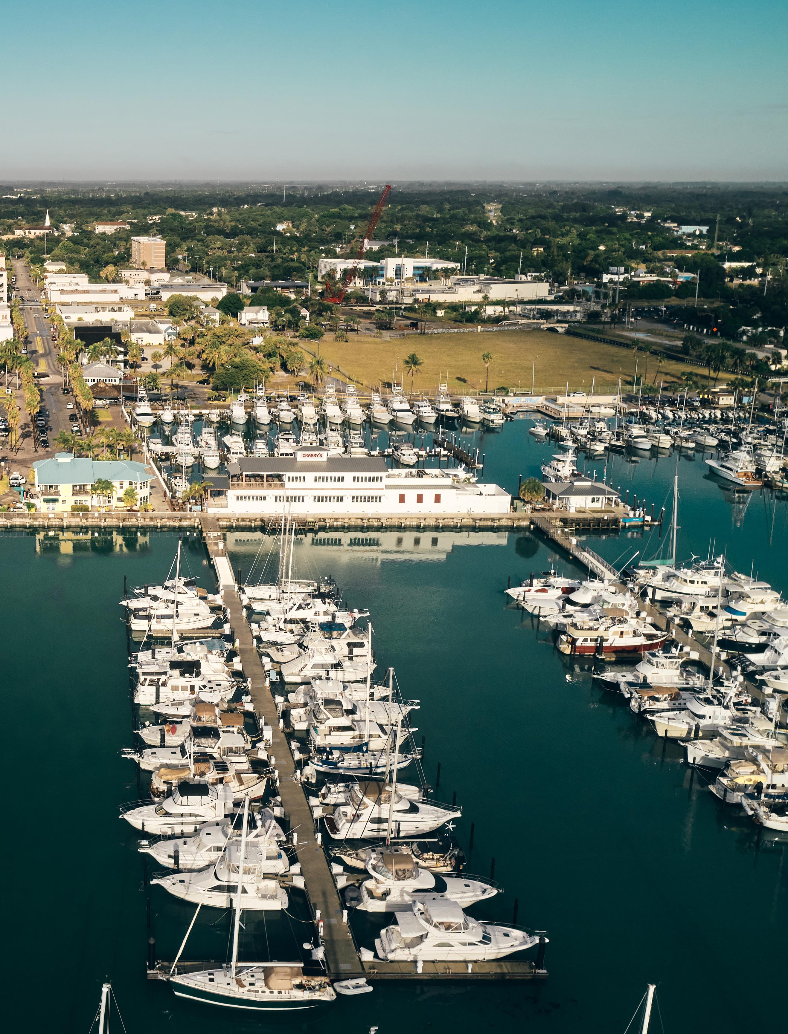
This project reimagines an underutilized downtown site as a vibrant, inclusive, and flexible public space. Grounded in robust community engagement, detailed site analysis, and proven placemaking strategies, the process delivers a clear, actionable plan to guide the site’s transformation.
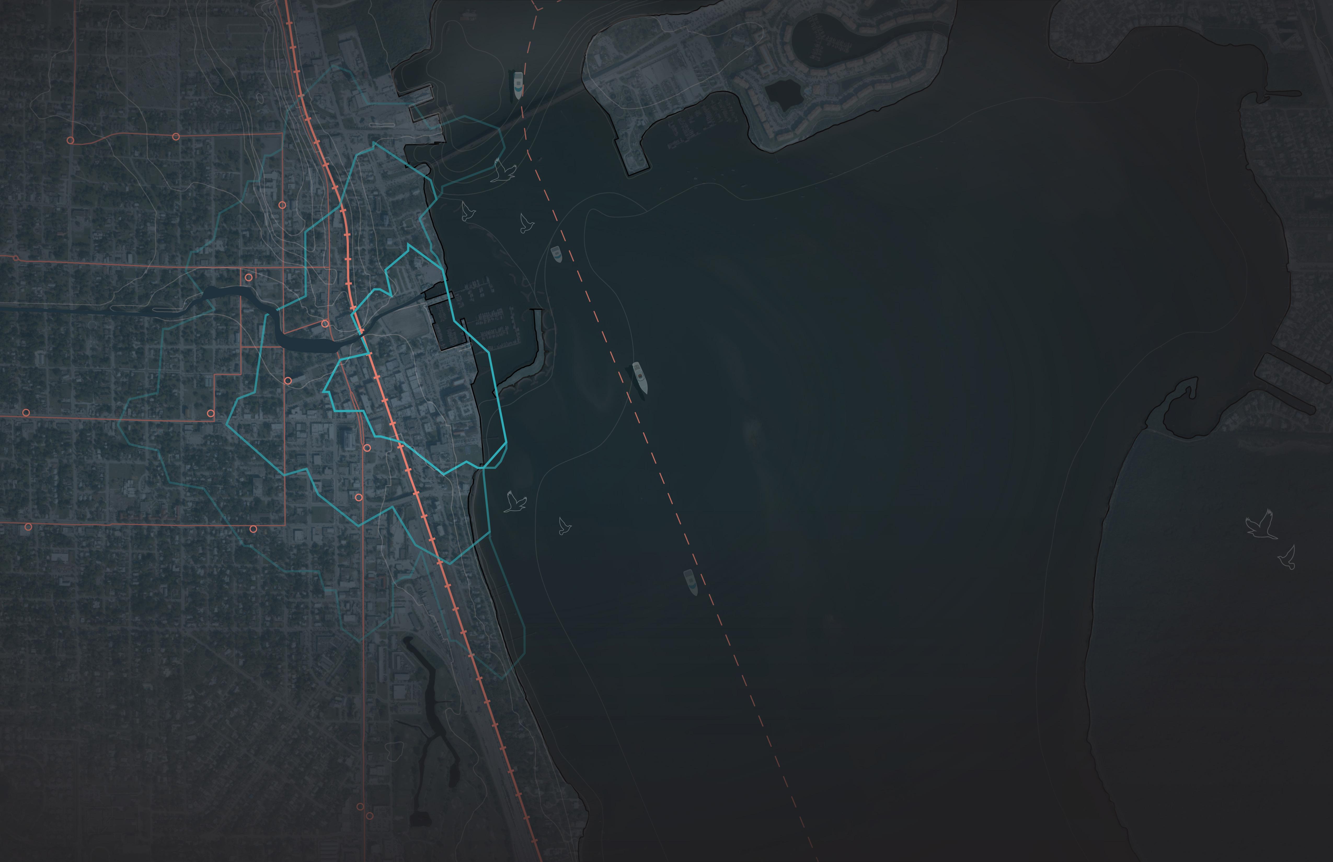
PROPOSED DOWNTOWN PARK SITE
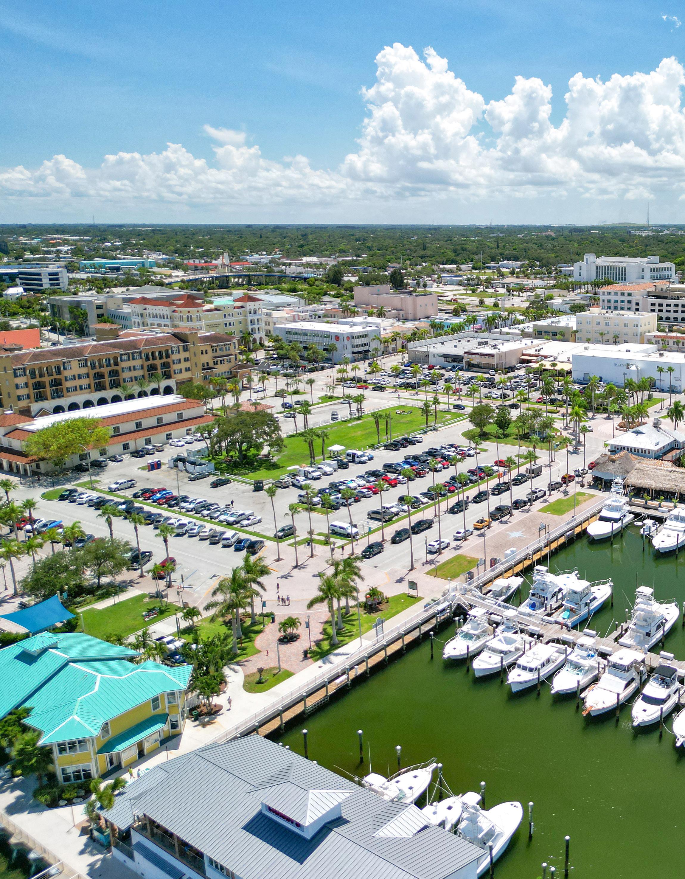
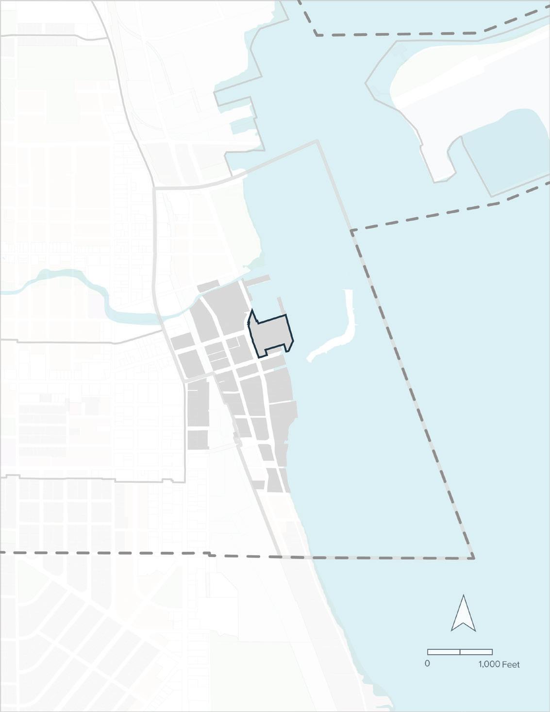
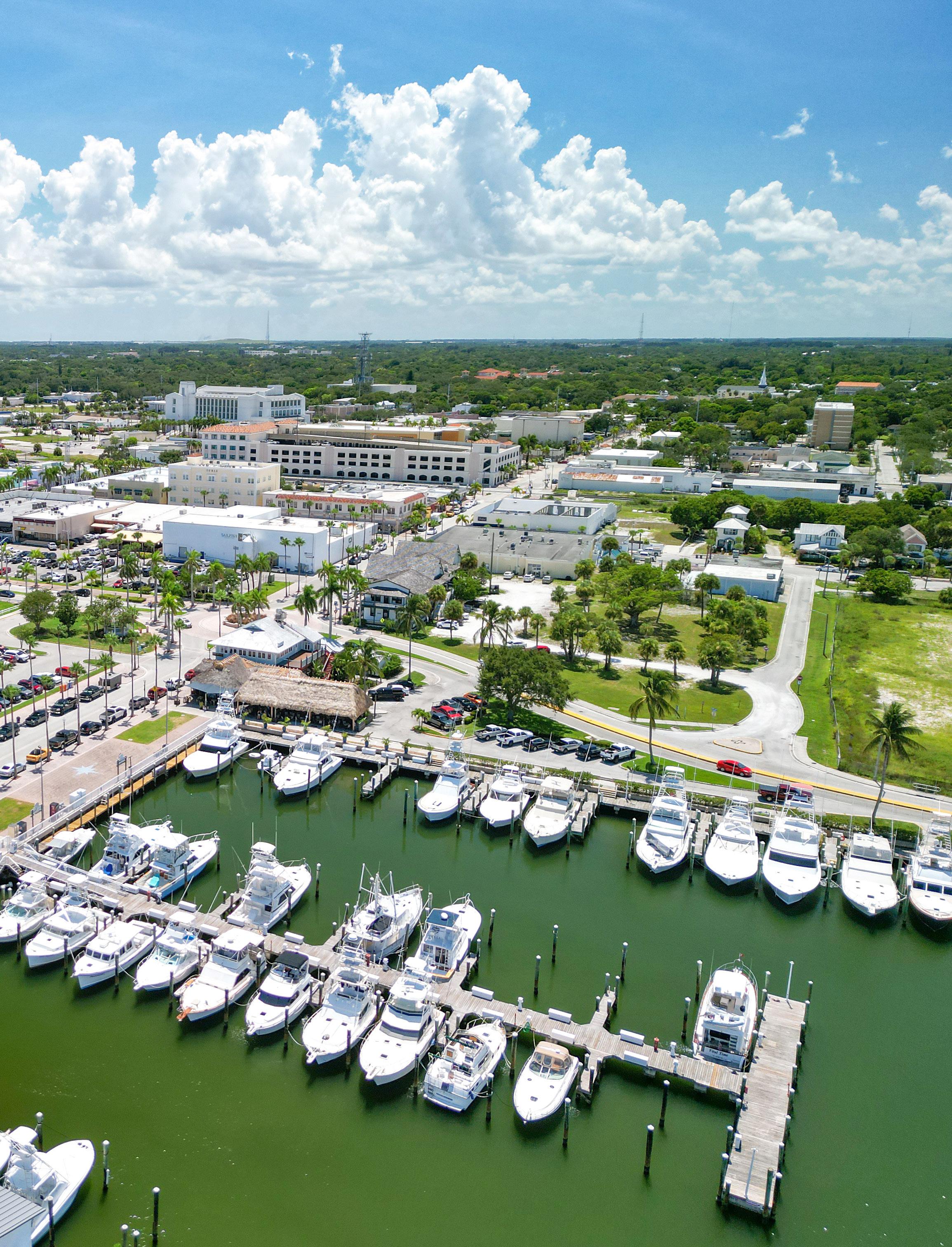
The proposed 5.9-acre site is centrally located in Fort Pierce, St. Lucie County, Florida, encompassing Gazebo Park, Marina Square, and portions of the Fort Pierce Marina. This prime location offers direct waterfront access and close proximity to key destinations. Within a five-minute walk, visitors can reach Kilmer Library, City Hall, Sunrise Theatre, the Manatee Center, and a variety of dining options.
The site is also connected to public transit, with bus routes 1, 2, 3, 7, and 8 serving the area. Routes 1 and 3 provide the most direct access, with stops within a 10-minute walk of the park. Additionally, the Brightline and Amtrak rail lines, located west of the site, offer opportunities for regional and statewide transit connections.
EVOLUTION
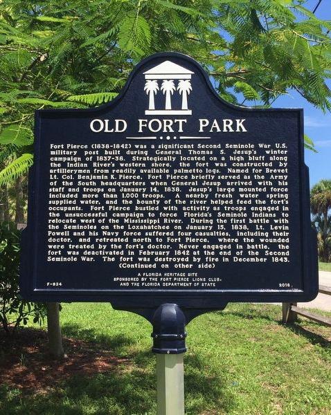
1838
ARMY POST ESTABLISHED
Fort Pierce began as an army post established in 1838 during the Second Seminole War. The fort played a crucial role in military operations and later influenced the settlement of the area as pioneers moved in after its abandonment.
1982
1997
FARMERS MARKET
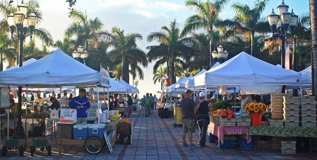
The Fort Pierce Farmers Market was established, providing a venue for local vendors to sell fresh produce, crafts, and other goods every Saturday.
DOWNTOWN WATERFRONT CHARRETTE
FPRA ESTABLISHED
The Fort Pierce Redevelopment Agency (FPRA) was established to guide the city’s redevelopment efforts, focusing on revitalizing both the physical and economic environment of the area.
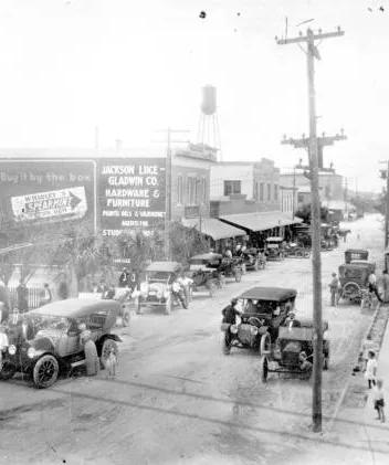
1901
FORT PIERCE INCORPORATED
Fort Pierce was incorporated in 1901, spurred by the Florida East Coast Railway’s expansion. The early 20th century brought rapid growth, new businesses, and key infrastructure improvements.
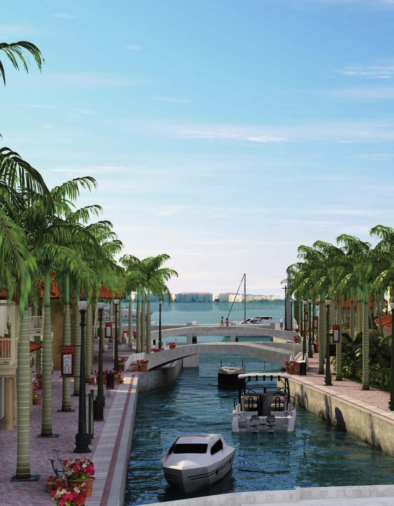
The City conducted the Downtown Waterfront Charrette, a collaborative planning session aimed at gathering community input to shape the future development of the downtown waterfront area.
2013
FORT PIERCE MARINA REBUILT
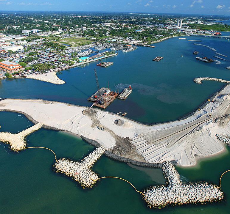
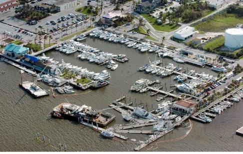
The Fort Pierce City Marina was rebuilt and expanded following destruction caused by the 2004 hurricanes, enhancing its capacity and resilience to future storms.
2022
DOWNTOWN MASTER PLAN
The City adopted a comprehensive Downtown Master Plan to guide future development, focusing on preserving the small-town character while promoting economic growth and revitalization.
2004
HURRICANES
Fort Pierce was significantly impacted by Hurricanes Frances and Jeanne, leading to widespread damage and initiating extensive rebuilding efforts.
Source: Eric Hasert/TCPalm
Source: Downtown Fort Pierce Farmers Market
Source: Jay Kravetz
Source: Tetra Tech
Source: State Archives of Florida
PATH FORWARD
A successful site design must comply with the city’s zoning regulations to align with broader city goals and streamline implementation.
FUTURE LAND USE
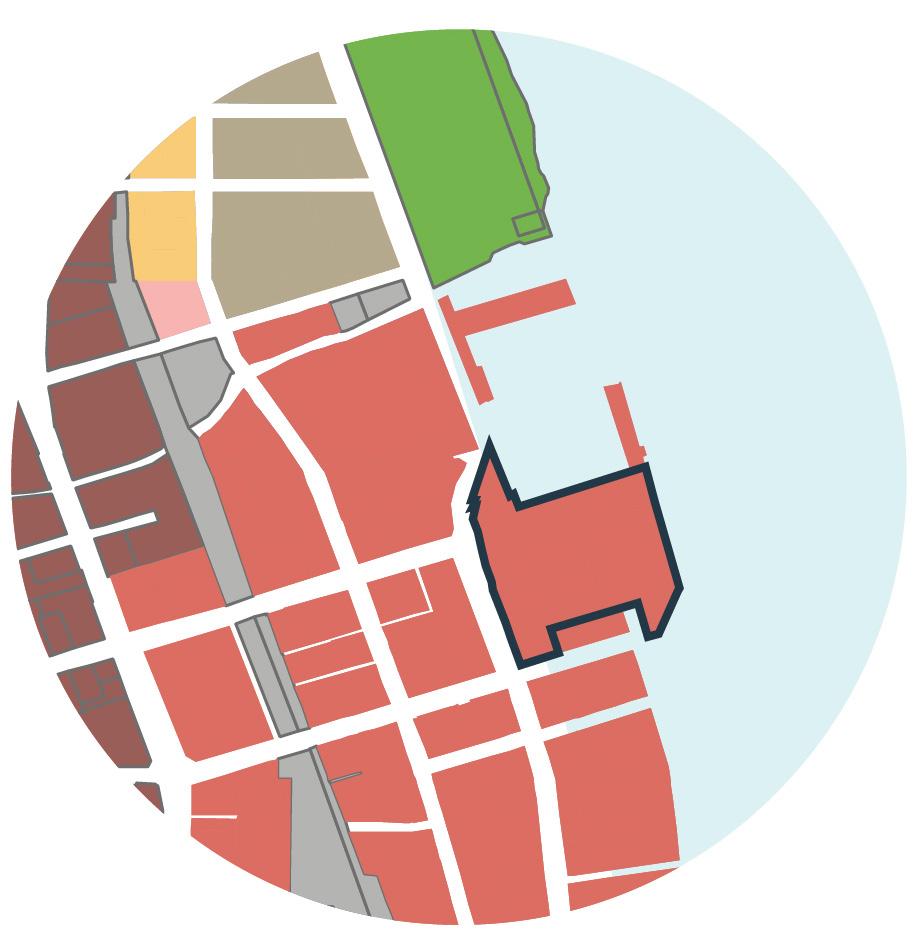
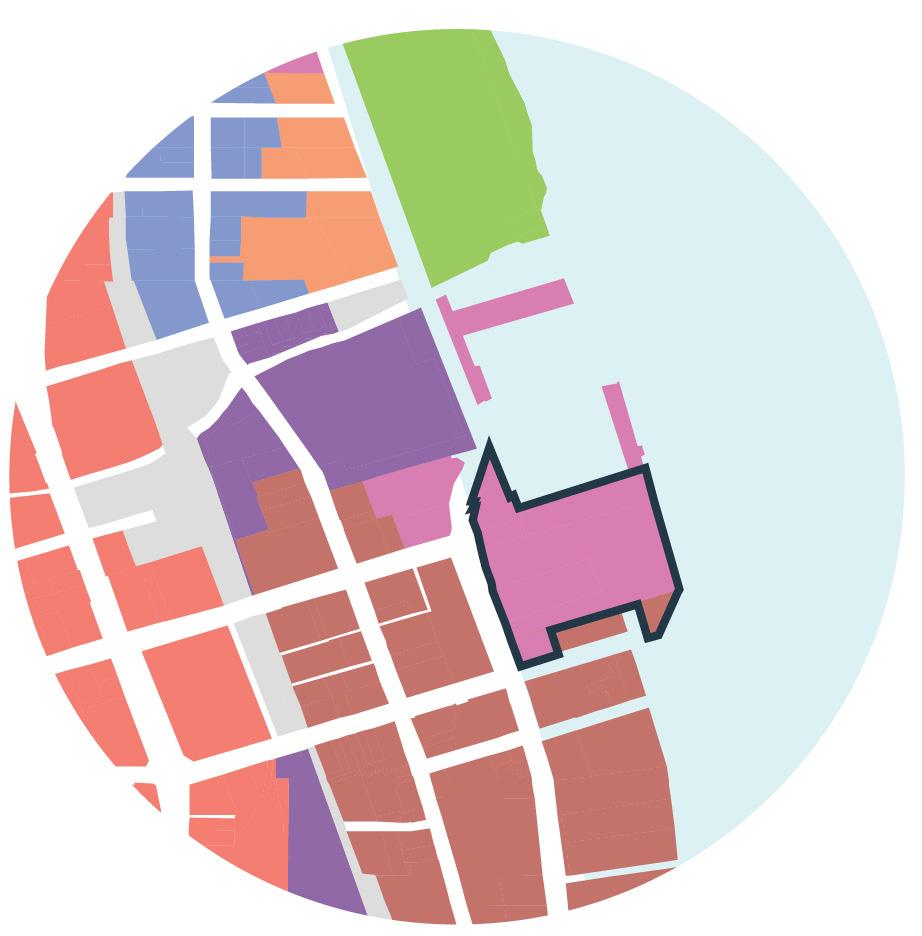
The park site is currently designated as part of the Central Business District (CBD) on the Future Land Use Map, reinforcing its role in fostering a high-density, mixed-use, and pedestrian-friendly downtown.
Central Business District
Industrial
Residential High
Corridor Opportunity Site
Residential Medium
Office Professional
General Commercial
FPRA
Also significant is the site’s location within the Downtown Development Area. Since the Fort Pierce Redevelopment Agency (FPRA) was established in 1982, this area has been recognized as a key catalyst for the city’s revitalization.
ZONING
In 2005, the park site was rezoned to Planned Unit Redevelopment (PUR), a designation aimed at encouraging innovative land development while ensuring compliance with the city’s comprehensive plan. The PUR zoning allows for a mix of residential and non-residential uses, promoting flexibility in design and land use.
C-3, General Commercial
C-4, Central Commercial
ES, Edgartown Settlement Zoning District
R-5 High Density Residential Zone
I-1, Light Industrial
OS-1 General & Recreational Open Space
PD, Planned Development
PUR, Planned Unit Redevelopment
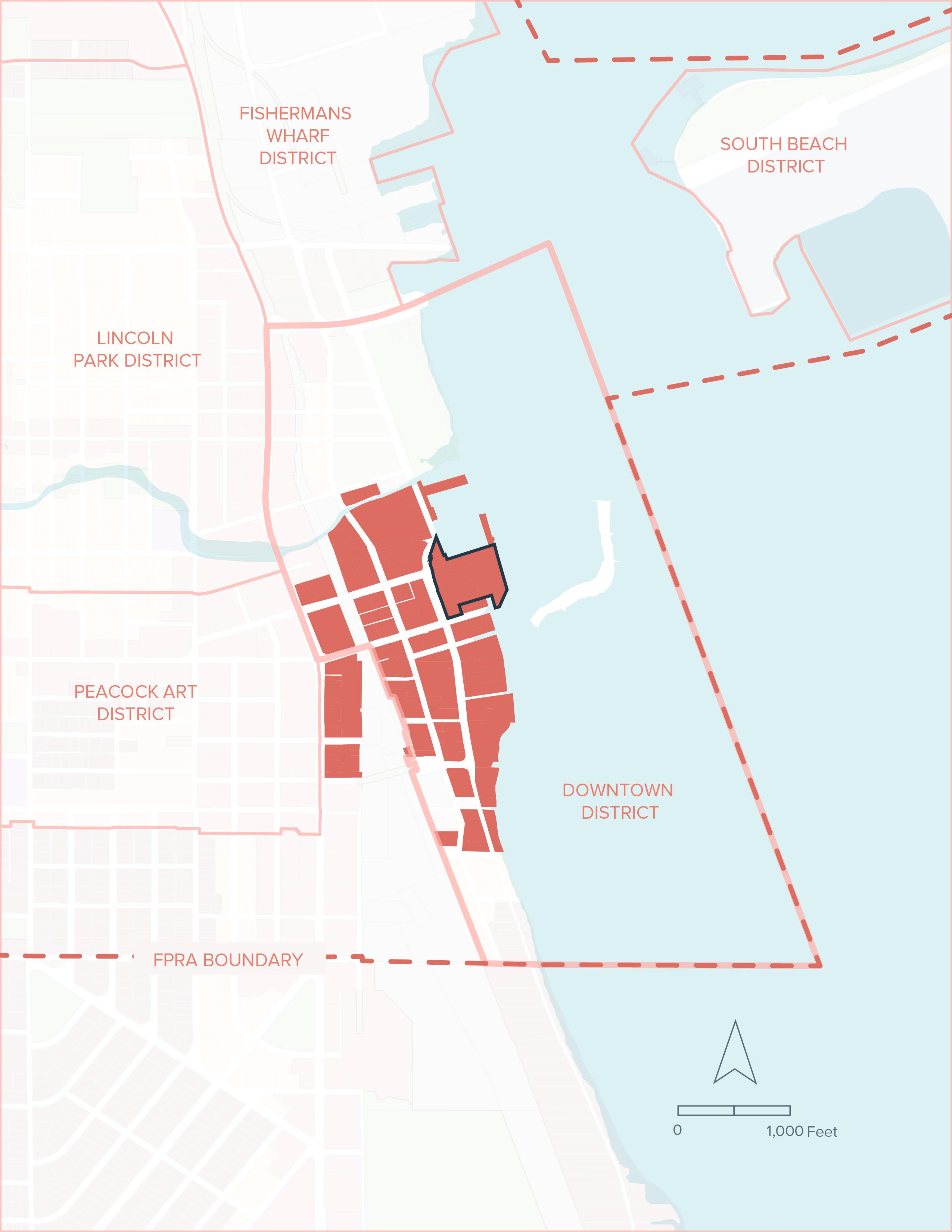
Central Business District
FPRA Boundary Downtown District
02GREATPARKS
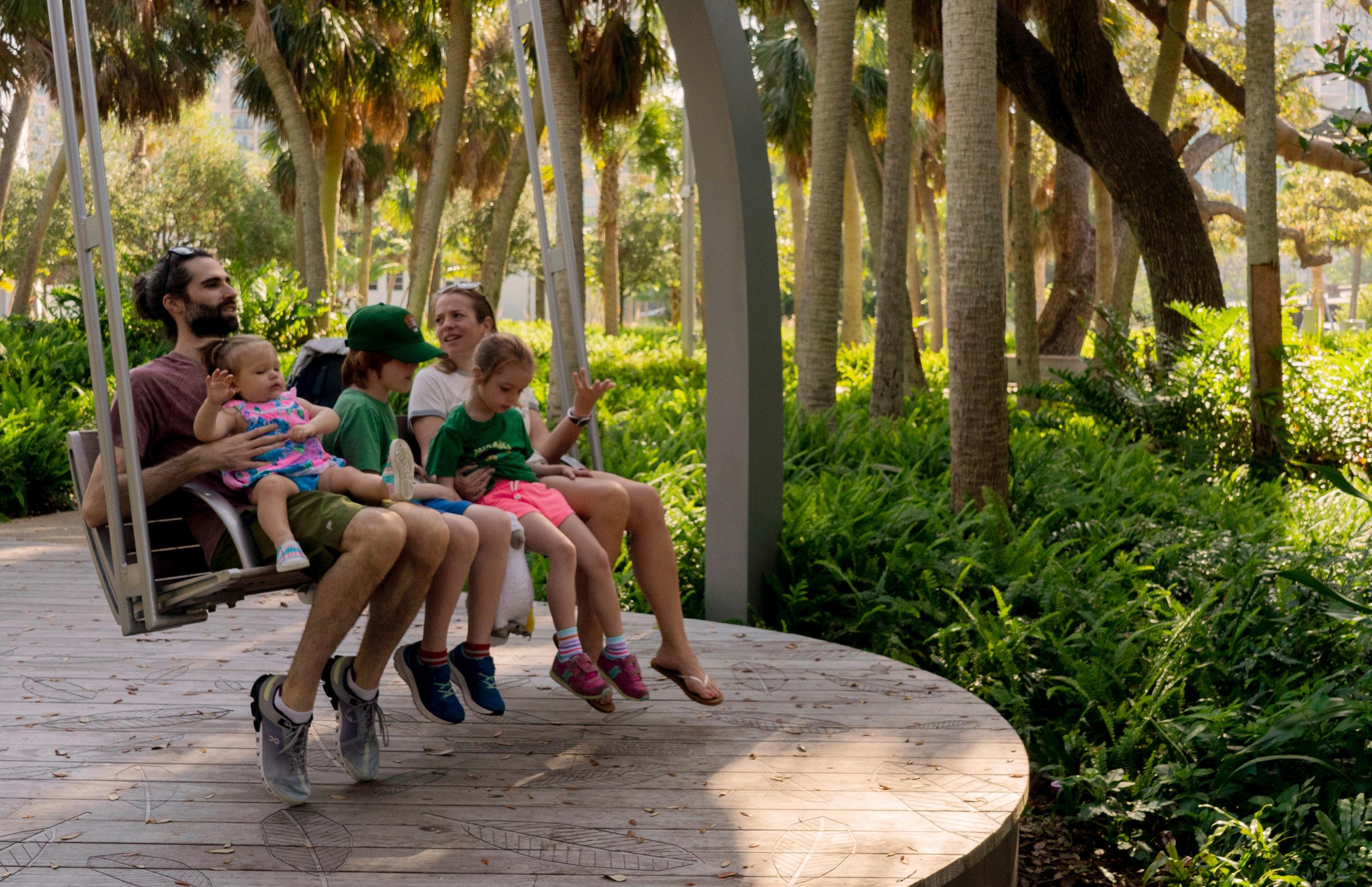
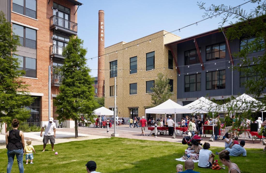
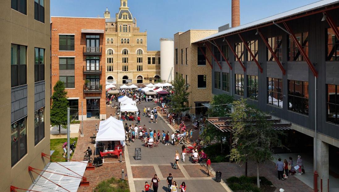
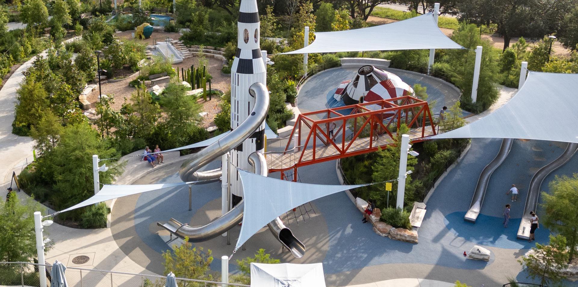
A great park doesn’t just happen. This framework breaks down the key elements that make parks successful from how they bring people together to how they support the environment and local economy.

A FRAMEWORK FOR DESIGN
Great parks are dynamic, evolving spaces that often become the heart of their communities. But what makes a park truly successful? How do we ensure it remains vibrant, well-used, and cared for over time? The key lies in following a set of three guiding principles, each supported by essential design elements that foster engagement, adaptability, and long-term stewardship.
A GREAT PARK IS FOR
PEOPLE
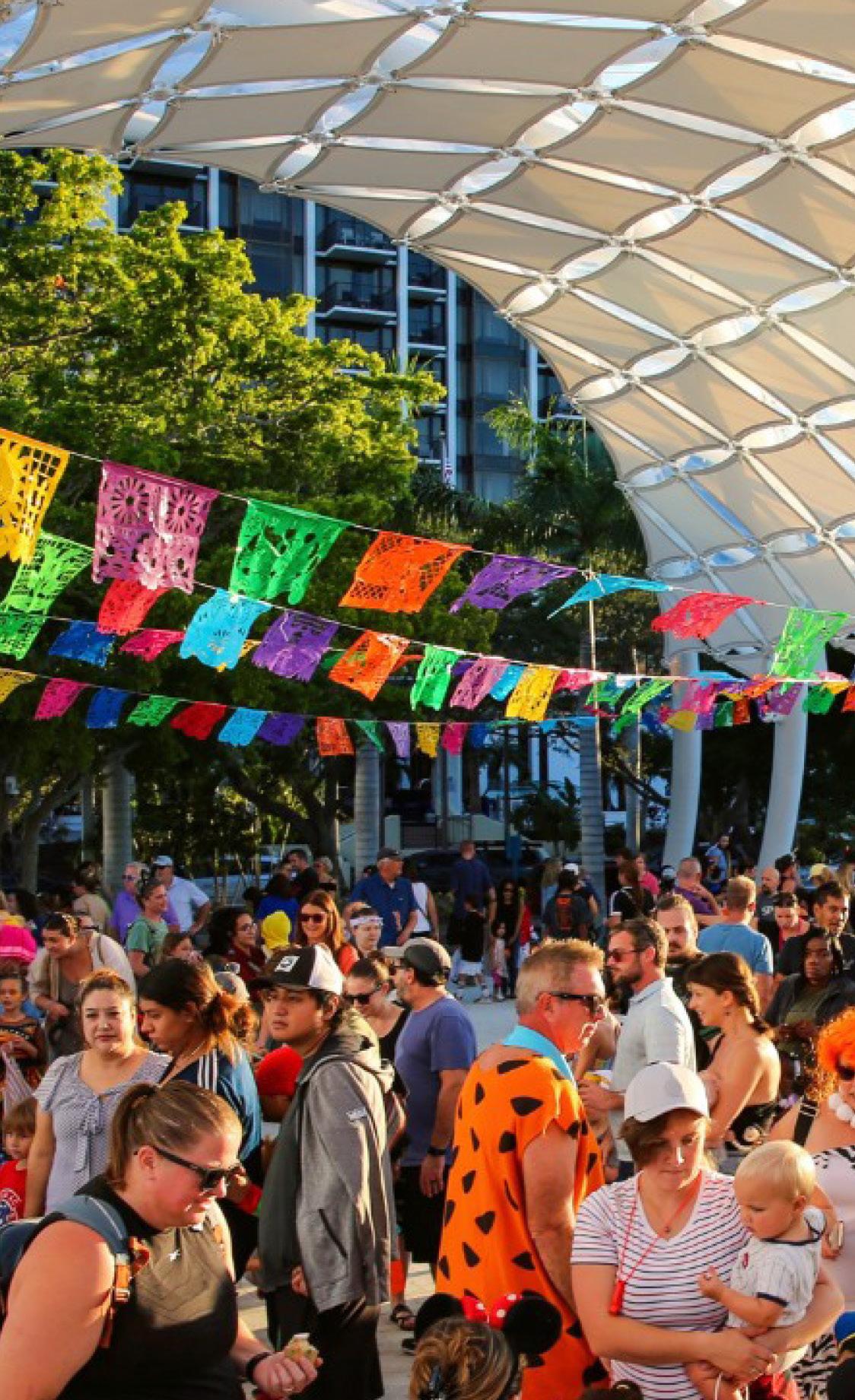
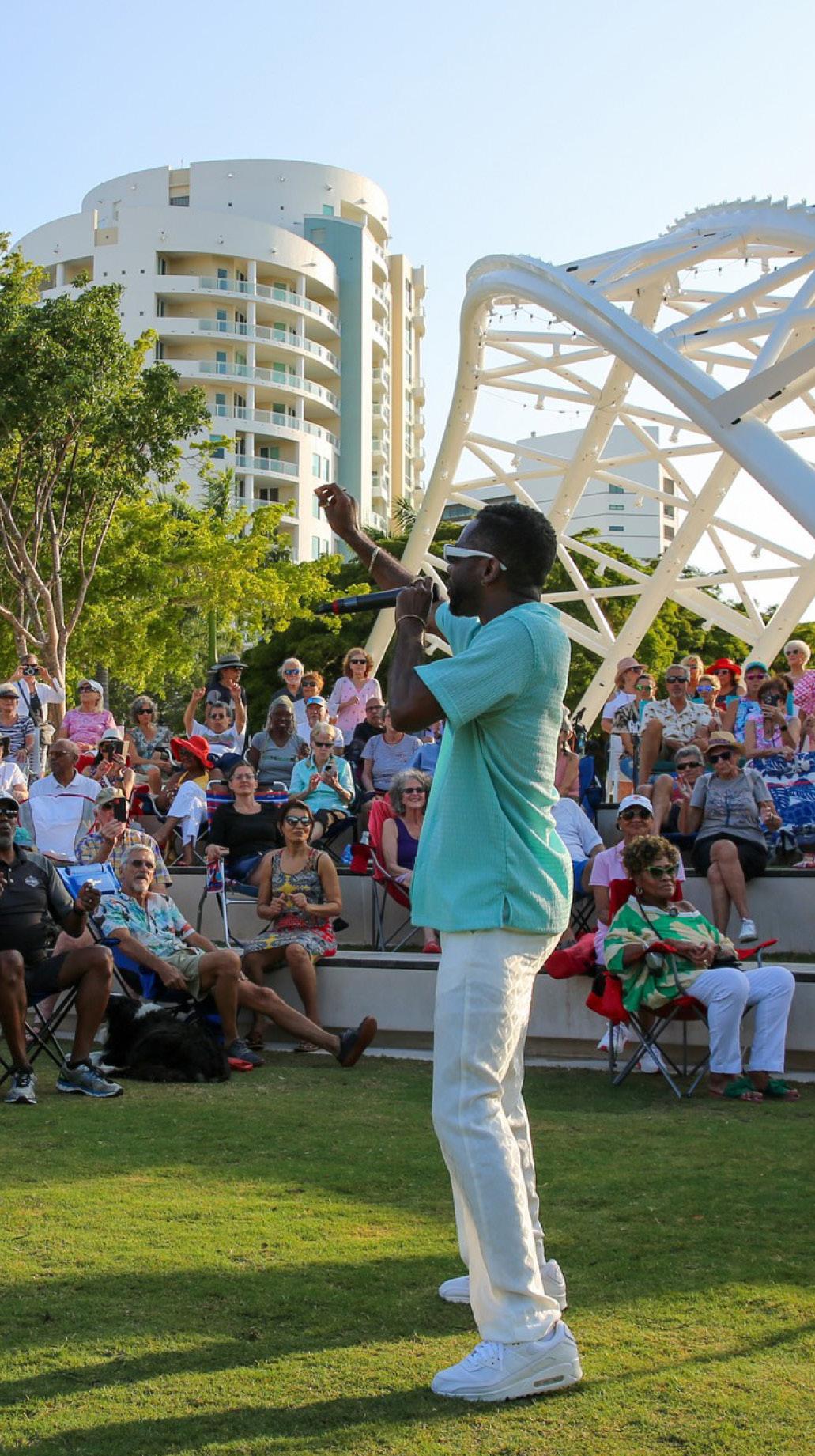
A well-designed park prioritizes social connection, comfort, and engagement. It should be a place that welcomes all, encourages interaction, and provides an array of experiences that appeal to diverse users throughout the day and year.
KEY ELEMENTS:
Varied Gathering Spaces – The park includes areas for both socialization and solitude, from large plazas for events to small pockets of seating for quiet reflection.
Seamless Connections – Designed to be intuitive and accessible, the park is wellintegrated with the surrounding streets, transit, and pedestrian pathways, making it easy to enter and navigate.
Visibility & Safety – Morning, daytime, and well-lit nighttime programming ensures consistent activity and natural surveillance, keeping “eyes on the park” and enhancing safety for all visitors.
Movement & Play – Spaces are designed to encourage physical activity, from playgrounds to walking trails, ensuring people of all ages have opportunities to be active.
Comfort & Shade – Strategic lighting, natural surveillance, and clear wayfinding enhance comfort and ensure the park feels safe at all times. Arts & Culture – The

Source: Agency Landscape + Planning
A GREAT PARK
IS AN ECOSYSTEM
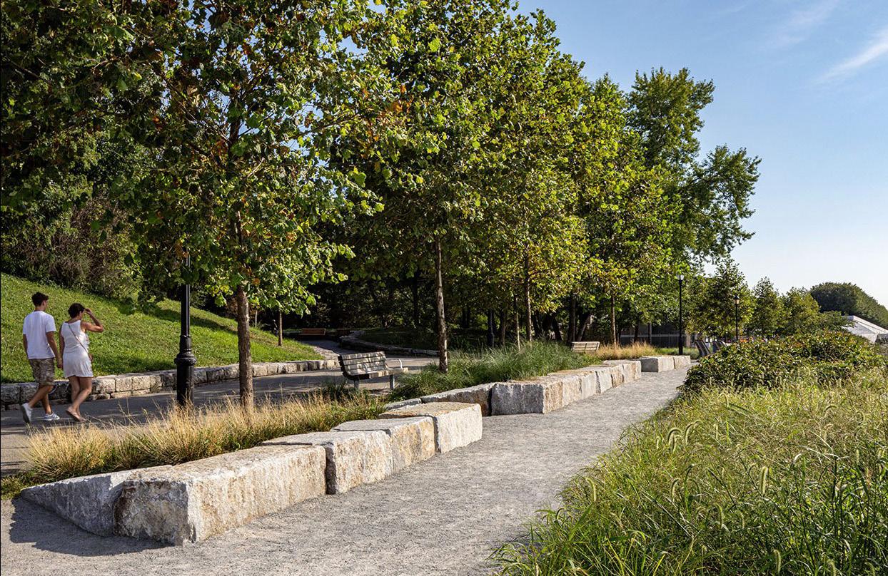
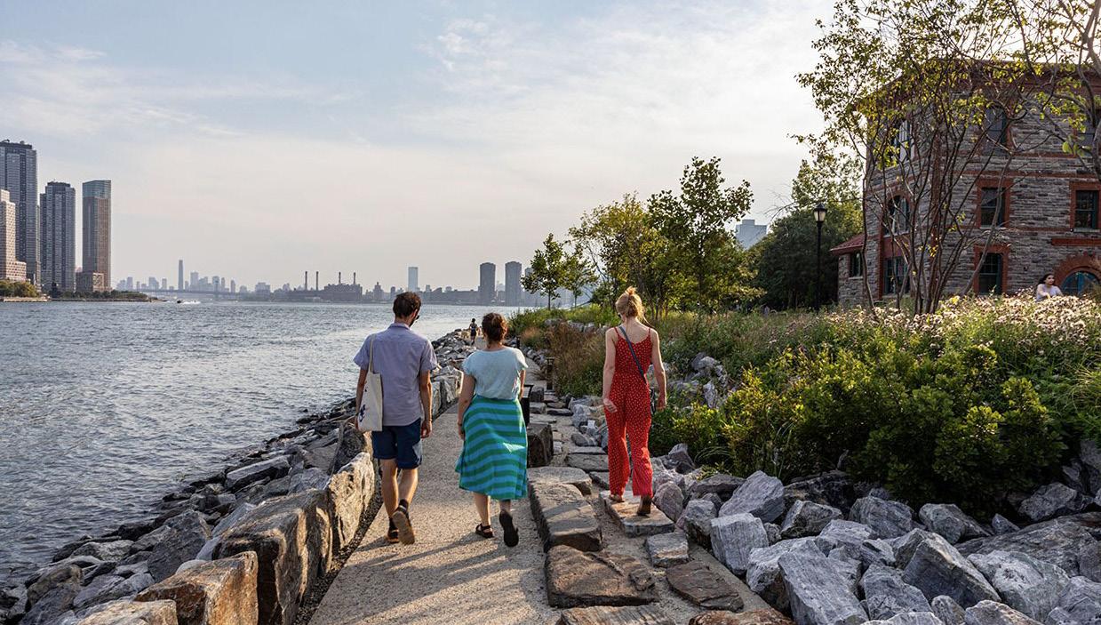
Parks are essential to urban resilience, providing environmental benefits that improve air quality, manage stormwater, and support biodiversity. They must be designed as living systems that adapt to changing climates and urban needs.
Air Quality – Trees, water features, and green roofs help regulate temperature and improve air quality.
Stormwater Management – Features like bioswales, retention areas, and storage tanks manage runoff, while durable materials enhance resilience, ensuring adaptability to seasonal changes and storm surges.
Biodiversity & Habitat – Native plantings, pollinator gardens, and naturalized areas support local wildlife, contributing to a balanced urban ecosystem.
Soil Quality – This is the foundation of a resilient landscape, supporting plant growth, stormwater absorption, and carbon sequestration.
Integrated Sustainability – Renewable energy features, such as solar lighting and permeable surfaces, enhance the park’s long-term environmental performance.
Source: Lagnan
A GREAT PARK SUPPORTS THE ECONOMY
A thriving park strengthens the local economy by attracting visitors, supporting small businesses and microeconomies, and enhancing nearby property values. When designed well, it functions as a social and economic anchor in the community.
Local Business Integration – Surrounding cafés, pop-up vendors, and small-scale retail contribute to a vibrant park experience and provide economic opportunities.
Events & Markets – Designed to accommodate seasonal festivals, farmers’ markets, and community events, the park generates consistent foot traffic that benefits local businesses.
Microeconomies – Adaptable spaces provide opportunities for small-scale economic activities such as independent yoga classes, street performances, and artisan pop-ups.
Neighborhood Investment – By enhancing the public realm, the park contributes to higher property values and attracts investment in surrounding areas.
Technology – Digital infrastructure, including Wi-Fi and charging stations, enables visitors to stay connected, making the park a welcoming space for remote work, study sessions, and social engagement, ultimately encouraging longer visits.
GREAT PARK
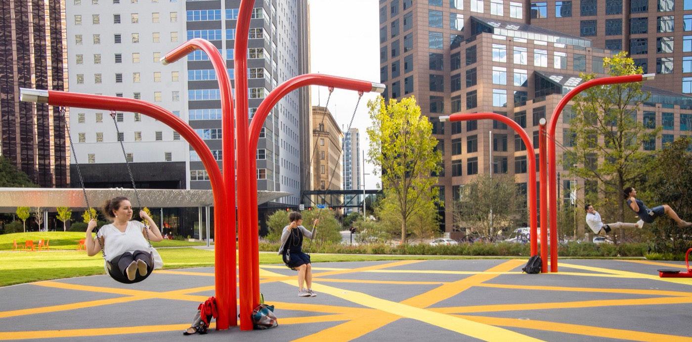
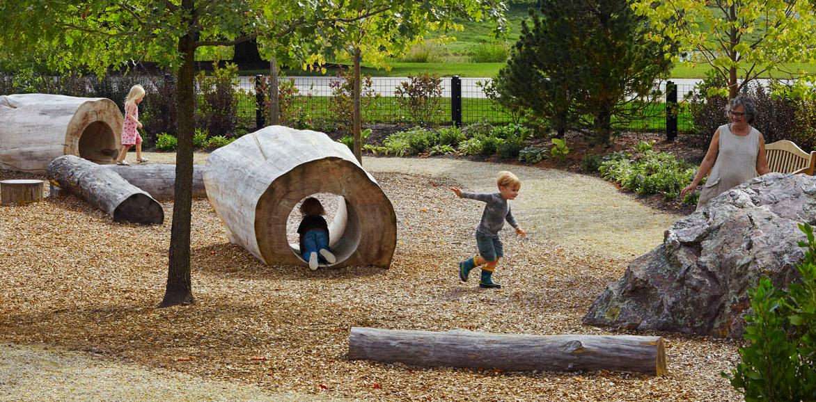
The guidelines outlined in this chapter lay the foundation for great parks: places that are inviting, functional, and built to last. The successful integration of the 16 key elements increases the park’s ability to thrive as a dynamic and inclusive community asset.
No two parks should look or feel the same. The way a park comes to life,its layout, features, and programming, should reflect the people who use it. Local culture, history, and landscape shape the final design, making each park a unique expression of its community.
03
S ITE CONDITIO N S
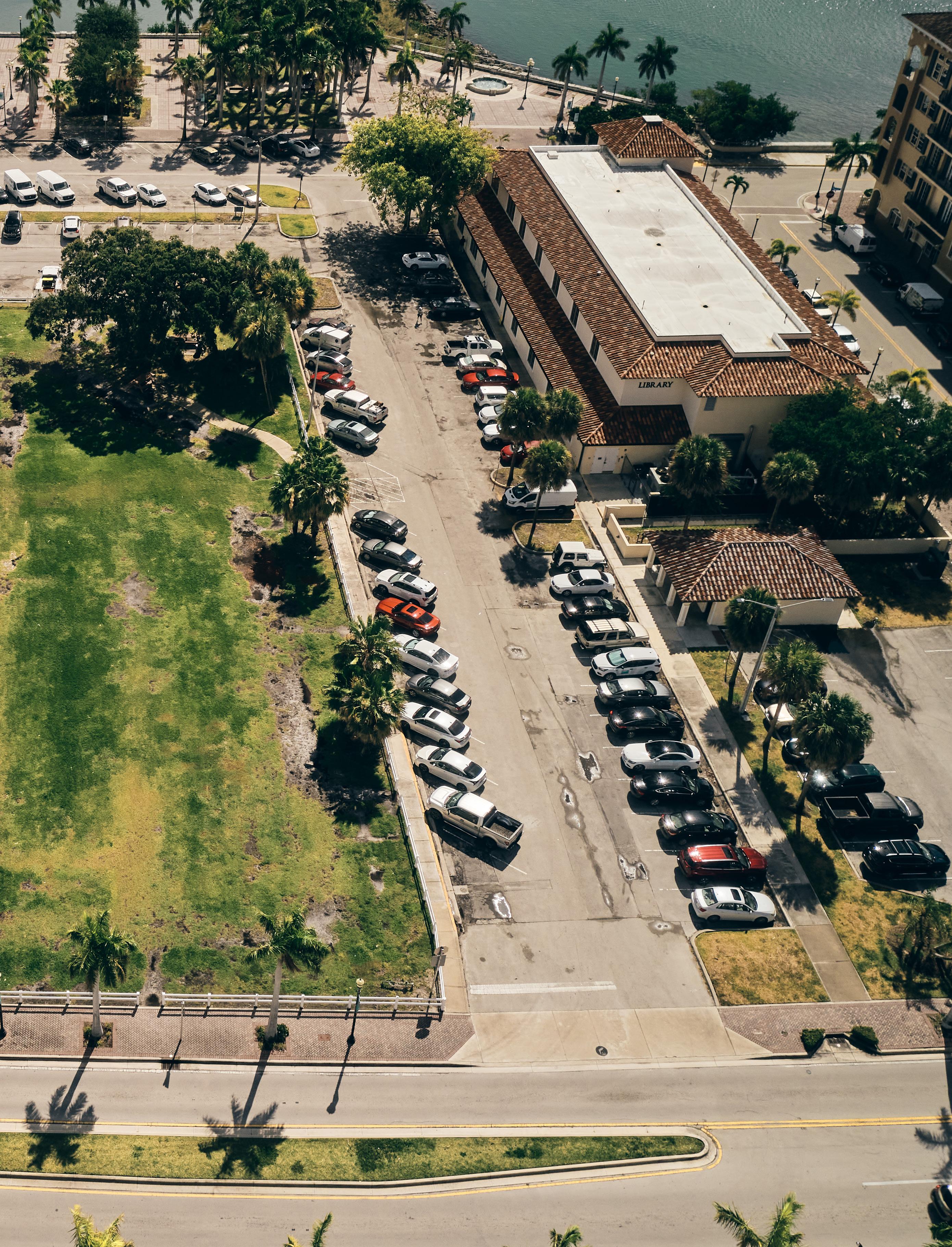
This chapter examines relevant social, environmental, and economic site conditions. Understanding the interplay between factors such as topography, flooding, existing infrastructure, and economic context ensures a design that is responsive, resilient, and seamlessly integrated into its surroundings.
PROJECT SITE
N.INDIANRIVERDRIVE NINDIANRIVERDRIVE
ORANGE AVE
KILMER BRANCH ST LUCIE COUNTY LIBRARY
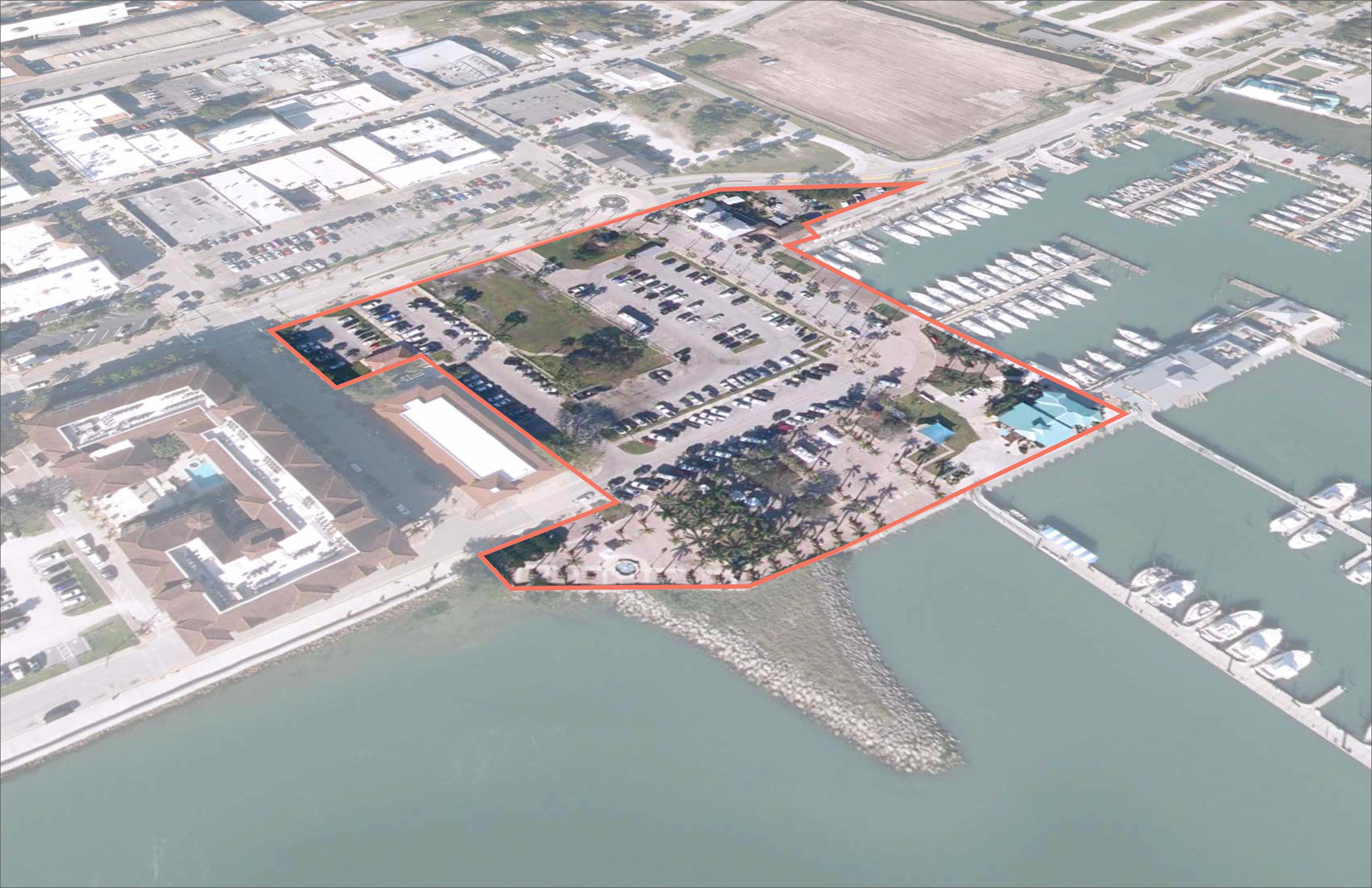
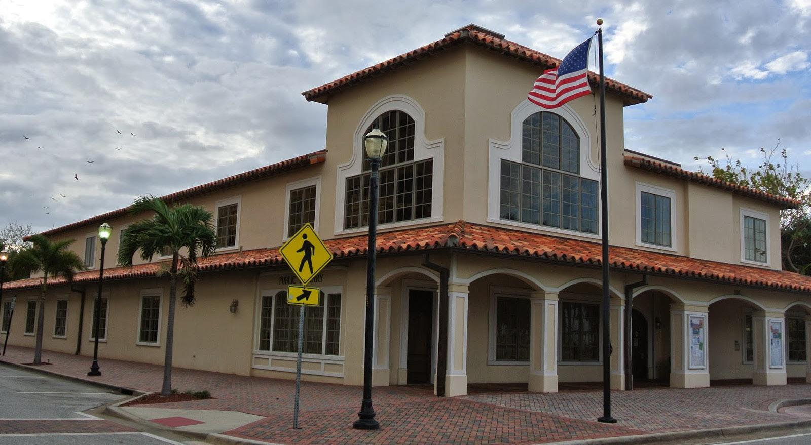
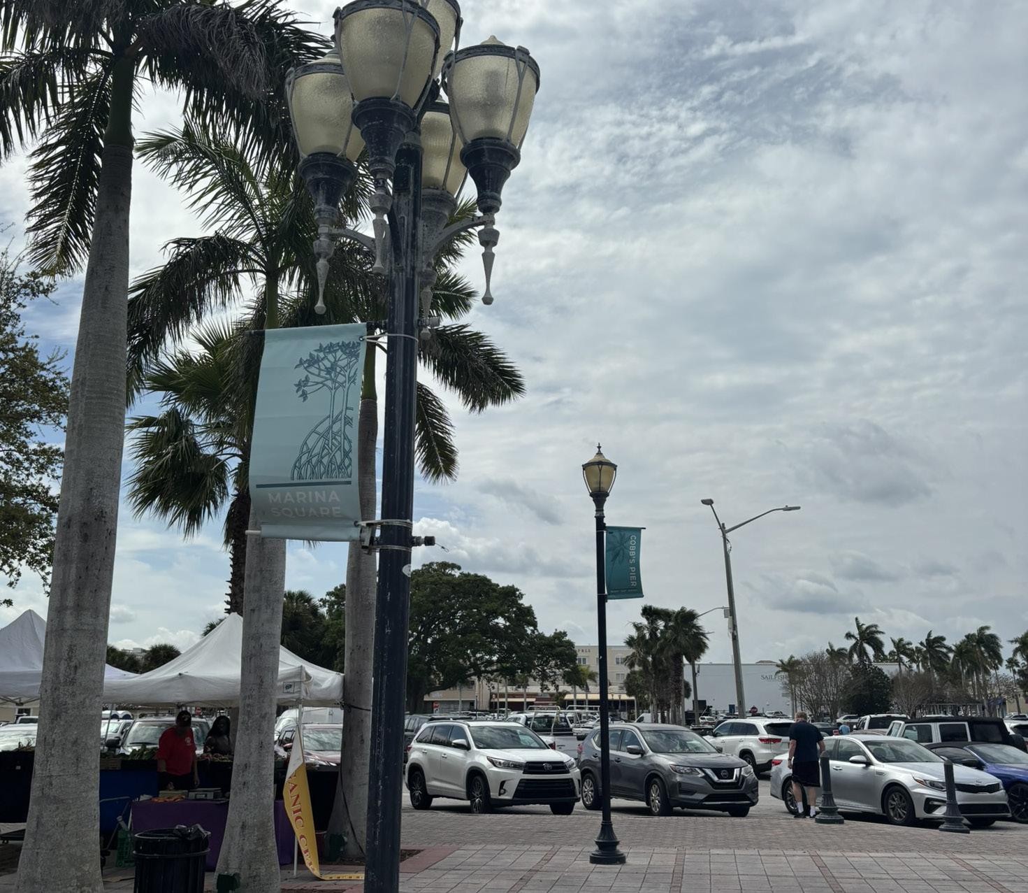
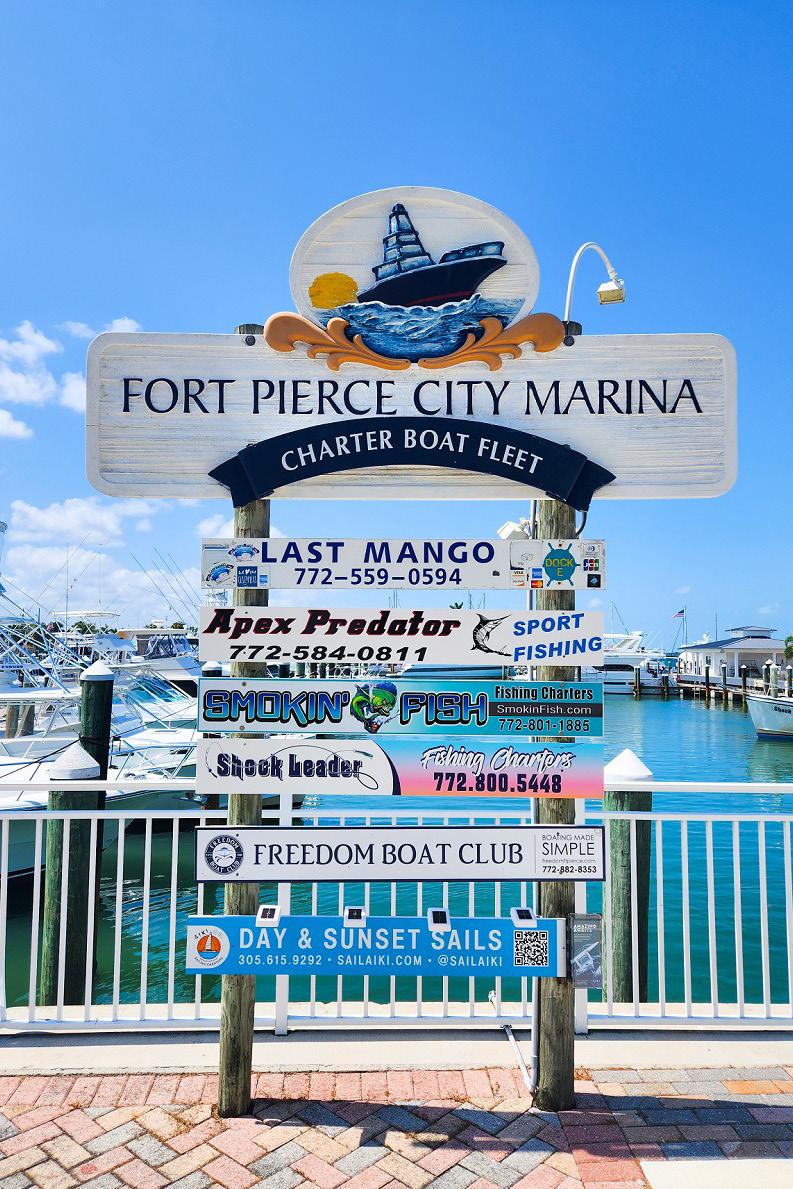
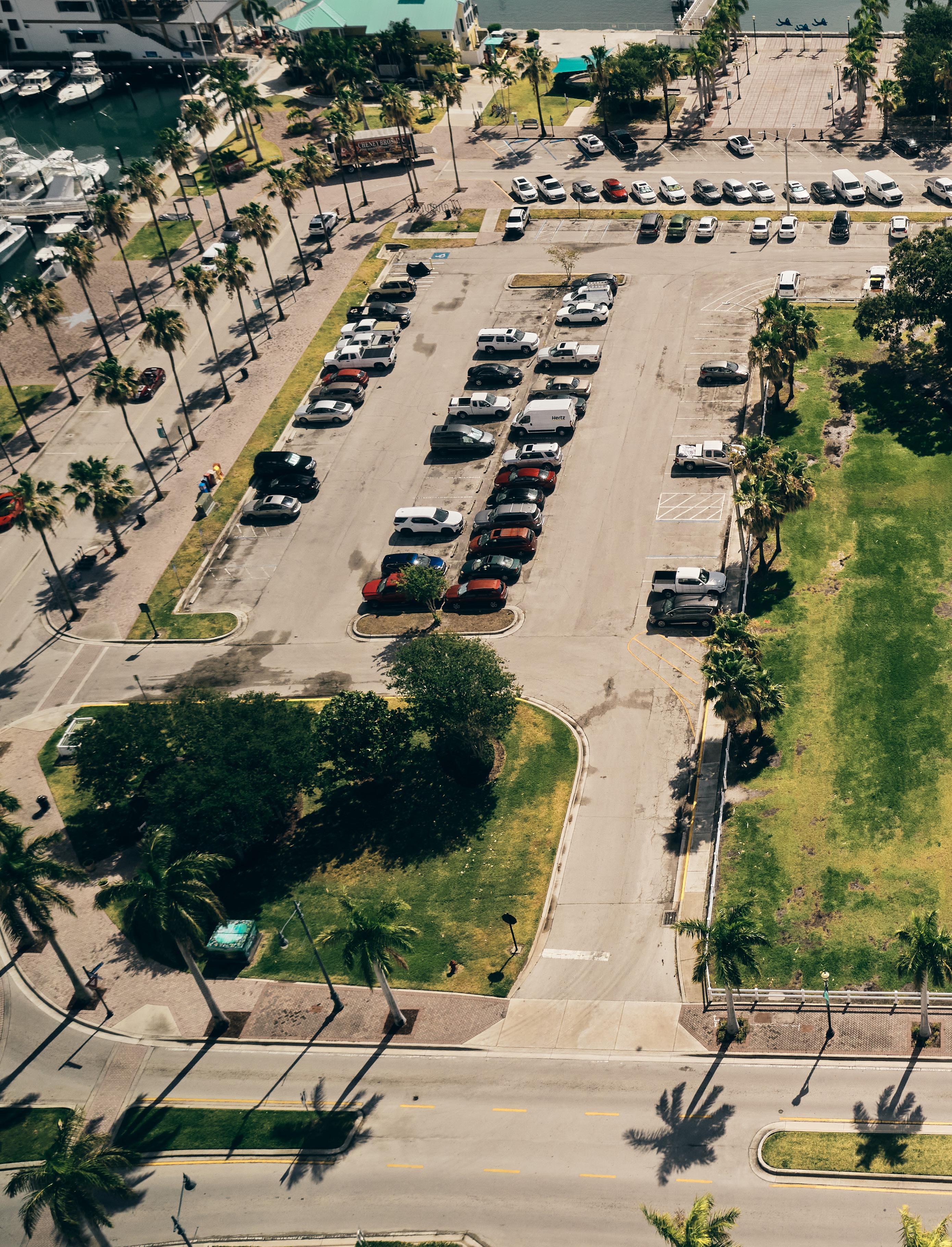
The 5.9-acre project site is bounded by N. Indian River Drive to the west, Orange Avenue to the south, and the Indian River Lagoon to the east and north. Although more than one-third of the project is dedicated to parking, it remains a hub of activity, drawing visitors to a mix of destinations from the Kilmer Branch St. Lucie County Library to the Fort Pierce City Marina.
GAZEBO PARK
FORT PIERCE CITY MARINA
MARINA SQUARE
INDIANRIVERLAGOON
MARINA PARK VISITORS
THROUGHOUT THE DAY
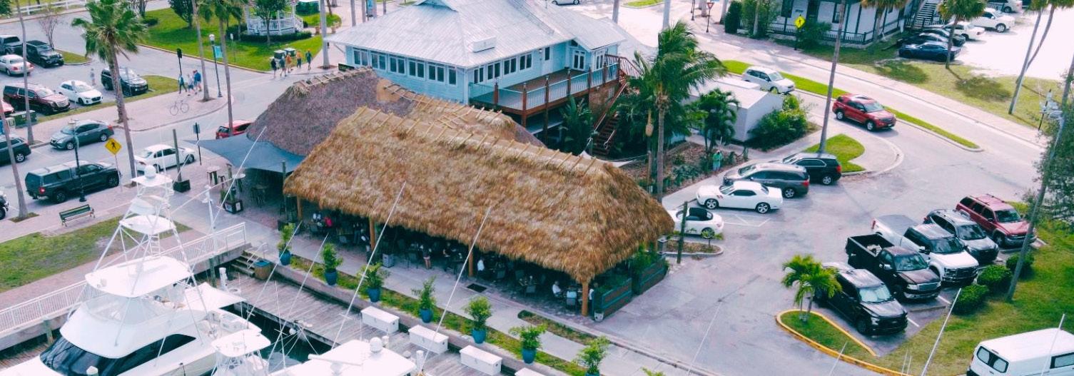
Fort Pierce Marina Park is open Monday through Saturday from 6:30 AM to 8 PM and is closed on Sundays. Activity varies throughout the day, with early mornings drawing active users like runners, dog walkers, and boaters, while afternoons and evenings see more visitors overall. All-day users include passive users like people watchers, walkers, and seniors. The Kilmer Branch Library (open from 9 AM, closing between 5–8 PM depending on the day) brings steady foot traffic. The adjacent restaurants are open from 11 AM to 10 PM, with peak times at lunch (11 AM–2 PM) and dinner (6–9 PM) The Saturday farmers market (8 AM–noon) and Wednesday Green Market (11 AM–4 PM) provide additional bursts of activity. Peak use generally occurs around midday and in the evenings.
Source: City of Fort Pierce
Source: City of Fort Pierce
PEOPLE IN FOCUS
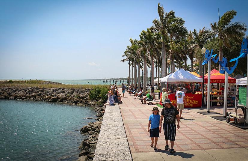
Each week, Marina Park comes alive with three popular vendor events: the Green Market, the Farmer’s Market, and the Jazz Craft Market. Other popular events include the monthly Friday Fest block party and the annual Stars of St. Lucie July 4th Fireworks event.
Farmer’s Market Event
Source - Fort Pierce Farmer’s Market
HOW WELL IS THE SITE DESIGNED FOR PEOPLE?
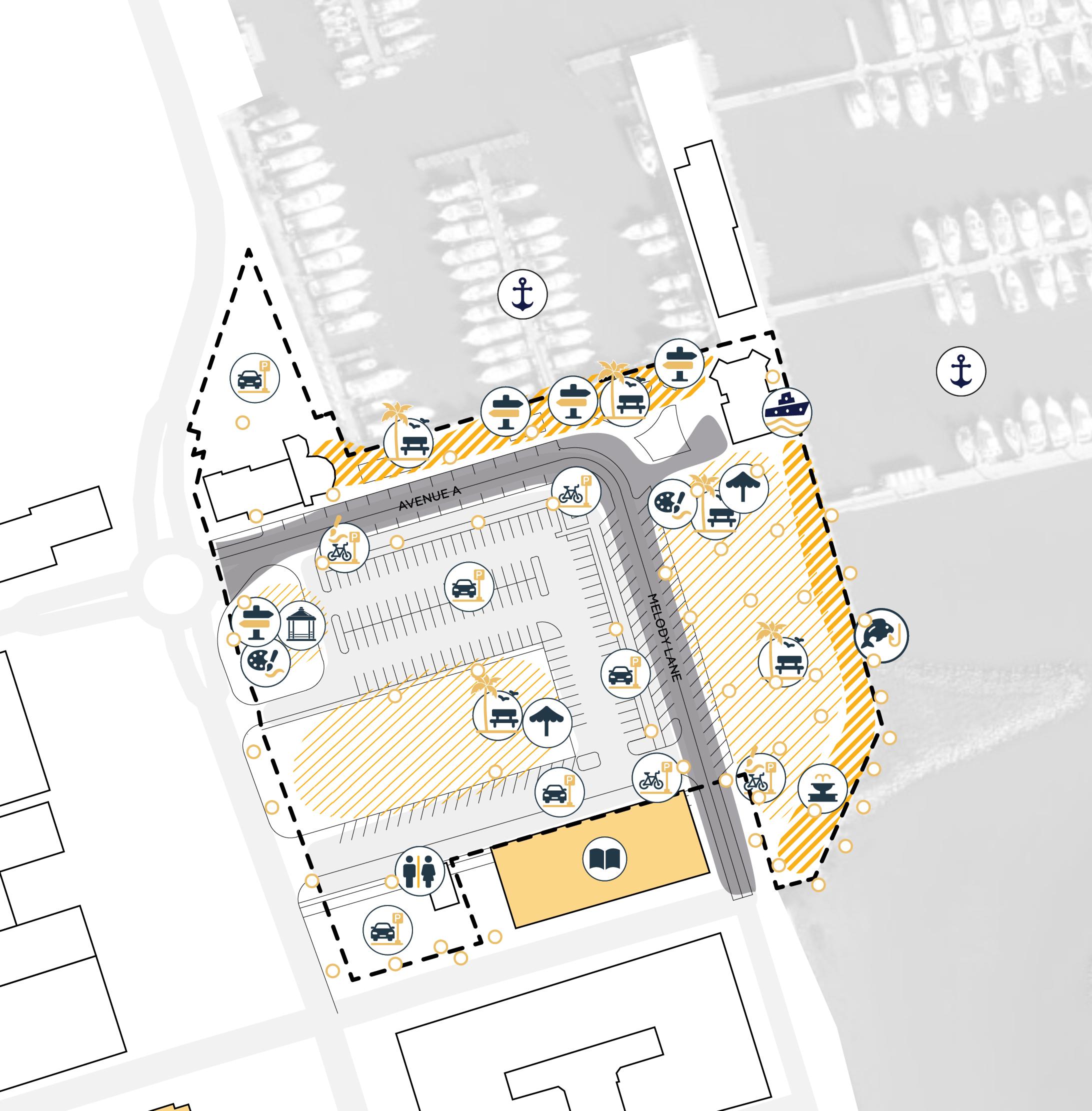
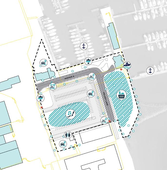
The well-located and visually appealing project site is a key asset to Fort Pierce, but it lacks strong pedestrian connections and consistent daily activity. While well-framed by the library, Cobb’s Landing, and the City Marina, much of the area is dominated by streets and parking, limiting pedestrian connectivity.
The site features 28 benches, two picnic tables, decorative signage, and public restrooms with a water fountain near the library, which is a key asset. However, wayfinding is minimal, and art installations are sparse and unengaging. Notably, there are no play or outdoor fitness areas in or around Marina Square, limiting its appeal for families that can stay longer.
While events like the Farmers Market, Friday Fest, and Jazz Craft Market bring the space to life, there are few regular attractions to draw visitors outside of event days. Notably, morning activity is minimal, with no coffee shops or vendors catering to early visitors, and evening use is limited by the park’s early closure at 8:30 p.m.
The lack of shaded seating further reduces the site’s ability to function as a comfortable, all-day destination. Though palm trees provide a distinct Florida character, they offer little shade, leaving large portions of the space exposed to direct sunlight.
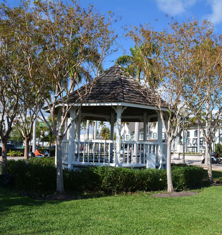
Despite these challenges, many existing amenities, including the historically significant gazebo, seating, and trash bins placed near gathering areas, should be preserved and better integrated into a revitalized design. Opportunities exist to increase shade, improve wayfinding, activate underutilized areas with interactive art and play spaces, and strengthen pedestrian connections to downtown. Adding engaging daily activities, expanded seating, and morning-oriented vendors could transform Marina Square into a vibrant, welcoming space that remains active beyond event days.
The site currently operates at 50% of its social capacity.
EXISTING SOCIAL CONDITIONS
NATURE IN FOCUS
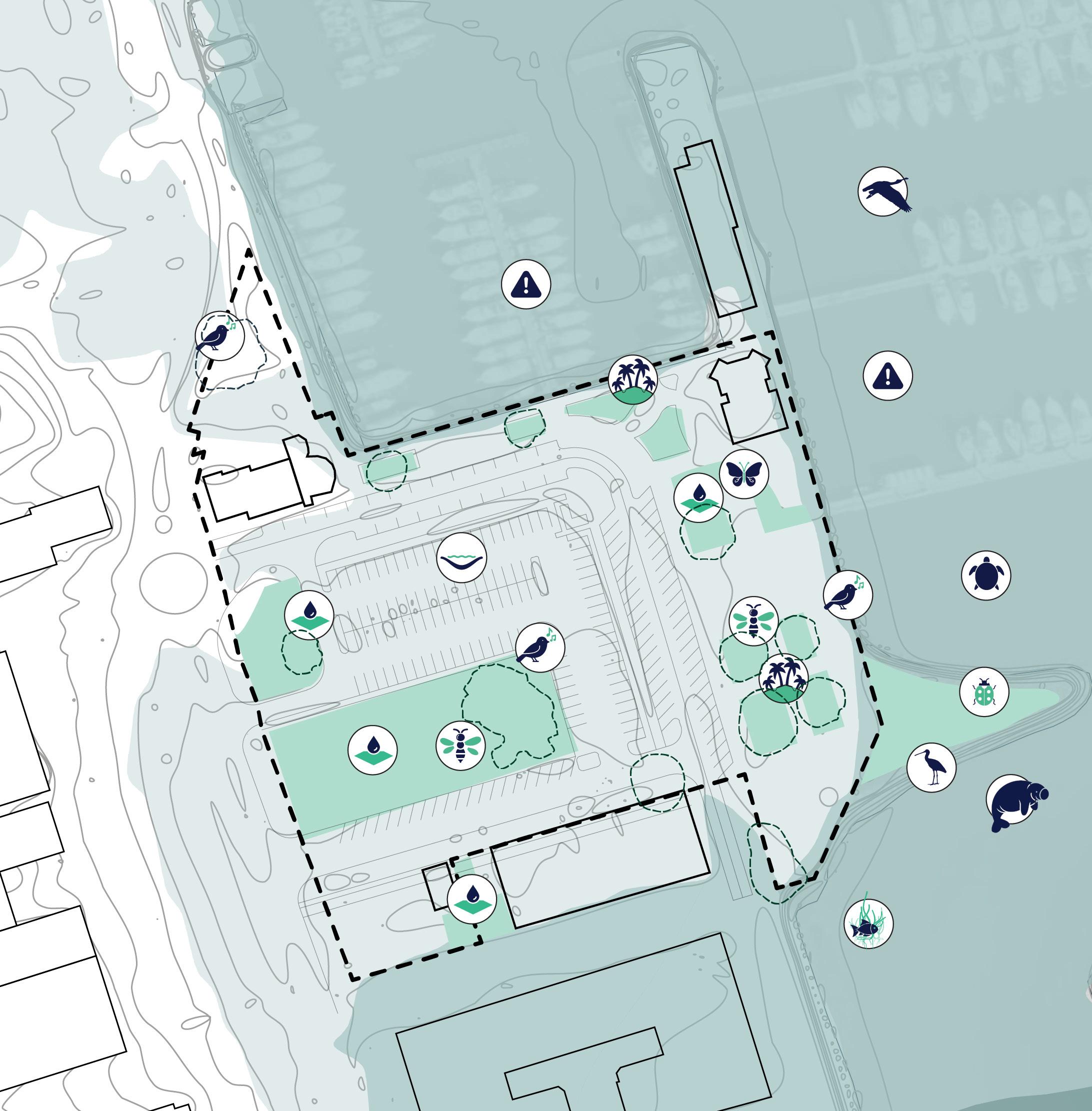
legend icons, add scale and map title
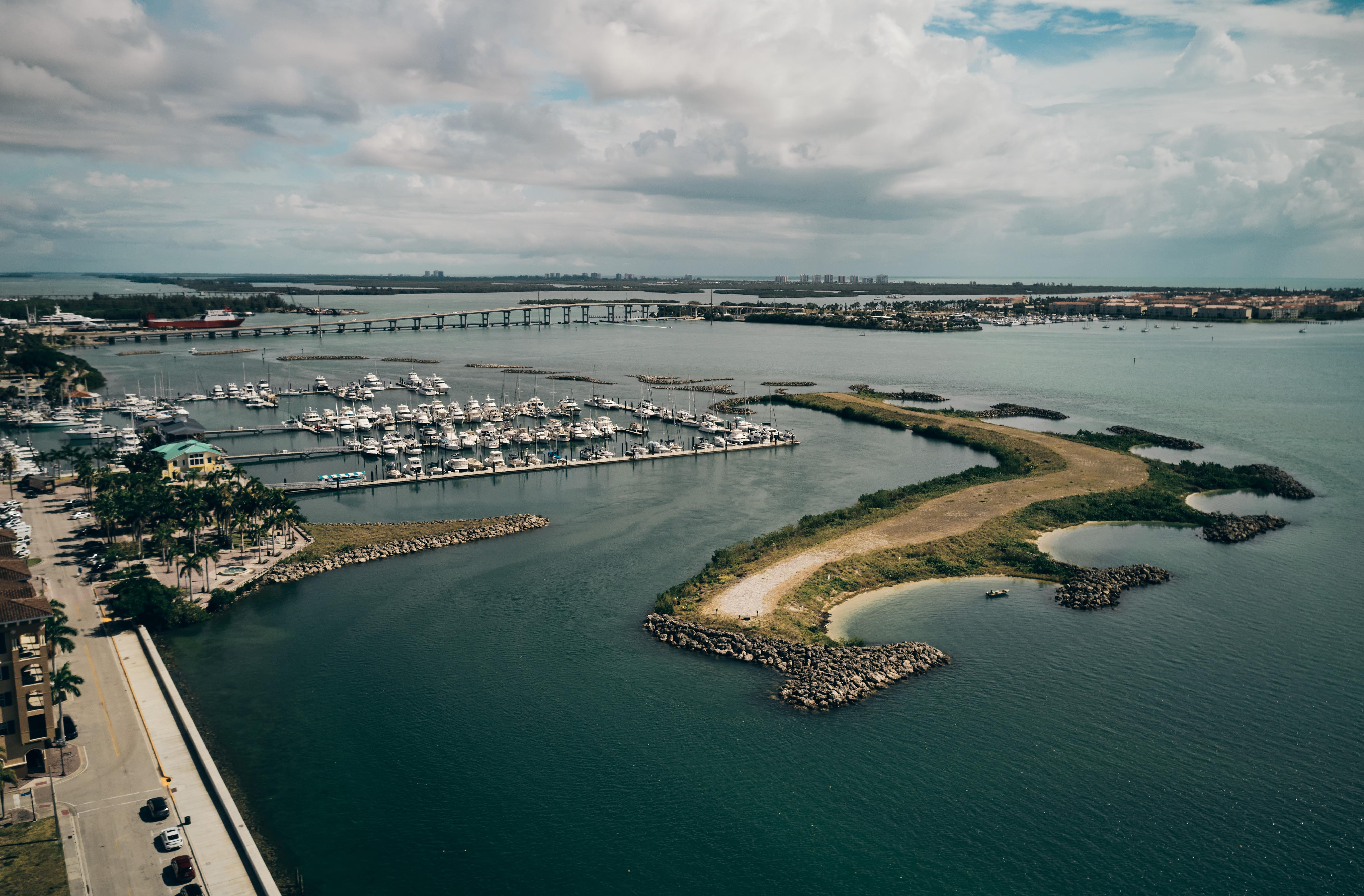
The 13 constructed barrier islands provide protection to the marina by mitigating wave forces during intense storm events. They also provide habitats for a number of plant, bird, fish, and mollusk species that call the Indian River Lagoon home.
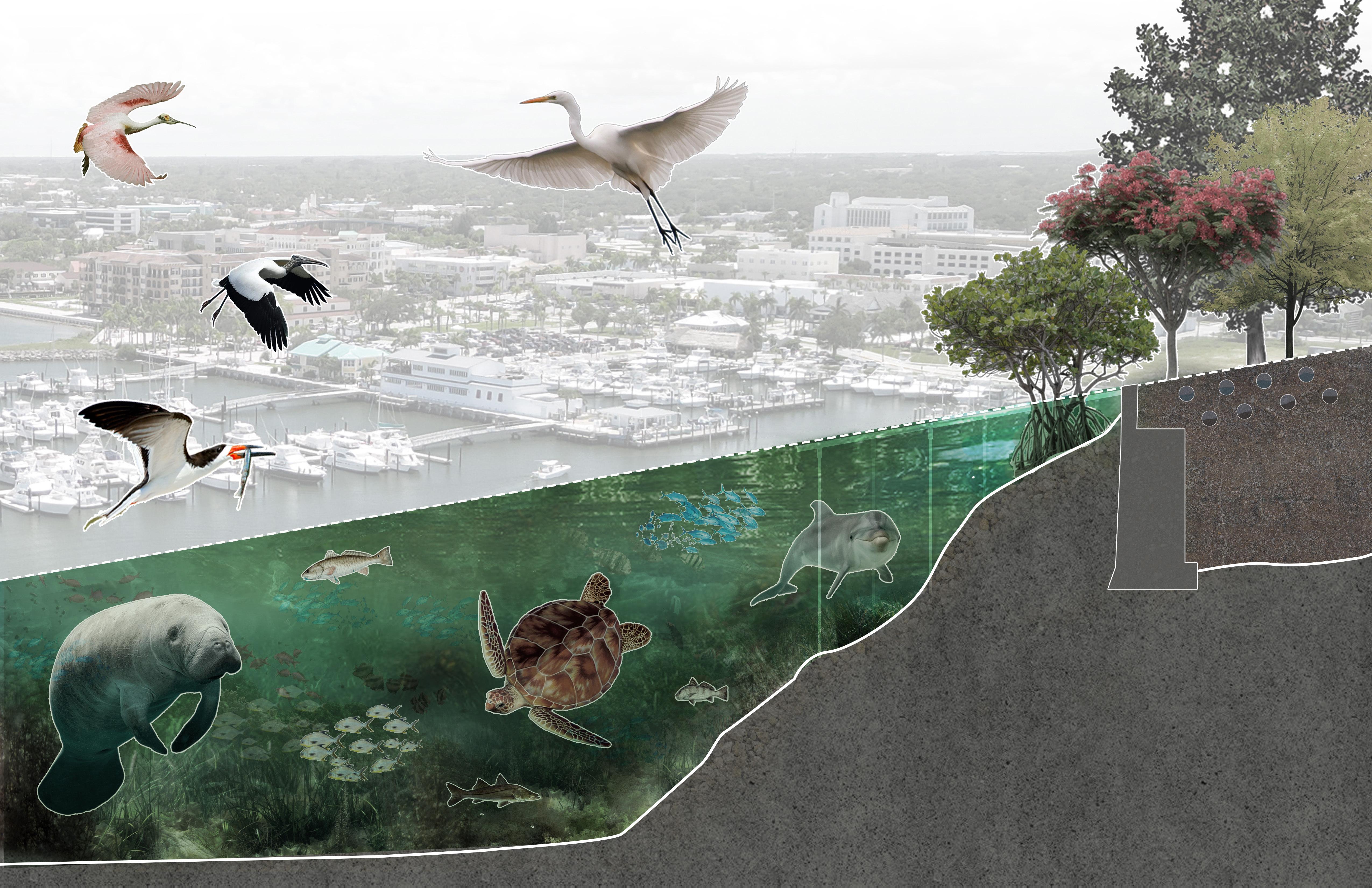
The project site is located within one of the most biologically diverse estuaries in North America.
This unique ecosystem is home to more than 4,000 species of plants and animals, including manatees, sea turtles, wading birds, and seagrasses that serve as critical habitat and nursery grounds.
Wood Stork Mycteria americana
Great Egret Ardea alba
Bluefish Pomatomus saltatrix
West Indian Manatee Trichechus manatus
Red Drum Sciaenops ocellatus
Roseate Spoonbill Platalea ajaja
Black Skimmer Rynchops niger
Green Sea Turtle Chelonia mydas
Black Drum Pogonias cromis Pompano Fish
Trachinotus carolinus
Common Snook Centropomus undecimalis
Red Mangrove Rhizophora mangle
Southern Magnolia Magnolia grandiflora
Royal Poinciana Delonix regia
Red Maple Acer rubrum
Bottlenose dolphin Tursiops truncates
Indian River Lagoon: An Introduction to a Natural Treasure
Johns River Water Management District, 2007
HOW WELL DOES THE SITE
FUNCTION AS AN ECOSYSTEM?
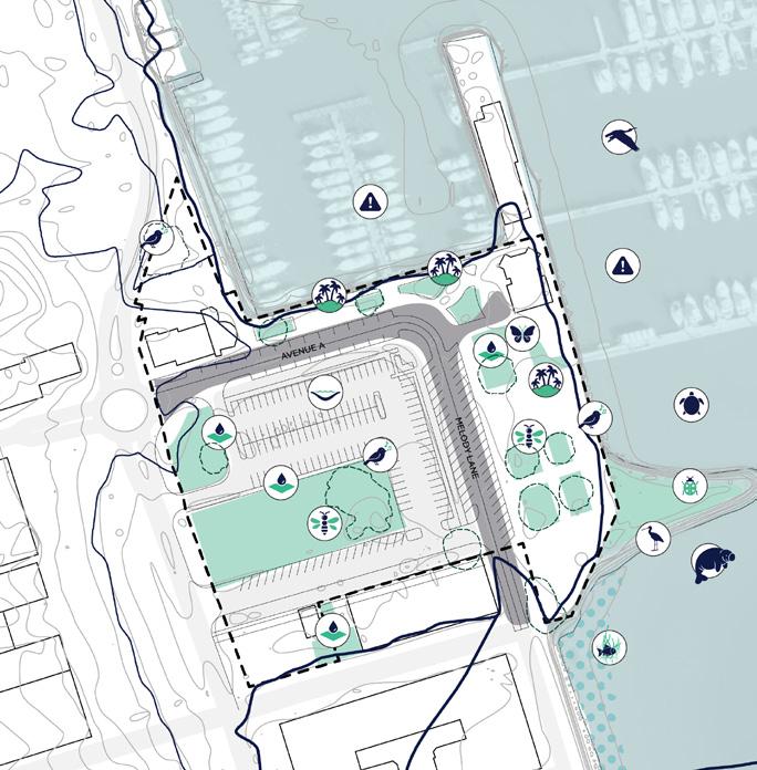
Despite the project site’s location within a sensitive and ecologically rich setting, the current design does little to support or protect nearby natural systems. Situated along the Indian River Lagoon, the site holds immense environmental value, but that significance is not reflected in its existing condition.
The low-lying, predominantly flat waterfront area is vulnerable to flooding, storm surges, and runoff, especially during heavy rainfall events. Nevertheless, much of the site is paved or compacted with limited permeable surfaces to manage stormwater and little green infrastructure in place to support water absorption or filtration.
Despite its location adjacent to the lagoon, the site currently lacks clear connections to its surrounding natural systems. Seagrass beds, critical for manatees, native fish, and migratory birds, face threats from pollution and unfiltered runoff, yet the park lacks visible buffers or plantings that would typically help filter water before it reaches the shoreline. Within the park itself, green habitat is minimal, and there are few features that support pollinators or bird species.
In addition to these environmental gaps, the site also lacks interpretive signage or programming that speaks to the ecological value of the lagoon. While the Manatee Center and Library provide important educational resources nearby, there is no physical or thematic connection between them and the park space. Overall, the site’s environmental conditions reveal a disconnect between its natural setting and its current design, underscoring the need for a more integrated approach to landscape, habitat, and climate resilience.
The site currently operates at only 20% of its environmental capacity.
EXISTING ENVIRONMENTAL CONDITIONS
ECONOMY IN FOCUS
REGULAR EVENTS
The project site hosts a wide range of events and activities year-round, attracting both locals and visitors while contributing significantly to the local economy. Weekly farmers markets create opportunities for small businesses and vendors to thrive, while seasonal festivals, live music, and art shows draw tourists and increase foot traffic to nearby shops and restaurants. Popular waterfront destinations like Cobb’s Landing and other waterfront restaurants consistently bring in diners, and the marina adds a steady stream of visitors and everyday activity along the water’s edge.
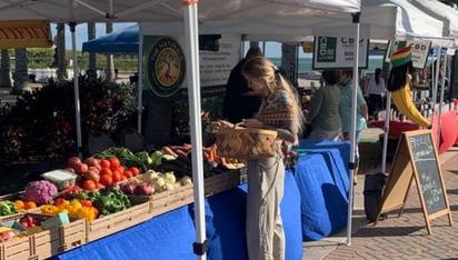
WEDNESDAY GREEN MARKET
The Green Market features fresh produce, artisanal goods, and local vendors every Wednesday.
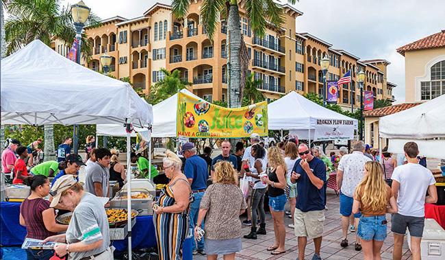
FARMERS & JAZZ MARKETS
Every Saturday, visitors enjoy a vibrant shopping experience with fresh produce, local vendors, and live jazz.
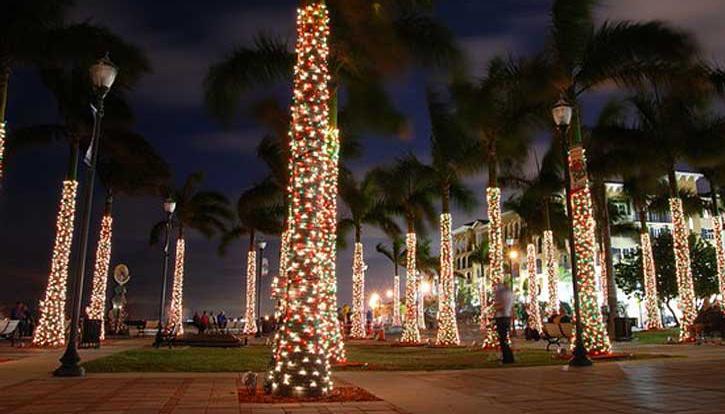
HOLIDAY LIGHTS SPECTACULAR
This annual waterfront display fills Marina Square with festive lights and holiday cheer, drawing visitors all season long.
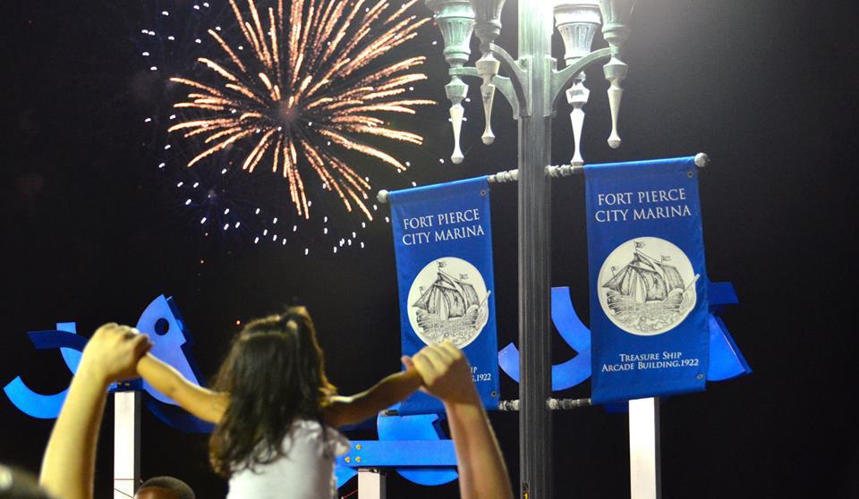
STARS OVER ST. LUCIE
Annual Independence Day celebration, featuring a spectacular fireworks display and festivities at Marina Square.
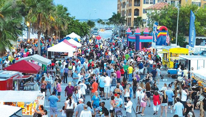
FRIDAY FEST
Fort Pierce’s longest-running monthly street festival, held on the first Friday of every month with live music, food, and local vendors at Marina Square.
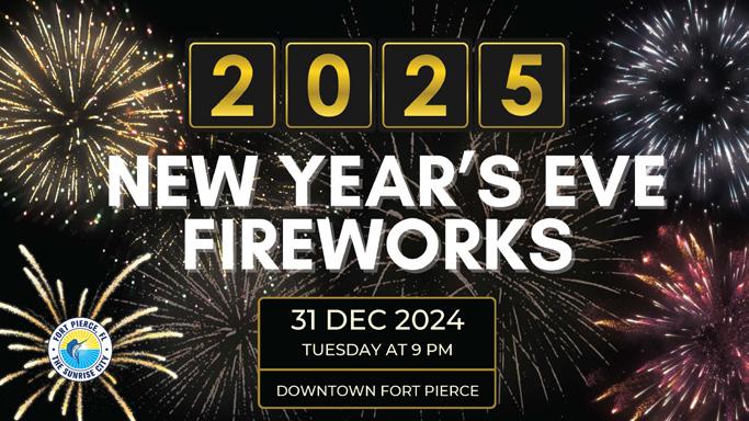
NEW YEARS EVE
Annual New Years Eve fireworks display over the waterfront where visitors can enjoy a festive atmosphere.
HOW WELL DOES THE SITE SUPPORT THE ECONOMY?
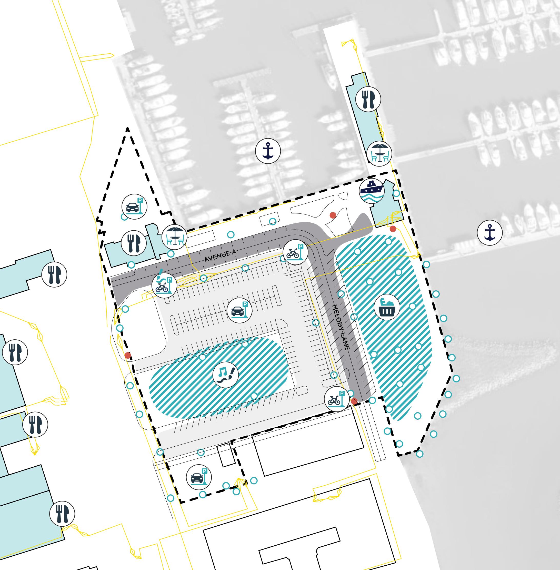
Fort Pierce Marina Park functions as a flexible civic space, hosting events like farmers’ markets and festivals while supporting adjacent restaurants. The local economy sustains these uses, but the park could grow its year-round vibrancy through more structured programming and placemaking interventions that invite everyday use.
Microeconomies bring the park to life during scheduled events, generating moments of vibrancy and connection. By building upon this momentum, there’s an opportunity to strengthen these activations with supportive infrastructure, such as vendor-ready kiosks, moveable furniture, and integrated power and Wi-Fi access. These enhancements can help sustain the park’s energy beyond event days, encouraging more frequent visits and reinforcing its role as both a social hub and a launchpad for local entrepreneurship.
Currently, many of the restaurants and commercial buildings adjacent to the park are oriented away from it with parking lots forming a physical and visual barrier. This disconnect limits natural surveillance, pedestrian traffic, and the seamless integration of business and public space. Future opportunities could include reconfiguring the rear façades to function as active frontages, introducing pedestrian paseos through parking lots, and encouraging infill or liner buildings that bridge the gap. Over time, this would create a more porous, engaging edge where commerce and community life meet the park.
Though the site includes significant on-site parking, there are understandable concerns about reducing it. However, the Fort Pierce public parking garage is conveniently located within a five-minute walk of the park, offering an alternative that could ease this transition while parking is relocated. With improved signage and wayfinding, this facility could more effectively serve park users, while freeing up valuable waterfront land for public enjoyment and placemaking enhancements.
The site currently operates at only 70% of its economic capacity.
EXISTING ECONOMIC CONDITIONS
ANALYSIS: CONCLUSION
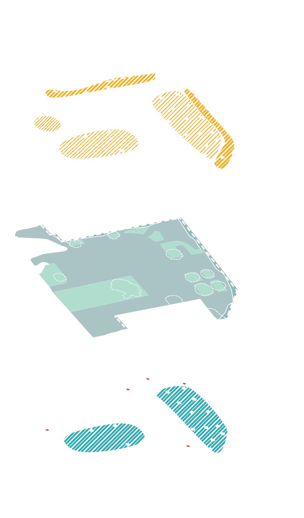
The collection and layering of key observations across social, environmental, and economic lenses allows specific opportunities and challenges to emerge. This integrated perspective forms a strong foundation for thoughtful, community-driven planning and design.

SOCIAL OBSERVATIONS
ENVIRONMENTAL OBSERVATIONS
Pedestrian disconnect exists between Marina Square, the library, and downtown.
Events bring welcome bursts of energy and activity, though the space sees limited use outside scheduled programming, especially during morning hours.
Existing assets like the gazebo and seating are present but not well integrated with the current uses.
Missing active-use elements such as play areas, fitness equipment, or wellness zones.
Limited shaded seating reduces comfort and dwell time.
Wayfinding and signage are minimal, impacting accessibility and orientation.
Prime location along the Indian River Lagoon offers unique environmental and educational potential.
Nearby institutions like the Manatee Center and Library provide strong foundations for ecological interpretation and programming.
Predominantly paved and compacted surfaces increase flood vulnerability.
Minimal habitat features for pollinators, birds, or other wildlife.
Overall park design underutilizes its ecological setting and resilience potential.
Working with the efforts from the Marina, the waterfront can continue to restore and serve as an educational asset.
ECONOMIC OBSERVATIONS
Strong potential is available to grow year-round economic activity through everyday programming and placemaking.
Microeconomies thrive during events but lack infrastructure to operate consistently throughout the week. Nearby businesses benefit from proximity but are physically and visually disconnected from the park.
Public parking garage within a five-minute walk could offset reduced on-site parking if better promoted.
Relocating parking to a more appropriate location will help to reclaim the waterfront for public and commercial use.
COMMUNITYENGAGEME N
COMMUNITY SNAPSHOT
POPULATION OVERVIEW
The immediate study area around the proposed park site has a small, walkable population–only about 1,120 residents live within a 10 to 15-minute walk. In contrast, the larger City of Fort Pierce is home to nearly 50,000 people. This shows that while the park will primarily serve those in the surrounding neighborhood, it also has the potential to become a destination for the broader community.
POPULATION WALKING DISTANCE FROM SITE
TRANSPORTATION & ACCESS
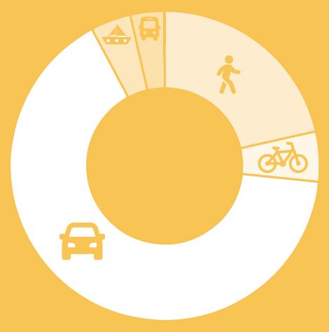
About 30% of households in the study area do not have a personal vehicle, compared to just 4.5% citywide. Despite this, there are no public transit stops nearby, while Fort Pierce has eight citywide. This limited transit access and high number of car-free households make safe pedestrian connections and multimodal access a key design priority. It also creates an opportunity for the park to offer community resources like mobility hubs, wellness programs, and access to essential services.
AMOUNT OF PUBLIC TRANSIT STOPS HOUSEHOLDS WITHOUT A VEHICLE
CITY OF FORT PIERCE POPULATION
INCOME & POVERTY
The study area around the proposed park faces significant economic challenges. Median household income ranges from just $12,500 to $13,611– less than a third of the citywide median of $41,060. Additionally, 58–60% of households in the study area live below the poverty line compared to 25% citywide. These figures highlight the high concentration of economically vulnerable residents in the immediate area and emphasize the importance of designing a park that is inclusive, free to access, and offers programming that meets the needs of the community.
MEDIAN HOUSEHOLD INCOME
HOUSEHOLDS BELOW THE POVERTY LINE
NEIGHBORHOOD AMENITIES
With only 29 restaurants nearby and no dedicated parks or playgrounds within a 15-minute walk, the study area lacks two key elements of vibrant neighborhood life: accessible green space and places to gather for food and social connection. Compared to Fort Pierce’s 153 restaurants and multiple parks, this area misses out on places people can relax, play, and enjoy local flavors. The new downtown park provides an important opportunity to fill that gap by creating a welcoming space that combines recreation, nature, and food through seasonal vendors, farmers’ markets, and pop-up events that will help make the park a true heart of the community.
AMOUNT OF RESTAURANTS AMOUNT OF PARKS/PLAYGROUNDS
THE DOWNTOWN FORT
PIERCE COMMUNITY
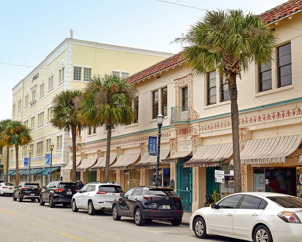
THE MARINA
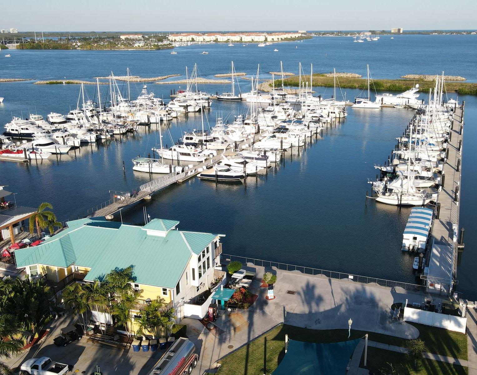
The marina’s live-aboard community functions as a small neighborhood with many residents living on their boats. It also functions as a hotel for visitors throughout the East Coast. Several restoration efforts have taken place in the area, including the use of oyster beds to help clean and filter the water. The Marina also helped to restore and revitalize the waterfront following the impacts of Hurricane Frances.
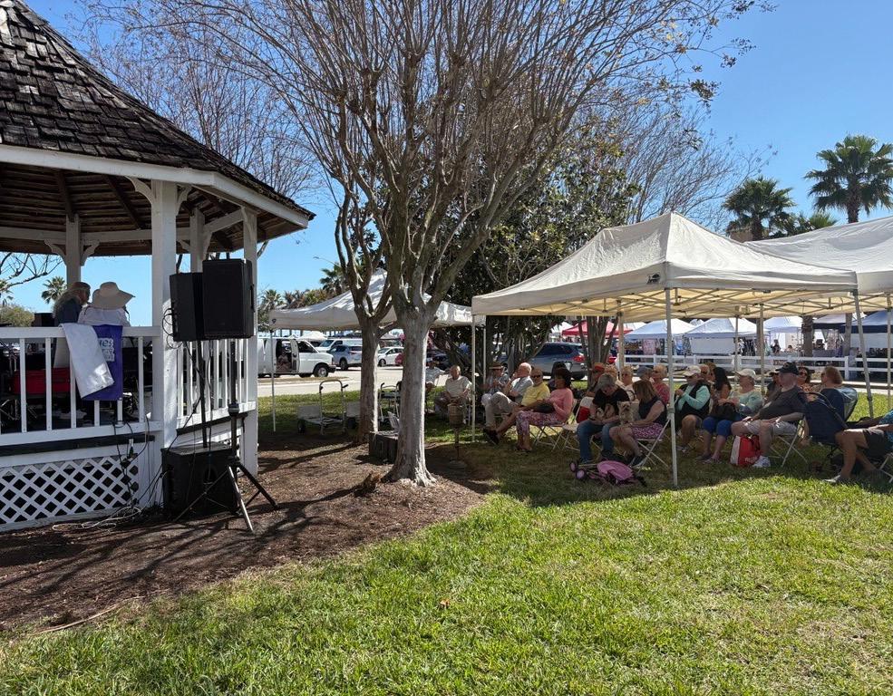
JAZZ FEST AND BLUES
The organization, established in the late 1990s-early 2000s, is a nonprofit that uses the Gazebo as a performance space. Their Saturday events and Crafts Markets raise funds for youth music education and support around 100 concerts annually. Peak season includes about 100 vendor tents, reducing to around 40 in summer.
DOWNTOWN OWNERS AND BUSINESSES
Business owners have played an important role in revitalizing and activating the downtown neighborhood. Main Street has strongly supported these efforts, including organizing events such as Friday Fest to bring activity and energy to the area.
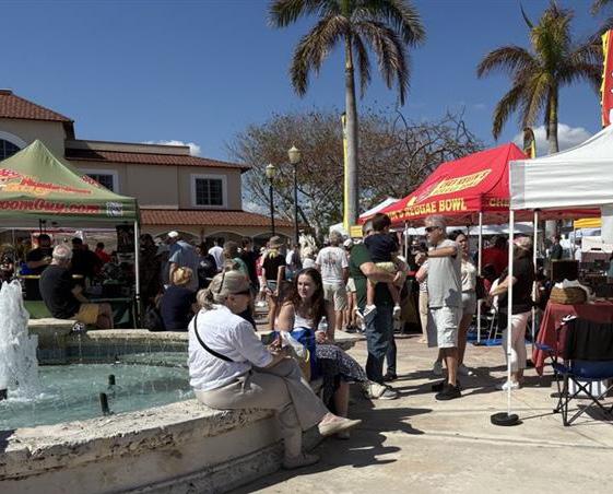
FARMERS MARKET
The Farmers Market has been a key contributor to activating Marina Square on Saturday mornings. The market typically operates from 8 - 11am and features over 50-90 vendors. This event brings residents and visitors to the waterfront, creating a lively community gathering space and supporting local businesses.
PUBLIC INPUT
INTRODUCTION
The Fort Pierce Downtown Park engagement process was designed to center community voices in shaping the future of the park at the Indian River Lagoon. Through a series of interactive workshops, interviews, and multiple conversations, the project team aimed to understand the needs, desires, and aspirations of Fort Pierce’s residents, business owners, and visitors. Multiple formats were used in gathering public input to drive the vision and design of the project.
WHY IT MATTERS
The love that the people of the neighborhood has for a public space determines that space’s success, and the engagement process is a way to ensure that the local knowledge, everyday user experience, and intergenerational priorities will shape the park’s conceptual direction. Community input maintains transparency amongst the different stakeholders, and by guiding decisions in and around the site with the community’s input, this provides a sense of ownership to each individual, making them co-authors in designing the space instead of passive participants.
ENGAGEMENT METHODS AND OUTREACH
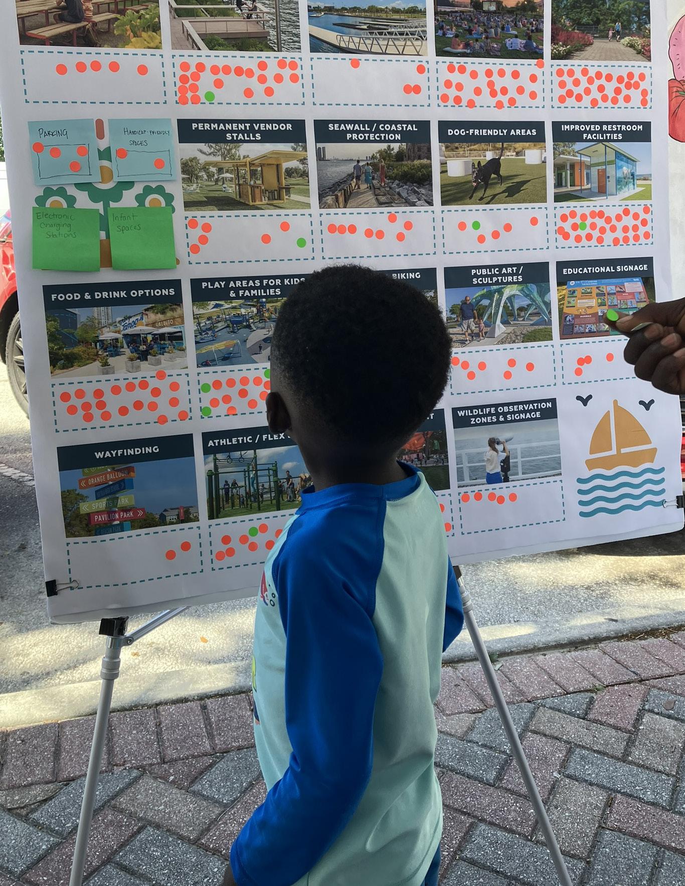
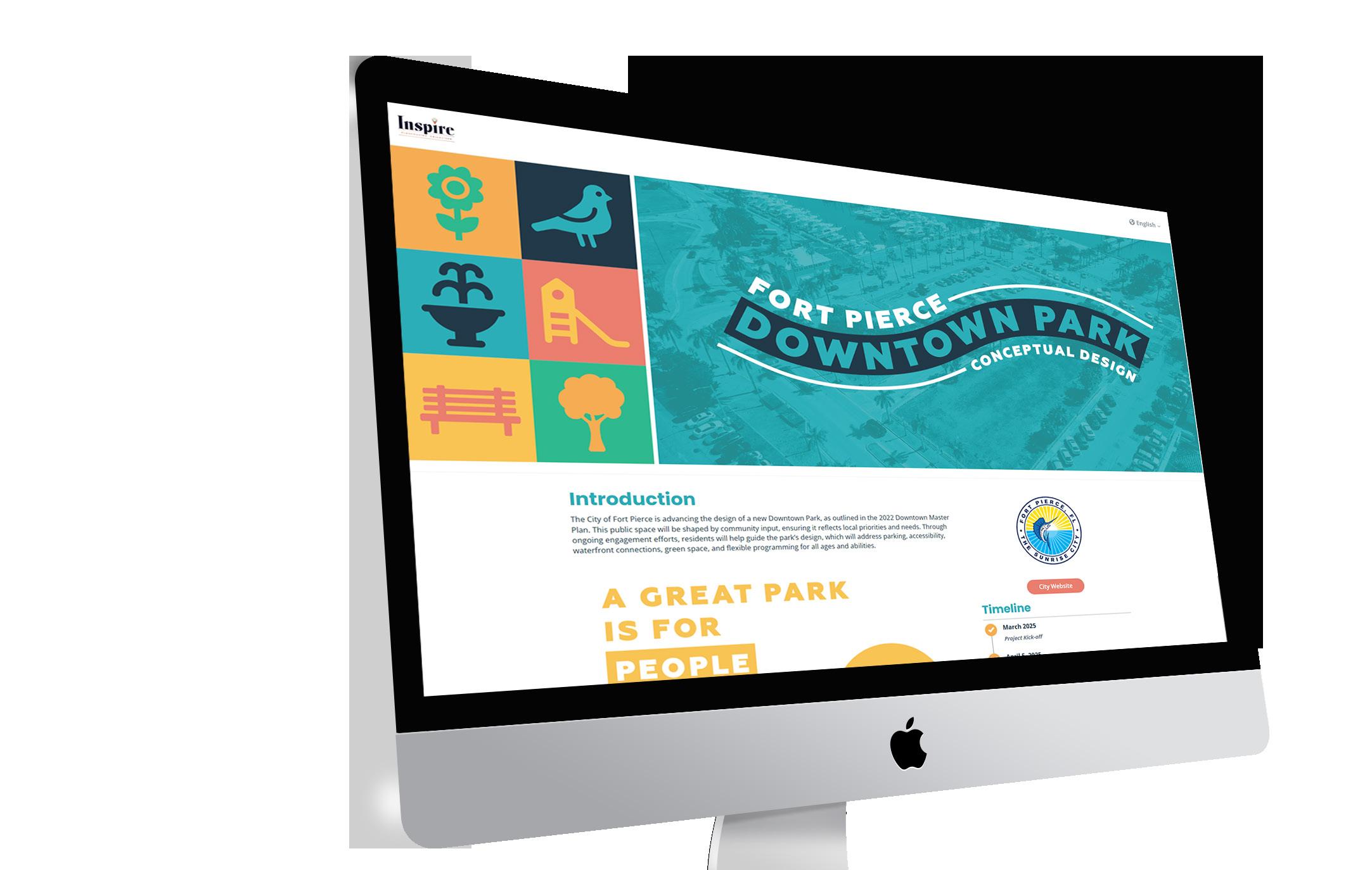
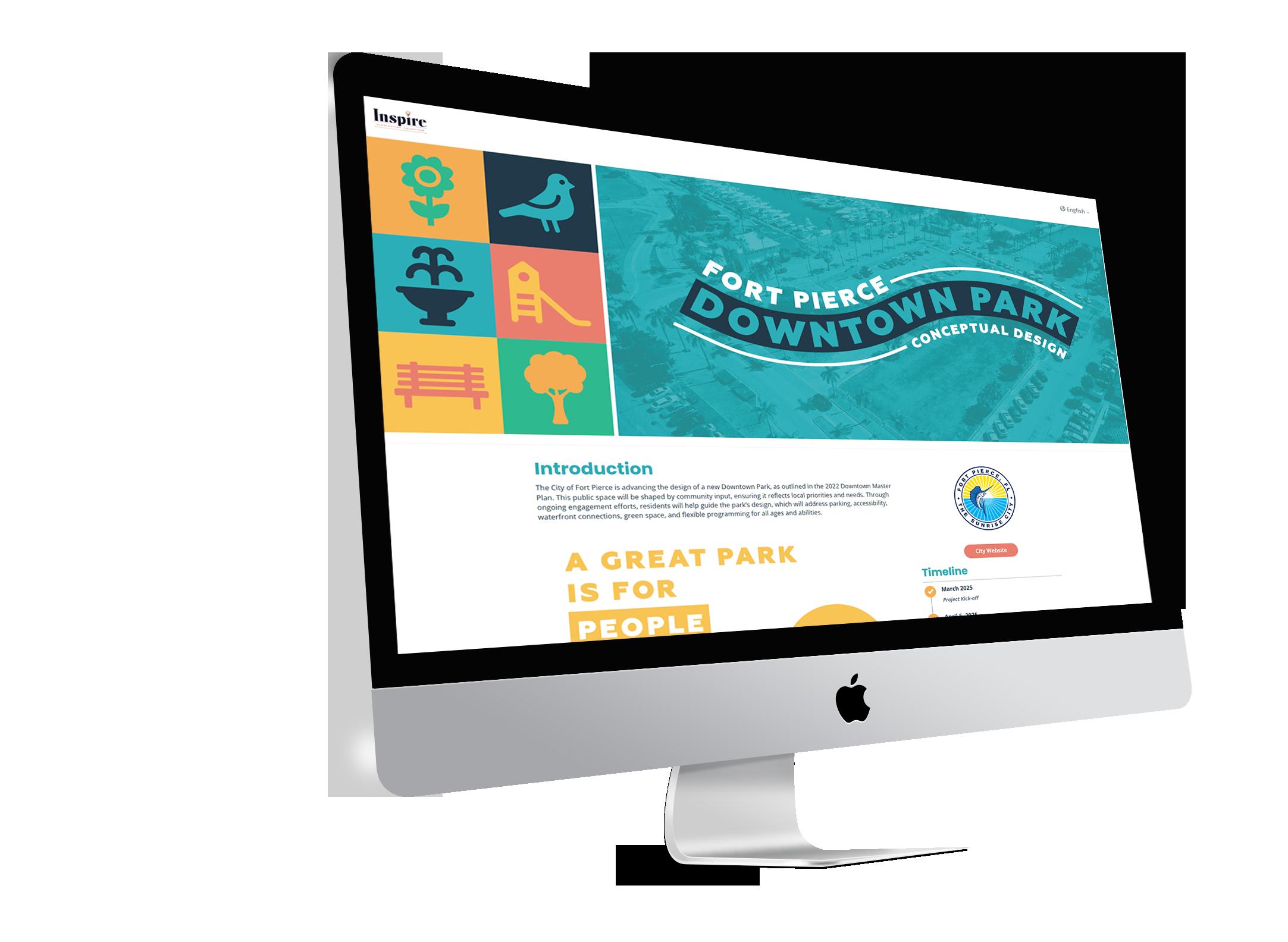
The engagement process was designed to reach out to community and interact with individuals on a personal level. The project team hosted two in-person workshops at the Fort Pierce Marina Park, the first was a integrated within a lively Saturday Farmer’s Market, focusing on program aspirations. The second was structured around the park design framework and visual branding. Materials and boards were designed to be accessible, welcoming, and interactive. At the same time, stakeholder interviews were conducted with Mayor Linda Hudson, FPRA, St. Lucie County Tourism, Main Street organization, and local business owners. A website has been created to engage with the community not only in person but also online, using tools such as surveys to gather input and feedback. With all these efforts, the project team was able to get a broad demographic involvement of residents and park users.
– JANE JACOBS
STAKEHOLDER INTERVIEWS
The stakeholders interviews offered a multifaceted perspective on the park’s role within the larger downtown Fort Pierce ecosystem, not only within the site. Fort Pierce has an impact on the overall tourism in the area, and thus would play as a major contributor in generating income. The tourism officials, / Marina staff, and event organizers stressed upon the balanced infrastructure needs with user experience. There was universal support for increasing the utility access (water & electricity), multigenerational design, and infrastructure that supports everyday & weekly events.
There was a lot of attention given to development for restaurants and vendors, thus the need for everyday activation, making the park a day to day destination. Concerns regarding parking were noticed, especially between Marina tenants and vendors with logistical challenges. Emphasis was also given on the potential of the waterfront site as an educational asset through marine ecology and youth engagement programs as a form of outdoor learning. Safety and underutilization concerns of areas near Gazebo also need to be taken into consideration. Overall, the stakeholders advocated for thoughtful and flexible design that elevates the park from a passive lawn into a dynamic civic venue.

ONLINE SURVEYS
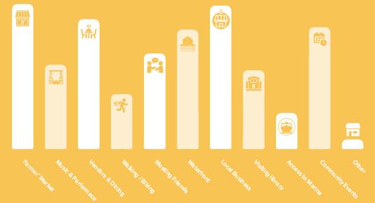
With over 220 responses, the online survey provided a broad community insight into the kind of user group for the park, what they value the most and their priorities for future development. The top three reasons for visiting the park were : the farmer’s market, waterfront views and the proximity to local businesses.
Responders showed a strong preference for improved restrooms, shaded seating and nighttime lighting. Event programming, particularly markets, live music and food festivals was a major draw for attention to the park. The survey also emphasized that over 75% of respondents rated sustainability as ‘very important’ along with marine life being a cherished feature, thus hinting on public awareness on the ecological front. Overall, the respondents had the need for a clean, flexible and ecologically sensitive public space.
CURRENT PREFERRED MODE OF TRAVEL?
WHAT BRINGS YOU TO THE FORT PIERCE PARK CURRENTLY?
ENGAGEMENT EVENTS
WORKSHOP 1
Workshop 1 was held during the ongoing farmers market, which helped make it successful in capturing authentic feedback from regular users of the space in a highly interactive setting. Participants overwhelmingly supported maintaining and enhancing the market area but expressed specific concerns about infrastructure and logistics, such as ADA accessibility and vendor setup considerations with respect to tree placement. Aesthetic and comfort related elements were frequently mentioned. The existing need concerns a lot with adequate restroom facilities, shading, and lighting.
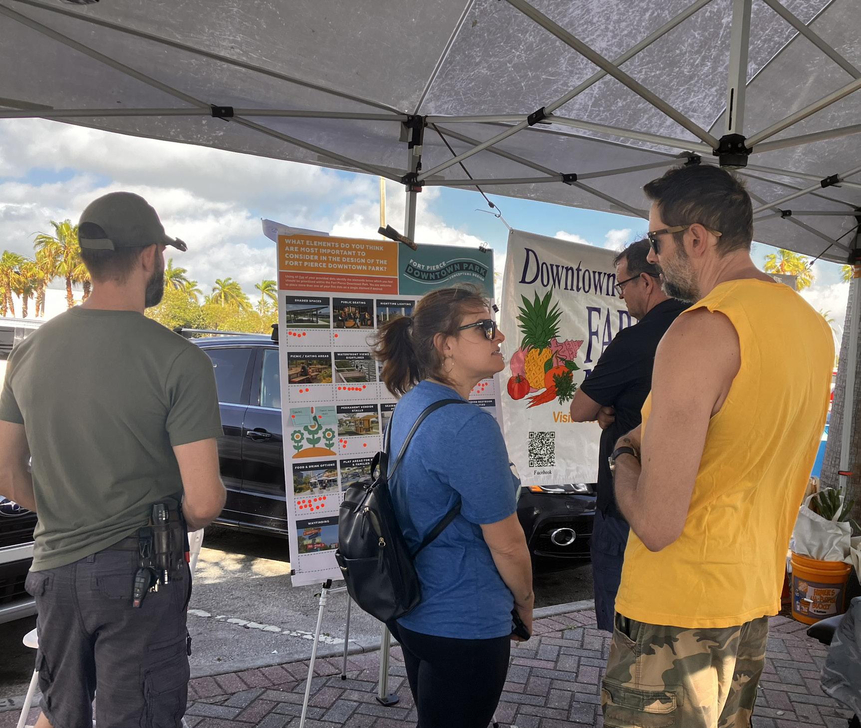
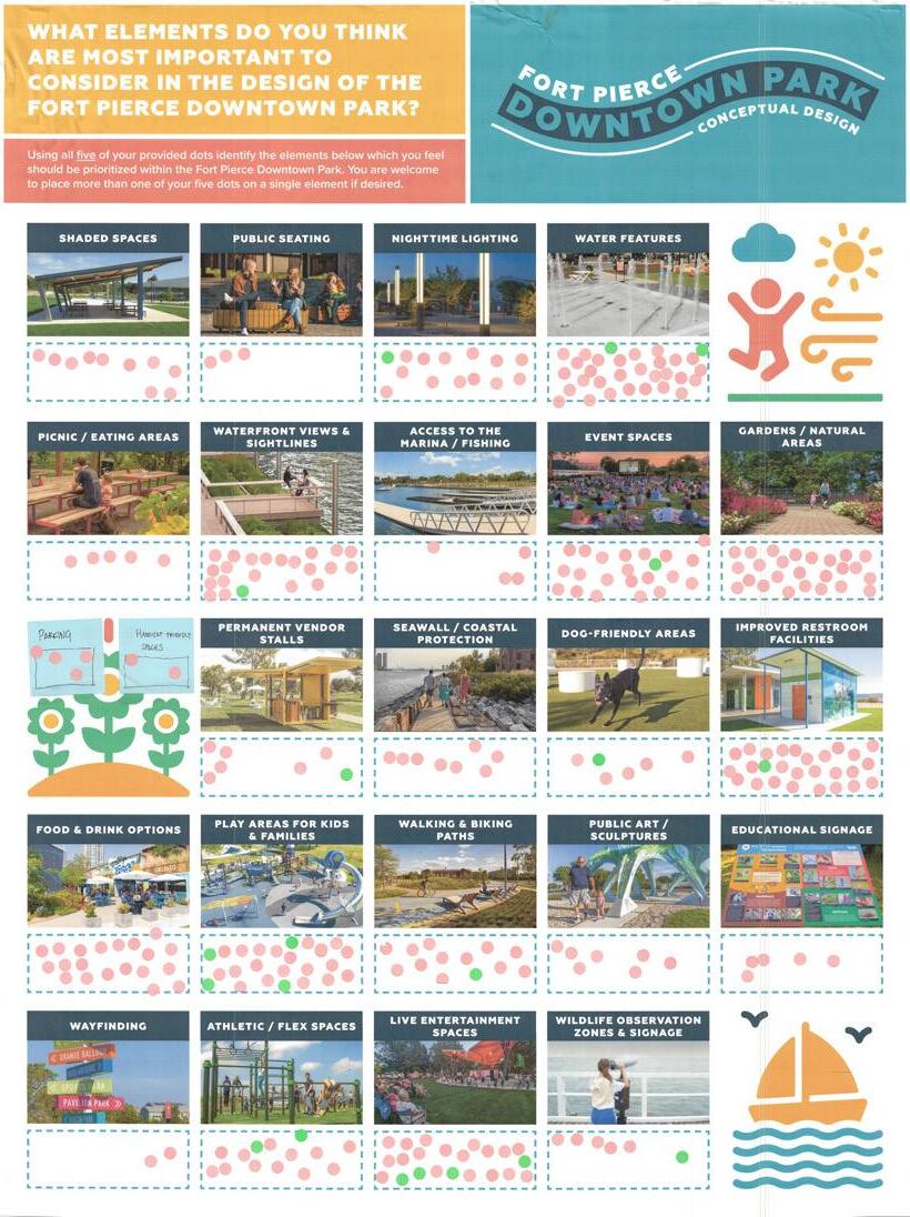
The image preference activity helped the project team understand the high inclination of people towards water features and garden areas. Most of the results aligned closely with the online surveys. The open comment section showed a strong sense of events and community-driven functions along with public safety. A need for more restaurant and food joint activation was also observed. There was great appreciation shown for the farmer’s market and the library, and overall, there was a deep-rooted sentiment for embracing the local identity while also showing willingness towards change and development.
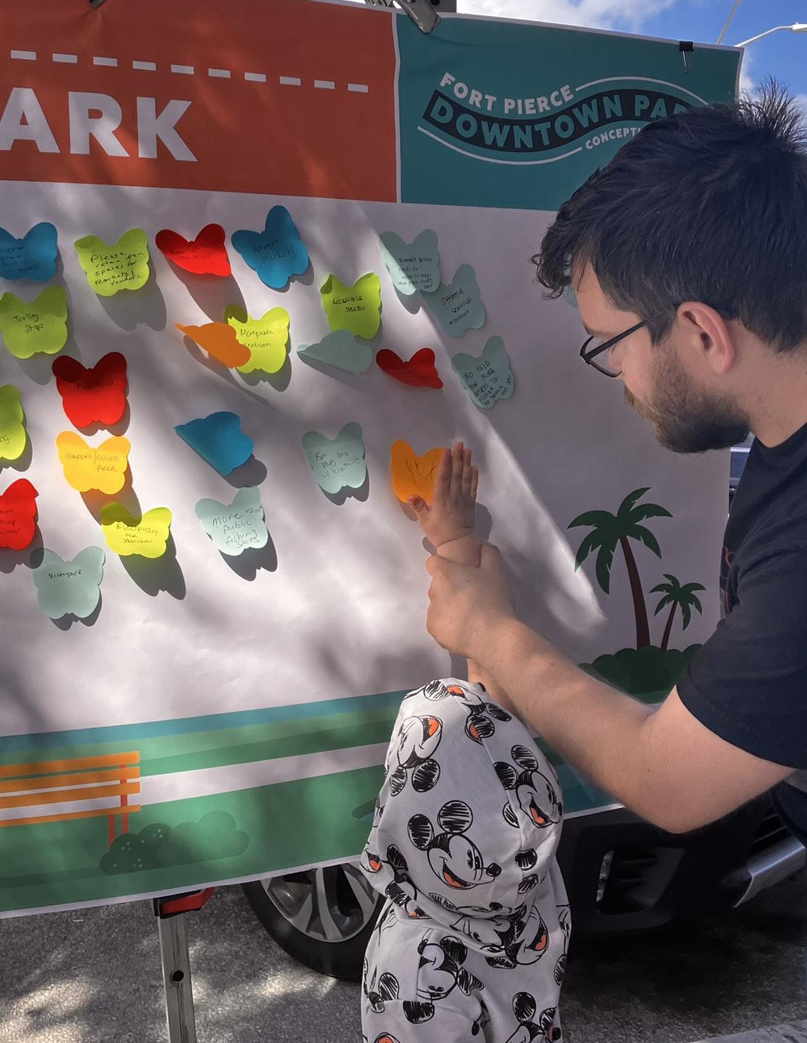
Participants filling in the blank the ‘I want___in my park’ board.
Alongside the more structured activities, participants at Workshop 1 were invited to complete the prompt “I want ___ in my park” as part of an open-ended engagement board. This activity allowed community members to speak freely and share ideas in their own words, offering a more personal look at what matters most to them.
“MORE USEFUL RECREATIONAL SPACE”
“MORE
SIGNAGE FOR RESTROOM FACILITIES”
“KEEP IT GEARED TOWARD LOCAL ARTWORK”
“MORE INFO SIGNS ABOUT LOCAL WILDLIFE”
The speech bubbles highlight a small selection of responses. Many focused on comfort and accessibility, including the need for shade, restrooms, and better signage. Others expressed interest in more spaces for local events, artwork, vendors, and nature-based experiences. These ideas helped the design team better understand everyday priorities and reinforced the importance of creating a park that is welcoming, flexible, and rooted in local identity.
“NO PALMS, MORE SHADE TREES”
“MORE FREE MUSIC CONCERTS”
“MORE FREE PUBIC FISHING SPOTS”
“PLEASE RETAIN OPEN SPACES FOR MARKETS & VENDORS”

WORKSHOP 2
Following up on the first workshop, the second workshop focused on redefining the character, design language and program visioning of the park. Through mood boards for envisioning the branding and the vibe of the park, participants preferred the ‘Gather & Grow’ and ‘Wild & Waterfront’ themes, which resonated with the community connections and embracing the existing nature. The boards also asked participants to choose a particular style for the park aligning with their aspirations. The Florida-lush landscape style was favored for greenery whereas hardscaped areas were preferred for flexibility in hosting markets and performances. There were divided opinions on vendors for all week’s activities and there was a fear of protecting the downtown businesses. Participants emphasized the need for spaces that are integrated and balanced with green and paved areas, comfortable seating and potential for spontaneous gatherings. This workshop was curated to understand how design aesthetics, programming infrastructure, and branding together associate the park not just as a place but also as a memory for people.
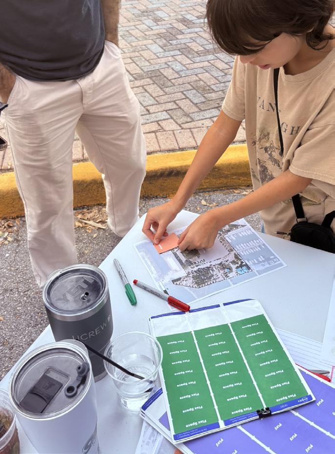
BUILD YOUR OWN PARK
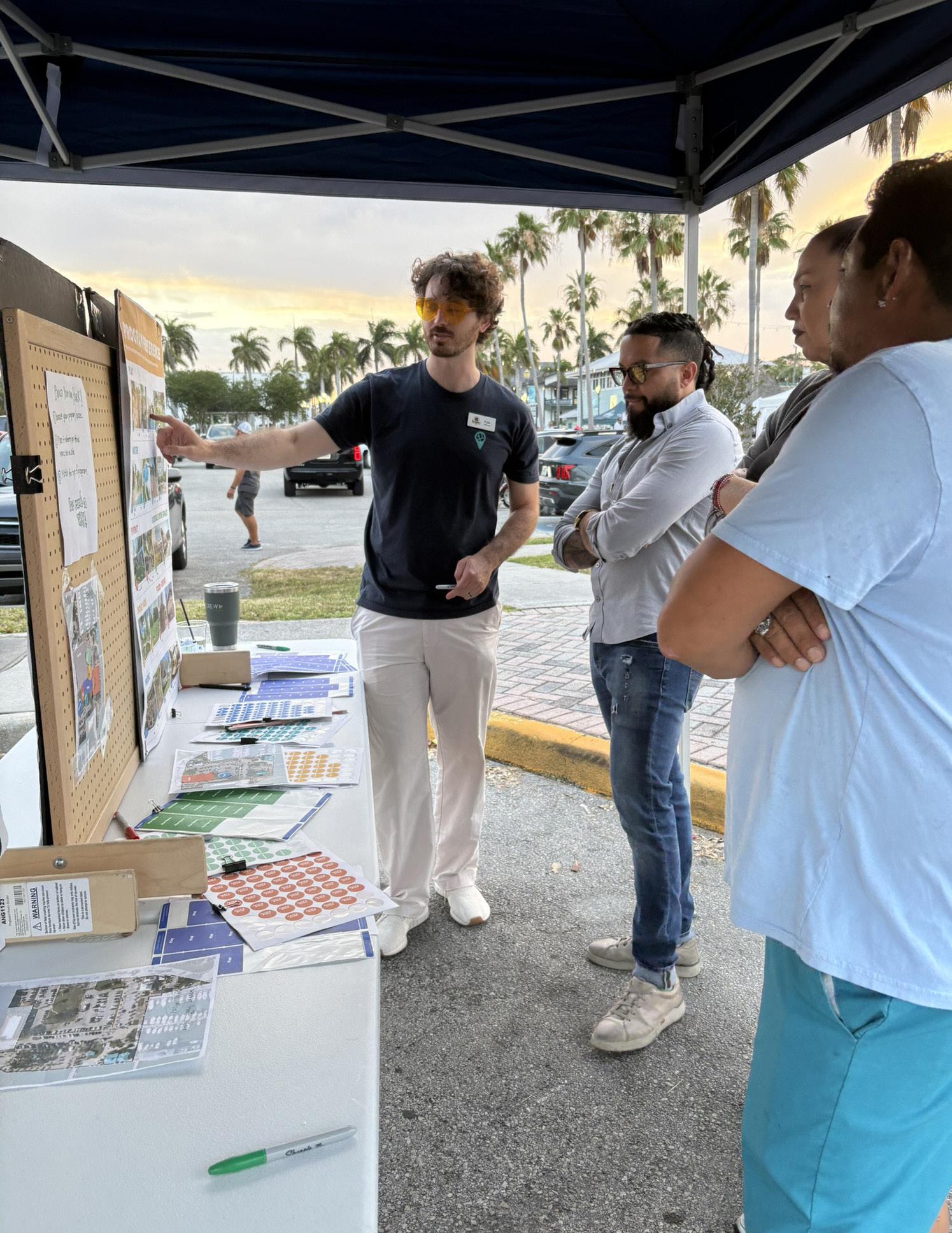
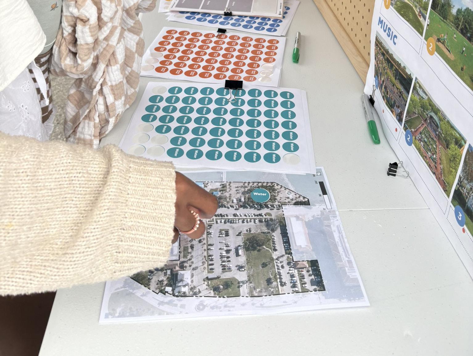
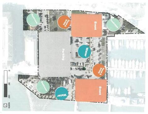
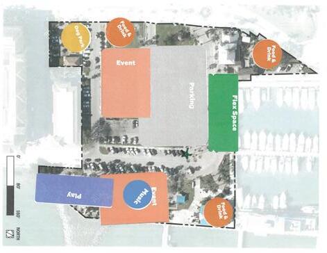
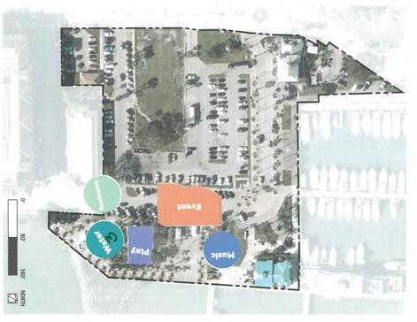
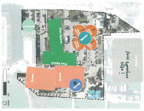
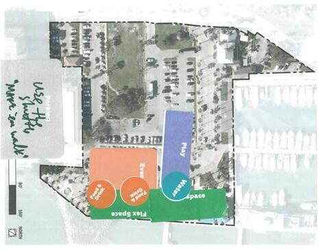
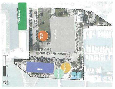
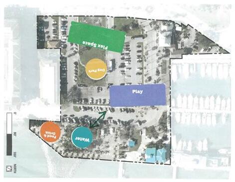
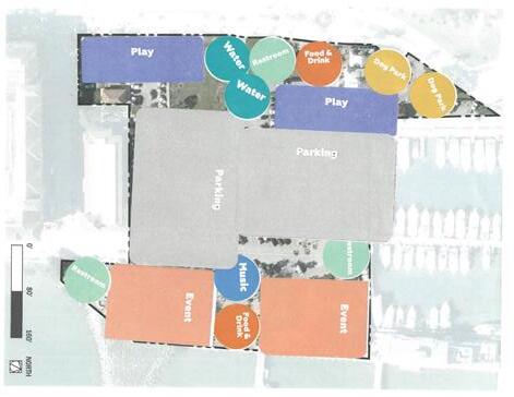
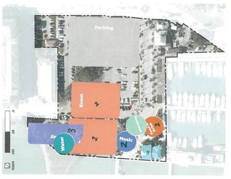
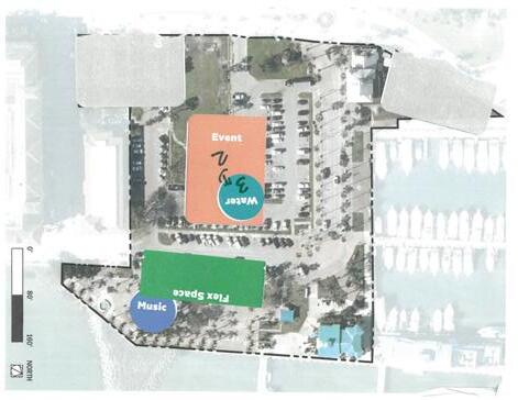
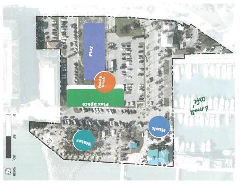
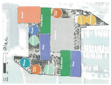
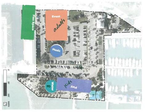
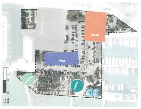
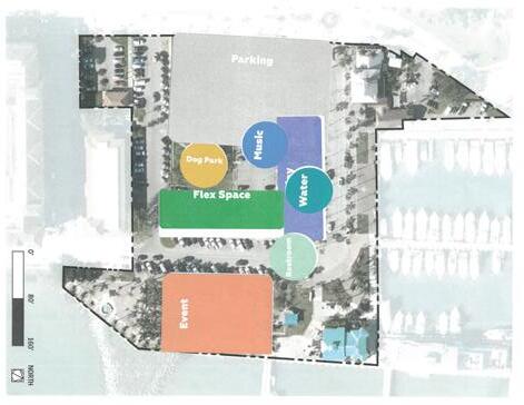
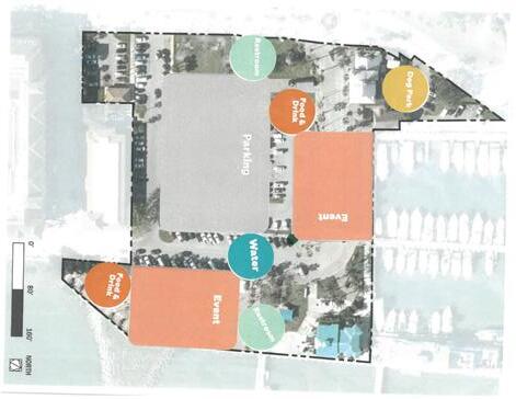
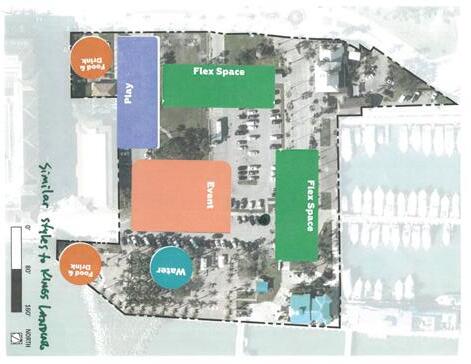
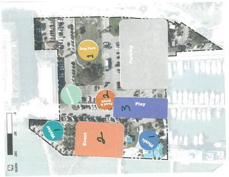
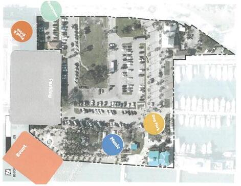
This portion of the workshop was an interactive session where participants had the opportunity to design their own park layouts. Using stickers to represent key functions on site plans, individuals explored various ways to organize different elements within the space. Among the 23 design variations created, most placed the event space near the waterfront, often accompanied by a music zone and parking located behind it. The central area of the site was commonly designated for flexible use, along with a food and beverage zone. Play areas were typically situated closer to the residential neighborhoods rather than along the water’s edge. These patterns were a valuable insight into the public’s hierarchy of spatial preferences.
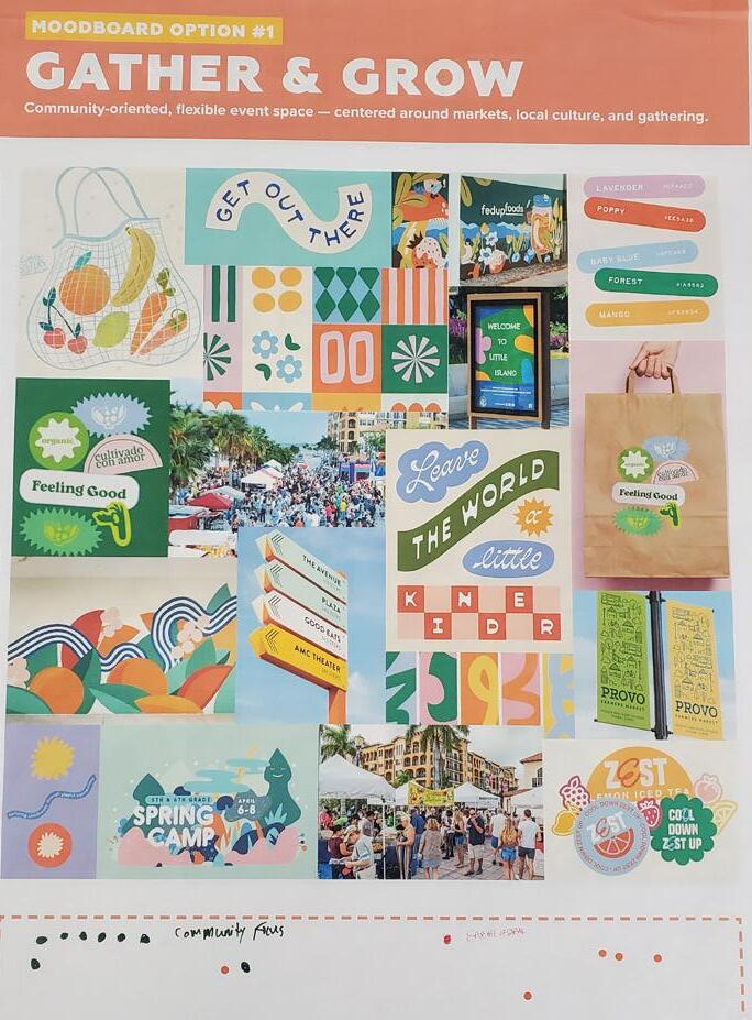
Branding Moodboard : Preferred Opt 1
Engagement for Build your own Park
KEY TAKEAWAYS
THE FARMERS MARKET AS A CORNERSTONE
The Saturday Farmers Market was repeatedly identified as the community’s most accepted use of the park. The market was not only an economic engine but also a cultural gathering space symbolic of Fort Pierce’s identity.
DESIRE FOR A FLEXIBLE, MULTIGENERATIONAL PARK
Feedback emphasized the importance of creating a space that welcomes people of all ages and accommodates multiple types of activity. Families requested interactive play areas, splash pads, and kid-friendly design. Older adults leaned towards shade, seating, and accessibility. Stakeholders emphasized flexible programming infrastructure that could support festivals, casual gathering, and everyday leisure without feeling empty when not in use.
INFRASTRUCTURE THAT SUPPORTS USE, NOT JUST FORM
From all forms of engagement, there was a constant repetition of improving the existing amenities includes upgraded restrooms, integrated electrical and water hookups for vendors, lighting, and signage. In order to not let infrastructure dominate the visual character of the park, the team recommended designs that are embedded, retractable, or architecturally complementary.
STRENGTHENING THE PARK’S NATURAL AND EDUCATIONAL IDENTITY
The community is rooted for more green spaces, embracing the lagoons, wildlife and native vegetation. They also showed a preference for lush Florida landscaping, birdwatching areas, and water features that also double up as educational tools. The stakeholders have also suggested incorporating signage and programming that highlights the marina’s role as a sponge system. This direction will create environmental awareness and help establish a contextual identity.
PARKING REMAIN CONTESTED BUT CRUCIAL
Parking availability was among the most controversial topics. Marina representatives noted the difficulty for long term marina tenants to walk with equipment and groceries from distant lots, while event organizers elaborated on frequent conflicts over weekend parking. There is strong support for creative solutions such as better signage, loading zones, shuttles, and balancing weekday versus weekend needs.
STAKEHOLDER FEEDBACK DURING THE DESIGN PROCESS
As the park is proposed to expand program opportunities, the necessity for robust parking has become a primary focus. To address these concerns, the engagement process in the conceptual phase incorporated specific parking strategies designed to alleviate fears regarding the potential removal of existing spaces.
One strategy explored involves modifying, managing, and maximizing nearby sites that are not currently designated as key spaces for public use. During these explorations, both the public and project stakeholders expressed a strong desire to investigate the feasibility of a structured parking garage on City-owned property across from the park, with an aim to seamlessly tie together the city’s parking requirements with its growing public space needs.
CONCLUSION
Taken together, the stakeholder interviews, survey responses, and the workshops set a consistent and actionable vision for the Fort Pierce Downtown Park: a flexible, multigenerational, and ecologically grounded civic space that celebrates community life all year around. Both residents and stakeholders seek a park that builds on the energy of the farmers market while providing infrastructure for future events, casual leisure, and educational engagement. Looking ahead, the design team aims to translate this input into a park framework based in the values of connection, authenticity, and resilience. This means preserving the market and gazebo, investing in durable infrastructure, and designing spaces inviting both vibrant activities and peaceful moments.
DESIGN
THE BRAND
Branding plays an essential role in shaping the identity of a public space. In a park context, the brand serves not only as a logo but as a flexible system that connects visitors to the environment. A thoughtfully developed identity informs signage, wayfinding, furnishings, programming, and communications, helping the park feel cohesive, recognizable, and rooted in its community.
For Marina Square, the brand was developed alongside the design of the park itself, allowing the visual identity to reflect both the community’s aspirations and the site’s physical character. The process established a foundation for the park’s overall design, with principles and visual elements that extend into the layout, features, and experiences of the park, which are detailed later in this section.
The following pages describe the development of the Marina Square brand, highlighting research, community input, naming considerations, and the creation of the final logo system.
RESEARCH AND FOUNDATIONS
The branding process began with a study of park identity systems from across the country. Unlike commercial branding projects, park brands must extend beyond traditional logo use into physical applications throughout the site. Successful examples revealed that park logos tend to be simple, flexible, and scalable.
While other parks provided inspiration for design approaches and applications, no two parks are intended to look or feel the same. The way a park comes to life through its layout, features, programming, and visual identity, should reflect the people who use it. Local culture, history, and landscape shape the final design, making Marina Square a unique expression of the Fort Pierce community.
In particular, elements of park identities are often designed to break apart into patterns or icons, which can then be applied across wayfinding signage, murals, furnishings, and other experiential touchpoints. This research guided the direction of the Marina Square brand, ensuring it would not only be recognizable but also enhance the visitor experience throughout the site.

Waterloo Greenway Austin, TX
Source: Bruce Mau Design
The Underline Miami, FL
Source: Order
Penn’s Landing Park Philadelphia, Pennsylvania
Source: J2
COMMUNITY ENGAGEMENT FINDINGS
Community engagement was central to shaping the brand direction. While a full summary of engagement activities is provided in the Community Engagement section of this report, the findings most relevant to branding are summarized here.
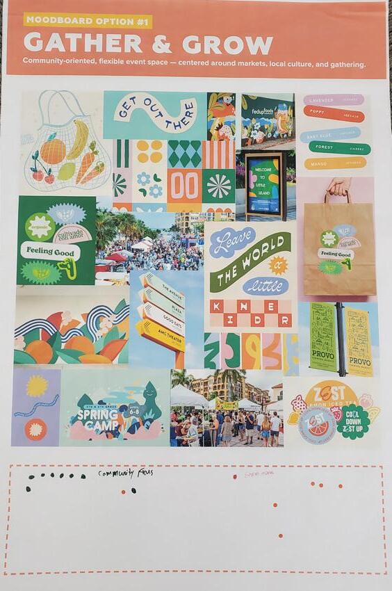
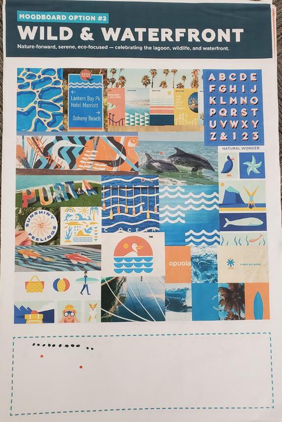
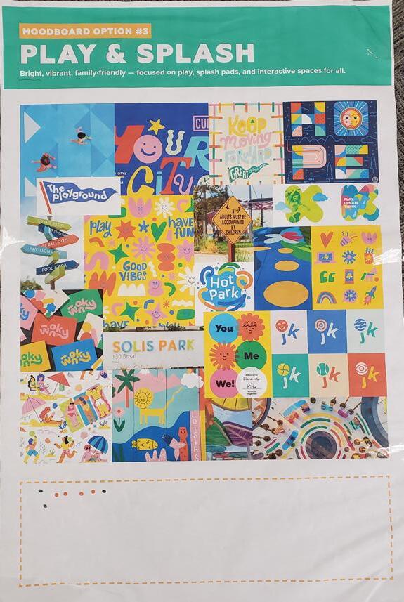
During the first public workshop, residents identified key themes and keywords describing their vision for the park. From this input, three moodboards were developed:
• Gather and Grow: Focused on community, markets, and gathering spaces. Combined geometric and organic shapes with a bright spring/summer palette.
• Wild and Waterfront: Highlighted nature and the waterfront environment. Featured wave patterns, wildlife illustrations, and an ocean-inspired palette.
• Play and Splash: Centered on play, family activities, and fun. Showcased a vibrant color palette, whimsical shapes, and child-centered illustrations.
At the second workshop, participants selected ‘Gather and Grow’ as their top choice, with ‘Wild and Waterfront’ as a close second. These preferences guided the design approach, combining the welcoming energy of ‘Gather and Grow’ with natural elements from ‘Wild and Waterfront.’
NAME & LOGO ITERATIONS
During the branding process, the team explored whether a new name might better reflect the park’s identity. Options included ‘The Marina Link’ and ‘Pierce Point,’ but it was ultimately decided to retain the established name, Marina Square, preserving public recognition and honoring the site’s history. Retaining the name also provided an opportunity to emphasize the “square” concept as a central visual element.
Alongside naming considerations, multiple iterations of logos, iconography, and color palettes were developed to explore different ways of expressing Marina Square’s identity. Early concepts tested a range of visual approaches inspired by community input and moodboard directions, including geometric versus organic shapes, playful versus natural motifs, and varying levels of abstraction.
These iterations were reviewed internally and with staff to evaluate how each option could translate into real-world applications, including signage, furnishings, murals, and environmental graphics. Feedback from these reviews informed refinements to form, color, and symbolism, gradually narrowing the options toward a cohesive identity system. 1 2 3 15 13 7
FINAL LOGO
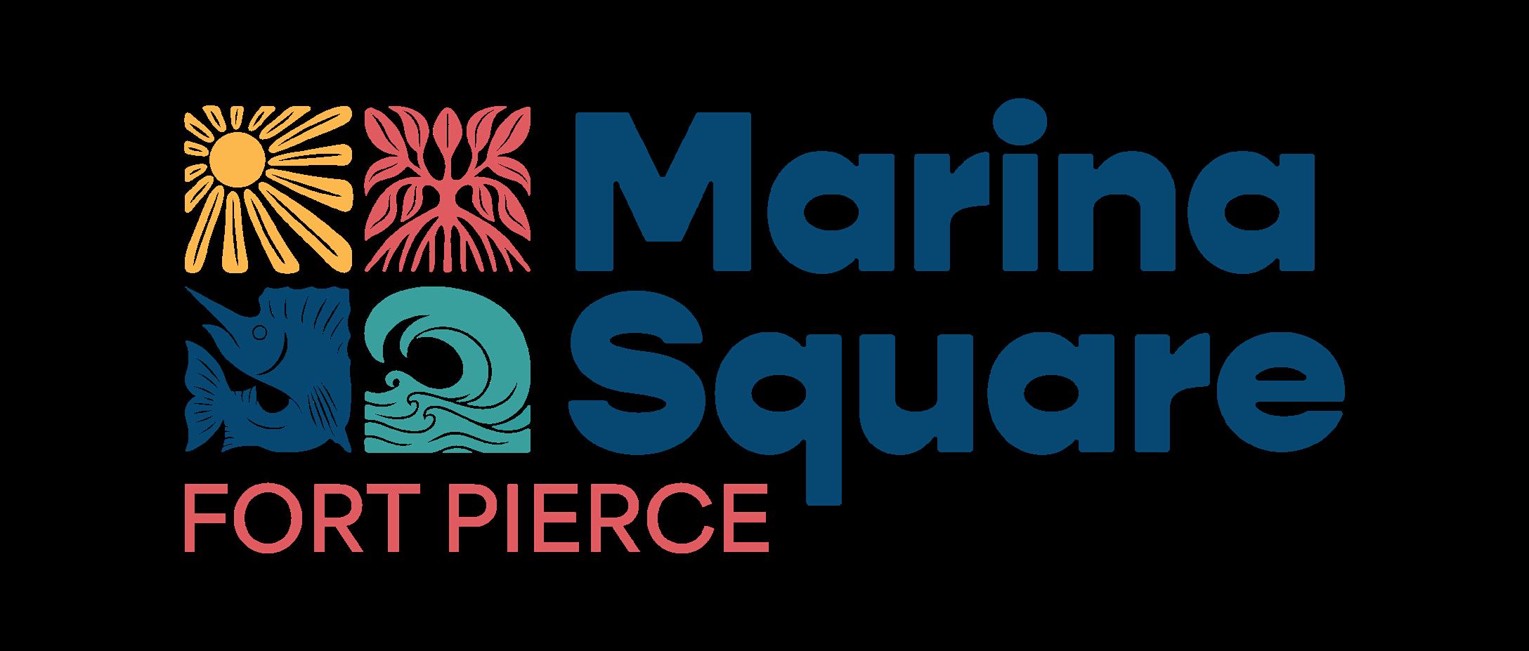
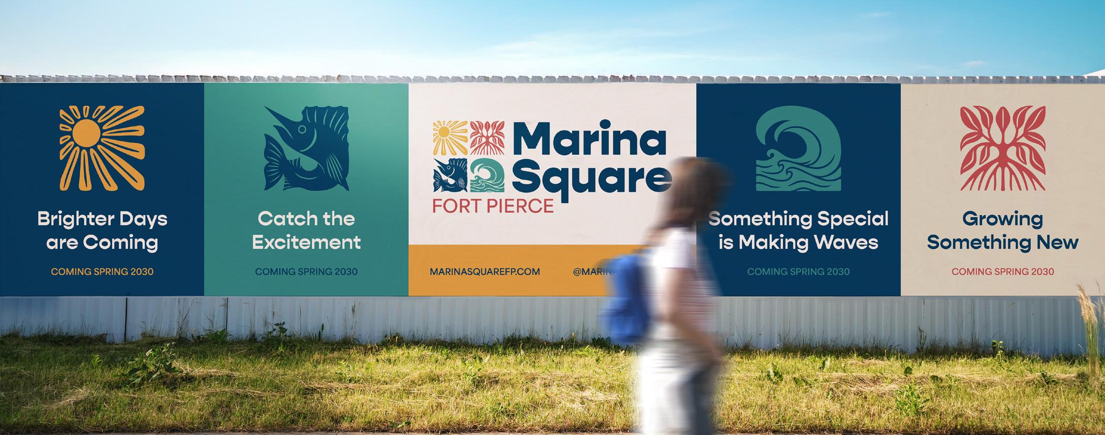
The final logo for Marina Square represents the culmination of multiple rounds of refinement. Through careful adjustments, the design team hand-illustrated icons that reflect the unique character of the site while maintaining a cohesive, square-based system.
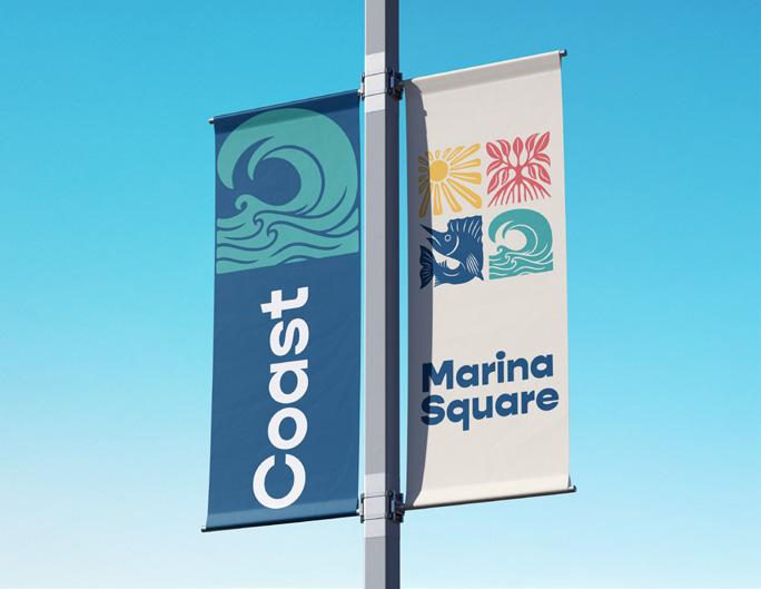
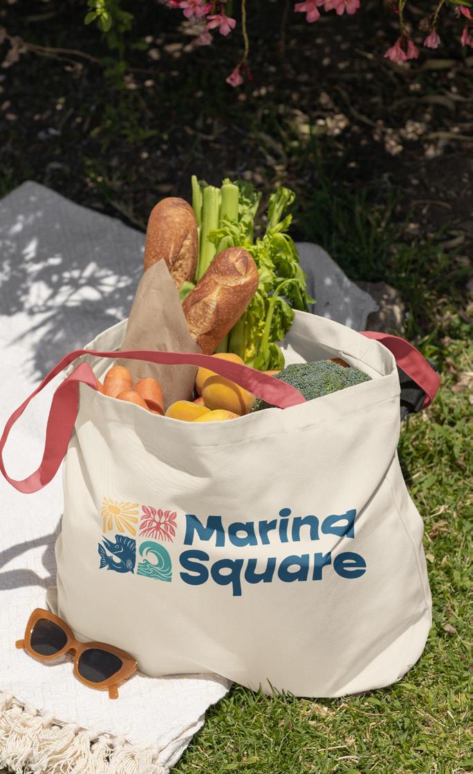
The resulting logo features four square icons arranged to form a larger square, each representing a key aspect of Marina Square: the sun (top left) reflects the sunny Florida waterfront setting, the mangrove (top right) honors the surrounding mangrove ecosystem, the sailfish (bottom left) pays homage to the historic Fort Pierce identity, and the wave (bottom right) emphasizes the park’s waterfront location and recreational opportunities. The icons were meticulously crafted to feel inherently square and balanced, ensuring they work both individually and collectively and reflect the name of the park.
Community input also directly influenced the final color palette. Visitors were invited to vote on their preferred palette through the project website, and the selected palette became the foundation for the brand. Minor adjustments were made to ensure ADA accessibility and legibility across applications, resulting in a vibrant yet functional color system that enhances the park’s identity.
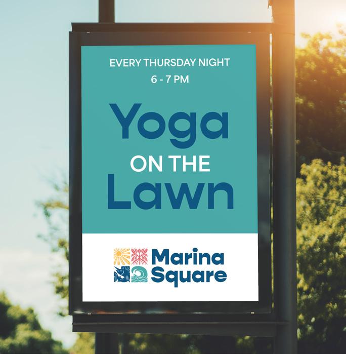
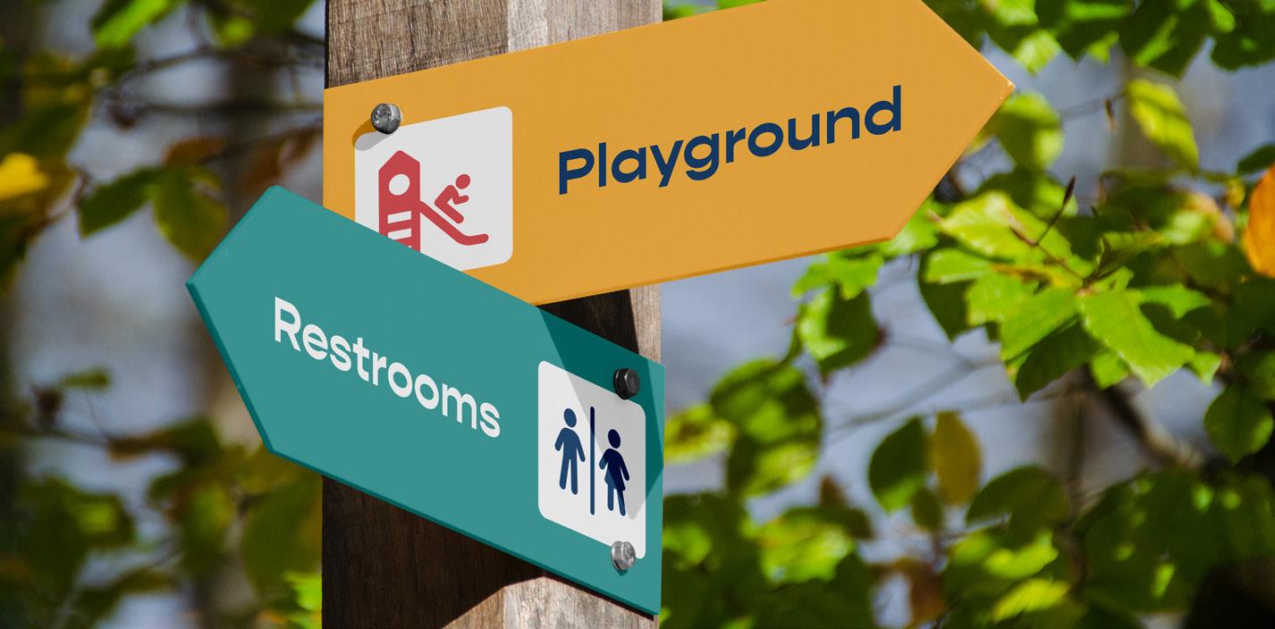
This flexible identity system extends beyond the logo itself, allowing the icons, color palette, and graphic elements to be applied across signage, murals, furnishings, and other park elements. Together, these refinements ensure that Marina Square’s brand is visually distinctive, deeply rooted in the history, environment, and community of Fort Pierce, and provides a strong foundation for the park’s overall design and visitor experience.
DESIGN FRAMEWORK
Comparing the site’s existing conditions to the Great Parks Framework and reflecting on key takeaways from community engagement, the site demonstrates strong potential to evolve into a truly great place. The design framework emphasizes the need to ACTIVATE, CONNECT, and RESTORE the park through a series of strategic moves.
RELOCATING PARKING COULD PROVIDE SPACE FOR SOCIAL AND ENVIRONMENTAL FUNCTIONS.
2. Focus on shaded
3. Create engagement opportunities at the edges.
4. Incorporate art and education into the design
1. Introduce opportunities for movement, play, and vending throughout the site to encourage interaction
2. Create a downtown trolley system to support off-site parking areas and nearby businesses
3. Increase IT capacity for park users and marina guests
4. Ensure food service and fuel deliveries are safe and efficient
1. Address stormwater management through multifunctional green infrastructure solutions
2. Support biodiversity by using native plant materials and protecting mature shade trees
3. Reuse and recycle site materials to reduce waste and cost for new materials
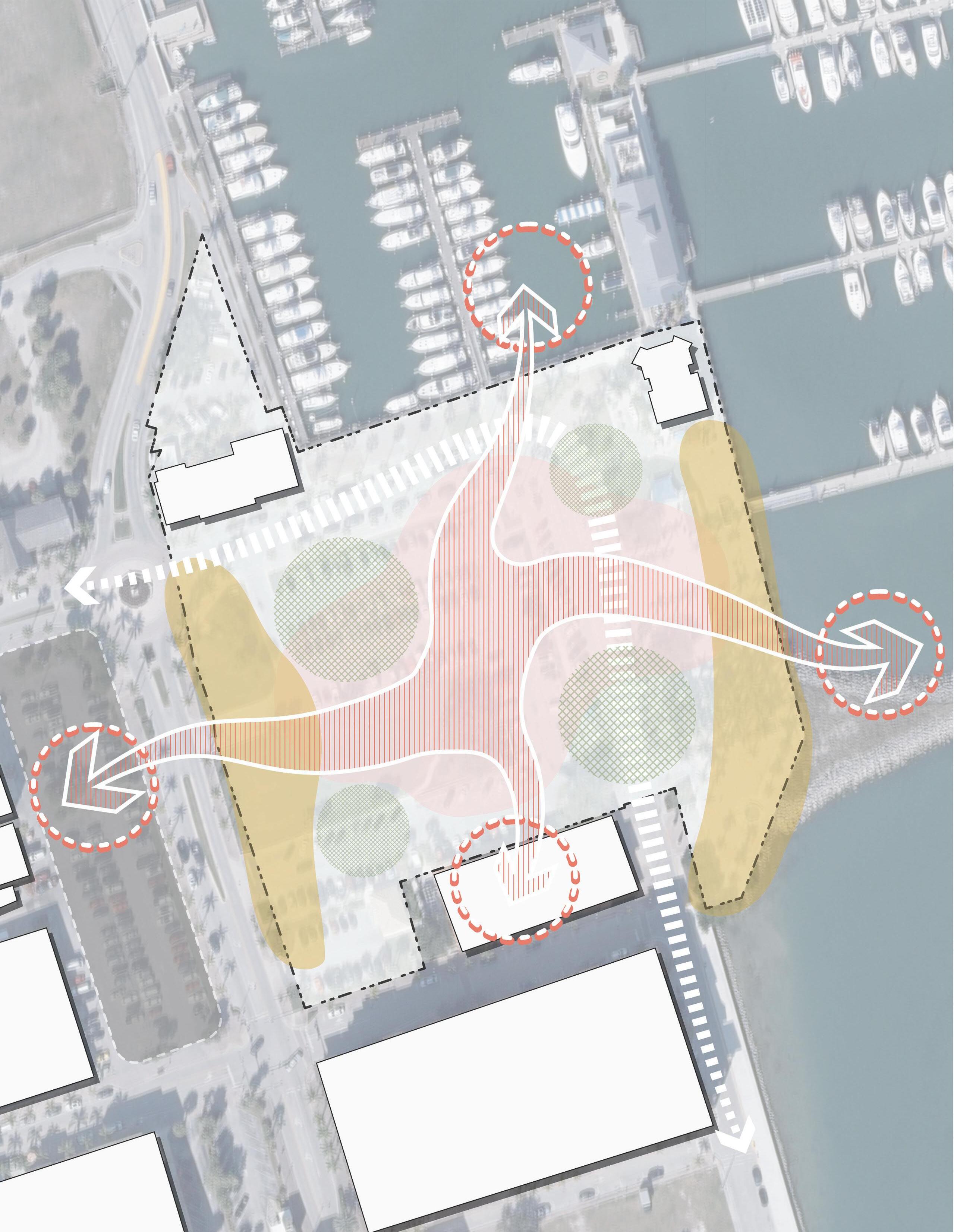
EDUCATIONAL ART, DIVERSE PLANTINGS, AND WAYFINDING COULD IMPROVE EAST/WEST LINKAGES
DESIGN ELEMENTS
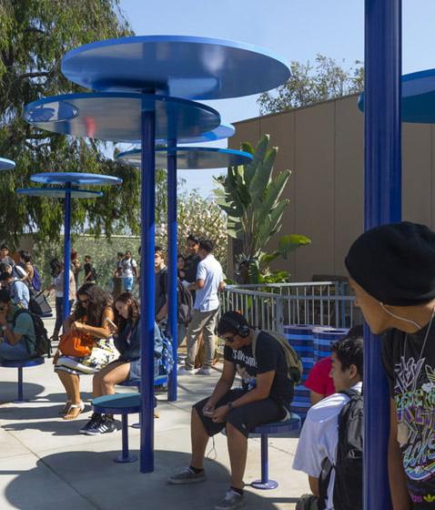
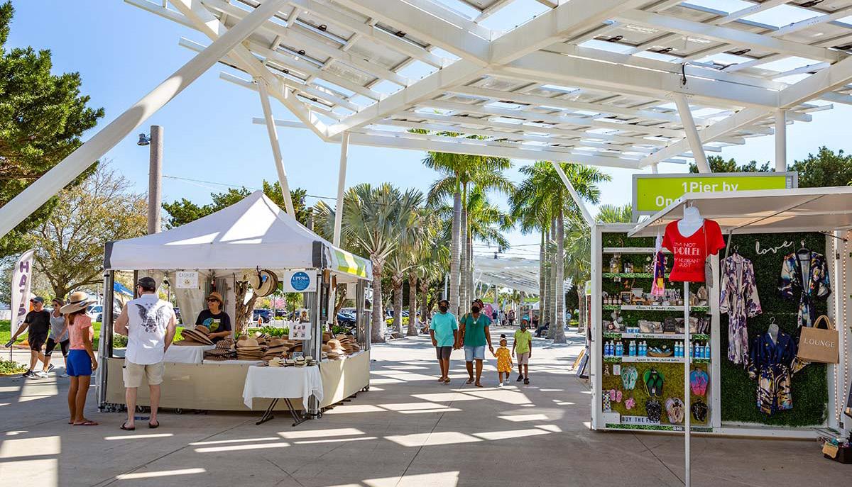
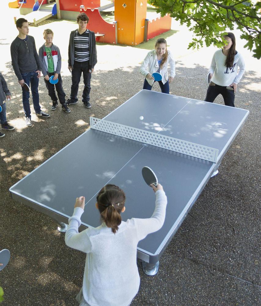
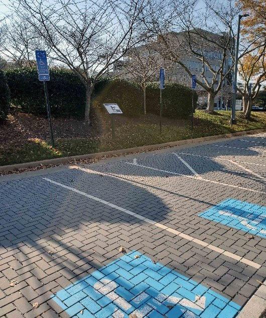
Vendor Pavilion
Interactive Art Tram Stop
Waterfront Promenade Multigenerational Play Permeable Parking
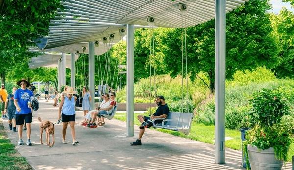
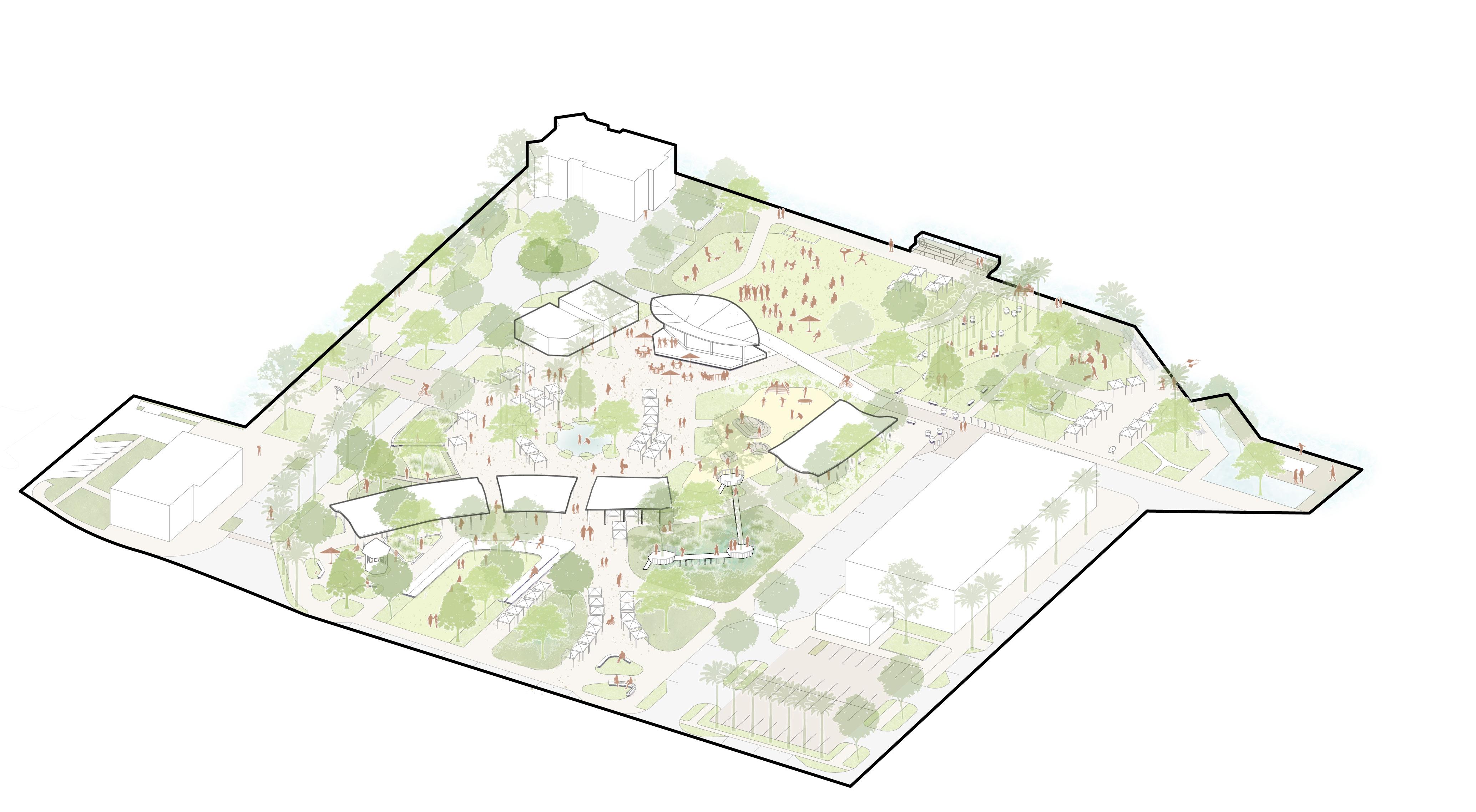
Imagine Fort Pierce’s waterfront as the City’s commons: open lawns for picnics, a plaza alive with markets and music, and shady groves for quiet moments. Marina Square brings all this together, anchored by a riverfront promenade that ties the heartbeat of downtown to the beauty of the Indian River.
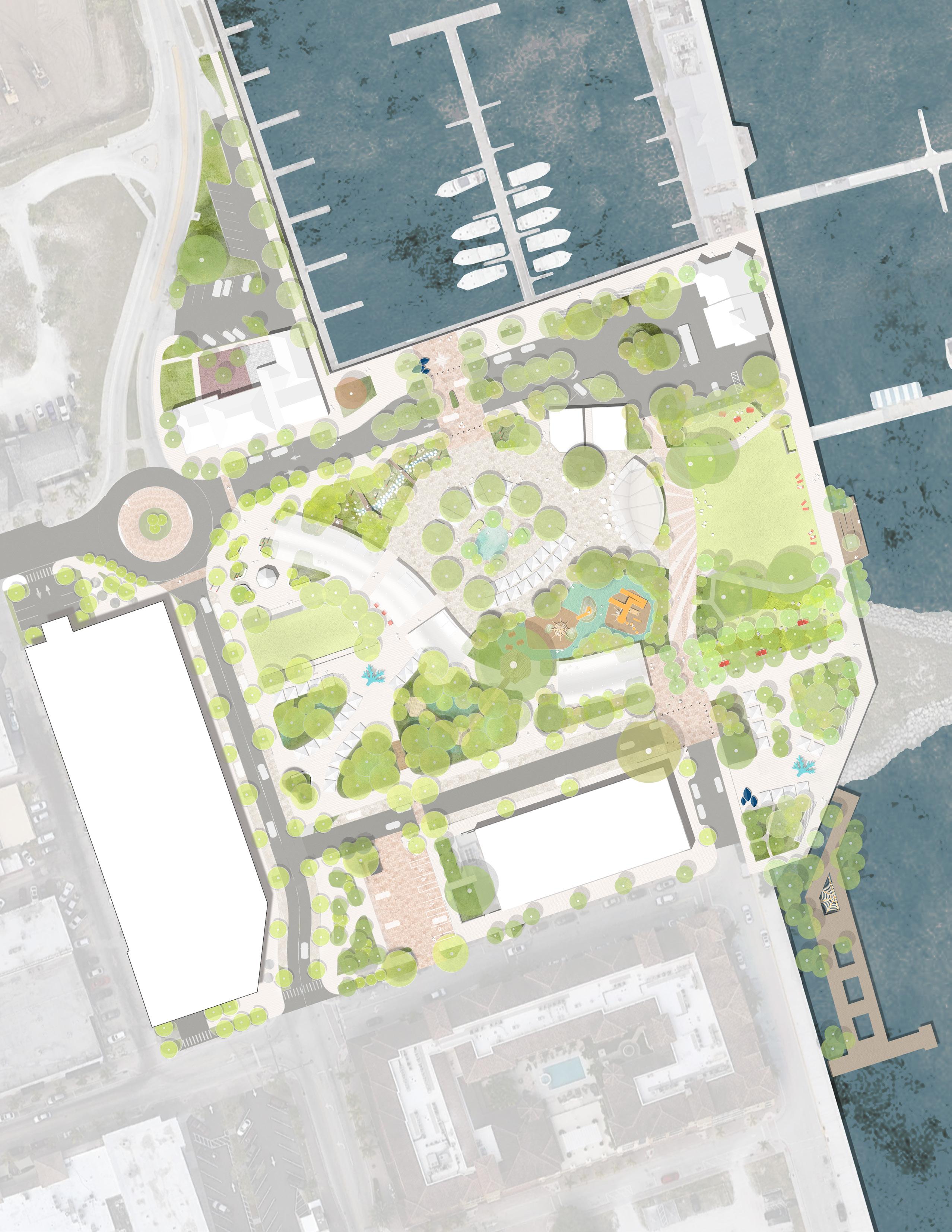
ILLUSTRATIVE MASTERPLAN
WATERFRONT PROMENADE
CITY TRAM STOPS (2)
STORMWATER SWALE
SCULPTURE PLAZA
HISTORIC GAZEBO
VENDOR COLONNADE
SUNKEN LAWN AND TERRACES
DOWNTOWN CROSSWALK
SPLASH PAD
INFORMATION CENTER OR VENDOR
RESTROOMS
MARINA SERVICE AREA
EVENT STAGE
OPEN LAWN
MARINA LOADING ZONE
MARINA DOCK
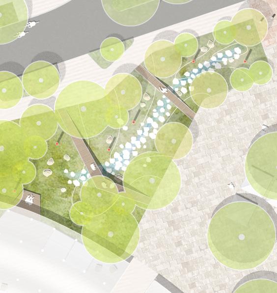
A.The discovery area integrates stormwater management with experience, using landscape bridges to immerse visitors in exploration while highlighting ecological function.
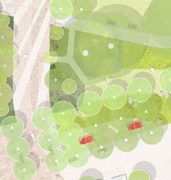
Existing palm groves are retained with turf below, offering shaded, flexible spaces for gatherings. Shared street paving patterns create a seamless connection between areas while enhancing pedestrian safety.
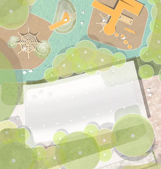
The shaded colonnade acts as a lively spine for markets and daytime activation. Flowing landscape gestures extend the outdoor experience inside while also providing controlled access to the adjacent children’s play area.
ACTIVITY MAPPING
















Tram Drop Off
Lawn / Plaza
Informal play area
Jazz and small music performances
Stormwater feature
Shaded seating
Interactive public art
Community welcome space
Colonnade
Crafts market / popup stalls
Board game tables
Exploration decks & nature interpretation signage
Shaded social seating
Public workshops and pop-ups
Market Plaza
Farmer’s Market / Green Market
Cafe and information center
Outdoor seating and dining
Performance stage
Splash pad
Public workshops and pop-ups
Events Lawn Palm Grove
Outdoor playscape
Treehouse play
Nature play elements
Concerts and cultural festivals
Large public events (Movie on the Lawn)
Community Fairs
Yoga / Fitness by the river
Dog park
Picnic area
Ping pong tables
Playful seating
Art and sculpture installations
Outdoor coworking tables
Medication / Quiet Retreat
Waterfront
Promenade
Playful seating






Experiential viewing decks
Bike and strolling edge
Observation platforms
Oyster bed restoration
Educational Signage
Fishing
Grove Entry
Stormwater collection cells
Mangrove boardwalk
Seating areas
Nature interpretation signage
Bird watching decks
Vendor Kiosks
Bioretention Area
Stormwater collection cells
Marsh boardwalk
Bridges and walkways
Discovery decks
Nature interpretation signage
JOINING FRIENDS FOR A PING PONG GAME UNDER THE PALM GROVE
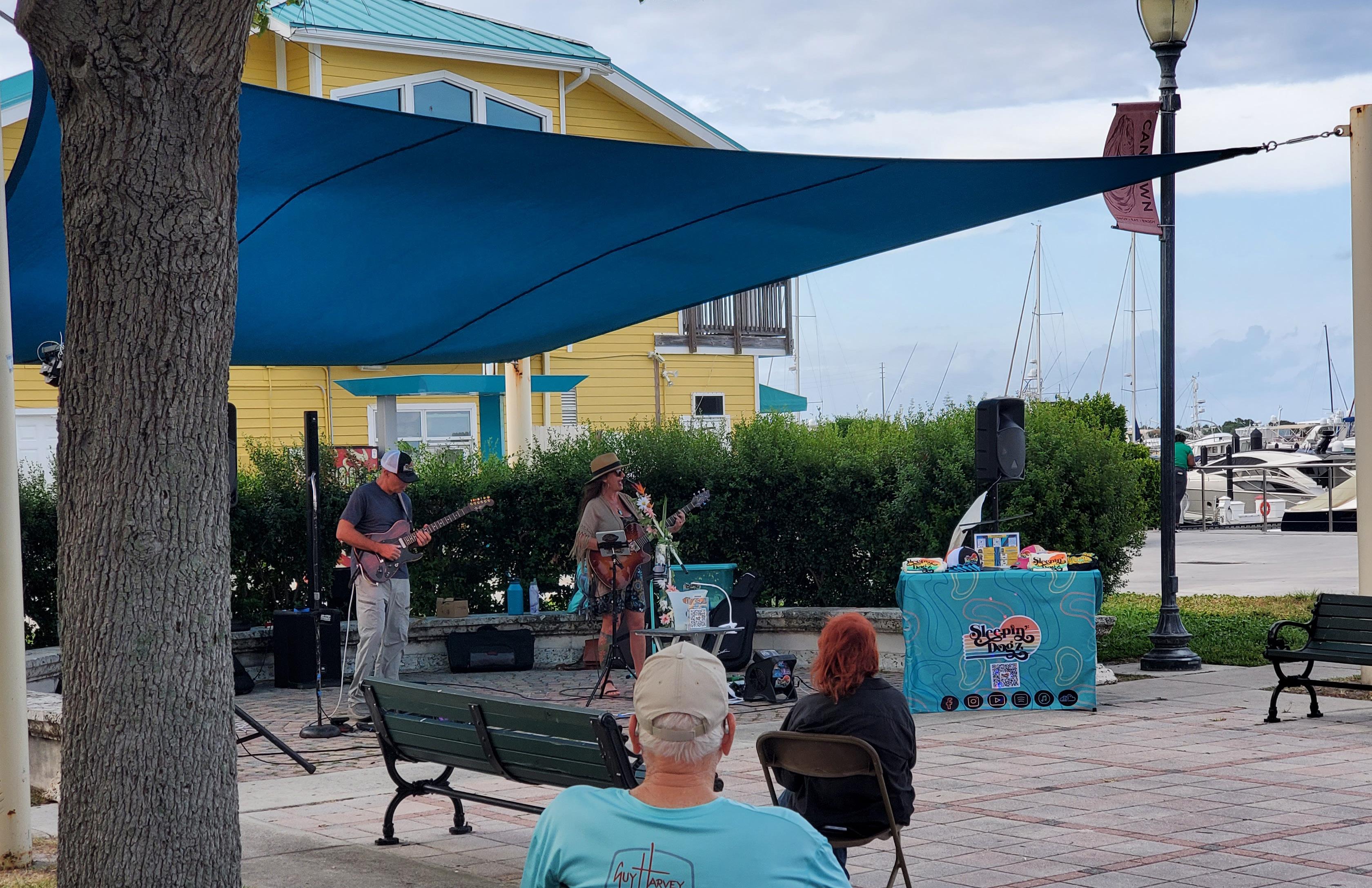
SUNDAY VIBES WITH A LOCAL BAND
GETTING A CLOSER EXPERIENCE TO THE WATER AND MARINE LIFE
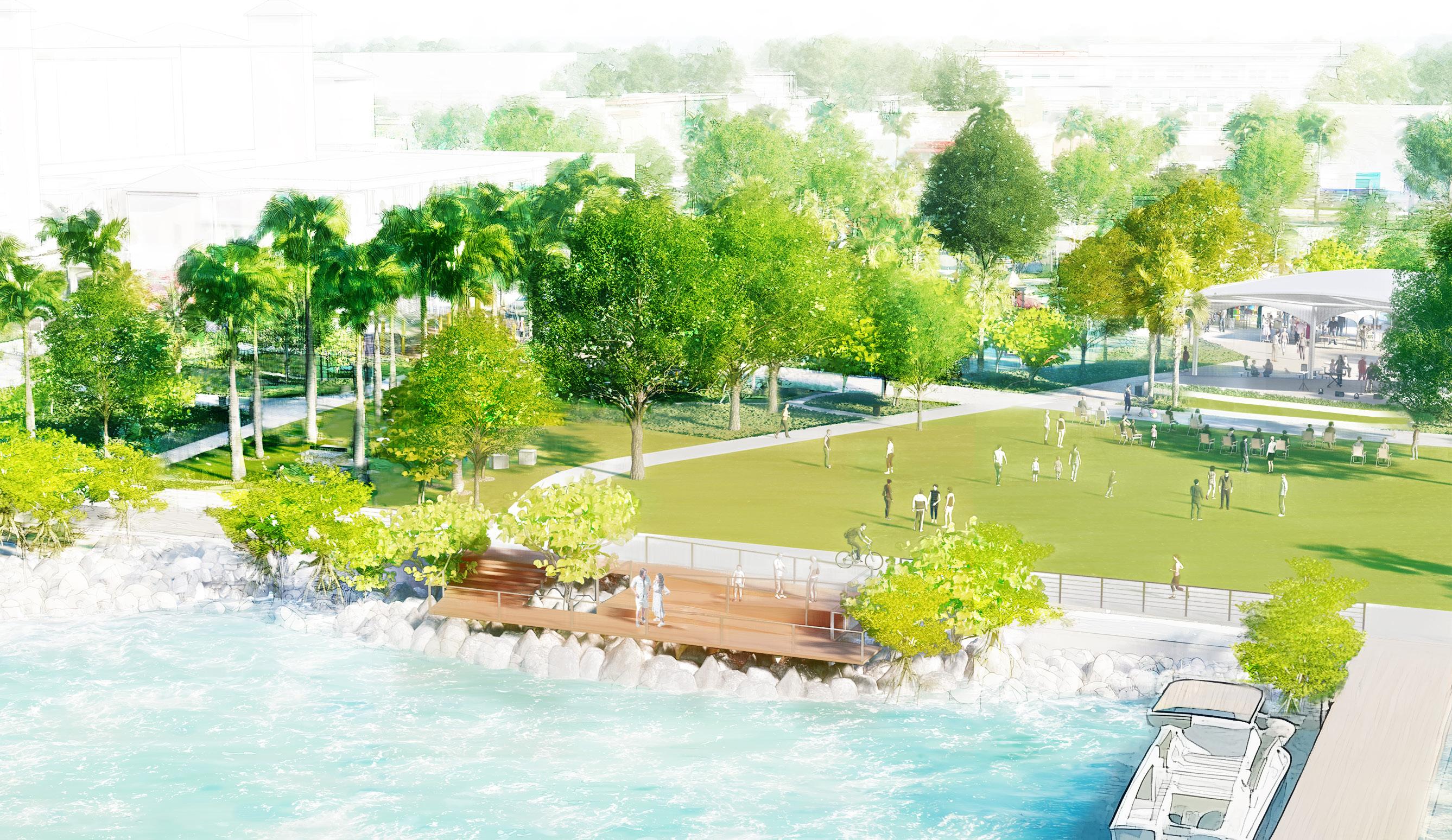
IMAGINE: THE RIVERFRONT
Celebrating the riverfront with a vibrant marina deck and expansive lawn that encourage connection, leisure, and waterfront experiences.
STARTING THE WEEK WITH YOGA ON THE LAWN
LISTENING TO THE JAZZ MUSIC BY THE MARKET ON SATURDAY MORNING
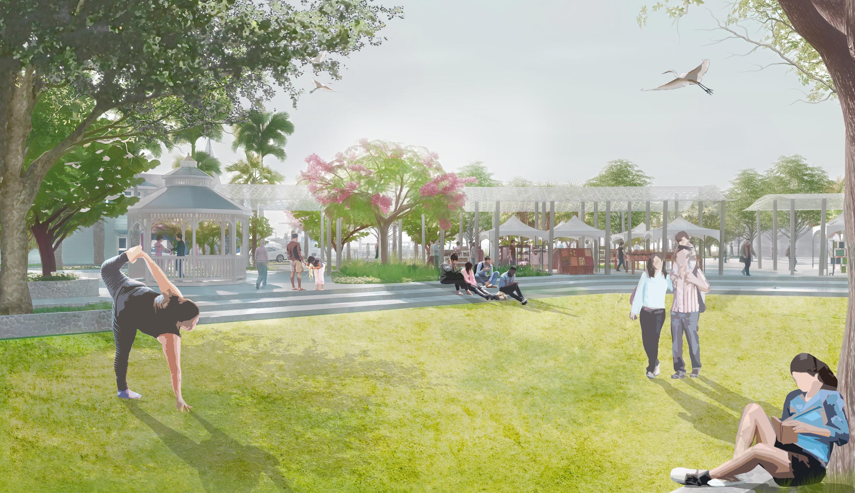
IMAGINE: THE ENTRY LAWN
Activating the street edge by a flexible lawn acting as a community space for markets, music, and casual gatherings.
RELAXING WITH FRIENDS OVER A PICNIC AFTER CLASS
CATCHING A BREAK AFTER WORK IN THE SHADED COLONNADE
PLAYING CHESS WITH FRIENDS AND FAMILY
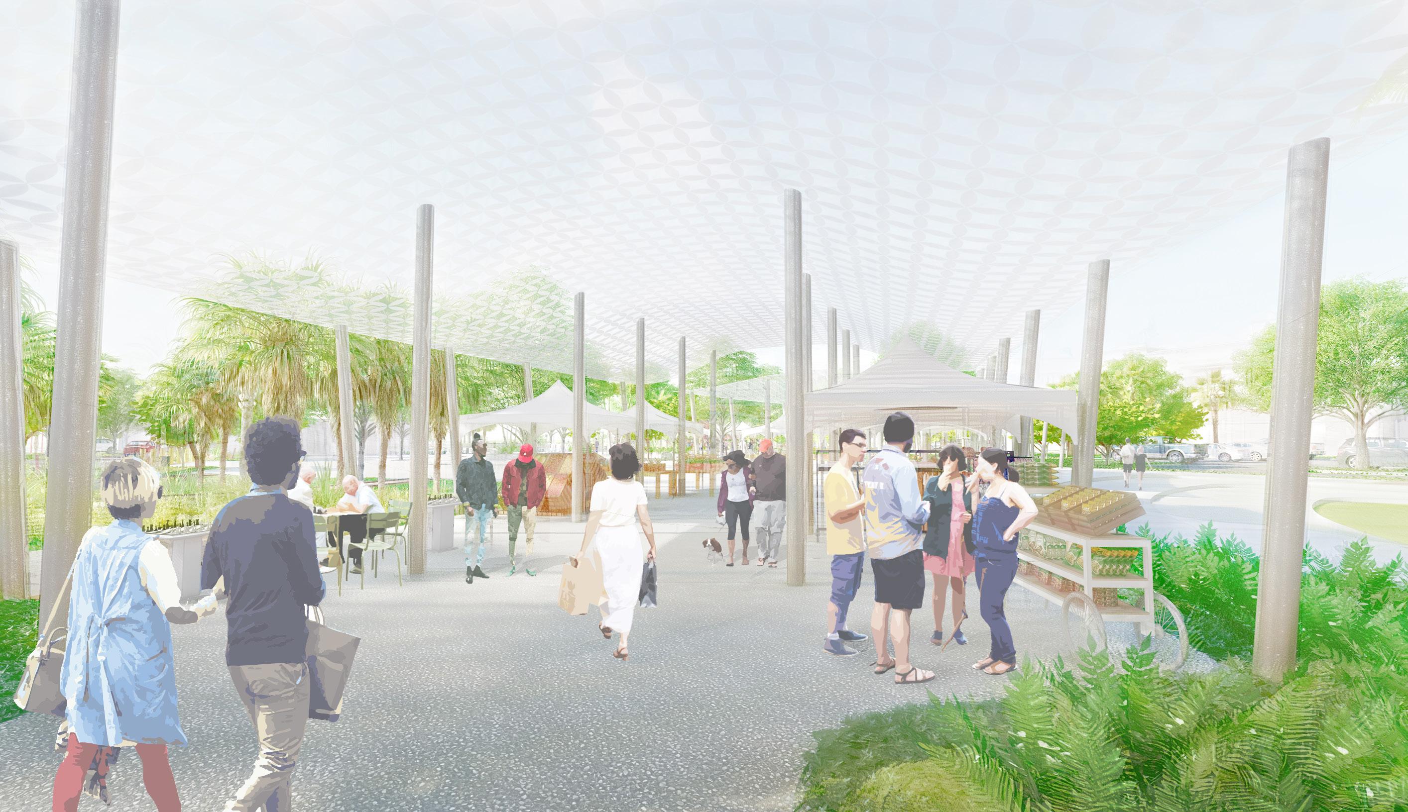
IMAGINE: THE COLONNADE
The shaded colonnade offers a welcome pause to enjoy local crafts and markets while casually engaging with others.
SHOPPING LOCALLY DURING A CASUAL STROLL IN THE PARK
EXPLORING HOW THE PARK’S SPONGE FILTERS WATER
DISCOVER NATIVE TREES AND WILDLIFE ON AN AFTERNOON WALK
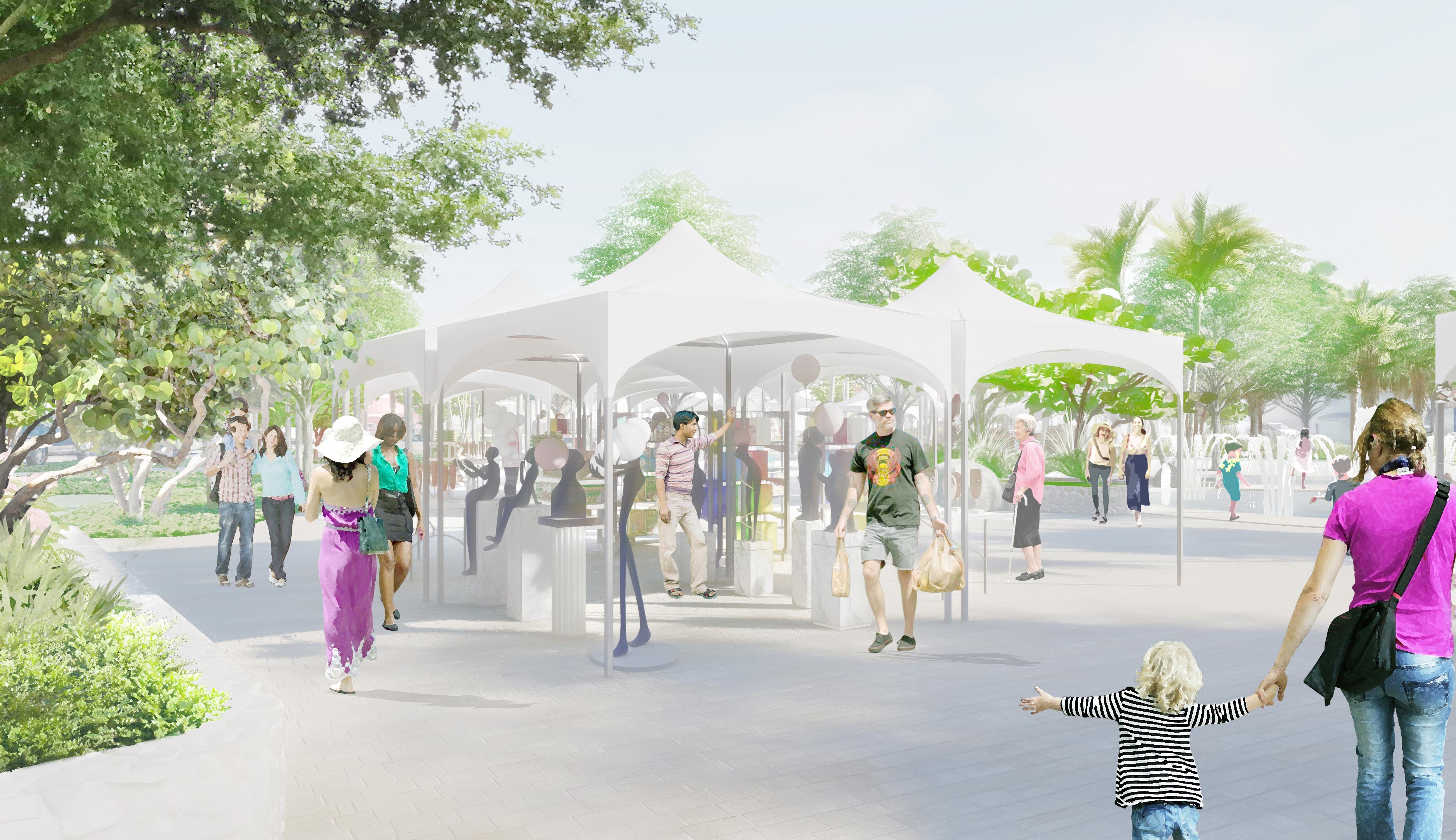
IMAGINE: THE PLAZA
At the heart of the design, the public plaza and flexible splash pad highlight culture, bring people together, and adapt to host a variety of events.
ENJOYING THE VENDORS & FARMER’S MARKET DURING THE DAY
HEADING TO THE SPLASH PAD WITH THE KIDS AFTER SOME PLAYGROUND FUN
CATCHING A BREATHER UNDER THE SHADE IN THIS HOT AFTERNOON!
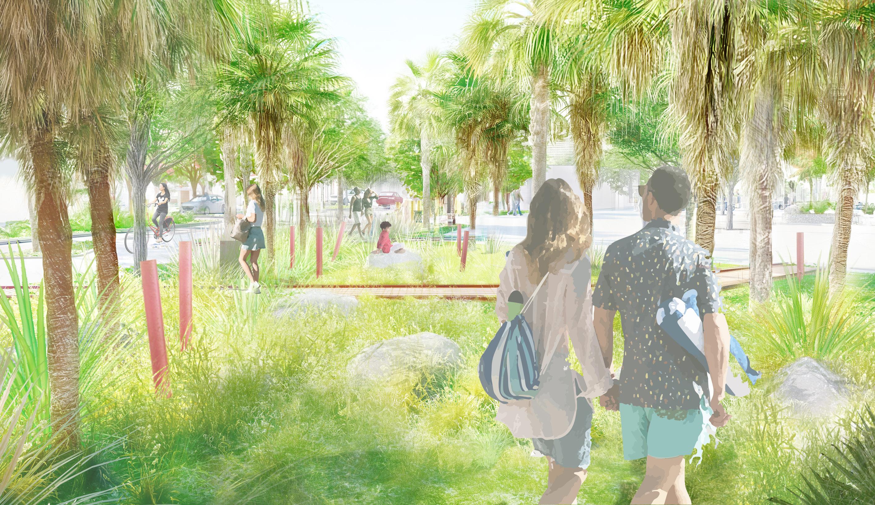
EXPERIENCING THE CALM & SERENE LANDSCAPE
LEARNING ABOUT STORM WATER AND FLORA FAUNA OUTSIDE SCHOOL
IMAGINE: THE SPONGE
Capturing and filtering stormwater in key designated landscape areas. They become educational opportunities for the community of Fort Pierce as well.
STEPPING OUT OF THE CITY AND RIGHT INTO NATURE
ENJOYING THE WEEKEND MARKET
FAVORITE WAY TO START THE DAY
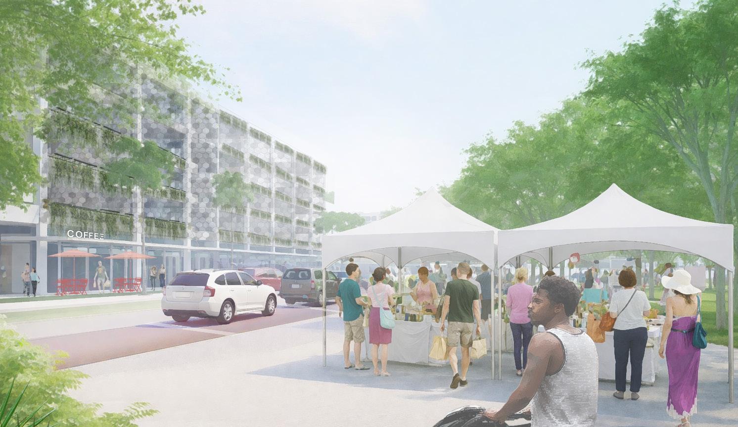
IMAGINE: THE PARK ARRIVAL
A welcoming park gateway supporting vibrant public life. The parking garage consolidates vehicle demand while activating the street edge with shaded walkways, ground-floor retail activity, pop-up markets, and community events..
BIRD AND MANATTEE WATCHING AT THE INDIAN RIVER LAGOON
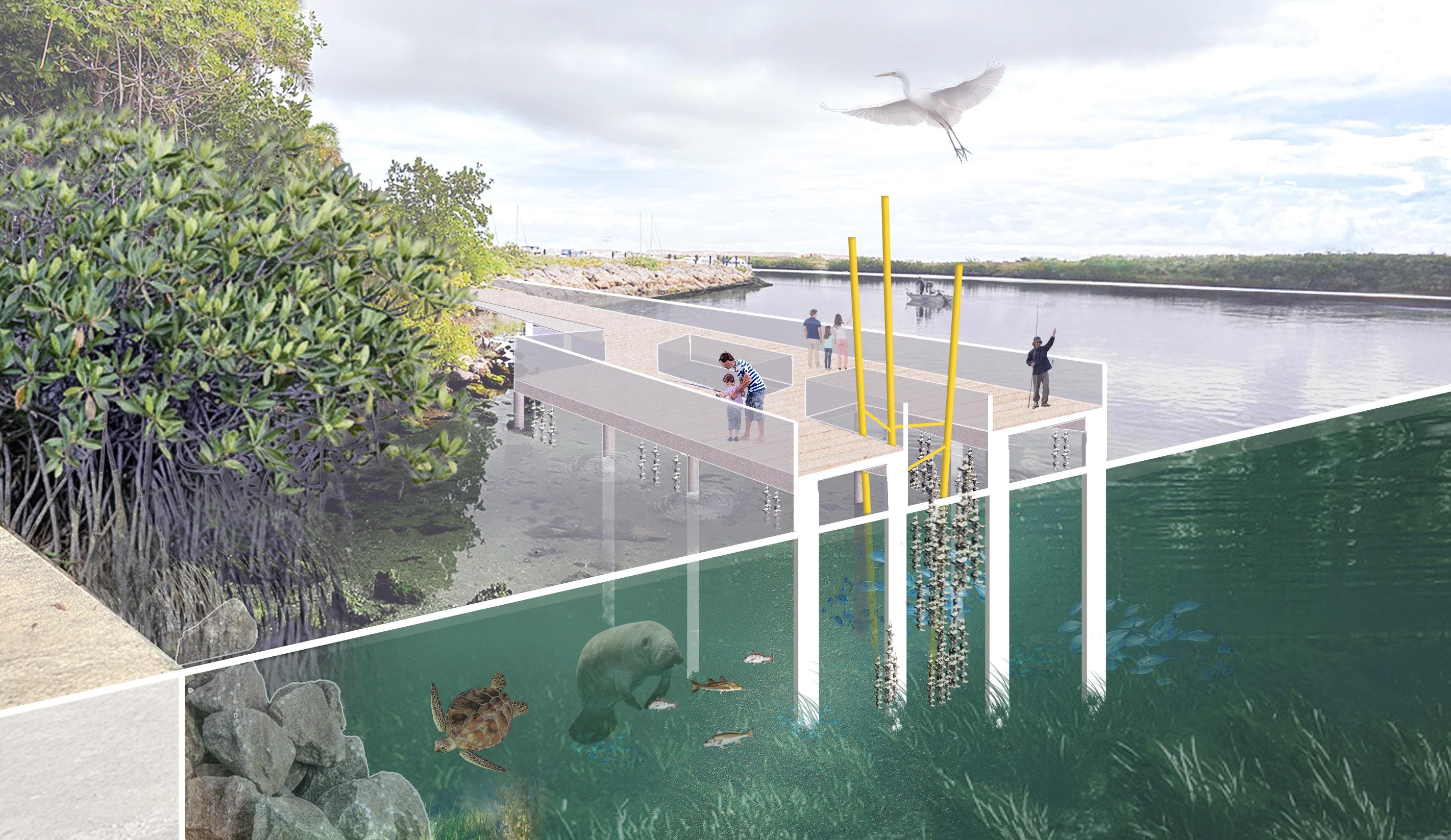
FISHING ALONG THE RICH WATER’S EDGE
LEARNING ABOUT OYSTER GARDENS HELPING OUR MARINE ECOSYSTEM
IMAGINE: THE WATERFRONT BOARDWALK
A resilient riverfront edge that brings people closer to the water. The elevated boardwalk supports fishing and gathering while oyster gardens below improve water quality, create habitat, and reduce wave energy, blending recreation with ecological resilience.
SUPPORT SYSTEMS:
PARKING & CIRCULATION
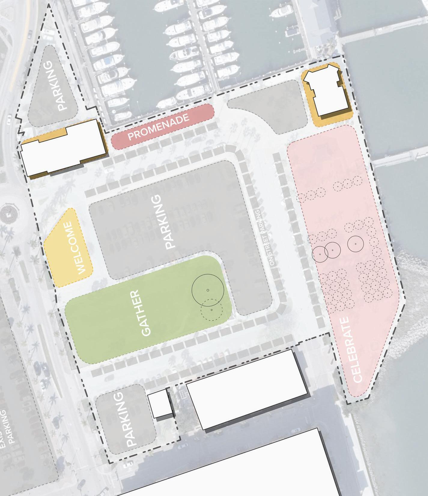
SUPPORT SYSTEMS: SERVICE ROUTES
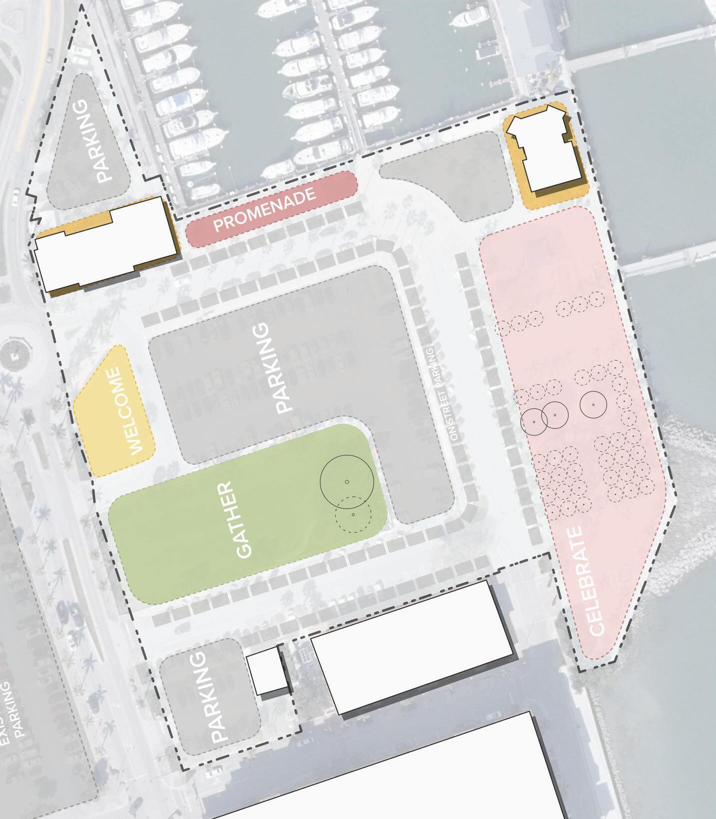
SUPPORT SYSTEMS:
VENDORS & MARKETS
Fests
Proposed Vendor Spaces
Vendor / Event Loading - Unloading Zones
Overflow Vendor Spaces
Suitable For Food Trucks
Green Market
Historic gazebo with audience space by the lawn
Loading / unloading areas for events
Downtown food vendor spotlight can host vendor for a number of months
Loading / unloading areas for events
Providing power throughout the park for vendors & events
Stage to enhance the music dynamics as today
S Indian River Dr OrangeAve
Melody Ln
I MPLEMENTATIO
STAGES OF IMPLEMENTATION
To finalize the vision for the Fort Pierce Downtown Park, the following recommendations are provided to ensure the conceptual design evolves into a high-performance civic asset. These steps focus on leveraging the site’s flexibility to create a resilient, active, and financially sustainable destination.
1
PHASE 1
FOUNDATION AND EARLY ACTIVATION
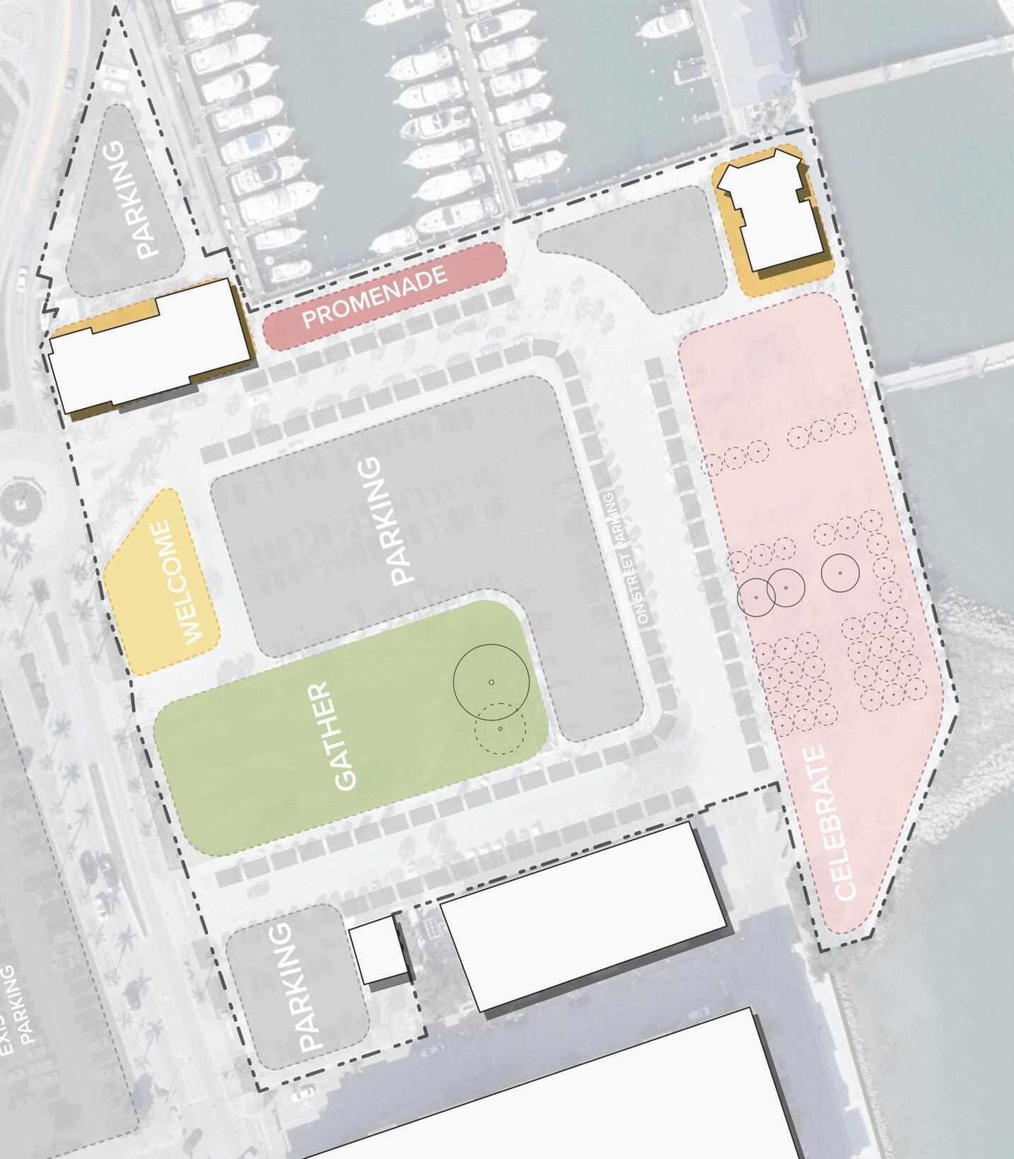
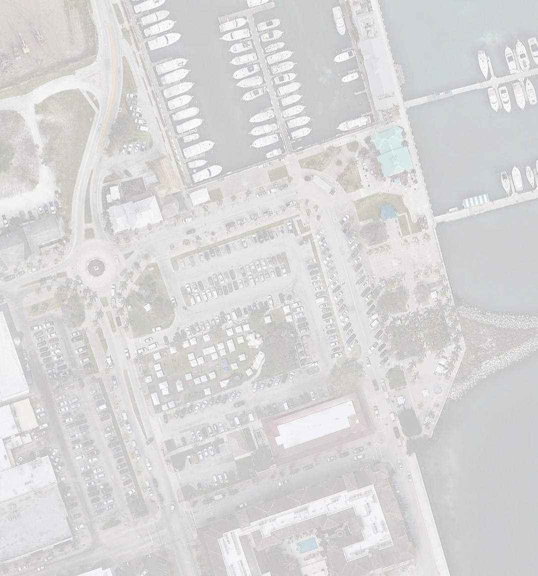
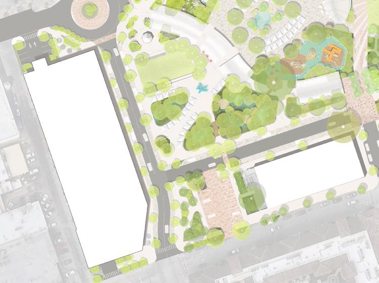
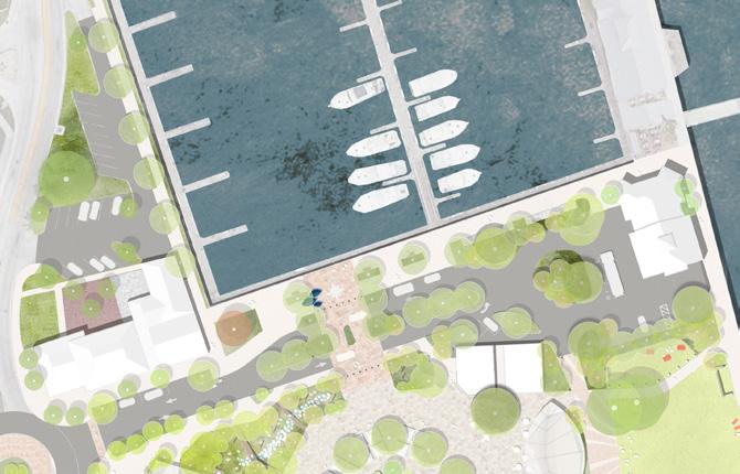
• Create southern parking facility and access on S Indian River Dr to replace waterfront parking.
• Keep waterfront markets; move crafts to parking lot and Melody Lane to extend activity inland
PHASE 2
PHASE 3 TEMPORARY SPACE TACTICAL INTERVENTIONS
SOCIAL CORE DEVELOPMENT ECOLOGICAL AND RECREATIONAL COMPLETION
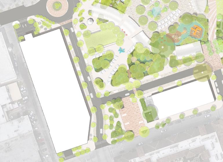
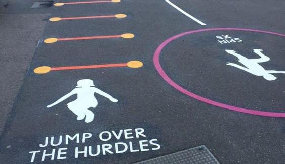
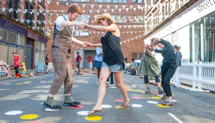
During this phase, the central parking area should be utilized for “tactical urbanism” interventions such as temporary ground murals and interactive play markers to reimagine the asphalt as a temporary social space and build community momentum.
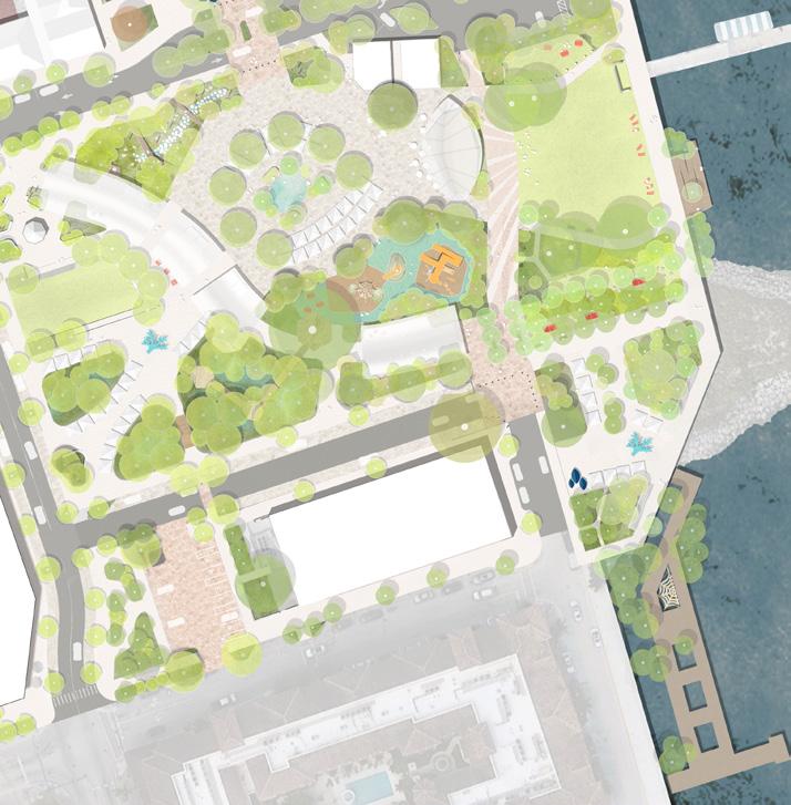
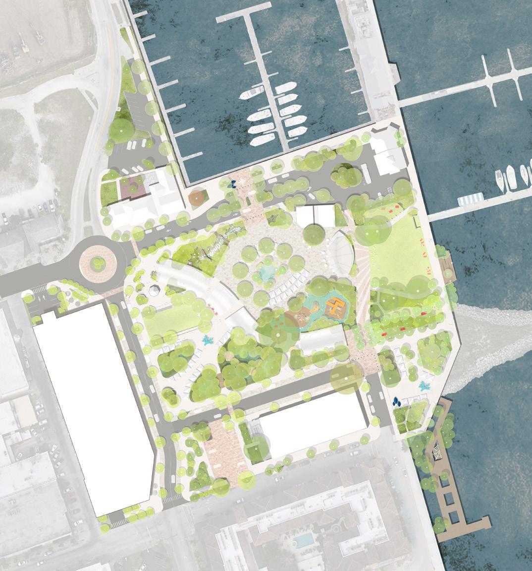
• Construct the central public plaza and waterfront edge as key social anchors, including the event lawn and shaded vendor colonnade.
• Integrate City Tram stops to connect the park with the downtown parking garage, improving access for visitors and marina users.
• Finalize the waterfront promenade and the Discovery Playground to fully integrate the park into the Indian River Lagoon ecosystem.
• Develop service routes, access points for marina along Avenue A and tram circulation.
• Enhace the existing parking area of Cobb’s landing
HIGH-PERFORMANCE PROGRAMMING
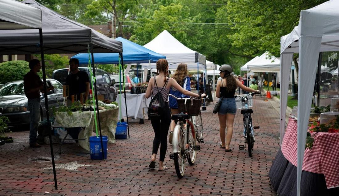
To transform the park from a “special event” space into a “16-hour” social anchor, the city must implement a proactive program management strategy that utilizes the site’s built-in flexibility.
DAILY ACTIVATION
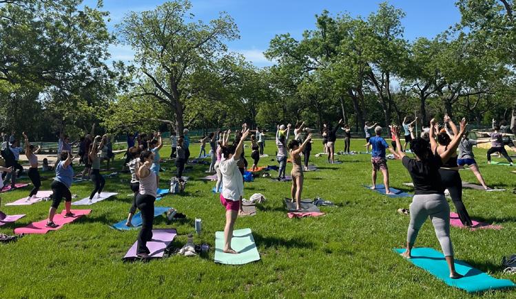
The park is designed to host a variety of daily uses, such as “Yoga on the Lawn,” outdoor fitness classes, and gardening workshops in the showcase gardens.
THE DIGITAL COMMONS:
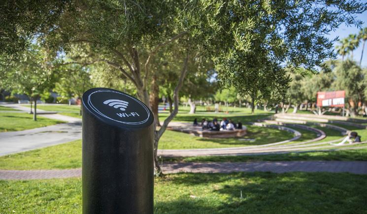
Leverage the planned digital infrastructure, including WiFi and power hookups, to activate the park as a daytime “tech hub” for remote workers and students.
CONSISTENT MOMENTUM:
This daily rhythm provides a foundation for the “market anchors”, such as the Wednesday Green Market and Saturday Farmers Market, and major monthly festivals like Friday Fest, ensuring the space remains vibrant and safe through consistent “eyes on the park”.
SUSTAINABLE OPERATIONS & MAINTENANCE (O&M)
A park’s long-term success is dictated not by its construction, but by its ongoing care and financial resilience. Establishing a robust O&M framework is critical for maintaining high-use amenities like the splash pad and discovery decks in great condition.
PUBLIC-PRIVATE PARTNERSHIPS (PPPS)
It is recommended that Fort Pierce explore a partnership with a dedicated non-profit conservancy modeled after the “Friends of” groups used by the High Line or Bryant Park to oversee specialized maintenance and daily programming.
REVENUE REINVESTMENT:
The park functions as an economic engine; income generated from the Vendor Colonnade, food truck hookups, and event permits should be directly reinvested into a dedicated maintenance fund.
VALUE CAPTURE AND TIF:
As the park increases the property values of the surrounding Central Business District, the Fort Pierce Redevelopment Agency (FPRA) should utilize Tax Increment Financing (TIF) to capture a portion of this growth for long-term infrastructure security and ecosystem restoration.
SCHEDULE
1. Approve Concept and begin detailed design 3. Start construction for the Park
Obtain Infrastructure to Manage Parking
Build the Parking Garage
4. Allocate funding for maintenence and operations 5. City to take over in 2042

07APPENDIX
APPENDIX A : BUILD YOUR OWN PARK MATRIX RESULTS
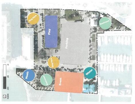
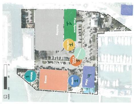
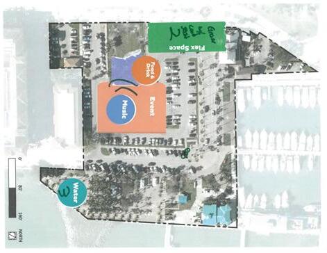
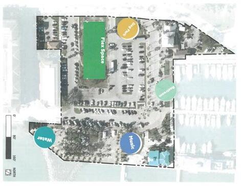
APPENDIX B: PARKING STRATEGY STUDY
To: Sara Delgado
From: George Kramer
CC: Shyanne Harnage, Viviana Castro
Date: March 9, 2026
Reference: Parking and Access Strategy Technical Memorandum
Introduction
The purpose of this memorandum is to analyze the parking supply and demand within walking distance of Marina Square and provide the framework for a parking strategy that is consistent with the design of Marina Square and the Fort Pierce Downtown Master Plan. The City’s parking strategy should balance the demand for parking and the community character of downtown Fort Pierce. Portions of this analysis and memorandum were presented on February 11, 2026, to the Fort Pierce Citizen Parking Committee
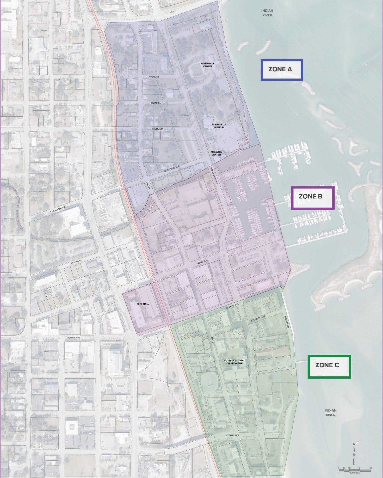
Zones
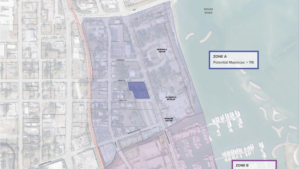
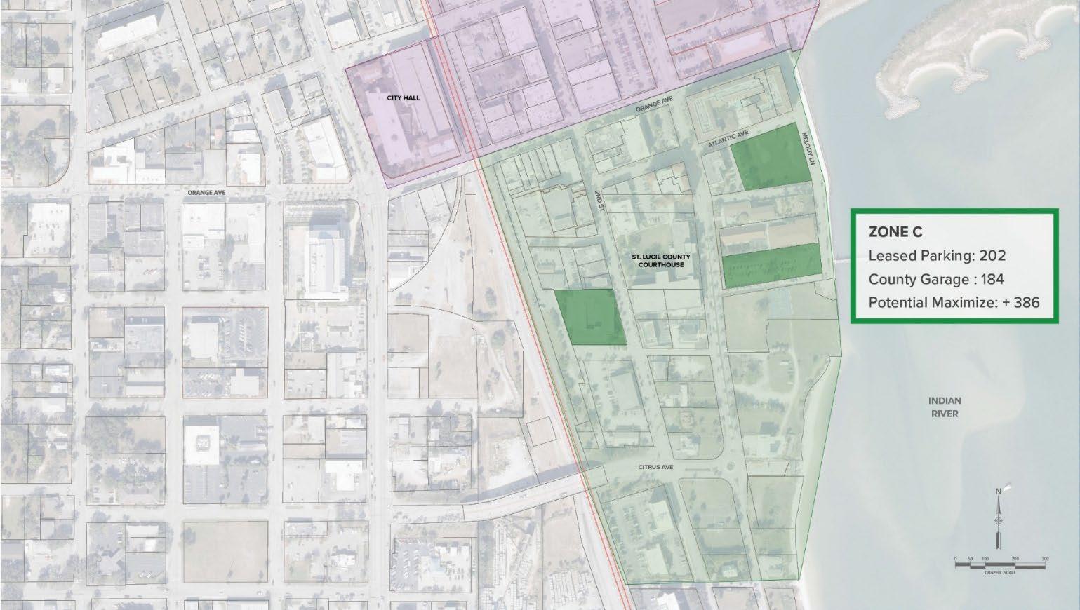
The existing parking supply within walking distance of Marina Square was analyzed based on three Zones (Zone A, B, and C). All three zones are generally bound on the east by the Florida Intracoastal Waterway and on the west by the train tracks that run parallel to US Highway 1. The only exception to the east and west boundaries is Zone A , which includes the parcel west of the train tracks occupied by City Hall. The northern and southern boundaries for the three zones are provided below in Table 1 and the three zones can be found in Map 1
Table 1 : North and South Boundaries
Zone A Jimmy Buffett Memorial Highway Moore’s Creek
Zone B Moore’s Creek Orange Avenue
Zone C Orange Avenue Delaware Avenue
APPENDIX B: PARKING STRATEGY STUDY
Parking and Access Strategy Technical Memorandum
Existing City- owned Parking Analysis
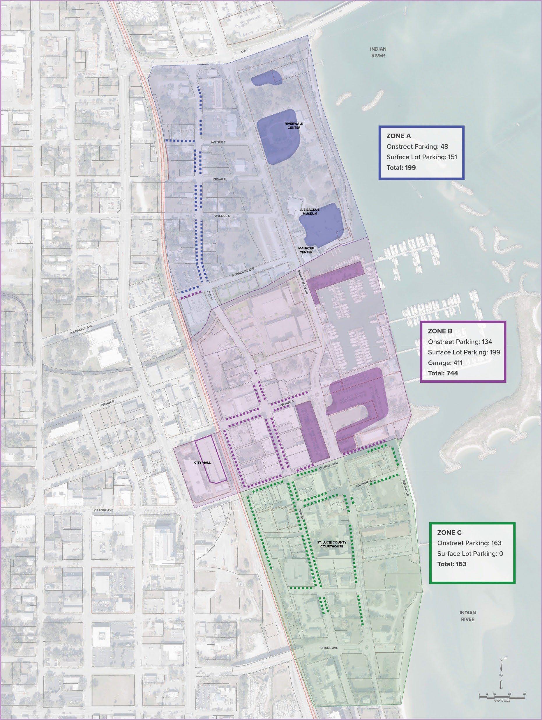
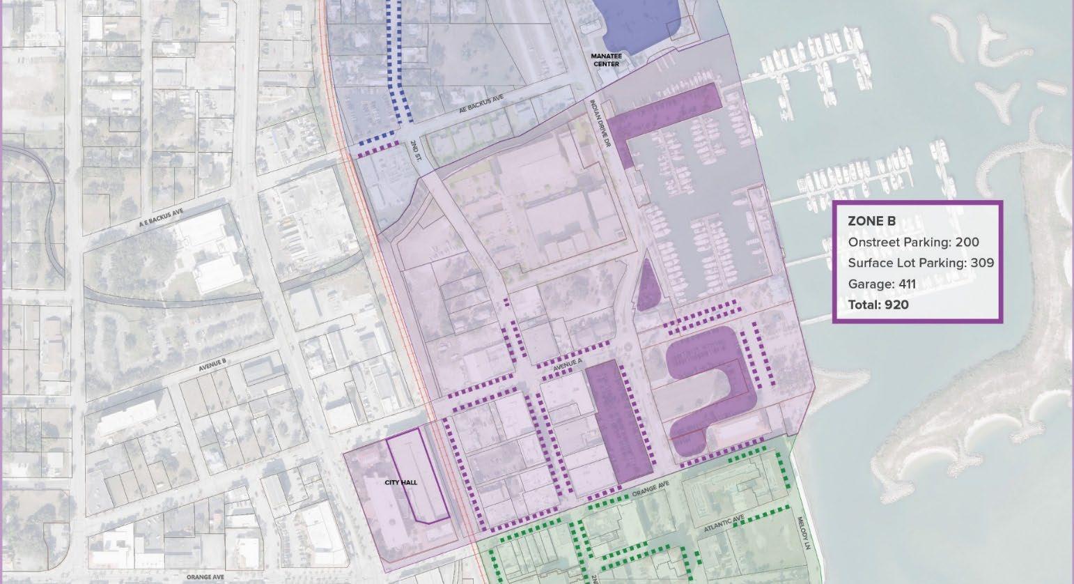
The existing parking analysis examined the total number of City owned public parking spaces available in each Zone. The analysis separated the available City owned public parking into three categories based on the type of parking available(on street, surface lot, and garage). Table 2 below provides a breakdown of available City owned public parking in all three zones.
Map 3: Zone B Existing City - Owned Public Parking
Map 4: Zone C Existing City - Owned Public Parking
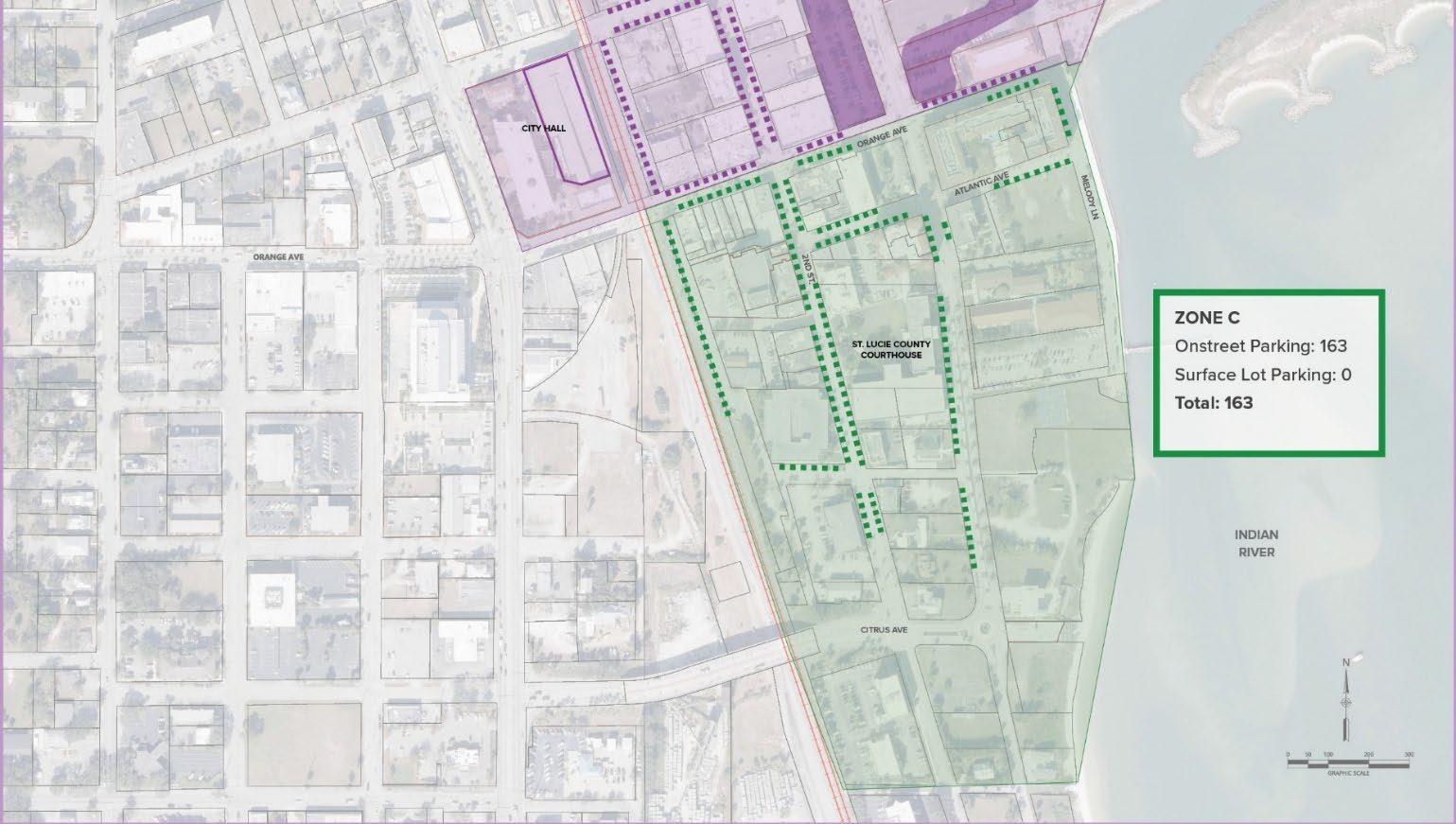
Table 2: Existing City Owned Public Parking
Map 2: Zone
APPENDIX B: PARKING STRATEGY STUDY
Parking and Access Strategy Technical Memorandum
3M Strategy
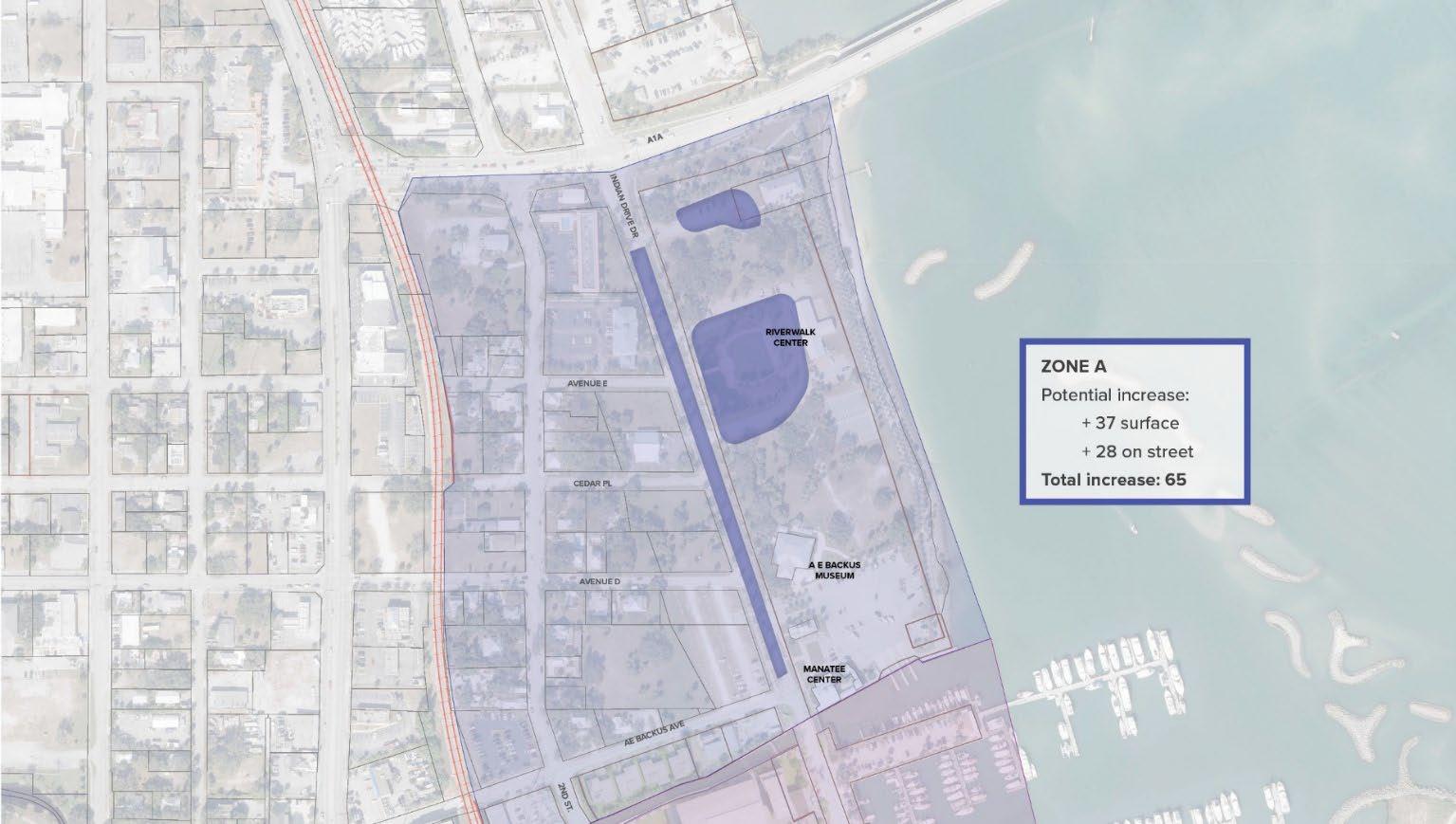
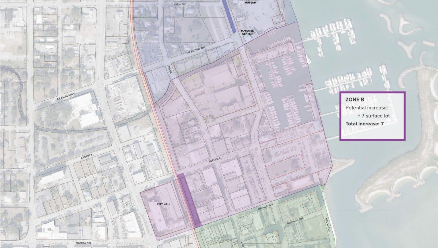
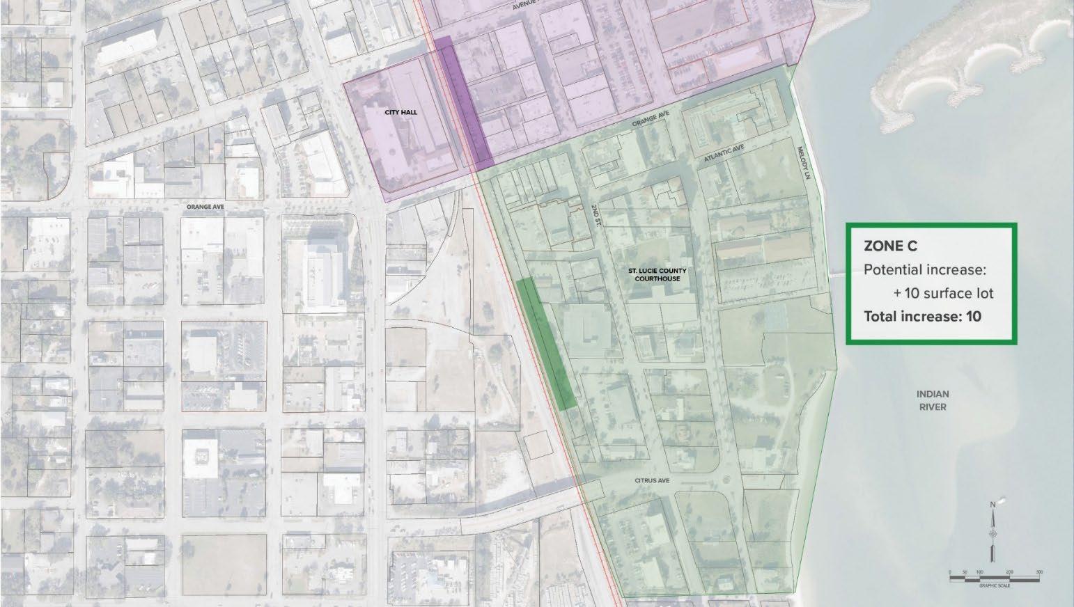
The 3M strategy is a three-pronged approach to increase the capacity of City- owned public parking within walking distance of the proposed Marina Square. The three Ms are Modify, Manage, and Maximize
Modify
The Modify objective seeks to redesign existing City- owned parking lots and on street parking to increase the number of City- owned public parking spaces. This approach could yield a total of 82 additional City- owned public parking spaces within walking distance of the Marina Square. A breakdown of potential additional parking spaces in each Zone is provided below in Table 3.
Table 3: Modify Strategy
Map 5: Zone A Modify Objective Parking and
Map 6 : Zone B Modify Objective
Map 7 : Zone C Modify Objective
APPENDIX B: PARKING STRATEGY STUDY
Parking and Access Strategy Technical Memorandum
Manage
Fort Pierce lacks a managed system for parking, yielding an inefficient use of the limited supply of downtown parking spaces. The City does not charge user fees for parking. Regulation is limited to a two-hour maximum on certain spaces with Zone B, however this is not strictly enforced.
The lack of a managed parking system has fostered the proliferation of long-term and overnight parking in the downtown core. The City Marina hosts seasonal and year-round liveaboards as well as multi-week guests who often have their cars parked in the city during their stays. We also learned that “ van camping” is an increasing trend in the city. On January 22, 2026 at 7:00am, and 30 minutes prior to the opening of Old Florida Coffee, the Inspire team counted 59 cars parked in the spaces surrounding Marina Square. This number of vehicles did not correspond to the handful people walking around at that early morning hour. Our assumption is that many of those cars were associated with City Marina patrons and people camping in their vans and/or cars.
The City of Fort Pierce pays a significant cost to maintain and operate on and off-street parking in downtown Without a parking system to manage the location of long-term parking, taxpayers are effectively subsidizing extended visitor parking in the downtown core (Zone B) - the exact area where residents and business owners perceive a shortage of supply.
A strategic parking management system can regulate the cost, location, and length of parking. Potential parking management measures include:
• City Resident Decal (for free and/or reduced parking fees)
• Designated Parking for City Marina Patrons (located in Zone A)
• Metered On-street Parking in Zone B, or in all Zones
• Managed City- owned Lots
• Managed City Garage
Maximize
The third objective of the 3M strategy is Maximize. This objective is addressed through a two-step process. The first step is to secure and extend an interlocal agreement with St. Lucie County (for use of the Courthouse garage on weekends) and extend existing leases on privately- owned parcels for surface parking lots.
Table 4: Maximize ( Step 1 - Agreement and Lease extensions )
Map 8 : Zone A Maximize (County Lease) Objective
Map 9 : Zone C Maximize (County Lease) Objective
APPENDIX B: PARKING STRATEGY STUDY
Parking and Access Strategy Technical Memorandum
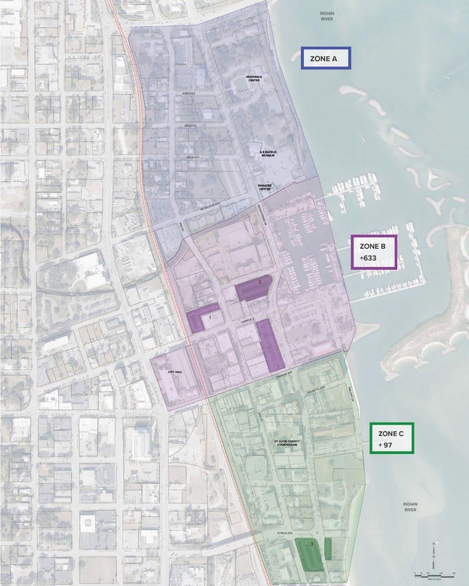
The second step is the creation of new parking lots and the construction of a second city- owned parking garage This analysis identified four potential parcels suitable for surface parking along with the long- discussed parking garage on the former JC Penney site, which is now owned by the City This strategy has the potential to yield an additional 776 parking spaces. Table 5 provides a breakdown of spaces that could be added and the potential locations for new surface lots and parking garages can be found on Map 7.
Recommendation
A s shown in Table 6 below, our analysis identified the potential to add approximately 858 spaces within downtown. The implementation of a parking management system combined with an increase in parking supply through the construction of a second city-owned parking garage and securing additional surface lots, will more than offset the 211 parking spaces that are anticipated to be displaced as part of the new Marina Square park.
Existing (Owned, Secured, and Leased) Displaced by Marina Square
Map 7: Maximize (New Parking Locations) Objective
Through our extended public engagement efforts within Fort Pierce, it is clear that convenient downtown parking is a widespread community concern. So much so – that the issue undermines new investment, redevelopment initiatives, and overall community optimism. Proactively addressing the parking issue, through management and increased supply, will enable the city to advance important economic development and quality of life improvement s in Downtown Fort Pierce.
The City of Fort Pierce should:
1. Modify existing city-owned lots to increase their yield
2. Manage downtown parking, including designated locations for long-term stays
3. Maximize the parking supply, by building the garage and securing favorable parking leases to supplement.
4. Build Marina Square Park- enhance and improve the accessibility of this waterfront public space to serve community members of all ages and abilities.
Table 5: Maximize ( Step 2 - New Parking Locations)
Table 6: Potential Downtown Parking Supply