DOCUMENT
DOCUMENT
Version Date adopted Comments
Draft December 2004 Draft plan accepted for public consultation.
V2004 January 2005 Plan adopted by council.
V2007 July 2007 Reviewed and introduced Appendix 1 - Risk Assessment and amended safety and deficit inspection and hazard response regimes, updated the road lengths and terminology relating to the above. Adopted by the Northern Grampians Shire Council on July 26, 2007.
V2009 June 2009 Accordingto Section 301 (3) of the Road Management (General) Regulation 2005, council has reviewedthe existing Road Management Plan.
V2013 August 2013 According to Section 52 of Road Management Act 2004, the existing Road Management Plan should have been reviewed in 2011, but it has been on hold due to flood damage and restoration works. Draft version of RMP has been prepared for council adoption.
V2013 November 2013 Road Management Plan has been adopted by Northern GrampiansShire Council on November 6, 2013.
V2017-1 May 2017 Draft Road Management Plan prepared by council officers and taken to public consultation for comment.
V2017 June 2017 Road Management Plan has been adopted by Northern GrampiansShire Council on June 26, 2017.
V2021-1 May 2021 Review road data, inspection regimes, hazards responses, design and construction parameters, hazard descriptions for footpath, bridge and road assets and risk matrix in the existing RMP through internal consultations. Draft Road Management Plan prepared by council officers and taken public consultation of review by notice in local paper and on website.
V2021 June 2021 Road Management Plan has been adopted by Northern GrampiansShire Council on June 28, 2021.
V2025-1 May 2025 Review road data, inspection regimes, hazards responses, design and construction parameters, hazard descriptions for footpath, bridge and road assets and risk matrix in the existing RMP through internal consultations. Prepare a report on the review and if there are any changes.
V2025-1 August 2025 Draft Road Management Plan prepared by council officers and taken public consultation of review by notice in local paper and on website.
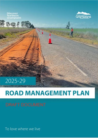
Northern Grampians Shire Council’s Road Management Plan 2025-29 (RMP) has been prepared in accordance with the Road Management Act 2004 (the Act) to document the methods and systems used by the Northern Grampians Shire Council (council) in managing the local road and footpath network. It outlines council’s commitment to providing a safe local road and pathway network for use by all members of the community.
Council is the responsible authority for an extensive network of 3,368km of the local road network that consists of 833km of sealed roads, 2,086km of unsealed roads and 449km of formed/track roads. Within the road network are also 140 bridges and 279 major culverts. In addition, council also maintains 121km of footpath network, a drainage network of 158km of kerb and channel, 76km of drainage pipes, 2,700 drainage pits and 58,851m2 of car parks.
The Act requires councils to be able to set reasonable maintenance standards for the management of their road infrastructure assets. Reasonable maintenance standards require community transparency to ensure that community needs and preferences have been considered, whilst considering an appropriate balance with council’s resources, systems and funding levels.
In line with council’s Asset Policy and to demonstrate compliance with the Act, council maintains a Road Register which contains the specific detail of the road assets for which council has responsibility. The Road Register also details the hierarchies assigned to the road assets. The RMP documents council’s intervention levels, inspection regimes and response times. These have been publicly displayed, discussed, and endorsed both internally and externally. Council’s Infrastructure Service Levels are based on attributes of quality, quantity, intervention, responsiveness and sustainability levels.
In developing the RMP,council considered the following criteria:
• Historical asset condition data and maintenance records to inform the frequency and scope of inspection regimes.
• The necessity to prove adherence to service levels and standards
• The types of inspection methods and frequencies
• Standards are reasonable and financially sustainable
• The activity guidelines for repair and maintenance.
When reviewing the above, it is important to understand:
• Intervention levels relate to the extent of a defect, danger, problem or inconvenience at which council’s Road Maintenance Unit will repair the asset with the most appropriate activity.
• Response times relate to the maximum allowable time within which council will respond to such an activity. Levels of Service have been developed which are financially sustainable for the renewal of council’s road assets.
• Intervention levels relate to the extent of a defect, danger, problem or inconvenience at which council’s Road Maintenance Unit will repair the asset with the most appropriate activity.
• Response times relate to the maximum allowable time within which council will respond to such an activity.
The road assets that have been considered in the preparation of the RMP are:
• Road surface and pavement (including car parks)
• Road formation
• Kerb and channel
• Road drainage
• Footpaths (including shared-use paths)
• Bridges and culverts
• Signage
• Roadside vegetation
These assets have been categorised by a road classification system that denotes the relative importance in terms of the maintenance levels and response times.
All service level standards have been developed in consultation with council’s Infrastructure and Operations Departments to ensure that they are realistic, achievable, sustainable and measurable. The consultation has also involved subjective analysis of historical patterns of complaints, defects, responsiveness and quality of repairs. These standards have then been provided to councillors for review and publicly displayed by council to invite community feedback before final adoption.
The Road Management Plan must be updated within a set period following a council election. Outside of this cycle, changes may be required from time to time which are documented at the beginning of the material.
The following process will be used to manage such changes:
• If material changes are made to standards and specifications, a report will be presented to council with a brief explanation as to why such changes are necessary. The review process must follow the steps as set out in the Road Management (General) Regulations 2016, Part 3 – Road Management Plans.
• When changes do not alter the technical aspects of road management, changes will be approved by the Director Infrastructure and Amenity
These changes will be made in accordance with the processes prescribed by the Road Management Act 2004. To assist with version control, these changes will be numbered as follows:
• Versions presented to council will be renumbered by whole numbers, for example, from Version 2004 to 2025-1
• Those approved by the Director will be renumbered by decimals, for example, from Version 2004 to 2025-1.01
Council has a variety of roads in terms of condition, design parameters and physical condition. Economic pressures, due to the limited funding for road maintenance and construction, has necessitated a review of road management for both asset life, asset function, and "day to day" maintenance requirements.
It is important to highlight that State Highways, Arterial Roads, Non-Arterial State Roads, Tourist Roads, Fire Roads and Forest Roads are managed by other roads authorities such as VicRoads, Parks Victoria, DELWP and GWM Water and are not part of the Municipal Roads Network managed by council.
Council currently maintains 3,368km of the local road network consisting of 833km of sealed roads, 2,086km of unsealed roads and 449km of formed/track roads as per the agreed level of service. This road network consists of 140 bridges and 279 major culverts.
In addition, council also maintains a 121km footpath network, a drainage network consisting of 157km of kerb and channel, 76km of drainage pipes, 2,700 drainage pits and 58,851m2 of car parks.
The following pie chart illustrates the percentage of road types based on the total length of the road. The Road Register is constantly being reviewed.
Road type maintained by council


The following factors influence the development of the RMP for the provision of a safe and functional road network:
• Availability of funds
• Property access requirements
• Road duplication between destinations
• Realignment of road reserves to accommodate changing traffic demand
• Past inappropriate design parameters of roads
• Appropriate identification of roadways Community’s expectation.
The objectives of the RMP are to:
• Provide an overview of the management system used by council to carry out its road management functions as a responsible road authority under the Act, with consideration given to resource availability and operational objectives.
• To ensure that a safe, reliable and efficient road network is provided for the movement of people and other goods and that road reserves are available for other appropriate uses
• Set the relevant standard concerning the discharge of duties in the performance of those road management functions.
The key elements of the RMP include:
• Register of Public Roads for which council is responsible
• Asset management processes that council uses for inspection, maintenance and repair of council managed roads.
• Road and Infrastructure Levels of Service that detail the maintenance practices used by council and Maintenance Standards.
• Civil liability.
• Powers and duties of road authorities.
• Protection against damage.
The RMP intends to provide easy to understand information to enable the council and the community to appreciate the value of the road assets and activities to manage risk across the road network.
The RMP covers road infrastructure and road-related infrastructure as defined under the Road Management Act 2004 of Public Roads which includes:
• Freeways;
• Arterial roads;
• Roads declared under section 204(1) of the Local Government Act 2020;
• Municipal roads declared under section 14(1) of the Road Management Act 2004; and
• Roads in respect of which council has decided it is reasonably required for general public use and is included on the Register of Public Roads.
The RMP applies only to roads for which council is the relevant road authority as listed in the Road Register which includeses:
• Road surface and pavement (council or local roads)
• Car parking both (on-street and off-street)
• Kerb and channel and road drainage (table drains and pits)
• Footpaths (including shared-use paths).
• Bridges (other than sub and super structure) and culverts
• Signage.
The following are excluded from the RMP:
• VicRoads or Arterial Roads.
• Service Authority Assets.
• Vehicle crossings providing access to private properties (i.e. driveways).
• Sub and Super Structures of bridges.
• Underground drainage pipes
• Rural roadside vegetation (excluding canopy clearance, sight distance maintenance and/or fallen trees affecting safety on travelled roads and paths)
• Rail track crossings (except approaching signage and some specific items)
• Forest and informal tracks, unmade roads and unlicenced roads that are not included in the Road Register.
• Unlicenced roads, including those in occupation by adjoining landowners, fenced or unfenced, and roads declared for removal from the Road Register.
Key stakeholders in the RMP include:
• General community and pedestrians for recreation, sport, leisure and business.
• Residents and businesses adjoining the road network.
• Vehicle users with motorised vehicles such as trucks, buses, commercial vehicles, cars and motorcycles
• Users of smaller, lightweight vehicles such as pedal-powered bicycles, motorised buggies, wheelchairs, prams and so on
• Tourists and visitors to the area.
• Emergency agencies such as Victoria Police, Country Fire Authority, Ambulance Victoria and State Emergency Services.
• Military representative during times of conflict and/or emergency
• Traffic and transportation managers.
• Managers of the road network asset
• Construction and maintenance personnel who build and maintain asset components
• Utility agencies using the road reserve for infrastructure for areas such as water, sewerage, gas, electricity and telecommunications
• State and federal governments who periodically provide funding for roads.
Section 35 of the Road Management Act 2004 provides that a Road Authority has power to do all things necessary or convenient to be done for or in connection with the performance of its functions under the Act.
Section 36 of the Act outlines which Road Authority is the Coordinating Road Authority. According to subsection (c), the Coordinating Road Authority is:
• If the road is a municipal road, the municipal council of the municipal district in which the road or part of the road is situated.
However, there are instances where several authorities are responsible for components of the road within the road reserve. Section 37 of the Act identifies who is the Responsible Road Authority in particular circumstances.
Council is the Coordinating Road Authority for all local roads in the shire and has the responsibility under the Act to inspect, maintain and repair all roads specified in council’s Road Register.
Council has the power to manage works within the road reserves and to establish standards for construction, maintenance and repair of public roads. Public roads are roads that are reasonably required for public use, that include both arterial roads and municipal roads over which VicRoads or a municipal council have made formal road declarations.
The Act requires authorities to keep a register of municipal public roads. The register lists all roads within the municipality and indicates their respective road hierarchy and Responsible Road Authority. Any road which is no longer required for public use must be removed from the Road Register.
Council has decided to exclude any unused road reserves, minor tracks and similar unlicenced roads in the RMP provisions.
Section 34 of the Road Management Act 2004 outlines a Road Authority's general functions including planning, provision, operation and maintenance of the road network for safe and efficient transport.
The rights of public road users, which are legally enforceable, are set out in Sections 8 to 10 of the Road Management Act 2004.
3.7.1. General usage
The common law requires that a road user must take reasonable care for their own safety (see Ghantous v Hawkesbury City Council).
The Road Safety Act 1986 sets out obligations on road users including Section 17A which requires that a person who drives a motor vehicle on or uses a highway must drive in a safe manner, and have regard for all relevant factors, including without limiting their generality, the following:
• Physical characteristics of the road.
• Prevailing weather conditions.
• Level of visibility
• Condition of any vehicle the person is driving or riding on the highway.
• Prevailing traffic conditions.
• Relevant road laws and advisory signs
• Physical and mental condition of the driver or road user.
Section 17A of the Road Safety Act 1986 also requires that a road user must take reasonable care to:
• Avoid any conduct that may endanger the safety or welfare of other road users.
• Avoid any conduct that may damage road infrastructure and non-road infrastructure on the road reserve.
• Avoid conduct that may harm the environment of the road reserve.
3.7.2. Incident claims
If a person proposes to make a claim in relation to a public road or infrastructure for which council is the Responsible Road Authority, that person should contact council and council will initiative respective investigation and insurance reporting processes.
In accordance with Section 110 of the Road Management Act 2004, council is not legally liable for property damages where the value of the damage is equal to or less than the threshold amount.
In cases where the claim relates to assets council does not own or is not responsible for on the road reserve, the person who proposes to make a claim must refer the claim to the appropriate authority or person responsible for those assets.
3.7.3. Permits for work within a road reserve
In cases where an individual or organisation proposes to carry out works within the road reserve, they must apply for a Works Within Road Reserve Permit. There are some exemptions that are noted in the Road Management (Works and Infrastructure) Regulations 2015.
Advice and application forms based on council’s General Local Law are available from council offices for work on municipal roads.
3.7.4. Obligations of others
There are several assets within the road reserve that we do not have an obligation to inspect and/or maintain, including:
• Non-road infrastructure: This includes (but is not limited to) items such as gas pipes, water and sewerage pipes, cables, electricity poles and cables, tram wires, rail infrastructure, bus shelters, public telephones, mailboxes, roadside furniture and fences erected by utilities, or providers of public transport.
• Vehicle driveways: The vehicle crossing (including cross-over) located between the carriageway and the property boundary must be maintained by the adjoining property owner. However, council is responsible for the portion of the driveway where the constructed pathway is reasonably required by the public in accordance with the following diagram.
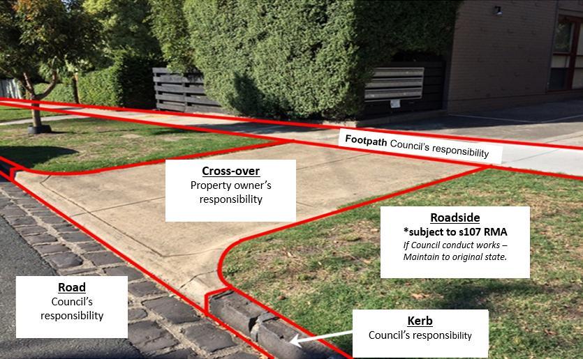
Figure 2: Roadside responsibilities
• Single property stormwater drains: For drains constructed within the reserve that carry water from a single property to an outlet in the kerb, or other drain.
• Utilities: including (but not limited to) telecommunication, power, water, gas and rail authority assets.
• Roadside: As per Section 107 of the Road Management Act, council has no “statutory duty or a common law duty to perform road management functions in respect of a public highway which is not a public road or to maintain, inspect or repair the roadside”, described as “any land that is within the boundaries of the road (other than shoulders) which is not a roadway or pathway”. This includes landscaped tree plots within the footpath/pathway where the surface of the tree plot is not constructed with the intention of providing a trafficable pedestrian surface.
A landowner has a responsibility to keep private vegetation clear of the footpath and/or roadway. Under the provisions of council’s General Local Law, council may issue a notice to compel the landowner to trim the overhanging branches.
Members of the public are not entitled to undertake any works or actions or place any items and/or infrastructure, on a municipal roadway including footpaths and/or roadside, without council’s prior knowledge and written authority.
Council has a code for the management of public carparks that provides more detailed information on the way that these are managed. Note that many carparks are located on private land and are not the responsibility of council. Some of the issues covered in the code include:
• Types of carpark: Regional, town, local.
• Types of usage: Shopping, commercial, recreational
• Leases and Committees of Management agreements
• Design and maintenance.
Council’s 2025-29 Road Management Plan is part of a suite of strategic materials that collectively set the direction for council over a four-year period. Three of these legislated materials are outlined below.
Every four years, council sets strategic objectives for the shire through a formal Council Plan process. This involves a range of different analysis, consultation and engagement initiatives to ensure the plan accurately addresses the needs and aspirations of the community.
Council’s 2025-29 Council Plan outlines five key goals which are underpinned by 15 strategies, 42 actions and hundreds of individual tasks. Collectively, these support the overarching 20-year Community Vision – to love where we live. You can view current and past council plans on our website here https://www.ngshire.vic.gov.au/Council/Governance-and-transparency/Council-publications/Council-Plan.
This RMP underpins the strategic direction contained within the broader Council Plan and aligns key road management resources and principles to achieve its primary goals which include the following.

Council collates a revised 10-year Asset Plan every four years to align with the cycle of other strategic documents such as the above-mentioned Council Plan. The Asset Plan outlines what funding is required to adequately maintain, enhance and develop council's extensive suite of assets such as roads paths, gardens, buildings and recreation spaces.
It aims to educate our community about the vast number of assets council is required to manage and what financial investment is required to perform that duty to an acceptable community level. It also details how council assets will deliver a sustainable infrastructure service to meet the current and future needs of the community.
You can view our previous 2022-32 Asset Plan on our website here https://www.ngshire.vic.gov.au/Council/Governance-and-transparency/Council-publications/Asset-Plan
Council also collates a revised 10-year Financial Plan every four years to align with the strategic direction outlined in documents such as those mentioned above. This is to ensure its financial viability into the future and by aligning its financial and non-financial resources to achieve the same outcomes.
The Financial Plan includes a review of expenditure on the renewal and maintenance of council assets in line with the annual budget process and extrapolates estimates on future asset expenditure over a 10-year period. You can view current and past financial plans on our website here https://www.ngshire.vic.gov.au/Council/Governance-and-transparency/Council-publications/Financial-Plan.
The following legislation applies to this Road Management Plan:
• Road Management Act 2004
• Road Safety Act 1986
• Local Government Act 1989
• Local Government Act 2020
The following key principles are the basis of the Road Management Act 2004:
• Clear allocation of road asset management and ownership
• Clarification of civil liability laws for road management.
Road asset management involves managing physical assets, their uses and operation that have the potential to impact their condition. It applies to all road assets including:
• The road – pavement and surface, as well as footpaths, kerb and channel.
• Structures – bridges, culverts and traffic management devices
• Road infrastructure – traffic signals and on-road electrical assets.
The aim of our road management system is to deliver a safe and efficient road network and meet community needs to the best of our ability within council’s available resources.
To create a road asset management system that best meets community needs when inspecting, maintaining and repairing public roads, council uses the following nationally recognised asset management frameworks:
• International Infrastructure Management Manual (IIMM) 6th Edition 2023, IPWEA
• AustRoads (Road Design publications)
• Other references as listed in Technical References.
The system is designed to set the direction for our asset management activities. It is also linked to annual business planning cycles
The classification of roads within the Northern Grampians Shire is based on a hierarchy system that considers traffic volume, traffic type and importance which is derived from the following factors:
• Direct access to abutting properties.
• Direct linkage with other roads in the network
• Transportation of goods/services and key traffic generator
• B-doubles and high mass limit route.
• Public transport bus routes
• School bus routes
• Linkage within areas of the municipality such as agricultural/commercial/residential.
• Identifiable origin and destination function served.
• Type of traffic use such as vehicle size, type, weight, and origin/destination
• Roads that may be surplus to the overall road network.
• Requirement for recreational needs such as bicycles, horse trails etc.
• Vehicular access to the municipal road network
• Council’s responsibility of management and maintenance of the road network.
• A clear distinction between council’s municipal road system and other road authorities such as VicRoads, Parks Victoria etc
The road classification model considers planning parameters and defines clear distinctions between road types. Separate four-tier functional hierarchies have been established for both urban and rural networks with subclassifications reflecting current road use within each category.
The four tiers including link, collector, access and minor access, form the basis for assigning functional roles and determining appropriate response levels for defect rectification. Road hierarchy classifications are formally reviewed every four years.
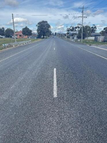
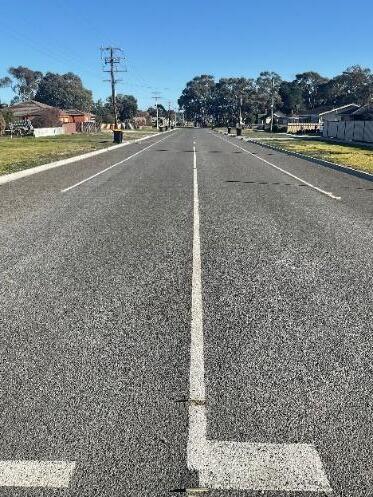
This includes all classes of sealed, gravel and unsealed types of varying condition. Please refer to the following examples and description of different classes.
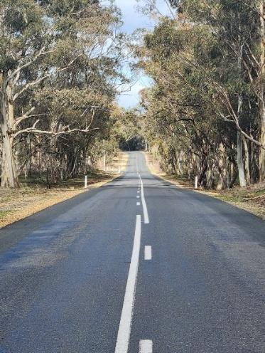
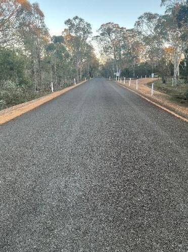
Rural Link Principal routes that enable the efficient movement of goods and people between townships via direct links. These roads provide safe and reliable connections, helping to minimise transport costs and support economic competitiveness and growth. They are predominantly sealed.

Rural Collector
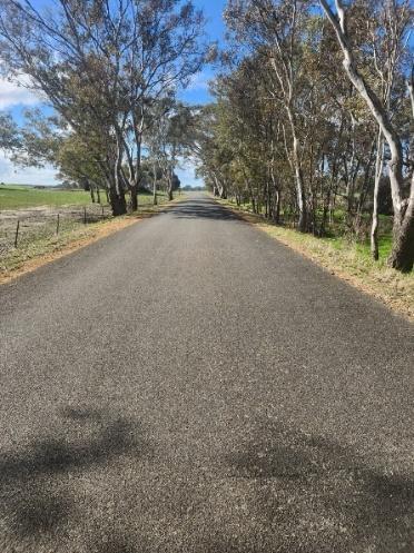
High-usage roads that provide efficient connections between access roads and rural link (i.e. arterial) roads. These roads play a key role in ensuring safe and reliable transport routes, helping to reduce transport costs and improve overall lifecycle costs. Roads may be sealed or unsealed.
Council

RuralAccess (resident)
RuralAccess (property)
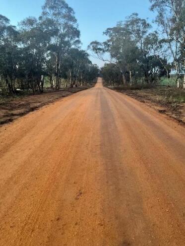
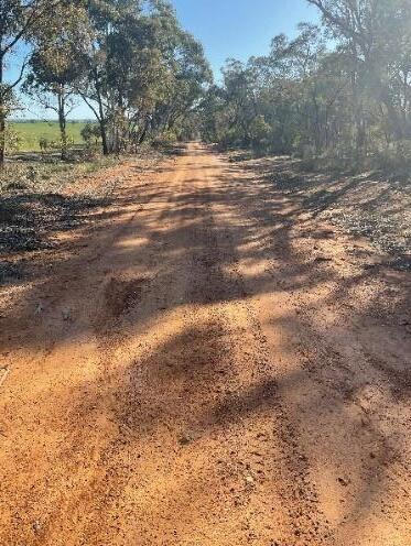
Very low-usage roads that provide direct access to residential or intensive commercial properties supporting rural living, agriculture and business activities. These roads enable all-weather access for the transport of freight, labour and materials. They do not function as through-routes or alternative connections within the broader road network.
These roads generally provide access to agricultural properties without dwellings and are intended for vehicles suited to paddock or off-road conditions such as commercial vehicles, tractors and all-terrain vehicles. They are typically formed earth tracks and do not usually serve properties with a formal rural address.
Council
This includes all classes of sealed, gravel and unsealed types of varying condition. The following are examples and descriptions of different classes.
Table 2: Urban road network classification.
Road hierarchy Function
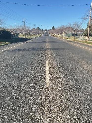
UrbanLink (arterial)
Responsible
Principal route for the movement of goods and people between significant residential, industrial and commercial nodes. They are predominantly sealed. VicRoads
Urban Collector High-usage roads that connect Urban Link roads with local Access Roads. They provide safe and reliable access while supporting both movement and place functions, facilitating access to commercial areas and encouraging activity such as parking, shopping, and lingering. Urban Collectors play a key role in supporting local businesses and directing traffic to Urban Link roads.
Urban Access Very low-usage roads that provide direct access to adjacent residential, industrial, recreational or commercial properties. These roads do not function as through-routes or alternative connections within the urban road network.
Reference
Urban Access Minor Very low-usage roads that provide direct access to a small number of residential or commercial properties, typically in cul-de-sacs, service lanes or low-traffic areas. These roads serve a purely local function and do not operate as throughroutes within the broader urban network. Council
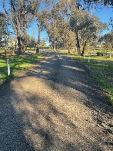
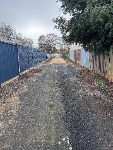
Table 3: Non-Maintained Roads Road
Non-maintained roads Road classification that is not maintained by council and includes roads maintained by other authorities.
This category also includes tracks that provide private access which may exist within a road reserve and serve a limited number of properties.
Driveway/shared access road created as part of an owner’s corporation subdivision are in this category.
Council applies footpath classification for all footpaths across the shire. These classifications are based on the public use function which reflects the perceived risk associated with pedestrian and other usages of each footpath type. These classifications are used to differentiate service levels and maintenance standards. Council inspects, maintains and repairs all footpaths that are on the roads listed on the Road Register.
Table 4: Footpath hierarchy classification
Classification
Category 1
Unconstructed/informal(low usage)
Category 2
Other areas of made footpaths
Category 3
Specific pedestrian generator
Category 4
Central business areas and high-use precincts (high usage)
Description
Footpaths in this category are unconstructed, have limited usage and run next to a council road in urban areas. Footpaths receive no added maintenance other than treatment of hazards found by the public.
Constructedfootpaths in residential, commercial and industrial areas other than as described Category 3 and 4.
These footpaths service pedestrian generators that include hospitals, schools, senior citizens centres, aged care facilities and major community facilities. The length classed as Category 3 extends forthe block having the pedestrian generator plus one added full block length.
Footpaths in commercial and/or shopping strips within towns, including paths leading to central car parks and those footpaths for the block having a school plus one added full block length.
Council’s road management responsibilities are supported by a structured inspection regime comprising three key categories:
• Reactive inspections
• Proactive maintenance inspections
• Asset condition surveys
Each inspection type plays a specific role in identifying, assessing and managing the condition and safety of council's road assets. The following diagram aims to highlight the primary workflows within these processes.
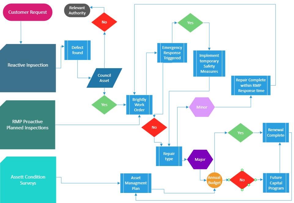
Reactive inspections are undertaken in response to customer reports regarding defects or hazards. Requests can be submitted through multiple channels including phone, letter, email or social media.
Council uses a customer request system called MERIT, alongside its Asset Management Information System (Brightly), to log, monitor and track these requests. This system enables the electronic reporting of hazards, defects or incidents and maintains comprehensive records of inspections, maintenance activities and corrective actions.
Upon receiving a request, a qualified council officer inspects the reported issue within the timeframes set by the RMP. The inspection process follows the safety and defect inspection schedule including documenting the defect, inspection details, actions taken and resolution time. Customers are then provided with feedback upon completion.
These are programmed inspections carried out at regular intervals to identify defects before they pose a significant risk or serviceability issue. A qualified Council Asset Inspector conducts visual inspections using standardised tools and procedures to assess common failure modes against defined intervention levels. Where a defect is found to exceed intervention thresholds, a works order is generated in council’s task management platform and assigned to a Council Maintenance Officer. The officer assesses the defect and determines the most appropriate repair method within the required response time. If the defect requires larger-scale repair, temporary measures such as signage or interim patching may be applied to reduce the risk, and a capital works request is initiated for a more permanent solution.
6.5.3.
Emergency responses are triggered by reported incidents or hazards that pose an immediate and significant risk to public safety. Council will implement temporary risk mitigation measures (e.g. signage, barriers and/or closures) until permanent rectification can be completed.
6.5.4.
Condition surveys are conducted every four years to assess the overall condition, remaining life and renewal needs of road assets. These inspections inform council’s Capital Renewal Program and ensure assets continue to meet service standards.
Condition surveys are typically outsourced to independent specialists to ensure consistency and objectivity. The data also supports asset valuation processes for financial reporting, auditing and long-term asset management planning.
6.5.5.
This RMP will be formally reviewed every four-years in line with each council term as required by the Road Management Regulations. Any amendments will also be gazetted in accordance with the Road Management Act 2004
In addition, the inspection regime, service levels and response times will undergo internal audits every six months to assess performance and effectiveness. Outcomes and improvement recommendations will be reported to council’s Audit and Risk Committee for consideration and implementation where appropriate.
6.5.6.
The following tables under sections 6.5.7 and 6.5.8 summarise the frequency of inspections according to road and footpath classification.
The following is intended to primarily identify any obvious defects in our shire’s road assets. Road inspections aim to identify defects in road surfaces such as potholes and areas such as damage to signs, drainage systems, barrier rails, bridges and culverts, or guideposts, along with line marking and other road components which may affect the safety of the road user. They may not necessarily cover every road component and are not intended to assess the condition for asset valuation purposes.
Kerb and channel inspection will be primarily assessed from the footpath in all road components. Kerb and channel inspections will take place at the same frequency of the Link, Collector, Urban Access and Urban Minor Access frequencies detailed in the table below.
Night inspections are conducted to primarily assess the effectiveness of signage and line marking reflectivity.
Table 5: Safety and defect inspection frequency for roads andkerbandchannelby classification.
Reactive 3 working days from the date the complaint is received by the relevant decision maker in council 5 working days from the date the complaint is received by the relevant decision maker in council 10 working days from the date the complaint is received by the relevant decision maker in council 12 working days from the date the complaint is received by the relevant decision maker in council
3 working days from the date the complaint is received by the relevant decision maker in council
6.5.8. Footpath safety and defect inspection frequency
5 working days from the date the complaint is received by the relevant decision maker in council 10 working days from the date the complaint is received by the relevant decision maker in council 12 working days from the date the complaint is received by the relevant decision maker in council
Footpath inspections aim to identify obvious defects in the wearing surface that can include trip hazards, major cracks, potholes and any vegetation clearance issues.
Table 6: Safety and defect inspection frequency for footpaths by classification
3 working days from the date the complaint is received by the relevant decision maker in council
5 working days from the date the complaint is received by the relevant decision maker in council
10working days from the date the complaint is received by the relevant decision maker in council
12 working days from the date the complaint is received by the relevant decision maker in council
Council has responsibilities to road users and the community to maintain public roads to a safe and suitable standard within our available funds and resources. By developing long-term maintenance programs for our assets, we are able to more efficiently plan how we achieve this outcome.
The following maintenance requirements shape our annual program and budgetary considerations.
Routine maintenance standards
Standards vary across the network depending on the asset type and relevant risk factors, such as traffic volumes and composition, operating speeds, the susceptibility of assets to deterioration and the cost effectiveness of repairs. Competing priorities for funding are also relevant.
Defect intervention levels have been established using the VicRoads Standard Specification Section 750 and adapting it to local conditions. The standards will be reviewed periodically to make sure they are adequate (see section 1.1).
Repair and maintenance works
Works must be completed within a specified time depending on the severity and location of the defect. Response times are determined using local knowledge and experience, as well as past performance as a general guide.
Response times are proactively monitored and will be periodically reviewed (see section 1.1).
Temporary mitigation measures
These are temporary works designed to reduce the risk of an incident until such time as repair or maintenance works can be completed.
Response times and safety measures are determined by reference to the risk to safety, road type and traffic volume and may include warning signs, flashing lights and/or safety barriers.
Emergency works
Works that result from emergency incidents and must be undertaken immediately for the safety of road users and the general public.
Emergency works might include traffic incident management, responses to fires, floods, storms and spillages, and any assistance required under the Victorian State Emergency Response Plan and Municipal Emergency Management Plan.
6.7.1 Road, bridge, kerb and channel, and footpath action response
The following table summarises response times for defect rectification works from the point of inspection.
Table 7: Road, bridge, kerb and channel, and footpath hazard action response
A
B
Inspect and actions as appropriate (i.e. rectify, install warning signage/barriers or place on a maintenance program1)
Inspect and actions as appropriate (i.e. rectify, install warning signage/barriers or place on a maintenance program1)
C
D
E
F
G
Inspect and actions as appropriate (i.e. rectify, install warning signage/barriers or place on a maintenance program1)
Inspect and actions as appropriate (i.e. rectify, install warning signage/barriers or place on a maintenance program1)
Inspect and actions as appropriate (i.e. rectify, install warning signage/barriers or place on a maintenance program1)
Inspect and actions as appropriate (i.e. rectify, install warning signage/barriers or place on a maintenance program1)
Inspect and actions as appropriate (i.e. rectify, install warning signage/barriers or place on a maintenance program1)
Within 1 day of inspection or notification from the date the complaint is received by the relevant decision maker in council
Within 48 hours of inspection or notification from the date the complaint is received by the relevant decision maker in council
Within 10 days of inspection or notification from the date the complaint is received by the relevant decision maker in council
Within 20 days of inspection or notification from the date the complaint is received by the relevant decision maker in council
Within 60 days of inspection or notification from the date the complaint is received by the relevant decision maker in council
Within 6 months of inspection or notification from the date the complaint is received by the relevant decision maker in council
Within 12 months of inspection or notification from the date the complaint is received by the relevant decision maker in council
1 Where it is not possible to rectify within stated timeframes due of the nature of the treatment required or level of resources required, appropriate warning signs or temporary repair may be required until the repair can be permanently completed.
Response times are based on normal working times/days, although these may be varied under exceptional circumstances.
Please note: Appropriate warning could include, for example:
• Provision of warning signs
• Traffic control action
• Diverting traffic around the site
• Installation of temporary speed limit
• Lane closure
• Closure of the road to use by certain vehicle (e.g. a load limit)
• Road closure
The table below contains the defect categories for roads and bridges, while the defects versus road hierarchy matrix provides a timeframeto rectify all the identified defects.
Table 8: Road, bridge, and kerb and channel hazard action response.
Road Where potholes are greater than 300 millimetres in diameter and 100 millimetres in depth
Road Where the edge of sealed pavement is broken/cracked or has lost material and reduces the pavement width by more than 200 millimetres or has a > 100mm drop off over 20 metres of length.
Road Where there is shoving/depressions or rutting on road surface that greater than 75 millimetres in depth.
Road Crocodile cracking should not affect more than 3 squares metres in road pavement and surface.
Road Corrugations of more than 75 millimetres in-depth and more than 20 metres in length.
Road Accumulation of loose materials on sealed traffic lanes
Road Oil spill or water over road.
Kerb & channel Vertical or horizontal displacement is more than 100 millimetres.
Signs Regulatory, warning and hazard signs missing, illegible at 100 metres distance or damaged, making them substantially ineffective.
Bollards and guide posts Bent, loose, damaged, nonfunctional or causing injury to the general public:
• Greater than 10 degrees off the vertical; or
• Greater than 5% surface dented; or Greater than 5% surface corroded /rusty.
Vegetation Vegetation that is obstructing sightlines to intersections or regulatory, warning and hazard signs when viewed from the following distances:
• Speed Limit – <=50km/h = 30m
• Speed Limit – 60km/h = 40m
• Speed Limit – 70km/h = 55m
• Speed Limit – 80km/h = 65m
• Speed Limit – 90km/h = 80m Speed Limit – 100km/h = 95m
Vegetation Vegetation intruding into the road envelope:
<5.0 mt clearance over the trafficable portion of roads.
Line marking (1)-Missing or damaged RRPM’s (Reflective Raised Pavement Markers) and/or (2)-Delineation or line marking not visible or ineffective.
Bridges Bridges and drainage cleaning and clearing of debris from surfaces.
Bridges Any damaged or defective guardrail making it substantially ineffective.
Table 9: Hazard response by footpath classification.
Footpaths Footpath lips or trip hazards greater than 40 millimetres in height difference. Mounds or depressions greater than 100 millimetres under a straight edge. Cross falls steeper than 1 in 20.
Asphalt footpath affected by tree roots, lifted, or depressed greater than 40 millimetres* in height difference and cracked or potholed more than 20 millimetres in width and 200 millimetres in diameter, respectively.
Concrete bay is cracked or broken more than 20 millimetres in width.
Gravel Path potholed greater than 200 millimetres in diameter and 50 millimetres indepth and depressed by 25 millimetres.
Vegetation intruding into the footpath envelope:
< 2.5m over footpath surface.
*Section 83 of the Wrongs Act confirms that local government is only required to undertake public works as and when it can reasonably do so given the limited resources and budget constraints that all councils operate under. Northern Grampians Shire Council considers the 40mm intervention level prescribed in this Road Management Plan (RMP) to be an accurate reflection of the maintenance standard it can reasonably maintain, given current financial and resources constraints. Council may periodically review the prescribed intervention level, throughout the life of this RMP, if circumstances alter and council considers it has sufficient capacity to reduce the prescribed threshold level below 40mm.
6.7.4Defect
In cases where the nature of the repair required is not considered to be an immediate hazard, the repair work will be placed on a maintenance program to be undertaken within the response time adopted in this plan.
Asset data for prioritising maintenance and renewal work for roads, bridges, footpaths, and kerb and channel, is collected and maintained in Brightly Cloud, council’s task management platform and is the single source for all council asset data. Records of works conducted (maintenance and renewal), asset condition data and inspections are all stored in Brightly Cloud for access by council’s Finance, Operation and/or Asset Teams.
Where municipal roads interface with private property, the property access needs to be managed consistently to provide a safe, operable and sustainable asset. These are managed in accordance with council’s Road Management Plan.
In cases where the provision of suitable access to dwellings is not covered by existing planning and building controls, the provision of such access will be subject to council’s Sustainable Asset Management Policy.
According to the Road Management Act 2004, it is mandatory that a Road Authority keeps a register of public roads and the roads they need to maintain in the RMP. The Act also provides guidance as to what must be included in the Road Register, which includes:
• Name of the public road;
• The date on which the road becomes a public road if declared after 1st July 2004;
• The classification of the public road; and
• Reference to arrangements where management of road functions have transferred from one Road Authority to another.
Due to the different levels of usage along any road, it may be divided into more than one hierarchy or level of service where appropriate.
All information relating to footpaths, bicycle paths and walking paths is recorded in Brightly Cloud including the footpath location, materials, dimensions, hierarchy, level of service, inspection frequencies and response mechanisms.
The register lists all bridges and major culverts for which council is the responsible Road Authority. The register is managed as a database and includes the following information:
• Location
• Dimensions
• Age
• Description of type
There are several areas where municipal roads interface with roads or railways that are maintained by other authorities such as neighbouring municipalities, VicRoads, Parks Victoria, DEPI, GWM Water, CFA and the railways. There may be a differing level of service arising at this interface due to changes in the manner roads are managed by the different road authorities.
State Arterial Roads have the function of carrying the heaviest volume of traffic, including commercial vehicles, and provide the principal routes for traffic flows in and around the municipality. These are the roads specially managed by VicRoads and are not council’s responsibility.
Several roads and bridges across the shire fall on, along or across the boundary with the seven neighbouring municipalities. Provision has been made for shared capital and maintenance costs in these instances, with the provision that all work will be cost-neutral with no financial advantage to either municipality. Further details are available in the “Code for the Routine Maintenance of Boundary Roads and Bridges”. Council is currently in the process of formalising all boundary agreements with the adjoining councils as part of this RMP process.
Numerous public roads within our shire are located on crown land managed by the Department of Environment and Primary Industry and/or Parks Victoria. A road may be the responsibility of council in certain instances such as where a road passes through crown land and council then remains the Responsible Authority.
There are also instances where freehold/private properties within the Northern Grampians that are only accessible via roads located on crown land, or via unused road reserves. In such instances, council is under no obligation to provide or maintain access to those lots. There are also hundreds of kilometres of unused road reserves throughout the shire that council has no responsibility to maintain as outlined under the Road Management Act 2004. These road reserves are not included in council’s Road Register.
The relevant rail authority is responsible for the maintenance of all roads and infrastructure near a rail crossing including some bridge structures. The Rail Safety Act 2006 requires Safety Interface Agreements to be in place that fully detail the areas of responsibility for the two railway lines within the shire.
The relevant service provider including rural and urban water, gas, sewer, phone, or power is responsible for the maintenance of its infrastructure located within the road reserve.
A private street may have been created from the subdivision of private land. As of 2007, all these private streets are now under the control of council and shall be maintained in accordance with the RMP.
Council has no legal obligation to provide and maintain tracks for fire access, however, if council decides to maintain a road for fire fighting vehicles as a community service, that function will be included in the Asset Register and not as a separate hierarchical classification.
Council receives notifications of assets that require attention. Ratepayer notifications are to entered into the customer request system and actioned according based on the prioritisation given. Issues notified by staff members will be referred electronically to the appropriate staff member who will respond accordingly to the hazard response schedule provided in the RMP.
Risk management is carried out in accordance with council’s approved Risk Management Policy, with details being recorded in the official Risk Register. Council strives to manage risks responsibly by eliminating, minimising, or cost-effectively controlling such risks. The objective of the risk management process is to ensure that:
• All significant operational and organisational risks are understood and identified.
• The highest risks that should be addressed in the short to medium term are identified.
• Risk reduction treatments which best meet business needs are applied
• Responsibilities for managing risks are allocated to specific staff.
• The adopted risk management process is consistent with Australian Standards that define risk assessment and management.
Through risk source identification and areas of impact, a framework for risk identification and analysis can be prepared for council’s day-to-day exposure. The tables below provide a simple approach when assessing the likelihood and consequence of risk of council’s road assets.
These tables allow council to prioritise potential risk exposures and as a result, adopt performance standards to reduce its risk exposure.
Table 10: Consequence scale.
1 Insignificant
• Direct loss or opportunity cost of <$10k. Impact easily manageable within jurisdictional budget.
• No impact. First Aid only required.
• Impact absorbed through normal operations and can be rectified using management processes.
• One or complaints or compliance incidents.
• No measurable impact to brand, limited negative local publicity.
• Contaminate spill contained on premises.
• Recoverable data loss, non-sensitive data leak, minor incident resolved using normal work procedures, system unavailable for <1 hour.
5 Catastrophic
• Direct loss or opportunity cost of between $10k and $100k.
• Some medical treatment required such as first aid treatment for minor injuries.
• Minor disruption to service, minimal time, effort and cost to resolve; success measures able to be achieved with some effort.
• Individual legal action, local regulatory enquiry/improvement notices, low range fines.
• Minimal damage to brand resulting from limited negative local publicity.
• Emission discharge/contaminate spill not exceeding EPA reportable levels.
• Small, isolated loss of confidentiality or data integrity, minor incident, system unavailable for 1-4 hours.
• Direct loss or opportunity cost of between $100k and $1m.
• Individual injury likely to result in time off work; significant injury involving medical treatment or hospitalisation. Moderate disruption or cessation of services (1-3 days), impacts cannot be absorbed into normal operations; some success measures affected with considerable effort necessary to rectify.
• Systemic complaints or compliance incidents, fines, minor litigation.
• Temporary damage to brand resulting f rom limited negative national publicity or detrimental local publicity.
• Short term effect on protected wildlife or plants. Emission discharge/contaminate spill
• Exceeding EPA reportable levels.
• Small, isolated loss of confidentiality or data integrity, significant incident, system unavailable for 4-24 hours.
• Direct loss or opportunity cost of between $1m and $10m. Significant reworking of corporate budget incl cuts to items.
• Extensive serious injuries or fatality to individual; exceedingly high loss to organisation.
• Loss of customers, high disruption or cessation of services, extensive effort to resolve (up to 1 month); most success measures threatened, or one severely affected.
• Major systemic or breaches, significant fines/imposition of regulatory restrictions, major litigation.
• Damage to brand resulting from detrimental national publicity or extensive adverse local publicity.
• Severe long-term effect on protected wildlife or plants. EPA prosecution.
• Some loss of confidentiality or data integrity, serious incident, system unavailable for 24- 48 hours.
• Direct loss or opportunity cost > $10m; financial impact could not be managed within corporate budget.
• Multiple fatalities/extensive long-term injuries; worse case loss.
• Significant loss of customers, major disruption or cessation of services over extended time (>1 month); event/project/activity would never be carried out again.
• Actual or potential loss of licence, penalties on directors, serious litigation including class action.
• Substantial damage to brand resulting from extensive negative national publicity.
• Devastation to a large area. State significant environmental event.
• Significant loss of confidentiality or data integrity, very serious incident, system unavailable for more than 48 hours, widespread impact on operations and service delivery
Table 11: Likelihood scale, the probability thata risk will occur.
Level Criteria Definition
A Almost certain >80% chance in next 12 months; event expected to occur most times during normal operations.
B Likely 50-80% chance in next 12 months; will probably occur at some stage based on evidence of previous incidents.
C Possible 25-50% chance in next 12 months; not generally expected to occur but may under specific circumstances.
D Unlikely 10-25% chance in next 12 months; conceivable but not likely to occur under normal operations.
E Rare Less than 10% chance in next 12 months; only ever occurs under exceptional circumstances.
Table 12: Risk matrix, consequence and likelihood scales.
Table 13: Road defectrisk assessment.
Road Size of Pothole are greater than 300mm diameter and 100mm in depth.
Road Edge of sealed pavement breaks and reduces the pavement width more than 200mm over 20m of length.
Road Shoving / Depressions or Rutting on road surface are greater than 75mm in depth.
Road Crocodile Cracking should affect more than 3m2 in road pavement and surface.
Road Corrugations are morethan 75mm in depth and more than 20 metres in length.
Road Bleeding, at intersections or bends.
Road Accumulation of loose material on sealed traffic lanes
Vertical or Horizontal displacement is more than 100mm.
Signs Regulatory, warning and hazard signs missing, illegible at 100m distance or damaged,making them substantially ineffective.
Bollards and guideposts
Bent, loose, damaged, non- functional, or causing injury to the public:
• Greater than 10 degrees off the vertical or,
• Greater than 5% surface dented or,
• Greater than 5% surface corroded/rusty.
Vegetation Vegetation that is obstructing sightlines to intersections or regulatory, warning and hazard signs when viewed from the following distances:
• Speed Limit – <=50km/h = 30m
• Speed Limit – 60km/h = 40m
• Speed Limit – 70km/h = 55m
• Speed Limit – 80km/h = 65m
• Speed Limit – 90km/h = 80m
Speed Limit – 100km/h = 95m
Vegetation Vegetation intruding into the road envelope:
• <5.0 mt clearance over the trafficable portion of roads.
Line marking 1.Missing or damaged RRPM’s (Reflective Raised Pavement Marker); and/or
2.Delineation or line marking not visible or effective
In bridges and drainage cleaning and clearing of debris from surfaces.
Any damageto protective railing or running surface.
Footpaths Footpath lips or trip hazards greater than 40 millimetres in height difference. Mounds or depressions greater than 100 millimetres under a straight edge.
Footpaths Asphalt footpath affected by tree roots, lifted, or depressed greater than 40 millimetres in height difference and cracked or potholed more than 20 millimetres in width and 200 millimetres in diameter respectively.
Footpaths Concrete bay is cracked or broken more than 20 millimetres in width.
Footpaths Brick pavers out of alignment (raised over 40mm), missing or broken.
Footpaths Gravel Path potholed greater than 200 millimetres in diameterand 40 millimetres in depth
Footpaths Vegetation intruding into the footpath envelope: < 2.5mt over footpath surface.
business area & high use precinct
Council will make every endeavour to meet all aspects of its RMP, however in the event of natural disasters and other events including, but not limited to, fires, floods, droughts and the like, together with human factors, such as lack of council staff or suitably qualified contractors, because of Section 83 of the Victorian Wrongs Act 1958, as amended, council reserves the right to suspend compliance with its Road Management Plan.
If the Chief Executive Officer of council has to pursuant to Section 83 of the above Act, consider the limited financial resources of council and its other conflicting priorities meaning council’s RMP cannot be met, they will write to the council officer in charge of this RMP and inform them that some, or all, of the timeframes and response times, are to be suspended.
Once the events beyond the control of council have abated, or if the events have partly abated, council’s Chief Executive Officer will write to the council officer in charge of this RMP and inform them which parts of the RMP are to be reactivated and the timeframes for each part that are to be reactivated.
The inspections regime, level of service and response times will be subject to an internal audit every six months to test the effectiveness of this RMP. The outcomes along with any recommendations for further improvements, will be reported to council’s Audit & Risk Committee for any further action if required.