

LANDSC APEURBA NARCHIT ECTURE
2024
Diandra Zahra Karima

LANDSC APEURBA NARCHIT ECTURE LANDSC APEURBA NARCHIT ECTURE
Diandra Zahra Karima
+39 375 5710 633 diandrazk@gmail.com
behance.net/diandrazk Piacenza, Italy
Work Experience
Landscape Architect
Bluegreen Aspen, Colorado
January 2023 - May 2024
• Created conceptual and schematic design documentation, including concept diagrams, concept plan renderings, and schematic site sections.
• Developed detailed design drawings such as plans, sections, and elevation drawings for the schematic design phase, design development phase and construction documents.
• Designed customized planting plans and curated plant species tailored to the unique conditions and requirements of each project.
• Produced the 3D models and rendered images.
• Refined the office’s project proposals layout and the master file of planting palettes, including detailed information on sun exposure, altitude, water requirements, soil conditions, and wildlife value.
• Managed the office’s social media channels, including Instagram, LinkedIn, and the official website, to enhance networking and visibility. Increased the amount of engagement by 10-12%.
• Organized bi-weekly non-working meetings to foster a more harmonious working environment among colleagues.
Landscape Architect Intern
Openfabric Milan, Italy
May 2021 - August 2021
• Created conceptual design and detailed design as part of team projects.
• Enhanced the 3D models and produced rendered images.
• Developed conceptual and schematic design presentation packages.
Project Architect
Arkana Architects Bali, Indonesia
August 2017 - March 2019
• Developed comprehensive conceptual and schematic design presentation and proposal to effectively communicate design ideas to clients.
• Created 3D models for each projects, ensuring accurate and visually compelling representation of the design.
• Supervised all phases of project construction, maintaining clear and consistent communication with clients, representatives, collaborators, and builders to ensure project alignment.
• Responsible for updating construction drawings to reflect any changes or modifications during the construction process.
Competitions
• Re-Use The Fallen Church 2021 - Participant
• Reinventing Square Piazza Gino Valle 2021 - Participant
Education
Master of Science
Sustainable Architecture and Landscape Design
Politecnico di Milano Piacenza, Italy
February 2019 - July 2022
Bachelor of Architecture
Architecture program in Faculty of Engineering University of Indonesia Depok, Indonesia
August 2013 - August 2017
Skills
Adobe Illustrator
Adobe Indesign
Adobe Photoshop
AutoCAD Autodesk Revit Rhinoceros Sketchup
Lumion Twinmotion QGIS

Website and Publication
Arkitesi - Founder arkitesi.com
a curated platform exhibiting master’s theses in architecture, demonstrating how spaces can be enhanced through the application of architectural, landscape, and urban design theories.
Our Urban Conversation - Founder oururbanconversation.com
a platform to discuss deeper the benefits of public space for society
Languages
English Indonesia Italian fluent native basic


selected projects
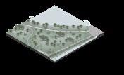
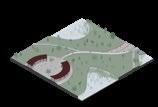
Regeneration of East Flood Canal : Urban and Landscape Strategy for Jakarta’s Water System
Individual Master Thesis. Grade 110/110
Revisiting Jakarta’s water infrastructure, the flooding issues and urban growth through revitalization of East Flood Canal, the newest flooding canal in Jakarta.
Sunnyside Residence
Team Work in Bluegreen, Aspen
Residential landscape project in Aspen, supported by its unique grading and natural water features. The design offers a journey through different zone and atmosphere.
Hunter Longhouse Redevelopment
Team Work in Bluegreen, Aspen
Landscape design for a social housing project in Aspen, Colorado. The site is ocated in front of a river, presenting both significant potential and challenges.
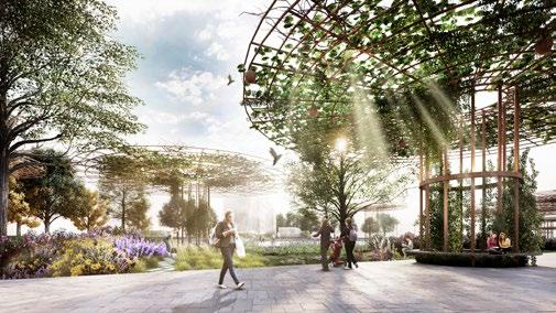
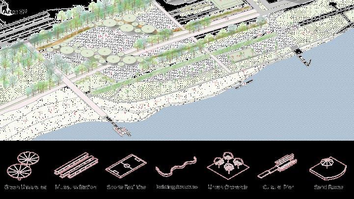
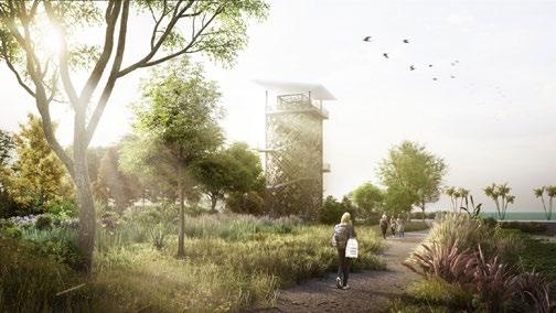
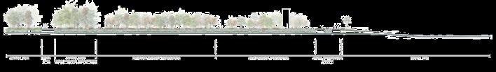
Coastline : An Urban Park for 21st Century
Studio Work in Advanced Landscape Design Studio Grade 30 L / 30
To revive the area in the coast of Bari, one of the oldest harbour city in Italy through urban engagement and landscape approaches.
Cremona : To a Sustainable Landscape between Agriculture, Water and Culture
Studio Work in Landscape Representation and Modeling (GIS) Grade 30 L / 30
Reading the urban textures and different landscape typologies throughout the old city of Cremona.
Re-Use The Fallen Church Team Work in Competition
Rediscover the spatial character of the church and its location regarding Grottole in order to enhance potentialities and create awareness of the site heritage.
Reinventing Square Piazza Gino Valle Competition
Redesign the piazza in Milan, Italy, to create a more welcoming and user-friendly space for its visitors.
Taryn Lane House
Team Work in Arkana Architects
An architectural project for a family in Bali island, Indonesia.


Regeneration of East Flood Canal : Urban and Landscape Strategies for Jakarta’s Water System
Jakarta, Indonesia
January - July 2022
Individual Master Thesis Project
Software used : Adobe Indesign, Adobe Photoshop, Adobe Illustrator, AutoCAD, SketchUp, QGIS
Jakarta, the capital city of Indonesia, was established on the delta formed by 13 rivers. Since its development began in the 15th century, Jakarta has remained a crucial hub for the economy, government, and industry, resulting in continuous growth and expansion. This rapid development attracts many people to work and reside in the city.
However, Jakarta faces significant challenges such as annual flooding, heavy rainfall, rising sea levels, and land subsidence, causing the city to sink faster than other coastal megacities. To combat flooding, the government constructed the East Flood Canal between 2003 and 2010. This canal helps mitigate flooding by redirecting the water flow from six natural rivers to the Java Sea.
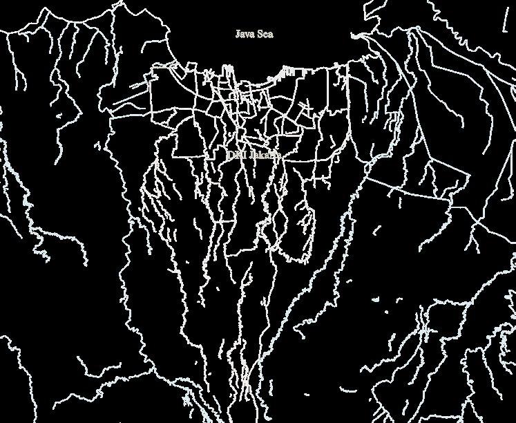

Jakarta frequently experiences land subsidence and flooding, which are interrelated issues. This is not surprising, given the city’s recurring flooding events. These flooding events occur because, hundreds of years ago, Jakarta was built on mud sediment deposited by 13 natural rivers flowing through the area towards the Gulf of Java. When the Dutch arrived in Jakarta, they constructed canals to channel water directly to the sea. Flooding events, river structures, and elevation conditions are crucial factors that guide the development of Jakarta’s water infrastructure.
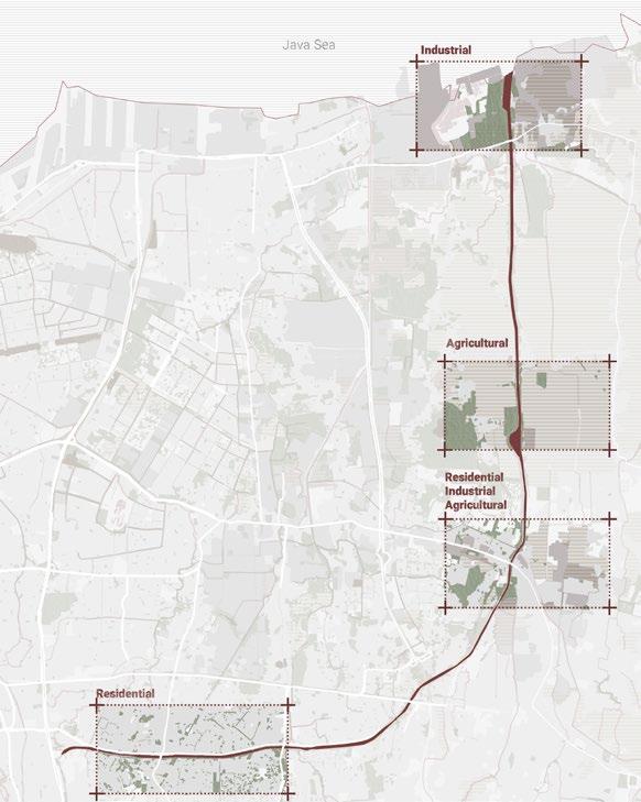
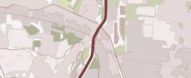
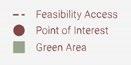
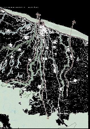
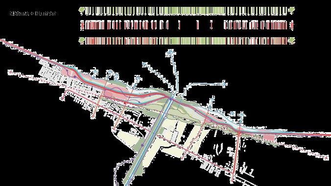
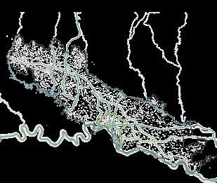
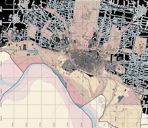
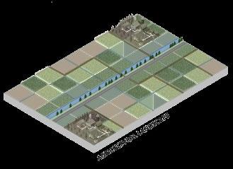
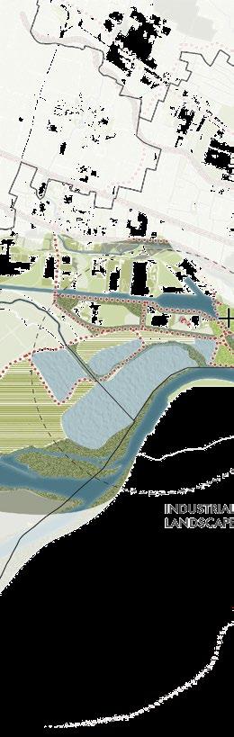
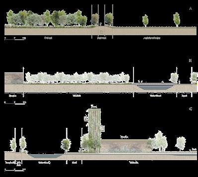
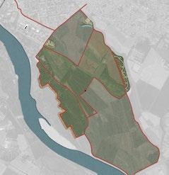
TERRITORIAL SCALE ANALYSIS
Reading the context in each urban fabrics
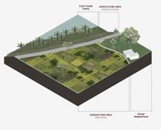
AGRICULTURAL AREA
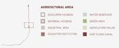
MIXED AREA

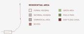
RESIDENTIAL AREA
DELTA
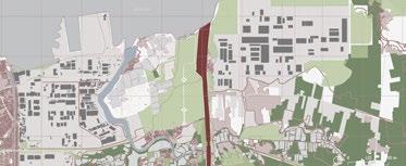
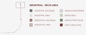
INDUSTRIAL -
AREA
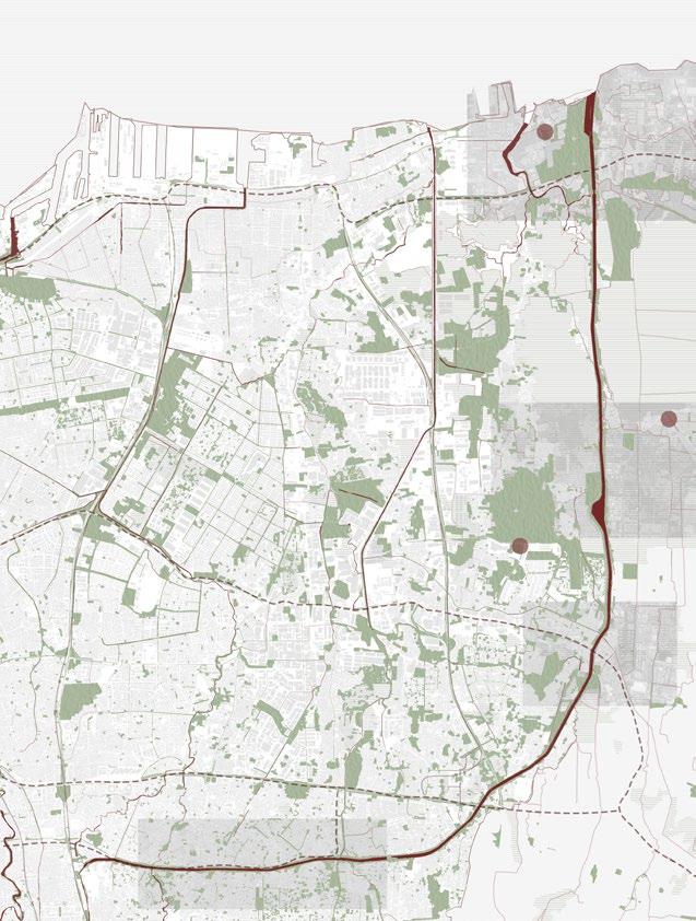
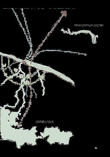
TERRITORIAL SCALE ANALYSIS : CONCLUSION
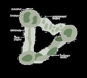
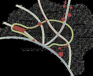
MAIN STRATEGY
+ Canal as a Bridge between the City Fabric of Jakarta and Rural Fabric of Bekasi (West Java) + Canal as a Platform to Enhancing the Green Belt Connection + Canal as a Media to Re-Introducing Jakarta as a Delta City for its Citizen


urban strategy landscape strategy
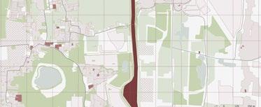
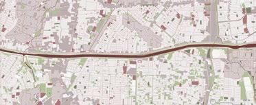
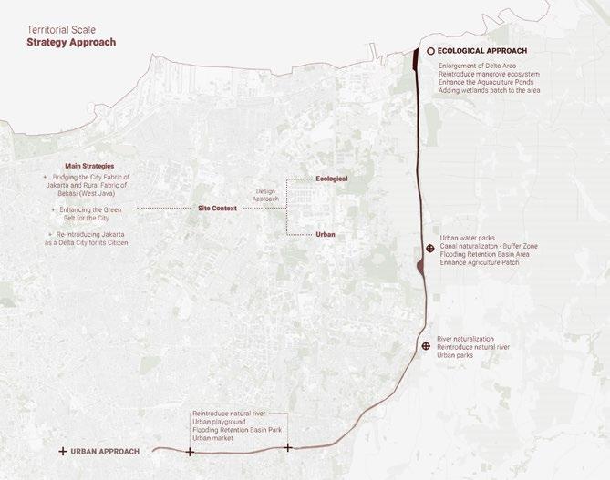
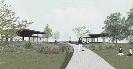
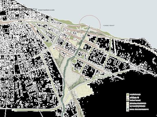
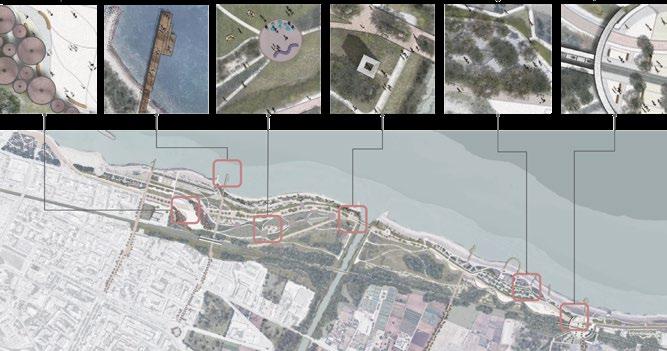
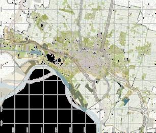
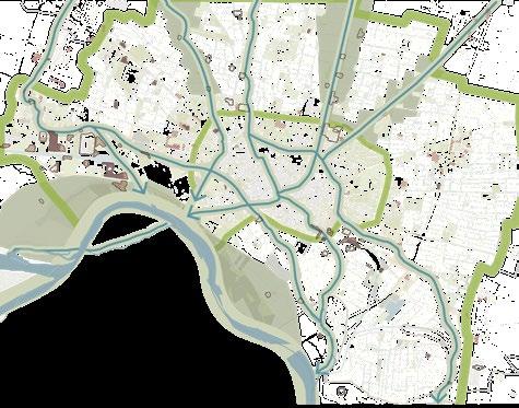
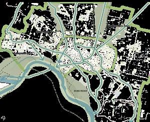
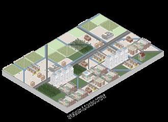
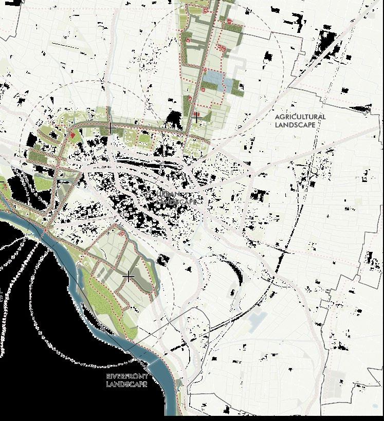
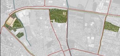
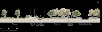
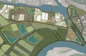
MASTERPLAN
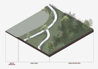
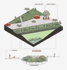
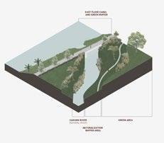
JAKARTA’S EAST FLOOD CANAL
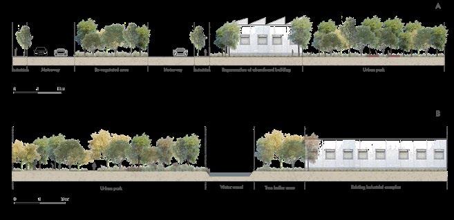
The interventions along the canal to support the main strategy.

AGRICULTURE AREA
Water Reservoir Basins
Urban Parks
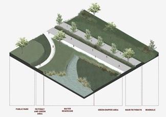

MIXED AREA
Market Terrace River Naturalization

RESIDENTIAL AREA
Urban Furniture
Re-Introduce Natural River
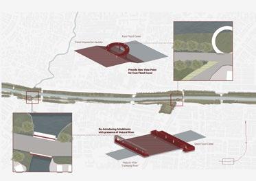
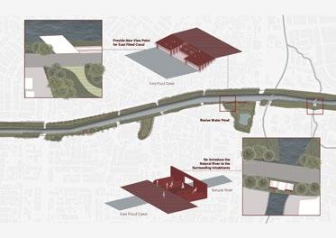
DELTA AREA
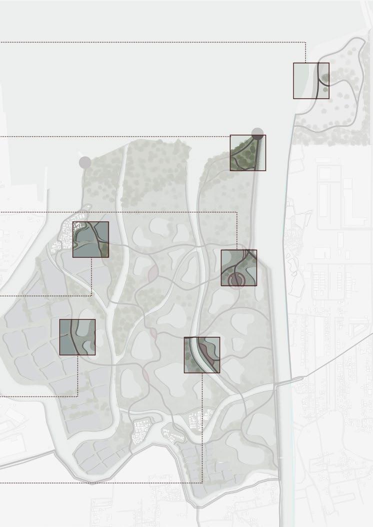

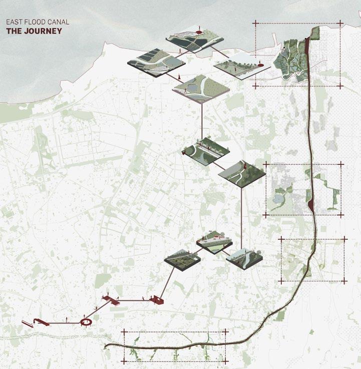
This project aims to implement urban and ecological strategies to regenerate East Flood Canal in Jakarta and how each fabric could activate and initiate development throughout the canal. Moreover, improving the canal will bring a domino effect for other aspects on the bigger scale (the city), from an environmental aspect, social - cultural, and economic.
It opens possibilities for possible solutions to overcome this canal’s complex intertwining fabrics and issues. Through the observation of the city’s fabric typologies, green space networks, the public spaces, the accessibility, and the water system condition, this project proposal can bridge the gap between the existing situation, Jakarta’s annual issues, and its future scenarios.
Coastline : An Urban Park for 21st Century
Bari, Italy
September 2021 - January 2022
Team Work in Landscape Design Studio
Software used : Adobe Indesign, Adobe Photoshop, Adobe Illustrator, AutoCAD, Google Sketchup, QGIS
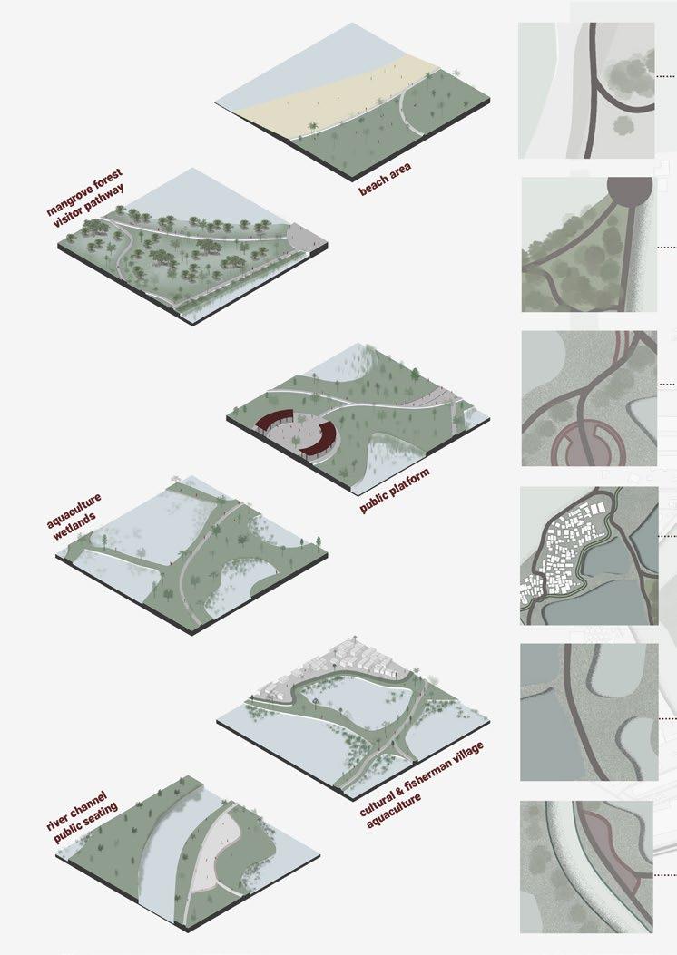
Beside its rich and abundant amount of biodiversity, this range of area has a disruption in the form of disconnection by anthropic interventions or even the natural occurrence.
One of the biggest anthropic interventions that could disconnect this biodiversity connection is a city settlement and also agricultural development.
This development is inevitable since the human settlement is growing, especially with the support from industrial revolution.
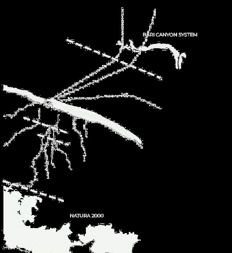
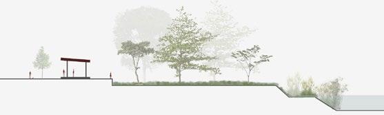
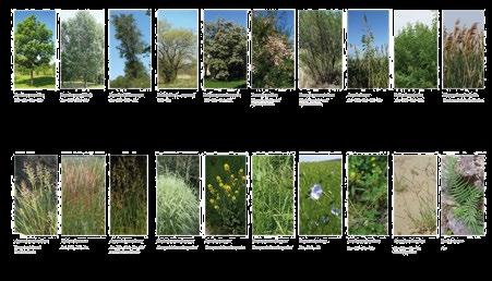
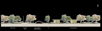
The proposed strategy follows the concept of Ecological Network.
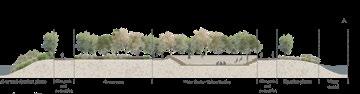
It will have some core areas, and corridors which integrate the cores. In the section we can see how the plants and trees are fading away as the area can be more accessible by people.
From the disruption that has been found, the main strategy in this scale will be to reconnect the green and blue pathway from the mountain range until the adriatic sea.
The objective is to provide an ecological connection throughout the area and support the movement of Natura 2000. The connection will be mainly through the blue infrastructure.
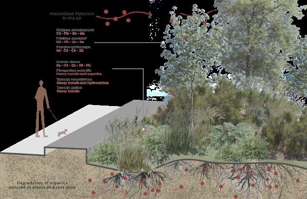
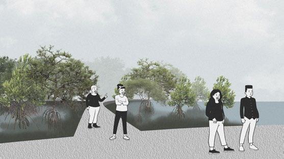
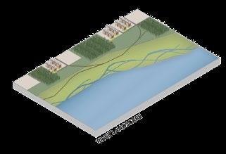
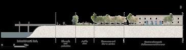
Beside the pollutant issue, floodings is also a problem that we found. One effective way to use it but still considering the natural aspect is through a Bioswale.
Bioswale is a water swell that filters water and sometimes it is directly used for other purposes.
bioswale area
phytoremediation area
water canal
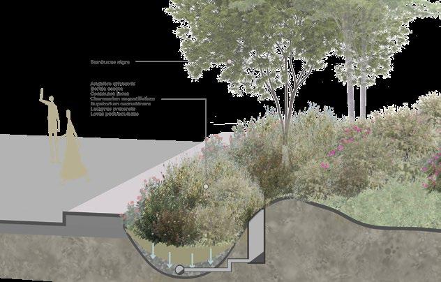
The strategies has been applied to the site. From the green strategies, mobility, until water culture strategies. We synthesize the analysis and all proposal for the site. We conclude that in the middle of our area (canal area) is more suitable for the green and blue area. We leave this area fothe biodiversity to grow. It is the main reason we are not try to put much interventions on this area. Going more in the sides, the area are becoming more urbanized, more populated, and more functional for the people.


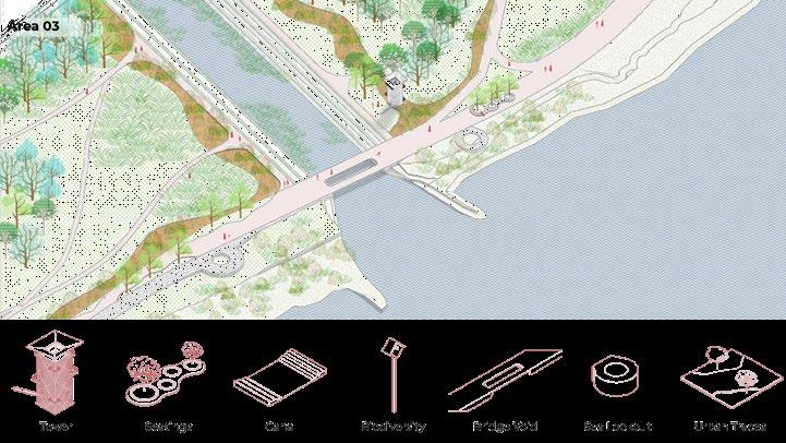
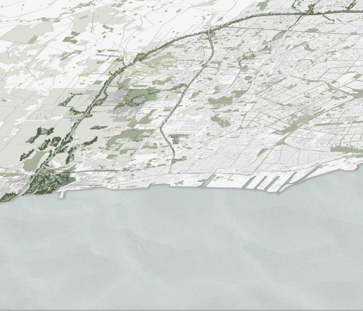
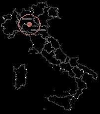
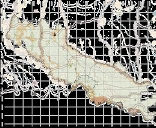
Cremona : To a Sustainable Landscape between Agriculture, Water and Culture
Cremona, Italy
September 2021- January 2022
Team Work in Landscape Design Studio
Software used : Adobe Indesign, Adobe Photoshop, Adobe Illustrator, AutoCAD, Google Sketchup, QGIS
When analyzing Cremona and its surrounding landscape, several key factors are crucial. The city’s rich history and heritage, its proximity to the important Po River, and its vital ecological resources significantly influence the shaping of large-scale projects. Additionally, the contemporary needs of residents and workers in the agricultural and industrial sectors play an essential role in this process.
From the initial analysis, the main strategies focused on enhancing green and blue infrastructure and utilizing available resources to address issues such as flooding, air pollution, and a lack of biodiversity. These natural resources also served as primary tools to achieve other project goals, such as promoting slow mobility and improving community access to nature and underused historical sites like abandoned buildings and farmsteads, as well as the historical footprint of the Po River.
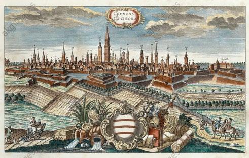
Cremona by Werner, Friedrich Bernhard 1740Cremona is situated within the Pianura Padana landscape typology, which refers to the Po Valley. This valley spans approximately 46,000 square kilometers and is bordered by the Alps, the Adriatic Sea, and the Apennines. Numerous rivers flow through this region, with the Po being the most significant. These rivers create unique natural conditions that shape the landscape, where urban, natural, and agricultural areas intersect.
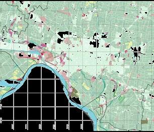
Legend
Priority Intervention Area
Special Protection Area
Regional and national reserves
Regional and national parks
Local parks of supra-municipal
Agricultural fields
Green areas
Woodlands
Particular formation
Uncultivated pasture
Water system
Regional ecological corridors
Protected areas (SIBA)
Poor water ecosystem (PTUA)
Acceptable water ecosystem (PTUA)
Good water ecosystem (PTUA)
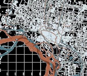
Legend
Green corridors
Green belt
Main blue corridors
Secondary blue corridors
Administrative boundary
The strategy aims to regenerate the main blue corridors, thereby improving ecosystem quality. Additionally, two green belts are proposed to serve as merging edges for different configurations of urban and productive elements. This approach strengthens the integration of natural elements into a complex system, using this enhanced network as a guideline for more in-depth planning and development.
GREEN & BLUE INFRASTRUCTURE
AGRICULTURAL LANDS
HYDROLOGICAL CHANGES
HYDROLOGICAL HAZARDS


AREA OF INTEREST
Ecological corridors
Green belt
Proposed Cultivated wetlands
Blue corridors
Agricultural lands
Woodlands
Uncultivated pastures
Local parks of municipal interest
Abandoned buildings
Uncultivated lands
Suspended areas
In this municipal scale, the applied strategies become more evident and the urban factors influencing is are move visible. The green strategy that has been applied to the bigger scale - provincial scale- extends into the city, with these blue and green corridors, reaching the Po river. Several areas are identified as potential focal points, demonstrating the opportunities for urban landscape intervention which will support the main strategy.

STRATEGY DIAGRAM Legend water management integration of landscape ecological connectivity urban intervention systemic intervention
The main strategy focuses on establishing ecological corridors that enhance the value of agricultural fields. As these corridors enter the urban environment and approach the Po River, they integrate into a larger system. By creating continuity through blue infrastructure, the strategy incorporates green belts to extend into the urban area and connect with city canals. Consequently, the strategy progresses through different phases and is applied to four areas: agricultural landscape, urban landscape, industrial landscape, and riverfront.
STRATEGY
Legend

Water system
New Urban Parks
New orchards/agricultural lands
Revegetated area
Wetlands
Green corridors
New facilities
New bicycle paths
Landmark
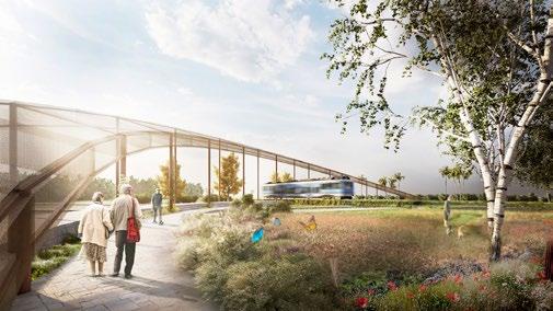
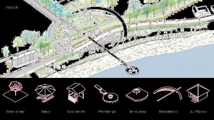
The strategy is divided into macro zones, each characterized by unique elements that define its landscape. The green system strategy includes four main types of interventions: urban parks, new agricultural lands, re-vegetated areas, and wetlands. These interventions address previously identified problems. The mobility system forms a comprehensive network that makes every green and urban area accessible, ensuring easy connections with the Po River.
Additionally, each macro area focuses on regenerating and improving various community facilities located at strategic points. These facilities, along with key landmarks, are essential for achieving the strategy’s ultimate goal: allowing people to experience each unique landscape and its natural systems.
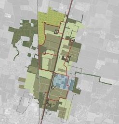
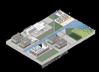
agricultural landscape urban landscape


riverfront landscape industrial landscape
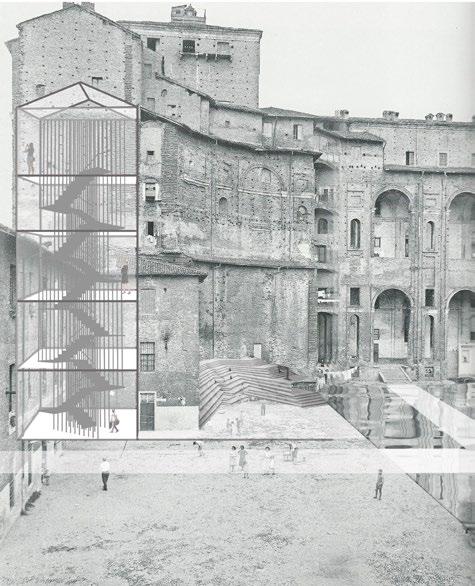
Re-Use Fallen Church
Grottole, Italy
September 2021
Team Work for Architecture Competition
Software used : Adobe Indesign, Adobe Photoshop, Adobe Illustrator, AutoCAD, Google Sketchup, QGIS
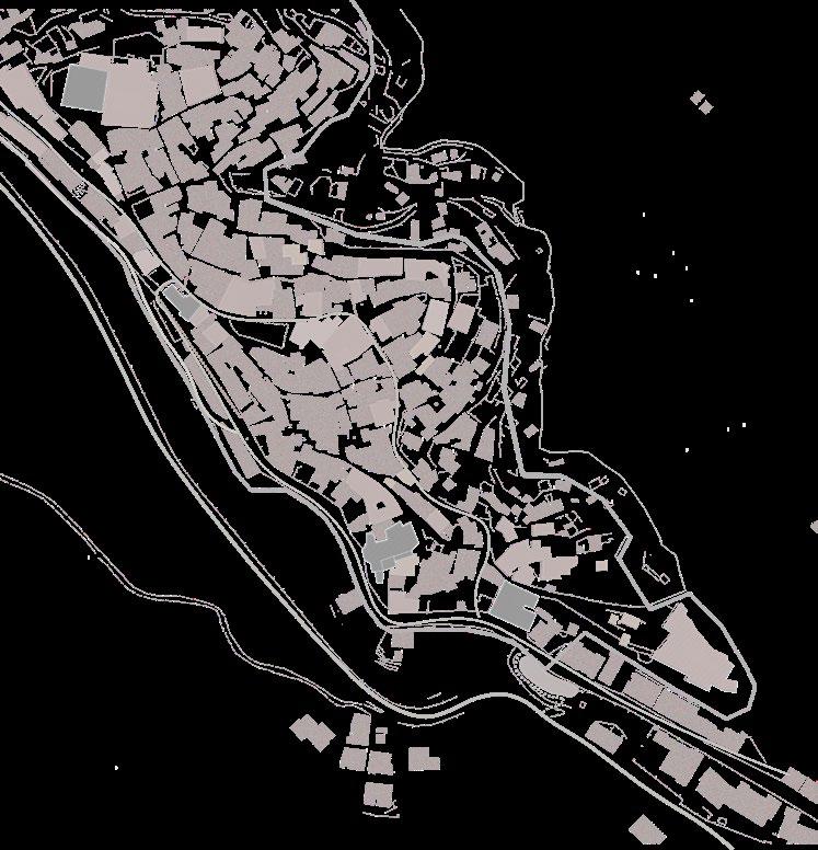
The project starts with understanding the spatial character of the church and its location regarding Grottole in order to enhance potentialities and create awareness of the site heritage.
Located in what we called in the project “Recuperation Axis” the church offers a pause in the axis route and also the possibility of changing levels and access to the historic center.
Therefore, the project speculates in the possibility of the church to offer a closed volume capable of support the enclosed activities like a concert hall, theater and exhibitions, and also to provide urban space in its roof connecting it with the public square on front and the access on the lower quote facing the agricultural fields.
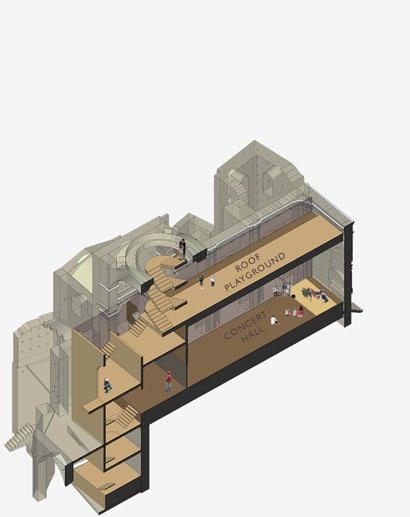
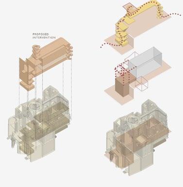
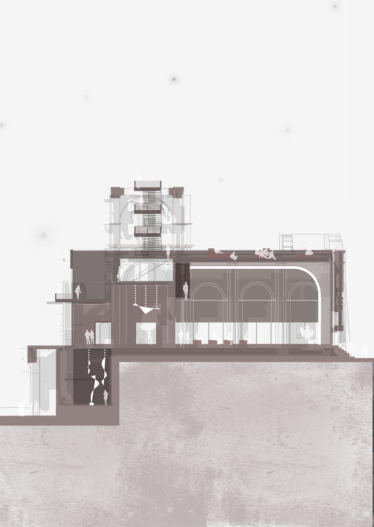
Chiesa Diruta (The Fallen Church) has been built since 16th century, but because of destructive earthquakes, this church lose its function and got abandoned since 1760. The purpose is to reactivate this building with the function of concert hall in order to engage with its surrounding context.
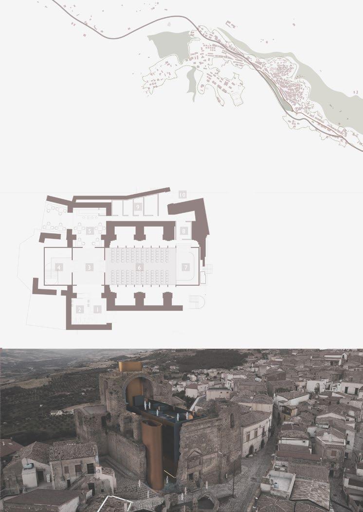
1. Entrance Lobby
2. Restroom
3. Transition Foyer
4. Access to Observatory Tower
5. Cafe
6. Indoor Auditorium
7. Stage
8. Backstage Foyer
9. Backstage Area
10. Service Entrance
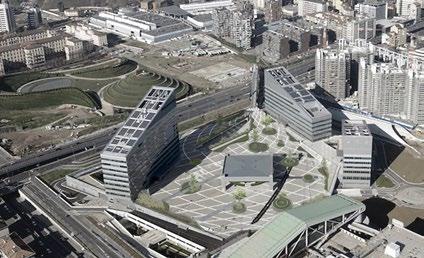
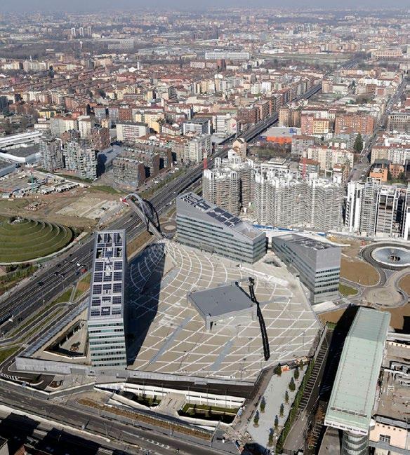
ReInventing Square : Piazza Gino Valle
Milan, Italy
December 2021
Architecture Competition - Individual Work
Software used : Adobe Indesign, Adobe Photoshop, Adobe Illustrator, AutoCAD, Google Sketchup, QGIS
Milan captures a harmonious blend of history, art, and professional life. Visitors come to the city for tourism, employment opportunities, and academic pursuits.
Piazza Gino Valle stands out as a notable attraction in Milan, drawing visitors due to the presence of the AC Milan Museum within the building complex and the headquarters of one of the city’s largest insurance companies, Vittoria Assicurazione.
Based on the observations of on-site activities, we have determined that Piazza Gino Valle primarily serves as a thoroughfare for individuals transitioning between various activities and destinations within the city.
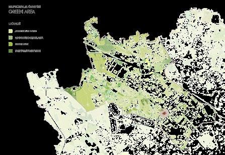
The green area map reveals the distribution of green spaces within municipal 8. It is evident that the majority of green areas are concentrated on the outskirts, primarily comprising agricultural land. As one moves towards the city center, the green spaces consist mainly of public parks and street green strips.
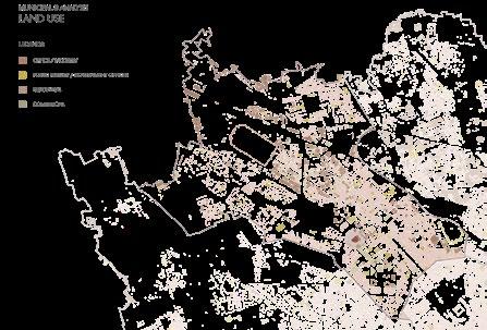
This map illustrates the land use distribution, delineating areas designated for offices, residential complexes, government facilities, and commercial activities.
Piazza Gino Valle serves primarily as a transit area, facilitating movement from one activity to another. Additionally, the presence of a bridge connecting Alfa-Romeo Park to the site, as well as a direct connection to the nearby hospital from the lowest part of the site, further reinforces its role as a passageway for individuals traveling between different destinations.
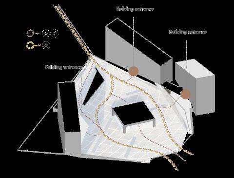
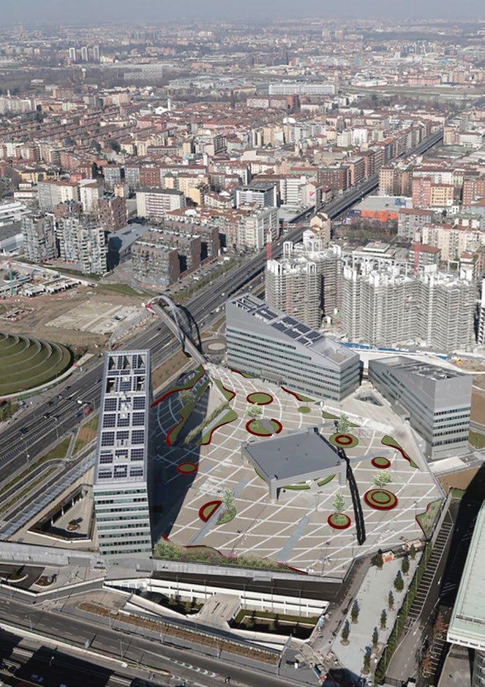
DESIGN STRAETGY
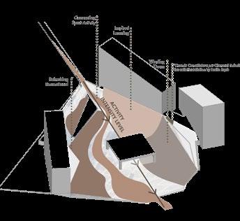
After analyzing and gaining a deeper understanding of the current user flow, devised a Zoning Strategy for the project. This strategy is informed by the existing lace texture on the flooring.
The areas with the densest lace texture on the flooring, which also happen to be the highest elevation points of the site, will be designated for high-intensity activities such as exercise, work, outdoor meetings, and learning sessions. Conversely, areas with the least dense lace texture will be allocated for low-intensity activities such as seating, socializing, or simply providing space for mental refreshment.
We recognize the effectiveness of this zoning strategy, particularly in the context of Piazza Gino Valle, which serves as a focal point for various activities. This intersection must act as a catalyst and achieve equilibrium amidst the bustling activities surrounding the site.
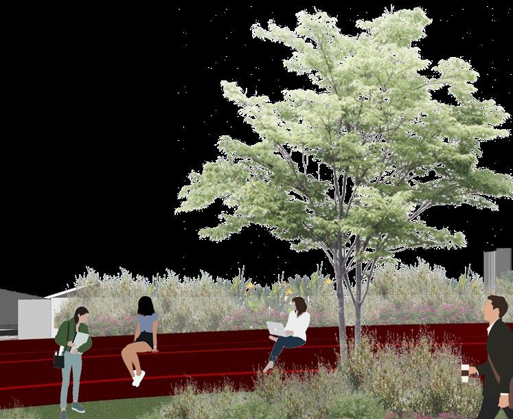
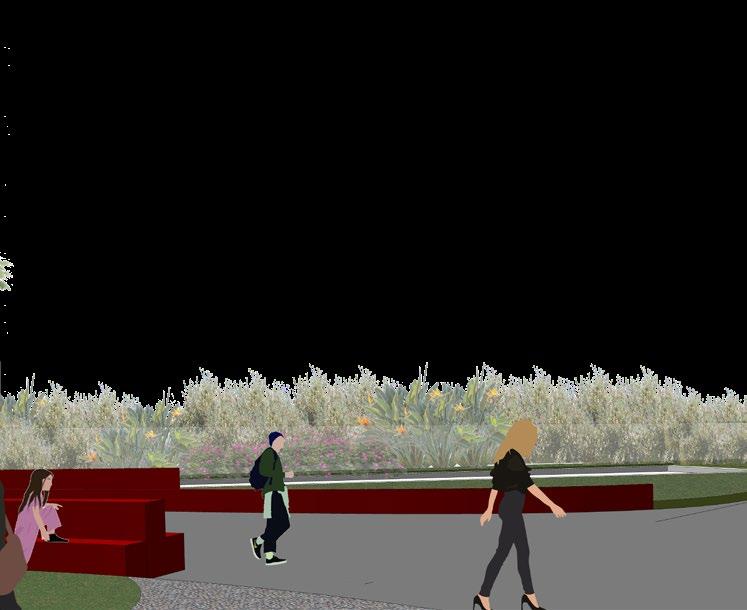
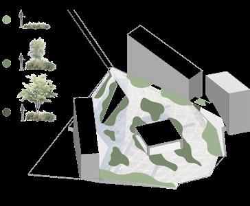
In addition to the green area provided by planter box structures, the space will also include facilities for seating, a mini library, and a temporary booth. These amenities will serve as spaces for various temporary activities, enhancing the functionality and versatility of the area.
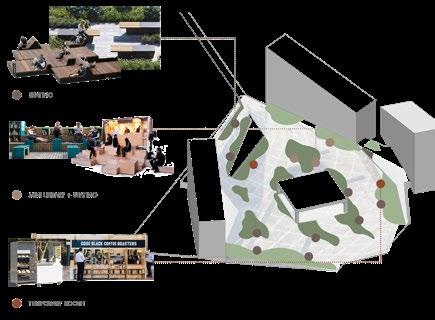
The seating area will serve as a space for users to socialize, enjoy the ambiance of Piazza Gino Valle, or outdoor meetings. A mini library will be established to support the educational institutions in the surrounding area.
Lastly, a temporary booth will be available for users to purchase food and beverages to enjoy on Piazza Gino Valle. This temporary structure will not be permanently attached to the site, allowing for flexibility in its function.

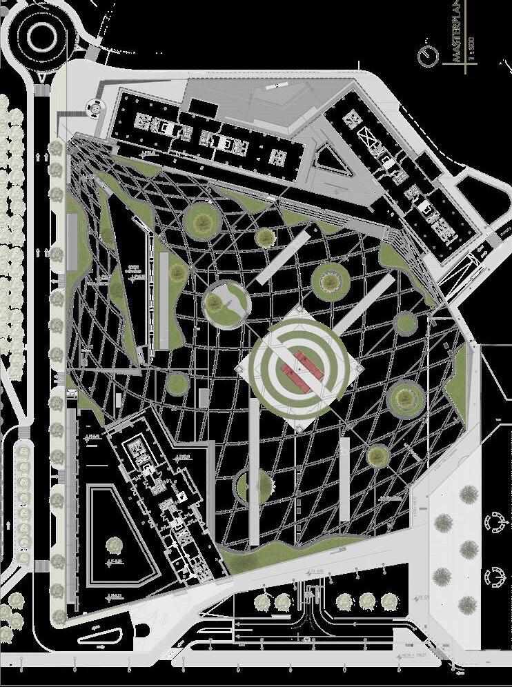
MASTERPLAN
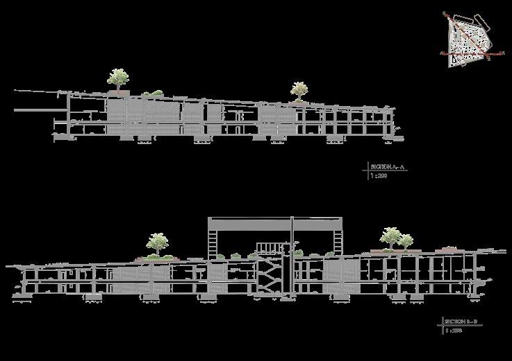
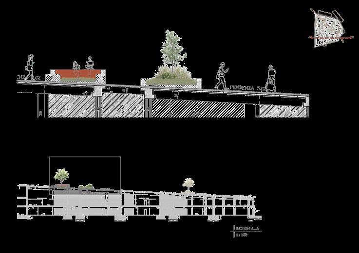
before
after
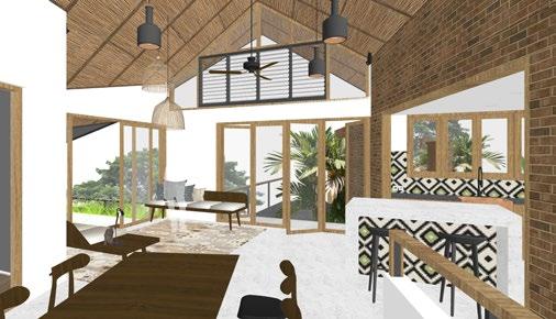
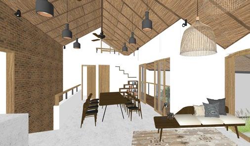
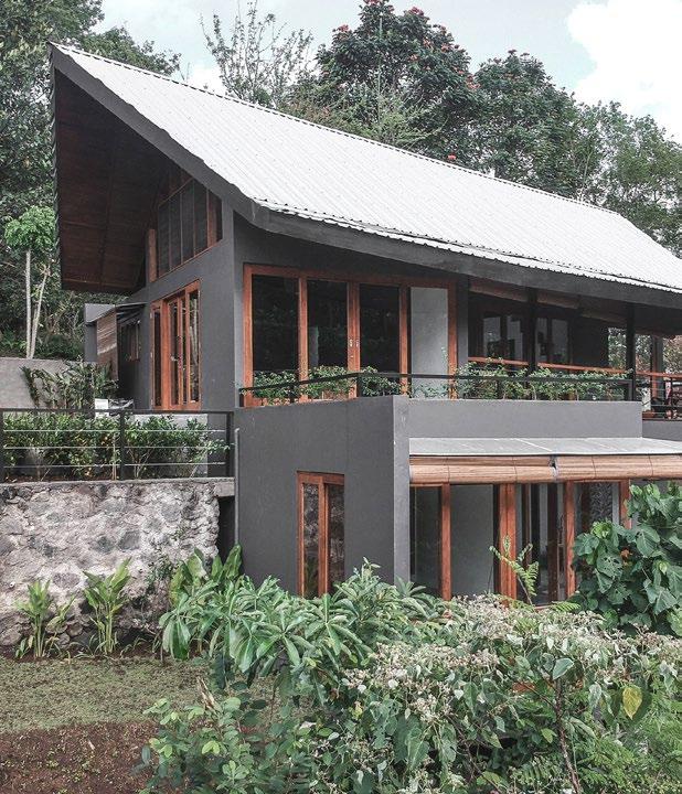
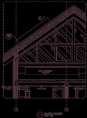
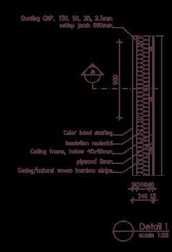
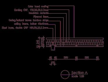
Taryn Lane House
Bali, Indonesia
September 2019
Built Project
Professional Work in Arkana Architects Office
Software used :
AutoCAD, Google Sketchup
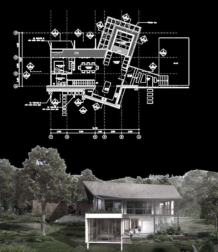
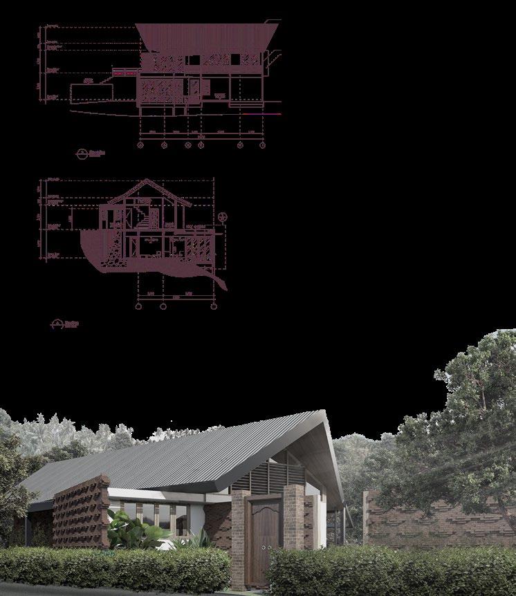
The project is situated within an eco-village neighborhood, positioned on the upper side of Bali island, known for its comparatively lesser population density and a more environmentally conscious approach in contrast to the southern region. This eco-village model encompasses the holistic lifestyle of its residents and their interaction with the surrounding environment. It influences various aspects of daily life, ranging from environmental considerations to social activities, both of which I believe are significantly enhanced. The eco-village’s main sustainable system ensures the preservation of natural cycles, allowing for the utilization of natural resources without exploitation. Additionally, the communal spaces provided facilitate gatherings and communication among residents, fostering cultural exchange and contributing to the social sustainability of the eco-village community.
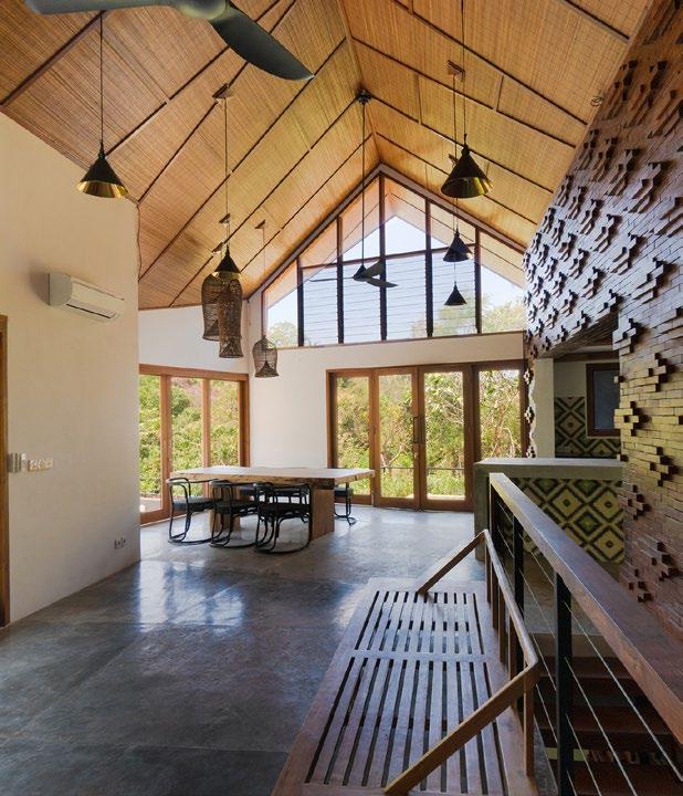
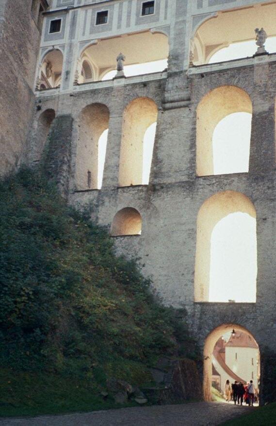


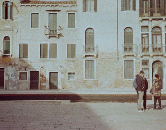
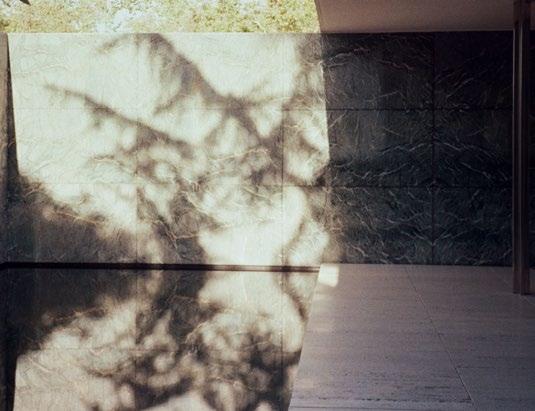
architecture photography
+39 375 5710 633
Diandra Zahra Karima