DHYANA S PATEL
RutgeRs univeRsity | Bachelor of Science in UrBan Planning and deSign
univeRsity of CalifoRnia, los angeles | MaSter of UrBan and regional Planning ConCentRation: Design anD Development minoR: publiC poliCy
SITE CONTEXT
Project Name: Robinsville Township Redevelopment Plan
Location: Robinsville Township, Mercer County, New Jersey, 08691
Development Type: Greenfield |Zoning: Mixed Use
Site Area: 53 Acres
Site Existing Conditions:
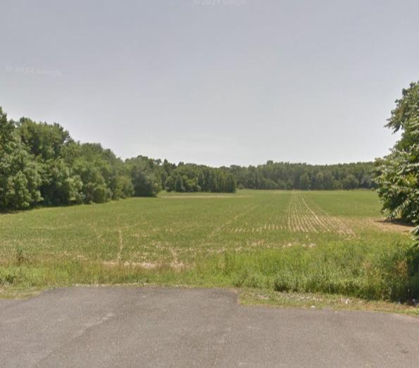
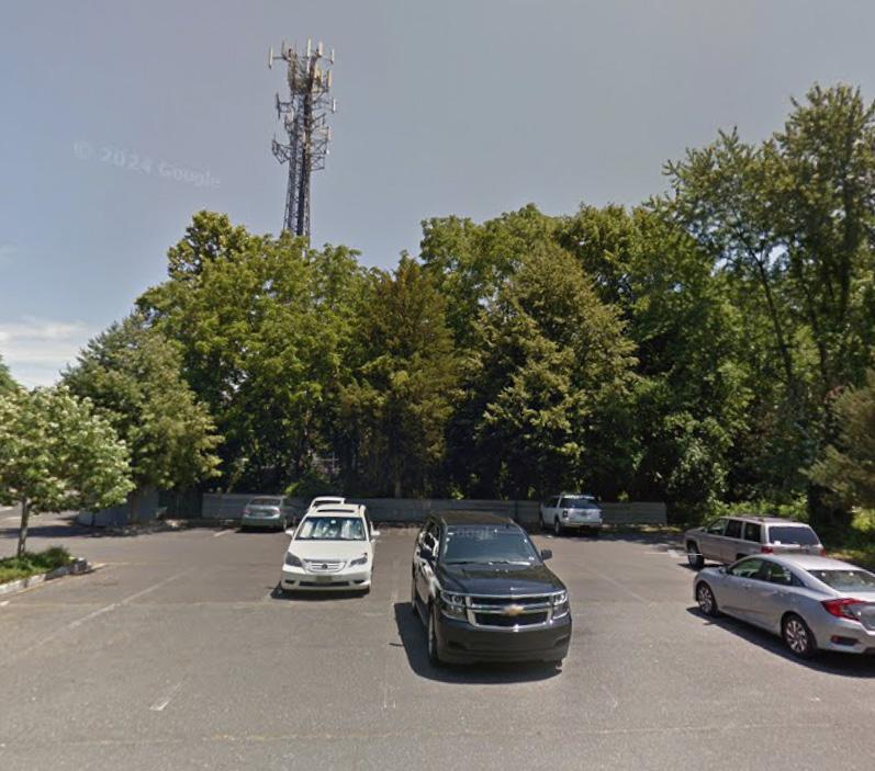
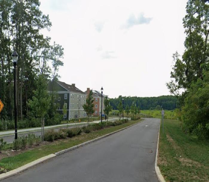
Existing Conditions Description: The site is adjacent to state highway 33. Around the site are several mixed uses, including residential, retail, and institutional. The greenfield site comprises of a parking lot that serves the adjacent nodes. The edges of the site comprise of native trees, which are intended to be preserved in the development. The client’s requirements are to master plan a mixed use development that cater to the growing population of the township. *This development proposal is part of a studio class where the instructor is the client.
SITE PROPOSAL
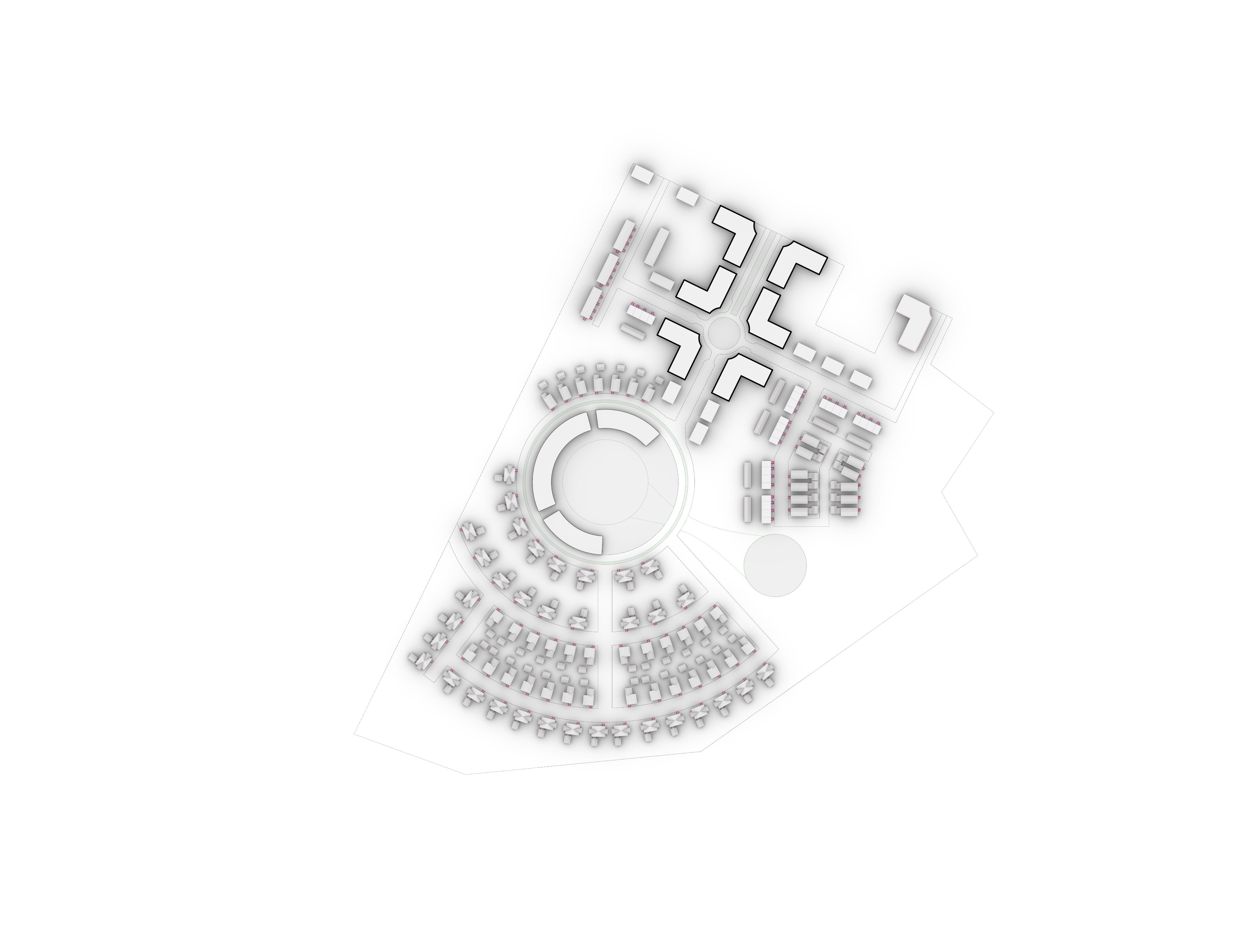
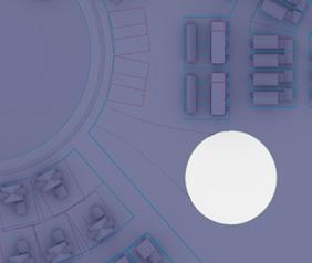
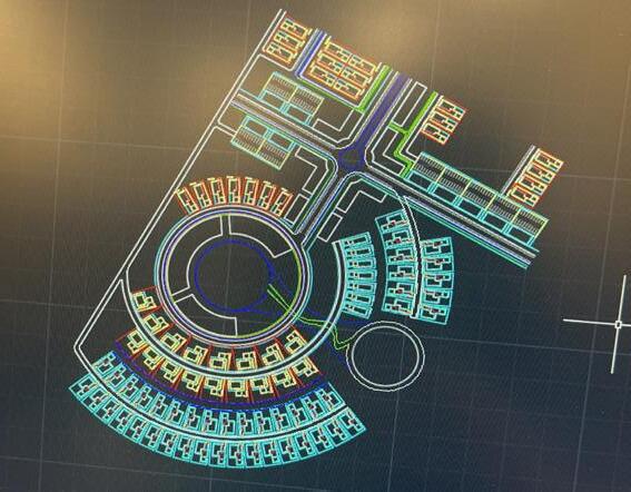
Project Description: The development is focused on creating a mixed-use development. It proposes several commercial and retail buildings, seperated by a main street down the middle that leads to a community garden and institutional/collaboration center. Surrounding it are different types of housing such as townhouses and single family, set in a radial pattern. The white space within the site, apart from the built environment, as seen in the diagram below, is to be preserved for sustainability and environmental goals. All the different green spaces proposed comprise of native plants and trees.
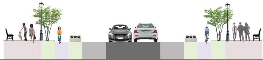
96’ ROW

The 96’ ROW features an 18’ greenbelt in the center, followed by 8’ road, 7’ street parking, 5’ planting strip, 4’ bike lane, 4’ planting strip, and an 11’ sidewalk on both sides. This ROW is at the Main St, running through the core commercial and retail center
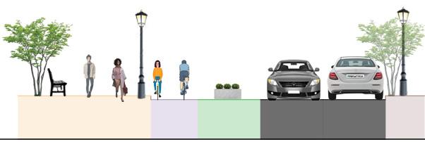
76’ ROW
The 76’ ROW features a 8’ road, 7’ street parking, 4’ planting strip, 4’ bike lane, 4’ planting strip, and an 11’ sidewalk on both sides. This ROW is at the core streets within the core commercial and retail center
52’ ROW
The 52’ ROW features a 17’ pedestrianized path, followed by a 6’ bike lane 7’, 8’ planting strip, 16’ road, and a 5’ sidewalk. This ROW is on the periphery of the community garden situated at the center of the development
46’ ROW

The 46’ ROW features a 8’ road, 7’ street parking, 7’ street parking, 5’ bike lane, and a 3’ sidewalk on both sides. This ROW is at the residential streets
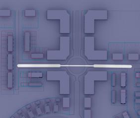
Green Belt
The 18’ green belt is lined with native trees, creating a microhabitat for local wildlife. It acts as a buffer, dividing the 96’ ROW down the commercial and retail center, mitigating heat island effect, improving air quality, and providing a sense of enclosure for pedestrian safety & traffic calming
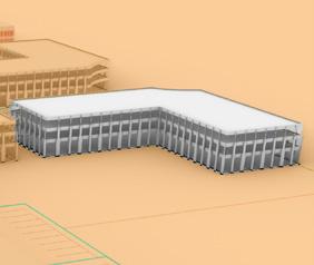
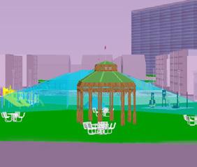
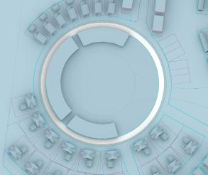
Recreation Center
The recreation center comprises of a green roof, an indoor hydroponic garden, a greenhouse, a conservatory for special species, an indoor community garden, and workspaces with sunrooms and terrariums. The purpose of this center is to promote green urbanism and spaces to coexist with nature
in every changing season, in every changing landscape, there is a different green...
Stormwater Garden + Trails
Connecting the two core gardens is a botanical strip garden with an over-ground stromwater management system. Along with environmental benefits, the trails that run through the garden offer a space to isolate oneself from the public realm and act as a space for reflection and cool down
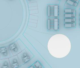
Community Gardens
The larger community garden features outdoor recreational zones, biking and jogging trails, and spaces for large community gatherings such as farmer’s markets. The smaller garden features a community agricultural garden and a playground


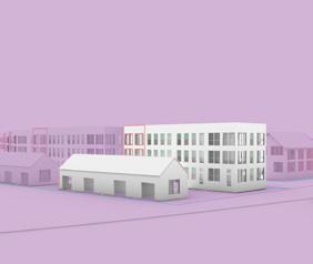


RENDERINGS
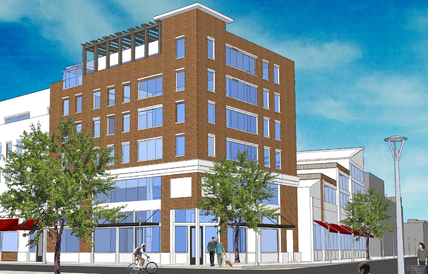
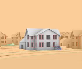
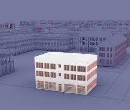
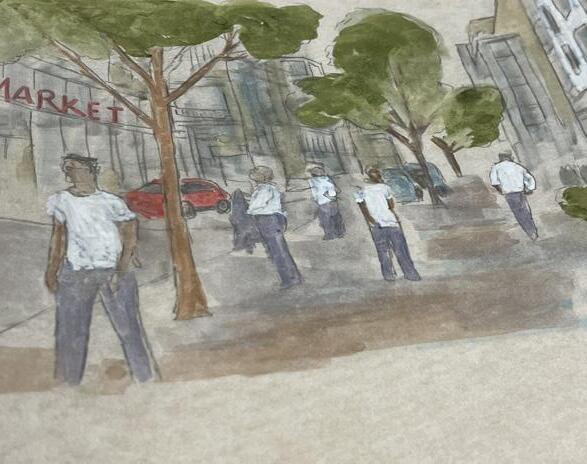
The retail and commercial center, with surrounding greens help bring out people with different backgrounds and lifestyles together, helping create a robust social fabric. The buildings with glass facade on the ground level helps maintain eyes on the street for enhanced safety
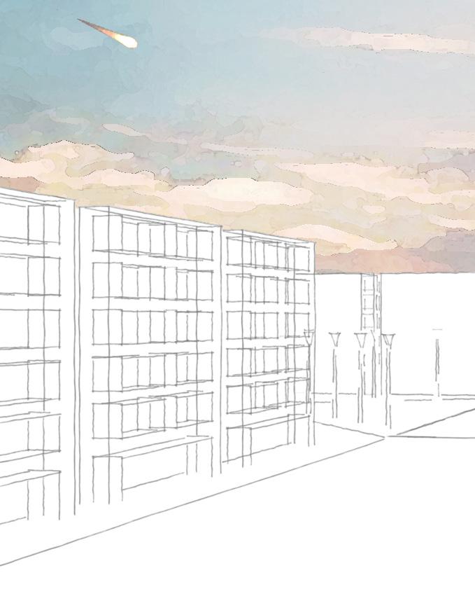
Graphic Creation Process:
• Drew and extruded the surfaces in SketchUp Pro
• Applied the assets on the buildings
• Rendered in Photoshop
TECHNICAL BUILDING TYPOLOGIES
single family units: 83 units townhouse: 51 units
93,500 sf CommeRCial 25,600 sf Retail
2 Community gaRDens 38,000 sf Community CenteR
2,500 sQft.
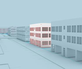
Tree-lined sidewalks, street lighting, narrow streets, all aid in creating a safe environment for the pedestrians
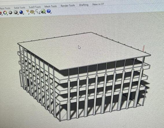
Graphic Creation Process:
• Drafted the master plan, including ROWs, in AutoCAD Civil 3D
• Creating block definitions for the approiate building typology in
• Extruded the model in Rhino 3D
• Applied assets and rendered in Rhino 3D using VRay
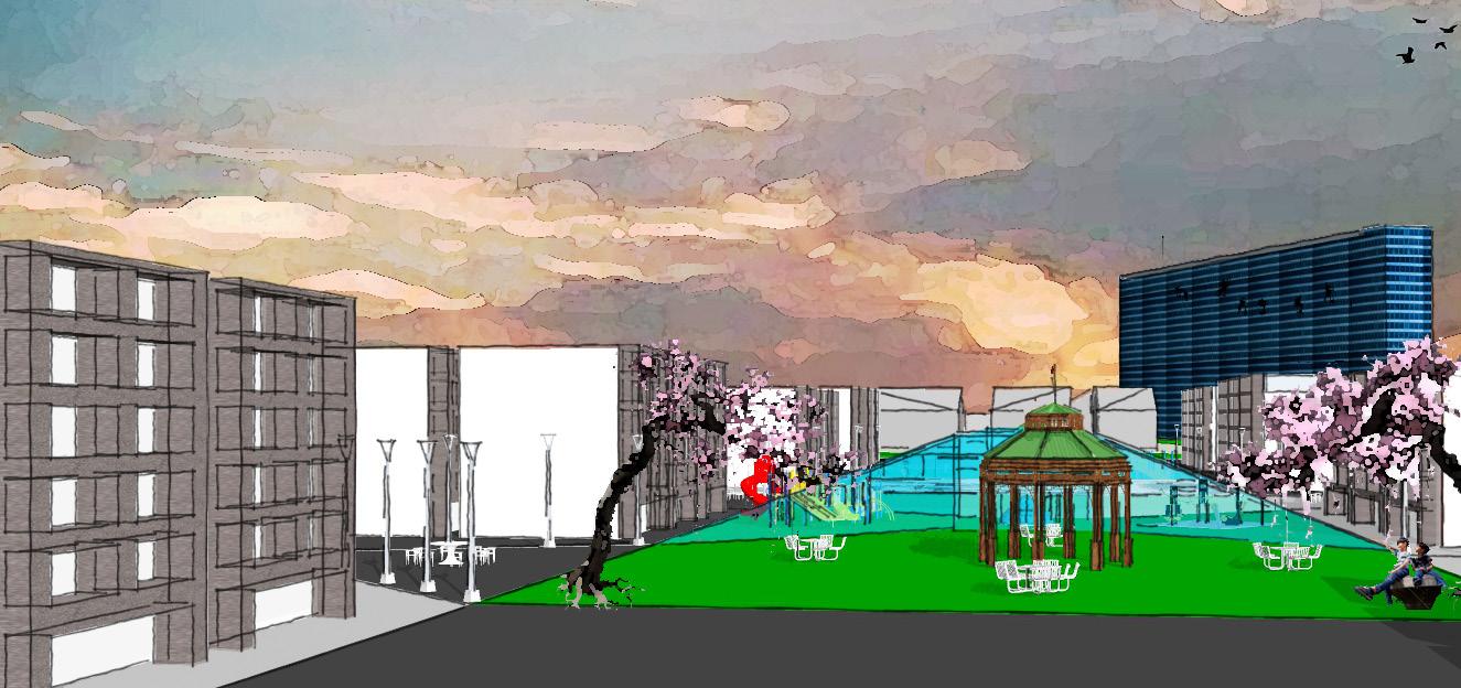
The gardens, intentionally placed at the center of the development, featuring multiple uses such as playgrounds, open space pockets, and trails force community interactions, achieving environmental and social sustainability
Graphic Creation Process:
• Drew building and street outlines in AutoCAD Civil 3D
• Extruded the surfaces in SketchUp Pro
• Applied the assets on the buildings
• Rendered in Photoshop for an artistic effect
townhouse paRking unDeRneath- 3,000 sQft flats oveR flex- 3,200 sQft
REFLECTIONS
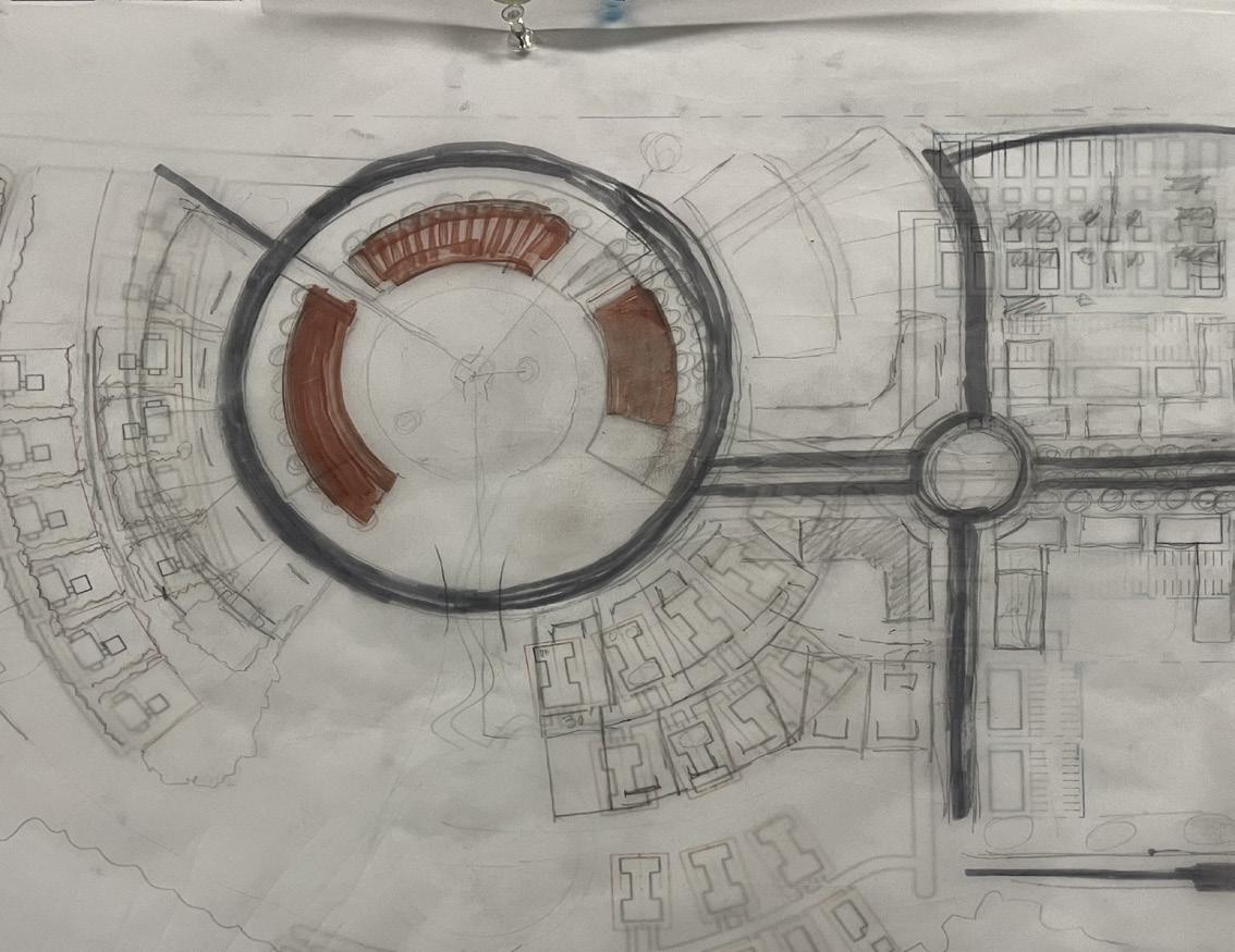
After imagining the streetscape, drawing out illustrations like the ones above, I had to decide what aesthetic pattern I want my development to follow. I spent countless hours with an 11’ by 17’ aerial map of the site and trace paper, just sketching out designs and with Professor Juan Ayala to improve my design. After numerous trace overlays with pedestrian and traffic circulations, green and open spaces, residential, retail and commercial computational mapping, I finalized a design!
This was my favourite part of the process as I was designing the actual site plan of what my redevelopment would look like. I went through half a roll of trace paper drawing and revising. Seeing the final plan on trace at 3 a.m. before midterms was surely a satisfactory experience.
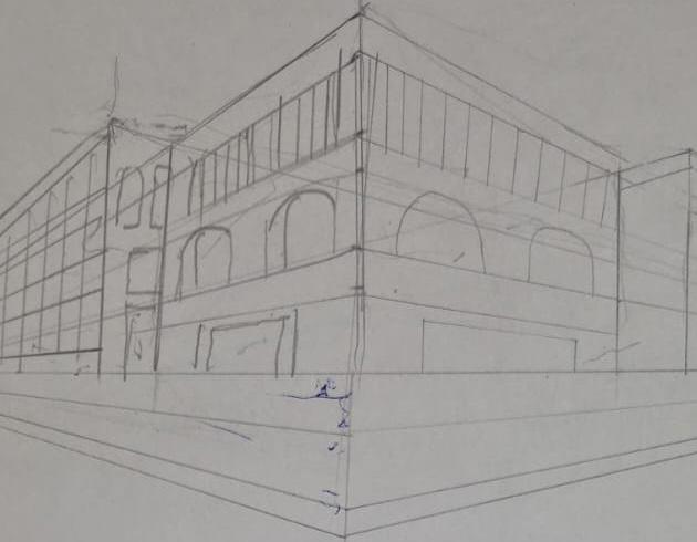
This project was my site for the Urban Planning and Design Studio during my Bachelors of Science in Urban Planning and Design at Rutgers University. I analyzed the site, existing and surrounding conditions, demographics, and other research pre-designing. I then moved on to imagining how I want my built environment and streetscape to be and did numerous hand sketches on trace paper and vellum, or just my sketch book to give me direction. I’d do them on the bus, or while watching a movie, at the dining hall grabbing breakfast, in the studio session, or wherever I could get inspiration from!
I loved the freedom of sketching informally as this was the phase where I wouldn’t need any maps, fancy tools or softwares. Just me, my sketchbook, a couple of markers, and I wouldn’t realize when time would fly by, but I’d stop when I’d get a headache due to the strong smell of the alcohol markers. I did sometimes wear a mask to prevent a headache but I’d still end up smelling like the markers!
After finalizing the design, I went straight into AutoCAD Civil 3D and drew out my design. After the AutoCAD model was ready, I extruded and rendered the model in Rhino 3D. Hours spent on YouTube tutorials learning and trying to perfect all the details, and VRay crashing after I imported all my rendering assets- creating the final model was frustrating, caused a lot of crash-outs, sleepless nights, and lost apetite.
This project, my first, made me realized why I choose to be an Urban Designer. The technical difficulties, frustration when the design doesn’t feel right, the bold decision to redo half of it, and the commitment to pursue excellence anyway. I’m drawn to this field because it demands both, rigor and imagination, reconciling climate realities with human emotion, innovation with intention, infrastructure with beauty. For me, design is purposeful: a responsibility to create places that are resilient, aspirational, and transformative. That possibility, turning vision into lived experience, is why I want to design for the rest of my life.