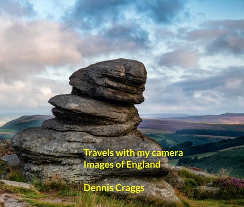
Henley Northumberland Peak District Cornwall New Forest Jurassic Coast Dennis Craggs August 2026
ak snow storm over night and in the early morning on 12 April 2021 this was gh to get me out of bed early and walking the riverside at Henley to catch the n. And as I did so, some enthusiast for a different reason, was out training, y not for fun. The snow was gone by the end of the day. The rower has a pink must be from Leander. They are looking for new members but Phyllis Court ter.
A freak snow storm over night and in the early morning on 12 April 2021 this was enough to get me out of bed early and walking the riverside at Henley to catch the action. And as I did so, some enthusiast for a different reason, was out training, surely not for fun. The snow was gone by the end of the day. The rower has a pink oar, it must be from Leander. They are looking for new members but Phyllis Court is better.
hased a drone to take to Iceland for volcanoes but this came to nothing. In ry 2022, finally catching a misty morning, I took it out to Henley to catch action. It was a lovely dawn about 8am-ish but freezing cold. The 249gm captures in RAW but they are only 12mB files and the sensor is not as y as a mobile phone and cannot handle much dynamic range. It seems to out quite well with some processing however so here it is. All taken in more s auto settings (Although it can be varied manually), I have enough trouble olling the drone, never mind handling the camera settings.
I purchased a drone to take to Iceland for volcanoes but this came to nothing. In January 2022, finally catching a misty morning, I took it out to Henley to catch some action. It was a lovely dawn about 8am-ish but freezing cold. The 249gm drone captures in RAW but they are only 12mB files and the sensor is not as quality as a mobile phone and cannot handle much dynamic range. It seems to work out quite well with some processing however so here it is. All taken in more or less auto settings (Although it can be varied manually), I have enough trouble controlling the drone, never mind handling the camera settings.
urgh Castle, the epicentre of the Kingdom of Northumbria and home of the trialist Armstrong family since 1894. Crowning nine acres of the Great Whin Bamburgh Castle has stood guard above the Northumberland coast for ands of years. I was up in Northumberland helping clear mum's house and a break to make a visit here. Having decided, as photographers do, that dawn time to visit, at this time of year dawn is about 4am, Accordingly, I left astle about 3am and drove up in an hour or so. The cloud cover wasn't too nd it was dry so I spent a few hours thereabouts, took a few pics and then home to Medmenham....stopping frequently, a bit knackered after the early
te was originally the location of a Celtic Brittonic fort known as Din Guarie may have been the capital of the kingdom of Bernicia from its foundation in c. o 547. After passing between the Britons and the Anglo-Saxons three times, rt came under Anglo-Saxon control in 590. The fort was destroyed by Vikings 3 and the Normans later built a new castle on the site, which forms the core of esent one. After a revolt in 1095 supported by the castle's owner, it became operty of the English monarch.
Bamburgh Castle, the epicentre of the Kingdom of Northumbria and home of the industrialist Armstrong family since 1894. Crowning nine acres of the Great Whin Sill, Bamburgh Castle has stood guard above the Northumberland coast for thousands of years. I was up in Northumberland helping clear mum's house and took a break to make a visit here. Having decided, as photographers do, that dawn is the time to visit, at this time of year dawn is about 4am, Accordingly, I left Newcastle about 3am and drove up in an hour or so. The cloud cover wasn't too bad and it was dry so I spent a few hours thereabouts, took a few pics and then drove home to Medmenham....stopping frequently, a bit knackered after the early start. The site was originally the location of a Celtic Brittonic fort known as Din Guarie and may have been the capital of the kingdom of Bernicia from its foundation in c. 420 to 547. After passing between the Britons and the Anglo-Saxons three times, the fort came under Anglo-Saxon control in 590. The fort was destroyed by Vikings in 993 and the Normans later built a new castle on the site, which forms the core of the present one. After a revolt in 1095 supported by the castle's owner, it became the property of the English monarch.
is another of Bamburgh from a different position on the beach. There are some interesting rock in this area and a small lighthouse, the most northerly of its kind in mainland England. Another sting fact is that the world’s first ever lifeboat was developed and tested here. It also gets good s for surfing and is regarded as one of the most consistent spots on the coast. Behind the beach, the of Sandy Hills are home to a wide variety of flora and fauna, including some quite rare insects and rea has been declared a Site of Special Scientific Interest. Opposite the beach are the Inner Farne s, home of hermits and monks from the 7th century right up until the dissolution of the monasteries 16th century.
y Gorge is a deep valley in the Peak District near Grindleford. It is described by our old friend, Wiki, furthest inland example of temperate rainforest in the U.K. and the Burbage Brook pictured here to form the boundary between Derbyshire and Yorkshire. It is a popular spot and is highly rated on dvisor apparently. We walked down here whilst on a workshop in the Peak District, it being the first hat I have been in this area. Therefore, another place to tick off the bucket list. A fairly conventional hat will win no prizes in photo competitions.
s another image taken on the Peak District workshop with Verity Milligan. was a fair old amount of walking on this trip as there are lots of high edges to nd the weather was not particularly kind either (We're talking England here) had to wait around a bit for the light. The visit was timed for August when eather is out and it's fair to say that was a good call as the heather provides interest in the gloom. The sun came out over the distant hills for a brief spell o I took the opportunity for a snap and this is probably my favourite photo of eek.
This is another image taken on the Peak District workshop with Verity Milligan. There was a fair old amount of walking on this trip as there are lots of high edges to visit and the weather was not particularly kind either (We're talking England here) so we had to wait around a bit for the light. The visit was timed for August when the heather is out and it's fair to say that was a good call as the heather provides some interest in the gloom. The sun came out over the distant hills for a brief spell here so I took the opportunity for a snap and this is probably my favourite photo of the week.
rook, formerly called "Lums", flows through the wooded gorge of Lumsdale and is notable for being the site of six now disused water wheels and three onds – perhaps the most concentrated evidence of early water power in Britain. The power of the stream was harnessed by generations of mills in alley, operating over several centuries. It is now an area of overgrown ruins probably only visited by itinerant photographers looking for a snap on a wet
The Brook, formerly called "Lums", flows through the wooded gorge of Lumsdale Valley and is notable for being the site of six now disused water wheels and three mill ponds – perhaps the most concentrated evidence of early water power in Great Britain. The power of the stream was harnessed by generations of mills in the valley, operating over several centuries. It is now an area of overgrown ruins and is probably only visited by itinerant photographers looking for a snap on a wet day.
g busting walk carrying all my camera kit on a summer evening up to this Curbar Edge is a gritstone moorland escarpment above the village of Curbar ose to the villages of Baslow, Calver, and Froggatt. It is located within the District National Park at an altitude of 292m. It is regarded as a significant on for rock climbing, both regionally and nationally, in terms of both the ical development of the sport and as the location of first ascents. Actually I t think it was more than a mile or so and made an easy ascent (Walking that climbing), it is just the tonne of metal on my back that weighs me down. We d in Matlock Bath for this trip. Quite Victorian, not my style really.
A lung busting walk carrying all my camera kit on a summer evening up to this edge. Curbar Edge is a gritstone moorland escarpment above the village of Curbar and close to the villages of Baslow, Calver, and Froggatt. It is located within the Peak District National Park at an altitude of 292m. It is regarded as a significant location for rock climbing, both regionally and nationally, in terms of both the historical development of the sport and as the location of first ascents. Actually I do not think it was more than a mile or so and made an easy ascent (Walking that is, not climbing), it is just the tonne of metal on my back that weighs me down. We stayed in Matlock Bath for this trip. Quite Victorian, not my style really.
s another shot in the Padley Gorge in the Peak District. I must have walked a r so down the gorge, carrying all the camera kit, of course. It is a bit of a cliche g a long exposure of flowing water but there was not much else to take. in forests are things I can never find a composition in but water is good. I that I am filling in space here, this is not one of my most exciting images. On llowing pages I have included some further images from this area.
Here is another shot in the Padley Gorge in the Peak District. I must have walked a mile or so down the gorge, carrying all the camera kit, of course. It is a bit of a cliche making a long exposure of flowing water but there was not much else to take. Trees in forests are things I can never find a composition in but water is good. I think that I am filling in space here, this is not one of my most exciting images. On the following pages I have included some further images from this area.
s an original name for a bay. This photo was taken at the north end of the main en cove beach during one of a number of visits there during a workshop in wall in September 2021 with the indomitable Clive Minnitt and Phil Malpas of andland. On their following workshop in Scotland, many of the group caught D and had to isolate for ten days. We were a bit cavalier about precautions s trip but all was OK. The desired effect in the photo is achieved using long ure. Sennen is the nation's most westerly beach, just north of Lands End and good reputation for surfing.
That's an original name for a bay. This photo was taken at the north end of the main Sennen cove beach during one of a number of visits there during a workshop in Cornwall in September 2021 with the indomitable Clive Minnitt and Phil Malpas of Lightandland. On their following workshop in Scotland, many of the group caught COVID and had to isolate for ten days. We were a bit cavalier about precautions on this trip but all was OK. The desired effect in the photo is achieved using long exposure. Sennen is the nation's most westerly beach, just north of Lands End and has a good reputation for surfing.
her stop on our 2021 tour of Cornwall, Botallack was a submarine mine with tunnels extending the sea, in places for half a mile. Over its recorded lifetime the mine produced around 14,500 s of tin, 20,000 tonnes of copper, and 1,500 tonnes of arsenic. An estimated 1.5 million tonnes of would have been dug up with the minerals. It is unclear how far back mining activity goes in this on. Early records date from the 1500s. Some archaeological evidence points to mining here in the n era or even as far back as the Bronze Age. Since 2006, it has been part of the UNESCO World age Site – Cornwall and West Devon Mining Landscape. The mine is within the impressively named oint to Carrick Du Site of Special Scientific Interest and the South West Coast Path passes along the t was an extremely windy day when we visited and the narrow path to the edge right opposite the was not recommended so I stayed back up the hill. I like seascapes with a longish exposure but I was the the wind would cause movement in the tripod and blur the image of the coastline. I therefore wo images, one fast for the coastline and one slow for the sea, and then blended them in Photoshop. now though, I still think the rocks are not quite pin sharp due to movement in the wind. I have quently made a print of this image with assistance from Tony Spencer using a sharpening tool on the cape and that has improved it.
evy Lighthouse is located on Godrevy Island in St Ives Bay. Standing approximately 300m off evy Head, it marks the Stones reef, which has been a hazard to shipping for centuries. The Stones ed many ships, prompting calls for a lighthouse to be built, but nothing came of plans until the wreck iron screw steamer SS Nile during a storm on 30 November 1854. All of her 40 passengers and were lost. Richard Short, a St Ives master mariner, wrote to the Shipping and Mercantile Gazette the fter the sinking to note: "[H]ad there been a light on Godrevy Island, which the inhabitants of this have often applied for, it would not doubt have been the means of warning the ill-fated ship of the rous rocks she was approaching. Many applications have been made from time to time concerning ection of a light to warn mariners against this dangerous reef, but it has never been attended to, and t account may be attributed the destruction of hundreds of lives and a mass of property ... Scarcely a h passes by in the winter season without some vessel striking on these rocks, and hundreds of poor ws have perished there in dark dreary nights without one being left to tell the tale." Further, though ethal, accidents and petitions followed, finally prompting Trinity House to agree to build the house. Its construction took around a year at a cost of £7,082 15s 12d and the light began operating March 1859. For me, this was another early morning and initially so unimpressively wet that we y stayed home but the light cleared and I took a few pics though the rocks were lethally slippy so and Phil were constantly fearful of injury amongst us. No wonder Clive has since retired for some .
pent a good amount of time walking this lovely stretch of National Trust owned coastline just north of the Lizard peninsula. The September weather behaved but I did not venture out swimming. Here ther of my long exposures off a tripod with ND filter. The cove is part of the West Lizard Site of al Scientific Interest and is in the Cornwall Area of Outstanding Natural Beauty. The cove became ar in the early Victorian era, with many distinguished visitors including Queen Victoria and Prince t and the poet Alfred Tennyson. It is worth adding that this trip was the 100th trip run by Clive and or Lightandland. Julia put on a good performance and worked hard to help us celebrate the occasion e had a surprise visit from the much esteemed photographer, Charlie Waite. Phil, as an aside, is a g man and fancies that he has a good algorithm for picking winners. But then they all say that. He is nly expert with a spreadsheet. He follows my horses.
s a wet, miserable day, the last of the tour, and Clive and Phil with vast ience, suggested going down in the dry under the fish market by Newlyn ur and this below left is the result. I only decided this composition later so it y cropped and probably would not enlarge well. The other photo below is an ll in Newlyn harbour. The main photo is off the rocks at Cadgwith. On the wing pages I have included some further photos from Cornwall.
It was a wet, miserable day, the last of the tour, and Clive and Phil with vast experience, suggested going down in the dry under the fish market by Newlyn harbour and this below left is the result. I only decided this composition later so it is very cropped and probably would not enlarge well. The other photo below is an oil spill in Newlyn harbour. The main photo is off the rocks at Cadgwith. On the following pages I have included some further photos from Cornwall.
t a day down in the New Forest with local photographers, Andy Farrer and Sam Gregory, looking for mn colour. The timing wasn't quite right and the only shot that I was really happy with was this one with a long lens across the valley of otherwise impenetrable undergrowth. Sam's portfolio includes s of the New Forest that make compositions out of trees. They look like a bit of a jungly mess to me rt of work. I always have difficulty finding compositions in woodlands. This is not really exciting but I appy. It was my only autumn colour photograph of the season. It was a nice day out and the first time e visited. This image has grown on me and I have subsequently made a print from it. Sam has an n wife and runs workshops in the Dolomites. I think I may add this to my bucket list.
to the Jurassic Coast with local photographer Andy Farrer in December 2021 first took us to this on in Swanage. This is the first Swanage Pier, which was 750 feet long, and which was built between and 1860 for use primarily by the local stone quarrying industry and included a tramway which ran ngth of the pier and some way along the seafront. When local businessman George Burt introduced ar steamer services between Swanage and nearby towns Poole and Bournemouth in 1874, a need me apparent for a second pier to be built primarily for use by passenger steamers. Construction on ew pier began in 1895, and by 1896 it was first used by a steamer. The pier was officially opened for on 29 March 1897. While regular steamer services ran on the new pier up until 1966, the older al pier declined along with the stone industry it served some years earlier. Today all that remains of d pier are some of the timber piles. Absolutely every photographer that visits (And they come in s) takes a long exposure shot here to smooth out the sea so who am I to argue. For a brief moment, I ht that the distant land was France but a quick study of geography determined it to be the Isle of t. The pier is slowly disappearing into the sea so before many years are out, Swanage will be losing gular photographer tourists.
ere out there, the weather was wet and miserable and a goodly wind was ng, it was after all December. This location did not look very promising at all e were about to pack up and go. Suddenly then, for a few minutes, the sun through the thick clouds just as it was setting and gave out this golden light. clambered over the rocks onto this ledge, health and safety gone with the stood with our backs to the sea as the waves came crashing over us and y took opportunities to photograph the storm. A good soaking was received but the cameras mostly stayed dry, they are supposed to be fairly waterproof. of our party sensibly stayed dry in the restaurant but I got to take this image squish squash all the way, and then headed for a hot shower. The nice thing t my image is better than Andy's.
We were out there, the weather was wet and miserable and a goodly wind was blowing, it was after all December. This location did not look very promising at all and we were about to pack up and go. Suddenly then, for a few minutes, the sun broke through the thick clouds just as it was setting and gave out this golden light. So we clambered over the rocks onto this ledge, health and safety gone with the wind, stood with our backs to the sea as the waves came crashing over us and quickly took opportunities to photograph the storm. A good soaking was received by all but the cameras mostly stayed dry, they are supposed to be fairly waterproof. One of our party sensibly stayed dry in the restaurant but I got to take this image home, squish squash all the way, and then headed for a hot shower. The nice thing is that my image is better than Andy's.
lace was on my photographic bucket list as it is a very popular place to shoot and Andy, our local has taken many hundreds of fantastic images here at all seasons. I always imagined it to be a quiet across open fields miles from anywhere but of course reality is car parking for thousands and all the ies for mass tourism. We came in December early morning (Climbing from the car park in the dark) was mercifully quiet for us. At this time of year, the sun can rise straight through the door so graphers in the exact right place on the beach can catch it just so. But today it was cloudy so this tunity did not arise. Anyway, we decided to avoid the massed cameras and walked up the cliff top to this and other images from a height. The light could have been better and it would probably have considerate to clone out the few photographers left on the beach but here it is anyway in my book. et list ticked off and off to breakfast (And a good one too if I remember correctly).
we are right on the tip of Portland Bill at Portland Bill Lighthouse. As Portland Bill's largest and most t lighthouse, as you will notice, the Trinity House operated Lighthouse is distinctively white and red d, standing at a height of 41m. It was completed by 1906 and first shone out on 11 January 1906. ghthouse guides passing vessels through the hazardous waters surrounding the Bill, while also as a waymark for ships navigating the English Channel. A nice big cloud considerately hovered ead close to sunset so I took this and since I wanted to fill this book up, I have included it. To be t, otherwise I probably would not have.
and Stone is a limestone formation from the Tithonian stage of the Jurassic period quarried on the Portland. The quarries are cut in beds of white-grey limestone separated by chert beds. It has been extensively as a building stone throughout the British Isles, notably in major public buildings in on such as St Paul's Cathedral and Buckingham Palace. Portland Stone is also exported to many ries, being used for example in the United Nations headquarters building in New York City. It was ed directly from the quarries and here remains a crane used for this purpose. The ships returned y and for ballast often used great cast iron bollards recovered from the streets of London which me redundant when they were widened. These can be found all around this area. I took a pic, there ot much else to take here.
is Craggs