

![]()


Daniel Crouch Rare Books Ltd 4 Bury Street, St James’s London SW1Y 6AB
+44 (0)20 7042 0240 info@crouchrarebooks.com crouchrarebooks.com
Michael Hoppen Gallery 10 Portland Road London W11 4LA
+44 (0)20 7352 3649 gallery@michaelhoppengallery.com michaelhoppengallery.com.
Catalogue edited by Arnie Anonuevo, Daniel Crouch, James Dwyer
Rose Grossel, Michael Hoppen, Kate Hunter, Ellida Minelli, Mia Rocquemore and Nick Trimming
Design by Ivone Chao
Photography by Louie Fasciolo and Marco Maschiao
Cover: item 7, dust jacket: item 8
Terms and conditions: The condition of all books has been described. Each item may be assumed to be in good condition, unless otherwise stated. Dimensions are given height by width. All prices are net and do not include postage and packing. Invoices will be rendered in £ sterling. The title of goods does not pass to the purchaser until the invoice is paid in full.

Printed by Park Communications on FSC® certified paper. Park is an EMAS certified company and its Environmental Management System is certified to ISO14001. 100% of the inks used are vegetable oil based, 95% of press chemicals are recycled for further use and, on average 99% of any waste associated with this production will be recycled. This document is printed on Galerie Matt made of material from wellmanaged, FSC®-certified forests and other controlled sources. The pulp used in this product is bleached without the use of chlorine (ECF).
“Cities, like dreams, are made of desires and fears, even if the thread of their discourse is secret, their rules are absurd, and their perspectives deceitful.”
— Italo Calvino, Invisible Cities
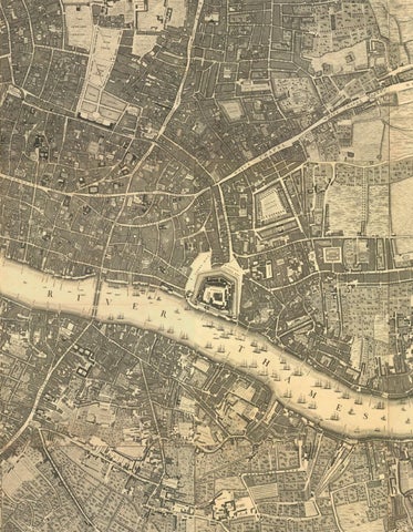
Cities, like people, are full of contradictions. They promise order but grow through chaos. They are built on careful plans, yet shaped by imagination and memory. Cities, like dreams, a collaboration between Daniel Crouch Rare Books and Michael Hoppen Gallery for TEFAF Maastricht 2026, explores how cities have been pictured and understood across three centuries - how they have been drawn from above and experienced from within.
The exhibition brings two very different ways of seeing together. Monumental eighteenth-century town plans - made at a time when faith in reason and measurement was at its height - are shown next to Sohei Nishino’s large-scale photographic dioramas, dreamlike reconstructions of the same cities created from thousands of individual photographs. These pairings reveal what the city has always been: both a system and an emotion, something that can be mapped and yet never truly contained.
The eighteenth century was a time of extraordinary energy and optimism. Across Europe and beyond, rulers, engineers, and artists believed that if the world could be mapped, it could be understood. City plans were feats of science as much as artdesigned to show a perfect, ordered world.
The plans selected for this exhibition are among the most ambitious and beautiful ever made. John Rocque’s Plan of the Cities of London and Westminster (1746) spread London across twenty-four engraved sheets, capturing every alley and garden. It made the city look stable, almost serene, at a moment when it was exploding in size and population.
Louis Bretez and Michel-Étienne Turgot’s Plan de Paris (1739) presented Paris as a harmonious whole. Shown from an imagined bird’s-eye view, the city seems to open like a painting rather than a map, every roof and courtyard drawn with care.
In Bernard Ratzer’s Plan of New York (1767), we find a new world city still in formation - its grid beginning to take shape, a symbol of both order and ambition. Suharaya Mohe’s map of Edo (Tokyo), made around the same time, shows a different kind of order: a web of streets spiralling from the shogun’s castle, structured less by geometry than by hierarchy and belief.
Ludovico Ughi’s plan of Venice (1729) transforms a famously irregular city into a precise network of canals and piazzas; Daniel Stalpaert’s Platte-Grondt van de Oude en Nieuwe Royinge der Stat Amsterdam (1720) captures the concentric grace of a city built upon water and commerce. Samuel von Schmettau’s

Kupferkarte von Berlin (1748) reveals a Prussian capital newly claiming its modern identity – a place of exact lines and military confidence. From the spiritual to the colonial, Louis-Alexandre de Breteuil’s plan of Rio de Janeiro (1769) celebrates Enlightenment ideals carried across oceans: the ordered framework through which Europe sought to understand distant worlds.
Taken together, these plans form an atlas of dreams. They represent the city as it was imagined by rulers and thinkers of the Enlightenment - rational, balanced, and knowable. But they are also records of a hope that could never quite be fulfilled. For beneath every straight street and perfect square runs another city: the unpredictable, breathing one of memory, noise, and change.
Sohei Nishino and the city remembered
More than two centuries later, Japanese artist Sohei Nishino undertakes a parallel act of vision, but from the opposite direction. His celebrated Diorama Map series, begun in 2004, also seeks to map the city - yet instead of surveying it from above, Nishino builds it from below.
He begins with walking. For weeks or months, he moves through a city – London, Paris, New York, Tokyo, Venice, Amsterdam, Berlin, Jerusalem, Rome, or Rio – photographing tirelessly, capturing details both grand and ordinary. He notices faces, reflections, signs, and patterns that most maps omit. Back in his studio, he prints thousands of small photographs, cuts them out by hand, and assembles them into vast collages. The result is a city that is both real and imagined: part document, part memory, part dream.
From a distance, the finished diorama resembles a map. Streets twist in familiar directions; landmarks rise recognisably above the rest. But up close, order dissolves into countless fragments, each taken from a different time and angle. The image becomes alive with overlapping perspectives – what Calvino called “desires and fears”. Nishino’s artwork is not about accuracy. It is about what it feels like to live in a city, to move through it and to remember it afterwards.
His vast dioramic map of Venice, exhibited here for the first time, ripples like water; his Tokyo expands without centre or edge, echoing the city’s constant reinvention. Paris glows with the rhythm of bridges and boulevards; New York rises in layers of energy and light. In Berlin, shards of history overlap like fragments of glass. Jerusalem glimmers with tension and devotion; Rio bursts into movement, a rhythm of mountains and sea. For Nishino, each city is a self-portrait of humanity—an emotional geometry shaped by the footsteps of millions.

Placing these eighteenth-century town plans next to Nishino’s contemporary dioramas opens a conversation across time. Both kinds of work are acts of faith: the mapmaker’s faith that the city can be measured and the artist’s faith that it can be remembered. Both rely on repetition, patience, and extraordinary craft. Both transform the raw material of the city, its streets, buildings, and patterns, into a work of art. Yet they speak in different languages. The Enlightenment planner stands above the city, looking down with confidence in the clarity of reason. Nishino moves through its crowds, guided instead by intuition and feeling. One builds through straight lines, the other through fragments. Where the eighteenth- century map reduces complexity to order, Nishino expands order into complexity. What unites them is the dream of understanding. Every map is a story about human desire: the desire to know, to control, to connect, and to belong. The cartographers of the eighteenth century sought to impose meaning on the uncertain world of the city. Nishino reveals that meaning instead arises from experience – the thousands of small encounters that shape how we remember a place.
In this sense, the two traditions complete one another. The rational city and the emotional city are two sides of the same imagination. Together, they reveal that the real city lives somewhere in between: half stone, half memory; half measure, half mystery.
Showing Cities, like dreams at TEFAF Maastricht, the world’s leading art and antiques fair, is especially fitting. For a few days each year, TEFAF itself becomes its own kind of city: a maze of galleries and passageways, of rare objects and new encounters. Within this temporary city, Daniel Crouch Rare Books and Michael Hoppen Gallery create a space where history and the present meet –where the tools of Enlightenment reason and the languages of contemporary art are seen as part of the same continuous story.
Daniel Crouch Rare Books, specialists in maps, atlases, and early cartography, bring together the masterpieces of a world once defined through measurement and mastery. Michael Hoppen Gallery, known internationally for championing photography as fine art, presents Nishino’s intricate, handmade dioramas as a new form of mapping – one that transforms geography into emotion.

Together, they invite visitors to walk slowly, to look carefully, and to imagine. The exhibition offers not only a view of the city across time, but a meditation on how we all chart our own livesthrough maps of memory, feeling, and ambition.
In Invisible Cities, Italo Calvino writes that every city is built from both desire and fear – that its rules may be “absurd” and its perspectives “deceitful”. Yet it is within this confusion that the poetry of the city lies. Cities, like dreams, asks us to see that maps and dreams are not opposites but companions: both are ways of giving form to human life.
The engravers of the eighteenth century drew the outlines of their hopes with compass and ink; Sohei Nishino builds his with camera, scissors, and memory. Both transform experience into image and reveal that no plan, no matter how precise, can ever capture the city’s living heart.
In the end, every city is both a plan and a dream, and every visitor, whether walking through London or TEFAF, is part of its unfolding map.

by Lucy Fleming-Brown
Little of the earth remains unmapped today. The known world has expanded, engulfing the former domains of dragons and extinguishing the credibility of flat earthers’ claims. Photography has played an important role in establishing this apprehension, with satellite imagery comprehensively capturing the surface of the globe, and camera-wielding travellers setting out to explore destinations lauded for their inaccessible exclusivity. With such a weight of geographical authority available in the twenty-first century, the role of experience and imagination in shaping the construction of maps can feel as if it has been succeeded by the sheer volume of photographic evidence. It is in this context, in which our curiosity about the world has been redirected away from the unknown and towards making sense of overwhelming tides of visual data, that Sohei Nishino’s practice of map-making has emerged.
Since the invention of photography in the nineteenth century, the camera’s ability to record its surroundings and provide evidence for experiences of place have rendered this modern medium a tempting corollary to map-making. Photography has been invoked to lend an ‘objective’ perspective to landscapes previously construed according to the agendas of explorers, civil engineers, prospectors, and any number of other individuals with designs upon the land and a desire to share their vision. Originally used to corroborate firsthand accounts of terrain as a complement to analogue diagrams, contemporary initiatives like Google Earth have assimilated photographic data as the raw material from which new maps are generated. Whether superimposed onto digital landscapes to create a mirage of anonymous impartiality or strategically deployed in support of visualised arguments, such approaches have continued to cast photography in an auxiliary role.
For the photographic products of geographical exploration to be treated as more than a means to an end, artists have approached the question of representing space from a different angle. Instead of ignoring the question of perspective that inevitably abstracts or limits the scope of what a map can illustrate, they have risen to the challenge by using technology creatively to overcome traditional difficulties. Maps conceived from an imagined aerial vantage point present a perspective that fails to convey the depth of our terrestrial encounters in three dimensions. However, attempting to illustrate a more organic outlook rarely yields more than partial insight into a place, since the varied topographies discounted from a birds-eye view pose frustrations to our gaze from the ground. Capturing a more balanced understanding is not a simple question for lens-


based instruments, which spring from a biological grasp of optics rather than a reckoning with the wider mechanisms of perception and memory.
With a practice that blends photography, cartography and fine art, Sohei Nishino (b 1982) has developed a perspective which reflects the complexity of our layered experiences of space. His Diorama series presents monumental collages constructed from thousands of individual photographs. Often staying many months at a time, Nishino walks the length and breadth of cities, navigating neighbourhoods and using his camera to explore the vantage points afforded by the unique interplay of geography and architecture. Upon returning to his studio, Nishino then resurrects the city out of these photographic fragments from memory, stitching together by hand an account of his journey articulated in countless instantaneous encounters, print by print. In this way, the city is revealed in its social aspect - through its inhabitants, their encounters - in precisely the dimension that satellite maps blur out in their quest for impartiality. Nishino’s maps do not shy away from the reality of match-day hordes or cargo yaks, recognizing their contributions to the tapestry of his experience, to create a definitive rather than exhaustive apprehension of these places.
A focus on the intensely personal, embodied process by which Nishino goes about this work might imply that the Dioramas offer a private vision of cities. However, his maps have received a warm reception from both local audiences (who recognise something that resonates with their own sense of belonging) and viewers presented with distant landscapes (for whom Nishino’s depiction lends insight into unknown places). The sensation of familiarity that springs from recognizing a shared quality of perception in Nishino’s collages is rooted in their reconciliation of multiple perspectives. His maps bring together the vast infrastructural and geographical schemas that guide our passage through modern cities, overlaid with a mosaic of personal interactions through which a highly detailed social fabric is revealed. Our contemporary understanding of cities is complex, based on accumulated overlays of diagrams and vistas, from arterial highways to subway networks, via bus routes, canalways, and flight paths. By exploring urban space through these varied routes and synthesizing the records according to his memory, Nishino’s Dioramas come to possess the seamless quality of a single journey belied by their dramatic swings in vantage.
The quest to uncover a perspective through photography that offers an alternative to the blind spots afforded by traditional cartography has been ongoing since the nineteenth century. In 1858 the French photographer Nadar (Gaspard-Félix Tournachon)

shot the first aerial photographs by taking his camera up in a hot air balloon. Nadar’s pictures revealed Paris as it had never been seen before, fascinating Parisians with a previously unreachable vision of their city that was at once familiar and freshly expansive. Nishino has translated this experience of fulfilled curiosity for an age in which views from airplane windows have become commonplace. From Amsterdam to Rio de Janeiro, his Dioramas inspire a moment of thrilling recognition, as well-known facades coalesce into cityscapes, without losing the height and depth that give neighbourhoods their sense of tangible belonging.
Nishino achieves these overviews through imagination, envisioning his individual photographs as features within complex portraits of cities, rather than making use of even the primitive technological means pioneered by Nadar. His materials, and the methods by which he gathers them, are familiar from long-standing traditions of street photography. Popular throughout the twentieth century and well-suited to the dynamic 35 mm analogue film format that Nishino continues to use, street photography embraces the role of chance encounter introduced by working in public spaces. Seizing upon instances that catch his eye in the streets, whether permanent characteristics in the form of buildings and natural features, or fleeting appearances made by living things, Nishino’s work is animated by his keen eye for these elements’ interaction. Shibuya’s scramble crossing and Jerusalem’s Western Wall have attained iconic status, instantly recognizable from travel guides and film sets, but they are rendered in the Diorama series as sites of human engagement. Landmarks are acknowledged alongside places of more local significance, as Nishino witnesses with compelling sensitivity the specific meanings and codes of associated behaviour that have taken root.
Perhaps more so than anywhere else on earth, Venice’s fish- shaped profile is better known internationally than the reality of life that occurs within its streets and canals. As Venice grew prosperous on the proceeds of trade during the Renaissance, the island captured the imagination of generations of mapmakers, whose diagrams have refined the island’s singularly visual legend. When Nishino embarked on reassembling Venice in his studio from photographs shot during his long visit to the city, he kept several of these historic maps, such as those by Jacopo de’ Barbari, Ughi, and Furlanetto, at the margins of his composition. As evidenced by his recurring fascination with Tokyo, which he has recorded at 10 year intervals since 2004, Nishino’s portrait of Venice reflects his belief in cities as living entities. Whether positioning himself within a centuries-old tradition of map-making

or in his dedication to recording new iterations of familiar places, Nishino is conscious of cities existing in a state of perpetual flux, shifting into new forms between each depiction and shaped by the people for whom it is home.
No matter how many times we return, the sum of places and people that give rise to our impression of a city can never be fully contained within a single image. Instead of aspiring towards an abstract totality, Nishino’s compositions convey something elusive about how we experience and make sense of complex urban constellations. Captured in momentary experiences and assembled according to memory, Nishino’s practice represents the city as a narrative rather than a geography. The diversity of vantage points from which places are disclosed to us each day are brought together in organic formation by Nishino, with his photographs revealing the different ways of seeing we bring to bear upon our environments. At once intimate and far- reaching, epic and granular, the lure of Nishino’s maps is the same as that of cities themselves. It lies in their promise of inexhaustible illegibility, the impossibility of ever having the last word or taking the last picture.


Platte-Grondt van de Oude en Nieuwe Royinge der Stat Amsterdam. Amsterdam, Johannes Covens and Cornelis Mortier, 1662 [but c1730]
Large engraved wall map on six sheets joined, mounted on linen, edged in green silk, light wear to old folds
123 x 161.5 cm


Diorama Map Amsterdam, 2014
Lightjet print on Kodak Endura paper
Edition of 15
120 x 136 cm
Edition of 5
180 x 205 cm


Johann David
Die Königl. Residenz Berlin. Berlin, 1773
Engraved map, dissected and mounted on linen
81.2 x 89.5 cm

Sohei Nishino
Diorama Map Berlin, 2012
Lightjet print on Fuji Crystal Archive paper
Edition of 15 97 x 119 cm
Edition of 5 177 x 218 cm

Jerusalem. ?[Cambridge, Field, 1660]
Engraved view with one inset plan, on four sheets
44 x 203 cm


Diorama Map Jerusalem, 2012-2013
Light Jet Print on Kodak Endura Paper
Edition of 15
100 x 117 cm
Edition of 5
180 x 210 cm


A Plan of the Cities of London and Westminster and Borough of Southwark, with the contiguous Buildings. From an Actual Survey taken by John Rocque, Land Surveyor and engraved by John Pine. London, John Pine and John Tinney, 1746
Engraved plan on 24 sheets
210 by 400 cm

8
Sohei Nishino
Diorama Map London, 2010
Lightjet print on Kodak Endura paper
Edition of 15
80 x 143 cm
Edition of 5
128 x 230 cm


Plan of the City of New York, in North America surveyed in the Years 1766 & 1767. London, 1776
Large engraved map, on 3 sheets joined, dissected and mounted on linen
122.5 x 90.5 cm


Diorama Map New York, 2006
Lightjet print on Fuji Crystal Archive paper
Edition of 15
103 x 80 cm
Edition of 5
172 x 133 cm


[BRETEZ, Louis] and [TURGOT, Michel-Etienne]
[Plan de Paris]. Paris, 1739
Large engraved wall map, on 20 sheets
236 x 240 cm


Diorama Map Paris, 2008
Lightjet print on Fuji Crystal Archive paper
Edition of 15
120 x 136 cm
Edition of 5
135 x 156 cm


BRETEUIL, Louis Charles Auguste le Tonnelier, baron de
Vüe de Rio de Janeiro [together with] Plan de la Baye de Rio Janeiro et de ses Deffense, 1757. [1757]
Manuscript plan of the bay of Rio de Janeiro in pen and ink with wash, signed “Breteuil fecit” [together with] a pen and ink prospect of Rio de Janeiro, both dissected and mounted on canvas
View: 29 x 79 cm; Plan: 53.5 x 73.5 cm


Diorama Map Rio de Janeiro, 2011
Lightjet print on Fuji Crystal Archive paper
Edition of 15
114 x 98 cm
Edition of 5
175 x 150 cm


Large folding woodblock map, with stencilled colour
163.5 x 196.5 cm

Sohei Nishino
Diorama Map Tokyo, 2014
Lightjet print on Kodak Endura paper
Edition of 15
120 x 160 cm
Edition of 5
181 x 242 cm

Iconografica Rappresentazione della Inclita Città di Venezia Consacrata al Reggio Serenissimo Domino Veneto. Venice, Giuseppe Baroni á S. Giuliano, 1729
Large engraved wall map on eight sheets, title to banner at top, 16 views of Venice to left and right borders, text below
149.7 x 205.5 cm


Nishino
Diorama Map Venice, 2026
Archival pigment print on Hahnemuhle silk baryta paper
Edition of 15 + 2 APs
100 x 219.4 cm
Edition of 5 + 2 APs
140 x 307 cm

[Pair of nine-inch table globes]. Amsterdam, 1602 [but c1621]
Terrestrial and celestial globes, each with 12 hand-coloured engraved gores heightened in gold
23 cm (diameter)


Cyanotype handmade Japanese paper
83 x 135 cm


Cyanotype handmade Japanese paper
83 x 135 cm


In making his Diorama maps, Sohei Nishino combines photography, collage, cartography and psychogeography to create large prints of urban landscapes. Drawing inspiration from the 18th century Japanese mapmaker, Inō Tadataka, his prints re-imagine the cities he has visited. To build his Diorama maps, Nishino walks a city’s streets for an average of three months, exploring many vantage points and gathering hundreds of rolls of exposed film. He then painstakingly prints the photographs by hand and compiles them to form the tableaux he will use as the basis for his limited edition photographs.
The overall effect is not a traditional bird’s-eye view but an enlightened way of seeing three dimensions in one plane. Although geographical accuracy is important in this process, scales are altered and locations occasionally repeated, mimicking our own fluid memories of place and time. From a distance the maps are almost abstract, it is not until we examine them in detail that the full diorama unfolds - the theatre of one man’s city played out in miniature.
“I just let myself rely on the experience of walking - it’s the accidental, coincidental elements that make it interesting. Then once I’m home I continue the journey of discovery in the darkroom.”
Nishino’s enduring fascination with map-making has taken a new direction in his most recent projects, which bring his cartographic vision to bear upon places which have traditionally defied definition on paper. His signature photo-collage technique pieces together thousands of images taken over the course of his travels, to construct dioramas of complex geographies which integrate human and physical landscapes. Moving beyond his earlier work in urban environments, over the past few years Nishino has travelled to Mount Everest, and to the sea which runs between northern Japan and eastern Russia among other landscapes, taking on some of the world’s most challenging environments.
“I walk through these cities, camera in hand, capturing multifacetted views that I then combine, one by one, in accordance with my memories, arranging them into a map that portrays all the singular aspects of the place. The result is quite different from the denotative expression of a map; it uses photographs (single 35mm frames) of concrete objects or shapes as units to recreate a geographical representation, expressing the city through human memories and images. This means that the finished work is anything but an accurate
map, it is simply the town as seen through the eyes of a single individual, a trace of the way in which I walked through it, an embodiment of my awareness, a microcosm of the life and energy that comprise the city.”
Sohei Nishino was born in Hyogo, Japan in 1982. He graduated from Osaka University of the Arts in 2004, when he began working on his Diorama Map series. Since then he has exhibited his work internationally and gleaned numerous awards including ‘President Award’, Osaka University of Arts (2004), ‘Young Eye Japanese Photographer Association Award’ (2005), the ‘Canon Excellence Award’ (2005) and the ‘TARO Award’ (2020).
Nishino was the subject of a solo exhibition at the San Francisco Museum of Modern Art in 2016. His work is held in permanent collections including the Jean Pigozzi Collection, the Louis Vuitton Foundation, Museum of Fine Arts in Houston, the Saatchi gallery, MAST Foundation and the Tokyo Metropolitan Museum of Phototgraphy.
Exhibitions history:
2007
Dialogue with a city (Yokohama, Bank Art, Japan)
2008
Sohei Nishino Exhibition (EMON PHOTO GALLERY, Tokyo)
2009
Canon New Cosmos of Photography 2009 Part II TAMA VIVANT 2009 (Japan)
2010
EMON SELECTION Vol.1 Sohei Nishino Exhibition
DAEGU PHOTO BIENNALE 2010 (Korea)
2011
Wandering The Diorama Map Sohei Nishino, Solo Exhibition (Michael Hoppen Gallery, London)
2012
Contemporary Japanese Photography vol.10 OUT OF FOCUS: PHOTOGRAPHY (Saatchi gallery, London)
Diorama Map Festival Images Vevey (Switzerland)
2013
fotográfica bogotá 2013 (Colonbia)
A Different Kind of Order: The ICP Triennial (ICP, NY)
ART ARCH HIROSHIMA 2013 (Hiroshima Museum, Japan)
Sohei Nishino “Diorama Maps” Foam Magazine Talent Exhibition
2013 Of Walking (Museum of Contemporary Photography, Chicago)
2014
KYOTOGRAPHY festival (Kyoto, Japan)
unseen photo fair CITIES (Amsterdam)
NEW DIORAMAS, solo show (Michael Hoppen Gallery, London)
2015
Photo London CITIES
Tokyo International Photography Festival (Tokyo)
Action Drawing, Solo show (IMA Gallery, Tokyo)
Sohei Nishino CITIES (Polka Gallery, Paris)
2016
Festival la Gacilly Photo (France)
New Work Sohei Nishino solo show (San Francisco MOMA, USA)
Bricollage (Bryce Wolkowitz gallery, NY)
2017
Prix Pictet Space touring exhibition
2018
MAST foundation for Photography grant 2018 on industry and work: group exhibition (MAST Foundation, Italy, Bologna)
New planet Photo city: group exhibition (21-21 design sight, Tokyo)
New Cartographies: Group exhibition (Asia Society Texas Center, Huston, U.S)
2019
TOP END3: Group exhibition (Hokkaido, Japan)
Shape of Water, solo show (rin art association, Takasaki, Japan)
2020
Sohei Nishino New Works (Michael Hoppen Gallery)
TOKAIDO, solo show (Mitsukoshi contemporary gallery, Tokyo, Japan)
2021
24th Taro Awards (Taro Okamoto Museum of Art, Japan)
Getxophoto Festival (Basque Country, Spain)
Guangzhou Image Triennial (Guangzhou Museum of Art,China)
Revela’T 2021 (Barcelona,Spain)
constellation#02 (rin art association, Gunma, Japan)
TOKAIDO Solo show (MITSUKOSHI CONTEMPORARY GALLERY, Tokyo, Japan)
New Horizon Sohei Nishino x Hiraku Suzuki (Each Modern, Taiwan)
世界を歩き地球を変換する Sohei Nishino x GOTO AKI
Gallery Forest, Tokyo Japan
12 October - 20 November 2021
2022
Tracing lines Solo show (Canon Gallery S ,Tokyo Japan)
WALK! group show (Schirn Kunsthalle Frankfurt)
同じ波は二度来ない Solo Show
THE NORTH FACE STANDARD KYOTO Japan
Tokyo ART & PHOTOGRAPHY Group show
Ashmolean Museum Oxford, England
線を編む Knitting lines Solo Show
Amagasaki Culture Center Amagasaki, Japan
2023
潜在景色 Latent Scenery group show アーツ前橋 前橋 日本
Arts Maebashi Maebashi, Japan
Walk With Me Solo show
Kanazu Forest of Creation Fukui, Japan
TYPE VI Sohei Nishino
ISSEY MIYAKE A-POC ABLE x Sohei Nishino collaboration
T3 PHOTO FESTIVAL TOKYO
態度が<写真>になるならば
If attitudes become “Photographies”
The View of Hanui
Drift Collective
Asia Culture Center Gwangju, South Korea
CLIFF EDGE PROJECT
Art Festival , IZU , Japan
2024
Elective affinities part 2 group show Agnes b gallery Tokyo Japan
PHOTO CITY/ How Images Shape the Urban World: Victoria & Albert Museum Dundee, Scotland
WONDER Mt.FUJI - Tokyo Metropolitan Museum Tokyo, Japan
2025
Theater of the Times Taipei Fine Arts Museum
Step After Step - group show (KIMBALL ART CENTER California,USA)
Selected collections:
Jean Pigozzi Collection, Switzerland
Kiran Nadar Museum of Art, New Delhi, India
Louis Vuitton Collection, France
MAST Foundation, Italy
Museum of Fine Arts in Houston, USA
San Francisco Museum of Modern Art, USA
Statoil Collection, Norway
The David Rumsey Map Collection, USA
The Fisher Collection, USA
Tokyo Metropolitan Museum of Photography, Japan
V&A Dundee, Scotland


For more inforamtion about the maps:
