

Closure for the Neill family, as Joseph’s body is found
STAFF REPORT
The body of missing North Bend man, Joseph Neill has been discovered in Haynes Inlet in Coos County, according to the Coos Couth Sheriff’s Office (CCSO).
North Coos Dispatch received a call at approximately 9:25 a.m. Jan. 5, from the Clausen Oysters farm off North Bay Road of a possible deceased person found in Haynes Inlet.
The deceased person was reportedly found to be on the southern beach area of Haynes Inlet, east of the bridge of Highway 101, which is near the intersection of North Bay Road, in North Bend.
“CCSO deputies quickly responded, meeting with the reporting party and discovered the safest access to the scene would require a boat,” a CCSO Facebook post states. “With the help of the Clausen Oysters staff, they provided the deputies with transportation to the scene utilizing one of their boats. Upon completion of the body recovery, the Coos County Chief Deputy Medical Examiner was requested to respond. After further investigation, the decedent was identified as Joseph C. Neill.” Neill had been missing since Dec. 15, when his personal items had been located on the railroad bridge which spans the Coos Bay at Jordan Point, approximately
1.5 miles west of where Neill was located. A photographer and survivalist, Neill was out taking pictures of the king tides when he suspectedly fell. King tides can be particularly dangerous, especially during winter months when the water is frigid and an increase in sediment can make clothing heavier, let alone the increased strength of the current.
The JoeStrong Facebook page, set up for bringing Neill home was replete with messages of love and support throughout the search. That support has continued, with the post

Port update: bolstering anti-discrimination policy and community outreach on
BY NATE SCHWARTZ Editor
At the most recent meeting of the Port of Coos Bay Commissioners it was standing room only, and public comment took up nearly the entirety of the first hour of the meeting. A number of locals, many of whom attended a community concern meeting in Empire (which The World covered last month) stepped up to voice their issues with the project. Though that is why the room was as full as it was, there was another concern among some attendees involving recent reports exposing that a long-time contractor with the Port was allegedly involved in White Nationalist groups.
Contractor Trouble
The meeting opened with Port Commission President Kyle Stevens speaking about bolstering the Port’s anti-discrimination policies and changing the leasing practices around purchases of publicly funded property.
“There have been media reports recently, and I just want to make it very clear and on the record that there is no place for discrimination in our community. We remain committed to ensuring that any and all employees and contractors uphold the same commitment as part of our public mission… We’ve taken concrete steps and are continuing to take

concrete steps to ensure fair inclusive and respectful work environment,” said Stevens.
Those steps include introducing the Port’s first Title VI non-discrimination policy, which includes a through complaint and investigation policy. It also meant halting any contracts or lease transfers until further updates could be drafted around those procedures.
This action came as a response to an open letter to the Port, signed by local organizations like IBEW Local 932, the Sierra Club, and South Coast Health
to
The Charleston-based hydraulic repair servicer is a contractor with the Port of Coos Bay and City of North Bend, among others, to the tune of over $300,000 dollars in public contracts. This sale and lease continuation would put Whit Industries in control of millions of dollars of publicly funded infrastructure.
In the Fall, reports surfaced online about Whit Industries owner, Michael ‘Whit’
on the messaging app Telegram. This was paired with photos of an easily identifiable company work truck at Neo-Nazi events.
Captured audio showed compelling evidence alleging
Sunset Bay floods, Cape Arago and Shore Acres closed
BY NATE SCHWARTZ Editor
Storms after New Years led to flooding at Sunset Bay State Park on Friday, January 3rd. Damage to the Cape Arago Highway has led to a closure to vehicle traffic heading toward Cape Arago and Shore Acres state parks, after a landslide undercut the highway making it too dangerous to be driven on.
“The water was up to ankle level at 7:30 am when we came on. By about 10 o’clock we were starting to get to knee level,” said Lee Ricci, Park Manager at Sunset Bay, “Immediately in the morning we began evacuating the campground.”
Flooding caused evacuation at the Sunset Bay campground around 8 a.m. on the 3rd, where 19 campsites had to be vacated. A preliminary timeline had Sunset Bay’s campground closed until January 9th. Further assessment of infrastructural damage is needed.
16


The statewide maps of wildfire hazard zones and the wildland-urban interface are complete and final versions are now available on the Oregon Explorer website. Notifications are being mailed to impacted property owners and should be expected to arrive over the next several days.
The wildfire hazard map’s purposes are to:
• Educate
•
million property tax lots into one of three wildfire hazard zones: low, moderate or high. It also identifies whether a tax lot is within boundaries of the wildlandurban interface. Properties that are in both a high hazard zone and within the wildland-urban interface will be prioritized for future wildfire risk mitigation resources and actions.
To help protect these communities, future defensible space and homehardening building codes may apply to properties with both designations, according to a release from the Oregon Department of Forestry.
All properties with both designations are receiving a certified mail packet informing them of the designations, outlining their appeal rights and explaining the appeal process, and explaining what the designation might mean for them and their property.


Equity Coalition, urging the Port to reconsider the sale of Giddings Boatworks
Whit Industries.
Gantenbein. These reports alleged ties to White Nationalist groups and presented captured audio and screenshots of the local White Lives Matter (a hate group according to the Southern Poverty Law Center) branch’s activities
Opinion
A
Country Media Newspaper
172 Anderson Ave., Coos Bay, OR 97420
WorldEditor@CountryMedia.net eWorldLink.com/opinion
Opinions expressed on this page are the writer’s alone and do not represent the opinion of the newspaper or its parent company, Country Media, Inc.
Girl Scouts Tree of Joy Girl Scouts of Oregon and Southwest Washington Service Unit 62 would like to thank those community members who generously gave to our 41th annual Tree of Joy at Pony Village Mall. We would like to acknowledge the Pony Village Mall Management, Maintenance, Custodial and Security, Gloria Dei Lutheran Church, Holy Redeemer Catholic Church, Donations from the Over the Hill Gang, Vintage Haulers, Pacific Coast Corvette Club, Southcoast Cruisers, and Midcoast Mustang
To make a submission to the

BY J. MARK POWELL InsideSources.com
If any woman was ever born to be the first lady of the United States, it was Kate. Glitteringly beautiful and dazzlingly charming, she was an engaging hostess whose table and conversation sparkled. She once rivaled a president’s wife as queen bee of Washington and came close to living in the White House herself, only to crash and burn in a humiliating scandal.
This is her sad, forgotten story.
Katherine Jane Chase was born in Cincinnati on a muggy Thursday in August 1840. Her father, New Hampshire-born Salmon Chase, was an ambitious Buckeye lawyer who had trouble keeping a wife. They kept dying. He lost the first soon after childbirth. Wife No. 2, Kate’s mom, died after delivering her. The final wife died of consumption. As so often happens, mother and stepdaughter didn’t get along. So, Kate was hustled off to a New York finishing school where she mastered the social graces while her father served in the U.S. Senate. She knew that when she eventually returned to Ohio, her father would need
Club, Sally Peterson for all her knitted hats, SOCC and all the other groups and families who make the Tree of Joy a special part of their holiday tradition. Through your giving we served over 1150 through the agencies that work with children, seniors, and others in need in Coos and Western Douglas Counties. It is a community of people like you that make the Tree of Joy such a success every year. Thanks again Girl Scout Service Unit 62 Debbie, Sara, and Lexy Tree of Joy elves.
Sara Miller Coos Bay
Lean on your local library
BY JENNY BROWNFIELD Deputy Director of Coos Bay Public Library Guest column
Libraries serve a greater function today than at any point in our past. Once only a place where you could check out a book and get help with research needs, modern libraries have become community centers. While you can certainly still check out a book and get help from a librarian, today’s libraries also provide wireless internet connections, computers, community rooms, programs of all types, and much more.
Like other libraries around the world, the Coos Bay Public Library strives to be more than just a place for books (although we really do love books). We are also a community hub. People reserve our free meeting rooms for everything from HOA meetings to job interviews. They come to sit in a comfortable chair and read a book in a quiet, welcoming atmosphere, catch up on some homework or work on a jigsaw puzzle with friends. Community members bring their children to the library on cold or rainy days to play with Legos and train sets in the children’s area. Some people just come in for a welcoming smile and a bit of conversation with librarians and other community members. We are more than books; we are the family room for the community of Coos Bay.
The library is also an information center. Some of this information comes from the wonderful

books that fill our shelves, but it also comes from the professional librarians and their skilled use of research techniques. As the saying goes, Google will give you 10,000 answers but your librarian will give you the correct one. Additionally, the library provides 45 different online resources free to the public. This includes educational search engines such as Gale, Khan Academy, and EBSCO Learning Express, search engines for job hunting like Learning Express Job and Career Accelerator and GotResume Builder, and a host of other search engines that will help you learn a language, search through your family history, or manage your stock portfolio. And if you don’t have a computer or the internet, we’ve got you covered with free wireless internet and plenty of computers for public use.
The library is an activity center. One look at the library calendar (coosbaylibrary.org/events) will show you just how many types
of programs the library offers. There are book clubs for adults and teens as well as story times for babies, toddlers, and preschoolers. Looking for fun for the whole family? Check out our monthly family game times, Lego building sessions and art classes for all ages. Want to be more active? We have free weekly yoga classes, a monthly hiking group, and individual programs like dance lessons, Zumba, and more. If you just want to learn something new there are language groups (ASL and Spanglish), cooking classes in person and online, and workshops given by experts from around the country and right here in Coos County. With over 50 programs a month there is something for everyone at the library and it’s all free. So, the next time you are looking for something to do consider your local library. Stop by and take a look at the many ways the library can help you and, maybe, pick up a book or two.
HOLY COW! H RY: They were crazy about Kate
her accomplished flair.
Kate was a true Daddy’s Girl. She worshipped him. And the timing of her homecoming was especially fortunate since Chase was now both the newly-elected governor of Ohio and a widower again.
As her father’s hostess, she did more than throw elegant dinner parties. The teenager was a natural politician and mature beyond her years.
She captivated A-List guests such as future president James Garfield and Massachusetts Sen. Charles Sumner, a Boston Brahmin who wasn’t easily impressed. One visitor wrote, “She had something imperial in the pose of her head, and all her movements expressed an exquisite natural charm.”
Kate was also her father’s confidant and closest adviser. In a time when women couldn’t vote, much less hold office, Kate focused her substantial talents on the dream she and her father shared: winning the presidency.
Chase sought the nascent Republican Party’s presidential nomination in 1860, losing to Abraham Lincoln. Though he was re-elected to the Senate that fall, the president-elect had other plans for him. Chase became Lincoln’s secretary of the treasury, and Kate was his secret social
weapon.
The beautiful young woman took Washington by storm, setting her on a collision course with first lady Mary Todd Lincoln. Washington quickly fell into rival camps: those who preferred Mrs. Lincoln’s Blue Room salon or the Chase’s 6th and E Street Northwest parlor.
The women were rivals in another arena as well. Both were angling for the same prize — the presidency in 1864.
Washington was filled with dashing young military men as the Civil War began. The beautiful Kate was the city’s prize catch. A Who’s Who of bachelors vied for her affection.
She eventually gave her hand to William Sprague, the fabulously wealthy 32-year-old “Boy Governor” of Rhode Island who’d just been elevated to the Senate. He gave her a tiara of matching diamonds and pearls (valued at $1.25 million today) as a gift for their November 1863 wedding. When she entered the room for the reception,
the U.S. Marine Band played the “Kate Chase March” composed for the occasion. Abraham Lincoln was on hand. Mary Lincoln was not.
With Lincoln’s popularity dropping as the war’s casualties rose and with Sprague’s millions now secured, Chase seemed destined to reach the presidency at last. Then everything fell apart.
It turned out Sprague was an alcoholic. A scandal involving him dealing in contraband cotton from the Confederacy (which was desperately needed by his family’s lucrative textile mills) erupted. The war turned in the North’s favor in time to save Lincoln’s re-election prospects.
Topping it all off, the Supreme Court’s chief justice died, creating the perfect opening for Lincoln to dispatch his rival Chase once again. When Chase put on the justice’s robe, his presidential dreams ended.
As Sprague’s drinking worsened, the couple drifted apart. Both spouses had multiple affairs. (It was so bad Washington
whispered about the true paternity of their second child.)
The bottom fell out in 1873 when Kate’s adored father died, and a severe economic depression crippled Sprague’s businesses. In 1879, Kate was caught in an affair with New York Sen. Roscoe Conkling. (Sprague is thought to have run Conkling out of their Newport mansion with a shotgun.)
When the Spragues divorced in 1882, Kate returned to her maiden name. Their three daughters lived with her while their only son went with the dad (and committed suicide a few years later).
Losing what was left of her fortune, Kate peddled chickens and eggs door to door, relying on purchases from old friends to stay financially afloat, a recluse who looked years older than her age. She refused to allow herself to be photographed in her fallen condition.
When kidney disease finally claimed her at age 58 in 1899, The New York
NEWS DEPARTMENT

Times wrote, “She was the most brilliant woman of her day. None outshone her.” Yet, the Cincinnati Enquirer reported after her funeral, “Hardly more than two or three — and they her nearest relatives on earth — were gathered around her gave.”
ABOUT THE WRITER
J. Mark Powell is a novelist, former TV journalist and diehard history buff. Have a historical mystery that needs solving? A forgotten moment worth remembering? Please send it to HolyCow@ insidesources.com.
172 Anderson Avenue, Coos Bay P.O. Box 1840, Coos Bay, OR 97420 541-266-6047 • ©2024 Country Media, Inc.
Chief Executive/Operations — Joe Warren jwarren@countrymedia.net News Editor — Nate Schwartz worldeditor@countrymedia.net
reporter2@countrymedia.net
worldsports@countrymedia.net

fiber internet to your
DFN.net or call 541-673-4242

J. Mark Powell
announcing
“It’s a hefty packet of information that property owners will receive by certified mail,” Wildfire Hazard Map Lay Representative Tim Holschbach said.
“However, we want to ensure Oregonians get all the relevant information they need on their wildfire hazard exposure.”
Anyone that does not receive a packet but is still interested in learning about the wildfire hazard where they live can visit the Oregon Explorer website.
A Property Owner’s Report is available for every Oregon tax lot and includes information about hazards and resources.
The road to completed maps has been a long one. After the initial wildfire map was released and rescinded in summer of 2022, ODF and OSU spent more than two years receiving and analyzing feedback to improve the product available today, including a recent public comment period.
Draft versions of the statewide wildfire hazard and wildland-urban interface maps were available to the public for review and comment from July 18 to August 18. ODF received nearly 2,000 comments from the public during the 30-day comment period.
After reviewing the
comments on the draft maps, ODF identified one key theme that had not been previously addressed in prior adjustments to the map: neighbor-to-neighbor variation in hazard zones. In response, researchers took a closer look at those variations and their causes.
OSU evaluated scientific methods to reduce neighbor-to-neighbor variations in hazard zone designations that were still in accordance with legislative rules directing development of the map.
This final adjustment is in addition to other revisions that have been made to the map over the last two years in response to feedback from elected officials, county governments and the public. Other updates to the map since 2022 include: Adjustments for hay and pasturelands.
• Adjustments for northwest Oregon forest fuels.
• Adjustments for certain irrigated agricultural fields.
• Corrections for verified anomalies identified by county planners.
“It’s important that the map is as objective and understandable as possible,” ODF Deputy Director of Fire Operations Kyle Williams said. “It took additional time to ensure community protection measures like


home hardening and defensible space are prioritized in communities of highest wildfire hazard. It’s been time well spent, and we’re pleased with the diligence ODF staff and OSU researchers put into addressing input from all sources.”
In addition to feedback that resulted in changes to the map, there were two main themes of public input that will not be addressed by map adjustments: insurance and existing defensible space
and fire hardening improvements, the release states.
Oregon Senate Bill 82 prohibits insurers in Oregon from using this map, or any statewide map, for making decisions on whether to extend coverage or determine rates.
Oregon’s Division of Financial Regulation has investigated concerns and confirmed that even prior to passage of Senate Bill
82, no insurance company in Oregon has or will use these maps for insurance purposes. Additionally, some property owners shared a belief that their hazard rating should be lower due to implementation of defensible space strategies. By law, the map’s hazard assessments are based on weather, climate, topography and vegetation on a broader environmental
scale than just an individual property. If a property owner has implemented appropriate defensible space already, there is likely nothing that a designation of high hazard and being within the wildland-urban interface will require of them when future code requirements are adopted. Find more information on ODF’s wildfire hazard web page.
Looking for the right fit?







Company: Country Media, Inc. Location: Coos County, Oregon
Compensation: We offer a competitive salary plus commission, along with a comprehensive benefits package that includes medical, paid vacation and sick leave, holiday pay, mileage, and phone, among other benefits.
About the Role: Join Coos County’s multi-media company as an Advertising Sales Representative. In this role, you’ll identify, qualify, and sell digital and print advertising to businesses. You’ll grow an established client list and attract new advertisers for The World newspaper and its associated publications, digital products, and events.
Responsibilities:
• Sell digital advertising solutions, social media products, newspaper ads, magazine ads, and event sponsorships.
• Offer the best marketing and advertising products to meet clients’ needs.
• Receive regular
•
but not required.
• Bilingual
• Bring your high
and goal orientation to contribute to the
most
SPORTS Pirates open league play with wins
Gunther
John
For the World
Marshfield’s boys basketball team won both its games to open Sky-Em League play last week, and added a nonleague win at Coquille on Saturday.
The Pirates opened league play with a 65-46 win at home against Junction City and then topped rival North Bend 67-39 at the Pirate Palace.
Marshfield pounded host Coquille 65-18 on Saturday to improve to 11-2 on the season, one loss a one-point setback to Crook County and the other a defeat to Class 5A Redmond in the final of the Marshfield holiday tournament.
Marshfield, ranked sixth in the Class 4A coaches poll, is at Cottage Grove on Tuesday and Marist Catholic on Friday, part of four straight road games in league play. The Marist Catholic contest is a big test with the Spartans third in the coaches poll.
In addition to losing to Marshfield, North Bend’s boys also lost their league opener to Marist Catholic 58-44 last week.
This week, the Bulldogs will look for their first league win when they are at Junction City on Tuesday, their lone contest of the week. They are at Cottage Grove next Tuesday and Marist Catholic next Friday before playing four straight at home.
RED DEVILS WIN ONE:
In addition to Saturday’s game against Marshfield, Coquille also beat Brookings-Harbor on
the road 34-28 and lost at home to Gold Beach 36-35 last week.
The Red Devils enter Far West League play this week with a home game against Douglas on Friday.
SKYLINE LEAGUE:
Powers lost both its games to open the league season, falling at Glendale 62-54 and 47-32 at home against Days Creek.
The Cruisers, who also lost a nonleague game to Gold Beach 56-49, are on the road for both league games this week at Riddle on Thursday and Camas Valley on Saturday.
Pacific also came up short in its games, falling to Elkton 53-35 and at North Douglas 60-26.
The Pirates have a nonleague game at Gold Beach on Wednesday and host Yoncalla on Friday before visiting Milo Adventist Academy on Saturday.
SUNSET CONFERENCE:
Bandon tuned up for the league season with a pair of close losses at home against visiting teams from Linn County.
Central Linn topped the Tigers 39-36 on Friday and East Linn Christian beat Bandon 45-38 a day later. Bandon is adjusting to missing a key starter to an injury.
The Tigers open league play at Illinois Valley on Tuesday and are home against Oakland on Friday.
Myrtle Point lost a trio of games in its final preseason tuneups, falling at Waldport 51-45 and at home to East Linn Christian 67-30 and Central Linn 51-34.
The Bobcats, on an eightgame losing streak, open league play at home against Gold Beach on Tuesday and visit Reedsport on Friday.
Reedsport enters league play on a five-game win streak, including a 57-33 win over Glendale and a 42-24 win at Waldport last week.
The Brave, who have won seven out of eight, are at Oakland on Tuesday in addition to hosting Myrtle Point on Friday.
GIRLS
BULLDOGS TOP
PIRATES: North Bend edged host Marshfield 5147 last Friday as both teams wrapped up the first week of Sky-Em League play at 1-1.
North Bend also lost to Marist Catholic 53-33 in its league opener, a defeat that snapped a seven-game winning streak.
Marshfield won its league opener, beating Junction City 47-51 and avenging a loss to the Tigers in Marshfield’s holiday tournament in the process.
North Bend’s lone league game is at Junction City on Tuesday this week. Marshfield is at Cottage Grove on Tuesday and Marist Catholic on Friday.
RED DEVILS TOP
MARSHFIELD: Coquille beat visiting Marshfield 43-33 on Saturday to improve to 11-1 on the season, the lone loss to Philomath, which tops the Class 4A coaches poll.
Coquille also won at Brookings-Harbor 52-16 last week.
The Red Devils, ranked second in the Class 3A coaches poll, open Far West League
play at home against Douglas on Friday.
SUNSET CONFERENCE:
Bandon split a pair of nonleague games at home against former league rivals, falling to Central Linn 46-33 and beating East Linn Christian 36-32.
The Tigers, who also lost at North Douglas 51-34, open league play at Illinois Valley on Tuesday and host Oakland on Friday.
Myrtle Point lost to both East Linn Christian (46-34) and Central Linn (38-26) and also had a road win at Waldport (41-40) last week.
The Bobcats open league play with a home game against Gold Beach on Tuesday and visit Reedsport on Friday. Reedsport fell to Glendale 62-43 and to Waldport 53-25 last week. The Brave are at Oakland on Tuesday before hosting Myrtle Point on Friday.
SKYLINE LEAGUE:
Powers opened league play with a 67-30 win over Glendale last week and also beat Days Creek 55-17.
The Cruisers, who also beat Gold Beach 59-27 last week, are at Riddle on Thursday and Camas Valley on Saturday. Pacific also won its league opener, beat Elkton 40-32 before falling to North Douglas 59-31.
The Pirates have a nonleague game at Gold Beach on Wednesday before hosting Yoncalla for their lone league game of the week on Friday (Milo Adventist does not have a girls team playing a Skyline League schedule).
Chemeketa edges SWOCC men in overtime
The Southwestern Oregon Community College men’s basketball team suffered its first NWAC South Region loss in rough fashion Saturday when host Chemeketa edged the Lakers Quinton Christman gave the Lakers a 73-72 lead with 58 seconds to go in overtime, but SWOCC didn’t score again as the Storm pulled off the victory.
SWOCC forced the overtime when Colby Whicker made a 3-pointer to knot the score at 66 with 14 seconds to go. Whicker led the Lakers with 17 points, while Logan Deal had 11 points and nine rebounds and Jett Lundberg scored 10. Both Christman and Luke Fotheringham
Wild spring
had nine points in the loss. Cooper Gobel had 20 points off the bench to lead Chemeketa.
SWOCC suffered just its third loss of the year. Both the Lakers and Chemeketa are 1-1 in league play and already every team has at least one loss — Umpqua, Lane, Portland and Linn-Benton all were 2-1 (the Lakers had their first-half bye in the league schedule during the week).
WOMEN Chemeketa outscored the Lakers 26-6 in the third quarter to pull away for a 79-51 win Saturday. SWOCC took a 29-28 lead into halftime but struggled in the third quarter.
Kali Hibbert and Bree Turner had 14 points each for the Lakers and Raegan Bruner added 10. Turner had 11 rebounds and Kaydence Apkaw nine. Annie Bafford had 18 points to lead the Storm. Chemeketa is 1-1 in region play and SWOCC is 0-2 heading into its region home opener Wednesday against Umpqua. The Lakers also host Portland on Saturday. In the NWAC schedule, the Wednesday games start at 5:30 p.m. for the women, followed by the men. On Saturdays, the women start at 2 p.m., with the men about 4 p.m.
Chinook harvest prohibited on mainstem Umpqua River, reduced on North Umpqua
A temporary rule prohibits wild spring Chinook salmon harvest on the mainstem Umpqua River and reduces the North Umpqua bag limit, ODFW announced today.
Feb. 1 – June 30, 2025:
Only hatchery spring Chinook may be kept on the mainstem Umpqua River. Harvesting wild spring Chinook (jacks and adults) is prohibited.
Just one adult wild spring
Chinook per day, 10 per year, may be kept on the North Umpqua River. Anglers may still retain hatchery spring Chinook. This temporary rule is meant to help protect populations returning to the South and North Umpqua rivers as biologists forecast low returns of adult wild spring Chinook this year. South Umpqua adult wild spring Chinook were low in 2024 with just 111 wild
fish, while runs in the North Umpqua were also well below average. This combination of low returns in 2024 and a low forecast in 2025 is triggering the restriction of wild spring Chinook harvest according to the sliding scale in the CMP, ODFW’s Coastal Multi-Species Conservation and Management Plan.
ODFW continues to work with our partners (U.S. Forest Service, Bureau of Land Man-
agement, Cow Creek Band of Umpqua Tribe of Indians, and NOAA Fisheries) to share information and address habitat and passage issues for spring Chinook in the upper South Umpqua River. The CMP was adopted in 2014 by the Oregon Fish and Wildlife Commission. It was developed with help from stakeholder teams within the Umpqua Basin along the Oregon coast.
Report your hunt with MyODFW app
Who needs to report
Every hunter who purchased a deer, elk, cougar, bear, pronghorn or turkey tag needs to report. Complete a survey for the tag you purchased — even if you didn’t hunt or weren’t successful.
Information from hunters who did not hunt or did not harvest an animal is as important as from those who did take an animal.
SportsPac buyers do not need to report on tags that were never issued to them.
A $25 penalty will be assessed for any hunter who fails to report deer and elk tags by the reporting deadline. The penalty is paid with the purchase of a hunting license two years hence. Only a single penalty is assessed, regardless of the number of tags you did
not report. Winner of 2010 incentive tag with 4-pt buck Ways to report Go online or report thru the MyODFW app – it’s the fastest and easiest way to report. You will need to verify / look up your account on the MyODFW.com licensing page. (Click on the Buy a License button.) to report your hunts. Once you have completed steps to verify your account, choose “Submit a Hunting and Fishing Outcome Report” or “Outcome Reporting / Mandatory Reporting” to complete your report. Go to an ODFW license agent. They now can take your hunt report. Visit on ODFW office.
Information you need to report Hunter/Angler ID number
(located on ODFW licenses, tags and applications). If you do not have your tag or license anymore, call 503-947-6101 for your Hunter/Angler ID#. This number stays the same year after year so you can also use an old license or tag.
The two-digit Wildlife Management Unit (WMU) number of the Unit you hunted in most of the time if the hunt area included more than 1 WMU. See the Big Game Hunting Areas page or the Oregon Big Game Regulations.
The total number of days hunted—including mentoring youth—and the number of days hunted in the WMU hunted most.
Penalties for not reporting
The $25 penalty was put in place by the Fish and Wildlife Commission in October 2012
John Gunther For the World
because although reporting has been “mandatory” since 2007, just 41 percent of tags were reported by the deadline in 2011. At this low rate, the data provided was not statistically sound. After the penalty was announced, reporting rates went from about 40 percent to an average of 80-85 percent for deer and elk tags. Incentives to report on time All hunters who report on time are entered to win a special big game tag with hunting privileges similar to auction and raffle tags. ODFW draws three winners each year. Winners can choose to hunt deer, elk or pronghorn in an expanded hunt area and for an extended season. The drawing takes place in June and winners are notified in June.
Marshfield’s wrestling team beat North Bend 56-19 in their annual dual last week.
The match included just eight contested matches — five won by the Pirates.
Trayton Forbes pinned North Bend’s Jaden McAllister at 126 pounds and Reese Hite pinned Demitrius Mavola of the Bulldogs at 132. Aryan Wright pinned North Bend’s Robert Champlin at 190.
The Pirates’ other two contested wins were major decisions by Wylie Robinson over O’rian Garcia at 144 and Skylar Folau over Kaleb Delph at 285.
North Bend got a pin by Jackson Swanson over Fox Wheatly at 150, a major decision by Connor Perez over Charlie Morton at 120 and a decision by John Willett over Aaron Sinnott at 157.
Marshfield won five other matches by forfeit and the Bulldogs picked up one win by forfeit.
The girls dual between Marshfield and North Bend included just five contested matches and Marshfield won 42-18, aided by four forfeit victories.
Marshfield got pins by Am.ina Palacios over Aubree Hodke at 115 pounds, Annhelena Vancannon over Jaelynn Cain-Torrez at 125 and Lana Wright over Alana Wirebaugh at 145.
North Bend’s Kaylianna Mazzucchi pinned Olivia Shield at 155 and Rowan Hampton pinned Azura Beckett at 170.
Marshfield will be at the Oregon Wrestling Classic in Redmond this coming weekend and North Bend will be at the Nick Lutz Invitational at Siuslaw High School.
Marshfield wrestlers top North Bend Yates earns All-America honors
Coquille graduate Gunner Yates received first-team All-American honors from a pair of national organizations.
Yates, who led Southern Oregon University to an 8-3 record, was named a firstteam All-American for NAIA by the National Football Coaches Association and also named an NAIA firstteam performer by the Walter Camp Football Foundation. The latter service has been issuing All-America teams for 135 years, but this was the first time the group named an NAIA All-American squad. Yates, a redshirt sophomore, also was the Frontier Conference Offensive Player of the Year.
He led all of NAIA with 1,488 yards rushing in 11 games and was second for rushing yards per game (135.3), rushing touchdowns (27) and total touchdowns (29). He rushed for at least 100 yards seven different times and had at least two touchdowns in all but one of the Raiders’ contests.
He was the first SOU player to be a first-team All-American on offense in seven years.
Yates was the first underclassman for SOU to earn first-team All-American honors since his father, Griff, earned the same honor in 1997. The last Raider running back to make the first team was Dusty McGrorty 21 years ago.
that Gantenbein was a de facto leader and organizing member of the group. This included audio of ‘Whit’ admitting to being a local business owner living on a specific street in Coos Bay, and using his company to hire and bring more white supremacists to the area in an attempt to install them in public positions. Public record shows that Gantenbein indeed owns property on that street.
“He wants to have us, you know, get established and create a community out there,” said Cruz Walters, co-leader of the local White Lives Matter branch, on an audio recording, “And win high positions of occupations, of government. Whether its mayor or city council, or all of the above.”
While this initial reporting came from antifascism activists online, further publications have picked up the story. In a statement given to The Oregonian, Gantenbein denied the claims, calling it a “smear campaign” and insisting he is not a racist.
Outstanding contracts still exist with the Port, and due to the nature of the accusations, it is not as cut-and-dry for the Port as simply dropping their involvement with Whit Industries. Therefore, there is the perceived need to strengthen antidiscrimination policies and leasing practices, and make sure contractors are upholding them. As stated by Stevens in an interview with The World: “I strongly oppose all forms racism, discrimination, any form of prejudice. We are deeply troubled by the allegations made against our vendor. It is important to note, that no one at the port was aware
of any such activities. Consequently, we will not be engaging in any future business dealings with any entity that violates our strict policies.”
The City of North Bend has their own Title VI policies, as stated in Resolution No. 3287, which includes a necessary affidavit that contractors must sign, to that end City Administrator David Milliron wrote this statement when asked if Whit Industries was in violation of their resolution, among insisting that the City is committed to ensuring high standards of ethical conduct:
“At this time, we are aware of the allegations made against Whit Industries and Mr. Michael Gantenbein. However, the City does not act on allegations alone. To date, there has been no independent, third-party investigation to substantiate these claims. The City will await the outcome of such an investigation, if pursued, before determining whether the posted evidence constitutes a violation of Resolution No. 3287.”
The Port of Umpqua, who contracted with Whit Industries on a smaller scale, has stated that they are taking their business elsewhere.
Public Feedback on Intermodal Port Project
While a couple of comments surrounded the contractor situation, most attendees were there to echo concerns over the Pacific Coast Intermodal Port project. During the meeting, the representatives from JLA, a firm contracted to do a public feedback survey, gave a presentation of their findings after extensive contact with stakeholders in the community.
That presentation contained a number of the grievances made by citizens in the aforementioned


meeting at the Dolphin Playhouse in Empire, points that were reiterated during public comment.
“While we are hired by the Port, we provide independent recommendations as informed by community input. The documents provided to the Port Commission at their latest meeting were given in their raw form and not influenced by the project team in any way,” stated Franziska Elliot, JLA program manager.
“As public engagement professionals, our role is to facilitate a transparent, inclusive, and meaningful process that ensures community members, stakeholders, and Tribal governments have the


opportunity to share their perspectives and have a voice in shaping project development.”
To that end, JLA’s presentation showed that stakeholders identified both opportunities that the project could bring, as well as concerns that it has raised.
On the positive side, they pointed to things like economic growth, infrastructure development, and community and workforce development.
On the opposite side, they outlined environmental risks, infrastructure and safety concerns, and a desire for greater transparency and trust.
To help with transparency, the presentation recommended ways that the Port could engage better with the community through focus groups, presentations to local organizations,
town halls, and a Project Advisory Group made up of community members.
Citizens hope that the Port will take these suggestions and be open and communicative during the design and scoping process.
“Our objective is to ensure that public input meaningfully informs project decisions as the PCIP advances through design, development, and the environmental review process under NEPA,” stated Elliott, “Ultimately, we believe the true value of public engagement lies in building trust and fostering collaboration with the community. Our hope is that community members can feel good about the process, regardless of the outcome.”
Some citizens, however, don’t feel like there is enough of an apparatus to affect actual change, and that the project already has
too much momentum to be influenced meaningfully, let alone stopped.
“What’s clear is that they keep talking about the project moving forward,” said Christine Moffitt, a concerned citizen and member of the League of Women Voters. “There’s no decision tree here that’s saying that the concerns are being addressed. They are moving, the train is moving… What I heard today is consultants that are working to check the box. There’s no offramp.
“What we want is the truth of what the development will do… Tell us what’s been done so far, whom have you worked with, what are the design frames… What we need here is a team of independent people to review the plans and materials. Asking a PR firm to do this, that’s not the right question.”
NW NATURAL FILES GENERAL RATE CASE IN OREGON
NW Natural filed a general rate increase with the Public Utility Commission of Oregon (OPUC) on December 30, 2024. The request is for an overall net revenue increase of about 5.8%, or an additional $59.4 million. The proposed increase will cover costs associated with operating and maintaining the company’s natural gas distribution system and continuing to provide safe and reliable service to customers.
HOW MUCH WILL MY GAS BILL CHANGE?
If the current request is approved as filed, residential customers using an average of 54 therms per month would see a monthly bill increase of about $5.55.
WHEN WOULD IT TAKE EFFECT?
The filing will not affect customer bills this winter, but if approved by the OPUC will likely take effect Nov. 1, 2025. Note: While NW Natural is providing general information about our proposal and its effect on customers, the calculations and statements are not binding on the Commission.
WHY IS THE COMPANY MAKING THIS REQUEST?





Attract tourists to your business through this glossy magazine distributed along the Oregon Coast.

The request is a necessary step in NW Natural’s regulatory process to recover costs associated with investments that strengthen and reinforce the natural gas system, provide necessary system maintenance and operational resiliency, and update and modernize technology. The requested rate change is subject to review by the OPUC and is not binding on the Commission.
HOW CAN I GET MORE INFORMATION ABOUT THIS FILING?
Copies of the filing are available for inspection at NW Natural’s main office and at nwnatural.com. For more information about the filing, or notice of the time and place of any hearing, contact NW Natural or the Commission at:
NW Natural
250 SW Taylor St. Portland, OR 97204
800-422-4012
Public Utility Commission of Oregon
201 High Street SE, Suite 100
Post Office Box 1088
Salem, Oregon 97308-1088
800-522-2404
Salem: 503-378-6600
Call LeafGuard and say goodbye to gutter cleaning for good. No cleaning. No leaking. No water damage. No more ladder accidents. Get LeafGuard today and be protected for life. FREE estimate. Financing available. 20% off total purchase (Restrictions may apply.) Call 1-844-3451537. (OCAN)
DIRECTV OVER INTERNET
Get your favorite live TV, sports and local channels. 99% signal reliability! CHOICE Package, $84.99/mo for 12 months.
HBO Max and Premium Channels included for 3 months (w/CHOICE Package or higher.) No annual contract, no hidden fees! Some restrictions apply. Call IVS 1-855-6022009. (OCAN)
Get a break on your taxes! Donate your car, truck, or SUV to assist the blind and visually impaired. Arrange a swift, no-cost vehicle pickup and secure a generous tax credit for 2025. Call Heritage for the Blind Today at 1-844-533-9173 today! (OCAN)
Get Boost Infinite! Unlimited Talk, Text and Data For Just $25/mo! The Power Of 3 5G Networks, One Low Price! Call Today and Get The Latest iPhone Every Year On Us! 844-955-3417. (OCAN)
Get DISH Satellite TV + Internet! Free Install, Free HD-DVR Upgrade, 80,000 On-Demand Movies, Plus Limited Time Up To $600 In Gift Cards. Call Today! 1-866-3739175. (OCAN)
Is 2024 your year? We’re here for it and here for you. Reach your goals this year with WeightWatchers. Get started with THREE months FREE, visit www. weightwatchersoffer. com/39. (OCAN)
Jacuzzi Bath Remodel can install a new, custom bath or shower in as little as one day. For a limited time, waiving ALL installation costs! (Additional terms apply. Subject to change and vary by dealer. (Offer ends 12/29/24.) Call 1-855-3415268. (OCAN)
Portable Oxygen Concentrator May Be Covered by Medicare! Reclaim independence and mobility with the compact design and long-lasting battery of Inogen One. Free information kit! Call 855-839-0752. (OCAN)
Prepare for power outages today with a Generac Home Standby Generator. Act now to receive a FREE 5-Year warranty with qualifying purchase. Call 1-877-557-1912 today to schedule a free quote. It’s not just a generator. It’s a power move. (OCAN)
Safe Step. North America’s #1 Walk-In Tub. Comprehensive lifetime warranty. Top-of-the-line installation and service. Now featuring our FREE shower package and $1600 Off for a limited time! Call today! Financing available. Call Safe Step 1-833-395-1433. (OCAN)
Stroke and Cardiovascular disease are leading causes of death, according to the American Heart Association. Screenings can provide peace of mind or early detection! Contact Life Line Screening to schedule your screening. Special offer - 5 screenings for just $149. Call 1-844655-0972.(OCAN)
Switch and save up to $250/year on your talk, text and data. No contract and no hidden fees. Unlimited talk and text with flexible data plans. Premium nationwide coverage.
100% U.S. based customer service. For more information, call 1-877-9160803. (OCAN)
DIVORCE $130. Complete preparation. Includes children, custody, support, property and bills division. No court appearances. Divorced in 1-5 weeks possible. 503-772-5295. www. paralegalalternatives. com legalalt@msn.com. (OCAN)
Donate your car, truck, boat, RV and more to support our veterans! Schedule a FAST, FREE vehicle pickup and receive a top tax deduction! Call Veteran Car Donations at 1-866-695-9265 today! (OCAN)
Eliminate gutter cleaning forever! LeafFilter, the most advanced debrisblocking gutter protection. Schedule a FREE LeafFilter estimate today. 20% off Entire Purchase. Plus 10% Senior & Military Discounts. Call 1-855-5368838. (OCAN)
The bathroom of your dreams in as little as 1 day. Limited Time Offer $1000 off or No Payments and No Interest for 18 months for customers who qualify. BCI Bath & Shower. Many options available. Quality materials & professional installation. Senior & Military Discounts Available. Call Today! 1-844-847-9778. (OCAN)
The Generac PWRcell, a solar plus battery storage system. SAVE money, reduce your reliance on the grid, prepare for power outages and power your home.
Full installation services available. $0 Down Financing Option. Request a FREE, no obligation, quote today. Call 1-844989-2328. (OCAN)
We buy 8,000 cars a week. Sell your old, busted or junk car with no hoops, haggles or headaches. Sell your car to Peddle. Easy three step process. Instant offer. Free pickup. Fast payment. Call 1-855980-4382.(OCAN)
Wesley Financial Group, LLC. Timeshare Cancellation Experts. Over $50,000,000 in timeshare debt and fees canceled in 2019. Get free informational package and learn how to get rid of your timeshare! Free consultations. Over 450 positive reviews. Call 844-487-0221. (OCAN)
When you want the best, you want Omaha Steaks! 100% guaranteed and delivered to your door! Our Butcher’s Deluxe Package makes a great gift and comes with 8 FREE Burgers ONLY $99.99. Call 1-844-763-2348 and mention code 77318CZJ or visit www.omahasteaks. com/Deluxe9670.(OCAN)
Announcements 311
Brokaw Tile Floors, Kitchen & Bath (541) 366-9523
Cage/Kennel Liner? Fire Starter?
The World has bundles of newspaper 2 for $1! 172 Anderson Avenue, Coos Bay

MARY'S PET SITTING! Your place or mine. 20+ years' experience, including medical. Insured. 541-297-0073. mls_3@yahoo.com
We Buy Houses for Cash AS IS! No repairs. No fuss. Any condition. Easy three step process: Call, get cash offer and get paid. Get your fair cash offer today by calling Liz Buys Houses: 1-866-249-8679.(OCAN)
Pick-Ups 612
02 F150 Ford Pick-up for $2500, 5 speed, new brakes, tires, fuel pump and clutch. Call Jim 541-817-9404
Pets 736
ANIMAL CREMATORY
The Bay Area’s only pet crematory with COOS BAY CHAPEL 541-267-3131 coosbayareafunerals.com
Misc for Rent 880
Two commercial office spaces for lease. Approximately 928 and 500 square feet. Located at 780 2nd Street, S.E., Bandon, Oregon 97411. Lease terms negotiable. Please call for viewing. 541-260-4210
Real Estate/Trade 900
WANTED REAL ESTATE DEAD OR ALIVE

I'm rounding up new property listings and I've got buyers for the good, the bad and the ugly. Whether it's a palace or a fixer, prime timber lands or a stump farm, or a view of the bay or the barn....the only thing needed to sell your property is a competent and experienced Realtor.
JOE WARD, BROKER
JOE WARD PROPERTIES
38 years licensed in Oregon 541-912-0934 983 Central Ave., Coos Bay
Legal Notices 999
IN THE CIRCUIT COURT OF THE STATE OF OREGON FOR THE COUNTY OF COOS
In the Matter of the Estate of MYRON ALDEN KRAGNES, Deceased.
Case No. 24PB11307
NOTICE TO INTERESTED PERSONS
NOTICE IS HEREBY GIVEN that Roger Kragnes has been appointed as Personal Representative of the above estate. All persons having claims against the estate are required to present them, with vouchers attached, to the personal representative, c/o Daniel M. Hinrichs, Attorney at Law, 590 Commercial, Coos Bay, OR 97420, within four months after the date of publication of this notice, or the claims may be barred.
All persons whose rights may be affected by the proceedings may obtain additional information from the records of the courtProbate Department, 250 N. Baxter, Coquille, OR 97423, the personal representative, or the attorney for the personal representative, Daniel M. Hinrichs, Attorney at Law, 590 Commercial, Coos Bay, Oregon 97420.
Dated and published: January 14, 2025 1/14/2025, World, 406943
FOR THE COUNTY OF COOS
In the Matter of the Estate of: BETTY LOU PRUITT, Deceased. Case No. 24PB11072 INFORMATION TO INTERESTED PERSONS NOTICE IS HEREBY GIVEN that JANICE MOULDER has been appointed personal representative. All persons having claims against the estate of BETTY LOU PRUITT are required to present them, with vouchers attached, to the personal representative at 129 W 16th Ave., Spokane, WA 99203, or through her attorney, Nathan B. McClintock, at PO Box 1178, Coos Bay, OR 97420, or in person at 936 Central Avenue, Coos Bay, Oregon, within four months after the date of first publication of this notice, or the claims may be barred. All persons whose rights may be affected by the proceedings may obtain additional information from the records of the Court, the personal representative, or the lawyer for the personal representative, Nathan B. McClintock.
Dated and first published on January 14, 2025. Nathan B. McClintock, OSB #841520
Attorney for Personal Representative
Personal Representative: Janice Moulder 129 W 16th Ave. Spokane, WA 99203 Phone: (509) 220-5706 Email: janmoulder@gmail.com
Lawyer for Personal Representative: Nathan McClintock PO Box 1178 Coos Bay, OR 97420
Phone: (541) 269-1123
Fax: (541) 269-1126 Email: nmcclintock@epuerto.com
1/14, 1/21, 1/38, & 2/4/2025, World 406903
NOTICE OF SHERIFF’S SALE
On FEBRUARY 3RD, 2025, at the hour of 10:00am at the front door of the Coos County Sheriff’s Office, 250 N. Baxter St; Coquille, the defendant’s interest will be sold, subject to redemption, in the real property commonly known as: 92718 Cape Arago Hwy, Coos Bay, OR 97420. The court case number is 24CV28993, where Banner Bank is plaintiff, and Estate of Devin Jeffrey Hanson, the Devin Hanson Trust under Agreement dated November 2, 2015, Teresa Lynn Hanson, David F. Hanson, Coos County Tax Assessor, All Other Unknown Heirs or Persons Claiming an Interest in the Property, and Occupants and Parties in Possession is defendant. The sale is a public auction to the highest bidder for cash or cashier’s check, in hand, made out to Coos County Sheriff’s Office. For more information on this sale go to: http://oregonsheriffssales. org/ 12/31/2024, 1/7, 1/14, & 1/21/2025, World 406258
In the Matter of the Proposed Annexation of Certain Territory into the Lakeside Rural Fire Protection District NOTICE OF PUBLIC HEARING
You are hereby notified that the Coos County Board of Commissioners will hold a public hearing in the large conference room at the Owens Building at 201 N. Adams St. Coquille, Oregon at 10:00 a.m. on January 30ih, 2025 on the matter of the proposed annexation of certain territory to the Lakeside Rural Fire Protection District. The Board of Commissioners will, at that time, hear the petition for annexation which is proposed to provide rural fire protection services to the territory proposed to be annexed. This proceeding is being conducted pursuant to the provisions of ORS 198.857, and in response to a petition offered for filing by Link and Jennifer Phillippi, on August 30th, 2024, and filed by the Clerk on September 1 7fh, 2024. All interested persons may appear and be heard. Date: 1/16/25 /s/ Rod Taylor, Chair, Board of Commissioners 1/14/2025, World, 406942
TRUSTEE’S NOTICE OF SALE
The Trustee under the terms of the Trust Deed described herein, at the direction of the Beneficiary, hereby elects to sell the property described in the Trust Deed to satisfy the obligations secured thereby. Pursuant to ORS 86.771, the following information is provided:
1. PARTIES: Grantor: LOYD J. LEMMER AND VALARIE J. AUGUSTINE Trustee: TICOR TITLE COMPANY Successor Trustee: NANCY K. CARY Beneficiary: OREGON HOUSING AND COMMUNITY SERVICES DEPARTMENT, STATE OF OREGON, ASSIGNEE OF UMPQUA BANK
2. DESCRIPTION OF PROPERTY: The real property is described as follows: Lot 1, Block 1, Rainbow Gardens to Lakeside, Coos County, Oregon 3. RECORDING. The Trust Deed was recorded as follows: Date Recorded: December 26, 2007 Recording No. 2007-16001
Official Records of Coos County, Oregon
4. DEFAULT. The Grantor or any other person obligated on the Trust Deed and Promissory Note secured thereby is in default and the Beneficiary seeks to foreclose the Trust Deed for failure to pay:
Monthly payments in the amount of $840.29 each, due the first of each month, for the months of February 2024 through October 2024; plus late charges and advances; plus any unpaid real property taxes or liens, plus interest.
5. AMOUNT DUE. The amount due on the Note which is secured by the Trust Deed referred to herein is: Principal balance in the amount of $104,178.01; plus interest at the rate of 5.6250% per annum from January 1, 2024; plus late charges of $257.44; plus advances and foreclosure attorney fees and costs.
6. SALE OF PROPERTY. The Trustee hereby states that the property will be sold to satisfy the obligations secured by the Trust Deed. A Trustee’s Notice of Default and Election to Sell Under Terms of Trust Deed has been recorded in the Official Records of Coos County, Oregon.
7. TIME OF SALE.
Date: March 20, 2025
Time: 11:00 a.m. Place: Coos County Courthouse, Front Entrance, 250 N. Baxter, Coquille, Oregon 97423
8. RIGHT TO REINSTATE.
Any person named in ORS 86.778 has the right, at any time that is not later than five days before the Trustee conducts the sale, to have this foreclosure dismissed and the Trust Deed reinstated by payment to the Beneficiary of the entire amount then due, other than such portion of the principal as would not then be due had no default occurred, by curing any other default that is capable of being cured by tendering the performance required under the obligation or Trust Deed and by paying all costs and expenses actually
incurred in enforcing the obligation and Trust Deed, together with the trustee’s and attorney’s fees not exceeding the amount provided in ORS 86.778.
NOTICE REGARDING
POTENTIAL HAZARDS
(This notice is required for notices of sale sent on or after January 1, 2015.) Without limiting the trustee’s disclaimer of representations or warranties, Oregon law requires the trustee to state in this notice that some residential property sold at a trustee’s sale may have been used in manufacturing methamphetamines, the chemical components of which are known to be toxic. Prospective purchasers of residential property should be aware of this potential danger before deciding to place a bid for this property at the trustee’s sale.
You may reach the Oregon State Bar’s Lawyer Referral Service at 503-684-3763 or toll-free in Oregon at 800452-7636 or you may visit its website at: www.osbar. org. Legal assistance may be available if you have a low income and meet federal poverty guidelines. For more information and a directory of legal aid programs, go to http://www. oregonlawhelp.org. Any questions regarding this matter should be directed to Lisa Summers, Paralegal, (541) 686-0344 (TS #30057.30877).
DATED: October 22, 2024. Nancy K. Cary, Successor Trustee, Hershner Hunter, LLP, P.O. Box 1475, Eugene, OR 97440. 1/14, 1/21, 1/28, & 2/4/2025, World 406904
AUCTION NOTICE The following storage units located at Circle H Storage Facility at 1190 Newmark Ave Coos Bay, OR 97420, will be auctioned off on Friday January 17, 2025, at 10:00 am. Terms: Cash Only
TENANT: UNIT: Terry Rutherford #17 Jay
AUCTION NOTICE
TRUSTEE’S NOTICE OF SALE OF COMMERCIAL
LOAN T.S. No.: OR-241002380-BB Reference is made to that certain deed made by, CLAUSEN OYSTERS, LLC, AN OREGON LIMITED LIABILITY COMPANY as Grantor to TICOR TITLE COMPANY OF OREGON, as trustee, in favor of NPI DEBT FUND I, LP, as Beneficiary, dated 10/11/2023, recorded 10/13/2023, in official records of COOS County, Oregon as fee/file/ instrument/microfilm/ reception number 202307181 and subsequently assigned or transferred by operation of law to NPI DEBT FUND II, LP covering the following described real property situated in said County, and State. APN: 186101 24S1335-A0-00100
182300 24S1325-00-01100
PARCEL 1 ALL OF THE TIDELANDS FRONTING AND ABUTTING GOVERNMENT LOTS 1, 2, AND 3 IN SECTION 25 OF TOWNSHIP 24
SOUTH, RANGE 13 WEST OF THE WILLAMETTE MERIDIAN, COOS COUNTY, OREGON. PARCEL 2 BEGINNING AT THE MEANDER CORNER
BETWEEN SECTIONS 35 AND 36, TOWNSHIP 24 SOUTH, RANGE 13 WEST OF THE WILLAMETTE MERIDIAN, COOS COUNTY, OREGON; THENCE ALONG THE MEANDER LINE SOUTH 78° 00’ WEST 528.00 FEET; THENCE ALONG THE MEANDER LINE SOUTH 81° 00’ WEST 300 FEET, MORE OR LESS, TO THE NORTHEAST CORNER OF A PARCEL OF LAND SOLD TO STATE OF OREGON BY DEED RECORDED IN BOOK 121, PAGE 205, DEED RECORDS OF COOS COUNTY, OREGON; THENCE SOUTH 5° 05 1/2’ WEST
ALONG SAID TRACT OF LAND SOLD TO THE STATE OF OREGON, 190.30 FEET, MORE OR LESS, TO THE NORTH BOUNDARY OF THE STATE HIGHWAY AND 30 FEET FROM THE CENTER LINE OF SAID HIGHWAY AT ENGINEER’S STATION 96+ 40; THENCE NORTHEASTERLY ALONG THE NORTHERLY BOUNDARY AND 30 FEET FROM THE CENTER LINE OF SAID HIGHWAY 930 FEET, MORE OR LESS, TO A POINT ON THE SECTION LINE BETWEEN SAID SECTIONS 35 AND 36 AND NORTH OF ENGINEER’S STATION 105+70.5; THENCE NORTH 50.0 FEET ALONG THE SECTION LINE TO THE MEANDER CORNER AND BEGINNING. ALSO: A PORTION OF TIDELANDS FRONTING GOVERNMENT LOT 4 OF SECTION 35, TOWNSHIP 24 SOUTH, RANGE 13 WEST OF THE WILLAMETTE MERIDIAN, COOS COUNTY, OREGON DESCRIBED AS FOLLOWS: BEGINNING AT THE MEANDER CORNER ON LINE BETWEEN SECTIONS 35 AND 36 OF SAID TOWNSHIP AND RANGE; THENCE NORTH 47° 30’ WEST 495 FEET TO THE LOW WATER LINE OF HAYNES SLOUGH; THENCE SOUTH 50° 00’ WEST 520 FEET ALONG THE SAID LOW WATER LINE TO A POINT THAT IS 160 FEET NORTH 5° 05 1/2’ EAST FROM THE NORTHWEST CORNER OF TAX LOT 4-1; THENCE SOUTH 5° 05 1/2’ WEST 160 FEET TO THE SAID HIGH WATER LINE AT THE NORTHWEST CORNER OF TAX LOT
4-1; THENCE NORTH 81° 00’ EAST 275 FEET ALONG THE HIGH WATER LINE ON THE NORTHERLY LINE OF SAID TAX LOT 4-1; THENCE NORTH 78° 00’ EAST 528 FEET ALONG THE WATER LINE ON THE NORTHERLY LINE OF TAX LOT 4-1 TO THE PLACE OF BEGINNING. ALSO: A PARCEL OF LAND LOCATED IN GOVERNMENT LOT 4, SECTION 35, TOWNSHIP 24 SOUTH, RANGE 13 WEST OF THE WILLAMETTE MERIDIAN, COOS COUNTY, OREGON AND BEING A PORTION OF THAT PARCEL DESCRIBED IN
BOOK 121, PAGE 205, DEED RECORDS OF COOS COUNTY, OREGON, SAID PARCEL SPECIFICALLY DESCRIBED AS FOLLOWS: BEGINNING AT AN IRON PIPE FROM WHICH THE MEANDER CORNER BETWEEN SECTIONS 35 AND 36, SAID TOWNSHIP AND RANGE BEARS NORTH 69° 00’ 01” EAST 824.40 FEET, SAID IRON PIPE BEING THE SOUTHWEST CORNER OF THAT PARCEL DESCRIBED BEARING MICROFILM REEL NO. 86-1-0074, RECORDS OF COOS COUNTY, OREGON; THENCE ALONG THE HEREBY ADJUSTED BOUNDARY NORTH 84° 54’ 30” WEST 40.00 FEET ON THE NORTH BOUNDARY OF THE OLD STATE HIGHWAY 101 (NORTH BAY DRIVE) TO A 5/8 INCH IRON ROD; THENCE NORTH 5° 05’ 30” EAST 107.94 FEET PARALLEL TO THE WEST LINE OF SAID PARCEL DESCRIBED BEARING MICROFILM REEL NO. 86-01-0074 TO A 5/8 INCH IRON ROD ON THE APPROXIMATE HIGH WATER LINE OF HAYNES SLOUGH; THENCE SOUTH 84° 54’ 30” EAST 40.00 FEET TO AN IRON PIPE ON SAID WEST LINE; THENCE LEAVING SAID ADJUSTED BOUNDARY SOUTH 5° 05’ 30” WEST 107.94 FEET ALONG SAID WEST LINE TO THE POINT OF BEGINNING. Commonly known as: 66234 NORTH BAY RD, NORTH BEND, OR 97459-8506 The undersigned hereby certifies that based upon business records there are no known written assignments of the trust deed by the trustee or by the beneficiary and no appointments of a successor trustee have been made, except as recorded in the records of the county or counties in which the above-described real property is situated. Further, no action has been instituted to recover the debt, or any part thereof, now remaining secured by the trust deed, or, if such action has been instituted, such action has been dismissed except as permitted by ORS 86.752(7). Both the beneficiary and the trustee have elected to sell the said real property to satisfy the obligations secured by said trust deed and notice has been recorded pursuant to Section 86.752(3) of Oregon Revised Statutes. There is a default by grantor or other person owing an obligation, performance of which is secured by the trust deed, or by the successor in interest, with respect to provisions therein which authorize sale in the event of such provision. The default for which foreclosure is made is grantor’s failure to pay when due the following sum: TOTAL REQUIRED TO REINSTATE: Not applicable due to loan maturity TOTAL REQUIRED TO PAYOFF: $2,014,714.01 PLEASE BE ADVISED THAT REINSTATEMENT WILL NOT BE AN OPTION AT THIS TIME, AS THE ENTIRE BALANCE OF THE DEBT IS OWED AND DUE. Because of interest, late charges, and other charges that may vary from day-to-day, the amount due on the day you pay may be greater. It will be necessary for you to contact the Trustee before the time you tender the payoff amount so that you may be advised of the exact amount you will be required to pay. By reason of the default, the beneficiary has declared all sums owing on the obligation secured by the trust deed immediately due and payable, those sums being the following, to- wit: The loan has matured and all balances due under the terms of the promissory note dated 10/11/2023 have not been paid, including the balance of principal and interest, along with late charges, foreclosure fees and costs, any legal fees, and/or advances that have become due. Nothing in this notice shall be construed as a waiver of any fees owing to the Beneficiary under the Deed of Trust pursuant to the
terms of the loan documents. Whereof, notice hereby is given that QUALITY LOAN SERVICE CORPORATION, the undersigned trustee will on 4/17/2025 at the hour of 10:00 AM, Standard of Time, as established by section 187.110, Oregon Revised Statues, Inside the main lobby of the Coos County Courthouse, located at 250 N Baxter St, Coquille, OR 97423 County of COOS, State of Oregon, sell at public auction to the highest bidder for cash the interest in the said described real property which the grantor had or had power to convey at the time of the execution by him of the said trust deed, together with any interest which the grantor or his successors in interest acquired after the execution of said trust deed, to satisfy the foregoing obligations thereby secured and the costs and expenses of sale, including a reasonable charge by the trustee. Notice is further given that any person named in Section 86.778 of Oregon Revised Statutes has the right to have the foreclosure proceeding dismissed by payment to the beneficiary of the entire amount then due (other than such portion of said principal as would not then be due had no default occurred), together with the costs, trustee’s and attorney’s fees and curing any other default complained of in the Notice of Default by tendering the performance required under the obligation or trust deed, at any time prior to five days before the date last set for sale. Other than as shown of record, neither the beneficiary nor the trustee has any actual notice of any person having or claiming to have any lien upon or interest in the real property hereinabove described subsequent to the interest of the trustee in the trust deed, or of any successor in interest to grantor or of any lessee or other person in possession of or occupying the property, except: Name and Last Known Address and Nature of Right, Lien or Interest
CLAUSEN OYSTERS LLC
C/O WSCJ BUSINESS SERVICES, INC, REG AGENT 805 SW BROADWAY, SUITE 2440 PORTLAND, OR, 97205
Original Borrower For Sale Information Call: 916-9390772 or Login to: www. nationwideposting.com In construing this notice, the singular includes the plural, the word “grantor” includes any successor in interest to this grantor as well as any other person owing an obligation, the performance of which is secured by the trust deed, and the words “trustee” and “beneficiary” include their respective successors in interest, if any. Pursuant to Oregon Law, this sale will not be deemed final until the Trustee’s deed has been issued by QUALITY LOAN SERVICE CORPORATION. If any irregularities are discovered within 10 days of the date of this sale, the trustee will rescind the sale, return the buyer’s money and take further action as necessary. If the sale is set aside for any reason, including if the Trustee is unable to convey title, the Purchaser at the sale shall be entitled only to a return of the monies paid to the Trustee. This shall be the Purchaser’s sole and exclusive remedy. The purchaser shall have no further recourse against the Trustor, the Trustee, the Beneficiary, the Beneficiary’s Agent, or the Beneficiary’s Attorney. If you have previously been discharged through bankruptcy, you may have been released of personal liability for this loan in which case this letter is intended to exercise the note holder’s rights against the real property only.
Pursuant to ORS 86.797(4) an action for deficiency may be brought after a trustee’s sale of a nonresidential trust deed. Without limiting the trustee’s disclaimer of representations or warranties, Oregon law requires the trustee to state in this notice that some residential property sold at a trustee’s sale may have been used in
manufacturing methamphetamines, the chemical components of which are known to be toxic. Prospective purchasers of residential property should be aware of this potential danger before deciding to place a bid for this property at the trustee’s sale. NOTICE TO TENANTS: TENANTS OF THE SUBJECT REAL PROPERTY HAVE CERTAIN PROTECTIONS AFFORDED TO THEM UNDER ORS 86.782 AND POSSIBLY UNDER FEDERAL LAW. ATTACHED TO THIS NOTICE OF SALE, AND INCORPORATED HEREIN, IS A NOTICE TO TENANTS THAT SETS FORTH SOME OF THE PROTECTIONS THAT ARE AVAILABLE TO A TENANT OF THE SUBJECT REAL PROPERTY AND WHICH SETS FORTH CERTAIN REQUIREMENTS THAT MUST BE COMPLIED WITH BY ANY TENANT IN ORDER TO OBTAIN THE AFFORDED PROTECTION, AS REQUIRED UNDER ORS 86.771. TS No: OR-241002380-BB
Dated: 12/9/2024 Quality Loan Service Corporation, as Trustee Signature By: Jeff Stenman, President Trustee’s Address: QUALITY LOAN SERVICE CORPORATION 108 1 st Ave South, Suite 450, Seattle, WA 98104 Toll Free: (866) 925-0241
IDSPub #0225809
1/14, 1/21, 1/28, & 2/4/2025, World 405748
Public Notice:
Agency: USDA - Natural Resources Conservation Service Meeting: Coos and Curry County Local Work Group Meeting
Date: February 4th, 2025 Time: 4:00-6:00 p.m.
Location: Bandon Public Library, 1204 11th St. SW, Bandon, OR 97411
For More Information or a Zoom link, contact: Katie Woodruff, 541-8248091 or Katlyn.woodruff@ usda.gov
Purpose: NRCS is holding a Local Work Group Meeting to gather input from farmers, ranchers, state and federal agencies, agriculture and conservation organizations regarding natural resource conservation priorities and opportunities to invest collaboratively in Coos and Curry County. Topics we will be focusing on are:
· Gorse removal
· Cranberry irrigation
· Pasture improvement
· Forest health
· Local foods
· Fish habitat/tide gates
The USDA is an equal opportunity provider, employer and lender. A request for accommodations for persons with disabilities should be made 48 hours before the meeting. Please contact (Katie Woodruff 541-824-8091 or Katlyn.woodruff@usda. gov) for arrangements. This event is not sponsored or endorsed by the Bandon Library. 1/14/2025, World, 406926
PUBLIC NOTICE
Notice is hereby given that Brandon Arreola-Soto has made an application to lease grounds on South Slough Bay, Oregon, for the purpose of oyster aquaculture. The application proposes to farm oysters using the suspended lines cultivation method. The proposed lease, described as being within South Slough/Charleston, Oregon, encompasses approximately 3 acres of tidelands. The corners of the proposed lease are detailed as follows: Top Left Corner at Latitude 43.336464, Longitude -124.327016; Top Right Corner at Latitude 43.336444, Longitude -124.326727; Bottom Left Corner at Latitude 43.333988, Longitude -124.327441; Bottom Right Corner at Latitude 43.333579, Longitude -124.327017. Comments regarding this application should be sent by mail to the Shellfish Plat Leasing Program, Oregon Department of Agriculture, Food Safety Program, 635 Capitol Street NE, Salem, OR, 97301. 1/7 & 1/14/2025, The World 406543
Public sale Minnesota Storage Lockers, LLC 1147 Minnesota Ave, Coos Bay Or,97420 will sell at auction for cash only at 10:00am on Saturday January 18th AT 1147 MINNESOTA AVE, COOS BAY, OR 97420, THE POSSESSIONS OF: KERSTIN DAHLSTROMSTORAGE LOCKER #21, AND LISA KELLER- STORAGE LOCKER #16. THE SALE IS SUBJECT TO TENANT REDEMPTION. 12/31/2024, 1/7/2025, & 1/142025, World 406277 IN THE CIRCUIT COURT OF THE STATE OF OREGON FOR DOUGLAS COUNTY In the Matter of the Adoption of: JACKSON ROBERT NOAH, a minor child. Case No. 24AP00588 PUBLISHED SUMMONS TO: KELSEY JEAN BOESCH PETITIONERS have filed a petition for the adoption of Jackson Robert Noah in the above-entitled court. You must file with the court a written answer to the motion for order to show cause and the order within 30 days after the date on which you are served with this summons or, if service is made by publication or posting under ORCP 7D(6), within 30 days from the date of last publication or posting.
If you fail to file a written answer to the motion for order to show cause and to the order within the time provided, the court, without further notice and in your absence, may take any action that is authorized by law, including but not limited to entering a general judgment of adoption of the child if the court determines, on the date the answer is required or on a future date, that your consent is not required and that the adoption is in the child’s best interests. In your answer, you must inform the court and the Petitioners of your telephone number or contact telephone number and your current residence, mailing, or contact address in the same state as your home.
If you fail to file a written answer to the motion for order to show cause and to the order within the time provided, the court, without further notice and in your absence, may take any action that is authorized by law, including but not limited ot entering a general judgment of adoption of the child if the court determines, on the date the answer is required or on a future date, that your consent is not required and that the adoption is in the child’s best interests.
If you file an answer to the motion for order to show cause and to the order, the court will schedule a hearing to address the motion for order and, if appropriate, the adoption petition, will order you to appear personally, and may schedule other hearings related to the petition and may order you to appear personally at those hearings.
You have the right to be represented by a lawyer. If you wish to be represented by a lawyer, please retain one as soon as possible to represent you in this proceeding. If you meet the state’s financial guidelines, you are entitled to have a lawyer appointed for you at state expense. To request appointment of a lawyer to represent you at state expense, you must contact the Douglas County Circuit Court immediately. You are responsible for maintaining contact with your lawyer and keeping your lawyer advised of your whereabouts. This Summons is published by order of The Honorable Ann Marie Simmons, Judge of the above-entitled court, made and entered on the 3rd of October, 2024, directing publication of this Summons once each week for four (4) consecutive weeks in a newspaper published and of general circulation in Coos County, Oregon.
Date of first publication: December 31, 2024 DOLE COALWELL /s/ James N. Forrester James N. Forrester, OSB #060604
Of Attorneys for Petitioner Post Office Box 1205 Roseburg, OR 97470 Telephone: 541-673-5541 12/31/2024, 1/7, 1/14, & 1/21/2025, World 405987
T-Mobile proposes to collocate antennas and associated equipment on an existing monopole telecommunications tower located at an address 49612 Hwy 101 S, Bandon, Coos County, OR 97411 (N 43° 05’ 03.82”, W 124° 25’ 11.94” W). Associated support equipment will be installed on a new concrete pad placed within a proposed T-Mobile fenced lease area. Routes for fiber/ utilities will run from the existing facility and equipment, through the existing driveway and connecting to the new equipment pad. Eocene Environmental Group is publishing this notice in accordance with Federal Communications Commission regulations (47 CFR § 1.1307) for Section 106 of the National Historic Preservation Act (NHPA) and for the National Environmental Policy Act (NEPA). Parties interested in commenting on this Federal undertaking or with questions on the facility should contact Eocene Attn: Telecommunications Department, 8951 Windsor Parkway, Johnston, IA 50131 or call 515-473-6256 (Ref. T-Mobile NW #818AM). 1/14/2025, World, 406925 IN THE CIRCUIT COURT FOR THE STATE OF OREGON FOR THE COUNTY OF COOS PROBATE DEPARTMENT In the matter of the Estate of: Richard James Kelley, Decedent. Case No.: 24PB10848 NOTICE TO INTERESTED PERSONS NOTICE IS HEREBY GIVEN that Diane Prickett has been appointed personal representative. All persons having claims against the estate are required to present them, with vouchers attached, to the personal representative at PO Box 119, Coos Bay, Oregon 97420, within four months after the date of first publication of this notice, or the claims may be barred. All persons whose rights may be affected by the proceedings may obtain additional information from the records of the court, the personal representative, or the attorneys for the personal representative, Stebbins & Company, PO Box 119, Coos Bay, Oregon 97420. Dated and first published: January 7, 2025. Diane Prickett, Personal Representative 1/7, 1/14, & 1/21/2025, World 406641 IN THE CIRCUIT COURT FOR THE STATE OF OREGON FOR THE COUNTY OF COOS PROBATE DEPARTMENT In the matter of the Estate of: John Curtis Warren, Decedent. Case No.: 24PB10738 NOTICE TO INTERESTED PERSONS NOTICE IS HEREBY GIVEN that Shannon Jones has been appointed personal representative. All persons having claims against the estate are required to present them, with vouchers attached, to the personal representative at PO Box 119, Coos Bay, Oregon 97420, within four months after the date of first publication of this notice, or the claims may be barred. All persons whose rights may be affected by the proceedings may obtain additional information from the records of the court, the personal representative, or the attorneys for the personal representative, Stebbins & Company, PO Box 119, Coos Bay, Oregon 97420. Dated and first published: January 7, 2025.
Shannon Jones, Personal Representative 1/7, 1/14, & 1/21/2025, World 406640
AUCTION NOTICE The following storage units located at Hauser Dunes Storage Facility at 68512 Hwy 101 North Bend, OR 97459 will be auctioned off on Friday January 17, 2025, at 11:00 am.
Terms: Cash Only
TENANT: UNIT: Catherine Carlin K Phillip James L Frederick Sell W Advanced Property Management LLC Tammy Tice, Property Manager 342 Anderson Avenue Coos Bay, OR 97420 541-269-7210
1/7 & 1/14/2025, World 406098
$853.58, $106.94, $504.38,
$2262.24, Glock 19 9mm w/ three magazine, two Alorair Dehumidifiers, two ideal air dehumidifiers, $1084.46, $363.54, $1221.10, $1810.83, $2386.31, $79.04, 2004 Harley Davidson 1HD1CLP134K426687, 2006 Volkswagen
3VWRW31C46M421934, $1797.00, 1986 collectors two coins, Buffalo Coin, liberty gold coin, three silver dimes, six pennies, collector buffalo nickel, eleven coins, thirteen wheat back pennies, two collector coins, thirty seven dollar coins, seven .50 cent coins, five pennies, two dimes, three .50 cent pieces, thirty
two misc. coins, two gold collector bills, one silver bill, one dollar bill, nine dollar bills, copper nickel, half dollar, fourteen liberty dollars, five troy ounces silver, two liberty dollars, two .50 cent pieces, four rings, one pendant, small gold collector bar, five collector coins, gold watch, eight .50 coins, five gold dollars, five collector coins, gold watch, eight .50 coins, five gold dollars, five collector quarters, three Susan B. Anthony coins, $3.00 dollars in dimes, $2.00 dollars in nickels, eight foreign coins, gold ring, one earing, one quarter, eleven eagle dollars, three nickels, two dimes, two pennies, two dimes, two quarters, five 50c, six liberty dollars, six Susan B. Anthony dollars,
nine .50c, two Eagle coins $50.00, three collector coins, eight camel coins, twenty three foreign coins, gold bicentennial, sixty five foreign coins, $1.00 dollar gold coin, $168.50 in change. Notice to all Potential Claimants: READ THIS NOTICE CAREFULLY!
The property described above has been seized for civil forfeiture. If you have an interest in the said property, you must claim that interest or you will automatically lose that interest. To claim an interest, you must file a legal paper called a “claim” with the forfeiture counsel named below. The “claim” must be signed by the claimant under penalty of perjury and must include: (a) The true
name of the claimant; (b)
The address at which the claimant will accept future mailings from the court or forfeiture counsel; and (c) A statement that the claimant has an interest in the seized property. The “claim” must be filed with forfeiture counsel within 21 days after the last publication date of this notice. This notice will be published on four successive weeks, beginning DECEMBER 18, 2024, and ending JANUARY 16, 2025. If you have any questions, you should see an attorney immediately. Where to file a claim: Mail to: Coos County Forfeiture Counsel, 250 N Baxter St, Coquille OR 97423, (541) 396-7550 or hand deliver to the Coos County District Attorney’s Office.
Summary statement of basis for civil forfeiture: On or about the dates of 12/10/2016, 03/25/2018, 09/25/2019, 11/19/2019, 04/02/20, 05/06/2022, 02/23/2023, 12/07/2023, 07/08/2024 and 08/21/2024 the properties described above was seized for civil/criminal forfeiture by agents of the South Coast Interagency Narcotics Team (SCINT). The property is subject to forfeiture pursuant to the laws of the State of Oregon (ORS Chapter 131A), because it is drugs, equipment, and money that are the proceeds of, or that were used to facilitate, a violation of the criminal controlled substance laws of the State of Oregon, specifically the manufacture, possession, and distribution
of a controlled substance. Forfeiture means that ownership of the property will be transferred to the government and any person with an interest in the property will be deprived of that interest without compensation. 12/24, 12/31/2024, 1/7, & 1/14/2025, World 405922
Port of Port Orford Invitation to Bid on the Crane Foundation contract. See the Port of Port Orford website, https:// portofportorford.org/rfp/ crane-foundations-project/ for more information. Bids close Jan 23, 2025 and Bid Conference is scheduled for Jan 17, 2025 at the Port. Contact the port at 547322-7121 or l.phillips@ portofportorford.org


Juli Schurmann
May 25, 1960 - November 24, 2024
Juli Schurmann FNP, BC passed away in her sleep from natural causes, on November 24, 2024 at her home in the small town of Coquille, Oregon. She lived a life of selfless giving her all to her medical patients, her community, her friends and family.
A daring lover of life, she never would shy away from an adventure or challenge. While paragliding along the popular waterfront of Seattle she discovered it was possible to spin upsidedown in the harness so that’s what she did- whooping loudly the whole way! She tandem parachute jumped over Snoqualmie at 10,000 feet and remained cheerful after the jump in spite of suffering a badly fitted harness and rough landing. While living in Sacramento, she and her husband broke into an abandoned diner in Stockton to rescue a stray cat family, bringing the kittens to a humane shelter for adoption. During her life she especially loved stray cats, fed and socialized at least 19 so they could be adopted. She also loved and cared for small animals including birds, squirrels, and baby raccoons.
Blessed with a great love for learning, she attended more than 7 colleges, graduating in 5, starting in Germany
July 26, 1933 – December 28, 2024
Our beautiful mother, grandmother and friend joined her heavenly family and the Lord for her next journey. “Grandma Pearly” as we all called her, peacefully passed away in her sleep December 28, 2024 at 91 years of age. She had tremendous compassion and a strong heart, but battled Alzheimer’s for the last few years of her life.
Shirley was born July 26, 1933 in Long Beach, California to Navy officer, Jesse Ridgway and his wife, Violet. She lived in China for the first few years of her life before moving to the Puget Sound in Olympia, Washington, where she grew up. Harvesting oysters and swimming in the sound were a few of her fondest memories there. She fell in love with her grade school sweetheart, Fred P. Eason and married him at age 19. They began their family shortly after. She was a dedicated wife, mom and homemaker, while her husband worked in the oyster beds and went to college. They moved to Portland, Oregon in 1956 so Fred could attend North Western School of Law, Lewis and Clark. After graduating from law school, they moved to Coos Bay where they lived and raised their family up Coos River. Shirley helped Fred with his law practice, planted a big garden and played in the river with her four children. She became interested in playing tennis and flying so she took lessons on both and flew solo so she could be Fred’s co-pilot.
In 1976, Shirley and Fred sold the law practice and the farm and bought a 56 foot sail boat and began sailing the South Pacific. She was fortunate to visit other cultures and meet friendly faces from all over. Each of their children spent some time joining them on this adventure. In 1980, Shirley and Fred made their way back to the west coast to be closer to their grown children and moored their boat in San Diego. Not too long after getting to San Diego, they sold the boat and bought a home where Shirley lived for 39 years. She became the registrar and librarian for Fred’s Law School he started “Western Sierra Law School.” She adapted quite nicely to San Diego weather, playing tennis, bike riding and boogie boarding at the beach. She traveled to Oregon often to visit her children and grandchildren. Sadly, she became widowed in 2000. Her perseverance and love of life and dancing led her to become actively involved in dance such as Parasol Strutters, Ballroom and Line dancing groups. She volunteered weekly at her church and belonged to a

while traveling solo at 20 years old, in a European excursion she independently planned and arranged herself, starting her education in nursing at Goethe-Institut Bremen. Then back to San Francisco where she worked at San Francisco General as trauma nurse and attended City College. The highlight of her education culminated in the years of 2001 to 2005 at the University of Washington where she honored in Sigma Theta Tau, and in Gold Key National Honor Society for outstanding scholastic achievement while awarded a double degree of Bachelor of Science, and Master of Nursing, in what was one of the happiest days of her life, and the launch of her career as Nurse Practitioner- to improve the lives of hundreds of patients in Seattle, Boise, Sacramento, Stockton, Newport, Salem, Medford, and finally Coquille before her retirement in 2021.
Throughout her long career she was beloved by her patients because of her relentless effort to provide the best care for everyone she saw. A gifted clinician, she was intuitive and highly skilled in diagnosis including cancers- seeing indications in the early stages before anyone else, starting treatments, and

wonderful bible study group.
In 2019, Shirley moved back to Oregon to be around family, where she got to know and play with her greatgrandchildren. She was preceded in death by her father, Jesse Ridgway; mother, Violet Strandberg; son, Alan Eason; husband, Fred P. Eason; sister, Missy Morrow and brother, Robert Ridgman. She is survived by her sister, Teresa Rancourt of San Point, Idaho; son, Mark Eason of Port Orford; son, Glen Eason and daughter-in-law, Kim Eason of Newport; daughter, Colleen Reeves and son-in-law, Jeff Reeves of North Bend; grandsons, Josh Reeves; Jared Reeves of North Bend; Dylan Eason of Toledo; Derek Eason of Corvallis; Marlino Eason of Port Orford; grand-daughter, Lindsay Reeves-Russell of North Bend; greatgrandchildren, Haley Reeves; Hunter Reeves; Hayden Reeves; Preston Giles; Carson Russell; Landon Russell; Henley Reeves; Berkeley Reeves; Tru Reeves; Alya Eason and Zoey Eason. Grandma Pearly will be missed dearly by all. Hats off to your wonderful life and remember your favorite quote “Dance like no one is watching.”
The family would like to thank mom’s caregivers at Inland Point and Almost Home. You were wonderful, supportive and loving to our mom, grandmother and friend. A private graveside service will be held at our family cemetery. Arrangements are under the care of Coos Bay Chapel, 541-267-3131. www. coosbayareafunerals.com

extending the lives of a great many. Patients also loved her for being a champion when dealing with medical insurance (a task she truly relished) to maximize options and greatly improving coverage for them. She got great satisfaction from this work, and her patients received some of the best medical care of their lives.
In spite of many personal ailments and challenges Juli was selfless, giving, and a positive inspiration and joy. She genuinely loved people, and made a positive impression wherever she went.
Barbara Irene Hoy May 18, 1936 – December 26, 2024
Barbara Irene Hoy passed away on December 26, 2024, at the age of 88. She was born May 18, 1936, in Salem, Oregon to Fred and Violet Johnston. Barb had an adventurous life. She graduated from Marshfield High School in 1954. In 1957 she married Jim Clark and they moved to Alaska to homestead five acres and run a hunting guide and wildlife film business. Sadly, that ended with Jim’s death in April of 1965, but she had their daughter Cindy in June and continued on life’s journey.
She became the proud stepmom of Mike, Chris, and Kelly Jacobson. Raising four kids, working on the family farm and setting chokers to help with the logging business kept her days full until she went to work in town. After working in insurance, she found the perfect job as a school secretary at Millicoma Junior High. Barb was loved and appreciated by all who encountered her. She had a positive attitude about life and never had an unkind word to say about anyone.
In 1997 Barb married the last love of her life, Kelly Hoy. Together they were an unstoppable team. They built a home together and shared a beautiful family. Al, David, April and Lorallan added much joy to her life, as did her many grandchildren. Barb and Kelly golfed, gardened, gambled and traveled extensively. They had a lot of fun in anything they did because they did it together.
Barb had a passion for flowers, hummingbirds, photography, playing games and children. She volunteered in April and Cindy’s classrooms for 20 years. She showered many young students

Recently she made so many optimistic plans for her future. She began training for tax preparation, a life coach, a second-language teacher, a financial planner, a coffee barista, even fashion designer. Devotionals will be sent to friends and family so they may celebrate her life in a manner that would please her. Juli Schurmann leaves behind her husband and life partner of 30 years, and a lifetime of wonderful memories. She will be greatly missed, and never forgotten.

with love and helped build their selfconfidence.
Barb made everyone in her extended family feel special. She will be greatly missed and always loved. She had a twinkle in her eye that you’ll never forget. Barb was preceded in death by her children Mike, Chris and Kelly Jacobson and by her brothers Dick and Bill Johnston. She is survived by her husband Kelly Hoy, daughter Cindy George and her husband Mike, who was like another son, stepchildren David Hoy and Anne, Al Hoy and Debbie, April Hoy, Lorallan Hoy, 11 grandchildren and 6 great grandchildren. A celebration of her life will be held at a future date.
memorial service with military honors to celebrate the life of Donald Leon Williams, 91, of Lakeside, will be held at
Bay. Arrangements are under the care of Coos Bay Chapel, 541-267-3131 www.coosbayareafunerals. com Donald Leon Williams August 24, 1933 - December 4, 2024
p.m., Saturday, January 18 at Coos Bay Chapel, 685 Anderson Avenue in Coos Bay. Donald passed away December 4, 2024 in
Jimmy Wayne Holt, 71, of Coos Bay died December 7, 2024 in Coos Bay. Arrangements are under the direction of Coos Bay Chapel 685 Anderson Ave. 541-267-3131. www.coosbayareafunerals.com
Paul Dean King, 57, of North Bend died December 10, 2024 in North Bend. Arrangements are under the direction of Coos Bay Chapel 685 Anderson Ave. 541267-3131. www.coosbayareafunerals.com
Joseph C. Neill, 72, of North Bend, passed away on January 5, 2025 in North Bend. Private cremation rites were held at Ocean View Memory Gardens in Coos Bay under the care of North Bend Chapel, 541756-0440.
Kimberly A. Dibble, 57, of Coos Bay passed away January 2, 2025 in Coos Bay. Cremation rites have been held at Ocean View Memory Gardens Crematory, Coos Bay under the direction of Coos Bay Chapel 685 Anderson Ave. 541-267-3131. www. coosbayareafunerals.com
Delores “Pat” Glover, 92, of Coos Bay passed away January 4, 2025 in Coos Bay. Arrangements are under the care of Dunes Memorial Chapel, 541-271-2822.
Joseph J. Bennie, 66, of Allegany died December 23, 2024 in Allegany. Arrangements are under the direction of Coos Bay Chapel 685 Anderson Ave. 541-267-3131. www.coosbayareafunerals.com

Shirley Joyce Eason


Friday, January 17, 2025

Nature & Nurture summer series with the Coos Watershed Association
This summer, the Coos Watershed Association (CoosWA) offered a “Nature and Nurture” event series that emphasized the scientifically backed connection between human health and environmental health. We would like to thank our funders (Oregon State Weed Board and Marshfield Z Club), hosts (City of Coos Bay Public Works, Egyptian Theatre, Millicoma Marsh Stewardship Group, and Bay Area Hospital), and workshop facilitators for helping us make this important connection!
Our events invited 70 participants to experience their home watershed from potentially new perspectives, through mindfulness and stewardship. Activities included “Welcoming Watercolors” with Josie’s Art Lab, “Stress Less, Go Outside” and “Mindfulness in Nature” with Dr. Sabine Huemer from Oregon State University, and forest bathing with Mossy Lotus. Following these outdoor mindfulness activities at Mingus Park, Millicoma Marsh, and the Bay Area Hospital Wellness Trail, participants removed English ivy, Scotch broom, and Himalayan blackberry, thereby improving the health of the watershed while simultaneously improving their own health. What is good for us can also be good for the planet, and the reverse is also true!

org for a list of resources, or reach out directly to our amazing facilitators to experience one of their programs:
JosiesArtLab.com
Interested in learning more about the science behind how nature improves health? Reach out to kklietz@cooswatershed.
LiberalArts.oregonstate. edu/directory/ sabine-huemer
MossyLotus.com


The police blotter is a public record of incidents as reported by law-enforcement agencies. All individuals arrested or charged with a crime are innocent until proven guilty. The information printed is preliminary and subject to change.
Monday 12/30
North Bend
• 2:54 am, arson, 1710 block of Virginia Avenue.
• 4:32 am, criminal trespass, 1955 block of Meade Avenue.
• 8:32 am, 40 year old male transported to Coos County Jail on 2 counts of luring a minor and 2 counts of online sexual corruption II, 562 block of Newmark Avenue.
• 10:30 am, disorderly conduct, 2231 block of Newmark Street.
• 11:00 am, theft, 824 block of California Avenue.


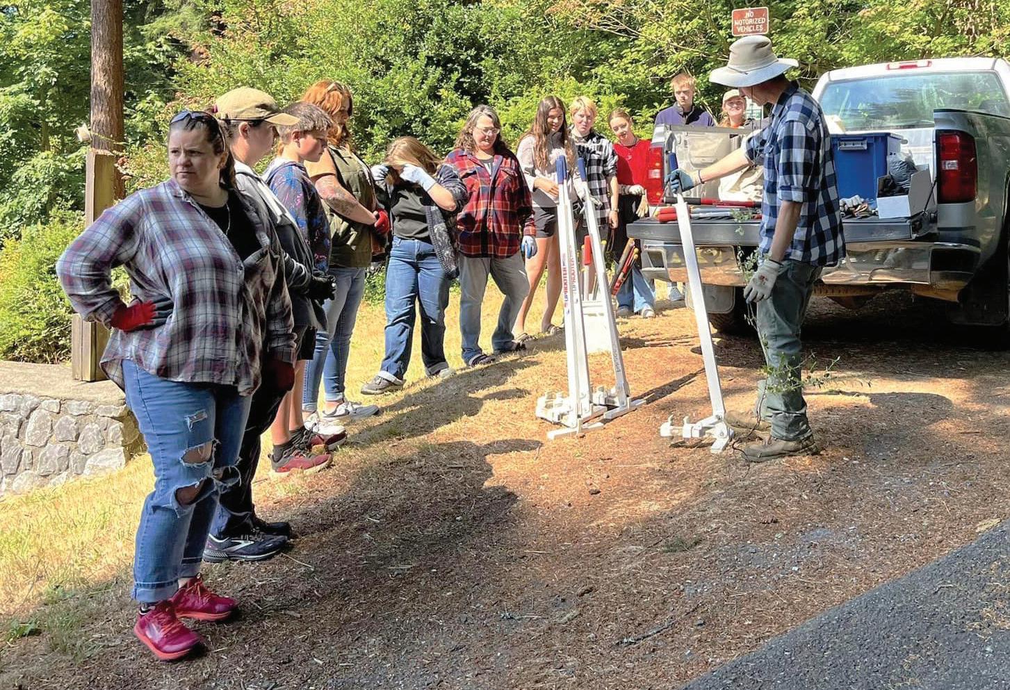


12:44 pm, fraud, 3571 block of Ash Street.
• 12:56 pm, hit and run, 1930 block of Maple Street.
• 1:19 pm, theft, 835 block of California Avenue.
• 7:16 pm, disorderly conduct, 1585 block of Sherman Avenue.
• 7:45 pm, theft from vehicle, 515 block of State Street.
• 7:46 pm, fraud, 2290 block of Inland Drive.
• 8:36 pm, criminal mischief, 2529 block of Sherman Avenue.
• 10:13 pm, 32 year old male cited on reckless burning and criminal mischief II, 3133 block of Broadway Avenue.
• 10:52 pm, criminal trespass, 2238 block of Pony Creek Road. Coos Bay
• 3:15 am, dispute, 500 block of Central Avenue.
• 8:16, driving while suspended, area of Wiscon-


POLICE BLOTTER
sin and South Empire.

• 9:19 am, theft of bike, 1775 block of Thompson Road.
• 9:40 am, phone harassment, 295 block of South 10th Street.
• 10:53 am, criminal mischief, 102 block of East Hall Avenue.
• 11:37 am, 49 year old male transported to Coos County Jail on criminal mischief I and 4 counts of disorderly conduct II, 105 block of East 2nd Street.
• 11:50 am, alarm, area of Schoneman and Michigan.
• 12:09 pm, unauthorized use of motor vehicle, 858 block of South 4th Street.
• 12:20 pm, criminal trespass, 212 block of South 5th Street.
• 1:09 pm, theft, 1775 block of Thompson Road.
• 2:37 pm, dispute, area of Bennett.

3:00 pm, 68 year old
male arrested on failure to appear on failure to report as a sex offender, 1360 block of Airport Way.
• 3:29 pm, 36 year old male cited on driving while suspended, area of Newmark and Lower Edgewood.
• 4:01 pm, dispute, 1024 block of Flanagan Avenue.
• 4:17 pm, 47 year old male cited on driving while suspended, area of 8th Terrace.
• 4:38 pm, criminal trespass, area of Taco Bell.
• 4:52 pm, domestic assault, 1667 block of Lakeshore Drive.
• 8:47 pm, 37 year old male cited on driving while suspended, area of North 10th Street and West Commercial Avenue.
• 10:51 pm, alarm, 2730 block of 34th Street.
• 10:57 pm, 24 year old female transported to


South Wasson Street. Coquille
• 10:20 am, 57 year old male transported to Coos County Jail on criminal trespass II, 115 block of North Birch Street.
• 10:45 am, missing person, 452 block of West 5th Street.
• 11:35 am, disorderly conduct, 200 block of North Adams Street.
• 4:46 pm, criminal trespass, 155 block of East 1st Street.
• 5:36 pm, criminal trespass, 940 block of East 5th Street.
• 6:10 pm, theft, 240 block of West Highway 42.
• 7:06 pm, shoplifter, 240 block of West Highway 42.
• 7:09 pm, business alarm, 1115 block of North Baxter Street.
• 10:50 pm, harassment, 479 block of North


Central Boulevard. Reedsport
• 2:26 pm, dispute, area of Reedsport Mobile Home Park.
• 3:33 pm, animal problem, 940 block of Rowe Street.
• 10:12 pm, criminal mischief, area of Champion Park.
Tuesday 12/31
North Bend
• 6:26 am, 46 year old male cited on criminal trespass II, 3585 block of Broadway Avenue.
• 4:27 pm, accident, area of Virginia and Cedar.
• 6:21 pm, criminal trespass, 2080 block of Marion Avenue.
• 8:50 pm, dispute, 1845 block of Sherman Avenue.
• 9:51 pm, theft, 2238
Obituaries
Martha Zoe Paull Houghton
Martha Zoe Paull Houghton, 78, of North Bend, passed peacefully from this life to her heavenly home on December 10, 2024 at her home in North Bend, Oregon. She was born on July 9, 1946 in Coos Bay to Royce and Laura Paull.
A Celebration of Life will be held on Saturday, January 25, 2025 at 12:00 p.m. at the St. Monica Church parish hall, 357 S. Sixth Street in Coos Bay. Martha’s favorite color was turquoise, so all are encouraged to wear this color to her celebration.
Martha’s youth was primarily spent in Reedsport, Oregon, where the tight knit community included many aunts, uncles and cousins. Martha’s vast love of music (all genres) and people started at a young age, where she enjoyed family gatherings that were filled with love, laughter and music. Music would become a thread that would weave its way through her life connecting her with people who became family. She always wanted to become a mother and raising her four children was the highlight of her life. Life brought them to Lakeside, Oregon, where they became involved in church and the historic Liberty Theater in North Bend. Martha loved people and “adopted” them wherever she went. While she was shy by nature, these activities led her to places she never thought she would venture, but answering her prayers for her children to know and appreciate people from all walks of life. The family’s involvement began with the local favorite production of Little Ole Opry on the Bay, which led to years of various productions and cherished memories for them. After working behind the scenes in multiple roles (seamstress, producer, assistant director, prop mistress, to name a few) and receiving awards for her efforts, she took on a bigger role as a director of Little Ole Opry for five seasons. The cast, crew and audience became extended family whom she cherished and remained close with over the years.
Above all, Martha loved her Lord and Savior Jesus Christ and shared His love wherever she went. In her last days, she continued to share her love for people and praising the Lord for all of those who blessed her life. Whether you knew her as Momz, Martha, Mama Houghton, or Gramz (for her grandchildren), please

know she loved you with her whole heart. She encouraged us to remember: “Jesus, Joy, Love and Laughter, Always!”
Martha is survived by her four children, Leah Houghton of North Bend; Gary Houghton of Eugene (wife Alicen, daughter McKenzie and son Joshua); Lauri Houghton-Todd of Eugene (son and daughter-in-law, Clayton and Taylor Messerle and Martha’s first great-grandson Riley, all of Salem; daughter and son-inlaw, Cora Messerle-Wang and Weilun “Weston” Wang of Shanghai, China; and Mary Houghton of North Bend; her sister, Melinda Deeter and niece, Candice Epperson (husband, Ray and son, Alex) of Lebanon, Oregon; and many cousins, friends and extended family whom she adored.
Martha was preceded in death by her parents, Garold Royce Paull and Laura Ruth Paull; and granddaughter, Emily Zoe Houghton.
In lieu of flowers, Martha asked that you donate to one of her favorite charities: South Coast Hospice or the local South Coast Food Share. Friends and family are encouraged to sign the online guest books at www.coosbayareafunerals.com and www.theoworldlink.com. Arrangements are under the care of North Bend Chapel, 541-756-0440.
Harley Dodge Jr.
January 23, 1933 - December 15, 2024
Harley Dodge Jr., a beloved father, papa, brother and friend, passed away peacefully at the age of 91. Born on January 23, 1933, in El Paso, Texas, to Harley Eugene Dodge and Lucretia Hope Carranza Dodge, Harley lived a life full of love, adventure and generosity.
Harley was married to the love of his life, Luella (Burch) Dodge, for 67 wonderful years until her passing on October 11, 2019. Together, they shared a passion for traveling and created countless cherished memories. Harley had a passion for fishing and hunting and always enjoyed playing games like Farkle and Aggravation. He took great pride in crafting game boards to share with friends and family.
A hardworking man with a strong work ethic, Harley built an impressive career working for Bangs and Dick Logging, Garret Construction and as a crane operator for Umpqua River Navigation. His contributions included building jetties that stand as a testament to his dedication and skill. Beyond his professional achievements, Harley was known for always offering a helping hand to those in need and never met a stranger.
Harley is survived by his sons, Bruce (Jeannine) of Reedsport; Rod(Kathy) Vancouver, Washington; and Dennis Dodge(Robin) of Gold Canyon, Arizona; his sisters, Geneva Conger and Lucretia Wilder; six grandchildren; seven greatgrandchildren; and numerous nieces and

Harley’s warmth, kindness, and generosity touched the lives of all who knew him. May his memory bring comfort to those he leaves behind as they celebrate the remarkable legacy he built over his lifetime. A graveside service will be held at the Scottsburg Cemetery at a later date.
Helen Dorothy Valentine Taylor
November 27, 1929 - December 27, 2024
Helen Dorothy Valentine Taylor was born November 27, 1929, to Esther Glaser and Milton James Valentine at University of California Medical Center in San Francisco. She had one sibling, her sister, Lucille. Helen passed December 27, 2024, at Coquille Valley Hospital.
Helen married Earl Leroy Taylor October 28, 1948, and was sealed to him for all eternity June 23, 1971. They have four children: Laura Rene Taylor Eschler, Roger Brad Taylor, Roy Valentine Taylor, and Jenifer Ann Taylor Wellard; 22 grandchildren; and 55 great-grandchildren. Helen taught language arts at Lincoln Elementary and Coquille Valley Middle School. She retired in 1994. In retirement, she volunteered with SMART Reading. Many locals still remember Mrs. Taylor. Helen is preceded in death by Earl; her daughter, Jennifer; and her grandchildren, Levi Taylor and Elizabeth Eschler. The day she was born, a nurse quipped “This is the first time I’ve delivered a Valentine on Thanksgiving.” This Christmas season, a Valentine was delivered to Heaven.
Services will be held January 18 in the
Sara K. Mintonye
December 2, 1941 - September 12, 2024
Services will be announced at a later date for Sara K. Mintonye, 82, of Coquille. Sara was born December 2, 1941 in Coquille the daughter of Keith H. and Mary M. (Dye) Mintonye and passed away September 12, 2024 in Coquille.
Sara was a 1960 graduate of North Bend High School and worked as a graphic artist with Coos County Education Department, an art instructor at SWOCC and receptionist with Amling Schroeder Funeral Service before retiring.
She is survived by her brothers, Dee W. Mintonye of Pierce, Idaho and Craig Mintonye of Bull Head City, Arizona; sister, Roberta Mintonye of Coos Bay; nieces and nephew, Shara Mintonye of Coos Bay; Marian Mintonye of Alaska, Sara Edwards and Mark Mintonye of Arizona.
Cremation rites have been held at Ocean View Memory Gardens Crematory, Coos Bay under the direction of Coos Bay Chapel 685

Coquille meetinghouse of the Church of Jesus Christ of Latter-day Saints at 9:30 a.m. In lieu of flowers, please make donations to Feeding Hope and Hunger (feedinghopeandhunger.org).

Anderson
www. coosbayareafunerals.com


nephews. He was preceded in death by his wife, Luella; his sister, Yolanda Pantages; and brothers, Donnie; Carl “Curly”; Melvin and Larry Dodge.

As I See It
I found a great story in Dow Beckham’s book, Bandon-by-the-Sea, about the local Life-Saving Station, later referred to as the Coast Guard.
“Congress authorized the establishment of the U.S. Live-Saving Station on the Coquille River in 1889 because of the increasing amount of shipping out of the port. The service built the station in1891 and in 1892 brought in a trained crew. The service established a lookout on Coquille Point (first photo). Carpenters constructed a boathouse directly below (second photo) toward the mouth of the river for a surfboat, breeches buoy, line, life preservers, and other equipment. In 1915 the Life-Saving Service merged into the U.S. Coast Guard.
A fire in 1921 destroyed the Bandon crew quarters. The Coast Guard then moved to a harbor building on First Street between Cleveland and Bandon avenues.
“The Department of the Treasury provided for a crew of seven men whom it paid $60 per month and a captain who received $70. The government furnished housing for the captain and his family. The Service housed the surfmen in bachelors’ quarters. Crew members received only twenty-four hours leave per week. Life in the Service was not easy. The men drilled every day except Sunday. All employees wore their uniforms. They maintained watch twenty-four hours per day from the lookout tower at Coquille Point. Each of the crew served a four-hour watch every day. At first they rang a bell, but later, used a telephone to notify the crew and captain to launch a boat at the River Station. When the bar was too rough, they launched directly into from the surf from the boathouse below the lookout. Rescues were frequently occurring at Bandon. Mariners considered the Bandon bar the worst on the Pacific Coast other than Cape Nome, Alaska. The Bandon bar was the site of sixty-four accidents between 1868 and 1914. The crew maintained the quarters, surfboats, the life-saving gear, such as the Lyle gun, oars, and block and tackle. On Mondays they overhauled the beach apparatus. On Tuesdays, they took the surfboat over the bar, regardless of the conditions. On Wednesdays, they practiced drill and signals (third photo) based on the International Code. The surfmen practiced with beach apparatus on Thursdays. On Fridays they practiced methods of rescue from drowning. On Saturday they again overhauled apparatus and took care of general clean-up of quarters.”
* * * At the recent request of Roger Straus, who is affiliated with the Bandon American Legion Post 26, concerning the ownership of the Bandon GAR (Grand Army of the Republic) cemetery, the Bandon History Museum has responded. Museum board treasurer Jim Proehl said after much research, “the information I found supports the conclusion that Bandon’s GAR Cemetery is owned by Bandon American Legion Post 26. The GAR Cemetery is part of a parcel that contains three cemeteries in the Bandon Heights neighborhood. They lie west of Harlem Avenue, near NE Division Street and NE First Street.
The other two cemeteries are Holy Trinity Cemetery and Averill Pioneer Cemetery. The triangular shaped GAR Cemetery fronts on Harlem Avenue,” said Proehl.
He quotes from the July 6, 1905, issue of the Bandon Recorder: “County Surveyor C.S. McColloch was down from the county seat last week surveying a plot of ground which the Bandon G.A.R. purchased from R.E.L. (Robert E. Lee) Bedellion for a cemetery for the interment of those who have served as soldiers when they die. The GAR was an organization of Civil War veterans. The GAR ceased to exist when the last Civil War veteran died.”
A later article from the Western World of July 23, 1931, explained that “for the first time in over a year, we had our two Comrades (James) Langlois and (Charles) Blumenrother of Bandon Post No. 56, G.A.R. with us; and the sadness that at this meeting we watched the disbanding of the post, and the turning over the hall and property to the American Legion Post No. 26.”
Edgar Capps is buried in the Capps family plot in the GAR Cemetery. His wife Mary was buried next to him in 2023. Their burials were among the few in the past 20 years.
* * * Saw a recent appeal by Oregon Governor Tina Kotek urging people to stop trashing Portland and instead send a welcoming message.
A few days later I read an article about a music store in downtown Portland, Artichoke Music, which has been broken into 10 times since 2021.
An item in late November said that The Portland Clinic will stop treating patients downtown.
“The Portland Clinic has announced it will be closing its downtown Portland facility to patients after a century of providing treatment there, citing safety issues in the neighborhood.”
A spokesman for the Portland Police Bureau said he was aware of issues around the Clinic, “namely issues involving drug use and drug dealing.” According to dispatch records,
By Mary Schamehorn
police have been called to the clinic’s block, or an adjoining intersection, at last 60 times this year, including 27 times in October. At least one was for a reported assault, three for threats and four for theft.”
It’s hard to ignore problems like this no matter the desired spin by people like the Governor who apparently do not live or frequent downtown Portland.
* * * I have learned that several women with ties to Bandon have died in the last couple of weeks.
Jean Stephenson, a well known local artist and founding member of Art By The Sea, died Dec. 30. A long-time resident of Langlois, she and her husband Al moved to Vancouver, Wash., last fall. Survivors include her daughter Kim Wessa and son Michael.
Marie Fasnacht Cochran, 91, a long-time resident of the North Bank Road, died Dec. 7. She and her late husband Don and their family have operated a Dairy Ranch for years. She graduated from Bandon High School and was the daughter of former city manager of utilities, school superintendent and coach John Fasnacht and his wife Marie.
Linda Faye Robertson, 82, North Bend, died Dec. 18. She and her husband Earl lived in Bandon for many years where they raised their family and were associated with the Robertson’s Sand and Gravel business, started by Earl’s father, Fred.
* * * The sheriff’s office put out a press release about a 57-year-old woman, Lesli Howard, who was arrested Dec. 27 after she allegedly drove through a highway work zone while intoxicated and crashed into a tree.


CCSO officials said a deputy responded at about 8:30 p.m. on Dec. 27 to milepost 2 on Highway 42 South in Bandon where a motorist, identified as Howard, had driven through a work zone and crashed into a hazard tree that was being removed by ODOT work crews. Howard and the vehicle were still on scene when the deputy arrived. Howard was arrested and transported to the Bandon Police Department for additional testing at which time she was cited for driving under the influence, reck-


PHOTO COURTESY OF MARY SCHAMEHORN


block of Pony Creek Road.
Coos Bay
• 8:34 am, unlawful entry into motor vehicle, 1128 block of Park Avenue.
• 8:40 am, alarm, 558 block of 11th Avenue.
9:14 am, burglary, 805 block of Arago Avenue.
10:28 am, damaged city property, area of 5th Avenue and E Street.
• 10:47 am, fraud, 2890 block of Ocean Boulevard.
10:49 am, phone harassment, 1900 block of Woodland Drive.
• 11:16 am, criminal trespass, 371 block of South Wasson Street.
• 12:58 pm, theft, 567 block of South Wall Street.
2:40 pm, unlawful entry into motor vehicle, 962 block of North 10th Street.
• 5:50 pm, business alarm, 579 block of South Broadway Street.
6:27 pm, 33 year old male transported to Coos County Jail on parole violation on intimidations and stalking, 550 block of South 4th Street.
• 6:52 pm, burglary, 1667 block of Lakeshore Drive.
6:57 pm, disturbance, 396 block of North Wall Street.
9:11 pm, 43 year old male transported to Coos County Jail on 2 counts of identity theft and escape III, area of Commercial and Chester.
• 9:34 pm, theft, 1705 block of Newmark Avenue.
10:00 pm, 42 year old male cited on driving while suspended, area of Tremont and Exchange.
• 10:22 pm, dispute, 239 block of South 8th Street.
10:35 pm, 24 year old female cited on driving while suspended, area of Ocean and 25th.
• 11:01 p, shots fired, 1283 block of North 13th Street.
11:09 pm, 28 year old cited on DUII, area of 2nd and Elrod.
11:55 pm, dispute, 295 block of South Broadway Street. Coquille
8:54 am, disorderly conduct, 54 block of West Highway 42.
• 11:27 am, criminal trespass, 155 block of East 1st Street.
1:47 pm, suspicious subject, 96955 block of Highway 42 South. Reedsport
• 12:34 am, weapons offense, area of Chevron. 9:53 am, disturbance, 331 block of Elm Avenue.
• 10:55 am, theft, area of Ace Hardware.
• 12:43 pm, criminal mischief, area of A2Z Mini Storage.
4:13 pm, animal problem, 395 block of Ranch Road.
• 8:17 pm, trespassing, area of Foursquare Church.
• 9:14 pm, trespassing, 1225 block of Ivy Avenue.
• 5:15 am, suspicious subject, 1900 block of Oak Street. 9:10 am, alarm, 2078 block of Everett Avenue.
10:03 am, criminal trespass, 2080 block of Marion Avenue.
• 12:50 pm, dispute, 725 block of Tower Street.
• 2:33 pm, dispute, 2289 block of 17th Street.
5:05 pm, suspicious subject, area of Newmark and Broadway.
• 5:24 pm, weapons offense, 2131 block of Newmark Street.
5:31 pm, criminal trespass, 1285 block of Virginia Avenue.
7:13 pm, threats, 2020 block of Lincoln Street.
• 7:18 pm, dispute, 2031 block of Newmark Avenue.
Coos Bay
• 12:54 am, 37 year old male cited on failure to appear on driving while suspended or revoked, 835 block of California Avenue.
• 1:44 am, 21 year old female cited on DUII, area of 10th and Hemlock.
1:42 am, suspicious subject, 515 block of North 12th Street.
• 2:06 am, 47 year old male cited on failure to appear on escape III and failure to appear II, 1360 block of Airport Way.
2:40 am, stabbing, 700 block of Anderson Avenue.
• 3:48 am, criminal trespass, 862 block of South 2nd Street.
3:45 am, dispute, 91699 block of Wingert Lane.
• 7:34 am, vehicle alarm, 1800 block of Cottonwood Avenue.
• 7:42 am, dispute, area of Lakeshore and North Morrison.
9:27 am, criminal trespass, 1075 block of South Broadway Street.
• 10:20 am, criminal mischief, 640 block of North Morrison Street. 1:07 pm, alarm, 976 block of Signal Way.
• 3:38 pm, alarm, 175 block of Hall Avenue.
• 3:47 pm, phone harassment, area of Grocery Outlet.
7:09 pm, menacing, 445 block of North Cammann Street.
• 7:44 pm, assault, 1775 block of Thompson Road.
9:40 pm, disorderly conduct, area of Newmark and South Empire.
• 9:58 pm, sexual abuse, 1775 block of Thompson Road.
• 10:58 pm, suspicious subject, 1230 block of Seagate Avenue.
11:26 pm, lost animal, area of North Morrison Street and Lakewood Lane.
Coquille
• 4:55 am, dispute, 204 block of South Irving Street.
• 12:41 pm, business alarm, 1742 block of West Central Boulevard.
5:03 pm, 21 year old male transported to Coos County Jail on failure to appear on DUII, 671 block of East 8th Street.
• 6:35 pm, dispute, 725 block of East 3rd Street.
• 10:44 pm, dispute, 155 block of East 1st Street.
Reedsport
7:29 am, fire, area of City Shops.
Myrtle Point
8:53 am, suspicious subject, area of 19th Street and Sunset Lane.
Thursday 1/2
North Bend
12:06 am, dispute, 2287 block of 17th Street.
• 4:42 am, vehicle alarm, 773 block of Commercial Street.
11:53 am, runaway juvenile, 2075 block of Lincoln Street.
• 12:36 pm, disorderly conduct, area of Virginia and Broadway.
12:49 pm, violation of restraining order, 2087 block of Meade Street.
• 1:10 pm, sex offender registration, 835 block of California Avenue.
• 3:33 pm, criminal mischief, 3447 block of Fir Street.
4:40 pm, dispute, 3411 block of Broadway Avenue.
• 7:19 pm, phone harassment, 2352 block of Sherman Avenue.
8:12 pm, menacing, 3440 block of Pine Street.
• 11:28 pm, 34 year old male cited on driving while suspended, area of Virginia and Sheridan.
Coos Bay
• 12:02 am, criminal trespass, 1660 block of Newmark Avenue.
• 5:15 am, burglary, 922 block of South 10th Street.
7:20 am, alarm, 479 block of Newmark Avenue.
• 8:53 am, suspicious subject, 474 block of North Morrison Street.
9:43 am, criminal trespass, 657 block of Newmark Avenue.
• 11:31 am, criminal mischief, 212 block of South 5th Street.
• 12:42 pm, criminal trespass, 1005 block of Newmark Avenue.
2:05 pm, elderly abuse, 1005 block of Oakway Drive.
• 2:16 pm, alarm, 357 block of South 6th Street.
2:37 pm, dispute, 990 block of South 2nd Street.
• 2:56 pm, unlawful entry into motor vehicle, 1158 block of Idaho Avenue.
2:35 pm, 32 year old female cited on criminal trespass II, 657 block of Newmark Avenue.
2:35 pm, 59 year old male cited on unlawful possession of meth, 657 block of Newmark Avenue.
4:37 pm, 30 year old transported to Coos County Jail on violation of restraining order, 994 block of Elrod Avenue.
• 6:50 pm, suspicious subject, area of 5th and Commercial.
7:09 pm, suspicious subject, 1020 block of South 1st Street.
• 9:13 pm, criminal trespass, 1075 block of Newmark Avenue.
Coquille
• 3:50 pm, violation of restraining order, 98 block of East 1st Street.
4:16 pm, criminal trespass, 55 block of East 1st Street.
• 7:18 pm, 57 year old male transported to Coos County Jail on failure to appear on resisting arrest and disorderly conduct II, 98 block of East 1st Street.
Reedsport
• 8:48 am, disturbance, 3855 block of Vista Drive.
9:56 am, accident, area of Sherman and Virginia.
• 11:38 am, criminal mischief, 835 block of California Avenue. 12:27 pm, theft, 1611 block of Virginia Avenue.
• 1:34 pm, criminal mischief, area of California Street.
1:51 pm, accident, area of Newmark and Virginia.
• 2:49 pm, accident, 1611 block of Virginia Avenue.
4:48 pm, violation of court order, 2087 block of Meade Street.
• 6:58 pm, dispute, area of Meade and Vermont.
• 8:01 pm, suspicious subject, 515 block of State Street.
10:34 pm, 26 year old male cited on criminal trespass, 2101 block of Tremont Avenue.
Coos Bay
• 7:48 am, accident, 2775 block of Ocean Boulevard.
9:21 am, criminal mischief, 598 block of Anderson Avenue.
• 10:36 am, threats, 500 block of Central Avenue.
• 11:07 am, fraud, 2051 block of Newmark Avenue.
12:15 pm, 40 year old male transported to Coos County Jail on disorderly conduct II and criminal trespass II, 2273 block of North Bayshore Drive.
• 2:22 pm, 22 year old male cited on driving while suspended, area of Mill and Michigan.
• 3:46 pm, assault, 962 block of South 1st Street.
5:10 pm, alarm, 200 block of North Ross Street.
• 7:08 pm, 47 year old male transported to Coos County Jail on domestic assault IV and menacing, 479 block of Newmark Avenue.
• 7:14 pm, identity theft, 576 block of South 9th Street.
8:06 pm, 29 year old male transported to Coos County Jail on failure to register as a sex offender, 230 block of East Johnson Avenue.
• 8:24 pm, 28 year old female cited on probation violation, 3303 block of Broadway Avenue.
8:29 pm, 57 and 33 year old males cited on theft II, 2051 block of Newmark Avenue.
• 8:36 pm, threats, 155 block of South Empire Boulevard.
Coquille
• 12:52 pm, criminal mischief, 114 block of Highway 42.
1:07 pm, business alarm, 940 block of East 5th Street.
• 2:15 pm, violation of restraining order, 725 block of East 3rd Street. 2:32 pm, criminal mischief, 250 block of North Baxter Street.
• 6:30 pm, disorderly conduct, 250 block of North Baxter Street.
Reedsport
• 11:28 am, dispute, area of Reedsport Mobile Home Park.
3:41 pm, trespassing, area of Port of Umpqua.
Sheridan.
North Bend 7:12 am, criminal trespass, 1710 block of Virginia Avenue.
• 7:44 am, unlawful vehicle, area of Ferry Road.
10:45 am, 27 year old male transported to Coos County Jail on warrant service, 3201 block of Tremont Avenue.
11:17 am, criminal mischief, 3062 block of Oak Street.
• 12:18 pm, suspicious subject, 1863 block of Steelhead Street.
6:52 pm, criminal trespass, 1911 block of Newmark Street.
• 7:30 pm, accident, 1611 block of Virginia Avenue.
8:07 pm, 76 year old transported to Coos County Jail on contempt of court, 2087 block of Meade Street.
10:34 pm, disorderly conduct, 1100 block of East Airport Way.
Coos Bay
4:43 am, business alarm, 972 block of West Ingersoll Avenue.
• 7:52 am, 47 year old cited on Ocean and Cedar.
• 8:38 am, disorderly conduct, 311 block of South Broadway Street.
8:58 am, 35 year old female cited on driving while suspended, area of Newport and Edwards.
8:38 am, disorderly conduct, 347 block of South Broadway.
• 10:20 am, 62 year old female cited on driving while suspended, area of Morrison and Taylor.
10:39 am, dispute, 249 block of South 8th Street.
• 11:28 am, criminal trespass, 1925 block of Newmark Avenue. 11:35 am, 38 year old cited on driving while suspended, area of Safeway.
2:07 pm, criminal trespass, 130 block of North Cammann Street.
• 2:46 pm, 31 year old female cited on driving while suspended, area of Tom’s Pro Tire.
3:06 pm, theft, 2051 block of Newmark Avenue.
• 3:15 pm, driving while suspended, 1006 block of Maryland Avenue.
7:54 pm, accident, 295 block of Holland Avenue.
• 8:14 pm, criminal trespass, 862 block of South 2nd Street. 11:03 pm, business alarm, 400 block of Madison Street.
• 11:50 pm, disturbance, 1453 block of Juniper Avenue.
Coquille
• 3:57 pm, dispute, 510 block of North Collier Street.
8:15 pm, dispute, 510 block of North Collier
Sunday 1/5
North Bend
• 12:11 am, criminal trespass, 1701 block of Newmark Street.
1:34 am, prowler, 2496 block of Broadway Court.
• 6:48 am, assault, 766 block of California Avenue.
9:55 am, harassment, 888 block of Vermont Street.
• 11:06 pm, dispute, 1189 block of Virginia Avenue.
Coos Bay
• 12:56 am, dispute, 1775 block of California Avenue.
6:52 am, 38 year old male cited on driving while suspended, area of South West 1st and Johnson.
8:42 am, 43 year old male cited on driving while suspended, area of Newmark and Schoneman.
10:30 am, 43 year old cited on driving while suspended, 1109 block of South 1st Street.
• 10:55 am, 41 year old male cited on driving while suspended, 1109 block of South 1s Street.
• 11:19 am, criminal trespass, 2051 block of Central Avenue.
12:00 pm, accident, 295 block of Holland Avenue.
• 1:19 pm, business alarm, 1865 block of Thompson Road.
1:51 pm, 32 year old male cited on driving while suspended, 1297 block of Ocean Boulevard.
1:52 pm, 50 year old male cited on driving while suspended, 3111 blockof South east Ocean Boulevard.
2:47 pm, 47 year old male cited on DUII, 1988 block of Newmark Avenue.
• 2:52 pm, disorderly conduct, area of Newmark and Main.
3:25 pm criminal mischief, 702 block of Newmark Avenue.
• 7:08 pm, suspicious subject, 1195 block of Newmark Avenue.
7:13 pm, dispute, 123 block of Ocean Boulevard.
• 8:38 pm, theft, 2051 block of Newmark Avenue.
10:19 pm, 65 year old male transported to Coos County Jail on attempted unlawful delivery of controlled substance, unlawful possession of controlled substance, attempted unlawful delivery of meth, unlawful possession of meth, attempted unlawful delivery of heroin, felon in possession of a firearm and driving while suspended or revoked, 1360 block of Airport Way.
Coquille
• 6:05 am, 57 year old male transported to Coos County Jail on criminal trespass I, 200 block of North Adams Street.
• 1:49 pm, criminal trespass, 155 block of East 1st Street. 2:19 pm, suspicious subject, area of North Baxter and East 2d Street.
2:22 pm, suspicious subject, 235 block of Highway 42.
• 3:19 pm, 54 year old female transported on probation violation, possession of controlled substance, 448 block of East 3rd Street.
Reedsport
12:14 am, disorderly conduct, area of McKay’s.
Wednesday 1/1
North Bend


• 10:26 am, animal problem, 2355 block of Arthur Drive.


1:03 pm, trespassing, area of Best Budget Inn.
2:08 pm, criminal mischief, area of Reedsport Eye Clinic.
Myrtle Point
• 3:48 pm, shoplifter, 418 block of 8th Street.
• 10:30 pm, suspicious subject, 630 block of Spruce Street.
Friday 1/3
North Bend
• 9:59 pm, disturbance, 2125 block of Elm Avenue.
Myrtle Point
• 7:24 am, dispute, 1783 block of View Street.
• 2:03 pm, criminal mischief, 405 block of Spruce Street.
4:27 pm, 32 year old transported to Coos County Jail on warrant service, area of Highway 42.
Saturday 1/4
• 1:40 pm, dispute, 3100 block of Lakeshore.
• 3:49 pm, suspicious subject, 3480 block of Tremont Avenue.
8:24 pm, 47 year old cited on driving while suspended, area of Newmark and Cedar.
9:29 pm, suspicious subject, 3700 block of Brussells.
• 10:28 pm, criminal trespass, 3411 block of Broadway Avenue.
10:56 pm, 68 year old male cited on DUII, area of Newmark and
• 3:10 am, disturbance, 911 block of Rowe Street. 7:03 am, disorderly conduct, area of Scholfield Bridge.
• 10:14 am, child abuse, area of Café Nine Ninety West. 11:23 am, animal problem, 940 block of Rowe Street.
• 3:47 pm, trespassing, area of Highland Mobile Home Park.
Myrtle Point
• 4:03 am, criminal trespass, 418 block of 8th Street.
3:31 pm, criminal trespass, 812 block of Willow Street.
As I See It
From Page 13
allow Southern Coos Health Foundation and Southern Coos Hospital and Health Center to launch a joint Master Facilities Planning initiative. Due to the generosity of the Bandon Dunes Charita-
Landslide
From Page 1
“It was extreme flooding. I’ve seen the campground flood before, this is actually the second time this winter we’ve evacuated due to flooding, but this was the worst flooding that I’ve seen while I’ve been here. It was a truly amazing amount of water,” said Ricci. “We were able, sort of amazingly, to keep South Sunset parking lot open, so people could still park and go onto the Oregon Coast Trail, and we
Birding at Millicoma
March
Wednesday, January 15
10:00am – 12:00pm
Wednesday, February 12
10:00am – 12:00pm
Millicoma Middle School
260 2nd Avenue, Coos Bay Dress for the weather. Meet in the parking lot directly behind Millicoma Middle School.
Max is 15 participants. Free. Pre-registration required. Programs may be cancelled due to hazardous weather or low enrollment.
Unlimited Book Club
Thursday, January 16
6:00pm
Zoom- bit.ly/3R6E57M
ble Foundation, the hospital will embark on a comprehensive and collaborative project designed to address the growing healthcare needs of the southern Oregon coast while ensuring sustainable growth and enhanced service delivery for the community. For years, SCHF and SCHHC have benefited from the generous support of the
did not lose sections of that trail, which was kind of a minor miracle.”
As of writing, the Sunset Bay campground and dayuse area is currently open. The restrooms which had initially been closed, are also now reopened. The ‘A Loop’ of the campground still closed and needing inspection due to a culvert failure.
Cape Arago and Shore Acres are expected to be closed to vehicle traffic for an extended period as the damage to the highway is extensive. As stated by Ricci, the undercut is
This meeting will be an opportunity for members to meet and discuss our next title, selected by book club members, Women’s Diaries of the Westward Journey by Lillian Schlissel. Suggestions for future readings will come from members of Unlimited.
Welcome Winter Dance: Ballroom Dancing at the Eagles Lodge
Friday, January 17
6:00pm – 9:00pm Coos Bay Eagles Lodge568 S 2nd St $7.00 Eagles Members $5.00. No Partner Required. All Levels are Welcome. For information, call Paul Rutan at (818) 675-8518 or visit oregoncoastballroom danceclub@ gmail.com.
SCDC Presents: Pitch Night Friday, January 17 5:00pm - 8:00pm Egyptian Theater 229 S. Broadway, Coos Bay Doors open 4:30 p.m. Admission is free! To register for this free event or learn more about Pitch Night, visit SCDCInc.org or contact Tanya Rasley at Tanya@SCDCInc.org or 541-888-7003. For press inquiries, contact SCDC Executive Director Lexie Woodward at Lexie@SCDCInc.org or 541-808-7774.
Bandon Dunes Charitable Foundation and the Keiser Family’s Charitable Giving. This partnership has fostered critical programs, including the Bandon School District School Nurse Program, the Living & Aging Well initiative, and expanded healthcare access through the Multi-Specialty Clinic.
The amount of the grant was $171,000.
“gnarly” and on a portion of road that was not expected to slide, despite the amount of water hitting the parks. OPRD has yet to release an estimate on cost and length of the repairs, but contractors and engineers have been contacted. The road slide occurred between Sunset Bay and Shore Acres making access impossible.
* * * Coming events: Jan. 19, 2 to 4 p.m., Library Art Gallery reception, Ginsburg and Ayers.
Jan. 25, free showing of the movie Casablanca, Sprague Theater, 7. Shoreline Education Awareness presentation, Traditional Uses of Coquille
Point by Native People, by local historian and anthropologist Reg Pullen, Jan. 25, 10 a.m., library meeting room.
Saturday, Feb. 8, the Bandon Library Friends and Foundation will sponsor a conversation with local best-selling author Barbara O’Neal, 1 p.m., library meeting room, suggested donation of $20 with signup at the library. Seating is limited.
* * * The rainfall for the month of December was 12.86 inches, which brought the total for the last three months to 32.63 inches, compared to 28.98 for the same period last year (October-December).

“We do not at this time have an official ETA for when the road will be re-opened to the public, but we will post to our official channels when we have that information,” said Ricci.
William Stafford Birthday Party
Friday, January 17
5:00pm - 6:00pm
Coos Bay Library (Myrtlewood Room)
525 Anderson Ave.
Join us to celebrate William Stafford’s Birthday. Stafford was Oregon’s Poet Laureate from 1975-1990. Bring your favorite Stafford poem to read aloud and share with the group. Or just come and listen to fans read their favorite Stafford poems.
Golden and Silver Falls Hike
January 18
10:00am – 3:30pm
February 15 10:00am – 3:30pm
To be announced
Things to bring: rain gear, sturdy waterproof shoes/ boots, camera, water bottle, lunch and snacks. We will provide transportation from Coos Bay. Max is 10. Free. Pre-registration is required. Programs may be cancelled due to low enrollment or hazardous weather. Pathways to Positive
Parenting Presents: Despicable Me 2
Saturday, January 18
10:00am
Egyptian Theater
229 S. Broadway, Coos Bay Doors open 9:30 a.m. Admission is free with popcorn and juice or water.
Southwestern Oregon Preppers (SWOP) monthly meeting
Saturday, January 18
Coos Bay Public Library
525 Anderson Ave, Coos Bay
The main topic is “Preparing to Make the Best of 2025”. This will be a round table discussion. Come to the meeting prepared to take notes. This is a free public meeting. Join Southwestern Oregon Preppers on Facebook and/or meetup.com.
Egyptian theatre Presents: Some Like it Hot Saturday, January 18
3:00pm
Egyptian Theater
229 S. Broadway, Coos Bay Doors open 2:30 p.m. Regular admission.
CAM Studio Presents: Clay Magnets
Saturday, January 18 1:00pm – 4:00pm
CAM Studio
600 Ranch Road, Reedsport
The agenda with remote access details will be sent once available.
Unlimited Book Club
Thursday, January 23 @ 1 p.m.
Meeting Virtually
Discuss your latest read in a book club without assigned reading. http:// tinyurl.com/yn7uz2vx
CAM Studio Presents: Playing with Watercolor
Saturday, January 25
11:00am – 3:00pm
187 Central Ave, Coos Bay
Get started with the basics of watercolor in this 4 hour workshop. All supplies provided. $30. Ages 13 – adult. Register online at coosart.org
Nature Film: Leave it to Beavers
Saturday, January 25
1:00pm – 2:00pm (Optional hike from 2:00pm – 4:00pm)
61907 Seven Devils Rd, Coos Bay
Quilters
First Thursday of the month until June 2025 6:00pm
Gloria Dei Lutheran Church 1290 Thompson Rd., Coos Bay New members are welcome to attend. Dues are $20.00 a year. A program is presented each month on quilt related topics. https:// coosbayquiltguild.com
Coos Art Museum Exhibits: Collector’s Series
January – April 13
Coos Art Museum 235 Anderson Ave
We will be showcasing work from the collection of Karen Thomas, owner of the Toriizaka Art Gallery in Sisters, Oregon. Museum admission: $5 general, $2 student, veterans and seniors. Free to museum members.


187 Central Ave, Coos Bay
We’re making magnets out of polymer clay! Make 10 different clay magnets. All supplies provided. Ages 15 - adult. Register online at coosart.org
Introduction to Crabbing
Wednesday, January 22 2:00pm – 4:00pm Charleston Welcome Center
91141 Cape Arago Hwy, Coos Bay
Come learn about the fascinating story of beavers in North America. Popcorn and light refreshments provided. Free. Pre-registration is required. Programs may be cancelled due to low enrollment or hazardous weather.
Egyptian Theatre Presents: The Good, the Bad, and the Ugly
Saturday, January 25 3:00pm
Egyptian Theater 229 S. Broadway, Coos Bay Doors open 2:30 p.m. Regular admission.

CAM Studio Presents: Felt Sky Shapes Saturday, February 1 1:00pm – 3:00pm 187 Central Ave, Coos Bay Come make and embellish your own felt sky shapes. All materials provided. $15. Ages 5 – adult. Register online at coosart.org
Nature Film: Octopus Contact
Saturday, February 8 1:00pm – 2:00pm (Optional Guided Hike 2:00pm - 4:00pm) 61907 Seven Devils Rd, Coos Bay Come learn about what is new in the world of octopus. Popcorn and light refreshments provided. Free. Pre-registration is required. Programs may be cancelled due to low enrollment or hazardous weather.
The Art of Correspondence

Come learn about the amazing life cycle of crabs, their importance to the local economy and the various techniques for capturing this delectable Crustacean. Dress for the weather. Pre-registration required. Programs may be cancelled due to hazardous weather or low enrollment.


Lower Umpqua Hospital District Board of Directors Meeting
Wednesday, January 22 7:30am
Lower Umpqua Hospital (Main Conference Room)
Lotus Lantern Workshop Saturday, January 25 2:00pm - 3:00pm Coos Bay Library 525 Anderson Ave.
Participates will create a lotus lantern and learn more about Korea’s unique history. All ages from 10 and up. Limited space is available, pre- registration is required. Call 541-269-1101 x 3606 or register online at www.coosbaylibrary.org.
CHM Winter Class – Mysteries of the South Coast with Steve Greif
Wednesdays, January 29 - March 5, 2025
6:00pm - 7:00pm
Saturday, February 8 1:00pm – 4:00pm 187 Central Ave, Coos Bay Learn the art of letter writing. Decorate your own envelope. All supplies provided. Register online at coosart.org
CAM Studio Presents: Life Drawing Group Every 2nd and 4th Sunday starting February 9 2:00pm – 4:00pm 187 Central Ave, Coos Bay $120 for 6 sessions. 21 and up. Register online at coosart.org





Coos History Museum 1210 N Front St., Coos Bay
Admission price is $80 for non-members and $75 for members. Pre-registration is required, payment is required at booking. Reservations can be made online https://cooshistory. org/event-registration/, by phone at 541-756-6320 or register in person at the museum’s front desk. Program fills up fast, sign up early!
Coos Sand ‘n Sea
Birds on the Estuary Wednesday, February 26 10:00am – 11:30am Charleston Welcome Center 91141 Cape Arago Hwy, Coos Bay Dress for the weather. Programs may be cancelled due to low enrollment or hazardous weather. Meet at the Charleston Visitors Center. Max is 15 participants. Free!
Contributed photos
The Sunset Bay campground had to be evacuated after significant flooding at the state park.