Drillers’ Trusted Publication
coringmagazine.com
QUALITY • SAFETY • RESULTS
21 Questions with Michael Dineen, R&D & GM Operations at Priority Drilling
TRUST DRILLING Exponential Growth and Innovations
Major Impact Building the Future of Mining through Technology and Skills
Geological Survey Drilling Why Do They Do It? Dr Richard Blewett
p. 6
p. 10
p. 16
p. 60
#33
12/25
ISSN 2367-847X
In this issue
AXIS CONNECT™
SIMPLE, RELIABLE AND EFFICIENT SURVEY MANAGEMENT AXIS Connect™ is an open, secure and integrated platform that simply, reliably and efficiently connects the measurements made by drillers with the geologists who need them. Survey tools connect to the cloud, drillers connect with geologists, and measurements connect with reporting and geological modelling.
Superior visualisation
Increase drilling time
Streamline workflows
PDAC 2026 Visit us at booth #743 from 1 - 4 March to learn more about Axis Connect™ and how it can support your operations.
Reduce operating costs
Table Contents /21 QUESTIONS 6
Exclusive interview with Michael Dineen, R&D and General Operations Manager at Priority Drilling
/PRODUCT REVIEW 28
OMNIxBOLT From burden to strategic advantage in blast hole deviation
34
Connecting geologists and drillers Orica Digital Solutions’ Axis Connect™ sets a new industry standard in efficiency and collaboration by Darren Palmer, Senior Product Manager— Orebody Intelligence, Axis, Orica Digital Solutions
/IN FOCUS 10
TRUST DRILLING Exponential growth and innovations
60
Geological survey drilling Why do they do it? by Dr Richard Blewett, Director of GeoSystems Consulting Pty Ltd, and Weethalle Gold Pty Ltd
/PRODUCT ARTICLE 36
BG Drilling Solutions: The true partner in directional drilling Trajectory control with CWT at the cost of a gyro
/TECHNICAL ARTICLE 40
Toward a mining industry standard for borehole survey instruments by Duncan McLeod, CEO and Dag Billger, Chairman, Inertial Sensing
/INDUSTRY EVENT /ANNIVERSARY ARTICLE 16
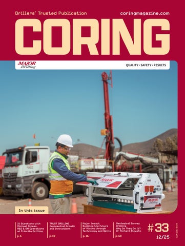
Major impact Building the future of mining through technology and skills
44
/EXPLORATION & MINING GEOLOGY 47
/CASE STUDY 22
26
Hy-Tech: Expansion drilling in the Homestake District by Bill Krasnozon, VP Client Support & Engagement at Hy-Tech Drilling, in collaboration with Dakota Gold Corp. Tackling paste-fill service hole drilling at the Bell Creek Mine
PDAC 2026
Q&A from the experts: In conversation with René Sterk, Managing Director of RSC
54
From manual to digital logging and back by Antoine Caté, PhD, PGeo, Senior Consultant (Structural Geology), SRK Consulting (Canada)
58
Finding my marbles The little stones that shaped my life by Nicole L Cox, Principal Structural Geologist at Aeris Resources Ltd
/EXPLORATION DRILLING CATALOG 64
Drilling services
65
Drilling equipment & accessories
69
Survey & Core orientation tools
70
Miscellaneous
/AUTHORS
Authors in this issue Michael Dineen R&D and General Operations Manager at Priority Drilling
Bill Krasnozon VP Client Support & Engagement at Hy-Tech Drilling
Darren Palmer Senior Product Manager—Orebody Intelligence—Axis, Orica Digital Solutions
René Sterk Managing Director of RSC
Antoine Caté, PhD, PGeo Senior Consultant (Structural Geology), SRK Consulting (Canada)
Duncan McLeod, CEO and Dag Billger, Chairman Inertial Sensing Nicole L Cox Principal Structural Geologist at Aeris Resources Ltd
CORING MAGAZINE December 2025 Cover photo Major Drilling
Dr Richard Blewett Director of GeoSystems Consulting Pty Ltd, and Weethalle Gold Pty Ltd
Publisher Coring Media Executive Officer & Editor in Chief Martina Samarova
Issue 33
Editor
ISSN 2367-847X
Maksim M. Mayer
Not for resale. Subscribe:
Section Editor – Exploration
coringmagazine.com/subscribe
& Mining Geology Dr Brett Davis
Contact Us Coring Media Ltd. 57A Okolovrasten pat street, r.d. Manastirski Livadi, Triaditsa region, 1404 Sofia, Bulgaria Phone Email Website
+359 87 811 5710 editorial@coringmagazine.com coringmagazine.com
Digital Marketing Manager Elena Dorfman Assistant Editor Adelina Fendrina Graphic Design Cog Graphics
Coring Magazine is an international quarterly title covering the exploration core drilling industry. Published in print and digital formats, Coring has a rapidly growing readership that includes diamond drilling contractors, drilling manufacturers and suppliers, service companies, mineral exploration companies and departments, geologists, and many others involved in exploration core drilling. Launched in late 2015, Coring aims to provide a fresh perspective on the sector by sourcing authentic, informed and quality commentary direct from those working in the field. With regular interviews, insightful company profiles, detailed product reviews, field-practice tips and illustrated case studies of the world’s most unique diamond drilling and mineral exploration projects, Coring provides a platform for learning about the industry’s exciting developments.
Want to contribute to Coring Magazine? Get in touch with us at: editorial@coringmagazine.com 4
Coring Magazine #33
BlastGyro® The name for blast hole surveys Born in the oilfield, matured underground All inclinations All latitudes No limits Superior accuracy Superior safety Open data
www.blastgyro.com COME SEE US AT PDAC 2026 - BOOTH 1316
/21 QUESTIONS
Exclusive interview with
MICHAEL DINEEN
questions
R&D and General Operations Manager at Priority Drilling
Michael is a globally recognized expert in directional drilling with over 37 years of industry experience. He is the R&D and General Operations Manager at Priority Drilling, a familyrun Irish company with a long-standing reputation built on reliability and technical capability. The basic measuring tools of his early career and the many technical challenges that followed have pushed Michael to look for improvements and work toward better, more reliable methods. His commitment to advancing technology and improving drilling efficiency led to the establishment of Zero-Trip Innovations. The company works closely with Priority Drilling’s crews to develop practical, fielddriven solutions that address the technical challenges encountered in modern drilling. Michael is also the inventor of the Zero-Trip Wedge, a directional drilling tool that eliminates the need for multiple trips in and out of the borehole, greatly enhancing safety by reducing manual handling and exposure to operational hazards. 6
Grigor Topev: It is a pleasure to have you as our guest interviewee at Coring Magazine! What first drew you to the drilling industry, and how did you get your start? Michael Dineen: I was drawn to the industry by the appeal of working outdoors at a time when job opportunities in Ireland were limited. I had been in an office-based job and quickly realized the indoor environment wasn’t for me. Drilling offered the challenge, opportunity, and direction I wanted. GT: Could you share some insights into your early days in the industry and your professional journey? MD: The early years were difficult because very few people were willing to teach drilling, which made breaking in more challenging. I started with basic measuring tools and old acid-filled tubes to determine borehole angles—a far cry from modern systems. That experience pushed me to look for improvements and work toward better, more reliable methods. GT: What are some of the more challenging projects you have worked on over the years? MD: Highly fractured ground, heavy water losses, and complex directional requirements have all provided significant challenges. These projects demanded persistence and creative problem-solving. They also helped shape many of the innovations we rely on today. GT: Could you tell our readers more about Priority Drilling’s history, expertise, fleet, and scope of operations? MD: Priority Drilling was established in Canada in the 1950s by Irish emigrants. In the early 1960s, the founders returned to Ireland amid a surge of interest in mining and mineral exploration. The company has remained family-run ever since and is now managed by the second and third genCoring Magazine #33
MICHAEL DINEEN
erations. Over the decades, Priority Drilling has specialized in deep and directional drilling, both on surface and underground, and today operates a fleet of more than 20 rigs. Our long-standing reputation is built on reliability, technical capability, and a commitment to delivering high-quality drilling solutions. GT: Where has Priority worked outside of Ireland, and where has it been working recently? Have you found the working conditions in any country to be more difficult than others? MD: We’ve worked in Sweden, the UK, and other regions, each with its own ground conditions and working cultures. These variations present challenges, but Priority has always adapted well. The experience has strengthened our operational range and flexibility. GT: The average length of service at Priority Drilling is presently over 20 years. What makes employees stay so long? MD: Priority is a steady, supportive employer with strong foresight and a culture built on loyalty. Many of our team members have been with us for decades, including a few who have worked with us for over 50 years. That kind of continuity speaks to the company’s commitment to its people. GT: Priority Drilling is one of the few drilling companies that adopted directional drilling early on and offered it as part of their services. Do you believe drilling companies should gain their own expertise in directional drilling, or hire specialist subcontractors?
GT: Our readers would be interested to learn more about the unique characteristics or challenges of the diamond drilling market in Ireland, the UK, and Western Europe in general. MD: The region combines highly varied ground conditions with some of the strictest environmental and social regulations in the world. Requirements around noise, protected habitats, flora and fauna, and broader community and employee responsibilities all significantly influence how drilling projects are planned and delivered. These factors, along with increasing depth demands, make capability, precision, and strong compliance essential. Adapting to this complex landscape has been a key part of our success.
‘Priority Drilling believes strongly in developing our own in-house directional expertise. This approach allows us to work directly and collaboratively with our clients, ensuring clear communication and a shared understanding of objectives, capabilities, and limitations.’
MD: Priority Drilling believes strongly in developing our own in-house directional expertise. This approach allows us to work directly and collaboratively with our clients, ensuring clear communication and a shared understanding of objectives, capabilities, and limitations. By avoiding reliance on third-party consultancy layers—who may influence decisions without carrying responsibility—we maintain better alignment, reduce potential conflict, and ensure that the technical decisions are made by those who are fully accountable. Ultimately, owning our expertise enhances efficiency, transparency, and the quality of results we deliver. GT: What is the size of the diamond drilling market in Ireland and the UK?
MD: The diamond drilling market across the British Isles is relatively small and comes with its own set of challenges. Activity levels fluctuate seasonally, and operations are further constrained by the fact that most drilling must take place during standard daytime working hours—typically 9 a.m. to 5 p.m., five to six days a week. This is largely due to environmental and noise restrictions arising from the close Drillers’ Trusted Publication
proximity of residential areas in what are often densely built-up locations. These factors create a compact yet competitive market, and our ability to adapt to these conditions has been an important part of sustaining our success.
GT: In your opinion, why are there so few major drilling contractors in the region? MD: The region is a relatively small and highly regulated market, which makes it difficult for major drilling contractors to secure the consistent volume of work needed to operate at scale. Seasonal activity levels, strict environmental and operational requirements, and fluctuating project demand all contribute to a challenging business environment. As a result, only companies with long-term commitment and strong adaptability tend to remain established. GT: Going from the previous question, is there enough collaboration between the Irish government and the mining industry? What do you think could be improved?
MD: Collaboration exists, but there is certainly room for improvement in areas such as permitting, exploration support, and long-term resource planning. Greater consistency and engagement would benefit both sides. Strengthening these links would support future development. GT: Has it been difficult to attract new talent to drilling? If so, what do you believe are the reasons for that? MD: Yes—the industry is small, specialized, and subject to fluctuating workloads throughout the year, which makes recruitment more challenging. Many younger workers prefer more predictable roles. The industry will need to promote the opportunities and progression that drilling can offer. GT: Today, there is an expanding emphasis on safety in the workplace. In your opinion, what is the most effective and 7
/21 QUESTIONS
↑ Michael Dineen in the field practical tool for ensuring drill-site safety? MD: Good procedures backed by regular toolbox talks, modern equipment, and full-time safety officers make the biggest difference. These create a strong safety culture where risks are managed proactively. Practicality and consistency are essential. GT: You and Priority Drilling have extensive experience with downhole motors. What’s the longest deviation you’ve seen with them? In what situations would you not recommend using downhole motors? MD: We’ve completed navi drilling in the region of 250 m (820 ft). These projects require precision and careful control. Downhole motors are less suitable in highly fractured ground or conditions involving significant water loss. In those situations, maintaining stability and control becomes difficult. GT: In addition to your extensive industry experience, you are also the inventor of the Zero-Trip Wedge. Could you tell our readers more about the idea behind it and the product itself? MD: The Zero-Trip Wedge was created out of frustration with repetitive and time-consuming traditional wedging processes. It is not only faster but simpler, and its advantages increase as holes get deeper. The design offers a more economical and reliable approach to directional control. GT: What are the advantages of the Zero-Trip Wedge compared to traditional wedging solutions?
8
‘The Zero-Trip Wedge eliminates the need for multiple trips in and out of the borehole, greatly enhancing safety by reducing manual handling and exposure to operational hazards.’ MD: The Zero-Trip Wedge eliminates the need for multiple trips in and out of the borehole, greatly enhancing safety by reducing manual handling and exposure to operational hazards. Fewer trips also mean significantly less wear and tear on in-hole tools and surface equipment, which reduces maintenance demands and extends equipment life. Combined with the time savings and improved consistency of the system, this makes the Zero-Trip Wedge a more efficient and cost-effective solution, especially in stable ground conditions. GT: What notable results has the Zero-Trip Wedge achieved? What is the percentage of successful installations, and what is the deepest installation to date? MD: Within Priority, the wedge has achieved 100% installation success in stable ground conditions. Its deepest installation was at Coring Magazine #33
MICHAEL DINEEN
around 2980 m (9777 ft), enabling a borehole to be completed to approximately 3200 m (10 498 ft) after six weeks of prior attempts by the client. These outcomes reflect its reliability and capability under demanding conditions. GT: You are also the Inventor/Innovations Manager at ZeroTrip Innovations. What is the company’s focus, the services you provide, and how is it connected to your work with Priority Drilling? MD: We established Zero-Trip Innovations to develop practical, field-driven solutions that address the technical challenges encountered in modern drilling. A core part of this mission is improving safety by reducing manual handling, simplifying processes, and creating tools that minimize operational risk. The team works closely with Priority Drilling’s crews, ensuring every innovation is grounded in real-world experience. Our focus is to continue advancing technologies that make drilling deeper, more complex, safer, and more efficient.
get deeper, innovation will be critical to improving accuracy, speed, and efficiency. We continually monitor emerging technologies that support these goals. GT: What are your personal interests outside the drilling industry? MD: I enjoy local GAA and soccer, along with sport in general. Staying active remains an important part of my life. GT: Thank you for taking the time to answer our questions! Lastly, what lessons did you learn throughout your career, and what would be your advice to young drillers? MD: Adaptability, curiosity, and responsibility are fundamental in this industry. Drilling is demanding but offers exceptional opportunities for those willing to learn and innovate. My advice is to stay open-minded, keep improving your skills, and embrace new techniques.
GT: With Zero-Trip Innovations, you are at the forefront of ongoing drilling innovations. From this spot, how do you see the evolution of drilling practices? Are there any technological developments you’re watching closely?
For more information Get in touch with Michael on LinkedIn
MD: Technology continues to evolve, but diamond drilling will always be essential because reserves must be physically proven. As deposits
DRILMAX ® TUBES for all kind of drillings • High strength, very low residual stresses • Superior straightness levels, tightest dimensional tolerances • Different grades and sizes for all possible requirements • Diameter from 44 to 168 mm/B-SWT, other dimensions on request • Manufactured in Western Europe from EAF raw material
Yield Strength
Tensile Strength
Elongation
Rp0.2(MPa) min
Rm (MPa) min
A2“ min (%)
Delivery Condition*
Drilmax® 550
550
690
18
Drilmax® 650
650
790
15
+SR
Drilmax® 730
730
820
15
+SR
Drilmax® 850
850
950
15
+SR
Drilmax® 950
950
1000
12
+N +SR
+SR
Drilmax® can be delivered upon request with ultra low residual stresses (hoop stresses) – max. 100 MPa – for B, N, H and P dimensions. * +SR – stress relieved; +N – normalized
n
ma
ur
w
ei
fo r
available up to 30 percent lighter
eb
M or
s ite
TDT tubes – with variable wall thickness,
tio n o n o
Contact us: drilling@mannesmann.com
Drillers’ Trusted Publication
9
/IN FOCUS
Exponential growth and innovations Trust Drilling entered the Brazilian market in 2022, driven by a critical need: to solve a serious performance challenge in underground mining projects. What began as a pilot project evolved at an accelerated pace, positioning the company for strategic expansion in high-value mineral exploration services. In a remarkably short period of three years, Trust Drilling has achieved one of the most significant growth rates in the sector, and now operates 17 drill rigs across Brazil.
10
Coring Magazine #33
TRUST DRILLING
Drillers’ Trusted Publication
11
/IN FOCUS
↑ Drill site at Peixoto de Azevedo, the State of Pará, Brazil
Technical legacy and integration Founded in 2022 by Tiago Carrijo, Trust Drilling builds upon the legacy of its corporate group, Trust Soluções Geológicas (TSG). TSG is widely recognized as a national benchmark in specialized borehole logging and directional drilling services, and was the first licensed user of BG Drilling Solutions’ CWT and CCT systems. This robust technical base, developed through highly complex projects for major companies such as AngloGold Ashanti, Nexa, Vale, and Jaguar Mining propelled the creation and rapid expansion of Trust Drilling. The Trust Group also includes CoreFinder, which developed and manufactured the GTF—the first Brazilian core orientation tool. Now in its third generation, the GTF has established itself as a precise and robust tool suited for both underground and surface operations, adding value and quality control to the group’s drilling programs.
Operations and logistical capacity Currently, Trust Drilling employs more than 180 professionals and operates through three strategic regional offices. Managers and directors have more than ten years of experience providing services to the mining and drilling sectors. The technical team is composed of professionals with extensive drilling experience, as well as trainees who receive operational training internally at Trust. One of the pillars of Trust’s accelerated growth is its strategic decision to design and build its own drilling rigs, supported by a dedicated in-house workshop. The resulting fleet standardization simplifies maintenance and speeds up parts replacement. It also significantly reduces operating costs and optimizes capital turnover. The company has full capability to operate throughout Brazil, with proven experience in diverse geological environments, including the states of Goiás, Minas Gerais, Rio Grande do Norte, Pará, Mato Grosso, Tocantins, Rondônia, and Rio Grande do Sul. 12
Trust Drilling currently operates 17 drill rigs and provides the following services to small-, medium-, and large-scale mining companies and explorers: • • • • •
Surface and underground diamond core drilling; Directional drilling; Drilling and installation of deep horizontal drains; Production blast hole logging; Drill hole logging.
Advanced safety in drilling operations Trust Drilling sets a standard of excellence in the mineral drilling sector by grounding its operations in non-negotiable internal values. Technology, Responsibility, Unity, Safety, and Transparency form the foundation of Trust. Among these, operational safety is the central pillar of conduct and a key competitive differentiator that is maintained through rigorous processes. Trust’s dedication to safety and risk management is further reflected in the incorporation of cutting-edge engineering solutions across its entire drilling fleet that exceed market and regulatory standards.
Control and interlocking technology (CIT) Trust Drilling’s rigs are equipped with an instantaneous rotation string interlocking system, developed by the company’s engineering team. The CIT system activates automatically after detecting a delimited risk zone entry or unauthorized access to operating platforms. It performs automatic drainage of the hydraulic system, causing the immediate stoppage of the rotation string. The rotation string remains inoperative until the safety area is verifiably cleared and a safety reset is performed by an authorized operator, ensuring effective risk isolation. Coring Magazine #33
TRUST DRILLING
On-site safety infrastructure
Case study: Tailings dam stabilization
Complementing the onboard technology, Trust’s drilling pads implement a rigorous physical safety protocol. Smart perimeter fencing ensures that the operational risk zone is fully enclosed with high-visibility physical barriers. Access sections of the perimeter fencing are equipped with opening sensors. Any breach or unauthorized opening of the fence triggers the interlocking system and the immediate shutdown of the drill, thus reinforcing perimeter safety.
Managing safety in critical geotechnical structures, such as tailings dams and large mining slopes, requires strict control of pore pressure and the groundwater table. Water infiltration significantly compromises safety factors, increasing the risk of instability and liquefaction failures—a risk widely recognized in the industry. A proven solution to mitigate this risk is the installation of Deep Horizontal Drains (DHDs). Traditionally, drilling for DHD installation is performed using the rotary percussion method. However, this technique presents two critical disadvantages. Percussion generates vibrations that can cause disaggregation of the soil mass. In addition, the use of drilling fluids increases local saturation and may temporarily reduce shear strength, thus compromising the structure’s safety factor. In a critical intervention program executed for Vale, Trust Drilling proposed and successfully applied wireline diamond drilling technology for the installation of DHDs. This methodology fundamentally eliminates the operational risks of the conventional method and resulted in significant technical and commercial gains within the project.
Logistics and mobilization with zero lifting Trust Drilling minimizes the risk of accidents by adopting a minimal lifting (zero lifting) policy for the movement and transportation of its equipment. Specialized roll-on/roll-off trucks are used to lower transport decks to ground level. This enables direct loading and securing of equipment, including the drill rig, onto the decks without the need for cranes or manual lifting. After the equipment is locked, the truck self-loads the deck onto the chassis in a fully mechanized process, ensuring safe and efficient transportation.
1.
Geotechnical safety and risk mitigation: The execution is vibration-free and performed without the use of fluids. By mitigating the risk of intervention-induced liquefaction, the methodology led to an increase in the safety factor of the monitored geotechnical structure.
2.
Installation quality and drain integrity: The wireline system allowed drilling to be performed with full casing, maintaining
Innovative solutions in high-risk environments Trust Drilling’s key differentiator is its ability to develop innovative methodologies and implement them to overcome technical challenges in high-risk geological environments.
Quality, Performance, Expertise that meet (and exceed) your drilling demands DIATOOL is a young and dynamic company, founded in 2010. The company manufactures impregnated and set core bits, casing shoes, reaming shells, and geotechnical drilling bits. DIATOOL products are sold in North and South America, Australia, Asia, Africa, and Europe. DIATOOL Diamond Products are manufactured in a modern well-equipped plant, using the latest Canadian and Australian manufacturing technology.
back to the 1970s. Their experience in designing, engineering, and manufacturing, has placed DIATOOL at the forefront of diamond drill bit technology. Using sophisticated, proprietary furnacing techniques, and experts in powder metallurgy, DIATOOL is able to manufacture a broad range of matrices to achieve the best possible bonds for everyday drilling demands.
competitive prices.
The personnel at DIATOOL have experience in the mining and mineral exploration and core drilling industry going
Specializing in prompt technical problem solving, we pride ourselves in our ability to respond to customer demands, with the supply of high-quality products at
The founding partners have in excess of eighty years of combined Canadian and Australian expertise in the areas of matrix metallurgy, technical design, manufacturing processes, and quality control systems.
Australia 19 Holmes Street Old Norlunga, South Australia SA518 herman@internode.on.net
Canada 401-6333 West Blvd., Vancouver, BC V6M 0C1 Canada аnthonygraham6@gmail.com
Asia 801 Kwong Sang Hong Centre 151-153 Hoi Bun Road, Kwun Tong, Kowloon, Hong Kong timli@lickhang.com.hk
To learn more about Diatool visit www.diatoolglobal.com
Drillers’ Trusted Publication
13
/IN FOCUS
Case study: Hybrid drilling in karst regions The execution of mineral and geotechnical drilling campaigns in regions that intersect highly complex carbonate lithologies, characterized by the presence of caves, cavities, and large vugs, represents a significant challenge for the industry. In these environments, standard diamond drilling requires telescopic drilling with successive diameter reductions, dramatically increasing non-productive time and, in many cases, limiting the final planned depth. In addition, passage through large voids may cause tool breakage and severe angular deviations. In partnership with Nexa Resources across 2024–2025, Trust Drilling developed and implemented an innovative hybrid drilling solution to optimize penetration in these highly unstable zones. The methodology consists of the sequential integration of two technologies: •
• ↑ Trust Drilling is a pioneer in the installation of deep horizontal drains with the wireline diamond drilling method. borehole stability and integrity. Installation of the geomechanical drain pipe occured inside the drill rod string with the casing advancer method. This methodology enabled the installation of drains at greater depths and ensured a 100% utilization of the drilled space, preventing collapses and blockages. 3.
4.
High-precision vibrating wire monitoring: Additionally, the campaign included the installation of two vibrating wire monitoring systems. This technology is essential for real-time measurement of critical geotechnical parameters such as pore pressure and structural deformation, and provides vital data for continuous safety management. The use of wireline diamond drilling was crucial, as the precise drilling with minimal disturbance to the rock/soil mass ensured borehole integrity, allowing accurate and reliable sensor placement and elevating the project’s instrumentation standard. Operational efficiency and productivity: The high penetration rate and robustness of diamond drilling ensured significantly higher productivity. In terms of campaign acceleration, the technology allowed faster execution—up to eight drains of 80 m (262 ft) per month, compared to an average of three using rotary percussion. This resulted in substantial operational cost savings and reduced overall exposure time to risk.
Upon completing the planned campaign, Trust was recognized by Vale’s Directorate of Geotechnics and Hydrogeology of the Southeast Corridor for the quality of its performance during the project and its dedication to safety and risk management. Since 2022, Trust Drilling has consolidated this methodology and it has become one of the company’s strongest technical specialties. By demonstrating an ability to deliver high-impact solutions that align geotechnical safety and operational efficiency, Trust has positioned itself as a national reference in structural stabilization interventions. 14
Rotary percussion and case advancing: Advancing casing simultaneously with drilling to penetrate and seal the entire karst interval, preventing collapse, deviation and tool entrapment. Wireline diamond drilling: After stabilizing and sealing the highly unstable section, wireline diamond drilling continues inside the already installed casing, ensuring precise core recovery and controlled trajectory.
The successful application of the hybrid system resulted in substantial operational gains. This solution reduced karst-zone crossing times by more than 80% and significantly increased campaign productivity. A section that previously required up to ten days of drilling with a high risk of hole loss was completed and stabilized in a maximum of 1.5 days, allowing immediate transition to core drilling. Fully cased drilling further eliminated tool loss and deviation, ensuring that holes reached their designed depths with high quality and alignment. By introducing this methodology to the Brazilian market, Trust Drilling reinforced its value proposition of technology and innovation. The approach improved operational efficiency in challenging geological scenarios and positioned the company as a strategic partner for the execution of highly complex projects.
Expansion horizons With a solid operational foundation and proven technical excellence, Trust Drilling is focused on maintaining consistent, structured growth, aiming to consolidate its position among the largest drilling companies in Brazil. In parallel, the company is initiating its plans for international expansion, with the ambition of bringing its technical expertise to Latin America.
For more information Visit: trustdrilling.com
Coring Magazine #33
Drilling Fluids Environmentally Safe
Environmentally safe drilling fluid systems and lubricants for diamond drilling, horizontal directional drilling, rotary and percussive drilling.
Downhole lubricants Specialty polymers Foams Tool lubricants Blast hole stabilizers Thread compounds All of our proprietary, vegetable oil-based products improve penetration rates and reduce drilling costs.
Drilling MADE EASIER
/ANNIVERSARY ARTICLE
Major impact Building the future of mining through technology and skills Major Drilling Group International is entering 2026 with a larger fleet, expanded geographic presence, and new technology initiatives after a year of significant growth and operational milestones. The company became the world’s largest mineral drilling contractor by meters drilled following the integration of Explomin Perforaciones and is now registered in more than 20 countries around the world. 16
Coring Magazine #33
MAJOR DRILLING
↑ Major Drilling Canada teams complete core drilling for resource definition and expansion for a client in Eastern Québec.
A legacy of specialized expertise Major Drilling was established in 1980 in Moncton, New Brunswick, Canada, as a regional drilling contractor. Over time, the company expanded operations beyond Canada to multiple continents, including North and South America, Australia, Asia, Africa, and Europe. Its growth has involved taking on technically demanding drilling projects such as high-altitude programs, deep-hole and directional drilling. In 1995, the company joined the Toronto Stock Exchange as ticker symbol MDI, and has operated through various economic and commodity cycles, maintaining a focus on specialized drilling services. Its current offerings include reverse circulation, surface and underground coring, sonic drilling, geotechnical and environmental drilling, and percussive longhole drilling. These services are supported by technology-based tools for data capture and analytics. President and CEO Denis Larocque celebrated 31 years with the company in 2025. He said the biggest changes he has observed during his tenure are the many major safety improvements, technology advancements and commitments to sustainability—all of which have strengthened the business. Mr. Larocque says Major Drilling’s development has relied on factors such as trained personnel, specialized equipment, safety systems, financial management, and long-term client relationships. These elements have contributed to its ability to expand service capabilities and update its fleet. As mining projects increasingly target deeper and more complex deposits, and as sustainability considerations become more prominent, the company’s historical approach to adaptation and technical capability continues to influence its operations. ‘Our track record of successfully maneuvering the company through mining cycles while effectively continuing to invest in innovation, and execute on acquisitions while maintaining our operational and financial integrity, is a testament to the strength of our management teams and hardworking teams in the field,’ Mr. Larocque said. Drillers’ Trusted Publication
Safety and fiscal strength: The core of growth Throughout its recent period of expansion, Major Drilling has continued to focus on specialized drilling—deep hole, high altitude, underground, directional, and heli-supported work—areas where it has built a long-standing reputation for delivering high-quality geological data. In fiscal 2025, the company reported CAD 727.6 million in revenue and invested CAD 72.5 million in fleet modernization. It also recorded a Total Recordable Incident Frequency Rate (TRIFR) of 0.74, the lowest in its 45-year history, a result management attributes to operational discipline and the rollout of hands-free technologies across the fleet. ‘We’ve expanded our global footprint, taken on bigger, more complex projects, and continued to earn the trust of the biggest names in mining while posting some of the strongest safety performance in our history,’ Mr. Larocque emphasized. A major driver of the company’s recent growth has been the integration of Explomin, announced in November 2024. The acquisition brought 92 drills into the business, increasing Major Drilling’s fleet to more than 700 rigs and significantly expanding its presence in Peru, Colombia, and other South American markets. It also increased the company’s exposure to copper-focused regions such as Peru, which Major Drilling says strengthens its ability to support complex drilling programs across multiple jurisdictions. The acquisition further added Explomin’s expertise in specialized services and a stable underground drilling division, diversifying Major Drilling’s revenue streams and expanding its influence in the competitive mining sector. Explomin’s leadership team, including Executive Director Noe Vilcas and founder Carlos Urrea, has remained in place to support continuity during the transition. The company reports that customer response has been positive, reflected in a 78.5% rise in South and Central American revenue in the fourth quarter of fiscal 2025. 17
/ANNIVERSARY ARTICLE
Advancing drilling innovation Alongside its geographic expansion, Major Drilling has continued to invest in technology aimed at improving drilling efficiency and geological insight. Its newly evolved Major+ innovation platform combines drilling services with imaging, surveying, and AI-assisted logging. In collaboration with KORE GeoSystems and DGI Geoscience, Major Drilling’s Innovation Team has developed a drillside imaging unit that captures high-resolution core photos and uses AI to produce quick logs, including RQD measurements. Early pilots at G Mining Ventures’ Tocantinzinho project in Brazil have shown improvements in decision-making and data consistency. ‘It’s exciting to finally see meaningful innovation coming from a drilling company,’ said Julie Anaïs Debreil, VP Geology & Resources at G Mining Ventures, citing the benefits of real-time imaging and automated logging. Major Drilling has also advanced its in-house analytics system, Rock5, which monitors drill pressures, water usage, and performance metrics in real time. The company reports that the system is helping reduce non-productive time and standardize best practices across rigs. Safety-related innovation has continued as well, particularly in rod handling, a long-standing concern in the industry. The company has introduced semi-autonomous rod handling systems for both surface and underground operations, including a robotic arm with magnetic lifts now in use in the field, including one in operation at Rio Tinto’s Kennecott Copper Mine in Utah, US.
‘Major Drilling is an innovative company, and we want the world to know it.’ Marc Landry, Major Drilling Chief Technology Officer Driving innovation through collaboration The development of this robotic arm was spearheaded by Major Drilling’s US operations team, under the leadership of Vice President Kevin Slemko. Early prototypes were introduced in 2024, with demonstrations to key mining partners later that year. These collaborative sessions provided valuable feedback, ensuring the technology met the practical needs of drill sites while aligning with broader industry goals for automation. Slemko noted that customer input guided the development process to improve safety and productivity while maintaining reliability. The robotic rod handler and Rock5 analytics were designed to address these priorities. ‘Customer expectations have always pushed us to lead change,’ Slemko explained. ‘Our partners want solutions that improve safety and productivity without compromising reliability. This robotic rod handler, combined with our Rock5 drill analytics platform, delivers exactly that.’ 18
↑ Drillside Imaging Unit
Case study: Core logging with AI Major Drilling partnered with G Mining Ventures at the Tocantinzinho Gold Project in Brazil to pilot a groundbreaking drillside imaging system developed with KORE GeoSystems. The unit captures high-resolution core photos at the rig with integrated access to Kore GeoSystems’ AI to depth-reference, segment, and calculate quick logs like RQD delivering auditable geodata within seconds. This innovation enables real-time decisionmaking, reducing delays and improving program agility. Geologists now have a built-in link to modeling software and can validate the geologic model from anywhere in the world. They can make agile decisions on whether to extend or cut drilling while holes are still in progress. Images once stored as files in folders on a server are now searchable, indexed, depth referenced and able to be viewed online anywhere in the world within seconds. ‘Real-time core photos and KORE’s logging automation are letting us run a more responsive, efficient drill program,’ said Ms. Debreil.
Coring Magazine #33
MAJOR DRILLING
Automation in practice: Robotic rod handling at Kennecott Copper Mine At Kennecott Copper Mine, Major Drilling has introduced a robotic rod handler mounted on a Smart 8 underground drill. The system uses magnetic technology for hands-free rod handling and is part of the company’s efforts to incorporate automation into underground operations to improve safety and operational efficiency. The robotic rod handler is a recent development in underground drilling automation. Developed in Utah and refined through rigorous testing, the semi-autonomous system uses magnetic technology to lift and position drill rods without manual intervention. By removing manual rod handling, the system reduces operator exposure to repetitive tasks in confined spaces, a common safety concern in underground drilling. The electric design removes the need for hydraulic components, reducing maintenance and eliminating hydraulic leak risks. The system can be adapted for use on different underground drill platforms, allowing flexibility across various applications.
Drillers’ Trusted Publication
↑ Major Drilling developed this fully electric, high-powered magnetic hands-free robotic rod handler affixed to a Smart 8 underground drill, now in operation in Utah, US.
Rock5 analytics provides real-time drilling data to support operational decision-making. Combined with the rod handler, these tools reflect an industry trend toward automation and data integration in underground drilling.
Safety and productivity at the forefront Hands-free rod handling addresses current safety standards and workforce requirements in underground mining. Mining companies are increasingly prioritizing solutions that reduce human exposure to hazardous tasks, and automation plays a central role in meeting these objectives. Deploying semi-autonomous systems underground aims to improve operator safety and reduce cycle times compared to manual handling. The robotic arm’s precision and consistency reduce downtime associated with manual handling, while its electric design minimizes environmental impact.
Shaping the future of underground drilling The introduction of robotic rod handling reflects a broader industry movement toward automation in underground drilling. As mining operations seek greater efficiency and sustainability, technologies like these are becoming increasingly common. Continued collaboration between Major Drilling and mining companies will likely shape how automation is applied in future projects. 19
/ANNIVERSARY ARTICLE
Tools and people together: Defining the future of mining Supporting these operational changes is a workforce of more than 6000 employees worldwide, including drillers, mechanics, geologists, engineers, and data technicians. Major Drilling continues to invest in workforce development through its Core College leadership program and training in new technologies such as Rock5. Mr. Larocque emphasized the role of employees in the company’s performance, noting that teams across the organization remain central to its success. ‘Whether they’re on a rig, in the office, or supporting operations from afar, our teams continue to adapt to changes within our industry and are the reason we’re so successful,’ he said. ‘They’re why Major Drilling has achieved so much, and they make me incredibly optimistic about what’s next for the company.’ The company’s sustainability framework, formalized in 2020, also continues to evolve. Its latest Sustainability Report outlines progress in greenhouse gas tracking, water stewardship, and community engagement, including partnerships with Indigenous groups.
← In Mongolia, the Rock5 drill data analytics system is expanded from surface installation to underground rigs to improve performance of drilling teams. ↓ Major Drilling continues to develop automated rod handling capabilities like this setup for a client in Chile.
20
Coring Magazine #33
MAJOR DRILLING
A new idling policy introduced in 2025 aligns with broader industry efforts to reduce emissions. For investors and mining company executives, Major Drilling highlights three areas it believes will shape its competitive position: • • •
Scale combined with specialized expertise; Integration of data and analytics into drilling workflows; Safety and sustainability performance that align with the expectations of major mining companies.
As exploration programs increasingly target deeper and more remote deposits—driven by demand for copper, gold, and critical minerals— the company expects its specialized drilling capabilities and data driven services to play a growing role in project execution. In an industry where accuracy, safety, and verifiable data increasingly define success, contractors capable of integrating technology with skilled execution can best serve mining partners. For Major Drilling, this means turning the drillside experience into a source of insight alongside its legacy of leading in meters drilled, aligning its role with the future of mining.
Major Drilling returns as Premier Sponsor of PDAC 2026 See demonstrations of key technologies from the Major+ innovation suite, including the Drilllside Imaging Unit and Rock5 drill data analytics system at Booth 330. For more information visit: majordrilling.com
DIAMOND DRILL BITS
RUGGED TO THE CORE Di-Corp is a registered trade name of Diversity Technologies Corp.
Ad_Di-Corp_Bits_Half-Page_202512.indd 1
Drillers’ Trusted Publication
di-corp.com/corematrix See us as PDAC - Booth 430 10/20/2025 10:22:27 AM
21
/CASE STUDY
Hy-Tech: Expansion drilling in the Homestake District by Bill Krasnozon, VP Client Support & Engagement at Hy-Tech Drilling, in collaboration with Dakota Gold Corp.
Dakota Gold Corp.’s flagship exploration projects target regions of historical gold mining significance in the Homestake District of South Dakota, US.
↑ Richmond Hill. Photo provided by Dakota Gold.
In collaboration with Dakota Gold, Hy-Tech Drilling is applying a suite of modern techniques inspired by the successful methods used at the nearby historic Homestake Mine. The drilling operations target high-potential zones surrounding the mine in an attempt to uncover untapped reserves. More than just a technical effort, the project is grounded in a commitment to economic development, environmental responsibility, and genuine community engagement.
To accomplish this, Hy-Tech assembled a specialized crew that could ensure operational efficiency and uphold high standards for safety and community engagement. The team strived to maintain clean, well-managed drill sites and to keep noise and light disturbance low. Additionally, they made an effort to integrate with the tight-knit local community, minimize disruption, and purchase their fuel, meals, and supplies in the area.
Sensitive location
Technical execution
Dakota Gold’s Richmond Hill and Maitland Gold project areas sit outside the town of Lead, South Dakota—a historic mining community built on the early gold rush and the logging industry. Beyond a site of mineral interest, today the region is also a tourist hub that attracts visitors for its Wild West heritage, casinos, outdoor recreation, and popular sites such as Mt. Rushmore. Tourist activities include snowmobiling, skiing, fishing, hiking, ATV/quad rentals, and cultural tours. The sensitive location meant that Dakota Gold and Hy-Tech had to maintain nonstop, year-round drilling operations without disturbing landowners or the tourist economy. The project’s proximity to local landowners and the high public visibility of the area also demanded heightened environmental responsibility and corporate behavior.
Dakota Gold focused its campaign on two high-potential targets: the Richmond Hill and Maitland properties, both positioned to extend the region’s gold-producing legacy. With guidance and input from Dakota Gold, Hy-Tech Drilling applied a suite of modern exploration techniques that made use of today’s technology, modeling, and precision tools to mirror the successful methods of the Homestake Mine. Directional drilling, conducted by Hy-Tech along the Homestake structural corridor, allowed Dakota Gold to precisely control pierce points and reduce hole deflection, especially at the Maitland Gold Project exploration site. This let Dakota Gold’s team ‘tighten up’ the JB Gold Zone by halving spacing and drilling long step-outs with accuracy that wasn’t possible historically.
22
Coring Magazine #33
HY-TECH DRILLING
The Homestake Mine The projects in the Homestake District build on the rich legacy of the Homestake Mine. Homestake was one of the most productive gold mines in US history, operating for more than 125 years and producing over 40 million ounces of gold. Its geology and mining methods still serve as an exploration analog for the district today. Following its closure, the mine site was converted into the Sanford Underground Research Facility, which hosts world-class physics experiments in massive underground caverns. Subsequent exploration efforts shifted to surrounding high-potential zones identified for their strong mineralization prospects.
Additionally, analog-driven 3D ledge modeling incorporated more than 145 years of Homestake geological data—available through Dakota Gold’s agreements with Barrick/Homestake—into modern structural models. The JB Gold Zone is now interpreted as at least three distinct ledges (34, 35, 36), comparable to the high-grade West Ledges system that produced roughly 6 million ounces at the Homestake Mine. Simultaneous targeting of stacked mineral systems allowed the use of the same drill grid to define both the Homestake-style iron-formation gold system and the younger Tertiary epithermal mineralization. This ‘two systems, one grid’ approach improved overall orebody definition. High-density, multi-rig drill programs—four rigs in the district and two at the Maitland exploration project site—enabled a rapid ‘drill–model–drill’ cycle. Using mother–daughter directional holes and systematic spacing reduction, Dakota Gold has nearly doubled the modeled strike length of Homestake-style mineralization to approximately 1.6 km (1 mi). Metallurgical-driven definition of the oxide resource at the Richmond Hill Gold Project exploration site included RC and core drilling specifically designed to feed resource updates and feasibility work, supported by column leach testing on crush size, leach kinetics, permeability, and reagent consumption. Together, these techniques allowed Dakota Gold to expand historic zones, validate new targets, and advance both the Richmond Hill and Maitland projects toward future development with confidence.
TECH 5000 and supporting equipment For this project, Hy-Tech Drilling used the TECH 5000: a deep-capacity core drill rig designed and manufactured in-house, used exclusively across Hy-Tech operations. The drill can reach depths of up to 2500 m (8202 ft) in N-size, and can also accommodate larger diameters such as H and P. Its component-based design allows for transport in any type of site, in a skid-mounted and/or fly configuration. Drillers’ Trusted Publication
↑ Hy-Tech drilling operations at Dakota Gold’s projects in South Dakota. Photo provided by Dakota Gold. The TECH 5000 is equipped with a range of standardized safety features, including emergency stop systems, interlocked rotating guards, and hot-part guarding. It also has rod presenters and handlers, as well as racks with mats for rod stacking. TECH 5000 can also be adapted to project-specific safety requirements. The rig has been engineered for ease of field servicing, which has contributed to a long-standing operational record of less than 1% equipment downtime. Using the TECH 5000, Hy-Tech’s crews have consistently achieved a hole completion rate of 99%, based on multiyear performance across varied geological conditions. Supporting equipment used at the Richmond Hill and Maitland exploration project sites included: • • • •
Directional drilling tools for precision control in daughter-hole programs; Blow-out preventer (BOP) systems for safe management of potential artesian flows in specific areas; Water tanks and trucks, long hose lines and return hose lines for water management; Exploration drill hole plugging and surface casing systems compliant with South Dakota’s groundwater protection regulations.
Environmental responsibility The Hy-Tech team implemented a water management plan using trucks and tanks—eliminating the need for a centrifuge—and upheld government standards rigorously when closing off drill holes in sensitive areas. They followed the South Dakota hole plugging regulation, which differs in specific requirements and reclamation procedures from Canadian regulations. Key standards of it include: •
Preventing the potential uncontrolled artesian flow—no groundwater can be allowed to discharge at the surface through the borehole; 23
/CASE STUDY
↑ TECH 5000 in Hy-Tech Drilling’s training facility (Smithers, BC, Canada) • •
Preventing vertical fluid communication between aquifers by sealing the hole so that water-bearing formations are not ‘short-circuited’; Restoring surface conditions as close as practical to their original state, as part of the state’s broader reclamation requirements.
All holes were grouted using cement, bentonite, or a blend of grout with loss circulation material, following the South Dakota regulatory requirements. Grouting was completed from bottom to top. Depending on conditions, the team applied different techniques—from grout plugs to customized mixes incorporating loss circulation material.
The Hy-Tech drill crew The heart of Hy-Tech’s operation in the Homestake District is John Sanchez, who started with the company back in 2022 in the US. John’s leadership has played a central role in the project’s success. Known for his high standards and grounded, community-first approach, John has built strong local relationships through genuine engagement—going out of his way to connect with neighbors. His example has helped foster goodwill and trust, which the community has returned in kind. At the sites, each drill operates with a rotating crew of six, including a night-shift foreman and a supervisor’s helper. At peak activity, there were up to four drills running simultaneously; currently, Hy-Tech operates two. The crews are a mix of experienced drillers with more than five years in the field and newer local team members, many of whom have enthusiastically embraced the project and the region. Retention has remained strong, thanks in part to the positive team dynamics on site and the collaborative, respectful working relationship that Hy-Tech has built with Dakota Gold. 24
↑ John Sanchez in front of Hy-Tech’s first US underground drill (Contango Ore’s Lucky Shot project)
Coring Magazine #33
HY-TECH DRILLING
Training and onboarding While there are slight differences in the training and onboarding approach for new hires in Canada and in the US, both programs share the same purpose and are supported by Hy-Tech’s DATS (Digital Action Tracking System) platform. The training and onboarding approach is grounded in safety, environmental stewardship, and situational awareness and it ensured that team members were well prepared to operate in the sensitive environment. Environmental training focuses on water use reporting, spill prevention, and sensitive-site protocols. Water meters are used to track usage, all pumping goes into designated sumps, and water is recycled as much as possible. Clear, on-site work instructions reinforce these practices. Safety training begins with a Hy-Tech-led site-specific onboarding that sets expectations for behavior near landowners, road and noise etiquette, and general operational conduct. US crews also complete DATS-based modules on hazard identification, competency standards, and spill response. Regular site visits by Field Trainers and Field Safety Coordinators ensure consistent mentorship of the drill crew. Throughout the project lifecycle, their presence reinforced Hy-Tech’s company values of being Safe, Dependable, Respectful, Collaborative and Proactive. All employees also complete the annual MSHA refresher training. Leadership is the cornerstone of the Hy-Tech approach. Foreman John Sanchez sets the tone daily, maintaining high visibility on site, reinforcing the company’s values in team meetings, and going above and beyond to build community trust.
This blend of structured digital learning, practical field coaching, and values-driven leadership ensures every team member fully understands the operational, environmental, and community context before drilling begins—and stays aligned throughout the job.
The results As of mid-November 2025, Hy-Tech Drilling has completed over 443 000 ft (135 000 m) of drilling for Dakota Gold across the district since the partnership began in 2022. At Maitland in particular, the deepest hole reached approximately 7100 ft (2160 m). Throughout the multi-year campaign, Hy-Tech crews have consistently met or exceeded Dakota Gold’s daily production targets—even when working in challenging ground conditions or on deeper holes. Supported by integrated safety systems and joint inspections at the sites, they are now 1.5 years incident-free. Hy-Tech Drilling’s ability to pair technical execution with community integration has turned a one-year contract into a long-term collaboration grounded in communication and shared values.
For more information Visit: hy-techdrilling.com and dakotagoldcorp.com
Challenge accepted.
Making the unpredictable, predictable. With a focus on preparedness, Hy-Tech Drilling is the long-term partner you can trust to ensure safe and seamless execution, giving you peace of mind. hy-techdrilling.com
Drillers’ Trusted Publication
25
/CASE STUDY
Tackling paste-fill service hole drilling at the Bell Creek Mine Introduction Foraco was awarded the directional paste-fill service hole drilling program by Pan American Silver at the Bell Creek Mine in Ontario. The project began in September 2023, and the initial phase was completed in May 2024, taking approximately eight months. Following successful completion, Foraco was awarded an extension to continue drilling additional paste-fill infrastructure at Bell Creek. The project involved approximately 50 personnel across Foraco’s Surface, Underground, Percussive, and Rotary divisions. This included drill crews, supervisors, directional specialists, and project management support.
Project execution and equipment The drilling took place in a well-established mine site with existing access infrastructure, so neither man-portable nor heli-portable drilling was required. All rigs and equipment were positioned using conventional surface and underground access routes. The program utilized multiple drilling systems, including the VD 8000 for surface coring, the LM 90 for underground coring, the Foremost DR24 HD for rotary drilling, the Cubex 5200 for percussive reaming, and the CRT25 system for lowering and cementing casing into the drilled holes, ensuring structural integrity and alignment of the paste-fill lines. •
VD8000: Completed two surface pilot holes to depths of approximately 415 m (1361 ft). Each hole was directionally drilled using the Continuous Wedging Tool (CWT).
•
LM 90: Drilled six underground holes to depths between 265 and 310 m (869–1017 ft). Each hole was directionally drilled to align with the surface pilots, ensuring precise alignment and borehole continuity.
•
Foremost DR24 HD: Completed reaming of the HQ pilot hole for approximately 410 m (1345 ft) to a final diameter of 12 in (30.5 cm), and installed casing from surface to underground. The casing was then secured and cemented to seal the annulus and ensure a stable surface-to-underground connection.
•
Cubex 5200-ITH: Reamed six underground pilot holes to a final diameter of 10 in (25.4 cm). The holes ranged from 265 to 310 m (869–1017 ft) in depth and were lined with threaded hardened steel casing for long-term stability.
26
↑ Underground operation of the CRT25 casing jack •
Casing running tool—CRT25: A hydraulic casing installation system was used for setting and cementing threaded steel casing in the underground boreholes, matching the same six holes drilled and reamed to depths between 265 and 310 m (869–1017 ft). The CRT25 enabled controlled handling and precise placement of each casing string, improving efficiency and reducing manual intervention during installation.
All coreholes for the initial phase were completed to plan. These consisted of two surface holes and six underground holes. Each hole was drilled to target depth and alignment without requiring re-drilling or modification. Based on this successful completion, Foraco has now been awarded additional follow-up work to extend the system. Coring Magazine #33
FORACO
Results and key factors The project delivered highly accurate, on-target boreholes with no corrective excavation required, demonstrating exceptional precision in aligning surface and underground drilling. While no formal records were documented, the seamless application of multi-division teamwork and the use of advanced directional tools generated new procedural efficiencies and strengthened Foraco’s integrated approach to paste-fill drilling for future projects. A key differentiator in this project was the use of the Continuous Wedging Tool (CWT), owned by BG Drilling Solutions of Bulgaria. Foraco holds preferential rights to use the CWT in Canada, which allowed for precise directional steering from both surface and underground. This technology ensured exact hole alignment prior to reaming and casing, significantly improving accuracy and efficiency for paste-fill infrastructure projects like Bell Creek. The Bell Creek program demonstrated Foraco’s capability to execute complex, multi-division drilling projects with precision, safety, and strategic coordination. The successful completion of the initial phase and the awarding of follow-up work reflects the strong trust and collaboration between Foraco and Pan American Silver. We are proud to support the mine’s long-term development and look forward to continuing this partnership with the next phase of drilling.
Drillers’ Trusted Publication
About the company Foraco International is a leading global drilling services provider specializing in mineral exploration, production drilling and blasting, mine infrastructure drilling, and geotechnical solutions. With operations across five continents, Foraco is recognized for its technical expertise, commitment to safety, and ability to deliver integrated drilling programs across diverse environments, from surface to deep underground. Its teams combine innovation, operational discipline, and collaborative client engagement to support sustainable resource development and long-term mining productivity. For more information: Visit foraco.com or Email: northamerica@foraco.com
27
/PRODUCT REVIEW
28
Coring Magazine #33
OMNIX™BOLT
OMNIxBOLT From burden to strategic advantage in blast hole deviation IMDEX has long been recognized as a leader in mineral exploration technologies, providing advanced solutions for geological data acquisition, analysis, and decision support.
Drillers’ Trusted Publication
29
/PRODUCT REVIEW
In 2019, the company identified a strategic opportunity to apply its proven exploration gyro technology and survey workflow expertise to the challenges of production mining, leading to a focused expansion into the space and, specifically, into underground blast hole surveying. The scale of the opportunity to deliver real value was clear: a drilling error of just 1° can shift a 30-m (98 ft) longhole by 0.5 m (1.64 ft) at the toe. That small deviation can distort burdens, misalign slots, and compromise wall control. The consequences and costs are significant: • • • •
Dilution and/or ore loss; Hang-ups and secondary blasting; Unplanned overbreak and fill overruns; Safety risks from breakthrough into fill or adjacent voids.
Resource companies knew they were leaving ore behind, but the manual, resource- and time-intensive methods of measuring deviation outweighed the incentive to make it work. The relentless pressure of tight firing windows and aggressive production targets often meant that, even when surveying was conducted, it was typically performed by contractors on an inconsistent basis or reserved only for mission-critical stopes. Often, the process became a box-ticking exercise, and what happened to the data afterwards was anyone’s guess. Recognizing this gap, IMDEX set out to develop a production hole surveying system that would transform deviation measurement from a burden into a strategic advantage. The solution needed to be faster, more accurate, safer, and seamlessly integrated into production workflows. Most importantly, it had to deliver actionable data to engineers immediately, not days later when the blast had already occurred. As a result, OMNIx™BOLT was born—a true north-seeking gyro system that wasn’t just adapted, but reimagined for the demands of underground production mining.
↑ OMNIxBOLT—Gyro probe and kit
OMNIxBOLT components North-seeking gyro
↑ OMNIxBOLT—Guider
OMNIxBOLT’s gyro delivers continuous, high-accuracy measurement of dip and azimuth, even in challenging underground environments. The probe is lightweight—approx. 5 kg (11 lb)—modular, and designed for easy transportation and deployment by two operators.
Guider The telescopic OMNIxBOLT guide tube eliminates the need for Elevating Work Platforms (EWPs) or Integrated Tool Carriers (ITCs), extending up to 6.5 m (21 ft) to reach overhead collars from the ground. Its lightweight, collapsible design, integrated safety features, and wireless communication window enable safe, efficient, and rapid underground deployment. By removing the requirement for EWPs or ITCs, it ensures that they remain available for other essential tasks. The guider also reduces operational bottlenecks, thus minimizing disruption to mine productivity, and adds flexibility to survey campaigns.
Rodder reel The robust fiberglass rodder reel enables surveys up to 60 m (197 ft), with a digital encoder for precise depth tracking. The system’s modular design allows for quick setup and minimal manual handling, reducing operator fatigue and risk. 30
↑ OMNIxBOLT—Reel
Coring Magazine #33
OMNIX™BOLT
Centralizers Custom clip-fast bow-spring centralizers ensure in-hole stability and accurate data collection across a wide range of hole diameters—from 64 to 150 mm (2.52 to 5.91 in).
SURVEYx™MINE The tablet-based application streamlines the entire workflow, from importing drill plans to exporting survey data in CSV and DXF formats. Real-time QA/QC is built in, with in-run and out-run surveys for every hole, enabling immediate validation and error correction. A deviation report is generated and includes a summary of survey data, setup errors, in-hole deviation errors, and three sectional views of each drillhole (long section, cross section, and toe alignment). Reports can be collated across campaigns, providing comprehensive insights for mine planning and reconciliation. Reprocessing surveys in the event of a collar relocation is seamless, automatically regenerating all data and deviation reports. IMDEX recognizes that technology is only as effective as its users, which is why OMNIxBOLT is supported by comprehensive training programs, delivered on-site or remotely. The intuitive design of the system, combined with detailed training resources and real-time QA/QC feedback, means that operators can quickly become proficient, regardless of prior surveying experience. Ongoing support and remote monitoring further ensure that mines can maintain high standards of data quality and operational safety from day one.
↑ SURVEYxMINE
The value The value of OMNIxBOLT is most directly realized by drill and blast engineers, mine planners, and technical services teams responsible for production hole design, execution, and reconciliation, but its benefits are apparent to decision-makers at every level. The system shines in high-stakes, high-throughput environments where the cost of poor data or delayed feedback is significant. Key applications include: • • • •
Slot rises and longhole open stoping: accurate collar and toe position data is critical for optimal blast design, minimizing dilution, and maximizing ore recovery. Narrow vein operations: where precision is paramount and the margin for error is slim, OMNIxBOLT’s accuracy and immediate reporting support better decision-making. Block cave and sublevel caving: the ability to survey both upholes and downholes, and to do so quickly and safely, supports complex mining sequences and aggressive production targets. Critical infrastructure and mission-critical stopes: it enables consistent, campaign-wide surveying, not just spot checks, ensuring that every blast is informed by high-quality data. This approach not only optimizes immediate outcomes, but also informs long-term strategies, reducing issues in future plans.
Real results As with any mining technology, the true value of OMNIxBOLT is best illustrated through its performance in the field. Now deployed across the world and having surveyed over 350 km (217 mi) and 4500 drill holes (and counting), the results speak for themselves. Drillers’ Trusted Publication
↑ SURVEYxMINE—Deviation report
31
/PRODUCT REVIEW
Conclusion OMNIxBOLT represents a significant advancement and step change in underground production hole surveying, transforming deviation measurement from a costly, inconsistent afterthought into a strategic driver of safety, efficiency, and ore recovery. With the immediate, high-precision data delivered through SURVEYxMINE, engineers and planners gain the clarity needed to make informed decisions before the blast, not after. The level of insight gained with OMNIxBOLT and its unique reporting format enables operations to not just measure but identify the root causes of toe errors. Teams can now consistently and proactively address or plan for these errors to achieve the highest toe accuracy possible. As the industry continues to demand more from every tonne, OMNIxBOLT stands out as a solution built for the realities and opportunities of modern mining. With proven results across global sites and mining methods, it’s delivering measurable value from every drill hole.
For more information Visit: imdex.com
32
Case studies At one Australian mine site, OMNIxBOLT is now used to survey every production hole, addressing long-standing challenges with flat slot rises and dilution. Surveys have become a ‘priority one’ requirement for the operation, a shift driven by measurable results: the site is recording an estimated gold recovery increase upwards of USD 8 million in additional gold recovery per truck annually. At a gold and silver mine in Chile, OMNIxBOLT replaced inaccurate magnetic survey tools and eliminated the need for ITCs or EWPs. The system improved operational safety, reduced personnel requirements, and enabled comprehensive onsite data validation. Most notably, OMNIxBOLT reduced drill and blast operating costs by up to USD 600 000 per year and improved dilution by more than 10%, directly contributing to increased production and efficiency.
Coring Magazine #33
Drill. Measure. Analyse. Blast. Take control of deviation, optimise blasting, and maximise ore recovery with the industry’s only northseeking, continuous production hole survey system.
OMNIxBOLT combines safety, speed and accuracy to inform better blasting decisions – every time. Intuitive software with robust QA/QC validation and deviation reporting – delivering results in minutes, not days. Ground-based deployment eliminates need for elevating work platforms, enhancing safety and freeing up resources.
Lightweight, easily transportable system custom designed to meet the demands of underground production mining.
imdex.com
/PRODUCT REVIEW
Connecting geologists and drillers Orica Digital Solutions' Axis Connect™ sets a new industry standard in efficiency and collaboration by Darren Palmer, Senior Product Manager—Orebody Intelligence Axis, Orica Digital Solutions Launched by Orica Digital Solutions in 2024, AXIS Connect™ is transforming how geologists and drillers manage surveys, saving time and delivering immediate insights. The open, cloud-based platform bridges the long-standing gap between drillers and geologists by delivering real-time downhole survey data and immediate trajectory compliance from field operations to decision-makers. By connecting drillers and geologists on a single platform, AXIS Connect™ makes exploration drilling operations safer, faster, and data-driven. The platform is device-agnostic and accelerates drilling decisions by unifying data from multiple drilling contractors, rigs and survey tools into one trusted source. Geologists gain instant 3D visualization of drill hole trajectories versus plan, enabling course corrections much earlier than traditional methods. By reducing survey processing time from hours to minutes, AXIS Connect™ significantly decreases costly drilling downtime and improves overall productivity. AXIS Connect™ introduces several features that set it apart from traditional survey systems: • Seamless data integration: move data seamlessly between your drilling and data management systems. Connect to Core34
•
• •
•
Plan, maxgeo and BlackFox to streamline hole names, survey transmission and further optimize the driller’s field operations by eliminating hole ID entry altogether. Multi-company coordination: support for complex projects involving multiple drilling companies and rigs within one digital campaign. Geologists can assign holes across teams, with all survey data consolidated in real-time, ensuring consistent, up-todate information from the field team through to the office. 3D visualization: survey data is instantly rendered in an interactive 3D view, allowing geologists to compare the actual hole trajectories versus the plan, and detect anomalies or sensor errors. Inbuilt QA/QC workflows: quality control tools allow geologists to approve or reject incoming surveys and designate the definitive survey for each hole. Notifications and time-stamped histories ensure data integrity and provide a reliable audit trail for resource modeling. Hardware-agnostic integration: compatible with any downhole survey tool, AXIS Connect™ allows drillers to use their preferred equipment while feeding data into a single, unified sysCoring Magazine #33
AXIS CONNECT™
tem. Seamless integration with geological modeling platforms enable one-click data transfer, eliminating double-handing and re-entry. AXIS Connect™ has delivered impressive results that continue to underscore its value. Within days of launch, the platform was in use across six continents, demonstrating its global relevance and ease of adoption by exploration teams worldwide. Exploration teams praised the ease of setup, intuitive workflows, and speed of the platform. Crucially, customers reported that the time from collecting a survey to having it approved and ready for geological modeling had dropped from hours (or even overnight) to under five minutes—a massive productivity boost for exploration projects. ‘The AXIS Connect™ software has changed the way our team collaborates and manages projects. The user-friendly interface simplifies drilling operations, minimizing disruptions while ensuring accurate and efficient data collection from the field. ‘Some of its many features are the management of hole assignments to multiple drill companies and rigs, the ability to receive and visualize trajectory in 3D, and approve all surveys in one place in real time,’ says Richard Ilunga, Superintendent II Geology at Kamoa Copper SA. AXIS Connect™ is more than a software platform—it’s a catalyst for industry-wide change and collaboration that is transforming the future of mineral exploration. By streamlining workflows, enhancing data integrity, and enabling real-time collaboration, it sets a new benchmark for exploration excellence. As the mining industry continues to seek smarter, faster, and more sustainable solutions, AXIS Connect™ stands out as an innovative industry leader.
Orica Digital Solutions is heading to PDAC 2026 Visit us at the MTCC, 1–4 March, to explore how we’re driving innovation to transform the future of mining, or visit orica.com/axisconnect
Drillers’ Trusted Publication
↑ Survey data within AXIS Connect™ seamlessly travels from driller to geologist. ↓ Survey data within AXIS Connect™ allowing 3D visualization of drill hole trajectories versus plan.
35
/PRODUCT ARTICLE
BG Drilling Solutions: The true partner in directional drilling Trajectory control with CWT at the cost of a gyro For years, the industry sought a solution to a recurring problem: how to correct a borehole’s trajectory when unexpected deviation occurs. How can a drilling company justify keeping a deviation tool on-site when the equipment is expensive, often requires specialists, and may ultimately go unused? Today, BG Drilling Solutions provides the answer. Its proven, reliable, and easy-to-use non-coring trajectory correction system, CWT, is now available for rent, allowing drilling crews to have a correction tool on-site and react immediately when needed. All at the cost of a single gyro rental.
36
Coring Magazine #33
BG DRILLING SOLUTIONS
The trajectory correction challenge In many drilling programs, the need for trajectory correction can arise unexpectedly and often requires an immediate response. Even a slight natural drift of one to two degrees at an early stage of the hole can lead to a non-productive borehole or reaching the target depth with a significant offset from the intended objective, which is a serious compromise. When trajectory correction becomes unavoidable, drilling sites often have no directional drilling (DD) tools available—neither a wedge, nor any other specialized instrument. This typically results in days of standby while waiting for the necessary equipment and, in many cases, a service crew to arrive. These delays often end up costing far more than if the tool had been available from the start. The solution to this problem is clear: every project should have DD tools readily available on-site. Until now, however, this requirement has usually been ignored for understandable reasons. No one wants to invest in equipment or specialized services that might never be used, especially when the cost is significant.
Existing practical tools for short trajectory corrections
↑ The CWT family
The concept of renting deviation tools isn’t new. Any company can rent a downhole motor, and this is done in many countries where experience with these tools exists such as Australia and parts of Africa. However, the investment and logistics remain substantial: a specialist is required to operate the motor, a smaller-diameter drill string and an auxiliary pump are also needed. In reality, downhole motors are used primarily for complex drilling programs where adequate water supply, depth conditions, and rock suitability align and no one keeps one on standby for occasional minor corrections. Directional coring systems are another option, but they are complex, expensive, and always require highly qualified personnel, making them even less suitable for projects where only small trajectory corrections are needed. Today, they represent the high-end solution for multi-branch drilling and complex directional profiles. Therefore, the only widely available and relatively low-cost tools for short trajectory corrections remain the steel wedge and, less often, the retrievable wedge. The steel wedge is a proven, long-standing solution for creating a new hole from an existing one. It can also be used to deviate the hole from the current bottom for trajectory correction. This method works, but it comes with several operational requirements such as having an available wedge and experienced drillers, as well as performing multiple trips in and out of the borehole to install it. Beyond these, steel wedges also come with a number of technical limitations:
CWT: A proven solution for short trajectory corrections
• • •
They leave metal in the hole, which can cause problems if not installed or drilled out correctly; Installing a second steel wedge below the first is risky and strongly not recommended, as the second may stop and anchor onto the first and compromise the hole; Using steel wedges for vertical (drop) trajectory corrections, which are the most common type due to widespread flattening tendency, is particularly risky.
By contrast, retrievable wedges have resolved many of these issues, but they are mainly available in Canada and are rare elsewhere. Their disadvantages include multiple trips and frequent inefficiency during reaming, often resulting in insufficient or zero deviation. Drillers’ Trusted Publication
The Continuous Wedging Tool (CWT) is one of the most established directional drilling systems for fast trajectory correction. It works effectively across a wide range of drilling environments and rock types, and enables rapid intervention whenever deviation occurs. The system has been used in Brazil, Canada, Europe, Indonesia, Peru, and many other regions worldwide. With nearly 15 years of field operation and more than 4000 completed trajectory corrections, the CWT has proven its reliability and consistency. It is available in the three most commonly used sizes: B-, N- and H-size, which makes it one of the most versatile systems and applicable to virtually any project. The CWT is operated entirely by the weight and rotation of the drill rods, without dependence on water pressure or water flow. The system is non-coring and occupies a unique position between traditional wedging tools and more advanced directional drilling technologies. It resembles a wedge in that each use typically produces 1.5–2 degrees per run, but it requires no complex installation—it is simply lowered into the hole, a short correction is drilled, and then pulled out, leaving no metal behind.
A new business model: CWT is now available for rent The recent development of the CCT (Continuous Coring Tool), BG Drilling’s directional coring system, has shifted the company’s operational focus. As the first directional coring system based on a fully mechanical principle, it is rapidly gaining acceptance and popularity worldwide, and its growing demand is taking most of the company’s resources and engineering manpower. As a result of this shift, BG Drilling Solutions has transitioned its mature, proven, and extremely reliable non-coring deviation tool, the CWT, into a client-oriented rental solution. The system is now available at a truly accessible price, giving projects on-site trajectory control whenever needed. 37
/PRODUCT ARTICLE
‘BG Drilling believe in making directional drilling widely accessible. We are confident we have achieved it through our accessible prices, the simplicity, reliability and effectiveness of our tools, paired with the expertise of our field engineering team.’
‘No one in the industry expected that a directional drilling tool could be available throughout an entire project at the monthly rental price of a single gyro. Fortunately, this is now a reality,’ says Grigor Topev, Co-Founder and CEO of BG Drilling Solutions.
Advantages of the CWT technology and rental model •
Proven technology and accuracy: deviation accuracy in terms of achieved angle and correct direction reaches 95%. Driller-friendly: extremely simple to operate. Toolface orientation and drilling 1.5–2.5 m (4.9–8.2 ft) are sufficient. Afterward, the tool is pulled out, the core barrel is run for reaming, and drilling continues. Compact and convenient: only 2.3 m (7.5 ft) long, making it easy to use in any drill rig and environment, even the smallest underground setups, including upward-directed holes. No depth limitation: operational principle works at any depth. The current record is 2740 m (8858 ft) in NQ drilling. CWT maintenance: fully serviceable on-site in about 30 minutes without shipment to the manufacturer.
•
•
Associate Professor Shteryo Lyomov, Founder of BG Drilling Solutions
• •
How the CWT rental model works The CWT rental agreement includes the CWT rental package plus 7 days of complimentary on-site training for the client’s team, led by experienced engineers. The trainees may be drillers or company personnel responsible for trajectory correction. After completing it, the company can operate the tool independently. Optional 24/7 guidance and troubleshooting support from BG Drilling engineers is available. CWT rental packages: • •
Basic Package: one CWT and a spare parts kit; suitable for programs requiring occasional trajectory corrections. Standard Package: includes everything in the Basic Package plus a spare CWT tool and additional spare parts; ideal for more active programs where trajectory corrections are expected regularly.
Additional services include sending an expert to the site for troubleshooting, remote planning, remote monitoring of borehole trajectories, and other optional project-specific solutions In an industry where precision, timing, and reliability define the success of every project, BG Drilling Solutions stands out by delivering technologies and business models that elevate the applicability of directional drilling services. By making CWT available as an on-site rental tool—supported by comprehensive training and expert assistance—the company provides drilling teams with a new level of autonomy, flexibility, and control. Combined with the advanced CCT technology and a team of specialists, BG Drilling Solutions continues to shape the future of directional drilling, offering practical solutions that prioritize efficiency, reliability, and real-world results.
↑ Operations with N-CWT and H-CWT, Somincor, Portugal
38
For more information Visit: bg-drilling.com Coring Magazine #33
/TECHNICAL ARTICLE
Toward a mining industry standard for borehole survey instruments
by Duncan McLeod, CEO and Dag Billger, Chairman Inertial Sensing
40
In recent years, we have published several articles in Coring Magazine addressing various aspects of borehole survey instrument performance. In this article, we consolidate those discussions and propose that the mining industry would benefit greatly from an agreed-upon standard for borehole survey instruments. Such a framework would enable more consistent performance evaluation, improve data quality, and ultimately serve the interests of all stakeholders in mining and drilling operations. Coring Magazine #33
Background and evolution of surveying practices Around twenty years ago, MEMS-based gyroscopic survey instruments began entering the mining market as cost-effective alternatives to the high-end oilfield gyros of the time. In parallel, survey service companies, once responsible for conducting high-quality surveys on behalf of mining operations, began to disappear. Traditionally, these companies supplied both specialized equipment and experienced surveyors who possessed deep practical knowledge of running the equipment under local conditions. As the industry shifted toward in-house surveying by drillers, responsibility for survey quality often fell to personnel whose primary focus was on drilling productivity rather than survey data accuracy. Frequent staff turnover compounded this issue, resulting in a loss of institutional expertise and surveying best practices. At the same time, survey tool marketing has evolved. Competition based on technical performance and accuracy has given way to an emphasis on ‘driller-friendly’ features such as ease of use and speed. While usability is important, this trend has often come at the expense of accuracy and, in some cases, the design choices that enhance usability have often degraded measurement performance. The rise of low-cost, off-the-shelf IMUs (Inertial Measurement Units) has further encouraged the proliferation of inexpensive but low-accuracy gyro survey systems.
‘In the opinion of the authors, the overall accuracy of many borehole surveys has now declined compared with a decade ago.’ Understanding accuracy specifications Most gyro instrument specification sheets include nominal accuracy values for key parameters such as azimuth and dip. However, these specifications are frequently misunderstood or misapplied. For example, take azimuth accuracy. A single quoted value, say 0.2°, rarely captures the variation in accuracy under different hole geometries and latitudes. A vertical hole, by its very nature, has no azimuth, and uncertainty increases dramatically as the hole approaches vertical. Moreover, for north-finding gyro tools, the quoted accuracy typically refers to 1-sigma at the equator, which represents the best-case scenario and covers only about 67% of survey conditions. At higher latitudes, such as 60°, the error approximately doubles. A more realistic 2-sigma value at 45° latitude for a tool rated at 0.2° accuracy may in fact yield an effective azimuth accuracy closer to 0.6°, before accounting for other factors. A practical azimuth accuracy for this north-finding instrument is actually around triple the ‘spec sheet’ value. Dip accuracy shows a different problem. Early MEMS survey gyros offered about 0.2° dip accuracy, whereas modern equivalents claim 0.05°–0.1°, a genuine improvement. Yet, some current north-finding systems report dip accuracies around 0.25°, worse than instruments from fifteen years ago. While this may appear minor, the implications are significant: a 0.25° dip error can correspond to a position error exceeding 0.4% of hole depth, undermining common claims of 0.1% positional precision. This is curious, as precise dip measurements are Drillers’ Trusted Publication
↑ North-finding position error, meters at 1000 meters depth. Accuracy drops as the instrument points east/west. independent of the north-finding technology and have long been possible at the 0.1° accuracy level.
Key challenges in modern surveying The current landscape of borehole surveying exhibits several interrelated issues that collectively degrade data reliability. These do not share a single root cause, but rather stem from economic, technical, and procedural shifts and choices within the industry.
Cheap systems Accurate gyroscopic surveys depend not only on quality sensor packages, but also on comprehensive calibration and robust navigation algorithms. These are resource-intensive to develop and maintain, requiring institutional commitment to scientific rigor. The availability of consumer-grade IMUs makes it tempting to build low-cost gyros, but without sophisticated calibration and algorithmic compensation, their accuracy remains inadequate. There is little ‘secret sauce’ here with proprietary algorithms and the like. The physics and mathematics have been known for a very long time, indeed much of the work came from the early NASA space programs.
Overgeneralized instrument design Some manufacturers promote a ‘one-size-fits-all’ approach, deploying the same technology across all drilling and measurement contexts. As a result, north-finding gyros, which are bulky and sensitive, are sometimes used in production blast hole applications, where speed and maneuverability are more critical than relying on the most expensive equipment. Furthermore, the north-finding shots are very sensitive to local noise and easily disrupted by underground operations. In such cases, the chosen tool is technically inappropriate and operationally inefficient. But a north-finder excels where a deep hole is drilled vertically to a steering point, and an independent orientation shot at that point from the north-finding module is critical for quality assurance. The reversed situations are true, the ideal lightweight, relatively vibration-insensitive blast hole gyro is not the best choice for a deep vertical hole. 41
/TECHNICAL ARTICLE
Overreliance on north-finding gyro technology
Magnetic compensation
Historically, north-finding gyros have been marketed as the most advanced instruments available. However, they are not universally superior and have several critical limitations when applied in borehole surveying. A well-calibrated reference gyro system can outperform north-finders in many conditions, particularly in inclined holes at mid to high latitudes. In these conditions, north-finders have a degradation of accuracy [3], whereas a reference gyro has no such limit. North-finders are indispensable for deep, vertical wells where steering accuracy is critical, such as transitioning to horizontal in gas drilling, but less ideal for routine mining surveys, particularly at higher latitudes, surveying in east-west directions, or close to horizontal.
Some modern gyros try to compensate for drift by incorporating magnetometers. Given the magnetic variability in mining environments, this approach introduces additional uncertainty and should be treated with caution. There is virtually no call for a modern gyro instrument to rely on a magnetic reference for error correction during surveying.
Excessive survey speed
•
The introduction of continuous gyro surveys has reduced survey times but introduced new challenges. The data sampling rate of the wireline encoder is typically quite low, so at high wireline speeds the resolution of the wireline depth is poor. To obtain good resolution, data interpolation is required, which introduces a new error source. This error source is not accounted for in most instances. Proper quality control would constrain survey speed, or acknowledge the error source and quantify it, or employ a high-frequency depth measurement system, such as the TrueDepth encoderless solution used with the BlastGyro, which eliminates the need for interpolation.
No check points in continuous surveys When a gyro is running a continuous survey, it is tempting to run from the start of the hole to the end in one motion, with no pauses taken anywhere in between. This approach is optimal for speed, but suboptimal for quality control. If a pause (or pauses) is taken instead, for just a few seconds partway down the hole, then stable inclination and gravity high-side readings can be obtained from the inclinometers of the tool. These measurements would give a direct check on the state of the gyro navigation, since while moving these angles must be taken from the gyros (as with the azimuth). Any significant drift or other error in the gyros will therefore be immediately revealed. However, this is often not done in the race to the bottom, and a simple quality check is missed.
Data smoothing and loss of resolution Survey data that appear unnaturally smooth often indicate over-filtering during post-processing. While some perceive ‘rough’ data as a sign of poor instrument performance, minor directional variations frequently reflect genuine borehole features. Excessive smoothing conceals these features, degrading spatial accuracy. In contrast, oil and gas micro-dogleg surveys intentionally capture such fine-scale variations to diagnose drilling performance. It appears that the desire for smoothness comes from the earlier generation of survey instruments, based on strain gauges or optical deflection that directly measured the bend of the long survey instrument. This length and method of measurement automatically produced surveys that smoothed out the shorter-scale features of many boreholes. Sometimes smoothing is also applied to try and eliminate the artificial wobbles caused by coning of a poorly calibrated instrument that is forced to rotate downhole in an effort to remove calibration alignment issues. 42
Suboptimal calibration practices As detailed in our earlier articles [1] and [2], inadequate calibration is a pervasive problem. Typical shortcomings include: •
Temperature calibration limited to a few discrete points or relying on the sensor manufacturer’s defaults; System calibration treated as a nominal alignment or improperly combined with temperature calibration.
Without rigorous calibration across operating conditions, systematic errors persist and accumulate. Typically, the effects are evidenced in the final data as excessive drift, non-physical ‘oscillation’ of the angles or positions, unusually stable azimuth near vertical, and so forth. These problems often lead to ad-hoc pre- or post-survey procedures to try and filter out the problems.
Induced rotation If a gyro suffers from a poor calibration, then a common tactic is to force it to rotate as it traverses the hole. The idea is to spread the angle errors across the survey in the hope of smoothing out the position errors. Paradoxically, given that gyros are sensors of rotation, this induced rotation will worsen results through amplification of scale factor error. It produces artificial oscillations and positional deviations, masking rather than solving underlying inaccuracies [2].
Limitations of current quality control Modern quality control practices in mining surveys often emphasize convenience over diagnostic value. Many systems provide binary pass/fail results, offering no quantitative measure of survey uncertainty. The most detailed information available is typically a generic accuracy percentage from the specification sheet or a simple misclose comparison between repeat surveys. A rigorous QC framework should estimate error bounds, flag systematic biases, and provide transparent confidence intervals. Unfortunately, such standards are rarely implemented, leaving end users with limited insight into true data quality.
Lessons from the energy industry The energy industry has long recognized the importance of standardized accuracy assessment. The Industry Steering Committee on Wellbore Survey Accuracy (ISCWSA), operating under the Society of Petroleum Engineers (SPE), provides a model worth emulating. The ISCWSA’s mission is to: ‘Produce and maintain standards for wellbore survey accuracy; define terminology and accuracy specifications; establish frameworks for modeling and validating tool performance; and raise industry-wide awareness of survey accuracy issues.’ Coring Magazine #33
Furthermore: ‘The Industry Steering Committee on Wellbore Survey Accuracy was founded to dispel the confusion and secrecy commonly associated with wellbore surveying. And to enable the industry to produce consistent, reliable estimates of survey-tool performance in today’s wells. We achieve these goals through the production and maintenance of standards covering the construction and validation of tool error models.’ This voluntary, non-partisan group develops scientific models that instrument manufacturers use to generate Instrument Performance Models (IPMs) and associated error models. These can be incorporated into industry software to estimate wellbore position accuracy given the tool’s performance characteristics and hole geometry. Such collaboration exists because the consequences of poor accuracy in oil and gas, such as missed deposits, well collisions, or environmental hazards, can carry severe legal and financial implications. The mining industry faces lower immediate risks, but the need for data integrity is equally critical, especially as automation and AI-driven decision systems become more prevalent.
↑ The oil and gas industry has long used advanced error modeling developed by the non-partisan ISCWSA group.
Conclusion Over the past decade, the range of survey gyros available to the mining market has expanded significantly. Sensor technology has improved, yet overall survey accuracy has often stagnated and, in some cases, declined. While low-cost tools will always serve the market segment that is not reliant on high accuracy, the erosion of accuracy among higher-end instruments is both surprising and concerning. A pervasive misconception persists that ‘a gyro is a gyro’, and that all systems are effectively interchangeable. This attitude, combined with the drive for speed and digital efficiency, risks embedding systematic inaccuracies into mining databases and AI models alike. The long-term consequences are reduced trust in data and suboptimal operational decisions. There is, however, no need to trade accuracy for convenience. The technology, expertise, and manufacturing capability already exist to produce ‘driller-friendly’ tools without compromising precision. Different applications such as blast hole surveying, core drilling, directional steering, etc., each demand tailored solutions optimized for their operating environments and latitudes. We therefore advocate for the creation of a non-partisan industry body, analogous to the ISCWSA, dedicated to developing and maintaining standards for borehole survey instrument performance. Such a framework would: • • • •
Define consistent terminology and performance metrics; Enable quantitative estimation of uncertainty for each survey; Encourage transparency as well as comparability across manufacturers; Foster a lasting corpus of knowledge to guide instrument design and validation.
Drillers’ Trusted Publication
Establishing such a standard would strengthen confidence in survey data and enhance the integrity of modern mining operations. We invite discussion and collaboration from industry stakeholders to help make this vision a reality. References 1. The importance of instrument calibration, Part I, Coring Magazine, Issue 23, 2023. 2. The importance of instrument calibration, Part II, Coring Magazine, Issue 24, 2023. 3. Similarities between magnetic and north-finding survey tools, Coring Magazine, Issue 9, 2019. 4. Comparing multishot & continuous surveys using the TwinGyro, Coring Magazine, Issue 12, 2020.
For more information Visit: inertialsensing.com or Get in touch with Duncan and Dag on LinkedIn
43
/INDUSTRY EVENT
PDAC 2026 The annual PDAC convention - the world’s premier mineral exploration & mining convention - will take place from March 1-4 2026 in Toronto, Canada. The PDAC Convention is widely considered the ‘Super Bowl’ of the mineral exploration and mining community and is the leading event for people, companies and organizations connected to mineral exploration. The convention brings together an ever-growing audience of more than 27 000 attendees from over 125 countries for its educational programming, networking events, business opportunities and fun.
Since it began in 1932, the annual convention has grown in size, stature and influence. The award-winning event is a gathering where familiar faces reunite, new connections are forged, and the future of mineral exploration takes shape one conversation at a time. It is the event of choice for the industry, hosting more than 1300 exhibitors and 700 presenters. Spread over both the North and South Buildings of the Metro Toronto Convention Centre (MTCC), PDAC 2026 will showcase another full slate of exhibitors from across the globe and offer plenty of opportunities to learn, network and celebrate.
Trade Show & Trade Show North The Trade Show is the premier platform for organizations and governments to showcase cutting-edge technologies and novel products and services. Beyond this, it aims to highlight prominent mining jurisdictions from around the globe. Within a competitive international market, this event provides a unique opportunity to engage with key decision-makers and enhance brand visibility. Part of the Trade Show is the Northern Ontario Mining Showcase (NOMS)—the largest pavilion at PDAC. It features over 110 exhibitors whose interactive displays showcase products and services to help plan, build, maintain, and rehabilitate projects around 44
the world. The pavilion also hosts a speaker series with panels and presentations on topics related to the growth and sustainability of the industry.
Core Shack This venue offers the opportunity to display core from new or ongoing projects that are generating exciting drill results. The latest discoveries from around the world will be featured along with maps, charts and technical information.
Investors Exchange The Investors Exchange serves as a dynamic platform for junior exploration firms, major mining companies, mid-sized producers, prospectors, and financial institutions to engage with investors from around the globe. It is a vibrant hub that facilitates the exploration of new business opportunities and fosters connections that drive growth and innovation within the mining sector.
PDAC-SEG Student Minerals Colloquium The Student Minerals Colloquium (SMC) brings together geoscience students and industry professionals with the aim of highlighting innovative student research on projects essential for the successful evolution of the modern mining industry. Students (BSc, MSc, PhD) working on projects linked to mineral deposits including mapping, mineralogy, geochemistry, geophysics, environmental and hydrogeology will be able to share their research with an audience of academics and representatives from industry. This event provides industry professionals with an opportunity to stay informed about and support ongoing research from students from across the world.
Indigenous artisans An initiative aimed at showcasing the work of talented artists and vendors from Indigenous communities.
Prospectors Tent The Prospectors Tent provides a venue for self-employed individuals with a project or property to display results and samples and connect with investors.
For more information Visit: pdac.ca/convention-2026
Coring Magazine #33
PROSPECTORS & DEVELOPERS ASSOCIATION OF CANADA
6 Don’t miss the world’s premier mineral exploration and mining convention 27,000+ attendees 400+ hours of programming 1,300+ exhibitors Delegates from 125+ countries Meet investors & senior executives Unrivaled networking
pdac.ca/convention | Toronto, Canada
Exploration Mining Geology In this Issue:
Q&A from the experts In conversation with René Sterk, Managing Director of RSC From manual to digital logging and back by Antoine Caté, PhD, PGeo, Senior Consultant (Structural Geology), SRK Consulting (Canada)
Finding my marbles The little stones that shaped my life
by Nicole L Cox, Principal Structural Geologist at Aeris Resources Ltd
Geological survey drilling Why do they do it?
by Dr Richard Blewett, Director of GeoSystems Consulting Pty Ltd, and Weethalle Gold Pty Ltd
46
Coring Magazine #33
/Q&A FROM THE EXPERTS
In conversation with
René Sterk FROM
THE EXPERTS
René Sterk Managing Director of RSC Brett Davis: Firstly, thanks for giving Coring the opportunity to interview you, René. It’s a real pleasure to sit down and chat with you. But, we both know that this is payback, because you interviewed me some time back on your very popular Measured podcast series. Can we start off by having you tell the readers what interested you in a career in geology? René Sterk: My parents dragged me and my younger brother into the European Alps when we were six and seven years old. We walked from hut to hut, carrying a backpack for days on end, collecting stamps and walking stick badges. Being in the mountains has always been my happy space, and even though I didn’t realize it at the time, the love for rocks was born then and there. We talk about the difficulty of getting kids into geology, but for me, it was all she wrote when someone pointed at the Matterhorn and said, ‘That’s a piece of Africa; cool, eh?’. This then morphed into the usual rock collection and dinosaur fascination in my early teens, but also with a sniff of astronomy and computing. Around 14, I became aware of geology as a discipline, and I never looked back. BD: René Sterk is the face of RSC, a globally recognized consultancy with expertise in Exploration, Resources & Reserves, and Geoscience. What does Drillers’ Trusted Publication
René Sterk is a geologist and the Managing Director of RSC, a global group helping mining and exploration companies develop their mineral resources responsibly and effectively. For more than 20 years, he’s worked on exploration, resource development, and mining projects across every continent and over a wide range of commodities. René is also the Founder and Technical Director of Opaxe, a digital platform that makes mining data more accessible, and Founder and Chair of Barkly Rare Earths, a soon-to-be-listed exploration company focused on projects in Australia’s Northern Territories. With a background in geology, business management, and governance, René is passionate about combining good science, smart data, and strong values to shape the future of the mining industry.
RSC stand for? What made you establish the company? And where do you find most of your work is in terms of service area and global location? RS: Ha, well, RSC is simply a result of having only had two hours to register a name before buying a plane ticket to Africa for my first job. I figured that everything with ‘geo’ in a company name sounds daft, and to be part of the cool kids, it was clear you needed three letters. I don’t have a middle name, nor did I have any friends, so I just grabbed another letter to add to my initials. Boring, right? I can come up with some poetic justification and moral validation as to why I established the company, but really, it comes down to the simple fact that I’ve always been an arrogant arsehole and wanted to do my own thing. I like throwing parties, I like working together with the people I choose, I like growing things, creating things, trying things, discussing things, breaking and rebuilding them, changing the mold, doing it differently just to point out that it can be done. I get satisfaction out of that. I love it when someone says, ‘That can’t be done.’ Hold my beer! Money has never been a motivator for me; it really is just about the jour-
ney of working together with like-minded people doing what you love. RSC’s work is all over the place. We’ve worked in the deserts of the Middle East, all over Africa, Asia, above the polar circle in Europe, the Americas, and even on the ocean floor, as we are also deep into the seabed nodule business. BD: You are a globally acknowledged expert on resource geology, but your skills extend much further than that, including being an accomplished structural geologist. Do you get much chance to spend time on the rocks and look at drill core or mines? RS: Your question reminds me of the decisions made along the way, and someone recently asked me if I had any regrets throughout my career. The only thing I ever wanted to do was to map. Be in the field, map rocks, and get paid to do it. That was the dream. Any structural skills I had, I have probably lost, as I don’t do as much of it as I used to. I’ve been gradually attracted by the bigger-picture puzzle of mining: the interaction of geology with engineering, metallurgy, laboratories, drill rigs, data quality, economics, 47
/Q&A FROM THE EXPERTS
reconciliation, and even psychology (why are we doing things the way we do?). As many do, I started in the field and worked mostly in exploration. That was a blast. Didn’t have a clue what ‘resource geologists’ do, as I was trained to look at the squiggly lines and drum up a story of where the oil is, being Amsterdam University-educated. I guess I had one course from a dude who talked about coal deposits in Eastern Europe, but it didn’t necessarily grab me. When I moved to New Zealand, I was given a job to go and map something, and a world opened! I was mostly doing fairly basic exploration work, but it was only when I walked into a little field office in Leigh Creek that I thought: holy shit, someone has been here before me who knows how to do stuff right. It was a watershed moment for me. That person was Iain Groves. There, I rolled from exploration into resource development, and suddenly I was examining sections of an orebody, not just a soil sample grid. Now that was exciting. And it was Michelle Wild who was explaining to me, for the first time, what resource geologists really do. From that point onward, I drifted increasingly away from exploration and more into estimation. I’ve always liked math and computers, so I liked suddenly being able to do something with that as well. But to get to your question: I realized soon enough that a good resource model hinges on good geology, and there was something where I really felt comfortable. I understand the math, but I am no Georges Matheron [EN: a French mathematician, civil engineer of mines, and recognized as the founder of geostatistics and the co-founder of mathematical morphology]. I understand structural geology, but I am no Brett Davis. But the interplay between those is where I really felt comfortable making good decisions. But then you realize that you cannot really be good at resource geology if you don’t also master various other related technical matters. You must understand reporting codes, and a lot of time went into that. You have to understand how a laboratory works, so a lot of time went into that, too. You have to understand the quality of your data, and that has taken me years to dive into. That has meant that I haven’t been able to continue ‘specializing’ in structural geology, nor in resource geology, per se. I have been picking up all these other disciplines and subjects and have tried to get good at those, to be a better-rounded professional. That’s the (very) long answer to an otherwise simple question! BD: If not looking at rocks, what occupies most of your time? Is travel a big part of your workflow? RS: At the moment, I am spending a lot of time working with our technical teams. My technical consulting mostly involves working with the great geologists in our team. But when I do get out and play, I try to pick the really fun things to do, and currently, that is reconciliation at big mine sites. And yes, all of that requires a lot of travel. By the way, I must also make it clear that I am not an expert in resource geology, and that’s not feigned humility. A little story if you humor me: what the internet has allowed us is to actually ‘see’ what that top of the mountain looks like in almost any discipline. For instance, say you’re good at tennis and you’re pretty chuffed about that. But then you watch people play on TV and you suddenly realize how much space there is between you and them. And then some. I have been playing competitive chess since an early age, and I was a decent player, floating around 1900 Elo. So, you’re in the top 1% of global players. However, you have international masters, grandmasters, and then super grandmasters. And they all broadcast on YouTube about how their mind works, and you are simply so, so far below them. I always imag48
↑ René at age 13 hammering at some rock pretending to be a geologist. ine it is the same in our industry. There are the true masters who live isolated lives at the top of mountains. What I am good at is being very tenacious and connecting dots. And I try to do my research when I get stuck on a problem. But the title ‘expert’ is not for me. BD: You have a team of around 100 RSC employees, who are spread across the world. How much interaction do you have with the teams? How do you keep abreast of what they are doing, and what frustrates you most in terms of management? RS: I am across most of the technical jobs we have on, so I participate Coring Magazine #33
RENÉ STERK
in progress meetings and so on. Our management group has several ops meetings where we cycle through all current jobs, and any that have an orange or red traffic light for whatever reason get some more interaction. So, being in Dunedin in New Zealand, I spend a lot of time on Teams at all hours of the day, as we have staff in Canada, Europe, the Middle East, Australia, and New Zealand. Frustrations? Plenty, but there are those you can control and those you can’t. So, you work through it. I try to see them as challenges you just have to work through. BD: Let’s pander to the real geologist here: is there a particular mineral system or commodity type that interests you most? RS: Well, I’d be lying if I said that structurally complex gold deposits don’t have a special place in my heart. I love the hunt for that little geometric pattern that gets your eye in on the puzzle, a little relationship between two variables that you just feel have a meaningful implication on paragenesis. So, it’s not about the natural beauty of the mineral system itself, I guess, and more about the layered complexity, the four-dimensional puzzle, that grabs me. BD: You’ve worked across a lot of exploration projects globally, so what is the most exciting exploration project you’ve worked on historically and why? RS: Well, I’d have to say WA1’s Luni niobium deposit has been quite special. It’s not every day that you get to work on a discovery of that size and impact. I had nothing to do with the discovery myself, but to be able to interact with that team on that deposit over the years of development was a high point. Another is Alpha’s Kerkesha license in Eritrea. Not only was that a spectacular place for geology and culture, it involved two separate discoveries where a story needed unpicking, and you’re the first one around to experience it. Really fun and exciting. And of course, I’d have to say: Barkly Rare Earths, a company that we founded ourselves through RSC in 2020 and where we discovered a high-grade regolith-hosted rare earth deposit in NT, Australia. Drilling the first holes into that and seeing those results come back is one heck of an experience. Other than being close to these ‘discovery stories’, plenty of other projects with great stories and experience, but perhaps no mine at the end. Driving around North Queensland in a 4WD, looking at rocks, and getting paid for it was just fantastic. Flying across the Northern Mongolian tundra in one of those big Chinook helicopters on the way to the Russian border was cool. Bumping around on snowmobiles above the polar circle in Sweden was fun. And dropping into a desolate creek in Alaska looking for alluvial gold was special, too. The list is long! BD: You’ve also worked in a lot of countries and on a lot of continents. Are there any skills or mindsets that have helped you in your roles in these places? RS: Whenever you go, people are always doing their best under whatever circumstances they are working. My mindset is that people on the ground generally know much more about the geology they’re working with, but perhaps they haven’t joined a few specific pieces of the puzzle. So, I do try to challenge people where I go. I get paid to come up with answers, so part of me is certainly very focused when I am on the ground for a short time, and that makes me sometimes hard to work with. Yet, at the same time, we’re all human beings with Drillers’ Trusted Publication
our own work and home life stresses, so I try to insert some humor along the way. BD: Apart from me, who have been great mentors or made a significant influence on you in your professional career? RS: Haha! So many people have helped shape my career. First, there are Greg Partington and Michelle Stokes, who saw something in me and gave me my first job in New Zealand 20 years ago. I picked up two key things here: how to write a proper report and how to carry out good exploration, based on sound geology. It’s great to have the bar that high on your first job. Then I worked with Roger Mustard, again, an excellent geologist, nudging me in the right direction, and always super helpful in guiding me. After that, Nick Corlis really allowed me to reach high, and I learned how to manage projects, budgets, and people. Then Iain Groves showed me a certain tenacity and devotion to the craft that I really took to heart. Getting into the resource space, and having started RSC, it was Shaun Hackett, Ivor Jones, and Lynn Olssen who were available to answer all my endless questions. Errol Smart was my first client, but he was happy to double as a mentor, teaching me about deal-making, growing a company with assets in a tricky jurisdiction. We ended up working together only a couple of years later. Afterward, after launching RSC, it has always been a matter of just emailing people for help. Some of these people I don’t even talk to all that often, but their work is what I use constantly, so they’ve been silent mentors without them knowing it! It’s just amazing what people are prepared to do to help. First was Simon Dominy, whom I bombarded with coarse gold questions, and who does such amazing things for the industry with his publications. The same goes for so many others: Marat Abzalov, Jacqui Coombes, and Mark Noppé, to name a few. Geoff Lyman has a special place in my heart. Geoff didn’t take prisoners; a true sampling expert who was able to work with a dumbass like me. I learned so much from him. In RSC, Chris Baker and Bruce Harvey are my inner circle of business mentors and my fellow directors. I’ve had the pleasure of Chris’s advice for more than 15 years now. BD: One topic we commonly talk about, but rarely put into print, is that of the health hazards of working in different countries and environments. Has your health ever been challenged, and, if so, what happened? RS: Never in a life-threatening way. I do remember getting hundreds of tiny little red dots all over my lower body whilst on a mapping job in South Africa in 2008. I couldn’t figure it out, thought they were bloody bed bugs or fleas, as I couldn’t find evidence of any insects. At one point, I woke up with a gland as large as a tennis ball in my upper leg and intense fevers. Turned out to be the African Tick Bite Fever. Nothing that good old doxy couldn’t kill fast enough, but pretty unpleasant for a few days. No malaria, though! Which, after spending years in most corners of Africa, is lucky, given that I stopped taking prophylactics a long time ago. Other than that, plenty of bouts of gastro and food poisoning, one of which had me in the hospital for 24 hours. I am sure that, compared to you, it is hardly an impressive list, and I intend to keep it that way! BD: Machine Learning, AI, and technology are advancing at a rapid pace. I note that you and RSC have managed to keep up 49
/Q&A FROM THE EXPERTS
↑ René at a pit site in the US, 2024 with this. Where do you see the innovations going forward? RS: I have colleagues who are far better placed than I am to talk about this, so I am not going to crystal-ball gaze based on copying other people’s well-published thoughts on this. The first thing I’d say is that, even though we do employ data scientists, we don’t market ourselves as market leaders in this space. Where we add value is again at the interface of the solution box (the software, the scripts, the algorithms) and the geology. For instance, when preparing mineral prospectivity models, we know that, just the same as with resource models, it’s all about the quality of the data and the geological understanding and maps you are feeding into it. Therefore, we partner up with a specialist group to apply the advanced algorithms, and we prepare and validate data and the output models. One thing I don’t see a lot of people talking about is the ability to apply the algorithms to clean or curate data. It is bizarre how much crappy data is out there, whether it’s a project with three holes in it or one of the larger mines. I am sure that in another 25 years, we will be looking back and wondering: what were we thinking? Just press this button, and all your data will be flagged for quality and consistency. BD: You have a well-established and well-known public profile at the professional level, contributing to conferences, 50
workshops, discussions, etc. One thing that has amazed me is your level of diplomacy when some of the comments and questions are critical or made to invoke uninformed debate. Please tell us the secret to remaining calm under fire! RS: I read the other day somewhere: ‘Choose your battles wisely, sometimes peace is better than being right.’ I do try to poke, because I like a bit of jousting. And sometimes it’s important to make sure that misinformation does not spread further. Then again, who am I to judge? So, I try to layer any public comments with enough je ne sais pas, and not throw oil on the fire… Call it diplomacy, I guess, but it comes down to arguing the topic and not the person, and too many people out there get so frigging personal with stuff! I also try to stay away from topics or discussions that nothing good can come from. In terms of staying calm, the first thing that comes to mind is a Big Lebowski quote, there’s one for every situation. I like listening to podcasts, and in particular those by a fellow called Sam Harris. I always like how he deals with opposing thoughts and conflict. I try to take a leaf out of his playbook. Sometimes speaking up is good; other times, I really don’t need to get involved. BD: The next few questions are standard ones, as many of us Coring Magazine #33
RENÉ STERK
want to defer to experts like you for the answers. As a widely traveled geologist, what part of the world do you think is highly prospective for finding new world-class orebodies? RS: I am too far out of that game to say something useful about this. With Barkly Rare Earths, we found a great deposit in Australia, and the WA1 Luni project is also on home ground, so I don’t think I would call out some obscure country and rave about its prospectivity just to appear knowledgeable. I worked in Türkiye a fair bit, I’d say plenty of stuff to find there still. I think the next 10 years in Saudi Arabia can be very interesting, let’s see. BD: Leading on from the previous question: Everyone has a handful of deposits that have left a mark on them, be it because of the amazing geology, the hideous conditions, the people they worked with, etc. Which deposits do you hold dear, and which ones really were difficult to work on? RS: I’ve had the luck and privilege to have worked on around 400 projects in the last 20 years, and there are so many that are memorable, some indeed for positives, others for some really terrible things! The work with Barrick has been special, as you’re working with topnotch people on top-notch assets. Working on Kibali, Carlin, Jabal, Lumwana, Porgera, Reko Diq, Bulyanhulu, has been rewarding in so many ways. I’ll repeat the Luni deposit in WA with WA1: discovery, geology, and people are all amazing, so that one sits high up there.
The Konongo deposit in Ghana was awesome to work on. It was one of those where an insane amount of value could be added by just being diligent and creative with legacy data, and also resulted in a paper. Some remote alluvial gold mine in the Yukon was an awesome experience, not because of the geology necessarily, but because I was on a holiday with my wife and firstborn in Europe and was given 24 hours to get there. I think I travelled for 72 hours and was only on the ground for an hour in the end. Crazy. The Klipwal mine in South Africa was just an insane experience. Not only because it was overrun by AK-47-wielding idiots after five days, shooting a guard and trying to steal gold that wasn’t there. Piecing together a model from whatever was left, going underground and figuring out how a Leica survey station works from Google, hearing the blasting and ripping of pillars each night, man, that was wild! Spending a night in the PNG jungle after the cheeky Kiwi helicopter pilot told me he couldn’t pick me up because it was too cloudy was another one I’ll never forget. Not the best night I’ve ever had. Chasing a company in Singapore for a million dollars in outstanding debt is also a memory I’ll not forget anytime soon. Bobbing on a small boat on the coast of Guinea for a couple of weeks, looking for mineral sands, is up there as an experience as well! BD: Is there a particular industry bugbear or fallacy that maddens you and that you see perpetuated, e.g., in ongoing posts on LinkedIn? RS: The one that I will always react to is idiots who blame the regulatory
ALL AROUND THE GLOBE
With a presence in over 30 countries, we're right where you need us, backed by our VersaDrill, Neolithik, and GtechDrill products.
MEET OUR TEAM
Can’t wait until these events? January 26–29, 2026
Drillers’ Trusted Publication
March 1–4, 2026
51
/Q&A FROM THE EXPERTS
chaos (read JORC, etc.) on consultants. Some are quite keen to point out that this is all about consultants trying to create work for themselves. I’m so tired of that argument. BD: Recently, there has been a fair bit of debate on public platforms about the origins of mineral deposits, particularly a rekindling of the debate of syngenetic vs epigenetic formation. Do you note any fundamental changes in how people interpret mineral deposits, such as using sophisticated 3D models or AI, that have upended long-standing beliefs and transferred the deposits from one mode of formation to another? One mineral deposit model that comes to mind and that is under fire now is the VMS model. RS: That’s an interesting question. I wouldn’t say that there are any ‘fundamental’ changes; people are always debating things. This is one of the things that I talk about during my technical courses, and is also something that I find interesting when, for instance, organizing MREC25: you bring together all these experts, put them on stage, and there is more stuff they don’t agree on than what they do agree on! The tools (3D modeling or otherwise) do allow us to better understand and poke these things, but to be honest, it’s the people who do the driving here. I discussed this on one of my recent podcasts (the one with Tim Craske): you need Pythagoras and Aristotle to stand up and say: ‘Hey guys and gals, I think this thing is not a pancake after all.’ I understand that the people challenging that VMS model are getting a lot of crap for it, but I’d argue that without these very people challenging conventional wisdom, we’re not moving forward. Having said that, I also understand the counterargument: people sowing confusion around well-established truths to satisfy their own agenda (pick your favorite topic: religion, COVID, or climate change). In this case, I don’t think that is happening. Again, I am not getting in the middle of that debate, as it is the space for experts. BD: RSC emphasizes the importance of integrated earth science approaches. I commonly find that my visits to sites are one in a sequence of several visits by consultants with different skills but at different times. Do you think exploration and mining companies make enough use of the integration of skill sets from the various disciplines? Is there merit in having several consultants on-site at the same time to combine findings? RS: What a great question. I have some thoughts on how to work with consultants, and how not to. Having worked for a range of clients, I find it interesting to see how different people expect different things out of their consultants. There’s also many ways in which people interact with consultants. Some like to micromanage; others give complete free rein. Some know how to get value out of them, others don’t have a clue, etc. So, to answer your question: to integrate consultants’ skill sets, first, they need to know their own gaps. Often it is a matter of: ‘We don’t have the time, just get someone in to do this or that.’ Or they don’t have in-house skills, and they just want to outsource a specific job. Fair enough. But perhaps what you’re hinting at is the ability of consultants to also challenge how their teams work, or how they’re approaching the project. That’s something that I am personally far more interested in and is a relationship I’ve been able to develop with key clients. And then, yes, to work together with other consultants really 52
brings out some amazing results. For instance, I was lucky enough to be with a client in a gold plant when they just happened to have the consultants who service and audit the automatic samplers on-site. That certainly generated a couple of interesting value-adds that would not have happened otherwise. Or another one where I happened to be on-site with another consultant, a carbonatite specialist. Because you’re both coming from it from a different perspective, a really nice chemical reaction happens, and value gets created. So, yes, I really do think there’s value in doing exactly that. BD: Many of us have interfaced with less-than-savory individuals or experienced toxic workplaces. Has there been any incident, or have there been any incidents that really disappointed you? RS: Plenty. At the start of trying to build a business, you can’t easily say no to a lot of people, especially during the downturn years. So, we’ve run into some real pricks. Some don’t pay, some who bully or treat your staff badly, and then there are the narcissists who made it to wherever they are. Not worth dwelling on! BD: What does René Sterk do in his downtime? RS: I like playing games with the kids: Magic: The Gathering, Civilization VI, Age of Empires, or some basketball. I love listening to and playing music. So, I crawl behind the drum kit (just out of view of the camera in my office) or grab the guitar. I love board games, with friends, family, or otherwise. When in Perth, I always look up friends to play some Settlers of Catan deep into the night. I just got back from a ten-day trip walking the Arctic Circle Trail in Greenland, so hiking is another passion; it’s one of the reasons I wanted to live in New Zealand. BD: If you had abundant financial funding, is there a fundamentally annoying geology question you’d like to solve or a topic you’d like to work on? RS: Nothing geologically that I am working on or would be working on. My investment would be in better collaborative and information-sharing tools. This was also the idea about opaxe.com, which we started 10 years ago. We are doing ourselves a disservice in how we deal with data and information. To me, that is a breakthrough area; we keep having to reinvent wheels, and it is all to do with poor data practice, lack of sharing of information, and access to it. BD: Any concluding comments or words of wisdom from someone who is fast becoming an industry veteran? RS: Nothing other than thanking you for the opportunity. One of the added benefits of consulting is the great number of cool people you meet, and it is so inspiring to look around you and see all those people doing amazing things, each adding their brick to the wall. I’d love to have the opportunity to hang out with you in the field sometime. I am sure that would be a blast!
For more information Get in touch with René on LinkedIn Coring Magazine #33
Cutting-edge excellence
EARTH-SHATTERING
EXCELLENCE WE ARE SWICK MINING SERVICES Hard rock mining’s heavyweight - innovating, manufacturing and delivering end-to-end excellence in underground diamond drilling. A partnership with us is an investment in safety and versatility improvements in diamond drilling like no other.
INDUSTRY-LEADING UNDERGROUND DIAMOND DRILL RIGS MATCHED BY A TEAM DETERMINED TO ALWAYS PERFORM BETTER THAN THE DAY BEFORE? THAT’S EXCELLENCE UNEARTHED. THAT’S SWICK.
QR
DRILL INTO THE POSSIBILITIES.
From manual to digital logging and back
↑ Antoine in the Stall Lake core yard in Snow Lake, Manitoba, 2013 by Antoine Caté, PhD, PGeo, Senior Consultant (Structural Geology), SRK Consulting (Canada)
Throughout my evolving career journey as a geologist, I have logged my fair share of meters of core on many projects, in highly variable geological environments, and for a multitude of purposes. As times change, in the last eight years I have also been involved in developing solutions to automate, in part, core logging using tools with fancy names such as machine learning (ML), computer vision, and recently - large language models (LLMs). Looking back at this experience, I am both amazed by and concerned about the value that geological logging provides to mineral exploration. The extraction of information from drill core is the very point of drilling in mineral exploration. Information can be sourced from geochemical analyses or the measurement of rocks’ physical properties but, arguably, the one dataset that is collected the most is geological descriptions compiled by the geologist logging the core. These descriptions are of high value to exploration. One example is a project where the client wanted me to investigate a very high-grade intersection that did not seem to have any continuity in the neighboring drill holes. With only visual observation of the core, I could see a thin gold veinlet that was within the foliation of a shear zone at a very low angle to the core. The current drilling pattern was not optimized 54
to intersect this shear zone. Because the core was oriented, I was able to model the orientation of the gold-bearing shear zone and advise the client to drill new holes with a different orientation that would better intersect the structure. With less than 1 m (3.28 ft) of core from the right place, one can get incredible insight and create a lot of value for an exploration project. However, it remains common to hear modeling or resource geologists complain about the quality of geological logs. Whether it is poor quality of the geological descriptions, or confusing, never-ending lists of lithology codes, or the important information not being collected at all, shortcomings in geological logging data are Coring Magazine #33
/EXPLORATION & MINING GEOLOGY
far too common. These result in unnecessary drill holes, errors, uncertainties in geological models and resources, and lead to missed exploration opportunities. In the last 15 years, new technologies such as core scanners, high-resolution geochemistry, and machine learning have been introduced in the core logging industry with the promise of making geological descriptions systematically reliable and removing all the biases introduced by the all-too-human geologist. These new technologies do indeed provide value for exploration. As an example, we realized on a project that gold mineralization is hosted in shear zones that no one had bothered to log. We then trained a machine learning model to recognize foliation intensity in core images from which we could model these shear zones and define the gold mineralization domains. New technologies have a clear value in extracting information from drill core. However, these technologies never addressed the underlying issue with geological logs: geological logging is often left to more junior staff, with a lack of coordination to improve logging quality. The
same degree of care for quality control on assays is often not taken for the quality control of geological descriptions. The most significant mistakes in exploration and resource estimation are often related to geological interpretation errors, and not to mistakes in the collection and analysis of assay data. In many projects, the uncertainty in the mineralization volume has more impact than the uncertainty in the grade within the volume. Unless more thought is put into geological data acquisition and interpretation, the use of advanced logging technologies will not resolve the issues in logging reliability. It will only help fill servers with gigabytes of data. The most important aspect is to put thought and effort into geological logging. The task is often completed by junior geologists after minimal training on a project, with minimal support, and with little feedback from the end-user of the data. For the success of a project, logging should be closely managed by experienced geologists with the support of domain experts when and where required. Experienced geologists should regularly look at the core and the resulting data, and lead the task of improving how the data is collected, used,
‘New technologies have a clear value in extracting information from drill core. However, these technologies never addressed the underlying issue with geological logs: geological logging is often left to more junior staff, with a lack of coordination to improve logging quality.’
↑ Stall Lake core yard in Snow Lake, Manitoba, 2012. Photo provided by Antoine Caté.
Drillers’ Trusted Publication
55
/EXPLORATION & MINING GEOLOGY
↑ Core Damage Index generated by machine learning on core images. Picture provided by SRK, 2021. and interpreted. This is implemented in some projects, and the results are worth the effort. In a recent project I worked on, the team implemented a systematic well-managed core orientation along with using two core scanning technologies. Instead of just storing the data, they used it to improve confidence in their geological interpretation. The result was an outstanding understanding of the project geology considering the relatively widely spaced drill holes. One could argue that the extra effort
put into logging leads to having to drill less and thus saving money in the end. We all know what to do, and we all know what the value in it is. This is not about revolutionizing how core logging is done but about implementing best practices and incrementally improving how we do things. Advanced technologies are an excellent tool to help us get more value from rocks. But the ‘core’ of the solution is human effort.
For more information Get in touch with Antoine on LinkedIn
NEW
Want your book published? Contact us at: editorial@coringmagazine.com
56
Coring Magazine #33
Full Hole Stabilized Core Barrel
Made from 4140 USA Steel • 3m barrel consists of 2 interchangeable pieces for rotation when front end wears • Only Core Barrel with fully machined outer diameter • About 15% heavier for long-lasting durability
Deep Milled Spiral Channels
• Deep milled spiral channels reduce water pressure by 15-20% • Reduced chance of getting stuck due to absence of flat sides • Minimal vibration from continuous spiral grooves • Improved bit lifespan by 10-15% with better flushing and hole cleaning • Facilitates in-hole pump action for clearing cuttings
Customer Experience • Achieved 3-4 times more meterage than competitors • Achieves substantial less deviation than any competitor • Option to add stabilizer ring for inner tube stabilization • Can be used for both 1.5m & 3m by changing reamer length • Easy shipping in 2m box • High client satisfaction, evidenced by reorders
Available in N, H, P, 1.5m & 3m Configurations
The “NEW” definition of a straight hole Visit us at Booth 6407N
/EXPLORATION & MINING GEOLOGY
Finding my marbles The little stones that shaped my life by Nicole L Cox, Principal Structural Geologist at Aeris Resources Ltd Search my handbag, and you’ll find a small, joined pair of Moqui marbles tucked into one of the front pockets. This set was collected and given to me by my engineer and fossicker dad. As he handed them over, he told me they were ‘lucky’. However, I don’t carry them around for superstitious reasons. I carry them as a gentle reminder of something that has shaped who I am and where I am today. As small as they are—lucky or not—they influenced my life. Collecting Moqui marbles was a piece of my childhood that helped build me into the geologist I am today.
Moqui marbles and their legends Moqui marbles (Figure 1), also called Thunderballs or Shaman stones, come from the porous and permeable Navajo Sandstone Formation, found mainly in southern Utah and northern Arizona. They are named after the Moqui (pronounced ‘Mo-Key’) Indians, an ancestral Hopi group of the southwestern United States. According to one source, the word moqui means ‘dearly departed one’ in the Hopi language. 58
One legend tells of Hopi ancestors playing games with these ‘marbles’ in the evenings when spirits were allowed to visit the earth. As the sun rose, the spirits returned to the heavens, leaving the marbles behind to reassure their loved ones that they were happy and well. Other beliefs suggest Moqui marbles offer protection, shielding their owners from calamities such as floods, fire, and misfortune. Some even claim they bring prosperity or promote fertility. All this explains why my dad called them ‘lucky’.
The science behind Moqui marbles Moqui marbles are small, generally spherical iron concretions that formed within the Jurassic-age Navajo Sandstone (around 190 million years old). They consist of a sandstone core encased by a hard shell of iron oxide minerals (primarily hematite and goethite; Figures 2 and 3). Studies estimate that these concretions formed no more than 25 million years ago, when iron-rich minerals precipitated from episodic groundwater flow through the much older, highly permeable eolian sandstone (Chan et al., 2001). Coring Magazine #33
Chan et al. (2005) summarized the formation process as follows: 1.
2.
3.
Iron source and initial sandstone formation The iron originally came from the chemical breakdown of ironbearing silicate minerals. These oxidized and coated the sand grains in the ancient dunes, giving the Navajo Sandstone its characteristic pink-to-orange-red hues. Bleaching and dissolution of iron During late diagenesis (the process of turning sand into sandstone), reducing fluids (such as hydrocarbons) migrated through the rock, dissolving the iron-rich coatings. This fluid movement bleached portions of the sandstone white, stripping it of iron. Precipitation and concretion growth When these iron-rich fluids encountered oxygenated groundwater, the iron oxidized and precipitated. When there is a concentration of precipitated minerals, it is referred to as a concretion. Concretions can range in shape from spheroids and bulbous nodules to pipes and banded structures.
After the concretions formed, the surrounding weaker Navajo Sandstone (Figure 4) slowly broke down and eroded. The hard, erosion-resistant concretions were set free and accumulated on the ground, often in great numbers. The formation of these iron concretions is a fascinating story of fluid movement and chemical reactions. Understanding how they formed has broader implications, including for the study of mineral deposits and fluid transport in sedimentary basins. Additionally, Moqui marbles have been studied as a terrestrial analog for Martian spherules, or ‘Martian Blueberries’—iron-rich spheres discovered by the Opportunity rover. Their presence on Mars has helped scientists hypothesize about the past presence of water on the planet.
↑ Figure 1 - Foreground—Twinned Moqui marbles collected from the Navajo Sandstone Formation of southern Utah, US. Background—Liesegang rings in a sandstone unit of the Tapley Hill Formation near Arkaroola, South Australia.
Lucky marbles As a child, I loved searching for these small, round, brownish rocks. If only that little girl knew she would grow up to travel the world studying folded rocks, linking them to local and global geologic histories, natural hazards, and mineral deposits. When choosing a career (or considering a career change), I believe in finding that sweet spot—where passion, talent, and societal need intersect. For me, rocks are that sweet spot. I consider myself lucky to do what I do each day. Thank you, Moqui marbles—and thank you, Dad.
↑ Figures 2 and 3 - Moqui marbles showing host in background, and broken nodule showing concretionary banding.
References • Chan, M.A., Bowen, B., Parry, W., Ormö, J., & Komatsu, G. (2005). Red rock and red planet diagenesis: Comparisons of Earth and Mars concretions. GSA Today, 15(8), p. 4–10. • Chan, M.A., Parry, W.T., Petersen, E.U., & Hall, C.M. (2001). 40 Ar/39Ar age and chemistry of manganese mineralization in the Moab to Lisbon fault systems, southeastern Utah. Geology, 29(4), p. 331–334.
For more information Get in touch with Nicole on LinkedIn Drillers’ Trusted Publication
↑ Figure 4 - Navajo Sandstone exposure with Moqui marbles from Capitol Reef National Park in Utah, US.
59
Geological survey drilling Why do they do it? by Dr Richard Blewett, Director of GeoSystems Consulting Pty Ltd, and Weethalle Gold Pty Ltd
The national agency Geoscience Australia works collaboratively with State and Northern Territory geological survey organizations (GSOs) on many areas of geoscience, including drilling. The article aims to expand on some of the mineralsrelated drilling activities and will also briefly include other use cases. The roles of each GSO vary, but all of them aim to attract private investment in mineral and energy exploration, and to some extent groundwater, through the provision of ‘pre-competitive’ data and information. The GSOs are not explorers as such; their primary role is to lower technical risk through conducting regional framework studies involving geological, geophysical, and geochemical mapping. The scale of GSO work varies from continent-wide to individual map sheet areas, and even smaller areas such as mineral districts and deposits when needed. The GSO aims to map and understand systems rather than make a discovery, although many GSOs have made notable discoveries in the past when that was their role. The discovery itself is the role of industry. But mineral exploration companies can only acquire new data within tenements, which range from hundreds to only a few thousand square kilometers in area. As a 60
↑ Perth Basin, 1958. Source: Geoscience Australia. result, companies may often lack a broader framework. It’s like having a detailed map of a single tree without understanding the entire forest. The role of the GSOs is to provide a map of that ‘forest’. In parallel, as resources become more difficult to find, the need to step out into more deeply covered and remote areas grows. Drilling is increasingly becoming a key activity for the GSOs as they attempt to validate mineral system models, especially from these remote and poorly understood greenfield regions.
Brief history of government drilling The Australian Government and its colonial predecessor have been involved in geological investigations for minerals, energy, and water from at least the early 1800s. From the 1920s, the Australian Government was encouraging oil exploration with financial support, tax breaks, and access to geological data and resources. The oil companies shared their data and stored their samples with the Bureau of Mineral Resources (BMR), now Geoscience Australia, where these samples remain today. Even though the search was for oil, the government had the foresight to add a condition that basement cores were to be provided. These samples are now valuable material for understanding the basement geology of large basins like the Great Artesian Basin. Coring Magazine #33
/EXPLORATION & MINING GEOLOGY
The development push after the Second World War led to pioneering geological investigations and exploration from the GSOs. BMR was active in mineral exploration, as well as in the systematic geological mapping efforts. Some of the notable discoveries involved drilling. The BMR owned drill rigs primarily for stratigraphic drilling purposes or for shot holes for seismic surveying. Most government drilling was focused on Australia’s sedimentary basins. Deep holes were drilled to obtain stratigraphic data, as well as reference samples for further analysis. The data was used to understand the depth dimension of the basin stratigraphy and to identify petroleum sources, reservoirs, and traps. Several GSOs had an engineering geology function in the past and utilized geotechnical drilling for site investigations. Government-backed drilling ranged in scale from mega offshore rigs (through collaboration with the International Ocean Drilling Programme), and large petroleum rigs with blow-out prevention (CO2 storage characterization), to the typical mineral and water rigs. Ageing equipment and challenging budgets meant that eventually a decision was made to outsource drilling to the private sector. Throughout the 1990s and 2000s, government drilling was limited, at least in the minerals domain. GSOs were heavily focused on improving geophysical coverages and their interpretation to remap the country. In the process of this, they started to uncover new questions asked by geophysics that could only be answered with drilling. My first involvement with drilling as a government geologist was writing it into the National Mineral Exploration Strategy in 2012. This provided the ‘mandate’ to drill as there were dissenters internally saying that drilling was the role of industry. The 2012–15 Stavely project in Victoria was the first of the reborn GSO drilling projects. It was a GA-GSV collaboration with research teams from Deep Exploration Technologies CRC (DET CRC), which was developing new technologies including a Lab-at-Rig® and other sensors, as well as the coiled tube system. The GSOs were pragmatic about allowing researchers to perfect their kit as they understood the long-run benefit to Australia if new tech was commercialized. This project style continued to the Thomson Orogen (2014–17), with GA partnering with GSNSW and GSQ, and in the Coompana region in the far southwest of South Australia with GSSA. The scientific insights and success of these projects were a catalyst for the National Drilling Initiative (NDI), which is operational today. The NDI is led by the GSOs (except GSQ) and is a theme of DET CRC’s successor—the research program MinEx CRC (started in 2017). The NDI has completed six projects across South Australia, Northern Territory, New South Wales and Western Australia, with many more in planning stages. It is clear from the map on p. 62 that targeting the frontier regions distant from the known mineral camps is a government focus, and that drilling plays a key part in the investigations.
↑ Rum Jungle BMR drilling, 1961. Source: Geoscience Australia. ↓ Sonic drill rig penetrating the Murray Basin cover in search of the Stavely Arc basement. Photo by Dr Richard Blewett.
Government incentives and support Governments boost attempts to increase economic growth through resource discovery. They realize that drilling leads to discovery and provide incentives for it. Such incentives have existed for over a century. Drillers’ Trusted Publication
61
/EXPLORATION & MINING GEOLOGY
Theyrequire minimal government spending and, at the same time, attract significant industry investment into exploration and discovery. The South Australian government energized the game in 2005 with their innovative Plan for Accelerating Exploration (PACE) scheme. It is underpinned by AUD 700 million in private mineral exploration, helping at least 15 significant discoveries at a rate of 20:1 in private-to-public spending (Economics Consulting Services, 2014).
Currently all the GSOs (except GA) have some form of a drilling incentive. The Australian Government previously offered the Junior Minerals Exploration Incentive (JMEI) to encourage investment in greenfields mineral exploration. The incentive provided a tax offset to Australian investors for a junior company’s exploration costs, including drilling. The West Australian Exploration Incentive Scheme (EIS) is the largest co-investment scheme. Economic modeling for 2009–20 concluded that the EIS delivered a 31:1 ratio in private-to-public spending (Fogarty, 2021). The Exploration Drilling Program component of the EIS is open for applications twice a year and offers up to a 50% refund for innovative exploration drilling projects. Securing a grant is highly competitive and only the technically best applications are successful. A very beneficial component of all these schemes is the transparency of results to all. After short confidentiality periods, the core and analysis (often done by the GSOs themselves) are published, which adds enormously to common knowledge. This extra knowledge lowers the technical risk for all, which encourages further investment.
Government drill core libraries and databases It breaks one’s heart to see hard-won drill core scattered in the bush. Millions of holes have been drilled in Australia, but only a tiny fraction of the collected material is retained for the long term. GSOs have a crucial role as sample custodians. They all have major core and physical sample libraries that store their own, as well as industry material. South Australia has an impressive facility in a disused former car factory. They store samples as old as 130 years! Western Australia has two facilities. Geoscience Australia have an entire building attached to the main office building where millions of samples and cores are stored from onshore and, importantly, offshore Australia, as well as Australian Antarctic Territory and other neighboring countries. All the samples are accessible for further study. Handling and storing core and samples is expensive. But physical samples like drill core are enduring, with many being studied and restudied years later as new techniques become available or new questions are being asked. The smart explorer regularly visits their state or GA facility to study rocks from their and others’ tenements. I know of several investment decisions being made on drill core library material. In addition, all GSOs (except GA and GSV) have the latest core loggers contributing data to the National Virtual Core Library, which is the world’s largest drill core mineralogical database. Databases are a core business for a GSO—sorry for the pun. Each GSO has a database of drilling within their state/territory, some with millions of records. The information available on each drillhole is extensive: assays, geochemistry, lithology descriptions and logs, drilling parameters. Many records link to the source reports submitted by the company to the regulator, or the reports if they were government holes. Australia is blessed to have all this information freely available. It is a point of difference compared to many competitor jurisdictions. ↑ A—Map of National Drilling Initiative (NDI) drilling project areas B—Map of boreholes stored in Geoscience Australia’s Boreholes database. Data is sourced from various regulatory authorities in the States, Northern Territory and Commonwealth governments for Geoscience Australia’s research purposes. Source: Geoscience Australia. 62
Future of geological survey drilling All governments have a form of net-zero commitment and a desire to develop the critical minerals needed to achieve it. They are also keen to support the METS (Mining Equipment, Technology, and Services) sector where innovative drilling technologies are being developed. Australia is blessed with a remarkable geological endowment, includCoring Magazine #33
ing many of the critical minerals. GSOs will be central to improving the knowledge base of these systems and will continue to play a pull-through role in helping technology development through the ‘valley of death’. For the GSOs, the drill bit is very much becoming the 21st century geopick.
Conclusion Drilling is fundamental for the necessary validation and the scientific test of a mineral system model, geochemical or geophysical anomaly or interpretation. Despite the millions of drill holes across Australia, there are still numerous geological units identified in geophysics data that are unknown geologically. Drilling will always be needed, and it is the role of the GSOs to provide the necessary geological framework for it at ever increasing levels of detail and sophistication. Working as a drilling contractor for a GSO can be a rewarding experience. You know that your hard work and skill as a driller is much appreciated and that your cores will be ‘squeezed’ for as much additional information as possible and the material will be cared for in perpetuity. They won’t end up on the dump or on the edge of a paddock! Each hole has been carefully planned in terms of science, with the objective of making a difference to our knowledge. The difference can be revolutionary in ways that change the perception of a region’s prospectivity, lead to new discoveries and to a more prosperous Australia. Drilling and the resultant knowledge gained from it are increasingly becoming a key component in the pre-competitive service provided by the GSOs. It can make the difference between a major company investing in Australia, or not.
References • Economics Consulting Services (2014). The Evaluation of the Plan for Accelerating Exploration (PACE): Prospectivity, Programs, Promotion and People (Report Book 2014/00014). Department for Manufacturing, Innovation, Trade, Resources and Energy, South Australia, Adelaide. • Fogarty, JJ (2021). An Economic Assessment of the Exploration Incentive Scheme: 10 years from 2009 to 2020, Prepared for the Department of Mines, Industry Regulation and Safety: Geological Survey of Western Australia, 48 p.
About the author Dr Richard Blewett PSM was the General Manager of the Minerals Systems Branch at Geoscience Australia up to 2021. He was responsible for leading GA’s minerals science, including carriage of the minerals component of the AUD 225 million Exploring for the Future program, and the promotion of Australia as an attractive investment destination for minerals exploration. Richard wrote the National Mineral Exploration Strategy, the Resources Data Strategy and was co-author of the UNCOVER strategy. He was Chief Editor of Shaping a Nation: A Geology of Australia. Get in touch with Richard on LinkedIn
See us at:
PDAC N6628 Drillers’ Trusted Publication
63
/EXPLORATION DRILLING CATALOG
Drilling Services Drilling Contractors (A-Z): Diamond Drilling, Reverse Circulation, AirCore
64
Coring Magazine #33
Drilling Contractors (A-Z): Cont.
Directional Drilling (A-Z)
Drilling Equipment & Accessories Drill Rigs & Accessories (A-Z)
BRYSON DRILLING Phone 306-323-2202 Fax 306-323-2203 info@brysondrilling.ca www.brysondrilling.ca Canada
DDH1 DRILLING Phone +61 08 9435 1700 admin@ddh1.com.au www.ddh1.com.au Australia
KATI OY Phone 0207430660 info@oykatiab.com www.oykatiab.com Finland
CAPITAL DRILLING Phone +230 464 3250 info@capdrill.com www.capdrill.com East, North, West Africa
DIAFOR Phone (819) 860-3957 info@diafor.ca www.diafor.ca Canada
MITCHELL SERVICES Phone +61 7 3722 7222 Fax +61 7 3722 7256 info@mitchellservices. com.au www.mitchellservices. com.au Australia
Drillers’ Trusted Publication
65
/EXPLORATION DRILLING CATALOG
Drill Rigs & Accessories Cont.
Drill Rig Parts (A-Z)
Specialized Machine Works (A-Z) NORTH BAY MACHINING CENTRE Phone (705) 472-9416 Fax (705) 472-2927 luc@nbmc.ca www.nbmc.ca ATELIER VAL-D’OR Phone (819) 824-3676 Fax (819) 824-2891 info@avddrills.com www.avddrills.com
66
BARKOM Phone 90-312 385 60 50 Fax 90-312 385 35 75 info@barkomas.com www.barkomas.com
PROLENC Phone (250) 563-8899 Fax (250) 563-6704 khodgins@prolenc.com www.prolenc.com
DISCOVERY DRILL MANUFACTURER Phone 1-506-542-9708 Fax 1-506-542-9709 info@discoverydrills.com www.discoverydrills.com
Coring Magazine #33
Diamond Products (A-Z)
BOART LONGYEAR Phone 1-801-972-6430 Fax 1-801-977-3374 www.boartlongyear.com
Drillers’ Trusted Publication
CORE TECH Phone +51 983 856 666 info@coretech.com.pe www.coretech.com.pe
DIASET Phone 1-800-663-5004 bits@diaset.com www.diaset.com
HOLE PRODUCTS Phone (888) 465-1569 Fax (320) 631-0064 www.holeproducts.com
67
/EXPLORATION DRILLING CATALOG
Diamond Products Cont.
Drill Rods & Casings (A-Z)
Core Barrels (A-Z)
BARKOM Phone 90-312 385 60 50 Fax 90-312 385 35 75 info@barkomas.com www.barkomas.com
68
CORE TECH Phone +51 983 856 666 info@coretech.com.pe www.coretech.com.pe
Coring Magazine #33
Drill Rods & Casings Cont.
Survey & Core Orientation Tools Survey Tools (A-Z)
Wedges (A-Z) Core Orientation (A-Z)
Drillers’ Trusted Publication
69
/EXPLORATION DRILLING CATALOG
Miscellaneous
Cloud Solutions (A-Z)
Drilling Fluids (A-Z)
Surveying & Geophysics (A-Z)
Specialty Drilling Solutions (A-Z)
70
CORE TECH Phone +51 983 856 666 info@coretech.com.pe www.coretech.com.pe Peru
DIGITAL SURVEYING TRUST SOLUÇÕES Phone +27 18 788 6349 GEOLÓGICAS sales@digitalsurveying.co.za Phone +55 62 992720023 www.digitalsurveying.com.za contato@trustsg.com.br Africa Brazil
Coring Magazine #33
Integrity • Innovation • Involvement
DRILLING WITH PRECISION, PURPOSE, AND RESPONSIBILITY Services & Capabilities Surface & underground drilling Exploration, development, & production programs Directional, large-diameter, & specialized drilling
Safety & Compliance Safety-first culture with strong training and risk management Aligned with provincial regulations and client site protocols Consistent quality assurance and control across every project
ESG & Community Low-impact, environmentally responsible drilling practices Indigenous partnerships and local hiring Transparent and responsible business conduct
foraco.com
Call us today +1 (705) 495-6363
Diamec ARM