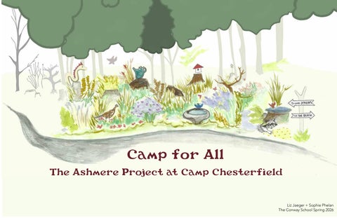
Camp for All The Ashmere Project at Camp Chesterfield
Liz Jaeger + Sophie Phelan The Conway School Spring 2026
Contents 1 2 3 4 5 6 7 8 9 10 11 12 13 14 15 16 17 18 19 20 21 22
Clethra alnifolia
About the Ashmere Project The History of this Land Community Engagement and Design Requests Site Overview Existing Conditions: Amphitheater and Beach Existing Conditions: Stream Crossing Infrastructure Geology The Westfield River Watershed Hydrology On-Site and Wetlands Vegetation: Canopy and Understory Vegetation: Wetlands Vegetation: Wetlands Wildlife Slope Analysis Access and Circulation Alternative Design Concept Final Design Detail: Amphitheater Detail: Platform Detail: Beach Cost Estimation
About the Ashmere Project The Ashmere Project is a non-profit organization started in 2022 that organizes residential summer retreats for adults with and without disabilities. More than that, it is a group of friends who have spent many summers together over the years, making memories and having a great time. There is no cost to attend camp retreats and the programming is funded almost entirely by donation and volunteer labor. Friends of Ashmere celebrate their new home
CAMP IS A PLACE FOR ALL
In October of 2025 the organization was able to purchase 195 acres in Chesterfield, Massachusetts. The site had been owned and used by the Boy Scouts of America for over eighty years. With a permanent site for regular programming the Ashmere Project can grow beyond some of the limitations of the previous location, and also grow their organization to include year-round offerings and rent the space to other groups. According to the 2026 report "Trails For All" (Massachusetts Office of Outdoor Recreation), 49% of Massachusetts residents would benefit from more accessible trails. A dream of the Ashmere Project is to offer a place of radical accessibility to anyone who would like to experience the joy of a special place outdoors.
A person in a motorized wheelchair enjoys a hike in the Berkshires.
In the future, the Ashmere Project hopes to "right size" camp activity to best suit the needs of the annual summer retreat, and also to expand use of the site year round. The current infrastructure and outdoor amenities at the Chesterfield location are still suited to the habits of Scouts and require adaptation in order to become safer and easier to access for people with disabilities. The organization's first step in accomplishing this was to construct new trails that meet needs for the 2026 season. Their next steps aim to make more of the new site accessible and enjoyable for their community. The Ashmere Project's goals for this project are: 1. To increase accessible connectivity throughout the site. 2. To improve accessibility and functional use of three priority sites for camp programming: • The beach • The amphitheater • The waterfall and bridge area
The Chesterfield site with new trails.
Sitting in the amphitheater looking out at Scout Pond.
About the Ashmere Project
Previous to 2026, the Ashmere Project hosted annual retreats at a rented camp site in Hinsdale, Massachusetts. This location provided a foundation for developing regular programming such as swimming, cooking food together, special event days, and regular bonfires. Situated in Berkshire County, this was near many opportunities for hiking, art making and viewing, and taking in the history and culture of the region. Developing connections with the wider community is an essential component of the Ashmere Project's ethos.
T he A shmere P roject at C amp C hesterfield T he C onway S chool S pring 2026 L iz J aeger + S ophie P helan
The mission of the Ashmere Project is "to create a community of friends who celebrate diversity and foster inclusion, independence and equity.”
Friends at the retreat hanging out by the fire. Not for construction. Part of a student project and not based on a legal survey.
1/22
The History of this Land
THE BOY SCOUTS OF AMERICA After the Boy Scout Council learned that their perennial camp site would be lost when the Quabbin reservoir was created, they formed Camp Chesterfield in 1936 by combining six separate parcels on either side of a large stream (highlighted below in blue). The original property was 140 acres, but Scout leaders hoped to expand this by acquiring adjacent parcels as funds became available.
DAVIS DAM AND SCOUT POND
THE CONSERVATION RESTRICTION
The Webster Brook flows from the north into the Page Brook just south of the camp, on the other side of Route 143. The Quinnehtuk Electric Company, which had intended to build a series of small dams to control water flow to a would-be hydropower plant in Knightsville, gifted this small parcel to the scouts. In 1937 a forty-acre impoundment was created by the construction of the Davis Dam across the Webster Brook and Scout Pond (referred to as "the Lake" above) was born. Tons of sand were trucked from nearby Northampton to create the beach where boy scouts would swim and launch canoes.
In December 2002 the Scouts sold the development rights to the Massachusetts Department of Fish and Wildlife for $250,000. A conservation restriction divides the property into five sections according to the existing Boy Scout camp's use and infrastructure. Building Envelope I, which encompasses the core of camp activity and infrastructure, is the primary focus for the 2026 season. The conservation restriction allows for some additional building in this area, however it is limited to regular maintenance and upgrades, plus a small allowance for new construction. Building outside of this envelope is strictly limited or prohibited. Ultimately, the conservation restriction aims to preserve the undeveloped, natural qualities of the site and maintain habitat for hunting and fishing there and on the adjacent Ram Hill and Fiske Meadow areas, and "passive outdoor recreation" throughout. The conservation restriction legally protects the land from development and environmental degradation in perpetuity.
The Scouts inhabited this land for over eighty years, altering the landscape in many ways to accommodate hundreds of Scouts and staff each summer. They built several permanent structures, centrally located and with direct vehicle access to Sugar Hill Road. Beyond the main camp buildings, like the mess hall, health cabin, trading post and Scout Master's cabin, the Scouts themselves resided in canvas tents on temporary wooden platforms. Pit privystyle latrines with sinks were also stationed at each tent site, ten in total. Before electricity came to the site, Scouts cut and processed firewood for cooking and heating water, and many old fire pits dot the landscape.
NEW FOOTPRINTS ON THE LAND
The Ashmere Project purchased the 195-acre property in 2025. It intends to both repurpose the existing infrastructure and also to upgrade the facilities to be more accessible to users with disabilities. The mission to foster independence in the community includes the goal of making this landscape one where people of all abilities can experience the outdoors.
Not for construction. Part of a student project and not based on a legal survey.
The History of this Land
Previous to the 1900's, the land which is now Camp Chesterfield was likely clear-cut to create sheep pasture, as was typical in New England hill towns during the "Merino Boom" of the mid 1800's. Stone walls throughout the western portion of the property support this theory, and an old farmhouse foundation can still be found in the southwest corner. According to the local historical museum, which is located in the former Bisbee grist mill down the road from the camp, the Bisbee Brothers formed a joint farming business and would go on to sell portions of their farm land to the Boy Scouts.
T he A shmere P roject at C amp C hesterfield T he C onway S chool S pring 2026 L iz J aeger + S ophie P helan
Long before European settlement,the Pocumtuc, Nipmuc and Mahican tribes, as well as others, moved across this hilly region. These people were driven from the area by colonial encroachment and inter-tribal warfare beginning at the turn of the seventeenth century. The King Philips War of 1675 killed many of the remaining Pocumtuc peoples, and those who survived were relocated to villages and missions to the north and west in present day New York and Vermont. The land that would become incorporated as Chesterfield in 1762 was originally divided into parcels that were granted to English-born soldiers who fought in the King Philips War.
2/22
What makes a trail feel safe and comfortable? • hand rails • width • clear ground • gravel is hard for wheelchairs Other desires for this site are • shade • magical lighting • big studio • music, dancing • performance and special events • campfires • making memories and friends • intermediate water spaces • we like a challenge sometimes
YEAR ONE IN CHESTERFIELD
Summer of 2026 will be the Ashmere Project's first season of programming at the Camp Chesterfield location. Those attending are people with and without disabilities, some of whom rely on accommodations and assistive devices to get around safely. As they explore this new terrain, the organization will adapt their goals as needs and desires arise. STAKEHOLDER OUTREACH
In spring 2026, the Conway team spoke to some of the longtime campers and their friends about what has worked well for them and what hasn't in previous camp locations. Responses touched on: • ground surfaces and materials • infrastructure • visibility (of obstacles and ground plane)
What do you like to do at the beach? • relax • swim and float • canoe and kayak • mermaid impressions
STAKEHOLDER ENGAGEMENT CONCLUSIONS Old stumps used to cross a marshy area are not safe for many users with disabilities.
Not all of the people the Conway team spoke to had visited the Chesterfield site yet, however those who had mentioned specifically areas where terrain was uneven, unstable or slippery as being of concern. Throughout the site Boy Scouts used logs and makeshift bridges to cross wet areas, like to the dam/bridge and to Ruder Island. Being largely forested, tree roots growing on the surface of trails present hazards in many places.
Stakeholders shared that the beach will be a special place for daily gathering and activity. The Ashmere Project expressed that this location is a priority for increased accessibility, connectivity and comfort. This may be achieved by reducing steep slopes, removing ground plane barriers, and siting activity space to comfortable micro climates. Stakeholders reflected that comfort and safety can be built into all spaces with consideration to shade, places for rest and visibility of surroundings. They also pointed out that trails throughout need to have more reliable, even terrain and to connect activity zones. The following pages present analyses of the site conditions and the implications they have for design requests.
Stakeholders shared that gravel is really difficult to traverse in a wheelchair. Others spoke about ground conditions and visibility, and how objects like large rocks on a trail would be hard to see. Many of the trail conditions that served the Scouts and provided a wilderness feel are unsuitable for universal accessibility. The beach, looking northeast across Scout Pond, does not currently have easy access into the water.
Not for construction. Part of a student project and not based on a legal survey.
Community Engagement and Design Requests
Camp users were asked about memories that sparked joy and what their big dreams are for the new space. They mentioned a sense of magic and whimsy, fun gatherings, opportunities for challenge as well as comfortable places, and how important it is to have a place away from everyday life where they can feel like themselves. At their summer retreat a helpful community makes all those challenges feel easier to overcome. Having special spaces for everyone to gather in, hang out and be together, with areas for one-on-one or more secluded time, is essential to the retreat experience.
SURVEY RESULTS
T he A shmere P roject at C amp C hesterfield T he C onway S chool S pring 2026 L iz J aeger + S ophie P helan
Community Engagement and Design Requests
3/22
Site Overview Camp Chesterfield is located in Chesterfield, Massachusetts, a hilltown in the Connecticut River Valley region. Chesterfield is characterized by a mix of forest cover and agricultural land. Camp Chesterfield is made up of three parcels which total nearly 200 acres. The main parcel is east of Sugar Hill Road. Two smaller parcels are located west of Sugar Hill Road. The site is predominantly forested by deciduous and evergreen trees. A pond impoundment of about 40 acres bisects the main parcel. The land generally slopes from west to east, with the Main Hall building at the high point at 1,243 feet. During the Boy Scouts' occupancy, they built an extensive network of trails, campsites, buildings, and other infrastructure such as an outdoor amphitheater, rifle ranges, and a bridge. The Ashmere Project has installed a series of crushed granite paths to provide access to key camp locations for the 2026 summer session. Beyond that, many trails survive from the Boy Scouts' tenure, which have vegetated and unmaintained surfaces.
MAIN HALL
TP ON D
SUGAR H ILL ROAD
MAGEE LODGE
WELCOME CENTER
SUGAR H
RIFLE RANGE
Looking north at a few key Camp locations
RUDER ISLAND
ILL ROAD
DAVIS DAM BEAC
H
CHAPEL
AMPHITHEATER
CARETAKER'S PROPERTY
MAIN HALL
BISBEE ISLAND MAGEE LODGE
BISBEE ISLAND
MAIN Y ENTR
T he A shmere P roject at C amp C hesterfield T he C onway S chool S pring 2026 L iz J aeger + S ophie P helan
SC
OU
MAIN ENTRY
BEACH DAVIS DAM
Looking south toward Main Road
Site Overview
BRIDGE
Looking south over Scout Pond toward Davis Dam
OAD
MAIN R
MAIN HALL
MAIN ENTRY
0
300 ft North
SUGAR HILL ROAD
Main Hall and a newly constructed trail below a cluster of yews
Looking east toward two vegetated trails Not for construction. Part of a student project and not based on a legal survey.
4/22
Existing Conditions: Amphitheater and Beach A
LEGEND crushed stone trail vegetated trail stone wall tree
B
L ROAD
SUGAR HIL
AMPHITHEATER
A
Tower at beachfront
STUMPERY
Looking east down the slope
BEACH The beach located on the west side of the pond, southeast of Magee Lodge, includes the waterfront, the main gathering area, and the "stumpery," an intermediary space connecting the beach's main gathering area to the path to the bridge which teems with lichens and mosses amidst tree stumps. A gently sloping, new crushed stone trail connects this area to Magee. This trail winds around the northern extent of the beach before heading south, and ends just before the waterfront area. A chainlink fence runs parallel to the pond edge. A two-story tower remains from the Boy Scouts. The Ashmere Project uses it for storage of personal flotation devices and paddles. A stone retaining wall runs from the tower to a small set of stairs, running parallel to the pond edge. The waterfront is vegetated by grass. The main gathering area just upslope of the waterfront has a fire pit.
B BEACH DAVIS DAM BRIDGE
PERY
STUM
MAIN GATHERING AREA CHAINLINK FENCE
WATERFR ON
D
MAIN ROA
T
Reindeer lichen growing on top of stump in the "stumpery" 0
150 ft North
Looking west toward the beach's waterfront and main gathering area Not for construction. Part of a student project and not based on a legal survey.
Existing Conditions: Amphitheater and Beach
Amphitheater benches
The amphitheater on the west side of the pond sits on a steep hillside sloping west to east. There are four columns of bench seats formerly used by the Boy Scouts (i.e., not made for adult use). Two firepits are located at the bottom of the slope along the pond. There is no accessible (unobstructed, firm, stable, gently sloping) entryway to the top nor the bottom of the amphitheater. The top of the amphitheater is accessed via a clearing off of a vegetated trail, and the land slopes steeply east toward the bottom of the amphitheater. A trail overgrown by vegetation and obstructed by tree roots runs from the beach north to the bottom of the amphitheater along the pond edge.
T he A shmere P roject at C amp C hesterfield T he C onway S chool S pring 2026 L iz J aeger + S ophie P helan
The Ashmere Project is looking to concentrate camp activities between the pond and Sugar Hill Road to increase accessibility and right-size their footprint in response to a decrease in occupancy on the site. The organization would like to improve access to and throughout the amphitheater, the beach, and the stream overlook.
AMPHITHEATER
5/22
Existing Conditions: Stream Crossing A
LEGEND
B
STREAM CROSSING The stream crossing is located in the southern portion of the property, just south of Davis Dam. The path to the bridge from the stumpery remains at a level grade until the approach to the bridge, which gets extremely steep and difficult to traverse. There are mossy stump crossings in a couple of locations along the path which add to the rustic whimsical experience of the site, but may be difficult for some people to get across. Along its length, the path has a lot of tree roots and pine needles, which can make navigation difficult or not possible. The bridge continues to a path on the east side of the property (not shown on the map).
crushed stone trail vegetated trail stone wall tree
Moss-covered stumps on path to bridge
C
A
Bridge from east side of stream
D
BEACH DAVIS DAM BRIDGE Bridge looking north
C A
T he A shmere P roject at C amp C hesterfield T he C onway S chool S pring 2026 L iz J aeger + S ophie P helan
L ROAD SUGAR HIL
E
AMPHITHEATER
A'
E
B Bridge from west side of stream
Existing Conditions: Stream Crossing
D
Path approaching bridge from the west
D MAIN ROA
0
STEEP HILLSIDE
150 ft
North
BRIDGE
Bridge looking north, steep hillside approach on left side
Section A-A'
STREAM Not for construction. Part of a student project and not based on a legal survey.
6/22
Infrastructure Primary infrastructure at Camp Chesterfield includes water lines from a well which is located on the southernmost parcel on the west side of Sugar Hill Road, restroom facilities on septic, and buildings. Lodging for the 2026 summer session will be located in existing cabin structures. These buildings support overnight accomodation.
Restroom facilities are a key component of camp infrastructure. While ADA and building code standards establish requirements for the number of stalls based on occupancy, they do not specify maximum distances between program areas and restrooms. A 200-foot buffer has been used as a metric to visualize how existing facilities (flush toilets and latrines) do (or don't) serve key activity areas.
There are currently no restrooms within 200 feet of the amphitheater. An amphitheater with a 200-person occupancy will require 6 toilets (4 women's, 2 men's) and 2 sinks according to Massachusetts Uniform State Plumbing Code (248 CMR 10). The beach area is just outside of the 200 foot buffer.
LODGING + WATER
RESTROOMS
200' PROXIMITY BUFFER FROM RESTROOMS
LEGEND
LEGEND
LEGEND
crushed stone trail
crushed stone trail
vegetated trail
vegetated trail
vegetated trail
stone wall
stone wall
stone wall
tree tree
tree
tree
water line
water line
water line
lodging
lodging
lodging
T he A shmere P roject at C amp C hesterfield T he C onway S chool S pring 2026 L iz J aeger + S ophie P helan
crushed stone trail
Infrastructure
200' buffer
0
150 ft
North
0
150 ft
North
0
150 ft
North
Not for construction. Part of a student project and not based on a legal survey.
7/22
Geology SURFICIAL GEOLOGY AND SOILS
Camp Chesterfield is situated within a landscape primarily underlain by metamorphic bedrock, with smaller areas of granite. This foundation contributes to the site’s rugged topography, shallow soils, and exposed bedrock outcrops. Metamorphic rock is formed when rock is exposed to heat and pressure, causing a process of recrystallization without melting, producing dense rock formations.
Surficial geology across the site consists predominantly of glacial till and exposed bedrock, with smaller areas of sand and gravel deposits associated with glacial outwash and stream corridors. These conditions reflect the site's glacial history and have influenced the development of soils present today. Many soils onsite are classified as extremely stony, containing rock fragments deposited during glaciation. High stone content may complicate excavation for trails, utilities, and other site work. In some locations, shallow depth to bedrock may further limit excavation. Areas mapped as fine sandy loams and sandy outwash deposits (portion of the site along the southern property boundary) generally have more workable soils with fewer physical limitations for construction and planting.
A GLACIATED LANDSCAPE Western Massachusetts was heavily shaped by the melting back of the Laurentide Ice Sheet approximately 15,000 years ago. As glaciers melted south to north, they impacted the underlying bedrock, deposited glacial till, and left behind the rocky, uneven terrain visible today throughout the region.
SURFICIAL GEOLOGY
The U.S. Department of Agriculture Natural Resources and Conservation Service maps the majority of the site as AshfieldShelburne Association soils, which are typically extremely stony and moderately well to well-drained. The Ashfield series generally occurs on upland slopes and consists of dense, loamy till, while the Shelburne Series typically includes deeper, well-drained soils. These soils tend to support mixed northern hardwood forests and are suitable for establishment of native woodland species.Lowerlying areas mapped as sandy loams are associated with outwash and stream-adjacent deposits. These areas have higher moisture availability, supporting wetland plant communities. The amphitheater, beach, and stream crossing are located within areas mapped as Ashfield-Shelburne Association soils, indicating they will require attention to subsurface stones during grading and construction. Soils
T he A shmere P roject at C amp C hesterfield T he C onway S chool S pring 2026 L iz J aeger + S ophie P helan
METAMORPHIC BEDROCK
LEGEND sand and gravel till or bedrock
0
5000 ft
920E
North
floodplain alluvium
Geology
Trees growing amidst boulders
LEGEND 31A walpole sandy loam 254C merrimac fine sandy loam 370B shelburne loam 370C shelburne loam
375B ashfield fine sandy loam
0
300 ft
North
911C ashfield - shelburne association 920E shelburne - ashfield association
921C westminster - millsite association
922B pillsbury - peacham - wonsqueak association Not for construction. Part of a student project and not based on a legal survey.
8/22
The Westfield River Watershed WILD & SCENIC Camp Chesterfield is located in the northeastern portion of the Westfield River watershed. This means that water moving across the landscape eventually flows southward into the Westfield River. From there it flows into the Connecticut River and into the ocean at the Long Island Sound. Portions of the Westfield River have been designated as "Wild and Scenic" by the U.S. Congress. This designation is granted because the river has outstanding water quality supporting cold water fisheries and is mostly free-flowing (without dams), which makes it one of the healthiest tributaries to the Connecticut River. Having achieved this designation, towns within the watershed, including Chesterfield, qualify for grants for dam removal and stream crossing improvements.
North Camp Chesterfield located in the Westfield River Watershed.
AD
DE CH AN
BR
SCOUT POND
K
OO
BR K
O
FISKE MEADOW WMA
R TE
RO
B
S
PAGE BROOK
EB
The Westfield River Watershed
Webster Brook flows through the impoundment pond and joins with Page Brook and the Dead Branch Brook south of the camp property. It joins the Westfield River about 5 miles downstream at the Indian Hollow campground.
Confluence of Dead Branch Brook and Westfield River
T he A shmere P roject at C amp C hesterfield T he C onway S chool S pring 2026 L iz J aeger + S ophie P helan
The Davis Dam is in satisfactory condition after its last inspection, and its hazard rating is "low," according to the National Inventory of Dams. Because the dam is sound and the pond is central to camp programming it is unlikely to be removed. However, should the Ashmere Project decide that the maintenance or liability is no longer feasible, there may be funding to remove the dam.
Camp Chesterfield
W
The Westfield River A brook trout caught nearby.
North The site (outlined) and adjacent water bodies. Not for construction. Part of a student project and not based on a legal survey.
9/22
Hydrology On-Site and Wetlands MAIN CAMP AREA RUNOFF AND WETLANDS
Surface water on site in the main camp area moves down the hill and into Scout Pond. Runoff sheds off of the surface of several large roofs of the main camp buildings, as well as many small structures scattered on the hillside. Previously dug drainage ditches and culverts attempt to move water away from infrastructure and pathways, but saturated ground conditions were observed.
Scout Pond
Shallow marsh meadow and fen.
The only asphalt surface on site is the driveway horseshoe, the main vehicle access point into the camp. Sections of the existing dirt trails and vegetated paths, as well as the newly constructed crushed stone trails, show signs of washout and erosion. Sedimentation from erosion can have serious water quality impacts, harming fish, amphibians, birds, and other wildlife nearby.
Open water and deep marsh
Water flow and water quality at the camp is of utmost importance because the pond is not only for humans to swim in, but also provides critical habitat and impacts wetland health downstream. Clean water is the foundation of the ecology that makes this landscape so special. Mapped wetlands
Wooded coniferous swamp and shrub swamp
AMPHITHEATER
A
Each of these specific wetland types supports a unique community of plant and animal species, all dependent on the water held in the landscape. Some species, like salamanders, are very sensitive to environmental changes.
T he A shmere P roject at C amp C hesterfield T he C onway S chool S pring 2026 L iz J aeger + S ophie P helan
The Massachusetts Department of Environmental Protection maps Scout Pond as a wetland, along with five other small areas on site. Work within a 100-foot radius of the wetlands requires review by the local Conservation Commission. Beyond the legal implications, wetlands are a vital resource for flood protection, water filtration and the recharge of aquifers.
H
AC
BE
A
Red eft, the juvenile stage of the Eastern Newt.
Po
nd
A
Sco
ut
A
STREAM CROSSING
LEGEND
Direction of water flow Wet area
BEACH
Hydrology and On-Site Wetlands
100' Buffer
North
Programmatic areas fall within the regulated wetland buffer.
Drainage issues between the pond and Magee Lodge. Uphill this same ditch is seen diverting water away from the foundation of a pavilion, with facultative wetland plants observed. Not for construction. Part of a student project and not based on a legal survey.
10/22
Vegetation: Canopy and Understory UNDERSTORY AND CULTIVATED LAWN
The site is predominantly forested, with canopy species including American beech, ash, hemlock, pine, birch and maple. These species contribute to wildlife habitat, hosting various insects and songbirds and other creatures, and adding to the overall experience of the landscape by creating variation in visual form, shade, and complex understory communities. Forest conditions vary throughout the property in response to topography, hydrology, past land management practices, and natural disturbances.
There are several stands of mature red pines across the site. These plantations appear distinct from surrounding native forest communities based on their bark and form, and may be remnants of reforestation efforts undertaken during the twentieth century by the Civilian Conservation Corps (CCC) forestry programs. Many of the observed red pine stands exhibit signs of decline. As these stands continue to age, they may require active management such as felling to avoid damages incurred to infrastructure or people.
The forest understory contains shrubs such as witch hazel, serviceberry, mountain laurel, hazelnut, honeysuckle, as well as herbaceous plants, ferns, mosses, and leaf litter. Areas of cultivated lawn occur north and east of the Main Hall, within the horeshoe-shaped main entry, and at the beach. These lawn areas provide lower ecological value than adjacent forest and wetland systems, but serve as open spaces for group activities. Therefore it may be best to maintain these already disturbed areas for group activities instead of deforesting others. Areas of lawn not needed for recreation could be converted into more diverse plant communities.
T he A shmere P roject at C amp C hesterfield T he C onway S chool S pring 2026 L iz J aeger + S ophie P helan
CANOPY COMMUNITY
Red pine stand near the Main Hall. Some having fallen while others remain standing.
Lawn at beach
Vegetation: Canopy and Understory
The woodland tree communities present on the site are experiencing pressures from a variety of pests, pathogens, and climate-related stressors. American beech populations have been impacted by beech bark disease and beech leaf disease. White ash are facing mortality from emerald ash borer, which has become widespread throughout the region. Eastern hemlock is vulnerable to hemlock woolly adelgid. Changing temperature and precipitation patterns may further influence species composition and forest resilience over time. These factors contribute to an evolving forest landscape that will require ongoing adaptive management. LEGEND bare land cultivated deciduous forest cultivated lawn evergreen forest impervious
0
300 ft
North
wetland pasture / hay
Lichens and mosses growing on tree bark
Birch tree bark
Beech tree with pocked bark
Lawn in area east of Main Hall Not for construction. Part of a student project and not based on a legal survey.
11/22
Vegetation: Wetlands WETLAND VEGETATION
LEGEND
The northwest portion of the site contains a wetland system characterized as a deep marsh. This area mapped by MASSDEP is a rich ecological zone supporting obligate wetland species (wetland species classification explained on following page). The wetland is populated by hydrophilic (water-loving) species including cattail (Typha latifolia), soft rush (Juncus effusus), tussock sedge (Carex stricta), yellow pond lily (Nuphar variegata), blueflag iris (Iris versicolor), marsh marigold (Caltha palustris), false hellebore (Veratrum viride), red-twig dogwood (Cornus sericea), silky willow (Salix sericea), and sphagnum moss (Sphagnum spp.). These species indicate sustained saturation, and conditions typical of emergent marshlands. Other species include highbush blueberry (Vaccinium corymbosum), steeplebush (Spiraea tomentosa), yellow birch (Betula alleghaniensis), and pussy willow (Salix discolor). This mapped wetland is a particularly sensitive ecological resource that provides habitat, hydrological functions, and biodiversity. Future development and frequent circulation should be avoided within and adjacent to this area.
Sco
ut P
Northwest Wetland
ond
massdep wetlands
Wet Area
Dense tree community in observed wet area
Wetlands are often positioned at low points, and as a result recieve runoff that can contain pollutants. This affects their ability to support wildlife. Wetlands have also been subject to degradation and filling across the state—the rate of wetland loss has prompted regulatory and conservation efforts. While all plant communities at Camp Chesterfield have ecological importance, minimizing impacts to wetlands might be prioritized. Upland communities might be better locations for trails, gatherings, and programming. 0
300 ft
Red efts amongst grasses in northwest wetland
Both the pond and the mapped wetland in the northwest of the site are likely subject to regulated wetland buffer requirements. Activities within these buffer areas may require additional review to ensure their functions are protected. The undelineated wet area is not mapped by MASSDEP, but may still be regulated. A qualified wetland scientist can delineate all wetland areas and determine regulatory requirements.
Vegetation: Wetlands
The beach is primarily maintained as mown lawn to support recreation, gathering, and access to the water. While open turf provides a flexible space for camp activities, regularly mown grass can attract geese, whose droppings may negatively affect the experience of being at the beach. It may also increase exposure to ticks. Planting vegetation to obstruct uninterrupted sightlines between open lawn and water may discourage geese. from congregating in these areas.
An undelineated wet area was observed within a forested portion of the site. Field observations indicate potential seasonally saturated soils and hydrologic conditions that support a distinct plant community. The canopy is composed of sugar maple (Acer saccharum), red maple (Acer rubrum), American beech (Fagus grandifolia), eastern white pine (Pinus strobus), and black cherry (Prunus serotina). Beneath the canopy, there is diverse herbaceous vegetation reflecting the area’s moist soil conditions. Observed species in this area include Carolina spring beauty (Claytonia caroliniana), red trillium (Trillium erectum), trout lily (Erythronium americanum), foamflower (Tiarella cordifolia), white avens (Geum canadense), and intermediate wood fern (Dropteris intermedia). Several species associated with wetter conditions were also documented here, including jewelweed (Impatiens capensis), sensitive fern (Onoclea sensibilis), meadow-rue (Thalictrum spp.), rough-stem goldenrod (Solidago rugosa), sphagnum moss (Sphagnum spp.), and red maple. The presence of these species suggests prolonged soil moisture. One species considered invasive, multiflora rose (Rosa multiflora), was observed.
T he A shmere P roject at C amp C hesterfield T he C onway S chool S pring 2026 L iz J aeger + S ophie P helan
The pond, mapped wetlands, and undelineated wet areas contribute to the ecological relationships of Camp Chesterfield. They function as a wetland system, storing water, supporting vegetation, providing wildlife habitat, and moderating downstream flows. The pond supports a variety of aquatic and shoreline vegetation that contributes to the habitat and water quality. Vegetated pond edges help filter runoff before it enters the pond and brook.
North
Not for construction. Part of a student project and not based on a legal survey.
12/22
Vegetation: Wetlands
LEGEND massdep wetlands
Sco
ut P ond
The following tables summarize plant species observed within the wet area and mapped wetland on-site. Wetland indicator status is included to describe each species' likelihood of occurring in wetland conditions. Obligate (OBL) species almost always occur in wetlands, Faculative Wetland (FACW) species are likely to occur in wetlands but may be found in uplands, Faculative (FAC) species are equally likely to be found in wetlands or uplands, and Facultative Upland (FACU) species usually occur in uplands but may occasionally occur in wetlands. These classifications help characterize the ecological conditions within these areas and determine if an area is a wetland and needs to be treated as such jurisdictionally. Identifying wetlands can shape future decisions on siting buildings and camp acitivities.
Trillium erectum
Northwest wetland vegetation
Northwest Wetland Common Name Scientific Name
Fac/Ob
Mountain laurel
Kalmia latifolia
FACU
Hemlock
Tsuga canadensis
FACU
Witchhazel
Hamamelis virginiana
FACU
Paper birch
Betula papyrifera
FACU
Black birch
Betula lenta
FACU
Windflower quinquefolia Anemone quinquefolia
FACU
Christmas fern
Polystichum acrostichoides
FACU
Striped maple
Acer pensylvanicum
FACU
Highbush blueberry
Vaccinium corymbosum
FACW
Steeplebush
Spiraea tomentosa
FACW
Pussy willow
Salix discolor
FACW
Yellow birch
Betula alleghaniensis
FACW
Goldthread
Coptis trifolia
FACW
Sphagnum moss
Sphagnum
OBL
Soft rush
Juncus effusus
OBL
Silky willow
Salix sericea
OBL
Yellow pond lily
Nuphar variegata
OBL
Tussex sedge
Carex stricta
OBL
Cattails
Typha latifolia
OBL
Red twig dogwood
Cornus sericea
OBL
Marsh marigold
Caltha palustris
OBL
Blueflag iris
Iris versicolor
OBL
False hellebore
Veratrum viride
OBL
Sundew
Drosera
OBL
300 ft North
Observed Wet Area Common Name Scientific Name
Fac/Ob
Carolina springbeauty
Claytonia caroliniana
FACU
Intermediate wood fern Dryopteris intermedia
FACU
Red trillium
Trillium erectum
FACU
Black cherry
Prunus serotina
FACU
Bellwort
Uvularia
FACU
Sugar maple
Acer saccharum
FACU
White avens
Geum canadense
FACU
Yellow clintonia
Clintonia borealis
FACU
Beech
Fagus grandifolia
FACU
Northern dewberry
Rubus
FACU
Wild strawberry
Fragaria virginiana
FACU
Multiflora rose
Rosa multiflora
FACU
Eastern white pine
Pinus strobus
FACU
Trout lily
Erythronium americanum
FACW
Foamflower
Tiarella cordifolia
FACW
Jewelweed
Impatiens capensis
FACW
Sensitive fern
Onoclea sensibilis
FACW
Meadow-rue
Thalictrum
FACW
Red maple
Acer rubrum
FACW
Sphagnum moss
Sphagnum
FACW
Rough-stem goldenrod
Solidago rugosa
FACW
Erythronium americanum
Sphagnum moss and sundews Photo by Stephen Kiely
Vegetation: Wetlands
0
T he A shmere P roject at C amp C hesterfield T he C onway S chool S pring 2026 L iz J aeger + S ophie P helan
Photo by Stephen Kiely
Grasses in Northwest wetland
Sundew
Photo by Stephen Kiely
Photo by Stephen Kiely Not for construction. Part of a student project and not based on a legal survey.
13/22
Wildlife SITE WILDLIFE A defining feature of Camp Chesterfield is the impoundment created by Davis Dam, constructed in 1937, which has altered local hydrology and established open-water habitat. The pond supports aquatic vegetation, amphibians, and waterfowl, and serves as an important recreational resource for the camp. Adjacent wetlands and upland forests create a diverse habitat that supports wildlife throughout the property. Species observed include beavers, river otters, turtles, red efts, Canada geese, ducks, and numerous songbirds. The continued stewardship of these habitats supports biodiversity and offers opportunities for education and connection to place. LEGEND
Davis Dam
conserved land
0
2,000 ft
North
camp chesterfield
WILDLIFE CORRIDOR Camp Chesterfield occupies an important position within a broad network of conserved lands. To the west lies Fisk Meadows Wildlife Management Area, a 622-acre conservation area managed by MassWildlife, that includes a segment of the Dead Branch Brook, which runs north to south through the area to the Westfield River. It contains wetlands, marshes, and forest. There are 118 bird species logged in E-Bird, and beaver activity impacts the amount of standing water present and contributes to slow-moving water in the area. Some other species in Fisk Meadows present include river otter, waterfowl, great blue heron, red-winged blackbird, white-tailed deer, native brook trout, chain pickerel, and various other wetland-dependent species. The Natural Heritage and Endangered Species Program (NHESP) identifies documented rare species habitats, including Fisk Meadows. The proximity of Camp Chesterfield to these protected habitats highlights the ecological value of the site and importance of maintaining habitat connectivity and minimizing disturbance to sensitive ecological systems as further improvements and development are considered. To the east lies Ram Hill Wildlife Management Area, a 549acre conservation area also managed by MassWildlife. Species present include white-tailed deer, bobcat, fisher, coyote, red fox, and wild turkey, amongst others. Fisk Meadows WMA, Ram Hill WMA, and Camp Chesterfield are all conserved in perpetuity. Maintaining the connectivity between these areas supports the movement of wide-ranging mammals, and provides opportunities for dispersal for amphibians and birds.
Freshwater mussel shell found on east side of pond
Northeast side of pond
Tree with beaver impact
Tiger swallowtail on east side of pond
Observed beaver activity throughout the site continues to influence ecological processes via tree felling and wetland alteration. As ecosystem engineers, beavers can modify water flow, create wetlands, and increase habitat diversity. While beaver activity can conflict with human infrastructure or intended land-use, their presence is ecologically valuable and they have a long history of shaping landscapes in the area.
As the site continues to evolve, these ecological systems can serve not only as critical wildlife habitat but also as a foundation for human connection to the landscape. The property’s varied terrain, hydrologic features, and natural communities offer opportunities for immersive outdoor experiences that foster curiosity and stewardship of ecological processes (e.g. bird watching, fishing, observing turtles and beavers). Future improvements should seek to balance habitat protection with opportunities for access, allowing a wider range of visitors to experience and build relationships with the land. Providing access and maintaining/strengthening the health of the habitat onsite are not necessarily at odds, but siting buildings and trails and choosing materials and construction methods will need to be done thoughtfully.
No specific conflicts between beavers and camp operations have been observed on-site, but there is potential if beavers fell trees on trails or (though rare) become aggressive.
Not for construction. Part of a student project and not based on a legal survey.
Wildlife
wildlife corridor
T he A shmere P roject at C amp C hesterfield T he C onway S chool S pring 2026 L iz J aeger + S ophie P helan
wetlands
14/22
Slope Analysis
The Main Lodge 1242'
ACCESSIBILITY STANDARDS: ADA & FSTAG To increase accessibility throughout the site for the 2026 season, and particularly in the central camp infrastructure zone, the Ashmere Project has constructed new trails with a maximum running slope of 5%. This corresponds to ADA, the Americans with Disabilities Act, standards.
Magee Lodge 1200`' Scout Pond 1158'
The variation in slope and the areas with slope in excess of 5% presents several issues to the camp's regular programming, most importantly that it limits accessibility between key activity areas and within them. For people with disabilities and those who use assistive devices, steep trails and uneven ground can be unsafe and exhausting to traverse. Steeper terrain on this site makes "flat" (less than 2% slope) ground for paths and gathering spaces harder to achieve but not impossible. In order to improve safety and reduce the steepness, routes of access will need to be graded, or follow along contours in the hillside, making them longer and less direct. For instance, a trail that served the Scouts' movement between the Main Lodge and the lower entry driveway is about 300 feet. In order to remake this same path at a 5% slope to accommodate the new users, the trail is now almost 500 feet long.
A1
0
40
80 Feet
TRAIL DRAINAGE DESIGN A grade reversal is a section of trail where the running slope decreases and rises again, and this dip encourages water to shed off the trail. Even a change of 2%, which would not reduce accessibility, will move water down and off of the treadway. This prevents erosion, contributing to long term trail maintenance and safety. Additionally, it is important to include segments of trail or stairs where people can choose to take a more direct route between destinations, or to maintain a barrier like woody vegetation, railings, or stones to prevent "desire paths" from forming across contours and exacerbating washout and erosion.
The Forest Service Trail Accessibility Guidelines allow for a maximum of 12% slope on trails without handrails, but they limit these segments to ten feet long. The FSTAG requires resting intervals after stretches of trail that exceed 5% slope. Rest areas along trails allow for users to take a break, and are also a natural place to build in drainage features like grade-reversals. The map on the right shows slopes on site in a color gradient ranging from 0% slopes (light blue) to over 12% (red). This graphic illuminates some of the pre-existing Scout trails, where ground was graded to accommodate vehicular access, or, where foot trails developed over time on contour with the hill.
Bisbee Island 1164'
A
Grade Reversal
A'
Running Slope Resting Interval
Obstacles Removed
Cross Slope
For users who enjoy a longer walk or a more challenging hike, this could be a positive attribute. However, for the quickest and easiest route between activities, the locations themselves may need to change.
Slope Analysis
A
T he A shmere P roject at C amp C hesterfield T he C onway S chool S pring 2026 L iz J aeger + S ophie P helan
Located on an east-facing hillside, the main camp area is defined by its slope down to Scout Pond. Average slope varies widely on the landscape, with very steep pockets and more gradual flat areas. Baseline criteria for universal accessibility calls for slopes less than 5%.
From the Forest Service Accessibility Guidebook for Outdoor Recreation and Trails
Not for construction. Part of a student project and not based on a legal survey.
15/22
Access and Circulation
Main vehicle entry
In order for surface materials to be considered accessible by the Americans with Disabilities Act, they must be firm (resist deformation when weight is applied), stable (do not shift or move underfoot), and slip-resistant (provide adequate traction in dry and wet conditions). According to the client, the newly constructed trails at Camp Chesterfield are crushed granite. During construction in spring of 2026 the ground was first cleared, excavated, and compacted, then laid with layers of 3 inch minus and half inch minus crushed granite. Materials were compacted between layers. The fines are important because they help bind the materials together and contribute to resistance of deformation from use, as opposed to gravel with larger aggregate which is not firm, stable, or slip-resistant and therefore not considered accessible.
Vehicle entry to Main Hall
LEGEND crushed stone trail vegetated trail stone wall
T he A shmere P roject at C amp C hesterfield T he C onway S chool S pring 2026 L iz J aeger + S ophie P helan
Two vehicular entryways on the east side of Sugar Hill Road bring people to the main entry horseshoe or the Main Hall. Vehicles park on the grass along the sides of the horseshoe. Parking at the Main Hall has not yet been observed, however there is space for vehicles to park. There is also vehicle access to Magee Lodge by way of a crushed stone trail with width to accomodate a car, and then downhill toward the beach where there is a turnaround. The pedestrian circulation network is composed of two systems: remnant Scout-era unpaved paths and newly constructed accessible trails developed by the Ashmere Project. The older trails remain largely vegetated or covered in plant material such as pine needles, and are not necessarily accessible because they do not meet ADA criteria for accessibility (firm, stable, slip-resistant). The Ashmere Project, however, has established a system of trails that provide reliable access to main areas of use for their summer 2026 camp session. According to the client, these trails have been designed to not exceed 5% slope in order to support accessibility for friends of Ashmere who use wheelchairs or have disabilities that impact their mobility. They aim to ensure that key destinations across the site are reachable.
TRAIL MATERIALS
tree
RUDER ISLAND
vehicle use pedestrian use
AMPHITHEATER
L ROAD
SUGAR HIL
MAIN HALL ENTRY
BISBEE ISLAND
MAIN ENTRY
BEACH BRIDGE Trail to Magee Lodge
Trail to beach
Trail to Ruder Island
Vegetated trail
Access and Circulation
DAVIS DAM
D
MAIN ROA
0
150 ft
North
Not for construction. Part of a student project and not based on a legal survey.
16/22
Alternative Design Concept NEW AMPHITHEATER
BEACH + STREAM CROSSING
This concept consolidates camp activities within a centralized, highly accessible core while restoring little-used areas to ecological habitat. The existing amphitheater is transformed into a restoration zone, allowing native vegetation to enhance pond-edge habitat and improve ecological function. A new amphitheater is located east of the Main Hall (an area currently managed as lawn), providing seating for 200 people, with abundant opportunities for wheelchair users to participate alongside their peers by constructing multiple rows of wheelchair accessible seating.
LEGEND M eadow
VEHICLE ACCESS
F lower B ed T urf
S hrubs
T ree
VEHICLE ACCESS
LEGEND crushed stone trail vegetated trail stone wall
STAGE
DECK
tree
DOCK
A'
MAIN HALL
A
RESTORATION ZONE
BOARDWALK
PATH TOWARD COOK'S CABIN
TEMPORARY BEACH MAT
AMPHITHEATER
T he A shmere P roject at C amp C hesterfield T he C onway S chool S pring 2026 L iz J aeger + S ophie P helan
Accessible trails connect key destinations throughout the site, weaving through newly established meadows and linking the amphitheater, campfire and beach. From the beach, a roughly 200-foot boardwalk provides access to a large gathering platform designed for activities such as yoga and meditation.
PLATFORM
0
0
40 ft North
40 ft North
TRAILS BEACH PLATFORM DAVIS DAM
Pros: Allows for land outside of main area of use to grow in as wildlife habitat. Reduces footprint of camp activities and improves accessibility throughout core zone of use.
BRIDGE MEADOW
SEATING STAGE
Cons: Reduces area of human connection to landscape.
Section A-A' 0
150 ft
North
Not for construction. Part of a student project and not based on a legal survey.
Alternative Design Concept
CAMPFIRE
17/22
To Ruder Island
Final Design The final design prioritizes accessibility and engagement with the site's natural communities.
A Renovated Amphitheater The existing amphitheater is enhanced with a 5% slope pathway that provides access to wheelchair seating. Non-accessible rows of seating are situated on the existing vegetated slope, minimizing earthwork and preserving the landscape. The pond edge downhill from the stage is planted to help intercept runoff, reduce erosion and sedimentation, and sustain the ecological health of the pond.
A
B Future Programming Area Main
Hall
B
C Beach, Firepit and Bird Garden Magee Lodge
Waterfront activity is concentrated at the beach, which is redesigned to support water access and is integrated with the adjacent grassy area where gathering and relaxing can take place. A dock connected to the accessible trail network allows all users to enjoy the pond and launch canoes or kayaks. A peripheral area west of the beach becomes re-wilded as a bird habitat and sculpture garden.
D Stream Overlook
C
Final Design
ill Road
Auxillary trails throughout, designed to be no greater than 12% slope (FSTAG standards), improve overall connectivity and also provide an accessible hiking option to campers and other visitors. Wayfinding signs share important information about what to expect on trails and how to get around.
Welcome Center and Lodges
Sugar H
A new crushed stone trail connects the beach to a new platform near the dam, with rest intervals every 100 feet. Near the dam and stream, an octagonal gathering platform provides space for activities and sensory experiences beneath the forest canopy, while a smaller covered platform nearby offers opportunities for refuge and quiet reflection. These features allow campers to enjoy the sights and sounds of the stream without navigating the steep hillside leading to the existing bridge.
T he A shmere P roject at C amp C hesterfield T he C onway S chool S pring 2026 L iz J aeger + S ophie P helan
Area identified by client as desireable for future expansion of infrastructure, such as lodging and more bathrooms to support the amphitheater at maximum event capacity.
D Davis Dam an Stream Cross d ing
0
100 ft North
Not for construction. Part of a student project and not based on a legal survey.
18/22
Detail: Amphitheater The amphitheater seating terraces are constructed from dry-laid fieldstone retaining walls (which also function as seats) sourced from stone available onsite where possible. Each wall is underlain by 4 inches of crushed stone to provide drainage beneath its base. 12 inches of crushed aggregate is placed behind the wall to improve drainage and reduce pressure on the wall. Geotextile fabric separates the aggregate from native soils to prevent migration of materials, maintaining the composition of materials to help with drainage and structure. Base stones are set below grade and successive stone layers are set into the slope. Stone or timber seating caps form the top layer to provide comfortable seating.
FIELDSTONE SEAT CAP
12" AGGREGATE
GEOTEXTILE EMBEDDED BASE STONE
4"+ CRUSHED STONE
STAGE PERSPECTIVE
LEGEND
Vegetation follows a moisture gradient in response to site hydrology and views. Along the pond edge, wetland species stabilize soils and act as a final buffer for runoff flowing into the pond. Vegetation transitions into a meadow composed of a mixture of wetland/upland, low-growing species 2-6 feet tall, preserving views of the water from the seating terraces. Trees frame the stage. Shrubs run along the forest edges, serving as vertical transition between the amphitheater and tall tree canopy in the adjacent forests. Mat-forming groundcovers between new trails stabilize disturbed soils and reduce erosion. Clover seeded between retaining walls of rows that are not accessible, reduces mowing requirements and withstands foot traffic. A native upland woodland meadow is established upslope from the top row of wheelchair accessible seating, offering flexibility should this area be developed for future circulation.
SEATWALL DETAIL
STAGE PLAN 34'
Plant Palette (Trees)
groundcover
Common Name
26'
18'
14'
wetland edge
Scientific Name
meadow
River Birch
Betula nigra
clover
Black Willow
Salix nigra
Common Serviceberry
Amelanchier arborea
Witch Hazel
Hamamelis virginiana
shrubs
BLACK LOCUST DECKING
FRONT FASCIA BOARD MEETS GRADE
117
A
0
11
80
117
5
tree
SERVICEBERRY
RIVER BIRCH
BLACK WILLOW
11 74
1177
8 116
116
9
UPLAND MEADOW
EXISTING TR EE CANOPY
AMPHITHEATER
STAGE
WETLAND/UPLAND MEADOW
POND
Detail: Amphitheater
116
6
7 116
117
1
117
3
117
0
117
5
117
117
6
2
A'
116
5
CLOVER
T he A shmere P roject at C amp C hesterfield T he C onway S chool S pring 2026 L iz J aeger + S ophie P helan
METAL ROOF
crushed stone trail
Section A-A': Amphitheater
PROPOSED TREE CANOPY
0
20 ft North
Proposed Grading
Not for construction. Part of a student project and not based on a legal survey.
19/22
Detail: Platform Located uphill from the stream crossing, a 25 x 25 foot octagonal platform is nestled within a level forest clearing overlooking the pond. The platform provides an accessible gathering space that accommodates activities such as yoga, group discussion, or reflection, without requiring visitors to navigate the uneven micro-topography below. A guardrail encloses the platform for safety on all sides but the entrance. This location provides a rich sensory experience, with sunlight filtered through the forest canopy, views of the pond, and the sound of water flowing nearby. Adjacent to the main platform, a covered 12 by 12 foot "nest" provides a more intimate setting for small gatherings or moments of solitude.
Disturbed soils along the access trail and around the main platform are revegetated with a native woodland seed mix to stabilize soils, restore native groundcover, and decrease likelihood of invasive species entering the plant community. This low-growing vegetation preserves views at the platform. Between the main platform and the "nest," trees and shrubs create a vegetated screen that softens sight lines and gives a sense of discovery to visitors moving through the site. A stand of mountain laurel surrounding the nest creates a sense of enclosure and privacy.
REST INTERVALS
D
N
PO
Plant Palette Common Name
PLATFORM SECTION
WOOD TOP RAIL CABLE
Scientific Name
Summersweet
Clethra alnifolia
Witch Hazel
Hamamelis virginiana
Mountain Laurel
Kalmia latifolia
Black Huckleberry
Gaylussacia baccata
SUMMERSWEET WITCH HAZEL
RAMP
A
DAVIS D
AM
PLATFORM
HUCKLEBERRY
HELICAL PIER FOOTINGS MOUNTAIN LAUREL
BRIDG
E
T he A shmere P roject at C amp C hesterfield T he C onway S chool S pring 2026 L iz J aeger + S ophie P helan
The platform is accessed from the beach by a 3-foot wide crushed stone path sited to not surpass 5% in slope. Larger resting/passing areas are provided every 100 feet, allowing visitors to pause or navigate around folks passing by in the other direction
Gaylussacia baccata Photo credit to Stephen Kiely Hamamelis virginiana Photo credit to Stephen Kiely
Detail: Platform
"NEST" PERGOLA
0
Photo A: View of pond from platform site
Ramp precedent onsite
Existing logs on trail moved to side of new trail
40 ft
North
Clethra alnifolia Photo credit to Kate Cholakis
Kalmia latifolia Photo credit to Stephen Kiely
Not for construction. Part of a student project and not based on a legal survey.
20/22
Detail: Beach to the fore
North
D
tra il
PON
AT
-M BI
CH
O
ND
A BE
SA
O PAVILI N
The heart of the beach area is around a new firepit, which is accessible via a 5% crushed stone trail from beach (140 feet long) or from the existing trail to the northwest (85 feet long). These new standardized trails form a loop that connect at junctures to a southerly trail and also a northerly one, creating spurs within a larger hiking system.
PICNIC
LEGEND
AREA
crushed stone trail
reinforced turf
Native plantings along the beach ridge provide shade and enjoyment, encompassing a lawn area with picnic tables and chairs, plus an additional semi-circle shade pavilion. A 50-by-50 foot section of reinforced turf offers a soft and more stable pad for gathering around the fire.
grass meadow ground cover trees & S hrubs
0
40 ft
Plant Palette for Songbird Meadow
"The Stumpery"
Common Name
The sloping hillside west of the grassy area is converted to songbird habitat and a sculpture garden with perennial native meadow plantings. A number of old stumps are left in the landscape as snags and to hold bird houses and art made by the Ashmere Project community. A gently meandering trail along the lower portion includes a place for refuge and birdwatching, and continues into the woods' edge toward the forest platform.
Scientific Name
Steeplebush
Spiraea tomentosa
Wild Bergamot
Monarda fistulosa
Staghorn Sumac
Rhus hirta
Big bluestem
Andropogon gerardii
Blue Lobelia
Lobelia siphilitica
Virginia Rose
Rosa virginiana
Blue lobelia
Intermediate water areas to safely access the pond.
STUM
FIRE PIT
Wild Bergamot
Little bluestem grass
Virginia rose
Not for construction. Part of a student project and not based on a legal survey.
Detail: Beach
PERY
Grill and Chill Zone
T he A shmere P roject at C amp C hesterfield T he C onway S chool S pring 2026 L iz J aeger + S ophie P helan
M DO CK
Access onto and into the water is improved with a 40' long T-shaped dock for swimming and fishing. Options for dock upgrades include adding a wheelchair accessible kayak launch, or shallow, wide "swim stairs." The floats are seasonally affixed to a stationary platform and connected to the crushed stone trail at grade. Entry into the water from the end of the existing trail is facilitated by a movable mat alongside a handrail that leads into the pond. An additional 5% grade trail segment connects the beach area to an upper flat, grassy area. An existing chainlink fence and stone wall are removed and replaced with native shrubs and ground cover to restore the ground plane and prevent erosion. The beach itself is restored to sand, however this will limit accessibility for those who require a firm and stable surface to navigate.
st pla tfo rm
The Shoreline
21/22
Cost Estimation
Notes:
Preliminary estimate, subject to change and further design development. Costs are impacted by tariffs and market instability.
Helical pier footings are suggested to minimize disturbance. White oak or black locust wood can be used for decking. Materials can be re-used to reclaimed from site where possible. Mobilization, installation and permitting fees are not accounted for. Permitting will be necessary per the Conservation Restriction and Wetland Protections Act regulations.
Beach Unit
Unit Price
Total
Prep
1
LS
Trail
600
SF
Tower Demolition
1
LS
Reinforced Turf Picnic Area
5,500
SF
Vegetation
1
LS
$10,000.00
Furniture
1
LS
$10,000.00
Mobi Mat
1
EA
Fire Pit
1
LS
$4,000.00
Dock
1
LS
$40,000.00
Wood Pavilion (220 SF)
1
$19,000.00 $8.00
STAKE ON DOWNSLOPE
$4,800.00
COIR LOG
$2,500.00 $8.00
$44,000.00
$2,400.00
LS
$2,400.00
COMPACTED SOIL FILTERED RUNOFF
$21,000.00
Subtotal
$157,700.00
Engineering Fee
10%
$15,770.00
Contingency
20%
$31,540.00
Total
WATER CARRYING SEDIMENT FROM EROSION
EROSION CONTROL Construction in the 100 foot wetland buffer needs to take measures to prevent erosion and sediment flowing into the pond. This preserves water quality for swimmers and fish alike, and is required by the Wetland Protection Act.
$205,010.00
Stream Overlook Cost Item
Quantity
Unit
Prep
1
LS
Trail
750
SF
Main Platform
625
"Nest"
Amphitheater Unit Price
Total
Cost Item
Quantity
Unit
Unit Price
Total
$11,500.00
Prep
1
LS
$8.00
$6,000.00
Trail
2,500
SF
$8.00
$20,000.00
SF
$100
$62,500.00
Stage
600
SF
$150
$90,000.00
144
SF
$150
$21,600.00
Retaining Walls
1
LS
$90,000.00
Ramps
1
LS
$20,000.00
Vegetation
1
LS
$30,000.00
Vegetation
1
LS
$6,000.00
Subtotal
Subtotal
$127,600.00
10%
$30,715.00
20%
$61,430.00
10%
$12,760.00
Contingency
Contingency
10%
$25,520.00
Total
$165,880.00
$307,150.00
Engineering Fee
Engineering Fee
Total
$77,150.00
$399,295.00
Not for construction. Part of a student project and not based on a legal survey.
Cost Estimation
Quantity
T he A shmere P roject at C amp C hesterfield T he C onway S chool S pring 2026 L iz J aeger + S ophie P helan
Cost Item
22/22