Stephen Kiely, Ashlyn Kohler, and Katie Purcell
The Conway School Winter 2026
Stephen Kiely, Ashlyn Kohler, and Katie Purcell
The Conway School Winter 2026
Thank you to the stakeholders who provided vital information and feedback throughout this process!




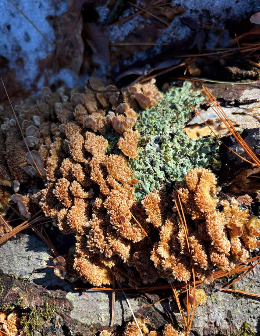
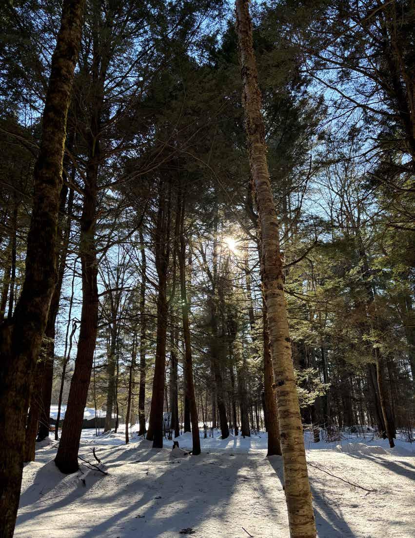
“When I would recreate myself, I seek the darkest wood, the thickest and most interminable and, to the citizen, most dismal swamp. I enter the swamp as a sacred place, a sanctum sanctorum . There is the strength, the marrow, of Nature.”
Henry David Thoreau
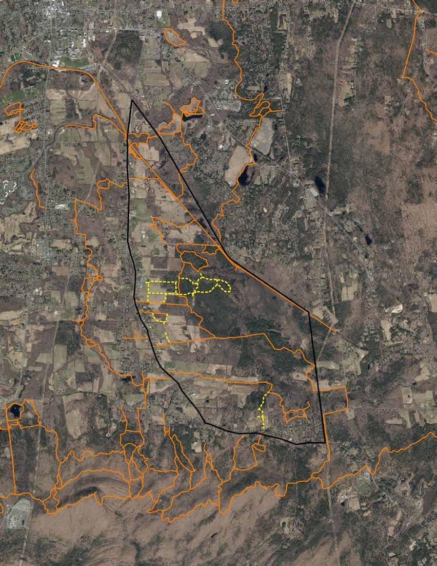
The Lawrence Swamp is an approximately 1,000-acre wetland complex in South Amherst, Massachusetts, located north of the Mount Holyoke Range. This report examines a broader 2,200acre focus area that includes surrounding residential, agricultural, and recreational lands. The team of students from the Conway School analyzed the landscape through three primary “pillars” of use: drinking water supply, habitat and biodiversity, and open space and recreation. The report identifies geological patterns, ecosystem conditions, land use patterns, regulatory protections, and potential threats to the ecological function of the area. These analyses inform recommendations for supporting long-term resource protection in the area.
The Town of Amherst sources approximately half of its drinking water from the Lawrence Swamp Aquifer through five groundwater wells. This confined aquifer is recharged by precipitation and upland infiltration from the Mount Holyoke Range and is naturally protected from surface contamination by an impermeable clay layer formed by Glacial Lake Hitchcock. The Town maintains extensive water supply protections, including Department of Public Works (DPW) land ownership, wellhead protection zones, and an Aquifer Recharge Protection overlay district that extends across municipal boundaries. Additional wetland and floodplain regulations further reinforce these protections. Overall, the aquifer water supply seems to be well protected, with high recharge rates and no significant contamination concerns identified.
The Lawrence Swamp is primarily a hemlock-dominated forest, transitioning into shrub-dominated wetlands along its eastern edges. The very center of the hemlock swamp is punctuated by the presence of a mostly-deciduous perched swamp system. The southwestern edges of the wetlandforest is bordered by streams and agricultural lands. The nutrient-dense, water-saturated lowlands and variety of plant communities create valuable habitat for a wide array of species, including amphibians, birds, and large mammals. The focus area, situated between the Pelham Hills to the northeast and the Holyoke Range to the south, is vital to the regional connectivity of habitats. Stakeholders of the area identified habitat and biodiversity to be the primary value of the landscape, and therefore minimizing disturbance and maintaining ecological function is the prime consideration driving recommendations. The focus area includes a mix of public and private land ownership, with significant holdings by the Amherst Conservation Commission and DPW, alongside privately owned agricultural lands. Many agricultural lands are enrolled in Chapter 61 or protected by Agricultural Preservation Restrictions; others do not have development restrictions. Approximately 17 miles of trails provide public recreational access, however, informal trail use, limited wayfinding, and off-leash dogs contribute to habitat disturbance and trail degradation. Given the ecological sensitivity of the area and its role in protecting the water supply, expanded recreation opportunities are limited.
Recommendations focus on balancing resource protection with existing land uses. A trail suitability rubric was developed to guide future trail management and planning. Assessments were conducted on two popular trails in the focus area, with proposals to reduce ecological impact with improved infrastructure, new routes, and potential closures. The report evaluates multiple land protection strategies to preserve water supply, including fee acquisition of land, conservation restrictions, Chapter 61 enrollment, and Agricultural Preservation Restrictions. Inspired by the interconnected aquifer resource, the report also highlights opportunities for cross-town collaboration models informed by regional case studies. Lastly, land and forest management strategies are suggested based on the Town’s existing management philosophies, as well as observed conditions in the landscape.
The objective of this analysis is to provide the Town of Amherst with a decision-making framework to use when considering future investments in the Lawrence Swamp focus area Future investments are framed through three lenses created in collaboration with the client team:


Through these lenses, the existing conditions and management practices of the focus area were identified. Further analysis and conversations with the client team and a group of stakeholders highlighted potential future uses of the focus area. The synthesis of these elements provided the framework for the suggested strategies and tools described in the Recommendations (see page 62).
The core client team from the Town of Amherst included:
• David Ziomek, Assistant Town Manager and Director of Conservation & Development
• Erin Jacque, Conservation Agent
• Amy Rusiecki, Assistant Superintendent of Public Works
• Beth Willson, Environmental Scientist, Public Works
During this process, the Conway team engaged with a group of stakeholders from key organizations connected to the focus area. They met for two separate engagement sessions to provide initial information, then again to provide feedback on draft recommendations. The stakeholders included:
• Andrey Guidera, Amherst Conservation Commission
• Sam Jurkowski, Massachusetts DCR
• Anna Martini, Fort River Watershed Association & Amherst Water Supply Protection Committee
• Rachel Quimby, Hitchcock Center for the Environment
• Chris Volonte, Kestrel Land Trust
• Mark Wamsley, Kestrel Land Trust
• Brian Yellen, Fort River Watershed Association & Amherst Water Supply Protection Committee WATER SUPPLY
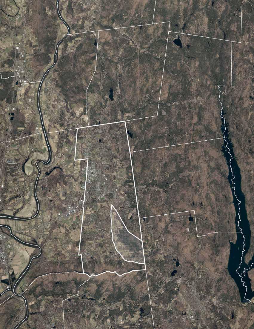
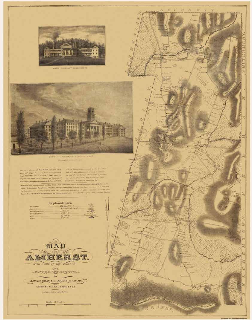
Amherst is home to a core downtown framed on the north and west by two education institutions: Amherst College and the University of Massachusetts, Amherst. In all other directions, there are more open rural lands reminiscent of the town’s agricultural past. In the southwest corner, Hampshire College has a more rural academic character adjacent to farms and conservation areas. In the same area, the Hitchcock Center for the Environment offers a wide variety of environmental education opportunities for community members of all ages at their living building. The Holyoke Range to the south and the Pelham Hills to the east create a basin within which much of the town sits.
Amherst’s reputation as an academic hub is key to its present-day identity. The University of Massachusetts, Amherst, commonly known as UMass, is a respected research institution and the flagship campus for the University of Massachusetts system. Amherst College is the oldest academic institution in the community offering a leading liberal arts education alongside the younger liberal arts institution, Hampshire College. All three academic institutions have tens of thousands of students that swell the community’s population during the academic year, and are major employers of many year-round Amherst residents. Those populations all rely on the groundwater supplied by the aquifer underneath the Lawrence Swamp. In addition to their large student populations, the three schools also own a large portion of land in the community for their campuses, research locations, and historic preservation, including lands near the Lawrence Swamp.
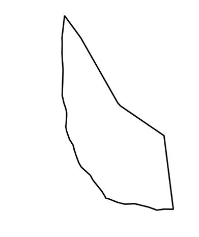
The Lawrence Swamp is a roughly 1,000-acre wetland complex stretching from southeastern Amherst east into Belchertown. In collaboration with the Amherst client team, the focus area was determined to be a larger 2,200-acre area including land surrounding the wetland complex. The borders are framed by infrastructure and the southern town boundary. The border follows the Norwottuck Rail Trail from South East Street to the Belchertown line, then continues south to Bay Road, west along Bay Road to South East Street, then north along South East Street back to the Norwottuck Rail Trail.
Along South East Street and Station Road, there are single family homes and small farms that are part of the historical village of South Amherst. The densest development is a subdivision along Hulst Road, in the southeast, consisting of 65 single-family homes on Stagecoach Road, Arrowhead Lane, Elf Hill Road, and Bay Road.
The New England Central Railroad runs northsouth from the Leverett town line to the east of downtown Amherst before turning southeast to run along the northeastern side of the focus area into Belchertown. In the 1950s, the Town of Amherst purchased a strip of property abutting the railroad; then the Massachusetts Department of Conservation and Recreation purchased another strip of land to the northwest in the 1970s. Beginning in the 1980s, DCR planned and constructed the Norwottuck Rail trail, which opened to the community in 1993 (The Norwottuck Network, 2023).
Within the focus area, there is a patchwork of ownership with a diverse array of land use and habitat types. Farms and residential homes, forests and wetlands, and conserved and developed lands all form the tapestry of the area.
The focus area and town of Amherst are part of the ancestral, unceded homelands of the Pocumtuc Nation. The Norwottuck community is one of many Indigenous sovereign peoples of the Pocumtuc, with broader Algonquin relations whose connection to these lands spans millenia. Through hundreds of years of displacement, removal, and erasure, many members of the Pocumtuc Indian villages of the river valley have created extant communities with other Algonquin-descent nations throughout the Northeastern United States (UMass Office of Equity & Inclusion, 2026). The Norwottuck people historically would have traveled throughout and lived along both sides of the Connecticut River, as well as the Fort and Mill River tributaries, subsisting off the land by fishing, hunting, and foraging; land management practices such as controlled seasonal burning and other disturbances may have been employed to enhance the habitat and plant communities for these purposes. The Lawrence Swamp likely served as one of these life-sustaining lands, and its dense woods may have provided concealment in times of conflict with other Indigenous nations and European settlers (Walsh & Comia, 2023).
In 1658, Major John Pynchon of Springfield purchased land from the Norwottuck that includes the modern-day municipalities of Amherst, Hatfield, Northampton, Hadley, South Hadley, and Granby; the Norwottuck retained their hunting and fishing rights to the land. The land that is now Amherst was commonly used for grazing by English settlers who resided in Hadley, which caused disputes by infringing upon Native retained uses of the land (Walsh & Comia, 2023).
In the 1670s, conflicts between the settlers and Indigenous groups of the region came to a head in King Philip’s War, one of the bloodiest wars per capita in US history (Warren). It was during this time that a traditional Norwottuck travel corridor along the northern base of the Mount Holyoke Range was widened by settlers, creating the first road in Amherst that is now Bay Road, the southern boundary of the focus area (Amherst Historical Preservation Plan, 2023). Through the next century, the land purchased by Major Pynchon was divided and settlement spread.
The early 1800s in Amherst were marked by population and industry growth. Industries were centered around agriculture, and small-scale water-powered manufacturing including gristmills, sawmills, cotton and woolen mills, and other goods (Town of Amherst, 2017). Evidence of these industries are still detectable in the landscape, such as the “Baby Carriage Brook” named for the manufacturing of children’s wagonries in the town. During this time period, dredging and ditching wetlands for agricultural use was commonplace; while these human alterations undoubtedly happened in the focus area (given the farmlands and development surrounding the wetland area), the Lawrence Swamp is the largest remaining wetland complex in Amherst (Town of Amherst, 2026).
Through the 1900s and 2000s, much of Amherst’s population and development dynamics have been in response to the expansion of higher education as a major player in the economy. From 1940 to 1980, the town’s population grew from 6.4 thousand to 33.2 thousand residents (Town of Amherst, 2007). Hampshire College was founded in 1970, corresponding with a period of growth for UMass (Town of Amherst, 2017). Another period of growth was marked by the John and Abigail Adams Scholarship program (2004), issuing full tuition waivers for qualifying students from Massachusetts public schools to attend any UMass system college. The presence and growth of educational institutions in Amherst correlates to the expansion of groundwater supply infrastructure in the Lawrence Swamp Aquifer.
The landforms of the Lawrence Swamp shape how water moves through the system and how the land functions. These underlying geological conditions support Amherst’s drinking water supply, sustain critical habitats and biodiversity, and create opportunities for recreation. Understanding the geomorphology of the landscape provides important context for how these systems interact and how they can be protected over time.
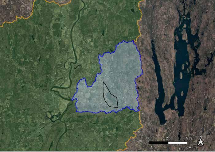
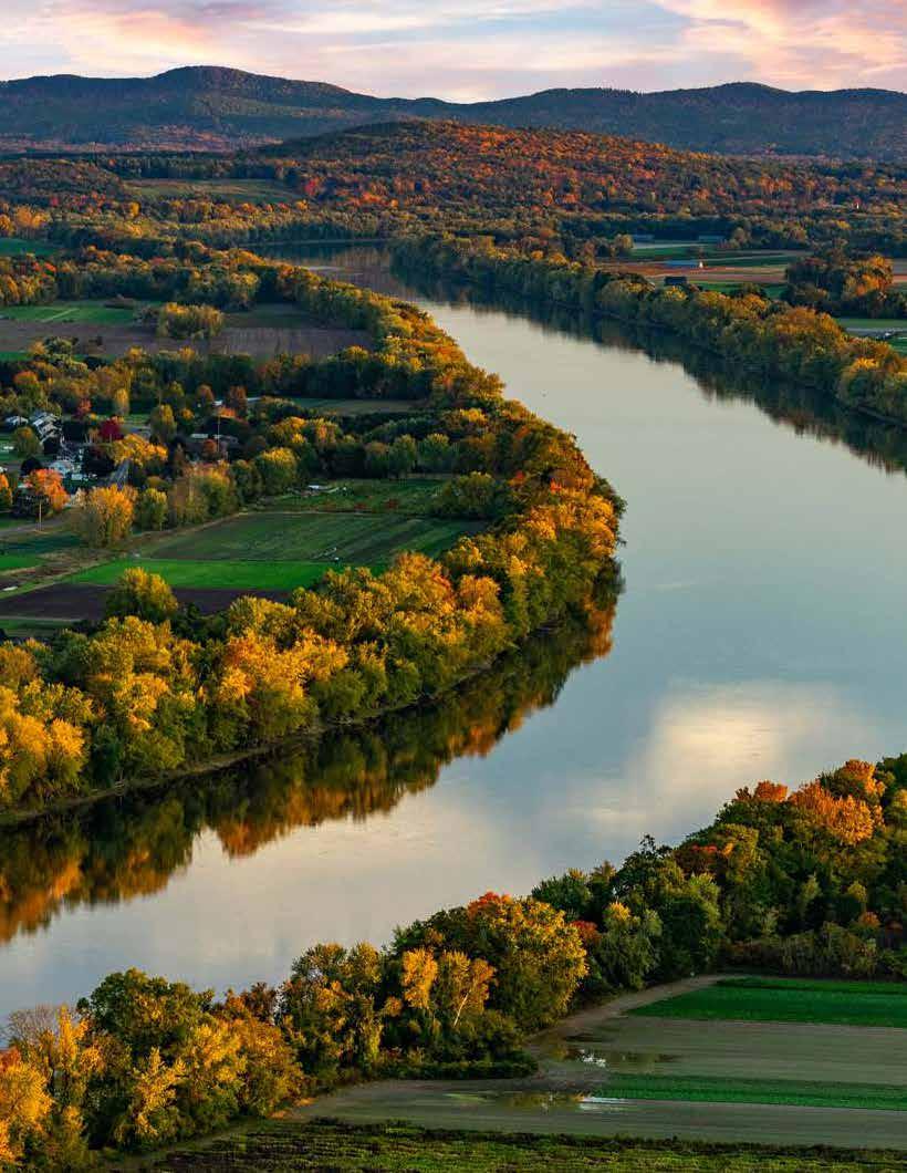
The Lawrence Swamp sits within the Fort River watershed, a sub-basin of the larger Connecticut River watershed. The Fort River is the longest free-flowing tributary of the Connecticut River in Massachusetts. Undammed by humans, the intact river system supports diverse freshwater ecosystems, including populations of freshwater mussels and other aquatic species (Mill & Fort Rivers).
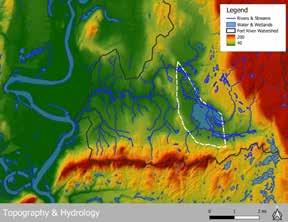
The hydrology of Lawrence Swamp is shaped by the surrounding topography. The swamp occupies a broad, low-lying basin bordered by higher elevations to the south and east.
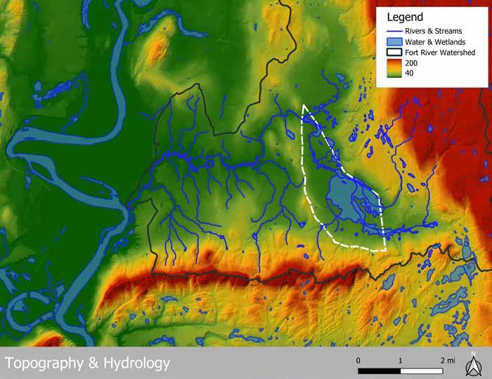
Three major perennial streams flow through the focus area:
• Hop Brook
• Montague Brook
• Baby Carriage Brook
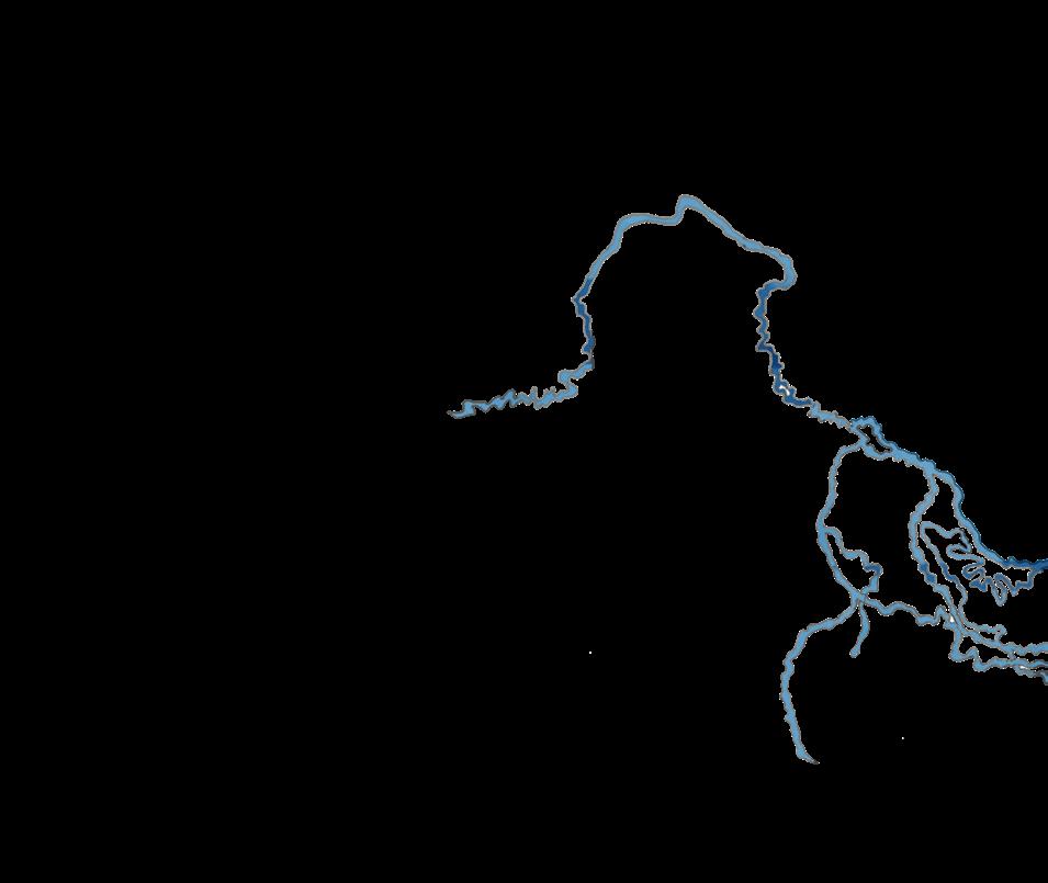
These streams flow from the adjacent uplands to the south and converge within the swamp before eventually joining the Fort River at the confluence near the northern point of the focus area. Multiple unnamed tributaries branch off of the three main streams. Together, these waterways form the primary hydrologic network that feeds the Lawrence Swamp wetland complex.
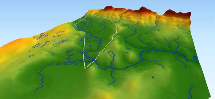
Above: View of the Lawrence Swamp, looking south towards the Holyoke range. Arrows show the direction of water movement.
Water drains from these uplands into the swamp lowlands. Within the entire focus area, the elevation change is less than ten feet. This gentle gradient slows water movement and promotes the formation of the wetlands and floodplain forests that characterize the Lawrence Swamp. The flat terrain also allows for gently sloped recreation trails, providing a different experience than steeper upland trails.
Surface water in the focus area flows generally northward, as the three brooks move through the swamp and join the Fort River. The Fort River then flows west to join the Connecticut River.
Water quality assessments from the Massachusetts Integrated List of Waters (MassDEP, 2018) classify the three brooks and associated wetlands within the Lawrence Swamp as Category 2 Waters . This designation indicates that the waters are unimpaired for some designated uses, while other uses have not yet been fully assessed. The Integrated List of Waters assessment is driven by the Clean Water Act (CWA), under which waters are evaluated for their capacity to support designated uses, which include: aquatic life, fish consumption, drinking water,
shellfish harvesting, recreation, and aesthetics (MassDEP, 2018). While MassDEP does not provide detail on which designated uses are or are not met, the Category 2 designation is a good indicator that the surface water moving through the wetland complex is low in contaminants, allowing for biodiversity to thrive and humans to enjoy the experience of a healthy swamp ecosystem.
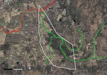
Water quality conditions change downstream. The Hop Brook joins the Fort River at the confluence near the northern tip of the focus area. On the map above, the Fort River is seen in red, indicating it’s been classified as Category 5 : Impaired for one or more uses and requiring a restorative “action” plan, according to MassDEP. The condition of the Fort River is due to eutrophication and bacteria, driven largely by nutrient loading from upstream agricultural runoff, sewage inputs, and detergents (Yellen). Elevated phosphorus and nitrogen levels can trigger algal blooms, which reduces oxygen in the water and creates hypoxic conditions harmful to fish and aquatic organisms (Water Resources Mission Area, 2019).
As of March 2026, MassDEP announced that a $50,000 water quality monitoring grant was awarded to the Connecticut River Conservancy, which partners with the Fort River Watershed Association (Mass DEP, 2026). The Town of Amherst is also currently working with MassDEP on a Fort River sampling program.
Despite these downstream impacts, the flow pattern of the brooks and surface water helps protect the swamp ecosystem. Because water flows northward toward the Fort River, the nutrient pollution occurring downstream does not move back into the Lawrence Swamp wetland complex. Thanks to topography’s influence on hydrology, the focus area is replenished with clean surface water allowing for the habitat to remain healthy.
The surficial geology of the Lawrence Swamp landscape reflects the legacy of Glacial Lake Hitchcock which filled the Connecticut River Valley approximately 10,000 to 15,000 years ago as the Laurentide Ice Sheet melted northward (Farnsworth, 2010).
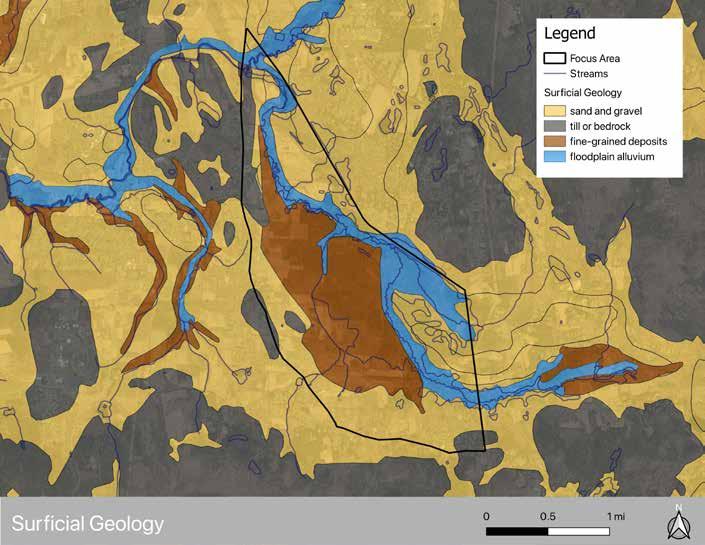
As the lake gradually drained, it left behind deposits of sediment that now define the region’s soils and groundwater systems. Much of the surficial geology under the Lawrence Swamp area is made up of coarse sand and gravel deposits. These coarse deposits are highly permeable and allow water to infiltrate easily into the ground. Along the stream corridors of Hop Brook and the Fort River, centuries of flowing water have deposited alluvial soils, forming narrow bands of nutrientrich soil along the streambeds. In the broader floodplain areas of the swamp, finer-grained sediments were dispersed and settled.
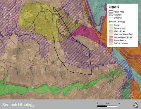
The neighboring uplands were formed during a much older geological era. Less than one mile to the south, the Holyoke Range forms a prominent ridgeline composed of basalt bedrock that formed more than 200 million years ago as igneous rock from the rifting of the Atlantic Ocean Basin (Farnsworth, 2010). Two miles to the east, the Pelham Hills consist of bedrock and glacial till deposits. Together, these patterns of sand, gravel, clay, and bedrock represent the geologic footprint of Glacial Lake Hitchcock and play a critical role in shaping the hydrology and groundwater resources of the region.
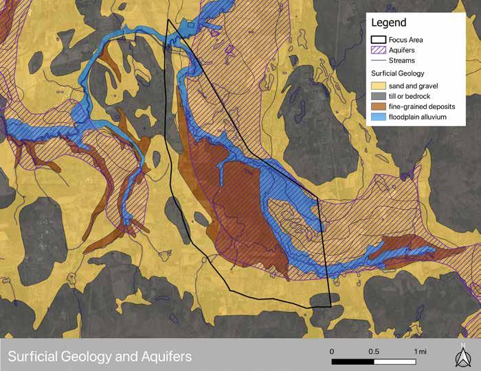
The sediments left behind by Glacial Lake Hitchcock created a confined aquifer system beneath the Lawrence Swamp. This aquifer is known for its good water quality and high recharge, making it a critical drinking water resource for the residents of Amherst. More about the Town’s drinking water supply can be found on page 38.
Water flows into the aquifer system from higher elevations, moving downward and accumulating in the lower artesian aquifer composed of permeable sand and gravel layers. Municipal wells draw from the lower artesian aquifer, confined between relatively impermeable clay deposits above and bedrock below. The low-permeability of the clay layer acts as a protective barrier that limits contamination from the surface (“Hydrogeology”).
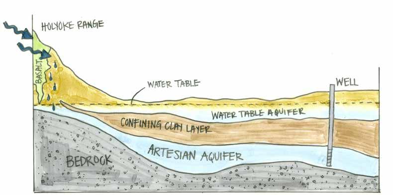
Illustration of a confined aquifer structure and the recharge mechanism. Not to scale.
Recharge occurs where the confining clay layers thin or “pinch out” near the edges of the ancient lakebed. According to Brian Yellen, the State Geologist for Massachusetts, one of the primary recharge areas occurs along the southern boundary of the basin near the Holyoke Range. The bedrock geology of the Range also plays a recharge role: the basalt bands are fractured and layered, allowing precipitation and runoff from the upland slopes to infiltrate along these bands before percolating into the deeper aquifer system (Yellen).
Because recharge occurs slowly and at higher elevations, the resulting groundwater supply tends to be cleaner and more stable than surface water systems. Unlike wetlands and streams, which respond quickly to changes in precipitation, the aquifer provides a more buffered and reliable water source.
Aquifer systems depend on the continued ability of precipitation to infiltrate into the ground and replenish groundwater reserves. When development replaces forests and open land with impervious surfaces, groundwater recharge declines and water quality can degrade.
A well-known example of this cautionary tale can be seen in Long Island, where communities are dependent on a single-source aquifer. Decades of development have reduced groundwater recharge and contributed to declining water quality. The loss of forests and permeable soils reduces natural vegetation filtration, increasing the likelihood of pollutants reaching the groundwater system (North Shore Land Alliance, 2024).
The Lawrence Swamp Aquifer benefits from extensive forest cover in its adjacent uplands, particularly within the Holyoke Range as one of the primary aquifer recharge sources. These forested landscapes absorb precipitation, slow runoff, and filter water before it enters the aquifer. Maintaining these undeveloped recharge areas is therefore critical to protecting the long-term reliability and quality of Amherst’s groundwater supply. Additionally, the conserved forests of the Holyoke Range provide complementary upland habitat for lowland inhabitants such as black bears, moose, a variety of bird species, and certain salamanders.
Wetlands are inextricable from and invaluable for the survival and success of humans and countless other living beings globally. They are nutrient-rich landscapes that are critical radial points of agricultural development and human civilizations. Wetlands filter and recharge groundwater, store floodwaters, stabilize soils, sequester carbon, and support high levels of biodiversity. These functions make wetlands an essential component of resilient landscapes, offering valuable cultural and productive qualities (Convention on Wetlands Secretariat, 1971). Different wetlands provide varying spectrums of these services depending on type, size, and location, but their influence on our existence and advancement as a species has and always will be undeniable.
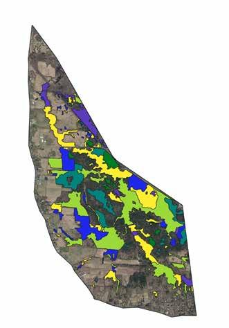
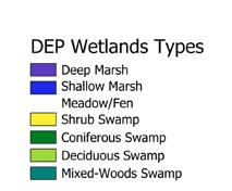

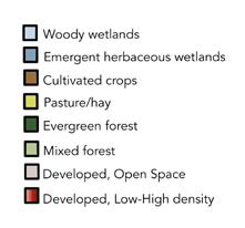
Wetlands are ecosystems that are primarily marked by the presence of water and its associated effects on the natural communities and surrounding environment ( Convention on Wetlands Secretariat ). Wetland types are categorized based on factors such as elevation, location, presence and type of associated surface waters, salinity of water present, etc. The Lawrence Swamp is an approximately 1,200 acre palustrine wetland, which encompasses freshwater “marshy” systems such as marshes, swamps, and bogs. The most abundant plant life of the landscape within the focus area is described in the Plant Communities Section (see page 22). Data from the Massachusetts Department of Environmental Protection (DEP) articulates other wetland types in the focus area including shallow marsh meadows and deep marshes. The interwoven wetland types, nutrient-rich soil, and variety of vegetation structure creates a rich patchwork of habitat qualities for upland and lowland wildlife; more on the fauna in the focus area can be found in the Wildlife Communities Section (see page 28).
Due to long-term soil saturation, microbial processes consuming oxygen create unique physical and chemical conditions that allow for high accumulation capacity for carbon matter. Disturbing wetland soils releases carbon as well as other greenhouse gases produced by microbial activity, which accelerates climate change (Massachusetts Healthy Soils Action Plan, 50). Therefore, the maintenance and protection of wetlands is essential to carbon sequestration goals and mitigation of climate change; this is a value at the state level in Massachusetts as well as at the municipal level in Amherst. The Town has set forth the objective in their Climate Action Adaptation and Resilience Plan (CAARP) to “Conduct a town-wide analysis of existing soil health, soil function, and soil carbon sequestration” and to “Use this analysis as a climate-informed basis for land use/land management planning, and participation in ecosystem services and carbon markets” (page 66, Strategy LU2.3). While it is unclear what progress has been made to officially analyze the soils of Amherst, emphasis on protection and restoration of wetland systems undeniably works towards the goals of Strategy LU2.3 in the CAARP. Should the Town decide to participate in carbon markets, per-acre soil organic carbon stocks of wetlands are worth twice as much as forests in Massachusetts (Massachusetts Healthy Soils Action Plan, 48).
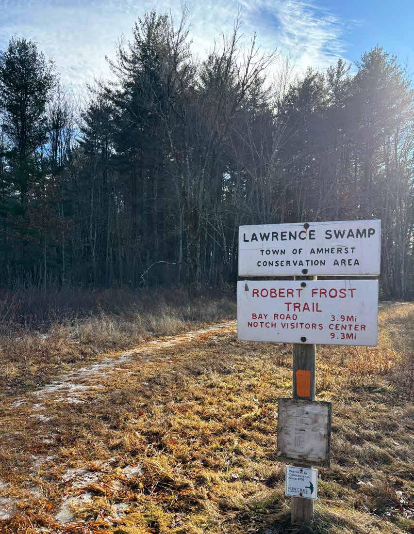
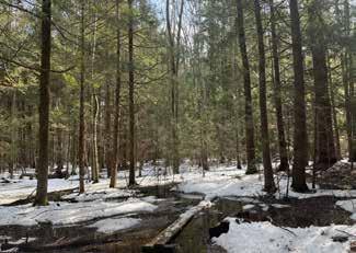
A swamp system is often distinguished by its plant communities. The Lawrence Swamp is primarily a Hemlock Swamp , dominated by mature Eastern hemlocks ( Tsuga canadensis ), with only a few other major canopy trees, namely Eastern white pine ( Pinus strobus ) and yellow birch ( Betula alleghaniensis ). There is minimal understory diversity under the dense canopy of the mature hemlocks. The characteristic hummock-and-hollow topography of this community is visible throughout the Lawrence Swamp, particularly along the Robert Frost Trail when walking south from Station Road. Trees often grow upon hummocks, and water saturates the hollows year-round (Swain, 2000).
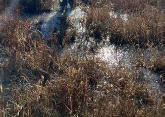
The other predominant plant community within Lawrence Swamp is a Shrub Swamp ; this is a lowland wetland with little canopy cover, mainly in the east of the focus area. The main species observed in the Shrub Swamp include speckled alder ( Aldus incana ) and silky dogwood ( Swida amomum ).
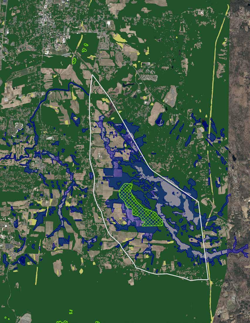
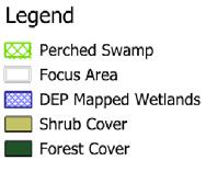
Another notable plant community in the focus area is the Perched Swamp ; according to the NHESP definition, this is a red mapledominated ( Acer rubrum ) overstory interspersed with swamp white oak ( Quercus bicolor ), pin oak ( Quercus palustris ), and black gum ( Nyssa sylvatica ) trees. Observation within the focus area confirmed the presence of these mature trees as well as red oak ( Quercus rubra ), black oak ( Quercus velutina ), and an abundance of mature Eastern white pines. The occasional American beech ( Fagus grandifolia ) can be found throughout the focus area at varying stages of maturity, with no observed presence of beech bark disease; it remains to be determined if beech leaf disease has infected this area, as the site analysis for this document occurred between January and March of 2026 when leaves could only be observed in marcescence.
The remaining land in the focus area, concentrated to the west along South East Street is agricultural and/or residential, where contiguous plant communities are less apparent due to cultivation and horticulture. More about these areas can be found in the Land Use Section (see page 37).
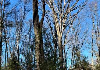
The landscape and natural communities are in a constant state of evolution, a concept known as ecological succession. Any given landscape may contain multiple stages of succession in tandem, highly dependent on both abiotic and biotic factors that cause disturbance or other means of spurring the transition of one successional stage into another. Some factors that may alter the successional pattern of a forest include wildlife activities (herbivory, pollination/seed dispersal, etc.), human activities (clearing for agriculture or logging, anthropogenic fire, etc.), and other abiotic factors such as flooding, fires, erosion and/or windthrows or other disturbances that open up the canopy. In the focus area, clearing for agriculture was likely the last major disturbance of the landscape, and is a repetitive disturbance on parcels that are still active farmland. Other potential disturbances in the area include windthrows, flooding, erosion, and forest pests/pathogens; the risk of these disturbances is discussed further in the Natural and Anthropogenic Risks Section (see page 55). The actual stages of succession vary greatly across different biomes and ecosystems, but forest succession is primarily sorted into three successional stages: early succession, midsuccession, and late succession, all of which encapsulate multiple microsuccessional stages (Fitzgerald & Ober, 2025).
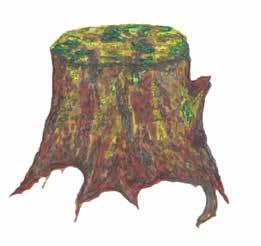
The early successional stage begins when the disturbance of a landscape removes most of the existing vegetation, exposing the soil to sunlight. This process, referred to as stand initiation, provides the conditions for pioneer plant species to spread quickly across the landscape. Early succession landscapes are often dominated by grasses and fast-growing shrubs—such as little bluestem ( Schizachyrium scoparium ), sedges ( Carex spp.), and silky dogwood ( Swida amomum )—and certain tree species such as Eastern white pine. This phase is heavily susceptible to wildlife herbivory, and is a valuable habitat for small mammals and songbirds who forage and nest in these areas, which in turn provides nutritional value for higher trophic-level consumers. The transition into the midsuccessional stage is catalyzed by stem exclusion, when certain plant species— namely young trees—mature and outcompete pioneer species for nutrients, space, sunlight, and water. Plant communities from the previous stage may persist in pockets of sunlight under the canopy or along edges of the treeline. Some plant species that are reliant on low-light conditions begin to establish in the understory. The midsuccessional stage, boasting a variety of conditions, can support a broader diversity of wildlife that depends on a mix of plant types from the multiple stages present. As trees mature, certain species become the dominant community and mark the transition from midsuccession to late succession. The forest is in a relatively steady state by this point, where the predominant tree species continue to grow and fill the canopy until lack of space, resources, or other disturbance causes mature trees to fall and create openings in the canopy for younger trees and other understory plants to grow. The forest persists in this state until a large-scale disturbance sets the landscape back to the beginning of the succession cycle (Whitaker & Rutledge, 2024).
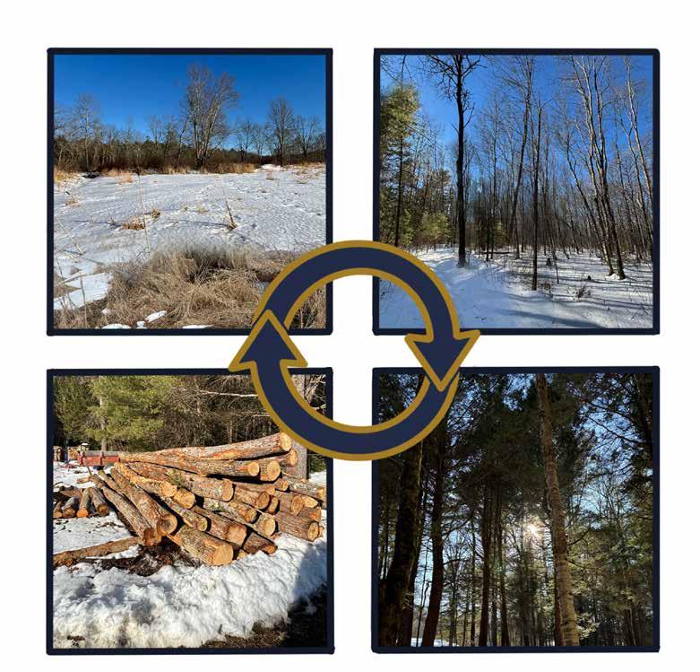
Based on observations, most of the forest cover in the focus area appears to be in late succession; dense canopy cover is present throughout all forested areas, as well as ample windthrows and snags surrounded by young trees taking advantage of canopy openings. In hemlock-dominated areas of the focus area, the new generation of trees is mainly hemlock saplings, with occasional yellow birch and American beech poles. In areas with sparser canopy, such as the Perched Swamp system, Eastern white pine is the most prolific regenerating tree species, followed by American beech and red oak.
The tree canopy assessment tool iTree was used to estimate the ecosystem services provided by the tree cover in the focus area; this broadly includes the air pollution removal and carbon storage potential of the landscape, both in terms of economic and physical benefits. This estimation is based on data from the USDA Forest Service and EPA, developed in a public/private partnership with several schools, organizations, and societies that are renowned in the field of forestry to provide information for users to make informed land management decisions The iTree estimation of ecosystem services is only based on tree cover, meaning that the ecosystem services of the focus area are likely much higher due to the wetland complex; more about the services of wetlands can be found in the Wetlands & Function Section (see page 20).
The total area assessed with iTree is 2,985.6 acres, which includes the 2,140-acre focus area as well as a ~846-acre polygon on the west side of South East Street attached to the northern end of the greater Lawrence Swamp focus area; this is because the web-based iTree tool has premade polygons and could not be customized to only estimate for the focus area. The estimated economic value of the carbon storage of the existing trees in this area is roughly $30 million per year, or about 324 tons of carbon and CO 2 . The estimated monetary value of their air pollutant removal through biological processes is $8.2k per year, or about 85.5k pounds of CO, NO 2 , O 3 , PM 2.5 , SO 2 , and PM 10*

On March 11, 2026, the Conway team and Amherst Conservation Agent Erin Jacque walked north from Well #4 Road along the Robert Frost Trail with DCR Service Forester Sean Libbey to learn more about the forest system, notably in the transitional areas between Hemlock Swamp and Perched Swamp. The goal of this field session was to gain insight into how the forest composition may change over time, and if there are any proactive management strategies to enhance the ecological health of the area now and into the future as the climate changes.
Summary of observations and comments from DCR Service Forester:
• While some patches and individual hemlock trees will succumb to the Hemlock Woolly Adelgid, preemptive harvest of living, healthy hemlocks would unnecessarily diminish mature stock that may have unknown resistance to the pest and could disturb ecologically sensitive areas.
• The mature deciduous stands, comprising mostly red maple and various oaks, have promising resilience projections to withstand anticipated climate change conditions, and encouraging saplings and young poles of these species would be an effective strategy to maintain canopy cover of the area as other mature trees decline.
• Eastern white pine, widespread throughout the forested area, is not well-suited to wetland conditions and long-term changes; the trees are prone to windthrows and could be selectively cut to open understory up for preferred saplings.
• Should selective cutting be done in the landscape, downed trees—specifically the tree tops—can be left to prevent damages caused by equipment for removal and relieve young saplings of deer browse pressure.

The size of the Lawrence Swamp wetland complex suggests that the area would be a vital habitat for a number of rare or threatened species by providing enough of their lifecycle needs in one location. The data compiled by the Massachusetts Natural Heritage and Endangered Species Program (NHESP) and The Nature Conservancy within BioMap supports that initial suspicion in a number of ways. The focus area supports several different key habitat areas as noted by the BioMap survey.
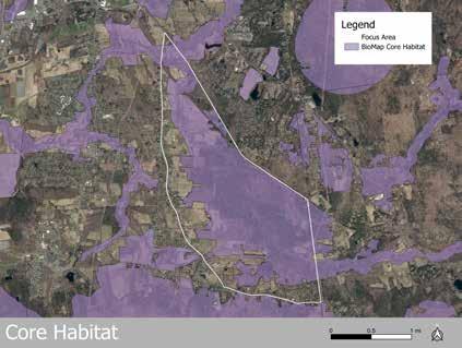
Core habitats are “areas critical for the long-term persistence of rare species, exemplary natural communities, and resilient ecosystems” (“BioMap: The Future of Conservation”). Within the focus area there are 1,514 acres of core habitat.
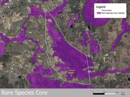
Rare Species Core habitats are “areas critical to the long-term conservation of our most vulnerable species and their habitats” (“BioMap: The Future of Conservation”). Within the focus area there are 1,454 acres of rare species core habitat. BioMap notes that in those areas there are 27 known rare species that rely on the Lawrence Swamp.
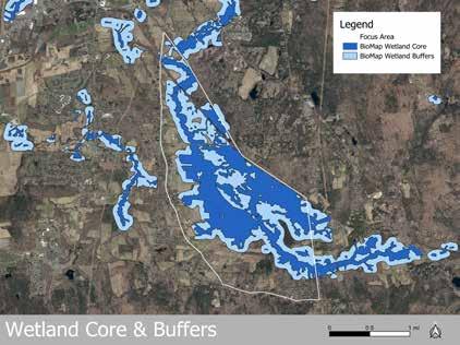
of Conservation”). Within the focus area there are 767 acres of wetland core habitat. Additionally there are 624 acres of wetland buffer habitat. Wetland buffers are “intact upland areas surrounding Wetland Cores which support habitat function and enable species to move between habitat types” (“BioMap: The Future of Conservation”).
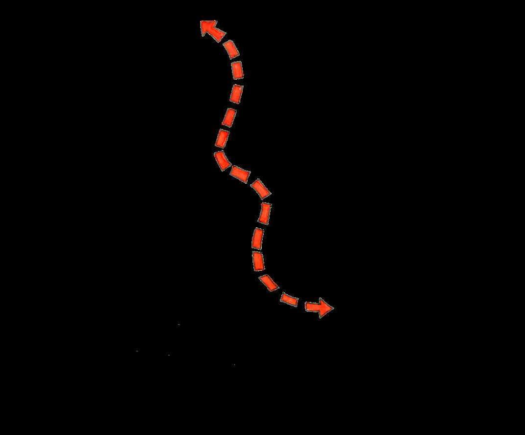
Regional connectivity areas are “particularly important for maintaining connections among habitats across the Northeast US, which will support the shifting ranges of native species” (“ BioMap: The Future of Conservation” ) . Within the focus area, 712 acres are mapped as supporting regional connectivity, mainly centered around the wetland complex south of Station Road. This area may be a key pathway for species moving north-south between the Holyoke Range and the land surrounding the Quabbin Reservoir.
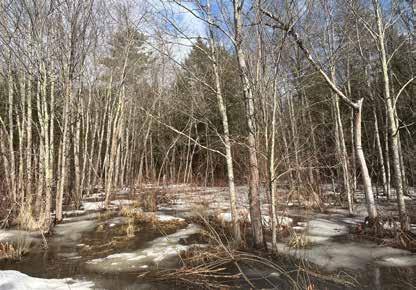
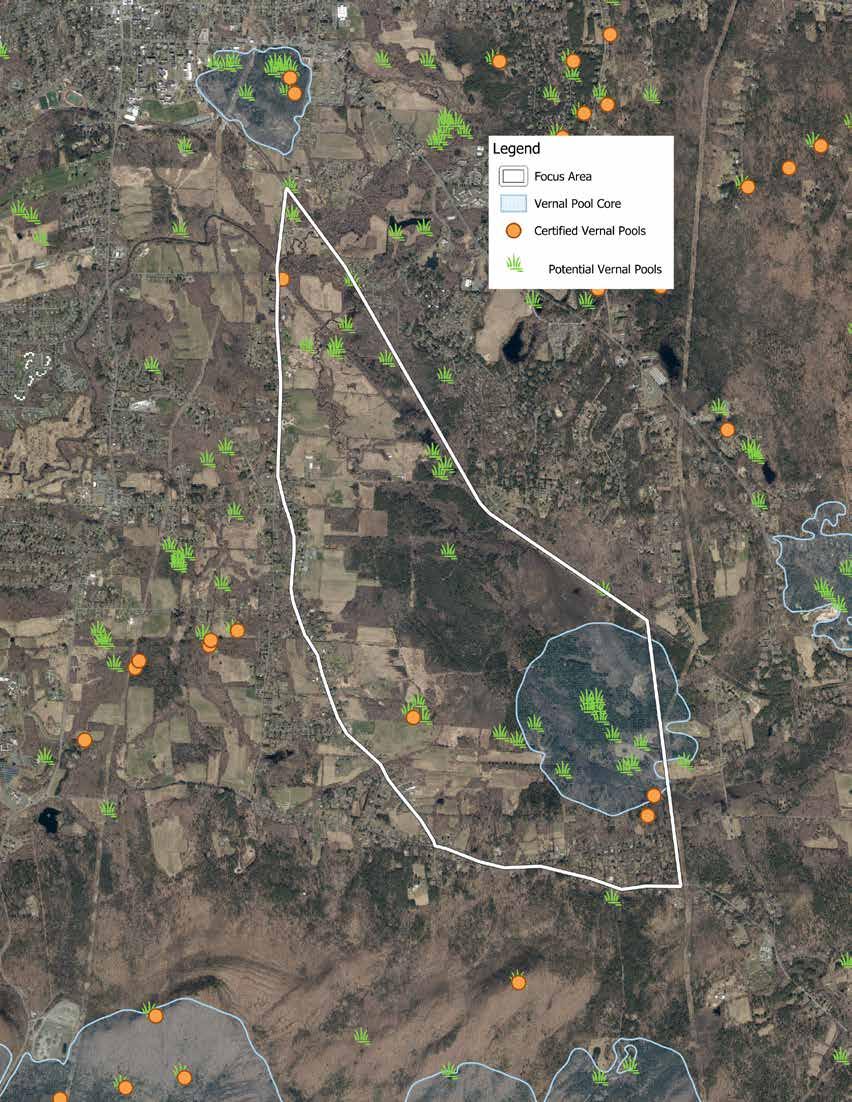
The relatively flat basin of the Lawrence Swamp allows water to move slowly, forming wetlands. The hummock-and-hollow microtopography creates the conditions necessary to support vernal pools. Within the focus area, there are four vernal pools certified by the Natural Heritage and Endangered Species Program (NHESP). Three of the certified vernal pools are south of Well #4 Road and one is just south of the junction of the Norwottuck Rail Trail and South East Street. All are currently on permanently protected lands managed by the Town of Amherst Conservation Commission or the Massachusetts DCR.
Vernal pools are unique microhabitats conducive to the lifecycle needs of some amphibians. They are seasonally inundated, typically in the spring, hence the term “vernal.” Due to the fact that the pools dry out or have low oxygen levels later in the season, aquatic species, namely fish, are not able to live in them. Amphibians rely on the absence of fish to increase the survival rate of their eggs and young, who are often prime food for fish species in the spring. Adult amphibians, like salamanders and frogs, travel from their upland overwintering habitats to their ancestral vernal pools each spring when the temperatures rise above freezing at night and there is some rain, typically between midMarch and mid-April, an event colloquially referred to as “Big Night.” Once at the vernal pool, they mate and lay their eggs in masses within the pool. Those eggs hatch and grow in the pool until they are adults and ready to live in their upland habitats. Some of those include threatened species listed by NHESP or common species like the iconic Spring Peeper ( Pseudacris crucifer ) (Massachusetts Division of Fisheries & Wildlife, 2020).
The topography and ecological analyses like BioMap, which designates a large section of the southern portion of the focus area as “Vernal Pool Core” habitat, and ground observation would suggest more vernal pools exist in the area. To that effect, NHESP and the Town of Amherst have identified 26 potential vernal pool sites with the focus area. These potential vernals pools are distributed across the northern and southern portions of the focus area. There is a notable spatial gap between Station Road and Well #4 Road, where only one potential vernal pool has been identified. This gap coincides with a large section of privately-held lands. According to NHESP, the potential vernal pools data set was compiled through analyzing aerial photography taken in 2000 (“NHESP Potential Vernal Pools”). It is quite possible that more or fewer vernal pools exist in the focus area than were identified 26 years ago without any groundtruthed data.
From the Conway team’s visual inspections of the area, the topography is conducive to vernal pool formation. Collaboration with the landowner, Blooming Farm Properties, LLC, could lead to certification of additional vernal pools, which would help support protected species that may inhabit the Lawrence Swamp focus area.
It is widely known within the Amherst community that a healthy population of beavers inhabits the Lawrence Swamp. The beavers have spent a number of years building impoundments, commonly referred to as dams, that have flooded trails, fields, and infrastructure throughout the focus area. After two centuries of extirpation, beavers returned to Massachusetts in the mid- to late-1900s (Burchsted). Much of the habitat they had created for centuries prior to European colonization has changed and the local communities weren’t used to living alongside the aquatic engineers. According to the client and stakeholders, the tension between human and beaver infrastructure has been difficult and expensive for the community to manage effectively.
Beavers eat a variety of plant species beyond the trees typically thought of as the mainstay of their diets. During the growing season, beavers will eat a number of herbaceous plants that are easier to digest and higher in nutrients than woody plant material. They take cuttings of branches and store them underwater for the winter when other food is scarce. Beaver dams can span hundreds of feet, but are typically less than 100 feet in length (Jackson and Decker, 2004). The impoundments hold back water from flowing streams or brooks, forming a beaver pond. That pond provides a secure habitat for beavers, who are safer from their predators in water, and other species who rely on the robust beaver-engineered wetlands. Beavers usually abandon their impoundments within 10 years of making them, either by leaving the area or succumbing to illness. Once impoundments fail, the beaver pond drains, leaving an area of rich silty soil that quickly grows into a beaver meadow. Those meadows “[have] a combination of conditions that [are] not present elsewhere in the landscape, and some plant species that [live] in these beavermodified habitats [are] not present in habitats unmodified by beaver (Haemig, 2012).
The Amherst DPW, Conservation Department, and Mass DCR are managing beaver conflicts in the focus area as best they can at this time. There is consistent monitoring of beaver activity in the focus area to ensure beavers are doing minimal damage to infrastructure. Unfortunately, in the past few years, Mass DCR had to resurface and repair sections of the Norwottuck Rail Trail caused by beavers burrowing into the embankment supporting the trail. DPW has undertaken efforts to handle flooding on Well #4 Road that occasionally prevents them from accessing key well infrastructure. A series of beaver deceivers are set up across the focus area in an attempt to keep water flowing through key areas without causing catastrophic flooding. In areas with less maintenance, such as the Jan Dizard Trail and southern portions of the Robert Frost Trails, there isn’t as much intervention. Those areas are frequently flooded and the Town suspects that beaver impoundments are the likely cause. One such impoundment observed on the Robert Frost Trail, just north of Well #4 Road, was approximately 100 feet long and flooded a quarter-mile section of trail in 2025, leaving it impassable (Jacque).
Beavers are contributing to the natural structure of many of the wetland communities in the Lawrence Swamp complex, but they are not the only factor. There are a number of culverts in the focus area, and most are undersized according to the DPW. The 2016 Amherst Natural Hazard Mitigation Plan also notes that some of the culverts are the main causes of some significant flooding, especially along Station Road. It is possible that the undersized pipe culverts are as much of a cause of infrastructure flooding in some areas as beavers are. Further examination of culverts can be found on pages 42-43.
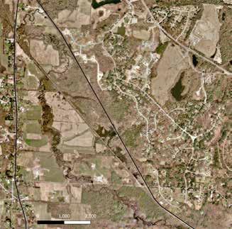
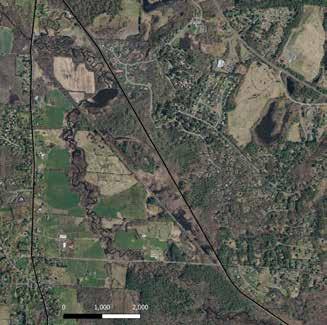
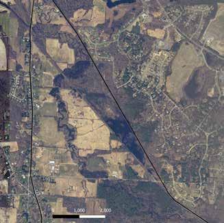
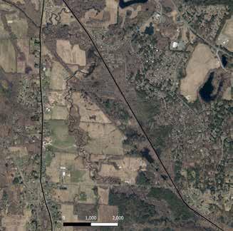
Prior to 2005, there was minimal beaver activity in the area. At that point, beaver activity led to flooding northeast of the Nortwottuck Rail Trail and along Hop Brook (blue circles). In 2013, beaver activity had shifted farther north along Hop Brook (yellow circle). By 2023, there is minimal flooding visible, likely a result of several flow control devices the Town installed in the area.
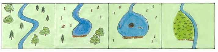
(1) Beaver habitat succession begins with a free-flowing stream. (2) When beavers move into an area, they begin to take down trees and build a dam to staunch water flow and form a pond. (3) Once the pond forms, the beavers build a lodge and inhabit the pond for up to 10 years. (4) Within 10 years of building it, the dam typically fails and the water floods out of the pond leaving behind a nutrient rich area that forms a healthy, diverse beaver meadow.
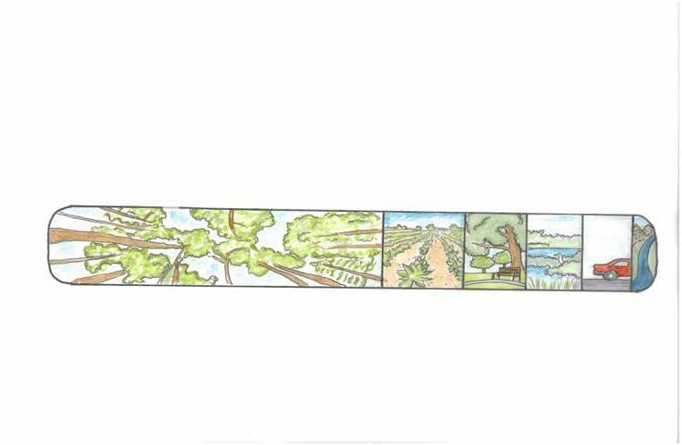
The landscape also reflects a history of forest clearing along with ditching and draining for agricultural use, with hundreds of acres remaining as farmland. Residential development is concentrated along the periphery of the basin, primarily along roadways. Some properties date back to the eighteenth-century and have been subdivided over time, while more recent development from the mid-twentieth century is more concentrated in the southeastern portion of the focus area between Hulst Road and Bay Road.
Primary land uses within the focus area include:
• Drinking water supply, recharge, and protection
• Ecological conservation that supports biodiversity and ecosystem services
• Public open space and passive recreation, such as hiking and birding
• Hunting as permitted by state laws
• Agricultural production and preservation
• Residential development
These overlapping land uses reflect both the ecological significance of the landscape and the range of community needs it supports. As a result, the Lawrence Swamp remains a priority area for the Town to balance resource protection, land use pressures, and long-term ecosystem function.
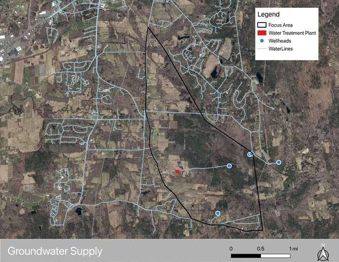
Four of the five active groundwater wellheads are located within the Lawrence Swamp. Well 3 is adjacent to the focus area, just east over the Blechertown line.
The Town of Amherst relies on two primary sources for its drinking water: surface water reservoirs and groundwater. Surface water is supplied by the Pelham and Atkins Reservoirs (located outside the focus area), while groundwater is drawn from the Lawrence Swamp Aquifer. Over the past several decades, Amherst has gradually shifted from relying primarily on surface water to a more groundwater-dependent system. Today, the majority of the town’s drinking water supply comes from wells located within the Lawrence Swamp. The Town started using more groundwater while the Centennial Water Treatment Plant was being rebuilt. Later in 2026, DPW will return to being more equally dependent on surface and groundwater. As of January 2026, approximately 68% of the town’s drinking water is supplied by Well #3 and Well #4 (“Water Supply Status”).
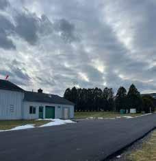
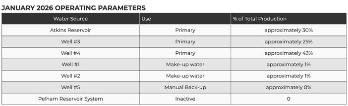
Sourced from the Amherst Water Supply Status webpage.
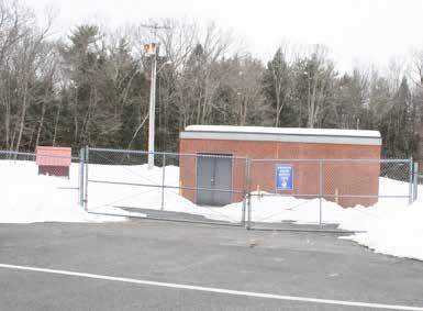
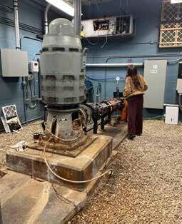
Based on a conversation and site tour of Well #4 with stakeholders from Amherst’s Department of Public Works (DPW), the groundwater from the Lawrence Swamp Aquifer generally requires minimal treatment. Pumped water is treated for pH adjustment for corrosion control, with fluoride for dental health, and chlorine for disinfection before entering the municipal system. One exception is Well #4, where groundwater contains elevated levels of iron and manganese due to the specific confined aquifer layer supplying the well. To address this, the Well #4 treatment plant uses Greensand filtration in addition to the standard treatment process (Rusiecki and Willson).
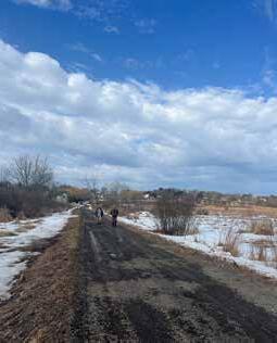
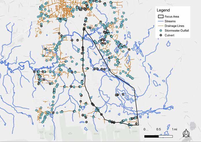
During the initial stakeholder engagement session, representatives from the DPW noted that relatively little stormwater infrastructure enters the project focus area. As shown in the map above, stormwater infrastructure, including culverts and outfalls, is primarily located along the periphery, associated with surrounding residential development.
While no outfalls appear to discharge directly into wetlands or waterways, several are located in close proximity to these sensitive areas. Notable locations include cross-streets near Mechanic Street and Southeast Street, along Hulst Road, Southeast Street, and Pomeroy Lane, and near the confluence of Hop Brook and the Fort River.
As precipitation events become more frequent and intense with climate change, these outfalls may pose increased risk to adjacent wetlands and waterways. Undersized outfalls can be prone to outfall blowouts, and concentrated flows can lead to erosion and scouring.
Due to the topography of the Lawrence Swamp landscape, runoff from these higher-elevation edges drains inward toward the wetland interior. Despite this pattern, water quality impacts appear limited. As explored earlier in this report, the Massachusetts Integrated List of Waters lists the three brooks and associated wetlands within Lawrence Swamp as Category 2 waters (see page 15).
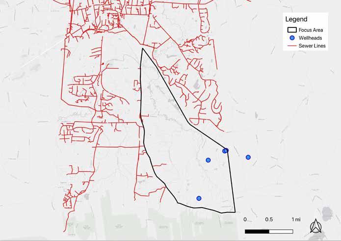
The municipal sewer system largely encircles the focus area to the north, with limited infrastructure extending into its interior. Sewer lines primarily serve surrounding residential areas, with a few pump stations located along the western boundary on Southeast Street.
Residential parcels in the southeastern portion of the focus area, along Bay Road, rely on private septic systems. According to Town engineering plans, these systems typically include 1,500-gallon septic tanks with 8-hole distribution boxes. This cluster of residences is located within the Aquifer Recharge Protection overlay district at the base of the Mount Holyoke Range, where bedrock meets
permeable sand deposits and groundwater recharge is likely to occur.
Although current water quality data does not indicate contamination, the Town may benefit from evaluating long-term risks.
A feasibility study could help determine whether maintaining private septic systems or extending municipal sewer service would better protect groundwater resources.
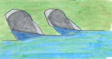
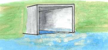
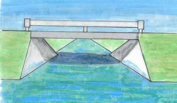
Culvert infrastructure is vital to keep water moving under and around other infrastructure in the Lawrence Swamp. The Town is currently undergoing an analysis of their culverts through a Municipal Vulnerability Preparedness (MVP) program grant. During a visual inspection of the area, the team noted that many of the culverts appear to be undersized, placed too high above the waterline, or clogged. All observed culverts were only moving small amounts of water despite large amounts of water impounded upstream of them. The Town’s CAARP also notes that the existing culvert infrastructure is likely the cause of flooding where Hop Brook crosses under Station Road. With that in mind, the current pipe culverts in the focus area may contribute to significant flooding along Well #4 Road and Station Road. The physical assessment done through the MVP grant will come to more rigorous conclusions as to the hydraulic ability of the existing culverts. While that assessment will likely consider the hydrologic and physical aspects of culverts, it may give less attention to the ecological aspects of culverts. A majority of the culverts in the focus area are pipe culverts, which are effective at moving water if they are properly sized and installed but can be poor at connecting habitats. Many species are only able to move in one direction through pipe culverts and the unnatural material of a pipe culvert could deter species from using it (Massachusetts Division of Ecological Restoration, 2018).
The Commonwealth and ecologists recommend replacing pipe culverts with small bridges or open box culverts to direct stream flow and allow for more habitat connectivity. Transitioning the existing pipe culverts to box culverts or small bridge culverts could improve habitat connectivity between the southern portions of the Lawrence Swamp north along the various brooks into the heart of the wetland complex. Transitioning the pipe culverts along Well 4 Road to box or bridge culverts would likely improve water flow and habitat connectivity currently disrupted by the road. Upgrading pipe culverts underneath Station Road with box or bridge culvert replacements may help with flooding in that area and allow wildlife to move freely under the road in several areas instead of being concentrated underneath the bridge over Hop Brook.
PROS:
• Least expensive
• Quick to install
• Effective at moving water if installed correctly
PROS:
• Larger openings allow more water flow and make it harder for beavers to dam
• Less likely to fail in heavy storms
• Reinforced to handle heavy equipment travel over top
• Increases habitat connectivity
PROS:
• Best for habitat connectivity
• Handles water flow best and makes it harder for beavers to dam
• Less likely to fail in heavy storms
• Reinforced to handle heavy equipment travel over top
CONS:
• Can inhibit animal movement
• Can lead to more flooding if improperly sized
• Easier for beavers to dam
CONS:
• Moderately expensive
• More time and engineering to install
• Requires design for natural bottom and wildlife movement
CONS:
• Most expensive option
• Longest installation time depending on size
• Requires design for natural bottom and wildlife movement
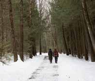
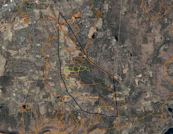
Around 17 miles of official and unofficial trails cross through the focus area, forming a robust recreation network. There are two regional trails that connect nearby recreation areas.
The Norwottuck Rail Trail runs from the southeast to the northeast of the focus area. It is a paved trail allowing for easy walking and biking access for the surrounding communities that can take the trail from Northampton to the focus area. It is a popular trail system for people to enjoy year-round.
The Robert Frost Trail is a long-distance hiking trail that runs south from near Wendell State Forest through ten communities. “Today, along with the Appalachian Trail, New England National Scenic Trail, Mid-State Trail, and Bay Circuit Trail, the Robert Frost Trail is recognized as one of the Commonwealth’s five landmark trails offering long-distance recreational opportunities in Massachusetts” (Gajaseni, Sarisa, et al., 2021). The trail connects various conservation areas along its length such as Mt. Toby, Amethyst Brook, and the Holyoke Range.
A number of local trails offer loops through the Lawrence Swamp and adjacent conservation areas.
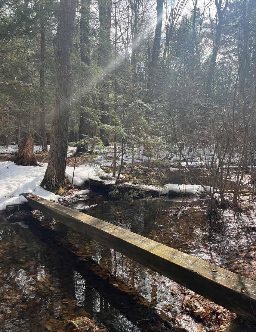
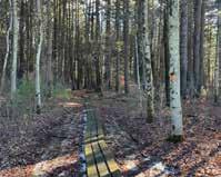
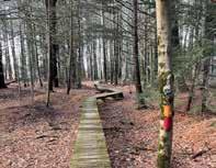
The Jan Dizard Trail is a roughly one-mile loop in the Lawrence Swamp located just south of Station Road. It traverses mostly hemlock floodplain forest while bringing visitors up to the edge of Hop Brook. There is fairly uneven terrain despite its average 0-2% grade, and it has bog bridges to allow visitors to cross over wetter portions of the trail.
The Brookfield Trail is a roughly two-mile trail that crosses through wetlands and agricultural fields. Most of the trail is on APR lands managed by the Brookfield Farm/Biodynamic Farmland Conservation Trust. Visitors can hike from Elf Meadow along Bay Road in the east to South East Street in the west.
Atkins Flats includes various small trails through the meadow conservation area next to DPW infrastructure on Well #4 Road. The trail changes with mowing patterns and allows visitors a chance to experience Baby Carriage Brook in the lower eastern portion and an early successional meadow maintained for species habitat in the higher western portion. It is a popular area for birding.
Various recreational activities are permitted on public lands within the focus area, including:
• Hiking: permitted on all trails
• Biking: permitted on most trails
• Dog walking: permitted on all trails; dogs must be leashed
• Cross-country skiing: permitted on all trails
• Hunting: permitted on all Conservation lands with the exception of Atkins Flats west of Baby Carriage Brook
• Birding: permitted on all trails
The owners of Andrew’s Greenhouse maintain semi-public walking and cross-country skiing trails on their property. Those trails connect with the Robert Frost Trail where it crosses Andrew’s Greenhouse land north-south. Though not advertised, the owners allow members of the public to park at the greenhouse and use the trails. The owners also groom winter trails for cross-country skiers.
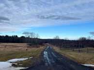
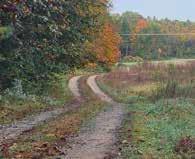
One of the main issues stakeholders identified was the existence of a large network of unofficial trails. Local residents have apparently spent years clearing personal trails from their properties across public lands to the official trails. Some of these unofficial trails may be the result of efforts to bypass flooded or otherwise impassable trails. These unofficial trails may pose a risk to the rare habitat in the area and the erodible soils.

Parking within the focus area is very limited. There are seven known parking areas that allow visitors to access the trail network:
1. Norwottuck Rail Trail (Station Road) : 17 standard spots and 2 accessible spots
2. Norwottuck Rail Trail (Mill Lane) : approx. 4 spots
3. Station Road pull-off : 3 spots
4. Andrew’s Greenhouse : unknown number, approx. 15 spots
5. Mount Pollux parking area : 6 spots
6. Elf Meadow - Hulst Road : approx. 5 spots
7. Brookfield Farm : unknown number
DCR Parks Manager Samuel Jurkowski informed the Conway team that the Norwottuck Rail Trail parking area on Station Road is full most of the time during good weather.
The minimal parking means that nearby residents make up the majority of trail users because those who have to drive from other neighborhoods do not have many opportunities to park at trailheads.
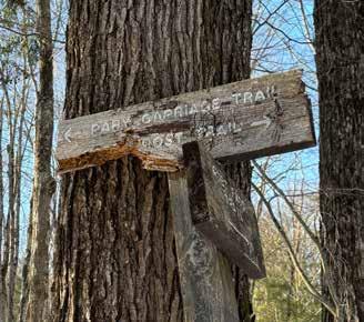
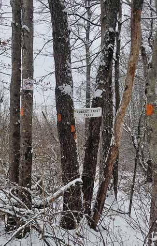
Wayfinding within the focus area is minimal, though the Town is working to replace their existing signage to improve navigability in the area. Most of the trails lack trailhead kiosks with information. The only trails that currently have kiosks are the Robert Frost Trail at the Station Road trailhead and the Norwottuck Rail trail at the Station Road parking area. Those kiosks include older faded signs and descriptions of what activities are allowed on the trail, maps, and other announcements. The trail at Atkins Flats has a kiosk that is severely tilting and faded that describes the grassland/ meadow restoration efforts that happened there in the past.
Along nature trails, there are a number of different wayfinding features:
• Trailhead signs: Typically white signs with inset text painted a different color to match the trail markers further on. The text usually names the trail and how long it is to the next segment. Occasionally they have arrows noting where the trail goes at a junction with another trail.
• Directional signs : Mostly untreated wood signs on six-foot poles that point out the direction of the trail. They are often shaped like a chevron and have the name of the trail and a directional arrow written on them. Many of these signs are in poor condition or have fallen down.
• Blazes: Paint blazes on trees along the trails with colors corresponding to the trail. Many of the blazes are well placed for visibility, but do not effectively allow visitors to anticipate where the next one will be especially along the Robert Frost Trail between Station Road and Well #4 Road. Some of the blazes are beginning to fade or have fallen off trees that lost their bark.
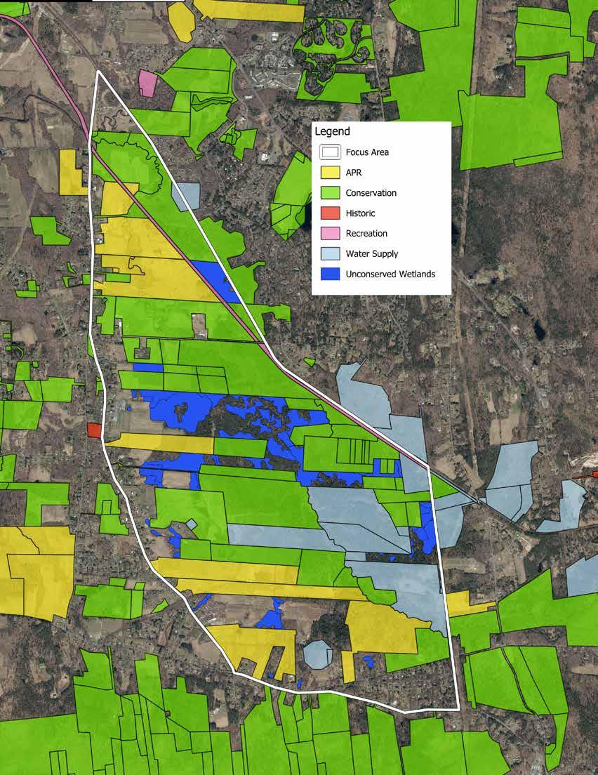
At roughly 2,100 acres of land, the Lawrence Swamp focus area makes up 12% of the total land in the Town of Amherst. The Town has taken great steps to conserve the second most acreage in the Commonwealth. The focus area is exemplary in this aspect because 65% of the total acreage is protected in perpetuity with the following breakdown:
• 1,372.13 acres permanently conserved
• 173.71 acres of APR land
• 729.69 acres of Conservation Commission land
• 241.07 acres of Water Supply land
• 227.66 acres of other conservation types (Conservation Restrictions)
Agricultural Preservation Restriction (APR) : A voluntary program that enables farmers to access the financial value of their land without needing to sell it. Through federal, state, and local funds, the Massachusetts Dept. of Agricultural Resources can pay farmland owners the difference between the “fair market value” and the “agricultural value” of their farms in exchange for a permanent deed restriction to retain the land for farming. This helps to preserve the land for future generations, and to maintain affordable and accessible farmland for aspiring and experienced farmers (“Agricultural Preservation Restriction (APR) Program”).
Amherst Conservation Commission Lands: Lands managed by the Conservation Commission with the goal of ensuring the protection of the Town’s natural resources and conservation areas. The Commission works closely with the Conservation Department on management of conservation land, including over 80 miles of the 140 total miles of trails in Amherst, and establishing environmental policy such as updating the Open Space and Recreation Plan (“Conservation Commission”).
Water Supply Lands: Lands managed by the Department of Public Works containing groundwater wells that provide over 50% of the Town’s drinking water. DPW works to ensure their water supply lands protect the water quality and promote long-term sustainability of drinking water for the community (“Watershed Forestry”).
Additional land is temporarily conserved under the Chapter 61 or Current Use Program . These lands are under temporary protection for a certain term for forestry, agriculture, or open space purposes. Landowners can take their property out of the program at the end of the term without penalty, or earlier with a tax penalty. At that point, the municipality has the first right of refusal when the property goes up for sale. This allows the community to preserve the property in perpetuity (“Chapter 61 Current Use Tax Programs”).
The Town’s efforts also provide a strong ecological support for the wetland complex of the Lawrence Swamp. The majority of the known extent of the complex is preserved in perpetuity. Some wetlands are still at risk to impacts from potential development because they are not currently on permanently conserved parcels. Most of the unprotected wetlands are in the center of the focus area on private lands.
To the south of the focus area, most of the Holyoke Range is permanently conserved, augmenting the wildlife corridor capacity of the Lawrence Swamp. The habitat of the Range provides ideal conditions for species that use uplands and lowlands in different life stages. The recharge of the Lawrence Swamp Aquifer relies on the forested lands of the Holyoke Range to filter runoff as it percolates through layers of sand and gravel.
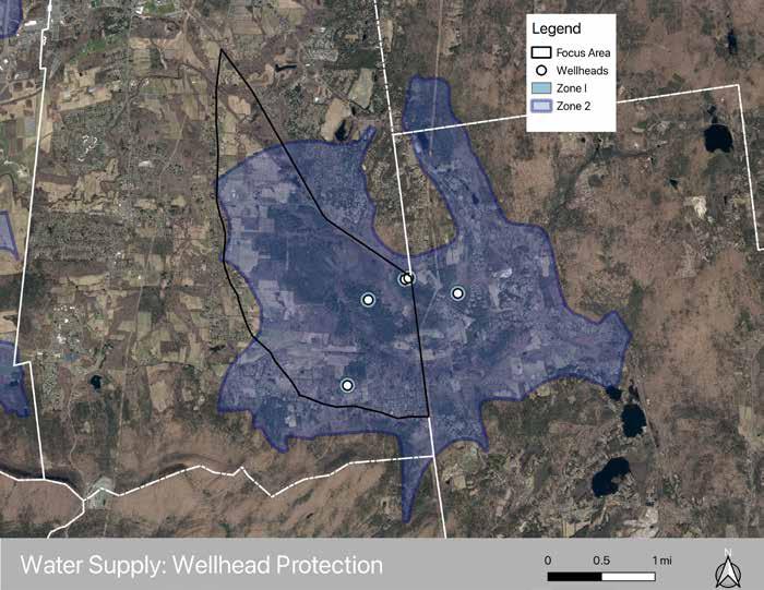
Amherst’s groundwater is pumped from five active municipal wells. These wells are protected through a tiered framework known as the Wellhead Protection Area , which is divided into three zones based on groundwater flow and recharge patterns.
Zone I forms the most immediate protection area surrounding each wellhead. This zone consists of a 400-foot radius around the well and serves as the final buffer against potential contamination. Only activities with no significant negative impact on water quality are allowed, generally limited to passive recreation and maintenance of water infrastructure and natural vegetation.
Zone II covers the portion of the aquifer that contributes groundwater to a municipal well. This area represents the primary recharge zone where groundwater flows toward the well.
Zone III includes the broader land area beyond Zone II where both surface water and groundwater ultimately drain into the aquifer system (not pictured on map).
Together, these zones cover the land that directly influences groundwater quality and recharge. Zone II and III boundaries extend across municipal lines into Belchertown, Pelham, and Granby, reflecting the regional hydrology of the aquifer rather than political boundaries (“Zoning Bylaw,” 2025).
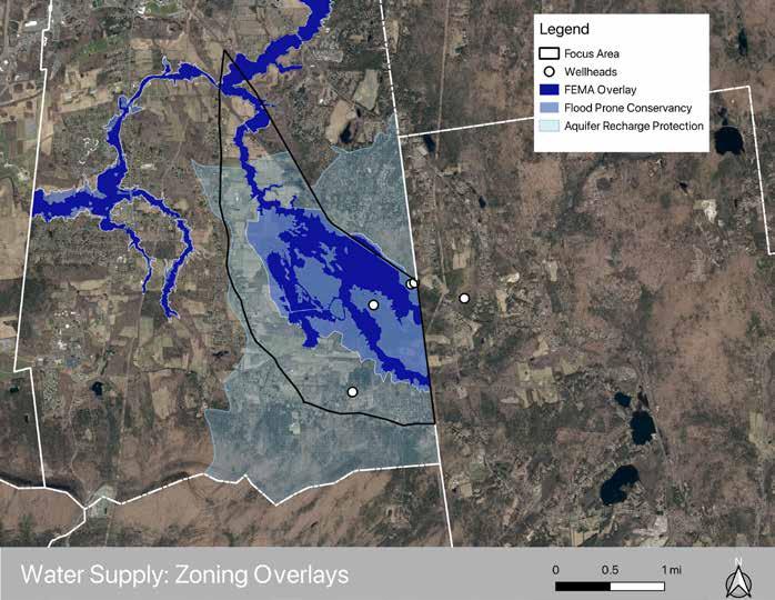
Several zoning overlays further regulate land use and development within these recharge areas.
The Flood Prone Conservancy (FPC) District closely aligns with the federally-mapped FEMA floodplain. The overlay district includes floodplains, wetlands, and waterways. The district serves two purposes: to protect residents and property from flood hazards, and to maintain the natural hydrologic flow patterns. By limiting development within these areas, the district preserves floodwater storage capacity, reduces erosion risk, and helps prevent pollution from inappropriate land uses near waterways (“Zoning Bylaw,” 2025).
The Aquifer Recharge Protection (ARP) District further protects the water supply by prohibiting land uses that pose a high risk of groundwater contamination. Industrial activities such as chemical manufacturing, metal plating, dry cleaning, and auto body repair are generally not permitted due to their potential to generate hazardous waste (“Zoning Bylaw,” 2025).
New development within the ARP district is also subject to stormwater management requirements, including directing stormwater into vegetated infiltration basins to promote groundwater recharge and clustering residential development to minimize impervious surfaces.
Municipal and state regulations, including the Massachusetts Wetlands Protection Act , further regulate activity within wetlands, floodplains, and buffer zones that filter and store water within the system.
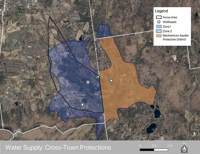
Belchertown’s Aquifer Protection District overlay is shown in orange, matching the aquifer’s outline and the footprint of Amherst’s Zone II overlay.
Amherst and Belchertown share an interconnected water supply system, making cross-town land management an essential component of water supply protection.
Belchertown’s Aquifer Protection District functions as an overlay zoning district similar to Amherst’s ARP district. The district restricts uses that could threaten groundwater quality, including hazardous waste generating industries, underground petroleum storage, and certain high-impact commercial activities. Notably, there is a gas station off Route 9 that was established before the the adoption of an Aquifer Protection District bylaw, so it is considered a “pre-existing nonconforming use.” Additionally, this district limits impervious surface coverage and requires that stormwater runoff be infiltrated on site for new and redevelopment (“Article II Zoning Districts,” 2023).
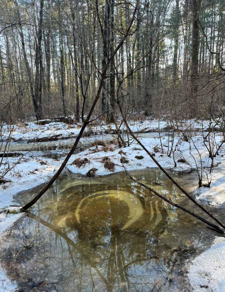
The Lawrence Swamp Aquifer crosses municipal boundaries, extending across Amherst, Belchertown, Pelham, and Granby. Water quality depends on coordinated land use protections across multiple jurisdictions.
Overlay districts such as the Aquifer Recharge Protection and the Flood Prone Conservancy supercede the base zoning and play an important role in managing stormwater and limiting risky land uses and development.
Even with these protections, the shared nature of the aquifer highlights the importance of continued cross-town coordination in land use planning and watershed management. Maintaining forest cover, limiting impervious surfaces, and preventing groundwater contamination within recharge areas remain key strategies for protecting Amherst’s drinking water supply.
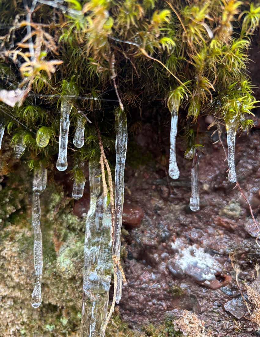
According to estimates from Amherst’s Climate Action Adaptation and Resilience Plan (CAARP), Amherst’s climate is projected to be similar to that of Maryland’s by 2050, and that of North Carolina by 2070. This means warming temperatures, as well as increasingly volatile weather events such as extreme storms, prolonged drought, heat waves, and inland flash flooding (2025 Massachusetts Climate Report Card). These changes have major implications for the local ecology as species respond to altered habitat conditions; these responses may include changes in morphology, behaviors (e.g., migration or foraging patterns), and shifting of geographic-spatial distribution (Climate Adaptation Science Centers, 2018). Drought conditions could damage wetlands to the point of being a source of emissions rather than a carbon sink, and degrade their water purification qualities; conversely, increased rain and temperatures can be beneficial to a wetland’s carbon storage capacity (Salimi et al., 2021). The unpredictability of these factors in the face of climate change creates uncertainty around resilience and future management of the focus area. To add to this complexity, there is potential for warming temperatures to increase permeability of the underground clay layer that confines the Lawrence Swamp Aquifer, one of the town’s main water supplies (Rowe). This risk reinforces the value of strong aquifer recharge and wetland protections.
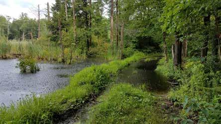
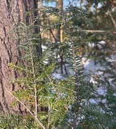
Another concern in the focus area is the presence of the Hemlock Woolly Adelgid (HWA, Adelges tsugae ). This is an invasive pest introduced from Japan to the Eastern United States in the 1950s, and was first detected in Massachusetts in 1988 (Childs, 2022). Hemlock stands throughout the focus area show various stages of infestation, but the only area observed to be in late-stage decline was the tree stand surrounding Well #4. Considering a majority of forest in the focus area is hemlock-dominated, it is likely that the HWA will continue to spread and weaken the hemlock populations, increasing their susceptibility to other pests (such as the Elongate Hemlock Scale) or killing trees in time. Hemlocks under other stress factors such as drought will decline more rapidly (Managing Hemlock in Northern New England Forests Threatened by HWA and EHS, page 12). As noted in the Forest Processes & Succession Section (see page 27) here is little incentive for preemptive harvest of the healthy hemlocks, and doing so could potentially hinder HWA-resistance efforts. Whether HWA is lethal or not, its presence guarantees defoliation of hemlocks over time and potential loss of canopy cover that provides critical habitat. Less-dense canopy could lead to less shading of the forest floor, which could increase the temperature of the ground and streams.
There are over 20 soil types within the Lawrence Swamp focus area. Those soils are mostly related to the deep floodplain alluvium deposited over millenia along the courses of the Hop, Baby Carriage, and Montague Brooks. The entire area is poorly suited to most types of development due to the soft, unstable nature of the soils and the fact that the water table is very high. The high water table leads to corrosion of most construction materials, most importantly concrete and steel, at a faster rate than standard conditions. Most importantly, according to NRCS data, the soils in the area are somewhat or very limited in their trail carrying capacity (Soil Survey Staff, 2026). The analysis suggests that the soils are prone to compaction and erosion, require specialized design and construction considerations, and require higher-thanaverage maintenance efforts. These soil data points strongly suggest that recreational trails should not travel through most of the focus area because they will likely have poor outcomes and could drain Conservation Department resources.
The soils are prone to the risk of windthrows. Due to their structure as fine floodplain alluvium and the amount of water they hold throughout the year, they are not a stable surface for trees to root into. A number of species in the area, mainly Eastern white pine ( Pinus strobus ), already have shallow root systems. The flat terrain of fields such as Atkins Flats allows strong northern and western winds to gain momentum before they hit the trees at the edge of the Lawrence Swamp. Those trees become susceptible to windthrows during a high-wind event and even more so if their health has declined or there is a severe storm. There were a number of severe windthrows observed by the team during a walkthrough with DCR Service Forester Sean Libbey and Amherst Conservation Agent Erin Jaque on March 11, 2026. Those windthrows had blocked large portions of the Robert Frost Trail north of Well #4 Road. The windthrow hazard could be a barrier to maintaining accessible trails. Future windthrows would require more staff time to ensure that trails are consistently passable.

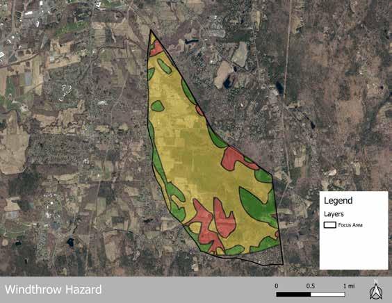
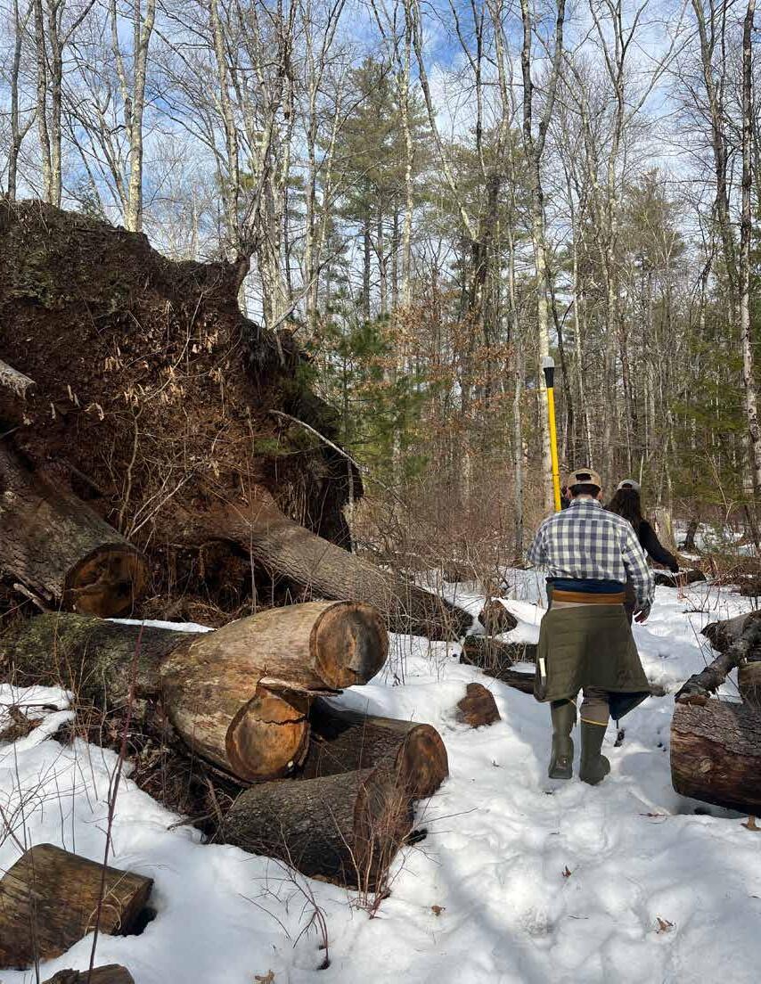
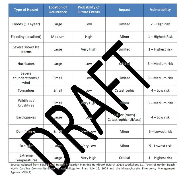
As noted in the Soils Section (see page 56), the focus area has a high windthrow hazard potential. This is the most likely small- and large-scale disturbance to occur in the focus area presently, and increasingly volatile environmental conditions (prolonged droughts, extreme precipitation events, and flash-flooding) all contribute to windthrow potential. All of the above climate change risks have been identified in Amherst’s Natural Hazard Mitigation Plan (2016) and have corresponding mitigation and disaster relief strategies. While windthrows in forests as dense as that of the focus area are unavoidable, proactive management of identified critical snags and stands in proximity to trails and other human infrastructure such as the wellheads can prevent extensive damage and human health risk. Potential strategies for further addressing these risks are discussed in the Land & Forest Management Strategies Section (see page 80).
NATURAL HAZARD IDENTIFICATION AND ASSESSMENT FOR THE TOWN OF AMHERST
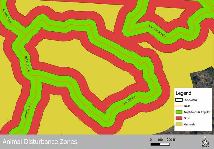
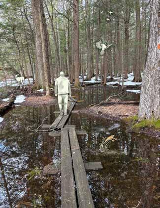
Humans are the main source of habitat fragmentation in the world. Our presence as a predator can easily disturb wildlife in our proximity. The current trail network through the focus area covers a massive 17 miles of official and unofficial trails. Along each of those trails is a zone of disturbance where human presence can impact wildlife living in the area. According to research analyzed by the New Hampshire Fish and Game Department, different groups of animals are disturbed by human presence at the following distances on either side of a trail (Stevens and Oehler, 2019):
• Amphibians and reptiles : 60 feet
• Birds : 150 feet
• Mammals : 400 feet
When those disturbance zones are overlaid with the existing trail network, the area is significantly fragmented by human presence. It is also important to note that this trail network includes trails that the Conway team and the Town of Amherst were able to map as of March 2026. The Town, DCR, and local residents have informed the team that there are many more unofficial trails created and maintained by the local community that exist within the focus area. This information suggests that human activity in the Lawrence Swamp may be degrading the wildlife habitat present in the area and reducing its effectiveness within the regional wildlife corridor. The map below shows the amount of disturbance that trail use may be causing in the focus area.
The presence of dogs in natural areas is known to cause wildlife disturbances and can contaminate drinking water supplies. Leashed dogs are currently allowed on conservation lands in the Town of Amherst with the exception of Puffers Pond. On several visits to the focus area, off-leash dogs were observed running on and off trails. According to the Town of Amherst, off-leash dogs are a priority concern. The clients informed the Conway team of a high number of off-leash dog incidents, including dog bites, across the community, though it was not possible to identify how many of those instances took place in the focus area. The client and stakeholders shared that dog owners frequently ignore leash rules and fail to clean up after their dogs in the focus area. In a number of cases, mainly along the Norwottuck Rail Trail and Robert Frost Trail, dog feces bags were observed on the side of the trails or, in one case, flung into a nearby shrub.
Scientists across the globe continue to assess the ecological disruption that domestic dogs have on wildlife in conservation areas. A literature review by Lori Hennings of the Portland, Oregon Metro Parks District concluded that ample research showed that “the presence of dogs causes wildlife to move away, temporarily or permanently reducing the amount of available habitat in which to feed, breed, and rest” (Hennings, 2016). In Australia, it has been shown that frequent dog walking, even of leashed dogs, does not habituate wildlife to their presence. No matter how accustomed animals may be to humans, dogs in the area will continue to significantly disturb wildlife (Banks and Bryant, 2007). The scientific evidence suggests that having dogs on trails, especially in rare species habitats, could lead to a serious disruption of wildlife patterns and lifecycles. The current human and dog movement patterns in the Lawrence Swamp likely detract from the land’s ability to provide useful habitat for wildlife.
The Amherst community is one that enjoys riding bikes, and the trail network across the town allows them ample opportunity to engage in that type of recreation. The Norwottuck Rail Trail is designed to support biking activities, including e-biking up to Class II e-bikes. Mountain biking is allowed on most conservation trails in the town. This poses a problem for the long-term health of the trail networks in the Lawrence Swamp. The Town of Amherst is aware that trails in the focus area are deteriorating, mostly due to flooding and erosion. According to DCR’s Trails Guidelines and Best Practices Manual, mountain bikes cause the second most trail damage of any non-motorized activity; only horses cause more damage to trails. The current activity patterns might be leading to some of the poor trail conditions on portions of the trails in the focus area. It is also likely that the presence of mountain bikes might disrupt the habitat patterns of wildlife in the area.
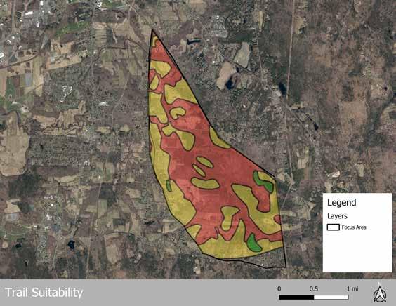
17 miles of trails in the Lawrence Swamp offer recreational opportunities for residents of Amherst and the surrounding communities. Some of these trails are in better condition than others. Assessing the current state of the trails provides an opportunity to understand how they fit into the ecological and recreational framework of the focus area. The Massachusetts Department of Conservation and Recreation’s Trails Guidelines and Best Practices Manual (2019) is a comprehensive analysis structure that allows communities to evaluate their trails and make decisions about the sustainability of existing trails and viability of new trails. The guidelines assert that successful trails must be “physically, ecologically, and economically sustainable” (3). Those guidelines are the basis of the analysis presented in this section. The trails are scored based on how well they meet the criteria set forth by DCR and additional soil factors for trail safety selected from the Natural Resources Conservation Service (NRCS).
This trail suitability assessment is designed for use on any existing or proposed trail, not just those within the focus area. As such, not all categories are applicable to every trail. There are categories that are measurable through GIS data analysis and some that require ground truthing or data collection. To account for this, the trails receive a final percentage score rather than a total point score. Please note, due to the critical importance of Wellhead Zone 1 for water supply protection, any trails that pass through the Zone 1 radius automatically receive a failing score (0%).
In this model, score criteria for trail quality indicate the following outcomes:
• 0-33%: unsuitable; should be rerouted or closed
• 34-66%: moderately suitable; should be rerouted or improved
• 67-100%: very suitable; minor improvements can be made as desired, but are not necessary
On the following pages, there are sample assessments for the Robert Frost Trail (Station Road-Well #4 Road) and the Jan Dizard Trail. Both trails cross through some of the most sensitive areas of the Lawrence Swamp and are popular with visitors. They score quite differently from each other, and as such demonstrate different methods to improve the sustainability of the trails and surrounding ecology.
Criteria
Soil suitability for trails (NRCS)
Within rare species or priority habitat (BioMap)
Within wetland, wetland buffer zone, certified vernal pool, potential vernal pool (Per latest survey on file or Mass DEP
Windthrow hazard (NRCS)
Average running slope for length of trail segment
Human activity present (new trails only)



Grades Score
Not limited - 2
Somewhat limited - 1
Very limited - 0
No - 1
Yes - 0
No - 2
Yes - 0
Slight - 2
Moderate - 1
Severe - 0
- 2
- 1
- 0
Yes - 1
No - 0
Outside Zones I & II protections - 2
Outside Zone I - 1
Public water supply
Outside of buffer zone for specific NHESP listed species (consult with NHESP)
Boardwalks/bog bridges present when crossing wetlands (percentage of total trail length in known wetlands)
Consistent with Forest/Resource Management Plan established with DCR Region Forester
Within Zone 1 - auto-fail, prioritize removing from Zone I
Yes - 1
No - 0
- 2
- 1
- 0
Yes - 1
No - 0
No plan in place - N/A
This is a template rubric for this project, but could be applied to any trails or customized to better serve the needs of the Town in the future.
The Robert Frost Trail (RFT) is a regional trail that runs through the Lawrence Swamp, with a welldefined segment between Station Road and Well #4 Road. Trail suitability was evaluated using a combination of GIS analysis and field observation; some criteria could not be assessed due to data limitations.
Under the assessment rubric, this segment received a failing score (0%) due to its location within the Zone I wellhead protection area for Well #4. Zone I represents the most critical protection area, where land use should be limited to essential operations, like DPW wellhead maintenance. While the trail is part of a larger regional network and should remain open, its current alignment presents a risk to water supply protection. Rerouting outside of Zone I is therefore recommended.
Potential reroutes to the north and south were evaluated (see maps on opposite page) and both scored significantly higher (64%) than the existing route. These alternatives benefit from more suitable soils and reduced susceptibility to windthrow but would require elevated structures (e.g. bog bridges or boardwalks) to minimize wetland disturbance.
Robert Frost Trail (Station Road-Well #4 Road)
Soil suitability for trails (NRCS)
Within rare species or priority habitat (BioMap)
Within wetland, wetland buffer zone, certified vernal pool, potential vernal pool (Per latest survey on file or Mass DEP
Human activity present (new trails only)
Public water supply
Outside of buffer zone for specific NHESP listed species (consult with NHESP)
Boardwalks/bog bridges present when crossing wetlands (percentage of total trail length in known wetlands)
Consistent with Forest/Resource Management Plan established with DCR Region Forester
Outside Zones I & II protections - 2 Auto-fail for Zone I Outside Zone I - 1
Within Zone 1 - auto-fail, prioritize removing from Zone I
- 1
data to assess at this time
- 2
0
- 1
0
No plan in place - N/A
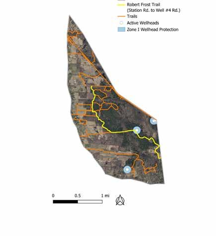
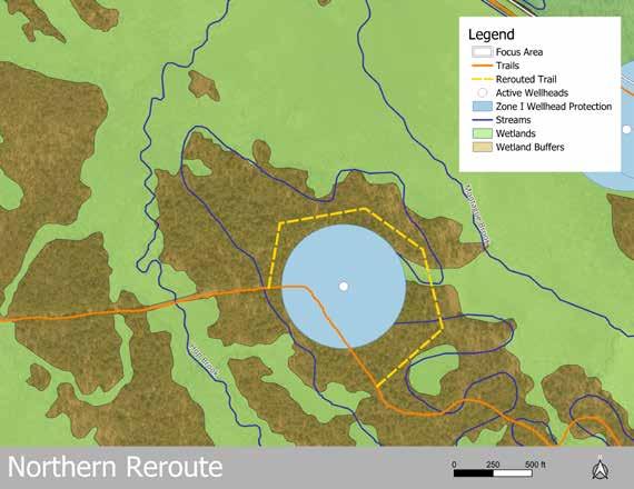
A northern reroute would require approximately 2,500 feet of new trail , including two stream crossings , resulting in greater cost and ecological impact.
A southern reroute would require approximately 1,200 feet of new trail and one stream crossing , resulting in lower overall impact and cost.
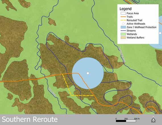
Based on these findings, a southern reroute appears to be the more feasible option. The final reroute decision should be determined through site-specific assessment by Conservation Department staff or qualified professionals.
The Jan Dizard is a fairly popular walking trail for the public, but loops closer than the RFT to the core wetlands of the Lawrence Swamp. As this trail is clearly defined, this assessment is for the entire trail system instead of a segment of it. Trail suitability was evaluated using a combination of GIS analysis and field observation; some criteria could not be assessed due to data limitations.
The Jan Dizard trail is moderately suitable with an overall score of 46%, which places it within the category recommending reroutes or trail enhancements. The next steps would be to evaluate the ways to increase the trail’s score. Unfortunately, the features that the trail scored
worst in are elements that cannot be changed through interventions, such as soil suitability, windthrow hazard, wetland presence, and being in the Zone II wellhead protections. Once additional elements that could not be evaluated due to lack of data are factored in, such as the rare species buffer zones and forest management plan, the Jan Dizard trail may score lower than it does currently. Since this trail has no capacity for improvement beyond the 66% threshold for a sustainable trail, the recommendation would be to permanently close it.
wetland, wetland buffer zone, certified vernal pool, potential vernal pool (Per latest survey on file or Mass DEP)
Outside of buffer zone for specific NHESP listed species (consult with NHESP)
- 0 Boardwalks/bog bridges present when crossing wetlands (percentage of total trail length in known wetlands)
Consistent with Forest/Resource Management Plan established with DCR Region Forester
data to assess at this time
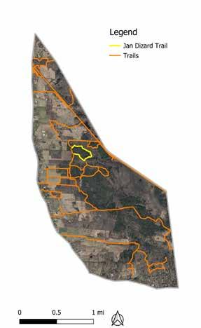
Closing the trail would let the area return to a more natural state and provide a buffer between human activity on the more popular Robert Frost Trail and wildlife living in and along Hop Brook. To successfully close the trail, DCR recommends a number of best management practices. DCR does not specify an order of operations for closing a trail with their BMPs; however, a potential process for the Town to consider is listed below:
1. Decide to close the trail
It can be difficult to close an established trail that people use regularly. Making this decision should involve discussion with trail maintenance staff, the Conservation Commission, and some public stakeholders.
2. Plan for closure
Look for a time of year when closing the trail would cause the least amount of human and wildlife impact. Typically, this would be during winter when the ground has been frozen consistently for several weeks. Assemble all necessary materials and file for all necessary permits.
3. Physically close the trail
The goal of closure should be to make the trail “disappear” and make it impassable so that visitors don’t form their own paths around the closure. Begin by selecting large woody debris nearby to block off any parts of the trail visible from other trails or parking areas. It is also advisable to fell some trees in the area to make the trail even more impassable. DCR Service Forester Sean Libbey advised that the significant populations of hemlocks and pines in the area would not be harmed if several of them were felled to block closed trails. Finally, remove any infrastructure (bog bridges, wayfinding, etc.) from the trail.
4. Ecological restoration
With the trail physically closed, more natural processes can take place to fill the gap that the trail left. However, years of trail compaction can inhibit the growth of plants in that area. The trail team should consider pairing closure with ecological restoration. This would include decompacting soils along the length of the trail and planting them to spur regeneration. The added plants in the path of the trail would also help make the trail “disappear” from view for visitors.
5. Signage
Replace all physical and digital signs that show the now-closed trail so it is clear to visitors that they should not walk the trail. Post signs at the start and end of the closed trail segment that explains why the trail was closed. In this case, it would be in line with feedback from the community on the OSRP to mention that the trail is being closed to reduce human impacts on biodiversity. Additionally, sign language can mention the trail was closed for an ecological restoration project that is in progress as another means to educate the public about the closure.
6. Community education
Engage with the community through flyers, educational talks, and additional signage to help neighbors understand why the trail is closed. Highlight the ecological benefits of closing the trails and the economic cost of keeping the trail open (maintenance staff time, new infrastructure, etc.).
Due to the sensitive nature of rare species habitat and the fragmentation of the area by humans and dog activity, the town could consider redirecting visitors from the core of key habitats to the periphery to reduce the ecological impacts of recreation.
Bird blinds offer a positive experience for visitors and wildlife. By shielding humans from the view of wildlife, there is less stress put on wildlife. Visitors can still see all of the animals, and may end up seeing more wildlife as the effect of their disturbance reduces over time. There is a history of bird blinds in the focus area, which supports bringing them back as effective elements of the visitor experience. The Town should examine Atkins Flats and the Caroline Arnold trail as potential locations for bird blinds. Both of those locations are towards the edge of key habitats. The two areas also offer views into the key habitats for birders: the open meadow of Atkins Flats and the open shrub swamp along the Caroline Arnold trail. The Town is encouraged to examine other sections of the focus area for bird blinds as they see fit based on their knowledge of wildlife habitat.
Adding elevated bog bridges to sections of the trail within wetlands and their buffer zones can make the trails in the Lawrence Swamp more resilient and ecologically sound. The best option may be a 24-30” elevated bog bridge with perpendicular planks instead of lower parallel plank designs that are currently in use. The higher options are more expensive, but would likely last longer, direct the flow of visitors more clearly, and keep people out of wetland zones.
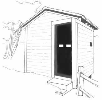
A bird blind, which could be a good alternative to enjoy wildlife without disturbing them.
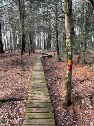
Allotting time for staff to walk and assess the trails in the focus area at least once a year could help ensure that trails are clearly marked, that they aren’t causing undesired impacts on habitat, and that no new unofficial trails are appearing. This assessment can direct future work on the trails for the Conservation Commission and Conservation Department. All trails should support or only minimally detract from biodiversity goals.
While walking the trails, Town staff may be able to identify the concerns most frequently appearing in the focus area and work to develop community education materials to help address those concerns. For example, if a staff member finds that there are frequently unofficial trails going through a specific area, they could create a small sign to post in the center of the unofficial trails informing the community about the vital habitat that is vulnerable to human disturbance. Gathering this data could inform the Conservation Commission on how to adjust regulations around the use of conservation lands in Amherst to ensure healthy biodiversity.
The trails assessment would also identify broken or confusing wayfinding signs due for repair. Clear, visible wayfinding features along a trail are some of the best ways to keep visitors out of sensitive areas. If people are confused on where they should go, they’re likely to make their own path instead of spending time searching for the next blaze that might be obscured by foliage.
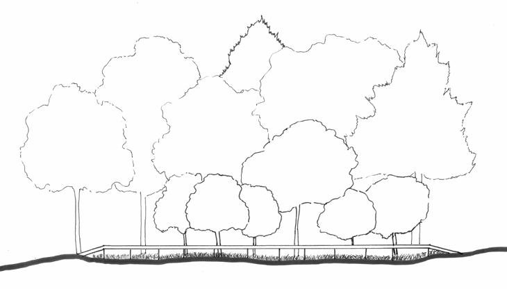
The Town of Amherst has a long history of using land acquisition to protect natural resources. Within the project focus area, several parcels are designated as Water Supply Land , owned and managed by the Department of Public Works (DPW) for water supply protection and wellhead infrastructure.
Amherst is interested in exploring whether additional land acquisition through outright purchase within the focus area could further strengthen protection of the water supply.
A parcel elimination exercise can reveal priorities for fee acquisition in the focus area. As an initial step, Town-held conservation parcels are
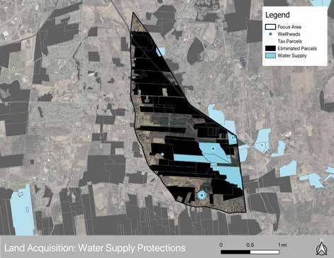
removed from consideration; because these protections are permanent, the likelihood of future land use changes that could threaten groundwater quality is low.
In contrast, regulatory tools such as zoning overlays, floodplain regulations, and environmental policies may change over time as municipal priorities shift and legislative bodies turnover. Given their non-permanent status, overlays and wetland buffer zones were not used in the parcel elimination exercise.
CAARP
IMPLEMENTATION LEADER:
POTENTIAL PARTNERS:
FUNDING OPPORTUNITIES:
LAND Grants, EEA

After removing permanently protected parcels, the exercise focuses on areas where land acquisition could most directly strengthen groundwater protection.
The northern portion of the focus area lies downstream from the aquifer and therefore has limited influence on groundwater quality. As a result, the parcel selection was narrowed to the southern portion of the focus area, just north of Bay Road , where land uses more directly influence aquifer recharge.
As additional criteria, DPW has expressed interest in expanding contiguous protection around existing wellhead infrastructure . Increasing Town-owned land adjacent to municipal wells can improve access for
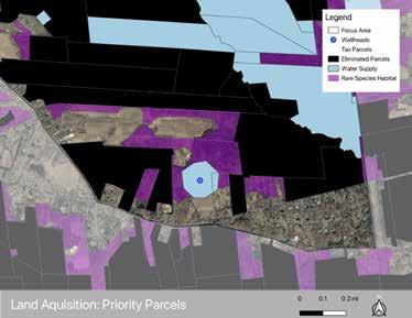
Rare species habitat is shown in purple to highlight where conservation could support water supply and habitat protection.
monitoring and maintenance while allowing flexibility for future infrastructure upgrades if needed. The Town has also expressed interest in prioritizing parcels that support habitat connectivity and biodiversity , allowing land protection efforts to serve multiple conservation goals.
Under fee acquisition, the municipality purchases land outright and manages it directly (“How Do I Preserve My Land in Amherst?”).
Benefits:
• Maximum protection and municipal control
• May allow public access
• Enables conservation focus; habitat, open space and watershed management take priority
Constraints:
• High acquisition costs
• Long-term management responsibilities
• Removes the entire parcel from the tax base
The Town of Amherst is a leader in land conservation, holding the second largest portfolio of protected open space in the Commonwealth (“Land Resources”). The majority of the investment push for acquisition happened decades ago. While land acquisition offers strong and permanent protection, expanding municipal ownership reduces the town’s tax base and increases long-term stewardship responsibilities. Given the extent of existing Town-held land within the Lawrence Swamp, additional strategies may complement or in some cases substitute for direct acquisition.
Massachusetts municipalities have several tools available to protect land and groundwater resources, ranging from permanent conservation agreements to voluntary tax incentive programs that encourage landowners to maintain open space.
A Conservation Restriction (CR) is a voluntary legal agreement between a landowner and a conservation entity that permanently limits development while allowing the landowner to retain ownership (“What Is a Conservation Restriction?”).
Benefits:
• Permanent land protection
• Flexible agreements tailored to landowner goals
• Potential financial or tax incentives for the landowner
Constraints:
• Requires regular monitoring by the CR holder
• Public access is not guaranteed
• Requires state approval
• Partial reduction of property tax revenue for the Town
APRs protect working farmland by purchasing the development rights while keeping the land in agricultural use (“Agricultural Preservation Restriction (APR) Program Details”).
Benefits:
• Permanent land protection
• Flexible agreements tailored to landowner goals
• Potential financial or tax incentives for the landowner
Constraints:
• Requires regular monitoring by the APR holder
• Public access is not guaranteed
• Requires state approval
• Partial reduction of property tax revenue for the Town
Chapter 61 provides property tax breaks for landowners who maintain land in forestry, agriculture, or open space (“Chapter 61 Current Use Tax Programs”).
Benefits:
• Encourages land to remain undeveloped
• Provides tax relief to landowners
• Gives municipalities a right of first refusal if land is sold
Constraints:
• Protection is temporary, typically requiring a 10-year commitment
• Partial reduction of property tax revenue for the Town
Land acquisition has historically played a central role in protecting Amherst’s drinking water supply. However, given the extent of existing Town-owned land within the Lawrence Swamp, it may be beneficial to diversify protection strategies by combining targeted acquisitions with other conservation tools.
Programs such as conservation restrictions, agricultural preservation restrictions, and Chapter 61 enrollment can help protect the water supply while keeping properties in private ownership. Combining these approaches may provide a balanced path forward that protects groundwater resources, supports habitat connectivity, and manages longterm municipal costs.
Municipalities do not need to pursue conservation and natural resource protection alone. Across the Pioneer Valley, regional collaborations between municipalities, non-profits, and community organizations have strengthened land stewardship and resource protection efforts. These partnerships allow communities to share expertise, coordinate planning strategies, and address ecological systems that extend beyond municipal boundaries.
One framework frequently used in the region is the Memorandum of Agreement (MOA) , a formal partnership between municipalities and partner organizations that establishes shared goals for land stewardship and coordinated action. The following case studies demonstrate how MOAs have supported regional collaboration to protect natural resources (“Ridgeline & Hillside Development Bylaws”).
The Pioneer Valley Planning Commission (PVPC) has supported many regional conservation initiatives, including the case studies described on the following page. Building on this experience, PVPC developed the Pioneer Valley Sustainability Toolkit, which provides municipalities with technical resources and planning tools to support regional sustainability initiatives.
The toolkit aims to:
• help communities adopt strategies to address climate change
• promote clean energy and green infrastructure
• support smart growth and environmental protection
• strengthen regional food systems and climate resilience
These resources support implementation of the region’s long-term planning framework, Our Next Future: An Action Plan for Building a Smart, Sustainable and Resilient Pioneer Valley (“Pioneer Valley Sustainability Toolkit”).
Municipalities can access the toolkit at: www.pvpc.org/our-work/pioneer-valley-sustainability-toolkit/
IMPLEMENTATION LEADER:
POTENTIAL PARTNERS:
FUNDING OPPORTUNITIES:
The Mount Holyoke and Mount Tom Ranges are defining landscape features of the Pioneer Valley. In the early 2000s, development pressures along the ridges spurred five municipalities and ten nongovernmental organizations to sign a Memorandum of Agreement for the protection of the Mount Tom and Mount Holyoke Ranges and their scenic, natural, recreational, and historic resources (“Town Warrant Special Town Meeting”). The agreement led to the formation of the Summit Land Use Task Force , a joint committee of representatives from participating municipalities and organizations. The task force was established to:
• Advocate for the protection of the ranges’ scenic and ecological resources
• Coordinate zoning and land use planning across municipalities
• Assist communities in conservation planning and grant applications
• Educate the public about conservation challenges and opportunities in the ranges
While the MOA was drafted by the Pioneer Valley Planning Commission (PVPC), the initiative was supported by local planners and residents concerned about protecting the landscape. Notably, the collaboration also engaged private landowners by providing information about voluntary conservation tools and guiding them through the conservation process (Eiseman and Curtis).
Amherst was one of the participating municipalities, so there is a precedent that the Town is willing to engage in these collaborations. Today, much of the Mount Holyoke Range is permanently protected, providing regional open space access, protecting critical upland habitat connected to the Lawrence Swamp ecosystem, and safeguarding important groundwater recharge areas.
The Barnes Aquifer is a major groundwater source supplying drinking water to approximately 60,000 residents across four municipalities in the Pioneer Valley. Eleven municipal wells draw roughly 1.2 billion gallons of water annually from the aquifer (“Barnes Aquifer Protection Advisory Committee”).
Recognizing that the aquifer extends across municipal boundaries, the municipalities of Easthampton, Holyoke, Southampton, and Westfield formed the Barnes Aquifer Protection Advisory Committee (BAPAC) in 1989. The committee formed through a year-long planning effort led by the Pioneer Valley Planning Commission and a voluntary advisory task force of local officials and residents.
Because the aquifer spans multiple jurisdictions, its protection requires regional cooperation. Through a Memorandum of Agreement, participating communities established an intergovernmental framework to coordinate groundwater protection strategies. The collaboration enabled municipalities to:
• Coordinate aquifer protection policies and zoning approaches
• Address groundwater quality concerns
• Share technical resources and information
• Educate local governments, businesses, and residents about groundwater protection
The partnership has allowed municipalities to move beyond individual zoning overlays and instead develop coordinated strategies for managing groundwater withdrawals and protecting water quality (“Barnes Aquifer Protection Advisory Committee Fiscal Years 2014 and 2015 Annual Report”).
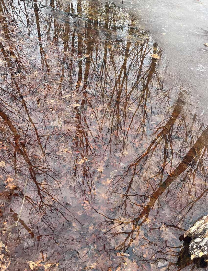
While Amherst relies most heavily on the Lawrence Swamp Aquifer as a drinking water source, its recharge and protection zones extend beyond town boundaries into Belchertown, Granby, and Pelham. As discussed in the Water Supply Protection section on page 50, Amherst and Belchertown share particularly interconnected groundwater resources.
Although the towns maintain similar zoning protections and a cooperative working relationship, a formal intermunicipal agreement could strengthen long-term coordination and protection. A Memorandum of Agreement could support expanded collaboration in areas such as:
• Public education about groundwater protection
• Shared investments in stormwater management infrastructure
• Coordinated development and review of restrictions within recharge areas
Community support for water resource protection is strong. In the Town of Amherst’s 2024 Open Space and Recreation Survey, “Protection of Drinking Water Supply” ranked as the most important community concern, followed by “Protection of Watershed Lands” (“Open Space & Recreation Plan”). A formal partnership could help demonstrate the Town’s commitment to addressing these priorities while strengthening regional stewardship of shared water resources.
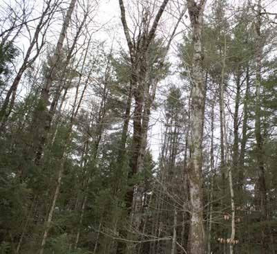
The Town of Amherst, as an official Climate Leader Community certified by the Massachusetts Department of Energy Resources, has made marked efforts to create and implement climate resilience and adaptation goals for their community. The Climate Action Adaptation and Resilience Plan (CAARP), published in 2021, puts forth a roadmap for both short- and long-term goals through five overarching initiatives. This plan is mainly centered around the goal of carbon neutrality by 2050, but also highlights goals of approaching resilience with environmental justice/equity planning in mind. The objectives of the CAARP informed this document’s prioritization and structure of recommended initiatives within the focus area.
As noted on page 58 of the CAARP, roughly 30% of the town’s land is permanently protected open space, including privately-held land with conservation restrictions. While these lands are protected from development in perpetuity, there is more to protection of habitat and biodiversity than conserving lands. Stewardship of conserved lands through proactive management strategies could enhance the biodiviersity and habitat in the focus area, and offer more ecosystem service benefits such as increased carbon sequestration and pollutant reduction in the air and water, as discussed in the Maintaining Aquifer Recharge Section (see page 20). While creating a full-fledged management plan for the focus area is beyond the scope of this document, analysis of the focus area in combination with existing goals and values of the community (as articulated in various Town documents) ultimately highlights a few distinct management opportunities that the Town may consider.
There may be groups and organizations in the Amherst community interested in supporting some of the management strategies proposed in this report; organizations with preexisting knowledge of ecology and/or forestry could conduct research, implement management, and receive a mutual benefit from educational opportunities. An example of a potential partnership could be with the UMass Extension program; students could learn to monitor the forest through tagging trees, establishing permanent plots, or surveying vernal pools to submit evidence for certification.
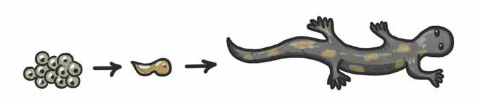
SURVEY POTENTIAL VERNAL POOLS IN THE FOCUS AREA FOR CERTIFICATION OF VERNAL POOL HABITAT 1.
As noted in the Vernal Pools section (see page 32), there are currently four certified vernal pools within the focus area, and roughly 26 potential vernal pools extrapolated from aerial imagery taken in 2000. Based on observations of the conditions in the focus area in early spring 2026, it is likely that the number of vernal pools is much higher than recognized by existing data. Official certification of a vernal pool provides specific protections under the Massachusetts Wetlands Protection Act, Title 5 of the Massachusetts Environmental Code, Section 401 of the Federal Clean Water Act, the Massachusetts Surface Water Quality Standards, and the Massachusetts Forest Cutting Practices Act (NHESP). By achieving certification for more vernal pools in the focus area, more of these protections are applied, which benefits habitat and biodiversity as well as water supply protections. Vernal pools can be certified by submitting documentation to NHESP of certain physical and biological evidence of vernal pool habitat; this work is often reliant on citizen volunteers. There are different physical and biological criteria for certification of habitat based on presence of obligate or facultative vernal pool species. To achieve the most efficient result, the Conservation Commission should consider putting out a request for proposal (RFP) for an ecologist or graduate student to professionally review and certify the potential vernal pools.
With forests accounting for 54% of Amherst’s total land cover (Amherst Sustainability Dashboard, 2026), forest management is a valuable investment of the Town’s planning time and resources.
According to Amherst’s Department of Public Works webpage, forest management is an ongoing effort on watershed lands to maintain integrity of the water supply, generate revenue from wood sales, and improve habitat. Of the 2,662 total acres of Amherst watershed holdings, 300 acres are in the Lawrence Swamp focus area, with another 140 acres immediately due east of the focus area in Belchertown.
Conversely, page 16 of the 2026 Draft of the Conservation Land Use Policy and Regulations states that “forests on Conservation Land are passively managed with the exception of trail maintenance required for human use and safety. The potential exists to implement forest management strategies on parcels to meet the following additional purposes: 1) ecological restoration, 2) control of destructive insects, 3) wildlife habitat management, 4) climate resilience, 5) education, 6) control of invasive plant species, fire management, and 7) salvage following destructive storms and wind events.”
This suggests that different forest management approaches are in place for DPW-owned lands and Conservation-owned lands, although their ideal management philosophies are similar. DPW and the Conservation Commission are two major landholders of the publiclyaccessible lands within the focus area. Rather than treating forested lands based on the parcel boundaries, a unified Forest Management Plan (FMP) by a licensed consulting forester could assess the forest as a whole system. In research for this document, some potential forest management concerns and strategies were identified that could be considered and expanded upon by an FMP:
• Official assessment of HWA infestation and further identification of critical stands that pose the most threat to humans ; the hemlocks immediately around Well #4 appear to be in severe decline and at risk of falling on wellhead infrastructure, DPW workers, or even recreational users.
• Successional planning to build resilience and maintain canopy cover over time, in acknowledgement of climate change Maintaining tree cover is valuable to wetlands and water quality, and provides critical habitat to wildlife communities. Charismatic fauna, such as moose and amphibians, rely on the cooling properties of mature hemlock canopy (Swain, 2000); coniferous trees such as Atlantic white cedar ( Chamaecyparis thyoides ) could potentially be planted to replace hemlock canopy over time and anticipate the range shift of plant species that could withstand today’s current climate in the focus area but also naturally occur further south. This is an example of assisted migration, where humans actively identify plant species that are adapted to conditions of the climate change forecasts of their region and plant them with the objective of building resilience and maintaining long-term vegetation cover. Another strategy for successional planning for forest resilience could be encouraging expansion of the Perched Swamp species. According to DCR Service Forester Sean Libbey and Arborist Inspector/Environmental Planner CJ Lammers, the Oak family and the other Perched Swamp overstory trees have high anticipated resilience to changing climatic conditions; selectively thinning Eastern white pines, as noted in the Succession Section (see page 24), could open canopy for the young preferred saplings to grow.
The Town’s Open Space and Recreation Plan emphasizes the importance of the Conservation Department and Conservation Commission to work with farmers and farmland owners to promote ecologically-sound forest and land management (Amherst Hazard Mitigation Plan, 13). This value is in alignment with other Town goals related to carbon sequestration. According to the Massachusetts Healthy Soils Action Plan, “agricultural soils could sequester approximately four times as much carbon annually if Best Management Practices (BMPs) are widely adopted and 50% of the development between now and 2050 is avoided” (CAARP, 124). If the Town seeks to meet carbon goals, they should consider supporting farmers in implementing BMPs; in the focus area, the most likely and effective BMP to work towards would be increased buffer plantings of riparian areas. Increased buffer plantings between agricultural land and
the wetlands and brooks can increase edge habitat, reduce fragmentation, and benefit the wetlands and surface waters by providing shade to regulate water temperatures and reducing agricultural runoff. Currently, most agricultural parcels in the focus area have less than ten-foot-wide buffers between the productive land and a stream; the USDA recommends a buffer between 35 and 180 feet wide depending on stream size, runoff potential, and other site-specific factors. Anything less than 35 feet is likely inadequate protection for the water (Conservation Practice, 391). Some programs that incentivize and assist farmers to implement and maintain riparian buffer plantings include the Massachusetts Agricultural Environmental Enhancement Program (AEEP), the Section 319 Nonpoint Source Competitive Grants Program, and the Massachusetts Environmental Quality Incentives Program (EQIP).
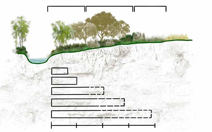
The Conservation Land Use Policy defines permitted and prohibited uses on Town of Amherst Conservation Land under the jurisdiction of the Conservation Commission. The Commission manages approximately 2,400 acres of largely undeveloped land, which is open to the public for passive recreational use unless otherwise specified. As a public-facing document, the policy plays an important role in guiding appropriate use and encouraging stewardship of these lands. This report refers to a draft version of the policy (March 2026). At the time of this report, the document is under active consideration by the Conservation Commission. The following recommendations suggest minor edits to improve clarity, consistency, and effectiveness. Overall, the proposed changes are limited in scope. This report supports adopting the policy.
Greater consistency in language could improve clarity and enforceability. Terms such as “not permitted” and “prohibited” are used interchangeably but may carry different interpretations. In some cases, strengthening language may also support best practices. For example, within the Agricultural Use Policy:
• Page 12 (Section I. Crops) states that management plans must consider the use of cover crops.
• Page 14 (Section X. Cover Crops) states that the Commission will require cover crops or equivalent practices.
Aligning these statements to reflect consistent, directive language (e.g., “will require”) would better support soil health and agricultural stewardship goals.
On multi-use trails shared by pedestrians, cyclists, and equestrians, the Town may consider installing “Yield To” signage to clarify right-of-way expectations. Clear guidance can help reduce user conflict and improve safety.
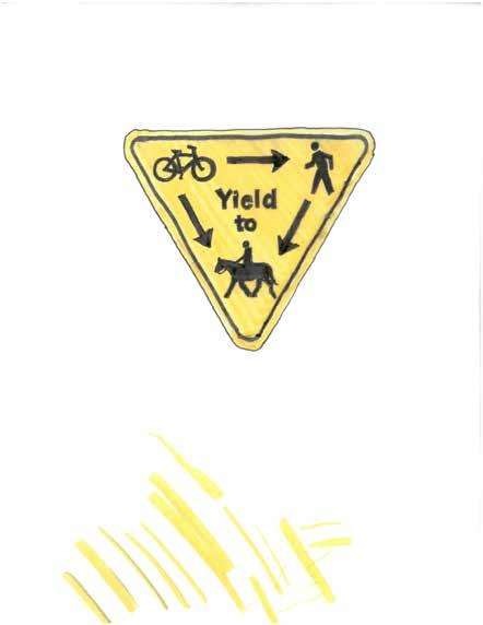
Based on observed ecological impacts and user conflicts (see page 61), it is recommended that the Commission restricts dogs in ecologically sensitive areas. Specifically:
• Prohibit dogs on unpaved trails that pass through mapped rare species core habitat (BioMap)
• Continue to allow dogs on paved, multi-use paths (e.g., Norwottuck Rail Trail)
In areas with frequent dog-related conflicts (e.g., off-leash activity, waste), the Town may also consider installing signs that reinforce regulations and provide contact information for the Animal Control Officer (Section 17-G). This approach supports community accountability and compliance.
Given the potential for soil erosion and trail degradation (see page 61), the Town may consider limiting or prohibiting mountain bike access in sensitive areas, including:
• Wetlands and adjacent buffer zones
• Areas with soils identified as poorly suited for trails based on the NRCS Soil Survey
In alignment with the established values of the Town and its role as a Massachusetts Climate Leader Community, Amherst could set an example in the Commonwealth of Massachusetts by declaring legal personhood or rights of nature for the Lawrence Swamp wetland complex. Other municipalities in New England, namely across New Hampshire, have used ordinances to create water rights within their jurisdictions that prohibit corporations from wielding constitutional powers that could harm these natural resources, and emphasize the essential value of water to all life. This declaration is powerful in shifting cultural perceptions from ownership-oriented to stewardship-oriented. More on the implementation of such an initiative can be found through the Rights of Wetlands Initiative and the Eco Jurisprudence Monitor.
Several deeds for Town-owned parcels have notable clauses or methods of acquisition. It is recommended that the Town’s legal counsel review them to understand the implications those deeds have on the properties and their management.
Parcel
17D-58
Town of Amherst Conservation Commission 3/14/1988 3142 301
18C-80
Town of Amherst Conservation Commission 2/11/1994 4421 162
21A-62
Town of Amherst Conservation Commission 12/31/1993 4395 179
Notes (all notes should be reviewed by legal counsel in relation to the original deeds)
Private sale from Kestrel Land Trust. Conservation easement listed in Book 2300, Page 213. Includes multiple easements, but it is unclear on initial assessment which of the six easements listed apply to this lot.
Private transfer from Kestrel Land Trust, who purchased it from Caroline Flower. Reserved grantor (Caroline Flower) an easement in gross for access to the property for conservation and open space use. Requires that the public has access to the property for "conservation purposes and open space."
Private sale. Reserved grantor (Caroline Flower) an easement in gross for access to the property for conservation and open space use. Requires that the public has access to the property for "conservation purposes and open space."
23D-96
Town of Amherst Conservation Commission 9/28/1989 3452 344
24A-13
Town of Amherst Conservation Commission 10/24/1984 2499 178
Private sale. Deed restrictions require a 15-foot easement for a road from South East Street to allow the public pedestrian access to the land (Atkins Flats) and access for the Town's motor vehicles only for maintenance of facilities; Town must maintain the easement. No expansion of the water treatment facility onto this parcel without Town Meeting, Con Comm, and state legislature approval. Hunting prohibited between Hop Brook and South East Street; Town must post this on the property and enforce the restriction.The Town will make every effort to hay/mow the premises once a year. Grantors and their heirs have the right to enter the property to maintain and harvest from fruit trees within 65 feet of the western boundary in accordance with good agricultural practices.
Private sale from Kestrel Land Trust. Conservation easement listed in Book 2300, Page 213. Includes multiple easements, but it is unclear on initial assessment, which of the six easements listed apply to this lot.
24C-1
24D-26
24D-75
27A-23
27A-3
Town of Amherst Water Department 4/2/1981 2216 148
Town of Amherst Water Department 11/23/1959 1315 70
Town of Amherst Conservation Commission 8/6/1907 621 89
Town of Amherst Conservation Commission 5/23/1969 1551 497
Town of Amherst Conservation Commission 12/22/1981 2257 222
27C-4 Town of Amherst 3/19/1984 DOC #93142 0
Deed confirming eminent domain transfer by Howard W. Atkins in 1981. Easements included to build and maintain water pipes on adjacent lands still owned by Howard Atkins. Right to build road for access with proper drainage and culverts. Right for the public to use the road to access the water treatment parking lot as approved by the Town.
Rail trail land. Town agreed not to sue railroad or any of its successors or assigns for any damage caused on the land by fire directly or indirectly from the railroad for 100 years (2059). Town agrees to install and maintain suitable fencing on the common property line if any fencing is required (in perpetuity on land, not owners). Town has no right to an ROW across other railroad property. Town is obligated to protect all existing ROWs on the property they purchased. Town must maintain all bridges and culverts on land. Town may be liable for any accidents caused by changes they make to the level crossing at Station Road.
Deed in 1907 to Forrester P. Ainsworth. No transfer recorded after. Unclear how the Town acquired the property or who inherited the property after the death of Forrester and his wife in Merrimack, NH in 1919.
Private sale. ROW for pedestrians, riders and vehicles between South East Street and the parcel unless the grantor or their heirs build a road on the easement, in which case, the public access will be moved to a separate, mutually agreed upon, location.
Private sale. Subject to any pre-existing easements if any. 20-foot ROW for pedestrians, riders and vehicles, from South East Street agreed upon by both parties is fixed and cannot be moved in the future.
Private sale from Kestrel Land Trust. Conservation easement listed in Book 2300, Page 213. Includes multiple easements, but it is unclear on initial assessment which of the six easements listed apply to this lot.
The Training Manual for Applied Agroforestry Practices (2021 edition) is a free resource produced by the University of Missouri Center for Agroforestry, in collaboration with several other organizations at the forefront of agroforestry in the United States. Chapter Five describes the design, implementation, function, and management of planted riparian buffers. The table below defines the different zones within a riparian buffer, as depicted on page 83.
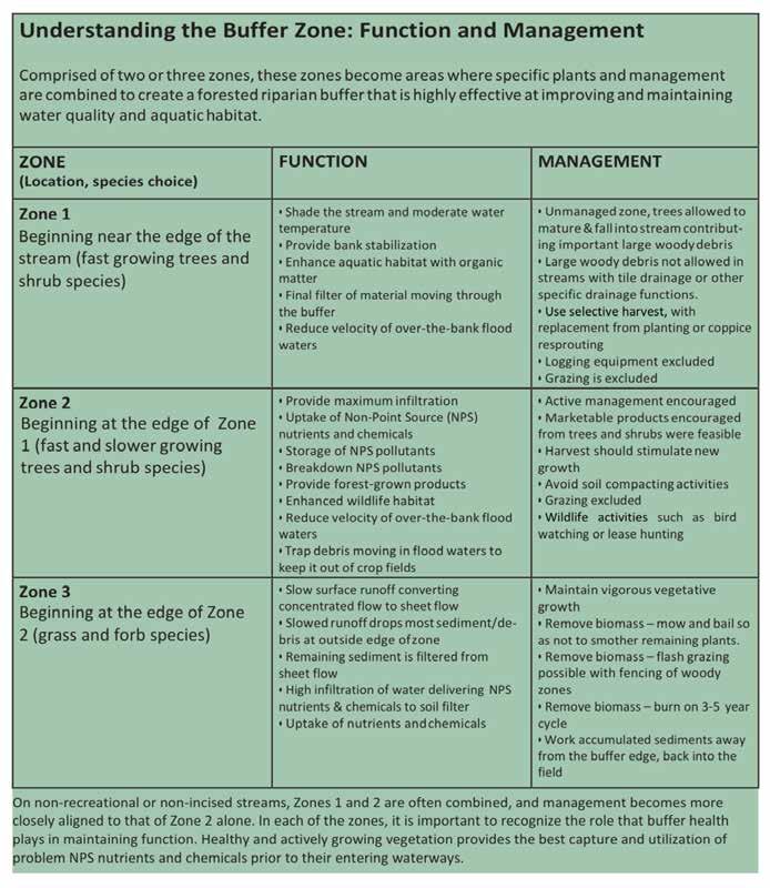
American Tree Farm System. “Carrying on the Family Legacy.” Tree Farm System , www. treefarmsystem.org/bulletin-cinda-jones-carrying-on-the-family-legacy
Amherst Hazard Mitigation Planning Workgroup. “The Town of Amherst Natural Hazard Mitigation Plan Update.” Pioneer Valley Planning Commission, 2016. www.amherstma.gov/ DocumentCenter/View/37928/6a-Hazard-Mitigation-Plan-Update-MEMAedits.
Banks, Peter B., and Jessica V. Bryant. “Four-legged friend or foe? Dog walking displaces native birds from natural areas.” Biology Letters vol. 3,6 (2007): 611-3. doi:10.1098/rsbl.2007.0374.
Burchsted, Denise. Personal interview. 3 March 2026.
“Chapter 61 Current Use Tax Programs.” MassWoods , www.masswoods.org/future-my-land/ chapter-61-current-use-tax-programs/.
Childs, Robert. “Hemlock Woolly Adelgid.” UMass Extension Landscape: Center for Agriculture, Food, and the Environment (CAFE) . 8 Dec. 2022, www.umass.edu/agriculture-food-environment/ landscape/fact-sheets/hemlock-woolly-adelgid.
Commonwealth of Massachusetts. “Agricultural Preservation Restriction (APR) Program Details.” www. mass.gov/info-details/agricultural-preservation-restriction-apr-program-details.
“Conservation Practice 391: Riparian Forest Buffer.” USDA Conservation Stewardship Program , 2025. www.nrcs.usda.gov/sites/default/files/2025-03/E391A_FY2025.pdf.
Convention on Wetlands Secretariat. “Ramsar Information Paper no. 1: What are Wetlands?” Ramsar Convention on Wetlands , 1971, www.ramsar.org/sites/default/files/documents/library/info200701-e.pdf.
Convention on Wetlands Secretariat. “Wetland Ecosystem Services – an introduction.” Ramsar Convention on Wetlands . www.ramsar.org/sites/default/files/documents/library/services_00_e. pdf.
“Data Spotlight: Explore Climate-Induced Range Shifts with the CoRE (Contractions and Range Expansions) Database.” Climate Adaptation Science Centers, U.S. Geological Survey . 1 Jan 2018, www.usgs.gov/programs/climate-adaptation-science-centers/news/ data-spotlight-explore-climate-induced-range.
Eiseman, Judith, and Christopher Curtis. “Reference: MOA for Protection of the Mount Tom and Mount Holyoke Ranges.” 19 June 2003.
Farnsworth, Elizabeth. “Hard Knocks, Hard Rocks: Geology of the Holyoke Range.” Hitchcock Center for the Environment , 13 Nov. 2010, www.hitchcockcenter.org/earth-matters/ hard-knocks-hard-rocks-geology-of-the-holyoke-range/.
Fitzgerald, Stephen & Ober, Holly. “Early-Seral Forest: What Is It and Why Is It Important?” Extension Communications , 2 May 2025, extension.oregonstate.edu/catalog/ em-9516-early-seral-forest-what-it-why-it-important.
Gajaseni, Sarisa, et al. “Robert Frost Trail Online Guide.” 2021, www.storymaps.arcgis.com/stories/ b1780aa426a44e08be034098a130893e. Accessed 10 March 2026.
Gold, Michael, et al. Training Manual for Applied Agroforestry Practices. University of Missouri Center for Agroforestry, 2021 edition.
Haemig, Paul D. “Ecology of the Beaver.” Ecology.Info 13, 2012.
Hennings, Lori. “The Impacts of Dogs on Wildlife and Water Quality: A Literature Review.” The Nature Institute , April 2016, www.thenatureinstitute.org/wp-content/uploads/2019/02/The-impact-ofdogs-on-wildlife.pdf.
Hilltown Land Trust. “What Is a Conservation Restriction?” www.hilltownlandtrust.org/conservingyour-land/what-is-a-conservation-restriction.
“How to Design a Riparian Buffer for Agricultural Land.” National Agroforestry Center, USDA Forest Service , Jan 1997, www.fs.usda.gov/nac/assets/documents/agroforestrynotes/an04rfb03.pdf.
“Hydrogeology.” Geoscience Perspectives on Fresh Water Availability, University of Massachusetts Amherst , www.websites.umass.edu/geoandsociety/hydrogeology/.
“iTree Canopy Assessment Tool.” landscape.itreetools.org/maps/benefits/.
Jackson, Scott, and Thomas Decker. Beavers in Massachusetts: Natural History, Benefits, and Ways to Resolve Conflicts Between People and Beavers . University of Massachusetts Extension and Massachusetts Division of Fisheries & Wildlife, June 2004.
Jacque, Erin. Personal Interview. 11 March 2026.
“Managing Hemlock in Northern New England Forests Threatened by Hemlock Woolly Adelgid and Elongate Hemlock Scale.” Northeastern Area State and Private Forestry, USDA Forest Service , September 2015, extension.unh.edu/sites/default/files/migrated_unmanaged_files/ Resource005573_Rep7772.pdf.
Massachusetts Department of Conservation and Recreation. Trails Guidelines and Best Practices Manual. July 2019.
Massachusetts Department of Environmental Protection. “Healey-Driscoll Administration Awards $200,000 in Grants to Help Watershed Coalitions Monitor Water Quality.” 16 Mar. 2026, www. mass.gov/news/ healey-driscoll-administration-awards-200000-in-grants-to-help-watershed-coalitions-monitorwater-quality.
Massachusetts Division of Ecological Restoration. “Massachusetts Stream Crossing Handbook.” May 2018, www.mass.gov/files/documents/2018/08/23/Stream%20Crossings%20booklet%20Web.pdf
Massachusetts Division of Fisheries & Wildlife. “Guidelines for the Certification of Vernal Pool Habitat.” Oct. 2020, www.mass.gov/doc/guidelines-for-the-certification-of-vernal-pool-habitat.
Massachusetts Executive Office of Energy and Environmental Affairs. “2025 Massachusetts Climate Report Card.” 13 Feb. 2026.
Massachusetts Executive Office of Energy and Environmental Affairs. “The Massachusetts Healthy Soils Action Plan.” 2022, www.mass.gov/doc/healthy-soils-action-plan-2023/download.
MassGIS. “BioMap: The Future of Conservation.” www.mass.gov/info-details/massgis-data-biomapthe-future-of-conservation. Accessed 14 Mar. 2026
MassGIS. “MassDEP 2018/2020 Integrated List of Waters (305(b)/303(d)).” www.mass.gov/info-details/ massgis-data-massdep-20182020-integrated-list-of-waters-305b303d.
MassGIS. “NHESP Potential Vernal Pools.” www.mass.gov/info-details/ massgis-data-nhesp-potential-vernal-pools.
MassWildlife’s Natural Heritage and Endangered Species Program (NHESP). “Vernal Pool Protection.” www.mass.gov/info-details/vernal-pool-protection.
North Shore Land Alliance. “Aquifer Study Released and the News is Not Good.” 22 Nov. 2024, northshorelandalliance.org/aquifer-study-released-and-the-news-is-not-good/.
The Norwottuck Network. Mass Central Rail Trail Primer . Sept. 2023, www.norwottucknetwork.org/_ files/ugd/92f6ae_9ef8d778c06f4d048ffce57e9f74a9aa.pdf.
Pioneer Valley Planning Commission. “Barnes Aquifer Protection Advisory Committee.” www.pvpc. org/our-work/barnes-aquifer-protection-advisory-committee/.
Pioneer Valley Planning Commission.“Barnes Aquifer Protection Advisory Committee Fiscal Years 2014 and 2015 (July 2013 to June 2015) Annual Report.” Dec. 2015.
Pioneer Valley Planning Commission. “Pioneer Valley Sustainability Toolkit.” www.pvpc.org/our-work/ pioneer-valley-sustainability-toolkit/.
Pioneer Valley Planning Commission. “Ridgeline & Hillside Development Bylaws.” www.pvpc.org/ wp-content/uploads/2025/05/PVPC-Ridgeline-and-Hillside-Development-Bylaws.pdf.
Rowe, Rebecca. Personal interview. 14 March 2026.
Rusiecki, Amy, and Beth Willson. Personal interview. 17 Feb. 2026.
Salimi, Shokoufeh, et al. “Impact of Climate Change on Wetland Ecosystems: A Critical Review of Experimental Wetlands.” J ournal of Environmental Management , vol. 286, May 2021, p. 112160. doi.org/10.1016/j.jenvman.2021.112160.
Soil Survey Staff, Natural Resources Conservation Service, United States Department of Agriculture. Web Soil Survey , www.websoilsurvey.nrcs.usda.gov/. Accessed 20 Feb. 2026.
Stevens, Rachel, and Jim Oehler. Trails for People and Wildlife: A Guide to Planning Trails That Allow People to Enjoy Nature and Wildlife to Thrive . 2019, https://www.wildlife.nh.gov/sites/g/files/ ehbemt746/files/inline-documents/sonh/trails-for-people-wildlife.pdf.
Swain, P.C. “Hemlock Swamp.” Classification of the Natural Communities of Massachusetts , 2000. www.mass.gov/doc/hemlock-swamp-0.
Swain, P.C. “Black Gum – Pin Oak – Swamp White Oak Perched Swamp.” Classification of the Natural Communities of Massachusetts , 2000, www.mass.gov/doc/ black-gum-pin-oak-swamp-white-oak-perched-swamp.
Swain, P.C. “Shrub Swamp.” Classification of the Natural Communities of Massachusetts , 2000, www. mass.gov/doc/shrub-swamp.
Swain, P.C. “Coastal Atlantic White Cedar Swamp.” Classification of the Natural Communities of
Massachusetts , 2000, www.mass.gov/doc/coastal-atlantic-white-cedar-swamp.
Town of Amherst. “Chapter 3. People: Demographics.” Planning Amherst Together , 2007, www. amherstma.gov/DocumentCenter/View/1627/3_Demographics_070830_SN?bidId=.
Town of Amherst. Climate Action Adaptation and Resilience Plan , June 2021.
Town of Amherst. “Conservation Commission.” www.amherstma.gov/273/Conservation-Commission.
Town of Amherst. “How Do I Preserve My Land in Amherst?” www.amherstma.gov/1250/ How-Do-I-Preserve-My-Land-in-Amherst.
Town of Amherst. “Land Resources.” www.amherstma.gov/614/Land-Resources.
Town of Amherst. “Mill & Fort Rivers.” www.amherstma.gov/1261/Mill-Fort-Rivers.
Town of Amherst. “Open Space & Recreation Plan.” 2017, www.amherstma.gov/629/ Open-Space-Recreation-Plan.
Town of Amherst. “Town Warrant Special Town Meeting.” 29 Jan. 2003.
Town of Amherst. “Watershed Forestry.” www.amherstma.gov/1793/Watershed-Forestry.
Town of Amherst. “Water Supply Status.” www.amherstma.gov/2262/Water-Supply-Status.
Town of Amherst. “Wetlands Protection and Permitting.” www.amherstma.gov/1268/ Wetlands-Protection-and-Permitting.
Town of Amherst. “Zoning Bylaw.” 1 Dec. 2025, www.amherstma.gov/476/Zoning-Bylaw-Map.
Town of Belchertown. “Article II Zoning Districts.” 8 May 2023, www.ecode360. com/9051132#9051148.
“UMass Amherst Land Acknowledgement.” University of Massachusetts Amherst, Office of Equity and Inclusion , www.umass.edu/diversity/about/land-acknowledgement.
USDA Natural Resources Conservation Service. “Voluntary Public Access and Habitat Incentive Program.” www.nrcs.usda.gov/programs-initiatives/ voluntary-public-access-and-habitat-incentive-program.
Warren, Jason. “King Philip’s War.” Encyclopedia Britannica . www.britannica.com/event/ King-Philips-War.
Walsh, Shannon, and Ken Comia. “Amherst Historic Preservation Plan 2023.” Town of Amherst Community Preservation Committee , 2023, www.amherstma.gov/DocumentCenter/View/75803/ Amherst-Historical-Preservation-Plan-2023.
Water Resources Mission Area. “Nutrients and Eutrophication.” U.S. Geological Survey . 2 Mar. 2019, https://www.usgs.gov/mission-areas/water-resources/science/nutrients-and-eutrophication.
Whitaker, Bates, and Rutledge, Liz. “Forest Dynamics – On Wildlife and Ecological Succession.” North Carolina Wildlife Federation , 27 Aug. 2024, www.ncwf.org/blog/succession/.
Yellen, Brian. Personal interview. 19 Feb. 2026.
The Lawrence Swamp in the Town of Amherst is a critical ecological and hydrological resource that supports the Town’s drinking water, biodiversity, and open space. Through an integrated analysis of the 2,200-acre landscape surrounding the wetland complex, including water supply systems, habitat networks, and recreational use, the study finds that while the aquifer is well-protected and the landscape provides regionally significant wildlife habitat, increasing pressures from land use, development, and off-trail recreation pose risks to long-term ecological function. Grounded in these findings, the report offers targeted, actionable recommendations to guide the Town of Amherst in balancing conservation, water resource protection, and public access while emphasizing strategic land protection, improved trail management, and collaborative, cross-municipal stewardship to ensure the resilience of this vital landscape for generations to come.