
El Niño Returns
Oregon Forecasters Watch Developing Pacific Pattern That Could Shape the State's Weather Through Winter
By John Oliver
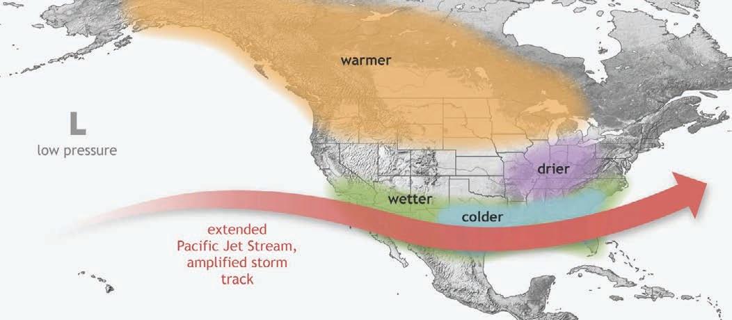
A developing climate pattern thousands of miles west of the Oregon coastline is drawing increasing attention from meteorologists and climate scientists, who say it has the potential to influence the state's weather well into the coming fall and winter. Federal forecasters have officially confirmed that El Niño conditions have developed across the equatorial Pacific Ocean, marking the beginning of what could become one of the strongest episodes observed in decades.
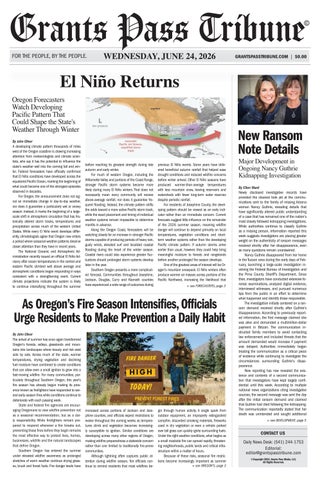
For Oregon, the announcement does not signal an immediate change in day-to-day weather, nor does it guarantee a particularly wet or snowy season. Instead, it marks the beginning of a largescale shift in atmospheric circulation that has historically altered storm tracks, temperatures and precipitation across much of the western United States. While every El Niño event develops differently, climatologists agree that Oregon now enters a period where seasonal weather patterns deserve closer attention than they have in recent years.
The National Oceanic and Atmospheric Administration recently issued an official El Niño Advisory after ocean temperatures in the central and eastern Pacific climbed well above average and atmospheric conditions began responding in ways consistent with a strengthening event. Current climate projections indicate the system is likely to continue intensifying throughout the summer
before reaching its greatest strength during late autumn and early winter.
For much of western Oregon, including the Willamette Valley and portions of the Coast Range, stronger Pacific storm systems become more likely during many El Niño winters. That does not necessarily mean every community will receive above-average rainfall, nor does it guarantee frequent flooding. Instead, the climate pattern shifts the odds toward a more active Pacific storm track, while the exact placement and timing of individual weather systems remain impossible to determine months in advance.
Along the Oregon Coast, forecasters will be watching closely for an increase in stronger Pacific storms capable of producing periods of heavy rain, gusty winds, elevated surf and localized coastal flooding during the heart of the winter season.
Coastal rivers could also experience greater fluctuations should prolonged storm systems develop later in the year.
Southern Oregon presents a more complicated forecast. Communities throughout Josephine, Jackson, Douglas, Curry and Klamath counties have experienced a wide range of outcomes during
previous El Niño events. Some years have delivered beneficial autumn rainfall that helped ease drought conditions and reduced wildfire concerns before winter arrived. Other El Niño seasons have produced warmer-than-average temperatures with less mountain snow, leaving reservoirs and watersheds with fewer long-term water reserves despite periodic rainfall.
For residents of Josephine County, the developing pattern should be viewed as an early indicator rather than an immediate concern. Current forecasts suggest little influence on the remainder of the 2026 summer season, meaning wildfire danger will continue to depend primarily on local temperatures, vegetation conditions and shortterm weather systems rather than the developing Pacific climate pattern. If autumn storms arrive earlier than usual, however, they could help bring meaningful moisture to forests and rangelands before another prolonged fire season develops.
One of the greatest areas of interest will be Oregon's mountain snowpack. El Niño winters often produce warmer air masses across portions of the Pacific Northwest, increasing the likelihood that
As Oregon’s Fire Season Intensifies, Officials Urge Residents to Make Prevention a Daily Habit
By John Oliver
The arrival of summer has once again transformed Oregon's forests, valleys, grasslands and mountains into landscapes where beauty and risk exist side by side. Across much of the state, warmer temperatures, drying vegetation and declining fuel moisture have combined to create conditions that can allow even a small ignition to grow into a fast-moving wildfire. For many communities, particularly throughout Southern Oregon, this year's fire season has already begun making its presence known as firefighters have responded to several early-season fires while conditions continue to deteriorate with each passing week.
State and federal fire agencies are encouraging Oregonians to view wildfire prevention not as a seasonal recommendation, but as a daily responsibility. While firefighters remain prepared to respond whenever a fire breaks out, preventing those fires before they begin remains the most effective way to protect lives, homes, businesses, wildlife and the natural landscapes that define Oregon.
Southern Oregon has entered the summer under elevated wildfire awareness as prolonged stretches of warm weather continue drying grasses, brush and forest fuels. Fire danger levels have

increased across portions of Jackson and Josephine counties, and officials expect restrictions to evolve throughout the coming weeks as temperatures climb and vegetation becomes increasingly susceptible to ignition. Similar conditions are developing across many other regions of Oregon, making wildfire preparedness a statewide concern rather than one limited to traditionally fire-prone communities.
Although lightning often captures public attention during wildfire season, fire officials continue to remind residents that most wildfires be-
New Ransom Note Details
Major Development in Ongoing Nancy Guthrie Kidnapping Investigation
By Ellen Ward
Newly disclosed investigative records have provided the clearest look yet at the communications sent to the family of missing Arizona woman Nancy Guthrie, revealing details that have significantly altered public understanding of a case that has remained one of the nation's most closely followed kidnapping investigations. While authorities continue to classify Guthrie as a missing person, information reported this week suggests investigators are placing greater weight on the authenticity of ransom messages received shortly after her disappearance, even as many questions remain unanswered.
Nancy Guthrie disappeared from her home in the Tucson area during the early days of February, launching a large-scale investigation involving the Federal Bureau of Investigation and the Pima County Sheriff's Department. Since then, investigators have conducted extensive forensic examinations, analyzed digital evidence, interviewed witnesses, and pursued numerous tips from the public in an effort to determine what happened and identify those responsible.
The investigation initially centered on a ransom demand received shortly after Guthrie's disappearance. According to previously reported information, the first message claimed she was alive and demanded a multimillion-dollar payment in Bitcoin. The communication instructed family members to avoid contacting law enforcement and included threats that the amount demanded would increase if payment was delayed. Authorities immediately began treating the communication as a critical piece of evidence while continuing to investigate the circumstances surrounding Guthrie's disappearance.
gin through human activity. A single spark from outdoor equipment, an improperly extinguished campfire, discarded smoking materials, fireworks used in dry vegetation or even a vehicle parked over tall grass can quickly ignite surrounding fuels. Under the right weather conditions, what begins as a small roadside fire can spread rapidly, threatening neighborhoods, public lands and critical infrastructure within a matter of hours.
Because of these risks, seasonal fire restrictions become increasingly important as summer
• see OREGON’S, page 3
New reporting has now revealed the existence and contents of a second communication that investigators have kept largely confidential until this week. According to multiple national news organizations citing investigative sources, the second message was sent the day after the initial ransom demand and claimed that Guthrie had died following the kidnapping. The communication reportedly stated that her death was unintended and sought additional
• see DEVELOPMENT, page 5

OREGON
Oregon Journalism Mourns the Loss of Reporter
Zane
Sparling, Whose Commitment to the Story Endured Until the End
By John Oliver
Oregon's journalism community is mourning the loss of one of its most dedicated local reporters following the death of Oregonian and OregonLive journalist Zane Sparling, who died on June 21 after a two-year battle with the rare vascular cancer known as epithelioid hemangioendothelioma. He was 33.
For readers across Oregon, Sparling became a familiar byline through years of reporting on the issues shaping Portland and the surrounding region. His work regularly examined public safety, homelessness, housing, city government, and community affairs while documenting many of the state's most significant public demonstrations and breaking news events. Whether covering the daily challenges facing neighborhoods or the major stories drawing statewide attention, his reporting reflected a consistent commitment to informing the public with accuracy and persistence.
His passing marks the loss of a journalist whose career, though far too brief, left a lasting impression on colleagues, public officials, readers, and the profession he chose to serve.
In 2024, Sparling was diagnosed with epithelioid hemangioendothelioma, an exceptionally rare cancer that develops in the lining of blood vessels and affects only a small number of people worldwide. The disease can appear in multiple parts of the body, including the liver, lungs, bones, and soft tissue, and remains one

of the least common forms of cancer encountered by physicians. Despite advances in medical research, treatment options remain limited because of its rarity.
Rather than allowing the diagnosis to define the final chapter of his career, Sparling continued doing the work that had become his calling. Throughout months of treatment and the physical demands that accompanied his illness, he remained active in the field, covering stories for The Oregonian and OregonLive with the same professionalism that had become a hallmark of his reporting. His final published work appeared only days before his death, underscoring a level of dedication that colleagues say never diminished, even as his health declined.
That perseverance became one of the defining characteristics of his legacy. Journalism often demands long hours, difficult assignments, unpredictable schedules, and an unwavering commitment to documenting events as they unfold. Sparling continued to embrace those responsibilities while facing a deeply personal medical battle, demonstrating a quiet resilience that earned admiration throughout Oregon's news industry.
Before joining The Oregonian, Sparling built his experience reporting for community newspapers throughout the Portland metropolitan area. Those early assignments helped shape a reporter who understood the importance of local journalism and the responsibility that accompanies informing the public. As his career progressed, he developed a reputation for being present wherever news was unfolding, often arriving quickly at breaking events and providing readers with detailed, timely coverage.
His work extended beyond simply reporting facts. It documented the evolving challenges facing Oregon's largest city while preserving an accurate public record of events that will remain part of the state's history for years to come. Readers came to recognize his name not because he sought attention for himself, but because they trusted the consistency and depth of his reporting.
News of Sparling's death prompted an outpouring of condolences from fellow jour-
Oregon’s Fire Season Intensifies
progresses. Activities involving spark-producing equipment are often limited during the hottest and driest hours of the day when vegetation is most vulnerable. Debris burning is prohibited throughout much of fire season, and restrictions on campfires, fireworks and certain recreational activities may expand as conditions worsen. Residents are encouraged to remain aware of changing regulations before beginning outdoor projects or visiting public lands, recognizing that restrictions may change quickly in response to weather and fire conditions.
Outdoor recreation remains an important part of life in Oregon, but enjoying forests, rivers and campgrounds safely requires added vigilance during fire season. Campfires should only be built where they are specifically permitted and should never be left unattended, even for a short period of time. Before leaving any campsite, fires should be completely extinguished with water and stirred until every ember is cool to the touch. What may appear to be an extinguished fire can continue smoldering beneath the surface before reigniting as afternoon temperatures rise and winds increase.
Motorists can also play a significant role in wildfire prevention. Hot exhaust systems and catalytic converters are capable of igniting dry grasses when vehicles are parked off paved surfaces. Trailer safety chains that drag against pavement can produce sparks along highways, while poorly maintained equipment may create additional ignition hazards. Taking a few moments to inspect vehicles before traveling can prevent an avoidable emergency from unfolding along Oregon's roadways.
Around the home, creating defensible space remains one of the most effective steps property owners can take before wildfire threatens their neighborhood. Removing dry grass and weeds, trimming tree branches away from roofs,
clearing leaves and pine needles from gutters, relocating firewood away from buildings and reducing combustible materials surrounding structures all help lower wildfire risk while providing firefighters with safer conditions should suppression efforts become necessary.
Wildfire preparedness extends beyond protecting individual homes. Large fires can affect drinking water supplies, damage wildlife habitat, close highways, interrupt recreation, impact agriculture, reduce air quality and place enormous demands on local emergency resources. Recovery often takes years, while the economic and environmental consequences can linger long after flames have been extinguished. Emergency managers also encourage families to prepare before an evacuation becomes necessary. Developing a household evacuation plan, assembling emergency supplies, safeguarding important documents and discussing evacuation routes with family members can save valuable time when conditions change rapidly. Preparing in advance allows residents to focus on safety rather than scrambling to make decisions during an emergency.
As Oregon moves deeper into what is expected to be another active wildfire season, officials continue reminding residents that preventing the next wildfire depends as much on individual choices as it does on firefighting resources. Every responsible decision made around homes, campgrounds, forests, farms and public lands contributes to protecting communities across the state.
Wildfire season is an unavoidable part of living in Oregon, but many wildfire disasters are not. Through careful planning, heightened awareness and respect for seasonal fire restrictions, Oregonians can help reduce preventable fire starts and preserve the forests, open spaces and communities that make the state unique for generations to come.
nalists, public officials, and members of the communities he spent years covering. Many remembered not only his professionalism and work ethic but also his generosity toward colleagues and his genuine belief in the public service mission of journalism. His contributions earned respect across newsrooms throughout Oregon, where reporters understood both the demands of the profession and the determination required to continue reporting while confronting serious illness.
The loss of Zane Sparling serves as a reminder that journalism is ultimately carried forward by individuals willing to devote themselves to documenting the lives, challenges, achievements, and history of their communities. His reporting informed countless readers, strengthened public understanding of important issues, and reflected the enduring value of local news at a time when trusted journalism remains essential.
Although his career was measured in years rather than decades, the standard he established through determination, integrity, and unwavering commitment to his craft will endure far longer. His legacy lives on in the stories he told, the communities he documented, and the example he leaves for future generations of journalists who understand that the pursuit of truth often requires extraordinary dedication. Oregon has lost a gifted reporter, but the work he leaves behind will continue to speak for itself.
Forecasters Watch Developing Pacific Pattern
From page 1
precipitation falls as rain instead of snow at middle elevations within the Cascade Range. Even when overall precipitation remains near average, reduced snowfall can have lasting consequences for spring runoff, irrigation supplies, hydroelectric generation and streamflow’s that support fish and wildlife throughout the following summer. Agriculture across Oregon will also be closely tied to how the pattern evolves. Ranchers, orchard operators, vineyard managers and row crop producers rely heavily on seasonal moisture and winter snow accumulation to sustain water supplies during the state's dry summer months. Earlier autumn rainfall could improve soil moisture entering winter, while warmer seasonal temperatures may influence crop development, pest activity and irrigation planning in different regions of the state.
Meteorologists caution that El Niño should not be viewed as a precise forecast for any individual community. Seasonal climate outlooks describe broad atmospheric tendencies rather than specific storms, snowfall totals or rainfall amounts. Local weather conditions can still vary considerably from one county to the next, even during a strong climate event.
As Oregon moves deeper into summer, forecasters will continue monitoring sea surface temperatures, atmospheric circulation and long-range climate models for signs that the Pacific pattern is strengthening as expected. Whether the coming winter ultimately proves wetter, warmer or more variable than average, the months ahead will provide valuable insight into how one of the world's most influential climate patterns shapes weather across the Pacific Northwest. For communities throughout Southern Oregon, including Josephine County, the forecast remains one to watch closely, not because dramatic changes are guaranteed, but because the developing conditions have the potential to influence water supplies, agriculture, mountain snowpack and the overall character of the state's winter season.

Supreme Court Defines Federal Authority Over Returning Green Card Holders in Landmark Immigration Decision NATIONAL
By Ellen Ward
The United States Supreme Court has issued a significant ruling that further defines the federal government's authority over lawful permanent residents returning from international travel, concluding that immigration officers may temporarily parole certain green card holders into the country while questions surrounding their admissibility are resolved. The 6 to 3 decision clarifies an area of immigration law that has been the subject of years of litigation and is expected to influence how future cases involving returning permanent residents are handled at the nation's ports of entry.
The case centered on Muk Choi Lau, a lawful permanent resident who returned to the United States in 2012 after a brief trip to China while facing criminal allegations involving trademark counterfeiting. Rather than admitting Lau as a returning permanent resident, federal immigration officers exercised their authority to parole him into the United States pending additional immigration proceedings. After Lau later pleaded guilty to the underlying offense, the Department of Homeland Security initiated removal proceedings based on federal immigration statutes governing individuals seeking admission into the country.
Lau challenged the government's actions, arguing that lawful permanent residents returning from short trips abroad generally retain their legal status and should not be treated as applicants for admission unless the government can first demonstrate that one of the specific statutory exceptions applies. He maintained that immigration officials lacked sufficient evidence at the time of his return to justify placing him on parole rather than admitting him under his existing permanent resident status.

The legal dispute eventually reached the nation's highest court after the United States Court of Appeals for the Second Circuit ruled in Lau's favor. The appellate court concluded that the government had not established the level of proof required to treat him as an arriving alien subject to inadmissibility proceedings at the time he reentered the country.
In reversing that decision, the Supreme Court determined that immigration officers are not required to possess clear and convincing evidence of a removable offense before exercising parole authority at the border. Writing for the majority, Justice Clarence Thomas concluded that federal law permits immigration officials to parole certain returning permanent residents into the country while the facts surrounding their immigration status and any criminal allegations are fully evaluated during subsequent removal proceedings.
The Court's opinion emphasized that immigration parole is a procedural mechanism distinct from criminal parole. Under federal immigration law, parole allows an individual to physically enter the United States without
being formally admitted for immigration purposes while additional legal questions remain pending. The majority concluded that this temporary status does not eliminate the government's obligation to ultimately prove removability during formal immigration proceedings but does allow immigration officers to address unresolved admissibility questions after a traveler has entered the country.
The Court's three dissenting justices disagreed with that interpretation. Writing for the dissent, Justice Ketanji Brown Jackson argued that Congress established specific protections for lawful permanent residents and intended those protections to apply before the government could alter their legal status upon returning from international travel. The dissent expressed concern that allowing parole under these circumstances grants immigration authorities broader discretion than Congress intended and could leave lawful permanent residents facing extended legal uncertainty before their cases are fully adjudicated.
Although the ruling arose from one individual's circumstances, immigration attorneys
and legal scholars believe the decision will carry broader implications for lawful permanent residents who travel internationally while facing unresolved criminal allegations. The Court's decision does not change the legal status of most green card holders, nor does it authorize automatic deportation based solely on an arrest or accusation. Federal immigration authorities must still establish that an individual is removable under existing immigration law through formal legal proceedings before removal can occur.
The decision instead addresses the government's authority during the initial inspection process at the border, clarifying that immigration officers may temporarily parole certain returning permanent residents while the legal basis for removal is determined through the immigration court system.
The litigation followed more than a decade of legal proceedings beginning with Lau's return to the United States in 2012. After conflicting decisions in the lower federal courts, the Supreme Court agreed to hear the case during its current term. Oral arguments were presented earlier this year before the Court issued its opinion on June 23, bringing a definitive resolution to a question that has divided lower courts and immigration practitioners.
The ruling represents another significant immigration decision issued by the Supreme Court during a term that has included multiple cases examining the scope of executive authority under federal immigration law. While the Court's opinion is narrowly focused on the treatment of returning lawful permanent residents, its interpretation of immigration parole authority is expected to guide federal agencies and lower courts in similar cases for years to come.
Development in Ongoing Nancy Guthrie Kidnapping Investigation
money in exchange for revealing the location of her remains. Although the reported contents have been widely published, investigators have not publicly released the complete text of the message or confirmed every detail described by media reports.
The emergence of the second communication represents one of the most significant developments in the investigation because law enforcement sources now believe the two ransom messages may be directly connected. According to reports citing investigators familiar with the case, forensic analysis indicates both emails likely originated from the same internet protocol address, strengthening the possibility that they were sent by the same individual or group responsible for the kidnapping. That finding has elevated the importance of the communications within the broader investigation and may provide investigators with valuable digital evidence as the case continues.
Despite the troubling claims contained in the second message, authorities have not confirmed that Nancy Guthrie is deceased. Her body has not been located, no forensic evidence has publicly established her death, and investigators continue to list her as a missing
person. Law enforcement officials have consistently emphasized that claims contained in ransom communications must be independently verified before they can be accepted as factual, particularly in investigations involving extortion or kidnapping.
Investigators continue to rely on a combination of physical, digital, and forensic evidence collected during the months since Guthrie disappeared. Earlier stages of the investigation identified blood evidence near the entrance of her residence, prompting extensive forensic testing. Surveillance video obtained from the neighborhood also captured an individual wearing dark clothing and a face covering near the home during the period surrounding the disappearance. Authorities have stated that additional surveillance footage, electronic records, DNA evidence, and digital communications remain under examination as investigators work to reconstruct the sequence of events.
Federal investigators have also devoted significant attention to tracing cryptocurrency activity associated with the ransom demands. Reports indicate authorities conducted controlled transactions involving the Bitcoin wallet
referenced in the communications in an effort to identify potential investigative leads. Public reporting suggests those efforts did not immediately reveal the identity of the individual or individuals behind the ransom messages, but investigators continue analyzing financial and digital records as part of the ongoing case.
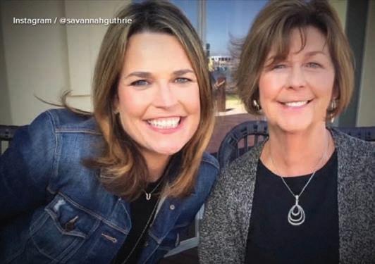
Throughout the investigation, Guthrie's family has maintained a visible public presence while urging anyone with credible information to contact law enforcement. Her daughter, television journalist Savannah Guthrie, has periodically addressed the investigation publicly and renewed appeals for information that could assist authorities. Following publication of the newly reported details surrounding the second ransom communication, the family again expressed hope that continued public attention may encourage someone with relevant information to come forward.
The investigation has generated widespread national attention because of its combination of digital evidence, sophisticated ransom demands, forensic analysis, and the continuing absence of definitive answers regarding Guthrie's whereabouts. Experts note that kidnapping investigations frequently in-
volve communications intended to mislead investigators or pressure families, making independent verification of every claim an essential component of the investigative process.
As the investigation enters another phase, authorities continue pursuing multiple lines of inquiry while withholding many details that could affect the integrity of the case. No arrests have been announced, no suspects have been publicly identified, and no criminal charges have been filed in connection with Guthrie's disappearance. The FBI and the Pima County Sheriff's Department continue to request information from the public while emphasizing that the investigation remains active and ongoing. The newly disclosed ransom communications provide investigators with additional evidence and offer the public a clearer understanding of the events that unfolded in the days immediately following Nancy Guthrie's disappearance. Even with those developments, the central questions surrounding the case remain unresolved. Until investigators determine what happened and identify those responsible, Nancy Guthrie's disappearance continues to stand as one of the nation's most complex and closely watched criminal investigations.

LOCAL POLITICS
The Pole Is Not Moving. The Ice Is.
Local Opinion by Michael A. Burdge
There is a simple visual lesson that explains a great deal about modern politics.
Imagine a pole standing upright in moving ice. At first glance, it can look as though the pole is plowing through the ice. A wake forms around it. The disturbance is obvious. The pole appears to be the object in motion.
But look closer, and the truth becomes clear: the pole is not moving. The ice is.
That image captures one of the most common mistakes in political thinking today. People see disruption surrounding a person, a belief, a law, a tradition, or a community, and they assume the thing at the center must be the cause. They mistake the wake for proof of motion.
I believe that is exactly what has happened in American politics over the past twenty years, particularly within the Democratic Party.
Before going further, it is important to make a fair distinction. This is not an attack on every Democrat. Many Democrats are decent, reasonable, hardworking people who care deeply about their families, their communities, and the future of the country. Many still believe in practical government, civil debate, local service, and persuasion. The issue is not ordinary Democrats as individuals. The issue is the direction of the Democratic Party as an institution, particularly the growing influence of its activist wing and national messaging class.
Millions of Americans who once considered themselves mainstream, moderate, or even quietly liberal have been told they somehow became extreme. Parents who ask questions about schools are treated as threats. Working class voters who worry about prices, housing, crime, and border security are dismissed as backward. Rural communities are mocked as ignorant. Religious citizens are portrayed as dangerous. People who still believe in free speech, equal treatment under the law, and basic common sense are told they have moved far to the right.
But have they? Or has the political ice moved around them?
That is the question the Democratic Party needs to ask honestly.
The Democratic Party of twenty years ago still had a strong working class identity. It frequently

spoke about wages, jobs, health care, retirement security, labor, and opportunity. It had room for religious Democrats, rural Democrats, union Democrats, moderate Democrats, and even culturally conservative Democrats. You did not have to agree with every activist slogan to belong.
Today, many ordinary people look at the party and see something very different. The loudest voices often seem more focused on identity politics, speech codes, climate absolutism, gender ideology, elite cultural conflicts, and permanent outrage than on the everyday pressures facing American families. The party still speaks about working people, but it increasingly appears to be guided by activists, consultants, nonprofit organizations, university departments, and national media personalities.
That shift matters.
When people say, “I did not leave the Democratic Party. The Democratic Party left me,” they are not always repeating a slogan. Many are describing a genuine experience. Their views on fairness, family, public safety, schools, border security, biology, religion, patriotism, and free speech did not change nearly as much as the political environment around them changed.
The pole did not move. The ice did.
This is why the growing divide within the Democratic Party feels increasingly difficult to ignore. There are still many practical, moderate Democrats who want to govern, persuade, and solve real problems. They care about wages, housing, health care, local services, civil rights, and public trust. They may
disagree with Republicans, but they still understand that disagreement is not the same as evil.
The activist wing, however, increasingly treats disagreement as something to punish, silence, or shame. It does not merely argue that opponents are wrong. It argues that opponents are morally defective. That is a dangerous path for any political movement.
A political party cannot label everyone outside its activist circle a bigot, an extremist, a fascist, or a threat to democracy and then be surprised when people stop listening.
Here in Josephine County, this matters because national political habits eventually become local political habits. We see the same pattern online and in public discussion. Mock first. Insult second. Block third. Public pages and public voices often engage in harsh rhetoric, yet when challenged, meaningful conversation frequently comes to an end. People are lectured about tolerance by those who sometimes display very little tolerance for disagreement.
That is not strength. It is fragility.
Healthy politics requires persuasion. It requires listening. It requires the humility to ask whether the other side may have a valid point. It requires the ability to separate a flawed argument from a flawed person. Most importantly, it requires a stable reference point.
Without that stable reference point, every disagreement feels like extremism. Every longstanding norm appears radical. Every citizen who refuses to
move with the shifting political landscape seems to be forcing his way through it.
That is how false conclusions are formed. People see turbulence and assign blame to the wrong object. They see a wake and assume movement. They see a citizen standing where he has always stood and conclude he must have become dangerous because the environment around him has changed.
The Democratic Party's challenge is not simply Donald Trump. It is not simply Republicans. It is not simply misinformation. Its deeper challenge is that many Americans no longer recognize the party's center of gravity. They are being told the country moved to the right when, in many cases, the activist class moved to the left and expected everyone else to act as though nothing had changed.
This is where moderates within the Democratic Party face an important choice.
They can continue allowing the most aggressive voices to define their party, or they can reclaim a politics rooted in persuasion, humility, and practical problem solving. They can continue defending every new ideological demand, or they can acknowledge that many voters have legitimate concerns. They can continue insisting the pole has moved, or they can finally take a closer look at the ice.
Republicans should take no arrogant comfort in this. Every political movement can lose its bearings. Every party can mistake loyalty for truth. Every side can become blind to its own excesses. At this moment, however, the Democratic Party appears to be struggling with a widening divide between its moderates and its activist base.
If the Democratic Party wants to remain a serious governing party, particularly outside deep blue cities, it must stop treating ordinary Americans as opponents to be managed. It must stop confusing emotional intensity with moral authority. It must stop assuming that every person who refuses to embrace the newest activist demand is hateful, ignorant, or fearful.
Sometimes the person standing still is not the problem.
Sometimes the environment is moving.
Sometimes the wake does not prove the pole is moving.
Sometimes the first step toward political sanity is acknowledging that the ice has shifted.
Commissioners Prepare for Budget Decisions, Public Hearings and County Projects
torium.
By John Oliver
Josephine County commissioners are set to move through one of the busiest weeks of their June schedule, with multiple public meetings focusing on county finances, infrastructure, public safety, intergovernmental cooperation and long-range planning. The agenda spans four separate public sessions between Tuesday, June 23, and Wednesday, June 24, and includes several budget hearings that will establish spending plans for the upcoming fiscal year while addressing operational matters affecting county government.
The week’s public schedule began Tuesday morning with a 9:30 a.m. with an appearance on KAJO Radio, where the Board of Commissioners participate in a general discussion covering county business and current issues. These appearances provide an opportunity for county officials to discuss ongoing projects and upcoming decisions with residents.
Later Tuesday morning, commissioners met jointly with City of Grants Pass officials during the monthly City/County Update. The meeting agenda included discussion of the approval process for banners along Sixth and Seventh streets, coordination
surrounding the community’s 250th Fourth of July celebration, and broader conversations regarding city and county-owned properties.
Tuesday afternoon shifted toward county administrative business during a 1:30 p.m. workshop. One of the principal discussions was on the Adult Jail and Juvenile Detention Levy, an issue closely tied to long-term funding for correctional operations and detention services. Commissioners also reviewed a proposed $1 million Horse Racing Grant Agreement made available through House Bill 5204, along with the Silverbrook Phase 2 subdivision plat map.
Environmental and infrastructure matters also were on the workshop agenda. Commissioners discussed the proposed removal of Murphy Dam on the Applegate River, an issue that has drawn public attention because of its potential implications for river restoration, fish passage, water management and surrounding property interests. The workshop also included consideration of an internal application involving the Anne G. Basker Auditorium.
The county’s most significant policy meeting of the week will take place Wednesday morning during the regularly scheduled Weekly Business Session beginning at 9:00 a.m. in the Anne G. Basker Audi-
Several formal public hearings are scheduled as commissioners finalize financial plans for the next fiscal year. Among the first items is a hearing regarding the legalization of a portion of Caves Camp Road No. 4120 as a county road, a procedural action designed to formally authorize part of the roadway within the county transportation system.
Financial matters dominate much of Wednesday’s agenda as commissioners convene in their capacity as governing bodies for several county service districts. Public hearings will be held to adopt the Fiscal Year 2026-27 budgets for the Josephine County 4-H Extension Service District and the Josephine County Law Enforcement Service District. Each hearing includes consideration of resolutions establishing appropriations for the coming budget cycle.
Commissioners are also expected to conduct the public hearing and adopt Josephine County’s overall Fiscal Year 2026-27 operating budget. Adoption of the annual budget establishes spending authority for county departments and provides the financial framework that will guide county operations during the upcoming fiscal year.
Another public hearing will address a supple-
mental budget and appropriations for the current 2025-26 fiscal year. Supplemental budgets are commonly used by local governments to account for new revenues, unexpected expenditures or adjustments that occur after the original budget has been adopted.
Residents will again have an opportunity to participate directly through the public comment portion of Wednesday’s meeting before commissioners consider consent calendar items, including approval of minutes from recent workshops and business sessions. Additional board business and commissioner announcements are scheduled before adjournment. This week’s agenda reflects many of the responsibilities carried out by the Board of Commissioners beyond routine legislative decisions. From budget adoption and public safety funding to transportation, recreation, intergovernmental coordination and community planning, the meetings encompass a broad range of subjects that influence county operations and public services. With several public hearings scheduled and multiple long-term projects under discussion, the week represents an important milestone as Josephine County prepares to enter the 2026-27 fiscal year.



COMMUNITY
Local Entrepreneurs Launch CommunityFocused Food Venture, Seeking 100 Founding Supporters
By Nik Martin, Local Foodie
For the past several months, I’ve been quietly working on a project that I believe has the potential to make a real difference in Southern Oregon.
What started as an idea and a series of conversations has grown into something much bigger. Along the way, I brought my friend and fellow entrepreneur, Rich Martin, into the project, and together we have been building a concept centered on great food, community involvement, and giving back.
One of the most exciting developments has been our partnership with The Mixed Grill, a business that shares many of the same values we do when it comes to supporting the community and bringing people together. Their involvement has strengthened the vision and created even more opportunities to make a positive impact.
Over the last several months, we have secured a location, assembled an incredible team, finalized our concept, and acquired a food trailer. Now, we are entering the final phase before launch.
While food will certainly be at the center of what we do, this project is about much more than sandwiches.
Our goal is to create a business that actively gives back to the community that supports it. Plans include regular outreach

efforts to help feed those in need, working with local farmers and suppliers whenever possible, and donating a portion of proceeds to organizations and initiatives focused on men’s mental health awareness. We also hope to create a place where people can gather, connect, and support one another.
To help bring the project across the finish line, we are introducing 100 Founders Cards. Each card is available for $150 and includes an exclusive Founders Hat, an exclusive Founders Shirt, 10 free sandwiches, an invitation to a private pre-opening event, and early access to future menu items and specials.
More importantly, Founders will become part of the story from the very beginning. Their support will help build a
business designed around service, community, and long-term sustainability. Only 100 Founders Cards will ever be available.
Throughout my journey promoting local businesses, one thing has become very clear: Southern Oregon shows up for its community. This project is an opportunity to demonstrate that a local business can be successful while also making a meaningful impact on the people around it.
We are excited about what lies ahead and grateful to everyone who chooses to be part of it.
For more information about becoming a Founder, send me a message or reach out directly.
Together, we can build something Southern Oregon can be proud of.

GRANTS PASS WEATHER
5 DAY OUTLOOK
SOURCE: WEATHER.COM
WEDNESDAY
THURSDAY FRIDAY SATURDAY SUNDAY Mostly cloudy 88/58 Mostly cloudy 72/52 Rain, some sun 65/49 Mostly sunny 92/57 Mostly cloudy 73/50




EVENTS
Grants Pass Gears Up for Four Days That Put Southern Oregon in the Driver's Seat
By John Oliver
For one weekend this summer, the streets of Grants Pass will become more than a route through downtown. They will become the center of an event expected to draw thousands of visitors, showcase Southern Oregon businesses, and celebrate a shared enthusiasm that crosses generations, professions and automotive preferences alike.
Cruise the Rogue will make its inaugural appearance July 23 through July 26, bringing a new four-day automotive festival to Historic Downtown Grants Pass and Riverside Park. While Southern Oregon has hosted vehicle gatherings for decades, organizers have expanded the concept into a destination event designed to welcome every segment of the automotive community, from meticulously restored classics and vintage trucks to modern performance vehicles, custom builds, imports and motorcycles.
More than 300 vehicles have already been registered across twelve competition classes, creating one of the region's most diverse automotive exhibitions. Rather than limiting participation to a single era or style, the festival embraces the full spectrum of automotive craftsmanship, reflecting how car culture continues to evolve while honoring its history.
The event also places Grants Pass on a national automotive stage. Television personalities Richard Rawlings and Dennis Collins of Gas Monkey Garage are scheduled to attend throughout the weekend, joining nationally syndicated automotive broadcaster Alan Taylor. Rawlings and Collins are expected to present awards during Sunday's closing ceremonies, adding national recognition to an event built around local participation and

community involvement.
Activities begin Thursday evening with a Long Table VIP Dinner in Historic Downtown Grants Pass, where guests will gather outdoors for a multicourse meal featuring locally sourced ingredients and Rogue Valley wines. The dinner serves as the opening celebration before four days of public activities unfold throughout the city.
Friday introduces the first Cars and Coffee gathering before downtown streets fill with registered entries during the Show and Shine display. Later in the day, participants will travel through the Applegate Valley on a scenic Poker Run that highlights one of Southern Oregon's best-known wine regions while introducing visitors to local destinations beyond the city limits.
Saturday broadens the festival even further.
Following another morning gathering, Riverside Park becomes home to the Riverside Salon de l'Automobile, featuring curated vehicle displays alongside vendors, food and live entertainment.

The park is expected to serve as one of the weekend's primary gathering places for residents and visitors alike.
As evening approaches, attention shifts back into Historic Downtown for the return of the Saturday Night Cruise. Once a familiar tradition that attracted large crowds for more than a decade, the downtown cruise returns as the signature attraction of a larger festival designed to reconnect the community with one of Grants Pass' most recognizable summer experiences.
T he weekend will conclude on Sunday at Riverside Park with an awards ceremony recognizing excellence across eleven categories and distributing $5,000 in prize money. One qualifying pre1979 vehicle will also earn selection as an official Hot August Nights Qualifier, providing an opportunity to represent Cruise the Rogue during the internationally recognized Grand Finale in Reno this August.
Adding another nationally recognized name
to the weekend, Barrett-Jackson will maintain a presence at Riverside Park on Saturday and Sunday, where company representatives will be available to meet with collectors and vehicle owners interested in consignment opportunities.
Planning for Cruise the Rogue has extended well beyond event logistics. Organizers have partnered with regional automotive organizations, including the Ruckus Rebels and the 541 Outlaws, to ensure the festival reflects the broad range of enthusiasts who call Southern Oregon home. Local businesses, civic organizations and sponsors have also joined the effort, reinforcing the event's focus on strengthening downtown commerce while showcasing the hospitality that has become a hallmark of the Rogue Valley.
Attendance is projected between 17,000 and 23,000 visitors over the four-day festival, creating opportunities for hotels, restaurants, retailers and other local businesses during one of the busiest periods of the summer tourism season. With overnight visitors expected from across Oregon and neighboring states, the event represents more than a celebration of automobiles. It is also an investment in the regional economy and an opportunity to introduce new visitors to the businesses, parks and attractions that define Southern Oregon.
For residents, Cruise the Rogue offers an opportunity to experience a community event built around craftsmanship, local pride and shared interests. For visitors, it provides four days to discover both the automotive culture and the welcoming character that continue to make Grants Pass one of Oregon's most recognizable destination communities.













HEALTH & WELLNESS
Protein on a Budget: How Southern Oregonians Can Meet Daily Nutrition Goals Without Overspending
By Bryce Robinsn
Protein has become one of the most talked about nutrients in modern nutrition, and for good reason. It is the primary building block for muscles, but its importance extends far beyond the gym. Every day, the human body depends on protein to repair tissues, support the immune system, produce enzymes and hormones, maintain healthy skin and organs, and preserve muscle mass throughout life. As food prices continue to challenge household budgets across Oregon, many residents are asking a practical question: How much protein do we actually need, and what is the most affordable way to get it?
The answer begins with understanding that protein requirements vary from person to person. The federal Recommended Dietary Allowance is 0.8 grams of protein per kilogram of body weight, an amount designed to prevent deficiency in healthy adults. However, many registered dietitians and sports nutrition specialists recommend higher daily intakes for individuals who are physically active, recovering from illness, attempting to lose weight, or simply trying to maintain muscle as they age.
For many adults, a practical daily goal falls between 90 and 120 grams of protein, although needs increase with larger body size and higher levels of physical activity.
Estimated Daily Protein Needs
Body General Active Weight Health Lifestyle
120 pounds 45–55 grams 65–90 grams
150 pounds 55–70 grams 80–110 grams
180 pounds 65–80 grams 95–130 grams
200 pounds 70–90 grams 110–145 grams
Meeting those targets may sound expensive, but protein remains one of the better nutritional values available when shoppers choose wisely. Instead of focusing solely on price per package, nutrition experts often compare foods by their

cost to provide approximately 25 grams of protein, an amount commonly associated with stimulating muscle repair and maintenance.
Approximate Cost to Obtain
25 Grams of Protein
Food Serving Size Estimated Cost
Dry lentils About 2 cups cooked
$0.60–$0.90
Eggs 4 large eggs
$1.00–$1.40
Chicken 4 ounces $1.10–$1.60 breast
Cottage cheese About 1¼ cups
$1.20–$1.80
Canned tuna 1 can $1.20–$1.80
Plain Greek About 1¼ cups $1.30–$1.90 yogurt
Peanut butter About 7 tablespoons $1.20–$1.60*
*Although peanut butter provides protein, it also contains significantly more calories and fat than most lean protein sources.
For families throughout Southern Oregon, several foods consistently provide the best nutritional value while remaining widely available in local
grocery stores, warehouse retailers, and neighborhood markets.
Chicken breast continues to rank among the most economical complete proteins, particularly when purchased in family-sized packages and frozen in individual portions. Eggs remain one of the most nutrient-dense foods available, delivering high-quality protein along with essential vitamins and minerals at a relatively modest cost.
Greek yogurt and cottage cheese have also become increasingly popular because they provide substantial protein while supplying calcium and probiotics that support digestive and bone health. Cottage cheese is especially rich in casein protein, which digests more slowly and may help sustain muscle recovery overnight.
Dry beans and lentils remain unmatched in overall affordability. Although plant proteins generally contain lower amounts of certain essential amino acids than animal proteins, consuming a variety of grains, vegetables, legumes, and other plant foods throughout the day provides the complete range of amino acids needed for good health.
For individuals who struggle to consume adequate protein through meals alone, protein
powder has become an economical supplement rather than simply a fitness product. A five-pound container of whey protein typically contains about 70 servings, each providing approximately 24 to 25 grams of protein. Depending on the manufacturer and retailer, the average cost ranges from about 80 cents to $1.30 per serving, making it competitive with many whole-food options while offering convenience for busy schedules.
One example of an affordable day of eating that provides approximately 110 grams of protein might include Greek yogurt with oats and berries for breakfast, a whey protein shake as a midmorning snack, grilled chicken with rice and vegetables for lunch, cottage cheese in the afternoon, and lentil soup paired with a salad for dinner. Depending on shopping habits and where foods are purchased, the total daily cost generally ranges between $6 and $12.
Nutrition specialists also emphasize that timing matters. Rather than consuming most daily protein during the evening meal, spreading intake evenly across breakfast, lunch, dinner, and snacks allows the body to use protein more efficiently for muscle maintenance and repair.
As grocery prices continue to influence household budgets throughout Oregon, thoughtful meal planning can make a significant difference. Purchasing proteins in bulk, choosing frozen poultry and seafood, preparing dry beans and lentils at home, and incorporating economical dairy products can help families meet nutritional goals without dramatically increasing food expenses.
Good nutrition does not necessarily require specialty diets or expensive supplements. With careful shopping and balanced meal planning, most Southern Oregon households can obtain adequate daily protein using foods that are affordable, readily available, and capable of supporting long-term health, strength, and overall wellness.