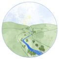
Creating thriving, resilient communities and natural environments in the upper Severn Valley
The Severn Valley Water Management Scheme (SVWMS) is being led by a core Partnership of the Environment Agency, Natural Resources Wales, Shropshire Council and Powys County Council as the primary risk management authorities operating across the Upper Severn Catchment. The four partners form the Project Board that will provide strategic direction and shape the longer-term delivery opportunities critical to a transformational project of the scale of the Severn Valley Water Management Scheme.
The scheme is also actively supported by a whole range of other partners from across the River Severn geography; the River Severn Partnership (RSP). The RSP is a pioneering and transformational partnership bringing together multiple organisations, resources and skills to drive resilient and sustainable futures along Britain’s longest river network. The partner support and collaboration already received has been crucial in helping to form initial thinking for the project and, alongside the views, input and co-ownership of local people and places, will continue to be fundamental to its future success.
The Severn Valley Water Management Scheme is also supported by a number of expert consultancy teams, with Arup providing design and strategy development input under the Environment Agency’s Collaborative Delivery Framework.
1.1
Project context
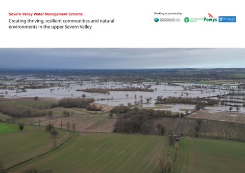
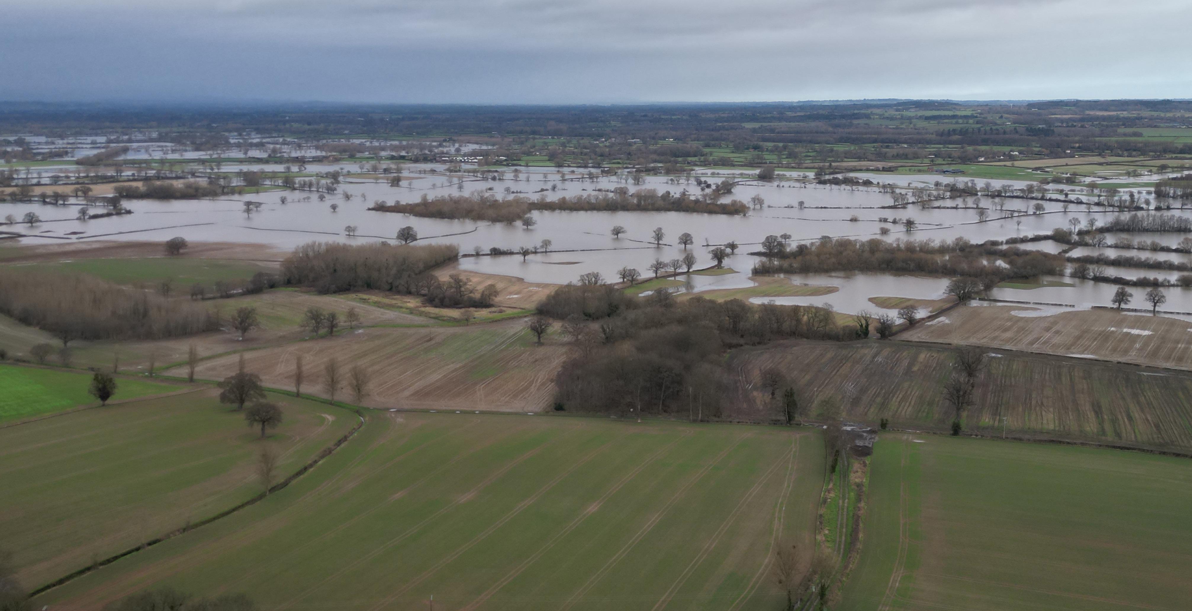
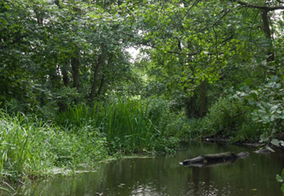
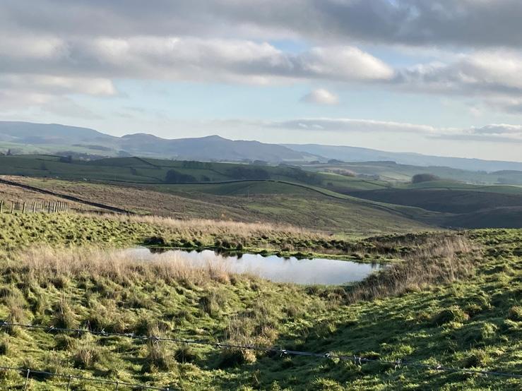
The River Severn forms an integral part of life for those who live and work around it. It provides benefits and opportunities for wildlife, transport and recreation, as well as water for farming and community uses.
However, those living near the River Severn will also know of the long history of flooding during periods of high rainfall. Conversely, during extended periods of dry weather, exceptionally low river flows lead to low groundwater and reservoir levels placing pressure on wildlife, the environment, and water supplies.
As a result of these environmental stresses, Natural Resources Wales, the Environment Agency, Powys County Council and Shropshire Council are exploring opportunities to make the Severn a more vibrant and resilient river catchment, where local economies prosper, and communities and natural assets thrive for current and future generations.
An overarching SVWMS Strategy document will outline the case for change and the proposed solutions to better manage water in the catchment.
The work that has been completed so far on the SVWMS has helped to better understand the scale of nature-based and engineered interventions that might be required to better manage water across the River Severn, upstream of Shrewsbury (an area of 2,500 Km2 across England and Wales).
That work has enabled funding for the next stage of strategy development to be secured and will provide the basis for a comprehensive engagement effort with communities and partners to help understand local requirements and to work collaboratively to shape an outline programme of interventions and a supporting strategy.
This Vision sets out the basis for a new way of thinking about water management and the guiding principles to shape the next stages of strategy development.
1.2 Sustainability drivers
Global and national policy for flood management is evolving. Acting just to mitigate against extreme weather and biodiversity decline is no longer enough. Emphasis is now on promoting greater resilience and regenerative systems. By doing this we aim to cope better with extreme events and help alleviate the impacts of climate change. The following plans and policies have provided the sustainability drivers that have informed our Vision document.
United Nations (UN) Sustainable Development Goals (SDGs)
The SDGs, adopted by the UN in 2015, are at the heart of the 2030 Agenda for Sustainable Development. There are 17 SDGs which call all countries to place sustainable targets at the centre of any investment, to improve health and education, reduce inequality and promote economic growth. These include targets around tackling climate change, reducing pollution of our rivers and seas as well as improving life on land.
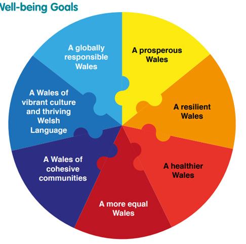
Well-being of Future Generations (Wales) Act, 2015
The Well-being of Future Generations Act requires public bodies in Wales to think about the long-term impact of their decisions and improve social, cultural, environmental and economic well-being.
It places emphasis on building a resilient Wales which “maintains and enhances a biodiverse natural environment with healthy functioning ecosystems that support social, economic and ecological resilience and the capacity to adapt and change.”
Natural Resources Wales (NRW) Policies
NRW have also recognised the need for a healthy and resilient environment to sustain people and the Welsh economy. The Sustainable Management of Natural Resources (SMNR) sets out their commitment to exploring opportunities to enable “our natural resources to provide multiple benefits for people and nature, now and into the future, whilst ensuring we continue building their resilience.”
United Kingdom Government 25 Year Environment Plan, 2018
The UK Government published the 25 Year Environment Plan to set out goals and policies to underpin any developments and investments in a bid to ensure protection and enhancement of the environment remains at the forefront of decision making. This plan acknowledges the role the natural environment has in our future well-being and prosperity as well as it’s economic value. It embeds an “Environmental Net Gain” principle into development and drives a Natural Capital approach to decision making.
Environment Agency (EA) Policies
EA2025: Creating a Better Place” sets out the EA’s priorities from 2020-2025, echoing the global and national policy shifts. This sets out three key goals for a nation resilient to climate change:
• Healthy air, land and water
• Green growth
• A sustainable future
The aims and priorities for the EA underline the need to value and respect the environment, recognise our dependency on natural resources and to adapt to climate change. The EA has also committed to reaching net-zero carbon by 2030, recognising its responsibility to not only minimise emissions through promoting low-carbon construction and operation activities but to actively encourage exploration of opportunities that can sequester carbon through natural processes.
1.3 Our objectives - What do we want to
The vision aims to make the catchment more resilient to changing water pressures (both too much and too little) by adopting sustainable and holistic water management. This will deliver the greatest social, cultural, economic, environmental and health benefits.
The diagram below represents the vision for the catchment and highlights the three key goals from which a series of objectives have been defined.
Support the natural environment and climate resilience
• Reducing current and future flood risk to natural systems.
• Achieving biodiversity net gain (balanced with other environmental factors).
• Restoring water quality and river health.
• Considering agricultural practices that support flood resilience.
• Ensuring the resilience of communities and the environment to climate change.
• Enhancing and reconnecting habitat corridors.
• Allowing people to experience nature whilst retaining undisturbed areas for wildlife.
• Introducing regenerative agriculture and land management.
• Sequestering Carbon.
Reconnecting people with the landscape
• Improving access to green spaces.
• Reducing the risk and impact of flooding on local communities.
• Introducing new parks, open spaces and nature-based recreation.
• Creating safe and inclusive places.
• Creating and promoting safe and inclusive active travel options.
• Improving air quality, for health and well-being.
• Celebrating the culture and heritage of the area.
• Fostering a sense of ownership and guardianship of the landscape through community participation, particularly with schools.
• Contributing to food security.
• Collaborating, through engagement with stakeholders, partners and local communities.
• Reducing the risk of damage to local business from flooding.
• Using an “ecosystems services” approach to deliver more benefits for people and wildlife.
• Supporting local businesses and having a positive economic impact on communities.
• Using a “natural capital” approach to measure the benefits of our work.
• Unlocking green funding opportunities / green finance to unlock sustainable economic opportunities for local communities.
• Opportunities for renewable energy production.
• Applying a circular economy approach.
A regenerative, and nature-positive approach
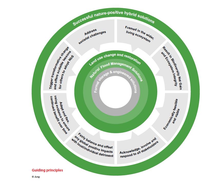
The scheme is adopting a regenerative approach to design, meaning that interventions will seek to positively contribute to addressing the climate crisis and halting biodiversity decline. Working in tune with natural systems, through the use of NbS is critical to achieving this.
The SVWMS aims to devise an innovative and nature-positive programme, bringing together the best of both NbS and traditional engineering solutions. This approach will provide sustainable outcomes that are specific to each location and will deliver real value for investors and partners, local communities and the natural environment.
This Vision, and the illustrations within, form a tool to aid discussions at an early stage. All opportunities visualised may not be taken forward. They will require further consultation and design development to ensure they deliver real value for people, nature and places.
In the coming months we will be working through the visioning process described below to share work that we’ve done to date and to develop the solutions at a more local scale with our communities.
Nature-based solutions:
Nature-based Solutions (NbS) is a term used to describe a range of techniques that increase our resilience to climate impacts, whilst simultaneously supporting the regeneration of ecosystems. Such impacts include flooding, resulting from more frequent and intense storms and from overuse of natural resources. NbS are most effective when delivered at scale and can be used to compliment more traditional engineered solutions to maximise the benefits delivered.
1.5 Interventions catalogue
The following interventions provide an overview of the measures currently being considered as part of an integrated approach to better water management.
Land Use Change: Buffer Strip
Buffer strips are areas adjacent to rivers, ditches, dykes, becks and watercourses where woody planting or grass buffers can be created to increase roughness and slow runoff.
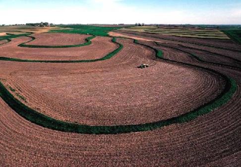
Land Use Change: Soil Management
The way rural land is managed affects the pathways and speed at which rainfall enters watercourses. This is controlled by both soil health and vegetation cover. Even simple practices such as restorative agriculture, reduced depth and frequency of ploughing and contour ploughing (which involves ploughing and/or planting across a slope following its natural contour lines) can make a difference to runoff volumes siltation and flow rates.
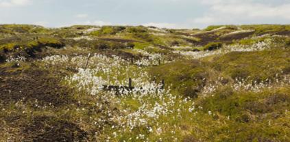
Land Use Change: Peat Restoration
Peatlands are carbon-rich wetlands and in their natural condition, help to slow flow of water from the uplands and provide floodplain storage in the wetlands as well as providing a significant carbon store and supporting important species. Re-wetting areas of drained peatland can restore these with flood alleviation, climate regulation and biodiversity benefits.
Land Use Change: Wet Woodland
Promotion of woodland within floodplains to slow down and hold back flood flows and reducing downstream siltation. New wet woodlands can provide varied and rich habitats, improve water quality and increase carbon sequestered through new vegetation.
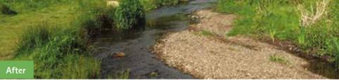
Land Use Change: Tree Planting
Land Use Change: Removal/Set Back Breach of Embankment
Removal or set back of existing defences to restore hydrological connection between rivers and historic floodplains. Similar to floodplain restoration, these can open opportunities for improved terrestrial and fluvial habitat.
Increasing tree cover has the potential to reduce flood risk by promoting soil infiltration, intercepting water on the canopy and increasing ground roughness, thus, slowing down the flow of surface runoff.
Land Use Change: Floodplain Restoration
Increasing the area allowed to flood in extreme events, restoring hydrological connection between rivers and floodplains and improving both terrestrial and fluvial habitats as well as offering water quality benefits.
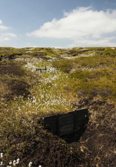
Natural Flood Management: Grip Blocking and Gully Stuffing
Filling erosion gullies or historic drainage ditches (known as ‘gripping’) with vegetation or introducing small dams to store waters within headwaters and re-wetting of peatland or moorlands to restore carbon sink function of these areas and improve natural habitats.
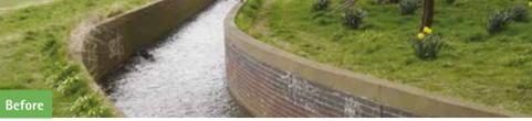
Establishing a pathway between a watercourse and its natural floodplain and allowing for additional storage within this floodplain, providing additional habitat, reduced soil erosion and improved water quality. NFM offline storage is a smaller reconnection-based feature as opposed to formal engineered flood storage.
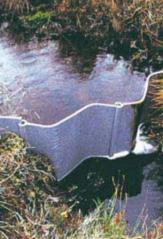
Natural Flood Management: Runoff Attenuation Features
Constructed features such as earth bunds or timber ‘leaky’ barriers designed to intercept and attenuate overland flows. These can be designed to also store water for agricultural purposes and provide additional farmland habitat.
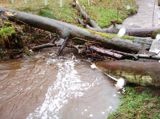
Natural Flood Management: Large Woody Material
Utilisation of large, natural pieces of wood (trunks, branches etc.) across or within the channel to slow the flow, leading to greater flow diversity and connectivity with floodplains. These interventions can also contribute to creation of wet woodland and associated biodiversity benefits.
Engineered Flood Management Solutions:
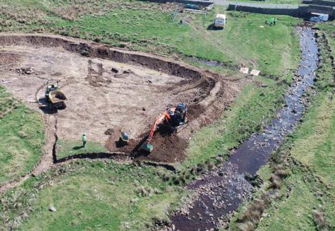
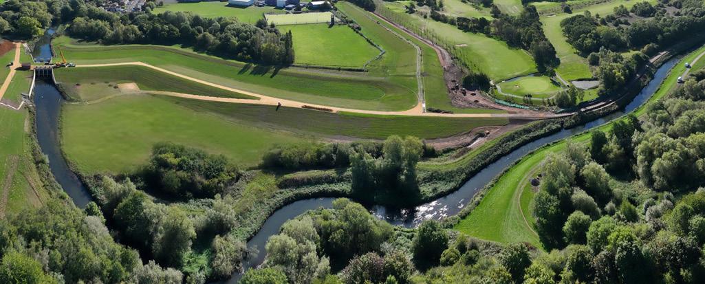
Formal Flood Storage Areas (FSAs) Flood Storage Areas (FSAs) are an integral part of the solution to storing water, for both flood and drought resilience.
A formal FSA is used to store water temporarily. The provision of flood storage acts to reduce the flood peak flows downstream by attenuating incoming flood flows and releasing these at a controlled rate.
FSAs can be combined with a series of other interventions, as shown on the image to the right. This approach helps to better integrate these structures into the surrounding landscape, and provides a wider range of social and environmental benefits.
The adjacent image provides an illustration of a typical FSA intervention. This intervention typology is not explored further in this Landscape Vision document, due to the complexities associated with developing potential concepts.
When considering a future integrated programme of interventions, consideration needs to be given to the appropriateness and effectiveness of those measures in the surrounding landscape. To support us in developing thinking around a Vision and future approach to the project, a series of landscape typologies have been defined that are appropriate to various locations across the SVWMS geography.
Whilst this approach may seem simplistic, the intention is to drive initial thinking around what certain interventions might look and feel like in these types of settings to support active and informed engagement.
Each landscape typology and the rules underpinning environmental characteristics in these types of settings, also feeds into the bespoke data science and modelling tools that have been specifically developed to support us in development of the SVWMS strategy. The approach taken enables evidenced-based consideration of the most suitable Land Use Change, Natural Flood Management and Formal Flood Storage approaches to be applied across the catchment.
These representative areas have been used to form some initial “visual concepts” of the types of intervention that might be appropriate for implementation in each landscape typology. This currently focusses on NbS and isn’t specific to any geographic location but is designed to provide initial images to support conversations with communities and partners.
The following section provides an overview of some of the opportunities and benefits that could be delivered in each of these different landscape typologies.
2.2
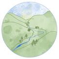
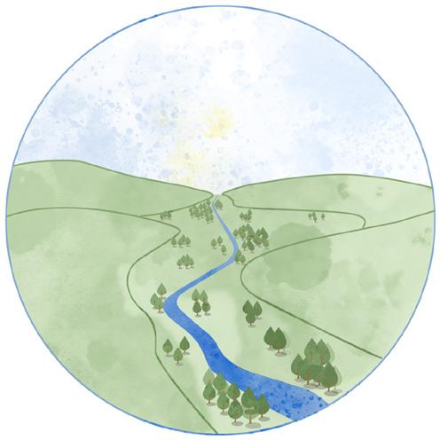
Area A - Uplands
• Grip blocking - small dam installations that slow the flow of water and help to raise the water table where appropriate
• Peat restoration - restores the form and function of peatland ecosystems
• Large woody material – Used in streams to slow the flow of water and create additional habitat
• Tree planting - enhanced native tree planting for aesthetic, habitat, and carbon benefits
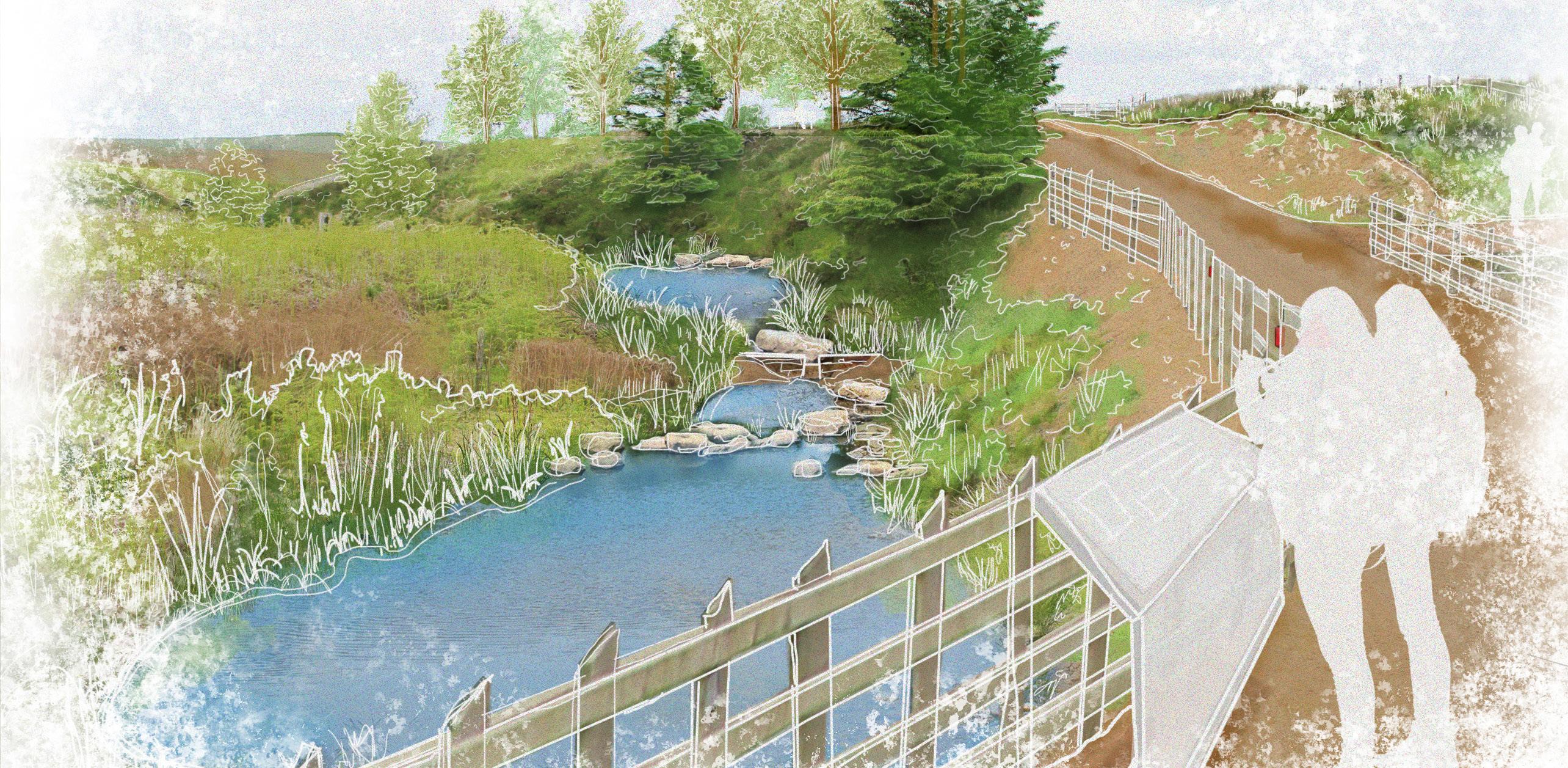
Potential approaches explored for the Upland area focus on Natural Flood Management and Land Use Change interventions such as grip blocking and peat restoration.
Grips and gullies lower the water table, drying out the land, making the peat soil more susceptible to erosion and increasing the flood risk downstream as large amounts of water flow quickly off the hills.
Grip blocking interventions are small dam installations which are intended to reverse these effects by trapping the water, slowing its flow and raising the water table.
There are two broad categories of these small dams, categorised by the use of impermeable or permeable materials. Choosing the right type is to be dictated by the nature of the sites. Often sites would benefit from a combination of impermeable and permeable dams, tailoring the typology to soil depth, gully depth and gradient in order to achieve the site’s overall ecological objectives.
Potential small dams could include those made of heather bales, peat, plastic, stone or timber.
The grip blocking interventions could create seasonal pools of different sizes. In places visited by walkers or tourists, this could also generate social value as the public could enjoy interacting with these wetland areas through features such as boardwalks. People would be able to learn about the benefits of interventions through interpretation boards.
Managed grazing and peat restoration are also other key potential interventions shown for the area. Implementation of such approaches also opens up opportunities to link into existing public rights of way, bringing people to new rest areas, picnic facilities and educational features such as outdoor classrooms and sculptural landmarks.
2.3
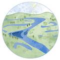
Area B - Upper Valley
Intervention types
• Passive floodplain storage - creation of pools and wetland habitats
• Removal/setback or breach of embankments - increasing the area naturally allowed to flood in extreme events
• Wet woodland - habitat creation opportunities
• Floodplain restoration - restores hydrological connection between rivers and historic floodplains
• Tree planting - enhanced native tree planting
Upper valleys offer great potential for Natural Flood Management and Land Use Change interventions.
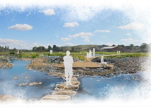
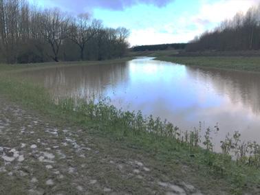
Water bodies, such as main rivers and streams, can be enhanced through passive floodplain storage e.g. wet and dry scrapes. This could take the form of a series of seasonal and permanent water pools, establishing a pathway between the watercourse and its natural floodplain. This approach will allow for additional storage as well as provide additional habitats and biodiversity. It will also reduce soil erosion. The potential benefits of designing a passive floodplain storage area also include social value enhancements. A series of pools well-integrated with the public rights of way network, can become a wetland park offering leisure, recreational and educational opportunities to surrounding towns and villages. This can also be integrated with recreational facilities connected to schools and sport centres. Rivers can also be enhanced through floodplain restoration, as shown in the illustration opposite. It increases the area naturally allowed to flood in extreme events, restores hydrological connection between rivers and floodplains and improves both terrestrial and fluvial habitats.
The steep valley sides, surrounding the floodplain of the Upper Valley area, can benefit from tree planting. Increasing tree cover is key in reducing flood risk by intercepting water on the canopy and increasing soil roughness to slow surface flow.
2.4
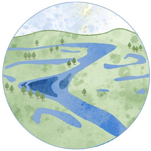
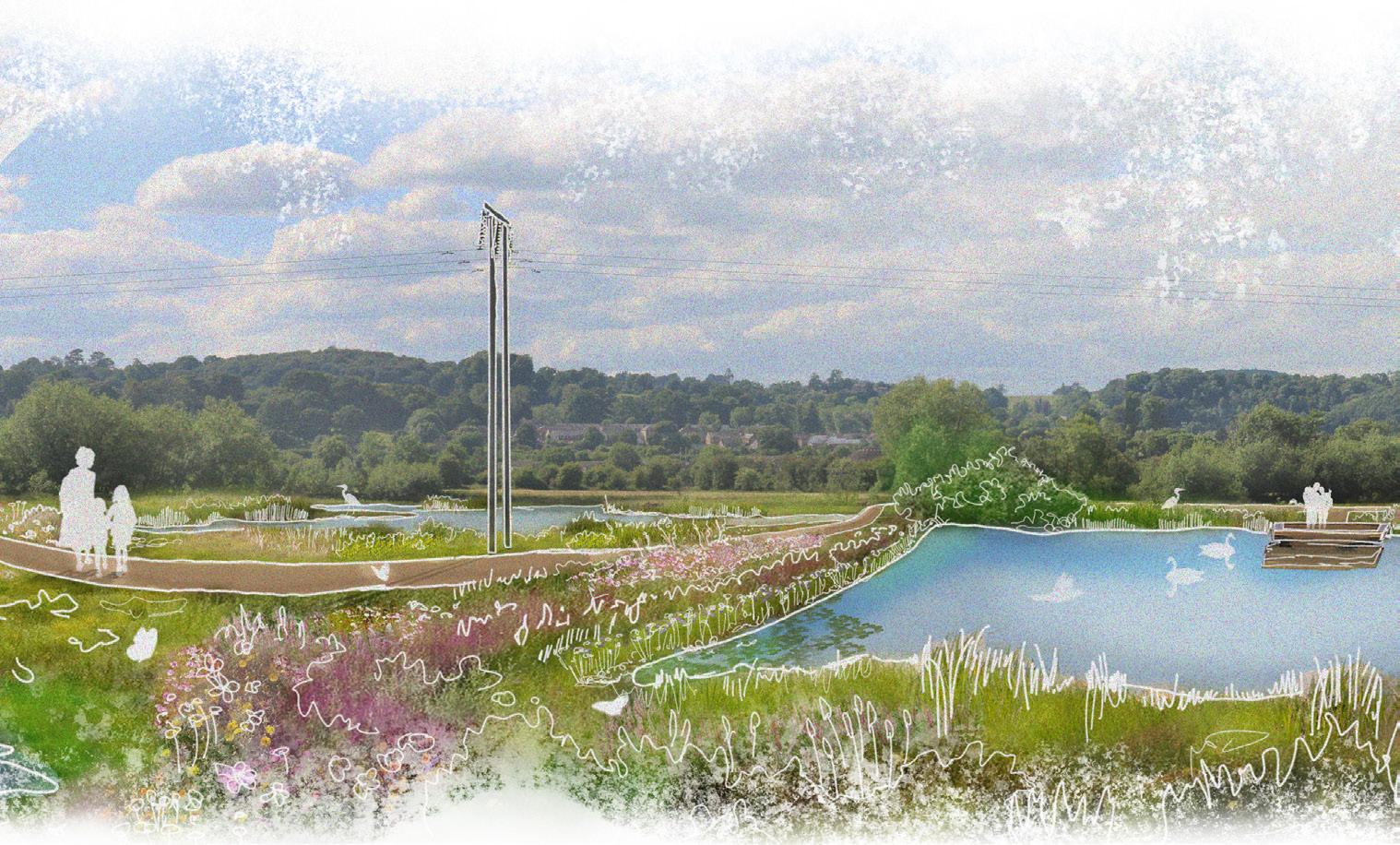
Area C - Lower Valley
• Passive floodplain storage - creation of pools and wetland habitats
• Removal/setback or breach of embankments - increasing the area naturally allowed to flood in extreme events
• Wet woodland - habitat creation opportunities
• Floodplain restoration - restores hydrological connection between rivers and historic floodplains in a managed way
• Tree planting - enhanced native tree planting for aesthetic, habitat, and carbon benefits
• Formal flood storage areas (FSA) - store water temporarily, reducing flood peak flows downstream and releasing flows at a controlled rate
• Buffer strip - improve water quality and help to reduce flooding
• Runoff attenuation features - temporarily reduce overland runoff flows
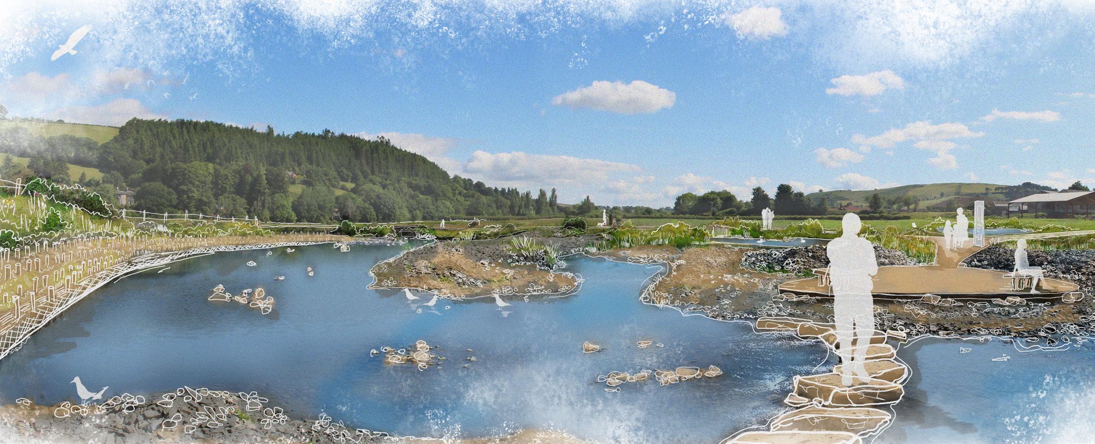
The Lower Valley area is rich in a diverse mix of water environments: rivers, streams, canals, ponds and lakes of various dimensions. A major river, like the River Severn, could be enhanced through interventions including; floodplain restoration as well as removal/setback and breach of embankments.
Furthermore, the wide floodplain area of the River Severn could host a wide network of passive floodplain storage pools. The nature of these pools could change with the nature and the topography of the site. Moving out of the floodplain, west and east of the river, pools could increasingly be designed to host less water and more vegetation. In the opposite direction, moving closer to the river and towards the flat area of the floodplain, the pools could have larger areas of permanent water and less vegetation. Through increasing the area allowed to flood, this approach could provide a natural and balanced environment that improves biodiversity through the provision of terrestrial and water dependent habitats.
Boardwalks and an enhanced network of public rights of way could be provided allowing access to the wider public to wetland features as well as supplying important leisure, recreational and education opportunities.
Passive floodplain storage can also have a significant positive impact on water quality.
Around the floodplains of the Lower Valley there are opportunities to implement buffer strips along existing hedges, canals and watercourses.
Tree planting could also be a key intervention, implemented as wet or dry woodland depending on the proximity to the watercourse. The Lower Valley has also been identified as an opportunity to implement FSAs and runoff attenuation features. FSAs provide an opportunity to store water temporarily, reducing flood peak flows downstream and releasing these at a controlled rate.
A typical rural Lower Valley landscape with passive floodplain storage and public access improvements
Area D - Hillside
Intervention types
• Passive floodplain storage - creation of pools and wetland habitats
• Tree planting - enhanced native tree planting for aesthetic, habitat and carbon benefit
• Buffer strips - improve water quality and help to reduce flooding
• Runoff attenuation features - temporarily reduce overland runoff flows
• Large woody material - placed in streams to slow the flow and create new habitat
• Soil management - improves soil quality, infiltration potential and ability of soil to absorb carbon
• SuDS - Sustainable (urban) Drainage Systems (E.g. swales, rain gardens and permeable paving)
In Hillside areas there could be significant benefits delivered through the implementation of Natural Flood Management and Land Use Change interventions.
Our approach focuses on implementing many small interventions upstream, in order to enhance water quality at source, and better attenuate flood waters.
For example, better soil management, such as reduced ploughing, can improve the structure of soils and infiltration as well as enhancing nutrient retention. It can also, simultaneously, reduce runoff and soil erosion.
A series of passive floodplain storage and tree planting interventions could also be considered to intercept water running off sloped agricultural fields.
Linear runoff attenuation features could also be implemented alongside existing infrastructure such as paths and highways as illustrated opposite.
Hillside agricultural fields, bounded by hedges and ditches, can provide an opportunity to intercept runoff using buffer strips, with large woody material across or within channels to add further flow retention structures.
Habitat enhancements could be applied to roughen the ground, acting like a sponge to slow surface runoff, whilst also restoring ecosystems and enhancing biodiversity in areas that are no longer under human management. For example disused quarries or poor agricultural land.
There are also potential opportunities to implement NbS within town locations
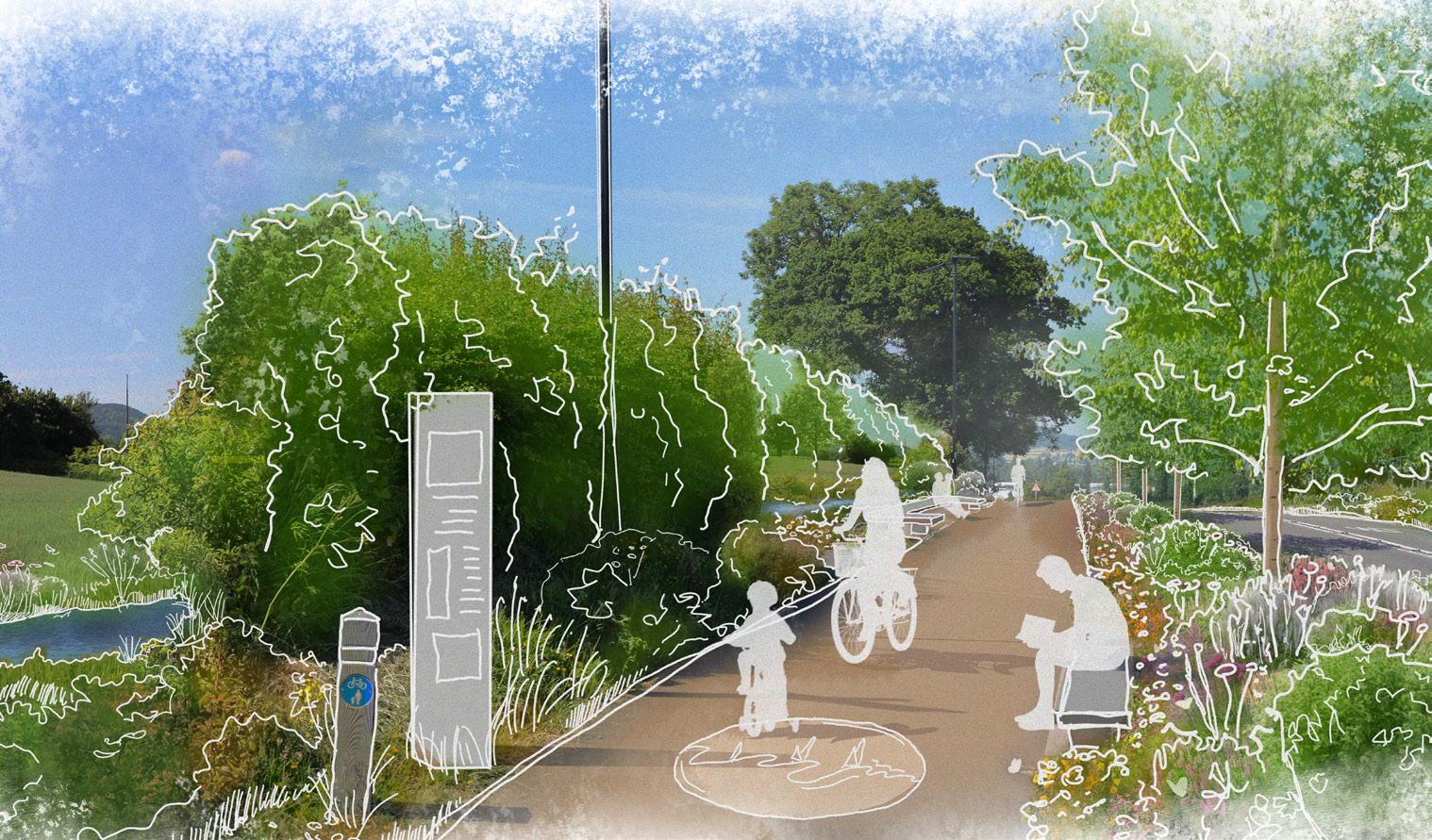
Sustainable Drainage Systems (SuDS) could be proposed alongside urban roads to intercept polluted runoff and help manage flash floods.
Implementing SuDS alongside roads with integrated recreational paths would enhance the environment at the same time as attenuating storm water. New and improved paths and rest areas could be built using permeable surfaces.
A typical Hillside scene with enhanced public right of way
attenuation and SuDS implementation
2.6
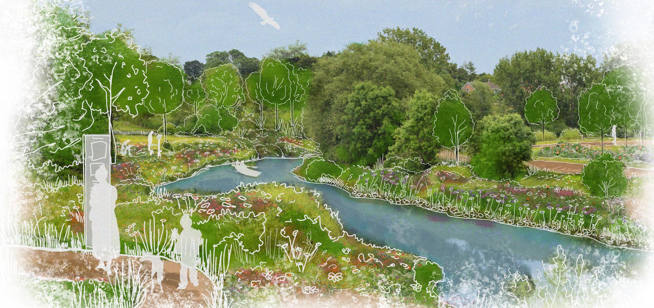
Area E - Floodplain
Intervention types
• Tree planting - enhanced native tree planting for aesthetic, habitat and carbon benefits
• Removal/setback or breach of embankment - increasing the area naturally allowed to flood in extreme events
• Wet woodland - habitat creation opportunities
• Floodplain restoration - restores hydrological connection between rivers and historic floodplains
There are great opportunities to implement tree planting throughout floodplain areas, where appropriate for the local area. Flood risk could be reduced by increasing tree cover, with surface roughness increasing the amount of rainwater intercepted by the canopy, slowing surface flow rates and improving infiltration. Increasing vegetation cover can also provide valuable habitat and promote greater carbon sequestration, helping to regulate the climate.
Tree planting can also play a key role in shaping the identity of places, adding a number of social value benefits. Woodlands can incorporate recreational routes, natural play areas, seating areas and wildflower glades.
The River Severn could also be enhanced in these areas by implementing other Land Use Change interventions, such as removal/set back or breach of embankments and floodplain restoration. These interventions would be important in restoring hydrological connections between rivers and historic floodplains, whilst increasing the area naturally allowed to flood in extreme events.
Along the river, there is potential for the enhancement of riparian buffers to reduce erosion and create new linear habitats.
The low-lying and open riparian landscape of the floodplain can offer important views, which have the potential to be enhanced. Key river crossings can also be reinstated to improve recreational networks.
A typical River Severn floodplain with enhanced woodland and riparian planting, interpretation boards and improved public access
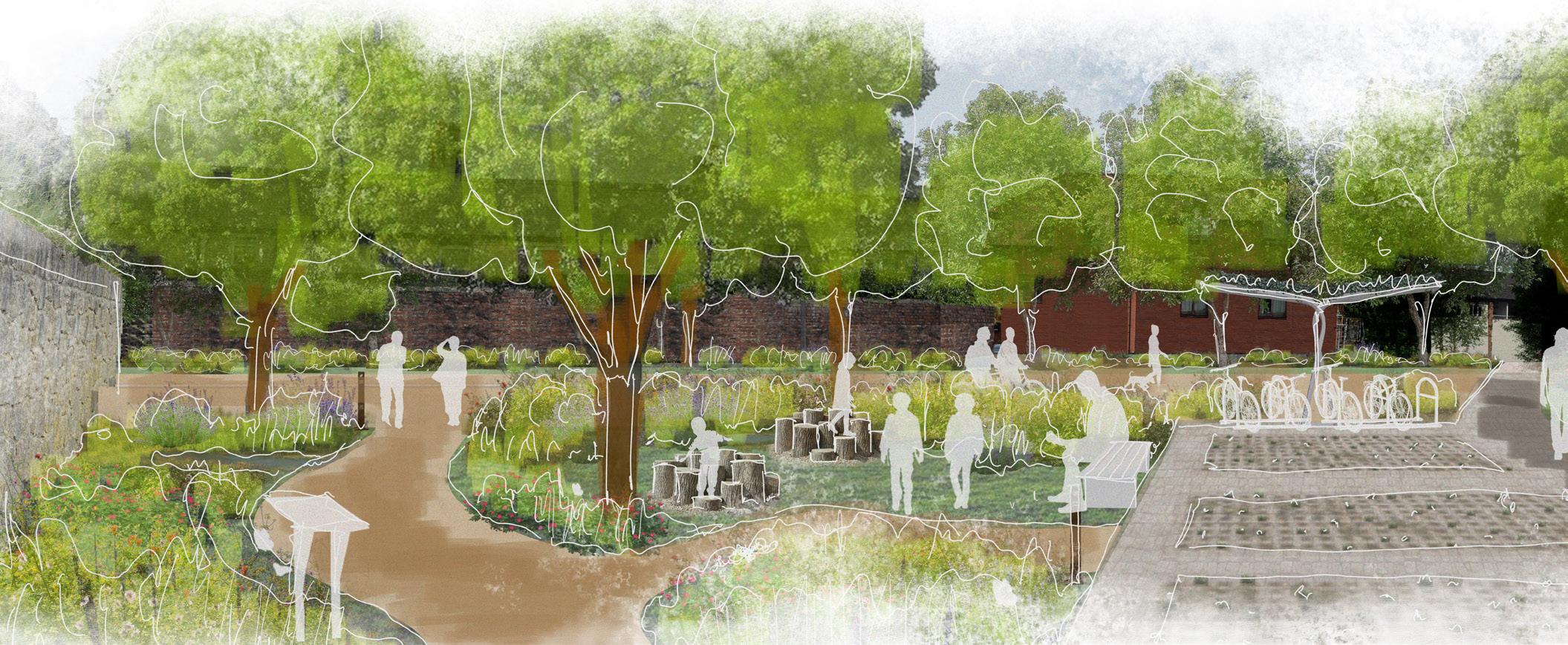
Area F - Urban
Intervention types
• Tree planting - enhanced native tree planting for aesthetic, habitat and carbon benefit
• De-paving - reduction of hard surfacing, wherever possible , and introduction of permeable alternatives
• SuDS - Sustainable (urban) Drainage System (swales, rain gardens and permeable paving)
As with most urban areas, there is a high proportion of impermeable paving throughout towns across the catchment. Hard surfaces like asphalt are important for the provision of low maintenance and inclusive access for the public. However, impermeable paving exacerbates flooding downstream, which leads to numerous economic and environmental problems; such as the diversion of polluted storm waters directly into nearby water bodies.
Pavements also increase summertime temperatures contributing to the “heat island effect” in many urban areas. As a result, elevated temperatures generate ground level ozone, which is the main constituent of smog.
Storm water attenuation and water quality are both improved by making urban areas more permeable. Depaving in areas with high proportions of concrete and asphalt can include measures such as the replacement of impermeable paving with permeable alternatives as well as complete removal of paved areas. This allows for greening and ground roughening with trees and plants.
In areas like car parks, if we carefully consider only the areas strictly necessary for cars and pedestrian movement, we can de-pave the leftover spaces. This process is also applicable in public spaces and urban plazas.
Flood risk management can also be implemented into urban areas in the form of SuDS. SuDS mimic natural drainage processes to reduce the impact on the quality and quantity of runoff from roads and developments-
They provide biodiversity and amenity benefits.
• They have a positive impact on air quality by reducing operational and embodied carbon as well as the sequestration of carbon through planting.
• They can be effective as traffic calming measures, reducing the risk of road accidents and increasing streetbased recreation.
• They are an effective first step in treating wastewater.
3.1 Our Programme: Making the vision a reality
Delivering the Severn Valley Water Management Scheme is a long-term solution to sustainable water management across the catchment. Achieving our vision will be a complex journey. Right now, we’re at the beginning of that journey as we set out the art of the possible – no one intervention has yet been developed or tested.
What our Vision and this Scheme could achieve is significant for communities, businesses and the natural environment and could be a blueprint for water management across the UK.
Transformative changes that realise broad benefits have been identified and these all can be realised. Our vision aligns with key policy across Wales and England and that provides a great opportunity for economic growth at a local, regional and national level.
Some sources of funding are available, but more investment will be required if we are to achieve the change needed at this scale. It is going to take time, effort and innovative collaborations to achieve this.
The diagram below sets out a roadmap to achieving the vision. It is critical that we work with communities and other stakeholders as proposals are identified and developed.
We look forward to developing and delivering this Vision together.
for strategy development secured Development of bespoke tools to define “art of the possible”
border political and strategic consensus secured
Vision - what is possible?
Use visioning as a basis of discussion to engage with all stakeholders (and iterate).
How to get involved:
In Spring 2024 we will begin a dedicated programme of engagement with communities across the catchment.
If you have any questions in the meantime, please contact either: SVWMS@environment-agency.gov.uk and
CynllunRheoliDwrDyffrynHafren@cyfoethnaturiolcymru.gov.uk or