149 City Plan 2040 | Shaping the Future City
10
Transport

The City’s transport infrastructure will be maintained and improved by:
1. Safeguarding land where necessary, as shown on the Policies Map, to enable the delivery of increased public transport capacity. Proposals which are contrary to the safeguarding of strategic infrastructure projects will be refused.
2. Implementing improvements to street-level interchange between Fenchurch Street and Tower Hill and Tower Gateway stations and working with partners to explore the feasibility of a direct interchange route in the longer-term.
3. Promoting further improvements to public transport capacity and step-free access at existing mainline rail, London Underground stations, Docklands Light Railway (DLR) stations and river piers.
4. Minimising road danger and congestion, and reducing vehicle emissions by:
a. Not providing any additional on-street car and motorcycle parking;
b. Identifying opportunities to use on-street parking reductions and restrictions to discourage private vehicle use;
c. Designing and managing streets in accordance with the City of London street hierarchy;
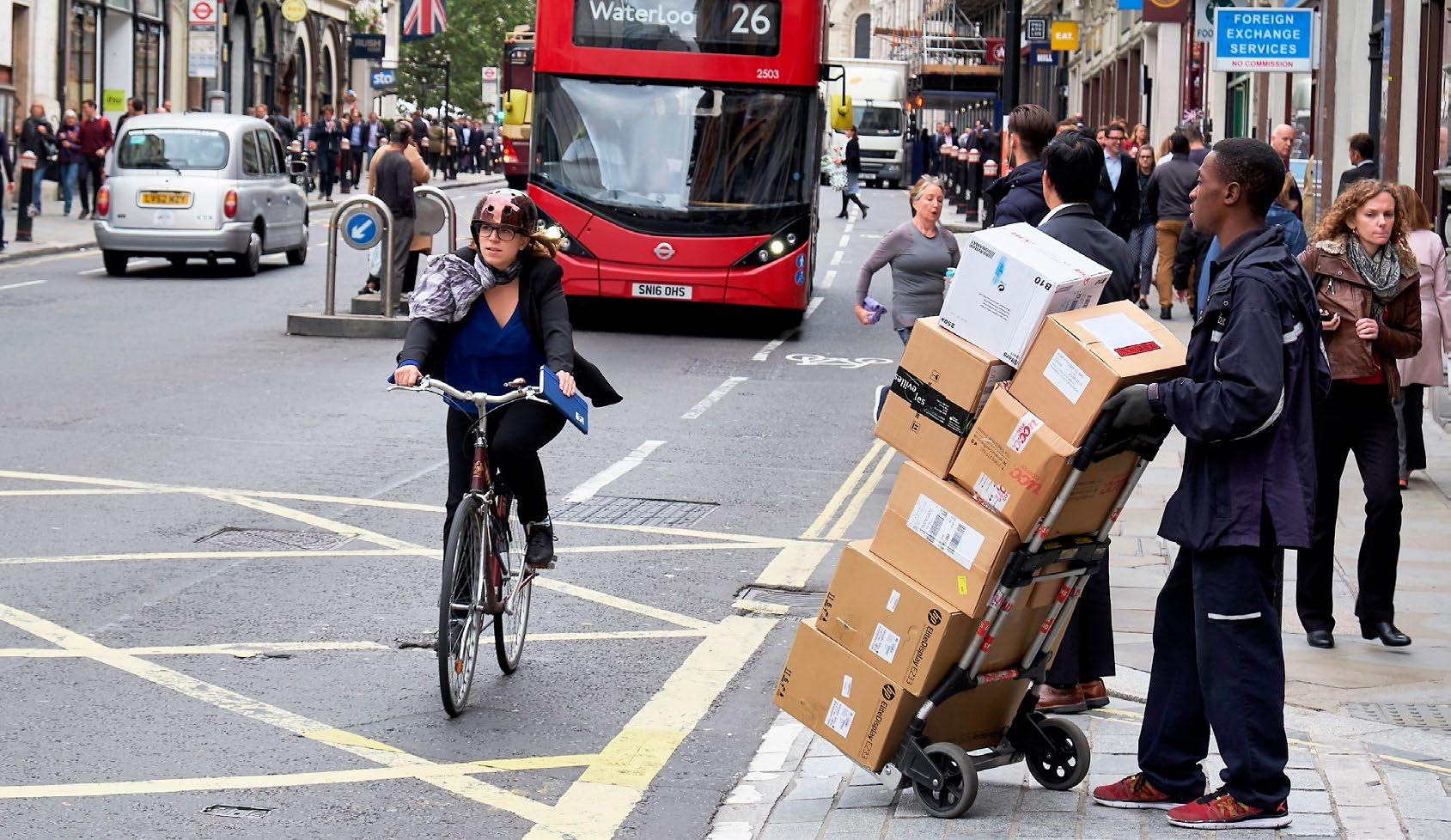
d. Minimising the impact of freight and servicing trips through such measures as the provision of on-site servicing facilities, the timing of deliveries outside peak hours, the adoption of area-wide solutions, freight consolidation and promoting deliveries by foot or bicycle;
e. Facilitating essential traffic, including emergency service vehicles, buses, freight and private transport for people with particular access needs, whilst minimising the environmental impact of these modes;
f. Requiring the provision of infrastructure for alternative-fuel vehicles and zero emissions vehicles, such as off-street vehicle charging points;
g. Using traffic management measures and street works permits to improve journey time reliability on the City’s roads; and
h. Requiring developers to demonstrate, through Transport Assessments, Construction Logistics Plans, Travel Plans, Cycling Promotion Plans and Delivery and Servicing Plans, how the environmental impacts and road danger of travel and servicing will be minimised as a result of their development, promoting best practice such as direct vision standards, and zero vison policies to minimise danger of travel and servicing, including through the use of river transport.
Reason for the policy
10.1.0 The City’s strategic central London position and its comprehensive transport infrastructure enable the vast majority of workers, residents and visitors to use public transport to access the City from across London and the wider south east. People walking and cycling make up more than two-thirds of all observed travel activity in the City. A third of all travel movements take place in the four peak hours: 8am to 10am and 5pm to 7pm. Over 90% of commuter travel to the City is by public transport, walking or cycling. Less than 5% of City workers drive to work. The City is already a highly sustainable location, and the opening of the Elizabeth Line has resulted in a wider catchment area within an hour’s journey time of the City. The City Corporation will use its planning powers, alongside its role as a transport authority, and in partnership with Transport for London to help secure improvements to public transport, for instance by safeguarding land from other forms of development where necessary.
10.1.1 The City’s Transport Strategy indicates that the design and management of streets will reflect their position in the street hierarchy, as well as their function as places.
10.1.2 The TfL network (classed as London Access) is expected to accommodate the majority of through traffic, while roads which are managed by the City Corporation are classed as either City Access or Local Access. Changes to the highway network at Bank Junction and the changes to the St Paul’s Gyratory are reflected in the street hierarchy.

Access - through traffic
(previously Strategic/London Distributor)
City Access
(previously Borough/Local Distributor)
How the policy works
10.1.3 The City’s Transport Strategy aims to support the continued reduction of motor vehicle traffic on the City’s streets, with targets proposed to reduce the number of motor vehicles in the City from the 2017 baseline by at least 25% by 2030 and at least 50% by 2044. In 2022, motor vehicle traffic has already seen a 26% reduction from 185,000 vehicles in 2017 to 137,000 vehicles. The spare capacity unlocked by these reductions will allow for the radical transformation of the City’s streets to deliver a healthier, safer and more attractive street environment.
10.1.4 Achievement of the targets is dependent on measures introduced by the Mayor of London and TfL, although the City Corporation will explore specific measures within the City of London if strategic scale measures are not progressed. The City Corporation will also implement measures such as timed closures and additional traffic calming to facilitate the removal of non-essential vehicular traffic.
10.1.5 The City Corporation will work with TfL to review bus routing and frequency through the City to maintain or improve journey times and connectivity while enhancing the pedestrian environment.
10.1.6 The City Corporation will work with TfL to prioritise investment in accessibility improvements to underground and DLR stations and will seek to identify opportunities to introduce step free access as part of new developments and major refurbishments.
10.1.7 The City Corporation will require developers and occupiers to minimise the impact of freight and servicing trips through measures such as the retiming of deliveries and collections outside peak periods, along with consolidation onto fewer or different types of vehicles.
10.1.8 Greater use of the River Thames will be encouraged for both passenger and freight transport purposes to alleviate the need for some motor vehicle trips on the City’s streets.

1. Development proposals must have a positive impact on highway safety for all users in accordance with the Transport Strategy and Vision Zero ambition, and should not have adverse effects on the City’s transport networks.
2. Where development would result in adverse impacts on the transport network, these must be demonstrated at pre-application stage and mitigated though site/building design, public highway works and management of operational activities. Appropriate measures to adapt public highway to mitigate the impact of the development will be sought via planning contributions or by legal agreement. There should be no reduction in the quality or function of the public highway as a result of development, and improvements should be sought where feasible.
3. The design and implementation of traffic management and highway security measures must be agreed with the City Corporation and Transport for London, where appropriate, and may include restricting motor vehicle access and using traffic calming measures to limit the opportunity for hostile vehicle approach.
4. Transport Assessments and Travel Plans (incorporating Cycling Promotion Plans) are required for all developments that exceed the following thresholds:

5. A Construction Logistics Plans is required for all major developments or refurbishments and for any developments that would have a significant impact on the transport network during construction.
Reason for the policy
10.2.0 Development has the potential to create significant changes in transport patterns and demands that must be addressed at an early stage of the design process. Any adverse impacts that are identified must be minimised and mitigated through appropriate design and/or management measures. Transport Assessments are required to assess the potential impacts of development, while Travel Plans will be required to maximise the use of active transport modes and public transport.
10.2.1 Major developments can have a significant impact on the function of existing streets and spaces and any adverse impacts must be mitigated by highway works and public realm interventions that enhance the quality of the City’s streets and public spaces.
How the policy works
10.2.2 An assessment of the transport implications of development, during both construction and operation, should address the impacts on:
X Road danger;
X Pedestrian environment, pedestrian and cyclist movement, infrastructure provision;
X Public transport; and
X The street network.
10.2.3 Development will be subject to conditions, Section 106 and Section 278 Agreements to ensure appropriate mitigation of any adverse transport impacts. Community Infrastructure Levy contributions will be used by the City Corporation to deliver wider improvements to the transport network, where appropriate.
10.2.4 For major developments, developers must demonstrate at pre-application stage the impact of the proposed development on the streets and spaces including the increase in pedestrian, cycle and vehicular numbers. Any proposals that substantially affect the use and function of an existing street or public space will be required to mitigate the impact of their development through appropriate highways works and public realm enhancements.
10.2.5 For applications that meet the relevant thresholds, a robust transport assessment is required, and an initial highways design general arrangement plan (at 1:200 scale), should be submitted, highlighting the highways works that would form part of a Section 278 Agreement. As a minimum, the reconstruction/ reinstatement of the streets adjacent to the planning application site should be incorporated within the proposals.
10.2.6 Proposals for works to the public highway should be developed in accordance with the Transport Strategy, City of London Public Realm Toolkit, the City of London Street Accessibility Tool (COLSAT), the City’s Healthy Streets Plans and other relevant guidance.
10.2.7 Transport Assessments and Travel Plans (incorporating Cycling Promotion Plans) should be used to demonstrate adherence to the City Corporation’s Transport Strategy. Applicants should discuss the scope of the transport documentation required early in the pre-application stage to ensure that it provides evidence tailored to the City’s specific circumstances. Account should be taken of the cumulative transport impacts of other nearby developments. TfL has prepared further guidance for developers on Transport Assessments which is available on the TfL website.
10.2.8 A full Construction Logistics Plan (CLP) will be required by condition with outline details required at the application stage. A CLP should comply with the measures set out in the City Corporation’s Code of Practice for Deconstruction and Construction Sites and with TfL’s online guidance. The CLP should show examples of how vehicles will be managed in line with the need to Reduce, Re-time and Re-mode (the three Rs).
1. Applicants should consult with the City Corporation on matters relating to servicing at an early design concept stage.
2. Developments must minimise the need for freight trips and seek to work together with adjoining owners and occupiers to manage freight and servicing on an area-wide basis. Major commercial development must provide for freight consolidation and use technological and procurement solutions that enable efficient servicing and deliveries to sites.
3. Development should be designed to provide for on-site servicing bays within buildings, wherever practicable. On site servicing areas must be of a sufficient size and design to allow all goods and refuse collection vehicles likely to service the development at the same time to be conveniently loaded and unloaded. Servicing areas should provide sufficient space or facilities for all vehicles to enter and exit the site in a forward gear. Servicing areas must be equipped with electric vehicle fast charging points. The use of servicing lifts will be required where this approach would be beneficial for creating attractive and inclusive public realm.
4. Delivery to and servicing of development must take place outside peak pedestrian hours (i.e. no deliveries between 7am-10am, 12pm-2pm and 4pm-7pm on weekdays). Deliveries residential areas must take place outside the hours of 11pm – 7am on all days of the week. Areas of high footfall or in proximity to sensitive land uses may be subject to further restrictions, especially areas near cultural and visitor attractions and transport hubs.
5. Developers should minimise congestion and emissions caused by servicing and deliveries through ensuring, last mile deliveries are made by foot, cycle or zero emission vehicle, and should seek opportunities to support deliveries to the City by river and rail freight. Developers will be encouraged to identify opportunities for last mile logistic hubs where appropriate.
6. Provision should be made within servicing bays for shredding operations. On-street shredding will not be permitted.
Reason for the policy
10.3.0 The low numbers of private motor vehicles in the City mean that delivery and service vehicles have a relatively greater impact on traffic congestion and air quality, especially in areas of high-density development and narrow streets. Efficient off-street servicing and delivery arrangements are vital to keep the City’s traffic moving and thereby avoid air pollution caused by stationary traffic. The Mayor’s Transport Strategy aims to reduce the number of lorries and vans entering central London in the morning peak by 10% by 2026. The City’s Transport Strategy seeks to reduce the number of motorised freight vehicles by 15% by 2030 and 30% by 2044 and facilitate the transition to ultra-low emission and zero emission delivery vehicles.
10.3.1 Retiming of deliveries and collections outside peak periods can reduce congestion, as can consolidation onto fewer vehicles or different types of vehicles. The City Corporation’s Transport Strategy aims to reduce the number of motorised freight vehicles at peak times (7-10am, 12-2pm and 4-7pm) by 50% by 2030 and 90% by 2044. The use of consolidation, will help to minimise the number of trips required to service a development during construction and operation, as does the use of preferred suppliers or nominated carriers to serve a multi-tenanted building.
10.3.2 Large physical consolidation centres will almost always need to be located outside the City because of the lack of suitable land and high land values within the City and will therefore require the cooperation of other local authorities. The City Corporation’s Transport Strategy aims to use the planning process to require consolidation for new developments, while encouraging existing buildings and BIDs to use consolidation. Last mile logistics hubs can facilitate more deliveries on foot, by cycle and by small electric vehicles.
10.3.3 Personal deliveries to places of work within the City contribute to congestion on the streets. Businesses should discourage personal deliveries to business premises and instead encourage deliveries near home and use of click and collect parcel drop off services. It may be appropriate to secure this through a legal agreement. Where deliveries continue to take place, the provision of shared ground floor storage facilities in multi-tenanted buildings may reduce the amount of time spent at the kerbside by delivery vehicles.
10.3.4 In order to decrease freight vehicles in the City, the Transport Strategy aims to encourage freight into the City with rail. The City will work with Network Rail to explore opportunities for inward freight into mainline rail stations and encourages developers to support this.
10.3.5 On-street shredding operations associated with building occupation creates noise and congestion and can have an adverse impact on the amenity of neighbouring uses.
10.3.6 Servicing areas should be designed into new buildings and provide sufficient space or facilities for all vehicles to enter and exit the site in a forward gear. Headroom should be provided of at least 5m where skips are to be lifted and 4.75m for all other vehicle circulation areas.
10.3.7 Delivery and Servicing Plans (DSP) will be required for all major commercial development over 1,000m2 and any other development or refurbishment that will cause significant transport impacts on the local or wider area through operational deliveries and servicing. For smaller development, a DSP is encouraged, and may be required in sensitive areas, as a tool to effectively manage delivery and servicing movements. DSPs should set out the following (as appropriate):
X The number of vehicle trips that have been avoided as a result of the use of consolidation of servicing and deliveries
X Procurement measures (including those taken jointly with other businesses) that would reduce the numbers of delivery and servicing trips
X A commitment to the use of zero emission vehicles and how their use and the use of deliveries on foot and by cycle will be facilitated
X Appropriate routing for vehicles, including to and from consolidation centres, taking account of the City’s street hierarchy and addressing the potential for river and rail freight
X Proposals for monitoring delivery and servicing arrangements, including consolidation
10.3.8 Out of hours servicing is required, except in residential areas where night-time deliveries must be avoided, and further restrictions may be applied in areas of high footfall. The DSP should set out that a booking system for deliveries and servicing will be implemented, and that deliveries and servicing within the restricted hours of 7am-10am, 12pm2pm and 4pm-7pm on weekdays will not be permitted. High footfall in areas at other peak times may also require restrictions on deliveries and servicing.
10.3.9 Where deliveries are required outside of the restricted hours, these should be subject to a quiet delivery agreement or a commitment to minimise noise and pollution impacts in all stages of the delivery process. Details should be set out in the DSP. Where appropriate, construction deliveries may be accepted outside of normal working hours and the management of such deliveries should be explained in the DSP.
10.3.10 Further information is set out in the City of London’s Freight and Servicing SPD.
1. Development in the City should be car-free except for designated Blue Badge spaces. Where other car parking (including motorcycle parking) is exceptionally provided it must not exceed London Plan standards.
2. No new public car parks will be permitted, including through the temporary use of vacant sites.
3. Underutilised public car parks will be prioritised for alternative uses that support the delivery of the Transport Strategy. The redevelopment of existing public car parks for other land uses will be supported if it is demonstrated that they are no longer needed for a transport-related function.
4. All off-street car parking facilities must be equipped with electric vehicle charging points.
5. New taxi ranks will only be permitted in key locations such as near stations, hotels and large retail developments and where they do not conflict with other policies in the development plan. Off-street taxi ranks should be designed with a combined entry and exit point to minimise obstruction to other transport modes.

10.4.0 The City has excellent public transport accessibility and all development should therefore be car-free (except for designated Blue Badge spaces) unless it can be demonstrated that there are exceptional circumstances which justify limited car parking, in line with London Plan standards.
10.4.1 Designated parking must be provided for Blue Badge holders within developments in conformity with the London Plan requirements and must be marked out and reserved for their use. Some older or disabled residents may need regular visits from carers and healthcare professionals and the provision of visitor parking would support their ability to live in their own homes. Any such parking should be marked out as such and restricted only for these users.
1. The City Corporation will support improvements to river piers, steps and stairs to the foreshore.
2. Improvements to piers and other river-based transport infrastructure to enable an increase in passenger and freight transport by river will be supported, alongside opportunities for new river-based transport.
3. The City Corporation will seek the reinstatement of Swan Lane Pier for river transport uses. Development that prejudices this reinstatement will not be permitted.
4. The permanent mooring of vessels along the riverfront will be resisted in order to maintain views of the river and heritage assets, allow public enjoyment of the riverfront and minimise potential impacts on archaeology, ecology, and amenity.
5. The City Corporation will continue to safeguard Walbrook Wharf as a river wharf and waste transfer site, support improvements to Walbrook Wharf that would improve its operation, and seek opportunities for the use of the wharf for transfer of goods, where this would not undermine its safeguarded role.
6. All development within the City must consider use of the River Thames for the movement of construction materials and waste. Development adjacent to, or over, the river must be supported by a Transport Assessment and a Construction Logistics Plan addressing the potential of using the river for the movement of construction materials and waste and servicing of the development.
Reason for the policy
10.5.0 Walbrook Wharf is the only active river wharf in the City and needs to be retained as a waste facility and river wharf in line with the associated Ministerial Safeguarding Direction and the London Plan The waste transfer site at Walbrook Wharf provides a means of removing domestic and commercial waste from the City by river, significantly reducing the need for road transport of waste. Subject to the need to retain capacity for efficient waste operations from this site and improve its operation, there may be potential to use Walbrook Wharf for freight logistics.
10.5.1 Additional use of the river either to transport construction and demolition materials or for deliveries and servicing would further reduce the need for goods vehicles on the City’s streets, helping to alleviate congestion and pollution.
10.5.2 Swan Lane Pier is a redundant pier and the City Corporation will seek its reinstatement for river transport uses. Applicants should liaise with the Port of London Authority regarding the operational and safety aspects of their proposals and with the Environment Agency regarding the impact of boat movements on biodiversity and river defences.
10.5.3 Given the limited opportunities to improve river transport within the City, as well as the potential impacts on views, heritage, ecology, biodiversity, archaeology, noise and other disturbance, and public enjoyment of the riverfront, permanent mooring of vessels will be resisted.
1. Heliports will not be permitted in the City. Individual helipads will only be permitted where they are essential for emergency or security purposes.
Reason for the policy
10.6.0 Heliports are not appropriate in the City because of the noise and disturbance that would be created by helicopters in such a densely developed area.
10.6.1 In order to demonstrate a need for individual helipad facilities, the helipad must be certified by the emergency services and it must be shown that the need cannot be met elsewhere.
10.6.2 The City Corporation’s Transport Strategy sets out principles that will apply to the potential use of drones in the City. The City Corporation will keep the need for facilities for drones under review, taking account of developing technology, the impact on amenity, City streets and sky space, and the security and privacy implications.
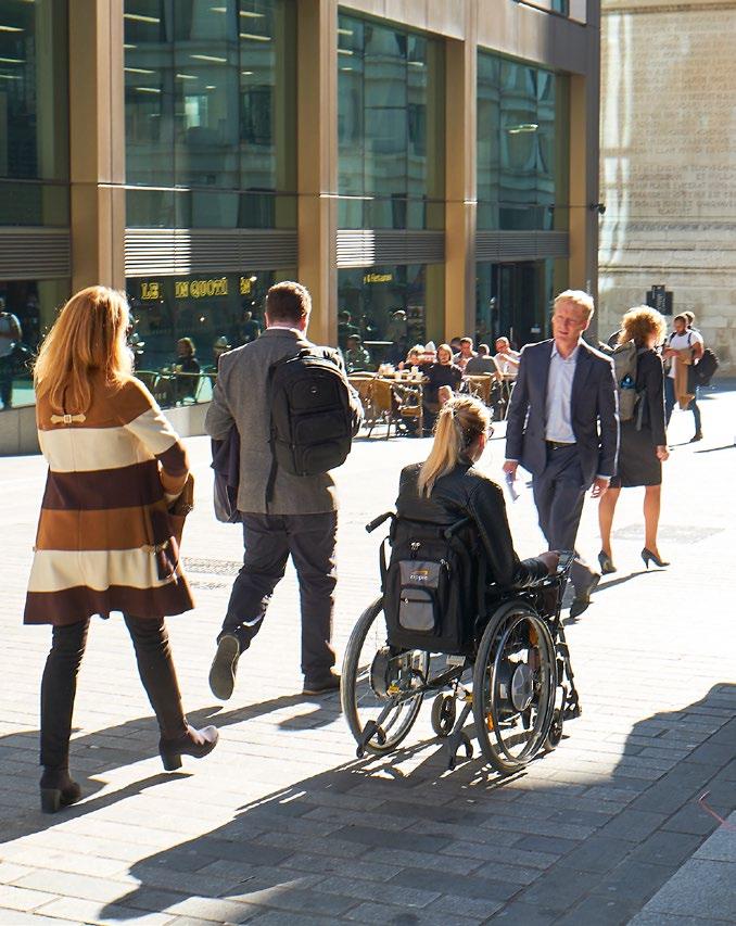
The City Corporation will work with partners to improve the quality and permeability of the City’s streets and spaces in ways that enhance inclusion and accessibility, put the needs of people walking and wheeling first when designing and managing our streets, and enable more people to choose to cycle in the City by:
1. Applying the Healthy Streets Approach in development proposals and improvements to public realm;
2. Improving conditions for safe, convenient, comfortable, inclusive and accessible walking, wheeling and cycling, incorporating climate change adaptation;
3. Expanding the cycle network across the City with the aim of ensuring that all property entrances are within 250m of the network;
4. Implementing improvements to key walking routes and increasing the number of pedestrian priority streets as part of the delivery of the City’s Transport Strategy;
5. Improving access routes and the public realm around stations, and between stations and key destinations; and
6. Implementing enhancements to the safety and appearance of streets and public realm in conjunction with restrictions to vehicular access, taking account of the needs of disabled people.
Reason for the policy
10.7.0 The Healthy Streets Approach provides the framework for the City of London’s Transport Strategy, which places improving people’s health and their experience of using streets at the heart of transport decision making. Good performance against each indicator demonstrates that individual streets are appealing places to walk, cycle and spend time.
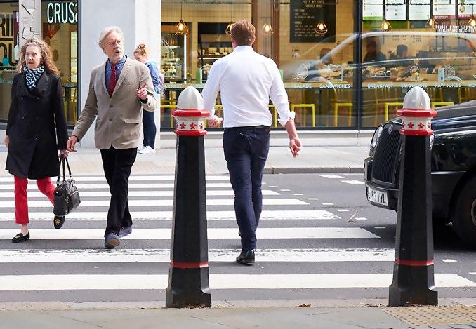
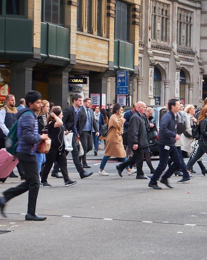
10.7.1 Most movement in the City is on foot and the street environment is predominantly a pedestrian environment, with over 750,000 walked and wheeled journeys a day. Cycling in the City needs to be considered within this context. Cycling in the City increased by almost four-fold between 1999 and 2022, although the rate of growth has slowed since 2012. Pedestrian numbers have also risen in the past 10 years as the City’s workforce has grown.
10.7.2 Improvements to conditions for safe, convenient and comfortable walking and cycling are required to improve the experience of people who already walk and cycle and encourage more people to use active modes of travel. The City has embedded the Healthy Streets Approach to inform strategic decision making and project prioritisation. Provision of necessary infrastructure is particularly challenging due to the City’s historic street pattern and the significant demands for space on streets from the high volume of pedestrians, cyclists and servicing and other essential vehicles. New planning applications and public realm proposals will be assessed using the Healthy Streets Indicators to understand development impacts on surrounding streets and on people’s experiences of the City’s streets.
10.7.3 The Mayor’s Transport Strategy seeks to enable more people to walk and cycle and reduce the use of and reliance on cars. Prioritisation of walking, wheeling and cycling through reallocation of highway space is advocated where appropriate to reduce conflict between different modes of transport, and to create an environment where people choose to walk, wheel and cycle.

10.7.4 Through the City Corporation’s Transport Strategy, the design and management of streets will reflect their position in the street hierarchy, as well as their function as places. Traffic management measures to implement the street hierarchy will be identified through the development of area based Healthy Streets Plans. These will consider how to reduce the use of Local Access streets by through traffic, while maintaining appropriate levels of vehicular access. They will also consider opportunities to introduce pedestrian priority, improve the experience of cycling, wheeling and walking, enhance the public realm and create new public space. Healthy Streets Plans will be developed by the City Corporation to cover the following areas: City Cluster; Fleet Street; Liverpool Street; Aldgate, Tower and Portsoken; Bunhill, Barbican and Golden Lane; Fenchurch Street; Bank and Cheapside; and Riverside.
1. Developers should facilitate pedestrian movement, enhance permeability, and reduce severance by provision of suitable routes through and around new developments, wherever feasible. Development will be required to contribute towards the improvement of pedestrian permeability in the City by providing:
a. legible, good quality, safe and low pollution pedestrian connections between spaces;
b. new pedestrian routes through buildings and development sites, where feasible, and respecting, maintaining and restoring, the City’s characteristic network of accessible buildings, streets, courts and alleyways;
c. publicly accessible ground floors for improved pedestrian movement, where feasible;
d. pedestrian routes that are of adequate width, step-free and follow best practice in street design to encourage ease of movement.
2. The City Corporation will work with developers and owners to maintain pedestrian routes at ground level and the upper level walkway network around the Barbican and London Wall. Development should not lead to the loss of routes and spaces that enhance the City’s heritage, function or character.
3. Development proposals should maintain and, wherever feasible, provide for an increase in pavement widths aligned with TfL Pedestrian Comfort guidance to ensure that pavements provide sufficient safety, comfort and convenience for the number of pedestrians.
4. The loss of a pedestrian route will only be permitted where an alternative public pedestrian route of at least equivalent standard is provided having regard to:
a. The extent to which the route provides for current and all reasonably foreseeable future demands placed upon it, including at peak periods;
b. The shortest practicable routes between relevant points.
5. Routes of historic importance will be safeguarded and where appropriate reinstated as part of the City’s characteristic pattern of lanes, alleys and courts, including the route’s historic alignment and width.
6. The replacement of a route over which pedestrians have rights with one to which the public have access only with permission will not be acceptable.
7. Public access across private land will be encouraged where it enhances the connectivity, legibility and capacity of the City’s street network. Spaces should be designed so that it is clear to the public that access is allowed (without reliance on signage).
8. The creation of new pedestrian rights of way will be encouraged where this would improve movement and contribute to the character of an area, taking into account the existing pattern of pedestrian routes and movement and connections to neighbouring areas and boroughs where relevant.
9. Improved wayfinding will be sought through new development and public realm improvements. Improvements sought will include:
a. Opportunities to update, enhance and add to the network of Legible London signs;
b. Consistent signage for public spaces created in new development; and
10. Better revealing ‘hidden’ routes, courts, alleys and other spaces in ways that respect and celebrate their character and heritage.
11. Major development proposals should model the pedestrian flow impact of new development.

Reason for this policy
10.8.0 In light of the current and predicted demands on the City’s streets and public realm, permeability and legibility are vital in order to accommodate pedestrians and enable efficient movement of people on foot and by cycle. Redevelopment schemes may provide opportunities to improve pedestrian safety and comfort, for instance by creating new routes or areas of open space, widening pavements and removing pinch points, or securing enhanced public access to private spaces and routes.
10.8.1 The City Corporation’s Transport Strategy promotes strategic measures to facilitate improved pedestrian movement, including pedestrian priority streets, increasing the number of pedestrianised or pedestrian priority streets from 25km to 35km by 2030 and 55km by 2044. Opportunities will also be identified to introduce pedestrian priority on streets with a pavement width of less than two metres.
10.8.2 The Transport Strategy identifies certain routes and junctions which will be prioritised for improvement, focusing on those which are busiest with people walking and where pavement width and pedestrian crossings are inadequate for current or forecast demand. Improvements to the following routes and junctions will be delivered by 2030 (see Figure 10):
Routes north-south from:
X Millennium Bridge to Barbican via St Pauls Cathedral, which supports the new Museum of London and Smithfield area changes.
X Southwark Bridge to Barbican via Guildhall
X Cannon Street to Liverpool Street via Bank
X Blackfriars Bridge to Farringdon via Ludgate Circus (in partnership with TfL)
X London Bridge to Liverpool Street via Bishopsgate including Monument junction (in partnership with TfL)
Routes east-west from:
X Farringdon to Aldgate via Smithfield and the Barbican
X Fleet Street to Aldgate via Bank and the City Cluster, including Ludgate Circus (in partnership with TfL)
X Temple to Tower Hill via the Thames Riverside
10.8.3 The City’s narrow streets and alleyways pose additional opportunities and challenges in terms of accessibility, wayfinding and safety. Many of these are valuable amenity spaces and are of historic importance. Sensitive solutions will be sought where development would have an impact on these spaces to protect their setting and create high quality, accessible areas for all the City’s users.
Proposed improvements to the TfL road network City of London boundary Proposed walking improvements 2019-2030
East-west route improvements
North-south route improvements
10.8.4 In considering proposals for new pedestrian routes, the City Corporation will ensure that routes are of adequate width, step-free and follow best practice in street design. Developers will be expected to consider the cumulative impacts of their developments on City streets alongside other existing and permitted development. Further details are set out in the City Public Realm SPD and accompanying Technical Manual.
10.8.5 Pedestrian Comfort Levels are used to assess the level of crowding on a pavement or at a pedestrian crossing. The level of comfort, which is graded between A+ (most comfortable) and E (least comfortable), is based on the number of people walking and the space available, taking account of street furniture and other restrictions. Minimum pavement widths should accord to TfL’s Pedestrian Comfort Guidance. TfL’s Pedestrian Comfort Guidance recommends a minimum comfort level of B+ and the City Corporation’s Transport Strategy aims for all City pavements to have a minimum pedestrian comfort level of B+. Transport Assessments submitted in support of planning applications should assess the level of pedestrian comfort and should provide a clear justification if any pavements in the vicinity of the development would fail to achieve a B+ rating.

10.8.6 Appropriate management and maintenance arrangements for the public realm and pedestrian routes should be agreed, including for public space that is privately owned (in accordance with the Mayor of London’s Public London Charter) and secured through legal agreement or planning condition. Financial contributions secured through s106 planning obligations will be used to ensure development contributes to improvements in the wider public realm. Developers will be required to meet the cost of updates to the Legible London map database which are required as a result of development, and to fund the provision of new Legible London totems, where necessary.

All major development must promote and encourage active travel through making appropriate provision for people who walk, wheel and cycle by:
X ensuring suitable access between the development site and pedestrian and cycle routes;
X incorporating sufficient shower and changing facilities, and lockers/storage to support walking and cycling in accordance with the London Cycling Design Standards.
Reason for this policy
10.9.0 Most of the City’s employees journey into work via public transport, completing their journeys on foot. Pedestrians make up the majority of the road users in the City and as such, provision needs to be made to facilitate safe and pleasant pedestrian movements and active travel.
10.9.1 A growing number of people are choosing to cycle through and around the Square Mile. The popularity of cycle hire schemes has grown post-pandemic. Increased access to the East-West and North-South Cycleways enables cyclists to cross the City on safer strategic routes. This will be supplemented by a Citywide core cycle network providing safe and attractive routes around the Square Mile and linking into cycling networks in neighbouring boroughs (see Figure 11). TFL cycleways and will be prioritised on this network, with the aim of delivering the core cycling network by 2035.
10.9.2 Smaller measures and network enhancements will be identified through development of the Healthy Streets Plans. Additional cycling infrastructure should see an increase in the uptake of cycling as a way of travelling around as well as commuting into the City and help to achieve the aims of both City of London’s Transport Strategy, and that of the Mayor of London.
How the policy works
10.9.3 New developments should provide shower and storage/locker facilities to encourage employees to engage in active travel modes. Lockers should be provided at a minimum ratio of 1 locker per 1 cycle parking space. Showers should be provided at a minimum of 1 shower per 10 cycle parking spaces. The City of London’s Active City Network actively encourages employers to promote and support safer commuting. The provision of personalised travel planning by employers for their staff can be an effective way of helping to achieve this. Accessible facilities for disabled cyclists should also be provided.
10.9.4 Developers will be required to contribute towards the enhancement of the public realm to encourage pedestrian and cycle travel, and towards the expansion of the City’s cycle network if the development is likely to benefit from the provision of a nearby route. Contributions may be secured through s106 planning obligations and s278 highways agreements where such provision is necessary to mitigate the impacts of the development.
Proposed cycling network
Existing cycling links
Network improvements by 2028
Network improvements by 2035
Monument junction
City of London boundary
1. Developments must provide on-site cycle parking for occupiers and visitors, complying with London Plan standards, and will be encouraged to provide facilities for public cycle parking.
2. All long stay on site cycle parking must be secure, undercover and preferably enclosed, in accordance with the London Cycle Design Standards.
3. Developments that include ground floor retail and take-away food outlets should provide appropriate off-street storage for cargo bikes and hand carts.
4. Cycling facilities should be conveniently located, easily accessible, safe and secure.
5. Opportunities to provide space for dockless parking should be explored where development would create or have an impact on existing public realm.

Reason for this policy
10.10.0 There is need to encourage more people to cycle into the City and adopt active travel initiatives, to reduce congestion on City streets, deliver improvements in air quality, reduce carbon emissions and contribute to the wider health and wellbeing of City occupiers, residents and visitors. Sufficient cycle parking will be required to meet these needs.
10.10.1 Developers will be required to provide sufficient cycle parking to meet potential demand, including provision for non-standard cycles. 5% of cycle parking spaces must be flexible in order to support secure storage and charging for e-bicycles, micromobility devices, and mobility scooters. A robust justification for failure to comply with London Plan standards will be required. This will be considered on a case-by-case basis as part of preapplication discussions. All on-site cycle parking must be secure, conveniently accessible and sheltered, in accordance with London Cycling Design Standards.
10.10.2 Short-stay visitor cycle parking should be provided on-site at ground floor level. Visitor cycle parking should be near building entrances in publicly accessible spaces wherever possible.
10.10.3 In order to facilitate last-mile deliveries by sustainable modes of travel, premises that include retail and take-away food outlets will be encouraged to provide storage space for cargo bikes and hand carts.
10.10.4 The Mayor’s Transport Strategy seeks to ensure that on-street cycle facilities cater for the wide range of cycles used by disabled people.
10.10.5 This policy applies to the cycle parking provided within new developments. The City Corporation’s Transport Strategy addresses public cycle parking. Developers are encouraged to provide additional public cycle parking facilities within the curtilage of their developments. The Transport Strategy aims to ensure that operators of dockless cycle and scooter hire schemes require users to leave cycles and scooters in designated parking locations.