Part d - Chapter twelve - site allocations
RLC1 – Land at Deerleap (north) LAA Reference Site Size (Ha) Existing Use Proposed Future Use Proposed Number of Homes
RC-006 0.6 ha Natural greenspace Housing 5
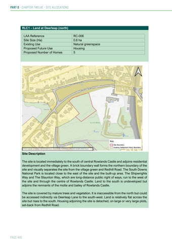
Site Description The site is located immediately to the south of central Rowlands Castle and adjoins residential development and the village green. A brick boundary wall forms the northern boundary of the site and visually separates the site from the village green and Redhill Road. The South Downs National Park is located close to the east of the site and the built-up area. The Shipwrights Way and The Staunton Way, which are long-distance public right of ways, run to the west of the site and through the centre of Rowlands Castle. Land to the south is undeveloped but adjoins the remnants of the motte and bailey of Rowlands Castle. The site is covered by mature trees and vegetation. It is inaccessible from the north but could be accessed indirectly via Deerleap Lane to the south-west. Land is relatively flat across the site but rises to the south. Housing adjoining the site is detached, on large or very large plots, set-back from Redhill Road.
Page 440