Part d - Chapter twelve - site allocations
HOP1 – Land north of Fullers Road, Holt Pound LAA Reference Site Size (Ha) Existing Use Proposed Future Use Proposed Number of Homes
BIN-005 3.8 ha Agricultural Housing 19
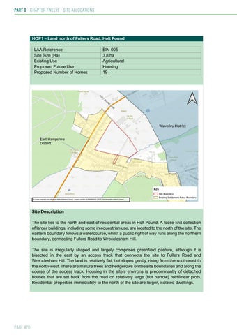
Site Description The site lies to the north and east of residential areas in Holt Pound. A loose-knit collection of larger buildings, including some in equestrian use, are located to the north of the site. The eastern boundary follows a watercourse, whilst a public right of way runs along the northern boundary, connecting Fullers Road to Wrecclesham Hill. The site is irregularly shaped and largely comprises greenfield pasture, although it is bisected in the east by an access track that connects the site to Fullers Road and Wrecclesham Hill. The land is relatively flat, but slopes gently, rising from the south-east to the north-west. There are mature trees and hedgerows on the site boundaries and along the course of the access track. Housing in the site’s environs is predominantly of detached houses that are set back from the road on relatively large (but narrow) rectilinear plots. Residential properties immediately to the north of the site are larger, isolated dwellings.
Page 470