Part d - Chapter twelve - site allocations
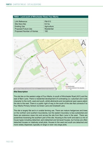
FMS4 – Land south of Winchester Road, Four Marks LAA Reference Site Size (Ha) Existing Use Proposed Future Use Proposed Number of Homes
FM-013 8.3 ha Agriculture Residential 100
Site Description The site lies on the western edge of Four Marks, to south of Winchester Road (A31) and the east of Barn Lane. There is residential development of contrasting (i.e. suburban and rural) character to the north, west and south, whilst allotments and recreational open space adjoin the site to the east. There is a public right of way to the south of the site that connects it to Four Marks Primary School via Green Lane and Gradwell Lane. The site is largely flat and is in arable farming use. There are mature hedgerows and trees on the northern and southern boundaries, but the eastern boundary is less substantial and there are extensive views into and across the site from Barn Lane in the west. There are powerlines traversing the southern part of the site. Housing to the north and east is a mix of house types including detached, semi-detached and terraced houses, but homes are often detached houses on relatively small plots. Houses to the west and south are detached and more widely dispersed, typically on large or even very large plots.
Page 432