City Plan 2040
City of London Local Plan
Revised Proposed Submission Draft March 2024
Submission policies map
1
LD5
2 Contents Policies Map A 9 Tall Buildings, Views and Heritage .......................................................................................................... 9 Conservation Areas ............................................................................................................................. 9 London View Management Framework – Protected Vista Landmark Viewing Corridors and Protected Vista Wider Setting Consultation 10 St Paul’s Heights Policy Area 11 Monument Views and Setting 12 Bevis Marks Synagogue Immediate Setting Area ............................................................................. 13 Airport Safeguarding Area ................................................................................................................ 14 Tower of London World Heritage Site – Local Setting Area ............................................................. 15 Tall Buildings Area ............................................................................................................................. 16 Policies Map B 17 Key City Places 17 Thames Policy Area 17 Thames Tideway Tunnel Safeguarding Area ..................................................................................... 18 Riverside Walk................................................................................................................................... 19 Assets of Community Value .............................................................................................................. 20 Transport and Servicing 22 Crossrail Safeguarding Area 22 Bank Station/Northen Line Upgrade Safeguarding Area 23 Strategic Road 24 London/Borough Distributor Road ................................................................................................... 24 Local Distributor Road ...................................................................................................................... 24 Open Spaces and Green Infrastructure 25 Site of Metropolitan Importance for Nature Conservation 25 Site of Borough Importance for Nature Conservation 25 Site of Local Importance for Nature Conservation 25 Climate Resilience and Flood Risk ......................................................................................................... 26 City Flood Risk Area .......................................................................................................................... 26 Circular Economy and Waste ................................................................................................................ 27 Safeguarded Wharf 27 Retail 28 Principal Shopping Centres (PSC) 28 Housing and Communities 29 Barbican and Golden Lane Neighbourhood Area ............................................................................. 29
3 Identified Residential Areas 30 The Temple 31 Policies Map C ....................................................................................................................................... 31 City Cluster Tall Building Area ............................................................................................................... 31 Policies Map D 31 Fleet Valley Tall Buildings Area 31
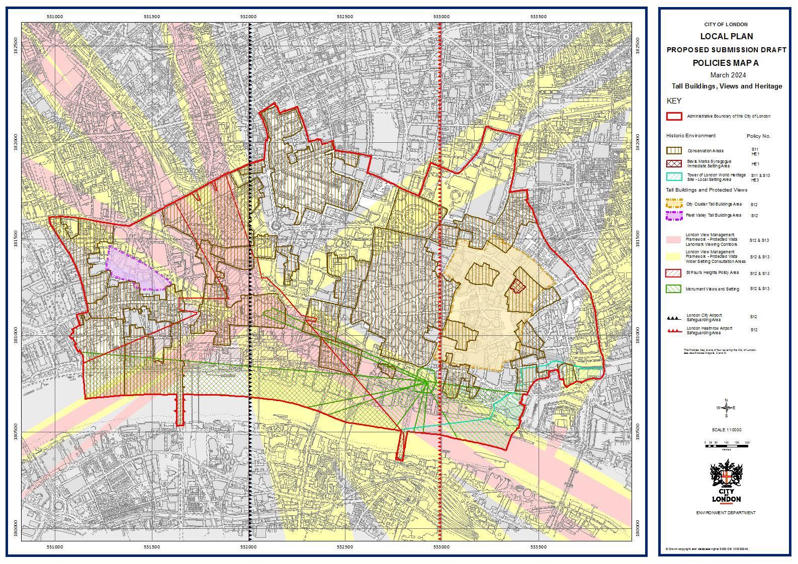
S3100 0 S31 500 S32000 S32 500 S33000 S33SO 0 • S31000 S31SO 0 S3200 0 S32SO 0 S3300 0 S33SO 0 CITYOF LOHDOH LOCAL PLA N PROPOS E D SUBMISSION DRAFT POLICI E S MAP A Ma r c h 2024 Tall Buildings, Views and Heritage KEY c:J Acrn kl lsra:11e so u no a.iy o fU)e et; o floo.® n His tori c E nvironment Po licy No. OJII COr-$elVa! ICO Area$ S 11 >£ 1 g;g;g 8e/l Ma.rusyna 9)g.re rn met11a ~ se:::b g Aiea >£ 1 CJ TewerOflOOOOO WOl'JCI ttrr* S11 &S13 s~ - toca I se:::t9 Area t-EJ Tall Bu ld i ngs and Protede<I V iew s ,.... 8-1wil O:;' Cbs.:e r n 11 5 UIIClb ~Aiea !!' •••• ,• .i Ree: v ane·, n 11 s uin t1~Aiea
12
mo~""'"'"
~~Ol<IM'1 >(c, .,..c,. SCAlf 1:10000 cirv LONDON Hv'I AO NIIE NT OEPAiUl/. NT
tonooo View IASO~E{neta Frame-No• - P ro!e,w.>O Vle.:a t..aoomart v 1ewngc.o rt10G tonooo View IA:O~ era Fra me-No• - P ro!e,w.>O VIS.:a Wkl er Se:! li g OX1&J .a ,;, n Are~ &Pau!l r :eigrr.; Po~ / Aiea ,'1) oom eatV woa no Se:;ng lO OOOO Ct/ A rp,rt &1egr.arat1 9 Area lO OOOO He3 111 rctN A rp)F1 saregr.ardb g Area S12 S
S12&S1J S12&S1J S12&S1J S12&S1J S12 S12
"'°<' • v--......,Nt,.•V1#401',.
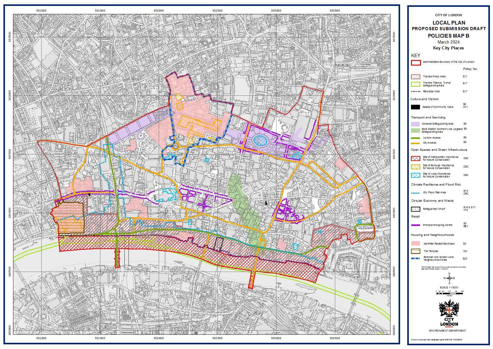
CITYOF L OHDOH LOCAL PLAN PROPOSED SUBMISSION DRAFT POLICIES MAP B Mar ch 2 024 Key C i ty P aces KEY D Mn ri ltra-:11e so uno ary om :e ,_ ..,.;1 ofloaoo n rzza CJ Tnameo POIIC'J AP.a TICIE"Na'/ Tum e -JarartgArea Cultur e and V isi tors - As.se~ot c.omm oo r.;vau e Transport a nd 5 , • ,;.v l CIOQ Pol io; N--o. S 17 S 17 S 17 S6 0/1 oo s.sra11 s~ gr.ianrgAra S9 1111 & Ni: S U t ~ N'Ol t.E' S3 ~.aro:b gAiea ml N ...., g-~e S9 - lOrx!OO /Wee$$ s, s, Open Spa ces a nd Gt een I nfras tructure - ClyAooes.s Ste OI oca tnporta oce br Na ::-Jie c.onse rva:o n C li mate Resilien ce and F lood R•isk Cly FIOOCI RIii: Ara c-l' CUlst E con ornf and W aste I!!!:!] S3~.arceo V\tta r: Retail Housing and Neig hbour hood s E:I ...... Qm ~ Reo1:1en:1a 1Areao Tte Tu-11p ies & Dic:¥1 a nci GolClen La ~Jg'IOO uaoo/J Area r.e SCAlf 1:10000 ; -;c ,cc , .c •CITY LONDON OS, OS, OS, S1S ""' S16&S 17 VH s; '"" s, "'' S'2J ENVl RO NI.E NT DEPAR:TI/ZNT
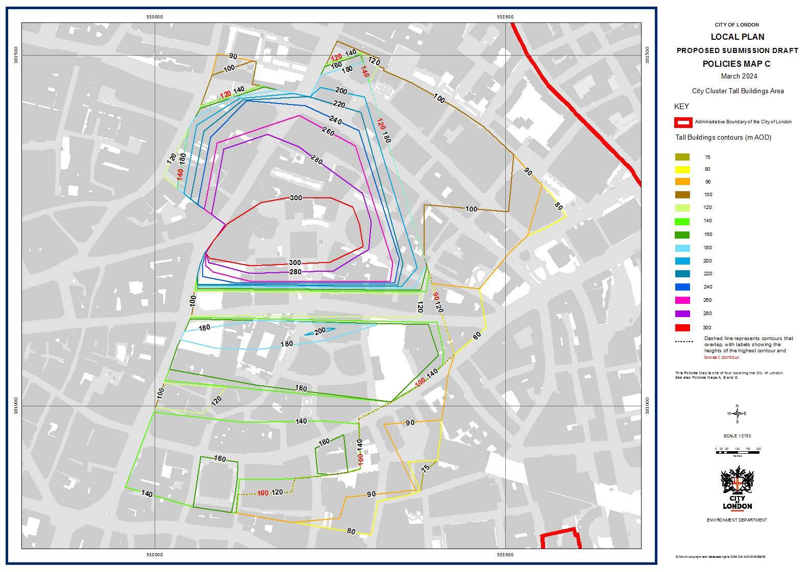
S3300 0 S33 50 0 l------------::::::------i:;;.;.;:;;;.------ , 90~ - ...!.~~~-----/4~ j.~~~ -i~_.:::::::::________i i ~-,J,~----------1 m R0 8 R m R ;I 8 1 \ AQ , . .. .. 1,6..0 'I,() :1 40 L ______ _J __;t.__ ~~===~3 ..-·;L_r,~ =-s1~-+}----_J_7 i ..• ,· 9 0 ,. .. ...... .' • .L .....w o -12 0 .... --...J I S3300 0 8Q I . . 9 0 S33 50 0 CITYOF L OHDOH LOCAL PLA N PROPOSED SUBMISSION DRAFT POLICI E S MAP C M ar c h 2 024 Ci t y Cl us t er Tall Bui l d ng s A rea KEY c::11 Adm nis11a live Bound aryof ltte Cityof Lo ndon Tall Buil ding s co ntou rs (m A OD ) - 7580 9J - 100120 140 - 160 - 18 0 - 200--220 240 260 28 0 30 0 Das h ed in e r e pr esen ts contour s th.at overla p, w ith labels s h ow ing th e hei gh ts o f th e h i gh es t contour .and low es t oontour n u s 1>ov..:.es M e. ors o ne ol !o\.l' «lY eM o : r.e etr,1 ol .o..-.uo n. seeei-:so :>o Mei_os, A Sc ei rao SCAl t2iSO Hv'I AO NIIE NT OEPAiUl/. NT
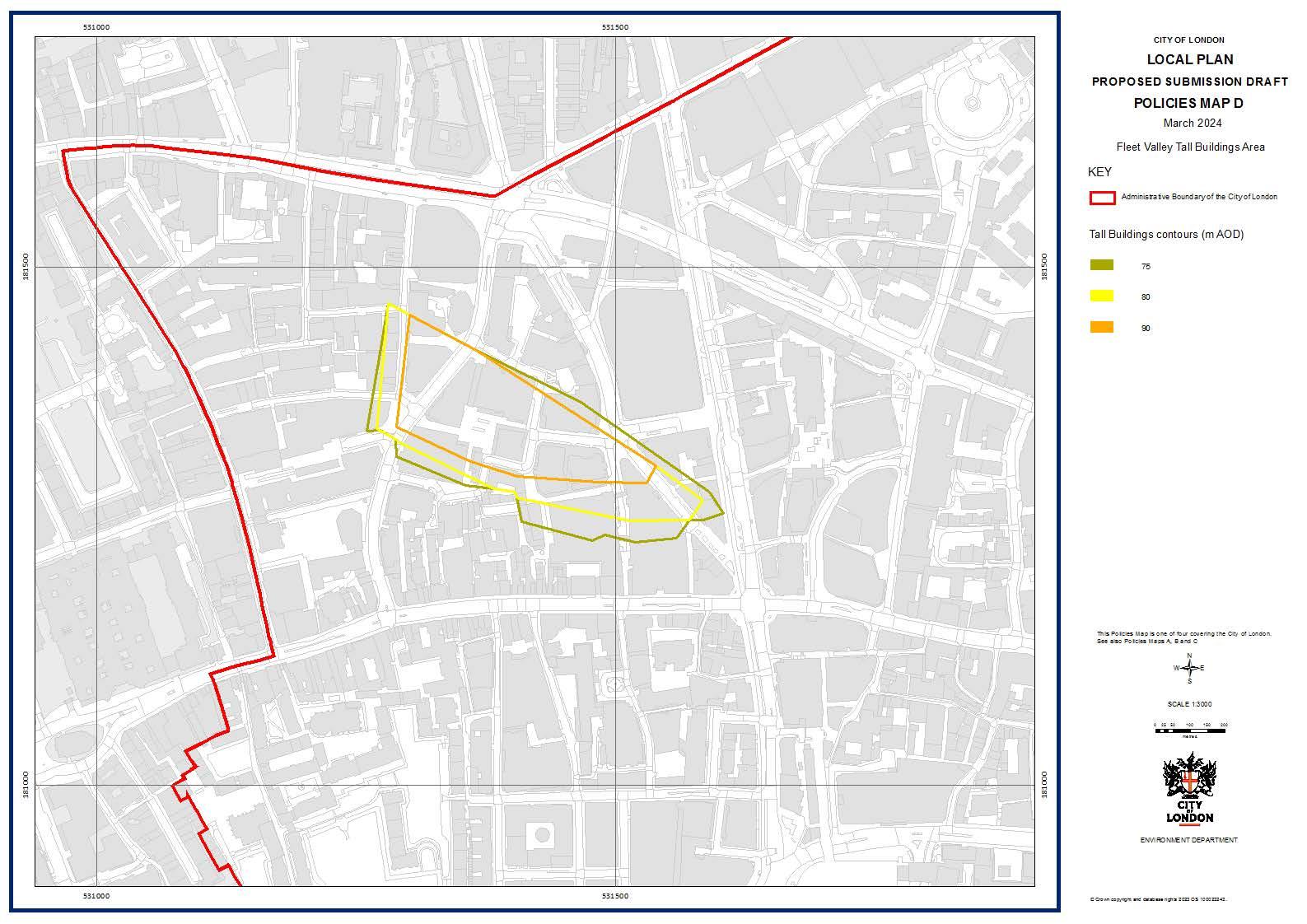
<~ \< ;v 0 8 " m " \ I q !~. I \ "\',! S3100 0 j S3150 0 CITYOF LOHDOH LOCAL PLAN PROPOSED SUBMISSION DRAFT POLICIES MAP D M ar c h 2024 Flee t V alle y Tall Bui l d ngsAr ea KEY c:J Adminis11a live Bound aryof ltte CityofLondon Tall B u il di ngs con t o urs (m A O D) - 75 - 80 - 9J ihfS Po ..:.e5 M i:>IIS OM ol 1¢ 1.1' «!Y en,g,:l'>e C::-,1 ol t.codo l"I. $ee "-:so Po ~ M$.0S A. ,, I'd C SCAl 1:3000 EHv'I AO NIIE NT OEPAiUl/. NT
Introduction
This document is the submission policies map to accompany the City Plan 2040: revised proposed submission version. It sets out how the adopted policies map would be amended by the City Plan 2040.
For clarity, this document includes:
• The proposed policies maps for the City Plan 2040 (policies maps A, B, C and D). These maps set out how the policies map would appear once the City Plan 2040 is adopted.
• Each layer that constitutes the policies map, showing any changes that have been made to that layer in the adopted policies map. Layers that have not been changed are also listed.
8
Policies Map A
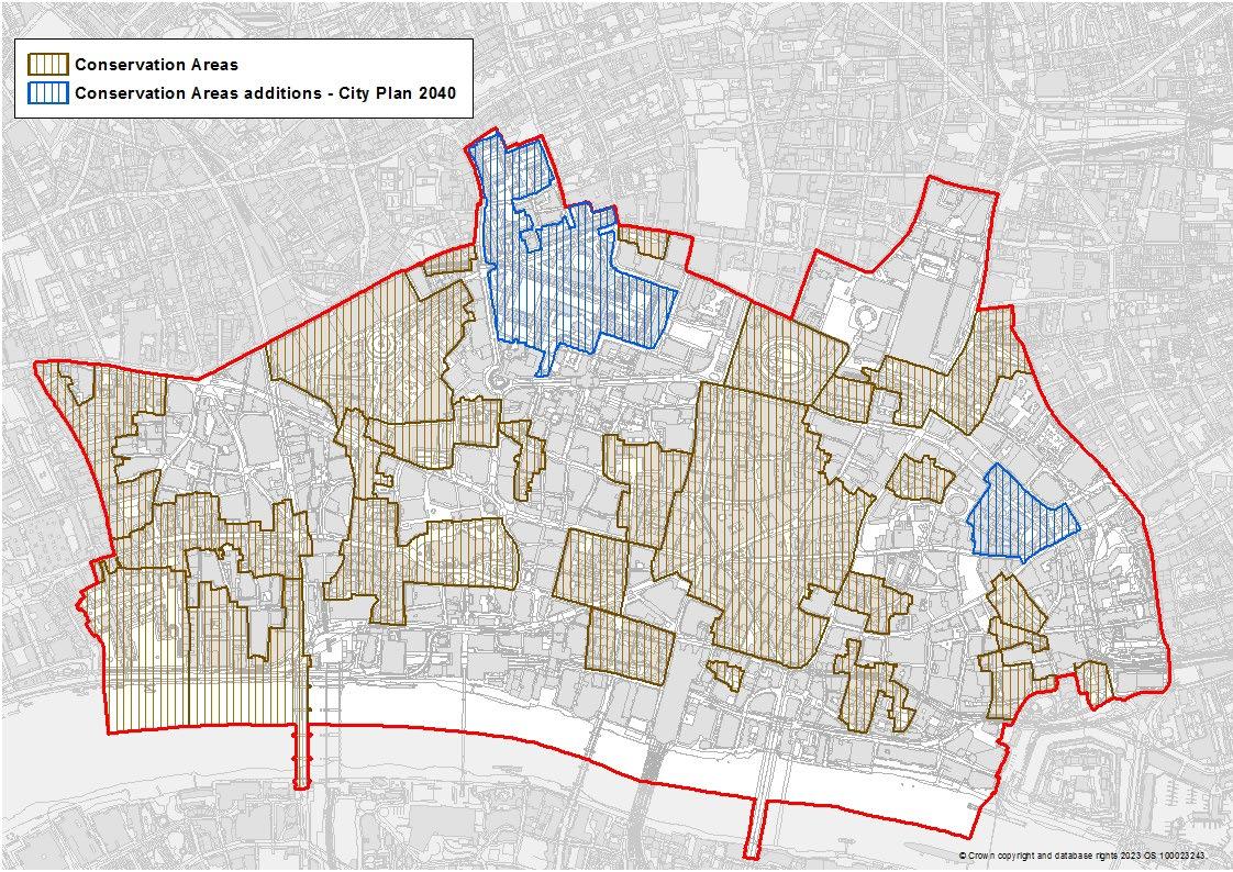
Tall Buildings, Views and Heritage Conservation Areas
The Barbican and Golden Lane and Creechurch Conservation Areas have been added to the policies map.
9
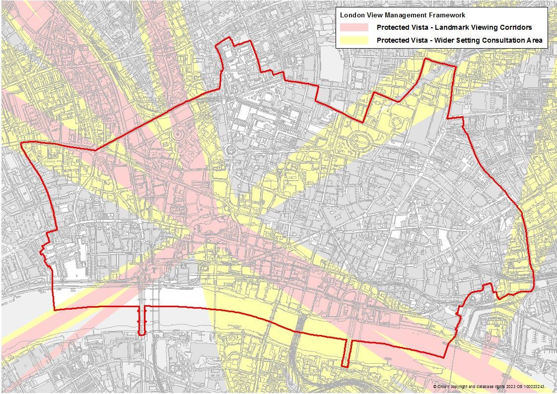
London View Management Framework – Protected Vista Landmark Viewing Corridors and Protected Vista Wider Setting Consultation
No change
10
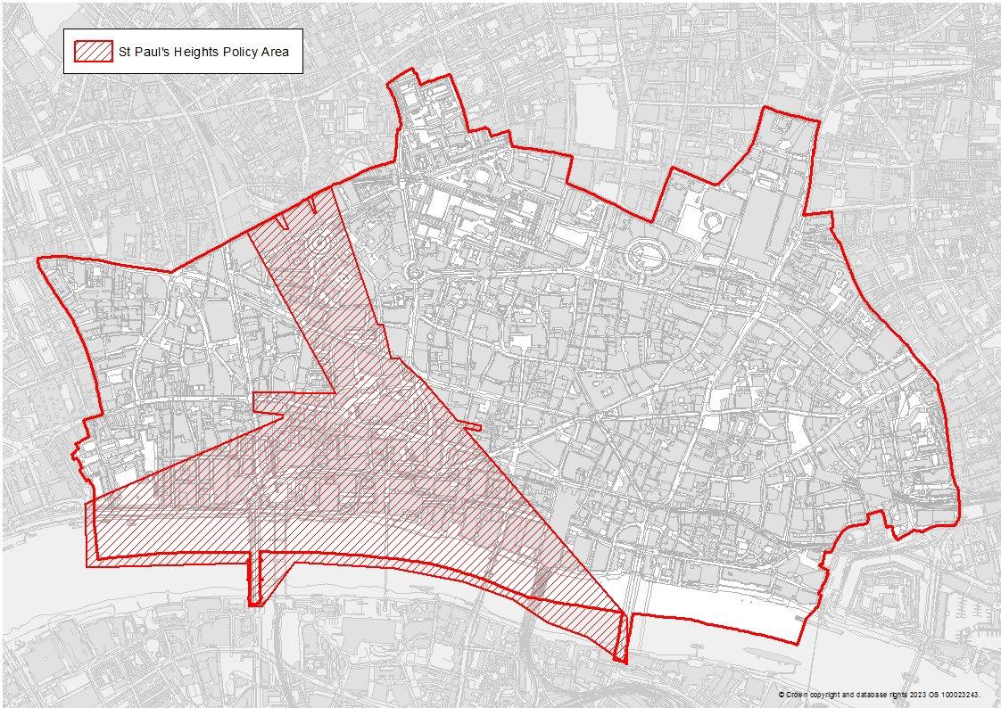
St Paul’s Heights Policy Area
No change
11
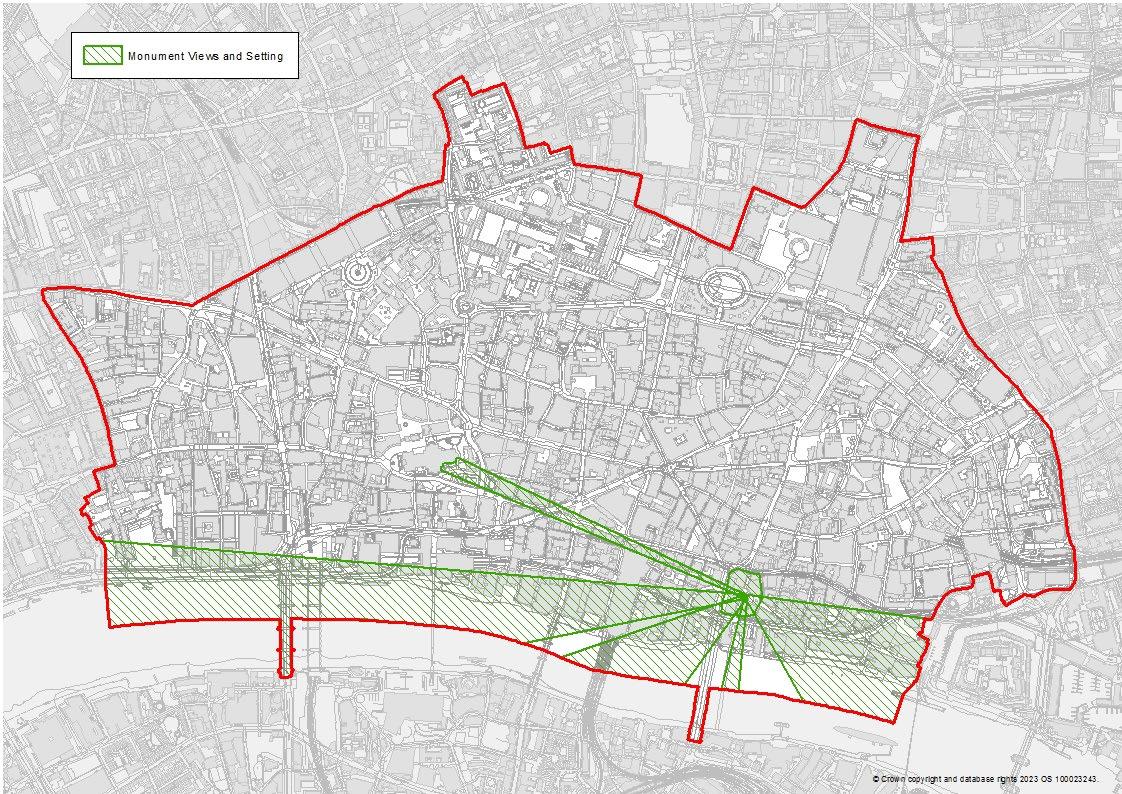
Monument Views and Setting
No change
12
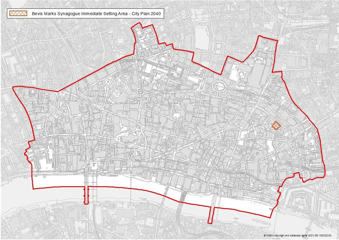
Bevis Marks Synagogue Immediate Setting Area
The Bevis Marks Synagogue Immediate Setting Area has been added to the Policies Map.
13
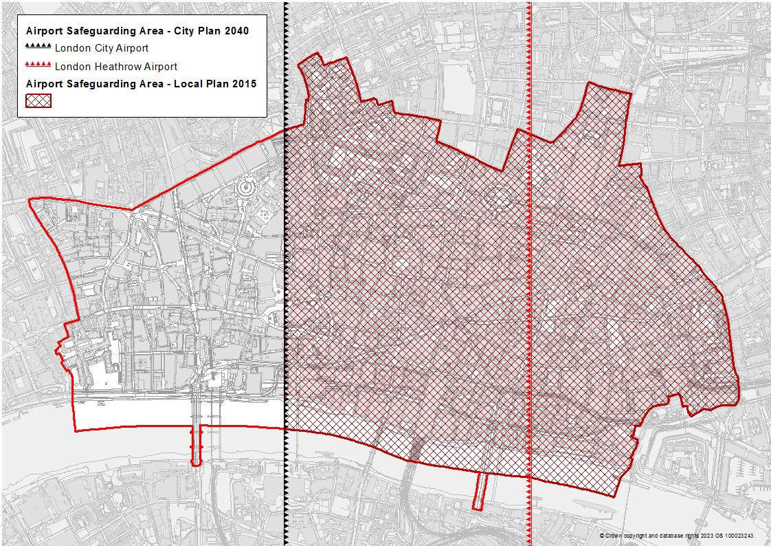
Airport Safeguarding Area
The adopted Local Plan 2015 policies map had an Airport Safeguarding Area covering roughly two thirds of the City. This has been deleted from the policies map for the City Plan 2040. The London Plan 2021 requires tall buildings to have regard to the Airport Safeguarding Areas of London City Airport and London Heathrow Airport. These specific areas have been added to the policies map
14
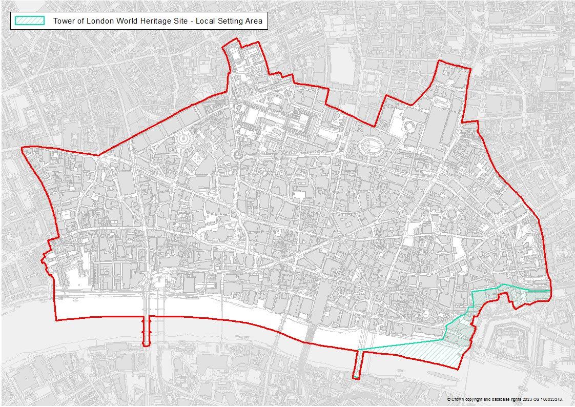
Tower of London World Heritage Site – Local Setting Area
No change
15
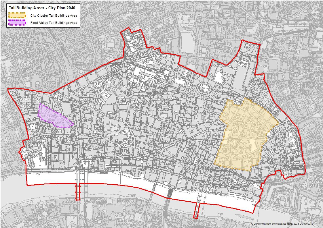
Tall Buildings Area
The tall building areas have been added to the policies map.
16
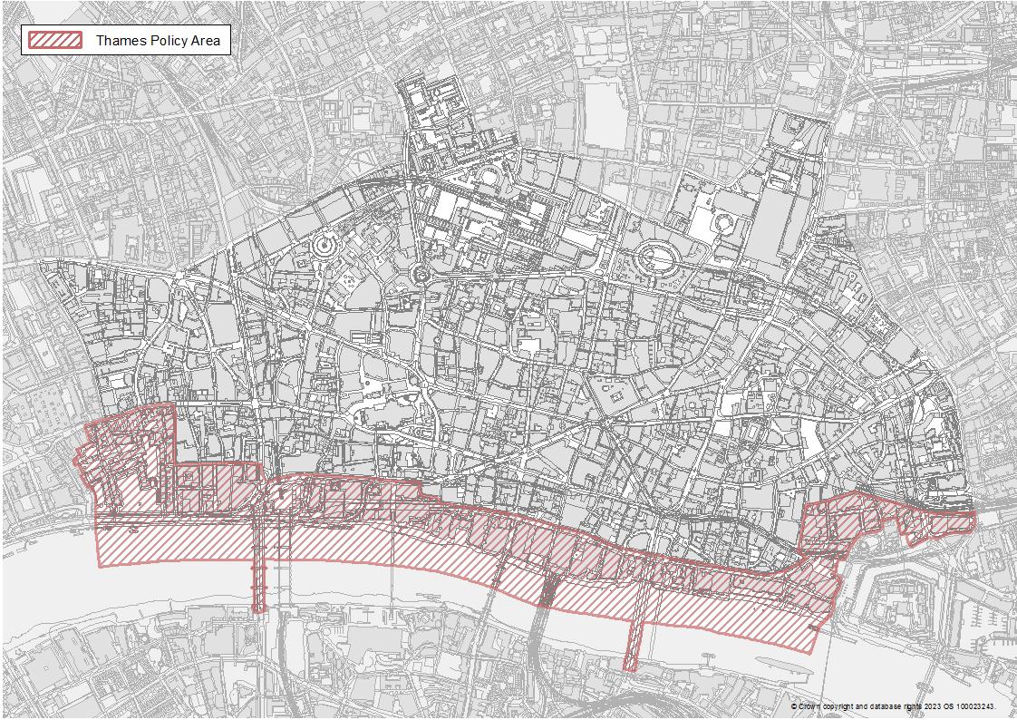
Key City Places
Thames Policy Area No change
17
Policies Map B
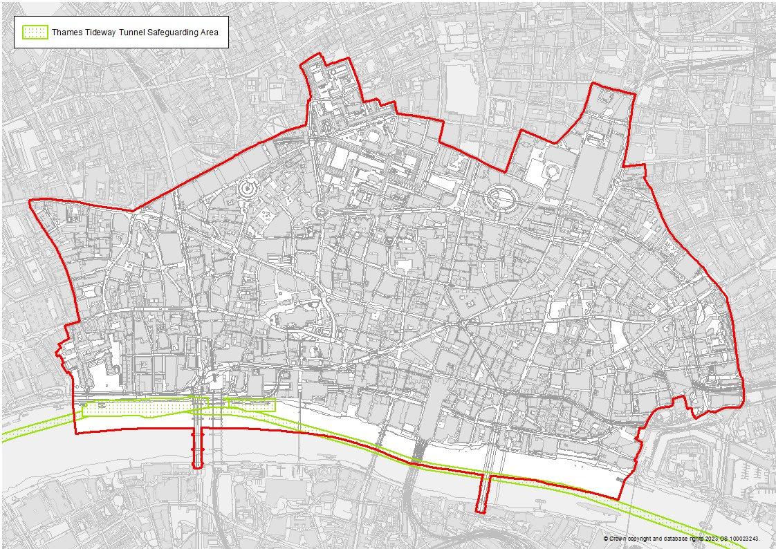
Thames Tideway Tunnel Safeguarding Area
No change
18
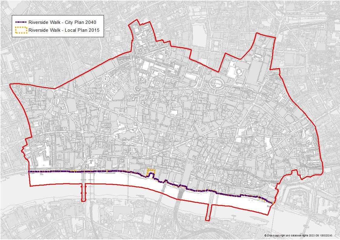
Riverside Walk
An adjustment has been made to the riverside walk layer on the policies map to reflect completed construction works at Queenhithe.
19
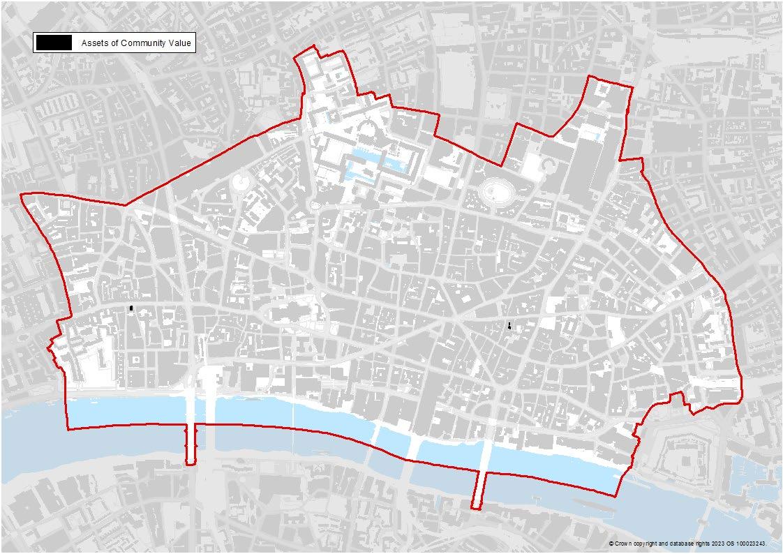
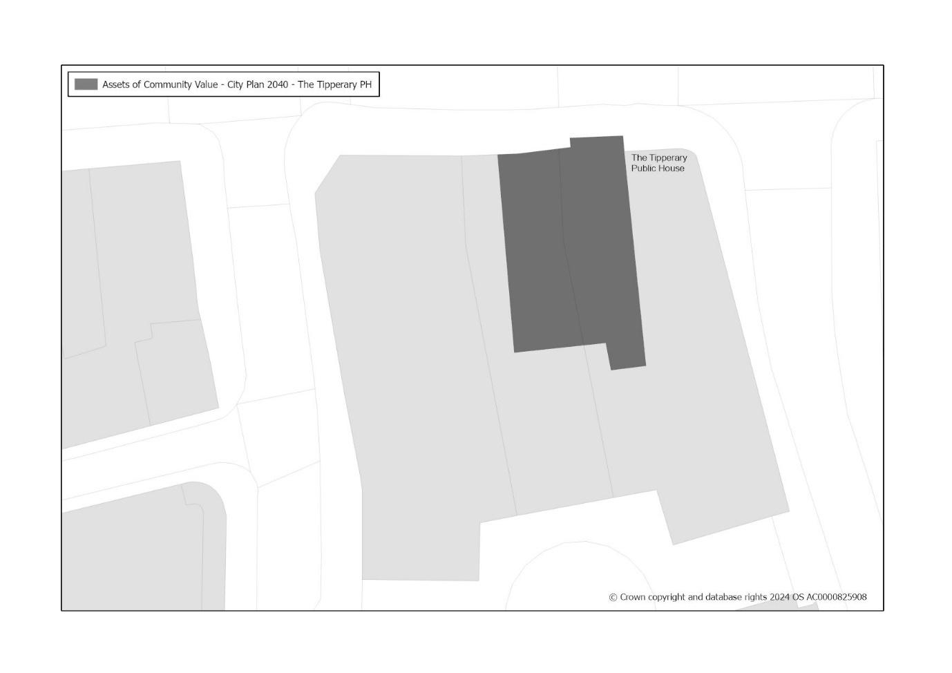
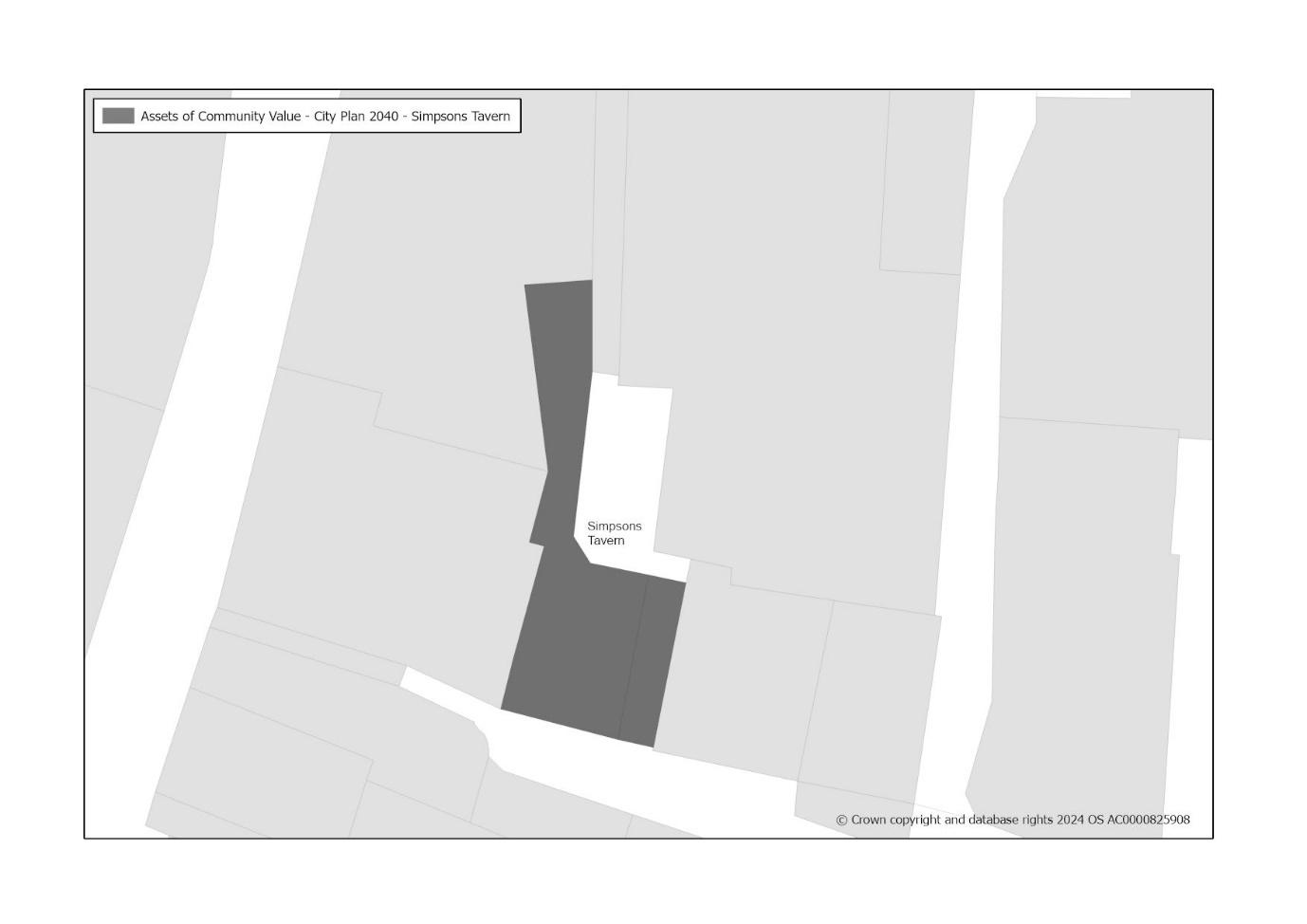
Assets of Community Value
Two assets of Community Value were designated in 2022. These have been added to the policies map.
20
21
Transport and Servicing
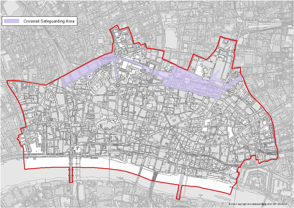
Crossrail Safeguarding Area
No change
22
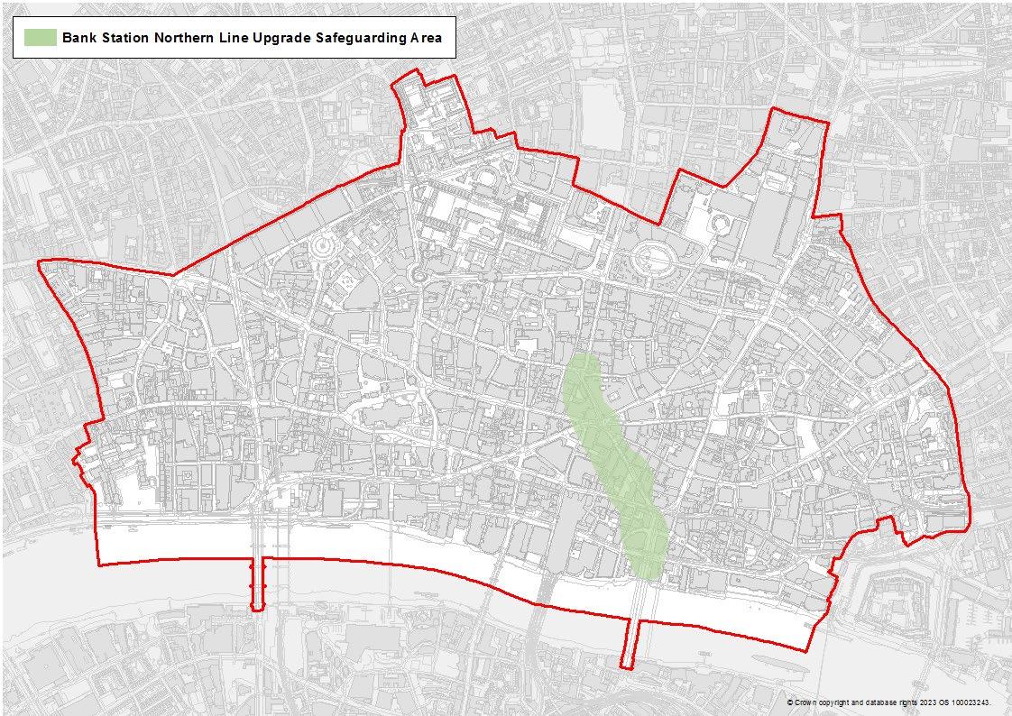
Bank Station/Northen Line Upgrade Safeguarding Area
No change
23
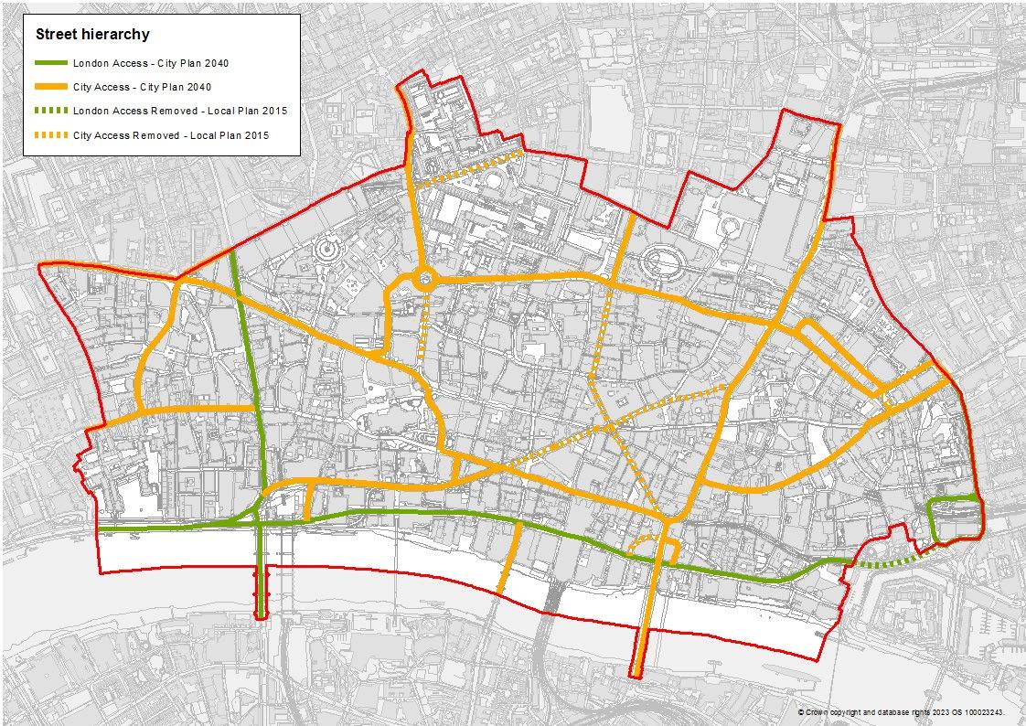
Strategic Road
As part of the Transport Strategy review, strategic roads have been renamed to London Access.
London/Borough Distributor Road
As part of the Transport Strategy review, London/Borough distributor roads have been renamed as City Access.
Local Distributor Road
As part of the Transport Strategy review, all other roads are designated as Local Access streets so they do not need to be identified on the map.
These changes to the road types have been reflected in changes to the key for the policies map.
Parts of the road network that were formerly designated as Strategic Road (London Access) have been de-designated. This has been reflected in changes to the policies map.
Parts of the road network that were formerly designated as London/Borough Distributor Road (City Access) have been de-designated. This has been reflected in changes to the policies map.
24
Open Spaces and Green Infrastructure
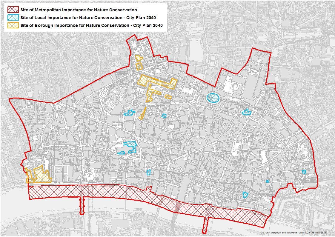
Site of Metropolitan Importance for Nature Conservation
No change
Site of Borough Importance for Nature Conservation
The SBINCs have been added to the Policies Map.
Site of Local Importance for Nature Conservation
The SLINCs have been added to the Policies Map.
25
Climate Resilience and Flood Risk
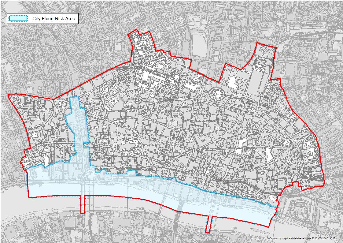
City Flood Risk Area
No change
26
Circular Economy and Waste
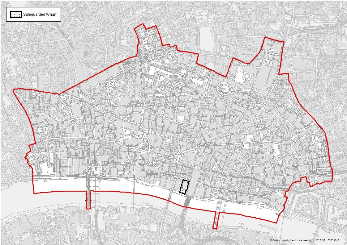
Safeguarded Wharf
No change
27
Retail
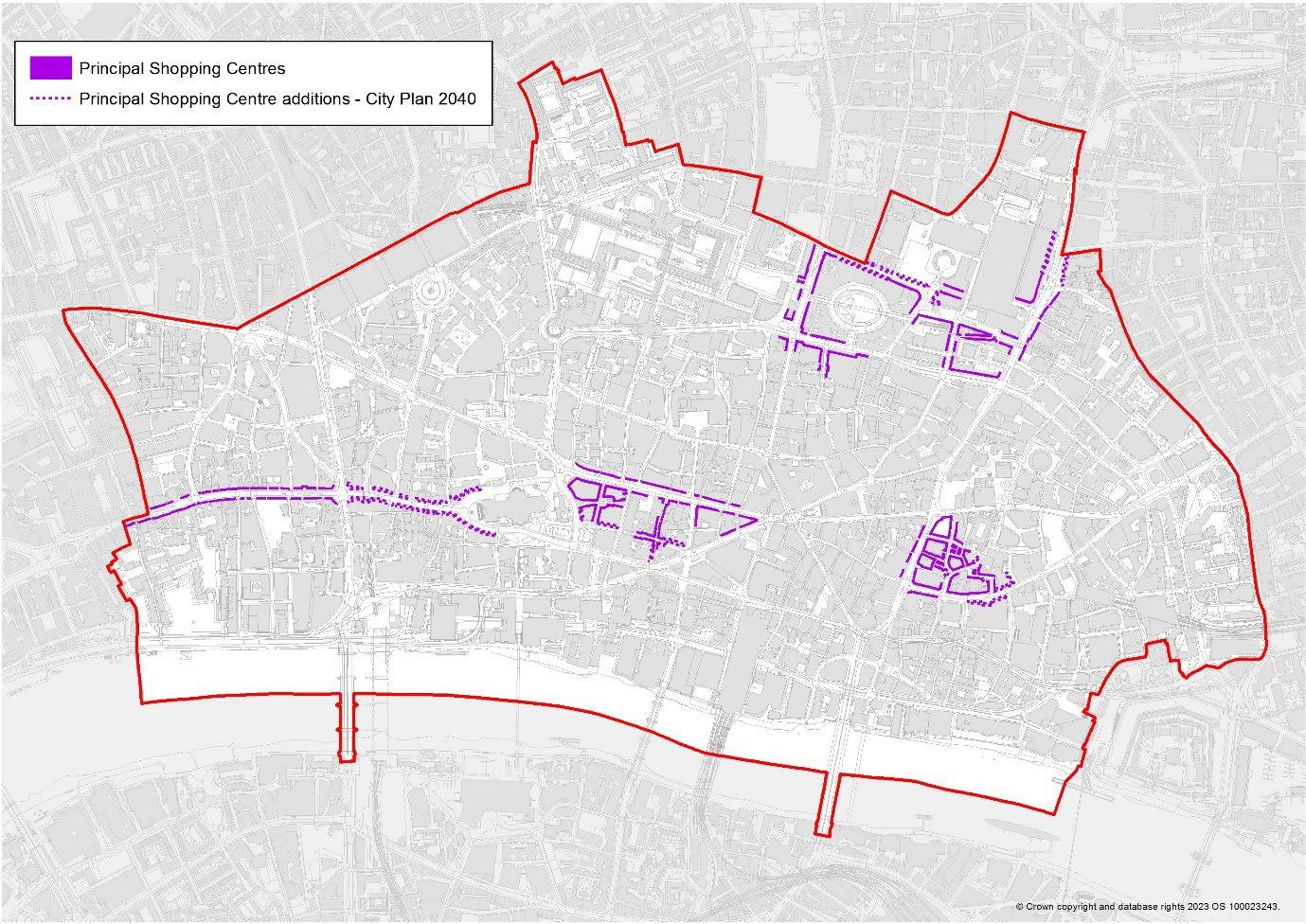
Principal Shopping Centres (PSC)
Additional frontages have been added to all four of the PSCs (Fleet Street; Moorgate/Liverpool Street; Cheapside and Leadenhall Market)
28
Housing and Communities
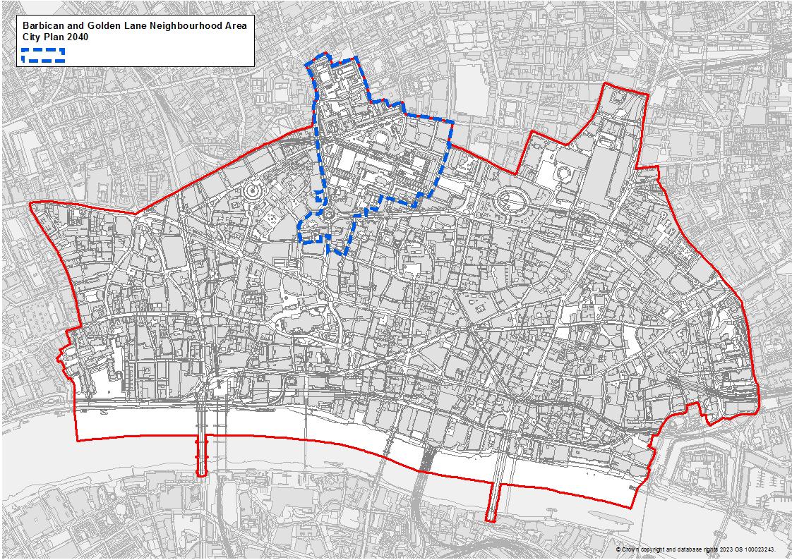
Barbican and Golden Lane Neighbourhood Area
The Barbican and Golden Lane neighbourhood area has been added to the policies map
29
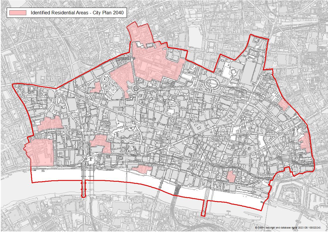
Identified Residential Areas
The identified residential areas have been added to the Policies Map.
30
Policies Map C
City Cluster Tall Building Area
The tall building contours for the City Cluster Tall Buildings Area have been added to the policies map.
Policies Map D
Fleet Valley Tall Buildings Area
The tall building contours for the Fleet Valley Area have been added to the policies map
31
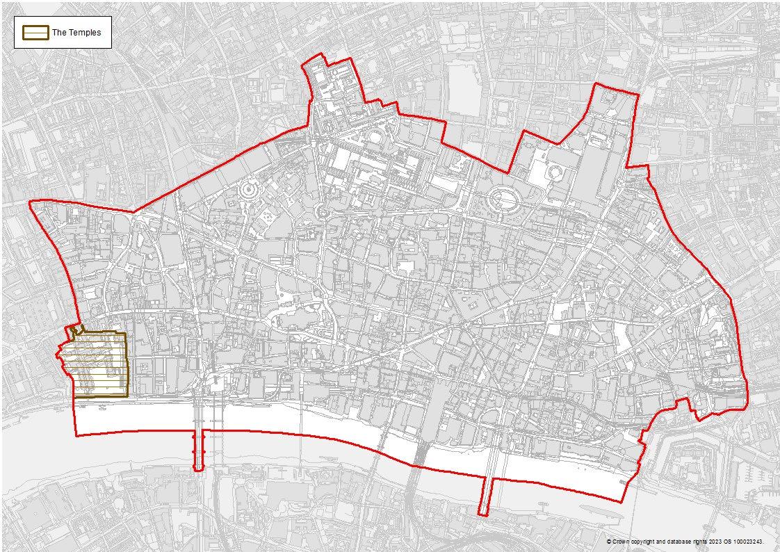
The Temple No change
