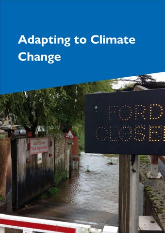
Chapter 7. Adapting to Climate Change
Flood risk
7.1. National policy on flooding must be considered for developments at risk of flooding. The plan's policies and allocations are informed by a Strategic Flood Risk Assessment (SFRA)30, which should also guide neighbourhood plans and development decisions. The SFRA provides a comprehensive analysis of flood risks from various sources, including rivers, the sea, and surface water, and incorporates future scenarios accounting for climate change.
7.2. Developers are encouraged to consult with East Devon District Council, Devon County Council, the Environment Agency, and South West Water early in the planning process to address flood risk, site-specific Flood Risk Assessments (FRAs), and appropriate mitigation measures. The Environment Agency is updating national flood risk information, which will include future climate change scenarios. The update will be published in Spring 2025 and may necessitate an update to evidence and changes to the plan.
Strategic Policy AR01: Flooding
All development should minimise the impact and mitigate the likely effects of climate change on existing and future occupants, together with the wider community and environment, through the delivery of developments and communities which are resistant and resilient to future floods. This will be achieved by:
A. Requiring development proposed in a flood risk location from any source to demonstrate that there is no sequentially preferable location and, if necessary, that development complies with the exception test (unless this has been undertaken through a site allocation in this plan);
B. Requiring a Flood Risk Assessment (where appropriate in terms of national planning policy and guidance) which demonstrates that the development, including
30 CCF-002 – Strategic Flood Risk Assessment Level 1, https://eastdevon.gov.uk/planning/planningpolicy/emerging-local-plan-2020-2042/evidence-and-examination-library/climate-change-and-floodingccf/#article-content
the access and egress, will be safe for its lifetime, without increasing or exacerbating flood risk elsewhere and where possible will reduce flood risk overall. For areas within 5 meters horizontal distance of Flood Zone 2, where there is no detailed modelling, assessment of this Zone with climate change will need to be undertaken in accordance with the most up-to-date Environment Agency hydrology, hydraulic modelling and flood risk mapping. Any flooding measures proposed in the FRA should respond to the specific requirements of the site and respect the character and biodiversity of the area. These FRAs should also identify opportunities for the development to provide wider community flood risk benefit through measures such as additional storage on site (oversized SuDS, natural flood management techniques, green infrastructure and green-blue corridors), and/ or by providing a Partnership Funding contribution towards any flood alleviation schemes;
C. Ensuring that space is provided on all development sites for the inclusion of SuDS designed to reduce the volume and rate of runoff to less than greenfield rates, as informed by the ‘Sustainable Drainage System – Guidance for Devon’31. Surface water run-off should be managed as close to the source as possible. Preference will be given to systems that reduce pollution risks and contribute to the conservation and enhancement of biodiversity and green infrastructure where practicable. Within Critical Drainage Areas, SuDS should result in a reduction of existing runoff rates;
D. Protecting land required for flood management, including natural floodplains;
E. Not permitting proposals for basements in areas at risk of flooding; and
F. Where appropriate, the opportunity for Natural Flood Management in rural areas, SuDS retrofit in urban areas and river restoration should be maximised. Culverting should be opposed, and day-lighting existing culverts promoted through new developments.
Where a Level 2 SFRA has been undertaken on an allocated site, the ‘Requirements and guidance for site-specific Flood Risk Assessment’ set out in the relevant site sheet should be taken into account when submitting an application and designing a scheme.32
31 CCF-022 – Sustainable Drainage System – Guidance for Devon, https://www.devon.gov.uk/floodriskmanagement/document/sustainable-drainage-system-guidance-for-devon2023/ [accessed 16th Jan 2025]
32 CCF-003 – Strategic Flood Risk Assessment Level 2, https://eastdevon.gov.uk/planning/planningpolicy/emerging-local-plan-2020-2042/evidence-and-examination-library/climate-change-and-floodingccf/#article-content
The SFRA has shown that some catchments are at a high risk of cumulative flooding. In these areas, development proposals should help to reduce flood risk overall by demonstrating that:
A. The design and layout of the proposed development safeguards any areas identified in the Natural Processes Mapping for floodplain reconnection, riparian woodland, additional floodplain woodland or runoff attenuation features;
B. Any FRA considers the potential cumulative effects of all proposed development and how this affects sensitive receptors; and
C. There is a suitable surface water management plan for storm events during construction to support the Construction Drainage Phasing Plan.
This policy applies across the whole plan area including the Cranbrook Plan area.
Justification for policy
7.3. Certain areas in the District face flood risks from rivers, the sea, and surface water, which are likely to worsen with climate change. The NPPF advises directing development away from high-risk flood areas. This policy is based on the recommendations of the SFRA.
Water supply
7.4. Population growth, climate change, and environmental protection measures put pressure on water resources, contributing to water stress. This policy addresses these issues.
Strategic Policy AR02: Water efficiency
To minimise impact on the water environment all new dwellings should achieve the Optional Technical Housing Standard of 110 litres per day per person for water efficiency as described by Building Regulation G2
33 . This policy applies across the whole plan area including the Cranbrook Plan area.
33 CCF-020 – Approved Document G: Requirement G2 Water Efficiency, https://eastdevon.gov.uk/media/cjjht5ql/cfl-022-approved-document-g.pdf
Justification for policy
7.5. Building Regulations set a water efficiency standard of 125 litres per person per day, with an optional requirement of 110 litres per day for new residential development. The water cycle study provides evidence for adopting the stricter standard of 110 litres per day in East Devon to address water stress.
Coastal change
7.6. East Devon faces significant challenges from coastal erosion and increased risk of permanent coastal flooding, exacerbated by climate change. While coastal defences may be appropriate in some areas, they are often costly and environmentally damaging. In many cases, allowing natural processes to occur is the best approach. This plan identifies potential impacts and develops policies to ensure risks are considered in development decisions.
Coastal Change Management Areas
7.7. We have collaborated with the University of Plymouth to predict coastal erosion and flooding, mapping areas vulnerable to coastal change over the next 20, 50, and 100 years34. This work, aligned with the National Planning Policy Framework, forms the basis for identifying Coastal Change Management Areas (CCMAs)35. Detailed assessments, such as Beach Management Plans, have refined these areas.
7.8. The Environment Agency will publish updated national flood and coastal erosion risk data in January 2025, which will be considered before finalising the plan for submission. Given the complexity of this topic, supplementary planning guidance is recommended to detail the practical implementation of the CCMA approach.
34 CCF-006 – Coastal Change Management Areas Methodology Report, https://eastdevon.gov.uk/media/0q5lai3a/cfl-007-ccma-methodology.pdf
35 CCF-005 – Coastal Change Topic Paper
Policy AR03: Coastal Change Management Areas (CCMAs)
Within the Coastal Change Management Area (CCMA) defined on the Policies Map, proposals for new residential development, including the conversion of existing buildings, will not be permitted.
Applications for non-residential development within the CCMA will be assessed in relation to the most up-to-date evidence available for when coastal change can be expected so that:
0-to-20-year time horizon - In parts of the CCMA expected to be at risk within a 0to-20-year time horizon (2020 to 2040), only the following developments will be allowed:
A. Temporary development directly related to the coast, such as beach huts, cafes, car parks or sites used for touring caravan and camping;
B. Temporary modifications to other existing commercial facilities where a positive link can be made to the local economy;
C. Mitigation measures for dealing with coastal change that are in accordance with the relevant coastal strategy; or
D. Nationally significant infrastructure projects related to offshore development that are constructed to withstand the impacts of the expected coastal change.
20-to-50 year time horizon
In parts of the CCMA expected to be at risk within a 20-to-50 year time horizon (2040 to 2090), in addition to the development allowed in the 0 to 20 years zone the replacement, relocation and adaptation of infrastructure, commercial and community uses will be permitted, providing they require a coastal location and provide economic and/or social benefits to the local community.
50-to-100 year time horizon
In parts of the CCMA expected to be at risk within a 50 to 100 year time horizon (beyond 2090), in addition to the development allowed in the 0 to 50 year zones, extensions to residential properties and householder applications may be acceptable.
All applications for development within a CCMA must show that it would not result in an increased risk to life or any property through the submission of a coastal change vulnerability assessment, which should be proportionate to the scale and nature of the development.
Planning permission for all development in a CCMA will be time limited according to the risk identified in the coastal erosion vulnerability assessment. This policy does not apply in the Cranbrook Plan area.
Justification for policy
7.9. The NPPF requires plans to reduce the risk of coastal change by avoiding inappropriate development in vulnerable areas and identifying Coastal Change Management Areas (CCMAs). CCMAs are not necessary where the Shoreline Management Plan36 policy is to ‘hold the line’ and can be maintained over the plan's lifetime. Generally, the centres of main coastal settlements are defended, so CCMAs are not identified for town centres. This policy aligns with national guidelines and will be supported by supplementary planning guidance for detailed implementation
Relocation of uses affected by coastal change
7.10. Where evidence shows that certain existing uses are vulnerable to coastal change in the short term, relocation to safer areas may be allowed.
Policy AR04: Relocation of uses affected by coastal change
Where there is robust evidence to demonstrate that permanent homes (with unrestrictive occupancy) or community facilities, commercial or business uses that are considered important to coastal communities are likely to be affected by coastal erosion within 20 years of the date of the proposal, proposals for relocation/replacement, including outside of settlement boundaries, will be considered favourably subject to the following criteria:
A. The new development is located in an area at less risk of coastal erosion;
B. The replacement property is located close to the community from which it is displaced and has an acceptable relationship with it in terms of character, setting, local amenity and any special landscape designations;
36 CCF-008 – Shoreline Management Plan, https://environment.data.gov.uk/shoreline-planning/shorelinemanagement-plan/SMP16#actionplan [accessed 13th Jan 2025]
C. Overall, taking both the existing and proposed buildings into account, the proposal should not have an additional detrimental impact on the landscape, townscape or biodiversity of the area, taking into account any special designations;
D. The existing site is either cleared and restored with enhancements for nature conservation or put to use to benefit the local community within three months of the first use of the replacement. The future use of the site should be secured in perpetuity and provision made for public access to the coast where appropriate; and
E. In the case of a residential proposal, the gross floorspace of the replacement dwelling is no larger than the one it is to replace.
This policy does not apply in the Cranbrook Plan area.
Justification for policy
7.11. Some buildings and uses may be lost to the sea within the plan period. This 'rollback' policy provides flexibility for relocation if necessary.
Development affecting coastal erosion
7.12. The national and local approach to coastal erosion, as set out in the Shoreline Management Plan (SMP), is to defend main settlements and allow natural processes in rural areas. Large parts of the coastline are inscribed as a World Heritage Site, which relies on natural processes continuing.
Policy AR05: Development affecting coastal erosion
Where compatible with the most up-to-date coastal policy (as expressed in the SMP or a strategy such as a beach management plan), the Council will promote proposals for sustainable coastal change management such as improvements to coastal defences or managed realignment, provided that they would not have an unacceptable adverse economic, social or environmental impact, including an unacceptable detrimental visual impact on a protected landscape.
To protect the integrity of the Dorset and East Devon World Heritage Site, the natural processes that created it will be allowed to continue, unless the safety and economic well-being of any coastal community would be undermined, provided that the implications of this for the World Heritage Site have been fully considered. These
same considerations will also apply to the Sidmouth to West Bay SAC which also depends on coastal processes.
Where there is a conflict between allowing coastal erosion and protecting coastal communities from that erosion both interests will be recognised and wherever possible impacts will be mitigated where they arise.
Schemes that are incompatible with coastal policy are will not be supported. This policy does not apply in the Cranbrook Plan area.
Justification for policy
7.13. This policy balances the need for protective measures with the integrity of the World Heritage Site, which relies on coastal change processes. Both interests will be assessed in planning proposals to guide decision-makers and determine mitigation measures. This policy is relevant for applications like rock groynes/islands in beach management plans37 .
Links to marine planning
7.14. The NPPF requires local plans to consider the UK Marine Policy Statement and marine plans. The South Marine Plan38 covers marine activities and overlaps with land planning in the intertidal zone. No conflicts have been identified between the marine and local plans.
37 CCF-007 – East Devon Beach Management Plans, https://eastdevon.gov.uk/beaches-harbours-and-coastalinformation/coastal-protection/beach-management-plans/
38 CCF-021 – South Marine Plan, https://www.gov.uk/government/publications/the-south-marine-plansdocuments [accessed 13th Jan 2025]