BEN1 – Land west of Hole Lane, Bentley LAA Reference Site Size (Ha) Existing Use Proposed Future Use Proposed Number of Homes
BEN-017 2.5 ha Agriculture Residential 20
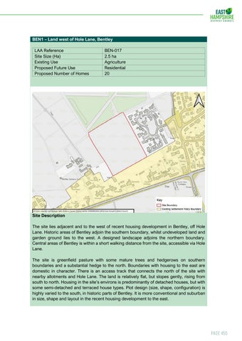
Site Description The site lies adjacent and to the west of recent housing development in Bentley, off Hole Lane. Historic areas of Bentley adjoin the southern boundary, whilst undeveloped land and garden ground lies to the west. A designed landscape adjoins the northern boundary. Central areas of Bentley is within a short walking distance from the site, accessible via Hole Lane. The site is greenfield pasture with some mature trees and hedgerows on southern boundaries and a substantial hedge to the north. Boundaries with housing to the east are domestic in character. There is an access track that connects the north of the site with nearby allotments and Hole Lane. The land is relatively flat, but slopes gently, rising from south to north. Housing in the site’s environs is predominantly of detached houses, but with some semi-detached and terraced house types. Plot design (size, shape, configuration) is highly varied to the south, in historic parts of Bentley. It is more conventional and suburban in size, shape and layout in the recent housing development to the east.
Page 455