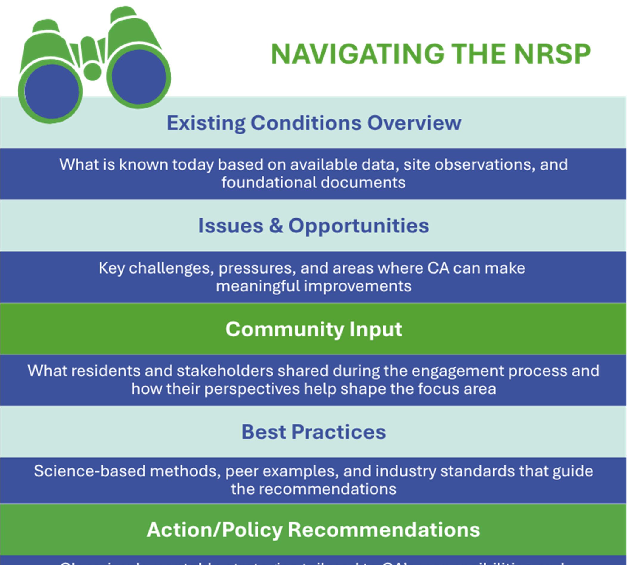
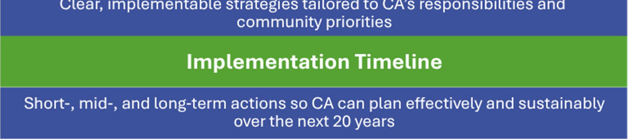
Grounded in Columbia’s NATURAL RESOURCE MANAGEMENT FOUNDATION and shaped through an INTEGRATIVE PROCESS, this plan amplifies WHAT WE HEARD from the community and guides the sustainable stewardship of CA resources, through clear AREAS OF FOCUS, and outlines the PATH FORWARD for CA’s bold 20-YEAR VISION to support a sustainable and thriving Columbia.
OVERVIEW
Purpose of the NRSP
Columbia, MD, is a uniquely planned community with an extensive network of natural and recreational assets, including over 3,600 acres of open space, 95 miles of pathways, three lakes, more than 40 ponds, and a diverse array of parks, play areas, and community facilities. These resources are not only central to the community’s identity but also vital to its environmental health, recreational value, and long-term resilience.
The commitment of Columbia Association (CA) to environmental sustainability is supported by a comprehensive Natural Resource Stewardship Plan (NRSP) that is visionary yet rooted in practical, sciencebased recommendations to provide strategic guidance for managing and enhancing CA assets. The NRSP builds upon existing foundational documents to create a unified, forward-looking 20-year vision that reflects best practices for the management of resources in Columbia’s natural and built environments.
Key Focus Areas
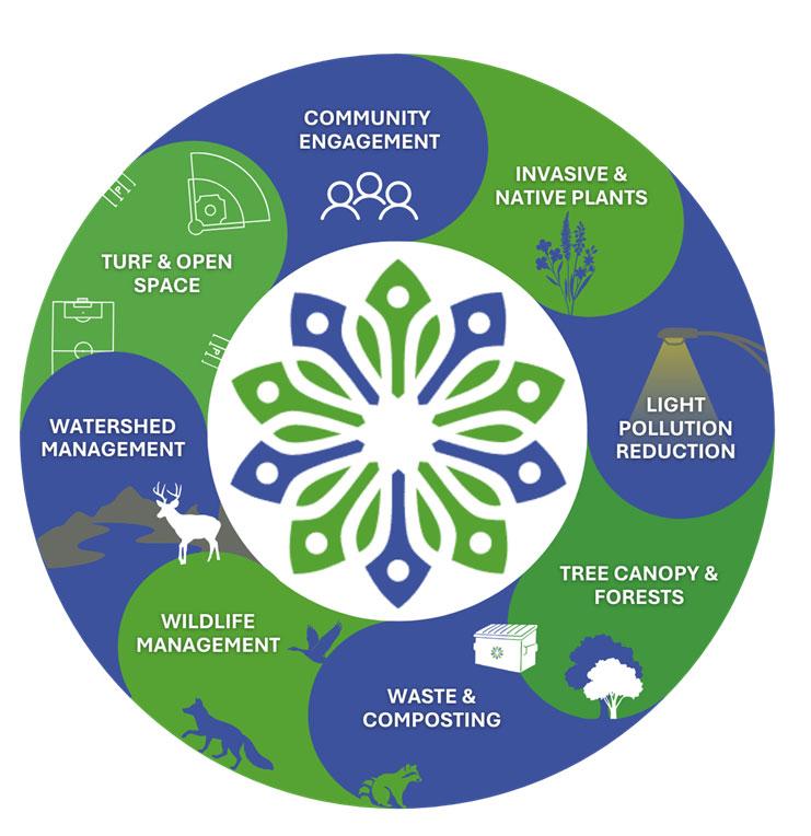
The NRSP is organized around eight key focus areas that reflect the most important natural resource issues identified through data analysis, staff insights, and community engagement. These areas represent major components of Columbia’s natural and built environment, highlighting how topics such as forests, wildlife, water, turf, waste, light, and community engagement are interconnected across CA managed lands. The circular diagram underscores this integrated relationship, illustrating that actions in one area influence outcomes in others and reinforcing the need for a coordinated, systems based approach to develop meaningful, focus area specific recommendations.
Columbia Association (CA) is a nonprofit community services organization dedicated to enhancing the health, wellness and quality of life of those who call Columbia home. CA’s mission is to engage their diverse community, cultivate a unique sense of place, and enhance quality of life.
Key Focus Areas of the NRSP
Community Engagement
Consistent and transparent messaging promotes sustainable ongoing communication between residents and CA. Existing outreach about CA events, volunteer programs, and educational opportunities can be leveraged to reach more people in the community at all age levels, using a variety of methods to engage a diverse audience.
Invasive & Native Plants
The Columbia community is knowledgeable and passionate about native plants (plants native to our area like the Black-eyed Susan) and invasive species removal (plants that are non-native like bamboo). Many residents participate in plant maintenance through Weed Warriors and other volunteer programs. CA leads by example, implementing landscaping policies that avoid use of invasive plants and promote natives. Combining these policies with community-based educational programming around invasives will help promote healthy ecosystems and habitats throughout Columbia.
Weed Warriors are community volunteers who work alongside CA to remove invasive species and improve the health of forests, pathways, and open space across Columbia.
Light Pollution Reduction
Light pollution has negative impacts on wildlife, ecosystems, and human health. Utilizing strategic lighting at night, such as including warm colors to limit disruptive blue light and shielding fixtures to prevent light trespass, can help limit these deleterious effects. CA can lead by example, through the establishment of a lighting plan for CA facilities. These guidelines should include using sensors and timers, shielding, downlighting, diffused lighting, and other strategies to mitigate contributions to light pollution. Combining these policies with community-based educational programming will support improved lighting practices, while meeting needs for visibility and safety.
Tree Canopy & Forests
The tree canopy is an often overlooked but critical part of a balanced ecosystem. Healthy forests and tree canopies help to provide shading and habitats, mitigate extreme temperatures, improve residents’ mental health, and reduce pollution. Columbia residents have expressed a strong desire to preserve mature trees, and a preference for thoughtful and intentional forest management strategies, especially with regards to the impacts of development projects. Residents have expressed a strong desire to preserve mature trees and to see intentional forest management practices.
Management of Turf & Open Space
Management of turf and open space, including the neighborhood greenspaces, and larger CA owned fields and facilities, helps bring the Columbia community together by providing spaces for gathering, recreation, and daily enjoyment. Maintaining the perceived value of these spaces contributes positively to community enjoyment and morale. Residents emphasized the importance of maintaining the natural character of Columbia’s landscape with a mix of traditional lawns and natural landscapes. This balance helps ensure that open space remains both welcoming for recreation and supportive of broader environmental goals.
Waste & Composting
Columbia participates in the composting and waste management programs managed by Howard County, which includes a robust recycling infrastructure and corresponding education programs. However, there are gaps in waste management that represent opportunities for improvement. Residents expressed a desire for more access to composting opportunities and better waste management at multifamily housing properties. By expanding school and commercial participation in both recycling and composting, CA can build on the strong waste management foundation. CA can evaluate waste streams at facilities and events to identify opportunities to collect compostable materials and establish requirements for vendors and waste haulers, to best align with county programs.
Watershed Management
Watershed management refers to the coordinated care of the land and water systems that drain into Columbia’s lakes, ponds, and streams. Columbia’s extensive and interconnected system of waterways is integral to the community’s identity. CA is committed to working closely with residents to maintain and protect these resources. While CA manages the lakes, ponds, and drainage systems within its own boundaries, it does not control regional hydrology, upstream development, or county and state regulatory requirements, making it essential to carefully evaluate the most effective and feasible tools for watershed management. Moving forward, CA can play a key role in helping residents understand watershed challenges, explaining when and why certain interventions are used, and involving the community more closely in decisions through open communication and collaborative planning.
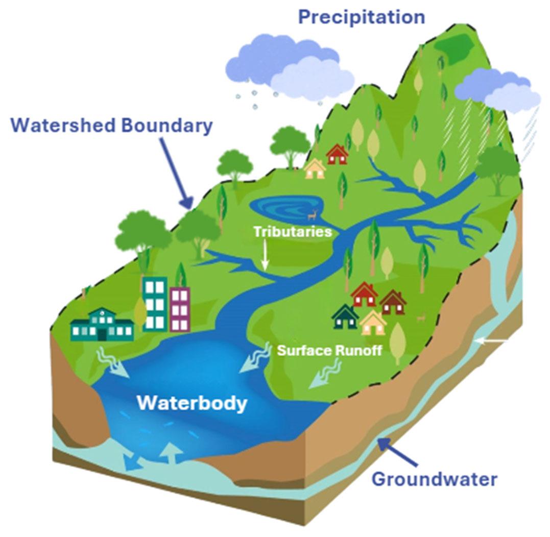
A watershed is the area of land where precipitation (rain and snow) eventually flows into the same waterbody (stream tributaries, ponds, lakes, or rivers). Water moves downhill across yards, streets, forests, and parks, collecting in small streams before joining larger waterways. Some water soaks into the ground and becomes groundwater, while surface runoff flows through neighborhoods and natural areas. Everything that happens on the land within a watershed affects the health of the streams and lakes downstream.
Image Credit: Adapted from NOAA
Wildlife Management
Wildlife management involves understanding and balancing the needs of animal populations with the health of natural areas, gardens, and community spaces so that people and wildlife can coexist safely and sustainably. Deer are one of the most visible and impactful species in Columbia, but a wide range of wildlife including fox, rabbits, songbirds, pollinators, bats, and small mammals, also play an important role in our community’s ecosystems. Some species, such as deer and certain ground-disturbing animals, can negatively affect vegetation and spread invasive plants, while others provide clear ecological benefits by supporting native plant reproduction, controlling pests, and contributing to biodiversity. Maintaining a balanced and sustainable wildlife population supports all other focus areas by protecting habitats and open space, promoting native plant growth, strengthening the tree canopy, improving community well-being, and contributing to healthy, resilient watersheds.
Deer are a familiar sight in Columbia, and an important part of our local landscape, but growing populations can negatively affect gardens, forests, and safety, underscoring the importance of balanced wildlife management.
How We Got Here
Developing a Comprehensive Natural Resource Stewardship
Plan
We Began with a Systems-Based Approach.
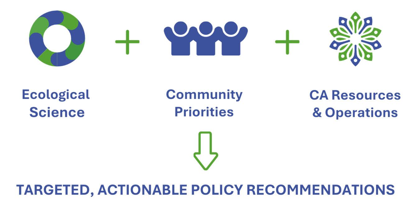
Strategic decisions made by CA relating to the management of their assets in one area of focus (such as wildlife management) may affect outcomes in others (like invasive species control). The NRSP was developed using a systems based framework that brings together ecological science, community priorities, and thoughtful planning to help guide what actions (i.e., policies) should be taken by CA, while recognizing how Columbia’s natural resources are connected and can benefit one another. CA’s assets and natural resources are not evaluated independently; instead, a systems based approach results in policy recommendations that minimize unintended consequences and help CA make informed decisions within the context of their assets. This approach ensures that recommendations support both environmental and community well being, while remaining practical and achievable over the 20-year horizon of the NRSP.
A systems-based approach recognizes Columbia’s residents and natural resources as part of a connected whole, where forests, streams, lakes, open space, wildlife habitat, and residents intersect.
Within this systems-based framework, existing CA data, plans, and policies serve as a starting point to document the current and historical contexts of CA assets and resources and identify natural resource issues/opportunities in support of developing targeted policy recommendations specific to each focus area. Policy recommendations refer to the targeted, implementable actions CA can take to guide decision‑making, resource allocation, and long term management of each natural resource focus area. The systems-thinking framework results in a comprehensive, 20-year horizon NRSP that strategically balances long-term sustainability with the current needs of Columbia.
We Listened.
Listening to the community was essential to shaping the NRSP, ensuring that the plan goals, priorities, and recommendations genuinely reflect the people who live and work in Columbia. Through community and stakeholder meetings, we heard directly from residents, village leaders, environmental practitioners, and partner organizations about the issues that matter most across Columbia’s natural and built environments. This feedback not only helped confirm the NRSP’s focus areas, but also influenced how goals were framed, which challenges were prioritized, and where the plan emphasizes transparency, education, and collaboration. The insights shared in these sessions formed a critical foundation for the NRSP’s system-based approach and guided the development of practical, community informed policy recommendations.
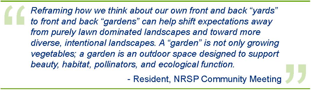
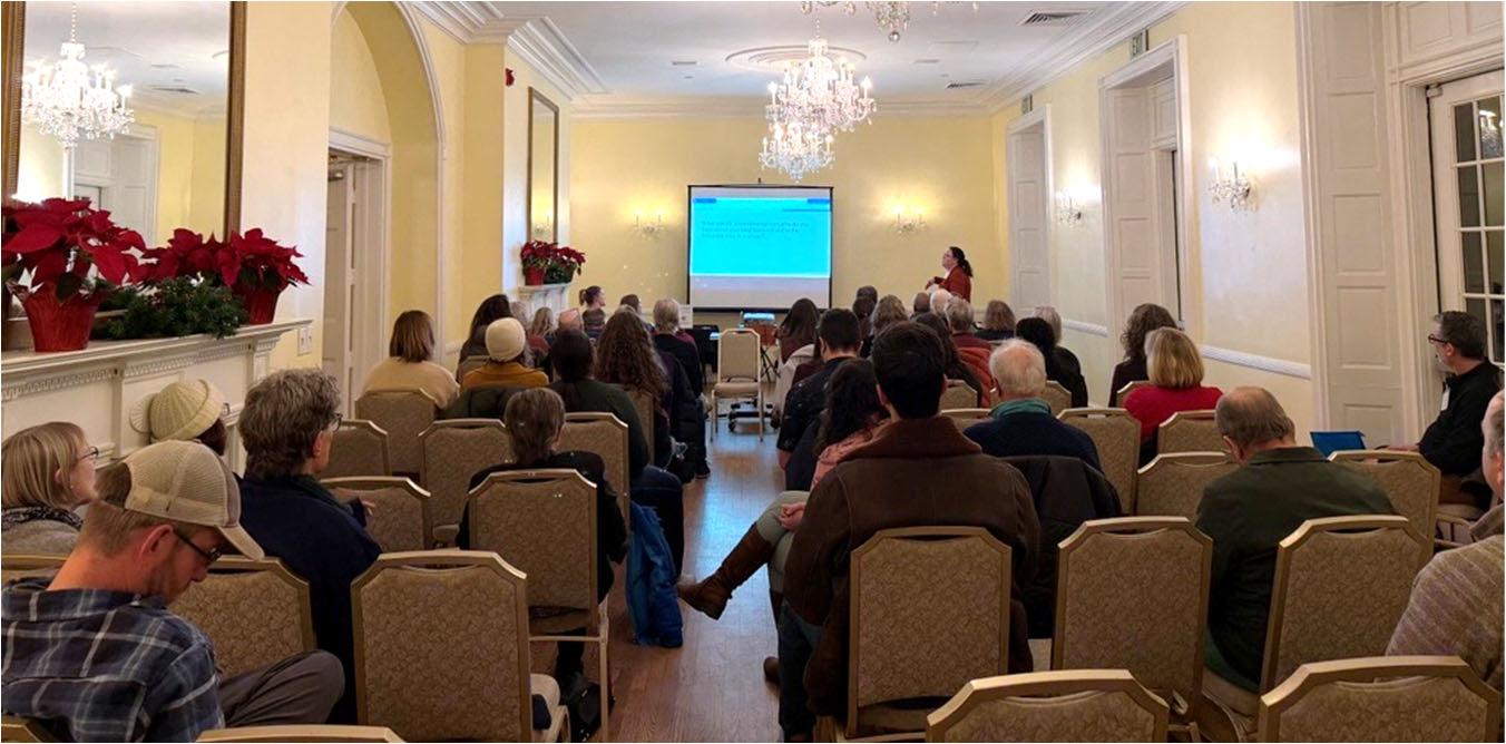
The community meeting served as an open forum where residents from across Columbia could learn about the NRSP, ask questions, and participate in facilitated conversations about natural resource issues affecting their villages. Residents shared a range of insights, calling for clear communication around project decision-making, expressing support for preserving Columbia’s natural character, raising concerns about invasive species and wildlife impacts, and highlighting opportunities for improved waste management, turf care, and watershed practices.
These conversations provided valuable context on what matters most to the community and revealed areas where CA can improve clarity, coordination, and engagement. The feedback gathered during the community meeting directly shaped the issues, opportunities, and policy recommendations outlined in the NRSP.
Residents came together for an opening presentation on the NRSP, setting the stage for deeper discussion in small group sessions and providing a shared foundation for understanding the plan’s goals, focus areas, and community driven approach.
The stakeholder meeting functioned as a more technical, discussion based workshop with representatives from village boards, environmental organizations, local agencies, and community partners. Participants reviewed early findings, reflected on operational considerations, and discussed how CA’s existing policies, partnerships, and resource constraints influence natural resource management. Stakeholders offered detailed input
on topics such as watershed decision‑making, invasive species control, wildlife impacts, maintenance capacity, and the role of education and volunteer programs. These conversations highlighted both alignment and areas of disagreement, underscoring the need for transparency, consistent communication, and a collaborative, systems based approach. The insights collected during the stakeholder meeting were incorporated into the refinement of recommendations, helped prioritize actions, and will continue to guide next steps in coordination, outreach, and implementation planning.
Stakeholders participated in a virtual meeting, reviewing topic specific feedback and providing detailed input on natural resource priorities.
We Translated What We Heard into Recommendations.
As the NRSP moved from listening to the community and stakeholders toward shaping actionable guidance, we translated the issues, opportunities, and priorities identified across all focus areas into a set of draft stewardship policy recommendations. This step served as the bridge between community input and the technical analysis that followed, ensuring that every recommendation was grounded in what matters most to the people who live and work in Columbia.
Each recommendation was then evaluated through ecological, social, and operational lenses.
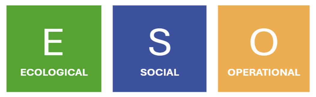
Draft stewardship recommendations were classified through Ecological, Social, and Operational lenses to reflect the key considerations CA must balance in managing its assets.
This Ecological lens reflects the extent to which a recommended action/policy contributes to environmental benefits and long‑term ecological integrity across CA managed assets. Recommendations with higher ecological value are those that strengthen biodiversity by supporting a wider range of plant and wildlife species, enhance habitat connectivity to allow ecosystems to function as linked systems rather than isolated fragments, and improve the overall resilience of natural areas to climate‑related stressors such as increased rainfall, temperature extremes, or changing seasonal patterns. Ecological considerations also include the potential to improve water quality through reduced runoff, erosion, and pollutant loading, as well as the promotion of native species to support healthy ecosystem function. Together, these factors help ensure that actions taken under the NRSP protect and enhance Columbia’s natural systems in a way that is sustainable over time.
The Social lens reflects the degree to which a recommendation aligns with community priorities and delivers meaningful public benefit. Recommendations with higher social value are those that respond directly to themes raised during community engagement, enhance public access to natural areas, and support education, stewardship, and awareness. Social considerations also include visibility and equity, ensuring that benefits are shared across neighborhoods and demographic groups, and that actions contribute positively to quality of life, neighborhood character, and community trust. By accounting for social value, the NRSP ensures that natural resource management strategies reflect not only environmental goals, but also the needs, experiences, and expectations of the people who live in and care about Columbia.
The Operational lens considers the feasibility, practicality, and long term sustainability of implementing and maintaining a recommendation within CA’s organizational structure. Higher operational value is assigned to actions that can be realistically supported with available staffing, equipment, funding, and partnerships, and that align with CA’s authority and responsibility over its assets. Operational considerations also include the complexity of implementation, regulatory requirements, lifecycle costs, and capacity for ongoing maintenance over time. By evaluating operational feasibility alongside ecological and social value, the NRSP supports recommendations that are not only well‑intentioned, but also achievable and sustainable over the long term.
We prioritized recommendations where needs best align.
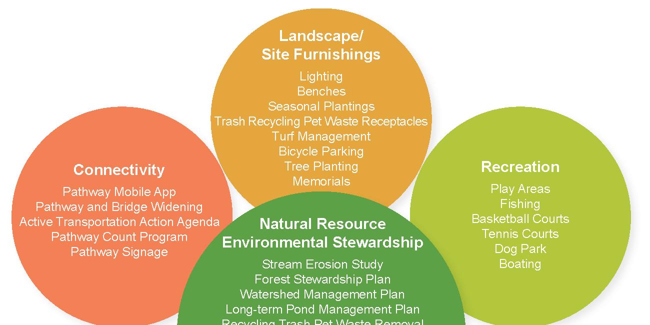
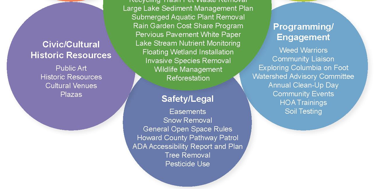
CA has a wide range of assets and operational responsibilities, and natural resource stewardship intersects with recreation, safety, connectivity, programming, and everyday maintenance across Columbia.
Image Credit: Columbia Association
Open Space Assessment Report
April 2017
Prioritization is not driven by any single factor, but by a comprehensive understanding of how ecological health, community priorities, and operational realities holistically support CA’s long term 20 year vision. By evaluating and classifying recommendations through Ecological, Social, and Operational lenses, the NRSP employs a prioritization process that integrates interdependence among natural resources and CA managed assets, providing CA with the ability to: identify actions/recommendations that deliver multiple benefits, understand tradeoffs clearly and with transparency, balance community expectations with operational feasibility, and prioritize investments that are both impactful and sustainable.
Each policy recommendation in the NRSP was evaluated using a consistent scoring method that applies three distinct lenses (ecological, social, and operational), each rated on a scale from 1 to 10. Together, these scores provide a balanced and transparent foundation for comparing recommendations and prioritizing actions that deliver the greatest overall value. O U R F O C U S
This heat map matrix shows the framework of the three lens evaluation, where each recommendation receives an ecological, social, and operational score. The approach provides a transparent method for comparing actions and identifying those with the greatest overall value.
The NRSP Focus Areas
The NRSP is grounded in eight priority focus areas that reflect the natural resource issues most important to CA and the community. These areas were identified through a combination of existing data, science-based best practices, and extensive community input, providing a framework to understand current conditions, interrelated challenges, and opportunities for improvement. By viewing each focus area through ecological, social, and operational lenses, the NRSP highlights where co-benefits exist, how different topics connect, and which recommendations offer the greatest potential to advance Columbia’s long-term environmental values and community priorities.
COMMUNITY ENGAGEMENT
Existing Conditions Overview. Community engagement reflects the shared values of accessibility, inclusion, and transparency of CA and interactions with residents. It focuses on identifying community partnerships while establishing multiple consistent avenues for collaboration and feedback between CA and community members and empowering all diverse communities in Columbia to be proactive and engaged in long-term stewardship and environmental learning experiences.
CA currently has two electronic newsletters, the biweekly Do More with CA and the bimonthly CA Digest, both keeping residents informed of upcoming events, updates, and volunteer opportunities. Current social media presence includes Facebook, X, LinkedIn, and Instagram. Blog posts covering a wide range of content have a regular cadence and posting on the CA website. Surveys have also been posted online by CA for community input for various programs and initiatives.
CA recognizes the importance of addressing disparities in access, representation, and participation across Columbia’s diverse population. A 2013 study captured the demographic and socio-economic characteristics and trends of Columbia and its villages: Columbia has high racial and ethnic diversity, with 25% of the total population identifying as Black or African American, 57% identifying as white, 11% identifying as Asian, and 8% identifying as Hispanic or Latino.1 Additional reports focus specifically on Columbia’s population of 55+ older adults and millennials born between 1983 and 2001. These profiles generated familiar key issues across both generations: limited transportation, affordable housing options, social isolation, and barriers to participation including cost, location, mobility, schedules, life events/lifestyles, and lack of social network. Challenges with existing CA infrastructure include accessibility barriers to facilities, pathways, and open space for older adults or people with mobility limitations, few permanent establishments for gatherings, limited scheduling that conflicts with work and commutes, and a disconnect between each group's communication styles and programming needs compared to current CA planning and outreach efforts.
Insights & Themes. Insights from community engagement and background review indicate several considerations related to how information is shared, promoted, and accessed across the community.
• Awareness of CA’s environmental programming differs across segments of the community
• Information about environmental programs and opportunities is frequently shared through newsletters and email, which may not reach all audiences
• Social media is used as a communication tool, with opportunities to improve consistency and effectiveness
• Coordination among villages in promoting and distributing events varies, affecting overall awareness
• Engagement approaches have established strong connections with some senior audiences, with opportunities to further strengthen relationships with both youth and seniors through expanded volunteer and stewardship programs that intentionally connect these populations
• Opportunities exist to enhance awareness of CA Board meeting activities.
• Outreach to multifamily housing communities is influenced by changes in property management and property management staff turnover
There are several opportunities for CA to address these key issues and common themes by leveraging existing outreach infrastructure as well as creating new engagement channels. Utilizing a variety of messaging options would improve outreach across demographic groups including communication through social media, mobile alerts, direct mailing, village board meetings, and village newsletters. A centralized communications system could help CA better coordinate outreach by bringing together newsletters, email, text alerts, mobile notifications, and social media into a single, easy-to-manage platform. Serving as a central information hub, this system would make it easier for CA and villages to promote events and for residents to stay informed and select how they wish to receive updates. The hub could also support orientation for new community members, increase awareness of educational and volunteer programs, share information related to CA Board Meetings activities, and coordinate outreach for in-person events, environmental education opportunities, and volunteer activities. In addition, CA could utilize this hub to coordinate outreach for in-person events, environmental education options, and volunteer opportunities.
Opportunities also exist for CA to facilitate inclusive, family-friendly events at varied times with a focus on environmental programs. Leveraging partnerships with established community groups, educators, and multifamily housing can help amplify messaging and increase proactive engagement and community input during the project development process. Existing community organizations such as Weed Warriors, Stream Waders, Columbia Community Care, scouting and youth organizations, schools, and camp programs already play an integral role in maintaining Columbia’s resources and assets. These organizations and programs connect directly with residents and their
families, so focusing outreach on these connections will help ensure that education and volunteer opportunities reach a broader swath of the Columbia community.
Lastly, providing Board Meeting summaries that offer clear communication regarding CA decisions supports stronger alignment between governance practices and community expectations for openness and trust. Consistent and accessible summaries not only strengthen organizational transparency but also help ensure that residents remain well informed about CA’s long term environmental and operational planning. Tools like MDEnviroscreen from the Maryland Department of the Environment, can be used to help identify target communities, using a variety of demographic and socioeconomic data, with environmental factors. It is also important to consider ADA compliance and accessibility guidelines, as well as translation needs, for the development of materials to effectively reach diverse audiences.
Community Input. Community members emphasized a preference for familyfriendly, in-person events and environmental programs that are inclusive of young children and older adults. Several current successful programs and volunteer opportunities were identified with community partners (Robinson Nature Center and the Columbia Community Care program), in addition to those operated by CA (Weed Warriors and Adopt-A-Spot).
Residents also expressed a preference for email communications as the best method for distributing CA information, announcements and events, specifically referencing CA village email newsletters. Community members also favor the use of informational QR codes at play areas, bike paths, and trails. Some residents requested alerts for CA activities, upcoming events, registration deadlines, and community issues such as flooding.
Multi-generational connectivity was noted as an important element of inclusive community engagement, as shared experiences can strengthen social ties, encourage knowledge sharing, and support long-term stewardship across age groups. Examples of environmental programs that foster this type of connection include:
• “Tech Buddies” or similar programs where youth volunteers help seniors with technology and devices
• “Nature Mentor” volunteer roles to provide a structured program where seniors serve as docents/mentors and youth support as junior interpreters or event helpers (e.g., Pull and Plant Events, Stream Waders, Weed Warriors)
• Native plant “Native Giveaway Day” short community event where residents pick up native plants, and youth volunteers help seniors carry materials, label plants, or assist with planting demos
Reaching residents across all demographics requires outreach and engagement approaches that account for language access, housing type, and varying levels of familiarity with CA programs. Feedback indicates that those with limited English proficiency (LEP) may be less likely to encounter or engage with environmental programs unless opportunities are clearly visible, culturally responsive, and connected to trusted, public‑facing spaces and activities. Examples of engagement include:
• Partnership supported volunteer days coordinated through trusted community organizations and nonprofits (e.g., Maryland Latinos United), schools, or service providers that already serve multilingual populations, using CA owned sites as the activity location while leveraging partners for outreach and communication
• Low text, visually driven outreach and wayfinding at CA facilities and along open space corridors (e.g., signage, icons, QR codes, or demonstration based activities that promote upcoming programs and volunteer opportunities
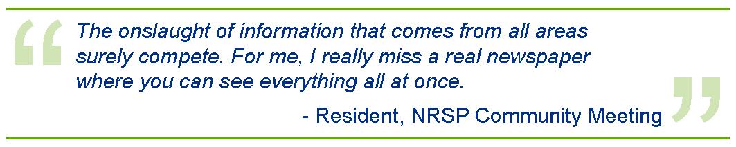
Feedback from survey respondents indicated that they were mostly aware of CA’s current community programs, including environmental outreach, educational activities, and volunteer opportunities. Most of these respondents also indicated they are active volunteers with CA, and almost all have used a public facility within the past year. It was also noted that effective engagement can be challenging due to the volume of information residents receive from multiple sources, making it difficult for environmental programs and engagement opportunities to stand out to residents with limited time and competing priorities.
Best Practices. To help ensure CA information reaches a broader audience, outreach and engagement efforts should be designed with accessibility in mind, including the use of multiple communication methods and attention to technology and language barriers.
Across all demographics, establish and implement inclusive, family-friendly events with a focus on environmental programs.
Maintain and enhance partnerships with current community groups, educators, and multifamily housing.
R.CE.4 Re-imagine CA’s Visitor Center.
Establish a communications hub for regular email distribution & multiple avenues of engagement to improve the efficiency and consistency of community messaging.
Identify and implement a regular cadence of events/programs to help CA reach and engage residents across all demographics. This includes opportunities that support intergenerational connection, LEP populations, and multi-unit housing developments.
Short-Term
Leverage existing partnerships to ensure inclusiveness and sensitivity to the concerns of all Columbia residents (e.g., partnership-led events, wayfinding). Short-Term
An amplified and re-imagined CA Visitor Center serves as a welcoming, central resource where both current and new residents can easily learn about CA programs, environmental initiatives, community services, and volunteer opportunities. By offering in person orientation, accessible information, and a consistent point of contact, the amplified center would better help integrate newcomers into the community and strengthen connections across Columbia.
Long-Term
INVASIVE & NATIVE PLANTS
Existing Conditions Overview.
Columbia’s natural areas support a range of native plant species that provide important ecological functions, including wildlife/pollinator habitat, soil stabilization, nutrient cycling, and resilience to disturbance. Native vegetation has evolved in balance with local soils, climate, hydrology, and species interactions, forming the foundation of healthy forest, wetland, and riparian systems.
Invasive species of non-native plants spread rapidly due to the absence of natural predators, high shade tolerance, and quick reproductive capacity, allowing them to “outcompete” native species. Both animal and human activity contribute to the spread of invasive species: seeds and spores may be unknowingly transported on fur, feathers, boots, mowers, and vehicles; dispersed through wildlife consumption; or unintentionally introduced through landscaping and other land use practices.
Several invasive species have been designated for Early Detection and Rapid Response (EDRR), a program targeting particularly problematic species in areas where populations are still limited. It is important to note that EDRR is not a CA-led effort, but a fundamental principle of invasive species management. EDRR efforts within CA’s open space system currently focus on a limited number of priority invasive plant species where early intervention has the greatest potential to prevent broader spread and long term ecological impacts. Targeted species include purple loosestrife, Japanese knotweed, and chameleon plant, with poison hemlock noted primarily due to human health concerns but not actively managed through EDRR given its widespread distribution. These species are primarily summer growing invasives, with effective species control typically occurring from July through early August.
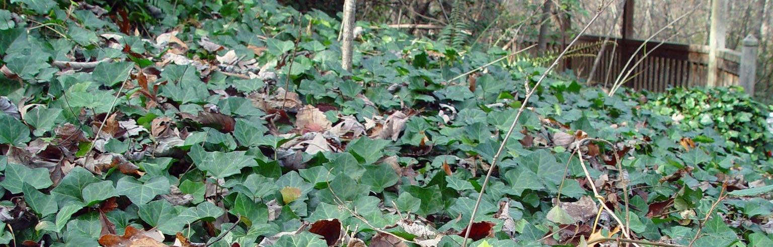
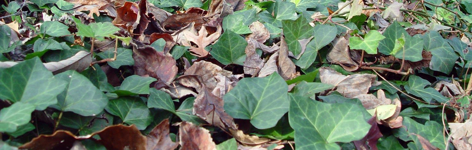
CA currently manages the spread of several invasive species, including English Ivy –a very invasive and hard to remove plant found throughout many landscapes and residences.
In many forested areas within CA’s open space system, invasive understory and vine species such as Japanese honeysuckle, English ivy, and wintercreeper are well established and widely distributed. These species form dense, persistent groundcover and climbing mats that suppress native species' growth and reduce plant biodiversity. By altering the amount of sunlight available, soil structure, and nutrient cycling, invasives disrupt and limit the capacity of forested areas to recover or sustain native plant communities over time.
Insights & Themes. Despite ongoing, active invasive species management efforts, infestations persist within CA’s 3,600 acres of open space. Management of native and invasive plant species occurs within a complex community setting, where ecological objectives, public expectations, and operational considerations intersect. Effective management should rely on research‑based practices and ecological principles to guide decisions over time. Invasives on CA assets are currently managed on a case-by-case basis, largely driven by individual project goals, resident requests, and asset protection needs.
Management of invasive species requires long-term commitment from CA Leadership. Invasive species are difficult to eradicate, and repeated treatments over multiple seasons and years are often necessary to reduce regrowth and support the recovery of native species. Establishing clear priorities and actionable strategies is essential to ensure a cohesive approach to invasive species management.
There are several opportunities for CA to effectively manage invasive species, with ongoing efforts strengthened by active community participation. Expanding CA’s volunteer programs, public outreach, and strategic partnerships can provide additional opportunities to support native habitat restoration and promote longterm ecological health. Existing programs such as Weed Warriors and Adopt A Spot can be scaled to train more volunteers, increase coverage across open space, and pair invasive removal with intentional native plant establishment. Enhanced educational outreach, including CA-branded plant identification tools, instructional giveaways, and interpretive signage, creates everyday entry points for residents to recognize and address invasive species on both public and private property.
Encouraging native landscaping through demonstrations, incentives, and coordination with nurseries can reduce the introduction of invasive ornamentals and build more resilient habitat across Columbia. Deeper collaboration with community partners, Howard County, Maryland Department of Natural Resources (DNR), and local educational institutions provide shared training
capacity, consistent messaging, and more coordinated landscape management. Native plant revegetation should be implemented as part of an integrated management approach, coordinated with invasive species control and ongoing monitoring. Post‑planting observation would allow CA to evaluate establishment success, identify areas requiring adaptive management, and adjust strategies to improve long term outcomes. Where revegetation is paired with education and volunteer stewardship, native plantings can also reinforce community understanding of ecological restoration goals and promote broader adoption of native species across the landscape.
Together, these opportunities create a multi layered, community supported approach that strengthens long term invasive species control and promotes healthy native ecosystems.
Community Input. Community members expressed concern with the presence of invasive species in Columbia and emphasized the importance of public outreach and education as part of effective management. Key takeaways from the community include:
• Intentional planting of invasive species continues to undermine invasive species management efforts
• Deer populations contribute to the spread and persistence of invasive species through seed and spore transport, intensive browsing/grazing that reduces native understory and regeneration, and preferential consumption of native plants that can give invasive species a competitive advantage
• Education and outreach were identified as critical components of successful invasive species management, including interpretive signage, accessible educational materials, and initiatives that promote native plant use such as plant giveaways and seed exchange programs
• Effective invasive species management requires an integrated approach that combines mechanical methods, targeted and limited chemical applications implemented with transparency and public communication, and biological strategies such as restoring and maintaining strong, competitive native plant communities
• Coordination among CA, Howard County, and State agencies is essential to align goals and management strategies
• A clear set of priorities and a targeted, strategic approach are needed to guide invasive species management efforts
Best Practices. Effective management of invasive plant species requires CA to take a long-term approach that combines prevention, early detection, control,
restoration, and community engagement. The following best management practices provide a framework for sustaining ecological health, supporting native biodiversity, and maintaining resilient ecosystems.
Prevention and Early Detection
Minimize Introductions
Early Detection and Rapid Response (EDRR)
Monitoring High-Risk Areas
Human Vectors
Avoid planting known non-native invasive species on private or commercial properties and promote native alternatives through outreach and incentives.
Focus monitoring and management efforts, with involvement from village Resident Architectural Committees (RACs), on species in locations that currently have limited distribution. Prompt detection and removal prevent population expansion.
Prioritize forests, wetlands, edge habitats, and stream corridors for management, as these areas are especially vulnerable to invasion.
Implement signage, educational campaigns, and cleaning protocols to reduce the inadvertent transport of seeds and spores via boots, equipment, and vehicles. Collaborate with Village RAC contacts for education and implementation of guidelines.
Integrated Control Methods
Manual Controls
Biological Controls
Chemical Controls
Hand-pulling, digging, cutting, and weed wrenching are effective for small populations or individual plants, particularly for herbaceous species, shrubs, and small trees.
Promote strong, competitive native plant communities to naturally suppress invasive species, improve ecosystem resilience, and reduce long-term management needs.
Apply herbicides selectively and transparently, ensuring treatments are targeted, limited, and follow all environmental regulations. Use chemical controls in conjunction with mechanical or biological methods.
Restoration and Habitat Enhancement
Native Plantings
Structural Diversity
Adaptive Management
Replace removed invasive species with site-appropriate native plants to stabilize soils, enhance habitat quality, and prevent reinvasion.
Incorporate a variety of native growth forms (trees, shrubs, herbaceous plants) to improve ecosystem function and provide food and shelter for wildlife.
Monitor post-removal areas and adjust restoration strategies as needed to ensure successful establishment of native vegetation.
Community Engagement and Volunteer Programs
Weed Warrior Program
Adopt-A-Spot
Educational Outreach
Resident Involvement
Train and certify volunteers to identify and safely remove invasive species.
Encourage volunteers to commit to ongoing management and native plantings in designated open space areas.
Expand interpretive signage, educational pamphlets, resource guides, and native plant giveaways to raise awareness and support responsible landscaping choices.
Promote removal of invasive species on private properties and use of native plants to reduce sources of reinfestation.
Partnerships and Collaboration
Collaborative Management
Clear Priorities & Strategic Planning
Coordinate with Howard County, State agencies, Howard Community College, and other community organizations to align goals, share resources, and implement consistent management strategies.
Establish specific, actionable objectives for invasive species management, including timelines, responsibilities, and monitoring protocols to ensure cohesive and effective implementation.
Monitoring and Adaptive Management
Evaluate Management
Effectiveness
Monitor and Adjust Techniques
Maintain Records
Regularly evaluate management effectiveness through surveys, photographic documentation, and population tracking.
Adjust management techniques, timing, and resource allocation based on observed results and emerging best practices.
Maintain centralized records of treated areas, control methods, and volunteer activities to guide future management decisions and demonstrate program success.
By integrating prevention, targeted control, native restoration, community engagement, and inter-agency coordination, CA can work to effectively manage invasive plant species, protect biodiversity, and maintain resilient open space ecosystems. Long-term commitment and adaptive management are essential to address the persistent challenges posed by invasive species.
Establish policy to prohibit the intentional planting of invasive species.
Prohibit intentional planting of invasive species on CA owned properties and within open space. Provide recommendations for RAC Guidelines to support standardized, science based native plant selection and management practices, and promote native alternatives through CA landscaping guidance, incentives for homeowners and commercial properties, and targeted public education campaigns.
Short-Term
No. Policy/Action Description
R.IN.2
R.IN.3
Conduct a program level assessment to identify priority invasive species management areas.
Conduct an early, high level assessment to identify priority invasive species management areas across CA managed lands. This assessment will establish a program wide prioritization framework that focuses resources on protecting intact, high value ecological areas (“defend the core”), while guiding the sequencing and scope of future, more detailed assessments and implementation planning at the village level. The intent of this effort is to provide strategic direction for invasive species management investments without pre determining site specific treatments or designs.
R.IN.4
Establish a formal Early Detection and Rapid Response (EDRR) program.
Define clear criteria for identifying priority species and high-risk areas. This program should include protocols for rapid response actions, including removal, reporting, and follow-up monitoring.
R.IN.5
Require the use of integrated management strategies.
Require the use of integrated management strategies, combining mechanical, chemical, and biological control methods based on species, site conditions, and ecological sensitivity. Implement transparent herbicide application policies, including public notification, signage, and restricted use in sensitive habitats, and ensure that native plant restoration follows invasive species removal to prevent reinvasion and promote ecological resilience.
R.IN.6
Expand community engagement and volunteerism through existing channels.
Support and expand the Weed Warrior and AdoptA-Spot programs, including training, certification, and recognition of volunteer contributions. Promoting community education programs, including signage, workshops, pamphlets, and native plant giveaways increase awareness of invasive species impacts. Encourage resident participation in both invasive species removal and the adoption of native landscaping on private and commercial properties.
Formalize collaborative agreements for invasive species management and the planting of natives.
Formalize collaborative agreements with Howard County, State agencies, Howard Community College, and other community partners to share resources, training, and expertise. Leveraging these partnerships is a critical component of coordination and will help align management objectives and reporting protocols across CA and partner organizations to ensure consistent, strategic invasive species management. Mid-Term
No. Policy/Action Description
R.IN.7
R.IN.8
Establish policy for a Systematic Monitoring Framework.
Require systematic monitoring and record-keeping for all treated areas, including invasive species populations, control methods used, and restoration success. Implement adaptive management practices, reviewing results annually and adjusting strategies based on effectiveness, emerging research, and community input. Establishing performance metrics and reporting mechanisms can help track progress, inform policy decisions, and communicate outcomes to the public.
R.IN.9
Allocate dedicated funding to CA’s operating budget for invasive species management.
Develop targeted, village level invasive species action plans using a “Defend the Cores” strategy.
Short-Term
Maintain and enhance existing funding and staffing capacity to support invasive species management activities, including monitoring, removal, restoration, and community engagement. As program scope expands or treatment intensity increases, additional dedicated or seasonal staffing may be required to ensure timely implementation, particularly for EDRR, follow up monitoring, and volunteer stewardship coordination. Funding may be supplemented through grants and partnerships to support large scale restoration efforts, education programs, and applied research initiatives. Mid-Term
CA should develop focused, village level invasive species action plans that provide clear starting points and prioritized steps tailored to each community’s open space conditions and forest structure. Using a “defend the cores” approach, protecting the highest quality interior habitats first and working outward from low invasion to high invasion areas, will allow CA to make meaningful ecological gains with strategic, lower effort interventions. Creating these localized plans will give villages practical guidance, support coordination with broader forest and wildlife goals, and help ensure invasive species management is both efficient and ecologically effective.
Mid-Term
LIGHT POLLUTION REDUCTION
Existing Conditions Overview. Light pollution is caused by the excessive use of artificial lighting at night, which disrupts normal darkness and causes negative impacts on human health and wildlife. Light pollution interrupts normal ecosystems, wastes energy, and results in increased greenhouse gas emissions.
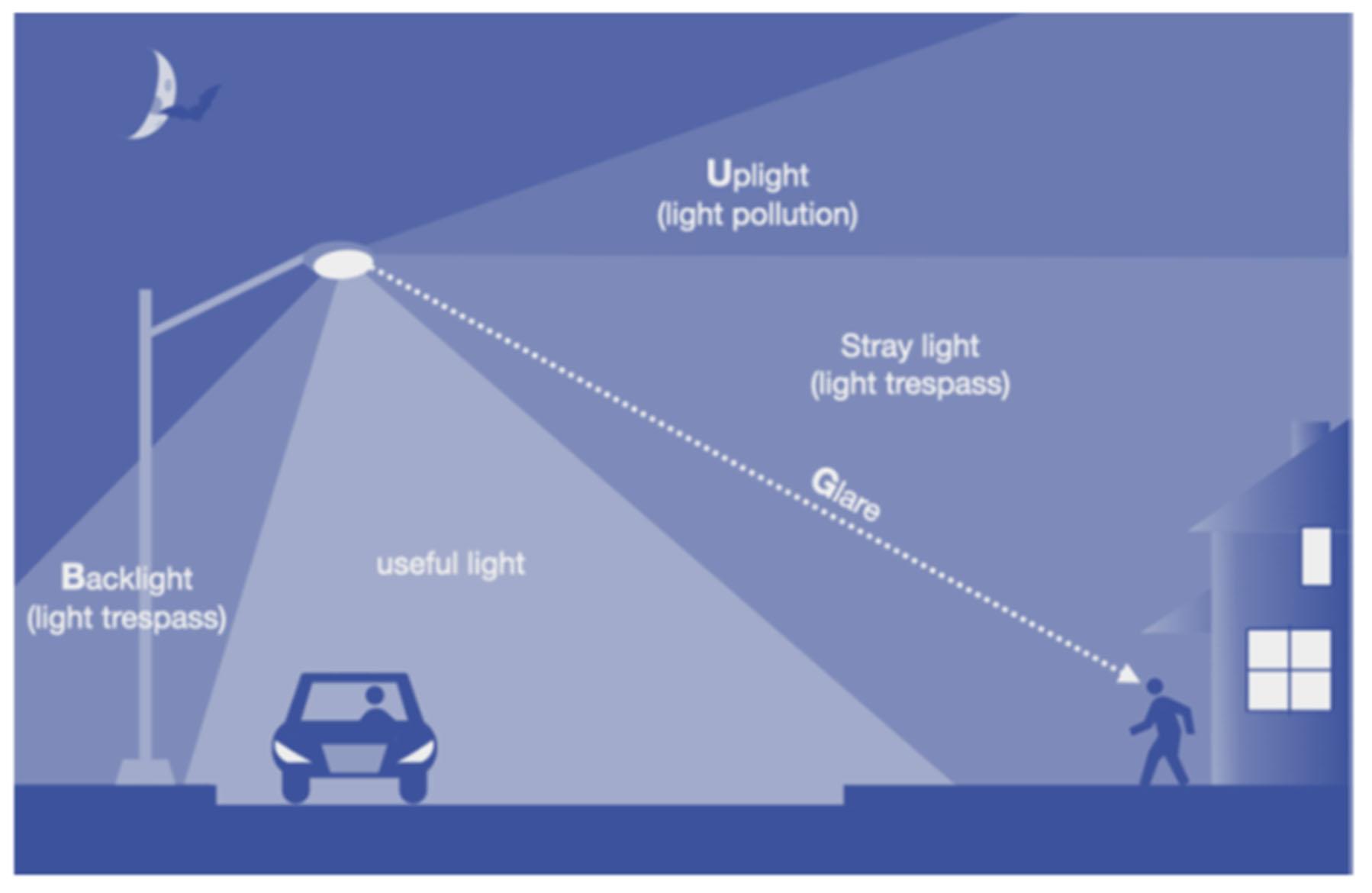
Light pollution can be categorized into varying types. Sky glow (uplight) involves the large-scale brightening of the sky, particularly over areas of intense development; it is exacerbated lack of shielding. Light-Emitting Diodes (LEDs) increase the effects of light pollution, as they tend to have a higher proportion of blue light that can spread further and create more extensive sky glow. Light trespass is the spread of light outside of its target area and into surrounding areas where light is not needed. This spread may occur between residential areas, from commercial into residential areas (or more rarely, from residential into commercial areas), or from commercial or residential areas into surrounding wilderness or wildlife habitats. Glare is created by excessively bright, poorly aimed or shielded lighting that can disrupt vision.
All types of light pollution are harmful to humans and wildlife. Glare, light trespass, and sky glow disrupt the normal human circadian rhythm by decreasing melatonin production, leading to increased risk for stress, depression, and anxiety. Decreased melatonin also heightens the risk of developing hormonesensitive health conditions such as diabetes, obesity, and cancer. In addition to longer-term health impacts, glare also poses immediate safety risks. Excessive brightness can decrease visibility at night, particularly for drivers and pedestrians, by decreasing visual contrast and obscuring obstacles.
Excessive lighting also impacts surrounding ecosystems and wildlife. Artificial brightness at night impacts animals’ normal cycles just as it impacts human circadian rhythms, which can destabilize ecosystems. For instance, brightness at night interferes with time-of-year cues animals rely on for breeding and migration, which can cause severe disruptions to reproductive cycles that decrease offspring viability and contribute to food scarcity. Light pollution induces early migration in birds and other migratory species and disrupts navigational cues. Birds use light to navigate, and can be easily confused by artificial light, leading to increased bird strikes and “trapping” of birds attracted to the light around heavily populated areas.
Along with health impacts on both humans and wildlife, excessive lighting wastes energy and increases greenhouse gas emissions. Further, the decreased visibility of the night sky detaches people from the environment; along with the negative psychological impacts this can cause, it creates more separation from the ecological impacts of human activity, further disconnecting us from the natural world.
In suburban communities like Columbia, light pollution is generally not as severe as it is in larger cities. Much of the sky glow in Columbia consists of spillage from Baltimore City. However, light trespass and glare can still cause local negative effects, and all efforts to decrease excessive lighting around a metropolitan area can contribute to overall reductions in sky glow. In suburban areas, it is also critical to find the optimal balance of reduced lighting with safety. Measures to reduce sky glow, glare, and light trespass should not sacrifice security needs or create unsafe conditions. However, as previously noted, excessive or poorly aimed lighting can decrease safety by creating blind spots and obscuring vision; thus, well-implemented light pollution reduction strategies can substantially increase community safety.
This nighttime satellite image shows concentrations of artificial light across the region, with brighter white areas indicating intense illumination in urbanized zones. Columbia’s location is marked, highlighting how surrounding development contributes to elevated light levels that affect nighttime visibility and ecological health Image Credit: NASA VEDA Dashboard
Columbia does not currently have a policy related to light pollution reduction, and there are no community-wide strategies to mitigate the negative impacts of light pollution in the community. Throughout this section, light pollution recommendations will prioritize the maintenance of community safety and security.
Insights & Themes. Although some sky glow in Columbia is unavoidable, the Columbia community can still take steps to reduce local light pollution and decrease Columbia’s contribution to sky glow. Due to the variety and scope of different types of light pollution, preventing it and addressing its effects can be challenging. For example, addressing a resident’s complaint about light trespass from a neighboring property requires a completely different approach than working to address diffuse sky glow throughout Columbia due to widespread artificial lighting at night. Despite these challenges, the diverse impacts of light pollution also offer a wide range of opportunities to address specific community concerns while maintaining safety requirements.
During the 2025 Maryland legislative session, the Maryland General Assembly passed House Bill 4522 (HB 452) to begin addressing light pollution statewide. This bill requires the Maryland Green Building Council (GBC) to develop updated guidance on outdoor lighting fixtures designed to reduce light pollution and prohibits the use of state funds to purchase lighting fixtures that do not meet light pollution reduction and general sustainability requirements for color temperature,
energy efficiency, and uplighting limitations. If passed, HB 452 will set precedent for light pollution reduction efforts at state, local, and neighborhood levels, and offers CA a unique opportunity to coordinate local lighting recommendations with guidance from the Maryland GBC. Additional provisions of HB 452 introduce purchasing requirements that Columbia Association can voluntarily incorporate into its lighting policies and recommendations, including the use of exterior lighting exclusively with a color temperature less than or equal to 3000 Kevlin (“warmer” colors with less blue light). Schools and community organizations such as the Columbia Association can also use HB 452 to educate students and community members about light pollution, security, and lighting strategies that are beneficial for both safety and light pollution reduction.
Community Input. Residents in Columbia expressed concerns about excessive lighting throughout the community in residential, commercial, and business areas, noting that light pollution can trigger and exacerbate migraines and disrupt their sleep patterns. Several residents were also concerned about the impacts of light pollution on wildlife. Specific examples shared by residents regarding light pollution and preferred methods for improvement include:
• Increased use of LED lamps for energy efficiency in recent years, which worsens glare
• Persistent night lighting in unoccupied outdoor areas (e.g. school stadiums lit even when unused, non-essential lighting in empty parking lots)
• Residential light trespasses, which is particularly an issue when it occurs on the border between villages, since light pollution complaints are handled internally in each village
• Creating a reporting system for light pollution issues
• Using motion sensors in low-occupancy areas, such as parking lots at night (this can both reduce light pollution and increase safety by illuminating suspicious activity in otherwise unoccupied locations)
• Increasing community education about light pollution and its effects
• Shielding streetlights, lamp posts and other community lighting
• Using warmer lighting whenever possible (i.e. temperature less than 3000 K) to reduce blue light and decrease light scatter
• Using diffuse ground lighting to replace direct downlighting
• Using timed lighting to decrease glare and light trespass at night
• Increasing community education efforts around light pollution and its consequences
Residents showed a clear preference for the use of motion sensors, improved light pollution reporting mechanisms, and increased education. Motion sensors came up frequently as a preferred method to reduce artificial lighting at night while maintaining safety. Residents pointed out that much outdoor night lighting is unnecessary. Motion sensors were viewed as the best way to reduce light pollution in public spaces, help the community recognize potential suspicious activity, and maintain safe lighting levels for minimally occupied areas at night.
Light pollution reporting was a concern for residents, noting that light pollution complaints used to be adequately addressed, but in recent years village-specific enforcement of directives to reduce light trespass has been ineffective. They also requested a method to report light pollution issues between villages. Current reporting mechanisms are siloed within each village, and residents expressed frustration about their inability to address several ongoing instances of light trespass from residential areas of one village into residential areas of a neighboring village. There was consistent interest in adopting community-wide lighting policies and coordinating with local HOAs and residential communities to enforce these policies. Residents also focused on the need for light pollution education in Columbia, expressing that many people do not recognize or understand the problem which makes it difficult to address. One resident noted that “many people aren't aware that this is a problem and feel a need for more light for safety reasons.” A community education campaign in both schools and community organizations like the Columbia Association would be an effective tool to teach residents about light pollution and safety optimization and promote understanding that more or brighter lighting is not always a safer option.
Best Practices. The Illuminating Engineering Society and International Dark Sky Association (IES/IDA) have established best practices and standards for light pollution reduction. These standards are summarized in their Five Principles for Responsible Outdoor Lighting3:
• All light should have a clear purpose
• Light should be directed only to where needed
• Light should be no brighter than necessary
• Light should be used only when it is useful
• Use warmer color lights where possible
These principles form the basis of the Joint IDA-IES Model Lighting Ordinance (MLO), which is a framework developed by IES/IDA to inform municipal outdoor lighting codes. It is used to inform many local and state lighting regulations
3 https://ies.org/advocacy/light-at-night/
across the United States. The Five Principles are also incorporated into ASHRAE/IES Standard 90.1, the International Green Construction Code (IgCC), and the Leadership in Energy and Environmental Design (LEED) sustainability certification system. Maryland House Bill 452 specifically addresses the Five Principles by requiring warmer color lights, shielding, and brightness limitations on all luminaires purchased with state funds. IES/IDA also created a DarkSky Approved Luminaires Program which recognizes lighting products that meet the Five Principles and categorizes each recognized product by its specifications into luminaires optimized for residential use, commercial use, pedestrian comfort, and wildlife protection. A database of DarkSky Approved luminaires can be found on the IES/IDA website.
Conduct an assessment of all outdoor lighting currently installed on CA property.
Conduct a review of all outdoor lighting currently installed on CA property and identify key areas where outdoor lighting could be modified to reduce light pollution. Potential modifications may include installing timers or sensors, provide more shielding, and eliminate unnecessary uplighting. This assessment would help CA identify priority areas for outdoor lighting changes.
R.LP.3
Implement an outdoor lighting purchasing policy for all CA properties.
Create purchasing guidelines for all outdoor lighting requiring that newly purchased outdoor lighting be DarkSky Approved or equivalent. Creating this purchasing policy also represents an opportunity for CA to publicly commit to voluntarily complying with the lighting requirements issued in House Bill 452 as well as the upcoming light pollution guidance to be issued by the Maryland GBC. In leading by example, this purchasing policy and lighting review would help raise awareness of light pollution and encourage Columbia residents to follow suit.
Short-Term
Develop and issue residential outdoor lighting guidance.
Issue residential outdoor lighting guidance to be included in the Resident Architectural Committee (RAC) across all Columbia villages and distributed to HOAs, neighborhood community organizations, and other residential leadership.
Mid-Term
Short-Term
No. Policy/Action Description
R.LP.4
R.LP.5
Create a central, Columbia-wide reporting system for light pollution issues.
Work with Columbia villages and Howard County government to create a central, Columbia-wide reporting system for light pollution issues. In collaboration with the Howard County government and Columbia village boards, establish a central mechanism for residents to report light pollution issues. Ensure the system is consistent across Columbia and provide actionable solutions to complaints, including light trespass complaints across village boundaries. The reporting tool should be online for accessibility like Howard County’s "Tell HoCo” portal. Alternatively, reporting could still be addressed by individual villages, but with new mandatory collaboration requirements for light trespass reported across village boundaries.
Long-Term
R.LP.6
Establish a light pollution education program for Columbia residents and youth.
Educational programming could include (but is not limited to): creation and/or presentation of Light Pollution education modules for local elementary, middle, and high schools, and educational flyers or leaflets issued to residents with their tax and water bills, or through established communication channels such as the CA newsletter and Columbia Community Care. These flyers or leaflets could also provide information about House Bill 452 and provide updates on lighting guidance from the Maryland GBC once it is issued. Ideally, educational information would be provided on an ongoing basis and updated as local recommendations and regulations change.
Mid-Term
Sponsor community events celebrating celestial events, such as meteor showers, visible planets, aurora borealis, comets, and eclipses.
CA sponsors events to encourage community engagement while providing opportunities to educate larger swaths of the public and promote awareness of light pollution. When possible and safe, encourage residents to turn off exterior lighting during the event. Use lighting at these events that is DarkSky approved or compliant and provide educational materials to participants about the celestial event itself, the negative impacts of light pollution, and how the types of lighting at the event help to mitigate light pollution. In the educational materials, provide actionable strategies that they can use to decrease their contributions to light pollution.
Mid-Term
No. Policy/Action Description
R.LP.7
Establish guidelines to use DarkSky approved outdoor lighting fixtures for replacements and new lighting as appropriate.
It is recommended that CA standardize guidelines to ensure outdoor lighting is consistent with DarkSky approved alternatives as existing luminaires reach the end of their life cycle.
Long-Term
TREE CANOPY & FORESTS
Tree canopy refers to the layer of branches and leaves formed by individual trees and forests that shade the ground, moderating temperatures and reducing runoff by intercepting rainfall. While the canopy is just one component of a tree, much like a roof is only one part of a house, the trees that create it are complex living organisms that filter air and water, provide habitat, and sequester carbon. Leaf litter beneath the canopy further supports ecological function by offering habitat for beneficial insects, feeding birds and wildlife, reducing erosion, improving soil moisture, and adding organic matter and nutrients as it decomposes. Together, these elements contribute not only to ecological health but also to human wellness, as exposure to trees and natural areas has been shown to reduce stress and anxiety.
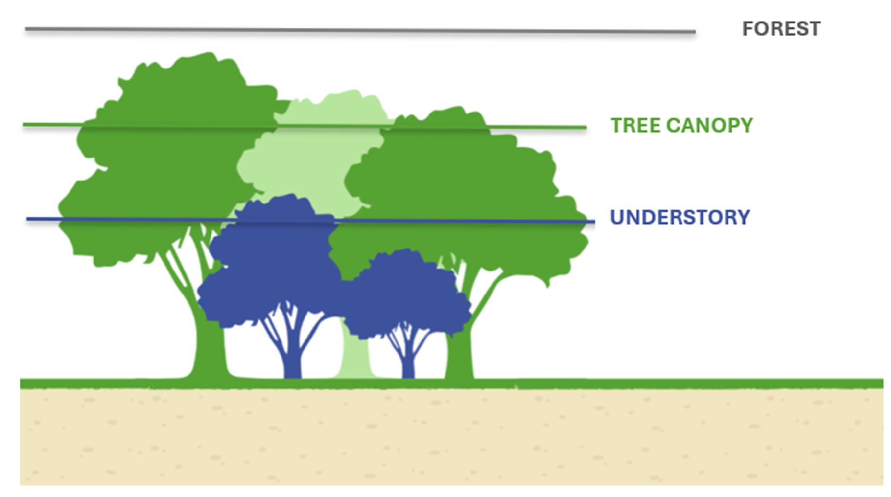
“Tree canopy” is the layer of leaves and branches formed by mature trees, while a “forest” includes multiple layers including the tree canopy, understory, and the ecological communities that exist within them.
These benefits increase substantially when trees are part of larger, connected patches rather than isolated individuals. In expansive stands, tree canopies and root systems knit together to form interior forest habitat with environmental conditions, such as cooler temperatures, higher humidity, and denser shade, distinct from surrounding areas. Once patches reach a certain size, they begin to function as true forests, with multiple structural layers including canopy trees, understory trees, shrubs, and herbaceous plants. This layered complexity
enhances habitat diversity, strengthens resilience to stressors, and enables forests to provide long-term ecological and societal benefits far beyond those of individual trees.
Existing Conditions Overview. Forest cover within Columbia is generally confined to open space, specifically in the 34 miles of stream valleys. In 2016, Maryland Department of Natural Resources (DNR) developed a Forest Stewardship Plan (FSP) for CA. This high-level plan delineated approximately 1,956 acres of woodland with fair to good growth potential. The identified woodlands were characterized as immature saw young timber dominated by yellow poplar, red maple, white oak with an understory invaded by Japanese honeysuckle and multiflora rose, and some native spice bush and viburnum species.
Outside of the forested stream valleys, the land use is mixed with few residual forest patches and a significant but fragmented mosaic of tree canopy consisting of isolated patches of trees, relict individual trees, and planted street and landscape trees. Howard County has conducted a countywide assessment of tree canopy which noted the following countywide trends in tree canopy cover from 2007 to 2018:
• Total forest cover and tree canopy declined
• Amount of land not suitable for planting increased
• Tree canopy loss not offset by regrowth; instead, it was largely replaced by impervious surfaces (e.g., roads, buildings)
• Fragmentation larger patches converted into smaller patches) is threatening the ecological integrity of remaining forest patches
CA has performed a Columbia-specific analysis using the same data and noted net losses of tree canopy in all villages except River Hill, which had a 0.17% increase in canopy cover. The losses in canopy cover occurred on lands characterized as residential and CA open space, while the increase in canopy cover in River Hill was largely attributed to residential land. Continuing to monitor and communicate trends in canopy cover can help engage residents in tree planting initiatives and garner support and show progress toward broader management objectives related to mitigating urban heat islands, wildlife habitat, underserved communities, and other focus areas.
Insights & Themes. Stressors to CA’s forest and tree canopy include:
• Forest Fragmentation – Development, roads, and utility corridors break continuous forest and canopy into smaller patches, which results in a reduction in patch quality
• Non-native Invasive Plants – Widespread presence of invasive plant species (e.g., English ivy, Japanese barberry, bamboo) impedes forest regeneration and threatens native biodiversity by occupying productive habitat and competing with the native plants that host and provide for local wildlife
• Pests – Non-native pests like emerald ash borer and beech leaf disease are selectively removing species from native forests, causing shifts in community composition and opportunities for non-native species to become established
• Deer Overpopulation – Over-browsing by white-tailed deer inhibits the natural regeneration of native understory vegetation and tree seedlings
• Encroachment from Adjacent Properties – Invasive species and yard waste from private properties are encroaching into CA-managed open space, complicating maintenance and restoration
• Limited Monitoring and Data – A lack of consistent, long-term monitoring of forest health and regeneration trends limits understanding of landscape level trends and the ability to proactively respond to emerging stressors
• Aging Tree Canopy – As forested areas reach maturity, all these stressors above limit natural regeneration, raising concerns about longterm canopy sustainability
CA’s 2016 Forest Stewardship Plan (FSP) documents overall management objectives relating to recreation and aesthetics, natural heritage, and soil and water conservation. Complementary to the FSP objectives, CA also seeks to minimize resource damage resulting directly from human activity. In support of these objectives, the FSP characterizes overall condition, high level stressors, generalized best practices, and some areas for action; however, the FSP lacks specificity on prioritized and measurable actions in support of these objectives and there is a gap related to managing the urban tree canopy.
Opportunities for the management of trees and forests, particularly in addressing gaps within the Forest Stewardship Plan’s overarching objectives, include developing Targeted Forest Management Plans for open space areas to identify site‑specific stressors, priority conservation zones, and restoration opportunities. Establishing an Urban Tree Canopy Program across both open
space and private property can help preserve and enhance canopy coverage through coordinated planting, maintenance, and stewardship efforts. The Urban Tree Canopy Program elements should include:
• Tree Canopy Assessment to be completed every 5 years to track the current canopy conditions against the 2018 benchmark, facilitate goal setting and prioritization, and provide a basis for tracking progress and sharing success
• Tree Canopy Management Plan that builds on the findings of the Tree Canopy Assessment to establish programmatic goals and objectives inform planting priorities, performance targets, and long‑term strategies for expanding and sustaining the canopy
• Ongoing Tree Canopy Monitoring and Adaptive Management to track canopy changes, respond to emerging threats such as pests or invasive species, and guide adjustments to management actions
Stewardship initiatives can further support these goals by engaging residents, volunteers, and community partners in tree care and forest enhancement. This includes offering technical assistance through Certified Arborists who can help residents make informed decisions about tree removal, assess tree health and risk, and recommend appropriate replacement species. Broader community education and engagement efforts, such as on lot stewardship programs, tree planting events, and volunteer maintenance activities, can strengthen public awareness, build community ownership, and expand collective capacity to protect and enhance Columbia’s tree canopy and forested landscapes.
Other management opportunities addressed more specifically within the recommended forest and tree canopy management plans include reducing stressors and threats to existing forests and canopy, expanding canopy cover to mitigate the urban heat island effect and strengthen landscape connectivity, and protecting riparian zones and other critical habitats. Additional opportunities involve infilling canopy lost to emerald ash borer and other emerging threats, as well as piloting deer exclosure approaches to encourage natural regeneration and inform broader deer management strategies. Restoring understory and shrub layers following reductions in deer pressure can further enhance habitat structure, while forest and canopy restoration efforts can be targeted to support wildlife habitat objectives. Management plans can also incorporate actions to preserve or expand standing and downed coarse woody material for wildlife use and prioritize practices that improve soil health and support the recovery of compacted or eroded soils. Additionally, strategies in other focus areas such
as invasive species management and wildlife management should align with and complement forest and canopy cover objectives.
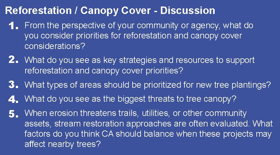
Community Input. Residents expressed a strong preference for conserving mature trees, since they provide erosion control, habitat and biodiversity, pollution reduction, microclimates and cooling, a sense of place, mental health and wellbeing, and other ecosystem services. Received comments noted that trees should be replanted reasonably near where they are cut, in high priority ecosystem areas, and where kids will see them and interact with them outside, such as in schools, parks, play areas, paths, and stream corridors. Specific target areas for tree planting include Elkhorn Fields, Lake Elkhorn, and Swansfield Park. Residents also expressed concern regarding threats to tree canopy and forest health, including deer, a lack of follow-up on plantings, a lack of oversight and encouragement of sustainable forest management, and pathogens and disease.
Strategies suggested by residents to address their concerns include implementing thoughtful tree replacement plantings after tree removal and ensuring all tree plantings include ongoing watering and maintenance until established. Tree planting event incentives, such as CA-provided tools like tree cages and gloves, adequate parking signage, and educational, and kid-friendly messaging were also recommended.
Best Practices. In the context of ecological and societal benefits, a tree is good, a patch of trees is better, and a forest is best. The same hierarchy describes a tree system’s resilience to climactic variables and other stressors. A forest is comprised of trees of different species and age classes; thus, if a disease or pest targeting one species or age class removes individual trees, the forest will remain intact and can regenerate from the remaining stock. However, if an individual landscape tree is affected, its value is lost when the tree is lost. A healthy forest is regenerative and resilient and capable of providing benefits in perpetuity.
Update the baseline assessment of the tree canopy.
R.TC.3
Develop a framework for stewardship initiatives in support of tree canopy and forest management plans.
Update the desktop canopy cover assessment every 5 years to establish trends in Columbia’s urban tree canopy cover that will support the development of targeted forest management plans (FMP). Short-Term
Build a clear plan for how CA will encourage and support residents, volunteers, and community groups in caring for trees and forests, through education, planting programs, maintenance support, and long term stewardship activities. Establishing an urban tree canopy program promotes the preservation and enhancement of tree canopy quality and coverage. Such a program should seek to maintain and/or expand a resilient urban tree canopy through assessment and monitoring, stewardship initiatives, and targeted tree planting.
R.TC.4
Develop a tree canopy management plan.
Develop a targeted forest management plan for up to two priority areas.
Develop a Tree Canopy Management Plan that defines performance criteria (e.g., increase canopy cover by x% in 10 years), establishes priority planting areas, and defines best practices and policies related to tree canopy objectives. Identify two priority areas for conservation and restoration. Short-Term
Develop targeted FMPs for the two priority areas identified in the Tree Canopy Management Plan that document specific stressors and conditions, identify priority areas for conservation and restoration, indicate opportunities for reforestation/afforestation, and support wildlife management objectives. Short-Term
R.TC.5
R.TC.6
Establish a framework for tree replacement/ retention rules.
Establish an approval process for individual tree or forest removal and a replacement requirement. This program would allow for the tracking of tree removals on CA managed land and establishes a standard for replacement. Examples of similar programs include the Maryland Critical Area Law that has a no net loss goal and the Maryland Roadside Tree Law that requires review of any tree care activities occurring on public road right-of-way.
Short-Term
R.TC.7
Implement a tree replacement/retention policy for CA open space.
R.TC.8
Establish a maintenance program for all tree planting sites.
Replacement should occur at the site of tree loss or a priority area in accordance with management plans if tree was removed due to a conflict. In addition, establish a maintenance program for all tree planting sites, including volunteer planting sites, to facilitate successful tree establishment.
Establish a maintenance program that includes a leaf litter management strategy that increases availability of high-quality litter (e.g., oaks) for wildlife use and soil health benefits and is compatible with other operational priorities like safety and aesthetics. To support existing forests, adopt and implement standard tree protection measures in accordance with International Society of Arboriculture guidelines when working under tree canopy.
Short-Term
Develop forest management plans for two additional priority areas.
R.TC.9
R.TC.10
Develop and implement a monitoring framework for forest management plans.
Implement strategies for developed recommendations and stewardship initiatives.
Implement Forest Management Plans for two additional priority areas. Mid-Term
Reassess canopy cover and update management plan(s) as needed and develop and implement monitoring framework for FMPs. Mid-Term
These initiatives are targeted toward private landowners and include technical assistance, education, and community engagement strategies to support management objectives. Implement strategies in Targeted Forest Management Plan first two priority areas; Implement tree replacement/retention recommendations for private property; Implement stewardship initiatives in support of tree canopy and FMPs.
Mid-Term
R.TC.11
Implement tree canopy monitoring and adaptive management.
Adaptive management is a strategy that uses monitoring results to inform future management actions. Reassessment of the tree canopy at plan milestones (e.g., every 5 years), can be used to track progress and adaptively manage emerging threats that could hinder progress (e.g., invasive species, pests, and diseases). Efforts include reassess canopy cover and update management plan(s) as needed; monitor areas under targeted FMPs and update plans as needed; develop targeted FMPs for remaining areas; Implement adaptive management strategies; operationalize strategies identified in management plans to support continued forest health; continue to implement and expand stewardship initiatives in alignment with plans and objectives.
Long-Term
MANAGEMENT OF TURF & OPEN
SPACE
Lush green acreage is one of the perks of living in Columbia, where nearly a quarter of the region is protected as community land. CA owns and maintains more than 3,600 acres of open space to provide opportunities for residents to enjoy the outdoors, live a healthier and more active lifestyle, and gather with friends and family.
CA has various existing programs and strategies to improve water quality, reduce stormwater runoff, remove invasive species, increase recycling, provide recreation and places for play, engage with the community to enhance environmental stewardship, host community events in open space, address wildlife management and protection, and enhance the natural beauty of Columbia.
Existing Conditions Overview. In 1965, the Howard County Government approved the New Town zoning district. The county created this special zoning district for the new town of Columbia, and building began in 1967. The New Town regulations require that a minimum of 36 percent of New Town‑zoned lands designated for open space use. Today, there are approximately 14,235 acres zoned for New Town, of which 38 percent are open space lands.
CA owns 3,577 acres of land in Columbia, and more than 99 percent of these lands are comprised of natural or open space areas. Open space is broadly defined as undeveloped land preserved to protect the environment, provide recreational space, or serve other public uses. While CA owns a sizable portion of the community’s open space zoned New Town, there are other landowners who also own significant areas of open space, the largest being the 1,021 acres of the Middle Patuxent Environmental Area located between the Columbia villages of Hickory Ridge and River Hill. This area is maintained by the Howard County Recreation and Parks Department in a cooperative partnership with the Middle Patuxent Environmental Foundation.
People enjoy walking, biking, fishing, boating, kayaking, bird watching, picnics, events, and more throughout Columbia. Within such facilities and open space, CA manages and maintains large areas of turfgrass along pathways, sidewalks, and buildings for aesthetics and safety sightline distances, as well as mowing of acres of turfgrass in open space, which includes large fields and areas around
lakes and forest stands. CA also maintains and mows some state‑ and county‑ owned roadway medians and community gateways.
All residential areas and most employment and mixed‑use areas are near open and natural areas. This development pattern, and the extent of the open space holdings, distinguishes Columbia from other communities. These lands provide health, recreation, aesthetic, ecological, and community cohesion benefits that contribute to Columbia’s quality of life.
Plans, policies, and management practices guide CA in its oversight of its open space. However, these plans, policies, and protocols have not been recently evaluated to determine whether updates are needed to support CA’s open space stewardship, particularly related to mowing practices. In addition, there is limited public understanding of open space composition and the location and scope of CA programs and investments. For instance, while many know the mileage of CA’s pathway system, few understand the proportion of open space lands that are forested, the extent and distribution of landscaped and mowed areas, or the location of rain gardens implemented through partnerships with residents, even though portions of this information are already documented through CA Landscape Services.
Insights & Themes. There are several options to best utilize open space for community benefit. CA has made significant strides to better understand its open space, relative to a diverse set of recreational activities and maintenance costs that consider sustainable management practices balanced with current and future community needs.
CA uses pesticides carefully and sparingly to maximize the safety of team members and residents and to minimize unintended environmental impacts. CA staff use current, research-supported best management practices, including herbicides for invasive weed control in natural, un-mowed areas. However, turf management standards for most of CA’s managed open space do not call for the use of insecticides, fungicides, or other pesticides. For landscape plants, most issues are addressed through careful plant selection, placement, and sustainable horticultural practices. Neonicotinoid pesticides are not used by staff. It should be noted that golf courses are maintained under a different set of standards and agreements that best serve the grounds and patrons.
While CA owns and manages its open space lands, community members also have a strong attachment to this open space, particularly to those areas close to home and those used frequently. These deep connections can encourage
community members to actively engage in stewardship activities and advocate for the places they cherish.
Opportunities also exist to establish a Pollinator Habitat Plan to restore and manage habitats that support bees, butterflies, and other threatened and impacted pollinators by:
• Using native plants in mitigation and planting designs for development projects
• Establishing perennial wildflowers and meadow grasses to provide:
o Stable food sources;
o Nesting locations; and
o Overwintering sites for pollinators
• Installing educational signage, including QR codes, about pollinators and their habitat for public knowledge and learning opportunities
• Using social media to promote pollinator habitat awareness and pollinatorfriendly practices for public understanding
• Providing a network of pollinator habitats and connecting green spaces
• Utilizing funding opportunities that support pollinator habitats, native plants, and invasive species control
Site search criteria for the establishment of native meadows and pollinator meadows involve the following considerations:
• How much of the area is currently covered by flowering plants? Are any of these flowering plant species key pollinator plants? Are any of them noxious or invasive weeds that need to be controlled?
• If there are already non-weedy herbaceous flowering plants (forbs), shrubs, or trees at the site, is it possible to enhance rather than replace the habitat?
• Are there nearby areas that might be used as nesting habitat for bees? This may include downed wood or snags, bunchgrasses, brush piles, old rodent burrows, or hollow stems.
• What are the land uses of adjacent sites? What weeds are present and what pesticides are used there that might affect the project site?
• Are there high slope areas where erosion may result from disturbing soils?
Community Input. Residents in Columbia expressed concerns about the use and safety of open space owned by CA. Specific examples of areas of concern include:
• Traditional lawns versus natural landscapes
• Safety features
• Pesticide use
• Recreational use
• Ecosystem services including habitat, biodiversity, shade from trees, stormwater flow, and native versus nonnative plants
• Aesthetics and materials
• Maintenance
Preferred methods to address the concerns listed above include:
• Implementing mowing criteria for recreational areas and for sightline safety setback distances
• Continued use of recreational open space
• Designated areas for establishing meadow
• Multigenerational features to expand beyond play areas
• Safety patrols in open space
• Replacing some areas of turf with pervious pavement in areas requiring paving
• Tree plantings in open space for shade opportunities
• Educational QR codes explaining ecosystem services and plant knowledge
• Regulations for playground materials to incorporate more natural materials such as woodchips and permeable bases
• Maintaining open space that is already there instead of adding more
Most community members preferred meadow establishment and reduced mowing of turfgrass. Residents also would like dedicated recreational fields with turfgrass within each village center for recreational sporting activities. Although some residents requested more turf in recreational areas, most residents showed a preference for reduced turf in areas not intended for recreational use, since turfgrass offers little ecological benefit and can lead to issues with stormwater runoff due to lack of water infiltration. Ecologically, nonnative turfgrass offers little benefit and takes away habitat from native species. Reducing the number of areas of routinely mowed turfgrass will lead to less compaction in soil as mowers will not be going over the soil multiple times to maintain it. Less mowing would also lead to decreased carbon dioxide and air pollution from gas-powered mowers.
Community members saw benefits of reducing turf areas including:
• Benefits for pollinators and wildlife
• Lower maintenance and costs
• Decreased erosion
• Reduced pesticide runoff
• Mental health benefits
• Carbon sequestration
• Reduced stormwater runoff
• Cooling effects from shade on microclimate
• Native vegetation opportunities
Best Practices. Best practices and standards for converting turf into pollinator meadows can be used throughout non-recreational areas in the community. Pollinator meadows provide habitat for important pollinator species, as well as the following benefits:
• Native plant community establishment
• Stormwater management
• Erosion reduction
• Carbon sequestration
• Healthier soil and ecosystems
• Natural landscapes along roadsides and medians
• Reforestation of degraded areas in open space with climate resilient species that are native to the area
Successful implementation of pollinator meadows requires recognition of groundlevel constraints, including persistent invasive species pressure and impacts from deer browsing/grazing. As such, meadow conversion efforts are most effective when coordinated with integrated invasive species management, adaptive maintenance practices, and complementary wildlife management strategies to ensure long term ecological function and resilience.
What makes a healthy pollinator meadow: mostly wildflowers, a small amount of native grasses, and special plants like milkweed that help monarch butterflies thrive. Image Credit: NCPC, referencing the USDA’s Maryland Conservation Planting Guide
Converting some of CA’s open turf spaces into pollinator habitat will require site preparation and pollinator-friendly practices. Methods used to prepare the site will depend on the existing site conditions. For sites that were historically native meadows, trees and brush removal may be enough to promote flowering plants that had been suppressed by shade. Converting turf sites to pollinator habitat requires more work because of the high density of low diversity grass species. In this case, close mowing, using herbicides to control the grasses, and drill seeding or overseeding with a pollinator mix may be necessary to allow the pollinator plants to establish.
Other local jurisdictions in the region already use meadow planting best management practices. Meadow planting and the creation of conservation landscapes help with stormwater management used in residential and urban landscapes. They use the conversion of turfgrass lawn to perennial native meadows as a best management practice, including:
Less required maintenance:
• Once established, meadows are generally mowed once a year, thus contributing less to exhaust emissions, gas, and energy usage
• Fertilization, herbicide, and pesticide applications are not needed, unlike turfgrass which requires these supplemental nutrients and chemicals to maintain its desirable lush and thick condition
Increased biodiversity and aesthetics:
• Meadows are comprised of a mix of native grasses and wildflowers, creating greater biodiversity of plants and associated wildlife benefits such as cover, forage, and pollinator opportunities
• Various flowering periods of the diverse meadow plant species support a greater diversity of birds and pollinators throughout the year
• Diverse plant types both in size, texture, and color provide an aesthetic quality not achievable from monotypic turfgrass lawns
Improved water quality:
• When strategically located between nutrient and/or pollutant sources such as lawn, downspouts or impervious surfaces and a receiving waterway or swale, meadows can help prevent nutrient run-off to storm drains and/or waterways by removing up to 39% of nitrogen and 25% of phosphorus4
4 Case studies associated with lawn conversion can be found at: https://extension.umd.edu/resource/converting-lawns-diverse-landscapes-case-studies
Develop a Pollinator Habitat Plan to guide the creation, enhancement, and long term management of pollinator habitats across CA managed lands. The plan would establish clear goals, siting considerations, and high level standards for pollinator habitat implementation, while coordinating with invasive species management, turf practices, and wildlife management efforts to support sustainable, functional pollinator systems over time.
Short-Term
R.TM.2
Establish pollinator habitats and meadows in open turf areas.
Each village should establish 1–3 pollinator meadow patches, focusing on locations where reduced mowing is already feasible and where long term maintenance can be sustained. In general, individual meadow patches should range from 0.25 to 1 acre, with larger areas pursued where site conditions, invasive species pressure, and deer management strategies support successful establishment. The goal is to reduce mowing and increase native meadow establishment and pollinators, while identifying area(s) within village centers to keep recreational sports turfgrass fields accessible to users in designated areas, while also reducing the mowing overall in the open space to promote pollinators and meadows.
Mid-Term
No. Policy/Action Description
R.TM.3
Control meadow plant ratios and use intentional planting practices.
Establish standards for creating and maintaining high quality pollinator meadows by requiring the use of diverse, site appropriate seed mixes; setting minimum species diversity targets; and implementing dormant season mowing and maintenance practices that support pollinator habitat. The seed mix shall prioritize wildflowerdominant compositions (85–90% wildflowers and 10–15% native grasses), maintain a minimum 3:1 forb to grass seed ratio, and ensure continuous bloom from early spring through late fall. This includes butterfly host plants (such as milkweed) and bunch grasses that support nesting insects and birds and incorporate annual species during establishment to provide first year floral resources and weed suppression. Customize seed mixes to reflect geophysical zones, site conditions, and rare species needs. During the dormant season, mow meadows to approximately 8 inches to maintain hollow stems for overwintering habitat, control woody encroachment, and support natural reseeding. Expand the use of milkweed to simultaneously enhance pollinator habitat and suppress Spotted Lanternfly populations.
Short-Term
No. Policy/Action Description
R.TM.4
R.TM.5
Reduce mowing practices in turf areas and plan the timing and location of mowing.
Implement intentional mowing practices that prioritize ecological outcomes by shifting away from traditional schedules that cut native forbs during peak bloom. Between May and August, limit mowing to targeted spot mowing and/or spot herbicide treatment of invasive species, while scheduling the annual full meadow mow during the dormant season after native forb seeds have dispersed. Establish mowing zones using standardized slope-based criteria: areas 2:1 or steeper should be naturalized and not mowed; areas 3:1 to 5:1 shall receive reduced mowing to support meadow and pollinator habitat; and areas 6:1 or flatter may be routinely mowed where recreational use requires it. Apply additional siting criteria that account for adjacent vegetation and land use, prioritizing reduced mowing where turf abuts forests or pollinator habitat and maintaining access only where needed for recreation, pathways, or water features. Within village centers, clearly delineate turfgrass recreational areas that are flat, accessible, and proximate to parking, while transitioning surrounding non recreational turf to meadow or naturalized habitat. Use GIS based analyses and spatial planning tools to map and refine these mowing zones, ensuring consistent implementation across CA managed open space. Related to R.WI.1.
Long-Term
R.TM.6
Maintain recreational space and improve area utilization.
Naturalize slopes in areas that are not being utilized due to grade.
Evaluate use of designated recreational areas to determine if under-utilized turf areas can be converted to pollinator habitat around recreational spaces. Incorporate natural materials such as woodchips and permeable pavement in areas where appropriate.
Most recreational areas such as sports fields are flat. In areas that are sloped but are being maintained, naturalize the areas and increase pollinator habitat.
Long-Term
Short-Term
WASTE & COMPOSTING
Waste encompasses trash and recyclable materials while composting focuses on converting biodegradable materials like leaves, fruit peels, coffee grounds, and plant cuttings into a beneficial soil product instead of sending it as waste to a landfill. Waste and composting involve the handling of everyday materials that are disposed, recycled, or collected as organic matter across the entire Columbia community, including in CA managed facilities, parks, pathways, event venues, and open space. This includes waste produced by residents and visitors while using CA amenities, household waste and yard materials, and waste generated directly by CA staff through maintenance activities, landscaping work, event operations, and facility management.
Columbia’s waste generation occurs across both public and private spaces that are managed through a mix of County systems, villages, and CA operations. Effective waste and composting practices depend on consistent systems, clear signage, and simple sorting guidance that residents, visitors, village boards, and CA staff can all follow. By helping the entire community sort materials correctly, CA can reduce environmental impacts (e.g., less contamination of recycling streams, reduce landfill volume/emissions, etc.), support village‑level sustainability efforts, strengthen alignment with Howard County programs, and create a more intuitive and environmentally responsible waste system.
Existing Conditions Overview. CA currently operates with a standardized recycling system. Most solid waste, recycling, and organics services, including the “Feed the Green Bin” pilot, are managed by Howard County for many residential and commercial areas in Columbia; however, CA facilities themselves are not eligible to participate in the County’s organics program, so CA’s facilities, recreational centers, parks, and events do not have regular access to composting or standardized recycling systems.
Maryland HB264, “Solid Waste Management – Organics Recycling and Waste Division – Food Residuals,” came into effect on January 1, 2024, and requires “large food waste generators” producing one ton or more of food residuals weekly to divert these organics if the facility has available capacity and is located within 30 miles of the generator. Per the regulation, large food waste generators include schools, supermarkets, business and institutional cafeterias, food manufacturers, and others that generate at least one ton of food residuals per
week. CA will need to evaluate their facilities to determine whether any are required to comply with this regulation.
Howard County requires recycling receptacles for special events, office buildings, and multifamily housing ("Howard County Code/Code of Ordinances, Title 18Public Works," §18.612; §18.613; and §18.611). However, these code references do not include requirements for composting receptacles, and CA does not currently have an official composting policy for facilities and events. Stakeholders have also noted the lack of composting bins at CA events.
During the Stakeholder Meeting, residents noted that there are existing programs providing resources, outreach, and services to support waste management and composting, which are available and accessible to the public, such as the Howard County Bureau of Environmental Services. Howard County also has a “Zero Waste Events Guide” with recommendations for compostable food ware, waste sorting stations and signage, and vendor education and requirements. However, incorporating contract requirements with vendors and waste haulers may raise costs for special events.
CA facilities are not currently eligible for Howard County’s Feed the Green Bin composting program. However, Howard County’s HoCoGro Compost is used in parks and gardens, and the county’s Climate Forward Plan (2023) also links composting to methane reduction and circular economy. If composting is feasible and implemented at CA facilities, it can be integrated into existing landscaping and maintenance, turf restoration, tree planting, stormwater BMPs, community education and/or community programming. CA can consider promoting the county’s pilot programs at high-use facilities to promote public education and build momentum and public support.
As an alternative, CA can consider engaging the community through public education or incentives to promote proper disposal of food scraps and recyclables. By correctly identifying waste types, recyclables, and compostable materials by community members at the source, this eases the strain on waste collections, operations, and management at CA facilities. Proactive planning for bin distribution and maintenance also increases recycling and composting participation.
Insights & Themes. Waste management is a universal issue that is not unique to Columbia. There are opportunities to learn from the strategies and successes of other similar communities in Howard County, Baltimore, and other areas of Maryland. The most common issues within CA as noted by community members include inconsistent program management, lack of smaller-scale composting options for residents, and inadequate education.
At the county and CA management level, there is no consistent communication across villages with different processes for managing waste, and program changes are not always clearly communicated to residents. Typically, there are only one or two bins for trash and/or recycling and no third bin for biodegradables. Additionally, there are sometimes few or no CA collection stations or bins for landfills, compost, and recycling.
There is sometimes confusion from inconsistent signage or guidance for participation throughout Howard County. For composting, one resident noted that county compost collection is not accessible to all households. Clarifying acceptable food waste and yard waste is a main concern with recycling and composting contamination. At bins or collection areas, community members also noted unclear instructions for processing collections and acceptable items for recycling or composting; for example, ambiguous descriptions refer to “small amounts, clean, etc.” Specific instructions were also lacking for cleaning and sorting various material types for curbside collections. The feasibility and cost effectiveness of recycling along bike paths was also a concern.
Several challenges currently limit the effectiveness of waste and composting practices across CA‑managed spaces. CA facilities do not have an internal composting program and are not eligible to participate in Howard County’s Feed the Green Bin program, which creates an immediate gap in organics diversion. There may also be barriers to participation due to unclear or inconsistently communicated instructions for waste, recycling, and composting processes throughout the County. Unclear or inconsistent bin signage and labeling, which reduces proper use, contributes to contamination. Broader compliance, adoption, and enforcement of waste reduction legislation, such as the Bottle Bill (HB0232) and HB264, also pose challenges, as community members may be unaware of requirements or lack support to meet them. Finally, issues such as littering and the illegal dumping of items like bicycles into waterways continue to strain maintenance operations and negatively affect the health and appearance of Columbia’s open space.
Although these issues are universal, there are abundant resources to educate the public. Existing county programs such as the Feed the Green Bin program
offer workshops, signage, and instructions for processing various materials. The Alpha Ridge Composting Facility also offers drop-off programs, bulk compost purchases, and facility tours. Promoting existing county programs and available community programs empowers residents to evaluate solutions for managing household residential waste.
CA programs and classes that promote proper waste disposal can also encourage household adoption of best practices through student participation. CA can also consider sharing more frequent, specific, and accessible county recycling updates through its networks. Opportunities to improve waste management include the following:
• Partner or promote Howard County composting resources and pilot programs
• Partner or promote community pilot programs (e.g. Baltimore Compost Collective)
• Incorporate contract requirements for waste management strategies and compliance; contract requirements may include adherence to established recycling and composting practices, proper material separation during operations and events, and coordination with approved waste haulers and disposal facilities
• Assess its own food waste generation and implement on-site composting
• Consider other food waste diversion methods including but not limited to reducing food residuals generated, donating servable food, managing an organics recycling system on-site to be transported to one central CA location, providing collection and transportation of organic material for agricultural use, or providing collection and transportation for processing in an organics recycling facility
• Audit waste streams at CA facilities
• Clear labeling and education campaigns on accepted recyclable/compostable items for each bin
Community Input. Many participants at the Community Meeting were concerned about the proper disposal of recyclables and waste types. One resident noted that certain food types may not be appropriate for composting due to too much salt or grease. Residents also indicated that in some areas, such as Symphony Woods, disposal containers are overflowing and there is a lack of education or staff oversight and management of proper waste sorting.
Leaf litter was another concern among residents. Currently, leaf litter is managed using leaf blowers and bags. Residents suggested managing leaf litter through the installation of storm drain screens and outfall collections, the use of mulching lawn mowers instead of leaf blowers, or composting leaves. Community
members also expressed a preference for implementing curbside vacuum leaf collection for CA and County property gutters.
Residents frequently referred to the existing County recycling and composting programs that manage residential waste and recycling. Also, residents preferred clearer labeling of accepted, common household materials and instructions for how and where to process materials at the household level. Waste materials mentioned include types of plastics, pizza boxes, Styrofoam, yard waste such as leaf litter and invasive plant material, batteries, and medication.
All residents who submitted surveys for community feedback indicated that they participate in the County recycling program and composting program, with 71% expressing confidence in what can be recycled and 43% needing guidance on what is recyclable. Respondents would also be interested in composting if more County infrastructure, collection opportunities, and education were available.
Best Practices. Proper sorting is needed to avoid contamination of materials, the main issue of recycling and composting. Typical best practices to promote proper recycling include the following:
• Provide dedicated areas accessible to waste haulers and building occupants for the collection and storage of recyclable materials for the entire building
• Size waste collection bins properly throughout each facility according to the expected occupancy and waste generated
• Place recycling receptacles adjacent to every trash receptacle
• Provide clear signage indicating accepting materials
• Provide infrastructure for the single-stream recycling of (at a minimum) glass, plastic, metal, mixed paper, and corrugated cardboard at CA managed facilities, community centers, and other high-use public locations, consistent with Howard County’s single-stream recycling program
• Provide infrastructure for the recycling of electronic waste, batteries, and mercury containing lamps (as necessary)
Best practices for composting include the following:
• Size compost collection bins properly throughout each facility according to the expected occupancy and volume generated
• Arrange outreach and education for building occupants and operations and maintenance staff, involving their acknowledgement of compost collection and related procedures
• Evaluate opportunities for source reduction, such as food donation
• Arrange for a dedicated storage area and consistent pickup of organic waste
Conduct a waste audit to establish a baseline of existing waste management practices.
Promote proper recycling/composting using clear, specific guidance and signage.
Completing a waste audit will provide a more complete sense of CA’s current waste infrastructure and a clearer understanding of how CA can improve waste management practices. Short-Term
This includes comprehensive signage, bin labeling at CA facilities, and evaluating the efficacy of the existing distribution of free recycling and compost bins for community members at the household level. Short-Term
R.WC.3
R.WC.4
Incorporate contract requirements and compliance with CA vendors and waste haulers to comply with current regulations.
Partner with community organizations to implement composting and yard waste programs throughout Columbia.
Ensure alignment with county and state composting infrastructure and regulations. Long-Term
By leveraging community connections, CA can reach more residents across multi-family housing, school clubs and activity groups, commercial entities such as grocery stores and restaurants, and environmental volunteer programs. This broad integration will help to significantly reduce waste across Columbia.
Mid-Term
WATERSHED MANAGEMENT
Columbia’s watersheds are foundational to the character, function, and resilience of the community. Streams, ponds, lakes, floodplains, and adjacent open space support ecological health, protect infrastructure, provide recreation, and contribute to overall quality of life. Because much of Columbia was developed prior to modern stormwater standards, its watersheds continue to reflect long-term impacts from impervious surfaces, altered drainage patterns, and increasingly intense storm events.
The 2009 Columbia Watershed Management Plan (CWMP) established a solid foundation for stewardship, centered on reducing stormwater impacts, improving habitat and water quality, and enhancing stream-based quality of life and environmentally friendly recreational opportunities for residents of and visitors to the Columbia watersheds. Many of its concepts were implemented, including several retrofit projects, reforestation efforts, and the creation of a dedicated watershed management program and manager within CA.
Over a dozen watershed retrofit projects have been installed, in addition to bioretention and stormwater treatment facilities across multiple CA properties. Targeted installations have focused on addressing flooding in residential open space and reducing erosion and flooding along pathways and in play areas. CA has also managed a Rain Garden Cost Share Program that delivered 464 residential rain gardens, driving widespread adoption of green infrastructure practices.
Aging infrastructure, sediment accumulation in lakes and ponds, increased frequency of high-intensity storm events, and changing community expectations have introduced new challenges and opportunities. At the same time, CA has gained experience through over a decade of watershed project implementation, volunteer monitoring programs such as Stream Waders, and expanded public engagement efforts. These experiences highlight both the strength of the existing program and the need for a more integrated, transparent framework to guide future decisions.
Over the next 20 years, this NRSP recommends that CA steward its watersheds through a formal and science-informed program that integrates monitoring, maintenance, restoration, and community engagement. This section focuses on strengthening the structure and governance of the watershed program itself so
that future decisions are consistent, defensible, and clearly aligned with shared watershed goals.
The 2009 CWMP and subsequent pond studies generated a substantial body of projects and recommendations, many of which have been implemented or operationalized. As a result, CA does not currently have a published inventory of upcoming watershed retrofit and restoration priorities and projects aligned with present-day conditions. The next phase of watershed stewardship is therefore not simply the selection of projects from an existing list, but the establishment of a renewed inventory, monitoring, and prioritization cycle that can guide decisions over the next 20 years.
In the near term, this means clarifying how watershed decisions are made, refreshing the inventories and data needed to prioritize work, and establishing a transparent way to report progress to residents.
Existing Conditions Overview. CA manages an extensive network of watershed-related assets, including streams, lakes, ponds, stormwater facilities, culverts, bridges, and trails located near waterways. These assets serve ecological, recreational, and infrastructure protection functions and require ongoing oversight and investment. Since adoption of the 2009 CWMP, CA has implemented numerous watershed projects, including stormwater retrofits, reforestation initiatives, pond maintenance and rehabilitation, stream stabilization activities, and public engagement programs. Dedicated watershed program staffing and CA-funded capital investments support this work.
Over the past 15 years, CA has commissioned and relied upon multiple watershed-related studies and assessments. Most notably, the 2009 CWMP established the primary policy and planning framework for watershed stewardship and has guided substantial capital investment, program development, and project implementation. Many of its recommendations were advanced, and it remains the foundational watershed planning document for CA.
The 2016 Pond Assessment Report provided a detailed operational inventory of 19 CA-owned wet ponds and identified maintenance priorities, sediment removal needs, and retrofit opportunities. This assessment has been regularly referenced to guide budgeting, dredging, and rehabilitation decisions and continues to serve as a practical management tool. It has been approximately ten years since the last comprehensive inventory; however, facility conditions, regulatory expectations, and climate stressors have evolved, suggesting that updated evaluations would support more current planning and capital forecasting.
CA has also engaged in several recent sediment management studies for the large Lakes, including the Lake Kittamaqundi Sediment Management Plan (2021 update), the Lake Elkhorn Sediment Management Plan (2024), and Wilde Lake Sediment Management Plan (2013). These studies have significantly advanced the planning of regular dredge maintenance with dredging assumed to be required on average every 4 to 6 years with plans to control costs over a 20-year period.
CA’s Place in Howard County and the State of Maryland. CA lies fully within the jurisdictional boundaries of Howard County, which operates under a Maryland Municipal Separate Storm Sewer System (MS4) permit. As the MS4 permittee, Howard County retains regulatory responsibility for stormwater management, water quality compliance, and implementation of restoration and retrofit activities necessary to meet State requirements. Howard County’s MS4 permit is administered by the Maryland Department of the Environment (MDE), which establishes statewide regulatory requirements for stormwater management, water quality restoration, and watershed modeling. In addition, the State administers floodplain management programs and maintains overlapping regulatory authority related to stormwater design, water quality standards, and resilience planning. Maryland is currently advancing updated climate and risk assessment guidance, including expanded watershed modeling and its A-Storm initiative, to better project the influence of future storm intensity on flooding and public safety. As these regulatory and modeling frameworks evolve, additional flood and resilience studies may be developed at the County level, generating data and analytical tools that can inform and support watershed decision-making within Columbia.
Portions of stormwater and sanitary sewer infrastructure that traverse CAmanaged lands are owned and maintained by the County, and the County operates its own monitoring, restoration, and capital improvement programs. At the same time, substantial portions of drainage infrastructure, stormwater facilities, stream channels, ponds, and open space corridors remain under CA ownership and management. Responsibility is therefore shared and site-specific. In some locations, watershed concerns fall primarily under County authority; in others, they are clearly CA’s responsibility. This distinction is often confusing for residents and reinforces the importance of clearly articulating ownership, roles, and expectations on a project-by-project basis.
Currently, CA watershed program capital decisions are most often driven by asset conditions, flooding or erosion concerns, public safety issues, and resident reports. Capital improvement and reactive maintenance activities represent a substantial portion of CA watershed expenditures. In parallel, CA sustains
education and stewardship programs such as Stream Waders, salt reduction campaigns, and partnerships with community groups. Together, these efforts reflect a dual focus on infrastructure protection and communitybased education and support.
The Stream Waders program, conducted in partnership with the Maryland Department of Natural Resources, provides annual biological monitoring and limited water chemistry sampling at selected stream sites. Macroinvertebrate sampling supports calculation of Index of Biological Integrity scores and provides insight into stream condition over time. While valuable, current monitoring efforts are limited in geographic scope and are not synthesized into a comprehensive, program-level performance framework that informs capital prioritization across subwatersheds.
Issues and Opportunities.
Need for Project Prioritization and Decision Process. While the 2009 CWMP and subsequent studies guided substantial capital investment, CA does not currently operate under a refreshed, forward-looking watershed management framework that integrates past work with present conditions and future priorities.
As earlier project recommendations from prior studies were implemented and exhausted, watershed activities evolved toward more site-specific and issuedriven decision-making. This evolution is understandable.
However, this issue is fundamentally organizational and programmatic. A modern watershed project prioritization process is needed to clarify how CA manages its watershed resources, how projects are chosen, and how financial investments align with long-term objectives.
Monitoring Gaps. CA conducts biological monitoring and has completed targeted facility and lake sediment studies. However, there is no coordinated, long-term monitoring program that links watershed condition, sediment trends, water quality, infrastructure performance, and restoration outcomes into a unified adaptive management structure. Without consistent baseline data and trend analysis, it is difficult to:
• Quantify watershed conditions across subwatersheds.
• Track sedimentation rates and long-term maintenance trends.
• Assess nutrient concentrations and algal dynamics in lakes.
• Evaluate the effectiveness of retrofits and stabilization projects.
• Prioritize investments based on comparative need.
In the absence of this information, decision-making naturally relies more heavily on asset conditions, resident reports, and immediate concerns. While these drivers are valid, they do not substitute for watershed-scale performance tracking.
A strengthened monitoring framework would allow CA to evaluate trends, measure outcomes, and support transparent, science-informed project selection over time. In addition, updated monitoring and inventory data will be necessary to refresh retrofit opportunity identification, reassess pond and lake condition, and generate a current backlog of prioritized watershed projects grounded in presentday conditions rather than historical assumptions.
Existing Watershed Infrastructure Maintenance. Columbia’s watershed assets, including ponds, lakes, dams, culverts, stormwater facilities, trails, and stream corridors, require continuous maintenance to remain safe, functional, and compliant. Much of this infrastructure was constructed prior to modern stormwater standards and operates within a developed landscape experiencing more frequent and intense storm events. As a result, existing facilities face increasing performance demands, and there remains opportunity to both upgrade legacy systems and develop new stormwater management practices where appropriate.
The maintenance and preservation of stormwater management ponds and large recreational lakes remain central responsibilities of the Watershed and Capital Improvement programs. Likewise, the stability of trails, waterway crossings, embankments, and dams presents ongoing safety and fiscal risk if not addressed proactively. These maintenance obligations are not temporary conditions. They represent continuing operational responsibilities that will persist regardless of future restoration priorities.
CA currently performs structured inspections of many facilities, including trails, bridges, and culverts, and has invested in pond studies and Emergency Action Plans for high-hazard dams. Many positive and necessary activities are occurring in parallel to support water resources health and public safety.
While inspection programs and facility assessments are in place, these data sources are not directly integrated into a structured watershed program decision process that links asset conditions with watershed health.
Clarity of Purpose and Communication
Around In-Stream Projects.
The term “stream restoration” is used to describe a wide range of practices that vary substantially in scale, intent, and impact. In Columbia, this term has historically
been applied to work ranging from localized outfall repairs and limited bank stabilization to broader channel and floodplain reconfiguration.
Public feedback indicates that these distinctions matter. Targeted in-stream interventions tied to infrastructure protection, sanitary sewer stability, dam/embankment safety, or prevention of property loss are generally viewed as more acceptable, though not universally supported. In contrast, larger-scale corridor projects involving tree removal or perceived primarily as generating mitigation or regulatory credit for external entities have generated opposition and concern.
Residents have expressed discomfort with projects that appear to trade mature forest habitat for engineered stream or wetland habitat where local benefit is not clearly demonstrated. At the same time, there is recognition that maintenance, safety, and erosion control are necessary responsibilities of stewardship.
When varied project types are grouped under a single label, it becomes difficult to have productive, project-specific discussions. Differences in purpose, scale, regulatory context, and expected outcomes can be obscured, and areas of potential agreement may be lost.
Developing a project definition and classification nomenclature that differentiates in-stream project types, clearly states primary purpose, and distinguishes locally driven needs from externally motivated partnerships would support more effective public engagement and more precise decision-making.
At present, CA does not maintain an active programmatic initiative to advance large-scale stream corridor reconfiguration (for example, projects affecting more than 1,000 linear feet of perennial stream). Future consideration of such projects should occur only within the context of an updated watershed framework, supported by site-specific data, clear articulation of local benefit, and robust public engagement.
The following opportunities outline ways for CA to strengthen watershed management by building on existing efforts, addressing current challenges, and enhancing long term resilience.
Reaffirm and Modernize Consensus Watershed Goals. The core goals of the 2009 CWMP remain widely supported: reducing stormwater impacts from impervious surfaces, preserving and improving habitat, protecting water quality, and enhancing stream-based quality of life. More recent conversations add emphasis on climate resilience, infrastructure protection, flood risk reduction, and transparency in public decision-making. Reaffirming and modernizing these goals
as shared, forward-looking watershed outcomes for the next 20 years would provide continuity with Columbia’s history while clearly articulating how watershed management will evolve to address present conditions and future challenges. Organizing investment, monitoring, and public process around clearly restated goals would strengthen long-term consistency.
Integrate Maintenance, Monitoring, and Capital Planning Under One Decision Process. Much watershed-related work is appropriately triggered by asset conditions, erosion concerns, flooding, or resident reports. Rather than separating reactive maintenance from long-term restoration strategy, these activities can be integrated within the Watershed Program under a unified decision process that:
• Captures inputs from multiple sources (e.g., maintenance data, monitoring results, and capital planning triggers such as asset age, known problems/resident reports, or planned reinvestment)
• Screens and categorizes issues at the subwatershed level for prioritization of capital investment opportunities (e.g., immediate maintenance/safety concerns, near-term stabilization or repair needs, or long-term capital investment priorities)
• Apply transparent advancement criteria for project advancement (e.g., severity and risk, frequency of recurrence, efficacy of addressing root causes rather than symptoms, alignment with watershed goals, etc.)
• Addresses implementation across time horizons (e.g., immediate actions, intermediate actions, and capital projects)
Aligning emergency response, restoration, and long-term planning within one structure would move the program from reactive investment toward measurable, adaptive watershed management.
Find Strategic Alignment with Howard County. CA lies entirely within Howard County, which operates under a Maryland MS4 permit and retains regulatory authority for stormwater compliance and certain infrastructure systems. The County also maintains restoration, monitoring, and watershed planning programs. Strategic alignment, while maintaining CA’s autonomy, can strengthen watershed outcomes. Coordination with the County will clarify:
• Where CA will lead and where it will collaborate
• How monitoring efforts and data can be complimentary
• How funding or cost-sharing opportunities can be pursued strategically
• How watershed-scale objectives can be met while preserving CA’s lead stewardship role
• Opportunities to streamline local permitting for CA watershed projects, such as establishing pre-review coordination and standardized application materials for
recurring project types, allowing routine stabilization and restoration actions to advance more efficiently
• Monitor and adapt to evolving State and County watershed modeling, climate resilience, and flood risk initiatives so that CA projects align with updated technical guidance and can leverage new data and studies as they become available
By clearly defining its priorities, CA can engage Howard County through early coordination and agreed‑upon expectations, supporting collaborative problem solving while maintaining local authority over watershed investments.
Support a Highly Engaged and Environmentally Conscious Community.
Columbia residents demonstrate strong and sustained interest in protecting water quality, preserving mature forests, maintaining safe infrastructure, and enhancing resilience. Regional nonprofit organizations and environmental partners also operate within and around Columbia and offer technical expertise, volunteer capacity, and grant partnership opportunities. This engagement can support:
• Expansion of structured volunteer monitoring
• Early involvement in alternatives analysis
• Improved transparency in project development
• Continued investment in public education
Columbia’s residents and regional partners represent a long-term asset in advancing watershed stewardship.
Community Input. Community input was gathered through a resident listening session, Village leadership meetings, stakeholder and CA staff discussions, and written feedback. The feedback reflects a community that is deeply invested in how Columbia manages its watersheds. Participants consistently connected watershed management to natural habitat, forest preservation, lake health, flood risk, infrastructure protection, and overall quality of life.
While perspectives varied across individuals and communities, several reoccurring themes arose during focus groups, including forest preservation, infrastructure and flood risk, stormwater source control, watershed monitoring, process sensitivity and public engagement, and stream restoration and external drivers.
Forest Preservation. Preservation of mature trees and intact forest habitat was one of the most consistently and strongly expressed priorities. In the watershed context, residents frequently link forest preservation to erosion control, stream
shading, habitat protection, and long-term water quality. Participants expressed concern about projects that require tree removal within stream corridors or adjacent open space, particularly where those projects alter familiar landscapes. Many described mature forests as irreplaceable assets. Residents are often distinguished between disturbance necessary for critical maintenance and infrastructure protection and broader voluntary restoration work. Limited tree removal associated with clearly defined maintenance or safety needs was generally viewed as more acceptable than projects involving large-scale corridor disturbance.
Infrastructure and Flood Risk. Across viewpoints, there was broad agreement that watershed management must protect infrastructure and public safety. In general, participants supported actions that:
Work necessary to protect infrastructure, including limited in-stream activities, was generally characterized as appropriate when clearly tied to safety or asset protection and designed to minimize broader disturbance.
Stormwater Source Control. Many stakeholders expressed preference for addressing stormwater at its source through upland practices, stormwater retrofits, and improved outfall management rather than relying primarily on restoration work within perennial stream channels. There was significant interest in:
• Rain gardens and bioretention
• Conservation landscaping
• Reduced road salt use
• Improved stormwater facility maintenance
• Education and resources for homeowners and HOAs
• Greater scrutiny of runoff from adjacent development
Participants frequently framed watershed health in terms of upstream responsibility and long-term reduction of sediment and nutrient loading to lakes and streams. Comparatively, projects to repair storm drain outfalls and stabilize ephemeral or intermittent drainage channels associated with outfalls were viewed as more acceptable than large-scale restorations within perennial stream corridors.
Watershed Monitoring. Multiple stakeholders emphasized that watershed decisions should be supported by data and long-term monitoring. Participants expressed interest in:
• Expanded biological and chemical water quality monitoring
• Clear communication of lake and stream conditions
• Defined criteria for project selection
• Defined goals for success for projects
• Post project monitoring and verification
Some residents indicated that past projects would have benefited from greater transparency of how decisions aligned with watershed goals and supporting data.
Process Sensitivity and Public Engagement. Recent watershed-related projects involving significant habitat trade-offs, including tree removal, have heightened sensitivity around how projects are initiated, evaluated, and implemented. Participants consistently emphasized the importance of a process that includes:
• Evaluation of alternatives before a preferred approach is advanced
• Clear articulation of watershed objectives and project purpose
• Consistent application of decision criteria
• Transparent explanation of anticipated benefits, trade-offs, and uncertainties
Village and CA representatives noted the importance of ensuring that decisionmaking reflects both engaged stakeholder perspectives and conformance with overall watershed goals. While passionate voices are a critical component of civic dialogue, long-term watershed stewardship requires consistent balancing of community input, scientific understanding, infrastructure protection, and fiscal responsibility.
Stream Restoration and External Drivers. A significant portion of discussion at the watershed-focused public listening session centered on stream restoration, particularly prior proposals and projects that involved use of CA land in partnership with external agencies. Several residents expressed strong opposition to:
• Projects perceived as primarily generating mitigation or stormwater credit for outside entities
• Use of CA land to advance regulatory objectives not clearly linked to direct community or local ecosystem benefit
• Transfer of management authority or long-term stewardship control of CA open space to external agencies
During the public listening session, the NRSP team observed substantial opposition to larger-scale stream restoration projects in several communities. In contrast, during a separate meeting with Village board representatives, several leaders emphasized the need for restoration tools to address erosion affecting private property and critical infrastructure.
The question of whether, and under what circumstances, to pursue future stream restoration projects remains sensitive. However, feedback does include a clear and actionable request to improve process clarity and transparency for projects of any kind that involve significant habitat tradeoffs. This includes earlier public engagement, clear articulation of project purposes, and transparent evaluation of alternatives. Strengthening these elements would allow project-specific discussions to proceed on their individual merits rather than through generalized assumptions about restoration as a practice.
Best Practices. Effective watershed programs integrate the following core principles:
• Watershed-Scale Goal Setting: Clear, measurable objectives guide capital and maintenance decisions
• Monitoring: Biological, chemical, and infrastructure data inform adaptive management
• Asset Management: Inspection and condition data for existing facilities are integrated with long-term watershed priorities
• Transparent Public Process: Early engagement and clear articulation of tradeoffs support legitimacy
• Strategic Alignment: Coordination with Howard County maximizes impact while preserving CA’s authority
R.WA.1 Develop a community outreach program to raise awareness of watersheds, science, and transparency.
The purpose of a community outreach program is to build community understanding of how Columbia’s watersheds function and how decisions about maintenance, restoration, and investment are made. Outreach efforts would translate watershed science and data into accessible, transparent information for residents. By clearly explaining watershed conditions, tradeoffs, and outcomes, the program supports informed community dialogue and shared stewardship. Over time, increased transparency helps align public expectations with watershed goals and management realities. Key indicators include number of residents reached, frequency of visits or downloads of disseminated information, quality/relevance of public feedback received during projects, and evidence that outreach occurs earlier in project timelines, prior to major decisions or construction activities.
Timeline
Short-Term
R.WA.2
Establish a watershed program decision process and update the watershed plan.
CA should initiate a comprehensive update to its watershed planning framework that results in a formal Watershed Program Management Plan. This effort should be built directly upon the 2009 CWMP, the 2016 Pond Assessment Report, and subsequent watershed-related studies, while defining how watershed work and projects will be selected and prioritized over the next 20 years. Formal adoption of this Program Management Plan by CA leadership should include endorsement of the decision framework and governance structure to ensure organizational clarity and accountability.
Mid-Term
R.WA.3
R.WA.4
Establish a watershed monitoring program.
As part of the updated Watershed Management Plan, CA should develop and implement a monitoring program that supports transparent, data-informed decision-making and adaptive management. Monitoring should inform prioritization; prioritization should guide capital investment; and post-project evaluation should feed back into future monitoring and decisionmaking. Establishing this continuous improvement cycle will allow the Watershed Program to evolve over time with transparency and technical credibility. Mid-Term
Integrate maintenance with proactive watershed investment.
Through the updated Watershed Management Plan, CA should formalize an approach that integrates infrastructure maintenance and watershed restoration under a shared prioritization structure. Long-Term
WILDLIFE MANAGEMENT
Wildlife is inclusive of all non-domesticated animal species ranging from commonly encountered charismatic animals like deer, fox, birds, bats, fish to smaller, more secretive, or noncharismatic animals like rodents, insects, spiders, and leeches. While the more common and charismatic fauna often take precedence, each species plays a vital role in the health of Columbia’s shared ecosystem. For example, people may not relate as easily to insects, but insect biomass is an essential food source for many more popular species such as songbirds. Consequently, if the landscape does not support insects, the number and diversity of songbirds may decline.
Existing Conditions Overview. Current wildlife management in Columbia is primarily focused on goose populations. However, Howard County is managing deer populations on adjacent county owned lands with managed bow and shotgun hunts at scheduled times, during which hunting areas are closed to public access. Residents are also permitted to install protection fences to deter deer, however, most areas of Columbia only allow 4-foot-high protection fences, which is insufficient to consistently deter deer trespass onto residential property Geese in Columbia are managed through the employment of working dogs and handlers who chase geese out of public spaces and waterways. This is widely regarded as the most consistent and humane strategy for geese removal. Other common wildlife in Columbia includes foxes, rabbits, coyotes, and native insect populations. Since all types of native wildlife play important roles in the local ecosystem, all wildlife management strategies need to prioritize appropriate population maintenance of native species.
Issues & Opportunities. The following stressors can negatively impact wildlife:
• Habitat Quality and Availability – Stressors like non-native invasive species can degrade the quality of habitats and reduce their productivity.
• Habitat Loss or Conversion – The removal, or conversion of productive habitat to less productive types, impacts habitat availability and may cause a decline in biodiversity.
• Habitat Fragmentation – Breaking up larger contiguous core habitats into smaller patches is another threat to biodiversity. Patch configuration and size can be critical in the definition of essential habitat for area sensitive species and certain species of greatest conservation need (SGCN), and connectivity among patches is important for the long-term sustainability of populations. Greater connectivity expands usable habitat to meet species needs and allows for recruitment to ensure genetic diversity and emigration from degraded and/or nonsupporting habitats.
• Deer Pressure – As noted in Tree Canopy and Forests, over-browsing by whitetailed deer inhibits natural regeneration of native understory vegetation, reduces plant diversity, and creates more opportunities for the establishment of nonnative invasive plants, all of which degrade habitat for other native wildlife species.
The following opportunities are intended to promote healthy, diverse habitats and wildlife populations.
Studies
• Habitat Characterization – Characterize CA’s open space and delineate type and extent of various habitats to better understand availability, functional attributes, and suitability of habitats and identify critical habitats to inform management planning.
• Connectivity Analysis – Analyze the arrangement of habitat patches on the landscape (e.g., patch shape, size, and proximity to patches of similar or compatible habitat) to define core habitats and connectors. This analysis is complementary to the habitat characterization and could tie into the larger Green Infrastructure Network developed by Howard County.
• Deer Census – Since 2025, CA has been performing aerial infrared surveys of large open-space tracts to document deer populations. These studies assist in the identification of deer “hot spots” to help understand the degree of deer pressure on native habitats and inform herd management activities.
Habitat Provisioning
• Habitat Protection Areas (HPA) – Based on the findings of the habitat characterization, designate HPAs that will be managed to support a specific habitat type, species, or guild. These areas could be existing habitats or proposed habitats, like a pollinator garden, that would be identified in the management plan. HPAs would each have a set of standard best practices aligned with the habitat or species they support. Ther is also opportunity to align practices with other NRSP focus area objectives, especially for Management of Turf & Open Space.
• Nest Box Program – A nest box program would provide artificial nesting and roosting structures for a variety of wildlife, including birds, bats, and arboreal
mammals. An important element of a nest box program is maintenance and monitoring, which provides an opportunity for engagement.
• Pollinators and Beneficial Insects – Managing space for pollinators and beneficial insects is necessary to achieve biodiversity goals. Establishing meadows, adjusting mowing schedules at certain times of year, eliminating use of neonicotinoid insecticides or other systemic insecticides that are highly toxic to pollinators, and leaving patches of leaf litter are all strategies to preserve and enhance habitat for pollinators, beneficial insects and the plants and wildlife that depend on them. Live Green Howard’s Bee City program and pollinator resources provide some best practices and outreach materials that could be adopted as the first step in developing a pollinator and beneficial insect initiative.
• Buffer Establishment – Establish 10+ foot buffer strips adjacent to natural habitats. These buffers soften hard edges, increase presence of meadow/grassland or early successional habitats, provide a place for leaf litter to accumulate, support the development of interior habitats, limit the spread of nonnative invasives (NNI) and provide important escape cover. Buffer strips can be managed with a rotational mowing schedule or allowed to succeed to shrub or woodland.
Nuisance Wildlife
• Deer Management Program – A comprehensive deer management program including population control measures (e.g., culling herd size) is likely necessary to alleviate the stressor of the deer population size on forest health and associated habitats. The comprehensive deer management program can dovetail with existing programs at the County and State levels. The program should also coordinate with forest management planning, including deer exclosure practices
• Goose Management Program – A goose management program would complement Columbia’s ongoing harassment efforts using herding dogs with monitoring and adaptive management to address emerging issues and proactively address emerging areas of concern.
• Other Wildlife – Conflicts with other wildlife, like beaver, may need to be addressed on an intermittent basis and would benefit from an adaptive management approach involving assessment and a set of prescribed best practices aligned with the issues. For beavers, this may involve installation of “beaver deceivers” to control water levels where there is flooding concern, caging important trees if tree mortality is a concern, prompt removal of downed trees to discourage foraging, or trapping in situations where the beaver’s presence is incompatible with the surrounding land use.
Community Input. Based on resident feedback, bird populations are highly valued in Columbia. Residents appreciate the diversity of birds in Columbia and the pollination they provide and expressed interest in efforts to preserve bird populations and habitats. Preferred methods for bird protection include installing bird strike protection measures on buildings- possibly paired with educational outreach and incentives, providing more bird boxes, and supporting bird clubs that monitor local populations. Residents shared concerns about domestic cats hunting and further reducing the already low bird populations in Columbia, and suggested regulations on outdoor domestic cat activity to control this issue. There is also discussion amongst residents about the possibility of a feral cat population in Columbia contributing to bird deaths, but the evidence for this is unclear.
Residents consistently cited deer as the most problematic wildlife in the Columbia community. Excessive deer activity hinders the propagation of native plants, causes safety issues on trails and roads, helps spread Lyme disease and other infections, and disrupts reforestation efforts. Since most areas of Columbia only allow 4’ high deer protection fences, residents frequently notice deer intrusions and related environmental impacts on private property. Deer hunting for population control may be effective, but it is also controversial, especially in residential areas. Residents favored the use of deer awareness campaigns, birth control and sterilization, legal hunting options including bow hunting, and lower speed limits on high-activity roads to control the deer population and mitigate negative effects of deer activity.
In addition to deer, geese also negatively impact the Columbia community. Excessive scat on trails makes walking in community areas unpleasant and can pose health concerns. Currently, CA uses working dogs to chase geese out of Columbia’s waterways and open space, which is an effective and humane population management solution.
Residents also mentioned other common wildlife in Columbia, including beavers, rabbits, and foxes. Beavers and rabbits are valued but can also be cause for concern; rabbits can contribute to over-browsing of native vegetation, and beavers can cause tree damage. Foxes are also highly valued as a part of the Columbia ecosystem. After birds and foxes, lightning bugs were the third most valued wildlife based on resident input; there is a clear preference to preserve leaf litter as a lightning bug habitat and limit the use of chemical mosquito controls, which harm lightning bugs.
In general, residents expressed a desire for more education on wildlife management practices in Columbia. Warnings about Lyme disease and increased signage in wildlife corridors would be helpful to keep the public alert about high-activity wildlife areas and related risks. Wildlife education apps such as iNaturalist and the Smithsonian app could be helpful tools to share information with the public. Maintaining wildlife habitat is also critical to the function of local ecosystems and residents are concerned about habitat fragmentation. Suggestions to address habitat concerns include replanting banks, leaving browsing trees in place, turning open turf areas into meadows, and preserving mature trees.
Best Practices. Suitable supporting habitat consisting of adequate food, cover, water, and space is necessary to sustain wildlife populations. If the availability of any of these habitat elements becomes scarce, as is often the case in suburban contexts, the system can become unbalanced and wildlife populations can place a strain on their supporting habitats and vice versa. This is commonly observed with deer; absent natural predators, deer populations can grow faster than their food source (young trees and shrubs) can regenerate. This results in significant stress on native forests, especially in suburban contexts.
Wildlife is also impacted by the arrangement of habitat patches on the landscape. All wildlife benefits from a connected landscape, with freedom and safety of movement among habitat patches to meet their needs (e.g., find water in a drought, maintain a diverse gene pool, etc.). The abundance of open space in Columbia provides a suitably connected habitat network; however, impediments to wildlife movement like roadways or significant changes in cover type (e.g., forest to turf) can break up this network.
Wildlife management is an applied science that requires an understanding of landscape, habitat availability, quality, and arrangement, needs of the target species, and factors limiting the success of target species or guilds (groups of species with similar requirements), to develop specific strategies that align with management objectives. Wildlife management objectives are generally complementary to other resource management objectives and commonly target conservation, stewardship and restoration of supporting habitat, and reducing the risk of specific human/wildlife conflicts (e.g., vehicle collisions, tickborne diseases). In some cases, wildlife management objectives may target measures to remove nuisance wildlife or suppress population size of target species in support of other objectives if natural feedback mechanisms are insufficient to control population size.
Phase 1 - Complete a high-level habitat characterization.
R.WI.1
Phase 2 - Implement time of year (TOY) restrictions related to certain activities and critical habitats.
R.WI.2 Implement a “Leave the Leaves Program.”
R.WI.3
R.WI.4
Provide education to support leash laws.
Phase 1: Characterize CA’s open space and delineate type and extent of various habitats to better understand availability, functional attributes, and suitability of habitats and identify critical habitats to inform management planning related habitat provisioning and protection.
Phase 2: Some TOY restrictions may be derived from information on species and habitats of greatest conservation need identified in the study phase; however, there are some standard practices that could be implemented, including “No mow May,” limiting tree removal, limiting land disturbances around waterways, and limiting disturbance to forest habitats.
The policy would leave fallen leaves in place to provide important overwintering habitat for insects, natural fertilizer, and weed suppression.
This is particularly important in and around Habitat Protection Areas (HPA) and other critical habitats.
Long-Term
Mid-Term
Short-Term
Develop a Community Outreach Program to raise awareness of the roles that residents can play in supporting healthy wildlife populations.
R.WI.5 Implement a deer management program in coordination with Howard County.
Potential target areas for outreach include raising awareness of specific on-lot threats to birds (e.g., collisions with widows and outdoor cats) and how to mitigate them, promoting onlot best practices for habitat provisioning, developing incentives like a “bird friendly lot” certification or awards program, and a webpage to share success stories, best practices, unique wildlife occurrences, and areas of concern (e.g., presence of feral cats). This platform can also be used to showcase the progress CA is making toward wildlife and habitat goals.
This action will build resiliency across habitat types to support biodiverse and functional wildlife communities.
Short-Term
Long-Term
THE PATH FORWARD Implementation Framework
The Implementation Framework provides a structured, transparent process that translates the NRSP’s recommendations into an achievable path forward for CA.
Built through a systems-based integrative process, this framework helps CA prioritize actions, balance resources, and plan for implementation over a 20-year horizon while maintaining flexibility to adapt to changing conditions.
To identify recommendations that provide the greatest benefit to CA and residents, each was evaluated using a standardized scoring system. This approach ensures recommendations are not judged in isolation, but instead through the lenses that matter most to CA. Scores range from 1 to 10, with higher scores indicating greater benefit.
The Ecological Score measures the degree to which an action improves ecological health, such as biodiversity, habitat connectivity, water quality improvement, and native species support. The Social Score evaluates alignment with community values and public benefit, including visibility, accessibility, equity, educational value, and how strongly themes emerged during engagement.
The Operational Score assesses CA’s ability to realistically implement and maintain the recommendation. Factors include cost-effectiveness, staff capacity, equipment availability, regulatory requirements, partnerships, and long-term maintenance considerations. Higher scores indicating greater feasibility, effectiveness, staff capacity, equipment availability, regulatory requirements, partnerships, and long-term maintenance considerations. Implementing a transparent system helps CA make investment decisions that best support ecological outcomes, community priorities, and operational realities. Following scoring, results were evaluated for the appropriate time for implementation, allowing CA to identify:
• Short-term Recommendations: Strong candidates for early implementation and require minor/minimal capacity or funding to implement;
• Mid-term Recommendations: Actions that follow initial implementation of shortterm recommendations, refine and expand programs, and address more complex or cross cutting needs as institutional capacity and partnerships mature, and require moderate coordination, capacity, or funding to implement; and
• Long-term Recommendations: High-value but resource-intensive actions requiring longer timeframes for implementation or phased over the 20-year horizon.
No. Policy/Action Connected Actions Summary
R.IN.1
SHORT-TERM RECOMMENDATIONS
Establish policy to prohibit the intentional planting of invasive species. 10 9 8
R.IN.2
R.TC.1
Conduct a program level assessment to identify priority invasive species management areas. 10 8 8
Update the baseline assessment of the tree canopy. 8 7 9
R.IN.3
R.TC.5
R.TM.1
R.WA.1
R.IN.6
R.IN.5
R.WI.1
R.IN.6
R.TC.3
R.TC.9
R.WA.1
(Score = 27) Highest ecological value; strong public backing; easy to implement via policy.
(Score = 26) Highest ecological value; strong public backing; operationally feasible and considered an essential step for future recommendations.
(Score = 24) Essential baseline for canopy management; moderate social support; feasible but requires GIS and contractor support.
No. Policy/Action
R.IN.4
Require the use of integrated management strategies such as implementing transparent herbicide application policies. 9 8 6
R.TC.3
R.TC.4
R.TC.5
Develop a tree canopy management plan. 9 8 6
Develop a targeted forest management plan for up to two priority areas. 10 8 5
Establish a framework for tree replacement/retention rules. 9 8 6
R.TM.1
R.TC.4
R.WI.1
R.IN.6
R.TC.4
R.TC.5
R.TC.11
R.WA.1
R.IN.3
R.WI.5
R.IN.8
R.TC.7
R.TC.6
R.TC.7
R.WI.1
R.IN.1
(Score = 23) Critical ecological gains; strong support; operational challenges around training, chemicals, and consistency.
(Score = 23) High ecological value; strong social alignment; moderate cost and consultant time.
(Score = 23) Strong ecological impact; residents want tree protection; moderate operational capacity needed to implement.
R.TC.6
R.WC.2
Implement a tree replacement/retention policy for CA open space. 9 9 5
R.TC.5
R.TC.7
R.TC.10
R.CE.2
R.TM.1
Promote proper recycling/composting using clear, specific guidance and signage. 7 9 7
R.CE.1
R.WC.3
R.CE.2
R.WC.4
(Score = 23) High ecological benefits; community strongly favors tree retention; operational demands (planting, follow-up) are significant.
(Score = 23) Reduces contamination and increases diversion rates. Very strong social demand. Operationally feasible through signage, bin labeling, and outreach.
R.TM.2
R.TM.3
Develop a pollinator habitat plan. 9 7 6
R.TC.3
R.IN.3
R.IN.5
R.LP.4
(Score = 22) Essential for habitat for pollinators; moderate social resonance but increasing with more education and awareness; operationally feasible with external support.
R.LP.3
Develop and issue residential outdoor lighting guidance. 7 8 7
Maintain and enhance partnerships with current community groups, educators, and multifamily housing. 5 9 8
Connected Actions Summary
R.IN.5
R.WC.3
R.WI.4
R.TM.1
R.TM.6
R.WI.4
Naturalize slopes in areas that are not being utilized due to grade. 7 8 7
(Score = 22) Partnerships enhance stewardship; strong social value; operationally easy because baseline partnerships already exist.
R.TM.1
R.IN.3
R.WI.2
R.TC.4
R.IN.7
Develop a Community Outreach Program to raise awareness of the roles that residents can play in supporting healthy wildlife populations. 6 9 7
Establish policy for a Systematic Monitoring Framework. 9 7 5
R.CE.1
R.LP.5
R.TC.2
R.WI.2
R.WI.3
(Score = 22) Good ecological uplift (meadow conversion on slopes). Strong public support. Operationally easy, less mowing, fewer hazards, simple transitions.
(Score = 22) Improves residential wildlife stewardship and reduces human wildlife conflict. Extremely strong social support. Operationally manageable via communications and volunteer channels.
R.TC.9
R.WA.2
R.IN.2
R.LP.1
Conduct an assessment of outdoor lighting currently installed on CA property. 6 8 7
(Score = 21) Reduces glare, trespass, and ecological disturbance; strong community support; considered operationally feasible but requires field inventory and database setup.
R.IN.3
R.TM.3
Control meadow plant ratios and use intentional planting practices. 9 7 4
R.WI.2
R.TM.4
R.WI.1
(Score = 20) High ecological value from strategic meadow establishment with moderate social visibility. Operationally demanding due to seed mix specs, monitoring ratios, and annual maintenance cycles.
R.WA.1
Develop a community outreach program to raise awareness of watersheds, science, and transparency. 6 7 7
R.WC.1
R.WI.3
Conduct a waste audit to establish a baseline of existing waste management practices. 5 6 8
R.CE.1
R.LP.5
R.TC.2
R.WI.3
R.WI.4
(Score = 20) Moderate ecological benefits through increased public awareness of watershed science and conditions. Social support is strongly noted as needed. Implementing a watershed outreach program may require additional staff time upfront to develop materials and respond to increased public interest, but over time it can reduce reactive workload, improve coordination across teams, and make maintenance and planning efforts more efficient through clearer expectations and shared understanding.
R.WC.2
R.WC.3
R.WA.4
Provide education to support leash laws. 6 8 5
R.CE.1 Create a central communications hub. 2 9 5
R.WI.4
R.TM.1
R.TC.4
(Score = 19) Indirect ecological benefit through better data. Low social visibility. Very feasible operationally for short, discrete analysis.
(Score = 19) Moderately high ecological value in reducing wildlife disturbance. Strong social support (safety, habitat protection). Operationally, it is extremely difficult to enforce with limited personnel resources and education is a short-term effort to increase awareness.
R.LP.5
R.WI.4
R.WC.1
R.TC.2
R.IN.3
(Score = 16) Minimal ecological effect; very strong resident demand; operationally feasible but requires integration and ongoing management.
MID-TERM RECOMMENDATIONS
Develop a framework for stewardship initiatives in support of tree canopy and forest management plans. 7 9 7
Establish a formal Early Detection and Rapid Response (EDRR) program. 9 8 6
(Score = 23) Major ecological benefit; good social support; operationally moderate due to training and protocols.
No. Policy/Action
R.IN.9
Develop targeted, villagelevel invasive species action plans using a “Defend the Cores” strategy. 9 8 6
R.IN.6
Formalize collaborative agreements for invasive species management and the planting of natives. 9 7 6
R.TC.8 Develop forest management plans for two additional priority areas. 10 7 5
R.TC.4
R.WI.5
R.CE.3
R.WA.1
R.CE.3
R.TC.4
R.WA.3
R.TC.4
R.IN.3
R.WI.5
R.TC.11
(Score = 23) Very high ecological benefit; solid community support; moderate operational lift (GIS mapping, staffing).
(Score = 22) Strong ecological return; moderate social visibility; operational burden from coordinating across agencies.
(Score = 22) High ecological return; moderate community engagement; operational costs still significant.
R.WA.2
Establish a watershed program decision process and update the watershed plan. 9 7 6
R.WA.3
R.TC.1
R.IN.5
R.WI.2 Implement a “Leave the Leaves Program.” 7 8 7
R.CE.2
Across all demographics, establish and implement inclusive, family-friendly events with a focus on environmental programs. 4 10 7
R.IN.5
R.IN.8
Expand community engagement and volunteerism through existing channels. 8 10 7
R.TM.1
R.TM.3
R.TC.7
R.IN.4
R.WI.4
R.LP.6
R.TM.1
R.CE.2
R.CE.3
R.TC.2
R.TM.1
Allocate dedicated funding to CA’s operating budget for invasive species management. 9 7 5
R.IN.5
R.IN.6
(Score = 22) Strong ecological value through unified governance, clearer priorities, and updated inventories. Social support moderate, residents voiced process concerns more than technical ones. Operational feasibility moderate due to cross-department coordination and plan development.
(Score = 22) Good ecological benefits (overwintering habitat, soil health). Strong community resonance. Operationally very feasible, mostly a messaging and mowing adjustment.
(Score = 21) Indirect ecological impact via education; strongest social support; moderate operational lift (coordination and staff time).
(Score = 21) Big ecological return via labor; extremely strong social support; manageable volunteer infrastructure.
(Score = 21) High ecological value due to dedicated funding stream for invasive management; Strong social support; Challenging to identify funding within existing budget constraints, and outside funding may be needed.
No. Policy/Action
R.TC.10
Implement strategies for developed recommendations and stewardship initiatives. 7 8 6
R.LP.2
R.WC.4
Implement an outdoor lighting purchasing policy for all CA properties. 8 7 6
Partner with community organizations to implement composting and yard waste programs throughout Columbia. 7 8 6
R.CE.3
R.WI.4
R.CE.2
R.CE.1
R.LP.7
R.LP.1
R.LP.5
R.CE.1
R.CE.3
R.WC.1
R.CE.2
R.IN.4
(Score = 21) Strong ecological benefits through private lot influence; high social resonance; moderate operational needs.
(Score = 21) Prevents future ecological harm; moderate social visibility; operational lift due to procurement updates and cost.
(Score = 21) Strong ecological benefits via distributed organics collection and education. Good social support. Operational feasibility is considered moderate due to required partner coordination.
R.LP.6
Sponsor community events celebrating celestial events, such as meteor showers, visible planets, aurora borealis, comets, and eclipses. 3 10 8
R.WA.3
Establish a watershed monitoring program. 10 6 5
R.CE.2
R.CE.1
R.LP.5
R.TM.2
Establish pollinator habitats and meadows in open turf areas. 10 9 5
(Score = 21) Highest ecological benefits via long-term data collection and adaptive management. Social visibility lowers as residents value outcomes, not monitoring itself. Operationally challenging due to staffing, equipment, and program structure.
R.WI.2
R.WI.1
R.IN.3
R.TC.2
R.WA.2
(Score = 20) Meadow creation provides the highest ecological lift (biodiversity, pollinators, soil health, runoff reduction). Strong resident support. Operational feasibility is moderate due to site prep, invasives control, and ongoing management.
R.TC.9
Develop and implement a monitoring framework for forest management plans. 8 6 5
R.LP.5
Establish a light pollution education program for Columbia residents and youth. 4 9 6
R.IN.6
R.TC.4
R.TC.11
R.CE.1
R.CE.2
R.LP.3
R.WI.4
(Score = 19) Key for adaptive management; low public visibility; moderate operational complexity.
(Score = 19) Education has indirect ecological benefit; high public interest; moderate ongoing staffing/coordination needs.
No. Policy/Action
R.TC.7
Establish a maintenance program for all tree planting sites. 8 7 4
Connected Actions Summary
R.TC.6
R.IN.3
R.WI.1
R.TC.3
R.TM.4
(Score = 19) Improves survival and resilience; moderate social value; operationally resource intensive due to watering and monitoring.
LONG-TERM RECOMMENDATIONS
Reduce mowing practices in turf areas and plan the timing and location of mowing. 9 8 5
R.WA.4
R.TM.5
Integrate maintenance with proactive watershed investment. 9 7 6
R.WI.1
R.WI.2
R.TM.1
R.IN.3
R.WA.2
R.IN.7
R.WC.4
R.TC.4
(Score = 22) Ecologically strong (pollinators, soil, carbon, reduced emissions). Socially supported but mixed in some cases. Moderate operational complexity (zone maps, staff retraining, enforcement).
(Score = 22) Strong ecological outcomes and reduces longterm risk. Social value moderate as residents emphasized safety and erosion. Operational feasibility midrange due to the need for improved coordination and revised budget processes.
Maintain recreational space and improve area utilization. 5 9 7
R.WI.5
Implement a deer management program in coordination with Howard County. 9 8 4
R.TM.1
R.TC.3
R.CE.2
R.WC.1 (Score = 21) Moderate ecological benefit (less turf expansion). Very high social alignment around recreation needs. Operationally feasible, mostly planning and communication.
R.TC.4
R.IN.8
R.TC.6
R.TM.1
(Score = 21) Very high ecological benefit (forest regeneration, invasive species control). Social support is strong but divided in approach. Operational feasibility is low due to logistics, safety, permitting, and political sensitivity.
R.LP.4
Create a central, Columbia-wide reporting system for light pollution issues. 5 10 4
R.LP.7
Establish guidelines to use DarkSky approved outdoor lighting fixtures for replacements and new lighting as appropriate. 9 7 3
R.CE.1
R.LP.3
R.LP.1
R.LP.2
R.LP.1
R.LP.5
(Score = 19) Helps address light trespass; extremely strong public demand; operationally challenging due to cross jurisdiction coordination.
(Score = 19) Major ecological improvement; good public support; low feasibility due to cost and long replacement cycles.
No. Policy/Action
R.TC.11
Implement tree canopy monitoring and adaptive management. 9 6 5
R.WC.3
Incorporate contract requirements and compliance with CA vendors and waste haulers to comply with current regulations. 6 6 4
R.WI.1 Protect critical habitats:
Phase 1 - Complete a high-level habitat characterization.
Phase 2 - Implement time of year (TOY) restrictions related to certain activities and critical habitats. 8 7 4
R.CE.4 Re-imagine CA’s Visitor Center. 3 7 3
R.TC.9
R.WA.2
R.WA.1
R.IN.6
R.WC.1
R.WC.2
R.WA.3
(Score = 19) Essential for longterm forest resilience; not highly visible socially; ongoing operational investment needed.
(Score = 16) Moderate ecological benefits through compliance and reduced contamination. Social value moderate (not widely discussed). Operational difficulty due to contract renegotiations and costs.
R.TM.3
R.IN.3
R.TC.7
R.TM.2
(Score = 19) Strong ecological protection during breeding/ spawning seasons. Social support is considered moderate and mixed. Operational complexity arises from scheduling limits and staff training. Bird nesting is MaySeptember during peak time of open space use. CA maintenance for many activities would have significantly shorter windows.
Although each NRSP recommendation can be implemented independently, many have co-benefits across other focus areas, allowing CA to maximize the return on investments and demonstrate progress across priorities simultaneously. The implementation timeline reflects this approach by phasing recommendations over the short-, mid-, and long-term based on organizational capacity, funding, and resident/stakeholder priorities. Early actions emphasize high impact, visible benefits; mid-term efforts expand and reinforce those gains; and long-term actions embed lasting stewardship and adaptive management. Prioritizing recommendations with strong co benefits enabling CA to build momentum and sustain progress over the NRSP’s 20-year horizon.
Cluster 1. Forest Health, Invasive Species Management, & Wildlife Management
This is the NRSP’s core ecological resilience cluster, bringing together canopy restoration, invasive-species reduction, deer management, habitat protection, and forest regeneration. Actions within this cluster are mutually reinforcing: invasive species suppression enables forest and understory recovery; forest recovery improves habitat structure and biodiversity; and wildlife management, particularly deer population control, ensures that regeneration is sustainable. As these forest and habitat systems improve, watershed stability, erosion reduction, and long-term ecological resilience also strengthen.
Key Drivers
• Invasive species management (R.IN.1–R.IN.8)
• Forest Management Plans (R.TC.4, R.TC.8)
• Deer management (R.WI.5)
• Monitoring frameworks (R.TC.9, R.IN.6, R.WA.2)
Implementation Timeline Alignment.
Short-Term: Establish monitoring frameworks, initiate invasive-species suppression, launch deer census and early deer management actions, develop first Forest Management Plans, and adopt tree replacement/retention rules. Mid-Term: Expand Forest Management Plans to additional areas, deepen invasive-species collaborations, and broaden deer management implementation. Long-Term: Achieve sustained forest regeneration, maintain adaptive wildlife management, and integrate long-term canopy and forest monitoring into CA’s operational cycle.
Cluster 2. Meadow Systems, Pollinators, and Low-Disturbance Land Care
This cluster shifts CA’s open-space management toward more ecologically functional landscapes by pairing meadow creation, reduced mowing, pollinator habitat enhancement, low-disturbance maintenance practices, and integrated invasive species management. These actions collectively strengthen pollinator populations, improve soil health, increase biodiversity, reduce operational costs, and complement forest and wildlife objectives. Strategies such as Leave the Leaves and Time-of-Year (determined by strategy and goal) restrictions further reinforce habitat continuity and minimize disturbance during critical ecological windows.
Key Drivers
• Meadow creation (R.TM.1)
• Plant ratio standards (R.TM.2)
• Reduced mowing (R.TM.3)
• Leave the Leaves (R.WI.2)
• TOY restrictions (R.WI.1)
• Integrated invasive management (R.IN.3)
Implementation Timeline Alignment.
Short-Term: Identify and prepare meadow conversion sites; initiate reduced mowing schedules; provide community education; establish plant ratio standards; integrate invasive-species control into meadow establishment.
Mid-Term: Expand meadow systems, adjust maintenance practices across additional villages, and integrate stewardship programming to support long-term care.
Long-Term: Mature meadow networks become established natural community assets, requiring only periodic maintenance; long-term adaptive management incorporates monitoring results and evolving ecological conditions.
Cluster 3. Watershed Function, Forest Cover, and Stormwater Resilience
This cluster reflects the ecological and hydrological connections between forest cover, stormwater systems, lake and pond sedimentation, riparian health, and watershed infrastructure. Updating the watershed decision process, strengthening monitoring, and integrating facility maintenance with proactive watershed investment ensures consistent, data-informed management of flooding, erosion, and water-quality issues. Forest health, invasive-species suppression, and open-space enhancements further reduce watershed stressors.
Key Drivers
• Watershed plan & governance (R.WA.1–R.WA.3)
• Tree canopy baseline & management plan (R.TC.1, R.TC.3)
• Invasive species removal in riparian areas (R.IN.3, R.IN.5)
• Forest buffer protection (R.TC.4, R.TC.8)
• Waste management
Implementation Timeline Alignment.
Short-Term: Conduct an internal watershed program review; refresh inventories of ponds, lakes, and subwatershed conditions; establish the updated Watershed Program Plan; and begin phased monitoring.
Mid-Term: Implement a comprehensive watershed monitoring program; use results to prioritize capital and maintenance investments; improve alignment with Howard County; and operationalize long-term sediment and facility management.
Long-Term: Maintain adaptive, transparent watershed governance; refine priorities based on trend data; and integrate watershed considerations into all land-management and capital-planning decisions.
Cluster 4. Light Pollution Reduction, Wildlife Protection, and Community Awareness
This cluster integrates DarkSky-aligned lighting practices, residential guidance, reporting tools, celestial-event programs, and wildlife education. Together, these actions protect night-time habitat for insects, bats, and birds; reduce glare and light trespass; and improve community awareness of the connection between responsible lighting and ecological health. These efforts also support community wellness and align with evolving state guidance and best practices.
Key Drivers
• Lighting assessment (R.LP.1)
• DarkSky purchasing policy (R.LP.2)
• Residential guidance (R.LP.3)
• Reporting system (R.LP.4)
• Celestial events + education (R.LP.5, R.LP.6)
Implementation Timeline Alignment.
Short-Term: Conduct lighting assessments, issue residential guidance, and begin education programming.
Mid-Term: Adopt purchasing policies, launch or co-host celestial-event programming, and integrate education into schools and community organizations.
Long-Term: Replace aging fixtures with DarkSky-approved alternatives and maintain a coordinated reporting system for ongoing community concerns.
Cluster 5. Waste Reduction, Composting, and Community Behavior Change
This cluster advances Columbia’s sustainability goals by improving waste sorting, expanding composting partnerships, strengthening vendor compliance, and creating consistent guidance and signage. These actions support watershed health by reducing contamination and litter, improve recycling and composting performance, and encourage sustained household and organizational behavior change across the community.
Key Drivers
• Clear compost/recycling guidance (R.WC.1)
• Vendor compliance (R.WC.2)
• Community compost partnerships (R.WC.3)
• Waste audit (R.WC.4)
• Community events & communications hub
Implementation Timeline Alignment.
Short-Term: Conduct a waste audit; improve signage and guidance; initiate zero-waste practices at CA events.
Mid-Term: Strengthen vendor and hauler compliance; expand compost partnerships across multifamily housing, schools, and community groups.
Long-Term: Integrate waste-diversion strategies into long-range operations and align with watershed and open-space goals.
Cluster 6. Communications, Partnerships, and Governance Infrastructure
This enabling cluster ensures that every technical recommendation is supported by the communication, transparency, partnerships, and governance structure required for success. Creating a central communications hub, expanding inclusive engagement strategies, increasing Board transparency, and strengthening partnerships provide the connective tissue that links all focus areas. This cluster enhances visibility, community trust, and operational coherence across the entire NRSP.
Key Drivers
• Communications hub (R.CE.1)
• Events (R.CE.2)
• Partnerships (R.CE.3)
• Visitor Center (R.CE.4)
Implementation Timeline Alignment.
Short-Term: Build the communications hub; increase Board meeting promotion transparency; expand partnerships with villages and community organizations.
Mid-Term: Integrate communications with volunteer stewardship, environmental programs, and cluster-based implementation activities.
Long-Term: Maintain an adaptive communications platform that supports changing community needs, program evolution, and continuous improvement across all focus areas.
Resource Needs (Staffing, Equipment, Funding)
Successful implementation of the NRSP requires careful consideration of CA’s resources, with a detailed evaluation of potential resource needs for each recommendation to avoid overloading staff or stretching CA capacity. Future analysis should focus on the following areas.
Staffing
• Existing CA staff and crews are central to implementation, particularly for recurring turf, invasive species, and water resource management.
• Some focus areas would require dedicated or seasonal support (e.g., invasive species EDRR, volunteer stewardship coordination, GIS updates).
• Training opportunities for CA operations staff can increase efficiency and reduce long-term costs.
Equipment
Examples of anticipated needs include:
• Invasive species control equipment.
• Meadow management tools or mowers suitable for reduced-mow zones.
• GIS software and field data collection tools.
• Light pollution monitoring technologies.
• Composting equipment for pilot or small-scale programs.
Funding
Potential funding sources identified in the NRSP include:
• Chesapeake Bay Trust
• DNR Chesapeake & Atlantic Coastal Bays Trust Fund
• FEMA BRIC or hazard mitigation grants (for resilience-related actions).
• Partnerships with Howard County agencies.
• Cost-sharing or MOUs for invasive species control-sharing or MOUs for invasive species control.
• Local corporate or foundation sponsorships.
The Implementation Framework also outlines opportunities for CA to pursue phased funding, sequence projects strategically, and leverage grants tied to specific ecological outcomes such as pollinator habitats or stormwater improvements.
Risk Management & Mitigation
Several risks may influence NRSP implementation. The plan outlines proactive strategies to manage these challenges and maintain momentum over the 20 year horizon.
1. Stakeholder Misalignment
Risk: Differing priorities across internal teams, Board members, or advisory committees.
Mitigation:
• Early and ongoing engagement.
• Clear decision support tools (e.g., the heat map).
• Transparent communication and documentation.
2. Community Resistance or Misinformation
Risk: Confusion about project goals, concerns about tree removal, lighting changes, or habitat management.
Mitigation:
• Strong public education and communications campaign.
• Clear explanations of co‑benefits and long‑term outcomes.
• StoryMap updates and accessible visuals.
• Early engagement before projects begin.
3. Over Complexity or Analysis Paralysis
Risk: The interconnected nature of the system may slow decision‑making.
Mitigation:
• Defined system boundaries.
• Adaptive management and feedback loops.
• Prioritizing actions with significant leverage.
• Clear, simple communication tools.
4. Funding Constraints
Risk: Budget limitations may delay projects.
Mitigation:
• Diversify funding sources.
• Phased implementation.
• Cost benefit analyses and grant alignment.
• Prioritize early wins to build support and attract funding.
These strategies ensure the NRSP remains actionable, realistic, and adaptable –positioning CA for long term success as a steward of Columbia’s natural resources.
Other Considerations
Framework for Monitoring & Evaluation. The NRSP’s monitoring and evaluation framework provides a structured approach for tracking ecological conditions, assessing the effectiveness of management actions, and ensuring alignment with long-term sustainability goals. This framework integrates baseline resource inventories, clearly defined performance indicators, and data collection protocols that enable consistent, repeatable measurements over time. By combining quantitative metrics, such as vegetation structure, invasive species coverage, water quality parameters, and habitat condition scores, with qualitative field observations, the framework offers a holistic understanding of ecological trends. This structure supports transparent decision-making and helps identify where adaptive management may be required to maintain or enhance natural resource values across Columbia’s open space system.
Reporting Schedule. Reporting will follow a standardized schedule designed to keep project partners, community stakeholders, and CA leadership informed of ongoing conditions and management outcomes. Field data and site assessments should be synthesized into routine internal updates, with a comprehensive annual report summarizing major findings, trends, and recommended management actions. The annual report should include comparisons to baseline conditions, progress toward NRSP objectives, and any resource areas requiring corrective measures. This regular cadence ensures accountability, supports budget planning, and provides a consistent record of natural resource conditions that can inform future planning cycles and operational priorities.
Adaptive Management Approach. The NRSP employs an adaptive management approach that emphasizes continuous learning, flexibility, and responsiveness to new information. Management actions will be implemented as testable strategies, with monitoring data used to evaluate their effectiveness and refine future steps. When observed outcomes differ from expectations, whether due to environmental change, resource constraints, or evolving community priorities, the approach allows for timely adjustments that improve long-term ecological resilience. This iterative process ensures that natural resource stewardship remains dynamic, evidence-based, and aligned with Columbia Association’s goals for biodiversity, climate resilience, and sustainable land management.
Tools for Tracking Progress. To support effective implementation, the NRSP should utilize a suite of tools for tracking progress, documenting outcomes, and facilitating transparent communication. These tools may include GIS-based mapping for spatial analysis of habitat conditions, mobile data-collection applications for field staff, and a centralized database for storing monitoring results and management records. Dashboards or scorecards may be developed to visualize trends, highlight priority sites, and track progress toward measurable targets. Together, these tools create an accessible, integrated system that enhances coordination across teams and enables data-driven decision-making.
CA’s 20-YEAR VISION will be achieved through a CLEAR PATH FORWARD in targeted AREAS OF FOCUS, built from WHAT WE HEARD, and grounded in Columbia’s
NATURAL RESOURCE
CONTEXT.
Through this NRSP and sustained action, CA and the community together will support a sustainable and resilient Columbia.
Howard County Code of Ordinances, Title 18 – Public Works (p.49) https://library.municode.com/md/howard_county/codes/code_of_ordinances?nodeId=HO COCO_TIT18PUWO
Howard County Bureau of Environmental Services (p.49) https://www.howardcountymd.gov/public-works/bureau-environmental-services
Howard County “Zero Waste Events Guide” (p.49) https://livegreenhoward.com/wpcontent/uploads/2024/08/Zero-Waste-Guidebook.pdf
GBI Green Globes for New Construction 2024 – Exterior Light Pollution (criteria: 2.6.1) and Exterior Lighting Safety (criteria: 2.7.1.1, 2.7.1.2, 2.7.1.3)
National Audubon Society, How to Make Your Outdoor Home Lighting BirdFriendly https://www.audubon.org/rockies/news/how-make-your-outdoor-homelighting-bird-friendly
EPA Composting At Home https://www.epa.gov/recycle/composting-home
Natural Resources Management Plan; An Element of Arlington County’s Comprehensive Plan https://arlingtonva.s3.amazonaws.com/wp-content/uploads/sites/31/2014/03/Read-theNatural-Resources-Management-Plan.pdf
Waste & Composting
Composting Facility Regulations, Permitting and Guidance
GBI Green Globes for New Construction 2024 – Construction Waste (criteria: 5.6.1.1, 5.6.1.2, 5.6.1.3, 5.6.1.4), Post Occupancy Solid Waste Recycling (criteria: 5.6.2.1), and Supply Chain Waste Minimization (criteria: 5.6.3.1)
Howard County Plastics Reduction & Environmental Protection (PREP) Grant Program https://livegreenhoward.com/recycling-waste/plastic-bag-fee/prep-grants/
Let’s Go Zero Waste; A Guide for Organizations on Zero Waste Events
Maryland Department of Natural Resources - Bringing a BOAT to Deep Creek Lake? https://dnr.maryland.gov/Invasives/Pages/boats-at-deep-creek-lake.aspx#idp
Maryland White-Tailed Deer Management Plan 2020–2034 https://dnr.maryland.gov/wildlife/documents/2020-2034marylandwtdeerplan.pdf
[1] Resident Sharon Boies requested CA accompany her on a stream walk in this area (Longfellow) to communicate residents' perspectives.
[2] Suggestion – use website, email and social media to share Health Department notices of sewage overflows.
Community Engagement
[1] Wilde Lake Village: Community gardens in mature cul de sac circles are maintained by scouts, weed warriors, and teaching groups (note from Kevin McAliley, 410-336-6593). Information on Community Engagement in Wilde Lake Village can be found here: www.wildelake.org/wilde-lake-neighborhood-reps
Light Pollution Reduction
[1] Light trespass occurs here from Harpers Choice into Wilde Lake. Is there a way to request that other residents reduce light trespass across the village border? (precise location).
[2] Removal of trees here during the redevelopment of Roslyn Rise has increased light pollution levels (precise location).
Tree Canopy & Forests
[1] November 2025 – severe beaver damage observed on many trees in the past two weeks (exact location is unclear).
[2] The Bryant Woods canopy situation is critical - too many trees were cut down at one time without any explanation (location is precise).
Waste & Composting
[1] At Mystic Court, Hildebrand Court, and Fall River, trash in the roadway is getting into streams.
[2] Visible signs are needed from various access for managed areas.
[3] Excessive trash in this area.
[4] Need trash cans in this area.
Watershed Management
[1] Stream Restoration
[2] Flooding from Lake Kittamaqundi on SB US 29 – have tried to get SHA to make improvements.
[3] US 29 Entrance Rd
[4] Elkhorn Branch was already the focus of the 2009 WMP. This new plan should focus on the other watersheds.
[5] Cedar Lane floods on the bridge over Middle Patuxent River just north of Route 32.
[6] Trash being washed from spilled garbage/recycling collections, especially at townhomes. Suggest adding screens on the storm drains.
[7] When shoveling snow, please shovel away from students' sidewalks, especially at the intersection between schools/houses at Savage Guilford Rd and Vollmerhausen Dr.
Wildlife Management
[1] Many deer in this area.
[2] Deer in Jeffers Hill – resident noted a herd of 10+ every morning on their residential street.