
GEOMATICS Services

Trusted data, powered by cutting-edge technology.


About Us

Geomatics Services at Coastal Partners works closely with clients across a wide range of industries to deliver reliable, high-quality spatial data and mapping solutions tailored to their needs.
By combining advanced technologies with expertise in data collection, analysis, and visualisation, we provide clear, actionable insights that support confident decisionmaking and drive efficient, innovative, and sustainable project outcomes.

Why choose us?
Our experienced surveyors possess a wealth of knowledge and expertise in various geomatic survey techniques, ranging from topographic surveys to 3D data capture. We are passionate about keeping up with the latest innovations in the industry.
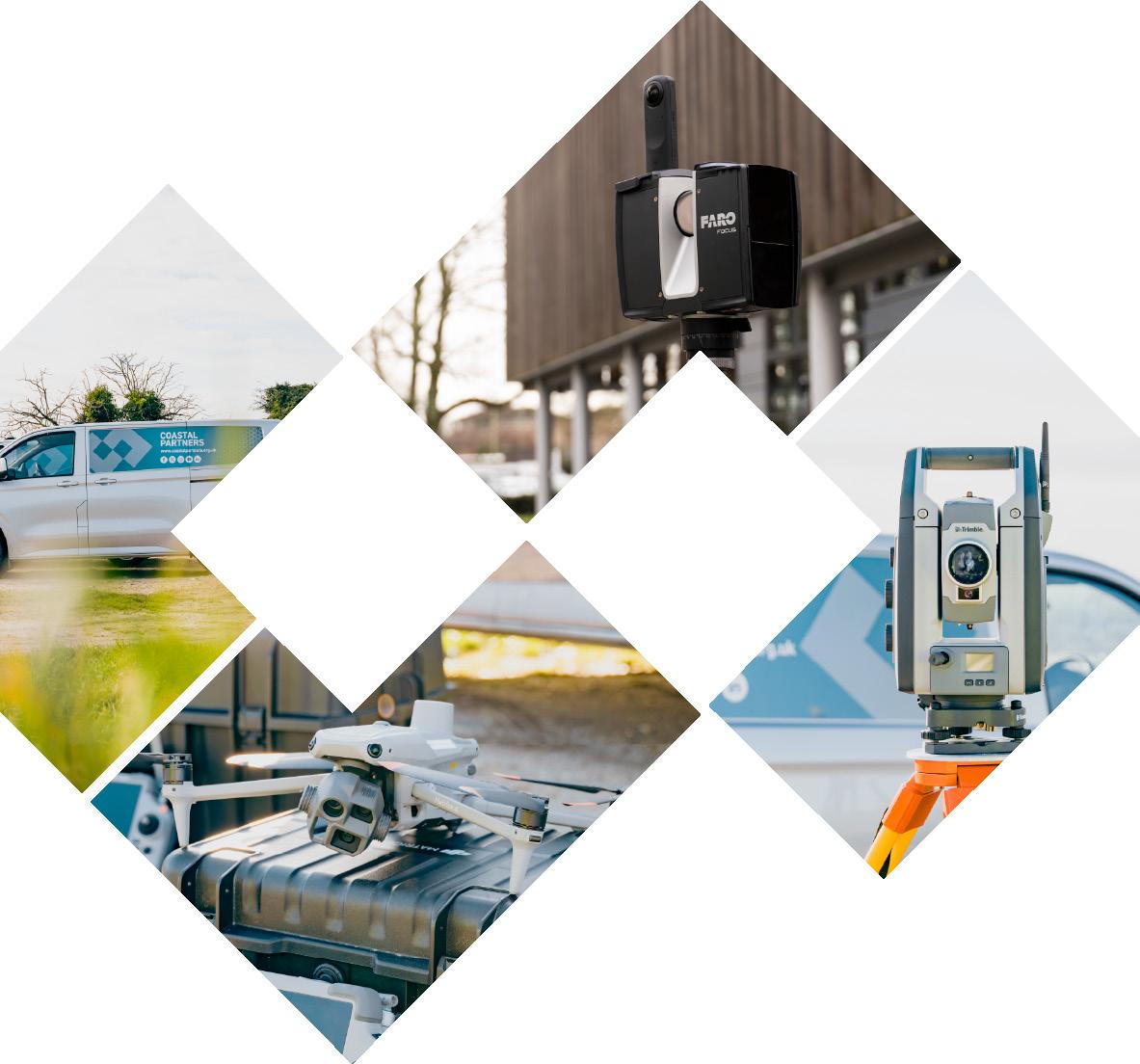
Coastal Partners Geomatics Services owns and maintains industry-leading surveying equipment, including the latest laser scanners, UAVs, total stations, levels, GNSS, and utility detection equipment. We deliver a diverse range of datasets that provide our clients with the best possible understanding of what is on and beneath the ground.
Our Services

3D Data
Capture
• Laser Scanning
• LiDAR Mapping & Monitoring
• UAV Photogrammetry Mapping & Modelling
• Reality Capture & Digital Twin
• Building Information Modelling
• 3D Visualisations
• Heritage & Preservation Surveys
Building & Architectural Surveying
• Floor Plans
• Elevations
• Sections
• 3D Point Cloud Models & Visualisations

Civil Engineering
Topographic Surveys
• 2D & 3D Topographic Detail Surveys
• 2D & 3D Topographic Detail Mapping
• Drainage Inspections & Drawings
Construction Site Surveys
• Setting Out
• Monitoring & Audit
• Aerial Photography / Videography
• 3D Mapping & Modelling
• Stockpile & Volumetric Surveys
Geomatics Services delivers an array of geospatial data to a number of clients. By using specialised equipment, we are able to provide industry standard works packages in many desired formats.
UAV Aerial Photography
• Geo-rectified Orthomosaic Aerial Images
• Oblique/Nadir Images
• Building / Asset Inspections
• Pre & Post Work / Event Inspections
• GIS Mapping Solutions
PAS128 Underground Utility Surveys
• Ground Penetrating Radar Detection
• Electromagnetic Utility Detection
• Utility Mapping & Drawings
• Design Verification
• Detection for Safety & Utility Strike Risk Reduction

Land Movement & Structure Monitoring
• Level & Position
• Cliffs
• Landslips

Coastal Monitoring Surveys
• Digital Ground Models
• Volume Calculations
• Difference Plots
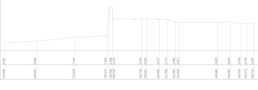
• Cross Sectional Analysis
3D Data Capture
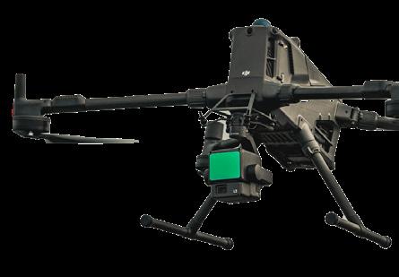
Aerial Inspection & Mapping Drones
Versatile imaging for inspections and site intelligence
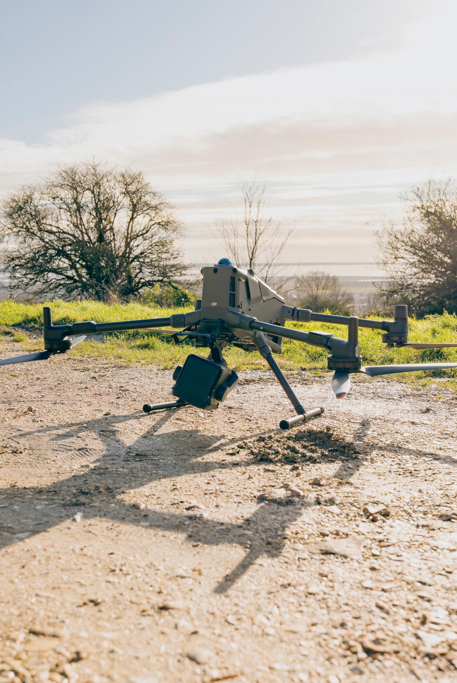
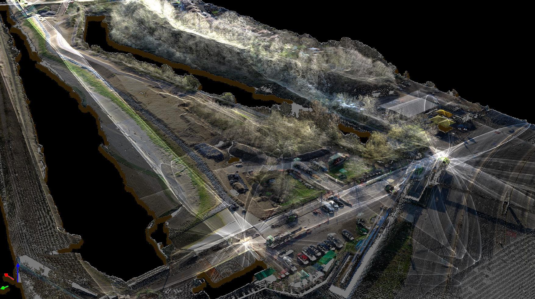
Unlock fast, ultra detailed 3D intelligence with our advanced aerial LiDAR and photogrammetry solutions. Capable of capturing wide areas with centimetre level accuracy, generating dense 3D datasets ideal for topographic, corridor and environmental surveys. Combined with cutting edge reality capture workflows, we create immersive digital twins, rich 3D visualisations, and highly accurate records. These support everything from design and monitoring to heritage preservation, ensuring irreplaceable assets are documented in exceptional detail for generations to come.
Services used - Civil Engineering Topographic Surveys, Construction Site Surveys, Land Movement & Structure Monitoring, Coastal Monitoring, Habitat Mapping
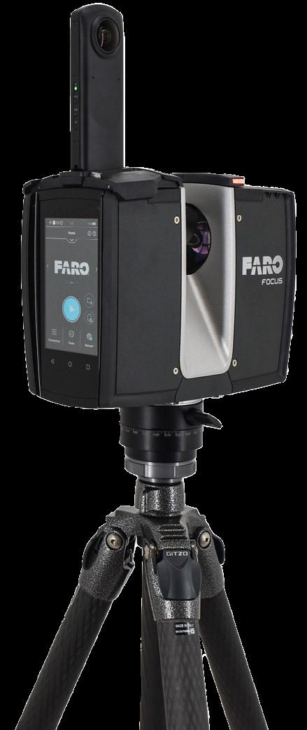
Laser Scanners
Reliable spatial data for precise analysis
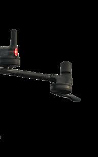
The FARO Focus Laser Scanner is a marketleading 3D reality capture solution designed to deliver millimetre level precision and efficiency in the field. Utilising advanced phase-shift laser technology, this ultra-portable device rapidly captures millions of accurate data points to create highly detailed, photorealistic 3D point clouds of complex environments and large-scale structures. Its rugged design, intuitive touchscreen interface, and exceptional measurement speed streamline workflows by minimising field time and reducing manual errors.
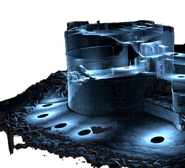
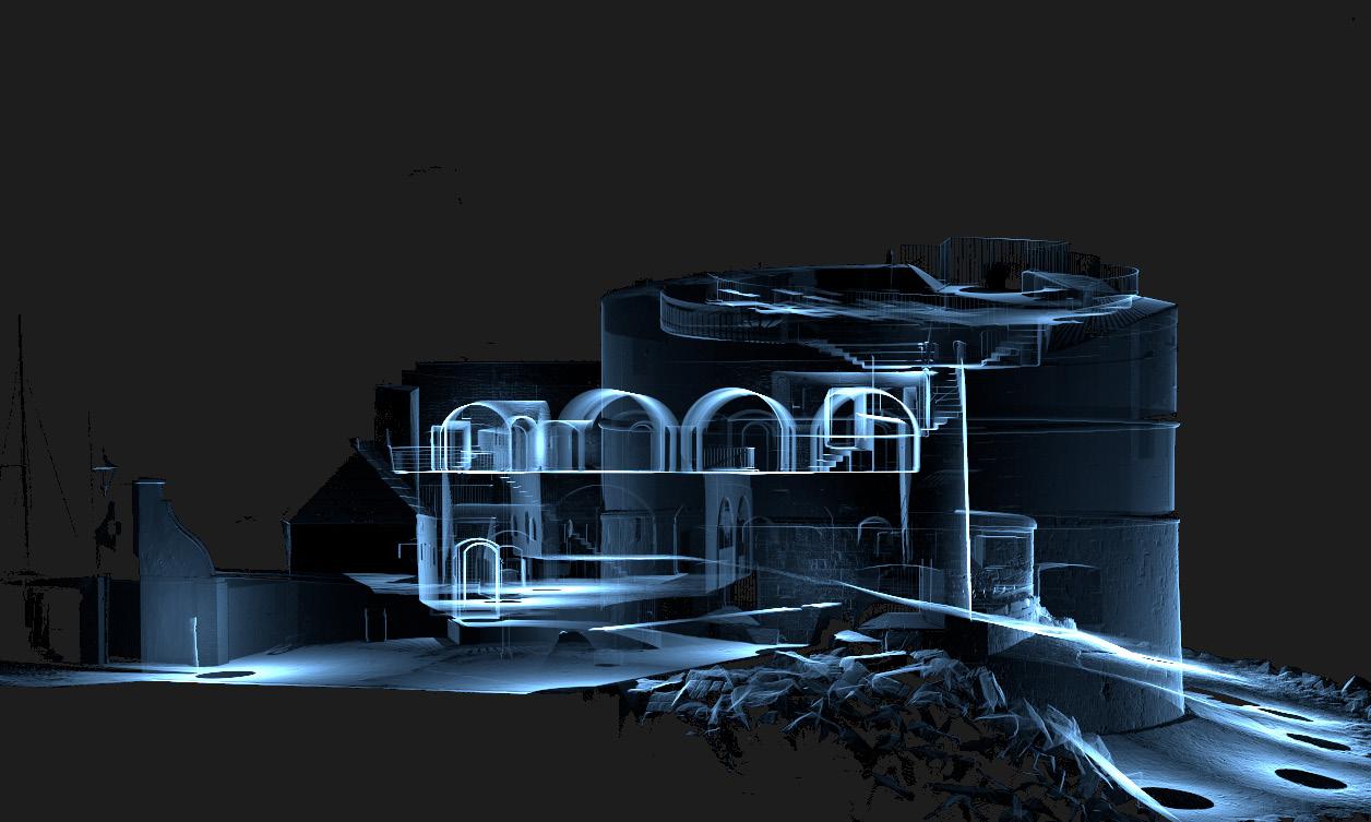
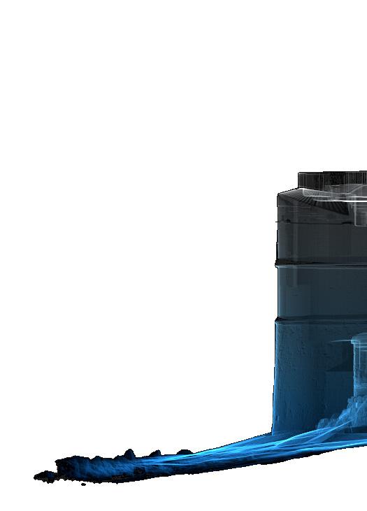
3D Laser Scan of Southsea’s Round Tower using the Faro Focus
Civil Engineering & Topographic Surveys
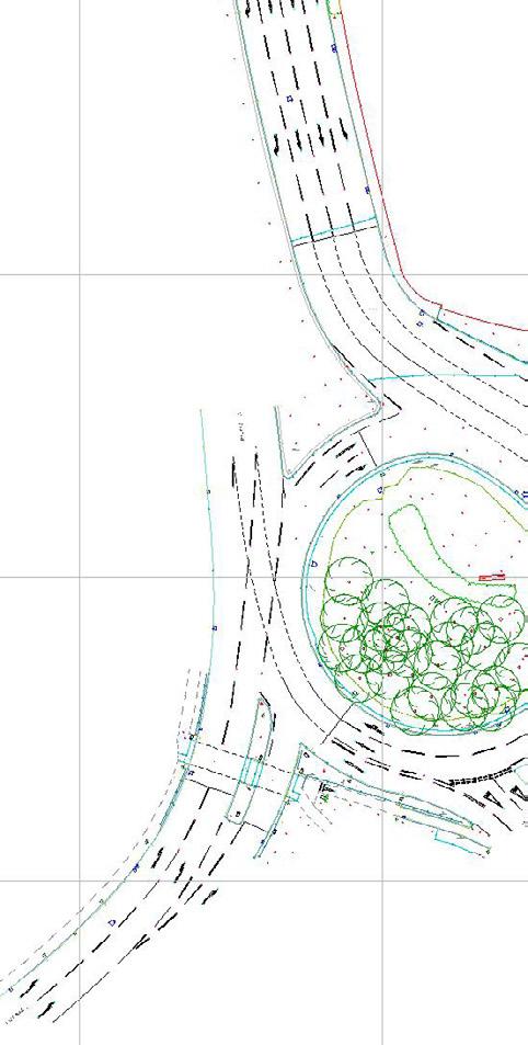
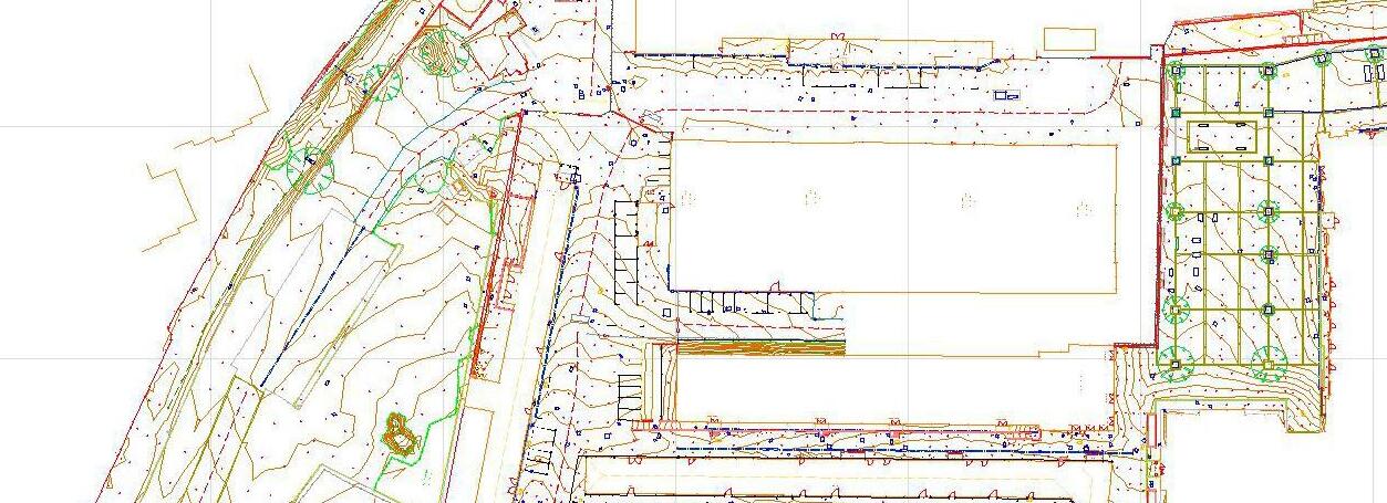
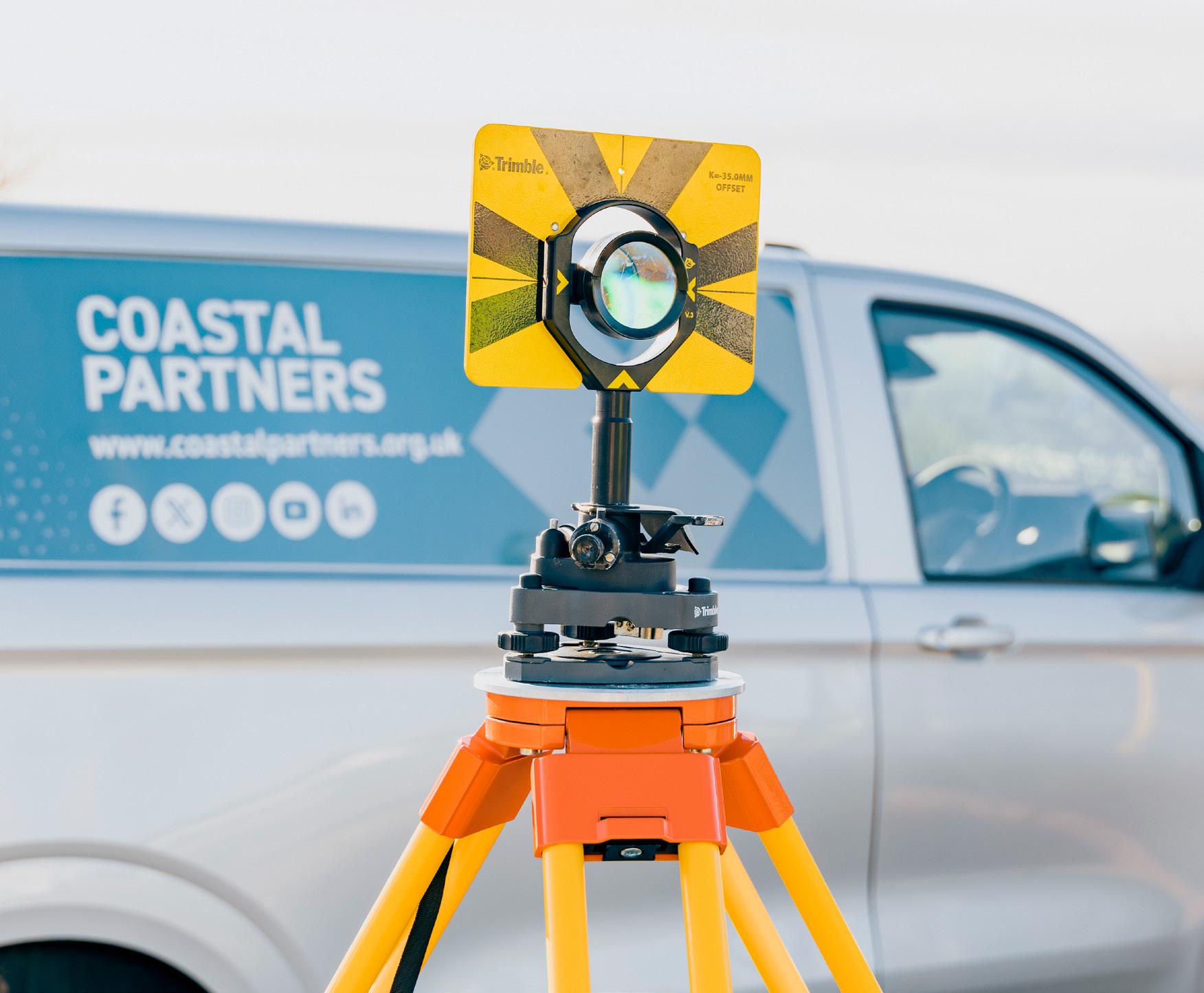
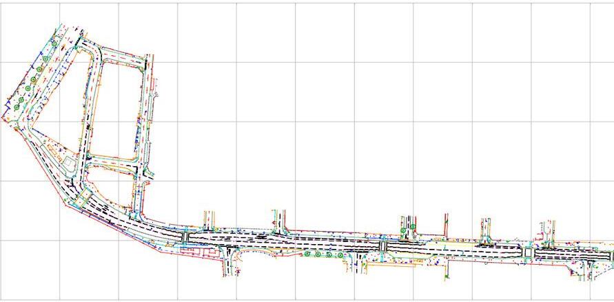
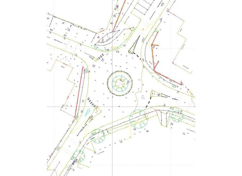
Using high precision total stations, our surveys deliver exceptional horizontal and vertical accuracy. This is ideal for engineering, design, and construction. RICS standards ensure every project is backed by robust survey control, calibrated equipment, and clearly defined accuracy bands tailored to your needs.
For civil engineering applications, this means reliable positions, dependable levels, and confidence ready data for layouts, infrastructure works, and as built verification.
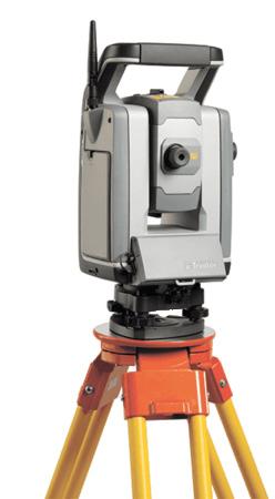
Robotic Total Station
Our topographic surveying equipment delivers millimetre-level precision for monitoring and infrastructure. Its automated tracking and reflectorless range capture high-accuracy terrain data with speed, ensuring dependable surveygrade results across your project’s lifecycle.
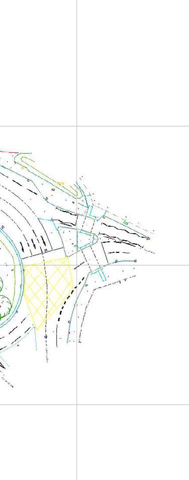
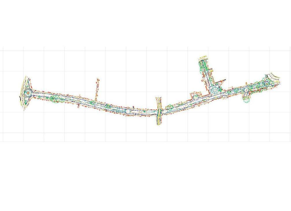
Topographic Survey Outputs
UAV Photography
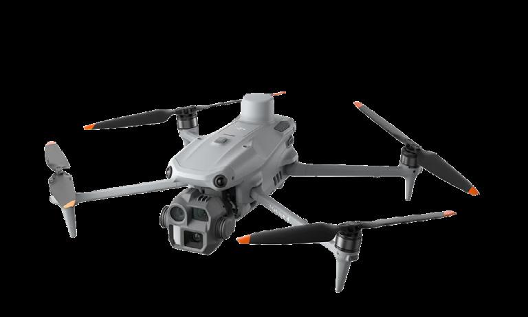
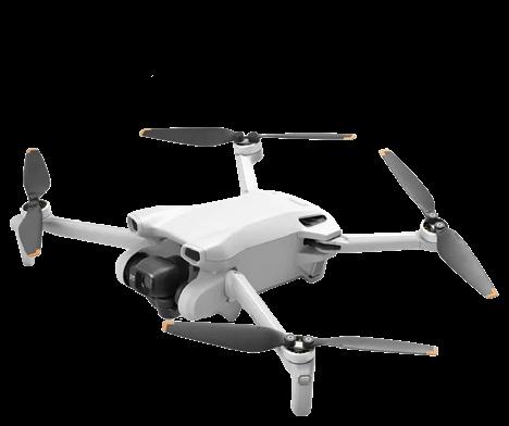
Aerial Inspection & Mapping Drones
Versatile imaging for inspections and site intelligence
Elevate your projects with UAV aerial photography. Drone captured imagery can be transformed into georeferenced orthomosaic maps, providing distortion free, true to scale visuals ideal for measuring, analysing and integrating directly into GIS workflows.
Whether you’re documenting site progress, inspecting infrastructure, or generating decision ready mapping products, UAV imagery gives you fast, accurate, repeatable insights from above, especially in inaccessible areas.
Services used - Geo-rectified Orthomosaic Aerial Images, Oblique/Nadir Images, Building & Asset Inspections, Pre & Post Work / Event Inspections, GIS Mapping Solutions
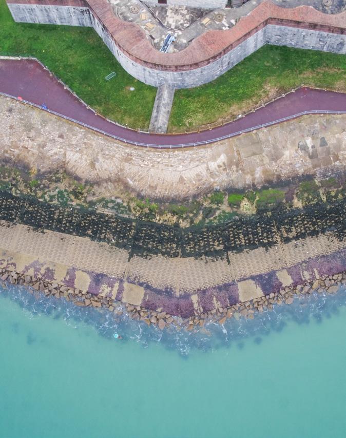
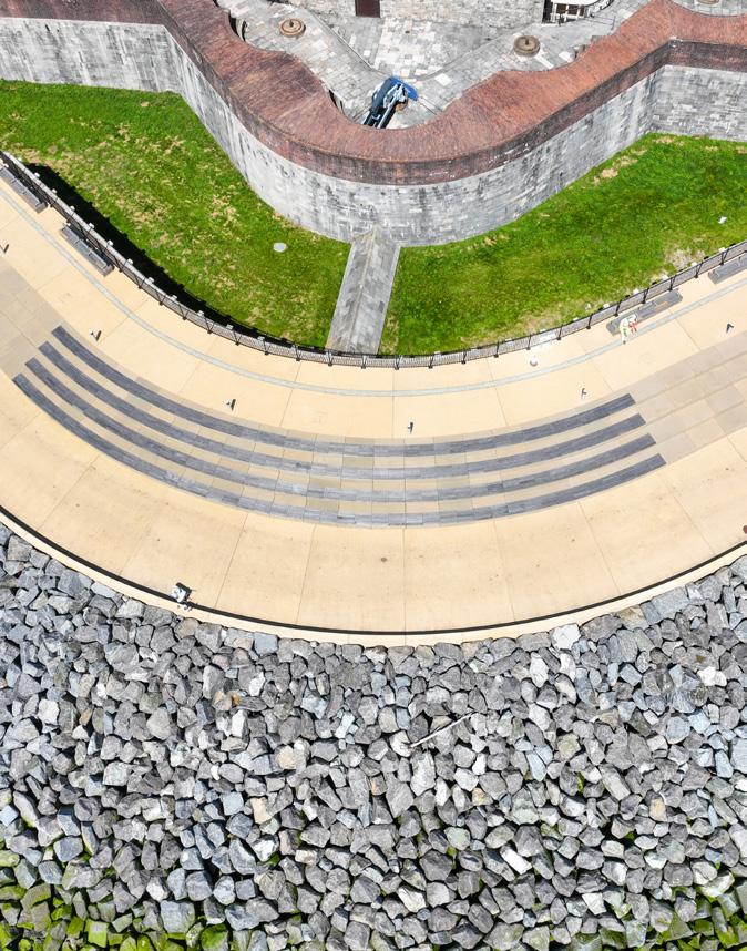

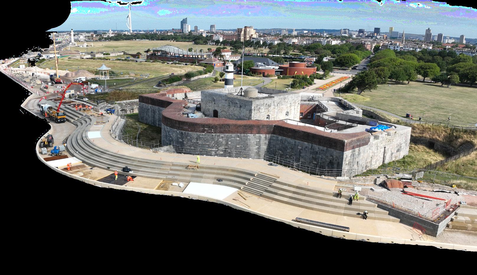

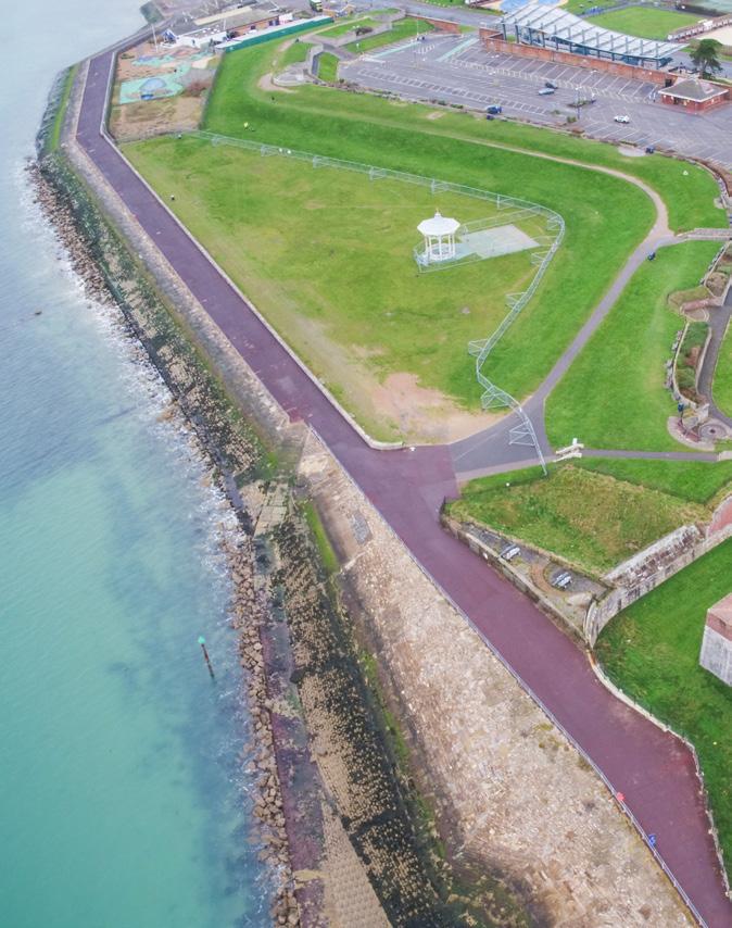
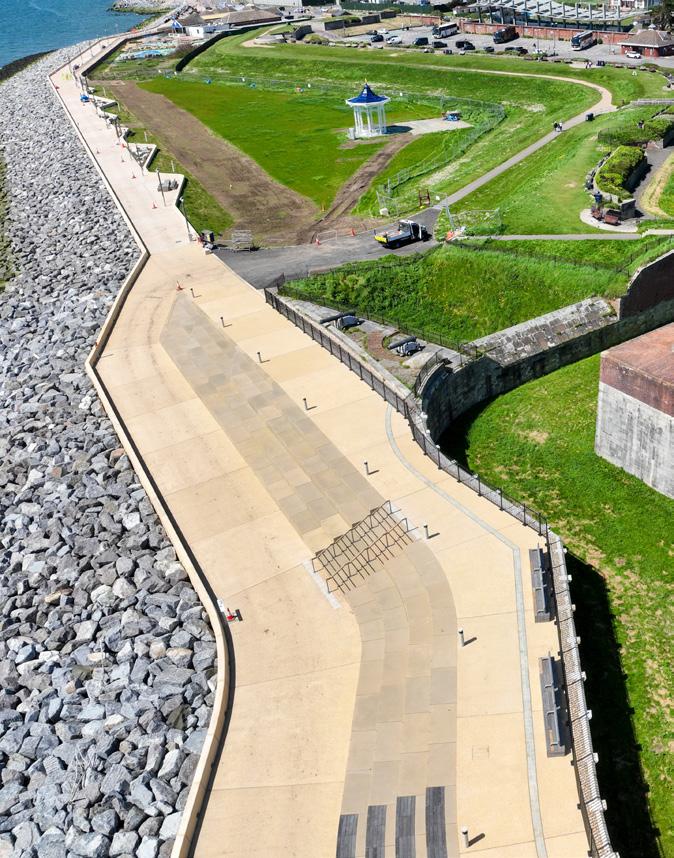
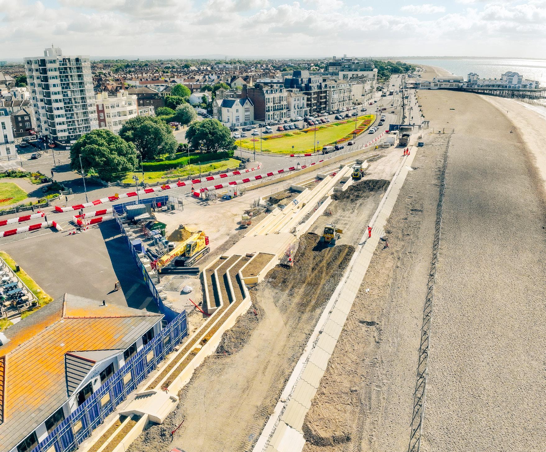
Construction at Southsea Castle by Southsea Coastal Scheme
Land Movement & Structure Monitoring
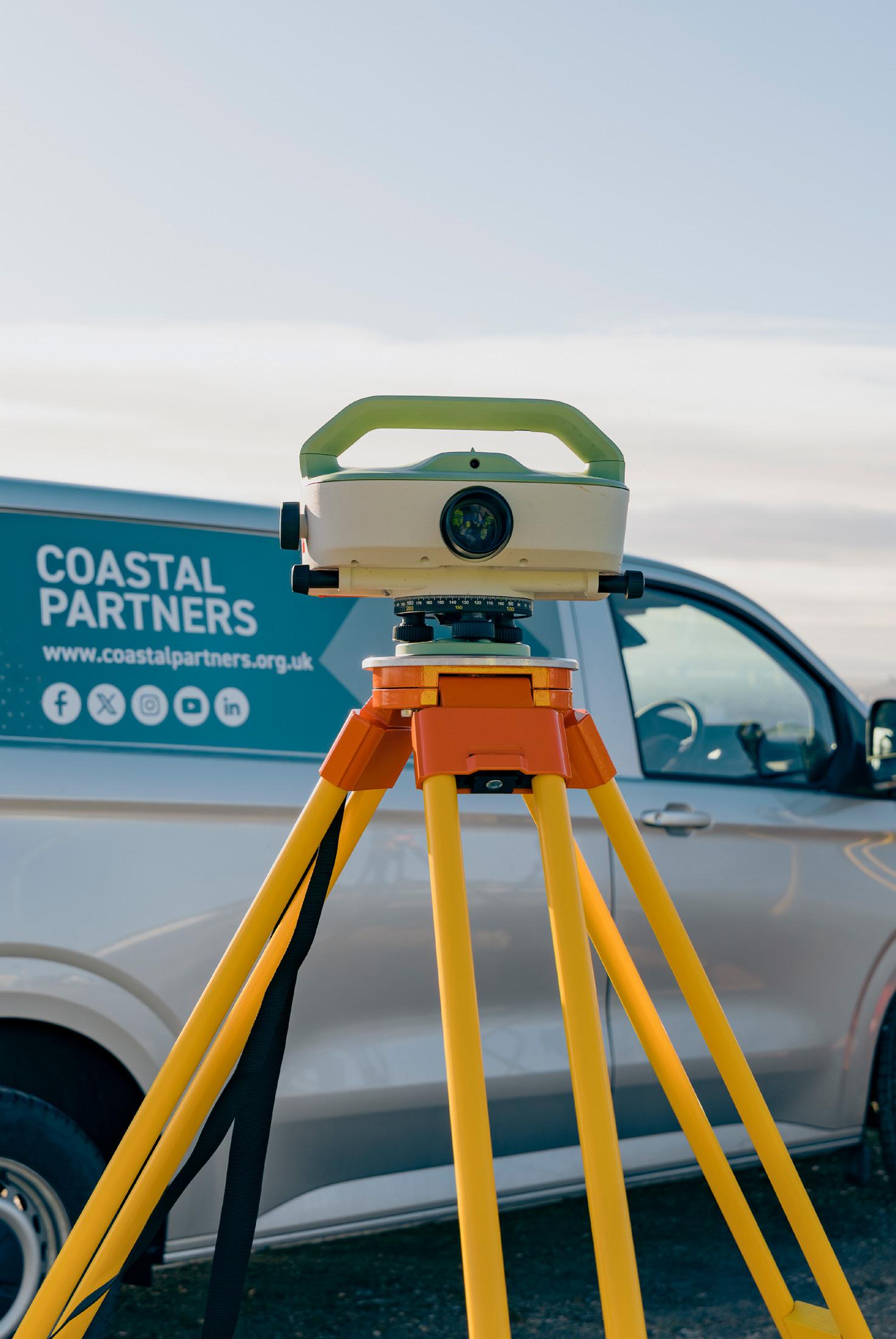
Monitor land and structural movement with absolute confidence using precise digital levelling, delivering sub millimetre accuracy for detecting even the smallest vertical shifts.
Combined with high precision total station measurements, achieving sub centimetre positional accuracy, you get reliable, repeatable data essential for safeguarding assets and ensuring structural stability.
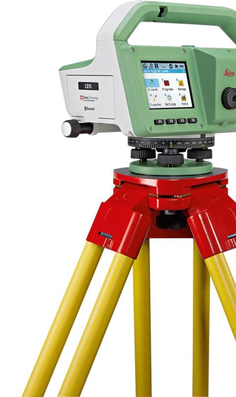
Digital Level
Reliable vertical accuracy you can trust
Digital levels deliver consistent and dependable height measurements for control networks, levelling runs, structural monitoring, and other height-critical tasks. Automated digital readings reduce human error and ensure the high-precision vertical control demanded by modern Architecture, Engineering, and Construction projects.
Services used - Civil Engineering Topographic Surveys, Construction Site Surveys, Land Movement & Structure Monitoring, Coastal Monitoring

Coastal Monitoring Surveys
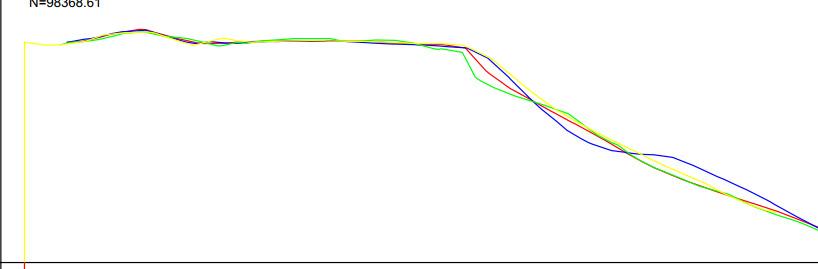
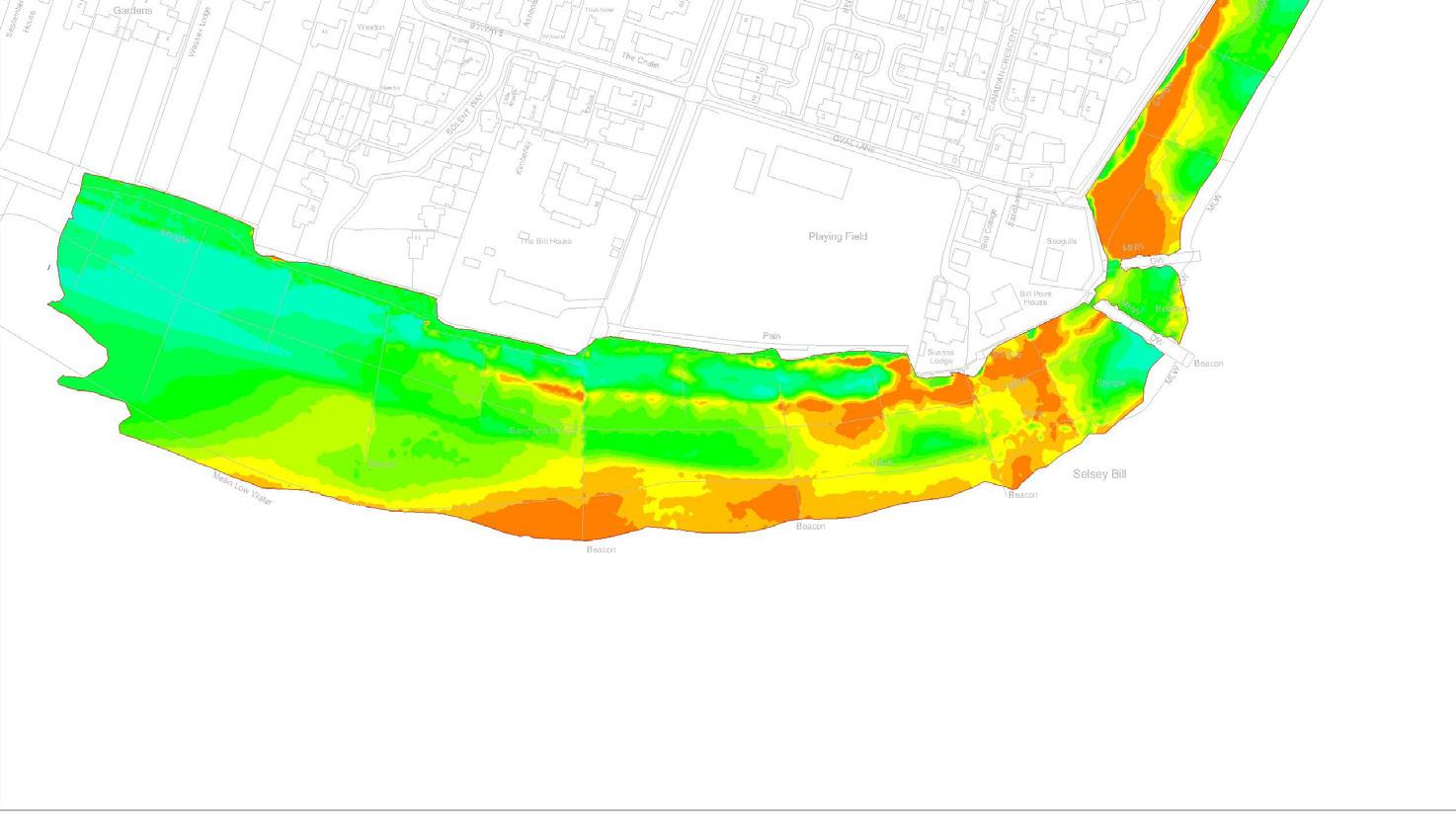
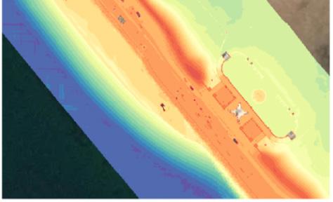
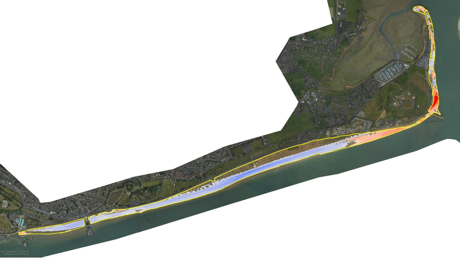
Track coastal change with confidence using high resolution digital ground models that reveal precise shoreline and seabed conditions. Our surveys deliver volumetric reporting for beach recharge, erosion, and sediment movement, alongside clear, data rich difference plots that highlight change over time.
Combined with detailed cross sectional analysis, you get an accurate, repeatable picture of coastal dynamics. This is perfect for long term planning, risk management, and environmental protection.
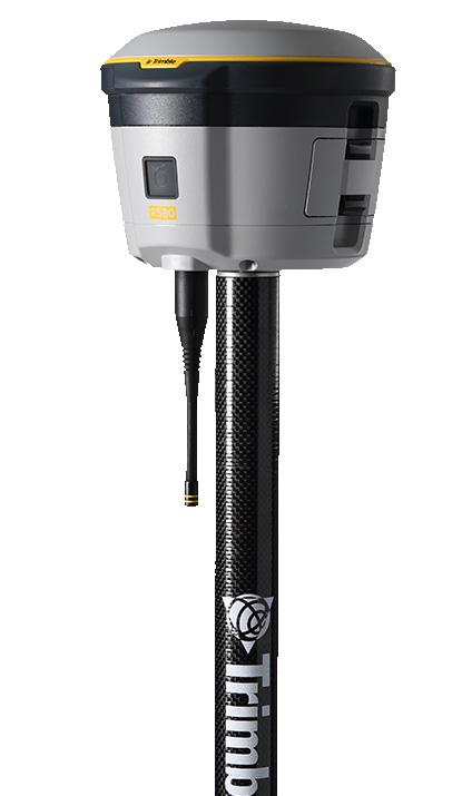
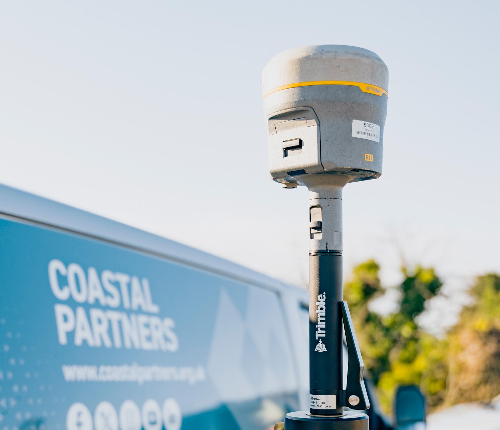
GNSS Receiver
Modern GNSS survey systems deliver fast, reliable, centimetre-accurate positioning across every stage of your project. With advanced multi-constellation tracking and seamless connectivity to VRS and network RTK base-station services, they provide real-time precision for everything from topographic data capture to engineering set-out and the establishment of high-quality control networks.
Selsey Bill Monitoring Data
Coastal Monitoring Outputs

Construction Site Surveys
We can help bring your project to life with construction site surveys that keep everything precise, compliant, and on track. From setting out foundations and infrastructure with survey grade accuracy, to monitoring and audit checks that ensure works stay aligned and within tolerance, we deliver total site assurance.
Add aerial photography/videography for rapid visual updates and 3D mapping & modelling for immersive, data rich site intelligence—giving your team the clarity, confidence, and control needed at every stage of construction.
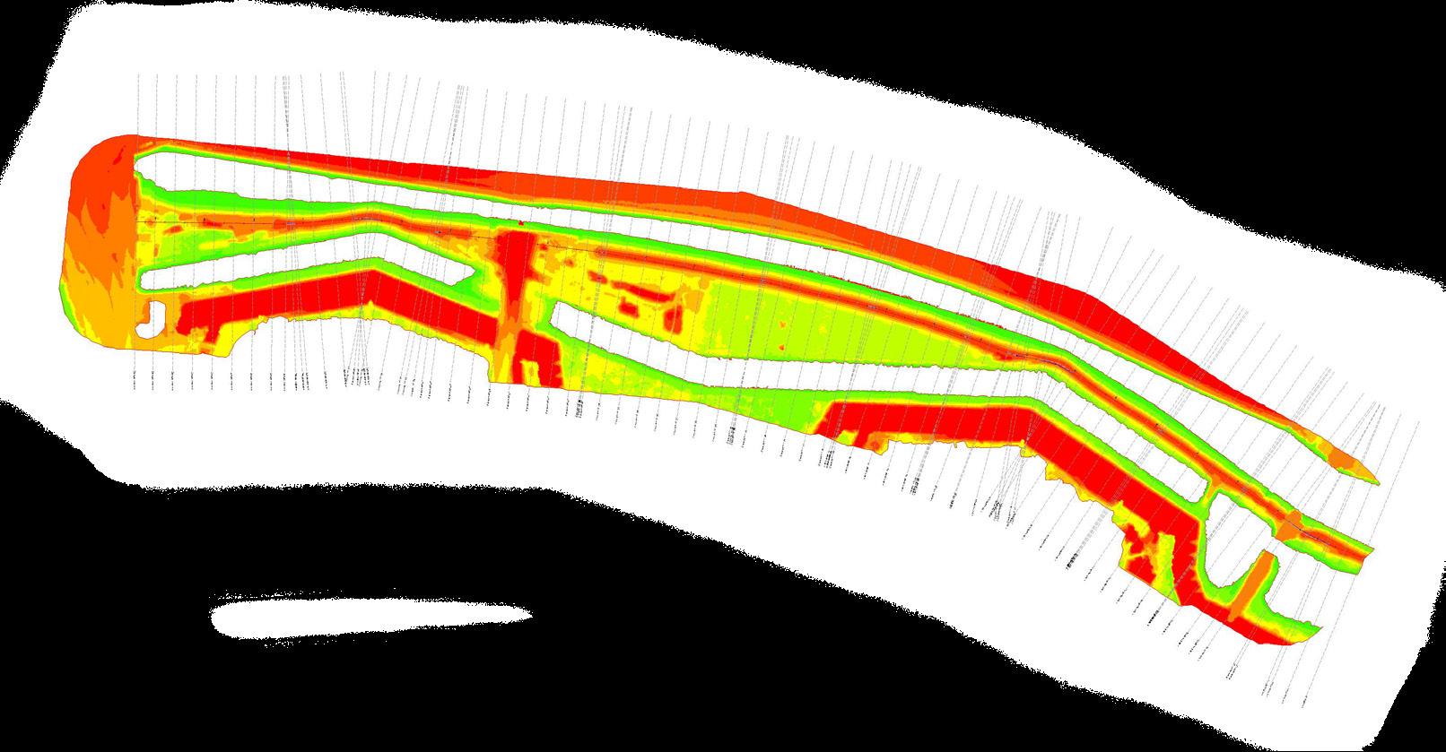
Construction Site Progress Monitoring
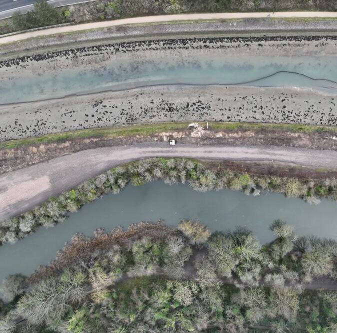
Survey 1 Survey 2
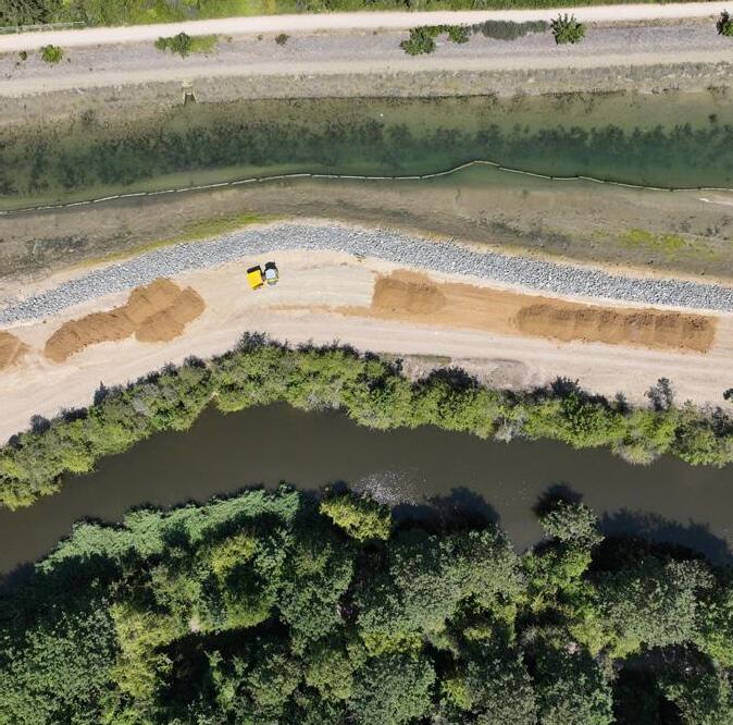

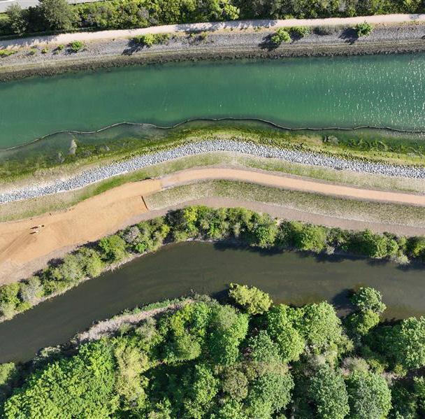
Survey 3
Building & Architectural Surveys
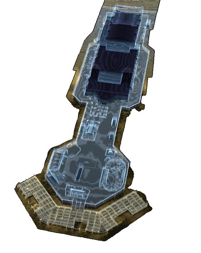
Bring buildings to life with high detail architectural surveying, delivering accurate floor plans, elevations and sections generated directly from precision 3D laser scanned point clouds.
Our surveys capture millions of measurements for reliable, design-ready outputs, backed by immersive 3D visualisations that help architects, planners and project teams understand every angle of a space.
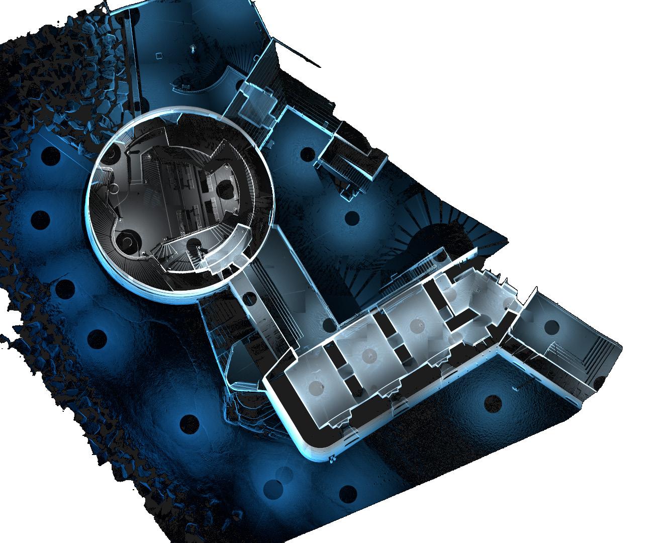
Round Tower 3D Laser scan Overview Floor Plan

South Parade Pier LiDAR Building Survey
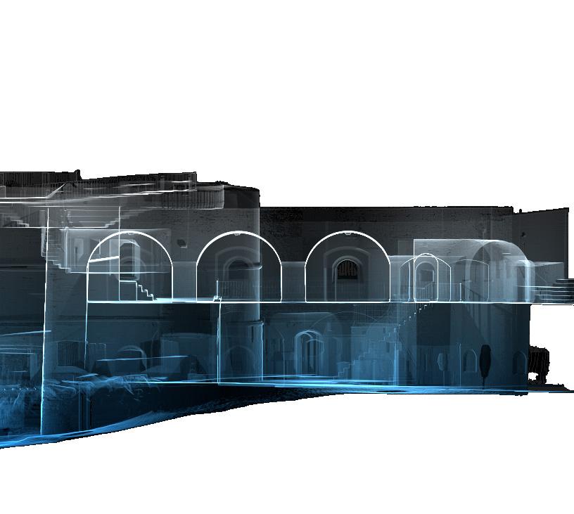

Round Tower 3D Laser scan Elevation
PAS128 Underground Utility Surveys
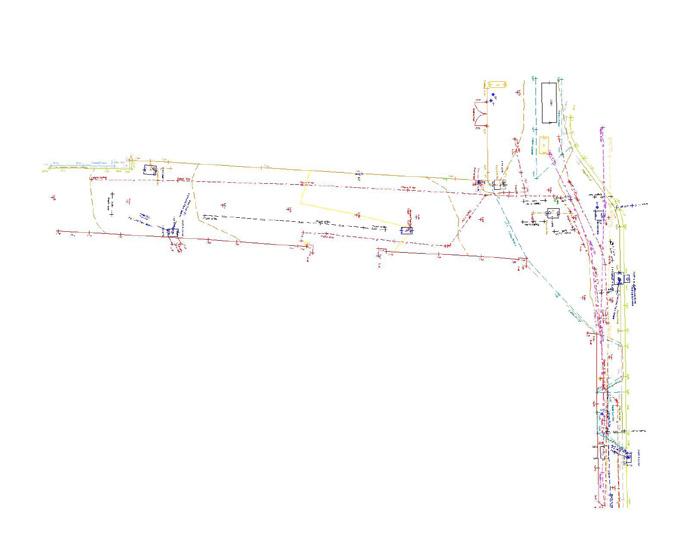
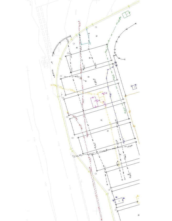
Understanding what lies beneath the ground is fundamental to the success and safety of any construction project. By applying advanced detection technologies and recognised industry methodologies, underground utility surveys provide a clear and reliable picture of buried services, enabling designers and engineers to assess feasibility, reduce risk, and plan with confidence.
Our utility mapping services follow the PAS 128 specification, ensuring a consistent, high-quality approach to locating and recording underground assets.
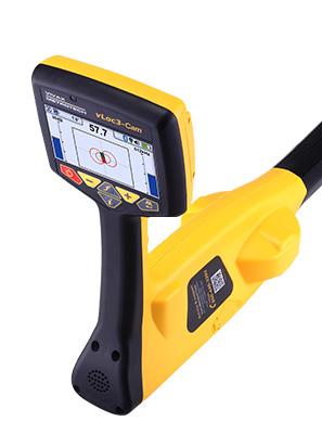
Electromagnetic Utility Locator (EM)
Precise detection of buried services
Our electromagnetic locating kit enables accurate tracing of underground utilities, helping teams identify service routes quickly and confidently. It’s essential for safe digging, utility avoidance, mapping unknown assets, and minimising delays caused by inaccurate or outdated records.
To achieve the highest accuracy in large-scale mapping projects and commercial operations, the team utilises the latest state-of-the-art tools & technology to help guide decision making.
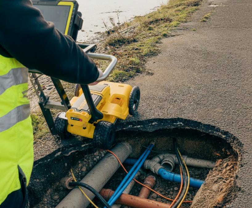

Ground
Clear subsurface insight for safer excavations
Ground Penetrating Radar systems reveal buried utilities, voids, and underground obstacles with exceptional clarity. It reduces excavation risks, supports accurate utility mapping, and helps prevent costly service strikes, providing critical intelligence before ground is broken.
Services used – PAS128 Underground Utility Surveys, Construction Site Surveys
Penetrating Radar (GPR)
Matrice M400 & Zenmuse Data Capture Case Study
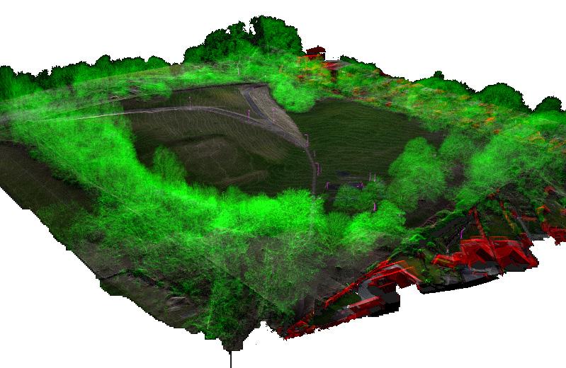
LiDAR penetration through vegetation
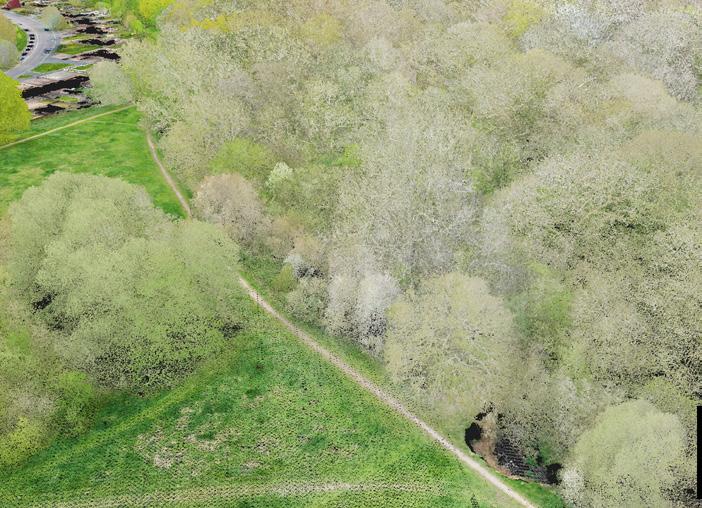
Full Point Cloud
LiDAR High Resolution Point Cloud Data
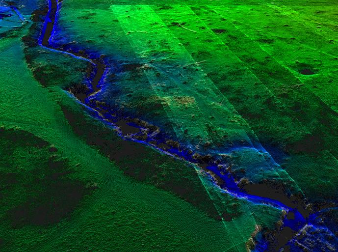
Elevation Intensity (Surface Returns)
Displays Digital Terrain Model of Ground
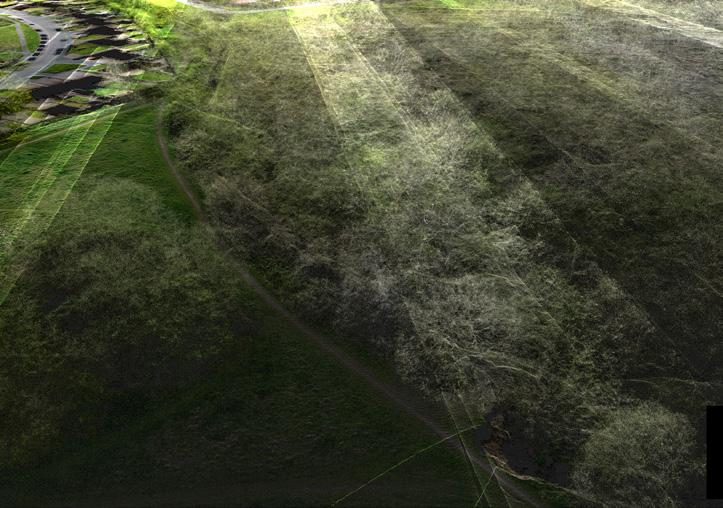
X-RAY View
Displays Vegetation & Structure Within Canopy
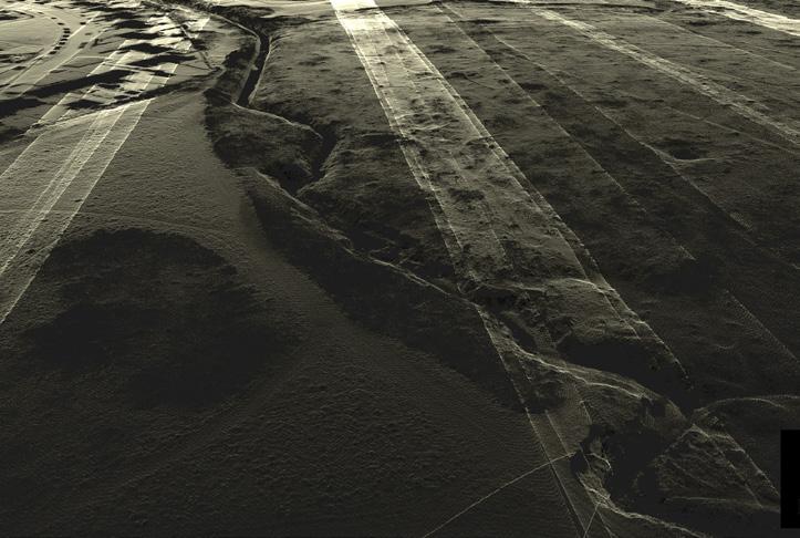
LiDAR Ground Returns (Surface Returns)
Displays Bare Earth Through Vegetation
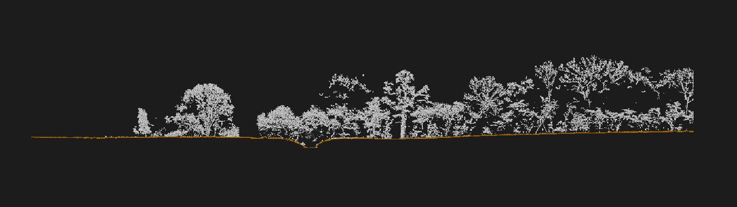
LiDAR X-Section View

L3 LiDAR

Matrice M400 + Zenmuse L3 LiDAR DATA CAPTURE
• High-density point clouds with up to 2 million pulses per second, providing exceptional vegetation penetration and clean, survey-grade terrain models even in dense canopy, making it reliable for large-area topographic and corridor surveys
• Multiple scanning modes (Linear, Star-Shaped, Non-Repetitive) to optimise accuracy, coverage, and penetration in forested or complex environments.
• Dual 100MP RGB cameras for colourised point clouds and high-accuracy mapping.
Vegetation Penetration Performance
• Up to 16 returns per pulse allow the sensor to record canopy, mid-storey, and ground in a single shot — ideal for creating bare-earth DTMs under tree cover.
• High energy density from the narrow beam improves the ability to “see through” foliage and reach the ground surface.
• Detect terrain features completely obscured by vegetation where photogrammetry fails.
Locations & Partners

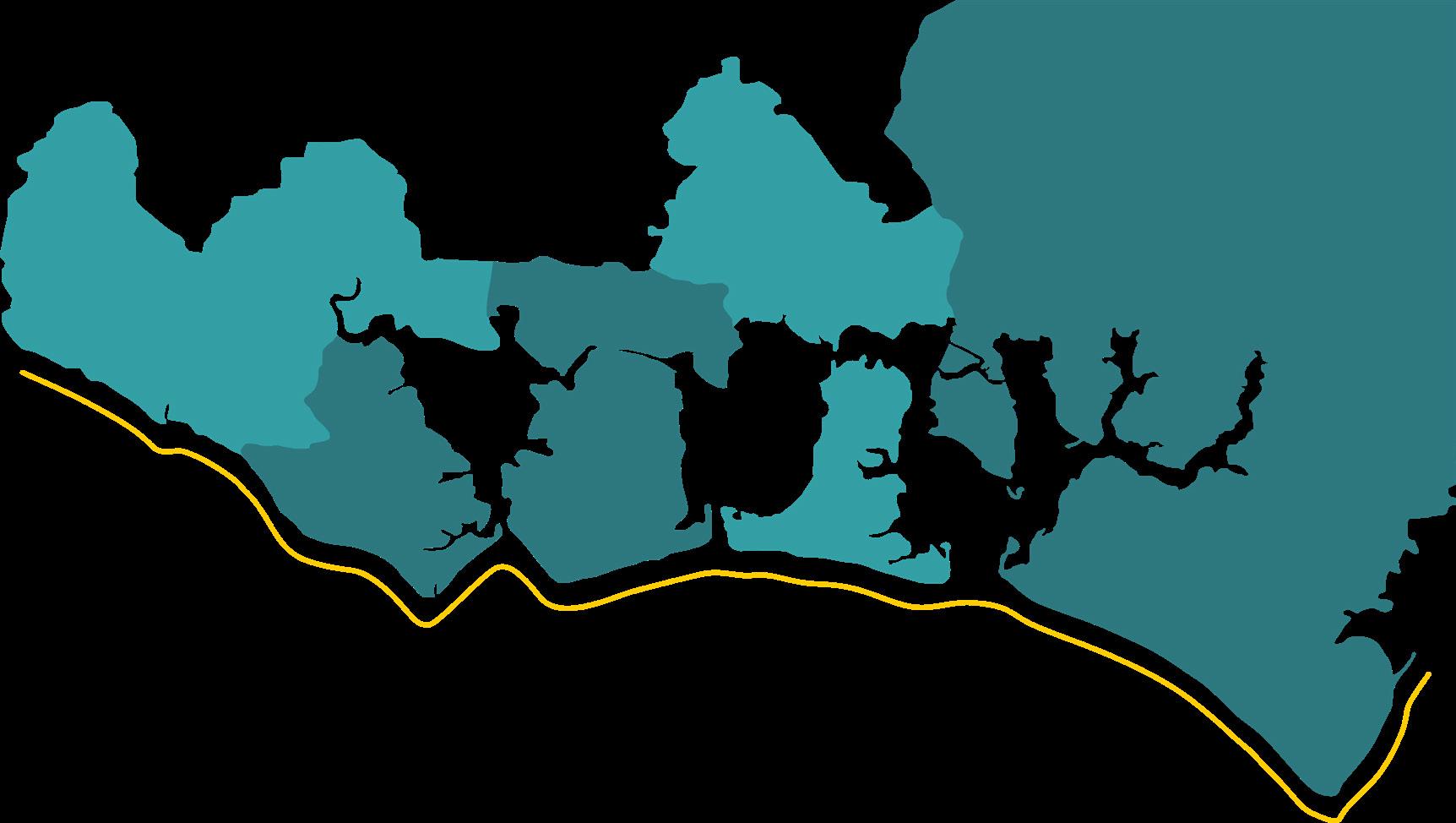
Where do we work?

We deliver projects across the South Coast and throughout the UK, with extensive experience supporting major infrastructure schemes.
Our work spans a wide range of environments, including urban developments, rural landscapes, ports, harbours, transport corridors, and environmentally sensitive sites. This breadth of experience enables us to provide accurate, tailored survey services wherever our clients operate.

Chichester
Portsmouth
Fareham
Gosport
Havant

Organisations we work with
We have provided survey services for a wide range of organisations, and have successfully completed projects for local councils, engineering consultancies, environmental agencies, utility providers, and construction companies.

This diverse client base reflects our ability to adapt our expertise to meet the unique needs of both public and private sector partners, ensuring reliable and precise survey solutions every time.