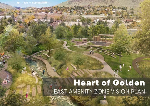
H eart of G olden EAST AMENITY ZONE VISION PLAN
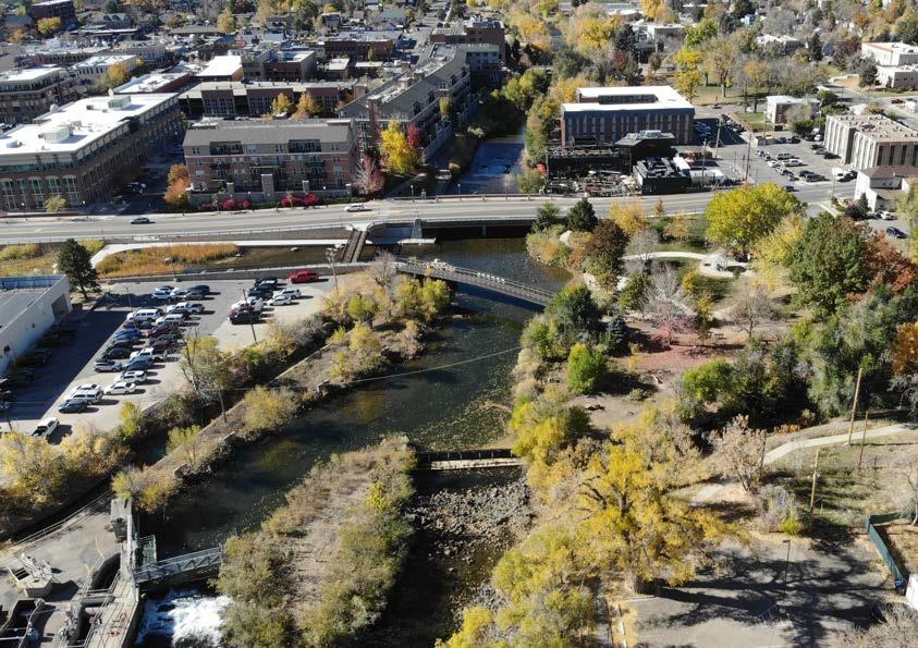
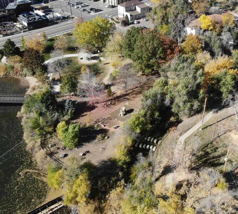
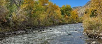
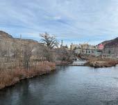
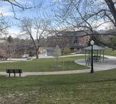
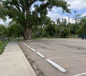
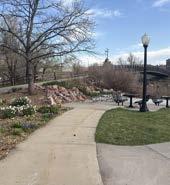
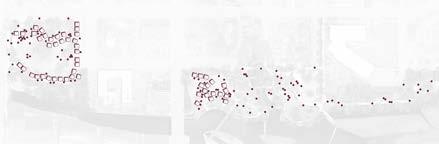
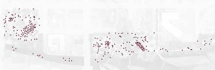
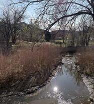
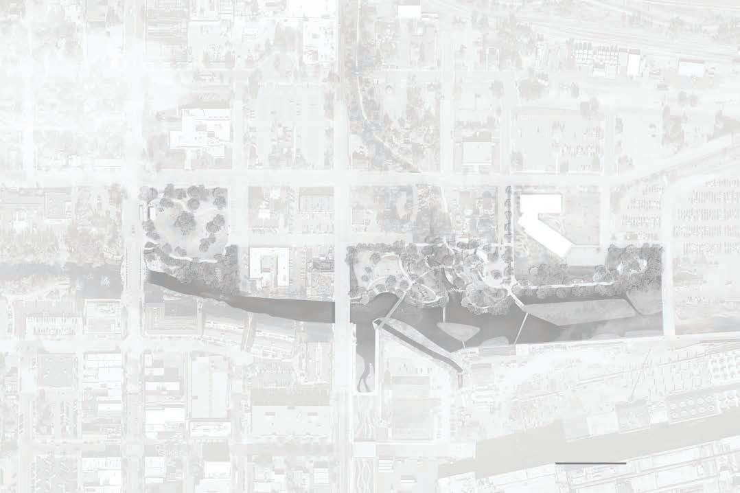
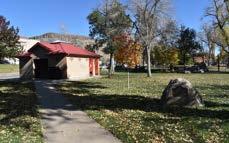
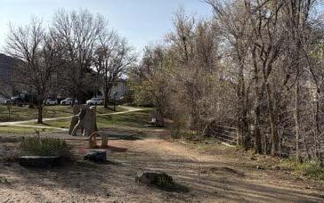
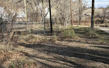
(Left) Drone picture looking at Vanover Park, Clear Creek, and the Archer Street parking lot.
(Left) Drone picture looking at Vanover Park, Clear Creek, and the Archer Street parking lot.
04 EXECUTIVE SUMMARY
06 INTRODUCTION
• Definition of Study Area
• Existing Conditions
22 COMMUNITY ENGAGEMENT
• The Heart of Golden: Previous Engagement
• East Amenity Zone: Engagement Process
• Summary of Feedback
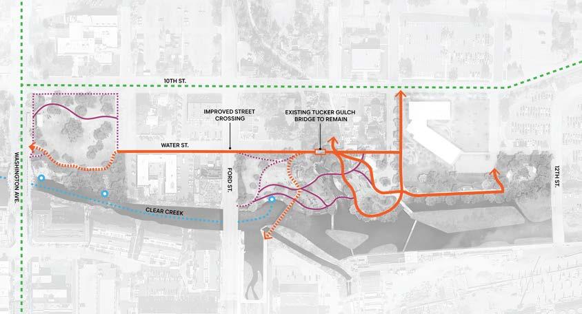
26 EAST AMENITY ZONE VISION
• Existing Site Plan
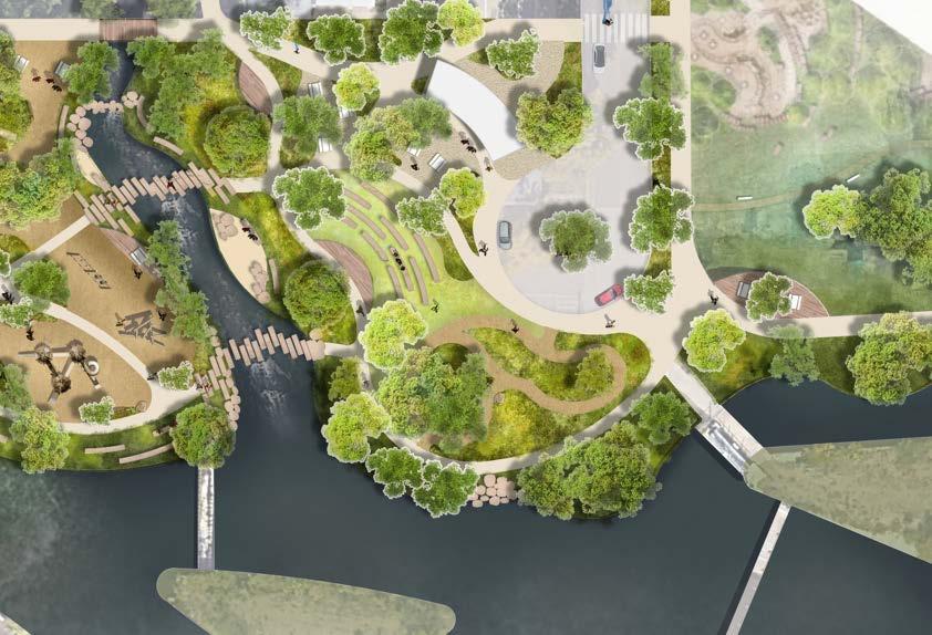
• Proposed Site Plan
• Enlargement Areas
58 MOBILITY AND CIRCULATION
• Water and Jackson St. Goals
• Proposed Crossings at Ford St.
• Goals for improving pedestrian and bicycle connections
• Complete Streets Plan for 10th St.
The East Amenity Zone is a pivotal stretch of the Clear Creek corridor — a place where Golden’s civic life, creek-side recreation, and ecological systems converge. Today, the area contains some of Golden’s most beloved community assets, including Parfet and Vanover Parks and the regional Clear Creek Trail. Yet gaps in connectivity, fragmented visibility, and underutilized edges prevent the corridor from functioning as one continuous, celebrated civic space.
The Heart of Golden planning effort — initiated to reimagine the entire Clear Creek corridor as a resilient, connected, and people-centered public realm — provides the foundation for this East Zone vision. Building from extensive engagement and strong community direction, this Vision Plan outlines a path to transform the East Zone from a set of standalone parks into a cohesive civic and ecological gateway that reflects Golden’s identity and supports daily life for residents.
The East Zone plays an essential role in stitching together the western recreational heart of Clear Creek with the City's Police and Municipal Building, neighborhoods, and mobility network to the east. Improvements focus on:
• Clarifying circulation with safer regional trail access and intuitive pedestrian connections
• Improving the community’s experience of the creek with new overlooks and restored, naturalized edges.
• Enhancing and increasing native plant habitat and resilience with riparian and landscape restoration with the reduction of ornamental turf
• Supporting community gatherings with flexible spaces sized for Golden’s residentfirst events
• Improving daily comfort through shade, furnishings, restrooms, and accessible routes
These moves reorient the zone as an everyday, community-first landscape that can flex for festivals and seasonal activity, while keeping nature at the forefront.
Across workshops, site walks, Guiding Golden surveys, and Parks and Recreation Advisory Board checkpoints, residents expressed clear priorities:
• Make connections safe, legible, and comfortable for people walking, bicycling, and rolling
• Preserve small-town authenticity and avoid over-built or overly programmed “destination” features
• Provide the basic infrastructure that supports local life — shade, bathrooms, and seating
• Ensure the corridor welcomes everyone, for everyday use as well as cultural celebration
• This Vision Plan reflects that direction — a nature-forward, community-scaled identity unique to Golden rather than imported from elsewhere.
The design framework centers on four interconnected goals that translate the community’s priorities into implementable outcomes:
1.
• Establishing a healthier creek corridor and restoring native plants to the creek and landscape to support biodiversity and naturebased recreation.
2. Make Movement Easy and Safe
• Clear crossings, upgraded trail continuity, and direct civic-to-creek access.
3. Design for Everyday Golden
• Amenities + comfort for residents first, while remaining welcoming to visitors.
4. Support Gathering and Celebration
• Flexible public spaces for daily moments and Golden’s signature community events.
This East Zone Vision establishes a clear roadmap for phased investment that is implementable and aligned with Golden’s policy priorities—equitable access to Clear Creek, sustainable and resilient public spaces, and safe, multimodal mobility. Next steps include coordination with mobility projects (e.g., the 10th Street Complete Street), refinement of creek restoration concepts with regulatory partners, and programming to ensure that improvements support both operations and community life.
With careful implementation and continued partnership between the City and residents, the East Amenity Zone will become a unified civic landscape along Clear Creek — a welcoming, resilient, and distinctly Golden heart for generations.
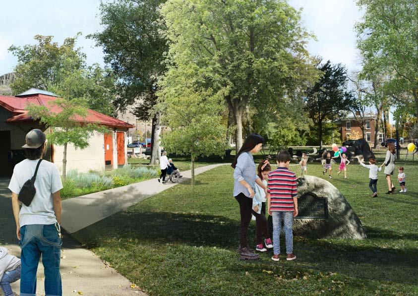
(Right) The Heart of Golden framework identifies three amenity zones along Clear Creek—West, Central, and East—each with distinct roles and opportunities that, together, create a cohesive civic corridor.
The Heart of Golden is a long-range community visioning and planning effort launched in 2019 by the City of Golden to reimagine the Clear Creek corridor through downtown as a connected, resilient, and people-centered amenity. The project recognizes the creek as one of Golden’s most valuable community assets, serving as both a natural system and a civic destination. Through extensive public engagement, the community has expressed a desire to balance ecological health, recreation, mobility, and civic identity— transforming the corridor into a vibrant public realm that reflects Golden’s unique character while meeting the needs of an evolving city.
At its core, the Heart of Golden is more than a park plan—it is a framework for shaping the city’s east, central, and west amenity zones into places that serve multiple functions: restoring native habitat and water quality, improving safety and access, providing space for community life and events, and strengthening Golden’s connection to Clear Creek and its historic downtown. The plan builds on Golden’s legacy of valuing public space and natural resources, and establishes a clear, implementable vision that will guide phased improvements over time. It is both a road map and a commitment: to create an equitable, inclusive, and enduring civic heart for generations to come.
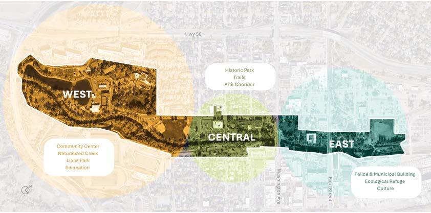
WEST, CENTRAL, AND EAST AMENITY ZONES OF GOLDEN
The East Amenity Zone plays a critical role in advancing the overall goals of the Heart of Golden vision. While the larger framework emphasizes walkability, preservation, inclusivity, and access to public spaces, this zone translates those values into tangible opportunities along the eastern reach of Clear Creek. Here, the emphasis is on balancing ecological restoration with civic identity, improving trail and street connectivity, and creating a welcoming environment that serves both residents and visitors.
During the public listening sessions, participants shared a strong desire for the East Zone to serve as a place of ecological refuge, cultural expression, and civic connection. Feedback pointed to the importance of restoring native habitat and water systems, providing safe and intuitive connections across the creek corridor, and ensuring that all people—regardless of age, ability, or background—feel welcome. The community also highlighted the need for spaces that support both quiet, everyday use and larger gatherings or celebrations tied to Golden’s cultural life.
The following goals translate community priorities into clear design outcomes for the East Zone: a creek corridor with more resilient and well-managed native vegetation, a legible and comfortable network for people on foot and bike, places that are universally welcoming and a flexible civic realm that supports everyday use and moments of celebration. Together, they guide choices—from native habitat and river bank treatments to street crossing types, wayfinding, furnishings, and event infrastructure— so improvements function as one coherent place. Above all, the approach is calibrated for residents’ daily life while offering an authentic, memorable experience for visitors.
Create a resilient creek corridor and landscape that restores native plants, supports biodiversity and human enjoyment, celebrates heritage, and delivers an authentic park experience reflecting the city’s past and future aspirations.
GOAL #3 : DESIGN FOR EVERYDAY GOLDEN
Prioritize residents’ daily use and quality of life while also welcoming visitors with authentic, accessible experiences.
Provide clear, intuitive trail connections and safe crossings so people can walk and bike comfortably throughout the East Zone.
GOAL #4 : SUPPORT GATHERING AND CELEBRATION
Create flexible public spaces that accommodate everything from small daily activities to major community events and festivals.
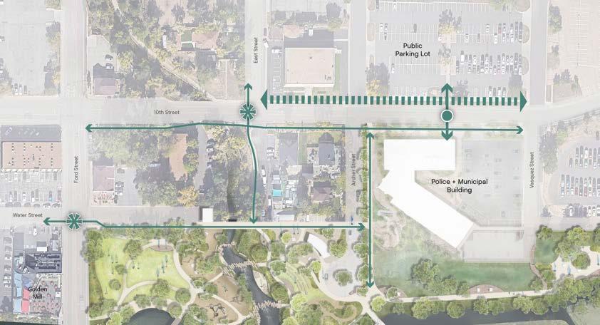
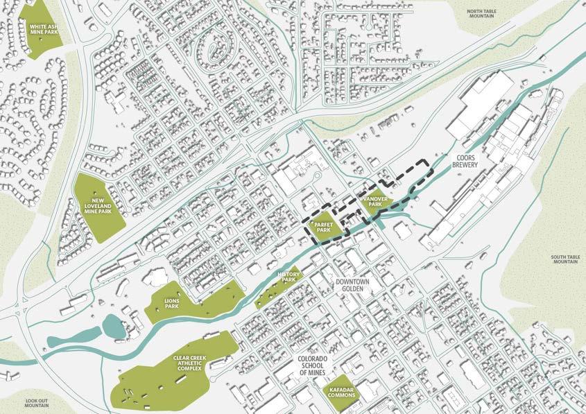
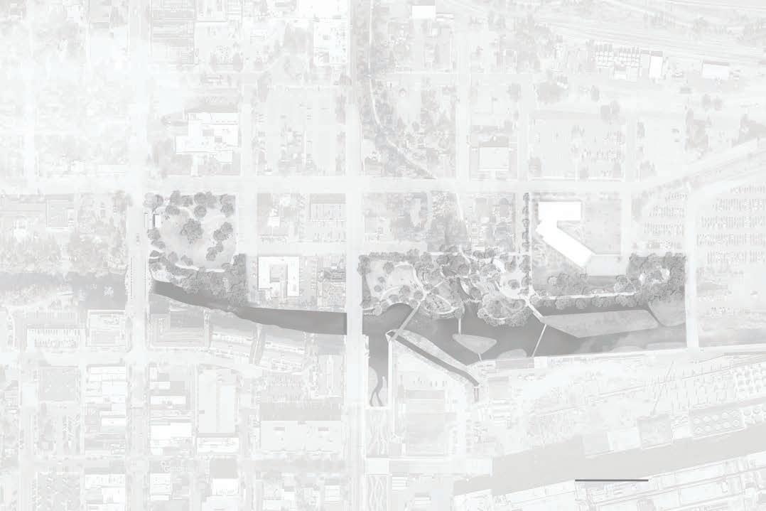
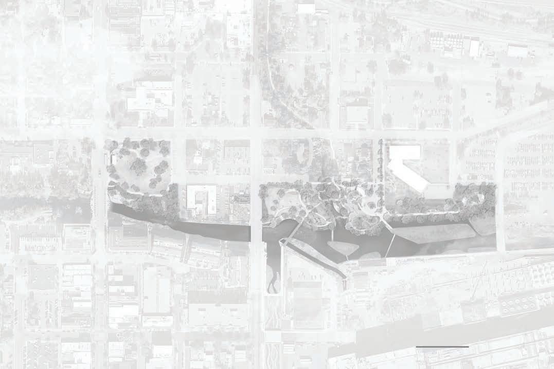
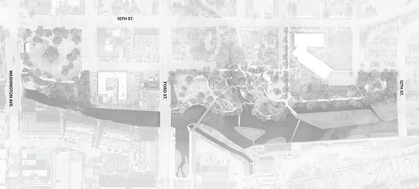
(Right) Context map of downtown Golden with the project boundary shown in the East Amenity Zone.
The study area defines the eastern extent of the Clear Creek corridor where downtown Golden interfaces with the municipal campus and adjoining neighborhoods. It operates as both a physical and symbolic gateway— linking the active creekfront and downtown blocks to the Police and Municipal Building, schools, and residential areas to the east. Because it sits at the transition between the heart of downtown and the city’s everyday civic operations, this area carries an outsized responsibility for making the corridor feel continuous, legible, and welcoming.
Functionally, the study area is the hinge that keeps the creek corridor connected as it moves east. It accommodates regional trail movement, day-to-day civic access, and neighborhood connections while still presenting the creek as a defining public asset. Its role is to reconcile these layers—movement, identity, and stewardship—so the corridor reads as one coherent place rather than a series of disconnected segments.
Extending from Washington Avenue on the west toward the city’s eastern edge, the study area includes the Police and Municipal Building, associated civic lands, and the open space that frames both banks of Clear Creek. It also captures the junctions where local streets, service drives, and the regional multi-use trail meet, creating a network of edges and thresholds that shape how people arrive, move through, and experience the creek.
Within this footprint, the components are varied but complementary: civic facilities and working back-of-house areas, creek-adjacent open space, and key trail connectors that tie downtown to neighborhoods and regional destinations. Together, these elements establish the structure for future improvements—identifying where civic needs must remain prominent, where public access and gathering should be emphasized, and where the corridor can widen to create stronger creek relationships.
Considering the East Zone as a distinct study area allows the City and community to craft a vision calibrated to its gateway role and multi-use character. The aim is to clarify how civic functions, creek access, and corridor continuity coexist—setting the stage for a cohesive sequence of spaces that feels unmistakably Golden while performing reliably for daily operations and regional movement.
The accompanying aerial map delineates the study-area boundary and its relationships to downtown blocks, adjacent neighborhoods, and the broader Clear Creek system. It provides a shared reference for decisions about circulation, access points, public space locations, and the interface with civic uses—so subsequent design moves can be phased, coordinated, and ultimately additive to the larger corridor experience.
HEART OF GOLDEN | EAST AMENITY ZONE
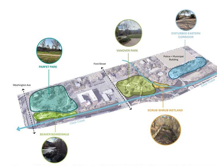
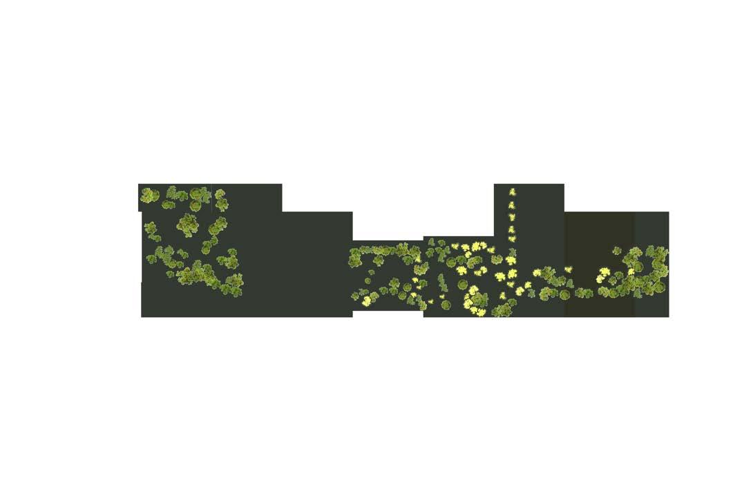
(Right) Key parks, civic edges, and underutilized parcels define a corridor with high potential for improved access, trail continuity, and stronger ecological relationships along Clear Creek.
The East Amenity Zone is a mosaic of parks, civic edges, and underutilized parcels along Clear Creek. Each piece contributes value, but uneven visibility, access, and continuity keep the area from functioning as a single, legible park corridor. Improving these connections will help people distribute more evenly along the creek, enhancing comfort and safety.
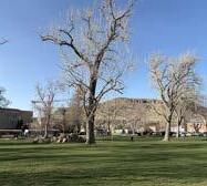
Parfet Park is one of Golden’s most recognizable civic open spaces, hosting community events and offering lawn and shade adjacent to downtown. While well-used, its edges and crossings to the east are not intuitive, making it difficult for visitors to experience the park as a gateway to the rest of the corridor.
Vanover Park provides creekside lawns, shade, and access to the regional trail. However, its connections back to downtown are fragmented by streets and parking, and its current trail alignments feel indirect. As a result, the park is well-loved locally but reads more as a standalone destination than as an integral piece of the Clear Creek corridor.
The Archer Street lot and adjacent Tucker Gulch currently serve overflow and back-of-house functions but occupy a pivotal location where neighborhood access, trail movement, and riparian habitat could all be strengthened. At the eastern edge, the Farmers Highline Canal is an undercelebrated water feature with potential to extend ecological restoration and recreational networks into the city’s fabric.
The study area contains signature assets—Parfet and Vanover Parks, continuous creek frontage, and adjacency to downtown—but their fragmentation diminishes overall impact. By clarifying trail connections and crossings, elevating underutilized parcels, and making the creek more visible and accessible from surrounding blocks, the East Zone can become a cohesive civic and ecological corridor that supports residents’ daily life while welcoming visitors.
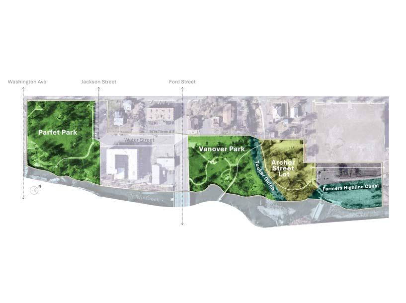
• Parfet Park - 2.25 Acres
• Vanover Park - 1.25 Acres
• Archer Lot and Tucker Gulch - 1.4 Acres
• Highline Canal - 1.0 Acres
Understanding how the East Zone works today reveals the opportunities to reconnect its parks, civic edges, and creek corridor into one continuous public realm.
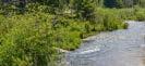
Clear Creek is the defining natural asset of the East Amenity Zone—a living corridor shaped by a dynamic hydrologic system and decades of recreational use. The riparian forest, dominated by plains cottonwood and coyote willow, continues to provide habitat, shade, and refuge for both people and wildlife. Yet this natural system transitions quickly into disturbed landscapes along the civic campus, where fragmented vegetation and urban infrastructure weaken ecological resilience.
Wetlands at the confluence of Tucker Gulch and Clear Creek support stormwater filtration and wildlife habitat but are largely hidden from public view. Beavers are actively modifying habitat along the Ford–Washington creekside walkway, signaling the potential for regenerative landscape management and improved ecological connections.
Future enhancements can reinforce the corridor as a resilient ecological spine — restoring native vegetation to replace water-intensive turf and reconnect fragmented riparian zones, and designing access that protects habitat while deepening connections to nature.
Clear Creek flows east through Golden before joining the South Platte River, contributing to a major regional watershed system that ultimately connects to the Missouri and Mississippi Rivers. This regional hydrology influences local design: much of the corridor falls within FEMA-designated Special Flood Hazard Areas, with portions identified as regulatory floodway. The eastern reach reflects revised boundaries per a 2023 LOMR update.
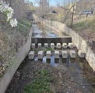
Tucker Gulch introduces additional stormwater complexity. Steep grade drops and a confined concrete channel create barriers to public access and ecological restoration, yet also define a dramatic topographic character that could be celebrated through overlooks, interpretation, and adjacent green spaces rather than direct in-channel interaction.
Importantly, water quality monitoring by CDPHE indicates Clear Creek is not currently listed as impaired — offering a strong foundation for climateresilient creek access, naturalized edges, and future restoration efforts without introducing new water-quality risks.
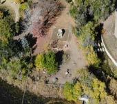

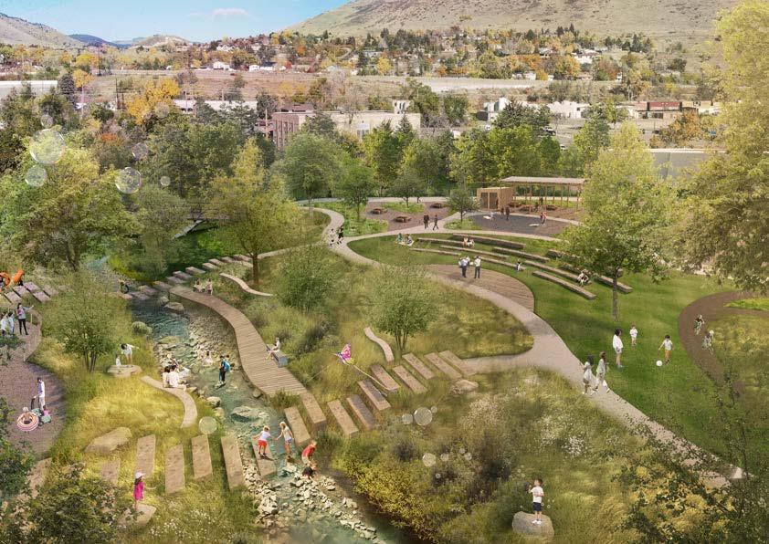
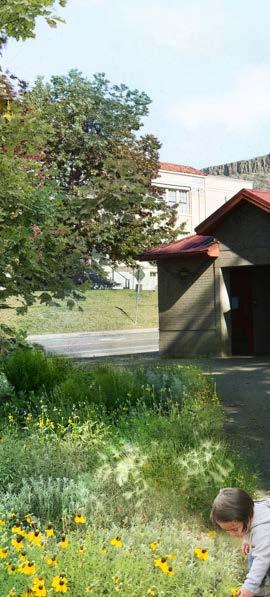
(Left) The East Amenity Zone today: a mix of well-loved parks, civic edges, and fragmented creekside habitats. Understanding these existing character areas — from Parfet and Vanover Parks to the scrub-shrub wetlands and the Beaver Boardwalk — reveals opportunities to reconnect people, ecology, and movement along Clear Creek.
Parfet Park and Vanover Park anchor the west and east edges of the corridor, yet the spaces between them lack legibility and cohesion. Underused lawn areas and ad-hoc edges create confusion about where parks begin and end. Meanwhile, the new Police and Municipal Building introduces a major civic destination that further increases the importance of strong pedestrian and visual connections across the corridor.
The East Zone presents a timely opportunity to stitch together these dispersed open spaces into a single public realm experience — one that supports both day-to-day recreation and Golden’s signature seasonal events. A unified park edge along the creek would provide clarity of purpose, expand opportunities for play and gathering, and reinforce Golden’s identity as a community shaped by its water, history, and outdoor culture.
Mobility networks in the study area are active but inconsistent. Washington Avenue and Ford Street serve as essential emergency and downtown access routes, yet their crossings are difficult during peak use times. Sidewalks and bike lanes are present but vary in comfort and continuity, especially where the Clear Creek Trail becomes constrained by road alignment or narrow pinch points.
Several planned improvements including the 10th Street Complete Street — signal a shift toward more connected, multimodal movement. Strengthening east-west flow along 10th Street and north-south access between the creek, parks, and civic buildings will support safer and more intuitive travel for pedestrians, cyclists, and families navigating the corridor. inconsistent, with limited crossings and wayfinding.
Planned upgrades—such as the 10th Street Complete Street— will knit together Parfet Park, Vanover Park, and the new municipal campus for people walking, biking, and rolling.
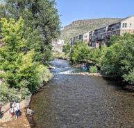
The East Zone is one of Golden’s most active cultural landscapes. Parfet Park hosts large-format events like Buffalo Bill Days and Movies & Music in the Park, while Vanover Park is the terminus to Golden’s iconic tubing culture. Seasonal activities — festivals, picnics, and creek-side recreation — bring thousands of residents and visitors into the area each year.
However, the spaces that serve these events are often stressed by heavy temporary uses: high foot traffic on trails, informal gathering in constrained zones, and limited amenities for large crowds. Enhancing circulation, shade, seating, and flexible gathering areas can improve the experience of both everyday users and major events — keeping Golden’s traditions strong while reducing impacts to the creek and neighborhoods.
PARK PARFET PARK
Jan Feb Mar April May June July Aug Sept
Summer Day-Use Picnics, Walks, Runs, Biking, Birthday Parties, etc.
1,500+ People
Ullrgrass Beer Festival
1,500 - 9,000 People (over the entire weekend)
People
500-1000 People Goldens in Golden
Easter Egg Hunt
500-800 People
10,000-30,000 People (over the entire weekend)
Tubing 100+ People (per day)
National Night Out
Bike to Work Day
2,000-4,000 People (over the entire weekend)
Movies & Music in the Park 500-1000 People
CULTURAL EVENTS IN THE EAST
(Left) The annual calendar of community events illustrates how Parfet Park, Clear Creek, and Vanover Park serve as cultural anchors, informing programming and infrastructure needs in the East Amenity Zone.
Chili Cook-Off
1,000-2,000 People
The project team reviewed Golden’s annual events calendar to better understand how community gatherings shape the use and perception of the study area. Many of the city’s most wellattended events—such as Ullrgrass, Buffalo Bill Days, and the Independence Day celebration—are hosted in or near Parfet Park, and Clear Creek, making these key cultural anchors within the corridor.
This seasonal programming contributes to a lively and dynamic public realm, particularly in the spring and summer months when the creek and adjacent parks experience their highest levels of use. Events range from large-scale festivals drawing thousands of people to smaller community gatherings like the Easter Egg Hunt. In addition, informal summer-day uses such as tubing, biking, and picnicking animate the area on a daily basis.
Understanding this cultural calendar is essential to planning future improvements. It helps identify high-traffic times, programmatic needs, and potential areas for enhanced infrastructure, shade, circulation, and gathering space to support both everyday use and large-scale events.
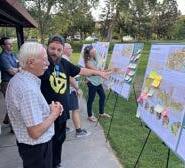
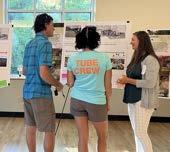
A layered, hands-on process that combined broad listening with focused testing. Early events introduced the study area and gathered values and priorities; subsequent workshops used station-based activities (dot-voting, comment cards, and place-specific boards) so participants could compare options side-by-side and explain trade-offs in their own words. This approach captured both quantitative signals (what rose to the top) and qualitative nuance (why it mattered).
To broaden access and keep the inputs comparable, each in-person public meeting was paired with a virtual survey on Guiding Golden that mirrored the boards and prompts presented at the event. This allowed people who couldn’t attend to weigh in at their convenience and generated parallel quantitative and qualitative feedback, which was tallied alongside the inperson results to guide concept development.
Engagement unfolded as a coordinated, iterative arc. It began with a joint kickoff and site walk led by City staff and the Parks & Recreation Advisory Board, using on-the-ground observations to anchor opportunities and constraints. Soon after, the East Amenity Zone was introduced at
a citywide Heart of Golden open house, inviting early input on values and priorities for this part of the corridor. The City hosted Public Meeting #1, a hands-on workshop where participants tested program ideas, character preferences, and mobility choices through station-based activities that produced both quantitative signals and qualitative insight.
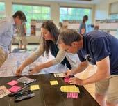
Throughout the process, the Parks & Recreation Advisory Board was engaged four times in total: first during the kickoff walk; then to review Meeting #1 findings and frame the range of alternatives; again to preview and refine three concepts ahead of the second public meeting; and finally to confirm a preferred direction and discuss implementation considerations. At Public Meeting #2, three alternative site plans were presented showing how the community’s preferred programs could be arranged on the ground and gathered clear direction on a path forward. City staff and the project team refined the preferred concept for feasibility, operations, and alignment with the broader Heart of Golden framework. This sequence—from walk to workshops to Board checkpoints—kept the design rooted in community input while ensuring it fits the city’s long-term vision, culminating in the coordinated concept presented in this document.
Meeting #1 results were translated into three alternatives and returned in Meeting #2 to test them. Community direction was to advance Concept 1 as the baseline, integrate shade and passive gathering from Concept 2, and avoid overbuilt features from Concept 3—all while explicitly addressing mobility and parking to keep the area resident-first and comfortable for daily use.
The preferred approach was refined to confirm feasibility and fit within the larger Heart of Golden framework; the coordinated concept in this Vision document reflects that progression from values to programs to alternatives to refined vision.

Across boards and surveys, people consistently chose nature-forward options—preferring nature-based play, wild/exploratory settings, and the ability to explore nature on one’s own path. This wasn’t just about “more green”; it pointed to a desire for living systems: native plant communities, soft creek edges, shaded refuges, and native habitat that supports birds and other wildlife.
Feedback was especially strong for restoring riparian corridors at Tucker Gulch and the Farmers Highline Canal, where participants called for native planting, habitat enhancement, and limiting human impact in sensitive areas. Notes also flagged water-quality awareness and the importance of treating the creek as an ecological asset first, recreational amenity second. Together, these signals set a clear mandate to reconnect fragmented habitats, stabilize banks with naturebased solutions, and integrate low-touch access that protect resources while letting people experience them.
Connectivity is a top priority - trail extensions, convenient and safe street crossings, and comfortable places for people to walk and bicycle.
The desire for multi-modal and pedestrianoriented movement outpaced demand for traffic and parking improvements in this area. Participants asked for traffic calming, clearer crossings, and more space for people walking and riding bicycles. Participants also asked for grade-separated street crossings at key pinch points to make movements predictable and safe.
(THE “EVERYDAY” INFRASTRUCTURE)
Across in-person and virtual inputs, people repeatedly asked for bathrooms, trash/recycling improvements, shade, seating/overlooks, and clear parking solutions that protect neighborhood access. Amenity tallies show strong interest in walking/biking trails, seating/ overlooks and community shelters, alongside “bathrooms!” noted multiple times. Feedback framed these as must-haves that make daily, local use comfortable and sustainable.
The community supported events in principle, but asked to right-size them and avoid permanent infrastructure in the creek parks. At Parfet, people favored no permanent stage and only 1–2 big events per year, with a preference for a mixed, more natural character. Comments urged shifting larger events away from the tightest locations and keeping the landscape native, open and green. Meeting #2 feedback echoed this: strong opposition to a permanent performance area and hardscape paving; any gathering space should be kept small, with trees and lawn preserved.

Participants asked for a place that feels unmistakably Golden—authentic, low-key, and resident-first—rather than a destination branded by big gestures or iconic objects. In the framework exercises, people favored local park character and local storytelling over destination tropes, emphasizing an experience that’s grounded in Golden’s history and everyday life. Open-ended comments reinforced this preference. Residents asked to “leave Golden natural” and “keep the small-town charm,” signaling that materials, furnishings, and interpretive elements should read as local— drawing on the city’s industrial and western heritage—without overwhelming the landscape.
Concerns about the corridor feeling “overDenverized” at Public Meeting #2 underscored the risk of overbuilt features; community members favored quiet, story-rich moments and human-scaled details over statement pieces.
HEART OF GOLDEN | EAST AMENITY ZONE
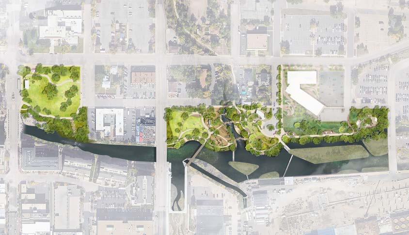
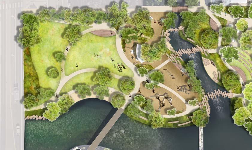
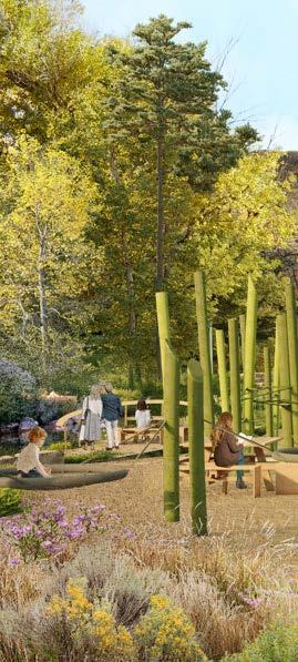
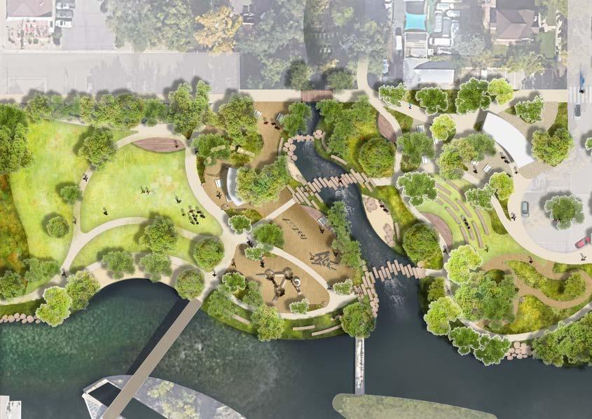
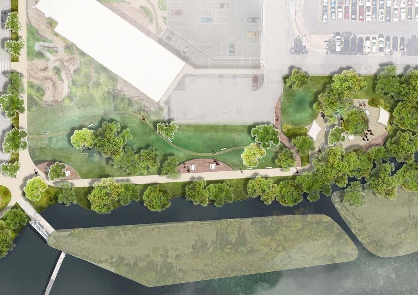
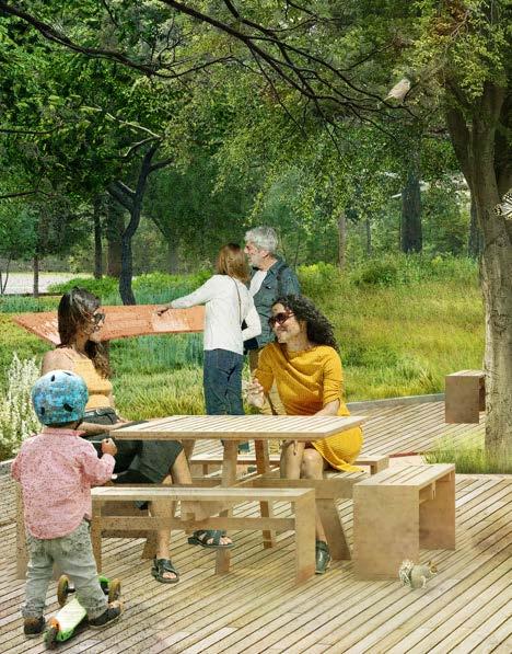
(Right) Vision Plan for the East Amenity Zone in Golden, CO, including new recreational spaces, landscaped areas, and community amenities.
Imagine a landscape where the sound of Clear Creek mingles with music and laughter from community gatherings, where shady groves and open lawns invite play, rest, and connection, and where every path leads to a new encounter with nature. The East Amenity Zone Master Plan envisions exactly this: a vibrant, connected series of parks, civic spaces, and waterways that together create a continuous, immersive experience of Golden’s outdoors.
The community’s vision was clear: Golden’s parks should be more than spaces for recreation, they should be ecologically rich, resilient, and deeply connected to the City’s identity. With their beloved mature trees and expansive multi-use lawns and opportunities to add native vegetation, Parfet and Vanover parks will retain the qualities that make them cherished gathering places, while enhanced pathways, safer street crossings, and improved accessibility will knit them more tightly into the fabric of downtown and the new Police and Municipal Building.
Moving outward from the downtown core, the landscape transitions from multi-use lawns to flourishing native plantings, re-naturalized habitats along Tucker Gulch, and stronger connections to Clear Creek. A creekside nature walkway along the Farmer’s Highline Canal creates an immersive, sensory experience, inviting visitors to explore, reflect, and engage with the natural world.
Anchored by the new Police and Municipal building at 10th and Archer, the East Amenity Zone becomes a dynamic, permeable public realm, shaded and inviting, adaptable to both large community events and quiet, everyday moments. Together, these elements form a landscape shaped by community, ecology, and a love for the outdoors, a place that feels purely Golden, and unmistakably Colorado.
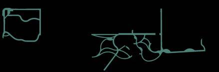
(Right) Circulation diagram of the East Amenity Zone, showing additional paths within existing parks and new overlooks along Farmer’s Canal and Tucker Gulch.
Today, circulation within the East Amenity Zone is fragmented. While individual parks, such as Parfet and Vanover, offer internal paths, safe and continuous connections between them are limited and often interrupted by roadways or unclear crossings. In several areas, trails do not fully engage with Clear Creek or other waterways, resulting in missed opportunities to experience the water close-up. Shared-use paths create conflicts between pedestrians, bicyclists, and recreational users, reducing comfort and safety for all. These disconnections and competing uses limit visitors’ experience of the East Amenity Zone as a cohesive and unified park system.
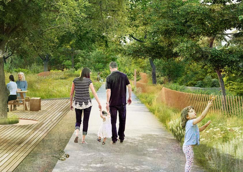
A continuous circulation network is the first step in fostering this cohesive experience. A new central path links Parfet Park, Vanover Park, Tucker Gulch, and the Farmer’s Canal into a seamless system that encourages walking, biking, and exploration.
New secondary paths along Clear Creek and Tucker Gulch bring pedestrians closer to the water, offering opportunities for water play and nature observation. Improved creek crossings and accessible trail surfaces enhance safety and comfort for users of all ages and abilities. Together, these improvements transform how users move throughout the East Amenity Zone from a series of separate routes into a connected, creekside experience that celebrates Golden’s incredible creeks and open spaces.
Bike & Pedestrian Circulation
Secondary Pedestrian Circulation
Existing Bike & Pedestrian Circulation
Existing Secondary Pedestrian Circulation
Tubing Float Path
(Right) Use diagram of the East Amenity Zone, illustrating programmed areas for play, recreation, community events, gathering, and passive enjoyment.
Parfet Park and Vanover Park have long been central gathering places for Golden, hosting public events, festivals, and community celebrations on their expansive lawns. The community wants these traditions to continue while also improving accessibility and usability. The proposed improvements at Vanover add smaller gathering spaces that complements Parfet’s usage, including intimate plazas, small performance spots, flexible recreation areas, and paths that can accommodate farmers market vendors. At Tucker Gulch, a shaded plaza with new restrooms creates a welcoming anchor for birthdays, small events, and everyday outdoor use.
By expanding the variety of programmed spaces across the East Amenity Zone, the plan supports movement through the site and offers more opportunities for recreation, connection, and community engagement. It strengthens the identity of Golden’s parks while improving connectivity and providing spaces for a wide range of users, from tubers accessing Clear Creek to families enjoying picnics. The East Amenity Zone enhances daily park experiences and supports larger events such as markets and festivals.
USE DIAGRAM

Play Areas
Multi-Use Lawn
Plazas / Gathering Spaces
(Right) Ecology plan illustrating enhanced riparian zones along Clear Creek and areas where high-water turf will be replaced with native grasses and pollinator-rich plantings.
The East Amenity Zone presents a remarkable opportunity to expand and enhance the existing ecology that thrives along Clear Creek. Building upon the rich riparian corridor that connects Parfet Park and Vanover Park, the vision plan seeks to rewild Tucker Gulch, restore natural hydrology, and remove the concrete channel that currently limits ecological function. By softening and naturalizing the creek edges, the project will allow water to move and breathe within a more resilient, living system.
Across the corridor, paved areas such as the Archer Street and Farmers Canal lots will be transformed into verdant park spaces, lush with native prairie and riparian plantings that celebrate the region’s natural heritage. These restored landscapes will form vital habitat patches, creating a continuous network of food sources, cover, and nesting areas for pollinators, birds, and other wildlife.
While existing mature trees and shaded lawns will continue to provide places for gathering, play, and respite, the expanded planting palette will introduce diverse native grasses, shrubs, and wildflowers that bring color, texture, and seasonal dynamism to the parks. Wetlands and scrubshrub zones along Clear Creek and Tucker Gulch will be strengthened with native willow, cattail, and rabbitbrush communities, providing structure and native habitat complexity.
Together, these improvements will reconnect people, plants, and wildlife along Clear Creek, transforming a fragmented urban corridor into a thriving ecological park system that supports both community life and the health of the watershed.
PLANTING TYPOLOGY DIAGRAM
HEART OF GOLDEN | EAST AMENITY ZONE
rogramming for littleones lots of impervious surf a c e n o designated communityspace
preserve existing mature shade trees
lca k i ng p


LAWN no access to Tucker Gulch
EXISTING PLAY existing path
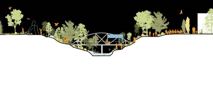
Existing Ecological Section at Tucker Gulch (Not to Scale)
energy dissipating structures
PARKING LOT
restore the existing nature play area to enhance native biodiversity

increase ecosystem diversity resilience is tied to diversity, size, and connectivity

preserve existing canopy trees + additional shade trees

*Diagrammatic sections are not to scale and only intended for interpretation
flex / open lawn & preserved trees
NATURE PLAY WITH UPLAND PRAIRIE RESTORED NATIVE FLOODPLAIN
Proposed Ecological Section at Tucker Gulch (Not to Scale)

FLOODPLAIN
bike & walking lane water-side seating areas enhanced ecological health - walls removed TUCKER GULCH
outdoor gathering & community events
COMMUNITY
EVENT SPACE / POLICE & MUNICIPAL BUILDING


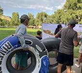
Golden is already well known for the energy and activity along Clear Creek. Tubing, kayaking, and creekside strolling draw visitors throughout the summer, with access points at Vanover Park and a public shuttle returning tubers to their start. Yet, this popularity can sometimes lead to congestion along the most active stretches of the creek. To better balance use and improve the experience for all visitors, the plan envisions expanding and enhancing key access areas, such as the Tuber Take-Out, while also creating new places for quieter, nature-based engagement with water.
Where Clear Creek’s swift current offers thrill and excitement, Tucker Gulch will provide calm. The plan proposes transforming this confluence into an accessible, naturalized riparian zone designed for safe, low-intensity water play and immersive contact with nature. Restored creek edges, native vegetation, and gentle topography will create a welcoming landscape for families, children, and those seeking a more peaceful experience. Interpretive elements will highlight the ecological
value of riparian corridors, illustrating how water, native vegetation, and wildlife interact to sustain a living system.
Farmers Canal introduces another dimension to the experience, a shaded, meandering greenway that connects the new Police & Municipal Building with the broader East Amenity Zone. Reimagined as a linear park and ecological corridor, the canal edge will feature native plantings, walkways, and gathering spaces that invite reflection and relaxation while preserving the canals irrigation stormwater role. Softened edges and layered native vegetation will enhance habitat for pollinators, birds, and aquatic species while offering a serene alternative to the bustling creek.
Together, these interventions diversify how people experience water in Golden, from the thrill of Clear Creek to the tranquility of Tucker Gulch and the quiet rhythm of Farmer’s Canal, creating a continuous, accessible, and ecologically rich connection between the City, its waterways, and the natural landscape.
(Right) Plan showing current and future access to Clear Creek, along with improved connections between the creek and adjacent park spaces.
WATER ACCESS DIAGRAM

(Right) East Amenity Zone includes four Focus Zones: Parfet Park, Vanover Park, Tucker Gulch and Farmers Highline Canal.
The East Amenity Zone of the Heart of Golden project has been subdivided into four distinct focus zones, each designed to enhance recreational, ecological, and community experiences while creating a connected and accessible landscape. While each zone has its own unique character and programming, together they form a cohesive outdoor recreation space that integrates ecology, civic activity, and recreational opportunities.
Parfet Park – This historic park retains its iconic old-growth trees and open lawn, with opportunities to supplement with native vegetation. It will continue to provide space for community gatherings, events, and informal recreation.
Vanover Park – Already a popular hub for Clear Creek activities such as tubing, Vanover Park will see targeted improvements to better manage high visitor use and will incorporate native vegetation.
Tucker Gulch – This area will evolve from an underutilized water corridor and impervious surface area into an accessible riparian native landscape and amenity for the community. The area previously known as the Archer Street Lot will now connect the East Amenity Zone to the new Police and Municipal Building.
Farmers Highline Canal – The canal zone will incorporate prairie and riparian native landscape and connect the Police and Municipal Building to the rest of the East Amenity Zone.
Together, these four focus zones balance shared programming with unique site experiences, creating an interconnected landscape where ecological restoration, community engagement, and outdoor recreation coexist and complement one another.
FOCUS ZONE 1: Parfet Park
A new path connects Water Street to a new Mobility Hub.
Water Street (Refer to Mobility Section)

Updated nature play draws visitors towards the newly restored Tucker Gulch.
A restored Tucker Gulch invites nature appreciation, while a natural gathering space and pump track provide new spaces for gathering and play.
A new walk connects visitors from Tucker Gulch to the Police & Municipal Building along Clear Creek, offering seating and public art installation.
LINKING PARFET PARK TO DOWNTOWN, CLEAR CREEK, AND BEYOND.
Parfet Park is a beloved community gathering place, hosting a variety of events while offering open green space and a connection to Clear Creek. The proposed master plan preserves the features the Golden community values most: its open lawn, shady trees, and creekside setting, while strengthening connections to downtown and the newly enhanced East Amenity Zone.
Upgrades along Water Street (see Mobility section) will make walking and biking between Parfet Park, the new Police & Municipal Building, and the other Heart of Golden parks safer,
easier, and more enjoyable, creating a seamless experience along the creek corridor. Thoughtfully placed native plantings at the edges of the lawn will support pollinators and bring visitors closer to nature without reducing the park’s usable space. A new creek access point will offer even more ways for people to connect with the water, and a small transportation hub at Washington Ave. and 10th Street will provide a convenient stop for buses and shuttles, helping to reduce congestion and idling on the City’s main streets.
(Left) Plan rendering of Parfet Park, highlighting the new creek access and preserved lawn space.
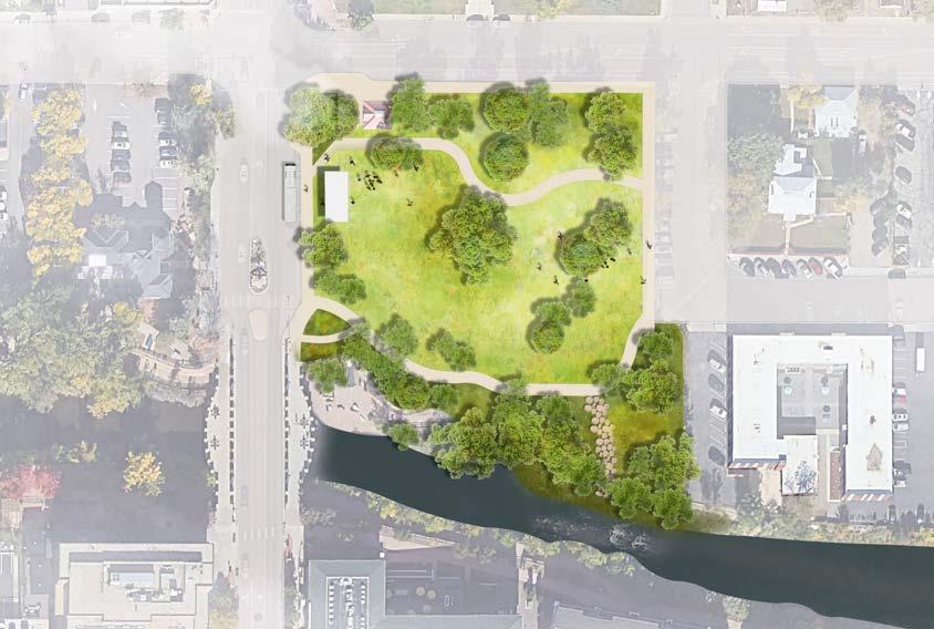

UNTAPPED OPPORTUNITY FOR PARFET PARK
To establish a meaningful gateway that connects visitors along Clear Creek, a pedestrian path pulled away from 10th Street will wind through new native plantings at Parfet Park. A new transportation hub will reduce traffic in Golden’s busiest areas.
In response to community input to preserve the existing lawn and mature trees, the plan also introduces a new access point to Clear Creek, helping to disperse use and enhance access along the waterway.
Vanover Park is a cherished spot for picnics, strolling, and tubing along Clear Creek, with paths that allow visitors to bike through the park and across the existing creek bridge and regional trail. The park will retain its open lawn, mature shade trees, and creek access, while introducing new ways to engage with nature.The plan preserves the existing trees, enhancing them with additional shade trees, new native plantings, and natural stone terraces. The park will also feature additional seating and a new shade structure, providing comfort for visitors while complementing the park’s ecological character.
The tuber take-out will be expanded and more seamlessly integrated with clear signage and improved connections to trails and the East Amenity Zone.
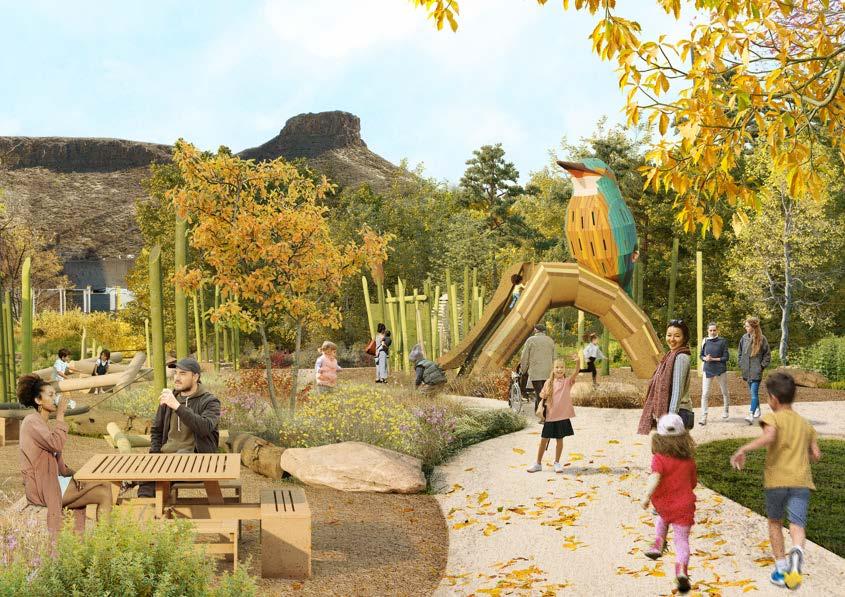
The plan’s biggest proposed update to Vanover is the expansion of the existing nature play area. As Tucker Gulch is re-naturalized, the play zone will stretch further into the landscape, featuring a signature iconic structure inspired by Golden’s local flora and fauna, alongside smaller elements such as fallen logs, stepping stones, climbing rocks, and an embankment slide – creating a playful, immersive space for kids to explore, climb, and interact with the natural surroundings.
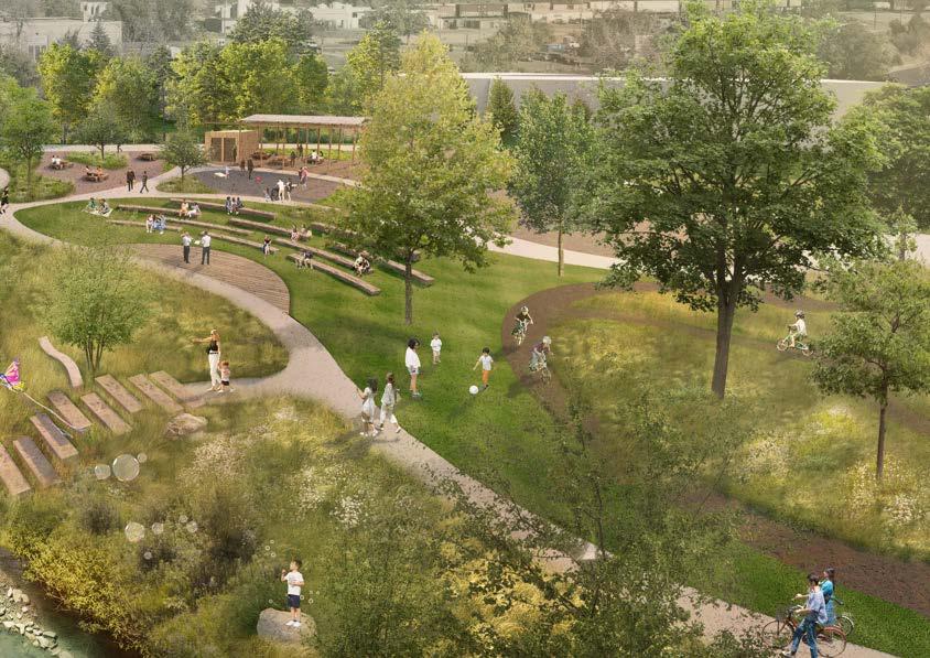
(Right) Plan rendering of Vanover Park, showing the reconfigured path network and its connection to Tucker Gulch.

Vanover Park will become a vibrant, natureinspired destination where families can engage with the creek and the surrounding landscape. A new play area, inspired by the riparian environment, will feature climbing structures, balance elements, and a sculptural play tower shaped like a native bird or insect. Natural materials, native plants, and shaded seating will create a playful atmosphere deeply connected to Golden’s ecology. With views of the foothills and direct access to Clear Creek, the park will serve as an energetic entryway to the water and the broader Heart of Golden park system.
NATIVE PLANTING WITH YEAR-ROUND INTEREST
OUTDOOR SEATING
NATURE INSPIRED PLAY
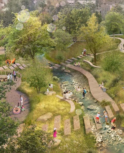
This plan reimagines the intersections of Tucker Gulch and Clear Creek, transforming a hardedged, neglected channel and surrounding abandoned lots into a vibrant, ecologically rich park. By rewilding the creek corridor and restoring native plant communities, the design creates a dynamic riparian ecosystem that supports wildlife while offering engaging public spaces. Gulch overlooks, seating boulders, and shaded decks allow visitors to pause and connect with the water, while a small sandy beach and crossing stones invite safe, playful interaction with the creek.
Adjacent open lawns and a new picnic pavilion reclaim previously underused lots, providing flexible spaces for community gatherings or quiet outdoor moments. The addition of a bike pump track introduces active recreation without compromising the ecological focus of the site. Overall, the design celebrates Golden’s waterways by restoring natural flows, reorienting abandoned spaces into usable parkland, and creating a landscape where people and nature coexist in harmony.
(Left) Plan rendering of Tucker Gulch showing the connection between Vanover Park and the newly restored Tucker Gulch.

Tucker Gulch will evolve from a publicly inaccessible drainage channel into an engaging landscape for play and community connection. Restoring the site’s natural riparian character creates opportunities for interactive water crossings and nature-based play. The new design links Vanover Park and the future Archer Street Park, establishing a continuous path from highuse areas such as Parfet and Vanover Parks to new public spaces adjacent to the Police and Municipal Building.
PRESERVED CANOPY TREES
FARMERS HIGHLINE CANAL AS A PUBLIC SPACE
In the new vision, what was once unutilized land along the Farmers Canal will become a dynamic green corridor that balances functional water conveyance with public access and ecological enhancement. The path along the canal preserves its role in water management while providing a shaded, meandering route for strolling, pausing, or enjoying picnics. Native plantings and preserved trees soften the edge and create habitat, while bioretention areas filter stormwater and enhance the creekside ecosystem.
Between the new Police & Municipal Building and the stormwater features, the creekside walkway transforms the canal edge into a unique, immersive experience. Sculptural elements, an artistic fence along the canal walk, seating
decks, and native gardens celebrate both Golden’s water infrastructure and its local art and ecological character. The fence follows the edge of the path to protect visitors, but its crafted design also adds beauty and identity to the corridor. Together, these features encourage interaction with the canal while maintaining its functional integrity, creating a continuous, inviting space that merges engineered systems, natural landscapes, and creative placemaking.
This area of the East Amenity Zone is an ideal location for public art, given its proximity to the new police and municipal building. Art can help make the bioretention pond and Farmers Canal a more visible and engaging feature, supporting the City of Golden’s public art program.

INTERPRETIVE SIGNAGE
CREATING COMMUNITY THROUGH PLACE-BASED ART INSTALLATIONS
The Farmers Canal will become a functional waterway that balances water management with public engagement. A shaded creekside walkway invites visitors to stroll, pause, or picnic along the canal. New native plantings soften the edge and provide habitat. A path will also connect the main walkway to the Police and Municipal Building. This creekside walkway corridor offers an immersive experience with sculptural installations and seating decks.
BIORETENTION PLANTING
OUTDOOR SEATING
Jackson Street and Water Street currently provide two-way traffic between 10th Street and Ford Street; on-street parking for park visitors, business customers, and residents; and nonmotorized access between Parfet Park and Vanover Park. During this project, participants expressed a desire for these streets to better support community gathering, comfortable pedestrian movement, and intuitive access between parks — while preserving resident access and parking needs. There is strong community interest in improving safety, comfort, and wayfinding, and ensuring these streets feel like a seamless part of the East Amenity Zone experience.
These goals are intended to guide future planning and reflect community feedback and City of Golden multimodal priorities, without establishing a preferred design or specific configuration at this time:
• Support local and residential access, including the potential to retain two-way travel, especially on Jackson Street.
• Preserve on-street parking access where feasible to serve residents, park users, and local businesses.
• Improve comfortable, intuitive, and safe movement for people walking, biking, rolling, and driving at slow, compatible speeds.
• Explore opportunities for sidewalks on both sides of Jackson Street to improve pedestrian connectivity.
• Consider shared-street concepts on Water Street that enhance mobility for all users and allow everyone to move at similar speeds.
• Provide shaded walkways and pedestrianoriented amenities to enhance comfort yearround.
• Strengthen the landscape character and provide nature-based elements so the streets function as part of the park system, not simply vehicular routes.
• Reallocate portions of right-of-way over time to expand space for people, programming, and landscape where appropriate.
• Introduce flexible spaces that could support community events or seasonal activities and help activate the corridor.
• Ensure use of durable, context-appropriate materials consistent with the Clear Creek corridor and East Amenity Zone identity.
• Create safe and intuitive connections that clearly link Vanover Park, Parfet Park, and the creek corridor.
Jackson Street and Water Street will continue to provide essential access for nearby residents and businesses. Over time, they can evolve into welcoming civic connectors that support daily mobility needs while enhancing park identity, community use, and the overall East Amenity Zone experience.
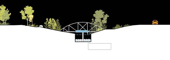
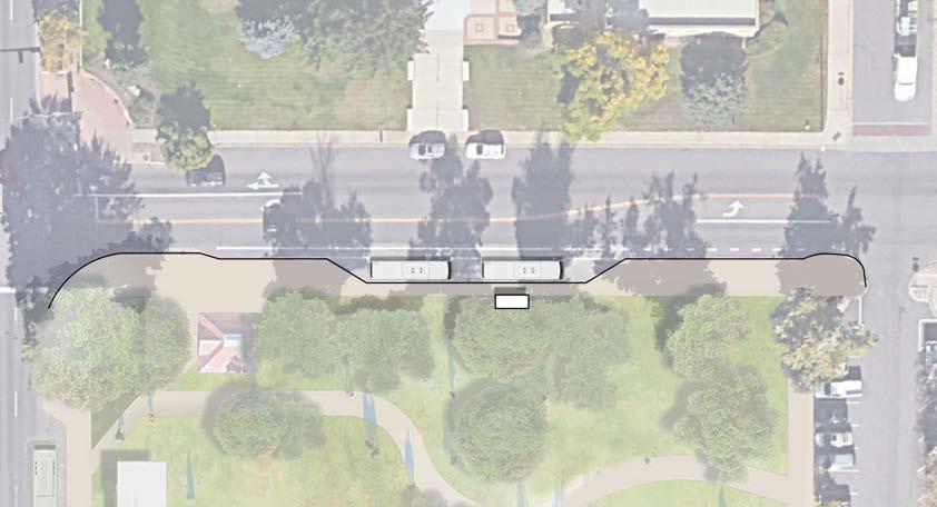
(Left) Proposed improved pedestrian crossing at Ford and Water Street
Crosswalk improvements on Ford Street at Water Street are recommended to provide convenient and comfortable multimodal connections through the East Amenity Zone. The crosswalk improvements shown in the image on the left include a median pedestrian refuge island and a traffic signal that would be coordinated with the traffic signal at Ford Street and 10th Street.
The proposed improvements on Ford Street will allow for average daily multimodal movement between the Vanover and Parfet parks, while not impeding traffic flow on Ford Street. Safety improvements include eliminating northbound and southbound left turn movements from Ford Street to Water Street. The northbound left turn lane is a continuous lane for both Water Street and 10th Street, which causes confusion for both drivers and pedestrians using the legal crosswalk at Water Street.
There is no left turn lane on Ford Street for southbound left turns at Water Street, so southbound left turning motorists can cause traffic delays. These restrictions will also impact left turn movements from Water Street onto Ford Street. Eliminating these movements will reduce the number of conflict points for motorists and pedestrians, create more predictability, and improve traffic flow on Ford Street.
DRIVEWAY
MEDIAN PEDESTRIAN REFUGE ISLAND
CROSSWALK LIGHTING
COORDINATED PEDESTRIAN SIGNAL
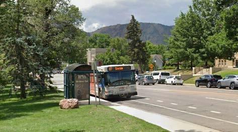
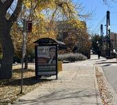
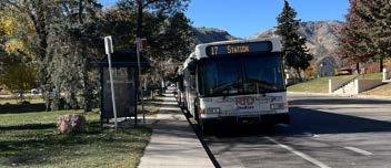
(Right) Bus stop improvements along 10th street at Parfet Park to increase safety for cyclists riding adjacent to the bus pull out lane.
In 2019, the City of Golden adopted the Transportation Master Plan which identifies 10th Street as a recommended complete street. The goal of complete streets is to better balance the multi-modal demands on corridors that have diverse needs for transportation modes.
To accommodate a future complete street project, a bus pull-out is incorporated into the park design to serve the bus route layover while improving the sight distance from Jackson Street looking west on 10th Street.
This design will allow for flexibility in a future complete street design on 10th Street while better serving existing traffic, bicycle, and transit experiences.
Example of RFB signage and overhead lighting
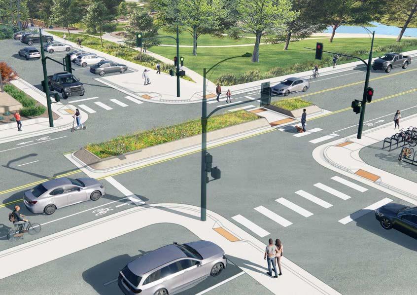
(Right) Proposed 10th Street shared used path, proposed lighting, and pedestrian connections to the new park
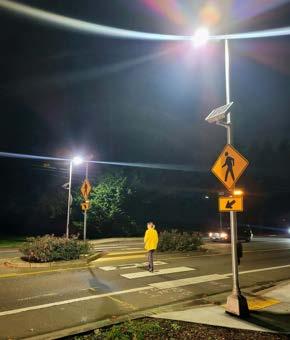
Currently a raised crosswalk is located on 10th Street at the Tucker Gulch crossing. This crosswalk is well-used, and motorist generally exhibit good yielding behavior during daylight hours. However, there is little lighting in the area and yielding compliance is reduced during low and no daylight situations, as motorists cannot see pedestrians and bicyclists approaching the crosswalk. It is recommended to install a rectangular rapid flashing beacon with overhead lighting to make trail users more visible to motorists.
In alignment with the Transportation Street Master Plan recommendations for a Complete Street on 10th Street, an eight-foot shared use path is recommended along the north side of 10th Street between the Clear Creek Parking Lot and Ford Street. To improve visitor experience and reduce traffic congestion, wayfinding signs would direct visitors between the EAZ and the Clear Creek Parking lot. Providing ample space for two-way pedestrian mobility will improve the overall pedestrian experience and encourage visitors to park and walk to the East Amenity Zone and nearby businesses.