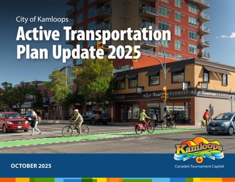
City of Kamloops
Active Transportation Plan Update 2025
OCTOBER 2025
CITY OF KAMLOOPS, BRITISH COLUMBIA, CANADA
Active Transportation Plan Update 2025 October 2025 Prepared by: Parsons and City of Kamloops Communications and Community Engagement Division and Transportation Division
Front Cover: Peter Olsen
Inside Cover: Tracey Mourre
The City of Kamloops acknowledges that we are located on Tḱemlúps te Secwépemc territory, situated within the unceded ancestral lands of the Secwépemc Nation. We honour and respect the people, the territory, and the land that houses our community.
Table of Contents Executive Summary
2
1.0 Introduction 1.1 Background 1.2 Goals and Objectives 1.3 How the Plan was Developed 1.4 Community Feedback
6 9 12 13
2.0 Active Transportation Network 2.1 Types of Active Transportation Facilities 2.2 Active Transportation Network
15 25
3.0 Supporting Infrastructure and Programs 29 33
3.1 Supporting Cycling 3.2 Supporting Walking
4.0 Implementation 37 40 42
4.1 Priority Criteria 4.2 Priority Projects 4.3 Monitoring
Appendix A ‑ Prioritized Project Descriptions
44
Appendix B ‑ Prioritized Project Maps
50
Appendix C ‑ All Projects List Descriptions
58
Appendix D ‑ All Projects Maps
88
Active Transportation Plan Update 2025 | CITY OF KAMLOOPS
1
City of Kamloops
Highland Road
Executive Summary The Active Transportation Plan Update is intended to encourage more walking, cycling, and other emerging forms of active transportation in Kamloops and to improve safety for pedestrians and cyclists. According to the 2018 Transportation Master Plan, the goal for transportation is to increase the modal share of work‑related travel by sustainable modes to 30% by 2039, when Kamloops’ population is projected to reach 120,000. Achieving this target would reduce the demand for costly road infrastructure projects aimed at expanding capacity, such as road widenings, extended storage lengths, and signalization upgrades. By promoting sustainable transportation options, the City can effectively minimize roadway capital expenditures. 2
CITY OF KAMLOOPS | Active Transportation Plan Update 2025
The key component of the Active Transportation Plan Update is a network of bicycle routes and pedestrian facilities. The existing network includes 30 km of bicycle lanes, 40 km of multi‑use pathways, and 295 km of sidewalks. The Active Transportation Plan Update includes proposed facilities appropriate for all ages and abilities, including 33 km of protected bicycle lanes, 97 km of multi‑use pathways, 100 km of new and improved sidewalks, and other facilities, such as crossings and neighbourhood bikeways. Priority projects to be undertaken will develop a core active transportation network that will enable pedestrians and cyclists to travel throughout Kamloops on safe and comfortable facilities, connecting directly to major destinations, such as employment centres, schools, commercial areas, recreational facilities, and parks. Downtown is the centre of the core network, which extends north to Westsyde, Rayleigh, and Heffley Creek; south to Aberdeen; east to Valleyview and Dallas; and west to Brocklehurst and Dufferin. The Active Transportation Plan Update also includes a range of supporting programs and actions to complement the active transportation network described in Section 2. Undertaking these programs will help to encourage more people to walk and cycle, improve safety for pedestrians and cyclists, and maximize the City’s return on its investment in active transportation. Construction of new and improved pathways and bicycle routes is currently funded at $3.5 million annually. Potential sources of additional funding for active transportation projects include federal and provincial sources, such as the Active Transportation Fund and the Active Transportation Infrastructure Grants Program, as well as other grants.
EXECUTIVE SUMMARY
Priority projects to be undertaken will develop a core active transportation network that will enable pedestrians and cyclists to travel throughout Kamloops on safe and comfortable facilities...
PLANNED NEW ALL AGES AND ABILITIES FACILITIES
33 km OF PROTECTED BIKE LANES
97 km 100 km OF MULTI‑USE PATHWAYS
OF SIDEWALKS
+ other facilities such as crossings and neighbourhood bikeways
EXISTING ACTIVE TRANSPORTATION NETWORK
30 km OF BICYCLE LANES
40 km 295 km OF MULTI‑USE PATHWAYS
OF SIDEWALKS
Active Transportation Plan Update 2025 | CITY OF KAMLOOPS
3
City of Kamloops
Tranquille Road Multi‑Use Path
1.0 Introduction This document presents an Active Transportation Plan Update that reflects a comprehensive approach to encourage and safely accommodate walking, cycling, and other forms of active transportation in Kamloops. The Active Transportation Plan Update will ultimately be incorporated into an updated Transportation Master Plan in the near future.
4
CITY OF KAMLOOPS | Active Transportation Plan Update 2025
INTRODUCTION
The Active Transportation Plan Update contains the following key components: • Goals and objectives to encourage
walking and cycling, improve safety for pedestrians and cyclists, and track progress using specific indicators
• A continuous and functional network of bicycle routes that cyclists can use to travel throughout Kamloops
Types of Active Transportation There are many different types of active transportation, including micro‑mobility devices such as skateboards, scooters, and hoverboards, many of which incorporate electric motor assist. To avoid lengthy descriptions of all types of devices throughout the Active Transportation Plan Update, these wheeled devices are grouped with bicycles under the category of cycling. Similarly, mobility aids such as wheelchairs and walkers are grouped with pedestrians under the category of walking. Therefore, references in the plan to walking and cycling include persons using mobility aids and micro‑mobility devices. In general, Class 2 and Class 3 e‑bikes and electric micro‑mobility devices are currently not legal to use on roads or public pathways in British Columbia. E‑scooters can be ridden on public roads in Kamloops as part of a provincial pilot project that continues through April 2028. The Province is reviewing the Motor Vehicle Act and related regulations to determine how best to regulate e‑bikes and electric micro‑mobility devices, and it is expected that they will eventually be legal to use in British Columbia, likely with some restrictions. The Active Transportation Plan Update anticipates this change and accommodates these devices.
• New and improved pedestrian facilities, particularly crossings and sidewalks
CYCLING
• Supporting actions to complement the network of bicycle routes and pedestrian facilities, including wayfinding and signage, bicycle parking, end‑of‑trip facilities (bike lockers, clothing lockers, showers, etc.), marketing, education and enforcement, maintenance, and monitoring.
• An implementation plan that
identifies the highest‑priority sidewalks, protected bicycle facilities, neighbourhood bikeways, pathways, crossings, and other facilities throughout Kamloops to improve safety and connectivity for pedestrians and cyclists.
BICYCLES
SKATEBOARDS
SCOOTERS
HOVERBOARDS
WALKING
PEDESTRIANS
WHEELCHAIRS
WALKERS
Active Transportation Plan Update 2025 | CITY OF KAMLOOPS
5
1.1 Background The Kamloops Transportation Master Plan was adopted in 2018 and provides a comprehensive and long‑term multi‑modal guide for the planning, design, development, and maintenance of transportation facilities and infrastructure in the city. The City has been working to implement the recommended walking and cycling networks in the Transportation Master Plan. To date, the City has implemented 30 km of bicycle lanes, 40 km of multi‑use pathways, shared bicycle routes, and other active transportation facilities. In doing so, the City has encountered two key issues:
6
Issue One
Issue Two
Conventional painted bicycle lanes, “sharrows”, and shoulders are not attractive to many current and potential cyclists as they do not provide protection from traffic. Consequently, the City would prefer to implement protected bicycle lanes with a barrier between cyclists and traffic or pathways separated from the road. In some cases, however, doing so would require removing traffic lanes and/or parking or would require costly road widening. The City would prefer to develop the bicycle network in a way that minimizes impacts on other road users and is affordable.
Like many other municipalities in British Columbia, there are roads in Kamloops that do not have sidewalks, meaning pedestrians must walk on the road with no protection from traffic. In some cases, paved shoulders are provided for pedestrians, but again, there is no protection from traffic. To improve safety for pedestrians and encourage more people to walk, the City aims to construct sidewalks on all arterial and collector roads and on local streets leading to key destinations, such as schools. To further improve safety and encourage walking, the City would also like to upgrade pedestrian crossings to ensure that motorists can see and stop for pedestrians. New crossings will also be added where needed.
CITY OF KAMLOOPS | Active Transportation Plan Update 2025
INTRODUCTION
AVERAGE COMMUTE TRIP IN CANADA
12
MINUTE WALKING TRIP a distance of approximately 800 m
Most walking and cycling trips are relatively short. Across Canada, the average commute trip is 12 minutes for walking trips (a distance of approximately 800 m) and 20 minutes for cycling trips (a distance of less than 5 km)1. What this means is that in Kamloops, the areas with the greatest potential for active transportation trips are those within 12 to 20 minutes of major destinations. This includes major activity centres, such as Downtown and the North Shore commercial area, as well as neighbourhoods close to these activity centres. This presents an opportunity to significantly increase walking and cycling in these areas, where many trips are within the 12‑to‑20‑minute average travel times for walking and cycling. In addition, the growing popularity of electric bicycles offers an opportunity to expand the reach of cycling trips beyond the traditional 20-minute cycling radius, making trips of 10 km or more both feasible and appealing. The City’s Official Community Plan identifies several of these neighbourhoods as the focus for future growth, including Downtown, North Kamloops, Brocklehurst, Lower Sahali, Southgate, and TRU. Figure 1.1 is a growth structure map from our Official Community Plan which shows Town Centres and Mid‑Rise Commercial‑designated areas where significant growth is expected. This presents an opportunity to significantly increase walking and cycling trips in these areas.
20
MINUTE CYCLING TRIP a distance of less than 5 km
In Kamloops, the areas with the greatest potential for active transportation trips are those within 12 to 20 minutes of major destinations.
Peter Olsen
1
6th Avenue Protected Bike Lanes
Census Profile, 2021 Census of Population, Statistics Canada, 2023
Active Transportation Plan Update 2025 | CITY OF KAMLOOPS
7
Figure 1.1: KAMPLAN: Official Community Plan 2025 Growth Structure Map
The growth structure map from our Official Community Plan shows Town Centres and Mid‑Rise Commercial‑designated areas where significant growth is expected. This presents an opportunity to significantly increase walking and cycling trips in these areas.
8
CITY OF KAMLOOPS | Active Transportation Plan Update 2025
1.2 Goals and Objectives
Mary Putnam
Rivers Trail
INTRODUCTION
The City wishes to encourage more walking and cycling, to achieve environmental, land use and other sustainability objectives.
KAMPLAN: Official Community Plan Goals
Transportation Master Plan Goals
The City’s Official Community Plan includes community values to create safe, accessible and inclusive neighbourhoods that are easy to get around and plan for all active forms of transportation. The Official Community Plan includes several objectives to achieve these goals, including:
The Transportation Master Plan identifies two goals for active transportation:
• Create a continuous network of safe and direct active transportation routes to encourage commuting and other daily trips that connect residents to major employment, schools, and amenities in mixed‑use areas such as town centres and neighbourhood centres.
• Increase the safety and accessibility of sidewalks
and pathways by improving the design of new streets and retrofitting existing streets as they are replaced or upgraded.
• Explore the creation of separated cycle lanes or
multi-use pathways for routes that are adjacent to high‑volume motor vehicle traffic corridors, including truck routes.
• Encourage end-of-trip amenities such as showers, lockers, and bicycle repair stations to encourage increased cycling usage in major employment and institutional facilities.
• Be a pedestrian‑friendly community with
networks that integrate with transit, neighbourhood amenities, parks, open space, and schools.
• Provide safe and convenient bicycle routes suitable for commuting, recreating, and other daily trips.
Vision Zero: Kamloops Road Safety Strategy • The City’s Vision Zero Action Plan includes five
emphasis areas to achieve the vision zero goal. Emphasis Area 2 Safety and Livability includes a strategy to accelerate and enhance the active transportation network.
Community Climate Action Plan • The City set a strategic goal to reduce community
greenhouse gas emissions. As part of this, 8 Big Moves and 24 strategies were created to achieve this goal. Big Move 2: Car‑Light Community seeks to facilitate the uptake of sustainable transportation options including walking and cycling.
Active Transportation Plan Update 2025 | CITY OF KAMLOOPS
9
Active Transportation Plan Goals Based on the City’s goals and objectives for active transportation, the following two goals are established for the Active Transportation Plan Update: Strategies to achieve these two goals include:
• Remove barriers and deterrents to walking and develop a pedestrian network with continuous and safe routes.
• Develop a core bicycle network comprising
of north‑south and east‑west routes linking all parts of the City, including Downtown, the North Shore, Sahali, Aberdeen, Valleyview, and Westsyde. Eliminate and avoid gaps in the core network to provide continuous and safe bicycle routes throughout Kamloops.
Goal 1
Goal 2
ENCOURAGE MORE ACTIVE TRANSPORTATION TRIPS • Encourage more people to walk and
IMPROVE SAFETY FOR PEDESTRIANS, CYCLISTS, AND OTHER ACTIVE TRANSPORTATION USERS • Build new and improved bicycle routes,
cycle for work, school, recreational purposes, and accessing daily activities.
• Increase the number of walking and
cycling trips and increase the share of all trips made by bicycle and on foot.
sidewalks, and crossings to increase safety and comfort for pedestrians and cyclists.
• Design facilities to minimize conflicts
between pedestrians, cyclists, motorists, and other road users and reduce the potential for injury in accordance with the Vision Zero Strategy.
10 CITY OF KAMLOOPS | Active Transportation Plan Update 2025
• Provide pedestrian and bicycle connections
to key destinations, including schools, employment centres, commercial areas, recreational facilities, and parks. Capitalize on public and private sector infrastructure and development projects to provide new and upgraded active transportation connections.
• Design and construct new and upgraded
transportation facilities to safely accommodate pedestrians and cyclists, including separation and protection from motor vehicles.
• Anticipate new and emerging modes of active transportation, particularly electric modes, and support these modes by incorporating design features to improve safety and reduce barriers to their use.
INTRODUCTION
The key features of the Active Transportation Plan Update that support these goals and strategies are:
• Active transportation facilities that will
attract and accommodate pedestrians and cyclists of all ages and abilities:
- Bicycle routes that maximize safety by
Develop a core bicycle network comprising of north‑south and east‑west routes linking all parts of the City, including Downtown, the North Shore, Sahali, Aberdeen, Valleyview, and Westsyde. Eliminate and avoid gaps in the core network to provide continuous and safe bicycle routes throughout Kamloops.
reducing exposure to motor vehicle traffic, using protection, separation, and other design techniques and supporting actions
- Pedestrian facilities that maximize safety with new and improved sidewalks, crossings, and supporting actions
• Priorities for implementing active
transportation facilities to maximize benefits for pedestrians, cyclists, and the community and to maximize the City’s return on investment.
• Regular maintenance of active
transportation facilities to maintain safety and comfort for pedestrians and cyclists and to preserve the City’s investment.
Peter Olsen
6th Avenue Protected Bike Lanes
Active Transportation Plan Update 2025 | CITY OF KAMLOOPS 11
1.3 How the Plan was Developed The technical part of the Active Transportation Plan Update was developed in four phases: PHASE ONE
PHASE TWO
PHASE THREE
PHASE FOUR
Gap Analysis
Safety Assessment
List of Options
Priorities
A gap analysis identified gaps in the active transportation network. A gap is where there are no existing, planned, or proposed bicycle or pedestrian facilities and no viable alternative route nearby. This includes “missing” sidewalks on arterial and collector roads, gaps between sections of bicycle routes, and no crossings where collector and arterial roads intersect and at significant destinations.
A safety assessment identified deficiencies in existing bicycle and pedestrian facilities. These include painted bicycle lanes on arterial and collector roads that do not provide separation or protection from traffic, collector and arterial roads without sidewalks or with paved shoulders for pedestrians that do not provide protection from traffic, and crossings that do not provide adequate protection for pedestrians and cyclists crossing major roads.
A long list of options was developed, identifying every possible project that could be undertaken to eliminate gaps and resolve safety deficiencies. Each project was assessed to ensure that it was feasible (meaning that it would be constructable and would meet applicable geometric standards) and suitable (meaning that it would be an appropriate active transportation facility given travel needs, terrain, acceptable impacts, and other factors). As a result, all projects remaining on the long list of options were projects that would be feasible and suitable to build.
Priorities were established. Each project in the long list of options was assessed using several criteria to provide a numeric score for the project. The top‑scoring projects were identified as priorities to be implemented in the short term (0 to 10 years) or medium term (10 to 20 years). Other projects would be implemented in the medium term and long term (20 or more years).
12 CITY OF KAMLOOPS | Active Transportation Plan Update 2025
INTRODUCTION
1.4 Community Feedback The City undertook a number of engagement activities to inform and receive feedback from the community regarding the Active Transportation Plan Update. • Key interest holders were invited to participate through an Active Transportation Engagement Group,
which included representatives from the general public, organizations supporting people with disabilities, business associations, Tḱemlúps te Secwépemc, cycling advocates, Thompson River University, School District No. 73, the BC Ministry of Transportation and Transit, BC Transit, Interior Health, community volunteers, and staff from various City departments. Eight Active Transportation Engagement Group meetings were held between September 2023 and February 2025.
• The City’s Let’s Talk engagement platform was used to communicate progress on the Active Transportation Plan Update and solicit feedback, beginning in fall 2023 and concluding in spring 2025.
• Meetings with key interest holders were held between 2023 and 2025 to discuss issues and opportunities specific to each group, including the North Shore Business Improvement Association, the Kamloops Central Business Improvement Association, the East Kamloops Business Improvement Association, the Healthy Kamloops Engagement Group, and the Accessibility Engagement Group.
• City staff from several departments completed an internal review of the draft network and priorities in October 2024.
• A public open house was held in May 2025 to solicit feedback on existing and future active transportation networks, present the recommended priority projects, and request input regarding upcoming projects.
Key feedback regarding active transportation included: • Better active transportation connectivity near schools, community centres, recreational facilities, and transit exchanges.
• Ensure the network is connected, and there is no disconnected segment.
• Improve network service to
equity‑deserving populations, such as seniors and lower‑income populations.
• Improve existing connections in Downtown.
• More dedicated bike infrastructure rather than utilizing multi-use recreational routes.
• More physical protection for cyclists. • Improve the network with accessibility and safety features, such as sufficient lighting and safer crossings.
City of Kamloops
Active Transportation Plan Update 2025 | CITY OF KAMLOOPS 13
Peter Olsen
6th Avenue Protected Bike Lanes
2.0 Active Transportation Network This section describes the network of bicycle routes and pedestrian facilities, which is the key component of the Active Transportation Plan Update. The network includes a range of infrastructure projects that would enhance and expand active transportation opportunities to encourage walking and cycling and to provide safe and convenient facilities for pedestrians and cyclists throughout Kamloops.
14 CITY OF KAMLOOPS | Active Transportation Plan Update 2025
2.1 Types of Active Transportation Facilities
ACTIVE TRANSPORTATION NETWORK
This section describes the different types of active transportation facilities that are currently used in Kamloops, and additional types of facilities that can be used to create pedestrian and bicycle routes that enable safe, comfortable and efficient walking and cycling for persons of all ages and abilities. Supporting facilities are described in Section 3.
2.1.1 Bicycle Facilities At present, the bicycle network on City streets comprises painted bicycle lanes on major roads, such as Valleyview Drive and Hugh Allan Drive; neighbourhood bikeways, such as St. Paul Street; and paved shoulders, such as on the western section of Tranquille Road. While these types of facilities provide extra space on the road for cyclists, they do not offer any protection from traffic. Understanding different types of cyclists is key to developing a network that will encourage increased ridership. The popular cyclist typology image in Figure 2.1 categorizes riders into Strong and Fearless, Enthused and Confident, Interested but Concerned, and No Way No How, with the Interested but Concerned group forming the majority. In planning a comprehensive active transportation network, this group represents the greatest opportunity for growth in cycling ridership. Investing in protected and separated cycling facilities that prioritize safety and connectivity is the most effective strategy to encourage a modal shift to cycling. Feedback from the community indicates a strong desire for bicycle facilities that incorporate some form of protection and physical separation. As Figure 2.2 illustrates, protected facilities are more comfortable for cyclists, increasing the facility’s real and perceived safety and attracting a wider range of cyclists of varying ages and cycling abilities. Protected bicycle facilities are a key factor in achieving the City’s goals of encouraging more people to cycle and improving safety for cyclists.
FIGURE 2.1: TYPES OF CYCLISTS:
7%
STRONG AND FEARLESS
5%
ENTHUSED AND CONFIDENT
National Survey of 50 Largest Metros
51% 37%
INTERESTED BUT CONCERNED
NO WAY, NO HOW
Active Transportation Plan Update 2025 | CITY OF KAMLOOPS 15
Bicycle Corridor Facility Types
FIGURE 2.2: CYCLING FACILITY SPECTRUM Lower Lower
LevelofofComfort Comfort Level
Higher Higher
Picture: City of Chicago
Picture: Google Street View
Picture: Town of Gibsons
Picture: Bike Cleveland
Picture: Google Street View
Picture: Parsons & Montgomery
Picture: Google Street View
Picture: Atla
Neighbourhood Shared Bicycle Bikeway Lane
Separated Bicycle Bicycle Lane Lane (Unbuffered)
Separated Buffered Bicycle Lane Bicycle Lane (Buffered)
Protected Protected Bicycle Lane Bicycle Lane
Multi‑Use Multi-Use Pathway Pathway
Segregated Segregated Multi-Use Pathways Pathway
Shared facilities on quiet, Shared facilities on low traffic streets with quiet, low‑traffic signage and pavement streetsmarkings. with signage
Painted lane lane with dedicated Painted with space for bikesspace between dedicated forthe vehicle travel lane and the bikes between curb or the parking the lane.
Dedicated bicycle lane with Dedicated bicycle painted buffer space lane with painted between cyclists and motor buffer vehicle space traffic.
Barrier-protected bicycle Protected bicycle lanelane that can be configured that can be to either street level or configured to sidewalk level.
Street-adjacent protected Street‑adjacent facility for shared protected facilityuse for between pedestrians and sharedcyclists. use between
Multi-use facilities with Multi‑use facilities physical separation with physical between pedestrians and separation between cyclists.
and pavement markings (aka ‘sharrows’)
vehicle travel lane and the curb or the parking lane
between cyclists and motor vehicle traffic
either street level or sidewalk level
pedestrians and cyclists
pedestrians and cyclists
Suitable for All Ages & Abilities (AAA) AAA facilities play a crucial role in advancing the recent Council Approved Vision Zero Strategy’s mission to reduce serious injuries and fatal collisions in Kamloops.
Suitable for All Ages and Abilities
All ages and abilities facilities play a crucial role in advancing the Council Approved Vision Zero Strategy’s mission to reduce serious injuries and fatal collisions in Kamloops.
16 CITY OF KAMLOOPS | Active Transportation Plan Update 2025
ALL AGES AND ABILITIES BICYCLE FACILITIES INCLUDE: • Protected bicycle lanes, which are located within the roadway but are physically separated from
ACTIVE TRANSPORTATION NETWORK
traffic lanes or parked cars by some type of protection, which can be as simple as flexible plastic pylons or as substantial as a concrete barrier. A study of protected bicycle lanes in Toronto measured two and a half times more cyclists after protected lanes were installed while cyclist/motor vehicle collisions decreased by 38%, even with the increased number of cyclists2. An example in Kamloops is the protected bicycle lane on 6th Avenue north of Columbia Street. Protected bicycle lanes can also be located between the curb and sidewalk, often at the same elevation as the sidewalk or elevated above the road but below the sidewalk, as shown in Figure 2.3.
• Enhanced neighbourhood bikeways, which are routes on neighbourhood streets with low traffic volumes and speeds. While neighbourhood bikeways typically only include signs and pavement markings identifying the route, enhanced bikeways can incorporate short sections of protected facilities in locations with high numbers of turning vehicles. Traffic calming measures can also be used to improve safety for cyclists and other road users, as shown in Figure 2.6.
• Multi‑Use Pathways, which are hard‑surfaced or compacted‑surface facilities that are shared by
cyclists, pedestrians, and other non‑motorized modes of transportation, including micromobility devices and persons using wheelchairs and other mobility aids. Multi‑use pathways are separated from roadways and motor vehicle traffic, although they may be located parallel to a roadway, as on Schubert Drive, Singh Street, and Westsyde Road.
Some all ages and abilities bicycle facilities can be constructed at a lower cost using quick‑build techniques as a way to expedite implementation, assess the facility’s operation, and make any necessary design adjustments before proceeding with full construction. Quick‑build techniques are particularly useful for protected bicycle lanes and intersections, where plastic bollards and pylons, pre‑cast concrete barriers, planters, and other design elements can be used to create a protected facility quickly and cost‑effectively, as shown in Figure 2.7 and Figure 2.8.
2
A study of protected bicycle lanes in Toronto measured 2.5 times more cyclists after protected lanes were installed, while cyclist/motor vehicle collisions decreased by 38%, even with the increased number of cyclists2
Cyclist‑motor vehicle collisions before and after implementation of cycle tracks in Toronto, Ling, Rothman, Cloutier, Macarthur and Howard, Accident Analysis & Prevention, 2020 Active Transportation Plan Update 2025 | CITY OF KAMLOOPS 17
IN ADDITION TO THE ALL AGES AND ABILITIES BICYCLE FACILITIES, OTHER SUPPORTING FACILITIES INCLUDE: • Buffered bicycle lanes, which include
bicycle lanes and a designated buffer space, often marked with paint and/or physical separators, such as planters between adjacent traffic lanes or parking lanes, as shown in Figure 2.5. These facilities offer a crucial layer of protection for cyclists against incidents such as the opening of parked car doors.
• Painted bicycle lanes and shoulders,
which are designated for use by bicycles and are characterized by a solid white line that separates the bicycle lane from the adjacent traffic lane (the line is dashed where motor vehicles may cross the bicycle lane, such as to turn right). Because they do not incorporate any physical protection from traffic, painted bicycle lanes and shoulders are not considered all ages and abilities facilities.
• Neighbourhood bikeways, which include only signage and pavement markings to guide cyclists and identify the road as a bicycle route.
Trails are soft‑surfaced facilities, typically gravel, dirt, or other natural materials. Cyclists on mountain bikes and similar bicycles capable of off‑road riding can navigate trails, but they may not be suitable for other types of bicycles. As trails are generally used for recreational purposes rather than for transportation purposes, they are included in parks and recreation plans rather than the Active Transportation Plan.
18 CITY OF KAMLOOPS | Active Transportation Plan Update 2025
City of Kamloops
St. Paul Street
ACTIVE TRANSPORTATION NETWORK
BICYCLE FACILITY EXAMPLES
Figure 2.3: Protected Raised Bicycle Lane (Kelowna)
Figure 2.4: Curb‑Protected Bicycle Lane (Kamloops)
Figure 2.5: Buffered Bicycle Lane (Vancouver)
Figure 2.6: Enhanced Neighbourhood Bikeway with Speed Hump (North Vancouver)
Figure 2.7: Quick‑Build Protected Bicycle Lane (Vancouver)
Figure 2.8: Quick‑Build Cycle Track (Vancouver)
Active Transportation Plan Update 2025 | CITY OF KAMLOOPS 19
ps Active Transportation Plan Update Active mloops |City Kamloops Active Transportation PlanTransportation Update rtation Plan Update of Kamloops | Kamloops Plan Update
2.1.2 Pedestrian Facilities
Pedestrian facilities include sidewalks, pathways, and walkable shoulders and trails. As Figure 2.9 indicates, pathways and sidewalks separated from the road are more comfortable for pedestrians, increasing the real and perceived safety of the facility and attracting a wider range of people of varying ages and physical abilities. Pedestrian facilities are a key factor in achieving the City’s goals of encouraging more people to walk and improving safety for pedestrians.
Pedestrian Corridor Facility Types Pedestrian Corridor Facility TypesTypes Pedestrian Corridor Facility estrian Corridor Facility Types FIGURE 2.9: PEDESTRIAN FACILITY SPECTRUM
wer
PEDESTRIAN FACILITIES
LevelLevel of Comfort Higher Level of Comfort LowerLevel of Comfort Level of Comfort Higher Lower Higher Higher INCLUDE: of Comfort
Higher
• Multi‑use pathways,
Picture: Parsons & Montgomery
which are hard‑surfaced or compacted‑surface facilities that are shared by pedestrians, cyclists, and other non‑motorized modes of transportation, including micro‑mobility devices and persons using wheelchairs and other mobility aids. Multi‑use pathways with higher Picture: Parsons & Montgomery Picture: Parsons & Montgomery Picture: Parsons & Montgomery numbers of users can incorporate a painted line to separate pedestrians and cyclists, or two separate parallel pathways can be provided for pedestrians and cyclists.
• Separated sidewalks, which
are paved walkways along the side Picture: Atla of a street used by pedestrians and Picture: Atla persons with mobility aids, with Segregated Painted Segregated Segregated Segregatedsome Painted Pedestrian Sidewalk Multi‑Use Segregated form of horizontal separation Multi-Use Multi-Use Multi-Use Multi-Use Multi-Use Sidewalk Pedestrian Multi-Use Sidewalk Multi-Use fromMulti-Use Sidewalk edestrian Sidewalk the adjacent roadway, such as a Shoulder Pathway Pathways Pathway Pathway Pathway Pathway Shoulder boulevard, Pathway a row of trees, Pathway Pathway Pathway landscaped Shoulder or a zone with street furniture. Painted lane with Facilities on quiet Street‑adjacent Multi‑use facilities dedicated space low‑traffic streets protected facility with physical for pedestrians with signage and for shared use separation between between the vehicle pavement markings between pedestrians pedestrians and travel lane and and cyclists cyclists the curb Picture: Google StreetPicture: View Picture: BCATDG Picture: Google View Picture: Google View Picture: TownStreet of Gibsons Picture: TownStreet ofBCATDG Gibsons Picture: Google Street View
Picture: BCATDG Google View Picture: TownStreet of Gibsons Picture: View Picture: Google Street View Picture: Picture: Google View Google Street Picture: Picture: TownStreet ofBCATDG Gibsons
20 CITY OF KAMLOOPS | Active Transportation Plan Update 2025
Picture: Google Street View
Picture: Picture: Atla Google Street View
Picture: Atla
ACTIVE TRANSPORTATION NETWORK
SUPPORTING FACILITIES INCLUDE: • Non‑separated sidewalks, which are located immediately adjacent to the road, with only a vertical curb separating pedestrians from motor vehicles. The lack of any horizontal separation and minimal physical protection from traffic means that non‑separated sidewalks are not considered all ages and abilities facilities.
• Pedestrian shoulders, which are paved
shoulders on the side of the road and separated from the adjacent traffic lane by a painted white line. Shoulders are not considered all ages and abilities pedestrian facilities, and the City ultimately intends to replace all walkable shoulders with sidewalks or pathways.
Trails are soft‑surfaced facilities, typically gravel, dirt, or other natural materials. Trails are generally not accessible to persons with disabilities. As trails are generally used for recreational purposes rather than for transportation purposes, they are included in parks and recreation plans and not the Active Transportation Plan. As in most communities, new sidewalks in Kamloops are constructed where possible as part of the development of adjacent lands. The City also constructs sections of sidewalk as needed to eliminate gaps in the pedestrian network and improve access for pedestrians to key destinations, such as schools and community facilities. Additional sidewalks on local roads are typically funded through a local improvement program, which enables residents to cost‑share with the City. On arterial roads, best practice is to have a sidewalk on both sides of the road. In lower‑density developing areas, it is acceptable for there to be sidewalk on only one side of the road as an interim condition until the area is fully developed.
Pedestrian facilities are a key factor in achieving the City’s goals of encouraging more people to walk and improving safety for pedestrians. Nidhi G Maurya
Schubert Drive ‑ Rivers Trail
Active Transportation Plan Update 2025 | CITY OF KAMLOOPS 21
Kathleen Fisher
2.1.3 Crossings Crossings are an important part of the active transportation network, as they improve safety for pedestrians and cyclists at intersections, mid‑block, and other critical locations. They also help prevent major roads from becoming obstacles to walking and cycling.
DIFFERENT TYPES OF CROSSINGS INCLUDE: • Grade‑separated crossings, such as • Rectangular rapid flashing beacons, overpasses and underpasses, which allow pedestrians and cyclists to cross a road at a different elevation, separated from traffic, as shown in Figure 2.10. Due to their cost, grade separations are generally only used where there are large numbers of pedestrians and cyclists crossing high‑volume, high‑speed roadways or active railway tracks.
• Traffic signals. The two types of signalized
crossings used in British Columbia are pedestrian‑activated signals (that may also be activated by cyclists) and full traffic signals (see Figure 2.11) that are activated by motor vehicles on the side street as well as pedestrians and cyclists.
• Protected intersections, which incorporate several features to improve safety for pedestrians and cyclists, including protective islands on corners where cyclists wait for signals to change, reduced crossing distances for pedestrians, forward stop bars that position cyclists where they can be easily seen by turning motorists, and signal phasing that favours cyclists. Figure 2.12 shows an example of a protected intersection in Vancouver. An analysis of protected intersection design indicates up to an 80% reduction in the total number of bicycle‐related conflicts compared to a conventional intersection, with no negative effects on motor vehicle delay or level of service3.
22 CITY OF KAMLOOPS | Active Transportation Plan Update 2025
as shown in Figure 2.13, which are pedestrian‑activated flashing lights mounted at the side of the road and on the median if there is one. Rectangular rapid flashing beacons increase the visibility of a crossing, particularly at night, and also provide the additional benefit of clearly indicating to motorists that a pedestrian is present. Rectangular rapid flashing beacons offer significant safety benefits compared with marked crossings. Tests of rectangular rapid flashing beacons in Calgary found yielding rates as high as 95%, much higher than before the rectangular rapid flashing beacons were installed4. An important advantage of rectangular rapid flashing beacons as compared with signals is that the rectangular rapid flashing beacons begin flashing immediately, so pedestrians are not required to wait. This is particularly important for crossings near schools, as children are less likely to wait to cross if there is a gap in traffic. In addition, motorists can proceed after pedestrians have crossed, even if the rectangular rapid flashing beacons are still flashing.
• Enhanced marked crossings on collector
roads. Enhancements include (but are not limited to) curb extensions that reduce the width of the road at the crossing, median islands in the middle of the road, and raised crossings that slow motorists at the crossing. Enhanced marked crossings are appropriate for all ages and abilities when used on collector roads with two traffic lanes.
ACTIVE TRANSPORTATION NETWORK
SUPPORTING CROSSINGS INCLUDE: • Enhanced marked crossings on
arterial roads are not considered all ages and abilities facilities due to the typically higher volume of traffic and often higher number of traffic lanes and traffic speeds. Figure 2.14 shows an enhanced marked crossing in Kamloops.
• Marked crossings, which are the
most basic type of crossing, incorporating only signs, pavement markings, and enhanced illumination of the crossing and approaches. Basic marked crossings are not considered all ages and abilities facilities, as the absence of additional treatments means that the marked crossing may not provide a significant improvement in safety for pedestrians and cyclists crossing the road.
3 4
City of Kamloops
Tranquille Road
Rectangular rapid flashing beacons offer significant safety benefits compared with marked crossings. Tests of rectangular rapid flashing beacons in Calgary found yielding rates as high as 95%, much higher than before the rectangular rapid flashing beacons were installed4.
Simulating and assessing the effect of a protected intersection design for bicyclists on traffic operational performance and safety, Preston and Pulugurtha, Transportation Research Interdisciplinary Perspectives, 2021 Enhancing Pedestrian Safety – Lessons Learned from Calgary’s RRFB Pilot, Mishra, Iwaskow and Domarad, City of Calgary, 2015 Active Transportation Plan Update 2025 | CITY OF KAMLOOPS 23
CROSSING EXAMPLES
Figure 2.10: Grade‑Separated Crossing (New Westminster)
Figure 2.11: Signal With Bicycle Crossing (Kamloops)
Figure 2.13: Solar‑Powered Rectangular Rapid Flashing Beacon Crossing (Kamloops)
Figure 2.14: Enhanced Marked Crossing with Median Island (Kamloops)
24 CITY OF KAMLOOPS | Active Transportation Plan Update 2025
Figure 2.12: Protected Intersection (Vancouver)
ACTIVE TRANSPORTATION NETWORK
2.2 Active Transportation Network
Priority projects include:
The existing active transportation network includes 30 km of bicycle lanes, 40 km of multi‑use pathways, and 295 km of sidewalks. The Active Transportation Plan Update includes 33 km of protected bicycle lanes, 97 km of multi‑use pathways, 100 km of new and improved sidewalks, and other facilities, such as crossings and neighbourhood bikeways. The core active transportation network will enable pedestrians and cyclists to travel throughout Kamloops on safe and comfortable facilities, connecting directly to major destinations, such as employment centres, schools, commercial areas, recreational facilities, and parks. Downtown is the centre of the core network, which extends north to Westsyde, south to Aberdeen, east to Valleyview, and west to Brocklehurst and Dufferin. As part of the Active Transportation Plan Update, various maps have been developed to clearly illustrate the active transportation network plans. These maps have been refined based on feedback received throughout the multiple engagement sessions undertaken. The maps comprise bicycle and pedestrian plans categorized into priority maps and full network maps. Figure 2.15 shows an initial corridors map. The bold green lines show proposed projects that will complement the existing network and connect to Build Kamloops facilities in the city.
• Protected bicycle lanes on major roads, such as on Seymour Street in the downtown
• New neighbourhood bikeways, such as on 7th Street in North Kamloops
• New multi‑use pathways for pedestrians and cyclists, such as on McGill Road to integrate TRU into the core network and on Valleyview Drive
• New sidewalks on key pedestrian routes, such as on Battle Street west of the downtown
• Conversion of pedestrian shoulders to
sidewalks, such as on Parkcrest Avenue
• New and improved pedestrian crossings with rectangular rapid flashing beacons and upgraded pedestrian signals
Detailed descriptions of priority and full network pedestrian and bicycle projects are included in the Appendices.
THE ACTIVE TRANSPORTATION PLAN UPDATE INCLUDES:
33 km 97 km 100 km OF PROTECTED BIKE LANES
OF MULTI‑USE PATHWAYS
OF SIDEWALKS
+ other facilities such as crossings and neighbourhood bikeways
Active Transportation Plan Update 2025 | CITY OF KAMLOOPS 25
FIGURE 2.15: INITIAL HIGH PRIORITY CORRIDORS MAP
26 CITY OF KAMLOOPS | Active Transportation Plan Update 2025
ACTIVE TRANSPORTATION NETWORK
The core active transportation network will enable pedestrians and cyclists to travel throughout Kamloops on safe and comfortable facilities, connecting directly to major destinations such as employment centres, schools, commercial areas, recreational facilities, and parks.
Peter Olsen
6th Avenue Bike Lanes
Active Transportation Plan Update 2025 | CITY OF KAMLOOPS 27
Kathleen Fisher
Lansdowne Transit Exchange Bike Lockers
3.0 Supporting Infrastructure and Programs This section presents a range of supporting programs and actions to complement the active transportation network described in Section 2. Undertaking these programs will help encourage more people to walk and cycle, improve safety for pedestrians and cyclists, and maximize the City’s return on its investment in active transportation.
28 CITY OF KAMLOOPS | Active Transportation Plan Update 2025
SUPPORTING INFRASTRUCTURE & PROGRAMS
3.1 Supporting Cycling Wayfinding and Signage The wayfinding information currently available to cyclists varies, and in many areas, it is not easy to find bicycle routes and navigate the bicycle network. Signage and other wayfinding information support the Active Transportation Plan’s goal to encourage more and safer cycling by identifying cycling opportunities, helping cyclists navigate the network safely and efficiently, and alerting motorists to the potential presence of cyclists on roads.
• Bicycle route signs are the most important wayfinding device for cyclists. Bicycle route signs should
be located at regular intervals on all bicycle routes to identify them as routes to cyclists, motorists, and non‑cyclists. Bicycle route signs can be supplemented with identification (a name or number identifying the bicycle route) and destination information.
• Pavement markings can be used to aid wayfinding at key junctions, in advance of a turn, and as confirmation after a turn.
• A bicycle route map is an important wayfinding resource. Options for maps include a printed, foldable
bicycle route map that cyclists can carry with them and an online map in PDF format. The City currently publishes a bicycle map using the online GIS system. Maps can also be installed at key locations where there are many cyclists, particularly visitors to Kamloops.
Figure 3.1: Bicycle Route Decision Sign (Maple Ridge)
Figure 3.2: Bicycle Route Sign (Kamloops)
Signage and other wayfinding information support the Active Transportation Plan’s goal to encourage more and safer cycling by identifying cycling opportunities, helping cyclists navigate the network safely and efficiently, and alerting motorists to the potential presence of cyclists on roads.
Figure 3.3: Bicycle Symbol Pavement Markings with Arrows (Kamloops) Active Transportation Plan Update 2025 | CITY OF KAMLOOPS 29
Mary Putnam
Sandman Centre Bike Valet
Bicycle Parking Theft is a significant deterrent to cycling, and research has shown that 45% of cyclists reduced or ceased cycling after their bicycle was stolen5. The primary benefit of bicycle parking is to encourage bicycle use by preventing theft, particularly for commuting (to work and school) and utilitarian purposes such as shopping, and facilitating multi‑modal travel by bicycle and transit. Bicycle parking helps organize parked bicycles to optimize the use of available space and avoid obstructing others, and discourages cyclists from locking bicycles to trees, fixtures, traffic signs, and other objects that could be damaged as a result. There are two primary types of bicycle parking:
• Bicycle racks are intended primarily for short-term use and offer a convenient option for cyclists to use their own locks to secure their bicycles
• Secure parking that protects bicycles from
vandalism and theft. Examples include freestanding bicycle lockers, such as the lockers at the North Shore and Lansdowne transit exchanges, bicycle racks in a cage or enclosure, locked rooms in buildings dedicated to bicycle parking, and attended parking, such as a bike valet service.
End‑of‑Trip Facilities End‑of‑trip facilities are typically provided at employment and education locations as a way to encourage employees and students to commute by bicycle. In addition to secure parking, end‑of‑trip facilities can include clothing lockers, showers, and tools for bicycle maintenance.
30 CITY OF KAMLOOPS | Active Transportation Plan Update 2025
SUPPORTING INFRASTRUCTURE & PROGRAMS
BICYCLE PARKING FACILITY EXAMPLES
5
Figure 3.4: Covered Bicycle Parking (Kamloops)
Figure 3.5: On‑Road Bicycle Corral (Portland OR)
Figure 3.6: Bicycle Lockers (Kamloops)
Figure 3.7: Bicycle Cage (Whistler)
Figure 3.8: Bicycle Maintenance Stand, Tools, and Air (Kamloops)
Figure 3.9: Bicycle Parking Sign
The impact of bicycle theft on ridership behavior, Chen, Nelson, Zanotto, Fitch‑Polse, Schattle, Herr and Winters, International Journal of Sustainable Transportation, 2024 Active Transportation Plan Update 2025 | CITY OF KAMLOOPS 31
Marketing, Education, and Enforcement • Marketing can support the Active Transportation
Plan’s goal to encourage cycling through activities such as media campaigns, bike valet parking at special events and popular destinations, annual events such as GoByBike Week, and an awards program that recognizes individuals, businesses, and organizations that have made a significant contribution to active transportation.
• Education actions include instructional materials
that advise cyclists, motorists, and others about safe cycling techniques, and cycling skills courses such as the Can‑Bike course in defensive cycling for advanced and beginner cyclists who ride in traffic, and community or school-based bike rodeos for cyclists of all ages and abilities.
• Enforcement actions are intended to encourage cyclists to ride in a safe, predictable manner for the benefit and safety of all cyclists, motorists, pedestrians, and other road users. Effective enforcement actions should be preceded by marketing and education actions and should focus on unsafe practices and common causes of collisions.
Maintenance Regular upkeep of bicycle facilities maintains safety and comfort for users and preserves the City’s investment. Key maintenance activities include:
• Maintaining roads and pathways free of hazards such as uneven or damaged asphalt and lips around catch basins and manhole covers
• Repainting bicycle pavement markings,
particularly in intersections and other locations with a higher potential for conflicts
• Sweeping all protected facilities and bicycle lanes at regular intervals to remove debris
• Trimming vegetation along pathways and on
bicycle routes where vegetation encroaches into a bicycle lane and from in front of signs
Figure 3.10: Sweeper in Protected Bicycle Lane (Vancouver)
• Clearing snow from high‑priority pathways and on‑street bicycle routes year-round to maintain access for cyclists
Construction Where construction projects occur on or adjacent to bicycle lanes and pathways, the City should (or require the contractor to) maintain access for cyclists through or around the construction zone. Temporary signs should be used to identify the detour route through the construction zone and to advise cyclists of the need to dismount and walk their bicycles where applicable.
Figure 3.11: Cyclist and Pedestrian Detour Sign (Denver, CO) 32 CITY OF KAMLOOPS | Active Transportation Plan Update 2025
3.2 Supporting Walking
SUPPORTING INFRASTRUCTURE & PROGRAMS
Wayfinding and Signage Wayfinding and signage are important for pedestrians, especially in areas with major destinations, where signs can direct pedestrians to direct and safe routes. In addition, neighbourhood‑level map stands can be used to orient pedestrians to their surroundings and help them identify and discover points of interest.
Crossing Enhancements In addition to new and upgraded pedestrian crossings included in the pedestrian network described in Section 2, other crossing enhancements can help to improve safety and accessibility. These include accessible curb letdowns, curb extensions that reduce crossing distances, median islands, pedestrian countdown timers at signalized intersections, and increased lighting of crossings and approaches to crossings.
Safe Routes to School Safe routes to school programs encourage children to walk and bicycle to school rather than be driven and improve safety with infrastructure improvements. Programs include:
• Education programs to instruct children how
to walk and bicycle safely and presentations to parents
• Walking school buses and bike buses where
parents and other adults follow a predetermined route, gathering schoolchildren who walk or ride bicycles to school
• Volunteers acting as crossing guards and
monitoring designated routes to school at peak times
• Wayfinding signs that indicate directions to school and the walking time for a child
• Improvements to sidewalks, pathways, crossings, and traffic calming along designated routes to school
Figure 3.17: Example Safe Route To School Wayfinding Sign (Active and Safe Routes To School) Active Transportation Plan Update 2025 | CITY OF KAMLOOPS 33
SUPPORTING WALKING EXAMPLES
Figure 3.12: Wayfinding Map Stand (Kamloops)
Figure 3.13: Curb Letdowns and Tactile Surfaces (Whistler)
Figure 3.14: Crossing with Curb Extensions and Overhead Signs and Lighting (Delta)
Figure 3.15: Median Island at Crossing (North Vancouver)
Figure 3.16: Countdown Display (Kamloops)
Figure 3.18: Accessible Pedestrian Construction Detour (UBC)
34 CITY OF KAMLOOPS | Active Transportation Plan Update 2025
SUPPORTING INFRASTRUCTURE & PROGRAMS
Maintenance Maintenance of sidewalks, pathways, and other pedestrian facilities is important for ensuring access and avoiding any obstacles that could arise and impede pedestrians or create unsafe conditions. Key maintenance activities include repairs to sidewalks and paths, particularly where the surface has cracked or has heaved from frost, extreme heat, and tree roots, and repainting pavement markings, especially at crossings. Snow removal in winter is a key activity on higher‑use pedestrian routes.
Construction Where construction projects occur on or adjacent to sidewalks and pathways, the City should (or require the contractor to) maintain access for pedestrians through or around the construction zone.
City of Kamloops
Victoria Street Crosswalk
Active Transportation Plan Update 2025 | CITY OF KAMLOOPS 35
City of Kamloops
Copperhead Drive Multi‑use Pathway
4.0 Implementation This section identifies priority projects that offer the greatest benefits for pedestrians, cyclists, and the community and will help achieve the Active Transportation Plan Update’s goal to encourage more and safer walking and cycling. These priority projects will create a core active transportation network that improves connectivity and safety for pedestrians and cyclists throughout Kamloops. The priority projects are intended for initial implementation while the remaining projects will be implemented over the years following the priority projects. 36 CITY OF KAMLOOPS | Active Transportation Plan Update 2025
4.1 Priority Criteria
City of Kamloops
IMPLEMENTATION
Overlanders Bridge - Rivers Trail
The purpose of the methodology documented in this section is to objectively determine the relative importance of various active transportation projects in terms of their contribution to the goals identified in Section 1. Priorities are determined based on a set of objective criteria. Each potential project is evaluated, and a rating is calculated from its cumulative score, with the highest ratings indicating the highest‑priority projects to be implemented first. These priorities are intended to provide a basis for City staff, decision makers, interest holders, and others to plan, budget for, and implement active transportation facilities. The priorities determined using the methodology described in this section are not intended to be cast in stone. Rather, it is expected that the priorities will be reviewed and updated on a regular basis as some projects are completed, new locations are identified for improvements, and conditions at other locations change. It is also expected that the methodology for determining priorities might be modified as needed to support the City’s objectives. The following criteria were used to assess and prioritize the bicycle and pedestrian facilities described in Section 2. For each criterion, a rating from 1 to 5 was assigned, with 5 indicating the highest priority. Ratings were determined qualitatively and reflect the relative benefits or implications of each action with respect to the other actions.
These priorities are intended to provide a basis for City staff, decision makers, interest holders, and others to plan, budget for, and implement active transportation facilities.
Active Transportation Plan Update 2025 | CITY OF KAMLOOPS 37
PROJECT RANKING CRITERIA
Safety (weighted 3X) This criterion reflects the goal of improving safety for pedestrians, cyclists, persons with disabilities, and other active transportation users. It measures the relative improvement in safety associated with a project. For example, a project that upgrades painted bike lanes to protected lanes would score lower than a project that implements protected lanes where there is currently no bike facility. Safety also reflects personal security, which is typically only a consideration as a negative factor. A score of 5 represents a significant safety improvement, whereas a score of 1 represents no significant safety improvement. Safety is weighted with a factor of 3 to reflect safety as a paramount consideration for any project.
38 CITY OF KAMLOOPS | Active Transportation Plan Update 2025
Network Contribution (weighted 2X) Network contribution reflects the relative contribution or value of a project within the overall active transportation network in terms of its location and proximity to other pedestrian and bicycle facilities and access to institutions and amenities (including schools, business districts, institutions, and recreation centres). Additionally, projects that connect or extend other active transportation facilities score higher than projects isolated from other facilities. A score of 5 represents a critical connection to existing facilities or new high‑priority segments that create a continuous route for which there is no reasonable alternative route. A score of 1 represents a project that does not connect any nearby facilities and for which nearby alternatives exist.
Use (weighted 2X) Use reflects the measure of the current use and potential future use by pedestrians and cyclists, including existing users and the potential for attracting new users. Additionally, projects that benefit vulnerable users score higher. A score of 5 represents high existing and potential future use with significant benefits for vulnerable users, whereas a score of 1 represents low existing and potential future use and low benefits for vulnerable users.
Crash history is not included as a
criterion. Pedestrian and cyclist crashes are relatively infrequent events, and consequently, the number of pedestrian and cyclist crashes occurring at a particular location during the past five years typically does not correlate well with the overall safety risk. Additionally, the location and cause of a crash are often not recorded in a way which enables subsequent analysis and identification of geometric and operational improvements.
IMPLEMENTATION
Equity (weighted 2X)
Road Conditions (weighted 1X)
Cost (weighted 1X)
Equity reflects how well a project is positioned to equitably treat all users. Projects are scored based on their relative proximity to equity‑deserving populations identified from census data: persons with indigenous ancestry, low‑income persons, youths, and seniors. A score of 5 was assigned to projects in the closest proximity to the highest number of equity‑deserving populations, whereas a score of 1 was assigned to projects in proximity to the fewest equity‑deserving populations.
This criterion provides a measure of existing road conditions that affect the safety and comfort of pedestrians and cyclists. And for road crossings, it also reflects how much of a barrier the road presents to active transportation. A score of 5 represents an arterial road with three or more through lanes, a score of 4 is an arterial road with two through lanes (one in each direction), a score of 3 is a major collector road, a score of 2 is a minor collector road, and a score of 1 is a local street or a pathway not in a road corridor.
Cost reflects the anticipated capital costs (and significant operating costs) associated with a project. Ratings are based on anticipated order‑of‑magnitude costs, with consideration for the potential for funding from other agencies to reduce the City’s costs. A score of 5 represents the lowest cost (e.g., less than $50,000), whereas a score of 1 represents the highest cost (e.g., more than $2 million).
Other Factors (weighted 1X) This criterion reflects other factors that could increase or decrease the priority of a project. Positive factors include (but are not limited to) opportunities to combine with other active transportation project(s) or other municipal projects (e.g. road reconstruction due to utility upgrades), adjacent land development projects, support for other City plans and objectives, and community support. Negative factors include (but are not limited to) jurisdictional issues involving other agencies, complexity of the project, dependency on redevelopment of adjacent properties, business impacts, property acquisition requirements, regulatory and legislative obstacles, and community opposition. A score of 0 is the default score that reflects a balance of positive and negative factors or no significant positive or negative factors. A score of +2 represents positive factors only, and a score of +1 represents mostly positive factors with some negative factors. Similarly, a score of ‑2 reflects negative factors only, and a score of ‑1 reflects mostly negative factors with some positive factors.
Active Transportation Plan Update 2025 | CITY OF KAMLOOPS 39
4.2 Priority Projects This section identifies pedestrian and bicycle projects that are considered priorities for initial implementation, based on the application of the criteria described above. The full list of prioritized projects is summarized in the Appendices.
THE HIGHEST‑PRIORITY ACTIVE TRANSPORTATION PROJECTS INCLUDE:
14 km OF PROTECTED BICYCLE LANES ON MAJOR ROADS
40 CITY OF KAMLOOPS | Active Transportation Plan Update 2025
7 km
OF NEIGHBOURHOOD BIKEWAYS
33 km OF MULTI‑USE PATHWAYS
13 km OF SIDEWALKS
including almost 5 km of pedestrian shoulders converted to sidewalks
City of Kamloops
4.2.1 Funding Opportunities
IMPLEMENTATION
Highland Drive
Construction of new and improved pathways and bicycle routes is currently funded at $3.5 million annually (which includes $1 million from the Community Climate Action Plan). To maintain the relevance of the budget over time, a periodic review is necessary to account for inflation and rising construction costs. Potential sources of additional funding for the implementation of the Active Transportation Plan Update are discussed below.
POTENTIAL SOURCES OF ADDITIONAL FUNDING FOR ACTIVE TRANSPORTATION PROJECTS INCLUDE: • Active Transportation Fund. This is • Green Municipal Fund. The Government a federal initiative aimed at expanding and enhancing active transportation infrastructure across the country. Capital projects that promote walking, cycling, and other human‑powered modes of travel can qualify for funding through contributions up to $50 million per project, with a maximum contribution rate of up to 60% for municipalities with a population over 100,000.
• Active Transportation Infrastructure
Grants Program. Through this program, the
Ministry of Transportation and Transit provides cost‑share funding for pedestrian and cycling infrastructure, including protected bicycle lanes, pathways, pedestrian and cycling safety improvements, end‑of‑trip facilities and other amenities, lighting, and wayfinding infrastructure.
of Canada endowed the Federation of Canadian Municipalities with $1.65 billion to create the Green Municipal Fund. Through the fund, municipalities may be eligible for funding for municipal environmental improvement projects.
• ICBC. Road projects that can contribute to
insurance claim reductions may be eligible for ICBC Road Improvement Project funding. For example, bicycle lanes that increase the width of a vehicle recovery zone are often eligible for limited funding from ICBC.
• Service Clubs, such as Rotary, Kiwanis, and Lions clubs, may be interested in contributing to certain projects, particularly higher‑profile recreational facilities.
• Federal Gas Tax Funding. The City
may make application for a portion of the gas tax revenue collected in Kamloops for transportation‑related projects.
Construction of new and improved pathways and bicycle routes is currently funded at $3.5 million annually (which includes $1 million from the Community Climate Action Plan).
Active Transportation Plan Update 2025 | CITY OF KAMLOOPS 41
4.3 Monitoring A monitoring program is essential to ensure that the Active Transportation Plan Update is implemented as intended and to determine whether the plan is achieving the goals of improving safety for pedestrians and cyclists and encouraging more walking and cycling. A monitoring program will also enable City staff to justify continued expenditures and allocation of resources for active transportation facilities and programs. Monitoring also provides a means of identifying changing conditions that may require changes to the plan. Monitoring should be undertaken on an annual basis. The first year of monitoring will establish baseline conditions against which information collected in subsequent years will be compared. After the data have been collected and summarized in the first year, it will also be possible to establish targets to be achieved within a specific time period.
4.3.1 Performance Measures In order to reliably measure and report on the success of the Active Transportation Plan Update, data can be collected for the following performance measures:
• Mode share. Data available from Statistics
Canada indicate the proportion of trips to work made by walking and cycling. As of 2021 (the most recent census data available), 5.2% and 0.9% of commuting trips in Kamloops are made by walking and cycling, respectively.
• Pedestrian and cyclist volumes. Counts
of bicycles and pedestrians at selected locations, desirably across cordons to capture any shifts from one route to another. These counts will provide an indication from year to year of the increase in walking and cycling.
• Proportion of roads with sidewalks. The lengths of arterial roads with sidewalks on one side and two sides, and the length of collector roads with sidewalks on at least one side, as a proportion of the total lengths of arterial and collector roads in the City.
42 CITY OF KAMLOOPS | Active Transportation Plan Update 2025
• Kilometres of bicycle routes, by type of
facility, differentiating all ages and abilities routes from other routes. Over time, this will provide a measure of the expansion of the bicycle network.
• Crossings. The number of signalized,
rectangular rapid flashing beacon, and enhanced marked pedestrian and bicycle crossings.
• Bicycle parking. The number of bicycle rack spaces and secure bicycle parking spaces.
• Connectivity. The percentage of the city’s
population and employment centres within a defined distance of a connected active transportation network. This would assess how well the network links key destinations, such as schools, parks, transit stops, and commercial areas, ensuring that people can easily access these locations via walking or cycling.
• Pedestrian and cyclist satisfaction.
Annual or biannual surveys of pedestrians and cyclists to indicate satisfaction with various features of the active transportation network and identify any significant issues.
• Crashes. Although crashes involving
pedestrians and cyclists are often not reported or details are poorly recorded, aggregated crash data can be useful in identifying safety‑related issues and trends.
IMPLEMENTATION
4.3.2 Data Collection To provide the data needed to calculate the performance measures described above, the following data should be collected each year:
• Bicycle counts should be undertaken annually. For consistency, counts should be undertaken at the same times of the year, and locations that comprise a cordon should be counted at the same time so that shifts in bicycle travel to a new or improved route can be captured. The optimum time to undertake counts is in late September, as schools and post‑secondary institutions are in session at this time and the weather is conducive to cycling. Bicycle counts should be undertaken at approximately a dozen locations throughout Kamloops. Where possible, bicycle counts can be incorporated into traffic counts that are undertaken by the City so as to minimize data collection costs. The preferred means of undertaking bicycle counts is with an automatic counter placed across a protected facility, bicycle lane, or pathway, either a tube counter or an infrared trail counter. Automatic counters can be used to collect data for several consecutive weeks to provide a complete picture of bicycle volumes at various times of the day, on different days of the week, and in different weather conditions.
• Pedestrian counts should be undertaken
annually at intersections, at crossings, and on pathways. Counts can be undertaken manually, typically for up to eight hours a day at peak times (e.g. three hours in the morning, two hours at midday, and three hours in the afternoon). The number of pedestrians on pathways can be counted with automated counters, such as infrared trail counters. Where possible, pedestrian counts can be incorporated into traffic counts that are undertaken by the City so as to minimize data collection costs. Surveys should be undertaken annually or biannually to measure pedestrians’ and cyclists’ satisfaction levels, to identify active transportation network needs and priorities, to identify key origins and destinations of walking and cycling trips, and to collect other data needed to calculate the performance measures described above. These surveys could be conducted online and/ or via survey forms distributed at key locations on the active transportation network, such as high‑use crossings, popular pathways, and community centres and through local employers.
Figure 4.1: Automatic Counter Across Bicycle Lane (Vancouver)
As of 2021 (the most recent census data available), 5.2% and 0.9% of commuting trips in Kamloops are made by walking and cycling, respectively.
Active Transportation Plan Update 2025 | CITY OF KAMLOOPS 43
Chris Lynch
Xget’tem’ Trail
Appendix A Prioritized Project Descriptions: These projects will further be subject to the Corporate Capital Prioritization process which considers all priorities across the city and integrates other opportunities to achieve the community’s vision. 44 CITY OF KAMLOOPS | Active Transportation Plan Update 2025
APPENDIX A
NAME
DESCRIPTION
LOCATION
CROSS STREET 1
CROSS STREET 2
LENGTH (M) OR UNITS
NEIGHBOURHOOD
CLASS
FACILITY TYPE
NEW OR UPGRADE
00082
1st Ave Multi‑Use Pathway
Pave a new 3 m‑wide multi‑use pathway along the west side of 1st Ave between Uji Way and St. Paul St. Requires the removal of the sidewalk on the west side. The project terminates at St. Paul St, resulting in a manageably shorter length of steeper grade than if it extended all the way to Columbia St.
1st Ave
Uji Way (Riverside Park)
St. Paul St
310
Downtown
Bike
Multi-Use Pathway
New
00654
8th St‑Batchelor Dr Multi‑Use Pathway
Install a multi‑use pathway on the east side of the 8th St‑Batchelor Dr bridge between 7th St and Ord Rd.
8th St to Batchelor Dr
7th St
Ord Rd
694
North Kamloops
Multi‑Use
Multi-Use Pathway
New
00213
Seymour St Protected Bicycle Lanes Pending Victoria St Study
Add 1,664 m of bidirectional protected bicycle lanes to Seymour St between 1st Ave and 8th Ave. Includes bicycle intersection crossing upgrades at 1st Ave, 2nd Ave, 6th Ave, and 8th Ave. No existing bikeway. Impact to parking is likely.
Seymour St
1st Ave
6th Ave
1,664
Downtown
Bike
Protected
New
00017
Victoria St Neighbourhood Bikeway
Install a new neighbourhood bikeway with traffic calming measures along Victoria St between 1st Ave and Lansdowne St. Existing sidewalks will remain in place.
Victoria St
Victoria St
Victoria St
1,339
Downtown
Bike
Neighbourhood Bikeway
New
00143
Hillside Way Multi‑Use Pathway
Install a new multi‑use pathway along Hillside Way between Hillside Dr and Rogers Way. Keep the existing sidewalk.
Hillside Way
Rogers Way
Hillside Dr
1,255
Dufferin
Multi‑Use
Multi-Use Pathway
New
00194
4th Ave Protected Bicycle Lanes
Install new sidewalk level protected bicycle lanes along 4th Ave between Columbia St and Victoria St. Requires a width of 4m on both sides of the road. Includes three bicycle intersection markings upgrades at Victoria St, St. Paul St, and Columbia St. Removal of parking is likely required.
4th Ave
Columbia St
Victoria St
494
Downtown
Bike
Protected
New
00671
Bestwick Dr‑3rd Ave Multi‑Use Pathway
Install a new multi‑use pathway from Bestwick Dr at Greenstone Dr to 3rd Ave.
3rd Ave-Sahali Terrace Nature Park
Bestwick Dr
Columbia St
511
Lower Sahali
Multi‑Use
Multi-Use Pathway
New
00226
Springhill Dr Multi‑Use Pathway
Install new multi‑use pathway along Springhill Dr from Summit Dr to Gleneagles Dr.
Springhill Dr
Summit Dr
Gleneagles Dr
1,824
Upper Sahali
Multi‑Use
Multi-Use Pathway
New
00296
MacKenzie Ave Protected Bicycle Lanes‑Yew Multi‑Use Pathway‑Oak Rd Neighbourhood Bikeway
Install 662 m of protected bicycle lanes along MacKenzie Ave between Kenora Rd and Yew St, 245 m of multi‑use pathway along Yew St, and 709 m of neighbourhood bikeway along Oak Rd. Parking removal on MacKenzie Ave is likely required.
MacKenzie Ave
Kenora Rd
Schubert Dr
1,618
North Kamloops
Bike
UNIQUE ID
New
Active Transportation Plan Update 2025 | CITY OF KAMLOOPS 45
UNIQUE ID
00010
NAME
DESCRIPTION
LOCATION
CROSS STREET 1
CROSS STREET 2
LENGTH (M) OR UNITS
NEIGHBOURHOOD
CLASS
FACILITY TYPE
NEW OR UPGRADE
12th St Protected Bicycle Lanes
Build new protected bicycle lanes on 12th St between Kenora Rd and Halston Ave, replacing on‑street parking on both sides of the road based on the existing 11 m road width.
12th St
Kenora Rd
Halston Ave
1,126
Brocklehurst
Bike
Protected
New
Hillside Dr
Columbia St West
1,134
West End
Multi‑Use
Multi-Use Pathway
New
New
12th Ave is one of the main connectors to McArthur Island Park. 90007
McGill Rd Multi‑Use Pathway West
Install a multi‑use pathway along the north side of McGill Rd between Columbia St West and University Dr, replacing existing sidewalks.
McGill Rd
00653
7th St-Fortune Dr Cycling Corridor
Install 960 m of neighbourhood bikeway along 7th St between Fortune Dr and 8th St and 460 m of Multi-Use Pathway along Fortune Dr between Oak Rd and 7th St.
7th StFortune Dr
Oak Rd
8th St
1,420
North Kamloops
Bike
Neighbourhood Bikeway and Multi-Use Pathway
90055
McGowan Ave Sidewalk
Construct sidewalk on McGowan Ave from Elm Ave to Leigh Rd.
McGowan Ave
Elm Ave
Leigh Rd
1,064
North Kamloops
Pedestrian
Sidewalk
New
00093
Hillside Dr Protected Bicycle Lanes East
Install new 2 km protected bicycle lanes along Hillside Dr between Pacific Way and McGill Rd, including bicycle intersection marking upgrades at McGill Rd, Notre Dame Dr, Hillside Way, and Pacific Way. These will connect Aberdeen Mall to Notre Dame Dr and beyond. No bicycle facility currently exists along the alignment.
Hillside Dr
Pacific Way
McGill Rd
1,987
Dufferin
Bike
Protected
New
90000
Summit Dr Overpass
Construct a bridge over Summit Dr that connects University Dr East with Dalgleish Dr.
Summit Dr
Dalgleish Dr
University Dr East
285
TRU
Multi‑Use
Multi-Use Pathway
New
00679
McGill Rd Multi‑Use Pathway East
Add a multi‑use pathway along McGill Rd between Columbia St and Bestwick Dr.
McGill Rd
Columbia St
Bestwick Dr
1,304
Lower Sahali
Multi‑Use
Multi-Use Pathway
New
Summit Dr Protected Bicycle Lanes
Convert the existing 2.7 km of painted bicycle lanes along Summit Dr to protected bicycle lanes. Much of Summit Dr has extra unused space in the centre of the road. We could shift the traffic lanes together to add barriers to the bicycle lanes, and would have to remove or reduce some raised median islands.
Summit Dr
Highway 5A
Whiteshield Cres
2,723
Upper Sahali
Bike
Protected
New
8th Ave
Victoria St
Munro St
999
Sagebrush
Bike
Multi-Use Pathway
New
00119
00034
8th Ave Multi‑Use Pathway
Create a new multi‑use pathway on the west side of 8th Ave between Victoria St and Munro St. The road cross-section is considerably wide in areas, and the street is missing west sidewalks intermittently. Includes three rectangular rapid flashing beacons.
90052
Willow St Sidewalk
Add sidewalk to Willow St.
Willow St
Poplar St
MacKenzie Ave
530
North Kamloops
Pedestrian
Sidewalk
New
00193
2nd Ave Multi‑Use Pathway
Pave a new multi‑use pathway on the west side of 2nd Ave between Lorne St and St. Paul St.
2nd Ave
Lorne St
St. Paul St
368
Downtown
Multi‑Use
Multi-Use Pathway
New
46 CITY OF KAMLOOPS | Active Transportation Plan Update 2025
APPENDIX A
UNIQUE ID
NAME
90051
Summit Dr Sidewalk
00064
Centre Ave Sidewalks
DESCRIPTION
Add sidewalk on the east side of Summit Dr from McGill Rd to Hillside Dr North. Replace the pedestrian shoulder with sidewalk on the west side of Centre Ave between Lombard St and Grandview Terr. The road classification is minor collector, so it should have sidewalks on both sides.
LOCATION
CROSS STREET 1
CROSS STREET 2
LENGTH (M) OR UNITS
NEIGHBOURHOOD
CLASS
FACILITY TYPE
NEW OR UPGRADE
Summit Dr
Hillside Dr North
McGill Rd
807
TRU
Pedestrian
Sidewalk
New
Centre Ave
Lombard St
Grandview Terr
536
West End
Pedestrian
Sidewalk
New
7th Ave
Nicola St
Pine St
276
DowntownSagebrush
Pedestrian
Sidewalk
New
Westsyde Rd
Walkem Rd
Rue Chez Nous
2,017
Westsyde
Multi‑Use
Multi-Use Pathway
Upgrade
The existing pedestrian shoulder also has bicycle sharrows, indicating a painted multi‑use pathway. 00025
00187
7th Ave Sidewalk
Westsyde Multi‑Use Pathway Upgrade: Walkem Rd to Rue Chez Nous
Pour new sidewalk on one side of 7th Ave, which is on a transit route near downtown, between Nicola St and Pine St. Widen the existing multi‑use pathway on Westsyde Rd between Walkem Rd and Rue Chez Nous to 3 m–4 m, and create cross rides at all intersections. Upgrade the multi‑use pathway to provide a 3 m wide multi‑use pathway plus a 0.5 m clear zone on either side. Upgrade crossings. Includes 21 cross‑ride markings.
90060
Lethbridge Ave Sidewalks East
Install sidewalks on both sides of Lethbridge Ave from 12th St to 8th St.
Lethbridge Ave
12th St
8th St
1,120
North Kamloops
Pedestrian
Sidewalk
New
00061
Parkcrest Ave Sidewalks
Convert the pedestrian shoulder to sidewalk along the north side of Parkcrest Ave between Crestline St and 12th St.
Parkcrest Ave
Crestline St
12th St
3,423
Brocklehurst
Pedestrian
Sidewalk
New
Parkcrest Ave
Schreiner St
12th St
3,438
Brocklehurst
Multi‑Use
Multi-Use Pathway
New
St. Paul St
Strathcona Park Trail
8th Ave
2,095
Downtown
Bike
Neighbourhood Bikeway
Upgrade
Build a new multi‑use pathway along the south side of Parkcrest Ave and Halston Ave between Crestline St and 12th St. This should reduce the need for cyclists to cross over Parkcrest St based on where the buildings are in relation to the train tracks. 00011
Parkcrest Ave Multi‑Use Pathway
Pedestrian shoulders should be removed where they currently exist in favour of this new multi‑use pathway. The project would also include five rectangular rapid flashing beacon crossing upgrades at Schreiner St, Windbreak St, Southill St, Singh St, and 12th St.
00014
St. Paul St Neighbourhood Bikeway Upgrade
Upgrade the neighbourhood bikeway along St. Paul St between Strathcona Park Trail and 8th Ave Clearer signage, wayfinding, parking management, and four multi‑use parallel crosswalks with rectangular rapid flashing beacons at 4th and 5th are included. Additional traffic calming as appropriate.
Active Transportation Plan Update 2025 | CITY OF KAMLOOPS 47
UNIQUE ID
NAME
DESCRIPTION
LOCATION
CROSS STREET 1
CROSS STREET 2
LENGTH (M) OR UNITS
NEIGHBOURHOOD
CLASS
FACILITY TYPE
NEW OR UPGRADE
00110
Battle St West Sidewalks
Add new sidewalks to Battle St West. Portions of it have no sidewalk, while others have sidewalk on one side of the road.
Battle St West
86 Battle St West
(End)
1,388
West End
Pedestrian
Sidewalk
New
00188
Westsyde Multi‑Use Pathway Upgrade: Westsyde Rd to Walkem Rd.
Westsyde Rd
Westmount Dr
Walkem Rd
436
Westsyde
Multi‑Use
Multi-Use Pathway
Upgrade
Bank Rd and Kyle Dr
Westsyde Rd
Harrington Rd
3,013
Westsyde
Multi‑Use
Neighbourhood Bikeways and Sidewalks
Upgrade
3rd Ave (or 4th Ave)
8th Ave
745
Downtown
Bike
Neighbourhood Bikeway
New
New
Widen the existing multi‑use pathway on Westsyde Rd between Westmount Dr and Walkem Rd to 3 m–4 m, and create cross rides at all intersections. Upgrade the multi‑use pathway to provide a 3 m wide multi‑use pathway plus a 0.5 m clear zone on either side. Upgrade crossings. Includes two cross‑ride markings. Upgrade the existing Bank Rd neighbourhood bikeway by adding traffic calming and crossing improvements.
00002
Bank Rd and Kyle Dr Neighbourhood Bikeways and Sidewalks
Install a new neighbourhood bikeway along Kyle Dr, including cyclist stencils, signage, and traffic calming. This connects the Bank Rd neighbourhood bikeway to existing the Westsyde Rd multi‑use pathway. Install new sidewalks on both sides of Bank Rd and Kyle Dr where they are missing. They are minor collectors. Parking impact potential depends on the appropriate traffic calming measures to be selected, pending further studies.
Nicola St Neighbourhood Bikeway
Extend the existing neighbourhood bikeway along Nicola St to reach either 3rd Ave or 4th Ave (depending on which is chosen for a bicycle facility). Includes a pedestrian signal at 6th Ave.
Nicola St
00728
Schubert Dr ‑ Oak Rd Cycling Corridor
Create a cycling corridor between Beach Ave at Schubert Dr and Oak Rd at Fortune Dr by expanding the Rivers Trail along Schubert Dr and creating a new neighbourhood bikeway along Oak Rd leading to Fortune Dr from Schubert Dr.
Schubert Dr‑Oak Rd
Beach Ave
Fortune Dr
1,700
North Kamloops
Bike
Multi-Use Pathway and Neighbourhood Bikeway
00122
Pacific Way from Howe Rd to Hugh Allan Dr Protected Bicycle Lanes
Add a protected cycling connection along Pacific Way between Howe Rd and Hugh Allan Dr. No bicycle facility currently exists along this section. Includes bicycle intersection markings upgrade at Howe Rd.
Pacific Way
Howe Rd
Hugh Allan Dr
639
Aberdeen
Bike
Protected
Upgrade
00074
Valleyview Multi‑Use Pathway
Convert the existing sidewalk on the north side of Valleyview Dr into a multi‑use pathway. Retain the existing parking on the north side of the road. Requires the removal of existing bicycle lanes.
Valleyview Dr
Rose Hill Rd
(End)
5,299
Valleyview
Multi‑Use
Multi-Use Pathway
New
00196
48 CITY OF KAMLOOPS | Active Transportation Plan Update 2025
APPENDIX A
UNIQUE ID
NAME
DESCRIPTION
LOCATION
CROSS STREET 1
CROSS STREET 2
LENGTH (M) OR UNITS
NEIGHBOURHOOD
CLASS
FACILITY TYPE
NEW OR UPGRADE
00089
Summit Central Multi‑Use Pathway
Pave a new 671 m multi‑use pathway along the southbound side of Summit Dr between Columbia St West and Notre Dame Dr. Remove the sidewalk to make room for the multi‑use pathway.
Summit Dr
Columbia St West
Notre Dame Dr
1,303
Lower Sahali
Multi‑Use
Multi-Use Pathway
New
00032
Tranquille Rd Multi‑Use Pathway
Install a new multi‑use pathway along the north side of Tranquille Rd between Desmond St and Crestline St, replacing the pedestrian shoulders. Rectangular rapid flashing beacon crossings at Windbreaker St and Schreiner St included.
Tranquille Rd
Desmond St
Crestline St
1,786
Brocklehurst
Multi‑Use
Multi-Use Pathway
New
00084
Xget’tem’ Trail to 6th Ave Redirection
Install a new multi‑use pathway that reroutes bicycle traffic away from 6th Ave to access Xget’tem’ Trail through Glenfair Dr.
Glenfair Dr
Xget’tem’ Trail
6th Ave
671
Downtown
Multi‑Use
Multi-Use Pathway
New
00022
Columbia St West Multi‑Use Pathway
Pave a new multi‑use pathway on the west side of Columbia St West between McGill Rd and Notre Dame Dr to minimize traffic crossings. Could pave in addition to the existing sidewalk (i.e. without removing the existing sidewalk), given the available space.
Columbia St West
McGill Rd
Notre Dame Dr
685
Lower Sahali
Multi‑Use
Multi-Use Pathway
New
00221
Hillside Dr Protected Bicycle Lanes West
Install protected bicycle lanes along Hillside Dr between the new arena multiplex and Pacific Way. Includes bicycle intersection markings at Pacific Way and Copperhead Dr. Potential parking impacts along the north side.
Hillside Dr
New Arena Multiplex
Pacific Way
2,500
Dufferin
Bike
Protected
New
00664
Batchelor Rd‑Grassland Blvd Multi‑Use Pathway
Install a multi‑use pathway along the entirety of Batchelor Rd and Grasslands Blvd.
Batchelor Dr‑Grassland Blvd
Batchelor Dr South End
Westsyde Rd
3,539
Batchelor Heights
Multi‑Use
Multi-Use Pathway
New
00154
Holt St Sidewalk Upgrade
Convert the existing pedestrian shoulder to sidewalk along Holt St north of Tranquille Rd.
Holt St
Parkcrest Ave
Tranquille Rd
786
Brocklehurst
Pedestrian
Sidewalk
New
00228
Pacific Way from Hillside Dr to Hugh Allan Dr Protected Bicycle Lanes
Install protected bicycle lanes on Pacific Way between Hugh Allan Dr and Hillside Dr. Includes bicycle intersection improvements at Hillside Dr and the northern Tran-Canada Hwy ramps.
Pacific Way
Hugh Allan Dr
Hillside Dr
367
Aberdeen/Dufferin
Bike
Protected
New
90056
Renfrew Ave‑10th St Sidewalk
Install sidewalk from Renfrew Ln to Tranquille Rd.
Renfrew Ave‑10th St
10th St
Tranquille Rd
448
North Kamloops
Pedestrian
Sidewalk
New
90071
Tranquille‑to‑Airport Multi‑Use Pathway
Install a multi‑use pathway between Tranquille Gateway and the airport.
Airport Rd‑Tranquille Rd
Southill St
Kamloops Airport
1,611
Brocklehurst
Multi‑Use
Multi-Use Pathway
New
Active Transportation Plan Update 2025 | CITY OF KAMLOOPS 49
Peter Olsen
6th Avenue Protected Bike Lanes
Appendix B Prioritized Project Maps
50 CITY OF KAMLOOPS | Active Transportation Plan Update 2025
APPENDIX B
Active Transportation Plan Update 2025 | CITY OF KAMLOOPS 51
52 CITY OF KAMLOOPS | Active Transportation Plan Update 2025
APPENDIX B
Active Transportation Plan Update 2025 | CITY OF KAMLOOPS 53
54 CITY OF KAMLOOPS | Active Transportation Plan Update 2025
APPENDIX B
Active Transportation Plan Update 2025 | CITY OF KAMLOOPS 55
56 CITY OF KAMLOOPS | Active Transportation Plan Update 2025
APPENDIX B
Active Transportation Plan Update 2025 | CITY OF KAMLOOPS 57
Murray Mitchell
McArthur Island Park
Appendix C All Projects List Descriptions
58 CITY OF KAMLOOPS | Active Transportation Plan Update 2025
APPENDIX C
*Projects highlighted in yellow are superseded by alternative projects on similar routes.
NAME
DESCRIPTION
LOCATION
CROSS STREET 1
CROSS STREET 2
LENGTH (M) OR UNITS
NEIGHBOURHOOD
CLASS
FACILITY TYPE
NEW OR UPGRADE
00082
1st Ave Multi-Use Pathway
Pave a new 3 m-wide multi-use pathway along the west side of 1st Ave between Uji Way and St. Paul St. Requires the removal of the sidewalk on the west side. The project terminates at St. Paul St, resulting in a manageably shorter length of steeper grade than if it extended all the way to Columbia St.
1st Ave
Uji Way (Riverside Park)
St Paul St
310
Downtown
Bike
Multi-Use Pathway
New
00654
8th St-Batchelor Dr Multi-Use Pathway
Install a multi-use pathway on the east side of 8th St-Batchelor Dr bridge between 7th St and Ord Rd.
8th StBatchelor Dr
7th St
Ord Rd
694
North Kamloops
Multi-Use
Multi-Use Pathway
New
00213
Seymour St Protected Bicycle Lanes pending Victoria St study
Add 1,664 m of bidirectional protected bicycle lanes to Seymour St between 1st Ave and 8th Ave. Includes bicycle intersection crossing upgrades at 1st Ave, 2nd Ave, 6th Ave, and 8th Ave. No existing bikeway. Impact to parking is likely.
Seymour St
1st Ave
6th Ave
1,664
Downtown
Bike
Protected
New
00018
Victoria St Sidewalk Level Separated Bicycle Pathways
Install a new sidewalk-level, unidirectional bicycle lane (2 m) and pedestrian (2 m) sidewalk along each side of the road where the existing sidewalk is along Victoria St. Complex existing conditions present constructibility challenges. Parking removal would be required.
Victoria St
1st Ave
Lansdowne St
1,339
Downtown
Bike
Protected
New
00017
Victoria St Neighbourhood Bikeway
Install a new neighbourhood bikeway with traffic calming measures along Victoria Street between 1st Ave and Lansdowne St. Existing sidewalks will remain in place.
Victoria St
1st Ave
Lansdowne St
1,339
Downtown
Bike
Neighbourhood Bikeway
New
00143
Hillside Way Multi‑Use Pathway
Install a new multi-use pathway along Hillside Way between Hillside Dr and Rogers Way. Keep the existing sidewalk.
Hillside Way
Rogers Way
Hillside Dr
1,255
Dufferin
Multi-Use
Multi-Use Pathway
New
00194
4th Ave Protected Bicycle Lanes
Install new sidewalk level protected bicycle lanes along 4th Ave between Columbia St and Victoria St. Requires a width of 4m on both sides of the road. Includes three bicycle intersection markings upgrades at Victoria St, St. Paul St, and Columbia St. Removal of parking is likely required.
4th Ave
Columbia St
Victoria St
494
Downtown
Bike
Protected
New
00671
Bestwick Dr-3rd Ave Multi-Use Pathway
Install a new multi-use pathway from Bestwick Dr at Greenstone Dr to 3rd Ave.
3rd Ave-Sahali Terrace Nature Park
Bestwick Dr
Columbia St
511
Lower Sahali
Multi-Use
Multi-Use Pathway
New
00226
Springhill Dr Multi‑Use Pathway
Install a new multi-use pathway along Springhill Dr from Summit Dr to Gleneagles Dr.
Springhill Dr
Summit Dr
Gleneagles Dr
1,824
Upper Sahali
Multi-Use
Multi-Use Pathway
New
UNIQUE ID
Active Transportation Plan Update 2025 | CITY OF KAMLOOPS 59
*Projects highlighted in yellow are superseded by alternative projects on similar routes. UNIQUE ID
NAME
DESCRIPTION
LOCATION
CROSS STREET 1
CROSS STREET 2
LENGTH (M) OR UNITS
NEIGHBOURHOOD
CLASS
00296
MacKenzie Ave Protected Bicycle Lanes-Yew Multi-Use Pathway-Oak Rd Neighbourhood Bikeway
Install 662 m of protected bicycle lanes along MacKenzie Ave between Kenora Rd and Yew St, 245 m of multi‑use pathway along Yew St, and 709 m of neighbourhood bikeway along Oak Rd. Parking removal on MacKenzie Ave is likely required.
MacKenzie Ave
Kenora Rd
Schubert Dr
1,618
North Kamloops
Bike
12th St Protected Bicycle Lanes
Build new protected bicycle lanes on 12th St between Kenora Rd and Halston Ave, replacing on‑street parking on both sides of the road based on the existing 11 m road width.
12th St
Kenora Rd
Halston Ave
1,126
Brocklehurst
Bike
Protected
New
00010
FACILITY TYPE
NEW OR UPGRADE
New
12th Ave is one of the main connectors to McArthur Island Park. 90007
McGill Road MultiUse Pathway West
Install a multi‑use pathway along the north side of McGill Rd between Columbia St West and University Dr, replacing existing sidewalks.
McGill Rd
Hillside Dr
Columbia St West
1,134
West End
Multi-Use
Multi-Use Pathway
New
00653
7th St-Fortune Dr Cycling Corridor
Install 960 m of neighbourhood bikeway along 7th St between Fortune Dr and 8th St and 460 m of Multi-Use Pathway along Fortune Dr between Oak Rd and 7th St.
7th StFortune Dr
Oak Rd
8th St
1,420
North Kamloops
Bike
Neighbourhood Bikeway and Multi-Use Pathway
New
90055
McGowan Ave Sidewalk
Construct sidewalk on McGowan Ave from Elm Ave to Leigh Rd.
McGowan Ave
Elm Ave
Leigh Rd
1,064
North Kamloops
Pedestrian
Sidewalk
New
00093
Hillside Dr Protected Bicycle Lanes East
Install new 2 km protected bicycle lanes along Hillside Dr between Pacific Way and McGill Rd, including bicycle intersection marking upgrades at McGill Rd, Notre Dame Dr, Hillside Way, and Pacific Way. These will connect Aberdeen Mall to Notre Dame Dr and beyond. No bicycle facility currently exists along the alignment.
Hillside Dr
Pacific Way
McGill Rd
1,987
Dufferin
Bike
Protected
New
90000
Summit Dr Overpass
Construct a bridge over Summit Dr that connects University Dr East with Dalgleish Dr.
Summit Dr
Dalgleish Dr
University Dr East
285
TRU
Multi-Use
Multi-Use Pathway
New
00679
McGill Rd Multi-Use Pathway East
Add a multi-use pathway along McGill Rd between Columbia St and Bestwick Dr.
McGill Rd
Columbia St
Bestwick Dr
1,304
Lower Sahali
Multi-Use
Multi-Use Pathway
New
Summit Dr Protected Bicycle Lanes
Convert existing 2.7 km of painted bicycle lanes along Summit Dr to protected bicycle lanes. Much of Summit Dr has extra unused space in the centre of the road. We could shift the traffic lanes together to add barriers to the bicycle lanes, and would have to remove or reduce some raised median islands.
Summit Dr
Highway 5A
Whiteshield Cres
2,723
Upper Sahali
Bike
Protected
New
00119
60 CITY OF KAMLOOPS | Active Transportation Plan Update 2025
APPENDIX C
UNIQUE ID
00034
NAME
DESCRIPTION
8th Ave Multi-Use Pathway
Create a new multi‑use pathway on the west side of 8th Ave between Victoria St and Munro St. The road cross-section is considerably wide in areas, and the street is missing west sidewalks intermittently.
LOCATION
CROSS STREET 1
CROSS STREET 2
LENGTH (M) OR UNITS
NEIGHBOURHOOD
CLASS
FACILITY TYPE
NEW OR UPGRADE
8th Ave
Victoria St
Munro St
999
Sagebrush
Bike
Multi-Use Pathway
New
Includes three rectangular rapid flashing beacons. Willow St Sidewalk
Add sidewalk to Willow St.
Willow St
Poplar St
MacKenzie Ave
530
North Kamloops
Pedestrian
Sidewalk
New
00658
Bestwick-Downtown Bicycle Connection
Add a bicycle route going from McGill Rd to St. Paul St, bikeways through the neighbourhood on Bestwick Dr, Sahali Terrace, Clarke St, Lee Rd, a multi-use hill ramp between Columbia St West and Clarke St, a pedestrian signal on Columbia St West at Sahali Terr, and an rectangular rapid flashing beacon on Battle St at Lee Rd.
Bestwick DrSahali Terr
McGill Rd
St. Paul St
1,574
Lower Sahali
Bike
Neighbourhood Bikeway
New
00193
2nd Ave Multi-Use Pathway
Pave a new multi-use pathway on the west side of 2nd Ave between Lorne St and St. Paul St. Requires the removal of existing sidewalk on the west side of 2nd Ave.
2nd Ave
Lorne St
St. Paul St
368
Downtown
Multi-Use
Multi-Use Pathway
New
90063
Poplar St Sidewalk
Construct sidewalk on Poplar St from MacKenzie Ave to Tranquille Rd. Goes to school. In 2018 Transportation Master Plan.
Poplar Ave
MacKenzie Ave
Tranquille Rd
406
North Kamloops
Pedestrian
Sidewalk
New
90051
Summit Dr Sidewalk
Add sidewalk to the east side of Summit Dr from McGill Rd to Hillside Dr North.
Summit Dr
Hillside Dr N
McGill Rd
807
TRU
Pedestrian
Sidewalk
New
Centre Ave
Lombard St
Grandview Terr
536
West End
Pedestrian
Sidewalk
New
7th Ave
Nicola St
Pine St
276
DowntownSagebrush
Pedestrian
Sidewalk
New
Westsyde Rd
Walkem Rd
Rue Chez Nous
2,017
Westsyde
Multi-Use
Multi-Use Pathway
Upgrade
90052
00064
Centre Ave Sidewalks
Replace the pedestrian shoulder with sidewalk on the west side of Centre Ave between Lombard St and Grandview Terr. The road classification is minor Collector, so it should have sidewalks on both sides. The existing pedestrian shoulder also has bicycle sharrows, indicating a painted multi-use pathway.
00025
00187
7th Ave Sidewalk
Westsyde Multi-Use Pathway Upgrade: Walkem Rd to Rue Chez Nous
Pour new sidewalk on one side of 7th Ave, which is on a transit route near downtown, between Nicola St and Pine St. Widen the existing multi-use pathway on Westsyde Rd between Walkem Rd and Rue Chez Nous to 3 m–4 m, and create cross rides at all intersections. Upgrade the multi-use pathway to provide 3 m wide multi-use pathway plus a 0.5 m clear zone on either side. Upgrade crossings. Includes 21 cross-ride markings.
Active Transportation Plan Update 2025 | CITY OF KAMLOOPS 61
*Projects highlighted in yellow are superseded by alternative projects on similar routes. UNIQUE ID
NAME
DESCRIPTION
LOCATION
CROSS STREET 1
CROSS STREET 2
LENGTH (M) OR UNITS
NEIGHBOURHOOD
CLASS
FACILITY TYPE
NEW OR UPGRADE
00142
Hillside Way Protected Bicycle Lanes
Install a new protected bicycle facility along Hillside Way between Hillside Dr and Rogers Way. Includes bicycle intersection marking upgrades at the northern and southern Trans-Canada Hwy ramps.
Hillside Way
Rogers Way
Hillside Dr
654
Dufferin
Bike
Protected
New
90060
Lethbridge Ave Sidewalks East
Install sidewalks on both sides of Lethbridge from 12th St to 8th St.
Lethbridge Ave
12th St
8th St
1,120
North Kamloops
Pedestrian
Sidewalk
New
00061
Parkcrest Ave Sidewalks
Convert the pedestrian shoulder to sidewalk along the north side of Parkcrest Ave between Crestline St and 12th St.
Parkcrest Ave
Crestline St
12th St
3,423
Brocklehurst
Pedestrian
Sidewalk
New
Parkcrest Ave
Schreiner St
12th St
3,438
Brocklehurst
Multi-Use
Multi-Use Pathway
New
St. Paul St
Strathcona Park Trail
8th Ave
2,095
Downtown
Bike
Neighbourhood Bikeway
Upgrade
00011
Parkcrest Ave Multi‑Use Pathway
Build a new multi-use pathway along the south side of Parkcrest Ave and Halston Ave between Crestline St and 12th St. This should reduce the need for cyclists to cross over Parkcrest St based on where the buildings are in relation to the train tracks. Pedestrian shoulders should be removed where they currently exist in favour of this new multi‑use pathway The project would also include five rectangular rapid flashing beacon crossing upgrades at Schreiner St, Windbreak St, Southill St, Singh St, and 12th St.
00014
St. Paul St Neighbourhood Bikeway Upgrade
Upgrade the neighbourhood bikeway along St. Paul St between Strathcona Park Trail and 8th Ave. Clearer signage, wayfinding, parking management, and four multi- use parallel crosswalks with rectangular rapid flashing beacons at 4th and 5th are included. Additional traffic calming as appropriate.
00097
Columbia St Multi‑Use Pathway
Install a new 450 m multi-use pathway along Columbia St between 3rd Ave and 6th Ave, replacing the existing sidewalk.
Columbia St
3rd Ave
6th Ave
454
Sagebrush
Multi-Use
Multi-Use Pathway
New
00110
Battle St West Sidewalks
Add new sidewalks to Battle St West. Portions of it have no sidewalk, while others have sidewalk on one side of the road.
Battle St W
86 Battle St West
(End)
1,388
West End
Pedestrian
Sidewalk
New
Westsyde Rd
Westmount Dr
Walkem Rd
436
Westsyde
Multi-Use
Multi-Use Pathway
Upgrade
00188
Westsyde Multi-Use Pathway Upgrade: Westsyde Rd to Walkem Rd.
Widen existing multi-use pathway on Westsyde Rd between Westmount Dr and Walkem Rd to 3 m–4 m, and create cross rides at all intersections. Upgrade the multi-use pathway to provide a 3 m wide multi-use pathway plus a 0.5 m clear zone on either side. Upgrade crossings. Includes two cross-ride markings.
62 CITY OF KAMLOOPS | Active Transportation Plan Update 2025
APPENDIX C
UNIQUE ID
NAME
DESCRIPTION
LOCATION
CROSS STREET 1
CROSS STREET 2
LENGTH (M) OR UNITS
NEIGHBOURHOOD
CLASS
FACILITY TYPE
NEW OR UPGRADE
Bank Rd and Kyle Dr
Westsyde Rd
Harrington Rd
3,013
Westsyde
Multi-Use
Neighbourhood Bikeways and Sidewalks
Upgrade
Nicola St
3rd Ave (or 4th Ave)
8th Ave
745
Downtown
Bike
Neighbourhood Bikeway
New
Schubert DrOak Rd
Beach Ave
Fortune Dr
1,700
North Kamloops
Bike
Multi-Use Pathway and Neighbourhood Bikeway
New
Upgrade the existing Bank Rd neighbourhood bikeway by adding traffic calming and crossing improvements.
00002
Bank Rd and Kyle Dr Neighbourhood Bikeways and Sidewalks
Install a new neighbourhood bikeway along Kyle Dr including cyclist stencils, signage, and traffic calming. This connects the Bank Rd neighbourhood bikeway to the existing Westsyde Rd multi-use pathway. Install new sidewalks on both sides of Bank Rd and Kyle Dr where they are missing. They are minor collectors. Parking impact potential depends on the appropriate traffic calming measures to be selected, pending further studies.
00196
Nicola St Neighbourhood Bikeway
Extend the existing neighbourhood bikeway along Nicola St to reach either 3rd Ave or 4th Ave (depending on which is chosen for a bicycle facility). Includes a pedestrian signal at 6th Ave.
00728
Schubert Dr - Oak Rd Cycling Corridor
Create cycling corridor between Beach Ave at Schubert Dr and Oak Rd at Fortune Dr by expanding the Rivers Trail along Schubert Dr and creating a new neighbourhood bikeway along Oak Rd leading to Fortune Drive from Schubert Dr.
00122
Pacific Way from Howe Rd to Hugh Allan Dr Protected Bicycle Lanes
Add protected cycling connection along Pacific Way between Howe Rd and Hugh Allan Dr. No bicycle facility currently exists along this section. Includes bicycle intersection markings upgrade at Howe Rd.
Pacific Way
Howe Rd
Hugh Allan Dr
639
Aberdeen
Bike
Protected
Upgrade
00074
Valleyview Multi-Use Pathway
Convert the existing sidewalk on the north side of Valleyview Dr into a multi-use pathway. Retain the existing parking on the north side of the road. Requires the removal of existing bicycle lanes.
Valleyview Dr
Rose Hill Rd
(End)
5,299
Valleyview
Multi-Use
Multi-Use Pathway
New
00089
Summit Central Multi-Use Pathway
Pave new 671 m multi-use pathway along the southbound side of Summit Dr between Columbia St West and Notre Dame Dr. Remove the sidewalk to make room for the multi-use pathway.
Summit Dr
Columbia St West
Notre Dame Dr
1,303
Lower Sahali
Multi-Use
Multi-Use Pathway
New
Tranquille Rd Multi‑Use Pathway
Install a new multi-use pathway along the north side of Tranquille Rd between Desmond St and Crestline St, replacing the Pedestrian shoulders. Rectangular rapid flashing beacon crossings at Windbreaker St and Schreiner St included.
Tranquille Rd
Desmond St
Crestline St
1,786
Brocklehurst
Multi-Use
Multi-Use Pathway
New
00032
Active Transportation Plan Update 2025 | CITY OF KAMLOOPS 63
*Projects highlighted in yellow are superseded by alternative projects on similar routes. UNIQUE ID
NAME
DESCRIPTION
LOCATION
CROSS STREET 1
CROSS STREET 2
LENGTH (M) OR UNITS
NEIGHBOURHOOD
CLASS
FACILITY TYPE
NEW OR UPGRADE
00065
Tranquille Rd Sidewalks
Convert the pedestrian shoulders to sidewalks, and complete the 3,681 m long sidewalk gaps along both sides of Tranquille Rd.
Tranquille Rd
Evergreen Pl
Crestline St
1,617
Brocklehurst
Pedestrian
Sidewalk
New
00675
Westsyde Multi-Use Pathway Upgrade: Kyle Dr to Harrington Dr
Widen the existing multi-use pathway between Kyle Dr and Harrington Rd to 3 m–4 m, and create cross rides at all intersections. Upgrade multi-use pathway to provide a 3 m wide multiuse pathway plus a 0.5 m clear zone on either side. Upgrade crossings.
Westsyde Dr
Kyle Dr
Harrington Rd
2,778
Westsyde
Multi-Use
Multi-Use Pathway
Upgrade
00084
Xget’tem’ Trail to 6th Ave Redirection
Install a new multi‑use pathway that reroutes bicycle traffic away from 6th Ave to access Xget’tem’ Trail through Glenfair Dr.
Glenfair Dr
Xget’tem’ Trail
6th Ave
671
Downtown
Multi-Use
Multi-Use Pathway
New
00022
Columbia St West Multi‑Use Pathway
Pave a new multi-use pathway on the west side of Columbia St West between McGill Rd and Notre Dame Dr to minimize traffic crossings. Could pave in addition to the existing sidewalk (i.e. without removing the existing sidewalk), given the available space.
Columbia St West
McGill Rd
Notre Dame Dr
685
Lower Sahali
Multi-Use
Multi-Use Pathway
New
00221
Hillside Dr Protected Bicycle Lanes West
Install protected bicycle lanes along Hillside Dr between the new multiplex and Pacific Way. Includes bicycle intersection markings at Pacific Way and Copperhead Dr. Potential parking impacts along the north side.
Hillside Dr
New Multiplex
Pacific Way
2,500
Dufferin
Bike
Protected
New
00664
Batchelor RdGrassland Blvd Multi‑Use Pathway
Install a new multi-use pathway along the entirety of Batchelor Rd and Grasslands Blvd.
Batchelor DrGrassland Blvd
Batchelor Dr South End
Westsyde Rd
3,539
Batchelor Heights
Multi-Use
Multi-Use Pathway
New
00154
Holt St Sidewalk Upgrade
Convert the existing pedestrian shoulder to sidewalk along Holt St north of Tranquille Rd.
Holt St
Parkcrest Ave
Tranquille Rd
786
Brocklehurst
Pedestrian
Sidewalk
New
00228
Pacific Way Hillside Dr to Hugh Allan Dr Protected Bicycle Lanes
Install protected bicycle lanes on Pacific Way between Hugh Allan Dr and Hillside Dr. Includes bicycle intersection improvements at Hillside Dr and the northern Tran-Canada Hwy ramps.
Pacific Way
Hugh Allan Dr
Hillside Dr
367
Aberdeen/Dufferin
Bike
Protected
New
90070
Springhill Dr Neighbourhood Bikeway
Signed bicycle route on Springhill Dr between Sedona Dr and Gleneagles Dr (south).
Springhill Dr
Sedona Dr
Gleneagles Dr
1,121
Upper Sahali
Bike
Neighbourhood Bikeway
New
00192
Fortune Dr Multi-Use Pathway
Pave a new multi-use pathway on the west side of Fortune Dr between 8th St and Tranquille Rd. Impact to utilities is likely.
Fortune Dr
Sydney Ave
Tranquille Rd
1,976
North Kamloops
Multi-Use
Multi-Use Pathway
New
00012
Lethbridge Ave Neighbourhood Bikeway Upgrade
Upgrade the existing Lethbridge Ave neighbourhood bikeway between Singh St and 10th St with traffic calming, wayfinding, and multi-use parallel crosswalks with rectangular rapid flashing beacons at 12th St.
Lethbridge Ave
Singh St
10th St
1,206
Brocklehurst-North Kamloops
Bike
Neighbourhood Bikeway
Upgrade
64 CITY OF KAMLOOPS | Active Transportation Plan Update 2025
APPENDIX C
NAME
DESCRIPTION
LOCATION
CROSS STREET 1
CROSS STREET 2
LENGTH (M) OR UNITS
NEIGHBOURHOOD
CLASS
FACILITY TYPE
NEW OR UPGRADE
00123
Rogers Way Protected Bicycle Lanes
Convert the shared route along Rogers Way to protected bicycle lanes. Protected bicycle lanes would require removal of on-street parking. The impact of this seems minimal as the business already have their own parking lots. Includes bicycle intersection markings convert at Hillside Way.
Rogers Way
Highway 5A
Hugh Allan Dr
666
Aberdeen
Bike
Protected
New
00670
McArthur Island MacKenzie Ave Multi-Use Pathway
Convert the multi-use pathways along MacKenzie Ave between Van Dyke St and McArthur Park to standard width.
MacKenzie Ave
Van Dyke St
McArthur Park
370
North Kamloops
Multi-Use
Multi-Use Pathway
New
90069
Yew St Sidewalk
Construct sidewalk on Yew St from Tranquille Rd to Dot St.
Yew St
Tranquille Rd
Dot St
175
North Kamloops
Pedestrian
Sidewalk
New
00234
Hugh Allan Dr Protected Bicycle Lanes
Install a new protected bicycle lane along Hugh Allan Dr between Rogers Way and Versatile Dr. Includes bicycle intersection improvements at Hwy 5A and Pacific Way.
Hugh Allan Dr
Rogers Way
Versatile Dr
1,902
Aberdeen
Bike
Protected
New
9th St-10th St Bicycle Route
Install a local bicycle route consisting of neighbourhood bikeway on 9th St between Lethbridge Ave and Tranquille Rd, a multi-use pathway on the south side of Tranquille Rd between 9th St and 10th St, and a neighbourhood bikeway on 10th St between Tranquille Rd and Renfrew Ave.
9th StTranquille Rd-10th St
Renfrew Ave
Lethbridge Ave
878
North Kamloops
Bike
Neighbourhood Bikeway
New
00230
Munro St and Pine St Neighbourhood Bikeway
Install a new neighbourhood bikeway from the proposed neighbourhood bikeway on Glenfair Dr to Nicola St through Munro St, connecting through the proposed multi-use pathway on 8th Ave, then through Pine St, 13th Ave, Columbia St, to Nicola St. Includes multi-use parallel crosswalks with rectangular rapid flashing beacons at 6th Ave, 8th Ave, and 11th Ave.
Munro St-Pine St
Glenfair Dr
Nicola St
1,975
Sagebrush
Bike
Neighbourhood Bikeway
New
00030
Hillside Dr North Multi‑Use Pathway
New a multi-use pathway on the north side of the Hillside Drive North between Bunker Rd and Summit Dr.
Hillside Dr North
Bunker Rd
Summit Dr
1,251
TRU
Multi-Use
Multi-Use Pathway
New
00689
7th Ave Sidewalk Douglas St to Munro St
Add new sidewalk to 7th Ave between Douglas St and Munro St.
7th Ave
Douglas St
Munro St
100
DowntownSagebrush
Pedestrian
Sidewalk
New
00690
9th Ave Sidewalk
Add a new sidewalk to 9th Ave between Seymour St and Columbia St.
9th Ave
Seymour St
Columbia St
392
Downtown
Pedestrian
Sidewalk
New
00691
13th Ave Sidewalk
Add a new sidewalk to 13th Ave between Columbia St and Pleasant St.
13th Ave
Columbia St
Pleasant St
300
Sagebrush
Pedestrian
Sidewalk
New
UNIQUE ID
00651
Active Transportation Plan Update 2025 | CITY OF KAMLOOPS 65
*Projects highlighted in yellow are superseded by alternative projects on similar routes. UNIQUE ID
NAME
DESCRIPTION
LOCATION
CROSS STREET 1
CROSS STREET 2
LENGTH (M) OR UNITS
NEIGHBOURHOOD
CLASS
FACILITY TYPE
NEW OR UPGRADE
00710
Fleetwood Ave Sidewalk
Add a new sidewalk to Fleetwood Ave between Southill St and Holt St.
Fleetwood Ave
Southill St
Holt St
650
Brocklehurst
Pedestrian
Sidewalk
New
90010
Princeton-Kamloops Hwy Multi-Use Pathway
Hwy 5A
Kamloops Hwy Multi-Use Pathway
Rogers Way
1,149
Aberdeen
Multi-Use
Multi-Use Pathway
New
00171
Thompson River Active Transportation Bridge
Add a multi-use pathway over the previous bridge supports that connects the Rivers Trail to Lombard St.
Hudson's Bay Trail-Victoria St West
Hudson's Bay Trail
Rivers Trail
1,177
West End
Multi-Use
Multi-Use Pathway
Upgrade
00057
Victoria St West and Summit Dr Sidewalk
Extend the unfinished sidewalk along Victoria St West by 1,397 m to Guerin Creek Way. There is currently a painted shoulder along the desired path.
Victoria St West
Guerin Creek Way
50°40’52.2N 120°21’38.1W
1,396
West End
Pedestrian
Sidewalk
New
00204
Fleetwood Ave Sidewalk
Add sidewalk to the south side of Fleetwood Ave, connecting to the existing sidewalk to the southwest.
Fleetwood Ave
Fleetwood Crt
Southill St
1,093
Brocklehurst
Pedestrian
Sidewalk
New
00222
Oriole Rd Protected Bicycle Lanes
Install protected bidirectional bicycle lanes along the east side of Oriole Rd between Valleyview Dr and the Trans-Canada Hwy. Removal of parking is likely required.
Oriole Rd
Frontage Rd
Valleyview Dr
494
Valleyview
Bike
Protected
New
90074
Summit Dr Overpass to Hillside Dr North Multi-Use Pathway
Install a multi-use pathway from Summit Dr overpass to Hillside Dr North.
Summit Dr
Summit Dr Overpass
Hillside Dr North
227
West End
Multi-Use
Multi-Use Pathway
New
90013
Summit Dr Guerin to McGill Multi-Use Pathway
Install a multi-use pathway from Guerin Creek to McGill Rd, connecting the future overpass. On the east side of Summit Dr.
Summit Dr
Guerin Creek Way
McGill Rd
815
West End
Multi-Use
Multi-Use Pathway
New
00212
Lansdowne St Sidewalk
Add new sidewalk to Lansdowne St on the south side. There are some existing sidewalk facilities, but they are disconnected and very poorly maintained.
Lansdowne St
7th Ave
Victoria St
322
Downtown
Pedestrian
Sidewalk
New
00220
Copperhead Dr Protected Bicycle Lanes
Install protected bicycle lanes along Copperhead Dr between Hillside Dr and Lodgepole Dr. Includes bicycle intersection marking improvements at Hillside Dr, Versatile Dr, and Hugh Allan Dr.
Copperhead Dr
Hugh Allan Dr
Hillside Dr
1,268
Aberdeen
Bike
Protected
New
00634
Ord Rd Protected Bidirectional Bicycle Lanes
Protected bidirectional bicycle lanes on the north side of Ord Rd between the Singh St multi‑use pathway and Batchelor Dr.
Ord Rd
Batchelor Dr
Singh St
1,381
Barnhartvale
Bike
Protected
New
Install a multi-use pathway along Hwy 5A between Rogers Way and Summit Dr.
66 CITY OF KAMLOOPS | Active Transportation Plan Update 2025
APPENDIX C
UNIQUE ID
NAME
DESCRIPTION
LOCATION
CROSS STREET 1
CROSS STREET 2
LENGTH (M) OR UNITS
NEIGHBOURHOOD
CLASS
FACILITY TYPE
NEW OR UPGRADE
00027
Southill St and Tranquille Rd Multi‑Use Pathway
Pave a new multi-use pathway along mostly Southill St between Desmond St and Parkcrest Ave, with some of Tranquille Rd also. Install a new multi-use rectangular rapid flashing beacon crossing at the intersection with Sunnycrest Ave.
Southill St
Desmond St
Parkcrest Ave
1,198
Brocklehurst
Multi-Use
Multi-Use Pathway
New
90005
Valleyview to Dallas Multi-Use Pathway
Install a multi-use pathway from the east end of Valleyview Dr to the west end of Dallas Dr.
Highway 1
Grand Blvd
Todd Rd
2,748
Valleyview
Multi-Use
Multi-Use Pathway
New
00053
Fort Ave Sidewalk
Add one sidewalk along Fort Ave between Fortune Dr and Baker St. There does not seem to be enough width to accommodate sidewalks on both sides of the road.
Fort Ave
Fortune Rd
Baker St
151
North Kamloops
Pedestrian
Sidewalk
New
00737
Surrey AveBrentwood Ave Neighbourhood Bikeway
Add new neighbourhood bikeway along Surrey Ave and Brentwood Ave between 10th St and 7th St.
Surrey AveBrentwood Ave
10th St
7th St
570
North Kamloops
Bike
Neighbourhood Bikeway
New
00734
Jasper Ave Sidewalk
Add new sidewalk to Jasper Ave between Brentwood Ave and Sydney Ave.
Jasper Ave
Brentwood Ave
Sydney Ave
350
North Kamloops
Pedestrian
Sidewalk
New
00223
Qu’Appelle Blvd Protected Bicycle Lanes
Qu’Appelle Blvd
Galore Cres
Adams Ave
3,079
Juniper Ridge
Bike
Protected
New
Schubert Dr
Walkem Rd (north end of Rivers Trail)
Beach Ave (south end of Rivers Trail)
2,800
North Kamloops
Multi-Use
Multi-Use Pathway
Upgrade
Aberdeen Dr
Highway 5A
Pacific Way
1,653
Aberdeen
Bike
Protected
New
00001
00095
Rivers Trail Beach Ave to Walkem Rd Multi-Use Pathway Upgrade
Aberdeen Dr Protected
Install protected bicycle lanes along Qu’Appelle Blvd West of Adams Ave. Potential parking impacts along the north side west of Highland Rd. Upgrade 4.2 km of the existing Rivers Trail multi‑use pathway along Schubert Dr by widening and repaving. Upgraded multi-use pathway should be at least 3 m wide, with a 0.6 m buffer zone from the street (BCATDG Table E-20). Existing conditions are as narrow as 1.5 m along certain cross-sections. Engagement comments and public feedback suggest the pathway is too narrow to accommodate cyclists alongside pedestrians and is in poor conditions. Install new protected bicycle lanes along Aberdeen Dr between Highway 5A and Pacific Way, replacing the existing ~30% painted, ~70% no bicycle facilities currently in place. Where there are not bicycle lanes, adding protected lanes means ripping up at least one sidewalk to widen the road, and where there is a treed median, both sidewalks would need to be removed to avoid impacting trees.
Active Transportation Plan Update 2025 | CITY OF KAMLOOPS 67
*Projects highlighted in yellow are superseded by alternative projects on similar routes. UNIQUE ID
NAME
DESCRIPTION
LOCATION
CROSS STREET 1
CROSS STREET 2
LENGTH (M) OR UNITS
NEIGHBOURHOOD
CLASS
FACILITY TYPE
NEW OR UPGRADE
00021
McGill Rd University Dr to Bunker Rd Multi-Use Pathway
Pave a new multi-use pathway along McGill Rd between University Dr and Bunker Rd. Probably on the north east side of the road, as this side is missing sidewalks in further north along the road.
McGill Rd
University Dr
Bunker Rd
1,029
TRU
Multi-Use
Multi-Use Pathway
New
00227
Rivers Trail Downtown Multi-Use Pathway Upgrade
Upgrade waterfront multi-use pathways along the Rivers Trail to standard width.
Rivers Trail
Uji Way (Riverside Park)
4th Ave
3,157
Downtown
Multi-Use
Multi-Use Pathway
Upgrade
00688
10th Ave-Munro St Multi-Use Pathway
Install a new multi-use pathway along 10th Ave and Munro St between 8th St and the Rivers Trail at River St.
10th AveMunro St
Munro St
River St
1,200
Downtown
Multi-Use
Multi-Use Pathway
New
00738
Glenwood Dr Sidewalk
Add new sidewalk to Glenwood Dr between Vicars Rd and Flamingo Rd.
Glenwood Dr
Vicars Rd
Flamingo Rd
1500
Valleyview
Pedestrian
Sidewalk
New
00741
Curlew Rd Sidewalk
Add new sidewalk to Curlew Rd between Glenwood Dr and East Trans-Canada Highway Frontage Rd.
Curlew Rd
Glenwood Dr
East Trans‑Canada Highway Frontage Rd
267
Valleyview
Pedestrian
Sidewalk
New
00678
Pacific Way Protected Bike Lanes South
Add protected bike lanes on Pacific Way south of Aberdeen Dr.
Pacific Way
Aberdeen Dr
(South end)
651
Aberdeen
Bike
Protected
New
00026
Ord Rd McLean St to 8th St Multi-Use Pathway
Pave a new multi-use pathway along the north side of Ord Rd between McLean St and 8th St. Two multi-use parallel crosswalks with rectangular rapid flashing beacons at McLean St and Singh St are included.
Ord Rd
McLean St
8th St
3,257
Brocklehurst
Multi-Use
Multi-Use Pathway
New
00016
Nicola St Neighbourhood Bikeway Upgrades
Upgrade the neighbourhood bikeway on Nicola St between 8th Ave and Columbia St with traffic calming measures and crossing improvements, including 5 multi-use parallel crosswalks with rectangular rapid flashing beacons at 9th, 10th, 11th, 12th, and 13th Ave.
Nicola St
8th Ave
Columbia St
952
Downtown
Bike
Neighbourhood Bikeway
Upgrade
Bank Rd and Kyle Dr
Westsyde Rd
Harrington Rd
3,013
Westsyde
Multi-Use
Multi-Use Pathway and Sidewalk
New
00186
Bank Rd and Kyle Dr Multi-Use Pathway and Sidewalk
Install a new multi-use pathway on the southeast side of Bank Rd and Kyle Dr. This minimizes the amount of existing sidewalk to be removed. As an additional benefit, it enables an easier connection to the Rivers Trail. Install new sidewalk along northwest side of Bank Rd and Kyle Dr where there is no existing sidewalk. Remove the existing Bank Rd neighbourhood bikeway and any existing sidewalk where the multi-use pathway will be, and add rectangular rapid flashing beacon crossing at Porterfield Rd.
68 CITY OF KAMLOOPS | Active Transportation Plan Update 2025
APPENDIX C
LOCATION
CROSS STREET 1
CROSS STREET 2
LENGTH (M) OR UNITS
NEIGHBOURHOOD
CLASS
FACILITY TYPE
NEW OR UPGRADE
Renfrew Ave10th St
10th St
Tranquille Rd
448
North Kamloops
Pedestrian
Sidewalk
New
Pave new multi-use pathway along Royal Ave between Tranquille Rd and Park St. A pedestrian shoulder currently exists between Tranquille Rd and Knox St.
Royal Ave
Tranquille Rd
Park St
908
North Kamloops
Multi-Use
Multi-Use Pathway
New
7th St Sidewalk
Add sidewalk to the east side of Richmond Ave between 8th St and Richmond Ave.
7th St
Richmond Ave
8th St
780
North Kamloops
Pedestrian
Sidewalk
New
00047
Singh St Sidewalk
Add sidewalk along the west side of Singh St between Ord Rd and Happyvale Ave. Likely requires the removal of parking.
Singh St
Ord Rd
Happyvale Ave
1,347
Brocklehurst
Pedestrian
Sidewalk
New
00029
McLean St Multi-Use Pathway
Pave new multi-use pathway along McLean St between Ord Rd and Parkcrest Ave. The west side has less private property. The rail crossing is a bottleneck.
McLean St
Ord Rd
Parkcrest Ave
346
Brocklehurst
Multi-Use
Multi-Use Pathway
New
00152
Desmond St Sidewalk Upgrade - Brock Shopping Centre
Convert the existing pedestrian shoulders to sidewalks along Desmond street. Might remove some on-street parking on the west side. There is high residential building density to the immediate north and a shopping centre to the immediate south. It is reasonable to build sidewalks on both sides despite being a local street.
Desmond St
Sunnycrest Ave
Brock Shopping Centre
166
Brocklehurst
Pedestrian
Sidewalk
New
00203
McLean St Sidewalk
Add sidewalk to the east side of McLean St. Coordination with railway owner would be required.
McLean St
Parkcrest Ave
Ord Rd
328
Brocklehurst
Pedestrian
Sidewalk
New
90002
Yew St Multi-Use Pathway
Install a multi-use pathway along the north side of Yew St between Mackenzie Ave and Tranquille Rd.
Yew St
Oak Rd
MacKenzie Ave
237
North Kamloops
Multi-Use
Multi-Use Pathway
New
00729
Brentwood Ave Sidewalk
Add new sidewalk to Brentwood Ave between 7th Ave and Jasper Ave.
Brentwood Ave
7th Ave
Jasper Ave
300
North Kamloops
Pedestrian
Sidewalk
New
00730
Regina Ave Sidewalk
Add new sidewalk to Regina Ave between 7th Ave and Jasper Ave.
Regina Ave
7th Ave
Jasper Ave
300
North Kamloops
Pedestrian
Sidewalk
New
00731
Brandon Ave Sidewalk
Add new sidewalk to Brandon Ave between 7th Ave and Jasper Ave.
Brandon Ave
7th Ave
Jasper Ave
300
North Kamloops
Pedestrian
Sidewalk
New
00732
Comox Ave Sidewalk
Add new sidewalk to Comox Ave between 7th Ave and Schubert Dr.
Comox Ave
7th Ave
Schubert Dr
400
North Kamloops
Pedestrian
Sidewalk
New
00733
Nelson Ave Sidewalk
Add new sidewalk to Nelson Ave between 7th Ave and Jasper Ave.
Nelson Ave
7th Ave
Jasper Ave
300
North Kamloops
Pedestrian
Sidewalk
New
UNIQUE ID
NAME
90056
Renfrew Ave-10th St Sidewalk
Sidewalk from Renfrew Ln to Tranquille Rd.
00078
Royal Ave Multi-Use Pathway
00161
DESCRIPTION
Active Transportation Plan Update 2025 | CITY OF KAMLOOPS 69
*Projects highlighted in yellow are superseded by alternative projects on similar routes. UNIQUE ID
NAME
DESCRIPTION
LOCATION
CROSS STREET 1
CROSS STREET 2
LENGTH (M) OR UNITS
NEIGHBOURHOOD
CLASS
FACILITY TYPE
NEW OR UPGRADE
00650
Renfrew Ln-Willow St Neighbourhood Bikeway
Install a neighbourhood bikeway on Renfrew Ln and Willow St between Renfrew Ave and Lethbridge Ave with signage and traffic calming.
Renfrew LaneWillow St
Renfrew Ave
MacKenzie Ave
544
North Kamloops
Bike
Neighbourhood Bikeway
New
00202
Windsor Ave Sidewalk
Add sidewalks to one side of Windsor Ave for Bert Edwards Elementary.
Windsor Ave
York Ave
Schubert Dr
625
North Kamloops
Pedestrian
Sidewalk
New
00067
Franklin Rd Sidewalks
Install new sidewalk to the north side of Franklin Rd between Westsyde Rd and Westsyde Centennial Park. Convert existing pedestrian shoulder to sidewalk along the south side Franklin Rd. This provides pedestrian access to Centennial Park from Rivers Trail.
Franklin Rd
Westsyde Rd
Westsyde Centennial Park
627
Westsyde
Pedestrian
Sidewalk
New
90071
Tranquille to Airport Multi-Use Pathway
Multi-use pathway between Tranquille Gateway and the airport.
Airport RdTranquille Rd
Southill St
Kamloops Airport
1,611
Brocklehurst
Multi-Use
Multi-Use Pathway
New
00121
Pacific Way Aberdeen Dr to Howe Rd Protected Bicycle Lanes
Upgrade the 1.4 km existing bicycle lanes along Pacific Way between Aberdeen Dr and Howe Rd with protective barriers (buffers offer minimal safety benefit). Includes bicycle intersection markings upgrade at the Trans-Canada Hwy.
Pacific Way
Aberdeen Dr
Howe Rd
1,406
Aberdeen
Bike
Protected
New
00216
Thrupp St Sidewalks
Add new sidewalks to both sides of Thrupp St and Royal Ave between MacKenzie Ave and Park St. Sidewalk currently exists on the north side of the Royal Ave section. Impact to on-street parking is likely.
Thrupp St
MacKenzie Ave
Park St
753
North Kamloops
Pedestrian
Sidewalk
New
00048
Singh St Multi-Use Pathway Upgrade
Add concrete barriers as protection to the painted portion of Singh St multi-use pathway, effectively connecting it to Rivers Trail.
Singh St
Happyvale Ave
Rivers Trail
140
Brocklehurst
Multi-Use
Multi-Use Pathway
Upgrade
00685
Central-GrandviewDalgleish Neighbourhood Bikeway Upgrade
Upgrade the neighbourhood bikeway along Central, Grandview, Dalgleish, wayfinding, parking management and additional traffic calming as appropriate.
Centre AveGrandview BlvdDalgleish Dr
Lombard St
McBeth Pl
837
West End
Bike
Neighbourhood Bikeway
Upgrade
00669
Greenfield Ave Multi‑Use Pathway
New multi-use pathway that extends west beyond Greenfield Ave to Tranquille Rd.
Greenfield Ave
Greenfield Ave
Tranquille Rd
541
Brocklehurst
Multi-Use
Multi-Use Pathway
New
00019
Dalhousie Dr Multi‑Use Pathway
Pave a new multi-use pathway along Dalhousie St between Dalhousie Dr and Notre Dame Dr. Pave on the west side of Dalhousie St, as the east side already has a completed sidewalk. The east side also has several business access driveways.
Dalhousie Dr
McGill Rd
Notre Dame Dr
426
Southgate
Multi-Use
Multi-Use Pathway
New
Notre Dame Dr Multi-Use Pathway
Pave a new multi-use pathway along Notre Dame Dr between Hillside Dr and Summit Dr. Pave on the north side, given it will provide access to Summit Shopping Centre. However, some challenges expected, even if the northern sidewalk is removed.
Notre Dame Dr
Hillside Dr
Summit Dr
1,631
Southgate-Lower Sahali
Multi-Use
Multi-Use Pathway
New
00020
70 CITY OF KAMLOOPS | Active Transportation Plan Update 2025
APPENDIX C
UNIQUE ID
NAME
DESCRIPTION
LOCATION
CROSS STREET 1
CROSS STREET 2
LENGTH (M) OR UNITS
NEIGHBOURHOOD
CLASS
FACILITY TYPE
NEW OR UPGRADE
00702
Elm Ave Sidewalk
Add new sidewalk to Elm Ave between Tranquille Rd and Fortune Dr.
Elm Ave
Tranquille Rd
Fortune Dr
270
North Kamloops
Pedestrian
Sidewalk
New
00703
Holly Ave Sidewalk
Add new sidewalk to Holly Ave between Fortune Dr and Schubert Dr.
Holly Ave
Fortune Dr
Schubert Dr
350
North Kamloops
Pedestrian
Sidewalk
New
00704
Happyvale Ave Sidewalk
Add new sidewalk to Happyvale Ave between Desmond St and Singh St.
Happyvale Ave
Desmond St
Singh St
650
Brocklehurst
Pedestrian
Sidewalk
New
00708
Moncton Ave Sidewalk
Add new sidewalk to Moncton Ave between 12th St and 8th St.
Moncton Ave
12th St
8th St
600
North Kamloops
Pedestrian
Sidewalk
New
00716
Summit Dr-Victoria St W Protected Bicycle Lanes
Add new protected bicycle lanes along Summit Dr and Victoria St W between Fernie Rd and Hudson's Bay Trail.
Summit DrVictoria St W
Fernie Rd
Hudson's Bay Trail
750
West End
Bike
Protected
New
00668
Briarwood Ave Multi‑Use Pathway
New multi-use pathway that extends west beyond Briarwood Ave to Tranquille Rd.
Briarwood Ave
Briarwood Ave
Tranquille Rd
376
Brocklehurst
Multi-Use
Multi-Use Pathway
New
00201
Ord Rd Sidewalk
Add sidewalks to south side of Ord Rd between Singh St and Batchelor Dr. No sidewalk currently exists.
Ord Rd
Singh St
Batchelor Dr
1,390
North Kamloops
Pedestrian
Sidewalk
New
00157
Yew St Sidewalk Upgrade
Convert existing pedestrian shoulder to sidewalk along Yew St.
Yew St
Tranquille Rd
60
North Kamloops
Pedestrian
Sidewalk
New
00051
Birch Ave Sidewalks
Add sidewalks along both sides of Birch Ave (the road classification is minor collector) between Schubert Dr and 630 Birch Ave. Road cross‑section looks challenging. At least one parking lane will have to be removed.
Birch Ave
Fortune Rd
Schubert Dr
312
North Kamloops
Pedestrian
Sidewalk
New
00063
Dallas Dr West End Multi-Use Pathway
Install a multi-use pathway along the entire length of Dallas Dr from Todd Rd to the west end of Dallas. Replace the existing pedestrian shoulder. May require minor road widening.
Dallas Dr
West End of Dallas
Todd Rd
3,111
Dallas
Multi-Use
Multi-Use Pathway
New
Knollwood DrGlenwood DrFlamingo RdRiver RdSunset Dr
Valleyview Dr
Tanager Dr
3,928
Valleyview
Bike
Neighbourhood Bikeway
New
Windbreak St
Parkcrest Ave
Greenfield Ave
829
Brocklehurst
Bike
Neighbourhood Bikeway
New
00035
Valleyview Neighbourhood Bikeway
Install a new neighbourhood bikeway between Knollwood Dr at Valleyview Dr and Tanager Dr at Valleyview Dr, through Knollwood Dr, Glenwood Dr, Flamingo Dr, River Rd, Sunset Dr, and Tanager Dr, including traffic calming as needed. Four multi-use crosswalks with rectangular rapid flashing beacons at Vicars Rd, Oriole Rd, Highland Rd, and River Rd.
00068
Windbreak St Neighbourhood Bikeway
New 830 m neighbourhood bikeway along Windbreak St connecting Brocklehurst Secondary and the Methodist Church to the active transportation network.
Active Transportation Plan Update 2025 | CITY OF KAMLOOPS 71
*Projects highlighted in yellow are superseded by alternative projects on similar routes.
LOCATION
CROSS STREET 1
CROSS STREET 2
LENGTH (M) OR UNITS
NEIGHBOURHOOD
CLASS
FACILITY TYPE
NEW OR UPGRADE
Install neighbourhood bikeway facilities on Lombard St from Centre Ave to Hudson's Bay Trail. No existing facility. The new bikeway will include stencils and signs.
Lombard St
Hudson's Bay Trail
Centre Ave
338
West End
Bike
Neighbourhood Bikeway
New
Vicars Rd-Oriole Rd Frontage Rd West Sidewalk
Install sidewalk along the south side of Frontage Rd between Vicars Rd and Oriole Rd.
Frontage Rd
Vicars Rd
Oriole Rd
847
Valleyview
Pedestrian
Sidewalk
New
Westsyde Multi-Use Pathway Upgrade: Rue Chez Nous to Kyle Dr
Widen existing multi-use pathway between Rue Chez Nous and Harrington Rd to 3 m–4 m, and create cross rides at all intersections. Upgrade the multi-use pathway to provide a 3m wide multiuse pathway plus a 0.5 m clear zone on either side. Upgrade crossings.
Westsyde Rd
Rue Chez Nous
Kyle Dr
1,879
Westsyde
Multi-Use
Multi-Use Pathway
Upgrade
00013
Schreiner St Multi‑Use Pathway
Create a new multi-use pathway along Schreiner St between Tranquille Rd and Edgemount Ave, remove existing pedestrian shoulders, and add rectangular rapid flashing beacon crossing at Parkcrest Ave.
Schreiner St
Tranquille Rd
Edgemount Ave
1,012
Brocklehurst
Multi-Use
Multi-Use Pathway
New
00096
Valleyview Protected Bicycle Lanes
Convert existing painted bicycle lanes along Rose Hill Rd south of Valleyview Dr to protected bicycle lanes (unidirectional or bidirectional). Requires removal of on-street parking.
Valleyview Dr
Rose Hill Rd
(End)
5,043
Valleyview
Bike
Protected
New
00028
Greenfield Ave and Desmond St Neighbourhood Bikeway
Add signage, road markings, and traffic calming for a new neighbourhood bikeway along Desmond St between Tranquille Rd and Southill St and around the corner of Greenfield Ave.
Greenfield AveDesmond St
Tranquille Rd
Southill St
828
Brocklehurst
Bike
Neighbourhood Bikeway
New
Northills East-West Corridor
Install a new neighbourhood bikeway going through Northills Shopping Centre and connecting McArthur Island to the North Thompson River. The project includes a pedestrian signal at 7th St, a bicycle intersection upgrade at Fortune Dr and Tranquille Rd, and a multi-use parallel crosswalk with rectangular rapid flashing beacons at Kenora Rd.
Norkam Path10th StRenfrew AveSydney Ave7th St-Comox Ave
Kenora Rd
Schubert Dr
1,375
North Kamloops
Bike
Neighbourhood Bikeway
New
Crestline St Multi‑Use Pathway
Install new multi-use pathway on the east side of Crestline St between Tranquille Rd and Parkcrest Ave. There are no existing bicycle or pedestrian facilities. There will be loss of street parking on the east side, though demand appears to be low based on street view observation.
Crestline St
Tranquille Rd
Parkcrest Ave
699
Brocklehurst
Multi-Use
Multi-Use Pathway
New
UNIQUE ID
NAME
00206
Lombard St Neighbourhood Bikeway
00666
00006
00088
00195
DESCRIPTION
72 CITY OF KAMLOOPS | Active Transportation Plan Update 2025
APPENDIX C
UNIQUE ID
NAME
DESCRIPTION
LOCATION
CROSS STREET 1
CROSS STREET 2
LENGTH (M) OR UNITS
NEIGHBOURHOOD
CLASS
FACILITY TYPE
NEW OR UPGRADE
00059
Schreiner St Sidewalks
Install new sidewalks along the both sides of Schreiner St between Tranquille Rd and Edgemount Ave. Lots of width to accommodate it. The road classification is major collector.
Schreiner St
Tranquille Rd
Edgemount Ave
1,009
Brocklehurst
Pedestrian
Sidewalk
New
90064
Desmond St Sidewalk
Construct sidewalk on Desmond St from Happyvale Ave to Tranquille Rd.
Desmond St
Happyvale Ave
Tranquille Rd
220
North Kamloops
Pedestrian
Sidewalk
New
Baker St
Fairview Ave
Schubert Dr
377
North Kamloops
Pedestrian
Sidewalk
New
00055
Baker St Sidewalks
Add a 378 m long sidewalk along one side of Baker St between Fairview Ave and Schubert Dr. The narrow width likely only accommodates one sidewalk.
00076
Royal Ave Sidewalks
Install new sidewalks along Royal Ave between Palm St and Knox St, replacing the pedestrian shoulder.
Royal Ave
Palm St
Knox St
418
North Kamloops
Pedestrian
Sidewalk
New
00686
Tranquille Gateway North Sidewalk
Install new sidewalk on the east side of Tranquille Rd between Crestline St and Ord Rd.
Tranquille Rd
Crestline St
Ord Rd
2,257
Brocklehurst
Pedestrian
Sidewalk
New
00087
Leigh Rd and Fort Ave Neighbourhood Bikeway
Install a new neighbourhood bikeway along Leigh Rd and Fort Ave between Tranquille Rd and Schubert Dr. Includes multi-use parallel crosswalk with rectangular rapid flashing beacons at Baker St and bicycle intersection upgrade at Fortune Dr.
Leigh RdFort Ave
Tranquille Rd
Schubert Dr
723
North Kamloops
Bike
Neighbourhood Bikeway
New
00075
York Ave Sidewalk
New sidewalks along York Ave between Sitka St and 8th St.
York Ave
Sitka St
Schubert Dr
496
North Kamloops
Pedestrian
Sidewalk
New
00172
Overlanders Bridge Active Transportation Path Upgrade
Upgrade the Overlanders Bridge with a wider, cantilevered active transportation path and a wider bridge connecting to the Riverside walking path.
0
West End
Multi-Use
Multi-Use Pathway
New
00224
Sudbury Ave Neighbourhood Bikeway
Install a new neighbourhood bikeway along Sudbury Ave between 12th St and 10th St to help with east-west cyclist connections.
Sudbury Ave
12th St
10th St
344
North Kamloops
Bike
Neighbourhood Bikeway
New
00648
Gleneagles Dr Neighbourhood Bikeway West
Install a neighbourhood bikeway on Gleneagles Dr between Springhill Dr and Monarch Dr with signage and traffic calming.
Gleneagles Dr
Springhill Dr
Monarch Dr
1,062
Upper Sahali
Bike
Neighbourhood Bikeway
New
90054
Sydney Ave Sidewalk
Construct sidewalk on Sydney Ave from Schubert Dr to Sarnia Pl.
Sydney Ave
Schubert Dr
Sarnia Pl
156
North Kamloops
Pedestrian
Sidewalk
New
00054
Baker St Multi-Use Pathway
Install a new multi-use pathway alongside Baker St to connect the multi-use pathway appendage off of Fortune Dr to the Schubert Dr multi-use pathway.
Baker St
Fairview Ave
Schubert Dr
268
North Kamloops
Multi-Use
Multi-Use Pathway
New
90004
Clapperton Rd Local Street Bikeway
Local street bikeway through Clapperton Rd between Tranquille Rd and Leigh Dr.
Clapperton Rd
Tranquille Rd
Leigh Rd
549
North Kamloops
Bike
Neighbourhood Bikeway
New
Active Transportation Plan Update 2025 | CITY OF KAMLOOPS 73
*Projects highlighted in yellow are superseded by alternative projects on similar routes. UNIQUE ID
NAME
DESCRIPTION
LOCATION
CROSS STREET 1
CROSS STREET 2
LENGTH (M) OR UNITS
NEIGHBOURHOOD
CLASS
FACILITY TYPE
NEW OR UPGRADE
00105
MacKenzie Ave Sidewalks
Add a second sidewalk of around 800 m to the other side of MacKenzie Ave between Tranquille Rd and Kenora Rd. Need to coordinate road geometry with MacKenzie Ave bicycle lane project.
MacKenzie Ave
Tranquille Rd
Kenora Rd
565
North Kamloops
Pedestrian
Sidewalk
New
00062
River St Sidewalks
Complete the sidewalk gaps along River St between Lorne St and the Yellowhead Highway. Removal of parking might be required.
River St
Lorne St
Yellowhead Highway
875
Downtown
Pedestrian
Sidewalk
New
90003
Oak St Local Street Bikeway
Install a local street bikeway through Oak Rd between Tranquille Rd and Schubert Dr.
Oak St
Tranquille Rd
Schubert Dr
709
North Kamloops
Bike
Neighbourhood Bikeway
New
00120
Hugh Allan Protected Bicycle Facility
Convert 1.6 km of painted bicycle lanes and shared roads along Hugh Allan Dr between Pacific Way and Lodgepole Dr to protected bicycle lanes. Includes multi-use parallel crosswalks with rectangular rapid flashing beacons at Copperhead Dr.
Hugh Allan Dr
Highway 5A
Lodgepole Dr
1,605
Upper Sahali
Bike
Protected
New
00170
Cambridge Crescent Sidewalk
Add sidewalk to on the west side of the road. Requires parking on the west side of the road to become parallel parking.
Cambridge Cres
Tranquille Rd
Cambridge Cres
315
Barnhartvale
Pedestrian
Sidewalk
New
00091
Victoria St Sidewalk
Add sidewalks to specific sections of Victoria St where they are currently missing between 10th Ave and 13th Ave (i.e. a few metres east of 10th Ave on the north side, a few metres west of 11th Ave on the north side, and a few metres west of 13th Ave on the north side), totalling around 550 m.
Victoria St
10th Ave
13th Ave
550
Downtown
Pedestrian
Sidewalk
New
00125
Pacific Way Sidewalk - North of Highway 1
Add sidewalk to the northwestern side of Pacific Way. An unpaved narrow dirt path currently exists.
Pacific Way
TransCanada Hwy Westbound Ramp
Hillside Dr
111
Dufferin
Pedestrian
Sidewalk
New
00140
Hillside Dr Sidewalk
Add sidewalk to the north side of Hillside Dr between Pacific Way and Hillside Way.
Hillside Dr
Pacific Way
Hillside Way
650
Dufferin
Pedestrian
Sidewalk
New
00687
Holt St Twin Rivers Sidewalk
Add new sidewalk to Holt St between Godwin Ave and Happyvale Ave.
Holt St
Goodwin Ave
Twin Rivers Education Centre
281
Brocklehurst
Pedestrian
Sidewalk
New
00705
Sitka St Sidewalk
Add new sidewalk to Sitka St between Windsor Ave and York Ave.
Sitka St
Windsor Ave
York Ave
500
North Kamloops
Pedestrian
Sidewalk
New
00706
Collingwood Dr Sidewalk
Add new sidewalk to Collingwood Dr between Westsyde Rd and Westsyde Rd.
Collingwood Dr
Westsyde Rd
Westsyde Rd
1100
Batchelor Heights
Pedestrian
Sidewalk
New
00707
Westmount Dr Sidewalk
Add new sidewalk to Westmount Dr between Westsyde Rd and Collingwood Dr.
Westmount Dr
Westsyde Rd
Collingwood Dr
350
Batchelor Heights
Pedestrian
Sidewalk
New
74 CITY OF KAMLOOPS | Active Transportation Plan Update 2025
APPENDIX C
LOCATION
CROSS STREET 1
CROSS STREET 2
LENGTH (M) OR UNITS
NEIGHBOURHOOD
CLASS
FACILITY TYPE
NEW OR UPGRADE
Add new sidewalk to Greenfield Ave between Desmond St and Singh St.
Greenfield Ave
Desmond St
Singh St
600
Brocklehurst
Pedestrian
Sidewalk
New
Add new sidewalk to Briarwood Ave between Crestline St and Schreiner St.
Briarwood Ave
Crestline St
Schreiner St
350
Brocklehurst
Pedestrian
Sidewalk
New
Howe Rd Protected Bicycle Lanes
Protected bidirectional bicycle lanes on the north side of Howe Rd between the Pacific Way and Balmoral Dr.
Howe Rd
Pacific Way
Balmoral Dr
546
Aberdeen
Bike
Protected
New
00153
Sherbrooke Ave Sidewalk Upgrade
Add sidewalk along the north side of Sherbrooke Ave connecting AE Perry Elementary to 12th St.
Sherbrooke Ave
12th St
AE Perry Elementary
272
Brocklehurst
Pedestrian
Sidewalk
New
90058
Pleasant St Sidewalk
Construct sidewalk on Pleasant St from 6th Ave to 7th Ave. Assuming one sidewalk on the south of Pleasant St.
Pleasant St
6th Ave
7th Ave
203
Downtown
Pedestrian
Sidewalk
New
90009
Batchelor Hills Dr Multi-Use Pathway
Install a multi-use pathway along Batchelor Dr between Grasslands Blvd and Westsyde Rd.
Batchelor Dr
Westsyde Rd
Grasslands Blvd
1,176
Batchelor Heights
Multi-Use
Multi-Use Pathway
New
00005
Soldier Rd Multi-Use Pathway
Pave a new 277 m multi-use pathway on the north side of Soldier Road (no curb existing; gravel). The north side of Solider Rd is used as gravel parking for both the sports field and Arthur Stevenson Elementary. Given the current estimated dimensions and property lines, conversion to parallel parking and multi-use pathway is feasible.
Soldier Rd
Westsyde Rd
Bank Rd
276
Westsyde
Multi-Use
Multi-Use Pathway
New
00210
Dallas Dr from Pat Rd to BC Wildlife Park Multi‑Use Pathway
Install a multi-use pathway along the south side of Dallas Dr between south of Pat Rd and the BC Wildlife Park.
Dallas Dr
Pat Rd
BC Wildlife Park
5,190
Campbell Creek
Multi-Use
Multi-Use Pathway
New
00649
Halston Ave Sidewalk
Add new sidewalks to 12th Ave between 8th St and Schubert Dr. Sidewalk currently exists on the north side of the Royal Ave section.
Halston Ave
12th Ave
Schubert Dr
1,176
North Kamloops
Pedestrian
Sidewalk
New
00086
Knox St Neighbourhood Bikeway
Paint and sign a new neighbourhood bikeway along Knox St between Royal Ave and Tranquille Rd.
Knox St
Royal Ave
Tranquille Rd
190
North Kamloops
Bike
Neighbourhood Bikeway
New
90006
Highway 5A Aberdeen to Summit Multi-Use Pathway
Install a multi-use pathway along Hwy 5A between Summit Dr and the southern city limit.
Hwy 5A
Summit Dr
1,230
Aberdeen
Multi-Use
Multi-Use Pathway
New
00735
Comox Ave Neighbourhood Bikeway
Add new a neighbourhood bikeway along Comox Ave between 7th Ave and Schubert Dr.
Comox Ave
7th Ave
Schubert Dr
400
North Kamloops
Bike
Neighbourhood Bikeway
New
00118
Versatile Dr Multi‑Use Pathway
Convert the south side sidewalks between Versatile Dr and Costco to multi-use pathway.
Versatile Dr
Hugh Allan Dr
Costco
421
Aberdeen
Multi-Use
Multi-Use Pathway
New
UNIQUE ID
NAME
00709
Greenfield Ave Sidewalk
00711
Briarwood Ave Sidewalk
00641
DESCRIPTION
Active Transportation Plan Update 2025 | CITY OF KAMLOOPS 75
*Projects highlighted in yellow are superseded by alternative projects on similar routes. UNIQUE ID
NAME
DESCRIPTION
LOCATION
CROSS STREET 1
CROSS STREET 2
LENGTH (M) OR UNITS
NEIGHBOURHOOD
CLASS
FACILITY TYPE
NEW OR UPGRADE
00657
Ord Rd from McLean St to Tranquille Rd Multi‑Use Pathway
Pave a new multi-use pathway alongside south side of Ord Rd between McLean St and Tranquille Rd.
Ord Rd
McLean St
Tranquille Rd
1,786
Brocklehurst
Multi-Use
Multi-Use Pathway
New
00113
Springhill Dr Sidewalks
Add 1.6 km of new sidewalks to Springhill Dr where there is already one on the opposite side. There is usually a dirt path on the opposite side of the road that shows both space for sidewalk, and current desire for traffic there.
Springhill Dr
Gleneagles Dr
Springhills Gardens
1,591
Upper Sahali
Pedestrian
Sidewalk
New
90072
Copperhead Extension Multi‑Use Pathway
Install a multi-use pathway along the Copperhead Dr extension project.
Copperhead Dr
Avens Way
Crosshill Dr
1,611
Aberdeen
Multi-Use
Multi-Use Pathway
New
00736
Kenora Rd Multi-Use Pathway Extension
Extend the Rivers Trail from Kenora Rd at Popp St to 12th Ave along the waterfront.
Kenora Rd
12th Ave
Popp St
150
Brocklehurst
Multi-Use
Multi-Use Pathway
New
00692
13th Ave-Nicola St Sidewalk
Add new sidewalk along 13th Ave and Nicola St between Battle St and Columbia St.
13th AveNicola St
Battle St
Columbia St
200
Downtown
Pedestrian
Sidewalk
New
00720
Norview RdNorth River Dr Neighbourhood Bikeway
Add a new neighbourhood bikeway along Norview Rd and North River Dr between Batchelor Dr and Leighton Pl.
Norview RdNorth River Dr
Batchelor Dr
Leighton Pl
1300
Batchelor Heights
Bike
Neighbourhood Bikeway
New
00740
Robin Rd Sidewalk
Add new sidewalk to Robin Rd between East Trans-Canada Highway Frontage Rd and Curlew Rd.
Robin Rd
East TransCanada Highway Frontage Rd
Curlew Rd
200
Valleyview
Pedestrian
Sidewalk
New
90050
McGill Rd South Sidewalk
Add sidewalk on south side of McGill Road from Hillside Dr/University Dr to Dalhousie.
McGill Rd
Hillside Dr
Dalhousie Dr
393
Southgate
Pedestrian
Sidewalk
New
90073
Lethbridge Ave Sidewalk West
Add sidewalk to both sides of Lethbridge Ave between 12th St and Singh St.
Lethbridge Ave
12th St
Singh St
845
Brocklehurst
Pedestrian
Sidewalk
New
00159
Greenfield Ave Sidewalk Upgrade
Convert the existing pedestrian shoulder along Greenfield Ave between Schreiner St and Windbreak St to sidewalk.
Greenfield Ave
Schreiner St
Windbreak St
804
Brocklehurst
Pedestrian
Sidewalk
New
00205
Barnhartvale Rd Multi-Use Pathway
Install a multi-use pathway along Barnhartvale Dr between Valleyview Dr and Todd Rd.
Barnhartvale Rd
Dallas Dr
Todd Rd
2,760
Barnhartvale
Multi-Use
Multi-Use Pathway
New
00145
Sandpiper Dr Sidewalk Upgrade
Convert the existing pedestrian shoulder between Oak Hills Blvd and the Rivers Trail to sidewalk along Sandpiper Dr.
Sandpiper Dr
Oak Hills Blvd
(End)
836
Westsyde
Pedestrian
Sidewalk
New
00645
Summit Dr from Guerin Creek Way to Fernie Rd Multi-Use Pathway
Install a multi-use pathway on the east side of Summit Dr between Guerin Creek Way and Fernie Rd.
Summit Dr
Guerin Creek Way
Fernie Rd
483
West End
Multi-Use
Multi-Use Pathway
New
76 CITY OF KAMLOOPS | Active Transportation Plan Update 2025
APPENDIX C
UNIQUE ID
NAME
DESCRIPTION
LOCATION
CROSS STREET 1
CROSS STREET 2
LENGTH (M) OR UNITS
NEIGHBOURHOOD
CLASS
FACILITY TYPE
NEW OR UPGRADE
00066
Oak Hills Blvd Sidewalks
Convert the existing pedestrian shoulders on both sides to sidewalks along both sides of Oak Hills Rd between Westsyde Rd and the Rivers Trail. Ample space for converts.
Oak Hills Blvd
Westsyde Rd
Rivers Trail
880
Westsyde
Pedestrian
Sidewalk
New
00038
Pine Springs Rd and Wawn Rd Multi-Use Pathway
Install a new multi-use pathway along the north side of Wawn Rd and the east side of Pine Spring Rd between David Thompson Elementary and Westsyde Rd.
Pine Spring Rd-Wawn Rd
David Thompson Elementary
Westsyde Rd
638
Westsyde
Multi-Use
Multi-Use Pathway
New
00156
Ord Rd Sidewalk Upgrade
Convert existing pedestrian shoulder to sidewalk along the south side of Ord Rd between McLean St and Singh St.
Ord Rd
McLean St
Singh St
1,841
Brocklehurst
Pedestrian
Sidewalk
New
00109
Grandview Terrace Sidewalks
Add new sidewalk along Grandview Terr between Centre Ave and Dufferin Terr. There appears to be enough road width and greenspace to enable the retention of parking, though retaining structure might be needed.
Grandview Terr
Centre Ave
Dufferin Terr
423
West End
Pedestrian
Sidewalk
New
90065
Nelson Ave Neighbourhood Bikeway
Construct neighbourhood bikeway along Nelson Ave from Fortune Dr to Schubert Dr
Nelson Ave
Fortune Dr
Schubert Dr
396
North Kamloops
Bike
Neighbourhood Bikeway
New
90059
Pine Springs Rd/ Wawn Rd Sidewalk
Construct sidewalk from Thompson Elementary School to Westsyde Rd.
Pine Springs RdWawn Rd
David Thompson Elementary
Westsyde Rd
650
Westsyde
Pedestrian
Sidewalk
New
00659
Bestwick DrXget'tem’ Trail Bicycle Connection
Install a bicycle route from McGill Rd to Xget'tem’ Trail through neighbourhood bikeways on Bestwick Dr, Thor Dr, and Silverthrone Cres and a multi-use hill ramp between Arrowstone Dr and the Xget'tem’ Trail.
Bestwick DrSahali TerrClarke St-Lee Rd
McGill Rd
Xget'tem’ Trail
1,275
Lower Sahali
Bike
Neighbourhood Bikeway
New
00229
Schubert Drive Sidewalk
Install new sidewalk along the west side of Schubert Dr.
Schubert Dr
York Ave
Richmond Ave
2,086
North Kamloops
Pedestrian
Sidewalk
New
00009
Walkem Rd Multi-Use Pathway
Build a new multi-use pathway to connect Westsyde multi-use pathway, the Rivers Trail, and Westmount Elementary. This requires the widening of the road onto a grade.
Walkem Rd
Westsyde Rd
Rivers Trail
113
Westsyde
Multi-Use
Multi-Use Pathway
New
90062
Beach Ave Sidewalk
Sidewalk along Beach Ave from Kitchener Cres to Schubert Dr. Expecting high pedestrian volumes due to proximity to Overlander Park.
Beach Ave
Kitchener Cres
Schubert Dr
219
North Kamloops
Pedestrian
Sidewalk
New
00107
Tranquille Gateway North Multi-Use Pathway
Fully extend the multi-use pathway up on Tranquille Rd to Ord Rd. A pedestrian shoulder currently exists south of Suncor Energy.
Tranquille Rd
Airport Rd
Ord Rd
350
Brocklehurst
Multi-Use
Multi-Use Pathway
New
00106
Kenora Rd Sidewalk
Add sidewalk to the west side of Kenora Rd between 12th St and MacKenzie Ave. An unpaved dirt path currently exists.
Kenora Rd
MacKenzie Ave
12th St
488
North Kamloops
Pedestrian
Sidewalk
New
Active Transportation Plan Update 2025 | CITY OF KAMLOOPS 77
*Projects highlighted in yellow are superseded by alternative projects on similar routes. UNIQUE ID
NAME
DESCRIPTION
LOCATION
CROSS STREET 1
CROSS STREET 2
LENGTH (M) OR UNITS
NEIGHBOURHOOD
CLASS
FACILITY TYPE
NEW OR UPGRADE
00718
Van Horne Dr-Laurier Dr Neighbourhood Bikeway
Add a new neighbourhood bikeway along Van Horne Dr and Laurier Dr to Aberdeen Dr.
Van Horne DrLaurier Dr
Aberdeen Dr
Aberdeen Dr
1200
Aberdeen
Bike
Neighbourhood Bikeway
New
00719
Cannel Dr Neighbourhood Bikeway
Add new neighbourhood bikeway along Cannel Dr between Hillside Dr and Pacific Way.
Cannel Dr
Hillside Dr
Pacific Way
400
Dufferin
Bike
Neighbourhood Bikeway
New
00147
Puett Ranch Rd Shoulder to Sidewalk
Convert existing pedestrian shoulders to sidewalks and complete sidewalks on both sides of Puett Ranch Rd's collector portion.
Puett Ranch Rd
Furlak Rd
Yellowhead Hwy
1,129
Rayleigh
Pedestrian
Sidewalk
New
00056
Baker St Traffic Calming
New traffic calming measures along Baker St between Fairview Ave and Schubert Dr to address existing active transportation safety concerns.
Baker St
Fairview Ave
Schubert Dr
270
North Kamloops
Bike
Traffic Calming
Upgrade
00680
Howe Rd Multi-Use Pathway
Add multi-use pathway along the south side of Howe Rd between Pacific Way and Hugh Allan Dr.
Howe Rd
Pacific Way
Hugh Allan Dr
762
Aberdeen
Multi-Use
Multi-Use Pathway
New
00633
Gleneagles DrMonarch Dr Neighbourhood Bikeway and MultiUse Pathway
Install a neighbourhood bikeway with signage and traffic calming along Gleneagles Dr and Monarch Dr between Summit Dr and Summit Elementary.
Gleneagles Dr -Monarch Dr
Summit Dr
Summit Elementary
1,156
Upper Sahali
Bike
Neighbourhood Bikeway
New
00644
Monarch Dr Neighbourhood Bikeway
Install a neighbourhood bikeway with signage and traffic calming along Monarch Dr between Summit Dr and Gleneagles Dr.
Monarch Dr
Summit Dr
Gleneagles Dr
473
Upper Sahali
Bike
Neighbourhood Bikeway
New
00236
Valleyview Dr Sidewalk
New sidewalk on the south side of Valleyview Dr.
Valleyview Dr
TransCanada Hwy East
Sonora Blvd
4,164
Valleyview
Pedestrian
Sidewalk
New
00674
Tremerton Multi-Use Pathway
Install a multi-use pathway along the west side of Tremerton Dr between Summit Dr and the south end of Tremerton Dr. The project is dependent on future development of the area south of its existing extent.
Tremerton Dr
Summit Dr
McGowan Park Elementary
454
Upper Sahali
Multi-Use
Multi-Use Pathway
New
00081
Neighbourhood Bikeway from Hook Park to Westmount Park
Install signing and traffic calming to connect Hook Park and Westmount Park through Collingwood Dr. Part of the route for Batchelor Dr to Schubert Dr multi-use pathway.
Collingwood Dr
Hook Park
Westmount Park
590
Westsyde
Bike
Neighbourhood Bikeway
New
00083
Lorne St Rivers Trail Upgrades
Widen the existing multi-use pathway between Lorne St and River Trail to minimum standard width of 3 m.
Lorne St
Rivers Trail
8th Ave
136
Downtown
Multi-Use
Multi-Use Pathway
Upgrade
00104
Hillside Dr Sidewalk
Add 320 m of sidewalk to the west side of Hillside Dr between McGill Rd and Reservoir Trail. A small dirt trail currently exists.
Hillside Dr
Reservoir Trail
McGill Rd
323
Southgate
Pedestrian
Sidewalk
New
78 CITY OF KAMLOOPS | Active Transportation Plan Update 2025
APPENDIX C
LOCATION
CROSS STREET 1
CROSS STREET 2
LENGTH (M) OR UNITS
NEIGHBOURHOOD
CLASS
FACILITY TYPE
NEW OR UPGRADE
Add sidewalk to the east side of Hillside Way between the Trans-Canada Hwy westbound ramp and Hillside Dr.
Hillside Way
TransCanada Hwy Westbound Ramp
Hillside Dr
307
Dufferin
Pedestrian
Sidewalk
New
Sahali Terr Sidewalk
Add new sidewalk to Sahali Terr between Columbia St and Pemberton Terr.
Sahali Terr
Columbia St
Pemberton Terr
250
Lower Sahali
Pedestrian
Sidewalk
New
00694
Bestwick Dr Sidewalk
Add new sidewalk to Bestwick Dr between 110 Bestwick Dr and McGill Rd.
Bestwick Dr
110 Bestwick Dr
McGill Rd
190
Lower Sahali
Pedestrian
Sidewalk
New
00717
Dalhousie DrLaval Cres-Cariboo Pl Protected Bicycle Lanes
Add new protected bicycle lanes along Dalhousie Dr, Laval Cres, and Cariboo Pl between McGill Rd and Cariboo Pl. Would require parking removal on at least one side of the road.
Dalhousie DrLaval CresCariboo Pl
McGill Rd
Cariboo Pl
1,100
Southgate
Bike
Protected
New
00643
Monteith Dr Neighbourhood Bikeway
Neighbourhood bikeway with signage and traffic calming along Monteith Dr between Summit Dr and Malahat Pl.
Monteith Dr
Summit Dr
Malahat Pl
128
Upper Sahali
Bike
Neighbourhood Bikeway
New
00665
Howe Rd Extension Multi-Use Pathway
Install a new multi-use pathway along the future Howe Rd extension between Inverness Way and the future Copperhead Dr extension.
Howe Rd (Planned)
Copperhead Dr (Planned)
Inverness Way
1,449
Aberdeen
Multi-Use
Multi-Use Pathway
New
90053
Tanager Dr Sidewalk
Add sidewalk to Tanager Dr.
Tanager Dr
TransCanada Hwy East
Valleyview Dr
197
North Kamloops
Pedestrian
Sidewalk
New
00114
Porterfield Rd Sidewalks
Add new sidewalks to both sides of Porterfield Rd, a major collector.
Porterfield Rd
Westsyde Rd
(End)
705
Westsyde
Pedestrian
Sidewalk
New
00235
Rose Hill Sidewalk
New sidewalk on the east side of Rose Hill Rd between Valleyview Rd and High Country Blvd.
Rose Hill Rd
Valleyview Dr
High Country Blvd
3,698
Rose Hill
Pedestrian
Sidewalk
New
00646
Fernie Neighbourhood Bikeway-Summit Dr Connector
Install a neighbourhood bikeway on Fernie Rd between Summit Dr and Hudson's Bay Trail with signage and traffic calming.
Fernie Rd
Summit Dr
Hudson's Bay Trail
356
West End
Bike
Neighbourhood Bikeway
New
00677
Briarwood Ave Neighbourhood Bikeway
Convert Briarwood Ave west of Schreiner St to a neighbourhood bikeway.
Briarwood Ave
(west end)
Schreiner St
721
Brocklehurst
Bike
Neighbourhood Bikeway
New
00209
McGill Rd Multi-Use Pathway Extension
Extend the planned McGill Rd multi-use pathway to Xget'tem' Trail.
McGill Rd
Bestwick Dr
Xget'tem' Trail
683
Downtown
Multi-Use
Multi-Use Pathway
New
00155
Desmond St Sidewalk UpgradeFleetwood Ave
Convert the existing pedestrian shoulders to sidewalks along Desmond St between Greenfield Ave and Fleetwood Ave.
Desmond St
Fleetwood Ave
Greenfield Ave
149
Brocklehurst
Pedestrian
Sidewalk
New
UNIQUE ID
NAME
00141
Hillside Way Sidewalk
00693
DESCRIPTION
Active Transportation Plan Update 2025 | CITY OF KAMLOOPS 79
*Projects highlighted in yellow are superseded by alternative projects on similar routes.
LOCATION
CROSS STREET 1
CROSS STREET 2
LENGTH (M) OR UNITS
NEIGHBOURHOOD
CLASS
FACILITY TYPE
NEW OR UPGRADE
Install sidewalk along the south side of Frontage Rd between Valleyview Dr and Comazzetto Rd.
Frontage Rd
Valleyview Dr
Comazzetto Rd
381
Valleyview
Pedestrian
Sidewalk
New
New sidewalk on the south side of Tod Mountain Rd.
Tod Mountain Rd
Old Hwy 5 Rd
(Church)
219
Heffley Creek
Pedestrian
Sidewalk
New
Lombard St Sidewalks
Add new sidewalk to Lombard Street where there is already one on the opposite side. The gravel usually makes ample road width for sidewalk.
Lombard St
Hudson's Bay Trl
Powers Rd
496
West End
Pedestrian
Sidewalk
New
00698
Camosun Cres Sidewalk
Add new sidewalk to Camosun Cres between McGill Rd and Dalhousie Dr.
Camosun Cres
McGill Rd
Dalhousie Dr
550
Southgate
Pedestrian
Sidewalk
New
00699
Laval Cres Sidewalk
Add new sidewalk to Laval Cres between Notre Dame Dr and Notre Dame Dr.
Laval Cres
Notre Dame Dr
Notre Dame Dr
1300
Southgate
Pedestrian
Sidewalk
New
00701
Rogers Pl Sidewalk
Add new sidewalk to Rogers Pl between Rogers Way and Rogers Pl.
Rogers Pl
Rogers Way
Rogers Pl
60
Aberdeen
Pedestrian
Sidewalk
New
00721
Westmount Dr Neighbourhood Bikeway
Add a new neighbourhood bikeway along Westmount Dr between Westsyde Rd and Collingwood Dr.
Westmount Dr
Westsyde Rd
Collingwood Dr
350
Batchelor Heights
Bike
Neighbourhood Bikeway
New
00723
Todd Rd Protected Bicycle Lanes
Add new protected bicycle lanes to Todd Rd between Dallas Dr and Lamar Dr. Construction would create more impact to adjacent residents compared to the Barnhartvale route.
Todd Rd
Dallas Dr
Lamar Dr
2,500
Barnhartvale
Bike
Protected
New
00739
Abbeyglen Way-Bentall Dr Neighbourhood Bikeway
Add new neightborhood bikeway with signage and traffic calming along Abbeyglen Way and Bentall Dr between Aberdeen Dr and Raeburn Dr.
Abbeyglen Way-Bentall Dr
Aberdeen Dr
Raeburn Dr
885
Aberdeen
Bike
Neighbourhood Bikeway
New
00208
Versatile Dr Sidewalk
Extend existing sidewalk on south side Versatile Dr to Copperhead Dr.
Versatile Dr
Copperhead Dr
1795 Versatile Dr
441
Aberdeen
Pedestrian
Sidewalk
New
00148
Cammeray Dr Shoulder to Sidewalk
Upgrade the section of Cammeray Dr with pedestrian shoulders between Rayleigh Elementary and Chetwynd Dr to having sidewalks on both sides.
Cammeray Dr
Rayleigh Elementary
Chetwynd Dr
654
Rayleigh
Pedestrian
Sidewalk
New
Install a new neighbourhood bikeway network with signage and traffic calming along Spurraway Rd, Puett Ranch Rd between Spurraway and Old Hwy 5 Rd, Montego Rd, Cammeray Rd between Puett Ranch Rd and Reighmount Dr, and Reighmount Dr west of Cammeray Dr.
Spurraway Rd, Puett Ranch Rd, Montego Rd, Cammeray Rd, Reighmount Dr
3,570
Rayleigh
Bike
Neighbourhood Bikeway
New
UNIQUE ID
NAME
00667
Valleyview DrComazzetto Rd Frontage Rd West Sidewalk
00681
Tod Mountain Rd Sidewalk
00111
00662
Rayleigh Neighbourhood Bikeway
DESCRIPTION
80 CITY OF KAMLOOPS | Active Transportation Plan Update 2025
APPENDIX C
LOCATION
CROSS STREET 1
CROSS STREET 2
LENGTH (M) OR UNITS
NEIGHBOURHOOD
CLASS
FACILITY TYPE
NEW OR UPGRADE
Complete sidewalks on both sides of Cammeray Dr between Chetwynd Dr and Reighmount Dr.
Cammeray Dr
Chetwynd Dr
Reighmount Dr
729
Rayleigh
Pedestrian
Sidewalk
New
Spurraway Rd South Sidewalk
Connect Mattoch-McKeague Rd to Rayleigh Elementary by putting sidewalks on both sides of Spurraway Rd and the north side of Montego Rd and the east side of Brigade Rd.
Spurraway Rd
Puett Ranch Rd
(North End)
857
Rayleigh
Pedestrian
Sidewalk
New
Todd Rd Sidewalks East
Install sidewalks on Todd Rd, between Pratt Rd and Barnhartvale Rd.
Todd Rd
Pratt Rd
Barnhartvale
1,150
Brocklehurst
Pedestrian
Sidewalk
New
Valleyview Dr
251
Valleyview
Pedestrian
Sidewalk
New
UNIQUE ID
NAME
00164
Cammeray Dr Sidewalk
00165
00683
DESCRIPTION
00151
Vicars Rd Sidewalk Upgrade
Convert the existing pedestrian shoulders along Vicars Rd to sidewalks.
Vicars Rd
TransCanada Hwy East Frontage Rd
00139
Gleneagles Dr Sidewalk
Add sidewalk to the north side of Gleneagles Dr between Springhill Dr and 318 Gleneagles Dr.
Gleneagles Dr
318 Gleneagles Dr
Springhill Dr
1,584
Downtown
Pedestrian
Sidewalk
New
00672
Batchelor School Pedestrian Walkway
Install a new pedestrian walkway from Bestwick Dr at Greenstone Dr to 3rd Ave.
Batchelor Nature Park
Batchelor Dr
(Planned School District No. 73 School)
355
Batchelor Heights
Pedestrian
Sidewalk
New
00640
Copperhead DrPacific Way Shared Route
Install a neighbourhood bikeway with signage and traffic calming along Copperhead Dr and Pacific Way north of Hillside Dr.
Copperhead Dr-Pacific Way
Hillside Dr
Hillside Dr
2,504
Dufferin
Bike
Neighbourhood Bikeway
New
00049
12th St Sidewalk
Add sidewalk along the west side of 12th St between Lethbridge Ave and Halston Ave. Impact to utilities is likely.
12th St
Halston Ave
Lethbridge Ave
384
Brocklehurst
Pedestrian
Sidewalk
New
00052
Wood St Sidewalk
Add sidewalk along southeast Wood St between Fortune Rd and Hilltop Ave. Requires removal of parking.
Wood St
Fortune Rd
Hilltop Ave
356
North Kamloops
Pedestrian
Sidewalk
New
00094
Dallas Sidewalks
Install sidewalks along Dallas Rd east of Todd Rd where there are developed areas. Shoulders currently exist.
Dallas Dr
East End of Kamloops
Todd Rd
5,681
Campbell Creek
Pedestrian
Sidewalk
New
00663
Heffley Creek Neighbourhood Bikeway Network
New multi-use pathway along Old Highway 5 Rd and Marriott Rd between Tod Mountain Rd and Heffley Creek Elementary.
Marriott Rd, Old Highway 5 Rd
387
Heffley Creek
Bike
Neighbourhood Bikeway
New
Active Transportation Plan Update 2025 | CITY OF KAMLOOPS 81
*Projects highlighted in yellow are superseded by alternative projects on similar routes.
NAME
DESCRIPTION
LOCATION
CROSS STREET 1
CROSS STREET 2
LENGTH (M) OR UNITS
NEIGHBOURHOOD
CLASS
FACILITY TYPE
NEW OR UPGRADE
00008
Walkem Rd Sidewalk
Build new sidewalk along Walkem Rd between Westsyde Rd and the Rivers Trail. The south side of the road currently has a concrete road barrier to provide pedestrian separation from vehicular traffic, but the walk space width is minimal. This new sidewalk requires widening the road onto a grade. Sidewalk only on one side of the road (road classification is local street).
Walkem Rd
Westsyde Rd
Rivers Trail
109
Westsyde
Pedestrian
Sidewalk
New
00695
2nd Ave Sidewalk
Add new sidewalk to 2nd Ave between Nicola St and Columbia St.
2nd Ave
Nicola St
Columbia St
90
Downtown
Pedestrian
Sidewalk
New
00233
6th Ave Sidewalk
New sidewalk along the west side of 6th Ave between Columbia St and Douglas St.
6th Ave
Columbia St
Douglas St
381
Downtown
Pedestrian
Sidewalk
New
90061
Highland RdRiver Rd Frontage Rd Sidewalk
Install sidewalk from Highland Rd to River Rd.
Frontage Rd
Highland Rd
River Rd
754
Valleyview
Pedestrian
Sidewalk
New
00149
Spurraway Rd North Sidewalk Upgrade
Convert the existing pedestrian shoulders to sidewalks along Spurraway Rd north of Puett Ranch Rd.
Spurraway Rd
Puett Ranch Rd
Huckleberry Pl
2,364
Rayleigh
Pedestrian
Sidewalk
New
00635
Porterfield Rd Neighbourhood Bikeway
Install a new neighbourhood bikeway with signage and traffic calming along Porterfield Dr between Westsyde Rd and Bank Rd.
Porterfield Rd
Westsyde Rd
Bank Rd
199
Westsyde
Bike
Neighbourhood Bikeway
New
00217
Leigh Rd Sidewalk
Add new sidewalk to Leigh Rd between Tranquille Rd and Clapperton Rd. The alignment goes through several business and private parking lots.
Leigh Rd
Tranquille Rd
Clapperton Rd
187
North Kamloops
Pedestrian
Sidewalk
New
00167
Qu’Appelle Blvd Sidewalk Upgrade
Upgrade existing sidewalks on Qu’Appelle Blvd between Highland Rd and Churchill Ave to current standard widths.
Qu’Appelle Blvd
Highland Rd
Churchill Ave
2,754
Juniper Ridge
Pedestrian
Sidewalk
Upgrade
00673
Westerdale Dr Extension Sidewalk
Install new sidewalk along future Westerdale Dr extension between Westerdale Dr and future Copperhead Dr extension.
Westerdale Dr
Westerdale Dr
Copperhead Dr Extension
449
Aberdeen
Pedestrian
Sidewalk
New
00144
Nicolani Dr Sidewalk Upgrade
Convert the existing pedestrian shoulders to sidewalks along Nicolani Dr. The existing road width is limited. One sidewalk is appropriate.
Nicolani Dr
Parkcrest Ave
Lethbridge Ave
311
Dufferin
Pedestrian
Sidewalk
New
00232
Mattoch-McKeague Rd Sidewalk
Install new sidewalk along both sides of Mattoch‑McKeague Rd.
MattochMcKeague Rd
Furlak Rd
Yellowhead Highway
994
Rayleigh
Pedestrian
Sidewalk
New
00189
Soldier Rd Neighbourhood Bikeway
Install a new neighbourhood bikeway along Soldier Rd between Westsyde Rd and Bank Rd. No bicycle facility currently exists.
Soldier Rd
Westsyde Rd
Bank Rd
292
Westsyde
Bike
Neighbourhood Bikeway
New
00160
Richmond Ave Sidewalk
Add sidewalk to the south side of Richmond Ave between 7th St and Schubert Dr.
Richmond Ave
7th St
Schubert Dr
387
North Kamloops
Pedestrian
Sidewalk
New
UNIQUE ID
82 CITY OF KAMLOOPS | Active Transportation Plan Update 2025
APPENDIX C
UNIQUE ID
NAME
DESCRIPTION
LOCATION
CROSS STREET 1
CROSS STREET 2
LENGTH (M) OR UNITS
NEIGHBOURHOOD
CLASS
FACILITY TYPE
NEW OR UPGRADE
00137
11th Ave from Columbia St to Dominion St Sidewalks
Add sidewalk to the west side of 11th St between Columbia St and Dominion St.
11th St
Columbia St
Dominion St
76
Downtown
Pedestrian
Sidewalk
New
00676
York Ave Sidewalk West
Add sidewalk to the south side of York Ave between 8th St and Sitka St.
York Ave
8th St
Sitka St
312
North Kamloops
Sidewalk
Sidewalk
New
00046
Rivers Trail Westsyde Park Multi-Use Pathway Upgrade
Pave the off-road portion of the Rivers Trail along Rivers Trail Park between Rue Chez Nous and 2751 Bank Rd.
Rivers Trail
Rue Chez Nous
2751 Bank Rd
2,179
Westsyde
Multi-Use
Multi-Use Pathway
Upgrade
00211
Dallas Dr East End Multi-Use Pathway
Install a multi-use pathway along the south side of Dallas Dr between the BC Wildlife Park and the east end of city extent.
Dallas Dr
West of Lafarge Rd
West of Lute Rd
5,773
Campbell Creek
Multi-Use
Multi-Use Pathway
New
00101
Howe Rd Sidewalk
Add new sidewalk on the developed north side of Howe Rd (a minor collector) between Hugh Allan Dr and Pacific Way, add new sidewalk on the south side between Pacific Way and Glenmohr Dr as an alternative to the narrow sidewalk on the north side, and upgrade the narrow existing sidewalk west of Glenmohr Dr.
Howe Rd
Balmoral Dr
Hugh Allan Dr
1,300
Aberdeen
Pedestrian
Sidewalk
New
00150
Trans-Canada Hwy East Frontage Rd Sidewalk Upgrade
Convert the existing pedestrian shoulder along the Trans-Canada Hwy East Frontage Rd to sidewalk.
Trans-Canada Hwy East Frontage Rd
Comazzetto Rd
Vicars Rd
642
Valleyview
Pedestrian
Sidewalk
New
00158
Harper Rd Sidewalk Upgrade
Convert the existing pedestrian shoulder along Harper Rd to sidewalk (continuing existing sidewalk past the elementary school).
Harper Rd
Dallas Dr
Harper Pl
97
Dallas
Pedestrian
Sidewalk
New
00218
Reighmount Dr Sidewalk
Add new sidewalk to Reighmount Dr between Spurraway Rd and Cammeray Dr.
Reighmount Dr
Spurraway Rd
Cammeray Dr
1,193
Rayleigh
Pedestrian
Sidewalk
New
00132
Hugh Allan Dr Sidewalks
Add sidewalk to Hugh Allan Dr between Gloaming Dr and Sifton Ave. Keep existing sidewalk.
Hugh Allan Dr
Gloaming Dr
Sifton Ave
421
Aberdeen
Pedestrian
Sidewalk
New
00136
Qu’Appelle Blvd Chekamus Dr to Omineca Dr Sidewalk
Add sidewalk on the south side of Qu’Appelle Blvd. Keep existing sidewalk on north side. Ample road width to accommodate new sidewalk.
Qu’Appelle Blvd
Chekamus Dr
Omineca Dr
1,054
Juniper Ridge
Pedestrian
Sidewalk
New
00682
Lister Rd Sidewalk
Install sidewalk on the north side of Lister Rd connecting to Heffley Creek Elementary.
Lister Rd
(Heffley Creek Elementary)
560 Lister Rd
170
Heffley Creek
Pedestrian
Sidewalk
New
00696
7th Ave Double Sidewalk
Add new sidewalk to 7th Ave between St. Paul St and Pleasant St.
7th Ave
St. Paul St
Pleasant St
600
DowntownSagebrush
Pedestrian
Sidewalk
New
Active Transportation Plan Update 2025 | CITY OF KAMLOOPS 83
*Projects highlighted in yellow are superseded by alternative projects on similar routes. UNIQUE ID
NAME
DESCRIPTION
LOCATION
CROSS STREET 1
CROSS STREET 2
LENGTH (M) OR UNITS
NEIGHBOURHOOD
CLASS
FACILITY TYPE
NEW OR UPGRADE
00726
Puett Ranch RdFuriak Rd-MattochMcKeague Rd-Old Highway 5 Rd Neighbourhood Bikeway
Add a new neighbourhood bikeway along Puett Ranch Rd, Furiak Rd, Mattoch- McKeague Rd, and Old Highway 5 Rd between Spurraway Rd and Yellowhead Hwy.
Puett Ranch RdFuriak RdMattochMcKeague RdOld Highway 5 Rd
Spurraway Rd
Yellowhead Hwy
1500
Rayleigh
Bike
Neighbourhood Bikeway
New
00163
Yellowhead Hwy North Sidewalk Upgrade
Convert the existing pedestrian shoulder to sidewalk along Old Highway 5 Rd north of Mattoch-McKeague Rd.
Yellowhead Hwy
MattochMcKeague Rd
Puett Ranch Rd
669
Rayleigh
Pedestrian
Sidewalk
New
00108
Overlander Neighbourhood Bikeway Extension
Paint stencils and add signs to extend the neighbourhood bikeway along Overlander Dr from Bank Rd to Westsyde Rd by 200 m.
Overlander Dr
Westsyde Rd
Bank Rd
192
Westsyde
Bike
Neighbourhood Bikeway
New
00112
Strathcona Terr Sidewalks
Add 420 m of new sidewalks to Strathcona Terr between Powers Rd and Battle St West, where there is already one on the opposite side.
Strathcona Terr
Powers Rd
Battle St West
420
West End
Pedestrian
Sidewalk
New
00102
Van Horne Dr Sidewalk
Complete sidewalks on the west side of Van Horne Dr (a minor collector).
Van Horne Dr
Howe Rd
Aberdeen Dr
1,321
Aberdeen
Pedestrian
Sidewalk
New
00146
Station Rd Sidewalk Upgrade
Convert the existing pedestrian shoulders to sidewalks along Station Rd.
Station Rd
Old Hwy S Rd
Hwy 5 SB On Ramp
1,197
Heffley Creek
Pedestrian
Sidewalk
New
00138
11th Ave from Pine St to Douglas St Sidewalks
Add sidewalk to the west side of 11th St between Pine St and Douglas St.
11th St
Pine St
Douglas St
148
Downtown
Pedestrian
Sidewalk
New
00130
Pacific Way Sidewalk South
Complete sidewalks on both sides of Pacific Way south of the Trans-Canada Hwy. Keep existing sidewalk.
Pacific Way
Hugh Allan Dr
Howe Rd
573
Aberdeen
Pedestrian
Sidewalk
New
00116
Copperhead Dr Sidewalks
Add 380 m of sidewalk along the west side of Copperhead Dr between Versatile Dr and Kryczka Pl. Sidewalk already exists to the east. Retaining structure might be needed.
Copperhead Dr
Versatile Dr
Kryczka Pl
375
Aberdeen
Pedestrian
Sidewalk
New
00124
Copperhead Dr Dufferin Sidewalks
Complete sidewalk on the both sides of Copperhead Dr north of the Tran-Canada Hwy, adding 80 m. Existing sidewalk on north side remains.
Copperhead Dr
TransCanada Hwy Westbound Ramp
(End)
905
Dufferin
Pedestrian
Sidewalk
New
00133
Grassland Blvd Sidewalk North
Add sidewalk to Grassland Blvd between Saddleback Dr and Westsyde Rd. Keep existing sidewalk.
Grassland Blvd
Saddleback Dr
Westsyde Rd
1,584
Westsyde
Pedestrian
Sidewalk
New
00080
Multi-Use Pathway from Batchelor Dr to Collingwood Dr via Hook Park
Install a new multi-use pathway connecting Batchelor Dr to the Schubert Dr multi-use pathway.
Batchelor Dr
Batchelor Dr
Collingwood Dr
195
Batchelor Heights
Multi-Use
Multi-Use Pathway
New
84 CITY OF KAMLOOPS | Active Transportation Plan Update 2025
APPENDIX C
UNIQUE ID
NAME
DESCRIPTION
LOCATION
CROSS STREET 1
CROSS STREET 2
LENGTH (M) OR UNITS
NEIGHBOURHOOD
CLASS
FACILITY TYPE
NEW OR UPGRADE
00647
Crestline StEdgemount Ave Neighbourhood Bikeway
Install a neighbourhood bikeway on Crestline St and Edgemount Ave between Parkcrest Ave and Schreiner St with signage and traffic calming.
Crestline StEdgemount Ave
Parkcrest Ave
Schreiner St
225
Brocklehurst
Bike
Neighbourhood Bikeway
New
00131
Laurier Dr Sidewalks
Add sidewalk on the northeast side of Laurier Dr that connects to Hwy 5A. Keep the existing sidewalk.
Laurier Dr
Van Horne Dr
Aberdeen Dr
1,036
Aberdeen
Pedestrian
Sidewalk
New
00103
McGill Rd (Southgate) Sidewalk
Add sidewalk to the east side of McGill Rd (a major collector and truck route) between Hillside Dr and Bunker Rd.
McGill Rd
Hillside Dr
Bunker Rd
792
Southgate
Pedestrian
Sidewalk
New
00700
Hillside Dr Sidewalk
Add new sidewalk to Hillside Dr between the Hillside 1000 block bus stop and Hillside Way.
Hillside Dr
Hillside 1000 Block Bus Stop
Hillside Way
900
Southgate
Pedestrian
Sidewalk
New
00712
Lamar DrClearview Dr Sidewalk
Add new sidewalk along Lamar Dr, Wildwood Dr, and Clearview Dr. Impacts to driveways, properties, and possibly utilities.
Lamar DrClearview Dr
Todd Rd
Todd Rd
1,600
Barnhartvale
Pedestrian
Sidewalk
New
00722
Qu’Appelle BlvdKicking Horse Dr Neighbourhood Bikeway
Add a new neighbourhood bikeway along Qu’Appelle Blvd and Kicking Horse Dr between Adams Ave and Kicking Horse Way.
Qu’Appelle Blvd-Kicking Horse Dr
Adams Ave
Kicking Horse Way
3,500
Juniper Ridge
Bike
Neighbourhood Bikeway
New
00162
Yellowhead Hwy Sidewalk Upgrade
Convert the existing pedestrian shoulder to sidewalk along the minor collector section of Old Highway 5 Rd south of Mattoch-McKeague Rd.
Yellowhead Hwy
3987 Yellowhead Hwy
MattochMcKeague Rd
386
Rayleigh
Pedestrian
Sidewalk
New
00713
Coldwater Dr Sidewalk
Add new sidewalk to Coldwater Dr between Qu’Appelle Blvd and Skeena Dr.
Coldwater Dr
Qu’Appelle Blvd
Skeena Dr
150
Juniper Ridge
Pedestrian
Sidewalk
New
00714
Trans-Canada Hwy East Frontage Rd Sidewalk
Add new sidewalk to Trans-Canada Hwy East Frontage Rd between Industrial Dr and Frontage Rd.
Trans-Canada Hwy East Frontage Rd
Industrial Dr
Frontage Rd
160
Valleyview
Pedestrian
Sidewalk
New
00727
Reighmount Dr Neighbourhood Bikeway
Add a new neighbourhood bikeway along Reighmount Dr between Cammeray Dr and Reighmount Dr.
Reighmount Dr
Cammeray Dr
Reighmount Dr
180
Rayleigh
Bike
Neighbourhood Bikeway
New
00073
Todd Rd Sidewalks
New sidewalk along Todd Rd between Dallas Dr and Pratt Rd. Some sections are very close to ditches and might require major alterations.
Todd Rd
Dallas Dr
Pratt Rd
3,776
Barnhartvale
Pedestrian
Sidewalk
New
00127
Abbeyglen Way Sidewalk to Aberdeen Dr
Add sidewalk to Abbeyglen Way between Aberdeen Dr and 27 Abbeyglen Way. Keep the existing sidewalk on the south side.
Abbeyglen Way
Aberdeen Dr
27 Abbeyglen Way
352
Aberdeen
Pedestrian
Sidewalk
New
00129
Bentall Dr Sidewalk
Complete sidewalks on both sides of Bentall Dr. Keep the existing sidewalk on the north side.
Bentall Dr
Abbeyglen Way
Willowbrae Dr
643
Aberdeen
Pedestrian
Sidewalk
New
Active Transportation Plan Update 2025 | CITY OF KAMLOOPS 85
*Projects highlighted in yellow are superseded by alternative projects on similar routes. UNIQUE ID
NAME
DESCRIPTION
LOCATION
CROSS STREET 1
CROSS STREET 2
LENGTH (M) OR UNITS
NEIGHBOURHOOD
CLASS
FACILITY TYPE
NEW OR UPGRADE
00168
Qu’Appelle Blvd Highland Rd Sidewalk
Add sidewalk to the south side of Qu’Appelle Blvd between Highland Rd and 2102 Qu’Appelle Blvd.
Qu’Appelle Blvd
Highland Rd
2102 Qu’Appelle Blvd
376
Juniper Ridge
Pedestrian
Sidewalk
New
00214
Munro St Sidewalk
Add new sidewalk to Munro St to serve South Kamloops Secondary School. There is no existing sidewalk. Potential impact to parking since the space is currently being used as an unmarked parking lot.
Munro St
7th Ave
8th Ave
171
Sagebrush
Pedestrian
Sidewalk
New
00231
Tremerton Dr Sidewalk
New sidewalk along the east side of Tremerton Dr.
Tremerton Dr
Chancellor Dr
McGowan Park Elementary
286
Upper Sahali
Pedestrian
Sidewalk
New
00031
Norview RdWestsyde Connector Multi-Use Pathway
Install a new multi-use pathway with switchbacks up a hill on the east end of Norview Rd to address dirt desire paths.
East End of Norview Rd
North River Dr
Westsyde Rd
303
North Kamloops
Multi-Use
Multi-Use Pathway
New
Westsyde Rd
Ida Ln
Dunes Dr
647
Westsyde
Pedestrian
Sidewalk
New
Pave new multi-use pathway to connect along an existing dirt path (which physically represents a desired path) between Franklin Rd and Rivers Trail.
Westsyde Centennial Park
Franklin Rd
Rivers Trail
93
Westsyde
Multi-Use
Multi-Use Pathway
New
Convert pedestrian shoulder along west side of Westsyde Rd between Ida Ln and Dunes Dr to a 647 m sidewalk. The portion between Ida Ln and West Links appears to benefit the most from sidewalks. Currently, it's an unraised multi-use pathway. However, the majority of the proposed project covers roadway that already has sidewalk on the east side.
00058
Westsyde Rd Sidewalk
00004
Westsyde Centennial Park Multi-Use Pathway
00697
Dalhousie Dr Sidewalk
Add new sidewalk to Dalhousie Dr between Notre Dame Dr and Laval Cres.
Dalhousie Dr
Notre Dame Dr
Laval Cres
350
Southgate
Pedestrian
Sidewalk
New
00725
McLeod Dr Neighbourhood Bikeway
Add new neighbourhood bikeway along McLeod Dr between Uplands Dr and Todd Rd.
McLeod Dr
Uplands Dr
Todd Rd
800
Barnhartvale
Bike
Neighbourhood Bikeway
New
90011
Qu’Appelle Blvd Extension Multi-Use Pathway
Build a new multi-use pathway connecting Qu’Appelle Blvd to Rose Hill.
Qu’Appelle Blvd
Rose Hill Rd
Qu’Appelle Blvd
1,084
Juniper Ridge
Multi-Use
Multi-Use Pathway
New
00724
Lamar Dr - Clearview Dr - Belair Dr Barnhartvale Rd Neighbourhood Bikeway
Add new neighbourhood bikeway along Lamar Dr, Clearview Dr, Belair Dr, and Barnhartvale Rd between Todd Rd and Barnhartvale Rd.
Lamar Dr Clearview Dr - Belair Dr - Barnhartvale Rd
Todd Rd
Barnhartvale Rd
2300
Barnhartvale
Bike
Neighbourhood Bikeway
New
86 CITY OF KAMLOOPS | Active Transportation Plan Update 2025
APPENDIX C
UNIQUE ID
NAME
DESCRIPTION
LOCATION
CROSS STREET 1
CROSS STREET 2
LENGTH (M) OR UNITS
NEIGHBOURHOOD
CLASS
FACILITY TYPE
NEW OR UPGRADE
00033
Overlanders Park Rivers Trail Multi-Use Pathway
New multi-use pathway at the end of Kitchener Cres between Rivers Trail and Schubert Dr to connect Overlanders Park with Schubert Dr.
Kitchener Cres.
Rivers Trail
Schubert Dr
210
North Kamloops
Multi-Use
Multi-Use Pathway
New
00128
Abbeyglen Way Sidewalk to Pacific Way
Add sidewalk to Abbeyglen Way between Bramble Lane and Pacific Way. Keep existing sidewalk.
Abbeyglen Way
Bramble Ln
Pacific Way
283
Aberdeen
Pedestrian
Sidewalk
New
00660
Comazzetto Rd Sidewalk
Add new sidewalk to the east side of Comazzetto Rd between Valleyview Dr and Frontage Rd.
Comazzetto Rd
Valleyview Dr
Frontage Rd
77
Valleyview
Pedestrian
Sidewalk
New
00684
Valleyview Extension Sidewalk
660
Valleyview
Pedestrian
Sidewalk
New
00215
Old Highway 5 & Tod Mountain Rd Sidewalk
Add new sidewalk to southeast side of Old Highway 5 and Todd Mountain Rd between Marriott Rd and the Catholic Church. Shoulders currently exist on both sides of Old Highway 5.
Old Highway 5 and Tod Mountain Rd
Marriott Rd
Catholic Church
295
Heffley Creek
Pedestrian
Sidewalk
New
00661
River Rd Sidewalk
Sidewalk along the east side of River Rd between Valleyview Dr and Sunset Dr.
River Rd
Valleyview Dr
Sunset Dr
169
Valleyview
Pedestrian
Sidewalk
New
00200
Grasslands Blvd Sidewalk South
Add sidewalk to the west side of Grasslands Blvd south of Batchelor Dr. Keep existing sidewalk on the east side.
Grasslands Blvd
Batchelor Dr
Red Tail Cres
117
Batchelor Heights
Pedestrian
Sidewalk
New
Valleyview Dr
Active Transportation Plan Update 2025 | CITY OF KAMLOOPS 87
Mary Putnam
Sandman Centre Bike Valet
Appendix D All Projects Maps
88 CITY OF KAMLOOPS | Active Transportation Plan Update 2025
APPENDIX D
Active Transportation Plan Update 2025 | CITY OF KAMLOOPS 89
90 CITY OF KAMLOOPS | Active Transportation Plan Update 2025
APPENDIX D
Active Transportation Plan Update 2025 | CITY OF KAMLOOPS 91
92 CITY OF KAMLOOPS | Active Transportation Plan Update 2025
APPENDIX D
Active Transportation Plan Update 2025 | CITY OF KAMLOOPS 93
94 CITY OF KAMLOOPS | Active Transportation Plan Update 2025
APPENDIX D
Active Transportation Plan Update 2025 | CITY OF KAMLOOPS 95
City of Kamloops
British Columbia, Canada
Development, Engineering, and Sustainability: 105 Seymour Street, Kamloops, BC, V2C 2C6 250‑828‑3561 | devadmin@kamloops.ca
Stay Connected @CityofKamloops Kamloops.ca | LetsTalk.Kamloops.ca