CHENG XING
WUXI DOWNTOWN URBAN REGENERATION MASTERPLAN
CLIENT: WUXI SOUTHERN CONSTRUCTION INVEST DEVELOPMENT CO., LTD
TYPE: CITY REGENERATION 2023-2024
ROLE: SENIOR URBAN DESIGNER
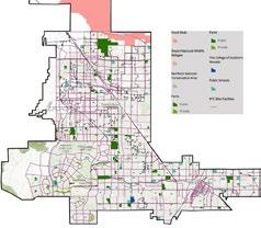
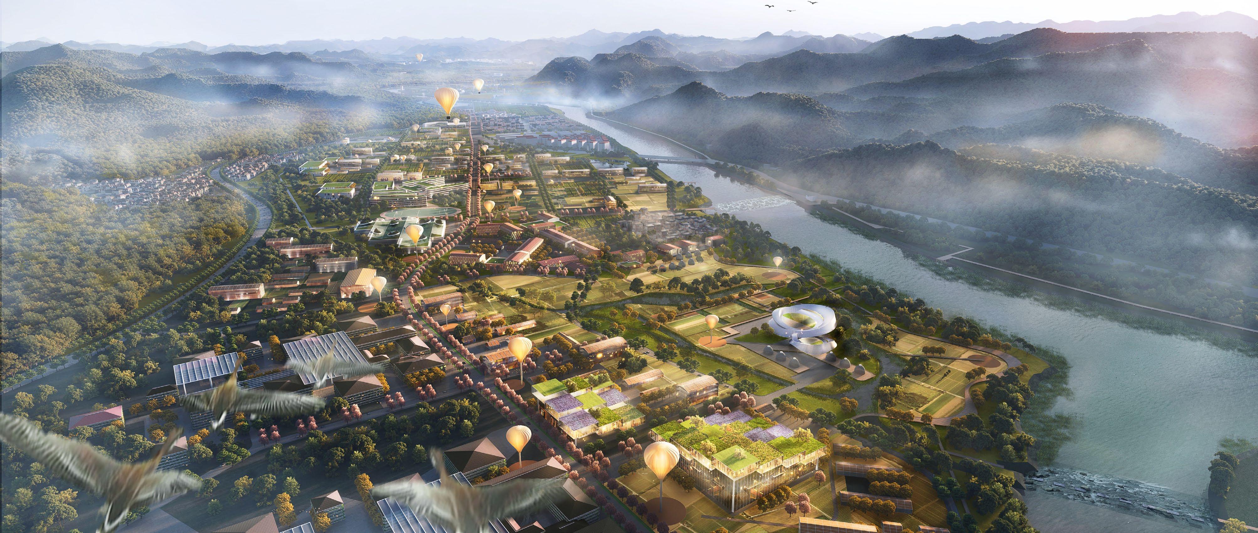
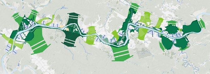
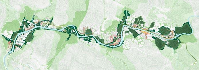
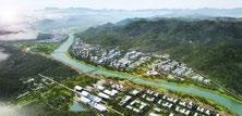
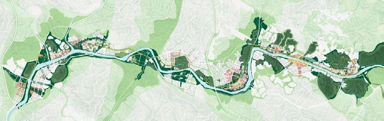
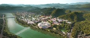
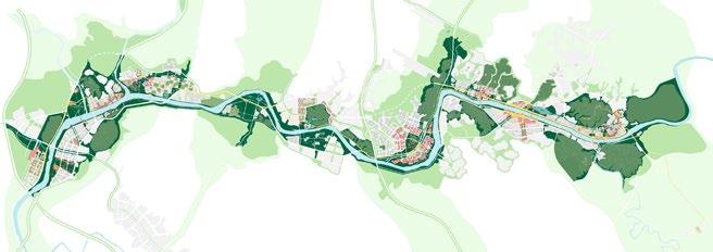
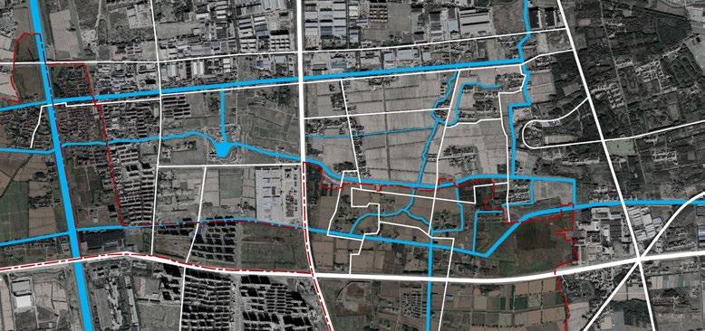
This project aims at creating urban renewal prototypes for intensely developed downtowns in Yangtze Delta Metro-area, such as that of Wuxi city. This so-called 2000-year-old historic city has only a few uncovered relics left, with other memorial landmarks replaced by quick and profitable development in 90s. Such challenge in between will be solved by the concept of “Project Package“, which synthesize culture, transit and development, consists of core openspace anchored by historic landmark, adjacent projects beneficial from it and TOD. Citywalk and Ring Belt strategies will exert public corridor improvements to trigger profound neighborhood and inner land regeneration.
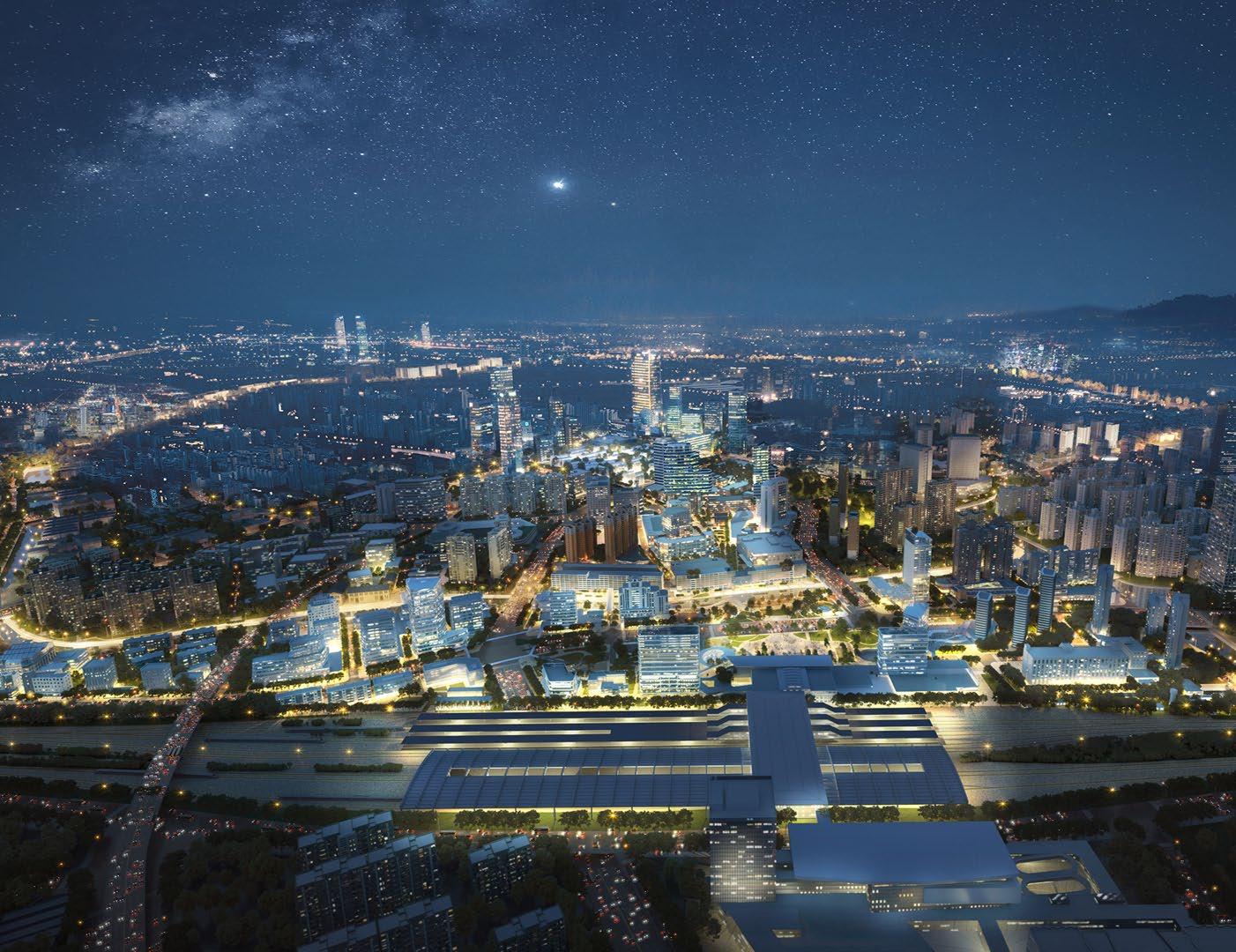
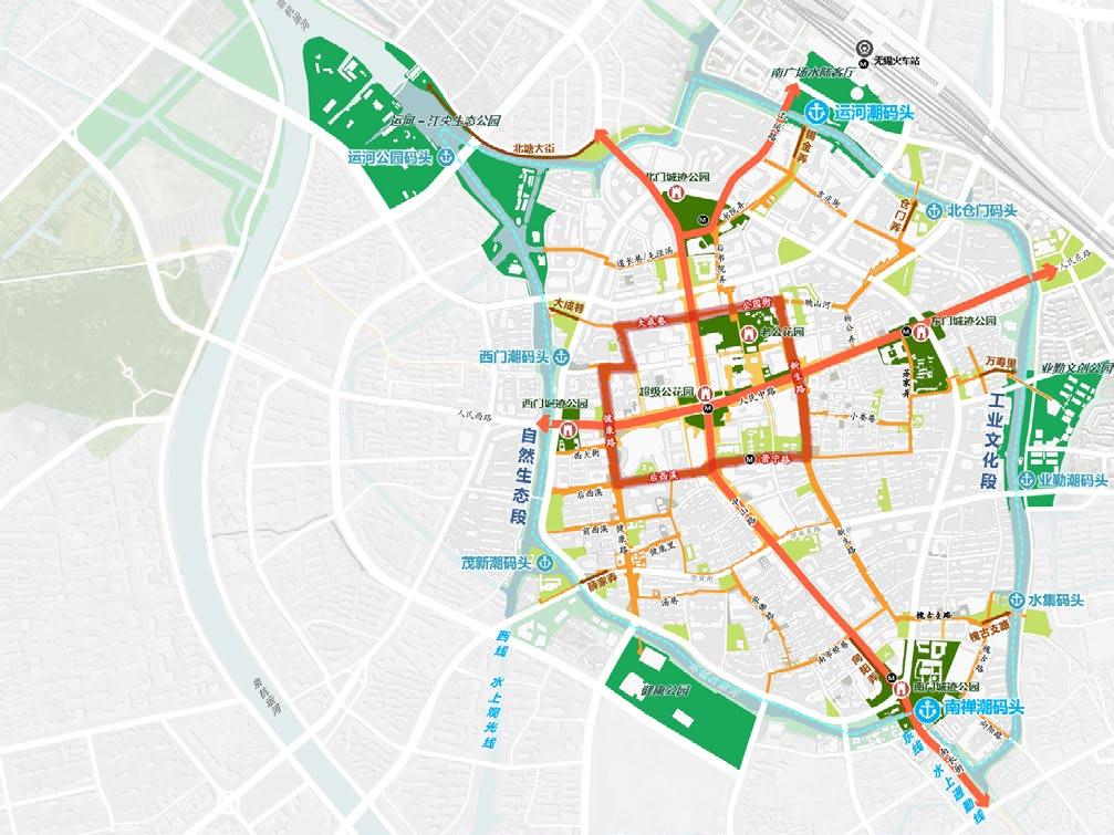
MILLANUIM WUXI - FUTURE OLD TOWN

MILLANUIM WUXI - FUTURE OLD TOWN Living Treasures of Local Historic and Cultural Memory
Consumption and Travel Destination in Yangtze Delta Metro-Area Innovation Center of Urban Modern And Neo-Professional Services Sustainable Tapestry of Diverse Urban Lifestyle
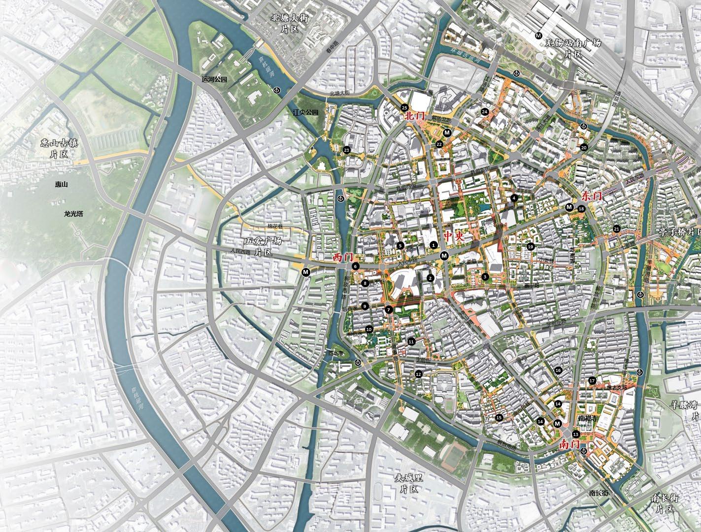
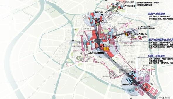
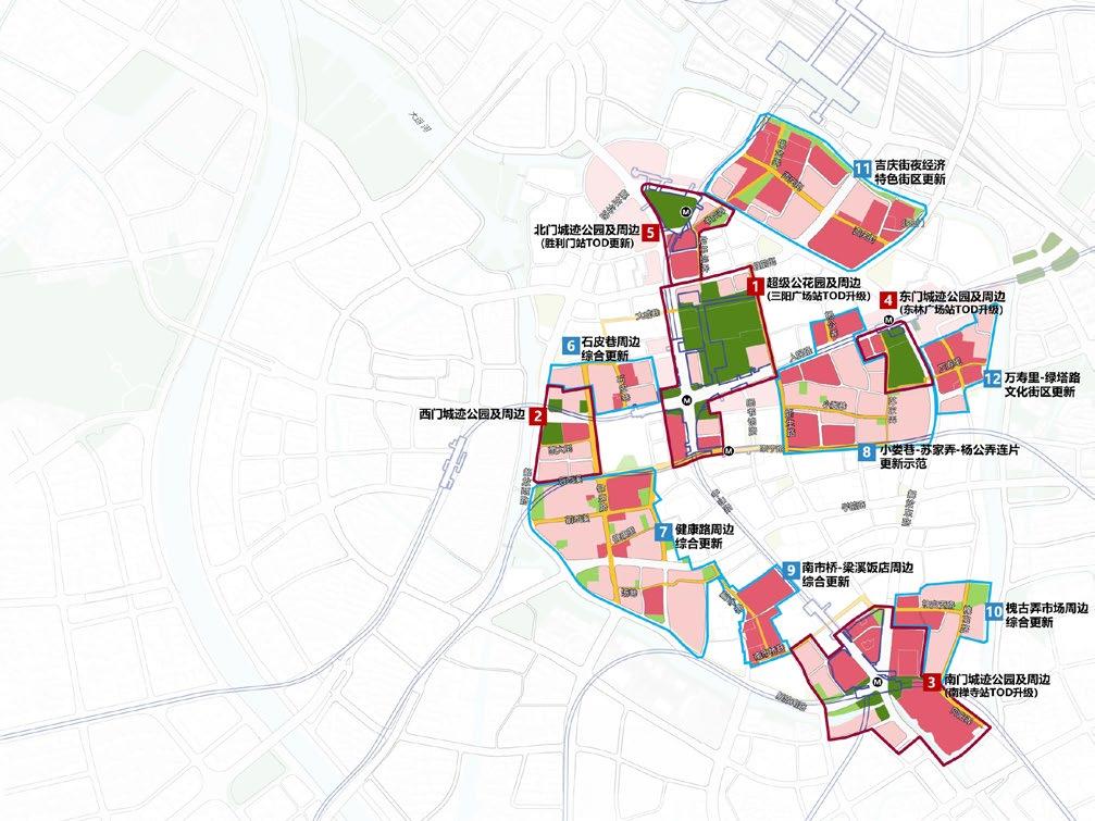
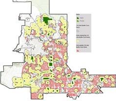
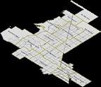
• 2 TOD Cores: City Centre Park + Rail Station
• 5 Culture-Oriented TOD Project Packages
• 10 Mixed Use Blocks along Citywalk Network
• 1 Canal Ring Cultural & Leisure Belt


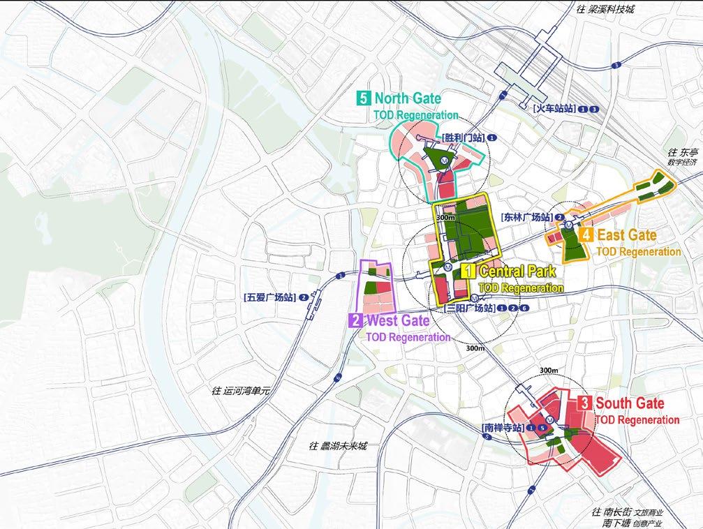
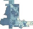
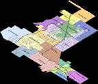
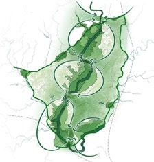
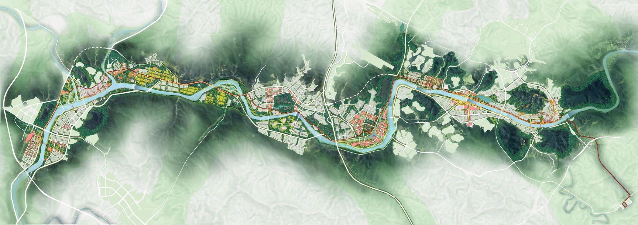
3 OVERALL URBAN REGENERATION STRATEGIES
CULTURE ORIENTED
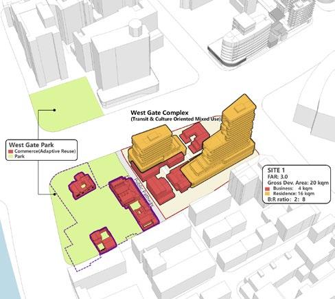
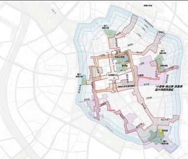
Divide downtown in 5 units based on significant historic landmarks (4 gates and central park), to pack and redevelop cultural resources.
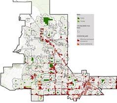
TOD REGENERATION
Establish TOD cores per transit stations to use traffic flow sources and activate the development engine of high-end service industry.
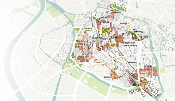
OPENSPACE NETWORK PROMOTE NEIGHBORHOOD
The strategy extends TOD energy along Citywalk network to revitalize inner city blocks with mixed use and multi-mode renewal approaches.
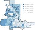
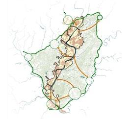
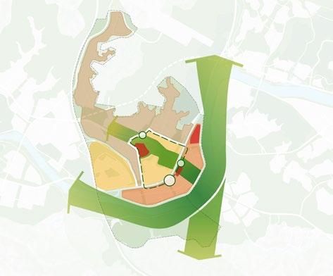
• OBJECTIVE: Revitalizing culture and business via compound land development surrounding 5 nucleus parks restoring historic landmarks
• ACTIONS: Nucleus Landmark Parks + Adjacent TOD Regeneration Projects
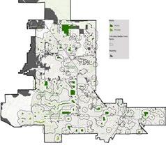
REESTABLISH NEW-AGE CITY GATES
New living-room images rejuvenates old city appearance at original gateway spots, which closely re-links to other units in 4 aspects outside downtown.
Rolling update logic and phase:
• Concentrate on the 5 TOD new development poles of city;
• Improve public domain bones;
• Versatile featured areas continue to be organically renewed;
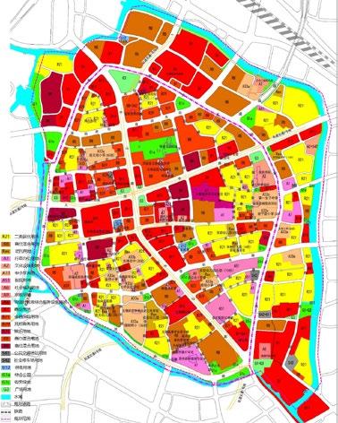

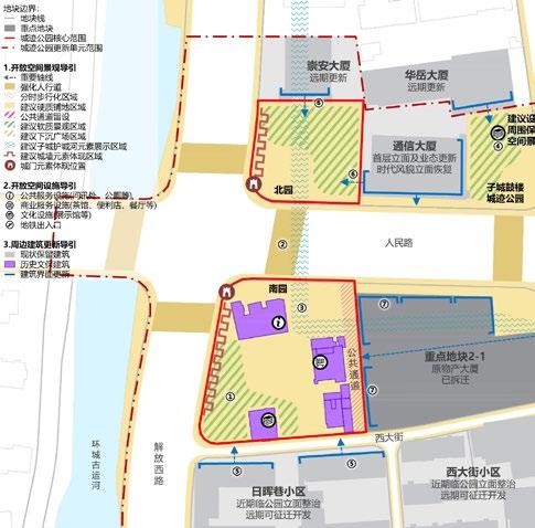
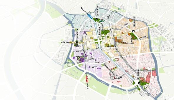
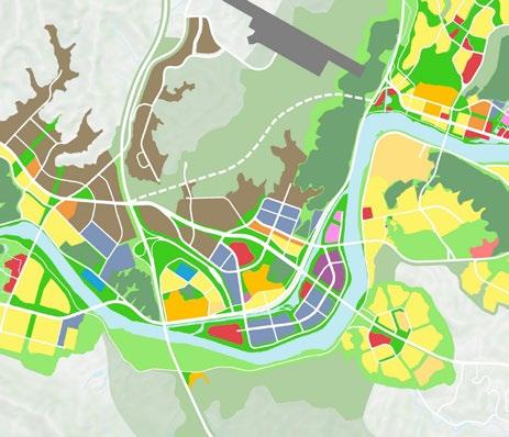
Update historically inherited downtown openspace in 3 categories: parks, streets and alleys, and canals, per deep research of city old maps.
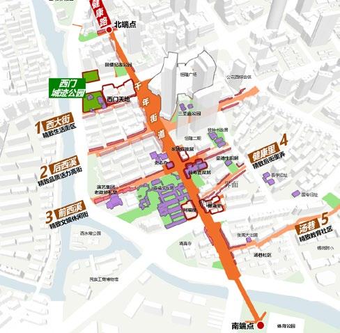
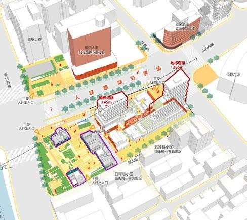
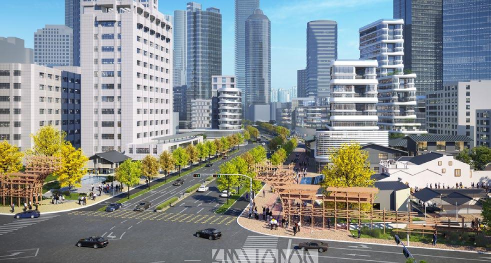
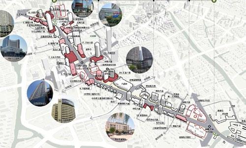
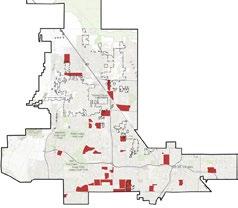
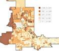
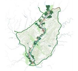
Cultural Citywalk is a pedestrian network with the memory of the old city of Wuxi. It brings together many historical and cultural resources and is an important carrier of Wuxi urban lifestyle.
• OBJECTIVE: Establish Wuxi Citywalk network that can be walked, read and experienced.
• ACTIONS: Central Street + Connector
+ Core Historic Portion
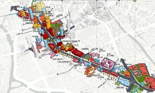
• Preserve lanes and improve walk experience by adding island, featured crosswalk and vegetated buffer.
• Create unique pedestrian space of prosperous commercial street.
• Non-motorized lanes and bus stops create commercial landscape of the ancient city.
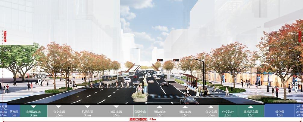
Walkable readable and experiential impression of the real old city; Historically significant with large number of cumulative socio-economic functions.
Attention to invest in upscale improvement and infusion of cultural symbols should be paid.
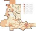
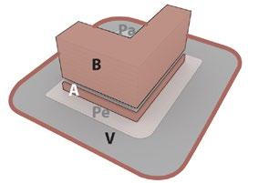
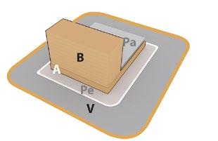
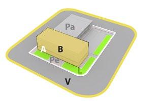
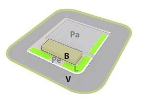
This is the section of road in which Wuxi old city historic texture and style are relatively well preserved. Historic style should be strictly protected or restored.
Adaptive reuse of existing space and structure to urbanism programs will be allowed. The case demonstrates a harmonious state of urban commercial vitality, protective improvement of interface appearance and highlighted cultural logos.
CLIENT: CITY OF LAS VEGAS
TYPE: URBAN PLANNING | PHYSICAL PLANNING
2020
ROLE: PROJECT PLANNER
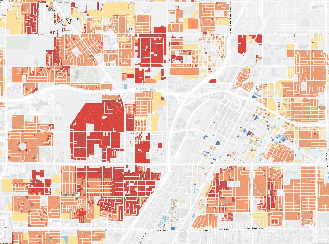
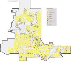
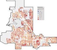
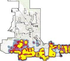
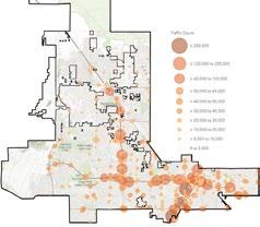
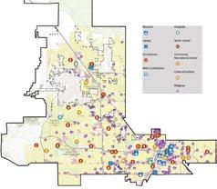
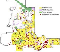
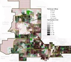
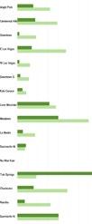
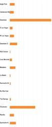
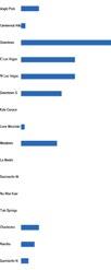
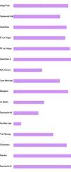
2050 Master Plan identifies current issues and needs in the community, and sets forth goals, policies and actions to address them. The project team worked closely with stakeholders and public to promote five aspects of city future development aligned with five guiding principles. A data-driven geodesign framework was exerted to build procedural models that facilitate process from decision-making to implementation. The complex and specific issues regarding existing conditions and future scenarios across sixteen planning areas were analyzed and proposed by not only spacial and experiential ways but also quantified and analytical methods. Its Storymap portal can be found: https://arcg.is/1SGW4G
Decision makers Objectives for the five themes of the city future development
Guiding principles that measure the success of objectives per each theme
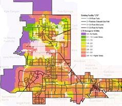
REPRESENTATION MODEL
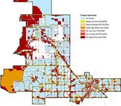
A series of inventories and representations of existing condition to figure out obvious issues the city is facing and the ways to describe them from a planning standpoint
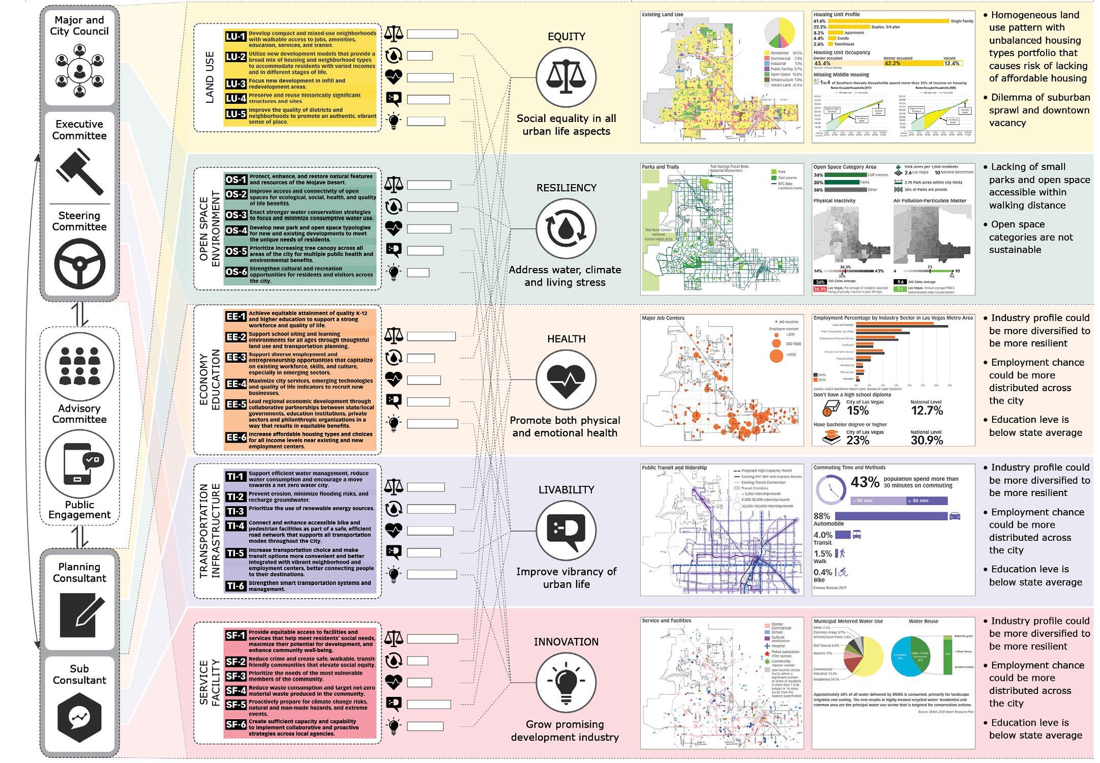
This model researches the relationship of various elements in each theme, and the spatial, ecological, and socioeconomic process by which the existing condition of each theme is formed.

Workflow and methods
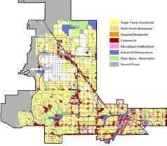

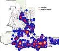
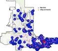
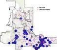
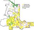
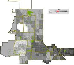
Assessment of five themes and reclassified in each planning area
Land
Evaluate specific potential of park and land use in each planning area


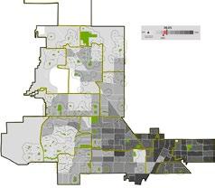

apply to the city as evaluation matrix with common spatial units
ac unit zonal statistics into both density and absolute number in each cell
zonal statistics into both density and absolute number in each cell
aggregate each cell’s data into 16 planning areas


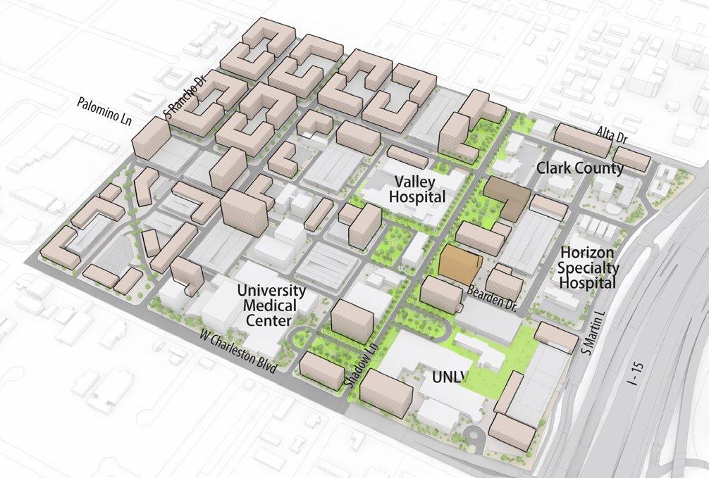
FACILITIES MASTER PLAN 2030
CLIENT: CITY OF LAS VEGAS
URBAN REGENERATION
LAS VEGAS, NV, 2015
ROLE: PROJECT DESIGNER | VISUALIZATION
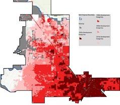
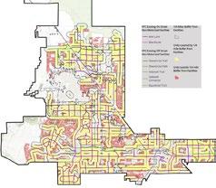
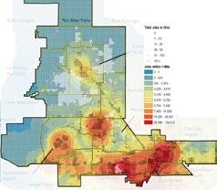
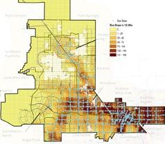
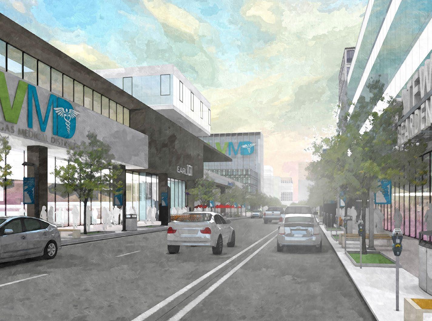
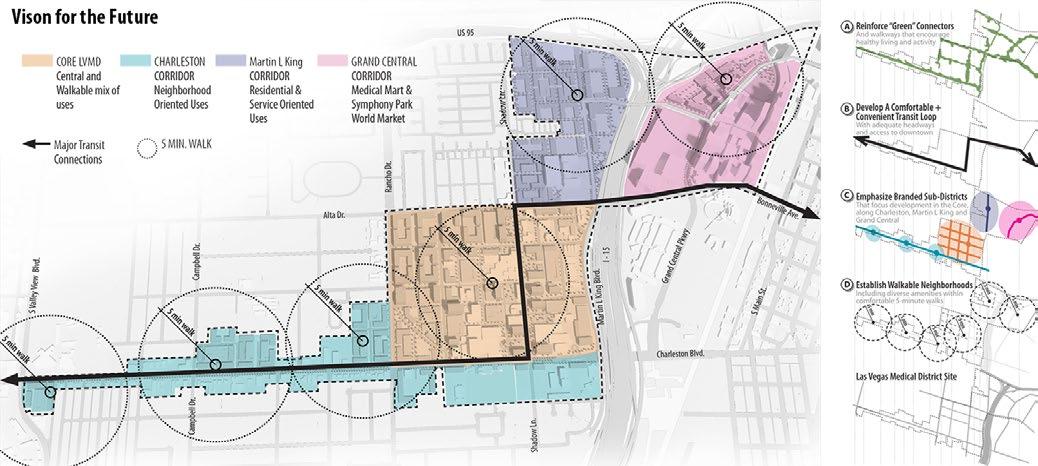
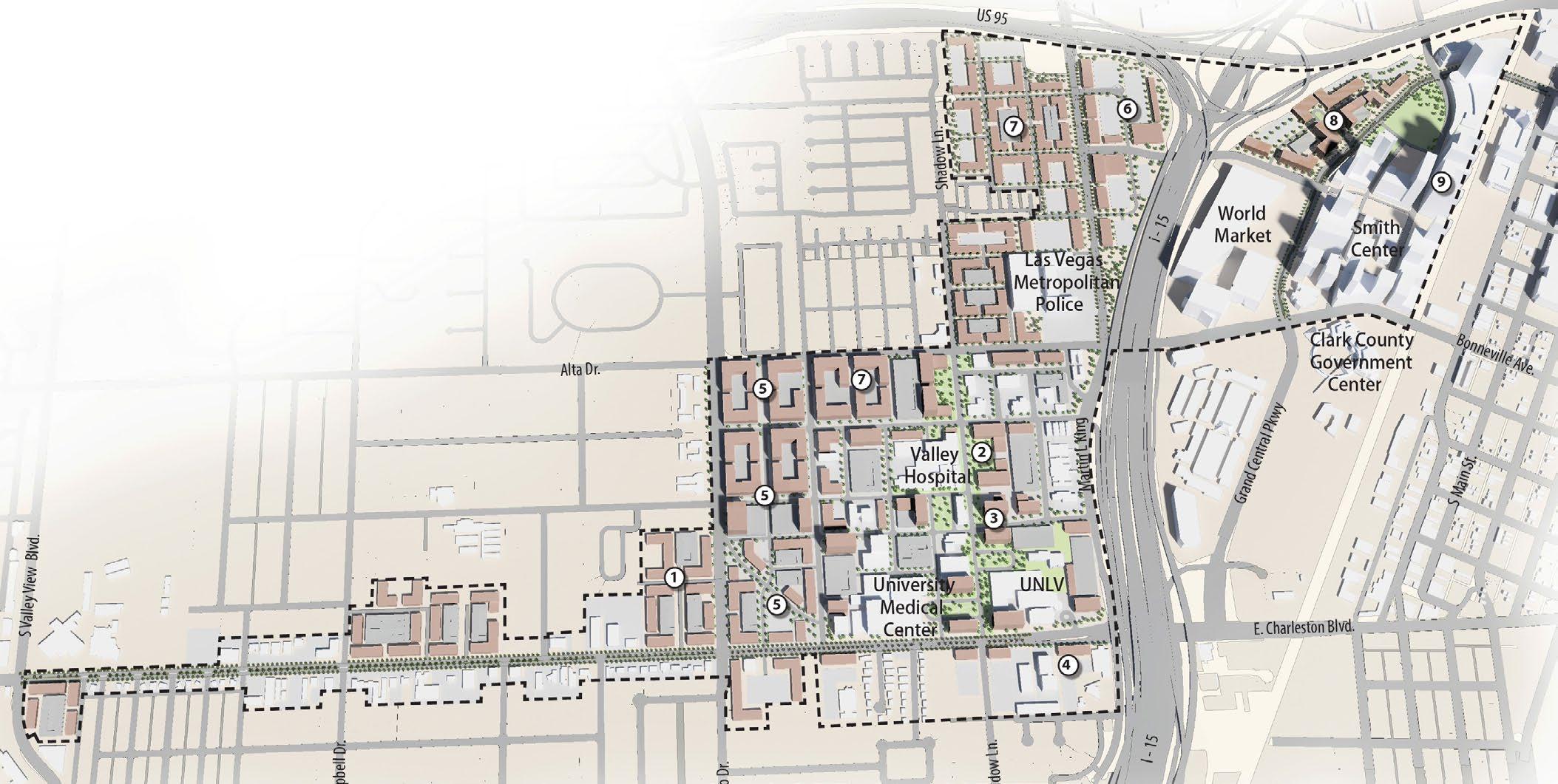
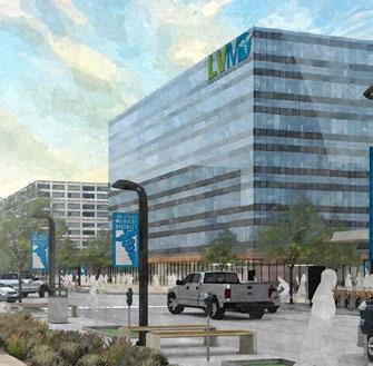
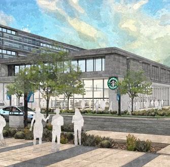
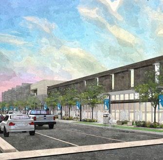
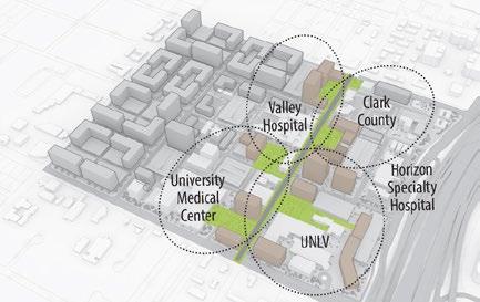
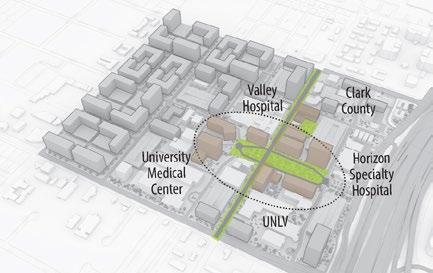
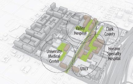
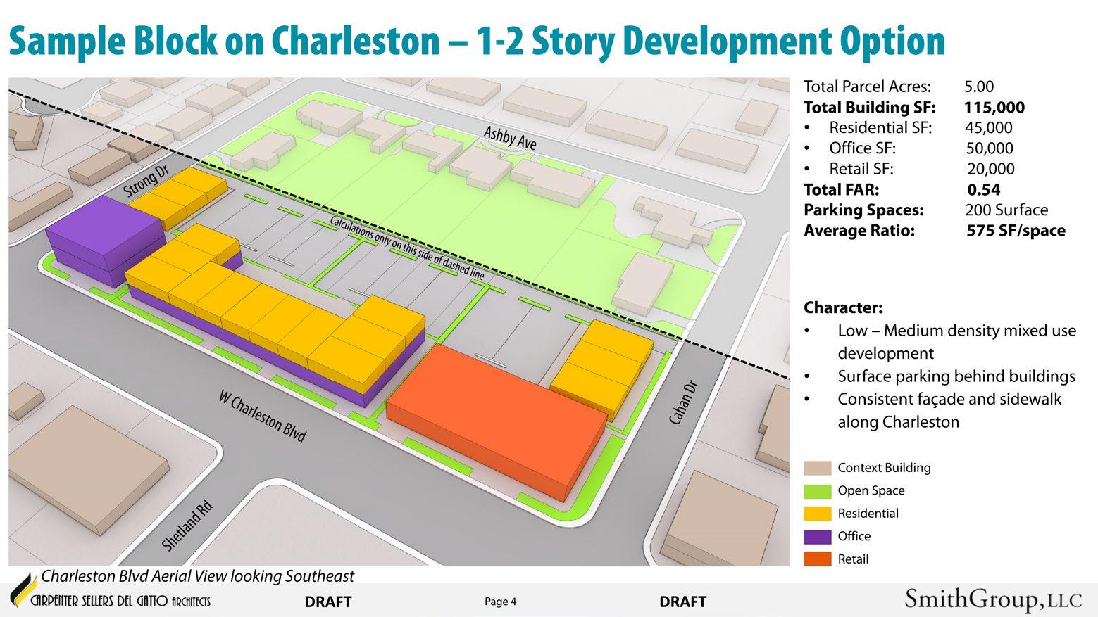
By 2030, the Las Vegas Medical District (LVMD) will be the clinic, research, wellness, and education center of Southern Nevada and the premier academic medical district in southwestern United States. The master plan encourages a collaborative approach to development of 640 acres directly adjacent to downtown Las Vegas. The project team used City Engine as a procedural physical planning tool to optimize the framework that accommodates profitable development aligned with project goals, initiates a vibrant mixeduse lifestyle, and emphasizes multi-modal, green streetscape and new boulevard linkages woven among the fabric of City of Las Vegas.
The vision and illustrative plan represent an optimal configuration for the LVMD in the long-term. They propose placement of new or enhanced features such as buildings, roadways, open spaces, parking and other facilities in relationship to existing facilities.
Built on a framework for ongoing change in downtown Las Vegas, the LVMD will capitalize on the potential development of prime real estate, providing opportunities for new academic, medical, research, clinical, and office development; creating an attractive destination to live, work, learn and play. Rooted in a consensus-oriented process, this plan represents optimal urban design configurations for development of the LVMD in the long-term.
While deliberately flexible to accommodate future changes and opportunities, the development framework plan for the LVMD creates an iconic setting for a world class medical center, new medical school, a range of walkable food service and amenity retail opportunities, and balanced opportunities for increased density.
Future Total Building: 19,250,000 sq feet / 1,800,000 sq meters
Future Total Parking: 32,000 spaces
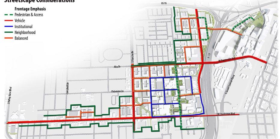
• Active pedestrian street facade along street frontages
• Typically 10-20 story
• Parking Garage
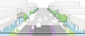
• Active pedestrian street facade along primary road
• Typically 5-10 story
• Parking Garage
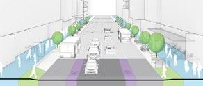
• Active pedestrian facade along primary street and rely on landscape to activate secondary development edges
• Low-rise “stick”
• Mixed Parking
• A balanced architectural and landscape oriented active pedestrian street
• Typically 1 story
• Surface parking
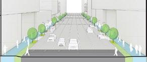
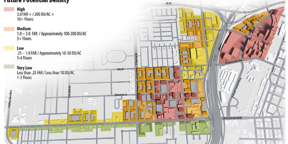
Efficient vehicle movement
• Limits ground floor uses
• Encourage multimode
• Balance needs of urban oriented modes
• Improve vibrancy
• Emphasize comfortable pedestrian experience and retail activity
• Residential-oriented complete streets for multimode
• Improve pedestrian experience and building frontage
• Improve environment quality and preserve neighborhood characters
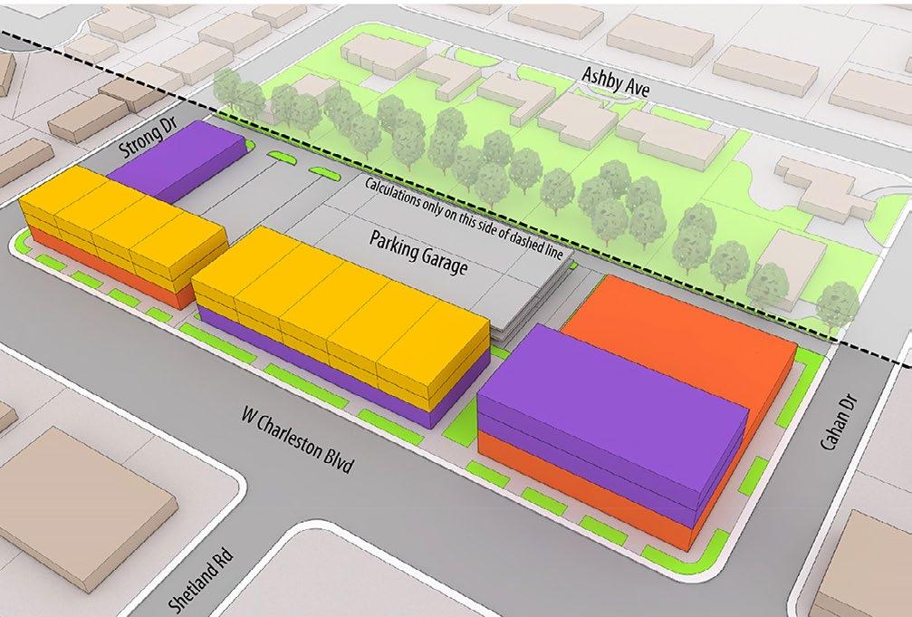
Three framework options for development of the core were reviewed as part of the master plan process with regards to alignment with the guiding principles and potential development capacity.
Focus Shadow Lane as primary element and addresses for each institution.
• New development: +/-12M sq ft
• New parking spaces: 40,000
• FAR: 3.0
Create an iconic open space to organize new development.
• New development: +/-13M sq ft
• New parking spaces: 40,000
• FAR: 3.90
Develop internal addresses for each institution.
• New development: +/-12M sq ft
• New parking spaces: 40,000
• FAR: 3.70
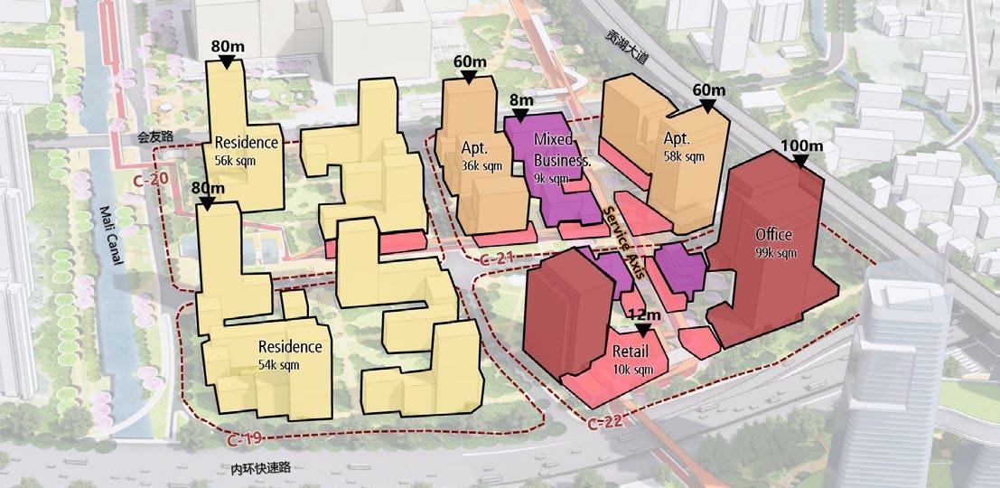
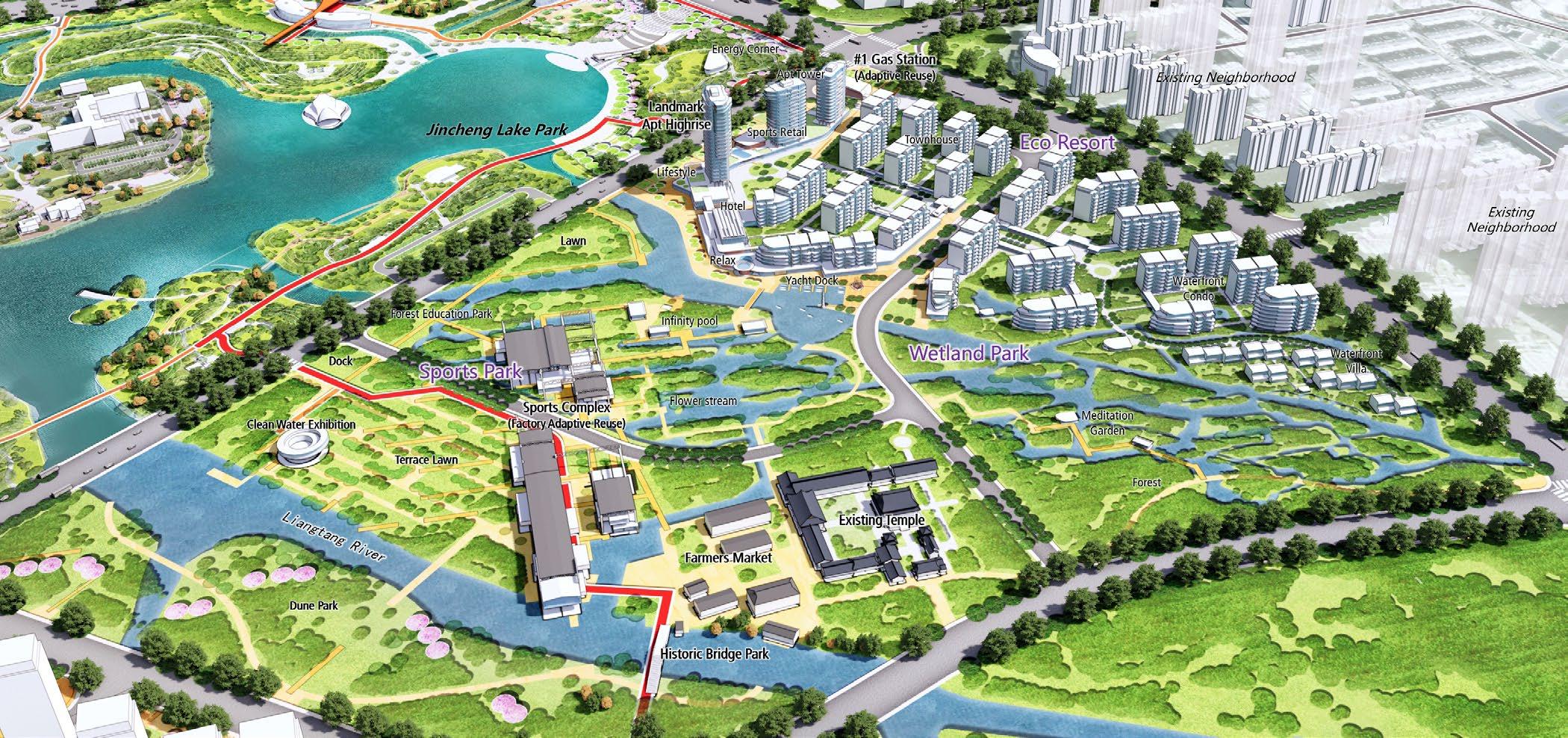
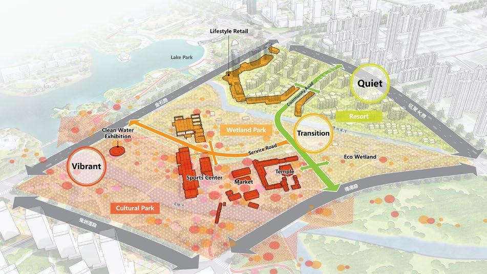
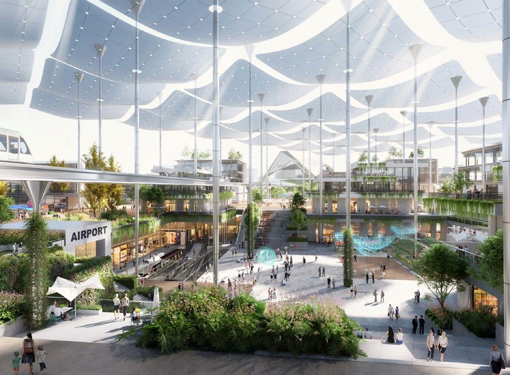
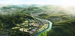
WUXI JINCHENG BAY URBAN DESIGN
CLIENT: WUXI ECONOMIC DEVELOPMENT DISTRICT MANAGEMENT COMMITTEE
TYPE: HEALTHCARE MIXED USE & RESORT DEVELOPMENT 2023-2024
ROLE: SENIOR URBAN DESIGNER
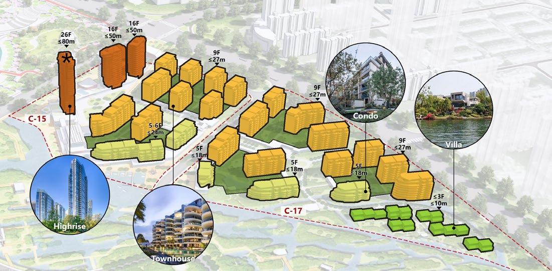
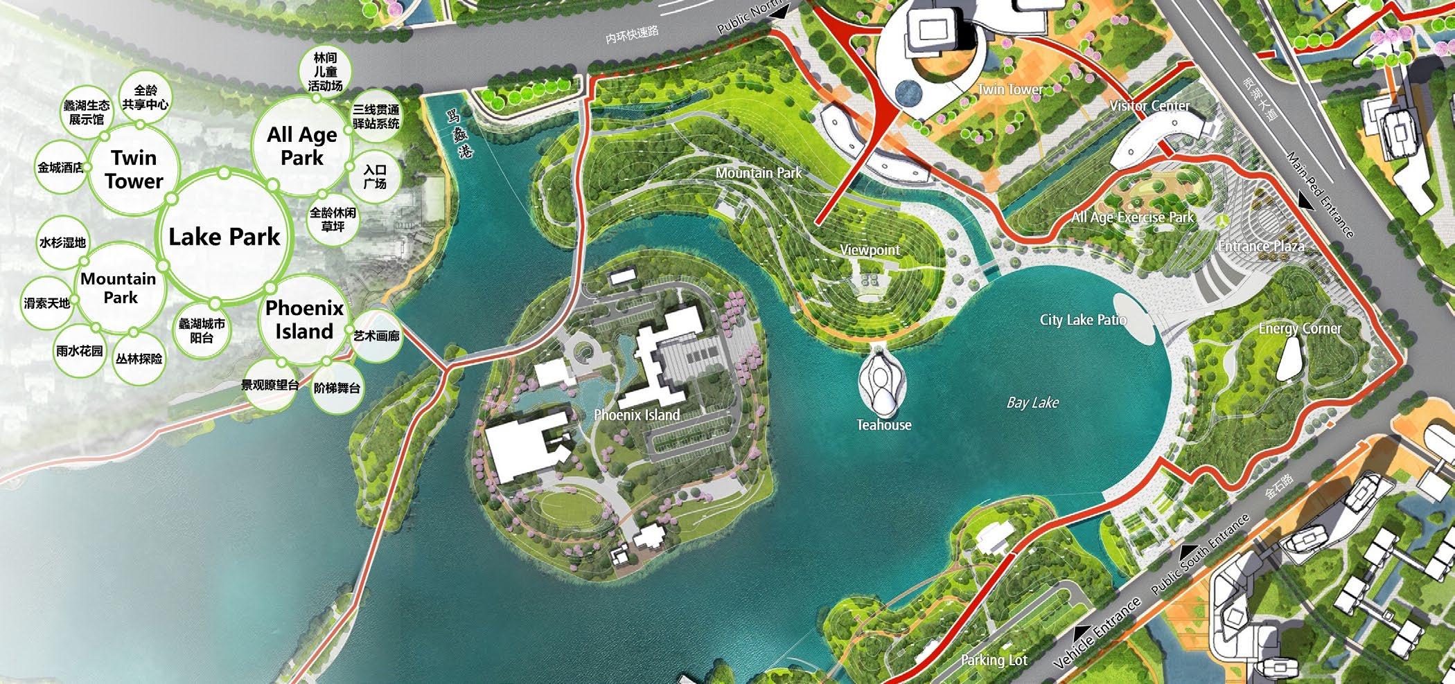
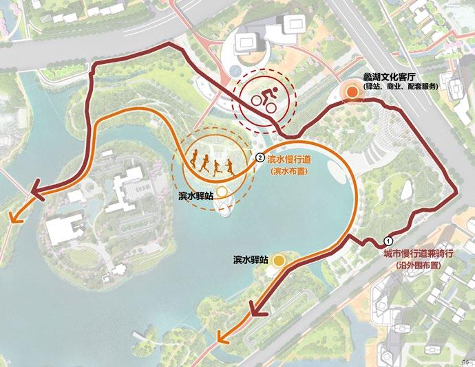
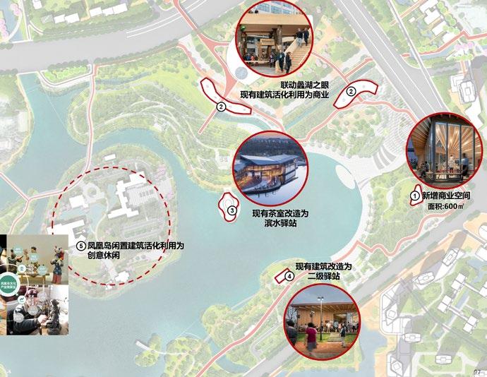
Benefited from adjacent Bay Lake Park as the most valuable natural resource, the virgin land of 1.3 sqkm has been planned as convalesce and healthcare center with precedent hospital under construction. This project prioritizes ecological and enjoyable revitalization of the three rivers draining into lake, resulting into three main development and landscape urbanism areas. The nature based urban design solution will promote this place to be the new center of healthcare and medicine R&D industry; the new relax destination offering diverse living, shopping and entertaining programs; and the new unique habitat livable for new residents.
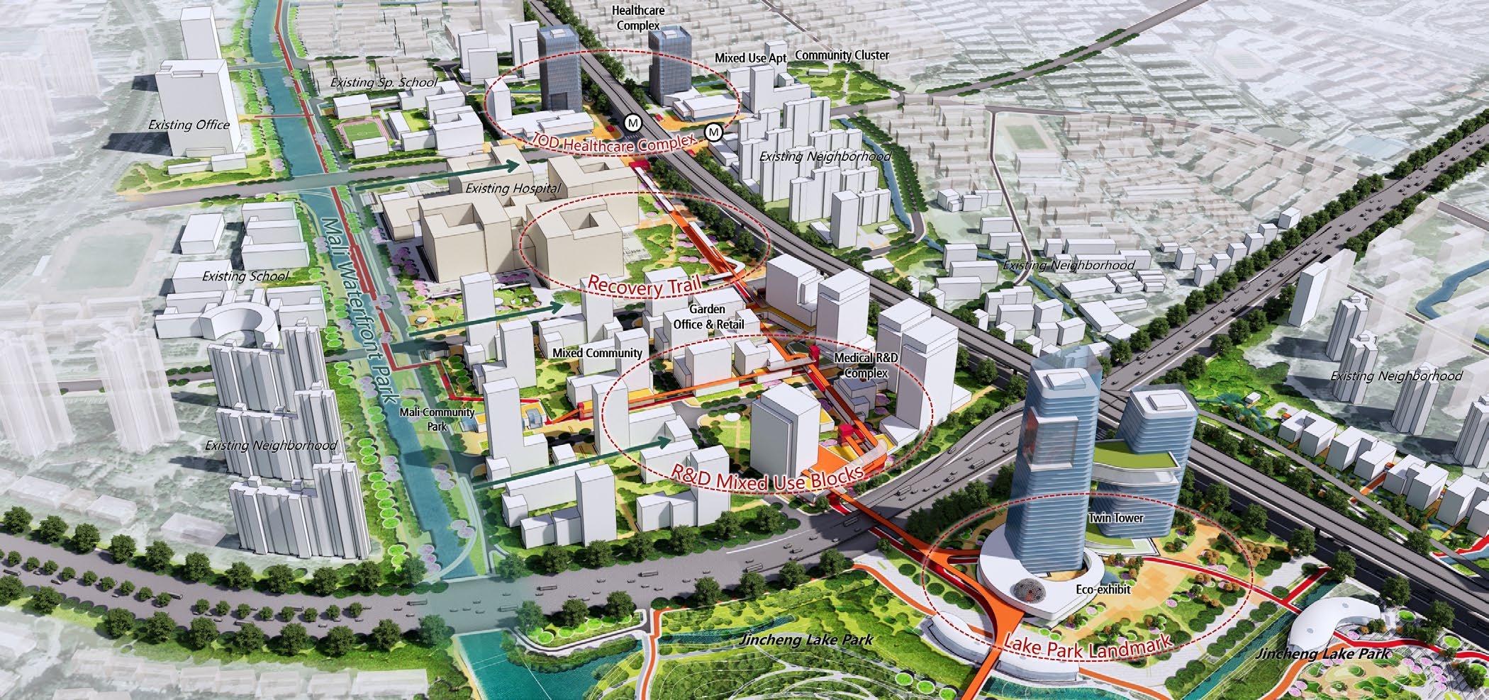
• Development area: 11.5 ha
• Gross development amount: 321 ksq m
• Gross business development amount:11.7 ksq m
• Gross residence development amount:20.4 ksq m


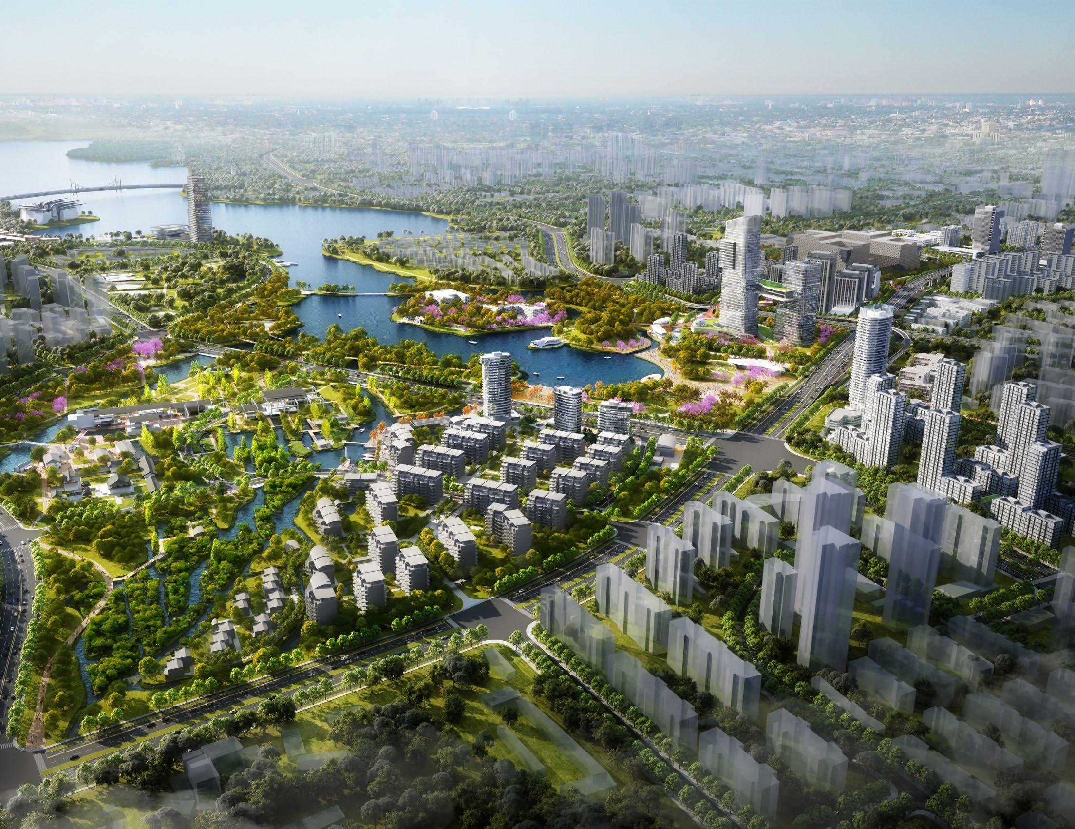
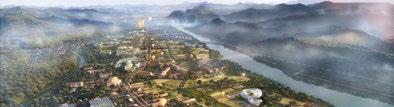
YANGTZE RIVER NEW TOWN MASTERPLAN + START AREA URBAN DESIGN
CLIENT: MANAGEMENT COMMITTEE OF WUHAN CHANGJIANG NEW TOWN TYPE: SUSTAINABLE URBAN DESIGN 2022
ROLE: URBAN DESIGNER
The 4.0 new-town prototype has been formed by three trends: A new industry led by intellectual and low-carbon tech; A new place where greenspace is clustered and chimeral; A pilot scenario attracting the next generation. Therefore, by interpreting the original characteristics of site and exploring the pathway of city smart growth, project team proposes three value propositions of “INNO-PARK”: The future green spine connecting city, the Yangtze River and context field; The future TOD core driving the flexible advancement; The future settlement that highlights the diverse working and living scene.
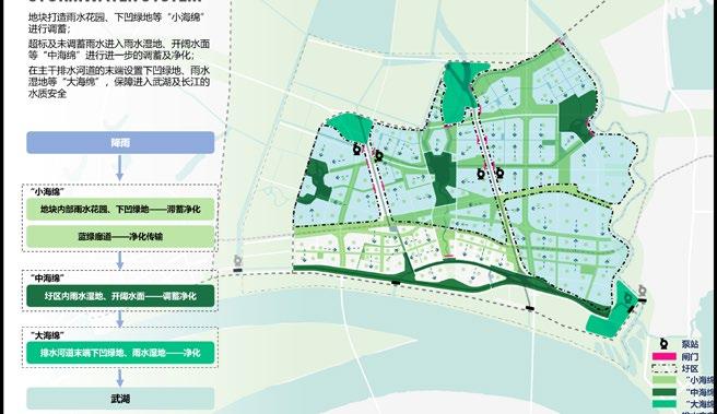
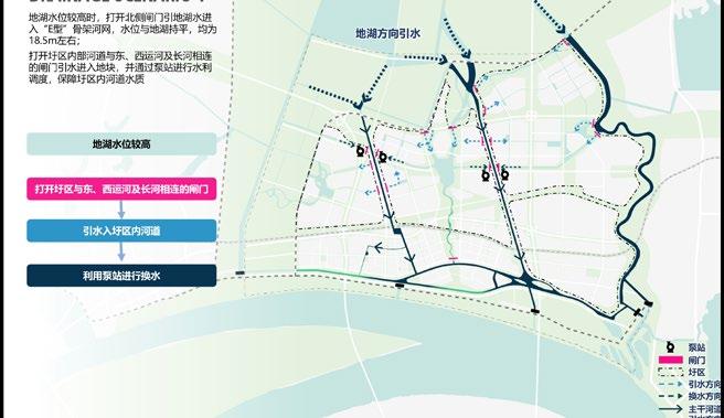
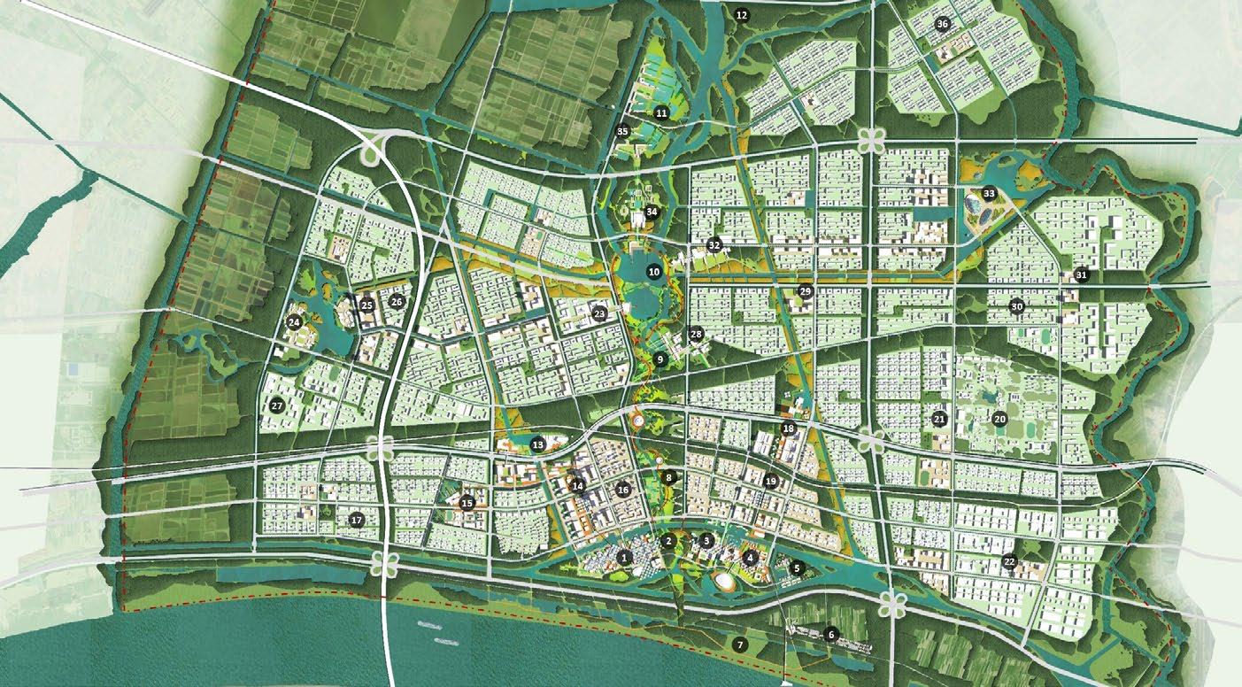


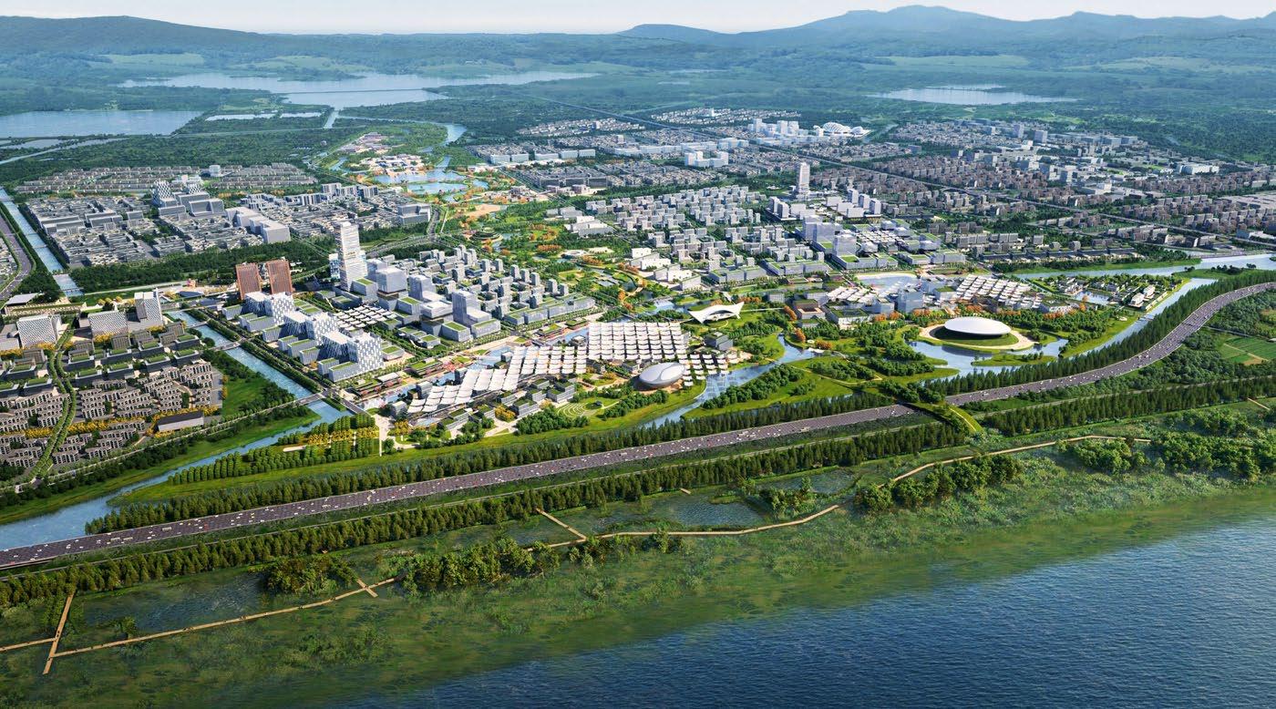


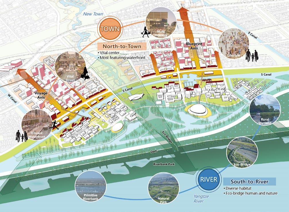
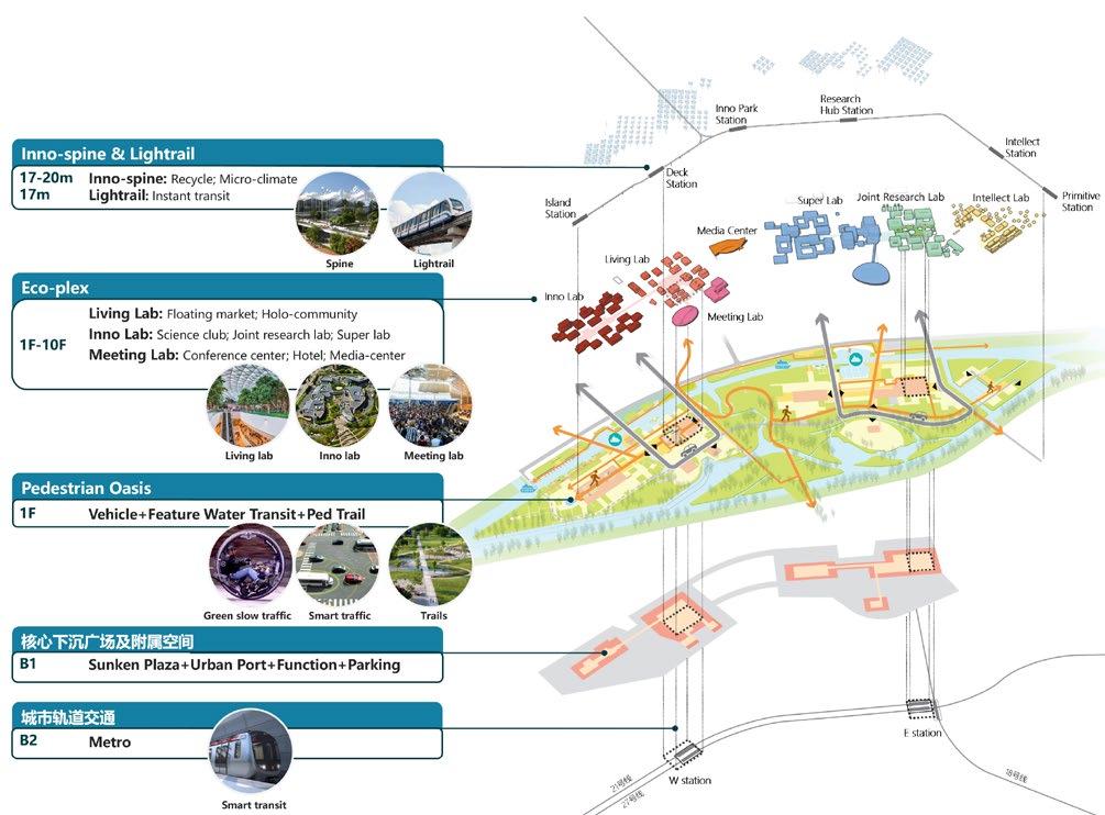
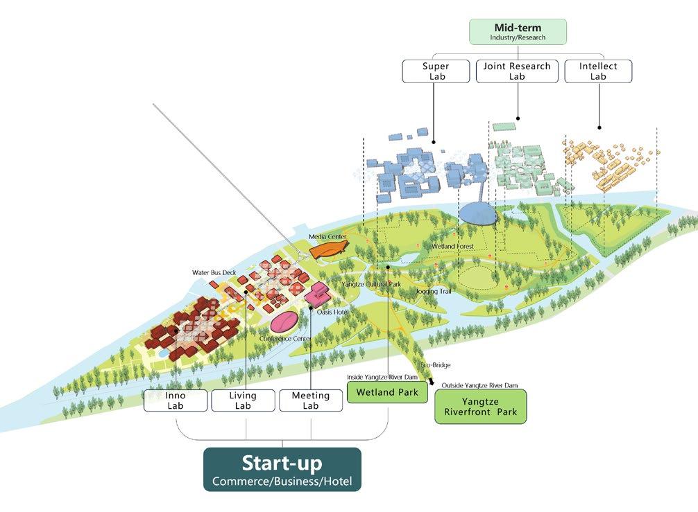
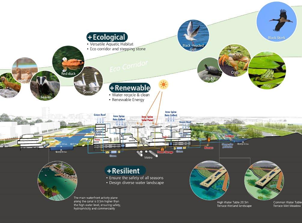
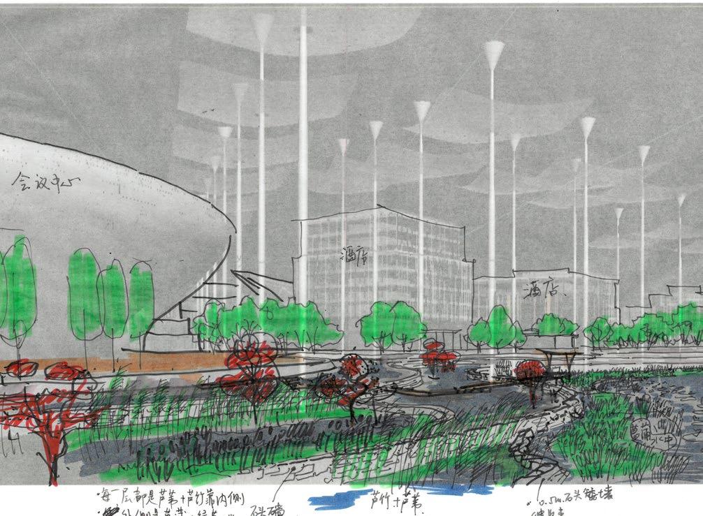
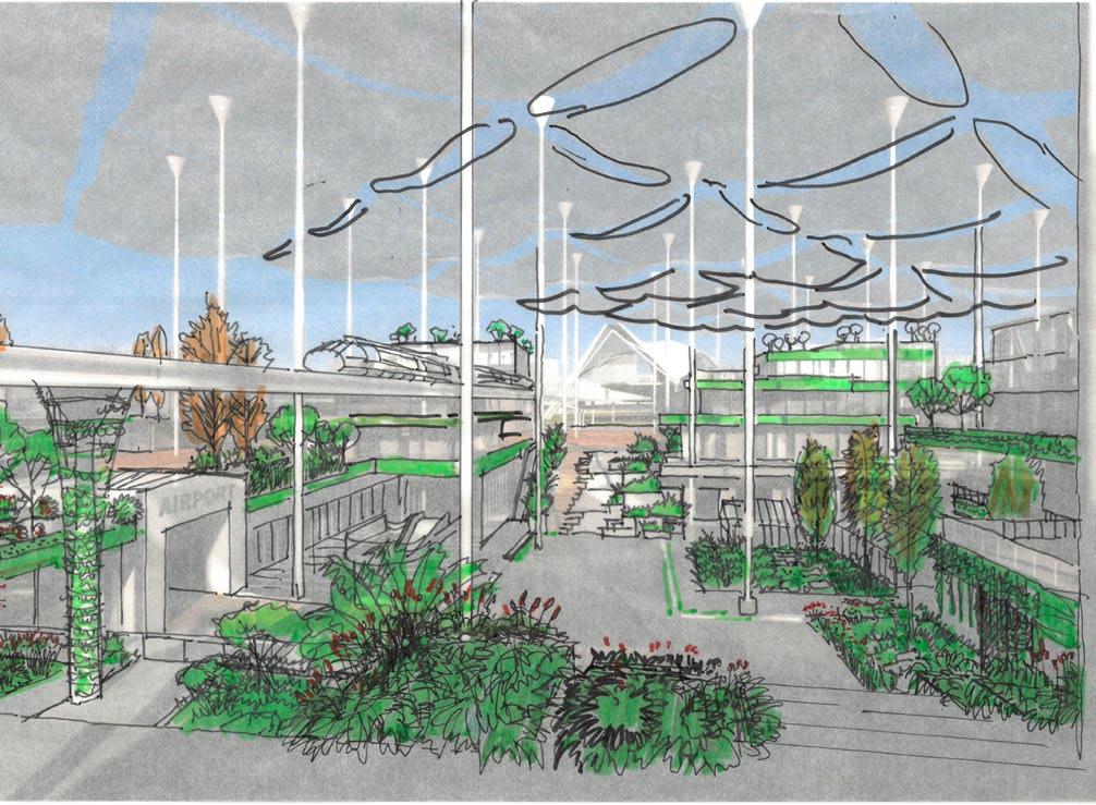
Image - Collaborated with Local Rendering Vendor
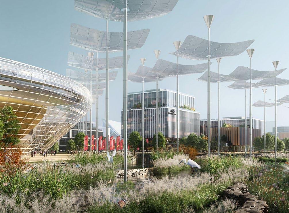
Image - Collaborated with Local Rendering Vendor

CLIENT: KAIHUA COUNTY NATURAL RESOURCES AND PLANNING DEPT.
TYPE: STRATEGIC MASTERPLAN
2021-2023
ROLE: SENIOR URBAN DESIGNER
This project explores development models of small shrinking towns with the National Park as catalysts. The masterplan adheres to the principle of coexistence of nature and human, and builds the “park development unit” to ensure the harmonious relationship between civilization development and ecological restoration. By bringing up the “Four Park Actions“, Kaihua will become an authentic national park heritage site, a place where the value of natural resources is transformed into development assets, and also a symbolic place of international exchange portal in the National Park.
Respect local geographical fabrics to protect watershed ecology.
Re-build human-nature relationship and create a sustainable conversion path from natural resources to economic assets
Shaping the natural and humanistic aesthetics of mutual appreciation in the city and garden


ILLUSTRATIVE MASTERPLAN


2.
3.


With “National Park+” and “Digital Intelligence+” strategies, this action focuses on identifying promising spots that will lead future economic escalation to green economy. It also aims at setting up “cluster development oriented” landuse guide that optimizes spatial structure and increases land value. 1


According to local topography, hydrology and developed land, a fourlevel green space system will be constructed to restore the major native species habitats such as mountains and water body, as well as the corridors among them, in order to improve the health and integrity of river ecosystem in project site
This action aims at the renaissance of unique folklore of Kaihua County, which has been declining in past decades due to rapid urbanization of the town. There are three major projects of this action: the ancient city cultural and creative workshop, the ancient port landscape and the ancient road cultural village.


This road distracts from vehicular system in order to create a diversified, naturalistic promenade of suburban and rural landscape. It takes advantage of existing infrastructure and adds user-friendly service with smart technologies to satisfy visitors’ need.


Divert water to form smart island, focusing on development of green industries.
Restore river ecosystem by dredge corridors and restoring wetland downstream.
Upgrade local villages. Build a high-tech corridor from central hill to river as the core.
Improve public service facilities. Build green industry service center in longterm.
• The main system forms one island, one core with multiple circles.
• Green island gathers core innovative projects including green industries, headquarters, services, smart economy, talent apartments and life services, along the river to radiate up and downstream unit.
• Realize work-live balance. Upgrade existing manufacture to “upstairs, green and open” as new industry parks.


Limit industrial sprawl. Ameliorate natural and visual problems caused by existing plants.
Increase landuse density to open up ecological corridors.
Add on enough public service facilities for local villages.
Control surrounding substation and high-voltage lines. Upgrade the landscape.


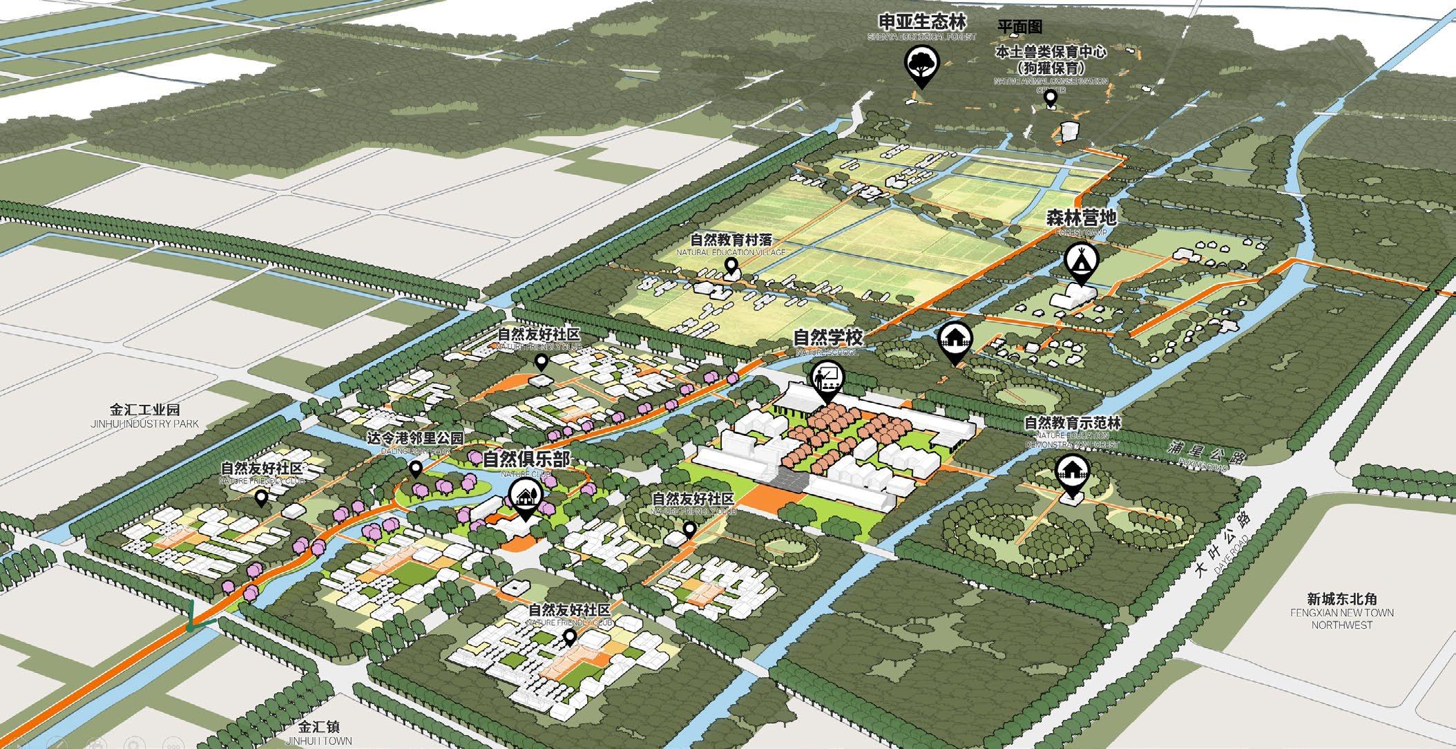
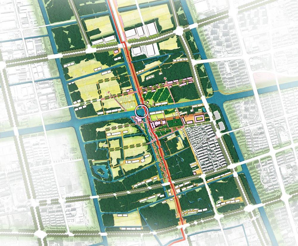
FENGXIAN NEW TOWN GREENBELT CONCEPTUAL PLANNING COMPETITION
CLIENT: FENGXIAN NATURAL RESOURCES AND PLANNING DEPT.
TYPE: MASTERPLAN
2021-2022
ROLE: URBAN DESIGNER
Located in south of Shanghai, the project sites covers 63 sq m² surrounding Fengxian town. This plan puts forward the concept of “Boundless Loop”, highlighting ecological protection, food safety and environmental resilience. A new type of sustainable self-operated social loop across urban and rural will also be created via necklace of dispersed communities.
The loop plan strategy combines together industry, cultural tourism, and lifestyle, in order to creates a multi-dimensional, boundless, urban-rural fusion New Town Green Loop from eight aspects: forest, water, habitat, fields, cultural tourism, life, industry, transportation, and tourist routes.


Sprawl of high density real estate development and manufactures plant is threatening the prime natural and cultural resources on site, including forests, streams, crop fields and historic villages. It brings up two questions for the plan:


• How to better protect the existing ecological resources and give full play to their ecological value?
• How to reasonably construct the urban development boundary?
The design of this zone use three major strategies as answers:

• Extends current province forest park in east by restoring ecological corridor along three existing rivers and streams;
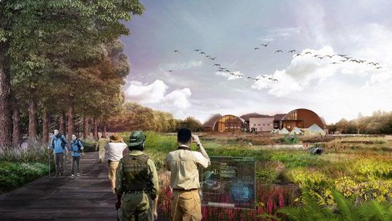
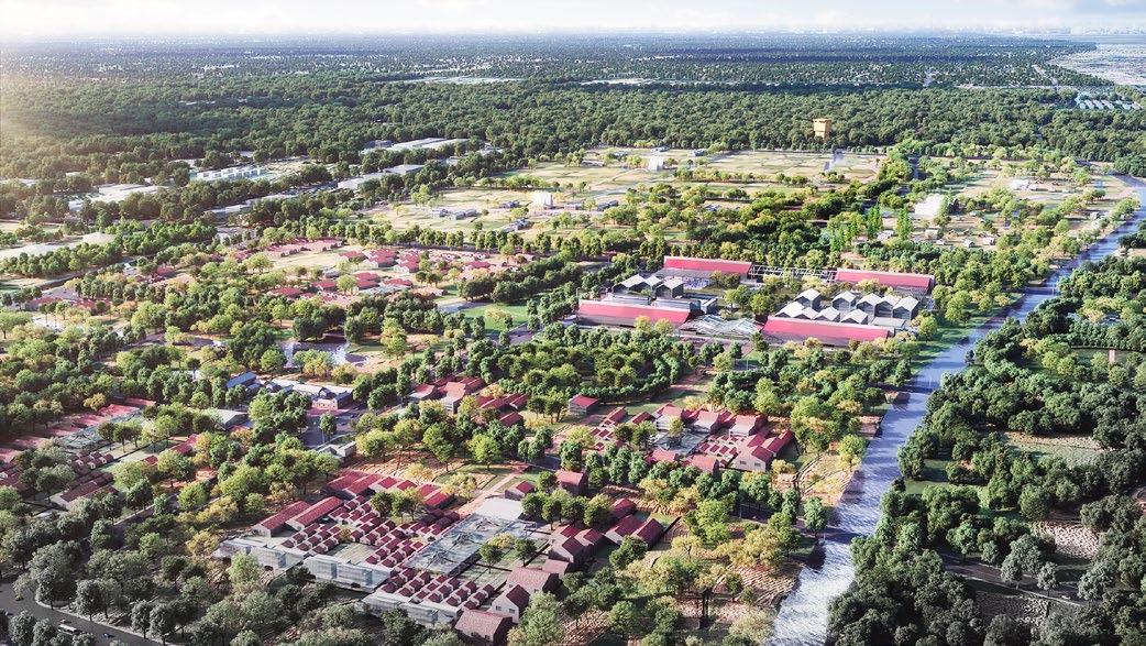
• Build “Nature School” as a radiation driver to form a gradient from “Nature Friendly Community”, to “Nature Education Settlement”, and finally to “Forest Camp” - from urban to rural;


• Cultivate nature-based, nature friendly industries suitable for local development, such as sprouting pet and natural education.

Biggest and prime badger habitat in Shanghai
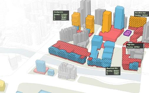
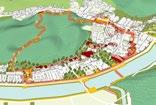
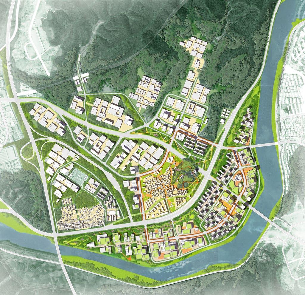
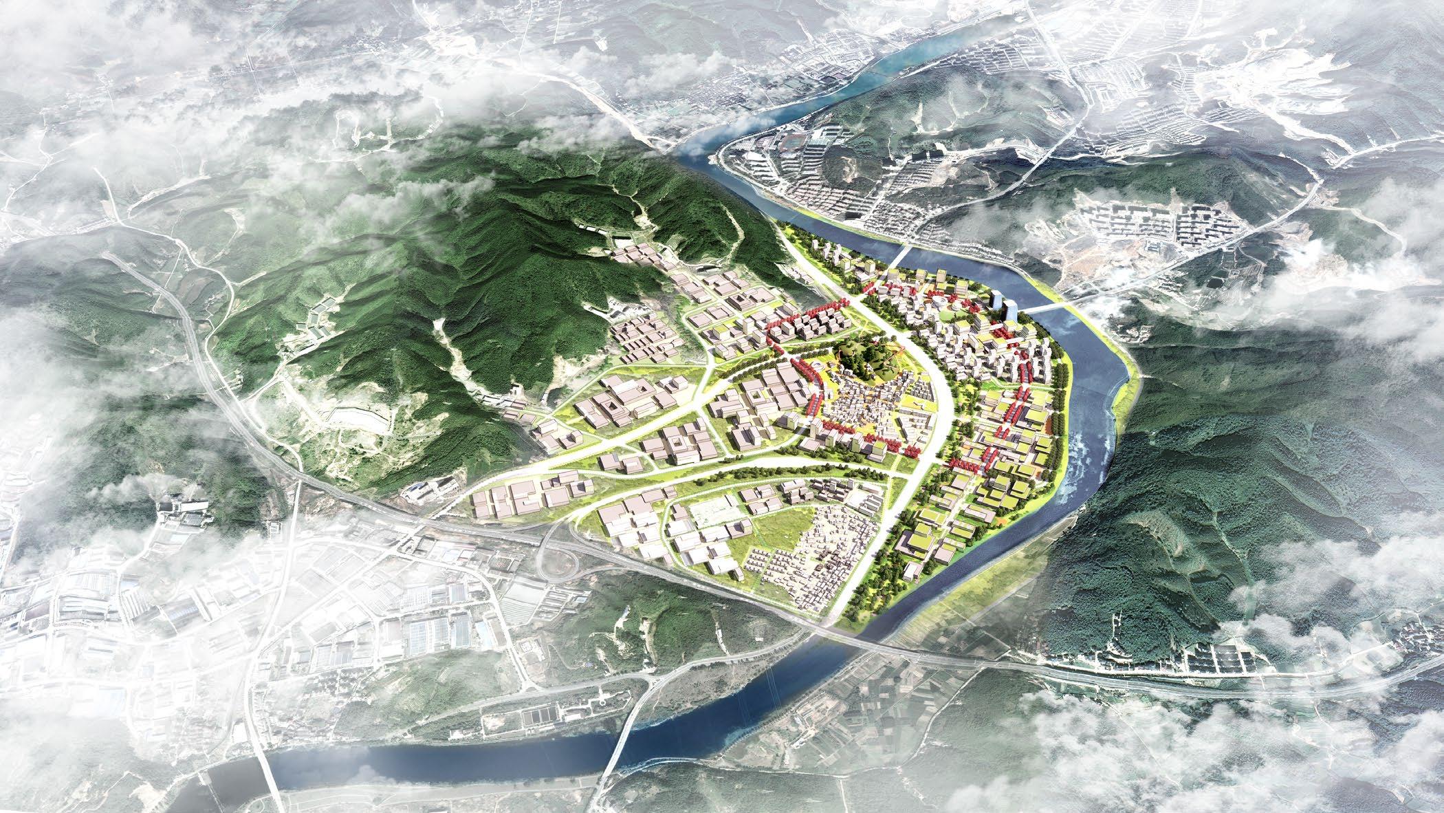
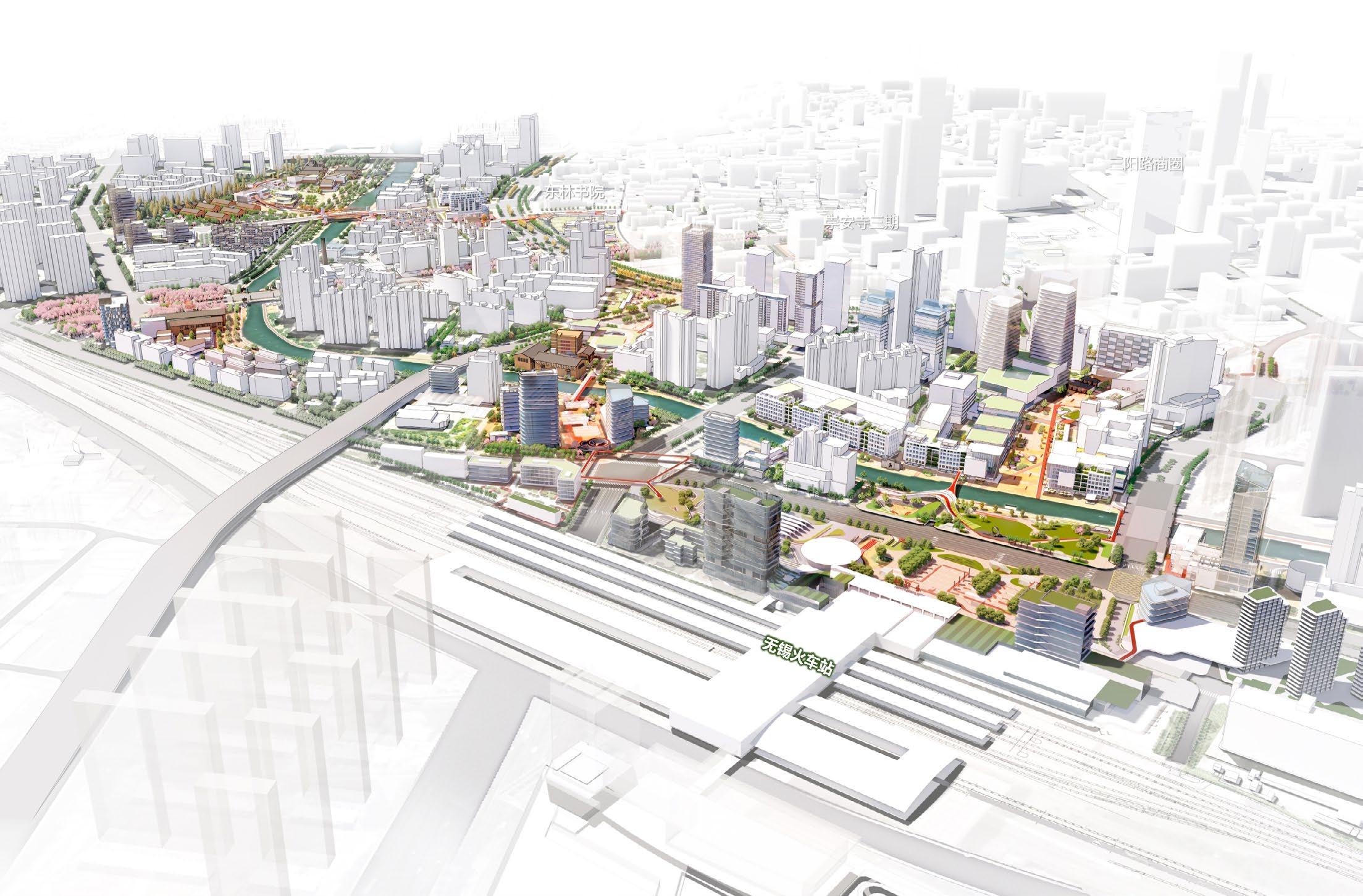
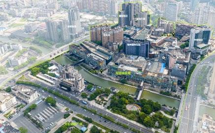
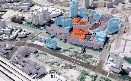
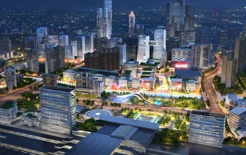
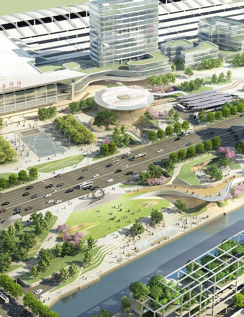
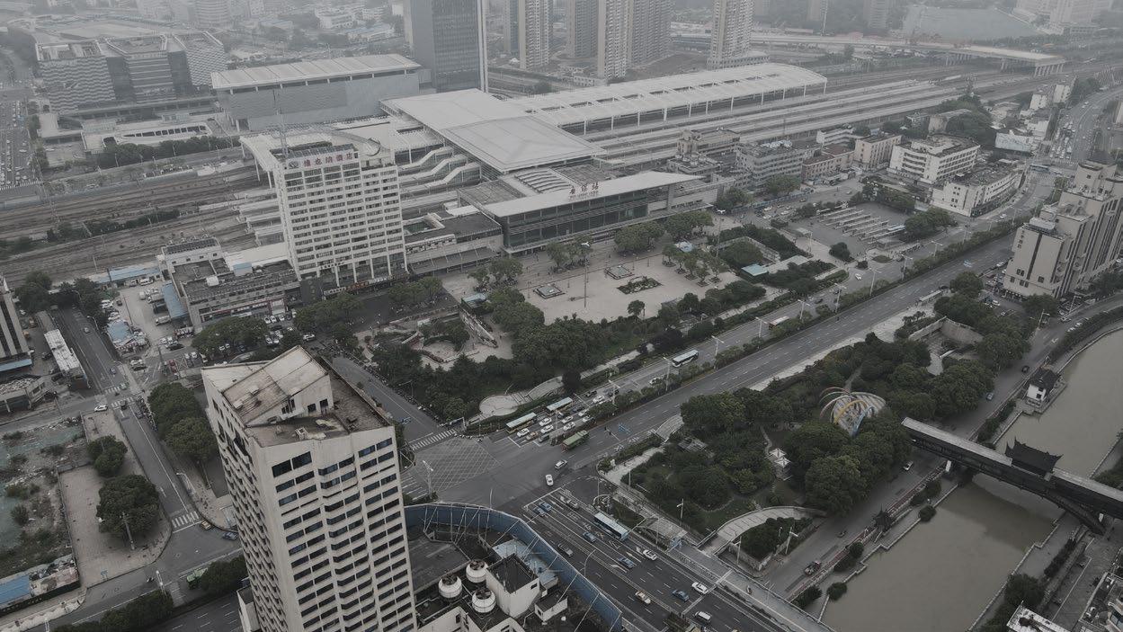
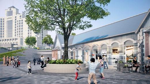
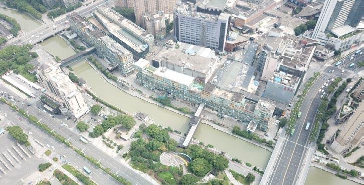
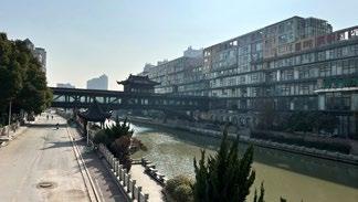
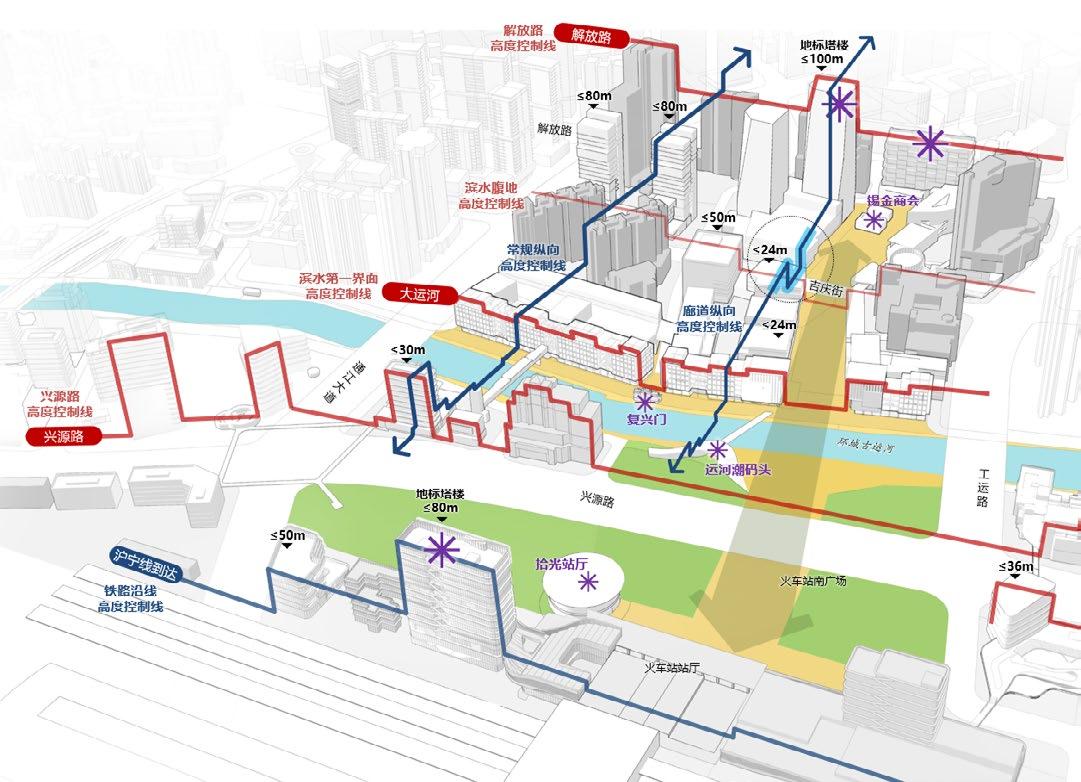
WUXI OLD EAST GATE & RAIL STATION DISTRICT URBAN DESIGN
CLIENT: WUXI URBAN CONSTRUCTION LIANGXI DEVELOPMENT CO., LTD
TYPE: URBAN DESIGN
2021-2023
ROLE: SENIOR URBAN DESIGNER
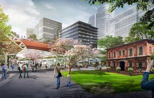
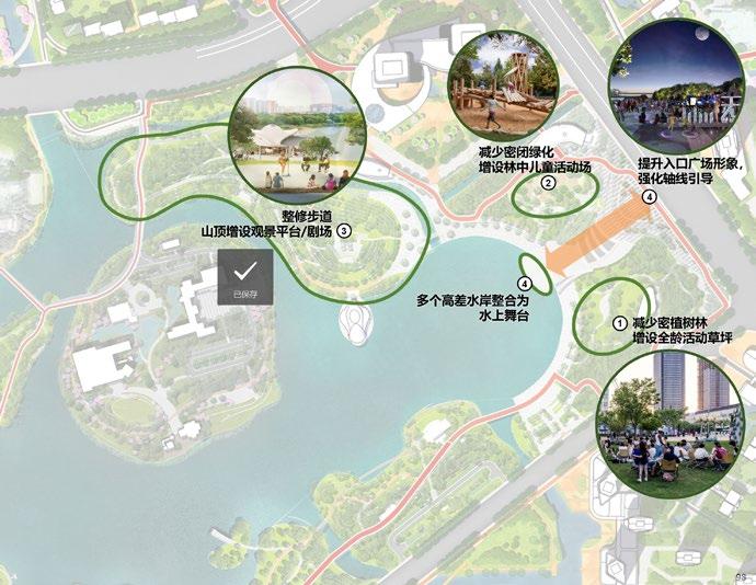
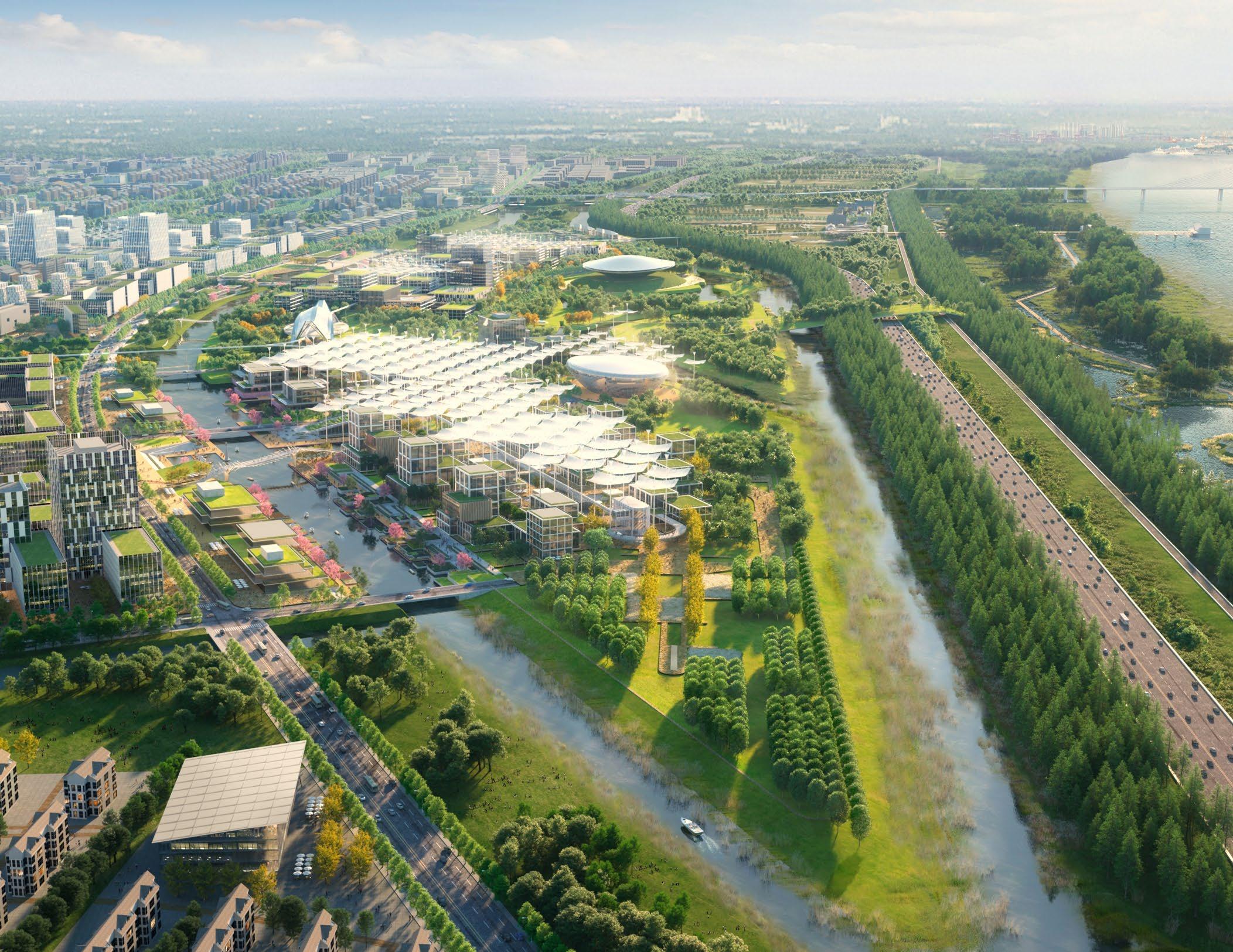
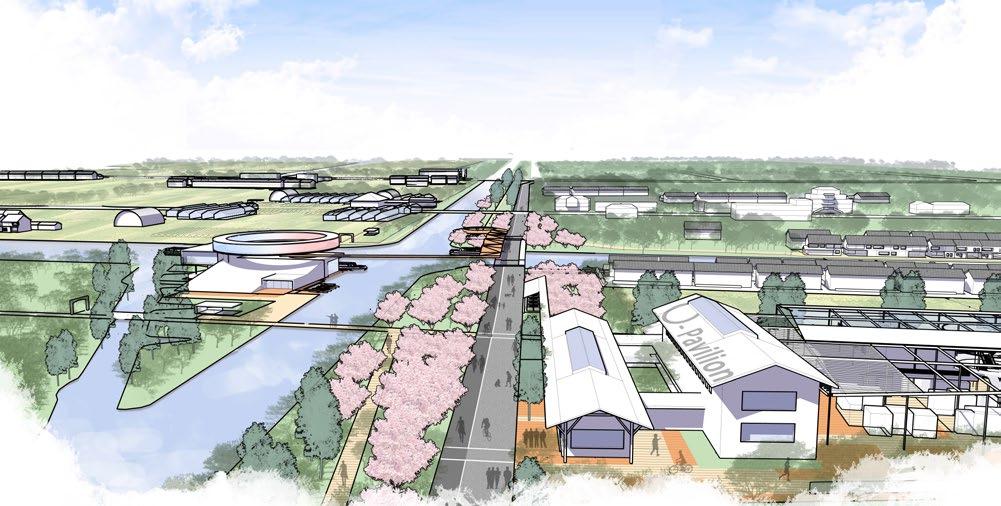
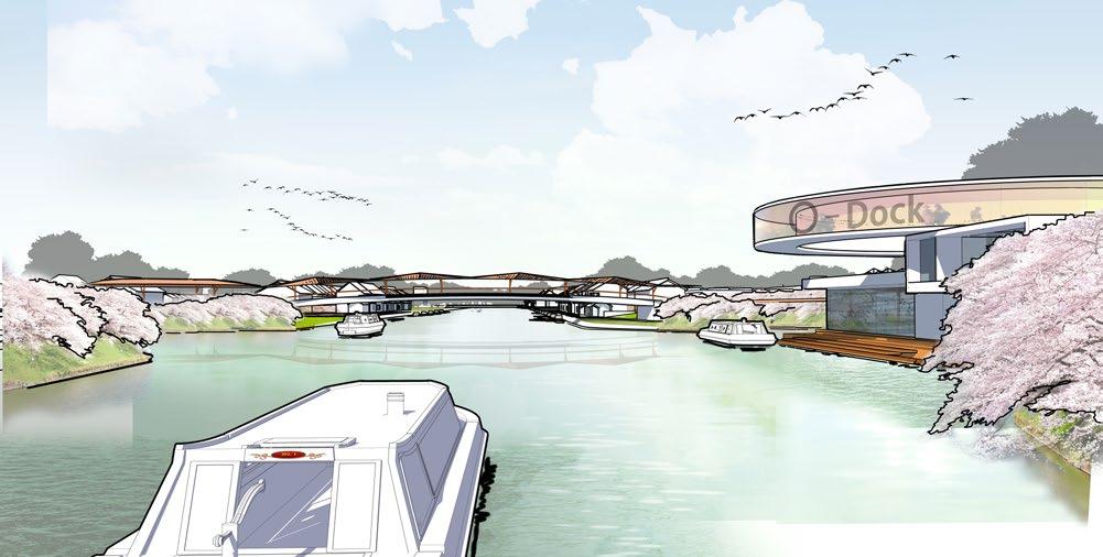
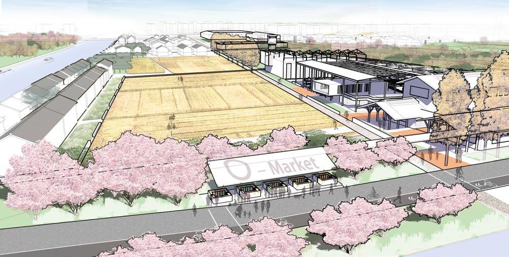
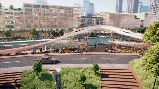
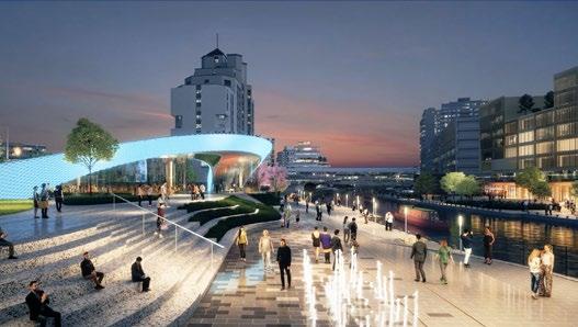
The team establishes four goals for the site: A cultural showcase embodying the allure of historic moat and city; An urban innovation waterfront inspired by industrial and commercial DNA of Yangtze River Delta; A youthful living quarter characterized by its all-weather vitality, green resilience, and adaptability; and a national model for evolution and transformation of urban hubs. The three functional areas spined by canal belt form three mixed-use corridors leading to downtown center, converting the outdated industrial and commercial reverse waterfront into a vital urban living room.


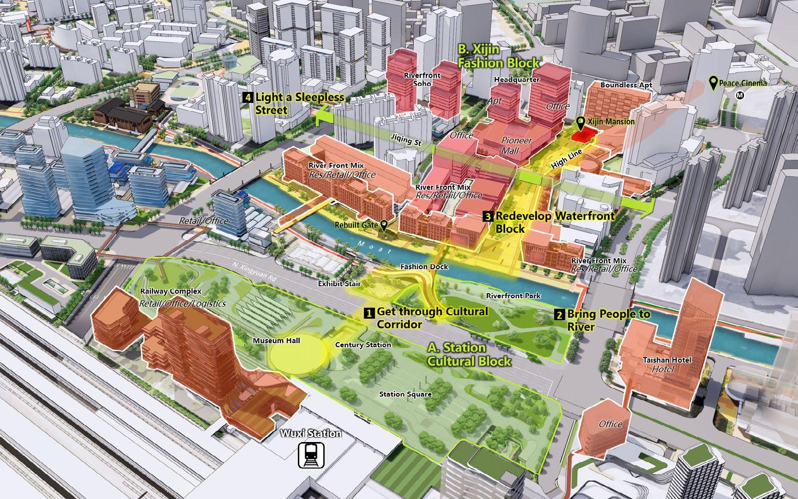
Vertical Development Connecting A to B Block across The Moat
• A welcoming sunny reception hall which shows one-hundred-year history of the station; • An underground hallway with cultural, retail and landscape experience; • A new fashion dock that serves as a multi-level viewpoint and activity hub.
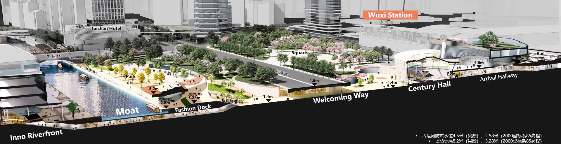
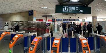
[STATION EXIT]
• Improve 1st floor transportation system.
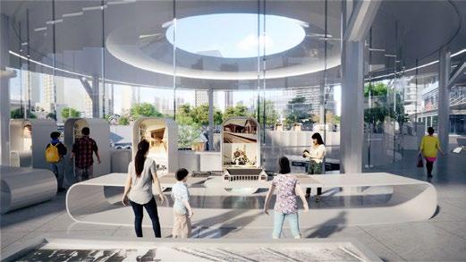
• Create 2nd museum presenting history of the station.
[MUSEUM HALL]
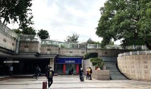
[NORTH SUNKEN PLAZA]
• Restore historic station through modern material as new landmark. Promote landscape of current sunken plaza
[SOUTH SUNKEN PLAZA]
• Exhibit local celebrity and history in plaza and stair upgrades.
• Connect to the dock.
[CENTURY STATION]
[EXHIBIT STAIRS]
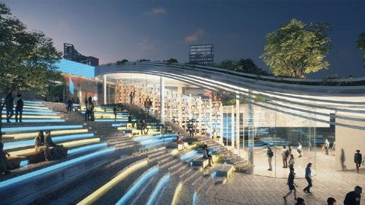
[FASHION DOCK]
[TOURISTIC DOCK]
• Composite benchmark place with a wide range of business from retail, bookstore, to museum and restaurant.
[EXISTING DAM]
• Push back the dam to open up a new square.
• Create an amphitheater for viewing river landscape.
[RIVERFRONT PARK]
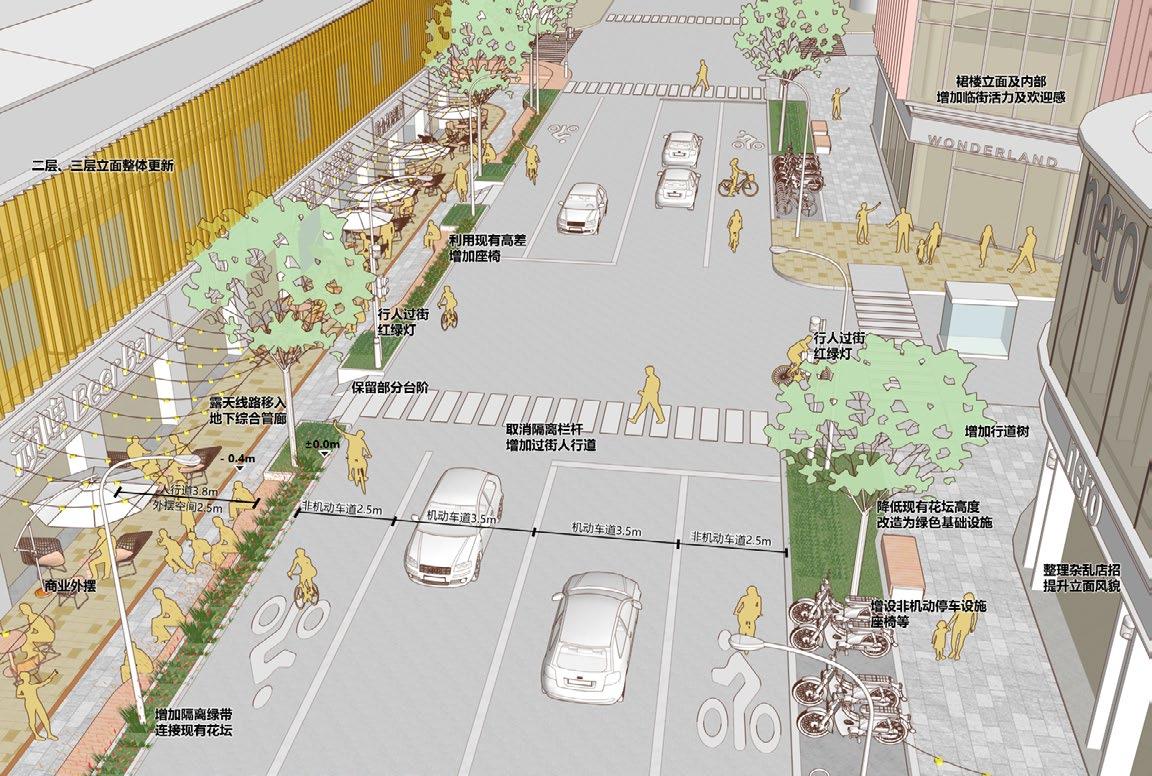
Mix Landscape & Programming


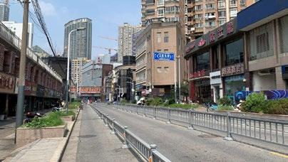
Lane partition railing is lengthy. Business interface has an outdated image and poor popularity. The ground paving is rudimentary. Non motor vehicles occupying the road for parking. The facade has an oldfashioned appearance.
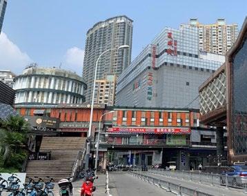
The large staircase has limited access space and a single function. The facade of the corridor bridge is dilapidated and the space is enclosed. Non motor vehicle parking disorderly, occupying road space.
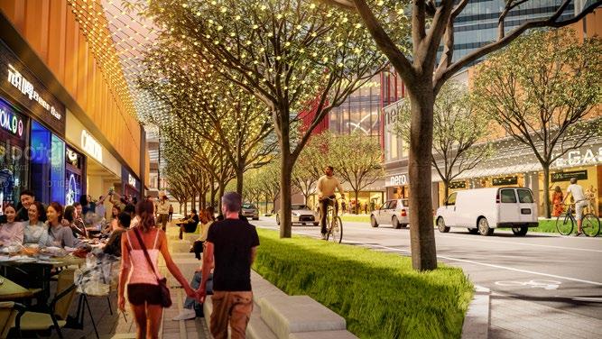
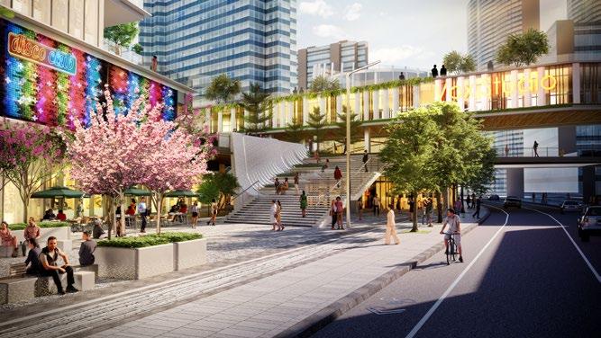
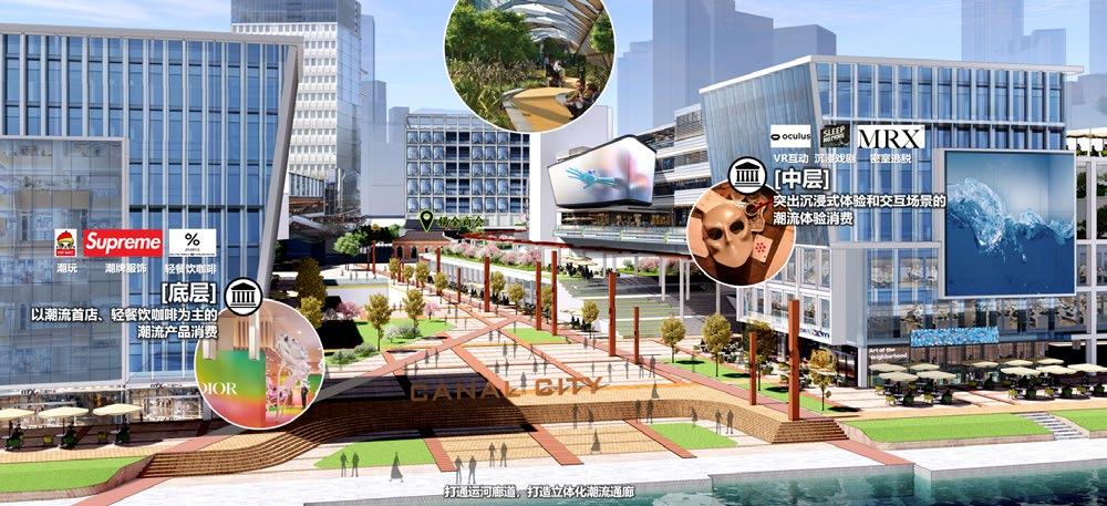
Open up to canal interface. Form an open space corridor. Inject trendy commercial elements and form a composite trendy block that integrates consumption, office, and community.