Thursday,September24,2026
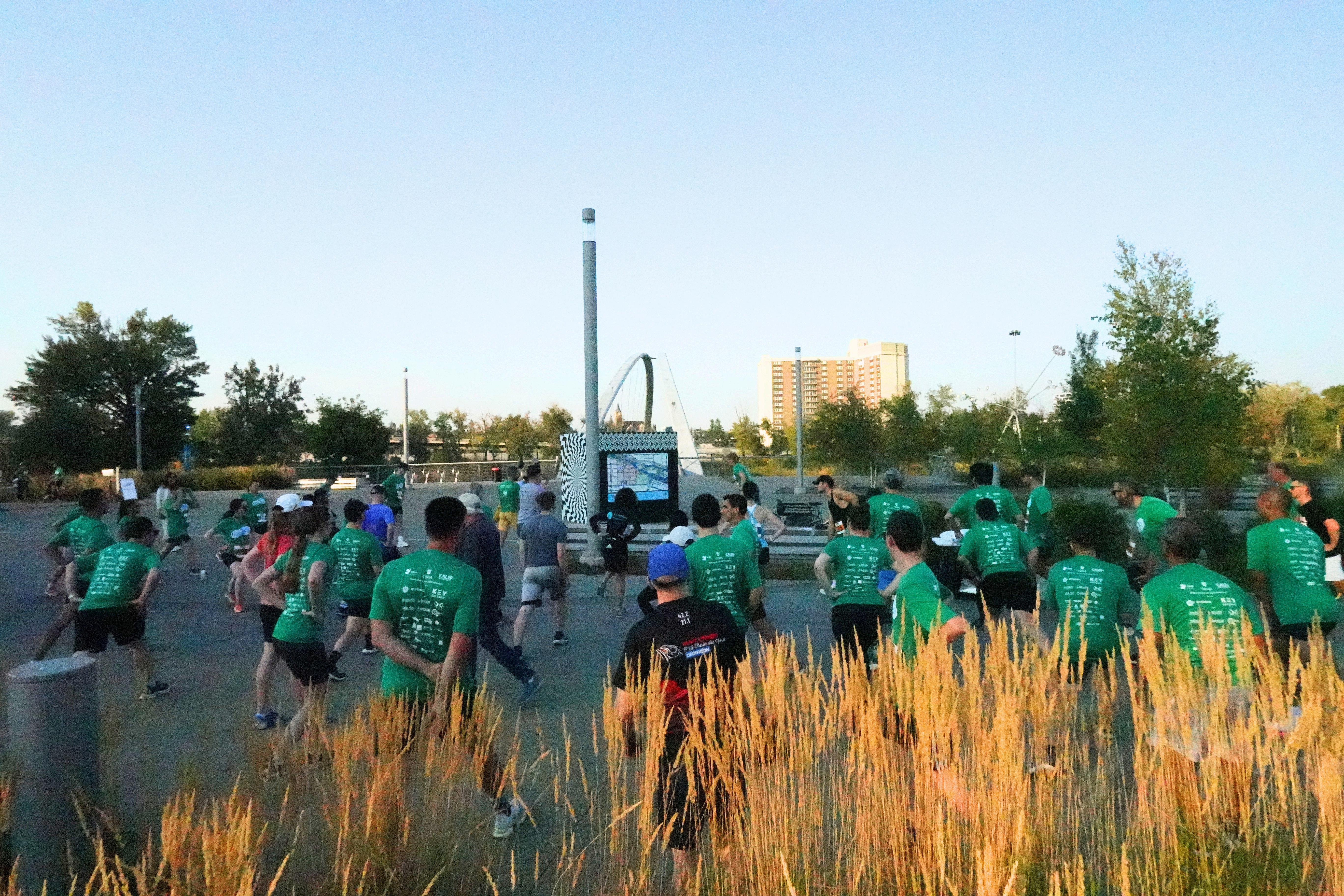
Joinusfora5kmor10kmraceorfunrun/walk!Allregistrations includeat-shirt,achancetowingreatprizes,andatickettotherace afterparty,includingfoodanddrink.



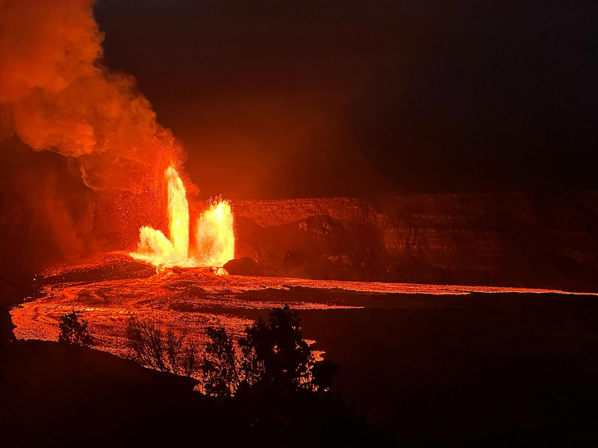
Kilauea
TO OUR JULY AND AUGUST ISSUE OF THE CEGA RESERVOIR!
Inthisissuewepresentthecontinuationofourregulararticles:
•2026MessagefromtheBoard
•GeologyinMotion:FredShottonandtheGeologicStruggleforNormandy
Inthisissuewepresentthefollowingarticles:
•RachellePinnow:CentennialTrails:GoTakeaHikeAcrossCanada—CallforSubmissionsand AuthorGuidelines
•JonNoad:WelcometoCalgary,theSandstoneCity
•VolunteerSpotlights:NashHaywardandReighMacPherson
•GeospielWrap-up
•CoreConferenceWrap-Up
•SweattheSubsurfaceAnnouncement
PleaseseetheCEGAwebsiteforalistofupdatedcoursesandhikesbeingofferedthroughoutthe summer.TheluncheonserieswillresumeinSeptember.
Welookforwardtoreceivingyourmanuscriptsfortheupcoming2026issuesoftheCEGA Reservoir.
Haveagreatsummerandenjoyyourtimeoutdoorshuntingforoutcrops,rocksandfossils!
Sarah.schultz@yukon.ca
PUBLICATIONINFORMATION
TheRESERVOIRispublishedsixtimesperyearbytheCanadian EnergyGeoscienceAssociation.ThepurposeoftheRESERVOIR istopublicizetheAssociation’smanyactivitiesandtopromote the geosciences. We look for both technical and non-technical materialtopublish.
Thecontentsofthispublicationmaynotbereproducedeither inpartorinfullwithouttheconsentofthepublisher. NoofficialendorsementorsponsorshipbytheCEGAisimplied
for any advertisement, insert, or article that appears in the RESERVOIR unless otherwise noted. All submitted materials are reviewed by the editor. We reserve the right to edit all submissions,includingletterstotheEditor.Submissions mustincludeyourname,address,andmembershipnumber (if applicable). The material contained in this publication is intendedforinformationaluseonly.
Whilereasonablecarehasbeentaken,authorsandtheCEGA makenoguaranteesthatanyoftheequations,schematics,or
devices discussed will perform as expected or that they will give the desired results. Some information contained herein maybeinaccurateormayvaryfromstandardmeasurements. The CEGA expressly disclaims any and all liability for the acts, omissions, or conduct of any third-party user of information containedinthispublication.Undernocircumstancesshall theCEGAanditsofficers,directors,employees,andagentsbe liable for any injury, loss, damage, or expense arising in any manner whatsoever from the acts, omissions, or conduct of anythird-partyuser.
PRESIDENT
Christa Williams
Canadian Discovery Ltd. christa.williams@cegageos.ca

FINANCE DIRECTOR ELECT
Thomas Plumridge Freehold Royalties director nance@cegageos.ca

EDUCATION DIRECTOR
Rachelle Pinnow Cenovus Energy education@cegageos.ca Linkedin
PAST PRESIDENT
Shelley Leggitt
Outwest Energy
shelley.leggitt@cegageos.ca
CONFERENCES DIRECTOR
Taylor Berezowski
Canadian Discovery Ltd.
conferences@cegageos.ca
PUBLICATIONS DIRECTOR
Michael Wamsteeker Parex Resources
publications@cegageos.ca

PRESIDENT ELECT
Astrid Arts
Cenovus Energy astrid.arts@cegageos.ca
OUTREACH DIRECTOR
Dilpreet Khehra University of Calgary outreach@cegageos.ca
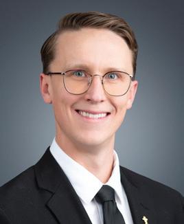
GROWTH & ENGAGEMENT DIRECTOR
Gareth Williams
Touchstone Exploration Inc. membershipdirector@cegageos.ca
MEMBERSHIP INQUIRIES
Tel: 403-264-5610
Email: membership@cegageos.ca






FINANCE DIRECTOR ELECT
David Lipinski
AtkinsRealis
director nance@cegageos.ca
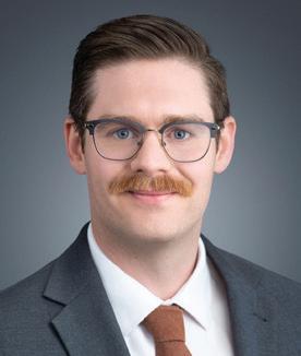
MEMBER PROGRAMS DIRECTOR
Scott MacKnight
Whitecap Resources Inc.
membershipdirector@cegageos.ca
CEGA OFFICE
#415, 500 4th Ave SW
Calgary Alberta, Canada T2P 2V6
Tel: 403-264-5610 | cegageos.ca
ADVERTISING INQUIRIES
Latoya Graham
Tel: 403-513-1230
Email: latoya.graham@cegageos.ca
CONFERENCE INQUIRIES
Kristy Casebeer
Tel: 403-513-1234
Email: kristy.casebeer@cegageos.ca
MANAGING DIRECTOR
Emma MacPherson
Tel: 403-513-1235
Email: emma.macpherson@cegageos.ca
GARETH WILLIAMS, GROWTH AND ENGAGEMENT DIRECTOR
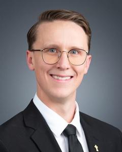
Thank you to all of our members, and to the many non-members who joined us, who made the past few months of CEGA events so memorable.
The level of engagement, enthusiasm, and community spirit continues to be what sets this organization apart Our winter social lineup was a fantastic success. The squash and pickleball tournament was a smashing (pun intended) event, with more than 50 players competing and plenty of great rallies both on and off the court It was incredible to see such strong participation across experience levels, with everyone from seasoned players to first-timers getting involved and enjoying the day
Equally exciting was the return of Geospiel, which has quickly established itself as a “can’t miss” event on the CEGA calendar. Now in its second year, teams came together over three days of friendly competition, showcasing not only their skills but also their creativity and team spirit Whether participants were aiming for the podium or simply hoping to stay upright, the event delivered plenty of laughs, camaraderie, and memorable moments
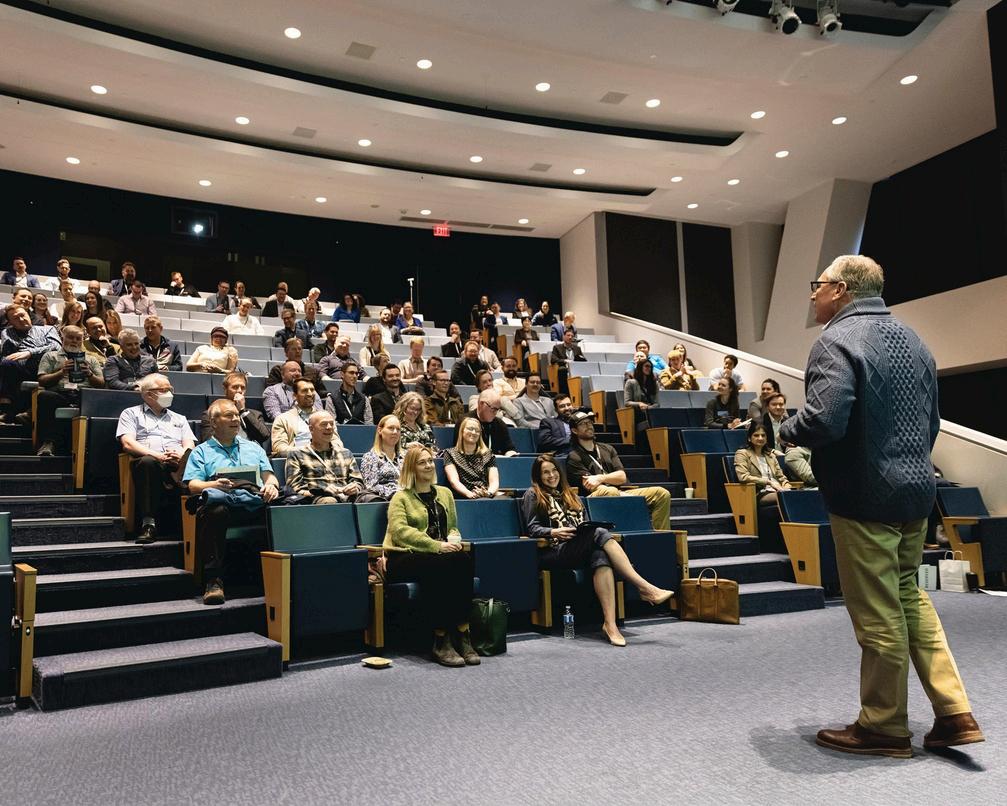
Our technical programming continues to deliver strong value for our members and the broader geoscience community. The recent two-day Core Conference was highly successful, attracting more than 600 attendees for engaging discussions, knowledge sharing, and hands-on geological insights This level of participation reflects the ongoing demand for high-quality technical content and highlights the importance of in-person collaboration In the same vein, GeoConvention, delivered in partnership with the Canadian Society of Exploration Geophysicists (CSEG), once again underscored its role as a flagship industry event, bringing together over 1,800 registrants to explore the latest advancements across the geosciences Together, these events showcase the strength of our technical community and reinforce CEGA’s role in advancing geoscience knowledge
One of the newer initiatives currently underway is the development of CEGA Student Chapters, an effort I am pleased to be advancing alongside Dilpreet, our Outreach Director This program is aimed at strengthening the connection between CEGA and the next generation of geoscientists by creating a structured presence on university campuses We have encouraged this year’s SIFT participants to serve as
champions for the initiative as they return to their respective institutions this fall, helping to establish and grow chapters within their local communities. By empowering students to take on leadership roles and engage directly with CEGA’s network, we hope to foster early professional development, facilitate meaningful industry connections, and build a stronger, more connected geoscience community for years to come.
These events and initiatives are a great reminder that CEGA is more than just technical excellence, it is a community From social gatherings and sporting events to our technical conferences and publications, our strength lies in bringing people together to share knowledge, build connections, and support one another throughout our careers
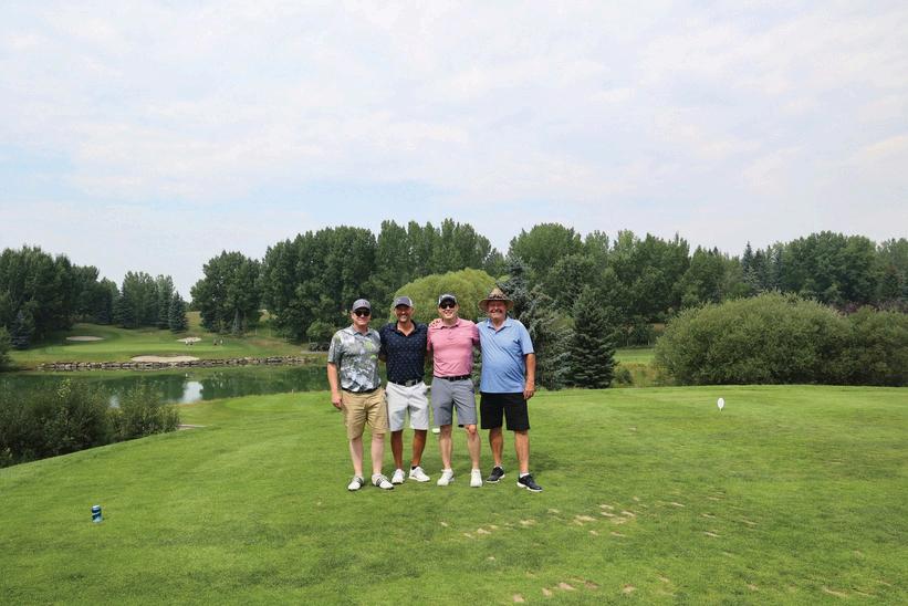
Looking ahead, there is no shortage of opportunities to stay involved. Be sure to sign up for the upcoming golf tournament, which promises another excellent chance to connect with colleagues in a relaxed and enjoyable setting
As always, thank you for being part of CEGA Your participation, whether at events, in volunteer roles, or through contributions to our technical community, is what keeps this organization thriving
SEANFLETCHER, DALLINLAYCOCK,ERINPEMBERTON,PAULBREMNER,HAN BYULWOO,RICHARD MACKENZIE
June 6, 1944, also known as D-Day, marked a decisive turning point in the liberation of Europe. While critical to gaining a foothold on the Europeancontinent,theNormandybeachlandingsrepresentedonlytheopeningphaseofaprolongedmilitarycampaignthatwouldcontinue for months across northwestern France. In our previous installment (Laycock et al., 2026), we examined the role of geoscientists in the characterization of coastal sediment and geomorphology of the landing grounds critical to the success of Operation Overlord. Geologists supplied essential intelligence on tidal regimes, beach gradients, and beach sediment composition, all of which determined where and how theAlliedforcescouldlandsuccessfully.
The liberation of Europe, however, did not end at the waterline. Once Allied forces moved inland, the tactical challenge shifted from an amphibious assault to maneuver warfare across a complex and unfamiliar landscape. To understand the terrain beyond the beaches; its naturalcorridors,barriers,drainagesystems,andtrafficability,commandersreliedheavilyontheexpertiseofMajorFrederickWilliamShotton of the Inter-Services Topographic Department (ISTD). Shotton’s primary contribution was the sophisticated transformation of abstract stratigraphic and pedological data into practical and actionable military intelligence. His analyses enabled Allied Forces to navigate the "Bocage",adistinctivelandscapecharacterizedbyadensepatchworkofsmall,irregularfieldspartitionedbyhigh,ancientearthenbanksand dense, interlocking hedgerows; secure critical water supplies; establish airfields; and sustain the infrastructure necessary for the eventual breakoutintotheinteriorofFrance(Rose&Clatworthy,2007;Rose,2020).
The lessons of the disastrous Dieppe Raid (see Laycock et al., 2026 for discussion), underscored the importance of terrain analysis for mechanized warfare. Shotton recognized that armored mobility was fundamentally governed by the interaction between heavy vehicle tracksandtheQuaternarysurfacedepositsoftheNormandyregion.In response, he spearheaded the creation of specialized "Going" maps at a scale of 1:100,000, or 1:25,000 (Figure 1). These maps synthesized aerial photography with existing French geological surveys and soil data to predict the trafficability of terrain and even considered the impactofvaryingweatherconditions.
Particular attention was given to the widespread "limon" or silty loess deposits that covered much of the Normandy plateau. Shotton accuratelypredictedthatwhilethesesurfacesremainedfirmwhendry, they would become impassable to heavy tanks after even moderate rainfall due to low shear resistance and high water retention (Clatworthy&Rose,2008).Thiswasparticularlycriticalbecausethe
loess veneer was often thin, concealing the underlying clay-rich MidJurassic strata beneath. Once saturated, the silts rapidly approached their liquid limit, losing the bearing capacity necessary to support thirty-tonarmouredvehicles.
Thisgeologicalforecastingprovedcriticaltogroundoperations.During offensives such as Operation Goodwood, a large British armored push eastofCaen,AlliedplannersprioritizedroutesacrossstableBathonian limestone uplands effectively avoiding the clay-rich Liassic valleys that would have trapped tanks and supply vehicles in mud (Rose & Clatworthy, 2007). By mapping these "Going" conditions, Shotton provided commanders with a simplified spatial framework for maneuver warfare that incorporated seasonal weather variability and substrate mechanics. Consequently, the Allied forces could anticipate logistical bottlenecks before they emerged on the battlefield, shifting the operational focus toward geologically favourable "corridors of movement"(Rose&Clatworthy,2008).

The "Bocage" landscape was a tactical obstacle defined more by its pedology and soil mechanics than by its surface vegetation Shotton and his team analyzed how the underlying Mid-Jurassic geology dictated the physical strength and durability of the infamous hedgerows. The weathering of Mid-Jurassic limestones and the Marnes de Port marls produced thick, heavy, clay-rich soils with up to 70% of the fines fraction characterized by high cohesion (Tessier, 1997) These cohesive soils enabled generations of farmers to construct earthen embankments several meters high without risk of structural collapse (Figure 2; Rose & Pareyn, 1995)
Over centuries, hawthorn and oak roots reinforced these clay banks creating dense, interwoven root matrices within the compacted soil The resulting combination of stony, cohesive clay-heavy soil, and interwoven roots formed a natural composite material with properties comparable to reinforced concrete (Rose, 2004) Shotton’s terrain analysis concluded that many hedgerows were effectively impervious to the standard M4 Sherman tanks. Rather than collapsing the embankments, tanks attempting to breach them often exposed their vulnerable underbellies to antitank fire rather than successfully collapsing the obstacle (Rose & Clatworthy, 2007)
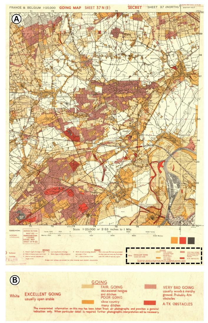
Figure 1:
A) Image of one of Shotton’s “Going Maps” at 1:25,000 scale. Courtesy Great Britain. War Office. General Staff. Geographical Section, 1944. Dashed black box shows the portion of the legend shown in panel B
B) Image of the legend from the bottom corner of the map, explaining the “Going” on each part of the map, representing the suitability of the terrain for troop movement
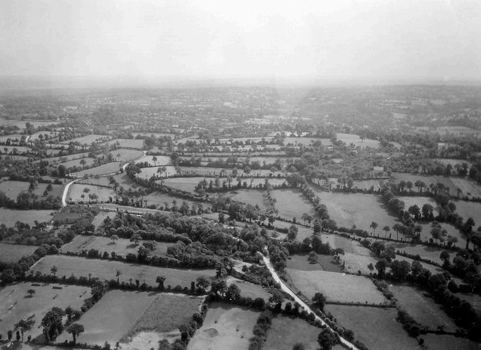
Figure 2: Image of Normandy, taken in 1939, shows an example of the Bocage landscape that the Allies had to work through. U.S. Army photograph, public domain, via Archives Normandie 1939–45
To overcome these obstacles, Allied troops developed specialized assault tactics for assaulting enemy positions in the hedgerow terrain Infantry units excavated concealed gaps, large enough for tanks to drive through, in the hedgerow embankments leaving only a thin shell of earth facing the enemy At the moment of attack, tanks could burst through these weakened sections under their own power (Blumenson, 1961) Other vehicles were modified with welded steel cutting instruments attached to the front of the chassis These were nicknamed “Rhino tanks”, since the steel prongs or “tusks” could slice through hedgerows rather than attempt to climb over them (Figure 3)
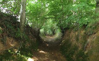
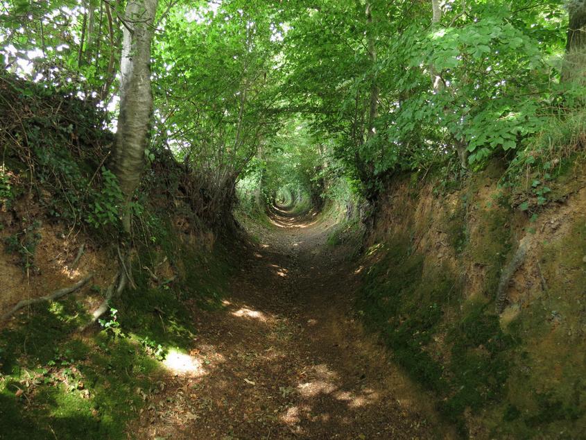
The geology of the “Bocage” also produced another formidable defensive feature: the chemins creux or “sunken lanes” Natural erosion in the softer sedimentary layers created incised "sunken lanes" or hollowages, providing German defenders with geologically protected trenches that remained shielded from direct Allied fire (Rose, 2004) These features were the product of centuries of human travel and hydraulic action acting upon the poorly consolidated Quaternary loess and the underlying Mid-Jurassic marls As cart wheels and livestock hooves broke the surface vegetation, seasonal runoff would wash away the fine-grained silts, gradually lowering the lane bed below the level of the surrounding fields (Figure 4)
The tactical significance of this incised topography cannot be overstated In many sectors of the Bessin, a historic natural region in Lower Normandy, these lanes were cut three to five meters below the field surface, effectively creating a natural geologic defilade, or areas protected from direct fire and artillery shrapnel, and importantly did not require the significant efforts of engineering entrenchment For the German infantry, these lanes served as ready-made communication trenches that allowed for the protected movement of reinforcements and supplies between defensive strongpoints, entirely invisible to Allied terrestrial observers Because the lanes were often narrower than a standard M4 Sherman tank, they functioned as "kill zones" where Allied armor was canalized into predictable avenues of approach, unable to traverse the high, cohesive banks on either side
Furthermore, the geologic composition of the lane walls, compacted clay-silt aggregates, was exceptionally resistant to the blast effects of high-explosive shells Unlike stone walls that might shatter into lethal secondary fragmentation, the damp, cohesive Jurassic soils of the sunken lanes tended to absorb shrapnel and dissipate the energy of artillery fire This necessitated the Allied development of specialized tactics, such as the "Rhino" tank attachments, to physically breach the geologic barriers of the lanes rather than attempting to navigate the sunken corridors themselves (Rose & Clatworthy, 2007; Rose, 2020)
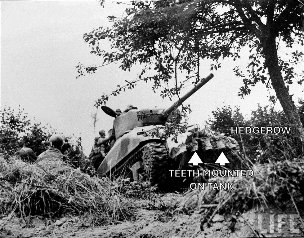
Figure 3. Doubler, Michael D. 1955. Sherman 'Rhino' variant, modified to cut through the hedgerows of the bocage countryside, Normandy 1944. Busting the Bocage: American Combined Arms operations in France. Image courtesy the Library of Congress
Maintaining air superiority depended on the rapid construction of Advanced Landing Grounds (ALGs) capable of supporting ground forces and Allied tactical aircraft Shotton, together with William Bernard Robinson (W B R ) King, a British geologist, challenged initial tactical plans by synthesizing decades of regional stratigraphic observations with high-resolution aerial interpretations and applying geological analysis to airfield selection By correlating 19th-century French lithological records with contemporary remote sensing, they developed a predictive model of the Cotentin Peninsula's hydrogeology Their analysis revealed that the peninsula’s surface was not a stable platform, but a perched water table held by impermeable Jurassic clays, an observation that transformed a 'proximity-based' tactical preference into a recognized engineering liability (Rose, 2004; Rose & Clatworthy, 2007), and led to the decision to utilize the Calvados Plateau
The tactical lessons from this decision were profound, as the shift to the Calvados Plateau allowed implementation of "dispersal" tactics that were geologically impossible in the Cotentin On the plateau, the high bearing capacity of the Great Oolite (Bathonian) limestone meant that aircraft did not need to be confined to reinforced taxiways or hardstands Engineers could scrape away the thin topsoil to reveal a naturally stable substrate that supported the weight of fully fueled and armed P-47 Thunderbolts and Typhoons This allowed for the wide scattering of aircraft across the fields, significantly reducing their vulnerability to Luftwaffe strafing runs and concentrated artillery fire, a luxury the soft, waterlogged soils of the Cotentin could never have provided (Rose, 2004; Rose & Clatworthy, 2008)
Furthermore, the plateau's geology solved a critical drainage problem that typically plagued front-line aviation The Bathonian limestones
Figure 4: Image showing an example of the sunken lanes or “chemins creux” in Normandy. Romain Bréget (CC BY-SA 4.0), via Wikimedia Commons.
are characterized to have high permeability from fractures and joints that allowed for rapid vertical drainage of surface water Even during the heavy summer thunderstorms of 1944, these ALGs remained operational while units in lower-lying clay regions were grounded by mud This "geologic readiness" meant that the 2nd Tactical Air Force could respond to calls for close air support within minutes, providing the continuous overhead cover necessary for Allied armored columns to bypass German strongpoints in the Bocage
The selection of the Calvados Plateau over the Cotentin Peninsula also highlighted the importance of "engineering geology" in strategic planning By avoiding unstable alluvial terrain, Shotton and King prevented the waste of thousands of tons of Hessian Matting and Pierced Steel Planking (PSP), materials that would have disappeared in the unstable alluvial muds of the Douve and Merderet valleys Through careful alignment of military engineering plans with the regional lithology, the Allies effectively transformed the Calvados Plateau into a series of unsinkable aircraft carriers This synergy between geoscience and logistics ensured that the "air umbrella" remained tethered to the advancing front line, a decisive factor in the ultimate collapse of the German defensive crust during Operation Cobra (Rose & Clatworthy, 2007; Rose, 2020)
As Allied supply lines stretched further inland, the requirement for local potable water became a critical logistical factor in maintaining the momentum of the breakout This task fell to the 5th and 6th Boring Sections of the Royal Engineers, whose operations relied heavily on the strategic geological prognosis developed by Shotton
and King According to King (1946), successful drilling operations depended on a detailed understanding of the Mid-Jurassic stratigraphy, particularly the hydrogeological properties of the Bajocian and Bathonian limestones King’s account (1946) details how military geologists provided drillers with predicted aquifer depths before engineers even landed, allowing for the rapid deployment of both percussion (A-type) and rotary (B-type) drilling rigs across the French countryside
The primary objective was to bypass surface water, which was often sabotaged or contaminated by the retreating German forces, and tap into deep geologic groundwater reserves King (1946) notes that the Marnes de Port marls served as a vital impermeable seal, protecting the underlying aquifers from surface pollution By utilizing 19thcentury French well records and stratigraphic logs, the Boring Sections were able to strike water with remarkable accuracy between Bayeux and Caen In some sectors, these boreholes produced over 250,000 gallons of water per day, effectively neutralizing a major logistical bottleneck and allowing the Allied advance to maintain its pace without waiting for water convoys from the coast (King, 1946; Rose et al , 2006)
The rapid movement of thousands of heavy mechanized vehicles quickly destroyed the rural road network, threatening a total logistical collapse shortly after the breakout Shotton was therefore tasked with identifying geological materials suitable for emergency repairs that could withstand the immense weight of armored columns
Many local Jurassic limestones of the Paris Basin, including the famous Bathonian "Pierre de Caen," proved too soft for sustained military use, as they quickly pulverized into a fine calcareous mud under the mechanical stress of tank treads and heavy truck tires This degradation was exacerbated by the high silt content of the local limon soils, which, when mixed with crushed limestone, created a slurry that rendered primary supply routes impassable (Rose et al , 2006; Rose & Clatworthy, 2008)
To solve this problem, Shotton directed military quarrying companies toward the harder, more durable lithologies of the Armorican Massif, or Hercynian basement, located at the western and southern fringes of the Paris Basin (Figure 5) By utilizing detailed stratigraphic maps, he identified outcrops of Precambrian and Paleozoic quartzites and igneous rocks that offered significantly higher crushing strength than the local Mesozoic cover The Grès Armoricain (Ordovician quartzite), in particular, became a primary target for extraction due to its resistance to abrasion and its ability to provide a stable, interlocking sub-base for high-traffic military roads (Rose & Pareyn, 1995; Pakenham-Walsh, 1958)
The logistical success of the "Red Ball Express" and the rapid Allied advance toward Paris depended heavily on this geologic resource management The 858th and 859th Quarrying Companies of the Royal Engineers were deployed to these basement outcrops to extract thousands of tons of high-quality aggregate daily This industrial-scale application of petrology ensured that the Allied manoeuvre warfare could be sustained across a landscape that was geologically predisposed toward logistical stagnation By identifying the specific engineering properties of the Hercynian basement, Shotton and his team provided the literal foundation upon which the liberation of France was built (King, 1946; Rose & Clatworthy, 2007)
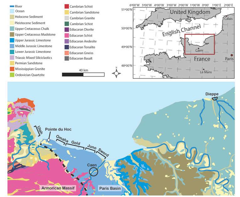
Figure 5: Geologic map of the Normandy area surrounding the D-Day beaches (centre), Dieppe (east), and the Cotentin Peninsula (west). Shown are major lithologies of the Paris Basin and Armorican Massif. Map is modified from European Geological Data Infrastructure (2025)
Logistical constraints combined with geological insights led to choosing Normandy beaches for Operation Overlord The Allied breakout from the Normandy beachheads required everything available - firepower, manpower, and bravery, but also a sophisticated and scientific understanding of the geological environment. Major Fred Shotton’s ability to synthesize and translate geologic data into tactical "Going" maps and comprehensive hydrogeological plans provided a decisive strategic advantage to Allied planners
Shotton’s work bridged the divide between academic geology and military engineering, demonstrating that the specific properties of the Bathonian limestone and the Quaternary silts were as significant to the outcome of the campaign as the tactical decisions of the generals (Rose & Clatworthy, 2007) The original maps, currently preserved at the Lapworth Museum of Geology, remain a lasting testament to the essential and often overlooked role of geoscientists and geological analysis in the theatre of modern warfare (Clatworthy & Rose, 2008)
Blumenson, M (1961) Breakout and Pursuit United States Army in World War II: The European Theater of Operations Washington, D C : Office of the Chief of Military History, Department of the Army
Clatworthy, J C , & Rose, E P F (2008) Frederick William Shotton (1906–1992): his contribution to military geology Geological Society, London, Special Publications, 283(1), 161-176
Costa, S , Maquaire, O , Letortu, P , & Antoine, R (2019) Sedimentary Coastal Cliffs of Normandy: Modalities and Quantification of Retreat Journal of Coastal Research, Special Issue No 88, 46–58 https://doi.org/10.2112/SI88-005.1
Doubler, Michael D 1955 Busting the Bocage: American Combined Arms operations in France June--31 July 1944 by Captain Michael D Doubler, U.S. Army Command and General Staff College Fort Leavenworth, Kansas Library of Congress Cataloging-in Publication Data: Bibliography: p 1 World War, 1939-1945-Campaigns-FranceBocage normand 2 Bocage normand (France)-History I Title D756.5.N6D68 1988 940.54'21 88-23757
European Geological Data Infrastructure (2025) EGDI map viewer: Pan-European surface geology (1:1,000,000 lithology) [Interactive map]. https://www.europe-geology.eu/
King, W B R (1946) The Work of the Military Geologist and Royal Engineer Boring Sections in N W Europe (Published in The Royal Engineers Journal, Vol. 60).
Laycock, D , Burridge, G , Pemberton, E , Fletcher, S , Hudson, S , Bremner, P, Woo, H B , & Mackenzie, R (2026) Geology in Motion: Investigating the Role of Geology on D-Day. CEGA Resevoir, 3, 8-18.
Rose, E P F (2004) Military Engineering on the Calvados Plateau, Normandy, June 1944 Quarterly Journal of Engineering Geology and Hydrogeology, 37(1), 5-13
Rose, E P F (2020) The British military contribution to the geological exploration of Normandy, France, 1943–1944 Earth Sciences History, 39(1), 164-185
Rose, E P F, & Clatworthy, J C (2007) Fred Shotton: a ‘hero’ of military applications of geology during World War II Quarterly Journal of Engineering Geology and Hydrogeology, 40(2), 121-133
Rose, E P F, & Clatworthy, J C (2008) Terrain evaluation for Allied military operations in Northwest Europe, 1944–45 Geological Society, London, Special Publications, 283(1), 131-159
Rose, E P F, & Pareyn, C (1995) Geology and the liberation of Normandy, France, 1944 Geology Today, 11(2), 58-63
Rose, E. P. F., Robinson, E., & Rosenbaum, M. S. (2006). Military uses of geologists and geology: a Royal Engineers perspective Royal Engineers Journal, 120(2), 115-121
Tessier, D., Bruand, A., Le Bissonnais, Y., & Dambrine, E. (1997). Chemical and physical properties of soils in France: Spatial context and evolution Geologica Carpathica - Series Clays, 6, 121–131

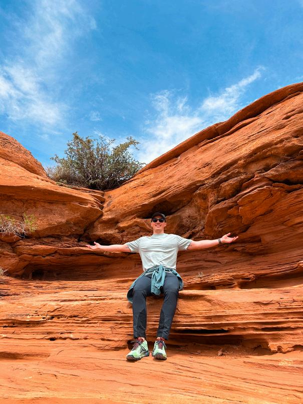
For years, Nash has been a dedicated member of CEGA’s volunteer community, playing an integral role on the Golf Tournament Committee and consistently contributing his time and energy to ensure the event’s success. In his professional role at Cenovus Energy, he remains engaged in the energy industry while continuing to give back through CEGA’s initiatives.
Now serving as co-chair of the Golf Tournament Committee, Nash leads efforts in organizing sponsorships, building teams, coordinating giveaways, and supporting event setup, helping to deliver one of CEGA’s most anticipated annual events. His attention to detail and commitment create a seamless and enjoyable experience for all participants.
Nash also contributes to the Student Industry Field Trip (SIFT) Committee, supporting one of CEGA’s most impactful student programs. His involvement across multiple initiatives reflects a genuine commitment to strengthening the geoscience community and creating meaningful experiences for its members.
We’re proud to spotlight Nash Hayward and learn more about what keeps him engaged year after year!
Q: What inspired you to get involved with CEGA?
A: I first joined as a student member during my undergraduate studies at the University of Calgary to connect with the energy geoscience industry I was interested in volunteering opportunities that allowed me to attend technical events and other social gatherings Through CEGA, I was able to expand my professional network, gain exposure to industry topics, and connect with geoscientists across different career stages and disciplines
Q: What does being a CEGA member mean to you, both professionally and personally?
A: Being a member means being part of a community that values technical excellence while also fostering camaraderie among like-minded professionals Professionally, it represents a commitment to continuous learning and engagement with the geoscience community Personally, it’s a group of people who share common interests, enjoy connecting outside of work, and make the industry feel more welcoming Through CEGA, I have been able to keep in touch with previous coworkers whom I now call close friends
Q: In what ways has CEGA supported or influenced your professional growth?
A: CEGA played an important role in supporting me during a career transition when I was laid off Through my membership, I continued attending technical talks and industry events, helping me stay current on topics relevant and adjacent to my experience CEGA kept me connected to my professional network during a challenging period, reinforcing the value of community Volunteering has been one of the more rewarding experiences of my career, from working with exhibitors and sponsors at GeoConvention, to supporting SIFT, and being a co-chair of the CEGA golf tournament Contributing to memorable experiences for members of this community never gets old
Q: What is one fun fact about you that others might not know?
A: My wife and I went on a one-week campervan road trip through the Mighty 5 National Parks in Utah last year, and it was amazing!
Thank you, Nash, for your continued dedication and leadership within CEGA We’re grateful for the energy and commitment you bring to the community.
RACHELLE PINNOW, EDUCATION DIRECTOR
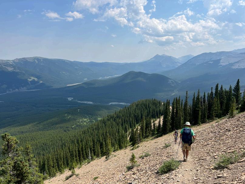
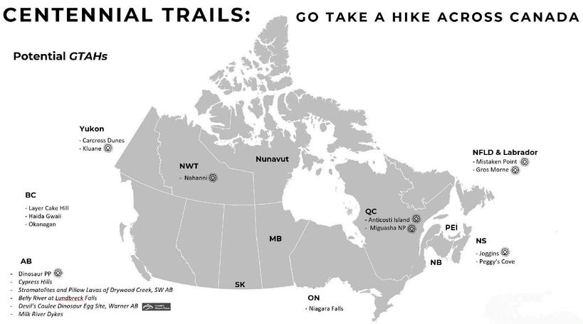
To celebrate the 100th Anniversary of the Canadian Energy Geoscience Association (CEGA), the Reservoir will launch a special Centennial Trails: Go Take a Hike Across Canada series. Beginning in 2027, this serieswillshowcasehikesfromeveryprovinceandterritoryandwillbe publishedintheReservoirthroughouttheyearandbeyond
The original Go Take a Hike (GTAH) series was launched in 2009 by Philip Benham “The focus of the series is hikes or short walks that have a destination of interest to geologists The topic of the hike can be any aspect of geology; the intent is that these are treks that geologists, and their friends and families, might be interested in doing”
Since its inception, the extremely popular series has had 83 hikes published in the Reservoir, predominantly from Western Canada, with a few international contributions These previously published articles are now available as convenient PDFs and can be found here: GTAH Archive - Website xlsx
A curated selection of Go Take a Hike articles were featured in a book published in 2019: Go Take a Hike - Canadian Energy Geoscience Association Purchase the Go Take a Hike Book
The Centennial Trails initiative aims to expand the geographic scope of GTAH by featuring hikes from all regions of Canada Submissions may include iconic destinations, such as UNESCO World Heritage Sites, National and Provincial Parks, and sections of the Trans-Canada Trail (Great Trail) Hikes could also include field sites tied to academic research, or personal discoveries from travel and lesser-known local trailswithuniquegeologicalsignificanceandhistory
All hikes are welcome in the same spirit as the original Go Take a Hike articles The purpose of the Centennial Trails series is to share our common interest in geology and serve as a practical guide for hiking enthusiaststogetoutandexploretherocksfirsthand.
Beforepreparingyourarticle,pleasecontact: RachellePinnow(Rachelle pinnow@cenovus com) LatoyaGraham(latoya.graham@cegageos.ca)
We are coordinating submissions to ensure broad geographic representation and to avoid duplication Full submission details are listed below and can be found on the CEGA website: Centennial Trails GTAH Submission Guidelines.
TomarkCEGA’s100thAnniversary,helpusshowcaseCanada’sgeologic diversity Submit your favourite hikes from across our beautiful country,highlightinggeologicgemsfromcoasttocoasttocoast.
Article Outline:
CEGA Go Take a Hike (GTAH) articles cover a wide variety of locations, terrains, and physical challenges A Go Take a Hike article’s purpose is to expose the reader not only to existing trails but to identify and provide a concise summary of the geological highlights one might see on these hikes. For the Centennial Trails GTAH series, we would like to highlight hikes from every province and territory in Canada
Required Hike Information:
1 Route information, in the form of a map marked with the route or coordinates
Canadian topographic maps are available for free through Natural Resources Canada: https://ftp maps canada ca/pub/nrcan rncan/vector/index/ht ml/geospatial product index en html
2 Trailhead access details
Directions, parking, and access considerations
3 Total route distance, round-trip in kilometers
4 Elevation information (i e , total elevation gain)
5 Difficulty and accessibility
Terrain, technical difficulty, seasonal considerations, and other relevant notes
Word Count:
500-900 (plus references)

Article Format:
Article text should be provided in a separate word document (i.e., without embedded images)
For easy reference formatting, consider using a free version of Mendeley Reference Manager and Mendeley Cite (to easily add citations in Microsoft Word) Download the free styles: AAPG Bulletin or Geology Society of America Bulletin
Image/figure Total:
Please include between five and ten images
Annotated images need to be sent individually to preserve resolution. Please do not embed the images in the word document as that reduces resolution Image/figure captions can be included with the article text or in a separate word document Where possible and appropriate, added historical photos or maps may enhance the theme of CEGA’s 100th Anniversary
Reservoir Submission Information:
For detailed information on submitting an article, visit the CEGA website for reservoir submission details
SUBMIT HIKE

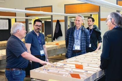
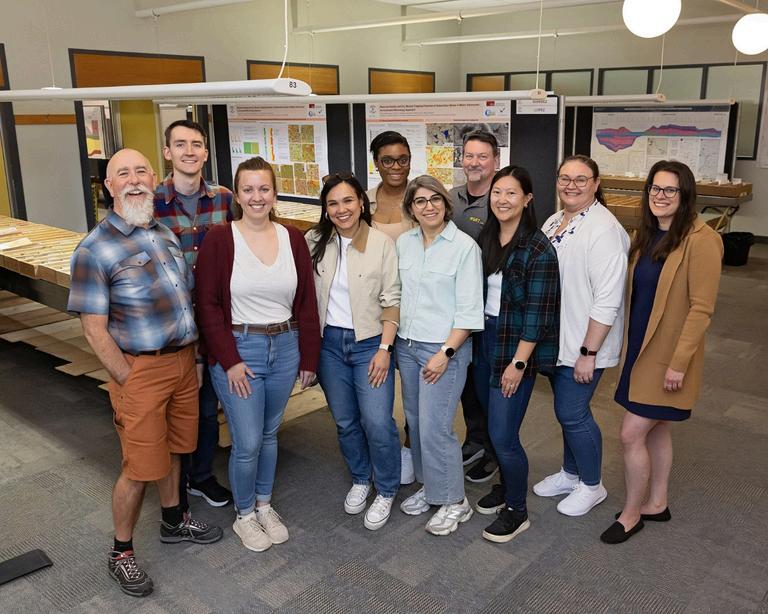
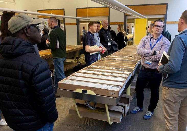
The annual CEGA Core Conference is a unique conference that creates a place where we can gather to learn, exchange ideas, and reconnect with friends and colleagues who share our passion for rocks and energy The 2026 CEGA Core conference was no different - bringing together presentations and core displays spanning the entire geological record, embodying this year’s theme, “The Core Continuum: Subsurface Knowledge Driving Innovation ” Delegates were treated this year with a wide variety of core displays from across Canada and beyond, representing the diverse geological settings and subsurface systems we work within Presenters shared their expertise across a broad range of geoscience disciplines, sparking meaningful collaboration, thoughtful discussion, and new perspectives among delegates
This year’s program showcased the remarkable breadth of geological settings and subsurface systems that define our work, with 23 presentations delivered across four technical sessions spanning the full geological timescale. From Precambrian and Cambrian foundations of western Canada’s earliest geological record, through the carbonate platforms, reef complexes and evaporite systems of the Ordovician to Devonian, presenters explored the evolution of ancient depositional environments and their relevance to modern exploration, resource development, and emerging energy applications. The journey continued through the Mississippian to Cretaceous, highlighting the rise of the Western Interior Basin and featuring data driven studies of mixed carbonate and siliciclastic systems, unconventional reservoir characterization, regional stratigraphic frameworks, and basin-scale correlations across the Western Canada Sedimentary Basin. The final session brought the story into younger Cretaceous to Miocene systems, where core observations, stratigraphy, geochemistry and monitoring data demonstrated how integrated subsurface studies continue to refine interpretations of depositional systems, support carbon capture
initiatives, and guide the future of energy development and security
We are deeply grateful to all our presenters, who generously shared not only their time but also their expertise and diverse perspectives on the challenges and innovations shaping our evolving industry
The overall turnout continues to exceed our expectations, with 624 delegates in attendance It was a pleasure to welcome both familiar and new faces to the conference The positive momentum continued into the Meltdown social, held offsite at the Canadian Brewhouse in the University District, where we caught up with colleagues, talked rocks, and celebrated the close of another successful event
Congratulations to the Pemberton Award winner for best overall presentation: Mark Smith, for his presentation on the Clearwater Formation, who artfully spoke of the importance of proper reservoir characterization, integrating sedimentological, seismic and postproduction monitoring to maximize steam chamber development,
A HUGE THANK-YOU TO EVERYONE INVOLVED WHAT A JOB WELL DONE!
production efficiency and maximizing production. Additionally, Magnus Roland Marun, along with co-authors Davood Zivar, Guanhua, Hassan Dehghanpour and Pavel Kabanov, won the Baillie Award for student presentation and the $1,000 prize.
Magnus’s presentation focused on the characterization of salt caverns across Alberta and Newfoundland and their feasibility for underground natural gas and hydrogen storage.
This conference would not have been possible without the gen support of our sponsors and advertisers We extend our sincere t to our title sponsor, Tourmaline Oil Ltd , for their continue invaluable support of the Core Conference Core Labora sponsored delicious snacks at the coffee breaks, while Laboratories provided the always-popular BBQ lunch Ch Consulting Services and Weatherford as sponsors for the Meltdown social A big thank you to Cenovus Energy who spon the Technical Program, APEGA sponsored the printed program Baker Hughes as our Showcase Room sponsor and Pro Consultants who supported student participation through the st registration sponsorship We are also grateful to our session spo Strathcona Resources, Spur Petroleum, Vidence Inc , and Saturn Gas
A special thank-you to our Premium Core Supporter and Core Supporter Level sponsors: Canamera Coring, Canadian Discovery and Imperial Oil Finally, we are immensely thankful to the AER Core Research Centre for pulling core and granting us access to their worldclass facility, as well as to the Saskatchewan Subsurface Geological Lab, the BC Energy Regulator’s Core Research Facility, Newfoundland Department of Energy and Mines and Touchstone Exploration (Trinidad and Tobago) for allowing us to borrow and showcase core samples
It truly took a village to bring the 2026 conference together, and we were fortunate to have an amazing group of volunteers Special thanks to: Carolyn Furlong, MacEwan University; James Burr, Spur Petroleum; Celine Chow, Saturn Oil + Gas; Lauren Eggie, Imperial Oil; Mastaneh
Liseroudi, Natural Resources Canada; Ozzy Ofoegbu, Cenovus Energy; Bob Riopel, Ronin; Colin Thiessen, AGAT Laboratories; and Michael Webb, Michael Webb Geoconsulting. We would also like to extend our appreciation to Kristy Casebeer, Taylor Berezowski, and the staff at the CEGA office for their invaluable support in organizing this event.
A huge thank-you to everyone involved, a job well done!
And to all who attended the conference, thank you for being part of it. We look forward to seeing you at next year’s conference and to the new opportunities, connections, and conversations it will bring.
DANIELA BECERRA AND CAROLYN CURRIE 2026 CEGA CORE CONFERENCE CO-CHAIRS
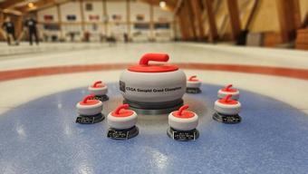

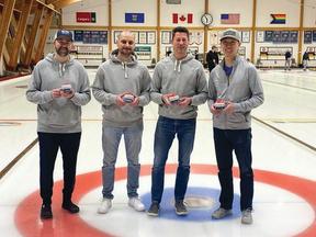
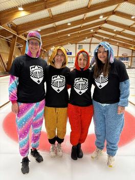
Following the overwhelming response to the inaugural event, the Second Annual CEGA Geospiel was held at the North Hill Curling Club from Thursday, April 16 to Saturday, April 18, 2026. Once again, the geoscience community came together for a fun, dynamic, and highly memorable event - and it delivered Team participation grew from 22 teams in the first year to a sold-out field of 30 teams, with more than 120 participants.
Teams arrived with incredible enthusiasm, taking things to the next level with creative costumes, matching shirts, and themed accessories Team name creativity also reached new heights, with many fully embracing the geoscience theme The event proved to be a major success on all fronts as a social gathering, a networking opportunity, and a celebration of the geoscience community
Building on lessons learned from last year, teams were divided into three skill categories: Advanced (A Bracket), Intermediate (B Bracket), and Beginner (C Bracket) Each team played three round-robin games, after which the top two teams from each bracket advanced to the finals
In the A Bracket, Grand Champion honours went to Team Rock Physics (Daniel Perez, Jason Lentz, Sterling Hansen, and Matt Ng), with Team Sheet Disturbers (Mike Gierach, Matthew Chomin, Jade Lakeman, and Marnie Gallant) taking second place In the B Bracket, Team Belloy 1 (Jeff Kriz, Jeff Preston, Gareth Hatto, and Tyler Klatt) claimed the championship, while Team Stolee (Drew Stolee, Ashley Krakowka, Chris Lister, and Lindsay Kung) secured second place In the C Bracket, the Sailing Stones (Scott MacKnight, Andrew Thomas, JF Gagnon, and Rob Vessey) were crowned Grand Champions, with Team 90s Rock (Jonathan Crealock, Colin MacDonald, Derek Savage, and Graham Dolce) finishing as runners-up
In addition to some exciting curling action, this year’s event featured two skills competitions. A hockey puck draw - sponsored by Belloy Petroleum Consulting - awarded a Traeger smoker to Gareth Williams, whose puck #1 proved to be the lucky winner The second event, a $10,000 draw-to-the-button challenge sponsored by Tensor Tide, lived up to its difficulty, with no participant able to claim the grand prize.
This event would not have been possible without the generous support of our sponsors A special thank you goes to our Title Sponsor, Cabra Consulting, along with our Ice Sheet Sponsors, Phoenix Technology Services and RigSat / Petrocraft
We also extend our appreciation to our Gold Sponsors: Altitude Energy Partners, Belloy Petroleum Consulting, Chinook Consulting Services, Pacesetter Directional, and XRF Solutions
Our Silver Sponsors included Pro-Geo Consultants, Core Laboratories,
Lonestar Directional, Canamera Coring, Weatherford, Rockwell Consulting, and Behr Integrated Solutions Our Bronze Sponsor was Sigma Explorations.
The three-day event featured a relaxed and social atmosphere, enhanced by beverages from our Brewery Sponsor, Balzac Brewing With so many teams embracing the spirit of the event through costumes and creativity, this year’s Spirit and Costume Award went to the Slippery Schists The one-of-a-kind “Tumbler Award,” presented to the player who best embodied the spirit of on-ice crashing, was awarded to Marius Simon.
A huge thank you goes to the Geospiel organizing committee for their tireless work: Co-Chair Tracy Theunissen, Jeff Fisher (Scheduling), Shannon Ward (Prizes), Gary Bugden (Trophies), and CEGA office support from Julie Beally
The enthusiasm from attendees and sponsors alike has truly set the tone for what is becoming a long-standing CEGA tradition. Keep your eyes open for registration for next year’s event We can't wait to see you at the 2027 CEGA Geospiel!
JON NOAD | STANTEC CONSULTING; ADELAIDE UNIVERSITY
Most of the new buildings in Calgary utilize modular construction, relying on factory-built components It was a very different story 140 years ago when, following the Calgary Fire of 1886, changes in local construction practices led to an increased reliance on sandstone, resulting in the town’s nickname: Sandstone City. The fire destroyed 18 buildings, beginning with the flour and feed store, and caused $100,000 ($3.5 MM in today’s money) in damage.
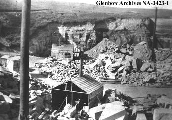
Following the fire, city officials drafted a bylaw requiring all large downtown buildings to be built with sandstone A ready source was the Paskapoo Sandstone, which is the bedrock underlying Calgary In consequence, 16 quarries were opened across the city to facilitate extraction (Figure 1) The sandstone is relatively soft, but it was hoped that weathering and exposure to the elements would harden it All these quarries have since closed, leaving few indications of their former existence
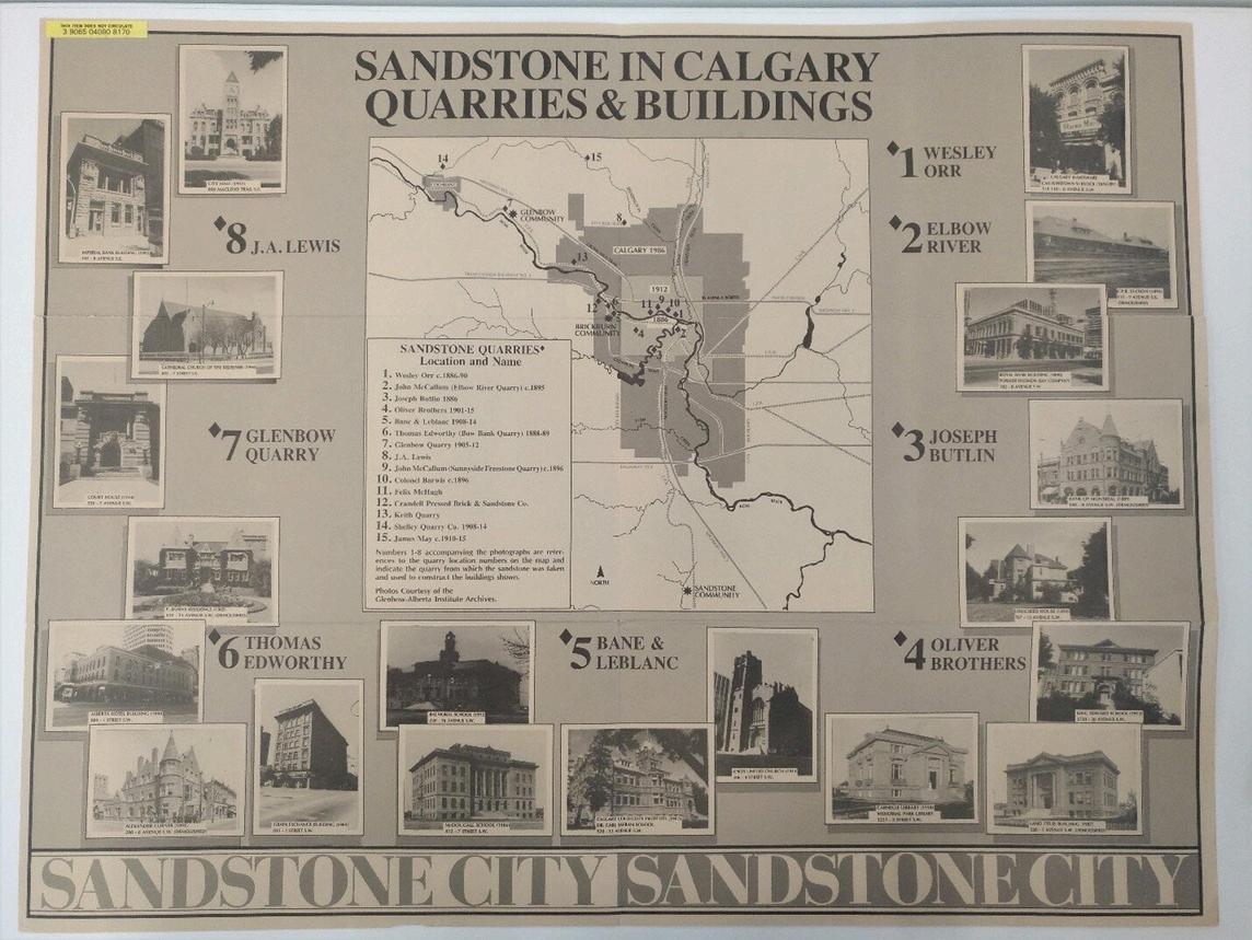
Figure 1. Pamphlet showing a map of sandstone quarries in Sandstone City, as well as buildings constructed using the sandstone from different quarries
The Upper Cretaceous to Paleocene geology of Southern Alberta is complex (Table 1) Older Scollard and Willow Creek formations straddle the K/Pg boundary These are overlain by the Paskapoo and Porcupine Hills formations, respectively The Scollard and Paskapoo were deposited in slightly cooler, more humid conditions to the north; the Willow Creek and Porcupine Hills in semi-arid conditions to the south, with the boundary running somewhere through the Calgary area Most of the quarries excavated the Paleocene Paskapoo Sandstone/Formation. This formation is characterized by sandstone beds up to 20 m in thickness The sandstone is often massive in appearance; hence, it can be described as a “freestone,” capable of being split by chisels in any chosen direction The bedding planes in the Paskapoo Formation in Calgary usually dip near horizontally, with common vertical joints
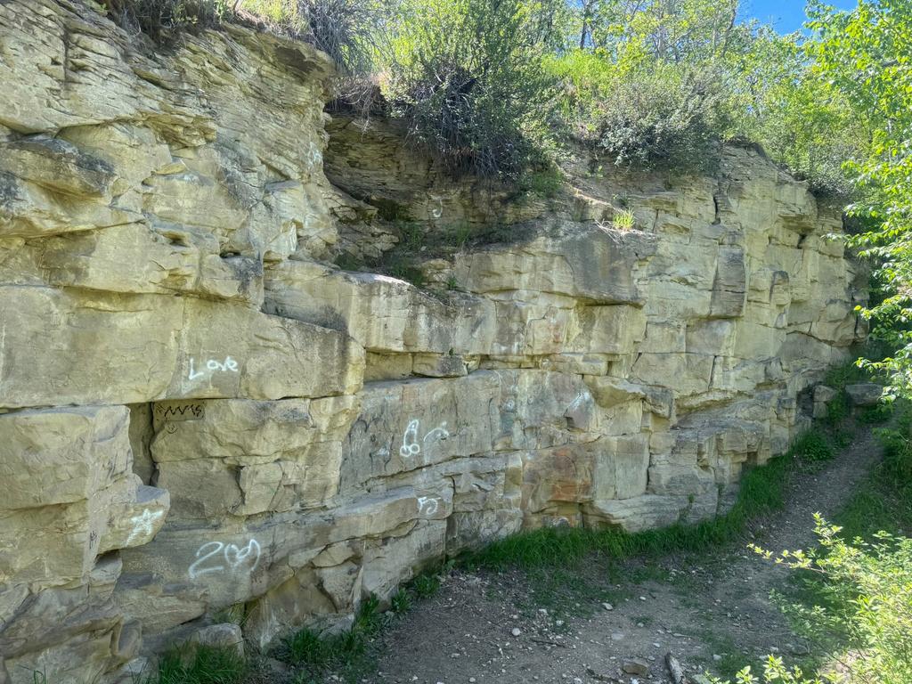
The Paskapoo Sandstone extends north at least as far as Edmonton along strike and underlies much of Calgary. The sandstone beds are massive to cross-bedded, medium- to coarse-grained, ranging from yellow to buff in colour (Figure 2) They are often stacked, or interbedded with hard to soft mudstone and siltstone, with subordinate limestone, coal, pebble conglomerate and bentonites.
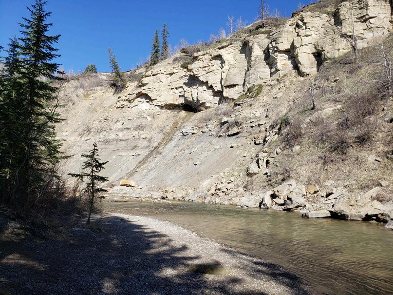
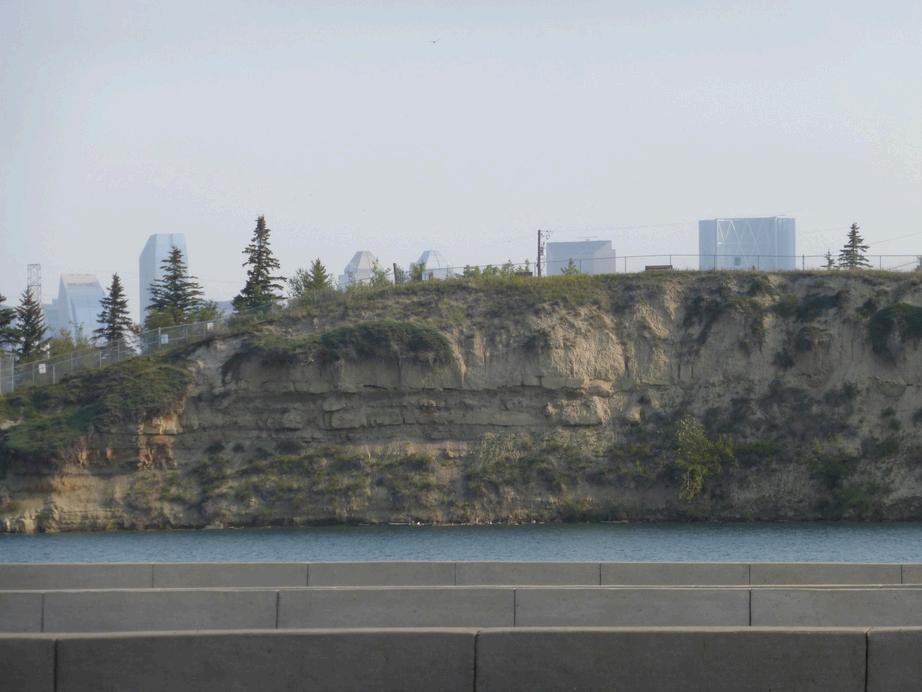
The depositional setting is interpreted as fluvial and floodplain in a fairly humid climate (indicated by the coals) Mapping of the Paleocene fluvial channels suggests meandering channels with general palaeoflow from west to east, with a lateral spread of at least 100 degrees Good natural exposures can be seen at Raven Rocks, Fish Creek Provincial Park (Figure 3), and on the Bow River just west of Cowboy Trail (Highway 22). Smaller outcrops occur all over the city, including just below McHugh Bluff; near Sandy Beach on the Elbow River; at the old Butlin’s Quarry in Riversedge Park close to Glenmore Dam (Figure 4); and in the Elbow River riverbed close to Scotsman’s Hill (site of the Elbow River Quarry).

Table 1. Paleocene Formations of the southern Alberta region (all thought to be deposited in fluvial and floodplain settings).
Referenced from numerous sources

Formation Age
Lithology
Porcupine Hills Middle to late Paleocene
Paskapoo Paleocene
Mudstones with well-developed paleosols and caliche nodules, siltstones and sandstones (crossbedded and calcite cemented) No coaly beds (semi-arid to arid indicator)
Sharp-based, massive to crossbedded, medium to coarsegrained, buff weathering sandstones reaching 15 to 20 m in thickness, interbedded with hard to soft mudstone, siltstone, and sandstone, with subordinate limestone, coal, pebble conglomerate and bentonite
Reaches 1200 m in the Porcupine Hills
May reach 750 m in the Foothills, 600 m around Calgary, 250 m at the Blindman River (Red Deer) type section
From the Waterton River to the Bow River in Calgary
Relationship to other formations
Basal contact to underlying Willow Creek Fm is marked by a thick sandstone resting disconformably on a palaeosol Near the Bow River it grades into the time-equivalent Paskapoo Fm Contact runs roughly east-west
Willow Creek Latest Cretaceous to Paleocene
Scollard
Non-marine varicolored shales, red beds, and sandstones The shales and red beds include calcite nodules and caliche deposits
Latest Cretaceous to Paleocene; K-Pg boundary at the base of lowermost Ardley coal seam
Sandstones and siltstones, interbedded with mudstones and, in the upper portion, coal seams (including the Ardley Coal Zone) No significant coal in lower member

Underlies much of southern Alberta Exposed at surface between Calgary and Edmonton
Overlies the Scollard Fm of the Edmonton Group in the plains (unconformably near Red Deer), and the Coalspur Fm (possibly unconformably) in the foothills Upper surface is always erosional Grades into the equivalent Porcupine Hills Fm south of Calgary Capped by Quaternary sediments
May exceed 1000 m Thins eastward from the Rocky Mountain foothills
Southwestern Alberta, south of the Bow River, and extends a short distance into Northern Montana
Equivalent to Scollard Formation, which includes coals Grades into Coalspur Fm in southern foothills, Willow Creek Formation is overlain by the Porcupine Hills Fm Cretaceous strata have yielded dinosaur fossils
Up to 300 m
Subsurface throughout much of SW Alberta
Rests disconformably on the Late Cretaceous Battle Fm and Brazeau Fm Unconformably overlain by Paskapoo Fm
Grades into Willow Creek Fm and Coalspur Fm in foothills
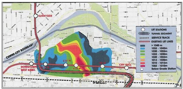
Table 2. List of Calgary’s quarries (referenced from various sources). Larger quarries in BOLD.
Quarry Name Established Location
CPR Quarry
Butlin’s Quarry
Orr’s Quarry
Oliver Brother’s Quarry
Bow Bank Quarry
Smith’s Quarry
Elbow River Quarry
Sunnyside Freestone Quarry
Barwis’ Quarry
Bankview Quarry
Owens’ Quarry
Glenbow Quarry
Shelley Quarry
May’s Quarry
Burnvale Brick Company Quarry
Keith Quarry
J.A. Lewis’ Quarries
McHugh’s Quarry
SBSPC Quarry
Watson’s quarry
1885 Edworthy Park
1886 Elbow Park, opposite Riveredge Park in Britannia area (in the treed area
1886 Bridgeland
Late 1880s Crowchild Trail, Knob Hill, beneath Sunalta School (now Oliver Quarry
1888 Edworthy (3 sites)
1892 Elbow River, 4 km south of Calgary
1895 Ramsay (Scotsman’s Hill)
1896 Sunnyside (Van Cortland quarter section east of 4th St NW)
1896 North of the Bow River near Prince’s Island (homestead in SE-22-24-1
1900 North-south gully near Summit Street SW, traversing 17th Ave SW
1904 Near Calgary
1905 Halfway between Calgary and Cochrane (now Glenbow Ranch
1908 Big Hill Creek valley near Cochrane
1910 Along Beddington Creek, north of Calgary
Sandstone, Alberta, south of Calgary
Keith railway siding along the CPR in or near Bowness
In Confluence Park, Beddington (NW21-25-R1-W5M) and a second
Sunnyside district, likely west of Barwis Quarry and Sunnyside
Sandstone, Alberta
Brickburn, Edworthy Park
Owner/Established by
CPR (blocks shipped to Regina)
Joseph Butlin
Wesley Fletcher Orr
Oliver Family
Thomas Edworthy
Peter Smith
John McCallum
John McCallum, owned by Van Cortlandt
Colonel Thomas Sheppard Barwis
William Nimmons, leased to Wm Oliver
John Owens
James May
John Alexander Lewis
Felix McHugh
Sandstone Brick and Sewer Pipe Company:
John Goodwin ("Gravity") Watson
The base of the Paskapoo Formation, designated the Haynes Member, consists primarily of cliff-forming sandstones and pebbleconglomerates, interbedded with lesser amounts of siltstone and mudstone In the overlying Lacombe Member, siltstones and mudstones dominate, with thin interbeds of fine-grained sandstone, carbonaceous mudstones, paleosols, and minor coals The Dalehurst Member at the top of the formation consists of the Obed coal zone, with up to six coal zones The coal beds may reach 5 m in thickness
In most areas, including Calgary, the Dalehurst and upper Lacombe Members have been removed by glacial erosion. The upper surface of the Paskapoo Formation is always erosional, and it is estimated that up to 3 km of strata may have been eroded due to glacial activity Deep, erosional channels cut into the sandstone beds at some localities, including in Calgary at Sunnyside and Rosedale (Figure 5). Where the unit is not exposed at surface, it is usually capped by glacial deposits
Until at least 1887, mineral rights were awarded to the homesteader
This covered at least five of the early sandstone quarries (Table 2) After 1887, the government retained mineral rights for the Crown, excepting lands owned by CPR, and a Crown mineral lease would be required to open a new quarry
Many quarries were opened and developed between 1880 and 1915
An example is Bankview Quarry, which employed about 40 men, utilizing two steam shovels, two derricks with gang saw, and a piece of equipment called an "orange peel stripper " Rough blocks of stone, up to seventy cubic feet, sold for about one cent per foot delivered in Calgary, and rubble was $7,000 per cord. Oliver Quarry had similar equipment and workforce numbers (Figure 6)
Most of the sandstone was quarried from strata near the surface that had undergone extensive weathering As a result, it did not stand up well to the Calgary climate (particularly freeze-thaw), and this led to the premature closure of the quarries by 1915 The last known example of new sandstone construction in the city was the Memorial Chapel at Grace Presbyterian Church (1009-15th Avenue SW) in 1962
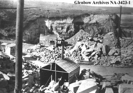
The mining process in Sunnyside involved clearing brush and trees, after which clay was removed by hand The final stage was removing several feet of waste bedrock with wedges, sledgehammers, and crowbars to expose the underlying sandstone. The quarrymen would cut 2 feet x 4 feet x 2 feet blocks ready for loading by block-and-tackle onto horse-drawn wagons The blocks were transported across the river using the Dewdney Bridge, completed in 1885, or slid across the ice-bound Bow River in winter months. Due to the poor exposures and steep slopes, the quarries close to the downtown area would not have been commercially viable without their proximity to the planned buildings Large quarries to the west of Calgary (such as the Edworthy quarries) took over the supply of sandstone after the 1890s.
There were also several shale quarries, mainly because building with bricks was cheaper than sandstone Locations were often adjacent to the sandstone quarries and included Brickburn, Oliver Brothers, Riley Park, and Sunnyside Several locations in Cochrane included the Collins Brickyard (located on the north side of Highway 1A close to the downtown area, operating from 1902 to 1925), the Cochrane Brick Company, and the French Brickyard. The Peel Brickworks, opposite Mission, was the principal brickworks in early Calgary, commencing operation in 1886 Some of the bricks were shipped west to Vancouver to help rebuild after fire destroyed Gastown in June 1886
Back in 2016, rumours abounded of a new small-scale sandstone quarry being redeveloped on one of two sites: Edworthy Park or the J.A. Lewis Quarry site near Hampton Hills. It was considered to hold heritage, business, and economic potential but unfortunately, nothing came of the plan. This followed news in 2015 that the restoration of City Hall was to use sandstone from Poland, Spain, and the US. The former quarry in Edworthy Park was deemed to be the best potential site, but there were complications. The Edworthy family donated the land to the city with the proviso it remain a park forever. To ensure that continued in perpetuity, the family also retained the mineral rights for the land. Bids for the restoration work were based on price, technical fit, laboratory documentation, colour-calibrated photography, physical samples, and cutting services.
It is still possible to visit several of the quarries that opened up in the first part of the last century. The following localities are recommended due to their accessibility and perceived lack of hazards; however, caution should always be exerted, especially where steep slopes are encountered.
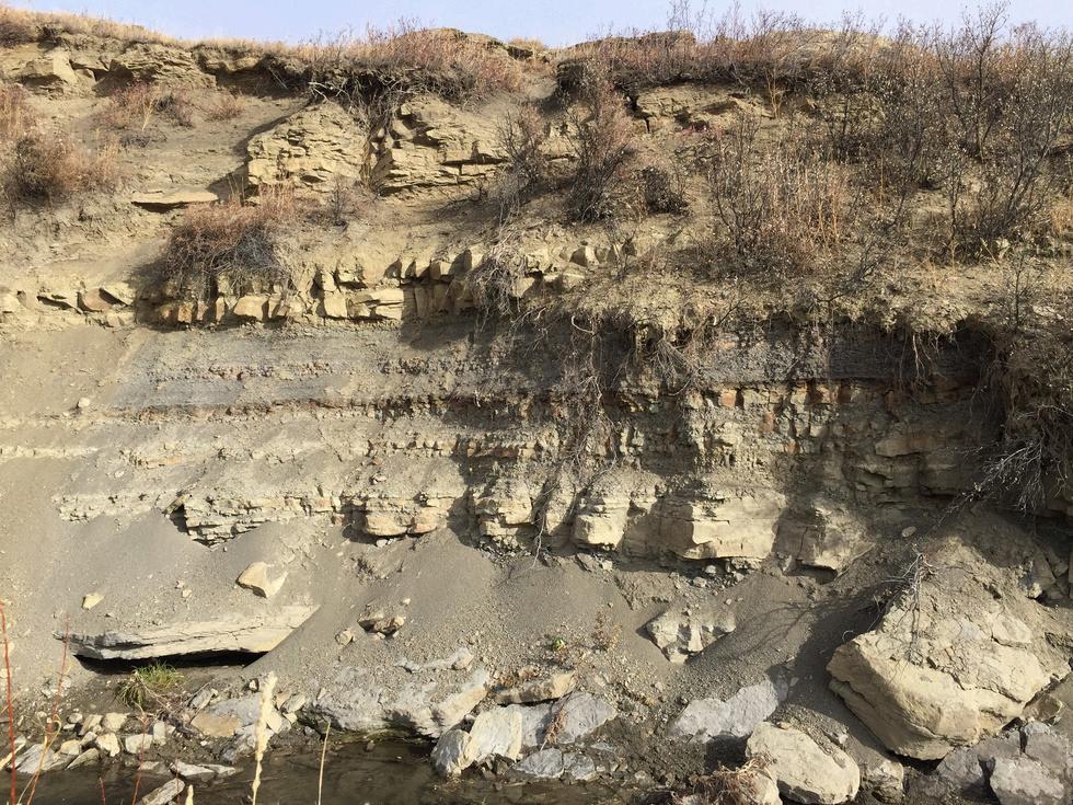
Several outcrops expose a thick, meandering-channel deposit (Figure 7), originally the site of the J.A. Lewis Quarry. There are further outcrops exposing thinner sandstone beds and thick overbank mudstone deposits (Figure 8).
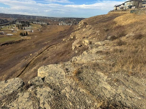
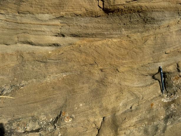
Extensive outcrops of Paskapoo Sandstone with mudstone interbeds, beautiful trough cross-bedded sandstone beds, and rare oncoids (Figures 9, 10, 11).
Bowbank Sand Quarry, Edworthy Park
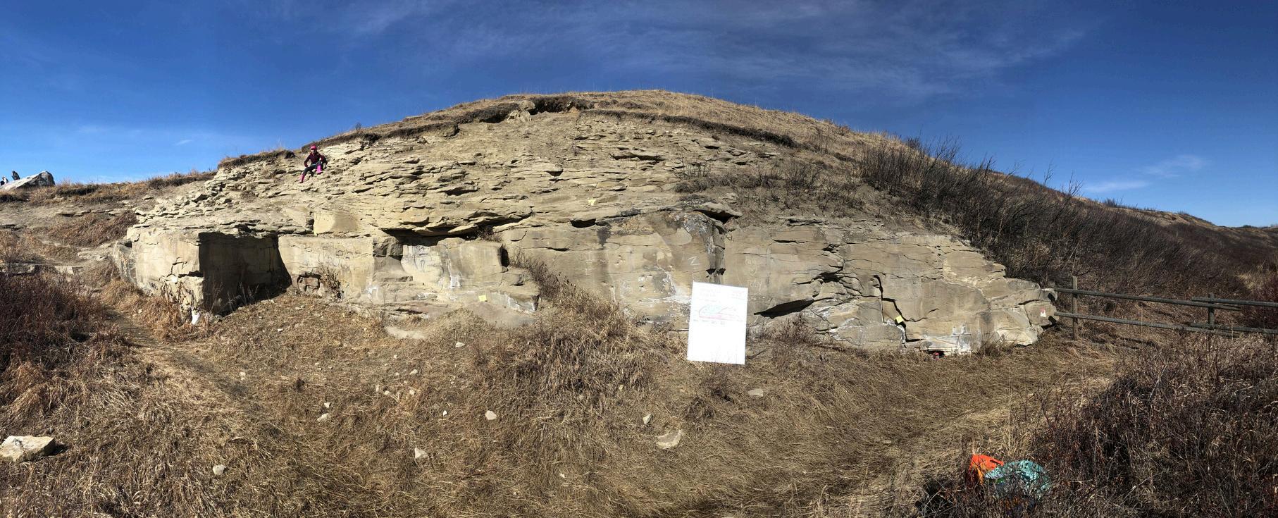
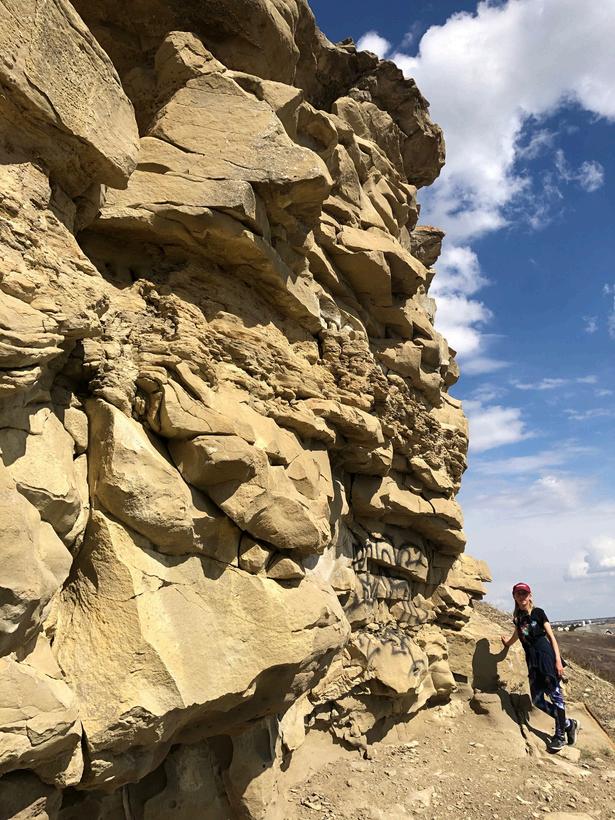
Thomas Edworthy operated three quarries here. One quarry is still well exposed on the west side of the road leading southward from the Bow River parking area. It features at least 8 m of stacked sandstone beds and some interesting graffiti (Figure 2). Drill marks, rubble piles, and excavations for the derrick footings can still be seen. Further Willow Creek outcrops, including small oncoids, can be seen on the north side of the Bow River by Angel’s Café.
Figure 8. Thin sandstone beds and overbank mudstone deposits in Confluence Park, Beddington
11.
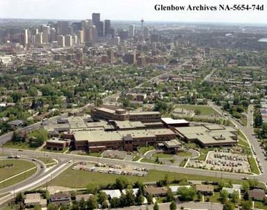
Figure 13 Site of the Oliver Brother’s Quarry in Sunalta, later the site of the old Alberta Children’s Hospital and now the Richmond Road Diagnostic and Treatment Centre.
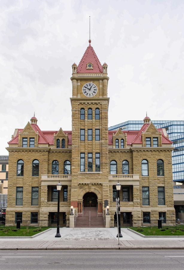
12. City Hall, Calgary, constructed from Paskapoo Sandstone
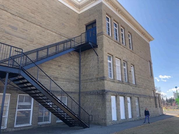
Figure 14 View of Colonel Walker School, Inglewood, built from Paskapoo Sandstone
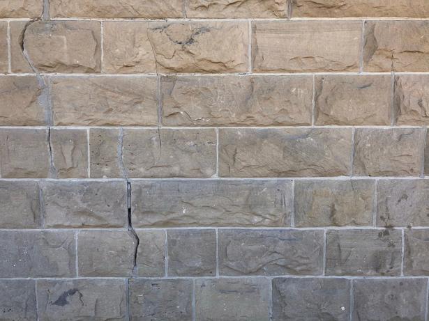
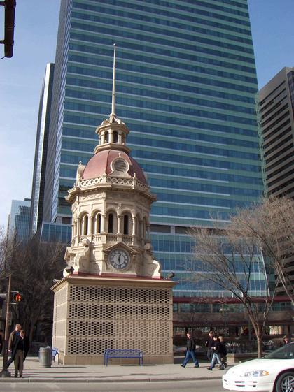
Figure 16. The original cupola from the Central Public School, Calgary (photo taken by rdrunner, Flickr)
Over a quarter of a century, more than 250 buildings were built in Calgary, in whole or part, of sandstone Many of these buildings are still standing, particularly along Stephen Avenue, designated as a National Historic Site of Canada The buildings include the majestic City Hall (Figure 12), designed by William Dodd. The sandstone for this building was quarried at Glenbow Quarry and J A Lewis’ quarries and delivered by horse and wagon More sandstone was supplied from Bankview Quarry, now the site of the Richmond Road Diagnostic and Treatment Centre (Figure 13). Eleven stone masons (and 33 stonecutters) cut the blocks to size, leaving the outside-facing stone rough, apparently to save money Many of these workers were originally from England and Scotland
The Ashdown Block on Stephen Avenue was built in 1891 from sandstone taken from Orr's north-bank quarry below East Crescent Heights The court house (sadly demolished in 1958) and Hudson’s Bay building (still standing) were built using stone cut from the Sunnyside Freestone Quarry The stone blocks were rough cut and varied between 1 to 2 feet in thickness They were completed in 1890/91 using a mortar mixture of sand and lime, the lime shipped from a lime works near Banff. The Alberta Hotel was also built with Sunnyside Freestone sandstone, while the Bank of Montreal (1889) and Lougheed House (1891) were built with sandstone from the Butlin Quarry
Possibly Calgary’s best sandstone building is the Memorial Park Library located in Memorial Park, close to downtown It is the oldest public library in Alberta and opened in 1912 Many other sandstone public buildings can be found around the city, including the Fairmont Palliser hotel, which opened on 9th Avenue SW in 1914
Nineteen sandstone schools were built in Calgary between 1894 and 1914 The first was Haultain School, constructed in 1894 Sunalta School was built in 1912 using sandstone from Bankview Quarry. Other examples include Ramsay School and Colonel Walker School in Inglewood (Figures 14 and 15, the latter showing multiple building stones) The cupola from the Central Public School has been preserved at the original school site (Figure 16).
Several sandstone churches were built in the same period, including Knox United Church (1912 to 13) The remains of Calgary’s first hospital are preserved as Rundle Ruins in Victoria Park, close to the Stampede grounds The Alberta Legislature and Government House in Edmonton are both constructed of sandstone from the Glenbow Quarry, located between Calgary and Cochrane
This article charts a time when Calgary was dominated by sandstone The Paskapoo Sandstone continues to be quarried around the city, mainly as a byproduct of excavation for construction projects Sandstone blocks are used both to repair existing buildings, many dating back to the 1920s, as well as for rockeries and other garden features The Paskapoo Sandstone is also Calgary’s aquifer, and water is currently extracted for use in the fish hatchery in Inglewood Keep an eye out on your travels as there are some wonderful little sandstone outcrops hidden away around the city
Boothby,M.2020. BrickyardsandStoneQuarries.CHAPS. CalgaryHeritageInitiative.2025.CelebratingCalgary150–Sandstone City,PartOne.AccessedFebruary2026.
Government of Alberta. 2026. Alberta Register of Historic Places: Edworthy Residence, Homestead Lands and Quarries (HeRMIS governmentwebsite):https://hermis.alberta.ca
Gross, C.W. 2021. Historian in Residence: Tracking Down Quarries. https://www.heritagecalgary.ca/heritage-calgaryblog/trackingquarries
Gross, C.W. 2021. Historian in Residence: Where Historic City Hall Came From. https://www.heritagecalgary.ca/heritage-calgaryblog/sandstonecityhall
Kilburn-Smith,E.2025.ThewildreasonwhysomedowntownCalgary buildings are made of sandstone. https://www.instagram.com/p/CV3rkc-Pcgt/ Loewen,C.2019.TheStoneArchive.TheSiteMagazine(online).
Patterson,D.2022.1880s&1890sSandstoneQuarryLocationsNorth Bank of Bow River, Calgary Candidate Sites based on 1944-2021 GeotechnicalBoreholeData.
White,R.2025.Calgary:TheSandstoneCity:www.everydaytourist.ca
https://www.calgary.ca/arts-culture/heritage-sites/city-hallsandstone.html
https://www.calgary.ca/arts-culture/heritage-sites/city-hallcraftsmen.html
https://calgaryheritage.org/wp/elbows-sandstone-legacy/
https://heritagepark.ca/heritage-parks-sandstone-house/
https://www.cbc.ca/news/canada/calgary/calgary-city-hallrestoration-1.4082152
https://www.cgenarchive.org/calgary-sandstone.html
https://theurbanexporer.ca/2023/01/31/sandstone-city-legacy
https://calgary.skyrisecities.com/news/2016/11/beheaded-schoolcentre-street.23690



July 14
Tuesday, 12:00 – 1:30 PM CEGA Student Webinar
CO2 Sequestration and Storagepresented by Cenovus Energy
August 19
Wednesday, 1:00 – 10:00 PM Sporting Event 2026 CEGA Golf Tournament
September 18
Friday, 7:30 – 9:00 PM
In-Person
Palaeontology Technical Division
The Anatomy, Taxonomy, and Tooth Replacement of a Sabre-Toothed Cretaceous Fish
Location: Mount Royal University, Room B108
September 2
Wednesday, 12:00 – 1:00 PM
BASS Technical Division
September 22
Tuesday, 11:30 AM – 1:00 PM
UPCOMINGEVENTS
Technical Luncheon

Wildcat or Wild Goose: Hydrocarbon
Assessments of the Canadian Arctic
Location: New CEGA Classroom
In-Person
Location: Lynx Ridge Golf Club In-Person In-Person
The Duvernay, from Outcrop to Subsurface: Translating Complex Stratigraphic Models into Predictable, Simple Patterns for Reservoir Quality Evaluation
Location: Calgary Petroleum Club
September 24
Thursday, 6:00 – 9:00 PM Sporting Event
Sweat the Subsurface Road Race 2026
Location: Sien Lok Park



For many years, Reigh MacPherson has been an active and valued volunteer within CEGA, contributing his time and expertise across multiple initiatives He just finished a term as chair of the Canadian Well Logging Technical Division, where he helped organize speakers, coordinate event programming, and support members of the former Canadian Well Logging Society as they continue their transition into CEGA Reigh is also a key member of the Technical Luncheon Committee, where he plays an important role in securing sponsorships and sourcing many of the speakers who have presented over the past several years, helping to ensure a strong and consistent program.
We’re
pleased to spotlight Reigh and his long-standing contributions to CEGA’s technical and volunteer community.
Q: What inspired you to first get involved with CEGA?
A: “I came to CEGA by way of a common occurrence in our industry, a friendly takeover I had been a decades-long member of the Canadian Well Logging Society (CWLS), volunteering in numerous capacities over the years, including holding the positions of VP and president in the late 90s. As our membership dwindled following the 2015 downturn, it was decided that the best course of action was to become a technical division within CEGA ”
Q: What does being a CEGA member mean to you, both professionally and personally?
A: “CEGA membership provides a wealth of opportunities for keeping up to date with current industry trends in geoscience I very much enjoy the technical luncheons and have recently taken in more of the division talks, which are great value Events, such as Core Conference and the recent Reservoir Symposium, are examples where professional development and social engagement go hand-in-hand. The purely social and sporting events are a great way to catch up with friends and present/former colleagues ”
Q: In what ways has CEGA supported or influenced your professional growth?
A: “On a professional level, as a senior consultant, CEGA membership has been invaluable Attending events and volunteering as CWLS technical chair and on the Technical Luncheon Committee has enabled me to meet and get to know a wide variety of folks in the industry ”
Q: What is one fun fact about you that others might not know?
A: “I’ve played the bagpipes with the Calgary Police Service Pipe Band for over 15 years It’s been a long-standing commitment that’s taken me to a wide range of community events, ceremonies, and performances across Calgary and beyond ”
Thank you, Reigh, for your ongoing dedication to CEGA and the impact you continue to make across our technical programs and community.
KENDRA MACLEAN, CALEP DIRECTOR AT LARGE
Somewhere along the way, I stopped thinking of geoscience and geophysics as things that happened on the other side of the office. I work in mineral land, and the subsurface shapes what I negotiate, even if I’m not the one interpreting it. That shift came from conversations with colleagues and industry connections who were generous enough to explain their work and curious enough to ask about mine. Those conversations are what Sweat the Subsurface is made for.
This year marks the 35th year of the event, and it’s one worth showing upfor.OntheeveningofThursday,September24,CEGA,theCanadian Association of Energy and Land Professionals (CALEP), and the Canadian Society of Exploration Geophysicists (CSEG) are bringing geologists, land professionals, geophysicists, and the broader energy communitytogetheralongCalgary’sBowRiverpathways.Whetheryou run the full 10 km, complete the 5 km, or join as an afterparty guest (no judgement), the point is just to show up and enjoy the experience. Every registration includes a t-shirt, a chance at winning prizes, and a ticket to the afterparty at the Calgary Curling Club. Registration closes September17,anddetailsareavailableontheCEGAwebsite.
The decisions made in land, geophysics, and geoscience are connected in ways that are not always obvious from inside a single discipline. While you don’t need to be an expert in everything, developing some familiarity with adjacent work helps us all ask better questions and understandwhytheanswersmatter.
CALEP has long recognized that the best land work does not happen in isolation, which is why I was keen to join the Sweat the Subsurface committee in 2024. At one of our committee meetings, a seismic inversion meme made the agenda. Admittedly, the joke went over my head, which led to an impromptu lesson on seismic that has since helpedmeunderstandthebroadercontextwhenworkingwithSeismic Data Review Agreements. That kind of informal learning is what this eventdoesbestandwhyIkeepshowingup.
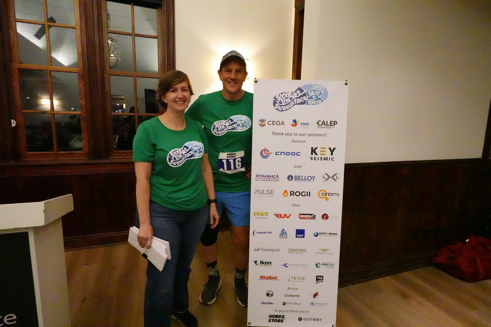
Behind Sweat the Subsurface is something that keeps every good industry association relevant and connected to its members: volunteers.Here’swhyafewofthisyear’scommitteemembershave decided to invest their time and expertise into making this event a success:
“Part of why I have been one of the CALEP/CEGA/CSEG volunteers who organize the Sweat the Subsurface run has been because I love how the event ties running into geoscience in a fun, lighthearted way. It is a great reminder that even though we spend so much time focused on the subsurface, we are still a community that can get outside, stay active, and connect beyond work. It is also a great way to show people outside the industry who we are and what we do, and to highlight the
“As someone who has participated in the last two Sweat the Subsurfaces, I am thrilled to be on this year’s committee. It is a great opportunity to meet geoscientists and land professionals in a relaxed, funenvironmentthatfeelsverydifferentfrommosttraditionalindustry events. I am still getting together for runs with some of the friends I havemetatpastevents.Iamalreadylookingforwardtothisyear’srun and hope I can play a small role in helping others enjoy it as much as I have.”
Matt Keller, Committee Member, Sweat the Subsurface | CALEP
A sincere thank you to the rest of this year’s committee: Franck Delbecg, Joanna Czarnecki, Jocelyn Frankow, Julie Li, Kasia Hinks,

13-15 | BANFF, AB
In October 2026, geoscientists and industry professionals will gather in the heart of the Canadian Rockies for one of CEGA’s most cherished technical events. Hosted in Banff National Park, the Gussow Conference offers three days of focused, high-impact technical exchange, set against a backdrop that is as inspiring as it is iconic.
This year’s theme, “Cracking the Cretaceous Code: Unlocking the Strata of the Western Canada Sedimentary Basin (WCSB),” reflects both the enduring importance and evolving complexity of Cretaceous-aged successions. As one of the most dynamic and economically significant intervals in the basin, the Cretaceous continues to drive exploration, development, and innovation across Western Canada.
What sets Gussow apart is its single-track format. Every attendee participates in the same sessions, fostering a shared experience that encourages deeper discussion, cross-disciplinary learning, and meaningful collaboration. The 2026 program is designed to deliver both scientific depth and practical relevance, bridging academic insight with real-world application.
The 2026 technical program is structured around five sessions, each exploring key aspects of Cretaceous geology across the WCSB.
SESSION 1: Reconstructing the Cretaceous: Basin Development and Regional Context
Opening the conference, this session examines the tectonic and paleogeographic evolution of the basin. By taking a basin-scale perspective, speakers will explore how large-scale processes influenced accommodation, sediment routing, and stratigraphic architecture. This regional framework provides critical context for understanding local variability and reservoir heterogeneity, setting the stage for the more focused discussions that follow.
SESSION 2: Investigating Cretaceous Coastal and Marginal Marine Systems
The Western Interior Seaway left behind a rich and complex record of shoreline and coastal deposition. This session highlights the diversity of marginal marine environments, from deltas and shorefaces to estuaries and beaches. Presentations will draw on both outcrop and subsurface data to explore sedimentology, stratigraphy, ichnology, and depositional models, offering new perspectives on how these systems evolved across the basin.
SESSION 3: Channeling the Past: Decoding Ancient River Systems
Fluvial systems are both familiar and notoriously complex. This session dives into the challenges and opportunities of interpreting ancient river deposits, from the prolific McMurray Formation to the Horseshoe Canyon outcrops. With advances in datasets, tools, and conceptual models, geoscientists are continuing to unlock increasingly subtle and heterogeneous reservoirs, demonstrating that these systems still hold significant untapped potential.
SESSION 4: Stratigraphic and Reservoir Insights from the Lower Cretaceous
Focusing on active plays, this session connects technical innovation with performance outcomes. Case studies will highlight reservoir characterization, recovery strategies, and production optimization, offering insight into what’s driving success in today’s commodity environment. As development continues across the Lower Cretaceous, understanding the link between geology and value has never been more important.
SESSION 5: Reevaluating the Upper Cretaceous: Case Studies of the Colorado and Belly River Groups
The final technical session turns to the Upper Cretaceous, with a focus on the Colorado and Belly River Groups. Through detailed case studies, speakers will examine reservoir complexity, risk mitigation strategies, and emerging geoscience techniques aimed at improving production potential. This session emphasizes the importance of re-evaluating established plays with fresh data and new approaches.
Gussow 2026 offers a uniquely collaborative, single-track format where every conversation builds on shared insights fostering deeper engagement and meaningful crossdisciplinary dialogue. Its location in Banff provides an inspiring setting to connect with peers and step beyond the day-to-day.
The Gussow Committee looks forward to welcoming you for a technically compelling and memorable event, where the challenge is clear: crack the Cretaceous code and unlock the future of the WCSB.
BIG HILL SPRINGS GO TAKE A HIKE TOGETHER! Field Trip
Saturday, July 18, 2026
11:00 AM – 3:00 PM
Leaders: Alexis Anastas & Kent Wilkinson
Location: Big Hill Springs Provincial Park Online registration closes: July 16, 2026
TYNDALL STONE GO TAKE A WALK TOGETHER! Field Trip
Saturday, August 15, 2026
1:00 PM – 4:30 PM
Location: Kensington Safeway
Online registration closes: August 1, 2026

Leader: Tako Koning, Senior Geologist- Consultant Location: Calgary Petroleum Club
GRASSI LAKES DEVONIAN GO TAKE A HIKE TOGETHER! Field Trip
Saturday, August 22, 2026
9:00 AM – 2:00 PM
Leader: Mark Mallamo
Location: Grassi Lakes Trailhead
Online registration closes: August 20, 2026
Wednesday, August 26 to Friday, August 28, 2026
12:00 PM – 6:00 PM
Location: AER Core Research Centre
Online registration closes: August 19, 2026
Leaders: Murray Gilhooly, John Weissenberger, Byron Veilleux

SEQUENCE STRATIGRAPHY AND RESULTING FACIES ARCHITECTURE OF THE UPPER DEVONIAN (FRASIAN) REEF AND OFF FACIES, CENTRAL ALBERTA OUTCROPS AND ADJACENT ALBERTA SUBSURFACE Field Trip
K/PG MASS EXTINCTION BOUNDARY AT KNUDSENS FARM GO TAKE A HIKE TOGETHER! Field Trip
Saturday, August 29, 2026
9:30 AM – 1:30 PM

Leader: Tako Koning, Senior Geologist
Location: Knudsen's Farm
Online registration closes: August 27, 2026