C
68.10 68.19
68.15 68.26
66.51
\\NEWPROJ1\Projects\NSW21\NSW210622\Drawings\CAD\CIV\Drawings\20 CVW and LKD Consolidated Plans\NSW210622-C112-03.dwg
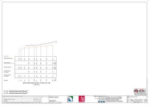
SEWER LONGITUDINAL SECTION - 375 MSCL-DICL S-RM A1 Horizontal Scale 1 : 500 A1 Vertical scale 1 : 100
SCALE 1:100 @ A1 SCALE 1:200 @ A3
0
1
2
4
6
8
10 metres
SCALE 1:500 @ A1 SCALE 1:1000 @ A3
0
5
10
20
30
40
50 metres
NOT FOR CONSTRUCTION Client
This drawing has been assigned an electronic code that signifies the drawing has been checked and approved by: North
B
100% DETAIL DESIGN ISSUE FOR REVIEW
A
NOT ISSUED
Issue -1
Description 0
1cm at full size
10cm
06.03.24
MDM
TRC
-
-
-
Date
Drawn
Approved 20cm
CAMDEN COUNCIL 70 CENTRAL AVENUE ORAN PARK, NSW 2570 PHONE : (02) 4654 7777
FAX : (02) 4954 7829
© COPYRIGHT of this design and plan is the property of ACOR Consultants Pty Ltd, ACN 079 306 246 ABN 40 079 306 246, all rights reserved. It must not be used, modified, reproduced or copied wholly or in part without written permission from ACOR Consultants Pty Ltd.
ACOR Consultants Pty Ltd
Project
CAMDEN VALLEY WAY UPGRADE BETWEEN HILDER STREET AND T +61 2 4926 4811 KIRKHAM LANE INCLUDING LIZ KERNOHAN DRIVE EXTENSION
The Forum, Level 1 Suite 1 240-244 Pacific Highway Charlestown NSW 2290
Drawing Title
SEWER LONGITUDINAL SECTIONS SHEET 1 Drawn
Date
Scale
JER
MAR 2023
AS SHOWN
Designed
Project No.
SP
A1
NSW210622
Q.A. Check
Date
TRC
28.02.24
Dwg. No.
Issue
C112-031
B
Mar 06, 2024 - 9:38am
1.37 95.01
100 102.44
0.85 77.93
1.43
0.73 61.27
1.15
67.88
67.94
66.10 66.95
67.25
65.81 0.83
66.54
66.64
65.57 0.67
66.50
66.24
65.42 66.22 66.43
0.93
1.40 5.67
50
0.89
CHAINAGE
0
0.96
EXISTING SURFACE PIPE COVER
0.80
66.40 1.30 27.72
DESIGN SURFACE PIPE COVER
1.01
66.13 1.22 15.6
EXISTING SURFACE
65.56
64.27
DESIGN SURFACE
43.28
65.10 66.06
64.91
63.38
SEWER OBVERT LEVEL
64.16
DATUM R.L 59.8
D LINE-C1 (3x)2.4x0.75 IL.64.34
D LINE-2 Ø0.375 IL.64.68
D LINE-1 Ø0.375 IL.64.47
63.52 66.21
\\NEWPROJ1\Projects\NSW21\NSW210622\Drawings\CAD\CIV\Drawings\20 CVW and LKD Consolidated Plans\NSW210622-C112-03.dwg
1.70 300
SEWER LONGITUDINAL SECTION - 500 DICL S-RM A1 Horizontal Scale 1 : 500 A1 Vertical scale 1 : 100
SCALE 1:500 @ A1 SCALE 1:1000 @ A3
0
5
10
20
30
40
50 metres
SCALE 1:100 @ A1 SCALE 1:200 @ A3
0
1
2
4
6
8
10 metres
NOT FOR CONSTRUCTION Client
This drawing has been assigned an electronic code that signifies the drawing has been checked and approved by: North
B
100% DETAIL DESIGN ISSUE FOR REVIEW
A
NOT ISSUED
Issue -1
Description 0
1cm at full size
10cm
06.03.24
MDM
TRC
-
-
-
Date
Drawn
Approved 20cm
CAMDEN COUNCIL 70 CENTRAL AVENUE ORAN PARK, NSW 2570 PHONE : (02) 4654 7777
FAX : (02) 4954 7829
© COPYRIGHT of this design and plan is the property of ACOR Consultants Pty Ltd, ACN 079 306 246 ABN 40 079 306 246, all rights reserved. It must not be used, modified, reproduced or copied wholly or in part without written permission from ACOR Consultants Pty Ltd.
ACOR Consultants Pty Ltd
Project
CAMDEN VALLEY WAY UPGRADE BETWEEN HILDER STREET AND T +61 2 4926 4811 KIRKHAM LANE INCLUDING LIZ KERNOHAN DRIVE EXTENSION
The Forum, Level 1 Suite 1 240-244 Pacific Highway Charlestown NSW 2290
Drawing Title
SEWER LONGITUDINAL SECTIONS SHEET 2 Drawn
Date
Scale
JER
MAR 2023
AS SHOWN
Designed
Project No.
SP
A1
NSW210622
Q.A. Check
Date
TRC
28.02.24
Dwg. No.
Issue
C112-032
B
Mar 06, 2024 - 9:38am
1.41 273.95
65.23
1.48 250
2.68
63.88 65.95
1.50 245.97
65.29
1.70 1.70 219.97 220.42
2.06
63.79 65.95
1.39 212.27
65.27
1.28 1.30 200 201.01
2.16
63.78
1.09 188.28
2.05
1.05 174.76
65.27
65.83
63.63 63.62 66.09 66.08
1.13 162.13
65.33 65.33
0.96 150
2.46 2.46
63.96 66.15 2.19
0.77 0.77 137.65 138.2
65.35
64.15 64.13 66.24 66.23 2.08 2.10
0.92 124.7
65.44 65.43
64.48 66.41
1.02 111.64
1.93
1.03 1.03 99.11 100
65.58
64.67 66.54
1.05 82.59
1.87
1.05 68.6
65.72
64.79 66.63
1.14 55.8
1.84
1.14 50
65.92
65.16 66.70
1.12 44.13
1.55
1.14 32.37
66.11
65.52 65.51 66.66 66.66
1.15 22.34
1.14 1.15
1.16
1.14 11.86
66.29 66.28
65.59 66.75
65.70 66.86 1.15
1.13
CHAINAGE
1.08 1.08
EXISTING SURFACE PIPE COVER
0
DESIGN SURFACE PIPE COVER
66.50
66.95 66.93
67.27
67.56
67.85
67.99
68.12
68.38
68.61
EXISTING SURFACE
68.84
69.10
DESIGN SURFACE
66.73
65.92 65.91 67.00 66.99
66.23
66.51
66.71
66.85
67.00
67.23
67.46
67.96
SEWER OBVERT LEVEL
67.70
DATUM R.L 60
D LINE-5 Ø0.375 IL.63.97
D LINE-4 Ø0.45 IL.63.84 D LINE-C2a D LINE-C2b D LINE-C2c D LINE-C2d (2x)3x0.9 2.7x0.9 1.8x0.9 3x0.9 IL.63.67 IL.63.67 IL.63.67 IL.63.67
63.35 65.63 64.78
\\NEWPROJ1\Projects\NSW21\NSW210622\Drawings\CAD\CIV\Drawings\20 CVW and LKD Consolidated Plans\NSW210622-C112-03.dwg
SEWER LONGITUDINAL SECTION - 500 DICL S-RM A1 Horizontal Scale 1 : 500 A1 Vertical scale 1 : 100
SCALE 1:500 @ A1 SCALE 1:1000 @ A3
0
5
10
20
30
40
50 metres
SCALE 1:100 @ A1 SCALE 1:200 @ A3
0
1
2
4
6
8
10 metres
NOT FOR CONSTRUCTION Client
This drawing has been assigned an electronic code that signifies the drawing has been checked and approved by: North
B
100% DETAIL DESIGN ISSUE FOR REVIEW
A
NOT ISSUED
Issue -1
Description 0
1cm at full size
10cm
06.03.24
MDM
TRC
-
-
-
Date
Drawn
Approved 20cm
CAMDEN COUNCIL 70 CENTRAL AVENUE ORAN PARK, NSW 2570 PHONE : (02) 4654 7777
FAX : (02) 4954 7829
© COPYRIGHT of this design and plan is the property of ACOR Consultants Pty Ltd, ACN 079 306 246 ABN 40 079 306 246, all rights reserved. It must not be used, modified, reproduced or copied wholly or in part without written permission from ACOR Consultants Pty Ltd.
ACOR Consultants Pty Ltd
Project
CAMDEN VALLEY WAY UPGRADE BETWEEN HILDER STREET AND T +61 2 4926 4811 KIRKHAM LANE INCLUDING LIZ KERNOHAN DRIVE EXTENSION
The Forum, Level 1 Suite 1 240-244 Pacific Highway Charlestown NSW 2290
Drawing Title
SEWER LONGITUDINAL SECTIONS SHEET 3 Drawn
Date
Scale
JER
MAR 2023
AS SHOWN
Designed
Project No.
SP
A1
NSW210622
Q.A. Check
Date
TRC
28.02.24
Dwg. No.
Issue
C112-033
B
Mar 06, 2024 - 9:38am
1.43 600
2.28
63.31 63.34 66.00 65.99 64.78 64.78 1.47 1.44 563.21 563.69
2.69 2.65
63.30 66.10 64.80 1.50 550
2.80
63.29 66.08 64.84 1.55 534.98
2.79
63.25 65.74 64.88 1.63 500
2.49
63.24 65.65 64.87 1.63 491.83
2.41
63.10 63.11 65.35 65.35 64.85 64.85 1.75 1.74
2.24 2.24
63.08
461.66 462.13
2.02 2.11 400 402.2
1.87
1.47 385.74
450
1.41 374.17
2.18
64.95
65.26
63.08 62.99
1.39 362.65
2.63 2.69
65.10 65.10
65.71 65.69
63.63 65.86 65.11
1.10 1.15 347.01 350
2.23
63.72
1.17 330.39
2.27
65.13
65.99
63.75
1.19
CHAINAGE
314.51
2.37
65.14
66.12
64.05 64.00 66.38 66.33 65.15 65.14
1.70 1.71 1.71
2.33 2.34
64.09 66.89 65.26
66.65
EXISTING SURFACE PIPE COVER
300 300.21 300.67
2.68 2.69 2.71
DESIGN SURFACE PIPE COVER
2.80
EXISTING SURFACE
2.54
65.23 65.23 65.22
DESIGN SURFACE
65.30
66.21 66.21 66.22
63.52 63.52 63.51
SEWER OBVERT LEVEL
64.11
DATUM R.L 59.4
D LINE-C3a D LINE-C3b D LINE-C3c D LINE-C3d D LINE-C3e D LINE-C3f 3x0.9 1.5x0.9 3x0.9 3x0.9 1.8x0.9 1.5x0.9 IL.63.92 IL.63.92 IL.63.92 IL.63.92 IL.63.92 IL.63.92
71.59 73.24 72.95
\\NEWPROJ1\Projects\NSW21\NSW210622\Drawings\CAD\CIV\Drawings\20 CVW and LKD Consolidated Plans\NSW210622-C112-03.dwg
SEWER LONGITUDINAL SECTION - 500 DICL S-RM A1 Horizontal Scale 1 : 500 A1 Vertical scale 1 : 100
SCALE 1:100 @ A1 SCALE 1:200 @ A3
0
1
2
4
6
8
10 metres
SCALE 1:500 @ A1 SCALE 1:1000 @ A3
0
5
10
20
30
40
50 metres
NOT FOR CONSTRUCTION Client
This drawing has been assigned an electronic code that signifies the drawing has been checked and approved by: North
B
100% DETAIL DESIGN ISSUE FOR REVIEW
A
NOT ISSUED
Issue -1
Description 0
1cm at full size
10cm
06.03.24
MDM
TRC
-
-
-
Date
Drawn
Approved 20cm
CAMDEN COUNCIL 70 CENTRAL AVENUE ORAN PARK, NSW 2570 PHONE : (02) 4654 7777
FAX : (02) 4954 7829
© COPYRIGHT of this design and plan is the property of ACOR Consultants Pty Ltd, ACN 079 306 246 ABN 40 079 306 246, all rights reserved. It must not be used, modified, reproduced or copied wholly or in part without written permission from ACOR Consultants Pty Ltd.
ACOR Consultants Pty Ltd
Project
CAMDEN VALLEY WAY UPGRADE BETWEEN HILDER STREET AND T +61 2 4926 4811 KIRKHAM LANE INCLUDING LIZ KERNOHAN DRIVE EXTENSION
The Forum, Level 1 Suite 1 240-244 Pacific Highway Charlestown NSW 2290
Drawing Title
SEWER LONGITUDINAL SECTIONS SHEET 4 Drawn
Date
Scale
JER
MAR 2023
AS SHOWN
Designed
Project No.
SP
A1
NSW210622
Q.A. Check
Date
TRC
28.02.24
Dwg. No.
Issue
C112-034
B
Mar 06, 2024 - 9:38am
1.36 900
1.65
70.96 72.80 72.44 1.48 890.3
1.83
69.20 71.10 70.71 1.51 855.93
1.90
68.73 68.91 70.62 70.80 70.24 70.41 1.51 1.50 846.52 850
1.89 1.90
67.82 69.56 69.33 1.51 826.35
1.74
67.48 67.49 68.70 68.72 68.60 68.62 1.12 1.13 809.92 810.33
1.22 1.23
66.93 68.23 68.19 1.26 800
1.30
65.24 67.02 66.97 1.78 1.73
63.73
64.50 64.54 66.51 66.54 66.24 66.29 2.01 2.00
769.89
700
1.74 1.74
1.51
685.6 686.04
750 751.5
1.66 1.66
650 650.73
1.71
1.46 1.46
618.39
721.04
1.42
CHAINAGE
2.28
65.44
66.02
63.50
1.43
2.18
65.02
65.68
63.35 63.35 2.12 2.12
65.01 65.02
65.47 65.48
63.35 63.35 65.16 65.16 64.81 64.81
65.44
EXISTING SURFACE PIPE COVER
600
2.28
DESIGN SURFACE PIPE COVER
1.81 1.81
EXISTING SURFACE
2.09
64.78
DESIGN SURFACE
64.77
65.63
63.35
SEWER OBVERT LEVEL
63.35
DATUM R.L 59.8
W W
W
78.39
78.39
78.38
78.15 78.17
78.97
79.36
79.23
0.97
0.57
1050
1055.45
\\NEWPROJ1\Projects\NSW21\NSW210622\Drawings\CAD\CIV\Drawings\20 CVW and LKD Consolidated Plans\NSW210622-C112-03.dwg
0.84 1040.49
SEWER LONGITUDINAL SECTION - 500 DICL S-RM A1 Horizontal Scale 1 : 500 A1 Vertical scale 1 : 100
SCALE 1:100 @ A1 SCALE 1:200 @ A3
0
1
2
4
6
8
10 metres
SCALE 1:500 @ A1 SCALE 1:1000 @ A3
0
5
10
20
30
40
50 metres
NOT FOR CONSTRUCTION Client
This drawing has been assigned an electronic code that signifies the drawing has been checked and approved by: North
B
100% DETAIL DESIGN ISSUE FOR REVIEW
A
NOT ISSUED
Issue -1
Description 0
1cm at full size
10cm
06.03.24
MDM
TRC
-
-
-
Date
Drawn
Approved 20cm
CAMDEN COUNCIL 70 CENTRAL AVENUE ORAN PARK, NSW 2570 PHONE : (02) 4654 7777
FAX : (02) 4954 7829
© COPYRIGHT of this design and plan is the property of ACOR Consultants Pty Ltd, ACN 079 306 246 ABN 40 079 306 246, all rights reserved. It must not be used, modified, reproduced or copied wholly or in part without written permission from ACOR Consultants Pty Ltd.
ACOR Consultants Pty Ltd
Project
CAMDEN VALLEY WAY UPGRADE BETWEEN HILDER STREET AND T +61 2 4926 4811 KIRKHAM LANE INCLUDING LIZ KERNOHAN DRIVE EXTENSION
The Forum, Level 1 Suite 1 240-244 Pacific Highway Charlestown NSW 2290
Drawing Title
SEWER LONGITUDINAL SECTIONS SHEET 5 Drawn
Date
Scale
JER
MAR 2023
AS SHOWN
Designed
Project No.
SP
A1
NSW210622
Q.A. Check
Date
TRC
28.02.24
Dwg. No.
Issue
C112-035
B
Mar 06, 2024 - 9:38am
0.91 0.91 1024.56 1025.06
0.85 0.85
79.07 79.08
79.01 79.02
77.13 77.96 78.09 0.96 1000
0.83
76.79 77.55 77.71 0.92 991.89
0.76
76.04 76.05 77.00 77.02
76.80 76.82
74.38 75.49 75.63 1.11
0.76 0.76 0.96 0.96
1.31 939.33
977.58 977.98
1.29 917.1
1.25
1.36 1.34
CHAINAGE
950
73.74 75.01 75.04
74.01
EXISTING SURFACE PIPE COVER
900 902.12
1.65 1.61
DESIGN SURFACE PIPE COVER
1.27
EXISTING SURFACE
1.42
72.95 73.06
DESIGN SURFACE
73.88
73.24 73.33
71.59 71.72
SEWER OBVERT LEVEL
72.59
DATUM R.L 68
63.15 63.15
63.22
63.42
63.72
64.08
64.22
64.93
65.51 65.50
66.51
66.64
67.16
67.41
67.55
SEWER OBVERT LEVEL
67.53
DATUM R.L 59.6
64.95 64.74
64.93
64.66
64.85
65.32
65.49
66.36
66.59 66.58
67.30
67.37
1.07 7.74
67.87
68.60
1.10
CHAINAGE
EXISTING SURFACE
68.21
68.65
EXISTING SURFACE PIPE COVER
0
DESIGN SURFACE
1.08 1.08
1.43
1.27
1.24
1.12
1.24
1.72
1.80 1.59
100 100.48
116.48
144.48
150
163.48
175.48
200
207.48 208.95
\\NEWPROJ1\Projects\NSW21\NSW210622\Drawings\CAD\CIV\Drawings\20 CVW and LKD Consolidated Plans\NSW210622-C112-03.dwg
0.79 54.48
SEWER LONGITUDINAL SECTION - 630 PE100 S-RM A1 Horizontal Scale 1 : 500 A1 Vertical scale 1 : 100
SCALE 1:100 @ A1 SCALE 1:200 @ A3
0
1
2
4
6
8
10 metres
SCALE 1:500 @ A1 SCALE 1:1000 @ A3
0
5
10
20
30
40
50 metres
NOT FOR CONSTRUCTION Client
This drawing has been assigned an electronic code that signifies the drawing has been checked and approved by: North
B
100% DETAIL DESIGN ISSUE FOR REVIEW
A
NOT ISSUED
Issue -1
Description 0
1cm at full size
10cm
06.03.24
MDM
TRC
-
-
-
Date
Drawn
Approved 20cm
CAMDEN COUNCIL 70 CENTRAL AVENUE ORAN PARK, NSW 2570 PHONE : (02) 4654 7777
FAX : (02) 4954 7829
© COPYRIGHT of this design and plan is the property of ACOR Consultants Pty Ltd, ACN 079 306 246 ABN 40 079 306 246, all rights reserved. It must not be used, modified, reproduced or copied wholly or in part without written permission from ACOR Consultants Pty Ltd.
ACOR Consultants Pty Ltd
Project
CAMDEN VALLEY WAY UPGRADE BETWEEN HILDER STREET AND T +61 2 4926 4811 KIRKHAM LANE INCLUDING LIZ KERNOHAN DRIVE EXTENSION
The Forum, Level 1 Suite 1 240-244 Pacific Highway Charlestown NSW 2290
Drawing Title
SEWER LONGITUDINAL SECTIONS SHEET 6 Drawn
Date
Scale
JER
MAR 2023
AS SHOWN
Designed
Project No.
SP
A1
NSW210622
Q.A. Check
Date
TRC
28.02.24
Dwg. No.
Issue
C112-036
B
Mar 06, 2024 - 9:38am
0.73
0.71 31.74
50
0.80 23.74
DESIGN SURFACE PIPE COVER
62.84
62.79 62.80
1.99
1.82
1.78
1.54 1.56
1.64
433.87
450
454.48
498.48 500
508.95
\\NEWPROJ1\Projects\NSW21\NSW210622\Drawings\CAD\CIV\Drawings\20 CVW and LKD Consolidated Plans\NSW210622-C112-03.dwg
2.11 2.03 407.48 410.48
SEWER LONGITUDINAL SECTION - 630 PE100 S-RM A1 Horizontal Scale 1 : 500 A1 Vertical scale 1 : 100
SCALE 1:100 @ A1 SCALE 1:200 @ A3
0
1
2
4
6
8
10 metres
SCALE 1:500 @ A1 SCALE 1:1000 @ A3
0
5
10
20
30
40
50 metres
NOT FOR CONSTRUCTION Client
This drawing has been assigned an electronic code that signifies the drawing has been checked and approved by: North
B
100% DETAIL DESIGN ISSUE FOR REVIEW
A
NOT ISSUED
Issue -1
Description 0
1cm at full size
10cm
06.03.24
MDM
TRC
-
-
-
Date
Drawn
Approved 20cm
CAMDEN COUNCIL 70 CENTRAL AVENUE ORAN PARK, NSW 2570 PHONE : (02) 4654 7777
FAX : (02) 4954 7829
© COPYRIGHT of this design and plan is the property of ACOR Consultants Pty Ltd, ACN 079 306 246 ABN 40 079 306 246, all rights reserved. It must not be used, modified, reproduced or copied wholly or in part without written permission from ACOR Consultants Pty Ltd.
ACOR Consultants Pty Ltd
Project
CAMDEN VALLEY WAY UPGRADE BETWEEN HILDER STREET AND T +61 2 4926 4811 KIRKHAM LANE INCLUDING LIZ KERNOHAN DRIVE EXTENSION
The Forum, Level 1 Suite 1 240-244 Pacific Highway Charlestown NSW 2290
Drawing Title
SEWER LONGITUDINAL SECTIONS SHEET 7 Drawn
Date
Scale
JER
MAR 2023
AS SHOWN
Designed
Project No.
SP
A1
NSW210622
Q.A. Check
Date
TRC
28.02.24
Dwg. No.
Issue
C112-037
B
Mar 06, 2024 - 9:38am
2.27 400
1.56 1.57
64.47
64.34 64.36
64.44
64.45
64.54
64.60 64.54
64.78
64.36 64.37
62.65
62.63
62.55
62.49 62.51
62.51
62.58 65.15 64.92 2.57
62.60 65.69 65.05 3.09
62.65
2.34
319.48
372.48
2.43
298.48 300
2.46
2.32 2.33
294.48
364.48
2.25
250
2.54
1.64
238.48
350
1.52
CHAINAGE
3.63
65.19
66.29
62.77 66.46 65.20
1.59
3.69
62.82 62.81 66.25 66.29
EXISTING SURFACE PIPE COVER
208.95
2.81
DESIGN SURFACE PIPE COVER
65.14 65.15
65.10
64.65
EXISTING SURFACE
64.58
64.74
DESIGN SURFACE
3.43 3.48
62.85 65.65
63.01
63.15
SEWER OBVERT LEVEL
63.05
DATUM R.L 58.9
62.22 62.17 64.88 65.17 63.99 64.09
0.98
1.27 1.38
1.77 1.92
750
798.48 800
806.01 808.95
\\NEWPROJ1\Projects\NSW21\NSW210622\Drawings\CAD\CIV\Drawings\20 CVW and LKD Consolidated Plans\NSW210622-C112-03.dwg
0.96 1.00 696.48 700
SEWER LONGITUDINAL SECTION - 630 PE100 S-RM A1 Horizontal Scale 1 : 500 A1 Vertical scale 1 : 100
SCALE 1:100 @ A1 SCALE 1:200 @ A3
0
1
2
4
6
8
10 metres
SCALE 1:500 @ A1 SCALE 1:1000 @ A3
0
5
10
20
30
40
50 metres
NOT FOR CONSTRUCTION Client
This drawing has been assigned an electronic code that signifies the drawing has been checked and approved by: North
B
100% DETAIL DESIGN ISSUE FOR REVIEW
A
NOT ISSUED
Issue -1
Description 0
1cm at full size
10cm
06.03.24
MDM
TRC
-
-
-
Date
Drawn
Approved 20cm
CAMDEN COUNCIL 70 CENTRAL AVENUE ORAN PARK, NSW 2570 PHONE : (02) 4654 7777
FAX : (02) 4954 7829
© COPYRIGHT of this design and plan is the property of ACOR Consultants Pty Ltd, ACN 079 306 246 ABN 40 079 306 246, all rights reserved. It must not be used, modified, reproduced or copied wholly or in part without written permission from ACOR Consultants Pty Ltd.
ACOR Consultants Pty Ltd
Project
CAMDEN VALLEY WAY UPGRADE BETWEEN HILDER STREET AND T +61 2 4926 4811 KIRKHAM LANE INCLUDING LIZ KERNOHAN DRIVE EXTENSION
The Forum, Level 1 Suite 1 240-244 Pacific Highway Charlestown NSW 2290
Drawing Title
SEWER LONGITUDINAL SECTIONS SHEET 8 Drawn
Date
Scale
JER
MAR 2023
AS SHOWN
Designed
Project No.
SP
A1
NSW210622
Q.A. Check
Date
TRC
28.02.24
Dwg. No.
Issue
C112-038
B
Mar 06, 2024 - 9:38am
0.78 682.48
2.66 3.00
0.76
600
650
1.15
574.48
0.80
1.35
567
643.39
1.56
550
1.01
1.58
CHAINAGE
627.48
1.64 1.62
1.59
63.64 63.71
63.81
64.30 64.31
64.25
64.26
64.30
64.28
64.32
64.42
63.92
62.37 62.34
62.83
63.34 63.31
63.48
63.50
63.50
63.27
63.17
63.08
62.88 64.50
EXISTING SURFACE PIPE COVER
508.95 511.48
1.79
DESIGN SURFACE PIPE COVER
1.62
EXISTING SURFACE
64.45
64.47 64.47
DESIGN SURFACE
64.44
64.66
62.84 62.85
SEWER OBVERT LEVEL
62.87
DATUM R.L 58.6
W W
62.05
61.94
61.90
61.88
61.69
62.66
62.86
\\NEWPROJ1\Projects\NSW21\NSW210622\Drawings\CAD\CIV\Drawings\20 CVW and LKD Consolidated Plans\NSW210622-C112-03.dwg
0.72 912.48
SEWER LONGITUDINAL SECTION - 630 PE100 S-RM A1 Horizontal Scale 1 : 500 A1 Vertical scale 1 : 100
SCALE 1:100 @ A1 SCALE 1:200 @ A3
0
1
2
4
6
8
10 metres
SCALE 1:500 @ A1 SCALE 1:1000 @ A3
0
5
10
20
30
40
50 metres
NOT FOR CONSTRUCTION Client
This drawing has been assigned an electronic code that signifies the drawing has been checked and approved by: North
B
100% DETAIL DESIGN ISSUE FOR REVIEW
A
NOT ISSUED
Issue -1
Description 0
1cm at full size
10cm
06.03.24
MDM
TRC
-
-
-
Date
Drawn
Approved 20cm
CAMDEN COUNCIL 70 CENTRAL AVENUE ORAN PARK, NSW 2570 PHONE : (02) 4654 7777
FAX : (02) 4954 7829
© COPYRIGHT of this design and plan is the property of ACOR Consultants Pty Ltd, ACN 079 306 246 ABN 40 079 306 246, all rights reserved. It must not be used, modified, reproduced or copied wholly or in part without written permission from ACOR Consultants Pty Ltd.
ACOR Consultants Pty Ltd
Project
CAMDEN VALLEY WAY UPGRADE BETWEEN HILDER STREET AND T +61 2 4926 4811 KIRKHAM LANE INCLUDING LIZ KERNOHAN DRIVE EXTENSION
The Forum, Level 1 Suite 1 240-244 Pacific Highway Charlestown NSW 2290
Drawing Title
SEWER LONGITUDINAL SECTIONS SHEET 9 Drawn
Date
Scale
JER
MAR 2023
AS SHOWN
Designed
Project No.
SP
A1
NSW210622
Q.A. Check
Date
TRC
28.02.24
Dwg. No.
Issue
C112-039
B
Mar 06, 2024 - 9:38am
0.96 900
942.48
0.91
1.41 850
892.48
1.60
1.92
CHAINAGE
841.48
EXISTING SURFACE PIPE COVER
808.95
3.00
DESIGN SURFACE PIPE COVER
62.79
EXISTING SURFACE
63.10
64.09
DESIGN SURFACE
63.25
65.17
62.17
SEWER OBVERT LEVEL
61.65
DATUM R.L 58.1
C
C D LINE-4 Ø0.45 IL.64.7
65.90
65.77
67.05
66.82 66.84
\\NEWPROJ1\Projects\NSW21\NSW210622\Drawings\CAD\CIV\Drawings\20 CVW and LKD Consolidated Plans\NSW210622-C112-03.dwg
1.16 89.47
WATER LONGITUDINAL SECTION - 150 CICL W-POT A1 Horizontal Scale 1 : 500 A1 Vertical scale 1 : 100
SCALE 1:100 @ A1 SCALE 1:200 @ A3
0
1
2
4
6
8
10 metres
SCALE 1:500 @ A1 SCALE 1:1000 @ A3
0
5
10
20
30
40
50 metres
NOT FOR CONSTRUCTION Client
This drawing has been assigned an electronic code that signifies the drawing has been checked and approved by: North
B
100% DETAIL DESIGN ISSUE FOR REVIEW
A
NOT ISSUED
Issue -1
Description 0
1cm at full size
10cm
06.03.24
MDM
TRC
-
-
-
Date
Drawn
Approved 20cm
CAMDEN COUNCIL 70 CENTRAL AVENUE ORAN PARK, NSW 2570 PHONE : (02) 4654 7777
FAX : (02) 4954 7829
© COPYRIGHT of this design and plan is the property of ACOR Consultants Pty Ltd, ACN 079 306 246 ABN 40 079 306 246, all rights reserved. It must not be used, modified, reproduced or copied wholly or in part without written permission from ACOR Consultants Pty Ltd.
ACOR Consultants Pty Ltd
Project
CAMDEN VALLEY WAY UPGRADE BETWEEN HILDER STREET AND T +61 2 4926 4811 KIRKHAM LANE INCLUDING LIZ KERNOHAN DRIVE EXTENSION
The Forum, Level 1 Suite 1 240-244 Pacific Highway Charlestown NSW 2290
Drawing Title
WATER LONGITUDINAL SECTIONS SHEET 1 Drawn
Date
Scale
JER
MAR 2023
AS SHOWN
Designed
Project No.
SP
A1
NSW210622
Q.A. Check
Date
TRC
28.02.24
Dwg. No.
Issue
C112-041
B
Mar 06, 2024 - 9:38am
1.08 82.36
1.05
65.62 66.70 66.68 1.06 73.11
1.08
65.46 1.08 65.25
1.14
66.54
66.60
65.39 66.48 66.40 1.01 57.18
1.09
65.21 65.24 1.06 1.10 48.39 50
1.20 1.17
66.27 66.34
66.40 66.41
65.06 66.33 66.13 1.27 1.07
0.98 31.73
40.13
64.94 66.28
1.05 23.81
1.34
1.01 16.37
1.53
1.07 1.04 7.24 9.88
65.92
64.76 66.28
64.67 66.27
1.80 1.70
1.02
CHAINAGE
1.60
2.02
EXISTING SURFACE PIPE COVER
0
DESIGN SURFACE PIPE COVER
65.81
EXISTING SURFACE
65.68
66.18 66.17
65.20
DESIGN SURFACE
65.44 65.50
66.20
64.18
WATER OBVERT LEVEL
64.37 64.46
DATUM R.L 61.6
D LINE-8 Ø0.375 IL.64.69 S
S
62.52
62.42
\\NEWPROJ1\Projects\NSW21\NSW210622\Drawings\CAD\CIV\Drawings\20 CVW and LKD Consolidated Plans\NSW210622-C112-03.dwg
WATER LONGITUDINAL SECTION - 150 DICL W-POT A1 Horizontal Scale 1 : 500 A1 Vertical scale 1 : 100
SCALE 1:100 @ A1 SCALE 1:200 @ A3
0
1
2
4
6
8
10 metres
SCALE 1:500 @ A1 SCALE 1:1000 @ A3
0
5
10
20
30
40
50 metres
NOT FOR CONSTRUCTION Client
This drawing has been assigned an electronic code that signifies the drawing has been checked and approved by: North
B
100% DETAIL DESIGN ISSUE FOR REVIEW
A
NOT ISSUED
Issue -1
Description 0
1cm at full size
10cm
06.03.24
MDM
TRC
-
-
-
Date
Drawn
Approved 20cm
CAMDEN COUNCIL 70 CENTRAL AVENUE ORAN PARK, NSW 2570 PHONE : (02) 4654 7777
FAX : (02) 4954 7829
© COPYRIGHT of this design and plan is the property of ACOR Consultants Pty Ltd, ACN 079 306 246 ABN 40 079 306 246, all rights reserved. It must not be used, modified, reproduced or copied wholly or in part without written permission from ACOR Consultants Pty Ltd.
ACOR Consultants Pty Ltd
Project
CAMDEN VALLEY WAY UPGRADE BETWEEN HILDER STREET AND T +61 2 4926 4811 KIRKHAM LANE INCLUDING LIZ KERNOHAN DRIVE EXTENSION
The Forum, Level 1 Suite 1 240-244 Pacific Highway Charlestown NSW 2290
Drawing Title
WATER LONGITUDINAL SECTIONS SHEET 2 Drawn
Date
Scale
JER
MAR 2023
AS SHOWN
Designed
Project No.
SP
A1
NSW210622
Q.A. Check
Date
TRC
28.02.24
Dwg. No.
Issue
C112-042
B
Mar 06, 2024 - 9:38am
0.75 263.5
63.26
63.22 63.23 0.81 250
0.80
62.38 63.29 0.91 0.84 244.74
63.22
62.64 63.38 0.74 0.61 230.3
63.25
62.49 63.58 1.09 1.01 214.59
63.50
62.63 62.60 63.71 63.68 1.08 1.08 -0.00 0.48 197.04 200
62.63 63.08
62.71 63.92 1.21 0.98 176.17
63.69
62.77 64.12 1.35 0.95 161.12
63.73
62.77 62.77 64.32 64.27 1.55 1.50 1.75 0.87 146.69 150
64.52 63.64
62.82 64.40 1.58 1.54 142.28
64.36
62.57 64.56 63.76 1.98 1.19
62.67 2.10
63.77
64.77
62.26 62.22 2.77 2.80
132.28
1.19 80.58
1.10
2.75 50
116.82
3.70 35.13
1.86 1.89
3.71 23.82
100 101.17
1.59 1.21 1.20 3.60
CHAINAGE
4.99 8.12 10.39 13.75
2.52
64.12 64.11
65.03 65.02
62.86 64.06
65.39
61.52 4.24
64.27
65.76
60.86 65.94 64.57
1.55
5.08
61.19 66.05 64.90
66.31 66.24 66.19 66.12
EXISTING SURFACE PIPE COVER
0
2.09
DESIGN SURFACE PIPE COVER
4.85
EXISTING SURFACE
65.49 65.21 65.11 64.99
65.86
DESIGN SURFACE
2.41 2.24 2.28 4.73
66.39
64.31
WATER OBVERT LEVEL
63.90 64.00 63.91 61.39
DATUM R.L 57.3
64.79 65.95 65.54
0.70
0.75
294.42
300
\\NEWPROJ1\Projects\NSW21\NSW210622\Drawings\CAD\CIV\Drawings\20 CVW and LKD Consolidated Plans\NSW210622-C112-03.dwg
0.64 284.67
WATER LONGITUDINAL SECTION - 250 DICL W-POT A1 Horizontal Scale 1 : 500 A1 Vertical scale 1 : 100
SCALE 1:100 @ A1 SCALE 1:200 @ A3
0
1
2
4
6
8
10 metres
SCALE 1:500 @ A1 SCALE 1:1000 @ A3
0
5
10
20
30
40
50 metres
NOT FOR CONSTRUCTION Client
This drawing has been assigned an electronic code that signifies the drawing has been checked and approved by: North
B
100% DETAIL DESIGN ISSUE FOR REVIEW
A
NOT ISSUED
Issue -1
Description 0
1cm at full size
10cm
06.03.24
MDM
TRC
-
-
-
Date
Drawn
Approved 20cm
CAMDEN COUNCIL 70 CENTRAL AVENUE ORAN PARK, NSW 2570 PHONE : (02) 4654 7777
FAX : (02) 4954 7829
© COPYRIGHT of this design and plan is the property of ACOR Consultants Pty Ltd, ACN 079 306 246 ABN 40 079 306 246, all rights reserved. It must not be used, modified, reproduced or copied wholly or in part without written permission from ACOR Consultants Pty Ltd.
ACOR Consultants Pty Ltd
Project
CAMDEN VALLEY WAY UPGRADE BETWEEN HILDER STREET AND T +61 2 4926 4811 KIRKHAM LANE INCLUDING LIZ KERNOHAN DRIVE EXTENSION
The Forum, Level 1 Suite 1 240-244 Pacific Highway Charlestown NSW 2290
Drawing Title
WATER LONGITUDINAL SECTIONS SHEET 3 Drawn
Date
Scale
JER
MAR 2023
AS SHOWN
Designed
Project No.
SP
A1
NSW210622
Q.A. Check
Date
TRC
28.02.24
Dwg. No.
Issue
C112-043
B
Mar 06, 2024 - 9:38am
0.70 275.11
1.17
64.80 65.95 65.49
0.87 263.08
1.15
64.82 65.92 65.47
1.22 1.14 250 253.15
1.10
64.75 65.89 65.45
1.24 244.38
1.13
64.81 65.93 65.68
1.57 237.22
1.11
64.47 64.54 66.02 65.99 65.69 65.68
1.46 231.31
1.55 1.45
64.34 66.07 65.58
1.38 226.26
1.73
63.83 66.07 65.40
1.02 207.04
2.25
63.70 65.97 65.15
1.47 200
2.27
63.62 65.84 65.00
1.43 195.38
2.23
63.92 66.01 64.94
1.54 186.5
2.09
64.08 65.80 65.55
1.38 175.67
1.72
64.18 65.54 65.61
0.92 162
1.36
63.93 65.64 65.47
0.95 0.97 150 153.59
1.72
63.88 65.66 65.26
64.70
0.90
1.03 130.55
142.74
1.02 124.02
1.02
DESIGN SURFACE PIPE COVER
1.78
66.13 66.09
66.21
1.00 108.22
66.35
0.89 0.92 97.66 100
66.63
1.31 85.25
66.66
1.23 79.09
66.75 66.73
1.07 65.44
67.34
1.03 59.5
67.42
1.07 50
67.79
1.04 45.78
67.93
0.78 39.51
68.05
0.82 34.83
68.07
0.80 13.48
68.21
0.70 7
68.34
69.02
0.52 0.55
CHAINAGE
EXISTING SURFACE
68.94
69.22 69.17
EXISTING SURFACE PIPE COVER
0 2.44
DESIGN SURFACE
65.62
65.71
65.18 65.11
65.30
65.31
65.61
65.66
65.86 65.81
66.03
66.20
66.72
66.90
66.99
67.03
67.43
67.52
68.14
68.70 68.62
WATER OBVERT LEVEL
68.32
DATUM R.L 60.1
250 DICL W-POT
250 CICL W-POT
63.93 63.91 65.78 65.75 64.89 64.87
\\NEWPROJ1\Projects\NSW21\NSW210622\Drawings\CAD\CIV\Drawings\20 CVW and LKD Consolidated Plans\NSW210622-C112-03.dwg
WATER LONGITUDINAL SECTION - 250 DICL W-POT AND 250 CICL W-POT A1 Horizontal Scale 1 : 500 A1 Vertical scale 1 : 100
SCALE 1:100 @ A1 SCALE 1:200 @ A3
0
1
2
4
6
8
10 metres
SCALE 1:500 @ A1 SCALE 1:1000 @ A3
0
5
10
20
30
40
50 metres
NOT FOR CONSTRUCTION Client
This drawing has been assigned an electronic code that signifies the drawing has been checked and approved by: North
B
100% DETAIL DESIGN ISSUE FOR REVIEW
A
NOT ISSUED
Issue -1
Description 0
1cm at full size
10cm
06.03.24
MDM
TRC
-
-
-
Date
Drawn
Approved 20cm
CAMDEN COUNCIL 70 CENTRAL AVENUE ORAN PARK, NSW 2570 PHONE : (02) 4654 7777
FAX : (02) 4954 7829
© COPYRIGHT of this design and plan is the property of ACOR Consultants Pty Ltd, ACN 079 306 246 ABN 40 079 306 246, all rights reserved. It must not be used, modified, reproduced or copied wholly or in part without written permission from ACOR Consultants Pty Ltd.
ACOR Consultants Pty Ltd
Project
CAMDEN VALLEY WAY UPGRADE BETWEEN HILDER STREET AND T +61 2 4926 4811 KIRKHAM LANE INCLUDING LIZ KERNOHAN DRIVE EXTENSION
The Forum, Level 1 Suite 1 240-244 Pacific Highway Charlestown NSW 2290
Drawing Title
WATER LONGITUDINAL SECTIONS SHEET 4 Drawn
Date
Scale
JER
MAR 2023
AS SHOWN
Designed
Project No.
SP
A1
NSW210622
Q.A. Check
Date
TRC
28.02.24
Dwg. No.
Issue
C112-044
B
Mar 06, 2024 - 9:38am
0.95 0.96 597.36 600
1.84 1.84
63.83 65.85 64.83 1.01 589.37
2.02
63.79 65.98 64.84 1.05 576.14
2.19
63.86 66.12 64.88 1.01 561.21
2.25
63.86 63.86 66.16 66.16 64.88 64.88 1.02 1.02 548.89 550
2.31 2.31
63.79 66.03 64.80 1.01 528.48
2.23
63.65 65.93 64.73 1.08 518.17
2.28
63.61 65.81 64.58 0.96 506.51
2.19
63.64 65.74 64.57 0.93 500
2.10
63.66 65.70 64.53 0.87 495.74
2.04
63.64 65.60 64.33 0.69 485.61
1.97
63.59 65.51 64.22 0.63 476.19
1.92
63.82 65.43 64.76 0.94 467.96
1.60
63.66 63.73 65.18 65.22 64.77 64.79 1.10 1.06 450 452.54
1.52 1.49
63.17 63.53 65.25 65.18 64.66 64.73 2.08 1.65 1.49 1.21 441.52 443.17 445
63.65 65.47 64.93 1.28 427.08
1.82
64.19 65.62 65.11 0.92
1.43
64.08 64.09
414.3
1.04 385.55
0.90 0.87
1.03 374.82
399.26 400
1.02 366.43
1.27 1.27
64.98 64.96
65.36 65.36
64.07 65.14 65.11
1.06 361.62
1.07
64.20
1.08 357.81
1.06
65.23
65.26
64.24
0.92 0.92 349.98 350
1.50
65.26
65.74
64.21 66.12 65.27
1.02 341.7
1.91
64.15 66.21 65.23
0.91 336.4
2.07
64.18 64.18 66.14 66.14 65.10 65.10
0.80 328.62
1.96 1.96
64.35 66.32 65.37
0.67 318.26
1.98
64.55 66.44 65.45
0.77 311.06
1.89
64.57 66.45 65.37
0.74
CHAINAGE
303.84
1.88
64.58
0.75
1.62
65.26
66.20
64.77 66.00 65.54
65.83
EXISTING SURFACE PIPE COVER
300
1.17
DESIGN SURFACE PIPE COVER
1.24
EXISTING SURFACE
65.52
65.54
DESIGN SURFACE
1.05
65.95
64.79
WATER OBVERT LEVEL
64.78
DATUM R.L 59.6
D LINE-C3a D LINE-C3b D LINE-C3c D LINE-C3d D LINE-C3e D LINE-C3f 3x0.9 1.5x0.9 3x0.9 1.5x0.9 3x0.9 3x0.9 IL.64 IL.64 IL.64 IL.64 IL.64 IL.64
71.96 72.08 72.84 72.92 73.46 73.57
\\NEWPROJ1\Projects\NSW21\NSW210622\Drawings\CAD\CIV\Drawings\20 CVW and LKD Consolidated Plans\NSW210622-C112-03.dwg
WATER LONGITUDINAL SECTION - 250 CICL W-POT A1 Horizontal Scale 1 : 500 A1 Vertical scale 1 : 100
SCALE 1:100 @ A1 SCALE 1:200 @ A3
0
1
2
4
6
8
10 metres
SCALE 1:500 @ A1 SCALE 1:1000 @ A3
0
5
10
20
30
40
50 metres
NOT FOR CONSTRUCTION Client
This drawing has been assigned an electronic code that signifies the drawing has been checked and approved by: North
B
100% DETAIL DESIGN ISSUE FOR REVIEW
A
NOT ISSUED
Issue -1
Description 0
1cm at full size
10cm
06.03.24
MDM
TRC
-
-
-
Date
Drawn
Approved 20cm
CAMDEN COUNCIL 70 CENTRAL AVENUE ORAN PARK, NSW 2570 PHONE : (02) 4654 7777
FAX : (02) 4954 7829
© COPYRIGHT of this design and plan is the property of ACOR Consultants Pty Ltd, ACN 079 306 246 ABN 40 079 306 246, all rights reserved. It must not be used, modified, reproduced or copied wholly or in part without written permission from ACOR Consultants Pty Ltd.
ACOR Consultants Pty Ltd
Project
CAMDEN VALLEY WAY UPGRADE BETWEEN HILDER STREET AND T +61 2 4926 4811 KIRKHAM LANE INCLUDING LIZ KERNOHAN DRIVE EXTENSION
The Forum, Level 1 Suite 1 240-244 Pacific Highway Charlestown NSW 2290
Drawing Title
WATER LONGITUDINAL SECTIONS SHEET 5 Drawn
Date
Scale
JER
MAR 2023
AS SHOWN
Designed
Project No.
SP
A1
NSW210622
Q.A. Check
Date
TRC
28.02.24
Dwg. No.
Issue
C112-045
B
Mar 06, 2024 - 9:39am
1.51 1.49 898.29 900
0.89 0.84
70.48 72.03 72.43 1.95 883.52
1.55
69.96 71.29 71.02 1.06 868.58
1.33
69.09 70.33 70.08 0.99 850
1.24
68.37 69.50 69.35 0.99 834.5
1.14
67.58 68.72 68.70 1.11 819.89
1.14
66.97 67.97 68.09 1.12 805.41
1.00
66.74 67.72 67.87 1.13 800
0.98
66.40 67.38 67.53 1.13 792.16
0.98
65.24 66.92 67.06 1.82 779.98
1.68
64.88 66.58 66.69 1.82 768.82
1.70
64.48 66.35 66.41 1.93 758.53
1.87
64.38 64.41 66.24 66.25 66.09 66.17 1.71 1.76 746.72 750
1.85 1.84
64.09 66.26 65.91 2.17
63.94
1.81
1.17 700
739.08
0.54 687.92
1.72
0.71 679.72
728.12
2.08
65.66
66.02
63.91 65.68 65.08
0.82 671.07
1.77
63.90 65.51 64.44
0.84 661.76
1.61
63.79 65.38 64.50
1.02 1.02 650 650.08
1.59
63.89 65.27 64.71
1.17 637.2
1.38
64.02
1.20 625.09
1.18
64.86
65.20
63.76 63.76
1.12
CHAINAGE
613.4
1.41 1.41
64.78 64.78
65.17 65.17
63.72 65.40 64.88
0.96
1.68
63.71 65.51 64.91
65.62
EXISTING SURFACE PIPE COVER
600
1.84
DESIGN SURFACE PIPE COVER
1.80
EXISTING SURFACE
1.84
64.87
DESIGN SURFACE
64.91
65.75
63.91
WATER OBVERT LEVEL
63.78
DATUM R.L 60.2
78.36
78.41
78.40 78.40
78.12
78.96
78.82
78.91 78.91
78.76
0.77
0.64
0.50 0.50
0.41
0.60
1025.65
1037.85
1049.16 1050
1057.45
1069.38
\\NEWPROJ1\Projects\NSW21\NSW210622\Drawings\CAD\CIV\Drawings\20 CVW and LKD Consolidated Plans\NSW210622-C112-03.dwg
0.94 1015.52
WATER LONGITUDINAL SECTION - 250 CICL W-POT A1 Horizontal Scale 1 : 500 A1 Vertical scale 1 : 100
SCALE 1:100 @ A1 SCALE 1:200 @ A3
0
1
2
4
6
8
10 metres
SCALE 1:500 @ A1 SCALE 1:1000 @ A3
0
5
10
20
30
40
50 metres
NOT FOR CONSTRUCTION Client
This drawing has been assigned an electronic code that signifies the drawing has been checked and approved by: North
B
100% DETAIL DESIGN ISSUE FOR REVIEW
A
NOT ISSUED
Issue -1
Description 0
1cm at full size
10cm
06.03.24
MDM
TRC
-
-
-
Date
Drawn
Approved 20cm
CAMDEN COUNCIL 70 CENTRAL AVENUE ORAN PARK, NSW 2570 PHONE : (02) 4654 7777
FAX : (02) 4954 7829
© COPYRIGHT of this design and plan is the property of ACOR Consultants Pty Ltd, ACN 079 306 246 ABN 40 079 306 246, all rights reserved. It must not be used, modified, reproduced or copied wholly or in part without written permission from ACOR Consultants Pty Ltd.
ACOR Consultants Pty Ltd
Project
CAMDEN VALLEY WAY UPGRADE BETWEEN HILDER STREET AND T +61 2 4926 4811 KIRKHAM LANE INCLUDING LIZ KERNOHAN DRIVE EXTENSION
The Forum, Level 1 Suite 1 240-244 Pacific Highway Charlestown NSW 2290
Drawing Title
WATER LONGITUDINAL SECTIONS SHEET 6 Drawn
Date
Scale
JER
MAR 2023
AS SHOWN
Designed
Project No.
SP
A1
NSW210622
Q.A. Check
Date
TRC
28.02.24
Dwg. No.
Issue
C112-046
B
Mar 06, 2024 - 9:39am
0.92 0.91 1000 1002
1.28 968.86
1.08
1.21 954.39
980.08
0.99 0.93 946.35 950
0.68
78.73
78.35
77.74 77.81
77.06
78.80
77.96
77.41
76.82 76.90
75.98
75.48
1.15 932.38
0.57
76.76
76.05
75.22 75.50 76.43
1.14 927.17
0.28
74.76 74.97
1.11 921.16
0.37 0.33
75.75 75.90
75.13 75.30
73.94 74.47 75.09
1.34
CHAINAGE
907.46
0.53
73.59 74.22 74.73
1.49
0.63
73.53 73.94 74.64
73.28
EXISTING SURFACE PIPE COVER
900
0.84
DESIGN SURFACE PIPE COVER
0.41
EXISTING SURFACE
73.96
73.57
DESIGN SURFACE
0.66
72.92
72.08
WATER OBVERT LEVEL
72.62
DATUM R.L 68.5
D LINE-C1 (3x)2.4x0.75 IL.64.32
D LINE-2 Ø0.375 IL.64.66
D LINE-1 Ø0.375 IL.64.41
64.05 66.31 65.22
\\NEWPROJ1\Projects\NSW21\NSW210622\Drawings\CAD\CIV\Drawings\20 CVW and LKD Consolidated Plans\NSW210622-C112-03.dwg
WATER LONGITUDINAL SECTION - 450 CICL W-POT A1 Horizontal Scale 1 : 500 A1 Vertical scale 1 : 100
SCALE 1:100 @ A1 SCALE 1:200 @ A3
0
1
2
4
6
8
10 metres
SCALE 1:500 @ A1 SCALE 1:1000 @ A3
0
5
10
20
30
40
50 metres
NOT FOR CONSTRUCTION Client
This drawing has been assigned an electronic code that signifies the drawing has been checked and approved by: North
B
100% DETAIL DESIGN ISSUE FOR REVIEW
A
NOT ISSUED
Issue -1
Description 0
1cm at full size
10cm
06.03.24
MDM
TRC
-
-
-
Date
Drawn
Approved 20cm
CAMDEN COUNCIL 70 CENTRAL AVENUE ORAN PARK, NSW 2570 PHONE : (02) 4654 7777
FAX : (02) 4954 7829
© COPYRIGHT of this design and plan is the property of ACOR Consultants Pty Ltd, ACN 079 306 246 ABN 40 079 306 246, all rights reserved. It must not be used, modified, reproduced or copied wholly or in part without written permission from ACOR Consultants Pty Ltd.
ACOR Consultants Pty Ltd
Project
CAMDEN VALLEY WAY UPGRADE BETWEEN HILDER STREET AND T +61 2 4926 4811 KIRKHAM LANE INCLUDING LIZ KERNOHAN DRIVE EXTENSION
The Forum, Level 1 Suite 1 240-244 Pacific Highway Charlestown NSW 2290
Drawing Title
WATER LONGITUDINAL SECTIONS SHEET 7 Drawn
Date
Scale
JER
MAR 2023
AS SHOWN
Designed
Project No.
SP
A1
NSW210622
Q.A. Check
Date
TRC
28.02.24
Dwg. No.
Issue
C112-047
B
Mar 06, 2024 - 9:39am
1.17 300
2.26
63.90 66.89 2.99 1.38 271.14
65.28
64.15 66.24 2.10 0.99 253.99
65.14
64.12 2.04 0.97 250
65.09
66.16
64.02 66.08 65.23 1.21 236.86
2.06
63.97 65.74 1.76 1.27 216.44
65.24
64.00 66.00 65.22 1.22 200
2.00
64.02 66.06 65.21 1.19 189.15
2.04
63.71 66.12 65.23 1.53 181.2
2.41
64.17 66.38 65.37 2.21
64.33 66.47 65.54 2.14
64.61
63.99 66.57 65.54 2.58
1.20
100
150
1.08
76.57
1.21
0.87
56.68
138.9
0.91
50
1.56
0.93
39.93
126.39
0.98
19.77
1.21
1.02
CHAINAGE
112.65
2.05
65.82
66.66
64.91
1.13
1.83
EXISTING SURFACE PIPE COVER
0
1.18
65.99
66.74
65.47 66.65
65.76 0.93
DESIGN SURFACE PIPE COVER
66.34
66.79
66.98
EXISTING SURFACE
67.41
67.89
DESIGN SURFACE
66.67
66.69
65.86
66.00
66.76
WATER OBVERT LEVEL
66.39
DATUM R.L 60.2
D LINE-4 Ø0.45 IL.63.79
D LINE-C2a D LINE-C2b D LINE-C2c D LINE-C2d (2x)3x0.9 1.8x0.9 3x0.9 2.7x0.9 IL.63.64 IL.63.64 IL.63.64 IL.63.64
D LINE-5 Ø0.375 IL.63.94
65.09 64.74
\\NEWPROJ1\Projects\NSW21\NSW210622\Drawings\CAD\CIV\Drawings\20 CVW and LKD Consolidated Plans\NSW210622-C112-03.dwg
WATER LONGITUDINAL SECTION - 450 CICL W-POT A1 Horizontal Scale 1 : 500 A1 Vertical scale 1 : 100
SCALE 1:100 @ A1 SCALE 1:200 @ A3
0
1
2
4
6
8
10 metres
SCALE 1:500 @ A1 SCALE 1:1000 @ A3
0
5
10
20
30
40
50 metres
NOT FOR CONSTRUCTION Client
This drawing has been assigned an electronic code that signifies the drawing has been checked and approved by: North
B
100% DETAIL DESIGN ISSUE FOR REVIEW
A
NOT ISSUED
Issue -1
Description 0
1cm at full size
10cm
06.03.24
MDM
TRC
-
-
-
Date
Drawn
Approved 20cm
CAMDEN COUNCIL 70 CENTRAL AVENUE ORAN PARK, NSW 2570 PHONE : (02) 4654 7777
FAX : (02) 4954 7829
© COPYRIGHT of this design and plan is the property of ACOR Consultants Pty Ltd, ACN 079 306 246 ABN 40 079 306 246, all rights reserved. It must not be used, modified, reproduced or copied wholly or in part without written permission from ACOR Consultants Pty Ltd.
ACOR Consultants Pty Ltd
Project
CAMDEN VALLEY WAY UPGRADE BETWEEN HILDER STREET AND T +61 2 4926 4811 KIRKHAM LANE INCLUDING LIZ KERNOHAN DRIVE EXTENSION
The Forum, Level 1 Suite 1 240-244 Pacific Highway Charlestown NSW 2290
Drawing Title
WATER LONGITUDINAL SECTIONS SHEET 8 Drawn
Date
Scale
JER
MAR 2023
AS SHOWN
Designed
Project No.
SP
A1
NSW210622
Q.A. Check
Date
TRC
28.02.24
Dwg. No.
Issue
C112-048
B
Mar 06, 2024 - 9:39am
0.02 600
0.38
65.36 64.69 0.01 566.44
0.68
0.84 550
1.67
64.70
65.52
63.50 65.59 64.71 1.20 543.06
2.08
0.02 519.62
1.13
64.71
65.82
63.85 65.96 64.69 0.84 505.66
2.11
63.86 65.99 64.75 0.89 500
2.14
63.86 66.01 64.76 0.89 494.25
2.14
63.60 65.95 64.79 1.19 481.54
2.35
63.92 65.86 64.81 0.90 471.99
1.94
63.70 65.73 64.79 2.03
63.70 65.64 64.80 1.94
63.70 65.60 64.81 1.90
1.08
1.56 413.4
458.87
2.11 2.01 397.21 400
1.10
2.86 2.94 385.85 387.75
450
3.03 369.04
1.10
2.10 357.69
445.74
63.23 65.28 64.79
1.70 350
2.05
62.86 62.92 2.31 2.25
64.97 64.94
65.17 65.18
61.92 61.91 65.18 65.16 64.77 64.84
1.38 343.19
3.38
1.12 327.75
3.26 3.26
61.96 64.99
65.34
62.97 65.48 65.07 2.52
63.34 65.59 65.05
1.05
CHAINAGE
311.45
2.24
63.68 65.68 65.06
1.17
2.00
63.98 65.88 65.10
66.11
EXISTING SURFACE PIPE COVER
300
2.26
DESIGN SURFACE PIPE COVER
1.91
EXISTING SURFACE
2.00
65.22
DESIGN SURFACE
65.16
66.31
64.05
WATER OBVERT LEVEL
64.11
DATUM R.L 58.4
W
W D LINE-C3a D LINE-C3b D LINE-C3c D LINE-C3d D LINE-C3e D LINE-C3f 3x0.9 3x0.9 1.5x0.9 1.8x0.9 1.5x0.9 3x0.9 IL.63.89 IL.63.89 IL.63.89 IL.63.89 IL.63.89 IL.63.89
68.45 68.77 69.83 69.91 69.51 69.58
\\NEWPROJ1\Projects\NSW21\NSW210622\Drawings\CAD\CIV\Drawings\20 CVW and LKD Consolidated Plans\NSW210622-C112-03.dwg
WATER LONGITUDINAL SECTION - 450 CICL W-POT A1 Horizontal Scale 1 : 500 A1 Vertical scale 1 : 100
SCALE 1:100 @ A1 SCALE 1:200 @ A3
0
1
2
4
6
8
10 metres
SCALE 1:500 @ A1 SCALE 1:1000 @ A3
0
5
10
20
30
40
50 metres
NOT FOR CONSTRUCTION Client
This drawing has been assigned an electronic code that signifies the drawing has been checked and approved by: North
B
100% DETAIL DESIGN ISSUE FOR REVIEW
A
NOT ISSUED
Issue -1
Description 0
1cm at full size
10cm
06.03.24
MDM
TRC
-
-
-
Date
Drawn
Approved 20cm
CAMDEN COUNCIL 70 CENTRAL AVENUE ORAN PARK, NSW 2570 PHONE : (02) 4654 7777
FAX : (02) 4954 7829
© COPYRIGHT of this design and plan is the property of ACOR Consultants Pty Ltd, ACN 079 306 246 ABN 40 079 306 246, all rights reserved. It must not be used, modified, reproduced or copied wholly or in part without written permission from ACOR Consultants Pty Ltd.
ACOR Consultants Pty Ltd
Project
CAMDEN VALLEY WAY UPGRADE BETWEEN HILDER STREET AND T +61 2 4926 4811 KIRKHAM LANE INCLUDING LIZ KERNOHAN DRIVE EXTENSION
The Forum, Level 1 Suite 1 240-244 Pacific Highway Charlestown NSW 2290
Drawing Title
WATER LONGITUDINAL SECTIONS SHEET 9 Drawn
Date
Scale
JER
MAR 2023
AS SHOWN
Designed
Project No.
SP
A1
NSW210622
Q.A. Check
Date
TRC
28.02.24
Dwg. No.
Issue
C112-049
B
Mar 06, 2024 - 9:39am
1.06 0.81 782.64 784.07
1.38 1.14
67.26 68.42 68.34 1.08 756.12
1.16
66.88 68.12 67.98 1.10 750
1.23
65.98 67.47 67.09 1.11 735.43
1.53 1.04 719.56
1.49
65.37 66.90 66.41
66.40 66.43 66.52 65.91 65.92 65.89 0.51 0.50 0.47 0.01 -0.01 -0.16 700 701.53 705.47
-0.02
0.68
65.50
66.21
62.12 65.92 65.07 3.80
61.83
682.55
647.33 650
2.95
2.65 2.52
635.8
669.69
1.75
620.69
2.86
1.07
603.9
661.22
0.03
CHAINAGE
3.93
64.69
65.77
61.70 61.72 65.55 65.59 64.34 64.25
0.02
3.85 3.87
65.39 2.62
64.51
65.17 64.68
65.09
EXISTING SURFACE PIPE COVER
600
0.38
DESIGN SURFACE PIPE COVER
1.55
EXISTING SURFACE
64.75
64.74
DESIGN SURFACE
0.37
65.09
63.62
WATER OBVERT LEVEL
62.76
DATUM R.L 58.1
UTILITIES LEGEND ADJOINS SHEET 2
EXISTING BOUNDARY PROPOSED BOUNDARY PROPOSED UTILITIES PROPOSED STORMWATER PROPOSED ELECTRICAL PROPOSED LIGHTING COLUMNS PROPOSED WATER MAIN PROPOSED SEWER MAIN PROPOSED COMMUNICATIONS PROPOSED GAS EXISTING UTILITIES TO REMAIN EXISTING DRAINAGE OVERHEAD ELECTRICAL (ASSUMED BETWEEN POLES) LIGHTING COLUMN WATER MAIN (ELECTRONIC LOCATION) SEWER MAIN (ELECTRONIC LOCATION) COMMUNICATIONS (ELECTRONIC LOCATION) GAS (ELECTRONIC LOCATION)
200
183.84 CTP 183.87
180
170.08
160
140
120
100
TC 84.03
80
60
40
20
0.00
MCB1
CAMDEN VA
LLEY WAY
POWER POLE TO BE RELOCATED OUTSIDE CLEAR ZONE
E
DBYD
ELECTRICAL (DIGITISED)
W
DBYD
WATER MAIN (DIGITISED)
S
DBYD
SEWER MAIN (DIGITISED)
T
DBYD
COMMUNICATIONS (DIGITISED)
G
DBYD
GAS (DIGITISED)
EXISTING UTILITIES TO BE REMOVED REMOVE EXISTING UTILITY
NOTE: ALL UTILITIES DEPTHS TO BE CONFIRMED BY POTHOLING
SCALE 1:500 @ A1 SCALE 1:1000 @ A3
0
5
10
20
30
40
50 metres
NOT FOR CONSTRUCTION Client
This drawing has been assigned an electronic code that signifies the drawing has been checked and approved by: North
B
100% DETAIL DESIGN ISSUE FOR REVIEW
06.03.24
MDM
TRC
A
DRAFT ISSUE FOR REVIEW
01.08.23
MDM
TRC
Date
Drawn
Approved
Issue -1
Description 0
1cm at full size
10cm
20cm
CAMDEN COUNCIL 70 CENTRAL AVENUE ORAN PARK, NSW 2570 PHONE : (02) 4654 7777
FAX : (02) 4954 7829
© COPYRIGHT of this design and plan is the property of ACOR Consultants Pty Ltd, ACN 079 306 246 ABN 40 079 306 246, all rights reserved. It must not be used, modified, reproduced or copied wholly or in part without written permission from ACOR Consultants Pty Ltd.
ACOR Consultants Pty Ltd
Project
CAMDEN VALLEY WAY UPGRADE BETWEEN HILDER STREET AND T +61 2 4926 4811 KIRKHAM LANE INCLUDING LIZ KERNOHAN DRIVE EXTENSION
The Forum, Level 1 Suite 1 240-244 Pacific Highway Charlestown NSW 2290
Drawing Title
INTEGRATED UTILITIES PLAN SHEET 1 Drawn
Date
Scale
JER
MAR 2023
1:500
Designed
Project No.
SP
A1
NSW210622
Q.A. Check
Date
TRC
28.02.24
Dwg. No.
Issue
C112-101
B
Mar 06, 2024 - 9:39am
ADJOINS SHEET 2
\\NEWPROJ1\Projects\NSW21\NSW210622\Drawings\CAD\CIV\Drawings\20 CVW and LKD Consolidated Plans\NSW210622-C112-10.dwg
PROPOSED ELECTRICAL TO BE CONFIRMED
UTILITIES LEGEND ADJOINS SHEET 3
ADJOINS SHEET 1
EXISTING BOUNDARY PROPOSED BOUNDARY PROPOSED UTILITIES PROPOSED STORMWATER PROPOSED ELECTRICAL PROPOSED LIGHTING COLUMNS PROPOSED WATER MAIN PROPOSED SEWER MAIN PROPOSED COMMUNICATIONS PROPOSED GAS EXISTING UTILITIES TO REMAIN
Ø450 CICL WATER MAIN TO BE PROTECTED AND RETAINED DURING CULVERT EXTENSION WORKS
EXISTING DRAINAGE
ADJUST/REPLACE STOP VALVE TO SUIT THE FINISHED SURFACE LEVEL
OVERHEAD ELECTRICAL (ASSUMED BETWEEN POLES)
MOVE STOP VALVE AWAY FROM CULVERT EXTENSION
LIGHTING COLUMN
ADJUST/REPLACE STOP VALVE TO SUIT THE FINISHED SURFACE LEVEL
500
480
COMMUNICATIONS (ELECTRONIC LOCATION)
80
CT 71.44
60 TC 35. 97 40
CAUTION - EXISTING WATER MAIN (250mm CICL) WITHIN THE VICINITY OF WORKS
DBYD
WATER MAIN (DIGITISED)
S
DBYD
SEWER MAIN (DIGITISED)
T
DBYD
COMMUNICATIONS (DIGITISED)
G
DBYD
GAS (DIGITISED)
CAUTION - EXISTING TELECOMMUNICATIONS CABLE (18mm CABLE) WITHIN THE VICINITY OF WORKS
PROPOSED ELECTRICAL TO BE CONFIRMED
30
40
50 metres
NOT FOR CONSTRUCTION Client
B
100% DETAIL DESIGN ISSUE FOR REVIEW
06.03.24
MDM
TRC
A
DRAFT ISSUE FOR REVIEW
01.08.23
MDM
TRC
Date
Drawn
Approved
Description 10cm
20cm
CAMDEN COUNCIL 70 CENTRAL AVENUE ORAN PARK, NSW 2570 PHONE : (02) 4654 7777
FAX : (02) 4954 7829
© COPYRIGHT of this design and plan is the property of ACOR Consultants Pty Ltd, ACN 079 306 246 ABN 40 079 306 246, all rights reserved. It must not be used, modified, reproduced or copied wholly or in part without written permission from ACOR Consultants Pty Ltd.
ACOR Consultants Pty Ltd
Project
CAMDEN VALLEY WAY UPGRADE BETWEEN HILDER STREET AND T +61 2 4926 4811 KIRKHAM LANE INCLUDING LIZ KERNOHAN DRIVE EXTENSION
The Forum, Level 1 Suite 1 240-244 Pacific Highway Charlestown NSW 2290
Drawing Title
INTEGRATED UTILITIES PLAN SHEET 2 Drawn
Date
Scale
JER
MAR 2023
1:500
Designed
Project No.
SP
A1
NSW210622
Q.A. Check
Date
TRC
28.02.24
Dwg. No.
Issue
C112-102
B
Mar 06, 2024 - 9:39am
ADJOINS SHEET 3
\\NEWPROJ1\Projects\NSW21\NSW210622\Drawings\CAD\CIV\Drawings\20 CVW and LKD Consolidated Plans\NSW210622-C112-10.dwg
EET 20
North
1cm at full size
W
NOTE: ALL UTILITIES DEPTHS TO BE CONFIRMED BY POTHOLING
R STR 10
ELECTRICAL (DIGITISED)
REMOVE EXISTING UTILITY
HILDE
ADJOINS SHEET 1
0.00 5
DBYD
ADJUST/REPLACE STOP VALVE TO SUIT THE FINISHED SURFACE LEVEL
20 0
E
EXISTING UTILITIES TO BE REMOVED
Ø250 CICL WATER MAIN TO BE PROTECTED AND RETAINED DURING CULVERT EXTENSION WORKS
POWERPOLE TO BE RELOCATED OUTSIDE CLEARZONE
This drawing has been assigned an electronic code that signifies the drawing has been checked and approved by:
0
460
CAMDEN VALLEY WAY
100 102.83 SCALE 1:500 @ A1 SCALE 1:1000 @ A3
-1
440
MCB1
420
400
380
360 CT 360.02
340
320
297.63 300
289.31
280
260
240
236.26
220 220.07 CT
SEWER MAIN (ELECTRONIC LOCATION)
GAS (ELECTRONIC LOCATION)
TELSTRA PIT TO BE ADJUSTED TO SUIT FINISHED SURFACE LEVELS
Issue
WATER MAIN (ELECTRONIC LOCATION)
200
183.84 CTP 183.87
180
MCB1
TC 344.60
CAUTION - EXISTING SEWER MAIN (500mm DICL) WITHIN THE VICINITY OF WORKS
UTILITIES LEGEND ADJOINS SHEET 5
ADJOINS SHEET 5
EXISTING BOUNDARY ADJOINS SHEET 4
ADJOINS SHEET 2
160
180
PROPOSED BOUNDARY PROPOSED UTILITIES PROPOSED STORMWATER PROPOSED ELECTRICAL
MCA2
PROPOSED SEWER MAIN PROPOSED COMMUNICATIONS
KIRKHAM LANE
EXISTING UTILITIES TO REMAIN
220
EXISTING DRAINAGE
CAUTION - EXISTING WATER MAIN (450mm CICL) WITHIN THE VICINITY OF WORKS
OVERHEAD ELECTRICAL (ASSUMED BETWEEN POLES)
CAUTION - EXISTING SEWER MAIN (500mm DICL) WITHIN THE VICINITY OF WORKS. CAUTION - EXISTING WATER MAIN (250mm DICL) WITHIN THE VICINITY OF WORKS
800
MCB1
780
760
740
720
255.48 257.25 260
WATER MAIN (ELECTRONIC LOCATION)
700
671.96 CT 674.84
667.41
660
640
MCB1
620 621.54 623.99
600
580
540
560 TC 563.58
240
680
CAUTION - EXISTING WATER MAIN (450mm CICL) WITHIN THE VICINITY OF WORKS
LIGHTING COLUMN
SEWER MAIN (ELECTRONIC LOCATION) COMMUNICATIONS (ELECTRONIC LOCATION) GAS (ELECTRONIC LOCATION)
TC 269.56 278.06 0.00 TC 0.05
CAUTION - EXISTING WATER MAIN (250mm CICL) WITHIN THE VICINITY OF WORKS
ELECTRICAL COORDINATION SUBJECT TO ISOLUX CONFIRMATION CAUTION - EXISTING SEWER MAIN (375mm DICL) WITHIN THE VICINITY OF WORKS
TCS FOUNDATION DESIGN SUBJECT TO SYDNEY WATER BPA
40.00
CT 59.76 60
ADJOINS SHEET 2
LIZ KERNOHAN DRIVE
MCA1
SCALE 1:500 @ A1 SCALE 1:1000 @ A3
0
5
10
20
30
40
Client
B
100% DETAIL DESIGN ISSUE FOR REVIEW
06.03.24
MDM
TRC
A
DRAFT ISSUE FOR REVIEW
01.08.23
MDM
TRC
Date
Drawn
Approved
Description 0
1cm at full size
S
DBYD
SEWER MAIN (DIGITISED)
T
DBYD
COMMUNICATIONS (DIGITISED)
G
DBYD
GAS (DIGITISED)
REMOVE EXISTING UTILITY
NOTE: ALL UTILITIES DEPTHS TO BE CONFIRMED BY POTHOLING
CAUTION - EXISTING SEWER MAIN (375mm MSCL) WITHIN THE VICINITY OF WORKS
PROPOSED ELECTRICAL TO BE CONFIRMED
DESIGN SUBJECT TO SYDNEY WATER BPA CAUTION - EXISTING SEWER MAIN (500mm DICL - NOT SURVEYED) WITHIN THE VICINITY OF WORKS
80
100
ADJOINS SHEET 6
NOT FOR CONSTRUCTION North
-1
WATER MAIN (DIGITISED)
TC 127.23
50 metres
This drawing has been assigned an electronic code that signifies the drawing has been checked and approved by:
Issue
DBYD
CAUTION - EXISTING WATER MAIN (250mm CICL) WITHIN THE VICINITY OF WORKS
120
ADJOINS SHEET 6
W
EXISTING UTILITIES TO BE REMOVED
CAUTION - EXISTING TELECOMMUNICATIONS (18mm CABLE) WITHIN THE VICINITY OF WORKS
CAUTION - EXISTING SEWER MAIN (375mm DICL - NOT SURVEYED) WITHIN THE VICINITY OF WORKS
ELECTRICAL (DIGITISED)
ADJOINS SHEET 4
CAUTION - EXISTING TELECOMMUNICATIONS CABLE (18mm CABLE) WITHIN THE VICINITY OF WORKS
DBYD
CAMDEN VALLEY WAY
CAMDEN VALLEY WAY 20
E
\\NEWPROJ1\Projects\NSW21\NSW210622\Drawings\CAD\CIV\Drawings\20 CVW and LKD Consolidated Plans\NSW210622-C112-10.dwg
CAUTION - EXISTING SEWER MAIN (500mm DICL) WITHIN THE VICINITY OF WORKS
PROPOSED GAS
10cm
20cm
CAMDEN COUNCIL 70 CENTRAL AVENUE ORAN PARK, NSW 2570 PHONE : (02) 4654 7777
FAX : (02) 4954 7829
© COPYRIGHT of this design and plan is the property of ACOR Consultants Pty Ltd, ACN 079 306 246 ABN 40 079 306 246, all rights reserved. It must not be used, modified, reproduced or copied wholly or in part without written permission from ACOR Consultants Pty Ltd.
ACOR Consultants Pty Ltd
Project
CAMDEN VALLEY WAY UPGRADE BETWEEN HILDER STREET AND T +61 2 4926 4811 KIRKHAM LANE INCLUDING LIZ KERNOHAN DRIVE EXTENSION
The Forum, Level 1 Suite 1 240-244 Pacific Highway Charlestown NSW 2290
Drawing Title
INTEGRATED UTILITIES PLAN SHEET 3 Drawn
Date
Scale
JER
MAR 2023
1:500
Designed
Project No.
SP
A1
NSW210622
Q.A. Check
Date
TRC
28.02.24
Dwg. No.
Issue
C112-103
B
Mar 06, 2024 - 9:39am
CAUTION - EXISTING SEWER MAIN (630mm DICL - NOT SURVEYED) WITHIN THE VICINITY OF WORKS
520
PROPOSED WATER MAIN
CAUTION - EXISTING WATER MAIN (150mm DICL) WITHIN THE VICINITY OF WORKS
200
500
PROPOSED LIGHTING COLUMNS
UTILITIES LEGEND ADJOINS SHEET 3
EXISTING BOUNDARY PROPOSED BOUNDARY PROPOSED UTILITIES PROPOSED STORMWATER PROPOSED ELECTRICAL PROPOSED LIGHTING COLUMNS PROPOSED WATER MAIN PROPOSED SEWER MAIN PROPOSED COMMUNICATIONS PROPOSED GAS EXISTING UTILITIES TO REMAIN CAUTION - EXISTING WATER MAIN (450mm CICL NOT SURVEYED) WITHIN THE VICINITY OF WORKS
LIGHTING COLUMN WATER MAIN (ELECTRONIC LOCATION) SEWER MAIN (ELECTRONIC LOCATION)
945.79
940
920
900
880
860
OVERHEAD ELECTRICAL (ASSUMED BETWEEN POLES)
CAUTION - EXISTING SEWER MAIN (500mm DICL - NOT SURVEYED) WITHIN THE VICINITY OF WORKS
CAUTION - EXISTING TELECOMMUNICATIONS (10mm CABLE) WITHIN THE VICINITY OF WORKS
840
820
800
TC 864.55
CAUTION - EXISTING SEWER MAIN (500mm DICL) WITHIN THE VICINITY OF WORKS
EXISTING DRAINAGE
COMMUNICATIONS (ELECTRONIC LOCATION) GAS (ELECTRONIC LOCATION)
CAMDEN VALLEY WAY E
DBYD
ELECTRICAL (DIGITISED)
W
DBYD
WATER MAIN (DIGITISED)
S
DBYD
SEWER MAIN (DIGITISED)
T
DBYD
COMMUNICATIONS (DIGITISED)
G
DBYD
GAS (DIGITISED)
MCB1
CAUTION - EXISTING WATER MAIN (250mm CICL) WITHIN THE VICINITY OF WORKS
EXISTING UTILITIES TO BE REMOVED REMOVE EXISTING UTILITY
CAUTION - EXISTING SEWER MAIN (500mm DICL - NOT SURVEYED) WITHIN THE VICINITY OF WORKS
NOTE: ALL UTILITIES DEPTHS TO BE CONFIRMED BY POTHOLING
SCALE 1:500 @ A1 SCALE 1:1000 @ A3
0
5
10
20
30
40
50 metres
NOT FOR CONSTRUCTION Client
This drawing has been assigned an electronic code that signifies the drawing has been checked and approved by: North
B
100% DETAIL DESIGN ISSUE FOR REVIEW
06.03.24
MDM
TRC
A
DRAFT ISSUE FOR REVIEW
01.08.23
MDM
TRC
Date
Drawn
Approved
Issue -1
Description 0
1cm at full size
10cm
20cm
CAMDEN COUNCIL 70 CENTRAL AVENUE ORAN PARK, NSW 2570 PHONE : (02) 4654 7777
FAX : (02) 4954 7829
© COPYRIGHT of this design and plan is the property of ACOR Consultants Pty Ltd, ACN 079 306 246 ABN 40 079 306 246, all rights reserved. It must not be used, modified, reproduced or copied wholly or in part without written permission from ACOR Consultants Pty Ltd.
ACOR Consultants Pty Ltd
Project
CAMDEN VALLEY WAY UPGRADE BETWEEN HILDER STREET AND T +61 2 4926 4811 KIRKHAM LANE INCLUDING LIZ KERNOHAN DRIVE EXTENSION
The Forum, Level 1 Suite 1 240-244 Pacific Highway Charlestown NSW 2290
Drawing Title
INTEGRATED UTILITIES PLAN SHEET 4 Drawn
Date
Scale
JER
MAR 2023
1:500
Designed
Project No.
SP
A1
NSW210622
Q.A. Check
Date
TRC
28.02.24
Dwg. No.
Issue
C112-104
B
Mar 06, 2024 - 9:39am
ADJOINS SHEET 3
\\NEWPROJ1\Projects\NSW21\NSW210622\Drawings\CAD\CIV\Drawings\20 CVW and LKD Consolidated Plans\NSW210622-C112-10.dwg
PROPOSED ELECTRICAL TO BE CONFIRMED
UTILITIES LEGEND EXISTING BOUNDARY PROPOSED BOUNDARY PROPOSED UTILITIES PROPOSED STORMWATER PROPOSED ELECTRICAL PROPOSED LIGHTING COLUMNS PROPOSED WATER MAIN PROPOSED SEWER MAIN PROPOSED COMMUNICATIONS PROPOSED GAS EXISTING UTILITIES TO REMAIN EXISTING DRAINAGE OVERHEAD ELECTRICAL (ASSUMED BETWEEN POLES)
0.00
LIGHTING COLUMN WATER MAIN (ELECTRONIC LOCATION)
20
SEWER MAIN (ELECTRONIC LOCATION) COMMUNICATIONS (ELECTRONIC LOCATION)
MCA2 GAS (ELECTRONIC LOCATION)
40
KIRKHAM LANE
60 CAUTION - EXISTING WATER MAIN (150mm DICL) WITHIN THE VICINITY OF WORKS
E
DBYD
ELECTRICAL (DIGITISED)
W
DBYD
WATER MAIN (DIGITISED)
S
DBYD
SEWER MAIN (DIGITISED)
T
DBYD
COMMUNICATIONS (DIGITISED)
G
DBYD
GAS (DIGITISED)
EXISTING UTILITIES TO BE REMOVED
80 REMOVE EXISTING UTILITY
NOTE: ALL UTILITIES DEPTHS TO BE CONFIRMED BY POTHOLING
PROPOSED ELECTRICAL TO BE CONFIRMED
100
140
160 ADJOINS SHEET 3
SCALE 1:500 @ A1 SCALE 1:1000 @ A3
0
5
10
ADJOINS SHEET 3
20
30
40
50 metres
NOT FOR CONSTRUCTION Client
This drawing has been assigned an electronic code that signifies the drawing has been checked and approved by: North
B
100% DETAIL DESIGN ISSUE FOR REVIEW
06.03.24
MDM
TRC
A
DRAFT ISSUE FOR REVIEW
01.08.23
MDM
TRC
Date
Drawn
Approved
Issue -1
Description 0
1cm at full size
10cm
20cm
CAMDEN COUNCIL 70 CENTRAL AVENUE ORAN PARK, NSW 2570 PHONE : (02) 4654 7777
FAX : (02) 4954 7829
© COPYRIGHT of this design and plan is the property of ACOR Consultants Pty Ltd, ACN 079 306 246 ABN 40 079 306 246, all rights reserved. It must not be used, modified, reproduced or copied wholly or in part without written permission from ACOR Consultants Pty Ltd.
ACOR Consultants Pty Ltd
Project
CAMDEN VALLEY WAY UPGRADE BETWEEN HILDER STREET AND T +61 2 4926 4811 KIRKHAM LANE INCLUDING LIZ KERNOHAN DRIVE EXTENSION
The Forum, Level 1 Suite 1 240-244 Pacific Highway Charlestown NSW 2290
Drawing Title
INTEGRATED UTILITIES PLAN SHEET 5 Drawn
Date
Scale
JER
MAR 2023
1:500
Designed
Project No.
SP
A1
NSW210622
Q.A. Check
Date
TRC
28.02.24
Dwg. No.
Issue
C112-105
B
Mar 06, 2024 - 9:39am
CAUTION - EXISTING SEWER MAIN (630mm PE) WITHIN THE VICINITY OF WORKS
\\NEWPROJ1\Projects\NSW21\NSW210622\Drawings\CAD\CIV\Drawings\20 CVW and LKD Consolidated Plans\NSW210622-C112-10.dwg
120
UTILITIES LEGEND ADJOINS SHEET 3
ADJOINS SHEET 3
EXISTING BOUNDARY
120
PROPOSED BOUNDARY PROPOSED UTILITIES
TC 127.23
PROPOSED STORMWATER
140
PROPOSED ELECTRICAL PROPOSED LIGHTING COLUMNS PROPOSED WATER MAIN
160
PROPOSED SEWER MAIN PROPOSED COMMUNICATIONS PROPOSED GAS
180
EXISTING UTILITIES TO REMAIN EXISTING DRAINAGE
53
0 201. 0 2 T C
OVERHEAD ELECTRICAL (ASSUMED BETWEEN POLES)
MCA1
60 .59
6 4.4
KE
S
SEWER MAIN (ELECTRONIC LOCATION) COMMUNICATIONS (ELECTRONIC LOCATION)
DR
20
AN
OH RN
ER G R T E I 40INB U 2E C R H I R C
WATER MAIN (ELECTRONIC LOCATION)
90. 08
22
40 C 40 T
0
22
LIZ
8709.00
LIGHTING COLUMN
.73
GAS (ELECTRONIC LOCATION)
0.0
0
E IV
9 24
0
26
MC01
E
DBYD
ELECTRICAL (DIGITISED)
W
DBYD
WATER MAIN (DIGITISED)
S
DBYD
SEWER MAIN (DIGITISED)
T
DBYD
COMMUNICATIONS (DIGITISED)
G
DBYD
GAS (DIGITISED)
0
28
.00
5
29
0 30
EXISTING UTILITIES TO BE REMOVED REMOVE EXISTING UTILITY
.60 2 0 32 C 32 T
NOTE: ALL UTILITIES DEPTHS TO BE CONFIRMED BY POTHOLING
PROPOSED ELECTRICAL TO BE CONFIRMED 0
34
\\NEWPROJ1\Projects\NSW21\NSW210622\Drawings\CAD\CIV\Drawings\20 CVW and LKD Consolidated Plans\NSW210622-C112-10.dwg
S 360 DJOIN A
7
380
400
T7
EE
H SS
SCALE 1:500 @ A1 SCALE 1:1000 @ A3
0
5
10
20
30
40
N JOI D A
50 metres
NOT FOR CONSTRUCTION Client
This drawing has been assigned an electronic code that signifies the drawing has been checked and approved by: North
B
100% DETAIL DESIGN ISSUE FOR REVIEW
06.03.24
MDM
TRC
A
DRAFT ISSUE FOR REVIEW
01.08.23
MDM
TRC
Date
Drawn
Approved
Issue -1
Description 0
1cm at full size
10cm
20cm
CAMDEN COUNCIL 70 CENTRAL AVENUE ORAN PARK, NSW 2570 PHONE : (02) 4654 7777
FAX : (02) 4954 7829
© COPYRIGHT of this design and plan is the property of ACOR Consultants Pty Ltd, ACN 079 306 246 ABN 40 079 306 246, all rights reserved. It must not be used, modified, reproduced or copied wholly or in part without written permission from ACOR Consultants Pty Ltd.
ACOR Consultants Pty Ltd
Project
CAMDEN VALLEY WAY UPGRADE BETWEEN HILDER STREET AND T +61 2 4926 4811 KIRKHAM LANE INCLUDING LIZ KERNOHAN DRIVE EXTENSION
The Forum, Level 1 Suite 1 240-244 Pacific Highway Charlestown NSW 2290
Drawing Title
INTEGRATED UTILITIES PLAN SHEET 6 Drawn
Date
Scale
JER
MAR 2023
1:500
Designed
Project No.
SP
A1
NSW210622
Q.A. Check
Date
TRC
28.02.24
Dwg. No.
Issue
C112-106
B
Mar 06, 2024 - 9:39am
ET
E SH
GRIMES AVENUE
UTILITIES LEGEND MC02 ADJOINS SHEET 8
EXISTING BOUNDARY PROPOSED BOUNDARY PROPOSED UTILITIES PROPOSED STORMWATER
57.75 40 41.00 CT 45.42
PROPOSED ELECTRICAL PROPOSED LIGHTING COLUMNS
58
C2 6.
PROPOSED WATER MAIN
20
PROPOSED SEWER MAIN
.73
540
498 TC 500
.07
520
527.72
T
PROPOSED COMMUNICATIONS
CT
EXISTING UTILITIES TO REMAIN EXISTING DRAINAGE
0
460
56 0
0.0
480
54 8
PROPOSED GAS
420 .36 3 2 4 CT
58 0
440
OVERHEAD ELECTRICAL (ASSUMED BETWEEN POLES) LIGHTING COLUMN WATER MAIN (ELECTRONIC LOCATION)
60 0
4.0 0
COMMUNICATIONS (ELECTRONIC LOCATION)
0
LIZ
D
SEWER MAIN (ELECTRONIC LOCATION)
62
O
RN E K
N HA
E RIV
62 0
0 40
MCA1
64
0
38
GAS (ELECTRONIC LOCATION)
36 0
DBYD
ELECTRICAL (DIGITISED)
W
DBYD
WATER MAIN (DIGITISED)
S
DBYD
SEWER MAIN (DIGITISED)
T
DBYD
COMMUNICATIONS (DIGITISED)
G
DBYD
GAS (DIGITISED)
720
700
64
680
T6 EE SH
679.
S IN
66
0
JO AD
E
MCA1 EXISTING UTILITIES TO BE REMOVED REMOVE EXISTING UTILITY
NOTE: ALL UTILITIES DEPTHS TO BE CONFIRMED BY POTHOLING
6 ET
E SH
SCALE 1:500 @ A1 SCALE 1:1000 @ A3
0
5
10
20
30
40
50 metres
NOT FOR CONSTRUCTION Client
This drawing has been assigned an electronic code that signifies the drawing has been checked and approved by: North
B
100% DETAIL DESIGN ISSUE FOR REVIEW
06.03.24
MDM
TRC
A
DRAFT ISSUE FOR REVIEW
01.08.23
MDM
TRC
Date
Drawn
Approved
Issue -1
Description 0
1cm at full size
10cm
20cm
CAMDEN COUNCIL 70 CENTRAL AVENUE ORAN PARK, NSW 2570 PHONE : (02) 4654 7777
FAX : (02) 4954 7829
© COPYRIGHT of this design and plan is the property of ACOR Consultants Pty Ltd, ACN 079 306 246 ABN 40 079 306 246, all rights reserved. It must not be used, modified, reproduced or copied wholly or in part without written permission from ACOR Consultants Pty Ltd.
ACOR Consultants Pty Ltd
Project
CAMDEN VALLEY WAY UPGRADE BETWEEN HILDER STREET AND T +61 2 4926 4811 KIRKHAM LANE INCLUDING LIZ KERNOHAN DRIVE EXTENSION
The Forum, Level 1 Suite 1 240-244 Pacific Highway Charlestown NSW 2290
Drawing Title
INTEGRATED UTILITIES PLAN SHEET 7 Drawn
Date
Scale
JER
MAR 2023
1:500
Designed
Project No.
SP
A1
NSW210622
Q.A. Check
Date
TRC
28.02.24
Dwg. No.
Issue
C112-107
B
Mar 06, 2024 - 9:39am
S IN
JO AD
ADJOINS SHEET 8
\\NEWPROJ1\Projects\NSW21\NSW210622\Drawings\CAD\CIV\Drawings\20 CVW and LKD Consolidated Plans\NSW210622-C112-10.dwg
PROPOSED ELECTRICAL TO BE CONFIRMED
UTILITIES LEGEND ADJOINS SHEET 9
ADJOINS SHEET 7
EXISTING BOUNDARY PROPOSED BOUNDARY PROPOSED UTILITIES PROPOSED STORMWATER PROPOSED ELECTRICAL PROPOSED LIGHTING COLUMNS PROPOSED WATER MAIN PROPOSED SEWER MAIN PROPOSED COMMUNICATIONS PROPOSED GAS EXISTING UTILITIES TO REMAIN EXISTING DRAINAGE OVERHEAD ELECTRICAL (ASSUMED BETWEEN POLES) LIGHTING COLUMN WATER MAIN (ELECTRONIC LOCATION) SEWER MAIN (ELECTRONIC LOCATION) COMMUNICATIONS (ELECTRONIC LOCATION)
1040
1020
1000
980
960
940
920
900 900.58
879.00 880
870.98
840
820
800
780
760
740
720
MCA1
860
GAS (ELECTRONIC LOCATION) E
DBYD
ELECTRICAL (DIGITISED)
W
DBYD
WATER MAIN (DIGITISED)
S
DBYD
SEWER MAIN (DIGITISED)
T
DBYD
COMMUNICATIONS (DIGITISED)
G
DBYD
GAS (DIGITISED)
EXISTING UTILITIES TO BE REMOVED
LIZ KERNOHAN DRIVE
REMOVE EXISTING UTILITY
NOTE: ALL UTILITIES DEPTHS TO BE CONFIRMED BY POTHOLING
5
10
20
30
40
50 metres
NOT FOR CONSTRUCTION Client
This drawing has been assigned an electronic code that signifies the drawing has been checked and approved by: North
B
100% DETAIL DESIGN ISSUE FOR REVIEW
06.03.24
MDM
TRC
A
DRAFT ISSUE FOR REVIEW
01.08.23
MDM
TRC
Date
Drawn
Approved
Issue -1
Description 0
1cm at full size
\\NEWPROJ1\Projects\NSW21\NSW210622\Drawings\CAD\CIV\Drawings\20 CVW and LKD Consolidated Plans\NSW210622-C112-10.dwg
0
10cm
20cm
CAMDEN COUNCIL 70 CENTRAL AVENUE ORAN PARK, NSW 2570 PHONE : (02) 4654 7777
FAX : (02) 4954 7829
© COPYRIGHT of this design and plan is the property of ACOR Consultants Pty Ltd, ACN 079 306 246 ABN 40 079 306 246, all rights reserved. It must not be used, modified, reproduced or copied wholly or in part without written permission from ACOR Consultants Pty Ltd.
ACOR Consultants Pty Ltd
Project
CAMDEN VALLEY WAY UPGRADE BETWEEN HILDER STREET AND T +61 2 4926 4811 KIRKHAM LANE INCLUDING LIZ KERNOHAN DRIVE EXTENSION
The Forum, Level 1 Suite 1 240-244 Pacific Highway Charlestown NSW 2290
Drawing Title
INTEGRATED UTILITIES PLAN SHEET 8 Drawn
Date
Scale
JER
MAR 2023
1:500
Designed
Project No.
SP
A1
NSW210622
Q.A. Check
Date
TRC
28.02.24
Dwg. No.
Issue
C112-108
B
Mar 06, 2024 - 9:40am
SCALE 1:500 @ A1 SCALE 1:1000 @ A3
ADJOINS SHEET 9
ADJOINS SHEET 7
PROPOSED ELECTRICAL TO BE CONFIRMED
UTILITIES LEGEND ADJOINS SHEET 8
EXISTING BOUNDARY PROPOSED BOUNDARY PROPOSED UTILITIES PROPOSED STORMWATER PROPOSED ELECTRICAL PROPOSED LIGHTING COLUMNS PROPOSED WATER MAIN PROPOSED SEWER MAIN PROPOSED COMMUNICATIONS PROPOSED GAS EXISTING UTILITIES TO REMAIN EXISTING DRAINAGE
LODGES ROAD
OVERHEAD ELECTRICAL (ASSUMED BETWEEN POLES) LIGHTING COLUMN WATER MAIN (ELECTRONIC LOCATION) SEWER MAIN (ELECTRONIC LOCATION)
1184.83
1160
1180
GAS (ELECTRONIC LOCATION)
1140 1144.00 CT 1145.93
CT 1 TC 1 112.23 113.9 9 1120
1100
TC 1091.21
1040
1060
1080
COMMUNICATIONS (ELECTRONIC LOCATION)
E
DBYD
ELECTRICAL (DIGITISED)
W
DBYD
WATER MAIN (DIGITISED)
S
DBYD
SEWER MAIN (DIGITISED)
T
DBYD
COMMUNICATIONS (DIGITISED)
G
DBYD
GAS (DIGITISED)
MCA1
LIZ KERNOHAN DRIVE
EXISTING UTILITIES TO BE REMOVED REMOVE EXISTING UTILITY
NOTE: ALL UTILITIES DEPTHS TO BE CONFIRMED BY POTHOLING
SCALE 1:500 @ A1 SCALE 1:1000 @ A3
0
5
10
20
30
40
50 metres
NOT FOR CONSTRUCTION Client
This drawing has been assigned an electronic code that signifies the drawing has been checked and approved by: North
B
100% DETAIL DESIGN ISSUE FOR REVIEW
06.03.24
MDM
TRC
A
DRAFT ISSUE FOR REVIEW
01.08.23
MDM
TRC
Date
Drawn
Approved
Issue -1
Description 0
1cm at full size
10cm
20cm
CAMDEN COUNCIL 70 CENTRAL AVENUE ORAN PARK, NSW 2570 PHONE : (02) 4654 7777
FAX : (02) 4954 7829
© COPYRIGHT of this design and plan is the property of ACOR Consultants Pty Ltd, ACN 079 306 246 ABN 40 079 306 246, all rights reserved. It must not be used, modified, reproduced or copied wholly or in part without written permission from ACOR Consultants Pty Ltd.
ACOR Consultants Pty Ltd
Project
CAMDEN VALLEY WAY UPGRADE BETWEEN HILDER STREET AND T +61 2 4926 4811 KIRKHAM LANE INCLUDING LIZ KERNOHAN DRIVE EXTENSION
The Forum, Level 1 Suite 1 240-244 Pacific Highway Charlestown NSW 2290
Drawing Title
INTEGRATED UTILITIES PLAN SHEET 9 Drawn
Date
Scale
JER
MAR 2023
1:500
Designed
Project No.
SP
A1
NSW210622
Q.A. Check
Date
TRC
28.02.24
Dwg. No.
Issue
C112-109
B
Mar 06, 2024 - 9:40am
ADJOINS SHEET 8
\\NEWPROJ1\Projects\NSW21\NSW210622\Drawings\CAD\CIV\Drawings\20 CVW and LKD Consolidated Plans\NSW210622-C112-10.dwg
PROPOSED ELECTRICAL TO BE CONFIRMED
8.05
3.00 1.40
12.50 8.05
0.00
9.15
0.00
/
/
/
/
/
/
/
/
/
/
/
/
/
/
/
/
/
/
/
/
/
/
/
/
/
/
/
/
/
/
/
/
/
/
/
/
/
/
/
/
/
/
/
/
/
/
/
/
/
/
/
280
289.31
/
/
/
/
/
/
/
/
/
/
/
/
/
/
/
/
/
/
/
/
/
/
/
260
297.63 /
/
/
/
/
/
/
/
/
/
/
/
/
/
/
/
/
/
/
/
/
/
/
240
300
/
220 20.07 CT 2
/
/
/
/
/
/
/
/
/
/
/
/
/
/
/
/
/
/
/
/
/
/
/
/
/
/
/
/
/
/
/
/
/
/
/
/
/
/
/
/
/
/
/
/
/
/
/
/
/
/
/
/
/
/
/
/
/
/
/
/
/
/
/
/
/
/
/
/
/
/
/
/
/
/
/
/
/
/
/
/
/
/
/
/
/
/
/
/
/
/
/
/
/
/
/
/
/
/
/
/
/
/
/
/
/
/
/
/
/
/
/
/
/
/
/
200
/
CTP 183.87
/
/
/
/
/
/
/
/
/
/
/
/
/
/
/
/
/
/
/
/
/
/
/
/
/
/
/
/
/
/
/
/
/
/
/
/
/
/
/
/
/
/
/
/
/
/
/
/
/
/
/
/
/
/
/
/
/
/
/
/
/
/
/
/
/
/
/
/
/
/
/
/
/
/
/
/
/
/
/
/
/
/
/
/
/
/
/
183.84
/
/
/
/
/
180
/
170.08
0.45
/
/
/
/
/
/
/
/
/
/
/
/
/
/
/
/
/
/
/
/
/
/
/
/
/
/
/
160
4.50
B-DOUBLE 26M
meters
Tractor Width Trailer Width Tractor Track Trailer Track
: 2.50 : 2.50 : 2.50 : 2.50
Lock to Lock Time Steering Angle Articulating Angle
13.70
4.20 1.40
Prime mover and semi-trailer (19 m)
/
/
/
/
/
/
/
/
/
/
/
/
/
/
/
/
/
/
/
/
/
/
/
/
/
/
/
/
/
/
/
/
/
/
/
/
/
/
/
/
/
/
/
/
MCB1
: 6.0 : 23.4 : 70.0
/
236.26
1.40
9.50
/ /
/
/
/
/
/
/
/
/
/
/
/
/
/
/
/
/
/
/
/
/
/
/
/
/
/
/
/
/
/
/
/
/
/
/
/
Pas enger vehicle (5.2 m)
0.20
Pas enger vehicle (5.2 m)
102.83
100
Prime mover and semi-trailer (19 m)
1.60
5.30
PM S 19M
Prime mover and semi-trailer (19 m)
Tractor Width Trailer Width Tractor Track Trailer Track
Pas enger vehicle (5.2 m)
meters : : : :
2.50 2.50 2.50 2.50
Lock to Lock Time Steering Angle Articulating Angle
Pas enger vehicle (5.2 m)
CAMDEN VALLEY WAY
: 6.0 : 27.8 : 70.0
12.50
Prime mover and semi-trailer (19 m)
80 2.20
6.85
BUS / S.U. TRUCK
meters
Width Track Lock to Lock Time Steering Angle
: 2.50 : 2.50 : 6.0 : 36.6
CT 71.44
8.80
/
/
/
/
/
/
/
/
/
60 5.0
/
/
/
/
/
1.5
/
/
/
/
/
/
SERVICE VEHICLE meters : 2.50 : 2.50 : 4.0 : 36.6
/
/
/
/
/
/
/
/
/
/
/
/
/
/
/
/
/
Width Track Lock to Lock Time Steering Angle
/
/
/
/
/
5.20
/
/
/
/
/
/
/
/
40 /
/
/
/
/
/
PASSENGER-CAR meters : 1.94 : 1.84 : 6.0 : 33.6
/
/
/
/
/
/
/
/
/
/
/
/
/
/
/
/
/
/
Width Track Lock to Lock Time Steering Angle
/
/
/
/
/
/
/
/
/
/
/
/
/
20 SCALE 1:250 @ A1 SCALE 1:500 @ A3
0
2.5
5
10
15
20
25 metres
NOT FOR CONSTRUCTION Client
This drawing has been assigned an electronic code that signifies the drawing has been checked and approved by: North
B
100% DETAIL DESIGN ISSUE FOR REVIEW
06.03.24
MDM
TRC
A
DRAFT ISSUE FOR REVIEW
01.08.23
MDM
TRC
Date
Drawn
Approved
Issue -1
Description 0
1cm at full size
10cm
20cm
CAMDEN COUNCIL 70 CENTRAL AVENUE ORAN PARK, NSW 2570 PHONE : (02) 4654 7777
FAX : (02) 4954 7829
© COPYRIGHT of this design and plan is the property of ACOR Consultants Pty Ltd, ACN 079 306 246 ABN 40 079 306 246, all rights reserved. It must not be used, modified, reproduced or copied wholly or in part without written permission from ACOR Consultants Pty Ltd.
ACOR Consultants Pty Ltd
Project
CAMDEN VALLEY WAY UPGRADE BETWEEN HILDER STREET AND T +61 2 4926 4811 KIRKHAM LANE INCLUDING LIZ KERNOHAN DRIVE EXTENSION
The Forum, Level 1 Suite 1 240-244 Pacific Highway Charlestown NSW 2290
Drawing Title
VEHICLE SWEPT PATHS - DESIGN VEHICLE SHEET 1 Drawn
Date
Scale
JER
MAR 2023
1:250
Designed
Project No.
SP
A1
NSW210622
Q.A. Check
Date
TRC
28.02.24
Dwg. No.
Issue
C116-001
B
\\NEWPROJ1\Projects\NSW21\NSW210622\Drawings\CAD\CIV\Drawings\20 CVW and LKD Consolidated Plans\NSW210622-C116-00.dwg
/ / /
3.05
Mar 06, 2024 - 9:40am
/
/
/
/
/
/
/
/
TC 35. 97 /
0.95
8.05
3.00 1.40
12.50 8.05
0.00
9.15
0.00
/
/
/
/
/
/
/
/
/
/
/
/
/
/
/
/
/
/
/
/
/
/
/
/
/
/
/
/
/
/
/
/
/
/
/
/
/
/
/
/
/
/
/
/
/
/
/
/
/
/
/
280
289.31
/
/
/
/
/
/
/
/
/
/
/
/
/
/
/
/
/
/
/
/
/
/
/
260
297.63 /
/
/
/
/
/
/
/
/
/
/
/
/
/
/
/
/
/
/
/
/
/
/
240
300
/
220 20.07 CT 2
/
/
/
/
/
/
/
/
/
/
/
/
/
/
/
/
/
/
/
/
/
/
/
/
/
/
/
/
/
/
/
/
/
/
/
/
/
/
/
/
/
/
/
/
/
/
/
/
/
/
/
/
/
/
/
/
/
/
/
/
/
/
/
/
/
/
/
/
/
/
/
/
/
/
/
/
/
/
/
/
/
/
/
/
/
/
/
/
/
/
/
/
/
/
/
/
/
/
/
/
/
/
/
/
/
/
/
/
/
/
/
/
/
/
/
200
/
CTP 183.87
/
/
/
/
/
/
/
/
/
/
/
/
/
/
/
/
/
/
/
/
/
/
/
/
/
/
/
/
/
/
/
/
/
/
/
/
/
/
/
/
/
/
/
/
/
/
/
/
/
/
/
/
/
/
/
/
/
/
/
/
/
/
/
/
/
/
/
/
/
/
/
/
/
/
/
/
/
/
/
/
/
/
/
/
/
/
/
183.84
/
/
/
/
/
180
/
170.08
0.45
/
/
/
/
/
/
/
/
/
/
/
/
/
/
/
/
/
/
/
/
/
/
/
/
/
/
/
160
4.50
B-DOUBLE 26M
meters
Tractor Width Trailer Width Tractor Track Trailer Track
: 2.50 : 2.50 : 2.50 : 2.50
Lock to Lock Time Steering Angle Articulating Angle
: 6.0 : 23.4 : 70.0
/
236.26
1.40
13.70
4.20 1.40
9.50
/
/
/
/
/
/
/
/
/
/
/
/
/
/
/
/
/
/ /
/
/
/
/
/
/
/
/
/
/
/
/
/
/
/
/
/
/
/
/
/
/
/
/
/
/
/
MCB1
/
/
/
/
/
/
0.20
/
/
/
/
/
/
/
/
/
/
/
/
/
/
/
/
/
/
/
/
/
/
/
/
/
/
/
/
/
Single Unit Truck/Bus (12.5 m) 102.83
100
Single Unit Truck/Bus (12.5 m)
1.60
5.30
PM S 19M Tractor Width Trailer Width Tractor Track Trailer Track
meters : : : :
2.50 2.50 2.50 2.50
Lock to Lock Time Steering Angle Articulating Angle
CAMDEN VALLEY WAY
: 6.0 : 27.8 : 70.0
12.50
80 2.20
6.85
BUS / S.U. TRUCK
meters
Width Track Lock to Lock Time Steering Angle
: 2.50 : 2.50 : 6.0 : 36.6
CT 71.44
8.80
/
/
/
/
/
/
/
/
/
60 5.0
/
/
/
/
/
1.5
/
/
/
/
/
/
SERVICE VEHICLE meters : 2.50 : 2.50 : 4.0 : 36.6
/ / / / /
/ / / /
/
(12.5 m)
/
Single Unit Truck/Bus
(12.5 m)
5.20
40
/
/
Single Unit Truck/Bus
/
/
/
/
/
/
/
/
/
/
/
/
/
/
/
/
/
Width Track Lock to Lock Time Steering Angle
/
/
/
/
/
/
PASSENGER-CAR meters : 1.94 : 1.84 : 6.0 : 33.6
/
/
/
/
/
/
/
/
/
/
/
/
/
/
/
/
/
/
Width Track Lock to Lock Time Steering Angle
/
/
/
/
/
/
/
/
/
/
/
/
/
20 SCALE 1:250 @ A1 SCALE 1:500 @ A3
0
2.5
5
10
15
20
25 metres
NOT FOR CONSTRUCTION Client
This drawing has been assigned an electronic code that signifies the drawing has been checked and approved by: North
B
100% DETAIL DESIGN ISSUE FOR REVIEW
06.03.24
MDM
TRC
A
DRAFT ISSUE FOR REVIEW
01.08.23
MDM
TRC
Date
Drawn
Approved
Issue -1
Description 0
1cm at full size
10cm
20cm
CAMDEN COUNCIL 70 CENTRAL AVENUE ORAN PARK, NSW 2570 PHONE : (02) 4654 7777
FAX : (02) 4954 7829
© COPYRIGHT of this design and plan is the property of ACOR Consultants Pty Ltd, ACN 079 306 246 ABN 40 079 306 246, all rights reserved. It must not be used, modified, reproduced or copied wholly or in part without written permission from ACOR Consultants Pty Ltd.
ACOR Consultants Pty Ltd
Project
CAMDEN VALLEY WAY UPGRADE BETWEEN HILDER STREET AND T +61 2 4926 4811 KIRKHAM LANE INCLUDING LIZ KERNOHAN DRIVE EXTENSION
The Forum, Level 1 Suite 1 240-244 Pacific Highway Charlestown NSW 2290
Drawing Title
VEHICLE SWEPT PATHS - DESIGN VEHICLE SHEET 2 Drawn
Date
Scale
JER
MAR 2023
1:250
Designed
Project No.
SP
A1
NSW210622
Q.A. Check
Date
TRC
28.02.24
Dwg. No.
Issue
C116-002
B
\\NEWPROJ1\Projects\NSW21\NSW210622\Drawings\CAD\CIV\Drawings\20 CVW and LKD Consolidated Plans\NSW210622-C116-00.dwg
/ / /
3.05
Mar 06, 2024 - 9:40am
/
/
/
/
/
/
/
/
TC 35. 97 /
0.95
8.05
3.00 1.40
12.50 8.05
0.00
9.15
0.00
/
/
/
/
/
/
/
/
/
/
/
/
/
/
/
/
/
/
/
/
/
/
/
/
/
/
/
/
/
/
/
/
/
/
/
/
/
/
/
/
/
/
/
/
/
/
/
/
/
/
/
280
289.31
/
/
/
/
/
/
/
/
/
/
/
/
/
/
/
/
/
/
/
/
/
/
/
260
297.63 /
/
/
/
/
/
/
/
/
/
/
/
/
/
/
/
/
/
/
/
/
/
/
240
300
/
220 20.07 CT 2
/
/
/
/
/
/
/
/
/
/
/
/
/
/
/
/
/
/
/
/
/
/
/
/
/
/
/
/
/
/
/
/
/
/
/
/
/
/
/
/
/
/
/
/
/
/
/
/
/
/
/
/
/
/
/
/
/
/
/
/
/
/
/
/
/
/
/
/
/
/
/
/
/
/
/
/
/
/
/
/
/
/
/
/
/
/
/
/
/
/
/
/
/
/
/
/
/
/
/
/
/
/
/
/
/
/
/
/
/
/
/
/
/
/
/
200
/
CTP 183.87
/
/
/
/
/
/
/
/
/
/
/
/
/
/
/
/
/
/
/
/
/
/
/
/
/
/
/
/
/
/
/
/
/
/
/
/
/
/
/
/
/
/
/
/
/
/
/
/
/
/
/
/
/
/
/
/
/
/
/
/
/
/
/
/
/
/
/
/
/
/
/
/
/
/
/
/
/
/
/
/
/
/
/
/
/
/
/
183.84
/
/
/
/
/
180
/
170.08
0.45
/
/
/
/
/
/
/
/
/
/
/
/
/
/
/
/
/
/
/
/
/
/
/
/
/
/
/
160
4.50
B-DOUBLE 26M
meters
Tractor Width Trailer Width Tractor Track Trailer Track
: 2.50 : 2.50 : 2.50 : 2.50
Lock to Lock Time Steering Angle Articulating Angle
: 6.0 : 23.4 : 70.0
/
236.26
1.40
13.70
4.20 1.40
9.50
/
/
/
/
/
/
/
/
/
/
/
/
/
/
/
/
/ /
/
/
/
/
/
/
/
/
/
/
/
/
/
/
/
/
/
/
/
/
/
/
/
/
/
/
/
/
MCB1
/
/
/
/
/
/
/
/
/
/
/
/
/
/
/
/
/
/
/
/
/
/
/
/
/
/
/
/
/
/
/
/
/
/
/
0.20
102.83
100
1.60
5.30
PM S 19M Tractor Width Trailer Width Tractor Track Trailer Track
Single Unit Truck/Bus (12.5 m)
meters : : : :
2.50 2.50 2.50 2.50
Lock to Lock Time Steering Angle Articulating Angle
CAMDEN VALLEY WAY
: 6.0 : 27.8 : 70.0
12.50
Single Unit Truck/Bus (12.5 m)
80 2.20
6.85
BUS / S.U. TRUCK
meters
Width Track Lock to Lock Time Steering Angle
: 2.50 : 2.50 : 6.0 : 36.6
CT 71.44
8.80
/
/
/
/
/
/
/
/
/
60 5.0
/
/
/
/
/
1.5
/
/
/
/
/
/
SERVICE VEHICLE meters : 2.50 : 2.50 : 4.0 : 36.6 5.20
/
/
/
/
/
/
/
/
/
Single Unit Truck/Bus
40
/
/
/
/
(12.5 m)
2.5 m)
Single Unit Truck/Bus (1
/
/
/
/
/
/
/
/
/
/
/
/
/
/
/
/
/
Width Track Lock to Lock Time Steering Angle
/
/
/
/
/
/
PASSENGER-CAR meters : 1.94 : 1.84 : 6.0 : 33.6
/
/
/
/
/
/
/
/
/
/
/
/
/
/
/
/
/
/
Width Track Lock to Lock Time Steering Angle
/
/
/
/
/
/
/
/
/
/
/
/
/
20 SCALE 1:250 @ A1 SCALE 1:500 @ A3
0
2.5
5
10
15
20
25 metres
NOT FOR CONSTRUCTION Client
This drawing has been assigned an electronic code that signifies the drawing has been checked and approved by: North
B
100% DETAIL DESIGN ISSUE FOR REVIEW
06.03.24
MDM
TRC
A
DRAFT ISSUE FOR REVIEW
01.08.23
MDM
TRC
Date
Drawn
Approved
Issue -1
Description 0
1cm at full size
10cm
20cm
CAMDEN COUNCIL 70 CENTRAL AVENUE ORAN PARK, NSW 2570 PHONE : (02) 4654 7777
FAX : (02) 4954 7829
© COPYRIGHT of this design and plan is the property of ACOR Consultants Pty Ltd, ACN 079 306 246 ABN 40 079 306 246, all rights reserved. It must not be used, modified, reproduced or copied wholly or in part without written permission from ACOR Consultants Pty Ltd.
ACOR Consultants Pty Ltd
Project
CAMDEN VALLEY WAY UPGRADE BETWEEN HILDER STREET AND T +61 2 4926 4811 KIRKHAM LANE INCLUDING LIZ KERNOHAN DRIVE EXTENSION
The Forum, Level 1 Suite 1 240-244 Pacific Highway Charlestown NSW 2290
Drawing Title
VEHICLE SWEPT PATHS - DESIGN VEHICLE SHEET 3 Drawn
Date
Scale
JER
MAR 2023
1:250
Designed
Project No.
SP
A1
NSW210622
Q.A. Check
Date
TRC
28.02.24
Dwg. No.
Issue
C116-003
B
\\NEWPROJ1\Projects\NSW21\NSW210622\Drawings\CAD\CIV\Drawings\20 CVW and LKD Consolidated Plans\NSW210622-C116-00.dwg
/ / /
3.05
Mar 06, 2024 - 9:40am
/
/
/
/
/
/
/
/
TC 35. 97 /
0.95
/ /
/ / / / /
/ / / / / /
12.50
/
/
/
/
/
/
/
/
Prime mover and semi-trailer (19 m)
8.05
3.00
8.05
0.00
9.15
/
/
/
/
/
/
/
/
/
220
/
/
/
/
/
/
/
/
/
/
/
/
/
/
/
0.00
/
/
/
MCA2
1.40
4.50
0.45
B-DOUBLE 26M
meters
Tractor Width Trailer Width Tractor Track Trailer Track
: 2.50 : 2.50 : 2.50 : 2.50
/
/
/
/
/
/
/
/
/
/
/
/
/
/
/
/
/
/
/
/
/
/
/
/
/
/
/
/
/
/
/
/
/
/
/
/
/
/
/
/
/
/
/
/
/
/
/
/
/
/
/
/
/
/
/
/
/
/
/
/
KIRKHAM LANE
/
/
/
/
/
/
/
1.40
/
/
/
/ / / / / / / / / /
/ / / / /
13.70
/
/
/
/
/
/
4.20
/
/ / / / / / / / / / / / /
240
/
/
/
/
/
/
/
/
/
/
/
/
/
/
/
/
Prime mover and semi-trailer (19 m)
/
: 6.0 : 23.4 : 70.0
/
/
/
/
/
Prime mover and semi-trailer (19 m)
/
Lock to Lock Time Steering Angle Articulating Angle
9.50
CT 674.84
/
/
/
/
/ /
/
/
/
/
/
640
/
/
/ /
/
720
660
623.99
/
/
/
/
/
/
620 621.54
/
/
255.48 257.25
/
/
/
580
600
/
700
/ / /
/
/ /
/
/
0.20
680
667.41
/
/ / / / /
/
/
671.96
/
/
/
/
/
/
/
/
/
/
/
/
/
/
/
/
/
/
/
/
/
/
/
/
/
/
/
/
/
/
/
1.40
/
/
1.60
/
/
MCB1
5.30
PM S 19M
meters
/
/
/
/
/
/
/
/
/
/
/
/
/
/
/
/
/
/
/
/
/
/
260
/
/
/
/
/
/
/
/
/
/
/
/
/
/
/
/
/
/
/
/
/
/
/
/
/
/
/
/
/
/
/
/
/
/
/
/
/
/
/
/
/
/
/
/
/
/
/
/
/
/
/
/
/
/
/
/
/
/
/
/
/
/
/
/
/
/
/
/
/
/
/
/
/
/
/
/
/
/
/
/
/
/
/
/
/
/
/
/
/
/
/
/
/
/
/
/
/
/
/
/
/
/
/
/
/
/
/
/
/
/
/
/
/
/
/
/
/
/
MCB1
/
/
/
/
/
/
/
/
/
/
/
/
/
/
/
/
/
/
/
/
/
/
/
/
/
/
/
/
/
/
/
/
/
/
/
/
/
/
/
/
/
/
/
/
/
/
/
/
/
/
/
/
/
/
/
/
/
/
/
/
/
/
/
/
/
/
/
/
/
/
/
/
/
/
/
/
/
/
/
/
/
/
/
/
/
/
/
/
/
/
/
/
/
/
/
/
/
/
/
/
/
/
/
/
/
/
/
/
/
/
/
/
/
/
/
/
/
/
/
/
/
/
/
/
/
/
/
/
/
/
/
/
/
/
/
/
/
/
/
/
/
/
/
/
/
/
/
/
/
/
/
/
/
/
/
/
/
/
/
/
/
/
/
/
/
/
/
/
/
/
/
/
/
/
/
/
/
/
/
/
/
/
/
/
/
/
/
/
/
/
/
/
Tractor Width Trailer Width Tractor Track Trailer Track
: : : :
2.50 2.50 2.50 2.50
Lock to Lock Time Steering Angle Articulating Angle
TC 269.56
: 6.0 : 27.8 : 70.0
12.50
/
Prime mover and semi-trailer (19 m) /
/
/
/
/
/
/
/
/
/
/
/
/
/
/
/
/
/
/
/
/
/
/
/
/
/
/
/
/
/
/
/
/
/
/
/
/
/
/
/
/
/
/
/
/
/
/
/
/
/
/
/
/
/
/
/
/
/
/
/
/
/
/
/
/
/
/
/
/
/
/
/
/
/
/
/
/
/
/
/
/
278.06
0.00
Prime mover and semi-trailer (19 m)
TC 0.05
Prime mover and semi-trailer (19 m) 2.20
CAMDEN VALLEY WAY
CAMDEN VALLEY WAY /
/
/
/
/
/
/
/
/
/
/
/
/
/
/
/
/
/
/
/
/
/
/
/
/
/
/
/
/
/
/
/
/
/
/
/
/
/
/
/
/
/
/
/
/
/
/
/
/
/
/
/
/
/
/
/
/
/
/
/
/
/
/
/
/
/
/
/
/
/
/
/
/
/
/
/
/
/
/
/
/
/
/
/
/
/
/
/
/
/
/
/
/
/
/
/
/
/
/
/
/
/
/
/
/
/
/
/
/
/
/
/
/
/
/
/
/
/
/
/
/
/
/
/
/
/
/
/
/
/
/
/
/
/
/
/
/
/
/
/
/
/
/
/
/
/
/
/
/
/
/
/
/
/
/
/
/
/
/
/
/
/
/
/
/
/
/
/
/
/
/
/
/
/
/
/
BUS / S.U. TRUCK
meters
Width Track Lock to Lock Time Steering Angle
: 2.50 : 2.50 : 6.0 : 36.6
/
/
/
/
/
/
/
/
/
/
/
/
Prime mover and semi-trailer (19 m)
6.85
/
/
/
/
/
/
/
/
/
8.80
20
1.5
5.0
Width Track Lock to Lock Time Steering Angle
Prime mover and semi-trailer (19 m)
Prime mover and semi-trailer (19 m)
SERVICE VEHICLE meters : 2.50 : 2.50 : 4.0 : 36.6 5.20
0
2.5
5
10
15
20
100% DETAIL DESIGN ISSUE FOR REVIEW
06.03.24
MDM
TRC
A
DRAFT ISSUE FOR REVIEW
01.08.23
MDM
TRC
Date
Drawn
Approved
Description 1cm at full size
: 1.94 : 1.84 : 6.0 : 33.6
MCA1 CT 59.76
60
Client
B
0
Width Track Lock to Lock Time Steering Angle
NOT FOR CONSTRUCTION North
-1
PASSENGER-CAR meters
25 metres
This drawing has been assigned an electronic code that signifies the drawing has been checked and approved by:
Issue
3.05
10cm
20cm
CAMDEN COUNCIL 70 CENTRAL AVENUE ORAN PARK, NSW 2570 PHONE : (02) 4654 7777
FAX : (02) 4954 7829
© COPYRIGHT of this design and plan is the property of ACOR Consultants Pty Ltd, ACN 079 306 246 ABN 40 079 306 246, all rights reserved. It must not be used, modified, reproduced or copied wholly or in part without written permission from ACOR Consultants Pty Ltd.
ACOR Consultants Pty Ltd
Project
CAMDEN VALLEY WAY UPGRADE BETWEEN HILDER STREET AND T +61 2 4926 4811 KIRKHAM LANE INCLUDING LIZ KERNOHAN DRIVE EXTENSION
The Forum, Level 1 Suite 1 240-244 Pacific Highway Charlestown NSW 2290
Drawing Title
VEHICLE SWEPT PATHS - DESIGN VEHICLE SHEET 4 Drawn
Date
Scale
JER
MAR 2023
1:250
Designed
Project No.
SP
A1
NSW210622
Q.A. Check
Date
TRC
28.02.24
Dwg. No.
Issue
C116-004
B
\\NEWPROJ1\Projects\NSW21\NSW210622\Drawings\CAD\CIV\Drawings\20 CVW and LKD Consolidated Plans\NSW210622-C116-00.dwg
SCALE 1:250 @ A1 SCALE 1:500 @ A3
0.95
Mar 06, 2024 - 9:40am
LIZ KERNOHAN DRIVE
40.00
/ /
/ / / / /
/ / / / / /
12.50
/
/
/
/
/
/
/
/
Prime mover and semi-trailer (19 m)
8.05
3.00
8.05
0.00
9.15
/
/
/
/
/
/
/
/
/
220
/
/
/
/
/
/
/
/
/
/
/
/
/
/
/
/
0.00
/
/
MCA2
1.40
4.50
0.45
B-DOUBLE 26M
meters
Tractor Width Trailer Width Tractor Track Trailer Track
: 2.50 : 2.50 : 2.50 : 2.50
/
/
/
/
/
/
/
/
/
/
/
/
/
/
/
/
/
/
/
/
/
/
/
/
/
/
/
/
/
/
/
/
/
/
/
/
/
/
/
/
/
/
/
/
/
/
/
/
/
/
/
/
/
/
/
/
/
/
/
KIRKHAM LANE
/
/
/
/
/
/
/
/
1.40
/ / / / / / /
Lock to Lock Time Steering Angle Articulating Angle
: 6.0 : 23.4 : 70.0
/
/
240
/ / / / /
13.70
/
/
/
/
/
/
/
4.20
/
/
/
/ / / / / / / / / / / / / /
/
/
/
/
/
/
/
/
/
/
/
/
/
/
/
/
/
/
Prime mover and semi-trailer (19 m)
Prime mover and semi-t railer (19 m)
/
/
/
/
/
9.50
CT 674.84
/
/
/
/
/ /
/
/
/
/
/
640
/
/
/ /
/
720
660
623.99
/
/
/
/
/
/
620 621.54
/
/
255.48 257.25
/
/
/
580
600
/
700
/ / /
/
/ /
/
/
0.20
680
667.41
/
/ / / / /
/
/
671.96
/
/
/
/
/
/
/
/
/
/
/
/
/
/
/
/
/
/
/
/
/
/
/
/
/
/
/
/
/
/
/
1.40
/
/
1.60
/
/
MCB1
5.30
PM S 19M
meters
/
/
/
/
/
/
/
/
/
/
/
/
/
/
/
/
/
/
/
/
/
/
260
/
/
/
/
/
/
/
/
/
/
/
/
/
/
/
/
/
/
/
/
/
/
/
/
/
/
/
/
/
/
/
/
/
/
/
/
/
/
/
/
/
/
/
/
/
/
/
/
/
/
/
/
/
/
/
/
/
/
/
/
/
/
/
/
/
/
/
/
/
/
/
/
/
/
/
/
/
/
/
/
/
/
/
/
/
/
/
/
/
/
/
/
/
/
/
/
/
/
/
/
/
/
/
/
/
/
/
/
/
/
/
/
/
/
/
/
/
/
MCB1
/
/
/
/
/
/
/
/
/
/
/
/
/
/
/
/
/
/
/
/
/
/
/
/
/
/
/
/
/
/
/
/
/
/
/
/
/
/
/
/
/
/
/
/
/
/
/
/
/
/
/
/
/
/
/
/
/
/
/
/
/
/
/
/
/
/
/
/
/
/
/
/
/
/
/
/
/
/
/
/
/
/
/
/
/
/
/
/
/
/
/
/
/
/
/
/
/
/
/
/
/
/
/
/
/
/
/
/
/
/
/
/
/
/
/
/
/
/
/
/
/
/
/
/
/
/
/
/
/
/
/
/
/
/
/
/
/
/
/
/
/
/
/
/
/
/
/
/
/
/
/
/
/
/
/
/
/
/
/
/
/
/
/
/
/
/
/
/
/
/
/
/
/
/
/
/
/
/
/
/
/
/
/
/
/
/
/
/
/
/
/
/
Tractor Width Trailer Width Tractor Track Trailer Track
: : : :
2.50 2.50 2.50 2.50
Lock to Lock Time Steering Angle Articulating Angle
TC 269.56
: 6.0 : 27.8 : 70.0
12.50
Prime mover and semi-trailer (19 m)
Prime mover and semi-trailer (19 m) /
/
/
/
/
/
/
/
/
/
/
/
/
/
/
/
/
/
/
/
/
/
/
/
/
/
/
/
/
/
/
/
/
/
/
/
/
/
/
/
/
/
/
/
/
/
/
/
/
/
/
/
/
/
/
/
/
/
/
/
/
/
/
/
/
/
/
/
/
/
/
/
/
/
/
/
/
/
/
/
/
/
278.06
0.00
TC 0.05 2.20
CAMDEN VALLEY WAY /
/
/
/
/
/
/
/
/
/
/
/
/
/
/
/
/
/
/
/
/
/
/
/
/
/
/
/
/
/
/
/
/
/
/
/
/
/
/
/
/
/
/
/
/
/
/
/
/
/
/
/
/
/
Prime mover and semi-trailer (19 m) /
/
/
/
/
/
/
/
/
/
/
/
/
/
/
/
/
/
/
/
/
/
/
/
/
/
/
/
/
/
/
/
/
/
/
/
/
/
/
/
/
/
/
/
/
/
/
/
/
/
/
/
/
/
/
/
/
/
/
/
/
/
/
/
/
/
/
/
/
/
/
Prime mover and semi-trailer (19 m) /
/
/
/
/
/
/
/
/
/
/
/
/
/
/
/
/
/
/
/
/
/
/
/
/
/
/
/
/
/
/
/
/
/
/
/
/
/
/
/
/
/
/
/
/
/
/
/
/
/
/
BUS / S.U. TRUCK
meters
Width Track Lock to Lock Time Steering Angle
: 2.50 : 2.50 : 6.0 : 36.6
/
/
/
/
/
/
/
/
/
/
/
CAMDEN VALLEY WAY /
6.85
/
/
/
/
/
/
/
/
/
8.80
20
1.5
5.0
Width Track Lock to Lock Time Steering Angle
: 2.50 : 2.50 : 4.0 : 36.6 5.20
0.95
3.05
PASSENGER-CAR meters Width Track Lock to Lock Time Steering Angle
: 1.94 : 1.84 : 6.0 : 33.6
MCA1 CT 59.76
60
SCALE 1:250 @ A1 SCALE 1:500 @ A3
0
2.5
5
10
15
20
25 metres
NOT FOR CONSTRUCTION Client
This drawing has been assigned an electronic code that signifies the drawing has been checked and approved by: North
B
100% DETAIL DESIGN ISSUE FOR REVIEW
06.03.24
MDM
TRC
A
DRAFT ISSUE FOR REVIEW
01.08.23
MDM
TRC
Date
Drawn
Approved
Issue -1
Description 0
1cm at full size
10cm
20cm
CAMDEN COUNCIL 70 CENTRAL AVENUE ORAN PARK, NSW 2570 PHONE : (02) 4654 7777
FAX : (02) 4954 7829
© COPYRIGHT of this design and plan is the property of ACOR Consultants Pty Ltd, ACN 079 306 246 ABN 40 079 306 246, all rights reserved. It must not be used, modified, reproduced or copied wholly or in part without written permission from ACOR Consultants Pty Ltd.
ACOR Consultants Pty Ltd
Project
CAMDEN VALLEY WAY UPGRADE BETWEEN HILDER STREET AND T +61 2 4926 4811 KIRKHAM LANE INCLUDING LIZ KERNOHAN DRIVE EXTENSION
The Forum, Level 1 Suite 1 240-244 Pacific Highway Charlestown NSW 2290
Drawing Title
VEHICLE SWEPT PATHS - DESIGN VEHICLE SHEET 5 Drawn
Date
Scale
JER
MAR 2023
1:250
Designed
Project No.
SP
A1
NSW210622
Q.A. Check
Date
TRC
28.02.24
Dwg. No.
Issue
C116-005
B
\\NEWPROJ1\Projects\NSW21\NSW210622\Drawings\CAD\CIV\Drawings\20 CVW and LKD Consolidated Plans\NSW210622-C116-00.dwg
40.00
Mar 06, 2024 - 9:40am
LIZ KERNOHAN DRIVE
Prime mover and semi-trailer (19 m)
Prime mover and semi-trailer (19 m)
SERVICE VEHICLE meters
8.05
3.00 /
180
12.50
/ /
/ /
/
/
1.40
/
/
/
/
8.05
0.00
9.15
/
/
/ /
/ /
/ / / / / / / /
0.00
/ /
/
/ / / / /
/ /
/
/
/ /
/ /
/ /
/ /
/ /
/
/
/
/
/
/
/
1.40
/
/
4.50
0.45
/
/ /
/
/
/
/
/
CT
3 1.5 0 2
/
/
0
20
/
/
/
/
meters
Tractor Width Trailer Width Tractor Track Trailer Track
: 2.50 : 2.50 : 2.50 : 2.50
/
/
B-DOUBLE 26M
/
/ /
/ /
/ /
/ /
/
/
/ /
/
/
/ /
/ /
/ /
/
Lock to Lock Time Steering Angle Articulating Angle
: 6.0 : 23.4 : 70.0
/
/ /
/ /
/ /
/ /
/ /
/
/
/
/
/
/
/
/
/
/
/
/ /
/
/
/
/
/
/
/
/
/
/
/
/
/
/
/
/
/
/ /
/
/
/
/ /
/
/
/
/
/ / / /
/
60
/
/
/
/ /
/
/
/
/
/
/ /
/ /
/
/
/ / / /
/
/
/
/
/
/
/
0
/
/
79.0 80 0
/
/
/
/
/
/ /
22
13.70
4.20
/
/
/
1.40
/
/
/
/ /
/
/
9.50
/
/
/
/
/
/
/
/
/
/
/
/
/
/
9 0.5 4 TC
/
.46 4 22
/
/
/
/
/
/
/
/
/
/
/
/
40
/
/
0.20 /
/
/
/ /
/ /
/ /
/ /
/ /
/ /
/ /
/
/
/
/
/
/
/ /
/
/
/
/ /
/
/
/
/ /
/
PM S 19M
/
/
/
/ / / /
/
/
/
/
/
/
/
/
/
/
/
/
/
/
/
/
/
/
/
/
/
/
/
/
/
/
/
/
/
/
/
/
/
/
/
/
/
/
/
/
/
/
/
/
/
/
/
/
/
/
/
/
/
/
/
/
/
: : : :
2.50 2.50 2.50 2.50
Lock to Lock Time Steering Angle Articulating Angle
: 6.0 : 27.8 : 70.0
/
/
/
Service
/ /
/ /
/
/
/
/
(8.8 m)
/
/
/
/
/
/ /
/
/
/
/
/
MC01
/ /
0
/
/
(8.8 m)
/
/
ehicle Service V
/
S
12.50
/
Vehicle
/
.8 m)
le (8 ierv ce Vehic
/ /
0.0
/
/
Tractor Width Trailer Width Tractor Track Trailer Track
/
/
3 9.7 4 2
meters
/
/
ER G UR
/
E
RH
5.30
/
/
/
20
/
/
/
/
INB
/
/
40
1.60
/
SC
/
2
/
IT U IRC
0
/ /
/ / /
26
/ / /
/ / / /
/
2.20
/ /
6.85
/ / / /
/ /
meters
Width Track Lock to Lock Time Steering Angle
: 2.50 : 2.50 : 6.0 : 36.6
/
BUS / S.U. TRUCK
/ / / / /
/ / / / / / / / / /
/ / /
0
/
28
/
8.80
/ / /
LIZ
/ /
/ / / /
KE
/
/ / /
O RN
/
MCA1
/ / /
/ / / /
N HA
/ / / / / / /
/
DR
/
0
/ /
/ /
1.5
/
/ /
5.0
/
IVE
5.0 9 2
/
SERVICE VEHICLE meters
/ /
V Service
/ /
/ /
8.8 m) ehicle (
00
/
3
/
Width Track Lock to Lock Time Steering Angle
/ / / /
/ / / / /
/ / / / /
: 2.50 : 2.50 : 4.0 : 36.6
/ / /
//
/
//
//
/ /
//
/
//
// / /
//
//
5.20
/
/
/ //
/ /
/
/ //
/ /
// //
/
// /
//
/
/ /
/
//
/
/
HE
/
//
/
//
/
//
/
//
/
//
/
//
/
// //
/ / /
//
// /
//
/
//
ER RB
// //
/
/
/
/ //
/
//
/
//
/
//
/
//
/
//
/ /
//
/ /
//
//
//
//
//
//
/
TR //
0
//
0.95
3.05
//
//
//
//
//
//
LE
//
PASSENGER-CAR meters
//
/
/
/ /
//
T
Width Track Lock to Lock Time Steering Angle
//
/ / //
//
//
//
//
//
//
//
//
/
/
//
// // //
//
: 1.94 : 1.84 : 6.0 : 33.6
// // // // //
// //
// // // // //
// // // // //
// // // // // //
// // // // // //
SCALE 1:250 @ A1 SCALE 1:500 @ A3
0
2.5
5
10
15
20
NOT FOR CONSTRUCTION Client North
-1
B
100% DETAIL DESIGN ISSUE FOR REVIEW
06.03.24
MDM
TRC
A
DRAFT ISSUE FOR REVIEW
01.08.23
MDM
TRC
Date
Drawn
Approved
Description 0
1cm at full size
0
25 metres
This drawing has been assigned an electronic code that signifies the drawing has been checked and approved by:
Issue
34
10cm
20cm
CAMDEN COUNCIL 70 CENTRAL AVENUE ORAN PARK, NSW 2570 PHONE : (02) 4654 7777
FAX : (02) 4954 7829
© COPYRIGHT of this design and plan is the property of ACOR Consultants Pty Ltd, ACN 079 306 246 ABN 40 079 306 246, all rights reserved. It must not be used, modified, reproduced or copied wholly or in part without written permission from ACOR Consultants Pty Ltd.
ACOR Consultants Pty Ltd
Project
CAMDEN VALLEY WAY UPGRADE BETWEEN HILDER STREET AND T +61 2 4926 4811 KIRKHAM LANE INCLUDING LIZ KERNOHAN DRIVE EXTENSION
The Forum, Level 1 Suite 1 240-244 Pacific Highway Charlestown NSW 2290
Drawing Title
VEHICLE SWEPT PATHS - DESIGN VEHICLE SHEET 6 Drawn
Date
Scale
JER
MAR 2023
1:250
Designed
Project No.
SP
A1
NSW210622
Q.A. Check
Date
TRC
28.02.24
Dwg. No.
Issue
C116-006
B
Mar 06, 2024 - 9:40am
//
//
//
IVU
TC
3
.6 22
\\NEWPROJ1\Projects\NSW21\NSW210622\Drawings\CAD\CIV\Drawings\20 CVW and LKD Consolidated Plans\NSW210622-C116-00.dwg
/
//
//
//
0
32
TC
2.6 2 3
0
0
TC
.6 22
3
8.05
3.00 1.40
12.50 8.05
0.00
9.15
0.00
34
0
0 34 1.40
4.50
0.45
B-DOUBLE 26M
meters
Tractor Width Trailer Width Tractor Track Trailer Track
: 2.50 : 2.50 : 2.50 : 2.50
Lock to Lock Time Steering Angle Articulating Angle
13.70
4.20 1.40
//
//
//
//
360
//
//
360
: 6.0 : 23.4 : 70.0
9.50
//
//
//
//
//
//
//
//
//
//
//
//
//
//
//
//
//
//
0.20
//
//
//
//
//
//
//
//
//
//
//
//
//
//
ehicle (8.8
Service V
//
//
m)
Service V 8 ehicle (8. m)
1.60
IT
UIT C R I C S R RGE RHEINBU
IRCU C S R E G R RHEINBU 380
380
5.30
PM S 19M Tractor Width Trailer Width Tractor Track Trailer Track
meters : : : :
2.50 2.50 2.50 2.50
Lock to Lock Time Steering Angle Articulating Angle
8.8 m) SSeerrvviiccee VVeehhiiccllee ((8.8 m)
cle (8.8 m) Service Vehi
: 6.0 : 27.8 : 70.0
12.50
cle (8.8 m) Service Vehi
2.20
400
400
6.85
BUS / S.U. TRUCK
meters
Width Track Lock to Lock Time Steering Angle
: 2.50 : 2.50 : 6.0 : 36.6
Service Vehic le (8.8 m) 1.5
SERVICE VEHICLE meters 420
3.36 CT 42
3. CT 42
Width Track Lock to Lock Time Steering Angle
36
: 2.50 : 2.50 : 4.0 : 36.6 5.20
MCA1
0.95
3.05
PASSENGER-CAR meters 440
SCALE 1:250 @ A1 SCALE 1:500 @ A3
0
2.5
5
10
15
20
NOT FOR CONSTRUCTION Client North
-1
B
100% DETAIL DESIGN ISSUE FOR REVIEW
06.03.24
MDM
TRC
A
DRAFT ISSUE FOR REVIEW
01.08.23
MDM
TRC
Date
Drawn
Approved
Description 0
1cm at full size
440
: 1.94 : 1.84 : 6.0 : 33.6
25 metres
This drawing has been assigned an electronic code that signifies the drawing has been checked and approved by:
Issue
Width Track Lock to Lock Time Steering Angle
10cm
20cm
CAMDEN COUNCIL 70 CENTRAL AVENUE ORAN PARK, NSW 2570 PHONE : (02) 4654 7777
FAX : (02) 4954 7829
© COPYRIGHT of this design and plan is the property of ACOR Consultants Pty Ltd, ACN 079 306 246 ABN 40 079 306 246, all rights reserved. It must not be used, modified, reproduced or copied wholly or in part without written permission from ACOR Consultants Pty Ltd.
ACOR Consultants Pty Ltd
Project
CAMDEN VALLEY WAY UPGRADE BETWEEN HILDER STREET AND T +61 2 4926 4811 KIRKHAM LANE INCLUDING LIZ KERNOHAN DRIVE EXTENSION
The Forum, Level 1 Suite 1 240-244 Pacific Highway Charlestown NSW 2290
Drawing Title
VEHICLE SWEPT PATHS - DESIGN VEHICLE SHEET 7 Drawn
Date
Scale
JER
MAR 2023
1:250
Designed
Project No.
SP
A1
NSW210622
Q.A. Check
Date
TRC
28.02.24
Dwg. No.
Issue
C116-007
B
\\NEWPROJ1\Projects\NSW21\NSW210622\Drawings\CAD\CIV\Drawings\20 CVW and LKD Consolidated Plans\NSW210622-C116-00.dwg
MCA1
5.0
Mar 06, 2024 - 9:40am
IVE N DR
IVE N DR
8.8 m) Service Vehicle (
OHA ERN
LIZ K
OHA ERN
LIZ K 420
8.80
8.05
3.00 1.40
480
12.50 8.05
0.00
9.15
480 0.00
1.40
m) Service Vehicle (8.8
8.07 TC 49
8.07 TC 49
500
500
4.50
0.45
B-DOUBLE 26M
meters
Tractor Width Trailer Width Tractor Track Trailer Track
: 2.50 : 2.50 : 2.50 : 2.50
Lock to Lock Time Steering Angle Articulating Angle
: 6.0 : 23.4 : 70.0
13.70
4.20 1.40
9.50
0.20
MCA1
MCA1
1.60
5.30
PM S 19M Tractor Width Trailer Width Tractor Track Trailer Track
: : : :
2.50 2.50 2.50 2.50
Lock to Lock Time Steering Angle Articulating Angle
520
: 6.0 : 27.8 : 70.0
0
12.50
0.0
0.0
0
520
meters
/
/
/
/ /
/ /
/ /
/ /
/ /
/ /
/ /
/
/
/ /
/ /
/ /
/ /
/ /
/ /
/ /
/ /
/ /
/
/
/ /
/ /
/ /
/ /
/ /
/
/
/ /
/ /
/ /
/ /
/
/
/
/
/ /
/ /
/ /
/ /
/
/
/
/
/ /
/ /
/ /
/
/
/ /
/ /
/ /
/ /
/ /
/
/
/ /
/ /
/ /
/ /
/
/
/
/
/ /
/ /
/
527 .72
/ /
/ /
/
/ / / /
/
/
/
/
/
/
/
/
/
2.20
6.85
/
/
/
/
/
/
/
/
/
/
/
/
BUS / S.U. TRUCK
meters
Width Track Lock to Lock Time Steering Angle
: 2.50 : 2.50 : 6.0 : 36.6
/
20
26 .58
Vehicle
/
/
/ /
/
/
/
8.80
/
/
MC02
/
/
/
/
/
/
/
/
0
/
/
0
54
/
54
/
(8.8 m)
.42
/
/
Vehicle
/
/
/
/
/
/
/
/
/
/
/
/
CT 45
/
Service
41.0 0
/
Serv
e (8.8 m) ice Vehicl
40
/
(8.8 m)
TC
/
/
.42
/
/
CT 45
/
/
41.0 0
/
/
40
/
/
26 .58
/
/
TC
/
/
K Z I L
Service
/
/
(8.8 m)
ER
/
/
MC02
/
/
Ser v
Vehicle
/
/
Service
/
/
e (8.8 m) ice Vehicl
/
/
AN H NO
E
/
/
(8.8 m)
IV R D
/
/
Vehicle
/
/
Service
(8.8 m)
/
/
ehicle Service V
20
/
/
/
/
/
/
/
/
/
/
/
/
/
/
/
/
/
/
/
/
/
/
/
/
/
/
/
CT
/
CT
/
/
/
/
/
/
/
548
/
548
/
/
/
/
/
/
/
/
/
S AV
.73
/
.73
/
GRIM E
/
/
GRIM ES A VENU E
/
/
/
/
560
560
/
1.5
5.0
SERVICE VEHICLE meters
ENUE
Width Track Lock to Lock Time Steering Angle 5.20
/ /
/
/
/ /
/ /
/ /
/ /
: 2.50 : 2.50 : 4.0 : 36.6
/
/
/ /
/ /
/
/
/ /
/
/
/ /
/ /
/
/
/ /
/
/
/ /
/ /
/
/
/ /
/ /
/
/
/ /
/
/
/ /
/ /
/
/
/ /
/
/
/ /
/
/
/ /
/
/
/ /
/
3.05
PASSENGER-CAR meters Width Track Lock to Lock Time Steering Angle
SCALE 1:250 @ A1 SCALE 1:500 @ A3
0
2.5
5
10
15
20
25 metres
NOT FOR CONSTRUCTION Client
This drawing has been assigned an electronic code that signifies the drawing has been checked and approved by: North
B
100% DETAIL DESIGN ISSUE FOR REVIEW
06.03.24
MDM
TRC
A
DRAFT ISSUE FOR REVIEW
01.08.23
MDM
TRC
Date
Drawn
Approved
Issue -1
Description 0
1cm at full size
: 1.94 : 1.84 : 6.0 : 33.6
10cm
20cm
CAMDEN COUNCIL 70 CENTRAL AVENUE ORAN PARK, NSW 2570 PHONE : (02) 4654 7777
FAX : (02) 4954 7829
© COPYRIGHT of this design and plan is the property of ACOR Consultants Pty Ltd, ACN 079 306 246 ABN 40 079 306 246, all rights reserved. It must not be used, modified, reproduced or copied wholly or in part without written permission from ACOR Consultants Pty Ltd.
ACOR Consultants Pty Ltd
Project
CAMDEN VALLEY WAY UPGRADE BETWEEN HILDER STREET AND T +61 2 4926 4811 KIRKHAM LANE INCLUDING LIZ KERNOHAN DRIVE EXTENSION
The Forum, Level 1 Suite 1 240-244 Pacific Highway Charlestown NSW 2290
Drawing Title
VEHICLE SWEPT PATHS - DESIGN VEHICLE SHEET 8 Drawn
Date
Scale
JER
MAR 2023
1:250
Designed
Project No.
SP
A1
NSW210622
Q.A. Check
Date
TRC
28.02.24
Dwg. No.
Issue
C116-008
B
\\NEWPROJ1\Projects\NSW21\NSW210622\Drawings\CAD\CIV\Drawings\20 CVW and LKD Consolidated Plans\NSW210622-C116-00.dwg
580
580
0.95
Mar 06, 2024 - 9:41am
LIZ
IVE R ND A OH N R KE
.72
/
/
527
/
/
/ /
/
/ /
/
/ /
8.05
3.00 1.40
12.50 8.05
0.00
9.15
0.00
/
/
/
/
/
/
/
/
/
/
/
/
/
/
/
/
/
/
/
/
/
/
/
/
/
/
/
/
/
/
/
/
/
/
/
/
/
/
/
/
/
/
/
/
/
/
/
/
/
/
/
/
280
289.31
/
/
/
/
/
/
/
/
/
/
/
/
/
/
/
/
/
/
/
/
/
/
260
297.63 /
/
/
/
/
/
/
/
/
/
/
/
/
/
/
/
/
/
/
/
/
/
/
240
300
/
220 20.07 CT 2
/
/
/
/
/
/
/
/
/
/
/
/
/
/
/
/
/
/
/
/
/
/
/
/
/
/
/
/
/
/
/
/
/
/
/
/
/
/
/
/
/
/
/
/
/
/
/
/
/
/
/
/
/
/
/
/
/
/
/
/
/
/
/
/
/
/
/
/
/
/
/
/
/
/
/
/
/
/
/
/
/
/
/
/
/
/
/
/
/
/
/
/
/
/
/
/
/
/
/
/
/
/
/
/
/
/
/
/
/
/
/
/
/
/
/
/
/
/
/
/
/
/
/
/
/
/
/
/
/
/
/
200
/
CTP 183.87
/
/
/
/
/
/
/
/
/
/
/
/
/
/
/
/
/
/
/
/
/
/
/
/
/
/
/
/
/
/
/
/
/
/
/
/
/
/
/
/
/
/
/
/
/
/
/
/
/
/
/
/
/
/
/
/
/
/
/
/
/
/
/
/
/
/
/
/
/
/
/
183.84
/
/
/
/
/
180
/
170.08
0.45
/
/
/
/
/
/
/
/
/
/
/
/
/
/
/
/
/
/
/
/
/
/
/
/
/
/
/
/
/
/
/
/
/
/
/
/
/
/
/
/
/
/
/
/
160
4.50
B-DOUBLE 26M
meters
Tractor Width Trailer Width Tractor Track Trailer Track
: 2.50 : 2.50 : 2.50 : 2.50
Lock to Lock Time Steering Angle Articulating Angle
: 6.0 : 23.4 : 70.0
/
236.26
1.40
13.70
4.20 1.40
9.50
B-Double (25.0m) / /
/
/
/
/
/
/
/
/
/
/
/
/
/
/
MCB1
/
/
/
/
/
/
/
/
/
/
/
/
/
/
/
/
/
/
/
/
/
/
/
/
/
/
/
/
/
/
/
/
/
/
/
/
/
/
/
/
/
/
/
/
/
/
/
/
0.20
102.83
100
B-Double (25.0m)
1.60
5.30
PM S 19M
B-Double (25.0m)
Tractor Width Trailer Width Tractor Track Trailer Track
meters : : : :
2.50 2.50 2.50 2.50
Lock to Lock Time Steering Angle Articulating Angle
CAMDEN VALLEY WAY
: 6.0 : 27.8 : 70.0
12.50
B-Double (25.0m)
80 2.20
6.85
BUS / S.U. TRUCK
meters
Width Track Lock to Lock Time Steering Angle
: 2.50 : 2.50 : 6.0 : 36.6
CT 71.44
8.80
/
/
/
/
/
/
/
/
/
60 5.0
/
/
/
/
/
1.5
/
/
/
/
/
/
SERVICE VEHICLE meters : 2.50 : 2.50 : 4.0 : 36.6
/
/
/
/
/
/
/
/
/
/
/
/
/
/
/
/
/
Width Track Lock to Lock Time Steering Angle
/
/
/
/
/
5.20
/
/
/
/
/
/
/
/
40
97
/
/
/
/
/
/
PASSENGER-CAR meters : 1.94 : 1.84 : 6.0 : 33.6
/
/
/
/
/
/
/
/
/
/
/
/
/
/
/
/
/
/
Width Track Lock to Lock Time Steering Angle
/
/
/
/
/
/
/
/
/
/
/
/
/
20 SCALE 1:250 @ A1 SCALE 1:500 @ A3
0
2.5
5
10
15
20
25 metres
NOT FOR CONSTRUCTION Client
This drawing has been assigned an electronic code that signifies the drawing has been checked and approved by: North
B
100% DETAIL DESIGN ISSUE FOR REVIEW
06.03.24
MDM
TRC
A
DRAFT ISSUE FOR REVIEW
01.08.23
MDM
TRC
Date
Drawn
Approved
Issue -1
Description 0
1cm at full size
10cm
20cm
CAMDEN COUNCIL 70 CENTRAL AVENUE ORAN PARK, NSW 2570 PHONE : (02) 4654 7777
FAX : (02) 4954 7829
© COPYRIGHT of this design and plan is the property of ACOR Consultants Pty Ltd, ACN 079 306 246 ABN 40 079 306 246, all rights reserved. It must not be used, modified, reproduced or copied wholly or in part without written permission from ACOR Consultants Pty Ltd.
ACOR Consultants Pty Ltd
Project
CAMDEN VALLEY WAY UPGRADE BETWEEN HILDER STREET AND T +61 2 4926 4811 KIRKHAM LANE INCLUDING LIZ KERNOHAN DRIVE EXTENSION
The Forum, Level 1 Suite 1 240-244 Pacific Highway Charlestown NSW 2290
Drawing Title
VEHICLE SWEPT PATHS - CHECK VEHICLE SHEET 1 Drawn
Date
Scale
JER
MAR 2023
1:250
Designed
Project No.
SP
A1
NSW210622
Q.A. Check
Date
TRC
28.02.24
Dwg. No.
Issue
C116-101
B
\\NEWPROJ1\Projects\NSW21\NSW210622\Drawings\CAD\CIV\Drawings\20 CVW and LKD Consolidated Plans\NSW210622-C116-10.dwg
/
/ /
3.05
Mar 06, 2024 - 9:41am
/
/
/
/
/
/
/
/
TC 35. /
0.95
8.05
3.00 1.40
12.50 8.05
0.00
9.15
0.00
/
/
/
/
/
/
/
/
/
/
/
/
/
/
/
/
/
/
/
/
/
/
/
/
/
/
/
/
/
/
/
/
/
/
/
/
/
/
/
/
/
/
/
/
/
/
/
/
/
/
/
/
280
289.31
/
/
/
/
/
/
/
/
/
/
/
/
/
/
/
/
/
/
/
/
/
/
260
297.63 /
/
/
/
/
/
/
/
/
/
/
/
/
/
/
/
/
/
/
/
/
/
/
240
300
/
220 20.07 CT 2
/
/
/
/
/
/
/
/
/
/
/
/
/
/
/
/
/
/
/
/
/
/
/
/
/
/
/
/
/
/
/
/
/
/
/
/
/
/
/
/
/
/
/
/
/
/
/
/
/
/
/
/
/
/
/
/
/
/
/
/
/
/
/
/
/
/
/
/
/
/
/
/
/
/
/
/
/
/
/
/
/
/
/
/
/
/
/
/
/
/
/
/
/
/
/
/
/
/
/
/
/
/
/
/
/
/
/
/
/
/
/
/
/
/
/
/
/
/
/
/
/
/
/
/
/
/
/
/
/
/
/
200
/
CTP 183.87
/
/
/
/
/
/
/
/
/
/
/
/
/
/
/
/
/
/
/
/
/
/
/
/
/
/
/
/
/
/
/
/
/
/
/
/
/
/
/
/
/
/
/
/
/
/
/
/
/
/
/
/
/
/
/
/
/
/
/
/
/
/
/
/
/
/
/
/
/
/
/
183.84
/
/
/
/
/
180
/
170.08
0.45
/
/
/
/
/
/
/
/
/
/
/
/
/
/
/
/
/
/
/
/
/
/
/
/
/
/
/
/
/
/
/
/
/
/
/
/
/
/
/
/
/
/
/
/
160
4.50
B-DOUBLE 26M
meters
Tractor Width Trailer Width Tractor Track Trailer Track
: 2.50 : 2.50 : 2.50 : 2.50
Lock to Lock Time Steering Angle Articulating Angle
13.70
4.20 1.40
/
/
/
/
/
/
/
/
/
/
/
/
/
/
Prime mover and semi-trailer (19 m)
MCB1
: 6.0 : 23.4 : 70.0
/
236.26
1.40
9.50
/ /
/
/
/
/
/
/
/
/
/
/
/
/
/
/
/
/
/
/
/
/
/
/
/
/
/
/
/
/
/
/
/
/
/
/
/
/
/
/
/
/
/
/
/
/
/
/
/
/
0.20
102.83
100
Prime mover and semi-trailer (19 m)
1.60
5.30
PM S 19M Tractor Width Trailer Width Tractor Track Trailer Track
meters : : : :
2.50 2.50 2.50 2.50
Lock to Lock Time Steering Angle Articulating Angle
CAMDEN VALLEY WAY
: 6.0 : 27.8 : 70.0
12.50
80 2.20
6.85
BUS / S.U. TRUCK
meters
Width Track Lock to Lock Time Steering Angle
: 2.50 : 2.50 : 6.0 : 36.6
CT 71.44
8.80
/
/
/
/
/
/
/
/
/
60 5.0
/
/
/
/
/
1.5
/
/
/
/
/
/
SERVICE VEHICLE meters : 2.50 : 2.50 : 4.0 : 36.6
/
/
/
/
/
/
/
/
/
/
/
/
/
/
/
/
/
Width Track Lock to Lock Time Steering Angle
/
/
/
/
/
5.20
/
/
40
/ /
/
/
/
/
/
/
/
Prime mover and se
97
TC 35.
/
/
/
/
/
/
PASSENGER-CAR meters : 1.94 : 1.84 : 6.0 : 33.6
/
/
/
/
/
/
/
/
/
/
/
/
/
/
/
/
/
/
Width Track Lock to Lock Time Steering Angle
/
/
/
/
/
/
/
/
/
/
/
/
/
20 SCALE 1:250 @ A1 SCALE 1:500 @ A3
0
2.5
5
10
15
20
25 metres
NOT FOR CONSTRUCTION Client
This drawing has been assigned an electronic code that signifies the drawing has been checked and approved by: North
B
100% DETAIL DESIGN ISSUE FOR REVIEW
06.03.24
MDM
TRC
A
DRAFT ISSUE FOR REVIEW
01.08.23
MDM
TRC
Date
Drawn
Approved
Issue -1
Description 0
1cm at full size
10cm
20cm
CAMDEN COUNCIL 70 CENTRAL AVENUE ORAN PARK, NSW 2570 PHONE : (02) 4654 7777
FAX : (02) 4954 7829
© COPYRIGHT of this design and plan is the property of ACOR Consultants Pty Ltd, ACN 079 306 246 ABN 40 079 306 246, all rights reserved. It must not be used, modified, reproduced or copied wholly or in part without written permission from ACOR Consultants Pty Ltd.
ACOR Consultants Pty Ltd
Project
CAMDEN VALLEY WAY UPGRADE BETWEEN HILDER STREET AND T +61 2 4926 4811 KIRKHAM LANE INCLUDING LIZ KERNOHAN DRIVE EXTENSION
The Forum, Level 1 Suite 1 240-244 Pacific Highway Charlestown NSW 2290
Drawing Title
VEHICLE SWEPT PATHS - CHECK VEHICLE SHEET 2 Drawn
Date
Scale
JER
MAR 2023
1:250
Designed
Project No.
SP
A1
NSW210622
Q.A. Check
Date
TRC
28.02.24
Dwg. No.
Issue
C116-102
B
\\NEWPROJ1\Projects\NSW21\NSW210622\Drawings\CAD\CIV\Drawings\20 CVW and LKD Consolidated Plans\NSW210622-C116-10.dwg
/ /
/ /
3.05
Mar 06, 2024 - 9:41am
/
/
/
/
/
mi-trailer (19 m)
mPri e mover and semi-tr ailer (19 m)
0.95
8.05
3.00 1.40
12.50 8.05
0.00
9.15
0.00
/
/
/
/
/
/
/
/
/
/
/
/
/
/
/
/
/
/
/
/
/
/
/
/
/
/
/
/
/
/
/
/
/
/
/
/
/
/
/
/
/
/
/
/
/
/
/
/
/
/
/
/
280
289.31
/
/
/
/
/
/
/
/
/
/
/
/
/
/
/
/
/
/
/
/
/
/
260
297.63 /
/
/
/
/
/
/
/
/
/
/
/
/
/
/
/
/
/
/
/
/
/
/
240
300
/
220 20.07 CT 2
/
/
/
/
/
/
/
/
/
/
/
/
/
/
/
/
/
/
/
/
/
/
/
/
/
/
/
/
/
/
/
/
/
/
/
/
/
/
/
/
/
/
/
/
/
/
/
/
/
/
/
/
/
/
/
/
/
/
/
/
/
/
/
/
/
/
/
/
/
/
/
/
/
/
/
/
/
/
/
/
/
/
/
/
/
/
/
/
/
/
/
/
/
/
/
/
/
/
/
/
/
/
/
/
/
/
/
/
/
/
/
/
/
/
/
/
/
/
/
/
/
/
/
/
/
/
/
/
/
/
/
200
/
CTP 183.87
/
/
/
/
/
/
/
/
/
/
/
/
/
/
/
/
/
/
/
/
/
/
/
/
/
/
/
/
/
/
/
/
/
/
/
/
/
/
/
/
/
/
/
/
/
/
/
/
/
/
/
/
/
/
/
/
/
/
/
/
/
/
/
/
/
/
/
/
/
/
/
183.84
/
/
/
/
/
180
/
170.08
0.45
/
/
/
/
/
/
/
/
/
/
/
/
/
/
/
/
/
/
/
/
/
/
/
/
/
/
/
/
/
/
/
/
/
/
/
/
/
/
/
/
/
/
/
/
160
4.50
B-DOUBLE 26M
meters
Tractor Width Trailer Width Tractor Track Trailer Track
: 2.50 : 2.50 : 2.50 : 2.50
Lock to Lock Time Steering Angle Articulating Angle
: 6.0 : 23.4 : 70.0
/
236.26
1.40
13.70
4.20 1.40
9.50
/
/
/
/
/
/
/
/
/
/
/
/
/
/
/
/
MCB1
/
/
/
/
/
/
/
/
/
/
/
/
/
/
/
/
/
/
/
/
/
/
/
/
/
/
/
/
/
/
/
/
/
/
/
/
/
/
/
/
/
/
/
/
/
/
/
/
0.20
102.83
100
1.60
5.30
PM S 19M Tractor Width Trailer Width Tractor Track Trailer Track
Prime mover and semi-trailer (19 m)
meters : : : :
2.50 2.50 2.50 2.50
Lock to Lock Time Steering Angle Articulating Angle
CAMDEN VALLEY WAY
: 6.0 : 27.8 : 70.0
12.50
Prime mover and semi-trailer (19 m)
80 2.20
6.85
BUS / S.U. TRUCK
meters
Width Track Lock to Lock Time Steering Angle
: 2.50 : 2.50 : 6.0 : 36.6
CT 71.44
8.80
/
/
/
/
/
/
/
/
/
60 5.0
/
/
/
/
/
1.5
/
/
/
/
/
/
SERVICE VEHICLE meters
/
/
Width Track Lock to Lock Time Steering Angle
/
/
/
/
/
/
/
/
/
/
/
Prime mover and se mi-traile r (19 m) /
/
/
/
: 2.50 : 2.50 : 4.0 : 36.6
/
/
/
/
/
5.20
/
/
/
/
40 /
/ / /
/
R STR
: 1.94 : 1.84 : 6.0 : 33.6
/
/
/
/
/
/
/
/
/
/
HILDE
/
/
/
/
/
/
/
/
Width Track Lock to Lock Time Steering Angle
/
/
/
/
/
/
/
/
/
/
/
/
/
20 SCALE 1:250 @ A1 SCALE 1:500 @ A3
0
2.5
5
10
15
20
25 metres
NOT FOR CONSTRUCTION Client
This drawing has been assigned an electronic code that signifies the drawing has been checked and approved by: North
B
100% DETAIL DESIGN ISSUE FOR REVIEW
06.03.24
MDM
TRC
A
DRAFT ISSUE FOR REVIEW
01.08.23
MDM
TRC
Date
Drawn
Approved
Issue -1
Description 0
1cm at full size
10cm
20cm
CAMDEN COUNCIL 70 CENTRAL AVENUE ORAN PARK, NSW 2570 PHONE : (02) 4654 7777
FAX : (02) 4954 7829
© COPYRIGHT of this design and plan is the property of ACOR Consultants Pty Ltd, ACN 079 306 246 ABN 40 079 306 246, all rights reserved. It must not be used, modified, reproduced or copied wholly or in part without written permission from ACOR Consultants Pty Ltd.
ACOR Consultants Pty Ltd
Project
CAMDEN VALLEY WAY UPGRADE BETWEEN HILDER STREET AND T +61 2 4926 4811 KIRKHAM LANE INCLUDING LIZ KERNOHAN DRIVE EXTENSION
The Forum, Level 1 Suite 1 240-244 Pacific Highway Charlestown NSW 2290
Drawing Title
VEHICLE SWEPT PATHS - CHECK VEHICLE SHEET 3 Drawn
Date
Scale
JER
MAR 2023
1:250
Designed
Project No.
SP
A1
NSW210622
Q.A. Check
Date
TRC
28.02.24
Dwg. No.
Issue
C116-103
B
Mar 06, 2024 - 9:41am
/
/ / / /
/
/
EET
PASSENGER-CAR meters
/
97
TC 35.
trailer (19 m)
3.05
\\NEWPROJ1\Projects\NSW21\NSW210622\Drawings\CAD\CIV\Drawings\20 CVW and LKD Consolidated Plans\NSW210622-C116-10.dwg
/
/
/
/
/
/
/
/
/
Prime mover and semi-
0.95
0
TC
3
8.05
3.00
12.50
/
180
.6 22
/ / /
1.40
/
8.05
0.00
9.15
/ / / /
/ / / /
/ / / /
0.00
/ / / / /
/ /
/ / / / /
0 34
0 53 20 201. CT
1.40
4.50
0.45
B-DOUBLE 26M
meters
Tractor Width Trailer Width Tractor Track Trailer Track
: 2.50 : 2.50 : 2.50 : 2.50
Lock to Lock Time Steering Angle Articulating Angle
13.70
4.20 /
0 22
: 6.0 : 23.4 : 70.0
/
/
/
/
/
/
1.40
/
/
360
/
/ //
/ //
/
//
/
9.50
//
//
9
/
//
.5 40 C T
/
/ //
//
/
//
/
//
/ //
/
// //
/
//
/ //
/ //
/ /
)
/
m us (12.5
us (12.5 m
//
/ / /
)
/ /
/ / / / / /
1.60
/ / /
RG U B
20 2
0.20
it Truck/B
//
/
12.5 m) k/Bus (
C S ER
.7 49
t Truck/B
ni Single U
//
/
nit Truc Single U
IT U IRC
0 24
Single Un
//
/
40
22
6 4.4
IN E RH
3
uck/Bu r T t i n U Single 0
UIT C R I C S R RGE RHEINBU
) s (12.5 m k/Bus Unit Truc
380
Bus (12.5 m) ) gSin le UnUit nTirtuTcrku/ck/Bus (12.5 m Single (12.5 m) s u B / k c u r T t Single Uni
(12.5 m)
PM S 19M Tractor Width Trailer Width Tractor Track Trailer Track
meters : : : :
2.50 2.50 2.50 2.50
Lock to Lock Time Steering Angle Articulating Angle
: 6.0 : 27.8 : 70.0
12.50
MC01
Single 0
0.0
5.30
26
2.20
400
meters
Width Track Lock to Lock Time Steering Angle
: 2.50 : 2.50 : 6.0 : 36.6
8.80
)
ck/Bus (12.5 m
KE
LIZ K
LIZ
OHA ERN
O RN
MCA1
N HA 0
Single U
5.0
SERVICE VEHICLE meters
12.5 m)
420
us (12.5 m)
k/Bus (
nit Truc 3
00
1.5
Single Unit Truck/B
IVE
IVE N DR
DR
5.0 9 2
BUS / S.U. TRUCK
Single Unit Tru
0
28
6.85
/
3. CT 42
/ / /
/
Width Track Lock to Lock Time Steering Angle
36
: 2.50 : 2.50 : 4.0 : 36.6
/ / /
//
/
//
/ /
//
/ /
/
//
// / /
//
//
5.20
/
// //
/
/
// //
/ /
// //
/
// /
//
/
//
/
/
/
//
/
HE
//
/
/
/
/
MCA1
//
/
//
/
//
/
//
/
/
/
//
/ / /
//
// /
//
/
//
RB
// //
/ /
// //
/
//
/
//
/
//
/
//
/
//
/
/
/
//
/
ER
/
/
//
//
//
//
//
//
TR
/
//
//
//
//
PASSENGER-CAR meters
//
//
//
LE
/
/
/ /
//
//
/
T
Width Track Lock to Lock Time Steering Angle
/
//
//
//
//
//
//
440
//
//
//
/
/
/ /
//
//
/ /
// //
//
: 1.94 : 1.84 : 6.0 : 33.6
//
// // // //
// // // // // //
// // // // // //
// // // // // //
// //
// // // //
SCALE 1:250 @ A1 SCALE 1:500 @ A3
0
2.5
5
10
15
20
25 metres
NOT FOR CONSTRUCTION Client
This drawing has been assigned an electronic code that signifies the drawing has been checked and approved by: North
B
100% DETAIL DESIGN ISSUE FOR REVIEW
06.03.24
MDM
TRC
A
DRAFT ISSUE FOR REVIEW
01.08.23
MDM
TRC
Date
Drawn
Approved
Issue -1
Description 0
1cm at full size
10cm
20cm
CAMDEN COUNCIL 70 CENTRAL AVENUE ORAN PARK, NSW 2570 PHONE : (02) 4654 7777
FAX : (02) 4954 7829
© COPYRIGHT of this design and plan is the property of ACOR Consultants Pty Ltd, ACN 079 306 246 ABN 40 079 306 246, all rights reserved. It must not be used, modified, reproduced or copied wholly or in part without written permission from ACOR Consultants Pty Ltd.
ACOR Consultants Pty Ltd
Project
CAMDEN VALLEY WAY UPGRADE BETWEEN HILDER STREET AND T +61 2 4926 4811 KIRKHAM LANE INCLUDING LIZ KERNOHAN DRIVE EXTENSION
The Forum, Level 1 Suite 1 240-244 Pacific Highway Charlestown NSW 2290
Drawing Title
VEHICLE SWEPT PATHS - CHECK VEHICLE SHEET 4 Drawn
Date
Scale
JER
MAR 2023
1:250
Designed
Project No.
SP
A1
NSW210622
Q.A. Check
Date
TRC
28.02.24
Dwg. No.
Issue
C116-104
B
Mar 06, 2024 - 9:41am
/
/
//
//
IVU
3.05
\\NEWPROJ1\Projects\NSW21\NSW210622\Drawings\CAD\CIV\Drawings\20 CVW and LKD Consolidated Plans\NSW210622-C116-10.dwg
/
//
//
//
0.95
8.05
3.00 1.40
12.50 8.05
0.00
9.15
0.00
480
1.40
4.50
0.45
us Single Unit Truck/B (12.5 m)
B-DOUBLE 26M
meters
Tractor Width Trailer Width Tractor Track Trailer Track
: 2.50 : 2.50 : 2.50 : 2.50
Lock to Lock Time Steering Angle Articulating Angle
: 6.0 : 23.4 : 70.0
8.07 TC 49 13.70
4.20
500
1.40
9.50
0.20
1.60
5.30
PM S 19M Tractor Width Trailer Width Tractor Track Trailer Track
meters : : : :
2.50 2.50 2.50 2.50
Lock to Lock Time Steering Angle Articulating Angle
: 6.0 : 27.8 : 70.0
/
/
/ / /
12.50
/
/ / / /
/
/ / / /
/ / / /
/
/ / / /
/ / / /
/ / / / /
/ / / /
/
/ /
520
/
/ / / / / / / / / / / / / / / / / / / / / / / / /
/
0
/
/ /
/
0.0
/ / / /
/ / / /
/ / /
/ / / / / / / /
/ / / / / / /
/ / / / / / /
/ / / / / / / /
/ / / / /
/
/ /
2.20
/ / /
/
/ / / /
/ /
/
6.85
/ / /
/ / / / / /
/ / / / /
/ / / / /
527
/
/ / / / /
/
/ /
.72
/ / /
/
/ / / / /
/ / / / / /
/ / /
: 2.50 : 2.50 : 6.0 : 36.6
/ / / / /
/ /
/ / / /
54
/ /
0
/
.42
/ / / /
/
CT 45
/
MC02
0
/
2.5 m)
Single SingleUUnit Tru nit Trcukc/Bus ( k/Bus12( .5 m 12.5)m)
41.0
/
2.5 m)
40
/
/Bus (1
8.80
26 .58
/
Unit Tr uck
TC
Single
/ /
Sin
Width Track Lock to Lock Time Steering Angle
/
E V I DR /Bus (1 k c u r T t i n gle U
meters
20
/
/ / /
57.75
/
LI
AN H NO R E ZK
/
Single
(12.5 m) s u B / k c Unit Tru
BUS / S.U. TRUCK
/
/ /
/ / /
1.5
5.0
/ /
SERVICE VEHICLE meters
/
CT
/ /
/ /
.73 548
/ / /
/
/ / /
MCA1
/
GRIM
/
Width Track Lock to Lock Time Steering Angle
/
ES AV
/
560
ENUE
: 2.50 : 2.50 : 4.0 : 36.6 5.20
/ / / / /
/ / /
/ /
/ / /
/ / / / /
/ / /
/ /
/ / /
/ /
/ / /
/ /
/
580
/
/ /
/ /
/
0.95
/ / / / / /
/ /
/ /
/
3.05
/
/ /
/ /
PASSENGER-CAR meters
/ / / / /
/ /
/ /
/ /
/ /
Width Track Lock to Lock Time Steering Angle
/ / /
/ /
/ /
/ / / / /
: 1.94 : 1.84 : 6.0 : 33.6
/ / /
/
600
/ / / / / / / / /
/ / / / / / / / /
/ /
SCALE 1:250 @ A1 SCALE 1:500 @ A3
0
2.5
5
10
15
20
25 metres
NOT FOR CONSTRUCTION Client
This drawing has been assigned an electronic code that signifies the drawing has been checked and approved by: North
B
100% DETAIL DESIGN ISSUE FOR REVIEW
06.03.24
MDM
TRC
A
DRAFT ISSUE FOR REVIEW
01.08.23
MDM
TRC
Date
Drawn
Approved
Issue -1
Description 0
1cm at full size
10cm
20cm
CAMDEN COUNCIL 70 CENTRAL AVENUE ORAN PARK, NSW 2570 PHONE : (02) 4654 7777
FAX : (02) 4954 7829
© COPYRIGHT of this design and plan is the property of ACOR Consultants Pty Ltd, ACN 079 306 246 ABN 40 079 306 246, all rights reserved. It must not be used, modified, reproduced or copied wholly or in part without written permission from ACOR Consultants Pty Ltd.
ACOR Consultants Pty Ltd
Project
CAMDEN VALLEY WAY UPGRADE BETWEEN HILDER STREET AND T +61 2 4926 4811 KIRKHAM LANE INCLUDING LIZ KERNOHAN DRIVE EXTENSION
The Forum, Level 1 Suite 1 240-244 Pacific Highway Charlestown NSW 2290
Drawing Title
VEHICLE SWEPT PATHS - CHECK VEHICLE SHEET 5 Drawn
Date
Scale
JER
MAR 2023
1:250
Designed
Project No.
SP
A1
NSW210622
Q.A. Check
Date
TRC
28.02.24
Dwg. No.
Issue
C116-105
B
Mar 06, 2024 - 9:41am
/
\\NEWPROJ1\Projects\NSW21\NSW210622\Drawings\CAD\CIV\Drawings\20 CVW and LKD Consolidated Plans\NSW210622-C116-10.dwg
/
MODEL : CTRL ROADS - STRING : MCA1
MODEL : CTRL SHOULDERS - STRING : MK01
MODEL : CTRL SHOULDERS - STRING : MK23
PT CHAINAGE EASTING NORTHING HEIGHT BEARING DEP.SEG DEP.RAD DEP.LEN
PT CHAINAGE EASTING NORTHING HEIGHT BEARING DEP.SEG DEP.RAD DEP.LEN
Start TC CT TC CT TC CT TC CT Point Point Point TC CT TC CT End
PT CHAINAGE EASTING NORTHING HEIGHT BEARING DEP.SEG DEP.RAD DEP.LEN
Start CC CT TC End
0.000 0.046 59.762 127.232 201.530 322.604 423.364 498.066 548.731 679.644 870.984 900.581 1091.211 1112.225 1114.109 1146.139 1184.832
289336.744 289336.771 289374.756 289420.728 289485.146 289604.772 289697.098 289757.650 289772.176 289730.811 289818.719 289832.323 289919.912 289926.250 289926.510 289936.171 289953.950
6230267.711 6230267.674 6230221.643 6230172.259 6230138.065 6230119.395 6230081.419 6230037.671 6229992.608 6229868.402 6229698.453 6229672.167 6229502.851 6229482.921 6229481.055 6229450.677 6229416.310
143°53'31.82" 143°53'31.82" 137°02'57.36" 137°02'57.36" 98°52'13.15" 98°52'13.15" 125°50'51.09" 125°50'51.09" 198°25'10.76" 152°38'57.82" 152°38'05.44" 152°38'50.05" 152°38'50.05" 172°04'02.34" 172°04'02.34" 152°38'50.08" 152°38'50.08"
66.387 66.450 68.869 71.675 74.048 73.317 73.429 73.435 73.454 78.519 79.761 90.216 91.311 91.396 92.384
LINE ARC LINE ARC LINE ARC LINE ARC LINE LINE LINE LINE ARC LINE ARC LINE
-500.000 -111.500 214.000 40.000
62.000 -94.500
59.716 67.471 74.298 121.074 100.760 74.703 50.665 130.913 191.339 29.598 190.630 21.015 1.883 32.030 38.694
0.000 2.500 5.764 9.908 28.016
289516.314 289518.345 289520.996 289525.091 289539.006
6230138.818 6230137.491 6230135.759 6230135.120 6230144.086
72.564 72.662 72.775 72.890
98°52'13.15" 147°26'08.59" 98°52'13.15" 98°52'13.15" 15°32'11.95"
ARC ARC LINE ARC
-3.850 -12.450
3.263 4.145 18.108
PT CHAINAGE EASTING NORTHING HEIGHT BEARING DEP.SEG Start End
0.000 15.944
289545.571 289553.218
6230144.926 6230133.058
72.884 73.427
195°32'11.95" 98°52'13.15"
289176.836 289331.797 289336.743
6230495.191 6230274.627 6230267.712
63.560 66.354
144°54'34.13" 144°54'34.13" 143°56'06.98"
6229907.406 6229945.068 6229956.649 6229960.414 6229948.387
66.509 66.159 66.034 65.792 65.702
331°14'15.66" 331°14'15.66" 314°32'13.87" 238°27'19.77" 227°03'03.17"
LINE ARC ARC ARC
-50.000 -27.001 -100.000
14.574 35.854 19.905
PT CHAINAGE EASTING NORTHING HEIGHT BEARING DEP.SEG DEP.RAD DEP.LEN 0.000 71.298 87.965
289013.670 289023.638 289013.670
6229992.343 6229980.214 6229992.343
66.500 66.500 66.500
354°41'17.78" 286°28'44.26" 354°41'17.78"
ARC ARC
14.000
16.667
MODEL : CTRL SHOULDERS - STRING : MK03 PT CHAINAGE EASTING NORTHING HEIGHT BEARING DEP.SEG Start End
LINE ARC
289077.805 289057.132 289048.370 289015.306 288999.487
MODEL : CTRL SHOULDERS - STRING : MK24 (CLOSED)
ARC
Start CC End
0.000 12.678
289779.139 289787.873
6230012.834 6230004.976
73.384 73.065
170°24'43.25" 93°32'41.00"
ARC
MODEL : CTRL MEDIAN - STRING : MA01 PT CHAINAGE EASTING NORTHING HEIGHT BEARING DEP.SEG DEP.RAD DEP.LEN
PT CHAINAGE EASTING NORTHING HEIGHT BEARING DEP.SEG DEP.RAD DEP.LEN 0.000 269.558 278.060
0.000 42.963 57.537 93.391 113.296
MODEL : CTRL SHOULDERS - STRING : MK02
MODEL : CTRL ROADS - STRING : MCA2 Start TC End
Start TC CC CC End
-500.000
Start CT TC CT TC End
MODEL : CTRL SHOULDERS - STRING : MK04 PT CHAINAGE EASTING NORTHING HEIGHT BEARING DEP.SEG
8.502
Start End
0.000 12.677
289787.494 289777.857
6229998.888 6229992.169
73.019 73.280
273°32'41.00" 196°41'06.48"
ARC
0.000 38.401 105.337 179.594 300.691 348.330
289350.034 289375.107 289420.733 289485.124 289604.772 289650.639
6230250.282 6230221.210 6230172.233 6230138.068 6230119.395 6230106.893
66.294 66.462 68.870 71.675 74.048 73.866
141°25'12.86" 137°01'43.11" 137°01'43.11" 98°52'13.15" 98°52'13.15" 111°37'30.20"
ARC LINE ARC LINE ARC
-111.500 214.000
66.936 74.258 121.096 47.639
MODEL : CTRL ROADS - STRING : MCB1 PT CHAINAGE EASTING NORTHING HEIGHT BEARING DEP.SEG DEP.RAD DEP.LEN 288847.025 288916.505 288994.782 289017.794 289026.292 289107.034 289118.605 289272.394 289355.629 289496.152 289560.494
6229844.470 6229891.730 6229953.569 6229981.359 6229995.144 6230067.374 6230077.567 6230210.932 6230284.752 6230412.201 6230461.665
55°46'37.21" 55°46'37.21" 47°36'17.44" 31°39'05.05" 48°11'04.48" 48°11'04.48" 49°04'05.21" 49°04'05.21" 47°47'35.53" 47°47'35.53" 57°06'12.06"
66.540 65.938 66.471 66.498 65.339 65.329 65.251 66.937 75.791 79.151
LINE ARC ARC LINE LINE ARC LINE ARC LINE ARC
-700.000 -130.000
1000.000 -5000.000 500.000
MODEL : CTRL SHOULDERS - STRING : MK11
MODEL : CTRL MEDIAN - STRING : MA0J
PT CHAINAGE EASTING NORTHING HEIGHT BEARING DEP.SEG
99.842 36.197 16.194 108.335 15.421 203.561 111.257 189.710 81.246
Start End
0.000 22.580
289344.071 289323.926
6230238.559 6230240.183
65.874 65.816
320°48'49.44" 228°24'14.28"
PT CHAINAGE EASTING NORTHING HEIGHT BEARING DEP.SEG DEP.RAD DEP.LEN
ARC
MODEL : CTRL SHOULDERS - STRING : MK12 PT CHAINAGE EASTING NORTHING HEIGHT BEARING DEP.SEG DEP.RAD DEP.LEN Start CC CC CT TC End
MODEL : CTRL ROADS - STRING : MC01
0.000 24.650 24.673 35.638 50.656 65.829
289313.404 289314.456 289314.442 289308.772 289300.772 289292.368
6230255.647 6230277.739 6230277.757 6230287.142 6230299.852 6230312.483
65.807 66.178 66.178 66.276 66.104
48°26'01.83" 317°01'08.09" 329°54'20.59" 327°48'41.57" 327°48'41.57" 324°54'49.33"
ARC ARC ARC LINE ARC
0.100 -300.000 -300.000
0.022 10.965 15.018 15.173
Start CT TC CC CT TC CC CT TC CT TC Point End
PT CHAINAGE EASTING NORTHING HEIGHT BEARING DEP.SEG DEP.RAD DEP.LEN Start TC End
0.000 40.594 90.084
289538.196 289549.069 289584.127
6230129.786 6230168.896 6230199.904
73.348 73.175 73.642
15°32'11.95" 15°32'11.95" 81°28'46.64"
LINE ARC
43.000
49.490
Start TC CC CC CC CC CT TC CT TC End
Start End
0.000 22.027
289329.432 289348.797
6230290.169 6230288.007
66.033 66.620
144°54'35.49" 47°49'42.24"
ARC
PT CHAINAGE EASTING NORTHING HEIGHT BEARING DEP.SEG DEP.RAD DEP.LEN 289774.149 289800.675 289818.888 289829.849
6230002.771 6230001.127 6230004.957 6230010.613
73.515 73.127
93°32'41.00" 93°32'41.00" 62°42'23.10" 62°42'23.10"
LINE ARC LINE
-35.000
18.838 12.334
MODEL : CTRL SHOULDERS - STRING : MK14 PT CHAINAGE EASTING NORTHING HEIGHT BEARING DEP.SEG Start End
0.000 19.604
289358.176 289356.724
6230270.867 6230253.128
66.352 66.045
227°52'48.43" 141°28'35.66"
ARC
0.000 40.932 75.953 76.704 79.015 80.844 112.276 153.262 154.860 156.861 158.404
MODEL : CTRL ROADS - STRING : MC03 0.000 35.966 71.438 102.828
289083.690 289066.990 289046.975 289026.292
6229910.491 6229942.345 6229971.531 6229995.144
66.773 66.493 66.297 66.501
332°20'00.48" 332°20'00.48" 318°47'03.22" 318°47'03.22"
LINE ARC LINE
73.870 73.898 73.901 73.958 74.055 71.552 69.276 69.081 68.726 68.622 66.408 66.245
111°37'30.21" 254°30'49.71" 254°30'49.71" 289°14'02.92" 278°52'13.15" 278°52'13.15" 308°29'20.70" 325°23'43.13" 325°23'43.13" 317°01'43.11" 317°01'43.11" 321°24'49.72" 141°24'49.72"
ARC LINE ARC ARC LINE ARC ARC LINE ARC LINE ARC ARC
16.000 -210.000 120.000 20.000 -20.000 502.800 0.900
0.095 9.696 37.985 121.158 62.033 5.901 11.447 2.921 61.811 38.538 2.827
289724.472 289757.650 289774.128 289773.698 289771.453 289770.132 289755.308 289722.085 289721.876 289723.092 289724.472
6230061.642 6230037.671 6230008.030 6230007.500 6230006.965 6230007.839 6230034.428 6230058.431 6230059.849 6230061.438 6230061.642
73.104 73.428 73.539 73.551 73.574 73.540 73.422 73.093 73.089 73.096 73.104
125°50'51.09" 125°50'51.09" 176°00'38.01" 262°04'38.40" 251°05'02.81" 355°52'20.24" 305°50'51.09" 305°50'51.09" 37°23'50.21" 37°23'50.21" 125°50'51.09"
LINE ARC ARC ARC ARC ARC LINE ARC LINE ARC
40.000 0.500 -12.048 1.000 -36.000 1.000 1.000
35.020 0.751 2.312 1.829 31.431 40.986 1.598 2.001 1.544
MODEL : CTRL MEDIAN - STRING : MA03
PT CHAINAGE EASTING NORTHING HEIGHT BEARING DEP.SEG DEP.RAD DEP.LEN Start TC CT End
6230106.893 6230105.946 6230105.921 6230106.233 6230115.443 6230134.126 6230158.763 6230163.060 6230172.482 6230174.756 6230219.983 6230249.160 6230250.282
PT CHAINAGE EASTING NORTHING HEIGHT BEARING DEP.SEG DEP.RAD DEP.LEN
MODEL : CTRL SHOULDERS - STRING : MK13
MODEL : CTRL ROADS - STRING : MC02 0.000 26.577 45.415 57.749
289650.639 289650.588 289650.496 289640.953 289604.155 289484.446 289428.266 289424.251 289417.750 289415.922 289373.790 289348.627 289350.034
MODEL : CTRL MEDIAN - STRING : MA02 (CLOSED) PT CHAINAGE EASTING NORTHING HEIGHT BEARING DEP.SEG
Start TC CT End
0.000 1.247 1.342 11.038 49.023 170.182 232.215 238.116 249.563 252.484 314.295 352.833 355.661
-150.000
PT CHAINAGE EASTING NORTHING HEIGHT BEARING DEP.SEG DEP.RAD DEP.LEN
MODEL : CTRL SHOULDERS - STRING : MK21 PT CHAINAGE EASTING NORTHING HEIGHT BEARING DEP.SEG DEP.RAD DEP.LEN
35.472 31.391
Start CC CC CC End
0.000 5.625 51.310 85.290 136.430
288979.890 288984.103 289002.496 289022.354 289067.365
6229949.637 6229953.363 6229993.756 6230018.197 6230041.280
65.713 65.702 66.167 66.227 65.650
48°44'36.29" 48°16'42.13" 0°41'09.05" 77°30'03.85" 48°12'00.13"
ARC ARC ARC ARC
-55.000 25.345 -100.000
45.686 33.980 51.140
MODEL : CTRL SHOULDERS - STRING : MK22 PT CHAINAGE EASTING NORTHING HEIGHT BEARING DEP.SEG DEP.RAD DEP.LEN Start CC CC CT End
0.000 34.248 40.386 69.727 125.392
289070.493 289053.469 289053.385 289063.070 289088.990
6230025.294 6229996.213 6229990.119 6229962.533 6229913.271
65.751 66.052 66.081 66.183 66.560
228°11'05.18" 192°30'25.38" 169°03'36.48" 152°14'55.32" 152°14'55.32"
ARC ARC ARC LINE
-14.998 -100.000
Start TC CC CT TC CC CC CC CT TC CC CT End
0.000 48.661 56.429 64.196 96.840 100.358 101.130 101.929 105.538 142.364 147.849 153.333 202.266
289738.785 289754.161 289757.537 289760.912 289771.227 289772.187 289772.774 289773.160 289772.176 289760.540 289758.342 289756.144 289740.683
6229901.842 6229948.010 6229954.981 6229961.953 6229992.924 6229996.308 6229996.683 6229996.079 6229992.608 6229957.669 6229952.652 6229947.635 6229901.210
72.896 73.017 73.079 73.465 73.497 73.487 73.467 73.435 72.999 72.949 72.899 73.034
18°25'10.76" 18°25'10.76" 33°15'17.16" 18°25'10.76" 18°25'10.76" 13°15'03.09" 101°38'18.91" 193°15'03.09" 198°25'10.76" 198°25'10.76" 208°53'41.89" 198°25'10.76" 198°25'10.76"
LINE ARC ARC LINE ARC ARC ARC ARC LINE ARC ARC LINE
30.000 -30.000 -39.000 0.500 0.500 40.000 30.000 -30.000
7.768 7.768 32.644 3.518 0.771 0.799 3.609 36.826 5.485 5.485 48.932
6.138 29.341 55.665
\\NEWPROJ1\Projects\NSW21\NSW210622\Drawings\CAD\CIV\Drawings\20 CVW and LKD Consolidated Plans\NSW210622-C117-00.dwg
0.000 84.029 183.871 220.068 236.262 344.597 360.018 563.579 674.836 864.546 945.792
NOT FOR CONSTRUCTION Client
This drawing has been assigned an electronic code that signifies the drawing has been checked and approved by: North
B
100% DETAIL DESIGN ISSUE FOR REVIEW
06.03.24
MDM
TRC
A
DRAFT ISSUE FOR REVIEW
01.08.23
MDM
TRC
Date
Drawn
Approved
Issue -1
Description 0
1cm at full size
10cm
20cm
CAMDEN COUNCIL 70 CENTRAL AVENUE ORAN PARK, NSW 2570 PHONE : (02) 4654 7777
FAX : (02) 4954 7829
© COPYRIGHT of this design and plan is the property of ACOR Consultants Pty Ltd, ACN 079 306 246 ABN 40 079 306 246, all rights reserved. It must not be used, modified, reproduced or copied wholly or in part without written permission from ACOR Consultants Pty Ltd.
ACOR Consultants Pty Ltd
Project
CAMDEN VALLEY WAY UPGRADE BETWEEN HILDER STREET AND T +61 2 4926 4811 KIRKHAM LANE INCLUDING LIZ KERNOHAN DRIVE EXTENSION
The Forum, Level 1 Suite 1 240-244 Pacific Highway Charlestown NSW 2290
Drawing Title
ALIGNMENT SETOUT TABLES SHEET 1 Drawn
Date
Scale
JER
MAR 2023
N.T.S.
Designed
Project No.
SP
A1
NSW210622
Q.A. Check
Date
TRC
28.02.24
Dwg. No.
Issue
C117-001
B
Mar 06, 2024 - 9:41am
Start TC CC CT Point TC CT TC CT TC End
MODEL : CTRL MEDIAN - STRING : MA04
MODEL : CTRL MEDIAN - STRING : MA13 (CLOSED)
MODEL : CTRL WALL - STRING : MW01
PT CHAINAGE EASTING NORTHING HEIGHT BEARING DEP.SEG DEP.RAD DEP.LEN
PT CHAINAGE EASTING NORTHING HEIGHT BEARING DEP.SEG DEP.RAD DEP.LEN
PT CHAINAGE EASTING NORTHING HEIGHT BEARING DEP.SEG DEP.RAD DEP.LEN
Start Point Point TC CC CT TC CC CC CT End
0.000 4.760 34.358 224.987 229.953 248.146 248.809 251.954 269.982 271.338 271.467
289815.643 289817.830 289831.435 289919.023 289921.123 289926.530 289926.667 289927.269 289932.169 289932.674 289932.723
6229702.221 6229697.993 6229671.707 6229502.391 6229497.893 6229480.550 6229479.901 6229476.815 6229459.495 6229458.238 6229458.118
78.364 78.549 79.791 90.246 90.517 91.417 91.442 91.560 92.173 92.209 92.213
152°38'57.82" 152°38'05.44" 152°38'50.05" 152°38'50.05" 157°18'40.68" 168°03'27.27" 168°03'27.27" 169°53'06.10" 158°31'16.46" 157°41'57.67" 157°41'57.67"
LINE LINE LINE ARC ARC LINE ARC ARC ARC LINE
Start CT TC CT TC CT TC CT TC CC End
29.598 190.629 4.966 18.193 0.663 3.144 18.029 1.356 0.129
61.000 97.000 98.587 -90.900 -94.500
0.000 7.351 66.898 69.696 88.458 94.699 119.867 121.366 233.337 240.686 243.513
289351.389 289356.838 289400.946 289403.143 289418.663 289423.262 289439.290 289438.569 289355.629 289350.182 289351.389
6230278.484 6230283.419 6230323.423 6230325.152 6230335.695 6230339.882 6230359.287 6230359.975 6230284.752 6230279.819 6230278.484
66.687 66.883 69.469 69.610 70.557 70.892 72.240 72.266 66.937 66.737 66.687
47°52'38.69" 47°47'35.53" 47°47'35.53" 55°48'35.67" 55°48'35.67" 39°33'26.85" 39°33'26.85" 227°47'35.53" 227°47'35.53" 227°52'38.69" 47°52'38.69"
ARC LINE ARC LINE ARC LINE ARC LINE ARC ARC
20.000 -22.000 -0.500 5000.000 -0.900
59.547 2.798 18.762 6.240 25.168 1.499 111.971 7.349 2.827
Start TC CT End
0.000 46.967 134.542 257.820
289373.616 289405.630 289481.568 289603.372
6230198.604 6230164.239 6230123.948 6230104.938
66.799 68.574 71.561 74.085
137°01'43.12" 137°01'43.12" 98°52'13.19" 98°52'13.19"
LINE ARC LINE
-131.497
87.575 123.278
MODEL : CTRL WALL - STRING : MW02 PT CHAINAGE EASTING NORTHING HEIGHT BEARING DEP.SEG Start End
MODEL : CTRL MEDIAN - STRING : MA05 PT CHAINAGE EASTING NORTHING HEIGHT BEARING DEP.SEG DEP.RAD DEP.LEN Start CC CC End
0.000 1.384 19.810 22.890
289930.824 289930.307 289925.300 289924.710
6229457.479 6229458.763 6229476.464 6229479.487
92.219 92.183 91.588 91.450
337°41'57.67" 338°31'16.46" 349°53'06.10" 348°03'27.27"
ARC ARC ARC
92.900 -96.587
0.000 49.000
289908.641 289931.155
6229547.490 6229503.969
87.848 90.478
152°38'50.05" 152°38'50.05"
LINE
MODEL : CTRL MEDIAN - STRING : MA22 (CLOSED) PT CHAINAGE EASTING NORTHING HEIGHT BEARING DEP.SEG DEP.RAD DEP.LEN
18.425 3.081
Start TC CT TC CT TC End
MODEL : CTRL MEDIAN - STRING : MA06 (CLOSED)
0.000 15.954 17.593 33.267 33.747 40.047 41.998
289016.730 289004.754 289003.815 289010.491 289010.898 289016.520 289016.730
6229973.511 6229962.970 6229963.676 6229977.857 6229977.997 6229975.154 6229973.511
66.363 66.084 66.088 66.341 66.343 66.372 66.363
228°38'43.60" 228°38'43.60" 25°12'39.16" 25°12'39.16" 116°49'21.04" 116°49'21.04" 228°38'43.60"
LINE ARC LINE ARC LINE ARC
0.600 0.300 1.000
1.640 15.674 0.480 6.300 1.952
MODEL : CTRL WALL - STRING : MW03
PT CHAINAGE EASTING NORTHING HEIGHT BEARING DEP.SEG DEP.RAD DEP.LEN
PT CHAINAGE EASTING NORTHING HEIGHT BEARING DEP.SEG DEP.LEN
Start CT TC CT TC CT TC CC CT TC CC CC End
Start Point Point Point Point End
0.000 28.506 59.073 60.657 62.657 64.215 73.429 82.955 92.482 95.075 123.448 124.270 125.019
289672.950 289697.098 289721.875 289722.093 289720.900 289719.512 289712.043 289705.329 289698.614 289696.512 289672.477 289672.291 289672.950
6230096.527 6230081.419 6230063.518 6230062.111 6230060.505 6230060.290 6230065.686 6230072.388 6230079.090 6230080.608 6230095.645 6230096.354 6230096.527
73.601 73.324 73.095 73.135 73.103 73.081 73.133 73.246 73.366 73.391 73.621 73.618 73.601
118°12'55.43" 125°50'51.09" 125°50'51.09" 216°35'43.50" 216°35'43.50" 305°50'51.09" 305°50'51.09" 324°02'32.63" 305°50'51.09" 305°50'51.09" 298°12'55.43" 32°23'37.27" 118°12'55.43"
ARC LINE ARC LINE ARC LINE ARC ARC LINE ARC ARC ARC
MODEL : CTRL MEDIAN - STRING : MA23 (CLOSED)
30.567 1.584 2.000 1.558 9.214 9.527 9.527 2.593 28.373 0.822 0.749
1.000 1.000 30.000 -30.000 -213.000 0.500 0.500
PT CHAINAGE EASTING NORTHING HEIGHT BEARING DEP.SEG DEP.RAD DEP.LEN Start TC CT TC CT TC CC End
0.000 6.404 7.956 21.840 23.495 31.829 39.656 40.285
289045.910 289042.336 289042.593 289053.967 289054.814 289050.274 289046.428 289045.910
6230006.601 6230011.915 6230013.293 6230021.256 6230020.437 6230013.449 6230006.637 6230006.601
66.338 66.341 66.315 66.138 66.138 66.259 66.334 66.338
326°05'08.38" 326°05'08.38" 55°00'14.29" 55°00'14.29" 213°00'31.23" 213°00'31.23" 205°53'25.35" 326°05'08.38"
LINE ARC LINE ARC LINE ARC ARC
1.000 0.600 -63.000 0.300
1.552 13.884 1.655 8.334 7.827 0.629
0.000 1.241 3.961 18.973 37.826 44.727
288878.741 288879.439 288881.521 288894.262 288909.851 288905.970
6229877.853 6229876.827 6229878.578 6229886.518 6229897.121 6229902.827
66.848 66.841 66.826 66.741 66.612 65.837
145°46'36.96" 49°56'34.80" 58°04'16.98" 55°46'37.21" 325°46'40.20" 325°46'40.20"
LINE LINE LINE LINE LINE
2.721 15.012 18.853 6.901
MODEL : CTRL SHOULDERS - STRING : MK05 PT CHAINAGE EASTING NORTHING HEIGHT BEARING DEP.SEG DEP.RAD DEP.LEN
MODEL : CTRL MEDIAN - STRING : MA11 (CLOSED)
MODEL : CTRL MEDIAN - STRING : MA24 (CLOSED)
PT CHAINAGE EASTING NORTHING HEIGHT BEARING DEP.SEG DEP.RAD DEP.LEN
PT CHAINAGE EASTING NORTHING HEIGHT BEARING DEP.SEG DEP.RAD DEP.LEN
Start TC CT TC CT Point End
Start TC CC CT TC CT TC CT TC End
6230278.818 6230332.147 6230332.747 6230324.411 6230315.606 6230279.863 6230278.818
66.453 65.724 65.739 65.853 65.973 66.400 66.453
324°54'33.95" 324°54'33.96" 142°02'47.82" 142°02'47.82" 144°54'02.41" 144°54'18.17" 324°54'18.17"
LINE ARC LINE ARC LINE ARC
0.504
1.559 10.572 10.959 43.687 2.854
220.000 0.909
0.000 5.073 9.247 9.386 13.160 13.307 24.136 24.685 30.091 31.650
MODEL : CTRL MEDIAN - STRING : MA12 (CLOSED)
289048.265 289051.056 289053.279 289053.260 289050.440 289050.306 289042.303 289042.343 289046.889 289048.265
6229975.905 6229971.669 6229968.136 6229968.010 6229965.502 6229965.503 6229972.798 6229973.272 6229976.196 6229975.905
66.380 66.356 66.353 66.266 66.262 66.271 66.278 66.378 66.397
146°37'20.00" 146°37'20.00" 149°00'49.78" 228°20'57.10" 228°20'57.10" 312°21'04.01" 312°21'04.01" 57°15'00.45" 57°15'00.45" 146°37'20.00"
LINE ARC ARC LINE ARC LINE ARC LINE ARC
100.000 0.100 0.100 0.300 1.000
4.174 0.138 3.774 0.147 10.829 0.549 5.406 1.560
MODEL : CTRL MEDIAN - STRING : MA25
PT CHAINAGE EASTING NORTHING HEIGHT BEARING DEP.SEG DEP.RAD DEP.LEN
PT CHAINAGE EASTING NORTHING HEIGHT BEARING DEP.SEG DEP.RAD DEP.LEN Start CT TC CT Point End
289321.026 289288.354 289286.086 289268.317 289267.418 289252.693 289253.360 289265.397 289294.420 289322.222 289321.026
6230249.377 6230220.582 6230218.869 6230207.333 6230206.587 6230191.116 6230190.376 6230199.647 6230223.497 6230248.032 6230249.377
66.060 65.476 65.436 65.257 65.260 65.492 65.521 65.406 65.621 66.072 66.060
228°21'32.03" 228°51'27.44" 237°00'29.18" 237°00'29.18" 223°35'14.07" 223°35'14.07" 52°23'34.80" 52°23'34.80" 48°47'02.90" 48°21'33.40" 228°21'33.40"
ARC ARC LINE ARC LINE ARC LINE ARC ARC ARC
20.000 -5.000 -0.500 -596.499 -5004.999 -0.900
2.845 21.185 1.171 21.359 1.494 15.194 37.571 37.080 2.828
0.000 2.648 5.470 7.145 12.408 15.547
289054.856 289056.116 289057.426 289056.491 289052.602 289054.947
6229965.414 6229963.086 6229960.587 6229959.865 6229963.410 6229965.496
66.369 66.356 66.342 66.334 66.307 66.373
150°49'00.06" 152°20'01.43" 152°20'01.43" 312°21'05.03" 48°21'00.77" 48°21'00.77"
6230123.898 6230124.544 6230125.385 6230123.565 6230121.833 6230120.506
72.444 72.537 72.659 72.962 72.986 73.009
98°50'08.53" 50°18'14.41" 98°52'13.15" 98°52'13.15" 147°26'08.68" 98°52'13.14"
ARC ARC LINE ARC ARC
3.850 3.850 -2.950
3.263 11.804 3.263 2.500
MODEL : CTRL SHOULDERS - STRING : MK06 PT CHAINAGE EASTING NORTHING HEIGHT BEARING DEP.SEG DEP.RAD DEP.LEN
Start CC CT TC CT TC CT TC CC Point End
0.000 43.550 46.395 67.580 68.751 90.109 91.603 106.797 144.368 181.448 184.276
289513.985 289516.323 289519.375 289531.038 289533.689 289535.720
ARC LINE ARC LINE LINE
0.600
Start CC CC CC CC End
0.000 2.405 5.715 17.817 21.131 23.594
289653.547 289651.983 289649.783 289638.438 289635.243 289632.868
6230095.371 6230097.109 6230099.446 6230103.653 6230103.314 6230103.027
73.571 73.639 73.729 73.851 73.813 73.785
294°39'18.31" 341°21'33.18" 292°05'51.66" 288°35'45.69" 239°16'31.79" 286°56'13.57"
ARC ARC ARC ARC ARC
-3.850 -198.018 -3.850 2.961
3.310 12.102 3.314 2.463
2.822 1.676 5.262 3.139
MODEL : CTRL SHOULDERS - STRING : MK07 PT CHAINAGE EASTING NORTHING HEIGHT BEARING DEP.SEG DEP.RAD DEP.LEN Start TC CT TC CT End
MODEL : CTRL DRIVEWAY - STRING : MD01 PT CHAINAGE EASTING NORTHING HEIGHT BEARING DEP.SEG Start End
0.000 18.067
289272.420 289285.475
6230359.141 6230371.631
65.162 64.017
46°16'04.30" 46°16'04.30"
0.000 1.272 2.821 5.854 7.398 8.688
289646.519 289646.101 289646.695 289649.537 289650.814 289651.297
6230114.828 6230113.626 6230112.361 6230111.299 6230111.861 6230113.057
73.678 73.753 73.787 73.744 73.687 73.587
199°11'52.92" 199°11'52.92" 110°29'07.59" 110°29'07.59" 21°59'14.61" 21°59'14.61"
LINE ARC LINE ARC LINE
-1.000 -1.000
1.548 3.033 1.545 1.290
LINE
\\NEWPROJ1\Projects\NSW21\NSW210622\Drawings\CAD\CIV\Drawings\20 CVW and LKD Consolidated Plans\NSW210622-C117-00.dwg
289322.741 289285.274 289286.084 289292.586 289299.108 289324.228 289322.741
0.000 2.499 5.762 17.566 20.829 23.330
MODEL : CTRL DRIVEWAY - STRING : MD02 PT CHAINAGE EASTING NORTHING HEIGHT BEARING DEP.SEG DEP.LEN Start Point End
0.000 5.530 21.919
289269.772 289265.247 289256.191
6230354.212 6230351.033 6230337.374
65.349 65.202 63.672
234°54'33.85" 213°32'37.21" 213°32'37.21"
LINE LINE
16.389
NOT FOR CONSTRUCTION Client
This drawing has been assigned an electronic code that signifies the drawing has been checked and approved by: North
B
100% DETAIL DESIGN ISSUE FOR REVIEW
06.03.24
MDM
TRC
A
DRAFT ISSUE FOR REVIEW
01.08.23
MDM
TRC
Date
Drawn
Approved
Issue -1
Description 0
1cm at full size
10cm
20cm
CAMDEN COUNCIL 70 CENTRAL AVENUE ORAN PARK, NSW 2570 PHONE : (02) 4654 7777
FAX : (02) 4954 7829
© COPYRIGHT of this design and plan is the property of ACOR Consultants Pty Ltd, ACN 079 306 246 ABN 40 079 306 246, all rights reserved. It must not be used, modified, reproduced or copied wholly or in part without written permission from ACOR Consultants Pty Ltd.
ACOR Consultants Pty Ltd
Project
CAMDEN VALLEY WAY UPGRADE BETWEEN HILDER STREET AND T +61 2 4926 4811 KIRKHAM LANE INCLUDING LIZ KERNOHAN DRIVE EXTENSION
The Forum, Level 1 Suite 1 240-244 Pacific Highway Charlestown NSW 2290
Drawing Title
ALIGNMENT SETOUT TABLES SHEET 2 Drawn
Date
Scale
JER
MAR 2023
N.T.S.
Designed
Project No.
SP
A1
NSW210622
Q.A. Check
Date
TRC
28.02.24
Dwg. No.
Issue
C117-002
B
Mar 06, 2024 - 9:41am
0.000 65.175 66.734 77.306 88.265 131.952 134.806
Start Point CT TC CC End
LEGEND FILL
CUT -999 to 0
m
0
to 999
m
NOTE: ALL EARTHWORKS QUANTITIES ARE INDICATIVE ONLY, BASED UPON BANKED VOLUMES WITH NO ALLOWANCE FOR BULKING FACTORS. CONTRACTOR TO MAKE HIS OWN ASSESSMENT OF EARTHWORKS QUANTITIES CUT / FILL QUANTITIES TOTAL CUT (FROM PAVEMENT SUBGRADE SURFACE TO NATURAL SURFACE)
-1392m³
TOTAL FILL (FROM PAVEMENT SUBGRADE SURFACE TO NATURAL SURFACE)
4127m³
TOTAL BALANCE
2735m³ (FILL)
/
/
/
/
/
/
/
/
/
/
/
/
/
/
/
/
/
/
/
/
/
/
/
/
/
/
/
/
/
/
/
/
/
/
/
/
/
/
/
/
/
/
/
/
/
/
/
/
/
/
/
/
/
/
/
/
/
/
/
/
/
/
/
/
/
/
/
/
/
/
/
/
/
/
/
/
/
/
/
/
/
/
540
520
500
320
340 TC 344.60
360 CT 360.02
/
297.63 300
380
/
/
/
/
/
/
/
/
/
/
/
/
/
/
/
/
/
/
/
/
/
/
/
/
/
/
/
/
/
289.31
400
/
/
/
/
/
/
280
420
/
/
/
/
/
/
/
260
440
/
236.26 240
460
/
/
/
/
/
/
/
/
/
/
/
/
/
/
/
/
/
/
/
/
/
/
/
/
/
/
/
/
/
/
/
/
/
/
/
/
/
/
/
/
/
/
/
/
/
/
/
/
/
/
/
/
/
/
/
/
/
/
/
/
/
/
/
/
/
/
/
/
/
/
/
/
/
/
/
/
/
/
/
/
/
/
/
/
/
/
/
/
100 102.83
/
/
/
/
/
/
/
/
/
/
/
/
/
/
/
/
/
/
/
/
/
/
/
/
/
/
/
/
/
/
/
/
/
/
/
/
/
/
/
/
/ /
80
CT 71.44 /
/
/
/
/
/
/
/
/
60 /
/
/
/
/
/
/
/
/
/
/
TC 40 35.97 /
/
/
/
/
/
/
/
/
/
/
20 /
/
/
/
/
/
/
/
/
/
/
/
/
/
/
/
/
/
/
/
/
/
/
/
/
/
/
/
/
/
/
/
/
/
/
/
/
/
/
/
/
/
/
/
0.00
/
/
/
/
/
/
/
/
/
/
/
/
/
/
/
/
/
/
/
/
/
/
/
/
/
/
/
/
/
/
/
/
/
/
/
/
/
/
/
/
/
/
/
/
/
/
/
/
/
/
/
/
/
/
/
/
/
/
/
/
/
/
/
/
/
/
/
/
/
/
/
/
/
/
/
/
20
480 /
220 220.07 CT
/
200
/
180 183.84 CTP 183.87
/
170.08
/
160
/
140
/
120
/
100
/
80 TC 84.03
/
60
/
40
/
/
/
/
/
/
/
/
/
/
/
/
/
/
/
/
/
/
/
/
/
/
/
/
/
/
/
/
/
/
/
/
/
/
/
/
/
/
/
/
/
/
/
/
/
/
/
/
/
/
/
/
/
/
/
/
/
/
/
/
/
/
/
/
/
/
/
/
/
/
/
/
/
/
/
/
/
/
/
/
/
/
/
/
/
/
/
/
/
/
/
/
/
/
0.00
ASSUMPTIONS: 1. NO ALLOWANCE HAS BEEN MADE FOR STRIPPING. 2. NO ALLOWANCE HAS BEEN MADE FOR TRENCHING. 3. NO ALLOWANCE HAS BEEN MADE FOR TOPSOIL REPLACEMENT.
AREA 1
/
/
/
/
/
/
/
/
/
/
/
/
/
/
/
/
/
/
/
/
/
/
/
/
/
/
/
/
/
/
/
/
/
/
/
/
/
/
/
/
/
/
/
/
/
/
/
/
/
/
/
/
/
/
/
/
/
/
/
/
/
/
/
/
/
/
/
/
/
/
/
/
/ / /
/ / /
/ /
/
/
/
/ /
/ / /
/ /
/ /
/
/
/ /
/ /
/ /
/ / /
/ /
/ /
/ / /
/ / /
/ /
/
/
/
/ / /
/ / / / /
/
/ / / / / / / /
/ / /
/ / / /
/ / /
/ /
/ / /
/
/ / / /
/ /
//
/
/ //
/ / //
/
/ //
/ //
/ //
/
//
/ //
/ /
//
/ //
/ //
/
/ //
/ //
/ //
/ // // // // //
// // //
//
/ // //
// //
// // // // // //
// // // // //
/ // //
/ //
//
/
/
/
/
46 0
/
/
/ /
/
0
/
/ /
/
44
/
/ /
/
.36
/
/ /
/
/
/
/
4 CT20 42 3
/
/
/ /
/
/
400
/
/
/
/
0
380
/
/
/
/
360
/
/
340
/
/
/
/
/
320 TC 322.6 0
/
/
/
90.08
/
/
295.00 300
/
/
/ /
/
/
0
/
80 7890.0
/ /
/
/
/
/
/
/
/
280
/
/
/
/
/
260
/
/
249.73
/
/
240
/
/
220 224.46
/ /
/
/
200 CT 201.5 3
/
/
180
/
160
/
/
0
/
/
/
.76 9 5 CT60 /
14
/
/
/
/
/
/ /
/
/
/
/
/
/
/
/
/
/
/
/
/
/
/
/
/
/
/
/
/
/
/
/
/
/
/
/
/ /
/
/
/
/
/
/
/
/
/
/
/
/
/
/
/ /
/
/
/
/
/
/
/
0 4 62 21.5.99 6 23 6
/
/
/
/
/
0 60
/
/
/
/
/
0 58
/
.58 3 0 6 56 C 5 T
/
0
/
54
/
/
0 52
/
/
/
/
0
/
/
/
/
/
/
50
/
/
/
/
/
/
/
0 48
/
/
/
/
/
/
/
/
0 46
/ /
/
0
64
/
/
/
/
/
/
/
/
/
/
/
/
/
/
/
/
/
/
/
/
/
/
/
/
/
/
/
/
/
/
/
/
60
6
/
/
/
/
/
/
/
/
/
/
/
/
/
/
/
/
/
/
/
/
/
/
/
/
/
/
/
/
/
/
/
/
/
/
/
/
/
/
/
/
/
/
/
/
.41 6 .84 7 66 71.9674 6 T C 80 6
/
/
/
/
/
/
/
/
/
/
/
/
/
/
/
/
/
/
/
/
/
/
/
/
/
/
/
0 70
/
/
/
/
/
/
/
/
/
/
/
/
/
/
/
/
/
/
/
/
/
/
/
/
/
/
/
/
/
/
/
/
/
/
/
/
/
/
/
/
/
/
/
/
/
0 72
/
/
/
/
/
/
/
/
/
/
/
/
/
/
/
/
/
/
/
/
/
/
/
/
/
/
/
/
/
/
/
/
/
/
/
/
/
/
/
/
/
/
/
/
/
/
/
/
0 74
/
/
/
/
/
/
/
/
/
/
/
/
/
/
/
/
/
/
/
/
/
/
/
/
/
59
/
/
/
/
/
/
/
/
/
/
/
/
/
/
/
0 76
/
/
/
/
/
/
/
/
/
/
/
/
/
/
/
/
/
/
/
/
/
/
/
/
/
/
/
/
/
/
/
/
/
/
/
/
/
/
0 78
/
/
/ /
/
/
/
/
/
.23 7 12
60
/
/
/
/
/
/
/
/
/
/
/
/
/
/
/
/
0
/
/
/
/
/
/
44
/
/
/
/
/
/
/
/
/
/
/
0 80
/
/
/
/
0
/
/
/
/
/
/
/
/
42
/
/
/
/
/
/
/
/
/
/
/
/
/
/
/
/
/
/
/
/
/
/
/
/
/
/
/
/
/
/
/
/
/
/
/
/
/
/
/
/
/
/
/
/
/
/
/
/
/
/
/
/
/
/
/
/
0 82
/
/
/
/
/
0
/
/
/
/
40
/
/
/
/
/
/
/
/
/
/
/
/
/
/
/
/
/
/
/
/ /
/
/
/
/
/
/
/
/
/
/
/
/
/
/
/
/
/
/
/
/
/
/
/
/
/
/
/
/
/
/
//
/
/
/
TC
/
/
/
/
/
/
/
/
/
/
/
/
0 84
//
//
//
//
/
/
/
0 12
/
/
/
//
/
/
10
/
/
/
/
/
/
/
/
//
/
/
/
/
/
/
/
/
/
/
/
/
/
/
/
/
/
/
/
/
/
/
/
/
/
/
/
/
/
/
/
/
/
/
/
/
/
/
/
/
/
/
/
/
/
/
/
/
/
/
/
/
/
/
/
/
/
/
/
/
/
/
/
/
/
0
/
/
/
/
/
/
/
/
/
/
/
/
/
/
/
/
/
/
/
/
/
/
/
/
/
/
/
/
/
/
/
/
/
/
/
/
/
/
/
/
/
/
/
/
/
/
0
.55
88
0 64 86 C 8 T
/
/
38
/
/
/
/
/
/
/
/
/
/
/
/
/
/
/
/
/
/
0.00
/
/
/
/
/
/
/
/
/
/
/
/
/
/
/
/
/
/
/
/
/
/
/
/
/
/
/
/
/
/
/
/
/
/
/
/
/
/
/
/
/ /
/
/
/
/
/
/
/
/
/
/
/
/
/
/ /
/
/
/
/
/
/
/
/
/
/
/
/
/
/
/
/
/
0 90
/
/
/
/
/
.00 0 4
//
/
/
20
/
/
/
/
/
/
/
/
/
/
/
/
/
/
/
/
/
/
/
/
/
/
/
/
/
/
/ /
/
/
/
/
/
/
/
/
/
40 TC 40 .
/
/
/
/
/
/
/
/
/
/
/
/
0 92
/
/
/
/
20 /
/
/ / /
/
/
.485 5 2557.2 2 60 9.56 2 26 TC 8.06 27 .00 0.05 0 C T /
/
/
0 22
/
/
/
0
24
/
//
/
/
/
/
/
/
02
/
/
/
/
/
/
/
/
/
/
0 0. 36 T 36 C
/
/
/
/ /
/
/
/
/
/
/
/
/
/
/
/
/
/
/
/
/
/
/
2 00
//
/
/
/
/
/
/
/
/
/
/
/
/
/
0 94 .79 945
/
1
//
/
80
/
/
/
/
/
/
/
0
10
/
/
80
/
/
60
/
/
40
/
/
/
20
/
/
/
/ /
/
0 16
/
/
//
/
/
/
/
0 14 /
/
/
/
/
0 12 /
/
/
/
/
/
/ /
/
/
/
/
/
60
/
/
/
/
/
/
/ /
/
/
/
/
/ /
/
/
/
/
/
/
/ /
/
/
/
/
/
/
/
/
/
/ /
/
0 344. 4 3 C T
LEGEND
CUT
-999 to 0
0 0.0
/ /
/
/
/ /
/ / /
/
/ /
/ /
/
/ /
/ /
/ /
/
m
TOTAL BALANCE
FILL
0 to 999 m
NOTE: ALL EARTHWORKS QUANTITIES ARE INDICATIVE ONLY, BASED UPON BANKED VOLUMES WITH NO ALLOWANCE FOR BULKING FACTORS. CONTRACTOR TO MAKE HIS OWN ASSESSMENT OF EARTHWORKS QUANTITIES CUT / FILL QUANTITIES
TOTAL CUT (FROM PAVEMENT SUBGRADE SURFACE TO NATURAL SURFACE) -7571m³
TOTAL FILL (FROM PAVEMENT SUBGRADE SURFACE TO NATURAL SURFACE) 30042m³
/ /
/
22471m³ (FILL)
/
/
/
ASSUMPTIONS: 1. NO ALLOWANCE HAS BEEN MADE FOR STRIPPING. 2. NO ALLOWANCE HAS BEEN MADE FOR TRENCHING. 3. NO ALLOWANCE HAS BEEN MADE FOR TOPSOIL REPLACEMENT.
/
/ /
/
/
/ /
/ / /
/ /
/
/ / /
/ /
/
/ / / /
/
/ /
/ /
/ /
/ /
/ / /
/ /
/ /
/ / /
/
/
/
/
/ /
/
/
/ /
/ /
AREA 2
/
/
180
/
/ / /
/
LEGEND
/
/ /
/
/
/ /
/
53
/ /
/
0 1. 20 T 20 C
/ /
/
/
/
/
/ /
/
/ /
/
/
/
/
/ /
/
740
/
/
/
FILL
CUT
/
/
/ / /
/ /
/
/
/
/
/
/
/
/
/
/
/
/
/ /
m
0
to 999
m
/
/
/
/
/
/
/
/
/
/
/
/
760
/
/
/
/
/
/
90. 08
/
/
/
/
-999 to 0
/
/
60
/
/
8709.00
/
/
.59 40C 40 T
/
/
0 6 22 24.4 2
/ /
/ /
/
/
/
/
/
0 24
/ /
/ / /
/
/
/
/
/
/
/
/
/
/
/
/
/ /
/ /
/
/ /
/
/ /
/
780
/
/
2
0 0.0
/
/
/
0 26
/ /
/
NOTE: ALL EARTHWORKS QUANTITIES ARE INDICATIVE ONLY, BASED UPON BANKED VOLUMES WITH NO ALLOWANCE FOR BULKING FACTORS. CONTRACTOR TO MAKE HIS OWN ASSESSMENT OF EARTHWORKS QUANTITIES
/
/
3
/
/
20
/
.7 49
/ /
/ /
/ /
/ /
/ /
/
/
/ /
/ / /
/ /
RW
800
/
0 28
/ /
/ /
/ /
/
CUT / FILL QUANTITIES
/
/ /
/ /
/
/ /
/ /
/ /
/ /
/ /
820
/ /
/ / /
.00 5 29 00 3 /
/
/
/
/
/ /
// //
/
/
/
/
RW
/ /
//
//
/ /
/
/
/
/
//
/
/
/
840
/
//
TOTAL FILL (FROM PAVEMENT SUBGRADE SURFACE TO NATURAL SURFACE)
3344m³
/
/
/
//
/
//
-2329m³
/
/
/
/
//
RW
RW
/
/
//
/
/
/
0
/
2.6 0 2 32 C 3 T
// //
/
TOTAL CUT (FROM PAVEMENT SUBGRADE SURFACE TO NATURAL SURFACE)
/
/
/
// /
// /
// /
// /
//
//
/
//
/
//
TOTAL BALANCE
/
//
0 34
1015m³ (FILL)
/
//
/
// //
/
// /
// /
// // /
// /
//
860
/
// /
//
//
/
360
//
/
//
/
//
/
//
/
// //
/
// / / / /
/
870.98 879 880 .00
/
/
380
/ / /
/ /
/ / /
/
900 900.58
/
/
/
/
/ /
/ /
/ /
/
400
ASSUMPTIONS: 1. NO ALLOWANCE HAS BEEN MADE FOR STRIPPING. 2. NO ALLOWANCE HAS BEEN MADE FOR TRENCHING. 3. NO ALLOWANCE HAS BEEN MADE FOR TOPSOIL REPLACEMENT.
/
/ /
/ /
/
/
/
/
/ /
/ /
/
920
/
/
/
/ /
/ /
/
/
/
/ / /
/ /
420 23.36 CT 4
/ / /
/ /
940
/ / / / / / / /
440
/ / / / /
960
/ / /
/ / / /
/
/
460
/
/
/
/ /
/
/
980
/ /
/ /
/ /
/ /
/ /
/ /
/
480
/
/
/
/
/
/
/
/
/
/
/
1000
/
/ /
/
8.07 TC 49 500
/
/
/
/
/
/ /
/
/
/
/
/
/
/
/
/
/
/
/
1020
/
/
/
/
/
/
/
/
/
/
/
/
/
/
/
/
/
/
/
/
/ /
/
/
/
/
/
/ /
/
/ /
/
/
/
/ / / /
1040
/
/
/
/ /
/
/ /
/
/ /
/
/
520
/
0
/ /
/
/
/ /
0.0
/ /
/ /
/
/ / /
/ /
/
/ /
/ /
/ /
/ /
/
/ /
/
/ / / /
/ /
/ /
/
/
/ /
/ /
/
/
/
/
/
/
/
/
/
/
/
/
/
20
/
/
/
/
/
/
/
/
/
/
/
/
/
/
/ /
/ /
/
/
/ /
/
/
0
/
/
54
/
/
/
/
/
/
/
/
1060 /
/
/
.72
57.75
/
/
TC 40 26 41.0 .58 CT 450 .42
/
/
/
/
/
/
/
527
/
/
/
/
/
/
/
/
/
/
/
/
/
/
CT
/
/
/
/
/
/
/
/
/
/
/
/
/
/
/
/
/
/
/
/
/
/
/ / /
/
/ /
91.21
/ / / / / / / /
/
/
/
/ /
/
/
/
/
/
/
/
TC 10
/
/
/
/
/
/
/
/
/
/
.73
580
/
/
548
560
1080
/
/
/
/
/
1100
/
/
/
/
/
/
/
/
/
/
/
/
/
/
/
/
/
/
/
/
/
/
/
600
/
/
/
/
/
/
/
/
/
/ / / /
/
/
/
/
/ / / /
/ /
/
/
/
/
/
/
/
/
/
/
/
/
/
/
/
C TCT 111 112 11 2.2 0 13. 3 99 114 11440. CT 11 00 45.93 /
/
/
/
/
640
/
/
/
/
/
/
/
/
/
/
/
/
/
/
/
/
/
/
/
62024.00 6
/
/
/
/
/
/ /
/
/ /
/ /
/ /
/
/ /
/
/ / /
/
/
/
/
/
/
/
/
/
/
/
/
/
/
/
/
/
/
/
/
/
/
/
/
/
/
/
/
/
68 67 0 9.6 4
/
/
/
660
/
/
/
/
/
/
/
/ /
/
/ /
/
/ /
/
/
1160
/
/
700 /
/
/ /
/
/ /
/
/
/
/
/
/
/
/ /
/
/ /
/
/ /
/ /
/ / / /
/
/
720
/
/ / /
/
/ / /
/
/
1180 1184.8 3
/
/ /
/ / / / / / / /
/
740
/ / / /
/ / / /
/
/ / /
/ / /
760
/
/ / /
/ /
/ / / /
/ /
RW
/
780
/
AREA 3
/ /
/
/
/
/ /
/
/
/
/
/ / /
/
/
/
/
LEGEND
/
/ /
/
/
/
160
/
/
/
/ /
/
/
/
/
/
FILL
CUT
/
/
/
/
/
/
/
/
/
/
/
/
/
/
/
/
/
/
-999 to 0
m
0
to 999
m
/
/
/
/
/
/
/
/
/
/
/
/
/
/
/
/
/
/
/
/
/
180
/
/
/
/
/
/
/
/
/
/
/
NOTE: ALL EARTHWORKS QUANTITIES ARE INDICATIVE ONLY, BASED UPON BANKED VOLUMES WITH NO ALLOWANCE FOR BULKING FACTORS. CONTRACTOR TO MAKE HIS OWN ASSESSMENT OF EARTHWORKS QUANTITIES
/
/
/
/
/
/
/
/
/
/
/
/
/
/
/
/
/
/
/
/
/
/
/
/
/
200
/
/
/
/
/
/
220
/
/
/
/
/
/
/
/
/
/
/
/
/
/
/
/
/
/
/
/
/ / /
945.79
840
940 /
/
/
/
/
/
/
/
/
26005m³ (FILL)
/
/
/
/
/
/
/
/
/
/
/
/
/
/
/
/
/
/
/
/
/ /
/
/
/
/
/
/
/
/
/
/
/
/
/
/
/
/
/
/
/
/
/
/
/
/
/
/
/
/
/
/
/
/
/
/
/
/
/
/
/
/
/
/
/
/
/
/
/
/
/
/
/
/
/
/
/
/
/
/
/
/
/ / / /
ASSUMPTIONS: 1. NO ALLOWANCE HAS BEEN MADE FOR STRIPPING. 2. NO ALLOWANCE HAS BEEN MADE FOR TRENCHING. 3. NO ALLOWANCE HAS BEEN MADE FOR TOPSOIL REPLACEMENT.
40.00
CT 59.76 60
80
100
120 /
TC 127.23
/
/
/ /
/
/
/
/ /
/ /
/
/
/
140
/
/ /
/ /
/ /
/ /
/ /
/
/
/
/
/ /
/ /
/
160
/
/ /
/ /
/
/
/ /
/ /
/ /
/ /
/ /
/
180
/
/ /
/ /
/
/
/
/
/
/
/
53
/
/
/
/
/
/
/
/
/
/
/
/
/
/
/
/
0 201. 0 2 T C
/
/ /
/
/
/
/
/
90.
08
/ / /
/
40C 40 T
/
/
/
/
/
/
/
/
/
/
/
8709.00 /
/
/
/
/
60
/
.59
/
/
0 6 22 24.4 2
/
/
/
/
/
/
640
740
/ / / / /
660
/
/
/
/
/
/
/
/
/ /
700
/
/ /
/
/ / / / / /
/
620 621.54 623.99
/
/ /
/
/
/ / / / / /
/
/
/
/
/
/
/
/
/ /
/
/
/
/ /
/ / /
/ / /
/ / / /
/ / /
/ / / /
/
/
/ / / /
0 5.0 9 2 00 3 / /
/
/
.60
/
// /
/
/ /
/
0 22 32 C 3 T
/ /
// / /
// /
/
0
28
/
/
0 26
//
/
/
2
//
/
/
//
/
20
/
3
.7 49
//
/
0 24
0 0.0
580
600
/
/
/
/
/
/
/
/
/
/
/
/
/
/
/
/
/
/
/
/
/
/
/
/
/
/
920
667.41 671.96 CT 674.84 680
/
/ / /
560 TC 563.58
540
900 /
//
//
//
/
//
//
//
//
/
/
/
/
/
/
/
/
/
/
/
/
/
/
/
/
/
/
/
/
/
/
/
/
/
/
/
/
/
/
/
/
/
/
/
/
/
/
/
/
/
TOTAL BALANCE
20
/
520
760 /
/
/
/
/
/
/
/
/
/
/
/
/
/
/
/
/
/
/
/
/
/
500
820 /
/ /
/
/
/
/
/
/
/
480
800 /
/
/
/
/
/
/
/
/
/
/
/
/ /
/
460
780 /
/
/
/
440
720 /
/
/
/
/
/
880
/
/
/
/
/
/
/
/
/
/
/
/
/
/
/
/
/
/
/
/
/
/
/
/
/
/
/
/
/
/
/
/
/
/
/
/
/
/
/
/
/
/
/
/
/
/
/
/
/
/
/
/
/
/
/
/
/
/
/
/
/
/
/
/
/
/
/
/
/
/
/
/
/
/
/
/
/
/
/
/
/
26112m³
/
/
/
/
/
/
/
/
/
/
/
/
/
/
/
/
/
TOTAL FILL (FROM PAVEMENT SUBGRADE SURFACE TO NATURAL SURFACE)
/
/ /
/
-107m³
/
/
/
/
TOTAL CUT (FROM PAVEMENT SUBGRADE SURFACE TO NATURAL SURFACE)
/
/
/
/
/
/
/
/
/
/
/
/
/
/
/
/
/
/
/
/
/
/
/
/
/
/
/
/
/
/
/
/
/
/
/
/
/
/
/
/
/ /
/
/
/ /
/
/
/ /
/
/
/ /
/
/
/ /
/
/
/
/
/
/
/
/
/
/
/
/
/
/
/ /
/
/
/
/ /
/
/
/
/ /
/
/
/
/
/
/
/
/
//
/
/
/
//
/
/
/
//
/
/
/
/
/
/
/
//
/
/
/
//
/
/
//
/
/
/
255.48 257.25 260 TC 269.56 278.06 0.00 TC 0.05
//
240
/
//
/
//
/
860 TC 864.55
/
/
/
/
/
/
/
/
/
/
/
CUT / FILL QUANTITIES
// // //
// // //
0
//
34
//
// //
// // // // // // // // // //
//
360
//
// //
// // //
//
380
400
420 23.36 CT 4
AREA 4
/
/
/
/
/
/
/
/
/
/
/
/
/
/
/
/
/
/
/
/
/
/
/
/
/
/
/
/
/
/
/
/
/
/
/
/
/
/
/
/
/
/
/
/
/
/
/
/
/
/
/
/
/
/
/
/
/
/
/
/
/
/
/
/
/
/
/
/
/
/
/
/
/
/
/
/
/
/
/
/
/
/
/
/
/
/
APPENDIX B:
Statement of Heritage Impact
17/0065 – Revised REF: Camden Valley Way Upgrade Works
Appendix
Statement of Heritage Impact Camden Valley Way Road Widening Works
Prepared for Monteath and Powys Prepared by Niche Environment and Heritage 29 August 2023
Document control Project number
Client
Project manager
LGA
8118
Monteath and Powys Pty Ltd
Samuel Ward
Camden LGA
Version
Author
Review
Status
Date
D1
Samuel Ward
Jo Nelson
Draft
25/8/2023
REV0
Samuel Ward
Monteath and Powys
Final
29/8/2023
Table of Contents _________________________________________________________________________________________________________________________________________________________________
1
2
3
4
5
6
Introduction ...................................................................................................................................... 5 1.1
Location of the Subject Area ......................................................................................................... 5
1.2
Project Background ....................................................................................................................... 5
1.3
Objectives ...................................................................................................................................... 5
1.4
Methodology ................................................................................................................................. 5
1.5
Identified Heritage Items ............................................................................................................... 6
1.6
Authorship and acknowledgements .............................................................................................. 6
Historical Context .............................................................................................................................. 9 2.1
Regional Historical Context: Camden and the cow pastures ........................................................ 9
2.2
Historical Development of the Subject Area ............................................................................... 10
2.3
Summary of the subject area’s historical context ....................................................................... 17
Physical Analysis ..................................................................................... Error! Bookmark not defined. 3.2
Assessment of Archaeological Potential ..................................................................................... 22
3.3
Summary of Physical Analysis...................................................................................................... 23
Assessment of Significance ..................................................................... Error! Bookmark not defined. 4.2
Current Statements of Significance ............................................................................................. 25
4.3
Contributory Significance ............................................................................................................ 25
4.4
Assessment of Significance .......................................................................................................... 29
4.5
Statement of Cultural Significance for the Subject Area ............................................................. 30
Heritage Impact Assessment ............................................................................................................ 31 5.1
The Proposed Works ................................................................................................................... 31
5.2
Impact Assessment ...................................................................................................................... 33
5.3
Statement of Heritage Impact ..................................................................................................... 33
Conclusions and Recommendations ................................................................................................. 34 6.1
Conclusions .................................................................................................................................. 34
6.2
Recommendations ....................................................................................................................... 35
References List ........................................................................................................................................ 36
List of Figures Figure 1: Location of the Subject Area .............................................................................................................. 7 Figure 2: Heritage Listed Items .......................................................................................................................... 8 Figure 3: The Proposed Works ........................................................................................................................ 32
List of Plates Plate 1: “Yamba”, constructed c1915, as photographed in the late 20th Century (Camden Images) ............. 11 Plate 2: 1946 historical aerial showing the positions of ‘Yamba’ (Yellow Arrow) and ‘Rheinbergers Hill’ (Red Arrow), with the intersection of Kirkham Lane (within the subject area) visible to the left of these positions (source: NSW Spatial Services). ....................................................................................................................... 12 Plate 3: 1960 historical aerial of the subject area showing the positions of ‘Yamba’ (Yellow Arrow) and ‘Rheinbergers Hill’ (Red Arrow) indicated, which shows a continued development and occupation of these sites (source: NSW Spatial Services). ............................................................................................................... 13 Plate 4: 1971 historical aerial of the subject area showing the positions of ‘Yamba’ (Yellow Arrow) and ‘Rheinbergers Hill’ (Red Arrow) indicated, and showing the area where the southern portion of the subject area is located (source: NSW Spatial Services)................................................................................................ 14 Plate 5: 1989 historical aerial of the subject area showing the positions of ‘Yamba’ (Yellow Arrow) and ‘Rheinbergers Hill’ (Red Arrow) indicated, providing an indication of change of use of these properties (source: NSW Spatial Services). ....................................................................................................................... 15 Plate 6: 2004 historical aerial of the subject area showing the positions of ‘Yamba’ (Yellow Arrow) and ‘Rheinbergers Hill’ (Red Arrow) indicated, with encroaching suburban development visible (source: NSW Spatial Services). .............................................................................................................................................. 16 Plate 7: 2023 satellite imagery of the subject area showing the positions of ‘Yamba’ (Yellow Arrow) and ‘Rheinbergers Hill’ (Red Arrow) indicated, with the increase in development evident (source: NSW Spatial Services)........................................................................................................................................................... 17 Plate 8: View of ‘Yamba’ looking north across Camden Valley Way. .............................................................. 19 Plate 9: View looking northeast at the southern structure associated with Yamba – note the overgrown vegetation and surrounding former agricultural lands. .................................................................................. 19 Plate 10: View from Herbert’s Hill looking north towards the southern Yamba structure which is located alongside Camden Valley Way. Note the overgrown hedges along this road. ............................................... 20 Plate 11: View looking east towards Herbert’s Hill from Kirkham Lane, at the position of the old railway route. This view shows the southern portion of the Yamba curtilage. ........................................................... 20 Plate 12: View of Rheinbergers Hill cottage looking up slope to the northeast. ............................................ 20 Plate 13: View of Rheinbergers Hill cottage looking southeast at the crest of the hill. .................................. 20 Plate 14: View of Rheinbergers Hill cottage looking southwest from the public path. Note the metal construction fencing which surrounds this structure. .................................................................................... 21 Plate 15: View of Rheinbergers Hill cottage looking southwest from the previous gate along Camden Valley Way. ................................................................................................................................................................. 21 Plate 16: View looking west from the public path at Herbert’s Hill, towards the intersection of Kirkham Lane and Camden Valley Way. ................................................................................................................................. 21
Plate 17: View from Herbert’s Hill looking south across playing fields and non-perennial stream towards Liz Kernohan Drive. ............................................................................................................................................... 21 Plate 18: View from Herbert’s Hill looking north towards Yamba, and Camden Valley Way. ........................ 22 Plate 19: View looking towards the Kirkham Lane/Camden Valley Way intersection from the crest of Herbert’s Hill in the southwest direction. ....................................................................................................... 22 Plate 20: View of the Kirkham Lane/Camden Valley Way intersection looking south towards playing fields. ......................................................................................................................................................................... 22 Plate 21: View of the Kirkham Lane/Camden Valley Way intersection looking north towards Yamba. ......... 22 Plate 22: View looking towards the southern portion of the subject area opposite from Kirkham Lane. ..... 22 Plate 23: View of the southern portion of the subject area from the corner of Knight Street and Liz Kernohan Drive. ............................................................................................................................................... 22
List of Tables Table 1: Subject Area: related Lot and DP boundaries ...................................................................................... 5 Table 2: Results of Heritage Register Searches/Heritage Listings ..................................................................... 6 Table 3: Historical Phases of the subject area ................................................................................................. 18 Table 4: Gradings of significance ..................................................................................................................... 24 Table 5: Assessment Criteria and Significance Assessment ............................................................................ 25 Table 6: Assessment Criteria and Significance Assessment ............................................................................ 27 Table 7: Assessment Criteria and Significance Assessment ............................................................................ 29 Table 8: Recommendations ............................................................................................................................. 35
1 Introduction _________________________________________________________________________________________________________________________________________________________________
1.1 Location of the Subject Area The subject area for this project consists of road reserve and surrounding lands located between Hilder Street and Kirkham Lane, with a connection to Liz Kernohan Drive via playing fields and undeveloped lands. The subject area is located within the Camden Council local government area (LGA), and within the following Lot and Deposited Plan (DP) boundaries (see Table 1): The outline and location of the subject area can be seen on Figure 1. Table 1: Subject Area: related Lot and DP boundaries List of Lot and DP boundaries which the Subject Area is partially within Lot 101//DP 1143373
Road Reserve of Camden Valley Way and Kirkham Lane
Lot 11//DP 1103895
Lot 162//DP 1087243
Lot 301//DP 1143646
Lot 101//DP 631430
Lot 431//DP 1106634
Lot 351//DP 1139677
Lot 352//DP 1139677
Lot 1//DP 1274892
Lot 3//DP 1274892
Lot 430//DP 1106634
Lot 429//DP 1106634
Lot 429//DP 1106634
Lot 4//DP 1274892
1.2 Project Background Monteath and Powys Pty Ltd (M&P), on behalf of Camden Council, engaged Niche Environment and Heritage Pty Ltd (Niche) to assess potential heritage impacts which could arise from proposed roadworks at Camden Valley Way near Kirkham Lane (the Subject Area, as defined above). The proposed works are designed to facilitate traffic volumes along Camden Valley Way, as well as to formalise the road network which link Liz Kernohan Drive and new development of parkland areas around the Subject Area.
1.3 Objectives This report, which is a Statement of Heritage Impact assessment (SoHI), will evaluate the significance of the subject area, by identifying associated heritage value connected with this landscape. The report will then assess potential impacts to this heritage value, and present management measures as appropriate in response to the proposed works.
1.4 Methodology This SoHI has been prepared in accordance with the principles and methodology contained in The Burra Charter: The Australia ICOMOS Charter for Places of Cultural Significance (2013) and in accordance with the best practice standards set out by the Heritage NSW. The relevant best practice guidelines include: • • • • •
Statement of Heritage Impact (Heritage Council of NSW, 2002) NSW Heritage Manual Assessing Heritage Significance (Heritage Office (former), 2001) Assessing Significance for Historical Archaeological Sites and ‘Relics’ (Heritage Council of NSW, 2009) Assessing heritage significance: Guidelines for assessing places and objects against the Heritage Council of NSW criteria (Department of Planning and Environment, 2023)
1.4.1 Site Inspection The site inspection was conducted by Samuel Ward (Heritage Consultant, Niche) on the 11th of August 2023. The whole of the subject area was surveyed via a walking survey, which identified physical fabric, photographic evidence, and confirmed the results of the desktop research undertaken for this report. The results of this survey are presented in Section Error! Reference source not found..
1.5 Identified Heritage Items A review of relevant literature and databases was undertaken to determine the potential for historical heritage items to occur within the Subject Area. The literature and databases that were reviewed included: • • • •
Heritage NSW Heritage Inventory (State Heritage Register, State Heritage Inventory) Camden Local Environmental Plan 2010 heritage schedules Camden Development Control Plan 2019 Commonwealth heritage registers (Australian Heritage Database, Commonwealth Heritage List, and former Register of the National Estate)
The results of these searches identified four listed heritage items within 100m of the subject area. All of these items are listed on the Camden LEP 2010, and only two are partially within the subject area, or which could be affected by the proposed works. These items are listed below in Table 2. Table 2: Results of Heritage Register Searches/Heritage Listings Item #
Item Name
Location
Level of Significance
Relationship to Subject Area
LEP #I105
‘Yamba’
165 Camden Valley Way ELDERSLIE NSW 2570
Local
Partially within the subject area.
LEP #I104
‘Rheinbergers Hill’
168 Camden Valley Way ELDERSLIE NSW 2570
Local
Partially within the subject area.
LEP #I109
‘House’
141 Lodges Road ELDERSLIE NSW 2335
Local
Located within 100m of but southwest from the Liz Kernohan connection section of the subject area.
LEP #I103
‘John Oxley’
46 Camden Valley Way ELDERSLIE NSW 2570
Local
Located southwest and removed from the subject area.
1.6 Authorship and acknowledgements This SoHI has been written by Samuel Ward (Archaeologist and Heritage Consultant, Niche), with document review and quality control provided by Jo Nelson (Associate Heritage Consultant). Technical assistance was provided by Loren Saiyanmontakul (GIS Consultant, Niche). Unless otherwise attributed, images used in this report are produced by Niche.
289000
Na r
288800
289400
289600
289800
an Cree ell k
ek
m ha
River
ne
WOLLONDILLY SHIRE COUNCIL
ay yW
La
Menangle Park
Cawdor
alle nV
de
Cam
Ci er
ge
rs
t ivule ley R
He
r cu
it
er rb
let ivu R t
6230400
NIWA,
es
s C irc u
it
6230000
ue
W ay
n Ave
G
un n
ri m
e lac
G
Mc 6229800
an
n Ave
nzm
Fra
ue
sc
R oa
e
ac
Perennial Stream
Minor road
s
Li
nd
ue
ha
use rC
re
n d
Marsde nA ve n
to
Non Perennial Stream
n Cresc ent riga Major road Ker et
Bruch
Hig g
s c e nt
en
t
ue Ave n
Ne t
6229600
ank
ue
en Av
Lot
tre
Road
r
Transport
et
tre
s in and e s Administrative cProperty ent Boundaries
nC
Waterbody
S ne
Irvi
iksh
kso
ue
e
p le
ive Hydrography Pl Watercourse ey
S ton lt e
Jac
en Av
Plac
Cru
ane
6229400
e
sL
en
folk S uf
m Te
M
Dr
ad
Ro
L
rv
n
t
es odg
Subject area
ino er
ru Ca
oad
oad
Cl
nR
ly R
r irbe We Co
Be
ce n
a ng De
re
w Ko
e
e os
te
et
S ald
nna
res
C g al
ac
Bre
an
Cr
l kP
e
eet
tre
ue
r
t
riv
Str
B
A
Kan an g
n ce
es
r aC
md
eet Str
A n v il
Lo w e C
a
rn
La
a Pl
c re
sD
ero run
ve n
ch
nA
ter
ne
ar
H
Clisso
n rpe
La
et
r St
ce
et ld Stre
Ca
ve
e Str
n
o gt rin
Ca
Do
der Hil
t ee
6229200
a
luc
Location of the Subject Area 0
Camden Valley Way Road Widening Works SoHI
150 m
WGS 1984 Web Mercator
Niche PM: Samuel Ward Niche Proj. #: 8118 Client: Monteath & Powys Pty Ltd
Figure 1
Imagery: Nearmap (July 2023) | Watercourses, Waterbodies, Road and Rail alignments, Protected areas of NSW © Spatial Services 2021. | Niche uses GDA2020 as standard for all project-related data. In order to ensure that data from numerous sources and coordinate systems is aligned, on-the-fly transformation to WGS1984 Web Mercator Auxilliary Sphere is used in the map above. For ease of reference, the grid tick marks and labels shown around the border of the map are presented in GDA2020, using the relevant MGA zone.
Drawn by: LorenLaughlan Last updated: 3/08/2023 File: C:\OneDriveSyncFolder\Niche\GIS - APRX - APRX\a8100\a8118_CamdenValleyWay_NSW\Pro\a8118_CamdenValleyWay_NSW.aprx
Rh
eP
ei
Ox
nb
yt Wh
6230200
k
s Way
k Kir
ep e a n
William Howe Regional Park
Lin
reek Camden
290000
Condron C reek
Cre
itty C
obb
CAMDEN COUNCIL
N 6230600
289200
eys Ril
C
289000
289500
I105: Yamba
le t
ek Cond
ne La
ron Cre
am
6230500
kh
Kir 101/DP1143373
Ci
rcu
it
He
rbe
i rt R
vu
162/DP1087243
rg e
Dr
W ay
ue
n
un n
e
ive
t ule iv yR le
Lan e
Property Boundaries
8
Lot
nC
sc
re
71
08 83
/DP
Minor road
kso
12
Waterbody
20
99
Major road
ent
Hig g
Ox
nt sce a l Cre
e
Ave nu
ne
Sto
ank
e
ad Ro
Lan
6/DP1274892
Administrative and I109: House
Ja c
09
ik s h
rus
n nna
84 11
Road
Non Perennial Stream
Ca
Bre
ue
6229500
n Ave
DP
0/
e
e Lan er t r Ba oad sR e g Lod
Transport
Watercourse
27 P1
Cru
an
zm
ad
16
Hydrography 0/D
Place
Item - General
Ro
200/DP1154993
13
folk S uf
Local Heritage Place (Camden LEP 2010)
rly irbe
We
nu
t
Subject Area
t
n Fra
eet
C
t
Ko
l Avenue
e
at
e los
eet
e tre
vi An
ce n
D
g en
A
ve nA
res
g
e Stre u ld
Str
ld S wa
C o r ve
eC
n Be
t
P nk
448
Lo w
a Cr
5/DP1274892
Br
65 P11 32/D
/D
10
et
Str
33
gra
K an a n
r La
69 12 e 17 1 lac P
Drive
ne
et
87 117
tre rS
P 2/D
de Hil
h
c na
nt
St
ld Stre
ro une
I107: House
I108: Hilsyde
ce es Cr
t ree
Clisso
er ent
1
La
30 1
I106: House
1/DP550552
ig Kn
rp Ca
ve
08
0 P1 30 08
1/DP560048
e ac Pl
es Acr
46
73
ht
H
1/DP815589
en
8 11 1/DP1274892
Do
1/D 10 DP
2/
I103: John Oxley
et
re St
t
ng
ri ar
4
on
md
/DP
67
14
9 DP 1/
Cir
cu i
Ca
30
2/DP1103162
cas
lu Mc
i
ns
ue en Av
Drawn by: LorenLaughlan Last updated: 3/08/2023 File: C:\OneDriveSyncFolder\Niche\GIS - APRX - APRX\a8100\a8118_CamdenValleyWay_NSW\Pro\a8118_CamdenValleyWay_NSW.aprx
G Liz K ern oh a
r im
e lac
G
eP
e
101/DP631430
6230000
yt Wh
i nb
ven sA
n
6 64 43 11
m Ca
de
ll Va
ay W
ey
Rh e
P 1/D 30
11/DP827115
rs
I104: Rheinburgers Hill
Heritage listed items 0
Camden Valley Way Road Widening Works SoHI
100 m
WGS 1984 Web Mercator
Niche PM: Samuel Ward Niche Proj. #: 8118 Client: Monteath & Powys Pty Ltd
Figure 2
Imagery: Nearmap (July 2023) | Watercourses, Waterbodies, Road and Rail alignments, Protected areas of NSW © Spatial Services 2021. | Niche uses GDA2020 as standard for all project-related data. In order to ensure that data from numerous sources and coordinate systems is aligned, on-the-fly transformation to WGS1984 Web Mercator Auxilliary Sphere is used in the map above. For ease of reference, the grid tick marks and labels shown around the border of the map are presented in GDA2020, using the relevant MGA zone. v2.0
2 Historical Context _________________________________________________________________________________________________________________________________________________________________
2.1 Regional Historical Context: Camden and the cow pastures 2.1.1 Establishment of Camden District Shortly after the arrival of the First Fleet at Port Jackson, several of the cattle that had been imported from England were reported lost. After some years, it was found that the cattle had strayed to an area to the south-west of the settlement at Port Jackson. Governor Hunter sent a party to investigate and visited the area himself at a later date in 1795. The area was eventually named Cow pastures, after the now wild cattle found there. A hut was built near what is now Elderslie, to house a stockman to look after the cattle (Cited in Biosys, 2010: 22). A track to the area developed, as people visited for hunting and tours. The track may have been marked out as early as 1803, by John Warby, who was Stockman of the Wild Cattle. In 1805, James Meehan surveyed the line of the track leading south-west from Prospect and a rough road was formed. This became the Old Cow pasture Road, most of which is now known as Camden Valley Way (Wrigley 2001: 9). The present road still follows much of the original route to the present day (Mylrea 2002: 41). The first grant of land in the area was made in 1805 to John Macarthur. The property was named Camden Park (Wrigley 2001: 10). Macarthur was granted a total of 5,000 acres to demonstrate support for his theories that there was potential for the production of fine quality wool in the colony (Mylrea 2002: 17). Wool was the first main industry of the Camden area (Wrigley 2001: 18). By the late 1830s Macarthur’s property had been expanded to 28,000 acres (Wrigley 2001: 10). With the exception of the grant made to Macarthur, and another made to Walter Davidson, no other land was granted in the Camden district until Macquarie became governor in 1810 (Mylrea 2002: 8). To the north-east, in the South Creek catchment, a few grants had been made by 1806, all of which were located along Cow pasture Road or the creek (Biosys 2010: 22) However, by 1820 all land with agricultural potential had been alienated, with the exception of land reserved for public purposes. It quickly became apparent that there were several difficulties faced by the settlers in the Camden area, including lack of water, difficulty of access to Sydney, price fluctuations, local commodity monopolies, and agricultural pests and diseases. Landowners who proved successful in establishing holdings in the region appeared to have been those who had access to additional sources of income to supplement the vicissitudes of the weather and the economy. (Perumal Murphy, August 1990: 1) Effectively they had a financial buffer to support them in years when the crops failed, and disease decimated the stock. The developing village of Camden had been established by the Macarthur brothers, James and William, as part of their Camden Park estate settlement in the 1830s. The first township lots were sold in 1840. The village gradually became the transport node for the district and developed into the area’s leading commercial and financial centre (Camden History Notes). Gradually, a substantial proportion of the smaller grants were eventually absorbed into the larger estates along the Camden road between Campbelltown and Liverpool. Other than some changes in ownership, these large estates remained largely intact. Some of the landholdings that started off of a modest size were increased through purchase of neighbouring property or through marriage into a neighbouring family. Labour on the largest estates had initially been supplied by convicts but on smaller properties, ex-convicts were employed as was casual labour, depending on the season. In some instances, landowners leased
portions of the properties to tenants who were required to clear forested land, cultivate it and provide the landlord a portion of the crop (Liston 1988: 41 – 42; Biosys 2010:23). By the mid-1870s wheat was no longer a viable or lucrative crop for the region’s farmers, owing to the effects of rust (Liston 1988: 73). From this period onwards, the growth of feed crops became more common, to provide for the increasing number of dairy farms. Rural activity became concentrated in the village of Camden. There were weekly livestock auctions, the annual agricultural show and the provision of a wide range of services. The town soon proved to be the centre of law enforcement, health, education, communications and other services. 2.1.2 Subdivision and Development A road from Sydney to Liverpool was opened in 1814 and was soon extended further south through to Appin. To begin with, it was just a cleared dirt track (Liston 1988: 11). The road through Campbelltown to Appin had been built in 1815 and was then maintained by convict road gangs. However, the road deteriorated quickly in poor weather. The road from Liverpool to Campbelltown was very hilly and poorly designed. The alternative southern route was the old Cow pastures Road further to the west. (Liston 1988: 53) In 1827 the Cow pasture Bridge was built at Camden. A new road across Hovell’s estate linked Campbelltown with the Cow pastures Road and the bridge (Liston 1988: 53). By 1832 Campbelltown had become a small village, set among farming country (Liston 1988: 33). Traffic on the Cow pasture Road declined after 1836, when the road to Liverpool moved to the east (Perumal Murphy August 1990: 12). In 1836 the town of Camden had been surveyed on part of the Macarthur property (Wrigley 2001: 10). Before the establishment of this town, the rural properties in the area were developed as almost self-contained communities (Wrigley 2001: 11). Camden soon eclipsed Narellan as the main centre of the district. In c.1843 the District Council of Camden-NarellanCampbelltown-Picton was formed, but it was short-lived (Wrigley 2001: 22). In 1889, the Municipality of Camden was incorporated (Wrigley 2001: 22). The railway through to Campbelltown was opened in 1858 (Liston 1988: 71). (Biosys 2010: 24) After the First World War, much of the area was subdivided to create hobby farms and small poultry farms, including “Yamba” and “Rheinbergers Hill” (see below). The area remained principally agriculturally based until well into the 20th Century; until the post World War II period, town planners actively attempted to discourage further subdivision across the district in order to retain its rural qualities. (Perumal Murphy August 1990: 14). However, the growth of Sydney created an unrelenting demand for residential subdivision in the surrounding areas (Perumal Murphy August 1990: 14). From the 1970s through to the present, large housing estates were subdivided and developed on what was farming land.
2.2 Historical Development of the Subject Area The subject area existed as part of the Kirkham locality between Camden and Narellan on the former Hume Highway. The small properties created as “Yamba” and “Rhienbergers Hill” provide evidence of the development which occurred within the subject area during the 20th century. 2.2.1 “Yamba” 181 Camden Valley Way (Lot 101, DP 1143373 Local I105) Yamba was an Edwardian timber and weatherboard cottage built in the early 20th century. Its architectural features included a corrugated iron room and a wraparound verandah which was typical of the type of cottage construction of the period in this district. The house had an approximate construction date of c.1913-15, during a period where the property itself was owned by schoolteacher Frederick Longley. Local history sources indicate that Longley abandoned teaching as a career and built the cottage on the site of his orchard. (Dictionary of Sydney, the cottage was later modified, with the enclosure of its rear verandah into
additional internal space, and with fencing along Camden Valley Way. It has since been upgraded to improve amenity for its occupants. The c.1980s photograph of the property shows the changes to the fabric at the rear, together with evidence of verandah roof sheeting replacement.
Plate 1: “Yamba”, constructed c1915, as photographed in the late 20th Century (Camden Images)
2.2.2 “Rheinbergers Hill” 168 Camden Valley Way (Lot 162, DP 1087243 Local I104) The property at ‘Rheinbergers Hill’ Cottage dates back to the early European development of the Cow pastures area, with the original land grant traced back to 1812. The original grantee was Thomas Herbert, a shepherd for the Macarthur family’s sheep flocks. Herbert’s ownership was followed by the Scott, Longley, Whyte and Rheinberger families. The property was constructed on the rise of a hill, which provided extensive views across Camden, being located approximately halfway between the historic town centers of Camden and Narellan. (Camden Council Herbert’s Hill Plan of Management, 2015) The uses of the area related to agricultural purposes, with the property sited above the flood plain and used for both residential purposes and for a market garden. Visually, the house connected to substantial properties in the local cultural landscape, including Kirkham and Camelot. As constructed in the c.1920s, the existing cottage comprised a single-storey, weatherboard, threebedroom building with a wraparound veranda, making it a typical example of this period in this local context. It was framed within its hillside context, with mature plantings making up a picturesque landscape
feature. The fabric of the cottage was later altered and extended in the 20th Century to include a rear extension as well as additional landscape elements including the mature palm tree and perimeter hedges still extant on the site that separated the homestead precinct from its surrounding farmland. Essential repair works were carried out on the property c. 2011-2013 to improve its amenity and render it habitable for modern residential use (Camden Council, Herbert’s Hill Plan of Management, 2015). Its current state has removed all vegetation around the house and installed a metal construction fence immediately surrounding the structure. 2.2.3 Analysis of Aerial photography of the subject area Historical use resulted in soil disturbance to the ground across the sites of Yamba and ‘Rheinbergers Hill.’ The earlier agricultural use of the property involved vegetation clearance and ploughing, which would have affected most or all of the upper soil profile in the quest for market gardens, subsistence crops and for construction of the cottages. The earliest historical aerial image of the sites was taken in 1946, and the imagery continues throughout the remainder of the 20th Century.
Plate 2: 1946 historical aerial showing the positions of ‘Yamba’ (Yellow Arrow) and ‘Rheinbergers Hill’ (Red Arrow), with the intersection of Kirkham Lane (within the subject area) visible to the left of these positions (source: NSW Spatial Services).
The 1946 image (Plate 2) shows the location of the subject area (centred around the intersection of Kirkham Lane and Camden Valley Way (see Figure 1 for positional reference). The positions of ‘Yamba’ to the north of the former Hume Highway (Camden Valley Way) is visible amongst a complex of formal gardens and outbuildings. The southwest portion of this property, which is partially within the subject area,
shows that this area was used at this time for cultivated farming. The route of the Narellan to Camden railway line is visible to the north of the ‘Yamba’ property, and this route crosses Kirkham Lane in parallel to Camden Valley Way. The location of ‘Rheinbergers Hill’ cottage is visible to the south of Camden Valley Way, and the driveway, screening vegetation surrounding the northern side of the house, and a series of outbuildings/structures to the south of the house (potentially beehives or chicken coops). The lands surrounding the identifiable structures are used for cultivation, with the non-perennial stream located within the subject area opposite Kirkham Lane visible as a much less well-defined water course.
Plate 3: 1960 historical aerial of the subject area showing the positions of ‘Yamba’ (Yellow Arrow) and ‘Rheinbergers Hill’ (Red Arrow) indicated, which shows a continued development and occupation of these sites (source: NSW Spatial Services).
The 1960s historical aerial (Plate 3) shows a continued occupation of the two sites described above, with the railway line still visible, and a small increase in development associated with both ‘Yamba’ and ‘Rheinbergers Hill’. The subject area is still mostly represented by cultivated farmlands in this location.
Plate 4: 1971 historical aerial of the subject area showing the positions of ‘Yamba’ (Yellow Arrow) and ‘Rheinbergers Hill’ (Red Arrow) indicated, and showing the area where the southern portion of the subject area is located (source: NSW Spatial Services).
The 1971 aerial imagery shows a greater portion of the subject area (Plate 4) and provides an indication of the number of cultivated lands around the smaller ‘hobby’ farming properties such as ‘Yamba’. The railway line is still visible, as is the encroachment of suburban development along Camden Valley Way in the direction of Narellan.
Plate 5: 1989 historical aerial of the subject area showing the positions of ‘Yamba’ (Yellow Arrow) and ‘Rheinbergers Hill’ (Red Arrow) indicated, providing an indication of change of use of these properties (source: NSW Spatial Services).
The 1989 historical imagery of the subject area shows some changes to the use of the properties which seems to show that cultivation is no longer being undertaken at these sites. The amount of vegetation has increased at ‘Rheinbergers Hill’, which is almost overgrown with the formerly maintained screening hedges. The imagery shows that outbuildings and formerly managed cultivated areas have also overgrown and are no longer actively employed. It is unclear whether this property is occupied in 1989 from this image. The ‘Yamba’ also property in this image also shows that agricultural elements are either no longer present (orchards surrounding the house) or maintained (the outbuildings to the north of the main house. The formerly cultivated farmlands near to Kirkham Lane are not under crops in this image but have lain fallow. The presence of development in the lower part of the image shows the increase of suburban development around the subject area, and the fact that the Camden to Narellan rail line has now been removed is worthy of note.
Plate 6: 2004 historical aerial of the subject area showing the positions of ‘Yamba’ (Yellow Arrow) and ‘Rheinbergers Hill’ (Red Arrow) indicated, with encroaching suburban development visible (source: NSW Spatial Services).
Historical imagery from 2004 shows further development of the landscape surrounding the subject area, as new suburbs are being laid out in parts of the image. The properties seem abandoned, with a significant amount of vegetation growth encroaching on the houses, with outbuildings left to collapse or be removed. The change from cultivation around the subject area to development and further settlement of this landscape shows a changing of cultural priorities. The final overview in this analysis series is taken from available 2023 satellite imagery (Plate 7) and shows a further increase in development around the subject area. The two properties are now little more than suburban houses on larger lots, and the ‘Rheinbergers Hill’ house is located within public parklands, which have been stripped of their vegetation. An increase in playing fields, and the construction of a shared bicycle/footpath which runs past this house, along the southern side of Camden Valley Way indicates the change of use from cultivation for agriculture to recreation and settlement. The southern outbuilding which is on the ‘Yamba’ property is overgrown, and few of the other structures previously evident on this property remain intact. The non-perennial watercourse opposite Kirkham Lane has had its router between the growing suburbs formalised, and with the surrounding houses providing run-off, is now functioning as stormwater management.
Plate 7: 2023 satellite imagery of the subject area showing the positions of ‘Yamba’ (Yellow Arrow) and ‘Rheinbergers Hill’ (Red Arrow) indicated, with the increase in development evident (source: NSW Spatial Services).
2.3 Summary of the subject area’s historical context This chapter has explored the regional context and historical development of Camden, and has also analysed resources available which show development, particularly in the latter 20th Century, of the subject area. The development which occurred within the subject area, on the basis of this context, can be summarised as a succession of historical ‘phases’, each related to a use or evidence of cultural activity within the subject area. The identified historical phases of the subject area are presented below in Table 3.
Table 3: Historical Phases of the subject area
Historical Phase
Description of phase
Phase 1: Initial Discovery
This phase is characterised by the initial discovery of the cow pastures/Camden district by British authorities and first European occupation.
Phase 2: Settlement of the Camden District
The settlement and first land grants provided to colonial landholders is what characterises this phase. The subject area was initially part of the ‘Kirkham’ estate/locality.
Phase 3: Subdivision and smallscale agriculture
This phase lasts from the late 19th/early 20th Century subdivision of larger properties within the subject area into smaller agriculturally based smaller farms, with named cottages such as ‘Yamba’.
Phase 4: population pressure and suburban development
This phase is characterised by the current trend of prioritising land use for suburban development above the previous agricultural use, a transition which occurred in the subject area during the 1980s and is ongoing.
3 Physical Analysis _________________________________________________________________________________________________________________________________________________________________
3.1.1 General Description of the Subject Area The subject area (as depicted in Figure 1) is characterized by the former Hume Highway, and the intersection between this route (Camden Valley Way) and Kirkham Lane. The subject area is dominated by the raised elevation of Herbert’s Hill reserve, where the ‘Rheinbergers Hill’ cottage is located, and the surrounding former farmlands which stretch on the Nepean River floodplain which stretches in the direction of the Camden township. The subject area was inspected on the 11th of August 2023 by Samuel Ward and consisted of an analysis of potentially significant fabric remaining within or near to the subject area, and an inspection of any potentially significant views and vantages in and around this landscape. The areas intended for modification as part of the proposed works were inspected in order to identify any conflicts or potential for impacts to heritage value. The two heritage items identified within the subject area in Section 1 were inspected for this report. 3.1.2
Description of Identified Heritage Items
‘Yamba’ Cottage This heritage item’s curtilage is bounded by Camden Valley Way on its southern edge, and this boundary is heavily overgrown with screening vegetation which is not actively maintained at its previous height. The southern outbuilding/cottage of this site, which is located along Camden Valley Way, is currently overgrown with vegetation and structurally unsound. The Yamba homestead is in fair condition and is currently occupied. The rest of the site holds little indication of the removal of outbuildings around the house. The southern cottage is surrounded by former farmlands, and there is no evidence of other uses beyond the historic agricultural use. The fence along Camden Valley Way consists of a variety of differing styles and fabric in several states of repair, and as such is not considered to be intact. This item, while much of the original fabric has degraded, still retains its original form, and much of the original fabric survived intact. Plates Plate 8 to Plate 11 show this item.
Plate 8: View of ‘Yamba’ looking north across Camden Valley Way.
Plate 9: View looking northeast at the southern structure associated with Yamba – note the overgrown vegetation and surrounding former agricultural lands.
Plate 10: View from Herbert’s Hill looking north towards the southern Yamba structure which is located alongside Camden Valley Way. Note the overgrown hedges along this road.
Plate 11: View looking east towards Herbert’s Hill from Kirkham Lane, at the position of the old railway route. This view shows the southern portion of the Yamba curtilage.
‘Rheinbergers Hill’ Cottage This heritage item’s curtilage has been transformed into a public reserve. ‘Rheinbergers Hill’ cottage within this curtilage is located on the crest of a local hill (Herbert’s Hill) and is bounded by construction fencing to preserve some privacy and private land associated with the structure. The cottage is currently occupied, and has been recently restored, with new fabric added, and structural decay addressed. All previous vegetation present within the curtilage has been removed, and park benches and a shared bicycle/footpath installed which circles the crest of the hill and joins the paths north and south of the heritage item which run alongside Camden Valley Way. The former gate structure and a power pole still remain at the north of the curtilage, at the entrance off Camden Valley Way. The ‘Rheinbergers Hill’ cottage, located on a local high point, has a vantage point which overlooks the surrounding landscape, and the Nepean River floodplain which extends towards Camden. While some elements of the original form remain, this item has been substantially transformed, and has a lack of integrity. Plates Plate 12 to Plate 15 show this item.
Plate 12: View of Rheinbergers Hill cottage looking up slope to the northeast.
Plate 13: View of Rheinbergers Hill cottage looking southeast at the crest of the hill.
Plate 14: View of Rheinbergers Hill cottage looking southwest from the public path. Note the metal construction fencing which surrounds this structure.
Plate 15: View of Rheinbergers Hill cottage looking southwest from the previous gate along Camden Valley Way.
3.1.3 Landscape and Views of the Subject Area The landscape of the subject area is dominated by former agricultural lands which are now used for recreation, travel and housing development. Significant views are not associated with any of the identified heritage items but are related to visual sightlines from the items, which provide an outlook across open green spaces surrounding the subject area. None of the vantage points, such as the crest of Herbert’s Hill/near to ‘Rheinbergers Hill’ Cottage are located within the boundary of the subject area, which is tightly aligned with the road reserve of Camden Valley Way and the southern area where the connection to Liz Kernohan Drive is located. Plates Plate 16 to Plate 23 present views of the landscape in and around the subject area.
Plate 16: View looking west from the public path at Herbert’s Hill, towards the intersection of Kirkham Lane and Camden Valley Way.
Plate 17: View from Herbert’s Hill looking south across playing fields and non-perennial stream towards Liz Kernohan Drive.
Plate 18: View from Herbert’s Hill looking north towards Yamba, and Camden Valley Way.
Plate 19: View looking towards the Kirkham Lane/Camden Valley Way intersection from the crest of Herbert’s Hill in the southwest direction.
Plate 20: View of the Kirkham Lane/Camden Valley Way intersection looking south towards playing fields.
Plate 21: View of the Kirkham Lane/Camden Valley Way intersection looking north towards Yamba.
Plate 22: View looking towards the southern portion of the subject area opposite from Kirkham Lane.
Plate 23: View of the southern portion of the subject area from the corner of Knight Street and Liz Kernohan Drive.
3.2 Assessment of Archaeological Potential The subject area was largely used historically for agricultural purposes, and the former Hume Highway between Camden and Narellan. A former railway line which also linked Camden with Narellan existed to
the north of the subject area and the ‘Yamba’ heritage item’s curtilage. This railway line has been removed, but the embankment, alignment and culverts associated with this line are still visible in the landscape. The area surrounding the heritage items were used for farming outbuildings and also cropping/agriculture. The outbuildings associated with these items were located outside the subject area, with only the southern outbuilding of the ‘Yamba’ item located near to the subject area. As historical aerial imagery has shown, the areas of the heritage item curtilages which are within the subject area were previously used for cultivation and were regularly ploughed and disturbed. The southern area of the subject area was also either cultivated, previously uncleared, or has been subsequently developed by the construction of roads, housing subdivisions or cleared in preparation for subdevelopment. This level of physical disturbance within the subject area severely reduces the potential for any subsurface deposits to have remained intact. The Historical context section and analysis of the available historical evidence shows that the majority of the subject area consisted of agricultural land. Due to the historical use of the subject area, any potential sub-surface deposit types are likely to consist of artefacts related to small scale agriculture in the 20th Century. Earlier historical phases are unlikely to be represented, and deposits from phase 4 are likely to consists of materials related to recreational activities. Any such deposits would not provide evidence of information which would be important for research, or not available from other sources. It is considered that there is a very low potential for archaeological deposits to be present.
3.3 Summary of Physical Analysis The analysis of physical evidence within the subject area determined the following: • • •
•
That there is a very low chance of encountering archaeological deposits within the subject area, That the heritage item ‘Yamba’ is largely intact, although much of the original outbuildings’ fabric has been removed, That the heritage item ‘Rheinbergers Hill’ has suffered a severe reduction in original fabric, and the setting and context of this item has been severely compromised by removal of vegetation and impingement on this item’s curtilage, That the subject area consists of former agricultural lands which are currently under development, being used for recreational purposes, or which are laying fallow.
4 Assessment of Significance _________________________________________________________________________________________________________________________________________________________________
This section of the report will analyse the heritage value of the subject area by assessing its cultural significance against the NSW Heritage Council Criteria for assessments of significance. The aim is to discover the cultural significance of the subject area, and any contributory factors to that significance.
4.1.1 Methodology for Assessing Significance The NSW Heritage Manual guideline, ‘Assessing Heritage Significance’ (Department of Planning and Environment 2023), provides a significance assessment and Statement of Significance framework to be used in NSW. This along with older versions of these guidelines incorporate the seven aspects of cultural heritage value identified in the Australia ICOMOS Charter for Places of Cultural Significance, The Burra Charter, (2013) into a framework currently accepted by the NSW Heritage Council. 4.1.2 Criteria for Assessing Significance The SHR criteria are outlined in Assessing Heritage Significance (DP&E 2023) and are summarised in Table 7. Using these criteria, a place can be assessed to be of local, state or no heritage significance. Grading of significance A five-tier system detailing levels of significance is outlined in Assessing Heritage Significance (Heritage Office 2000). The grading system is used to identify the overall significance of items or sites being assessed. The levels of significance and their justification to be applied to items is listed in Table 4 below.
Table 4: Gradings of significance Grading
Justification
Status
Exceptional
Rare or outstanding element directly contributing to an item’s local or State listing.
Fulfills criteria for local and/or State significance.
High
High degree of original fabric. Demonstrates a key element of the item’s significance. Alterations do not detract from significance.
Fulfills criteria for local and/or State significance.
Moderate
Altered or modified elements. Elements with little heritage value, but which contribute to the overall significance of the item.
Fulfills criteria for local and/or State significance.
Little
Alterations detract from significance. Difficult to interpret.
Does not fulfill criteria for local or State listing.
Damaging
Damaging to the item’s heritage significance.
Does not fulfill criteria for local or State listing.
4.2 Current Statements of Significance The two identified heritage items within the subject area have been previously assessed for heritage significance as part of the listing process. These statements are presented on the State Heritage Inventory (SHI) listing sheets for these items. It is noted that while these assessments will add to the understanding of these items’ significance, they may be outdated or lacking in specific information needed to understand their relationship to the subject area’s significance. 4.2.1
Previous significance assessment for ‘Yamba’ (Camden LEP #105: updated 30/10/2002)
Assessment of Significance No information available on listing sheet. Integrity/Intactness The building retains a reasonable level of integrity. Statement of Significance A visually prominent and important timber and corrugated iron dwelling with significant plantings, which maintains an urban juxtaposition to the historically important Camden Valley Way. Its openness of setting and visual awareness of its wraparound verandah contributes substantially to its significance. Further investigation as to its historical significance and associations would be desirable. 4.2.2
Previous significance assessment for ‘Rheinbergers Hill’ (Camden LEP #104: 30/10/2002)
Assessment of Significance No information available on listing sheet. Integrity/Intactness The house retains good integrity. Further investigation is required to determine the level of intactness. Statement of Significance An early weatherboard cottage located on ‘Rheinberger's’ (Herbert's) Hill along Camden Valley Way.
4.3 Contributory Significance In order to understand the contributory nature of the heritage items’ significance to the significance of the subject area, it is necessary to re-assess the significance of these items. These revised assessments are presented in Table 5 and Table 6 below: 4.3.1
Revised Significance assessment for ‘Yamba’ (Camden LEP #105)
Table 5: Assessment Criteria and Significance Assessment Heritage NSW Criteria
Assessment
Criterion (a) Historical Significance: an item is important in the course, or pattern, of NSW’s cultural or natural history (or the local area)
The cottage ‘Yamba’ is an example of the smaller scale farming of the Nepean floodplain which began in the early 20th Century and is important in illustrating the landscape surrounding the Hume Highway route of this period. This item meets this criterion at a local level of significance.
Heritage NSW Criteria
Assessment
Criterion (b) Associative Significance: an item has strong or special association with the life or works of a person, or group of persons, of importance in NSW’s cultural or natural history (or the local area)
This item is associated with Frederick Longley, a locally important historical figure who was a teacher at Narellan from 1906 to 1915. This item meets this criterion at a local level of significance.
Criterion (c) Aesthetic Significance: an item is important in demonstrating aesthetic characteristics and/or a high degree of creative or technical achievement in NSW (or the local area)
This item has landmark qualities and is located in a place of prominence along the route from Narellan to Camden. This item meets this criterion at a local level of significance.
Criterion (d) Social Significance: an item has strong or special association with a particular community or cultural group in NSW for social, cultural or spiritual reasons (or the local area)
This item has been subject to several campaigns by local resident historical groups to preserve historic value in the district, and was the prominent example used in those campaigns. This item meets this criterion at a local level of significance.
Criterion (e) Research Potential: an item has potential to yield information that will contribute to an understanding of NSW’s cultural or natural history (or the local area)
This item retains some potential for limited archaeological resources to be available, particularly in the area where previous structures were removed. However, it is not clear that information gathered would contribute new or unique knowledge to the historical record. This item does not meet the threshold for significance for this criterion.
Criterion (f) Rarity: an item possesses uncommon, rare or endangered aspects of NSW’s cultural or natural history (or the local area)
This cottage is one of several similar items in the region. However, encroaching development and lack of maintenance and care for original fabric entails a trend of increasing rarity for this class of item. It is a rare example of a relatively intact cottage, with a high degree of original fabric. This item meets this criterion at a local level of significance.
Criterion (g) Representativeness: an item is important in demonstrating the principal characteristics of a class of NSW’s cultural or natural places or cultural or natural environments (or the local area)
This cottage is a representative example of a smallhold farm cottage, which retains elements and context within its curtilage which demonstrate the previous land use of the local area. This item meets this criterion at a local level of significance.
Statement of significance for ‘Yamba’ The cottage ‘Yamba’ is a visually distinctive small-scale farming weatherboard cottage in federation style. It is situated in a prominent place along the former Hume Highway route between Narellan and Camden and has been featured by many local historically interested groups as an example of heritage items under threat from neglect and which are significant to the community. The item is able to represent small scale landholders of the early 20th century such as Frederick Longley, a locally prominent teacher who
established the orchard at this site. This item holds value as a rare and representative example of its type, which can speak to the historical nature of the local region.
4.3.2
Significance assessment for ‘Rheinbergers Hill’ (Camden LEP #104)
Table 6: Assessment Criteria and Significance Assessment Heritage NSW Criteria
Assessment
Criterion (a) Historical Significance: an item is important in the course, or pattern, of NSW’s cultural or natural history (or the local area)
The cottage at Herbert’s Hill has historical significance due to its connection to European early settlement in the cow pastures district, despite the current removal of curtilage. This item meets this criterion at a local level of significance.
Criterion (b) Associative Significance: an item has strong or special association with the life or works of a person, or group of persons, of importance in NSW’s cultural or natural history (or the local area)
This item has an association with Thomas Herbert, a shepherd in the Macarthur family’s employ, and other prominent local families. This item meets this criterion at a local level of significance.
Criterion (c) Aesthetic Significance: an item is important in demonstrating aesthetic characteristics and/or a high degree of creative or technical achievement in NSW (or the local area)
This item, despite the removal of vegetation, introduction of intrusive metal fencing, and removal of a protected curtilage and setting around the remaining structure, retains landmark due to its location at the crest of Herbert’s Hill, and represents the original form and layout of the original cottage design, which has aesthetic qualities. This item meets this criterion at a local level of significance.
Criterion (d) Social Significance: an item has strong or special association with a particular community or cultural group in NSW for social, cultural or spiritual reasons (or the local area)
The item is a local landmark and has strong association to the local historically minded community groups. This item meets this criterion at a local level of significance.
Criterion (e) Research Potential: an item has potential to yield information that will contribute to an understanding of NSW’s cultural or natural history (or the local area)
This item’s curtilage and context have been severely disrupted and revised through public works up to the structure itself. It is unlikely that any archaeological research potential remains. This item does not meet the threshold for significance for this criterion.
Criterion (f) Rarity: an item possesses uncommon, rare or endangered aspects of NSW’s cultural or natural history (or the local area)
This item is one of several similar cottages in the region but has not retained enough integrity to be considered intact. This item does not meet the threshold for significance for this criterion.
Criterion (g) Representativeness: an item is important in demonstrating the principal characteristics of a class of NSW’s cultural or
This item has suffered a removal of curtilage and much of the original setting and has been renovated with original fabric replaced. It is not a
Heritage NSW Criteria
Assessment
natural places or cultural or natural environments (or the local area)
good example of this type. This item does not meet the threshold for significance for this criterion.
Statement of significance for ‘Rheinbergers Hill’ The cottage ‘Rheinbergers Hill’ is visually prominent due to its location at the crest of an locally prominent hill along the route from Camden to Narellan, however current management procedures have removed the context and setting of this item, and the introduction of intrusive fencing, replacement of original fabric and creation of a public reserve out of the item’s curtilage, including the total removal of vegetation, have seriously impacted the potential to interpret and understand the remaining heritage value of this item. Despite these impacts, the item still has the potential to continue to community understanding of previous historical land use and grants, and to allow the legacy of Thomas Herbert and other local smallholding farmers to remain in the evolving local landscape.
4.3.3 Contribution of Archaeological potential The lands within the subject area were previously disturbed by agricultural activity, which in and of itself would be unlikely to produce archaeological deposits of any significance. The archaeological potential of the subject area is considered to be very low, and this does not contribute any significance to the subject area as a whole.
4.3.4 Contribution of landscapes and views The landscape around the subject area has aesthetic qualities which relate to the previous smallholder farming practices which typified much of the Nepean River floodplain around Camden during the late 19th and early 20th centuries. Some significant views have been identified which overlook the subject area, however these viewpoints are not located within the subject area itself. The subject area consists largely of the road reserve of Camden Valley Way, which while it is an intrusive element to these views, marks the original route of the Hume Highway. This road has been subject to substantial upgrades historically but remains as a representation of the connection between Camden and Narellan, and therefore exists within the visual landscape as a necessary signpost and physical embodiment of this connection between local population centres. These views also incorporate various levels of vegetation, however the current overgrown state of much of the hedges associated with the Yamba Heritage item does not reflect the historical nature of the former Hume Highway route. The heritage value of the subject area, therefore, is largely unaffected by the surrounding landscape views, as it does not incorporate significant viewpoints or vistas despite the proximity to sites which do.
4.4 Assessment of Significance 4.4.1 Assessment of Significance Below is the assessment of the subject area using the guidelines Assessing Heritage Significance (DP&E 2023), Assessing Significance for Historical Archaeological Sites and ‘Relics’ (Heritage NSW 2009), Assessing Heritage Significance (Heritage NSW 2001): Table 7: Assessment Criteria and Significance Assessment Heritage NSW Criteria
Assessment
Criterion (a) Historical Significance: an item is important in the course, or pattern, of NSW’s cultural or natural history (or the local area)
The subject area consists of the former Hume Highway route (Camden Valley Way), but due to ongoing maintenance and upgrades, no longer reflects in fabric or physical form the historical nature of this previous transport route. This item does not meet the threshold for significance for this criterion.
Criterion (b) Associative Significance: an item has strong or special association with the life or works of a person, or group of persons, of importance in NSW’s cultural or natural history (or the local area)
The subject area is near to several smaller landholdings of prominent local historical figures but does not maintain a connection with these persons. This item does not meet the threshold for significance for this criterion.
Criterion (c) Aesthetic Significance: an item is important in demonstrating aesthetic characteristics and/or a high degree of creative or technical achievement in NSW (or the local area)
The subject area, consisting of a bitumen-surfaced road reserve which is subject to heavy use, is a physically intrusive/functional element in the landscape. This item does not meet the threshold for significance for this criterion.
Criterion (d) Social Significance: an item has strong or special association with a particular community or cultural group in NSW for social, cultural or spiritual reasons (or the local area)
The subject area does not have a particular social connection. This item does not meet the threshold for significance for this criterion.
Criterion (e) Research Potential: an item has potential to yield information that will contribute to an understanding of NSW’s cultural or natural history (or the local area)
The subject area has a very low potential for archaeological deposits to be present. The areas of heritage item curtilages which are within the subject area have a similar low potential for archaeological deposits. This item does not meet the threshold for significance for this criterion.
Criterion (f) Rarity: an item possesses uncommon, rare or endangered aspects of NSW’s cultural or natural history (or the local area)
The subject area is not rare, having already been subjected to severe disturbance, unlike some of the surrounding farmlands. This item does not meet the threshold for significance for this criterion.
Criterion (g) Representativeness: an item is important in demonstrating the principal
The subject area is substantially transformed from historically significant forms and fabric. It does
characteristics of a class of NSW’s cultural or natural places or cultural or natural environments (or the local area)
note retain integrity to its original use and has a functional purpose to the community. This item does not meet the threshold for significance for this criterion.
4.5 Statement of Cultural Significance for the Subject Area The subject area, while it navigates between the curtilages of two heritage items, and through the disappearing former agricultural landscape of the Nepean floodplain near Camden, does not hold any particular historical value. The road reserve of Camden Valley Way, which follows the former Hume Highway’s route from Camden to Narellan, does not show any particular relationship with this alignment, and has been substantially modified over time. The subject area, which consist of this road reserve and former agricultural lands, has a very low chance for archaeological potential, and has been severely disturbed by ongoing transformative processes. The subject area holds no special connection to previous historical figures or local social or community groups, and is a functional space used for transit through the landscape.
5 Heritage Impact Assessment _________________________________________________________________________________________________________________________________________________________________
5.1 The Proposed Works The proposed works consist of modifications to be made to Camden Valley Way at the intersection of Kirkham Lane, as well as a connection south of this intersection to the northern end of Liz Kernohan Drive. The plans for the proposed works are overlaid on aerial imagery on Figure 3, and the proposed works plans have been attached to this report as Appendix 1. The proposed works will encroach upon the curtilage of the Yamba and ‘Rheinbergers Hill’ local heritage items, in the southwestern portion of the Yamba Curtilage, and the north-western portion of the ‘Rheinbergers Hill’ curtilage, where they are adjacent to the road reserve of Camden Valley Way. 5.1.1 Analysis of proposed works’ details The proposed works will include a significant amount of landscaping and some cut-and fill of embankments and road verges alongside Camden Valley Way in the direction of the Kirkham Lane intersection, from the northern approach. These landscaping efforts will entail the removal of fencing and vegetation alongside the road. The re-surfacing of older roads, and creation of new roads south towards Liz Kernohan Drive will also entail excavation, landscaping and the installation of services according to plans provided. It is noted that in much of the southern part of the subject area previous development works have partially completed these tasks. The proposed works will include the removal of playing fields and re-routing the non-perennial stream which has been recently provided with a more defined route. The proposed works changes will be conducted in close proximity to the degraded southern structure of the Yamba heritage item.
Condron Cr eek am
kh
Kir ne La Va
it
m
n
ay W
rg e
i nb
e
W ay
Cir
t
md
lu Mc
cu i
cas
Ca
6230000
ue
un n
e ven sA
G
r im
e lac
G
eP
Rh e
en
ne
t R iv
6229500
e
Lot
ent
Hig g
nt sce
ivu
a l Cre
e
Ave nu ank
Lan
ik s h
ne
Sto
Cru
ve
e
sc
re
Major road
nC
Non Perennial Stream
Administrative and ue en Property Boundaries Av
kso
Place
Road
Minor road
Ja c
folk S uf
Transport
Watercourse
Dri
e Lan er t r Ba oad sR e g Lod
Waterbody
Hydrography
Lan
e
t
nu
ce n
Subject Area
an
C
ad
We
rus
e
at
Ca
res
D
g en
Ro
ve nA
eC
g
e los
rly irbe
ad Ro
Lo w
n Be
Au
Ko
C o r ve
Cr
t tree ld S
n nna
K an a n
La
e ac
l kP an
Bre
gr
ld S wa
l Avenue
h ac rn
ce res aC
t
e tre
vi An
nt
e ac
ue
Br
noh Ker
n Ave
eet
an
Str
Liz
zm
et
R ley Ox
n Fra
eet
le t
Str
tre rS
ro une
Pl
et
ld Stre
Clisso
er ent
La
gt
rb e r He
ve
on
de Hil
a H
n rri
re St
K
rp Ca
Do
et
Drive
u le t
es Acr
et
tre
tS
h nig
in
s
Drawn by: LorenLaughlan Last updated: 3/08/2023 File: C:\OneDriveSyncFolder\Niche\GIS - APRX - APRX\a8100\a8118_CamdenValleyWay_NSW\Pro\a8118_CamdenValleyWay_NSW.aprx
289500
yt Wh
rs
Ci
rcu
Ca
de
y lle
The Proposed Works 0
Camden Valley Way Road Widening Works SoHI
100 m
WGS 1984 Web Mercator
Niche PM: Samuel Ward Niche Proj. #: 8118 Client: Monteath & Powys Pty Ltd
Figure 3
Imagery: Nearmap (July 2023) | Watercourses, Waterbodies, Road and Rail alignments, Protected areas of NSW © Spatial Services 2021. | Niche uses GDA2020 as standard for all project-related data. In order to ensure that data from numerous sources and coordinate systems is aligned, on-the-fly transformation to WGS1984 Web Mercator Auxilliary Sphere is used in the map above. For ease of reference, the grid tick marks and labels shown around the border of the map are presented in GDA2020, using the relevant MGA zone. v2.0
5.2 Impact Assessment The following section is the impact assessment for the proposes works within the subject area: 5.2.1
Direct Impacts
Demolition of structures The proposed works do not include the demolition of significant fabric, or structures. Physical impacts to fabric (non-demolition) Some removal of fencing, vegetation, potential for physical impacts to the southern cottage structure which is part of the ‘Yamba’ curtilage. These impacts are considered to be minor in nature, especially as the vegetation along Camden Valley Way within the subject area is overgrown and intrusive to the Yamba heritage items, and the fencing is not considered to be intact. Physical impacts to the southern ‘Yamba’ structure must be avoided – management measures should be introduced to control for this risk to heritage value. This includes when vegetation is cleared around this structure. The landowner of ‘Yamba’ should be encouraged to fulfill their obligations for minimum standards of maintenance and care for this item, which includes vegetation management and maintenance of structures. Removal of setting/curtilage Limited removal of curtilage from both items, although for both items this is considered non-significant former agricultural land in both cases. Disruption to these curtilages should be minimised, and the curtilages should be revised to exclude the new road reserve boundaries. 5.2.2
Indirect Impacts
Modification to significant views/vistas The proposed works will modify the existing landscape surrounding the items; however, this is unlikely to affect key views, or the setting or context of the items. The subject area within which the proposed works will take place is located southwest of both the ‘Yamba’ cottage frontage onto Camden Valley Way, and former gates of the former ‘Rheinbergers Hill’ item. The subject area is located out of the sightlines to these items, in a cutting as it passes south towards Kirkham Lane. The proposed works, additionally, are unlikely to substantially alter the nature or form of Camden Valley Way, due to the standardised nature of current road designs. The connection to Liz Kernohan Drive will also alter the surrounding landscape, removing green space and replacing this with a suburban landscape. However, this is area has already had its visual landscape impacted with suburban development, with the remaining significant views which look out towards Camden and Camden aerodrome to the north to remain unaffected by the proposed works.
5.3 Statement of Heritage Impact The subject area is not considered to have its own heritage value, despite the proximity to heritage items, and is unlikely to be impacted by the proposed works. There will be some reduction in curtilage for both items, and some removal of non-significant fencing and vegetation from along the Camden Valley Way road reserve. There is the possibility of potential physical impacts to the southern structure within the ‘Yamba’ heritage item, but these can be avoided. The proposed works will modify the visual landscape in and around the subject area, but this is unlikely to cause negative impacts to the heritage value of nearby items or the subject area.
6 Conclusions and Recommendations _________________________________________________________________________________________________________________________________________________________________
6.1 Conclusions This SoHI report has assessed the significance of the subject area and heritage items in proximity to this area by consideration of the statutory listings, archival and historical record, and physical evidence in and around the subject area. It has assessed the proposed works proposal for its potential to impact the heritage value of items and the subject area. The summary of this reports findings is as follows: 6.1.1 Summary of Cultural Significance The subject area, while it navigates between the curtilages of two heritage items, and through the disappearing former agricultural landscape of the Nepean floodplain near Camden, does not hold any particular historical value. The road reserve of Camden Valley Way, which follows the former Hume Highway’s route from Camden to Narellan, does not show any particular relationship with this alignment, and has been substantially modified over time. The subject area, which consist of this road reserve and former agricultural lands, has a very low chance for archaeological potential, and has been severely disturbed by ongoing transformative processes. The subject area holds no special connection to previous historical figures or local social or community groups, and is a functional space used for transit through the landscape. 6.1.2 Summary of Heritage Impacts The subject area is not considered to have its own heritage value, despite the proximity to heritage items, and is unlikely to be impacted by the proposed works. There will be some reduction in curtilage for both items, and some removal of non-significant fencing and vegetation from along Camden Valley Way’s road reserve. There is the possibility of potential physical impacts to the southern structure within the ‘Yamba’ heritage item, but these can be avoided. The proposed works will modify the visual landscape in and around the subject area, but this is unlikely to cause negative impacts to the heritage value of nearby items or the subject area. Whether the Proposed Works are Acceptable or Not Acceptable It is the outcome of this report that the proposed works pose an acceptable risk to heritage value of the subject area and identified heritage items, and that works should proceed with caution, as long as recommended management measures are put in place.
6.2 Recommendations Based on the above conclusions, the following recommendations have been developed: Table 8: Recommendations
Recommendations #1
Proceed with caution
That the proposed works can proceed with caution with reference to historical heritage as long as the following measures (Recommendations #2 to #5) are put in place prior to and during works:
#2
Stop work in case of unexpected archaeological finds
The following procedure would be followed in the event of the unexpected find of suspected archaeological material during the works: Stop work in a 20 m area around the unexpected find and secure this area using barrier fencing (or similar) to avoid further harm. Notify a suitably qualified archaeologist and engage them to assess the suspected material to determine the historical significance of the find. If assessed to be not culturally significant or a relic, proceed with works with caution. If assessed to be of cultural value or a relic, works must cease in this portion of the site (within 100 m of the find) and the NSW Heritage Council and Local Government Council must be contacted as per S.146 of the Heritage Act 1977. Any directions or responses from these organisations should be considered. Works of this type could include salvage excavation, testing, further monitoring, archival recording.
#3
Vegetation Clearance near to ‘Yamba’ structures
Vegetation clearance which is undertaken in and around the southern structure/cottage at ‘Yamba’ must not negatively impact the fabric of this structure and works crews must be briefed to this affect.
#4
Protection of structures associated with the ‘Yamba’ item
The proposed works which are conducted in proximity to the southern structure/cottage at ‘Yamba’ must be, through physical barriers and other controls, separated from the proposed works in order to prevent physical impacts to the fabric of this structure.
#5
Encroachment on Heritage Curtilage
The encroachment of the proposed works on heritage curtilage should be minimised as much as possible, and after the works are completed, the identified heritage items must be updated with the resultant modification to their curtilage on council-supplied heritage mapping information.
References List _________________________________________________________________________________________________________________________________________________________________
Artefact, 743 Camden Valley Way, Catherine Field – Archaeological Survey Report (ASR), July 2016 Australia ICOMOS (2013). The Burra Charter, the Australia ICOMOS Charter for Places of Cultural Significance, ICOMOS Australia. Biosys Research, Camden Gas Project: Northern Expansion Part 3A Historic Cultural Heritage Assessment, Report for AECOM on behalf of AGL Gas Production (Camden) Pty Limited, August 2010. Camden Council, Herbert’s Hill Reserve Specific Area Plan of Management, 2015 Camden History Notes, https://camdenhistorynotes.com/2023/04/20/camden-district-1840-1973/ Camden Images, https://camdenhistorynotes.com/tag/yamba-kirkham/ Commonwealth of Australia (1999). Environment Protection and Biodiversity Act (EPBC Act) 1999, Canberra, Australia. Dictionary of Sydney, https://dictionaryofsydney.org/building/yamba_cottage Heritage NSW (2009) Archaeology Management Plan Heritage NSW (2006) Historical Archaeology Code of Practice Heritage Office (former) (2001). Assessing Heritage Significance. Heritage Council of NSW. Heritage Office and Department of Urban Affairs & Planning (former), (1996 revised 2002). Statements of Heritage Impact. Kibblewhite, a, M; Tóthb, G and Hermannb, T (2015). Predicting the preservation of cultural artefacts and buried materials in soil. Science of the Total Environment 529, 249–263. Liston, C., Campbelltown, the bicentennial history, (1988), Allen & Unwin, Sydney Museum of London Archaeology Services (MoLAS) (1996) Archaeology Site Manual. Mylrea P J, 2002, “Camden District: A History to the 1840s”, Camden Historical Society NSW State Government (1974). National Parks and Wildlife Act (NPW Act) 1974, NSW. NSW State Government (1977). NSW Heritage Act 1977 (Heritage Act) 1974, NSW. NSW State Government (1979)., Environmental Planning and Assessment Act (EP&A Act) 1979, NSW. NSW State Government (2007). State Environmental Planning Policy (Mining) 2007 (Amended 2015), NSW. OEH Office for Environment and Heritage 2021, eSpade viewer Perumal Murphy Pty Limited, August 1990, “South Creek Valley Heritage Study: Final Report”, for the Department of Planning TfNSW (2020) Guideline for landscape character and visual impact assessment. Wrigley J W, 2001, “A History of Camden NSW”, Camden Historical Society.
Appendix 1: Detailed Plans _________________________________________________________________________________________________________________________________________________________________
LEGEND
MCXX
EXISTING SURVEY LYNDSAY DYNAN 110 LODGES ROAD DESIGN
:2 7
KG
10 :3 8
SM SF
MONOWILLS PEDESTRIAN FENCE TO MANUFACTURER STANDARD
7/ 20 23
DESIGN CONTOURS - MINOR
CTP 183.87
PROPOSED BOUNDARY 200
180
160
140
EXISTING BOUNDARY
STORMWATER EASEMENT
/
/
/
/
/
/
/
/
/
/
/
/
/
/
/
/
/
/
/
/
/
/
/
/
/
/
/
/
/
/
/
/
/
/
/
/
/
/
/
/
/
/
/
/
/
/
/
/
/
/
/
/
/
/
/
/
/
/
/
/
/
/
/
/
/
/
/
/
/
/
/
/
/
/
/
/
/
/
/
/
/
/
/
/
/
/
/
/
/
/
/
/
/
/
/
/
/
/
/
/
/
/
/
/
/
/
/
/
/
/
/
/
/
/
/
/
EXISTING CONTOURS - MINOR
120
80
60
/
/
/
/
/
/
100
40
TC 84.03
0.00
/
/
MCB1
EXISTING CONTOURS - MAJOR
86
RETAINING MW02 WALL 1m MAX. REFER RETAINING WALL PLAN AND DETAILS
/
/
/
19 /0
DESIGN CONTOURS - MAJOR
86
20
ra
HERBERT RIVULET AND OXLEY RIVULET DESIGN BY CARDNO STANTEC ROLL KERB AND GUTTER TO CCC STANDARD KERB AND GUTTER TO CCC STANDARD KERB ONLY TO CCC STANDARD MOUNTABLE KERB TO CCC STANDARD POST AND RAIL PEDESTRIAN FENCE
RKG
MAKE SMOOTH CONNECTION TO EXISTING PAVEMENT
/
D
ROAD CONTROL LABEL NEW DESIGN
AM
ft Pr in t
ADJOINS SHEET 2
0.000
ROAD CONTROL LINE
/
/
/
/
/
/
/
/
/
/
/
/
/
/
/
/
/
/
/
/
/
/
/
/
/
/
/
/
/
/
/
/
/
/
/
/ /
/
/
/
/
/
/
/
/
/
/
/
/
/
/
/
/
/
/
/
/
/
/
/
/
/
/
/
/
/
/
/
/
/
/
/
/
EXISTING TREE TO BE RETAINED SUBJECT TO ARBORIST ASSESSMENT
/
/
/
/
/
/
/
/ /
/
/
/
/
/
/
/
/
/
/
/
/
/
/
/
/
/
/
/
/
/
/
/
/
/
/
/
/
/
/
/
/
/
/
/
/
/
/
/
/
/
/
/
/
/
/
/
/
/
/
/
/
/
/
/
/
/
/
/
/
/
/
/
/
/
/
/
/
/
/
/
/
/
/
/
/
/
/
/
/
/
/
/
/
/
/
/
/
/
/
/
/
/
/
/
/
/
/
/
/
/
/
/
/
/
/
/
/
/
/
/
/
/
/ /
/
/
/
/ /
/
/
/
/
/
/
/
/
/
/
KG
66.00
/
/
/
/
/
/
/
/
/
/
/
/
/
/
/
/
/
/
/
/
/
/
/
/
/
/
/
/
/
/
/
/
/
/
/
/
/
/
/
/
3.5m 3.5m 3.5m 3.5m 3.5m 3.5m
/
/
/
/
/
/
/
/
/
/
/
/
/
/
/
/
/
/
/
/
/
/
/
/
/
KG
PROVIDE 30m LONG RUNOUT AREA FOLLOWING MERGE
/
/
LLEY WAY
/
/
/
/
3.5m
3.0m
CAMDEN VA
4.5m
3.3m
67.00
/
/
/
SEWER EASEMENT
/
/
/
/
/
/
/
/
/
/
REGRADE EXISTING ROAD SIDE DRAIN TOWARDS NEW HEADWALL AREA SURROUNDING PROPOSED HEADWALL TO BE REGRADED TO SUIT NEW LEVELS
97 10
20
30
40
50 metres
NOT FOR CONSTRUCTION
C COPYRIGHT of this design and plan is the property of ACOR Consultants Pty Ltd, ACN 079 306 246 ABN 40 079 306 246, all rights reserved. It must not be used, modified, reproduced or copied wholly or in part without written permission from ACOR Consultants Pty Ltd. Client
This drawing has been assigned an electronic code that signifies the drawing has been checked and approved by: North
Draft Print A
ISSUED FOR APPROVAL
Issue -1
19/07/2023 10:37:01 AM
XX.XX.XX MDM
Description 0
1cm at full size
Date 10cm
\\NEWPROJ1\Synergy\Projects\NSW21\NSW210622\Drawings\CAD\CIV\Drawings\20 CVW and LKD Consolidated Plans\NSW210622-C105-00.dwg
5
Drawn
TRC Approved 20cm
CAMDEN COUNCIL 70 CENTRAL AVENUE ORAN PARK, NSW 2570 PHONE : (02) 4654 7777
FAX : (02) 4954 7829
ACOR Consultants Pty Ltd
Project
CAMDEN VALLEY WAY UPGRADE BETWEEN HILDER STREET AND T +61 2 4926 4811 KIRKHAM LANE INCLUDING LIZ KERNOHAN DRIVE EXTENSION
The Forum Level 1, Suite 1 240-244 Pacific Highway Charlestown NSW 2290
ENGINEERS MANAGERS INFRASTRUCTURE PLANNERS DEVELOPMENT CONSULTANTS
Drawing Title
GENERAL ARRANGEMENT PLAN SHEET 1 Drawn
Date
Scale
JER
MAR 2023
1:500
Designed
Project No.
SP
A1
Q.A. Check
TRC Dwg. No.
NSW210622
C105-001
Date
XX Issue
A
Jul 19, 2023 - 8:37am
0
0.00
ADJOINS SHEET 2
TC 35.
SCALE 1:500 @ A1 SCALE 1:1000 @ A3
LEGEND ADJOINS SHEET 3
MCXX
ROAD CONTROL LABEL NEW DESIGN EXISTING SURVEY LYNDSAY DYNAN 110 LODGES ROAD DESIGN
AM
ft Pr in t
ADJOINS SHEET 1
0.000
ROAD CONTROL LINE
HERBERT RIVULET AND OXLEY RIVULET DESIGN BY CARDNO STANTEC ROLL KERB AND GUTTER TO CCC STANDARD KERB AND GUTTER TO CCC STANDARD KERB ONLY TO CCC STANDARD MOUNTABLE KERB TO CCC STANDARD POST AND RAIL PEDESTRIAN FENCE
:2 7
RKG KG
10 :3 8
SM SF
MONOWILLS PEDESTRIAN FENCE TO MANUFACTURER STANDARD
360 CT 360.02
500
480
460
440
400
380
TC 344.60
340
320
300
280
260
240
420
/
/
/
/
/
/
/
/
/
/
/
/
/
/
/
/
/
/
/
/
/
/
/
/
/
/
/
/
/
/
/
/
/
/
/
/
/
/
/
/
3.5m 3.5m 3.5m 3.5m 3.5m VARIES
/
/
/
/
/
/
/
/
/
/
/
/
/
/
/
/
/
/
/
/
/
/
/
/
/
/
/
/
/
/
/
/
/
/
/
/
/
/
/
/
/
/
/
/
/
/
/
/
/
/
/
/
/
/
/
/
/
/
/
/
/
/
/
/
/
/
/
/
/
/
/
/
/
STORMWATER EASEMENT SEWER EASEMENT
CAMDEN VALLEY WAY 66.00
EXISTING TREE TO BE RETAINED SUBJECT TO ARBORIST ASSESSMENT
66.00
KG /
/
/
/
/
/
/
/
/
/
/
/
/
/
/
/
/
/
/
/
/
/
/
/
/
/
/
/
/
/
/
/
/
/
/
/
/
/
/
/
/
/
/
/
/
/
/
/
/
/
/
/
/
/
/
/
/
/
/
/
/
/
/
/
/
/
/
/
/
/
/
/
/
/
/
/
/
/
/
/
/
/
/
/
/
/
/
/
/
/
/
/
/
/
/
/
/
/
/
/
/
/
/
/
/
/
/
/
/
/
/
/
/
/
/
/
/
/
/
/
/
/
/
/
/
/
/
/
/
/
/
/
/
/
/
/
/
/
/
/
/
/
/
/
/
/
/
/
/
/
/
/
/
/
/
/
/
/
/
/
/
/
/
/
/
/
/
/
/
/
/
/
/
/
/
/
/
/
/
/
/
/
/
/
4.1m
4.1m
/
/
3.5m 3.5m 3.5m 3.5m 3.6m 3.5m
/
m 4.0m 4.0
/
.2m
/
4.2m 4
/
/
/
/
/
/
/
/
/
/
/
/
/
/
/
/
/
/
/
/
/
/
/
/
/
/
/
/
/
/
/
/
/
/
/
/
/
/
/
/
/
/
/
/
/
/
/
/
/
/
/
/
/
/
/
/
/
/
/
/
/
/
/
/
/
/
/
/
/
/
/
/
/
/
/
/
/
/
/
/
/
/
/
/
/
/
/
/
/
/
/
/
/
/
/
/
/
/
/
/
/
/
/
/
/
/
/
/
/
/
/
/
/
/
/
/
/
/
/
/
/
/
/
/
/
/
/
/
/
/
/
/
/
/
/
/
/
/
/
/
/
/
/
/
/
/
/
/
/
/
/
/
/
/
KG
/
/
/
/
/
/
/
/
/
/
/
/
/
/
/
/
/
/
/
/
/
/
/
/
/
/
/
/
/
/
/
/
/
/
/
/
/
/
/
/
/
/
/
/
/
/
/
/
/
/
/
/
/
/
/
/
/
/
/
/
/
/
/
/
/
/
/
/
/
/
/
/
/
/
/
/
/
/
/
/
/
/
/
/
/
/
/
/
/
/
/
/
100 102.83 SF
00
/
/
66.
/
KG
/
m
4.2
4.5m
/
/
m
4.2 SF
4 .5 m
/
/
/
KG
m R14
R12 .5m
PROPOSED BOUNDARY /
236.26
19 /0
MCB1 /
220220.07 CT
EXISTING BOUNDARY
/
D
EXISTING CONTOURS - MINOR
/
200
EXISTING CONTOURS - MAJOR
86
/
CTP 183.87
MCB1
/
180
DESIGN CONTOURS - MINOR
KG
66.0 0
DESIGN CONTOURS - MAJOR
86
/
ra
7/ 20 23
ROUNDABOUT CENTRAL ISLAND. REFER TO C106-511 FOR DETAILS
80
5.1m
SM
4.4m 4.0m
CT 71.44
CONSTRUCT NEW ROADSIDE DRAIN AT MIN 0.3% GRADE
3.0m
MAKE SMOOTH CONNECTION WITH EXISTING PATH
60 /
/
/
/
/
/
/
/
/
/
SM
2.5m SHARDE PATH
/
/
/
/
/
/
MC03
/
/
/
/
/
/
/
/
/
T C 35. 97 40 /
3.8m 3 .5m 3.4 m
/
/
/
2.5m SHARDE PATH
/
/
2.5m
OXLEY RIVULET UPGRADE DESIGNED BY CARDNO STANTEC
/
/
/
/
/
/
/
/
/
MAKE SMOOTH CONNECTION WITH EXISTING PATH
0
5
10
20
30
40
ADJOINS SHEET 3 50 metres
NOT FOR CONSTRUCTION
C COPYRIGHT of this design and plan is the property of ACOR Consultants Pty Ltd, ACN 079 306 246 ABN 40 079 306 246, all rights reserved. It must not be used, modified, reproduced or copied wholly or in part without written permission from ACOR Consultants Pty Ltd. Client
This drawing has been assigned an electronic code that signifies the drawing has been checked and approved by: North
Draft Print A
ISSUED FOR APPROVAL
Issue -1
19/07/2023 10:37:01 AM
XX.XX.XX MDM
Description 0
1cm at full size
Date 10cm
Drawn
TRC Approved 20cm
CAMDEN COUNCIL 70 CENTRAL AVENUE ORAN PARK, NSW 2570 PHONE : (02) 4654 7777
FAX : (02) 4954 7829
ACOR Consultants Pty Ltd
Project
CAMDEN VALLEY WAY UPGRADE BETWEEN HILDER STREET AND T +61 2 4926 4811 KIRKHAM LANE INCLUDING LIZ KERNOHAN DRIVE EXTENSION
The Forum Level 1, Suite 1 240-244 Pacific Highway Charlestown NSW 2290
ENGINEERS MANAGERS INFRASTRUCTURE PLANNERS DEVELOPMENT CONSULTANTS
Drawing Title
GENERAL ARRANGEMENT PLAN SHEET 2 Drawn
Date
Scale
JER
MAR 2023
1:500
Designed
Project No.
SP
A1
Q.A. Check
TRC Dwg. No.
NSW210622
C105-002
Date
XX Issue
A
Jul 19, 2023 - 8:37am
\\NEWPROJ1\Synergy\Projects\NSW21\NSW210622\Drawings\CAD\CIV\Drawings\20 CVW and LKD Consolidated Plans\NSW210622-C105-00.dwg
/ / / /
/ / / /
/ / / /
/ /
/ / /
/ /
/ /
/
/
/
/
/
/
/
/
/
/
/
/
/
/
/
/
/
/
/
/
/
/
/
/
/
/
0.00
ADJOINS SHEET 1
KG
/
/
/
/
/
/
HILDE R STR
KG
EET
/
20 SCALE 1:500 @ A1 SCALE 1:1000 @ A3
/ /
/
/ /
/
/
LEGEND
/
/
/ /
/
/
/
/
/
/
ADJOINS SHEET 5
/
/ /
/
/ /
160
/
/
/
/
/
/
ROAD CONTROL LINE
ADJOINS SHEET 4
/
/
/
/
/
ft Pr in t
/
/
/
/
/
/
/
/
/
/ /
/
/
/
/ /
/
/
/
/
/
/
/
/
/
/
/
/
/
/
/
/
/
/
/
/
/
/
/
/
/
/
/
/
/
/
/
/
/
/
/
HERBERT RIVULET AND OXLEY RIVULET DESIGN BY CARDNO STANTEC ROLL KERB AND GUTTER TO CCC STANDARD KERB AND GUTTER TO CCC STANDARD KERB ONLY TO CCC STANDARD MOUNTABLE KERB TO CCC STANDARD POST AND RAIL PEDESTRIAN FENCE
/ /
/
/
/
/
/
/
/
/
/
/
/
/
/
/
/
/
/
/
/
/
/
RKG
/ /
/
/
KIRKHAM LANE
/ / /
/ / / / /
/
/
/
/
/
SM
/
/
/
/
/
/
/
/
/
SF
/
220
/
SF
SF
/ / / /
/
KG
/
/
/
200
/
/ /
/
3.5m /
/
/
/
3.2m 3.5m 3.5m
/ / /
/
/
/
/
/
/
/
/
/
/
/
/
/
6 6 .0 0
/
/
/
MONOWILLS PEDESTRIAN FENCE TO MANUFACTURER STANDARD
/ /
/
/
/ / /
DESIGN CONTOURS - MAJOR
/
/
/
86
/
/
/
/
/
KG
/
/
800
780
760
740
720
/
/
/
/ / /
DESIGN CONTOURS - MINOR EXISTING CONTOURS - MAJOR
86
EXISTING CONTOURS - MINOR
/
/
/
660
640
/ / /
700
/
/
/
/ / / /
/
620
600
/
KERB RAMPS TO R0300-11 AT TCS INTERSECTION
680
CT 674.88
/ /
1.8m 6.0m 3.2m 3.5m 3.5m 3.5m VARIES /
/
240
/ /
/ / /
/ /
/ / /
/
/
/
/ /
580
LYNDSAY DYNAN 110 LODGES ROAD DESIGN
/ / / / / / /
/ / / / /
/ / / / /
/
/
/
/
/
10 :3 8
560 TC 563.58
/
/
/
MCB1
/
/
/
EXISTING BOUNDARY
MCB1
/ / /
/
/
/
/
SM
/
/
/
SM
/
/
/
540
EXISTING SURVEY
/
/
/
/
/
3.5m 3.5m 3.5m
/
/
/
/
/
260
/
/
/
/
/
/
/
/
/
/
/
/
/
/
/
/
/
/
/
/
/
/
/
/
/
/
/
/
/
/
/
/
/
/
/
/
/
/
/
/
/
/
/
/
/
/
/
/
/
/
/
/
/
/
/
/
/
/
/
/
/
/ /
/
/
/
/
/
/
/
/
/
/
/
5.1m 3.5m 3.5m 3.2m 3.5m 3.5m 3.5m 1.8m
/
/
/
/
/
/
/
/
/
/
/
/
/
/
/
/
/
/
/
/
/
/
/
/
/
/
/
/
/
/
/
/
/
/
/
/
/
/
/
/
/
/
/
/
/
/
/
/
SM SM
SM 66.0 SM
278.06 -19.84 TC -19.61
0
/
/
/
/
/
/
/
/
/
/
/
/
/
/
/
/
/
/
/
/
/
/
/
/
/
/
/
/
/
/
/
/
/
/
/
/
/
/
/
/
/
/
/
/
/
/
/
/
/
/
/
/
/
/
/
SM
SM
/
/
/
/
/
/
/
/
/
/
/
/
/
/
/
/
/
/
/
/
/
/
/
/
/
/
/
/
/
/
/
/
/
/
/
/
/
/
/
/
/
/
/
/
/
/
/
/
/
/
/
/
/
/
/
/
/
/
/
/
/
/
/
/
/
/
/
/
/
/
/
/
/
/
/
/
/
/
/
/
/
/
/
/
66.00
20
3.5m 3.5m 3.4m 1.5m 66.00
/
/
/
/
/
/
/
/
/
/
/
/
/
/
/
/
/
/
/
/
/
/
/
/
/
/
/
/
/
/
/
/
/
/
/
/
/
/
/
/
/
/
/
/
/
/
/
/
/
/
/
/
/
/
/
/
/
/
/
/
/
/
/
/
/
/
/
/
/
/
/
/
/
/
KG
/
/
/
/
/
/
/
/
/
/
/
KG
/
/
/
/
/
/
/
/
/
/
/
/
/
/
/
/
/
/
/
/
/
/
/
/
/
STORMWATER EASEMENT SEWER EASEMENT
SF SF
CAMDEN VALLEY WAY
/
/
/
/
/
/
/
/
/
/
/
/
/
/
/
/
/
/
/
/
/
/
/
/
/
/
/
/
/
/
/
/
/
/
/
/
/
KG /
/
/
/
/
/
/
/
/
/
/
/
/
/
/
/
/
/
/
/
/
/
/
/
/
/
/
/
/
/
/
/
/
/
/
/
/
/
/
/
/
/
/
/
/
/
/
/
/
/
/
/
/
/
/
/
/
/
/
/
/
/
/
/
/
/
/
/
/
/
/
/
/
/
/
/
/
/
/
/
/
EXISTING TREE TO BE RETAINED SUBJECT TO ARBORIST ASSESSMENT
KG
/
/
/
/
/
/
/
/
/
/
/
/
/
/
/
/
/
/
/
/
/
/
/
/
/
/
/
/
/
/
/
/
/
/
2.5m SHARED PATH
40 CT 40.48
.00
4.5m
KG
SF
MCA1
.00
60
67
SF
KG
LIZ KERNOHAN DRIVE
2.5m
DIVERSION CHANNEL 1
.00 67
.00
3.5m 3.5m 3.2m
1.2m FOOTPATH
72
67.00
2.5m SHARED PATH
71
4.5m 3.5m 3.5m 3.4m 4.5m 1.5m
HERBERT RIVULET UPGRADE TO BE DESIGNED BY CARDNO STANTEC
/
DIVERSION CHANNEL 2 BARRIER KERB (SM)
LK
EXISTING CYCLEWAY BRIDGE (NOT SURVEYED). TO BE DEMOLISHED. TO BE CONFIRMED BY COUNCIL
/
CONSTRUCT SM KERB 5m FROM MEDIAN NOSE AND TRANSITION FROM SF TO SM OVER 3m
2.5m SHARED PATH CONSTRUCT NEW ROADSIDE DRAIN AT MIN 0.3%
/
/
0.5m
0
"KIRKHAM PARK" SIGN AND GARDEN TO BE RELOCATED T.B.C BY CAMDEN COUNCIL LANDSCAPE ARCHITECTS
ADJOINS SHEET 2
/
/
ADJOINS SHEET 4
/
KG
/
/
/
3.5m3.5m 3.5m
/
/
/
/
/
/
/
/
/
/
/
/
/
/
/
/
/
/
/
/
/
/
/
/
/
/
/
/
/
/
/
/
/
/
/
/
/
/
/
/
/
/
/
/
/
/
/
/
/
/
/
/
/
/
/
/
/
/
/
/
.00
/
/
/
73
/
/
/
00
/
/
/
72.
/
/
/
/
/
/
00
/
/
/
71.
/
/
/
00
/
/
/
70.
/
/
/
00
/
/
/
69.
/
/
.00
/
/
68
/
/
.00
SF / /
/
67
CAMDEN VALLEY WAY
/
TC 269.55 /
SF
/
/
/
/
KG
/
/
1.8m 3.5m 3.5m 3.5m 3.2m 3.5m 3.5m 2.5m 5.5m
/
/
/
PROPOSED BOUNDARY
.00 70
/
/
80 3.8m2.5m 68 .00
TIERED SANDSTONE BLOCK RETAINING WALL REFER RETAINING WALL PLAN AND DETAIL
\\NEWPROJ1\Synergy\Projects\NSW21\NSW210622\Drawings\CAD\CIV\Drawings\20 CVW and LKD Consolidated Plans\NSW210622-C105-00.dwg
/
/
/
19 /0
1.8m
CONSTRUCT SM KERB 5m FROM MEDIAN NOSE AND TRANSITION FROM SF TO SM OVER 3m
7/ 20 23
ra
NEW DESIGN
MCA2
/
520
180
ROAD CONTROL LABEL
/
AM
:2 7
HERBERT RIVULET UPGRADE TO BE DESIGNED BY CARDNO STANTEC
D
CONSTRUCT NEW PROPERTY ACCESS AND GATE. REFER C106-601 FOR DETAILS
/
CONSTRUCT NEW PROPERTY ACCESS AND GATE. REFER C106-601 FOR DETAILS
500
/
/
/
/
/
/
/
/
/
/
/
/
/
/
/
/
/
/
/
/
/
/
/
/
/
/
/
/
/
/
/
/
MCXX
.00 68
6.0m
72 .00
LK
100
ADJOINS SHEET 6 .00
73
68.00
ADJOINS SHEET 6
/
/
5
10
20
30
40
TC 107.42
50 metres
/
0
/
SCALE 1:500 @ A1 SCALE 1:1000 @ A3
NOT FOR CONSTRUCTION
C COPYRIGHT of this design and plan is the property of ACOR Consultants Pty Ltd, ACN 079 306 246 ABN 40 079 306 246, all rights reserved. It must not be used, modified, reproduced or copied wholly or in part without written permission from ACOR Consultants Pty Ltd. Client
This drawing has been assigned an electronic code that signifies the drawing has been checked and approved by: North
Draft Print A
ISSUED FOR APPROVAL
Issue -1
19/07/2023 10:37:01 AM
XX.XX.XX MDM
Description 0
1cm at full size
Date 10cm
Drawn
TRC Approved 20cm
CAMDEN COUNCIL 70 CENTRAL AVENUE ORAN PARK, NSW 2570 PHONE : (02) 4654 7777
FAX : (02) 4954 7829
ACOR Consultants Pty Ltd
Project
CAMDEN VALLEY WAY UPGRADE BETWEEN HILDER STREET AND T +61 2 4926 4811 KIRKHAM LANE INCLUDING LIZ KERNOHAN DRIVE EXTENSION
The Forum Level 1, Suite 1 240-244 Pacific Highway Charlestown NSW 2290
ENGINEERS MANAGERS INFRASTRUCTURE PLANNERS DEVELOPMENT CONSULTANTS
Drawing Title
GENERAL ARRANGEMENT PLAN SHEET 3 Drawn
Date
Scale
JER
MAR 2023
1:500
Designed
Project No.
SP
A1
Q.A. Check
TRC Dwg. No.
NSW210622
C105-003
Date
XX Issue
A
Jul 19, 2023 - 8:37am
ADJOINS SHEET 2
/
/
0.000
/
/
/
/
0 65.0
/
/
/
ADJOINS SHEET 5
LEGEND ADJOINS SHEET 3
0.000
ft Pr in t
MCXX
NEW DESIGN EXISTING SURVEY
AM
LYNDSAY DYNAN 110 LODGES ROAD DESIGN
:2 7
RKG KG
//
//
/ /
//
//
/ /
//
//
/ /
//
//
/ /
/
/
/
/
/
/
/
/
/
/
/
/
/
/
/
/
/
/
/
//
//
/ /
/
/
/
/
/
/
/
/
/
/
/
/
/
/
/
/
/
/
/
/
/
/
/
/
/
/
/
/
/
/
/
/
/
/
/
/
/
/
/
/
/
/
/
/
/
/
/
/
/
/
/
/
/
/
/
/
/
/
/
/
/
/
/
/
/
/
/
/
/
/
/
/
/
/
/
/
/
/
/
/
/
/
/
/
/
/
/
/
/
/
/
/
/
/
/
/
/
/
/
/
/
/
/
/
/
/
945.79 /
/
/
/
/
/
/
STORMWATER EASEMENT SEWER EASEMENT 79.
00
EXISTING TREE TO BE RETAINED SUBJECT TO ARBORIST ASSESSMENT
/
/
/
/
/
/
/
/
/
/
/
/
/
/
/
/
/
/
/
/
/
/
/
/
/
/
/
/
/
/
/
/
/
/
/
/
/
/
/
/
/
/
/
/
/
/
/
/
/
/
/
/
/
/
/
/
/
/
/
/
/
/
/
/
/
/
/
/
/
/
/
/
/
/
/
/
/
/
/
/
/
/
/
/
/
/
/
/
/
/
/
/
/
/
/
/
/
/
/
/
/
/
/
/
/
/
/
/
/
/
/
/
/
/
/
/
/
/
/
/
/
/
/
/
/
/
/
/
/
/
/
/
/
/
/
/
/
/
/
/
/
/
/
/
/
/
/
/
/
/
/
/
/ / / / / / /
\\NEWPROJ1\Synergy\Projects\NSW21\NSW210622\Drawings\CAD\CIV\Drawings\20 CVW and LKD Consolidated Plans\NSW210622-C105-00.dwg
/
/
/
/
/
/ / /
/
SCALE 1:500 @ A1 SCALE 1:1000 @ A3
0
5
10
20
30
40
50 metres
NOT FOR CONSTRUCTION
C COPYRIGHT of this design and plan is the property of ACOR Consultants Pty Ltd, ACN 079 306 246 ABN 40 079 306 246, all rights reserved. It must not be used, modified, reproduced or copied wholly or in part without written permission from ACOR Consultants Pty Ltd. Client
This drawing has been assigned an electronic code that signifies the drawing has been checked and approved by: North
Draft Print A
ISSUED FOR APPROVAL
Issue -1
19/07/2023 10:37:01 AM
XX.XX.XX MDM
Description 0
1cm at full size
Date 10cm
Drawn
TRC Approved 20cm
CAMDEN COUNCIL 70 CENTRAL AVENUE ORAN PARK, NSW 2570 PHONE : (02) 4654 7777
FAX : (02) 4954 7829
ACOR Consultants Pty Ltd
Project
CAMDEN VALLEY WAY UPGRADE BETWEEN HILDER STREET AND T +61 2 4926 4811 KIRKHAM LANE INCLUDING LIZ KERNOHAN DRIVE EXTENSION
The Forum Level 1, Suite 1 240-244 Pacific Highway Charlestown NSW 2290
ENGINEERS MANAGERS INFRASTRUCTURE PLANNERS DEVELOPMENT CONSULTANTS
Drawing Title
GENERAL ARRANGEMENT PLAN SHEET 4 Drawn
Date
Scale
JER
MAR 2023
1:500
Designed
Project No.
SP
A1
Q.A. Check
TRC Dwg. No.
NSW210622
C105-004
Date
XX Issue
A
Jul 19, 2023 - 9:38am
/
/
PROPOSED BOUNDARY /
/
/
ADJOINS SHEET 3
/
EXISTING BOUNDARY
/
/
/
EXISTING CONTOURS - MINOR
.00
/
EXISTING CONTOURS - MAJOR
86
MAKE SMOOTH CONNECTION TO EXISTING PAVEMENT
2m
/
DESIGN CONTOURS - MAJOR
78
00
/
/
/
/
77.
.00
.00
/
940
920
900
880
820
TC 864.53
/ /
800
860
//
19 /0
//
D
/
/
/
/
/
/
/
/
/
/
/
/
/
/
/
/
76
75
.00
74
/
MONOWILLS PEDESTRIAN FENCE TO MANUFACTURER STANDARD
MCB1
/
/
/
/
/
/
/
/
/
/
/
CAMDEN VALLEY WAY
.00
73
/
SF
/
/ /
840
ra
7/ 20 23
10 :3 8
SM
DESIGN CONTOURS - MINOR
KG
/
HERBERT RIVULET AND OXLEY RIVULET DESIGN BY CARDNO STANTEC ROLL KERB AND GUTTER TO CCC STANDARD KERB AND GUTTER TO CCC STANDARD KERB ONLY TO CCC STANDARD MOUNTABLE KERB TO CCC STANDARD POST AND RAIL PEDESTRIAN FENCE
86
3m 3.5m 3.5m
/
/
/
/
/
/
/
/
ROAD CONTROL LABEL
1m
KG
/
/
/
/
/
/
/
/
/
/
/
/
/
/
/
/
/
/
/
ROAD CONTROL LINE
LEGEND 0.000
ROAD CONTROL LINE
EXISTING SURVEY LYNDSAY DYNAN 110 LODGES ROAD DESIGN HERBERT RIVULET AND OXLEY RIVULET DESIGN BY CARDNO STANTEC ROLL KERB AND GUTTER TO CCC STANDARD KERB AND GUTTER TO CCC STANDARD KERB ONLY TO CCC STANDARD MOUNTABLE KERB TO CCC STANDARD POST AND RAIL PEDESTRIAN FENCE
RKG
MAKE SMOOTH CONNECTION TO EXISTING PAVEMENT
KG SM SF
/
/
7/ 20 23
MONOWILLS PEDESTRIAN FENCE TO MANUFACTURER STANDARD
0.00
/ /
ra
/ / /
DESIGN CONTOURS - MAJOR
/
/
86
/
/
/
/
/
/
/
/
/
/
/
/
/
/
/
/
DESIGN CONTOURS - MINOR
/ /
/
/ /
/
/ /
/
/ /
/
/ /
/
/
EXISTING CONTOURS - MAJOR
/
/
86
/ /
/
/
/
/
/
/
/
/
/
/
/
/
/
/
EXISTING CONTOURS - MINOR
/
/
/
20
/
/
/
/
/
/
/
/
/
/
/
/
/
19 /0
/
/
/
/
/
EXISTING BOUNDARY
/
/
/
/
/
/
/
/
/
/
/
/
/
/
/
/
/
/
/
/
/
PROPOSED BOUNDARY
/
/
/
/
/
/
/
/
/
/
/
/
MCA2
/
/
/
/
/
/
STORMWATER EASEMENT
/
/
/
D
ROAD CONTROL LABEL NEW DESIGN
10 :3 8
:2 8
AM
ft Pr in t
MCXX
/
/
/
/
/
/
/
/
/
/
/
/
/
/
/
40
/
/
/
/
/
/
/
/
/
SEWER EASEMENT
/
/
/
/
/
/
/
/
/
/
/
/
/
/
/
EXISTING TREE TO BE RETAINED SUBJECT TO ARBORIST ASSESSMENT
/
/
/
/
/
/
/
/
/
/
/
/
/
/
/
/
/
/
/
/
/
/
/
/
/
/
/
/
/
/
/
/
/
/
/
/
/
/
/
/
/
/
/
/
/
/
/
/
2.0m 1.0m
/
/
60
2.0m 1.0m
/
/
/
/
/
3.5m
/
/
/
/
/
3.5m
/
/
/
/
/
/ / / / / / / /
/ / /
/ / /
/ / /
/
/ /
/
/ /
/
/ /
/
/
/
/
/
/
/
0 K64.0IR KHAM LANE
/
/ /
/ / / / / / /
/ / / / /
/
/
/
/
/
/
/
/
/
/
/
/
/
/
/
/
/
/
/
/ /
/
/
/
/
/
/
/
/
/
/
80
/
/
/
/
/
/
/
/
/
/
/
/
/
/
/
/
/
/
/
/
/
/
/
/
/
/
/
/
/
/
/
/
/
/
/
/
/
/
/
/
/
/
/
/
/
/
/
/
/
/
/
/
/
/
/
/
/
100
/
/
/
/
/
/
/
/
/
/
/
/
/
/
/
/
/
/
/
/
/
/
/
/
/
/
/
/
/
/
/
/
/
/
/
/
/
/
/
/
/
/
/
/
/
/
/
/
/
/
/
/
/
/
/
/
/
/
/
/
/
/
/
/
/
/
/
/
/
/
/
/
/
/
/
120
/
/
/
/
/
/
/
/
/
/
/
/
/
/
/
/
/
/
/
/
/
/
/
/
/
/
/
/
/
/
/
/
/
/
/
/
/
/
/
/
/
/
/
/
/
/
/
/
/
/
/
/
/
/
/
/
/ /
/
/
/ /
/
/
/
/
/
/
/
/
/
/ /
/
/
/ / /
/
/
/
/
/
/
/
/
/
SF
/
/
/
/
/
/
/ / /
/
/
SF
/
/
/
/
/
/
/
/
/
/
/
/
/
/
/
/
/
/
/
/ / /
/
/
/
/
/
/
/
/
/
/
/
/
/
/
/
/
/
/
/
/
/
/
/
/
/
/
/
/
/
/
/
/
/
/
/ /
/
/
/
/
/
/
/
6
/
/
5.00
/
/
/ /
/
/ /
/
/ /
/
/
/
/
/
/
/
/
160 ADJOINS SHEET 3
/
ADJOINS SHEET 3 /
/
/
/
/
/
/
/
/
/ /
SCALE 1:500 @ A1 SCALE 1:1000 @ A3
0
5
10
20
30
40
/
/
/
50 metres
NOT FOR CONSTRUCTION
C COPYRIGHT of this design and plan is the property of ACOR Consultants Pty Ltd, ACN 079 306 246 ABN 40 079 306 246, all rights reserved. It must not be used, modified, reproduced or copied wholly or in part without written permission from ACOR Consultants Pty Ltd. Client
This drawing has been assigned an electronic code that signifies the drawing has been checked and approved by: North
Draft Print A
ISSUED FOR APPROVAL
Issue -1
19/07/2023 10:37:02 AM
XX.XX.XX MDM
Description 0
1cm at full size
Date 10cm
Drawn
TRC Approved 20cm
CAMDEN COUNCIL 70 CENTRAL AVENUE ORAN PARK, NSW 2570 PHONE : (02) 4654 7777
FAX : (02) 4954 7829
ACOR Consultants Pty Ltd
Project
CAMDEN VALLEY WAY UPGRADE BETWEEN HILDER STREET AND T +61 2 4926 4811 KIRKHAM LANE INCLUDING LIZ KERNOHAN DRIVE EXTENSION
The Forum Level 1, Suite 1 240-244 Pacific Highway Charlestown NSW 2290
ENGINEERS MANAGERS INFRASTRUCTURE PLANNERS DEVELOPMENT CONSULTANTS
Drawing Title
GENERAL ARRANGEMENT PLAN SHEET 5 Drawn
Date
Scale
JER
MAR 2023
1:500
Designed
Project No.
SP
A1
Q.A. Check
TRC Dwg. No.
NSW210622
C105-005
Date
XX Issue
A
Jul 19, 2023 - 8:37am
/
\\NEWPROJ1\Synergy\Projects\NSW21\NSW210622\Drawings\CAD\CIV\Drawings\20 CVW and LKD Consolidated Plans\NSW210622-C105-00.dwg
/
/
140
68 .00
LEGEND
68
0.000
.00
7 2.0 0
ADJOINS SHEET 3
6.0m
LK
ADJOINS SHEET 3
ROAD CONTROL LINE
MCXX
73 .00
68.00
100
ROAD CONTROL LABEL
/
/ / /
/
/
/ /
/ / /
/ /
/ /
/
/ /
LOT REGRADE
/
/
/
EXISTING SURVEY
/
/
76.00
/
/
/
/ / / /
/
/ / /
/ /
69
75.00
/
/
/ /
LYNDSAY DYNAN 110 LODGES ROAD DESIGN
/
/
74.00
/ /
/ /
/
.00
69
120
/
.00
HERBERT RIVULET UPGRADE TO BE DESIGNED BY CARDNO STANTEC
/ /
/
/
/ /
73
/
/
.00
68.00
/ /
/ /
HERBERT RIVULET AND OXLEY RIVULET DESIGN BY CARDNO STANTEC ROLL KERB AND GUTTER TO CCC STANDARD KERB AND GUTTER TO CCC STANDARD KERB ONLY TO CCC STANDARD MOUNTABLE KERB TO CCC STANDARD POST AND RAIL PEDESTRIAN FENCE
/ /
/
AM
/ /
/
/
/
/
/
/ /
/ /
/ /
/ /
140
/
/
/ /
RKG
/ /
/
/
/ /
/
/
/ /
/
/ /
/ /
/
:2 8
70.0 0
/
/
KG
/
/
/
/ /
/
/
/ /
SM
/ / /
/ /
/
/
/ /
73.0
/
MAKE SMOOTH CONNECTION TO EXISTING PAVEMENT
/
SF
/
/
/ /
0
/ /
/ /
/
/
/
/
10 :3 8
1.2m FOOTPATH
/
70. 00
160
/ /
/
/ /
/ /
/ /
8
/ / /
/
/
/
74.0
/
0 /
/
/
/
/
/
/
/
71.00
/
/
/
LOT REGRADE
/
/
/
60
/
1.6 0 8 18 T 1 C
/
/
/
/ /
/ / / /
/
/
/
/
/
/
/
/
/
/
/
/
/
/
/ /
/ /
/
90. 23
/
/
/
SF
DESIGN CONTOURS - MAJOR
86
/
/
/
0
20
/
40 C 40 T
/
/
/
7/ 20 23
/
/
KG
ra
/
/
.63
/
/
71.00
MCA1
MONOWILLS PEDESTRIAN FENCE TO MANUFACTURER STANDARD
7 809.00
/
00 70. 00 69. 00 68. 00 67.
/ /
/
SF
DESIGN CONTOURS - MINOR
/
/ /
/
/
/
/
/
/
/
/
/
/
KG
/
/
/ /
/ /
/
/ /
/ / /
/
20
/
73.00
/ /
/
/
/
/
/
/
/
/
/ /
/ / / /
/
/
/
/
/
/
/
/
/
/
/
/
/
/
/
/
/
/
/
KG
/ /
/ /
/
/
4.7
/
/
/
m
E
/
STORMWATER EASEMENT
/
0
IV
.3m
/
R
/
/
m3
/
73 .0
DR
/
PROPOSED BOUNDARY
/
/
3.3
/
/
0 24
00
73.
/
/
/
G RK
m
/
AN
/
4.7
/
EXISTING BOUNDARY
/
/
72.00
/
/
0
/
/
/
0.0
/
0 22
OH RN
/
RS E RG T E B UI N I E IRC H R C
/
/
EXISTING CONTOURS - MINOR
/
KE
/
19 /0
86
/
/ /
m
6.0
m
6.0
/
/
/
/
/
/
SEWER EASEMENT
73.00
/ / /
73 /
.00
/
73.00
/
TIERED SANDSTONE BLOCK RETAINING WALL REFER RETAINING WALL PLAN AND DETAIL
EXISTING CONTOURS - MAJOR
/
/
72.00
/
LIZ
/
D
NEW DESIGN
/
ft Pr in t
/
/
TC 107.42
/ /
EXISTING TREE TO BE RETAINED SUBJECT TO ARBORIST ASSESSMENT
/ /
/
EASEMENT AND EXISTING SERVICES AND DRAINAGE TO BE EXTINGUISHED.
/ /
73.00
/ /
0
MC01
/
26
/ / /
/ / / /
6.0 /
m / /
/ /
/
6.0
/ /
m
74.0
/
0
/
/ /
2.5m SHARED PATH
/
/ / / / / /
m
/
4.5
/
SF
/
HERBERT RIVULET UPGRADE TO BE DESIGNED BY CARDNO STANTEC
KG
m
6.3
0 28 / /
/ /
/ /
/ /
/ /
/
/
/ /
/
/
/
m
/
/
/ /
/
/ /
/
/
/ /
/
/
/
/
/
/
/
/ /
/
/
/
/ /
/
/
/
/
/
/
.00 .00 69
6.0
/
/
/
/
/
/
m
/
/
/
/
/
/
/ /
/
/ /
/
/ /
/ /
/ / /
4.5
1.2m FOOTPATH
/
/
KG
m 4.0
70
.00 .00 71
72
.00
73
SF
m 6.0
0 5.0 9 2
/ /
/
HE
/ / / / / /
/
/
/ / / /
RB
/ / /
/ / / /
/
/ / / /
ER
.77 0 2 30 30 TC MAKE SMOOTH CONNECTION TO EXISTING PAVEMENT
/ / /
/
.00
/
/ /
74
/ /
/ /
TR
/ / / / / /
/
0
/
/
32
/ /
/ /
IVU
/ /
/ / /
/ / / / /
/ /
LE
/ / / / / / / /
/
/
T
/
/ / / /
/ / /
/ / / / / / / /
/
/ / /
/
/ / / / /
/ / / / /
/
340 ET HE S INS DJO
/ /
/
/
/
/ / /
/ / / /
00
/ /
/ /
74.
7
/ /
/ / / /
/ /
A
/ / / /
/ / / /
/ / / / /
SF SF
SM
360 KG
INS
SCALE 1:500 @ A1 SCALE 1:1000 @ A3
0
5
10
20
30
40
EET SH
7
JO AD
50 metres
NOT FOR CONSTRUCTION
C COPYRIGHT of this design and plan is the property of ACOR Consultants Pty Ltd, ACN 079 306 246 ABN 40 079 306 246, all rights reserved. It must not be used, modified, reproduced or copied wholly or in part without written permission from ACOR Consultants Pty Ltd. Client
This drawing has been assigned an electronic code that signifies the drawing has been checked and approved by: North
Draft Print A
ISSUED FOR APPROVAL
Issue -1
19/07/2023 10:37:02 AM
XX.XX.XX MDM
Description 0
1cm at full size
Date 10cm
Drawn
TRC Approved 20cm
CAMDEN COUNCIL 70 CENTRAL AVENUE ORAN PARK, NSW 2570 PHONE : (02) 4654 7777
FAX : (02) 4954 7829
ACOR Consultants Pty Ltd
Project
CAMDEN VALLEY WAY UPGRADE BETWEEN HILDER STREET AND T +61 2 4926 4811 KIRKHAM LANE INCLUDING LIZ KERNOHAN DRIVE EXTENSION
The Forum Level 1, Suite 1 240-244 Pacific Highway Charlestown NSW 2290
ENGINEERS MANAGERS INFRASTRUCTURE PLANNERS DEVELOPMENT CONSULTANTS
Drawing Title
GENERAL ARRANGEMENT PLAN SHEET 6 Drawn
Date
Scale
JER
MAR 2023
1:500
Designed
Project No.
SP
A1
Q.A. Check
TRC Dwg. No.
NSW210622
C105-006
Date
XX Issue
A
Jul 19, 2023 - 8:37am
/
\\NEWPROJ1\Synergy\Projects\NSW21\NSW210622\Drawings\CAD\CIV\Drawings\20 CVW and LKD Consolidated Plans\NSW210622-C105-00.dwg
/
MAKE SMOOTH CONNECTION TO EXISTING PAVEMENT
/
/
/
/
/
/
/
/
/
/
/
/
/
/
/
/
/
/
/
/
/
/
/
/
/ /
/
/
/
/
/
/
/
/
/
/
/
/
/
/
/
/
LEGEND
/
/
/
/
/
500
/ / / / / / /
ADJOINS SHEET 8
/ / / / / / / / /
/ / / / / / / / / / /
/ / / /
. 478 C T 480
24
AM
/
/
/
/
/
/
/
/
/
/
/
/
/
/
/
/
/
/
/
/
/
/
/
/
/
/
/
/
/
/
/
/
/
/
/
/
/
/
/
/
5 CT 27.7 52 2 8.9 0
520
/
/
KG
/
RK G
/
:2 8
/
460
/
0
0.0
SM SF
0
/
2.5m SHARED PATH
54
/
/ / /
440
/
/
/
/
/
/
/
/
/
SF
/
/
/
/
/
/
MONOWILLS PEDESTRIAN FENCE TO MANUFACTURER STANDARD
/
KG
/
MAKE SMOOTH CONNECTION TO EXISTNG ROAD (CONSTRUCTED BY PRIVATE DEVELOPMENT
/
/
/ /
/
0
/
/
/
/
56
/
/
/
6.0 m
/ / /
/ /
.00 73
3.0 m
/
6.0 m
/ /
MK
DESIGN CONTOURS - MINOR
MK
0
/ / / /
00
0
73
73.0
/
/
/
KG
/
.00
EXISTING CONTOURS - MINOR
73
.00
/
73
/
.00
/
EXISTING CONTOURS - MAJOR
86
/
/
/
/
/
MCA1
DESIGN CONTOURS - MAJOR
86
KG 73.
58
10 :3 8
/
420
/
7/ 20 23
/
/
/
73.00
/
/
00 73.
/
EXISTING BOUNDARY
0
/ /
/
/
60
/
m 6 .0
/
/
PROPOSED BOUNDARY
BREAK IN MEDIAN TO ALLOW STORMWATER BREAKOUT
STORMWATER EASEMENT
/
/
/
/
/
/
/
2.5m SHARED PATH
/ / /
SEWER EASEMENT
4.0
62
0
0
/ / / / /
/
62
/
m
BREAK IN MEDIAN TO MATCH EXISTING MEDIAN GAP
/
400 .53 3 0 4 CT
/
19 /0
/
ra
/
0
/
38
/
D
/
m
HERBERT RIVULET AND OXLEY RIVULET DESIGN BY CARDNO STANTEC ROLL KERB AND GUTTER TO CCC STANDARD KERB AND GUTTER TO CCC STANDARD KERB ONLY TO CCC STANDARD MOUNTABLE KERB TO CCC STANDARD POST AND RAIL PEDESTRIAN FENCE
KG
/
SF
SF
1.0
E H R
/
R
/
U B N I
LYNDSAY DYNAN 110 LODGES ROAD DESIGN
/
m
R E G
EXISTING SURVEY
/
6.0
0
NEW DESIGN
LK
KG
m
36
/
LK
4.5
/
.5m
m
4.0
6.3
ROAD CONTROL LABEL
/
m3
m
IVE R ND
MCXX
20 3.5
6.0
K Z I L
HA O N ER
SF
ROAD CONTROL LINE
RKG /
MAKE SMOOTH CONNECTION TO EXISTING PAVEMENT
IR C S
/
TC 40 26.58 41.00 CT 45.42
PROPOSED DRIVEWAYS
MC02
/
ft Pr in t
57.75
1.2m FOOTPATH PATH
MAKE SMOOTH CONNECTION EXISTING PAVEMENT
0.000
REMOVE EXISTING PAVEMENT AND VEGETATE AND GRADE TO PROPOSED ROAD
IT U C
GRIMES AVENUE
/ /
/
/
/
/
/
/
/
EXISTING TREE TO BE RETAINED SUBJECT TO ARBORIST ASSESSMENT
/
/
TRANSITION VERGE PROFILE FROM 2.5% TO -2.5% OVER 5m
0
/
/
MK
81 659.
/
/
/
SM
/
/ / /
/
/
/
/
/
/
/
/
/
/
/
/
/
/
/
/
/ / / / / / / / / /
/
/
/
/
/
/
/
/
/
/
/
/
/
/
/
/
/
/
/
/
/
/ /
/
/ /
/
/
/
/
/
/
/
/
/
/
/
/
/
/
/
/
/
/
/
/
/
/
/
/
/
/
/
/
/
/
/
/
/
/
/
/
/
/
/
/
/
/
/
/
/
/
/
/
/
/
/
/
/
/
/
/
/
/
/
/
/
/
/
/
/
/
/
/
/
/
/
/
/
/
/
/
/
/
/
/
/
/
/
/
/
/
/
/
/
/
/
/
/
/
/
/
/
/
/
/
/
/
/
/
/
/
/
/
/
/
/
/
/
/
/
/
/
/
/
/
/
/
/
/
/
/
/
/
/
/
/
/
/
/
/
/
/
/
/
/
/
/
/
/
/
/
/
/
/
/
/
/
/
/
/
SF
MCA1 /
/
MAKE SMOOTH CONNECTION TO EXSITNG ROAD (CONSTRUCTED AS PART OF PRIVATE DEVELOPMENT /
T6 SF
/
PROPOSED SHARED PATH TO MATCH EXISTING LEVELS
EE
SH
KG
/
S
IN
660
/ /
.00
JO
73
/
KG
2.5m SHARED PATH
680
/
/
AD
700
64
/
/
/
MK
/
/
/
/
/
/
/
/
/
/
/
/
/
/
/
/
/
/
/
/
/
/
/
/
/ / /
/
/
/
/ /
/
/
/
/ /
/
/
/
/
/
/ /
/
/ /
/
/
/
/
74
/
/
/
/ / /
/
/
/
/
/
/
/ /
/
/
/
/
/
/
/
/
/
/
/
/
/
EXTEND PATH TO EXISTING KERB RAMP CONSTRUCTED BY PRIVATE DEVELOPMENT
/
.00
/
/ /
/
/
/
/
/
/ /
/
/
/
/
/ /
/
/
/
/
/
/
/ /
/
/
/
/ /
/
/
/ /
/
/ /
/ /
/
/
/
/
/
/
/
/
/
/
/
/
/
/
/ /
/
/
/
/ /
/ /
/
/
/
/
/
/
/
/
/
/
/
/
/
/
/
/
/
/
/
/
/
/
/
/
/
/
/
/
/
/
/
/
/
/
/
/
/
/
/
/
/
/
/
/
/
/
/
/
/
/
/
/
/
/
/
/
/
/
/
/
/
/
/
/
/
/
/
/
/
/
/
/
/
/
/
/
/
/
/
/
/
/
/
/
/
/
/
/
/
/
/
/
/
/
/
/
/
/
/
/
/
/
/
/
/
/
/
/
/
/
/
/
/
/
/
/
/
/
/
/
/
/
/
/
/
/
/
/
/
/
/
/
/
/
/
/
/
/
/
/
/
/
/
/
/
/
/
/
/
/
/
/
/
/
/
/
/
/
/
/
/
/
/
/
/
/
/
/
/
/
/
/
/ /
/
/
/
/
/
/
/
/
/ /
/
/
/
/
/
/
/
/
/
/
/ /
/
/
/
/
/
/
/
/
/
/
/
/
/
/
ADJOINS SHEET 8
/ /
/ /
/ /
/
/
/
/
/
/
/
/
/
/
/
/
/
/
/
/
/
/
/
/
/
/
/
/
/
/
/
/
/
/
/
/
/
/
/
/
/
/
/
S IN
JO AD
VU
T6
LE T
EE
SH
0
5
10
20
30
40
50 metres
RI
SCALE 1:500 @ A1 SCALE 1:1000 @ A3
NOT FOR CONSTRUCTION
HE RB ER T
C COPYRIGHT of this design and plan is the property of ACOR Consultants Pty Ltd, ACN 079 306 246 ABN 40 079 306 246, all rights reserved. It must not be used, modified, reproduced or copied wholly or in part without written permission from ACOR Consultants Pty Ltd. Client
This drawing has been assigned an electronic code that signifies the drawing has been checked and approved by:
A
Draft Print
ISSUED FOR APPROVAL
Issue -1
North
19/07/2023 10:37:02 AM
XX.XX.XX MDM
Description 0
1cm at full size
Date 10cm
Drawn
TRC Approved 20cm
CAMDEN COUNCIL 70 CENTRAL AVENUE ORAN PARK, NSW 2570 PHONE : (02) 4654 7777
FAX : (02) 4954 7829
ACOR Consultants Pty Ltd
Project
CAMDEN VALLEY WAY UPGRADE BETWEEN HILDER STREET AND T +61 2 4926 4811 KIRKHAM LANE INCLUDING LIZ KERNOHAN DRIVE EXTENSION
The Forum Level 1, Suite 1 240-244 Pacific Highway Charlestown NSW 2290
ENGINEERS MANAGERS INFRASTRUCTURE PLANNERS DEVELOPMENT CONSULTANTS
Drawing Title
GENERAL ARRANGEMENT PLAN SHEET 7 Drawn
Date
Scale
JER
MAR 2023
1:500
Designed
Project No.
SP
A1
Q.A. Check
TRC Dwg. No.
NSW210622
C105-007
Date
XX Issue
A
Jul 19, 2023 - 8:37am
/
/
\\NEWPROJ1\Synergy\Projects\NSW21\NSW210622\Drawings\CAD\CIV\Drawings\20 CVW and LKD Consolidated Plans\NSW210622-C105-00.dwg
/
/
/
/ /
LEGEND ADJOINS SHEET 9
MCXX
EXISTING SURVEY LYNDSAY DYNAN 110 LODGES ROAD DESIGN HERBERT RIVULET AND OXLEY RIVULET DESIGN BY CARDNO STANTEC ROLL KERB AND GUTTER TO CCC STANDARD KERB AND GUTTER TO CCC STANDARD KERB ONLY TO CCC STANDARD MOUNTABLE KERB TO CCC STANDARD POST AND RAIL PEDESTRIAN FENCE
RKG
:2 8
RW
ROAD CONTROL LABEL NEW DESIGN
AM
ft Pr in t
ADJOINS SHEET 7
0.000
RW
ROAD CONTROL LINE
KG
10 :3 8
SM SF
RW
DESIGN CONTOURS - MAJOR
RW
86
DESIGN CONTOURS - MINOR EXISTING CONTOURS - MAJOR
86 LOCALLY STEEPEN BATTER TO 1V:2H TO REDUCE IMPACT OF EXISTING TREES
19 /0
D
ra
7/ 20 23
RW
MONOWILLS PEDESTRIAN FENCE TO MANUFACTURER STANDARD
EXISTING CONTOURS - MINOR EXISTING BOUNDARY PROPOSED BOUNDARY STORMWATER EASEMENT
2.5m SHARED PATH
1020
1000
980
960
940
920
900
879.00 880 880.75
EXISTING TREE TO BE RETAINED SUBJECT TO ARBORIST ASSESSMENT
LIZ KERNOHAN DRIVE
/
/
/
/
/
/
/
/
/
/
/
/
/
/
/
/
/
/
/
/
/
/
/
/
/
/
/
/
/
/
/
/
/
/
/
/
/
/
/
/
/
/
/
/
/
/
/
/
/
/
/
/
/
/
/ / /
/
/
/
/
/
/
/
/
/
/
/
/
/
/
/
/
/
/
/
/
/
/
/
/
/
/
/
/
/
/
/
/
/
/
/
/
/
/
/
/
/
/
/
/
/
/
/
/
/
4.5m
/
/
KG 6.0m
/
/
/ /
/
/
/
/
/
/
/
/
/
/
/
/
/
/
/
/
/
/
/
/
/
/
/
/
/
/
/
/
/
/
/
/
/
/
/
/
/
/
/
/
/
/
/
/
/
/
/
KG SF
0
0
00
LIZ KERNOHAN DRIVE
/
0
/
/
/
/
/
00
/
/
/
/
87.
/
/
/
/
00
/
/
/
/
87.
/
/
/
/
00
/
/
/
/
/
/
/
/
/
/
/
/
/
/
/
/
/
/
/
/
/
/
/
/
86.
/
/
/
/
/
00
/
/
/
/
/
/
86.
/
/
/
/
/
/
/
/
/
00
/
/
/
/
/
85.
/
/
/
/
/
00
/
/
/
/
/
0
/
/
/
/
/
84.0
/
/
/
/
/
00
/
/
/
/
/
84.
/
/
/
/
/
83.0
/
/
/
/
/
0
/
/
/
/
/
/
83.0
/
/
/
/
/
82.0
/
/
/
/
/
00
/
/
/
/
/
82.
/
/
/
/
81.0
/
/
/
/
/
00
/
/
/
/
/
81.
/
/
/
/
/
80.
/
/
/
/
/
00
/
/
/
/
/
80.
/
/
/
/
/
.00
/
/
/
/
/
79
/
/
/
/
/
/
/
/
/
/
/
/
/
/
/
/
/
/
/
85.
MCA1
/
/
/
4.5m
/
860
840
820
800
780
760
740
720
700
851.15
SEWER EASEMENT
SF
/
/
/
/
/
/
/
/
/
/
/
/
/
/
/
/
/
/
/
/
/
/
/
/
/
/
/
/
/
/
/
/
/
/
/
/
/
/
4.5m
6.0m
SF
/ / / / / /
5
10
20
30
40
50 metres
NOT FOR CONSTRUCTION
C COPYRIGHT of this design and plan is the property of ACOR Consultants Pty Ltd, ACN 079 306 246 ABN 40 079 306 246, all rights reserved. It must not be used, modified, reproduced or copied wholly or in part without written permission from ACOR Consultants Pty Ltd. Client
This drawing has been assigned an electronic code that signifies the drawing has been checked and approved by: North
Draft Print A
ISSUED FOR APPROVAL
Issue -1
19/07/2023 10:37:02 AM
XX.XX.XX MDM
Description 0
1cm at full size
\\NEWPROJ1\Synergy\Projects\NSW21\NSW210622\Drawings\CAD\CIV\Drawings\20 CVW and LKD Consolidated Plans\NSW210622-C105-00.dwg
0
Date 10cm
Drawn
TRC Approved 20cm
CAMDEN COUNCIL 70 CENTRAL AVENUE ORAN PARK, NSW 2570 PHONE : (02) 4654 7777
FAX : (02) 4954 7829
ACOR Consultants Pty Ltd
Project
CAMDEN VALLEY WAY UPGRADE BETWEEN HILDER STREET AND T +61 2 4926 4811 KIRKHAM LANE INCLUDING LIZ KERNOHAN DRIVE EXTENSION
The Forum Level 1, Suite 1 240-244 Pacific Highway Charlestown NSW 2290
ENGINEERS MANAGERS INFRASTRUCTURE PLANNERS DEVELOPMENT CONSULTANTS
Drawing Title
GENERAL ARRANGEMENT PLAN SHEET 8 Drawn
Date
Scale
JER
MAR 2023
1:500
Designed
Project No.
SP
A1
Q.A. Check
TRC Dwg. No.
NSW210622
C105-008
Date
XX Issue
A
Jul 19, 2023 - 8:37am
SCALE 1:500 @ A1 SCALE 1:1000 @ A3
ADJOINS SHEET 9
ADJOINS SHEET 7
MAKE SMOOTH CONNECTION TO EXISTING PAVEMENT
LEGEND ADJOINS SHEET 8
0.000
ROAD CONTROL LINE
ft Pr in t
MCXX
NEW DESIGN EXISTING SURVEY
AM
LYNDSAY DYNAN 110 LODGES ROAD DESIGN
:2 8
KG
10 :3 8
SM SF
MONOWILLS PEDESTRIAN FENCE TO MANUFACTURER STANDARD
MAKE SMOOTH CONNECTION TO EXISTING PAVEMENT
DESIGN CONTOURS - MINOR EXISTING CONTOURS - MAJOR
86
EXISTING CONTOURS - MINOR EXISTING BOUNDARY
/
/
PROPOSED BOUNDARY STORMWATER EASEMENT
/ / /
/
SEWER EASEMENT
1160
1165.00
/
/ / /
/ / / / /
EXISTING TREE TO BE RETAINED SUBJECT TO ARBORIST ASSESSMENT
/
/
1140
1144.00
/
/
/
CT 1126.31
2.5m SHARED PATH
1120
1080
CT TC 11092.39 094.2 8 1100
/
/
/
/
/
TC 1071.38
1060
DESIGN CONTOURS - MAJOR
86
LODGES ROAD
BLOCKWORK RETAINING WALL 1.5m MAX REFER RETAINING WALL PLAN AND DETAILS
19 /0 1040
HERBERT RIVULET AND OXLEY RIVULET DESIGN BY CARDNO STANTEC ROLL KERB AND GUTTER TO CCC STANDARD KERB AND GUTTER TO CCC STANDARD KERB ONLY TO CCC STANDARD MOUNTABLE KERB TO CCC STANDARD POST AND RAIL PEDESTRIAN FENCE
RKG
7/ 20 23
ra D 1020
ROAD CONTROL LABEL
/ /
N DRIVE
/
/ /
/ /
/
/
/ / / /
/
/
/
/
/
/
/
/
/
/
/
/
/
/
/
/
/
/
/
/
/
/
/
/
/
/
/
/
/
00
/
/
/
/
/
/
/
/
/
/
/
/
/
/
/
/
/
/
/
/
/
/
/
/
/
/
/
/
/
/
/
/
/
/
/
/
/
/
/
/
/
/
/
/
/
/
/
/
/
/
/
/
/
/
/
/
/
/
/
/
/
/
/
/
/
/
/
/
/
/
/
/
/
/
/
/
/
/
/
/
/
/
/
/
/
/
/
/
/
/
/
92.0 0
.00
91
00
00
00
88.
89.
90.
LIZ KERNOHAN DRIVE
/
/
91.00
90.
4.5m
/
00
00
SF
92
00
87.
6.0m
/
89.
88.
00
87.
KG
/
/
/
/ /
/
/
/
MCA1
0
5
10
20
30
40
50 metres
NOT FOR CONSTRUCTION
C COPYRIGHT of this design and plan is the property of ACOR Consultants Pty Ltd, ACN 079 306 246 ABN 40 079 306 246, all rights reserved. It must not be used, modified, reproduced or copied wholly or in part without written permission from ACOR Consultants Pty Ltd. Client
This drawing has been assigned an electronic code that signifies the drawing has been checked and approved by: North
Draft Print A
ISSUED FOR APPROVAL
Issue -1
19/07/2023 10:37:02 AM
XX.XX.XX MDM
Description 0
1cm at full size
Date 10cm
Drawn
TRC Approved 20cm
CAMDEN COUNCIL 70 CENTRAL AVENUE ORAN PARK, NSW 2570 PHONE : (02) 4654 7777
FAX : (02) 4954 7829
ACOR Consultants Pty Ltd
Project
CAMDEN VALLEY WAY UPGRADE BETWEEN HILDER STREET AND T +61 2 4926 4811 KIRKHAM LANE INCLUDING LIZ KERNOHAN DRIVE EXTENSION
The Forum Level 1, Suite 1 240-244 Pacific Highway Charlestown NSW 2290
ENGINEERS MANAGERS INFRASTRUCTURE PLANNERS DEVELOPMENT CONSULTANTS
Drawing Title
GENERAL ARRANGEMENT PLAN SHEET 9 Drawn
Date
Scale
JER
MAR 2023
1:500
Designed
Project No.
SP
A1
Q.A. Check
TRC Dwg. No.
NSW210622
C105-009
Date
XX Issue
A
Jul 19, 2023 - 9:10am
ADJOINS SHEET 8
\\NEWPROJ1\Synergy\Projects\NSW21\NSW210622\Drawings\CAD\CIV\Drawings\20 CVW and LKD Consolidated Plans\NSW210622-C105-00.dwg
4.5m
6.0m
.00
SCALE 1:500 @ A1 SCALE 1:1000 @ A3
4
6
8
MCB1
-0.03 65.48 14.40
65.45
-0.13 65.12 12.52
64.98
0.09 65.85 65.76 9.20
0.41 65.78 7.73
66.20
0.45 65.81 5.75
66.26
0.66 65.77 0.00
66.43
0.88 0.87 0.72 0.74 66.41 66.41 66.26 66.30 65.52 65.53 65.54 65.56 -5.13 -4.98 -4.95 -4.50
1.03
MCB1
0.00 65.46 10.88
65.46
0.57 65.78 7.35
66.35
0.54 66.41 65.88
DESIGN OFFSETS
1 in -4
5.09
EXISTING LEVELS
65.75 66.62 66.62 66.56 66.56 66.41 66.45 66.57
DESIGN LEVELS
-3.0%
65.75 65.75 65.74 65.77 65.78 65.78 65.81 65.99
0.00 66.03 66.03 9.06
0.23 66.64 66.41 6.59
0.21 66.73 66.52 3.77
0.24 66.84
1 in 4
CH 40
CH 80
10 metres
NOT FOR CONSTRUCTION
C COPYRIGHT of this design and plan is the property of ACOR Consultants Pty Ltd, ACN 079 306 246 ABN 40 079 306 246, all rights reserved. It must not be used, modified, reproduced or copied wholly or in part without written permission from ACOR Consultants Pty Ltd. Client
This drawing has been assigned an electronic code that signifies the drawing has been checked and approved by: North
Draft Print A
ISSUED FOR APPROVAL
Issue -1
19/07/2023 10:37:02 AM
XX.XX.XX MDM
Description 0
1cm at full size
Date 10cm
\\NEWPROJ1\Synergy\Projects\NSW21\NSW210622\Drawings\CAD\CIV\Drawings\20 CVW and LKD Consolidated Plans\NSW210622-C106-30.dwg
2
-3.8
Drawn
TRC Approved 20cm
CAMDEN COUNCIL 70 CENTRAL AVENUE ORAN PARK, NSW 2570 PHONE : (02) 4654 7777
FAX : (02) 4954 7829
ACOR Consultants Pty Ltd
Project
CAMDEN VALLEY WAY UPGRADE BETWEEN HILDER STREET AND T +61 2 4926 4811 KIRKHAM LANE INCLUDING LIZ KERNOHAN DRIVE EXTENSION
The Forum Level 1, Suite 1 240-244 Pacific Highway Charlestown NSW 2290
ENGINEERS MANAGERS INFRASTRUCTURE PLANNERS DEVELOPMENT CONSULTANTS
Drawing Title
ROAD CROSS SECTIONS CAMDEN VALLEY WAY - MCB1 SHEET 1 Drawn
Date
Scale
JER
MAR 2023
1:100
Designed
Project No.
SP
A1
Q.A. Check
TRC Dwg. No.
NSW210622
C106-301
Date
XX Issue
A
Jul 19, 2023 - 9:04am
1
66.60
0.26 66.75
CH 10
0.00
-9.17 -7.81 -6.53
DESIGN OFFSETS
66.49
66.27 66.61 66.65 66.27 66.26 66.25
66.84 66.81
EXISTING LEVELS
-3.21
0.00 0.35 0.39
0.06 0.00 66.90 66.81
DESIGN LEVELS
6.31 6.66
-0.01 67.05 67.06
67.13 0.00
3.31
0.02 67.15
0.05 -3.23
-7.05 -6.55
67.00
66.74 66.87 66.74 66.77
67.05
0.00 0.09
LEVEL DIFFERENCE
-3.0%
0.00 0.88 0.88 0.79 0.78 0.62 0.64 0.58
2.0%
1 in -4
LEVEL DIFFERENCE
0
.2 1 in
-8.20 -8.20 -8.00 -4.68 -4.53 -4.50 -4.05 0.00
-3.0%
-3.0%
LEVEL DIFFERENCE
SCALE 1:100 @ A1 SCALE 1:200 @ A3
66.47
MCB1
MCB1
1 in -4
-5.0%
DATUM R.L 61.00
DESIGN OFFSETS
1 in -4
CH 100
DATUM R.L 61.00
EXISTING LEVELS
65.44
DESIGN OFFSETS
-8.45
65.88
EXISTING LEVELS
64.64
65.88
DESIGN LEVELS
DATUM R.L 62.00
DESIGN LEVELS
-3.0%
-15.77
0.00
LEVEL DIFFERENCE
9.45
0.43 66.50 66.06
66.17 4.43
6.97
0.40
65.98 66.76 66.76 66.69 66.69 66.54 66.58 66.61 66.70 65.98 65.98 65.98 66.08 66.09 66.09 66.11 66.17 66.29 -8.31 -8.31 -8.11 -4.79 -4.64 -4.61 -4.16 -3.26 0.00
DESIGN OFFSETS
6.32 6.82
66.57
0.00 0.78 0.78 0.61 0.60 0.45 0.47 0.44 0.41
0.12 0.00
EXISTING LEVELS
66.68 66.67
66.89 3.32
66.95 0.00
LEVEL DIFFERENCE
CH 60
-3.0%
-3.0%
-3.0%
1 in -4
1 in -4
DATUM R.L 60.00
CH 20
-5.5%
2.0%
-3.0%
DATUM R.L 61.00
DESIGN LEVELS
66.79 66.67
0.02 66.91
0.06 67.01
66.92 66.82
-7.35 -6.55
DESIGN OFFSETS
-3.23
66.57 66.60
EXISTING LEVELS
0.10
19 /0
DESIGN LEVELS
MCB1
MCB1
10 :3 8
:2 8
AM
ft Pr in t 7/ 20 23
ra 0.00 0.17
LEVEL DIFFERENCE
-3.0%
-4.0%
66.57 66.77
D
DATUM R.L 62.00
-3.0%
-3.0%
-4.5%
2.0%
2.0%
-3.0%
-3.0%
2.0%
2.0%
1
2
4
6
8
0.36 0.35 0.50 0.51 0.43 0.00 65.37 65.34 65.34 65.33 65.48 65.64 65.63 65.65 65.65 65.65 65.68 65.67 6.55 7.00 7.03 7.18 10.50 11.80
0.28 66.02 65.74 0.00
0.64 0.63 0.48 0.49 65.93 65.93 65.78 65.82 65.30 65.30 65.31 65.33 -7.18 -7.03 -7.00 -6.55
0.74 66.00 65.26
10 metres
NOT FOR CONSTRUCTION
C COPYRIGHT of this design and plan is the property of ACOR Consultants Pty Ltd, ACN 079 306 246 ABN 40 079 306 246, all rights reserved. It must not be used, modified, reproduced or copied wholly or in part without written permission from ACOR Consultants Pty Ltd. Client
This drawing has been assigned an electronic code that signifies the drawing has been checked and approved by: North
Draft Print A
ISSUED FOR APPROVAL
Issue -1
19/07/2023 10:37:03 AM
XX.XX.XX MDM
Description 0
1cm at full size
Date 10cm
\\NEWPROJ1\Synergy\Projects\NSW21\NSW210622\Drawings\CAD\CIV\Drawings\20 CVW and LKD Consolidated Plans\NSW210622-C106-30.dwg
0
CH 160
Drawn
TRC Approved 20cm
CAMDEN COUNCIL 70 CENTRAL AVENUE ORAN PARK, NSW 2570 PHONE : (02) 4654 7777
FAX : (02) 4954 7829
ACOR Consultants Pty Ltd
Project
CAMDEN VALLEY WAY UPGRADE BETWEEN HILDER STREET AND T +61 2 4926 4811 KIRKHAM LANE INCLUDING LIZ KERNOHAN DRIVE EXTENSION
The Forum Level 1, Suite 1 240-244 Pacific Highway Charlestown NSW 2290
ENGINEERS MANAGERS INFRASTRUCTURE PLANNERS DEVELOPMENT CONSULTANTS
Drawing Title
ROAD CROSS SECTIONS CAMDEN VALLEY WAY - MCB1 SHEET 2 Drawn
Date
Scale
JER
MAR 2023
1:100
Designed
Project No.
SP
A1
Q.A. Check
TRC Dwg. No.
NSW210622
C106-302
Date
XX Issue
A
Jul 19, 2023 - 9:04am
CH 120
SCALE 1:100 @ A1 SCALE 1:200 @ A3
-10.50
6.55 7.00 7.03 7.18 10.50
DESIGN OFFSETS
0.19 0.14 0.29 0.28 0.31 0.00
D
64.82
66.10 66.06 66.21 66.21 66.27
EXISTING LEVELS
65.77 65.75 65.74 65.71
66.29 65.57 0.00
-6.04 -5.89 -5.86 -5.41
65.30 65.31 65.31 65.33
66.24 66.24 66.09 66.13
66.17 -9.36
DESIGN OFFSETS
DESIGN LEVELS
1 in -4
-15.22
LEVEL DIFFERENCE
0.33 0.31 0.46 0.50
LEVEL DIFFERENCE
0.72
DATUM R.L 60.00
0.94 0.93 0.78 0.80
DATUM R.L 60.00
2.0%
-3.0%
-3.0%
65.82 65.78 65.93 65.93 66.00 65.67
-3.0%
-3.0%
D
EXISTING LEVELS
6.55 7.00 7.03 7.18 10.50 11.58
65.69 0.00 MCB1
MCB1
CH 180
1 in -4
DESIGN LEVELS
1 in -4
65.73 65.69 65.84 65.84 65.91 65.64
0.24 65.93
0.54 0.53 0.38 0.40 65.36 65.36 65.37 65.38 -7.33 -7.18 -7.15 -6.70
65.89 65.89 65.74 65.78
0.74 65.22 -10.66
65.96
0.00 65.16
DESIGN OFFSETS
65.16
EXISTING LEVELS
-13.89
0.00 65.37
6.55 7.00 7.03 7.18 10.50
DESIGN LEVELS
65.37
0.15 0.12 0.27 0.27 0.80 65.81 65.80 65.80 65.80 65.34
65.96 65.92 66.07 66.07 66.14
0.45 66.16 65.71
0.91 0.90 0.75 0.76 66.08 66.08 65.93 65.97
LEVEL DIFFERENCE
CH 140
-2.0%
2.0%
-3.0%
-2.1%
DATUM R.L 60.00
0.00
-16.80
DESIGN OFFSETS
-10.27
65.12
EXISTING LEVELS
65.17 65.17 65.18 65.20
1.03 66.14
64.51
DESIGN LEVELS
-6.95 -6.80 -6.77 -6.32
19 /0
D
LEVEL DIFFERENCE
2.1%
1 in -4
D
D
DATUM R.L 60.00
1 in -4
13.57
2.0%
MCB1
MCB1
10 :3 8
:2 8
AM
ft Pr in t 7/ 20 23
ra 1 in -4
10 :3 8
:2 8
AM
ft Pr in t 66.29 66.29 66.14 66.17 65.18 65.18 65.18 65.19 -18.27 -18.10 -18.07 -17.56
66.37
-28.98
DESIGN OFFSETS
65.08
64.89
EXISTING LEVELS
-22.07
64.89
DESIGN LEVELS
1.30
0.00
LEVEL DIFFERENCE
1.11 1.11 0.96 0.98
2.3%
19 /0
D
DATUM R.L 60.00
7/ 20 23
ra 1 in -4.7
0
1
2
4
6
8
1.16 1.03
65.32
65.44
65.44 65.44
0.00
13.61
15.33 15.49
66.60 66.47
1.41
1.56
65.26 65.26 65.29 65.30 -11.49 -11.33 -9.92 -9.61
66.87
1.24 1.37 1.37 1.59
1.41 1.41 1.26 1.29 66.41 66.41 66.26 66.30 65.00 65.00 65.00 65.01
66.48
CH 240
10 metres
NOT FOR CONSTRUCTION
C COPYRIGHT of this design and plan is the property of ACOR Consultants Pty Ltd, ACN 079 306 246 ABN 40 079 306 246, all rights reserved. It must not be used, modified, reproduced or copied wholly or in part without written permission from ACOR Consultants Pty Ltd. Client
This drawing has been assigned an electronic code that signifies the drawing has been checked and approved by: North
Draft Print A
ISSUED FOR APPROVAL
Issue -1
19/07/2023 10:37:03 AM
XX.XX.XX MDM
Description 0
1cm at full size
Date 10cm
\\NEWPROJ1\Synergy\Projects\NSW21\NSW210622\Drawings\CAD\CIV\Drawings\20 CVW and LKD Consolidated Plans\NSW210622-C106-30.dwg
SCALE 1:100 @ A1 SCALE 1:200 @ A3
-1.6%
Drawn
TRC Approved 20cm
CAMDEN COUNCIL 70 CENTRAL AVENUE ORAN PARK, NSW 2570 PHONE : (02) 4654 7777
FAX : (02) 4954 7829
ACOR Consultants Pty Ltd
Project
CAMDEN VALLEY WAY UPGRADE BETWEEN HILDER STREET AND T +61 2 4926 4811 KIRKHAM LANE INCLUDING LIZ KERNOHAN DRIVE EXTENSION
The Forum Level 1, Suite 1 240-244 Pacific Highway Charlestown NSW 2290
ENGINEERS MANAGERS INFRASTRUCTURE PLANNERS DEVELOPMENT CONSULTANTS
Drawing Title
ROAD CROSS SECTIONS CAMDEN VALLEY WAY - MCB1 SHEET 3 Drawn
Date
Scale
JER
MAR 2023
1:100
Designed
Project No.
SP
A1
Q.A. Check
TRC Dwg. No.
NSW210622
C106-303
Date
XX Issue
A
Jul 19, 2023 - 9:04am
CH 200
-0.2%
-22.96 -22.81 -22.78 -22.32
-1.39 -1.23 -1.15 0.00 0.60 0.68 0.83
8.94 9.40 9.44 9.59 13.06 14.31
DESIGN OFFSETS
0.2%
64.92
65.39 65.37 65.37 65.36 65.67 65.70
EXISTING LEVELS
-1.9%
-26.31
0.43 0.41 0.56 0.57 0.33 0.00
DESIGN LEVELS
65.82 65.78 65.93 65.93 66.00 65.71
0.64 0.77 0.77 0.76 0.65 0.61 0.48 66.14 66.27 66.27 66.28 66.28 66.28 66.15 65.50 65.50 65.50 65.52 65.63 65.67 65.67
66.09 66.09 65.94 65.98 65.18 65.18 65.18 65.19
65.30 -14.44
-19.13
DESIGN OFFSETS
-10.97 -10.81 -10.78 -10.31
66.17
65.08 65.08
EXISTING LEVELS
0.92 0.92 0.77 0.79
LEVEL DIFFERENCE
0.87
LEVEL DIFFERENCE
0.00
DATUM R.L 60.00
1.55
1 in -4
DATUM R.L 60.00
DESIGN LEVELS
-1.8%
66.50 66.63 66.66 66.89
2.0%
1 in -4 .2
0.00
2.0%
64.86
-4.1%
64.86
.3 1 in -4
-0.5%
-1.8%
-32.82
2.2%
66.85
MCB1
MCB1
CH 220
D
CH 280
0.34 0.33 0.48 0.48 0.65 0.47 0.44 0.00 65.42 65.38 65.53 65.53 65.57 65.62 65.63 65.26
0.49
65.08 65.05 65.05 65.04 64.92 65.15 65.19 65.26
65.61
6.55 7.00 7.03 7.18 9.34 11.84 12.44 13.91
MCB1 2.0%
1 in -5.1
0.7%
1.6%
2.0%
1 in -4
D
0
1
2
4
6
8
0.47 0.46 0.61 0.62 0.92 65.19 65.16 65.16 65.15 64.92
65.08
6.55 7.00 7.03 7.18 10.50
13.54
65.66 65.62 65.77 65.77 65.84
0.70 65.86 65.16 0.00
0.59 0.60 0.45 0.51 65.18 65.17 65.17 65.15 -7.18 -7.03 -7.00 -6.55
65.77 65.77 65.62 65.66
0.95 64.89
65.84
0.00 64.80
-10.50
DESIGN OFFSETS
64.80
EXISTING LEVELS
-14.67
0.05 0.05 0.00 65.79 65.81 65.76 65.75 65.76 65.76 31.56 32.18 32.45
0.00 0.05 65.69 65.75
DESIGN LEVELS
CH 300
10 metres
NOT FOR CONSTRUCTION
C COPYRIGHT of this design and plan is the property of ACOR Consultants Pty Ltd, ACN 079 306 246 ABN 40 079 306 246, all rights reserved. It must not be used, modified, reproduced or copied wholly or in part without written permission from ACOR Consultants Pty Ltd. Client
This drawing has been assigned an electronic code that signifies the drawing has been checked and approved by: North
Draft Print A
ISSUED FOR APPROVAL
Issue -1
19/07/2023 10:37:03 AM
XX.XX.XX MDM
Description 0
1cm at full size
Date 10cm
\\NEWPROJ1\Synergy\Projects\NSW21\NSW210622\Drawings\CAD\CIV\Drawings\20 CVW and LKD Consolidated Plans\NSW210622-C106-30.dwg
SCALE 1:100 @ A1 SCALE 1:200 @ A3
65.69 65.69
0.00 65.65 65.65
CH 260
28.23 28.47
14.93 15.46 15.49 15.67 19.65
22.77
0.98 0.97 1.12 1.14 0.52 66.07 66.03 66.18 66.18 66.26 65.09 65.06 65.06 65.04 65.75
66.46 66.46 66.33 65.35 65.35 65.35 4.19 4.27 4.43
1.18 1.30 1.29 1.18 66.32 66.46 66.46 66.46 65.15 65.16 65.17 65.28 -2.58 -2.42 -2.33 0.00
-14.56 -14.40 -14.36 -13.88
65.21 65.22 65.22 65.23
66.27 66.27 66.12 66.16
1.23 66.35 -18.15
65.12
64.95 64.95 -24.39
DESIGN OFFSETS
1.10 1.10 0.98
LEVEL DIFFERENCE
1.05 1.05 0.90 0.92
LEVEL DIFFERENCE
-0.00
DATUM R.L 60.00
EXISTING LEVELS
1 in -4
D
DATUM R.L 60.00
DESIGN LEVELS
2.0%
-3.0%
-3.0%
Drawn
TRC Approved 20cm
CAMDEN COUNCIL 70 CENTRAL AVENUE ORAN PARK, NSW 2570 PHONE : (02) 4654 7777
FAX : (02) 4954 7829
ACOR Consultants Pty Ltd
Project
CAMDEN VALLEY WAY UPGRADE BETWEEN HILDER STREET AND T +61 2 4926 4811 KIRKHAM LANE INCLUDING LIZ KERNOHAN DRIVE EXTENSION
The Forum Level 1, Suite 1 240-244 Pacific Highway Charlestown NSW 2290
ENGINEERS MANAGERS INFRASTRUCTURE PLANNERS DEVELOPMENT CONSULTANTS
Drawing Title
ROAD CROSS SECTIONS CAMDEN VALLEY WAY - MCB1 SHEET 4 Drawn
Date
Scale
JER
MAR 2023
1:100
Designed
Project No.
SP
A1
Q.A. Check
TRC Dwg. No.
NSW210622
C106-304
Date
XX Issue
A
Jul 19, 2023 - 9:04am
-2.4%
0.00
0.0%
65.08
-0.0%
-1.5%
65.12
CH 320
MCB1 2.3%
0.00
0.43 0.45 0.30 0.36 65.10 65.08 65.08 65.06 -7.18 -7.03 -7.00 -6.55
65.53 65.53 65.38 65.42
0.81 64.78 -10.50
65.59
0.00
65.23 14.85
64.57
0.00 65.23
65.40 65.24 65.24 65.24 65.08
64.57
0.49 0.61 0.76 0.77 1.00 65.89 65.86 66.01 66.01 66.08
65.23 0.00
-14.58
0.87 66.10
65.18 65.20 65.20 65.25
DESIGN OFFSETS
7.34 7.79 7.82 7.98 11.35
0.83 0.82 0.66 0.65 66.02 66.02 65.87 65.90
65.04
EXISTING LEVELS
-8.75 -8.60 -8.57 -8.11
1.05 66.09
DESIGN LEVELS
-12.13
DATUM R.L 60.00
LEVEL DIFFERENCE
.5 1 in -4
1 in -4
2.0%
-3.0%
-3.0%
D
0.00
DESIGN OFFSETS
2.0%
1 in -4
64.91
EXISTING LEVELS
.1
64.90
DESIGN LEVELS
1 in -4
-17.00
19 /0
LEVEL DIFFERENCE
2.2%
-2.8%
-2.4%
MCB1
MCB1
10 :3 8
:2 9
AM
ft Pr in t 7/ 20 23
ra
D
DATUM R.L 60.00
2.2%
.1
1 in -4
MCB1 1 in 4
1 in -4
2
4
6
8
-0.36 -0.37 0.00 19.22 19.72 21.39
65.31 65.32 65.37
64.95 64.95 65.37
0.72 0.65 0.59 65.05 65.12 65.21 14.23 14.83 15.83
65.77 65.78 65.80
1.01 64.71 11.73
65.72
0.79 0.80 0.96 0.96
65.41
-0.48 -0.49 21.86
64.89 64.89 65.37 65.38 19.26 19.76
0.66 0.53 0.37 65.58 65.59 65.61 64.92 65.06 65.24 14.77 15.37 16.37
1.15 65.53 64.38 12.27
0.54 0.52 0.67 0.67 65.32 65.28 65.43 65.43 64.77 64.76 64.76 64.75 6.55 7.00 7.03 7.18
0.56 65.51 64.95 0.00
0.68 0.57 0.58 0.43 0.50 65.44 65.43 65.43 65.28 65.32 64.76 64.85 64.84 64.84 64.82
1 in 4
CH 380
10 metres
NOT FOR CONSTRUCTION
C COPYRIGHT of this design and plan is the property of ACOR Consultants Pty Ltd, ACN 079 306 246 ABN 40 079 306 246, all rights reserved. It must not be used, modified, reproduced or copied wholly or in part without written permission from ACOR Consultants Pty Ltd. Client
This drawing has been assigned an electronic code that signifies the drawing has been checked and approved by: North
Draft Print A
ISSUED FOR APPROVAL
Issue -1
19/07/2023 10:37:03 AM
XX.XX.XX MDM
Description 0
1cm at full size
Date 10cm
\\NEWPROJ1\Synergy\Projects\NSW21\NSW210622\Drawings\CAD\CIV\Drawings\20 CVW and LKD Consolidated Plans\NSW210622-C106-30.dwg
1
1 in -4
Drawn
TRC Approved 20cm
CAMDEN COUNCIL 70 CENTRAL AVENUE ORAN PARK, NSW 2570 PHONE : (02) 4654 7777
FAX : (02) 4954 7829
ACOR Consultants Pty Ltd
Project
CAMDEN VALLEY WAY UPGRADE BETWEEN HILDER STREET AND T +61 2 4926 4811 KIRKHAM LANE INCLUDING LIZ KERNOHAN DRIVE EXTENSION
The Forum Level 1, Suite 1 240-244 Pacific Highway Charlestown NSW 2290
ENGINEERS MANAGERS INFRASTRUCTURE PLANNERS DEVELOPMENT CONSULTANTS
Drawing Title
ROAD CROSS SECTIONS CAMDEN VALLEY WAY - MCB1 SHEET 5 Drawn
Date
Scale
JER
MAR 2023
1:100
Designed
Project No.
SP
A1
Q.A. Check
TRC Dwg. No.
NSW210622
C106-305
Date
XX Issue
A
Jul 19, 2023 - 9:04am
0
-8.03 -7.18 -7.03 -7.00 -6.55
14.08 14.68
11.58
DESIGN OFFSETS
CH 340
SCALE 1:100 @ A1 SCALE 1:200 @ A3
64.40
65.43 65.44
65.38
65.18 65.14 65.29 65.29 6.55 7.00 7.03 7.18
65.10 0.00
-7.18 -7.03 -7.00 -6.55
EXISTING LEVELS
65.05 65.04 65.04 65.04
65.38
65.29 65.29 65.14 65.18
1.39 65.36 63.96 -10.50
DESIGN LEVELS
2.0%
-3.0%
-3.0%
-12.21
LEVEL DIFFERENCE
0.13 0.10 0.25 0.25
LEVEL DIFFERENCE
0.28
DATUM R.L 60.00
DESIGN OFFSETS
65.52 65.48 65.63 65.63
0.77 MCB1
MCB1
2.0%
DATUM R.L 59.00
EXISTING LEVELS
64.73 64.67 64.67 64.66
DESIGN OFFSETS
1 in -4
DESIGN LEVELS
1 in 4
CH 400
-3.0%
-3.0%
1 in -4
6.55 7.00 7.03 7.18
EXISTING LEVELS
65.71 64.94 0.00
0.92 0.83 0.82 0.67 0.70 65.64 65.63 65.63 65.48 65.52
-0.48 -0.49 64.82 64.82 65.31 65.32 19.37 19.87
64.72 64.80 64.80 64.80 64.81
0.23 0.22 0.19 65.41 65.42 65.44 65.17 65.20 65.25 15.32 15.92 16.92
-8.03 -7.18 -7.03 -7.00 -6.55
0.33 65.36 65.03 12.82
64.30
0.17 0.18 0.35 0.38 65.13 65.09 65.24 65.24 64.96 64.91 64.90 64.86 6.55 7.00 7.03 7.18
DESIGN LEVELS
-13.40
0.31 65.33 65.02 0.00
65.46
0.24 0.22 0.06 0.11
LEVEL DIFFERENCE
CH 360
2.0%
2.0%
-3.0%
-3.0%
DATUM R.L 60.00
65.24 65.24 65.09 65.13 -7.18 -7.03 -7.00 -6.55
-13.89
DESIGN OFFSETS
-10.50
EXISTING LEVELS
1 in -4
65.01 65.03 65.03 65.03
64.46
DESIGN LEVELS
65.31
LEVEL DIFFERENCE
2.0%
-3.0%
22.40
-3.0%
19 /0
D
DATUM R.L 60.00
10 :3 8
MCB1
:2 9
AM
ft Pr in t 7/ 20 23
ra 2.0%
1 in -4
SCALE 1:100 @ A1 SCALE 1:200 @ A3
A
Issue
-1 0 1cm at full size
0 1
ISSUED FOR APPROVAL 2 4 6 8
19/07/2023 10:37:03 AM
Description
10cm
Draft Print
XX.XX.XX MDM
Date Drawn
TRC
Approved
20cm
This drawing has been assigned an electronic code that signifies the drawing has been checked and approved by: North
PHONE : (02) 4654 7777
CH 420
Client
CAMDEN COUNCIL
70 CENTRAL AVENUE ORAN PARK, NSW 2570
FAX : (02) 4954 7829
65.12 65.15 65.17
65.26 65.26 65.27
13.40 14.00 15.00
19.51 20.01 20.69
1 in -4 2.0%
-0.15 -0.16 0.00
1.08 1.06 1.06
65.20 65.20 65.21
65.03 65.06 65.09
13.57 14.17 15.17
19.25 19.75 20.42
64.71 64.69 64.69 64.69 64.79
6.72 7.17 7.20 7.35 11.07
65.04 65.04 65.21
66.03 66.04 66.06
65.80 65.76 65.91 65.91 65.98
65.89
65.99 65.99
-0.16 -0.16 0.00
1.00 0.98 0.98
1.08 1.06 1.21 1.22 1.19
1.06
1.16 1.16
1.20 1.20 1.05 1.08 1.13
2.0%
65.10 65.10 65.27
66.20 66.21 66.23
1.26 1.25 1.40 1.41 1.31
-3.0%
65.97 65.93 66.08 66.08 66.15
64.83
64.82 64.83
0.00 0.17 3.67
64.70 64.70 64.70 64.71 64.75
-7.18 -7.03 -7.00 -6.55 -3.50
1.51
-3.0%
CH 460
10 metres
C COPYRIGHT of this design and plan is the property of ACOR Consultants Pty Ltd, ACN 079 306 246 ABN 40 079 306 246, all rights reserved. It must not be used, modified, reproduced or copied wholly or in part without written permission from ACOR Consultants Pty Ltd.
NOT FOR CONSTRUCTION
ACOR Consultants Pty Ltd
The Forum Level 1, Suite 1 240-244 Pacific Highway Charlestown NSW 2290
ENGINEERS MANAGERS INFRASTRUCTURE PLANNERS DEVELOPMENT CONSULTANTS
Project
CAMDEN VALLEY WAY UPGRADE BETWEEN HILDER STREET AND T +61 2 4926 4811 KIRKHAM LANE INCLUDING LIZ KERNOHAN DRIVE EXTENSION
Drawing Title
ROAD CROSS SECTIONS CAMDEN VALLEY WAY - MCB1 SHEET 6 Drawn Date Scale
JER MAR 2023 1:100
Designed Project No.
SP
A1
NSW210622
Q.A. Check
Dwg. No.
TRC C106-306
\\NEWPROJ1\Synergy\Projects\NSW21\NSW210622\Drawings\CAD\CIV\Drawings\20 CVW and LKD Consolidated Plans\NSW210622-C106-30.dwg
64.71 64.68 64.68 64.67 64.84
6.55 7.00 7.03 7.18 10.90
1.20
-3.0%
66.06
CH 440
64.86
1 in 4
-3.0%
3.50
MCB1
65.97
64.46
-10.50
LEVEL DIFFERENCE
65.90 65.90 65.75 65.79 65.88
64.43
1.02 0.99 0.99
1.24 1.24 1.39 1.41 1.29
1.11
1.21
MCB1
10 :3 8
MCB1
:2 9
AM
ft Pr in t 7/ 20 23
2.0%
1.31
1.36 1.34 1.35 1.20 1.22 1.28
65.08 65.08 65.33
66.15 66.16 66.18
65.92 65.88 66.03 66.03 66.10
66.01
66.11
1.21 1.20 1.20 1.05 1.10 1.18
1 in -4
66.16
64.85
DESIGN OFFSETS 0.00
EXISTING LEVELS 66.09 66.08 66.08 65.93 65.97 66.06
DESIGN LEVELS
64.74 64.73 64.73 64.73 64.75 64.78
65.13 65.17 65.19
EXISTING LEVELS -16.64
DESIGN OFFSETS
-8.03 -7.18 -7.03 -7.00 -6.55 -3.50
1 in -4
DESIGN LEVELS
64.45
19.42 19.92 20.91
13.40 14.00 15.00
64.67 64.63 64.63 64.62 64.81
64.89
64.90
66.04 66.03 66.03 65.88 65.92 66.01
1 in -4
-14.59
2.0%
65.02 65.02 65.32
LEVEL DIFFERENCE
0.81 0.80 0.79
6.55 7.00 7.03 7.18 10.90
3.50
0.00
64.84 64.83 64.83 64.83 64.81 64.83
2.0%
19.18 19.68 20.89
65.96 65.97 65.99
LEVEL DIFFERENCE 1.04 1.06 1.21 1.23 1.11
-3.0%
65.14 65.17 65.20
65.72 65.68 65.83 65.83 65.91
MCB1
-8.03 -7.18 -7.03 -7.00 -6.55 -3.50
ra
-3.0%
13.68 14.28 15.28
64.68 64.62 64.61 64.59 64.80
-3.0%
6.55 7.00 7.03 7.18 11.18
DATUM R.L 60.00
0.98
1 in -4
65.91
DATUM R.L 60.00
1.06 0.98 1.00 0.85 0.91
EXISTING LEVELS
64.94
65.84 65.83 65.83 65.68 65.72
19 /0
64.53
DESIGN LEVELS
0.00
EXISTING LEVELS 64.78 64.84 64.83 64.83 64.81
DESIGN OFFSETS -14.10
LEVEL DIFFERENCE
-8.03 -7.18 -7.03 -7.00 -6.55
DESIGN LEVELS 64.43
DATUM R.L 60.00 -3.0%
Date
Issue
XX
A
Jul 19, 2023 - 9:04am
DESIGN OFFSETS -13.70
D 1 in -4
1 in -4
DATUM R.L 60.00
CH 480
1 in -4
SCALE 1:100 @ A1 SCALE 1:200 @ A3
A
Issue
-1 0 1cm at full size
0 1
ISSUED FOR APPROVAL 2 4 6 8
19/07/2023 10:37:03 AM
Description
10cm
Date
This drawing has been assigned an electronic code that signifies the drawing has been checked and approved by: North
Draft Print
XX.XX.XX MDM
Drawn
TRC
Approved
20cm
PHONE : (02) 4654 7777
CH 500
Client
CAMDEN COUNCIL
70 CENTRAL AVENUE ORAN PARK, NSW 2570
FAX : (02) 4954 7829
64.90 64.91 64.91 64.91 64.92 64.92 64.91 64.91 64.91 64.91 64.68 64.78 64.85 64.86 64.89 64.87 64.98 65.00 65.05 65.14 65.15 65.18
0.00 0.31 0.31 0.46 0.54 4.17 4.25 4.40 4.40 4.40 7.90 10.95 11.40 11.43 11.58 13.40 15.90 16.50 17.50 19.95 20.45 21.94
65.25 65.26 65.29 65.39 65.39 65.51 65.51 65.41 65.38 65.38 65.28 65.19 65.15 65.30 65.30 65.33 65.38 65.39 65.41 64.80 64.80 65.18
65.16 65.16 65.01 65.05 65.15
64.72 64.72 64.72 64.73 64.80
-7.18 -7.03 -7.00 -6.55 -3.50
0.36 0.35 0.38 0.48 0.48 0.60 0.60 0.50 0.47 0.47 0.59 0.41 0.29 0.44 0.41 0.47 0.41 0.39 0.37 -0.34 -0.35 0.00
0.44 0.44 0.29 0.33 0.35
0.80
3.4%
-3.0%
3.0% 4.1%
-3.0%
2.0%
2.0%
1 in -4
1 in -4
CH 540
10 metres
C COPYRIGHT of this design and plan is the property of ACOR Consultants Pty Ltd, ACN 079 306 246 ABN 40 079 306 246, all rights reserved. It must not be used, modified, reproduced or copied wholly or in part without written permission from ACOR Consultants Pty Ltd.
NOT FOR CONSTRUCTION
ACOR Consultants Pty Ltd
The Forum Level 1, Suite 1 240-244 Pacific Highway Charlestown NSW 2290
ENGINEERS MANAGERS INFRASTRUCTURE PLANNERS DEVELOPMENT CONSULTANTS
Project
CAMDEN VALLEY WAY UPGRADE BETWEEN HILDER STREET AND T +61 2 4926 4811 KIRKHAM LANE INCLUDING LIZ KERNOHAN DRIVE EXTENSION
Drawing Title
ROAD CROSS SECTIONS CAMDEN VALLEY WAY - MCB1 SHEET 7 Drawn Date Scale
JER MAR 2023 1:100
Designed Project No.
SP
A1
NSW210622
Q.A. Check
Dwg. No.
TRC C106-307
\\NEWPROJ1\Synergy\Projects\NSW21\NSW210622\Drawings\CAD\CIV\Drawings\20 CVW and LKD Consolidated Plans\NSW210622-C106-30.dwg
0.52 0.55 0.64 0.64 0.72 0.72 0.62 0.59 0.59 0.60 0.54 0.45 0.60 0.58 0.48 0.50 0.50 0.49
MCB1
CH 520
65.44 65.47 65.57 65.57 65.62 65.62 65.52 65.49 65.49 65.38 65.29 65.25 65.40 65.40 65.44 65.49 65.50 65.52 64.86 64.86 65.19
-3.0%
0.54
2.0%
65.39
1 in -4
-3.0%
64.92 64.92 64.92 64.93 64.90 64.90 64.89 64.89 64.89 64.78 64.75 64.80 64.80 64.82 64.96 64.99 65.00 65.03
64.85
0.00
1 in 4
2.0%
0.59 0.59 0.44 0.48 0.53
65.23
64.43
-10.50
1 in -4
1.65 1.65 1.80 1.88 3.08 3.16 3.31 3.31 3.31 6.81 9.86 10.31 10.34 10.49 12.31 14.81 15.41 16.41 19.03 19.53 20.82
64.71 64.71 64.71 64.71 64.75
-7.18 -7.03 -7.00 -6.55 -3.50
0.92
64.24
MCB1
10 :3 8
MCB1
:2 9
AM
ft Pr in t 7/ 20 23
1 in 4
65.30 65.30 65.15 65.19 65.28
65.37
DESIGN OFFSETS 64.44
EXISTING LEVELS
-10.50
DESIGN LEVELS
-14.46
64.92 64.92 65.21
DESIGN LEVELS
64.36
DESIGN OFFSETS
18.76 19.26 20.41
0.69 0.71 0.86 0.86 0.67 0.67 0.67 0.67
0.74
0.75
0.75
65.45 65.41 65.56 65.56 65.61 65.66 65.67 65.69
65.55
65.65
65.59
LEVEL DIFFERENCE
-14.52
1 in -4
64.98 64.98 65.25
64.76 64.71 64.70 64.71 64.94 64.99 65.00 65.02
EXISTING LEVELS
8.70 9.15 9.18 9.33 11.58 14.08 14.68 15.68
64.81
64.90
64.84
0.81 0.81 0.66 0.70 0.74
1.21
1 in -4
19.04 19.54 20.60
2.0%
0.81 0.81 0.80
-3.0%
65.84 65.86 65.88
0.90 0.88 1.03 1.03 0.90
5.65
2.15
0.00
65.50 65.50 65.35 65.39 65.48
65.57
2.0%
65.04 65.05 65.08
LEVEL DIFFERENCE
0.89
MCB1
64.69 64.69 64.69 64.69 64.74
64.35
-3.0%
13.87 14.47 15.47
65.62 65.58 65.73 65.73 65.79
65.71
LEVEL DIFFERENCE 0.96 0.96
-3.0%
64.72 64.70 64.70 64.70 64.89
64.82
65.79 65.82
-7.18 -7.03 -7.00 -6.55 -3.50
-10.50
ra
3.0%
7.54 7.99 8.02 8.17 11.37
4.49
64.83 64.86
2.0%
-3.0%
0.00 0.99
DATUM R.L 60.00
0.99 0.99 0.84 0.88 0.94
1 in -4
65.70 65.70 65.55 65.59 65.68
DATUM R.L 60.00
1.32
EXISTING LEVELS
64.71 64.71 64.71 64.71 64.74
65.77
19 /0
64.20
DESIGN LEVELS
-7.18 -7.03 -7.00 -6.55 -3.50
EXISTING LEVELS 64.45
DESIGN OFFSETS -15.98
LEVEL DIFFERENCE
-10.50
DESIGN LEVELS 64.42
DATUM R.L 60.00
2.0%
Date
Issue
XX
A
Jul 19, 2023 - 9:04am
DESIGN OFFSETS -15.90
D 1 in -4
1 in 4
DATUM R.L 60.00
CH 560
1 in 4
SCALE 1:100 @ A1 SCALE 1:200 @ A3
A
Issue
-1 0 1cm at full size
0 1
ISSUED FOR APPROVAL 2 4 6
19/07/2023 10:37:03 AM
Description
10cm
8
Date
XX.XX.XX MDM
Drawn
This drawing has been assigned an electronic code that signifies the drawing has been checked and approved by: North
Draft Print
TRC
Approved
20cm
PHONE : (02) 4654 7777
DESIGN OFFSETS
Client
CAMDEN COUNCIL
70 CENTRAL AVENUE ORAN PARK, NSW 2570
FAX : (02) 4954 7829
CH 580
ACOR Consultants Pty Ltd
The Forum Level 1, Suite 1 240-244 Pacific Highway Charlestown NSW 2290
ENGINEERS MANAGERS INFRASTRUCTURE PLANNERS DEVELOPMENT CONSULTANTS
0.38 0.40 0.56 0.61 1.28 0.88 0.79
-3.0%
65.84 65.80 65.95 65.95 65.98 66.03 66.05
0.34 0.47 0.48 0.52 0.52 0.41 0.37
2.4%
CH 620
10 metres
C COPYRIGHT of this design and plan is the property of ACOR Consultants Pty Ltd, ACN 079 306 246 ABN 40 079 306 246, all rights reserved. It must not be used, modified, reproduced or copied wholly or in part without written permission from ACOR Consultants Pty Ltd.
NOT FOR CONSTRUCTION
Project
CAMDEN VALLEY WAY UPGRADE BETWEEN HILDER STREET AND T +61 2 4926 4811 KIRKHAM LANE INCLUDING LIZ KERNOHAN DRIVE EXTENSION
Drawing Title
ROAD CROSS SECTIONS CAMDEN VALLEY WAY - MCB1 SHEET 8 Drawn Date Scale
JER MAR 2023 1:100
Designed Project No.
SP
A1
NSW210622
Q.A. Check
Dwg. No.
TRC C106-308
\\NEWPROJ1\Synergy\Projects\NSW21\NSW210622\Drawings\CAD\CIV\Drawings\20 CVW and LKD Consolidated Plans\NSW210622-C106-30.dwg
65.46 65.40 65.38 65.33 64.71 65.15 65.26
11.55 12.00 12.03 12.18 14.00 16.50 17.10
66.00 66.13 66.13 66.16 66.16 66.06 65.93
0.35 1.8%
65.66 65.66 65.66 65.64 65.65 65.65 65.56
65.94
-3.0%
3.20 3.35 3.43 4.77 4.85 5.00 8.50
65.60
EXISTING LEVELS
0.00
DESIGN LEVELS 1.19 1.19 1.04 1.07 0.73
2.0%
65.86 65.86 65.71 65.75 65.84
2.0% 1 in -4
MCB1
64.39
-24.98
65.92
64.02
-31.72
0.00
63.69
-33.44
DESIGN OFFSETS
64.67 64.67 64.67 64.68 65.11
2.0%
EXISTING LEVELS
-7.18 -7.03 -7.00 -6.55 -3.50
-3.0%
66.24
66.22
66.19
66.21
DESIGN LEVELS
1.46
3.9%
0.33
1.83
2.17
2.0%
65.92
0.42 0.56 0.56 0.63 0.64 0.54 0.51 0.51 0.69 0.67 0.82 0.81 0.49 0.40 0.40
65.73 65.86 65.86 65.91 65.91 65.81 65.78 65.68 65.59 65.55 65.70 65.70 65.73 65.78 65.80
65.31 65.31 65.31 65.28 65.28 65.28 65.28 65.17 64.90 64.88 64.88 64.88 65.25 65.39 65.40
3.20 3.35 3.43 4.77 4.85 5.00 5.00 8.50 11.55 12.00 12.03 12.18 14.00 16.50 17.10
LEVEL DIFFERENCE 2.52
0.40
65.64
65.24
0.00
MCB1
10 :3 8
MCB1
:2 9
AM
ft Pr in t 7/ 20 23 -3.0%
64.46
MCB1
0.89 0.92 0.78 0.90 0.52
65.56 65.56 65.41 65.45 65.54
64.66 64.64 64.63 64.55 65.02
-7.18 -7.03 -7.00 -6.55 -3.50
3.7%
-10.50
LEVEL DIFFERENCE
0.38 0.41 0.51 0.52 0.60 0.60 0.50 0.47 0.47 0.65 0.56 0.40 0.54 0.49 0.31 0.33 0.34 0.35 -0.50 -0.50
3.0%
65.45 65.48 65.58 65.58 65.63 65.63 65.53 65.50 65.50 65.40 65.31 65.27 65.42 65.42 65.45 65.50 65.52 65.54 64.74 64.74 65.27
LEVEL DIFFERENCE 0.34
-3.0% 2.8%
65.07 65.07 65.07 65.06 65.03 65.03 65.03 65.03 65.03 64.75 64.74 64.87 64.88 64.92 65.14 65.17 65.18 65.19 65.24 65.25
65.35
1.12
65.62
64.50
-10.50
-3.0%
3.11 3.11 3.26 3.33 4.72 4.80 4.95 4.95 4.95 8.45 11.50 11.95 11.98 12.13 13.95 16.45 17.05 18.05 21.22 21.72 23.84
65.02
DATUM R.L 59.00
0.57 0.58 0.43 0.48 0.39
2.0%
0.00
65.27 65.27 65.12 65.16 65.25
DATUM R.L 60.00
0.86
1 in -4
64.70 64.69 64.69 64.67 64.86
65.33
EXISTING LEVELS
-7.18 -7.03 -7.00 -6.55 -3.50
EXISTING LEVELS 64.48
LEVEL DIFFERENCE
19 /0
ra
DATUM R.L 60.00
-10.50
DESIGN LEVELS 64.28
DESIGN LEVELS 64.28
D
2.0% -0.4%
Date
Issue
XX
A
Jul 19, 2023 - 9:04am
DESIGN OFFSETS -14.74
DESIGN OFFSETS -15.88
D 1 in -4 1.4% -0.1%
D
DATUM R.L 59.00
CH 640
CH 600
2.0%
1 in 4
D
SCALE 1:100 @ A1 SCALE 1:200 @ A3
A
Issue
-1 0 1cm at full size
0 1
ISSUED FOR APPROVAL 2 4 6
19/07/2023 10:37:04 AM
Description
10cm
8
This drawing has been assigned an electronic code that signifies the drawing has been checked and approved by: North
Draft Print
XX.XX.XX MDM
Date Drawn
TRC
Approved
20cm
PHONE : (02) 4654 7777
Client
CAMDEN COUNCIL
70 CENTRAL AVENUE ORAN PARK, NSW 2570
FAX : (02) 4954 7829
67.90 67.90 67.91 67.91 67.99 67.99 68.00 67.95 67.86 67.62 67.60 67.60 67.59 67.51 67.62 67.77 67.75 67.72 67.65 67.64 67.62 67.50 67.39
0.00 0.00 0.15 0.23 1.57 1.65 1.80 5.00 8.50 11.55 12.00 12.03 12.18 15.50
CH 660
ACOR Consultants Pty Ltd
The Forum Level 1, Suite 1 240-244 Pacific Highway Charlestown NSW 2290
ENGINEERS MANAGERS INFRASTRUCTURE PLANNERS DEVELOPMENT CONSULTANTS
17.56 20.06 20.56 21.38 23.18 23.68 24.18 25.98 27.33
Project
CAMDEN VALLEY WAY UPGRADE BETWEEN HILDER STREET AND T +61 2 4926 4811 KIRKHAM LANE INCLUDING LIZ KERNOHAN DRIVE EXTENSION
-0.10 -0.13 -0.11 -0.35 -0.33 -0.31 0.11 -0.00
2.6%
67.67 67.62 67.61 67.31 67.30 67.31 67.61 67.38
D
2.0%
0.10
-3.0%
67.72
-5.5%
-0.13 -0.15 0.00 0.01 0.16
-4.0%
67.49 67.45 67.60 67.60 67.67
-3.0%
-0.07 0.04 0.14 0.13 0.01 0.00 -0.11 -0.27 -0.28
2.0%
67.84 67.95 68.05 68.05 67.99 67.99 67.89 67.69 67.58
1.04 1.01 0.85 0.79 0.19
1.59
D
67.75 67.75 67.60 67.64 67.73
67.82
-8.2%
1 in -4
-2.0%
1 in -6
CH 700
10 metres
C COPYRIGHT of this design and plan is the property of ACOR Consultants Pty Ltd, ACN 079 306 246 ABN 40 079 306 246, all rights reserved. It must not be used, modified, reproduced or copied wholly or in part without written permission from ACOR Consultants Pty Ltd.
NOT FOR CONSTRUCTION
Drawing Title
ROAD CROSS SECTIONS CAMDEN VALLEY WAY - MCB1 SHEET 9 Drawn Date Scale
JER MAR 2023 1:100
Designed Project No.
SP
A1
NSW210622
Q.A. Check
Dwg. No.
TRC C106-309
\\NEWPROJ1\Synergy\Projects\NSW21\NSW210622\Drawings\CAD\CIV\Drawings\20 CVW and LKD Consolidated Plans\NSW210622-C106-30.dwg
66.71 66.74 66.75 66.85 67.54
-7.18 -7.03 -7.00 -6.55 -3.50
DESIGN OFFSETS
66.22
EXISTING LEVELS -10.50
DESIGN LEVELS
0.00
MCB1
66.86 66.83 66.83 66.82 66.67 66.60
11.55 12.00 12.03 12.18 15.50 17.55
66.74 66.74 66.73 66.71 66.71 66.72 66.74 66.74
67.11 67.11 67.12 67.13 67.20 67.21 67.21 67.20 67.09
0.00 0.00 0.15 0.23 1.57 1.65 1.80 5.00 8.50
66.83 66.78 66.72 66.42 66.41 66.42 66.72 66.76
66.88
66.75 66.71 66.86 66.86 66.92
67.09 67.13 67.23 67.23 67.18 67.18 67.08 66.94 66.84
67.01 67.01 66.86 66.90 66.99
0.09 0.05 -0.01 -0.30 -0.30 -0.30 -0.02 0.02
0.28
-0.11 -0.13 0.03 0.03 0.25
-0.02 0.01 0.11 0.10 -0.03 -0.03 -0.14 -0.26 -0.25
0.96 0.93 0.77 0.72 0.25
1.81
1 in -6
65.85
0.2%
-2.0%
65.85
-2.5%
20.05 20.55 21.34 23.13 23.63 24.13 25.93 26.20
66.05 66.08 66.09 66.17 66.74
-7.18 -7.03 -7.00 -6.55 -3.50
67.07
0.00
1 in -4
-18.35
D
-1.9%
0.03 -0.15 -0.24
65.26
-10.50
64.89
MCB1
10 :3 8
:2 9
AM
ft Pr in t 7/ 20 23
D
2.0%
66.34 66.25 66.20
0.06 0.03 0.18 0.18
-2.7%
-3.0%
66.31 66.40 66.44
66.23 66.19 66.34 66.33
MCB1
64.89
19 /0
ra
-3.2%
19.10 20.27 20.77
66.17 66.16 66.16 66.15
1.8%-6.2%
-4.0%
13.80 14.34 14.38 14.56
LEVEL DIFFERENCE
0.21
-1.0%
66.57
LEVEL DIFFERENCE 1.40 1.30 1.16 1.13
-0.7%
-19.22
DESIGN OFFSETS
66.36
66.26 66.17 66.14 66.21
DATUM R.L 61.00
1.23 1.37 1.33
EXISTING LEVELS
0.00
64.86 64.87 64.98 65.07
65.98 66.13 66.14
DATUM R.L 60.00
1.33 0.3%
-16.94 -16.29 -14.80 -13.77
64.75 64.77 64.82
DESIGN LEVELS 65.99
DESIGN LEVELS
-29.74 -29.50 -28.26
EXISTING LEVELS 64.66
LEVEL DIFFERENCE -3.0%
Date
Issue
XX
A
Jul 19, 2023 - 9:04am
DESIGN OFFSETS -33.47
D
DATUM R.L 60.00
2.0%
1 in 6
D
CH 680
1 in 6 1 in -6
D
SCALE 1:100 @ A1 SCALE 1:200 @ A3
A
Issue
-1 0 1cm at full size
0 1
ISSUED FOR APPROVAL 2 4 6 8
19/07/2023 10:37:04 AM
Description
10cm
XX.XX.XX MDM
Date Drawn
This drawing has been assigned an electronic code that signifies the drawing has been checked and approved by: North
Draft Print
TRC
Approved
20cm
CH 720
Client
CAMDEN COUNCIL
70 CENTRAL AVENUE ORAN PARK, NSW 2570
PHONE : (02) 4654 7777 FAX : (02) 4954 7829
70.55 70.55 70.56 70.56 70.52 70.52 70.52 70.52 70.51 70.31 70.58 70.78 70.79 70.86 71.94 72.07
0.00 0.00 0.15 0.23 4.57 4.64 4.79 4.80 4.81 8.31 11.36 11.81 11.84 11.99 15.31 18.74
2.0%
-3.0%
ACOR Consultants Pty Ltd
The Forum Level 1, Suite 1 240-244 Pacific Highway Charlestown NSW 2290
ENGINEERS MANAGERS INFRASTRUCTURE PLANNERS DEVELOPMENT CONSULTANTS
4.4% -3.0%
D
-3.0%
2.0% 1 in
74.18
74.18
71.94 71.97 72.07 72.07 72.01 72.01 71.91 71.88 71.82 71.72 71.63 71.59 71.74 71.74 71.80
0.00
0.40 0.43 0.53 0.52 0.45 0.45 0.35 0.32 0.32 0.36 -0.20 -0.54 -0.41 -0.51 -2.00
-0.03 -0.06 -0.21 -0.24 0.33
D
19.05
71.54 71.54 71.54 71.54 71.56 71.56 71.56 71.56 71.50 71.35 71.82 72.13 72.15 72.25 73.80
0.00 0.00 0.15 0.23 1.76 1.84 1.99 1.99 3.79 7.29 10.34 10.79 10.82 10.97 14.29
71.85 71.85 71.70 71.74 71.83
0.53
-3.0%
0.00
CH 740 -3.8%
72.07
MCB1
71.88 71.91 71.91 71.98 71.50
-7.18 -7.03 -7.00 -6.55 -3.50
71.92
-3.0%
0.37 0.40 0.49 0.49 0.39 0.39 0.30 0.27 0.26 0.36 -0.00 -0.24 -0.10 -0.17 -1.18
71.39
-10.50
2.0%
70.92 70.95 71.05 71.05 70.92 70.92 70.81 70.78 70.78 70.67 70.58 70.54 70.69 70.69 70.76
1 in -4
-0.25 -0.19 -0.33 -0.11 0.32
0.17
D
70.83 70.83 70.68 70.72 70.82
70.90
0.00
0.00 1 in -4 1 in
CH 760
10 metres
C COPYRIGHT of this design and plan is the property of ACOR Consultants Pty Ltd, ACN 079 306 246 ABN 40 079 306 246, all rights reserved. It must not be used, modified, reproduced or copied wholly or in part without written permission from ACOR Consultants Pty Ltd.
NOT FOR CONSTRUCTION
Project
CAMDEN VALLEY WAY UPGRADE BETWEEN HILDER STREET AND T +61 2 4926 4811 KIRKHAM LANE INCLUDING LIZ KERNOHAN DRIVE EXTENSION
Drawing Title
ROAD CROSS SECTIONS CAMDEN VALLEY WAY - MCB1 SHEET 10 Drawn Date Scale
JER MAR 2023 1:100
Designed Project No.
SP
A1
NSW210622
Q.A. Check
Dwg. No.
TRC C106-310
\\NEWPROJ1\Synergy\Projects\NSW21\NSW210622\Drawings\CAD\CIV\Drawings\20 CVW and LKD Consolidated Plans\NSW210622-C106-30.dwg
71.08 71.02 71.01 70.83 70.49
-7.18 -7.03 -7.00 -6.55 -3.50
DESIGN OFFSETS
70.73
EXISTING LEVELS
-10.50
DESIGN LEVELS 70.22
LEVEL DIFFERENCE
70.22
2.0%
70.74
DESIGN OFFSETS
70.74
EXISTING LEVELS -15.22
2.0%
-13.23
D
-0.01
-3.0%
69.52
0.09 0.05 0.20 0.20 -0.13 0.00
0.25 0.28 0.37 0.37 0.22 0.22 0.11 0.08 0.06 0.11
69.51 69.47 69.62 69.62 69.69 69.91
69.86 69.89 69.99 69.99 69.88 69.88 69.78 69.75 69.71 69.61
DESIGN LEVELS
69.42 69.43 69.43 69.43 69.83 69.91
69.62 69.62 69.62 69.62 69.67 69.67 69.67 69.67 69.65 69.49
0.64 0.62 0.47 0.47 0.33
LEVEL DIFFERENCE
11.55 12.00 12.03 12.18 15.50 16.38
0.00 0.00 0.15 0.23 2.17 2.24 2.39 2.39 5.00 8.50
69.77 69.77 69.62 69.66 69.76
MCB1
MCB1
10 :3 8
:2 9
AM
ft Pr in t 7/ 20 23
1.07
D
69.53
MCB1
69.13 69.15 69.15 69.19 69.43
69.84
-3.0%
37.52
1 in -4
-0.01 -0.07 0.08 0.07 0.08 0.00
-2.9%
68.45 68.41 68.56 68.56 68.63 68.57
-4.3%
-1.6%
68.47 68.49 68.49 68.49 68.55 68.57
LEVEL DIFFERENCE 0.06 0.09 0.18 0.18 0.06 0.06 -0.03 -0.12 -0.11
-7.18 -7.03 -7.00 -6.55 -3.50
68.77
-10.50
ra
-5.6%
11.55 12.00 12.03 12.18 15.50 15.74
68.80 68.83 68.93 68.93 68.87 68.87 68.77 68.65 68.55
DATUM R.L 65.00
0.50 0.48 0.33 0.32 0.12 -3.0%
68.74 68.74 68.75 68.75 68.82 68.81 68.80 68.77 68.66
68.71 68.71 68.56 68.60 68.70
2.0%
0.00 0.00 0.15 0.23 1.57 1.65 1.80 5.00 8.50
68.22 68.24 68.24 68.29 68.57
DATUM R.L 62.00
0.97
DESIGN OFFSETS
68.78
EXISTING LEVELS
-7.18 -7.03 -7.00 -6.55 -3.50
EXISTING LEVELS 67.82
0.01
19 /0 68.17
DESIGN LEVELS
68.16
LEVEL DIFFERENCE
-17.17
DATUM R.L 64.00
-10.50
DESIGN LEVELS 66.97
1 in -4
-3.0%
Date
Issue
XX
A
Jul 19, 2023 - 9:04am
DESIGN OFFSETS -17.74
D 2.0%
2
2.0%
D
DATUM R.L 66.00
CH 780
2.6
D D
MCB1 -3.0%
-3.0%
1 in -4
2.0%
2
4
6
8
0.00 78.56 78.56 17.01 0.00 78.91 19.59
-0.09 -0.10 0.06 0.07 -1.29 74.47 74.43 74.58 74.58 74.65 74.56 74.53 74.53 74.52 75.94 7.11 7.56 7.59 7.74 11.06
-0.15 74.56 74.72 4.06
-0.05 -0.07 74.73 74.74 0.00 0.56
74.69 74.67
0.03 74.55 -3.50
74.58
-0.71 74.49
0.00 -0.04 -0.25 74.25 74.23 74.43
10 metres
NOT FOR CONSTRUCTION
C COPYRIGHT of this design and plan is the property of ACOR Consultants Pty Ltd, ACN 079 306 246 ABN 40 079 306 246, all rights reserved. It must not be used, modified, reproduced or copied wholly or in part without written permission from ACOR Consultants Pty Ltd. Client
This drawing has been assigned an electronic code that signifies the drawing has been checked and approved by: North
Draft Print A
ISSUED FOR APPROVAL
Issue -1
19/07/2023 10:37:04 AM
XX.XX.XX MDM
Description 0
1cm at full size
Date 10cm
\\NEWPROJ1\Synergy\Projects\NSW21\NSW210622\Drawings\CAD\CIV\Drawings\20 CVW and LKD Consolidated Plans\NSW210622-C106-30.dwg
1
CH 840
Drawn
TRC Approved 20cm
CAMDEN COUNCIL 70 CENTRAL AVENUE ORAN PARK, NSW 2570 PHONE : (02) 4654 7777
FAX : (02) 4954 7829
ACOR Consultants Pty Ltd
Project
CAMDEN VALLEY WAY UPGRADE BETWEEN HILDER STREET AND T +61 2 4926 4811 KIRKHAM LANE INCLUDING LIZ KERNOHAN DRIVE EXTENSION
The Forum Level 1, Suite 1 240-244 Pacific Highway Charlestown NSW 2290
ENGINEERS MANAGERS INFRASTRUCTURE PLANNERS DEVELOPMENT CONSULTANTS
Drawing Title
ROAD CROSS SECTIONS CAMDEN VALLEY WAY - MCB1 SHEET 11 Drawn
Date
Scale
JER
MAR 2023
1:100
Designed
Project No.
SP
A1
Q.A. Check
TRC Dwg. No.
NSW210622
C106-311
Date
XX Issue
A
Jul 19, 2023 - 9:04am
CH 800
75.20
20.41
DESIGN OFFSETS
-6.50
76.39
EXISTING LEVELS
74.25 74.27 74.68
76.39
DESIGN LEVELS
-10.62 -10.52 -8.50
0.00
-0.50 -0.77 -0.63 -0.71 -2.36 72.61 72.57 72.72 72.72 72.78 73.10 73.34 73.35 73.43 75.14
72.49 6.21
9.26 9.71 9.74 9.89 13.21
0.21 72.70
0.22 72.80 72.58 2.71
0.31 72.88 72.57 0.00
-0.50 -0.53 -0.69 -0.74 0.29 72.80 72.80 72.65 72.69 72.78 73.30 73.33 73.34 73.43 72.49 -7.18 -7.03 -7.00 -6.55 -3.50
0.27 72.86 72.60
72.26 72.26 -12.93
-10.50
0.00
LEVEL DIFFERENCE
0
-0.30 -0.32 -0.17 -0.16 -1.41 D
D
LEVEL DIFFERENCE
SCALE 1:100 @ A1 SCALE 1:200 @ A3
2.0%
-3.0%
-3.0%
-10.0%
2
78.91
-3.0%
1 in
DATUM R.L 69.00
DESIGN OFFSETS
75.39 75.35 75.50 75.50 75.32 75.69 75.67 75.67 75.66 76.73 6.58 7.03 7.06 7.21 10.53
MCB1
MCB1 -3.0%
2
DATUM R.L 67.00
EXISTING LEVELS
-0.29 75.77 3.53
CH 860
D
DESIGN LEVELS
75.48
-0.16 -0.16 75.74 75.74 0.00 0.03
75.59 75.59
-0.10 75.58 -3.50
75.48
0.07 75.41
0.00 0.15 0.18 74.99 75.25 75.35
75.34
DESIGN OFFSETS
-5.78
EXISTING LEVELS
74.99 75.10 75.17
78.22
DESIGN LEVELS
-9.87 -8.81 -7.81
0.00
LEVEL DIFFERENCE
78.22
73.50 73.66 73.67 73.75 75.84 8.17 8.62 8.65 8.80 12.12
73.61
73.54 73.50 73.65 73.65 73.72
0.02
0.04 -0.16 -0.02 -0.10 -2.12
DATUM R.L 70.00
1 in
2.0%
-5.3% D
CH 820
1 in -4
2
D
73.63
0.06 73.74 73.67
1 in
2.0%
5.12
0.00
1.62
0.15 73.64
73.79
0.20 73.68 73.48 -3.50
-8.61 -8.46 -8.43 -7.98
-13.16 -11.93
DESIGN OFFSETS
2
21.11
MCB1
10 :3 8
:3 0
AM
ft Pr in t 7/ 20 23
-0.57 -0.60 -0.75 -0.79 73.66 73.66 73.51 73.55
73.42 73.64
EXISTING LEVELS
74.23 74.25 74.26 74.34
73.42 73.72
DESIGN LEVELS
-3.0%
-3.0%
19 /0
D
LEVEL DIFFERENCE
0.00 0.09
DATUM R.L 68.00
2.0%
ra
1 in -4
1 in
-0.15
7/ 20 23 -0.18
-0.20
-0.21
-0.32 0.00
77.36 77.46
77.49
77.53
77.40
77.32
77.07 77.38
77.16 77.31
77.64
77.71
77.60
77.53
77.39 77.38
EXISTING LEVELS
-7.50 -6.50
-3.50
8.04 8.67
DESIGN OFFSETS
3.8%
-5.7%
CH 900
0
1
2
4
6
8
0.01 -0.06 0.00 78.72 78.68 78.68 5.30 6.30 6.41
78.72 78.62 78.68
0.08 78.84 78.76
-0.06 0.00
78.15
78.07 78.06
5.50
6.98 7.08
78.01 78.06
0.01
-0.00 78.26 3.50
78.25
-0.09 78.51 0.00
78.42
-0.10 78.47 78.57 -3.50
0.07 -0.07 78.34 78.58
-10.0%
CH 920
10 metres
NOT FOR CONSTRUCTION
C COPYRIGHT of this design and plan is the property of ACOR Consultants Pty Ltd, ACN 079 306 246 ABN 40 079 306 246, all rights reserved. It must not be used, modified, reproduced or copied wholly or in part without written permission from ACOR Consultants Pty Ltd. Client
This drawing has been assigned an electronic code that signifies the drawing has been checked and approved by: North
Draft Print A
ISSUED FOR APPROVAL
Issue -1
19/07/2023 10:37:04 AM
XX.XX.XX MDM
Description 0
1cm at full size
Date 10cm
\\NEWPROJ1\Synergy\Projects\NSW21\NSW210622\Drawings\CAD\CIV\Drawings\20 CVW and LKD Consolidated Plans\NSW210622-C106-30.dwg
SCALE 1:100 @ A1 SCALE 1:200 @ A3
-4.8%
Drawn
TRC Approved 20cm
CAMDEN COUNCIL 70 CENTRAL AVENUE ORAN PARK, NSW 2570 PHONE : (02) 4654 7777
FAX : (02) 4954 7829
ACOR Consultants Pty Ltd
Project
CAMDEN VALLEY WAY UPGRADE BETWEEN HILDER STREET AND T +61 2 4926 4811 KIRKHAM LANE INCLUDING LIZ KERNOHAN DRIVE EXTENSION
The Forum Level 1, Suite 1 240-244 Pacific Highway Charlestown NSW 2290
ENGINEERS MANAGERS INFRASTRUCTURE PLANNERS DEVELOPMENT CONSULTANTS
Drawing Title
ROAD CROSS SECTIONS CAMDEN VALLEY WAY - MCB1 SHEET 12 Drawn
Date
Scale
JER
MAR 2023
1:100
Designed
Project No.
SP
A1
Q.A. Check
TRC Dwg. No.
NSW210622
C106-312
Date
XX Issue
A
Jul 19, 2023 - 9:04am
CH 880
-7.50 -6.50
77.36
DESIGN OFFSETS
77.36
79.04
EXISTING LEVELS
16.80
10.61
76.93
79.04
DESIGN LEVELS
-11.71
0.00
-0.98 75.95
-0.33 76.31 76.64 7.03
3.50 4.91
76.73 76.70
76.41 76.37
-0.20 76.52 76.72
76.38 76.41 76.51 76.58
0.00
-8.88 -8.18 -7.18
DESIGN OFFSETS
-4.57 -3.50
76.03 76.20 76.30 76.03 76.10 76.22
EXISTING LEVELS
-0.31 -0.33
LEVEL DIFFERENCE
-0.13 -0.17
LEVEL DIFFERENCE
0.00 0.10 0.09
DATUM R.L 72.00
0.00
-10.0%
DATUM R.L 71.00
DESIGN LEVELS
1.4%
1 in -4
78.41 78.51
-3.0%
2
78.16
MCB1
MCB1
CH 940
1 in
-3.0%
-10.0%
3.30
-0.01 79.03 79.04 0.00
0.00 -0.12 0.01 -0.03 79.27 79.13 79.23 79.16 79.27 79.25 79.22 79.19 -6.97 -6.44 -5.44 -3.42
DESIGN OFFSETS
-10.0%
DATUM R.L 74.00
5.50
EXISTING LEVELS
0.00
19 /0
DESIGN LEVELS
3.50
0.20 0.15
76.82
DESIGN LEVELS
ra 0.00
LEVEL DIFFERENCE
76.82
D
LEVEL DIFFERENCE
-10.0%
-9.67
DATUM R.L 72.00
-3.8%
MCB1
MCB1
10 :3 8
:3 0
AM
ft Pr in t -1.0%
1 in -4
APPENDIX C:
Traffic Study
17/0065 – Revised REF: Camden Valley Way Upgrade Works
Appendix
Newcastle Office Suite 1, 161 Scott Street Newcastle NSW 2300 Ph: (02) 4032 7979
ACN: 164611652 www.secasolution.com.au admin@secasolution.com.au Central Coast Office Unit 8, 1 Bounty Close Tuggerah NSW 2259 Ph: (02) 4353-5885
Technical Design Note Project:
P0825 ACOR SIDRA Assessment, Elderslie
Subject:
Intersections of Camden Valley Way / Kirkham Lane & Camden Valley Way / Hilder Street
Date:
23 January 2018
Attention:
Bob Staniland - ACOR Consultants
Dear Bob, We have now completed our review of the documentation provided for the two intersections on Camden Valley Way, at Hilder Street and Kirkham Lane. We have undertaken site work to assess the existing road conditions and operation and traffic counts have been completed at this intersection during the typical weekday peak periods. The intersections have then been modelled using Sidra Intersection 7 to determine the required capacity to support the increased demands associated with the future land use growth and the changes to the road network, including the proposed extension of Liz Kernohan Drive and the associated changes in traffic patterns. In completing this assessment, the following documents have been reviewed: • •
Draft Camden Valley Way Strategy Study – TDG October 2015 SIDRA Assessment prepared by TDG, October 2015
Background Camden Council and several adjoining Councils commissioned TDG to prepare a Strategic Traffic Model covering an area from Penrith to Wollondilly, including Camden Council. As a second stage to this model, Camden Council commissioned the consultant (TDG) to prepare a Camden Valley Way Strategy Study to understand the future traffic impacts along the Argyle Street – Camden Valley Way corridor. The study included preliminary SIDRA assessment, adopting the volumes from the Strategic Traffic Model. The study recommended a roundabout as the preferred method of control at Camden Valley Way / Hilder Street, and traffic control signals as the preferred method of control at Camden Valley Way / Kirkham Lane. The proposed layout for the Kirkham Lane TCS was a copy of a nearby intersection, and only intended as a guide, subject to more detailed modelling and analysis. Council have a proposal to extend Liz Kernohan Drive to the south, to connect with Camden Valley Way, forming a four-way junction to serve as the primary route into the Elderslie residential catchment. The proposed extension of Liz Kernohan Drive will form a continuous road link between the Camden By-Pass and Camden Valley Way. The link will provide an alternate access to the schools and residential development on the south side of Camden Valley Way, resulting in a transfer of traffic from Hilder Street to Liz Kernohan Drive. These upgrades are required to accommodate the future growth along Camden Valley Way associated with the current and future land use development and the proposed extension of Liz Kernohan Drive. The upgrades will also improve road safety by providing safer facilities for turning traffic and pedestrian movements.
The location of both intersections in the context of the surrounding road network is shown in Figure 1.
Figure 1 - Location of Camden Valley Way / Hilder Street and Camden Valley Way / Kirkham Lane / Liz Kernohan Drive extension in the context of the surrounding road network.
Current Traffic Flows As part of the project work, Seca Solution has completed traffic surveys at both intersections. These surveys were completed on Tuesday 29th August 2017 during the morning (7:00-9:30am) and afternoon (3:30-6:00pm) peak periods. With respect to Hilder Street, the duration of the counts captured the start and finish times of the nearby Elderslie High School. The surveyed traffic flows are illustrated in Figures 2 & 3. The forecast flows for the 2036 future year scenario were sourced from Councils Strategic Traffic Model developed by TDG in October 2015.
2017 Current Traffic Flows AM
PM
Figure 2 – 2017 Actual Traffic Flows – Camden Valley Way / Hilder Street
2017 Current Traffic Flows AM
PM
Figure 3 – 2017 Actual Traffic Flows – Camden Valley Way / Kirkham Lane
2036 Forecast Traffic Flows
Camden Valley Way
Camden Valley Way 1010
739 10
960 100
35
130
70
110
Hilder Street
100
775 10 ??29
Hilder Street PM
AM
Figure 4 – 2036 Forecast Traffic Flows – Camden Valley Way / Hilder Street
2036 Forecast Traffic Flows Kirkham Lane
Liz Kernohan Drive extension
30 890 260
115 6 280 0 45
170 610 155
Camden Valley Way
Camden Valley Way
60 800 140
Camden Valley Way
40 700 90
250 70 240
Camden Valley Way
70 115 115
220 330 55
Kirkham Lane
AM
Liz Kernohan Drive extension
Figure 5 – 2036 Forecast Traffic Flows – Camden Valley Way / Kirkham Lane / Liz Kernohan Drive
PM
Proposed Works Camden Council had previously nominated a dual lane roundabout control at Camden Valley Way / Hilder Street and traffic control signals at Camden Valley Way / Kirkham Lane / Liz Kernohan Drive extension as their preferred method of control. This assessment provides confirmation of these treatments and a suitable geometric layout for the 2036 future scenario. The modelling undertaken by Seca Solution assumes that the traffic signals at Camden Valley Way / Kirkham Lane / Liz Kernohan Drive intersection will be completed concurrently, or prior to the Camden Valley Way / Hilder Street roundabout. The assumption is required as the Liz Kernohan Drive extension will draw traffic away from Hilder Street, thus reducing the volumes of turning traffic. The scope of this project did not include 2036 modelling of Camden Valley Way / Hilder Street without the Liz Kernohan Drive extension. However, it is evident from the modelling outputs (Figure 10) that there is adequate capacity in the 2036 scenario to accommodate increases in turning traffic, that would eventuate if the Liz Kernohan Drive is not in place.
Figure 6 – Suggested 2036 layout – Camden Valley Way / Kirkham Lane / Liz Kernohan Drive
Figure 7 – Adopted phase arrangement – Camden Valley Way / Kirkham Lane / Liz Kernohan Drive
Figure 8 – Adopted layout – Camden Valley Way / Hilder Street
Camden Council have supplied a strategic concept for Camden Valley Way / Hilder Street. It is provided in Attachment A. Assessment of Intersection Performance The proposed upgrades to both intersections have been assessed using Sidra Intersection 7 to determine the capacity of these upgrades to support the future demands associated with broader land use development and ongoing within the road network. This assessment does not involve a performance analysis of the base case or existing layouts. The analysis involves an assessment of the future performance and capacity analysis of the two pre-determined layouts. The scenarios include: Camden Valley Way / Hilder Street – Single lane Roundabout •
2036 AM & PM
Camden Valley Way / Hilder Street – Dual lane Roundabout •
2036 AM & PM
Camden Valley Way / Kirkham Lane / Liz Kernohan Drive – Traffic Control Signals •
2036 AM & PM
Sidra results for these scenarios are listed in Figures 9, 10 & 11.
Peak period
AM
PM
Approach
Degree of Saturation (DoS)
Average Delay (sec)
95% queue length (m)
Level of Service (LOS)
Hilder Street
0.177
15.3
10
A
Camden Valley Way (east)
0.689
4.4
71
A
Camden Valley Way (west)
0.615
5.5
48
A
Overall
0.689
5.8
71
A
Hilder Street
0.129
14.4
7
A
Camden Valley Way (east)
0.648
4.4
57
A
Camden Valley Way (west)
0.560
5.2
41
A
Overall
0.648
5.4
57
A
Figure 9 – Proposed intersection SIDRA assessment 2036 – Camden Valley Way / Hilder Street (Single Lane)
Peak period
AM
PM
Approach
Degree of Saturation (DoS)
Average Delay (sec)
95% queue length (m)
Level of Service (LOS)
Hilder Street
0.151
10.9
5
A
Camden Valley Way (east)
0.457
4.3
27
A
Camden Valley Way (west)
0.347
5.0
18
A
Overall
0.457
5.2
27
A
Hilder Street
0.118
11.1
4
A
Camden Valley Way (east)
0.438
4.4
25
A
Camden Valley Way (west)
0.326
4.9
17
A
Overall
0.438
5.0
25
A
Figure 10 – Proposed intersection SIDRA assessment 2036 – Camden Valley Way / Hilder Street (Dual Lane)
Peak period
AM
PM
Approach Liz Kernohan Drive Camden Valley Way (east) Kirkham Lane Camden Valley Way (west) Overall Liz Kernohan Drive Camden Valley Way (east) Kirkham Lane Camden Valley Way (west) Overall
Degree of Saturation (DoS)
Average Delay (sec)
95% queue length (m)
Level of Service (LOS)
0.835
42.3
88
C
0.844
32.2
175
C
0.404
36.5
35
C
0.699
26.5
109
B
0.844
33.0
175
C
0.731
41.7
105
C
0.950
47.9
312
D
0.960
66.6
155
E
0.890
31.5
122
C
0.960
45.8
312
D
Figure 11 – Proposed intersection SIDRA assessment 2036 – Camden Valley Way / Kirkham Lane / Liz Kernohan Drive extension
Conclusion The proposed upgrades to both intersections have been assessed using Sidra Intersection 7. A summary of the key findings is provided below: • • •
Council have proposed a dual lane roundabout at Hilder Street and this will provide adequate capacity to support the existing traffic flows through to 2036, and beyond. It will operate well within its capacity providing minimal delays and queuing on each approach. However, Seca Solution has also assessed this intersection as a single lane roundabout at Hilder Street and this single lane option will provide adequate capacity to support traffic flows through to 2036, and beyond. The proposed 4-way TCS at Liz Kernohan Drive will provide adequate capacity to support the existing and future growth in traffic flows through to 2036, inclusive of the projected flows along Liz Kernohan Drive. Beyond 2036, selected turning movements will experience increases in queues and delays. However, a minimum of 20 years design life is an acceptable outcome for a project of this size.
Please feel free to contact me on should you have any further queries. Yours sincerely,
Sean Morgan Director Attachment A – Concept Design by Council for the Roundabout at Camden Valley Way / Hilder Street. Attachment B – Criteria for Interpreting Sidra Results and detailed SIDRA outputs.
Attachment A – Councils concept design for the dual lane roundabout at Camden Valley Way / Hilder Street.
Attachment B – Criteria for Interpreting SIDRA results and detailed SIDRA outputs
Criteria for Interpreting Sidra Results 1-Level of Service (LoS) LoS
Traffic Signals and Roundabouts
Give Way and Stop Signs
A B C
Good Good, with acceptable delays and spare capacity Satisfactory
Good Acceptable delays and spare capacity Satisfactory, but requires accident study
D
Operating near capacity
E
At capacity, excessive delay: roundabout requires other control method Unsatisfactory, requires other control mode or additional capacity
Near capacity and requires accident study At capacity, requires other control mode Unsatisfactory, requires other control mode
F
2-Average Vehicle Delay (AVD) The AVD is a measure of operational performance of an intersection relating to its LoS. The average delay should be taken as a guide only for an average intersection. Longer delays may be tolerated at some intersections where delays are expected by motorists (e.g. those in inner city areas or major arterial roads). LoS
Average Delay / Vehicle Traffic Signals (secs) Roundabouts
and Give Way and Stop Signs
A B
Less than 15 15 to 28
C
28 to 42
Good operation Good with acceptable delays and spare capacity Satisfactory
D
42 to 56
Operating near capacity
E
56 to 70
F
Exceeding 70
Good operation Acceptable delays and spare capacity Satisfactory but accident study required
Near capacity, accident study required At capacity, excessive delays: At capacity; requires other roundabout requires other control mode control mode Unsatisfactory, requires Unsatisfactory, requires additional capacity other control mode
3-Degree of Saturation (D/S) The D/S of an intersection is usually taken as the highest ratio of traffic volumes on an approach to an intersection compared with the theoretical capacity, and is a measure of the utilisation of available green time. For intersections controlled by traffic signals, both queues and delays increase rapidly as DS approaches 1.0. An intersection operates satisfactorily when its D/S is kept below 0.75. When D/S exceeds 0.9, queues are expected.
MOVEMENT SUMMARY Site: 101 [CVW/Liz Kernohan Drive 2036 AM] Camden Valley Way / Liz Kernohan Drive / Kirkham Lane Signals - Fixed Time Isolated Cycle Time = 90 seconds (Optimum Cycle Time - Minimum Delay) Movement Performance - Vehicles Demand Flows Deg. Total HV Satn veh/h % v/c South: Liz Kernohan Drive 1 L2 263 3.3 0.502 2 T1 74 2.0 0.246 3 R2 253 3.3 0.835 Approach 589 3.1 0.835 Mov ID
OD Mov
Average Level of Delay Service sec
95% Back of Queue Vehicles Distance veh m
Prop. Queued
Effective Average Stop Rate Speed per veh km/h
34.6 36.9 52.0 42.3
LOS C LOS C LOS D LOS C
9.7 2.9 12.2 12.2
70.1 20.8 88.0 88.0
0.88 0.92 1.00 0.94
0.81 0.71 0.94 0.86
37.5 37.4 31.9 34.9
East: Camden Valley Way 4 L2 147 5 T1 842 6 R2 32 Approach 1021
3.3 0.688 3.7 0.844 2.2 0.111 3.6 0.844
32.4 32.5 22.9 32.2
LOS C LOS C LOS B LOS C
17.3 24.3 0.8 24.3
124.5 175.3 5.6 175.3
0.91 0.95 0.80 0.94
0.82 0.92 0.70 0.90
40.0 38.9 42.9 39.1
North: Kirkham Lane 7 L2 121 8 T1 121 9 R2 74 Approach 316
0.8 0.227 2.0 0.404 2.2 0.242 1.6 0.404
31.9 38.0 41.6 36.5
LOS C LOS C LOS C LOS C
4.1 4.9 2.9 4.9
28.7 35.2 20.6 35.2
0.80 0.95 0.91 0.88
0.76 0.75 0.75 0.75
38.6 37.0 35.1 37.1
West: Camden Valley Way 10 L2 42 11 T1 737 12 R2 95 Approach 874
4.5 0.569 3.9 0.699 3.3 0.410 3.9 0.699
31.0 26.3 26.4 26.5
LOS C LOS B LOS B LOS B
13.3 15.1 2.5 15.1
96.6 109.1 18.0 109.1
0.86 0.88 0.93 0.88
0.75 0.77 0.76 0.77
41.1 41.8 41.2 41.7
All Vehicles
3.4 0.844
33.0
LOS C
24.3
175.3
0.92
0.83
38.7
2800
Site Level of Service (LOS) Method: Delay (RTA NSW). Site LOS Method is specified in the Parameter Settings dialog (Site tab). Vehicle movement LOS values are based on average delay per movement. Intersection and Approach LOS values are based on average delay for all vehicle movements. SIDRA Standard Delay Model is used. Control Delay includes Geometric Delay. Gap-Acceptance Capacity: SIDRA Standard (Akçelik M3D). HV (%) values are calculated for All Movement Classes of All Heavy Vehicle Model Designation.
MOVEMENT SUMMARY Site: 101 [CVW/Liz Kernohan Drive 2036 PM] Camden Valley Way / Liz Kernohan Drive / Kirkham Lane Signals - Fixed Time Isolated Cycle Time = 105 seconds (Optimum Cycle Time - Minimum Delay) Movement Performance - Vehicles Demand Flows Deg. Total HV Satn veh/h % v/c South: Liz Kernohan Drive 1 L2 121 3.3 0.206 2 T1 295 2.0 0.731 3 R2 47 3.3 0.196 Approach 463 2.5 0.731 Mov ID
OD Mov
Average Level of Delay Service sec
95% Back of Queue Vehicles Distance veh m
Prop. Queued
Effective Average Stop Rate Speed per veh km/h
33.2 43.8 50.3 41.7
LOS C LOS D LOS D LOS C
4.5 14.7 2.2 14.7
32.3 104.8 16.0 104.8
0.76 0.99 0.93 0.92
0.75 0.88 0.74 0.83
38.1 35.0 32.4 35.4
East: Camden Valley Way 4 L2 274 5 T1 937 6 R2 32 Approach 1242
3.3 0.774 3.3 0.950 1.5 0.118 3.3 0.950
37.1 51.9 25.1 47.9
LOS C LOS D LOS B LOS D
25.8 43.3 0.9 43.3
185.8 311.6 6.4 311.6
0.94 0.98 0.79 0.97
0.87 1.10 0.70 1.04
37.7 32.2 41.8 33.5
North: Kirkham Lane 7 L2 58 8 T1 347 9 R2 232 Approach 637
1.4 0.097 2.0 0.928 3.7 0.960 2.6 0.960
32.0 62.7 81.1 66.6
LOS C LOS E LOS F LOS E
2.1 21.8 15.6 21.8
14.6 154.9 112.8 154.9
0.73 1.00 1.00 0.98
0.72 1.12 1.09 1.07
38.6 29.6 25.4 28.5
West: Camden Valley Way 10 L2 179 11 T1 642 12 R2 163 Approach 984
5.9 0.581 3.1 0.713 3.3 0.890 3.6 0.890
32.7 28.1 43.5 31.5
LOS C LOS B LOS D LOS C
16.7 16.7 6.2 16.7
121.5 121.5 44.6 121.5
0.84 0.85 1.00 0.87
0.78 0.76 0.96 0.79
39.6 40.7 34.5 39.3
All Vehicles
3.1 0.960
45.8
LOS D
43.3
311.6
0.94
0.94
34.1
3326
Site Level of Service (LOS) Method: Delay (RTA NSW). Site LOS Method is specified in the Parameter Settings dialog (Site tab). Vehicle movement LOS values are based on average delay per movement. Intersection and Approach LOS values are based on average delay for all vehicle movements. SIDRA Standard Delay Model is used. Control Delay includes Geometric Delay. Gap-Acceptance Capacity: SIDRA Standard (Akçelik M3D). HV (%) values are calculated for All Movement Classes of All Heavy Vehicle Model Designation.
APPENDIX D:
AHIMS Search Results
17/0065 – Revised REF: Camden Valley Way Upgrade Works
Appendix
AHIMS Web Services (AWS) Search Result
Purchase Order/Reference : 18/0375
Client Service ID : 446274
Monteath & Powys Pty Ltd - Newcastle West Office
Date: 02 September 2019
PO Box 2270 125 Bull Street Danger New South Wales 2309 Attention: Philip Carroll Email: p.carroll@monteathpowys.com.au Dear Sir or Madam: AHIMS Web Service search for the following area at Lot : 301, DP:DP1143646 with a Buffer of 50 meters. Additional Info : Incorporate into REF rpt, conducted by Philip Carroll on 02 September 2019. The context area of your search is shown in the map below. Please note that the map does not accurately display the exact boundaries of the search as defined in the paragraph above. The map is to be used for general reference purposes only.
A search of the Office of the Environment and Heritage AHIMS Web Services (Aboriginal Heritage Information Management System) has shown that: 1 Aboriginal sites are recorded in or near the above location. 0 Aboriginal places have been declared in or near the above location. *
If your search shows Aboriginal sites or places what should you do? You must do an extensive search if AHIMS has shown that there are Aboriginal sites or places recorded in the search area. If you are checking AHIMS as a part of your due diligence, refer to the next steps of the Due Diligence Code of practice. You can get further information about Aboriginal places by looking at the gazettal notice that declared it. Aboriginal places gazetted after 2001 are available on the NSW Government Gazette (http://www.nsw.gov.au/gazette) website. Gazettal notices published prior to 2001 can be obtained from Office of Environment and Heritage's Aboriginal Heritage Information Unit upon request Important information about your AHIMS search The information derived from the AHIMS search is only to be used for the purpose for which it was requested. It is not be made available to the public. AHIMS records information about Aboriginal sites that have been provided to Office of Environment and Heritage and Aboriginal places that have been declared by the Minister; Information recorded on AHIMS may vary in its accuracy and may not be up to date .Location details are recorded as grid references and it is important to note that there may be errors or omissions in these recordings, Some parts of New South Wales have not been investigated in detail and there may be fewer records of Aboriginal sites in those areas. These areas may contain Aboriginal sites which are not recorded on AHIMS. Aboriginal objects are protected under the National Parks and Wildlife Act 1974 even if they are not recorded as a site on AHIMS. This search can form part of your due diligence and remains valid for 12 months.
3 Marist Place, Parramatta NSW 2150 Locked Bag 5020 Parramatta NSW 2220 Tel: (02) 9585 6380 Fax: (02) 9873 8599
ABN 30 841 387 271 Email: ahims@environment.nsw.gov.au Web: www.environment.nsw.gov.au
AHIMS Web Services (AWS) Search Result
Purchase Order/Reference : 18/0375
Client Service ID : 446241
Monteath & Powys Pty Ltd - Newcastle West Office
Date: 02 September 2019
PO Box 2270 125 Bull Street Danger New South Wales 2309 Attention: Philip Carroll Email: p.carroll@monteathpowys.com.au Dear Sir or Madam: AHIMS Web Service search for the following area at Lot : 1, DP:DP914674 with a Buffer of 50 meters, conducted by Philip Carroll on 02 September 2019. The context area of your search is shown in the map below. Please note that the map does not accurately display the exact boundaries of the search as defined in the paragraph above. The map is to be used for general reference purposes only.
A search of the Office of the Environment and Heritage AHIMS Web Services (Aboriginal Heritage Information Management System) has shown that: 0 Aboriginal sites are recorded in or near the above location. 0 Aboriginal places have been declared in or near the above location. *
If your search shows Aboriginal sites or places what should you do? You must do an extensive search if AHIMS has shown that there are Aboriginal sites or places recorded in the search area. If you are checking AHIMS as a part of your due diligence, refer to the next steps of the Due Diligence Code of practice. You can get further information about Aboriginal places by looking at the gazettal notice that declared it. Aboriginal places gazetted after 2001 are available on the NSW Government Gazette (http://www.nsw.gov.au/gazette) website. Gazettal notices published prior to 2001 can be obtained from Office of Environment and Heritage's Aboriginal Heritage Information Unit upon request Important information about your AHIMS search The information derived from the AHIMS search is only to be used for the purpose for which it was requested. It is not be made available to the public. AHIMS records information about Aboriginal sites that have been provided to Office of Environment and Heritage and Aboriginal places that have been declared by the Minister; Information recorded on AHIMS may vary in its accuracy and may not be up to date .Location details are recorded as grid references and it is important to note that there may be errors or omissions in these recordings, Some parts of New South Wales have not been investigated in detail and there may be fewer records of Aboriginal sites in those areas. These areas may contain Aboriginal sites which are not recorded on AHIMS. Aboriginal objects are protected under the National Parks and Wildlife Act 1974 even if they are not recorded as a site on AHIMS. This search can form part of your due diligence and remains valid for 12 months.
3 Marist Place, Parramatta NSW 2150 Locked Bag 5020 Parramatta NSW 2220 Tel: (02) 9585 6380 Fax: (02) 9873 8599
ABN 30 841 387 271 Email: ahims@environment.nsw.gov.au Web: www.environment.nsw.gov.au
AHIMS Web Services (AWS) Search Result
Purchase Order/Reference : 18/0375
Client Service ID : 446250
Monteath & Powys Pty Ltd - Newcastle West Office
Date: 02 September 2019
PO Box 2270 125 Bull Street Danger New South Wales 2309 Attention: Philip Carroll Email: p.carroll@monteathpowys.com.au Dear Sir or Madam: AHIMS Web Service search for the following area at Lot : 5, DP:DP882365 with a Buffer of 50 meters, conducted by Philip Carroll on 02 September 2019. The context area of your search is shown in the map below. Please note that the map does not accurately display the exact boundaries of the search as defined in the paragraph above. The map is to be used for general reference purposes only.
A search of the Office of the Environment and Heritage AHIMS Web Services (Aboriginal Heritage Information Management System) has shown that: 0 Aboriginal sites are recorded in or near the above location. 0 Aboriginal places have been declared in or near the above location. *
If your search shows Aboriginal sites or places what should you do? You must do an extensive search if AHIMS has shown that there are Aboriginal sites or places recorded in the search area. If you are checking AHIMS as a part of your due diligence, refer to the next steps of the Due Diligence Code of practice. You can get further information about Aboriginal places by looking at the gazettal notice that declared it. Aboriginal places gazetted after 2001 are available on the NSW Government Gazette (http://www.nsw.gov.au/gazette) website. Gazettal notices published prior to 2001 can be obtained from Office of Environment and Heritage's Aboriginal Heritage Information Unit upon request Important information about your AHIMS search The information derived from the AHIMS search is only to be used for the purpose for which it was requested. It is not be made available to the public. AHIMS records information about Aboriginal sites that have been provided to Office of Environment and Heritage and Aboriginal places that have been declared by the Minister; Information recorded on AHIMS may vary in its accuracy and may not be up to date .Location details are recorded as grid references and it is important to note that there may be errors or omissions in these recordings, Some parts of New South Wales have not been investigated in detail and there may be fewer records of Aboriginal sites in those areas. These areas may contain Aboriginal sites which are not recorded on AHIMS. Aboriginal objects are protected under the National Parks and Wildlife Act 1974 even if they are not recorded as a site on AHIMS. This search can form part of your due diligence and remains valid for 12 months.
3 Marist Place, Parramatta NSW 2150 Locked Bag 5020 Parramatta NSW 2220 Tel: (02) 9585 6380 Fax: (02) 9873 8599
ABN 30 841 387 271 Email: ahims@environment.nsw.gov.au Web: www.environment.nsw.gov.au
AHIMS Web Services (AWS) Search Result
Purchase Order/Reference : 18/0375
Client Service ID : 446254
Monteath & Powys Pty Ltd - Newcastle West Office
Date: 02 September 2019
PO Box 2270 125 Bull Street Danger New South Wales 2309 Attention: Philip Carroll Email: p.carroll@monteathpowys.com.au Dear Sir or Madam: AHIMS Web Service search for the following area at Lot : 11, DP:DP827115 with a Buffer of 50 meters, conducted by Philip Carroll on 02 September 2019. The context area of your search is shown in the map below. Please note that the map does not accurately display the exact boundaries of the search as defined in the paragraph above. The map is to be used for general reference purposes only.
A search of the Office of the Environment and Heritage AHIMS Web Services (Aboriginal Heritage Information Management System) has shown that: 0 Aboriginal sites are recorded in or near the above location. 0 Aboriginal places have been declared in or near the above location. *
If your search shows Aboriginal sites or places what should you do? You must do an extensive search if AHIMS has shown that there are Aboriginal sites or places recorded in the search area. If you are checking AHIMS as a part of your due diligence, refer to the next steps of the Due Diligence Code of practice. You can get further information about Aboriginal places by looking at the gazettal notice that declared it. Aboriginal places gazetted after 2001 are available on the NSW Government Gazette (http://www.nsw.gov.au/gazette) website. Gazettal notices published prior to 2001 can be obtained from Office of Environment and Heritage's Aboriginal Heritage Information Unit upon request Important information about your AHIMS search The information derived from the AHIMS search is only to be used for the purpose for which it was requested. It is not be made available to the public. AHIMS records information about Aboriginal sites that have been provided to Office of Environment and Heritage and Aboriginal places that have been declared by the Minister; Information recorded on AHIMS may vary in its accuracy and may not be up to date .Location details are recorded as grid references and it is important to note that there may be errors or omissions in these recordings, Some parts of New South Wales have not been investigated in detail and there may be fewer records of Aboriginal sites in those areas. These areas may contain Aboriginal sites which are not recorded on AHIMS. Aboriginal objects are protected under the National Parks and Wildlife Act 1974 even if they are not recorded as a site on AHIMS. This search can form part of your due diligence and remains valid for 12 months.
3 Marist Place, Parramatta NSW 2150 Locked Bag 5020 Parramatta NSW 2220 Tel: (02) 9585 6380 Fax: (02) 9873 8599
ABN 30 841 387 271 Email: ahims@environment.nsw.gov.au Web: www.environment.nsw.gov.au
AHIMS Web Services (AWS) Search Result
Purchase Order/Reference : 18/0375
Client Service ID : 446247
Monteath & Powys Pty Ltd - Newcastle West Office
Date: 02 September 2019
PO Box 2270 125 Bull Street Danger New South Wales 2309 Attention: Philip Carroll Email: p.carroll@monteathpowys.com.au Dear Sir or Madam: AHIMS Web Service search for the following area at Lot : 11, DP:DP1103895 with a Buffer of 50 meters, conducted by Philip Carroll on 02 September 2019. The context area of your search is shown in the map below. Please note that the map does not accurately display the exact boundaries of the search as defined in the paragraph above. The map is to be used for general reference purposes only.
A search of the Office of the Environment and Heritage AHIMS Web Services (Aboriginal Heritage Information Management System) has shown that: 0 Aboriginal sites are recorded in or near the above location. 0 Aboriginal places have been declared in or near the above location. *
If your search shows Aboriginal sites or places what should you do? You must do an extensive search if AHIMS has shown that there are Aboriginal sites or places recorded in the search area. If you are checking AHIMS as a part of your due diligence, refer to the next steps of the Due Diligence Code of practice. You can get further information about Aboriginal places by looking at the gazettal notice that declared it. Aboriginal places gazetted after 2001 are available on the NSW Government Gazette (http://www.nsw.gov.au/gazette) website. Gazettal notices published prior to 2001 can be obtained from Office of Environment and Heritage's Aboriginal Heritage Information Unit upon request Important information about your AHIMS search The information derived from the AHIMS search is only to be used for the purpose for which it was requested. It is not be made available to the public. AHIMS records information about Aboriginal sites that have been provided to Office of Environment and Heritage and Aboriginal places that have been declared by the Minister; Information recorded on AHIMS may vary in its accuracy and may not be up to date .Location details are recorded as grid references and it is important to note that there may be errors or omissions in these recordings, Some parts of New South Wales have not been investigated in detail and there may be fewer records of Aboriginal sites in those areas. These areas may contain Aboriginal sites which are not recorded on AHIMS. Aboriginal objects are protected under the National Parks and Wildlife Act 1974 even if they are not recorded as a site on AHIMS. This search can form part of your due diligence and remains valid for 12 months.
3 Marist Place, Parramatta NSW 2150 Locked Bag 5020 Parramatta NSW 2220 Tel: (02) 9585 6380 Fax: (02) 9873 8599
ABN 30 841 387 271 Email: ahims@environment.nsw.gov.au Web: www.environment.nsw.gov.au
AHIMS Web Services (AWS) Search Result
Purchase Order/Reference : 18/0375
Client Service ID : 446235
Monteath & Powys Pty Ltd - Newcastle West Office
Date: 02 September 2019
PO Box 2270 125 Bull Street Danger New South Wales 2309 Attention: Philip Carroll Email: p.carroll@monteathpowys.com.au Dear Sir or Madam: AHIMS Web Service search for the following area at Lot : 101, DP:DP631430 with a Buffer of 50 meters, conducted by Philip Carroll on 02 September 2019. The context area of your search is shown in the map below. Please note that the map does not accurately display the exact boundaries of the search as defined in the paragraph above. The map is to be used for general reference purposes only.
A search of the Office of the Environment and Heritage AHIMS Web Services (Aboriginal Heritage Information Management System) has shown that: 0 Aboriginal sites are recorded in or near the above location. 0 Aboriginal places have been declared in or near the above location. *
If your search shows Aboriginal sites or places what should you do? You must do an extensive search if AHIMS has shown that there are Aboriginal sites or places recorded in the search area. If you are checking AHIMS as a part of your due diligence, refer to the next steps of the Due Diligence Code of practice. You can get further information about Aboriginal places by looking at the gazettal notice that declared it. Aboriginal places gazetted after 2001 are available on the NSW Government Gazette (http://www.nsw.gov.au/gazette) website. Gazettal notices published prior to 2001 can be obtained from Office of Environment and Heritage's Aboriginal Heritage Information Unit upon request Important information about your AHIMS search The information derived from the AHIMS search is only to be used for the purpose for which it was requested. It is not be made available to the public. AHIMS records information about Aboriginal sites that have been provided to Office of Environment and Heritage and Aboriginal places that have been declared by the Minister; Information recorded on AHIMS may vary in its accuracy and may not be up to date .Location details are recorded as grid references and it is important to note that there may be errors or omissions in these recordings, Some parts of New South Wales have not been investigated in detail and there may be fewer records of Aboriginal sites in those areas. These areas may contain Aboriginal sites which are not recorded on AHIMS. Aboriginal objects are protected under the National Parks and Wildlife Act 1974 even if they are not recorded as a site on AHIMS. This search can form part of your due diligence and remains valid for 12 months.
3 Marist Place, Parramatta NSW 2150 Locked Bag 5020 Parramatta NSW 2220 Tel: (02) 9585 6380 Fax: (02) 9873 8599
ABN 30 841 387 271 Email: ahims@environment.nsw.gov.au Web: www.environment.nsw.gov.au
AHIMS Web Services (AWS) Search Result
Purchase Order/Reference : 18/0375
Client Service ID : 446245
Monteath & Powys Pty Ltd - Newcastle West Office
Date: 02 September 2019
PO Box 2270 125 Bull Street Danger New South Wales 2309 Attention: Philip Carroll Email: p.carroll@monteathpowys.com.au Dear Sir or Madam: AHIMS Web Service search for the following area at Lot : 101, DP:DP1143373 with a Buffer of 50 meters, conducted by Philip Carroll on 02 September 2019. The context area of your search is shown in the map below. Please note that the map does not accurately display the exact boundaries of the search as defined in the paragraph above. The map is to be used for general reference purposes only.
A search of the Office of the Environment and Heritage AHIMS Web Services (Aboriginal Heritage Information Management System) has shown that: 0 Aboriginal sites are recorded in or near the above location. 0 Aboriginal places have been declared in or near the above location. *
If your search shows Aboriginal sites or places what should you do? You must do an extensive search if AHIMS has shown that there are Aboriginal sites or places recorded in the search area. If you are checking AHIMS as a part of your due diligence, refer to the next steps of the Due Diligence Code of practice. You can get further information about Aboriginal places by looking at the gazettal notice that declared it. Aboriginal places gazetted after 2001 are available on the NSW Government Gazette (http://www.nsw.gov.au/gazette) website. Gazettal notices published prior to 2001 can be obtained from Office of Environment and Heritage's Aboriginal Heritage Information Unit upon request Important information about your AHIMS search The information derived from the AHIMS search is only to be used for the purpose for which it was requested. It is not be made available to the public. AHIMS records information about Aboriginal sites that have been provided to Office of Environment and Heritage and Aboriginal places that have been declared by the Minister; Information recorded on AHIMS may vary in its accuracy and may not be up to date .Location details are recorded as grid references and it is important to note that there may be errors or omissions in these recordings, Some parts of New South Wales have not been investigated in detail and there may be fewer records of Aboriginal sites in those areas. These areas may contain Aboriginal sites which are not recorded on AHIMS. Aboriginal objects are protected under the National Parks and Wildlife Act 1974 even if they are not recorded as a site on AHIMS. This search can form part of your due diligence and remains valid for 12 months.
3 Marist Place, Parramatta NSW 2150 Locked Bag 5020 Parramatta NSW 2220 Tel: (02) 9585 6380 Fax: (02) 9873 8599
ABN 30 841 387 271 Email: ahims@environment.nsw.gov.au Web: www.environment.nsw.gov.au
AHIMS Web Services (AWS) Search Result
Purchase Order/Reference : 18/0375
Client Service ID : 446236
Monteath & Powys Pty Ltd - Newcastle West Office
Date: 02 September 2019
PO Box 2270 125 Bull Street Danger New South Wales 2309 Attention: Philip Carroll Email: p.carroll@monteathpowys.com.au Dear Sir or Madam: AHIMS Web Service search for the following area at Lot : 301, DP:DP1143646 with a Buffer of 50 meters, conducted by Philip Carroll on 02 September 2019. The context area of your search is shown in the map below. Please note that the map does not accurately display the exact boundaries of the search as defined in the paragraph above. The map is to be used for general reference purposes only.
A search of the Office of the Environment and Heritage AHIMS Web Services (Aboriginal Heritage Information Management System) has shown that: 1 Aboriginal sites are recorded in or near the above location. 0 Aboriginal places have been declared in or near the above location. *
If your search shows Aboriginal sites or places what should you do? You must do an extensive search if AHIMS has shown that there are Aboriginal sites or places recorded in the search area. If you are checking AHIMS as a part of your due diligence, refer to the next steps of the Due Diligence Code of practice. You can get further information about Aboriginal places by looking at the gazettal notice that declared it. Aboriginal places gazetted after 2001 are available on the NSW Government Gazette (http://www.nsw.gov.au/gazette) website. Gazettal notices published prior to 2001 can be obtained from Office of Environment and Heritage's Aboriginal Heritage Information Unit upon request Important information about your AHIMS search The information derived from the AHIMS search is only to be used for the purpose for which it was requested. It is not be made available to the public. AHIMS records information about Aboriginal sites that have been provided to Office of Environment and Heritage and Aboriginal places that have been declared by the Minister; Information recorded on AHIMS may vary in its accuracy and may not be up to date .Location details are recorded as grid references and it is important to note that there may be errors or omissions in these recordings, Some parts of New South Wales have not been investigated in detail and there may be fewer records of Aboriginal sites in those areas. These areas may contain Aboriginal sites which are not recorded on AHIMS. Aboriginal objects are protected under the National Parks and Wildlife Act 1974 even if they are not recorded as a site on AHIMS. This search can form part of your due diligence and remains valid for 12 months.
3 Marist Place, Parramatta NSW 2150 Locked Bag 5020 Parramatta NSW 2220 Tel: (02) 9585 6380 Fax: (02) 9873 8599
ABN 30 841 387 271 Email: ahims@environment.nsw.gov.au Web: www.environment.nsw.gov.au
AHIMS Web Services (AWS) Search Result
Purchase Order/Reference : 18/0375
Client Service ID : 446233
Monteath & Powys Pty Ltd - Newcastle West Office
Date: 02 September 2019
PO Box 2270 125 Bull Street Danger New South Wales 2309 Attention: Philip Carroll Email: p.carroll@monteathpowys.com.au Dear Sir or Madam: AHIMS Web Service search for the following area at Lot : 2, DP:DP1103162 with a Buffer of 50 meters, conducted by Philip Carroll on 02 September 2019. The context area of your search is shown in the map below. Please note that the map does not accurately display the exact boundaries of the search as defined in the paragraph above. The map is to be used for general reference purposes only.
A search of the Office of the Environment and Heritage AHIMS Web Services (Aboriginal Heritage Information Management System) has shown that: 0 Aboriginal sites are recorded in or near the above location. 0 Aboriginal places have been declared in or near the above location. *
If your search shows Aboriginal sites or places what should you do? You must do an extensive search if AHIMS has shown that there are Aboriginal sites or places recorded in the search area. If you are checking AHIMS as a part of your due diligence, refer to the next steps of the Due Diligence Code of practice. You can get further information about Aboriginal places by looking at the gazettal notice that declared it. Aboriginal places gazetted after 2001 are available on the NSW Government Gazette (http://www.nsw.gov.au/gazette) website. Gazettal notices published prior to 2001 can be obtained from Office of Environment and Heritage's Aboriginal Heritage Information Unit upon request Important information about your AHIMS search The information derived from the AHIMS search is only to be used for the purpose for which it was requested. It is not be made available to the public. AHIMS records information about Aboriginal sites that have been provided to Office of Environment and Heritage and Aboriginal places that have been declared by the Minister; Information recorded on AHIMS may vary in its accuracy and may not be up to date .Location details are recorded as grid references and it is important to note that there may be errors or omissions in these recordings, Some parts of New South Wales have not been investigated in detail and there may be fewer records of Aboriginal sites in those areas. These areas may contain Aboriginal sites which are not recorded on AHIMS. Aboriginal objects are protected under the National Parks and Wildlife Act 1974 even if they are not recorded as a site on AHIMS. This search can form part of your due diligence and remains valid for 12 months.
3 Marist Place, Parramatta NSW 2150 Locked Bag 5020 Parramatta NSW 2220 Tel: (02) 9585 6380 Fax: (02) 9873 8599
ABN 30 841 387 271 Email: ahims@environment.nsw.gov.au Web: www.environment.nsw.gov.au
AHIMS Web Services (AWS) Search Result
Purchase Order/Reference : 18/0375
Client Service ID : 446256
Monteath & Powys Pty Ltd - Newcastle West Office
Date: 02 September 2019
PO Box 2270 125 Bull Street Danger New South Wales 2309 Attention: Philip Carroll Email: p.carroll@monteathpowys.com.au Dear Sir or Madam: AHIMS Web Service search for the following area at Lot : 100, DP:DP700530 with a Buffer of 50 meters, conducted by Philip Carroll on 02 September 2019. The context area of your search is shown in the map below. Please note that the map does not accurately display the exact boundaries of the search as defined in the paragraph above. The map is to be used for general reference purposes only.
A search of the Office of the Environment and Heritage AHIMS Web Services (Aboriginal Heritage Information Management System) has shown that: 0 Aboriginal sites are recorded in or near the above location. 0 Aboriginal places have been declared in or near the above location. *
If your search shows Aboriginal sites or places what should you do? You must do an extensive search if AHIMS has shown that there are Aboriginal sites or places recorded in the search area. If you are checking AHIMS as a part of your due diligence, refer to the next steps of the Due Diligence Code of practice. You can get further information about Aboriginal places by looking at the gazettal notice that declared it. Aboriginal places gazetted after 2001 are available on the NSW Government Gazette (http://www.nsw.gov.au/gazette) website. Gazettal notices published prior to 2001 can be obtained from Office of Environment and Heritage's Aboriginal Heritage Information Unit upon request Important information about your AHIMS search The information derived from the AHIMS search is only to be used for the purpose for which it was requested. It is not be made available to the public. AHIMS records information about Aboriginal sites that have been provided to Office of Environment and Heritage and Aboriginal places that have been declared by the Minister; Information recorded on AHIMS may vary in its accuracy and may not be up to date .Location details are recorded as grid references and it is important to note that there may be errors or omissions in these recordings, Some parts of New South Wales have not been investigated in detail and there may be fewer records of Aboriginal sites in those areas. These areas may contain Aboriginal sites which are not recorded on AHIMS. Aboriginal objects are protected under the National Parks and Wildlife Act 1974 even if they are not recorded as a site on AHIMS. This search can form part of your due diligence and remains valid for 12 months.
3 Marist Place, Parramatta NSW 2150 Locked Bag 5020 Parramatta NSW 2220 Tel: (02) 9585 6380 Fax: (02) 9873 8599
ABN 30 841 387 271 Email: ahims@environment.nsw.gov.au Web: www.environment.nsw.gov.au
APPENDIX E:
Bionet Atlas Search Results
17/0065 | Revised REF: Camden Valley Way Upgrade Works
Appendix
Animalia Animalia Animalia Animalia Animalia Animalia Animalia Animalia Animalia
Aves Aves Aves Aves Aves Aves Aves Aves Aves
Acanthizidae Accipitridae Accipitridae Anatidae Anatidae Ardeidae Artamidae Cacatuidae Climacteridae
Species Code 504 225 226 216 214 197 8519 268 8127
Animalia Animalia Animalia Animalia Animalia Animalia Animalia Animalia Animalia Animalia Animalia Animalia Animalia Animalia Animalia Animalia Animalia Animalia Animalia Animalia Plantae
Aves Aves Aves Aves Aves Aves Aves Aves Aves Gastropoda Mammalia Mammalia Mammalia Mammalia Mammalia Mammalia Mammalia Mammalia Mammalia Mammalia Flora
Estrildidae Neosittidae Petroicidae Petroicidae Petroicidae Psittacidae Psittacidae Psittacidae Strigidae Camaenidae Emballonuridae Miniopteridae Miniopteridae Molossidae Phascolarctidae Pteropodidae Vespertilionidae Vespertilionidae Vespertilionidae Vespertilionidae Apocynaceae
652 549 382 8367 380 260 309 302 248 I006 1321 3330 1346 1329 1162 1280 1372 1361 1353 1357 10896
Kingdom
Plantae Plantae Plantae Plantae Plantae Plantae
Class
Flora Flora Flora Flora Flora Flora
Family
Fabaceae (Faboideae) Myrtaceae Myrtaceae Rhamnaceae Santalaceae Thymelaeaceae
3008 4055 4007 5573 5871 6190
Scientific Name
Common Name
Chthonicola sagittata Hieraaetus morphnoides Haliaeetus leucogaster Oxyura australis Stictonetta naevosa Botaurus poiciloptilus Artamus cyanopterus cyanopterus ^^Callocephalon fimbriatum Climacteris picumnus victoriae
Speckled Warbler Little Eagle White-bellied Sea-Eagle Blue-billed Duck Freckled Duck Australasian Bittern Dusky Woodswallow Gang-gang Cockatoo Brown Treecreeper (eastern subspecies)
Stagonopleura guttata Daphoenositta chrysoptera Petroica phoenicea Melanodryas cucullata cucullata Petroica boodang Glossopsitta pusilla Lathamus discolor ^^Neophema pulchella ^^Ninox strenua Meridolum corneovirens Saccolaimus flaviventris Miniopterus orianae oceanensis Miniopterus australis Micronomus norfolkensis Phascolarctos cinereus Pteropus poliocephalus Falsistrellus tasmaniensis Scoteanax rueppellii Chalinolobus dwyeri Myotis macropus Marsdenia viridiflora subsp. viridiflora
Diamond Firetail Varied Sittella Flame Robin Hooded Robin (south-eastern form) Scarlet Robin Little Lorikeet Swift Parrot Turquoise Parrot Powerful Owl Cumberland Plain Land Snail Yellow-bellied Sheathtail-bat Large Bent-winged Bat Little Bent-winged Bat Eastern Coastal Free-tailed Bat Koala Grey-headed Flying-fox Eastern False Pipistrelle Greater Broad-nosed Bat Large-eared Pied Bat Southern Myotis Marsdenia viridiflora R. Br. subsp. viridiflora population in the Bankstown, Blacktown, Camden, Campbelltown, Matted Bush-pea Camden White Gum Netted Bottle Brush Brown Pomaderris Austral Toadflax Spiked Rice-flower
Pultenaea pedunculata Eucalyptus benthamii ^^Callistemon linearifolius Pomaderris brunnea Thesium australe Pimelea spicata
NSW Comm. Records status status V,P 11 V,P 5 V,P 7 V,P 1 V,P 3 E1,P E 1 V,P 15 V,P,3 E 2 V,P
1
V,P V,P V,P V,P V,P V,P E1,P V,P,3 V,P,3 E1 V,P V,P V,P V,P E1,P V,P V,P V,P V,P V,P
1 5 1 2 2 2 47 1 6 42 2 24 8 25 2 40 9 10 5 13
CE
E V
V
E2 E1 E4A V,3 E1 V E1
7
V V V E
4 251 1 50 1 809
APPENDIX F:
Commonwealth Protected Species Search Results
17/0065 | Revised REF: Camden Valley Way Upgrade Works
Appendix
close
Enterlayers address View
Advanced Search Select layers you want to see on the map.
Protected Areas - Terrestrial Protected Areas - Marine Ramsar Wetlands
Protected Matters Search Tool
Nationally Important Wetlands
Upload
info info info
World Heritage Properties
info
National Heritage Places
info
Commonwealth Heritage Places
Draw
info
info
layers add remove i
gps_fixed XY
share
Property Boundaries
My Features
Local Government Areas Natural Resource Management
Layers
Regions
Report About
info
Marine Regions
info
Great Barrier Reef Marine Park
info
Australian Marine Parks
info
Commonwealth Marine Area
info
Key Ecological Features
info
Listed Critical Habitat
info
Regional Forest Agreements
info
Interim Biogeographic
info
Regionalisation of Australia Commonwealth Electoral SHOW LAYERS LEGENDS Lng: 150.7260 Lat: -34.0491 COLLAPSE SIDEBAR
100 m 500 ft
DESELECT 18 LAYERS Leaflet | Powered by Esri | Maxar
double_arrow
APPENDIX G:
Property report
17/0065 | Revised REF: Camden Valley Way Upgrade Works
Appendix
Property Report CAMDEN VALLEY WAY KIRKHAM 2570
Property Details Address:
CAMDEN VALLEY WAY KIRKHAM 2570
Lot/Section /Plan No:
11/-/DP1103895
Council:
CAMDEN COUNCIL
Summary of planning controls Planning controls held within the Planning Database are summarised below. The property may be affected by additional planning controls not outlined in this report. Please contact your council for more information. Local Environmental Plans
Camden Local Environmental Plan 2010 (pub. 18-3-2022)
Land Zoning
RU1 - Primary Production: (pub. 20-8-2021)
Height Of Building
9.5 m
Floor Space Ratio
NA
Minimum Lot Size
40 ha
Heritage
NA
Land Reservation Acquisition
NA
Foreshore Building Line
NA
Local Provisions
30 km
Detailed planning information State Environmental Planning Policies which apply to this property State Environmental Planning Policies can specify planning controls for certain areas and/or types of development. They can also identify the development assessment system that applies and the type of environmental assessment that is required.
This report provides general information only and does not replace a Section 10.7 Certificate (formerly Section 149) 10/11/2023 2:58 PM | 22895b43-94ed-4fb3-81a3-147df46161fa
1/3
Property Report CAMDEN VALLEY WAY KIRKHAM 2570 · · · · · · · · · · · · · · · ·
State Environmental Planning Policy (Biodiversity and Conservation) 2021: Excluded (pub. 21 -10-2022) State Environmental Planning Policy (Biodiversity and Conservation) 2021: Hawkesbury Nepean Catchment (pub. 21-10-2022) State Environmental Planning Policy (Biodiversity and Conservation) 2021: HawkesburyNepean Sub-Catchments (pub. 21-10-2022) State Environmental Planning Policy (Biodiversity and Conservation) 2021: Land Application (pub. 2-12-2021) State Environmental Planning Policy (Biodiversity and Conservation) 2021: Strategic Conservation Planning Area (pub. 9-12-2022) State Environmental Planning Policy (Biodiversity and Conservation) 2021: Subject Land (pub. 2-12-2021) State Environmental Planning Policy (Exempt and Complying Development Codes) 2008: Land Application (pub. 12-12-2008) State Environmental Planning Policy (Housing) 2021: Land Application (pub. 26-11-2021) State Environmental Planning Policy (Industry and Employment) 2021: Land Application (pub. 2-12-2021) State Environmental Planning Policy (Planning Systems) 2021: Land Application (pub. 2-122021) State Environmental Planning Policy (Primary Production) 2021: Land Application (pub. 2-122021) State Environmental Planning Policy (Resilience and Hazards) 2021: Land Application (pub. 2 -12-2021) State Environmental Planning Policy (Resources and Energy) 2021: Land Application (pub. 212-2021) State Environmental Planning Policy (Sustainable Buildings) 2022: Land Application (pub. 298-2022) State Environmental Planning Policy (Transport and Infrastructure) 2021: Land Application (pub. 2-12-2021) State Environmental Planning Policy No 65—Design Quality of Residential Apartment Development: Land Application (pub. 26-7-2002)
This report provides general information only and does not replace a Section 10.7 Certificate (formerly Section 149) 10/11/2023 2:58 PM | 22895b43-94ed-4fb3-81a3-147df46161fa
2/3
Property Report CAMDEN VALLEY WAY KIRKHAM 2570 Other matters affecting the property Information held in the Planning Database about other matters affecting the property appears below. The property may also be affected by additional planning controls not outlined in this report. Please speak to your council for more information 1.5 m Buffer around Classified Roads Bushfire Prone Land
Classified Road Adjacent
Greater Sydney Tree Canopy Cover 2019 Percentage Greater Sydney Tree Canopy Cover 2022 Percentage Housing and Productivity Contribution Local Aboriginal Land Council
0.00
Regional Plan Boundary
Greater Sydney
Vegetation Category
1.08 Housing and Productivity Contribution Greater Sydney Region_A&A THARAWAL
This report provides general information only and does not replace a Section 10.7 Certificate (formerly Section 149) 10/11/2023 2:58 PM | 22895b43-94ed-4fb3-81a3-147df46161fa
3/3
APPENDIX H:
Landscape Plans
17/0065 | Revised REF: Camden Valley Way Upgrade Works
Appendix
TE EX
NT
OF
L-3004
K WOR
A B
11/09/2023 15/01/2024
FOR INFO 80% TENDER
EX
L-3005
Date
SMH
CAMDEN VALLEY WAY UPGRADE BETWEEN HILDER STREET AND KIRKHAM LANE INCLUDING LIZ KERNOHAN DRIVE EXTENSION
Amendments Issue Description
NT TE
OF
K WOR
PP
HA KIRK
M
NE LA
MDE CA
N
EY LL VA
W
AY
M HA KIRK NE LA
L-3003 SP535
N
EY LL VA
WAY
MDE
CA
LIZ
47
65
KE OHA RN N
20
18
DR E
IV
00 25
B
89
38 68
16 B
NT EXTE OF
B
RK WO
B
IL TA DE R TO 2. TING FE /700 AN L, RE 01 IL PL R WAL TA FO NE DE O ST ND
CCT
SA
RGERS
B
B
RHEINBE
B
B
B
B
MDE
CA
N
VA
EY
W
AY
S CC ER BERG
L-3006
T
HAN DRIVE
AD RO L TO DE LEVE . STRAICANT /7002 01 BALU NIF ED E SIG TAIL OS OP WHER FER DE PR GE . RE ED GE AN CH
L-3002 B
B
LL
ED AR GE SH AN 2. TO CH /700 DE L 01 RA LEVETAIL ST LU NT DE BA FICA FER L D AL . W SE SIGNI S. RE G TING 2. IN OPO RE UR IN AN 00 PR HE OCC TA PL 04/7 W RE ITH IL TH G TA PA LO E W DE AC R ONE FE ST TERR RE ND SA
EIN
B
B
RH
LIZ KERNO B
LIZ
KE
RN OH AN
DR IVE
B
BE TO AD FER RO ING D. RE E. EXIST LISHE CKAG DEMOCIVIL PA TO
B
B
B
L-3007
B
3320
EXTENT
GRIMES AVENUE
B
B
B
B
B
B
OF WO
B
B
B
B
B
B
B
LIZ KER
RK
B
NOHAN
B
B
DRIVE
B
B
EXTENT
B
HIL
DE
R ST
RE
ET
B
OF WO RK
B
RK
L-3001 EY
MD CA
NT TE EX
OF
EN
WAY
NT EXTE
OF
WO
EXT ENT
OF WO RK
550
818
LL VA
K WOR
RW
588
RW
RW
RW
RW
Consultant
L-3008 RK
NT
OF
WO
ACOR Consultants Pty Ltd Level 1, 54 Union Street Cooks Hill, Newcastle NSW 2300
EXTE
Client
Candem Council LIZ AN
OH
KERN
70 Central Ave,Oran Park NSW 2570
IVE
DR LIZ AN
OH
KERN IVE
DR
L-3009 OF ENT
WO
Group GSA Pty Ltd ABN 76 002 113 779 Level 7, 80 William St East Sydney NSW Australia 2011 www.groupgsa.com
RK
EXT
T +612 9361 4144
F +612 9332 3458
architecture interior design urban design landscape nom architect Lisa-Maree Carrigan
NSW 7568
Project Title
Camden Valley Way upgrade between Hilder St and Kirkham Lane including Liz Kernohan Dr extension Drawing Title
COVER
Scale
- @ A1
Drawing created (date)
02/03/2022
By
FR
Plotted and checked by
FR
Verified
FR
Approved
SH
Project No
Drawing No
Issue
A220642 L-0000
B
File
Plot Date
$FILE$
$DATE$
This drawing is the copyright of Group GSA Pty Ltd and may not be altered, reproduced or transmitted in any form or by any means in part or in whole without the written permission of Group GSA Pty Ltd. All levels and dimensions are to be checked and verified on site prior to the commencement of any work, making of shop drawings or fabrication of components. Do not scale drawings. Use figured Dimensions.
TE EX
NT
OF
L-3004
K WOR
A B
11/09/2023 15/01/2024
FOR INFO 80% TENDER
EX
L-3005
Date
SMH
CAMDEN VALLEY WAY UPGRADE BETWEEN HILDER STREET AND KIRKHAM LANE INCLUDING LIZ KERNOHAN DRIVE EXTENSION
Amendments Issue Description
NT TE
OF
K WOR
PP
HA KIRK
M
NE LA
MDE CA
N
EY LL VA
W
AY
M HA KIRK NE LA
L-3003 SP535
N
EY LL VA
WAY
MDE
CA
LIZ
47
65
KE OHA RN N
20
18
DR E
IV
00 25
B
89
38 68
16 B
NT EXTE OF
B
RK WO
B
IL TA DE R TO 2. TING FE /700 AN L, RE 01 IL PL R WAL TA FO NE DE O ST ND
CCT
SA
RGERS
B
B
RHEINBE
B
B
B
B
MDE
CA
N
VA
EY
W
AY
S CC ER BERG
L-3006
T
HAN DRIVE
AD RO L TO DE LEVE . STRAICANT /7002 01 BALU NIF ED E SIG TAIL OS OP WHER FER DE PR GE . RE ED GE AN CH
L-3002 B
B
LL
ED AR GE SH AN 2. TO CH /700 DE L 01 RA LEVETAIL ST LU NT DE BA FICA FER L D AL . W SE SIGNI S. RE G TING 2. IN OPO RE UR IN AN 00 PR HE OCC TA PL 04/7 W RE ITH IL TH G TA PA LO E W DE AC R ONE FE ST TERR RE ND SA
EIN
B
B
RH
LIZ KERNO B
LIZ
KE
RN OH AN
DR IVE
B
BE TO AD FER RO ING D. RE E. EXIST LISHE CKAG DEMOCIVIL PA TO
B
B
B
L-3007
B
3320
EXTENT
GRIMES AVENUE
B
B
B
B
B
B
OF WO
B
B
B
B
B
B
B
LIZ KER
RK
B
NOHAN
B
B
DRIVE
B
B
EXTENT
B
HIL
DE
R ST
RE
ET
B
OF WO RK
B
RK
L-3001 EY
MD CA
NT TE EX
OF
EN
WAY
NT EXTE
OF
WO
EXT ENT
OF WO RK
550
818
LL VA
K WOR
RW
588
RW
RW
RW
RW
Consultant
L-3008 RK
NT
OF
WO
ACOR Consultants Pty Ltd Level 1, 54 Union Street Cooks Hill, Newcastle NSW 2300
EXTE
Client
Candem Council LIZ AN
OH
KERN
70 Central Ave,Oran Park NSW 2570
IVE
DR LIZ AN
OH
KERN IVE
DR
L-3009 OF ENT
WO
Group GSA Pty Ltd ABN 76 002 113 779 Level 7, 80 William St East Sydney NSW Australia 2011 www.groupgsa.com
RK
EXT
T +612 9361 4144
F +612 9332 3458
architecture interior design urban design landscape nom architect Lisa-Maree Carrigan
NSW 7568
Project Title
Camden Valley Way upgrade between Hilder St and Kirkham Lane including Liz Kernohan Dr extension Drawing Title
COVER
Scale
- @ A1
Drawing created (date)
02/03/2022
By
FR
Plotted and checked by
FR
Verified
FR
Approved
SH
Project No
Drawing No
Issue
A220642 L-0000
B
File
Plot Date
$FILE$
$DATE$
This drawing is the copyright of Group GSA Pty Ltd and may not be altered, reproduced or transmitted in any form or by any means in part or in whole without the written permission of Group GSA Pty Ltd. All levels and dimensions are to be checked and verified on site prior to the commencement of any work, making of shop drawings or fabrication of components. Do not scale drawings. Use figured Dimensions.
K OR
N TE
Amendments Issue Description
Date
A
15/01/2024
80% TENDER
FW TO
EX
EX O NT TE OR FW K
LE
K KIR
N DE M CA
Y
W
AY
L VA
M HA NE LA
LIZ AN OH RN KE EXTE
E IV DR
O NT
T CC
EIN BER G
ER S
CC
T
RHEI N B ER GE RS
ORK /
/
/ / / / / /
RH
AY
FW /
/
N DE M CA
EY LL A V
W
/ /
/ /
/
/ /
/
/
/ / / /
NT OF
EXTE WOR K
EXTE
NT OF
WOR
K
K OR
FW
EXTE
TO EN EXT
NT OF
WOR K
Consultant
ACOR Consultants Pty Ltd Level 1, 54 Union Street Cooks Hill, Newcastle NSW 2300
EX
N TE
TO
FW
K OR
Client
Candem Council 70 Central Ave,Oran Park NSW 2570
Group GSA Pty Ltd ABN 76 002 113 779 Level 7, 80 William St East Sydney NSW Australia 2011 www.groupgsa.com T +612 9361 4144
F +612 9332 3458
architecture interior design urban design landscape nom architect Lisa-Maree Carrigan
NSW 7568
Project Title OR
FW
K
Camden Valley Way upgrade between Hilder St and Kirkham Lane including Liz Kernohan Dr extension
TO
N XTE
E
LIZ
Drawing Title
HA
NO
R KE
STREET TREE - MASTER PLAN
ND RIV
-
E
Scale
1:2000@A1
Drawing created (date)
LEGEND EXTENT OF WORKS
EUCALYPTUS AMPLIFOLIA
EXISTING TREE TO BE RETAINED AND PROTECTED
LIQUIDAMBAR STYRACIFLUA
PROPOSED TREE
LOPHOSTEMON CONFERTUS
ACER RUBRUM 'OCTOBER GLORY'
PYRUS USSURIENSIS
ANGOPHORA SUBVELUTINA
POPULUS x EURAMERICANA 'VERONESE'
CORYMBIA EXIMIA
MIX 1: CORYMBIA MACULATA, EUCALYPTUS AMPLIFOLIA, EUCALYPTUS SIDEROXYLON, LOPHOSTEMON CONFERTUS
MIX 2: ACACIA BINERVATA, ACACIAO LONGIFOLIA SUBSP. LONGIFOLIA, BACKHOUSIA CITRIODORA, CALLISTEMON VIMINALIS, CORYMBIA EXIMIA 'NANA'
By
FR
Plotted and checked by
FR
Verified
FR
Approved
SH
Project No
ORK
10/12/2023
Drawing No
Issue
A220642 L-2000
A
File
Plot Date
$FILE$
$DATE$
FW
NT O
EXTE
This drawing is the copyright of Group GSA Pty Ltd and may not be altered, reproduced or transmitted in any form or by any means in part or in whole without the written permission of Group GSA Pty Ltd. All levels and dimensions are to be checked and verified on site prior to the commencement of any work, making of shop drawings or fabrication of components. Do not scale drawings. Use figured Dimensions.
Amendments Issue Description
Date
A B
11/09/2023 15/01/2024
FOR INFO 80% TENDER
KEY PLAN
L-2005 L-2001
L-2002
L-2003
L-2004
RETAINING
L-2006
WALL
L-2007 RW
RW
RW
RW RW
L-2008
L-2009
WORK
CAMDEN V
ALLEY WAY
REFER TO L-2002
EXTENT OF
NOTE: TREES AND SERVICES TO BE RETAINED AND PROTECTED Consultant
ACOR Consultants Pty Ltd Level 1, 54 Union Street Cooks Hill, Newcastle NSW 2300 Client
Candem Council 70 Central Ave,Oran Park NSW 2570
Group GSA Pty Ltd ABN 76 002 113 779 Level 7, 80 William St East Sydney NSW Australia 2011 www.groupgsa.com T +612 9361 4144
F +612 9332 3458
architecture interior design urban design landscape nom architect Lisa-Maree Carrigan
NSW 7568
Project Title
Camden Valley Way upgrade between Hilder St and Kirkham Lane including Liz Kernohan Dr extension Drawing Title
TREE MANAGEMENT PLAN Scale
1:500@A1
Drawing created (date)
LEGEND
02/03/2022
By
FR
Plotted and checked by
FR
Verified
FR
Approved
SH
EXTENT OF WORKS
Project No
EXISTING TREE TO BE RETAINED AND PROTECTED
A220642 L-2001
B
File
Plot Date
$FILE$
$DATE$
EXISTING TREE TO BE RETAINED EXISTING PATH TO BE REMOVED CONCRETE PATH. REFER TO CIVIL PACKAGE
Drawing No
This drawing is the copyright of Group GSA Pty Ltd and may not be altered, reproduced or transmitted in any form or by any means in part or in whole without the written permission of Group GSA Pty Ltd. All levels and dimensions are to be checked and verified on site prior to the commencement of any work, making of shop drawings or fabrication of components. Do not scale drawings. Use figured Dimensions.
Issue
Amendments Issue Description
Date
A B
11/09/2023 15/01/2024
FOR INFO 80% TENDER
KEY PLAN
L-2005 L-2001
L-2002
L-2003
L-2004
RETAINING
L-2006
WALL
L-2007 RW
RW
RW
RW RW
L-2008
REFER TO L-2003
REFER TO L-2001
L-2009
CAMDEN VALLEY WAY
NOTE: TREES AND SERVICES TO BE RETAINED AND PROTECTED Consultant
ACOR Consultants Pty Ltd Level 1, 54 Union Street Cooks Hill, Newcastle NSW 2300 Client
Candem Council
HILDER
STREE T
70 Central Ave,Oran Park NSW 2570
Group GSA Pty Ltd ABN 76 002 113 779 Level 7, 80 William St East Sydney NSW Australia 2011 www.groupgsa.com T +612 9361 4144
F +612 9332 3458
architecture interior design urban design landscape nom architect Lisa-Maree Carrigan
NSW 7568
Project Title
Camden Valley Way upgrade between Hilder St and Kirkham Lane including Liz Kernohan Dr extension Drawing Title
TREE MANAGEMENT PLAN EXTE NT
OF W O
RK
Scale
1:500@A1
Drawing created (date)
LEGEND
02/03/2022
By
FR
Plotted and checked by
FR
Verified
FR
Approved
SH
EXTENT OF WORKS
Project No
EXISTING TREE TO BE RETAINED AND PROTECTED
A220642 L-2002
B
File
Plot Date
$FILE$
$DATE$
EXISTING TREE TO BE RETAINED EXISTING PATH TO BE REMOVED CONCRETE PATH. REFER TO CIVIL PACKAGE
Drawing No
This drawing is the copyright of Group GSA Pty Ltd and may not be altered, reproduced or transmitted in any form or by any means in part or in whole without the written permission of Group GSA Pty Ltd. All levels and dimensions are to be checked and verified on site prior to the commencement of any work, making of shop drawings or fabrication of components. Do not scale drawings. Use figured Dimensions.
Issue
Amendments Issue Description
Date
A B
11/09/2023 15/01/2024
FOR INFO 80% TENDER
REFER TO L-2005
KEY PLAN
L-2005 L-2001
L-2002
L-2003
L-2004
RETAINING
KIRKHAM LANE
L-2006
WALL
L-2007 RW
RW
RW
RW RW
L-2008
REFER TO L-2004
REFER TO L-2002
L-2009
CAMDEN VALLEY WAY
NOTE: TREES AND SERVICES TO BE RETAINED AND PROTECTED Consultant
ACOR Consultants Pty Ltd Level 1, 54 Union Street Cooks Hill, Newcastle NSW 2300 Client
Candem Council 70 Central Ave,Oran Park NSW 2570
LIZ KERNOHAN DRIVE
Group GSA Pty Ltd ABN 76 002 113 779 Level 7, 80 William St East Sydney NSW Australia 2011 www.groupgsa.com T +612 9361 4144
F +612 9332 3458
architecture interior design urban design landscape nom architect Lisa-Maree Carrigan
NSW 7568
Project Title
Camden Valley Way upgrade between Hilder St and Kirkham Lane including Liz Kernohan Dr extension Drawing Title
TREE MANAGEMENT PLAN FOR PLANTING DETAIL SANDSTONE WALL, REFER TO DETAIL 01/7002.
Scale
1:500@A1
Drawing created (date)
REFER TO L-2006
LEGEND
02/03/2022
By
FR
Plotted and checked by
FR
Verified
FR
Approved
SH
EXTENT OF WORKS
Project No
EXISTING TREE TO BE RETAINED AND PROTECTED
A220642 L-2003
B
File
Plot Date
$FILE$
$DATE$
EXISTING TREE TO BE RETAINED EXISTING PATH TO BE REMOVED CONCRETE PATH. REFER TO CIVIL PACKAGE
Drawing No
This drawing is the copyright of Group GSA Pty Ltd and may not be altered, reproduced or transmitted in any form or by any means in part or in whole without the written permission of Group GSA Pty Ltd. All levels and dimensions are to be checked and verified on site prior to the commencement of any work, making of shop drawings or fabrication of components. Do not scale drawings. Use figured Dimensions.
Issue
Amendments Issue Description
Date
A B
11/09/2023 15/01/2024
FOR INFO 80% TENDER
KEY PLAN
L-2005 L-2001
L-2002
L-2003
L-2004
RETAINING
L-2006
WALL
L-2007 RW
RW
RW
RW RW
L-2008
CAMDEN VALLEY WAY
F WORK
EXTENT O
REFER TO L-2003
L-2009
NOTE: TREES AND SERVICES TO BE RETAINED AND PROTECTED Consultant
ACOR Consultants Pty Ltd Level 1, 54 Union Street Cooks Hill, Newcastle NSW 2300 Client
Candem Council 70 Central Ave,Oran Park NSW 2570
Group GSA Pty Ltd ABN 76 002 113 779 Level 7, 80 William St East Sydney NSW Australia 2011 www.groupgsa.com T +612 9361 4144
F +612 9332 3458
architecture interior design urban design landscape nom architect Lisa-Maree Carrigan
NSW 7568
Project Title
Camden Valley Way upgrade between Hilder St and Kirkham Lane including Liz Kernohan Dr extension Drawing Title
TREE MANAGEMENT PLAN Scale
1:500@A1
Drawing created (date)
NOTE: NO EXISTING TREES TO BE MANAGED IN THIS AREA. LEGEND
02/03/2022
By
FR
Plotted and checked by
FR
Verified
FR
Approved
SH
EXTENT OF WORKS
Project No
EXISTING TREE TO BE RETAINED AND PROTECTED
A220642 L-2004
B
File
Plot Date
$FILE$
$DATE$
EXISTING TREE TO BE RETAINED EXISTING PATH TO BE REMOVED CONCRETE PATH. REFER TO CIVIL PACKAGE
Drawing No
This drawing is the copyright of Group GSA Pty Ltd and may not be altered, reproduced or transmitted in any form or by any means in part or in whole without the written permission of Group GSA Pty Ltd. All levels and dimensions are to be checked and verified on site prior to the commencement of any work, making of shop drawings or fabrication of components. Do not scale drawings. Use figured Dimensions.
Issue
Amendments Issue Description
Date
A B
11/09/2023 15/01/2024
FOR INFO 80% TENDER
KEY PLAN
L-2005 L-2001
L-2002
L-2003
L-2004
RETAINING
L-2006
WALL
L-2007
EXTENT O
F WORK RW
RW
RW
RW RW
L-2008
L-2009
E
KIRKHAM LAN
NOTE: TREES AND SERVICES TO BE RETAINED AND PROTECTED Consultant
ACOR Consultants Pty Ltd Level 1, 54 Union Street Cooks Hill, Newcastle NSW 2300 Client
Candem Council 70 Central Ave,Oran Park NSW 2570
Group GSA Pty Ltd ABN 76 002 113 779 Level 7, 80 William St East Sydney NSW Australia 2011 www.groupgsa.com T +612 9361 4144
F +612 9332 3458
architecture interior design urban design landscape nom architect Lisa-Maree Carrigan
NSW 7568
Project Title
Camden Valley Way upgrade between Hilder St and Kirkham Lane including Liz Kernohan Dr extension Drawing Title
TREE MANAGEMENT PLAN REFER TO L-2003
Scale
1:500@A1
Drawing created (date)
LEGEND
02/03/2022
By
FR
Plotted and checked by
FR
Verified
FR
Approved
SH
EXTENT OF WORKS
Project No
EXISTING TREE TO BE RETAINED AND PROTECTED
A220642 L-2005
B
File
Plot Date
$FILE$
$DATE$
EXISTING TREE TO BE RETAINED EXISTING PATH TO BE REMOVED CONCRETE PATH. REFER TO CIVIL PACKAGE
Drawing No
This drawing is the copyright of Group GSA Pty Ltd and may not be altered, reproduced or transmitted in any form or by any means in part or in whole without the written permission of Group GSA Pty Ltd. All levels and dimensions are to be checked and verified on site prior to the commencement of any work, making of shop drawings or fabrication of components. Do not scale drawings. Use figured Dimensions.
Issue
FOR PLANTING DETAIL SANDSTONE WALL, REFER TO DETAIL 01/7002.
Amendments Issue Description
Date
A B C D
07/03/2022 24/05/2022 11/09/2023 15/01/2024
50% Draft FOR DISCUSSIONE FOR INFO 80% TENDER
REFER TO L-2003
KEY PLAN
L-2005 L-2001
L-2002
L-2003
L-2004
RETAINING
L-2006
WALL
L-2007 RW
RW
RW
RW RW
L-2008
L-2009 PROPOSED BALUSTRADE TO SHARED PATH WHERE SIGNIFICANT LEVEL CHANGE OCCURS. REFER DETAIL 01/7002.
SANDSTONE LOG RETAINING WALL TERRACE WITH PLANTING. REFER DETAIL 04/7002.
EX RK
T E N T OF W O
T
RS GE
IN HE
CC
R BE
R
LIZ AN OH RN
KE IV DR E
NOTE: TREES AND SERVICES TO BE RETAINED AND PROTECTED Consultant
ACOR Consultants Pty Ltd Level 1, 54 Union Street Cooks Hill, Newcastle NSW 2300 Client
Candem Council /
70 Central Ave,Oran Park NSW 2570 /
/
/
/ /
/ /
/
/ /
/
/
/ /
/ /
/
/
/
/
/
/
/
/
/
/
/
/
/
/
/
/
/
/
/
/
/
Group GSA Pty Ltd ABN 76 002 113 779 Level 7, 80 William St East Sydney NSW Australia 2011 www.groupgsa.com
/
/
REF ER T O L-
/ /
/ /
/ / /
T +612 9361 4144
/ /
F +612 9332 3458
/ /
2007
/ /
architecture interior design urban design landscape nom architect Lisa-Maree Carrigan
/
/ /
/
NSW 7568
/ / / / / / /
/
Project Title
/ / / /
Camden Valley Way upgrade between Hilder St and Kirkham Lane including Liz Kernohan Dr extension
/ / / / / / / / / /
/ / /
/ / / / /
/ /
/ / /
/ / /
PROP O EDG SED BAL U E S W T CHAN HERE SIG RADE TO R N GE. R EFER IFICANT L OAD D E T AIL 01 EVEL /7002.
LEGEND
Drawing Title
TREE MANAGEMENT PLAN
IN RHE
BE
RS RGE
CCT
Scale
1:500@A1
Drawing created (date)
02/03/2022
By
FR
Plotted and checked by
FR
Verified
FR
Approved
SH
EXTENT OF WORKS
Project No
EXISTING TREE TO BE RETAINED AND PROTECTED
A220642 L-2006
D
File
Plot Date
$FILE$
$DATE$
EXISTING TREE TO BE RETAINED EXISTING PATH TO BE REMOVED CONCRETE PATH. REFER TO CIVIL PACKAGE
Drawing No
This drawing is the copyright of Group GSA Pty Ltd and may not be altered, reproduced or transmitted in any form or by any means in part or in whole without the written permission of Group GSA Pty Ltd. All levels and dimensions are to be checked and verified on site prior to the commencement of any work, making of shop drawings or fabrication of components. Do not scale drawings. Use figured Dimensions.
Issue
Amendments Issue Description
Date
A B C D
07/03/2022 24/05/2022 11/09/2023 15/01/2024
50% Draft FOR DISCUSSION FOR INFO 80% TENDER
KEY PLAN EXTENT O
F WORK
EXISTING ROAD TO BE DEMOLISHED. REFER TO CIVIL PACKAGE.
L-2005 L-2002
L-2003
L-2004
L-2006
RETAINING
GR IME SA VEN UE
L-2001
WALL
L-2007
RW
RW
RW
RW RW
L-2008
LIZ
L-2009 KE
RN O
W OR NT
OF
VE
TE
R
KE
DR
EX
TE
NT
OF
W
OR
K
RH
EI
ER NB
GE
T CC S R
LIZ
N HA NO
DR I
EX
N
IVE
K
HA
Consultant
ACOR Consultants Pty Ltd Level 1, 54 Union Street Cooks Hill, Newcastle NSW 2300
/
/
Client / /
/ / / / / / /
/ / /
/ / /
/ / /
/ / / / / / /
/ /
/ /
/
/
/
/
/
/
/
/
/
/
T L-20
SHEE
/
/
R TO
PROPOSED BALUSTRADE TO ROAD EDGE WHERE SIGNIFICANT LEVEL CHANGE. REFER DETAIL 01/7002.
REFE
/
/
/
Candem Council 70 Central Ave,Oran Park NSW 2570
/
/
/
06
T +612 9361 4144
F +612 9332 3458
architecture interior design urban design landscape nom architect Lisa-Maree Carrigan
NSW 7568
/
/
/
Group GSA Pty Ltd ABN 76 002 113 779 Level 7, 80 William St East Sydney NSW Australia 2011 www.groupgsa.com
/ /
/
/
/ /
/
Project Title
Camden Valley Way upgrade between Hilder St and Kirkham Lane including Liz Kernohan Dr extension Drawing Title
TREE MANAGEMENT PLAN Scale
1:500@A1
Drawing created (date)
LEGEND
02/03/2022
By
FR
Plotted and checked by
FR
Verified
FR
Approved
SH
EXTENT OF WORKS
Project No
EXISTING TREE TO BE RETAINED AND PROTECTED
A220642 L-2007
D
File
Plot Date
$FILE$
$DATE$
EXISTING TREE TO BE RETAINED EXISTING PATH TO BE REMOVED CONCRETE PATH. REFER TO CIVIL PACKAGE
Drawing No
This drawing is the copyright of Group GSA Pty Ltd and may not be altered, reproduced or transmitted in any form or by any means in part or in whole without the written permission of Group GSA Pty Ltd. All levels and dimensions are to be checked and verified on site prior to the commencement of any work, making of shop drawings or fabrication of components. Do not scale drawings. Use figured Dimensions.
Issue
Amendments Issue Description
Date
A B C D
07/03/2022 24/05/2022 11/09/2023 14/12/2023
50% Draft FOR DISCUSSION FOR INFO 80% TENDER
KEY PLAN
L-2005 L-2001
L-2002
L-2003
L-2004
RETAINING
L-2006
WALL
L-2007 RW
RW
RW
RW RW
L-2008
REFER TO SHEET L-2009
EXTENT OF WORK
REFER TO SHEET L-2007
L-2009
Consultant
ACOR Consultants Pty Ltd Level 1, 54 Union Street Cooks Hill, Newcastle NSW 2300
LIZ KERNOHAN DRIVE Client
Candem Council 70 Central Ave,Oran Park NSW 2570
Group GSA Pty Ltd ABN 76 002 113 779 Level 7, 80 William St East Sydney NSW Australia 2011 www.groupgsa.com T +612 9361 4144
F +612 9332 3458
architecture interior design urban design landscape nom architect Lisa-Maree Carrigan
NSW 7568
Project Title
Camden Valley Way upgrade between Hilder St and Kirkham Lane including Liz Kernohan Dr extension Drawing Title
TREE MANAGEMENT PLAN Scale
1:500@A1
Drawing created (date)
NOTE: NO EXISTING TREES TO BE MANAGED IN THIS AREA. LEGEND
02/03/2022
By
FR
Plotted and checked by
FR
Verified
FR
Approved
SH
EXTENT OF WORKS
Project No
EXISTING TREE TO BE RETAINED AND PROTECTED
A220642 L-2008
D
File
Plot Date
$FILE$
$DATE$
EXISTING TREE TO BE RETAINED EXISTING PATH TO BE REMOVED CONCRETE PATH. REFER TO CIVIL PACKAGE
Drawing No
This drawing is the copyright of Group GSA Pty Ltd and may not be altered, reproduced or transmitted in any form or by any means in part or in whole without the written permission of Group GSA Pty Ltd. All levels and dimensions are to be checked and verified on site prior to the commencement of any work, making of shop drawings or fabrication of components. Do not scale drawings. Use figured Dimensions.
Issue
Amendments Issue Description
Date
A B C D
07/03/2022 24/05/2022 11/09/2023 14/12/2023
50% Draft FOR DISCUSSION FOR INFO 80% TENDER
KEY PLAN
L-2005 L-2001
L-2002
L-2003
L-2004
RETAINING
L-2006
WALL
L-2007 RW
RW
RW
RW RW
L-2008
LIZ KERNOHAN DRIVE
EXTENT OF WOR
K
REFER TO SHEET L-2008
L-2009
Consultant
ACOR Consultants Pty Ltd Level 1, 54 Union Street Cooks Hill, Newcastle NSW 2300 Client
Candem Council 70 Central Ave,Oran Park NSW 2570
Group GSA Pty Ltd ABN 76 002 113 779 Level 7, 80 William St East Sydney NSW Australia 2011 www.groupgsa.com T +612 9361 4144
F +612 9332 3458
architecture interior design urban design landscape nom architect Lisa-Maree Carrigan
NSW 7568
Project Title
Camden Valley Way upgrade between Hilder St and Kirkham Lane including Liz Kernohan Dr extension Drawing Title
TREE MANAGEMENT PLAN Scale
1:500@A1
Drawing created (date)
NOTE: NO EXISTING TREES TO BE MANAGED IN THIS AREA. LEGEND
02/03/2022
By
FR
Plotted and checked by
FR
Verified
FR
Approved
SH
EXTENT OF WORKS
Project No
EXISTING TREE TO BE RETAINED AND PROTECTED
A220642 L-2009
D
File
Plot Date
$FILE$
$DATE$
EXISTING TREE TO BE RETAINED EXISTING PATH TO BE REMOVED CONCRETE PATH. REFER TO CIVIL PACKAGE
Drawing No
This drawing is the copyright of Group GSA Pty Ltd and may not be altered, reproduced or transmitted in any form or by any means in part or in whole without the written permission of Group GSA Pty Ltd. All levels and dimensions are to be checked and verified on site prior to the commencement of any work, making of shop drawings or fabrication of components. Do not scale drawings. Use figured Dimensions.
Issue
Amendments Issue Description
Date
A B
15/01/2024 03/05/2024
80% TENDER FOR INFO
KEY PLAN
L-3005 L-3001
L-3002
L-3003
L-3004
RETAINING
L-3006
WALL
L-3007 RW
RW
RW
RW
RW
L-3008
L-3009
EXTENT OF W
ORK NEW TREES TO BE LOCATED 2000MM FROM SHARED PATH
5 x LS
2 x LS
REFER TO L-3002
4 x LS
Consultant
5 x LS 3 x LS
2 x LS
ACOR Consultants Pty Ltd Level 1, 54 Union Street Cooks Hill, Newcastle NSW 2300
2 x LS
Client
Candem Council 70 Central Ave,Oran Park NSW 2570
EXISTING SHARED PATH TO BE REMOVED. Group GSA Pty Ltd ABN 76 002 113 779 Level 7, 80 William St East Sydney NSW Australia 2011 www.groupgsa.com T +612 9361 4144
F +612 9332 3458
architecture interior design urban design landscape nom architect Lisa-Maree Carrigan
NSW 7568
Project Title
Camden Valley Way upgrade between Hilder St and Kirkham Lane including Liz Kernohan Dr extension Drawing Title
PLANTING PLAN Scale
1:500@A1
Drawing created (date)
LEGEND EXTENT OF WORKS
TURF
EXISTING TREE TO BE RETAINED AND PROTECTED
SHURBS MIX, REFER TO PLANTING SCHEDULE L-5000 PLANTING - GROUND COVERS, REFER TO PLANTING SCHEDULE L-5000 FOOTPATH, REFER TO CIVIL PACKAGE
EXISTING TREE TO BE REMOVED PROPOSED TREE
02/03/2022
By
FR
Plotted and checked by
FR
Verified
FR
Approved
SH
Project No
Drawing No
Issue
A220642 L-3001
B
File
Plot Date
$FILE$
$DATE$
This drawing is the copyright of Group GSA Pty Ltd and may not be altered, reproduced or transmitted in any form or by any means in part or in whole without the written permission of Group GSA Pty Ltd. All levels and dimensions are to be checked and verified on site prior to the commencement of any work, making of shop drawings or fabrication of components. Do not scale drawings. Use figured Dimensions.
Amendments Issue Description
Date
A B
15/01/2024 03/05/2024
80% TENDER FOR INFO
KEY PLAN
L-3005 L-3001
L-3002
L-3003
L-3004
RETAINING
L-3006
WALL
L-3007 RW
RW
RW
RW
RW
L-3008
L-3009
14 x LS
REFER TO L-3003
2 x LS
REFER TO L-3001
5 x LS
PLANTING DETAIL ROUNDABOUT, REFER TO DETAIL 01/7003
16 x LS
5 X PU
17 x LS 5 x LS
5 x PU
4 x LS
1 x PU
4 x LS
8 x PU Consultant
ACOR Consultants Pty Ltd Level 1, 54 Union Street Cooks Hill, Newcastle NSW 2300
2 x LS
Client
6 x PU
REFER CIVIL PACKAGE FOR PROPOSED SHARE PATH DETAILS.
EXISTING SHARED PATH TO BE REMOVED.
NEW TREES CENTERED BETWEEN NEW SHARED PATH AND BACK OF KERB
Candem Council EXISTING SHARED PATH TO BE REMOVED.
70 Central Ave,Oran Park NSW 2570
Group GSA Pty Ltd ABN 76 002 113 779 Level 7, 80 William St East Sydney NSW Australia 2011 www.groupgsa.com T +612 9361 4144
F +612 9332 3458
architecture interior design urban design landscape nom architect Lisa-Maree Carrigan
NSW 7568
Project Title
Camden Valley Way upgrade between Hilder St and Kirkham Lane including Liz Kernohan Dr extension Drawing Title
6 x Ea
EXTE NT OF
PLANTING PLAN
WORK
Scale
1:500@A1
Drawing created (date)
LEGEND EXTENT OF WORKS
TURF
EXISTING TREE TO BE RETAINED AND PROTECTED
SHURBS MIX, REFER TO PLANTING SCHEDULE L-5000 PLANTING - GROUND COVERS, REFER TO PLANTING SCHEDULE L-5000 FOOTPATH, REFER TO CIVIL PACKAGE
EXISTING TREE TO BE REMOVED PROPOSED TREE
02/03/2022
By
FR
Plotted and checked by
FR
Verified
FR
Approved
SH
Project No
Drawing No
Issue
A220642 L-3002
B
File
Plot Date
$FILE$
$DATE$
This drawing is the copyright of Group GSA Pty Ltd and may not be altered, reproduced or transmitted in any form or by any means in part or in whole without the written permission of Group GSA Pty Ltd. All levels and dimensions are to be checked and verified on site prior to the commencement of any work, making of shop drawings or fabrication of components. Do not scale drawings. Use figured Dimensions.
1 x CM
REFER TO L-3005
Amendments Issue Description
Date
A B
15/01/2024 03/05/2024
80% TENDER FOR INFO
1 x ES
1 x EA
KEY PLAN 1 x Lc 2 x CM
ACOR comment: there is no 3.5 verge herethere is a 1m road verge and then batter no opportunity for landscaping above batter
L-3005
1 x ES 1 x Lc
L-3001
L-3002
L-3003
L-3004
1 x EA
Council comment:Kirkham Lane on both sides: First 3.5m verge to turfed, beyond 3.5m verge upto new property boundary provide mixture of native species.
L-3006
RETAINING
3.5 m NEW TURF VERGE.
WALL
3 x Lc 2 x ES
Please coordinate with Council.
L-3007
1 x CM
RW
RW
RW
RW
3.5 m NEW TURF VERGE.
RW
PROPOSED SHARED PATH. REFER TO CIVIL PACKAGE FOR FURTHER DETAILS.
1 x ES
L-3008
3 x Lc
1 x EA
L-3009
3 x CM 1 x xx
1 x Lc ALLOW FOR TURF
1 x Ab
1 x CeN
1 x CeN
1 x Ab
1 x Bc
2 x Cv
1 x Bc
1 x CeN
1 x Cv
1 x Ab
1 x AlL
1 x AlL
1 x Bc
2 xAlL
1 x Ab
9 x LS
1 x CeN
1 x Cv
5 x LS 16 x LS
REFER TO L-3003
REFER TO L-3001
1 x Lc
17 x LS
9 x LS
PROPOSED SHARED PATH. REFER TO CIVIL PACKAGE FOR FURTHER DETAILS.
1 x Ab 1 x Bc
1 x Cv 1 x CeN
1 x CeN
1 x Ab
1 x AlL
1 x AlL
1 x AlL
1 x Cv
1 x Bc
1 x Cv
1 x CeN
1 x Ab
1 x LC 3.5 m WIDTH NEW TURF VERGE.
5 x PU
1 x CeN
Consultant
ACOR Consultants Pty Ltd Level 1, 54 Union Street Cooks Hill, Newcastle NSW 2300 Client
Candem Council 70 Central Ave,Oran Park NSW 2570
REFER CIVIL PACKAGE FOR PROPOSED SHARE PATH DETAILS.
EXISTING SHARED PATH TO BE REMOVED.
NEW TREES CENTERED BETWEEN NEW SHARED PATH AND BACK OF KERB
EXISTING SHARED PATH TO BE REMOVED. PROPOSED BALUSTRADE TO SHARED PATH WHERE SIGNIFICANT LEVEL CHANGE OCCURS. REFER DETAIL 01/7002.
Group GSA Pty Ltd ABN 76 002 113 779 Level 7, 80 William St East Sydney NSW Australia 2011 www.groupgsa.com
NEW TREES IN BLISTERS, REFER TO DETAIL 04/7001.
FOR PLANTING ALONG LIZ KERNOHAN DRIVE WHERE LEVEL CHANGE OCCURS, REFER TO PLANTING SCHEDULE L-3201 AND DETAIL 02/7003.
T +612 9361 4144
F +612 9332 3458
architecture interior design urban design landscape nom architect Lisa-Maree Carrigan
NSW 7568
Project Title
NEW SHARED PATH. REFER TO CIVIL PACKAGE.
Camden Valley Way upgrade between Hilder St and Kirkham Lane including Liz Kernohan Dr extension Drawing Title
PLANTING PLAN 3 x CE
FOR PLANTING DETAIL SANDSTONE WALL, REFER TO DETAIL 01/7002.
Scale
6 X CE
Drawing created (date)
REFER TO L-3006 30 x CE 6 x CE
LEGEND EXTENT OF WORKS
TURF
EXISTING TREE TO BE RETAINED AND PROTECTED
SHURBS MIX, REFER TO PLANTING SCHEDULE L-5000 PLANTING - GROUND COVERS, REFER TO PLANTING SCHEDULE L-5000 FOOTPATH, REFER TO CIVIL PACKAGE
EXISTING TREE TO BE REMOVED PROPOSED TREE
1:500@A1 02/03/2022
By
FR
Plotted and checked by
FR
Verified
FR
Approved
SH
Project No
Drawing No
Issue
A220642 L-3003
B
File
Plot Date
$FILE$
$DATE$
This drawing is the copyright of Group GSA Pty Ltd and may not be altered, reproduced or transmitted in any form or by any means in part or in whole without the written permission of Group GSA Pty Ltd. All levels and dimensions are to be checked and verified on site prior to the commencement of any work, making of shop drawings or fabrication of components. Do not scale drawings. Use figured Dimensions.
Amendments Issue Description
Date
A B
15/01/2024 03/05/2024
80% TENDER FOR INFO
KEY PLAN
L-3005 L-3001
L-3002
L-3003
L-3004
RETAINING
L-3006
WALL
L-3007 RW
RW
RW
RW
RW
L-3008
L-3009
1 x CeN
1 x Cv
1 x Cv
1 x CeN
1 x AlL
1 x Ab
1 x AlL
1 x AlL
1 x Bc
1 x CeN
2 xAlL
1 x Ab
1 x Bc
2 x Ab
1 x Ab 1 x Cv
EXTENT O
PROPOSED SHARED PATH. REFER TO CIVIL PACKAGE FOR FURTHER DETAILS.
F WORK
REFER TO L-3003
2 x Cv
1 x AlL 1 x Bc
1 x Cv 1 x Ab
1 x Ab
1 x CeN 1 x Ab
1 x AlL
1 x CeN
1 x Bc
1 x Cv
1 x CeN
1 x CeN
1 x Ab
1 x AlL
1 x Cv
1 x Ab
1 x CeN
1 x CeN
Consultant
ACOR Consultants Pty Ltd
3.5 m WIDTH NEW TURF VERGE.
Level 1, 54 Union Street Cooks Hill, Newcastle NSW 2300 Client
Candem Council 70 Central Ave,Oran Park NSW 2570
Group GSA Pty Ltd ABN 76 002 113 779 Level 7, 80 William St East Sydney NSW Australia 2011 www.groupgsa.com T +612 9361 4144
F +612 9332 3458
architecture interior design urban design landscape nom architect Lisa-Maree Carrigan
NSW 7568
Project Title
Camden Valley Way upgrade between Hilder St and Kirkham Lane including Liz Kernohan Dr extension Drawing Title
PLANTING PLAN Scale
1:500@A1
Drawing created (date)
LEGEND EXTENT OF WORKS
TURF
EXISTING TREE TO BE RETAINED AND PROTECTED
SHURBS MIX, REFER TO PLANTING SCHEDULE L-5000 PLANTING - GROUND COVERS, REFER TO PLANTING SCHEDULE L-5000 FOOTPATH, REFER TO CIVIL PACKAGE
EXISTING TREE TO BE REMOVED PROPOSED TREE
02/03/2022
By
FR
Plotted and checked by
FR
Verified
FR
Approved
SH
Project No
Drawing No
Issue
A220642 L-3004
B
File
Plot Date
$FILE$
$DATE$
This drawing is the copyright of Group GSA Pty Ltd and may not be altered, reproduced or transmitted in any form or by any means in part or in whole without the written permission of Group GSA Pty Ltd. All levels and dimensions are to be checked and verified on site prior to the commencement of any work, making of shop drawings or fabrication of components. Do not scale drawings. Use figured Dimensions.
Amendments Issue Description
Date
A B
15/01/2024 03/05/2024
80% TENDER FOR INFO
KEY PLAN
L-3005 L-3001
L-3002
L-3003
L-3004
RETAINING
L-3006
WALL
L-3007
EXTENT O
F WORK RW
RW
RW
RW
RW
L-3008
L-3009
ACOR comment: there is no 3.5 verge herethere is a 1m road verge and then batter no opportunity for landscaping above batter
1 x Lc
Council comment:Kirkham Lane on both sides: First 3.5m verge to turfed, beyond 3.5m verge upto new property boundary provide mixture of native species.
Consultant
1 x EA
ACOR Consultants Pty Ltd Level 1, 54 Union Street Cooks Hill, Newcastle NSW 2300
1 x Lc
Please coordinate with Council.
Client
Candem Council
2 x CM
70 Central Ave,Oran Park NSW 2570
1 x Lc 2 x ES Group GSA Pty Ltd ABN 76 002 113 779 Level 7, 80 William St East Sydney NSW Australia 2011 www.groupgsa.com T +612 9361 4144
1 x Lc
F +612 9332 3458
architecture interior design urban design landscape nom architect Lisa-Maree Carrigan
1 x EA
NSW 7568
1 x Lc Project Title
2 x EA
1 x Lc
Camden Valley Way upgrade between Hilder St and Kirkham Lane including Liz Kernohan Dr extension
1 x CM Drawing Title
PLANTING PLAN 1 x ES
1 x EA
REFER TO L-3003
Scale
1:500@A1
Drawing created (date)
1 x Lc
LEGEND EXTENT OF WORKS
TURF
EXISTING TREE TO BE RETAINED AND PROTECTED
SHURBS MIX, REFER TO PLANTING SCHEDULE L-5000 PLANTING - GROUND COVERS, REFER TO PLANTING SCHEDULE L-5000 FOOTPATH, REFER TO CIVIL PACKAGE
EXISTING TREE TO BE REMOVED PROPOSED TREE
02/03/2022
By
FR
Plotted and checked by
FR
Verified
FR
Approved
SH
Project No
Drawing No
Issue
A220642 L-3005
B
File
Plot Date
$FILE$
$DATE$
This drawing is the copyright of Group GSA Pty Ltd and may not be altered, reproduced or transmitted in any form or by any means in part or in whole without the written permission of Group GSA Pty Ltd. All levels and dimensions are to be checked and verified on site prior to the commencement of any work, making of shop drawings or fabrication of components. Do not scale drawings. Use figured Dimensions.
REFER TO CIVIL PACKAGE.
Amendments Issue Description
Date
A B C D
07/03/2022 24/05/2022 15/01/2024 03/05/2024
50% Draft FOR DISCUSSION 80% TENDER FOR INFO
3 x CE
FOR PLANTING DETAIL SANDSTONE WALL, REFER TO DETAIL 01/7002.
REFER TO L-3003 6 X CE
KEY PLAN
30 x CE 6 x CE
L-3005 L-3001
L-3002
L-3003
L-3004
RETAINING
L-3006
WALL
L-3007 RW
RW
RW
RW
RW
L-3008
L-3009 PROPOSED BALUSTRADE TO SHARED PATH WHERE SIGNIFICANT LEVEL CHANGE OCCURS. REFER DETAIL 01/7002.
SANDSTONE LOG RETAINING WALL TERRACE WITH PLANTING. REFER DETAIL 04/7002.
3 x Ar
00
16
WOR
S.01 L-5001
TENT OF
EX
FOR PLANTING ALONG LIZ KERNOHAN DRIVE WHERE LEVEL CHANGE OCCURS, REFER TO PLANTING SCHEDULE L-3201 AND DETAIL 02/7003.
K
3 x Ar
8 x AS
2 x CE
Consultant
9 x AS
ACOR Consultants Pty Ltd Level 1, 54 Union Street Cooks Hill, Newcastle NSW 2300 Client
4 x CE
Candem Council 70 Central Ave,Oran Park NSW 2570
Group GSA Pty Ltd ABN 76 002 113 779 Level 7, 80 William St East Sydney NSW Australia 2011 www.groupgsa.com
REF ER T
O L3007
T +612 9361 4144
F +612 9332 3458
architecture interior design urban design landscape nom architect Lisa-Maree Carrigan
Project Title
1xC
E
1xC
S
1xA
PROP O EDG SED BAL U E S W T CHAN HERE SIG RADE TO R N GE. R EFER IFICANT L OAD D E T AIL 01 EVEL /7002.
492 Drawing Title
PLANTING PLAN Scale
E
TURF
EXISTING TREE TO BE RETAINED AND PROTECTED
SHURBS MIX, REFER TO PLANTING SCHEDULE L-5000 PLANTING - GROUND COVERS, REFER TO PLANTING SCHEDULE L-5000 FOOTPATH, REFER TO CIVIL PACKAGE
EXISTING TREE TO BE REMOVED PROPOSED TREE
1:500@A1
Drawing created (date)
6xC
EXTENT OF WORKS
Camden Valley Way upgrade between Hilder St and Kirkham Lane including Liz Kernohan Dr extension
3 52
E
LEGEND
NSW 7568
02/03/2022
By
FR
Plotted and checked by
FR
Verified
FR
Approved
SH
Project No
Drawing No
Issue
A220642 L-3006
D
File
Plot Date
$FILE$
$DATE$
This drawing is the copyright of Group GSA Pty Ltd and may not be altered, reproduced or transmitted in any form or by any means in part or in whole without the written permission of Group GSA Pty Ltd. All levels and dimensions are to be checked and verified on site prior to the commencement of any work, making of shop drawings or fabrication of components. Do not scale drawings. Use figured Dimensions.
Amendments Issue Description
Date
A B C D
07/03/2022 24/05/2022 15/01/2024 03/05/2024
50% Draft FOR DISCUSSION 80% TENDER FOR INFO
KEY PLAN EXTENT O F WORK EXISTING ROAD TO BE DEMOLISHED. REFER TO CIVIL PACKAGE.
L-3005 L-3001
L-3002
L-3003
L-3004
4 x CE
RETAINING
L-3006
WALL
L-3007
RW
RW
RW
RW
RW
L-3008
REFER TO SHEET L-3006
REFER TO SHEET L-3008
4 x AS
EX TE NT
OF
W
OR
K
L-3009
W
OR
K
3 x CE
EX
TE N
T
OF
6 x CE
Consultant
ACOR Consultants Pty Ltd Level 1, 54 Union Street Cooks Hill, Newcastle NSW 2300 Client
Candem Council 70 Central Ave,Oran Park NSW 2570
PROPOSED BALUSTRADE TO ROAD EDGE WHERE SIGNIFICANT LEVEL CHANGE. REFER DETAIL 01/7002.
Group GSA Pty Ltd ABN 76 002 113 779 Level 7, 80 William St East Sydney NSW Australia 2011 www.groupgsa.com
1 x CE
T +612 9361 4144
1 x CE
F +612 9332 3458
architecture interior design urban design landscape nom architect Lisa-Maree Carrigan
1 x AS
NSW 7568
Project Title
Camden Valley Way upgrade between Hilder St and Kirkham Lane including Liz Kernohan Dr extension Drawing Title
PLANTING PLAN Scale
1:500@A1
Drawing created (date)
LEGEND EXTENT OF WORKS
TURF
EXISTING TREE TO BE RETAINED AND PROTECTED
SHURBS MIX, REFER TO PLANTING SCHEDULE L-5000 PLANTING - GROUND COVERS, REFER TO PLANTING SCHEDULE L-5000 FOOTPATH, REFER TO CIVIL PACKAGE
EXISTING TREE TO BE REMOVED PROPOSED TREE
02/03/2022
By
FR
Plotted and checked by
FR
Verified
FR
Approved
SH
Project No
Drawing No
Issue
A220642 L-3007
D
File
Plot Date
$FILE$
$DATE$
This drawing is the copyright of Group GSA Pty Ltd and may not be altered, reproduced or transmitted in any form or by any means in part or in whole without the written permission of Group GSA Pty Ltd. All levels and dimensions are to be checked and verified on site prior to the commencement of any work, making of shop drawings or fabrication of components. Do not scale drawings. Use figured Dimensions.
Amendments Issue Description
Date
A B C D
07/03/2022 24/05/2022 15/01/2024 03/05/2024
50% Draft FOR DISCUSSION 80% TENDER FOR INFO
KEY PLAN
EXTENT OF
WORK
L-3005 1 x Lc
1 x EA
1 x Lc 2 x CM
1 x Lc
2 x ES
1 x Lc 1 x EA
1 x Lc
2 x EA
1 x Lc
1 x CM
1 x ES 1 x EA
1 x Lc 2 x CM 1 x ES 1 x Lc
1 x EA 3.5 m NEW TURF VERGE. 3 x Lc 2 x ES 1 x CM PROPOSED SHARED PATH. REFER TO CIVIL PACKAGE FOR FURTHER DETAILS.
1 x ES 3.5 m NEW TURF VERGE.
3 x Lc
1 x EA 3 x CM
PLANTING DETAIL ROUNDABOUT, REFER TO DETAIL 01/7003
L-3002
WORK
4 x LS
3 x LS
NEW TREES TO BE LOCATED 2000MM FROM SHARED PATH
5 x LS
2 x LS
5 x PU
5 x LS
2 x LS
6 x PU
1 x xx
4 x LS
NEW TREES CENTERED BETWEEN NEW SHARED PATH AND BACK OF KERB
REFER CIVIL PACKAGE FOR PROPOSED SHARE PATH DETAILS.
1 x PU
4 x LS
1 x Ab
1 x CeN
1 x Ab
1 x Bc
17 x LS
5 x LS
2 x LS
1 x CeN
1 x Bc
L-3003 1 x CeN
2 x Cv
1 x CeN
1 x Cv
1 x Ab
1 x Cv
1 x AlL
1 x Bc
1 x Cv
1 x AlL
2 xAlL
1 x CeN
1 x AlL
1 x Ab
1 x Bc
1 x Cv
1 x CeN
1 x CeN
1 x Ab
1 x Ab
1 x AlL
1 x AlL
1 x Cv
1 x Cv
1 x CeN
EXISTING SHARED PATH TO BE REMOVED.
REFER CIVIL PACKAGE FOR PROPOSED SHARE PATH DETAILS.
1 x CeN
1 x Bc
1 x Cv 1 x CeN
1 x Ab
3.5 m WIDTH NEW TURF VERGE.
1 x Ab 1 x Cv
1 x Cv
1 x Ab
1 x Ab
1 x CeN
1 x CeN
1 x Ab
1 x CeN
1 x CeN
1 x AlL
1 x Cv
EXISTING SHARED PATH TO BE REMOVED.
NEW TREES CENTERED BETWEEN NEW SHARED PATH AND BACK OF KERB
EXISTING SHARED PATH TO BE REMOVED.
1 x AlL
1 x AlL
1 x AlL 1 x Bc 1 x Ab
1 x LC
5 x PU
1 x CeN
2 x Ab
PROPOSED SHARED PATH. REFER TO CIVIL PACKAGE FOR FURTHER DETAILS.
9 x LS
8 x PU
L-3004 1 x Bc
1 x Bc
1 x Lc
5 X PU
OF WORK
L-3001 EXTENT OF
9 x LS
5 x LS
16 x LS
EXTENT
RW
1 x Lc ALLOW FOR TURF
14 x LS
EXISTING SHARED PATH TO BE REMOVED. PROPOSED BALUSTRADE TO SHARED PATH WHERE SIGNIFICANT LEVEL CHANGE OCCURS. REFER DETAIL 01/7002. NEW TREES IN BLISTERS, REFER TO DETAIL 04/7001.
FOR PLANTING ALONG LIZ KERNOHAN DRIVE WHERE LEVEL CHANGE OCCURS, REFER TO PLANTING SCHEDULE L-3201 AND DETAIL 02/7003.
RW
NEW SHARED PATH. REFER TO CIVIL PACKAGE.
6 x Ea
EXTENT
FOR PLANTING DETAIL SANDSTONE WALL, REFER TO DETAIL 01/7002.
OF WORK
3 x CE
6 X CE
30 x CE 6 x CE
PROPOSED BALUSTRADE TO SHARED PATH WHERE SIGNIFICANT LEVEL CHANGE OCCURS. REFER DETAIL 01/7002.
SANDSTONE LOG RETAINING WALL TERRACE WITH PLANTING. REFER DETAIL 04/7002.
3 x Ar
L-3006 1600
OF WORK
S.01 L-5001
EXTENT
FOR PLANTING ALONG LIZ KERNOHAN DRIVE WHERE LEVEL CHANGE OCCURS, REFER TO PLANTING SCHEDULE L-3201 AND DETAIL 02/7003.
3 x Ar
8 x AS
2 x CE
RETAINING WALL
9 x AS
4 x CE
1 x CE
1 x CE
1 x AS
523
PROPOSED EDGE BALUSTRADE WHERE CHANGE. SIGNIFICANTTO ROAD REFER LEVEL DETAIL 01/7002.
492
6 x CE 3520
4 x AS
4 x CE
EXISTING ROAD DEMOLISHED. TO BE TO CIVIL REFER PACKAGE.
L-3007
RW
OF
EXTENT
EXTENT
3 x CE
OF
WORK
WORK
EXTENT OF WORK RW RW
RW RW
RW RW
RW RW
RW RW
RW
L-3008 EXTENT
OF WORK
25 x
PV
8 x LC
9 x LC
4 x LC
EXTENT OF WORK
REFER TO SHEET L-3009
REFER TO SHEET L-3007
RW
L-3009
25 x PV
EXTENT OF WORK
Consultant
ACOR Consultants Pty Ltd Level 1, 54 Union Street Cooks Hill, Newcastle NSW 2300 Client
8 x LC
Candem Council 70 Central Ave,Oran Park NSW 2570
9 x LC
Group GSA Pty Ltd ABN 76 002 113 779 Level 7, 80 William St East Sydney NSW Australia 2011 www.groupgsa.com T +612 9361 4144
F +612 9332 3458
architecture interior design urban design landscape nom architect Lisa-Maree Carrigan
NSW 7568
Project Title
Camden Valley Way upgrade between Hilder St and Kirkham Lane including Liz Kernohan Dr extension Drawing Title
PLANTING PLAN Scale
1:500@A1
Drawing created (date)
LEGEND EXTENT OF WORKS
TURF
EXISTING TREE TO BE RETAINED AND PROTECTED
SHURBS MIX, REFER TO PLANTING SCHEDULE L-5000 PLANTING - GROUND COVERS, REFER TO PLANTING SCHEDULE L-5000 FOOTPATH, REFER TO CIVIL PACKAGE
EXISTING TREE TO BE REMOVED PROPOSED TREE
02/03/2022
By
FR
Plotted and checked by
FR
Verified
FR
Approved
SH
Project No
Drawing No
Issue
A220642 L-3008
D
File
Plot Date
$FILE$
$DATE$
This drawing is the copyright of Group GSA Pty Ltd and may not be altered, reproduced or transmitted in any form or by any means in part or in whole without the written permission of Group GSA Pty Ltd. All levels and dimensions are to be checked and verified on site prior to the commencement of any work, making of shop drawings or fabrication of components. Do not scale drawings. Use figured Dimensions.
Amendments Issue Description
Date
A B C D
07/03/2022 24/05/2022 15/01/2024 03/05/2024
50% Draft FOR DISCUSSION 80% TENDER FOR INFO
KEY PLAN
L-3005 L-3001
L-3002
L-3003
L-3004
RETAINING
L-3006
WALL
L-3007 RW
RW
RW
RW
RW
L-3008
EXTENT OF WOR K
REFER TO SHEET L-3008
L-3009
4 x LC
Consultant
ACOR Consultants Pty Ltd Level 1, 54 Union Street Cooks Hill, Newcastle NSW 2300 Client
Candem Council 70 Central Ave,Oran Park NSW 2570
Group GSA Pty Ltd ABN 76 002 113 779 Level 7, 80 William St East Sydney NSW Australia 2011 www.groupgsa.com T +612 9361 4144
F +612 9332 3458
architecture interior design urban design landscape nom architect Lisa-Maree Carrigan
NSW 7568
Project Title
Camden Valley Way upgrade between Hilder St and Kirkham Lane including Liz Kernohan Dr extension Drawing Title
PLANTING PLAN Scale
1:500@A1
Drawing created (date)
LEGEND EXTENT OF WORKS
TURF
EXISTING TREE TO BE RETAINED AND PROTECTED
SHURBS MIX, REFER TO PLANTING SCHEDULE L-5000 PLANTING - GROUND COVERS, REFER TO PLANTING SCHEDULE L-5000 FOOTPATH, REFER TO CIVIL PACKAGE
EXISTING TREE TO BE REMOVED PROPOSED TREE
02/03/2022
By
FR
Plotted and checked by
FR
Verified
FR
Approved
SH
Project No
Drawing No
Issue
A220642 L-3009
D
File
Plot Date
$FILE$
$DATE$
This drawing is the copyright of Group GSA Pty Ltd and may not be altered, reproduced or transmitted in any form or by any means in part or in whole without the written permission of Group GSA Pty Ltd. All levels and dimensions are to be checked and verified on site prior to the commencement of any work, making of shop drawings or fabrication of components. Do not scale drawings. Use figured Dimensions.
Amendments Issue Description
Date
A B
11/09/2023 15/01/2024
FOR INFO 80% TENDER
KEY PLAN
RETAINING WALL
RW
RW
RW
RW RW
Consultant
ACOR Consultants Pty Ltd Level 1, 54 Union Street Cooks Hill, Newcastle NSW 2300 Client
Candem Council 70 Central Ave,Oran Park NSW 2570
Group GSA Pty Ltd ABN 76 002 113 779 Level 7, 80 William St East Sydney NSW Australia 2011 www.groupgsa.com T +612 9361 4144
F +612 9332 3458
architecture interior design urban design landscape nom architect Lisa-Maree Carrigan
NSW 7568
Project Title
Camden Valley Way upgrade between Hilder St and Kirkham Lane including Liz Kernohan Dr extension Drawing Title
PLANTING SCHEDULE
Scale
1:500@A1
Drawing created (date)
02/03/2022
By
FR
Plotted and checked by
FR
Verified
FR
Approved
SH
Project No
Drawing No
Issue
A220642 L-3201
B
File
Plot Date
$FILE$
$DATE$
This drawing is the copyright of Group GSA Pty Ltd and may not be altered, reproduced or transmitted in any form or by any means in part or in whole without the written permission of Group GSA Pty Ltd. All levels and dimensions are to be checked and verified on site prior to the commencement of any work, making of shop drawings or fabrication of components. Do not scale drawings. Use figured Dimensions.
Amendments Issue Description
Date
A
15/01/2024
80% TENDER
Consultant
ACOR Consultants Pty Ltd Level 1, 54 Union Street Cooks Hill, Newcastle NSW 2300 Client
Candem Council 70 Central Ave,Oran Park NSW 2570
Group GSA Pty Ltd ABN 76 002 113 779 Level 7, 80 William St East Sydney NSW Australia 2011 www.groupgsa.com T +612 9361 4144
F +612 9332 3458
architecture interior design urban design landscape nom architect Lisa-Maree Carrigan
NSW 7568
Project Title
Camden Valley Way upgrade between Hilder St and Kirkham Lane including Liz Kernohan Dr extension Drawing Title
MATERIAL SCHEDULE
Scale
-@A1
Drawing created (date)
10/12/2023
By
FR
Plotted and checked by
FR
Verified
FR
Approved
SH
Project No
Drawing No
Issue
A220642 L-4000
A
File
Plot Date
$FILE$
$DATE$
This drawing is the copyright of Group GSA Pty Ltd and may not be altered, reproduced or transmitted in any form or by any means in part or in whole without the written permission of Group GSA Pty Ltd. All levels and dimensions are to be checked and verified on site prior to the commencement of any work, making of shop drawings or fabrication of components. Do not scale drawings. Use figured Dimensions.
Amendments Issue Description
Date
A
15/01/2024
80% TENDER ISSUE
SANDSTONE LOG RETAINING WALL TERRACE WITH PLANTING MIX TURF
FOOTPATH
2460
1220
2500
TREE TO ROUND MEDIAN WITH PASSIVE IRRIGATION
300
1200
500
1500
KEY PLAN
500
WALL
01
RETAINING
AA/5001
01
/50
01
TREE PIT/PARKING
AA
ROAD
TREE PIT DETAIL RW
RW
RW
RW
B
B
RW B
B
PEDESTRIAN PATH - REFER CIVIL DWGS FOR DETAIL
1200MM HIGH BALUSTRADE SET BACK 300MM FROM SHARED PATH WITHIN PLANTING REFER DETAIL
MASS PLANTING REFER DETAIL
KERB ROAD
500x500x1000MM SANDSTONE LOG RETAINING WALL. TYPICALLY 3 LOGS IN HEIGHT REFER DETAIL
Consultant
ACOR Consultants Pty Ltd Level 1, 54 Union Street Cooks Hill, Newcastle NSW 2300 Client
Candem Council 70 Central Ave,Oran Park NSW 2570
Group GSA Pty Ltd ABN 76 002 113 779 Level 7, 80 William St East Sydney NSW Australia 2011 www.groupgsa.com T +612 9361 4144
F +612 9332 3458
architecture interior design urban design landscape nom architect Lisa-Maree Carrigan
NSW 7568
Project Title
Camden Valley Way upgrade between Hilder St and Kirkham Lane including Liz Kernohan Dr extension Drawing Title
SECTION
Scale
1:20@A1
Drawing created (date)
25/08/2022
By
FR
Plotted and checked by
FR
Verified
FR
Approved
SH
Project No
Drawing No
Issue
A220642 L-5001
A
File
Plot Date
$FILE$
$DATE$
This drawing is the copyright of Group GSA Pty Ltd and may not be altered, reproduced or transmitted in any form or by any means in part or in whole without the written permission of Group GSA Pty Ltd. All levels and dimensions are to be checked and verified on site prior to the commencement of any work, making of shop drawings or fabrication of components. Do not scale drawings. Use figured Dimensions.
NOTE: FOR PLANTING IN TURF 1500mm DIA MULCHED AREA AROUND TREES. KEPT CLEAR FROM PLANT STEMS. MULCH TO BE FLUSH WITH TURF
75MM DEPTH MULCH KEPT CLEAT FROM PLANT STEMS
NO UNDERSTOREY PLANTING WITHIN 600mm OF TREE
RW
RW
75
RW
300mm DEPTH TOP SOIL TYPE B. REFER TO MATERIALS SCHEDULE
TYPE B TOPSOIL TO TOP 300mm OF PLANTING HOLE
RIP SUBGRADE TO 150mm INCORPORATING ADDITIVES AS REQUIRED
TYPE C SUBSOIL BELOW 300mm IN PLANTING HOLE 100
300
RW
75mm DEPTH MULCH KEPT CLEAR FROM PLANT STEMS. REFER TO MATERIALS SCHEDULE
RW
150
KEY PLAN
WALL
148
11/09/2023 15/01/2024
FOR INFO 80% TENDER
RETAINING
RIP SUBGRADE TO 150mm INCORPORATING ADDITIVES AS REQUIRED. CULTIVATE BY HAND AROUND EXISTING TREES
A B
TREE PLANTING AS SPECIFIED ON PLANTING PLANS / PLANT SCHEDULE
TURF. FINISH FLUSH WITH ADJACENT SURFACES. REFER TO MATERIALS SCHEDULE 150mm DEPTH TOP SOIL TYPE A. REFER TO MATERIALS SCHEDULE. COMPACTED AND GRADED TO SPECIFIC LEVELS.
Date
NOTE: PLANTING HOLE TO BE 1000mm WIDER AND 100mm DEEPER THAN ROOTBALL
THREE 1800x50x50mm HARDWOOD TIMBER STAKES DRIVEN INTO GROUND AVOIDUNG ROOTBALL. HESSIAN TIES FIXED TO STAKES AND TIED ABOVE LOWEST BRANCHES
PLANTING AS SPECIFIED. REFER TO PLANTING PLANS
Amendments Issue Description
BREAK UP BASE AND SIDES OF HOLE TO 100mm
500
01
TURF
7001
1 : 10
TYPICAL PLAN
02
MASS PLANTING
7001
1 : 10
TYPICAL PLAN
360
2100
03
TREE PLANTING TO MEDIAN
7001
1 : 10
500
TYPICAL PLAN
90
KERB Consultant
GUTTER
ACOR Consultants Pty Ltd Level 1, 54 Union Street Cooks Hill, Newcastle NSW 2300 Client
Candem Council 70 Central Ave,Oran Park NSW 2570
COARSE MULCH, SANDSTONE OR BLUESTONE/BASALTSCOUR PROTECTION / ENERGY DISSIPATION APRON
2000
FOOTPATH COARSE MULCH, SANDSTONE OR BLUESTONE/BASALTSCOUR PROTECTION/ENERGY DISSIPATION APRON DOWNSTREAM KERB TO FINISH 50mm ABOVE ADJACENT GUTTER
TREE IN CENTRE OF PIT PLANTING HOLE
KERB
TEMPORARY TREE GUARD
200
KERB
DIRECTION OF WATER FLOW
R3
360
TRANSITION LAYER
2100
F +612 9332 3458
architecture interior design urban design landscape nom architect Lisa-Maree Carrigan
Camden Valley Way upgrade between Hilder St and Kirkham Lane including Liz Kernohan Dr extension
DRAINAGE LAYER SLOTTED PVC PIPE CONNECTED TO STORMWATER SYSTEM SUBGRADE INDICATIVE LOCATION OF STORMWATER SERVICES
Drawing Title
DETAILS Scale
1:- @A1
Drawing created (date)
04
TREE PIT - PASSIVE IRRIGATION
7001
1 : 20
NSW 7568
Project Title
FILTER MEDIA CONCRETE KERB TO FINISH FLUSH WITH ADJACENT GUTTER
T +612 9361 4144
ROAD
ROOT BARRIER TO EDGE OF TREE PIT
00
Group GSA Pty Ltd ABN 76 002 113 779 Level 7, 80 William St East Sydney NSW Australia 2011 www.groupgsa.com
TYPICAL PLAN
05
TREE PIT - PASSIVE IRRIGATION
7001
1 : 20
TYPICAL SECTION
04/09/2023
By
FR
Plotted and checked by
FR
Verified
FR
Approved
FR
Project No
Drawing No
Issue
A220642 7001
B
File
Plot Date
$FILE$
$DATE$
This drawing is the copyright of Group GSA Pty Ltd and may not be altered, reproduced or transmitted in any form or by any means in part or in whole without the written permission of Group GSA Pty Ltd. All levels and dimensions are to be checked and verified on site prior to the commencement of any work, making of shop drawings or fabrication of components. Do not scale drawings. Use figured Dimensions.
1700 x 50mm INTERMEDIATE POST 90
2000
Date
A
15/01/2024
80% TENDER
50
2000
152 10
90
10
50
Amendments Issue Description
STEEL BRACKETS FIXED TO END/INTERMEDIATE POSTS WITH M10 COMMERCIAL BOLT. HOLE IN BOTTOM BRACKETS ONLY.
KEY PLAN
1700 x 90mm END POST
1150
1130
REFER TO PLANS FOR ADJACENT FINISHES
RETAINING WALL
RW
RW
RW
RW
TYPICAL BALUSTRADE
7002
1 : 10
50
10
RW
01
TYPICAL ELEVATION
RMS PEDESTRIAN FENCE. XX REFER TO MATERIALS L-XXXX SCHEDULE.
600mm x 300mm Ø CONCRETE FOOTING TO FENCE POSTS. TOP OF FOOTING AT SOIL LEVEL WITH 75mm OF MULCH OVER. 1200
MASS PLANTING. REFER TO DETAIL.
Consultant
ACOR Consultants Pty Ltd Level 1, 54 Union Street Cooks Hill, Newcastle NSW 2300 Client
Candem Council 70 Central Ave,Oran Park NSW 2570
7550
1500
ALLOW FOR SAFETY LINE ANCHOR POINTS ALONG LOG RETAINING WALL FOR MAINTENANCE PURPOSES
Group GSA Pty Ltd ABN 76 002 113 779 Level 7, 80 William St East Sydney NSW Australia 2011 www.groupgsa.com
100/75mm DEPTH MULCH
T +612 9361 4144
300
architecture interior design urban design landscape nom architect Lisa-Maree Carrigan
600
Project Title
DRAINAGE
300 Ø 200 MIN.
1 : 10
Camden Valley Way upgrade between Hilder St and Kirkham Lane including Liz Kernohan Dr extension
F.S.L
OUTLET TO STORMWATER PIT OR DRAIN STIFF NATURAL CLAY OR ENGINEERED FILL COMPACTED. REFER TO CIVIL PACKAGE.
7002
NOM.
1500
A14 BIDIMGEOTEXTILE. REFER TO CIVIL PACKAGE.
TYPICAL BALUSTRADE - SECT
NSW 7568
300mm DEPTH TOP SOIL DRAINING GRANULAR BACKFILL
02
F +612 9332 3458
TYPICAL SECTION
03
TYPICAL SECTION SANDSTONE WALL
7002
1 : 20
Drawing Title
DETAILS Scale
TYPICAL SECTION
1:- @A1
Drawing created (date)
04/09/2023
By
FR
Plotted and checked by
FR
Verified
FR
Approved
FR
Project No
Drawing No
Issue
A220642 7002
A
File
Plot Date
$FILE$
$DATE$
This drawing is the copyright of Group GSA Pty Ltd and may not be altered, reproduced or transmitted in any form or by any means in part or in whole without the written permission of Group GSA Pty Ltd. All levels and dimensions are to be checked and verified on site prior to the commencement of any work, making of shop drawings or fabrication of components. Do not scale drawings. Use figured Dimensions.
Amendments Issue Description
Date
A
15/01/2024
80% TENDER
KEY PLAN
5 X Pyrus Ussuriensis
RETAINING
Myoporum 'Yareena'
WALL
8990
Lomanara Tanika with Gomphrena globosa (seed)
RW
MULCH ONLY WHERE TREES OCCURR
RW
RW
RW
RW
Rhaphiolepis ' Oriental Pearl'
Miscanthus sinensis G. 1000
2500
3000
2500
3200
Consultant
ACOR Consultants Pty Ltd Level 1, 54 Union Street Cooks Hill, Newcastle NSW 2300 Client
01
HILDER ST ROUNDABOUT TYPICAL PLANTING
7003
1 : 100
Candem Council 70 Central Ave,Oran Park NSW 2570
TYPICAL PLAN
10000 PEDESTRIAN PATH SPECIES 2 (G'NK'/P'P')
VARIES
300
GROUNDCOVER
T +612 9361 4144
F +612 9332 3458
BALUSTRADE REFER DETAIL
architecture interior design urban design landscape nom architect Lisa-Maree Carrigan
SPECIES 1 (AI/C'CC')
Project Title
SPECIES 5 (WF'Z'/HP) 500
Group GSA Pty Ltd ABN 76 002 113 779 Level 7, 80 William St East Sydney NSW Australia 2011 www.groupgsa.com
SPECIES 4 (LCH/M'CT')
NSW 7568
Camden Valley Way upgrade between Hilder St and Kirkham Lane including Liz Kernohan Dr extension
SPECIES 3 (WF'2'/Hp) SANDSTONE LOG Drawing Title
02
PLANTING MIX
7003
1 : 50
TYPICAL PLAN
DETAILS Scale
1:- @A1
Drawing created (date)
04/09/2023
By
FR
Plotted and checked by
FR
Verified
FR
Approved
FR
Project No
Drawing No
Issue
A220642 7003
A
File
Plot Date
$FILE$
$DATE$
This drawing is the copyright of Group GSA Pty Ltd and may not be altered, reproduced or transmitted in any form or by any means in part or in whole without the written permission of Group GSA Pty Ltd. All levels and dimensions are to be checked and verified on site prior to the commencement of any work, making of shop drawings or fabrication of components. Do not scale drawings. Use figured Dimensions.
APPENDIX I:
Indicative location of construction compounds
17/0065 | Revised REF: Camden Valley Way Upgrade Works
Appendix
LOT 1 DP914674
40.00 SE TERCOUR FROM WA
R FO IES EA LIT R A CI E A IV Y F T A R IC LLA D IN NCI A
LOT 301 DP1143646
40m MIN FROM N EAREST WATERC
LOT 301 DP1143646
OURSE
INDICATIVE AREA FOR ANCILLARY FACILITIES