LOCATION: RABBI
LOCATION: RABBI
1 RABBI’S ALPINE DAIRIES
1.480 m s.l.m.
1
6 h Round Trip - 8,8Km
2
MEDIUM
4 MALGA MONTE SOLE
2.054 m s.l.m.
4 h Round Trip - 6,8Km
1.260 m s.l.m.
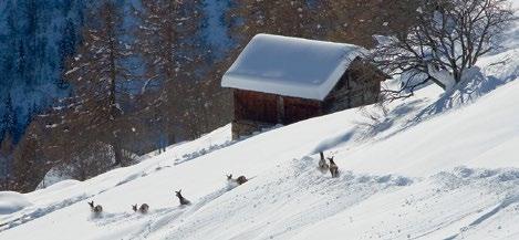
Piazzola, Cavallar parking area Sunny and scenic route in the Stelvio National Park, with the opportunity to observe wild animals Wildlife.
1
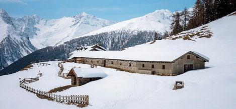
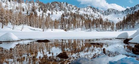
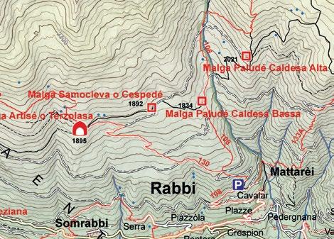
From the Cavallar parking area, which is located just above the hamlet called Cavallar in the town of Piazzola, the itinerary goes up along several bends with a moderate slope on the road used in the summer, taking you through a lovely larch forest until you reach the wide open meadows of the alpine dairies. Near the Malga Artisè alpine dairy, the route starts to go up along the pastures, follow the road until you reach the diary at a height of 1.890 m. From this point you can enjoy a panoramic view of Val di Rabbi and the surrounding mountains. Then from here, follow the trail to Malga Cespedè (1.892 m) and descend along the mountain ridges coming down from the Cima del Sas Forà peak, after the wide valley of the Lago Corvo (lake) until you reach Malga Paludè Alta (2.054 m). Here you can enjoy another panoramic view of Val di Rabbi and of the Dolomites in the distance. After that, walk downhill along an old mule track until you reach Malga Paludè Bassa (1.835m), from here continue downwards through the woods and wide open spaces until you reach the Cavallar parking area.
7 VAL MELEDRIO
La via degli Imperatori
2.053 m s.l.m.
5 h Round Trip - 14,6Km
1
EASY
i
LOCATION: DIMARO
800 m s.l.m.
MEDIUM
Rabbi Fonti, parking area near the Rabbi Thermal Spa Centre
Dimaro, crossroads to Val Meledrio S.S. 239
Sunny and scenic route on a snow groomer in the Stelvio National Park.
1
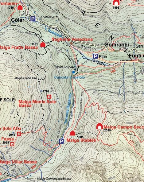
Drive to the hamlet called Rabbi Fonti, at the end of Val di Rabbi, and park near the Rabbi Thermal Spa Centre. The route goes upwards, along a clearly groomed road, until you reach an area called Fontanon near the Malga Stableti alpine dairy (closed for the winter). Continue onward to the right, leaving the alpine dairy behind you on the left, and follow the bend in the road that after a second bend takes you to the Malga Monte Sole Bassa alpine dairy. From here, continue along the groomed road until you reach Malga Monte Sole Alta. This itinerary is regularly groomed; therefore it is also perfect for a walk or for sledding. Return back along the same itinerary.
Percorso: Rabbi Fonti (1.260 m) - Malga Monte Sole Bassa (1.759 m) -Malga Monte Sole Alta (2.053 m)
BASSA DI PRESSON 10 MALGA MASI DI RONZOLA
13 LAGHI DEL MALGHETTO
1.400 m s.l.m.
1
MEDIUM
i
LOCATION: MARILLEVA 1400
1.400 m s.l.m.
5 h Round Trip - 12,6Km
1
LOCATION: FOLGARIDA
1.400 m s.l.m.
1 h 30’ Round Trip - 2,4Km
LOCATION: PELLIZZANO
1.400 m s.l.m.
1
EASY
Folgarida, parking area at Belvedere
16 SENTIERO DEGLI GNOMI
2.001 m s.l.m.
4h 30’ Round Trip - 9,4Km
980 m s.l.m.
1.280 m s.l.m.
3 h 30’ Round Trip - 6,4Km 2
2 h 30’ Round Trip - 5,2Km
MEDIUM
MEDIUM
MEDIUM
Marilleva 1400, Residence Artuik parking
Pellizzano, Parking area near the playground
1
i
Route of ecological and historical value in the Adamello Brenta Nature Park.
i
Route at the foot of Sasso Rosso between characteristic farmhouses and a wooden amphitheatre surrounded by nature.
i
Route through the snow-covered forests and partly on a piste groomer.
i
Path through snow-covered forests, along a natural trail, often with icy sections.
1
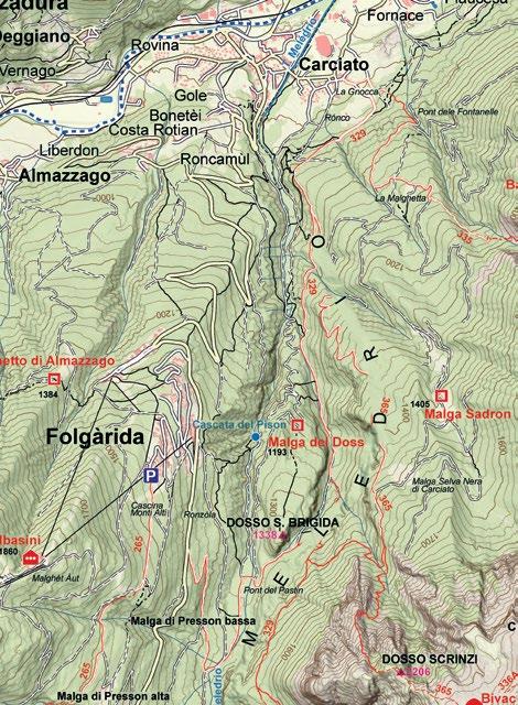
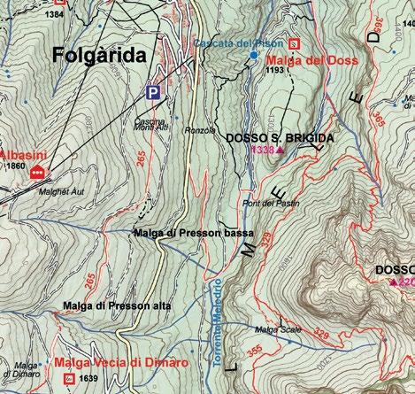
Park your vehicle at the first harpin bend of the S.S. 239 road in the direction of Madonna di Campiglio and take the dirt road. Here, you can visit the ruins of a small industrial area and an ancient triphammer. Along the forest road, you come across the old “calcara” kiln, until reaching the hydroelectric power plant. After a larch forest, you find a narrow rocky gorge, where the Meledrio stream forms several small waterfalls. Then, continue upwards towards Masi di Ronzola (mountain cabins) until you reach the Belvedere area in the hamlet of Folgarida. Return along the same itinerary following the directions of the route No. 1 of the Ecomuseo Val Meledrio.
1
Park your car at Piazzale Belvedere di Folgarida and take the road just below of the Hotel Belvedere, situated on the left side of the state road 239, before climbing in the direction of Madonna di Campiglio. Follow a path that heads slightly downhill, keeping to the right and following the signs to “Ronzola.” Once you reach several mountain cabins, continue your descent in the direction of Malga Bassa di Presson. One of the first things to see here is a small wooden amphitheatre on the right, symbolising the close link between man and nature. Continue the walk – uphill this time - still keeping to the right, towards the Malga Bassa di Presson. Once at the malga, you can choose to continue along the trail, going up towards the state road, or you can return to the starting point, following the same itinerary.
1
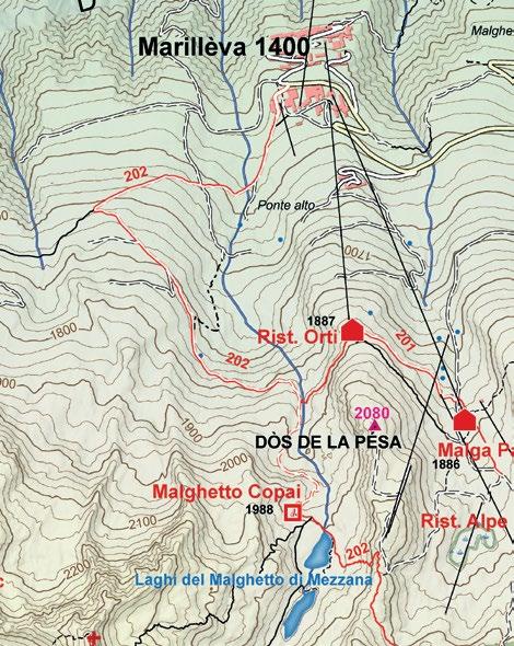
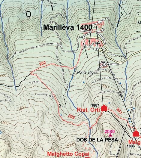
A challenging hike starting from Residence Artuik, where you take the SAT 202 trail, which takes you to “Ponte Alto”. From there, continue following the signs for the small lakes. At a second fork, ascend on a steep trail until you reach the Malghetto Lakes. Return along the same route.
1
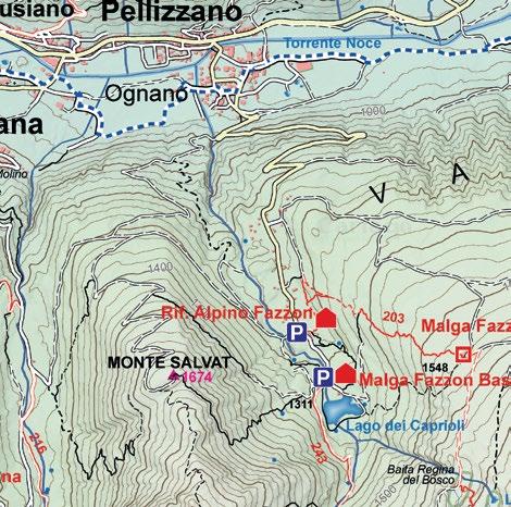
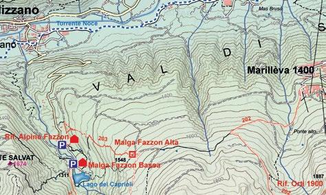
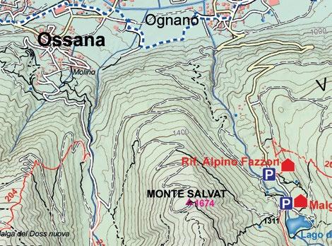
Park your vehicle near the playground in Pellizzano, you pass the last houses of the village until reaching the shrine of Sant’Antonio on the right. Once past it, continue to the right, following a small road that leads to the second hairpin turn on the road to Fazzon - Lago dei Caprioli. Then, follow the trail “Senter dela Palù”, which leads to Malga Bassa - Visitors Center. Afterwards, continue on the main road that leads to Lake Caprioli. Return along the same route.
Trail: Dimaro (800 m) - Masi Ronzola (1.289 m) Folgarida/Belvedere (1.400 m)
Trail: Marilleva (1.400 m) - Bivio Rifugio Orti (1.820 m) - Malga Copai (1.986 m) - Laghetti del Malghetto (2.001 m)
2 Alternative route: to the right of the Caprioli Lake parking area,
2 follow the flat road that after 3 km takes you to the area called Valpiana, from here you can then follow itinerary n. 18 or return along the same route For further information on the opening time of Chalet Lago dei Caprioli: +39 0463 751157
Trail: Folgarida (1351 m) - Masi di Ronzola (1335 m) - Malga Bassa di Presson (1292 m)
Trail: Pellizzano (920 m) - Malga Bassa (1.250 m) - Lago dei Caprioli (1.280 m)
2 It is also possible to shorten the itinerary by following the trail that
from the Malga Cespedè alpine dairy quickly takes you to Malga Paludè bassa
Trail: Loc. Cavallar (1.480 m) - Malga Artisè (Terzolasa 1.890 m) - Malga Cespedè (Samocleva 1.892 m) - Malga Paludè Alta (Caldesa Alta 2.054 m) - Malga Paludè Bassa (Caldesa Bassa 1.835 m) - Loc. Cavallar (1.480 m)
1 Km
1 Km 1 Km
LOCATION: FOLGARIDA-COMMEZZADURA-MARILLEVA 1400
1 Km
LOCATION: RABBI
2
LOCATION: RABBI
VALORZ: TRA MASI E CASCATE
1 Km
5 MALGA STABLASOLO
THE MALGHETTO 11 TO DI ALMAZZAGO
1
1.364 m s.l.m.
3 h 30’ Round Trip - 3,3Km
1.260 m s.l.m.
1
1.539 m s.l.m.
1.500 m s.l.m.
Rabbi Fonti, Plan parking area
i
Route past characteristic farms and frozen waterfalls.
1
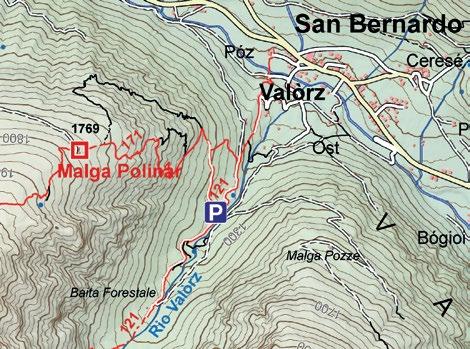
From the parking area close to the San Bernardo Information Office, without your snowshoes on, follow the road that takes you down to the opposite side of the Rabbies stream. After passing two barns and an old mountain shelter, you’ll reach a small bridge over the Valorz stream, near which you can finally put your snowshoes on. Follow the route up through the characteristic rural mountain homes and after passing over a small wooden bridge, continue onwards through the overwhelmingly tall facades of the Valorz valley until you reach the Baito Forestale mountain shelter (1.364 m) located underneath the spectacular frozen waterfalls. To return to the starting point, go back a short distance along the same route and near a charming mountain shelter, go over to the opposite side and go downwards through the sparse larch forest until you reach the Valorz valley.
i
Sunny and scenic route on a snow groomer in the Stelvio National Park between characteristic buildings.
MEDIUM- EASY
4 h Round Trip - 8,3Km
i
Route partly in the Folgarida-Marilleva ski area
1
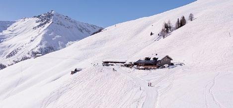
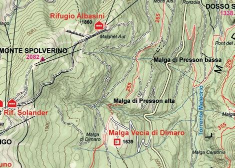
From Folgarida, continue along the SS 239 state road towards Madonna di Campiglio until you reach the Malga Dimaro (alpine dairy) parking area which is located on your right side if travelling towards Madonna di Campiglio. Leave your vehicle here and follow the forest road upwards, that after several turns will lead you directly to the Malga di Dimaro, a panoramic point from where you can admire the Brenta Dolomites. From here the itinerary takes you into the woods and after several turns in the road you will reach the Malghet Aut area (1.850 m) located on the slopes right at the center of the Folgarida-Marilleva ski area. Be extra careful as there are many skiers at the arrival area of this itinerary.
For further infromazion on the openining time of Malga Stablasolo: +39 388 863958
Possibility of using the cable car for those who do the route in the opposite direction.
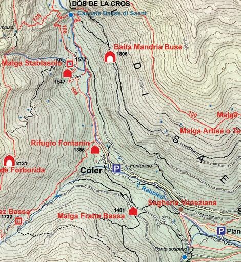
Trail: Rabbi Fonti (1.260 m) - Còler (1.386 m) - Malga Stablasolo (1.539 m) Trail:
S.S. 239 - Malga di Dimaro (1.670 m) - Malghet Aut (1.850 m)
1.400 m s.l.m.
1
17 VALPIANA
1.675 m s.l.m.
5 h Round Trip - 11,4Km
1.011 m s.l.m.
MEDIUM-DIFFICULT
Folgarida, Piazzale Folgarida (square)
i
A route through snow-covered woods and a panoramic point over the Val di Sole.
1
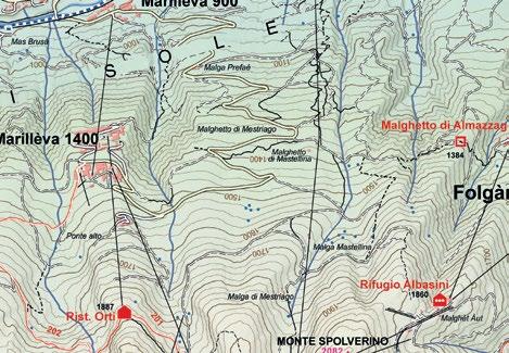
The walk starts from Hotel Selva, above the Folgarida square, where you take the forest road for a short stretch until the first hairpin bend. Once past it, you take a marked path on the right that crosses Val Rotian and reaches the pasture of Malghetto di Almazzago. From where you can enjoy a lovely view of Val di Sole. Then continue through the fir forest until you reach the middle station of the “Daolasa- Val Mastellina” gondola lift located near the Malghetto di Mastellina alpine dairy at 1.364 m (you can also reach this point by taking the gondola lift in Daolasa, then from here follow the above itinerary to Folgarida, an easy 2 km route, 1h 15min). Go onwards past the gondola lift station and after about 100 m, you’ll find directions on the left for the trail going towards Marilleva; continue onwards and cross the provincial road, then continue to follow the forest road, about 300 m long, that turns into a narrow trail further ahead. Then cross through a small valley and after a few meters you will reach the Marilleva 1400 tourist resort. The same itinerary can also be followed the other way around starting from Marilleva 1400 (which can also be reached by taking the “CopaiMalga Panciana” gondola lift) or ascent by cable car from Daolasa to the intermediate station.
Folgarida, Malga Dimaro parking area S.S. 239
1 Go to the hamlet called Rabbi Fonti, at the bottom of Val di Rabbi
Trail: San Bernardo (1.093 m) - through the Masi di Valorz rural homes – Baito Forestale (1.364 m) – return route along the right side of the Valorz stream.
1.850 m s.l.m.
3h Round Trip - 7,5Km
1
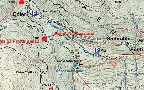
and park in the area called Plan near the cross-country skiing track, about 800 m after the Rabbi Thermal Spa Centre. Then, continue straight through the woods along a groomed track on the left side of the Rabbies stream until you reach the area called Coler. Cross over the bridge on the Rabbies stream and go upwards on the right side of the stream until you reach the Rifugio Al Fontanin alpine hut; be very careful along this stretch due to the risk of avalanches. From here continue along the forest road until you reach the Malga Stablasolo alpine dairy. It is possible to walk until the bridge on the Rabbies River in front of the Saent Waterfalls. Return along the same route.
1.400 m s.l.m.
MEDIUM- EASY
MEDIUM
San Bernardo, info office
LOCATION: OSSANA
8 MALGHET AUT CLIMB
1 3 h 30’ Round Trip - 7,8Km
MEDIUM-EASY
1400 14 MARILLEVA LAGO DEI CAPRIOLI
LOCATION: FOLGARIDA
1.300 m s.l.m. 1.093 m s.l.m.
1 Km
LOCATION: MARILLEVA 1400 - PELLIZZANO
1
Marilleva 1400, Residence Artuick parking area
2 h Round Trip - 4,1Km MEDIUM- EASY
i
Route through the snow-covered forests
1
Near the Residence Artuik complex, follow the trail uphill until you reach the area called Ponte Alto, then continue uphill until you reach a turn in the road, then leave the main route behind you on your left that goes towards the “Laghetti di Mezzana” (lakes) and continue straight ahead through a spruce forest, which is quite dense in certain sections, until you reach the Malga Alta di Fazzon (alpine dairy) then from here go down to the Lago dei Caprioli lake. From the lake, it is also possible to go down to the town of Pellizzano along the “Gnomi” n. 17 trail. It is also possible to start this itinerary in the opposite direction starting from the Lago dei Caprioli lake or from Pellizzano. For further information on the opening time of Chalet Lago dei Caprioli +39 0463 751157
Trail: Marilleva (1.400 m) - Malga Alta di Fazzon (1.546 m) - Lago dei Caprioli (1.280 m) - Pellizzano (925 m)
Trail: Folgarida (1.300 m) - Malghetto di Almazzago (1.389 m) - Marilleva 1400
2
1.260 m s.l.m.
3 h 30’ Round Trip - 5,2Km MEDIUM
Ossana, S. Vigilio church
i
Sunny and panoramic route with views of the Ortles-Cevedale group and the Presanella.
1
Park near the ancient medieval church of S. Vigilio, in the town of Ossana. From the church’s parking area follow the steep road. After the first bend in the road, the slope gradually decreases and after about 2 km you’ll reach the Valpiana valley; the Foce stream passes right through this valley. From here, there’s a striking view behind you of the peaks of the Ortles-Cevedale mountain group (Vioz peak at 3.645 m) and in front of you, the Corno di Valpiana, Cima di Bon and Monte Giner peaks (2.955 m) that continues the Presanella mountain group. Return along the same itinerary.
2 Alternative route: continue for a short flat stretch, then turn left,
uphill from a recently renovated house. Through the forest road, you reach the parking lot at Malga Bassa in Fazzon, near Lake Caprioli; from here, return along the same route
Trail: Ossana (1.011 m) - Valpiana (1.260 m - S. Antonio)
1 Km
LOCATION: ORTISÉ
1 Km
LOCATION: RABBI
3
1 Km
1 Km
SUSPENSION BRIDGE MALGA FRATTE
LOCATION: COGOLO
18 S. LUCIA
12 MADONNA DELLE CIME
CIOCOMITI 9 BAITA MALGA VIGO
LOCATION: MALÉ
1.260 m s.l.m.
1
1.477 m s.l.m.
THE BOLENTINA 6 AMONG ALPINE DAIRIES
1.482 m s.l.m.
1 Km
LOCATION: MARILLEVA 1400
LOCATION: DIMARO-FOLGARIDA
1 Km
15 LE MALGHE DI ORTISÉ
1
2.084 m s.l.m.
5 h Round Trip - 7,3Km MEDIUM
3 h Round Trip - 2,9Km
Ortisé, church square parking
EASY
1.500 m s.l.m.
Rabbi Fonti, parking area near the Rabbi Thermal Spa Centre
i
Route in the Stelvio National Park with an exciting suspension bridge.
1
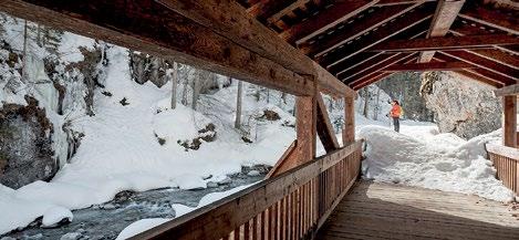
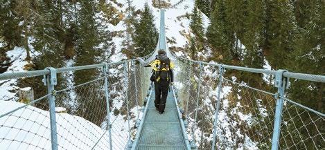
From the parking area, located near the Rabbi Thermal Spa Centre, in the hamlet of Rabbi Fonti, follow the dirt road on the left side of the main road with the directions “Ponte Sospeso/Malga Fratte”. Follow this road uphill for about 1 km, until you once again see the directions on the right for “Ponte Sospeso/Malga Fratte Bassa”. Follow the trail through the lovely larch wood until you are near the deep gorge of the Ragaiolo stream. The new suspension bridge crosses over the gorge with a length of 100 m at a height of 57 meters. The Ragaiolo waterfall beneath the bridge is quite striking. On the other side of the valley, you’ll clearly see the trail that reaches an old mule track, along a slight downhill slope, that rises upwards from the area below (be careful as there may be ice along the trail). Then follow this track upwards until you reach an unpaved road that quickly takes you to Malga Fratte Bassa (alpine dairy). A panoramic area within the Stelvio National Park. In order to return to the starting point, go back along the first section of the same road that continues down below, crossing over the Ragaiolo bridge, from where you can see the Suspension Bridge above you. From here, you’ll quickly return to the starting point, as you walk alongside the cross-country skiing track and the Rabbies stream. Part of the itinerary leading to the suspension bridge may be closed due to ice. In that case, follow the return itinerary from Malga Fratte both ways. For further information on the opening time of Malga Fratte Bassa: +39 339 2868811 - +39 331 4633633
1
1.400 m s.l.m.
1.800 m s.l.m.
1
3 h Round Trip - 8,3Km
1
1.600 m s.l.m.
3 h Round Trip - 7,2Km MEDIUM-DIFFICULT
Hamlet Bolentina
i
Sunny and panoramic route with views of the Rabbi, Sole and Non valleys.
1
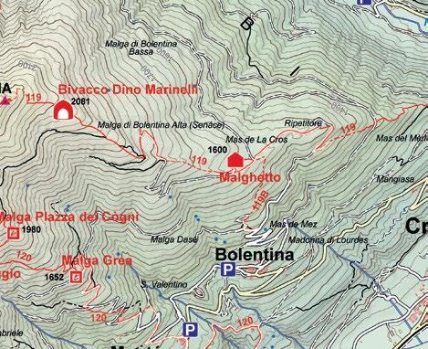
From Malè, follow the directions up to the village of Bolentina, pass through it and continue in the direction of Mas de Mez and at the first harpin bend, park your vehicle. Take the small road on the right, following the direction to Malga Bassa, from where you take the fork on the left and reach Mas de la Cros. Continue downhill until the area “Plaza Marendaia” and then along the road until Mas de Mez, from where an asphalt road takes you to the starting point. Circular route.
Trail: Bolentina (1.161 m) - Mas de Mez (1.317 m) - Plaza Marendaia (1.510 m) Mas de la Cros (1.601 m) - Malga Bolentina Bassa (1.510 m)
1h 30’ Round Trip - 3,4Km EASY
MEDIUM- EASY
1.248 m s.l.m.
1.400 m s.l.m.
Marilleva 1400, Residence Artuik parking
Folgarida, Malga Dimaro parking area S.S. 239
i
Route with views of the Brenta Dolomites.
i
Route through the snow-covered forests
1
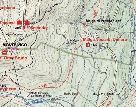
From the hamlet of Folgarida continue on the S.S. 239 road in the direction of Madonna di Campiglio until you reach Malga di Dimaro, which is located on the right side of the road and where you park your vehicle. After about 45 minutes’ walk, you will come to Malga Dimaro, the panoramic viewpoint out over the Brenta Dolomites. Keep the Malga on your right side and follow the directions to Malga Vigo. You will then take a trail (SAT trail no. 265), which gently climbs among the conifers, where the bright snow-covered meadow of the malga makes way for the shadows and silence of the wood. Continue along the trail for about 1 hour, until you come to Baita Ciocomiti -Malga Vigo, where yet another breathtaking view awaits you. The renovated malga, set right inside the Skiarea Campiglio Dolomiti di Brenta , now serves refreshments.
1
Easy walk suitable for everyone that starts near Residence Artuik. After passing under the ski slope tunnel near the recycling area, a sing marks the beginning of the path. Descend to the right for about 50 meters along the path that runs alongside the playground, immersed in the woods, until you reach the flat road on the left. Following the sign for “Madonna delle Cime” in about 30 minutes, you reach a small shrine located at the end of the trail. Return along the same route
Trail: Marilleva (1.400 m) - Madonna delle Cime (1.400 m)
For further information on the opening time of Malga Vigo – Baita Ciocomiti +39 320 2169737
i
Sunny and panoramic route with views of the Brenta Dolomites.
1
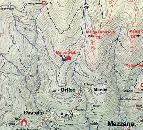
This loop itinerary starts in the town of Ortisé (1.477 m). From the parking area next to the small church, follow the road that goes up just above the town going towards Alpe Pozze. After the town of Ortisé, go up on the right side of a characteristic mountain shelter located on the right side of the first bend in the road. The route then takes you into the wood, steeply going up alongside a stream in the top section, then turn left on the forest road that goes through a thick fir forest. A bit higher up, the wood opens up giving you a view of the upper part of Val di Sole and the snowclad peaks of the Presanella. Here, next to the road, you’ll go past several lovely mountain cabins that have recently been renovated and that are located close to the Malga Stabli alpine dairy (1.911 m). The itinerary then continues towards Malga Bronzolo. From here, follow the forest road and go past the pastures, then go back into the wood and take the narrow path on the left that gradually goes down through the thick fir forest. When you reach Val Molinac, just before the town of Ortisé, you’ll once again reach the trail that you followed on your way up. You’ll then quickly reach the starting point. For further information on the opening time of Malga Stabli: +39 346 6933370
1.173 m s.l.m.
1.278 m s.l.m.
1 3 h Round Trip - 6,1Km EASY
Cogolo, Loc. Le Plaze
i
Route in an area of particular ecological and historical value Forest
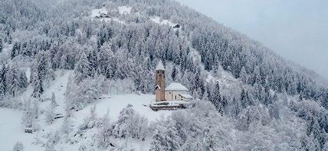
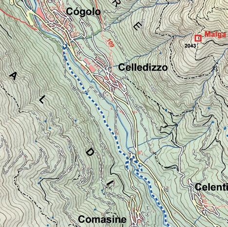
1 Start from the area called “Le Plaze” in the town of Cogolo, on the right side of the Noce River, and follow the country road through the meadows at the edge of the wood. Follow the signs until you reach the romantic little church of Santa Lucia, situated in a secluded spot on a hill outside the village of Comasine. From the Santa Lucia Church, you can return to the starting point by following the same route back for about 800 m. Then start to go downwards along a trail located beside the cycling path close to the Noce River. After approximately 1 km, you will once again reach the area called “Le Plaze”.
Trail: Cogolo (1.173 m) - Comasine (1.204 m) - Santa Lucia Church (1.278 m)
Trail: Ortisé (1.477m) - Malga Stabli (1.814m) - Malga Bronzolo (2.084m)
Trail: S.S.239 - Malga di Dimaro (1.670m) - Baita Ciocomiti (Malga Vigo - 1.800 m)
Trail: Rabbi Fonti (1.260 m) - Suspension Bridge (1.366 m) - Malga Fratte Bassa (1.482 m)
WALK
WINTRY WALKS
1 Km
1 Km
1 Km
1 Km
1 Km
1 Km