LOCATION TERZOLAS - CALDES
1
LOCATION VAL DI RABBI
TERZOLAS-SAMOCLEVO BORDIANA The Rocca and the Trenches
4
LOCATION DIMARO - FOLGARIDA
7
SUSPENSION BRIDGEMALGA FRATTE
MONCLASSICO E PRESSON The Sundial Towns
LOCATION DIMARO FOLGARIDA - COMMEZZADURA - MEZZANA
LOCATION MEZZANA
LOCATION PELLIZZANO
10
13
16
LAKE MALGHETTE
MEZZANA WATERFALL CASTELLO - MASON
The mountain professionals
PELLIZZANO - LAKE CAPRIOLI - MALGA ALTA
Availing of the expertise of mountain professionals is always a good choice for those new to the world of hiking in the Alps or for those who prefer the company of an expert during their excursions in the mountains.
ACCOMPAGNATORI DI MEDIA MONTAGNA VAL DI SOLE
Tel. +39 335 445376 info@accompagnatorivaldisole.it www.accompagnatorivaldisole.it 1
2 h round trip 2 2 h round trip EASY
NO
2 h 30’ round trip 2 1 h 30’ round trip
1
MEDIUM-EASY
MEDIUM-EASY
MEDIUM-EASY
NO
NO
NO
1
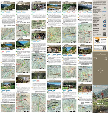
Starting from Palazzo Torraccia in Terzolas village, follow the signs for Sentiero di Valle n. 7 toward Samoclevo’s Piazza della Chiesa and Via dei Canopi. Upon reaching Samoclevo, continue past the fountain behind the church, taking the uphill road on the left. Turn left again at the first crossroad and follow the easy, sunlit track leading to Arnago, Terzolas and then back down toward Magras. Pass through its hamlet to return to your starting point. 2 Alternatively, after reaching Samoclevo, you may head east along a 4 km level trail that passes the villages of San Giacomo, Tozzaga, Bordiana, and Bozzana. For a more challenging experience, you can explore three paths branching off the main trail. The first leads from Samoclevo to the Rocca Fortress, a historical landmark with stunning views. The second, starting above San Giacomo, takes you to the Sassias climbing wall, where you can see unusual rock formations with hemispherical depressions, known as “Sassi Coppellati”. The third path, located above Bordiana, brings you to the “Trincee”, World War I ruins featuring lookout embrasures and communication trenches. From here, descend to Bordiana, where you can take a train back to Terzolas if desired.
1
1 h round trip
1
EASY
YES
1
From the Plan car park in Rabbi Fonti (1252 m asl), head toward the Al Plan motorhome service area and join the “Sentiero dell’Acqua” (Water Trail). Cross the wooden bridge and continue to the Ragaiolo waterfalls through lush meadows until you reach the start of the forest road (this section of the trail is stroller-friendly, but if you wish to continue, follow the forest road uphill to Malga Fratte, a scenic mountain dairy). Take the winding trail leading to a panoramic viewpoint overlooking the Ragaiolo waterfalls and the suspension bridge that crosses them.Once over the bridge, continue along the trail to a walkway, then climb left to reach Malga Fratte. For the return journey, descend via a steep trail that leads past a Venetian sawmill and back to the starting point. 2 Alternatively, after crossing the suspension bridge, follow the rough track back to the car park.
1
This itinerary through the villages of Monclassico and Presson has been organized by the “Le Meridiane” Cultural Association to promote local culture. It offers an open-air art gallery that is accessible year-round, showcasing over 50 sundials created by renowned local, national, and international artists. The sundials, made in collaboration with expert gnomonists, include highlights such as a horizontal sundial and a dark room. Start your exploration at the Biolago lake, where parking is available.
Points of interest: Sundials, Biolago lake, dark room
Points of interest: Venetian sawmill, suspension bridge, drinking fountain with water rich in iron
Points of interest: Palazzo Torraccia, centuries-old walnut trees, Rocca di Samoclevo, San Giacomo rock gym, the ancient lime kiln or “calcara” and the trenches in Bordiana and Bozzana
3 h 30’ round trip 2 3 h round trip 3 2 h round trip MEDIUM-EASY
MEDIUM-EASY
MEDIUM-EASY
PARTIALLY
PARTIALLY
NO
1
45’ round trip 2 3 h round trip 3 2 h 45’ round trip EASY
NO
1
1
3 h 30’ round trip 2 30’ round trip 3 2 h 30’ round trip
MEDIUM
MEDIUM
MEDIUM
NO
NO
NO
1
Starting at Belvedere Square in Folgarida (1300 m asl), take the cable car to Malghet Aut (1860 m asl). From here, follow the wide, rough track to Rifugio Solander - Alpe Daolasa (2045 m asl), then continue to Rifugio Orso Bruno at Monte Vigo (2180 m asl). From here walk along SAT Trail 201 that brings you to the beautiful Lake Malghette (1889 m asl). For the return journey, you can take the “Sentiero dei Pastori” (Shepherds’ Trail) back to Alpe Daolasa and then follow the same route to Malghet Aut. 2 Another option is to start at Marilleva 1400 and take the Copai-Malga Panciana cable car (1882 m asl). From the top station, follow a mediumdifficulty uphill trail, passing scenic viewpoints before reaching Rifugio Solander (which can also be reached via Daolasa 1 and 2 gondola). Continue to Lake Malghette by descending along the slopes and then following an easy trail to the right. Return to Malga Panciana by first ascending SAT 201 Trail and then descending the rough track. 3 By car, reach Malga di Dimaro (1670 m asl). After passing the malga, take the SAT 265 trail, which, after approximately an hour of walking, leads first to Malga Vigo and then to Lago delle Malghette. The return journey follows the same route as the ascent.
The route begins in Piazza Trento in Mezzana, near the parish churches dedicated to Saints Peter and Paul and the Shrine of Our Lady of Caravaggio. From here, walk along Via Maturi for about 150 meters, crossing over the Rio Spona. Take the road on the right leading to Piazza della Novalina, then turn left onto Plazöle Road. After 500 meters, take the road on the right to reach the waterfall. Return via the same path. 2 You can also extend this route. After visiting the waterfall, walk back to the uphill trail on the right, which leads to Loc. Plaze. From there, you have two options. One option is to continue towards Castello until you reach Masi de Guil, located just below the village. Then, follow an old trail that takes you first to Sassignana and then to Claiano. From there, head towards the S.S. 42 state road and cross the nearby underpass. Afterward, follow the forest road near Pont de le Caore bridge, and then take the small, rough track back to Mezzana. 3 Alternatively, head toward Menas via Mason Road, marked by its characteristic dry-stone walls. The route ascends 250 meters to the scenic green meadows of Menas. Return via the same path.
Points of interest: scenic views of the Brenta Dolomites, “Sentiero dei Pastori” (Shepherds’ Trail), Lake Malghette
Points of interest: Waterfall on Rio Valletta, Masi de Guil, the rock with cup-shaped depressions in Mason
EASY
YES
MEDIUM-EASY
NO
1
Starting from the playground in the center of Pellizzano, this route takes you to the picturesque Lake Caprioli(1,321 m). Begin at the second hairpin bend on the paved road from Pellizzano to Fazzon. Cross the wooden bridge over Rio Fazzon and follow signs for the “Sentiero degli Gnomi” (Gnome Trail) and “Sentiero della Palù” to Fazzon and the lake. Return along the same path. 2 You can also drive up from Pellizzano, leaving your car at Malga Bassa’s paid parking area. From here, enjoy a pleasant half-hour walk around the lake on a stroller-friendly path. 3 Starting from the Malga Bassa car park, follow SAT 203 trail to Malga Alta (1546 m). The trail continues to the Regina del Bosco cabin, and Lake Stablo, now a peat bog. At Malga Alta, follow the signs south to return to Lake Caprioli completing a scenic and rewarding hike. Points of interest: Lake Caprioli, Malga Bassa (mountain dairy) with Visitor Centre, small Wildlife Area
EVOLUTION SKI SCHOOL
Tel. +39 348 9129723 - +39 342 3987853 tonalefreeride@gmail.com www.tonalefreeride.it
EXPERIENCE VAL DI SOLE Tel. +39 327 8512910 info@experiencevaldisole.com www.experiencevaldisole.com
GUIDE ALPINE VAL DI SOLE
Tel. +39 0463 903160 - +39 347 7457328 info@guidealpinevaldisole.it www.guidealpinevaldisole.it
MOUNTAIN LEADER INTERNATIONAL Attilio Brusaferri Tel. +39 335 445376 attiliobrusa@gmail.com
MOUNTAIN LEADER INTERNATIONAL Grazia Zilorri Tel. +39 339 1085943 graziazilorri@libero.it
1 Km
URSUS ADVENTURES
Tel. +39 0463 636175 – +39 334 8468540 info@ursusadventures.it www.ursusadventures.it
LOCATION DIMARO - FOLGARIDA
8 VAL MELEDRIO, TRAIL 5
TRENTINO WILD Tel. +39 0463 973278
The crown of Franz Joseph
Scan the QR Code to discover all the mountaineering equipment rentals in Val di Sole. 1 Km LOCATION VAL DI RABBI
COURSE5 KNEIPP VALORZ WATERFALLS
1 Km
LOCATION MALÉ
2
MEDIUM-EASY
NO
NO
MEDIUM-EASY
YES
MEDIUM-EASY
MEDIUM
NO
NO
1
1
The trail begins in the center of Malé and leads through the “Il Funghetto” pinewood, crossing a footbridge over the River Noce to reach the Regazzini area. From here, ascend along “Sentiero di Valle n°9”, which meanders through the forest with alternating rough tracks and pathways, until you arrive at the Plazze di Croviana picnic area. A tarmacked road leads you into the Ontaneta di Croviana, a protected alder tree wood of exceptional natural beauty. Along the way, you will encounter an old mill, now home to the MMape Bee Museum, and a nearby picnic area featuring a charming lake. From Plazze, continue through the pine forest, passing the Plaucesa picnic area, and eventually arrive at the Gnoca park near the picturesque hamlet of Carciato. You may retrace your steps or follow the pedestrian and cycle path back to Malé. Once in Malé, consider exploring the “Sentiero dei Pianeti,” a themed trail dedicated to astronaut Samantha Cristoforetti, offering a virtual journey through the solar system. Maps for this route are available at the Malé Information Office. 2 From Regazzini, another option is to follow “Sentiero di Valle n°10” to Toare, a round trip that also includes the historic Molini di Terzolas.
Starting from the car park in front of the San Bernardo information office (1098 m asl), follow the signs for the Kneipp Course, which marks the beginning of the “Sentiero Rio Valorz.” This cultural route forms a 2 km loop featuring woven wood sculptures of local wildlife by a talented artist. 2 Midway through the trail, near the Valorz car park, take a short detour to the base of the Valorz waterfall, where a picnic area with tables and a grill is available. If you choose to park at the Valorz car park, the round trip to the waterfall takes about an hour.
LOCATION DIMARO FOLGARIDA - COMMEZZADURA - MEZZANA
11
FOLGARIDA - MALGHETTO DI ALMAZZAGO - MARILLEVA 1400
1 Km
1 Km
1 Km
The trail begins at the old Venetian Sawmill at the far end of Dimaro, on the road to Madonna di Campiglio. After a short stretch, the path passes through an underpass beneath the state road and follows the rough track along the River Meledrio. Along the way, you can visit the ruins of a small industrial district and a restored waterpowered tilt hammer. The trail continues toward a hydroelectric power station and brings you back to Dimaro. 2 Alternatively, from the tilt hammer, you can or cross the footbridge over the River Meledrio to join Trail 5, also known as Franz Joseph’s Crown. This easy loop follows the Lec, an old irrigation channel that once carried water from the River Meledrio to nearby farms. The route reaches the Gnoca locality, where a small park provides a pleasant rest stop. Descend to the church in Carciato and follow the pedestrian path back to Dimaro.
3 h round trip 2 4 h round trip
Walking in the mountains is a tradition that begins in childhood for the people of Val di Sole.
EASY
1
3 h 45’ round trip 2 1 h 30’ round trip MEDIUM
1 h 45’ round trip 2 1 h 20’ round trip YES
MALÉ - CARCIATO MALÉ - TERZOLAS
1
1
1
Top hiking routes loved by Val di Sole residents
LOCATION MEZZANA
14
LOCATION PELLIZZANO
ORTISÉ - MALGA STABLI MALGA BRONZOLO
CAPRIOLI MONTE SALVAT - VALPIANA 17 LAKE
Points of interest: Venetian Sawmill, Ecomuseum Val Meledrio la Via degli Imperatori, old forge and lime kiln, hydroelectric plant
1
1 h round trip 2 1 h round trip 3 2 h round trip EASY
NO
Points of interest: Kneipp course, masi Valorz, Valorz waterfalls, panoramic views of San Bernardo and the upper part of Val di Rabbi
MEDIUM-EASY
MEDIUM-EASY
NO
NO
1
Starting from the square in Folgarida near the cable car, enter the forest and follow the trail crossing Val del Rotian to Malghetto di Almazzago, a mountain dairy that offers breathtaking views of Val di Sole. Return via the same route. 2 An alternative is to park near Malghetto di Mestriago, located on the road to Marilleva 1400, just minutes from the Daolasa intermediate station. From here, follow the simple path to reach Malghetto di Almazzago. 3 Alternatively, from Marilleva, start at the third bend and follow the path, first reaching Malghetto di Mastellina and the intermediate stop of the Daolasa cable car, before continuing on to Malghetto di Almazzago. Points of interest: scenic views of Val di Sole
Points of interest: footbridge over the River Noce, adventure park, Venetian Sawmill in Malé, MMape Bee Museum, Alder wood, Trail of the Planets in Malé.
Come and explore the same trails we “Solandri” have walked for generations, accompanied by expert mountain professionals. Choose from 14 specially selected itineraries! Along the way, mid-mountain guides and hiking leaders will share fascinating stories and hidden secrets of the valley’s majestic peaks.
i 1
1 h 45’ round trip 2 1 h 45’ round trip
1
2 h 30’ round trip 2 3 h 30’ round trip
MEDIUM-EASY
MEDIUM-EASY
MEDIUM-EASY
MEDIUM
YES
NO
YES
NO
1
Leave your car in the parking lot near the small church of Ortisé (1477 m) and follow the road to Malga Stabli (1814 m). This road is easy to travel with a stroller and can also be reached by car without a permit. Along the way, enjoy breathtaking views of the Brenta Dolomites and the Presanella. 2 From Malga Stabli, a mountain dairy that also serves food, continue towards Malga Bronzolo. After passing Val del Molinac, the path leads through a beautiful pine and larch forest, followed by a winding stretch through stunning landscapes. Soon, you’ll arrive at the large pastures surrounding Malga Bronzolo (2084 m), where grazing animals add to the charm of the scenery. To return, follow the same route back to Malga Stabli. Points of interest: pastures at Malga Bronzolo (mountain dairy), scenic viewpoints on the mountain ranges
Tel. +39 0463 901280 - info@visitvaldisole.it
1
Before reaching Malga Bassa di Fazzon (mountain dairy at 1279 m asl), take the forest road on the right, which winds through a dense pine forest along the ridge of Monte Salvat. This ridge separates Valle di Fazzon from Valpiana and opens into the green meadows of the Valpiana hollow (1221 m asl). From here, you can continue to the Valpiana mountain dairy (1311 m asl) and return along the same path. 2 To ascend Monte Salvat, continue past Malga Bassa towards the lake, then take the uphill trail on the right. The trail climbs an additional 400 meters to the summit, offering stunning views. Descend via a rough track that connects Fazzon and Valpiana to complete a loop. Points of interest: Malga Bassa (mountain dairy) with Visitor Centre, small Wildlife Area, scenic viewpoint from Monte Salvat, botanical mountain gardens in Valpiana
1 Km
LOCATION DIMARO - FOLGARIDA
1 Km
9
BELVEDERE PISON WATERFALLS
LOCATION VAL DI RABBI
6 CASCATE DI SAÈNT LOCATION MALÉ - VAL DI RABBI
3
1
LA LÉC DI MALÉ PRACORNO 1 1
3 h round trip MEDIUM
NO 1
1
2 h 20’ round trip 2 2 h round trip MEDIUM-EASY
MEDIUM-EASY
NO
NO
1
Begin your walk in Malé near the Museum of the Val di Sole Civilization, close to the stone arch at the entrance to the road leading toward Trento. Ascend along the S.P. 141 provincial road toward Bolentina and Montes. At the first hairpin bend, take the unpaved track on the right, continuing uphill for about 100 meters. Turn left and follow the wide, level road that winds through the scenic Val di Rabbi, eventually reaching the Birreria and the bridge over the River Rabbiés. Cross the bridge and proceed for 50 meters before taking the path on the left, which leads to Molino Ruatti, a historic watermill. From the mill, you can either return to Malé via the trail to Magras that passes through Pondasio. 2 Alternatively, opt for a longer, level loop that from Molino Ruatti takes you to Pozze through the charming villages of Pracorno before joining the pedestrian and cycle path alongside the River Rabbiés. The path reconnects with the rough track at Birreria and continues to Malé. The full circuit from Malé to Pozze and back takes approximately 3 hours and 30 minutes.
1 Km
1 Km
1 Km
The route begins at the Còler car park (1380 m asl), situated about 3 km beyond the village of Piazzola. Follow the forest road to Malga Stablasolo (1539 m asl). After crossing the bridge over the River Rabbies, you will arrive at the first waterfall. Continue uphill to a second panoramic waterfall viewpoint at 1750 m asl, reached via a scenic bridge. From here, follow SAT 106 trail downhill to Malga Stablét, a Stelvio National Park visitor center dedicated to marmots. Return to Malga Stablasolo and retrace your steps along the forest road back to the Còler car park.
Points of interest: Saènt waterfalls, Stablét Visitor Centre
2 h 45’ round trip 2 3 h MEDIUM-EASY
MEDIUM
PARTIALLY
PARTIALLY
Starting at Loc. Belvedere di Folgarida, cross the iron bridge over the main road to Madonna di Campiglio and take the “Ronzola” trail on the left, which leads down to Pont del Pastin (1213 m asl). From here, follow the path through the dense and mysterious Val Meledrio forest until you reach a fork leading to the Pison waterfalls (the final section of the trail is not suitable for strollers, but you can continue to Pont del Pison to catch a glimpse of the waterfalls). Return via the same route.
LOCATION COMMEZZADURA
LOCATION MEZZANA
SECRET WORLD 12 THE OF AULASA
MADONNA DELLE CIME 15 ALBARÉ
1 Km
LOCATION OSSANA
18 OSSANA - BOSCO DERNIGA
2 For a longer walk, continue to Dimaro by crossing the Pison Bridge.
Follow the signs for Ecomuseo Val Meledrio Trail 1, which leads through sites such as an old lime kiln, a water-powered tilt hammer, and the Venetian sawmill before arriving in Dimaro. Consider taking the local bus back to Folgarida.
Points of interest: masi Ronzola, Pison waterfalls, Ecomuseum Val Meledrio la Via degli Imperatori, old forge and lime kiln, hydroelectric plant, River Meledrio, Venetian Sawmill
1
2 h 15’ round trip MEDIUM-EASY
NO 1
2
1 h round trip
1
EASY
1 h 15’ round trip EASY
NO
YES
This playful trail is a treasure hunt called “The Secret World of Aulasa.” Begin your adventure by requesting a map at the Mestriago Information Office. Start in Mestriago village, climbing along Via della Camocina and continuing via Via dei Magagni. Upon reaching Mestriago Alto, ascend left to the town square. Continue a short distance before turning right toward Loc. Novaia. After passing through meadows and a small bridge, you will enter a forest and climb to Loc. Novaia. From here, follow a dirt road that ascends briefly and then descends steeply toward Mastellina. Before connecting to the paved road, take a smaller path on the right leading back to Mastellina and your starting point.
Points of interest: scenic viewpoint in Novaia, “Save Princess Aulasa” treasure hunt
2
1 h 40’ round trip MEDIUM-EASY
YES
1
About 150 meters past the Church of the Transfiguration in Marilleva 1400, take the path to the left of the hairpin bend. Cross the Ponte Basso (1441 m) over the Rio Lores and walk through a lush pine forest leading to the shrine of Madonnina delle Cime. Several benches and tables along the way offer great spots to rest and enjoy the surroundings. Return along the same path. 2 The return route can be completed by following the trail towards the Malghet Lakes until you reach Ponte Alto. From there, descend towards Residence Artuik and continue until you arrive back at the church. Points of interest: playground, shrine of the Madonnina delle Cime
1
25’ round trip 2 45’ round trip 3 45’ round trip EASY
YES
MEDIUM-EASY
MEDIUM-EASY
NO
YES
Three trails lead to Bosco Derniga, the hands-on nursery garden: Sentiero dei Portini, or Carrier’s Path, is a flat trail starting from the road to Valpiana. 2 Giardino dei Sensi, or Sensory Garden, starts at Piazza San Vigilio and passes through meadows, a dense pine forest, and a peat bog. 3 Passeggiata nel Tempo e nei Fiori, or Walk Through Time and Flowers, also starts in Piazza San Vigilio. This path winds past the village’s last houses and leads to Loc. Belvedere, offering panoramic views of Fucine and Val di Peio.
1
Points of interest: Bosco Derniga with workshops and educational activities organised in July and August (reservation required), biotope, flowerbeds.
Points of interest: Museum of the Val di Sole Civilization, Molino Ruatti watermill, Marinelli forge
WALK
EASY WALKS AND HIKES
1 Km 1 Km
1 Km
1 Km
1 Km
1 Km
LOCATION OSSANA
LOCATION VAL DI PEIO
- VALPIANA - “SAS PISADOR” FONTI 19 OSSANA WATERFALL - MALGA DEL DOSSO WILDLIFE AREA 22 PEIO
1
1 h 30’ round trip 2 1 h 30’ round trip 3 3 h 30’ MEDIUM-EASY
NO
EASY
PARTIALLY
1
2 h 15’ round trip
LOCATION VAL DI PEIO
LOCATION VERMIGLIO
LOCATION PASSO TONALE
LOCATION PASSO TONALE
LOCATION PASSO TONALE
PAESE LAKE COVEL 25 PEIO
28 CORTINA - OSSANA
30 PRESENA GLACIER
PEAT BOG BIOTOPE 32 TONALE
PASS - FORTE MERO - FORTE ZACCARANA 34 TONALE
1
3 h round trip 2 2 h 30’ round trip
MEDIUM
MEDIUM-EASY
MEDIUM
MEDIUM-EASY
NO
PARTIALLY
PARTIALLY
NO
1
The “Sentiero de la Lec” trail begins near the first hairpin bend on the road from Valpiana. Following this enchanting path through a lush pine forest, you’ll arrive at the valley. You can either return along the same route or complete the loop by continuing along the forest road. 2 Valpiana (1221 m asl) can also be reached by car from Ossana, with parking available near the junction for Malga del Doss. From here, follow the forest road through the wide valley alongside the River Foce. Upon reaching Malga Valpiana (1311 m asl), continue on the trail towards the scenic “Sas Pisador Waterfall” and the nearby rock climbing wall. At the fork with the path leading to Bivacco “Jack Canali,” stay to the left to return to Valpiana, creating an interesting circular route. 3 In Valpiana, you’ll also find Malga del Doss, a mountain dairy accessible via Trail 204, which begins immediately after the shrine to Saint Anthony. This route rewards hikers with splendid views over Val di Pejo. To return, follow the easy rough track back to Valpiana.
1
Starting from Peio Fonti, walk along Via dei Cavai to find a trail on the left that leads to the Wildlife Area. This zone, part of the Stelvio National Park, is home to stags and roe deer in semi-captivity, along with a visitor center. After exploring the center, follow the trail that circles the Wildlife Area fence, passing a farm and then leading slightly uphill towards Peio Paese. Once you reach Peio Paese, cross the SP 87 provincial road and ascend towards the town center, where you can visit the “Pejo 1914–1918 La Guerra sulla Porta” war museum and the Caseificio Turnario di Pejo (dairy). From here, continue along Via Punta San Matteo, passing Casanove and Baita 3 Larici before returning to Peio Fonti in a loop
Points of interest: Wildlife Area, “Museo Pejo 1914-1918 - La Guerra sulla Porta” war museum, “Caseificio Turnario” cheese factory
Points of interest: River Foce di Valpiana, Shrine to Saint Anthony, “Sas Pisador” Waterfall, rock climbing wall, scenic viewpoint at Malga del Dosso
Via delle Pendege
1
1 h round trip 2 3 h EASY
YES
1
Begin at the church in Peio Paese (1584 m asl), where a steep tarmacked road near the church ascends to the hillock of San Rocco. From there, an easily identifiable forest road leads you past typical farmhouses visible below the trail. After crossing a ski slope, a narrow mule track begins near an old farmhouse on the right. This path avoids the meadows and leads directly to a climbing wall and the small Covel waterfall. Crossing a tiny wooden bridge, you arrive at the biotope and Malga Covel (mountain dairy at 1856 m asl). From here, the trail continues through a picnic area, passing through meadows and a sparse larch forest. The route follows a dirt road (SAT 125 Trail), skirting the left side of wet meadows and picturesque farmhouses. After a small incline, the trail reconnects with the ski slope, eventually merging back with the forest road taken at the start. This route is stroller-accessible from San Rocco to Malga Covel, with the return following the same trail. 2 Alternatively, you can reach Lake Covel via the Tarlenta cable car. Below the gondola, take SAT 127 Trail , following signs for “Cros dei Caciadori.” Take the steep fork to the left, descending to the little lake and the Rio Vioz waterfall. The trail then passes a climbing wall and continues uphill for 20 meters along a rough track. Turning left onto the “Via dei Monti,” the path leads to a junction with SAT 127 Trail , completing the loop and returning to Tarlenta.
1
1 h 15’ round trip
MEDIUM-EASY
MEDIUM-EASY
YES
NO
1
Park your car in the hamlet of Cortina (1213 m asl) and take the small road called “Via dele Pendege,” which begins just after the Church of San Pietro. Walk across the pasture to the small chapel of San Giorgio (1070 m asl), where you’ll be rewarded with a stunning panorama of upper Val di Sole and the Tonale saddle. Return along the same route. 2 For a longer walk, continue along the forest road, which quickly leads to the village of Fucine - Ossana. Alternatively, follow the cycling-pedestrian path on the opposite side of the valley.
1
Points of interest: Cortina Watermill, church of San Pietro, scenic viewpoint, masi Poia
Percorso Vita
1
1 h 30’ round trip
1
EASY
PARTIALLY 1
From Tonale Pass (1883 m asl), take the Paradiso cable car to Paradiso Pass, where you can explore the “Galleria Paradiso”, a long tunnel carved into the granite that once served as a shelter for soldiers. Today, it hosts a multimedia exhibit titled “Sounds and Voices from the Great War,” featuring war relics and personal accounts that shed light on the harsh living conditions and struggles of soldiers at the glacier front. The immersive audio installation, which combines fragmented and muffled sounds as the soldiers would have heard them, creates a poignant and moving experience. After visiting the Galleria, follow the road from the cable car’s top station to the Monumento alla Fratellanza, a memorial dedicated to all those who perished in World War I. Continue along the path around Lake Monticello to the Capanna Presena mountain refuge (2738 m asl), which has recently been fully renovated. From there, take the Presena cable car to Presena Pass at 3000 m asl, where you’ll be treated to panoramic views of the surrounding peaks. Return via the same route.
From Tonale Pass, reach the “Paradiso” camper area and take the “Sentiero dei Rododendri.” Follow it to the end (strollers can go this far before returning). Continue down the rough track past the purifier, crossing meadows back to Tonale Pass. Visit the information point at the Torbiera and cross several small bridges leading to the last of three towers. This area features diverse microenvironments, from drylands to miniature lakes, each with unique vegetation.
Points of interest: peat bog info point, protected area
2 h 30’ round trip 2 3 h 30’ round trip MEDIUM-EASY
MEDIUM
NO
NO
1
From the Ospizio San Bartolomeo car park (1971 m asl), take the dirt road toward Vermiglio. At the bend, follow the rough track along the scenic Tonale high plateau, rich in alpine flora, until you reach Forte Mero (1840 m asl), an Austro-Hungarian fort built between 1911–1913. From here, continue to the ruins of the Strino Barracks, a former military village. Return along the same route. 2 Complete the loop by taking the track up to Forte Zaccarana (2096 m asl) for a breathtaking viewpoint before descending via SAT 160 Trail back to Tonale Pass. Points of interest: Forte Mero (fort), Strino Barracks, Forte Zaccarana (fort), scenic viewpoint
Points of interest: Galleria Paradiso, Monumento alla Fratellanza war memorial, scenic viewpoints
Points of interest: former Austro-Hungarian cemetery of San Rocco, waterfall, Lake Covel, Pejo Kinderland in loc. Tarlenta
1 Km
1 Km
1 Km
33 TONALE - MALGA VALBIOLO
LOCATION VERMIGLIO
LOCATION VAL DI PEIO
23
LOCATION PASSO TONALE
PEIO PAESE BOSCO DEGLI UROGALLI
1 Km
Sentiero delle Marmotte (Groundhog Trail)
29 BAITA VELON - MALGA PECÉ “Passeggiata delle Viscle” Walk
LOCATION PASSO TONALE
LOCATION VAL DI PEIO
RASEGHE TONALE BEACH 31 LOC.
- MALGA SALINE - DOSS DEI GEMBRI 26 SCOIATTOLO
1 Km
1
1 Km
20
MEDIUM
1
LOCATION VAL DI PEIO
COGOLO CHURCH OF S. LUCIA
1
2
1
2 h 30’ round trip MEDIUM-EASY
PARTIALLY 1
From the car park near the bus stop in Cogolo (1160 m asl), follow the sidewalk on the SP 87 road for about 50 meters and then take the pedestrian and cycle path to Loc. Le Plaze. At this point, turn right onto a trail that climbs through the forest to the picturesque Santa Lucia Church (1300 m asl), which sits on a hill near the ancient mining hamlet of Comasine. After visiting the church, descend via a visible trail to the shrine, then continue through the meadows along a country road to return to Loc. Plaze.
3 h round trip
1
3 h round trip 2 3 h 30’ round trip MEDIUM-EASY
MEDIUM-EASY
YES
NO
MEDIUM-EASY
1
PARTIALLY
From the car park in Peio Paese (1584 m asl), walk beside the shrine and along the road leading to the town’s playground. From here, follow the panoramic rough track to Croce dei Bagni (1680 m asl) and continue to Malga Talé (1723 m asl), once a mountain dairy now converted into an educational center dedicated to grouse. The trail includes wooden installations and panels explaining the habits of woodland birds. Return along the same route. For an alternative path, retrace your steps for about 200 meters and turn left at the first crossroads, following signs for Masi di Zampil. This forest road descends slightly to a group of picturesque farmhouses. After reaching the last hut, follow the signs for Torbi along a narrow trail that winds through open meadows before entering the forest. Continue past an old deer feeding station, then stay on the path until you come to a clearly marked downhill trail. This trail joins a forest road coming from Torbi. Turn right here and follow the road toward Peio, eventually bringing you back to the Croce dei Bagni. From there, simply retrace your steps along the same forest road you came up on.
Points of interest: ”Museo Pejo 1914-1918 - La Guerra sulla Porta” war museum, “Caseificio Turnario” cheese factory, Malga Talé visitor centre – Capercaillie Wood
1 1
2 h 15’ round trip MEDIUM-EASY
NO 1
From the top station of the Tarlenta cable car, descend the forest track on the left to reach the Doss dei Cembri chairlift. From there, follow signs for Malga Saline, entering the forest and ascending gradually. The trail joins a forest road leading to Malga Saline and SAT 105 Trail. From this point, the route becomes steeper and continues toward the Saroden area, near Sass de le Strie. For experienced hikers, SAT 105 Trail continues toward the “Filon dei Omeni,” where it meets SAT 139 Trail and descends to the Doss dei Cembri restaurant. Alternatively, an easier route follows a winding forest path with only a few uphill sections to the restaurant. To complete the loop, visit the beautiful artificial lake at Piani del Vioz,near Doss dei Cembri, offering unique views. From the lake, take an easy trail that descends gradually, eventually leveling out and leading back to the Lo Scoiattolo restaurant in Tarlenta. Another option is to return via the Doss dei Cembri chairlift.
DIFFICULTY OF UPHILL DIFFERENCE IN ALTITUDE
NO
2 h 15’ round trip
Park near Hotel Baita Velon (1348 m asl), walk past the hotel, and take the trail marked “Passeggiata delle Viscle” (1432 m asl). Follow the river to a picnic area by a cool stream. Turn right, cross the bridge, then turn left along a small road leading to the “Pradi del Pecé.” (If using a stroller, continue along the rough track to Velon). From here, walk up through the meadow to Malga Pecè (1503 m asl). Return via the forest road, keeping to the left bank of the river before crossing a bridge on the right to complete the loop.
Points of interest: entrances to World War One tunnels, Malga Pecè (mountain dairy)
1
1 h 30’ round trip EASY
NO 1
food
Park near the picnic area on the left side of SS42, about 8 km from Vermiglio and 2 km from Tonale Pass. A short trail leads to the Raseghe area (1750 m asl), where you’ll find picnic and barbecue spots. Continue along the dirt road, then take the first trail on the right to reach “Tonale Beach” (1650 m asl), a sandy area created by the erosive action of the nearby stream. Cross several small bridges leading to the “Bait dei Cacciatori” before returning along the same route.
MEDIUM-EASY
100-300 m
MEDIUM
300-600 m
MEDIUM-DIFFICULT 600-1100 m
drinking fountain
Points of interest: possible sightings of groundhogs, little artificial lake, “Villaggio delle Marmotte” (Groundhog Village) playground, views of the Adamello Presanella mountain range
<100 m
EASY
all-terrain stroller
Park at the Valbiolo chairlift (1884 m asl) and follow the paved road to Ospizio San Bartolomeo or Hotel La Mirandola (1971 m asl). To the left of the hotel, take SAT 111 Trail , which climbs steadily through meadows and marmot burrows to Malga Valbiolo (2244 m asl), passing a picturesque artificial lake. Near the Valbiolo chairlift’s top station is the Villaggio delle Marmotte, a fun educational play area for kids. You can also take the chairlift (open June–September). Return via the rough track starting at Malga Valbiolo.
> 1100 m
DIFFICULT
trail can be reached using lifts
1 Km 1 cm = 250 m
Points of interest: Tonale Beach, scenic viewpoints on Busazza and the Presena Glacier
Page layout and graphics by: STUG Arte Grafica Fotografia - stug.it Printed by: Esperia - Lavis (TN) Photos: A. Russolo, T. Prugnola, G. Podetti, C. Pizzini, E. Di Lecce, L. Brentari, M. Boglioni, T. Caffara, Pillow Lab, A. Vigarani, V. Veneri, Visual Stories, T. Mochen, Guide Alpine, Accompagnatori di Media Montagna.
Points of interest: little artificial lake at Piani del Vioz, Malga Saline
Printed: May 2025
Points of interest: church of Santa Lucia, scenic viewpoints
GPS tracking - Copyrights Cartago S.R.L. 2021 www.cartagomaps.com Editorial director: Enrico Casolari PhD.
® 1 Km
1 Km
1 Km
DOWNLOAD THE GPX TRACKS
1 Km
LOCATION VERMIGLIO
27 S. LEONARDO LAKES
1 Km
Valley Trail 15
LOCATION VAL DI PEIO
1 Km
21 PEGAIA - FRATTAPLANA Giro dei Masi
RIFUGIO MANDRON “CITTÀ DI TRENTO”
24 PIZ DEL PAI WATERFALL
EASY
YES 1
1
This scenic route begins at the car park near the old church in Pegaia, which is accessible from Cogolo. Follow the road to Malga Mare for 1,5 km, passing the historic Pont hydroelectric plant (1170 m asl). From here, take the trail on the right that leads to “masi Fratta Plana” (mountain lodges). For the return journey, follow the opposite riverbank, crossing the bridge near the farmhouses. As you continue, pass masi Guilnova and return to Pont. Along this route, you will encounter numerous typical buildings called “masi” and informational panels explaining the area’s cultural and historical significance.
Points of interest: church of Pegaia, hydroelectric plant, masi in Guilnova, Lame and Fratta Plana
1 h 15’ round trip
2
2 h 15’ round trip
MEDIUM-EASY
MEDIUM-EASY
NO
NO
1
Above Celentino (1342 m asl), take the road to Malga Campo. The road is tarmacked for approximately 400 meters, after which it becomes a rough track. Leave your car in the small car park.The trail starts with a fairly steep ascent, transitioning into easier, alternating flat stretches and gentle rises. At the end of the track, a simple path through the woods leads to the Piz del Pai waterfall (1535 m asl). 2 Alternatively, you can take a loop route starting from Celledizzo, following the rough track to Celentino. After about 300 meters, the trail forks to the left, with signs directing toward Malga Sassa and Cascata Piz del Pai. From the waterfall, continue on the trail leading back to Celentino, then follow the “Le Penagiole” rough track on the right to return to Celledizzo.
RIFUGIO CEVEDALE “G. LARCHER”
31 32 33 34
RISTORANTE DOSS DEI GEMBRI
25
2 2 h 50’ round trip 3 30’ round trip
MEDIUM-EASY
MEDIUM-EASY
PARTIALLY
NO
EASY
YES
Starting at the San Leonardo Lakes, park your car and follow signs for Trail 15. Walk along the Vermigliana Stream to reach the Volpaia area and the Masi di Stavel. This portion is stroller-accessible and can be done as an out-and-back route. From Stavel, cross the bridge over the Vermigliana Stream, turn left, and follow a dirt road that ascends steeply before leveling out. 2 For the complete loop, follow the main road for about 300 meters and cross over. After a short, steep ascent, the trail enters a pine forest, passing Le Ghiane farmhouses. It continues through a broadleaved forest and over a suspension bridge, eventually arriving at Vermiglio in Via di Dossi. From there, return to the San Leonardo Lakes. 3 For a shorter, family-friendly option, take a leisurely walk around the San Leonardo Lakes. The area features three picturesque artificial lakes, picnic areas, a playground, a cafe, a football field, and bike trail equipment.
29
RISTORANTE LO SCOIATTOLO
26 6
21
27
20
28
24
RIFUGIO STELLA ALPINA “AL LAGO CORVO”
“PONTE SOSPESO”
18
19 16
4
14
17 RIFUGIO ALPINO FAZZON
Points of interest: typical alpine lodges, Coredol Biotope, suspension bridge, little San Leonardo lakes
5
RIFUGIO ORSO BRUNO RISTORANTE ALPE DAOLASA
“KNEIPP”
13
10
Points of interest: Piz del Pai Waterfall, views of the Cevedale and Presanella mountain groups, former San Cesare mine, masi of Drignana, Museum of Wooden Ethnography
RIFUGIO SAENT “S. DORIGONI”
22 23
RIFUGIO STAVEL “F. DENZA”
1
2 h 30’ round trip
RIFUGIO VIOZ “MANTOVA”
RISTORANTE MYTHE
30
LOCATION VAL DI PEIO
1 2 h 15’ round trip
1
RIFUGIO BOZZI AL MONTOZZO
RIFUGIO CAPANNA PRESENA
RIFUGIO SOLANDER
15
12
RIFUGIO ALBASINI
11 9
8
7 2 3
RIFUGIO PELLER
1 Km
1 Km
1 Km
1